Knockdrum Stone Fort

There is no firm line that denotes where our most south-westerly Irish peninsula begins. Our series, Mizen Magic, has reported on walks, roads, views, history and archaeology which can definitely be defined as belonging to the Mizen (which we tend to think of as being to the west of, and including, its ‘gateway’ – Ballydehob). Perhaps we should start a series titled Magic Beyond The Mizen – in which case this would be the first: a report on a very prominent site about half an hour’s drive along the coast east of where we live: a historic structure – built within the last 2,000 years – but which contains evidence of much older human activity.

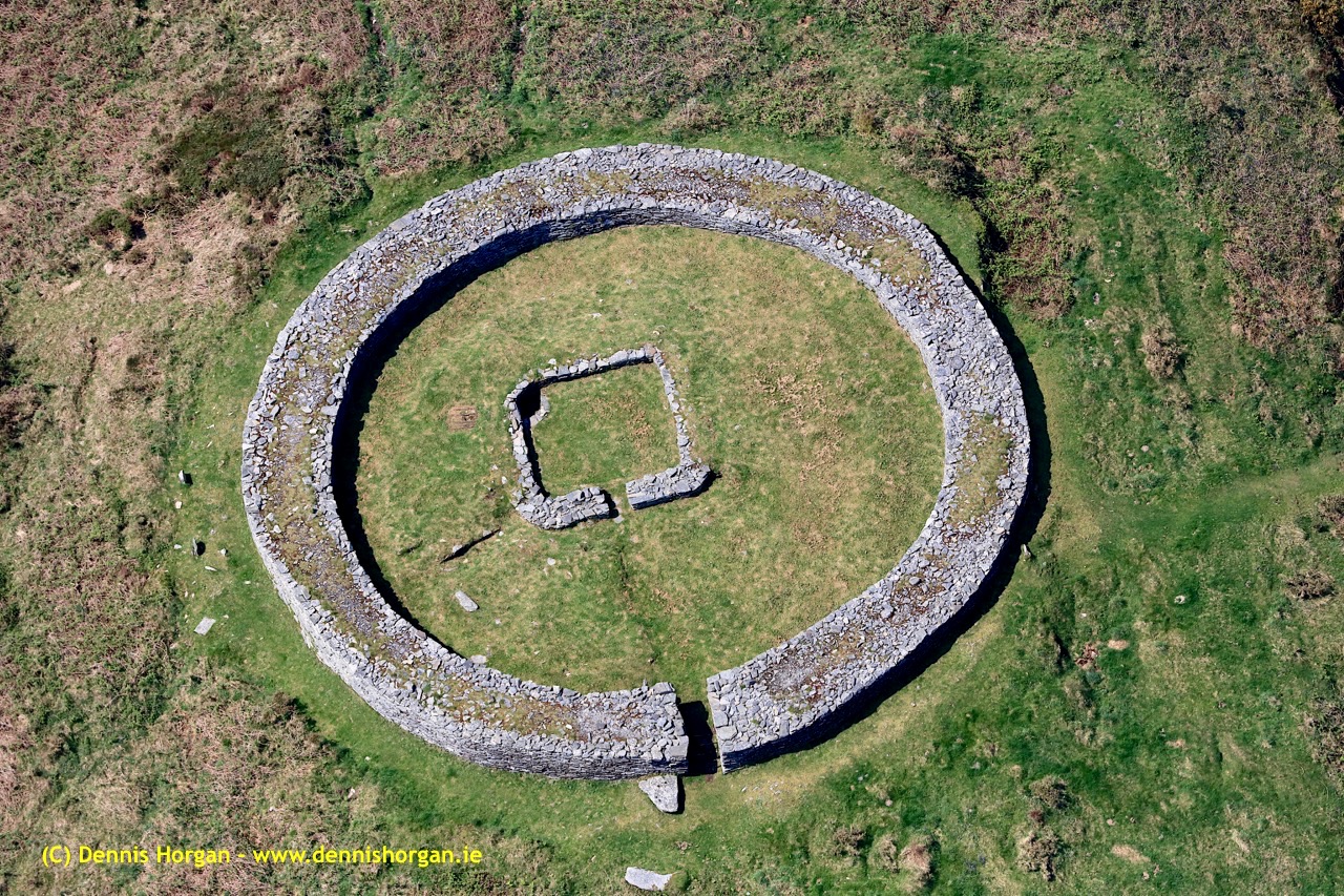
Here is an overhead view – the best way to see and understand the layout and construction of Knockdrum Stone Fort, which occupies a superb hilltop location in the townland of Farrandau between Skibbereen and Castletownshend. Thank you, Dennis Horgan – our professional West Cork aerial photographer – for allowing us to use this image: have a look at his website for other examples of his work, and for details of his excellent photographs and books.

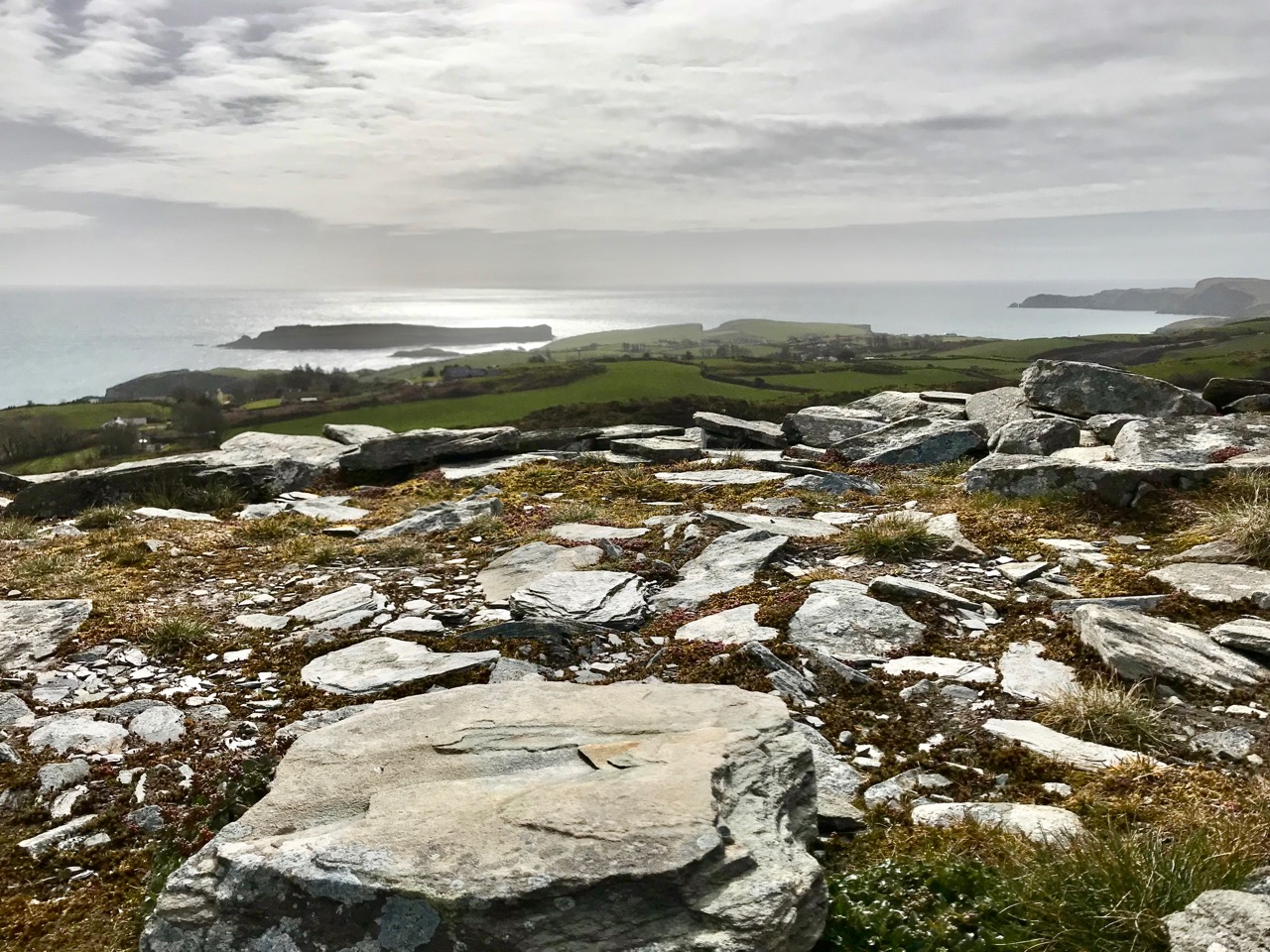
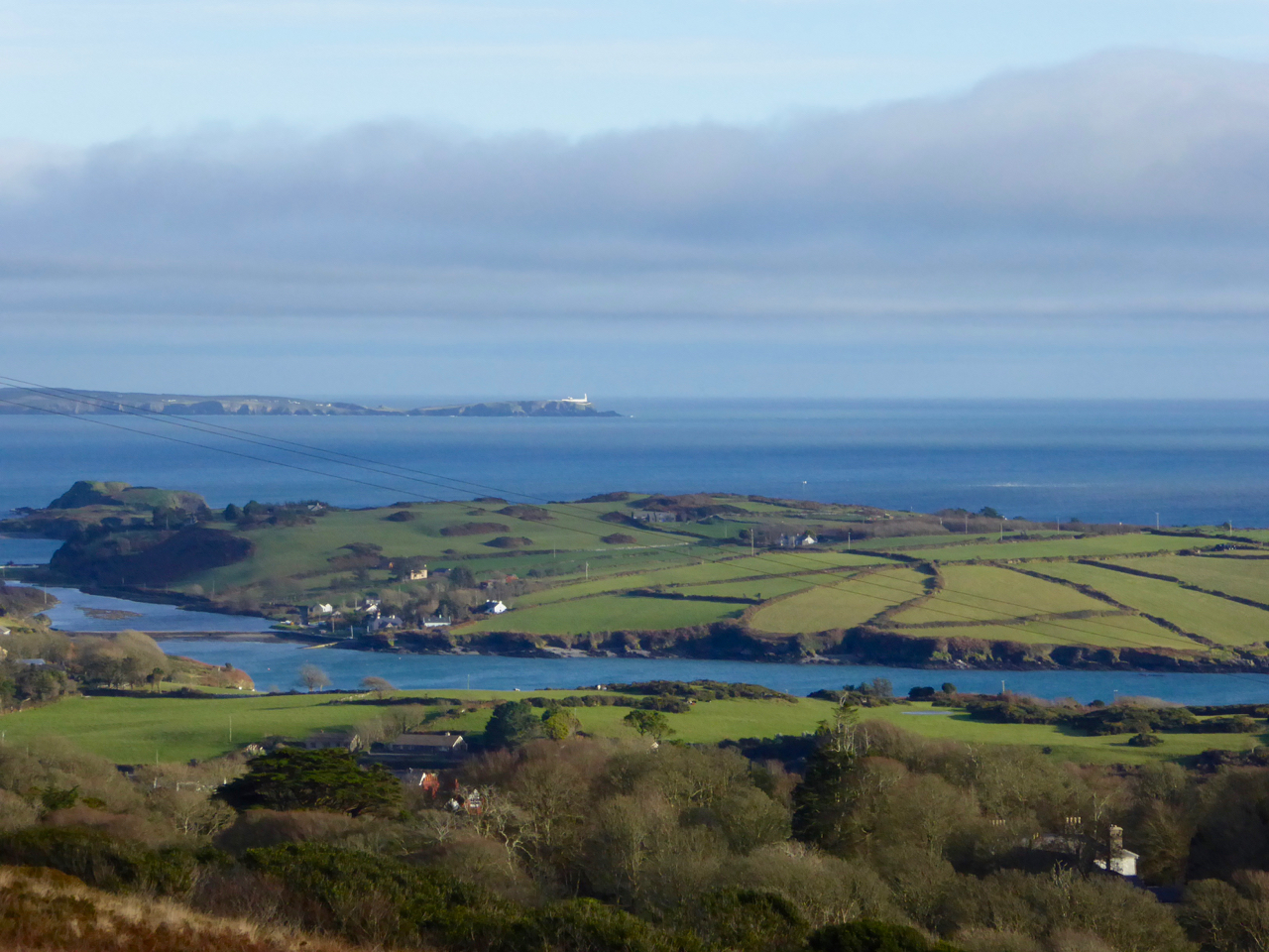
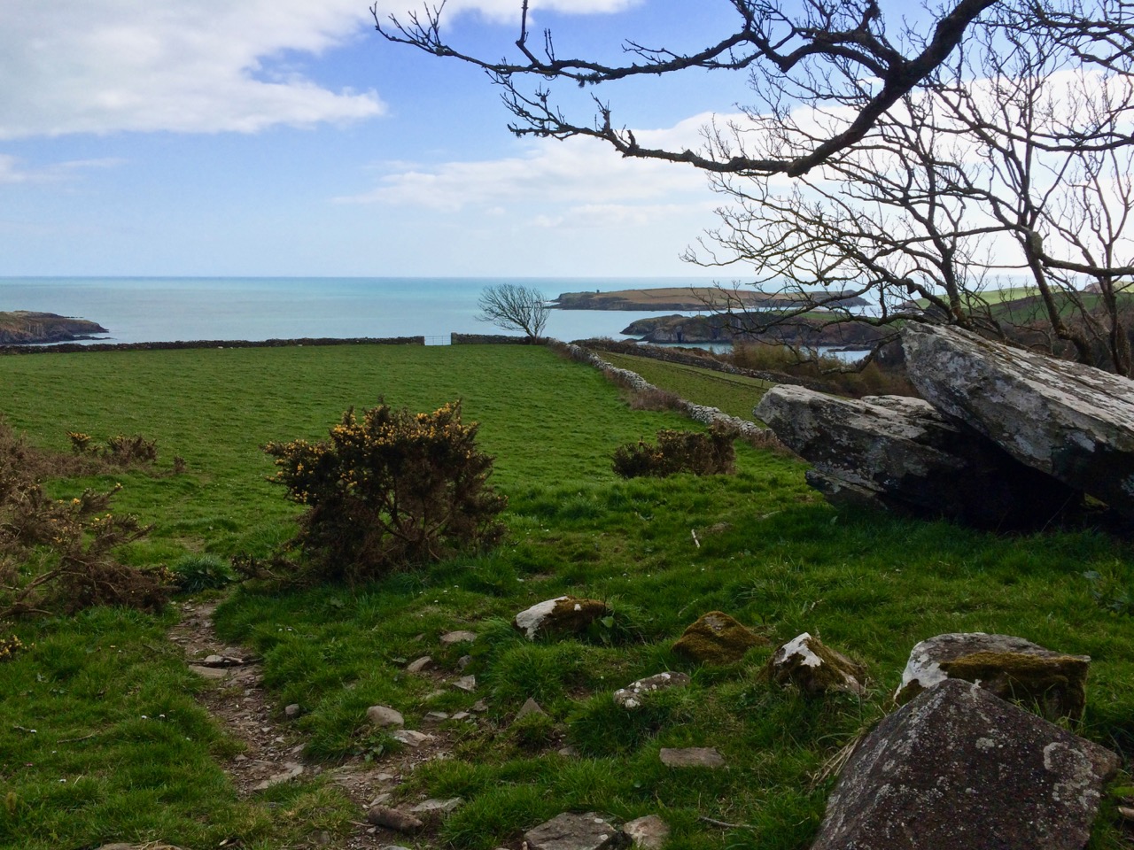
The Fort is located on a high ridge (although not on the summit of the ridge) with far-reaching views both inland and to the south, over the sea. The header picture looks from the Fort out to the west over Castlehaven to Galley Head in the far distance; the view in the picture above is due south – looking towards Horse Island, and the stone wall of the Fort is in the foreground. From these breathtaking vistas it’s reasonable to conjecture that Knockdrum Fort has a strategic siting, providing views of anyone approaching from the sea, and able to signal their arrival to dwellers in the ‘interior’ – the lands to the north. We cannot know for sure that stone fort structures had this – or any other – specific purpose: many theories have been advanced. Comparison with other examples is worthwhile. One of the largest stone forts in Ireland is Staigue Fort, near Sneem in County Kerry.

Staigue Fort (above) has a diameter of 27.5 metres, the present wall height is 5.5 metres, and the wall thickness is 4 metres. At Knockdrum the diameter is 22.5 metres, the present wall height is 2 metres and the wall thickness around 3 metres. The Duchas information board at Staigue says:

. . . This is one of the largest and finest stone forts in Ireland and was probably built in the early centuries AD before Christianity came to Ireland. It must have been the home of a very wealthy landowner or chieftain who had a great need for security . . . The fort was the home of the chieftain’s family, guards and servants, and would have been full of houses, out-buildings, and possibly tents or other temporary structures. No buildings survive today . . .

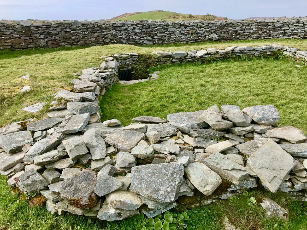
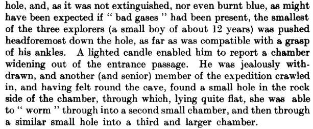
The picture above shows the present interior of Knockdrum Fort: the stone walls are likely to delineate a former building here. In the corner of the inner stone enclosure is the entrance to a ‘souterrain’ – a series of underground passageways. The souterrain is outlined on the following drawing of the Stone Fort which was made in 1930 after a detailed investigation of it by Vice Admiral Henry Boyle Somerville, the younger brother of writer and artist Edith Somerville of Castletownshend. Boyle, his life and his tragic death, is the subject of Finola’s complementary post today.

Finola is also discussing Boyle Somerville’s interest in the alignments of archaeological structures. In Boyle’s paper for The Journal of The Royal Society of Antiquaries of Ireland, 1931 (title page below), he presents the evidence that this Fort is on a solar alignment.

Boyle sets out the case for an alignment based on the Knockdrum Fort:

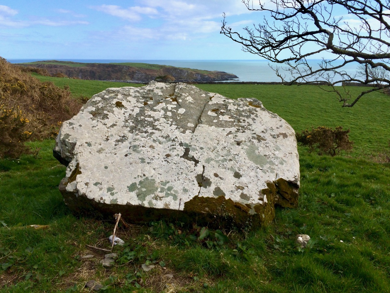
. . . This conception of the earlier use of the site of the cathair [the stone fort] for purposes which may perhaps be termed “religious,” seems to be borne out by the following fact. At a horizontal distance of about 600 yards to the E.S.E of the cathair, and at 210′ difference of level below it, there is a small rocky ridge standing up from the surrounding grass land. The name of the ridge is “Peakeen Cnoc Dromin,” The little peak of the white-backed hill . . .

The following paragraphs and photos are from the Journal paper:

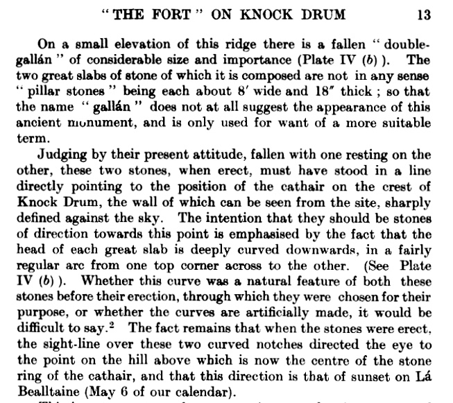
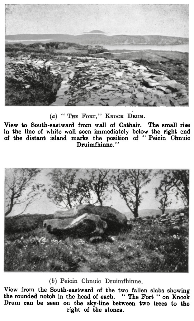
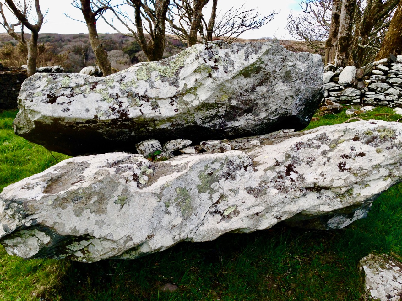
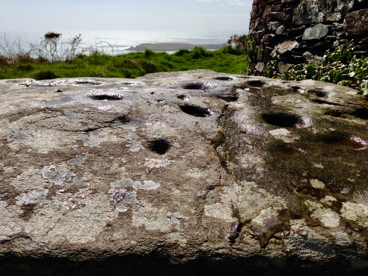
Finola and I are familiar with the Peakeen Cnoc Dromin from our researches into Rock Art: the uppermost stone (which does appear similar to the capstone of a fallen dolmen) is heavily cupmarked. The photos of the Peakeen (above) were taken before we had any idea that they might form an alignment connected with Knockdrum Stone Fort. We will have to revisit again at Bealltaine. Boyle confirmed his alignment theory by personal observation:

He went on to suggest:

. . . It is one of the clearest instances of intentional orientation between two ancient, and artificially formed monuments that can be imagined . . .

Of course, it can’t be the case that a cupmarked stone dating from anywhere between 3,000 to 5,000 years ago was in any way connected with a stone fort that dates from the early part of the first millennium AD. However, I have as yet omitted an important piece of information: at Knockdrum Fort, high up on the hill, are two further ancient cupmarked stones – and significant ones: the larger also exhibits Rock Art. Somerville illustrated them in 1930, and Finola recorded them in detail in 1973.

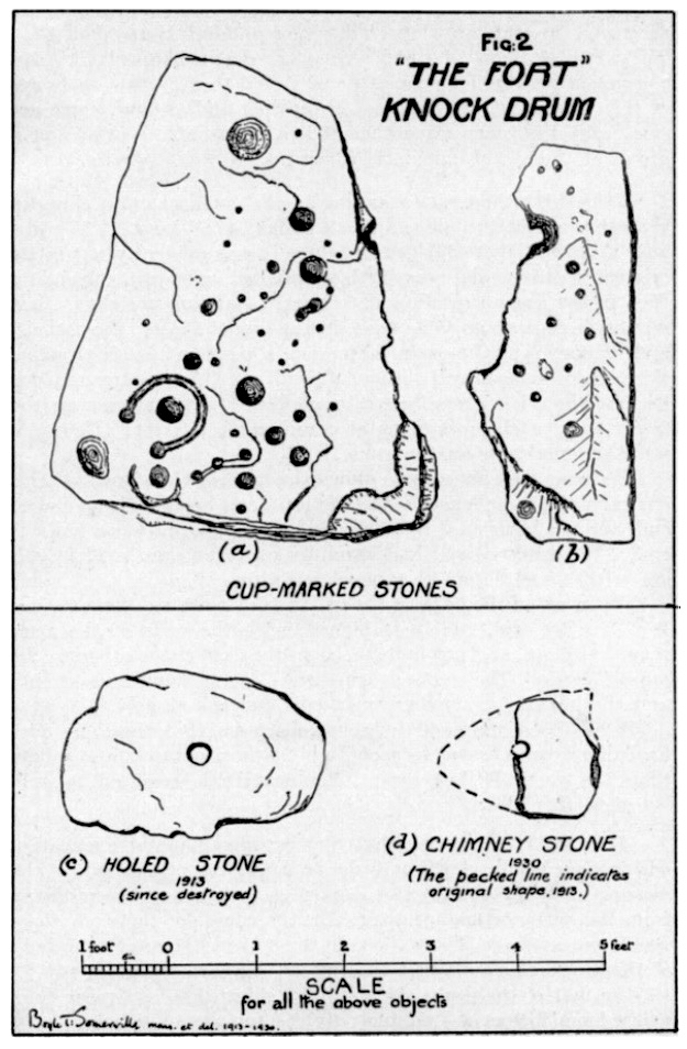
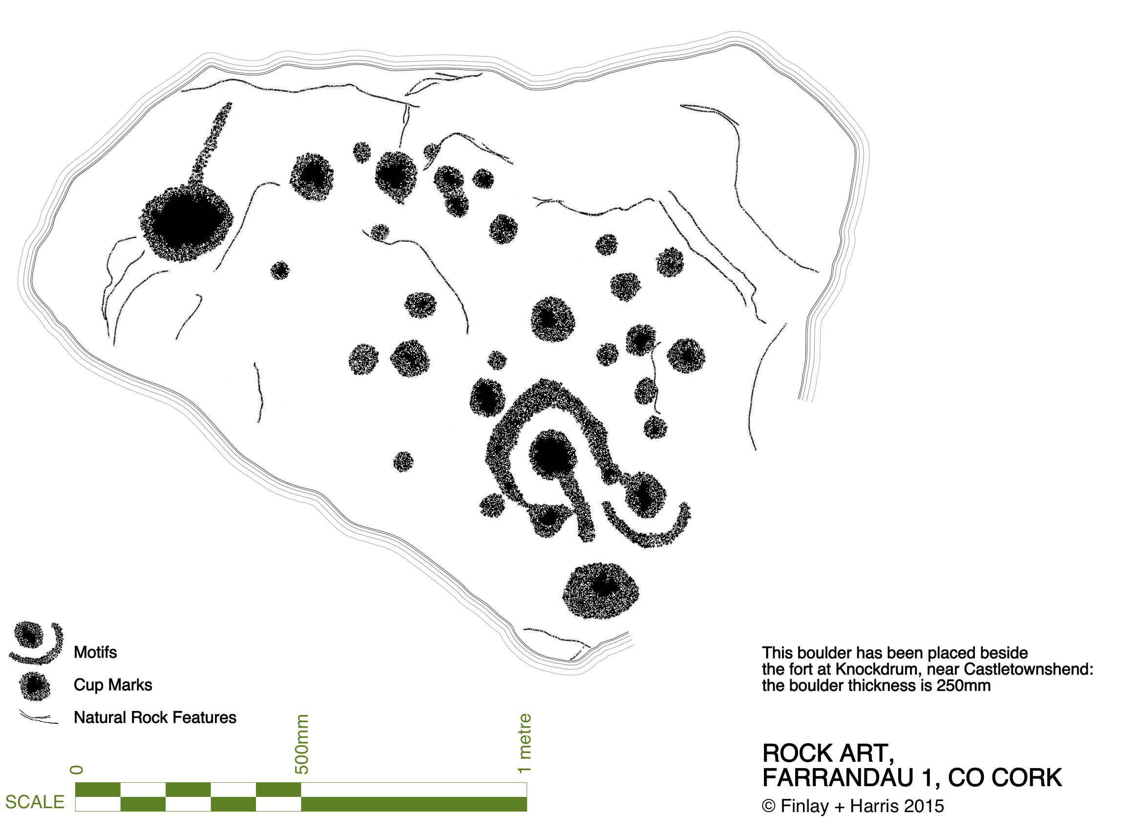
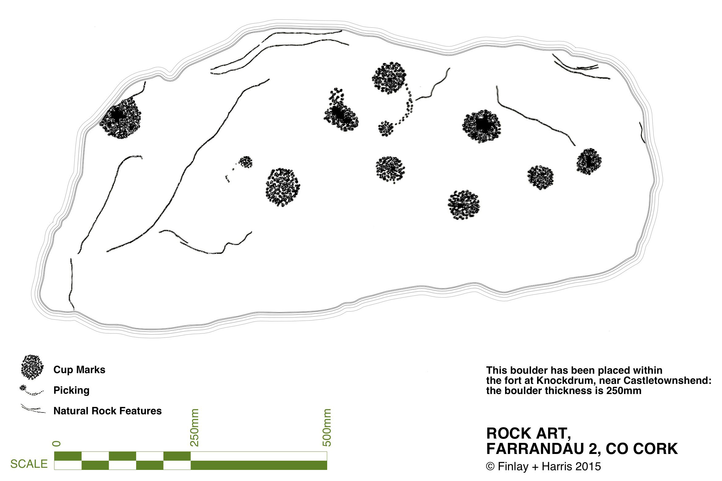
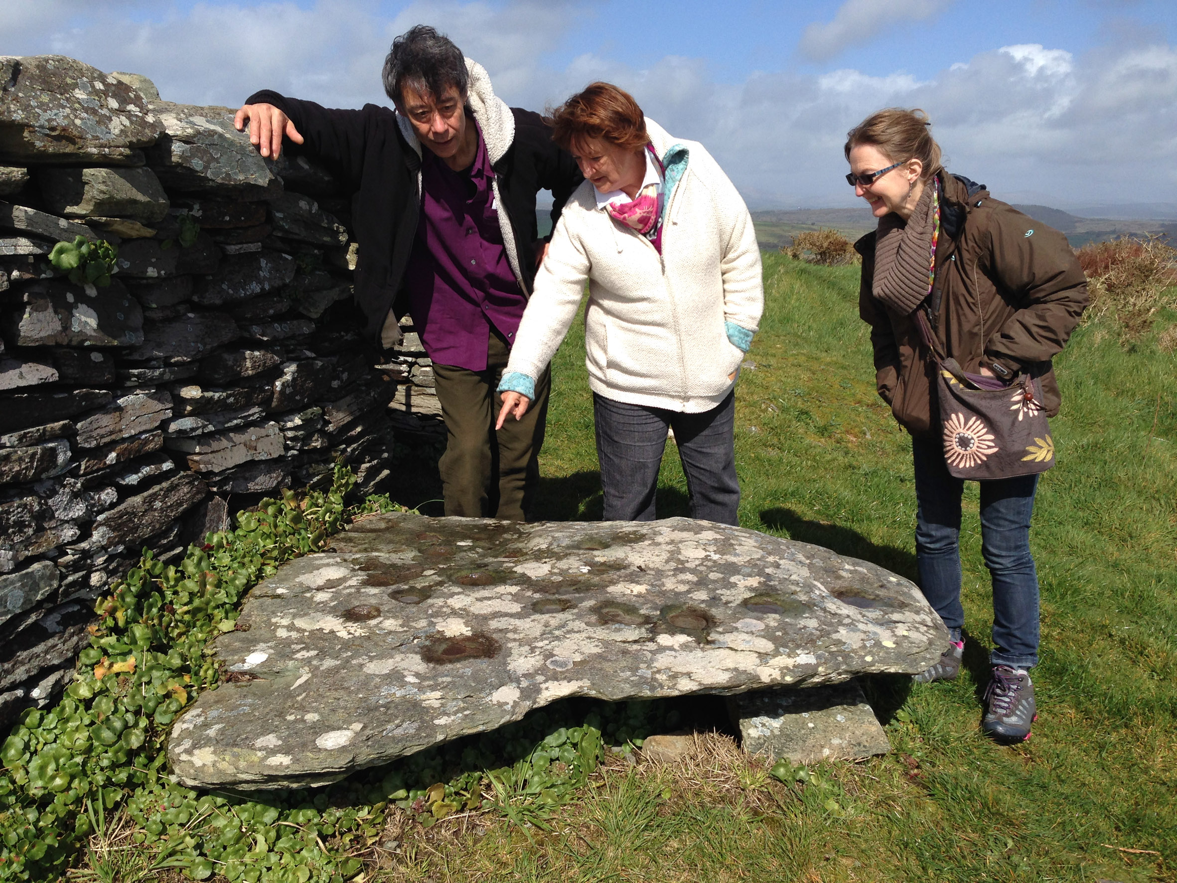
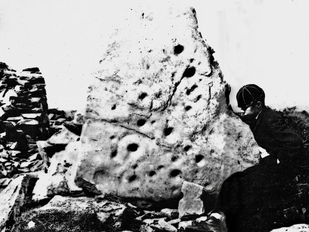
Images above are of the stones recorded at Knockdrum: topmost is Boyle’s drawing from 1930. Below Finola’s drawings are photographs of the large stone lying by the Fort entrance today: it is known that this has been moved, possibly during Somerville’s time. The old photograph immediately above is from the Coghill Family Archive and shows Arthur Townshend beside the stone, which is standing. Arthur was born in 1863: this photograph may record the occasion of the expedition by the young Somervilles and ‘their cousin’ (quite possibly Arthur) to Knockdrum described below, which took place in 1875. It is the presence of Rock Art and cupmarks at the Fort itself which tells us that the site must have had significance in far earlier times (perhaps that’s why the fort was sited in that location – rather than on the summit of the ridge), and Boyle’s reported alignment would have been with the carved rocks (or the important location that they marked) rather than with the comparatively modern stone fort.

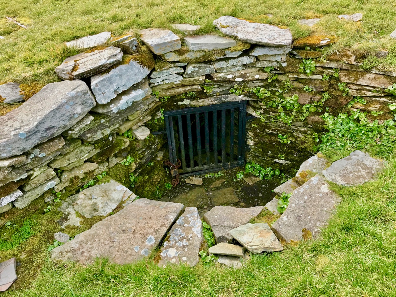
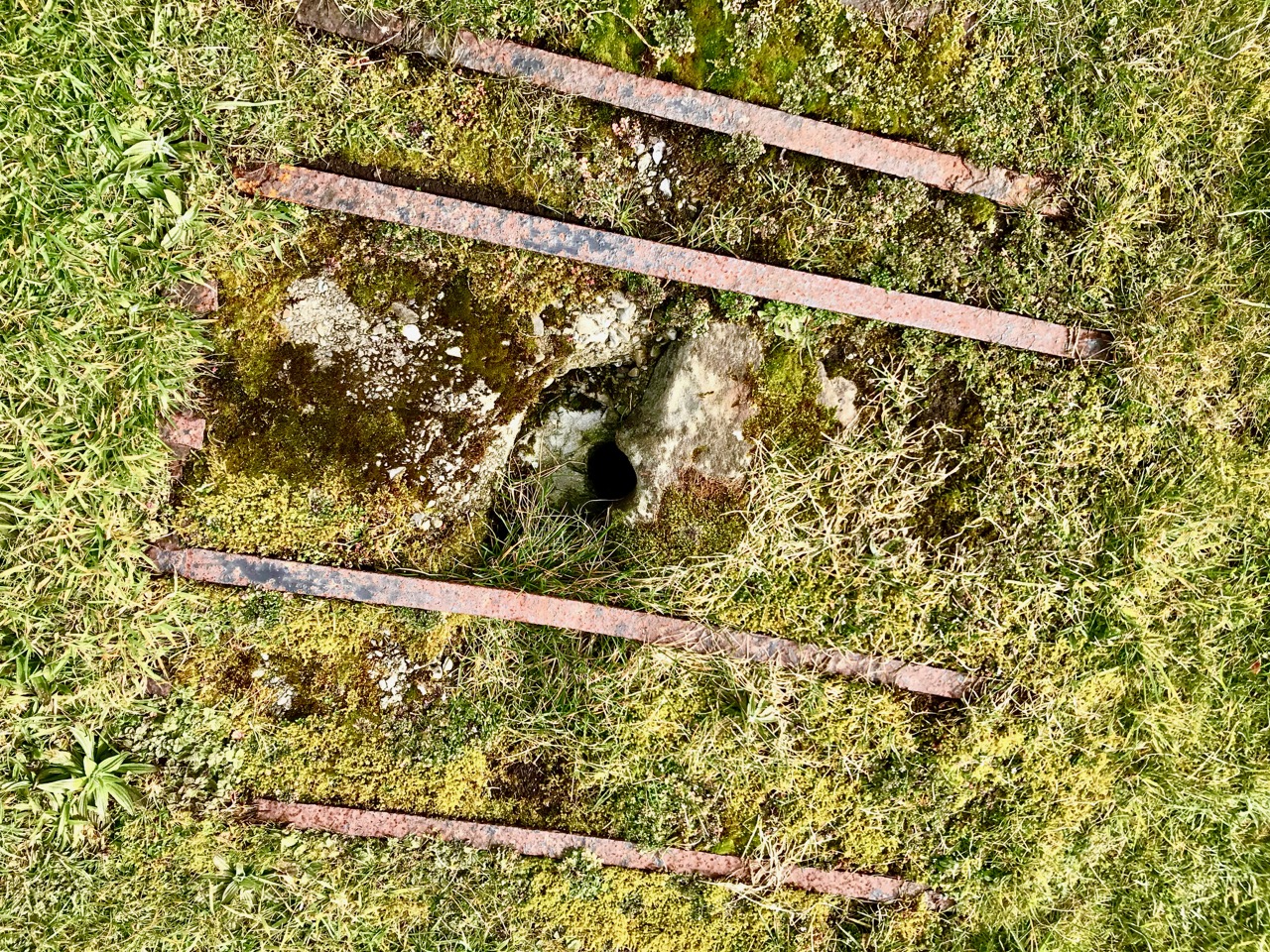
The souterrain in the enclosure of Knockdrum Fort (entrance in top photograph – ‘chimney’ in lower photograph) was explored in 1875, as Boyle recounts:

The ‘band of three youthful archaeologists’ are likely to have been Somervilles: Edith (the eldest, then 17), Boyle (then 12 – it was he who was lowered down into the discovered ‘cave’ by his ankles!) and, probably, a cousin. Great adventures, which would undoubtedly raise eyebrows today.

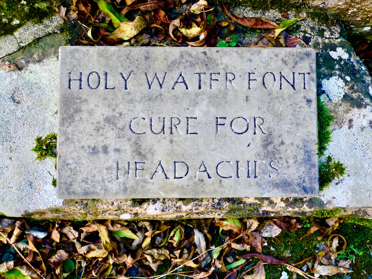
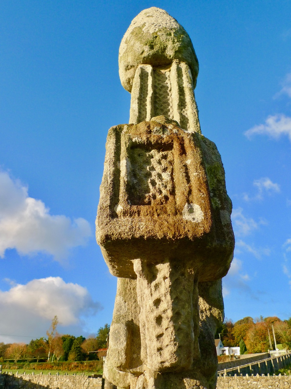
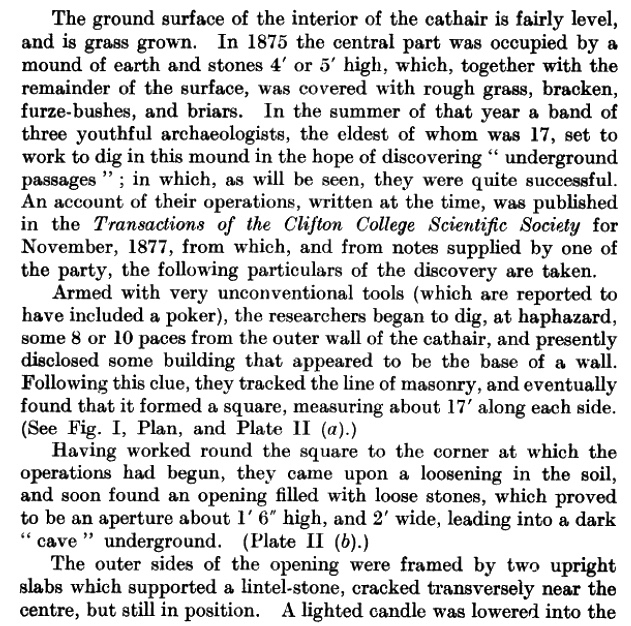
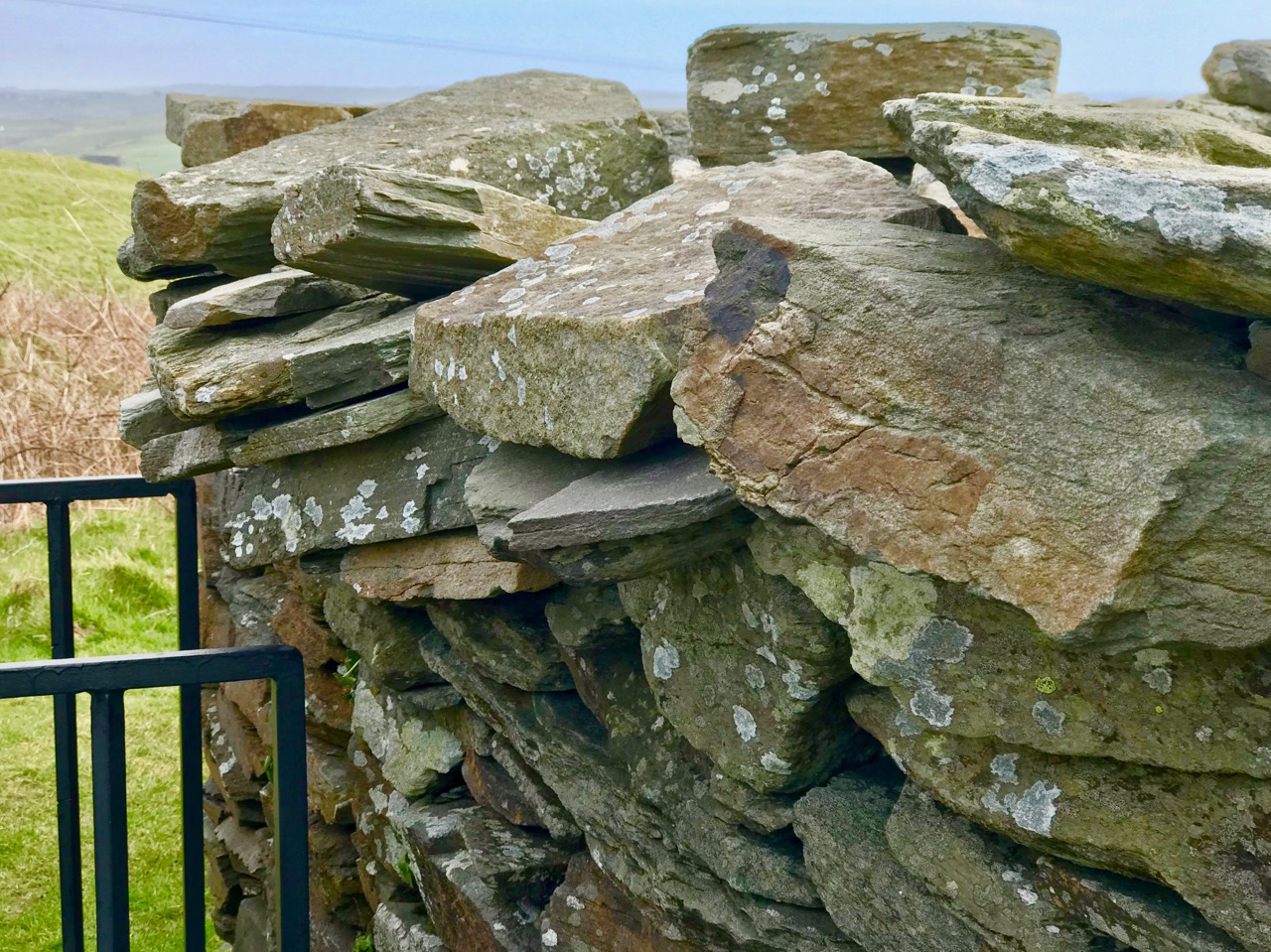
Within the fort enclosure is this cross-marked stone. It was apparently leaning against the wall in Boyle’s days, but has now been embedded close to the entrance. We visit this site often: this time we noted some significant disruption to the upper level of the dry stone walling, possibly caused by the fierce storm winds earlier this year. Compare the detail below with Dennis Horgan’s aerial view above, taken a few years ago.

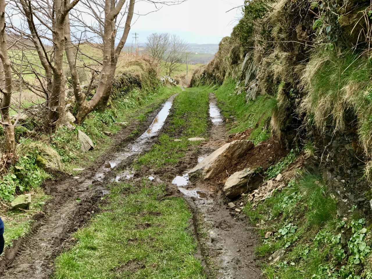
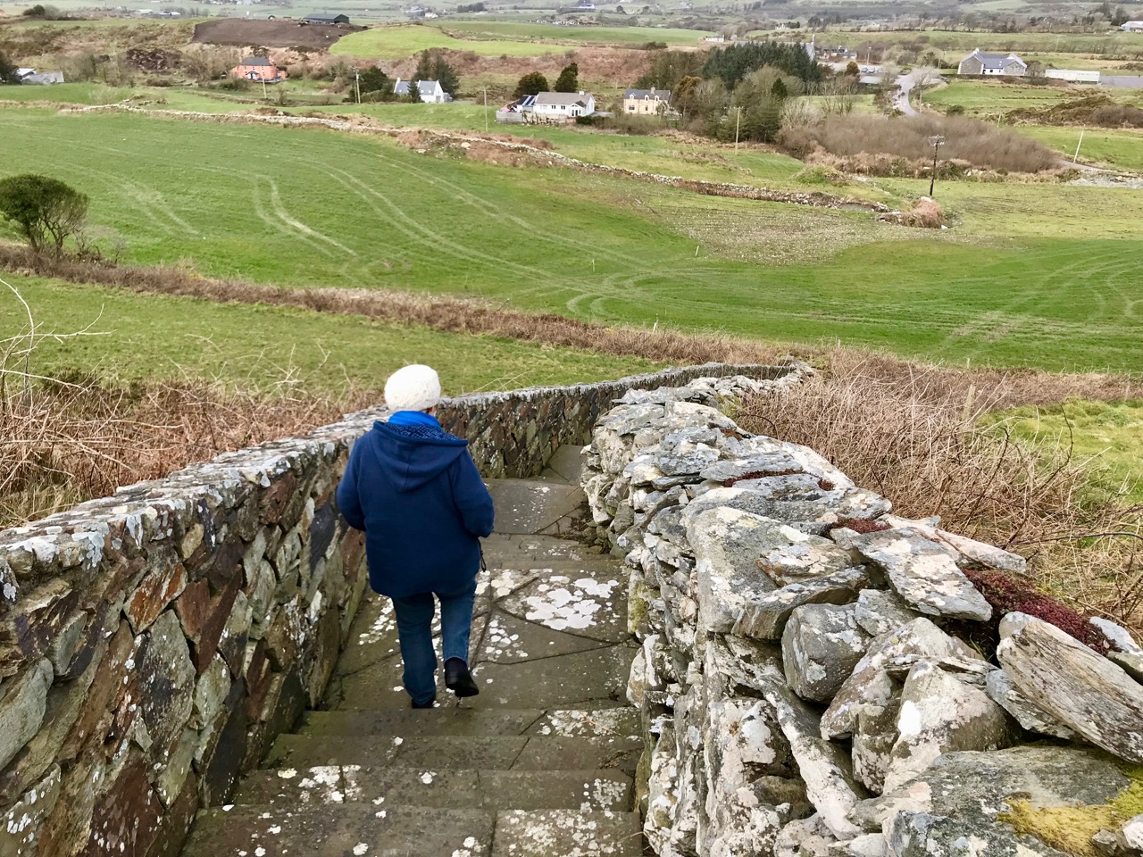
Some damage has also been suffered to retaining walls on the green boreen leading to the Fort from the main Skibereen – Castletownshend road (a walking route only), and on the stone walls beside the 99 steps which take you from the green path to the top of the hill. These are passable with care, but it is hoped that this monument – which is in State ownership – will be deservedly returned to good order before too long: it is one of the historic wonders of West Cork.

Boyle Somerville: Ireland’s First Archaeoastronomer

Henry Boyle Townshend Somerville (1863 – 1936) is mostly know in Ireland now for how he died, murdered by the IRA in 1936. And that’s a tragedy in many ways, not least of which is that the notoriety of his death has obscured his important contributions to Irish archaeology and especially to the once-controversial field of archaeoastronomy, of which he was a distinguished pioneer. [The portrait above is by Walter Stoneman and used with permission from the National Portrait Gallery under a Creative Commons License.]

Boyle was about 30 in this photograph. This illustration is from Somerville and Ross: A Biography by Maurice Collis. The family lived in Drishane House, below, in Castletownshend, West Cork. 

Boyle was one of the famous Castletownshend family of Somervilles that included Edith, the writer with Violet Martin of the Irish RM stories. He was her favourite brother and companion on youthful adventures, including the incursions into the souterrain at Knockdrum Fort, armed only with a poker and a candle. See Robert’s companion piece about this ancient site.

Boyle drew the first proper survey of Drombeg and his observations established the winter solstice orientation. Today, crowds gather to witness this spectacular event

He went off to sea in 1877 at the early age of 13 – seafaring was in the Somerville blood – and rose through the ranks of Commander, Captain and finally Vice-Admiral. Throughout his time in the navy he was engaged in surveying and in hydrographic, intelligence and research projects all over the world. He collected ethnographic materials (now in the Pitt-Rivers Museum) and wrote papers on his experiences.

Another one of Boyle’s stone circle solar events, this one occurs at the autumn equinox at Bohonagh

But it was astronomy that fired his imagination, and specifically the astronomy of ancient sites. Following on the work of astronomer Norman Lockyer, he surveyed monuments in Scotland and Ireland and demonstrated that many of them had significant solar, stellar and lunar orientations. His 1927 paper, simply titled Orientation, in the first issue of Antiquity is a readable and well-argued essay that argues for the acceptance of the importance of calendrical observations to early farming communities.

The Bohonagh complex of monuments as Boyle described them – a stone circle, a cup-marked stone and a boulder burial

It is hard to remember now that the scientific community of the time was dismissive, but even the writer of his obituary in the journal of the Royal Society of Antiquaries of Ireland could not resist a patronising summation:

He was an accomplished surveyor and careful observer, and if the theories as to the orientation of megaliths which he held are not universally accepted, his investigations have resulted in presentations of an accuracy too often absent from the surveys of many writers on those subjects.

Makes him sound like a crank, doesn’t it? But let’s go back to that bit about being an ‘accomplished surveyor and careful observer.’ In paper after paper, he did just that – carefully observed and documented the archaeological monuments of West Cork and elsewhere. It was he who first described the West Cork Stone Circles and coined the term recumbent, providing properly surveyed plans and making careful notes of the way in which they offered sightings to solar events at significant times of the year through the axis provided by the line running from the ‘entrance’ through the ‘recumbent.’ (For an explantation of how this all works, see our post Ancient Calendars.)

Reenascreena Stone Circle with its surrounding shallow fosse

Take a look at a couple of his papers for the Cork Historical and Archaeological Society. The first, on Five Stone Circles, is a good example of how he conducted his surveys. The second, titled Prehistorics sets out the case for a proper classification system for megalithic structures. Most of the terms he recommends, such as Standing Stone, Stone Row, Stone Circle, Passage Grave and Cup-Marked Stone are familiar to us and in everyday use now and he probably didn’t coin the terms. However, one of his terms never gained acceptance, and I think that’s a pity. It’s the charmingly named ‘Clochtogle’ and it’s what we now call a Boulder Burial. But in fact Clochtogle is a better term in being simply descriptive rather than assigning a function, since, as he points out in his paper, and as I pointed out in this post, there is precious little evidence that points to these monuments being burial places and they seem singularly unsuited for that function.

The Rathruane Clochtogle

Clochtogle is based on the Irish term cloch tógáil (cluck toe-gawl) which simply means raised up or lifted stone. We have lots of them in West Cork. In looking at the photograph of the Rathruane clochtogle (do you think this term might still catch on?) I am struck by how it seems to mirror the shape of Mount Gabriel in the background. Boyle, in his writings, did point out that not every monument was oriented to quarter or cross-quarter calendrical events: some, he said, may have other traditions reflected in their orientations. In our own investigations of West Cork monuments we are constantly struck by how many encompass views of Mount Gabriel.

Brian Lacey has an excellent paper in the Journal of the Royal Society of Antiquaries of Ireland* in which he describes Boyle Somerville as an important and distinguished. . .Irish archaeologist. . .and one of the founders of international archaeoastronomy. He details his various contributions to the field, and does not shy away from mentioning his less-than-scientific interest in ley-lines and also in the use of a medium to communicate with the builders of Drombeg. Edith, along with most of their circle (and indeed many of the literati of the time) routinely used mediums and ouija boards. After his death, as her biographer Maurice Collis puts it, Edith ‘lost no time in getting into touch with Boyle.’ But this does not detract from Boyle’s ultimate contributions: Without any doubt, states Lacey, Boyle Somerville was an extremely important and internationally-influential Irish archaeologist for his time. He deserves to be remembered better and celebrated with pride in this country.

Boyle’s death, at the hands of an IRA hit squad, triggered a national outcry. There’s a good account of it here so I won’t repeat the information that is widely available. I will emphasise, though, that the murder horrified the local community and brought together Catholic and Protestant in mourning the death of one who was highly regarded and universally respected in Castletownshend. Edith determined to raise a monument to the memory of her beloved brother and the notion that took was to erect a bench outside the entrance to Drishane House for the use and enjoyment of the village. She asked Seamus Murphy to execute it, one of his first commissions. Next time you come by, linger at this spot and reflect on the life of Vice-Admiral Boyle Somerville. Accomplished, erudite, decorated and distinguished, he is remembered by those who knew him by the simple and deeply moving words Cómharsa Maith – Good Neighbour.

*The Skibbereen and District Historical Journal, Vol 7, 2011, also has a paper by Brian Lacey about Boyle Somerville, substantially similar to the one in the RSAI Journal. It is not available online.


Recording the Sheelas

The sheela-na-gig is one of Ireland’s most mysterious historical artefacts, and one that has fascinated professionals and amateurs alike since the antiquarian days. What is a sheela-na-gig? It’s a carving of a female figure (mostly – there are also male figures, or seán-na-gigs), often crudely executed, with the focus on the hands reaching down to display the vulva. The female is often described as aged, or a ‘hag’ and the carvings have certain features that are common to many, such as staring eyes, ribs, stylised hair and breasts.

This is a romanesque arch at the Nuns’ Chapel in Clonmacnoise. Can you make out the tiny exhibitionist figure carved into one of the lozenges?

The carving of Sheelas probably started in the 12th century, as part of the corpus of fanciful or grotesque carvings that were used to decorate romanesque churches. Some are still found in romanesque contexts, especially outside of Ireland. In Ireland, two possible romanesque examples I have seen are at Liathmore and at the Nuns’ Chapel at Clonmacnoise. However, most Irish sheelas appear to have been either separated from their original locations or carved later, possibly up to the late 1500s. They are found on medieval churches, 17th century castles, the sides of old barns, at holy wells, and indeed in museums. Sheelas have been stolen, lost or destroyed and many of the existing sheelas are damaged.

Does this help? This is just a screen capture of one of DH_Age’s 3D renderings – view it properly online here. This may be a very early sheela or simply one of the grotesque figures associated with romanesque carvings. The tiny figure is grinning and has its legs over its head, exposing the vulva and anus

There are multiple theories as to what a sheela represents and how they were ‘used’ on structures. Were they intended to attract and ward off the evil eye? To serve as a warning against lust? To invoke the sacred feminine through the powerful image of the vulva? The hag, or cailleach, is a vibrant motif in Irish mythology as a form taken on occasion by a goddess. Several sheelas are associate with saints, and believed to be representations of them.

At St Gobnait’s Church in Ballyvourney it is customary to rub the sheela as part of the rounds

We have visited many sheelas (and one seán) and noted that it is always difficult to photograph them well. They are invariably out in the open and very worn. The details are difficult to discern and often obscured by lichen. Even where they are indoors, they show the signs of of exposure to the elements, so it is impossible to view them in what would have been their freshly-carved state. And of course they are deteriorating with every passing decade.

From Jack Roberts’ resource map (see below) – a collection of southwestern sheelas

Fortunately, there’s this great project out there run by DH_Age, or Digital Heritage Age, to record all the sheela-na-gigs using the latest 3D imaging technology. Hats off to Gary Dempsey and Orla Power for undertaking this incredibly important initiative with the support of The Heritage Council. They are working away on visiting all the Sheelas in Ireland and already have a substantial body of images to view online.

The Aghadoe sheela is damaged (the feet are broken off) and covered in patches of lichen

Take a look at their collection of Cork sheelas to see how a good 3D image can reveal the true nature of a carving. The Aghadoe (Co Cork) example is particularly striking to me, because we visited it recently and I found it quite hard to photograph. The 3D image shows the breasts, the ribs, how one arm goes behind the legs to display the vulva while the other holds something aloft, and the curious bumps on the wrists that defy interpretation.

The DH_Age’s 3D rendering of the Aghadoe Sheela: the clarity of detail is impressive, but view it online for the full effect

The Aghadoe Sheela-na-Gig has a complicated history of being placed in different locations but it is currently on the side of a dovecote of indeterminate date and looking like at any moment it will be covered by the thick growth of ivy all around it. There was a tower house here at one point, and the sheela was reported as ‘probably from the castle’ and as ‘lying beside it.’ It’s a little tricky to track down now, so it’s a big thrill to find it and to see that, for the moment at least, it’s in the relatively protected position of being cemented into the dovecote wall.

Jack Roberts’ sketch of the Aghadoe Sheela

Our old friend Jack Roberts has written extensively about sheela-na-gigs and has published a marvellous resource – a one page fold-out map of the Sheela-na-Gigs of Ireland. You can order this from Jack’s site. His illustrations, as usual, are superb, and his artist’s eye managed to make out much of the detail that my camera couldn’t catch.

The Aghadoe Sheela is currently cemented on to a dovecote

I will come back to sheela-na-gigs in a future post but for now, you can check out these resources, for Ireland and for Britain, to learn more.

Kilkieran High Crosses – Medieval Gems

You will remember Saint Ciarán of Saigir, who was born on Cape Clear, perfectly framed in our view from Nead an Iolair? He was known as the ‘First Saint of Ireland’, preceding Saint Patrick by almost a century, and also as one of the Twelve Apostles of Ireland. A manuscript dating from 1629 and housed in the Bibliothèque Royale, Brussels, tells how the Twelve Apostles were educated together in Clonard, Co Meath – the most important monastic school in early Christian Ireland – under Saint Finian. It is said that ‘ . . . there were no fewer than 3,000 pupils getting instruction at one time in the school in the green fields of Clonard. The master excelled in exposition of the Sacred Scriptures, and to this fact must be mainly attributed the extraordinary popularity which his lectures enjoyed. Finnian’s gift for teaching and his absolute dedication to the ascetic ideal, inspired a whole generation . . . ‘ St Finian achieved the age of 140 years himself, while Ciarán – who went off to Cornwall where he is known as St Piran (you will also remember) – lived to be 206 before falling into a well on the way home from a wild party. There’s a lot to be said for being a saint in those days.

These are extracts from the OPW signboard located at the site

Why are we revisiting St Ciarán? Well, we’ve just past March 5th, which is his day, so we have to celebrate him. To do that we will go off to County Kilkenny, where there is a very important medieval site, noted for its high crosses but with plenty more to see: it’s a 45 minute drive north of Waterford city. The site, known as Kilkieran (Kieran is an alternative anglicised spelling, prefixed by ‘Kil’ which means ‘church of’) was once home to a monastery founded by St Ciarán, and the high crosses date from the 9th century.

The West Cross has animal motifs and some unusual interlacing carved on the various elements; below is the site plan included on the OPW signboard

To be able to see exquisite artistic medieval carved stone from 1200 years ago still standing where it was first placed is remarkable. In other discussions on high crosses and similar works of expertise we have asked whether these gems should be preserved out of the elements – as some are – to prevent the deterioration which is undoubtedly taking place. While I tend to favour that approach – and it seems to me to be particularly appropriate where they are replaced by high quality replicas ‘in the field’ – there is something very special about visiting intact sites like this one. The whole conservation process is full of dilemmas.

The enigmatic East Cross – unlike any other Irish High Cross

There were once four crosses at Kilkieran. Three are still complete and in reasonable condition, although much weathered, while the fourth is just the stump of a shaft. One –  the East Cross – is unusual: it is slender, largely undecorated, with minimal crosspieces and no roundel. There’s a nice little tale about it: the cross was attacked and destroyed by iconoclasts, but was painstakingly reconstructed in the mid-19th century by blind local stonemason Paddy Laurence, who had lost his sight while working on the construction of the Palace of Westminster in London: the old Palace had been ravaged by fire in 1834 and was rebuilt to its present design under the auspices of Charles Barry and Augustus Pugin.

The plain South Cross: the large, acorn-shaped capping is found on other crosses in the ‘Ossory Group’

The high crosses at Kilkieran are simpler and less decorated than many others, but have a great dignity, especially in the context of the burial ground which has grown up around them. We were fortunate to visit them on a really clear day, when the shadowed relief stood strongly out.

A still-visited Holy Well and bullaun stones are found on the old monastery site

You will want to go to Kilkieran yourself: when you do, don’t miss some fine ancient grave slabs and the nearby Holy Well. Then you should take yourself off to the other High Cross sites in what is known as the ‘Ossory Group’, beginning with nearby Ahenny. I’ll be writing about them all soon.

Below – an early carved grave slab on the site, carving on the West Cross shaft, and a detail of the West Cross ring

The Splendour of Cobh

My favourite sea voyage was on the (alas now defunct) Swansea to Cork Ferry. I travelled this route very many times while living in Devon and Cornwall, and most enjoyed the last leg of the journey to Ireland, when the ship entered the Lee estuary and made its way upriver to Ringaskiddy. In all weathers I was out on deck to watch the slowly changing scenery that welcomed my arrival in to Cork, knowing that it was surely the best place in all the world to be going!

The excitement mounted when we steamed past the port town of Cobh, as the ferry terminal was then just around the corner. From afar I admired the way this settlement embraced the water with its long, colourful terraces lined up the steep hillside on which it was built, crowned atop by the magnificent Victorian edifice which I now know to be probably the finest architectural work of Edward Welby Pugin in Ireland: St Colman’s Cathedral.

I am almost ashamed to confess, then, that I had never called in on Cobh until last week – and the visit was a relevation. First, let me clear up some possible confusions: the name is pronounced ‘Cove’ – and the word in fact comes from the English, but has been Gaelicised to Cobh, (Irish An Cóbh), the location having allegedly been known since around 1750 as ‘The Cove of Cork’. The name was changed to ‘Queenstown’ after a visit from Queen Victoria in 1849, and was then changed back to Cobh after the founding of the Irish Free State in 1922. Or – have I just contributed to the confusion? One thing is for sure: the strategic waterside location in the great natural harbour of Cork is the raison d’être of this grand town.

Yes, it’s all about the water, and the fact that it is located beside the “second largest natural harbour in the world by navigational area” (a claim also made, incidentally, by Halifax Harbour in Canada and Poole Harbour in the UK – the undisputed nomination for largest harbour is Port Jackson, Sydney, Australia). Cobh faces the wonderfully named Haulbowline Island and Spike Island, both of which have been established as defensive fortifications, and the former as an important naval dockyard since before Napoleonic times. Today, Cobh has the only dedicated cruise ship berth in Ireland.

Do you remember my telling of the story of Cessair and the first human footsteps on Irish soil in our own Bantry Bay? The story is recounted in the 11th century Lebor Gabála Érenn (The Book of the Invasions of Ireland). The same book tells us about Neimheadh and his followers the Muintir Neimhidh  – People of Nemed – who arrived soon after Cessair around 2000 BC, but in Cork Harbour and settled the islands there: Neimheadh, like Cessair, shared his genealogy with Noah and is said to be buried in a mound on Great Island, overlooking present-day Cobh.

So why am I so impressed by Cobh? Perhaps it’s because – as an architect – I find the streetscapes so elegant, and quirky. For me it’s a cross between the horizontal graceful manners of Georgian Bath and the higgledy-piggledy uphill habitation of the steep lanes of Newlyn in Cornwall, where I lived for many years.

Above – Cobh yesterday and today, showing the elegance of the development of the town in the nineteenth century. Below – another side of Cobh: the steeply descending streets with some remarkable and picturesque terraces, crowned always by the glory of the Cathedral, which took half a century to build. Construction began in 1867.

Cobh is such an attractive town to walk around: it should be the jewel on County Cork’s tourist trail. This post is a fairly minimalist photographic essay of what caught my eye on the day we visited. There is a lot more to explore: we never made it to the Heritage Centre, nor to the Titanic Experience, which has brought particular fame to the place in recent times: it was the final embarkation point on the ship’s fateful maiden voyage. All for another day. But we did get up to Cobh’s Old Church Cemetery, high on the hill, where the victims of the Lusitania sinking were buried in mass graves in 1915: a poignant place.

But it was the architecture that had me absorbed: well proportioned and detailed buildings – often simple – that may be overlooked except for the way in which they come together into such a dignified whole. And – such an exploration of colour!

There’s much more to tell of the story of Cobh, and – certainly – so much more to see. I will follow up this post in the coming weeks; the magnificent Cathedral can justify an article on its own. Hopefully you will visit yourself if you have not already done so: your eyes will be opened . . . Look out for the small details!


A Change to The Fastnet Lighthouse

Way back in 2014 I wrote about An Carraig Aonair: The Fastnet Rock and I have decided to repost that today, but with some updated information and photographs, because of an upcoming change announced by Irish Lights. Depending on the story, this is either a relatively benign but majorly cost-saving switch to LED lighting, or a change we must be vigilant about to make sure the Fastnet is left “intact and unharmed”.

Irish Lights tells us that structural repairs. . .are necessary to ensure the metal lantern room is properly secured to the granite tower and modernisation of the light source to an energy efficient rotating LED lantern. When these works are completed the outward appearance of Fastnet will be unchanged. The work will improve our environmental impact by significantly reducing the need for diesel and generators and by removing all mercury from the station. The range of the light will reduce from 27 to 18 Nautical miles.

This photo was taken from our house, 12 miles (or 10.4 nautical miles) away

While this seems like a sensible and inevitable modernisation, with (according to this letter to the Irish Times) a very significant saving of €100,000 per year, those of us who live around Roaringwater Bay want more information: we want to be sure that the change does not negatively impact on the safety of our sailors and fisherfolk, and does not rob us of the iconic flash that is so much part of our lived experience in West Cork. There will be a meeting on Monday (March 5, 2018) at the Schull Sailing Club to discuss it all.

What follows now is the text of my post from June of 2014, lightly edited and with some newer photographs inserted.

Robert has written about our field trip to Cape Clear Island and I can now reveal that the journey also included a thrilling sail around An Charraig Aonair (Karrig Ane-er, The Lone Rock) better known as the Fastnet Rock; or to thousands of emigrants for whom it was the last sight of their home country, Ireland’s Teardrop.

We had been looking forward with great anticipation to visiting the rock close up. We can see it from our home, a far away mystical crag abounding with lore and legend. We have been awestruck by the waves crashing over the lighthouse in winter storms and wondered at the lives of the lightkeepers who once manned that treacherous outpost. We watched through our telescope as enormous yachts rounded the rock in the biennial Fastnet Race last summer, following the progress of the race on a special iPhone app. I have written elsewhere about the awful tragedy of the 1979 race, in which Gerard Butler and his fellow lightkeepers on the Fastnet played a crucial role in monitoring the participating yachts in the mountainous sea conditions. 

The signal station and the first lighthouse, on Cape Clear Island

The Fastnet was built to avoid such tragedies. Its first iteration was in 1818 as a lighthouse tower on a high point on nearby Cape Clear Island, beside the Napoleonic-era signal tower. However, the light was frequently obscured by fog and after the wreck of the Stephen Whitney in 1847 with 92 souls lost, it became clear that the best place for a lighthouse was on the Fastnet Rock. 

The great era of lighthouse building in Ireland got underway in the mid-nineteenth century. The engineering, design and construction expertise necessary to build lighthouses are impressive enough. Add to this the logistics of building on a tiny and inhospitable rock in a heaving sea on the edge of the Atlantic, and the sheer accomplishment of the objective is  staggering. The first attempt, started in 1849, was of steel and needed constant repair.

The first lighthouse on the rock – it was made of steel and didn’t last

It was decided to replace it with a structure of Cornish granite and the current lighthouse first cast its beam over the waters in 1904. Eamon Lankford in his book Fastnet Rock: An Charraig Aonair describes the building process and provides old photographs illustrating how the granite blocks were ‘floated’ and hoisted on to the islet, having been first assembled and tested in Cornwall. The website Digital Irish Lighthouse Experience by Sandra Michler has an animated sequence showing how this was accomplished. it took eight years.

We were fortunate to have Eamon Lankford as one of our guides on our trip to the Fastnet

One of the best accounts of the building of the lighthouse was in a 2008 article in The Economist called Light on a Lonely Rock. The piece gives fascinating details into the dedications and hardships of the builders and calls the lighthouse “a monument of man’s gift to mankind.” I don’t know who wrote it, but it’s a terrific essay.

According to the Irish Lights website, Fastnet is the tallest and widest rock lighthouse tower in Ireland and Great Britain and was a monumental achievement when completed in 1904. Each of the granite stones of the tower is dovetailed into those around it, bonding the structure into a virtual monolith. This webpage also has several excellent photographs of the lighthouse from the air. What all photographs of the rock also reveal is that the lighthouse is a thing of beauty. Tall, slender and elegant and boasting two balconies, it personifies form and function in the most admirable fashion possible. (Take a look, for example, at Dennis Horgan’s website – he’s an acclaimed aerial photographer and his photograph of the lighthouse is probably the most iconic shot of them all.) Today the Fastnet is fully automated but in The Lightkeeper Gerard Butler describes what it was like to live on the rock in fair weather, when he fished and swam from the steps, and foul, when the seas crashed and roared over the lighthouse as it quivered and shook all night. 

The lighthouse showing the full extent of the Cornish granite and the stub of the old steel tower

One of the stories we heard from Eamon concerned  a daring midnight raid on the lighthouse carried out by an IRA ‘Flying Column’ (experts in guerilla warfare) in 1921 during the Irish War of Independence. They were after the explosives used on the Fastnet to power the foghorn. [EDIT: I have some errors here – please see Finbarr O’Driscoll’s correct information about the raiding party in the comments section.] In researching this story further, I found an article in the 1999 Mizen Journal (no longer in print) by Frank Lannin, based on the eyewitness statement of Sean O’Driscoll.*

The Rock, showing the landing platform, steps and store

Here is part of Lannin’s account:

The breeze had freshened and caused the usual swell around the Rock and there was a rise and fall of several feet. The anchor was let out and the boat moved slowly to the landing place. Positioned on the bow was John O’Regan, a rope tied around his waist, a revolver in his pocket and balancing himself with the rise and fall of the boat. He would have to select the right moment to jump on the Rock and catch the iron ring which was fixed to the Rock. He knew where the ring was fixed, but to grasp it in total darkness was a feat that few would attempt. His vast experience as a seaman was now to be put to the test. As a wave was rising he jumped. It was a tense moment. As the wave covered him he grasped the ring with both hands. (It was an occasion for handclapping, but not tonight.) In seconds he had made the boat fast and the rest of the raiding party were landing on the platform. The huge steel door of the lighthouse was not locked. John was first up the spiral stairway leading to the room where the Lightkeeper was on duty. He put up no resistance and as a precaution the wireless was dismantled. Seventeen boxes of gun cotton and three boxes of detonators and primers were loaded on to the “Maire Cait” by means of the lighthouse derrick. in all, the spoils weighed but one ton. The daring mission was accomplished.

A Flying Column (this one from Tipperary)

The fog signal, together with the light, was an important aid to navigation for ocean going vessels. It was only in 2011 that the Fastnet foghorn was permanently discontinued, as modern navigation equipment rendered it unnecessary. All around the world people are missing the haunting sound of foghorns now, a sound so many of us grew up with. But at least we can see the light from Carraig Aonair every night and count its ‘character’ – one two three four FLASH…one two three four FLASH – and know that it’s doing its part to keep our mariners safe on the seas that roll outside Roaringwater Bay.

*See pages 18 to 20 of Sean O’Driscoll’s statement for his dramatic story of the raid.