. . . And Hello Schull!

First of all, a HUGE thank you to all the readers who sent me such kind messages of support on my last blog. I am normally very good about responding to comments, but moving house took its toll on my time and energy and I just never got to it. But I want you all to know that I read and appreciated SO MUCH every single message and I felt totally supported by this Roaringwater Journal community we have built together. 

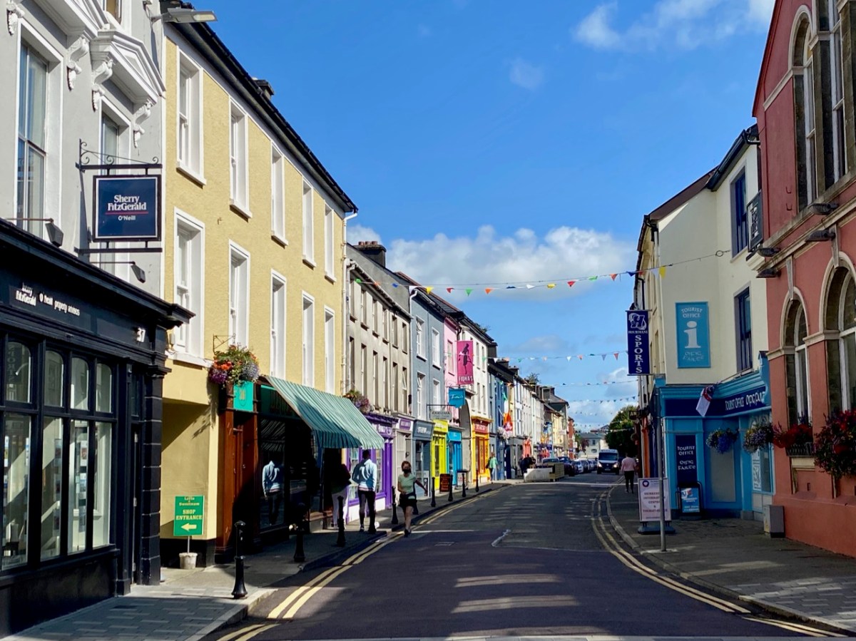
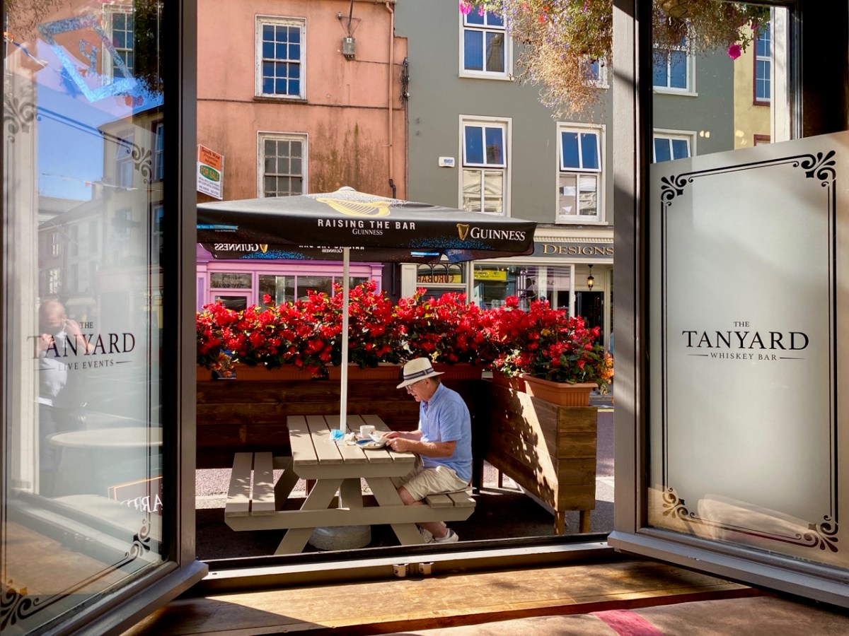
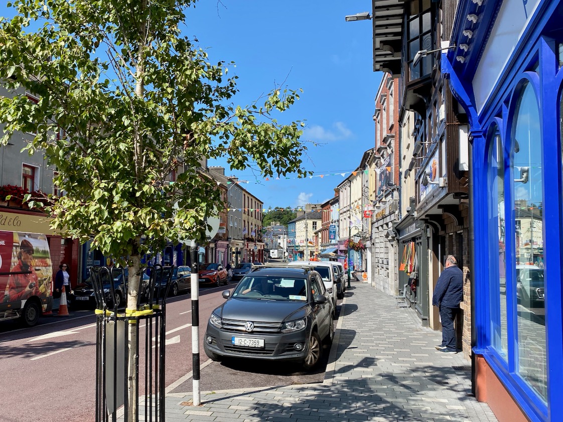
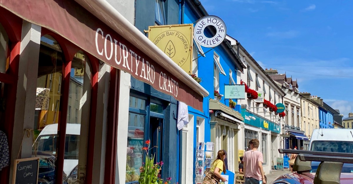
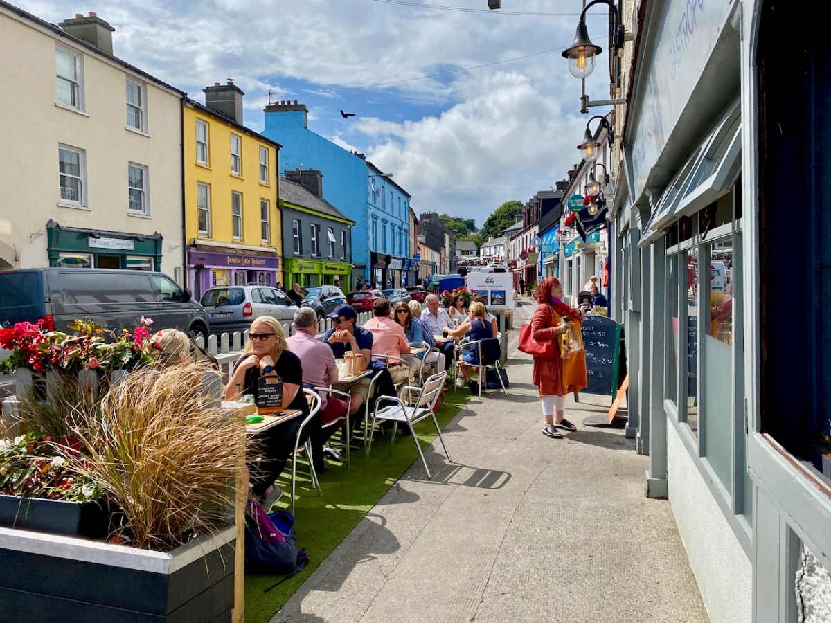
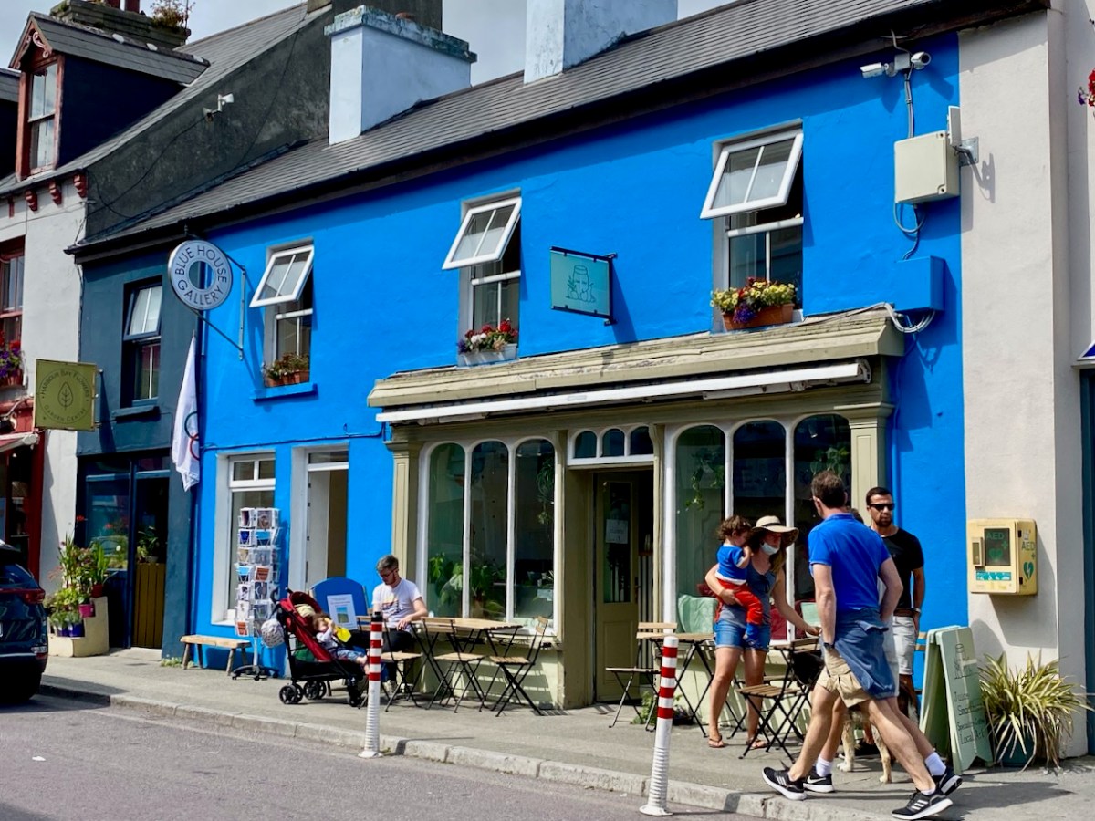
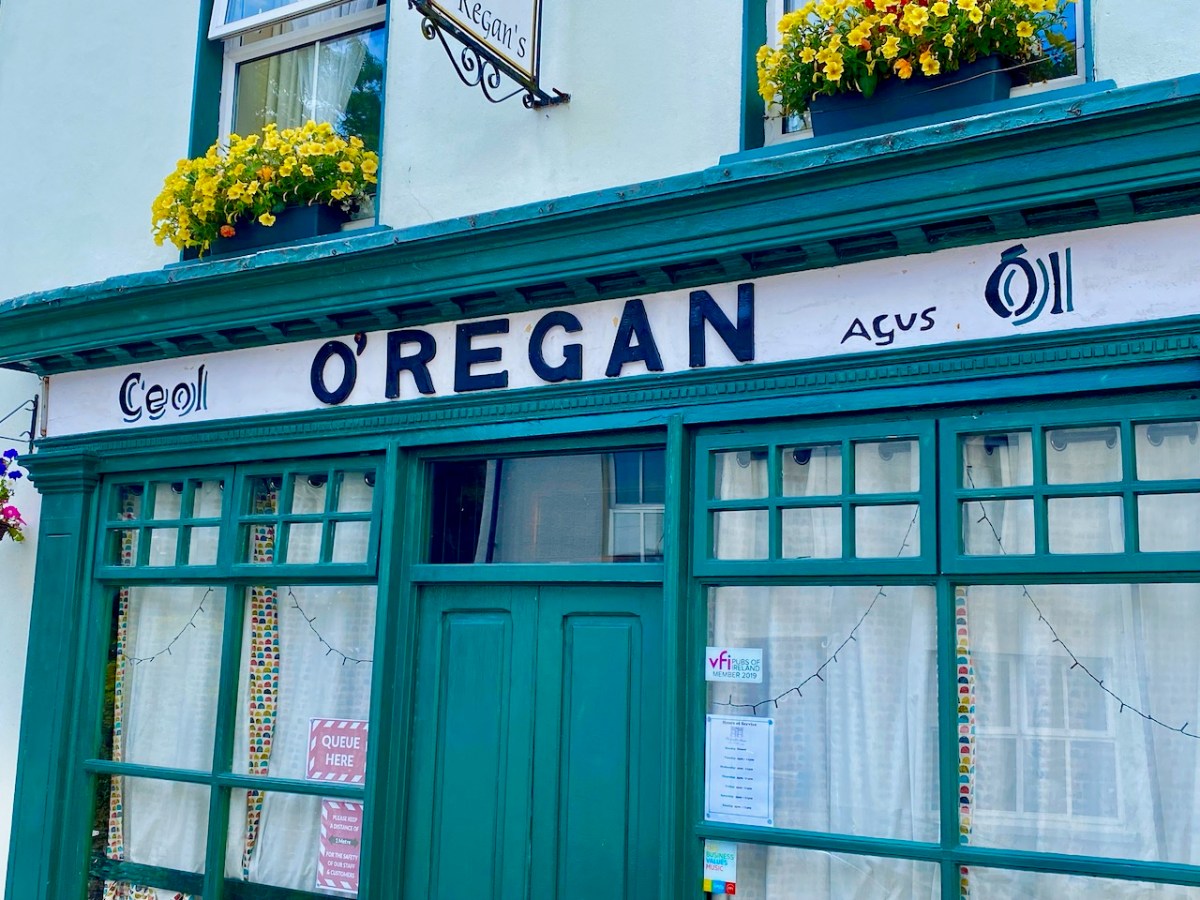
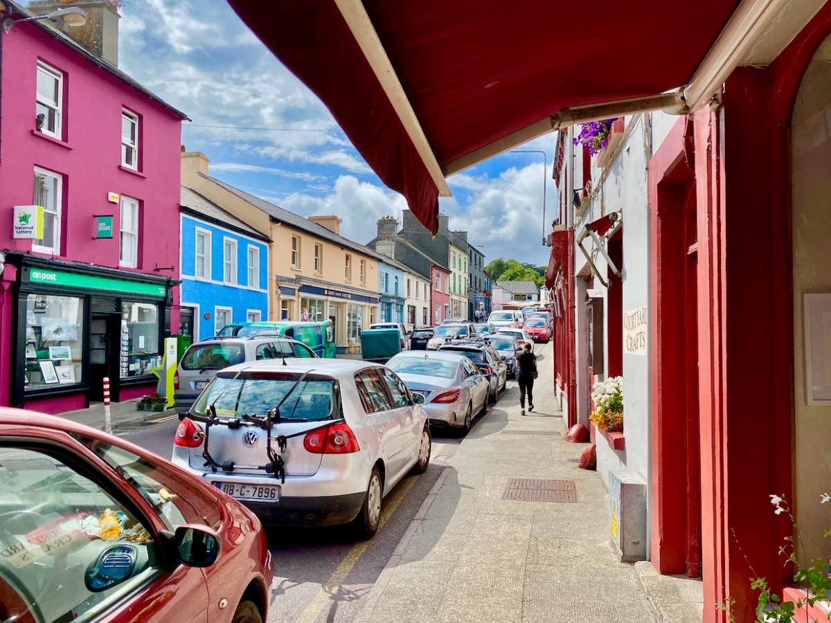
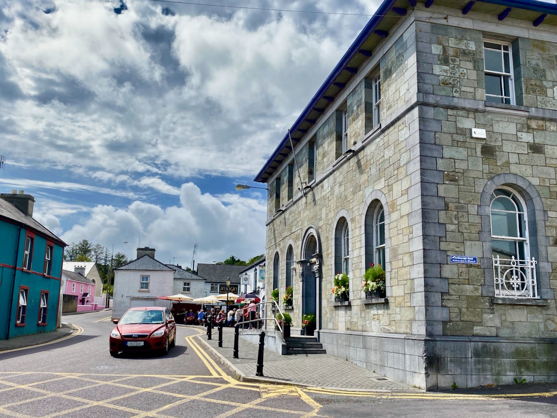
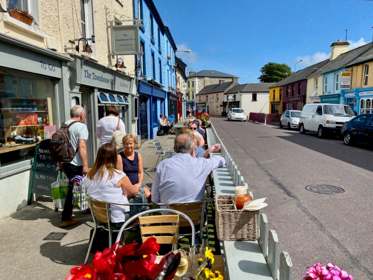
So here I am now, happily settled in Schull, looking back on what we have written about this wonderful village over the years. And what we have eaten as well.

Robert did a series called West Cork Towns and Villages and he wrote about Schull in 2021. (Don’t be confused, by the way, by the fact that the author is given as “Finola” on the top of many of these posts: now that I am the sole administrator of the website, WordPress has automatically assigned all authorship to me and I can’t seem to change it back.) It was during Calves Week in August and Schull was en fete and looking sunny and busy and gorgeous – as it is all summer anyway.

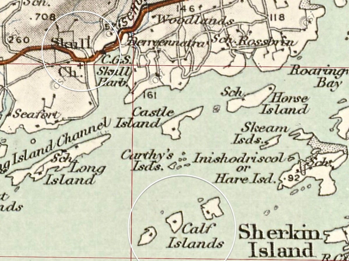
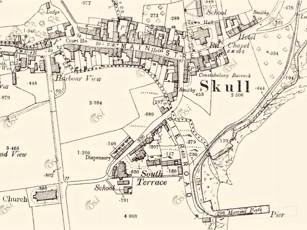
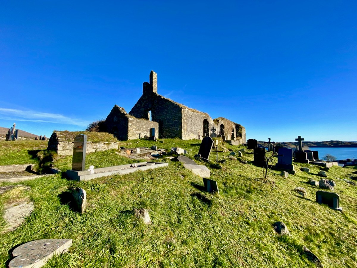
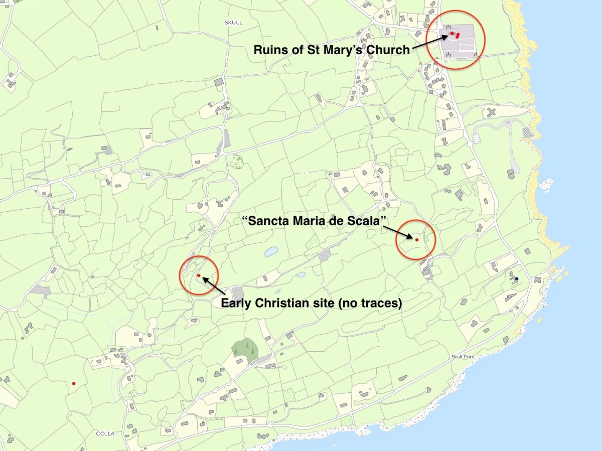
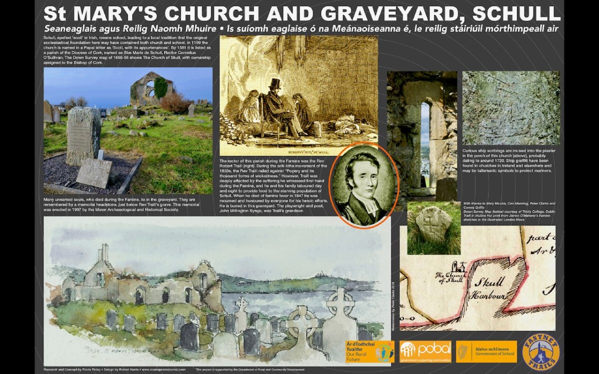
One of the topics Robert tackled was the name – Schull, or Skull as it is invariably given on old maps. In two posts he traced the possibility that somewhere around here was an ancient ecclesiastical settlement named for Mary. In the first one, he referred to the The National Monuments record which states: According to local information, this is the site of Scoil Mhuire or Sancta Maria de Scala, a medieval church and school that gave its name to this townland and to Skull village . . .

In the second, Schull – Delving into History, he charts the various evidence, or mythology, that gave rise to the ‘local information.’ As a corrective, he urged the reader to also look at John D’Altons’s sceptical take on the placename. I also urge you to do so: it’s here.

Robert re-visited St Mary’s church in 2022 to write about the ship graffiti in the porch. Subsequently our friend Con Manning wrote an erudite piece for the 2025 Skibbereen Historical Journal on the same graffiti: The ruined church at Schull, Co. Cork, and its ship graffiti

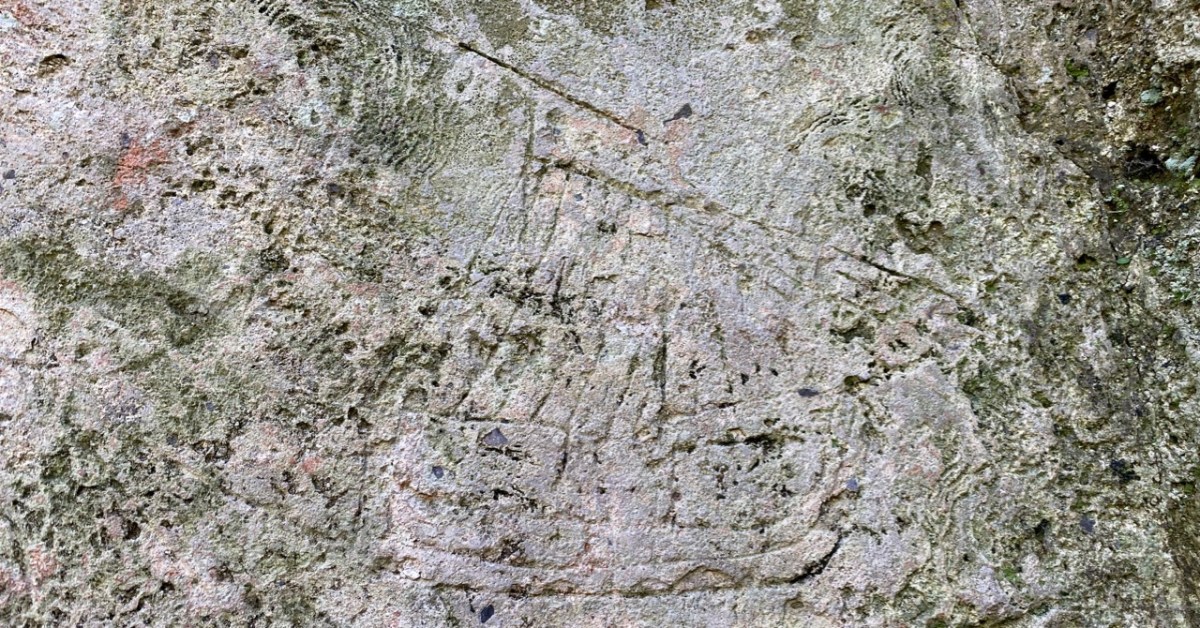
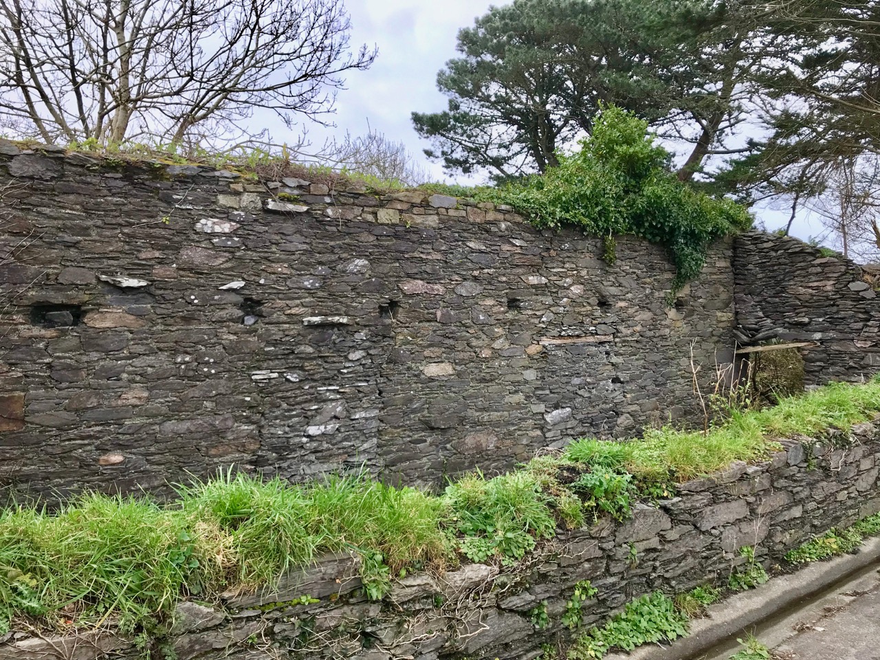
Before we leave St Mary’s I will mention it is the final resting place of many anonymous souls who died during the famine, as well as the Rev Robert Traill, about whom I wrote in my series Saints and Soupers. Traill’s story in Schull started out as that of a typical evangelical clergyman, despising the Catholics and railing against Popery and its thousand forms of wickedness, but ended heroically as he laboured night and day to feed the hungry all around him, dying himself of famine fever. Read more about Traill here and here.

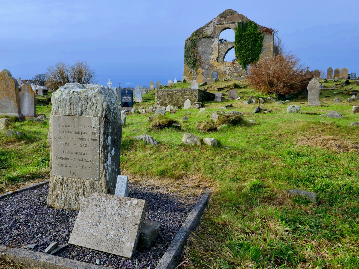
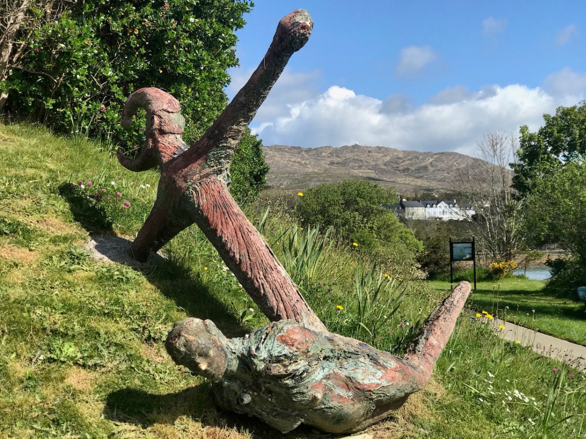
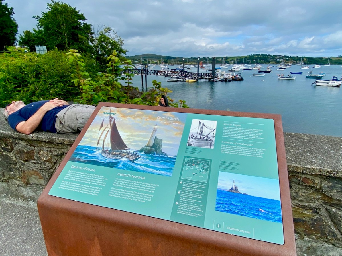
And of course, this is Robert’s final resting place also, with his beautiful hare headstone. I love it that, at the entrance to the Graveyard, is a Fastnet Trails informational board written by me and designed by Robert, about the history of this important place. The watercolour is by Peter Clarke.

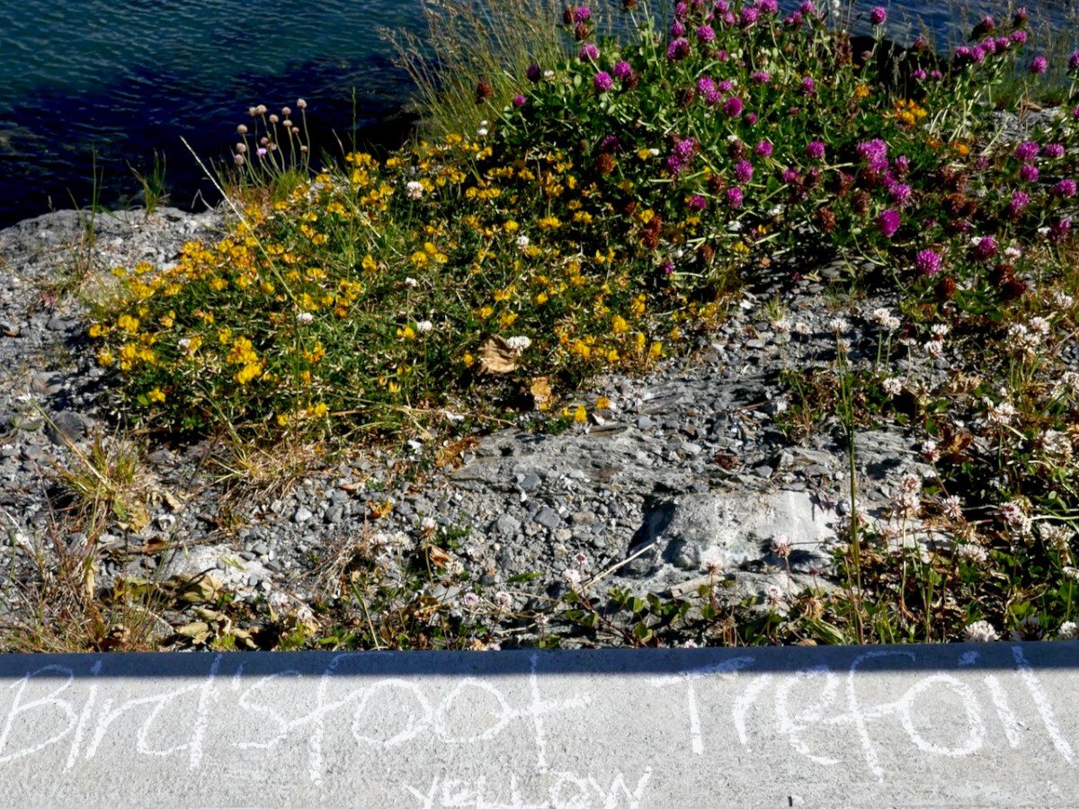
Like all the West Cork villages, Schull is also a haven for wildflowers, although you might think they are only weeds. We had a very enjoyable Guerrilla Botany session in early June in 2020 wandering around and chalking in the names of all the plants we found. Time to do that again this spring, I think – who’s up for joining me?

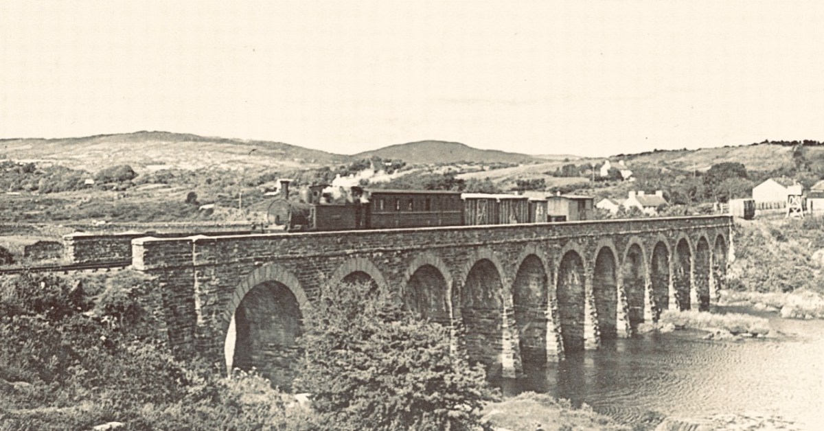
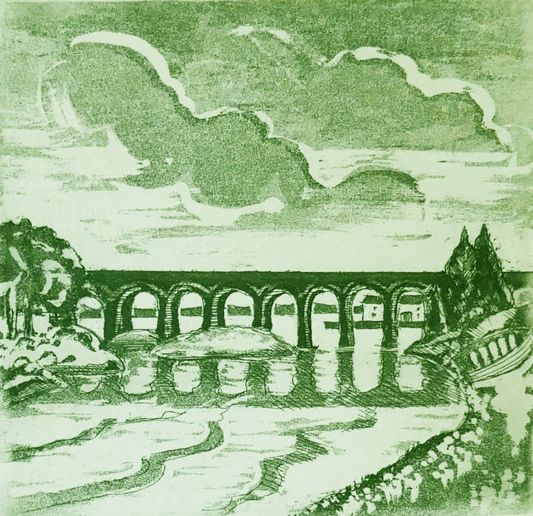
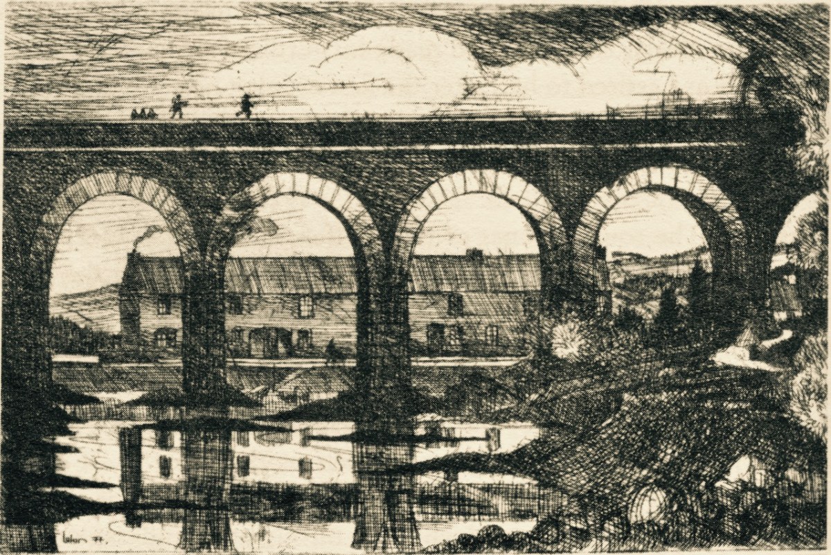
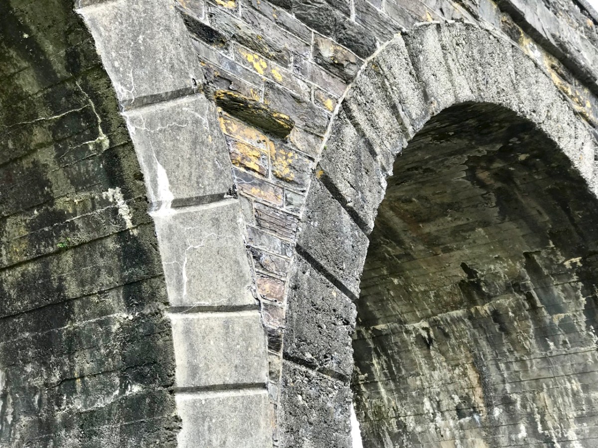
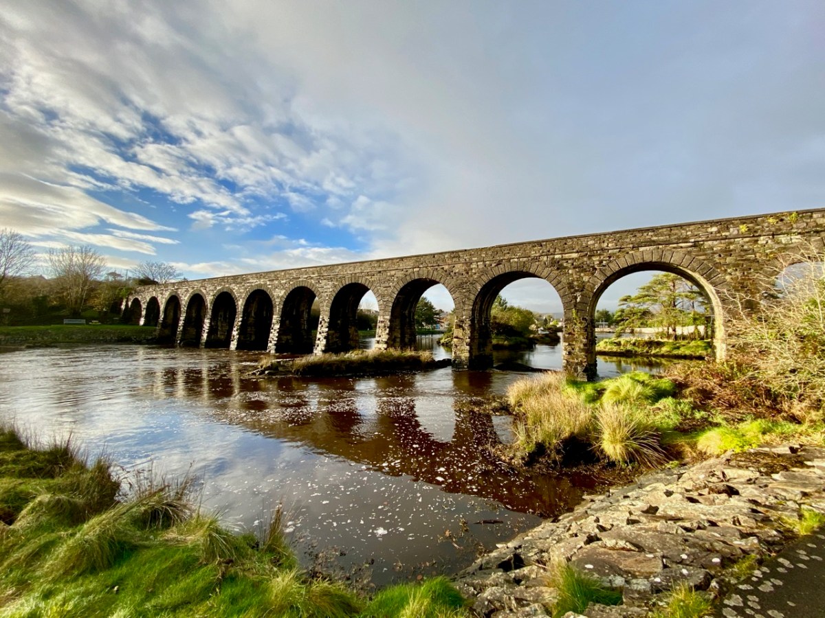
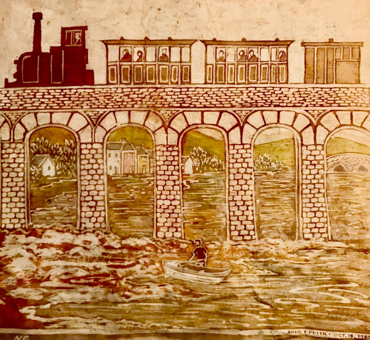
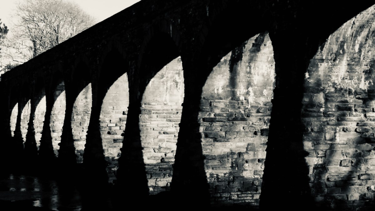
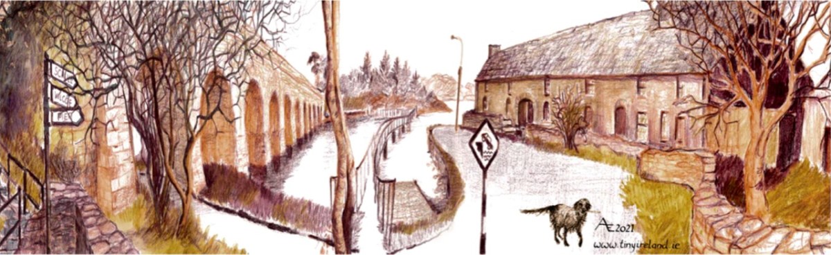
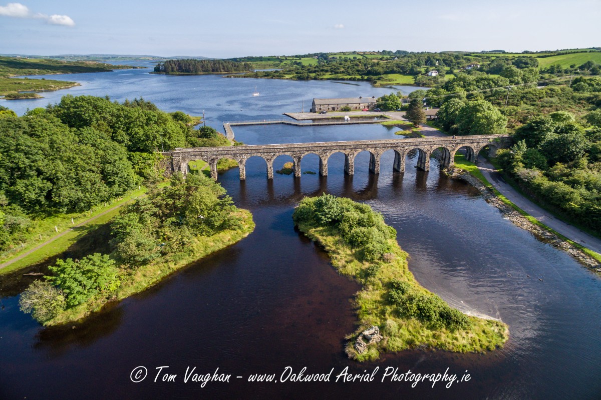
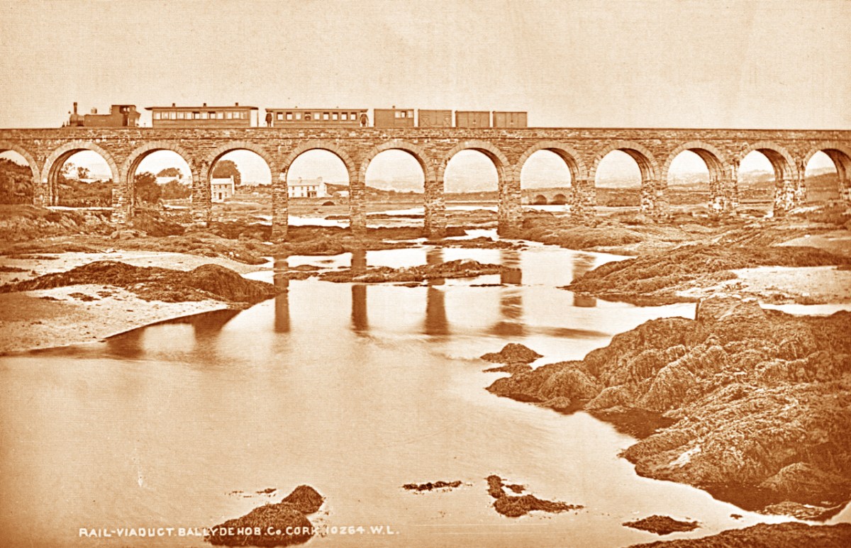
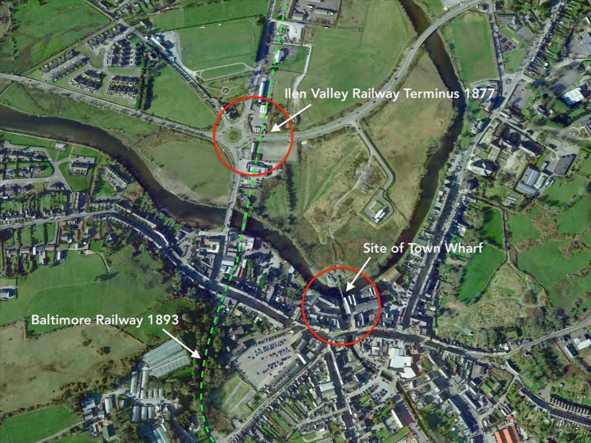
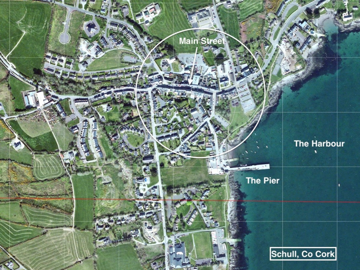
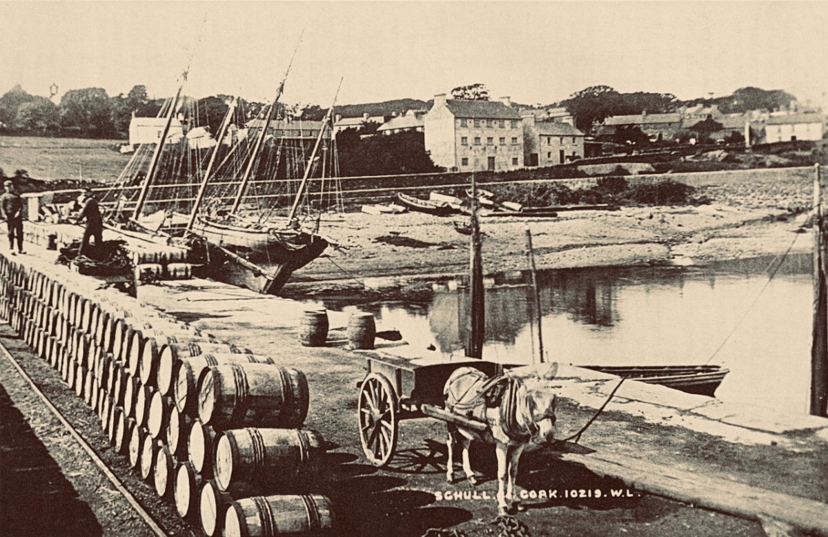
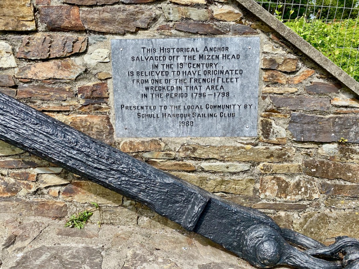
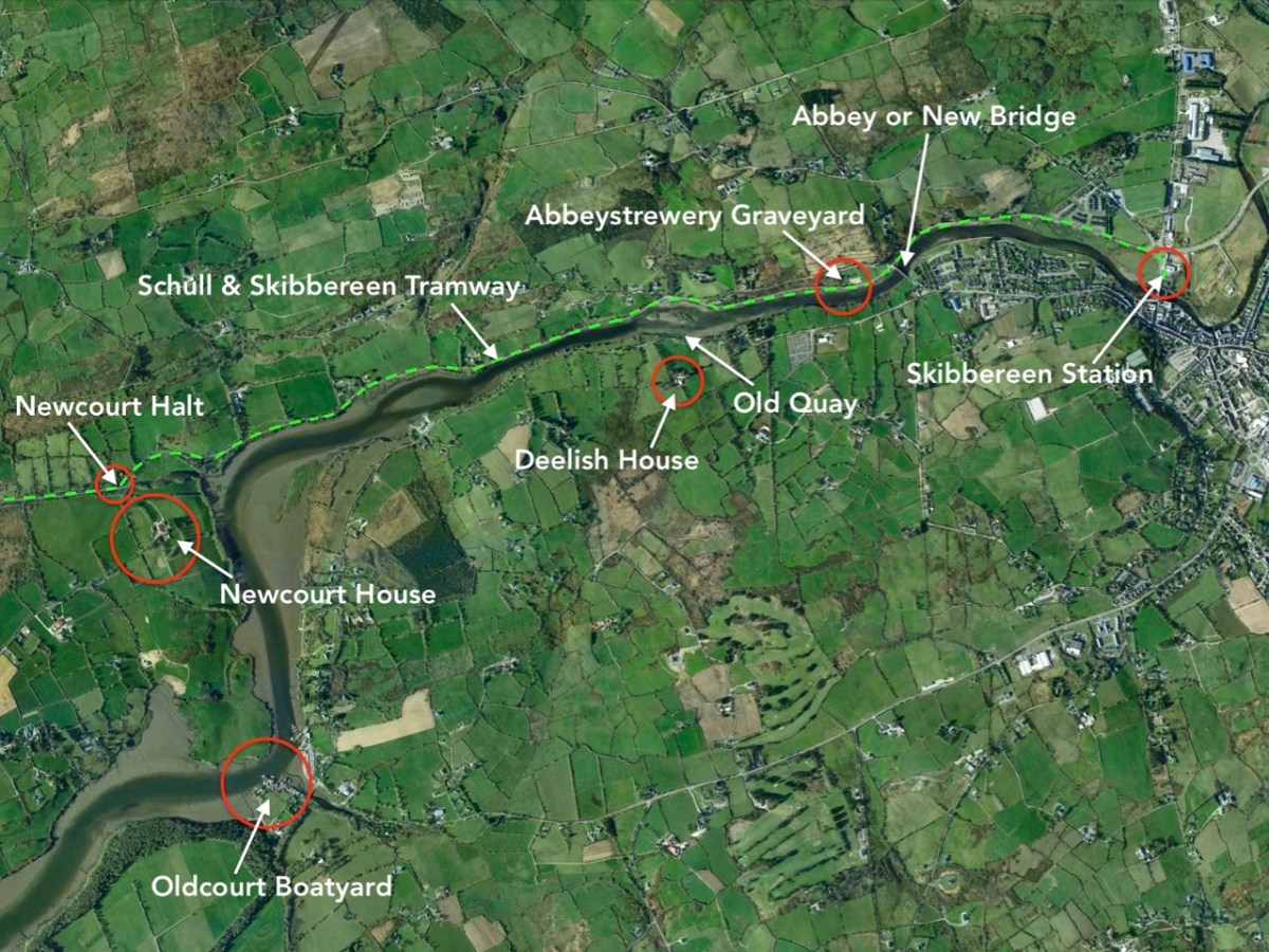
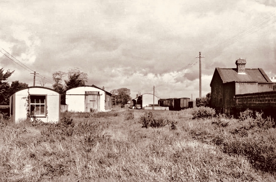
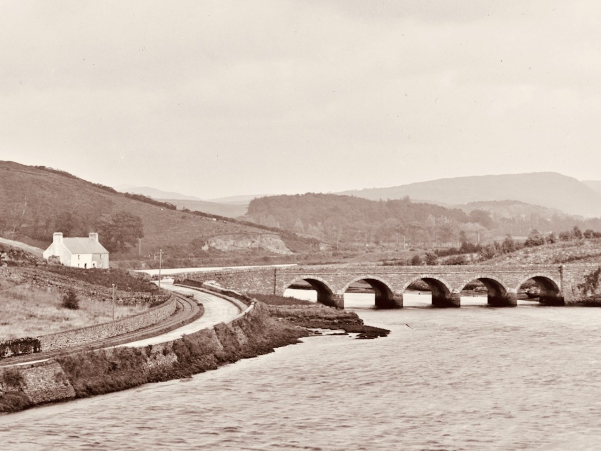
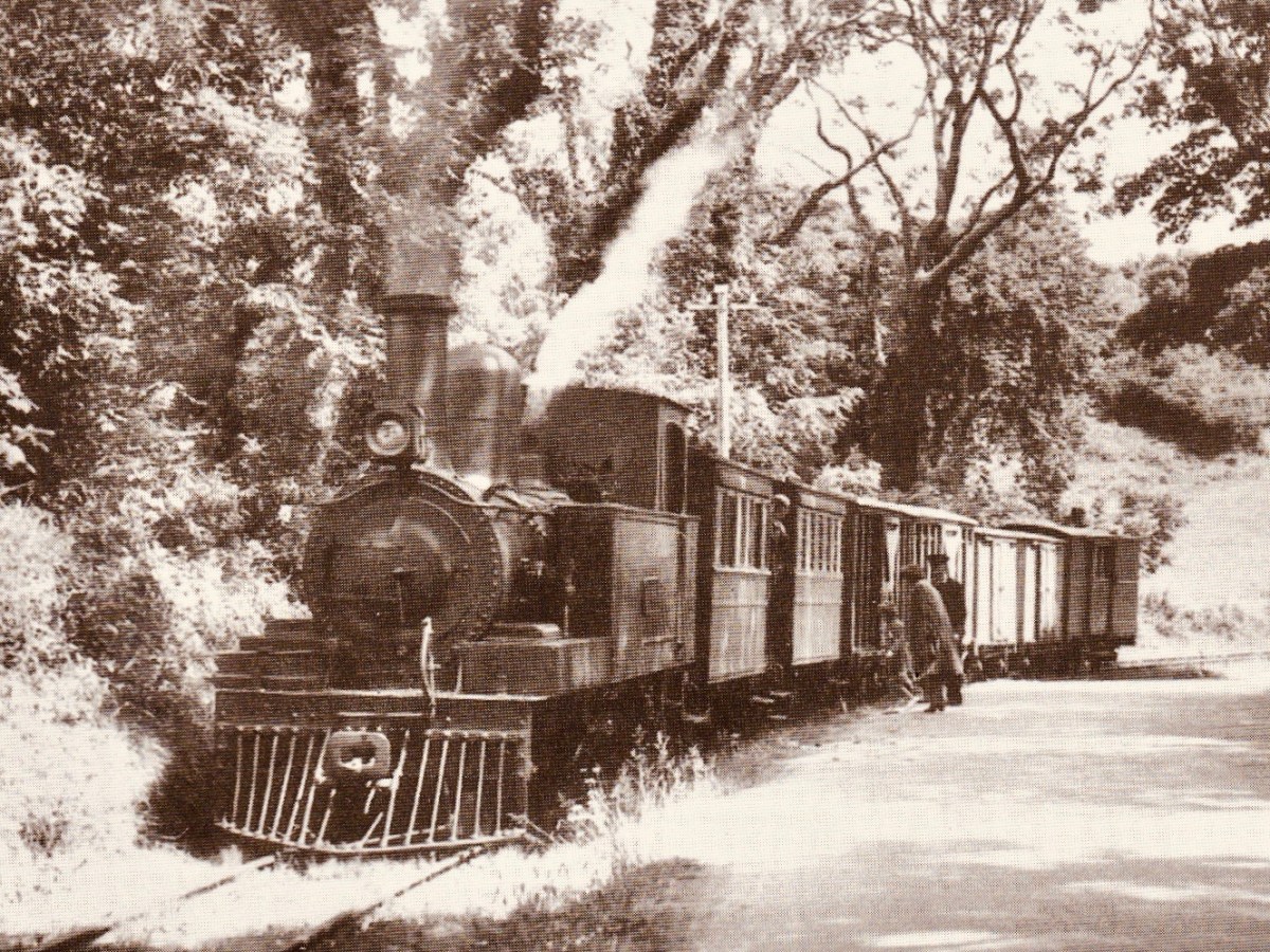
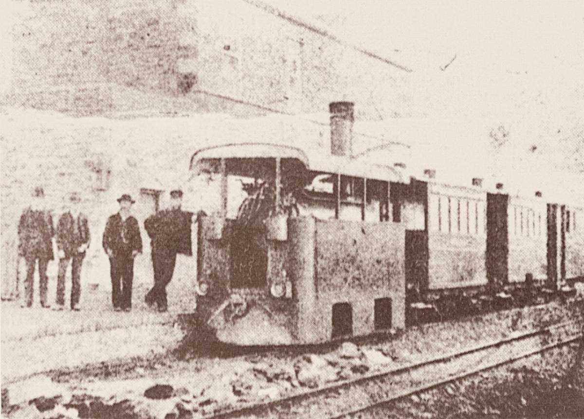
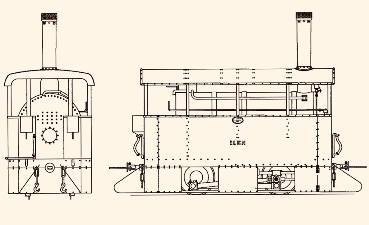
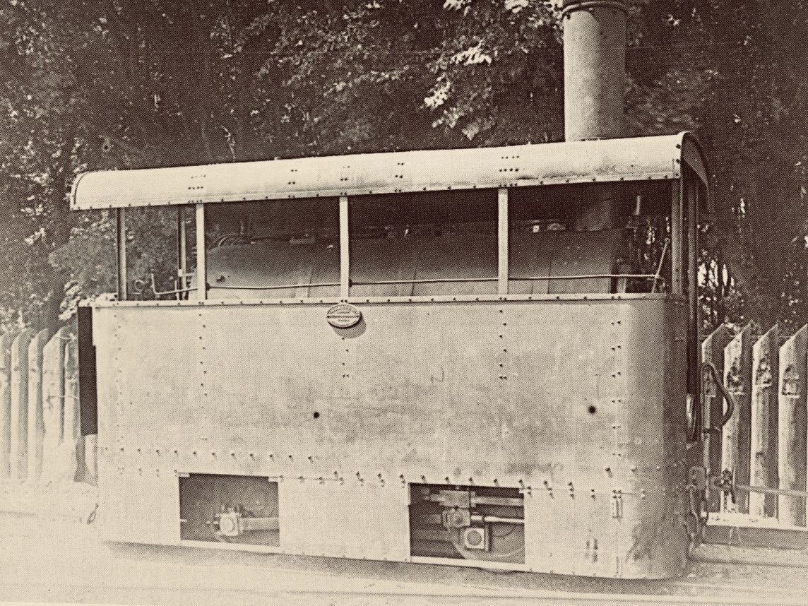
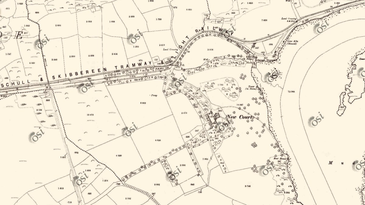
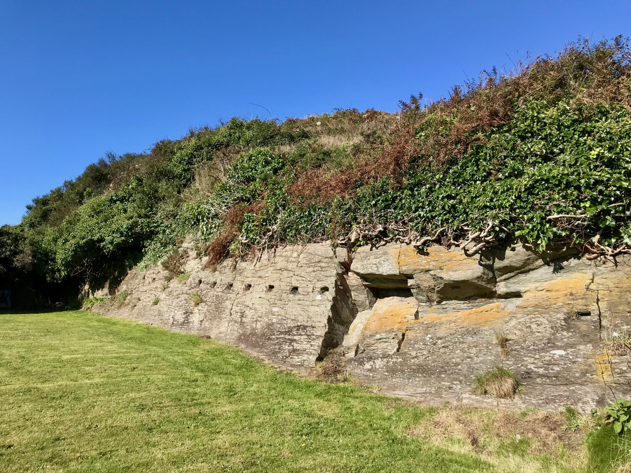
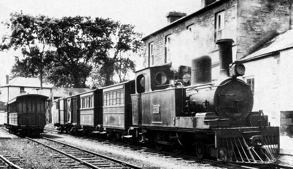
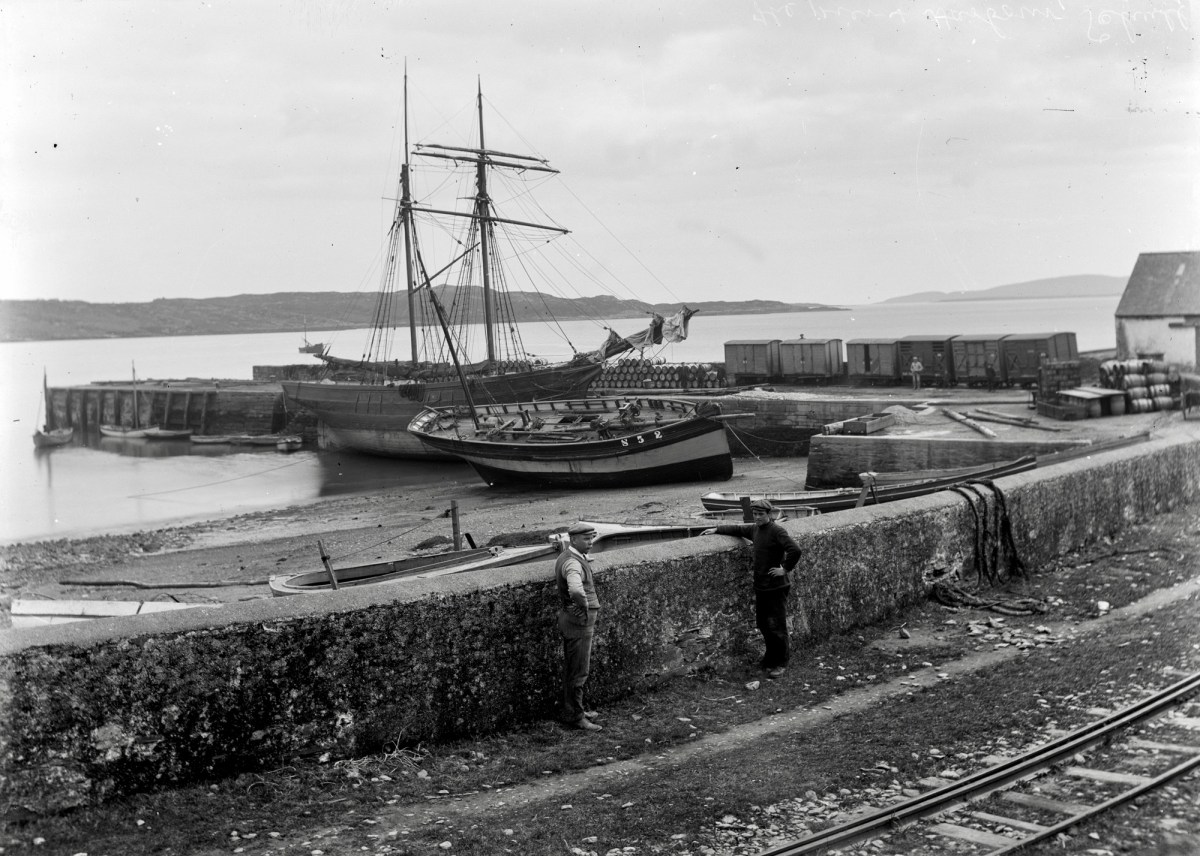
The train used to come to Schull – the Schull and Skibbereen Light Railway came all the way down the Pier and Robert wrote about this rail line in a series of posts. The Schull-related one is here – a set of reminiscences about the stops, the engines, the buildings and the people who made it all run. My personal favourite was Gerry McCarthy who was known as ‘Vanderbilt’ from the careful way he had with money

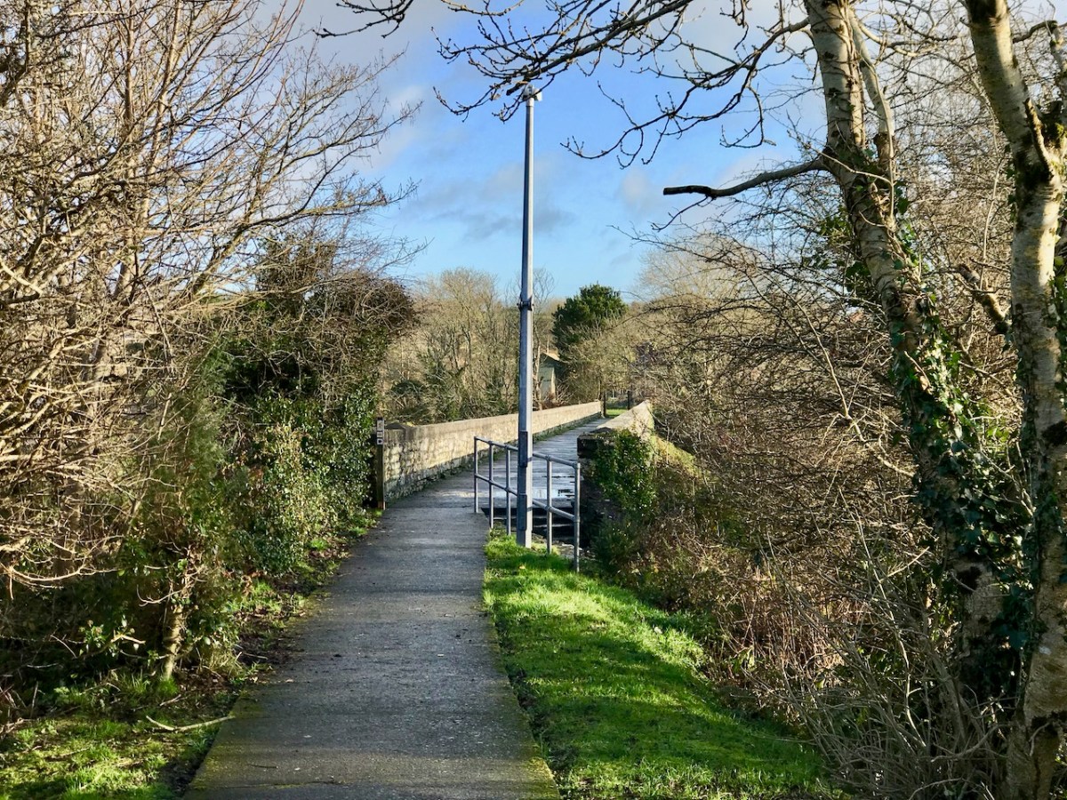
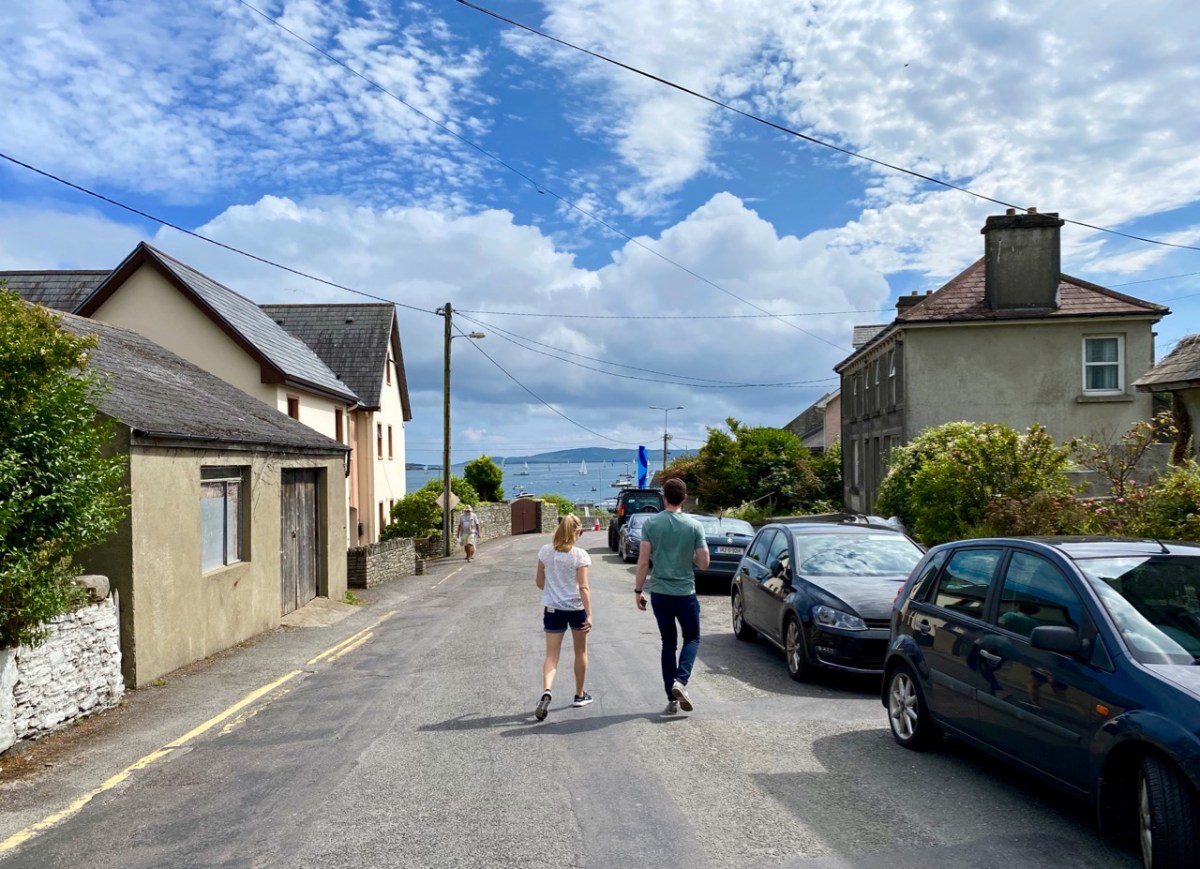
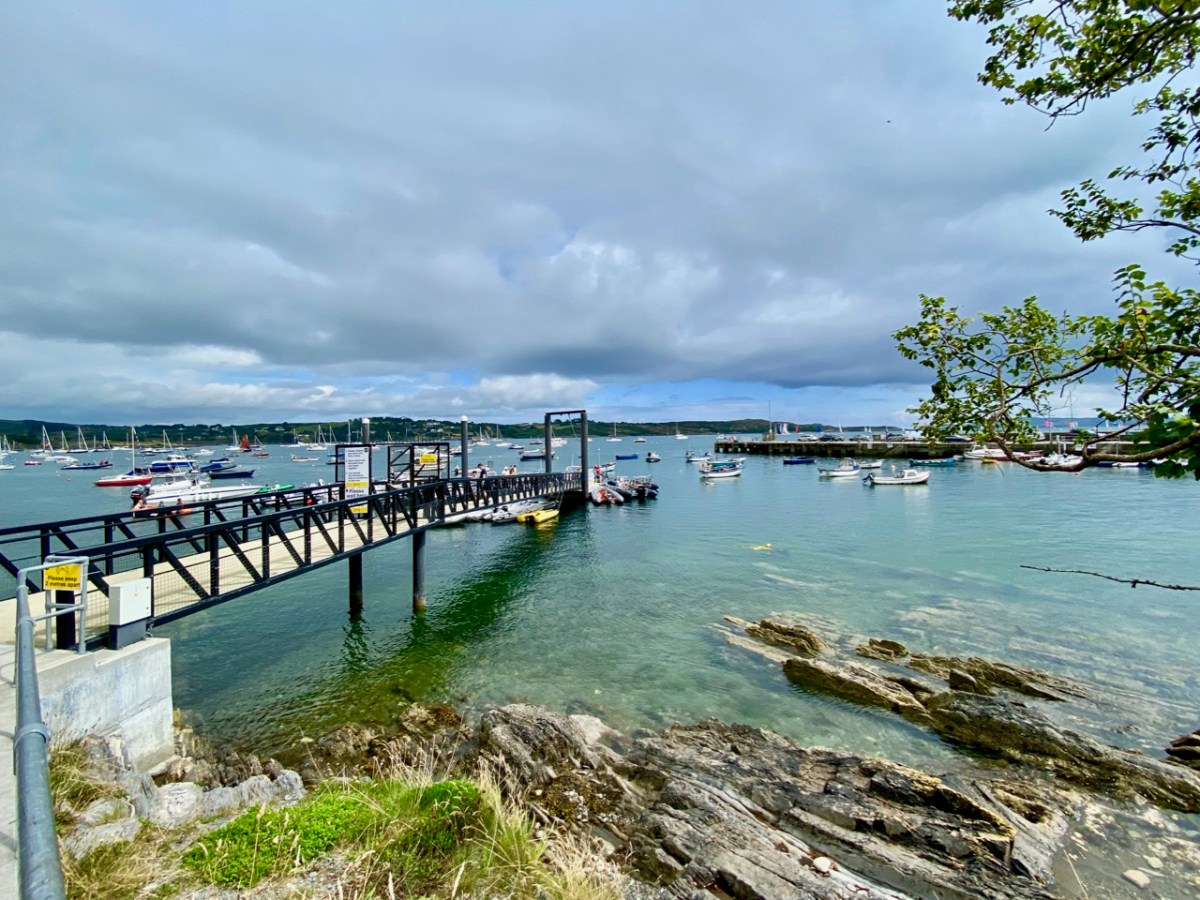
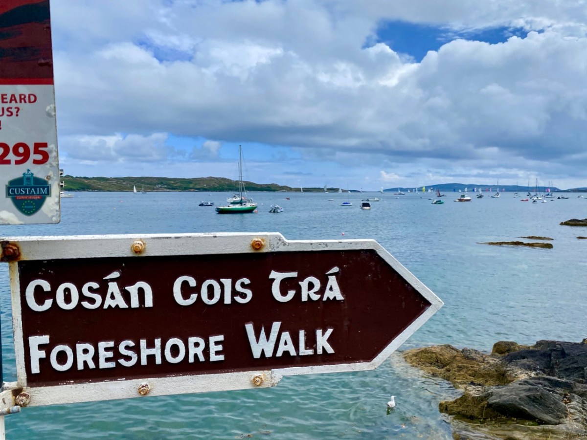
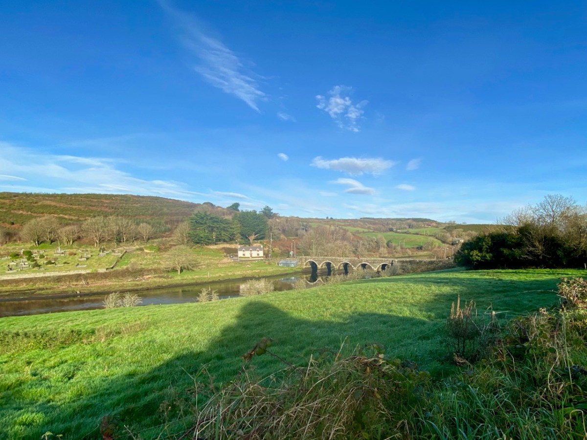
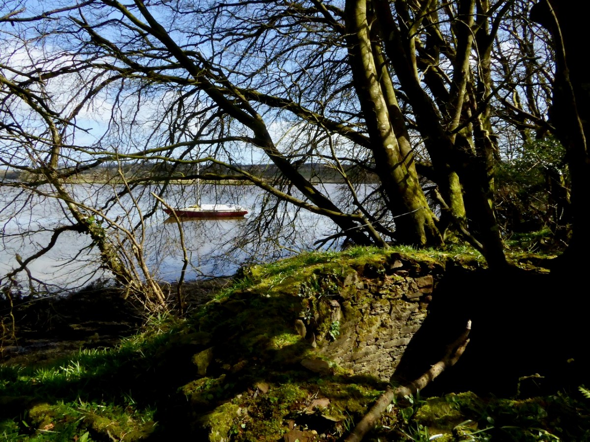
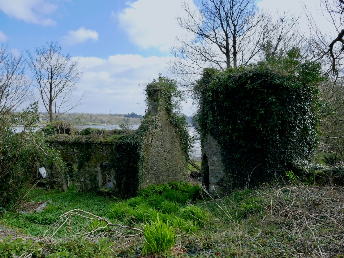
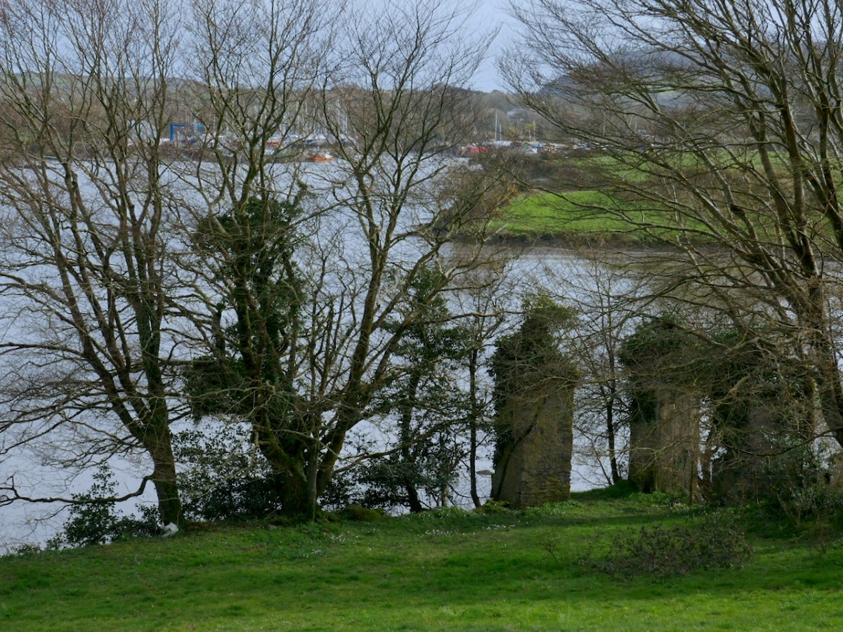
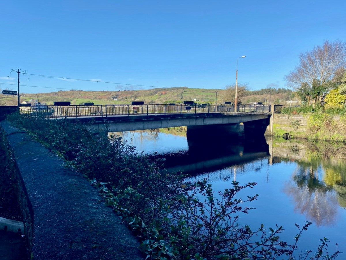
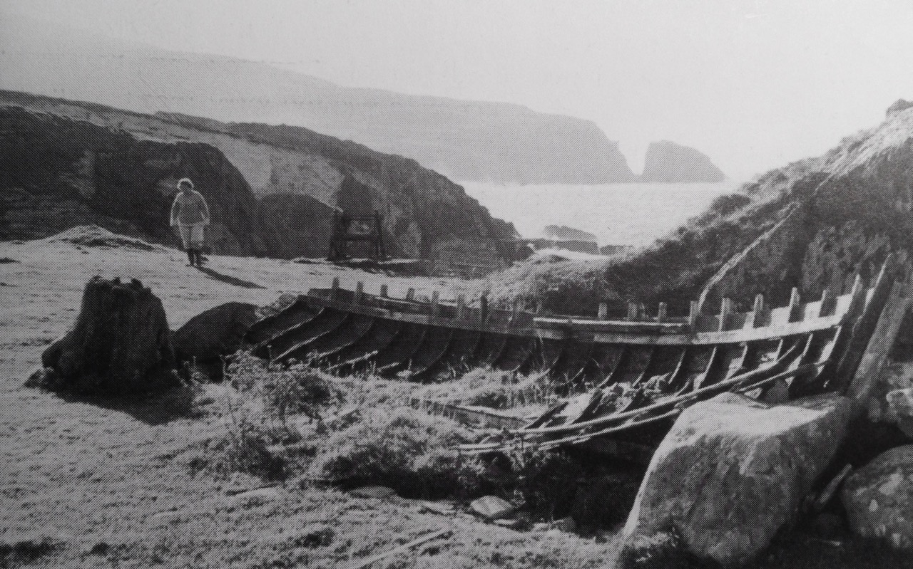
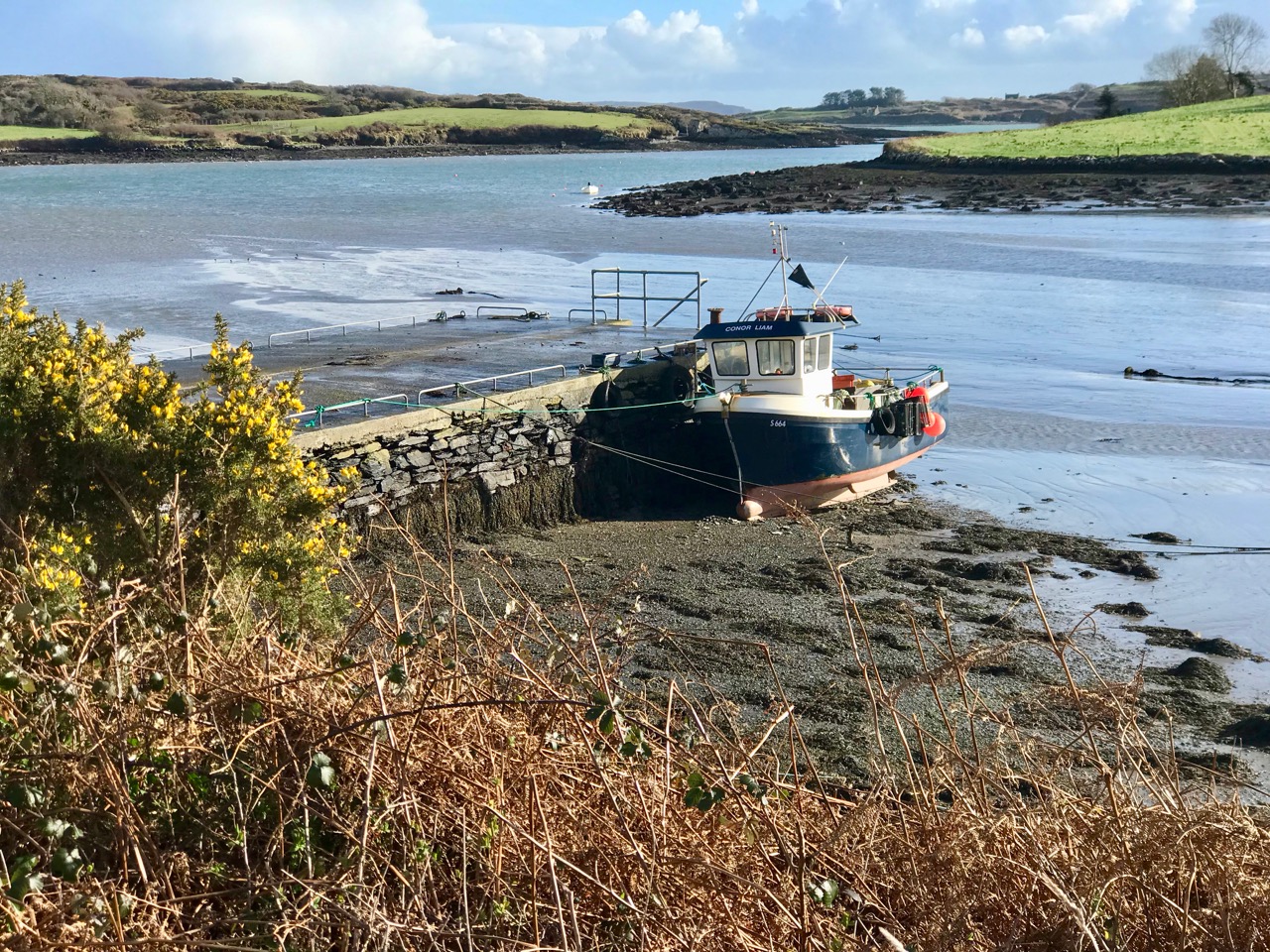
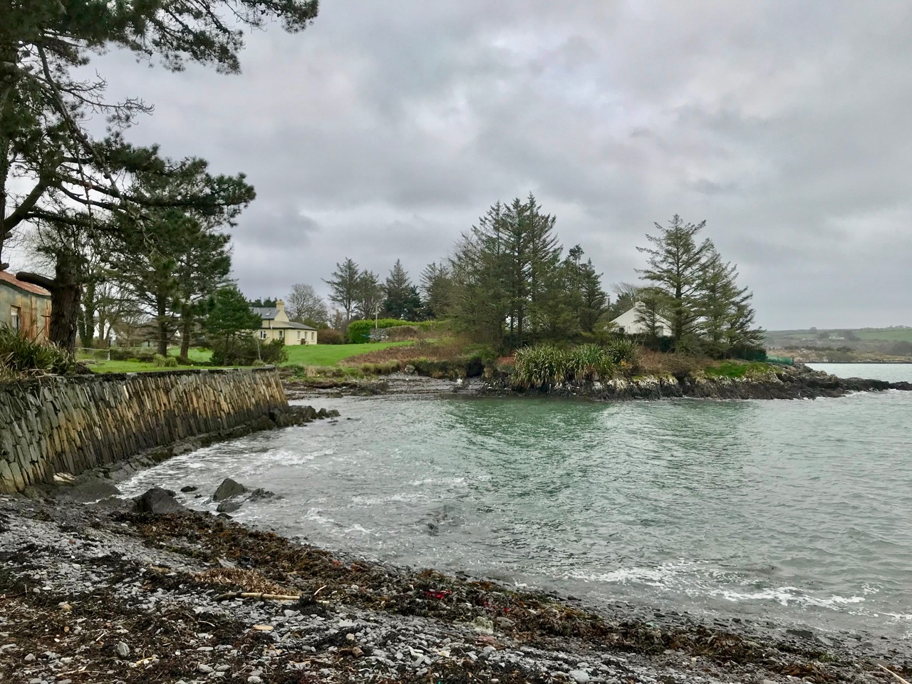
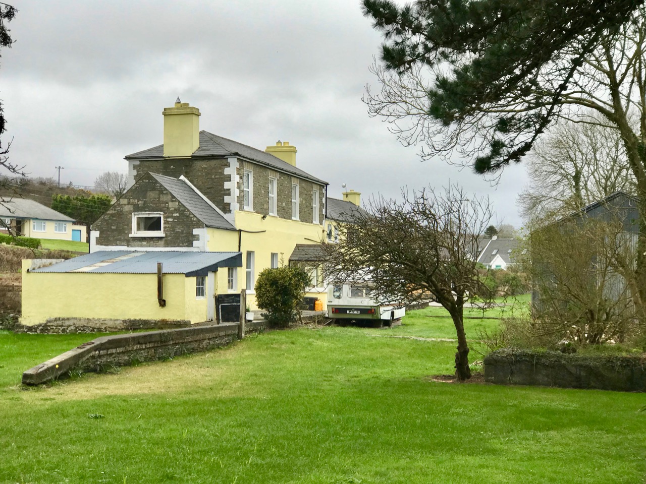
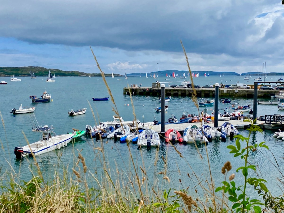
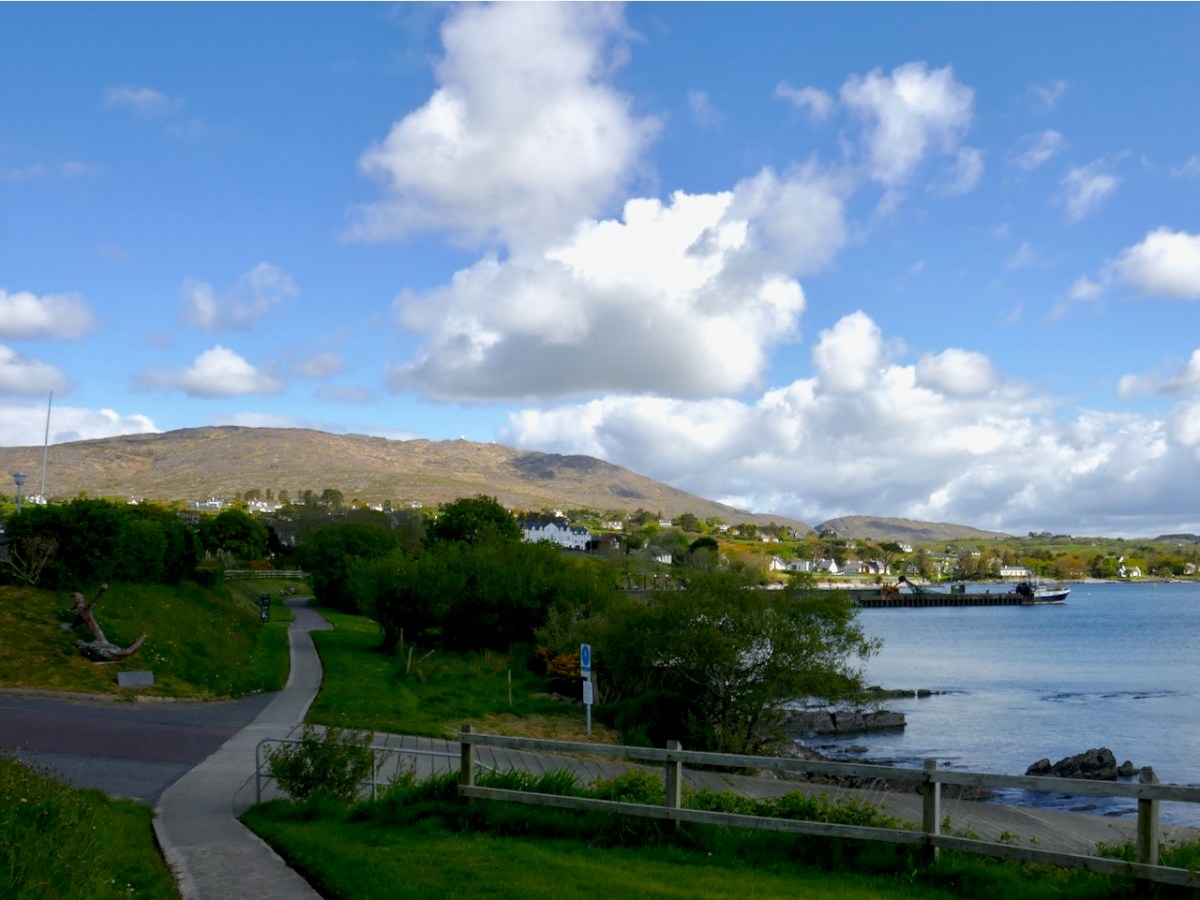
One thing Schull people love to do is walk and there are several lovely walks that start or end right in the village. You can walk from Schull to Castlepoint, or from Rossbrin to Schull. You can do the Butter Road – a green road for much of the way. If you have limited time, you can do the foreshore walk from the Pier out to the graveyard and back (below). Or just keep going out to Colla Pier.

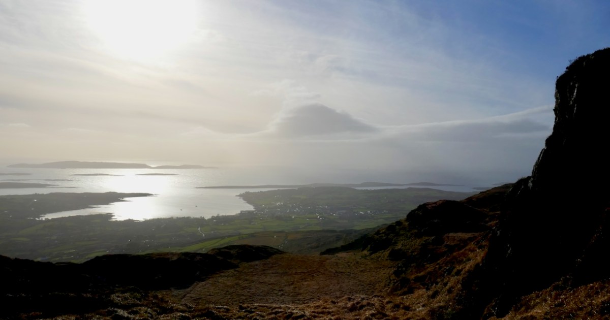
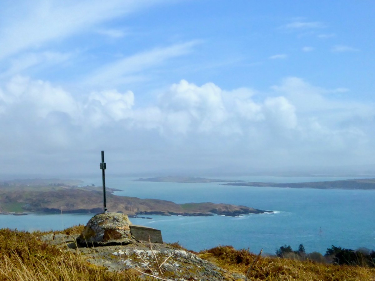
Best of all – you can do Sailor’s Hill, and hope to Catch Connie Griffin so he can explain his stonehenge to you, or lean over the wall and admire Betty’s garden.

Regular service will return soon – I’m already planning my annual Brigid post.

Our Lúnachán.

The Twelve Arches of Ballydehob

As we are approaching the traditional Twelve Days of Christmas I thought it fitting to give you Twelve views of Ballydehob’s iconic viaduct. Our West Cork village of Ballydehob has many claims to fame. It has been the centre of a great Irish art movement in the mid-twentieth century (have a look at this site). But earlier – between 1886 and 1947 – it was an important stop on the Schull & Skibbereen Tramway. This was a three-foot gauge railway line which must have been a great wonder to those who witnessed it in its heyday. There are fragments of it still to be seen, but its most monumental structure remains with us: the twelve-arched viaduct at Ballydehob.

Above: Brian Lalor was one of the creatives who settled in Ballydehob back in the artists’ heyday (he is still here today). The railway viaduct was a great source of visual inspiration to him and to his artist colleagues.

Here (above) is another Lalor work depicting the viaduct (many thanks, Brian). Behind the arches in this print you can see the former commercial buildings on the wharf, now converted to private use. At first glance you might think what a fine masonry structure this is. In fact, most of it is mass concrete. Look at the close-up view of the arches below: they are cast and faced in concrete, albeit the arch-stones are made to look like masonry. Only the facing infills and the parapets are actually of stone. This is quite an innovative construction for its time. Barring earthquake it’s certain to endure.

I was not surprised to find how often images of this engineering feat have inspired artists and others working in creative fields. Here’s a particularly fine example from the days of the artist settlement around the village in the mid-twentieth century (below): this one is a batik by Nora Golden.

I really like this moody photograph by Finola: it demonstrates the elemental nature which repetition and shadow gives to the scene. (Below): we have to see the way over the top, now a public footpath. The railway was a single track narrow-gauge at this point.

The ‘Tiny Ireland’ creator – Anke – has sketched this wonderful caricature of our wharf area, showing the 12-arched bridge in context. Finola has written about Anke. You can buy your own piece of Tiny Ireland through her website, here.

How better to look at the bridge in context than this view from Aerial Photographer Tom Vaughan. Thank you, Tom, for allowing us to use this magnificent image. Here’s the link to his own website. You will find excellent gifts for the connoisseur here. The last of our ‘Twelve Arches’ (for now) has to show us the bridge in its rightful use. I think this postcard – from the Lawrence Archive -dates from the early 1900s. I can’t resist quoting the caption for the rail buffs among you!

. . . A Schull-bound train has stopped especially for the photographer: this is Ballydehob viaduct looking north. The train comprises GABRIEL, bogie coaches Nos 5 and &, brake vans Nos 31, 32 and 38 . . .

The Schull & Skibbereen Railway – James I C Boyd – Oakwood Press 1999

West Cork Villages and Towns – Skibbereen

It was an ‘odd’ Olympic year – 2021. Firmly etched in my mind is the knowledge that years in which Olympic Games are held – like leap years – are divisible by 4! This one was different, because of Covid. But that didn’t prevent Ireland producing its heroes: gold for rowing and boxing, and bronze, also for rowing and boxing: a total of 8 sports heroes bringing medals home. If you will forgive the pun, the small country of Ireland punched well above its weight! All the rowers trained at the Skibbereen Rowing Club in West Cork, under the expert eye of their coach Dominic Casey. No surprise, then, that the town was in celebratory mood for weeks after the event, as you can see from many of my photographs, taken around the town at the end of August.

The town, from its situation in a wild, unenclosed part of the country, has frequently been the rendezvous of disaffected parties, but it has been much improved of late years, and is now a very flourishing place. It is situated on the southern bank of the river Ilen, and comprises seven streets; that part which extends into the parish of Abbeystrowry is called Bridgetown, and consists of three streets, one of which has been recently formed. The number of houses in the whole town is 1014, many of which, in the eastern part and in the parish of Creagh, are large and well built: the approaches have been much improved by the formation of new lines of road at each extremity . . .

LEWIS TOPOGRAPHICAL DICTIONARY OF IRELAND 1837

It’s interesting that Lewis – in 1837 – describes the number of houses as just over a thousand. He also states elsewhere that there were 4,429 inhabitants in 1691: in the 2011 census the town recorded a population of 2,568.

The first edition of the Ordnance Survey 6″ map was produced around 1840, just after the Lewis Topographical Dictionary was published. From the extract above, the layout of the town we know today had been broadly established by then. Compare this to today’s OS map (below) and the annotated aerial view.

There are a few theories as to the earliest origins of the town. Oft quoted is the story of the survivors from the sacking of Baltimore by Barbary Pirates in 1631 having moved upriver to found, or expand, the settlement that is now Skibbereen. It is likely that there was already a community on this part of the river, which was tidal and probably easily navigable up to its sheltered reaches at this point: at one time there were no less than five quays, warehouses and a Customs House within the town – this post will tell you more.

Skibbereen today is defined by its river – as it always has been. The waterside deserves a bit more attention – and is being opened up a little in some of the new civic improvement schemes that have been enabled by major flood relief works in the town. There are many opportunities yet to be explored.

All towns evolve and, hopefully, move into the future: Skibbereen – we’ll be keeping an eye on you! But it’s a great town already: it has the busiest market in West Cork on a Saturday; lively shopping streets; easy (and free) parking – and a very healthy ‘pavement cafe’ culture that has grown up during the pandemic, and is likely to continue to flourish. Let’s walk the streets and see the town as its best in the late summer sunshine . . .

Here at Roaringwater Journal we will always sing the praises of this town, and it has been the subject of a good deal of our historical research and writing. Have a look at our posts on Agnes Clerke, Ireland’s first and foremost female astronomer;  Jeremiah O’Donovan Rossa, the famed nationalist and Fenian: Uillinn – one of Ireland’s most innovative art galleries – here, here and here. We also must not forget that Skibbereen was at one time an important part of Ireland’s railway network: you could travel to and from Cork and Baltimore, and it was a terminus for the narrow gauge railway that trundled off to Schull, and whose loss is now much mourned.

I hope my post inspires you to explore this prominent West Cork town, if you haven’t already done so. It has historic foundations – too numerous to list in this one, short article. Choose a sunny afternoon – or go there to shelter from the infrequent showers. Whatever the day, make the Skibbereen Heritage Centre your starting point: you will find a wealth of information which will help to guide you on your way. The building itself is a piece of history: it used to be Skibbereen’s gas works!

The town name was familiar to me long before I settled in Ireland a decade ago. I lived in the fishing village of Newlyn, Cornwall, for many years and got to know the history of the artists’ colony in West Penwith, centred on that town and St Ives. One artist – Stanhope Alexander Forbes – was known as ‘The Father of the Newlyn School of Artists’ – he was Irish born, and lived from 1857 to 1947. I vividly remember one of his works, displayed in the Penlee Gallery in Penzance. It shows fishermen leaving Newlyn to follow the shoals of herring and pilchards to the waters of Roaringwater Bay. The title of that picture? Goodbye – Off To Skibbereen!

Previous posts in this series:

Bantry

Schull

West Cork Villages and Towns – Schull

What better time to visit Schull than during Calves Week? That’s a big sailing festival at the beginning of August every year, and you have to be a sailor to understand the nuances of its title. It’s held at the same time as the UK’s premier sailing event – Cowes Week, ‘…the world’s longest running sailing regatta…’ and is focussed around the three Calf Islands in Roaringwater Bay. So there you have it – Cowes and Calves! What it means, of course, is that the village of Schull is at its busiest and, since Covid has given a boost to outdoor socialising, the streets are crowded with visitors enjoying the shops, pavement cafés and galleries.

In this occasional series on the Towns and villages of West Cork we will take one community and try to discover why and how it has developed through history, and how it fares in the present day. A snapshot of the place will be presented – hopefully – in the best possible light (although this won’t always be on a sunny summer’s day!) From the aerial view above, you can see how Schull has been built up around its connection with the water. Schull Harbour is at the head of a long sheltered inlet, and the pier today is always busy with fishing and pleasure boats, ferries and yachts.

That’s the road to the pier, above, and it’s just a few steps from the village centre. If you are a visitor, you may have no idea that Ireland’s most south-westerly railway line once ran right on to this pier! The narrow gauge Schull, Ballydehob & Skibbereen Tramway and Light Railway was in service between 1886 and 1947, connecting these remoter parts of the county to Skibbereen and then, via the main line, Cork city. Although never considered a commercial success, it was a valuable element of infrastructure enabling local passengers to get to shops and markets, and fishermen to send their catches to distant merchants as hastily as possible (bearing in mind there was a speed limit of 15 miles per hour on most of this rural line). This photograph from the NLI Lawrence Collection (below) dates from the 1890s, and shows barrels of fish stacked up next to the railway track on Schull pier, awaiting despatch. They are likely to contain salted pilchards and herrings.

In all these pictures of the pier and pontoon areas above you can see the lively sailing activity in the background. Below are two extracts from early OS maps, one showing Schull and its location to some of the offshore islands, and the other showing the town centre, probably around 1890. It’s thought-provoking to see on the latter the various facilities which the town offered at that time, as well as the railway: Court House, Constabulary Barrack, Smiths, Schools, Hotel and Dispensary.

Note that on both the maps above, which date from more than a century ago, the settlement’s name is given as Skull: it still is on all OS Ireland maps up to the present time. Mostly today it’s known as Schull, or in Irish An Scoil, which translates as The School. Some of you may remember my posts earlier this year when I looked in to the possible origins of this village name – and the earliest ‘School’: a site described on Archaeology Ireland as a ‘possible early Christian settlement’:  . . . the ancient school of Sancta Maria de Scholia, ‘a place known in early times as a centre of learning’ . . . There’s a fair bit of local lore surrounding the subject, and you need to read Schull resident John D’Alton’s article on this to find an alternative view to the perhaps romanticised ideas of an ancient monastic site: I’m sitting on the fence!

Historic village – perhaps with medieval origins – to vibrant sailing centre and colourful streets in the 21st century. Schull has come a long way, and has far to go. Today the resident population numbers around 1,050: this is boosted substantially with the influx of summer visitors. It’s good to see long established names and new businesses on the streets, contributing to the colourful palette of the architecture. Great things are happening in the future: the old bank building (below) is to become a cinema and film centre: a focal point for the acclaimed annual Fastnet Film Festival.

Year round, Schull is worth exploring. Mount Gabriel, the area’s highest point, is above the village and offers superb vistas over the bay and islands. Finola has looked at the many legends associated with this peak and there is ancient history there, too: the remains of Bronze Age copper mines on its slopes. Good walks can be had on the high ground and on the coastal footpaths – see the Explore West Cork website.

Sweet Ilen – Part 2

Last week our first exploration of Sweet Ilen – our West Cork river – began in Skibbereen town from whence we travelled north, as far as Ballyhilty Bridge. Today, we return to the town and unearth some further history on the way downstream.

On the aerial view of the Ilen flowing south-west from Skibbereen (above) I have marked some significant locations. Abbey or ‘New’ Bridge is the first crossing point and the limit of navigation for large craft. The Old Quay shown to the north of Deelish House was the offloading point for ships arriving from the south; barges or lighters carried the goods further into the town. The narrow gauge Schull & Skibbereen Tramway (as it was originally named) left Skibbereen Station and followed the Ilen as far as Newcourt Halt, alongside the main road.

The Ilen Valley Railway, which brought the regular gauge railway into Skibbereen from Bandon and Cork, shared its station at Skibbereen from 1886 with the 3ft gauge line going to Schull. This picture (above) of Skibb Station in 1960 (courtesy Roger Joanes) shows the main line on the right and the remains of the narrow gauge terminus on the left.

The header picture shows Abbey or ‘New’ Bridge as it is today. The upper picture above, with an enlarged section of it underneath is fascinating for our study: it was taken in around 1893 by Robert French for the Lawrence Collection and is reproduced here with the permission of the National Library of Ireland. It shows the bridge – which was built in 1822 – with the road to Skibbereen running to the left, as it does today. But it also shows the tracks of the tramway on the left hand side of the road. Also in the main picture is a white building below the Abbeystrewery Graveyard. That marks the point at which the entrance to the graveyard adjoins the road, and is in fact a level-crossing keeper’s cottage, now gone.

Marked on this extract from the OS 25″ survey (late nineteenth century) is New Bridge on the right, the Graveyard with its level-crossing and the quay above Deelish House

The first halt on the tramway travelling from Skibbereen was at Newcourt. Here is a ‘sylvan scene’ of a train at that halt in 1939 (courtesy of W A Camwell, taken from the invaluable volume The Schull & Skibbereen Railway by James I C Boyd, published in 1999 following over 40 years of research):

If that doesn’t bring a nostalgic tear to your eye – for those apparently idyllic days of leisurely rural life in Ireland – I don’t know what will. But the little railway had its ups and downs (before vanishing altogether in 1947). Its association with the Ilen River was there at the beginning: the very first locomotive was named ‘Ilen’ and here it is (below), having just pulled a passenger train into Schull Station, probably in the 1880s (photo from the collection of Mrs E McCarthy):

Why is it so strangely shaped? Because the line was conceived as a tramway or ‘light railway’ to comply with the conditions of The Tramways of Ireland Act 1862, which allowed tramways to be built along public roads, thereby reducing costs. Because of this, locomotives were treated in the same way as city trams – where very low slung bodywork supposedly prevented serious injury if they struck pedestrians or animals sharing the roads – something that could be echoed on West Cork’s boreens where donkeys and cows were quite likely to be encountered.

. . . To comply with regulations sheet-steel skirting was taken down to a level approximately 3 inches above the rails; the rolling and pitching of the engine probably produced shrieks of protest as it scraped the rails . . . An impressively tall chimney was surmounted by a ‘chip-pan’ spark-arrester . . .

James I C Boyd 1999
Tram Engine Ilen at Skibbereen in 1906 – photo by H Fayle

It’s a shame, but this unique piece of machinery failed because it lacked sufficient sustained power to climb the relatively steep inclines on the tramway, and its later replacements were more conventional engines (such as the one pictured at Newcourt) fitted with cow-catchers.

OS 25″ survey extract, late nineteenth century. It shows the tramway diverging from the road just north of the entrance gate to Newcourt: there was evidently an ornamental avenue along that stretch of road leading to the gate, with arches over. Also on this map is located Newcourt Post Office (by the tramway halt), Mohanagh Dispensary and various landscape features belonging to the demesne

The Ilen River is broad and magnificent as it passes by Newcourt. You do see large boats on that stretch sometimes, but also many skiffs and small craft from the Skibbereen Rowing Club. The grand house – New Court – is gone now, but the ‘designed landscape’ can be traced through the survival of ruined towers, gazebos and water-gates.

Ilen River frontage on the Newcourt Demense: from upper – the base of an ornamental tower fronts the constructed river wall; Mohanagh Dispensary ruin and another tower; prospect towards Skibbereen from the estate; substantial pillars which were part of a water gate on the south of the site – in the distance is the boatyard at Oldcourt

Finola has written previously about Newcourt, and there tells the story of another ‘water-gate’ which will be seen today by anyone travelling towards Skibbereen from the main road. We now return to Skibbereen ourselves to finish off this second episode of the series. This (below) was the bridge which took the road into the town over the Ilen prior to the present one: built in 1877, it was condemned as unsafe for heavy loads in 1953, but it took another ten years to replace it.

Above is Kennedy Bridge, Skibbereen, that was opened with due ceremony on Monday 15 June 1964 and named in honour of American President John F Kennedy. It has a centre span of 22 metres and two side spans each of 8 metres. First to cross the bridge on that day was Richard Burchill of Tragumna on a horse and cart! Information about these events – and much more – can be seen in the excellent displays in the Skibbereen Heritage Centre: formerly the town’s gasworks buildings and sited appropriately enough alongside the Ilen River!

Look out next time for more adventures exploring the further northern reaches of the Ilen!

Here is the first episode in this series: Sweet Ilen

Fish Palaces – and How They Worked

Four years ago I wrote about the fishing industry that once flourished on the shores of Roaringwater Bay (and around much of the west coast of Ireland): according to extant records it was active before 1500, and probably had its heyday in the seventeenth century, when it was heavily invested in by the Great Earl of Cork (Richard Boyle, sometimes described as ‘the richest man in the known world’). In those days, pilchards were the main catch: huge shoals of them came to the comparatively warm, sheltered waters of the islands during the summer months, along with other oily fish such as herring and mackerel. Seine boats were commonly used for this enterprise. Today, pilchards are rare: through a combination of overfishing and changing climate, the bountiful shoals no longer appear.

Header – pilchard curing in St Ives, Cornwall c1890: the pilchards are piled up in layers, forming the huge mound in the centre of the photograph. They are salted and weighted down. Above – curing the fish, Valencia Island, Co Kerry, early 20th century (Reddit / Ireland)

Shooting the Seine:

There were two boats per seine net, the seine and the faller. The seine boat was 27 foot long with a beam close to nine foot. The golden rule on the Northside was to never get into a boat whose beam was less than one third its length. The seine boat had five oars of about 17 foot (bow, Béal-tuile, aft, bloc and tiller oars). The crew of seven had to shoot the seine net; one man shooting the trip rope, another to feed out the bunt rope, four men rowing and the huer (master of the seine and captain of the boat) directing the operation. The faller (or bloc) boat was 24 foot long with a crew of five. Its job was stoning and to carry any fish caught. The largest load a faller could carry would be around 5,000 fish. All boats carried a Crucifix and a bottle of Holy Water.

(from Northside of the Mizen by Patrick McCarthy & Richard Hawkes, 1991)

Twentieth century remains of a seine boat, from Northside of the Mizen

If the fish are gone, remains of the machinery of that industry are still to be seen. In particular, the sites of some of the curing stations – or Fish Palaces – are visible, and are recorded on the National Monuments Archaeological Survey Database. Take a look at the map below: I have drawn green pilchards to show the sites of fish palaces mentioned in the database – eleven in all on this section of the map. Also shown by red pilchards, however, are the sites of another six ‘curing stations’: these are mentioned in a long article by historian Arthur E J Went, Pilchards in the South of Ireland, published in the Journal of the Cork Historical and Archaeological Society in 1949: Volume 51, pages 137 – 157.

Known sites – or historical mention of – fish palaces (curing stations) in the South West of Ireland (information from  National Monuments database and  Arthur E J Went, Pilchards in the South of Ireland 1949)

The active fishing of pilchards on a large scale in Ireland has been discontinued for many years so that, unlike Cornwall, there is little left, apart from published records, to indicate its former importance. There is, however, published information as to the methods of fishing, and a few sites of old curing stations, frequently called pallices, can still be identified.

from Arthur E J Went, Pilchards in the South of Ireland, 1949

Arthur Edward James Went (1910–80), noted fisheries biologist and historian, lived at Sandycove, Co Dublin. In 1936 he was appointed Assistant Inspector of Fisheries in the Department of Agriculture, Dublin, and later was promoted to the position of Scientific Adviser and Chief Inspector of Fisheries

As explorers of all things historic and archaeological – particularly in West Cork – Finola and I couldn’t resist visiting some of the sites of Palaces – or Pallices – documented in these studies. We have always know about the one nearest to Nead an Iolair, in Rossbrin Cove – it’s just down the road: a perfect sheltered harbour, although it does dry out at very low tides. However, there seems to be some debate about exactly where this one is located. It would date from the time of William Hull and the Great Earl of Cork, so how much would be left after 500 years? There is a field on the north shore of the Cove with an old name: The Palleashes which, according to Arthur Went (quoting local tradition), was the site of a curing station for pilchards, operated by the ‘Spaniards’. There seems to be some difference of opinion locally as to which of the many small fields here is the actual site, although it is likely to be close to the large, now modernised quay, as this shows up on the earliest maps.

In the upper picture: the quay at Rossbrin is still used by small fishing boats today. Centre – the field above the present quay may be The Palleashes, and therefore could be the site of the medieval fish palace: there are very overgrown signs of stone walls here. Lower picture – the old 6″ OS map, surveyed around 1840, shows a lane accessing the area above the quay (to the left of the ‘Holy Well’ – that lane is no longer there today) and there are buildings close to the shore which could indicate the palace. In 1840 there was no road running along the north shore of the Cove, but the strand at low tide would have been used as a thoroughfare. Just above the ‘Holy Well’ indicated on the shoreline – and slightly to the right – is a small red dot. This is the area shown by Arthur Went as the possible site of the fish palace (and subsequently marked as such on the Archaeological Database); in my opinion it is more likely to have been directly accessed from the water.

A sure sign of the site of a fish palace is a line of perforations or holes – as can be seen above at Baltimore, where a substantial curing station is recorded (although it may only date from the nineteenth century). Large timbers were inserted horizontally into these holes to form a ‘press beam’ to provide leverage for bucklers to squash out the oil from the salted pilchards, as shown in Arthur Went’s diagram, below:

The ‘Train Oil’ – produced from the compressed pilchards – was a valuable commodity, and was collected to be stored and used for treating leather, and as fuel for lamps. As a by-product of the pilchard industry it was said to be as valuable as the fish themselves.

Palace Strand, in Schull

To continue my researches I went along to Schull, where Arthur Went mentions a ‘Palace House’ on ‘Palace Strand’ – an inlet just to the east of the main harbour. This is right beside the old railway station which was not quite the terminus of the Schull & Skibbereen Railway, as a spur went on from the station to serve the harbour itself. The station buildings and part of the platform are still there – now a private residence. I could not find anything in the area shown on Went’s map at the east end of the strand, but I did find something at the west end.

In the upper picture is a wall on the western boundary of the old station site in Schull. This contains beam holes very similar in size and spacing to those we have seen in fish palaces elsewhere: it’s very tempting to think that this wall – now part of a derelict building – may have had this purpose, as it is well situated close to the shoreline of Palace Strand. If this was a fish palace, it is also likely to date from the nineteenth century, as the early Ordnance Survey maps don’t indicate it. The centre picture shows the old station buildings today, and the lower picture taken at Schull Station in 1939 reminds us of past times: the railway closed in 1947.

This post is a ‘taster’ for a fully illustrated talk I’m giving at Bank House, Ballydehob, on Tuesday 26 February at 8pm: Pilchards & Palaces – 300 years of Fishing in South-West Ireland. It’s part of the Autumn series of Ballydehob’s ‘Talks at the Vaults’

Below – a postcard showing fish curing on Cape Clear in 1906 (from Hely’s, Dublin)