The Complex Cupmark

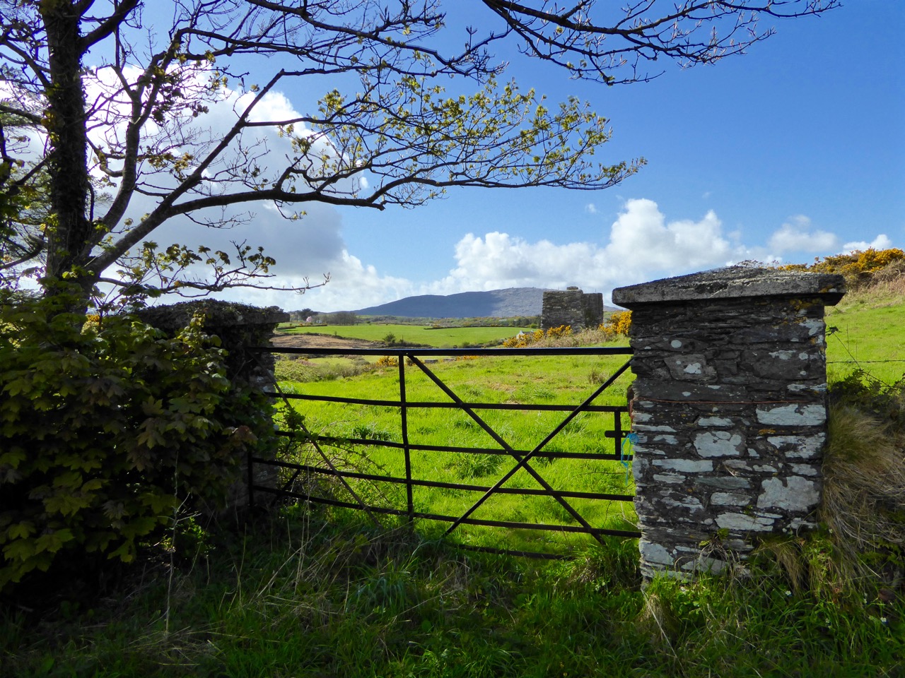
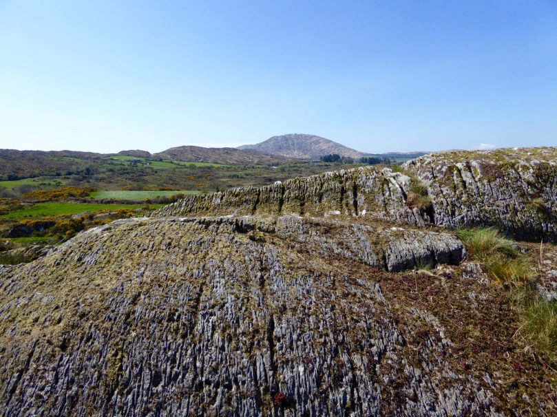
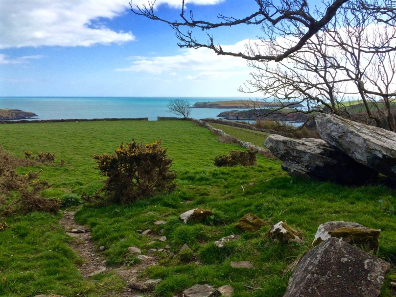
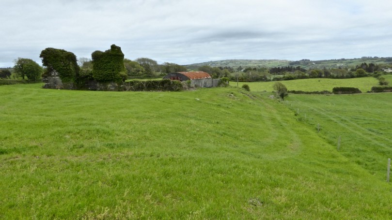
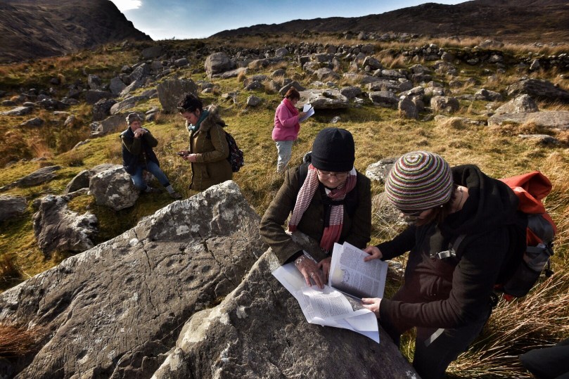
Rathruane More: the view from the rock art site includes a knoll with a row of cupmarks on its upper surface, and Mount Gabriel on the horizon

Rathruane More: the view from the rock art site includes a knoll with a row of cupmarks on its upper surface, and Mount Gabriel on the horizon

QUESTION: Is there a real difference between rock art and cupmarked stones?

A joint post by Finola and Robert
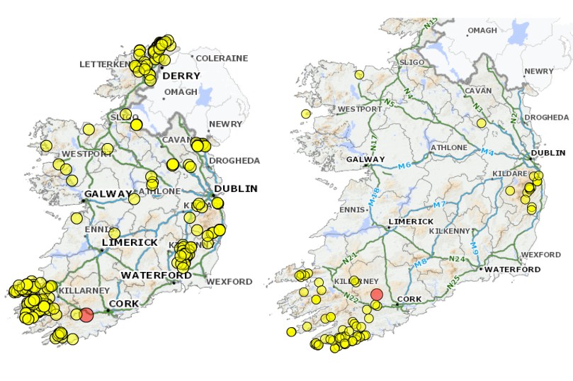
Distribution of 'rock art' (left) and 'cupmarked stones' (right) in Ireland

Distribution of ‘rock art’ (left) and ‘cupmarked stones’ (right) in Ireland, according to the National Monuments classification scheme

In recording the rock art of County Cork so far we have concentrated mainly on those examples described in the National Monuments Records as rock art. In the course of planning the Cork survey, years ago, a decision was made to distinguish between rock art and cupmarked stones and so they are listed separately. However, other counties appear to lump them together, or use the generic term rock art to include stones bearing only cupmarks. In addition, some monuments are classified using their most distinctive feature: a wedge tomb or a standing stone, for example, may well bear cupmarks on a surface, but do not therefore show up as examples of either rock art or cupmarked stones on the records.  

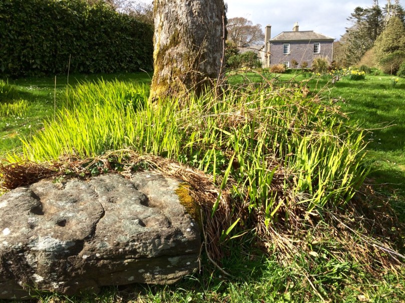
Drishane Cupmarked Stone. In other counties, this would be recorded as Rock art

Drishane Cupmarked Stone. In other counties, this would be recorded as Rock art

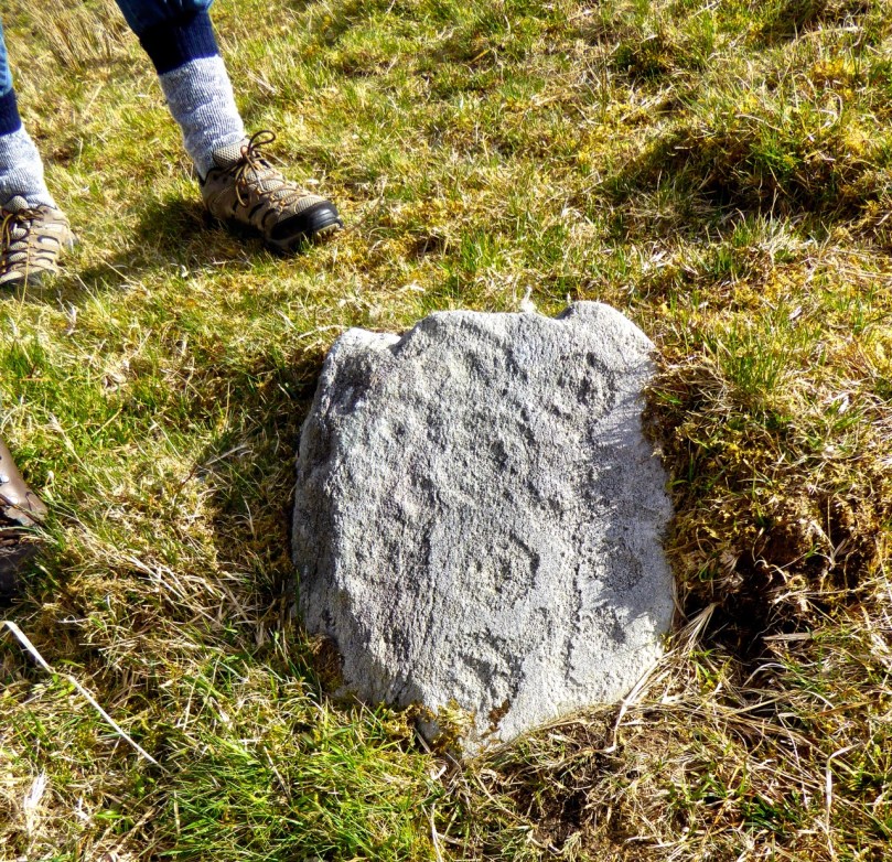
This is how the National Monuments Website describes cupmarked stones: A stone or rock outcrop, found in isolation, bearing one or more small, roughly hemispherical depressions, generally created by chipping or pecking. There are a total of 99 examples listed in Ireland, of which 64 are in Cork. However, as we have seen above, this is an arbitrary and misleading classification and varies from county to county. The number of cupmarked stones that fit the NM description is likely to be much larger. The question is – should we preserve this distinction between stones labelled rock art and those labelled cupmarked stones? Is it useful or merely confusing?

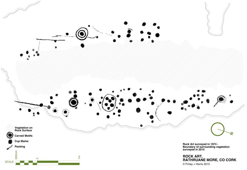
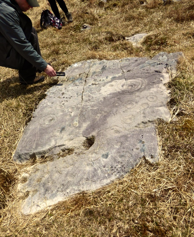
Rathruane - included in the list of rock art because, besdies cupmarks, it also has cup-and-ring marks, a rosette, and curved lines.

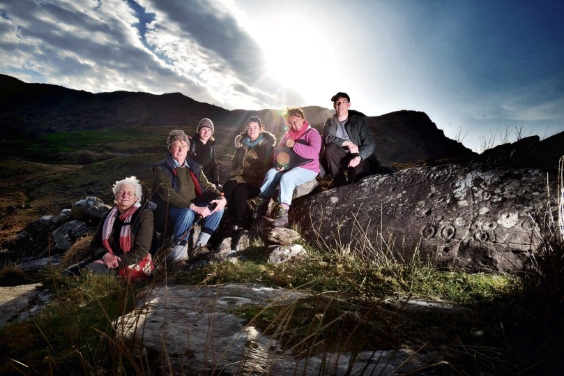
Rathruane – included in the list of rock art because, besides numerous cupmarks, it also has cup-and-ring marks, a rosette, and lines. The first photograph in this post was taken from this surface

The cupmark is the most basic and numerous element or motif of rock art in Ireland and elsewhere. In the examples labelled rock art in County Cork, they occur with other motifs, principally concentric rings, sometimes with radial grooves, and a variety of curved or straight lines. They can be incorporated within a motif (as in cup-and-ring marks, rosettes, or where enclosed by lines) or they may be scattered, seemingly randomly, over the surface of the rock, between and among the other motifs.

The two images above are from the shores of Lough Hyne. Two cupmarked stones lie on the beach, having probably fallen from the stone wall above. The right hand image is Robert’s drawing of the stone with 12 cupmarks

Since we have almost finished our recording of the rock art examples, we have moved on to focusing on those labelled cupmarked stones. As we spend time in the field recently with this class of monument we have begun to appreciate their differences from and similarities with rock art.

This simple cupmarked stone was placed many years ago within Knockdrum Fort, near Castletownshend, in the townland of Farrandau. It was brought to Vice-Admiral Boyle Sommerville by a local farmer

Let’s start with what differentiates them from rock art, apart from the obvious fact that the cupmark is the single motif employed in the carving.

  • Where a stone is smaller and moveable, it is more likely to bear only cupmarks. This also makes them more vulnerable to loss and to incorporation into field walls and other structures. While there are examples elsewhere, here in Cork we have found no examples of cup-and-ring carvings on small, easily moveable, stones.
  • We have found cupmarks on boulder burials here – Bohonagh is a good example, and Derreennatra (currently hidden under a mound of compost) may be another.
  • In general standing stones, where they have carvings, are more likely to have only cupmarks (we have three exceptions to this in West Cork).
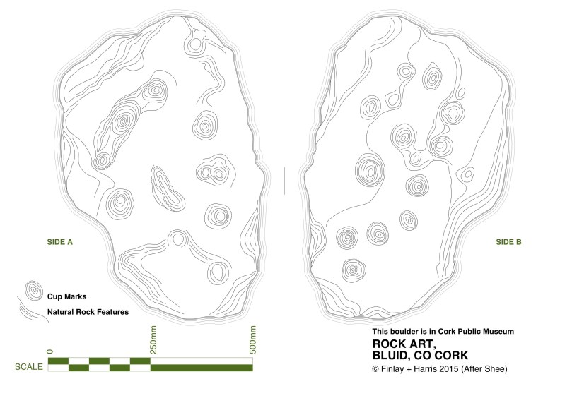
  • The Bluid stone has cupmarks on both sides – there are no Cork examples with rock art on both sides.
The Bluid Stone is in Cork Public Museum but comes from near Castletownshend. It is a rare example of a stone with cupmarks on both sides, quite portable. Note the semi-circular patterns of the cupmarks

The Bluid Stone is in Cork Public Museum but comes from near Castletownshend. It is a rare example of a stone with cupmarks on both sides, quite portable. Note the semi-circular patterns of the cupmarks

Now – what’s the same?

  • Location: Most cupmark-only carvings are found in the open countryside, on large earthfast boulders or rock outcrops.
  • Clusters: as with rock art, cupmarked stones are often found within a kilometre or two of other examples or are within sight of each other or within site of rock art (intervisibility).
  • Carving technique: where it can be discerned, it appears to be the same as for rock art – pecking with a harder stone. In the case of some of the shaley sandstone that laminates easily, it is impossible to tell how the cupmarked was formed – it may have been simply bashed out.
  • Siting: where the cupmarks are found in situ, their siting is equally spectacular to rock art. In particular, many of them are found on rising ground with strongly marked horizons that include views, even quite distant views, of Mount Gabriel, Mount Kidd, or other prominent horizon features. The sea, or water in the form of a lake, stream or river, is often a feature of the vista from the rock. We have not worked with enough of them yet to form any opinion on whether they are sited at what may have been routes through a landscape or territorial boundaries.       
  • Patterns: as with more complex rock art, often the cupmarks appear to be scattered randomly over the surface of the rock. However, patterns of straight lines, or of rough circles or semi-circles, can be made out in several of the stones we have recorded to date.
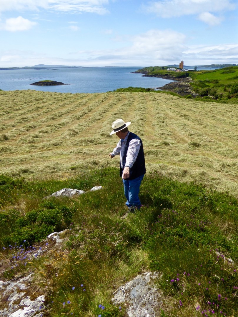
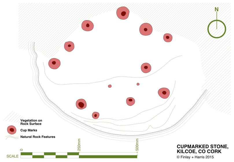
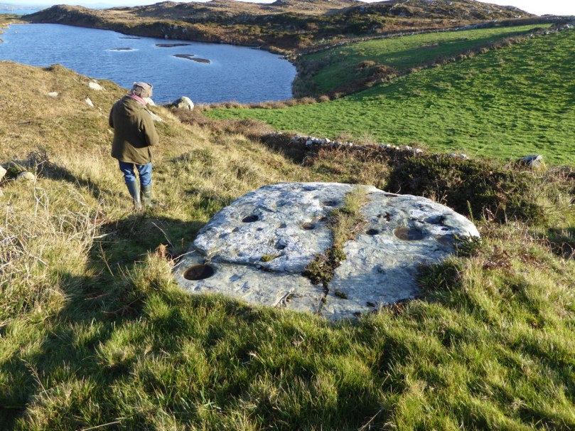
Robert points to two outcrops in Kilcoe. The lower one has one cupmark, the upper one has 13 cupmarks arranged in a rough circular patter. The sea and Mount Gabriel are visible from this location, as well as some rock art

Robert points to two outcrops in Kilcoe. The lower one has one cupmark, the upper one has 13 cupmarks arranged in a rough circular patter. The sea and Mount Gabriel are visible from this location, as well as some rock art

In researching this piece we have been influenced by Christiaan Corlett’s book Inscribed Landscape: The Rock Art of South Leinster. Christiaan is an archaeologist with the Dept of Arts, Heritage and the Gaeltacht and specialises in the archaeology of Leinster, and especially Wicklow. His book has been the first to catalogue the extensive body of rock art in the South Leinster area (indeed the first published work on rock art in Ireland) and in his corpus he includes both cup-and-ring art and cupmark-only stones without undue distinction. He notes many of the same things about rock art that we have observed. For example, he was struck, as we were, by the dominance of high mountains (in his case, Mount Leinster, the Blackstairs, or Brandon Hill) in the horizon views from the rocks he studied, and by the intervisibility of stones from each other.

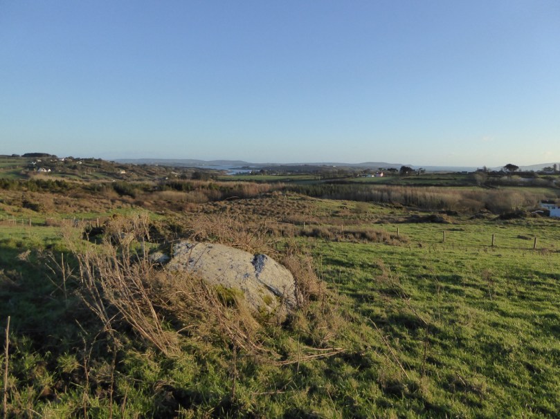
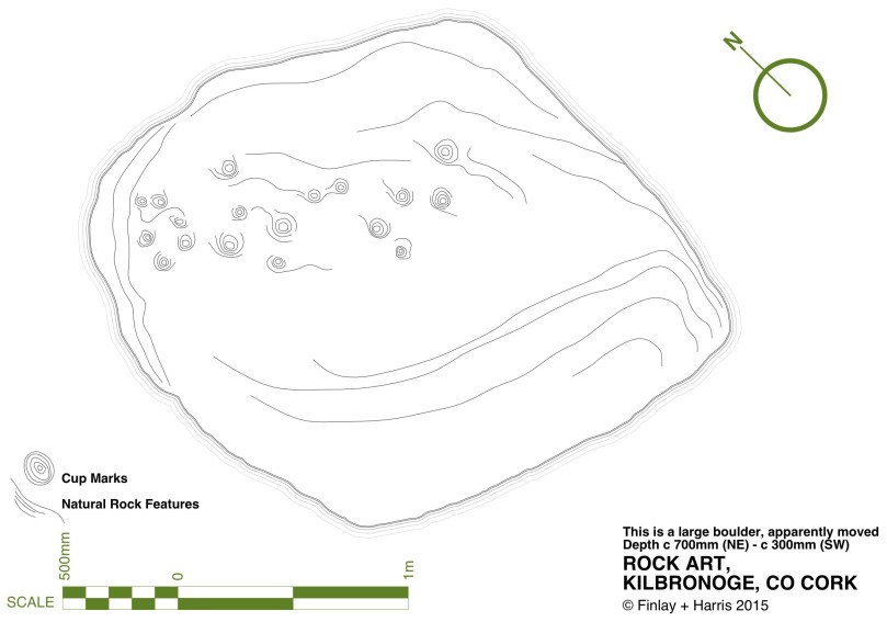
The newly-discovered Kilbronoge cupmarked stone. From it you can see Roaringwater Bay and a wedge tomb to the SE, and Mount Gabriel diametrically opposite in the NW

The newly-discovered Kilbronoge cupmarked stone. From it you can see Roaringwater Bay and a wedge tomb to the SE, and Mount Gabriel diametrically opposite in the NW

Robert's drawing of the Kilbronoge Cupmarked Stone, done on CAD using architectural drawing tehniques

Robert’s drawing of the Kilbronoge Cupmarked Stone, made using architectural survey and CAD techniques

His work is a strong argument for the inclusion of all cupmarked-based prehistoric carving under one rubric – rock art. First of all, he argues that it is all likely to be of a similar early origin. Recent thinking is that rock art may predate megalithic art and belong to the Early Neolithic (at least 5,000 years old). In fact, the cup-and-ring art may already have been dying out during the great flowering of megalithic art that we see at Newgrange, Knowth and Loughcrew. Cupmarks on their own may have persisted longer, as they are found in association with Bronze Age monuments such as wedge tombs and boulder burials. Here’s what he has to say about our search for meaning, vis-a-vis the humble cupmarked stone (p.78):

Arguably, it is only within the context of the overall composition that we may come close to some comprehension of the motifs found in rock art. Even the meaning of a completed composition, however, may only have been understood by the person(s) responsible for it. Perhaps the symbols represent a complex message of family history or a personal spiritual journey associated with an initiation ceremony or rite of passage, or perhaps they simply served to delineate family, tribal or sacred boundaries… [There is] a natural temptation to focus on the more elaborate designs and compositions found in rock art, as if they are more important because they are more accomplished. Yet the frequency of compositions consisting solely of plain and unelaborated cup-marks should not devalue their significance. Clearly their commonness would strongly suggest that these examples were just as important as, or maybe even more important than, the most elaborate examples of rock art found in the region. Given the intrinsic simplicity of a composition consisting entirely of cup-marks, however, it is arguably impossible to decipher or decode the specific meaning of the symbols themselves. That is not to say, of course, that we cannot attempt to understand the broader message of rock art, particularly where a complex of sites can be analysed. In such cases it may be the context of these sites that will provide the key to unlocking the meaning of rock art, in terms of the position and relationships within a given landscape, and the relationship with other examples of rock art on the vicinity.

The Kilcoe Cupmarked stone. The original record described three cupmarks - in fact there are 13, arranged in a rough circle.

The Kilcoe Cupmarked stone. The original record described three cupmarks – in fact there are 13, arranged in a rough circle

Christiaan deals with the similarity of cupmarks to the bowl-shaped depressions known as bullauns, assumed to be Early Medieval. But that’s a topic for another day. Suffice it to say here that one of our favourite stones, Castlemehigan, may have both cupmarks and bullauns on its surface, as well as a cross indicating its later use as a mass rock. In its extraordinary mix of seemingly-randomly-scattered but also possibly-linear-arrangement of cupmarks; large bowl and basin-shaped elements; a spectacular siting that includes views to a distant Mount Gabriel and a closer view of the sea; a nearby cluster of other cupmarked stones; and the folklore that surrounds it – this very special cupmarked stone embodies all that is wonderful about this class of ancient monument.

Castlemehigan cupmarked stone

Castlemehigan cupmarked stone

To come back to the question we posed at the beginning – should we preserve or abandon the notion that we are dealing with two classes of monument – rock art versus cupmarked stones? Our answer is that we’re not sure.  What do YOU think?

The Giant's Grave, Drishane. It bears numerous cupmarks on the upper surface of the 'capstone'

The Giant’s Grave, Drishane. It bears numerous cupmarks on the upper surface of the ‘capstone’

For those interested in more of our posts on rock art, go to Derrynablaha Expedition and scroll to the end for a list.

Irish Farming – 6,000 Years Ago

The Céide Fields Visitor Centre

The Céide Fields Visitor Centre


How did we farm in Ireland in Neolithic times? Turns out, much as we do now!

We’re just back from an inspiring trip to Mayo, the highlight of which was a visit to the largest Neolithic site in the world – the Céide Fields (pronounced Kay-jeh, for our non-Irish readers).

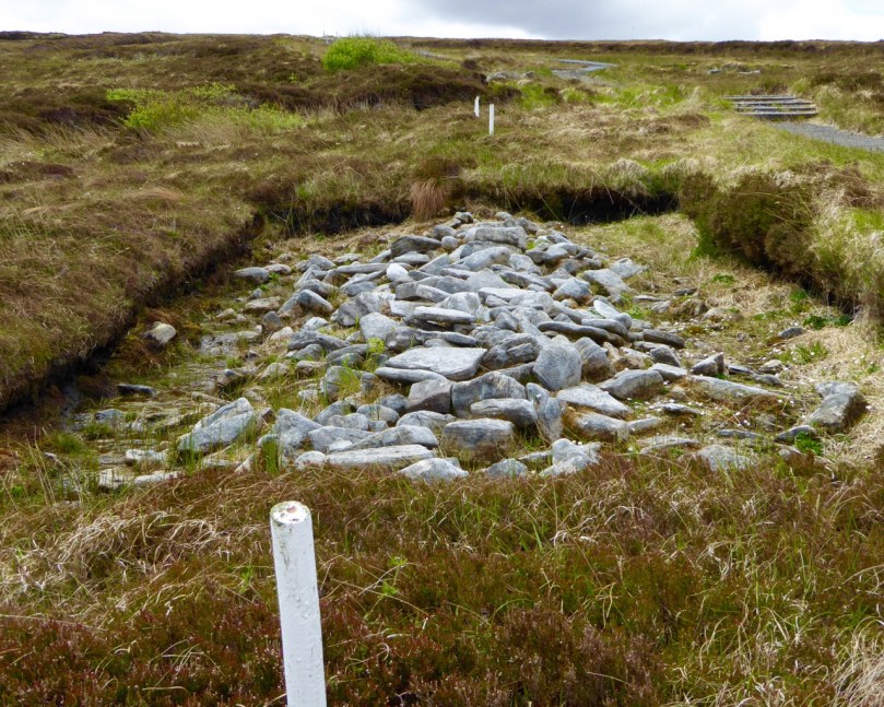
Collapsed field walls under the bog. The white stakes mark the line of the uncovered wall

Collapsed field walls under the bog. The white stakes mark the line of the uncovered wall

When we think of the Neolithic (or New Stone Age, or Early Farming) period in Ireland, we automatically think of the megalithic tombs – spectacular sites like Newgrange and Loughcrew, or the smaller portal tombs, like Poulnabrone or Arderrawinny. But how did these people make their living? What were their daily lives like? We found the answers, going back almost 6,000 years, at the Céide Fields.

The extent of the fields around the Visitor Centre

The extent of the fields around the Visitor Centre

The Céide Fields is an extensive system of enclosures, stretching for kilometres from the sea over the hills, used for livestock farming. Occasionally, besides grazing fields, there is evidence for corrals, grain-growing, and farmhouses. In fact, much like we see around us in West Cork nowadays, people lived in their own farmhouses, surrounded by their fields, within sight of their neighbours.

This enclosure surrounded a farmhouse

This enclosure surrounded a farmhouse

Society was cooperative – it had to be, in order for such an enormous network of fields to be constructed. And life was peaceful: there is no evidence of defensive structures. The weather was warmer than now – warm enough so cattle could graze outside all winter – and there was enough land and food for everyone.

They quarried rocks for fences and for structure like court tombs

They quarried rocks for fences and for structure like court tombs

They had a spiritual life, building their own version of megaliths – the Court Tombs. We were fortunate to meet the manager of the Céide Fields site, Gretta Byrne, who gave us directions to Rathlackan Court Tomb – a site she had excavated. Court tombs are a type of chambered tomb, generally oriented towards the east and featuring a forecourt at the front of a long mound that covered the chambers. Rathlackan is a fine example, with three chambers and a nicely preserved forecourt. It took a highly organised society to build a complex structure such as this.

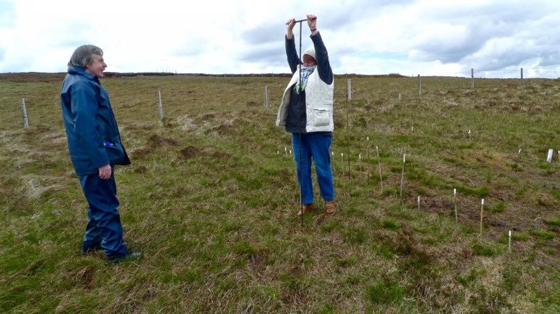
In the 1930s a local schoolteacher, Patrick Caulfield, first discovered what were clearly pre-bog collapsed walls when cutting peat in the deep blanket bog that covers this part of Mayo. Decades later his son, Seamus, now an archaeologist, headed the investigations that led to the realisation of how extensive the field system was. Mostly this was done by probing – sending a thin metal bar down through the soft peat until it hit a rock. This technique was so successful that miles of walls could be charted without the need to excavate. Excavation focussed on uncovering small sections of wall and features like enclosures and house-sites.

I take a hand at probing

I take a hand at probing

About 5,200 years ago, a combination of climate change and forest clearance led to the development of the blanket bog that covers the land today and ultimately forced these Neolithic people, after 500 years of successful farming, to abandon their fields. The ecology of bogland and the conditions that create it are the subject of some of the museum exhibits and also of the excellent guided tour that covered two hectares behind the Visitor Centre.

A section of wall disappears under the bog

A section of wall disappears under the bog

If you find yourself in this part of Ireland, do plan a visit to the Céide Fields. Take some bug spray – although they weren’t in evidence when we were there, the Céide midges have a reputation for ferocity. Enjoy the display in the award-winning Visitor Centre first and fortify yourself with a coffee and cake.

This pine came from the bog

This pine came from the bog

Once outside, as you walk along beside the ancient stone walls, look across the valley towards Downpatrick, and marvel at the continuity of a way of life – small cattle farms among stone-walled fields – that began almost 6,000 years ago.

This scene, in Galway, could have happened 6,000 years ago in North Mayo

This scene, in Galway, could have happened 6,000 years ago in North Mayo

We’ll let Seamus Heaney have the last word. His poem, Belderg, was inspired by the Céide Fields:

When he stripped off blanket bog

The soft-piled centuries

Fell open like a glib;

There were the first plough-marks,

The stone-age fields, the tomb

Corbelled, turfed and chambered,

Floored with dry turf-coomb.

A landscape fossilized,

Its stone wall patternings

Repeated before our eyes

In the stone walls of Mayo.

Looking towards Downpatrick Head from the Visitor Centre

Looking towards Downpatrick Head from the Visitor Centre

High Drama!

tower in context

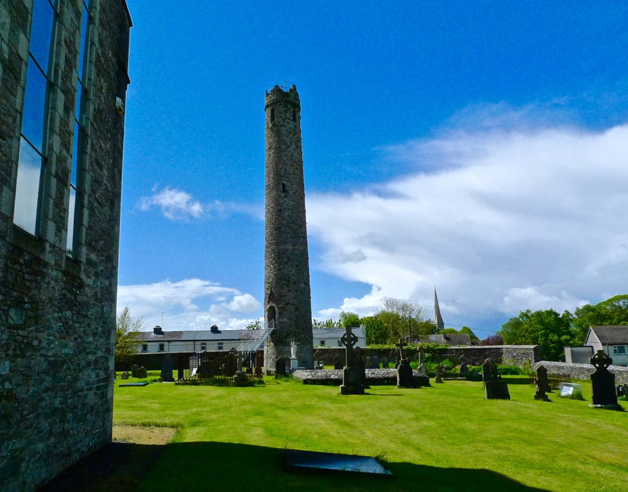
If you suffer from vertigo or claustrophobia – or both – then you won’t want to follow us in the adventure we had this week while returning from a visit to Dublin: climbing to the top of an Irish Round Tower! Overcoming any tendencies we might have had towards these phobias, we arrived at the roof of the 32.6 metre high Kildare tower and marvelled at being able to stand on the summit of a piece of architecture over a thousand years old. Kildare has the second highest Round Tower still extant in Ireland: the highest is at Kilmacduagh, Co Galway, at 34.9 metres; however, Kildare now lacks a conical cap, which it might once have had. If so, it would just tip in as the highest of all the towers.

Kildare Round Tower: note the battlemented top - probably added in an 18th century restoration, the romanesque doorway and the granite base. The upper stonework is limestone and sandstone

Kildare Round Tower: note the battlemented top – probably added in an 18th century restoration, the romanesque doorway and the granite base. The upper stonework is limestone and sandstone

The print above – dating from 1788 – shows the ruins of St Brigid’s Church, which was fully restored as a Church of Ireland Cathedral a hundred years later. We looked down on this from our vantage point atop the Tower – and had a good view of the (also restored) Fire Temple where a perpetual flame, lit by the Saint, was kept burning for hundreds of years, finally being extinguished by the shenanigans of Henry VIII.

Looking down on Kildare Cathedral, with St Brigid's 'Fire Temple' in the grounds

Looking down on Kildare Cathedral, with St Brigid’s ‘Fire Temple’ in the grounds

You’ll have heard me talk about St Brigid many times: she’s second only to St Patrick in the Irish Martyrology. In fact, as probably the most influential woman in Irish history, I’m going to declare her as quite the equal of St Patrick: she’s often enough described as one of the Patron Saints of Ireland. You will also know that she is surrounded by folklore and traditional customs, such as the making of her Cross on her day, the First of February.

St Brigid’s Cross – left, at her Holy Well and right, a textile in the Solas Bhride Centre, Kildare

Back to the adventure (although the whole day was adventurous!) – climbing the tower was hard going. There were a series of near-vertical ladders to be negotiated: each one took us to a higher timber platform, six floors in all. At the top of each ladder we had to squeeze ourselves through a narrow opening; this, and the confines of the tower interior – only two metres or so across – certainly challenged the claustrophobiac in me.

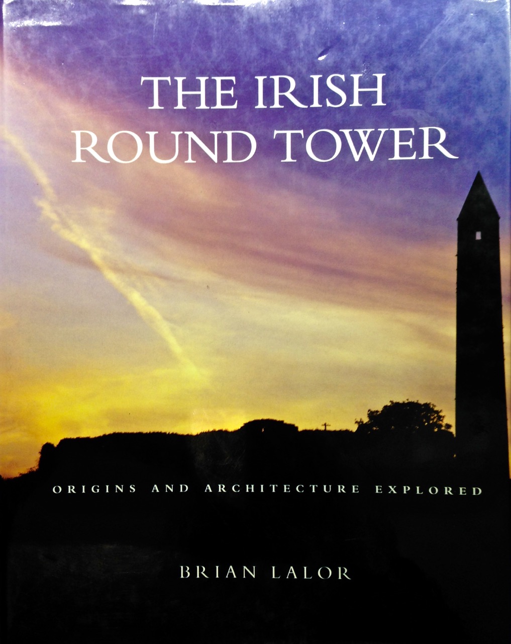
The restricted space also made us question some of the theories about the uses of these towers, which are always located at ecclesiastical sites. The definitive work on them is, as it happens, written by someone who also lives in West Cork – just a little distance from Nead an Iolair: Brian Lalor. Brian has led a very full life, involving architecture, archaeology, sketching and printing (his etchings are exquisite). He is also the author of a number of books, many of which are on our own shelves, including The Irish Round Tower, published by The Collins Press, 1999 and 2005.

lalor

Brian is unequivocal in his assertion that the primary purpose for round towers was to house the monastery bell. He also suggests that a secondary function would be as a safe storage place for the monastic treasures: the entrance door was always raised at a considerable height above the surrounding ground level, requiring steps or a ladder to gain access. In the times when they were constructed they would have been visually impressive – and could be seen from a great distance. They would have acted as signposts for travellers who might have been searching for the hospitality which monastic communities always offered. Brian discounts some of the more bizarre theories for the towers – for example, that they might have been places of safe refuge for the monks if under threat of attack by Vikings – or that they are simply phallic symbols! Lastly, Brian considers – and gives some credence to – the idea that the towers were monumental buildings of prestige and local aristocratic patronage: certainly, they required considerable expense and effort to construct.

centre entrance

As is often the case with our days out, one adventure led on to another. When we came down from the tower we found that St Brigid’s Cathedral had closed for lunch. But we knew that the Saint’s trail also involved a Holy Well and we had heard that there was a new building devoted to the work of Brigid just outside Kildare.

Solas Brhíde Centre

Solas Brhíde Centre

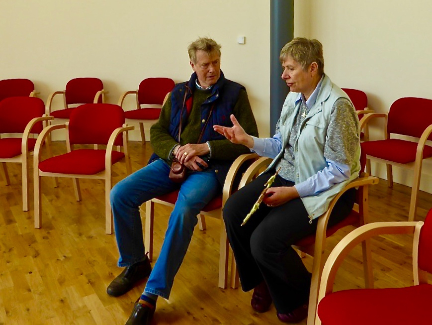
Robert with Phil, one of the Sisters who conceived the project

Robert with Phil, one of the Sisters who conceived the project

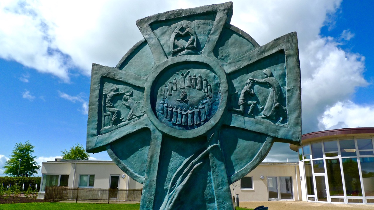
We were very impressed with the Solas Bhríde Centre: a small group of Brigidine Sisters has put together the project to build a Christian Spirituality Centre which unfolds the legacy of St Brigid and shows that it is still relevant in the present day. We were shown around the Centre by one of these Sisters, Phil, who pointed out that Brigid was attuned to the natural world and would have appreciated that the new building (designed by Solearth Ecological Architecture) is conceived on ecologically sound terms using sustainable materials and techniques which care for the wellbeing of the Earth. The plan of the building is appropriately inspired by the shape of a St Brigid’s Cross.

Architect's drawing of the newly completed building

Architect’s drawing of the newly completed building

The next stop on our itinerary was the nearby Holy Well – a popular place of pilgrimage and veneration on St Brigid’s Day:

Finally, we arrived back at the Cathedral. I’m always a little disappointed by restorations – particularly those which were carried out in Victorian times; nevertheless there are some impressive features. The possibly twelfth century font is one of them (below left), and another has to be the hidden Sheelagh-na-gig under the lip of Bishop Wellesley’s tomb (below right). I reached under to feel this little carving, and was then told by the Cathedral’s guardian that anyone who touches the effigy is ensured everlasting fertility!

The excellent Heritage Centre opposite the Cathedral entrance is informative about the town’s history and the important connections with this special Saint. There is much more to be discovered – and written – in respect of St Brigid, and other places in Ireland which are connected with her still to be visited. Do go to Kildare and, at the very least, suspend your phobias sufficiently to allow you to climb the ancient Round Tower. But make sure you go between May and September – and not during the lunch hour…

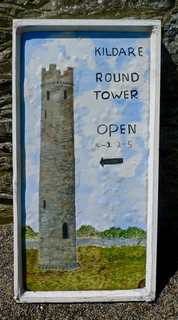
tower poster

Trading Up in Tudor Times: Fortified Houses in West Cork

Coppinger's Court, Ballyvireeen, near Rosscarbery

Coppinger’s Court, Ballyvireeen, near Rosscarbery

Fortified houses are a distinctly Irish phenomenon. The Tudor period in Britain ushered in a great era of house building with many distinctive features. But England was a peaceful place – the owners of these great houses did not expect to be attacked. Tudor Ireland was a very different environment: life was still dangerous and conflict between the native Irish and the planter class, or between Irish clans, was common.

Machicolations at Coppinger's Court

Machicolations at Coppinger’s Court

Up to the end of the 16th century the castle/tower house was the residence of choice of the powerful – a tall stone keep mainly focussed on defensive features and horribly uncomfortable to live in. (See When is a Castle..? for a complete run-down on tower houses.) These new houses emphasised the horizontal rather than the vertical, and were built with comfort in mind. However, they incorporated some of the defensive features of the tower houses – they were “fashionable but defendable.”

Mullioned windows

Mullioned windows

In Ireland they represented “a public display of power and wealth…[and] a long-term investment in their owner’s regional future and were monuments to an aspiration for an English and Continental house style suited to local Irish conditions. On a basic level  the construction of a fortified house represented the owners desire to modernise and Anglicize.” These quotes and much of the information that follows is taken from The Fortified Houses of County Cork: Origin, Fabric, Form, Function and Social Use of Space, by Joe Nunan, who has generously made it and related material available on his website.

Gun loop at ground floor level, Coppinger's Court

Gun loop at ground floor level, Coppinger’s Court

Fortified houses were built of stone but all internal floors, stairs and partitions were of wood. Defensive features included machicolations, bartizans, wall walks, gun loops, corner towers or wings to provide for flanking fire. They were built starting about 1580 up to about 1650.

Tower and Bartizan, Reeandisert

Tower and Bartizan, Reenadisert

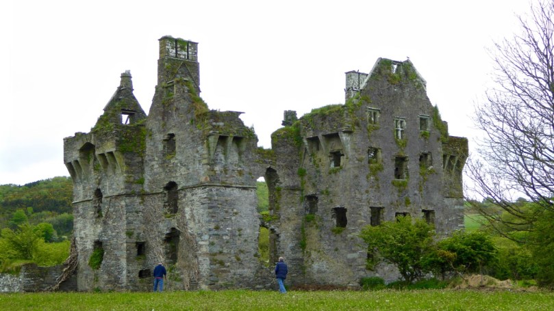
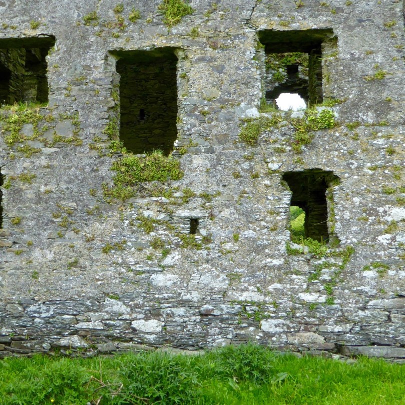
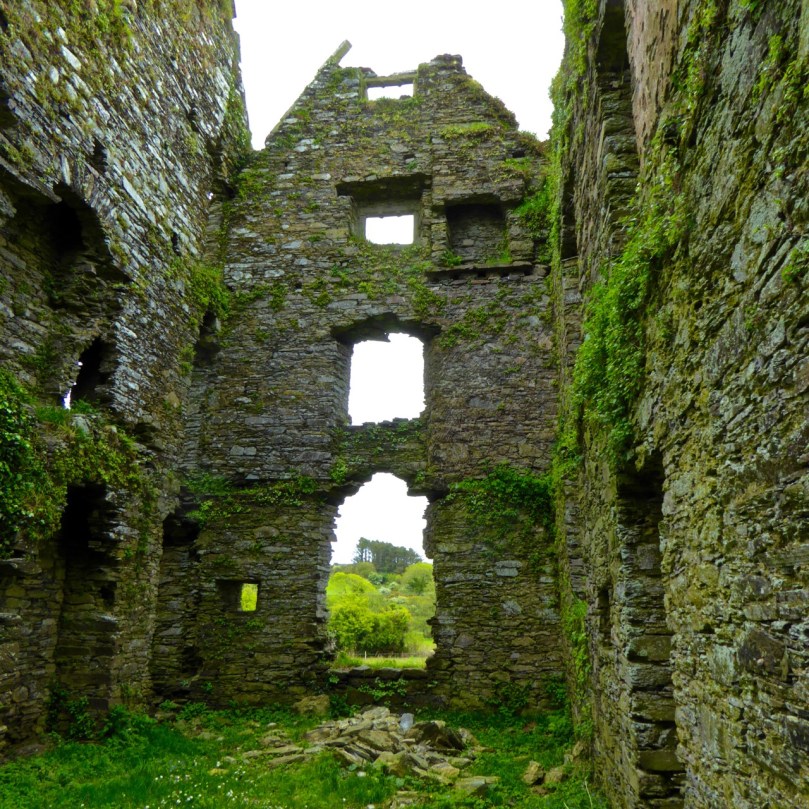
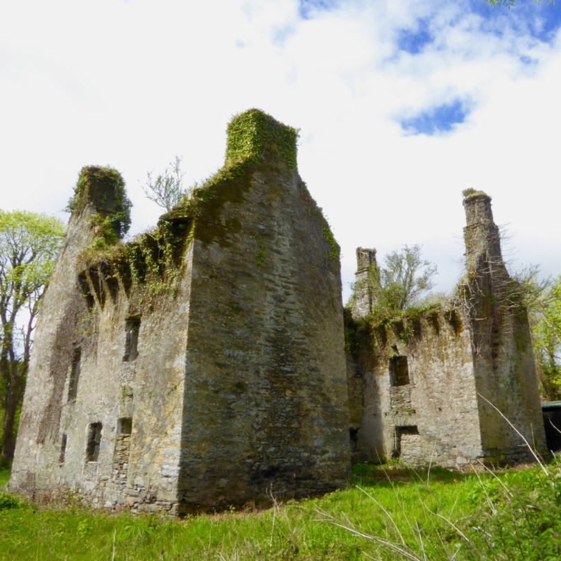
There are four (or five, if you include Baltimore Castle) surviving fortified houses in West Cork. The one that is most accessible (should you wish to visit) is Coppinger’s Court, in Ballyvireen townland near Roscarbery. It is also one of the most magnificent examples of this type of dwelling in Ireland. Some of the mullions remain in upper windows, and a sharp eye will spot gun loops in the outer walls. The machicolations are particularly fine, with impressive cut stone supports. This was the home of the infamous Sir Walter Coppinger, whose plan was to build a complete settlement around him in this lovely spot on the banks of the Roury River. He was a despot who got rich through clever manipulations of mortgage documents and he was said to hang his enemies from a gibbet from one of his windows.

The chimney on top of this wall has fallen - note the pile of stones on the ground.

The chimney on top of this wall has fallen – note the pile of stones on the ground

The house was so awe-inspiring in its time that the legend developed that it had a window for every day of the year, a chimney for every week and a door for every month. The house was eventually attacked and ransacked in 1641 and has sat in ruins ever since. Sadly, one of the magnificent chimneys fell down in the storms of early 2014. Evidence of a bawn wall remains, with possible outdoor cooking areas.

Gearhameen - a U shaped plan

Gearhameen – a U shaped plan

The fortified house at Gearhameen near Durrus, built by the MacCarthy Muclaghs, provides evidence of the comfort that these new ‘castles’ provided. The household work was done on the ground floor – large kitchens contained huge fireplaces, and in this house we can see the main kitchen fireplace had a bread oven to one side and a slop hole for sweeping out leftovers to the pigs, who must have been in an attached pen (the smell!).

Large ground floor fireplace with bread oven

Large ground floor fireplace with bread oven

The first and second floors have large fireplaces, with magnificent herringbone chimneys still intact (and hosting nesting choughs).

Rather than the machicolations we see at Coppinger’s Court, corbels on the outside walls probably supported wooden or stone platforms.

Corbels supported a platform for defenders

Corbels supported a platform for defenders

Like Coppinger’s Court, the outer walls still stand to their full height, but the loss of a keystone above one arch, and the consequent development of a large crack above it, bodes ill for that section of the wall.

Missing keystone

Missing keystone

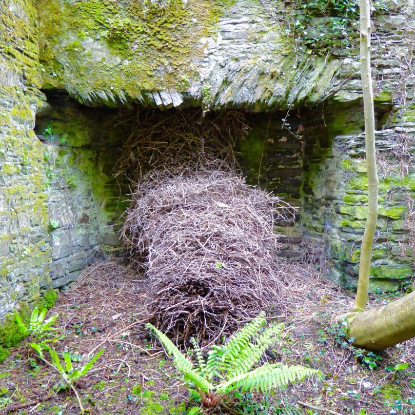
The house at Reenadisert, near Ballylickey, has been built onto and within over the centuries, serving as a modified dwelling place and as farm buildings. It was the stronghold of an O’Sullivan and has an impressive bartizan on one of the external towers. It is in a very ruinous state inside – the eeriness is enhanced by an enormous crows’ nest that has fallen from inside one of the chimneys to rest on the ground. There is evidence of a basement but this cannot be accessed.

Fallen nest

Fallen nest

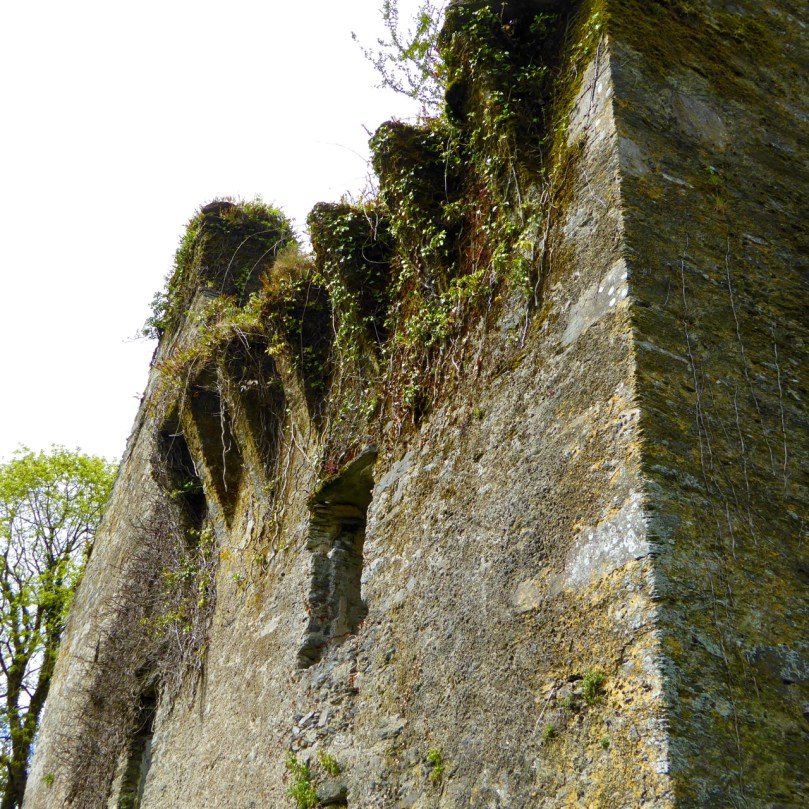
The house at Aghadown, home to the Becher family, consists only of one wall with attached towers. Ivy has threatened to take over most of it – I love Leask’s description of ivy – “destructive green mantle beloved of the sentimentalist.” Through it one can make out traces of the slate that once hung on the wall above the ground floor, the outline of corbels at roof level, and a string course between the ground and first floor.

Aghadown Fortified house occupies high ground with a commanding view

Aghadown Fortified house occupies high ground with a commanding view

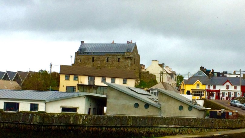
Interestingly, Dún na Séad Castle in Baltimore, home of the O’Driscolls, is described as a fortified house in the National Monuments Inventory. It possesses aspects of both a tower house and a fortified house – in this photograph you can see the corner bartizan, a gun loop, and the long, rather than tall, shape.

Dún na Séad or Baltimore Castle

Dún na Séad or Baltimore Castle

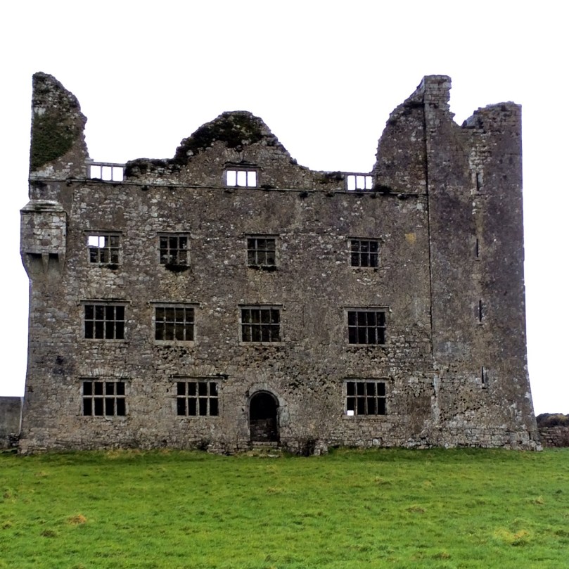
For a comparison of the two types of edifices, take a look at Leamanagh in Clare – here a 17th century fortified house has been literally tacked on to a 15th century tower house.

Leamanagh, in County Clare

Leamanagh, in County Clare

Joe Nunan provides useful summations of Irish fortified houses. Among other points, he says the following:

The fortified houses built in Co. Cork had a unique Irish architectural quality and a distinct southern English look and feel; the result of contacts built up between both regions, politically through plantation-immigration and economically, through trade with the port and fishing towns of Waterford, Cork, Kinsale, Youghal and Baltimore. The social changes that took place in Tudor England were reflected in architectural form by the elites in that society and it was the latter who spearheaded the Munster plantations. They were noblemen who viewed Munster as another region within a larger England and it was through these individuals that the initial architectural influence of the many gabled, oblong country manors with circular, square, rectangular and hexagonal corner-towers was introduced into Co. Cork.

Reenadisert

Reenadisert

We are lucky to have these fine examples of  fortified houses in West Cork still. However, all of them apart from Baltimore Castle are in a perilous state of dereliction.  Gearhameen’s owner has tried to stabilise the building and stave off collapse but all of them may eventually succumb to the natural ravages of time. That’s a sad thought.

Derrynablaha Expedition

Derrynablaha in all its glory

Derrynablaha in all its glory

It’s an almost entirely unknown national treasure – a valley of breathtaking grandeur dotted with the greatest concentration of prehistoric rock art in Ireland.

In Derreeny, Looking down the Kealduff Valley

In Derreeny, Looking down the Kealduff Valley

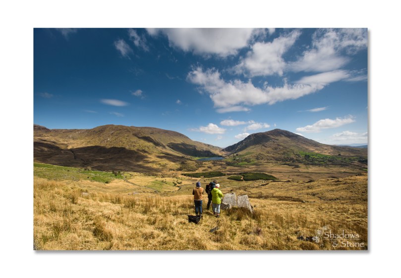
Derrynablaha (Little Oak Wood of the Flowers) is in Kerry, right in the heart of the Iveragh Peninsula (better known as the Ring of Kerry), on one of the few narrow roads that traverse the Peninsula. The rock art has been known for many years – the first paper about it appeared in the early 1960s, curiously, by an Italian rock art expert, Emmanuel Anati. The Cork husband/wife team of Michael and Claire O’Kelly traversed the valley, finding many new pieces and leaving extensive notes. Elizabeth Shee, the leading expert on passage grave art, added to the literature in the early 70s. In 1972 and 73 I (Finola Finlay) recorded and drew all the known examples, using the tracing techniques of the day. Blaze O’Connor and Avril Purcell both wrote about Derrynablaha in the early years of the 21st Century, relating the rock art to the landscape it occupied. Many more pieces came to light in the adjoining townland of Derreeny and were recorded by Ann O’Sullivan and John Sheehan in their Survey of the Iveragh Peninsula. Rose-Mary Cussen examined the art about five years ago, looking for patterns in the enigmatic carvings while other scholars have included Derrynablaha as part of a focus on Irish prehistory.  A few photographers have attempted to capture images of the art, but none more so than Ken Williams, of the outstanding Shadows and Stone website.

Robert, Clare, Finola, Elizabeth and Avril, checking the records and GPS readings. (Photo © Ken Williams)

Robert, Clare, Finola, Elizabeth and Avril, checking the records and GPS readings. (Photo © Ken Williams)

This weekend, several of these rock art enthusiasts and experts came together for a unique expedition to Derynablaha and Derreeny. Elizabeth Shee, myself, Avril Purcell, Rose-Mary Cussen, and Ken Williams took part, accompanied by Robert Harris (see his take on this special place) and Clare O’Sullivan, a UCC undergraduate. Our objective was to visit as many of the panels as possible and to assess what has changed in the landscape in the 65 years since it was first described in academic journals. (See the end of this page for links to other Rock Art topics we have  posted over the last couple of years.)

This one wasn't too hard to find

This one wasn’t too hard to spot

Finding the panels was the first challenge! We had all the information from the National Monuments records, including GPS locations for each rock. However, GPS readings can vary, and many of the ones we were using for Derrynablaha were from the early days of GPS and could be 30m out or even more. Apart from the small fields around the original farmhouse, this is a landscape of bog, gorse and tall grasses, of steep hillsides and tumbling streams, of numberless boulders and outcrops. It was, we think, populated by early herding agriculturalists in the Neolithic and Bronze Age periods. Historically, it supported a sizeable population in pre-Famine times (ruined cottages dot the land) and one sheep farm still operates now. Finding the rock art needle in the landscape haystack took time and patience, sharp eyes, and the good memories of those who had been there more recently than I. Where the GPS recording let us down we turned to the meticulous notes made by Claire O’Kelly: notes that said things like “keep the stream to your right and the large triangular rock in view and the rock is a short way below the wire fence.” These notes turned up trumps more than once.

The rock art is NOT on the large panel, but on the tiny stone by Robert's knee.

The rock art is NOT on the large panel, but on the tiny stone by Robert’s knee

In the end we located all but one panel of the ones we were tracking. The Derreeny rocks were easier to find as the GPS readings were more accurate. It was exhausting and exhilarating work and reminded us yet again how difficult this art can be to find and to see. While some panels were clear and sharp, others were weathered and lichened to the point of invisibility. For some, my drawings were needed to appreciate the full extent of the carvings. (I was feeling pretty pleased with myself about these drawings until we discovered one panel on Day 2 for which my drawing was mirror-imaged in my thesis. Fortunately, the Sullivan and Sheehan Survey had noted and corrected this in their work.)

Day 2 Crew: Ken, Rose-Mary, Finola, and Robert taking the photo.

Day 2 Crew: Ken, Rose-Mary, Finola, and Robert taking the photo

On day 2 the team consisted of Ken, Finola, Robert and Rose-Mary and we spent our time on the most southerly examples in Derrynablaha, especially the large tabular rock and its associated rosette stone. One of the most extensively carved pieces of rock art in Ireland, this iconic piece commands a panoramic view of the whole area, extending to Lough Brin to the east, the Ballaghbeama Gap to the north and to Kealduff River valley to the south. Leaning against it is a stone with a superb example of the rare “rosette” motif.

For really excellent images of this stone, view it on Ken’s Shadows and Stone site.

We also lingered over an unusual panel with multiple lines, cupmarks and rosettes: this one was so faint that Ken resorted to having us provide shade using his jacket and our bodies. The results he got, with his flash technology, revealed astonishing detail totally invisible to the naked eye.

How he got that high tech photo © Ken Williams

How he got that high tech photo  

My drawing, done over 40 years ago.

My drawing, done over 40 years ago

Our second objective was to assess the general ‘health’ of the rock art and its context. Mostly, we were encouraged: very little has changed in this valley over the years. It is remote and the land is marginal, suitable mainly as rough mountain pasture for sheep. The landowner knows about the rock art and is careful not to disturb or damage it.

 lDerrynablahaandscape - changed and unchanged. Note forestry activity.

Derrynablaha landscape – changed and unchanged: note forestry activity

However, two factors threaten the rock art even in this far-flung region. The first is forestry: a sizeable plantation occupies an area east of the road and at the south end of the townland. We didn’t have time to visit this area, but noted in the National Monuments records that two previously identified pieces of rock art are now within the forest boundaries and can no longer be found. The second factor is land-clearing for the purposes of improving the grazing fields. Farmers are encouraged to do this and there are grants available through European funds. We failed to find one piece that was located in such a cleared area, despite extensive searching over two days. Hopefully, this is a function of erroneous GPS readings and the rock still exists – but it is worrying.

Elizabeth, Robert, Avril, Clare, Finola and Ken. Day 1 Team by Derreeny rock art.

Elizabeth, Robert, Avril, Clare, Finola and Ken. Day 1 Team at Derreeny rock art  © Ken Williams

Derrynablaha and Derreeny have always been special places. We can only speculate on the meaning or meanings of the extraordinary numbers of carved rocks in this landscape. Were they familiar, even domestic, expressions of belief or supplication? Did they mark routeways through the mountainous territory or boundaries between clan lands? Were they, or some of them, hidden ritual sites known only to certain members of a priestly class? Did the carvings identify suitable spots for calendrical observations? Did they have altogether different functions that we have yet to comprehend? We may never know the full extent of the meaning of the rock art to those who carved them. Yet – we do know their meaning to us. As the largest body of this category of prehistoric site in Ireland, this collection constitutes a vital link to our most distant past.

Leaving Derrynablaha

Leaving Derrynablaha

Other Rock Art Posts in Roaringwater Journal

Rock Art Ramblings… away from home!

Our Rock Art Exhibition!

Rock Art in Danger

Rock Art

Equinox Adventure

Diving for Petroglyphs

The Stones Speak

Here Comes the Sun

Enigma

Tiny and perfect example of Derrynablaha rock art

Tiny and perfect example of Derrynablaha rock art

Glen of Ghosts

glen

There are some places in this world that touch you deeply in the soul. Derrynablaha has that affect on me. I first went there a few years ago and immediately felt that it was alive with ghosts. I was in search of Rock Art then, and Finola had told me about her experiences in the early 1970s – an intrepid young student on an old Honda 50 loaded down with sheets of cellophane and measuring rods. She had met the O’Sullivans who dwelt in the single farmstead there – they plied her with tea and directed her to the rocks above the house where treasures awaited. When I drove into that valley 40 years later I found only the ruins of the O’Sullivan cottage. It was a poignant moment – the mountains were empty: in some ways it felt like the loneliest place on earth, yet also one of the most beautiful.

The old O'Sullivan farmstead returning to nature

The old O’Sullivan farmstead returning to nature

What kind of a beauty is that? A mixtures of lives vanished and nature healing the wounds. Sheep still grazing on those rock-strewn fields: men from another valley tending them – O’Sullivans also, but – they claim – no relation to the last generation there.

New life among the old stones...

New life among old stones…

Those lives are recently gone but, as I first climbed the precipitous slopes to the west of the old farm, I felt the presence of other ghosts – from a more ancient time. It’s a long haul up to the iconic carved stone which commands the wide view across to Lough Brin but, each time I make that journey, I feel more strongly drawn to the people who made that place their home – or possibly their temple.

View from the 'very special' carved stone

View from the ‘very special’ carved stone

This expedition must have been my fourth visit to the hillside which commands such a magnificent view over the townlands of Derrynablaha and Derreeny and which takes in the lake on the valley floor – seemingly a mere puddle from that elevation yet  in fact covering several hectares. On each visit I find more evidence of prehistoric occupation: on this occasion it appeared to me that the carved stone is sited on the edge of a circular plateau; I could trace old retaining walls below, some circles which could have been hut walls half lost in the undergrowth and – above this site – a wall of boulders which might have dammed the stream which runs down the mountain here, to create a little reservoir. I also saw the vestiges of a wedge tomb – aligned east to west – and the base of a cairn… All this, of course, is my imagination at work, but it’s a place where the imagination can take wing.

sky pan

Panoramas from the plateau - east and west

Panoramas from the plateau – east and west

I have so many questions… Was there once tree growth at this level? Derrynablaha means ‘little oak wood of the flowers’ – I imagine something like the stunted oak forests on Dartmoor, where the ancient trees are gnarled and twisted from the ravages of a harsh climate, but which cling to the rocky terrain. But possibly the plateau was raised above this – a place where visibility over the whole landscape was important and visitors anticipated in advance. In my dreams I see fires burning up there in the night, figures dancing, songs being sung… Are they really Wolves and Deer I see moving around the fires, or are they my own ancestors wearing grotesque masks?

clouds

Dream clouds?

Why shouldn’t I have these thoughts? After all, technology might have changed over 5,000 years – but our minds haven’t. It’s not so hard to try and understand our forebears: I like to think they appreciated the power of the pristine landscapes which they inhabited – just as we are awed by the magnificence of their old haunts as we see them today.

Wedge tomb on the plateau?

Wedge tomb on the plateau?