The Rock of Dunamase and Ireland’s Most Iconic Painting

The ruins on the Rock of Dunamase in County Laois date mainly from the 12th century, very shortly after the Norman Invasion of 1169. That invasion was led by Richard DeClare, Earl of Pembroke, known as Strongbow, and it was at the invitation of Diarmuid MacMurrough, King of Leinster. MacMurrough had been ousted from his kingdom by Tiarnan O’Rourke and his allies, partly because MacMurrough had abducted O’Rourke’s wife Devorgilla (although some accounts say she went willingly). His request for help to King Henry II was welcomed, as the King was hoping to provide distraction to some over-ambitious knights, including deClare.

One of MacMurrough’s incentives to Strongbow was the promise of his daughter, Aoife, in marriage. The marriage took place in Christ Church Cathedral in Waterford in 1170 and following the death of Diarmuid in 1171, Strongbow declared himself King of Leinster.

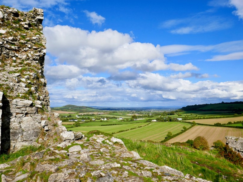
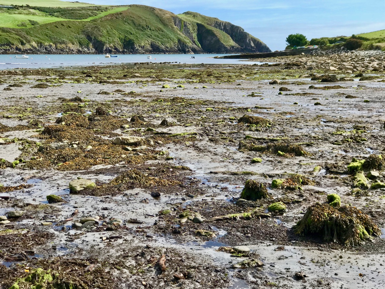
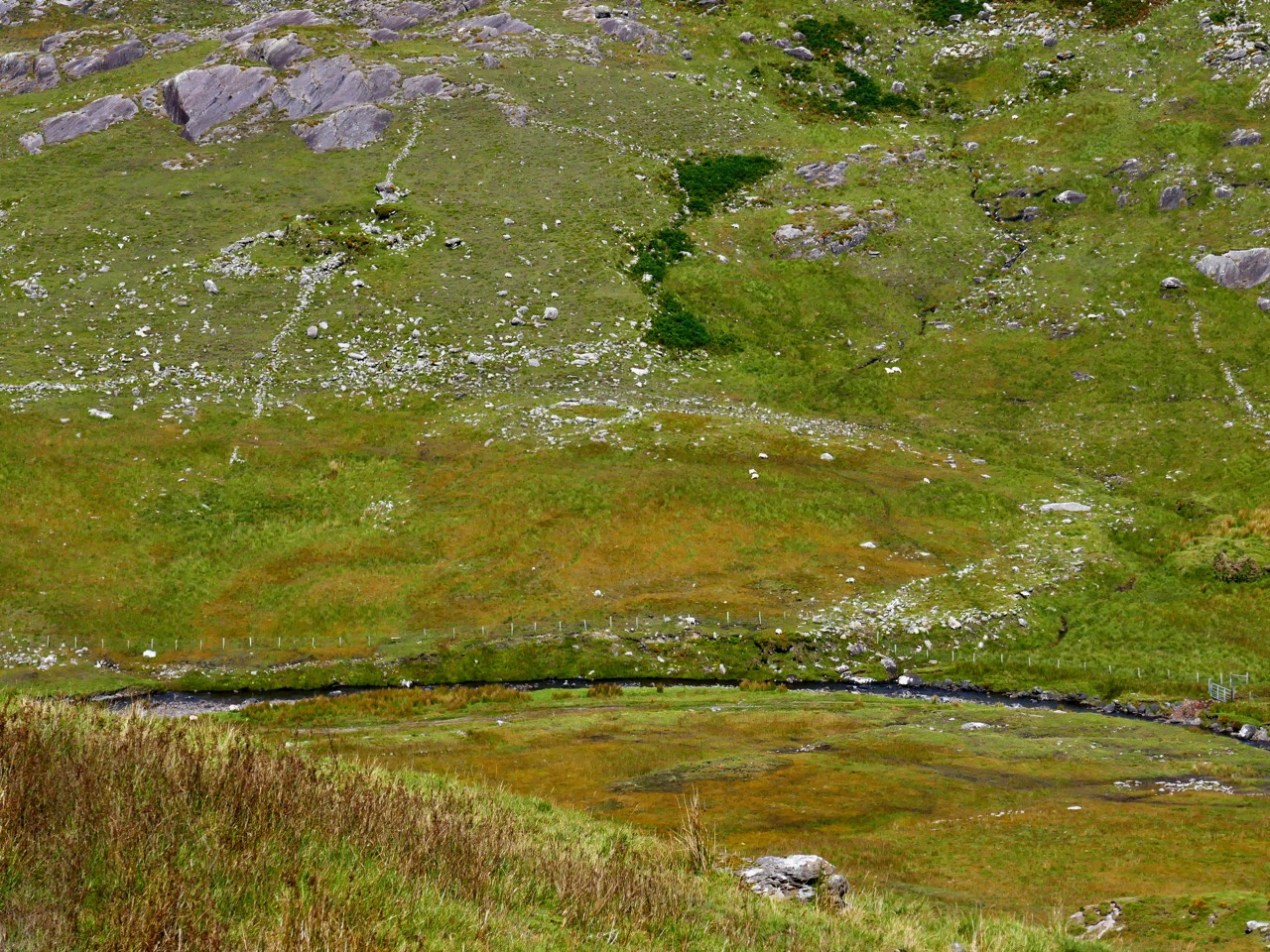
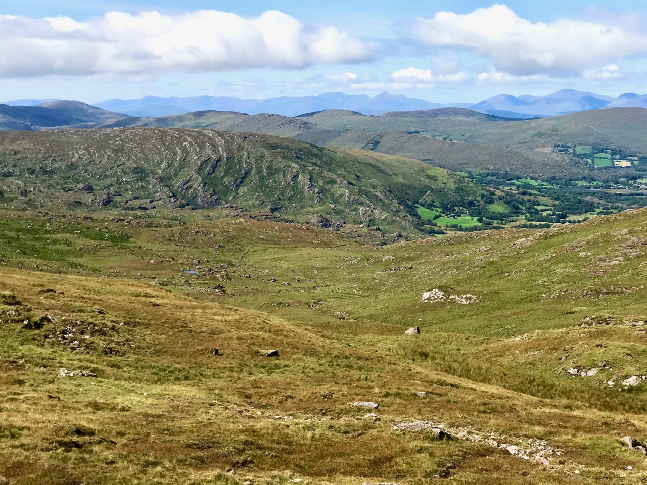
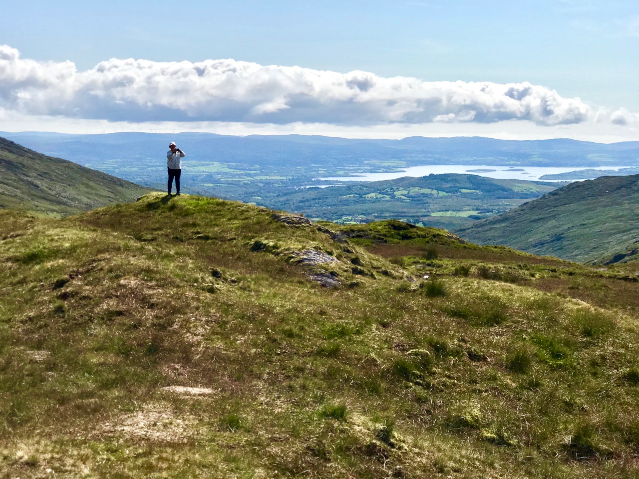
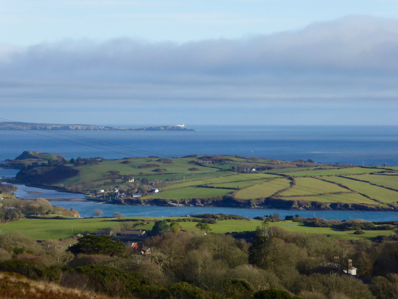
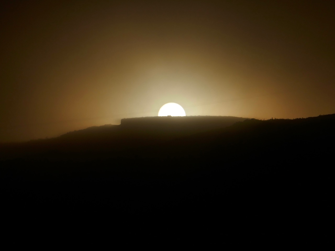
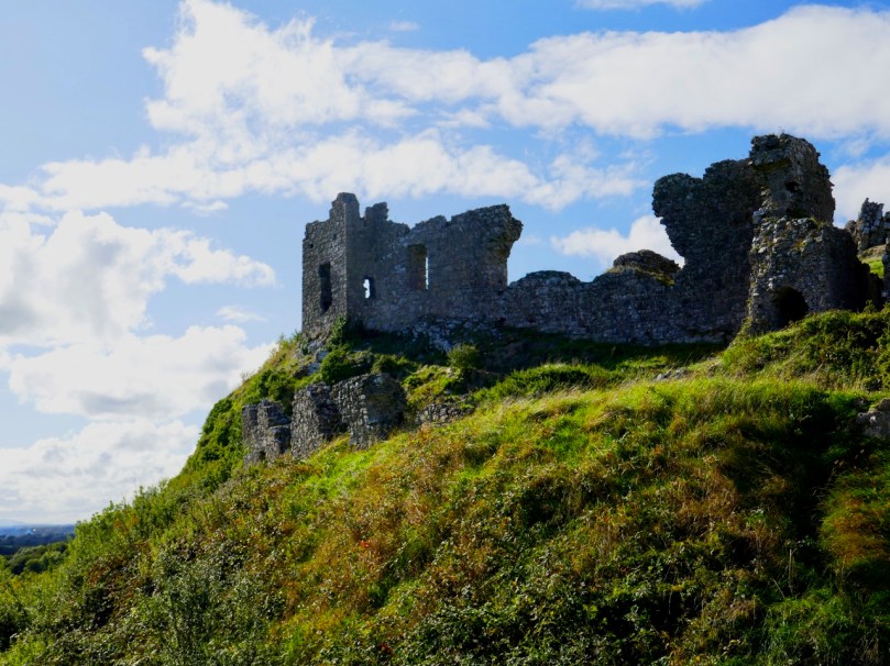
The summit of the Rock commands views of several counties

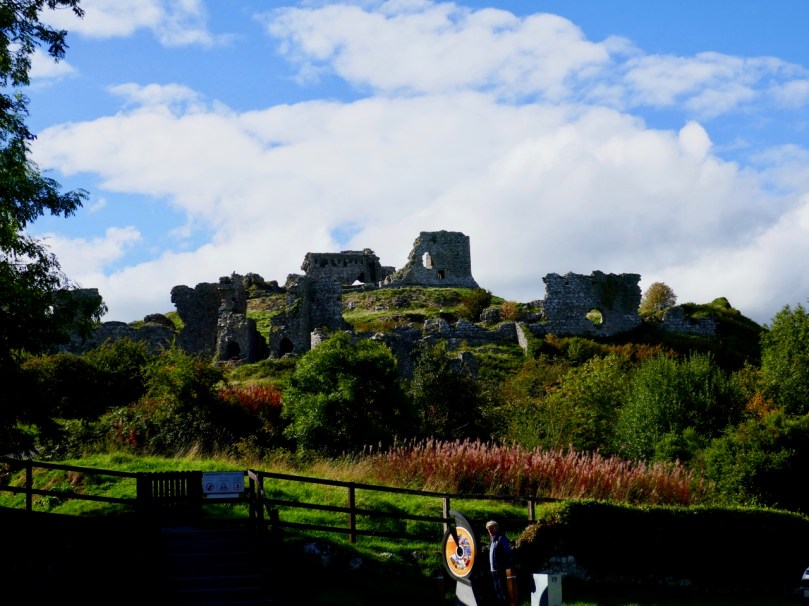
So where does the Rock of Dunamase come in? It was one of the MacMurrough strongholds, and accordingly was part of Aoife’s dowry when she married Strongbow. Thus, it is inextricably associated with the most turbulent events in Irish History. For some of the later (and indeed earlier) history of the Rock, I refer you to The Irish Aesthete’s excellent post A Rock and a Hard Place.

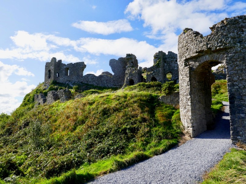
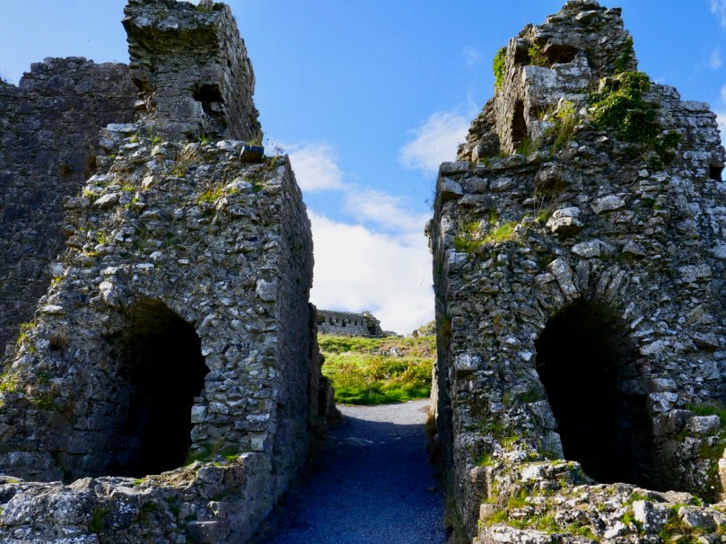
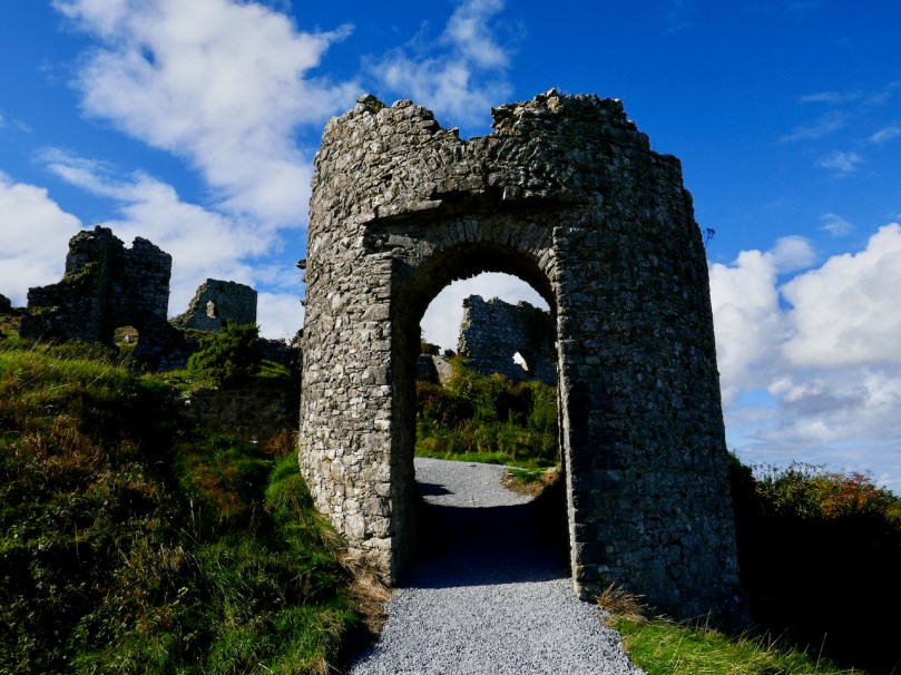
The Barbican Gate, with the curtain wall and corner tower above and behind

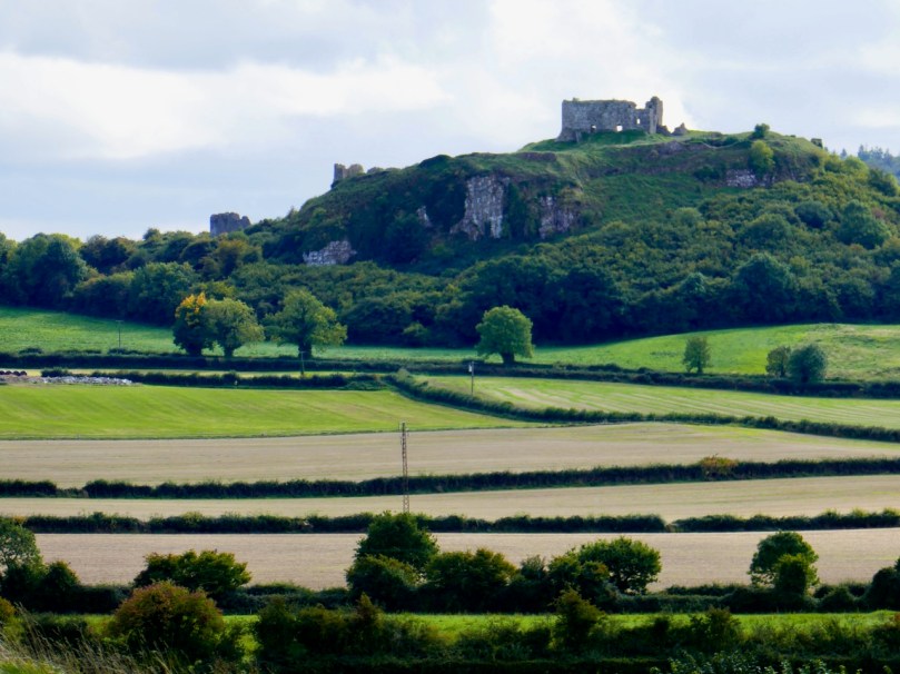
The fortifications and buildings at the Rock are in a ruinous state, of course, but enough remain to give you a good idea of what a strategic site this was and how the defences were designed. The first entrance was a barbican gate behind which was a small area known as the Inner Barbican. Once there, you were at the mercy of archers situated on top of the inner, or curtain wall, shooting down from their crenellated parapet.

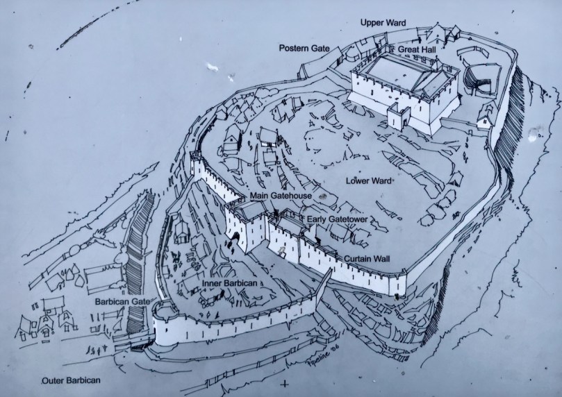
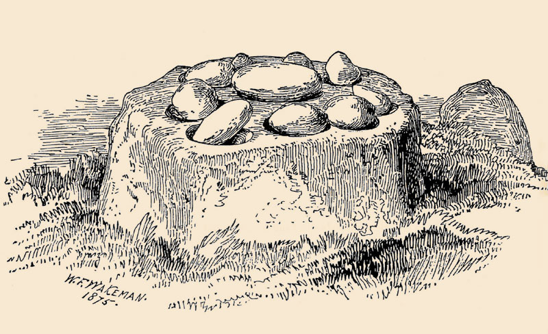
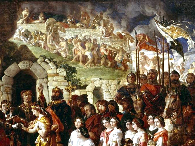
From the OPW informational sign

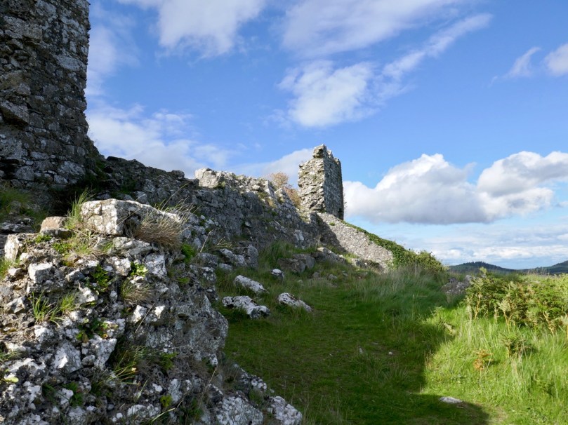
The curtain wall ran around the entire top of the rock. For three quarters of its length it was impossible to attack or breach with the weapons of the time because the wall was built at the top of a steep slope.

The more gentle slope of the east side necessitated the additional defence of the barbican gate. From the inner barbican a massive gatehouse with two towers gave access to the bawn or ward, while two corner towers guarded the northerly and southerly extent of the wall.

Looking upwards towards the Great Hall from the massive Main Gatehouse

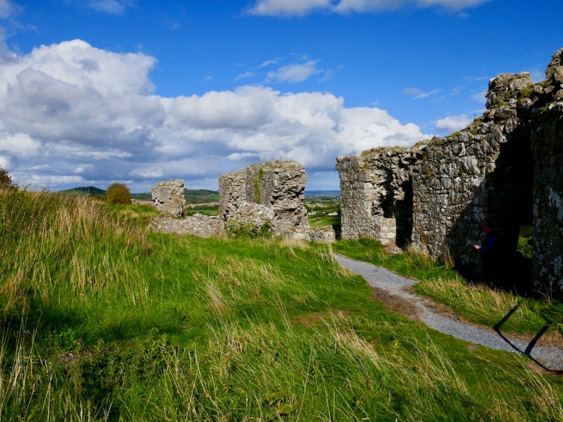
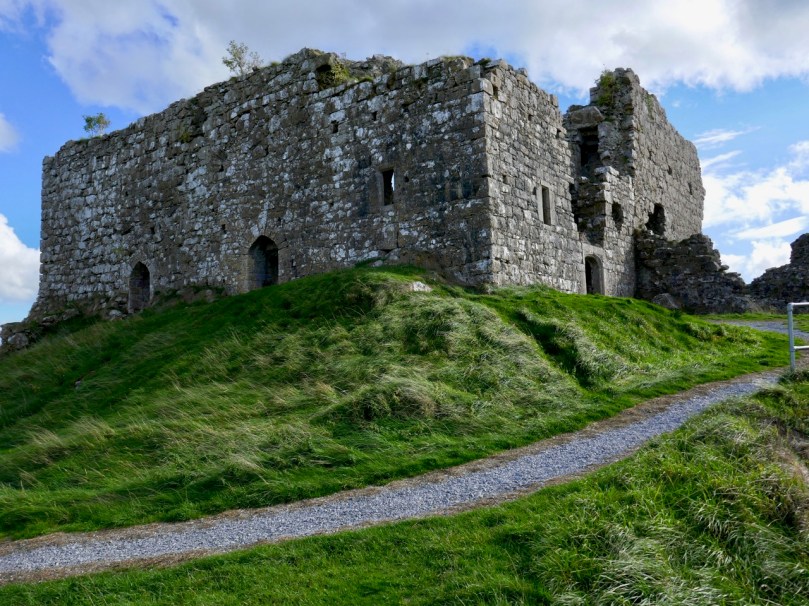
There are indications of other buildings inside the curtain wall, but all that is really significant today  is a large rectangular building known as the Great Hall. This was subject to reconstruction in the 1700s by the then owner (a grandfather of Charles Stewart Parnell) but the building project was never completed.

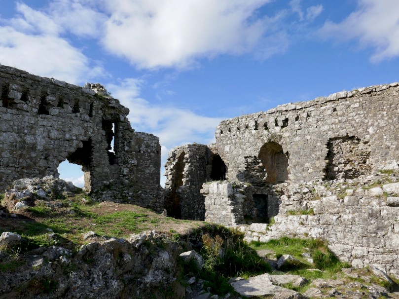
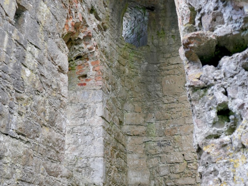
The main result of this reconstruction is to obscure and confuse original versus later parts of the fabric of the Hall. Everywhere you look what appears to be a gothic window embrasure is suddenly sporting red brick.

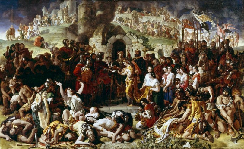
The Marriage of Strongbow and Aoife is the title of an enormous painting by Daniel Maclise that hangs in the National Gallery of Ireland (see the final photograph for the complete painting). It is, in fact, the largest painting in the Gallery, and has been completely conserved in recent years – a series of videos recording this massive process is available on YouTube (just Google ‘Strongbow and Aoife conservation’). But start with this video, in which Dr Brendan Rooney talks about the painting itself.

According to Dr Rooney, the background to the painting is of the City of Waterford, the city on which the marriage took place. The use of this backdrop (rather than, say, the interior of a church)  is used to dramatise the conflict between the Normans and the Irish Chieftains and the consequences of the invasion. He points out a round corner tower that appears to be based on Reginald’s Tower in Waterford, and asserts that the arched gateway calls to mind ‘similar’ gateways in New Ross and Drogheda.

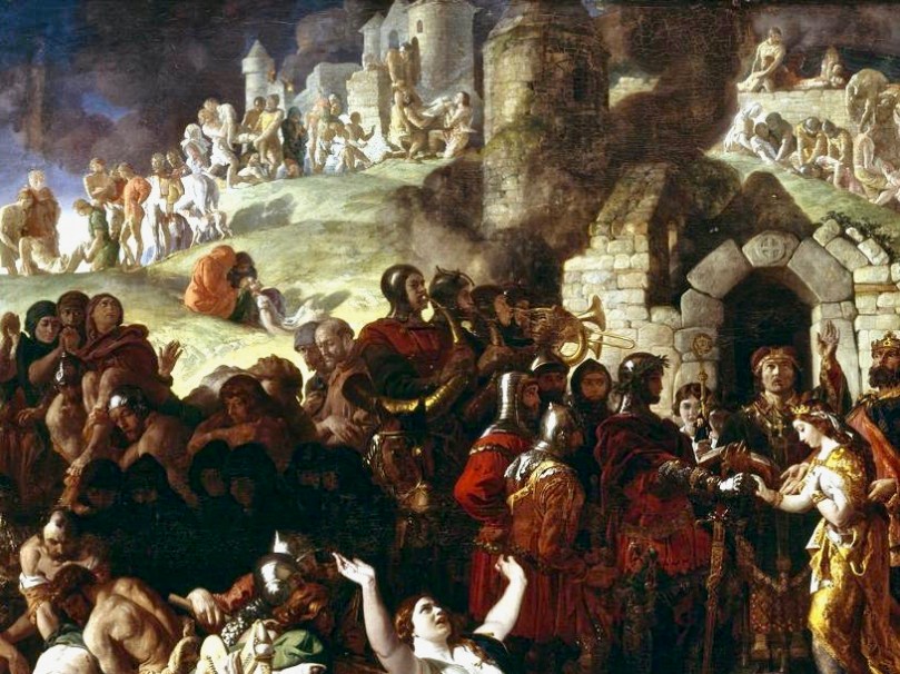
Even if the backdrop is intended to convey a picture of Waterford it seems obvious to me that it is inspired by and based heavily on the Rock of Dunamase. This makes perfect sense from both an historical and a visual point of view. First of all, Maclise was depicting a catastrophic moment in Irish history that is closely associated with the Rock, in that it was the seat of the MacMorroughs, transferred to Strongbow as part of Aoife’s dowry, and which allowed him to subsequently claim succession rights to the Kingship of Leinster.

Secondly – look at it! While there may be echoes of Reginald’s Tower and other Irish medieval sites (such as a round tower) in the painting, it is clearly the steep Rock of Dunamase and its layers of defences that are being depicted. Maclise was known for meticulously researching his subject matter and it seems obvious to me that the marriage is being consecrated in front of the Barbican Gate, while above and behind are the ramparts of the curtain wall. There are still stretches of Waterford’s town walls extant, including towers, and it’s possible that they also provided some inspiration for the backdrop to the marriage scene. There are also a few Irish Norman castle sites that are built on a rocky prominence, but the most dramatic of them is the Rock of Dunamase.

Maclise’s The Marriage of Strongbow and Aoife is one of our most iconic paintings and has been one of the most beloved because of the subject matter. At the same time, the Rock of Dunamase is central to the most critical juncture on our history. They belong together – don’t you agree?

Daniel Maclise (1806-1870), ‘The Marriage of Strongbow and Aoife’, c.1854. © National Gallery of Ireland

Tralong Bay, Co Cork – A Prehistoric Drowned Landscape

In West Cork it is possible to examine the remains of trees which were growing several thousand years ago – perhaps in the time of our earliest ancestors. Around the coasts of Ireland and Britain are sites of post-glacial forests which flourished close to an ancient shoreline until inundated by rising sea levels in the Neolithic period. Cycles of change in weather, tides and geology over millennia saw these remains flooded by encroaching seas, then resurfacing, only to be buried under sediment and sand as tides abated. We are living in an age of extremes and recent abnormal climate activity has in places exposed some of these remains which are as old as human activity in Ireland: this is Organic Archaeology!

Header – Tralong Beach, between Glandore and Rosscarbery, where the remains of very ancient woodland can be seen. Upper map – the c1850 6″ OS map showing the shape of the coastline at Tralong Bay, and Lower map – a closer aerial view of the beach in modern times: the darker mass shows the partly submerged peat beds

Little has been written about the Tralong site, but another comparable drowned landscape has been revealed in Northumberland UK where archaeologist Clive Waddington, of the company Archaeology Research Services, has found the remains of an ancient forest on the coast of Low Hauxley. He reports:

. . . In 5,000 BC, the sea level rose rapidly and swallowed the earth. The sand dunes were pushed inland, burying the forest, and then the sea receded somewhat. Now, the sea level increases again: it cuts out the sand dunes and exposes the forest . . . During the course of the investigation, the archaeologists found evidence of human presence in the area: traces of adults and children , the analysis of which revealed that they were wearing leather footwear. With human footprints the scientists also found footprints of wild boar and brown bears . . .

Part of the beach at Tralong Bay, Co Cork: the surface of the peat mass, which could be up to 4 metres thick, is interspersed with numerous tree boles, roots and scattered branch and twig debris. At one place I found a perfect complete pine cone, which could have been part of that debris.

The surface of the beach is dotted with these remnants of ancient forest, over a wide area. It seems remarkable that there are also extensive blankets of loose material retained in the bay which must also originate from the forest.

Upper picture – one of the huge blankets of organic material – mainly wood based – which has been washed up to the north end of the bay at Tralong since the extreme storms of 2014. Lower pictures – closer views of the debris showing recognisable material including twigs and branches.

In November 2015 Michael Viney wrote a piece in the Irish Times on drowned forests in Galway Bay:

. . . All summer the quiet tides returned the sand that last winter’s storms had dragged offshore, heaping it even deeper over the old oaken wreck on the strand . . . Perhaps, though I hope not, this winter’s great mill wheels of waves will grind that deeply again. Storms two years ago tore away whole layers of sand and stone west of Spiddal in Galway Bay, uncovering stumps of ancient oak, pine and birch from a 7,000-year-old forest drowned as the sea rose after the end of the Ice Age. The same exceptional seas, on the north coast of Connemara, exposed remnants of human occupation a metre thick in the sand-cliff shore of Omey Island. There were medieval burials among them, and bog at least 6,000 years old . . . Elsewhere along the west coast yet more of the kitchen shell middens of early settlers, back to the late Mesolithic, were stripped away. So the sea reveals the past and then takes it away . . . Glimpses of Ireland’s lost shores and drowned forests are not new. Pinewoods submerged off the Bray coast were described by Robert Lloyd Praeger at the end of the 19th century when construction of Bray harbour changed sediment flows and piles of collapsed trees appeared above the sand . . .

Ancient forests reappeared again in Bray, Co Wicklow, in 2001, and more were revealed recently – in 2017. The Irish Times reported earlier this year on a project to discover “the lost landscapes” of the Irish Sea

Tralong Beach will change again, as the weather patterns vary, and it may not always be possible to experience the drowned landscape here. It’s an unmissable journey into deep history.

With many thanks to Robin Lewando for introducing us to this site, and to Anthony Beese for providing additional material

Ballyrisode – Pirate Connections

Last week, Finola wrote about the discovery of what is probably an intertidal fulacht fia on the beach at Ballyrisode, not too far west of us down the Mizen Peninsula. Following the publication of her post, we received a host of comments and messages, including from our friend Dr Connie Kelleher – an underwater archaeologist and well-known specialist on the history of piracy in West Cork. Connie told us that she and a colleague – Áine Brosnan – had examined the site back in 2012 because they were looking for links to pirate connections!

Header – this really is the colour of the remarkably clear water in Canty’s Cove seen on a recent visit: this is probably due to veins of copper ore. Above – Ballyrisode Strand is notable for its secluded location and its impressive white sand

The mention of pirates took me back to my 2016 post – Cantyclick here now and have a read, then return to this page for more insights. One of my resources when researching for Canty was an article by John Hawke in Volume 5 of the Mizen Journal, published in 1997: Canty’s Cove – Legend and History. I only used snippets in my post then, as I concentrated on Canty’s lair on the Northside. Today I’ll expand on Canty’s exploits to the south and west, including his connections with Ballyrisode. Connie made a very valuable point in her comments to us that Canty was a Gaelic-Irish pirate on the opposite side of the peninsula to William Hull and active at a time when the English pirates were headquartered in Leamcon, Baltimore and Crookhaven; he appears to have remained in control within his own domain to at least 1629 but most probably into the 1640s.

Upper – a photo from ‘Northside of the Mizen’ clearly showing the protected promontory known as ‘Canty’s Garden’ in the twentieth century. It is likely that this is the site of Dunkelly Castle, and was the scene of Canty’s grisly treatment of his visitors. Lower – looking across Canty’s Garden today

The following stories were told to John Hawke in 1995 by James Camier, and were handed down from his father, William Camier of Enaghoughter Townland: they therefore go back a good few generations:

. . . Boats from America and elsewhere came into Dunmanus Bay, the captains were invited into his house by Canty, were dazzled by a special grog, robbed and pushed through the north door over the cliff into the cove to the north. On one occasion Canty wanted to stop an invasion by some outsiders at Ballyrisode. He had a daughter, who did not want him to go and tried to stop him, so he shot her. He then crossed by land to Ballyrisode and by moonlight fought a battle on the first strand, which he won. Gravestones to the dead stood on the shore. One day, the son of a captain previously murdered by Canty, who was also a captain, on returning from America was invited in by Canty. But, knowing more than his father, when Canty asked him to step outside he pushed Canty over the cliff . . . James himself remembers some gravestones, but these have been covered by encroaching sand over recent years . . . Graves existing on the second strand are of drowned sailors . . .

Sailor’s graves – or the site of a pirate battle? The fulacht fia is upper right in this picture

This very categoric piece of information suggests that James Camier (or perhaps his father) attribute the stones on the ‘second strand’ to sailors’ graves. These stones are probably the small upright stones which lie close to the fulacht fia today: they certainly resemble grave markers in size and shape. In the context of a Bronze Age fulacht fia such stones were probably part of a hearth or roasting-pit.

It is illegal to disturb any archaeological site (please note!). Our activities at Ballysrisode were confined to measuring and photography. However, we made a series of probes across the beach to test the depth of the sand (and imagine how many excavations have been made on that beach over the years by eager sandcastle engineers!). Our results show that there seems to be a consistent depth of only 50mm to 200mm over the main beach. Hmmmm… not enough to bury any pirate bones methinks. Also, it’s rather unlikely that any pirates would stay around to firmly fix substantial stone markers over the graves of their dead comrades (or enemies). But I would never want to stand in the way of a good tale.

I know this is slightly ‘off subject’ but it’s worth adding to the whole picture of Canty and pirates another tale from the Camiers:

. . . Canty’s Cove was always seen in the locality as a lonesome place at night and there are various stories of unexplained sightings – old longboats coming in and out, a man walking along the ledge on the far side of the Cove from the pier and suddenly disappearing, and of “white” hands helping the captain to tie up his seine boat . . .

I’m not sure that I’d be up for a visit to Canty’s Cove after sunset (above), but the beautiful white strands at Ballyrisode would be most attractive in the moonlight, and – who knows – it might be a good time to see if there is any ghostly pirate activity in this historically significant place.

In the picture below Rosie the Dog investigates the apparently haunted piers at Canty’s Cove: they were extensively upgraded in the 1940s

A Flying Priest, and Rolls of Butter

Last week Finola reported on a journey over the mountains on the ‘Priest’s Leap’ road from Kenmare, Co Kerry to Bantry, in West Cork. We received a fusilade of comments from readers who told us we hadn’t seen half of what there is to be found on this road so, on the very first day of September, we were off again, this time getting a different perspective by travelling the other way. Before we left Bantry we had to find the very spot where the priest – being pursued by soldiers – landed after he and his horse leapt off the highest summit of the road which has been named after him.

It’s great that this stone has been left untouched by the modern roadmakers, so that all can see the hoof marks to this day. I calculated that, 400 years ago, the priest was airborne for a distance of some 12 kilometres as the crow (or horse!) flies – considerably more than some of those early aviators of the 20th century were credited with!

If you are not of a nervous disposition, and don’t mind travelling a narrow, single-track mountain road for some 15 kilometres, probably sharing it only with a few sheep, then to pass over this route is one of Ireland’s most spectacular experiences. Choose your day, though: we were lucky to have hot sun and clear views the whole way. If you survive it to the top, you are right on the Cork – Kerry border: in the photo below, the fence going on up the hill is exactly on that border line (and the point at which the priest and his horse took off is to the right of it at the peak). Stop and look around: the views in every direction are stunning.

After we crossed the border into Kerry we came downhill and stopped again at the remote, picturesque Feaghna burial ground in the townland of Garranes. On our last visit we were completely unaware of the existence of an unusual archaeological site nearby – one which has a number of traditions associated with it.

Popularly known as the ‘Rolls of Butter’ this site is technically a ‘Bullaun Stone’. These are fairly widespread over Ireland, but their original function is not known for sure. Here’s a summary from the National Monuments Service:

. . . The term ‘bullaun’ (from the Irish word ‘bullán’, which means a round hollow in a stone, or a bowl) is applied to boulders of stone or bedrock with hemispherical hollows or basin-like depressions, which may have functioned as mortars. They are frequently associated with ecclesiastical sites and holy wells and so may have been used for religious purposes. Other examples which do not appear to have ecclesiastical associations can be found in bedrock or outcrop in upland contexts, often under blanket bog, and are known as bedrock mortars. They date from the prehistoric period to the early medieval period  . . .

A drawing by the 19th century antiquarian W F Wakeman of a Bullaun Stone at Killinagh in Co Cavan. Here, the stones are known as ‘cursing stones’ – a term also applied by some commentators to the Feaghna site at Garranes. Interestingly, the Cavan site is also referred to as ‘St Brigid’s Stones’, while the Rolls of Butter are associated with the local saint, Fiachna. Beliefs – stories – are, of course, as fascinating as any archaeological evidence, and have to be investigated. Here, they abound – and are best learned from local sources: in this link folklorist Matt Sullivan has put together an entertaining selection of local opinion about the Rolls of Butter.

A few years ago I wrote a post covering some bullauns, ‘cursing stones’ and ‘curing stones’ – but at that time I wasn’t aware of these examples just a mere priest’s leap away from our own home.

There is much more archaeology and history in this mountainous country: here (above) in the townland of Erneen, the view from the road across one of the many remote glens shows up former enclosures and ‘hut sites’, which the National Monuments Service describes thus:

. . . A structure, usually discernible as a low, stone foundation or earthen bank enclosing a circular, oval or subrectangular area, generally less then 5m in maximum dimension. The remains are generally too insubstantial to classify as a house but the majority probably functioned as dwellings. These may date to any period from prehistory (c. 8000 BC – AD 400) to the medieval period (5th-16th centuries AD) . . .

It’s intriguing to think that these beautiful natural landscapes which appear so lonely to us were occupied hundreds – perhaps thousands – of years ago. It’s likely that they have changed very little over all that time: history is clearly set out for us as we travel over this ancient way.

The days are shortening, and we still didn’t have time to explore everything the Priest’s Leap road has to reveal. We’ll be back again before too long – in search of more stories.

Out in the Field

During the West Cork History Festival field trips, led by Roaringwater Journal last week, treats were in store. Many thanks to volunteers Jenny and Ray who worked hard to provide the refreshments (and who baked the scones!) on Friday’s ‘Art and The Great Famine’ excursion, which arrived at Reen Farm in time for tea.

Artist John Kelly‘s cows are abundant at his home at Reen, and the experience of the connections with this unique place and Famine times were admirably and sensitively presented by Siobhan Burke of West Cork Experiences (she’s on the left, facing the bronze tree, below).

The day included organised visits to the 110 Skibbereen Girls project at the old workhouse site in Skibbereen – where we were given a presentation by artist Toma McCullim – and a guided tour by West Cork Arts Centre’s Zenda Williams of the Coming Home – Art and The Great Hunger exhibition at Uillinn, followed by a visit to the mass famine graves in Abbeystrewery, where Philip O’Reagan of the Skibbereen Heritage Centre explained the site’s enormous significance. Just as well we had those scones to bolster us up!

On the previous day we began the ‘West Cork Archaeology’ tour at Knockdrum Fort, where – in benevolent weather – you get the most spectacular views (above). Finola talked about the Rock Art on the site, which takes it back in time perhaps 5,000 years, and she also explained about the alignment with the Bealtaine sunset discovered by Boyle Somerville, described here – and which we witnessed ourselves earlier this year (below).

Highlights of that day’s expedition also included an entertaining time at Castletownshend hosted by George Salter-Townshend (below, he’s leading us into the Castle which has been owned by his family since medieval times).

After more on archeoastronomy from Finola, at Drombeg Stone Circle (above), a further treat was in store at Castle Salem, near Rosscarbery, where we were given a tour and talk by its owner Peter Daly (below).

We were delighted to be given the opportunity to provide this ‘lead-in’ to the History Festival weekend itself which – as last year – was a roaring success. If you didn’t go to it, take a look at the festival programme, and see what you missed!

Because our time has been taken up with the festival we haven’t written any posts this weekend. Normal service will be resumed next week. I can’t resist finishing off with another look at John Kelly’s sculpture garden at Reen.

Countdown to West Cork History Festival 2018!

As last year, Roaringwater Journal is very involved in the marvellous upcoming West Cork History Festival. We are both on the organising committee and this year we are leading field trips and chairing sessions, and I am giving a paper (more on that below). The Festival will be held in Skibbereen this week – 16th to 19th of August.

This is St Barrahane from Castletownshend. During the Thursday Field Trip we will be revealing his secret message

We haven’t had a lot to do with the detailed logistics or with the ultimate lineup of speakers – that is the purview of the Founders, Simon and Victoria Kingston. What a force they are! As you can imagine, organising a festival like this is an enormous amount of work and they do it while working full time, with two young children and a life lived between two countries – all while remaining cheerful, focussed, inventive and energetic. Here are Simon and Professor Roy Foster, our keynote speaker, talking last year about the upcoming festival.

Simon and Victoria are next door neighbours to the wonderful Liss Ard Estate. This place is dear to our heart as it’s where we were married, and they have been incredibly supportive of the festival, providing parking and accommodation.

While many of the speakers are academics and writers on the national scene, local historical societies are attending and volunteering and local experts have been persuaded to share their knowledge. The Skibbereen Heritage Centre is a big part of the festival this year, with both Terri Kearney and Philip O’Regan on the program, and William Casey giving a talk and launching a book.

Philip O’Regan of the Skibbereen Heritage Centre leads a walking tour of the historic town. Here he points out the building where O’Donovan Rossa founded his Phoenix Society, forerunner of the Fenians

We are looking forward to the field trips, a new addition this year and a popular one, given how quickly they booked up. Thursday’s focusses on archaeology and history and Friday’s on the Famine and Art.

Coppinger’s Court – these fortified mansions gradually replaced tower houses in the seventeenth century, during of the series of changes from Irish to Planter land ownership

The Festival aims to cover international, national and local themes and this year will, of course, focus partly on the events of 1918, with talks on WWI, Carson and Redmond, Women’s Suffrage and the great Flu epidemic. The Irish Revolutionary Period is the subject of several talks, by both academics and non-professionals, ranging from the hot topic last year, Protestants in West Cork, to the violence suffered by some women during that period.

Inspired by the Coming Home: Art and the Great Hunger exhibition currently running at Uillinn/West Cork Arts Centre, there is also a thread that looks at the intersection of art and history. It will be the main focus of Friday’s field trip, and run through sessions on Margaret Clarke, on Gothic art, on George du Noyer and most pointedly in the talk by Niamh O’Sullivan on the Coming Home Exhibition itself.

Stone Circle by George Victor du Noyer

We’re not forgetting the Medieval and Early Modern periods either. Dr David Edwards from UCC is recognised as an expert on Richard Boyle and on this period and his talk on Gaelic politics in the later Middle Ages should be fascinating. But never mind all that politics – what did people actually do back then, and what did they eat, before the advent of the potato?  Dr Susan Flavin is going to tell us that when she talks about ‘Food, Drink & Society in 16th century Ireland’.

Richard Boyle, Great Earl of Cork

Lots of local history too – on Cillíní (children’s burial grounds), women in the fishing industry, Sam Maguire and his memorial bells in Dunmanway, Pirates and treasure of the Coast of West Cork, and my own talk on Agnes Mary Clerke who grew up in Skibbereen during the famine and went on to become the most successful science-writer of her day, with a moon crater named in her honour.

Agnes Mary Clerke

That’s just a taster of the talks – there are lots more. And if that wasn’t enough, there are also film screenings, a concert by Jessie Kennedy based on the life of Lady Mary Carbery of Castle Freke, and a poetry reading by none other than Jeremy Irons! How can you resist that voice?

So if you don’t have your tickets yet, get them now. Yes, you’ll still be able to get them at the gate, but if you want to secure them now, do it online at this link.