Mizen Magic 9: Rossbrin to Schull

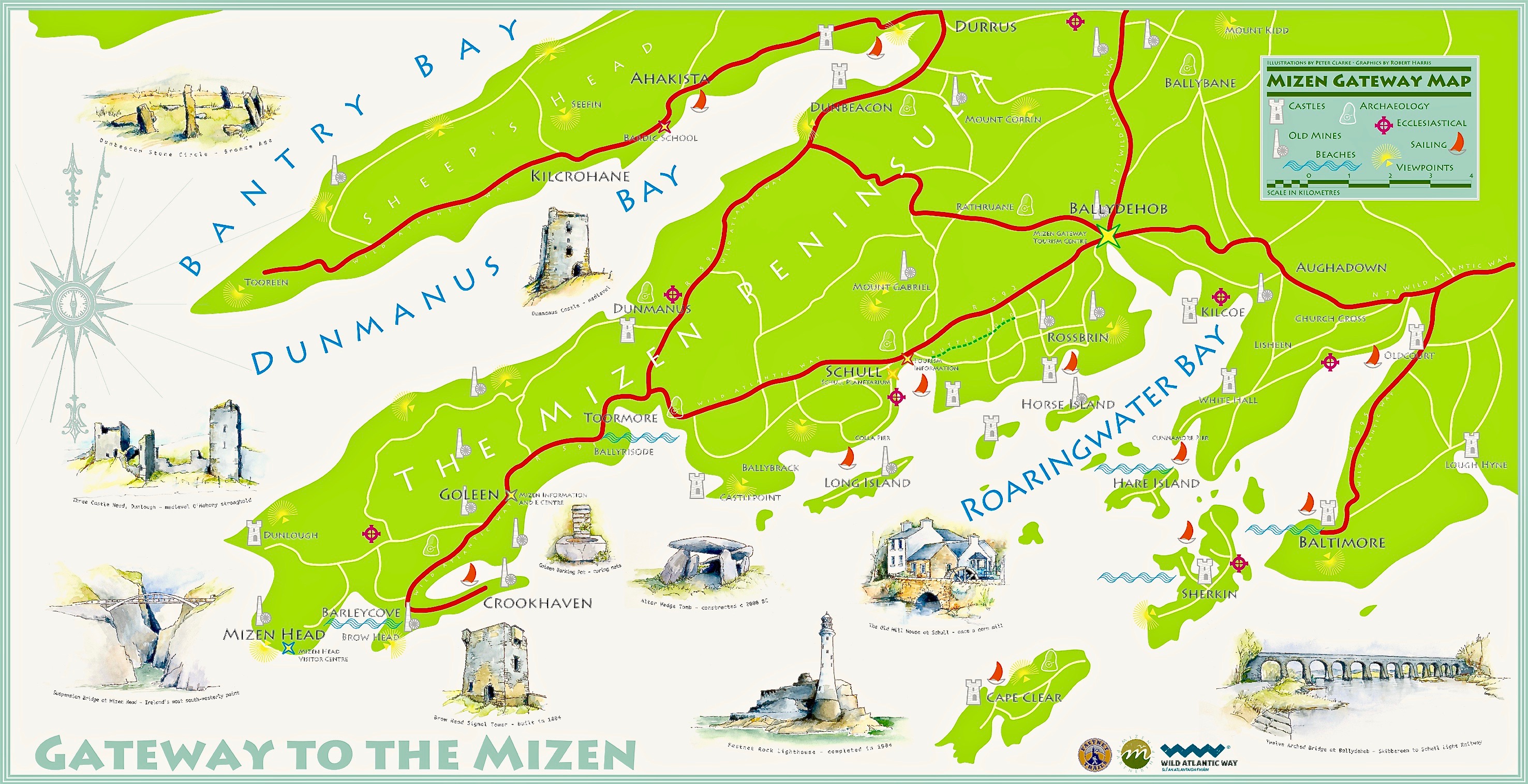
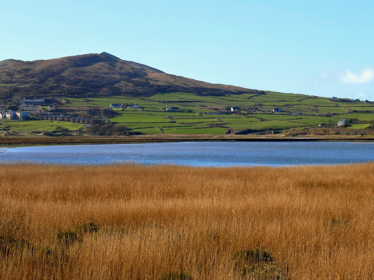
There’s a main road between Ballydehob and Schull, and then there’s a back road – a road that meanders through farmland and down half-forgotten boreens, a road lined with wildflowers and dotted with the remains of past history, a road that looks over once-inhabited islands. South of this road lies Mizen Magic 9.

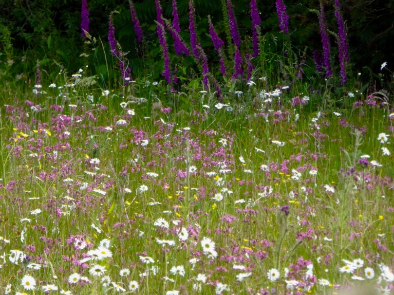
Along the back road in early summer

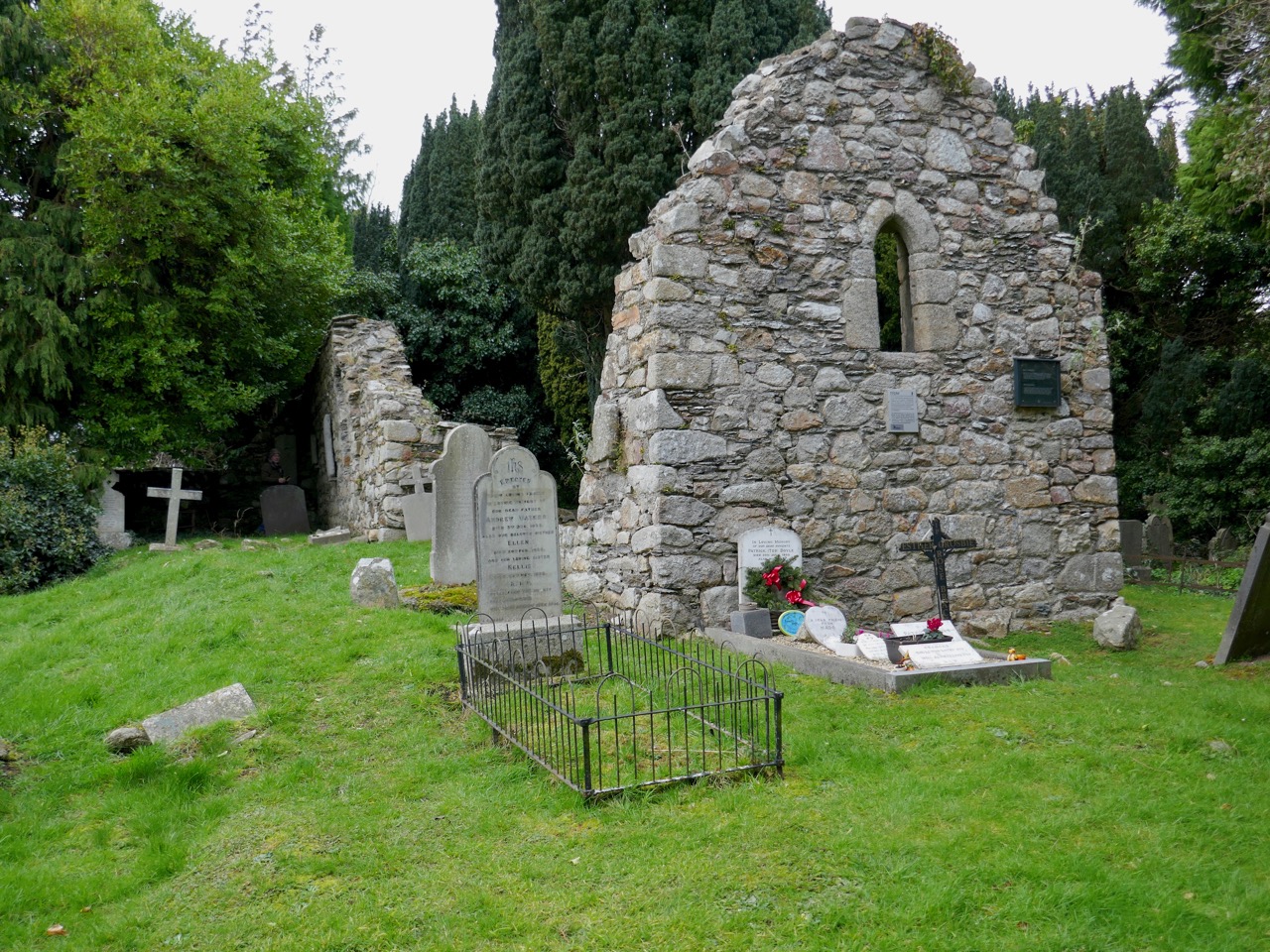
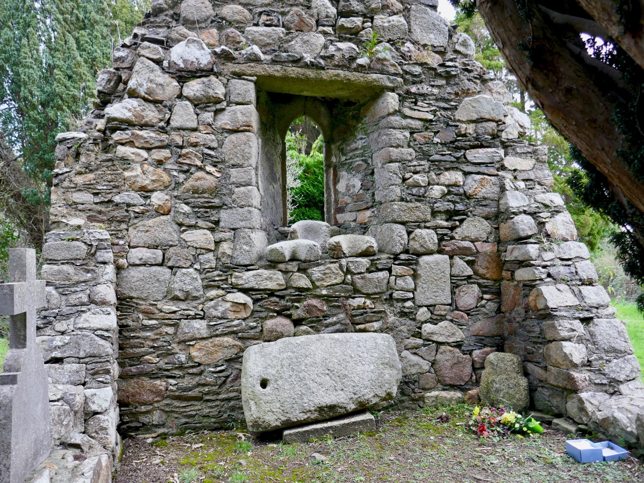
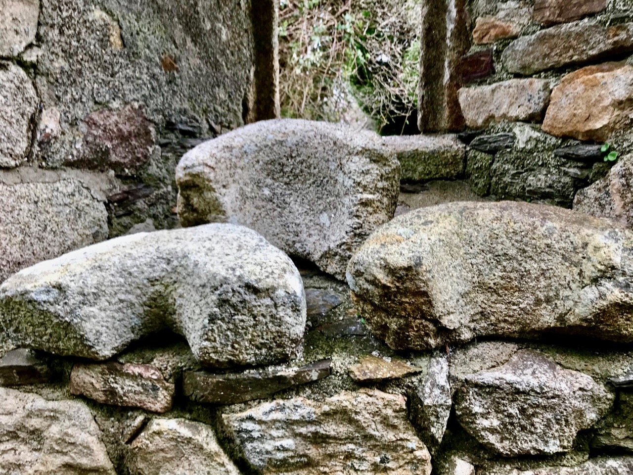
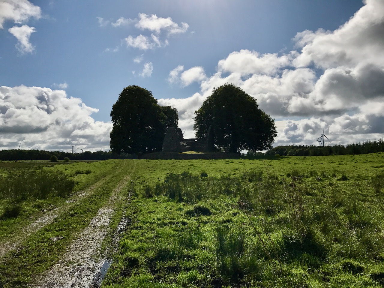
We’ll start at Rossbrin Cove – a place that Robert has written about over and over, like any writer with his own ‘territory.’ This was the home, in the 15th century, of Fineen O’Mahony, the Scholar Prince of Rossbrin.

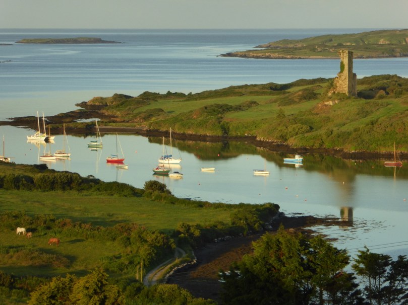
Looking down now on what’s left of his castle, it’s hard to imagine that this was a place teeming with life and learning – a mini-university where scribes and poets and translators transcribed to vellum (and to paper – a first in Ireland) psalters, medical tracts and even the travels of Sir John Mandeville. The castle has been in ruins since the 1600s, and we live in fear that the next storm will bring the last of it down.

Rossbrin Castle from the sea

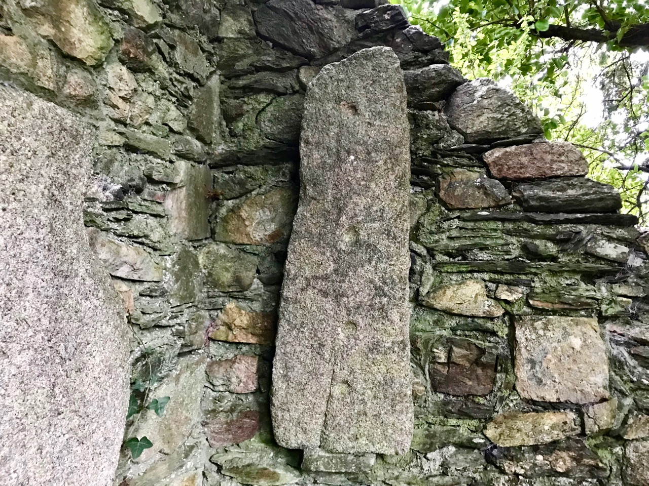
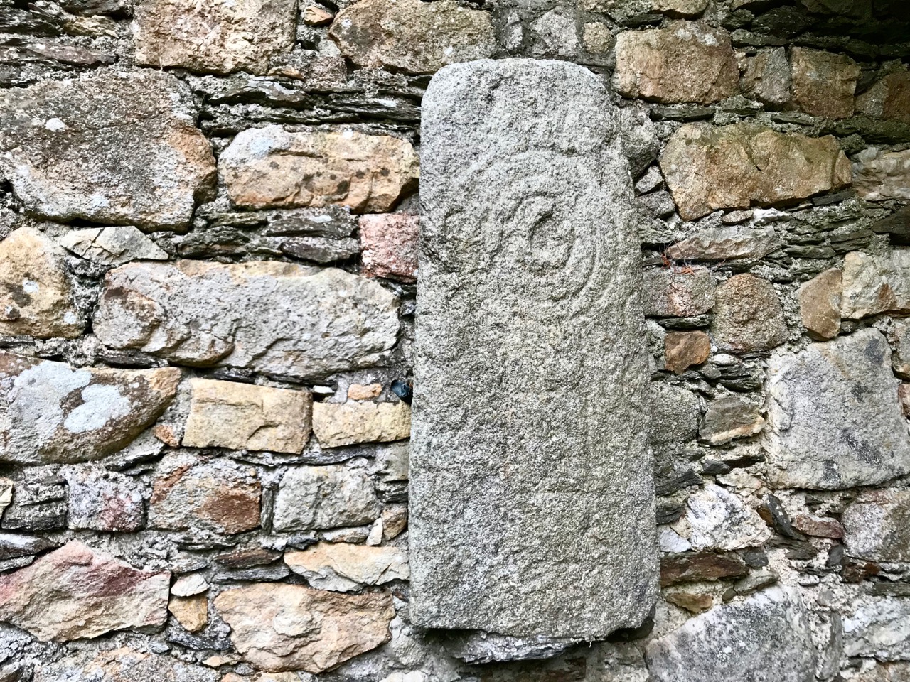
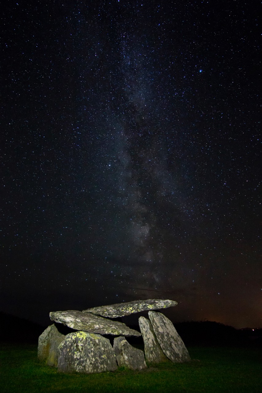
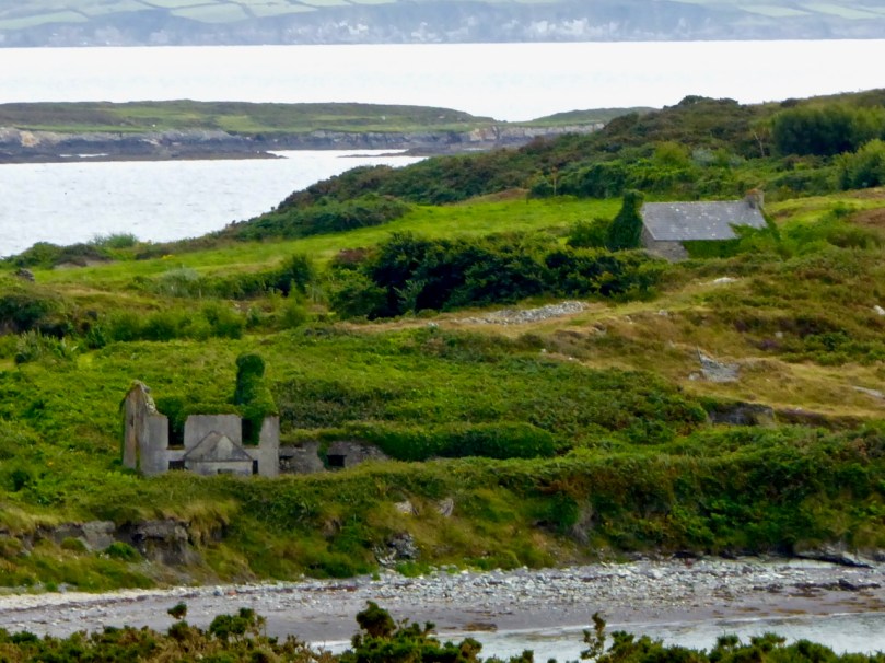
The road runs through the townlands of Rossbrin, Ballycummisk, Kilbronogue, Derreennatra and Coosheen. Ballycummisk has a wedge tomb from the Bronze Age and a ring fort from the Early Medieval period – just to remind you that you are far from the first to want to settle in this place. In more recent times, and like Horse Island, it was once the centre of a thriving mining industry, but a spoil heap and stone pillars are all that remain.

Large ring fort, and the remains of mining activity, in Ballycummisk

Two islands dominate the views of Roaringwater Bay along this road. The first is Horse Island, owned now by one family, with its industrial past a distant memory. There have been various plans for Horse Island in recent years – a resort, a distillery – but so far it has resisted development.

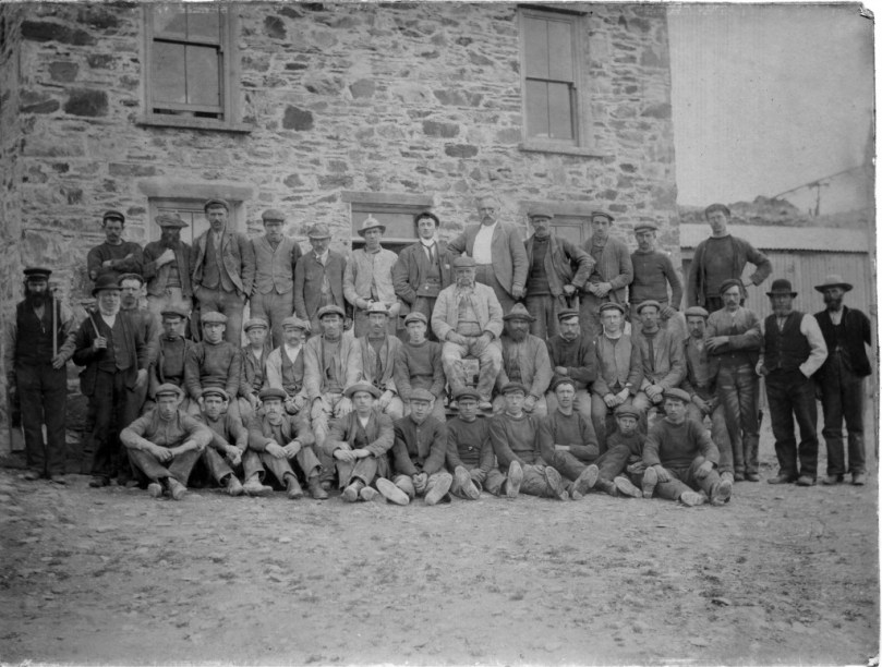
Horse Island Miners in 1898 and the ruins of miners’ dwellings

The other is Castle Island, home to yet another vestigial O’Mahony Castle – one of a string along the coastline, all within sight of each other and sited strategically to control the waters of Roaringwater Bay and their abundant resources.

There’s not much left of the castle on Castle Island

The O’Mahonys became fabulously wealthy in their day, charging for access to fishing and fish processing facilities and for supplies and fresh water. They also forged strong alliances with the Spanish and French fishermen and visitors who plied those waters – a friendship that was to cause great concern to the English crown and that was to spell, in part, their eventual downfall.

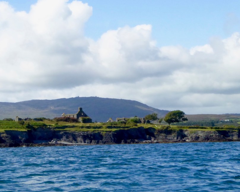
Ruined farm houses on Castle Island. The photograph was taken from a boat – that’s Mount Gabriel in the background

The closest spot to Castle Island (also uninhabited) is the beautiful little pier at Derreennatra. There is a large house up behind the pier, now inaccessible but once run as a guest house and famous for its hospitality. A curious bridge once gave access to the demesne and it remains a striking landscape feature, with its pillars and giant Macrocarpa tree.
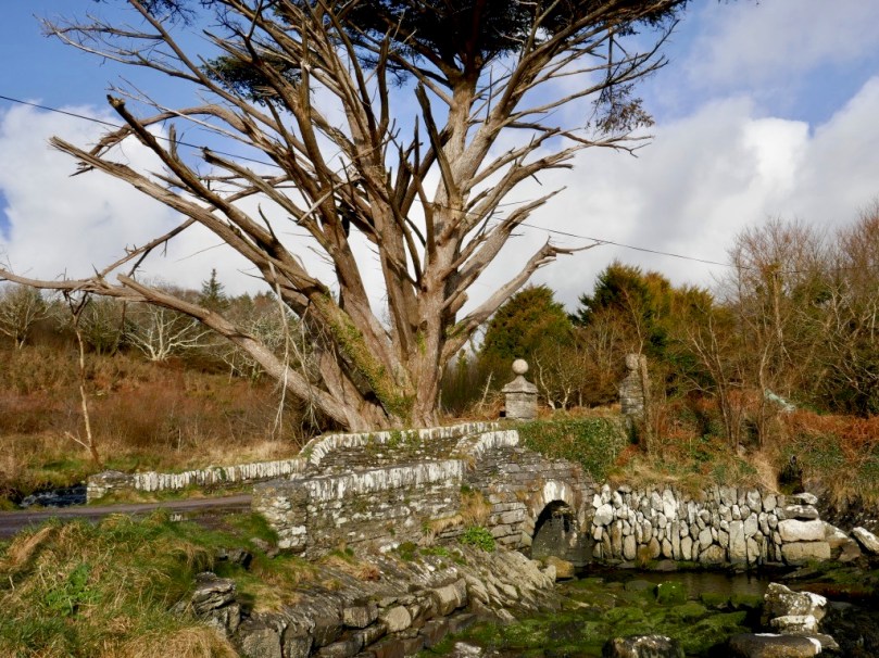
Derreennatra Bridge

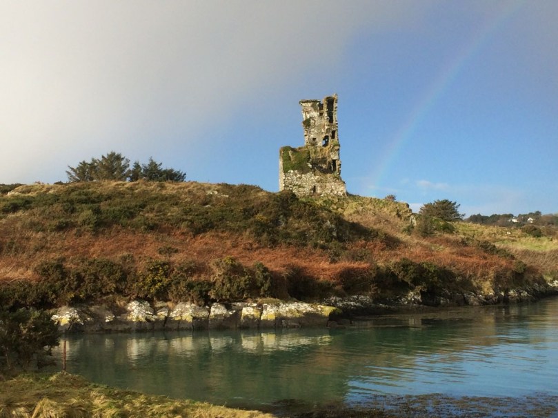
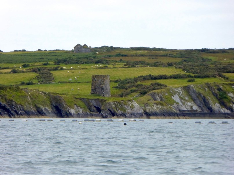
Continuing towards Schull we come to the last of the O’Mahony castles and the best preserved in this area. This is Ardintenant (probably Árd an Tinnean – Height of the Beacon – possibly referring to a function of the castle to alert others to the presence of foreign vessels) and it was the home of the Taoiseach, or Chief, of this O’Mahony sept.

Two ‘beacons,’ ancient and modern – Ardintenant or White Castle below and above it the signal stations on Mount Gabriel

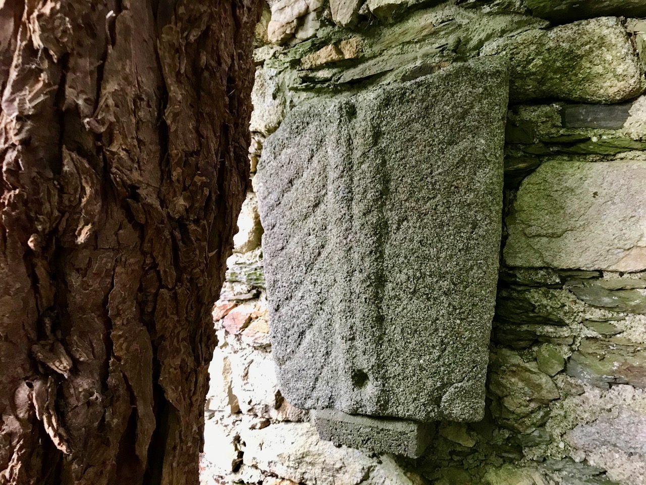
The castle, or tower house, still has a discernible bawn with stretches of the wall and a corner tower still standing. If you want to learn more about our West Cork tower houses, see the posts When is a Castle..?; Illustrating the Tower House; and Tower House Tutorial, Part 1 and Part 2.

Ardintenant is also known as White Castle, a reference to the fact that it was once lime-washed and stood out (like a beacon!) to be visible for miles around. It appears to have been built on top of an earlier large ring-fort which in its own day was the Taoiseach’s residence before the fashion for tower house building.

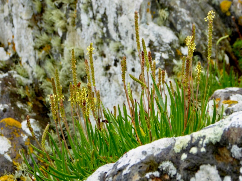
Sea Plantain at Coosheen

From Ardintenant we head south to Coosheen, a picturesque pebble beach known only to locals. It’s one of my favourite places to go to look for marine-adapted wildflowers. On a rainy day last August I saw Sea-kale, Sea-holly, Sea Plantain and Thrift, and drove back on a boreen lined with Meadowsweet and Wood Sage and past a standing stone whose purpose has been long-forgotten but that continues its vigil through the centuries.

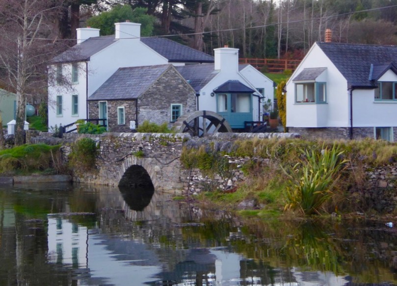
Our final spot in Coosheen is Sheena Jolley’s mill house, now the gallery of this award-winning wildlife photographer. She has restored it beautifully and the gardens are a work-in-progress that manage to capitalise on, rather than overwhelm, the mill stream and the rocky site. This is also the starting point for the Butter Road walk – but that deserves a new post one of these days, a post in the Mizen Magic series. We have written one but it was a long time ago.

Take a walk, or a drive, down any part of this road – do it in summer when the boreens are heady with wildflowers, or do it in winter when the colours of the countryside are at their most vivid. Heck, do it any time!


Vinegar Hill

Recent travels took us to County Wexford, and we immediately immersed ourselves in the locality. For years I have played the tune usually known as Boolavogue, without fully understanding the significance of the piece – and its place – in Irish history. Firstly, here’s a masterful rendering of this most heartrending of airs  by Davy Spillane and Aly Bain (from the Transatlantic Sessions) – enjoy the beauty:

That’s the instrumental but, according to the history books, the tune was originally called Eochaill (Youghal Harbour), used as the melody for a song written in 1898 by Patrick Joseph McCall to commemorate the centenary of the Irish Rebellion: the song was known as Fr Murphy of the County Wexford, and became ‘Boolavogue’ in more recent times. Here is Eochaill beautifully played by Paul Davies who I met on my first visit to Ireland back in the 1970s: he took me on a musical trail around County Clare where I met and heard some of the then ‘greats’ of Irish Traditional Music, including concertina player Paddy Murphy. Sadly, both Paddy and Paul have passed away now, but it’s good to keep their memories alive.

It may not be immediately obvious that Eochaill and what we now know as Boolavogue are the same melody, but comparison of the tunes is a good exercise in the study of evolution in musical traditions. What’s more important to our subject is the words of the song, and the reasons for the writing of it.

At Boolavogue as the sun was setting
O’er the bright May meadows of Shelmalier
A rebel hand set the heather blazing
and brought the neighbours from far and near
Then Father Murphy from old Kilcormack
Spurred up the rock with a warning cry:
“Arm! Arm!” he cried, “For I’ve come to lead you
for Ireland’s freedom we’ll fight or die!”

The header picture is a view from the top of Vinegar Hill, just outside the town of Enniscorthy, Co Wexford. Above is a view of the summit of the hill: it’s peaceful in the wintry sunlight. In 1798, however, it was a scene of carnage, as the United Irishmen, led by Father John Murphy, gathered to meet the British forces. George Cruikshank, the British caricaturist, produced illustrations for a history of the Irish Rebellion written by William Maxwell in 1845: he was not kind to the Irish cause but his drawings are probably accurate in their depiction of mayhem, slaughter and atrocities which were reportedly committed by both sides.

Cruikshank’s first drawing shows the Irish encampment on the summit of Vinegar Hill: women and children are evident. The windmill, which became the rebel command centre, dates from the 1600s and can still be seen on the hill today (shown in the photograph above). Disused probably since the time of the Rebellion, it fell into serious disrepair in the 1960s and a notice was affixed to it:

“Vinegar Hill, scene of glorious battle in 1798 between Insurgents and British Crown Forces. Carefully maintained by British Government from 1803 to 1922. Abandoned by the Irish Office of Public Works when freedom obtained. Only historic monument in the care of Irish Government in Enniscorthy area. Thank God for it.”

In our travels we chanced upon the ruins of another old windmill not too far away from Enniscorthy – in Tagoat. Today it’s in poor shape (but surely worthy of conservation) – we were unable to get close to it, but Finola managed to take this view:

Cruikshank’s imagining of the Battle of Vinegar Hill (above) could be a fair depiction. The engagement took place on Midsummer’s Day in 1798 and saw a rebel army of up to 20,000 – mainly armed with pikes – pitched against military forces of 13,000. Further military forces attacked nearby Enniscorthy.

He lead us on against the coming soldiers
And the cowardly Yeomen we put to flight
‘Twas at the Harrow the boys of Wexford
Showed Bookey’s regiment how men could fight

Look out for hirelings, King George of England
Search every kingdom where breathes a slave
For Father Murphy of County Wexford
Sweeps o’er the land like a mighty wave

Father Murphy is remembered everywhere in Wexford. He has a fine memorial in Ferns (above), and a centre dedicated to him at his former home near Boolavogue. No lives were spared by the British at Vinegar Hill; rebels who escaped marched to the midlands but dissipated after failing to garner enough support to continue the uprising. Father Murphy and a companion were captured but not recognised. Even when mercilessly tortured neither man revealed their identity. Both were hanged in the market square in Tullow. The yeomen cut off Father Murphy’s head, put it on display on a spike and burned his body in a barrel of pitch.

At Vinegar Hill, O’er the pleasant Slaney
Our heroes vainly stood back to back
and the Yeos at Tullow took Father Murphy
and burnt his body upon a rack

God grant you glory, brave Father Murphy
And open Heaven to all your men
the cause that called you may call tomorrow
in another fight for the Green again

There’s a 1798 Centre in Enniscorthy, but it was closed on the day we visited. We also looked for the Father Murphy Centre at Boolavogue, but the fine iron gates leading down to it were locked up for the winter. This Irish Rebellion deserves more exposure in this Journal – something we will address in the not-too-distant future. But I am pleased to have gained a greater insight into one of my favourite Irish airs: Boolavogue. Here’s an interesting rendering of P J McCall’s version, by ‘Flying Column’ dating from 1972: it’s preceded by Seamus Heaney’s sonnet Requiem for the Croppies, inspired by these same events.


Viking Traces

If you want to find some remote Irish history which is a long way off the beaten track, try the city of Dublin! Just a few minutes’ drive from the edge of this bustling metropolis (and down a long, rough and muddy farm track) is a collection of carved stones which have their roots in the time of the Vikings.

Here, in the barony of Rathdown, the remains of a small ruined church date from the twelfth century, but a monastic settlement was set up long before that by St Comgall of Bangor, who lived from 520 to about 600 AD. There is the stump of a round tower here, known locally as the Skull Hole, as bones from the surrounding graveyard were thrown in here. Some say, also, that it is actually the entrance to an underground tunnel going down to the coast: furthermore, a piper was once seen to enter the tunnel playing his pipes – but was never seen again!

There is another piping tale connected with a nearby site: Puck’s Castle. A fairy piper is often seen jumping from rock to rock while also playing his pipes. We watched and listened, but in vain . . . Here are some of the noteworthy ‘modern’ gravestones in the cemetery at Rathmichael:

But the real treasure of the place are the carved stones which date from Viking times, and which are probably early Christian grave markers. They are generally known as The Rathdown Slabs. Some of these we would classify as ‘Cross Slabs’, even though, on some, the cup marks and concentric circles make us think of Prehistoric Rock Art. Well worn by time and weather we can still make out the various motifs – and we are fortunate to have good drawn records of these stones dating from a study carried out by Pádraig Ó hÉailidhe, a member of the Society of Antiquaries of Ireland, and published in volume 87 of the Journal of that Society in 1957.

Rathdown Slabs (top to bottom): 1 and 2; 8 and 9; 3 and 4 – as classified by P Ó hÉailidhe in his 1957 study

From around 850 AD we find mention of Norse names: Amláib (Olaf the White) arrived in Dublin in 853 and ruled jointly with Ímar (Norse Ívarr inn beinlausi – ‘Ivar the Boneless’). Amhláib was a Norwegian but Ímar may have been a Dane. Ímar is mentioned as ‘king of all the foreigners in Ireland’ at his death in 873. The grave slabs at Rathmichael probably date from the time when Viking settlements were established in the Dublin area, and – although we tend to think of the Vikings as plunderers of monasteries – it seems that they began to follow Christian practices once they settled in Ireland. 

Top – Rathmichael Church with its round tower and Viking graves was established on an ancient Rath or fort, in fact one of the largest in the locality: you can see the probable circular outline of the fort in this extract from the National Monuments Service Archaeological Survey Database; middle – ruins of the medieval church at Rathmichael and, lower – fragments of Bullaun Stones at the church site

Other – probably related – inscribed slabs from the wider area are recorded by Pádraig Ó hÉailidhe (below): Dalkey Castle Heritage Centre displays one of the finest of them all (left), while the Tully Slab (right) is assumed to have come from another remote church ruin close by – however I cannot find any record of its current whereabouts. If anyone can throw light on this, please let us know.

Dalkey and Tully grave slabs – drawn by Pádraig Ó hÉailidhe, 1950s

I have used the drawings by Ó hÉailidhe because they are so clear: we visited the Rathmichael site this week and were struck by how faded much of the inscription seems to be. It could be that we were not seeing the carvings in a good, clear light. Worryingly, it may also be that the stones are suffering from accelerated weathering (much as our unprotected medieval high crosses appear to be) due to acid rain and pollution. You can see for yourselves by comparing the drawings above with our own photographs, a selection of which form the tailpiece of this post.

Finn McCool’s Causeway

In a recent post this year I said how much we liked to go off the beaten track and find Ireland’s gems hidden away among the narrow boreens of West Cork and elsewhere. But sometimes it’s also worth going to the better known hotspots around the country – and being prepared to regard them objectively in spite of the sometimes intrusive crowds that you might meet along the way.

Last summer our trip around the coast of Northern Ireland took us past the Giant’s Causeway in County Antrim. I had never been there before (Finola had) so I was keen to see what all the fuss is about. After all, I knew the causeway had been built by one of Ireland’s greatest heroes – Finn McCool – and that it once extended all the way to Scotland: the other end of it can be seen at Fingal’s Cave on the Scottish island of Staffa (Staffa is a Norse word meaning ‘Pillars’ and is named from the rock formations there): the Gaelic name for the cave is An Uaimh Bhinn, meaning ‘the melodious cave.’ It has been suggested that the name ‘Fingal’  is linked to the name ‘Finn McCool’ possibly after an 18th century Scots poet, James Macpherson, wrote an epic poem loosely based around the Finn story. Later, the composer Felix Mendelssohn visited the cave and celebrated it in his Hebrides Overture. It’s worth looking at this Youtube video of the piece as it is well illustrated with dramatic views of the Scottish end of things:

Before leaving Scotland – and this atmospheric music – I was intrigued to find mention of a tradition that the Staffa cave is fully illuminated by the sun on only one day of the year: on or around the 16th of December (quite close to the winter solstice), and the teller of this tale will point out that it was exactly on that day – 16 December – in 1830 that Mendelssohn completed his overture . . .

Ireland’s Giant’s Causeway has been a popular tourist destination for as long as there has been tourism in Ireland. I hadn’t realised that it had been served by a dedicated tramway since the 1880s (the photo above dates from that time). The line, running from the mainline railway at Bushmills, was the world’s first to be powered by hydro-electricity – fed by a generating station at Walkmill Falls near Bushmills via 104 horsepower 78 kW Alcott water turbines providing 250 volts at 100 amps. Sadly, the line closed down in 1949 but has been revamped over the final 3.2 km of the original tramway during the main tourist season, carrying its first passengers at Easter 2002.

Another modern development is the tourism and visitor centre, which opened in 2012: the previous building was burned down in 2000. As an architect (happily retired!) I always take an interest in large public buildings and their design. This one was very controversial when it was mooted, partly because there was concern about the way it was being commissioned – initially it was to have been privately financed and run. In the end funding was raised from the National Trust (who own the site), the Northern Ireland Tourist Board, the UK Heritage Lottery Fund and public donations. I think it is a successful building: it has gravitas while also being quite playful with the references to the hexagonal basalt formations of the Causeway. It has to achieve a difficult job: handling thousands of tourists (in 2016 there were 851,000!)  as efficiently as possible while providing a good informed experience.

Top – the Giant’s Causeway Visitor Centre has a well designed interactive information area. Above – Fare on offer at the Visitor Centre includes basalt column-shaped chips, and souvenir travel sweets!

The popularity of the causeway has ensured that it has been well recorded by artists, topographers and postcard publishers. Here are a few examples, beginning with one of our favourite antiquarians, George Victor Du Noyer.

Top to bottom – George Victor Du Noyer c1850; Thomas Rowlandson c1812; Susanna Drury, c1740; tourist postcard from 1907

The Giant’s Causeway was supposedly discovered by the Bishop of Derry in 1692, and announced to the world the following year when Sir Richard Bulkeley, a fellow of Trinity College Dublin, presented a paper on it to the Royal Society . . . I wonder if he mentioned Finn McCool? Just in case you don’t know this story yourself, here’s a good version of it, narrated by Tom Purves and beautifully accompanied on the Uillinn pipes:

We went fairly late in the season (October) and on a wet and windy day. It was a worthwhile visit and I do recommend it: the Antrim coastline is spectacular enough to warrant the journey, even if the causeway wasn’t there – but what a legend! It links one of Ireland’s best known heroes with the nearby Scottish coastline, and credits him with the creation of both Lough Neagh (Ireland’s largest inland mass of water) and the Isle of Man. Today it’s a Unesco World Heritage Site – in fact the only one in Northern Ireland.

Mizen Magic 8: The Altar

Here’s the Mizen Peninsula shown on a map drawn by Robert for the Bank House tourism centre in Ballydehob and embellished with Peter Clarke‘s exquisite watercolour sketches of just some of the places that should not be missed by visitors to West Cork . . .

. . . And here is another rendering from Peter of one of the ancient sites that everyone goes past when travelling to the far west: possibly one of the most accessible pieces of archaeology on this section of the Wild Atlantic Way. It’s the Altar Wedge Tomb at Toormore Bay.

It’s early February, and Imbolc has passed. That means that Springtime has officially started here in Ireland. Sure enough, we looked out over a sunlit Roaringwater Bay this morning: soon we were heading out towards Goleen, Barley Cove and all points west. We stopped at The Altar and had it all to ourselves. You can see here that it’s orientated towards the Mizen Peak – that sharp little pyramid which is right on the centre of the picture – and lies to the west. For me, there’s a perfectly natural symbolism about placing the dead in a tomb that is aligned on the rising and the setting of the sun: that’s something we still do, several thousand years on!

The upper picture, taken on the Winter Solstice, shows the Mizen stretching away from the heights of Mount Gabriel: the Mizen Peak is the little pointed blip just left of centre. The lower picture looks across the wetlands behind the sand dunes at Barley Cove, and was taken today in the Spring sunlight: the Peak is clearly visible as the highest point. I believe that our forebears attached great importance to high places, as many stone monuments and Rock Art often seem to be placed in the landscape with commanding views towards hilltops. Mike Wilson’s site Mega-What sets out his detailed studies of the orientation of ancient sites within the natural landscape. Here is his analysis of the setting of the Altar Wedge Tomb.

I am always alert for the ways in which our special sites are interpreted for us. I created a bit of a storm a while back when I commended the signage which has been put in place along the Wild Atlantic Way using visually strong corten steel elements (above left) supplemented more recently by (in my opinion) very well designed information boards. The image on the right above is from an earlier OPW board which explains the possible early use of the wedge tomb, while the images below show the new signage, which features the later use of the tomb as a Christian altar during the Penal times (hence the name: The Altar), with a drawing by Sam Hunter. I am struck by the way this monument has been a focal point for differing rituals spanning countless generations.

When writing about archaeological subjects I am always on the lookout for the way that antiquarians saw the sites which we are familiar with today. I had hoped that George Victor du Noyer – the subject of an excellent recent exhibition in Cork’s Crawford Gallery – might have drawn this wedge tomb when he travelled the country for the Ordnance Survey during the early nineteenth century: he may well have done, but the annotation and cataloguing of his vast legacy of work has yet to be completed and I have not found such a record. His drawings below are not of The Altar, but a portal tomb, Ballybrittas in County Wexford. Portal tombs (sometimes known as dolmens) share similarities with wedge tombs, but are earlier, dating from between 3000 BC to 2000 BC, while wedge tombs tend to be associated with the Bronze Age, which followed this period.

Cremated remains were found in Altar Wedge Tomb when it was excavated in 1989 by Dr William O’Brien, now Professor of Archaeology at UCC. We can never know exactly what the significance of these impressive structures was to those who built them. For me, I’m pretty sure that it was connected with their relationships to, and respect of, the landscapes which they inhabited, and which they invested with meaning. They must certainly have paid heed to the passing of the seasons and the continual cycles of nature, and their closeness to all of this must have given them an inherent knowledge of the paths of the sun, moon and stars. Above all, our ancestors had to understand and appreciate the environment around them, and make it work for them. In a practical sense, certainly, but also in terms of the stories they might pass on about the meaning of places.

Above – the magical landscape of the Mizen: we will never tire of it

The tailpiece picture, which is from Wikimedia Commons, attributed to Lukeoc88, is a remarkable timeless view of a human construction in the setting of our Universe: Altar Wedge Tomb under the Milky Way.

Fading Treasures

For me, Ireland’s greatest treasures are those that are shy of publicity. There’s nothing more rewarding than turning off the beaten track and negotiating a narrow boreen with a lush growth of grass down the middle and brambles scratching your car on either side to find – often by chance – a stunning piece of medieval architecture, perhaps just the fragments of a ruin in a field, but revealing the beauty of a decorated doorway or an ornately carved corbel. Always these items are discernible but fading. Their splendour – and the exquisite craftsmanship that created them – are manifest. But there’s a melancholy in these finds: you see them, and wonder at them, yet you ask: how many more generations will be able to appreciate these works of ancient hands?

A classic case study would be the medieval high crosses. There are a remarkable number of these still intact on the island of Ireland, and many more fragmentary remains. We go out of our way to search for all these traces in our travels: some of those we have visited to date can be found through this link. It’s such a rich archive, and there are many more to be written up.

Above is St Cronan’s High Cross, Roscrea, Co Tipperary. As you can see, this example has been removed to an indoor location (Black Mills Heritage Centre), to protect it from further weather deterioration, although all the fine detail has been lost. In fact, this example has been assembled from sections of two different medieval crosses for purposes of display. I am an advocate of protecting these artefacts in this way, as acid rain and modern pollution seem to be accelerating the decay of the stone monuments. As in many cases with the protection measures, a high quality reproduction cross has been placed on the original site in the churchyard of St Cronan’s, just a few metres away. Have a look at my post on Monasterboice for a further discussion on the arguments for preservation of these monuments – and compare the condition of the as yet unprotected high crosses there with the wear and tear above.

While in Roscrea, you can take your own journey along a ‘secret track’ to find treasures. Visit Inis na mBeo (Island of the Living) at Monaincha, just a stone’s throw from the town: you are likely to be the only visitors there and can fully appreciate the solitude of the location while exploring a ruined Romanesque church and a reconstructed high cross (above). The monastic site was founded in the 6th century, and was then a true island, only accessible by boat; now you can walk to it. Not least of its attractions is the fact that you are immortal while you are there (so they say). Certainly, we came back alive, but I was concerned to read later that another tradition has it that when the now dry lough contained water, no woman or female animal could ever set foot in or cross it without dying instantly. (Below – looking along the remote trackway that takes you to the former Island of the Living at Monaincha).

Another ‘rescued’ high cross can be found quietly located in the far less remote (but still a little unsung) Cathedral of St Flannan in Killaloe, Co Clare. Megalithic Ireland has a good account of the history of this cross, which can be seen in the images below (while the header picture at the top of this post shows exquisitely carved detailing from a Romanesque doorway in the same Cathedral):

. . . The High Cross in St Flannan’s Cathedral was moved to Killaloe from Kilfenora in 1821. Originally the cross stood on the highest point south of Kilfenora Cathedral, and became known as the cross on the hill. Dr Richard Mant who was appointed Bishop of Killaloe and Kilfenora in 1820, was appalled by the condition and lack of respect shown for the antiquities in Kilfenora. The cross, which had fallen in 1820, was sent to the Bishop the following year. He had it erected on the grounds of his residence Clarisford Palace. The cross was moved at a later date by a Bishop Ludlow and moved back within the Palace grounds in 1850. In 1934 the cross fell again and this time broke into three pieces. It was re-erected inside the cathedral and fixed against the west gable. In 1998 the cross was repaired and erected as a free standing cross. It stands over four metres high and bears a figure of christ in the centre of the head . . .

The White Cross of St Tola (images below) may not be on everyone’s list of things to see at Dysert O’Dea in Co Clare (you are more likely to be channelled to Corofin), but it’s easy to visit from the better known Romanesque monastery ruins: the ecclesiastical centre was founded by the saint in the 8th century. Cromwell’s forces destroyed the monastery and demolished the cross, but the cross was repaired by Michael O’Dea in 1683. The Synge family restored the cross again in 1871, and in 1960 it was temporarily dismantled and shipped to Barcelona for an exhibition on Irish art.

Clonmacnoise is likely to be on everyone’s list, and rightly so. It was one of Europe’s most important religious centres in medieval times. Ireland’s Ancient East website describes it thus:

. . . The whole of this early Christian site – including ruins of a cathedral, seven churches (10th–13th century), two round towers, high crosses and the largest collection of early Christian grave slabs in Western Europe – is a vast story in stone that keeps alive the spirit of Ireland as a Land of Saints and Scholars . . .

There are three conserved high crosses at Clonmacnoise – all are placed inside the visitor centre, while quality replicas are positioned on the original sites: this is a good exemplar of how to look after ancient stones and, while perhaps the seasonal crowds can be off-putting, I believe it’s the only answer for maintaining access to and displaying this valuable history. Ancient East mentions the important grave slab collection: after the high crosses (and, of course, Romanesque architecture) I feel these are the most beautiful representations of art and craftsmanship that connect us across the centuries to our remarkably focussed forebears.

These are just a few examples of the many grave slabs which are fortunately conserved at Clonmacnoise. But there are many more monuments that are less fortunate, albeit they may enjoy some sort of state care. There are just not enough resources to look after the huge historical heritage of Ireland: we can only hope that, in time, they will all be fully appreciated and that not too many treasures will fade away.