A Medieval High Cross – Out of Place

I was intrigued by this advertisement in the current edition of the Irish Arts Review (March – May 2020). Morgan O’Driscoll is based in Skibbereen, West Cork and specialises in Irish art. Paul Henry (1876 – 1958) fought an uphill battle in his own lifetime to get his work recognised. In 1911 Paul Henry and his wife Grace exhibited in Leinster Hall, Dublin. One critic commented that the Henrys: ‘ . . . seldom rise above the dead level of mediocrity and too often fall below it . . . ‘  In that exhibition was a work, The Potato Diggers: it didn’t sell until the 1930s. In 2013 it was included in a sale by James Adams & Sons, Dublin – and fetched €400,000! Just a decade ago, a Paul Henry might have been expected to sell for a few thousand – now, 40 years after his death, he’s a star!

Paul Henry painted by his wife Grace in 1899

So why am I intrigued by the O’Driscoll advertisement? Take another look – the title of the painting is given as Celtic Cross at Lough Derg. I have taken an interest in Irish medieval High Crosses, and published a few articles on them in this Journal. In particular, this one – The Wonders of Monasterboice. Here’s a couple of photos from that post: the left one is an image of the west face of Muiredach’s Cross taken in the early years of the twentieth century – when the carving appears to be more clearly defined than it is today – and on the right is Finola, giving scale to the same cross just a couple of years ago. This cross – named after Abbot Muiredach mac Domhnaill, who died in 923AD – is one of the finest in the country, standing 5.5 metres tall.

Looking at a detail from the Paul Henry painting (above), there is a remarkable similarity between the ‘Lough Derg’ cross and Muiredach’s Cross at Monasterboice. So – I hear you suggest – are they twins? Not exactly: in fact, through the medium of painting, one cross can be in two places at once! There is no ‘Celtic Cross’ at Lough Derg, so our artist has taken Muiredach’s Cross and placed it in his picture. Why?

At this point I can’t resist showing you this antiquarian drawing of Muiredach’s Cross (above), probably dating from the eighteenth century, although I haven’t been able to find the author of it. It’s fascinating that all the elements of the cross are portrayed: the central figure in the roundel – presumably Christ – the various figures on the  panels above and below and on either side, and the two cats on the base looking very much like comfortable fireside moggies. But look how all the images have become stylised: medieval has been transported to Georgian neo-classical!
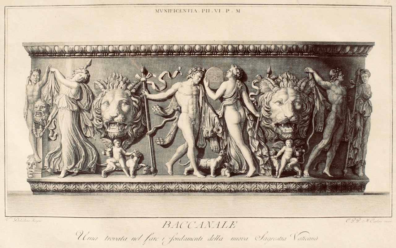
Baccanale – an example of a 1782 copperplate engraving by Marco Carloni, Rome

Before we explain Paul Henry’s stretching of the truth, let’s consider something else: there are a few Lough Dergs in the country, but the most famous – and the one most likely to be depicted by an artist who is showing off Ireland might be Saint Patrick’s Purgatory, which I covered in this post, also from two years ago.
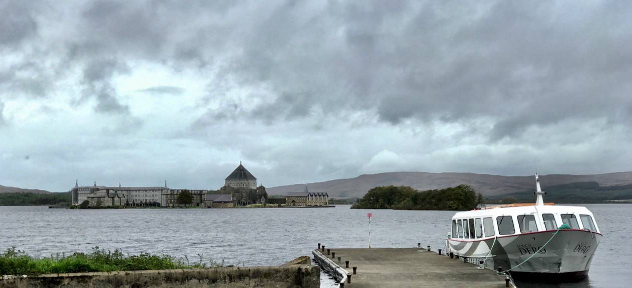
Lough Derg, showing the pilgrimage site of Station island, and the surrounding landscape

It’s a bit of a stretch of the imagination to see the setting of Lough Derg, with its fairly low-lying hills, in the background of Paul Henry’s painting. And where is that little tower house on the spit of land behind the ‘Celtic Cross’? Well – maybe it’s here:

This painting by Paul Henry is known as Grace O’Malley’s Castle: it is picturesquely situated at Kildavnet, in the south-east corner of Achill Island, County Mayo, which Paul and Grace first visited in 1910. So inspired were they by the landscape and the apparently idyllic simple way of life that they remained on Achill for a decade. Here’s another view of the O’Malley castle by Paul Henry:
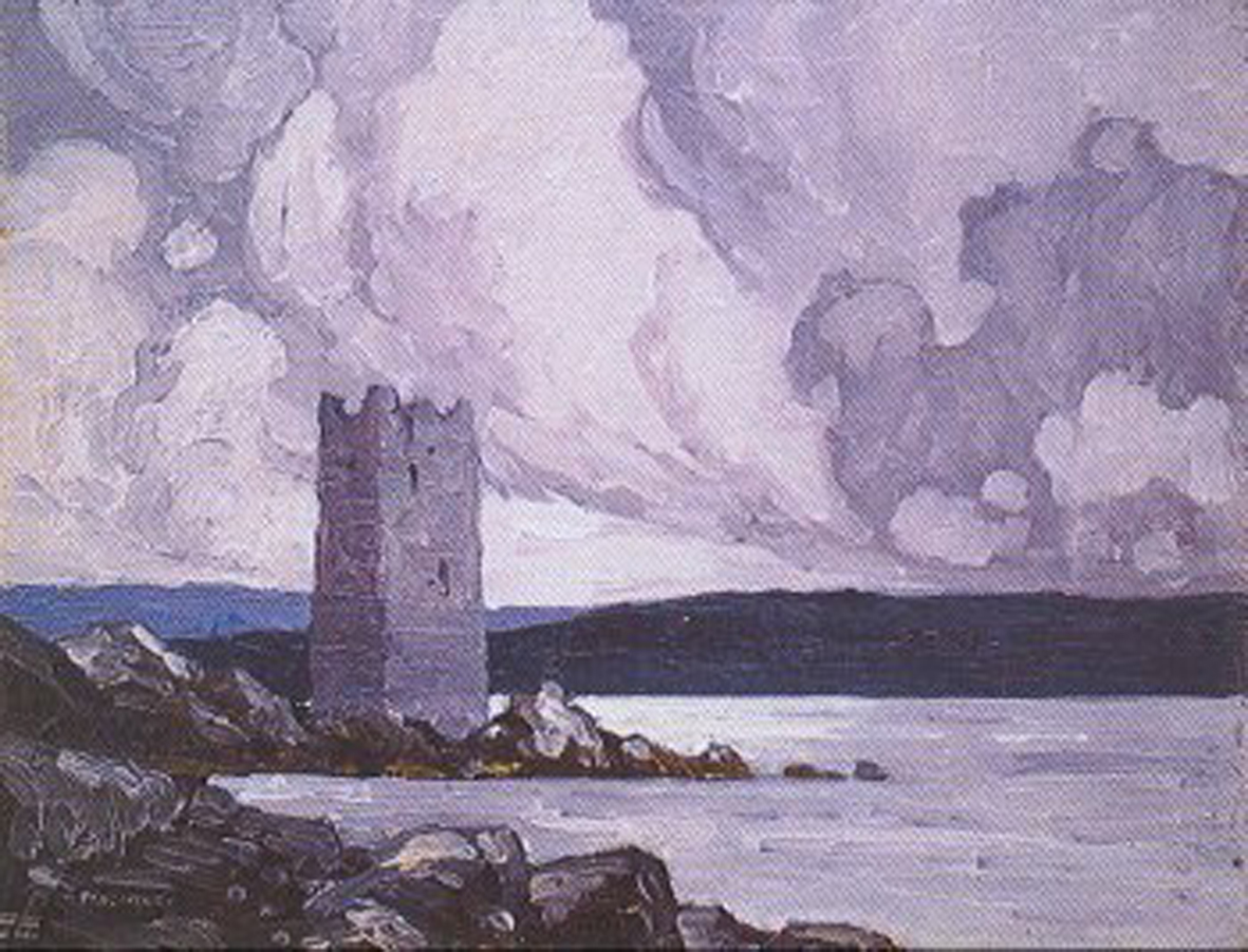
So the ‘Celtic Cross at Lough Derg’ is, in fact, a medieval high cross from Monasterboice, County Louth, and it is set against the stunning scenery of Achill, County Mayo. We can’t blame Morgan O’Driscoll (or anyone else who can be identified) for giving the painting a misleading name. It seems that originally the work was just titled ‘Celtic Cross’: here are some insights from Paul Henry’s biographer, Brian Kennedy, in the Irish Arts Review Yearbook 1989 / 1990 –

. . . Henry was egocentric and occasionally used artistic licence with historical facts in the same way he might have done in a painted composition . . .

. . . In 1917 the Irish Times thought he was developing a decorative treatment of the landscape whereby his imagery was not realistic but was symbolically Irish . . .

And the following is from Paul Henry: With a Catalogue of the Paintings, Drawings, Illustrations, by S B Kennedy, Paul HenryYale University Press, 2007: it tells us that the painting was clearly known as ‘Celtic Cross’ in 1924, and was in the collection of Seán T O’Kelly, Ireland’s second President (between  June 1945 and June 1959). When sold by Adams in 1984 the painting had acquired the additional wording . . . at Lough Derg . . .

. . . 611 Celtic Cross 1924. Oil on board 24 x 22 (61 x 56). Signed ‘PAUL HENRY’ . . .

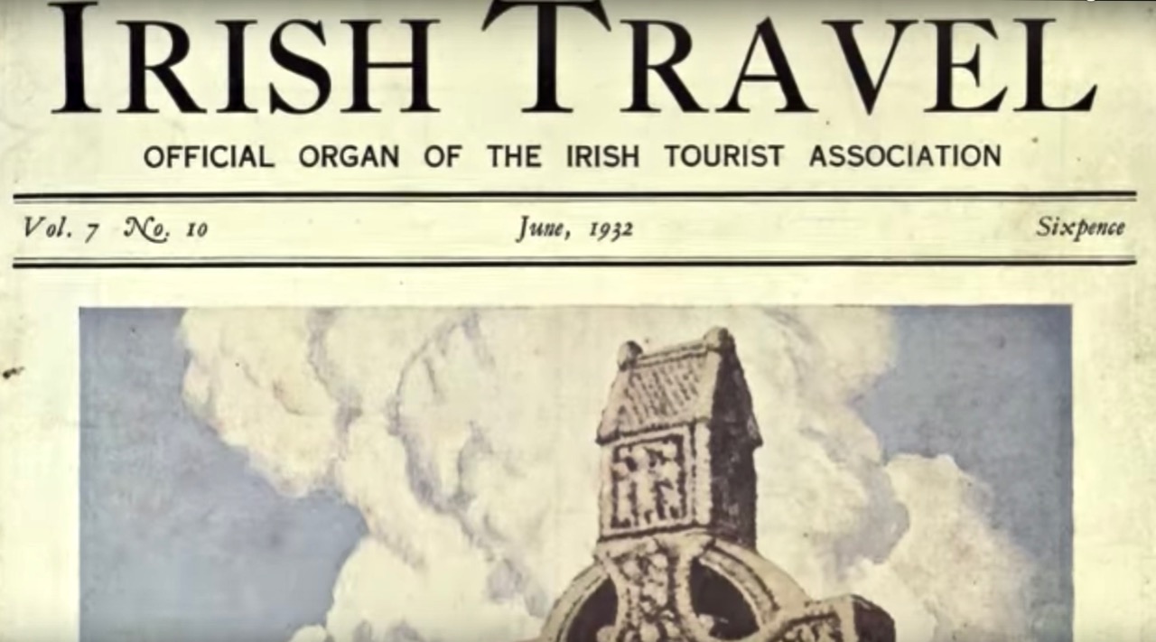
Private collection. Prov: Sean T O’Kelly; sale, Adams, Dublin 19 July 1984. Lot 86, as Celtic Cross at Lough Derg, repr. Irish Travel, vol 7, no 10, June 1937 repr. on front cover. Almost certainly a composite composition . . .
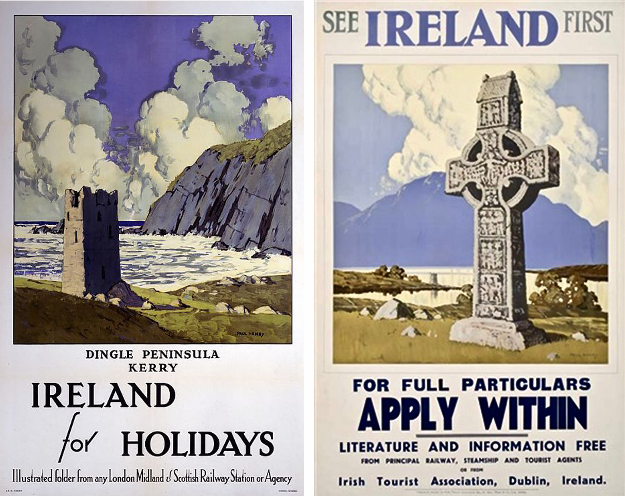
As with most artists – who need to earn a living – Paul Henry willingly accepted commissions. He was successful in selling ‘popular’ work to railway companies and the Irish Tourist Association (above – 1920s and 30s).
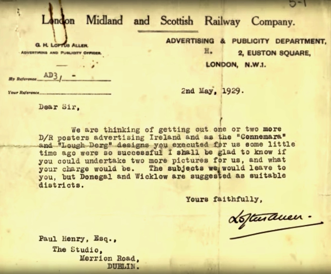
A “Lough Derg” design is mentioned in the Railway Company’s letter (above). Below is another – for British Railways: this is more likely to be the Lough Derg on the Shannon.

Has this helped to unravel the enigma of Paul Henry’s Celtic Cross at Lough Derg? Whether or not you are convinced, I’m sure you would like to have the painting hanging on your wall – me too! Although it would be so much better if it could go permanently into a public collection The sale is coming up in April . . .
 

Antiquarians Loved Glendalough

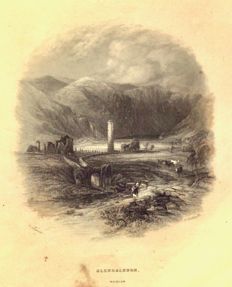
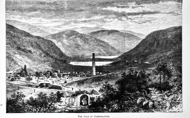
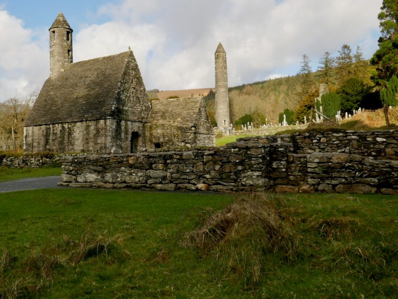
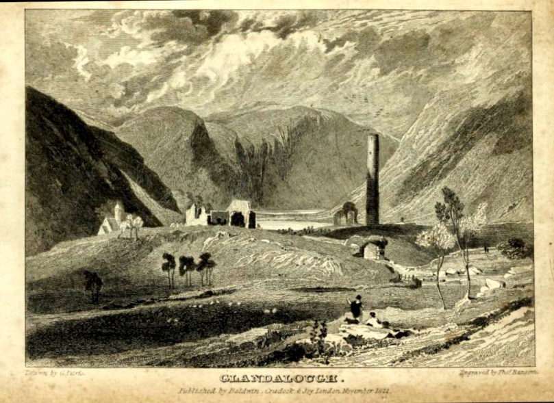
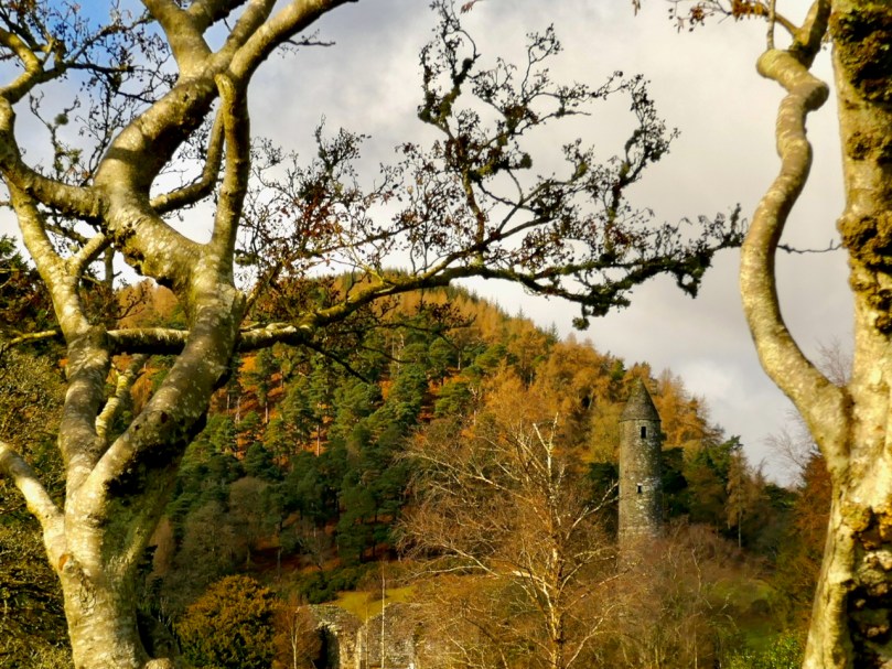
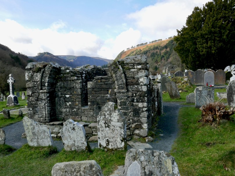
Researching a post on Romanesque architecture at Glendalough, I have come across so many depictions of Glendalough by tourists and antiquarians that I thought I would start by sharing some of these with you, by way of a general introduction to this outstanding heritage site. Situated in the heart of the Wicklow Mountains, the ecclesiastical settlement of Glendalough occupies one of the most beautiful valleys in Ireland and this combination of wild scenery and picturesque ruins made it a favourite of antiquarians, travellers and illustrators.

This illustration from Halls Tour of Ireland, Vol II, published in the early 1840s, concentrates less on architectural accuracy and more on an impression of romantic picturesqueness, although it does get the main features more or less right

Another view, this time by Lovett from his Irish Pictures of 1888

This is also a highly significant archaeological and historical site. I’ve been reading a most lucid and illuminating guide to it and I highly recommend it – Glendalough by Christiaan Corlett. Chris is an archaeologist with the National Monument Service and nobody knows this place better than he. Of the valley he says, Is there anywhere else in the Christian world that can boast so many churches and related buildings dating from before the year 1200 that have remained so intact?

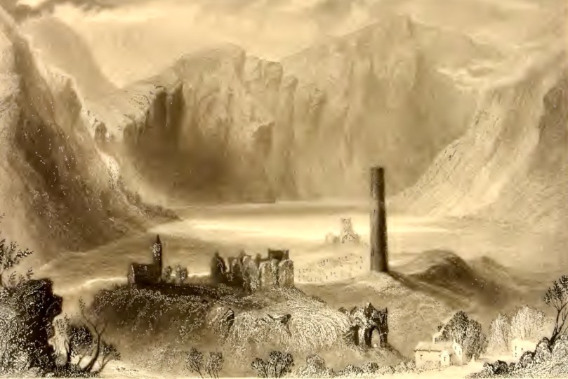
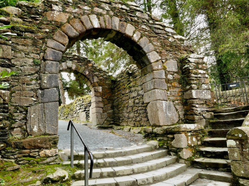
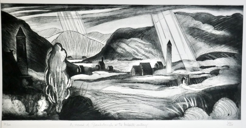
I’ve started this post with the most recent image, done in 2008 by our friend Brian Lalor, but in the style of an antiquarian drawing and showing the full scope of structures at Glendalough – eight churches and three towers – as the valley would have been seen in the thirteenth century. The round tower is the most prominent feature on the landscape – and the image that most visitors take away with them. It was, of course, originally a bell tower (although it may have served other functions) since the call to prayer was an important part of the monastic day. In the drawing directly above, done by W H Bartlett (see last week’s post about this wonderful illustrator) about the same time as the Hall’s Tour sketch, you can see that the round tower is roofless. Although once again Bartlett is careful to create a wildly romantic scene he also shows the principal structures, including the Gatehouse, which is pictured below as it is today.

Note the projections of the wall on either side of the arch – these features are known as antae and were typical of early church construction in Ireland. See my post Irish Romanesque – an Introduction for more on this topic

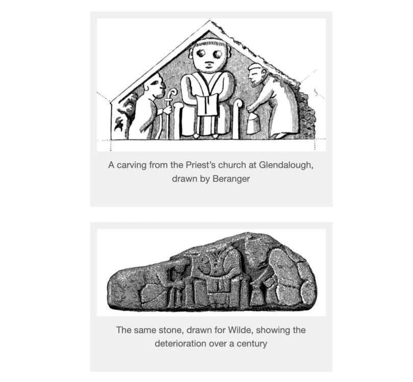
Of the two other bell towers, only the one atop St Kevin’s Church still exists. The other was similarly situated on Trinity Church but has since collapsed. But we do have evidence of it – see the final illustration in this post! Here we see why antiquarian drawings are so important. The ravages of time have taken their toll on the buildings and carvings at Glendalough: some have simply disintegrated away while some carvings recorded by these early illustrators have disappeared, presumably stolen.

St Kevin’s Church, the vestiges of St Ciaran’s Church (foreground), the Round Tower, and the east wall of the Cathedral

There’s another consideration too – the well-meaning rebuilding efforts of the Victorian period. As a consequence of the Disestablishment of the Church of Ireland which came into effect 150 years ago on Jan 1, 1871, responsibility for all the ancient ecclesiastical sites transferred from the Church of Ireland to the state, and from there to the Office of Public Works. An urgent need to conserve ruinous buildings combined with an enthusiastic approach to ‘reconstruction’ and improvement led to many monuments all over Ireland getting a make-over. As one of Ireland’s premier tourist destinations, then and now, Glendalough became the focus of such activity.

A Petrie engraving from 1827

Perhaps the most visible change was to the round tower, which was blessed with a brand new conical cap. The work was done carefully, using stones found at the site, and there is ample evidence that this was the original shape of the roof.

Some of the other reconstruction efforts may be less accurate, perhaps based more on conjecture than on evidence, but at least in the case of Glendalough the antiquarian drawings could provide some clues as to the condition of the monuments within the last 100 years, if not in their original state.

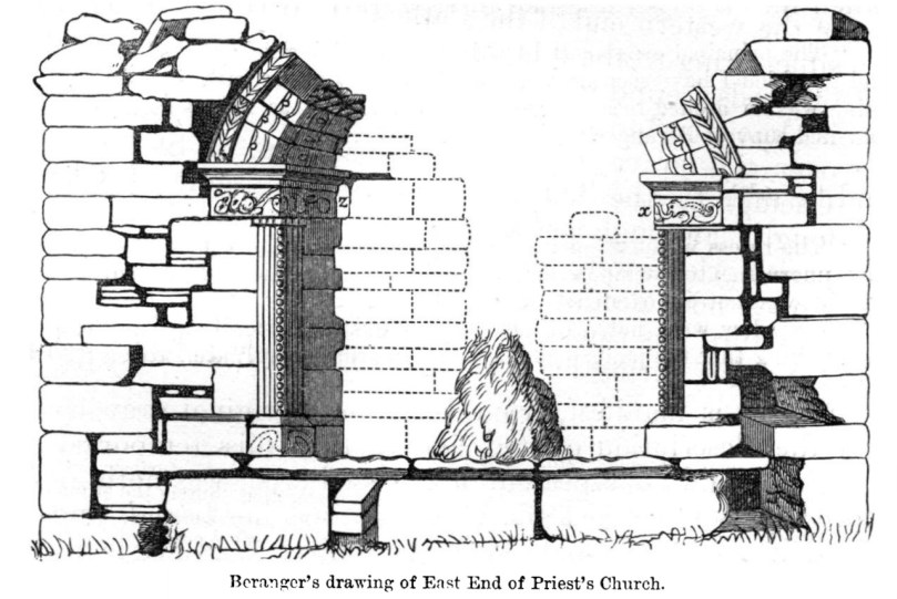
The Priests’ House (above) is a case in point. It had almost totally collapsed. As Corlett says, what can be seen today is a reconstruction carried out in the 1870s from the stones that survived among the rubble. This has presented a lot of problems for our attempts to understand the original nature of function of this building.

The Board of Works focused on the drawings of Gabriel Beranger from 1779 and rebuilt the elaborate romanesque arch as Beranger had depicted it. It remains somewhat controversial since it is highly unusual for such a feature to be on the outside of a building, although Corlett points out that its function may be related to the veneration of relics inside the chapel by pilgrims mounting the step to gaze through the small window.

Next time, I will concentrate on the architecture of Glendalough. It dates mostly from the 12th century and illustrates gloriously the persistence of traditional building designs from the early Irish church as well as the introduction of the Romanesque style with its arches and carvings. Some of the best examples are those that fewest people visit, so you may have a couple of surprises in store.

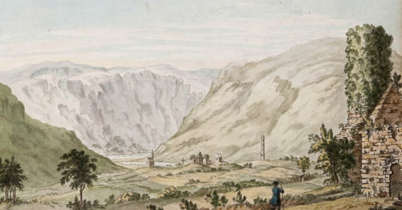
Beranger’s painting of Glendalough, done in the 1770s and showing the bell tower on Trinity Church, now gone

Scenery and Antiquities – W H Bartlett in Nineteenth Century Ireland

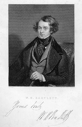
William Henry Bartlett was one of the foremost geographical illustrators of his day and he travelled the world producing images for his publisher, George Virtue. He came to Ireland at least twice, as witness his illustrations for Ireland Illustrated, published in 1831 and for Scenery and Antiquities of Ireland in 1841.

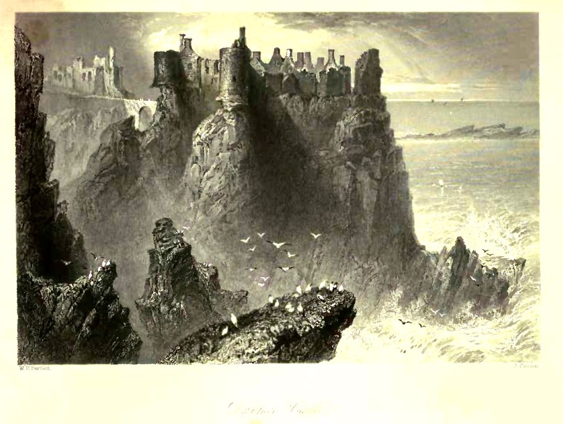
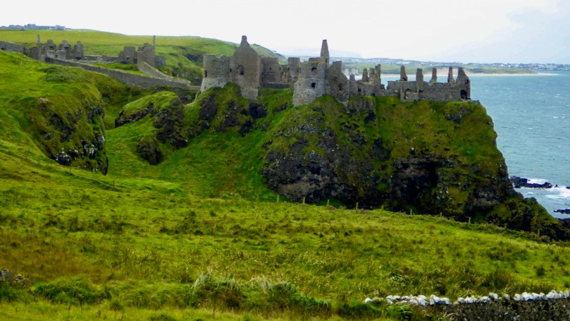
Dunluce Castle By Bartlett and a recent photograph. While accurate in architectural detail, Bartlett also manages to convey the impression of the wildly romantic, remote and craggy location in a way a photograph simply fails to do

Bartlett’s method was to do a sepia wash painting, as detailed and accurate as possible, and this was then engraved by the expert engravers employed by Virtue – he used the same ones as Turner. But Bartlett was also an artist, not content with reproducing only in a factual manner. Like other artists of the period he strove to convey an impression, particularly of monumental scale and wild romanticism.

The results for his Irish engravings are wonderful indeed – and important, since they enable us to compare what he saw with what remains today. Some of his illustrations are so exact that comparison with a modern photograph shows that the object of the drawing has survived in much the same condition for almost 200 years.

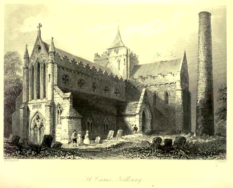
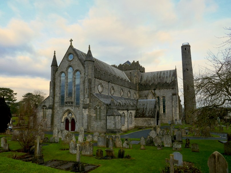
St Canice’s Cathedral, then and now

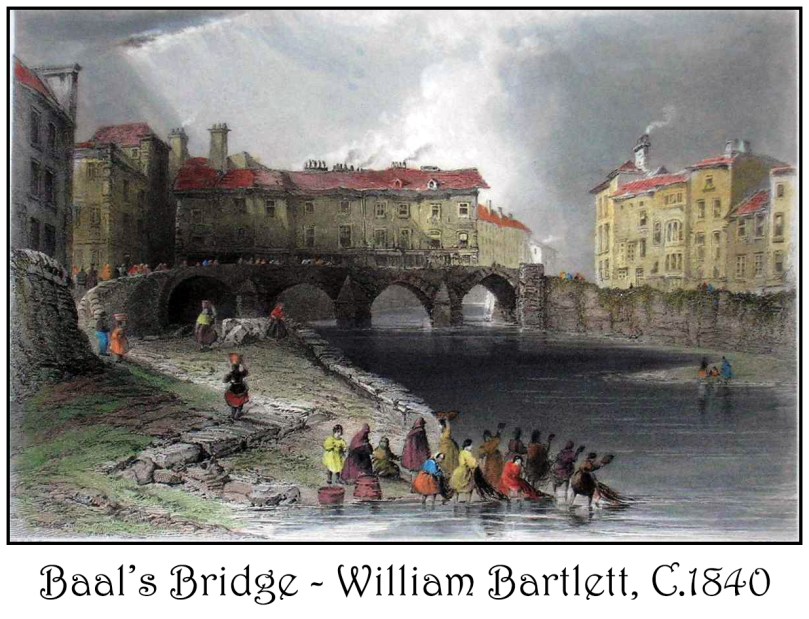
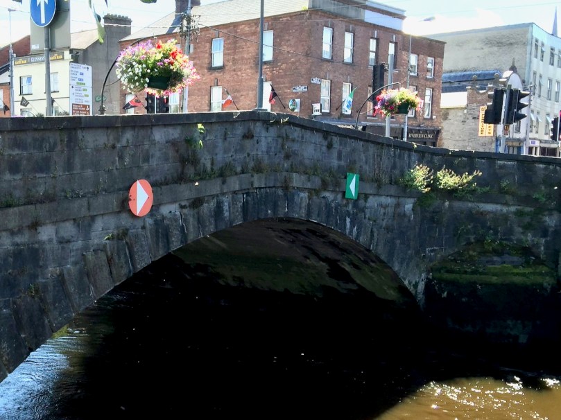
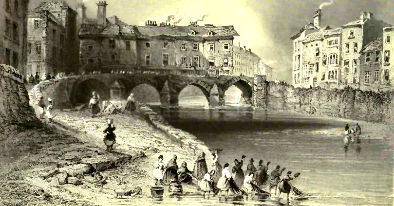
Others allow us to see what is no longer visible on the ground – the Old Baal’s Bridge, in Limerick, for example, was demolished by 1830, so Bartlett’s pictures of it are an essential reminder of this picturesque and unusual structure.

A colourised version (not sure when this was done) of Bartlett’s Old Baal’s Bridge in Limerick, and the bridge that is there today

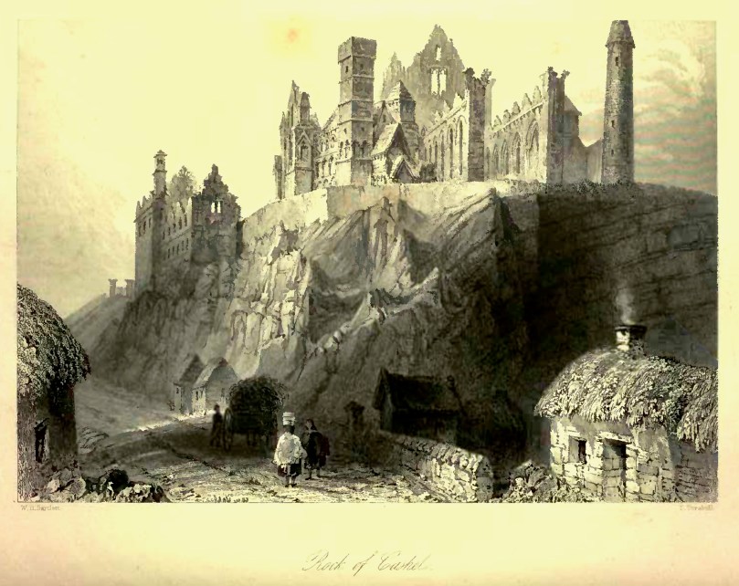
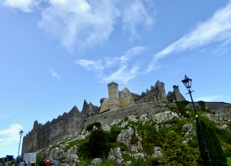
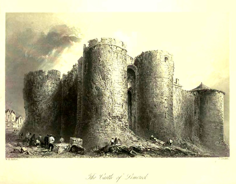
Although he illustrated streetscapes and contemporary buildings, Bartlett had a particular fondness for antiquities. Wherever he could, he selected scenes that contained ruins of abbeys or castles or ancient monuments such as high crosses.

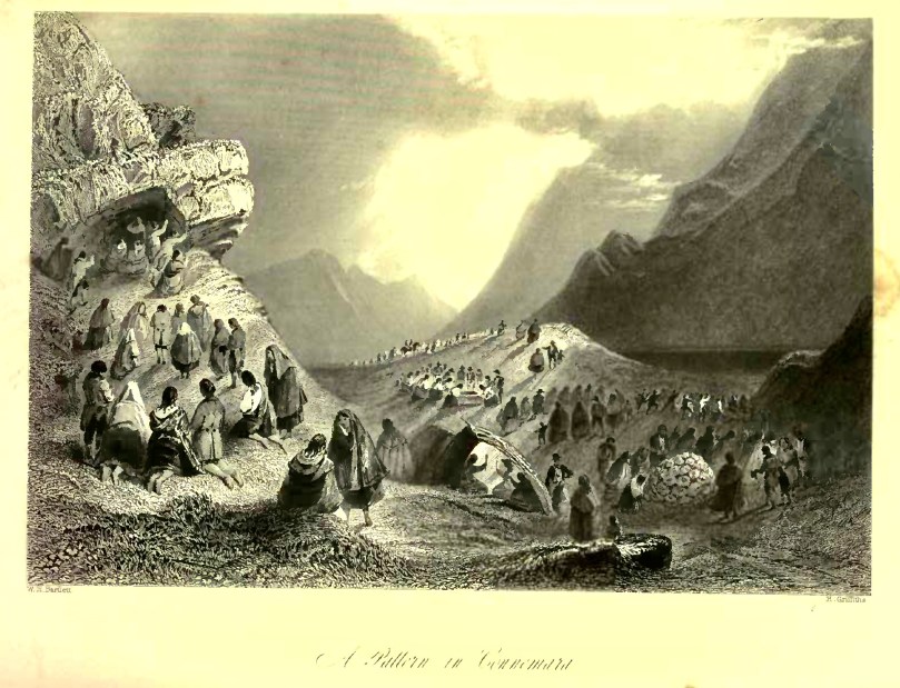
He also, almost incidentally, has left us many scenes of daily life or of special occasions, such as the women washing clothes at the Old Baal’s Bridge, or the Pattern in Connemara.

I have provided comparison shots for Bartlett’s illustrations wherever I have them, and have limited myself to a few of the better-known places in Ireland. The writers of Scenery and Antiquities, N P Willis and J Sterling Coyne, also deserve a post of their own at some point, so I can see that we will be re-visiting this book in the future!

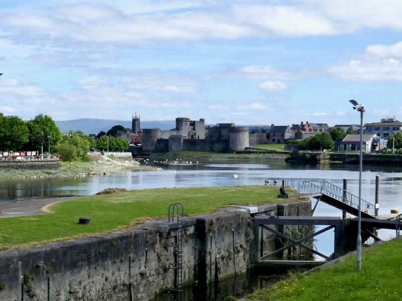
King John’s Castle in Limerick, and below is Bartlett’s original engraving of the Old Baal’s Bridge


Ireland in the 1950s – Through the Lens of Robert Cresswell

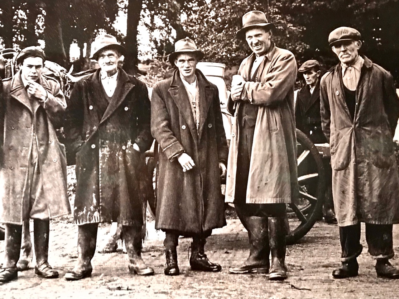
This post complements last week’s overview of the work of Dorothea Lange, who spent several weeks in County Clare in 1954, documenting the rural way of life she observed there in over 2,400 monochrome photographs. That’s a monumental collection which can only be fully accessed by visiting the Oakland Museum of California. We are fortunate to have a book of some of her Irish work – Dorothea Lange’s Ireland – published by Eliott & Clark, Washington, 1996 and a current exhibition which includes some of her images at Dublin’s Museum of Decorative Arts & History, Collins Barracks. That same exhibition features the work of two further documentary photographers, one of whom is our subject today: Robert Cresswell (below):

The Paris-based American anthropologist Robert Cresswell (1922-2016) remained on in France after WWII, having served in the US army there for four years. Following the completion of his studies in anthropology in Paris, he arrived in Ireland in 1955 with the ambition of carrying out an anthropological analysis of an Irish rural community. Taking the advice of the Irish Folklore Commission he chose Kinvara, County Galway. The small rural town of Kinvara and its agricultural hinterland would become the base for his study, published in 1969 as ‘Une Communauté Rurale de l’Irlande’ . . .
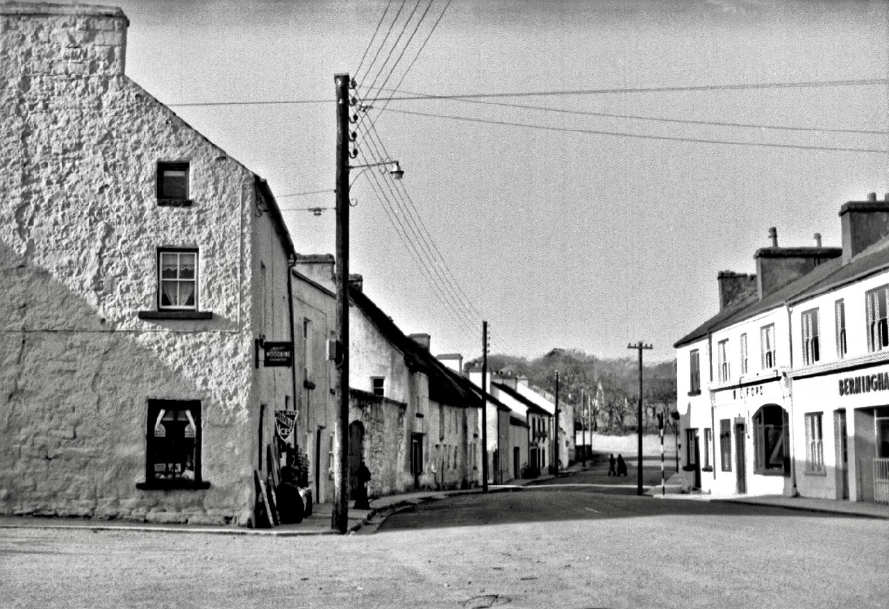
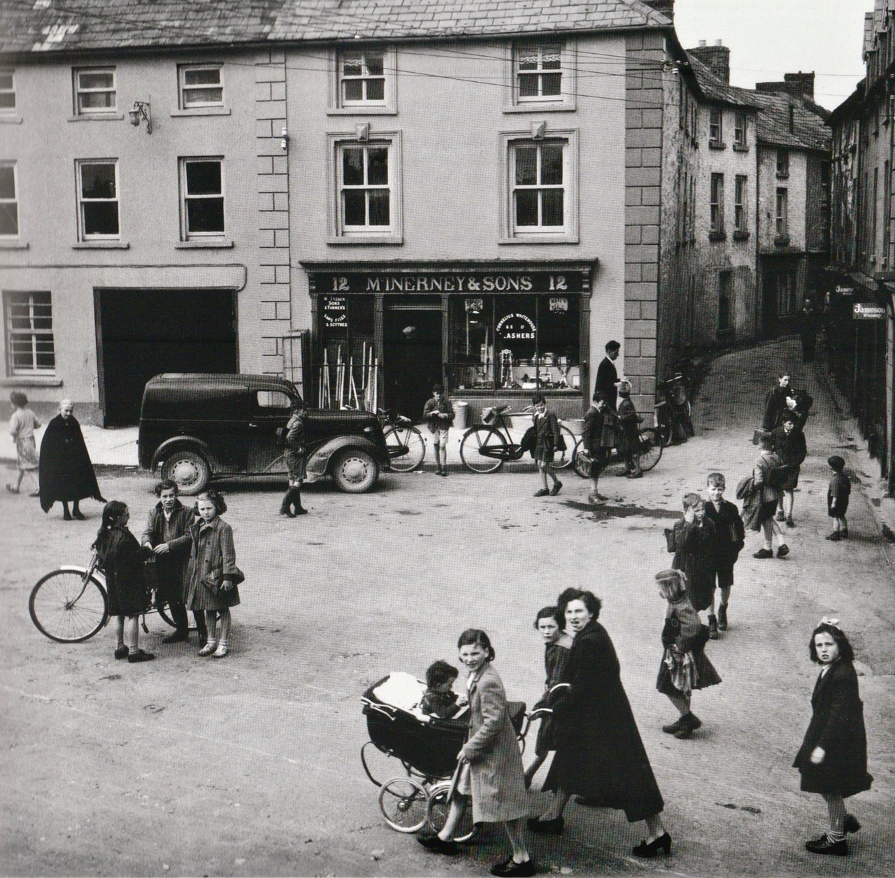
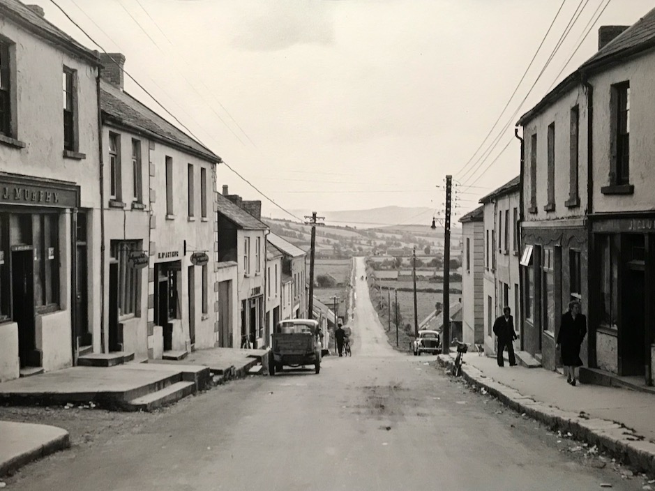
Header – Kinvara on Fair Day, 1955 by Robert Cresswell. Above – Kinvara, Co Galway, streetscape; compare these to Dorothea Lange’s views of Ennis and Tulla, Co Clare (in last week’s post), taken in the same period

While the photographic essays by Dorothea Lange and Robert Cresswell bear close comparison – and how hugely interesting it is for us to see Irish rural life through those lenses nearly 70 years ago – it’s fascinating to consider that both came from very different backgrounds and disciplines, but were equally absorbed by the iconic images each of them was capturing – giving us a visual ‘time capsule’ of Ireland as it was apparent a few generations ago.

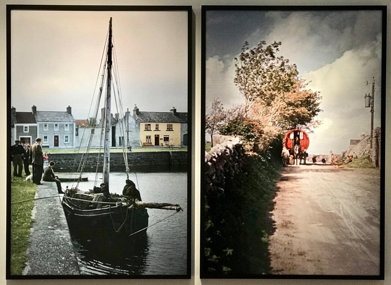
Above – examples from the Dublin exhibition showing the work of Cresswell taken from his colour slides

Robert Cresswell was a pioneer in some respects, in that he used Kodachrome film to produce colour slides, in the days when monochrome documentary photography was the norm. Some professional photographers could not cope with the idea of using colour, partly because they considered the images were not realistic. Ansell Adams felt that ‘. . . color could be distracting, and could therefore divert the artist’s attention away from creating a photograph to its full potential . . .’ while Henri Cartier-Bresson famously uttered his opinion that ‘. . . color is bullshit . . .’ – which was all he ever said about it, allegedly! My own (humble) opinion is that there is something about monochrome photographs which seems to draw the eye and enhance the atmosphere, particularly with historic images. I can’t explain this – there is no logic: it’s just a personal response which I am always aware of.
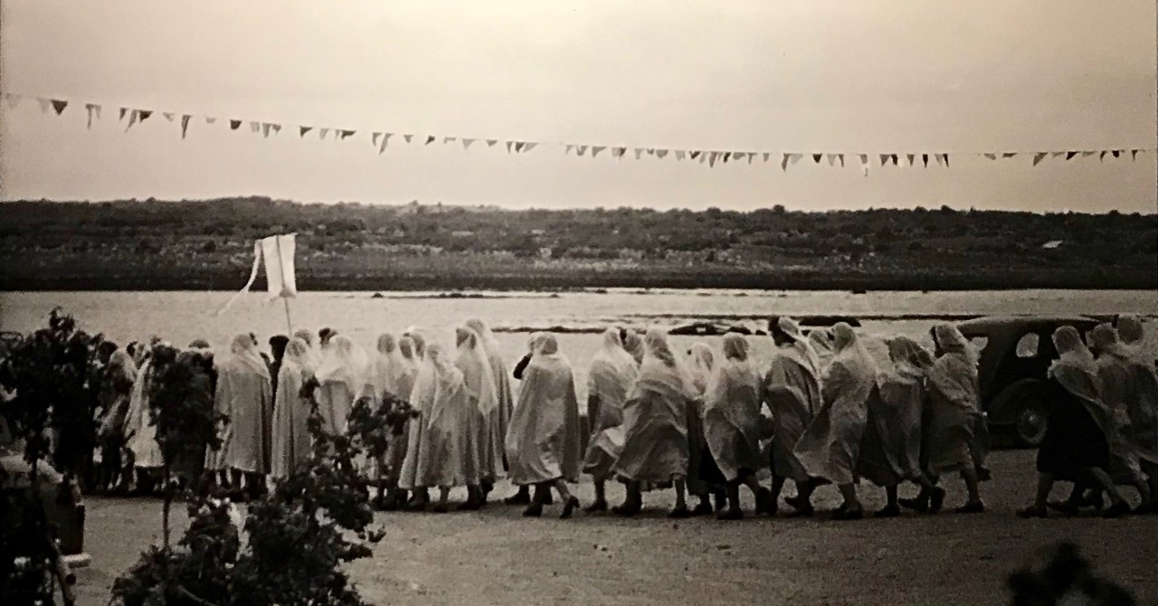
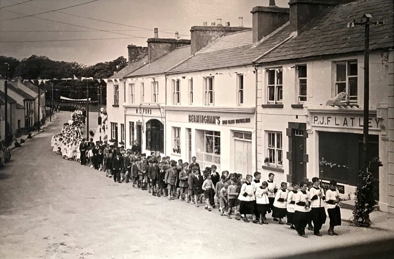
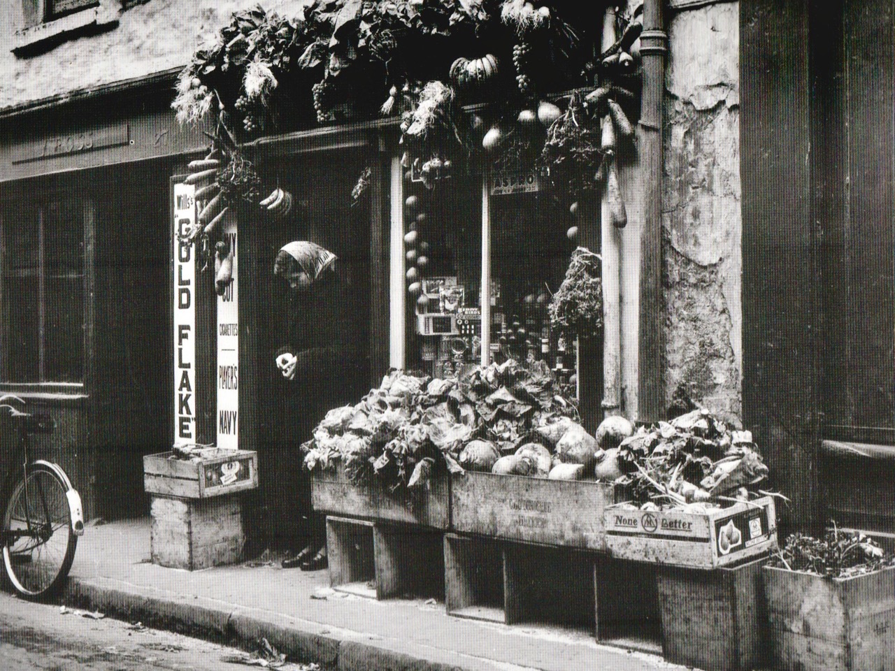
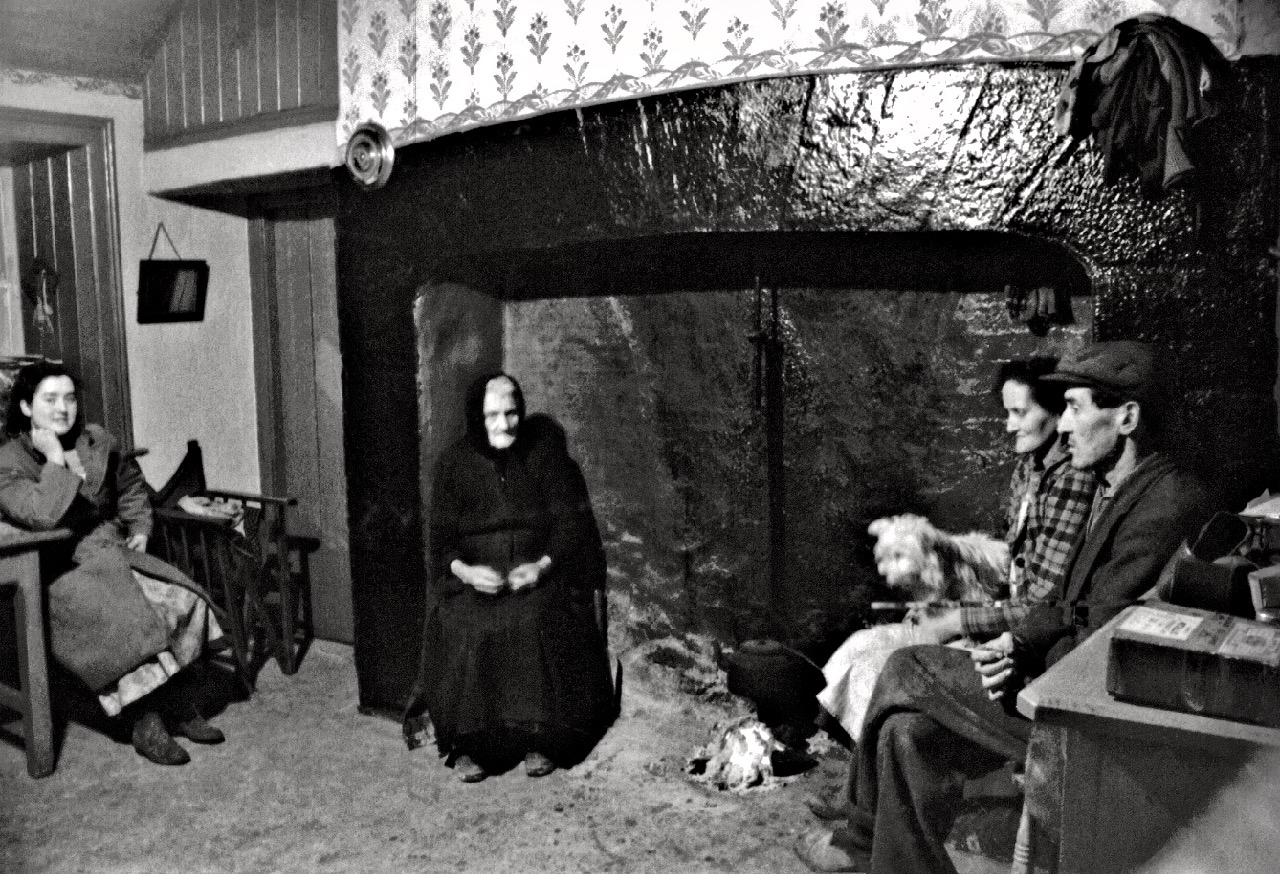
Above – monochrome Kinvara: the Forge, and Corpus Christie procession

Robert Cresswell lived in the Kinvara community for fifteen months between 1955 and 1956, returning for short periods in 1957 and 1958. The quotations in this post are from the exhibition text panels:

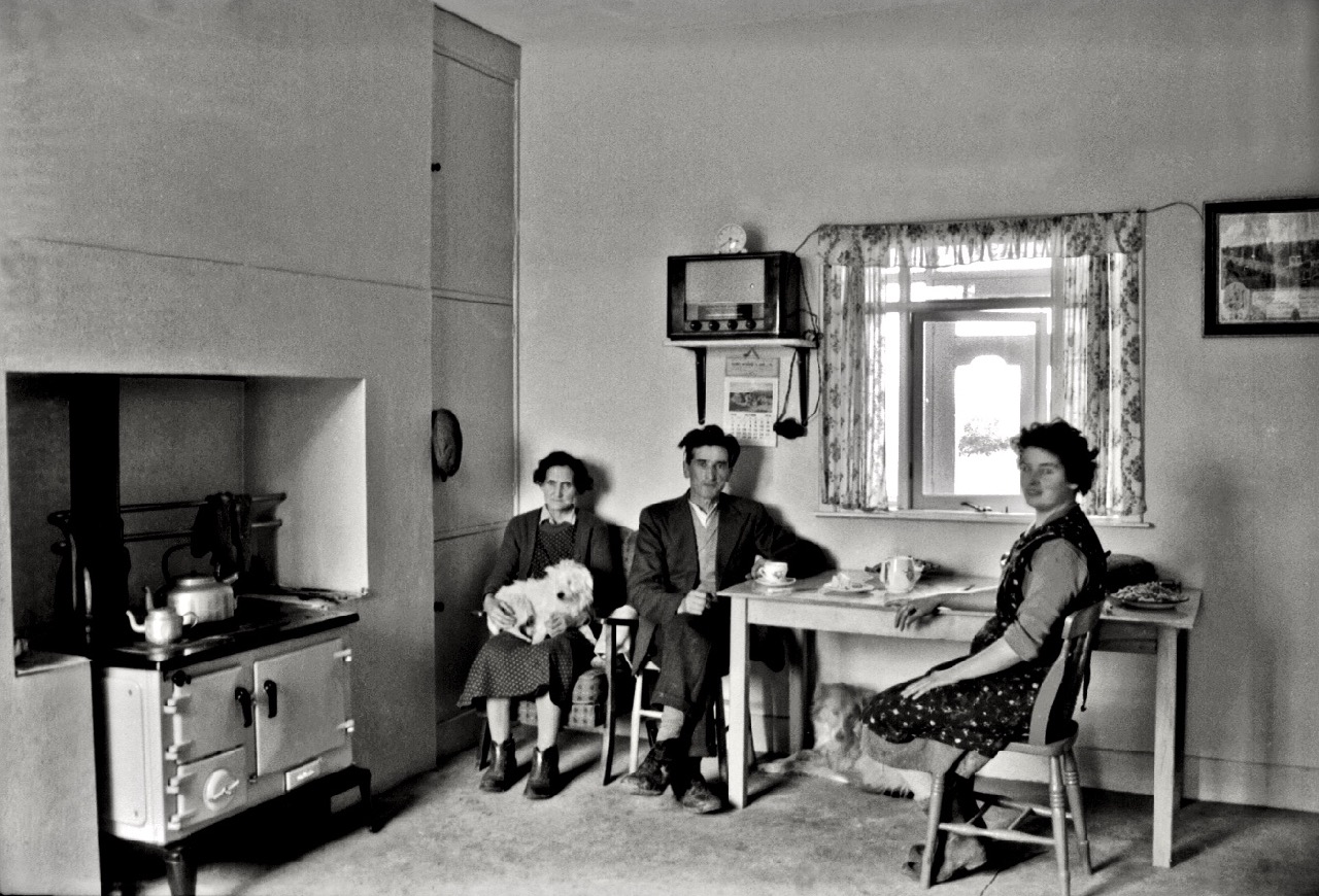
Capturing more than five hundred images . . . Cresswell photographed the people of Kinvara, their countryside, their work on sea, shore and land, the daily lives, religious processions, and fairs and markets. Documenting the changes that were occurring in the shift from a traditional farming community to a wider market-led economy, he was motivated to emphasise a community in transition over one operating in the continuity or stagnation of tradition. His photographs generally portray a well-functioning society, but his interpretation of emigration as the ultimate destructive agent in community and country profoundly influenced his understanding of rural life in a small community in 1950s Ireland . . . The population of the parish of Kinvara sustained a net loss of 80% between 1841 and 1956 . . .

Above: a community in transition – contrasting pictures of family life in Kinvara recorded by Cresswell in the mid 1950s

Tempting though it is to show you much more of Cresswell’s work here, I really want you to go and see for yourselves. The exhibition at Collins Barracks, Dublin continues until April this year, and is well worth making the effort to visit. Robert Cresswell lived a long life; in 2010, then aged 88, he donated his entire collection of documentary photographs and cine film of Kinvara to the Irish nation. He waived his own copyright to this unique work in favour of all persons who wish to use any of it for educational or heritage purposes (but not for commercial gain without prior permission). Copyright now rests with Kinvara Community Council, who have published an excellent website here. I have used a small number of images from the collection to supplement those we found at the exhibition, in order to give you a fair cross-section of the entirety of Cresswell’s opus.

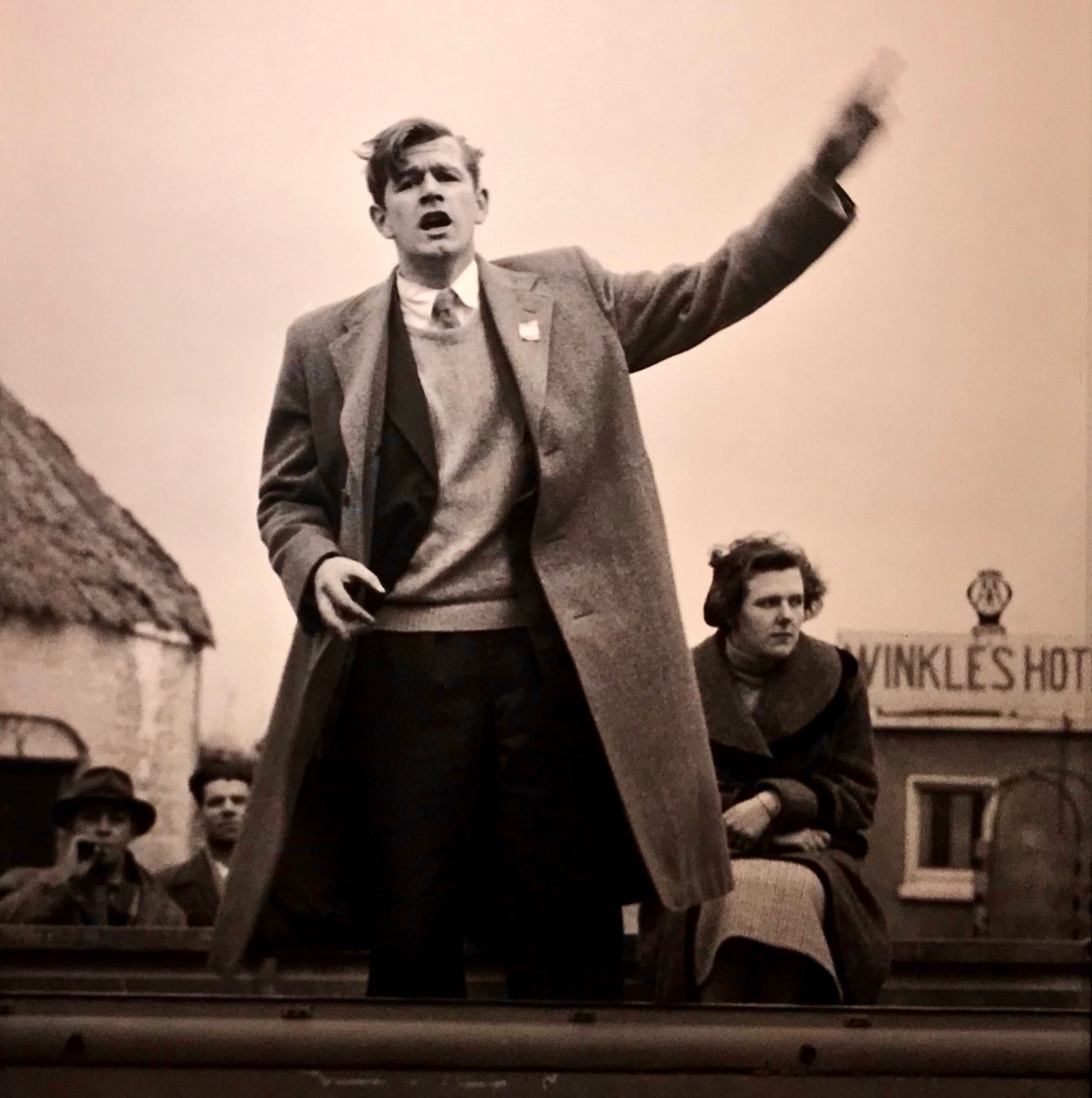
In a mirror of present-day events in Ireland, here’s a shot by Cresswell of the Sinn Fein candidate Murchadh Mac Ualtair canvassing in Kinvara for the 1957 General Election with Peggy Linnane. In that election Fianna Fáil, under Éamon de Valera, took 78 seats with 48.3% of first preference votes, and Sinn Féin took 4 seats with 5.3% of first preference votes. In our 2020 election, just passed, Sinn Féin, under Mary-Lou McDonald, took 37 seats with 24.5% of first preference votes in a thoroughly divided result, leaving us all in a bit of a dilemma! But I digress . . .

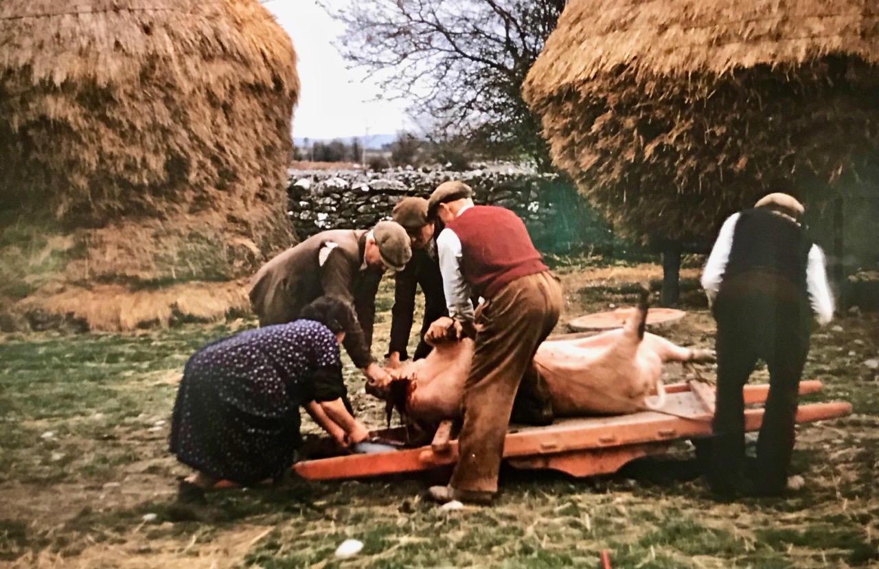
Another of Cresswell’s colour images, showing the killing of the pig – a family affair

There is one more photographer in this exhibition, who I will feature in a future post – watch this space! One last image from Robert Cresswell, possibly another view of the Corpus Christie parade:

1950s Ireland

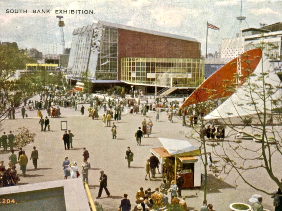
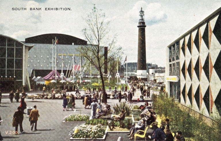
1950 happened 70 years ago – obviously. My earliest substantial recollection of the 50s era was a visit to the Festival of Britain, London, in 1951: I was five years old, and the memory has lasted. Incidentally, that year also saw my very first day at school, a traumatic experience from which I have never fully recovered – but that’s a story for another day!

I suppose that the seeds of an interest in building and engineering structures must have been in me then, because it is the architecture of that Festival that has stayed with me – and which probably influenced me in my own later career. Not that I ever designed a Dome of Discovery, or a Skylon – more’s the pity, but I think I have always related to the throwing off of tradition and the embracing of new and exciting shapes and colours which came out of the Festival. I believe we are overdue a revival of that bravado to lift our spirits once again.

I was pleased to find these contemporary picture postcards of the 1951 Festival of Britain: everything is exactly as I remember!

In the words of the Festival’s Director-General, Gerald Barry, it represented “a tonic to the nation” after twenty years in which Britons had successively endured economic depression, total warfare and acute post-war austerity. However, the Festival of Britain was the product of a left-wing government and it has been said that Churchill (then leader of the opposition) held the view that the whole venture was “three dimensional socialist propaganda”. I’m not sure that this is really true, as he attended the Festival and evidently spent all day riding up and down the escalators – then a novelty – with great delight! I also remember those escalators: we called them moving stairs (I still do – just like I still call the cinema the pictures). Finola clearly remembers riding on Ireland’s first moving stairs, in Roche’s Department Store, Dublin. But that was 1963; today’s post is all about the 1950s, but in rural Ireland.

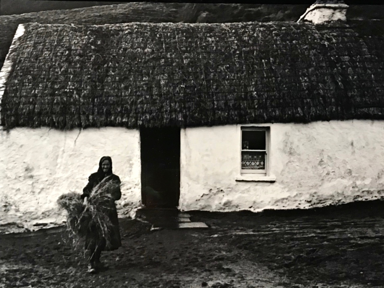
The Half Door, an image from rural Co Clare by Dorothea Lange

On a recent trip to Dublin we visited Ireland’s Museum of Decorative Arts & History at Collins Barracks. We went specifically to see an exhibition: Ireland in Focus: Photographing Ireland in the 1950s. This features “rare images of forgotten Ireland” by three world renowned documentary photographers, one from France and two from North America. Each of them visited Ireland during the 1950s to record a traditional way of life that was perceived to be vanishing as the twentieth century progressed. For anyone interested in Ireland and its recent history, this is not to be missed: it runs until April. In this post I shall show some examples of the work of one photographer: Dorothea Lange. The others will get a showing in future posts.

Dorothea Lange, a portrait taken by her husband Paul S Taylor on the Texas Plains in 1935

We had already been introduced to Dorothea Lange as my good friend John (also an expert photographer) recently gave us a copy of a book of her Irish photographs. Sponsored by Life Magazine, she visited the western seaboard in 1954, staying for several weeks in County Clare. She took over 2,400 photographs, which are now fortunately archived in the Oakland Museum of California. In the introduction to the book Dorothea Lange’s Ireland Eliott & Clark Publishing, Washington, 1996, Daniel Dixon writes:

. . . Dorothea Lange was not an avid reader. But among the few books which became her favourites was a description of the sort of culture that drew her attention time and again throughout her career, a rural society where customs, beliefs, and the way of life itself were tied to the soil. The book was called The Irish Countryman. Written in 1937 by a young anthropologist from Harvard, Conrad Arensberg, it documented and analyzed the social and economic traditions of Irish rural life and discussed how they were affected by religion and superstition. In it, Arensberg located the family farm at the hub of this complex system and explained how each generation placed an overriding importance on ‘keeping the family name on the land’ . . .

Why is it that we are so drawn to old photographs? Lange’s pictures paint a view of rural life in Ireland that is barely a lifetime away – yet it seems far longer ago. But, living in rural Ireland today, we can so easily relate to those times and – most probably – regret that they have passed. Of course, if we lift the veneer of nostalgia, we know that life was harsh, then and – for all the problems of this world – it is so much easier now. We doubtless have regrets principally for the loss of the people that are portrayed; moments preserved for all time on film, but that can never be recaptured.

Quite apart from the people, we do like to see how places have changed. These images of 1950s Ennis, now a sizeable county town, hark back to simpler times, for sure, in Lange’s work:

You won’t see every one these pictures in the exhibition – I have taken some from the book. They all complement each other. But it’s all only a small part of what Dorothea Lange recorded. What of the several hundred other images? At least they are kept safe, although not available on line. Lange was born in 1895 and succumbed to cancer in her seventieth year, 1965. A few months after her death the Museum of Modern Art in New York mounted a retrospective of her work. It was the first one-person retrospective by a female photographer held at MoMA. She is remembered far more for her images of the Great Depression years in the American West than she is for her visit to Ireland, but here we should be grateful for her documentary work that has added to our records of Irish rural life in the last century.

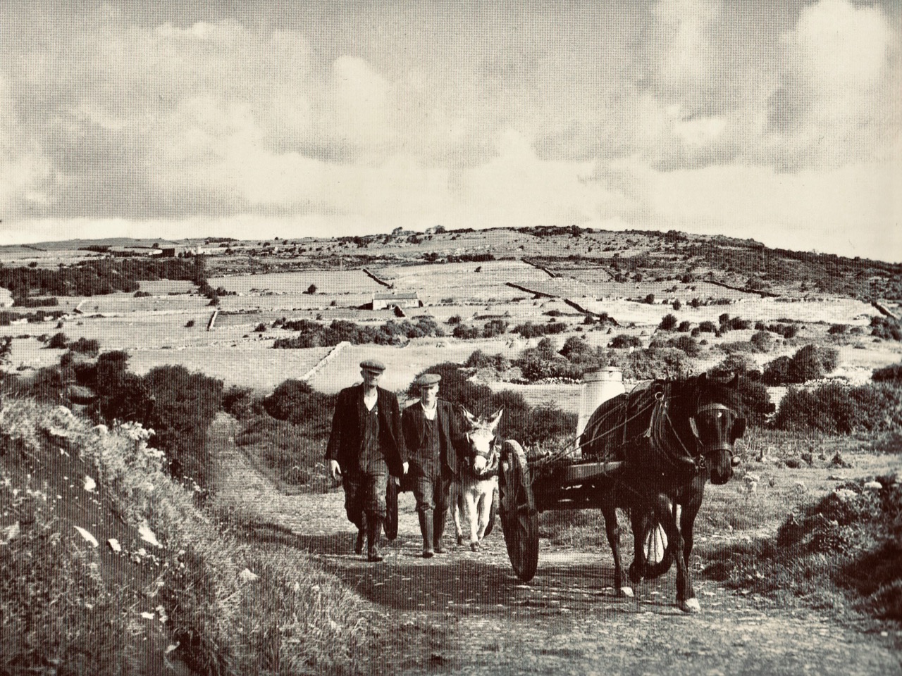
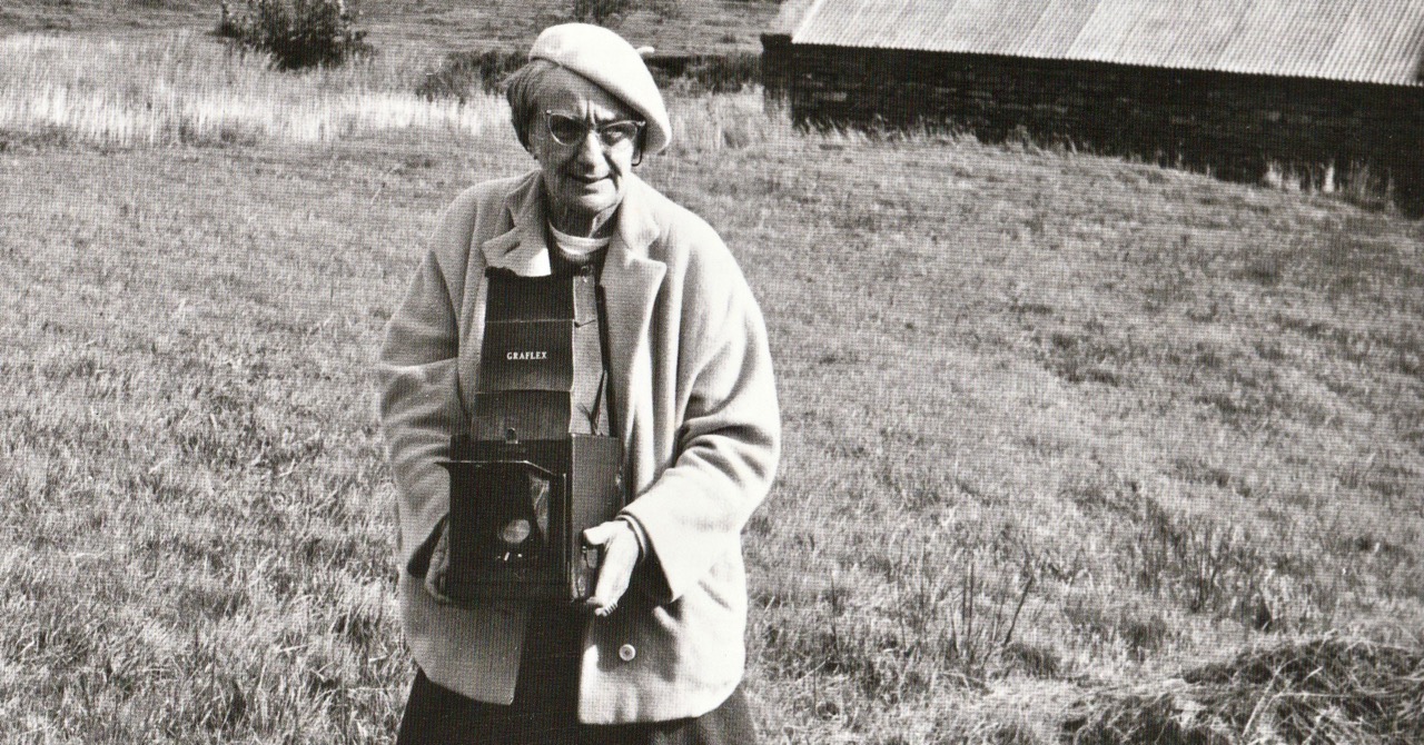
Top – Tulla, Co Clare; above – going to the Creamery, Co Clare, 1954. Below: Dorothea Lange in Ireland

Mizen Magic 17: Delights of Dunmanus

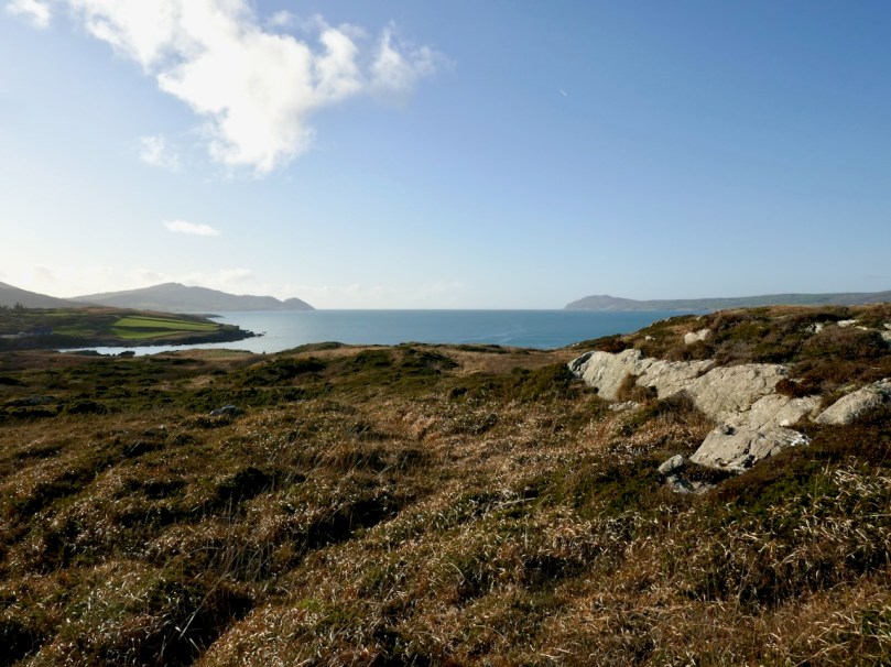
As we often do, we set out on a sparkling day last month to explore a part of the Mizen we aren’t familiar enough with yet. Our plan consisted of pouring over the OS Number 88 map and having an AHA! moment of realising that we haven’t been to a particular spot. This time, the dart landed on an area just northeast of Dunmanus Castle (seen above from Mount Gabriel), where it looked like there was a trail running along the water that would afford magnificent views of Dunmanus Bay and the Sheep’s Head. Things didn’t go quite as planned. . .

Red line: the trail we wanted to walk. Blue line, the trail we actually walked.
Arrows – yellow, Dunmanus Castle; pink, boulder burial; blue, Killhangel Church

We’ve written about this area before – specifically, in Mizen Magic 13 Robert described the promontory immediately to the northwest of the castle, with its ancient stone walls and its spectacular sea arches. This area has recently been re-fenced and isn’t as easy to access as it was.

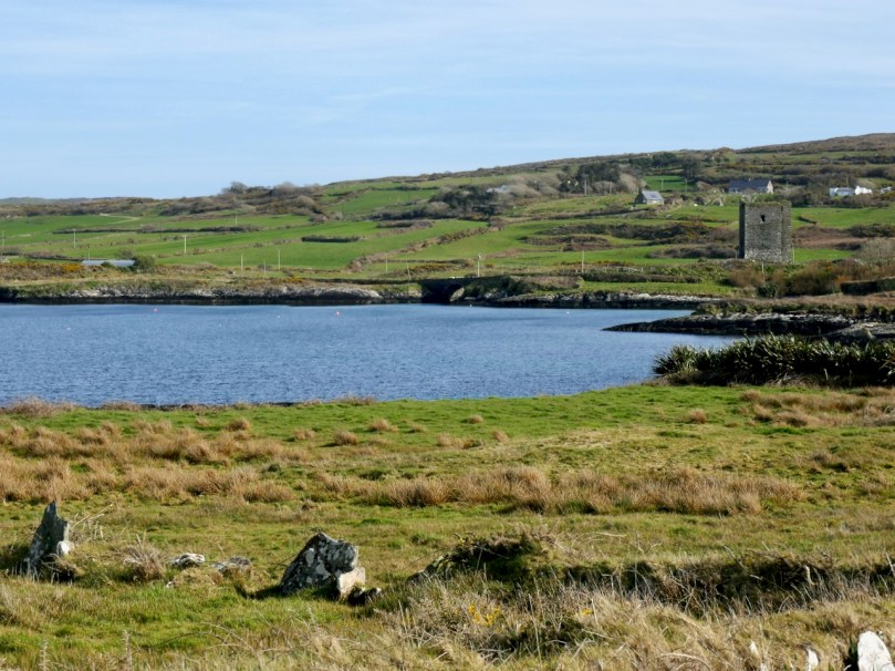
The Castle and bridge from the promontory

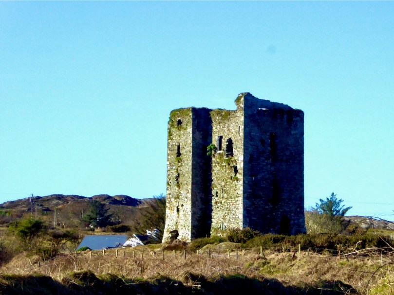
The Castle, of course, is the most prominent landmark in this area. Built by the O’Mahony’s in the 15th century, it is a classic early ‘raised entry’ type of tower house, with complicated internal architecture that allows restricted access to different parts of the building at different levels – including to an oubliette. My post When is a Castle..? has a good description of these kinds of castles, typical of West Cork.

But today we were heading away from the Castle, towards the townland of Knockeens, where, on the map, we could see this promising trail. But you can’t just go right there – a little meandering is always in order when you’re in countryside this beautiful and this interesting.

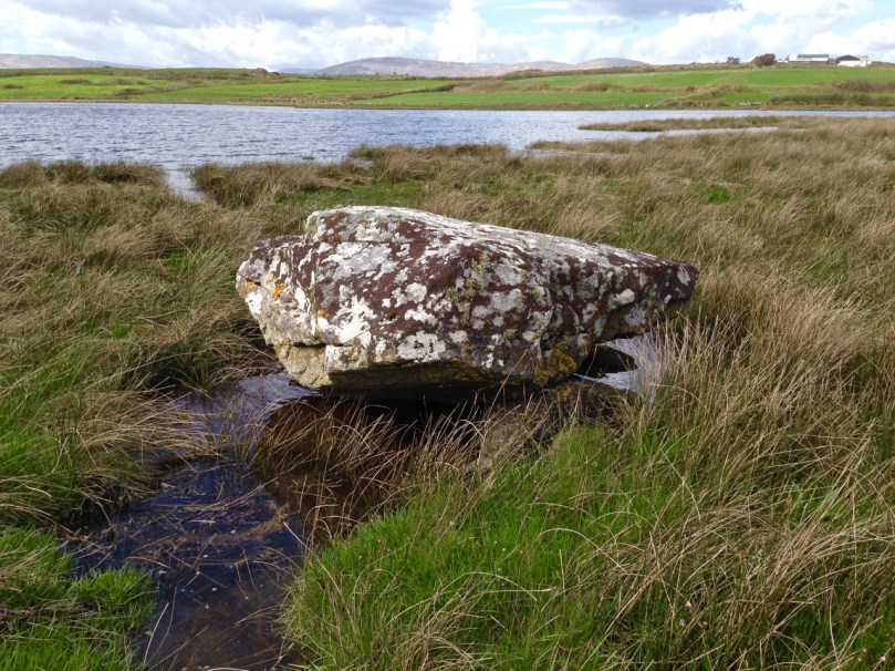
So we stopped to admire the Dunmanus boulder burial (it’s the rock in the lower left of the photograph above). Boulder burials are Bronze Age monuments, although they may have been used for purposes other than to mark burials. See my post Boulder Burials: a Misnamed Monument? for more about this intriguing group of archaeological sites, more widespread in West Cork than other parts of the country, and often associated with stone circles or standing stones. This one is unusual in that it is low-lying (most are in more commanding positions) and the base gets covered at high tides.

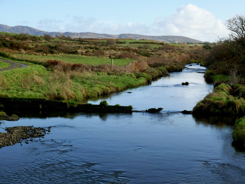
Crossing over an unnamed stream that rises on Mount Gabriel and empties into the sea here, we arrive at the point where we can leave the car and proceed on foot.

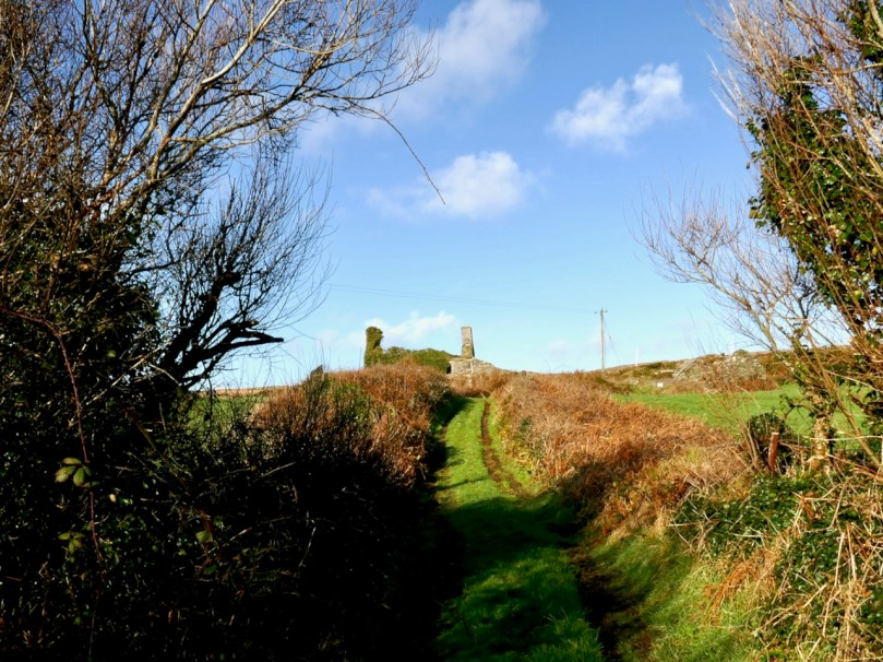
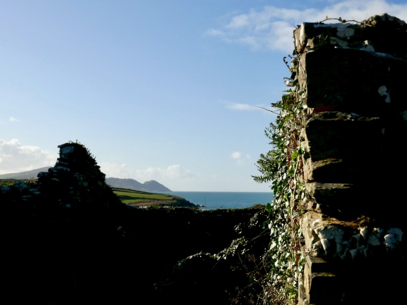
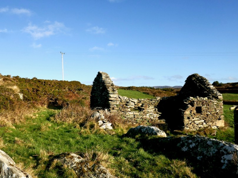
A short walk up an old boreen leads us to a clachán – a tiny settlement of houses, now all in ruins. The residents had magnificent views back down to the bay in their day, but as people say around here, you can’t eat scenery and the families who lived here are long gone to a better life elsewhere.

Just beyond the clachán we ran into our roadblock – an enormous puddle extended over the path. It was too deep to walk through and the boreen was fringed with thick gorse bushes we couldn’t push past. Stymied, we decided to climb up above the path and look for a way around. Easier said than done – between stands of gorse, boggy patches to go around (or sink into), sheep paths that went nowhere, we spent an hour or so wandering around the hillside and finally admitted defeat.

It wasn’t wasted time though – it was wonderful to be out in the crisp air, surrounded by all the magnificence of the Mizen, thinking about the generations who had wrested a subsistence out of that unpromising land. When we finally got back to the car we decided to see if we could approach the trail from the other side, and set off in that direction.

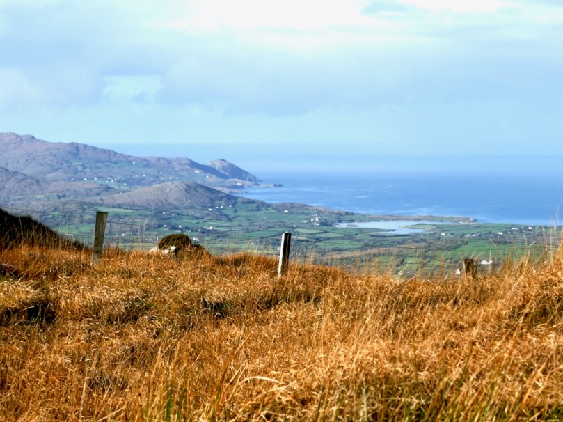
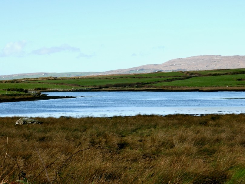
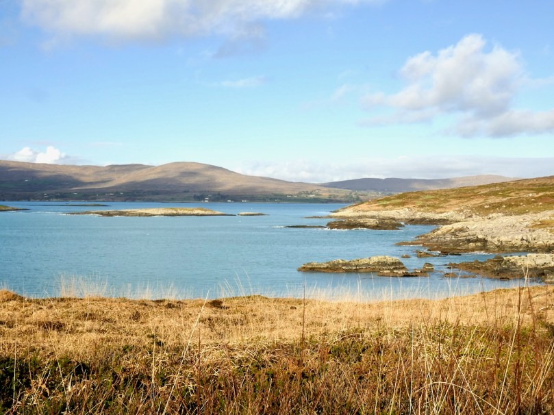
Looking across to the Sheep’s Head

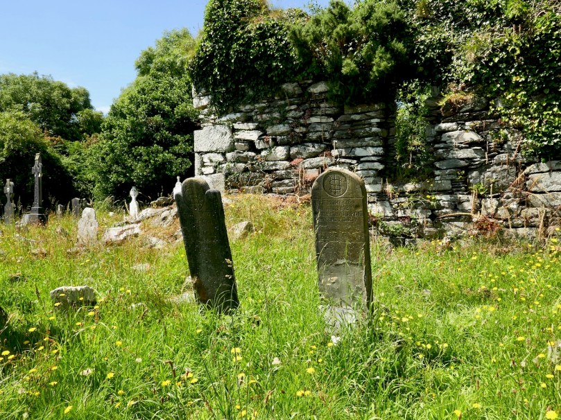
Along the way we had a quick stop at the ruined late-medieval Kilheangul Church (Church of the Angels). It’s a special little spot that deserves a post of its own someday, so I won’t say much about it now. This photograph of it was taken in the summer.

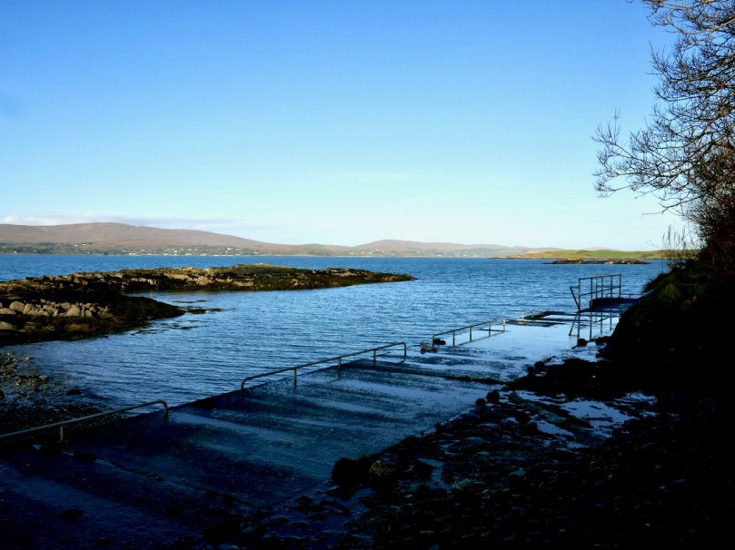
By the time we arrived at the other end of the trail, beside a small pier, it was starting to get dark, as befits a January afternoon, so discretion dictated that we leave the rest of the adventure to another day. 

The day started out to be about walking the trail – it ended up being about everything around it. That’s the thing about the Mizen – the journey is the destination.