Launched!

A joint post by Finola and Robert

Mingling

Hallowe’en (All Hallows – Samhain) was the perfect day to launch our Prehistoric Rock Art Exhibition at the Cork Public Museum. As Finola said in her remarks at the opening, it’s a time when the veil between two worlds is at its thinnest: in this case, it’s the veil between an ancient time and the present day. We hope the exhibition emphasises the work of our distant ancestors who have inscribed the landscape and given us the enigma that is Rock Art.

Blank Canvass

Almost there
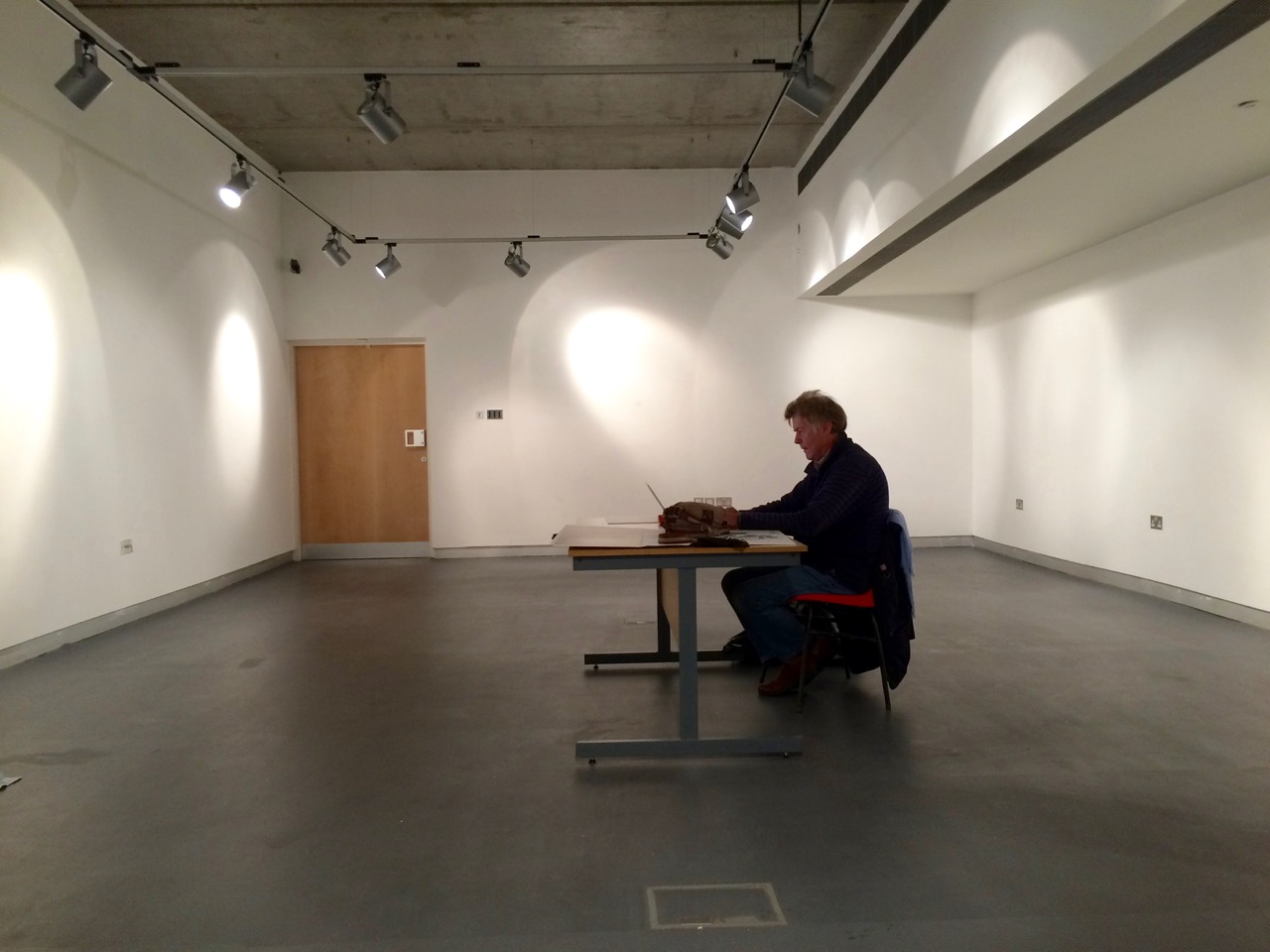
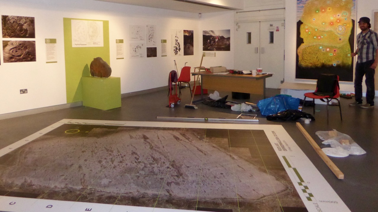
Before the Exhibition – Robert contemplates the blank canvas (top) and installation work in progress (below)

As our regular readers will know, the exhibition has been a very successful collaborative effort: Finola and Robert (providing drawings, explanations and the overall design); Keith Payne, a West Cork painter whose work is inspired by ancient art; Ken Williams, the excellent photographer of megaliths and monuments; the staff of Cork Public Museum, including intern Clare Busher O’Sullivan who came up with the idea and Dan Breen, Assistant Curator and his team, who made sure it all happened.

The Team

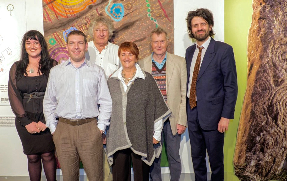
The Core Team: Clare Busher O’Sullivan, Ken Williams, Keith Payne, Finola Finlay, Robert Harris and Dan Breen

After some intensive days, on site and off, it has all come together and was launched yesterday. It was a grand launch: Firstly, William O’Brien – Professor of Archaeology at UCC – outlined a history of rock art studies and research which started back in the nineteenth century. He mentioned a predecessor in the department – Professor Michael J O’Kelly – who was born exactly 100 years ago and is best known for his excavations and restoration work at Newgrange, the Boyne Valley passage tomb: Finola worked on those excavations and it was Professor O’Kelly who suggested that she should carry out the research on rock art in Cork and Kerry which led to her Master’s thesis on the subject in 1973 – and, 42 years later, to the undertaking of this exhibition.

Professor Michael J O’Kelly (left) was renowned for his work at Newgrange (right)

Next up was Finola, who told us more about her expeditions back in the early 1970s. In those days when the boreens of rural Ireland were mostly populated by donkey carts her own travel was by means of her brother’s Honda 50 motorcycle, and we pictured her loaded down with compass, tapes, chains, chalk and tracing paper – a recording methodology now completely out of favour. But the result was a set of beautiful monochrome illustrations that form the core of the exhibition.

Coomasaharn

Rock Art: a detail of the picking technique (top left), and Finola’s drawings from 1973

In our modern days non-invasive recording methods have to be used: Ken Williams has developed a very effective method of photography using slave flash units to provide low angle lighting over the carved rocks, which brings the maximum level of detail out of the panels. The exhibition contains many fine examples of Ken’s work in this field.

Ken Williams in action: at the Bohonagh stone circle (left) and in the Derrynablaha townland, Kerry (right)

Finola also talked about Keith Payne’s work. He produces large and visually striking paintings based on particular rock art motifs. Two of these artworks are in the exhibition and will inevitably draw the eye, providing a good and colourful counterpart to Finola’s drawings.

Keith Payne at the hanging (left) and at the launch, in front of the remarkable Derreennaclogh stone (right)

The official launch was in the capable hands of Ann Lynch, now Chief Archaeologist at the Irish National Monuments Office. Ann and Finola were fellow students at UCC. Ann outlined the work of her department in recording Ireland’s monuments – and the difficulties involved in pursuing the preservation and protection of these monuments, including Rock Art – before formally declaring the exhibition open.

Ann declares it open

Ann Lynch, Chief Archaeologist at the National Monuments Office, declares the Exhibition open

Noteworthy exhibits include one piece of Rock Art – the Bluid Stone from County Cork – which is in the safe keeping of the Museum, and will remain on permanent display after the exhibition closes at the end of February next year. The Museum also houses an example of passage grave art from Cape Clear island (prominent in our own view from Nead an Iolair).

Tired

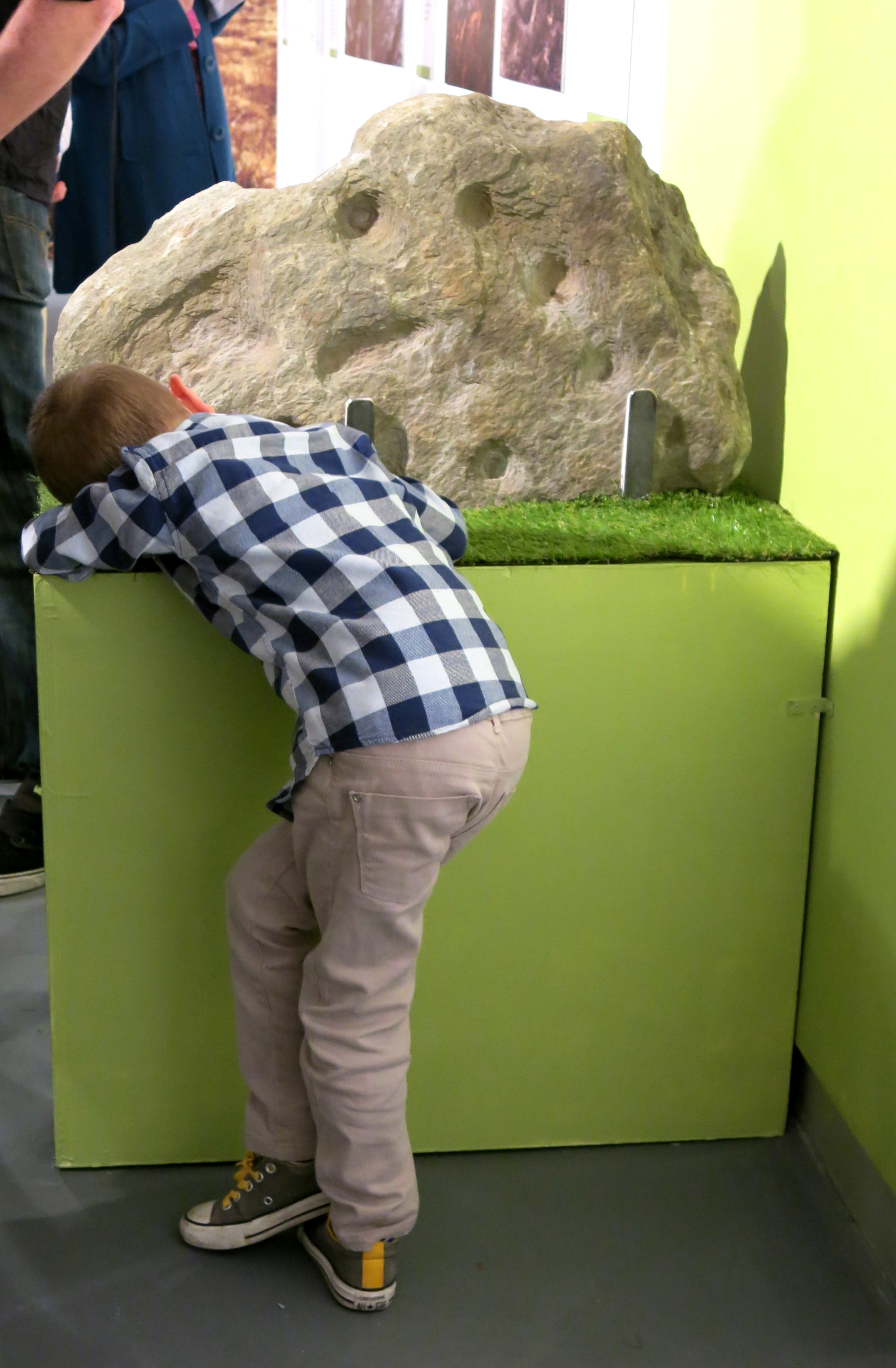
Fine Detail: the Bluid Stone under close inspection

Other exhibits include Ken’s superb photo of the iconic stone at Derrynablaha, Co Kerry, in its panoramic setting of a Neolithic landscape. This occupies the whole of the end wall – and is simply beautiful.

Gazing

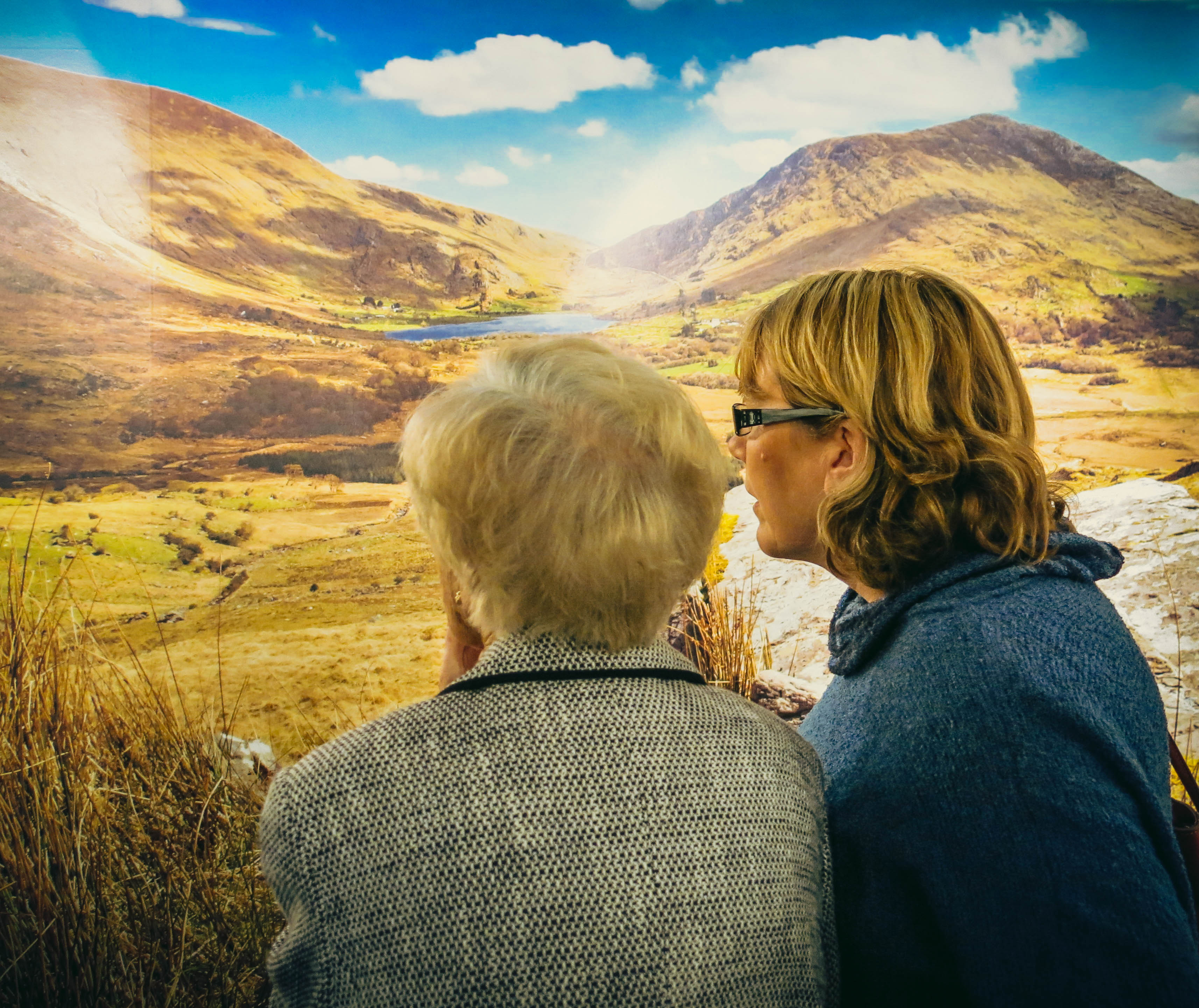
Visitors are surprised to see much of the floorspace taken up with a 70% life-sized image of the stone at Derreennaclogh: some hesitate to walk over it, but the printing is on hard-wearing vinyl, so feel free. The idea is to give you the feel of what it’s like to discover and explore the Rock Art out in the field. We have to mention how impressed we have been with the printing work carried out by Hacketts of Cork in the preparation of the exhibition – in particular, we were fascinated to watch the professionalism of their installation of the large items.

Yes – that floor can be walked on!

The timescale is set admirably by Alex Lee’s ‘Neolithic Settlement’ on the approach to the exhibition room. It’s well worth studying closely all the artefacts set out in this, and imagining what life must have been like for our artist ancestors in Ireland four or five thousand years ago.

Alex

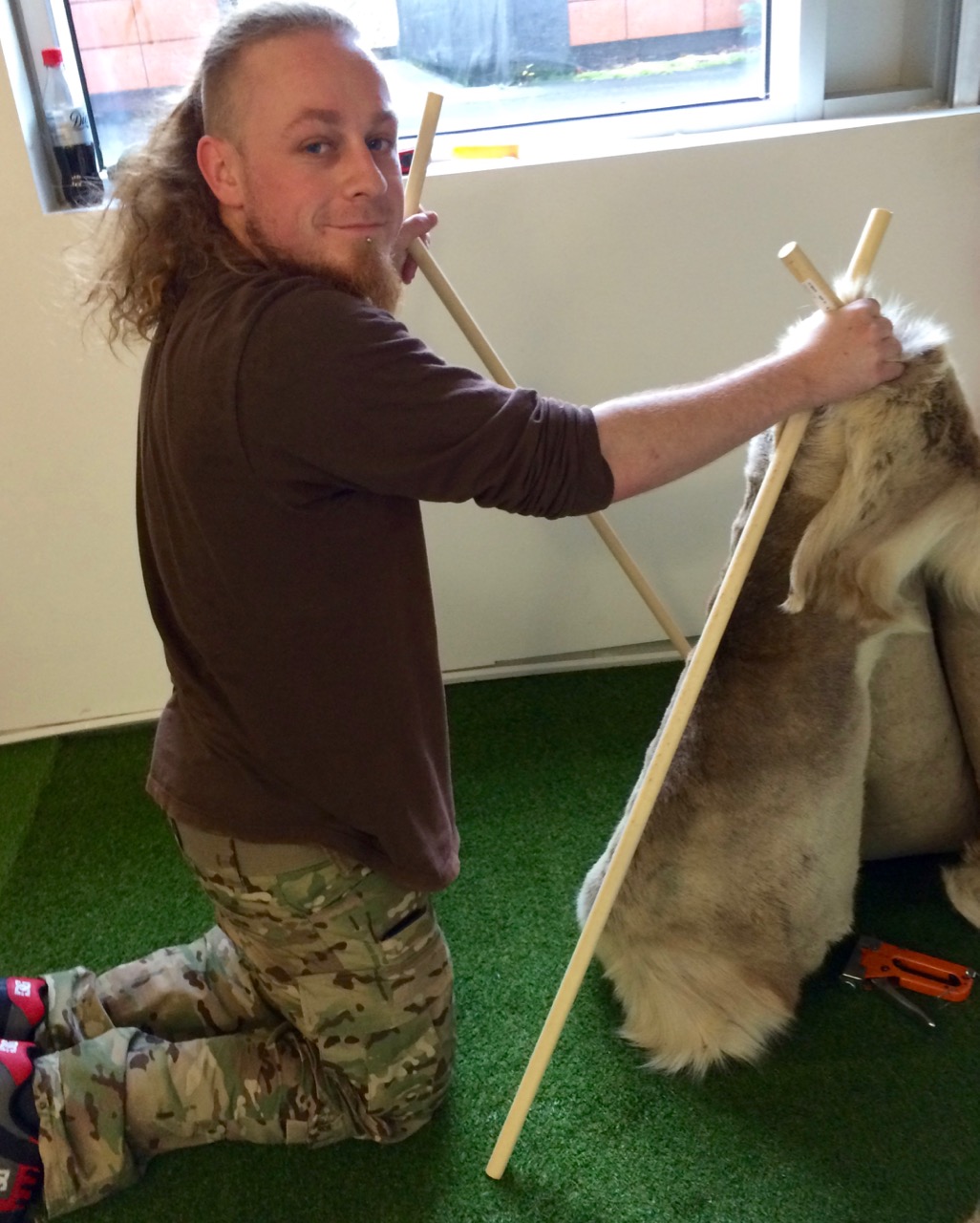
Alex Lee at work on the Neolithic Settlement

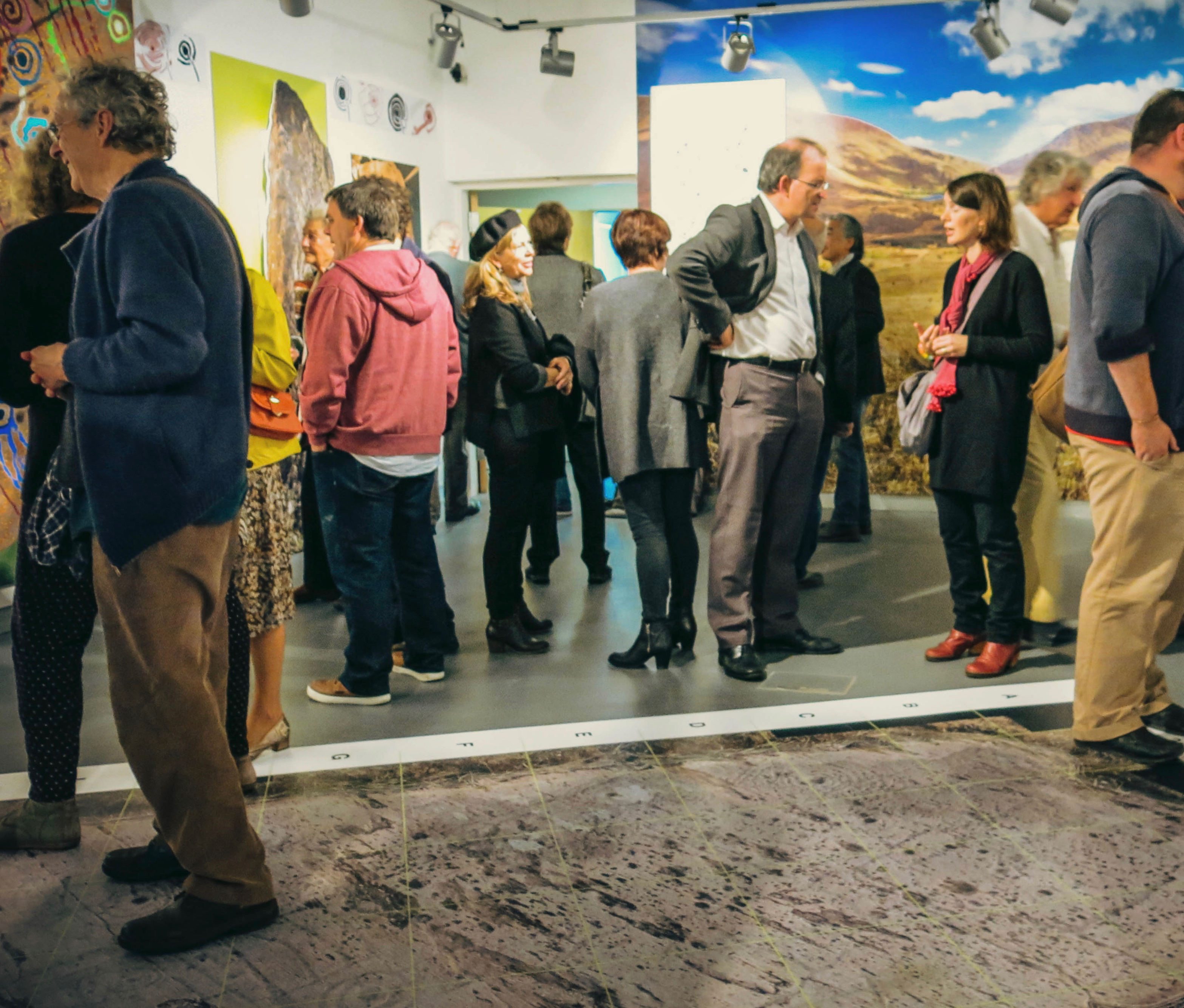
We were delighted by how many of our friends from West Cork and beyond attended the opening, and gave us positive feedback. If you go during the next four months, please sign the visitors’ book. We are so grateful to our friends Amanda and Peter Clarke for being so supportive throughout – and for taking most of these photographs of the event: very many thanks.

Earnest discussions (left) and one of Ken’s superb photographs (right)

Our own day was rounded off by a visit to the Shandon Dragon festival, which processed through the centre of Cork in the evening – another unmissable event which reminds us of ancient times and long-held beliefs…

Shandon Dragon

Hallowe’en: The Shandon Dragon Procession makes its way through Cork City

Up the Airy Mountain…

Shadow and light

…down the rushy glen – we daren’t go a-hunting for fear of little men! We were hunting mountains last week when we travelled up the west coast of Ireland with a visiting friend – finding some of the best scenery this country has to offer.

Connemara 2

If you look down on the island from above (as in this view from NASA, below) the lie of the land is very clear: the high points are all around the perimeters, yellow and brown in colour, with lower green plains in the centre.

nasa imageIf you lived in a country like Canada, then Ireland’s mountains should seem like mere gentle slopes. Our highest peak is not too far from us, up in Kerry, Carrauntoohil (Irish: Corrán Tuathail – this could mean Tuathal’s sickle or fang, Tuathal having been a common Irish name in medieval times) and this is only 1038 metres to the summit. However, the overriding characteristic of Irish mountains is that they often sweep steeply down to the sea or to a lough and are therefore visually spectacular in their settings.

We live in the far south-west: our mountains form the backbone of each of the peninsulas: The Mizen, Sheep’s Head, Beara, Iveragh and Dingle, largely Old Red Sandstone with some Carboniferous Limestone north of Killarney. Our travels took us up to Clare – very distinctive exposed limestone ‘pavements’ and mountain tops – and then to the complexities of granite, schists and gneisses found in the district of Connemara.

Connemara 3

Connemara fence

The four pictures above show the elements of the landscape in Connemara, Co Galway: quiet boreens, reflective water and dramatic mountains

The Irish landscape -and, particularly, her mountains – has long been the inspiration for artists and poets. The work of Paul Henry (1877 – 1958) is sparse and flat, yet expertly captures the character of the high lands of the west. It has been used over and over again in tourist advertising campaigns.

Paul Henry’s work was part of popular culture during his lifetime (above): now his art is very collectible and can be found in international galleries (below)

Killary Harbour

Killary Harbour, Connemara (above) and in Paul Henry’s landscape (above left) is said to be Ireland’s only true fjord (a flooded valley cut by glacial erosion which outlets to the sea): in the foreground are mussel ropes

irish mountain postcard

We stayed in the Lough Inagh Lodge – a comfortable hotel with great character and superb views to the mountains. There I was pleased to discover two original oil paintings by Leon O’Kennedy (1900 – 1979), a little known artist  who travelled mainly in the west of Ireland and, evidently, sold his work by knocking on doors. The hotel’s paintings might have arrived in this way as they depict local views: the prism shaped peat stacks are still very much in evidence in Connemara.

O Kennedy 1

O Kennedy 2

Connemara (which derives from Conmhaicne Mara meaning: descendants of Con Mhac, of the sea) is partly in County Galway and partly in County Mayo, in the province of Connacht. We were there only two days and barely did it justice. We intend to return and get to know it more intimately. In terms of our tour of Ireland’s mountainous districts it was the icing on the cake, but that in no way lessens the particular beauty of the other places we encountered – the strangely haunting limestone heights of Clare and the perennial grandeur of Killarney: all are experiences not to be missed.

rainbow over burren

Killarney

Limestone landscape in the Burren, Clare (top) and the lakes of Killarney, Kerry (above)

Fairy Tree

…By the craggy hillside,

Through the mosses bare,

They have planted thorn-trees,

For pleasure here and there.

Is any man so daring

As dig them up in spite,

He shall find their sharpest thorns

In his bed at night.

Up the airy mountain,

Down the rushy glen,

We daren’t go a-hunting

For fear of little men.

Wee folk, good folk,

Trooping all together;

Green jacket, red cap,

And white owl’s feather!

from The Fairies by William Allingham

Derrynablaha Expedition

Derrynablaha in all its glory

Derrynablaha in all its glory

It’s an almost entirely unknown national treasure – a valley of breathtaking grandeur dotted with the greatest concentration of prehistoric rock art in Ireland.

In Derreeny, Looking down the Kealduff Valley

In Derreeny, Looking down the Kealduff Valley

Derrynablaha (Little Oak Wood of the Flowers) is in Kerry, right in the heart of the Iveragh Peninsula (better known as the Ring of Kerry), on one of the few narrow roads that traverse the Peninsula. The rock art has been known for many years – the first paper about it appeared in the early 1960s, curiously, by an Italian rock art expert, Emmanuel Anati. The Cork husband/wife team of Michael and Claire O’Kelly traversed the valley, finding many new pieces and leaving extensive notes. Elizabeth Shee, the leading expert on passage grave art, added to the literature in the early 70s. In 1972 and 73 I (Finola Finlay) recorded and drew all the known examples, using the tracing techniques of the day. Blaze O’Connor and Avril Purcell both wrote about Derrynablaha in the early years of the 21st Century, relating the rock art to the landscape it occupied. Many more pieces came to light in the adjoining townland of Derreeny and were recorded by Ann O’Sullivan and John Sheehan in their Survey of the Iveragh Peninsula. Rose-Mary Cussen examined the art about five years ago, looking for patterns in the enigmatic carvings while other scholars have included Derrynablaha as part of a focus on Irish prehistory.  A few photographers have attempted to capture images of the art, but none more so than Ken Williams, of the outstanding Shadows and Stone website.

Robert, Clare, Finola, Elizabeth and Avril, checking the records and GPS readings. (Photo © Ken Williams)

Robert, Clare, Finola, Elizabeth and Avril, checking the records and GPS readings. (Photo © Ken Williams)

This weekend, several of these rock art enthusiasts and experts came together for a unique expedition to Derynablaha and Derreeny. Elizabeth Shee, myself, Avril Purcell, Rose-Mary Cussen, and Ken Williams took part, accompanied by Robert Harris (see his take on this special place) and Clare O’Sullivan, a UCC undergraduate. Our objective was to visit as many of the panels as possible and to assess what has changed in the landscape in the 65 years since it was first described in academic journals. (See the end of this page for links to other Rock Art topics we have  posted over the last couple of years.)

This one wasn't too hard to find

This one wasn’t too hard to spot

Finding the panels was the first challenge! We had all the information from the National Monuments records, including GPS locations for each rock. However, GPS readings can vary, and many of the ones we were using for Derrynablaha were from the early days of GPS and could be 30m out or even more. Apart from the small fields around the original farmhouse, this is a landscape of bog, gorse and tall grasses, of steep hillsides and tumbling streams, of numberless boulders and outcrops. It was, we think, populated by early herding agriculturalists in the Neolithic and Bronze Age periods. Historically, it supported a sizeable population in pre-Famine times (ruined cottages dot the land) and one sheep farm still operates now. Finding the rock art needle in the landscape haystack took time and patience, sharp eyes, and the good memories of those who had been there more recently than I. Where the GPS recording let us down we turned to the meticulous notes made by Claire O’Kelly: notes that said things like “keep the stream to your right and the large triangular rock in view and the rock is a short way below the wire fence.” These notes turned up trumps more than once.

The rock art is NOT on the large panel, but on the tiny stone by Robert's knee.

The rock art is NOT on the large panel, but on the tiny stone by Robert’s knee

In the end we located all but one panel of the ones we were tracking. The Derreeny rocks were easier to find as the GPS readings were more accurate. It was exhausting and exhilarating work and reminded us yet again how difficult this art can be to find and to see. While some panels were clear and sharp, others were weathered and lichened to the point of invisibility. For some, my drawings were needed to appreciate the full extent of the carvings. (I was feeling pretty pleased with myself about these drawings until we discovered one panel on Day 2 for which my drawing was mirror-imaged in my thesis. Fortunately, the Sullivan and Sheehan Survey had noted and corrected this in their work.)

Day 2 Crew: Ken, Rose-Mary, Finola, and Robert taking the photo.

Day 2 Crew: Ken, Rose-Mary, Finola, and Robert taking the photo

On day 2 the team consisted of Ken, Finola, Robert and Rose-Mary and we spent our time on the most southerly examples in Derrynablaha, especially the large tabular rock and its associated rosette stone. One of the most extensively carved pieces of rock art in Ireland, this iconic piece commands a panoramic view of the whole area, extending to Lough Brin to the east, the Ballaghbeama Gap to the north and to Kealduff River valley to the south. Leaning against it is a stone with a superb example of the rare “rosette” motif.

For really excellent images of this stone, view it on Ken’s Shadows and Stone site.

We also lingered over an unusual panel with multiple lines, cupmarks and rosettes: this one was so faint that Ken resorted to having us provide shade using his jacket and our bodies. The results he got, with his flash technology, revealed astonishing detail totally invisible to the naked eye.

How he got that high tech photo © Ken Williams

How he got that high tech photo  

My drawing, done over 40 years ago.

My drawing, done over 40 years ago

Our second objective was to assess the general ‘health’ of the rock art and its context. Mostly, we were encouraged: very little has changed in this valley over the years. It is remote and the land is marginal, suitable mainly as rough mountain pasture for sheep. The landowner knows about the rock art and is careful not to disturb or damage it.

 lDerrynablahaandscape - changed and unchanged. Note forestry activity.

Derrynablaha landscape – changed and unchanged: note forestry activity

However, two factors threaten the rock art even in this far-flung region. The first is forestry: a sizeable plantation occupies an area east of the road and at the south end of the townland. We didn’t have time to visit this area, but noted in the National Monuments records that two previously identified pieces of rock art are now within the forest boundaries and can no longer be found. The second factor is land-clearing for the purposes of improving the grazing fields. Farmers are encouraged to do this and there are grants available through European funds. We failed to find one piece that was located in such a cleared area, despite extensive searching over two days. Hopefully, this is a function of erroneous GPS readings and the rock still exists – but it is worrying.

Elizabeth, Robert, Avril, Clare, Finola and Ken. Day 1 Team by Derreeny rock art.

Elizabeth, Robert, Avril, Clare, Finola and Ken. Day 1 Team at Derreeny rock art  © Ken Williams

Derrynablaha and Derreeny have always been special places. We can only speculate on the meaning or meanings of the extraordinary numbers of carved rocks in this landscape. Were they familiar, even domestic, expressions of belief or supplication? Did they mark routeways through the mountainous territory or boundaries between clan lands? Were they, or some of them, hidden ritual sites known only to certain members of a priestly class? Did the carvings identify suitable spots for calendrical observations? Did they have altogether different functions that we have yet to comprehend? We may never know the full extent of the meaning of the rock art to those who carved them. Yet – we do know their meaning to us. As the largest body of this category of prehistoric site in Ireland, this collection constitutes a vital link to our most distant past.

Leaving Derrynablaha

Leaving Derrynablaha

Other Rock Art Posts in Roaringwater Journal

Rock Art Ramblings… away from home!

Our Rock Art Exhibition!

Rock Art in Danger

Rock Art

Equinox Adventure

Diving for Petroglyphs

The Stones Speak

Here Comes the Sun

Enigma

Tiny and perfect example of Derrynablaha rock art

Tiny and perfect example of Derrynablaha rock art

Glen of Ghosts

glen

There are some places in this world that touch you deeply in the soul. Derrynablaha has that affect on me. I first went there a few years ago and immediately felt that it was alive with ghosts. I was in search of Rock Art then, and Finola had told me about her experiences in the early 1970s – an intrepid young student on an old Honda 50 loaded down with sheets of cellophane and measuring rods. She had met the O’Sullivans who dwelt in the single farmstead there – they plied her with tea and directed her to the rocks above the house where treasures awaited. When I drove into that valley 40 years later I found only the ruins of the O’Sullivan cottage. It was a poignant moment – the mountains were empty: in some ways it felt like the loneliest place on earth, yet also one of the most beautiful.

The old O'Sullivan farmstead returning to nature

The old O’Sullivan farmstead returning to nature

What kind of a beauty is that? A mixtures of lives vanished and nature healing the wounds. Sheep still grazing on those rock-strewn fields: men from another valley tending them – O’Sullivans also, but – they claim – no relation to the last generation there.

New life among the old stones...

New life among old stones…

Those lives are recently gone but, as I first climbed the precipitous slopes to the west of the old farm, I felt the presence of other ghosts – from a more ancient time. It’s a long haul up to the iconic carved stone which commands the wide view across to Lough Brin but, each time I make that journey, I feel more strongly drawn to the people who made that place their home – or possibly their temple.

View from the 'very special' carved stone

View from the ‘very special’ carved stone

This expedition must have been my fourth visit to the hillside which commands such a magnificent view over the townlands of Derrynablaha and Derreeny and which takes in the lake on the valley floor – seemingly a mere puddle from that elevation yet  in fact covering several hectares. On each visit I find more evidence of prehistoric occupation: on this occasion it appeared to me that the carved stone is sited on the edge of a circular plateau; I could trace old retaining walls below, some circles which could have been hut walls half lost in the undergrowth and – above this site – a wall of boulders which might have dammed the stream which runs down the mountain here, to create a little reservoir. I also saw the vestiges of a wedge tomb – aligned east to west – and the base of a cairn… All this, of course, is my imagination at work, but it’s a place where the imagination can take wing.

sky pan

Panoramas from the plateau - east and west

Panoramas from the plateau – east and west

I have so many questions… Was there once tree growth at this level? Derrynablaha means ‘little oak wood of the flowers’ – I imagine something like the stunted oak forests on Dartmoor, where the ancient trees are gnarled and twisted from the ravages of a harsh climate, but which cling to the rocky terrain. But possibly the plateau was raised above this – a place where visibility over the whole landscape was important and visitors anticipated in advance. In my dreams I see fires burning up there in the night, figures dancing, songs being sung… Are they really Wolves and Deer I see moving around the fires, or are they my own ancestors wearing grotesque masks?

clouds

Dream clouds?

Why shouldn’t I have these thoughts? After all, technology might have changed over 5,000 years – but our minds haven’t. It’s not so hard to try and understand our forebears: I like to think they appreciated the power of the pristine landscapes which they inhabited – just as we are awed by the magnificence of their old haunts as we see them today.

Wedge tomb on the plateau?

Wedge tomb on the plateau?

First Foot

‘…According to local folklore the first foot was planted on Irish soil at Donemark on the shores of Bantry Bay in 2680 BC…’

Ireland's first arrivals passed by this pebble beach on their way to Donemark

Ireland’s first arrivals passed by this pebble beach on their way to Donemark

This statement (from Fuchsia Brand’s leaflet on Heritage) was guaranteed to send me scurrying for my history books. And – yes – I found many references to the event: an event which, to my mind, was surely one of special significance for Ireland: the first human ever to have set foot in this land – it must have deserved commemoration… Surely, there must at the very least be a plaque marking the spot? For a moment I wondered if this could be the long sought explanation for the enigmatic piece of Rock Art that’s on display in Bristol’s Museum & Art Gallery – the carving is about the right age…

Bronze Age Footprints in Bristol's museum

Bronze Age Footprints in Bristol’s museum

So, a similar example of Petrosomatoglyphia is what I was hoping to find on the shores of Bantry Bay, a mere stone’s throw from our home here in Cappaghglass. But – before that expedition – let’s just go back to the history for the moment. Back – in fact – to the Lebor Gabála Érenn (The Book of the Taking of Ireland), which was written down in the 11th century and – allegedly – based on earlier source material. It takes a bit of wading through: I used a commentary edited and translated by R A Stewart Macalister and published by the Irish Texts Society in Dublin in 1938, but it’s well worth the effort. There’s a lot I had never understood before about the earliest history of the people of Ireland.

lebot gabala book frontispiece

It’s a long story… The book is a collection, in five protracted parts, of all the poems and traditions which had been written and learned by the Bards, telling the history of their nation. There’s a lot of repetition: like the Gospels there are several versions of each episode and it’s a bit dizzying to try to get a clear overall picture of events. So, settle down and imagine the visiting Bard you have given hospitality to in your tower house on a winter’s night is regaling you with tales of your ancestors.

A Meeting of Bards (at Boscawen-Un Stone Circle, West Penwith, Cornwall

A Meeting of Bards (at Boscawen-Un Stone Circle, West Penwith, Cornwall)

Everything has to go back to Noah, who was only allowed to take with him on the Ark his own sons and their wives. One of his sons, Bith, had a daughter – Cesaire (or Cessair). As she had to stay behind so also did her father, but they built their own ships, three of them, and set sail with two other men and a large company of women, looking for a land which ‘knew no sin’ because it had never been populated: there they would settle and aim to re-found the human race in a green and fertile place. Their voyaging took them to many parts of the known world and they came eventually to the north of Spain – which we know today as Celtic Galicia. Cesaire knew that this wasn’t the Utopia they were seeking but she climbed to the top of a very tall tower and, in the far distance, she spotted Ériu – ‘…where no evil or sin had been committed, and which was free from the world’s reptiles and monsters…’

Cesaire would have needed a tower like this to catch a glimpse of Ireland from northern Spain...

Cesaire would have needed a tower like this to catch a glimpse of Ireland from northern Spain…

And so it was, forty years before the Great Flood engulfed everything, Cesaire’s expedition sailed up to the mouth of the Mealagh River, passing on the way the most beautiful landscapes they had ever seen – landscapes that we are fortunate to see every time we set out to explore our own new horizons.

Bantry Bay - the landscape today

Bantry Bay – the landscape today

Now it was time to glimpse for ourselves this remarkable site – Dún na mBarc – the place of the boat – (Donemark -Dunnamark Townland) in the parish of Kilmocomogue. We drove up the unremarkable N71 through Bantry town and turned in to its attractively situated golf course, then made our way down to the shore. Disappointingly, that is also unremarkable: it’s got a brooding, although not unattractive atmosphere about it. We came there at low tide and saw mud-flats – alive with foraging birds, including a very fine Old Nog – the huge stones of a disintegrating quay, and distant views to the Sheep’s Head and Beara Peninsulas.

Landing Place? At Donemark

Landing Place? At Donemark

Old Quay at Donemark

Old Quay at Donemark

.

Alas, there were no footprints, no plaque, no signification of the very important history of this site: there was only our imagination to fill in the gaps. I could envisage Cesaire’s Bronze Age boat (only one survived the full journey) making its way up the azure waters admiring the emerald green of the landscape and passing by some of Ireland’s most dramatic scenery. They landed on ‘…a Saturday, the fifteenth day of the moon at Dun na mBarc…’

Kerry Mountains

Mountains of West Cork

We did find a single commemoration of this event: in the tranquil gardens of the National Learning Network Centre, which is not far from the mouth of the river. It is a work of art, made in 2013 by the students of the Centre, under the guidance of Michael Ray and the auspices of the West Cork Arts Centre – you may remember both from this recent post. Voyage of Stories’  recalls that pioneering arrival in the form of a boat sculpture made of steel, copper and glass and set up over a pool. The glass tiles tell of invasions and emigrations both ancient and modern in Irish and English. It’s a good way to commemorate the journey and those early settlers, we thought.

'Voyage of Stories' at Donemark

‘Voyage of Stories’ at Donemark

Now, Finola – at my side and wearing her Archaeologist’s hat – is tutting at my unquestioning acceptance of the dating of this milestone in Ireland’s history, bearing in mind that the passage graves at Newgrange, Knowth and Dowth appear to be some 5,000 years old and – she says – there were people living in Ireland earlier than that! But my view is that there’s history, and there’s story… Well, perhaps history is always someone else’s story but give me a good tale any day, especially one woven with adventure and romance and told at the fireside.

Family Life (Caleb Bingham 1845)

Family Life (Caleb Bingham 1845) New Orleans Museum of Art

So now you know all about Cesaire, who was the first to step from that frail vessel which had travelled all the way from Egypt in those far off days. But perhaps I should also tell you a little more: the three men on that voyage faced the prospect of serving no less than fifty women between them if they were to populate this new land. The Lebor Gabála Érenn is quite frank about this: ‘… Ladra, the pilot, from whom is Ard Ladrann named he is the first dead man of Ireland before the flood. He died of excess of women, or it is the shaft of the oar that penetrated his buttock. Whatever way it was, however, that Ladra is the first dead man in Ireland…’ while Bith – Cesaire’s father – was already aged before the voyage and also passed away soon after. That left one man – Fionntán – who was so frightened by the prospect of facing all those women alone that he ran away and hid in a cave. There he changed into a Salmon and survived the Flood which, sadly, overcame Cesaire and her companions. The shape-shifting Fionntán went on to live for five and a half thousand years (by my reckoning that means he’s still alive!) and recorded all of Ireland’s history (including at first hand the account of Cesaire’s voyage) – which he then taught to the Bards of Ireland so that it would be taken out into the world…

But all that is for another day!

made harbour

Footsteps

Morning prayers on the Großglockner, Otto Barth 1911

Morning prayers on the Großglockner, Otto Barth 1911

Is it us? We seem to be following in the footsteps of thieves and wreckers… Back in June 2012 we visited St Manchan’s Church, in Boher, Offaly and saw the splendid shrine of that Saint securely locked in an armoured glass case and mounted in front of the equally magnificent Harry Clarke window depicting him. That was at about 1 o’clock in the afternoon. We were shocked to hear on the news that evening that the shrine had been stolen at 1.30! Two men had taken just a few minutes to break open the case – in spite of alarms and cctv – and make off with the Saint’s remains…

We were relieved to hear the following day that the robbery had been bungled: the shrine was thrown out of the getaway car and landed in a bog: both it and the perpetrators were picked up by the Gardi. I wonder if perhaps the thought of what divine justice might be wrought from on high (from St Manchan himself, even) had put doubts into the minds of the thieves and diverted them from their intentions – whatever they might have been.

Harry Clarke's depiction of the Saint's shrine

Harry Clarke’s depiction of the Saint’s shrine

Nevertheless, the incident led to some considerable debate on whether the reliquary should be returned to the church – where the security was evidently lacking – or whether the original 1,000 year old artefact should be put into Ireland’s National Museum and the replica which happens to be there should be sent back to St Manchan’s. The Boher people campaigned vigorously against this – quite rightly in my opinion – and eventually, after some improvements to the arrangements in the church, the shrine has been restored to where it belongs.

winter

Carrauntoohil Summit – photo by Noel Mulcair: thejournal.ie

So there we were just a week or two ago, honeymooning in the shadow of Ireland’s highest mountain (although warmly ensconsed in a comfortable Kerry hotel) when we heard the news that, not far away, someone had climbed the mountain at night and felled the iron cross that had stood up there for many years, with an angle-grinder! Obviously some point was being made, although nobody was quite sure what that was at the time…

The Mountains of Kerry

Gap of Dunloe, in the shadow of Carrauntoohil


The cross is felled...

The cross is felled…

The Carrauntoohil incident sparked off a lively correspondence in The Irish Times. Many were indignant at the act of vandalism, while others took the view that there is no reason why wild places should be ‘sullied’ with religious symbols. Hmmmm… that’s a bit harsh, perhaps: crosses on mountain tops have a been around for a long time all over the world and, ever since prehistory, humans have marked their presence on the landscape with monuments of one sort or another. As you all know, the two of us are fascinated (obsessed might be a more appropriate word) by megaliths, tombs, circles and inscribed rocks – and these are preserved archaeological artefacts – it would be unthinkable for someone to get it into their head that a standing stone should be destroyed because it might have represented someone’s god. At the very least, surely, the subject should be aired and a democratic decision made by a public majority before any such action is taken. Indeed, the subject did get aired after the event and I gleaned that the majority of respondents felt that the iconic cross should not have come down.

Well, this story – like the St Manchan one, has had a happy ending. A group of volunteers has been up to the summit with block, tackle and welding equipment and the cross is back again.

Ireland has many summits adorned with constructed pieces – ancient cairns and tombs, and more modern statues and symbols, not forgetting the wind farms which are another source of controversy. We are all part of human history and one of Ireland’s big attractions for me is that the history is so visible and accessible. In 1968 a white marble Pieta was placed high up on the Goat’s Path in Glanalin townland. It’s someone’s personal monument to a much loved father. In my opinion the melancholy statue enhances the wild place: I make a bee-line for it whenever I’m in the area – partly to enjoy the magnificent view but also, I have to say, because I am fascinated to see how many coins and offerings are put into the outstretched palm of Mary. Look here for a fuller description on the excellent website Sheep’s Head Places.

Hilltop Pieta

Hilltop Pieta

Given our experiences to date I worried a bit about our visits to Holy Cross Abbey and the Cathedral of St Mary and St Anne in Cork, where we came across the shin bone of Blessed Thaddeus McCarthy. But it seems to be ok: fair enough, the fragment of the True Cross was stolen from Holy Cross (it’s now been replaced with another), but long before our visit, while the saintly shin bone seems to have survived unscathed so far. I can’t help looking over my shoulder, though, when we visit such places. Ireland is full of enigmas…

thaddeus

Sacred shin bone – with Angelic guardians

Finola's childhood haunts: the cross on Bray Head, Wicklow

Finola’s childhood haunts: the cross on Bray Head, Wicklow