Industrial Archaeology in Crookhaven

Roaringwater Journal has featured Crookhaven many times. This far south-western outpost of Ireland has layers of history: thousands of years ago people lived in this area and made marks on the rocky landscape while countless generations of seafarers forged a ‘haven’ from the naturally sheltered ‘crook’ of land upon which the settlement is based. Even into the twentieth century pioneering technological advances were being made in Crookhaven: in the early 1900s Marconi sent some of the world’s earliest radio communications from Brow Head to vessels in the Atlantic shipping lanes.

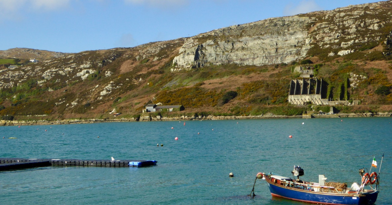
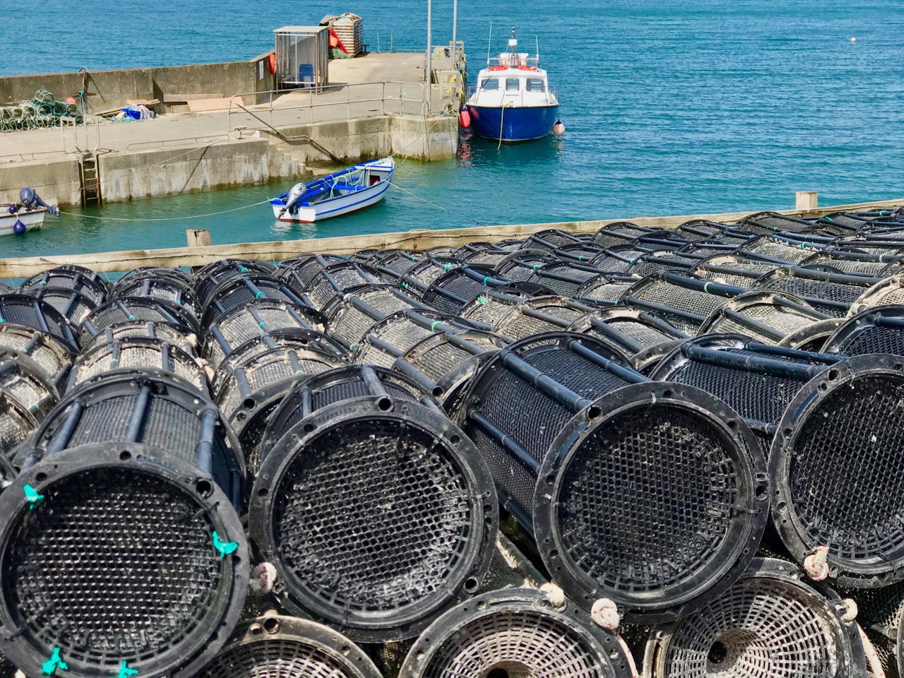
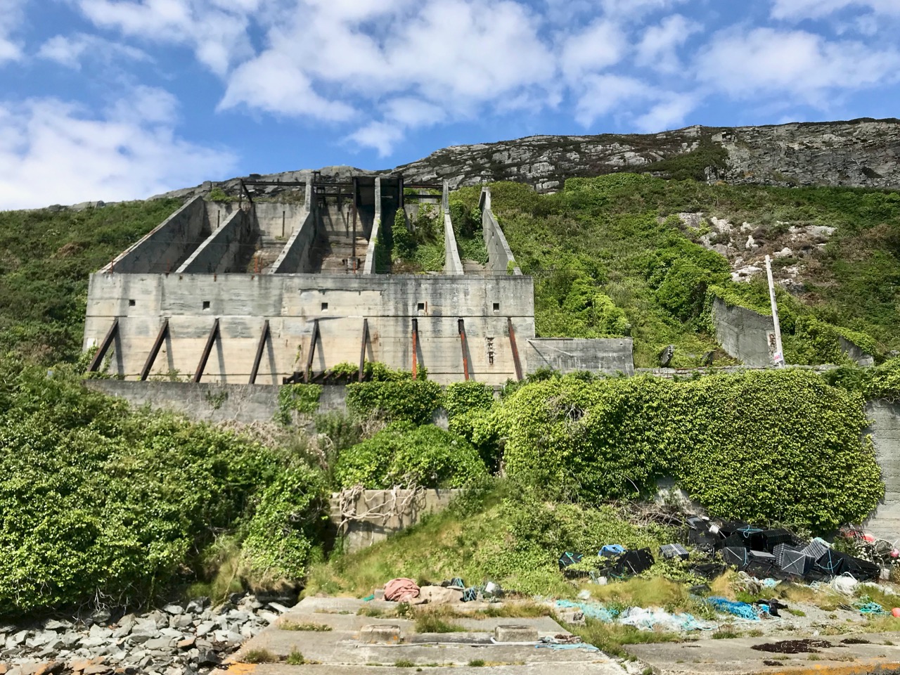
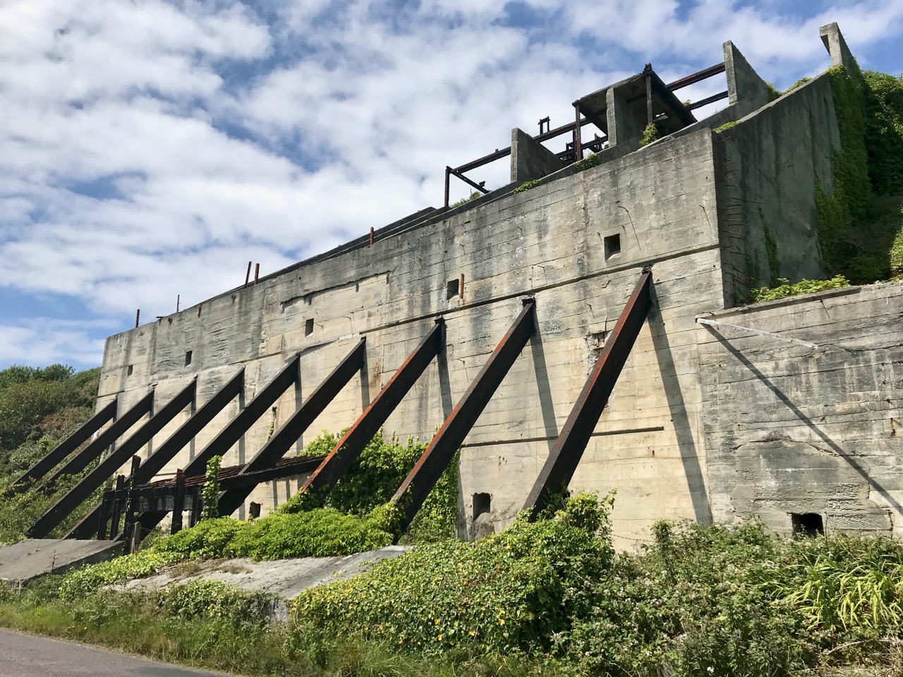
Header – the ‘old quarry’ dominates the landscape to the north of Crookhaven Harbour. Above – looking across the harbour from the ‘quarry quay’ towards Brow Head, one of the scenes of operation of Marconi in Ireland

I am fascinated by all traces of industrial history: for me it’s ‘modern archaeology’: some of it might survive long enough to puzzle historians of the far future. I couldn’t ignore, therefore, the huge steel and concrete structures which line the R591 road which approaches Crookhaven when travelling from Goleen. They are built into the hillside above the road, and tie in with a substantial stone quay which has been constructed below it.

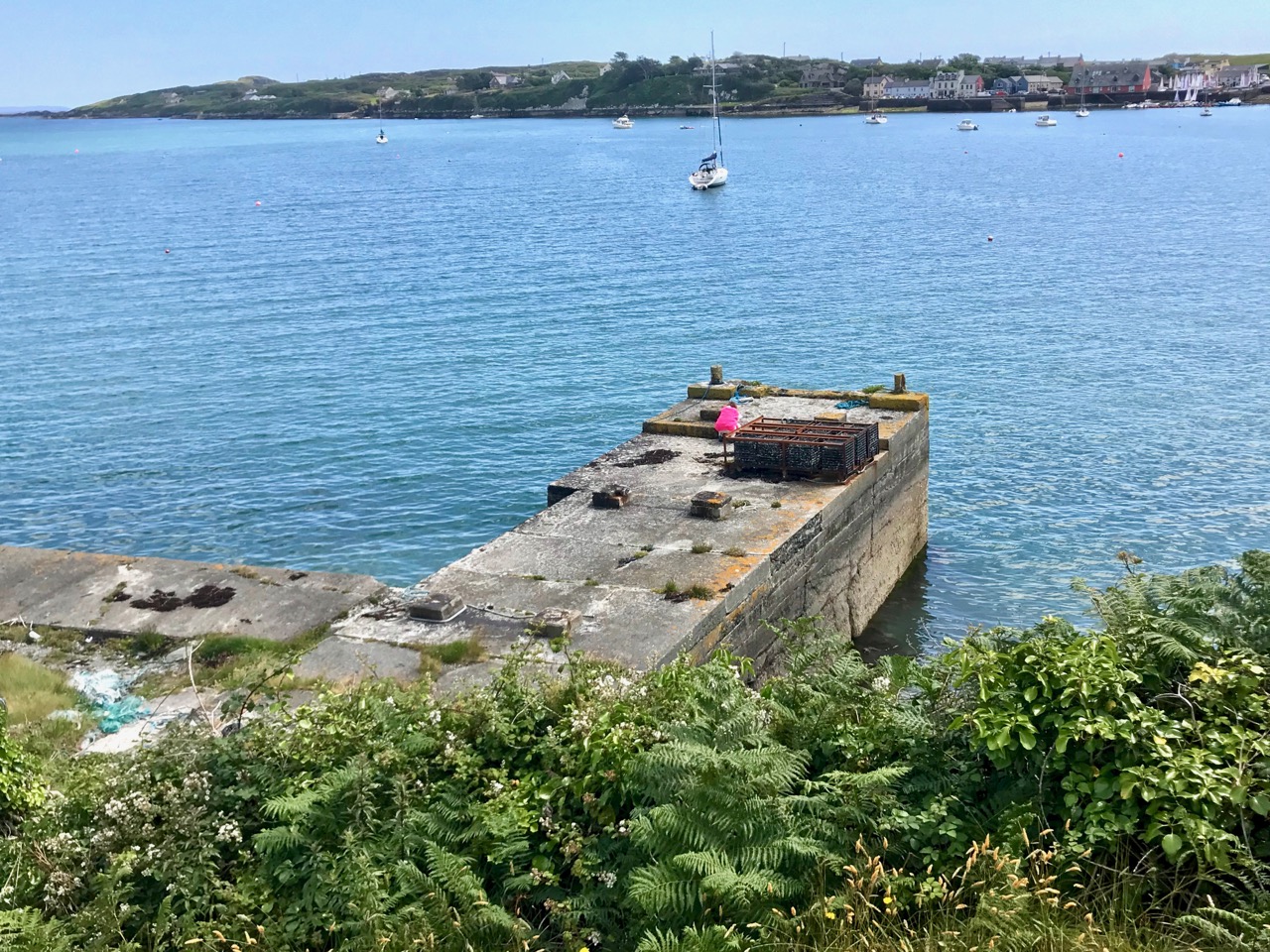
The quay which was presumably built to serve the quarry to the north of Crookhaven: the village can be seen across the water

Looking at the construction of this quay, and particularly the wear on the masonry steps leading down to the water, it would be reasonable to assume that the quay predates the concrete and steel structures which abut the road above it – by a long way. You might suppose that such significant edifices would have a history attached to them which would be easy to find, either from local informants, or in written or electronic record. However, I have so far drawn a blank. Well – not quite: there are countless identical references in contemporary accounts of Crookhaven to ‘…the old roadstone quarry on the side of the mountain, which provided metalling for the roads of Wales until 1945…’ I did find one variant, a caption to a general view of the area: ‘…Looking up to the roadstone quarry along the north shore of Crookhaven Harbour. The quarry was a source of gravel for Welsh tarred gravel roads until the 1930s…’

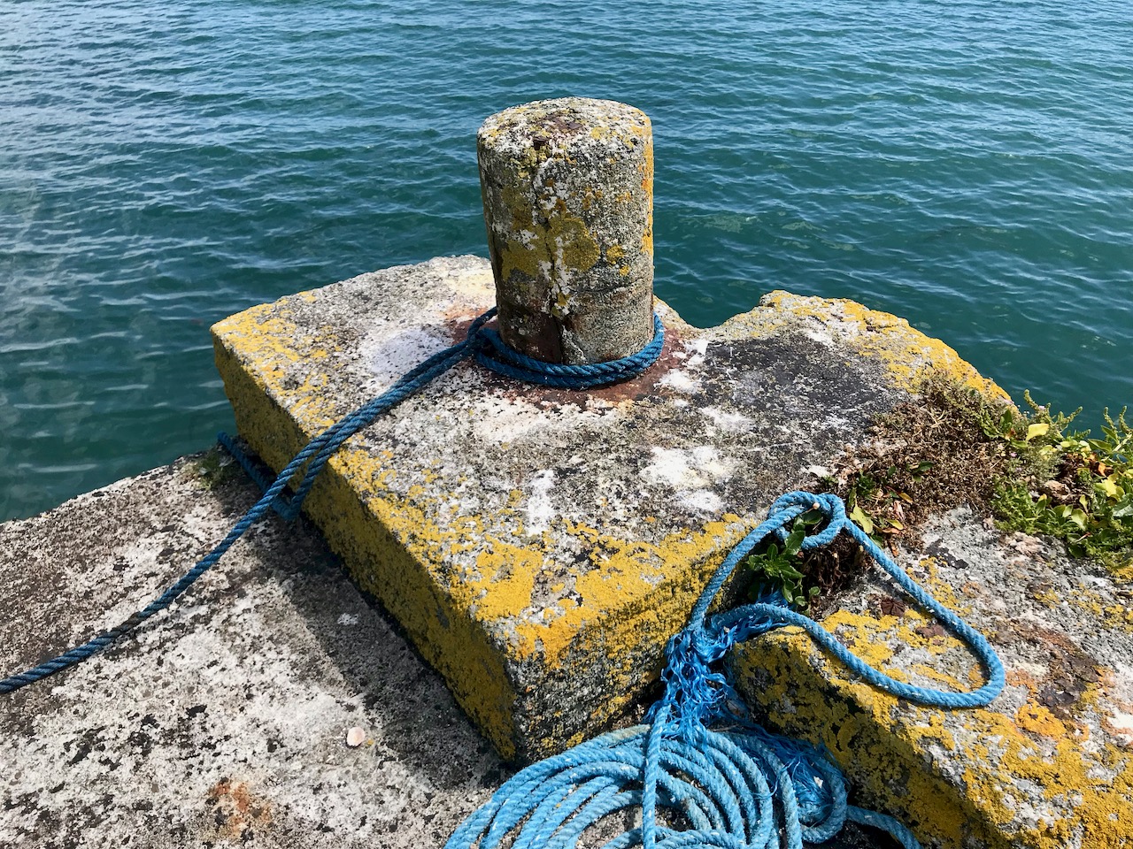
The quay below the ‘roadstone quarry’ is a paradise for industrial archaeologists and photographers! It must have had generations of users, up to fairly recent times, all of whom have left behind traces of their presence, but no solid history. I’m hopeful that readers of this post might be stirred to recall stories or memories – or even point me to some documented history to explain the provenance of this little piece of the complex West Cork jigsaw. *In fact, I have received information since this post was published – see the last paragraph.

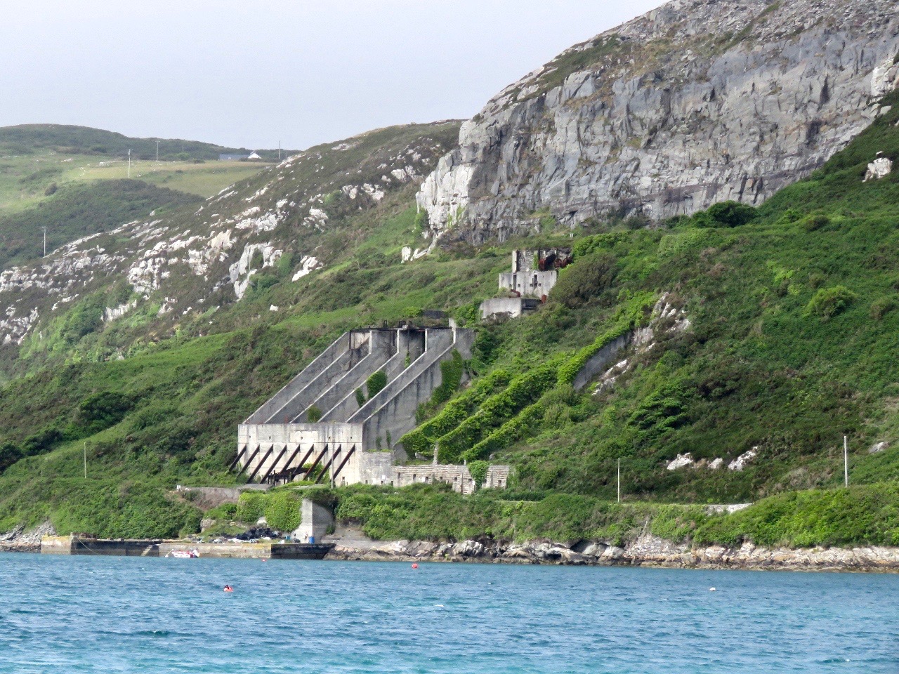
I’m borrowing this photograph of the Crookhaven quarry from the log of the MV Dirona, with thanks to Jennifer and James Hamilton, who hail from Victoria, British Columbia and are currently cruising the world in their Nordhaven 5263 vessel. They explored the south west coast of Ireland in June 2017 and, from the water, took this perfect view of the quay, the ‘roadstone quarry’ and the mountain face above it, from which the stone has been extracted. The rock face could have been worked for stone before the 20th century, although we don’t have hard evidence for this: in September 1846 a road was proposed between Rock island and Crookhaven, and the county surveyor provided an estimate of £1,857. Prior to this, the road which had been built by Richard Griffith, civil engineer for Munster, extended as far as Rock Island, and passage from there to Crookhaven itself could only be made by water. The 1846 road is today the R591 which passes below the quarry. It would be reasonable to suppose that locally available stone suitable for roadmaking could have been used, and the quarry may have had its origins at this time. The construction of the adjacent quay could have been contemporary with this early use of the quarry, but the huge concrete and steel structures we see today are certainly an incarnation of the quarry workings in the early 20th century.

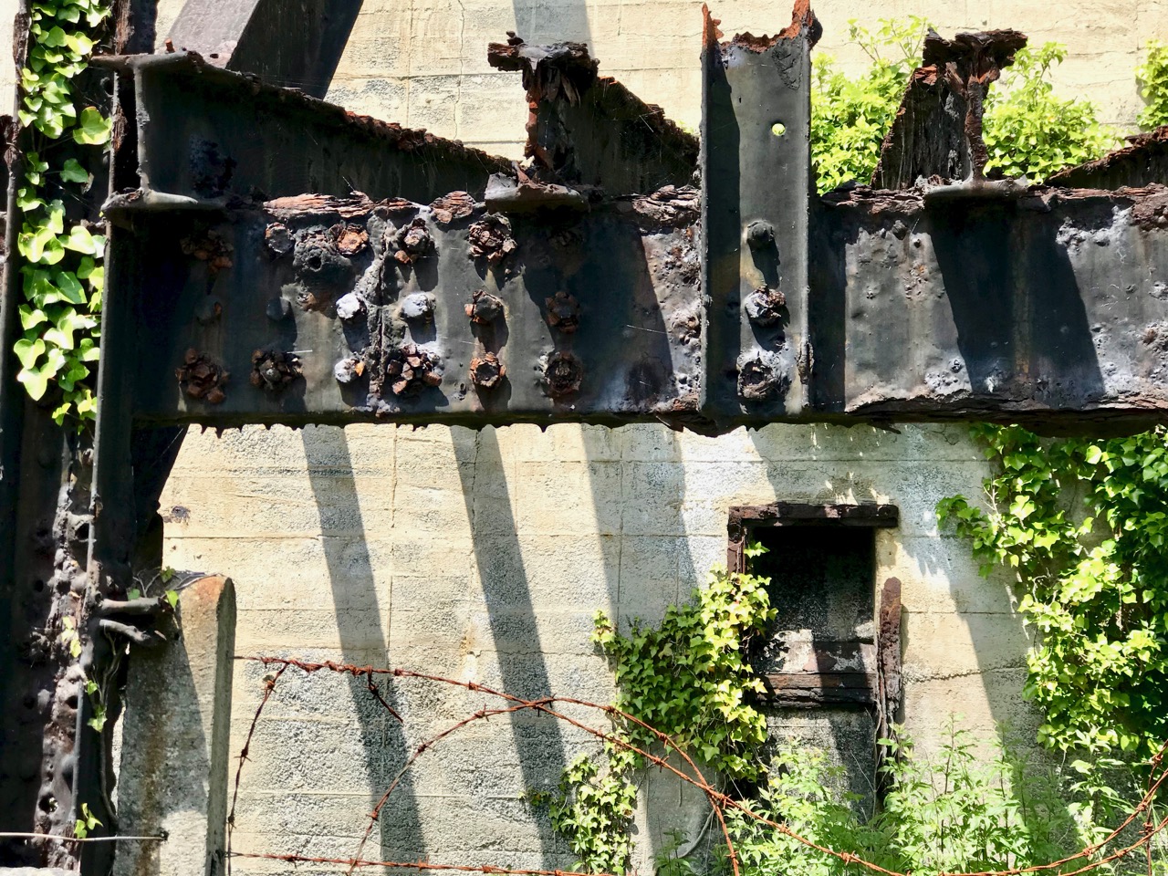
One of the fascinations of old industrial sites is the way they are taken over by nature if left relatively undisturbed. This one is no exception. There is a monumentality here which is being eroded and softened as time goes by. What does the future hold? Interestingly a -presumably serious – proposal was made in a not-too-long-ago iteration of the Goleen & District Community Council Development Plan:

PROPOSALS

2.24 The old roadstone quarry-works at Crookhaven Harbour should be developed as an amenity – perhaps a hotel with a restaurant with observation deck at the top…

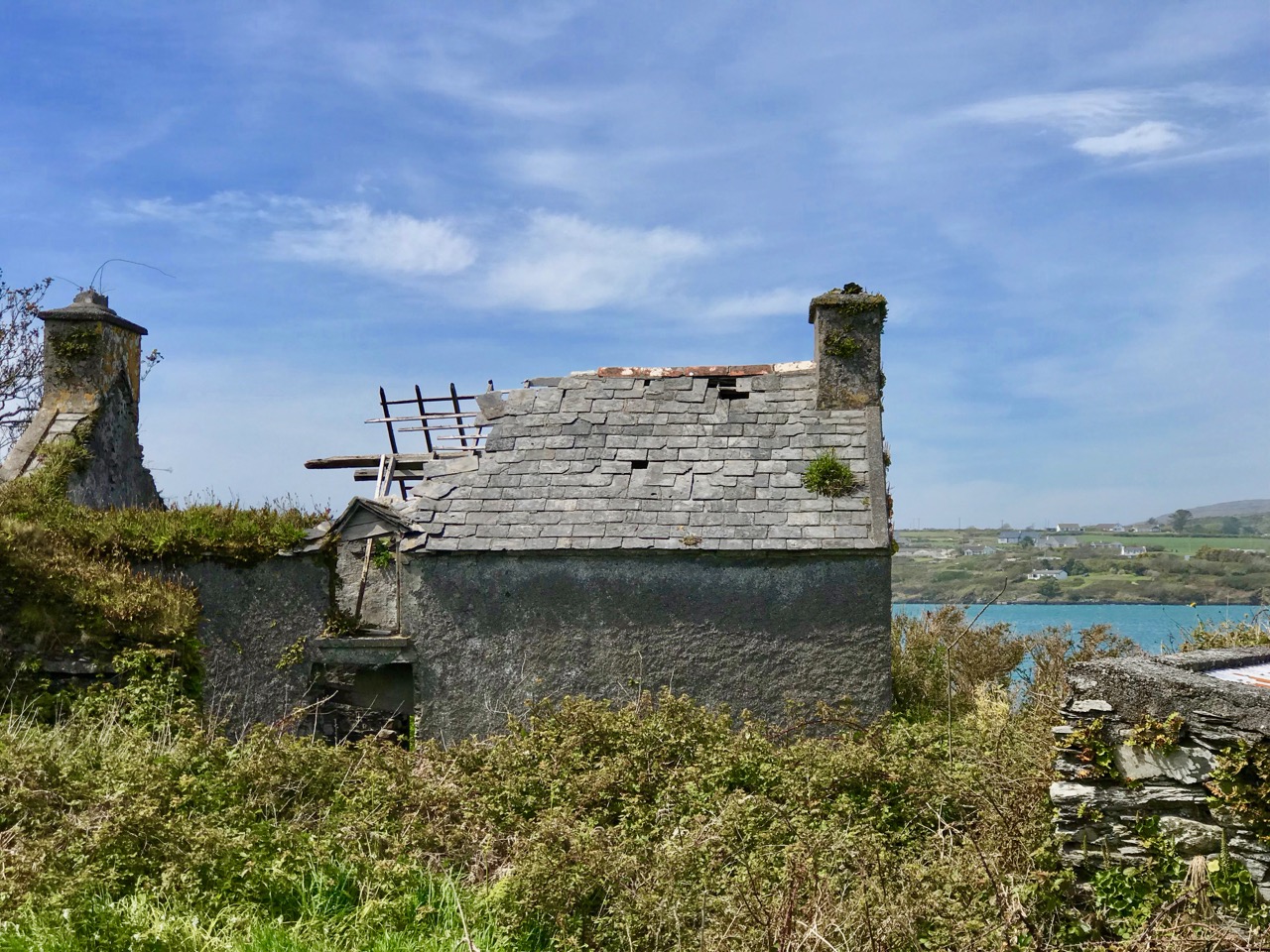
Hmmm… notions of grandeur there, perhaps – and little regard for practicalities, but it shows the power of imagination! I think it’s far more likely that the area will remain in its present state for many years to come and, perhaps, attract a level of ‘industrial architecture tourism’. Incidentally, it’s not too far away from the site of a fish palace run by William Hull and the Great Earl of Cork in the early seventeenth century: the remains of this are there to see to this day, although almost entirely returned to nature.

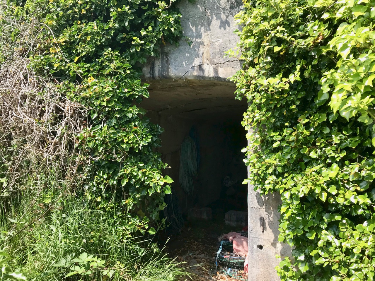
Below – a now impassable tunnel under the road connects the quarry workings with the quay; nature entangled with the leftovers of human activity

NOTE: in 2020 our friend, local historian and expert photographer John D’Alton of Schull has contacted Roaringwater Journal with some updated information about the Crookhaven quarry. John tells us that the quarry was never owned by the Roadstone Company. That was incorporated in 1949 by the Roche brothers who operated out of Dublin from the 1930s, but never operating this far south and west. John also adds that the company that operated the Crookhaven quarry was the Browhead Granite Company Limited, incorporated in London in 1917. The quarry opened for business in 1928 and closed in September 1939. It was this company that contracted for the construction of the impressive structure still there today. The company exported stone to various ports in England in particular, London especially, and Ipswich, among others, supplying stone for road surfaces. The Granite company was a successor to the Browhead Copper Mining Company that despaired of finding copper in mineable quantities in far West Cork. Interestingly, the structure is one of the earliest examples of this type of reinforced concrete construction in the country, the original Mizen (Cloughan Island) Bridge being another.

Many Thanks, John, for finding and sharing such detailed information which has been lacking until now!

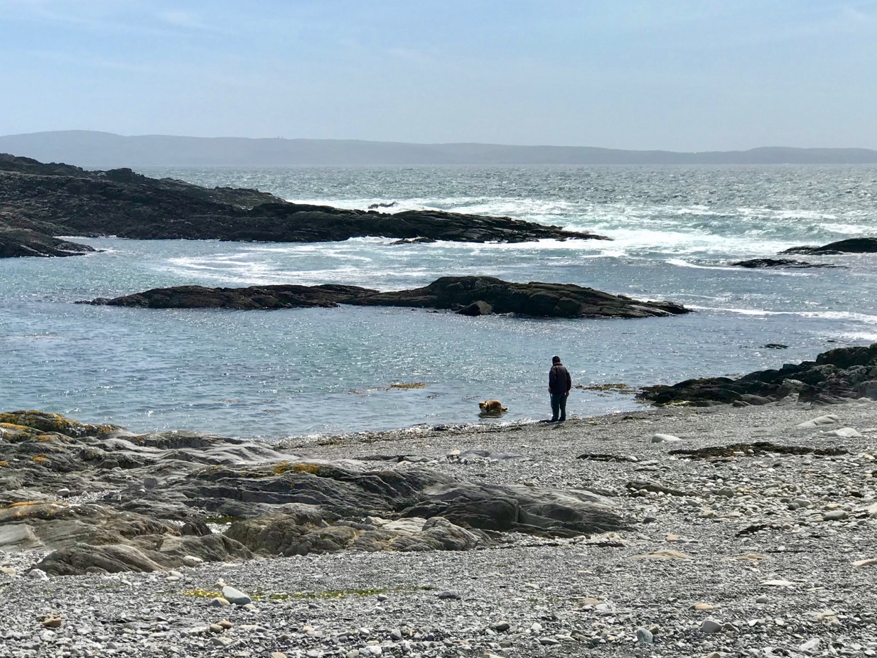
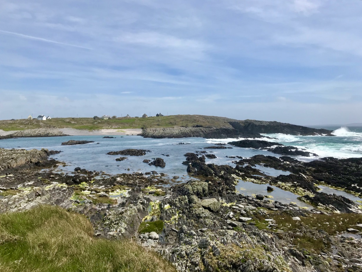
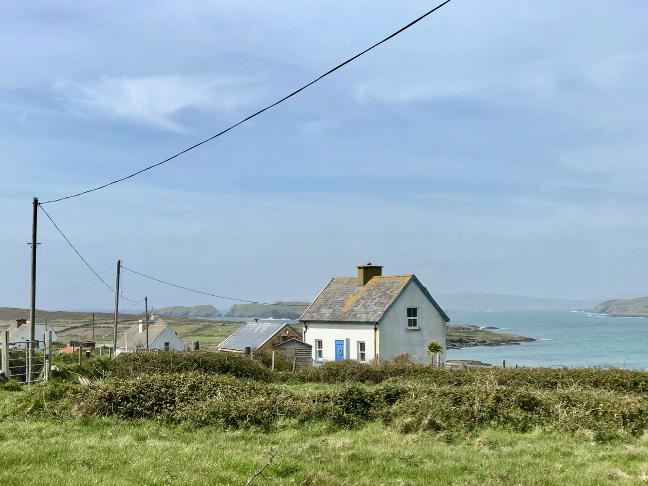
Endpiece – the old workings and quay are directly opposite the centre of Crookhaven – here’s a view towards the quarry from the village:

Wildflowers of a West Cork June – a Musical Treat

A few years ago I set out to record as many West Cork wildflowers as I can. This is the kind of project that lasts a lifetime and it seems important as our environment is threatened on so many fronts. But it’s also a complete pleasure to wander our beautiful boreens, camera in hand, capturing what I can. This month I want to share with you a selection of images, all local and all taken in June 2019. So sit back, turn on the music and just enjoy.

This slideshow requires JavaScript.

One of our favourites pieces of music to go with the images – just click ‘start.’

Eyebright

If you’re a wildflower fan you can follow our Wildflowers of West Cork page on Facebook. Go on – give it a Like!

Return to Long Island

The very distinct, treeless landscape of Long Island seen across the water from Colla Pier, from whence a ferry service will take you over: look here for the times. Alternatively, you can contact Helen of Schull Sea Safari and travel there on her large RIB, the Kealtra – we went with her from Schull Pier: my recent post told some of our adventures.

The seven permanent human residents on the island (in 2019) are supplemented by a good few four-legged inhabitants: we met most of the latter. Once there were enough people living here to support a school. That building now stands gaunt and empty right at the centre of a single road serving the two and a half mile long strip of land that lies at the very edge of the Atlantic.

Upper – the eastern end of the road that runs the length of the island is a trackway which served the old copper mine and the navigation beacon; above – the former school still stands, but is unused and decaying

One fascination of Long Island is a sense of fragility: even though it’s only a short sea crossing from the mainland it’s a completely different world. And you inevitably wonder about its future. In 2014 – just a few years ago – Helen Selka made a film about the island. It is well worth finding and watching: at least have a look at this trailer, remembering that there have been changes since then, although much also is unchanging. The film’s title is perfect: Bleak Paradise.

Fragile lives: in the centre picture is Finnbar, one of the permanent residents of Long Island. He appears in the trailer to ‘Bleak Paradise’

The island also has the distinction of being notable in the world of philately! On 24 April 1973 four postage stamps were issued by the ‘Long Island Local Carriage Service Ltd’. This local initiative was set up to improve the postal service then provided to and from the island. It was a private concern, and disapproved of by the Department of Posts and Telegraphs of Ireland, who made it clear that:

The Irish Post Office has not, at any time, approved the establishment of a privately owned and operated carriage service by the Long Island Local Carriage Service Ltd, and that company was not given permission to issue stamps and charge rates for the carriage of mail . . .

A little piece of very local history: Long Island’s attempt to set up its own postal service, dating from 1973. It created waves with the official postal service, and provided some good fodder for collectors of ‘first editions’!

We spent a day exploring this special place, and determined to return. We will choose a different time of the year, to gain a new perspective on this tiny, inhabited landfall on the edge of Roaringwater Bay. We recommend anyone to make a visit and take in the alternative lifestyle that is governed by a minimal population and a hidden and sequestered location.


Miniature World

A bog seems at first like an unpromising site for photography but all it takes is getting close. This isn’t as easy as it sounds, since bogs are wet places, but having arrived home sodden but exhilarated I’ve decided it’s definitely worth getting wet. My role model in this type of close observation is Tina Claffey, whose book, Tapestry of Light, and whose Facebook Page are constant sources of inspiration. Tina – thank you! We must be twin souls because like you I return again and again to the same patch of bog. Time loses meaning as I simply lie and let my eye tune in.

My little patch is quite close to my house and I described it in my post last year “The Wildest and Richest Gardens” – West Cork Bog Soaks. It’s taken a while this spring for the Cappaghglass soak to wake up but it’s well and truly alive now so here’s what’s there already.

On the rocks

First of all, the soak is surrounded by heather and rock. Lying on the rock, with my face a few centimetres from the surface, I have become aware of the rich lichen growth all around me. I don’t know a lot about lichens but I have been studying this one (above and below) – Devil’s Matchstick.

It’s obvious how it got that name, and it’s sometimes also known as Nail Lichen too. It’s only about a centimetre high, about the length of my little fingernail. The Latin name is Cladonia floerkeana. In Ireland we get this bright red form of it, whereas in North America the tips are black.  The site I go to to learn about Lichens is http://www.irishlichens.ie. Here’s what they say about lichens on their home page:

Lichens are dual organisms; a fungus and one or more algae in a stable, mutually beneficial (symbiotic) partnership. The fungus provides structural form and protects the algae from extremes of light and temperature. Algae are capable of photosynthesis and some of the sugars produced provide the fungus with energy for growth and reproduction. Some lichens can live for many hundreds of years and being sensitive to pollution levels they are important environmental indicators.

There are several red-tipped lichens in the Cladonia group so I must look out for others. The trunk is described as squamulose which simply means scaly, at the bottom and becoming fruticose (or shrubby) as it grows. The stems are called podetia, and they are topped by the bright red apothecia. Yikes! Don’t think I’ll become a lichen expert in this lifetime.

And look at this one, that looks like a goblet – it’s another Cladonia but I don’t know which one. And lots of white lichen to boot. It’s a whole world down there on the rock, under our feet. 

Let’s move over to the the bog soak now and look at two things in particular. The first is the Sundew. At first I thought it wasn’t up yet, but as I got closer I realised that it was just emerging from the surrounding Sphagnum moss (the second thing).

Besides looking weirdly otherworldly, the Sundew is a clever little critter, well adapted to this habitat. It’s developed a special mechanism to ensure it gets the nutrition it needs, since there isn’t much in the bog. It traps insects on its little sticky hairs, then the leaf rolls rolls over and digests them.

You might not want to watch this video if you have a weak stomach

The sundew does have a little white flower, but it’s the leaves that are the centre of all the action on this plant. Our bog soak has the Round-leaved Sundew, which is more common in Ireland than the Oblong-leaved Sundew that you saw in the video.

A hapless ant is this Sundew’s meal

Finally, as I was nosing around (er, literally) among the Sphagnum, I saw that some of them had these little brown caps and I wondered what they were. It turns out that mosses propagate by means of spores, and the caps are little exploding spore capsules. When they blow, they fire the spores great distances.

Take a look at the spores exploding in slow motion – it’s quite a sight.

Some of the capsules in my little patch had exploded already – you can see the empty cup-like capsules in the photograph below – at the bottom of the picture..

Sphagnum itself is an amazing moss – we wouldn’t have bogs without it, as it’s what holds all the moisture. The Irish Peatland Conservation Council has an excellent information page on Sphagnum. It includes this:

A huge number of tiny microscopic plants and animals live with Sphagnum mosses. A few drops of water squeezed from wet Sphagnum contains hundreds of microscopic species such as desmids, diatoms, algae, cyanobacteria, amoebae, rhizopods, flagellates, ciliates, rotifers (wheel organisms), worms, nematodes (round worms), flat worms and heliozoans (sun animals). One scientist counted over 32,000 microscopic animals from a Sphagnum moss growing in a bog pool!

Now that’s a bit too miniature for my lens. I’m happy at the magnification I can achieve with my Lumix. If you need me, you know where I’ll be.


Off the M8 – Kilree Monastic Site

Kilree is possibly the most perfectly contained and atmospheric site you will visit in Ireland. I defy you not to be enchanted with its leafy depths, its air of antiquity, and evidence of continued use. (I would also vote for Monaincha in Tipperary, a site that deserves its own post one of these days).

When you’re travelling from Cork to Dublin it’s easy to leave the M8 at Cahir and travel cross-country to join the M9. There are numerous sites to visit if you take this option: most recently we have written about Fethard and its Medieval Walls, but we also did a post about Kells Priory a long time ago (The Hallowed Fortress) and it remains one of our favourite sites and one of the most impressive monastic sites in Ireland. And don’t go without your copy of Ireland’s Ancient East by Neil Jackman – it’s our constant companion and a great resource. It’s available on Amazon but why not patronise your favourite bookstore?

Kells Priory, just up the road from Kilree and one of Ireland’s most impressive religious complexes

It’s a great contrast to Kilree. If you haven’t been to Kells Priory yet, try to take them both in, in the same day. What you will see is a typical example of an Early Medieval Irish monastic site (Kilree) and an excellent example of a large 12th to fifteenth century Augustinian Priory built to withstand the turbulent history of Kilkenny in those centuries. The monks in Kilree were living the life of Irish monastics in a pattern set down in the 6th century, while the Augustinians were mainstream European clerics invited over by the Normans.

Inside Kells Priory

The other things about Kilree is that it’s unspoiled (except for one thing – I’ll get to that later) and in Ireland, that means that the farmer who owns the land is using it. There’s a Bull sign on the gate and indeed there he was, with all his frisky bullock friends. We thought our chances of crossing the field were slim, but two friendly ladies on horseback offered to draw the attention of the cattle away from us so off we dashed while they were distracted, not giving much thought to how we might get back again.

Having charged off down the field after the horses (which were on the other side of the hedge) the bullocks, followed at a dignified pace by the bull) ended up beside the high cross so we decided to leave well enough alone and not venture over to that quarter. A distant shot will have to suffice for this post, but you can see excellent images of this cross at the Irish High Crosses website, and we thank them for that since this is the closest we will get for the moment.

But there was so much to see within the monastic enclosure. First, the round tower – it is missing its conical cap but apart from that it’s complete and in good shape. Brian Lalor, in his book The Irish Round Tower, assigns it an 11th century date based partly on the simple doorway. The arch, he points out, has been cut from the soffit of a monolithic lintel which is now cracked.

Crenellations were added to the top in later medieval times (you can see them in the first image) – the tower must have been renovated for some kind of defensive purpose at that time. When the Ordnance Survey folks came around in 1839 it was possible to climb to the top by means of rope ladders. There is no access now, apart from by the rooks and crows who have left evidence of their prodigious nest-building.

Lalor also points out that the round tower is perched on the circular boundary wall of an old churchyard which probably represents the position of the inner rampart of the monastic enclosure. What did such a monastic enclosure look like? I’ve used an illustration from a marvellous book called The Modern Traveller to the Early Irish Church, by Kathleen Hughes and Ann Hamlin (second edition, Four Courts Press, 1997). The site illustrated (Nendrum, County Down) was enclosed by three circular walls, a not-unusual configuration although one and two enclosing walls are also found. There is no real evidence left at Kilree for a second or third wall, but the location of the high cross indicates the likelihood of an outer wall.

The church is of an early form, rectangular, with antae at either end. To understand how this fits in with the architecture of the period, see my post Irish Romanesque – an Introduction. The nave, or main part of the church probably dates to the 10th or 11th century, but a chancel was added later, probably in the 12th century, by means of an inexpert Romanesque arch, which eventually had to be shored up with an even more awkward-looking inner arch.

Upper: East wall with buttresses added in 1945; Lower: The earlier Romanesque arch is clearly visible above the later one

The whole place was repaired by the Office of Public Works in the 1940s and it was they who built the buttresses which have successfully kept the east wall from falling down.

Upper: Looking through the linteled doorway into the nave and the chancel beyond; Lower: Looking towards the nave from the chancel. The chest tomb is on the right

There are several thirteenth to fifteenth century cross slabs within the church but the seventeenth century chest tomb just inside the chancel is the most interesting.

It’s hard to decipher as it’s faded and covered in lichen, but here is the description of it taken from the National Monuments listing:

Latin inscription, in a margin around the edge of the upper slab, was transcribed by Carrigan as, ‘Hic jacet Dns. Richardus Comerford quondam de Danginmore qui obit [date left uncut] et Dna Joanna St. Leger uxor eis pia hospitalis et admodum in omnes misericors matron quae obit 4 die October A. 1622’ and translated as, ’Here lie Mr. Richard Comerford, formerly of Danganmore, who died [left blank] and Johanna St. Leger, his wife, a matron pious, hospitable, and charitable to all, who died Oct 4th, 1622’. The front slab. . . is decorated with the symbols of the Passion flanked with stylised fluted pillars which taper towards the base. The symbols from dexter to sinister include a ladder, entwined ropes, a spear, dice and a seamless garment, 30 pieces of silver and beside them a bag with two straps, a cross ringed with a crown of thorns, a heart pierced with nails and pierced hands and feet above and below this, a scourge on either side of a plant, a cock on a three-legged pot, a sword, a chalice, a hammer, and pincer holding 3 nails and two sheaves of wheat. 

Can you recognise the details from the NM description?

Outside the church, the graveyard is quiet and picturesque, but I couldn’t help noticing the absence of vegetation of any sort. Older photographs I have seen show a covering of grass, and I suspect that somebody has been in here with the Roundup – I told you I would get to the one problem I have with this site, and this is it. It may be historically and archaeologically fascinating and important, but the ground itself is a dead zone – no biodiversity here. And that’s a pity because there was a swarm of bees about to settle in one of the trees. They will have to look outside the site for pollen.

We saw many old gravestones, dating from the early eighteenth century and into the current day. But the one that caught my eye was this one – all the instruments of the passion clearly carved for John Brenan, who died in 1772. Can you recognise and name them all?

I know you’re wondering how we made it back across the field. Well fortunately, the cattle stayed over by the hight cross and we sneaked back across without attracting their attention. I can’t decide whether their presence added to the experience or not, but it certainly made it more exciting, even though we didn’t get to see the high cross up close. Kilrea is a very special place, I think. I am hoping that next time we go back the grass will have been allowed to grow again.

Mizen Magic 15: Long Island

The summer sun is falling soft on Carbery’s hundred isles— 
The summer sun is gleaming still through Gabriel’s rough defiles—

(from Thomas Osborne Davis The Sack of Baltimore 1844)

Up here in Nead an Iolair (Eagle’s Nest) we look out over the Carbery Islands. There are supposed to be a hundred of them, although some are just little rocky outcrops: the tips of underwater mountains at the margins – and the mercy – of the Atlantic.

Horse Island, Castle Island and Long Island lie along the length of the coast below us. Peter Somerville-Large (The Coast of West Cork 1972) quotes a tradition that they all used to be one island:

In the latter end of March, AD 830, Hugh Domdighe being monarch of Ireland, there happened terrible shocks of thunder and lightning . . . At the same time the sea broke through the banks in a most violent manner, The Island, then called Innisfadda, on the west coast of this country was forced asunder and divided into three parts.

Long Island is still known as Inis Fada in the Irish language: the Anglicised name is a direct translation; header – the long road that winds from East to West on Long Island; second picture – the Wester village seen above the Atlantic breakers on the wild and battered far shore

We had a day’s adventure on the island, walking almost the full length of it; Finola was madly busy identifying all the wildflowers. It’s part of the magic of Long Island that we covered a distance of over 10 kilometres in the day, although the length of the island tip to tip is just over 4k. There is a regular ferry to the island from Colla Pier (not every day of the week), but we chose to travel from Schull pier with Helen of Schull Sea Safari (a whale watching trip with Helen will be a future outing for us). Our mode of transport was Helen’s very fine large RIB, the Kealtra – superbly equipped. With a hard south-easterly wind the waters were very choppy and we had to be fully kitted out for the crossing!

Upper – intrepid travellers kitted out for a choppy crossing on the Kealtra! Lower – skipper Donie taking the RIB out of Schull Harbour

After the heady excitement of a blustery crossing, stepping on to the tranquil world of Long Island is a magical experience. You are immediately aware that the place holds memories – and ghosts – but is still a community in the modern world thriving against the odds.

Everywhere there are signs of the past: abandonment, fading history, but also livings still being forged from the environment. The sadness is the obvious population decline. Looking through the available census records, a melancholic picture emerges: 1841 – population 305; 1911 – population 143; 1951 – population 74; 1991 – population 11; today – population 7 (and that’s an increase of 1 from 2 years ago). There was once a school: the decaying building is now a lonely waymark at the centre of the island’s single boreen.

The Island School – long deserted and gently decomposing

Peter Somerville-Large in conversation with the local residents during his visit half a  century ago:

I talked to Mr McCarthy, who had lived here all his life and could remember when the place had been full of fishermen all speaking a mixture of Irish and English. One by one he had watched them leave. A dozen families still remained, comprising perhaps forty people altogether. The school had shrunk year by year, to four pupils, then two – it closed after that. There was neither electricity, nor any shop – nothing to keep the young from making the short crossing over to the mainland. It would take them fifteen minutes, according to wind and weather. There they disappeared for ever. When the old ones like himself died out the place would become empty.

Contrasts at the west end of Long Island

Although there are many houses that are intact and well looked-after (a number are holiday homes), you would think that the odds were ultimately stacked against the survival of this island. Yet those who do live here full-time have tenacity – and there is fresh energy. Helen and Maurice have built their own new house and run businesses which allow them to be island based, while Castaway East is a ‘Place of New Beginnings’, a venture offering B & B or full board and – if you want – retreat packages to recharge your batteries. Peter and Tracy are also experts in garden landscaping as can be seen from the works they have carried out for themselves.

The East end of the Island: you can walk past Peter and Tracy’s ‘Island Retreat’ to the old copper mine and navigation beacon

We were pleased to find that the island’s well has been maintained and presented in excellent order – mainly by Joe, one of the Islanders. It’s a little haven, not to be missed. The day’s adventure gave us so much photogenic material – I will be returning to this magical place in a future post.