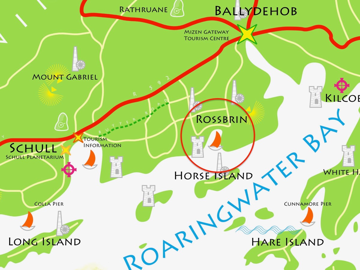
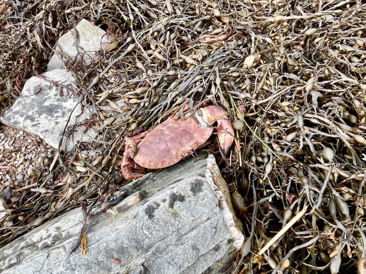
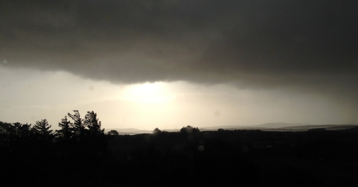
The weather so far this year is breaking records for coldness, wetness and evapotranspiration – while Earth as a whole continues to get warmer. In simple terms that means it’s not pleasant to wander too far from home. I decided to walk down to the shoreline of Rossbrin Cove – all of ten minutes – and see what the winter storms may have washed up: often an interesting diversion.
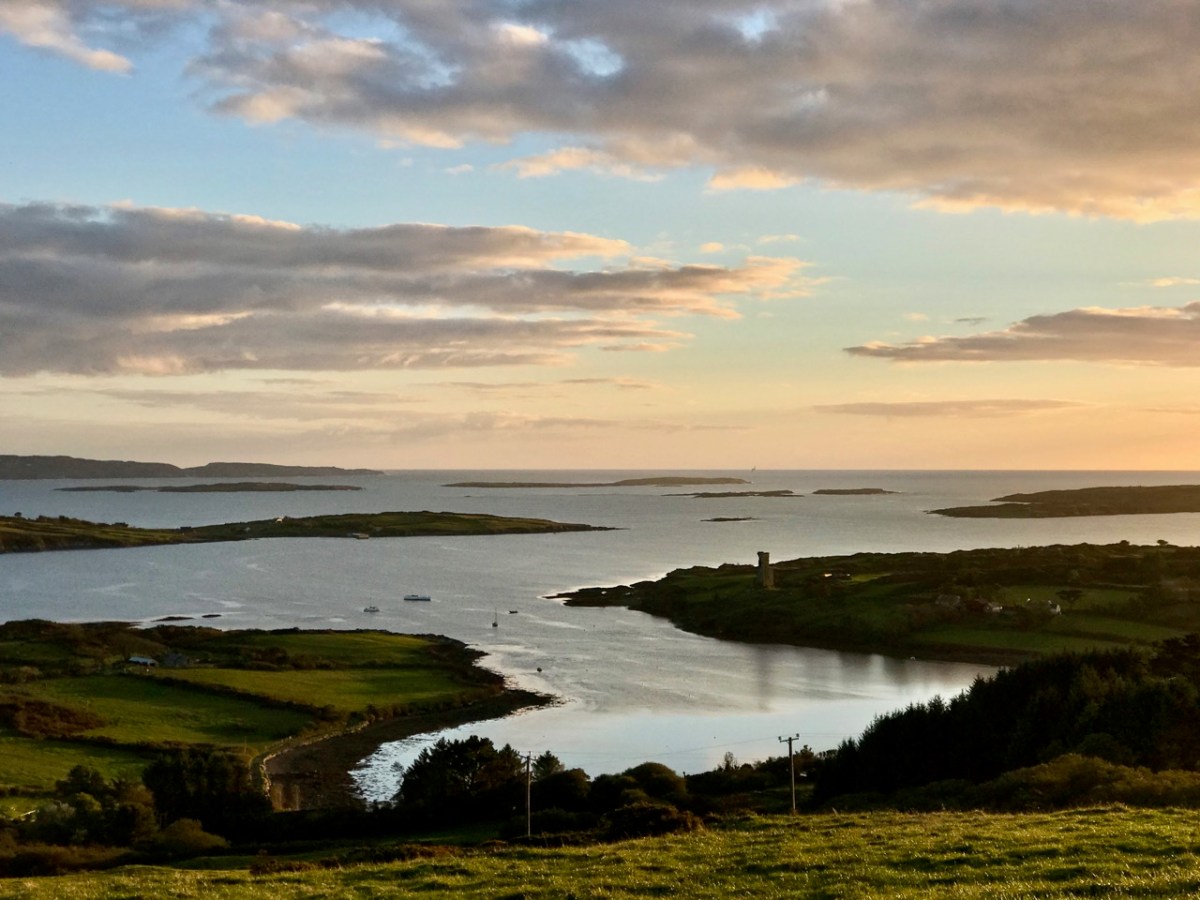
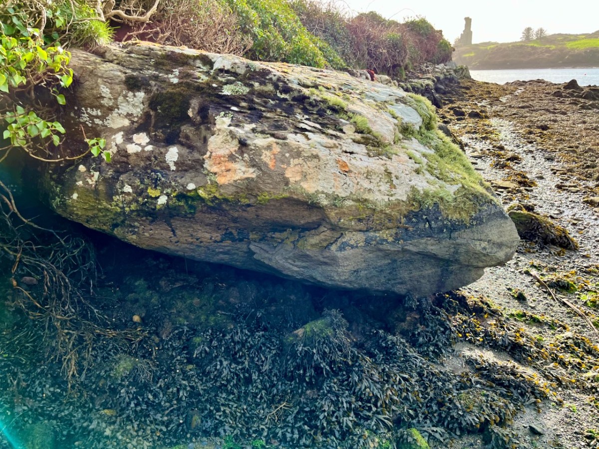
Above: looking down on Rossbrin Cove with some of the islands of Roaringwater Bay beyond. It is a natural harbour, and there is a thriving boatyard at the western end of it. The difference between low and high tides is around 2.5 metres on average, and much of the inlet dries out when it is at an extreme low. I timed my walk to arrive when the tide was fully down, as I wanted to explore the exposed mud-flats, with hopes of finding intriguing detritus.
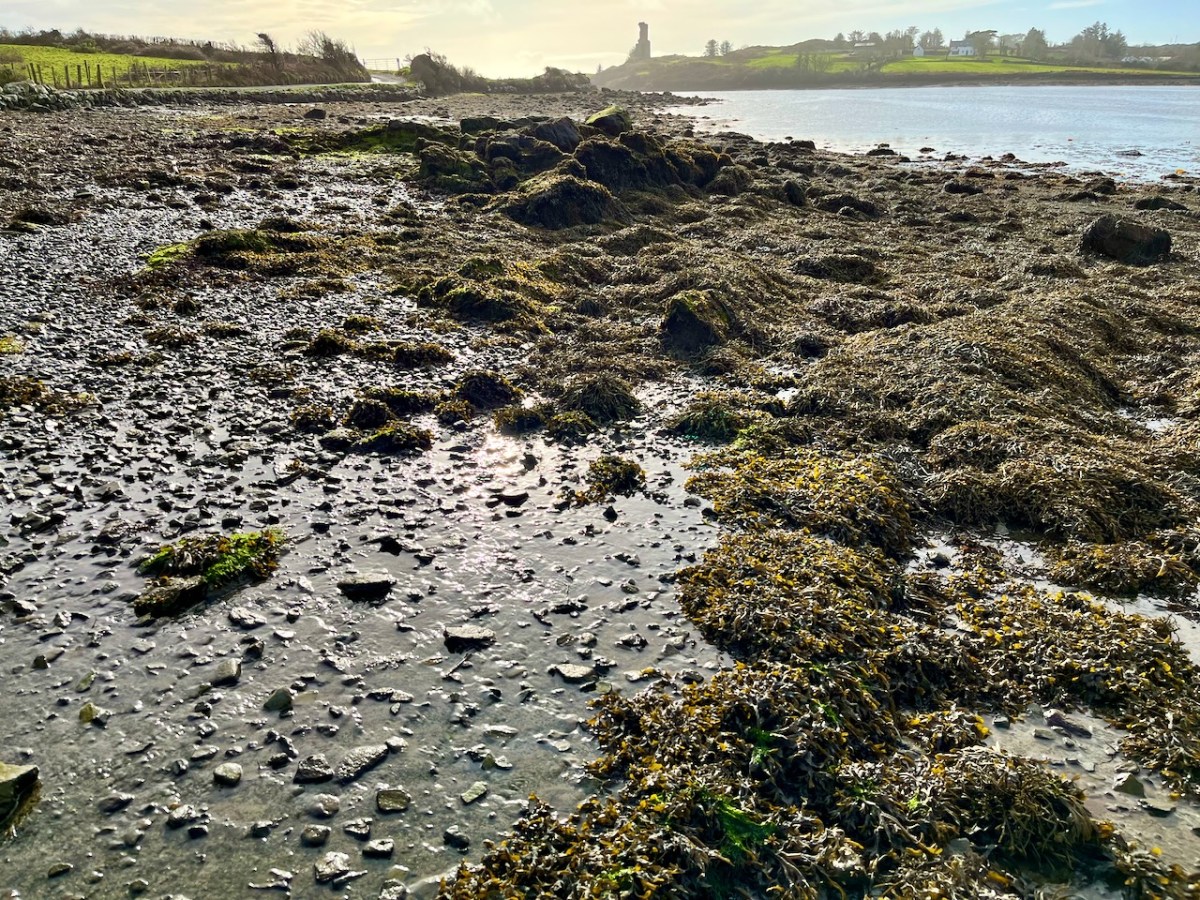
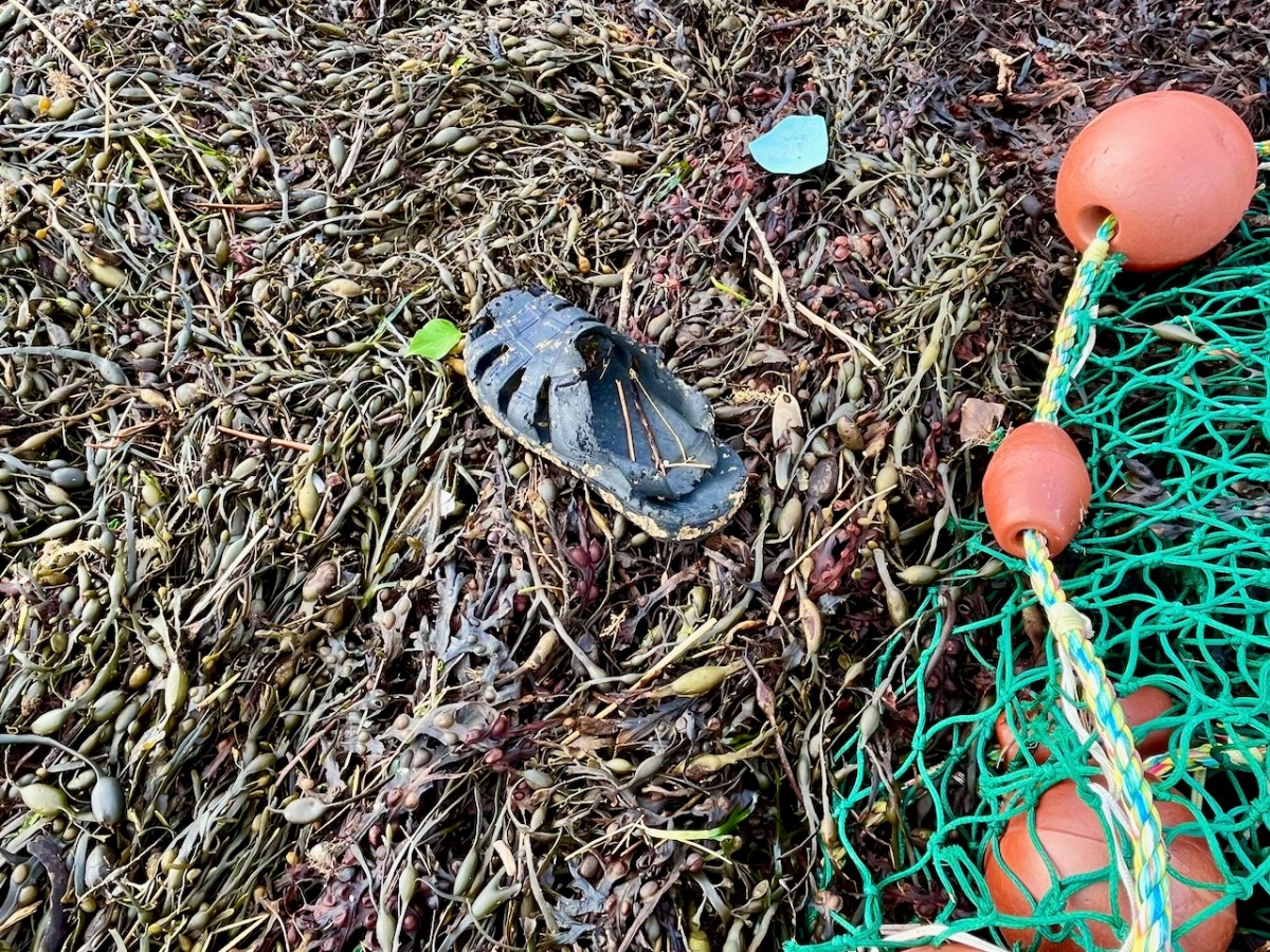
Not an inspiring start! In fact, as I continued my review, I noted that there was very little other than the natural environment – weather-worn boulders, skeletal shells and masses of seaweed – to disturb the order of things in Rossbrin on this February day. If our harsh storms had been of some positive effect it was perhaps to flush out any washed-up debris that might have accumulated in the winter – being now past St Brigid’s Day I consider it appropriate to call the season spring.
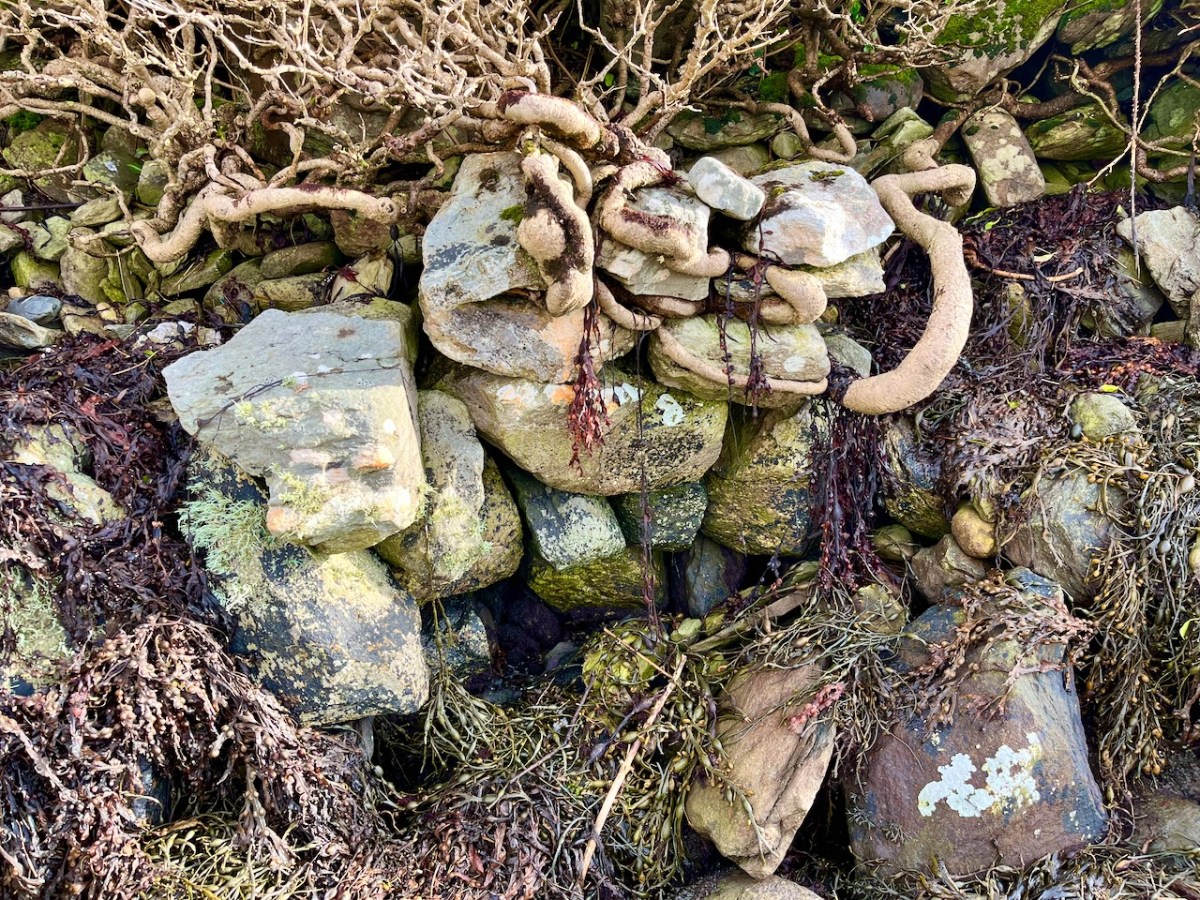
No matter that the exploration was superficially disappointing, the magic of this little bit of West Cork soon took over, and my mind was filled with the enormity of its history. There was a university here in medieval times: manuscripts were written here in the castle that has become a crumbling pile. Ravens and seabirds now rule over the stronghold. I walked on.
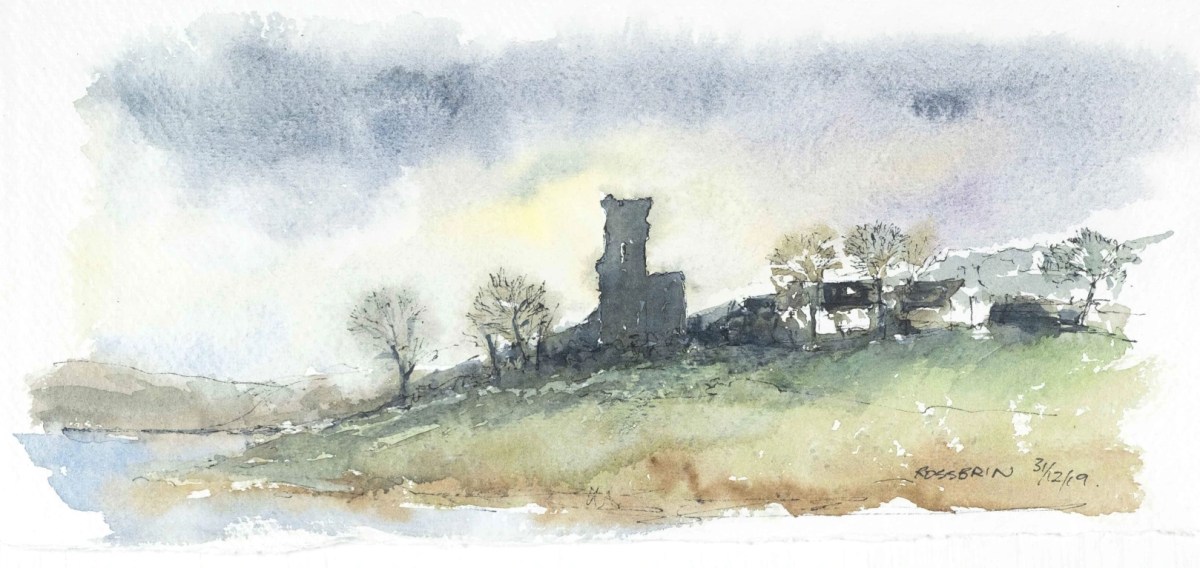
The margins of the cove are lined with ancient banks. At every turn there is a composition which a maestro could frame: I make do with a camera. Rossbrin inspired our artist friend Peter Clarke . . . Thank you, Peter!
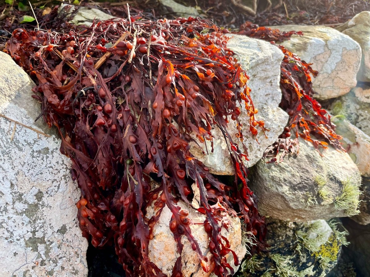
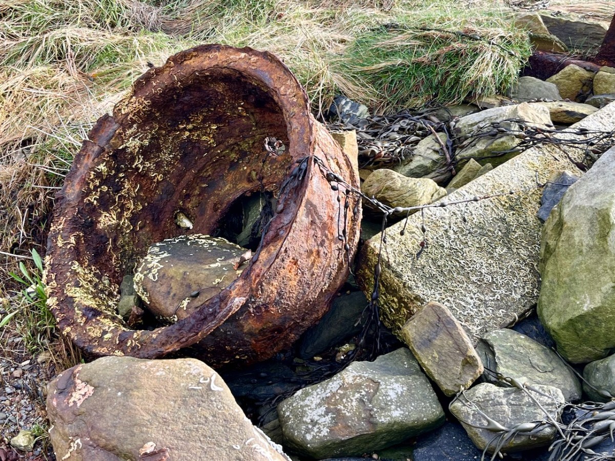
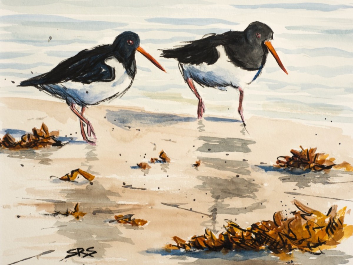
Evidence of more recent history: possibly a pot which was used in the process of tarring a clinker boat hull. No doubt vessels were built on these shores – and used to make basic livings. There is still fishing activity in and around the cove; mussel beds thrive in Roaringwater Bay; seaweed collection happens also. In summer months the deeper waters of Rossbrin are occupied by leisure orientated sailing craft. I enjoy the calm days of winter when there is hardly anything on the water. I watched a small flock of oystercatchers scurrying and foraging with their brilliant beaks, and then I turned for home.
The Rossbrin oystercatchers were uncooperative, and wouldn’t let me photograph them. Instead I have imported this wonderfully atmospheric painting by Cornish based artist Steve Sherris. Thank you, Steve
We have posted extensively about Rossbrin Cove, its history and its people. Have a look at these:
It was a big day in Ballvourney yesterday: the public unveiling of two replicas of the 800 year old wooden figure that has been central to observances of St Gobnait on her day for as long as anyone can remember – we must be talking centuries! If you are not familiar with St Gobnait – or her celebrations – read my post here.
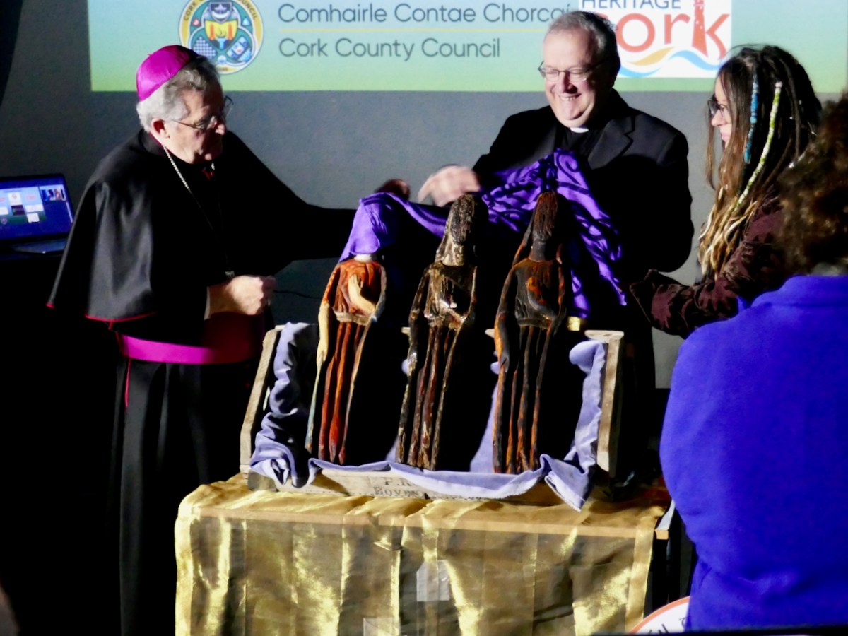
It’s actually St Gobnait’s Day today: the eleventh of February. As I write this, the congregation in the saint’s church will be venerating the 13th century wooden figure by ‘measuring’ her with ribbons. But also, for the first time, they will be able to view the two copies of that figure which have been made over the last few months. That exercise has been undertaken so that the figure itself could be fully studied because it is of great historical interest. There are other medieval carved wooden figures of saints surviving elsewhere in Ireland, but this is the only one that is still in regular active use.
. . . A medieval wooden image of Gobnait, kept traditionally in a drawer in the church during the year, is venerated in the parish church on this day. The devotion is known as the tomhas Gobnatan . People bring a ribbon with them and ‘measure’ the statue from top to bottom and around its circumference. This ribbon is then brought home and is used when people get sick or for some special blessing. The statue is thought to belong to the 13th c. A second pattern in honour of Gobnait was traditionally celebrated in Baile Bhúirne at Whit . . .
The above citation is taken from The Diocese of Kerry website, which sets out a comprehensive review of the saint and the activities which honour her. Here’s the measuring taking place a few years ago:
National Heritage Week 2023 explains the purpose of the project to replicate the carving:
. . . As patron saint of the parish, the statue provides a tangible link to the saint but importantly represents the long-standing living devotion to Gobnait. The wooden figure carved out of oak clearly depicts a female monastic. It was guarded over the centuries by the O’Herlihy clan, who were the ruling Gaelic lords of the Ballyvourney area during the medieval and late-medieval periods. It remained in the safe-keeping of members of the O’Herlihy family until they handed it over to the local parish priest in the late-19th century and it has been protected and kept secure by the Ballyvourney Church Committee ever since. The 3D project will comprise the digital scanning of the statue which in turn will enable a 3D generated wooden print out. A second replica will be hand carved as an integrative representation of how the statue would have looked originally before the centuries aged and tarnished it. The replicas will then be placed permanently on display in the Parish Church with information signage . . .
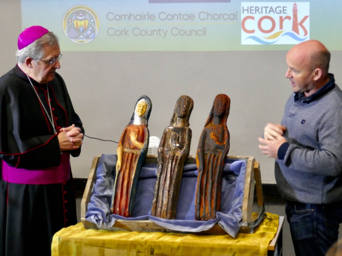
Above is a view of the original carving (in the centre) with the replica of that on the right. On the left is the ‘integrative representation’ – that is the carver’s interpretation of what the figure might have looked like when she first saw the light of day in the 1300s. On the left is Bishop William Crean – Bishop of Cloyne since 2013: he presided over the unveiling of the two replicas yesterday. On the right is John Hayes, of Special Branch Carvers in Fenor, Co Waterford. He was responsible for the carving project and has made an excellent job!
John gave us a presentation yesterday, after the unveiling ceremony, and we learned how he closely examined the original statue, taking detailed measurements and a full photographic survey. This enabled a Sketchfab 3D rendering to be produced: this became the basis for his work. During the examination he was able to find traces of paint, which enabled him to render the interpretative version with – very likely – a high degree of fidelity to the original.
I got the chance to talk to John and ask him about the timbers used for the original and the replicas. The original is of oak, and we don’t have a way of knowing where this came from. The replicas are of ash: this is a good material for stability and longevity. John had access to a good source of seasoned wood.
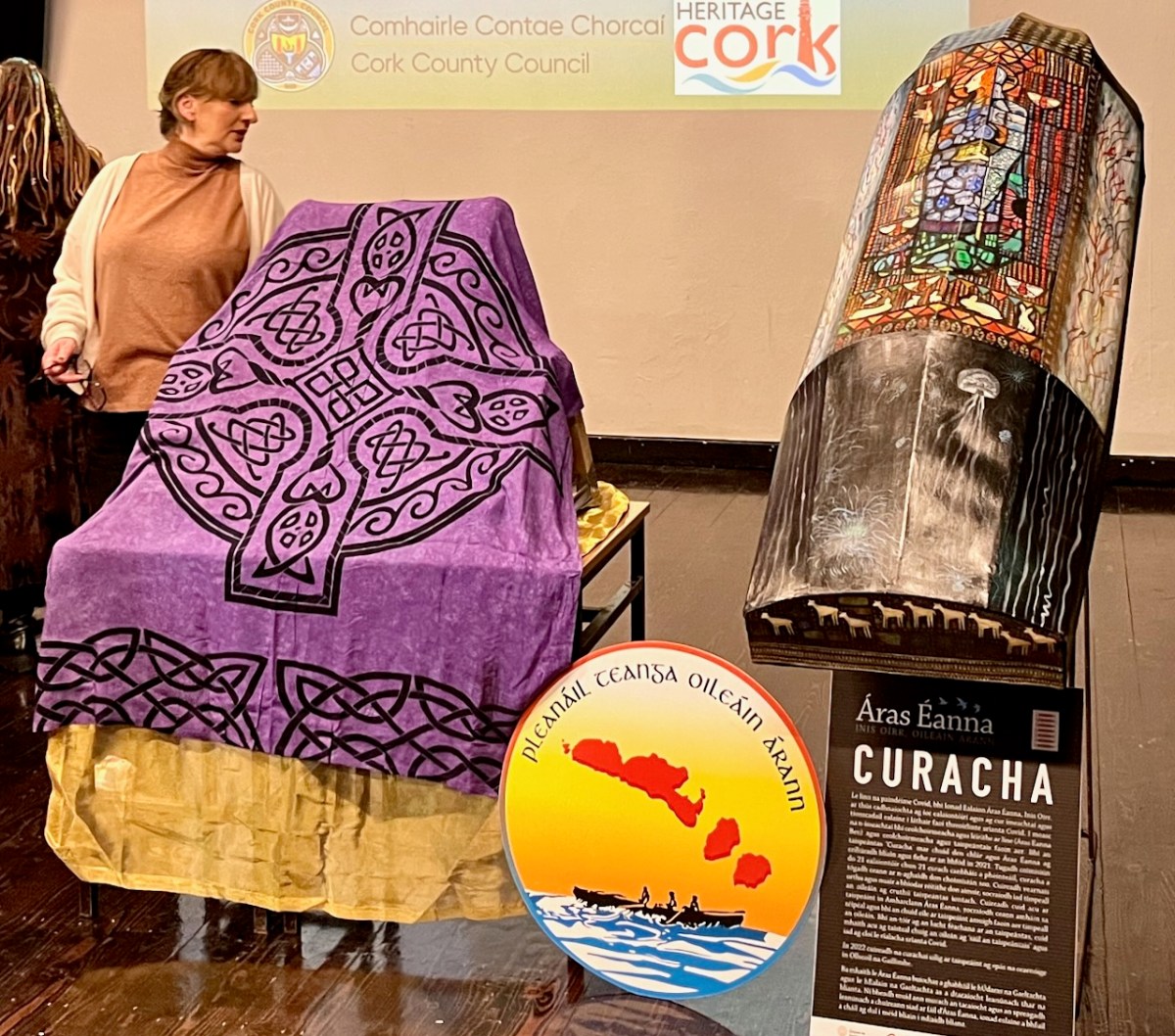
The day was a study day for St Gobnait, and encompassed a whole lot more than the unveiling of the replicas (they are waiting under the cloth- above – to be revealed)! Note the currach in the pic also: that’s another project – to establish a Camino tracing the route which Gobnait took as she travelled around Ireland from the Co Galway Aran Island of Inisheer, having been told by an angel that her life would be fulfilled when she saw nine white deer. She spent time in Dun Chaoin and Kilgobinet in Kerry, Ballyagran in Limerick, Kilgobinet in Waterford, and Abbeyswell and Clondrohid in Cork, before finally finding the deer in Ballyvourney. You can see those deer on the stern of the currach, above. There are at least eight holy wells in Ireland dedicated to the saint. Amanda has written extensively about Gobnait’s travels and – of course – about her wells.
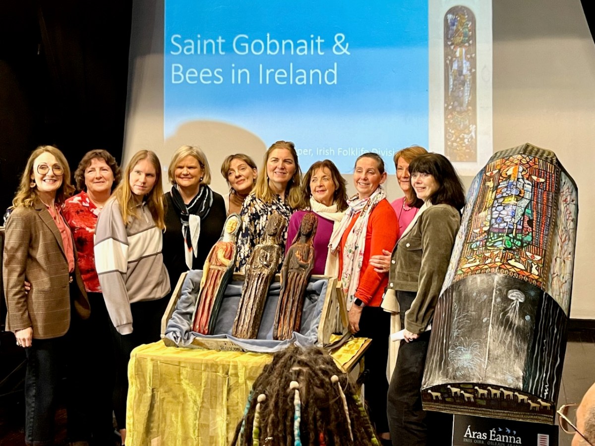
There was also an excellent series of talks about Gobnait. Events took place in Ionad Cultúrtha an Dochtúir Ó Loinsigh, which is a great facility in the community. Here we are – together with our good friends Peter and Amanda (you have met them frequently on the pages of this Journal), - waiting for proceedings to begin:
This is the moment of unveiling: the Bishop is accompanied by the Parish Priest – Very Reverend John McCarthy SP – and archaeologist Dr Connie Kelleher, National Monuments Service: she has played a significant role in this Ballyvourney project.
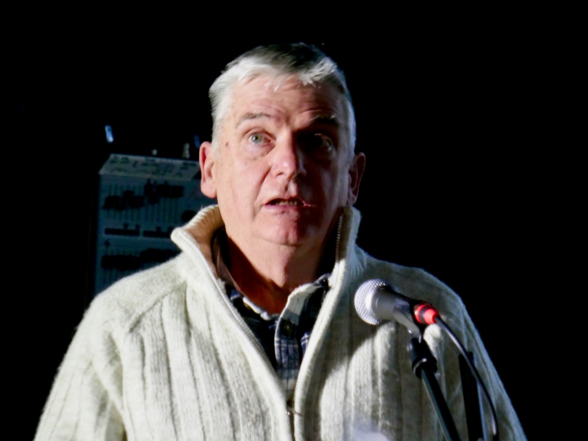
The decoration on the hull of the Camino Currach is based on the depiction of Saint Gobnait in the Harry Clarke window from the Honan Chapel, UCC. The bee image on the right reminds us that Gobnait is the patron saint of bees and beekepers. We enjoyed a comprehensive talk on bees by Peadar Ó Riada – who has first hand experience of the subject:
There were many more dimensions to the day. One of my favourites was when the audience was requested to produce anyone named Gobnait to be photographed with the carved figures. That included the variations of the name: Library Ireland (1923) (Rev Patrick Woulfe) gives these as Gobinet, Gobnet, Gubby, Abigail, Abbey, Abbie, Abina, Deborah, Debbie, and Webbie. Ten candidates stood up to be counted:
Thank you to Finola for providing many of these photos
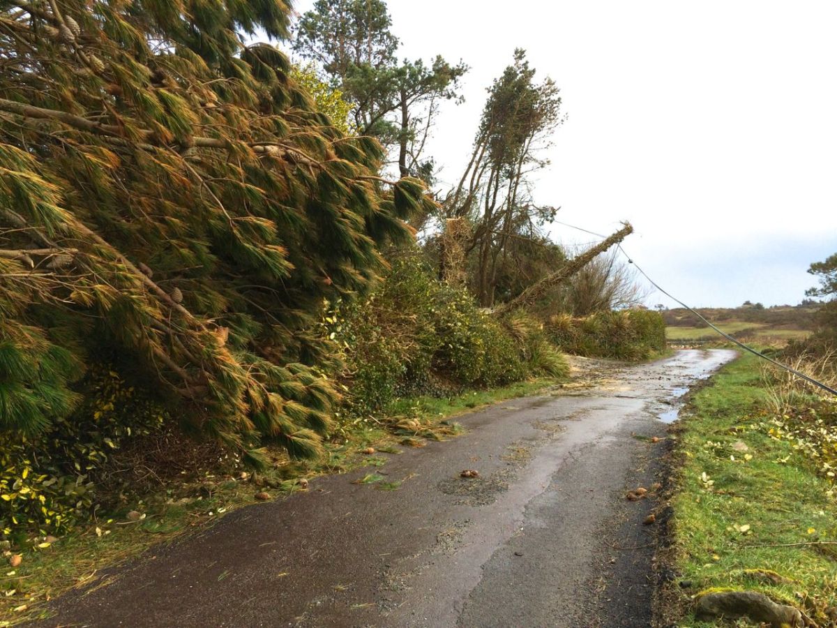
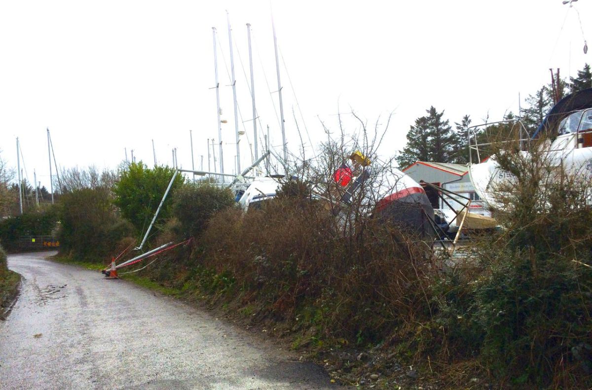
Exactly ten years ago I wrote a Roaringwater Journal post titled Outlook: Changeable! It was about the weather and – interestingly – things haven’t changed much in that respect over a decade. So I thought it was worth a re-run, with some adaptations. The new title, for a start – Outlook: Unsettled! – is apt, perhaps, for the whole world we are living in today and not just the weather. The year 2014 produced the fiercest storm – Darwin – that many in West Cork (and beyond) had experienced in their lifetimes. Certainly we had property damage, felled trees and powerlines, and were without electricity, phone and internet for very many days.
Examples of the damage caused by Darwin in 2014: neighbouring cables felled (upper) and boats toppled from their keel blocks in Rossbrin Boatyard
From January 2014: …One of my favourite expressions about the weather was learned from an elderly gentleman who had lived all his life in Hampshire, England. …Tis black over Will’s Mother’s… This would have described very well the scenes around us in Nead an Iolair when we awoke this morning. As an Englishman I would be expected to talk about the weather all the time; Irish people are not far behind in this, probably because there is such a variety of weather – even in a single day – that it demands to be described. …Is iomaí athrú a chuireann lá Márta dhe… means: …There is a lot of weather in a March day… This might just as well refer to a January day, or a day in any month in our experience. To illustrate this we decided to try a time lapse video, using an iPhone and a tripod. We had to shoot it through the window, hence the reflections – just as well because during the process we had torrential hail to add to the variety. So this is a thirty minute session of Irish weather coming in to Roaringwater Bay compressed to thirty seconds, each frame being shot a second apart:
By asking around the locality I have compiled some Irish expressions for weather. These are ones that I particularly like:
A snipe won’t stand in the morning… (meaning expect icy weather)
It’s a hure of a day… (meaning it’s a hure of a day – Finola has her own version here)
Bad aul’ day isn’t it?
And – very occasionally – The Sun does be splittin’ the stones…
Coming back to 2024 It’s worth delving into the archives of the The Schools’ Folklore Collection: the following entries were written down in the 1930s and provide an insight into weather-lore from the time:
“…When the sheep go under the wall there is a sign of rain. When the curlew begins to whistle there is a sign of rain. When the cricket begins to sing there is a sign of rain. There is a sign of rain when the hills look near. When the dust is flying off the road there is a sign of rain. When the river is roaring there is a sign of rain. When the fire is blue there is a sign of rain. When the clouds are running in the sky there is a sign of rain. When the smoke from the chimney is going up straight there is a sign of rain. When the sky is red in the morning it is a sign of a wet day. When there are a lot of clouds in the sky it is a sign of rain. When there is a rainbow in the morning it is a sign of a rain. The South wind brings most rain in this district. A red sky is a sign of a storm. Black clouds are a sign of rain. When the swallows are flying it is a sign of rain. When the dog is eating grass it is a sign of rain. When rain is expected the cat lies near the fire. The crows lie on the walls when rain is expected. The nearer the ring is to the moon the farther the rain is from us. The farther the ring is from the moon the nearer the rain is to us. When the lake is rough it is a sign of rain. When the water-fall roars it is a sign of rain. When the soot is falling it is a sign of rain. When the cricket comes into the house it is a sign of rain.
If a robin comes in very near the door of the house its the sign of bad weather. If crows fly in flocks together and are always cawing its the sign of rain. The South and South West winds are the most that bring rain. If the ducks quack loudly and the cricket sings sharply its the sign of rain. A ring around the moon at night is the sign of rain…”
All these sayings have been collected by informants Willie Noone, John Monoghan and Michael Halloran, Co Mayo. It’s instructive that they are only about rain.
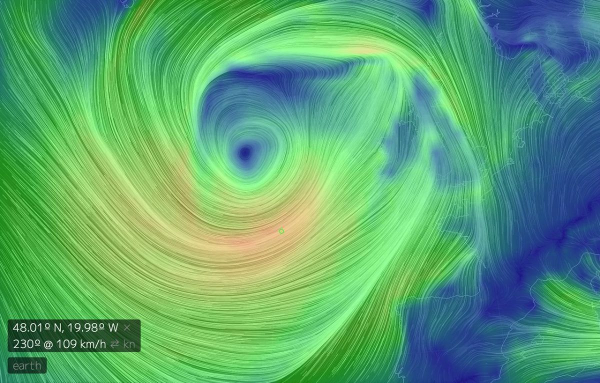
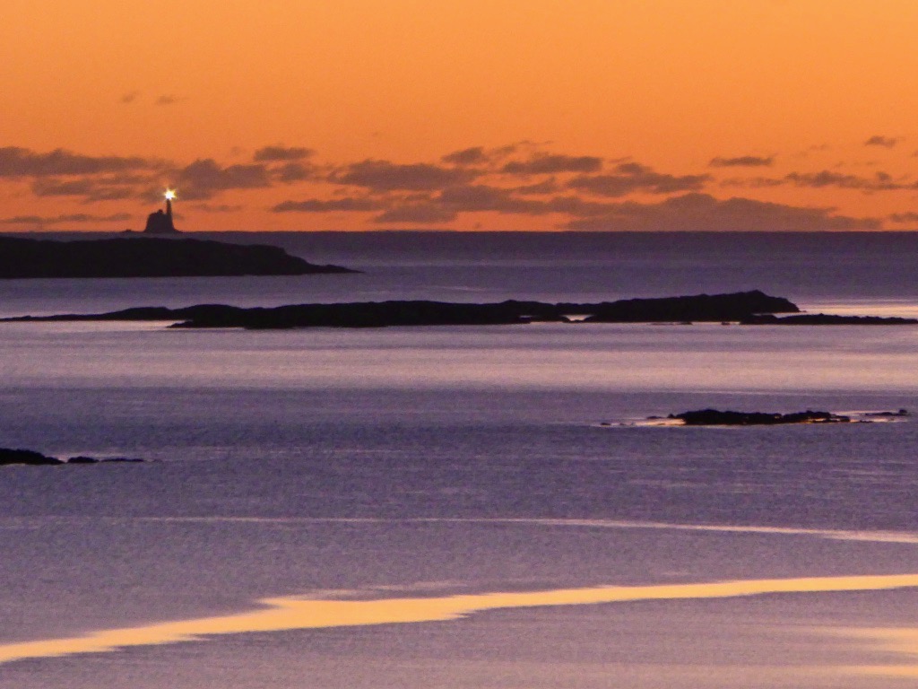
This is a record of the Earth Wind Map from early January, 2014. It’s centred over Ireland. Only 109 km/h is recorded. That’s classified as “Violent Storm” and just a few km/h short of a hurricane. Storm Darwin hit wind speeds of 177 km/h. That was a record for the time, but it’s worth noting that the greatest wind speed ever measured (so far) in Ireland was 191 km/h at Fastnet Lighthouse, County Cork on 16 October 2017. That’s just across the water from us here at Nead an Iolair! Here it is seen from our house (by Finola) on a happily calm day…
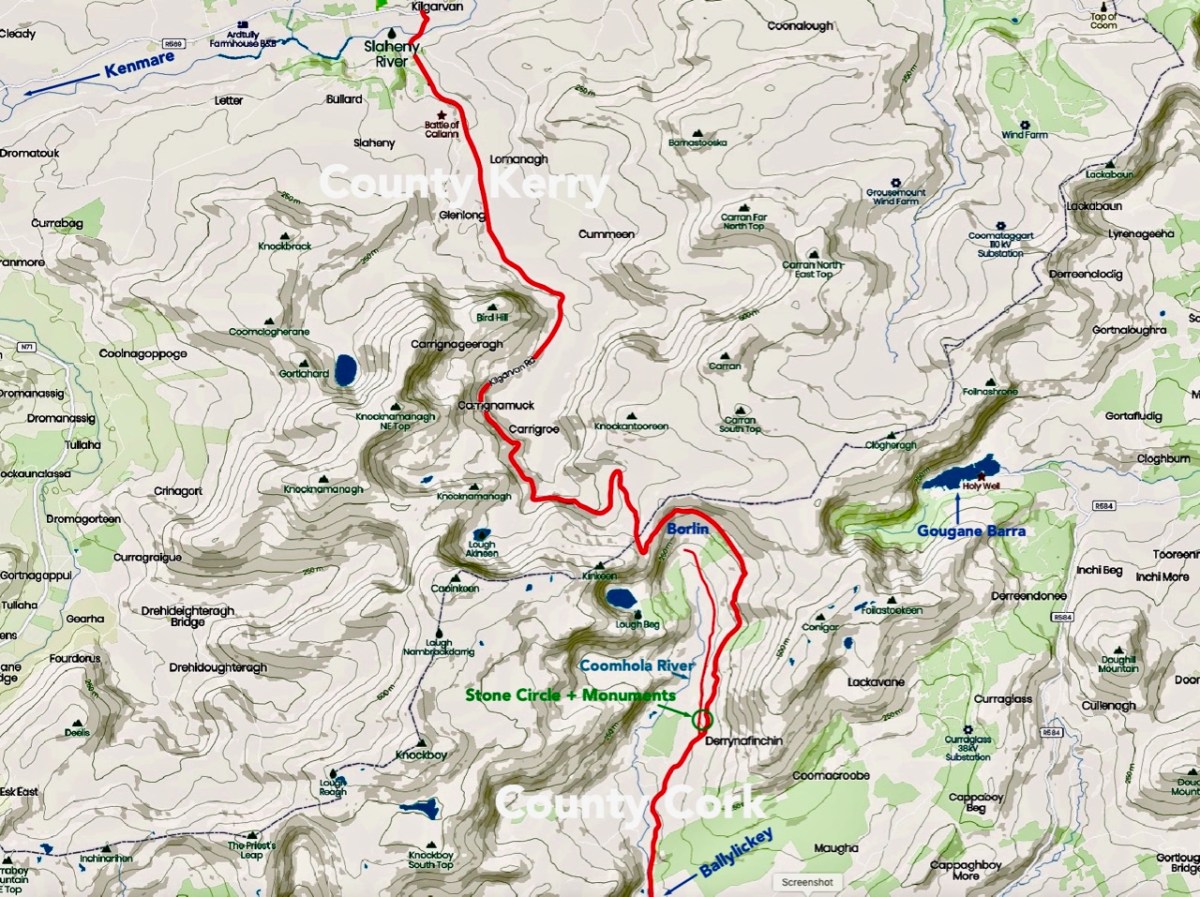
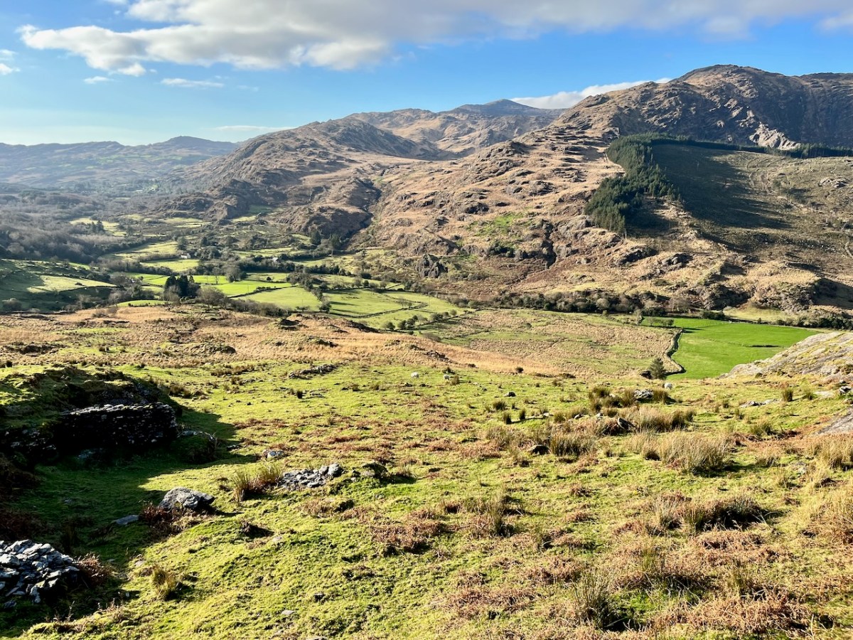
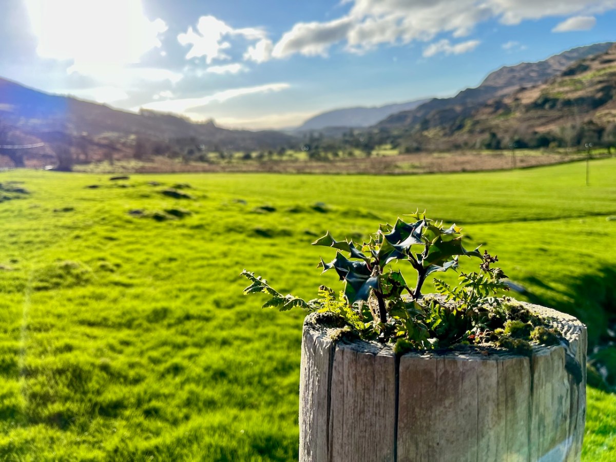
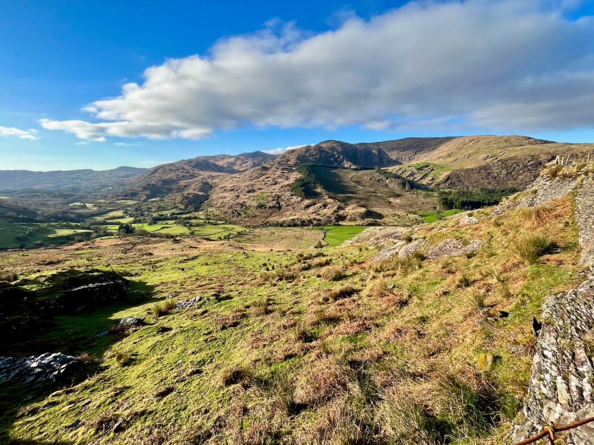
We have certainly travelled this route many times – it’s our favourite way of getting from Kenmare home to West Cork. Assuredly not a direct road, but spectacular – and you’ll hardly see a soul. Here’s a map – the road is in red:
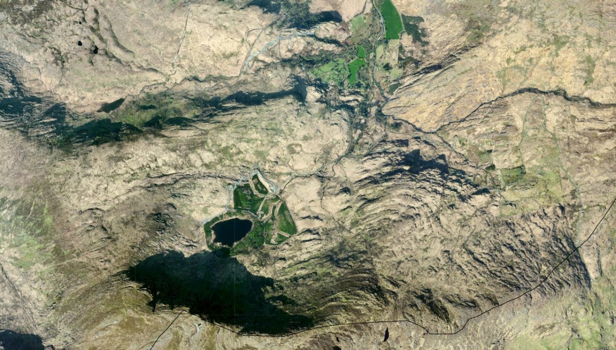
And here (below) – a sculptural abstract – is the nature of the terrain which the satellites spy on – looking straight down!
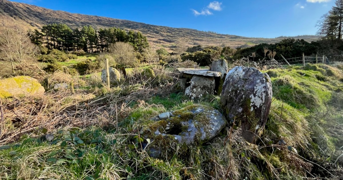
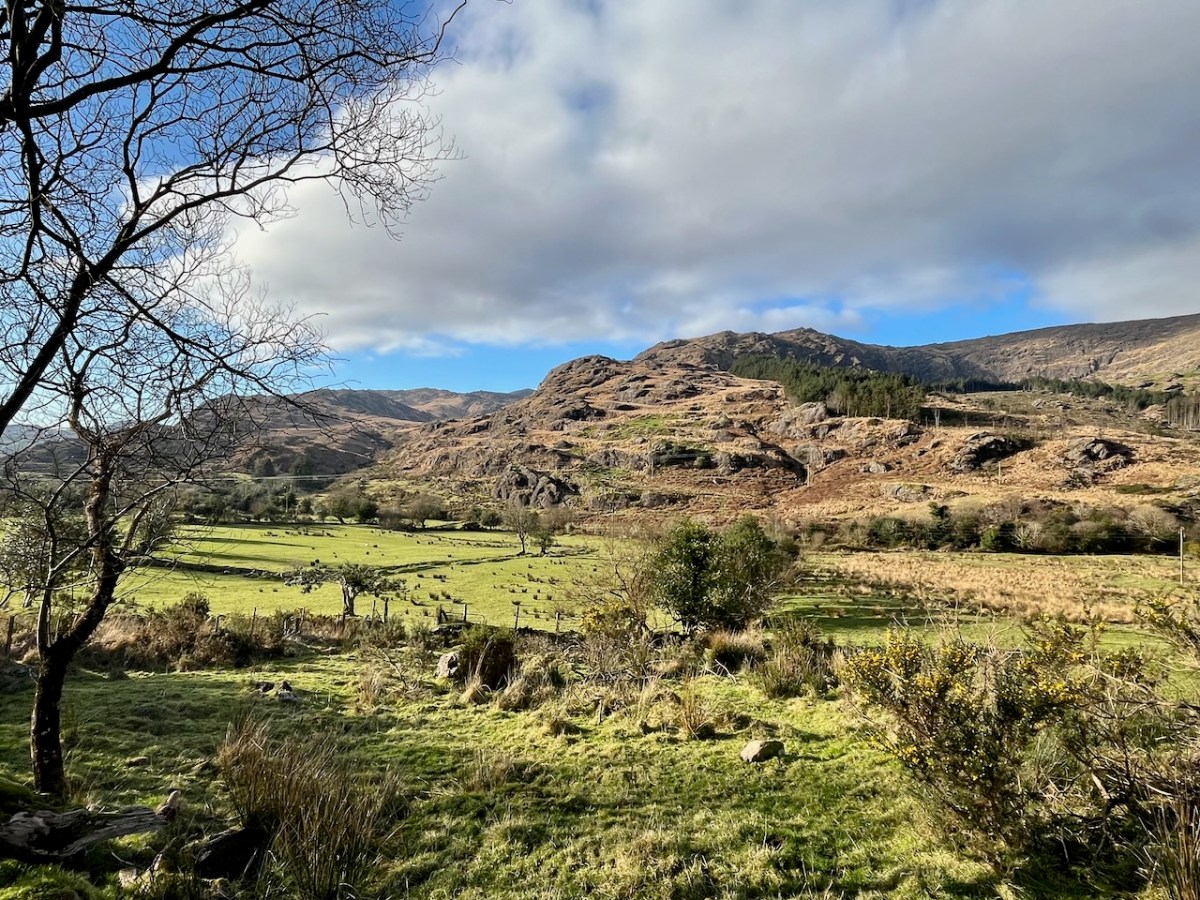
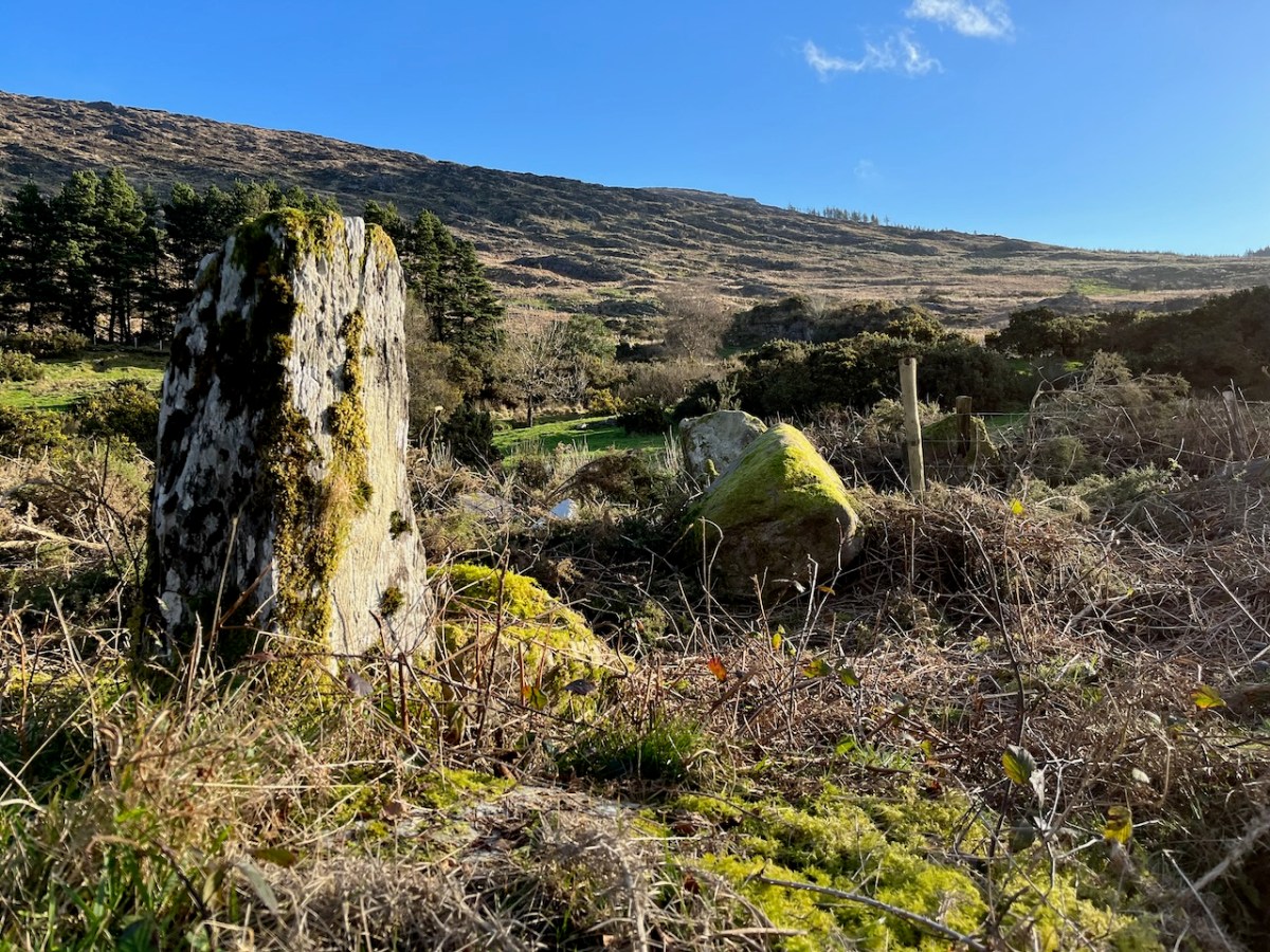
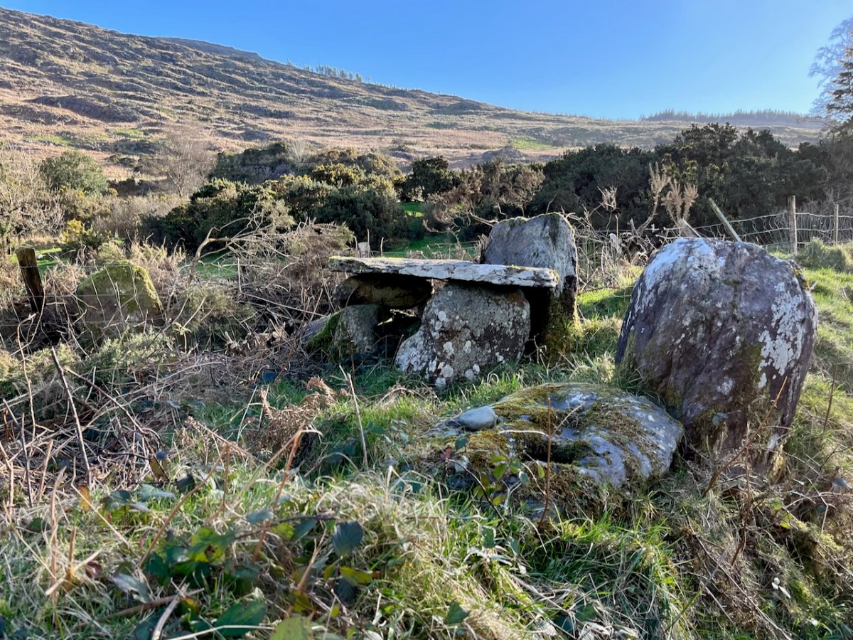
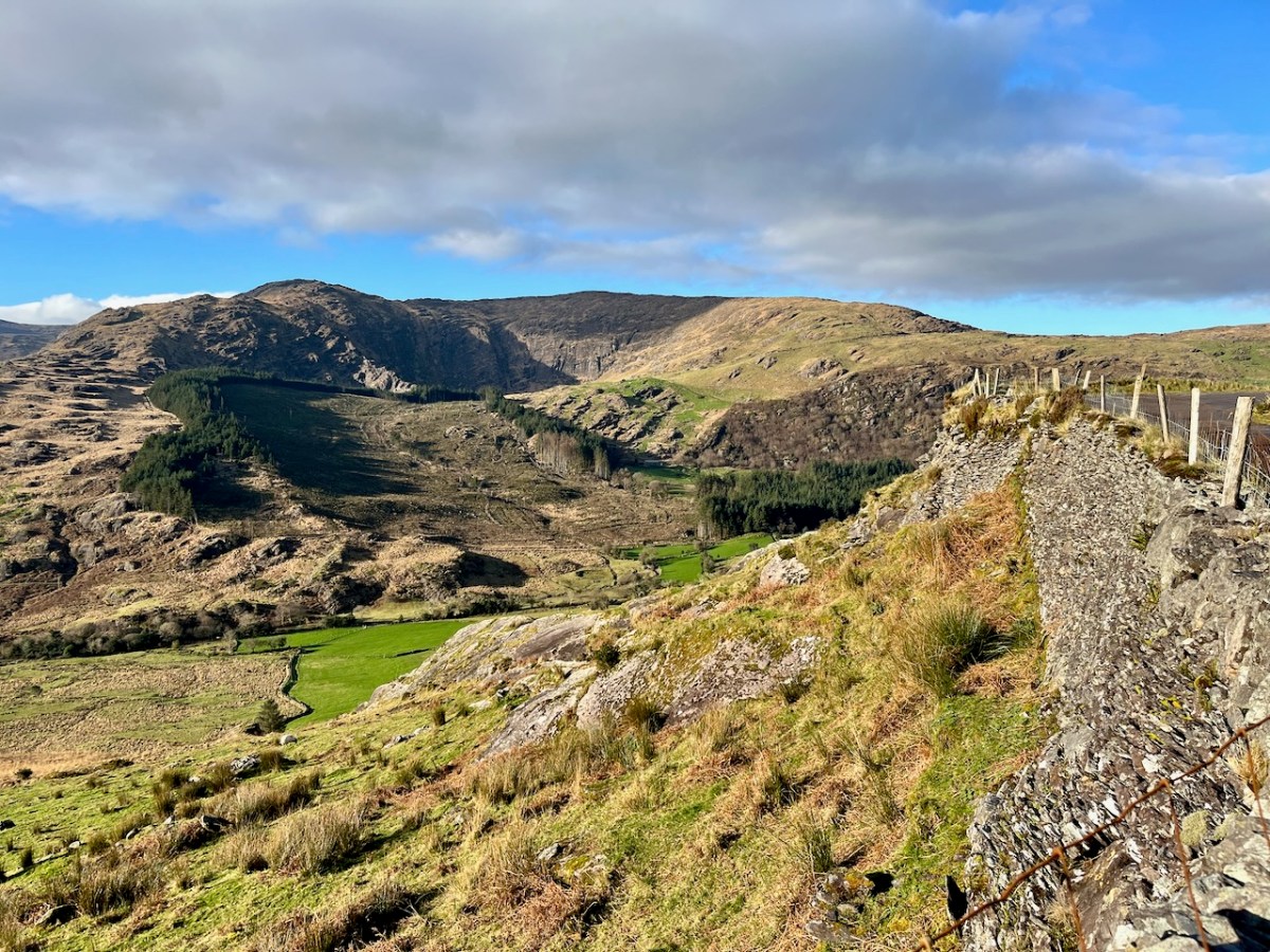
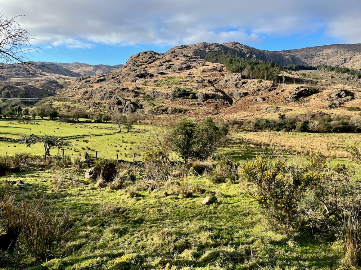
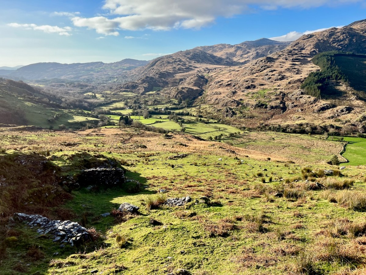
We passed over this high road that skirts the valley on an idyllic January day early in the new year (2024). For the first time, we also traversed the full length of the lane that goes into the heart of the vale, only serving scattered houses and farms. This goes by a complex stone circle and Mass Rock in the townland of Derrynafinchin – or Doire na Fuinseann. The group – also featured on the header – has been fully described by Amanda’s post Derrynafinchin: a bullaun, Mass rock & stone circle from a couple of years ago. Well worth a read!
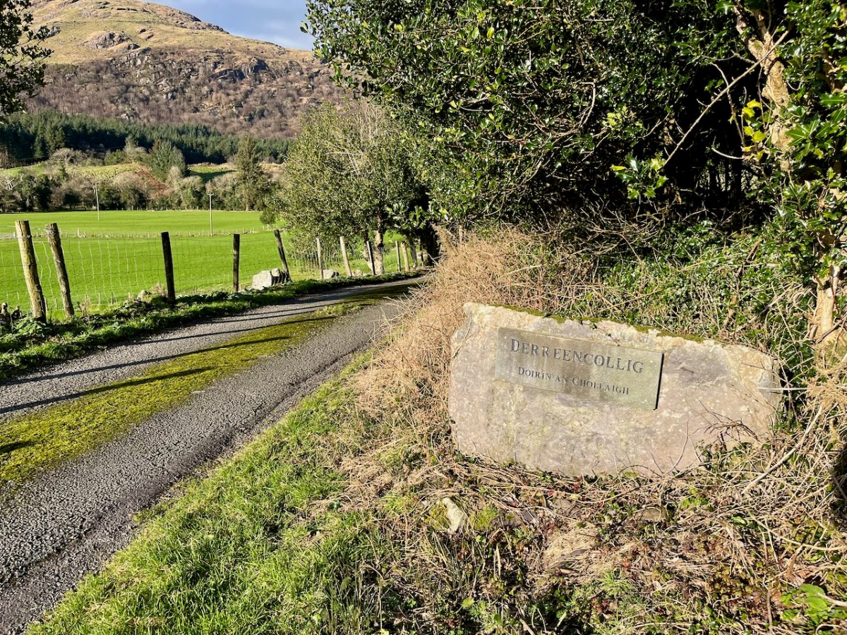
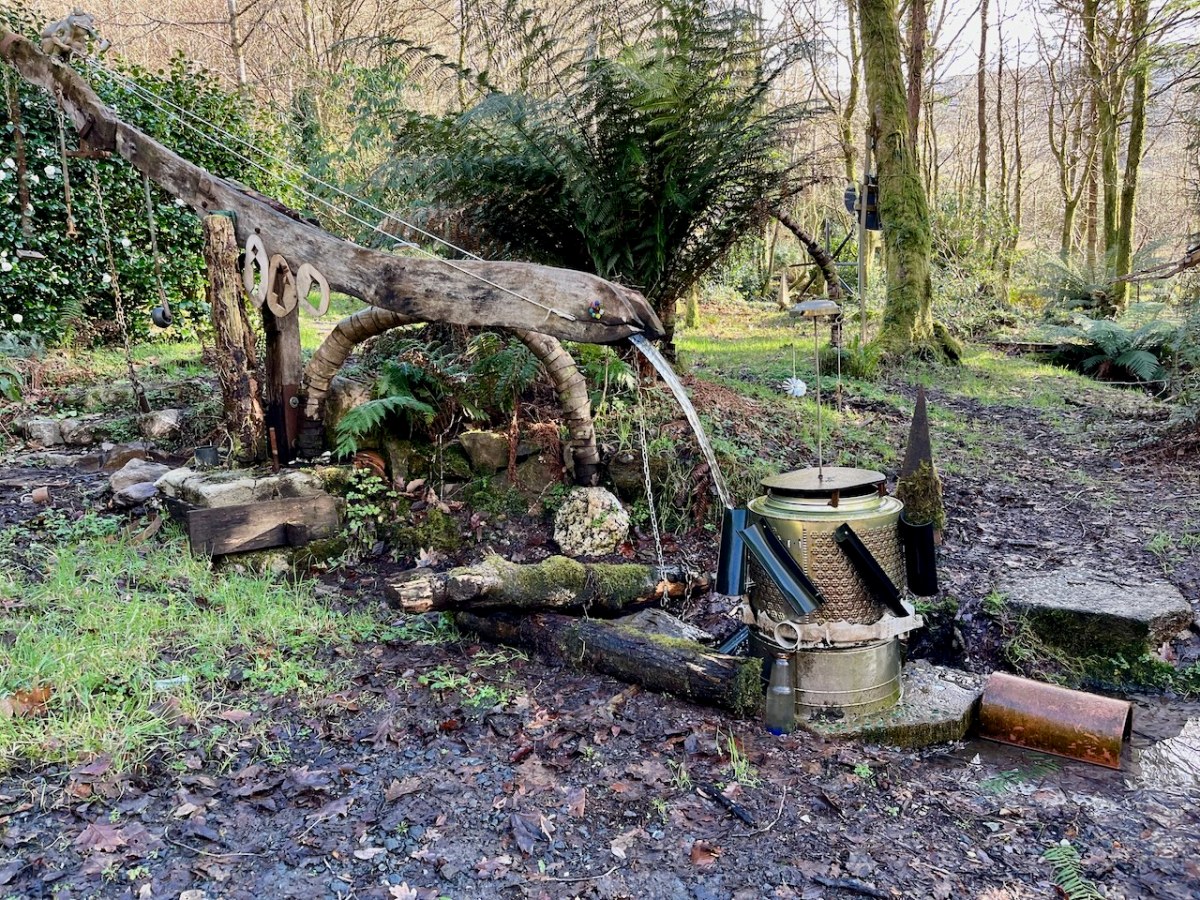
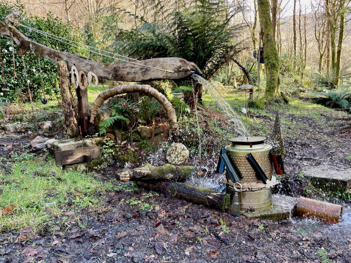
The little lane also passes into the townland of Derreencollig. We were intrigued by some kinetic sculptures we found beside the way: we did not come across the artist, nor anyone else on this part of the journey.
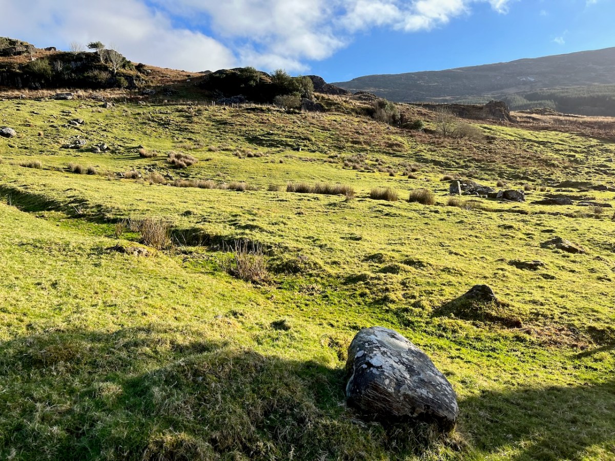
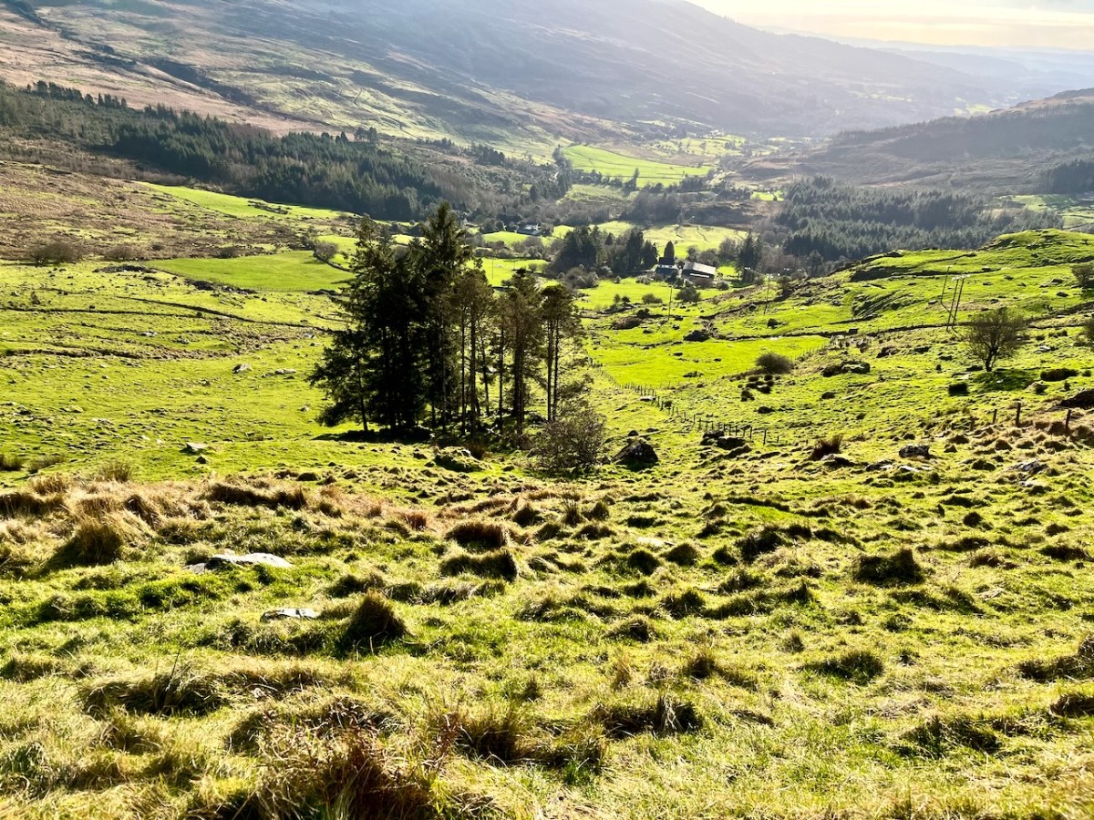
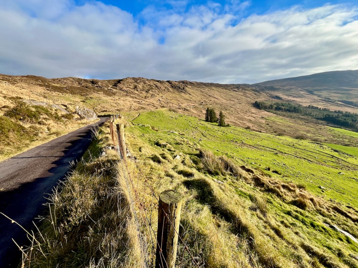
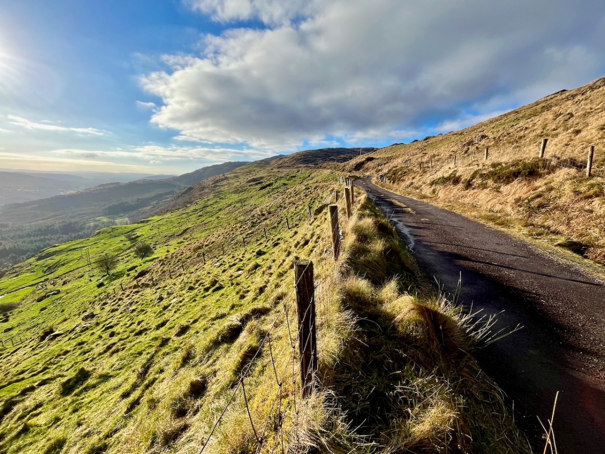
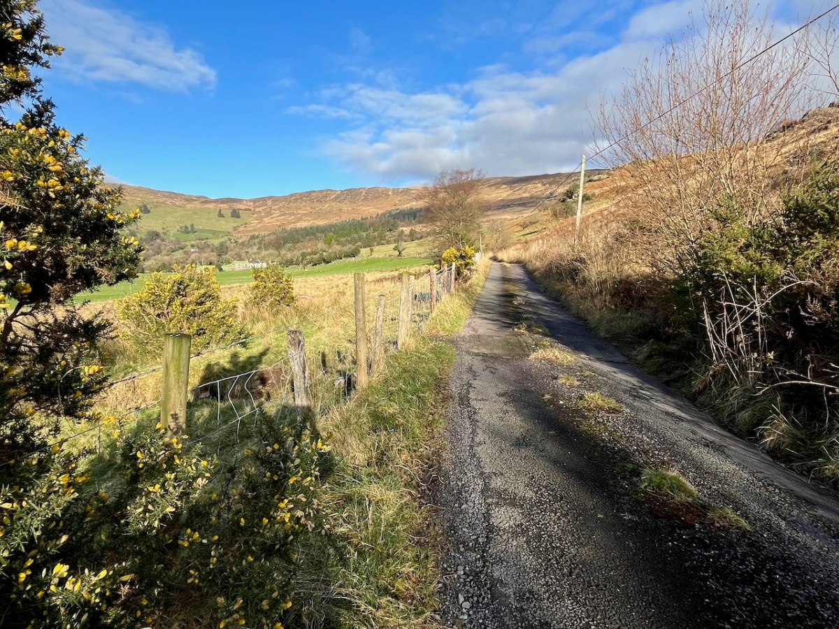
The views into this remote townland and its few habitations is seen from the minor road that follows the contour at high level, heading for Bantry.
If you find our minor roads tricky, then stick to the main ones. But, if you are not in a hurry, you couldn’t do better on a day of winter sunshine than to traverse the gentler, secret ways.
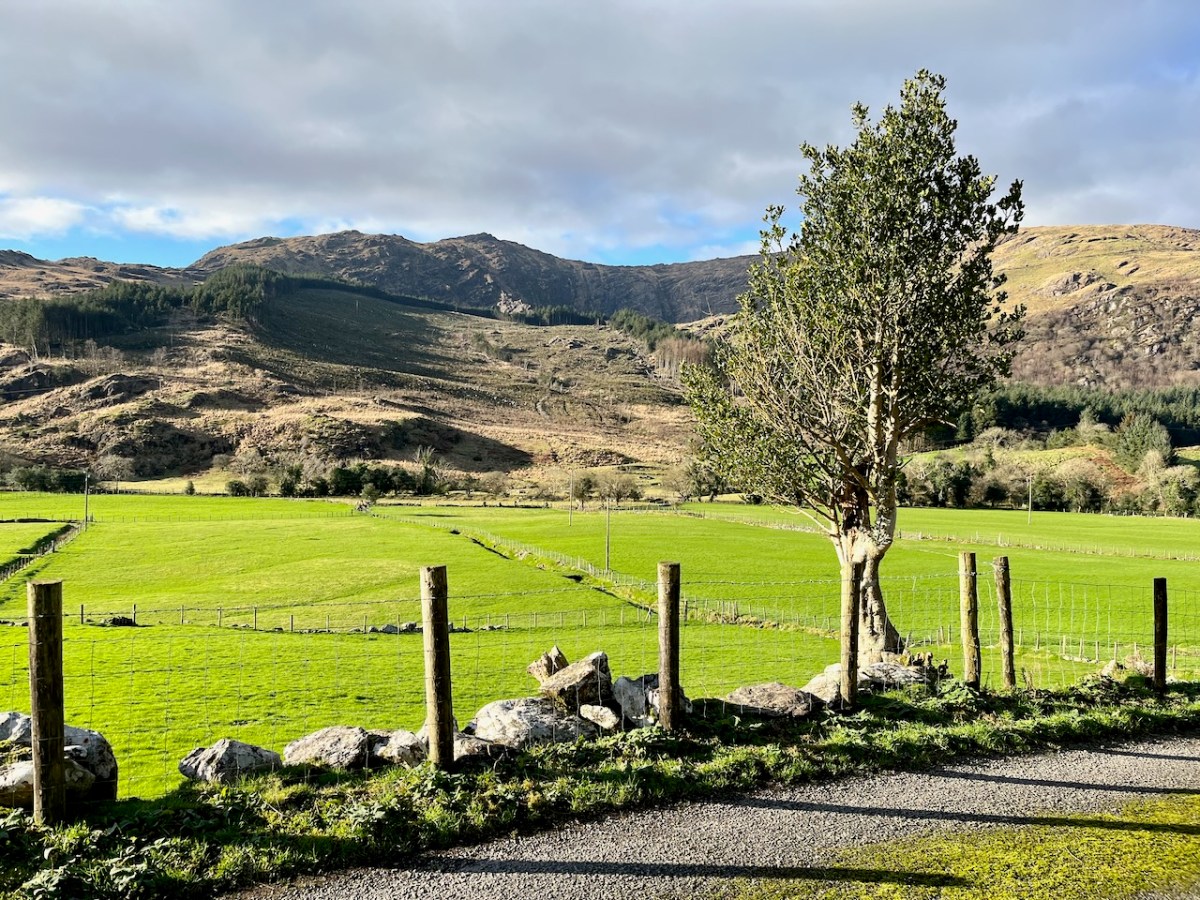
Description is hardly needed in this little topographical diversion. I’m not sure where else in the world you could find your senses as satiated as here in West Cork (and Kerry!). Travel on!
To my mind there’s no more satisfying way of journeying: keep to the crags and cornices of the high tracks.
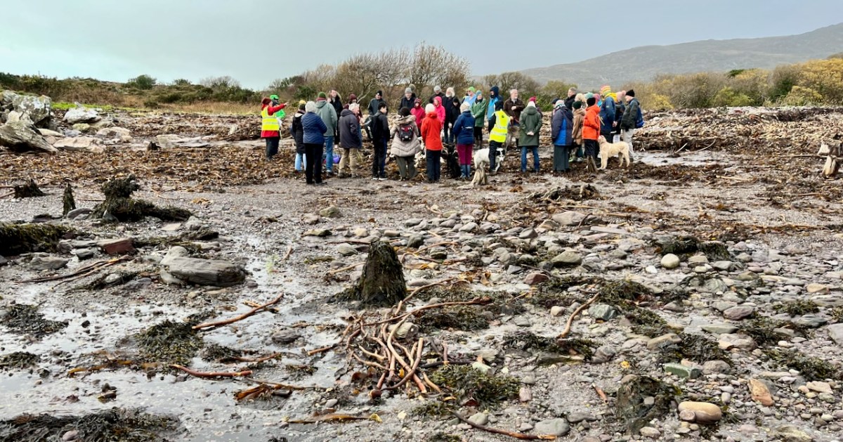
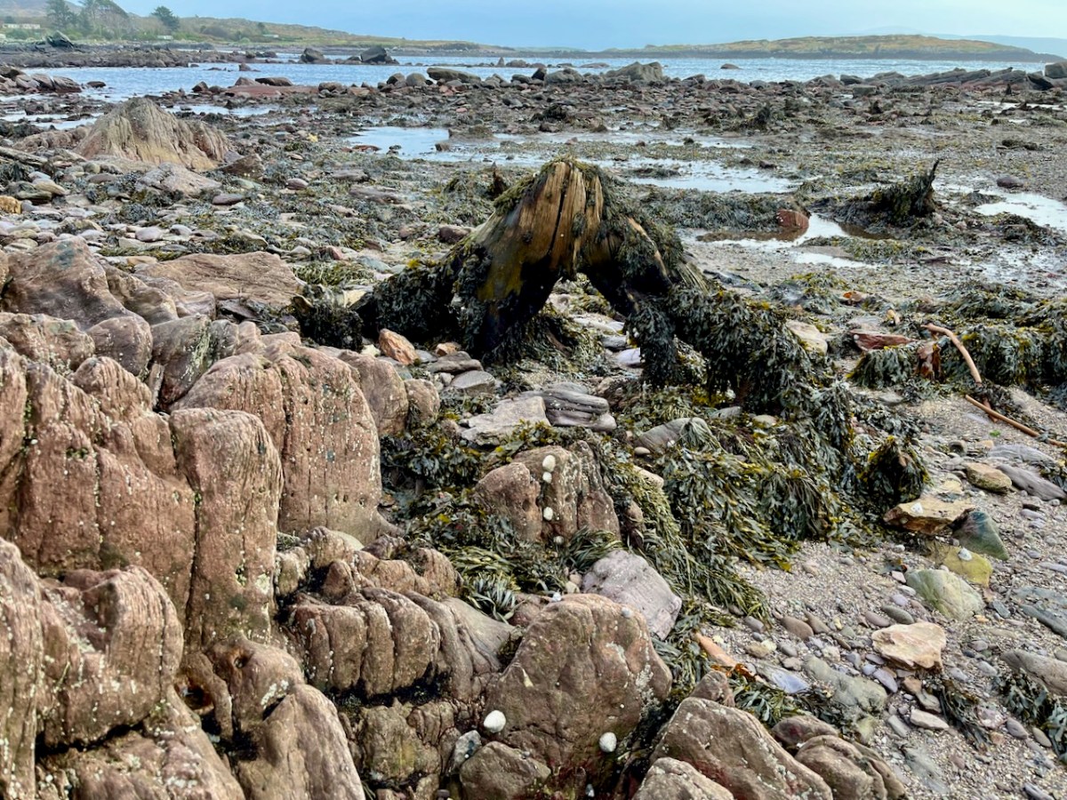
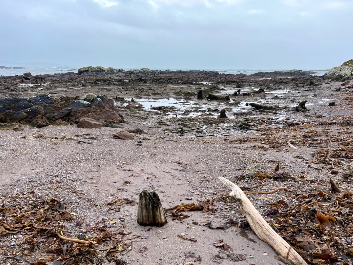
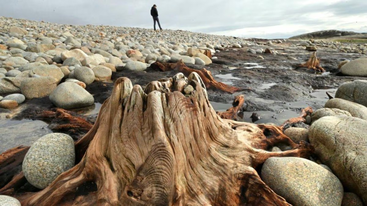
‘Drowned Landscapes’ – that’s an adequate enough description for us to look again at a subject which RWJ covered five years ago in this post: Tralong Bay, Co Cork – give it a read. I was reminded of the subject when we took part in an Archaeology Festival based in West Kerry just a week ago: Amanda’s current holy well blog describes the expeditions. One of the sites visited was Bunaneer Drowned Forest, where we saw stumps of trees on the beach there which were alive thousands of years ago. At low tide many tree remains become visible at Bunaneer, near Castlecove village on the south coast of Kerry’s Iveragh Peninsula. Our guides for this expedition were plant biologist Calum Sweeney and archaeologist Aoibheann Lambe.
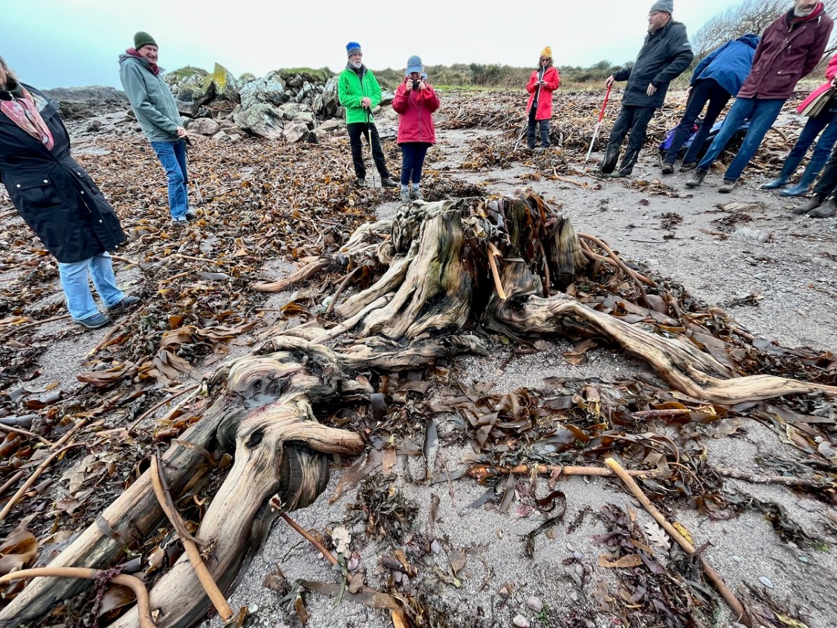
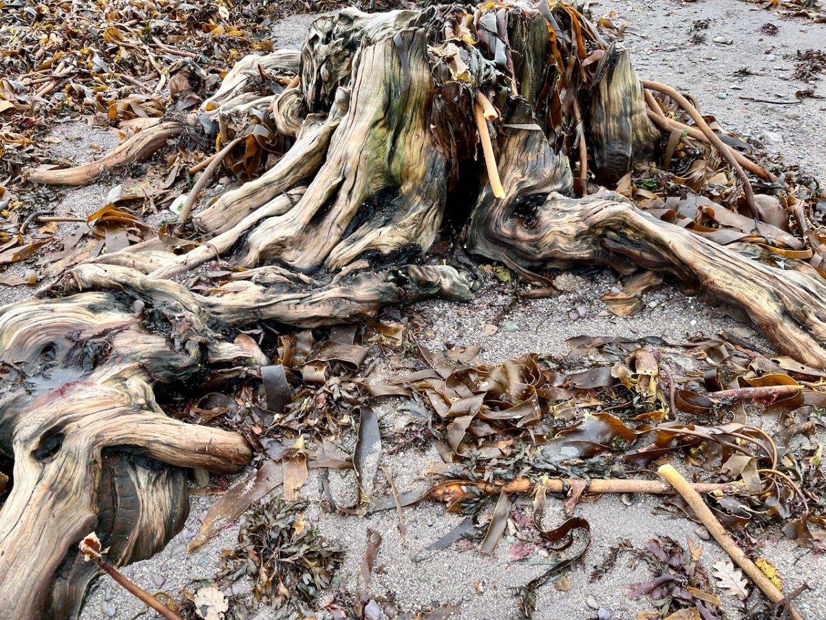
This large jumble of roots (above) is known as Goliath. All the remains here can be seen at regular low tides: at other similar sites elsewhere in Ireland, remains of ancient tree boles and roots are only revealed when tides are exceptionally low. I find it remarkable to be able to see and readily touch these archaic pieces of timber: we are communing with distant history!
Carbon dating has shown that these remains were alive between three and a half and five millennia ago. This is evidence that sea levels were significantly lower then, and that the shore line was further out – perhaps 50 metres from where we see it today. We are constantly – and quite rightly – being warned about rising sea levels resulting from our changing climate in the long term: here we see clear verification that it’s a continuing – and now apparently accelerating – process.
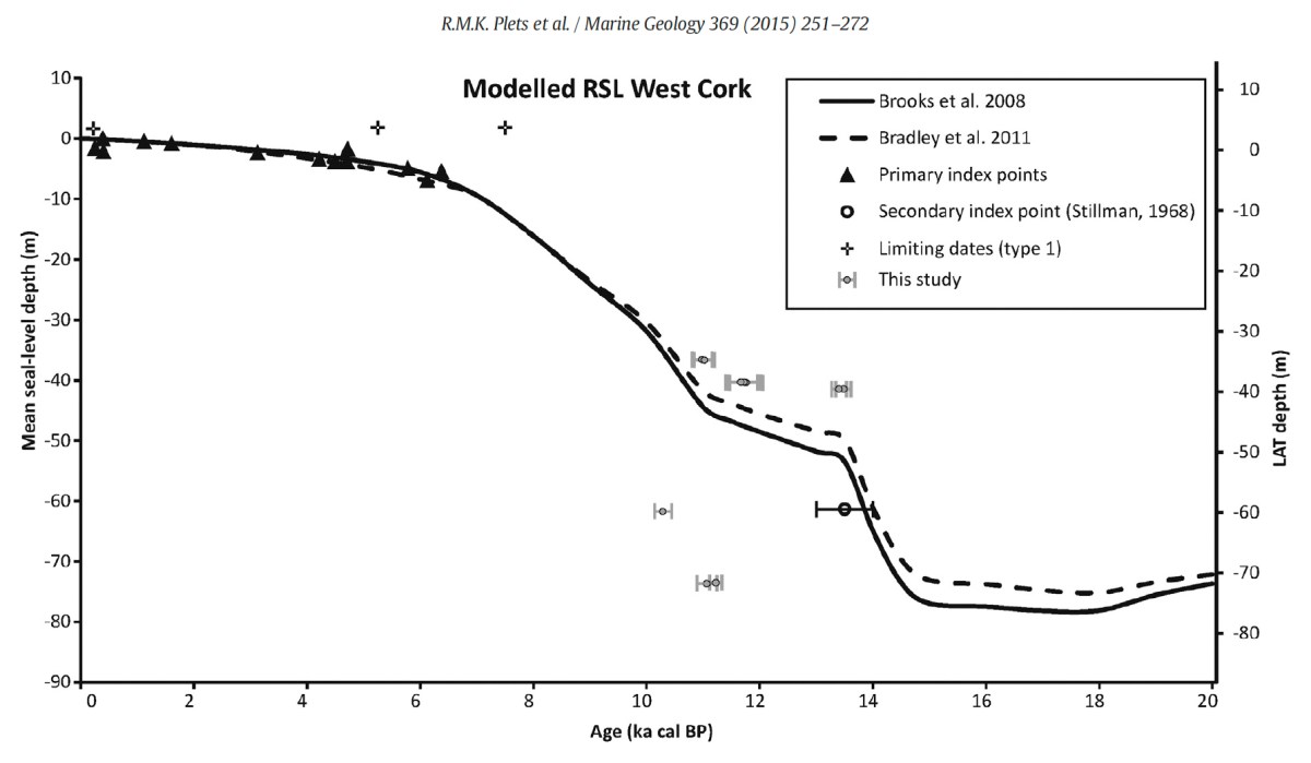
Our friends Robin and Sue Lewando were also on this expedition. Robin has a particular interest in sea-level changes in the Late Quaternary and subsequent eras, and he pointed me to a 2015 paper which explores the subject specifically in the Bantry Bay area of West Cork. That’s a good place to be looking at ancient history: remember the story of Cessair – Noah’s daughter-in-law – who came ashore at Donemark? You first read about it here! So this is a scientific diagram which sets out how sea-levels have been changing over time in our locality:
It’s an interesting comparison to take our horizons wider in our study of changing sea levels across the islands of Ireland. Over on the east coast – north of Bray, Co Wicklow – there is another substantial area where tree remains have been revealed at certain tidal conditions.
Above are the areas of beach between Bray and Killiney where ‘drowned forest’ remains have been observed. While at Youghal, Co Cork, further finds have occured:
This example catches our interest because the name of the settlement – Youghal – is derived from the Irish word ‘Eochaill’ meaning ‘Yew Woods’: they were evidently once common in the area, leading us to wonder whether the tree remains in this instance are of yew. In 2014 the following account of another ‘ancient drowned forest’ discovery appeared in the Irish Times (photograph courtesy of Joe O’Shaughnessy):
. . . Walking out on to the shoreline at low tide, geologist Prof Mike Williams points to the oak, pine and birch stumps and extensive root systems which were once part of woodlands populated by people, wolves and bears. These woodlands extended out into lagoons and marshlands that pre-dated the formation of Galway bay, Prof Williams says.
An extensive layer of peat also exposed at low tide in the same location in Spiddal was formed by organic debris which once carpeted the forest floor. The stumps at Spiddal are surrounded by root systems which are largely undisturbed. The carpet of peat is covered in strands of a reed called phragmites, which can tolerate semi- saline or brackish conditions.
“These trees are in their original growth position and hadn’t keeled over, which would suggest that they died quite quickly, perhaps in a quite rapid sea level rise,” Prof Williams adds. Up until 5,000 years ago Ireland experienced a series of rapid sea level rises, he says. During the mid-Holocene period, oak and pine forests were flooded along the western seaboard and recycled into peat deposits of up to two metres thick, which were then covered by sand.
Prof Williams estimates that sea level would have been at least five metres lower than present when the forests thrived, and traces of marine shell 50cm below the peat surface suggest the forest floor was affected by very occasional extreme wave events such as storm surges or tsunamis. He says most west coast sand-dune systems date to a “levelling” off period in sea level change about 5,000 years ago. Dunes in Doolin, Co Clare, are older still, having first formed around 6,500 years ago.
Prof Williams has located tree stumps in south Mayo and Clare, along with Galway, which have been carbon dated to between 5,200 and 7,400 years ago at the chrono centre at Queen’s University, Belfast. Some of the trees were nearly 100 years old when they perished . . .
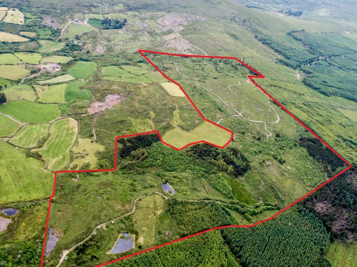
We spent a day on ‘The Mountain’. It’s a West Cork location, not too far away from us. The land has a history that touches on many of our interests covered here in Roaringwater Journal – and some of the West Cork people we have written about over the years – so it’s pretty special. We were delighted to be welcomed to it by its present owner, Oliver Farrell: that’s himself, in the pic below. You have met him before, here. Thank you, Oliver, for allowing us to experience this special site, and for letting us put out this post about it.
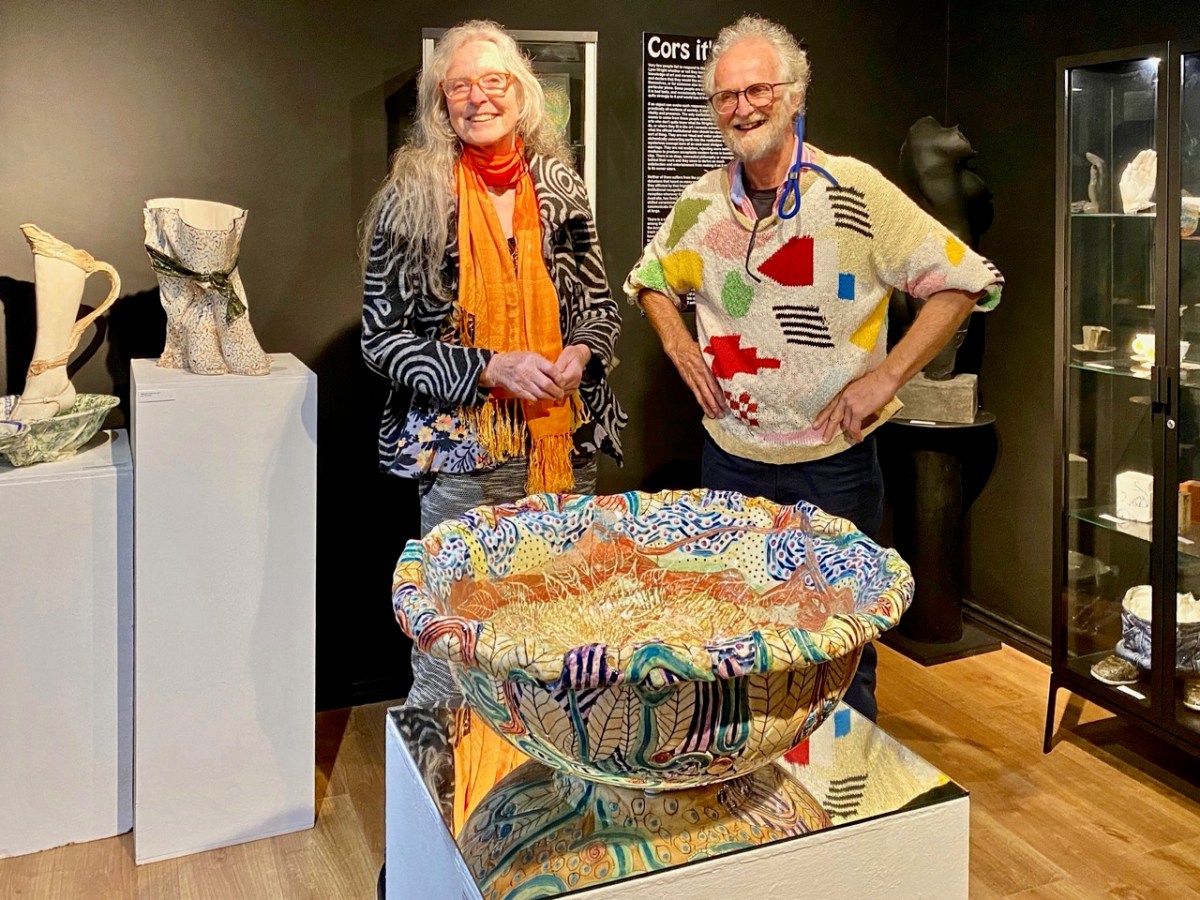
Previously, the 70 acre ‘Mountain’ site was owned by the Wrights – Lynne and Ian (above): you saw them in the 2022 Ballydehob Arts Museum exhibition, here. When they purchased it – in 1997 – it was rough pasture and bog. They aimed to develop an environmentally and economically sustainable forest using existing grants, and successfully challenged the decision of the Forest Service (through the EU) to only grant aid the planting of alien conifers. They set about transforming it: they had a vision of a ‘pure’ West Cork landscape supporting an ecosystem of native species. Now – many years later – it’s possible to see that the Wrights’ vision was fully justified – and realised. Today Oliver is undertaking essential maintenance work, and is committed to expanding on the inherent sustainable qualities that the site embodies. In fact, ‘The Mountain’ is largely in excellent environmental order.
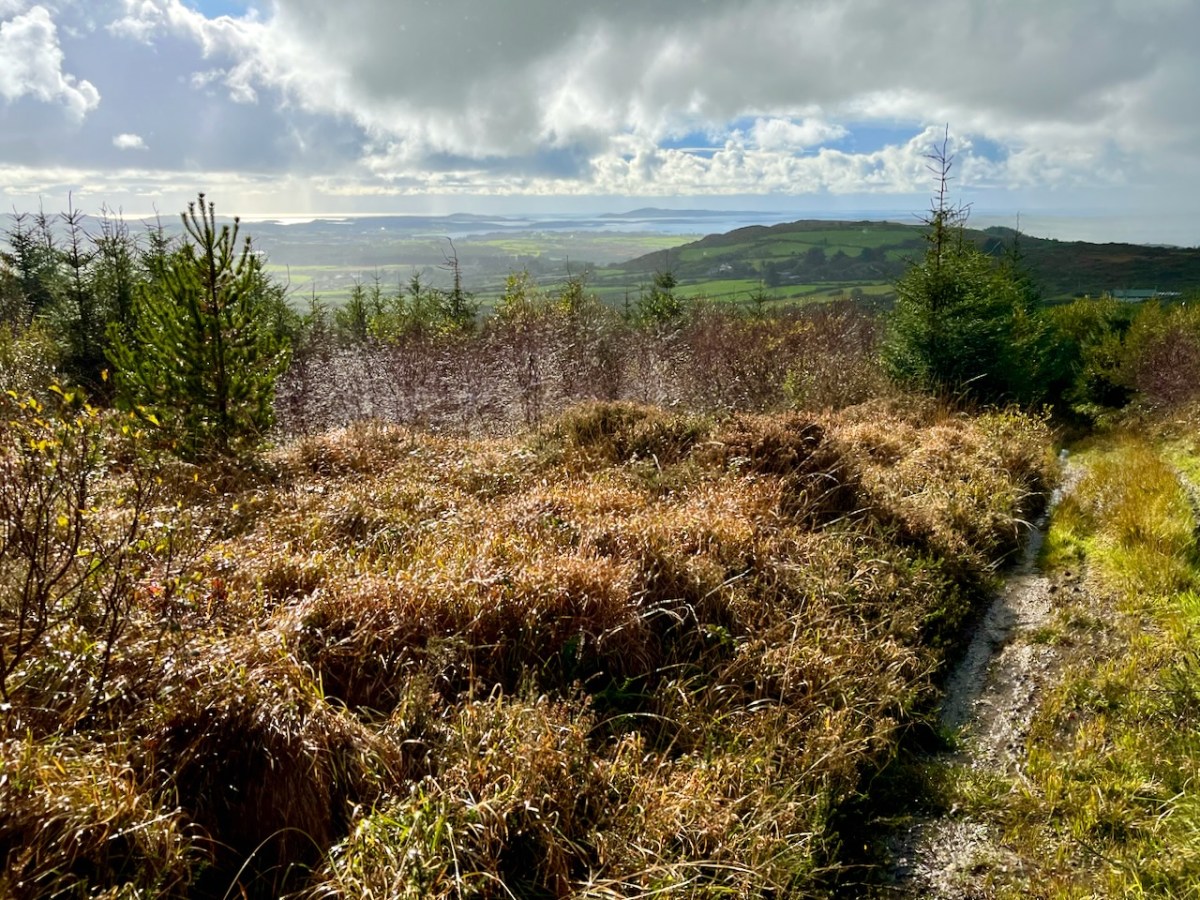
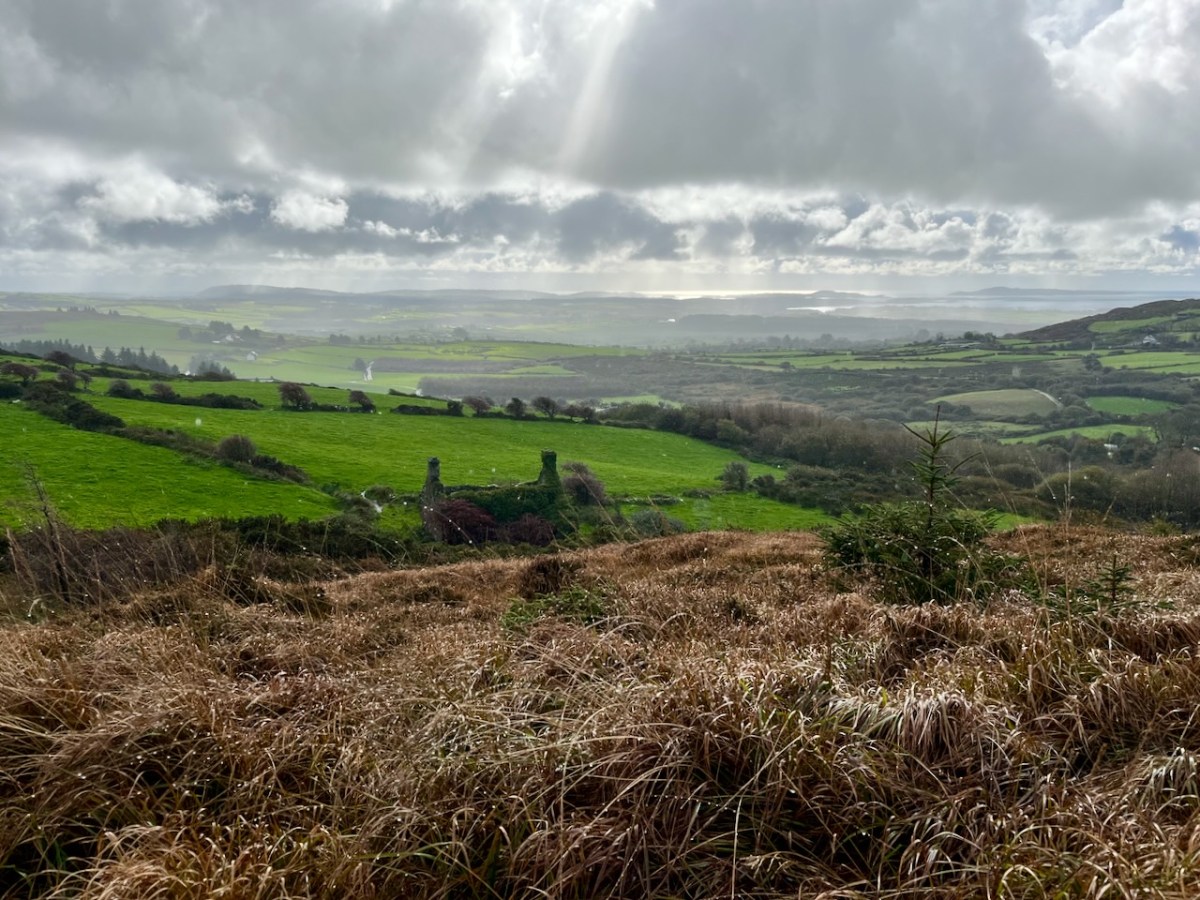
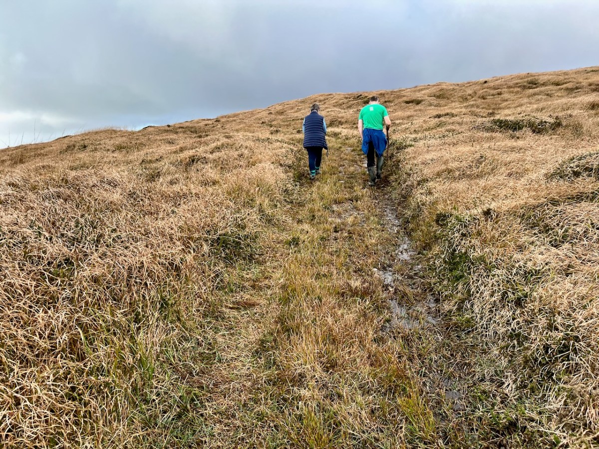
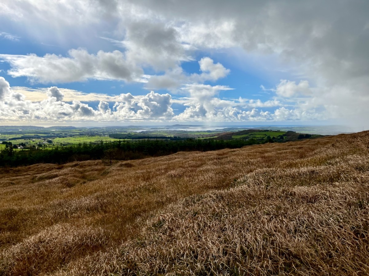
Interestingly, Ian told us that when they made the decision to buy the site they had only seen it under cloud: the spectacular view wasn’t revealed until later on. We were fortunate on the day of our visit to see the full panorama of Roaringwater Bay stretched out before us.
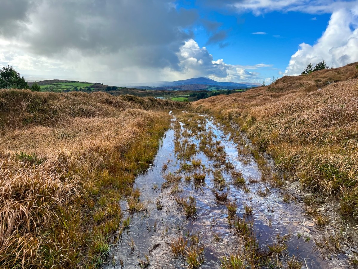
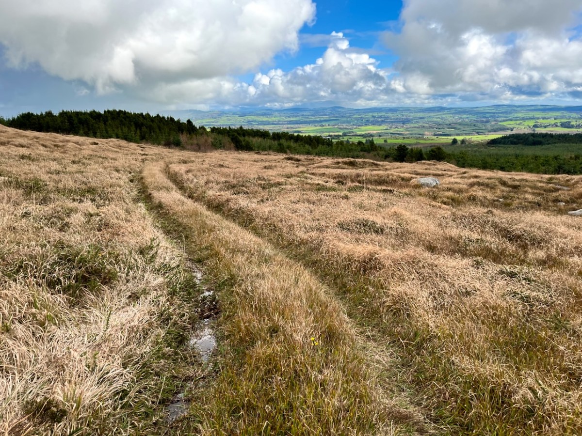
This dramatic view towards Mount Gabriel is a reward for climbing ‘The Mountain’. The ground was waterlogged on the day of our visit as this autumn has been a time of relentless rainfall, but always interspersed with brief dry patches: it’s great to be out to catch these. Springs rise on the high ground here, and I’m working out that they either feed the Roaringwater River – the water that gives its name to the whole Bay and islands that are central to our view from up here in Nead an Iolair, or another of the many streams that drain the West Cork hills below us.
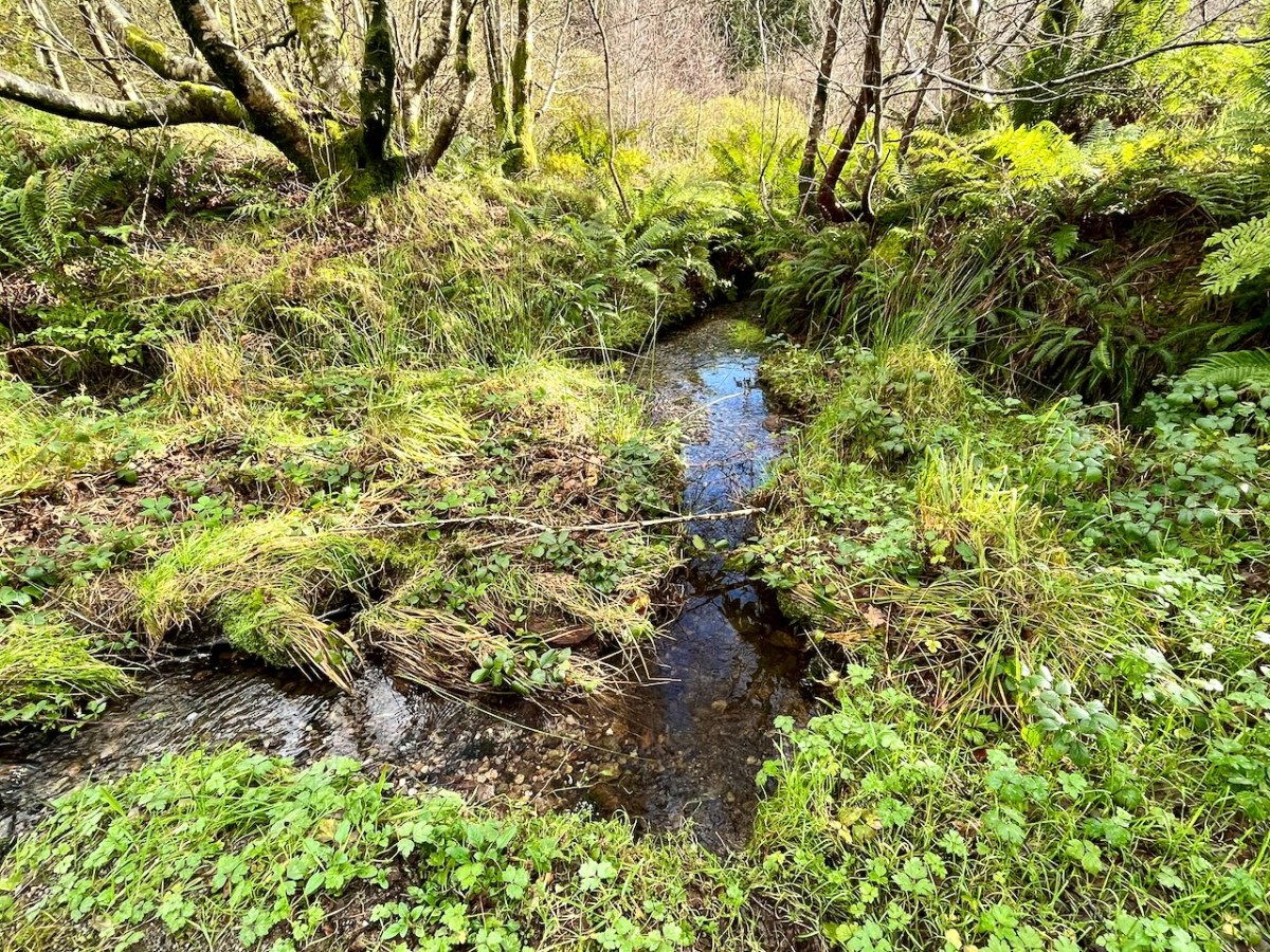
Oliver stands above one of the spring outlets that form the infant waterway (top), while the stream matures as it flows on down through his land (lower). Below – Oliver and Finola inspect one of the lakes which has been created within the site.
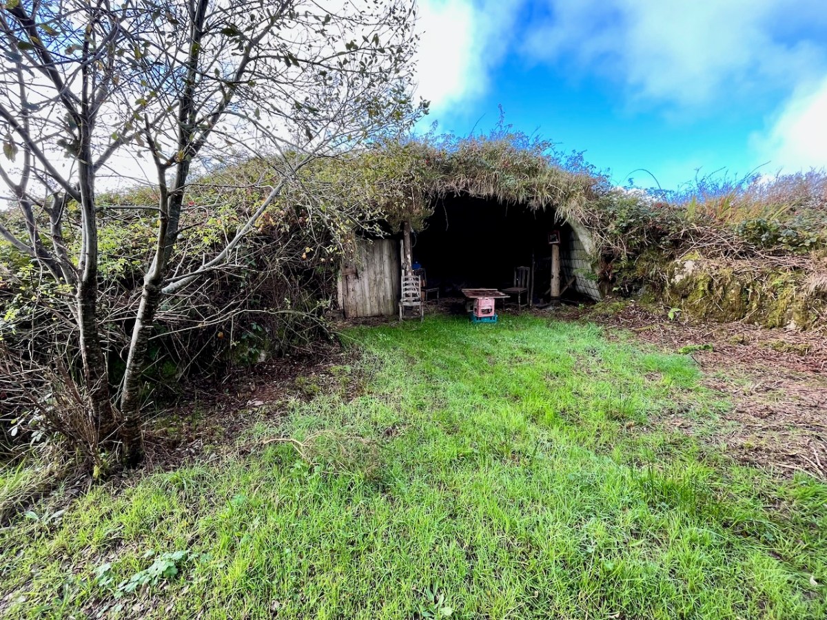
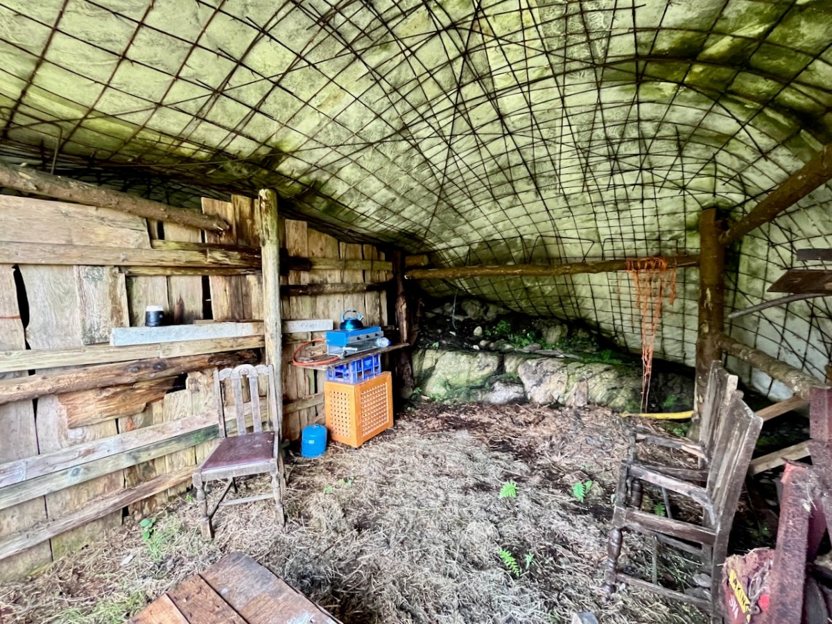
At one stage in his life Ian researched, developed and introduced the building of low–tech ferro–cement boats as a cottage industry on Lake Malawi to help address the problem of unsustainable fishing practices there. At the ‘Mountain’ site he experimented with ferro-cement as a material for establishing a well blended-in shelter and store.
Straddling two townlands, ‘The Mountain’ is an impressive example of how an area of West Cork wilderness has been perfectly moulded into its natural setting. It is an out of the ordinary place which demands exploration.
I’ll be visiting the site, and writing about it more in the future. Oliver will be keen to allow access: keep watching this space.
Welcome to the UCD Library Cultural Heritage Collections blog. Discover and explore the historical treasures housed within our Archives, Special Collections, National Folklore Collection and Digital Library