We spent a day on ‘The Mountain’. It’s a West Cork location, not too far away from us. The land has a history that touches on many of our interests covered here in Roaringwater Journal – and some of the West Cork people we have written about over the years – so it’s pretty special. We were delighted to be welcomed to it by its present owner, Oliver Farrell: that’s himself, in the pic below. You have met him before, here. Thank you, Oliver, for allowing us to experience this special site, and for letting us put out this post about it.
Previously, the 70 acre ‘Mountain’ site was owned by the Wrights – Lynne and Ian (above): you saw them in the 2022 Ballydehob Arts Museum exhibition, here. When they purchased it – in 1997 – it was rough pasture and bog. They aimed to develop an environmentally and economically sustainable forest using existing grants, and successfully challenged the decision of the Forest Service (through the EU) to only grant aid the planting of alien conifers. They set about transforming it: they had a vision of a ‘pure’ West Cork landscape supporting an ecosystem of native species. Now – many years later – it’s possible to see that the Wrights’ vision was fully justified – and realised. Today Oliver is undertaking essential maintenance work, and is committed to expanding on the inherent sustainable qualities that the site embodies. In fact, ‘The Mountain’ is largely in excellent environmental order.
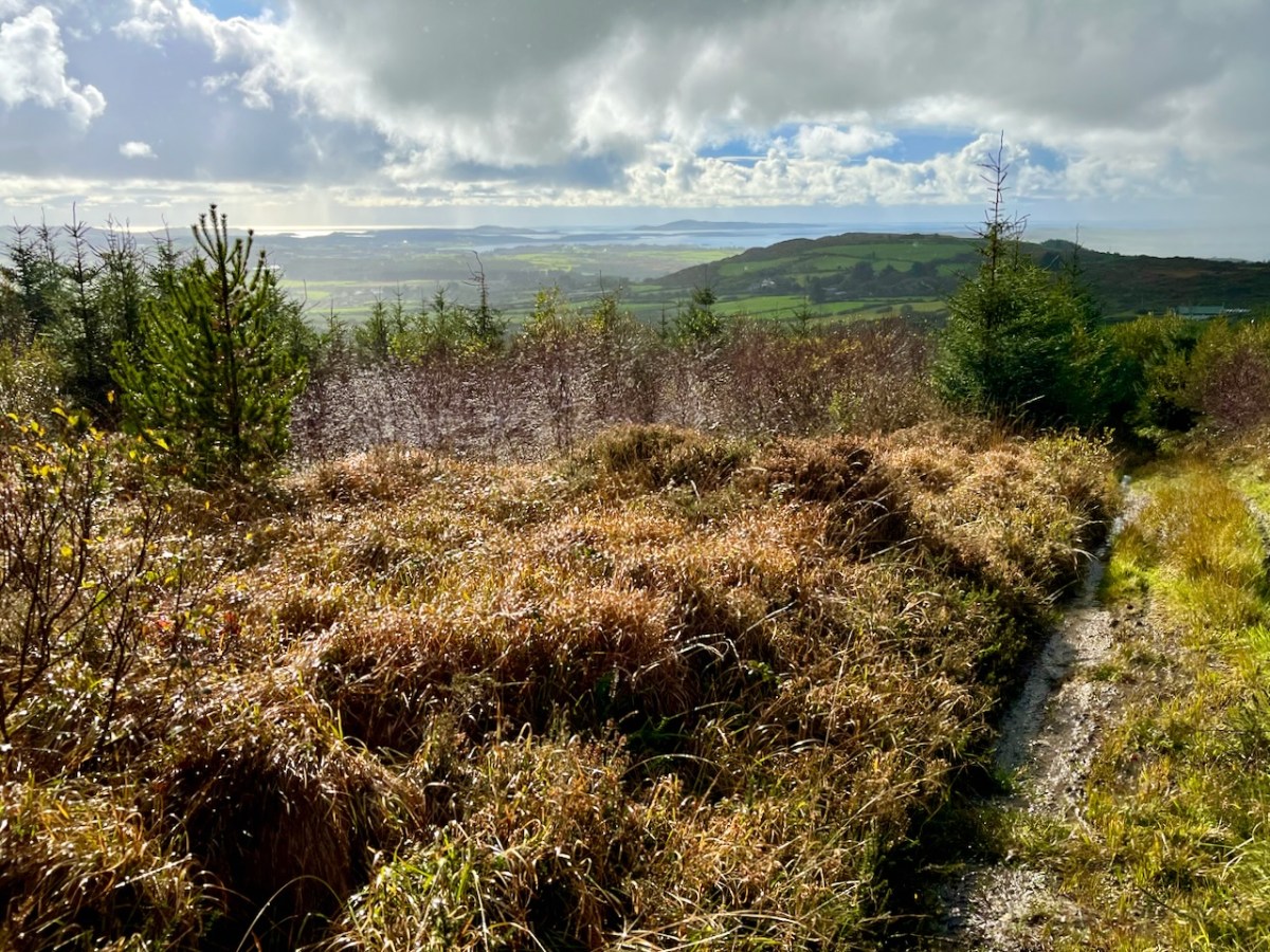
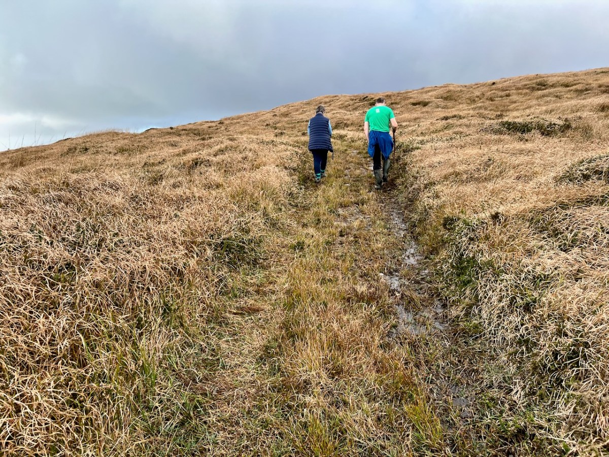
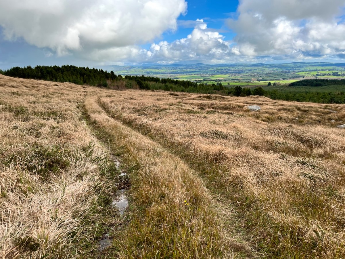
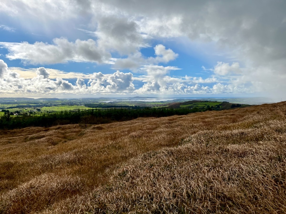
Interestingly, Ian told us that when they made the decision to buy the site they had only seen it under cloud: the spectacular view wasn’t revealed until later on. We were fortunate on the day of our visit to see the full panorama of Roaringwater Bay stretched out before us.
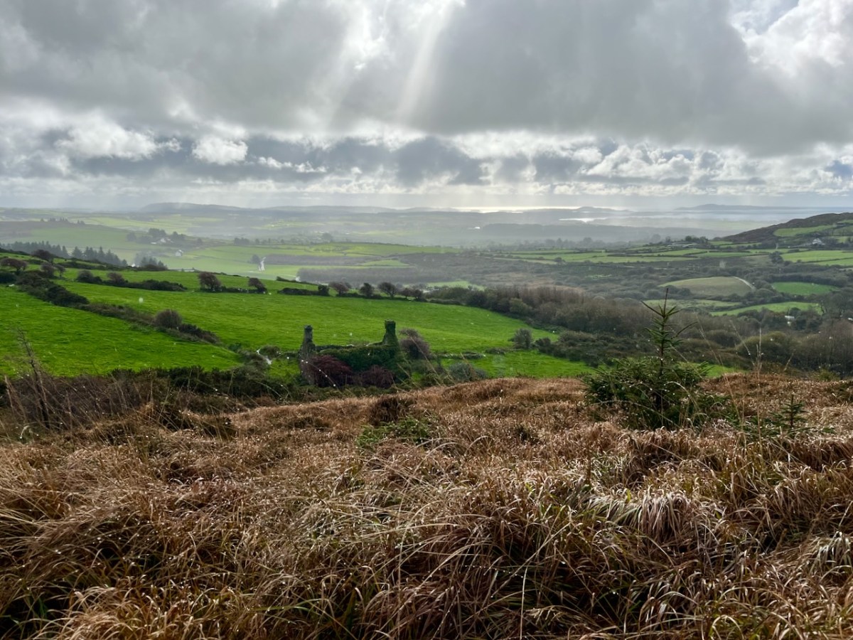
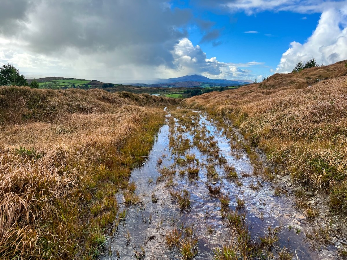
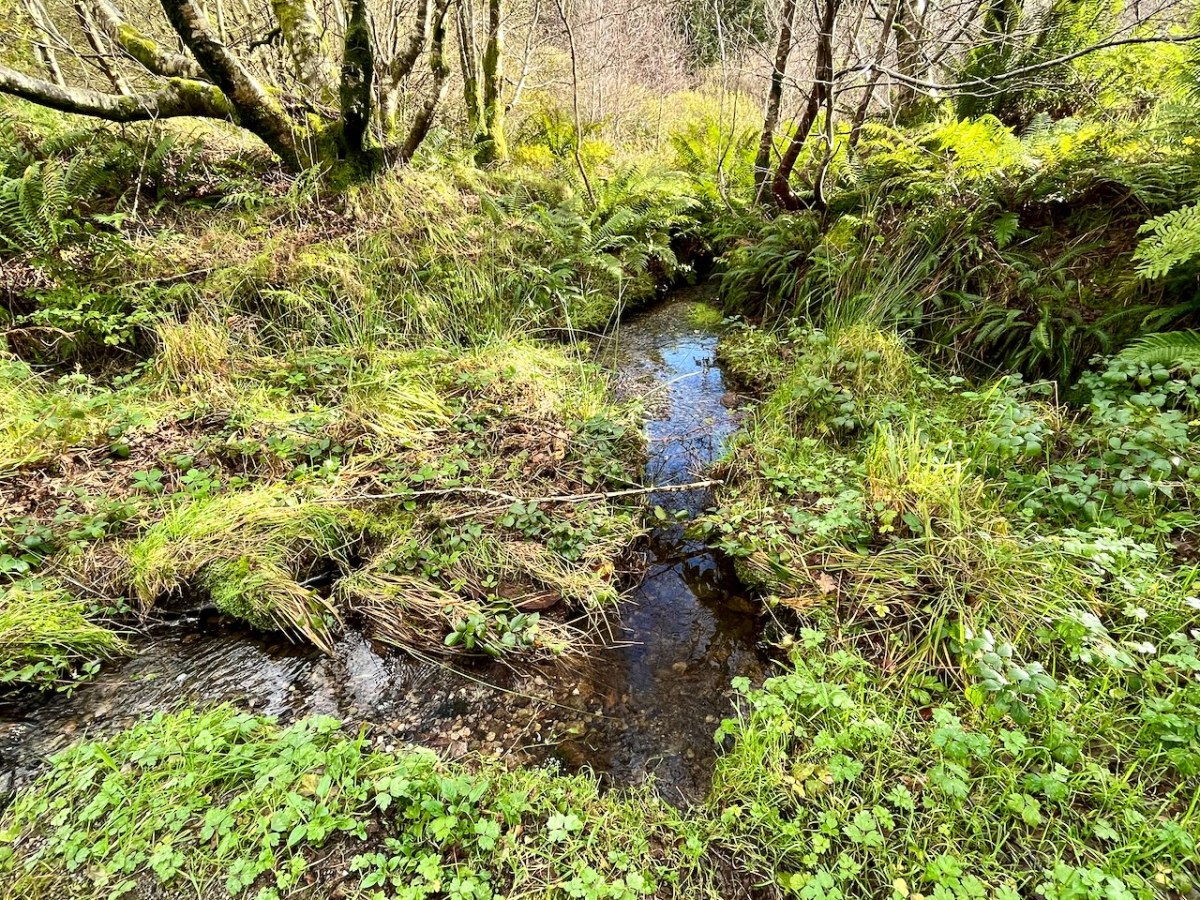
This dramatic view towards Mount Gabriel is a reward for climbing ‘The Mountain’. The ground was waterlogged on the day of our visit as this autumn has been a time of relentless rainfall, but always interspersed with brief dry patches: it’s great to be out to catch these. Springs rise on the high ground here, and I’m working out that they either feed the Roaringwater River – the water that gives its name to the whole Bay and islands that are central to our view from up here in Nead an Iolair, or another of the many streams that drain the West Cork hills below us.
Oliver stands above one of the spring outlets that form the infant waterway (top), while the stream matures as it flows on down through his land (lower). Below – Oliver and Finola inspect one of the lakes which has been created within the site.
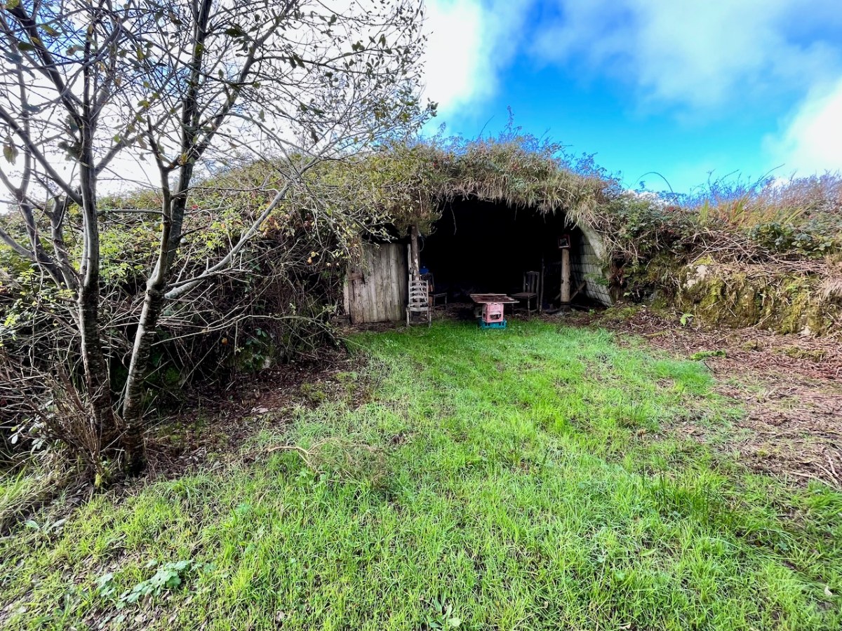
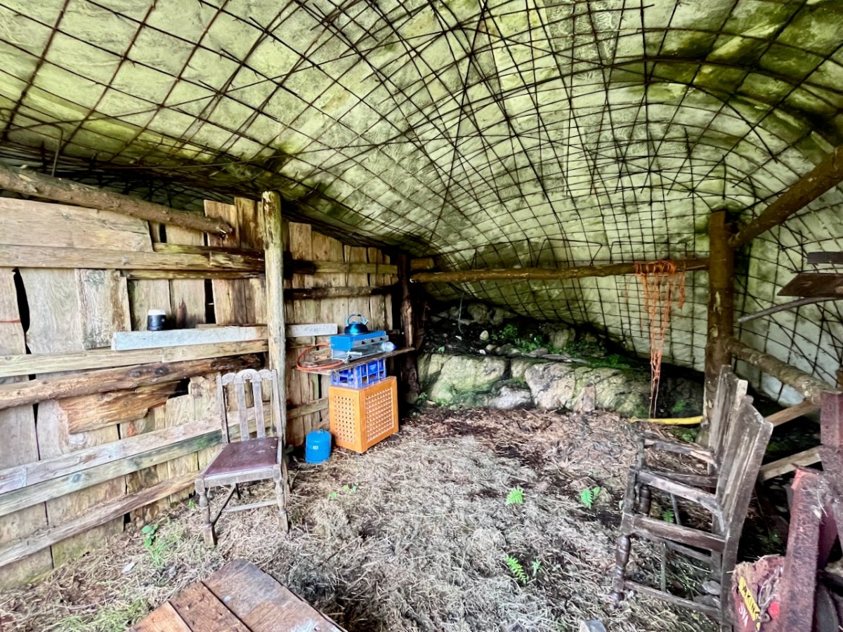
At one stage in his life Ian researched, developed and introduced the building of low–tech ferro–cement boats as a cottage industry on Lake Malawi to help address the problem of unsustainable fishing practices there. At the ‘Mountain’ site he experimented with ferro-cement as a material for establishing a well blended-in shelter and store.
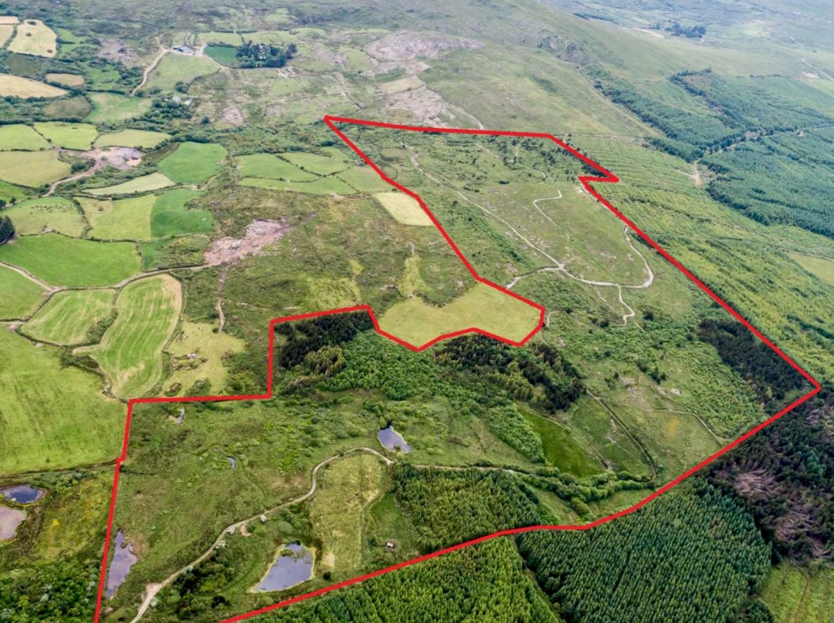
Straddling two townlands, ‘The Mountain’ is an impressive example of how an area of West Cork wilderness has been perfectly moulded into its natural setting. It is an out of the ordinary place which demands exploration.
I’ll be visiting the site, and writing about it more in the future. Oliver will be keen to allow access: keep watching this space.
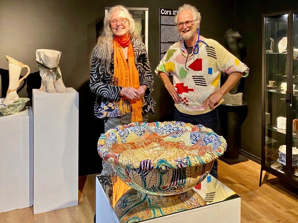
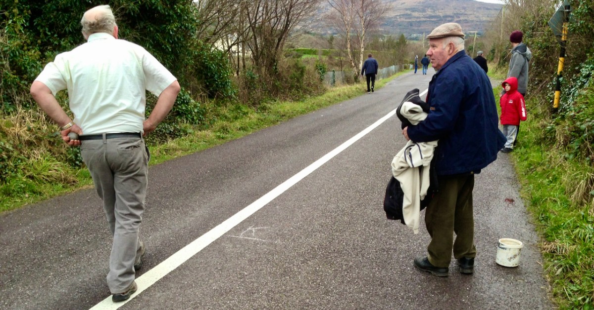
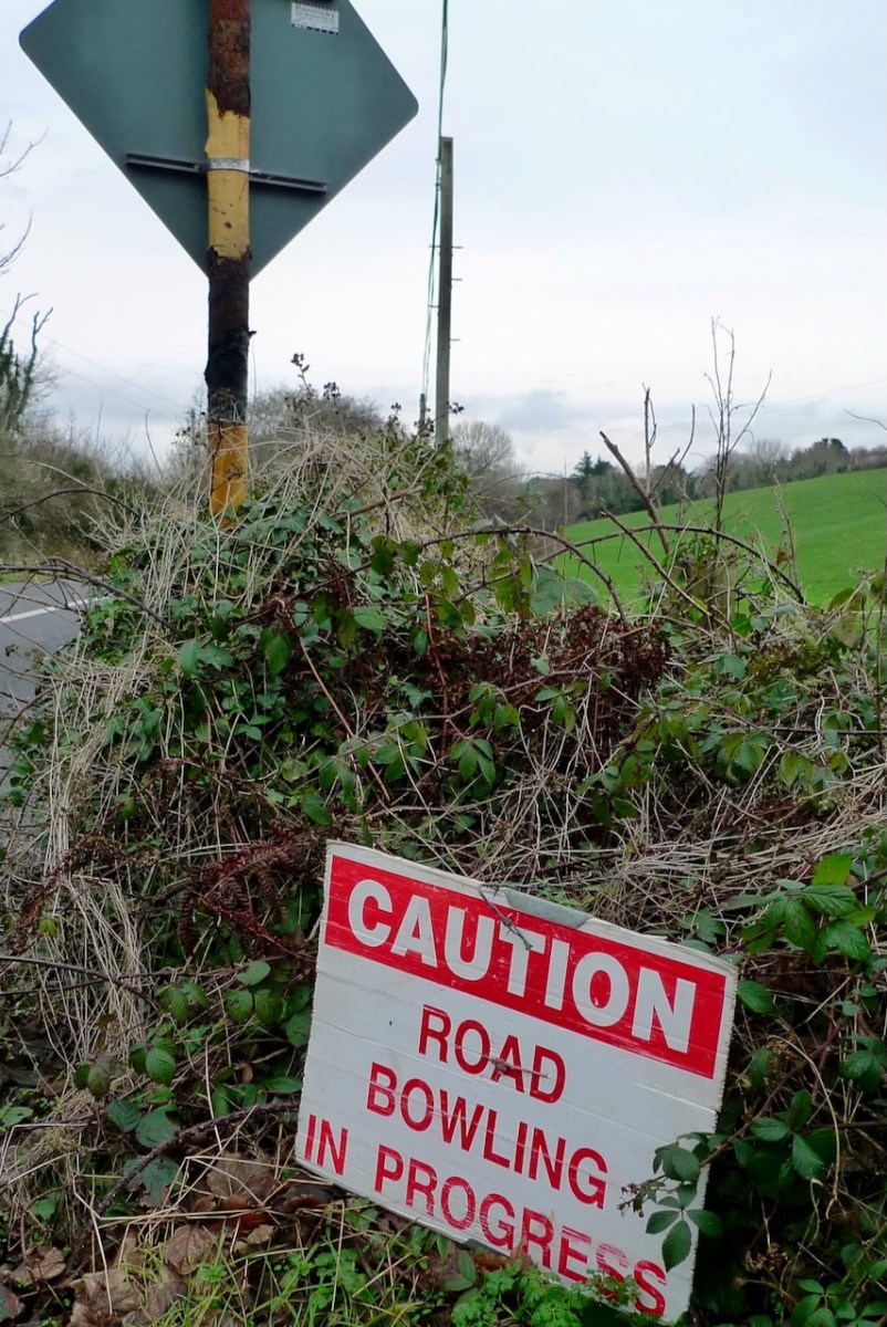
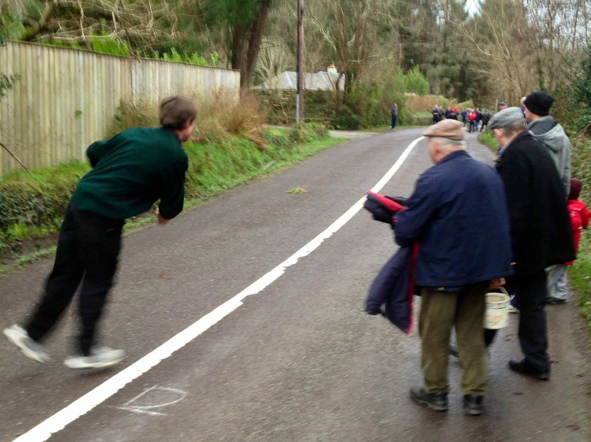
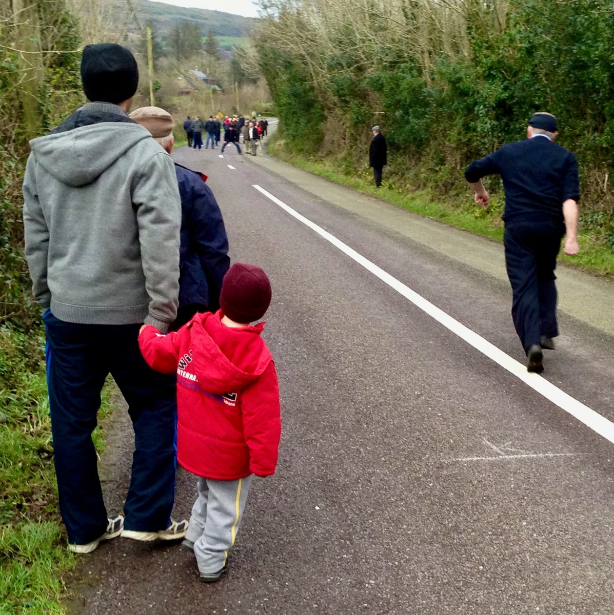
There’s a man about to ‘loft’ a bowling ball. Pronounce it Bowling, to rhyme with ‘growling’: in the Irish language it’s Ból an bhóthair – I’ve also seen the term Long Bullets used. This is a match we watched close to home – here in West Cork – all of ten years ago. It’s amazing we haven’t visited the subject again until now. In fact, it’s quite a secretive sport: if you put yourself ‘in the know’ you will be aware when it’s happening. Otherwise it’s something which you may pass by chance on any of the myriad by-roads of our county – and others.
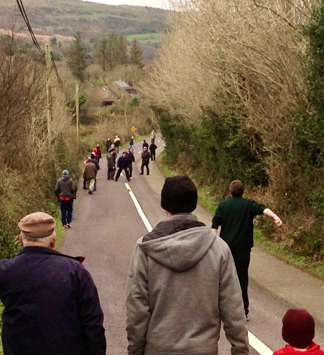
The sport is played mainly in the Counties of Cork and Armagh, although it may be encountered elsewhere in Ireland – in England, The Netherlands, Germany and – nowadays – in many of the United States. But you won’t find it on any Olympic Games timetable, and I’m not sure that it is ever televised: that would be a strange programme, as it’s challenging to follow and involves walks of many kilometres through tangled lanes and byways. Also, I don’t know whether any traffic laws are bent or broken in its pursuit.
Certainly, it has produced its champions.
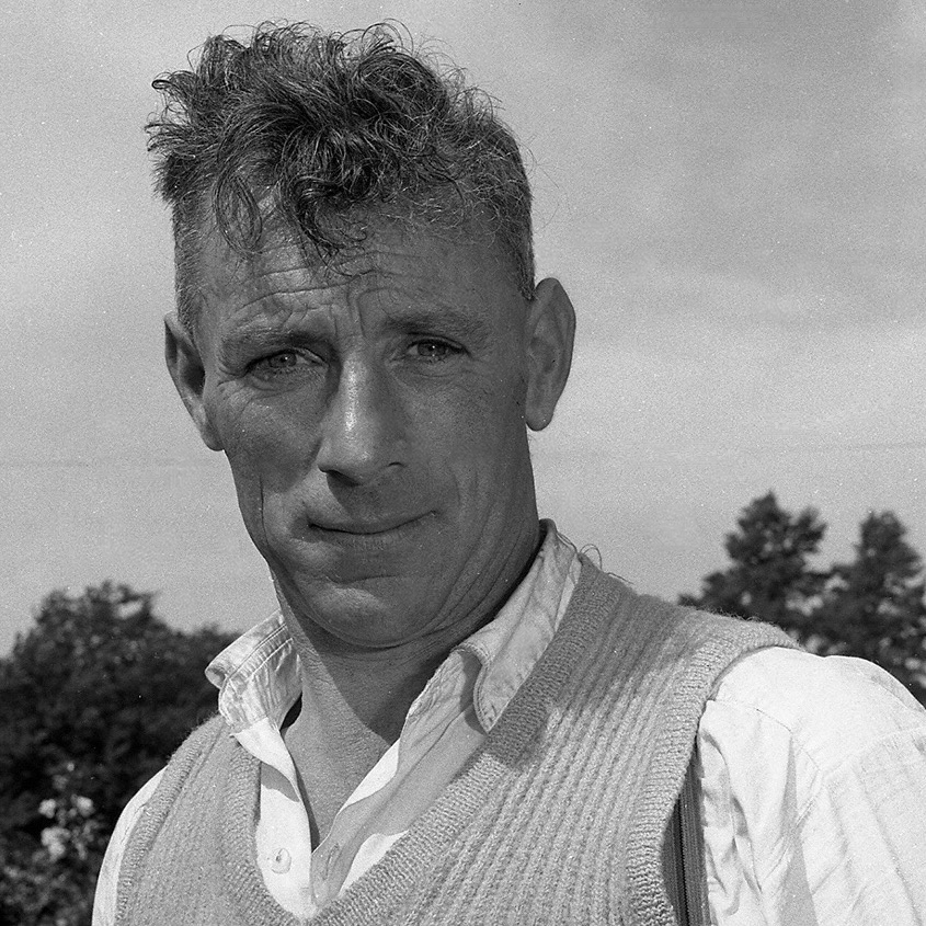
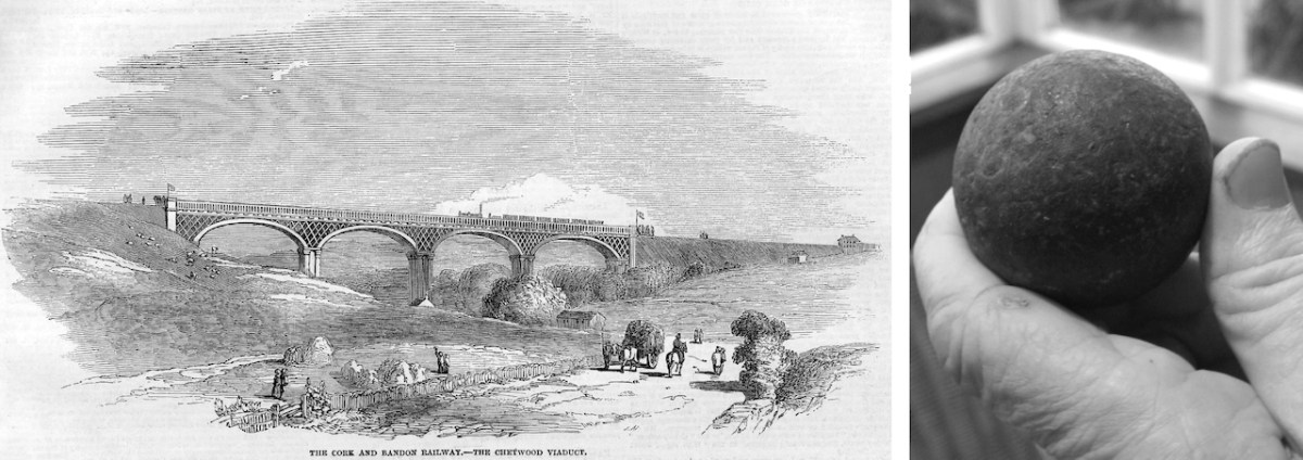
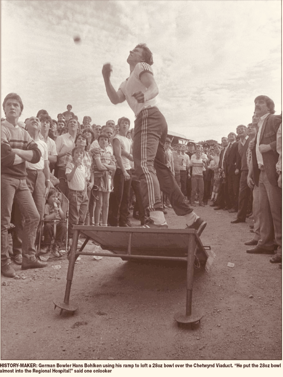
Here’s one: Mick Barry. The photo is likely to date from around 1955. Mick was All-Ireland Champion on eight occasions between 1965 and 1975. He lived a long life – 1919 to 2014. But he is best-known for having established a record – on St Patrick’s Day 1955 – for lofting a bowl onto the 100 ft high parapet of the Chetwynd Railway Viaduct just outside Cork.
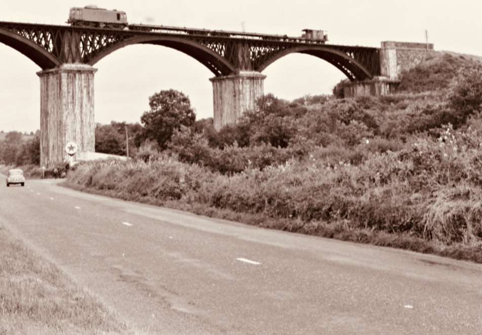
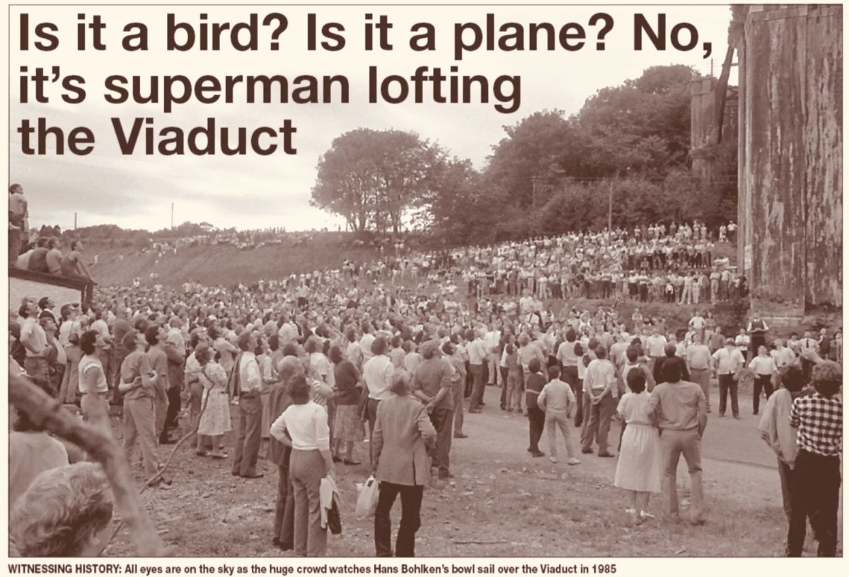
Above – the Chetwynd Viaduct in the 1960s, – after the line was closed, carrying a maintenance train, and – above that – a somewhat fanciful print of the same structure dating from a century before, together with the lead ball used by Barry. The same venue was the scene of another bowling spectacle thirty years later. In 1985 10,000 people showed up to watch a young German named Hans Bohlken loft a 28oz Road Bowl over the viaduct, using a portable ramp to improve his throw (images courtesy Cork Echo):
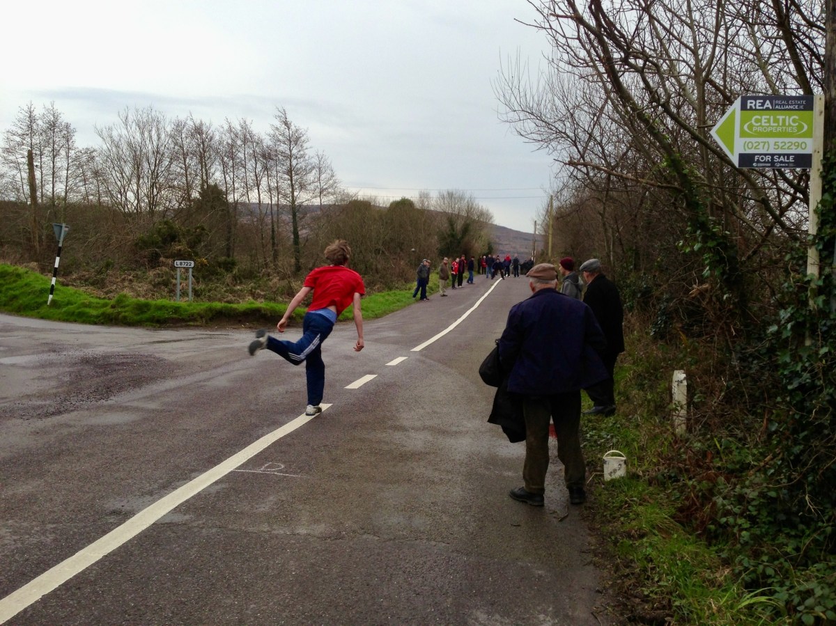
. . . In Irish road bowling the small iron and steel cannonball called a bowl is hurled down a 1 to 2-mile country lane. Throws can roll 250 or even 300 yards. Similar to golf, the player with the fewest throws to the finish line wins. Excitement builds as two evenly skilled players match each other shot for shot for more than a mile. Often, these memorable matches, called scores, are decided by only a few feet or inches’ distance past the finish line, both players with the same number of throws. The twists and turns of a narrow country lane, as well as the tilt of the road surface (the pitch and camber), provide a rich playing field for strategy and can spark spirited debate among the thrower, his coach and full-throated spectators . . .
WVROADBOWLING.COM
Finola drew my attention to a poem written by folk-poet Liam McGrath, who grew up in Skeaghanore, not far from us here in Nead an Iolair – and therefore as local a ‘folk’ as you could ever find. His work has been collected, but never widely published. Here is his commentary on the ancient pastime of Road Bowling:
Please dear Lord, forgive us all, for that boyish little sin, When we dashed out from the Rosary, before that last Amen. Could we only turn back the clock, to re-live those days of Yore, In the Summer twilight of a Sunday ‘eve, to throw just one more score.
*
So clearly now each face I see, as we pass Jer Coughlan’s gate, As the ladies from Ballydehob walked by, looking charming and sedate. The finishing line was at Stouke cross, then a score the other way. To stroll the streets of Ballydehob, our young hearts bright and gay.
*
When’re the twilight lingered on, we had many a thrilling score ’Til the last throw was decided, near Will Regan’s of Clashmore, Sometimes we changed the venue, our choice, the old Church road. But the skill and thrill remained unchanged, it was the bowler’s code.
*
A penny, tossed high in the air, a bowler called the toss. The first bowl flew from the bowler’s hand, in a score to Raheen Cross. From Bantry Cross to Skehanore, was also a favourite distance. Such happy lads in the good old days, when nothing seemed a nuisance.
*
St Peter and St Patrick, went out for a little walk. “What’s that iron ball, asked Peter, and who is that happy mob?” “They are throwing a score, said Patrick, and they’re all from Ballydehob.”
*
I must conclude this little poem, ‘cause I know it’s getting late, Only time for a score up Bantry Road, to Charlie Daly’s gate. Just lofted that turn, near Berry’s house, and my wrist is feeling sore, So I’ll down this pen, may we meet again, to throw just one more score . . .
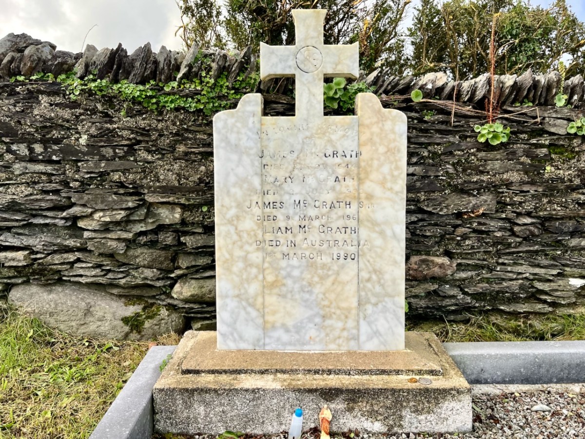
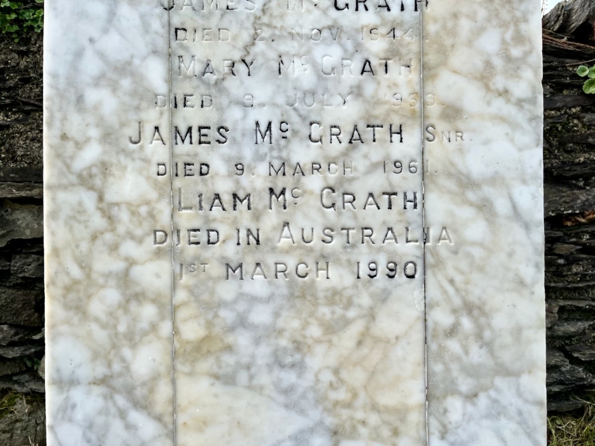
LIAM MCGRATH – Died in Australia – 1990
(Above) The McGrath grave in Stouke graveyard, in the next townland above our home. Liam died in Australia and his ashes are interred here.
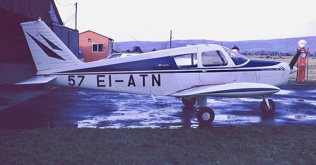
This Piper Cherokee plane set out on a flight from Luton in the UK to Cork exactly 50 years ago but didn’t make it! Instead it ended up in the waters of Roaringwater Bay just a few minutes away from where we live today. The pilot and all three passengers survived . . . It’s all part of the boundless jigsaw puzzle which is West Cork’s history. As you know, we love to discover the whole caboodle.
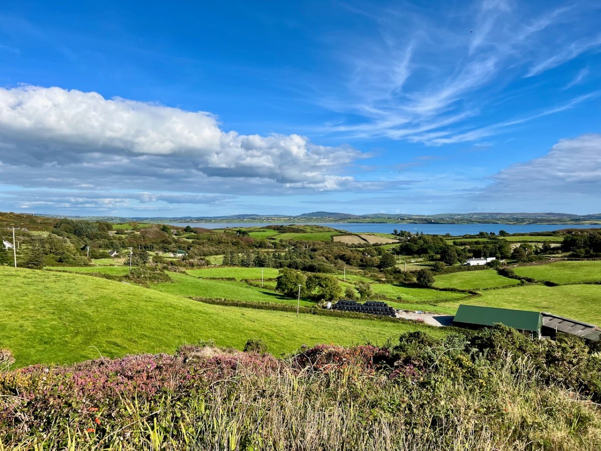
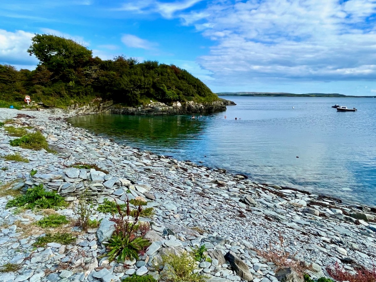
Here’s the view from just beside our house (Nead an Iolair) in the townland of Cappaghglass, looking across to the bay at Foilnamuck: a beautiful sunny day in September. Undulating country . . . Now, picture yourself piloting a small plane, lost, running out of fuel – darkness has come on – and you know you can’t get to any airport. You are going to have to ditch the plane. You can make out below you land and sea – a whole lot of islands. What do you do? You head for a stretch of sheltered water to cushion the inevitable blow.
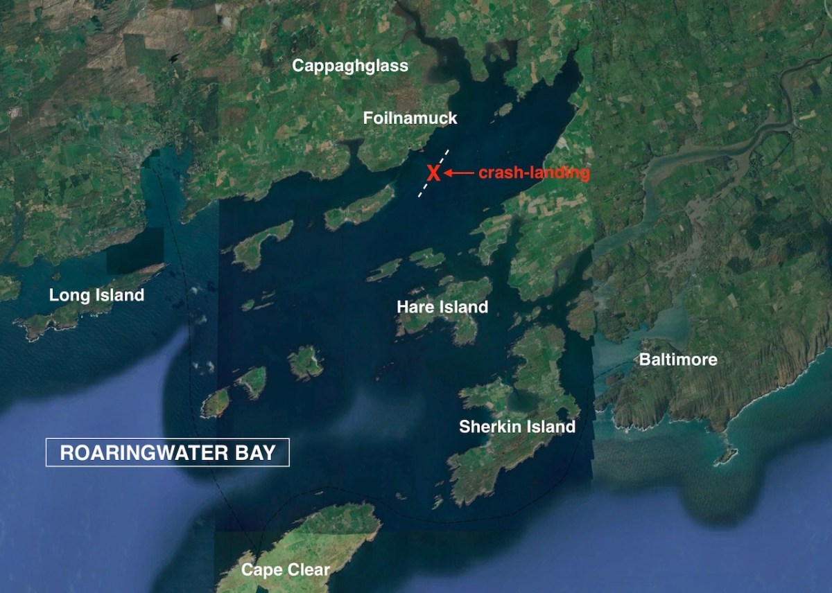
This Google Earth image shows – roughly – the site of the crash-landing that did occur on the night of 22 September 1973. In the coming days it was all over the papers. Thanks to Irish Newspaper Archives for the cuttings I have used.
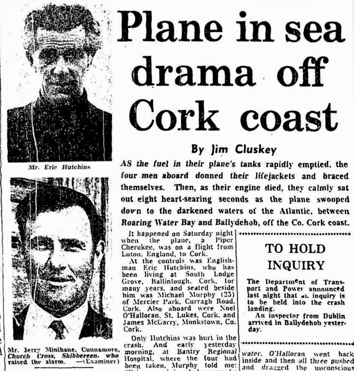
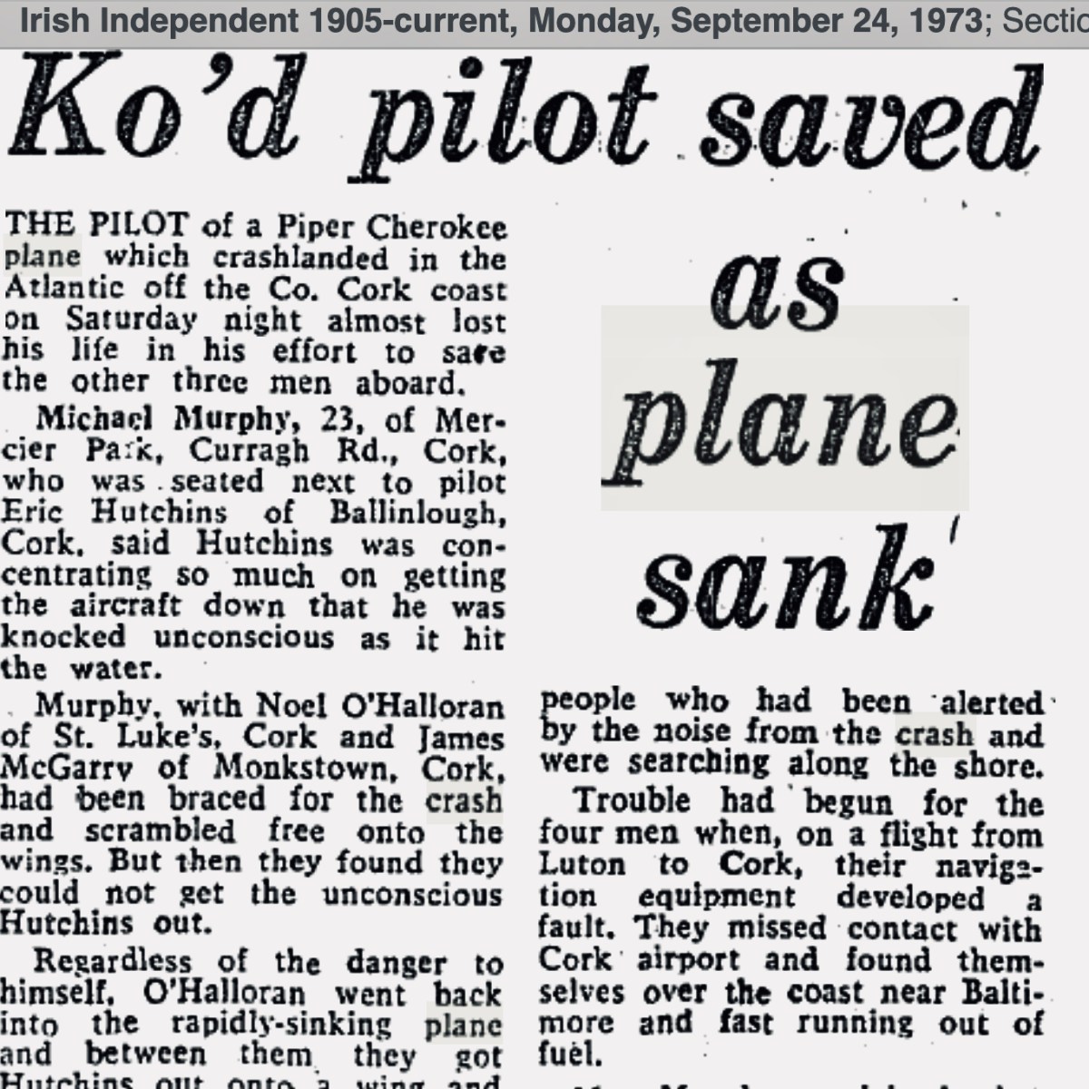
. . . AS an inspector from the aeronautical section of the Department of Transport and Power arrived in Ballydehob to begin an investigation into Saturday night’s plane crash off the Cork coast, it was learned last night that the pilot of the Piper Cherokee almost lost his life in his efforts to save the other three men on board. Michael Murphy (23), of Mercier Park, Curragh Road, Cork, who was sitting next to the pilot, Eric Hutchins of Ballinlough, Cork, said that Mr Hutchins was concentrating so much on getting the plane down that he was knocked unconscious at impact. Mr Murphy, together with Noel O’Halloran, of St Luke’s, Cork, and James McGarry, of Monkstown, Co Cork, had been braced for the crash and scrambled free on to the wing. But then they found that they could not get out Mr Hutchins who was unconscious. Mr O’Halloran then went back into the rapidly sinking plane and between them they pulled Mr Hutchins free and threw him into the water. The three men then swam ashore taking 40 minutes to reach land at Fylemuck, as they had to support the injured man all the way . . .
Irish Press, Monday 24 September 1973
. . . Only Hutchins was hurt in the crash. And early yesterday morning, at Bantry Regional Hospital, where the four had been taken, Murphy told me: “Eric was injured because he was concentrating completely on getting the plane down. It is entirely due to his skill that we are all alive.” But Hutchins came close to paying dearly for his dedication, for he was knocked unconscious by the impact as the plane smashed down, spewing its undercarriage across the waters.
Murphy was first out onto the wing as the plane began to settle in the water. He was followed by O’Halloran and McGarry. But then they found that they could not manoeuvre the slumped Hutchins clear.
Regardless of the fact that the plane was quickly filling with water. O’Halloran went back inside and then all three pushed and dragged the unconscious man out on the wing and threw him in the water, with his lifejacket still not inflating.
With the plane tilting dangerously. O’Halloran dived under the wing and reached Hutchins. He was joined by the other two and, as the plane sank, they struck out for the shore. They reached it at Fylemuck after 40 weary minutes, still supporting the injured man between them . . .
(With Original Cutting, Above) From Irish Examiner, Monday 24 September 1973
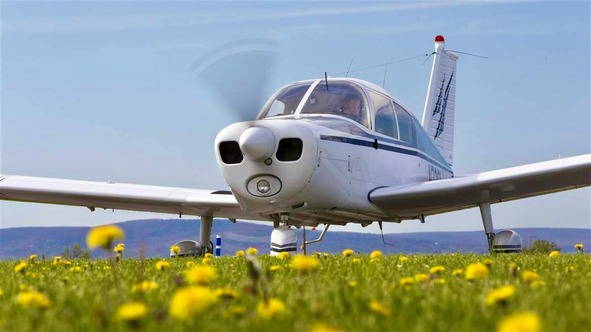
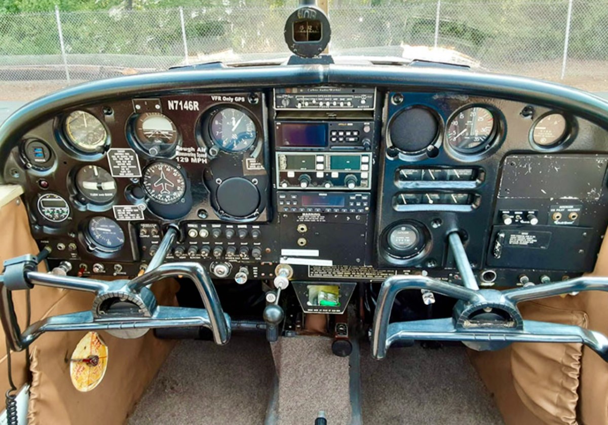
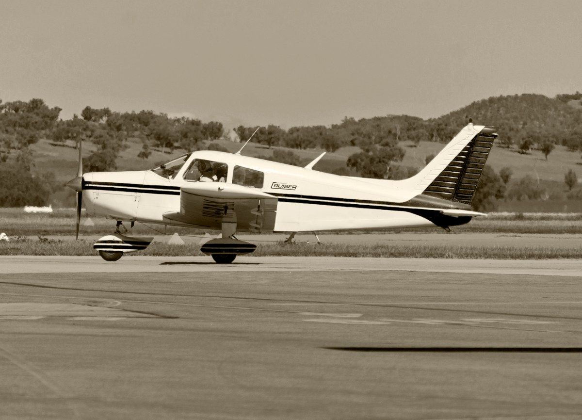
A Piper Cherokee in good times (top) with a view from the pilot’s seat (above – images courtsey AOPA). The plane has been in continuous production since 1961 and has included two, four and six seater versions. It was produced as a light affordable aircraft designed for flight training, air taxi and personal use. The 140 model piloted by Eric Hutchins on that fateful night in 1973 had an aluminium alloy semi-monocoque fuselage construction with a 150 horsepower four-cylinder engine. The standard fuel tank capacity was 136 litres, with an additional reserve of 54 litres. This was enough to cover the flight plan on that crucial day in 1973: the starting point was Luton, Bedfordshire, England, and the destination was Cork Airport, Ireland: a distance of 550km. In good conditions, with a direct flight (although in this case mainly against the prevailing wind) the plane was capable of covering over 900 km with a full tank. Things went awry when the plane’s navigation system failed during the flight. The group realised they were off-track, and they missed the Cork target, continuing westwards.
. . . Trouble had begun for the four men when, on a flight from Luton to Cork, their navigation equipment developed a fault. They missed contact with Cork airport and found themselves over the coast near Baltimore and fast running out of fuel. Mr. Murphy explained that coming down on land was out of the question because it was impossible to see the fields, adding “Eric picked an ideal place with calm water. None of us panicked, but took what precautions we could” . . .
IRISH Independent, September 24 1973
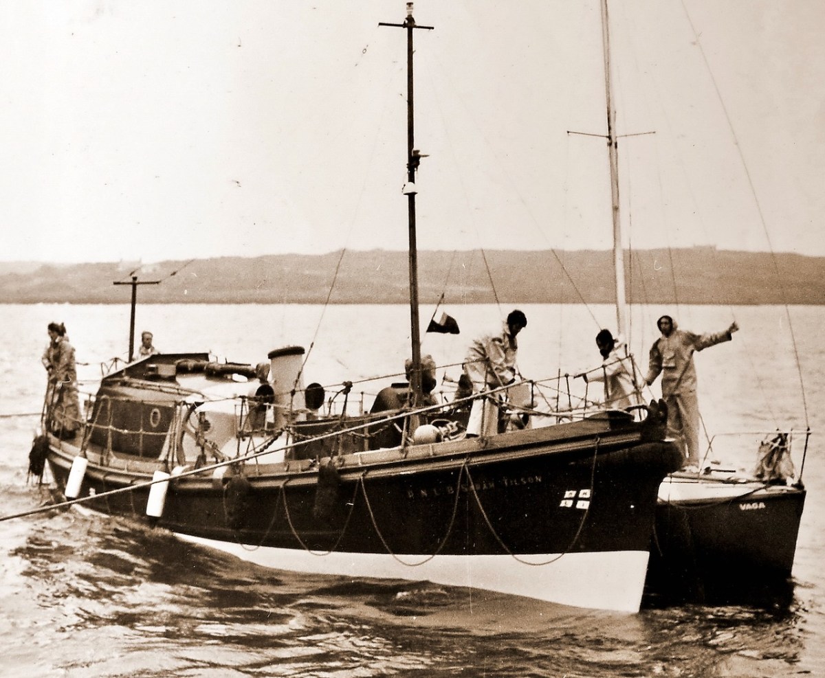
(Above) Calm water at Audley Cove, close to the crash-landing site. The water is exceptionally clear here. The four men were experienced flyers: they all belonged to an aero club and had received training in how to handle an emergency. They were also strong swimmers. They knew the drill regarding crash-landing on to water, and the actual experience would have been strictly routine, except that the pilot – Eric – was knocked unconscious during the impact. While still in the air they were sending out distress messages on the radio. The Piper Cherokee distress call was picked up by an Aer Lingus flight from London to Cork. The Marine Rescue Coordination Centre at Shannon was alerted immediately and a full-scale rescue operation was mounted, with helicopters and boats, including the lifeboat from Baltimore, under coxswain Christy Collins.
The Baltimore Lifeboat “Sarah Tilson” pictured (above – courtesy Cork Examiner Archives) in August 1973 rescuing the yacht Vaga close to Baltimore Pier. The 46ft 9in Watson class lifeboat was stationed at Baltimore between 1950 and 1978. She was launched on service 70 times and saved 21 lives. In fact her services were not needed on the night of the crash as the four men came to shore safely. The lights from the stricken plane had been seen locally and reported. The Ballydehob Garda – Paddy Curran – arrived in his Zephyr car and with the help of local neighbours was able to assist the men, who were taken to the hospital in Bantry, where Dr Larry O’Connor attended the injured pilot. Noel O’Halloran – who has given me much of this information (and the photo of the plane on the header) – told me that when the distress call was picked up it was initially thought that a large aircraft had come down, and an alert was sent out to all doctors and nurses in West Cork to attend at Schull to help with the envisaged emergency.
Two of the men – Michael Murphy and Noel O’Halloran are alive and well today – and I gather there will be a get-together for them in due course to mark the fiftieth anniversary. No doubt many stories will be shared. The pilot, Eric Hutchins, died a few years ago at the age of 84. He had been a professional flying tutor but, after the accident, retired and became a highly respected driving instructor. Michael and Noel lost touch with James McGarry and have recently discovered that he also died a while ago.
A vintage Cherokee (courtesy of Plane & Pilot Magazine)
What happened to the plane? She came to rest in approximately 7m of clear water, fairly close to the coast. On the Monday following – 24 September – she was dragged ashore. Following this, accounts are reminiscent of olden times when wrecked ships were scavenged: some locals dragged the plane on to the beach and began to dismantle it. The engine – a Rolls Royce – was pulled out using a mechanical excavator: it ended up at the Garda Barracks in Bantry. But it was too late to save the plane or the engine. When a machine has been immersed in salt water it needs to be immediately rescued and meticulously cleaned out if it is to be salvaged: unfortunately, this was not done.
I have no doubt that there are people living locally who remember all this. I was fascinated to learn about it, and that is all due to the worthy efforts of Noel O’Harrollan, who contacted Roaringwater Journal. Many thanks, Noel
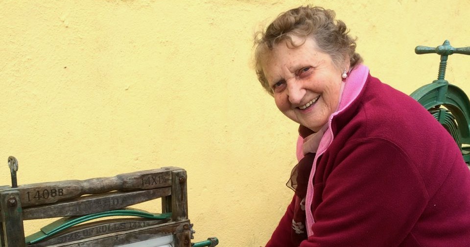
Our lovely friend Leita Camier died this week, aged 92 (although you wouldn’t have guessed it). Leita, and her husband Tommy, who predeceased her, were the marvellous couple who ran, up to a few years ago, the Gortnagrough Folk Museum. Tommy was quiet and gentle, where Leita was outgoing and chatty, and together they built an incredible collection of heritage artefacts. We were lucky we got to visit it before Tommy’s death made it all too much for Leita – it’s been closed for a few years now. In memory of Leita, I am reposting our account of our visit to their Folk Museum. You will see what a special place it was, and why Leita and Tommy were two more in our pantheon of Heritage Heroes.
What follows was written in 2014.
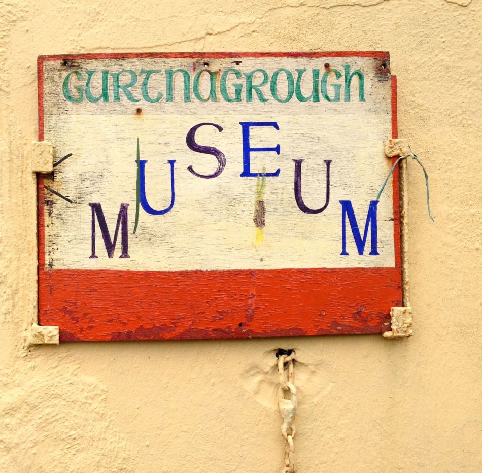
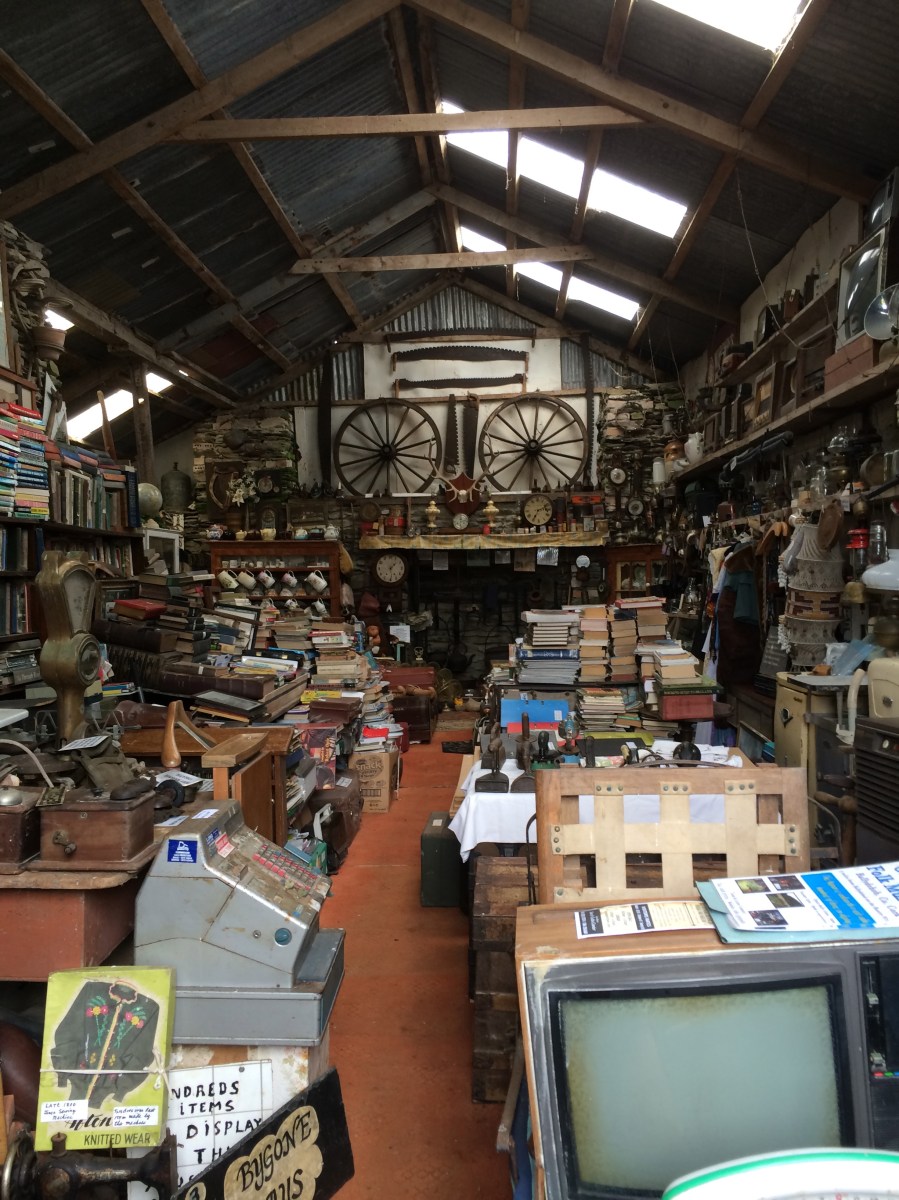
Gortnagrough Folk Museum has been called Ballydehob’s Best Kept Secret, but it could equally be called its Most Delightful Discovery. Leita and Tommy Camier have devoted years to building a huge, quirky, fascinating collection that will transport you back to your childhood, or perhaps your grandparents’ childhood. It’s pronounced Gurt-na-Grew.
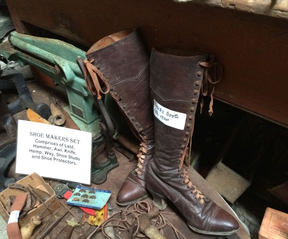
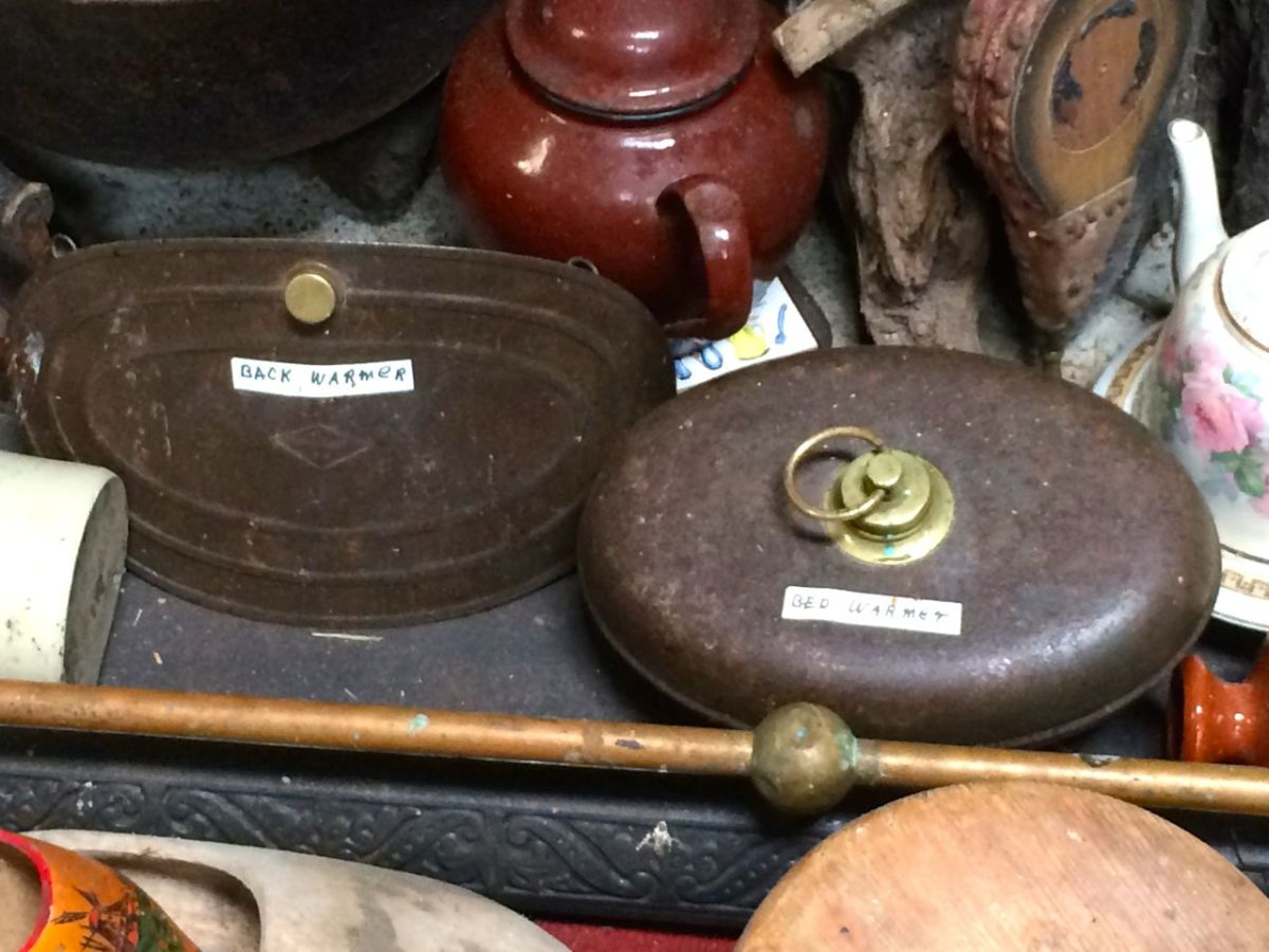
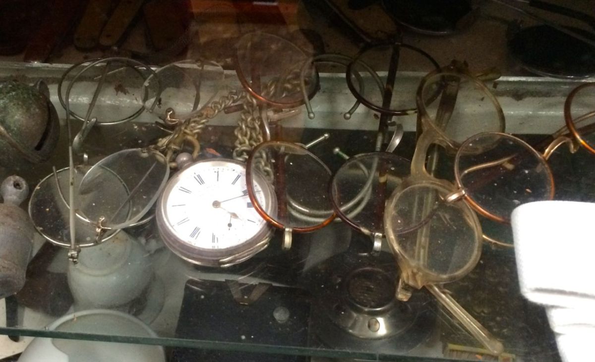
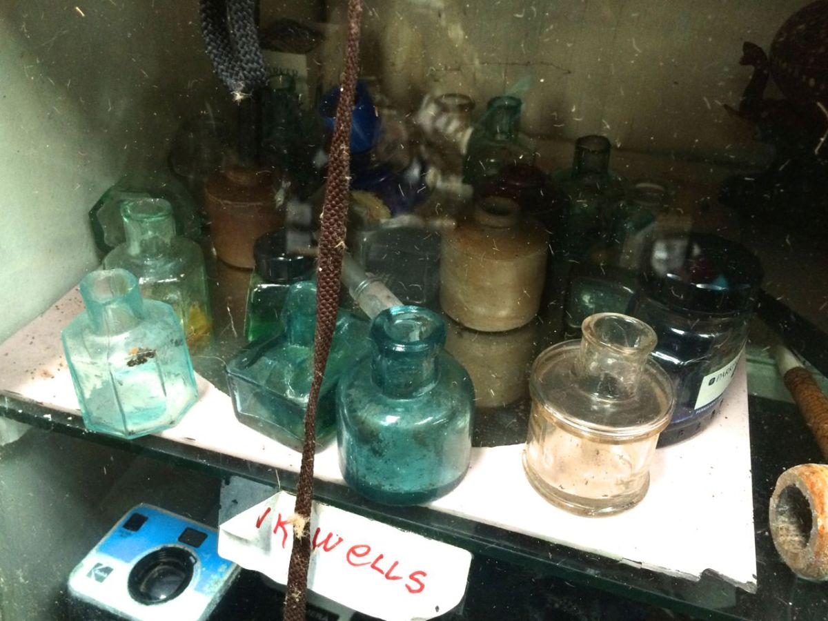
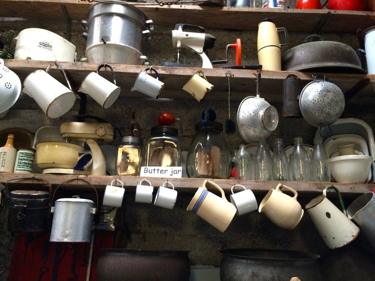
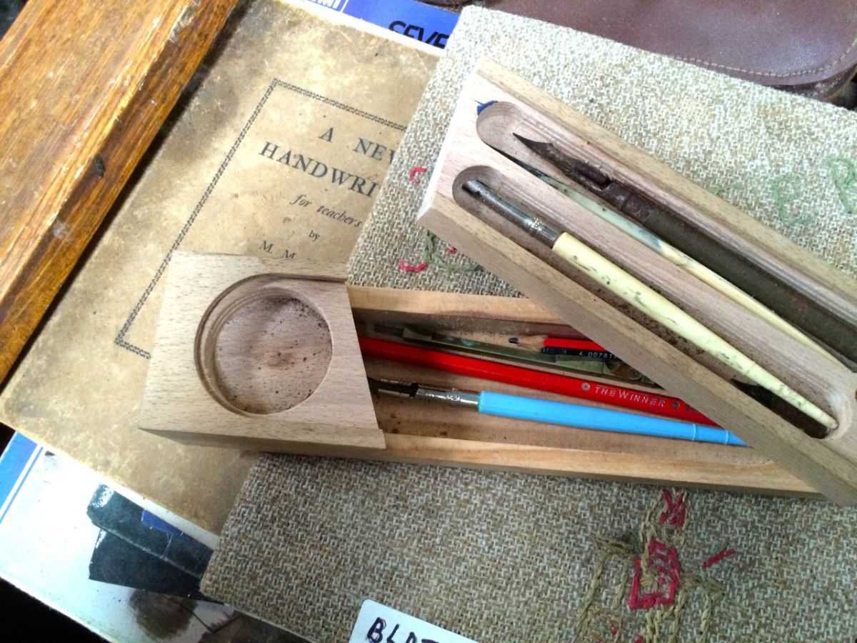
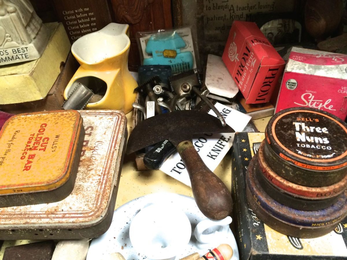
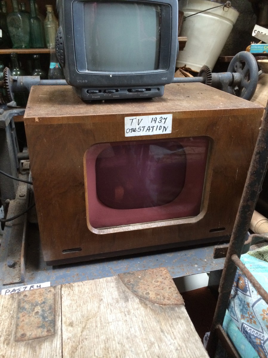
While the emphasis of the collection is on local and West Cork history and on farm machinery, many of the items will bring back memories, no matter where you grew up. Close your eyes for a minute and conjure up a picture of the little tin box that your father used to produce to fix the puncture on your bicycle tyre; or the tobacco tin your grandad opened when he needed to fill his pipe for a contemplative puff by the fire; or the funny old caddy your mother kept the tea in, that had belonged to her mother; or, if you’re as old as I am, the school desk you sat at, with the inkwell that was filled by the teacher once a week. You’ll find all of those here.
How many of these do you remember?
How about these?
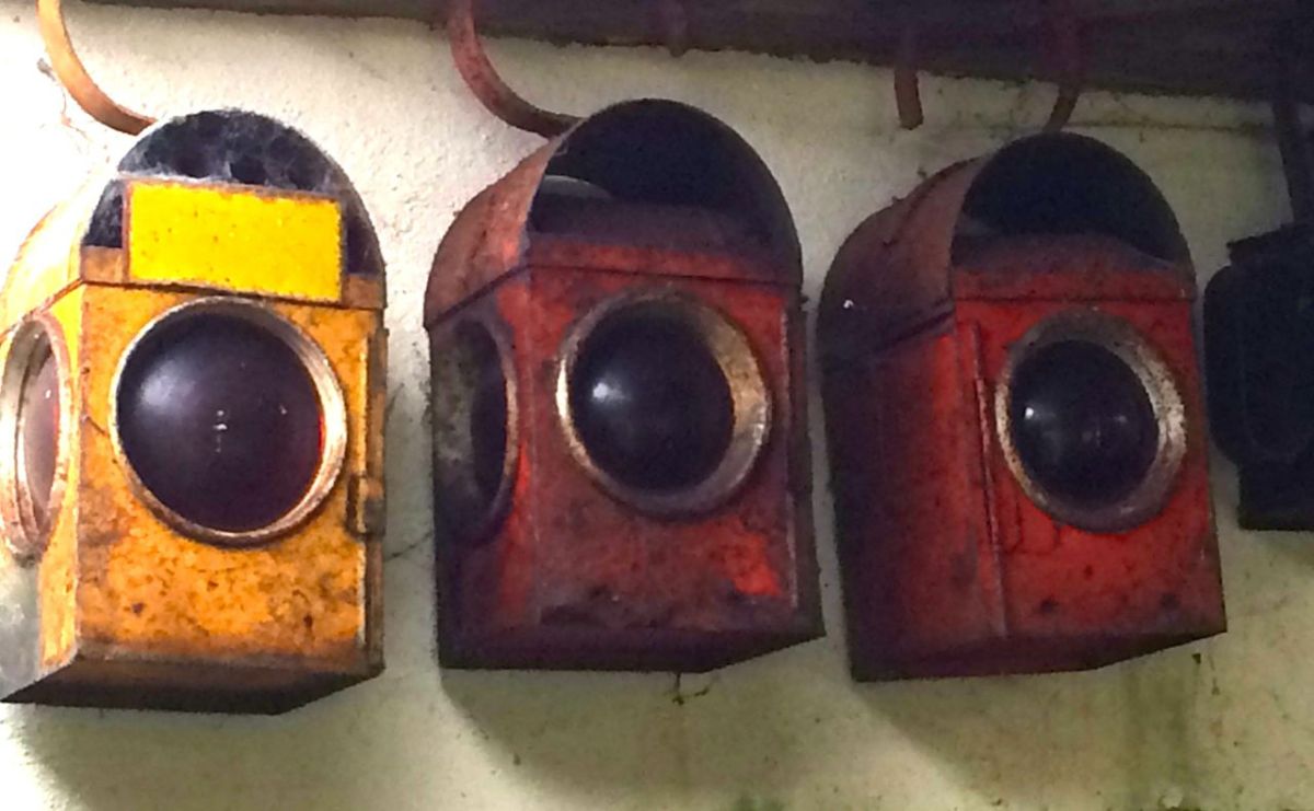
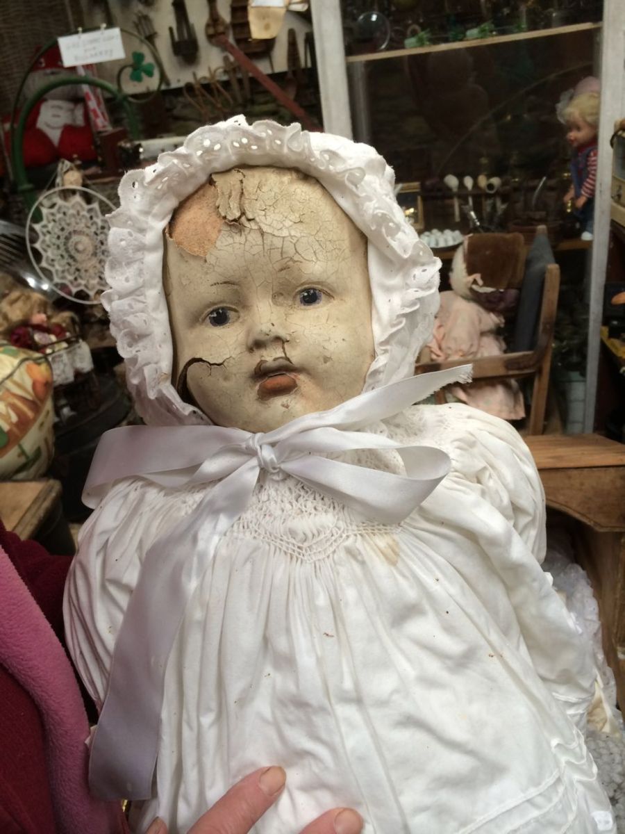
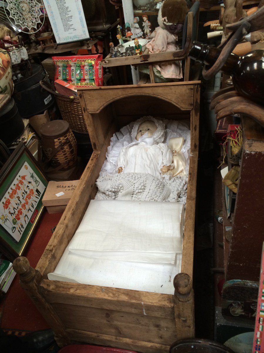
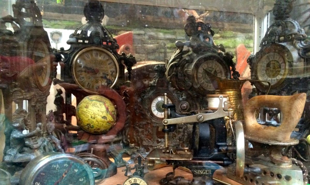
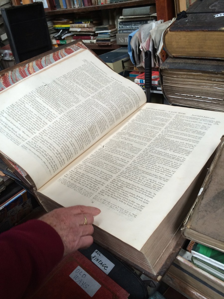
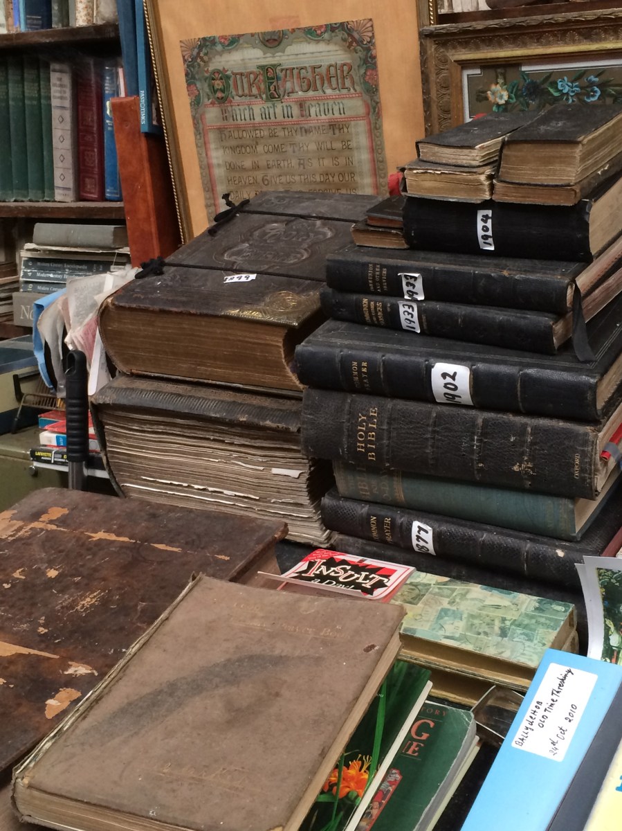
There are older items here too – eighteenth century bibles, little cages for coalmine canaries, famine soup pots, equipment used by tailors and cobblers, dolls loved by little Edwardian girls and clocks that adorned Victorian mantlepieces.
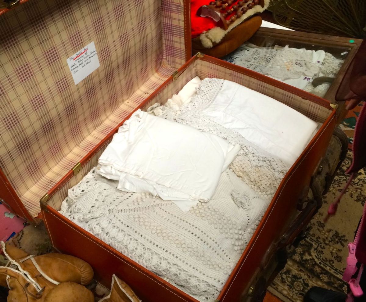
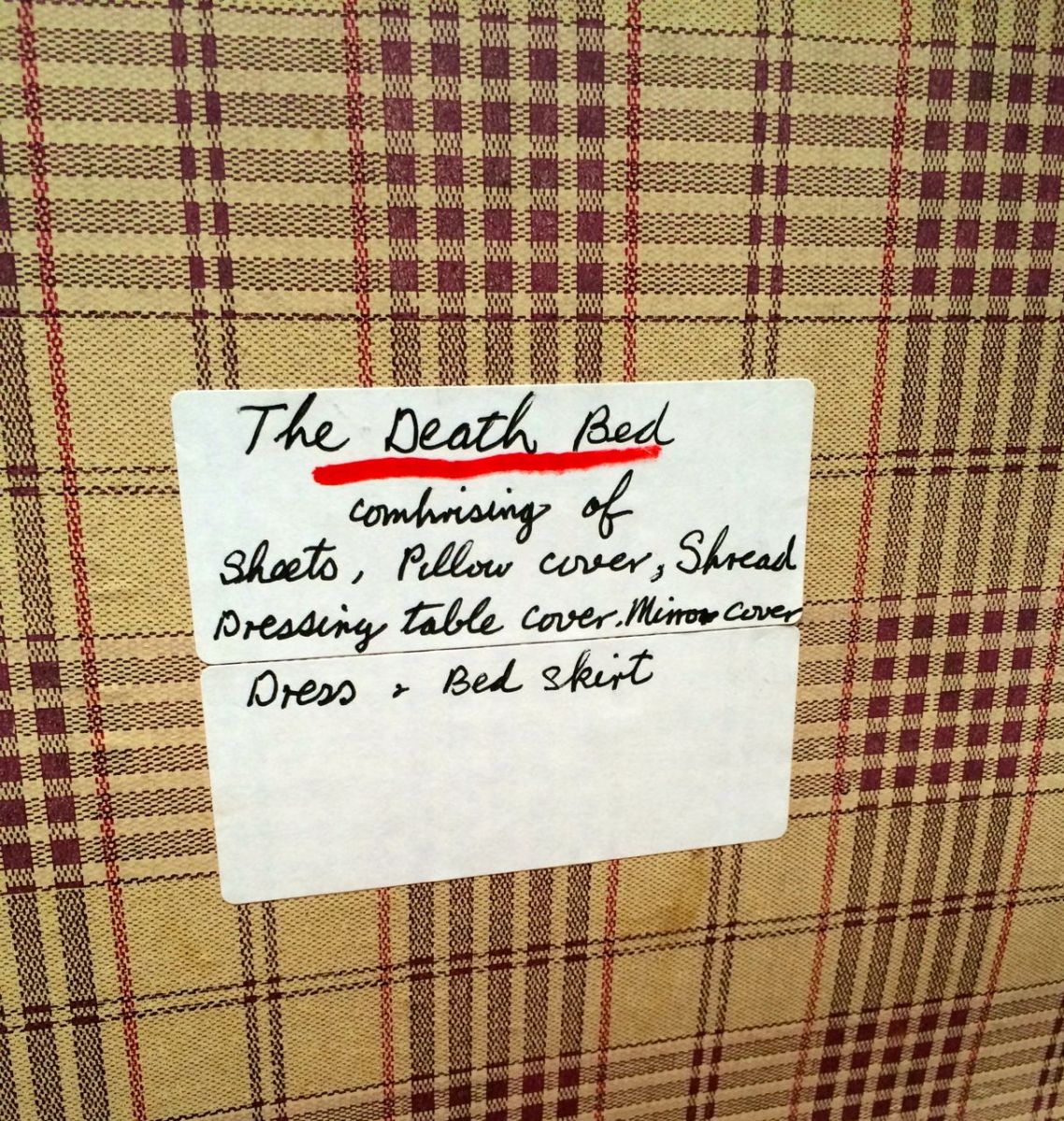
The Irish, as everyone knows, had a grand tradition of Waking the Dead. The body, first, had to be washed and dressed. Special linens, often passed down through generations and kept beautifully white, were used to dress the body, but also the bed and surrounding furniture. Mirrors and clocks, especially, had to be covered. Leita showed us an old suitcase that contained a treasure trove of this linen.
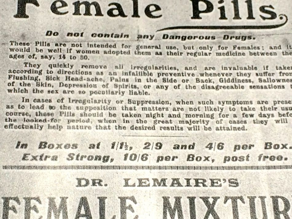
Among the artefacts are books and books of cuttings, old photographs, recipes, shop accounts, advertisements, journals and articles, all lovingly collated and saved in plastic covers.
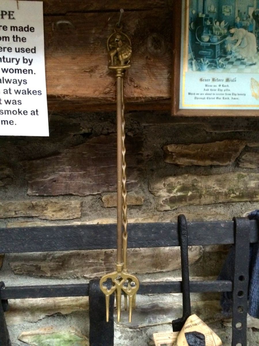
Outside is an equally interesting mixture of memories.
Careful – you might get so caught up in browsing among this eclectic collection that the rest of your party has moved on to the farm machinery before you notice.
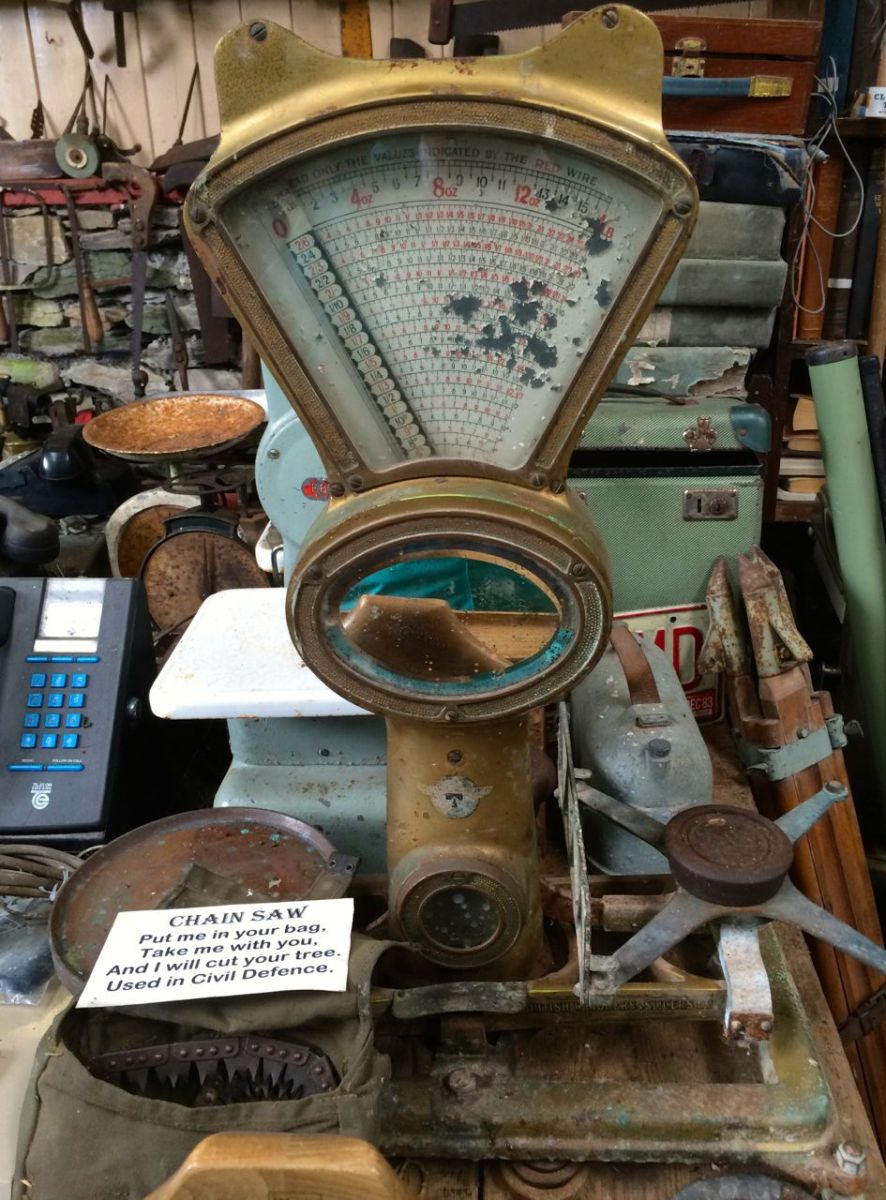
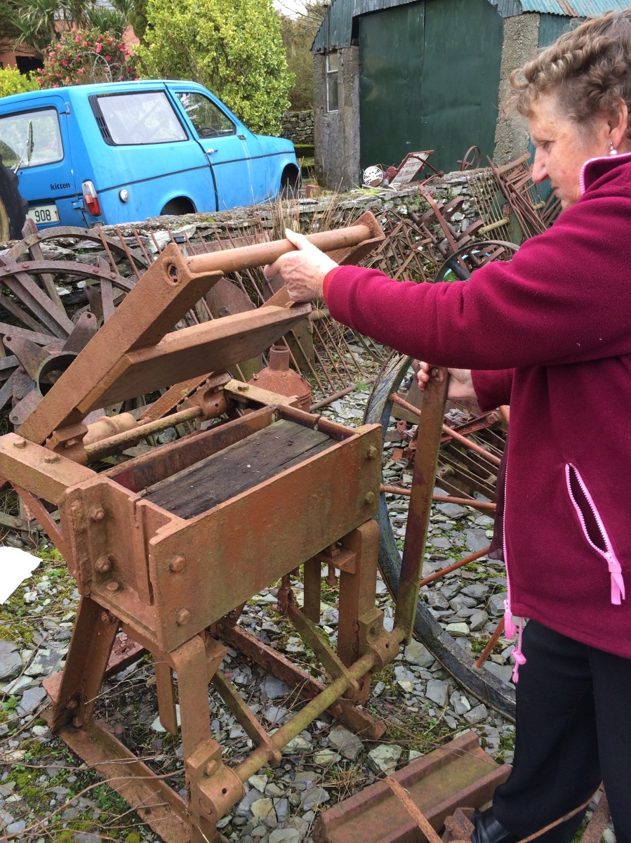
Tommy and Leita know the use of every item of machinery on their property. A lot of it is still in working order and they bring it to the Thrashing or to country fairs – to demonstrate old winnowing techniques, or to make butter.
Postscript
Looking back on these photos has been a joy, as we remember Leita and Tommy, how kind they were to us as recent blow-ins then, and how much they enjoyed their collections. We hope that this post gives other Ballydehob folk some fond memories too.
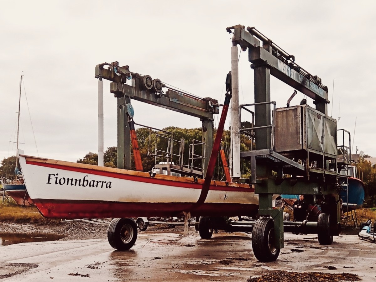
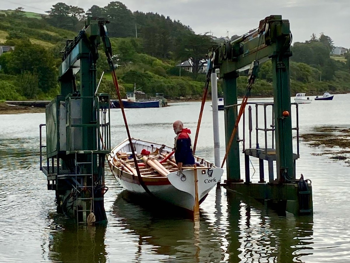
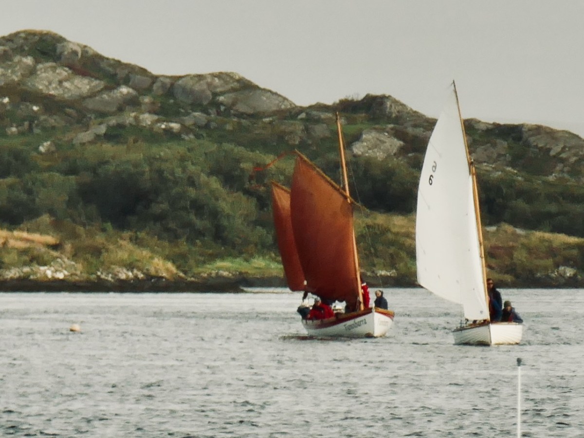
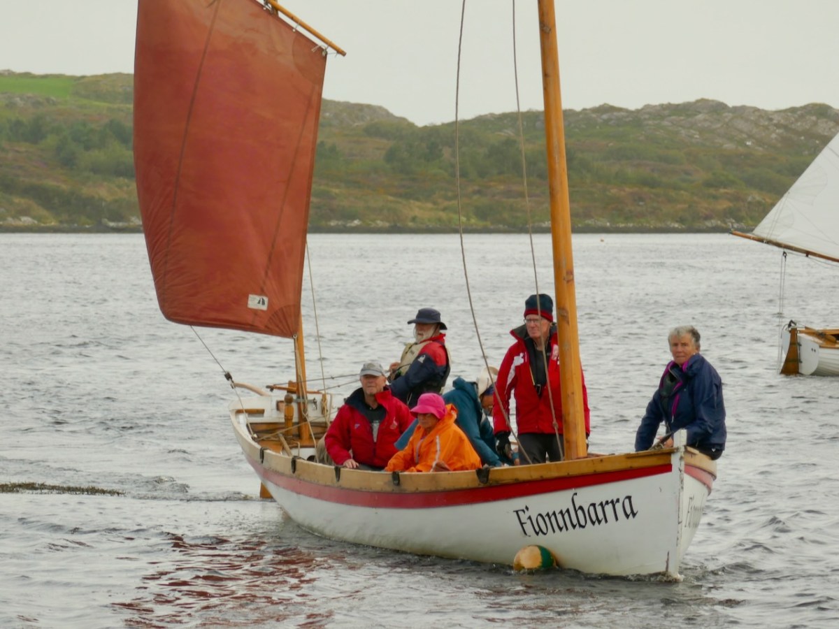
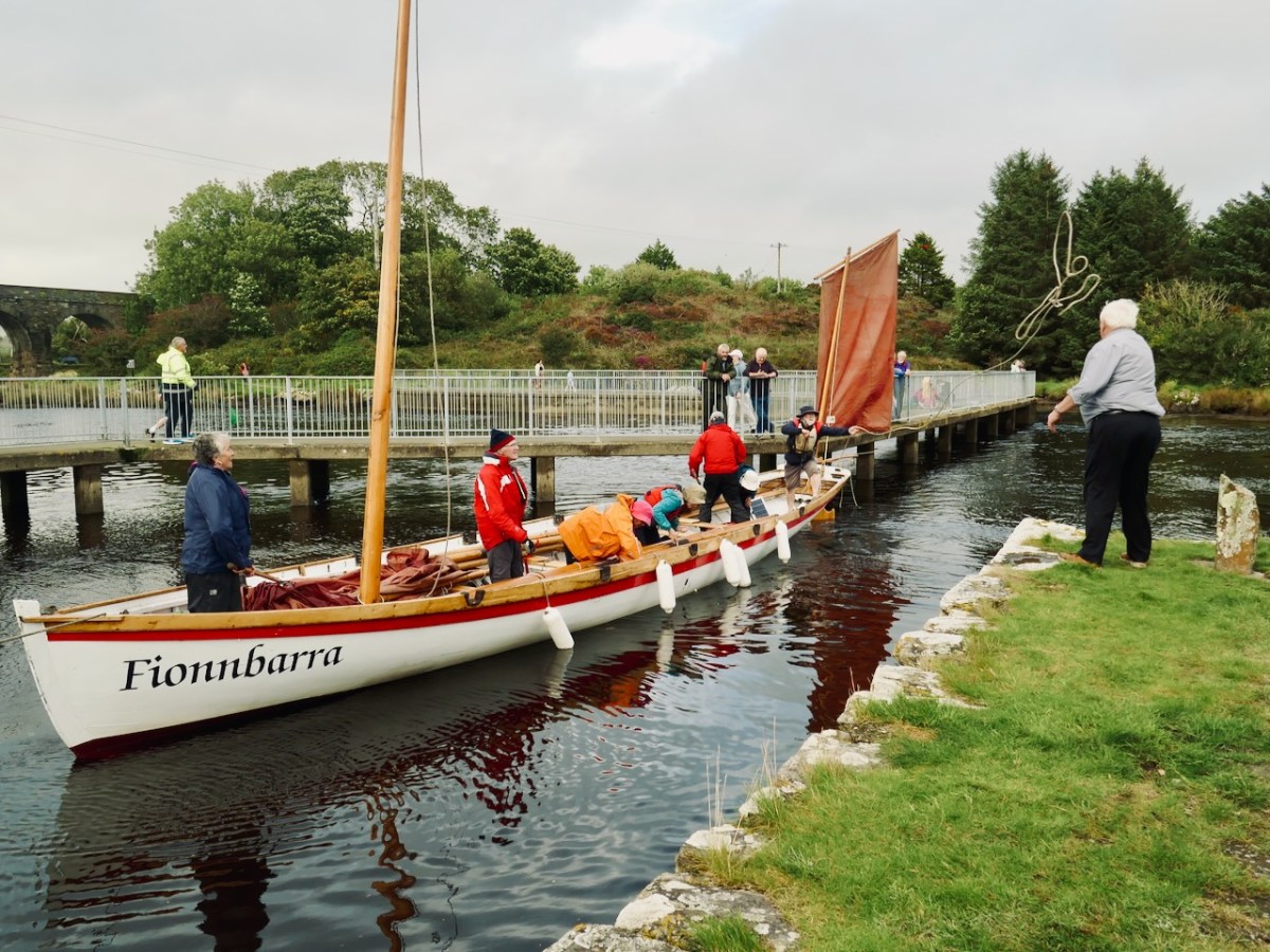
The importance of West Cork in world history was emphasised today at the Ballydehob Cruinniú na mBád (Meeting of the Boats). This annual event reminds us how busy our quay was back in the day when all the commerce of the village was based on the tidal waters. Finola wrote about the gathering in 2017. But today – 19 August 2023 – I had my eye out for a very particular vessel: Fionnbara.
There she is – above – leaving Rossbrin Harbour today, bound for Ballydehob. And here she is being launched early this morning, using the boatyard’s lifting gear. Many thanks to Jack O’Keeffe – her Skipper – and Anne O’Keeffe for the great photos.
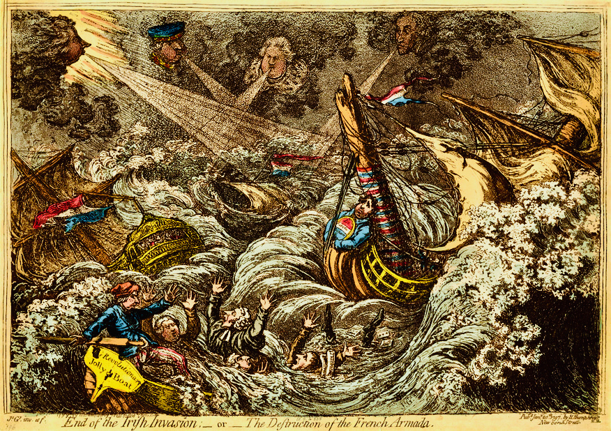
Above: ‘End of the Irish Invasion’ or ‘The Destruction of the French Armada’ by James Gilray 1797 (courtesy of the British Museum)
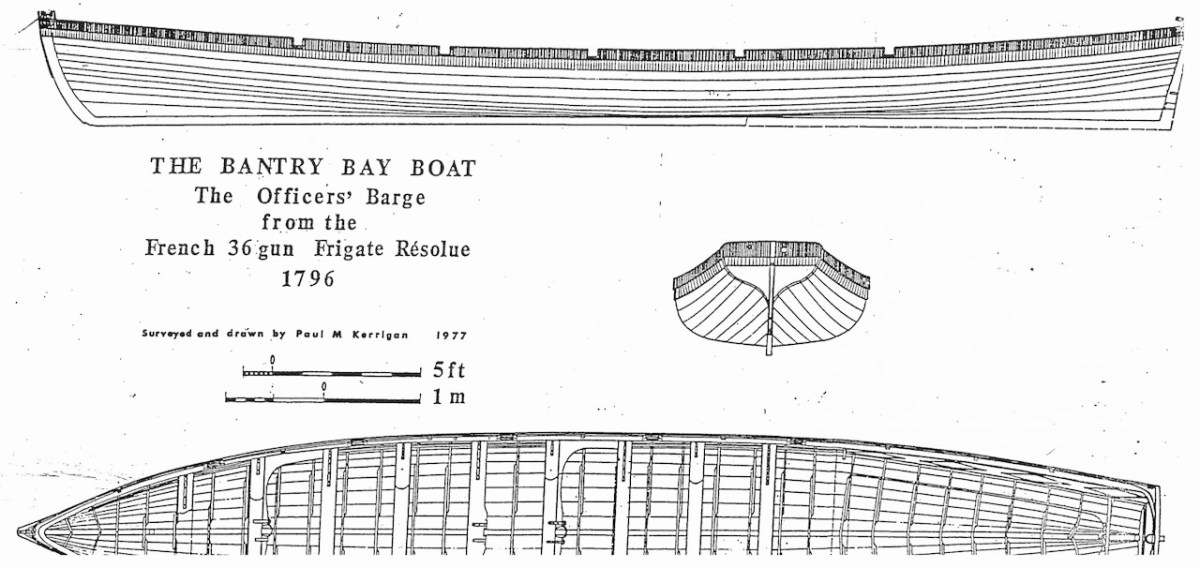
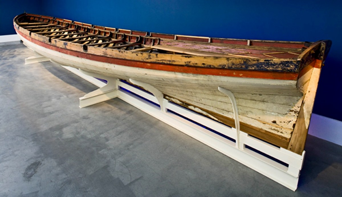
The boat is a replica – one of many around the world – of a craft which found its way to the shores of Bere Island – in West Cork – in 1796, after a disastrous escapade by the French navy, under the encouragement of Theobald Wolfe Tone of the Society of United Irishmen. A fleet of 43 vessels carrying 14,000 men headed for Bantry Bay intending to invade Ireland and declare it independent from Britain. Severe storms threw the ships off course and into disarray, and the opportunity was lost. During the chaos one of the French ships – La Résolue – lost her masts in a collision. Lt Proteau was sent in a ‘barge’ to find another ship to tow the frigate to safety, but instead he and his crew were driven ashore and captured. The ‘barge’ was taken as a prize of war and handed to the local Irish militia commander, Richard White of Bantry House. There it remained – gently rotting – for 148 years. In 1944 it was despatched to the National Maritime Museum in Dún Laoghaire and – after conservation – is now displayed at the Collins Barracks Museum. The ‘Bantry Bay Boat’, ‘Bantry Skiff’ or ‘Bantry Yole’, as the unusual craft is variously known, has attracted considerable attention and has inspired many boatbuilders to produce copies.
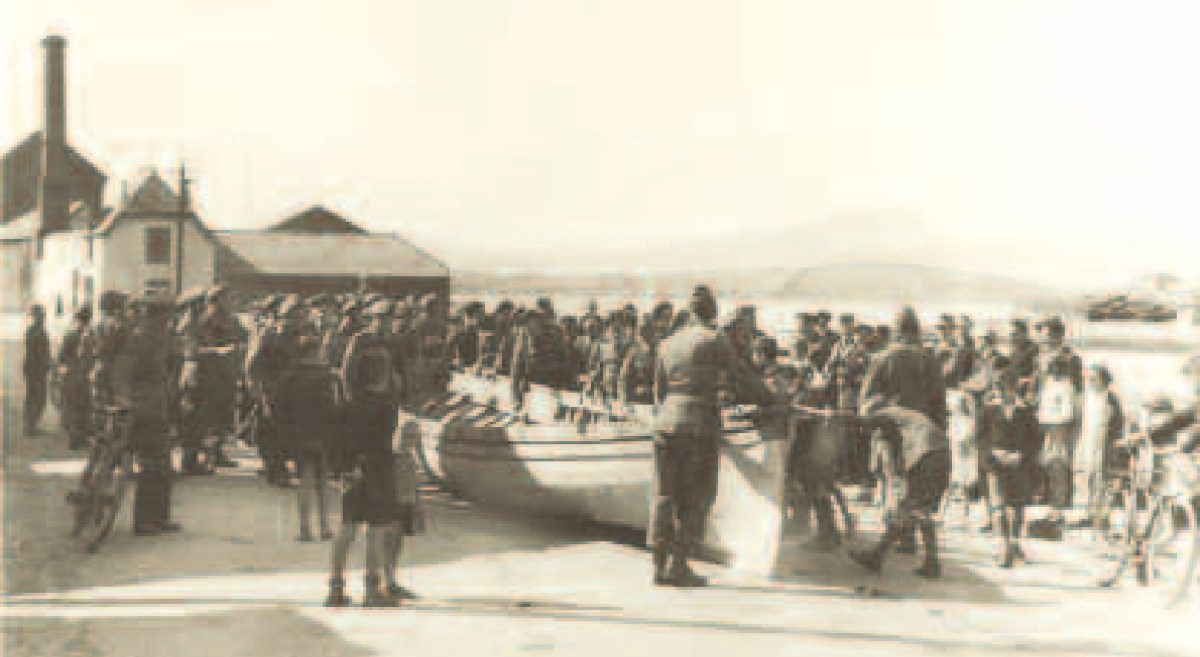
Below: upper – the Bantry Boat being transported from Bantry Railway Station to Dún Laoghaire in 1944; centre – plans of the original craft drawn by Paul Kerrington in 1977; lower – the original Bantry Bay Boat on display in the Collins Barracks Museum today (courtesy History Ireland – article by Lar Joye July/August 2018)
One of these copies is the Fionbarra, which arrived in Ballydehob today. The original was 11.64 metres long, 2.05 metres in beam, and a very fast boat. It was powered by ten oars or three sails, and could carry around ten passengers as well as the crew.
Ballydehob Bay today, 19th August 2023. The small boats are beginning to approach the old quay. With thanks to Finola for many of these photographs.
Building of the Fionbarra began in Waterford and was transferred to Meitheal Mara, a community boatbuilding venture based in Cork city. Construction was completed in 2008. We really appreciated the work of the team who transported her to West Cork and sailed her up the estuary today.
You may wonder why I have put in a header pic from across the Atlantic? This is to demonstrate the influence that the West Cork ‘Bantry Yole’ has had on the boating community all around the world. Atlantic Challenge International was founded in 1984 as a maritime training trust, and its activities are largely based on replicas of the 1796 Bantry craft. As a consequence there are relatives of the Fionbarra in many countries. I understand that there are currently at least 80 such replicas, spread over four continents, in the present day.
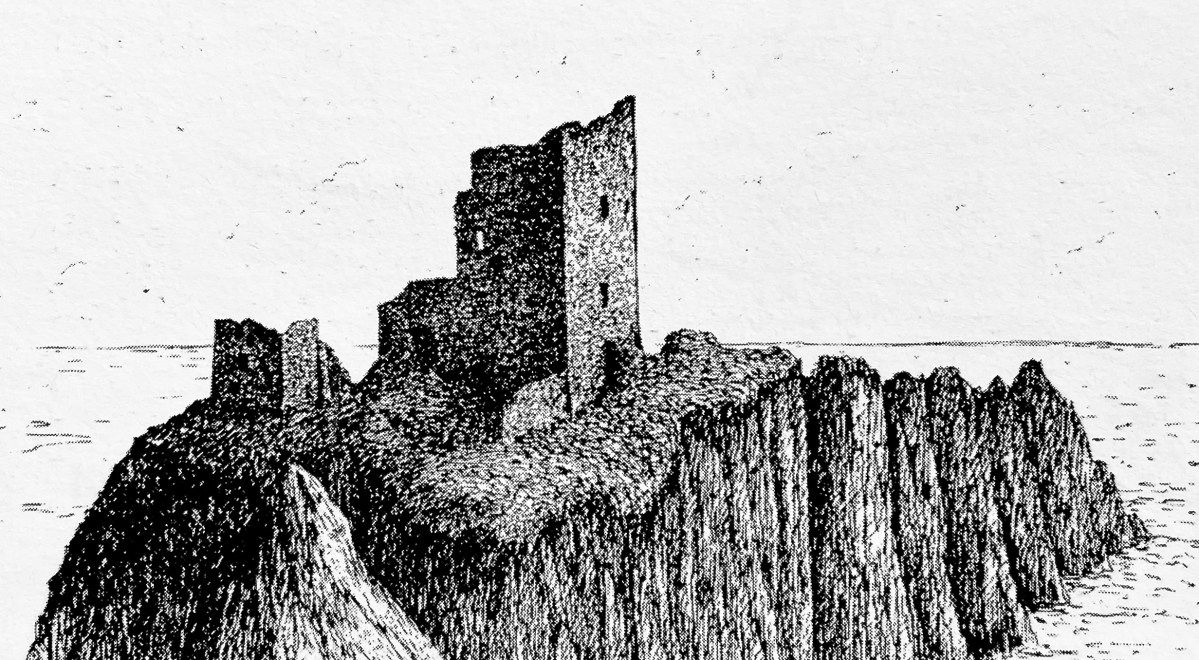
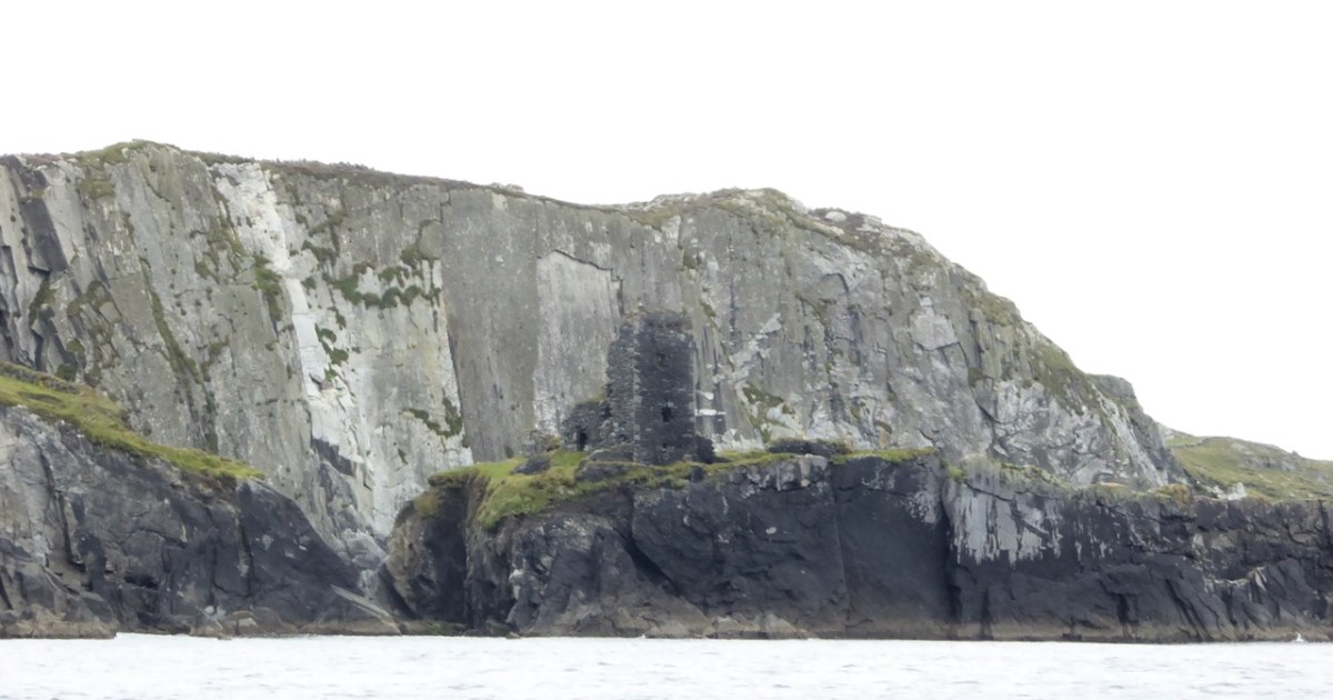
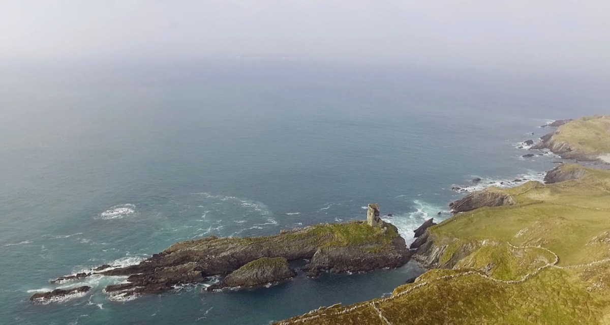
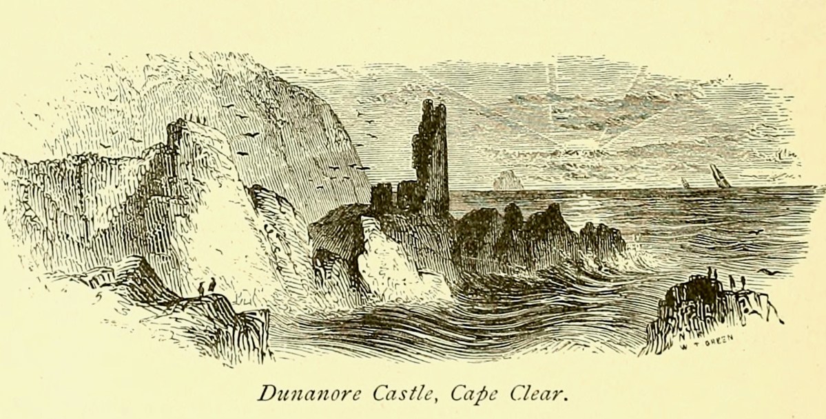
I have been gifted with a marvellous set of photographs of Dunanore, or Dún an Óir – an O’Driscoll Castle on Cape Clear. The gift came from one of our readers, Tash, and I am very grateful indeed. Regular readers know that I like to use my own photos, and I do have some that I took from the sea (like the one below) but I have none of Dún an Óir from the land, let alone from the castle itself!
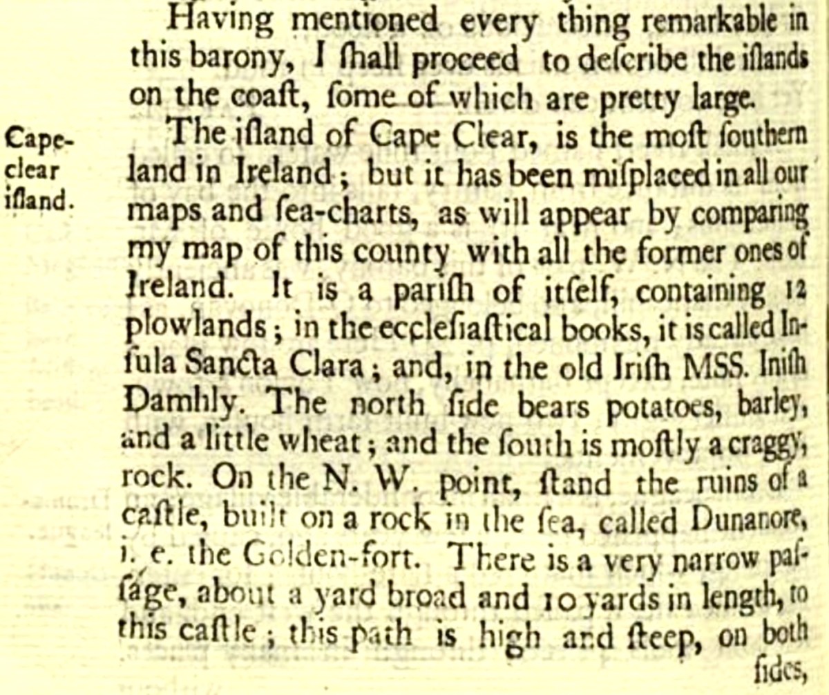
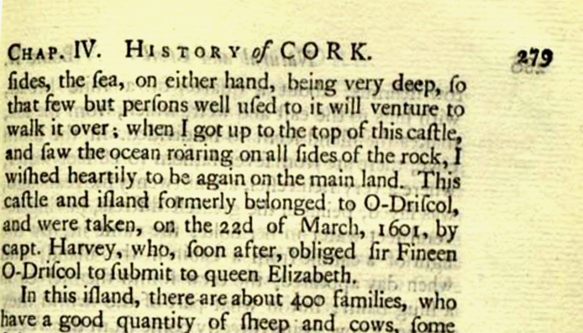
And that’s because, as you can see from the drawing by Jack Roberts at the top of this post, this castle is situated in a very perilous location, on the edge of a cliff, on a small island, essentially, making access a hazardous scramble up from a rocky beach. It was once connected to the rest of Cape Clear by a narrow causeway but this has long collapsed. It was still there in the 1770s when Charles Smith visited. In his The Ancient and Present State of the city of Cork Vol 1, he wrote:
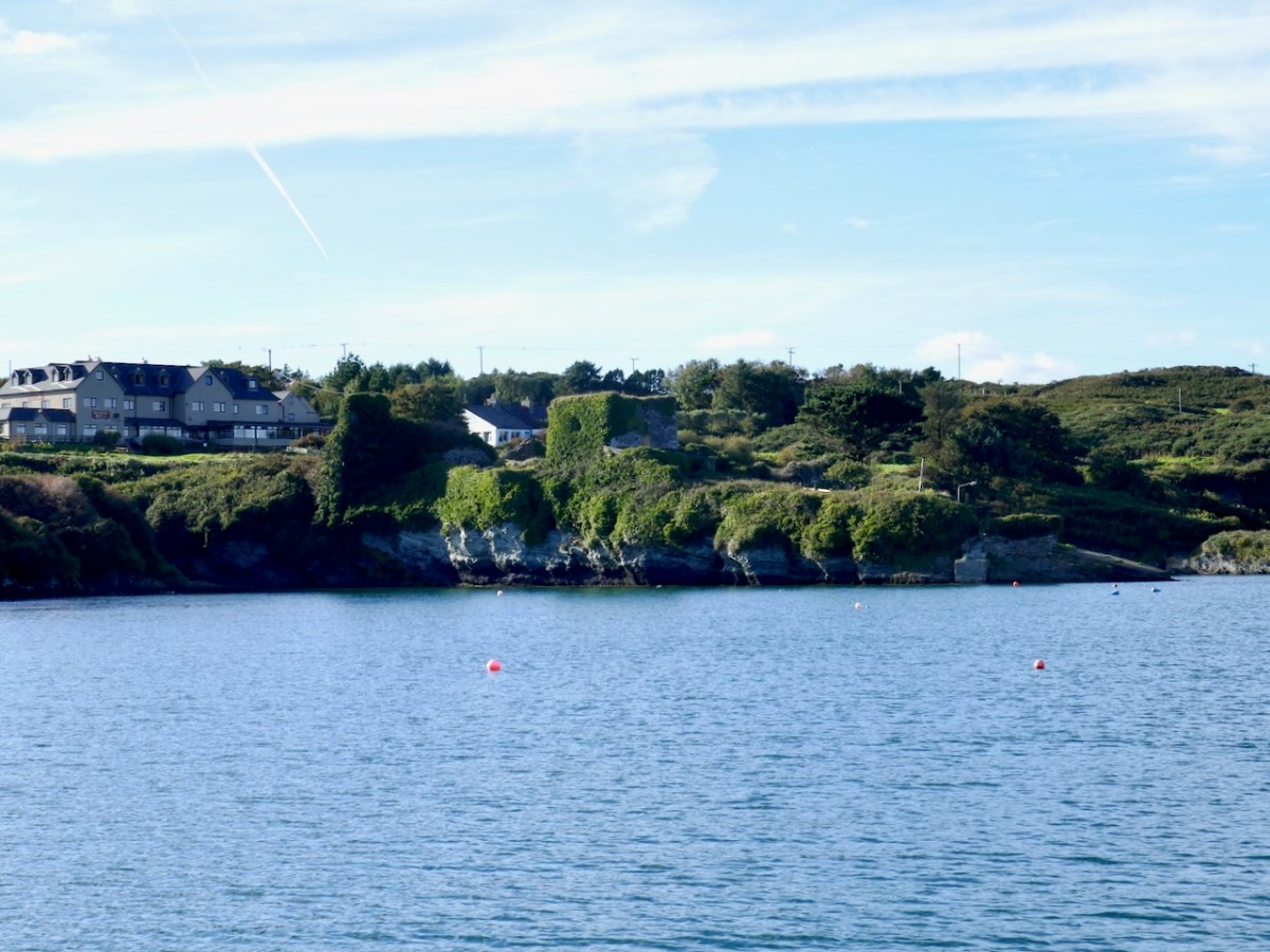
And this brings us to the name – Dún an Óir. It means, of course, Fort of Gold, and some of the old legends about this place talk about the name coming from stories of buried treasure. But in fact, this has been the name of this fort since the first maps of this area were made in the fifteen hundreds and it speaks to the wealth of the O’Driscoll clan who built it. Remember, their other stronghold, now called Baltimore, was Dún na Séad, or Fort of Jewels (on at least one map given as Castle of Perles). On Sherkin, their castle was Dúnalong – or the Fort of the Ships – that’s it as it is now, below.
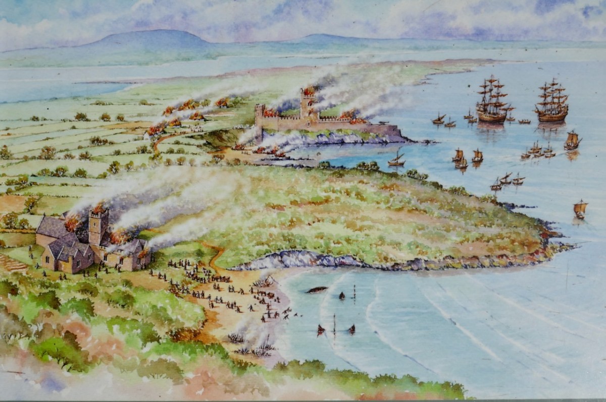
There are many accounts of their fleets of ships, and the battles they waged against the Waterfordmen in which they came out the worst for wear when Dunalong was attacked. The scene below, from an information sign on Sherkin, shows the Battle of the Wine Barrels, 1537, with both Dunalong and the Friary on Sherkin in flames
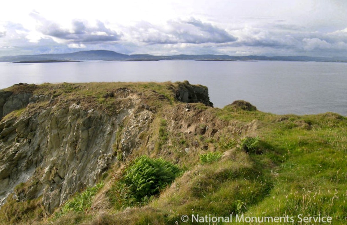
Dún means ‘fort’ but seems to be especially applied to promontory forts in the southwest. Before the castle was built, therefore, it is likely that the O’Driscolls fortified the headland, which may date well back to the Early Medieval period (400-1200) or even to the Iron Age (500BC to 400AD, or 500BCE to 400BC for those who prefer the secular version). The Illustration below is taken with permission from Dún an Óir Castle: an uncertain future, by Dr Sarah Kerr, and shows the present state of the castle, marooned on what was once a promontory connected to the Island.
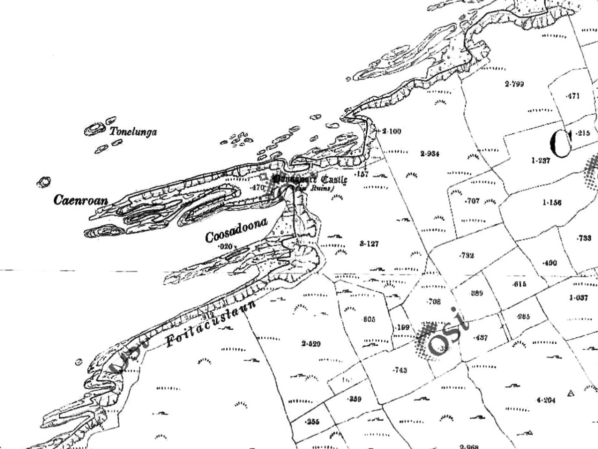
Our Promontory Fort man is Thomas Westropp (see here and here), and he wrote about Dún an Óir in his 1914-16 paper for the Royal Irish Academy, Fortified Headlands and Castles in Western County Cork. Part I. From Cape Clear to Dunmanus Bay. He visited the site, but like many a good explorer before and after him, did not venture out onto the promontory, but satisfied himself with what he could see from the high ground above it. That included the promontory and ruined castle, the rather ominously named Tonelunga (The sea-bed of the Ships), the end of the promontory called Caenroan (quay of the Seals), the inlet between the promontory and the cliffs, Coosadoona (the Little Harbour of the Fort) and the high cliffs behind the fort, Foilacuslaun (Cliffs of the Castle). All of these are marked on the 19th century twenty-five inch map.
Westropp writes about Dún an Óir as one of three Promontory forts on Cape Clear Island, although in fact there are more than that, as identified by the National Monuments Record – each yellow dot below is one.
Here’s one of them (below), Lios Ó Móine (the Fort of the Meadow – lios is usually used to designate an earthen ring fort): the description and then the photo are by National Monuments Service (NMS). In the photo you can see the narrow neck of land leading out to the promontory. This is likely what the spit leading out to Dún an Óir may have looked like.
Description: In rough pasture, at the foot of a steep N-facing slope on Stuckaunfoilnabena, a headland on the NW coast of Clear Island. A narrow eroding neck of land (Wth 3m; L 15m) leads to the roughly anvil-shaped headland. Across this neck of land are the remains of three earthen banks and the shallow remains of three fosses. Further examination of the remains was not possible for safety reasons.
Curiously, the NMS does NOT identify Dún an Óir as a promontory fort – here is what it says:
Description: The location of the tower house ‘Doonanore Castle’ (CO153-015002-) on a promontory, on the NW shore of Clear Island, suggested that it may have been built on the site of a promontory fort. However, there are no visible surface traces of an earlier defences across the promontory. The promontory is now isolated at high tide but was connected to mainland by causeway until 1831.
However, it has this to say about the earthwork identified on the high ground:
In pasture, on a steep N-facing slope to the E of the tower house known as Doonanore Castle . . . An earthen bank . . .extends upslope in a S to SW direction from a modern E-W field boundary wall on the cliff-top at N and ends at a large outcropping rock on the edge of another cliff. This bank appears to have formed part of the defences on the land approach to the castle from the E. The bank has three contiguous linear stretches [and] there is an entrance near the N end. There is a possible hut site near the centre of the enclosed area. The short promontory on which Doonanore Castle stands is a possible coastal promontory fort.
So, as you can see, although the NMS declines to label it a promontory fort because there are no longer any signs of banks or walls, it does concede that it is possible. It also extends the defences of that fort to the higher ground above it.
Back to Westropp – He quotes:
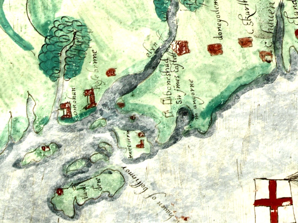
the poem of O Huidhrin, before 1418, tells how “0 hEidersceoil assumed possession of the Harbour of Cler.” It was of some importance to the foreign traders in wine and spices, and so figures in all the early portolan maps. Angelino Dulcert, in 1339, calls it Cap de Clar ; the subsequent portolans, Cauo de Clara, 1375 and 1426 ; Clarros, 1436 ; C. d’Clara or Claro, 1450 and 1552, and, to give no more, Cauo de Chlaram, in 1490. The 0 Driscolls’ Castle probably dates between 1450 and the last date. It was probably on an earlier headland fort, as it is called Dunanore. In 1602 it surrendered without resistance to the English, who burned it.
Westropp goes on to say
Dr. O’Donovan, in his ” Sketches of Carbery,” gives a few notes on the later history. He says there was a garrison at the Castle in Queen Anne’s time, and mentions the huge iron ring-bolt, set in the rock, to which the O Driscolls formerly moored their galleys in the creek. The last is improbable, even to impossibility: no one could moor galleys in the dangerous wave-trap, open to the most stormy and unsheltered points. The islanders regard the ruin as haunted, and tell of the singing of ships’ crews in its vaults. One “Croohoor” (Conor) O’Careavaun (Heremon’s grandson) lived as a hermit there in the eighteenth century. Another legend tells how, in 1798, the inhabitants painted the Farbreag Rocks and pillars so as to resemble soldiers in uniform to keep away the French ! If any truth underlies this, it is probably based on the idle act of some revenue or other officers, in the endless leisure of their island station.
In the map above, of the southwest end of the Island, you can just make out the name Firbreaga, almost covered by the O of OSI. Fir Bréaga means The Lying Men, an apt translation given Westropp’s story. No doubt the name is older than 1798, and may refer to the cliffs at that end seeming to be less dangerous from the sea than they actually were. Note also the two yellow dots for two more promontory forts- Doonthomas (Thomas’s Fort) and Coosfoilaskehaun (the Small Harbour of the Knife-Edge Cliff).
Westropp’s description of the promontory upon which Dun an Óir sits is poetic:
The path runs up a very slight ledge, flaking away and high above the creek, along the face of a cliff of polished silvery slate. The low neck joined it to the mainland, and the nearly perpendicular strata make the dock-like creek of Coosadoona, fort-cove, to the south Beside this cove, opposite to the castle, an enormous precipice rises high above the tower top. In the other direction is a noble view across the wide, porpoise-haunted bay, and its low islands to the blue, many-channelled Mount Gabriel, and on to Mizen Head.
In fact, very little is known about the history of Dún an Óir before the Battle of Kinsale in 1601. We can deduce from its strategic location that the O’Driscolls used it to keep an eye on every ship that sailed in and out of Roaringwater Bay, to exact fishing dues before the rival O’Mahonys could get to the incoming vessels, to curb the power of those O’Mahonys, and to establish their dominance over the land of Cape Clear Island. (See this post for more on the map above.) Because the castle would have been rendered, probably in some shade of white or near-white, it would have been visible from all around Roaringwater Bay, and have represented a potent statement of supremacy.
After the Battle of Kinsale the Castle was seized by Captain Harvey, as described in Pacata Hibernia:
‘While these things were on doing, Captain Roger Harvy sent a party of men to Cape Clear,the castle whereof being guarded by Captain Tirrell’s men, which they could not gain, butthey pillaged the island and brought thence three boats; and the second day following therebels not liking the neighbourhood of the English, quitted the castle, wherein Captain Harvy placed a guard. At this time Sir Finnin O’Driscoll came to Captain Harvy and submitted himself.’
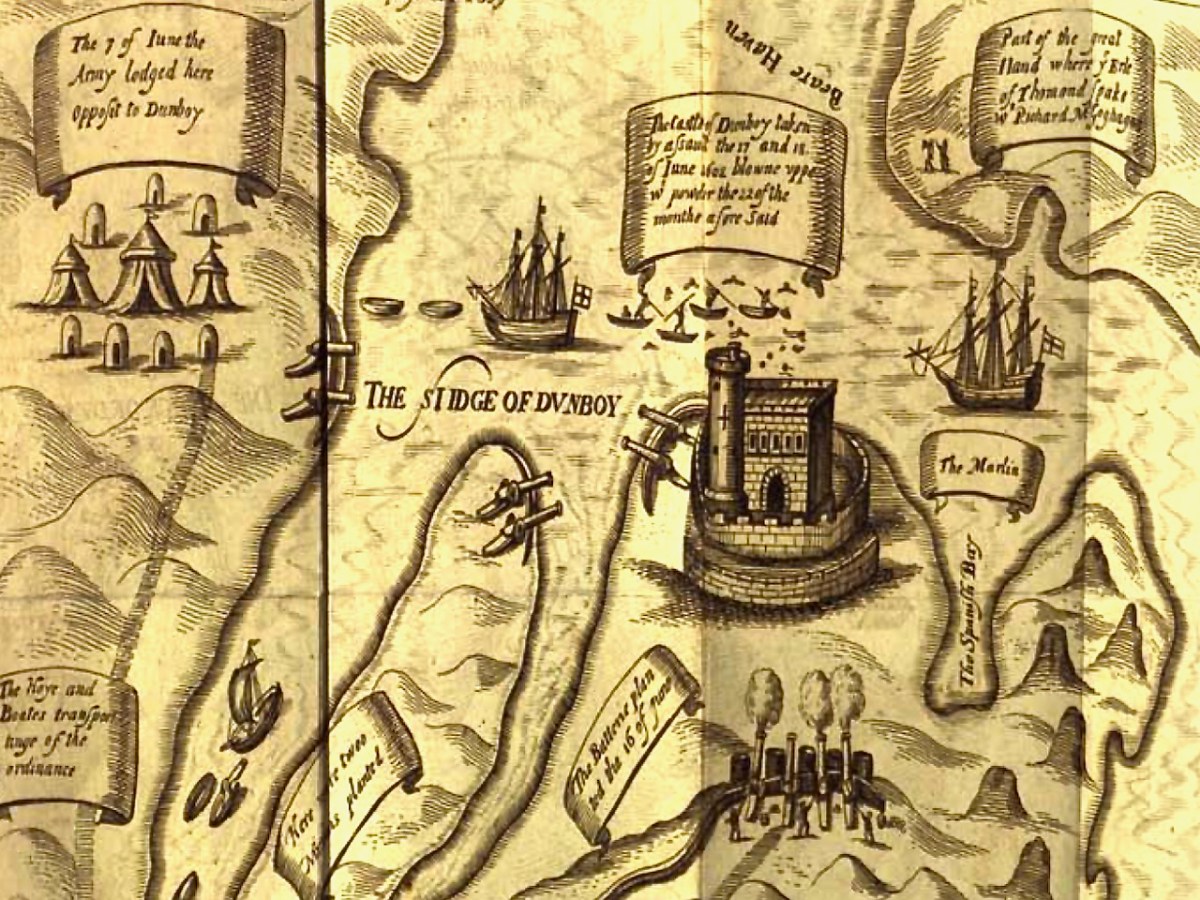
This illustration, from Pacata Hibernia, is of the siege of Dunboy Castle, the stronghold of O’Sullivan Beare, on Beara Peninsula. The destruction of Dún an Óir is described by James Burke in his article Cape Clear Island in the Journal of the Cork Historical and Archaeological Society Journal of 1908. Rather than Harvey simply taking over the castle, Burke relates the following:
Its central arch and the steps leading to its upper portion remain; but the huge pieces of its eastern wall now lying about show how severely it has suffered from the havoc of war. This wholesale destruction occurred when Dunanore Castle, together with the island, was captured on the 22nd of March, 1601, by Captain Roger Harvey, following on the defeat of the Spaniards at Kinsale. By means of the artillery he planted on the high ground adjoining it, he battered down the eastern wall and compelled the garrison to surrender, for which and other services (as Dr Donovan writes in his “Sketches of Carbery”) he was granted at the time a commission by Lord Deputy Mountjoy as Governor of Carbery.
It is far more likely that the ruined state of the castle is a result of the natural passage of time than the ‘havoc of war.’ For one thing, it would have been a monumental task to deploy artillery overland on Cape Clear. Any cannon fire would have come more naturally from the English warships we know were in use during this period and therefore, the damage would have been to the seaward side of the castle – but this side is actually intact.
A romantic view of the ruins of Dún an Óir above, by W Willes.* Next week we will look at what is left of the castle and what we can tell from that. I’ll be using the marvellous photos from Tash in that post.
Welcome to the UCD Library Cultural Heritage Collections blog. Discover and explore the historical treasures housed within our Archives, Special Collections, National Folklore Collection and Digital Library