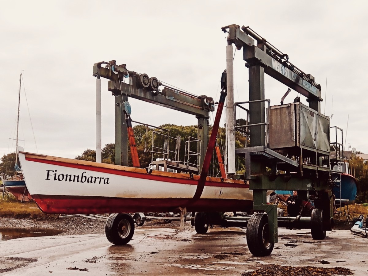
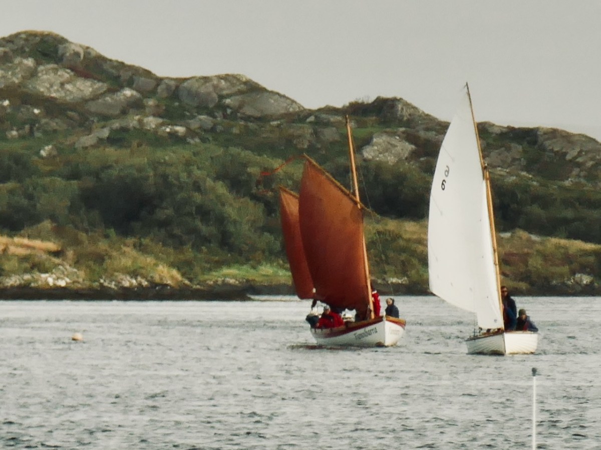
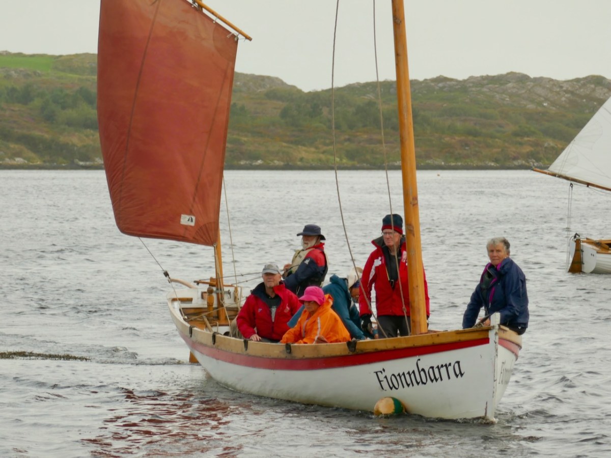
The importance of West Cork in world history was emphasised today at the Ballydehob Cruinniú na mBád (Meeting of the Boats). This annual event reminds us how busy our quay was back in the day when all the commerce of the village was based on the tidal waters. Finola wrote about the gathering in 2017. But today – 19 August 2023 – I had my eye out for a very particular vessel: Fionnbara.
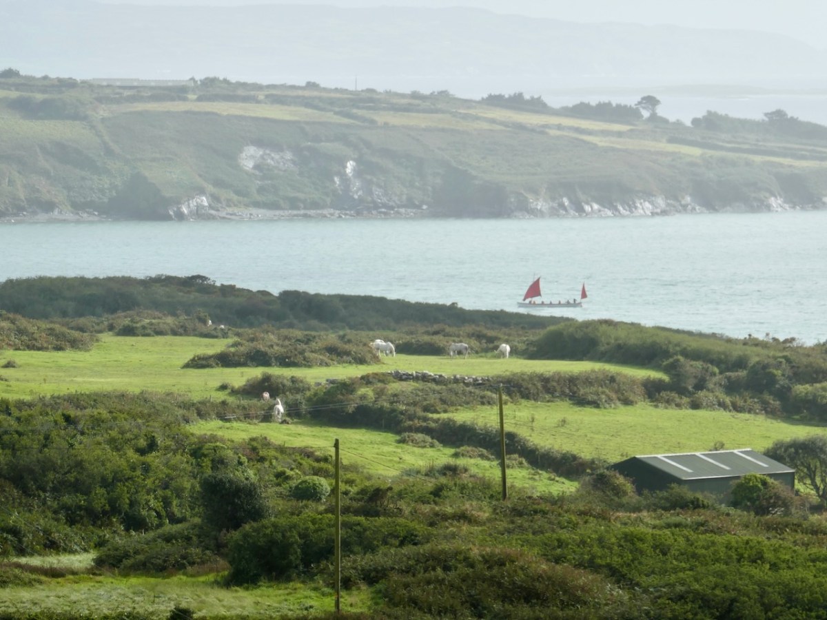
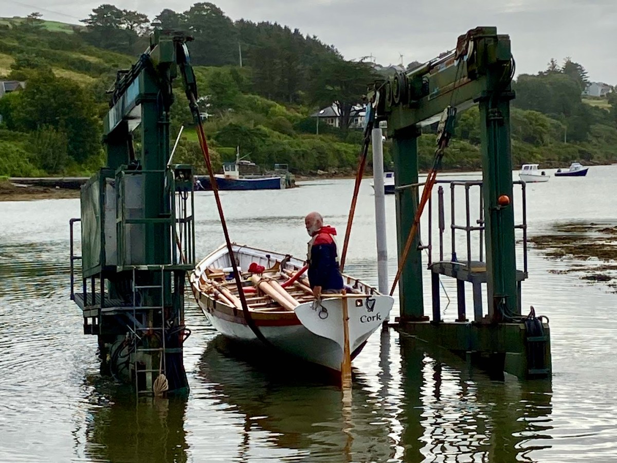
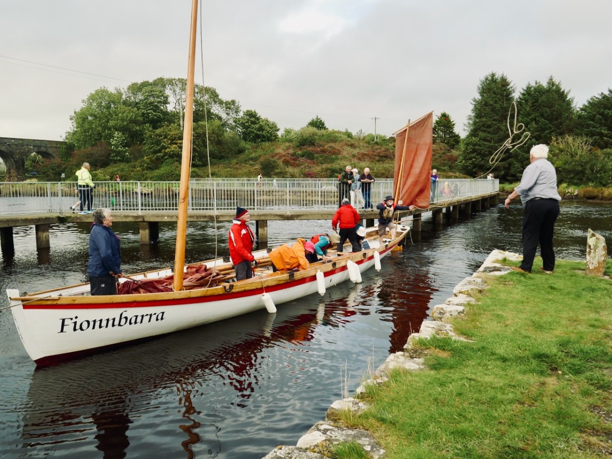
There she is – above – leaving Rossbrin Harbour today, bound for Ballydehob. And here she is being launched early this morning, using the boatyard’s lifting gear. Many thanks to Jack O’Keeffe – her Skipper – and Anne O’Keeffe for the great photos.
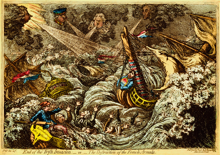
Above: ‘End of the Irish Invasion’ or ‘The Destruction of the French Armada’ by James Gilray 1797 (courtesy of the British Museum)
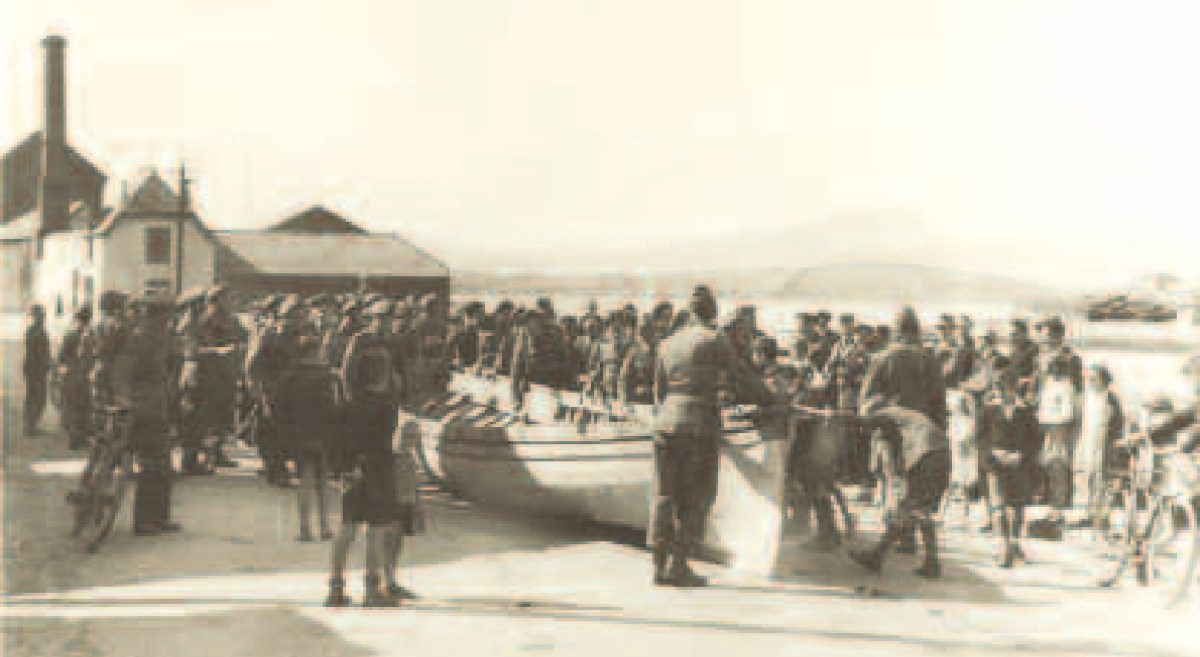
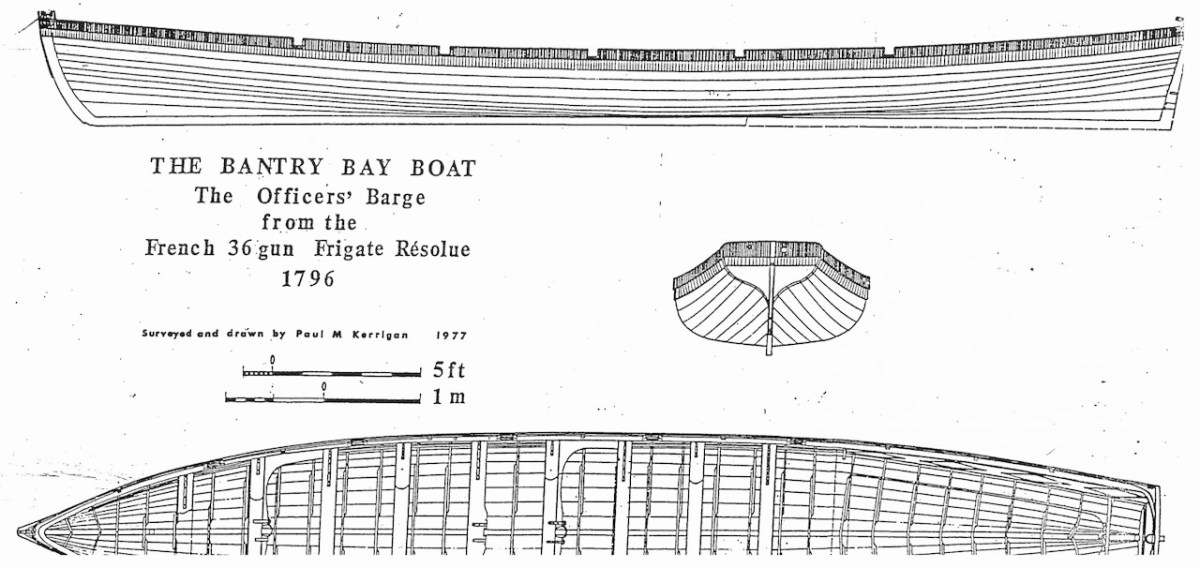
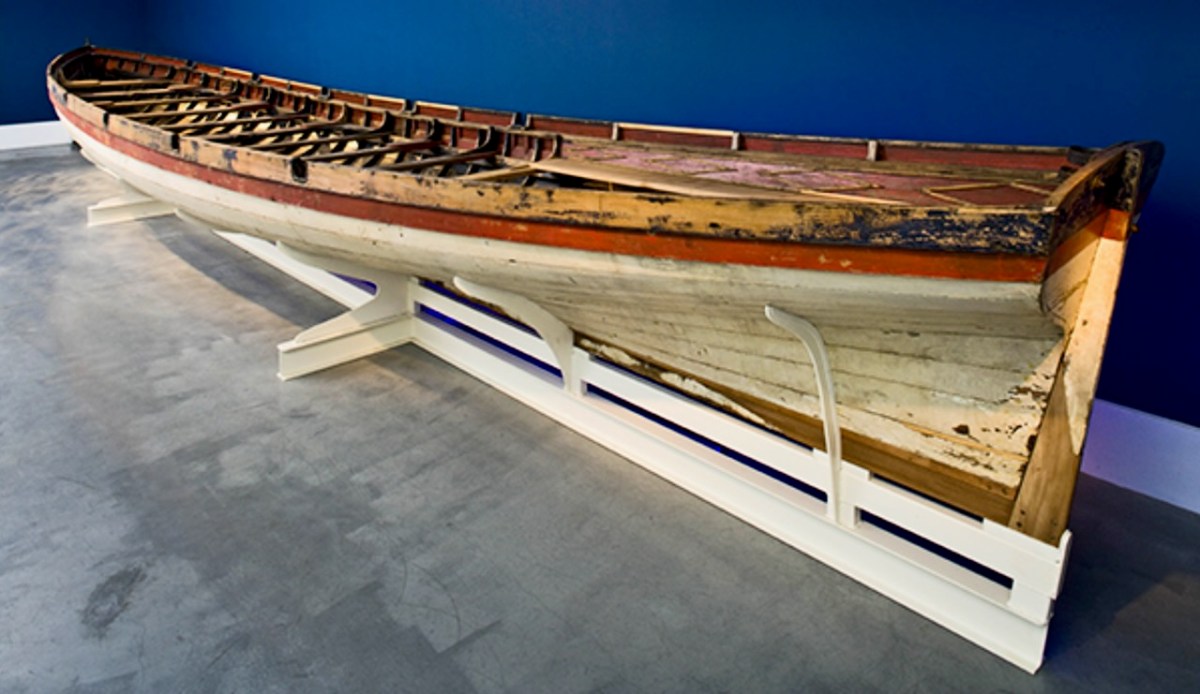
The boat is a replica – one of many around the world – of a craft which found its way to the shores of Bere Island – in West Cork – in 1796, after a disastrous escapade by the French navy, under the encouragement of Theobald Wolfe Tone of the Society of United Irishmen. A fleet of 43 vessels carrying 14,000 men headed for Bantry Bay intending to invade Ireland and declare it independent from Britain. Severe storms threw the ships off course and into disarray, and the opportunity was lost. During the chaos one of the French ships – La Résolue – lost her masts in a collision. Lt Proteau was sent in a ‘barge’ to find another ship to tow the frigate to safety, but instead he and his crew were driven ashore and captured. The ‘barge’ was taken as a prize of war and handed to the local Irish militia commander, Richard White of Bantry House. There it remained – gently rotting – for 148 years. In 1944 it was despatched to the National Maritime Museum in Dún Laoghaire and – after conservation – is now displayed at the Collins Barracks Museum. The ‘Bantry Bay Boat’, ‘Bantry Skiff’ or ‘Bantry Yole’, as the unusual craft is variously known, has attracted considerable attention and has inspired many boatbuilders to produce copies.
Below: upper – the Bantry Boat being transported from Bantry Railway Station to Dún Laoghaire in 1944; centre – plans of the original craft drawn by Paul Kerrington in 1977; lower – the original Bantry Bay Boat on display in the Collins Barracks Museum today (courtesy History Ireland – article by Lar Joye July/August 2018)
One of these copies is the Fionbarra, which arrived in Ballydehob today. The original was 11.64 metres long, 2.05 metres in beam, and a very fast boat. It was powered by ten oars or three sails, and could carry around ten passengers as well as the crew.
Ballydehob Bay today, 19th August 2023. The small boats are beginning to approach the old quay. With thanks to Finola for many of these photographs.
Building of the Fionbarra began in Waterford and was transferred to Meitheal Mara, a community boatbuilding venture based in Cork city. Construction was completed in 2008. We really appreciated the work of the team who transported her to West Cork and sailed her up the estuary today.
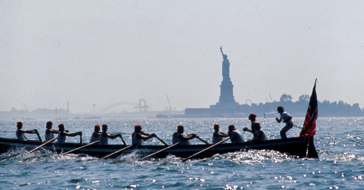
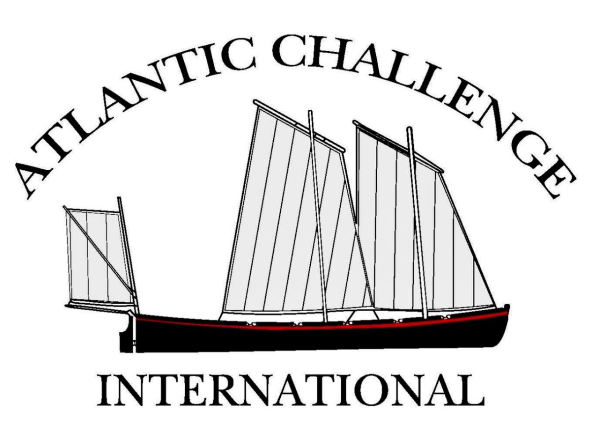
You may wonder why I have put in a header pic from across the Atlantic? This is to demonstrate the influence that the West Cork ‘Bantry Yole’ has had on the boating community all around the world. Atlantic Challenge International was founded in 1984 as a maritime training trust, and its activities are largely based on replicas of the 1796 Bantry craft. As a consequence there are relatives of the Fionbarra in many countries. I understand that there are currently at least 80 such replicas, spread over four continents, in the present day.
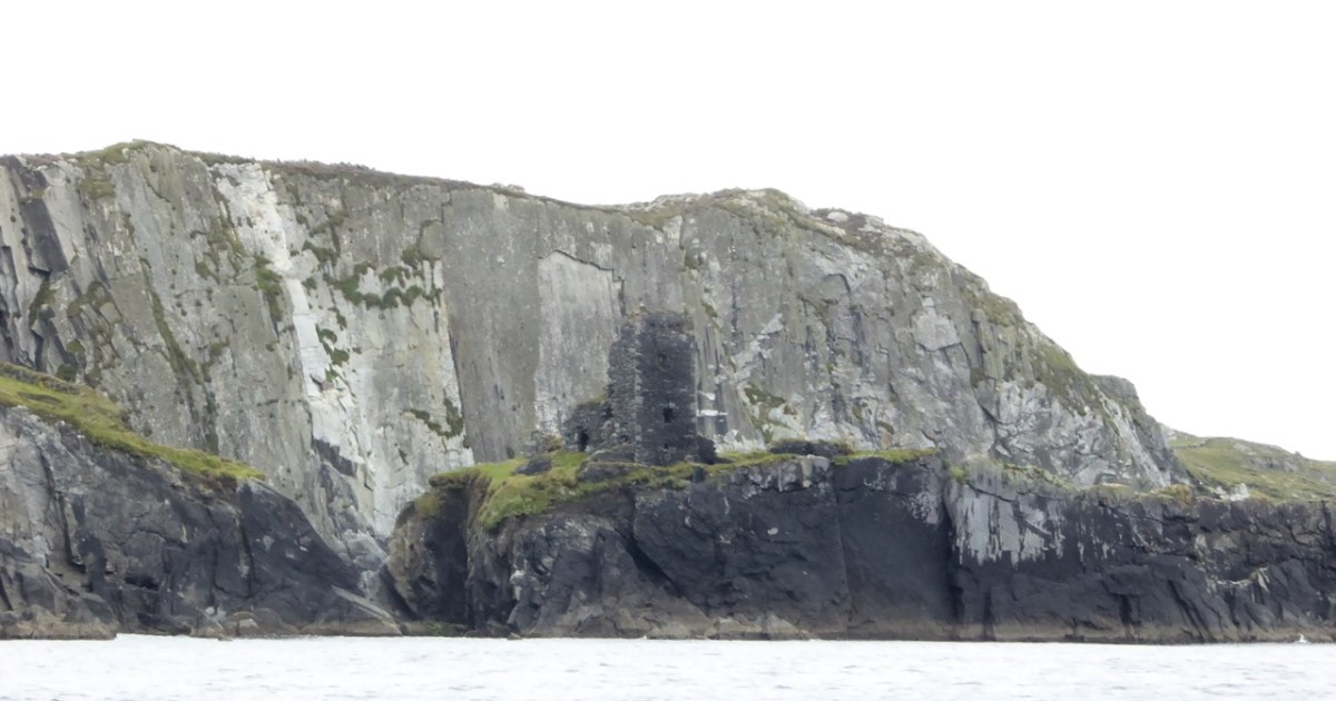
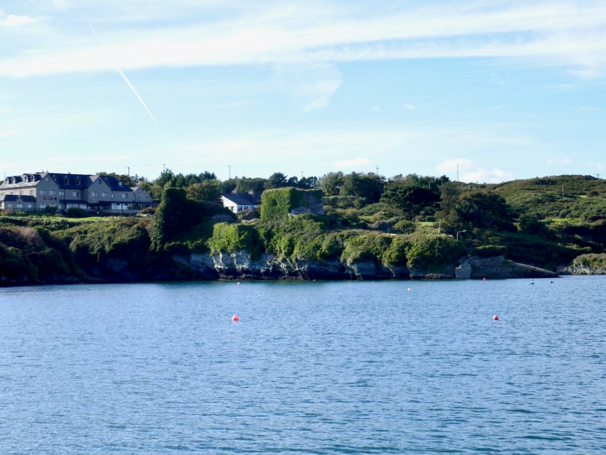
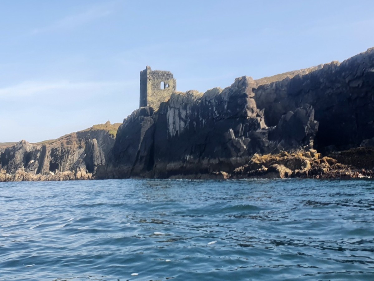
I have been gifted with a marvellous set of photographs of Dunanore, or Dún an Óir – an O’Driscoll Castle on Cape Clear. The gift came from one of our readers, Tash, and I am very grateful indeed. Regular readers know that I like to use my own photos, and I do have some that I took from the sea (like the one below) but I have none of Dún an Óir from the land, let alone from the castle itself!
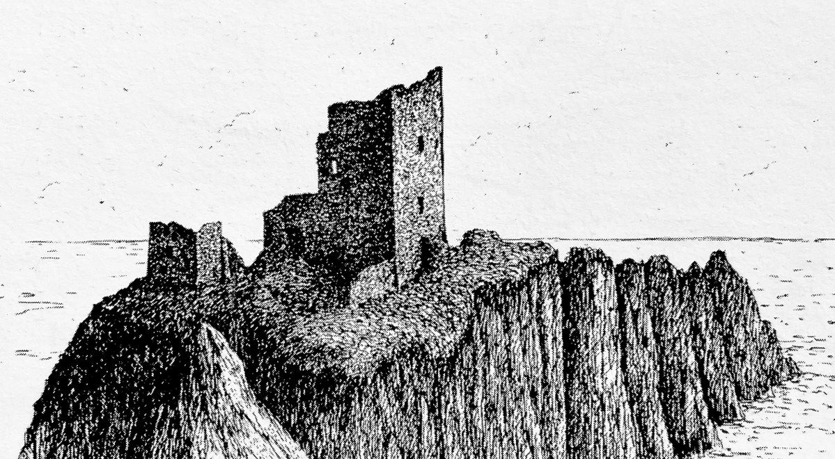
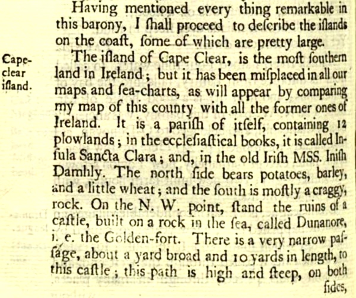
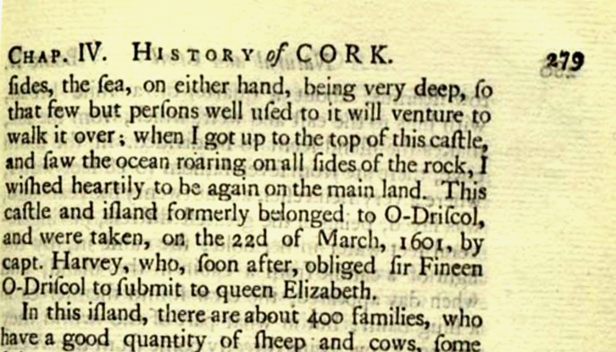
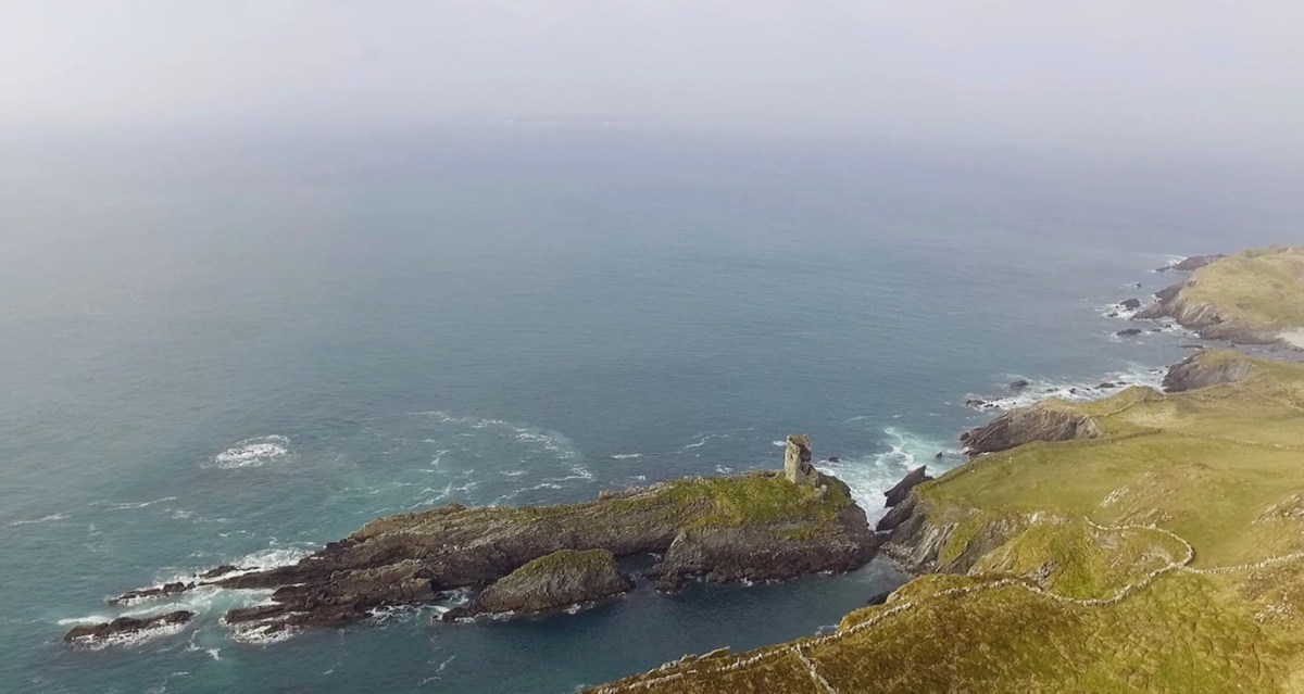
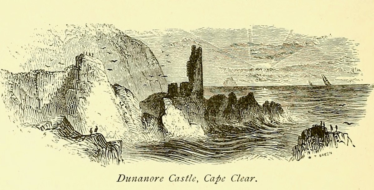
And that’s because, as you can see from the drawing by Jack Roberts at the top of this post, this castle is situated in a very perilous location, on the edge of a cliff, on a small island, essentially, making access a hazardous scramble up from a rocky beach. It was once connected to the rest of Cape Clear by a narrow causeway but this has long collapsed. It was still there in the 1770s when Charles Smith visited. In his The Ancient and Present State of the city of Cork Vol 1, he wrote:
And this brings us to the name – Dún an Óir. It means, of course, Fort of Gold, and some of the old legends about this place talk about the name coming from stories of buried treasure. But in fact, this has been the name of this fort since the first maps of this area were made in the fifteen hundreds and it speaks to the wealth of the O’Driscoll clan who built it. Remember, their other stronghold, now called Baltimore, was Dún na Séad, or Fort of Jewels (on at least one map given as Castle of Perles). On Sherkin, their castle was Dúnalong – or the Fort of the Ships – that’s it as it is now, below.
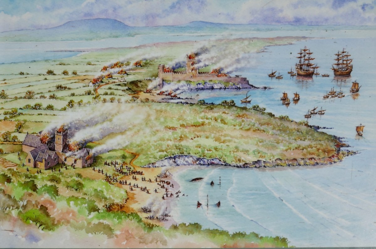
There are many accounts of their fleets of ships, and the battles they waged against the Waterfordmen in which they came out the worst for wear when Dunalong was attacked. The scene below, from an information sign on Sherkin, shows the Battle of the Wine Barrels, 1537, with both Dunalong and the Friary on Sherkin in flames
Dún means ‘fort’ but seems to be especially applied to promontory forts in the southwest. Before the castle was built, therefore, it is likely that the O’Driscolls fortified the headland, which may date well back to the Early Medieval period (400-1200) or even to the Iron Age (500BC to 400AD, or 500BCE to 400BC for those who prefer the secular version). The Illustration below is taken with permission from Dún an Óir Castle: an uncertain future, by Dr Sarah Kerr, and shows the present state of the castle, marooned on what was once a promontory connected to the Island.
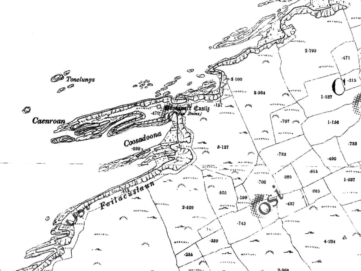
Our Promontory Fort man is Thomas Westropp (see here and here), and he wrote about Dún an Óir in his 1914-16 paper for the Royal Irish Academy, Fortified Headlands and Castles in Western County Cork. Part I. From Cape Clear to Dunmanus Bay. He visited the site, but like many a good explorer before and after him, did not venture out onto the promontory, but satisfied himself with what he could see from the high ground above it. That included the promontory and ruined castle, the rather ominously named Tonelunga (The sea-bed of the Ships), the end of the promontory called Caenroan (quay of the Seals), the inlet between the promontory and the cliffs, Coosadoona (the Little Harbour of the Fort) and the high cliffs behind the fort, Foilacuslaun (Cliffs of the Castle). All of these are marked on the 19th century twenty-five inch map.
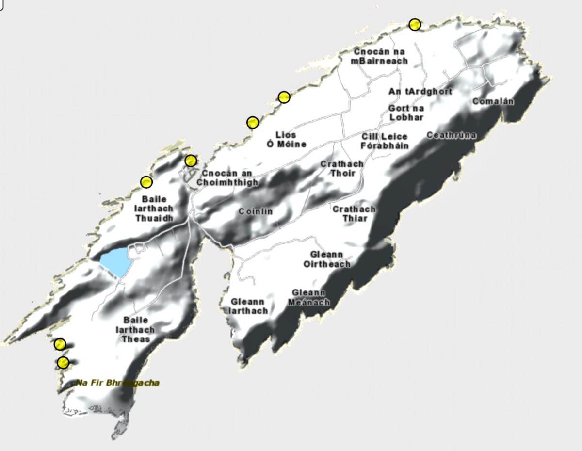
Westropp writes about Dún an Óir as one of three Promontory forts on Cape Clear Island, although in fact there are more than that, as identified by the National Monuments Record – each yellow dot below is one.
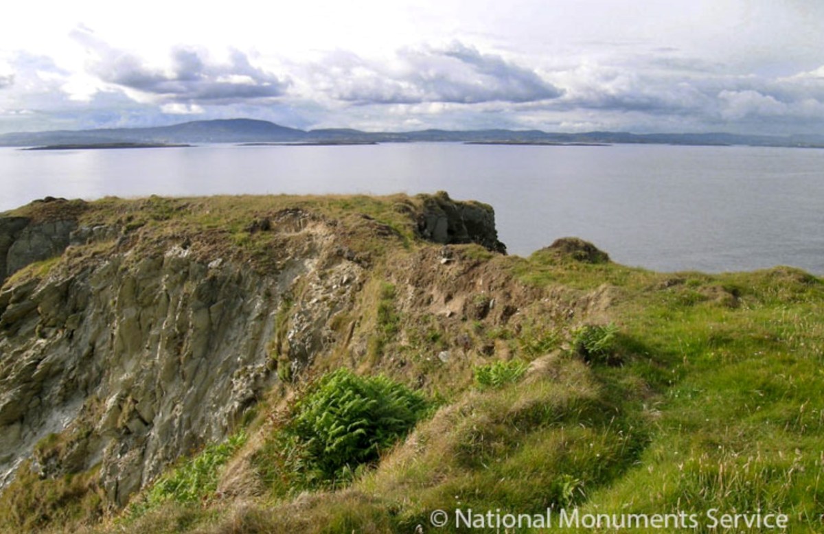
Here’s one of them (below), Lios Ó Móine (the Fort of the Meadow – lios is usually used to designate an earthen ring fort): the description and then the photo are by National Monuments Service (NMS). In the photo you can see the narrow neck of land leading out to the promontory. This is likely what the spit leading out to Dún an Óir may have looked like.
Description: In rough pasture, at the foot of a steep N-facing slope on Stuckaunfoilnabena, a headland on the NW coast of Clear Island. A narrow eroding neck of land (Wth 3m; L 15m) leads to the roughly anvil-shaped headland. Across this neck of land are the remains of three earthen banks and the shallow remains of three fosses. Further examination of the remains was not possible for safety reasons.
Curiously, the NMS does NOT identify Dún an Óir as a promontory fort – here is what it says:
Description: The location of the tower house ‘Doonanore Castle’ (CO153-015002-) on a promontory, on the NW shore of Clear Island, suggested that it may have been built on the site of a promontory fort. However, there are no visible surface traces of an earlier defences across the promontory. The promontory is now isolated at high tide but was connected to mainland by causeway until 1831.
However, it has this to say about the earthwork identified on the high ground:
In pasture, on a steep N-facing slope to the E of the tower house known as Doonanore Castle . . . An earthen bank . . .extends upslope in a S to SW direction from a modern E-W field boundary wall on the cliff-top at N and ends at a large outcropping rock on the edge of another cliff. This bank appears to have formed part of the defences on the land approach to the castle from the E. The bank has three contiguous linear stretches [and] there is an entrance near the N end. There is a possible hut site near the centre of the enclosed area. The short promontory on which Doonanore Castle stands is a possible coastal promontory fort.
So, as you can see, although the NMS declines to label it a promontory fort because there are no longer any signs of banks or walls, it does concede that it is possible. It also extends the defences of that fort to the higher ground above it.
Back to Westropp – He quotes:
the poem of O Huidhrin, before 1418, tells how “0 hEidersceoil assumed possession of the Harbour of Cler.” It was of some importance to the foreign traders in wine and spices, and so figures in all the early portolan maps. Angelino Dulcert, in 1339, calls it Cap de Clar ; the subsequent portolans, Cauo de Clara, 1375 and 1426 ; Clarros, 1436 ; C. d’Clara or Claro, 1450 and 1552, and, to give no more, Cauo de Chlaram, in 1490. The 0 Driscolls’ Castle probably dates between 1450 and the last date. It was probably on an earlier headland fort, as it is called Dunanore. In 1602 it surrendered without resistance to the English, who burned it.
Westropp goes on to say
Dr. O’Donovan, in his ” Sketches of Carbery,” gives a few notes on the later history. He says there was a garrison at the Castle in Queen Anne’s time, and mentions the huge iron ring-bolt, set in the rock, to which the O Driscolls formerly moored their galleys in the creek. The last is improbable, even to impossibility: no one could moor galleys in the dangerous wave-trap, open to the most stormy and unsheltered points. The islanders regard the ruin as haunted, and tell of the singing of ships’ crews in its vaults. One “Croohoor” (Conor) O’Careavaun (Heremon’s grandson) lived as a hermit there in the eighteenth century. Another legend tells how, in 1798, the inhabitants painted the Farbreag Rocks and pillars so as to resemble soldiers in uniform to keep away the French ! If any truth underlies this, it is probably based on the idle act of some revenue or other officers, in the endless leisure of their island station.
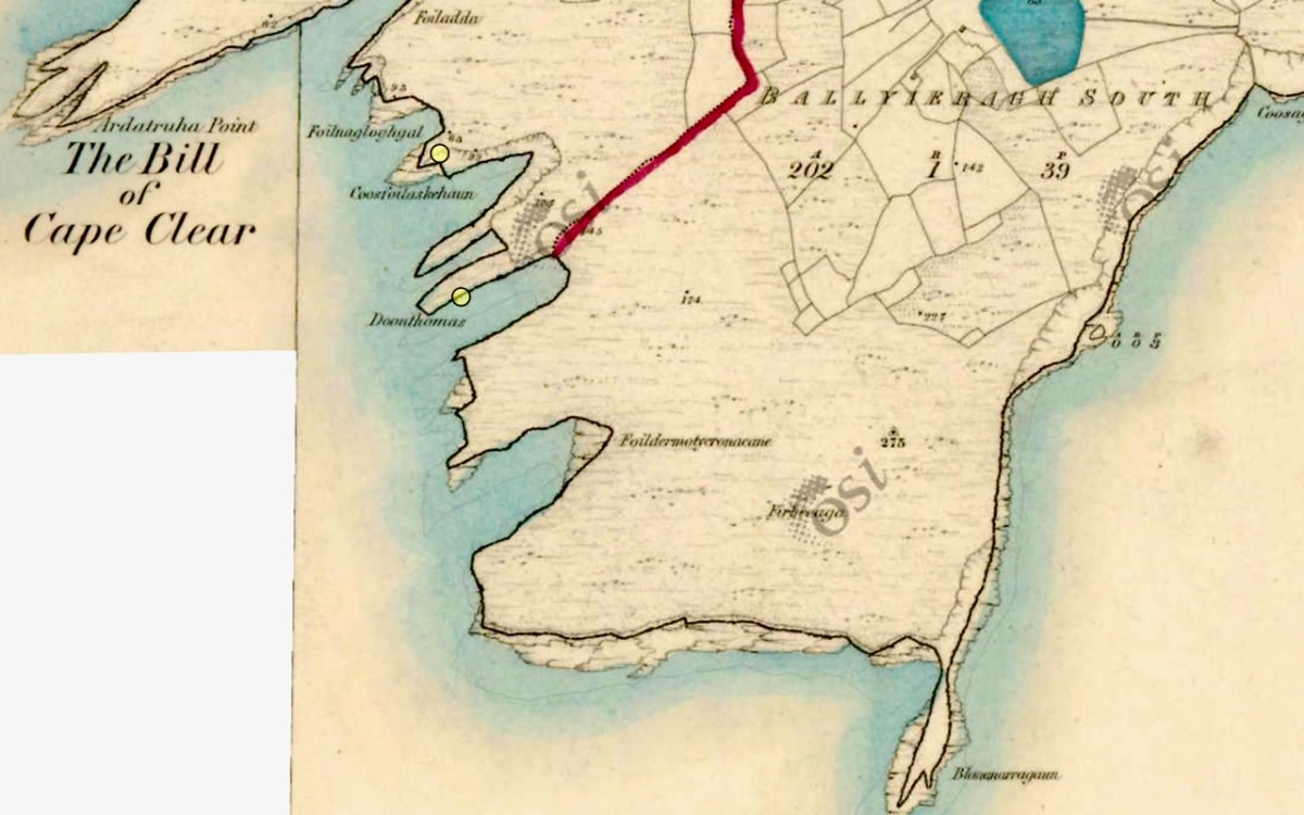
In the map above, of the southwest end of the Island, you can just make out the name Firbreaga, almost covered by the O of OSI. Fir Bréaga means The Lying Men, an apt translation given Westropp’s story. No doubt the name is older than 1798, and may refer to the cliffs at that end seeming to be less dangerous from the sea than they actually were. Note also the two yellow dots for two more promontory forts- Doonthomas (Thomas’s Fort) and Coosfoilaskehaun (the Small Harbour of the Knife-Edge Cliff).
Westropp’s description of the promontory upon which Dun an Óir sits is poetic:
The path runs up a very slight ledge, flaking away and high above the creek, along the face of a cliff of polished silvery slate. The low neck joined it to the mainland, and the nearly perpendicular strata make the dock-like creek of Coosadoona, fort-cove, to the south Beside this cove, opposite to the castle, an enormous precipice rises high above the tower top. In the other direction is a noble view across the wide, porpoise-haunted bay, and its low islands to the blue, many-channelled Mount Gabriel, and on to Mizen Head.
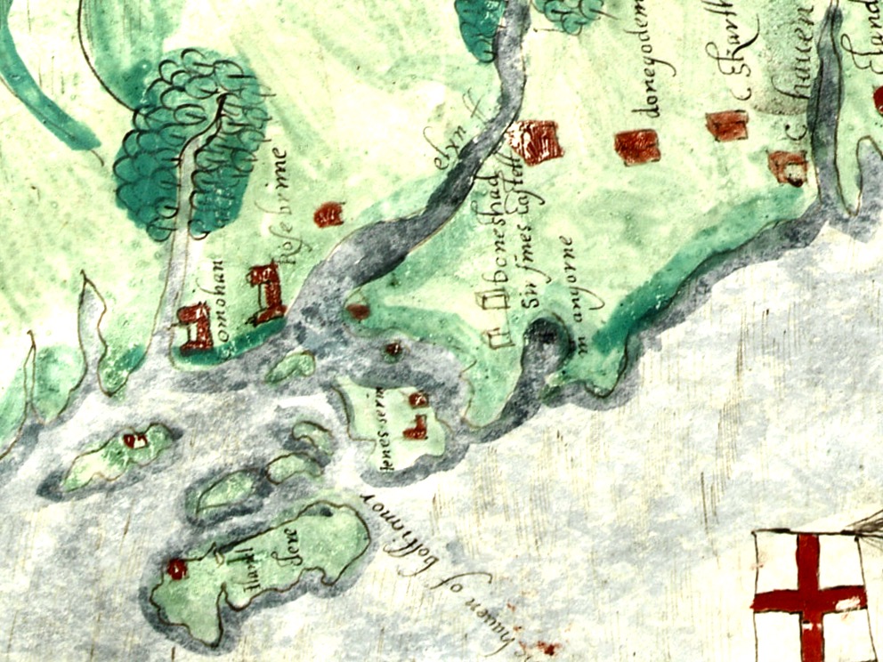
In fact, very little is known about the history of Dún an Óir before the Battle of Kinsale in 1601. We can deduce from its strategic location that the O’Driscolls used it to keep an eye on every ship that sailed in and out of Roaringwater Bay, to exact fishing dues before the rival O’Mahonys could get to the incoming vessels, to curb the power of those O’Mahonys, and to establish their dominance over the land of Cape Clear Island. (See this post for more on the map above.) Because the castle would have been rendered, probably in some shade of white or near-white, it would have been visible from all around Roaringwater Bay, and have represented a potent statement of supremacy.
After the Battle of Kinsale the Castle was seized by Captain Harvey, as described in Pacata Hibernia:
‘While these things were on doing, Captain Roger Harvy sent a party of men to Cape Clear,the castle whereof being guarded by Captain Tirrell’s men, which they could not gain, butthey pillaged the island and brought thence three boats; and the second day following therebels not liking the neighbourhood of the English, quitted the castle, wherein Captain Harvy placed a guard. At this time Sir Finnin O’Driscoll came to Captain Harvy and submitted himself.’
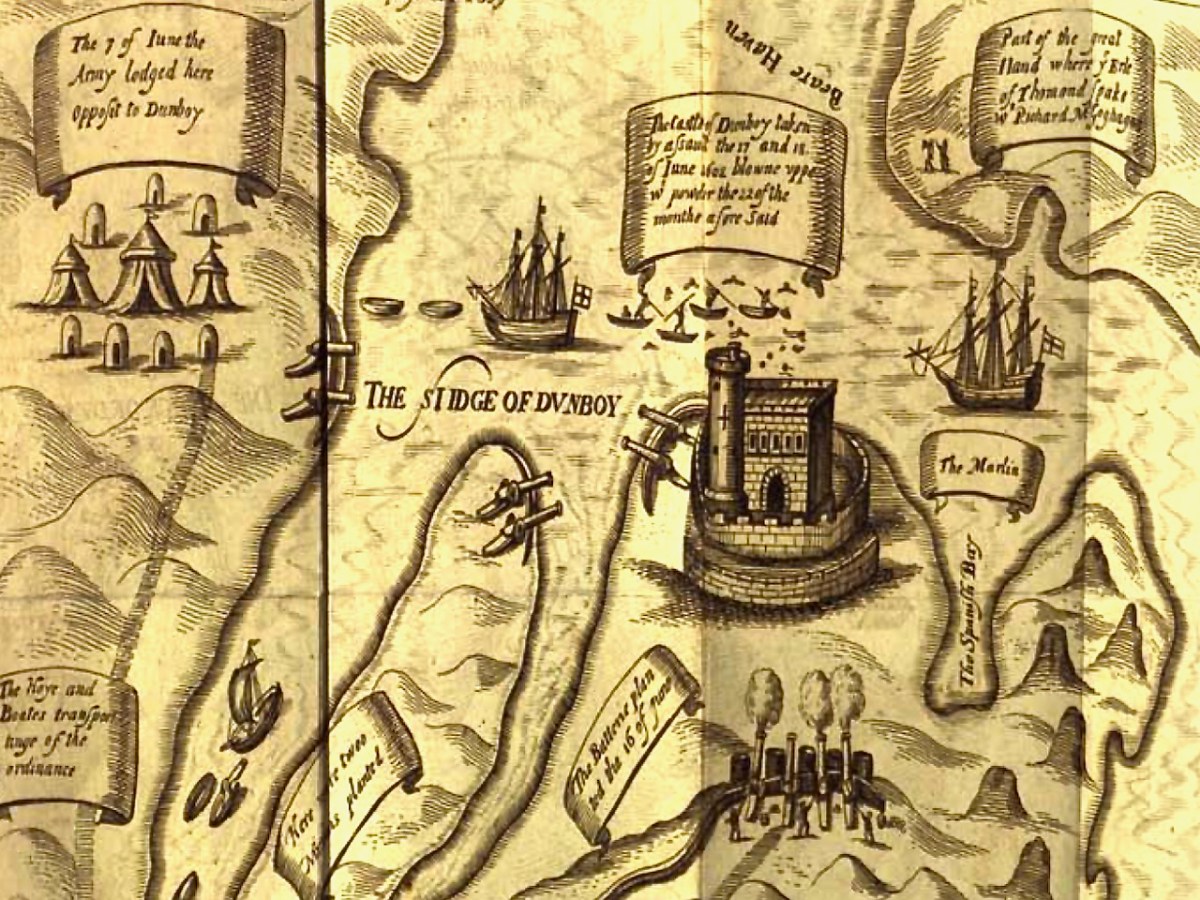
This illustration, from Pacata Hibernia, is of the siege of Dunboy Castle, the stronghold of O’Sullivan Beare, on Beara Peninsula. The destruction of Dún an Óir is described by James Burke in his article Cape Clear Island in the Journal of the Cork Historical and Archaeological Society Journal of 1908. Rather than Harvey simply taking over the castle, Burke relates the following:
Its central arch and the steps leading to its upper portion remain; but the huge pieces of its eastern wall now lying about show how severely it has suffered from the havoc of war. This wholesale destruction occurred when Dunanore Castle, together with the island, was captured on the 22nd of March, 1601, by Captain Roger Harvey, following on the defeat of the Spaniards at Kinsale. By means of the artillery he planted on the high ground adjoining it, he battered down the eastern wall and compelled the garrison to surrender, for which and other services (as Dr Donovan writes in his “Sketches of Carbery”) he was granted at the time a commission by Lord Deputy Mountjoy as Governor of Carbery.
It is far more likely that the ruined state of the castle is a result of the natural passage of time than the ‘havoc of war.’ For one thing, it would have been a monumental task to deploy artillery overland on Cape Clear. Any cannon fire would have come more naturally from the English warships we know were in use during this period and therefore, the damage would have been to the seaward side of the castle – but this side is actually intact.
A romantic view of the ruins of Dún an Óir above, by W Willes.* Next week we will look at what is left of the castle and what we can tell from that. I’ll be using the marvellous photos from Tash in that post.
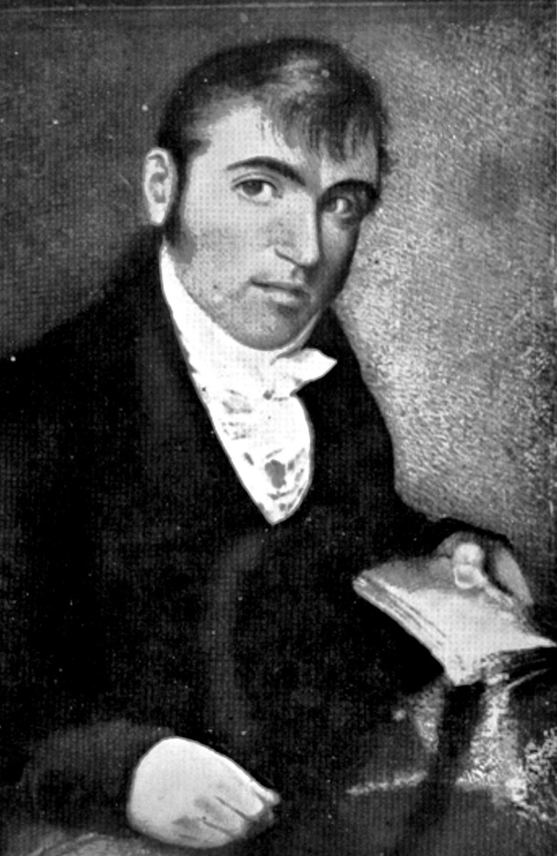
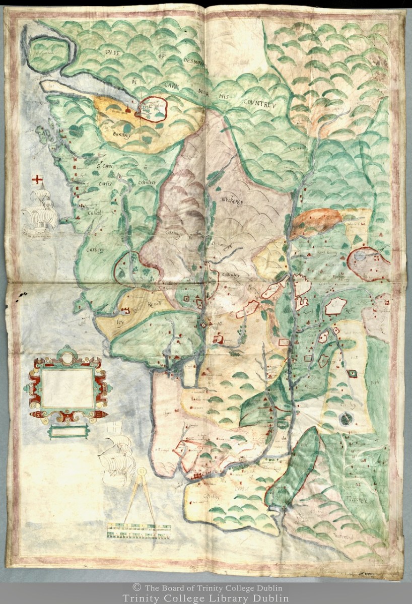
The Hardiman Atlas*, held in the Digital Repository of Ireland, is a bound volume of maps all of which were collected by James Hardiman. An erudite Mayo man born in 1782, he spoke Irish as his first language, studied law but was an historian to his core. He wrote histories, including one of Galway, and collected songs and manuscripts. He eventually became the librarian at Queen’s College Galway (now the University of Galway) where the main library is named for him. I’ve used the Hardiman Atlas before, for my posts on Jobson’s work on Planning a Plantation Part 1 and Part 2.
In the Digital Repository description we find this information of the Hardiman Atlas:
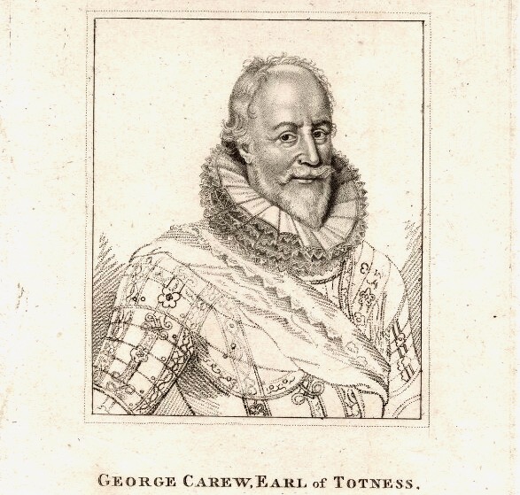
IE TCD MS 1209 is the collection of maps held in the Library of Trinity College Dublin and made by George Carew (1555-1629) 1st Earl of Totnes and Lord President of Munster at the beginning of the 17th century. Presented to the Library of Trinity College Dublin in the late 1700s. It contains nearly 90 maps and plans and is one of the largest sets of original Tudor and early Stuart maps of Ireland surviving anywhere. They are known collectively as the ‘Hardiman atlas’ after their first cataloguer, James Hardiman. Hardiman (1782-1855) was born in Co. Mayo and trained as a lawyer. He was librarian in Queen’s College Galway. Quoting from J.H. Andrews (‘Maps and Atlases’, Treasures of the Library Trinity College Dublin ed., Peter Fox (RIA: Dublin, 1986)): These maps, which are ‘for the most part competently drawn and attractively coloured’ and which ‘display not one scale of latitude or longitude in the entire collection … are essentially the by-product of a military and political conquest. However, as well as forts, defended towns and troop movements, they are rich in placenames, territorial boundaries and a good deal of ordinary landscape detail. Carew is said to have wanted all his Irish papers to be deposited at Trinity … though as it turned out most of them finally came to rest at Lambeth Palace in London. Nobody knows when, how or why the maps became detached from the collection and found their way to Dublin. They simply turn up in the College records of the late eighteenth century …. It was a non-Trinity historian, James Hardiman of Galway, who first catalogued them in 1821, apparently on his own initiative, and after being bound into a single, large volume they became generally known as the Hardiman atlas … The credit for [the rediscovery of their true origin] belongs to a recent Keeper of Manuscripts William O’Sullivan, who put the issue beyond any doubt by identifying Carew’s hand on many of the Hardiman maps and by collating all their titles and subjects with the original early-seventeenth-century catalogue still at Lambeth’.
George Carew** collected anything that helped to support his claim to large tracts of land in Munster. But maps were also vital for him as one of the military leaders in charge of subduing Ireland before and after the Battle of Kinsale in 1601. Read all about Carew and his time in Ireland in this excellent entry by Terry Clavin in the Dictionary of Irish Biography. (You might want to take a blood-pressure tablet first.)
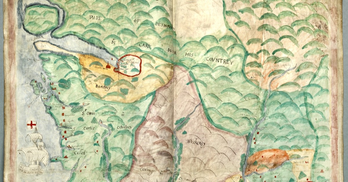
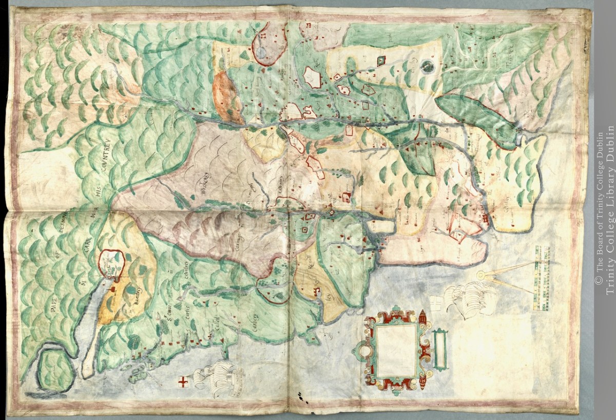
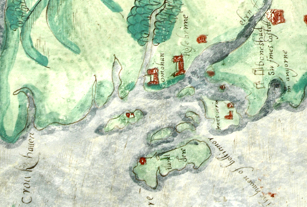
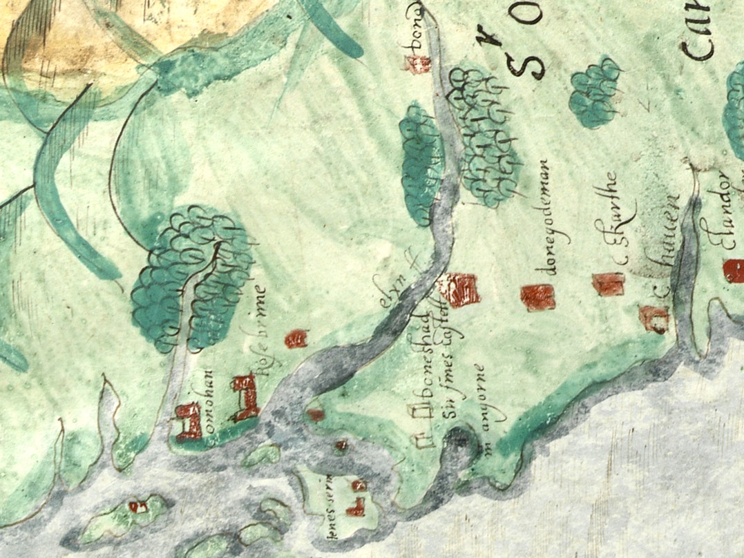
We don’t know who did this one, or when: The date is given as 1560-1620. It seems in some ways more basic than other maps of the period, and less exact. However, it still contains an extraordinary amount of information. The area it covers stretches from Bere Island to Waterford and from the sea to the Limerick and Tipperary borders. For ease, I have turned it rightside-up, so that West Cork is now as we expect to see it, on the bottom left of the map.
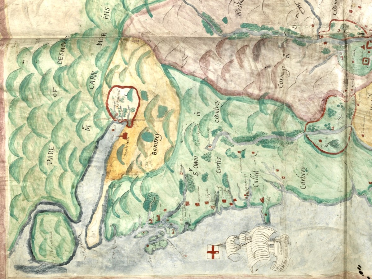
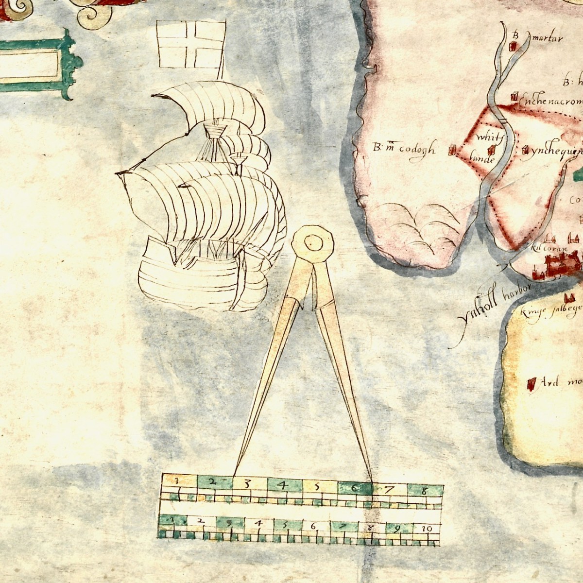
For this first post, I will concentrate on the area around Roaringwater Bay and west to Castlehaven, since this is my home turf, but we will explore further afield later. To put it in a little context, here’s a slightly broader view of the area (below). Note that it is labelled Sir Owen McCarthy’s Country called Carbery. There is also a large tract simply labelled Bantrey, of which the only feature is The Abbe Benita. Dunmanway, Donemenuye, is shown on an island at the head of the Bandon River. Berhaven, Croukhaven, Cape Clere, and The Haven of Boltimore are shown along the coast, along with a very fine warship in full sail, with cannons, a crow’s nest and an English flag.
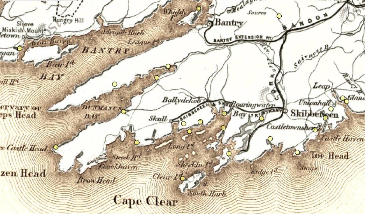
So you can further orient yourself, here is the 1880s map of the same area (more or less). The yellow dots indicate castles/tower houses as identified on the 1880s Ordnance Survey Map as part of the National Monuments Service.
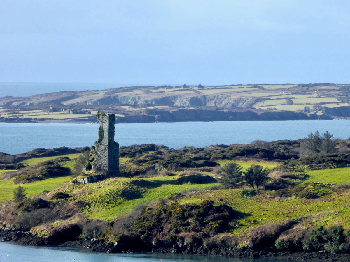
While Ardintenant still has one wall-tower, Rossbrin is a vestige of what it once must have been. This is what it looks like now, and you can see the remnants of what was once also a small castle on Castle Island behind it.
Castle Island castle and Dún an Óir Castle on Cape Clear are shown although not labelled, as is both the Castle (Dúnalong, or Castle of the Ships) and the Friary on Sherkin Island. It’s hard to imagine when you look at what remains of Dún an Óir now (below) that its name means Castle Of Gold – a testament to the wealth of the O’Driscolls who built it. Thank you so much to our reader, Tash, who sent me this wonderful photograph.
Moving West, into O’Driscoll territory (below), we see Baltimore in outline (the colorist ran out of brown ink?) – it’s called Doneshade (Dún na Séad, or Castle of the Jewels). Beside it is the brown square used to indicate tower houses and the words Sir Jmes Castlell. Following the Ilen Rover (Elyn ff) to its source we find Castle Donovan. Two more brown blobs at the entrance to the Ilen River may indicate Dún na Gall (Fort of the Foreigners) on Ringarogy Island, and Old Court Castle.
I’m going to leave it at that for now, but I hope your appetite is whetted to see more of this invaluable record of Cork 400 years ago.
*I am grateful to Digital Collections, at the Library of Trinity College Dublin, who gave permission to feature this map from the Hardiman collection in this blog. The complete citation for the map is as follows: Unattributed, & Manuscripts & Archives Research Library, Trinity College Dublin. (2021) Map of the County of Cork, Digital Repository of Ireland [Distributor], Trinity College Dublin, the University of Dublin [Depositing Institution], https://doi.org/10.7486/DRI.p554ng24v
**I am also grateful to the British National Portrait Gallery, who provide an easy method to use images from their collection under license, for purposes such as this non-commercial blog. The portrait of Carew is from their collection.
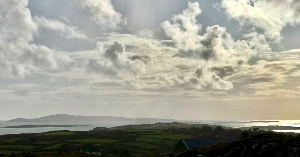
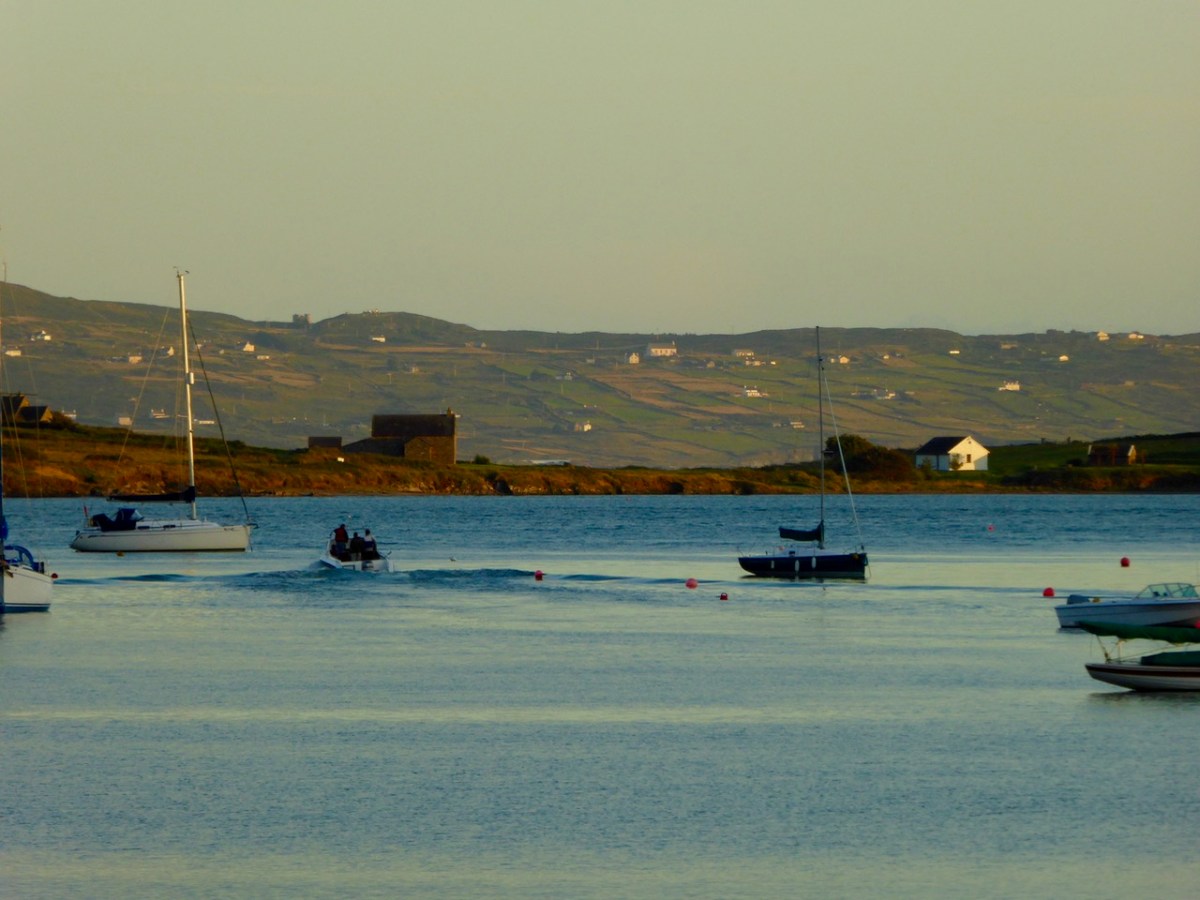
It’s March – an important month, in Ireland, for saints. This week we will celebrate St Patrick, of course. But there’s another – dare I say equally important – Irish saint whose day we have just passed by. That’s Saint Ciarán, and we are particularly keen to give him an airing, as he was born on Cape Clear, which we look out onto every day! That’s the view (above) from our home across Horse Island and Roaringwater Bay towards ‘The Cape’, which sits on the horizon under a wonderfully atmospheric sky. I also feel drawn towards Ciarán because his ‘day’ – March 5 – happens to be my birthday. And – as you will see – there’s another personal connection: I lived in Cornwall for many years, and that’s where some of my forebears hale from. Would you believe that this same saint is also the Patron Saint of Cornwall? Read on . . . But be aware that I have published this post before, several years ago – when RWJ publication day actually fell right on my birthday. I’m giving myself a day off the hard writing this week, as I have been recuperating from a little ‘op’ in Cork. Here goes:
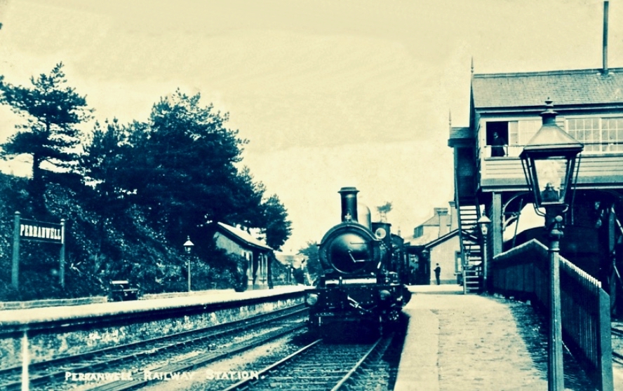
I was born in the first half of the last century. Early memories of the 1950s include the regular journeys my brother and I made as small boys on the mighty Atlantic Coast Express via Okehampton to visit, first, our sets of cousins on Dartmoor, and then beyond – via the even mightier Great Western Railway – to our cousins in the depths of Cornwall. The latter visits were particularly idyllic: the cousins (generations older than us) had a small farm and a herd of cows which they milked twice a day – by hand. Following this they cooled the milk in a big steel drum by stirring it with a propellor (we were allowed to do this) before pouring the precious liquid into bottles which were then sealed with silver caps using a rubber device which impressed on them the name ‘Cove Farm’. Then, together, we set out on bicycles to deliver the bottles to the doorsteps of every dwelling in the small village of Perran-ar-worthal.
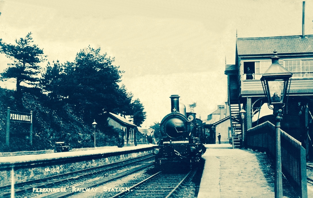
Perranwell Station 1950s – disembark here for Perran-ar-Worthal and Cove Farm!
Perran-ar-Worthal (in Cornish Peran ar Wodhel) means ‘St Piran’s village by the creek’. Who is St Piran? He is the Patron Saint of Cornwall and we’ve met him before, briefly, in my account of St Ciarán, who was born on Cape Clear, and was known as ‘The First Saint of Ireland’. Even before St Patrick arrived to start his missionary work in 432 AD, St Ciarán (according to some records born in 352 AD) had been at work converting the ‘heathen Irish’. Unfortunately, his efforts were not always appreciated and Ciarán was despatched from the top of a cliff with a millstone tied around his neck! The story is elaborated by Robert Hunt FRS in his Popular Romances of the West of England first published in 1908. I have the third, 1923 edition on my bookshelves. That’s Cape Clear below: possibly the very cliff (although not at all a tall one).
…On a boisterous day, a crowd of the lawless Irish assembled on the brow of a beetling cliff, with Ciarán in chains. By great labour they had rolled a huge millstone to the top of the hill, and Ciarán was chained to it. At a signal from one of the kings, the stone and the saint were rolled, to the edge of and suddenly over, the cliff into the Atlantic. The winds were blowing tempestuously, the heavens were dark with clouds, and the waves white with crested foam. No sooner was Ciarán and the millstone launched into space, than the sun shone out brightly, casting the full lustre of its beams on the holy man, who sat tranquilly on the descending stone. The winds died away, and the waves became smooth as a mirror. The moment the millstone touched the water, hundreds were converted to Christianity who saw this miracle. St Ciarán floated on safely to Cornwall; he landed on the 5th of March on the sands which bear his name. He lived amongst the Cornish men until he attained the age of 206 years…
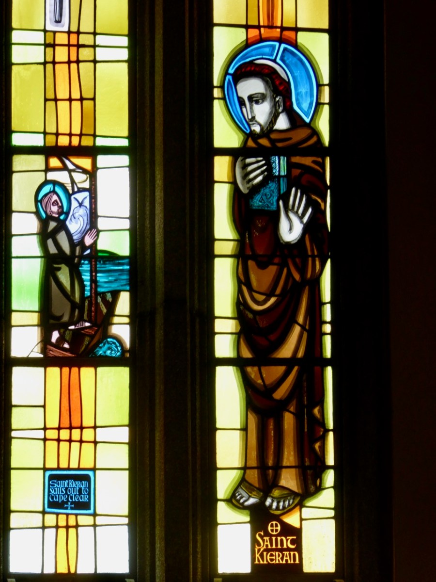
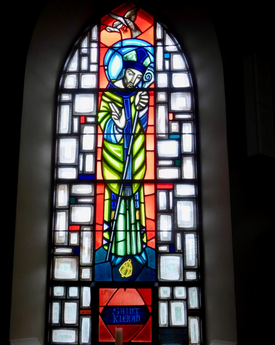
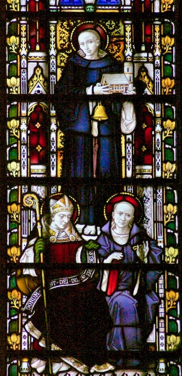
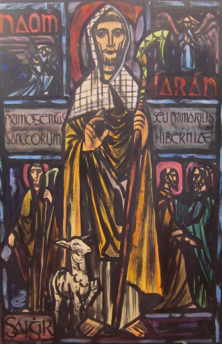
Left – St Ciarán celebrated in modern stained glass, in the church at Caheragh, West Cork; centre – Ciarán at Rath church, near Baltimore, and right – St Piran is the top figure (with church and bell) in this window panel from Truro Cathedral, Cornwall
So, what is the connection between Saints Ciarán and Piran? Apparently, they are the same person! Charles Lethbridge Kingsford reporting in the Dictionary of National Biography 1885 – 1900 (a 63 volume work!) states:
…PIRAN or PIRANUS, Saint, is commonly identified with Saint Ciaran of Saigir. The names Piran and Ciaran or Kieran are identical—p in Britain being the equivalent of the Irish k. The history of the two saints is in the main features the same, though the Irish lives of St Ciaran do not record his migration to Cornwall…
Many writers make the same assertion about the orthophony of the name but – to be fair – others, including some saintly hagiographers, do not agree, suggesting we are talking about two different saints. As someone who has a birthday on 5th March (today) – the Saint’s Day for both Ciarán and Piran – I have no doubts about the matter. Here’s another source that concurs with the view that they are one and the same saint – The Irish Ecclesiastical Record, Volume X (1874):
…The labours of St Kieran were not confined to Ireland. He passed several years on the western coast of Britain, and, as we learn from Blight’s “Churches in West Cornwall,” his memory is still cherished there. Four ancient Cornish parochial churches bear his name : these are Perran-zabuloe, or St Piran-in-the-sand; Perran-arworthal; Perran-uthnoe, situated near the coast opposite St Michael’s Mount, and St Kevern, or Pieran, which in Domesday-book is called Lanachebran. St Kieran’s holy well is also pointed out on the northern coast of Perran-zabuloe. The parish church of St Keverne stands in the district called Meneage, which terminates at the Lizard Point, the southernmost land of England. The name Meneage is supposed to mean, in the old Cornish dialect, “the deaf stone”, and the reason given for it is that, though there are several mineral veins or lodes in the district, on trial they have been found to be of no value, and hence are called deaf or useless. Tradition tells that St Kieran inflicted on the inhabitants, as a punishment for their irreligion, that the mineral veins of the district would be un-productive, and the old proverb is still handed down, “No metal will run within the sound of St Kieran’s bell”…
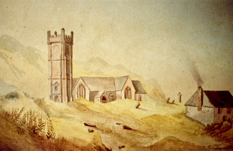
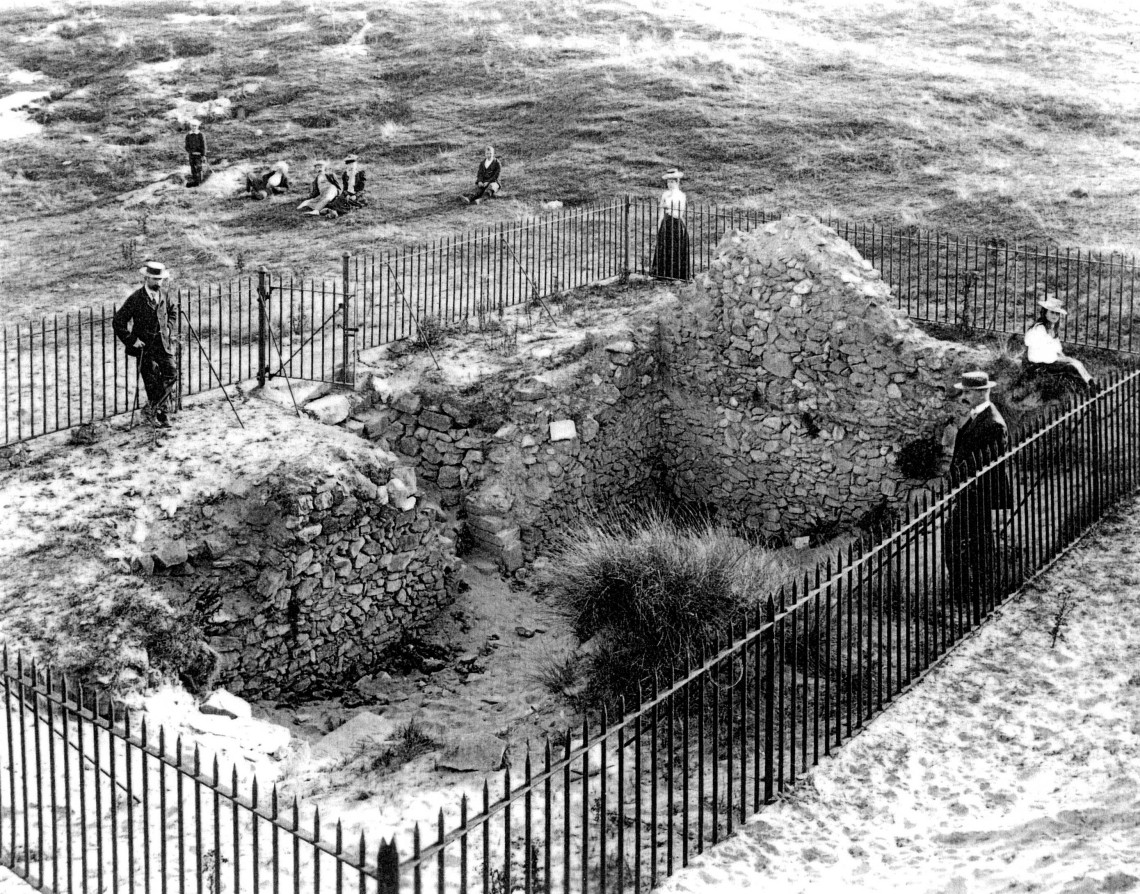
An early photo of St Piran’s Church which was built in the 12th century on the dunes at Penhale Sands, Perranzabuloe Parish, to replace the Saint’s original oratory which was buried by the shifting sands. The sands encroached on this church, too (the sands can be seen in the picture), and it was dismantled around 1800 and stone from the site was then used to build another new church two miles inland which was dedicated to St Piran in July 1805
To complement that little story of the saint in Cornwall, we have to visit Ossory, an Irish diocese which encompasses parts of Kilkenny, Laois and Offaly. There they also celebrate St Ciarán of Saigir on March the fifth: he is said to have returned from Rome after years of study, firstly visiting his native Cape Clear, then commencing his travels through Ireland until his bell rang of its own accord – this happened at a small hamlet in County Offaly, now known as Seir Kieran. There he set up a foundation, the remains of which are still visible – as is a holy well, a holy bush (bedecked with clouties) the base of a round tower, the base of an ancient high cross (now holding water which has curative powers) and a holy rock which was once said to have displayed the hand print and knee prints of the saint, now completely obscured.
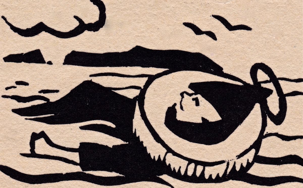
St Piran’s journey to Cornwall: “The millstone kept our man afloat” from The Discovery of Tin – a collection illustrated by Barry Cottrell
One of my favourite stories about St Piran tells of how he discovered tin smelting. He used as his hearth a piece of local stone; when he lit a fire on the hearth the veins of tin ore in the stone melted and a stream of silver ran out across the black rock, in the form of a cross. From that day to this the flag of Cornwall is a white cross on a black background, and Piran is also the patron saint of tin and tinners.
Just about now in Cornwall (March 5 2017) a great celebration is going on in honour of the saint. There will be a procession to the original oratory buried in the sands, led by the Grand Bard of the Cornish Gorsedd. Cornish flags – and the Cornish tartan – will be very much in evidence. The Cornish people have a great nationalistic spirit and have called for the 5th March to be an official public holiday. In a recent debate on Cornwall some interesting views were expressed on the place of Cornwall in a post-Brexit world, and the attributes of St Piran were symbolic of this – his inventiveness, his love of nature, and his belief in the inclusivity of all peoples in an international community.
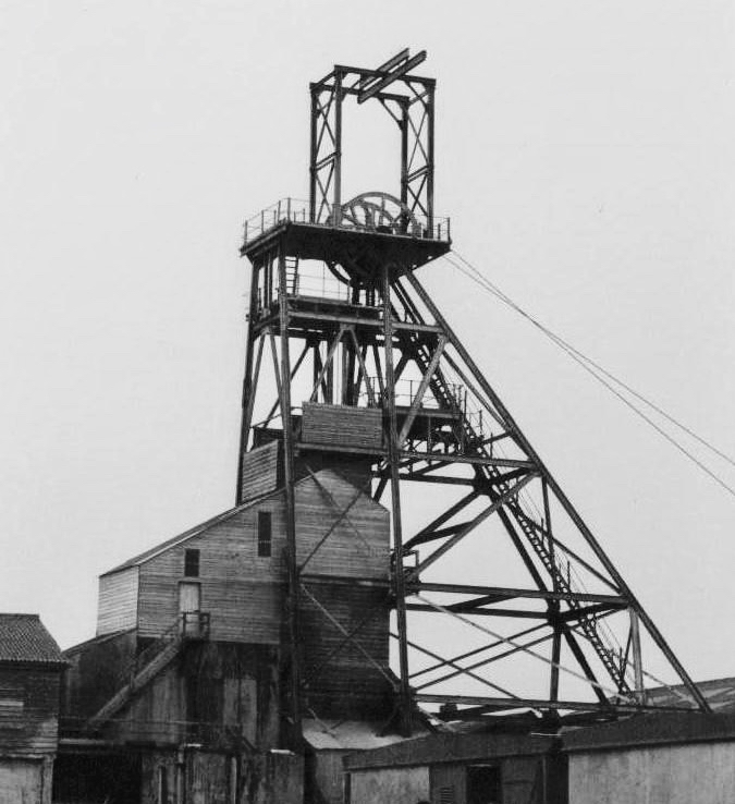
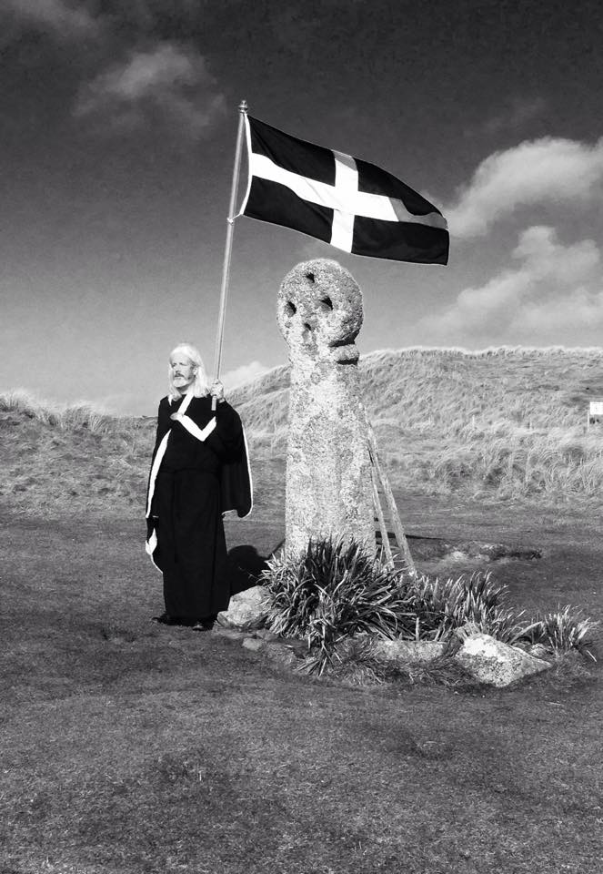
Left – Geevor Mine, in West Penwith, one of Cornwall’s last working tin mines, now a museum of mining; right – an incarnation of the saint: Cornish author Colin Retallick stands in front of St Piran’s ancient cross on the saint’s day
St Piran lived to a great age. They say in Cornwall that he was ‘fond of the drink’ and met his end by falling into a well when walking home from a party. I hope it was a holy well! Today, seventeen centuries after St Ciarán / Piran was thrown from the cliffs of Cape Clear I am looking out to that island: …the winds are blowing tempestuously, the heavens are dark with clouds, and the waves are white with crested foam… There have been so many links between Cornwall and West Cork, ever since the Bronze Age, when Cornish tin traders brought their metal to mix with copper mined above us here on Mount Gabriel. Watch out for more posts about these links between the two communities: links which would have warmed the heart of our shared saint!
Below – St Ciarán by Richard King, painted for the Capuchin Annual in the 1950s
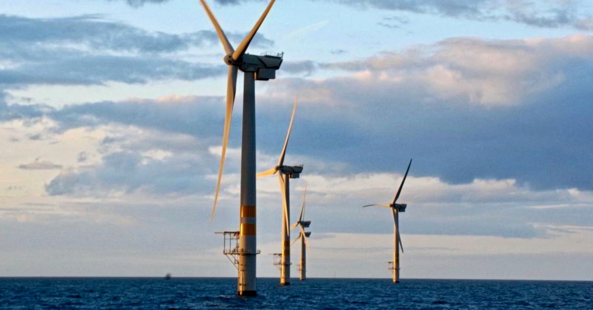
Arklow, Co Wicklow, had a ‘first’ for Ireland: the first offshore wind-farm installation in the country, and the first in the world to employ wind turbines rated over 3 MW. Phase 1 of the project, commissioned in June 2004, consists of seven GE 3.6-megawatt generators. The total output of 25.2MW seemed good at the time but the improvements in technology since it was constructed are considerable. A second phase, currently being planned, aims to achieve an export capacity of up to 800MW.
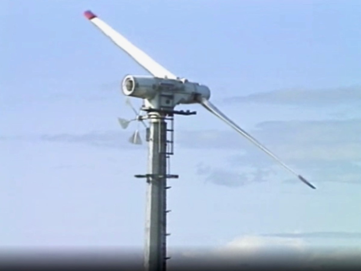
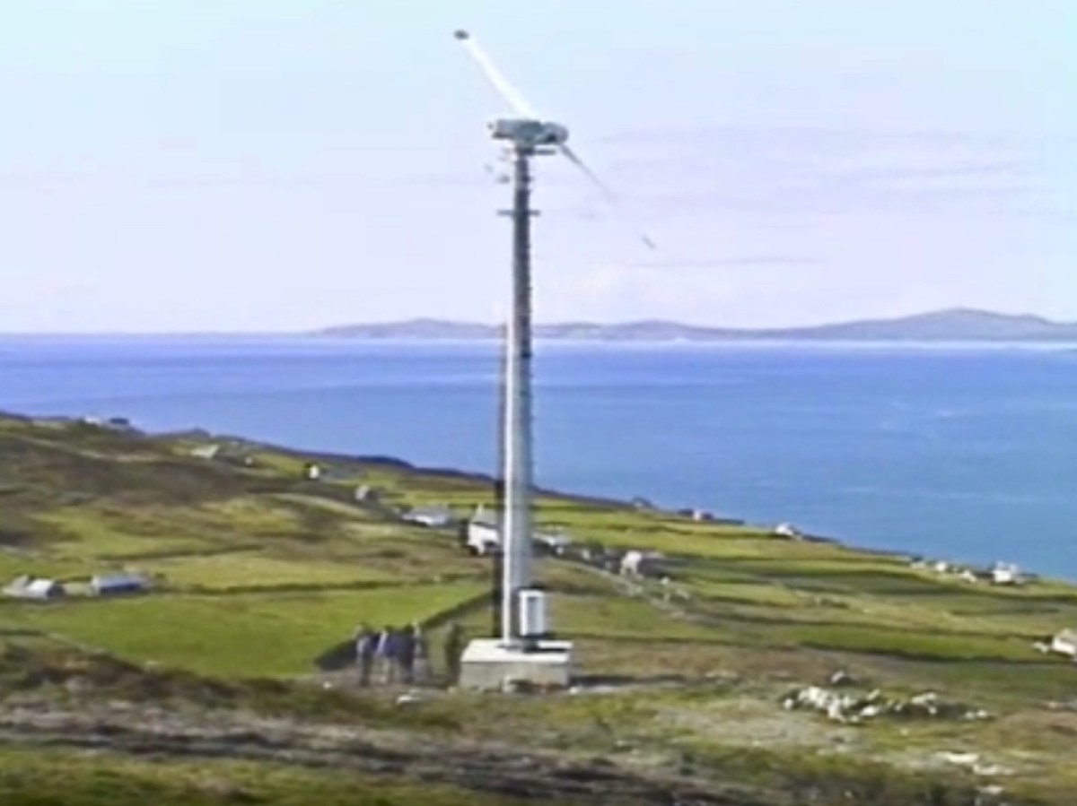
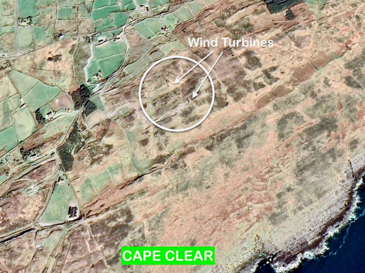
. . . The new technology was funded largely by the Germans and came in at a cost of around £500,000. The two wind-powered generators stand fifty feet above the top of the island and provide 30 kW each from the turning of their 12.5-meter blades. The National Board for Science and Technology claims that this new technology is the first of its type in the world as it integrates wind generation with diesel generators and battery storage creating a complete power supply . . .
RTÉ Archives
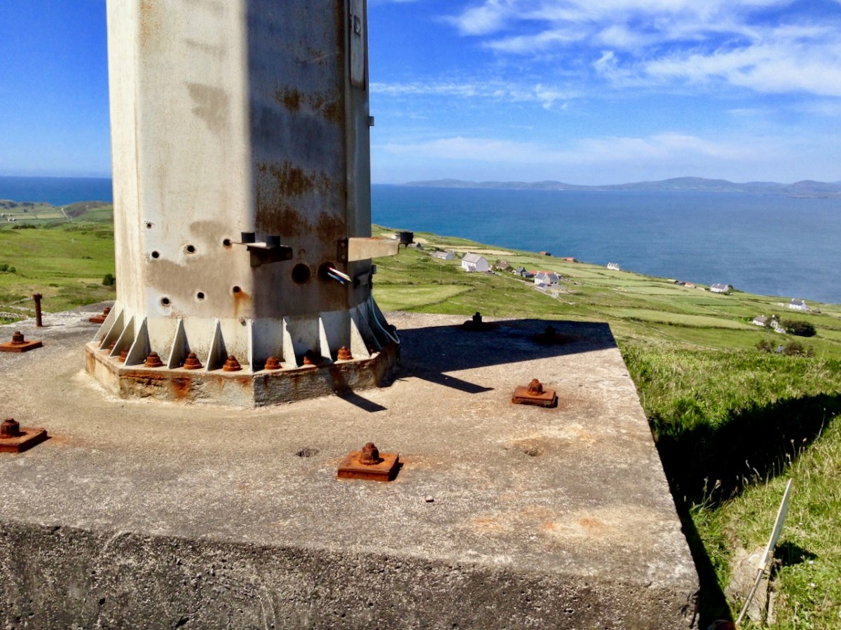
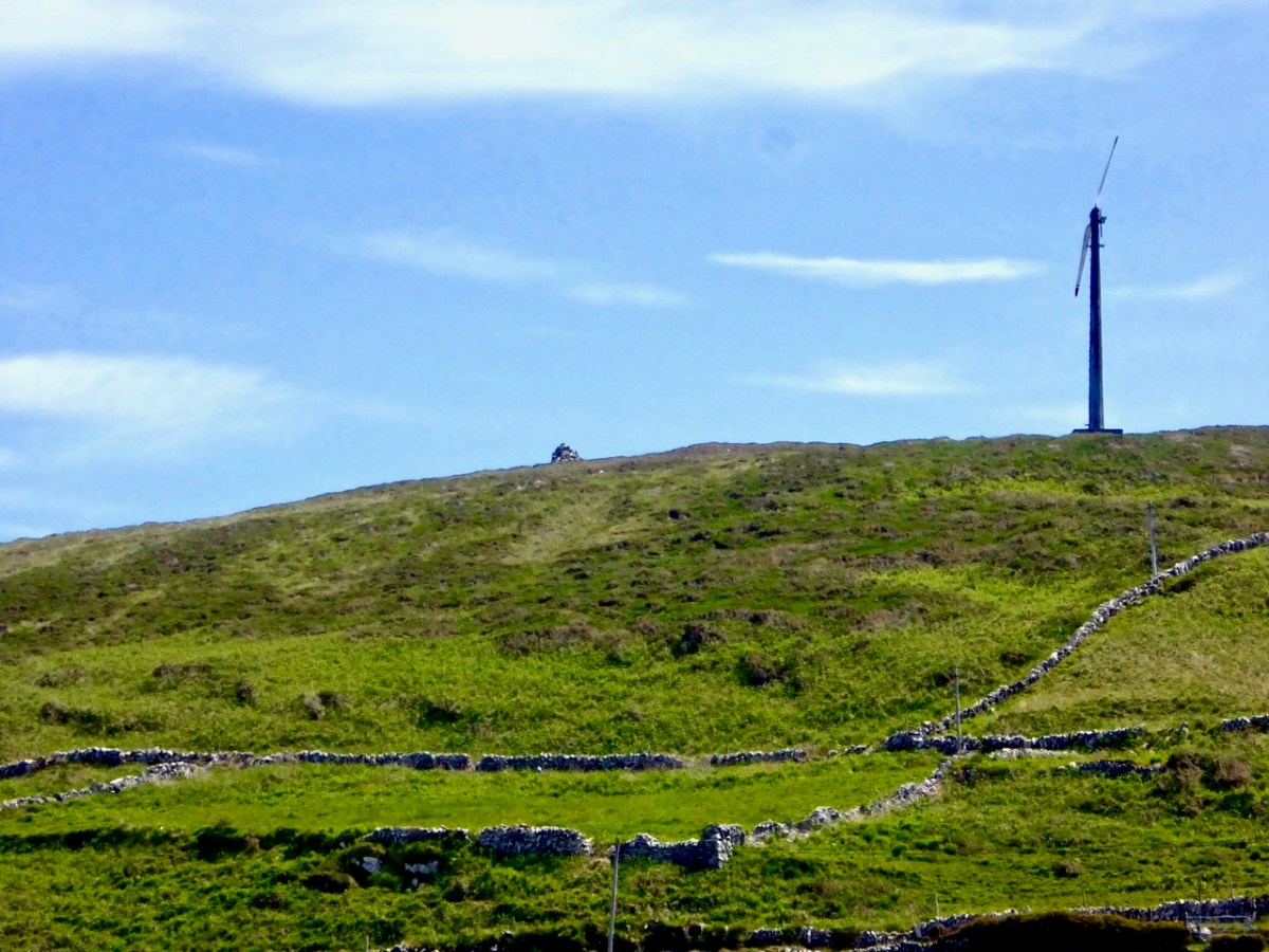
(Top) another still from the RTÉ news piece, and (above) aerial view of the site. The masts and turbines are still in place today, although they have been disused since the island was connected to the mainland for electricity supply via a subsea cable in 1996. (Below) we photographed the surviving turbines on the island in 2016.
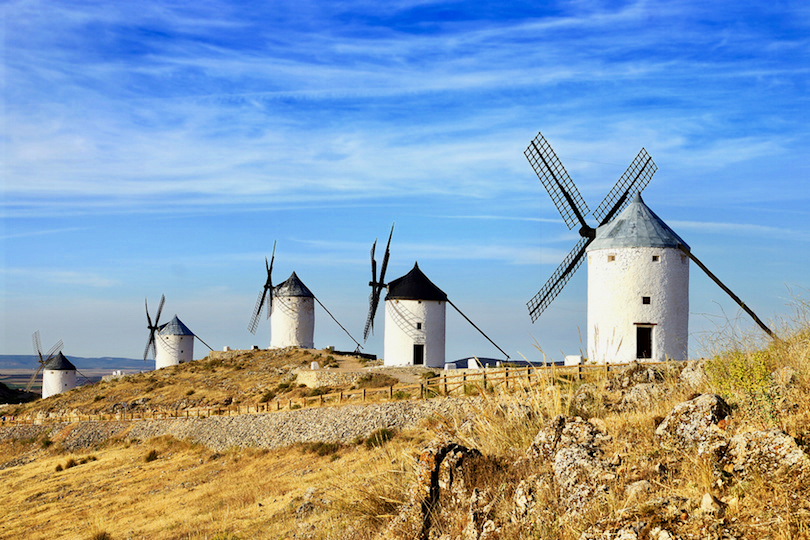
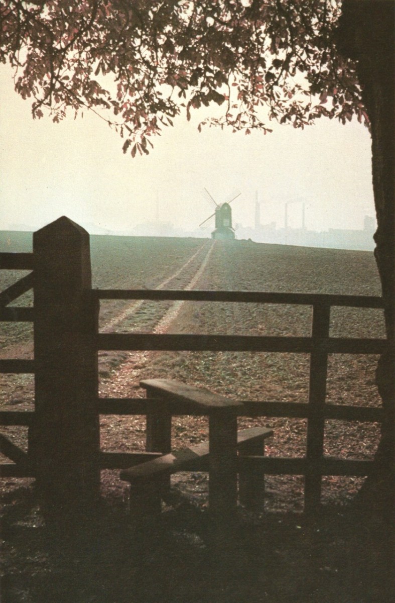
Wind power goes back a very long way, of course. Here (above) are some very picturesque ancient examples from La Mancha, in Spain. Here’s another (below) – Pitstone Windmill in England: an interesting composition with newer technologies in the background.
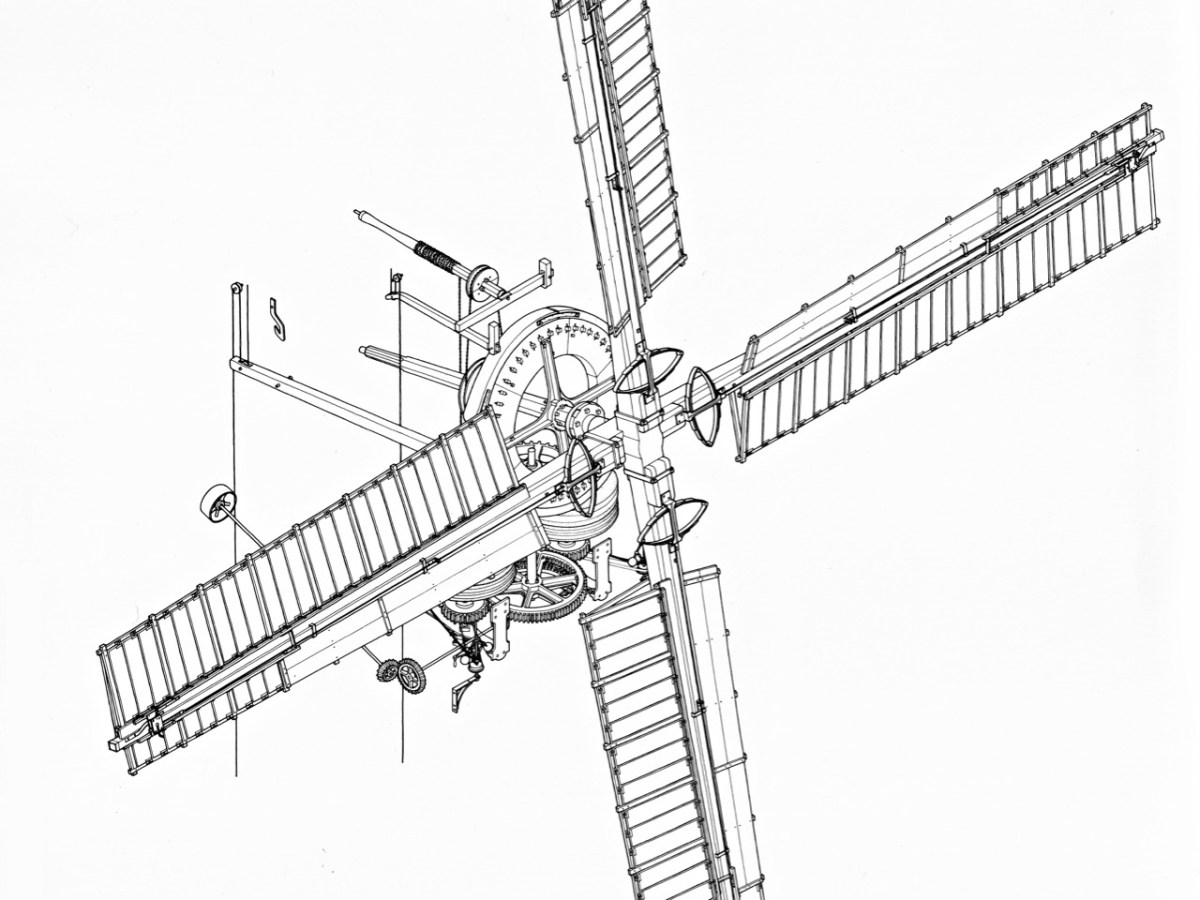
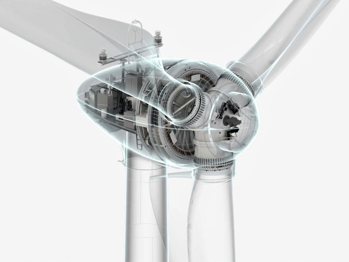
Compare technologies old and new (below)!
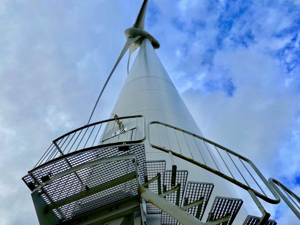
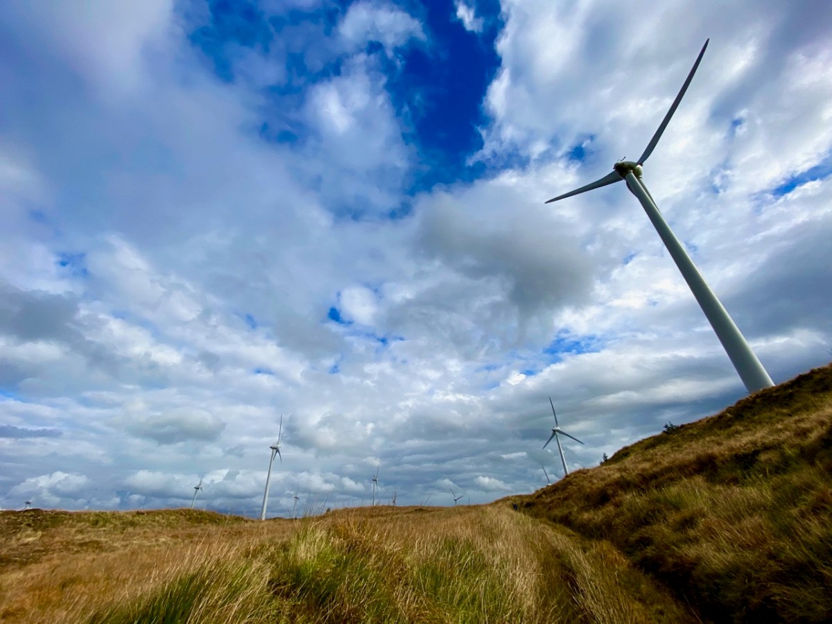
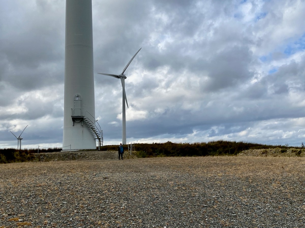
In West Cork we are no strangers to the more recent developments in this expanding field, although at present all land based. The scale and form of the machinery is, of course, increasing apace. These examples are on the hills close by us:
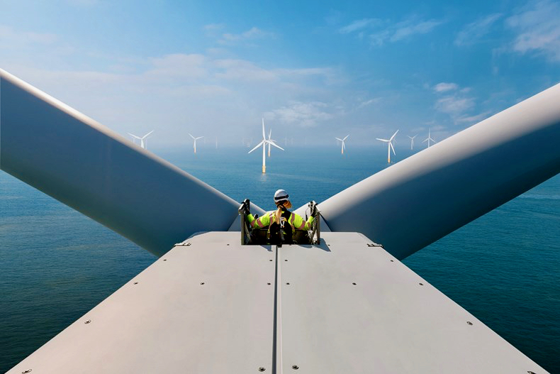
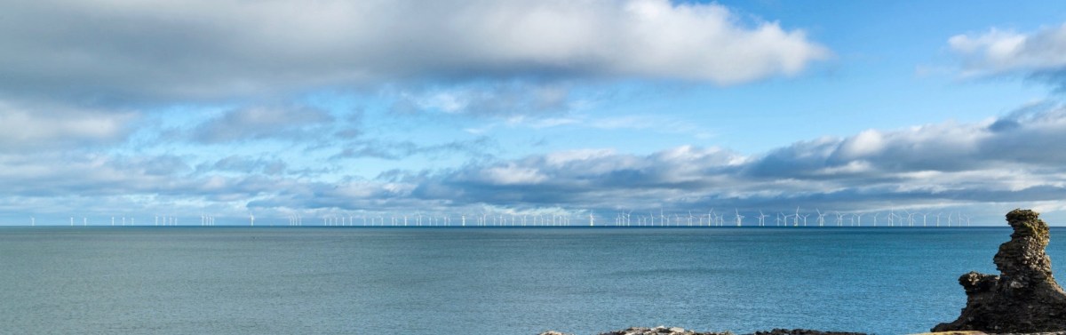
But it’s the vast resource of our relatively benign coastal waters that offers the most for the country’s still young wind-power industry. There’s a further example being planned in County Wicklow: the Codling Bank Wind Park scheme. Currently in the consultation stages, it is hoped that construction will be completed in late 2028. 73 turbines are planned, to be sited on the shallow Codling Bank, some 20km out in the Irish Sea. This project – the largest so far in this country – has the potential to power 1.2 million homes using natural resources. It will also provide welcome employment for a large work force. And – in my eyes – an elegant contribution to the marine environment. Well done, Ireland!
Photomontage of the Codling Bank Wind Park seen from the shore at Greystones. Thank you to http://www.codlingwindpark.ie for the dynamic illustrations.
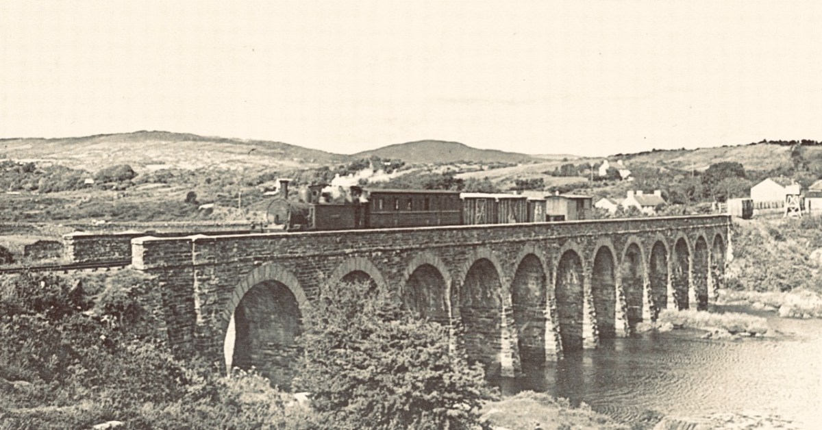
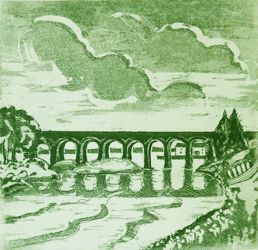
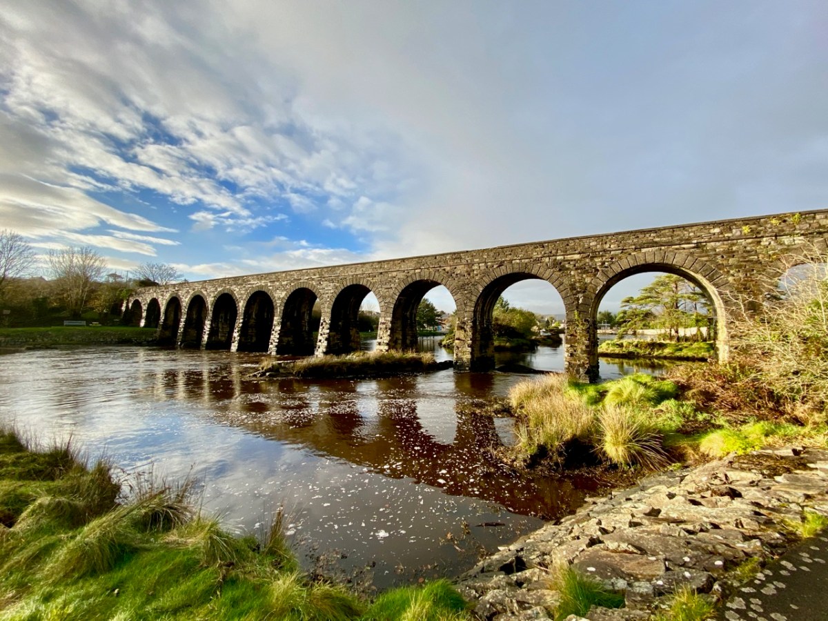
As we are approaching the traditional Twelve Days of Christmas I thought it fitting to give you Twelve views of Ballydehob’s iconic viaduct. Our West Cork village of Ballydehob has many claims to fame. It has been the centre of a great Irish art movement in the mid-twentieth century (have a look at this site). But earlier – between 1886 and 1947 – it was an important stop on the Schull & Skibbereen Tramway. This was a three-foot gauge railway line which must have been a great wonder to those who witnessed it in its heyday. There are fragments of it still to be seen, but its most monumental structure remains with us: the twelve-arched viaduct at Ballydehob.
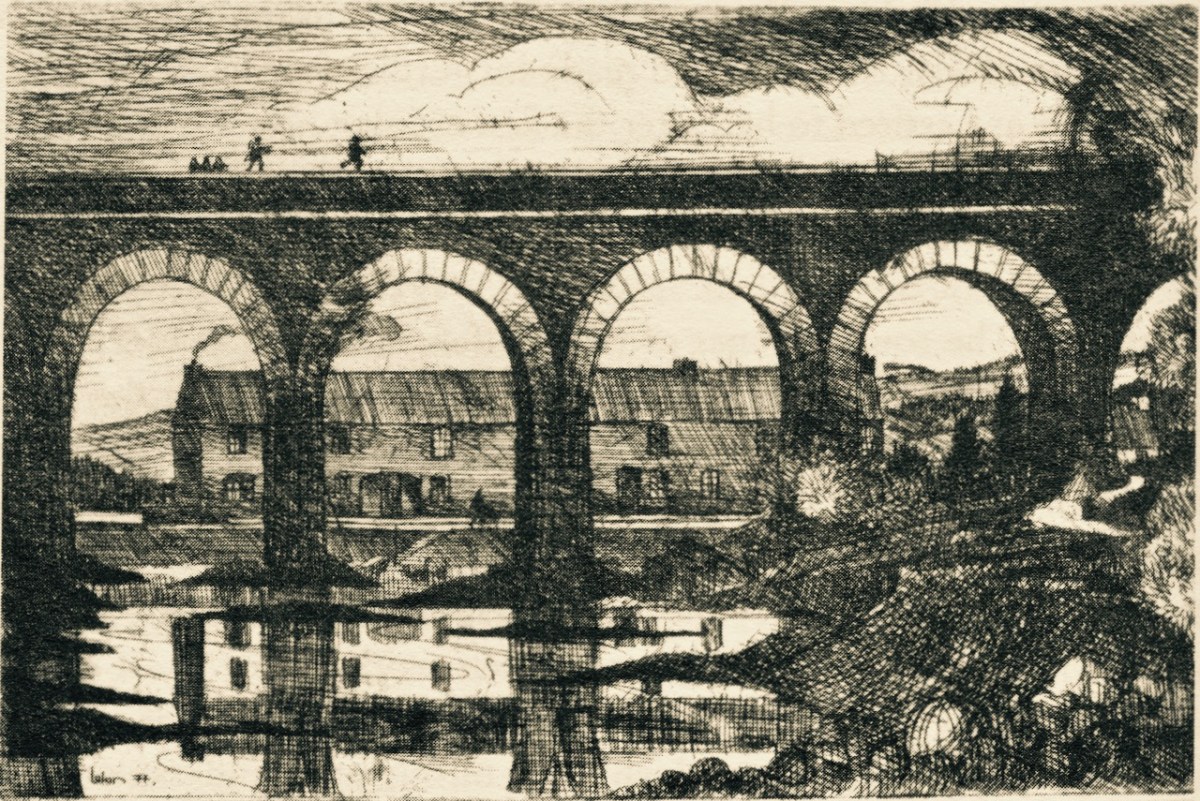
Above: Brian Lalor was one of the creatives who settled in Ballydehob back in the artists’ heyday (he is still here today). The railway viaduct was a great source of visual inspiration to him and to his artist colleagues.
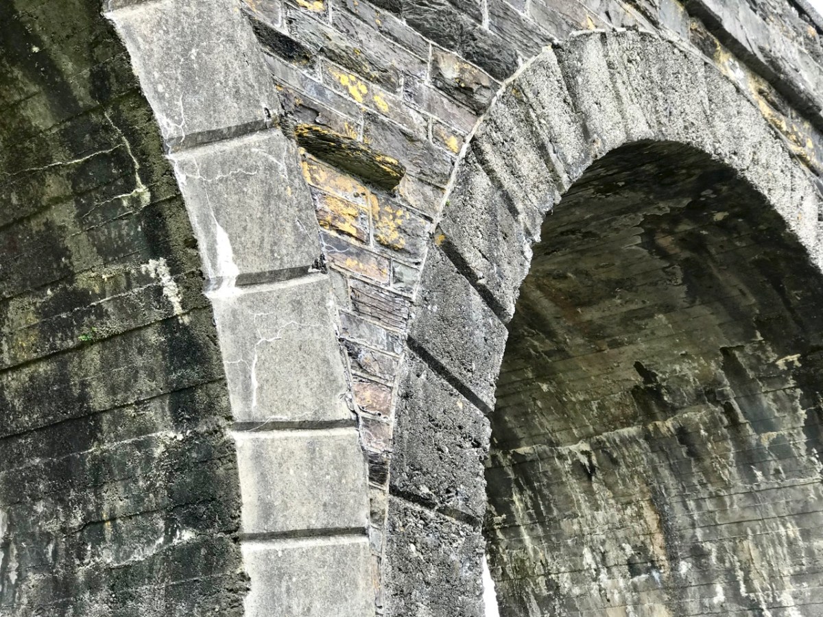
Here (above) is another Lalor work depicting the viaduct (many thanks, Brian). Behind the arches in this print you can see the former commercial buildings on the wharf, now converted to private use. At first glance you might think what a fine masonry structure this is. In fact, most of it is mass concrete. Look at the close-up view of the arches below: they are cast and faced in concrete, albeit the arch-stones are made to look like masonry. Only the facing infills and the parapets are actually of stone. This is quite an innovative construction for its time. Barring earthquake it’s certain to endure.
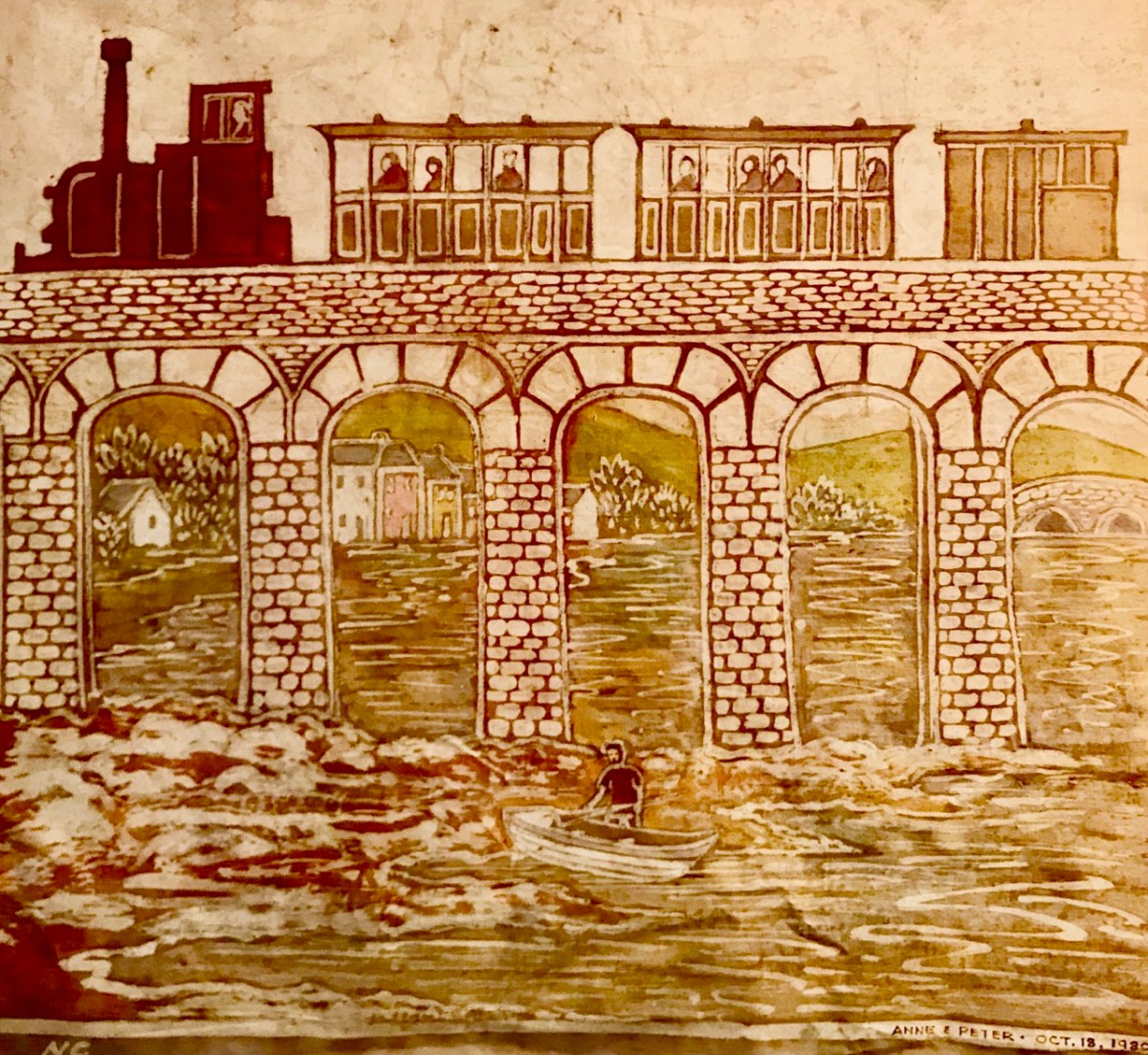
I was not surprised to find how often images of this engineering feat have inspired artists and others working in creative fields. Here’s a particularly fine example from the days of the artist settlement around the village in the mid-twentieth century (below): this one is a batik by Nora Golden.
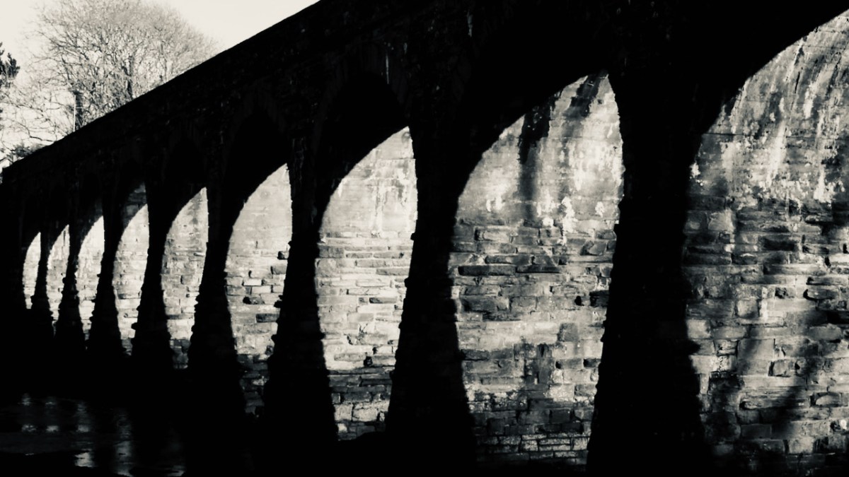
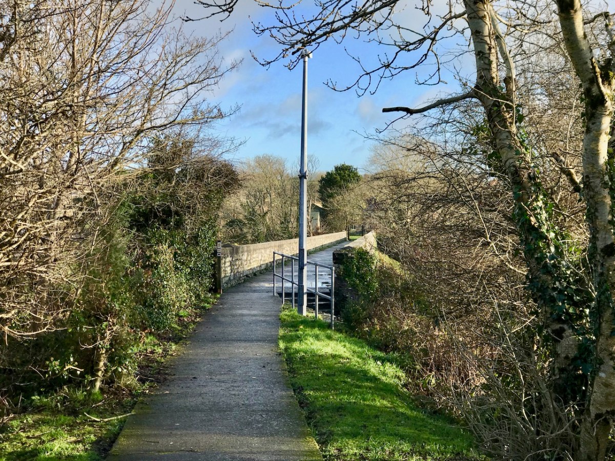
I really like this moody photograph by Finola: it demonstrates the elemental nature which repetition and shadow gives to the scene. (Below): we have to see the way over the top, now a public footpath. The railway was a single track narrow-gauge at this point.
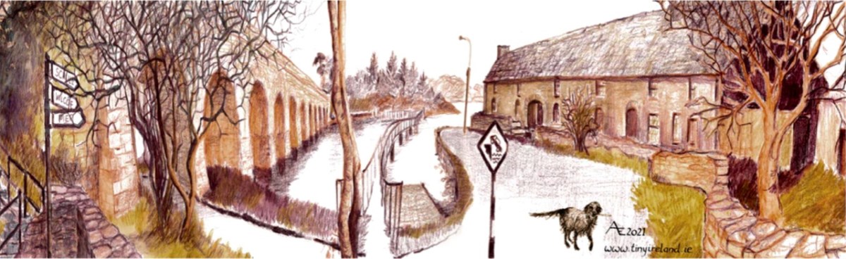
The ‘Tiny Ireland’ creator – Anke – has sketched this wonderful caricature of our wharf area, showing the 12-arched bridge in context. Finola has written about Anke. You can buy your own piece of Tiny Ireland through her website, here.
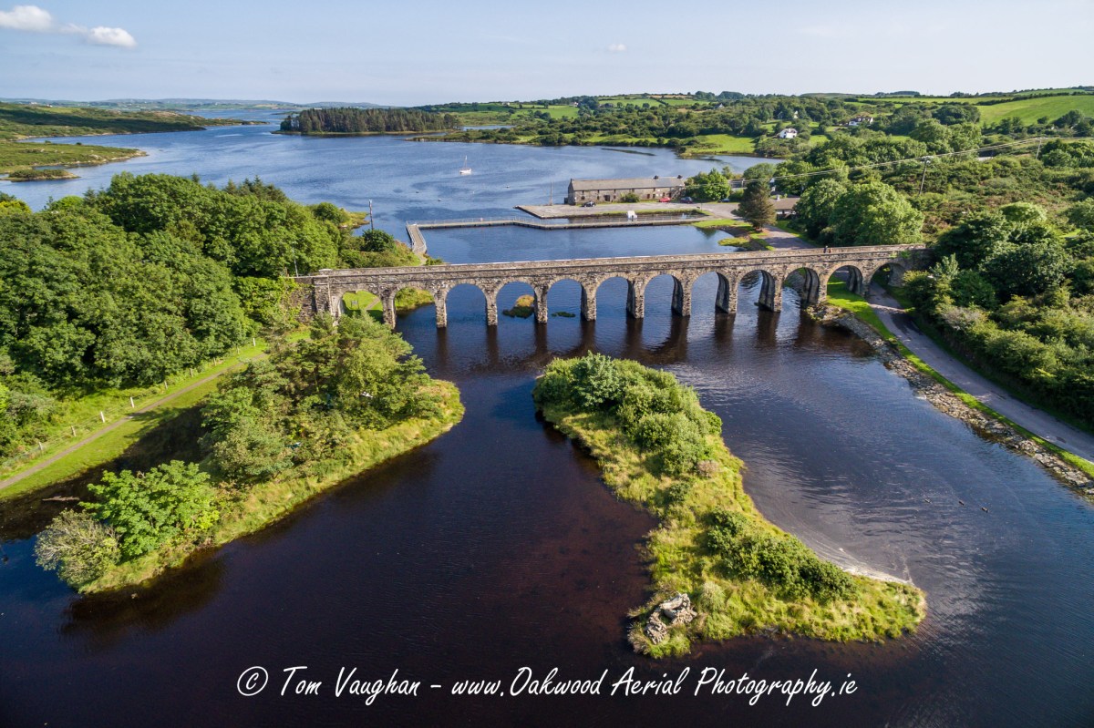
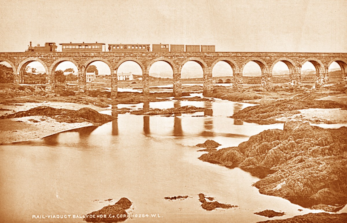
How better to look at the bridge in context than this view from Aerial Photographer Tom Vaughan. Thank you, Tom, for allowing us to use this magnificent image. Here’s the link to his own website. You will find excellent gifts for the connoisseur here. The last of our ‘Twelve Arches’ (for now) has to show us the bridge in its rightful use. I think this postcard – from the Lawrence Archive -dates from the early 1900s. I can’t resist quoting the caption for the rail buffs among you!
. . . A Schull-bound train has stopped especially for the photographer: this is Ballydehob viaduct looking north. The train comprises GABRIEL, bogie coaches Nos 5 and &, brake vans Nos 31, 32 and 38 . . .
The Schull & Skibbereen Railway – James I C Boyd – Oakwood Press 1999
Welcome to the UCD Library Cultural Heritage Collections blog. Discover and explore the historical treasures housed within our Archives, Special Collections, National Folklore Collection and Digital Library




 Roaringwater Journal