An Artist’s Encounter with West Cork

Perhaps this book review is a little late arriving? The book was – after all – published by Brandon of Dingle in 1990: thirty two years ago! The artist, and I, were in our forties then. But – don’t hesitate – although it’s out of print you can find copies readily available on many booksellers’ websites. You can spend a Euro (the postage will cost four times that!) or many Euros: but it’s well worth whatever you have to pay.
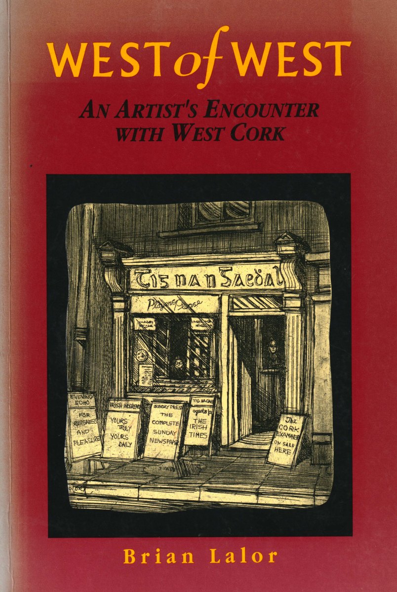
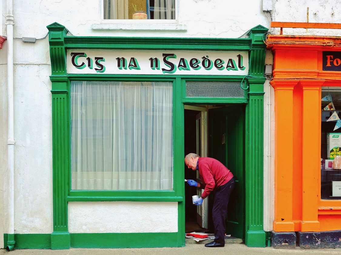
Here it is: a modestly sized paperback volume. But it punches well above its weight. It is beautifully written, and exquisitely illustrated. For everyone who is interested in West Cork, Ireland or the art of engraving it’s a must for your bookshelves. And, historically, it’s fascinating: the cover picture, above, shows Tig na nGaedheal (locally known as Brendan’s) – once described as ‘the greatest and most famous sweet shop ever in Skibbereen’. Sadly, Martha Houlihan, who ran it with her husband Brendan, passed away a little while ago and the shop is no longer trading. It’s still a significant feature in the town streetscape (below). Note the figures looking out of the door and window in Brian’s etching – a typical humorous touch.
The book includes nigh on a hundred of Brian’s engravings. This is only a fraction of the huge body of work he has created in his lifetime to date, and he’s never idle. It’s good to know that Uillinn – the West Cork Arts Centre gallery – has a retrospective of Brian’s work in the pipeline. It will be impossible to show more than a fraction of the art he has produced so far, but we certainly look forward to experiencing that selection.
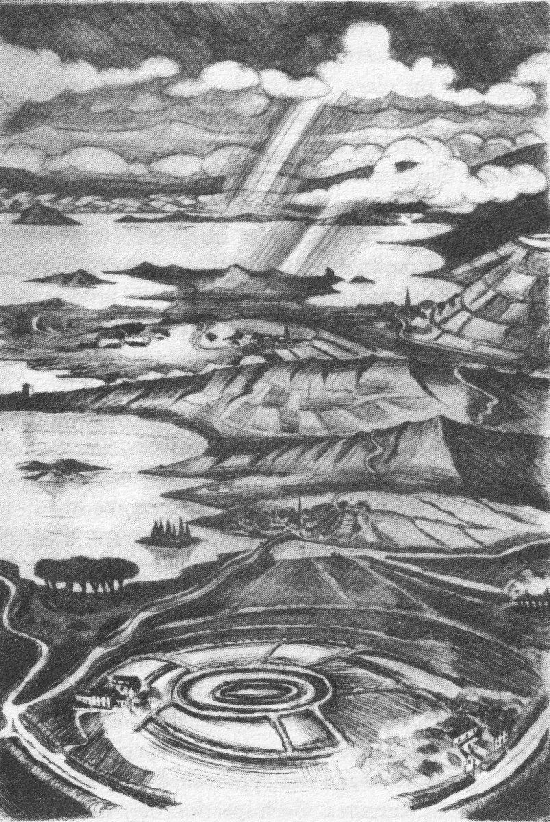
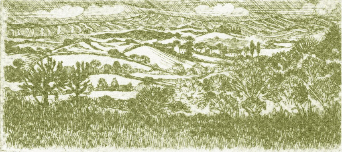
What I personally enjoy about Brian’s works in this book is the atmospherics that they create. Take, for example, The Dark Edge of Europe, above. The breadth of its content is overwhelming: it’s the landscape of West Cork summed up in gradations of grey, with coastline, lanes, settlements, hills and distant mountains, focussed on a foreground which features an ancient hill-fort. A tale of occupation and morphology: an eternal human story. The illustrations in the book are accompanied and amplified by wonderfully crafted written descriptions.

. . . Defining the high spots in the ribs of land, and distributed with apparent regularity all over this landscape, were lush green rings. Single, and occasionally double or triple concentric rings of grassy banks, these features resembled a giant’s game of quoits, forgotten and left to decorate the landscape. The gargantuan quoits are of course the ring forts or fairy rings of the Irish countryside, and outlined the forms taken by the rural farmsteads and dwellings from pre-Christian times down to the sixteenth century. Each ring represented an earthen rampart on high ground, with perhaps a dry moat or further rampart encircling some wattle huts. Simple and utilitarian, this form of dwelling satisfied the political and practical exigencies of the day – or aeon, for that matter. Rural life was lived in the midst of the land, without congregating in towns or villages . . .

The Land of Heart’s Desire: West of West, Brian lalor
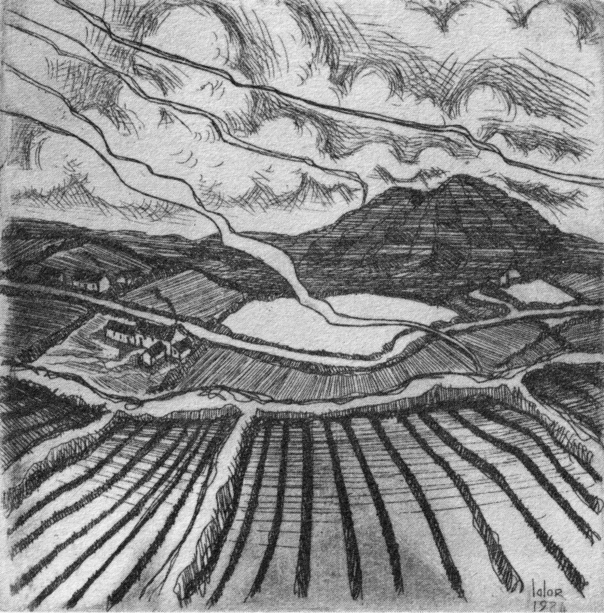
Mount Gabriel dominates much of the landscape in our part of West Cork. Brian’s view, above, is titled Mount Gabriel Gorse Fires. The artist ‘discovered’ remote West Cork back in the 1970s. In the book he describes the journey:

. . . The road wound away into the distance, a ribbon of reflected light, and the weaving shapes of the blackthorns threw a black Gothic tracery across the landscape. The immediate surrounding had a silvery sharpness, the precision of a lunar landscape; brightly outlined walls enclosed pools of darkness. We were no longer at the door to West Cork but in its very interior. We had arrived . . .

Well Met By Moonlight: West of West, Brian Lalor
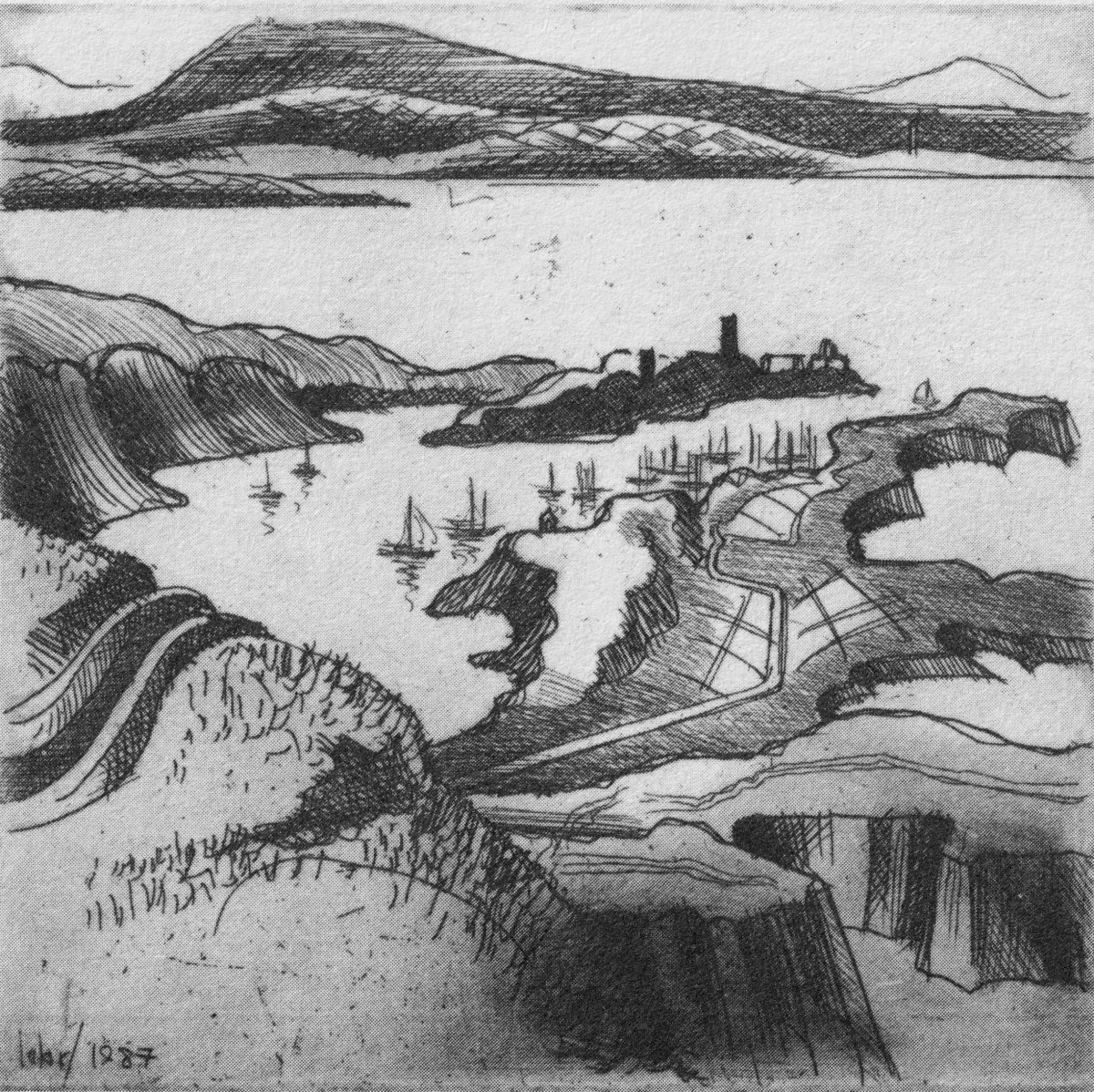
Essential to the intimate knowledge of West Cork’s landscape is the sea – and the coastline which encompasses it. This view is titled Rock Island & Crookhaven. Brian enhances the rendering with a description:

. . . From the heights of Brow Head the outline of Rock Island at the mouth of the harbour resembles a partially submerged submarine, its twin customs-observation buildings the conning towers of this strange naval mammoth. An ill-assorted collection of buildings adhere like barnacles to the back of this submarine: the roofless lighthouse barracks, a defunct fish factory and an abandoned, rambling Victorian mansion suggest an unfavourable location. Wedged in the little cove in front of the mansion is the hulk of an old wooden trawler. A graveyard of vanished days and forgotten hopes . . .

Coastline: West of West, Brian Lalor
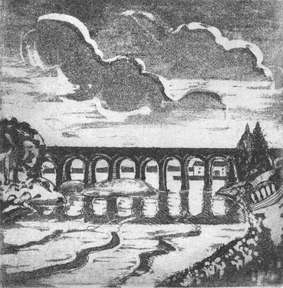
Ballydehob’s 12-arch bridge – or railway viaduct – must be one of the most profusely illustrated and photographed features of West Cork. The Schull, Ballydehob and Skibbereen tramway was a significant piece of transport infrastructure that ran from 1886 until 1947. It’s a fascinating piece of Victorian engineering, the first 3ft gauge railway line to be built in Ireland. Everything about it was eccentric: here’s one of my RWJ posts setting out the history of the line. Brian has a little anecdote well worth the recounting:

. . . As it is one of the most pleasing architectural features of the local landscape, I drew the Twelve Arch Bridge on many occasions and it reappears in a variety of forms amongst these etchings. One village magnate commissioned me to do a large picture of this monument for his new house. The price was agreed and the picture eventually produced. I had chosen an angle which showed the bridge emerging as it does from thickets of brambles and conifers on either side of the water. Delicate fronds of foliage wound in the foreground of the picture and the subject itself basked in the distance, looking solid and ancient. I was quite pleased with the results. When I presented it to my patron he gazed at it in silence for a long time. Then with a large and calloused hand he ran his index finger across the view a number of times, shaking his head slowly as he did so. ‘No. no good at all, It won’t do,’ he muttered more to himself than me. He had been counting the arches. In my enthusiasm for the atmosphere of the piece the accurately rendered number of the arches had become obscured, those on the extreme edges becoming partially lost in the undergrowth. The commission was rejected. If you are paying for twelve arches you don’t want to be short-changed with ten and two halves!

Coastline: West of West, Brian Lalor
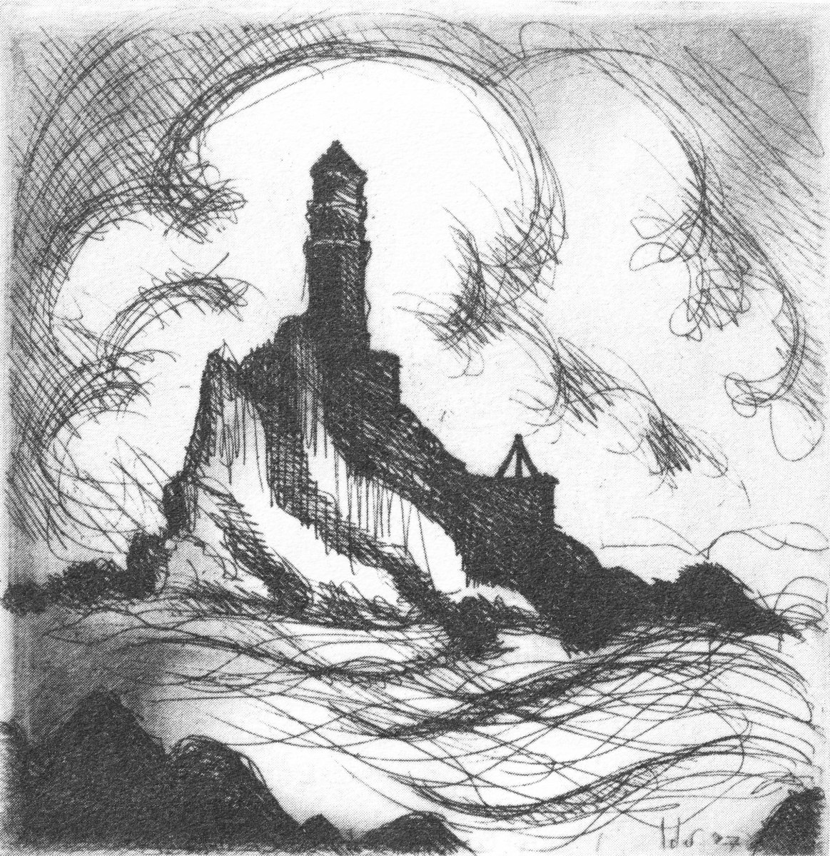
Fastnet. An iconic silhouette – perhaps a fish-eye view? The lighthouse is a ubiquitous element of structure which can be seen from all the waters and islands of Roaring Water Bay. Brian’s words:

. . . Roaring Water Bay encompasses an area of about a hundred square miles of water between Baltimore in the east and Crookhaven in the west. The tortuous coastline of the bay, as of much of the rest of West Cork, is punctuated by small coves, each with an old stone pier or miniature harbour. Up to the mid-nineteenth century these were the arteries of communication and trade and a wide array of lighters, barges, rowboats and yawls plied the coast, ferrying freight around the rim of the land rather than through it. Never far from the safety of land, they darted from port to port with the assurance of safe harbours at frequent intervals to reduce the threat from treacherous seas. Today, however, only the yachtsman holds this perspective on the land; it is a medieval cartographer’s view of the world: good on outlines, vague concerning the interior . . .

Coastline: West of West, Brian Lalor

The eye of the artist searches out ways to tell a story or unfold a scene in graphic simplicity. This is St Brendan Crookhaven: a simple church that is dear to the hearts of mariners, and has long been so.
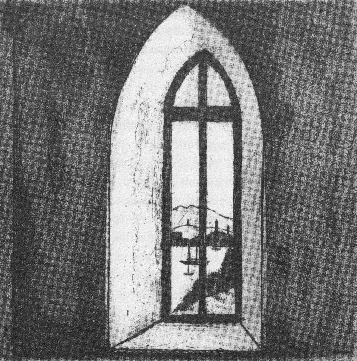
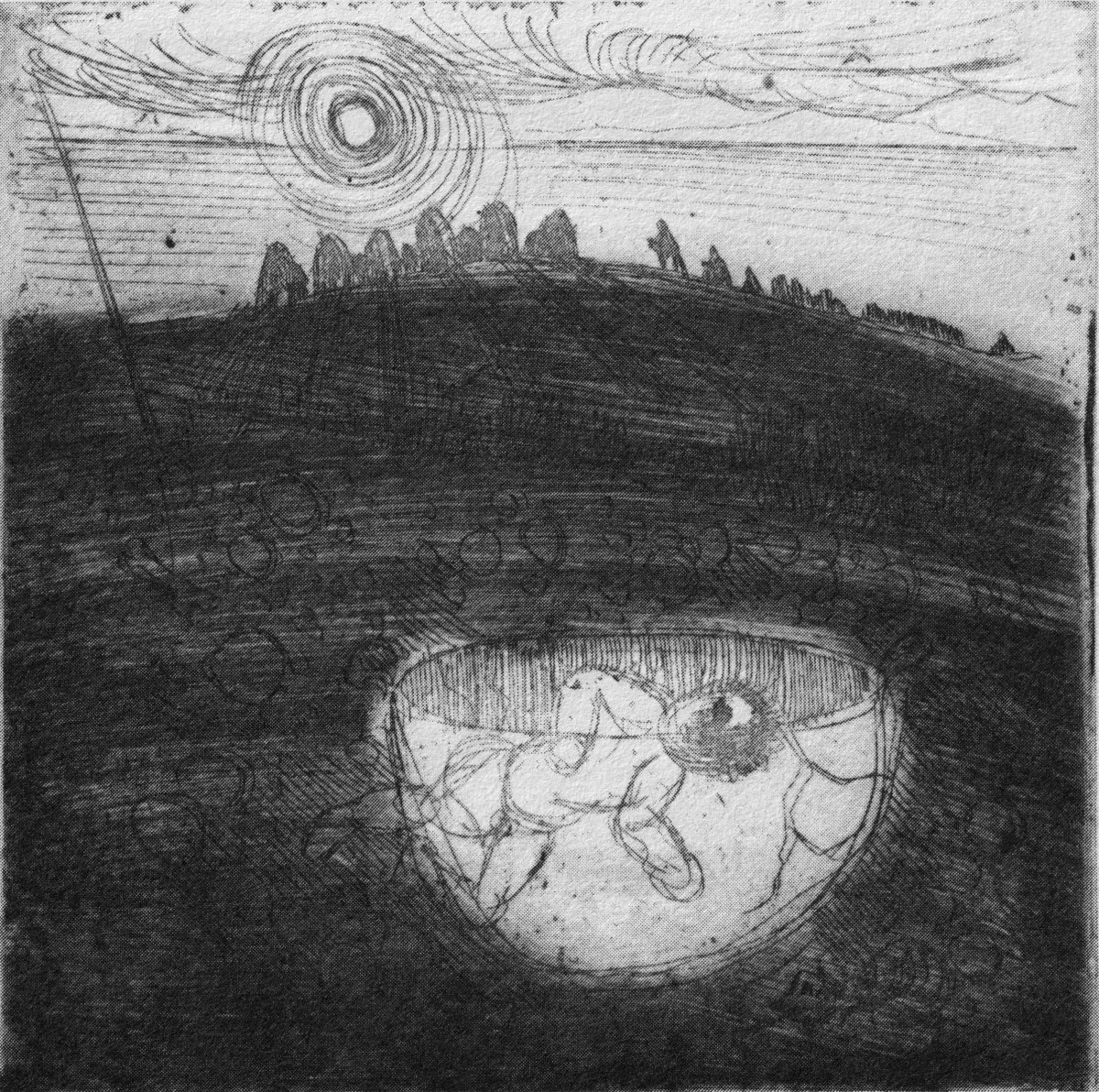
Stone Circle and Child Sacrifice is a thought-provoking piece. These ancient sites date back thousands of years: there are many here, beyond the West. We wonder at them, and can only guess at the significance they had to their constructors.

. . . The Landscape of the mind, which co-exists, interlocks and overlaps with the geographer’s vision, is an intangible, ephemeral thing. You may encounter it unexpectedly on a moonlit night or on some deserted headland, or perhaps in the dim light of a public bar. In this part of the world, soaked in memories and half-memories of the past, much is implied rather than stated. Like the collective unconscious, the landscape, too, is composed of a multitude of intertwining details. This collection of etchings of West Cork is concerned with those details: with small corners of towns and villages, with oddly-shaped fields and erratic skylines. Each etching is a vignette of landscape, architecture or environment. The pictures are organized around a number of themes yet the material as a whole has such an overall unity that what illustrates one section also has relevance for another. The point which they make is a collective one . . .

WELL MET BY MOONLIGHT: WEST OF WEST, BRIAN LALOR
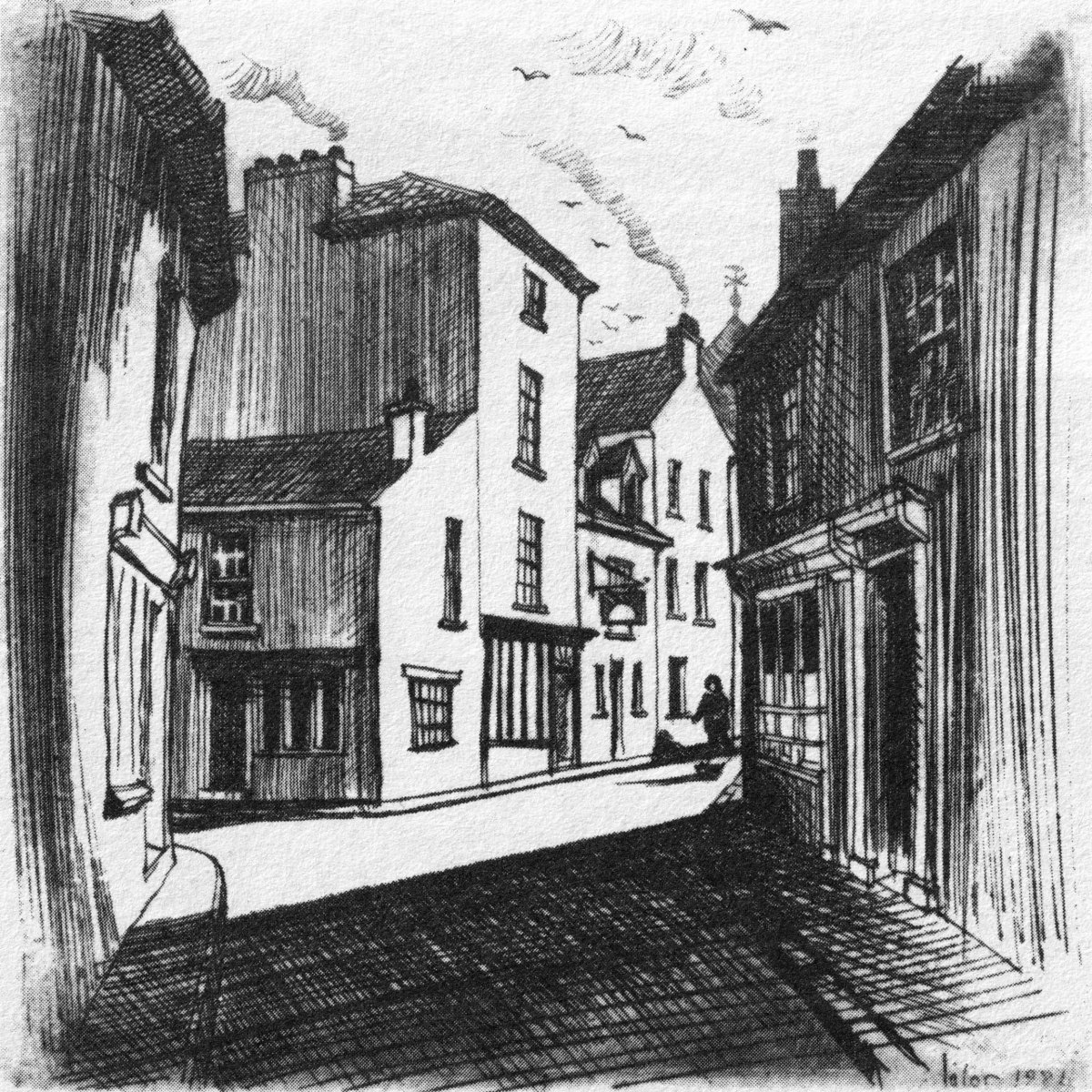
Brian’s book is as much about the human side of West Cork as it is about the natural or supernatural. He illustrates towns – Kinsale, above – and the landscape. For me, this is a very significant little volume: the travels described within it echo my own journeying through this most special of places. Thank you, Brian, for so vividly enhancing my appreciation of West Cork.
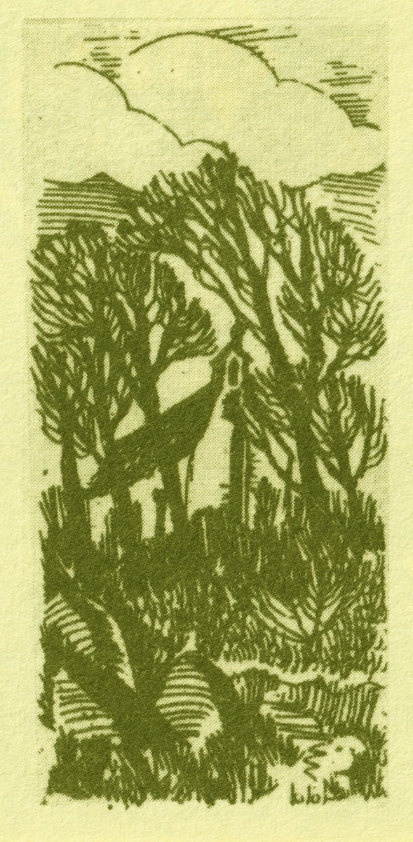
Kilcoe
Art in the Bay
You’ll all know that Ballydehob is the true centre of art in West Cork. Our posts about the Ballydehob Arts Museum (BAM) set out the history of the community from the 1950s onwards. Artists settled in the environs – some camping out in the hills, and many of them remain connected with the area to this day. Local residents were at first amused – or bemused – by this ‘invasion’, but it soon became an accepted part of the character of the village.

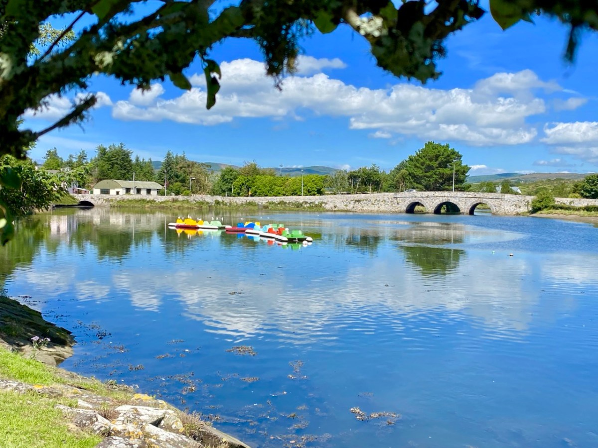
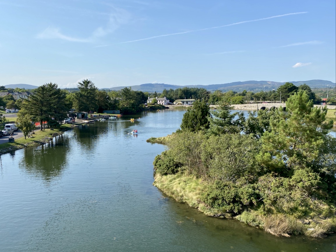
Right at this moment, an innovative installation is in place on the water in Ballydehob, just above the 12 arch viaduct and by the road bridge that comes into the town from the east. This is where the two rivers meet, the Bawnknockane and Rathraune, giving the town its name: Béal Átha an Dá Chab, which literally means Mouth of the Two River Fords.

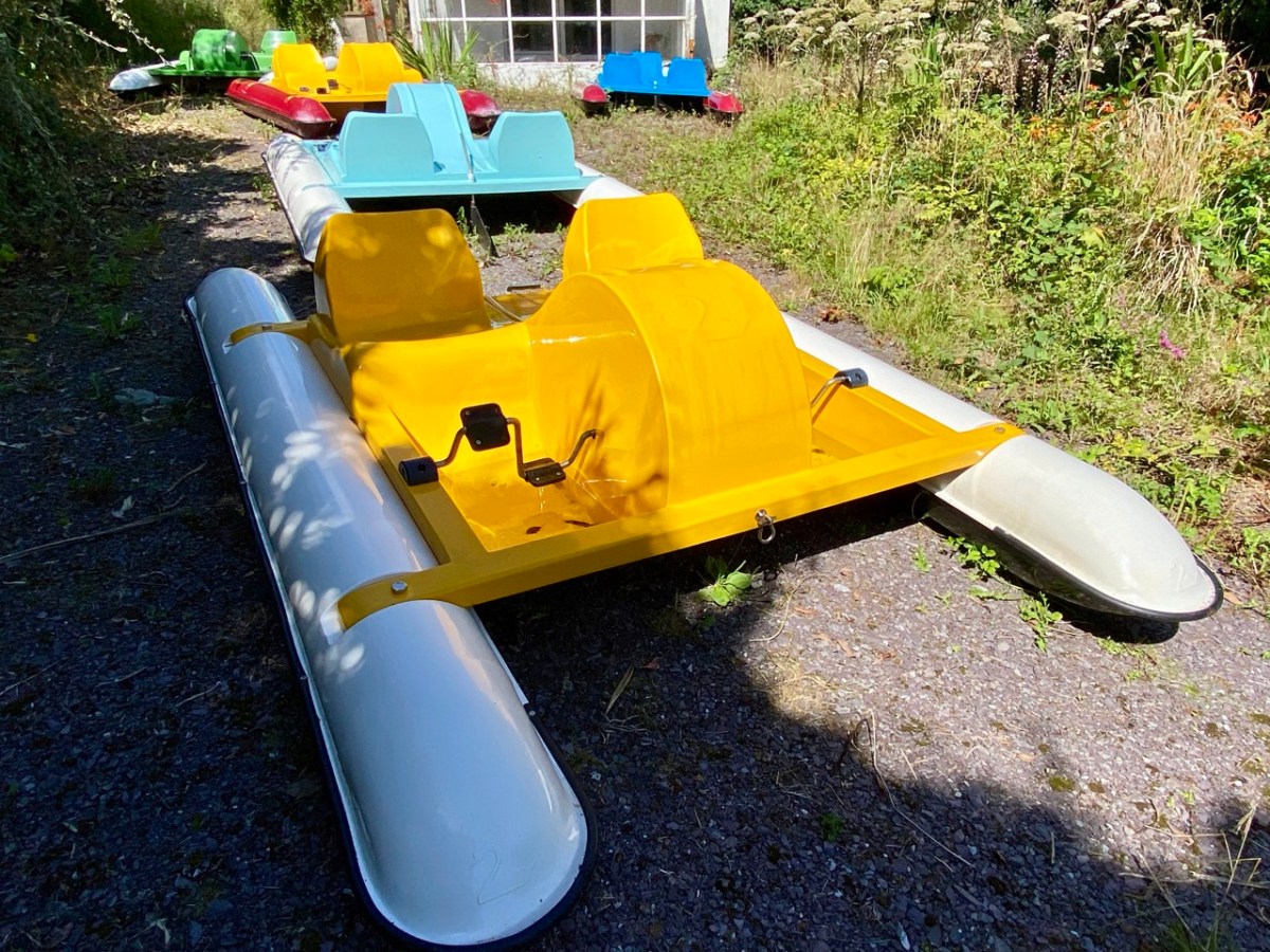
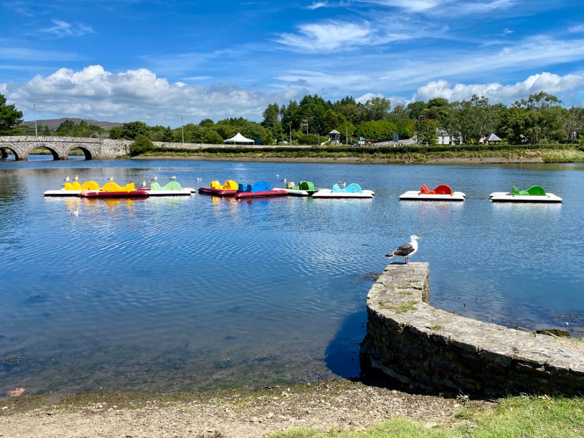
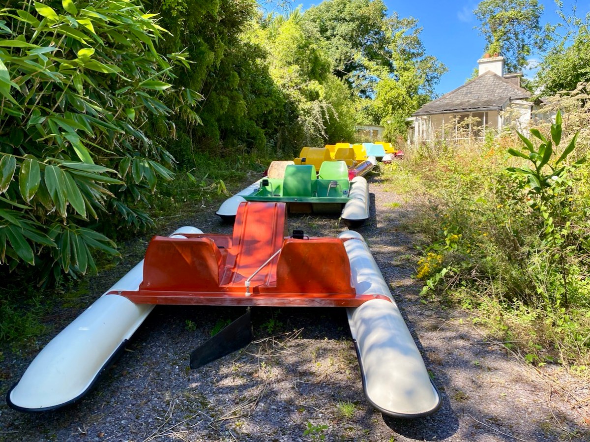
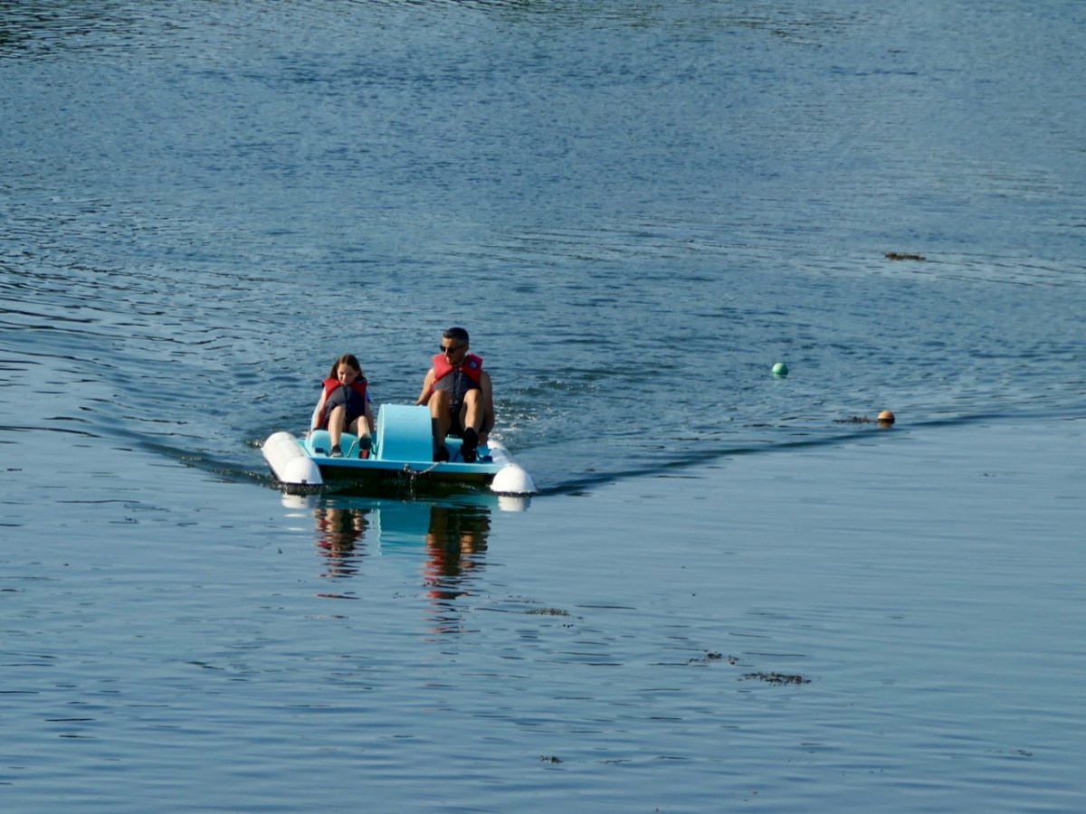
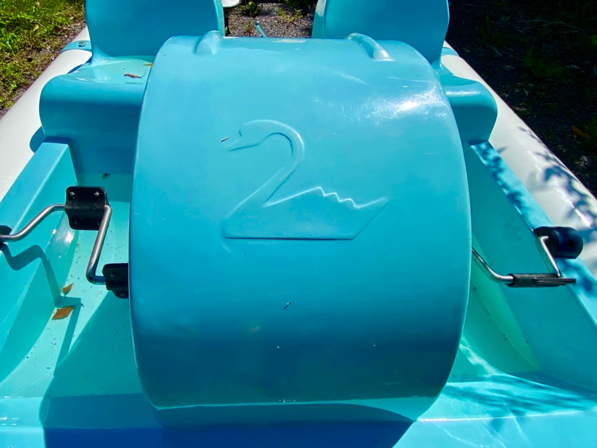
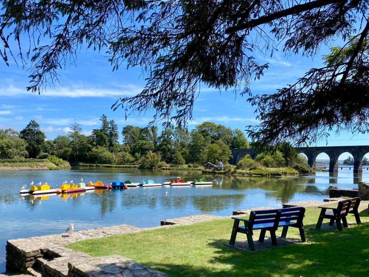
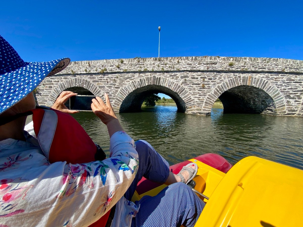
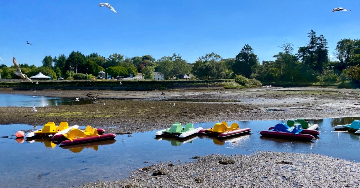
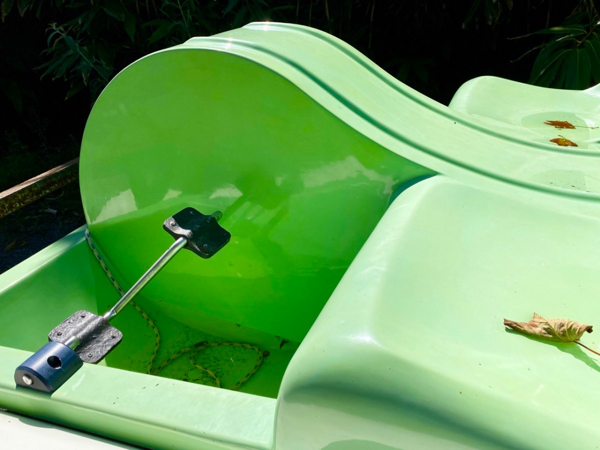
In summary, this art installation by Muireann Levis offers you a close experience of the water accompanied by a sensory soundtrack which is projected into the bay through a series of loudspeakers. The name of the project is Inbhear, which translates simply as Estuary. The way you experience the water is by climbing on board one of the ‘pedalo’ boats that were a common scene on the water here in Ballydehob back in the late 20th century. I remember seeing them on the estuary when I visited West Cork in that time, but they have not been in active use since then, so we were delighted to be among the first to experience their revival, a couple of days ago.

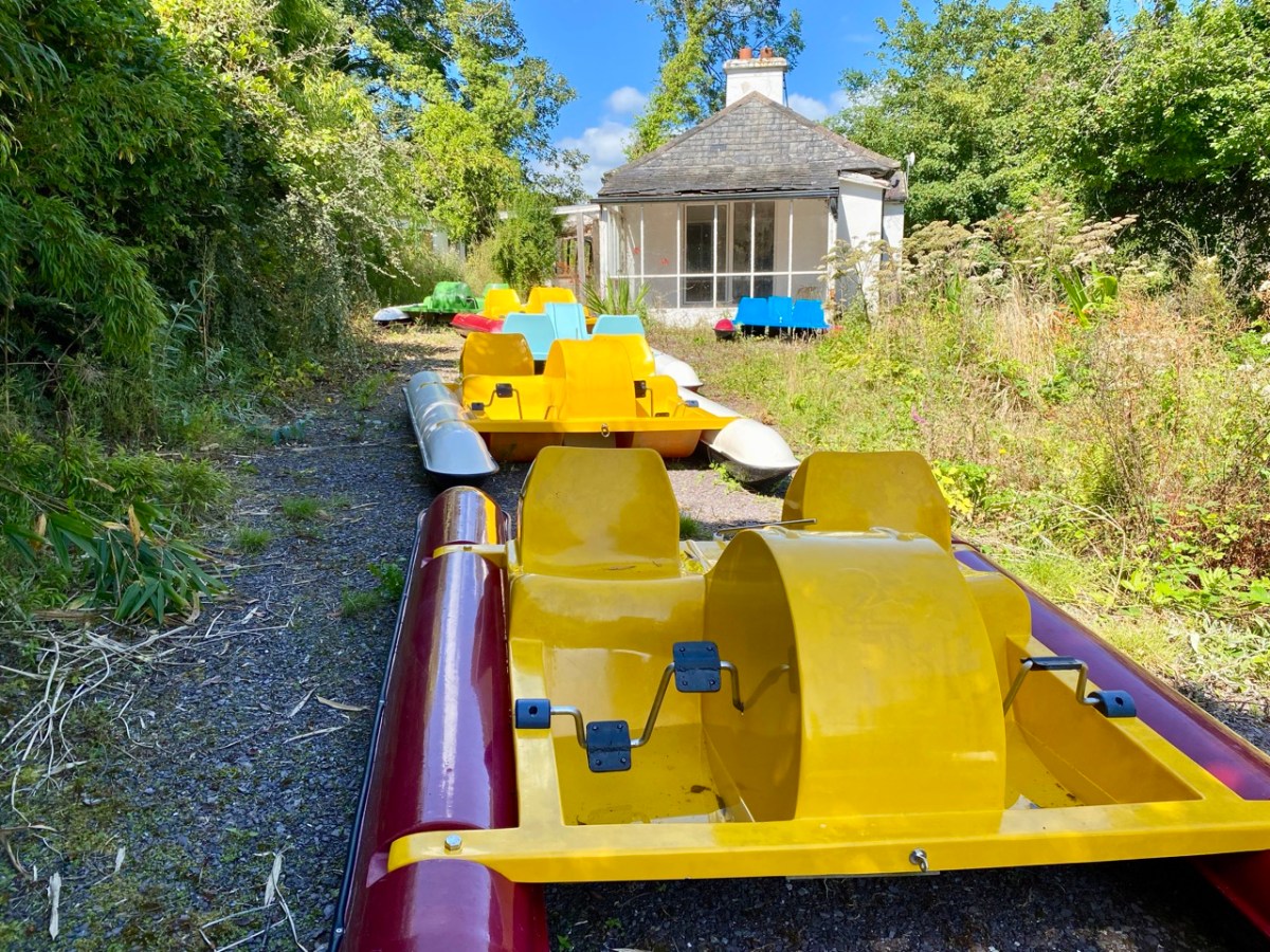
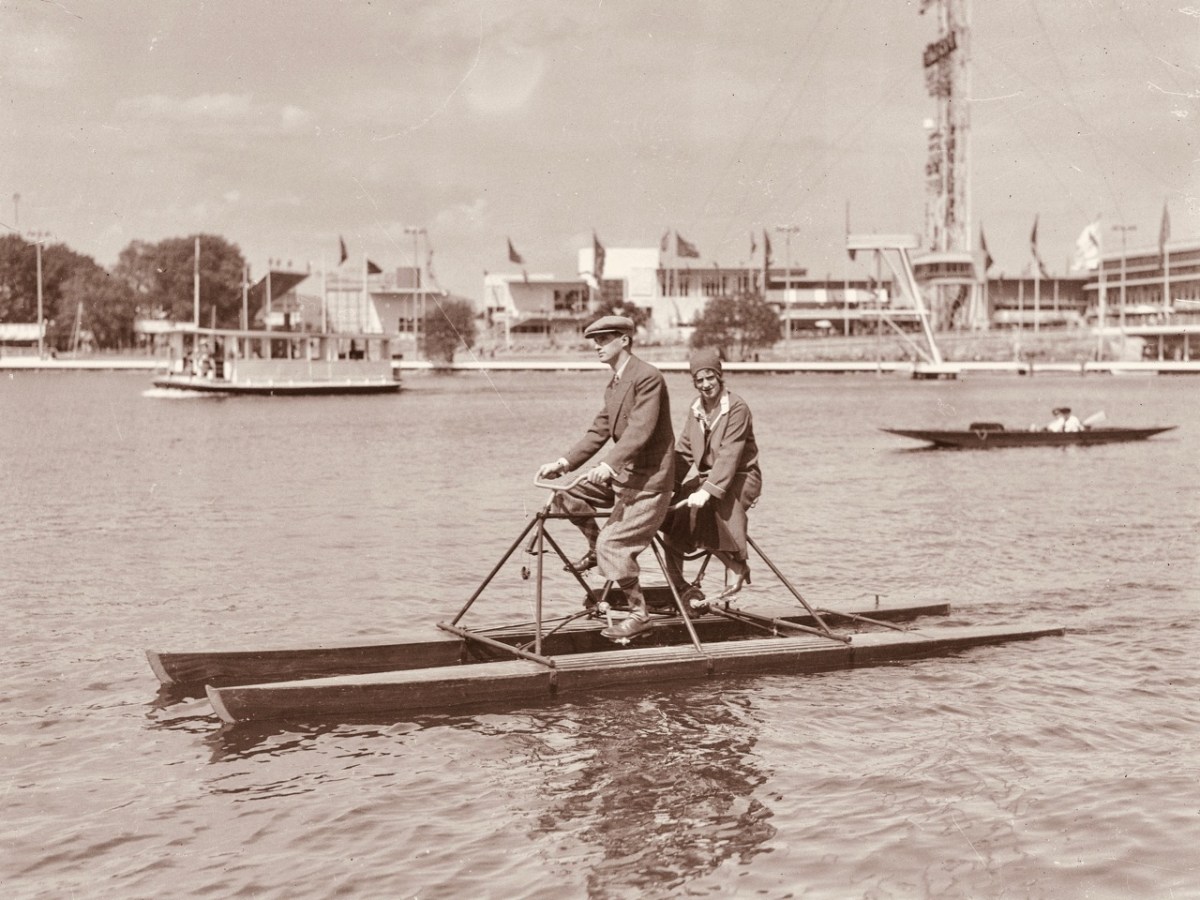
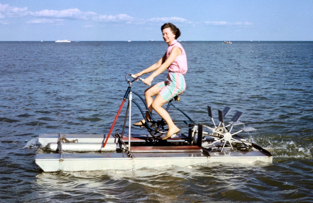
The pedalos have been kept safe and required only a little maintenance before coming back into service. Wouldn’t it be great to think that they might be brought out again on occasion? They are colourful and brimming with character. Have a look at these further examples from the historical archives of ‘pedal powered boats’; the first dates from 1930 in Stockholm, and the second is in Michigan, dated 1963.

Interestingly, the pedalos which we are seeing today were actually assembled in Ballydehob. They were made as part of a government employment scheme, and some were destined to be used in Barley Cove, with a small ‘fleet’ being set up in Ballydehob Bay. The latter deteriorated, but the Barley Cove boats have been stored well, and were recovered for this installation. So it’s a remote deja vu for these craft.

The meeting of the Bawnknockane and Rathraune rivers (above) creates an inner tidal pool – between the three-arched road bridge and the old railway viaduct, and this is where the installation has been set up.

. . . Working with field, hydro-phonic and electromagnetic recordings of the rivers and their many tributaries, Muireann invites us in to a relearning of her childhood environment, creating a piece that draws us closer to the everyday presence of water and elevates its endless subtleties . . . Inbhear, the Irish for “estuary”, finds meaning in its Old Irish roots where it translates to “a carrying in”. It offers a focal point for the carrying in and meeting of old and new identities, both social and environmental . . .

Inbhear event publicity

Finola shot these two videos while we were out on the water experiencing the event, and the soundtracks give an impression of what we could hear while we were afloat:

It may be too late for you to book this event: it’s only happening for a few days. Let’s hope that there’s a demand for a re-run in the near future: it’s such a celebration of so many aspects of Ballydehob, not least as a centre of pedalo boat production back in the day: who knew?

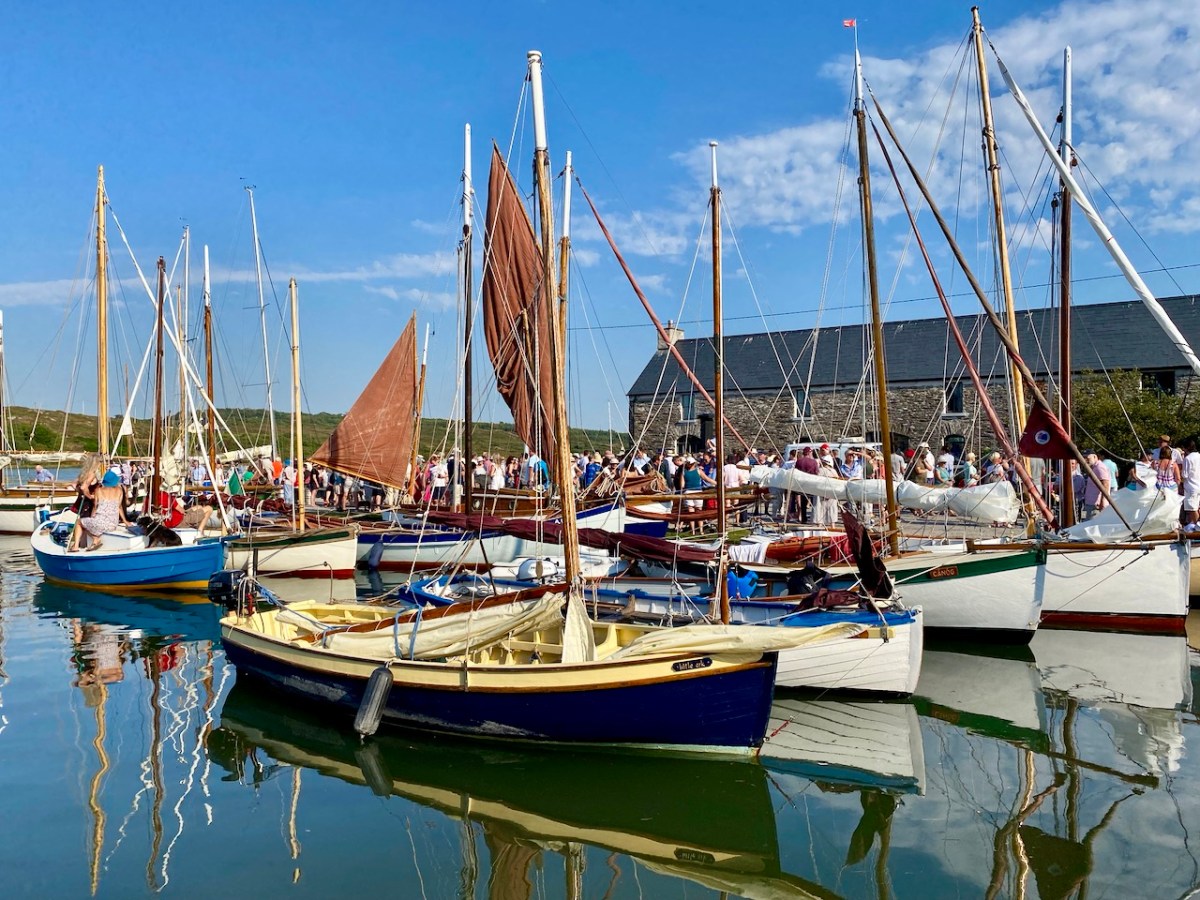
It’s very apt that I should be writing the post on this weekend, as we have just celebrated another Ballydehob event: the annual Cruinniú Bád (boat gathering) which happens at the quay around the highest tide of the summer:

With many thanks to Muireann Levis for inspiring the installation, and to Cormac Levis and William Swanton for information on the history of Ballydehob’s pedalo boats. We should also acknowledge the tireless endeavours of Eleanor Regan and the late Kevin Heaps who operated the pedalos getting on for forty years ago. William told me that Ballydehob Community Council has long been petitioning for the ‘Slob’ below the historic quay to be dredged to allow more boats to use that quay through the year. The sight of boats, small or large, on the water as visitors enter the village from the west would undoubtedly encourage enhanced footfall to the shops and hostelries of this remarkable community

BAM Open! A New + Unique Exhibition!

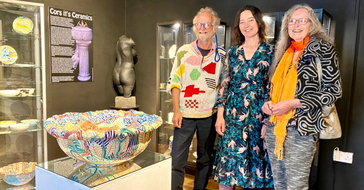
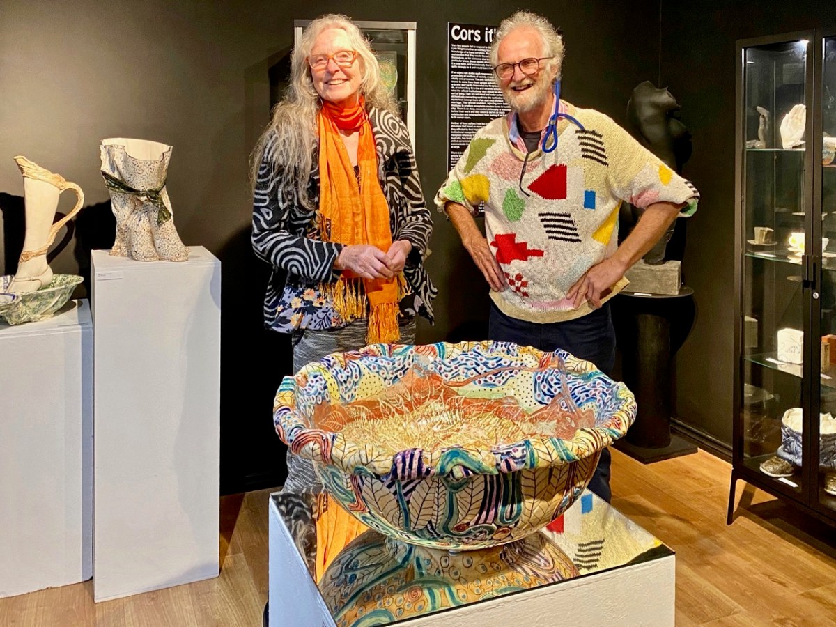
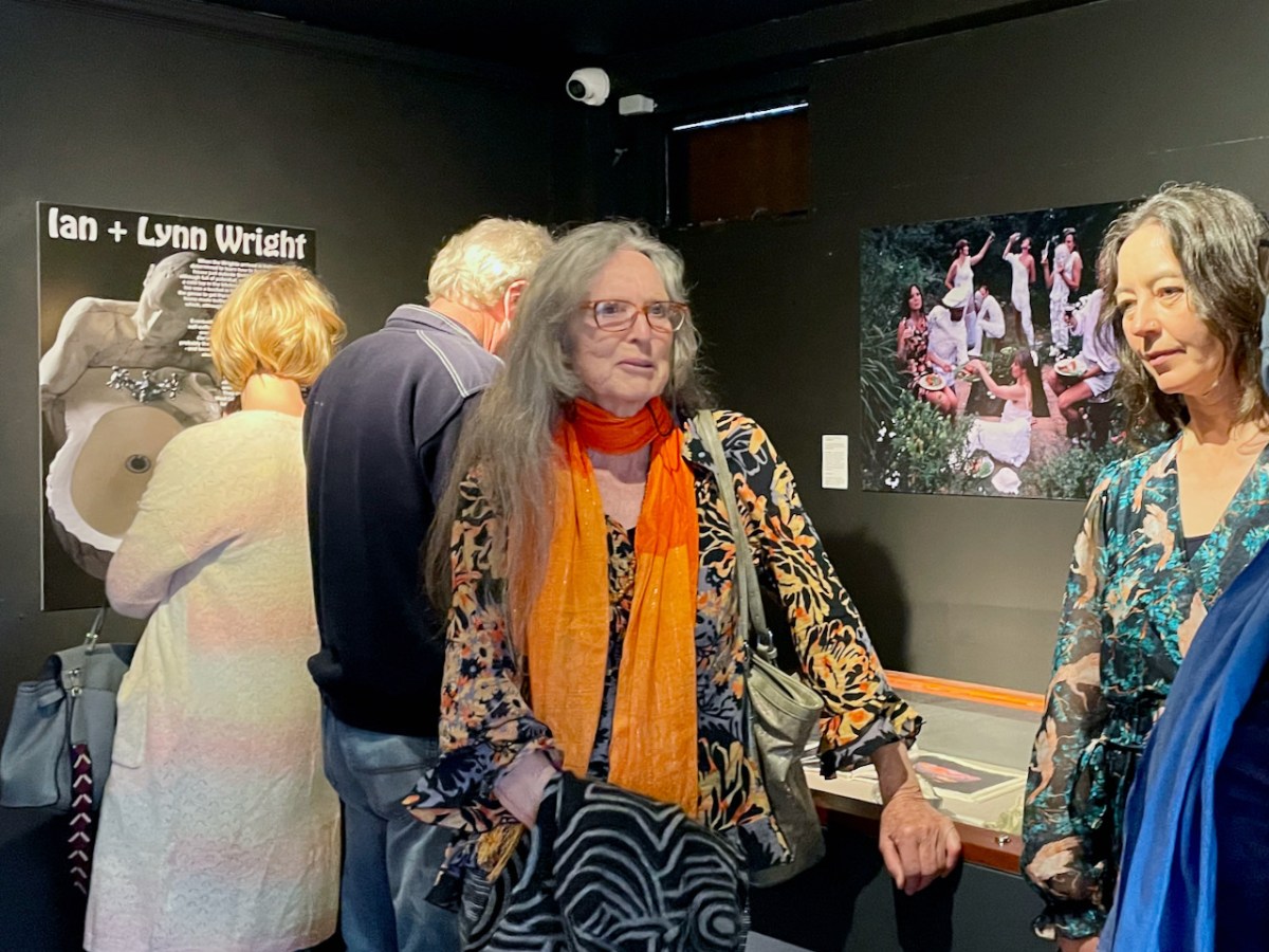
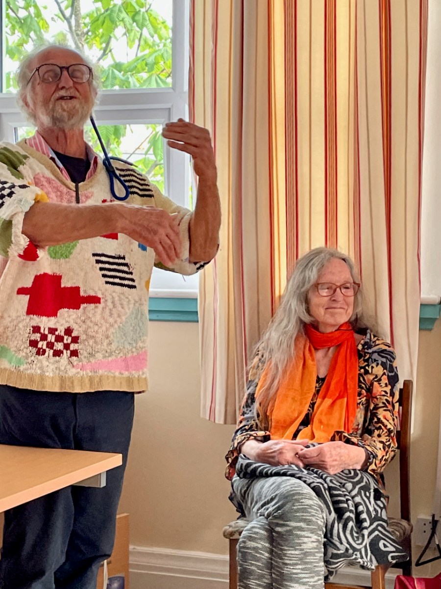
BAM – the Ballydehob Arts Museum – is open through the summer. Make sure you don’t miss the impressive exhibition that’s on at the moment. It shows the work of West Cork art creators Ian and Lynn Wright (shown above with Eleanor Flegg). They were part of the ‘invasion’ of artists who came to the Ballydehob area from the 1960s onwards, and who are now featured in what is perhaps Ireland’s smallest art gallery, situated in Bank House, the headquarters of the Ballydehob Community Council.

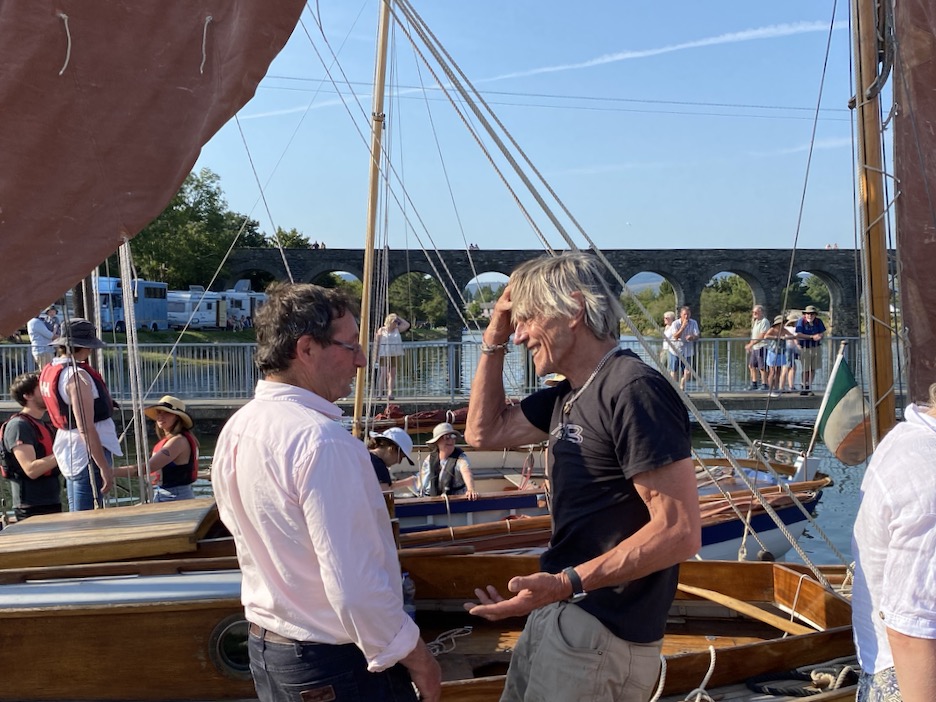
You will find out all about the Museum here and here. Curator Brian Lalor (who featured in last week’s post) and Director Robert Harris (that’s me!) have put together a new exhibition this summer, following two years of absence due to Covid.

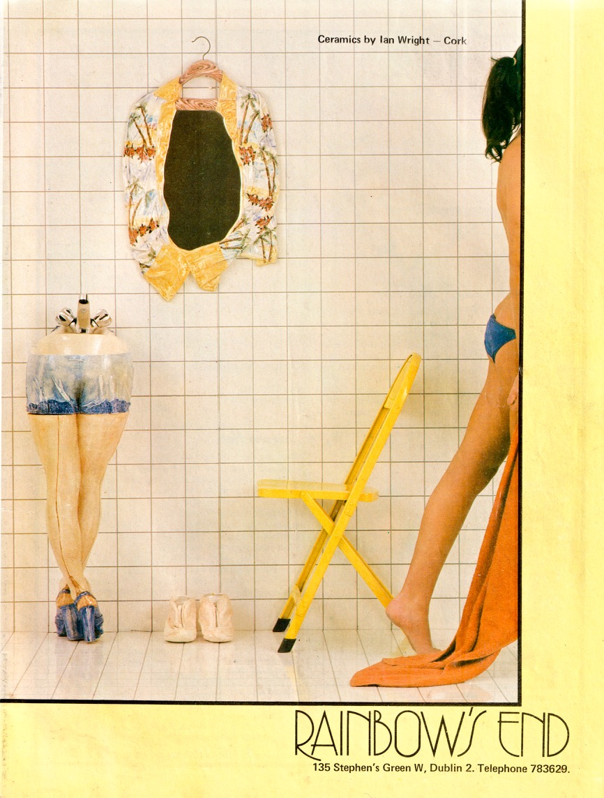
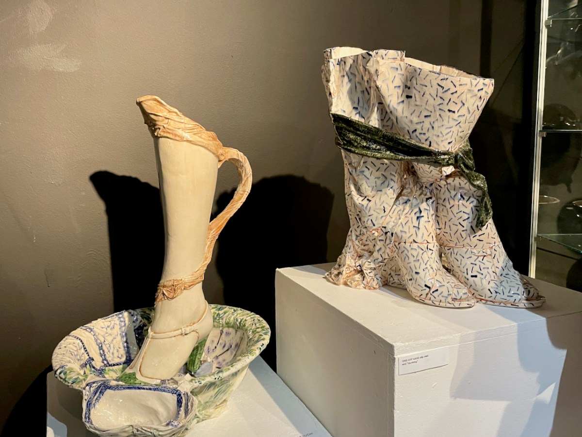
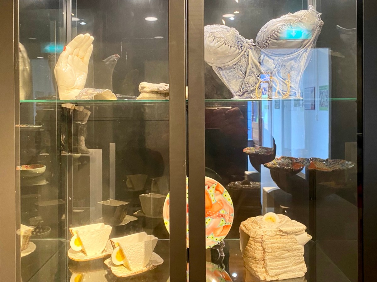
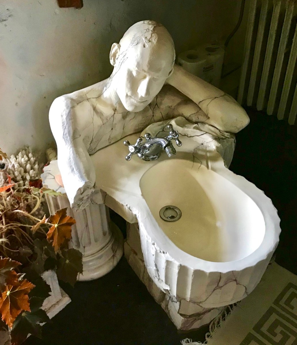
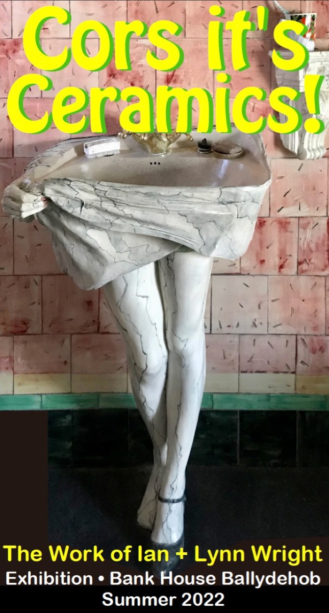
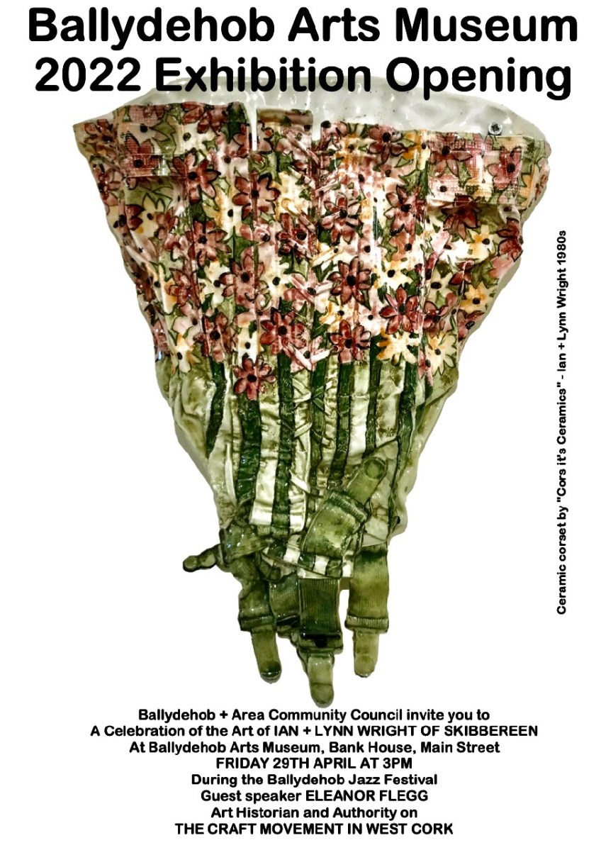
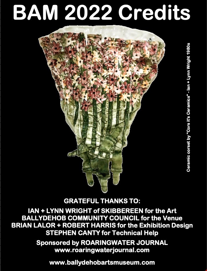
The ad above (from the early 1980s, I think) shows how Ian and Lynn’s work was being marketed at that time. They called themselves Cors it’s Ceramics, and they definitely projected a cheeky identity, making one-off ceramics – basins, bidets, loos and bathroom accessories: unique, appealing and often erotic. Their work was popular, and their production processes couldn’t keep up with demand! Today, the Wrights are producing more measured ceramics: Lynn produces beautiful large bowls, while Ian uses human body moulds to make impressive torso casts. Examples of all their working styles can be seen in the present Museum exhibition.

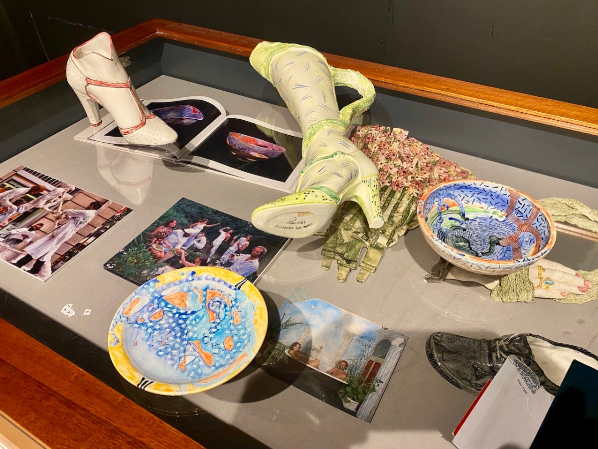
The Museum display is stunning. It brings together – probably for the first time ever – an eclectic extravaganza of the Wright’s output over half a century: examples of work small and large. There are no complete bathroom settings here: those that survive are still installed in the domestic settings for which they were commissioned. But we are fortunate that we have had access to the Wrights’ own collection of their work, which they have freely lent to the Museum. We do, of course, also have photographic records of other examples.

The Exhibition was formally opened earlier this year by Eleanor Flegg, and it can now be viewed for free whenever the Ballydehob Tourism Office is open. Through the summer this is usually from Monday to Saturday – 11am to 1pm, and from 2pm to 5pm. However, please check before visiting, as the office is staffed only by volunteers, and we can’t guarantee those hours at all times. It’s best to ring this number to confirm that it will be open: 028 25922.

A lot of effort has gone into making this exhibition. It’s on for the rest of this season, so please don’t miss it. It is the aim of the Ballydehob Arts Museum to celebrate the very special projects that have been carried out over decades to give the village its reputation as an artistic centre of excellence. Nowhere else can you find the full flavour of what has made this community so special.

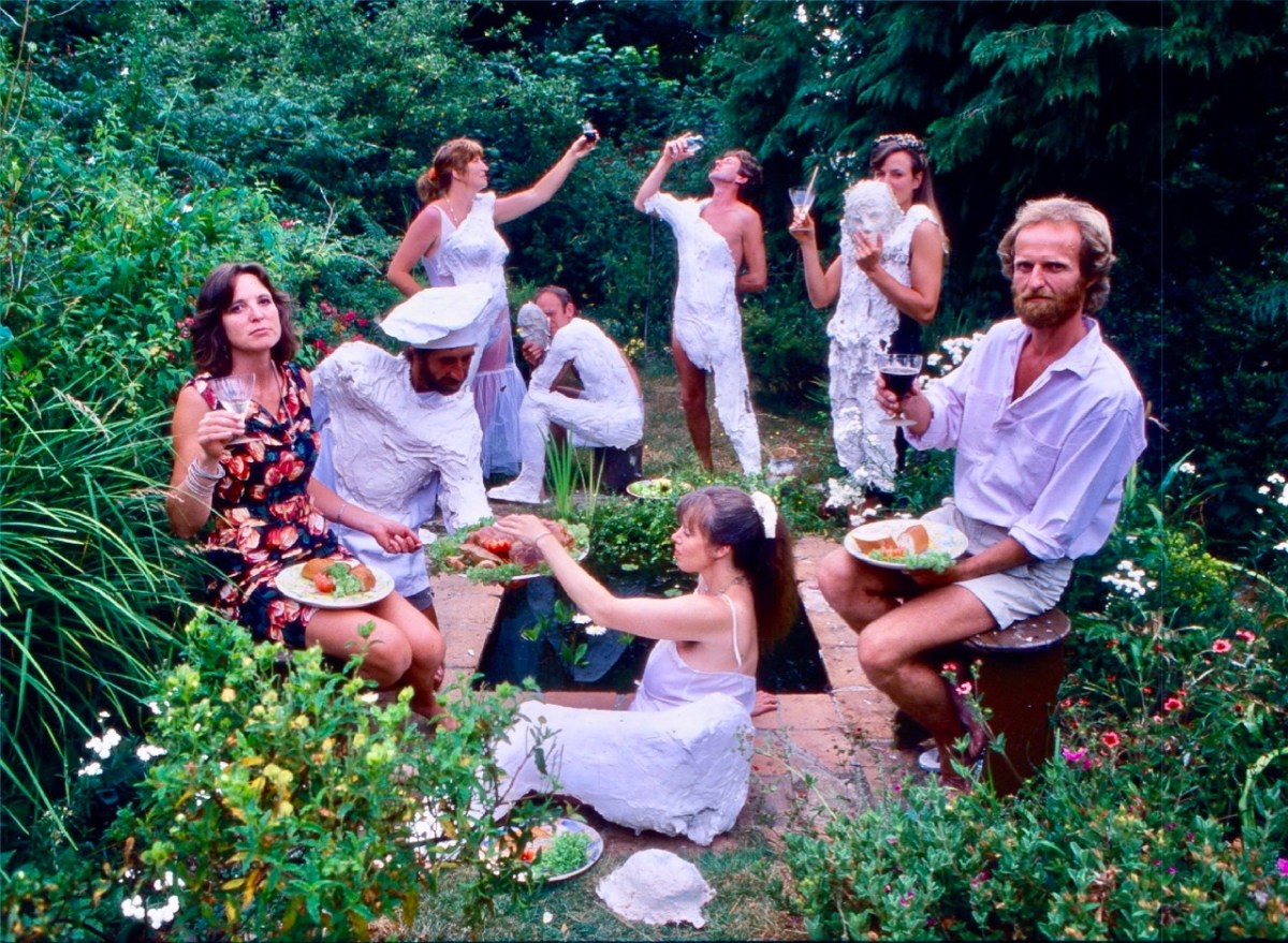
This photo (above) appeared in the Mail on Sunday newspaper in 1983. Lynn and Ian are on the left and right respectively. The occasion is a ‘body casting party’ in the Wright’s garden.

Mythical Isles of the West

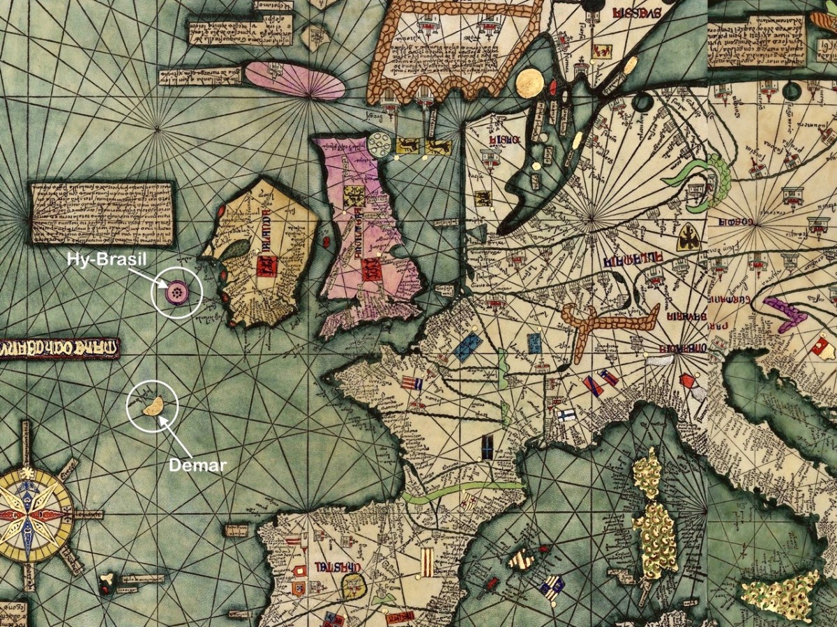
The fine map, above, was drawn in 1375 and is attributed to Abraham Cresques (courtesy  Library of Congress, Geography and Map Division). it is known generally as the Atlas Catalan. What interests us is that it depicts two islands off the west and south-west coasts of Ireland (see detail below): Hy-Brasil and Demar. These landfalls are shown on maps since then through the centuries, the last depiction being in 1865.

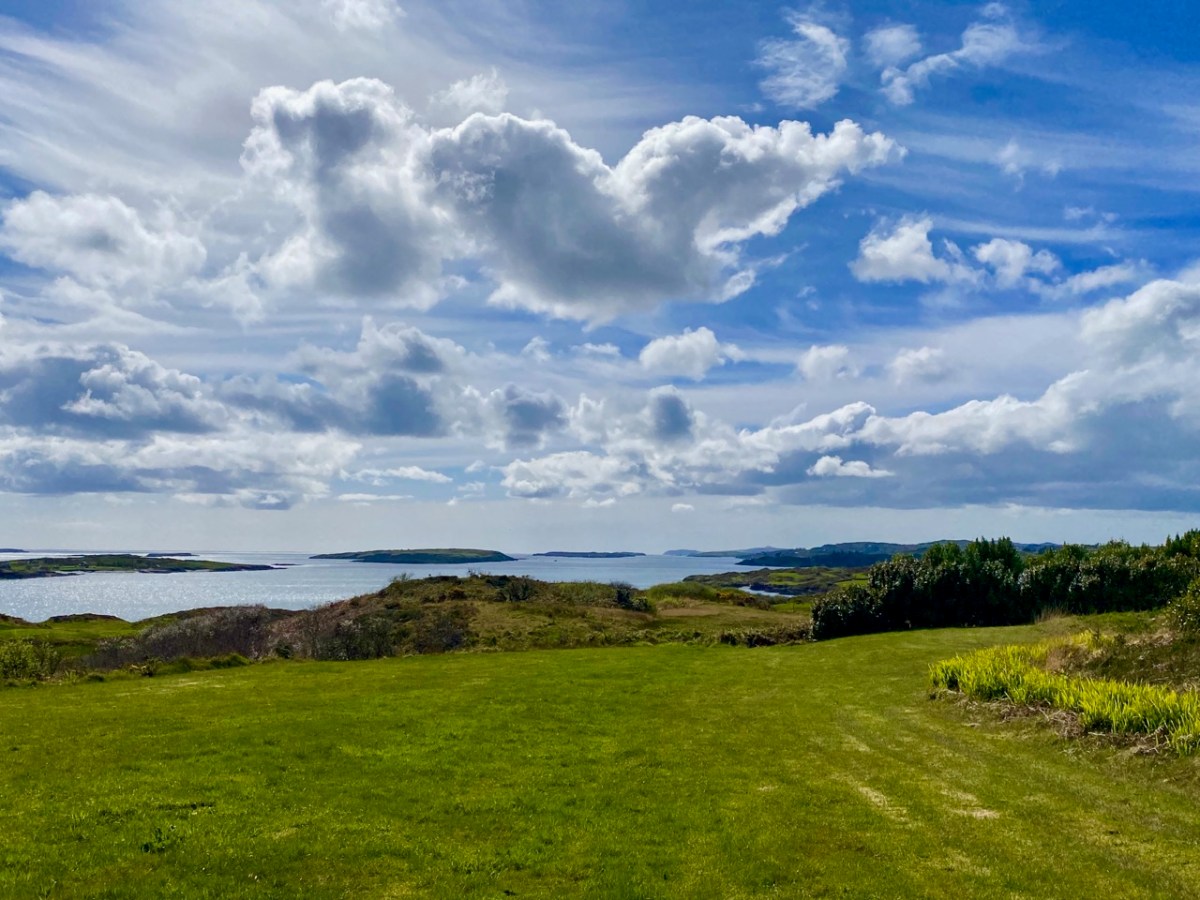
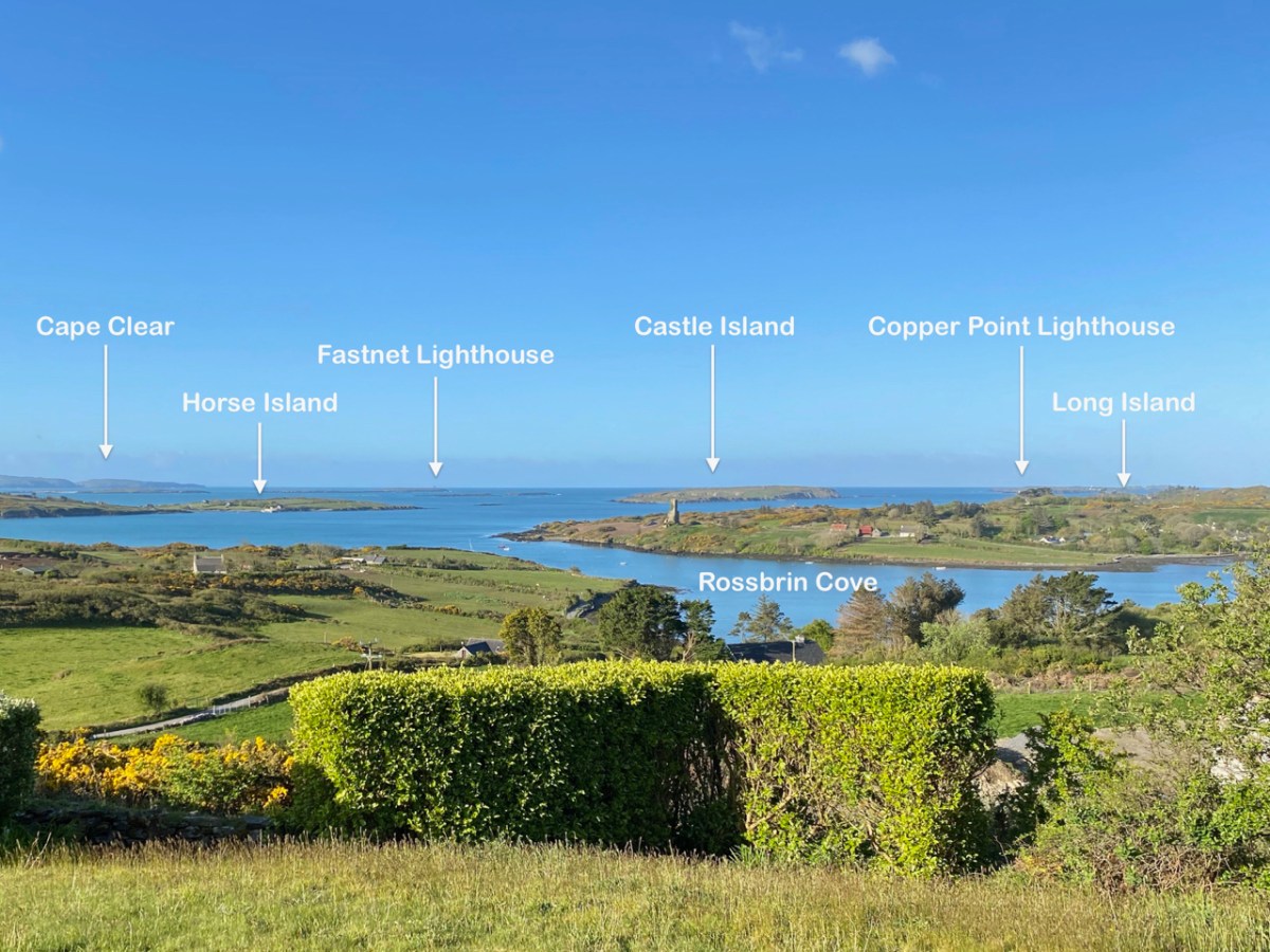
We look out to the hundred Carbery Islands in Roaringwater bay. The view (above) is always changing as sun, rain and wind stir up the surface of the sea and the sky and clouds create wonderful panoramas. But, generally, the view is predictable: we know that Horse island will be across from us, and Cape Clear will always be on the distant horizon, while the smaller islets break up the surface of the ocean in-between, and help calm down its wildness when the storms come.

But, suppose it wasn’t always predictable? What if those islands changed, moved around or appeared and disappeared? It seems that such things do happen, here in Ireland. At least, they do according to some of the recorded evidence. ‘Mythical Islands’ have been mentioned by mariners and storytellers through the centuries.

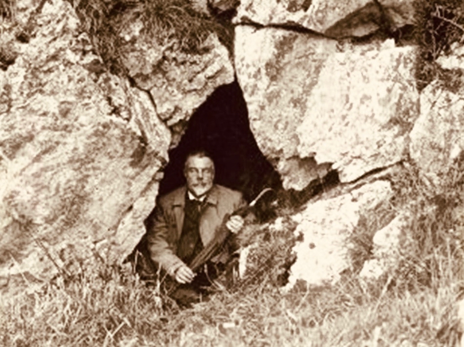
Our best source of information for Ireland’s ‘transcendent’ islands is our old friend Thomas Westropp (above, kitted out for an expedition) who was an archaeologist and folklorist living between 1860 and 1922. He was active in Counties Clare and Limerick and wrote a paper for The Royal Academy in 1912 – Brasil and the Legendary Islands of the North Atlantic: Their History and Fable. This comprehensive paper includes a list of evanescent islands, a new map drawn by Westropp, and a summary of historic maps which have located them:

Westropp’s exploration of the subject is remarkably comprehensive. Here are some extracts:

. . . Bran son of Febal, sleeping near his fort, hears sweet music, and awakes to seize a magic apple branch. An unknown woman sings of “a glorious island round which sea-horses glisten – a fair course against the white swelling surge.” In it dwells no wailing, treachery, death, or sickness; it glows many-coloured in incomparable haze, with snowy cliff’s and strands of dragon-stones and crystals. She vanishes, and Bran, with twenty-seven followers, embarks. They meet the sea-god Mananann mac Lir in his chariot, visit Magh Mell, the Isle of Laughter, and the Isle of Women, whose queen draws Bran to it by a magic clue. Entranced by love, the visitors do not note the flight of time; in apparently undiminished youth and strength they return to Ireland; it is only when the first to step ashore falls to ashes, as if centuries dead, that they know the truth. The survivors tell their tale without landing, and sail out into the deep, never to be seen again . . .

Thomas WESTROPP – Brasil and the Legendary Islands of the North Atlantic, 1912

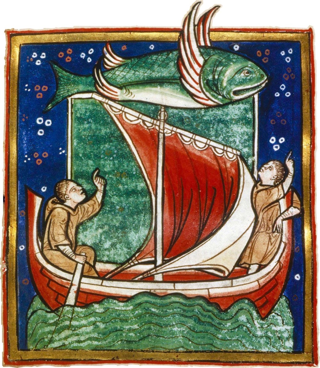
Image above courtesy of the Worksop Bestiary.

. . . The Sunken Land. I found no name for this in north Mayo save when it was confused with Manister Ladra. Belief in it prevailed in north Erris and Tirawley from Dunminulla to Downpatrick. In 1839 it was said to extend from near Teelin to the Stags of Broadhaven and thence half way to America. A boatman knew a woman named Lavelle who saw from the shore (when gathering Carrigeen moss) a delightful country of hills and valleys, with sheep browsing on the slopes, cattle in green pastures, and clothes drying on the hedges. A Ballycastle boatman, a native of Co. Sligo, corroborated this, adding that he had seen it twice at intervals of seven years, and if he lived to see it a third time he would be able to disenchant it. He could talk of nothing else, became idle and useless, and died, worn out and miserable, on the very eve of the expected third appearance . . .

Thomas WESTROPP – Brasil and the Legendary Islands of the North Atlantic, 1912

. . . Owen Gallagher, Lieutenant Henri’s servant, heard of one Biddy Took, who, when gathering dillish (seaweed), asked some passing boatmen to put her out to an islet and fetch her back on their return : amused by her talk they brought her fishing, and soon got a ” tremendous bite.” They landed a green, fishy-looking child, quite human in shape, and in their fright let him escape and dive. The man who hooked him died suddenly within a year. Gallagher also said that he had fired at and wounded a seal; soon after, when far out to sea in his currach, he got lost in a fog-bank and reached an unknown island. An old man, moaning, with one eye blinded, stood on the shore and proved to be the seal. With more than human forgiveness, he warned his enemy to fly from the land of the seal men, lest his (the seal’s) sons and friends should avenge the cruelty . . .

Thomas WESTROPP – Brasil and the Legendary Islands of the North Atlantic, 1912

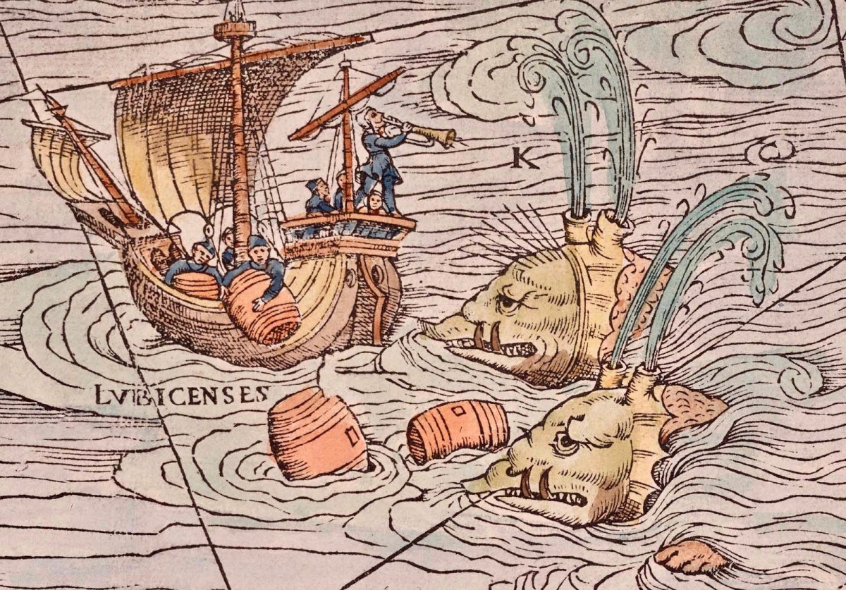
Image Carta Marina (1539) courtesy Bone + Sickle

. . . The Aran people now believe that Brasil is seen only once in seven years. They call it the Great Land. In Clare, I have heard from several fishermen at Kilkee and elsewhere that they had seen it ; they also told legends of people lost when trying to reach it. I myself have seen the illusion some three times in my boyhood, and even made a rough coloured sketch after the last event, in the summer of 1872. It was a clear evening, with a fine golden sunset, when, just as the sun went down, a dark island suddenly appeared far out to sea, but not on the horizon. It had two hills, one wooded ; between these, from a low plain, rose towers and curls of smoke. My mother, brother, Ralph Hugh Westropp, and several friends saw it at the same time; one person cried that he could “see New York ” ! With such realistic appearance (and I have since seen apparent islands in 1887 in Clare, and in 1910 in Mayo), it is not wonderful that the belief should have been so strong, probably from the time when Neolithic man first looked across the Atlantic from our western coast. It coloured Irish thought ; stood for the pagan Elysium and the Christian Paradise of the Saints ; affected the early map-makers ; and sent Columbus over the trackless deep to see wonders greater than Maelduin and Brendan were fabled to have seen, till Antilha, Verde, and Brazil became replaced by real islands and countries ; and the birds, flowers, and fruit of the Imrama by those of the gorgeous forests of the Amazon in the real Brazil. ” Admiration is the first step leading up to knowledge, for he that wondereth shall reign.” . . .

Thomas WESTROPP – Brasil and the Legendary Islands of the North Atlantic, 1912

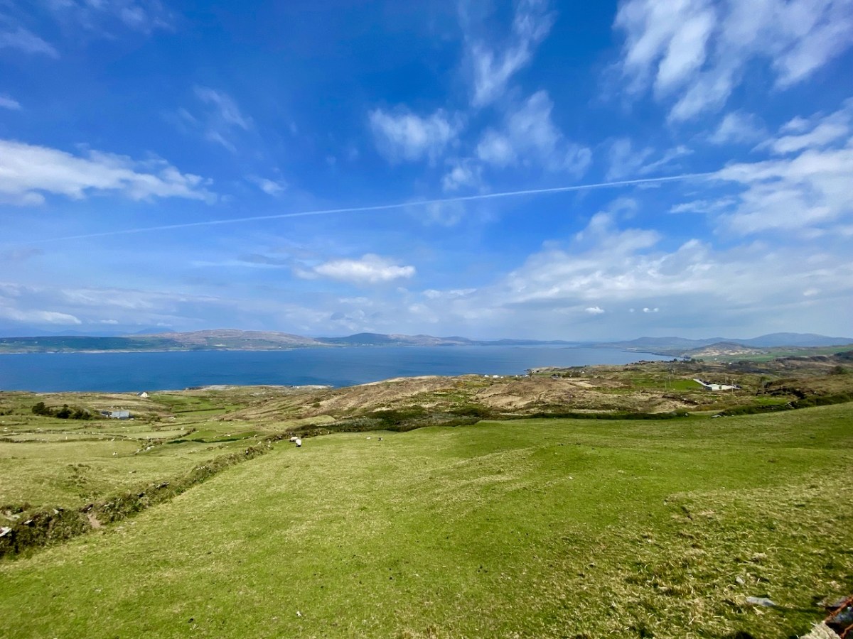
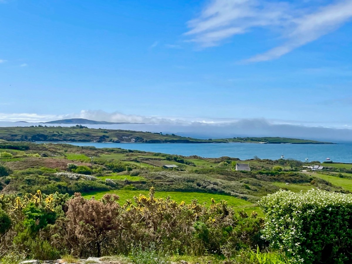
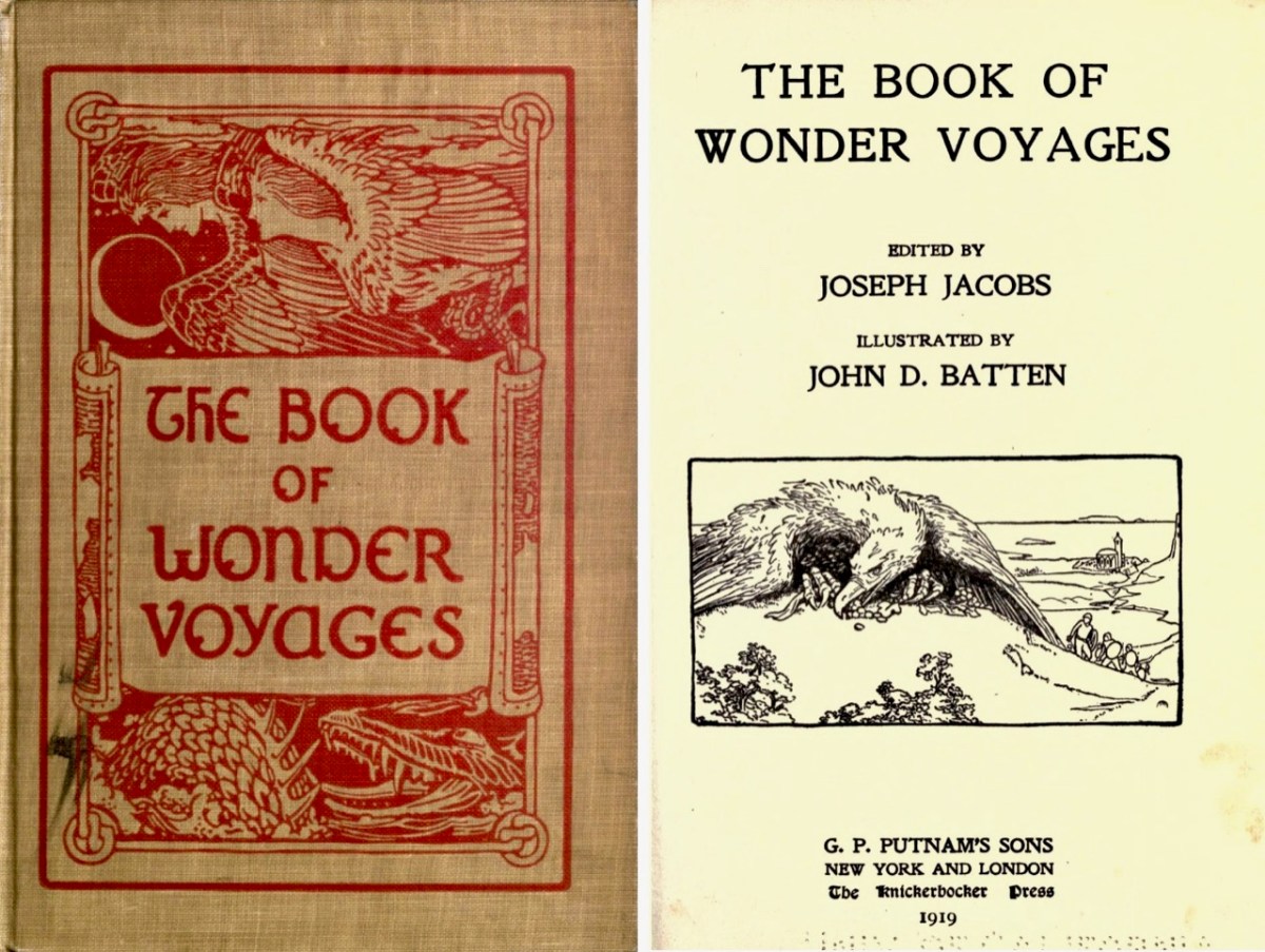
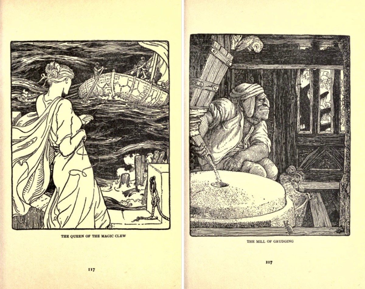
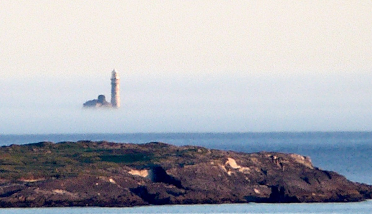
Above is the view from our house – Nead an Iolair – a day or two ago, when a strong sea mist was coming across from the south-west, enveloping Cape Clear and making it float ethereally like one of the mythical islands. Other writers have tackled the subject of the vanishing lands, including Joseph Jacobs, who put together a collection of stories in 1919. The subject is ‘Wonder Voyages’, and the book (available online here) covers some of Ireland’s adventurers, including Máel Dúin – a predecessor of Brendan the Voyager.

Máel Dúin sets out ‘into the limitless ocean’, suggesting that ‘God will bring the boat where it needs to go’. He and his crew encounter a large number of strange islands, including:

The island of ants, from which the men flee because the ants’ intention is to eat their boat

The island of tame birds

The island of the horse-like beast who pelts the crew with the beach

The island of horses and demons

The island of salmon, where they find an empty house filled with a feast and they all eat, drink, and give thanks to Almighty God.

The island with the branch of an apple tree, where they are fed with apples for 40 nights

The island of the “Revolving Beast”, a creature that would shift its form by manipulating its bones, muscles, and loose skin; it casts stones at the escaping crew and one pierces the keel of the boat

The island where animals bite each other and blood is everywhere

The island of apples, pigs, and birds

The island with the great fort/pillars/cats where one of the foster brothers steals a necklet and is burned to ashes by the cat

The island of black and white sheep, where sheep change colours as they cross the fence; the crewmen do not go aboard this island for fear of changing colour

The island of the swineherd, which contained an acidic river and hornless oxen

The island of the ugly mill and miller, who was “wrinkled, rude, and bareheaded”

The island of lamenting men and wailing sorrows, where they had to retrieve a crewman who entered the island and became one of the lamenting men; they saved him by grabbing him while holding their breath

The island with maidens and intoxicating drink

The island with forts and the crystal bridge, where there is a maiden who is propositioned to sleep with Máel Dúin

The island of colourful birds singing like psalms

The island with the psalm-singing old man with noble monastic words

The island with the golden wall around it

The island of angry smiths

The crew voyaged on and came across a sea like a green crystal. Here, there were no monsters but only rocks. They continued on and came to a sea of clouds with underwater fortresses and monsters.

The island with a woman pelting them with nuts

The island with a river sky that was raining salmon

The island on a pedestal

The island with eternal youth/women (17 maidens)

The island with red fruits that were made as a sleeping elixir

The island with monks of Brendan Birr, where they were blessed

The island with eternal laughter, where they lost a crewman

The island of the fire people

The island of cattle, oxen, and sheep

The most well-known voyager of all – in Irish tradition – is Saint Brendan. The image above is from the Finola Window, which was crafted by George Walsh. We all know that Brendan was a real character, who discovered America back in the sixth century. On the way he also encountered many islands – which we cannot locate today (that doesn’t mean they are not there) – and had hair-raising adventures on them. This post will take you through some of his journeyings.

It’s clear that, in the shared Irish psyche, we are aware of places that we can’t always see, or visit. it’s all part of a folk knowledge that’s largely hidden away, except in the memories of older generations, that relates to the sea, and the idea that there are races of people who live on ‘lost’ islands – or even in the sea. In some of the stories about the islands it is suggested that, when they vanish, it’s because they have submerged under the ocean – perhaps temporarily.

There’s a great collection of stories readily available in a series of podcasts known as Blúiríní Béaloidis / Folklore Fragments. Look out for the one titled Blúiríní Béaloidis 16 – Otherworld Islands In Folk Tradition. I have transcribed one of my favourite pieces from this podcast, and will finish this post with it. It summarises, very neatly, the tradition that other worlds are out there, and – at times – our world and theirs meet, providing solid evidence for there being human life under the sea! The tale was collected by Dr McCarthy of Kerry.

. . . People from Dingle Harbour used to sail to Kilrush in Limerick long ago. There was a boat leaving the harbour to Limerick one day with a load of salt. There were 8 men in the boat. They had prepared the boat. There was no quay in Dingle in those days, just a slipway. A fine, strapping young man approached them carrying a pot and a pot-hook, The pot-hook looked as if it had come straight from the forge. He addressed the boat’s captain. Are you going to Limerick, my good man? I am, said the captain, we are just about to leave. Would you mind terribly, said the young man, taking me some of the way? I don’t mind, said the captain, if you wish to come all of the way. He placed his pot and pot-hook in the boat, and got in himself. They rowed away and raised the sail at the mouth of the harbour. They were halfway when the man with the pot and pot-hook roused himself. I’ll be leaving you now, he said to the captain, and I’m very grateful to you. He took hold of his pot and his pot-hook and he leapt into the sea. They never saw him again . . .


Blúiríní Béaloidis

There’s a rather nice postscript to this story:

. . . Some time later, a man with a line and hook was fishing in the sea in the same place, and a boiled potato came up on his hook . . .

Blúiríní Béaloidis

“Easter” Island!

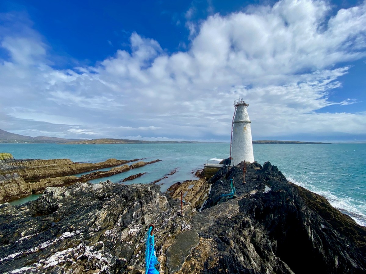
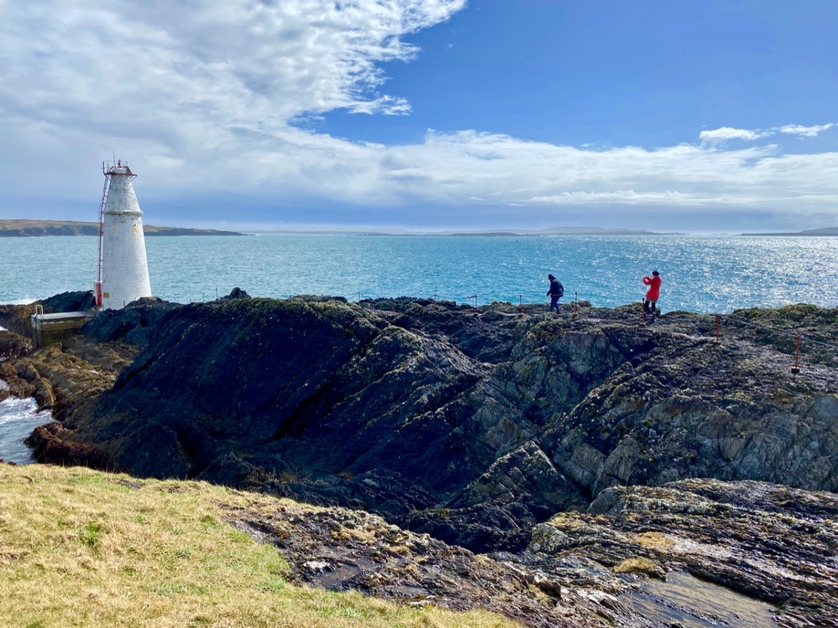
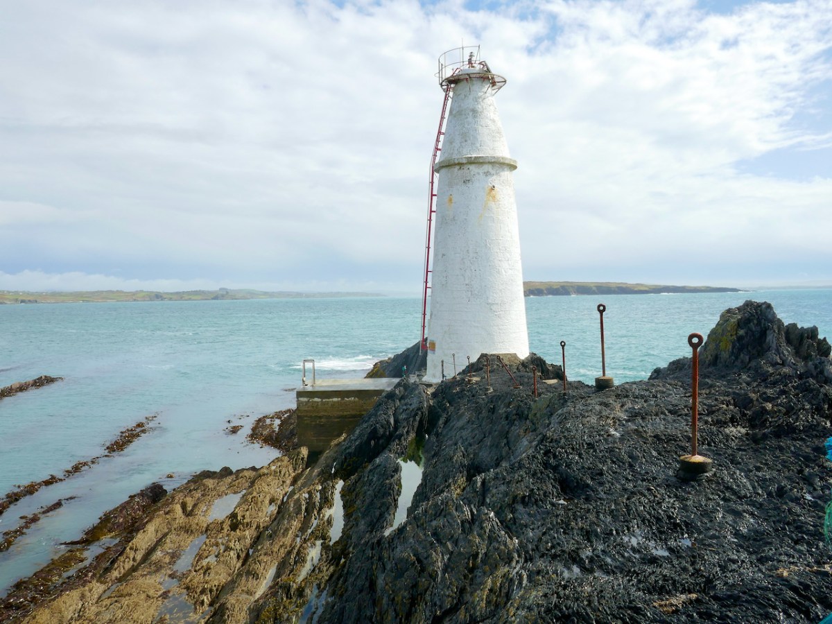
What better place to spend Easter Day than at the ‘Easter end’ of Long Island? We can see the island – out there in Roaringwater Bay – from our home here at Nead an Iolair. The lighthouse on the end of the island faces us – and winks through the night with the character of 3 quick flashes every 10 seconds. The narrow headland on which it stands bears the name ‘Copper Point’ – and so does the lighthouse.

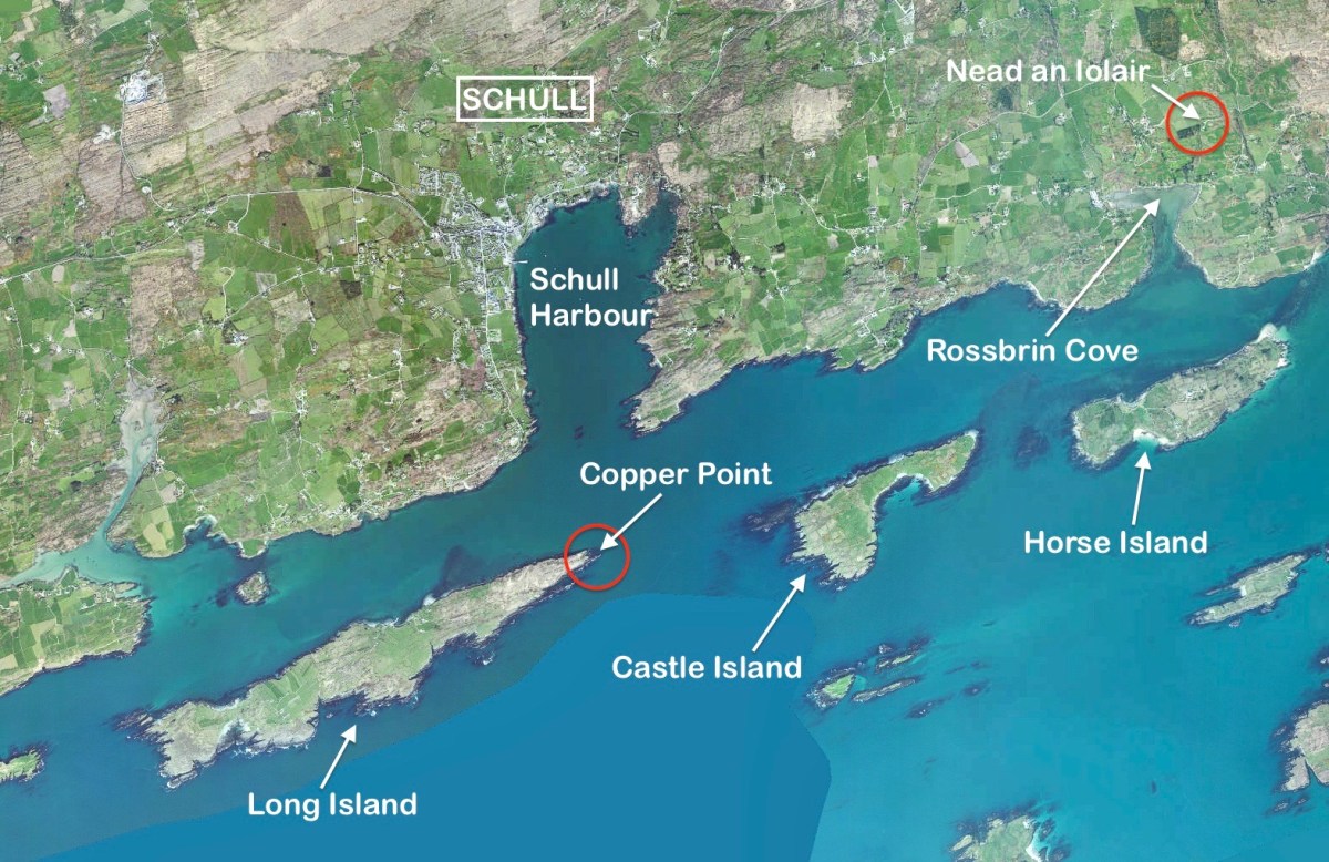
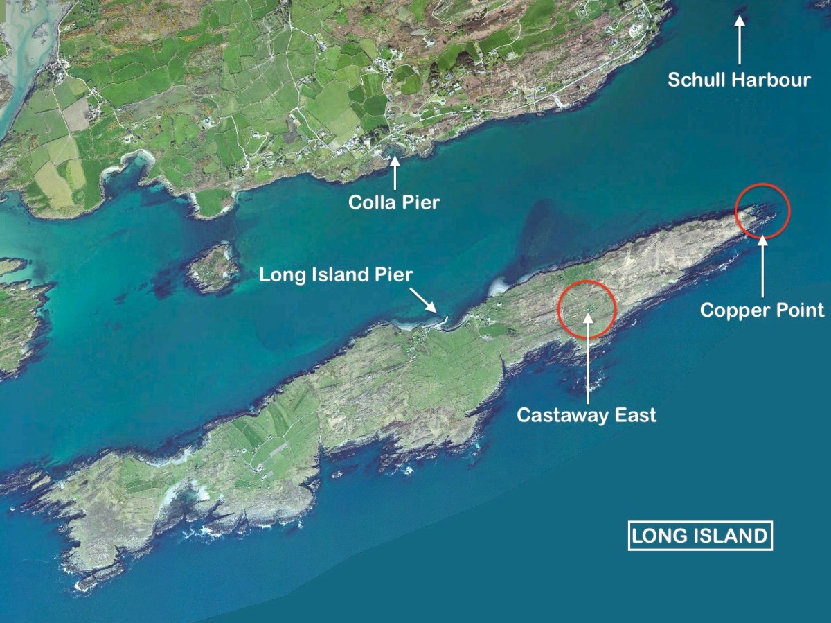
This aerial view shows Long Island in its context – a part of Roaringwater Bay and its ‘Carbery’s Hundred Islands’. Its neighbours to the east are Castle Island and Horse Island – all in our view – (that’s our view, below).

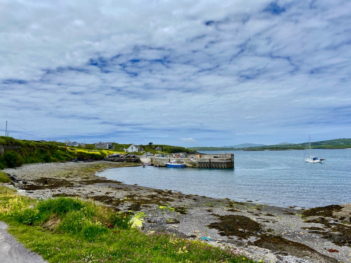
A closer aerial view of the island, above. It’s accessed by a regular ferry which leaves Colla Pier, a short distance from Schull town. The ferry arrives at Long Island Pier: there it is, on the pier (below).

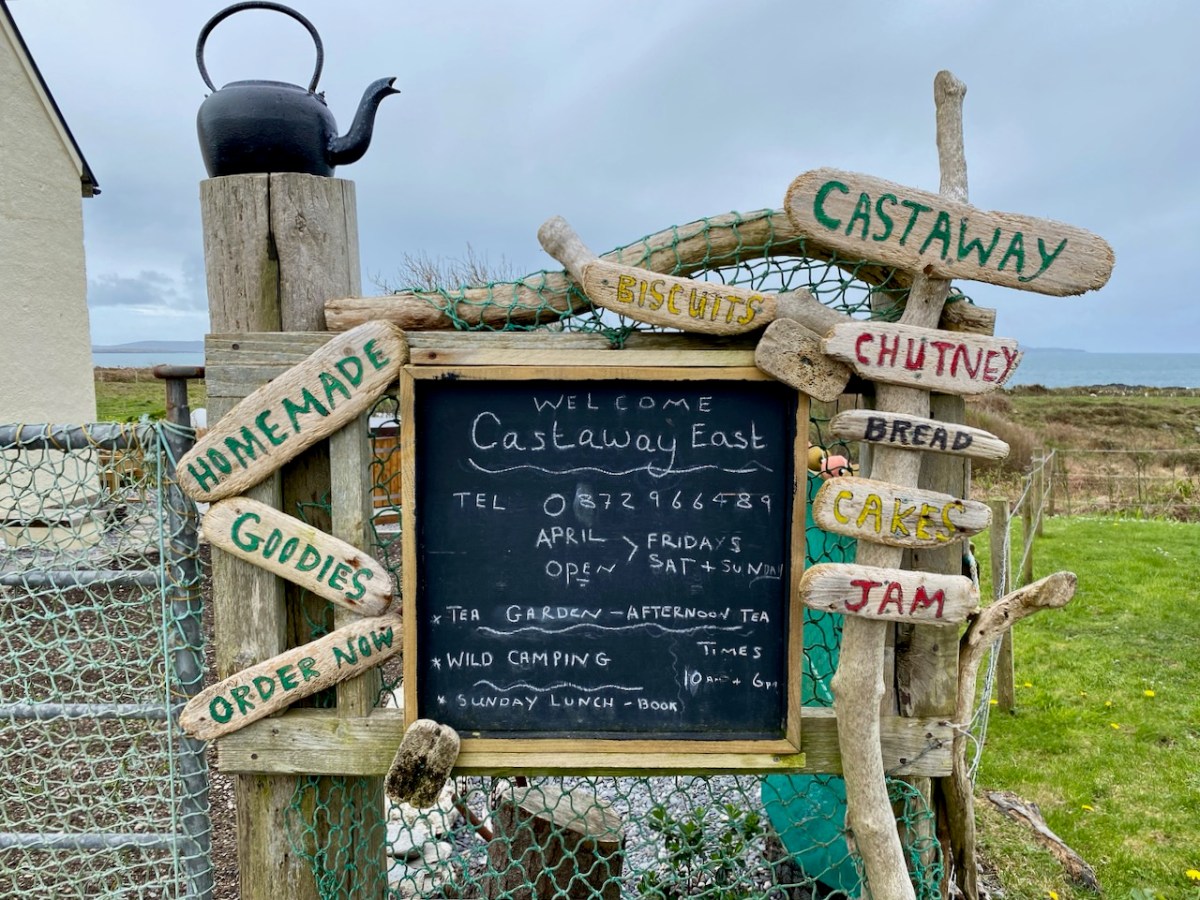
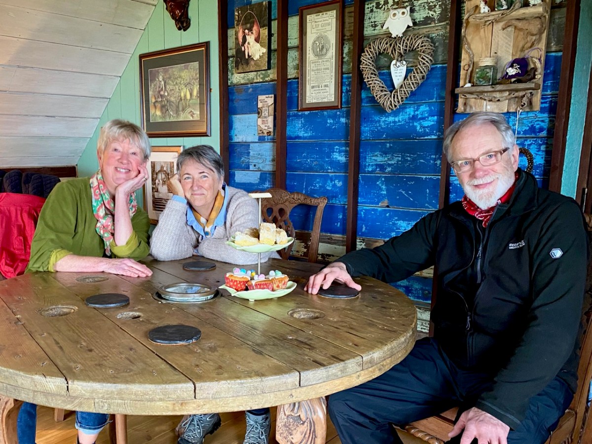
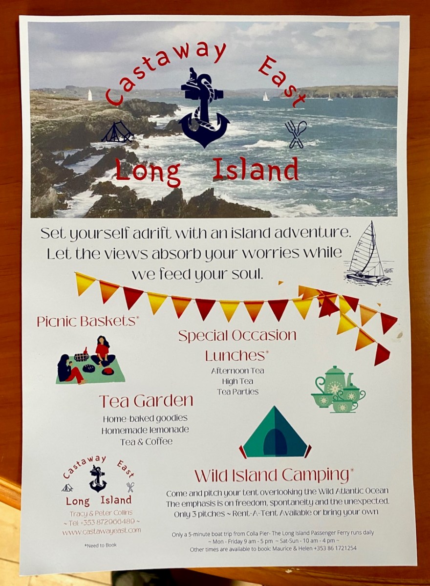
Our destination on this Easter Sunday was Castaway East – the furthest house on the ‘Easter’ end of the island. We have taken you there before, when we organised a Mad Hatter’s Tea Party in July of last year. The hosts there are Tracy and Peter, who served us brilliantly for that occasion, and also for the Wildflower Walks which Finola led last June: the Castaway crew provided a superb picnic for everyone, delivered to us at the island’s western end. This time we decided that we would test Tracy and Peter’s skills by ordering up an Easter Sunday lunch to celebrate a ‘special’ birthday for our good friend, Peter Clarke.

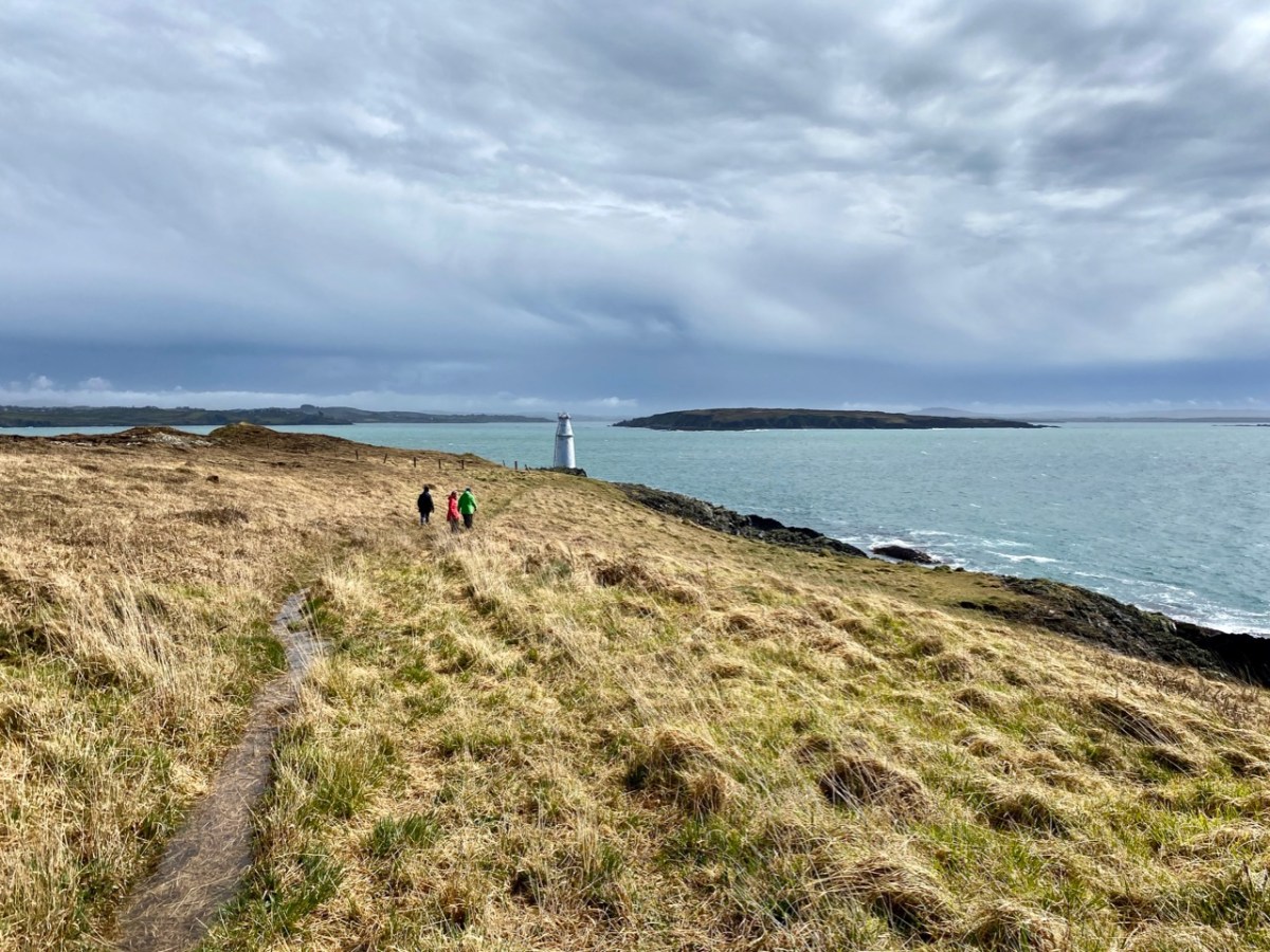
Amanda Clarke, Finola and birthday boy Peter, looking forward to a morning coffee (with delicious Easter treats) after arriving at Castaway East. We had an upstairs room in the Castaway house, with a good view over the island. Before lunch we had an opportunity to explore part of the island we had never been to before, heading down to Copper Point.

Why is it called ‘Copper Point’? Because there was a copper mine close by, one of many such enterprises that were seen in West Cork in the nineteenth century. Explorations on the island were started in the 1840s by the Cornish mining engineer Captain William Thomas: he wrote a Roaringwater Journal post for us a couple of years ago! William sank a trial shaft for 10 fathoms (60 feet) and extended a level south from this shaft for 3 fathoms. No metal bearing lode was found, and the mine was abandoned. Traces of these workings can still be seen not far from the lighthouse. It’s slightly ironic, perhaps, that the name ‘Copper Point’ arrived from somewhere and stuck.

It’s a wild landscape – but very beautiful and imbued with atmosphere. We certainly worked up a good appetite while on our morning walk, and returned to the house with great expectations.

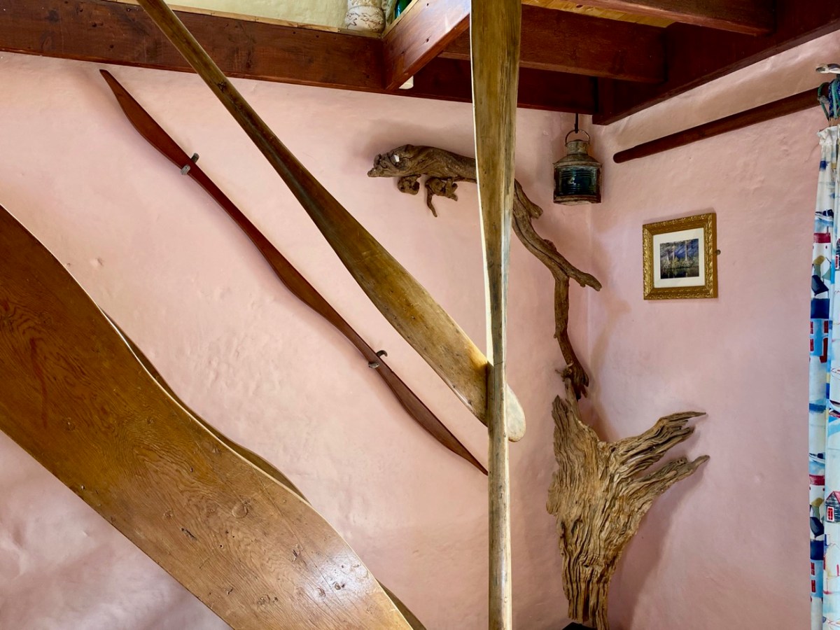
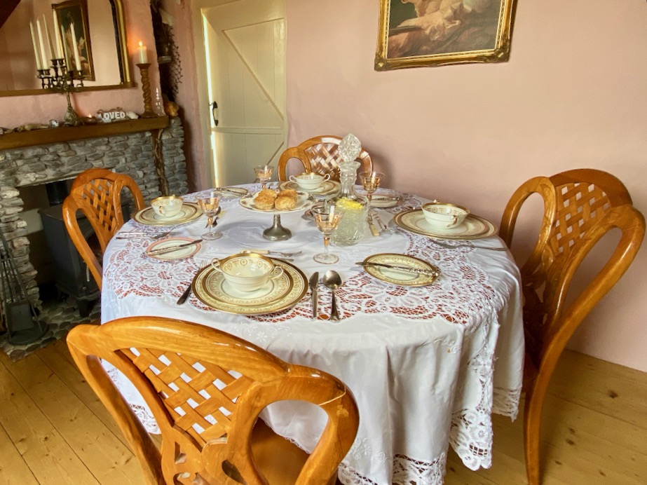
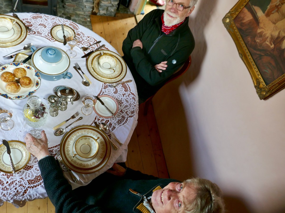
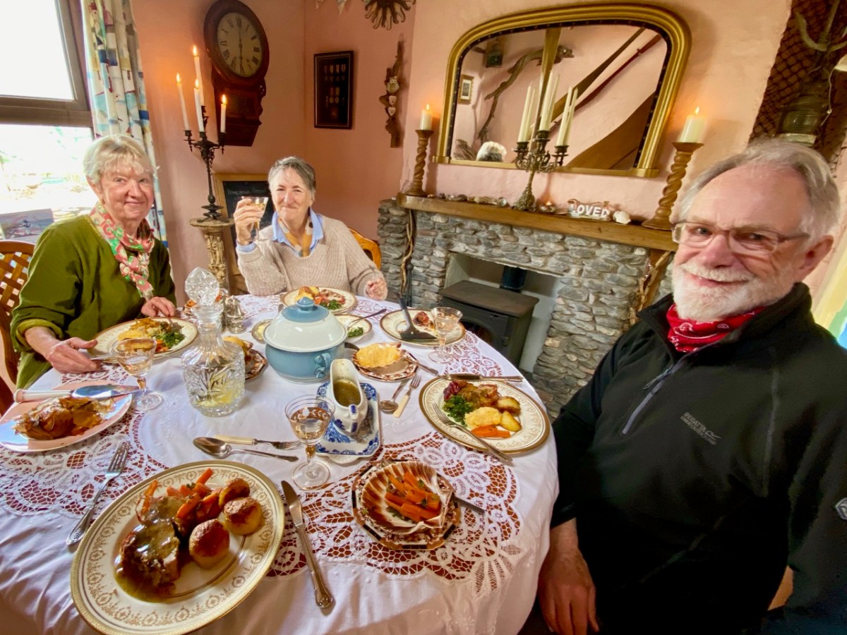
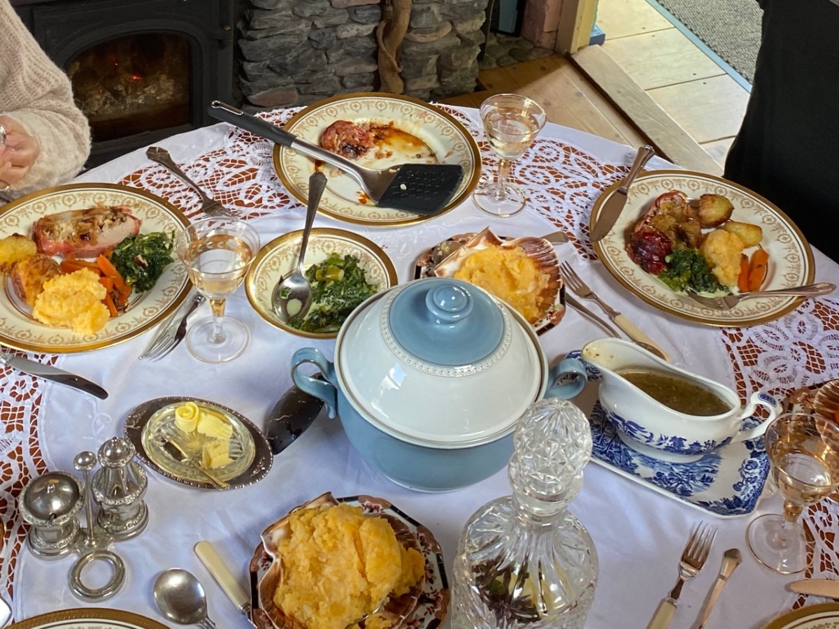
All those expectations were far exceeded when we sat down to our meal. We had a room to ourselves, attractively furnished and comfortable, with a welcome wood-burning stove on the go in one corner. Tracy and Peter have spent considerable time and energy upgrading what was a very run-down cottage, and have used locally available materials with impressive imagination.

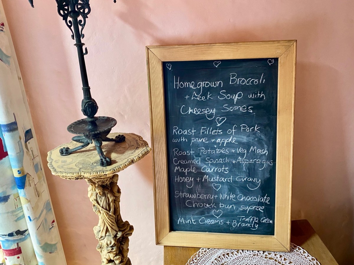
Tracy – in charge of the culinary delights – had worked out a menu which was entirely tailored to our various tastes (and dislikes) – and it was brilliant! All the courses were exemplary.

The main was a Sunday roast to make your mouths water… Fillets of pork for the three of us who are not vegetarian, and a miraculous stuffed filo pastry pie for Amanda. The accompanying vegetables were prepared without any meaty elements – so we could all savour them in equal measure.

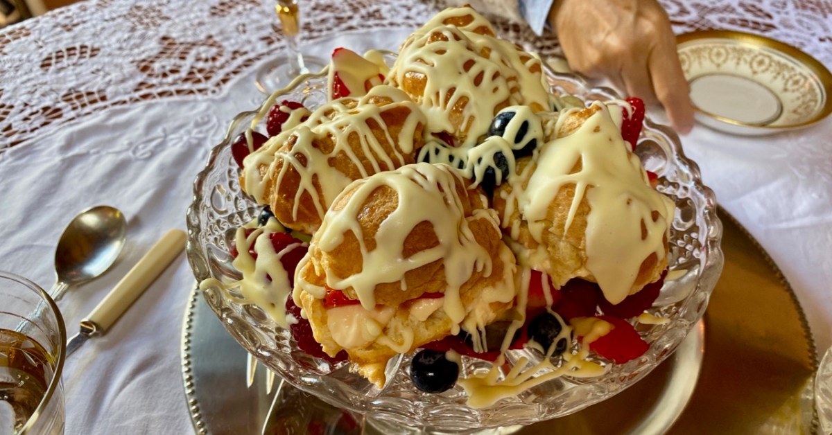
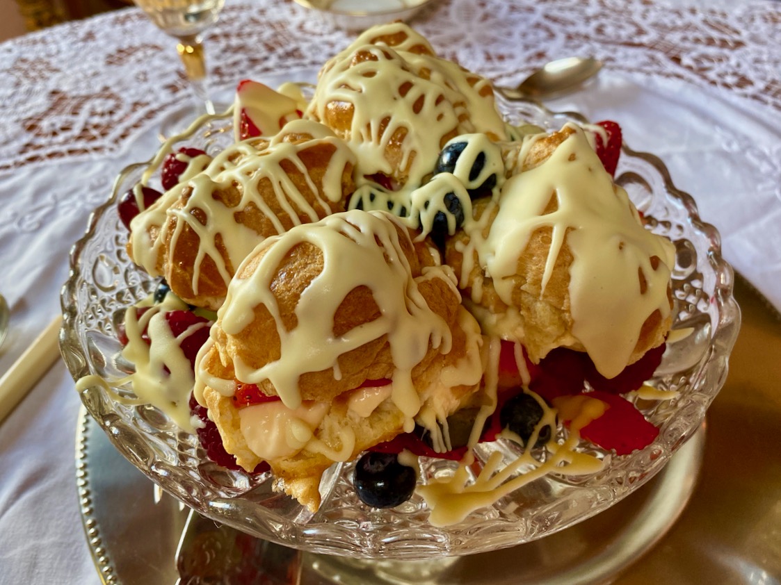
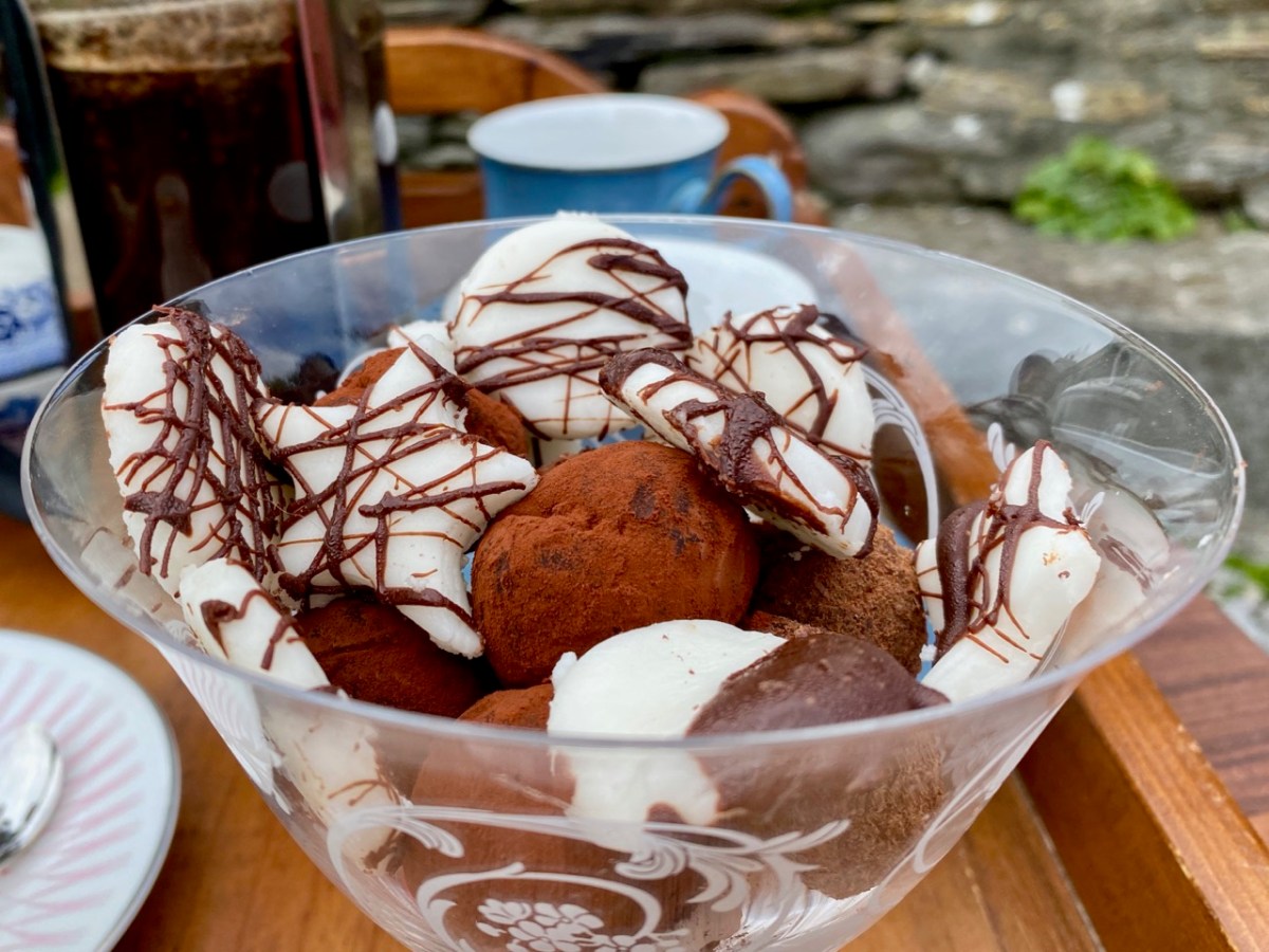
Peter was delighted with every aspect of his celebratory meal – we all were! The choux bun dessert was unbelievable; not a morsel was left behind. The riches never stopped: for our after-dinner coffee we went outside to the terrace-with-a-view and enjoyed home-made fondants and biscuits.

I think you’ve got the message… Sunday lunch at Castaway East is a very special experience indeed. Combine it with a good walk on a beautiful and atmospheric West Cork island and you will have a day you will always remember. If you want the experience for yourselves give Tracy and Peter a shout: they will be delighted to organise it for you.

Contact Tracy & Peter Collins on +353 872966489 or email simplytracy@icloud.com – They also have a campsite!

Ballycummisk Archaeology

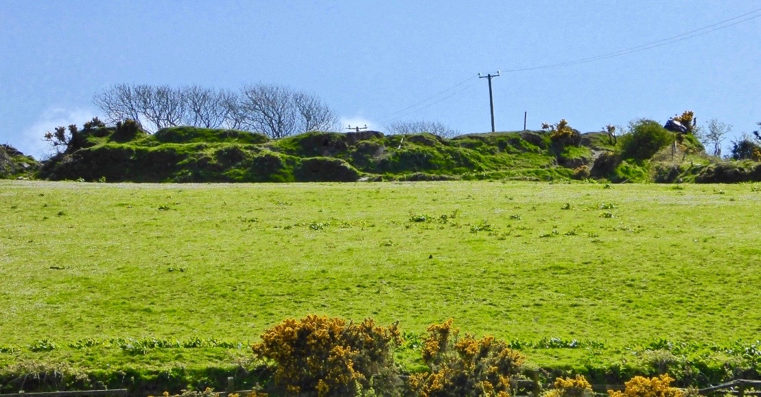
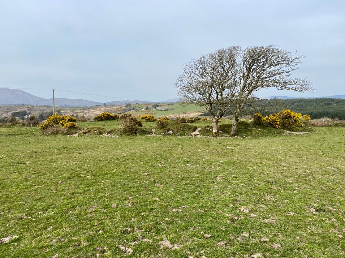
There’s a fine ringfort just over the hill from us – in the townland of Ballycummisk. A definition of a ‘ringfort’ in archaeological terms is given here:

. . . Many people lived in enclosed farmsteads known as ringforts in the Early Christian/Early Medieval period. Second to fulachta fiadh, they are the most common field monument surviving in Ireland with up to 60,000 examples, most dating to between 550-900AD. Ringforts are circular areas, measuring c24-60m in diameter, usually enclosed with one or more earthen banks, often topped with a timber palisade. In the west of Ireland the ringfort was often enclosed by a stone wall, with stone huts in the interior. Traces of iron and bronze working have been recovered suggesting some ringforts had very specific uses while others were multifunctional . . .

HeritageCouncil.ie
Significant Unpublished Irish Archaeological Excavations 1930-1997

A simpler definition comes from the monumental 1200-page Volume 1 of the ‘New History of Ireland’ series published in 2005 and edited by Dáibhí Ó Cróinín: “archaeologists are agreed that the vast bulk of them are the farm enclosures of the well-to-do of early medieval Ireland”.

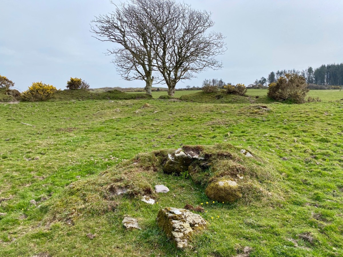
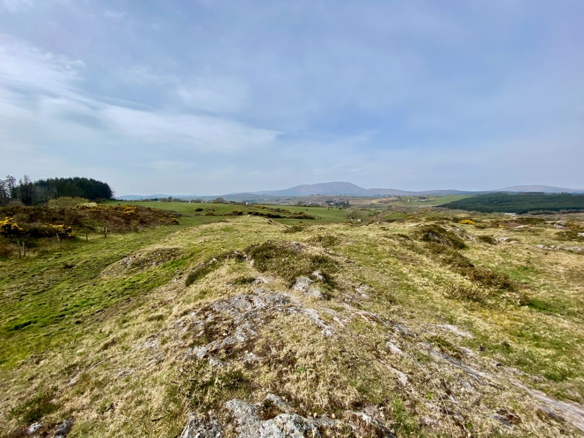
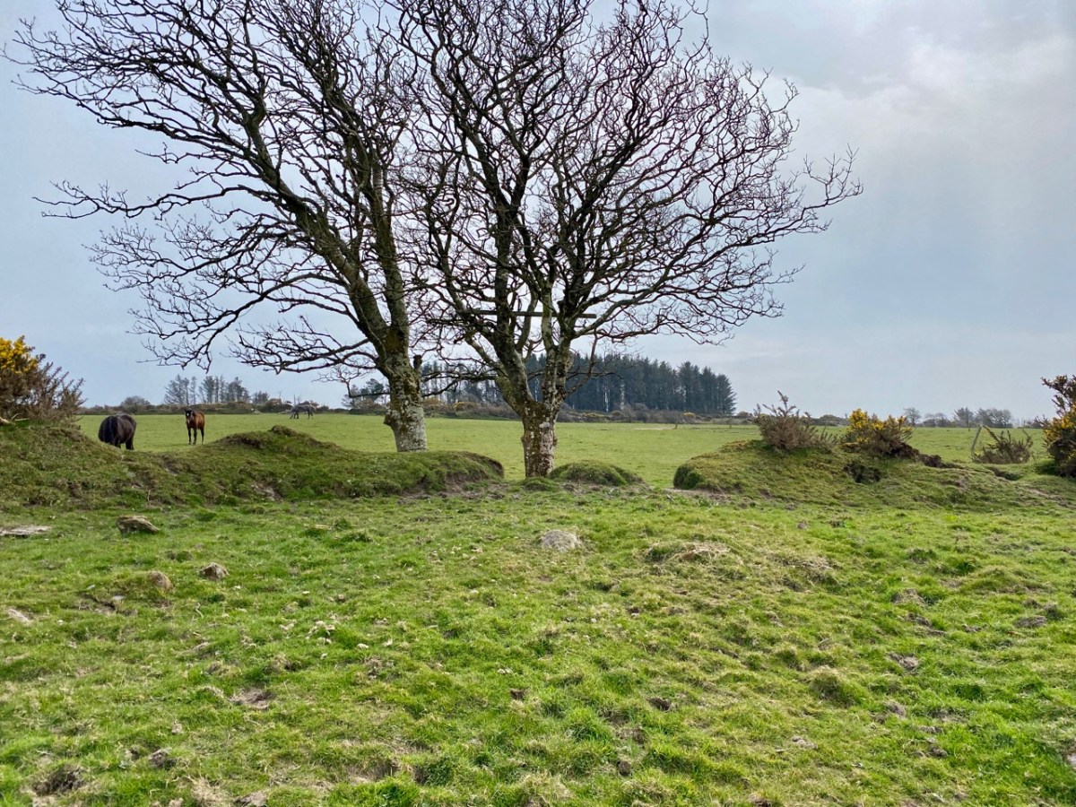
The upper picture is taken from within the ringfort enclosure; the north bank of the fort can be seen beyond a small stone outcrop which is said to be the site of a souterrain. Time for another definition:

. . . Souterrain: an underground structure consisting of one or more chambers connected by narrow passages or creepways, usually constructed of drystone-walling with a lintelled roof over the passages and a corbelled roof over the chambers. Most souterrains appear to have been built in the early medieval period by ringfort inhabitants (c. 500 – 1000 AD) as a defensive feature and/or for storage . . .

archaeology.ie/HistoricEnvironment

You can see more about souterrains – including some illustrations – in my post from four years ago about Knockdrum Fort, south of Skibbereen.

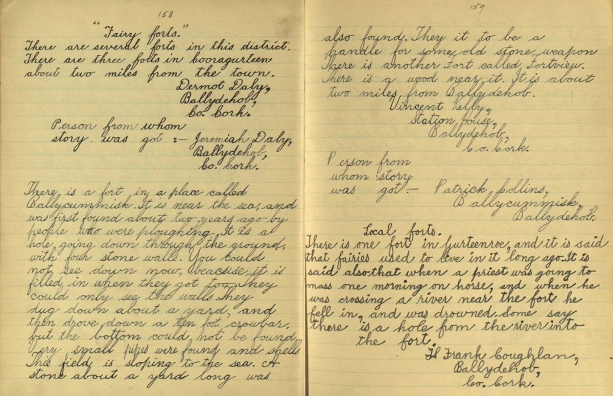
The Schools Folklore Collection is an important source of local beliefs and traditions – if not exactly historical information. The stories were collected in the 1930s but were remembered through family traditions which could go back through several generations. The example pages above – dating from 1936 – describe the Ballycummisk fort. Here is a transcription of the paragraph:

. . . There is a fort in a place called Ballycummisk. It is near the sea, and was first found about two years ago by people who were ploughing. It is a hole going down through the ground, with four stone walls. You could not see down now, because it was filled in when they got to it. They could only see the walls. They dug down about a yard, and then drove down a ten foot crowbar, but the bottom could not be found. Very small pipes were found and shells This field is sloping to the sea. A stone about a yard long was also found. They thought it to be a handle for some old stone weapon . . .

Schools Folklore Collection
Frank coughlan Ballydehob

Frank Coughlan’s description almost certainly refers to the discovery of a souterrain. It doesn’t quite ring true as he says that “the field is sloping down to the sea”. In fact, the fields containing the ringfort are sloping southwards away from the sea, which is not visible at all from the site.

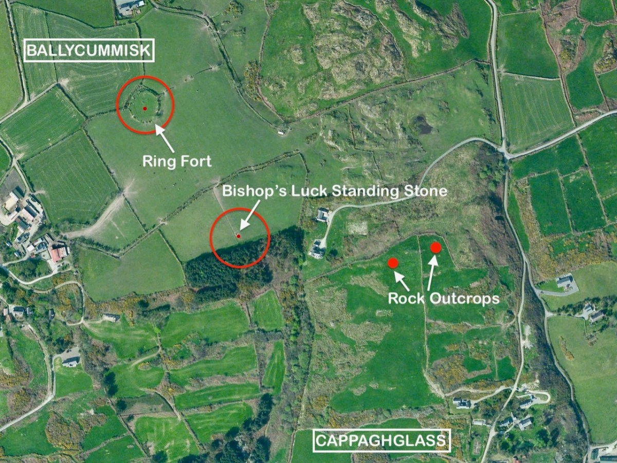
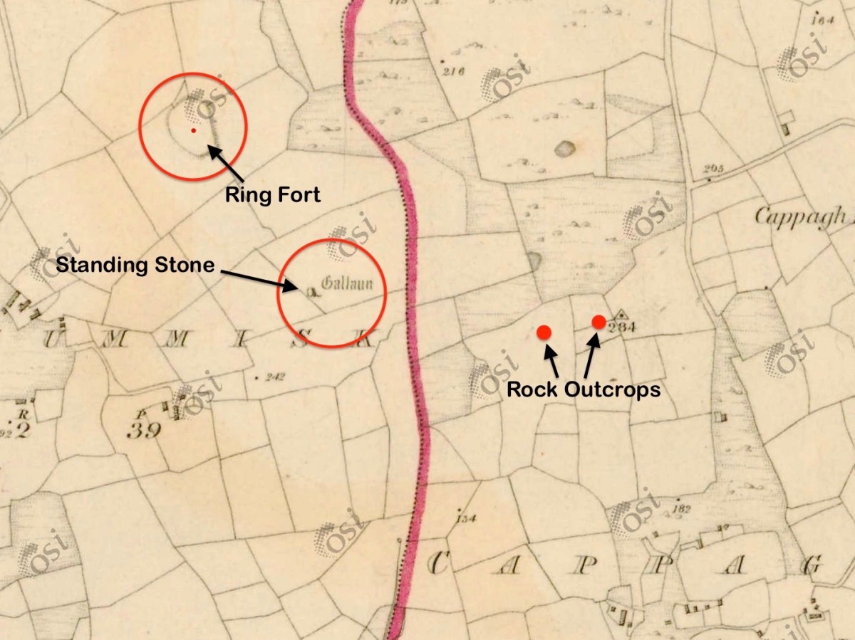
This aerial view shows parts of the townlands of Ballycummisk and Cappaghglass. The ringfort is marked. Another nearby feature – also shown – is a large standing stone, known as ‘Bishop’s Luck’.

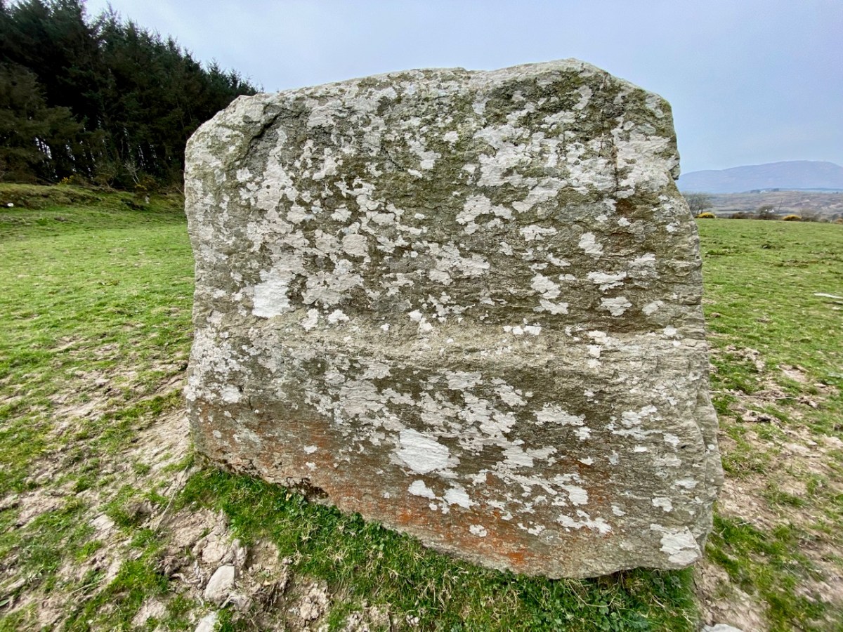
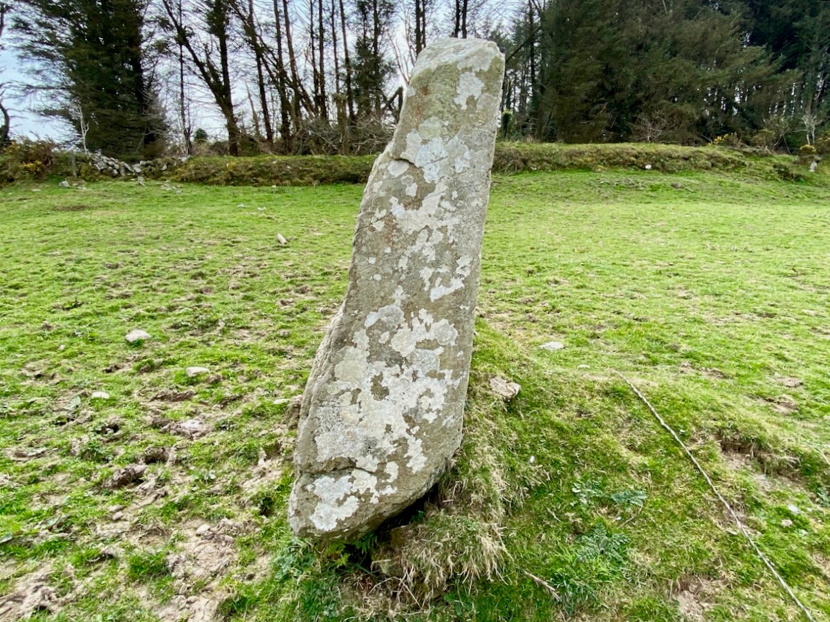
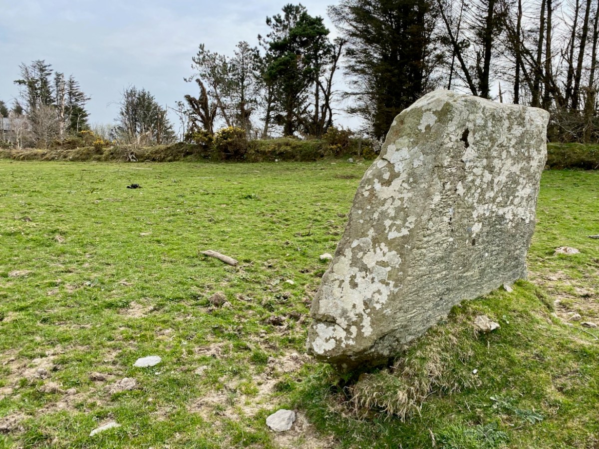
The stone is 1.6m high, 2.05m in length, and 0.45m in width: tall and wide in one direction, and relatively narrow in the other. It is also worth noting that the ‘long’ orientation is exactly North-South. This stone has been in this position for at least 180 years as it appears in the earliest edition of the 6″ Ordnance Survey (1830s), marked as ‘Gallaun’ – and even given a little illustration!

The standing stone is not far from the ringfort: perhaps there is a connection, although standing stones are generally reckoned to date from earlier times than the forts. Here is an extract from a recent article in Archaeology Ireland: Vol 34 No 1 (Spring 2020) pp 26-29, Wordwell Ltd:

. . . The classic standing stone surviving from the Bronze Age in Ireland is a rough-hewn or unshaped pillar, known as a gallaun (from the Irish gallán), generally oblong or oval in cross-section and up to 3m or more in height. Stones presumed to belong within this class vary considerably in height, from as little as 1m to as much as 6-7m in exceptional cases, the majority probably falling in the 1.5-2m range. Seán Ó Nualláin noted many years ago that in his experience the axis is generally aligned north-east/south-west. This is by no means a universal rule. Gallauns are by far the most numerous of all pre-Christian standing stones in Ireland. Approximately 600 are known in Cork and Kerryb alone. Beyond this region, examples are to be found extensively throughout the Irish countryside and many of them have attracted folk explanations . . .


Lone Standing Stones by Muiris O’Sullivan and Liam DowneY
Archaeology Ireland 2020

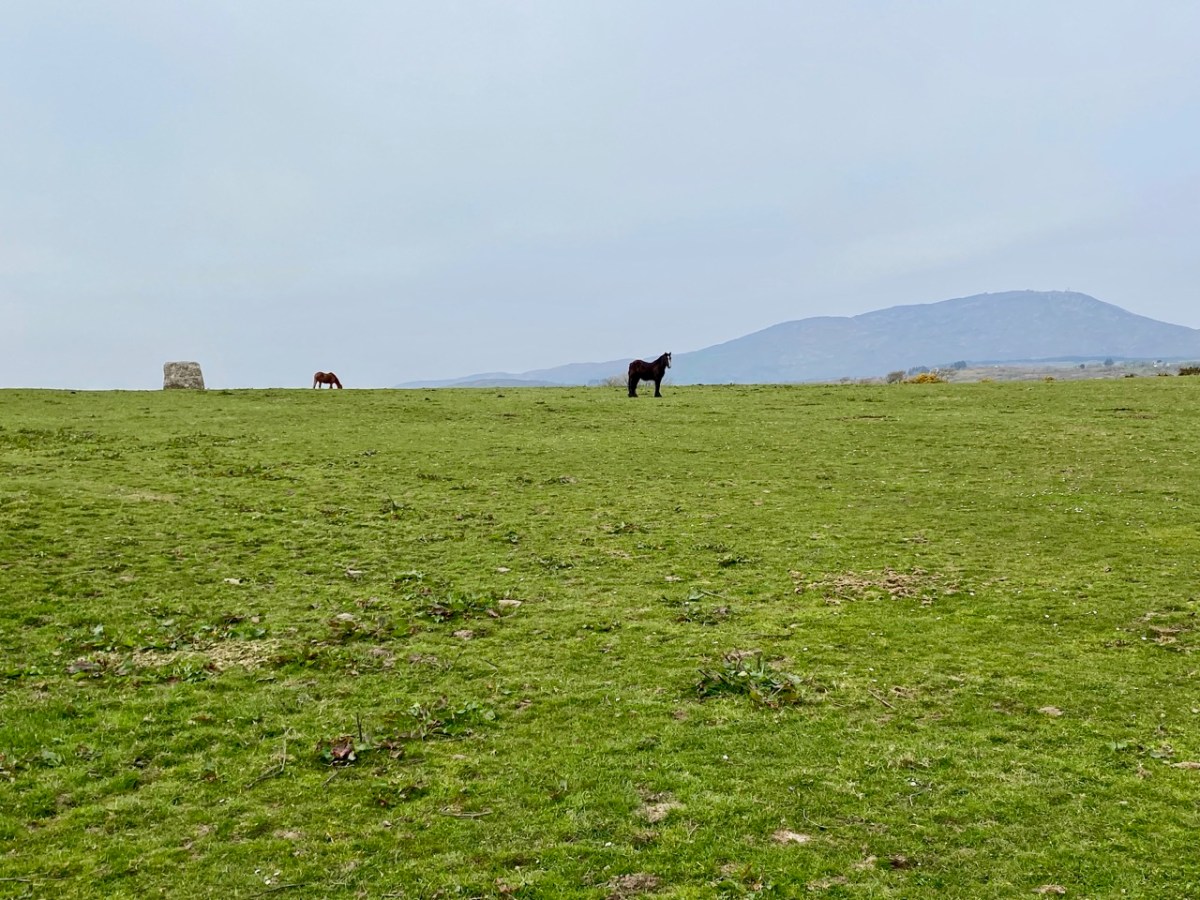
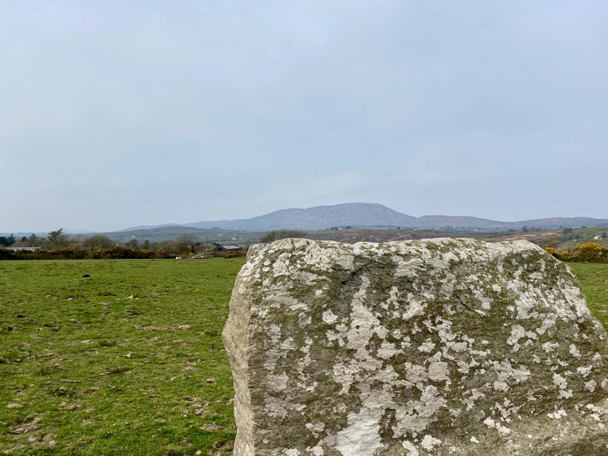
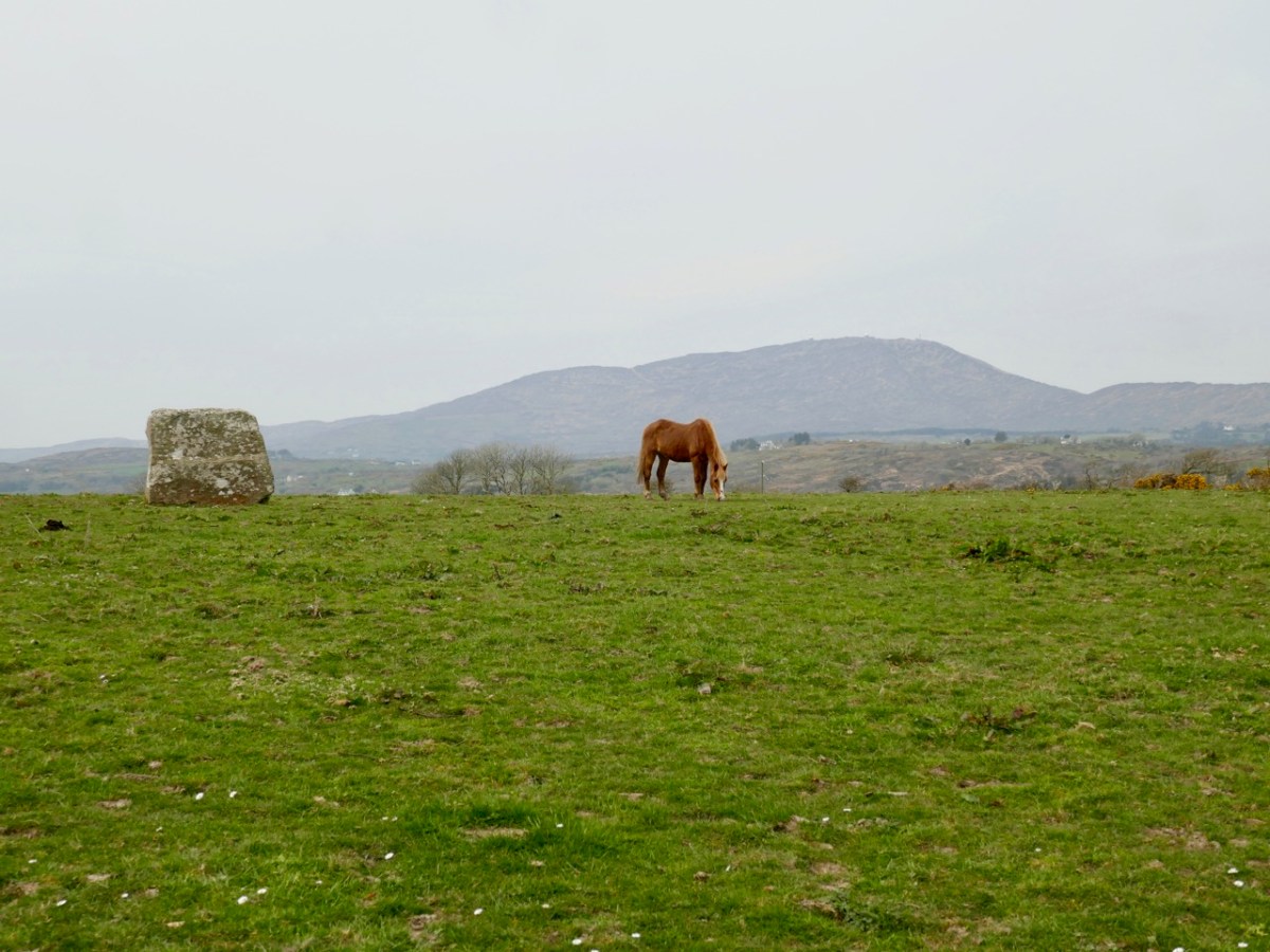
In these two pictures you can see the striking profile of the Bishop’s Luck standing stone against the skyline which features Mount Gabriel – the highest piece of land in the immediate area. Gabriel was an important place in prehistoric times as the centre of a significant copper mining industry – yet no artefacts have ever been found on the summit. In the lower picture you can see how the western edge of the standing stone ‘echoes’ the distant profile of Gabriel on the horizon. This is a phenomenon that has been noted a few times with regard to stones standing in the landscape. Here is Gabriel seen from the ringfort:

Finola has written comprehensively about standing stones in this Journal: here and here. O’Sullivan and Downey mention (above) that examples have attracted folk explanations. This doesn’t seem to be the case here: no mention is made of the stone in the Schools Folklore Collection. But surely there must be significance in the name: Bishop’s Luck?

But – hang on! There is ‘Bishop’ folklore associated with a site not very far away – in the neighbouring townland of Stouke. Finola recorded this in her 2016 post here. It’s a simple tale: The story goes that during the time of the penal laws a Bishop was confirming children nearby when the redcoats got wind of his activities and came to arrest him. He was beheaded. A bullaun stone in the graveyard at Stouke is supposed to be his head. If our possibly Bronze Age stone in Ballycummisk had anything to do with this, it should surely be known as Bishop’s Bad Luck?

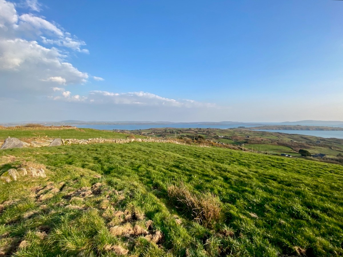
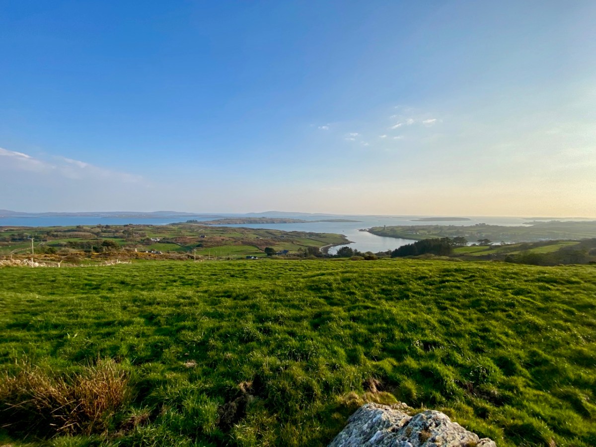
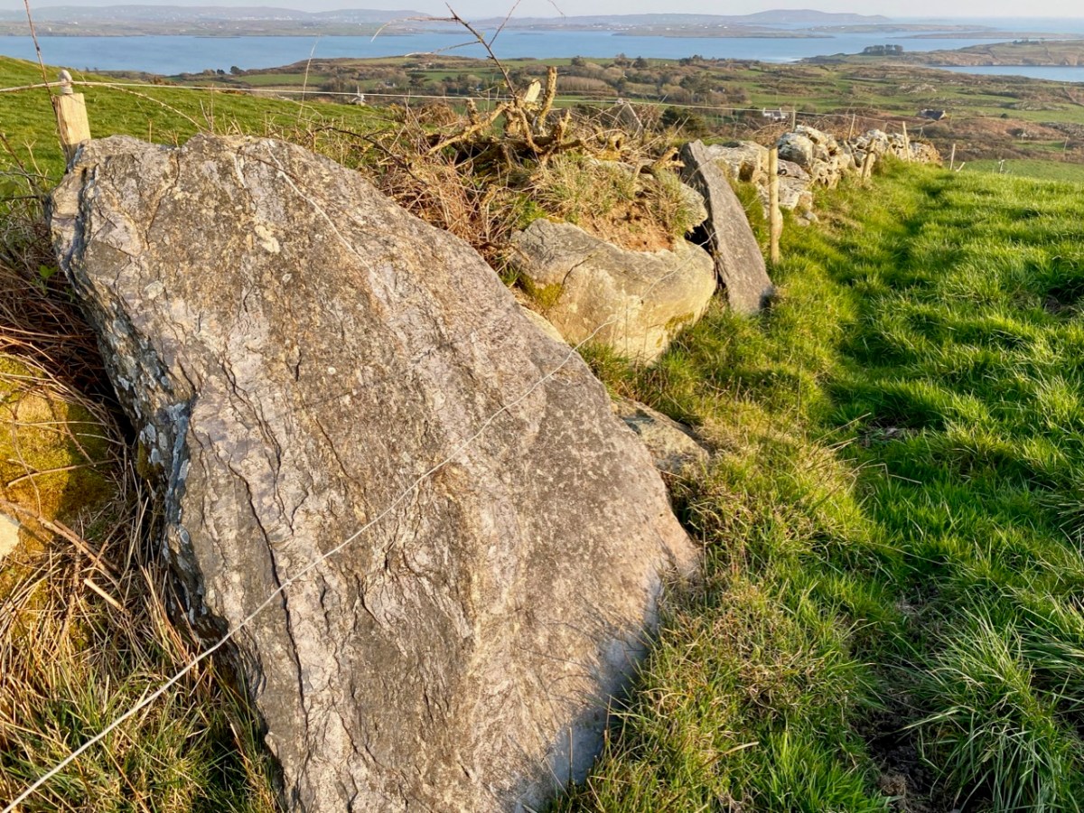
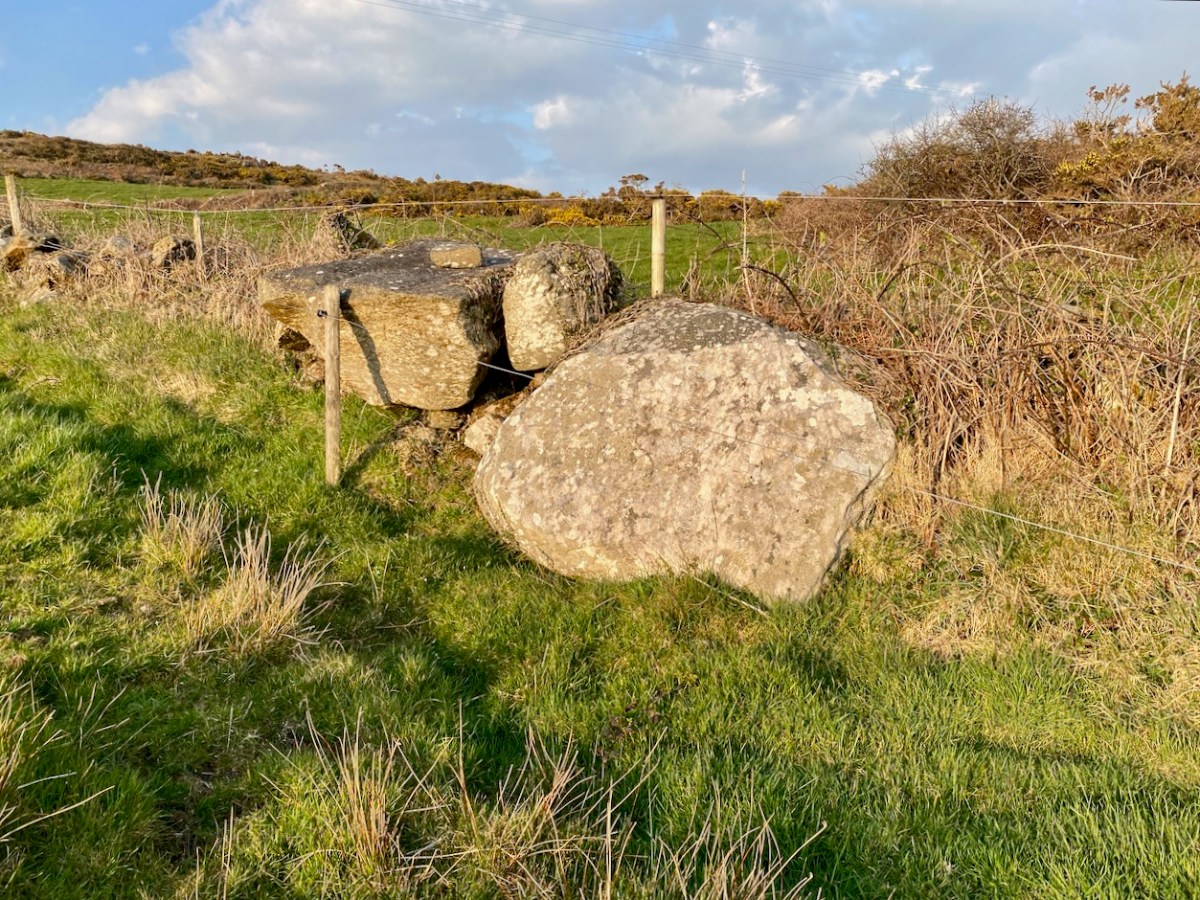
One further place that’s worth a mention here is the top of the hill to the south of the ringfort and standing stone. It doesn’t have a name, but it does have a magnificent view across to Rossbrin Harbour, with Cape Clear on the horizon in the far distance. There is a passage grave on the high point of Cape Clear. There seems to be some evidence for the inter-visibility of ancient sites, which makes me wonder whether there was ever any early structure on this hilltop. There are rocky outcrops there in the present day, and field clearance is evidenced by the presence of large slabs in the nearby field boundaries.

These are just thoughts, but I don’t mind thinking them! West Cork (and most of rural Ireland) must have much to reveal in terms of its ancient history. One point to remember: if you ever go searching yourself for archaeology or old sites, don’t forget that you will probably be entering private land. It is courteous to always seek permission: most owners are agreeable and – perhaps – may have stories to tell themselves.