The Coast of West Cork

Coast of West Cork cover

Every personal library in West Cork, maybe in Ireland, has a copy of the book The Coast of West Cork by Peter Somerville-Large. First published in 1972, it is a classic of travel writing – amusing, learned, thoughtful – that still holds up as a fascinating portrayal of this part of the world. The photograph above is of the front cover of the book, signed by the author, that I brought with me to Canada when I emigrated in 1974. Forty years later, I am living on the very spot where this photograph was taken! It took me a while to figure this out, as the picture is actually reversed.

Peter Somerville-Large, now in his 80s, is still writing. He is connected to the old Castletownshend families (Edith Somerville was a relation and he mentions Townsend aunts) and was already very familiar with West Cork when he set out to tour it by bicycle in the spring of 1970. He takes every road, every byway and boreen, and describes in detail the scenery, the characters and the conditions along the way.

Grand road for cycling!

Grand road for cycling!

Far more than a travel diary, this is a comprehensive account of West Cork. Somerville-Large’s erudition is impressive. Either before or after his journey he spent many hours in the National Library, researching the history, folklore, archaeology and literature of the area and he weaves this knowledge seamlessly into his narrative. Because of his own personal background, he is able to include stories and anecdotes from the Big Houses of the gentry. A great aunt

“…remembered going down to a cellar which was filled with swords used to arm the tenants during the time of the Whiteboys and also with empty stone wine jars which had carried wine smuggled in from France. From this cellar there was believed to be a passage underground to the O’Driscoll Castle of Rincolisky, whose truncated remains are to be found in a neighbouring field…An earlier Townsend sent his…page down the passage to see if it was clear. The boy was never seen again.”

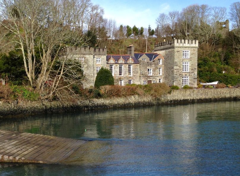
Castletownsend Castle

Castletownshend Castle

His affection for the place leads him to mourn the loss of population from the Islands of Roaringwater Bay.

“One by one the small islands became deserted…Only a few years ago I visited Horse Island, just opposite Ballydehob. The last people there, an elderly couple, were living all alone. It was summer, and the old man was sitting in a chair outside his house, his feet in a basin of water. His wife, behind him, fed hens. Next year, they were gone. The house, still intact and comfortable, stood empty, the linoleum in place, last year’s calendar on the wall. Down by the pier a plough had been thrown into the water where it looked like a gesture of despair.”

Looking across to Horse Island

Looking across to Horse Island

He documents the importance of the creamery in the social life of the townlands, the old occupations of fishing and mining and the loss of such sources of income, the string of castles that dot the coast and the great irish families that built them, the “brash new bungalows” springing up around the scenic areas, the awful legacy of the famine, and the sheer beauty of the scenery. He is conscious of a way of life passing. Going out of his way to visit a sweathouse (a feature of the Irish countryside in times past) he ends up in the O’Sullivan’s kitchen, drinking whiskey and eating biscuits.

“Mrs. Sullivan told me that the valley was once thickly populated, and when she was a girl there had been sixty children at the school that closed last year. The way of life had gone with it…Once it had been a great place to live in, her husband said. There were monthly fairs at Ballydehob and Schull, and he had walked all the way to Bantry with the cattle and all the way back again.”

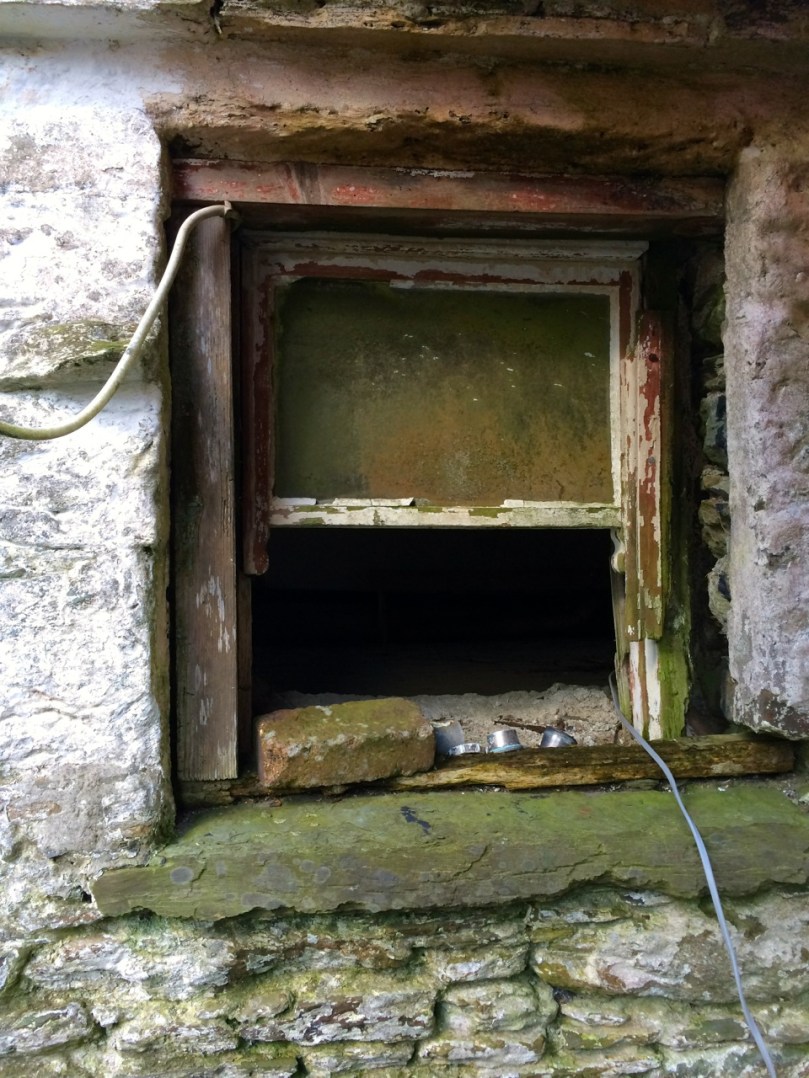
Deserted cottage

Deserted cottage

The parts I have quoted deal with the area around where we live, but the bicycle trip stretches from Clonakilty to the Beara Peninsula. Describing West Cork as it was in 1970, it is now an important historical document in its own right, alongside such accounts as Thackery’s Irish Sketchbook of 1879, or the Pacata Hibernia of 1633. Mostly, however, it is a charming, engaging and fascinating depiction of a special place.

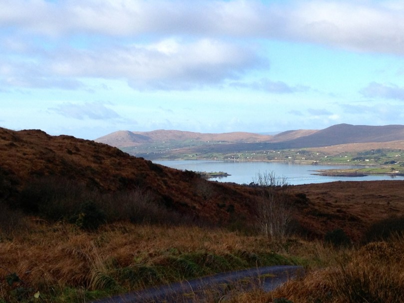
Over the hill to Durrus

Over the hill to Durrus

Outlook: Changeable

storm

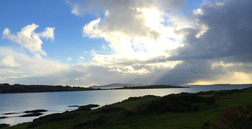
Sunday morning sky over Nead an Iolair

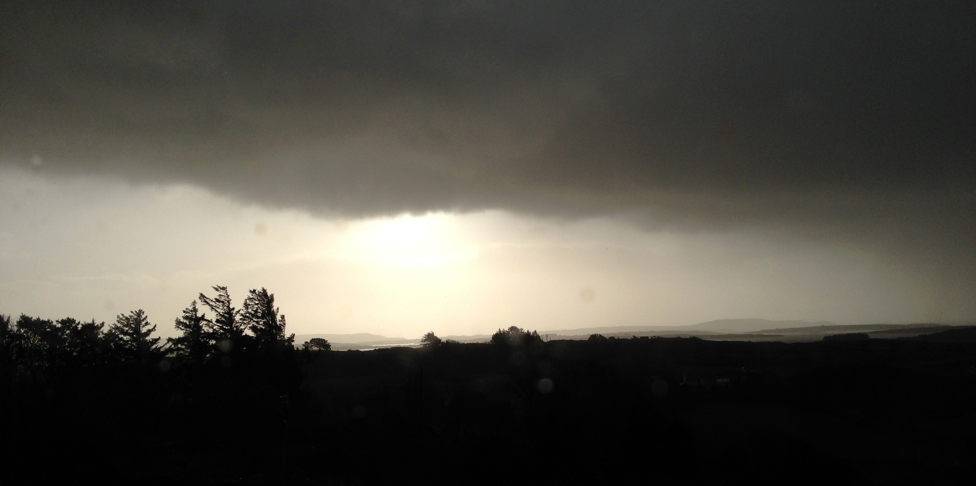
One of my favourite expressions about the weather was learned from an elderly gentleman who had lived all his life in Hampshire, England. …Tis black over Will’s Mother’s… This would have described very well the scene above, which was taken from Nead an Iolair when we awoke this morning. As an Englishman I would be expected to talk about the weather all the time; Irish people are not far behind in this, probably because there is such a variety of weather – even in a single day – that it demands to be described. …Is iomaí athrú a chuireann lá Márta dhe… means: …There is a lot of weather in a March day… This might just as well refer to a January day, or a day in any month in our experience. To illustrate this I decided to try a time lapse video, using my iPhone and a tripod. I had to shoot it through the window, hence the reflections – just as well because during the process we had torrential hail to add to the variety. So this is a thirty minute session of Irish weather coming in to Roaringwater Bay compressed to thirty seconds, each frame being shot a second apart:

By asking around the locality I have compiled some Irish expressions for weather. These are ones that I particularly like:

A snipe won’t stand in the morning… (meaning icy weather)

It’s a hure of a day… (meaning it’s a hure of a day – Finola has her own version here)

 Bad aul’ day isn’t it?

And – occasionally – The Sun does be splittin’ the stones

Sun circle, Bohanogh, a week ago

Sun circle, Bohonagh, a week ago

Now, as we get near to St Brigid’s Day – more on that next week – we can truly be saying:

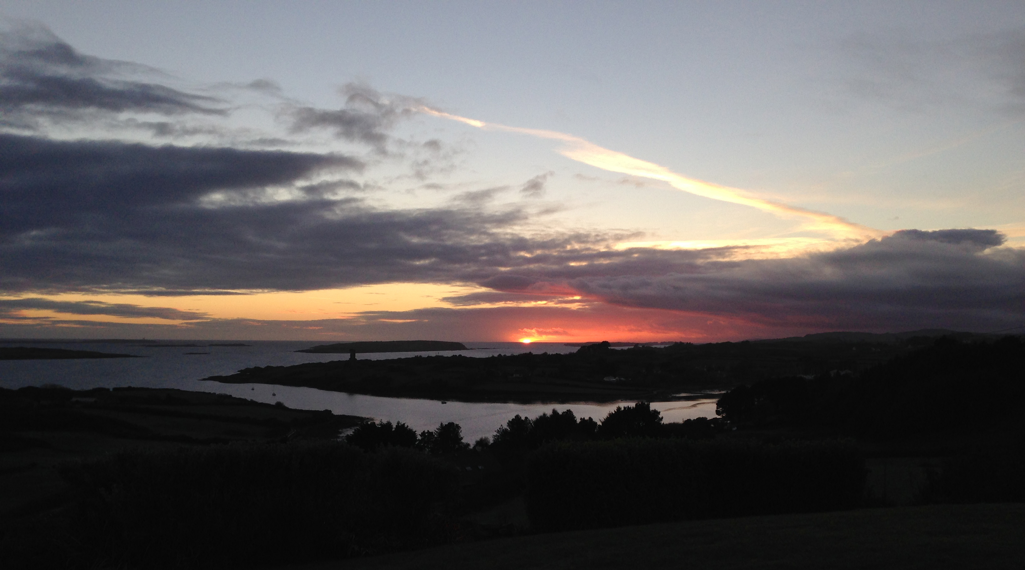
There’s a grand aul’ stretch to the evening… (the days are getting longer)

sunset

The Stones Speak

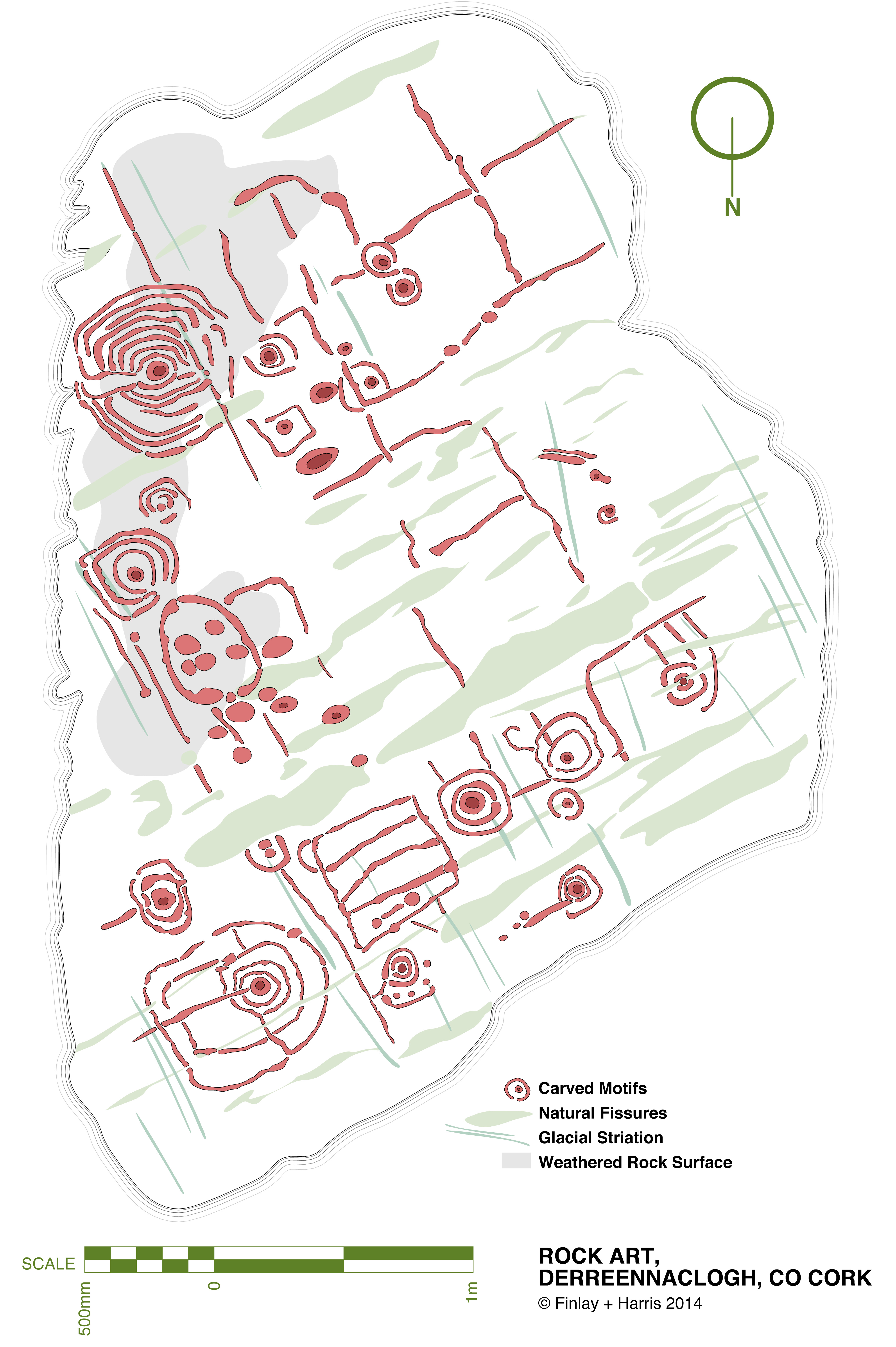
derr scale dwg 06

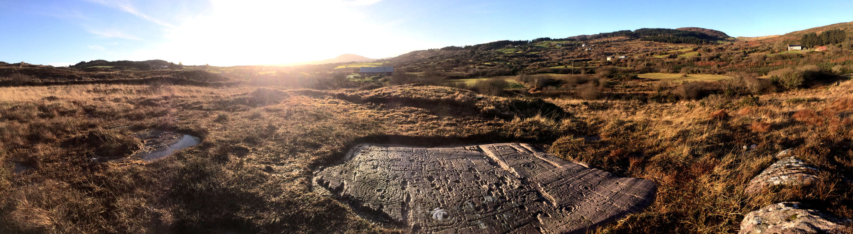
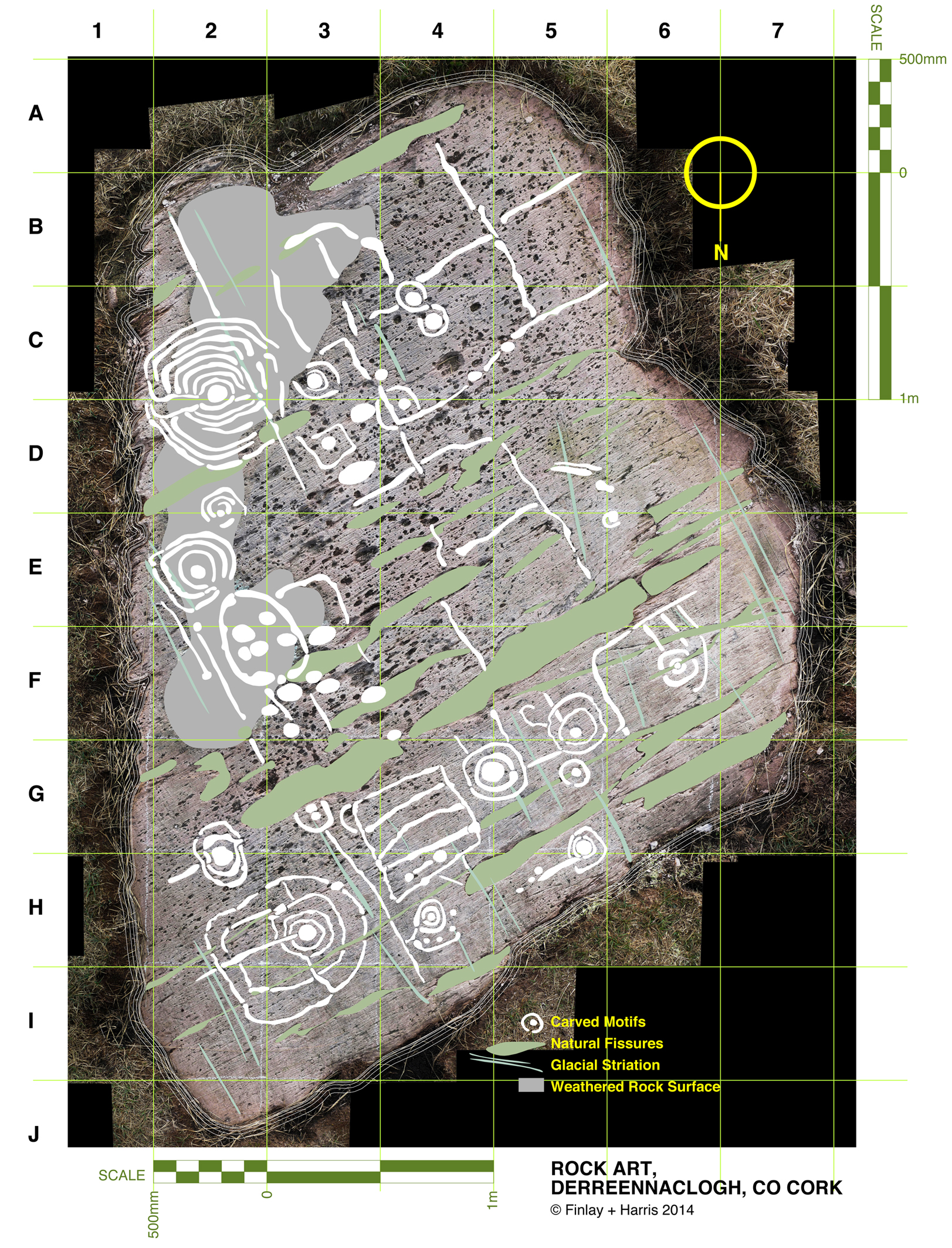
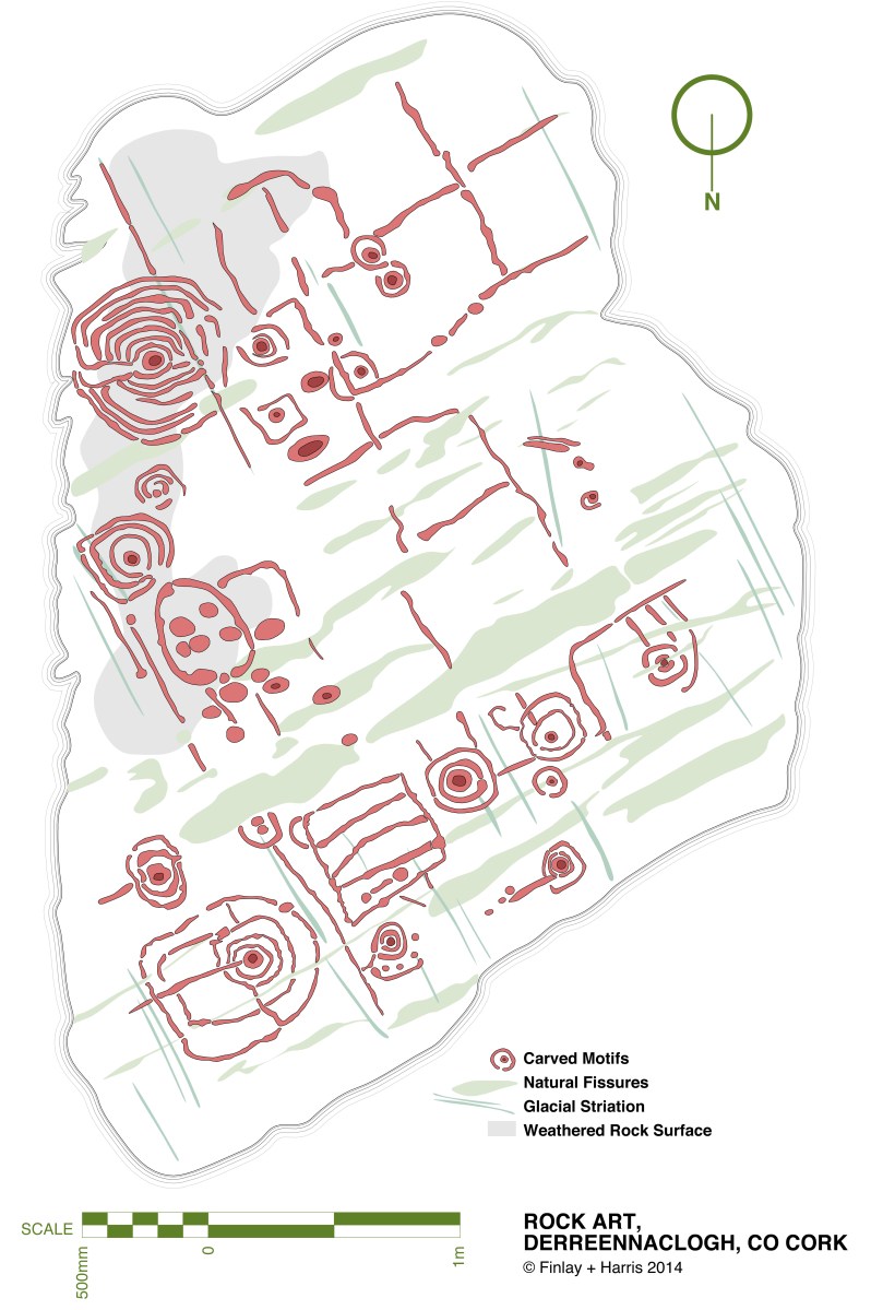
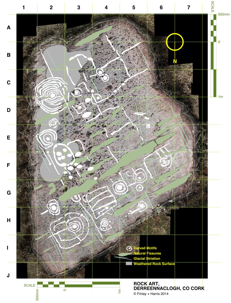
This drawing is a true scale representation of Rock Art on the horizontal surface of a large, earth-bound slab of sandstone in the townland of Derreennaclogh, Co Cork, Ireland. Archaeologists believe that carvings on this stone – and on very many others in Ireland and across the Atlantic coastline of Europe – were made by early farmers during the Neolithic or Early Bronze Age period, anywhere from 5,000 to 3,000 years ago. The carvings shown here were only discovered in the recent past: they had lain under a covering of peaty soil for hundreds or, perhaps, thousands of years and had therefore not suffered the natural weathering that many other examples of Rock Art exhibit. In one section – shown as ‘weathered rock’ on the drawing, the surface had previously been partly visible, and the curved lines which could be seen on this area led the finder of this piece to carefully pull back the overgrowth to reveal a remarkable Rock Art panel – perhaps one of the most complex and best preserved in Ireland.
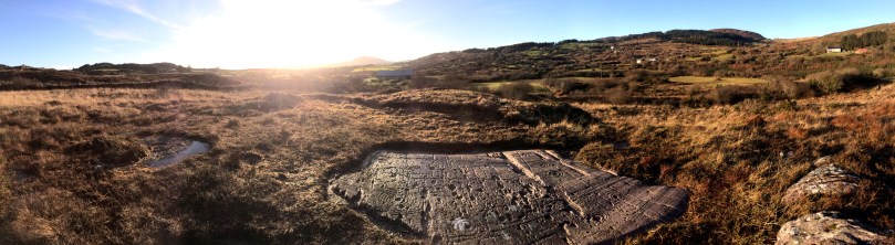
The rock at Derreennaclogh: Mount Gabriel is prominent on the western horizon

The rock at Derreennaclogh: Mount Gabriel is prominent on the western horizon

I have been working on this scaled drawing for nearly a year. This long period is partly because my life has been filled with other things (such as moving permanently to West Cork and buying a house which has needed some upgrading), but also because I have been devising a method to measure and record in fine detail the carvings on the stone without any adverse intervention to the rock surface. When my partner Finola was writing her thesis for UCC in 1973 – The Rock Art of Cork and Kerry – it was normal practice to chalk in the carvings and trace over them using a wrapping film, these tracings then being transferred to high quality mylar and photographed for reproduction. Now the codes for archaeological work have changed and it is no longer acceptable to use chalk or any ‘rubbing’ technique: the thinking is that this could damage the surface. There is a whole debate here on how to best preserve our prehistoric heritage – and no doubt there are those who would say that the Derreennaclogh stone – with its carvings in such a remarkable state of preservation – should never have been uncovered at all, or should perhaps be covered over again in a way that will ensure the retention of its markings in a pristine state, while hopefully allowing occasional access for viewing. These matters are being considered in other areas where Rock Art occurs, particularly in Portugal – where some examples are much visited and provided with interpretation centres – and Scandinavia, where many petroglyphs are protected by toughened glass.
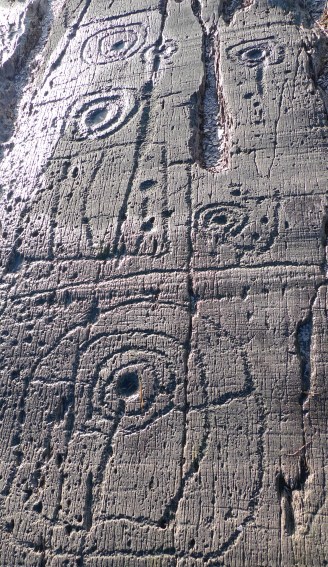
derr panel

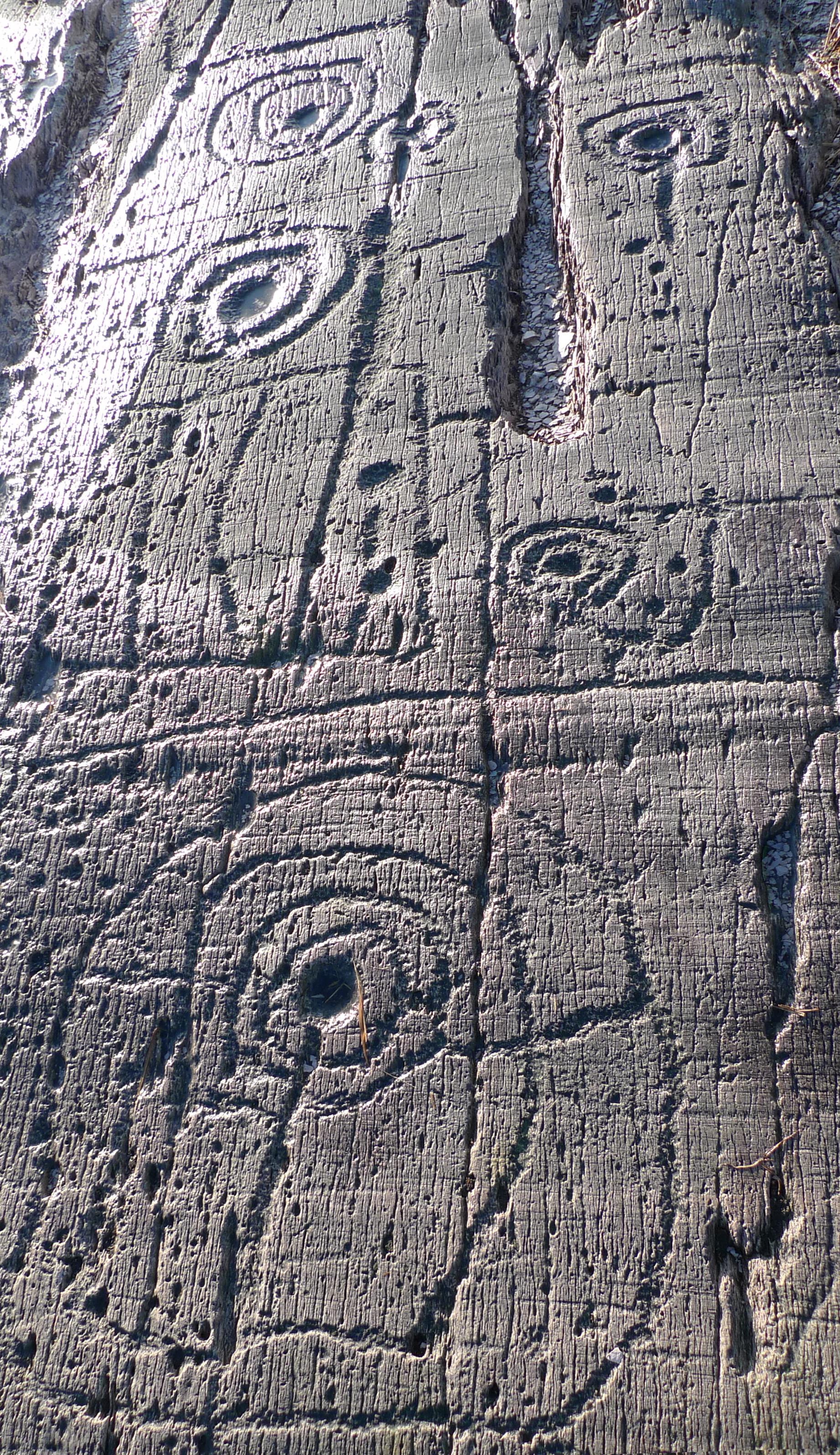
Motifs picked on the rock surface

I call my recording method, illustrated here, ‘visual rubbing’. It is not entirely without intervention, as I had to walk across the carved face of the rock, and place a camera tripod on the surface. I suppose this is a lesser evil when compared to some examples on open farmland where cattle walk freely across Rock Art panels or where – in places – rocks are being broken up to create new pastures: we have seen alarming signs of large excavator tracks passing right beside some good recorded pieces here in West Cork. Where the carved stones are listed in the Archaeological Record the landowner is always made aware that the monument is sacrosanct, but this does not guarantee practical conservation. Also, it may be argued that the topographical context of Rock Art is important (another debate) and that there should be restrictions in destructive activities to landscape in the vicinity of prime examples. Fortunately, the Derreennaclogh panels (there are two) are in bogland which is not currently grazed or used agriculturally.

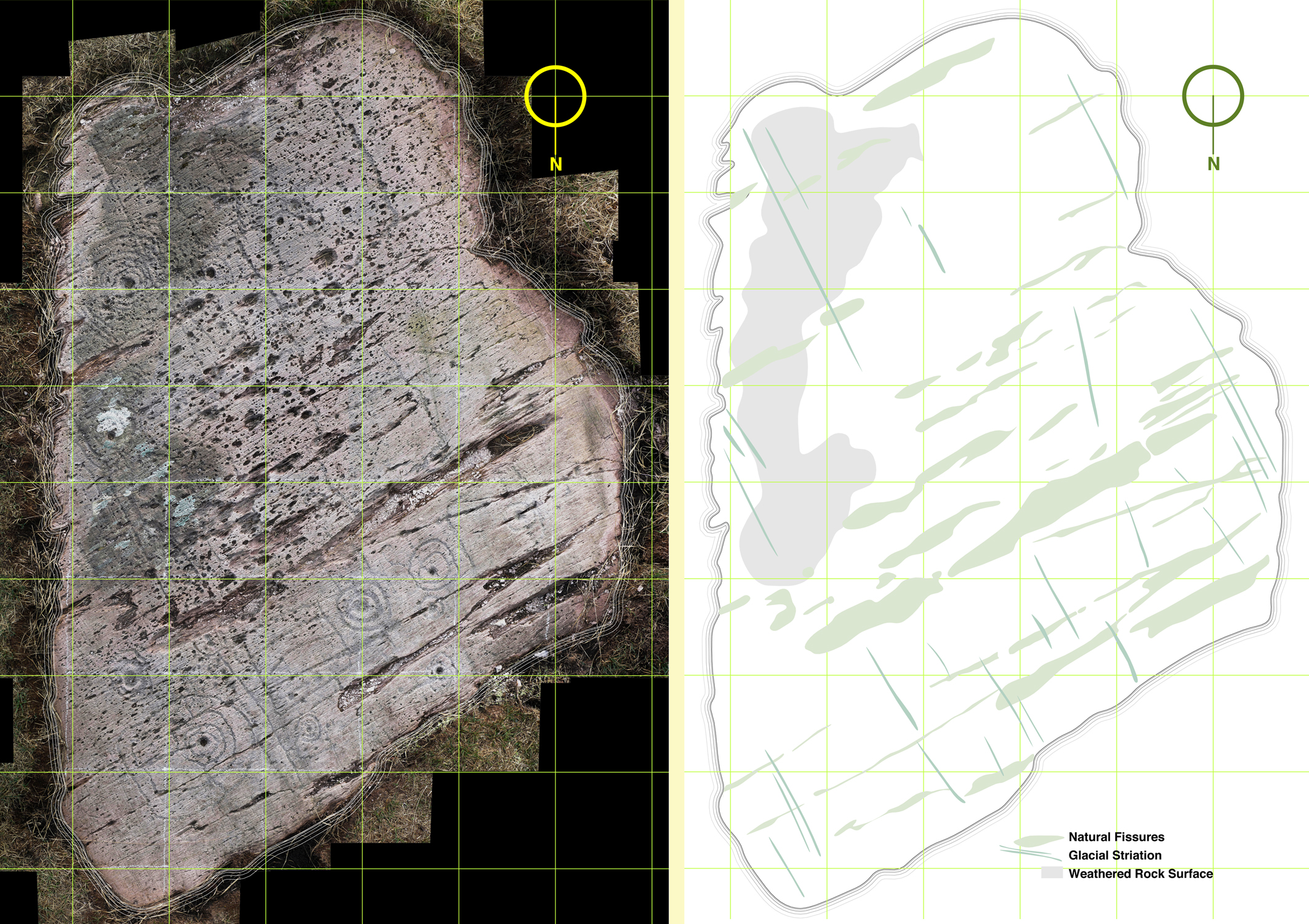
The rock measures about 3m by 4.5m at its extremities, and it was fairly easy to establish a 50cm grid using tapes. Fortuitously, one relatively straight side of the rock lies on a north – south line (magnetic north), and it was convenient to set my grid to compass orientation. The stone fills 55 of these grid squares and – using a Leica camera with a Vario-Summicron 2.8 lens – I took 55 high resolution photographs, each one centred on a grid square, and with the camera held a constant 1.5m above the flat rock surface. Back at the work station I stitched together all these photos using Photoshop, and this has given me a very accurate scaled base which is the bottom layer of the drawing I have subsequently created. My training as an architect has included using CAD techniques (Computer Aided Design), and I can trace very accurately the outlines of picked markings which show up on the photograph. The drawing is made as a digital file which can be reproduced physically to any size or scale, depending on the properties of the printer used. A CAD drawing can have any number of layers which can be switched on or off (or made transparent) to provide a matrix of information. My layers so far in ascending order are:

1   Photograph

2   Text and legends

3   Grid and grid reference numbers

4   Perimeter tracing of the rock

5   Tracings of the natural rock striations resulting from glacial movement (this appears to give the rock a definite directional ‘grain’)

6   Tracings of the natural rock fissures

7   Tracings of the rock carvings
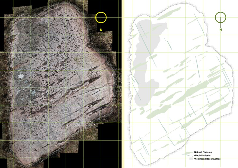
The composite photograph (left) and tracing of natural features on the rock (right)

The composite photograph (left) and tracing of natural features on the rock (right)

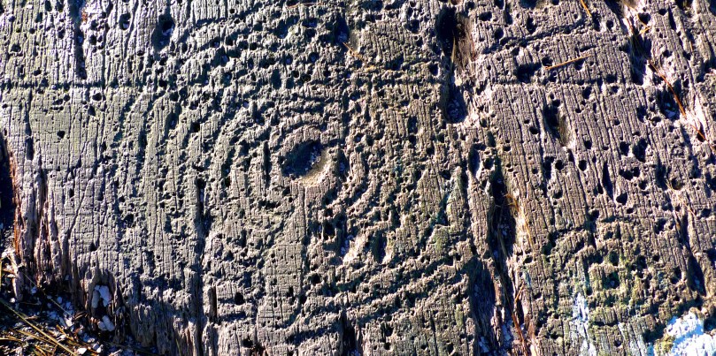
I have added layers (5a, 6a and 7a) so that I have the outline tracings of carvings etc, but also ‘fills’ to these outlines. All these layers can be given different colourings. I have the intention also to separate out motifs depending on ‘motif type’: for example, the Archaeological records for West Cork distinguish between ‘Rock Art’ and ‘Cupmarked Stones’. Cupmarks are the simplest form of motif, and the most prolifically spread. The Cupmark is a concave depression, often surrounded by one or more concentric rings, and sometimes with a radial groove from the ring to the outermost circle or beyond. ‘Rock Art’ can include any other motifs – rings, squares, figures of eight, dumb-bells: the rock at Dereennaclogh provides examples of all these and more. A drawing layer devoted just to cupmarks would be useful.
Motifs traced over the photograph

Motifs traced over the photograph

The motifs are ideally traced on a large screen, which enables the picking to be clearly seen: ‘picking’ means the hammer-on-stone technique of carving out the shapes. So far I don’t have a layer which includes information on the depths of the carved motifs. This would in any case be subjective and could only be done by taking a large copy of the drawing to the rock, measuring the depths of each mark and recording this ready for transfer to the file back at the workstation. This is a future job, and will involve a more selective coding to show the extent of picking graphically, It would in any case be academic and not necessarily a true record of what was carved, because of erosion and wear factors. Derreennaclogh is a valuable trial for developing these techniques as the carvings are on the whole in very good condition. It is not so easy on other examples: there is a further debate waiting on how it might be possible to retrieve information from a more heavily worn rock surface. Laser scanning surveys are showing up some interesting possibilities but better still would be an ability to analyse the body of the rock in a way that would show up the ‘attack marks’ from the original picking which would have altered the molecular structure of the surface. Laser scanning and this ‘attack’ recording technique (if it were possible) could both require the hauling of relatively expensive and relatively unwieldly equipment out into the field. My ‘visual rubbing’ technique is tabled as a method to be applied anywhere that is humanly accessible, and is within the capability of a retired CAD-adept draughtsperson with time on his or her hands.

There are drawbacks to the ‘visual rubbing’. One is the subjectivity of it. No rock surface is completely flat or smooth. There are striations, faults, pits and holes. Some of these resemble the carved motifs (particularly when the rock has been severely weathered), so I have to make decisions at all times as to what is natural and what isn’t, and also on where the actual edge of the carving is. Often it seems possible that the natural features of a rock influenced or informed any ‘design’ intentions. I’m sure many of my decisions are arguable. I can only say that my guesses are ‘educated’ by experience.
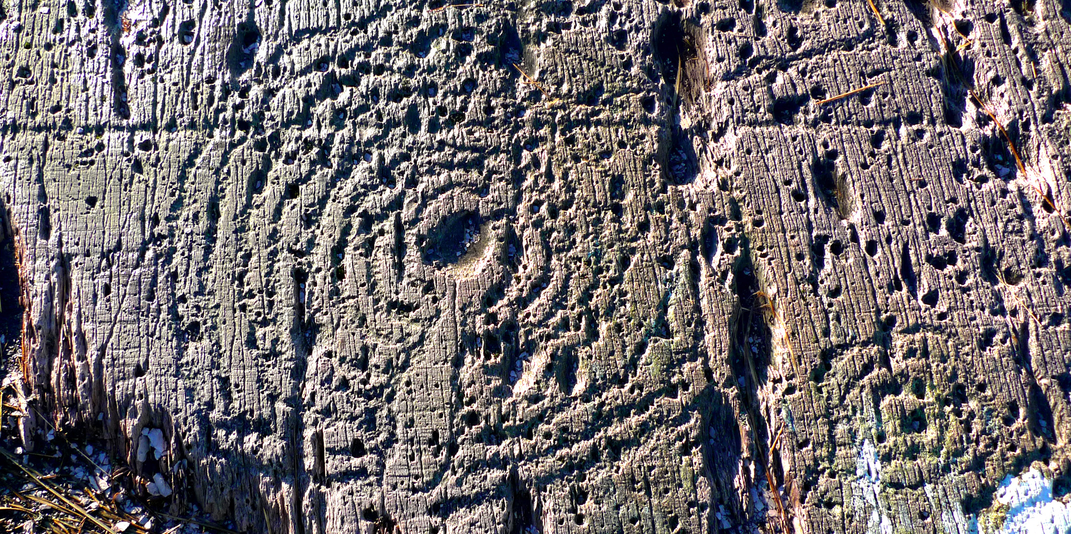
Cupmark with eight rings at Derrennaclogh

Cupmark with eight rings at Derreennaclogh

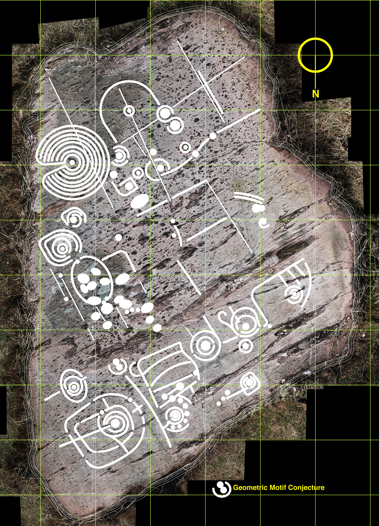
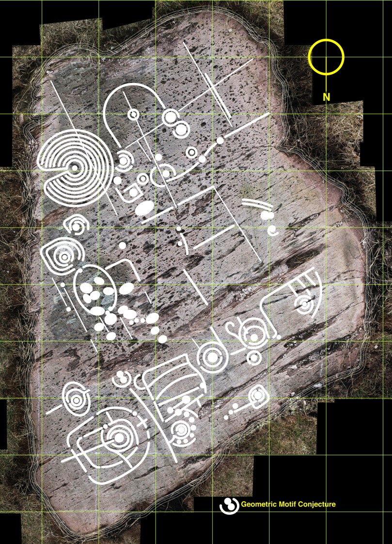
But this dilemma has led me to consider a further layer: intentions. I know this requires a leap of imagination and will seem bizarre – if not anathema – to trained academics, but when I am finely tracing some of the images I find myself asking what the carver originally set out to do in each individual case. So many of the marks are nearly geometric – concentric circles and parallel lines for example – but just don’t make it. Obviously there are limitations in the carving technique and you can’t rub out mistakes. Also it is interesting that some of the motifs seem to relate to natural striations and fissures – which is why I have shown the most prominent of these on separate layers. So here I am daring to have a ‘top’ layer which shows my interpretation of what the Rock Artist might have set out to do if he or she didn’t have the limitations of crud(ish) tools and materials. Please ignore this layer if you are not whimsically inclined – or a romantic. I am incurably romantic, and always still waiting for that moment when I am pensively standing on the rock and will be startled by the appearance beside me of a stray artist carver from 5,000 years ago. Miraculously we will be able to communicate – and, after that encounter, I will be able to provide the answer to the question that is always asked by voyeurs of prehistoric Rock Art: what does it all mean?
Whimsy - a conjectural geometric redrawing of the motifs at Derreennaclogh

Whimsy – a conjectural geometric redrawing of the motifs at Derreennaclogh

Ancient Calendars

One of West Cork's ancient calendars

One of West Cork’s ancient calendars

We’ve been catching up on our rock art project this week and it’s brought us out into the field. On Saturday the weather was spectacular – crisp, but with a totally blue sky and vibrant colours. See Amanda’s photo of the day here. We spent most of the day just east of Rosscarbery, a picturesque settlement above the water at Rosscarbery Bay, where the birdlife viewing is always a delight.

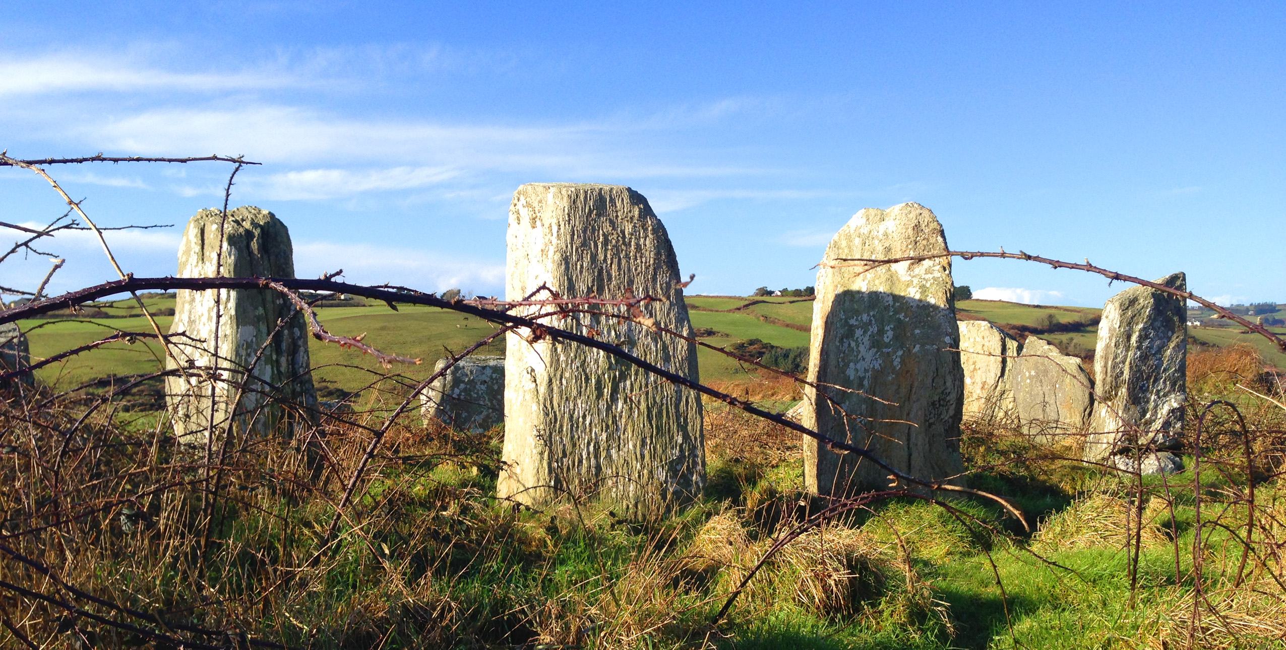
One of the sites we visited was Bohonagh. Not only does it boast cupmarked stones, but a very fine boulder burial and a stone circle.

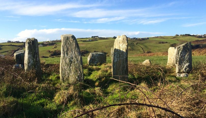
Bohonagh Stone Circle

Bohonagh Stone Circle

West Cork is particularly rich in 3000 year old Bronze Age stone circles and most of them are of the ‘axial’ or ‘recumbent’ type. This means that the circle is laid out on an axis that is oriented in a particular direction. On one side of the circle is a stone laid longways – the recumbent stone. Across from the recumbent are the portals: two tall stones that appear to create a doorway into the circle. Sometimes the stones rise in height from the recumbent to the portals, and the portal stones may be set ‘end-on’ to the circle. There are always, therefore, an uneven number of stones – up to 17 have been recorded, although many circles are incomplete, with fallen or missing stones. The purpose of the axis was to provide a line of sight on a sunrise or sunset (and perhaps even moonrise and moonset) at important calendrical points such as solstices and equinoxes.

The portal stones at Bohonagh

The portal stones at Bohonagh

Bohonagh quartz

Quartz at Bohonagh

A feature of these circles is that many of them include quartz rocks: sometimes as one of the circle stones, sometimes as an additional rock in the interior or exterior of the circle, and sometimes on a nearby monument such as a boulder burial. At Bohonagh there were several quartz rocks, including one lying outside the circle and two supporting the boulder burial. In one case, at Ballycommane, we have seen an enormous quartz rock function as the capstone of a boulder burial – quite awe-inspiring in its visual impact. Interestingly, this same phenomenon occurs in a stone circle in Cornwall – Boscawen-Un in the West Penwith Peninsula, not that far from West Cork! As we watched the quartz under the boulder burial glisten in the sun (impossible to capture on a photograph) we knew it had to be seen as a very special stone to the builders of these circles.

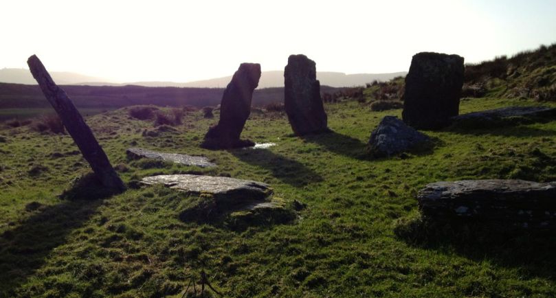
Brooding stones at Dunbeacon

Brooding stones at Dunbeacon

Stone circles often command sweeping views of the surrounding countryside. This makes them well worth visiting, even if a goodly hike is involved. Because they are invariably located on private land, it is good practice to try to track down the landowner and request permission, and of course to always close gates and observe good field etiquette on a visit. Don’t be surprised to find that many are no longer intact: the centuries have taken their toll and many of the stones have fallen or disappeared over time. On the upside, this adds to the romantic wildness of the scene.

Gorteanish Stone Circle, re-discovered in the laying out of  the Sheep's Head Way

Gorteanish Stone Circle, re-discovered in the laying out of the Sheep’s Head Way

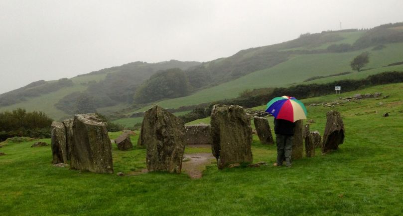
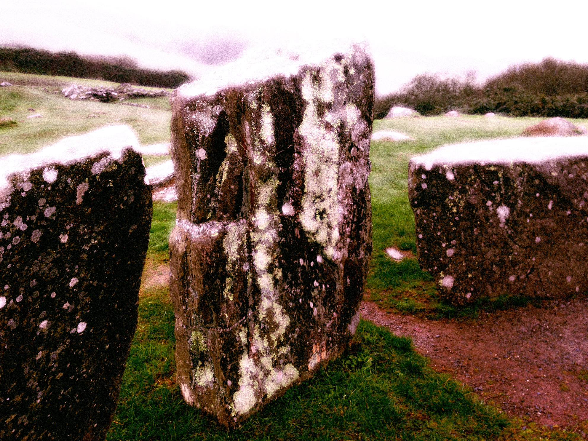
One of the most famous of the West Cork stone circles is Drombeg, near Glandore. Here, people gather on the winter and summer solstices to witness sunrise and sunset.

Drombeg on a wet day

Drombeg on a wet day

At Bohonagh, the alignment is to the spring equinox sunrise and sunset, due east and west. We plan to be there!

Loon the Sentinel

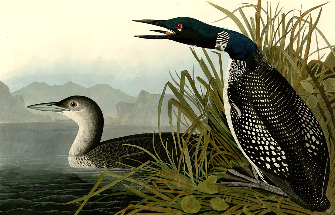
loon print

Our friend Julian lives beside the water in the Cove, and we were excited when he told us there were Great Northern Divers in the bay. During the recent storms he saw a large number of them – fourteen or fifteen – huddled together for shelter close by the shore. He called this gathering a ‘Raft’: In fact the collective noun is usually said to be Asylum, Cry or (more attractive) Water-dance. We saw them too, but distantly through our spotting scope up in Nead an Iolair, although we came across them close to when we were walking by the shore in Ahakista on the Sheep’s Head. Here they were mixed up with Cormorants (collective noun Flight of…) and Shags (Hangout of…) – but their markings were distinctive enough for us to be sure.

loonie

In Canada the same birds are known as Loons. Believe it or not, the International Ornithological Committee met especially to consider the problem of the differing names in America and Europe and proposed a compromise: the Great Northern Loon. I like the term Loon: supposedly this name comes about because the bird has large webbed feet set well to the back to assist diving but is clumsy on land. In Icelandic the word for ‘lame’ is lúinn, and in Swedish it is lam – this could well have been an influence. The Canadian Loon is featured on the one dollar coin – which is therefore know as a ‘loonie’ – the two dollar coin is a ‘toonie’.

When Finola and I were on a road trip up to the north of British Columbia (through spectacular scenery) we stopped by a lake and we could see diving birds a considerable distance away. Finola told me they were Loons and I said I really wanted to have a good look at them. She immediately put her hands up to her mouth and produced the distinctive wavering call:

I couldn’t believe it when a few seconds later a Loon surfaced right beside us! I was full of admiration (as always) for Finola’s many talents…

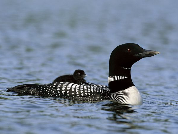
An endearing habit of the adult bird is that it carries its chick on its back until it can swim on its own.

Hitching a ride...

Hitching a ride…

I can’t find any Irish legends mentioning Loons, Great Northern Divers or any other variants, but there are plenty of Canadian ones among the First Nation cultures. There the Loon is invariably a ‘good guy’, and even helps Raven the Creator to make the world, and to bring Sun, Moon and Water to it. It has various names in these tales, including Big Loon, Black-billed Loon, Call-up-a-storm, Ember-goose, Greenhead, Guinea Duck, Imber Diver, Ring-necked Loon, and Walloon. We also have a very fine carved Loon on our living room wall, from Finola’s First Nation art collection.

loononwall

I call Loon the Sentinel because he seems to stay just outside our Cove, swimming and diving across the entrance – keeping it safe for us. When our spring comes (and we can begin to feel the sun getting stronger already) he will be off to colder climes to breed.

Nollaig na mBan

This post was first published many years ago – in 2014! The subject matter – Women’s Little Christmas – is just as relevant today. So, have another look…

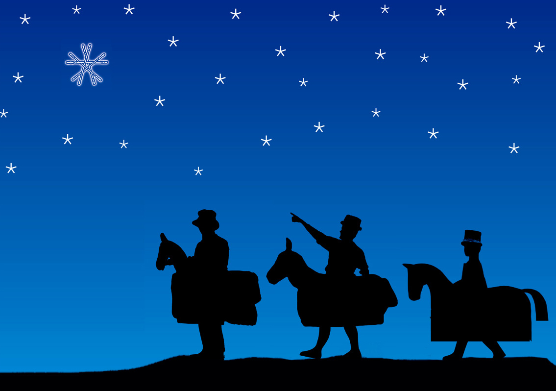
Sounds like ‘Nullig ne mon’ and translates as ‘Christmas of the Women’, but is also known as ‘Little Christmas’. It’s today – the 6th of January – and is celebrated in Ireland and wherever else in the world there are Irish communities. There are other traditions surrounding this day (quite apart from the arrival of the Three Wise Men), and they are confusing. I was brought up knowing that the Christmas decorations have to come down today otherwise there will be some bad luck in the year. Finola, however, knows that they have to stay up all through the day as it’s still part of Christmas – so she would have them down tomorrow instead. Maybe this is a Catholic / Protestant divide? And when is Twelfth Night: 5th or 6th of January? Either one, it seems, depending on which of the many traditions you choose to follow, or which part of the world you live in.

Layout 1

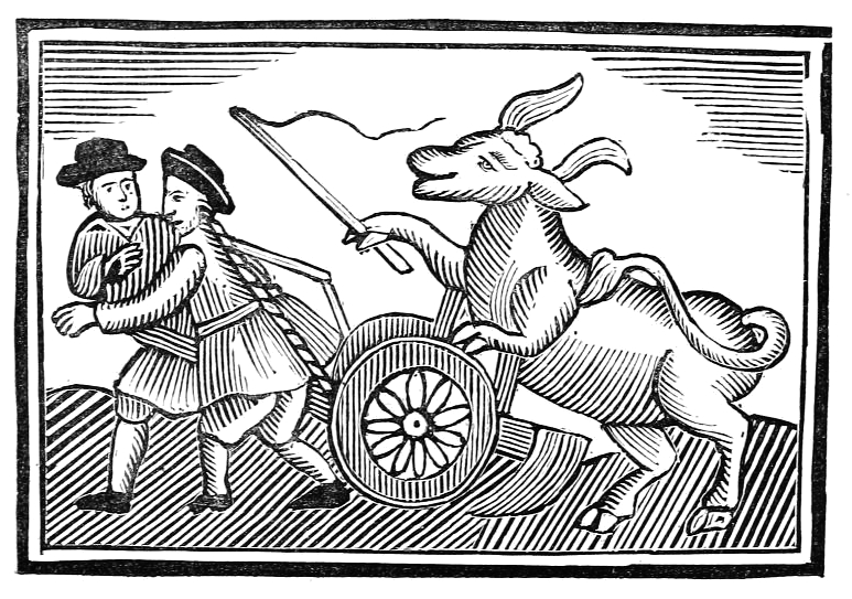
In Tudor Britain the whole winter festival started on All Soul’s Eve (Halloween) and lasted until Twelfth Night. On the first day a cake was baked with a bean in it. Whoever had the slice with the bean was elected Lord of Misrule and presided over a topsy turvy time when the peasant ruled the master and so on. The World Turned Upside Down is a wishful thinking concept that has inspired many artists ever since.

8597011641_560e181106_o

In some parts of Europe a custom of house-blessing takes place today. Dried herbs are burnt and their scents fill the building. Doorways are sprinkled with holy water and the master of the house writes with chalk above the house and barn doors the initials C M B enclosed within the year (eg 20 C  M  B 14). According to the ritual he says: Caspar, Melchior, Balthasar, protect us again this year from the dangers of fire and water. Alternatively it could stand for “Christus Mansionem Benedicat” (May Christ bless this home).

Some traditions closer to home: McCarthy + Hawkes write in Northside of the Mizen

…On Nollaig na mBan (Woman’s Christmas or Epiphany), the women put all the scraps and leftovers from Christmas onto the kitchen table and it was then up to everyone else to cope the best they could. At midnight, on the eve of Nollaig na mBan, the water in the spring well turned to wine. Now that was a great thing! Ne’er a man or woman has ever supped any and that was because it was only for the Little People…

Perhaps to emphasize that such miracles should be the preserve of only the Fairy Folk, there is a tale told of the blessed well of St Brendan in Cill a ‘Ruith, near Ventry in County Kerry: here in days of yore Three Unwise Men sat up to drink their fill of wine at the appropriate hour and were turned into three large boulders which stand there as a warning to this day.

rocks

As this is a Monday, and the first one of the new year, it is also known as Handsel Monday, when children used to visit neighbours and friends and ask for money or cakes. Such a gift was known as a suggit which may derive from the Irish so dhuit – ‘here’s for you – here you are’.

Finola is off out tonight with friends to celebrate Nollaig na mBan, as she used to in Vancouver where the tradition was strongly followed in the Irish community. It is said that the term ‘Women’s Christmas’ can be explained because Christmas Day was marked by beef and whiskey – men’s fare – while on Little Christmas Day the dainties preferred by women – cake and tea – were more in evidence. Finola will no doubt tell me whether this is still the case.