Copper Country

Sheep's Head Copper Mine: Cornish mineworkers' cottages

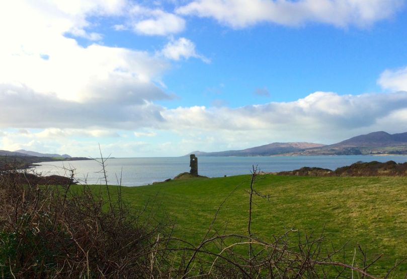
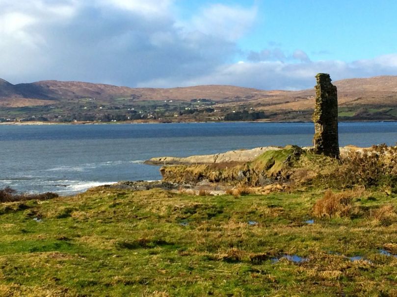
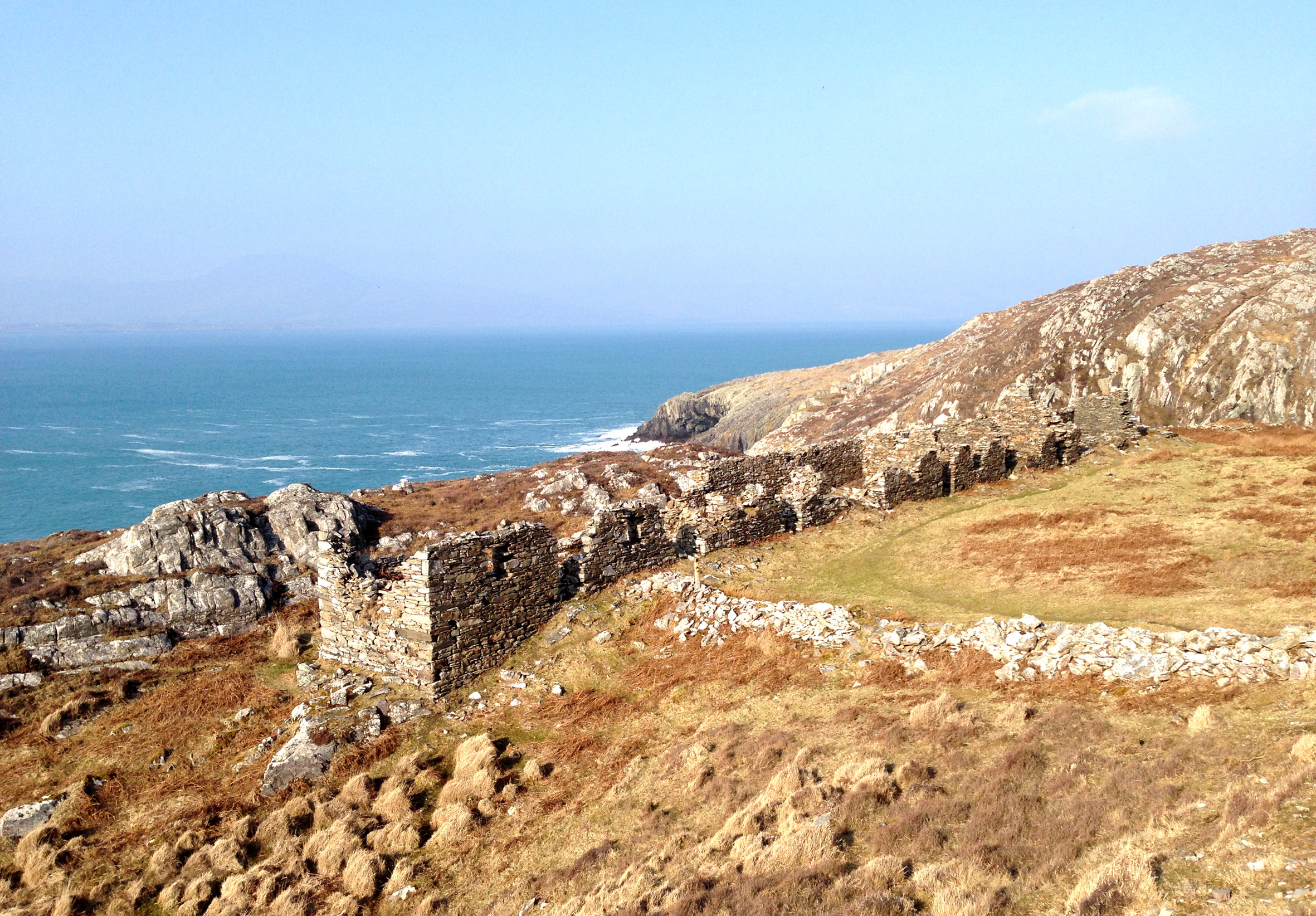
Gortavallig Copper Mine, Sheep’s Head: Cornish mineworkers’ cottages

We live in the townland of Cappaghglass. I would love to say that the name derives from the metal that makes up much of its geology – copper, but Finola tells me that way of looking at it comes from my English accent: the Irish word for copper is Copair, while Cappa actually means meadow. Glas or glass means green so – prosaically speaking – we live in ‘Green Meadow’. However, as in so many cases, the history of this little bit of Ireland is writ clearly on the landscape and Cappaghglass is very much ‘copper country’.

Stub of 9th century Irish round tower? - No: 19th century copper mine workings in Cappaghglass. In front is the head of a shaft, behind is the remains of the mine chimney that fell in 2002; to the right are the old mine cottages

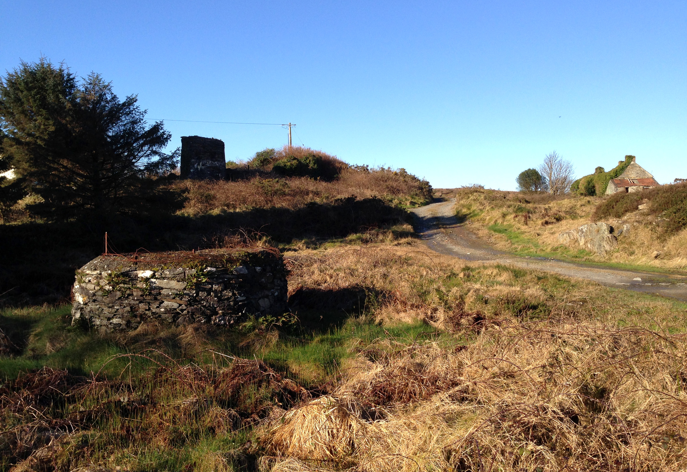
Stub of 9th century Irish round tower? – No: 19th century copper mine workings in Cappaghglass. In front is the head of a shaft, behind is the remains of the mine chimney that fell in 2002; to the right are the old mine cottages

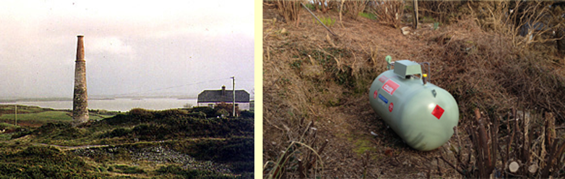
Our own house, Nead an Iolair, is built on territory that was once owned by a nineteenth century copper mine, and legend has it that our Calor gas tank is placed over an old mine shaft! We look out to Horse Island – one of Carbery’s Hundred Islands in Roaringwater Bay: it once supported a copper mine of the same period. Look at the photograph of the number of workers employed there at this time. Now there are merely a few holiday homes on the island.

Mineworkers on Horse Island: 19th century

Mineworkers on Horse Island: 19th century

Among the quiet fields and peaceful boreens our townland is strewn with evidence of the industry that once was here: old spoil heaps, barbed-wire protected shafts, supports for overhead ropeways and the base of a famous local landmark: the 20m tall Cappagh Mine chimney which came down in a lightning strike in 2002 which also severely damaged the Mine Captain’s House adjacent to it. Mining here commenced in 1820 and works ceased in 1874. Its best years were the decade 1863 to 1873, when 877 tons of bornite copper ore were produced.

cappamap2

Cappagh Mine: cross section, mine chimney (pre 2002) and our own mine shaft!

Cappagh Mine: cross section, mine chimney (pre 2002) and our own mine shaft!

***

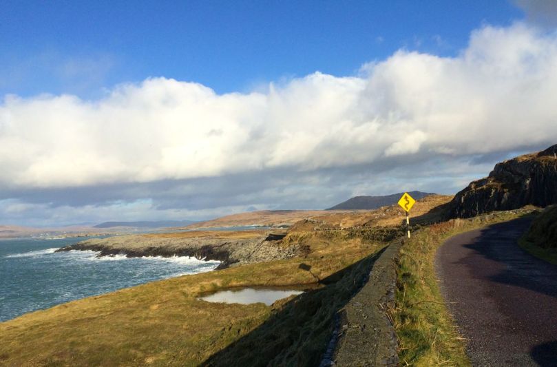
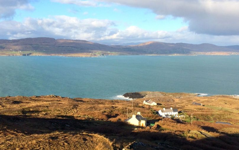
We went off to the Sheep’s Head last week – in idyllic weather – and were shown the Copper Trail by friends Peter and Amanda. It feels so remote out there, yet the place was a hive of industry when mining was at its height during the Victorian age. I was fascinated by the row of Cornish miners’ cottages there, and the similarity between this site and the cliff-edge setting of some of the mines in West Cornwall, Botallack in particular. When exploring these pieces of industrial archaeology in Cornwall I was always struck by the incongruity of the incredibly beauty of the places – set against the blue background of the Atlantic – with the hardship and danger of the working conditions that must have prevailed. Here in West Cork, as there in Cornwall, shafts and galleries extended out under the sea bed and the men toiled away in cramped and perilous conditions with the sound of the booming waters above them, while on the surface women (bal maidens) and children worked equally hard preparing the ore for crushing and smelting.

botallack

Botallack Tin Mine, West Cornwall - romantic site now, but less benign in earlier days

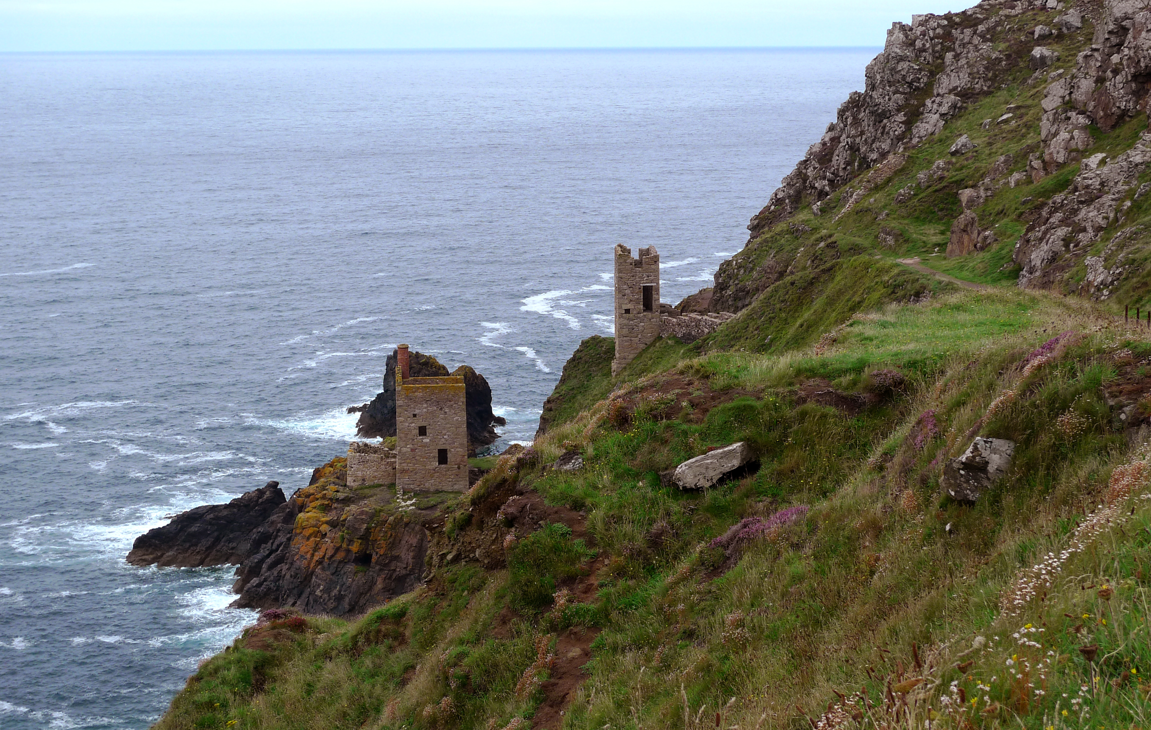
Botallack Tin Mine, West Cornwall – a romantic site now, but less benign in earlier days

Far longer ago than the nineteenth century, West Cork was being worked for copper ore. On the steep sides of our local Mount Gabriel there is evidence of copper mining dating back 3500 years to the Bronze Age. UCC Professor of Archaeology William O’Brien carried out research and excavations during the 1980s and traced a number of mine workings from this time. The extraction was a well organised process: a supply of  good roundwood had to be stockpiled and fires were lit against the rock face where traces of ore were apparent. A hot fire was kept burning for several hours followed by dousing in cold water (of which a good supply was also needed), causing the rock surface to fracture, and this disturbed face was hacked off with stone mauls allowing the accumulation of small quantities of  malachite. Constant working on good seams led to excavation into the mountain side, and some shafts have been found extending to several metres. Water ingress was a problem and it seems likely that a system of bailing or pumping was necessary. Eventually the drowned shafts were abandoned and, over time, they became filled with a type of blanket bog. This helped to preserve some of the wooden implements used and – presumably – discarded in them: hammer handles, wedges, picks and shovels as well as planks and ladders; also pine chips apparently used for illumination.

Bronze Age industrial landscape

Copper Country: Mount Gabriel – once the haunt of Wolves and miners

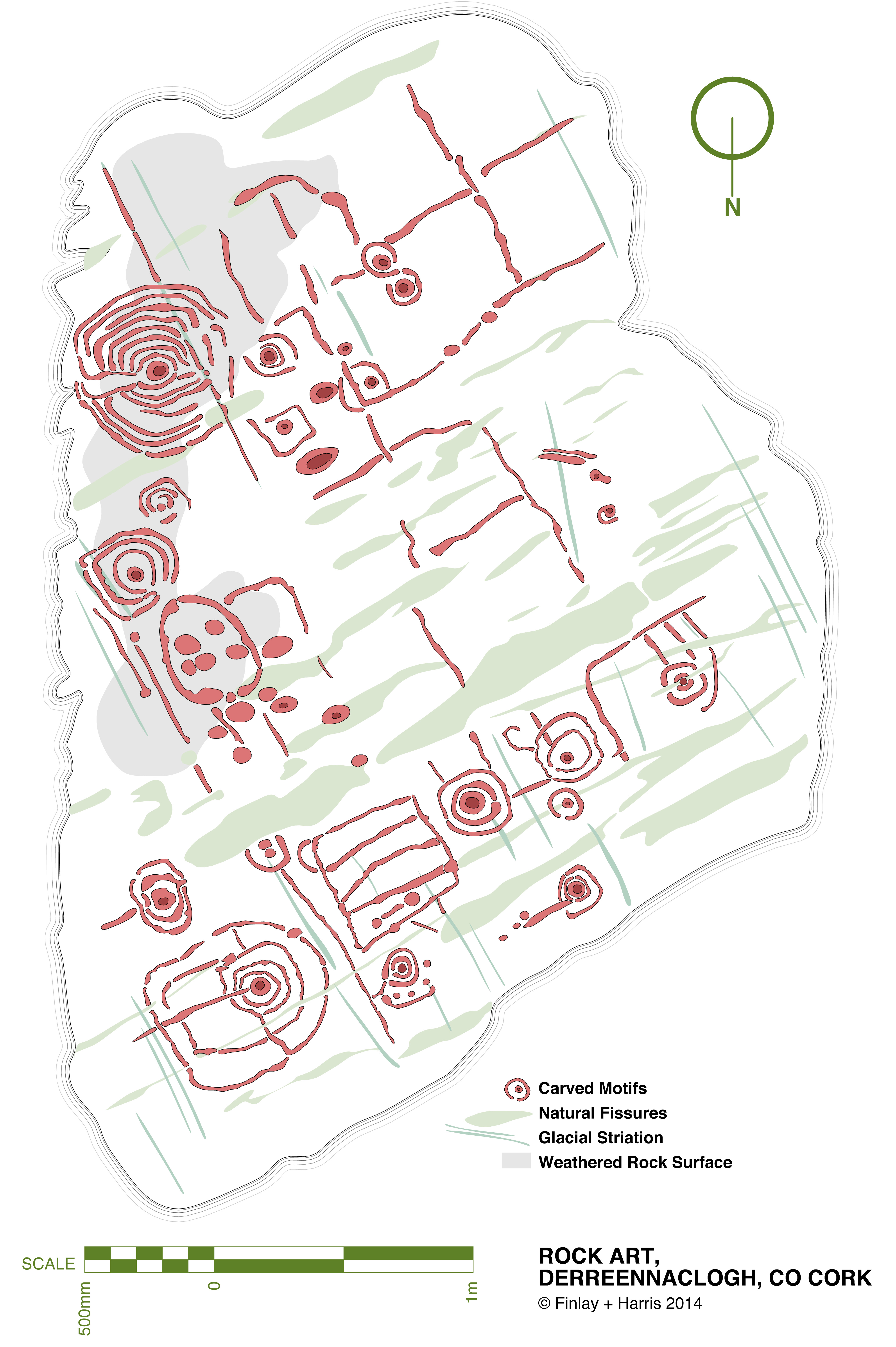
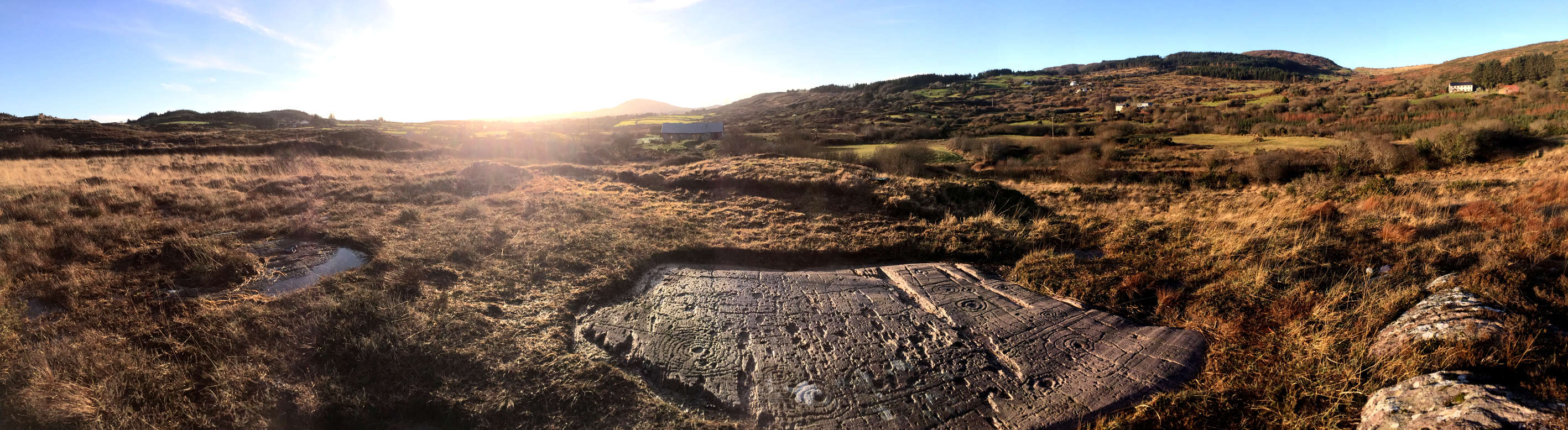
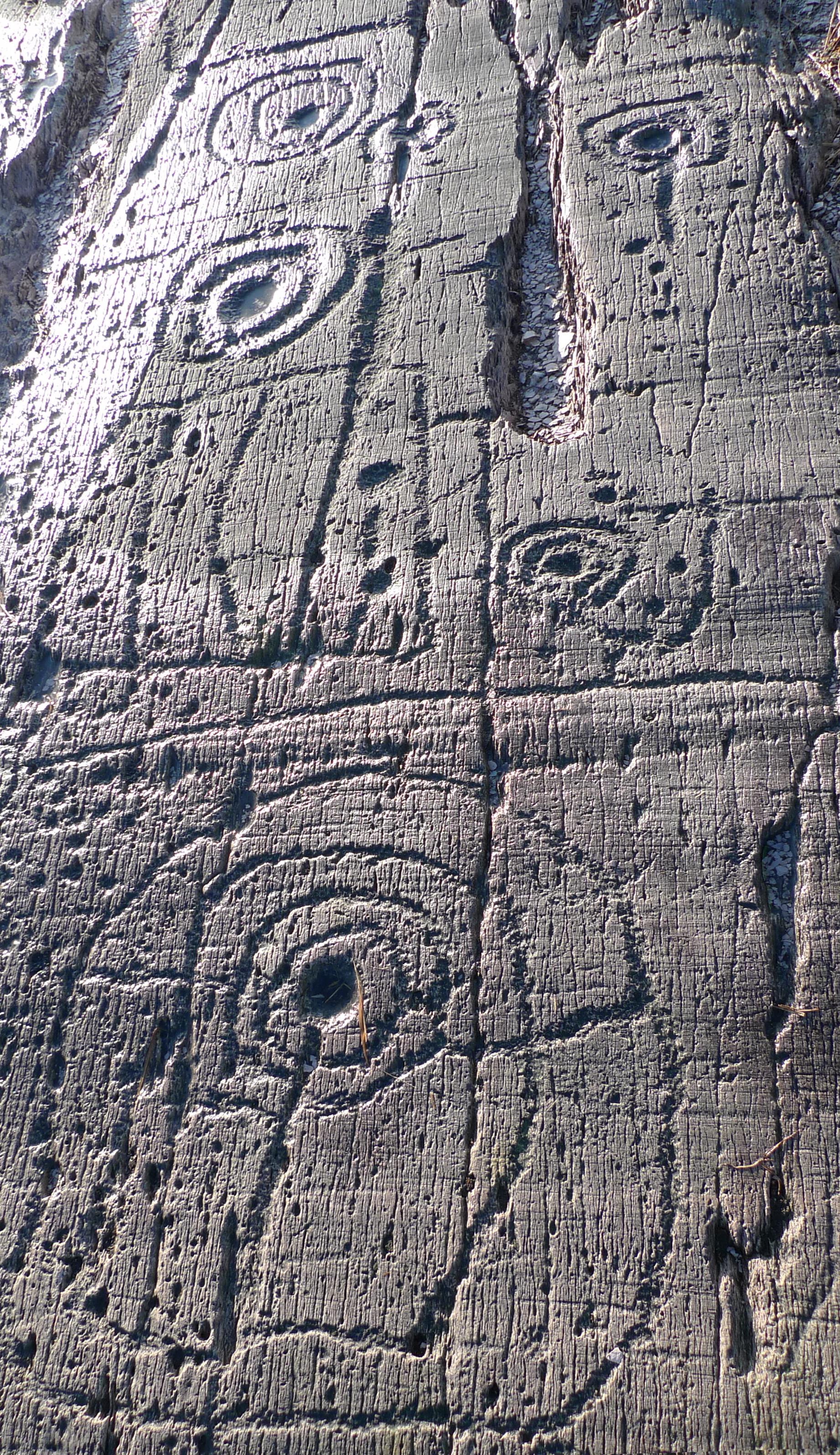
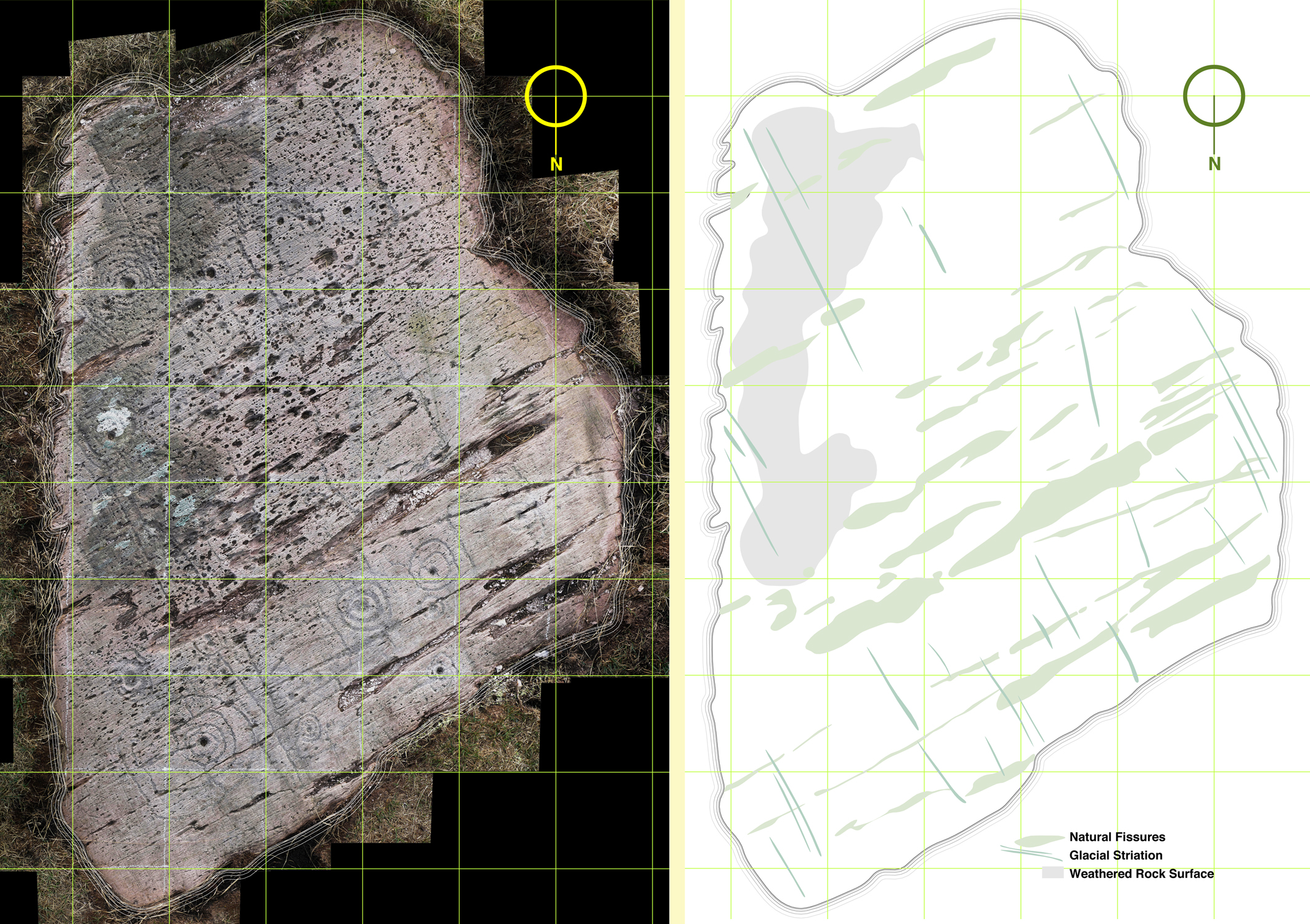
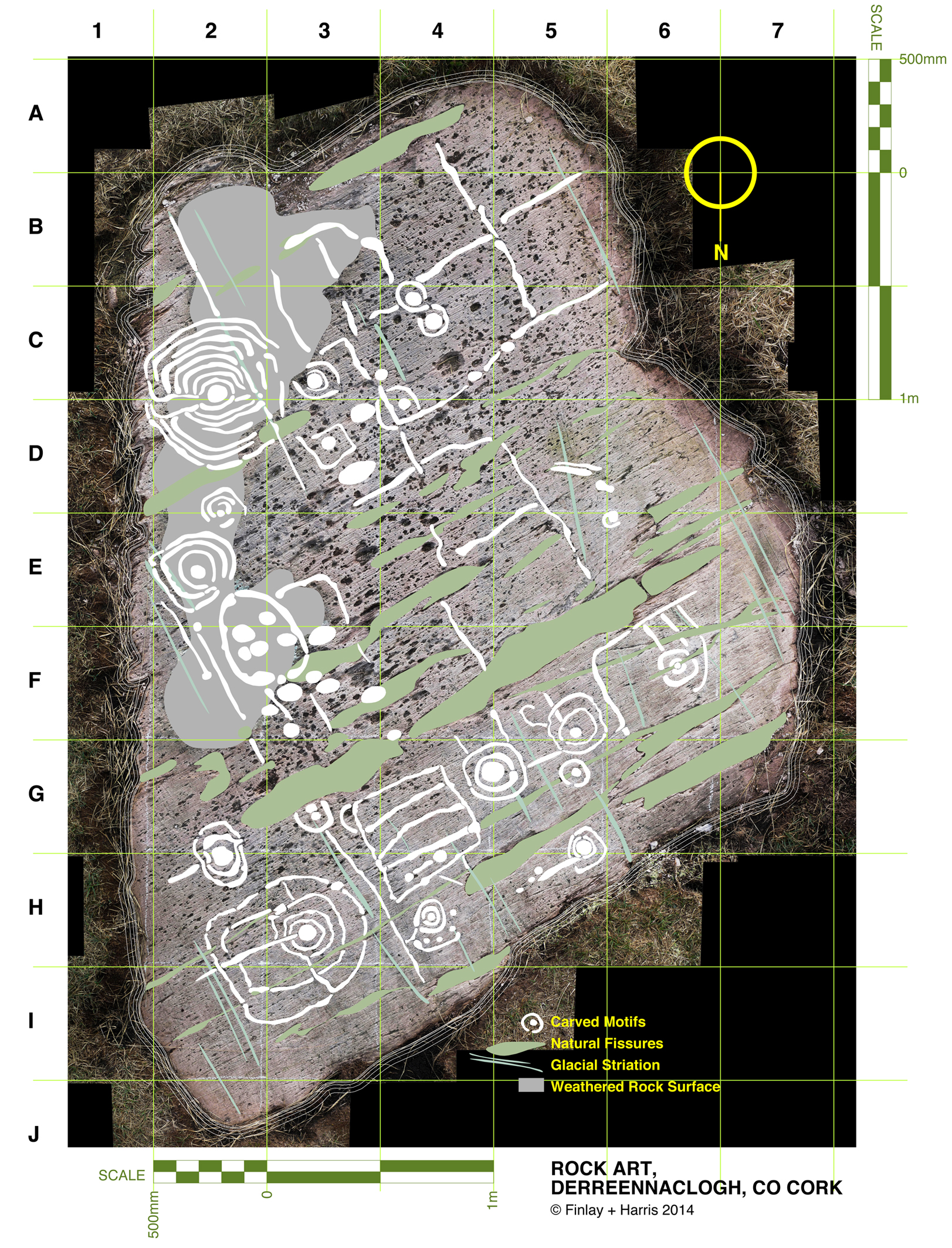
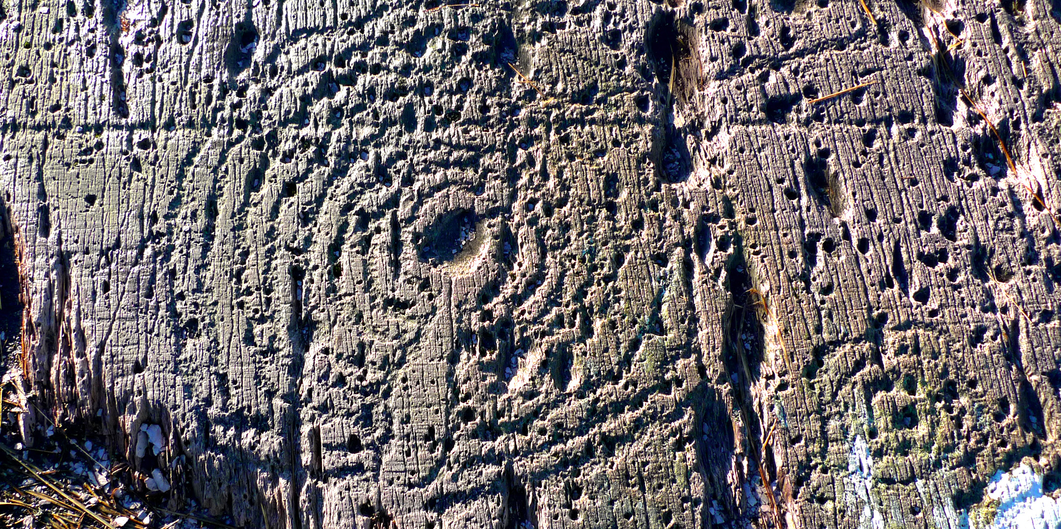
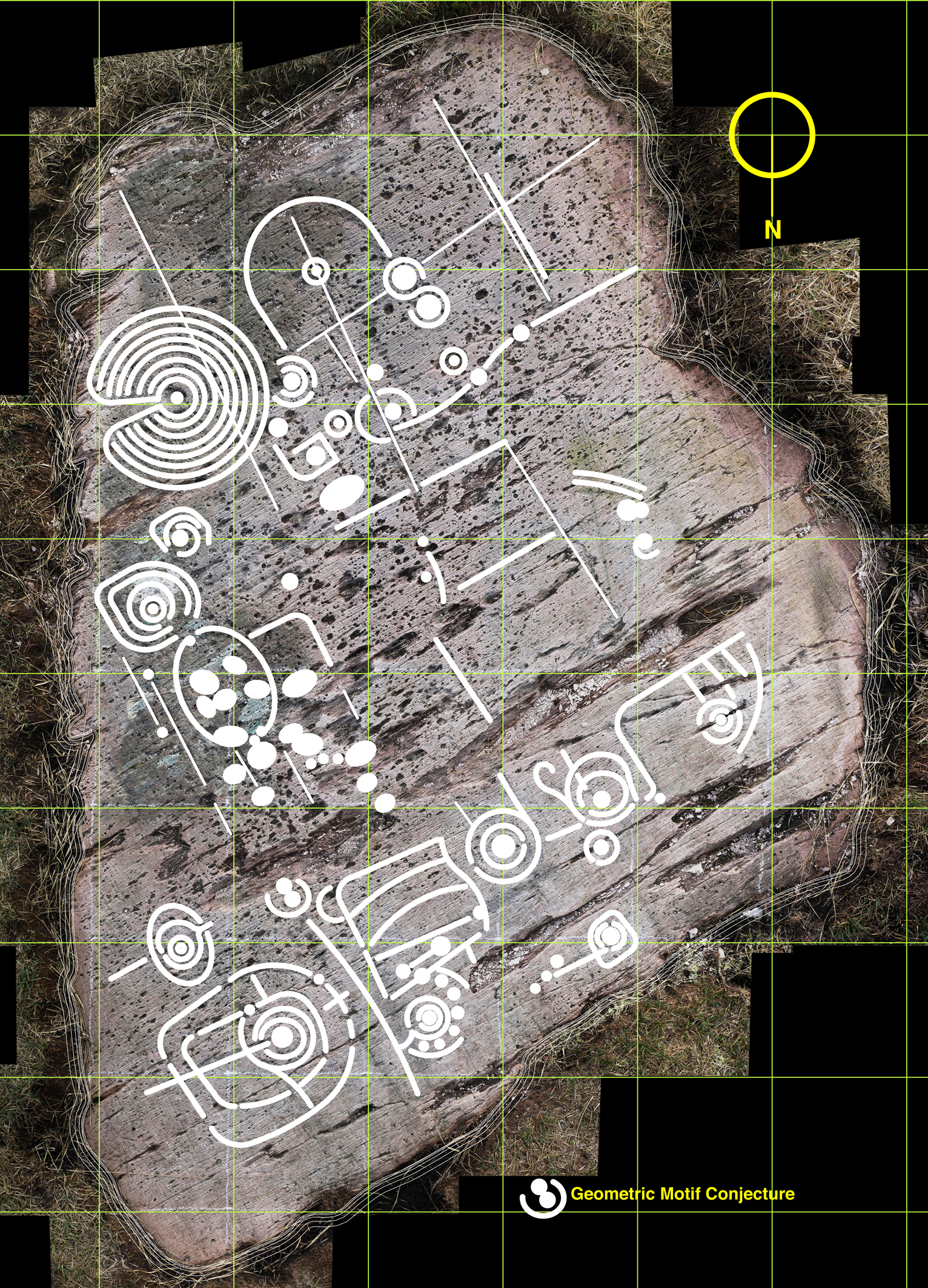
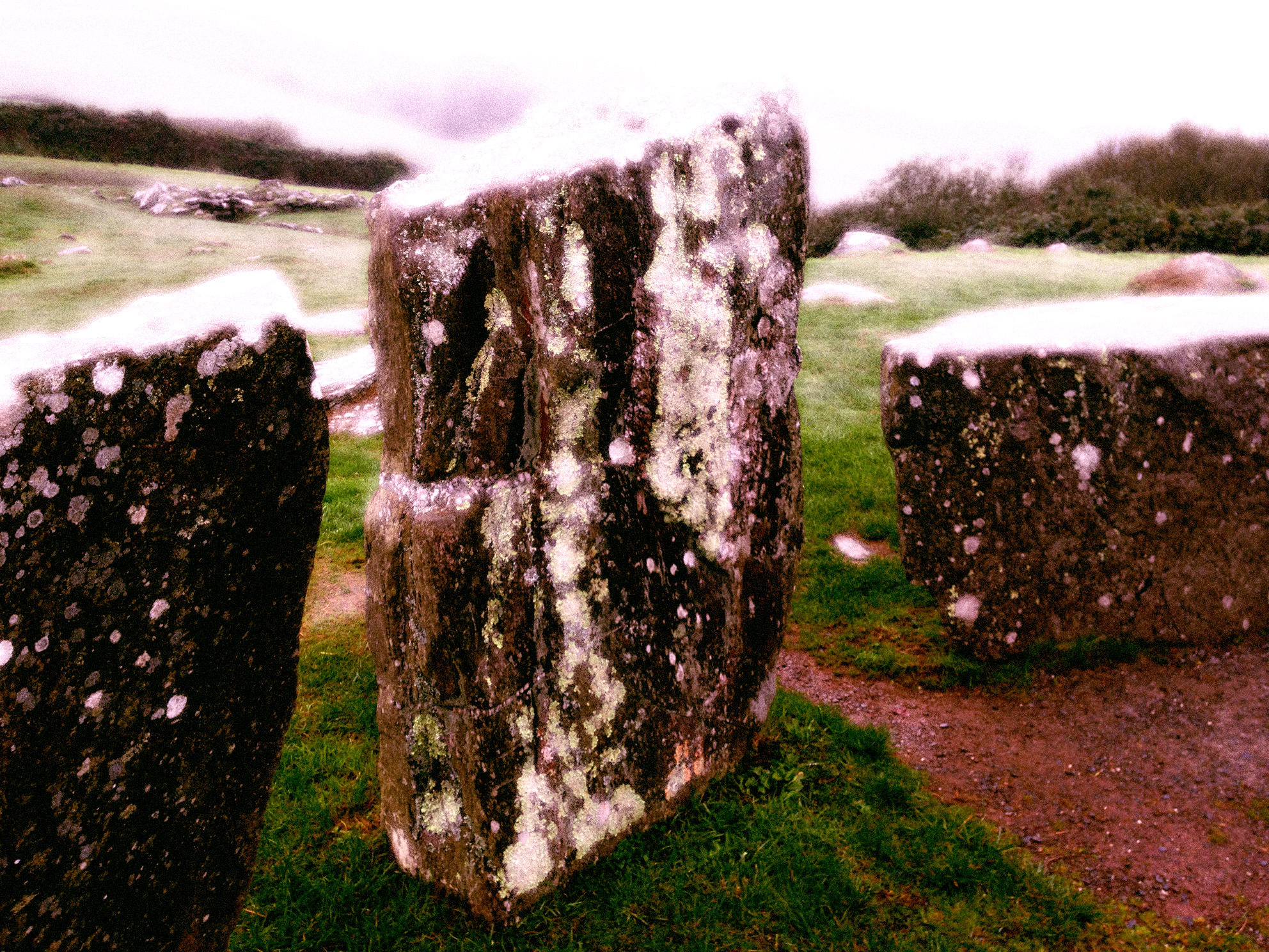
There’s a whole lot more to be said – about why metal was so important in the Bronze Age (wealth, in one word) and the whole context of distribution, trade and the technology of bronze itself: bronze production is only possible by combining copper ore with tin, and this was not available locally. In all probability our Cornish and Iberian cousins were making contact with Ireland’s metallurgists thousands of years ago. Interesting that the Rock Art we find in these same hillsides – and which could date from the same period – also has parallels in Britain, Brittany and Iberia.

Bronze Age industrial landscape?

Bronze Age industrial landscape?

The Workhouse

The ruins of the Schull Worhouse

The ruins of the Schull Workhouse

Of all the old ruined or abandoned buildings that dot the countryside of Ireland, one type has the distinction of being the most hated – the workhouse. Many have disappeared: most of the West Cork workhouses have been pulled down or completely rebuilt as community hospitals. A few hints remain – a wall here, a shed there. The workhouse in Schull, although in a ruinous state, has managed to maintain enough of a presence to remind us of its former role in the community. Surrounded by a high stone wall, you can still see parts of the administration building where inmates were admitted, remains of the dormitories and the hospital.

Administration Building and Entrance to the Workhouse

Administration Building and Entrance to the Workhouse

We wander around a lot of ruins here in West Cork, but this one is different. No good feelings emanate from these walls. Instead, an aura of decay and sadness lies thick upon the site. We found ourselves exploring in silence, contemplating the misery that was the inevitable condition of those who entered.

Schull Workhouse Plan

Schull Workhouse Plan

Workhouses were built throughout the nineteenth century in Ireland. The philosophy of charity prevailing at the time dictated that the workhouse must represent the absolute last resort of the desperate – those who could no longer feed, clothe or house their families or themselves. Once admitted, families were separated and might never see each other again. All inmates were assigned hard labour, although some rudimentary schooling was provided for children. There was no comfort, little sanitation, crowded conditions and meagre allowances of food.

One of the most intact spaces

One of the most intact spaces

The Irish Workhouse Centre in Portumna has an excellent website if you want to learn more about the Irish context, but the site that dwarfs all others in the sheer amount of information is The Workhouse: The Story of an Institution, created and maintained by Peter Higginbotham. He makes the point that not all was bad about workhouses, that many workhouses in Britain provided inmates with sanctuary, life-saving treatment and skills. This is not their reputation in Ireland, however, where their memory evokes dread and abhorrence.  Part of this is rooted in their response to the Great Famine of 1845-49. Established to provide Inside Relief many of them initially turned away those who came to the gates asking not to be admitted but to be fed. For those inside, conditions at this time were appalling. As an example, the Durrus History Blog records the report of a Dr Stephens on a visit to the Bantry Workhouse in 1847.

A kitchen, perhaps?

A kitchen, perhaps?

The workhouse in Schull was not built until 1851, in the aftermath of the Famine. It was burned down in 1921 during the War of Independence (there’s an account here), as were many workhouses, to prevent it being used as a barracks by the British army. When the Irish Free State was established, one of the first acts of the new government was to abolish the despised workhouse system and transfer its responsibilities to a new Ministry of Health.

The hospital wing?

The hospital wing?

All Irish workhouses were designed by the same man, to one plan, you can get a better idea of how the Schull workhouse might have looked on the Irish Workhouse Centre website. An exception to this sameness was the Durrus Grainstore, pressed into service as an auxiliary workhouse at the height of the hunger for a couple of years.

Durrus Grainstore. Photo by Amanda Clarke of Sheep's Head Places.

Durrus Grainstore. Photo provided by Amanda Clarke of Holy Wells of Cork

Mizen Magic 2: The North Side

A pet day on The Mizen

A pet day on The Mizen

We are once again being battered by Atlantic storms, but on a sparkling day earlier this week we drove, on a whim, to Durrus for breakfast. The day was so pure and sunny that it seemed a crime to go home again, so we set out to drive along the north side of the Mizen Peninsula.

Dunbeacon Castle

Dunbeacon Castle

What a day! We rambled down to the shore to investigate the 15th Century Dunbeacon Castle. There’s nothing left except one tall wall, standing sentinel against the wind, facing down the length of Dunmanus Bay. Its commanding position would have given its builders, the O’Mahonys, a strategic advantage in protecting and controlling their territory from adventurers arriving from the Atlantic.

Not much left

Not much left

Further along we explored an abandoned cottage, and found one of the water pumps that were once ubiquitous in the irish countryside. We saw few other cars, but we weren’t alone – our movements were observed from above by interested parties.

Preserved. Observed.

Preserved, Observed

Heading towards Dunmanus Harbour we stopped to pay our respects at the little ruined church and graveyard, beautifully called in Irish Kilheangul – the Little Chuch of the Angel. This was a curious mixture of cillín and modern graveyard: rough unmarked stones stood shoulder to shoulder with more recent granite headstones and lovingly tended graves.

The Little Church of the Angel

The Little Church of the Angel

We headed west along the road that skirts the sea and eventually leads to Barley Cove. We are convinced that this is one of the most breathtaking drives in Ireland – and, in a land as scenic as this, that’s a tall order! To the east we looked back up Dunmanus Bay to the Kerry Mountains in the far distance.

Looking East up Dunmanus Bay

Looking East up Dunmanus Bay

To the north lay the Sheep’s Head and beyond it the looming presence of the Beara Peninsula.

Across to the Sheep's Head and Beara Peninsula

Across to the Sheep’s Head and Beara Peninsula

To the west, Knocknamadree (the Mountain of the Dogs) and the wild Atlantic.

Bird Island and the Atlantic beyond

Bird Island and the Atlantic beyond

Once home to hundreds of families, this is a depopulated area now. There are some small farms, but many of the houses are holiday homes, seldom used. Sobering, that such a wildly beautiful place is no longer economically viable to support a thriving community.

The North Side of the Mizen

Northside of the Mizen

But thanks to the foresight and hard work of local writers, we can have a true appreciation of what life was like here. Northside of the Mizen has its own book! Recorded, edited and written by Patrick McCarthy and Richard Hawkins, and illustrated by Thelma Ede and with old photographs, it’s a charming, quirky compendium of character sketches, folktales, customs and traditions, poems and songs, and descriptions of country life. With chapters organised by month, it’s the kind of book you keep by the bedside and dip into when the spirit moves you. In January, for example, there’s a section on scoriachting, or visiting neighbours. It’s accompanied by a photo of a man and his jennet in somebody’s kitchen, with the caption Michael and Tom McCarthy out scoriachting. Once the neighbours arrived (but not on Saturday night as you would have to get ready for mass early the next morning) the night…

“…would start with games, blackguarding (horseplay) and sometimes dancing, then progress on to songs and poems. Storytelling was the preserve of an evening by the fire. With flames flickering and the wind and rain howling like the Banshee, the imagination of the storyteller and his forebears was let loose on a delighted and spellbound audience of children and adults alike. This, in turn, would lead to stories of a more superstitious nature, into a world of small folk, púcas (sprites), mermaids and of people’s misfortune when they interfered with the fairy ways.”

Look out for future posts about the Mizen – we’re only scratching the surface of this marvellous region of West Cork.

Where once were farms

Where once were farms

The Stones Speak

derr scale dwg 06

This drawing is a true scale representation of Rock Art on the horizontal surface of a large, earth-bound slab of sandstone in the townland of Derreennaclogh, Co Cork, Ireland. Archaeologists believe that carvings on this stone – and on very many others in Ireland and across the Atlantic coastline of Europe – were made by early farmers during the Neolithic or Early Bronze Age period, anywhere from 5,000 to 3,000 years ago. The carvings shown here were only discovered in the recent past: they had lain under a covering of peaty soil for hundreds or, perhaps, thousands of years and had therefore not suffered the natural weathering that many other examples of Rock Art exhibit. In one section – shown as ‘weathered rock’ on the drawing, the surface had previously been partly visible, and the curved lines which could be seen on this area led the finder of this piece to carefully pull back the overgrowth to reveal a remarkable Rock Art panel – perhaps one of the most complex and best preserved in Ireland.

The rock at Derreennaclogh: Mount Gabriel is prominent on the western horizon

The rock at Derreennaclogh: Mount Gabriel is prominent on the western horizon

I have been working on this scaled drawing for nearly a year. This long period is partly because my life has been filled with other things (such as moving permanently to West Cork and buying a house which has needed some upgrading), but also because I have been devising a method to measure and record in fine detail the carvings on the stone without any adverse intervention to the rock surface. When my partner Finola was writing her thesis for UCC in 1973 – The Rock Art of Cork and Kerry – it was normal practice to chalk in the carvings and trace over them using a wrapping film, these tracings then being transferred to high quality mylar and photographed for reproduction. Now the codes for archaeological work have changed and it is no longer acceptable to use chalk or any ‘rubbing’ technique: the thinking is that this could damage the surface. There is a whole debate here on how to best preserve our prehistoric heritage – and no doubt there are those who would say that the Derreennaclogh stone – with its carvings in such a remarkable state of preservation – should never have been uncovered at all, or should perhaps be covered over again in a way that will ensure the retention of its markings in a pristine state, while hopefully allowing occasional access for viewing. These matters are being considered in other areas where Rock Art occurs, particularly in Portugal – where some examples are much visited and provided with interpretation centres – and Scandinavia, where many petroglyphs are protected by toughened glass.

derr panel

Motifs picked on the rock surface

I call my recording method, illustrated here, ‘visual rubbing’. It is not entirely without intervention, as I had to walk across the carved face of the rock, and place a camera tripod on the surface. I suppose this is a lesser evil when compared to some examples on open farmland where cattle walk freely across Rock Art panels or where – in places – rocks are being broken up to create new pastures: we have seen alarming signs of large excavator tracks passing right beside some good recorded pieces here in West Cork. Where the carved stones are listed in the Archaeological Record the landowner is always made aware that the monument is sacrosanct, but this does not guarantee practical conservation. Also, it may be argued that the topographical context of Rock Art is important (another debate) and that there should be restrictions in destructive activities to landscape in the vicinity of prime examples. Fortunately, the Derreennaclogh panels (there are two) are in bogland which is not currently grazed or used agriculturally.

The rock measures about 3m by 4.5m at its extremities, and it was fairly easy to establish a 50cm grid using tapes. Fortuitously, one relatively straight side of the rock lies on a north – south line (magnetic north), and it was convenient to set my grid to compass orientation. The stone fills 55 of these grid squares and – using a Leica camera with a Vario-Summicron 2.8 lens – I took 55 high resolution photographs, each one centred on a grid square, and with the camera held a constant 1.5m above the flat rock surface. Back at the work station I stitched together all these photos using Photoshop, and this has given me a very accurate scaled base which is the bottom layer of the drawing I have subsequently created. My training as an architect has included using CAD techniques (Computer Aided Design), and I can trace very accurately the outlines of picked markings which show up on the photograph. The drawing is made as a digital file which can be reproduced physically to any size or scale, depending on the properties of the printer used. A CAD drawing can have any number of layers which can be switched on or off (or made transparent) to provide a matrix of information. My layers so far in ascending order are:

1   Photograph

2   Text and legends

3   Grid and grid reference numbers

4   Perimeter tracing of the rock

5   Tracings of the natural rock striations resulting from glacial movement (this appears to give the rock a definite directional ‘grain’)

6   Tracings of the natural rock fissures

7   Tracings of the rock carvings

The composite photograph (left) and tracing of natural features on the rock (right)

The composite photograph (left) and tracing of natural features on the rock (right)

I have added layers (5a, 6a and 7a) so that I have the outline tracings of carvings etc, but also ‘fills’ to these outlines. All these layers can be given different colourings. I have the intention also to separate out motifs depending on ‘motif type’: for example, the Archaeological records for West Cork distinguish between ‘Rock Art’ and ‘Cupmarked Stones’. Cupmarks are the simplest form of motif, and the most prolifically spread. The Cupmark is a concave depression, often surrounded by one or more concentric rings, and sometimes with a radial groove from the ring to the outermost circle or beyond. ‘Rock Art’ can include any other motifs – rings, squares, figures of eight, dumb-bells: the rock at Dereennaclogh provides examples of all these and more. A drawing layer devoted just to cupmarks would be useful.

Motifs traced over the photograph

Motifs traced over the photograph

The motifs are ideally traced on a large screen, which enables the picking to be clearly seen: ‘picking’ means the hammer-on-stone technique of carving out the shapes. So far I don’t have a layer which includes information on the depths of the carved motifs. This would in any case be subjective and could only be done by taking a large copy of the drawing to the rock, measuring the depths of each mark and recording this ready for transfer to the file back at the workstation. This is a future job, and will involve a more selective coding to show the extent of picking graphically, It would in any case be academic and not necessarily a true record of what was carved, because of erosion and wear factors. Derreennaclogh is a valuable trial for developing these techniques as the carvings are on the whole in very good condition. It is not so easy on other examples: there is a further debate waiting on how it might be possible to retrieve information from a more heavily worn rock surface. Laser scanning surveys are showing up some interesting possibilities but better still would be an ability to analyse the body of the rock in a way that would show up the ‘attack marks’ from the original picking which would have altered the molecular structure of the surface. Laser scanning and this ‘attack’ recording technique (if it were possible) could both require the hauling of relatively expensive and relatively unwieldly equipment out into the field. My ‘visual rubbing’ technique is tabled as a method to be applied anywhere that is humanly accessible, and is within the capability of a retired CAD-adept draughtsperson with time on his or her hands.

There are drawbacks to the ‘visual rubbing’. One is the subjectivity of it. No rock surface is completely flat or smooth. There are striations, faults, pits and holes. Some of these resemble the carved motifs (particularly when the rock has been severely weathered), so I have to make decisions at all times as to what is natural and what isn’t, and also on where the actual edge of the carving is. Often it seems possible that the natural features of a rock influenced or informed any ‘design’ intentions. I’m sure many of my decisions are arguable. I can only say that my guesses are ‘educated’ by experience.

Cupmark with eight rings at Derrennaclogh

Cupmark with eight rings at Derreennaclogh

But this dilemma has led me to consider a further layer: intentions. I know this requires a leap of imagination and will seem bizarre – if not anathema – to trained academics, but when I am finely tracing some of the images I find myself asking what the carver originally set out to do in each individual case. So many of the marks are nearly geometric – concentric circles and parallel lines for example – but just don’t make it. Obviously there are limitations in the carving technique and you can’t rub out mistakes. Also it is interesting that some of the motifs seem to relate to natural striations and fissures – which is why I have shown the most prominent of these on separate layers. So here I am daring to have a ‘top’ layer which shows my interpretation of what the Rock Artist might have set out to do if he or she didn’t have the limitations of crud(ish) tools and materials. Please ignore this layer if you are not whimsically inclined – or a romantic. I am incurably romantic, and always still waiting for that moment when I am pensively standing on the rock and will be startled by the appearance beside me of a stray artist carver from 5,000 years ago. Miraculously we will be able to communicate – and, after that encounter, I will be able to provide the answer to the question that is always asked by voyeurs of prehistoric Rock Art: what does it all mean?

Whimsy - a conjectural geometric redrawing of the motifs at Derreennaclogh

Whimsy – a conjectural geometric redrawing of the motifs at Derreennaclogh

Ancient Calendars

One of West Cork's ancient calendars

One of West Cork’s ancient calendars

We’ve been catching up on our rock art project this week and it’s brought us out into the field. On Saturday the weather was spectacular – crisp, but with a totally blue sky and vibrant colours. See Amanda’s photo of the day here. We spent most of the day just east of Rosscarbery, a picturesque settlement above the water at Rosscarbery Bay, where the birdlife viewing is always a delight.

One of the sites we visited was Bohonagh. Not only does it boast cupmarked stones, but a very fine boulder burial and a stone circle.

Bohonagh Stone Circle

Bohonagh Stone Circle

West Cork is particularly rich in 3000 year old Bronze Age stone circles and most of them are of the ‘axial’ or ‘recumbent’ type. This means that the circle is laid out on an axis that is oriented in a particular direction. On one side of the circle is a stone laid longways – the recumbent stone. Across from the recumbent are the portals: two tall stones that appear to create a doorway into the circle. Sometimes the stones rise in height from the recumbent to the portals, and the portal stones may be set ‘end-on’ to the circle. There are always, therefore, an uneven number of stones – up to 17 have been recorded, although many circles are incomplete, with fallen or missing stones. The purpose of the axis was to provide a line of sight on a sunrise or sunset (and perhaps even moonrise and moonset) at important calendrical points such as solstices and equinoxes.

The portal stones at Bohonagh

The portal stones at Bohonagh

Bohonagh quartz

Quartz at Bohonagh

A feature of these circles is that many of them include quartz rocks: sometimes as one of the circle stones, sometimes as an additional rock in the interior or exterior of the circle, and sometimes on a nearby monument such as a boulder burial. At Bohonagh there were several quartz rocks, including one lying outside the circle and two supporting the boulder burial. In one case, at Ballycommane, we have seen an enormous quartz rock function as the capstone of a boulder burial – quite awe-inspiring in its visual impact. Interestingly, this same phenomenon occurs in a stone circle in Cornwall – Boscawen-Un in the West Penwith Peninsula, not that far from West Cork! As we watched the quartz under the boulder burial glisten in the sun (impossible to capture on a photograph) we knew it had to be seen as a very special stone to the builders of these circles.

Brooding stones at Dunbeacon

Brooding stones at Dunbeacon

Stone circles often command sweeping views of the surrounding countryside. This makes them well worth visiting, even if a goodly hike is involved. Because they are invariably located on private land, it is good practice to try to track down the landowner and request permission, and of course to always close gates and observe good field etiquette on a visit. Don’t be surprised to find that many are no longer intact: the centuries have taken their toll and many of the stones have fallen or disappeared over time. On the upside, this adds to the romantic wildness of the scene.

Gorteanish Stone Circle, re-discovered in the laying out of  the Sheep's Head Way

Gorteanish Stone Circle, re-discovered in the laying out of the Sheep’s Head Way

One of the most famous of the West Cork stone circles is Drombeg, near Glandore. Here, people gather on the winter and summer solstices to witness sunrise and sunset.

Drombeg on a wet day

Drombeg on a wet day

At Bohonagh, the alignment is to the spring equinox sunrise and sunset, due east and west. We plan to be there!

Nollaig na mBan

This post was first published many years ago – in 2014! The subject matter – Women’s Little Christmas – is just as relevant today. So, have another look…

Sounds like ‘Nullig ne mon’ and translates as ‘Christmas of the Women’, but is also known as ‘Little Christmas’. It’s today – the 6th of January – and is celebrated in Ireland and wherever else in the world there are Irish communities. There are other traditions surrounding this day (quite apart from the arrival of the Three Wise Men), and they are confusing. I was brought up knowing that the Christmas decorations have to come down today otherwise there will be some bad luck in the year. Finola, however, knows that they have to stay up all through the day as it’s still part of Christmas – so she would have them down tomorrow instead. Maybe this is a Catholic / Protestant divide? And when is Twelfth Night: 5th or 6th of January? Either one, it seems, depending on which of the many traditions you choose to follow, or which part of the world you live in.

Layout 1

In Tudor Britain the whole winter festival started on All Soul’s Eve (Halloween) and lasted until Twelfth Night. On the first day a cake was baked with a bean in it. Whoever had the slice with the bean was elected Lord of Misrule and presided over a topsy turvy time when the peasant ruled the master and so on. The World Turned Upside Down is a wishful thinking concept that has inspired many artists ever since.

8597011641_560e181106_o

In some parts of Europe a custom of house-blessing takes place today. Dried herbs are burnt and their scents fill the building. Doorways are sprinkled with holy water and the master of the house writes with chalk above the house and barn doors the initials C M B enclosed within the year (eg 20 C  M  B 14). According to the ritual he says: Caspar, Melchior, Balthasar, protect us again this year from the dangers of fire and water. Alternatively it could stand for “Christus Mansionem Benedicat” (May Christ bless this home).

Some traditions closer to home: McCarthy + Hawkes write in Northside of the Mizen

…On Nollaig na mBan (Woman’s Christmas or Epiphany), the women put all the scraps and leftovers from Christmas onto the kitchen table and it was then up to everyone else to cope the best they could. At midnight, on the eve of Nollaig na mBan, the water in the spring well turned to wine. Now that was a great thing! Ne’er a man or woman has ever supped any and that was because it was only for the Little People…

Perhaps to emphasize that such miracles should be the preserve of only the Fairy Folk, there is a tale told of the blessed well of St Brendan in Cill a ‘Ruith, near Ventry in County Kerry: here in days of yore Three Unwise Men sat up to drink their fill of wine at the appropriate hour and were turned into three large boulders which stand there as a warning to this day.

rocks

As this is a Monday, and the first one of the new year, it is also known as Handsel Monday, when children used to visit neighbours and friends and ask for money or cakes. Such a gift was known as a suggit which may derive from the Irish so dhuit – ‘here’s for you – here you are’.

Finola is off out tonight with friends to celebrate Nollaig na mBan, as she used to in Vancouver where the tradition was strongly followed in the Irish community. It is said that the term ‘Women’s Christmas’ can be explained because Christmas Day was marked by beef and whiskey – men’s fare – while on Little Christmas Day the dainties preferred by women – cake and tea – were more in evidence. Finola will no doubt tell me whether this is still the case.