Another Grand Day Out on the Fastnet Trails

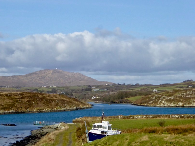
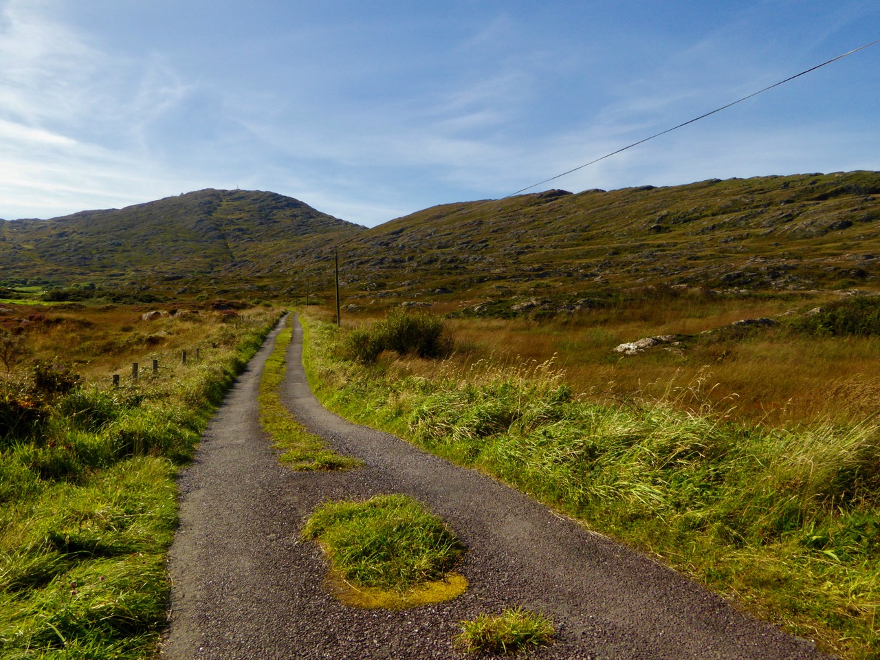
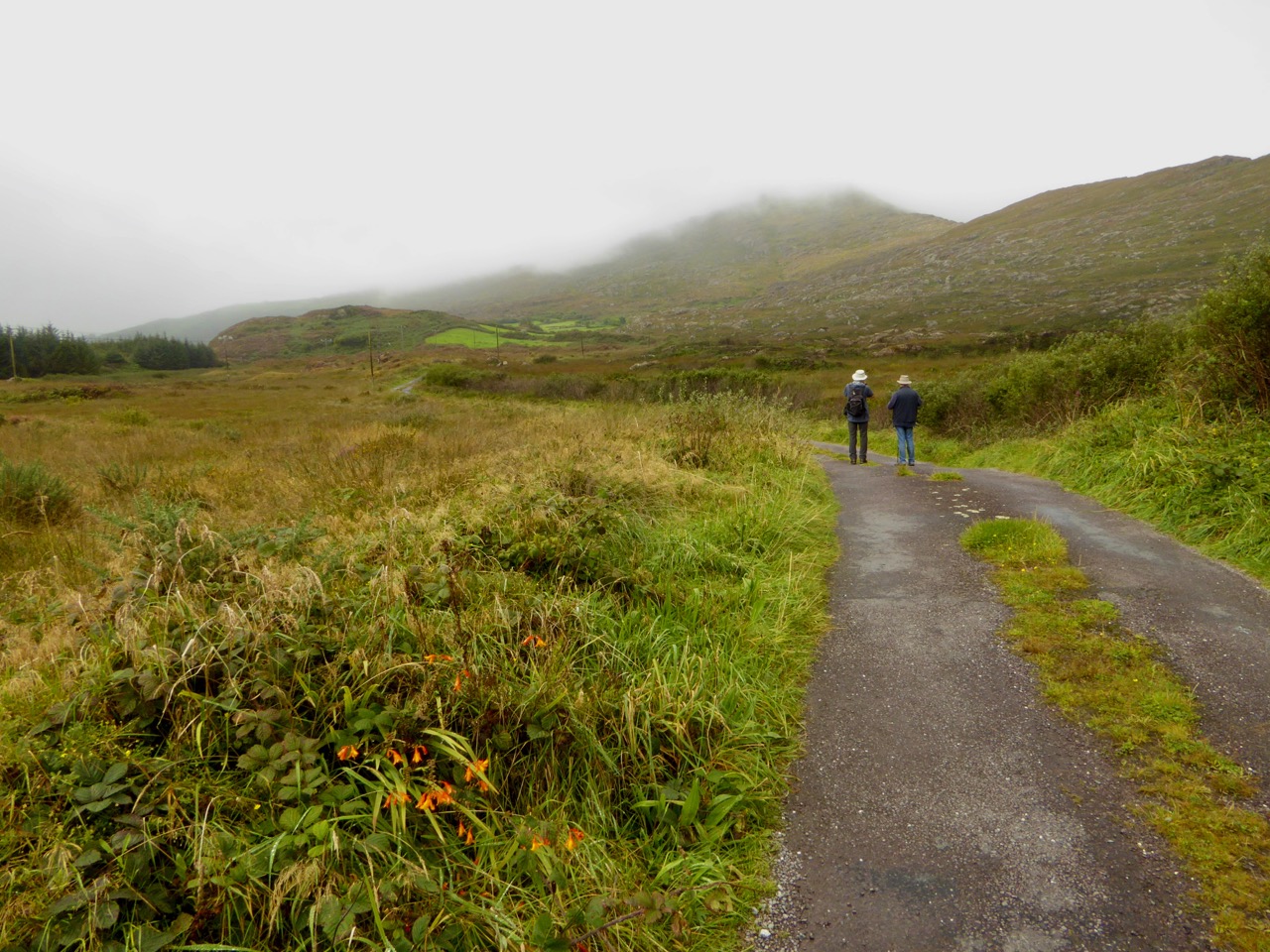
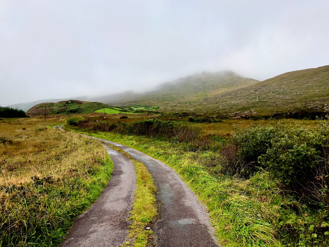
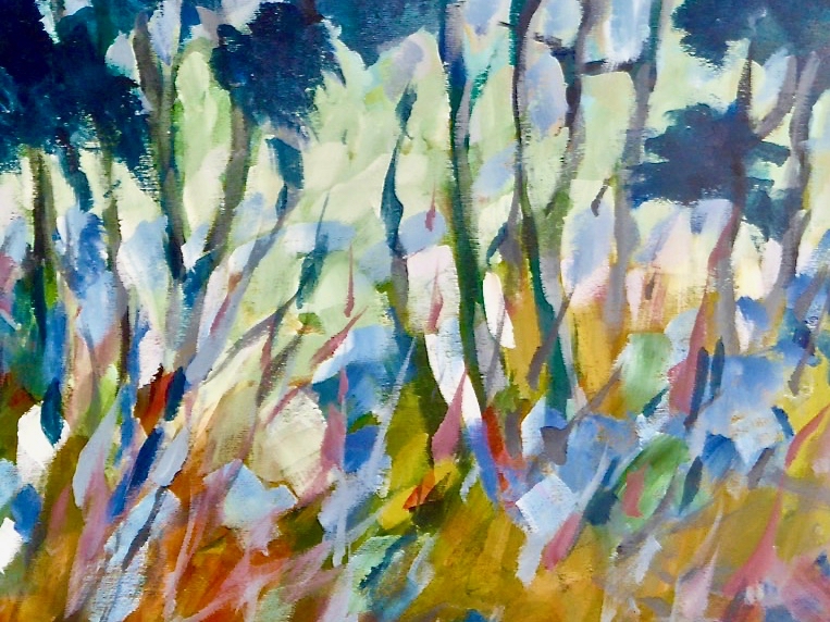
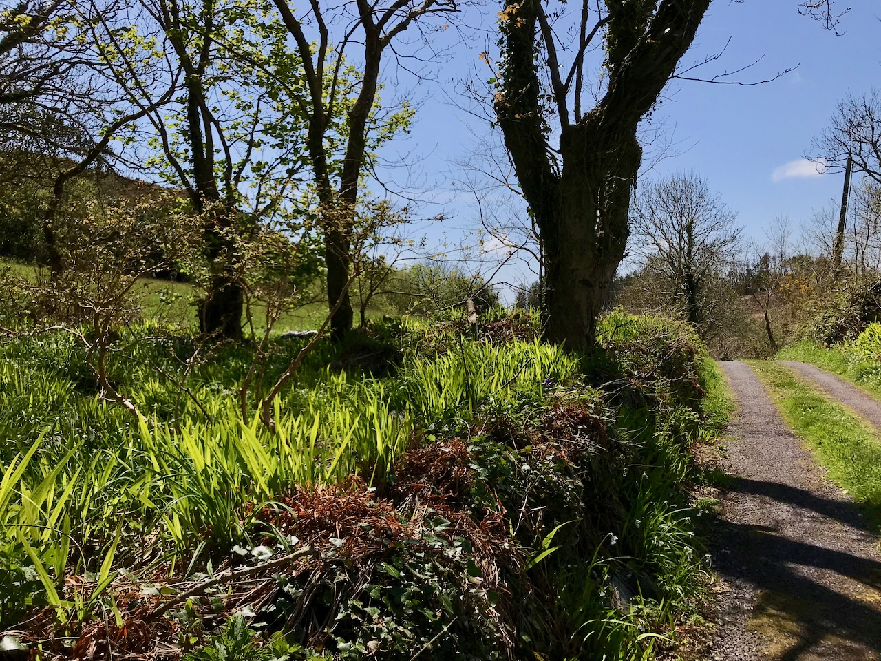
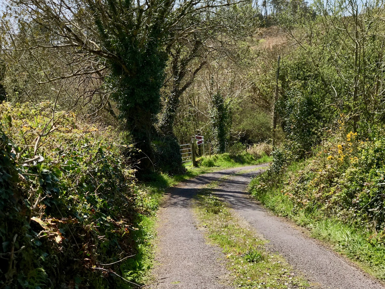
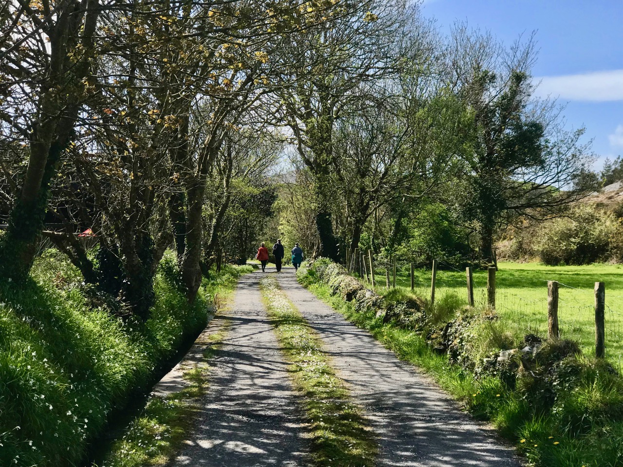
Lowertown, Schull to Toormore: it may seem a rather unadventurous walk: mainly on narrow back roads. But, on a spring day of scudding clouds and clear air, with distant views from the high ground across to the Sheep’s Head and even beyond, into Kerry, there is stimulation a-plenty to be had from an easy afternoon’s ambling and exploring of places which would be passed by in an instant when driving down to the west of West Cork. Although largely on tiny boreens, you are unlikely to encounter any traffic: we didn’t see any vehicles in two hours, apart from those parked in the few houses and farmyards on the way.

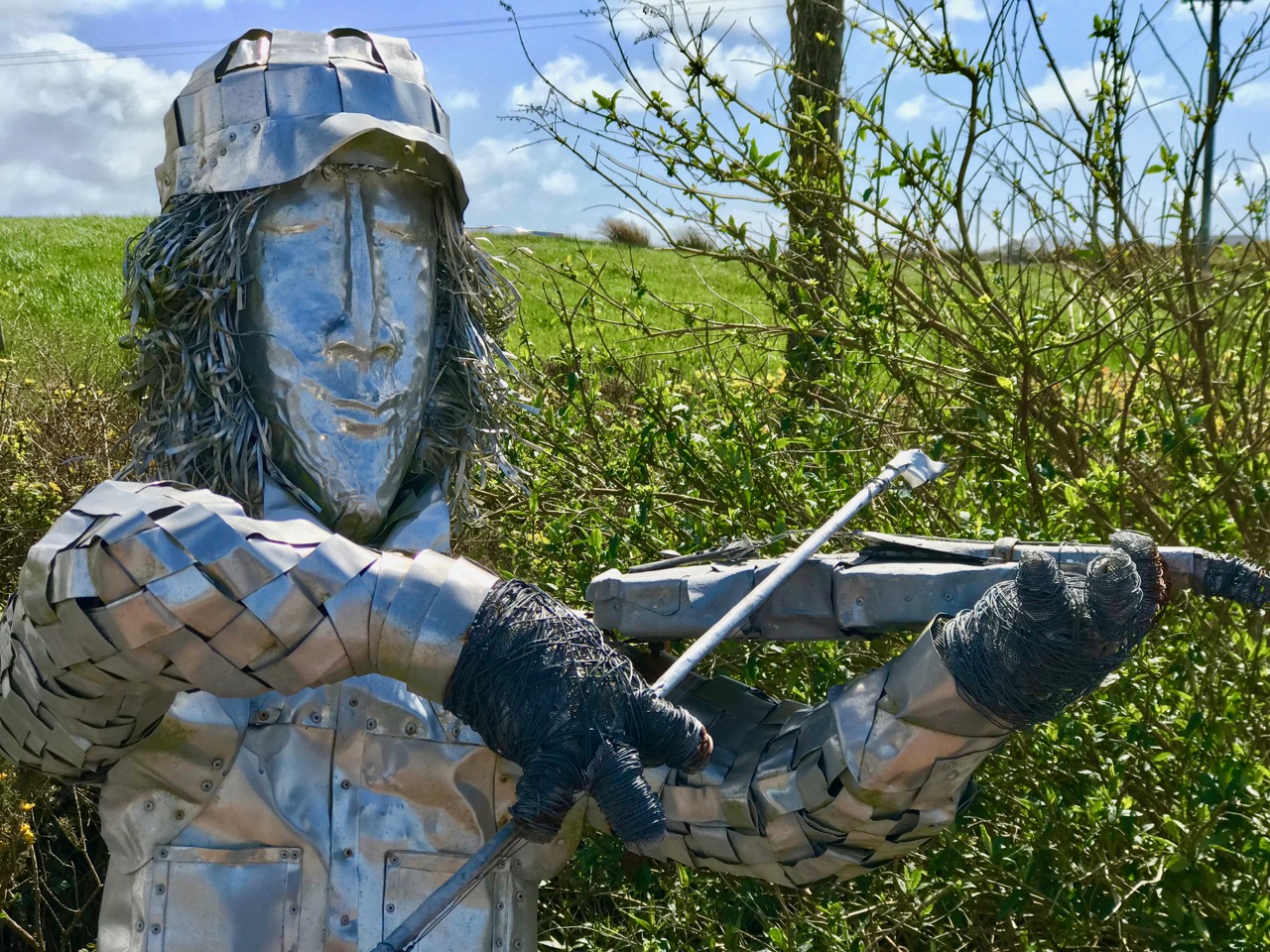
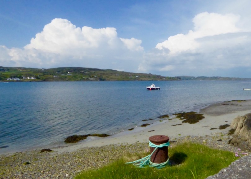
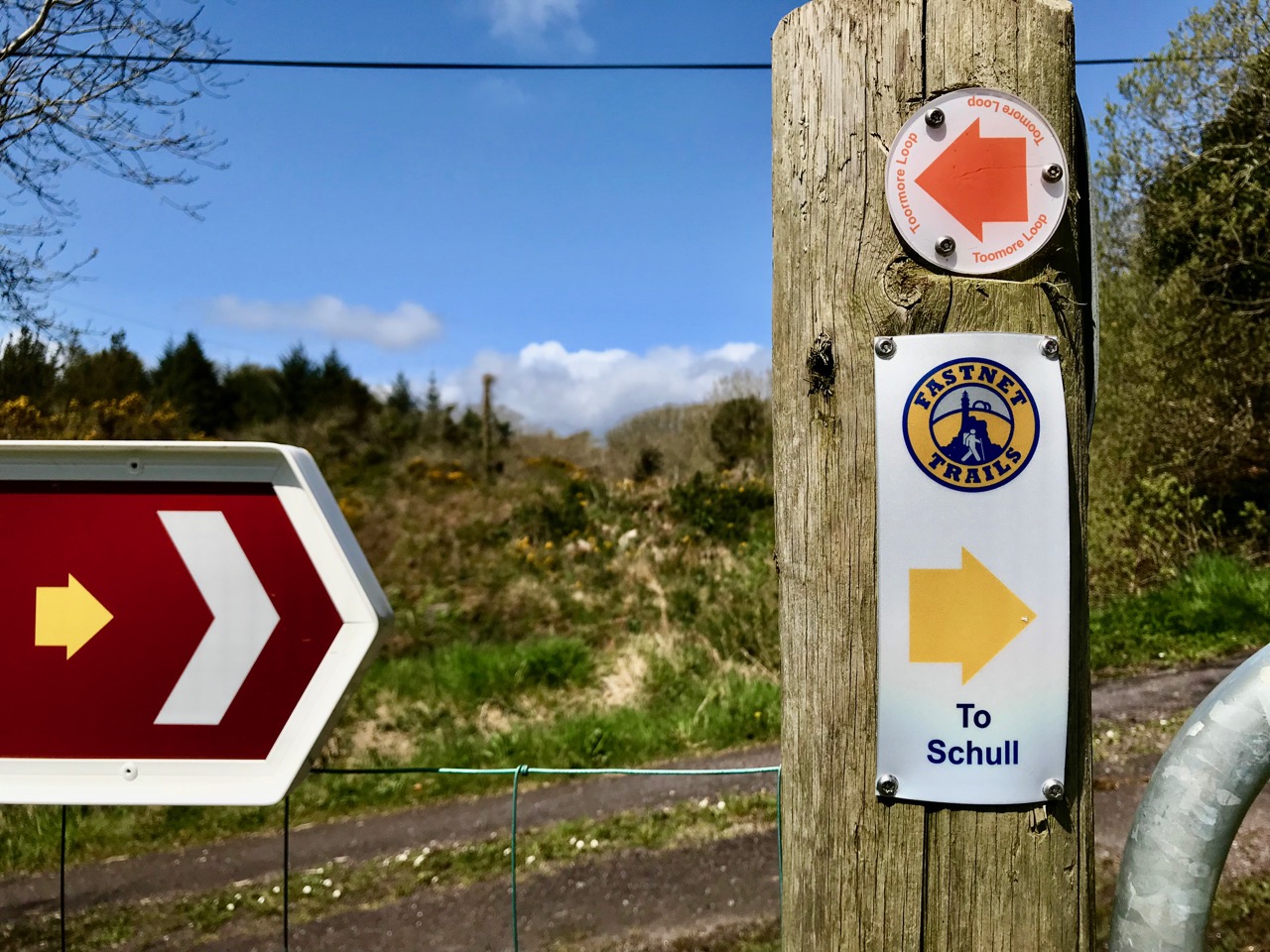
Header – our walk is part of the Fastnet Trails network beyond Schull: in this case the Toormore Loop. Upper – undisturbed peace on the quiet boreens; lower – we started out at Lowerton, where you will find a fiddler at the ready beside the old dance platform!

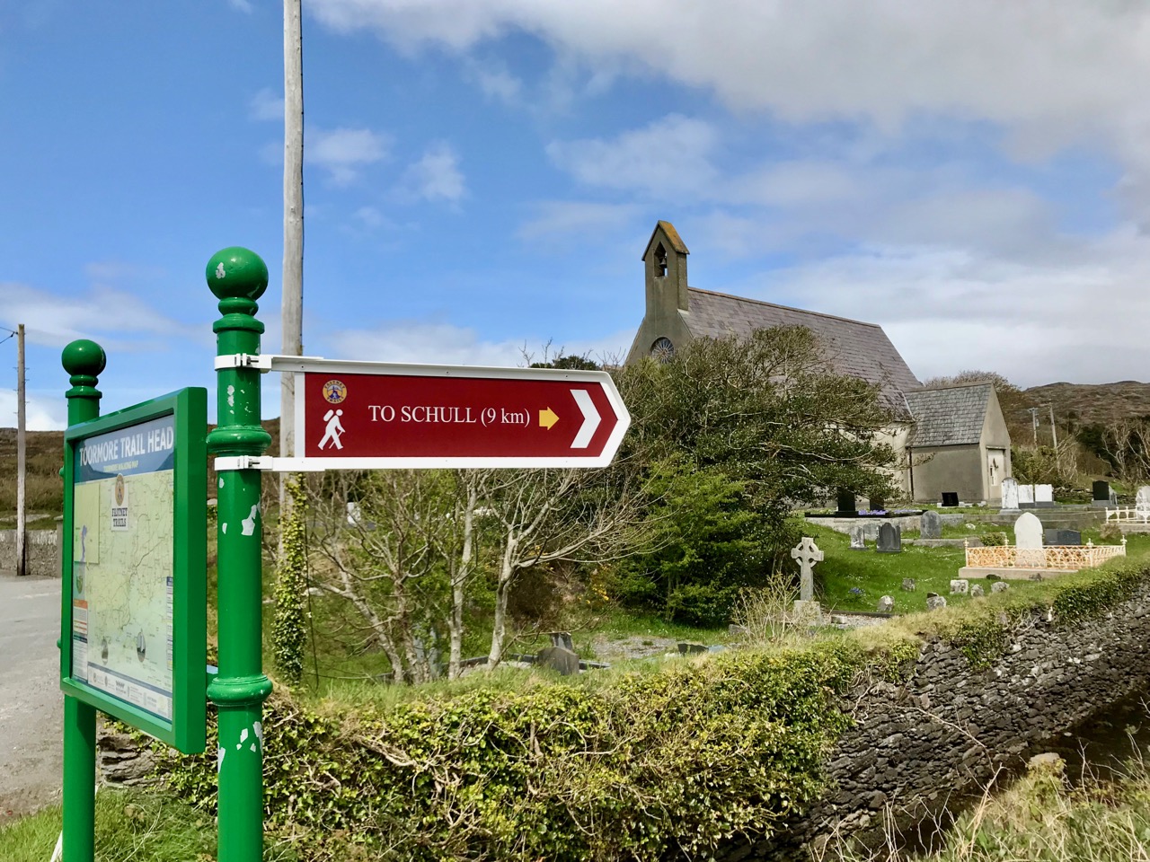
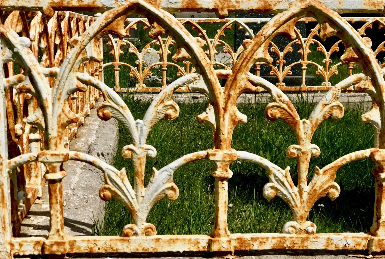
We parked one car beside the church at Lowertown – opposite the site of the old dance platform, celebrated with the sculptures of Susan O’Toole – and the other beside Teampol na mBocht, the little church at Altar, overlooking Toormore Bay. This enabled us to take our time and enjoy every aspect of the route, walking from east to west: in my view always the proper way to walk – following the sun! I should point out that the route we took – around 5 kilometres – is only a part of the full Toormore Loop which is itself one of an excellent comprehensive system of Fastnet Trails which has been put in place in recent years.

From the board at Toormore Trail Head: I have indicated our walk from Lowertown to Altar with the broken red line over on the left. Leaflets showing the full extent of the Fastnet Trail walking routes are available in the tourism information offices in Ballydehob and Schull

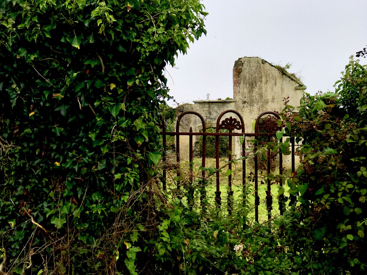
The little road climbs up and over hills and down through valleys and glens. I hadn’t expected to find an old burial ground, the site of the original Ballinskea Church which existed in this remote area between 1826 and 1967, when the Church of the Seven Sacrements was built to replace it beside the main road at Lowertown.

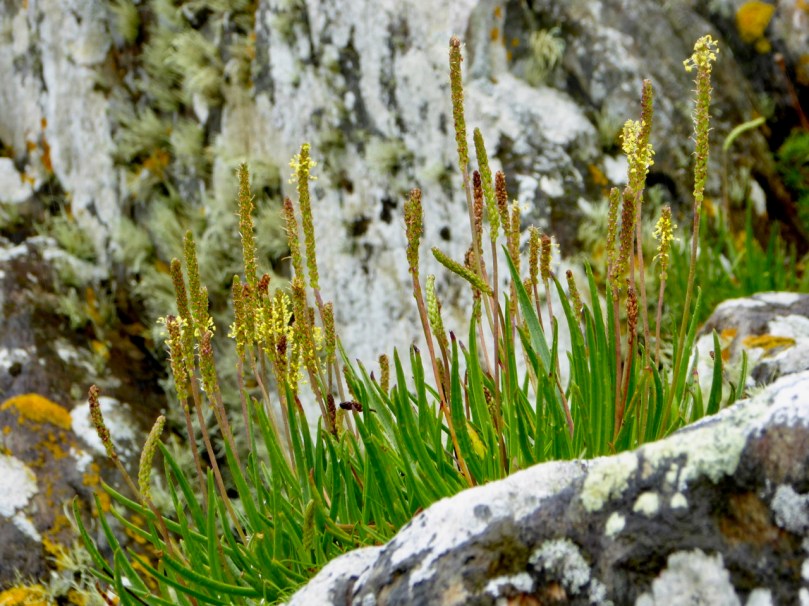
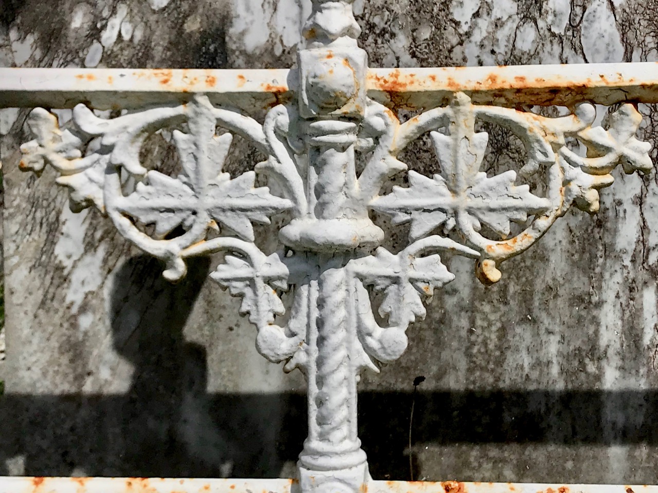
The old burial ground at Ballinskea Church: top – a bit of local history, perhaps, in the name stamped on the ironwork at the gate; bottom – the graveyard is well looked after – cowslips are in abundance

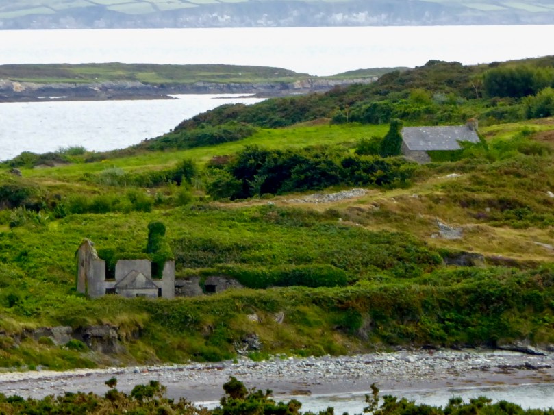
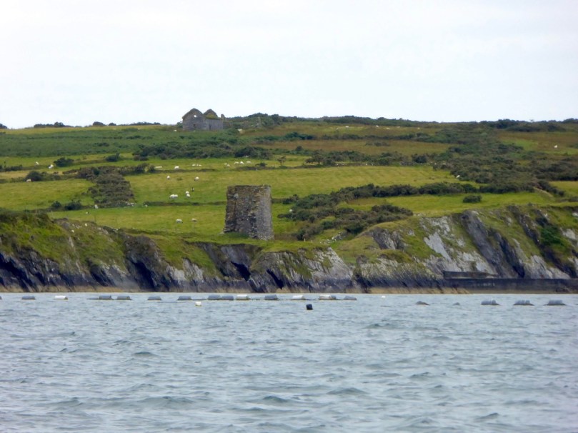
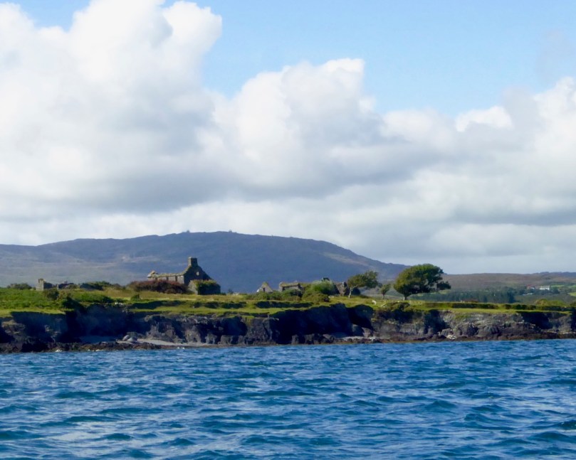
We passed a few houses along the way, but many were abandoned: each one tells its own story of lives and livelihoods – but they don’t readily give away their secrets to us.

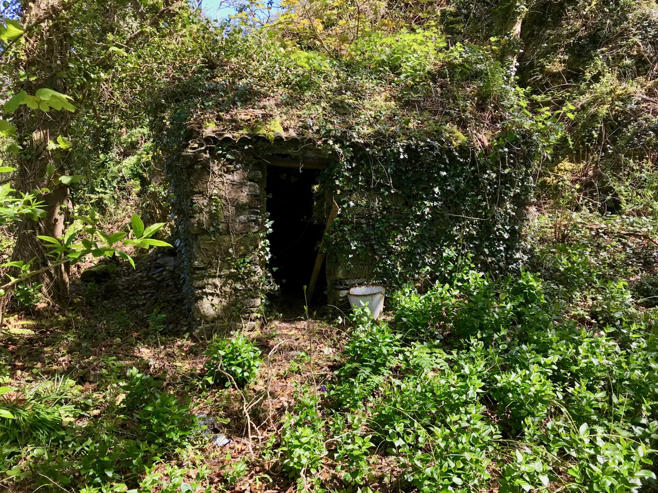
Some of the signs of former occupation and cultivation which we passed by on our way: the area seems so remote, yet it’s not so far from well-trodden routes

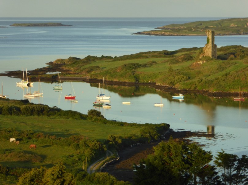
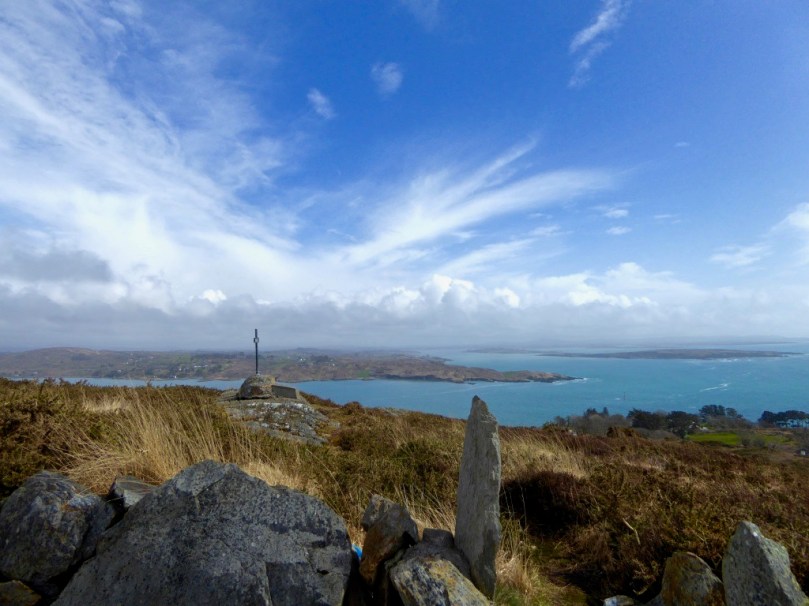
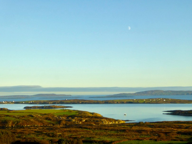
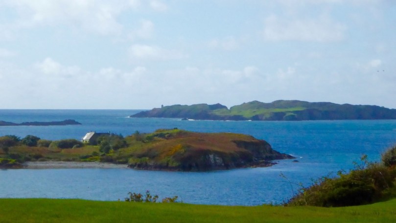
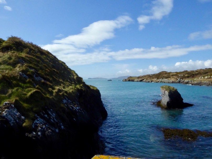
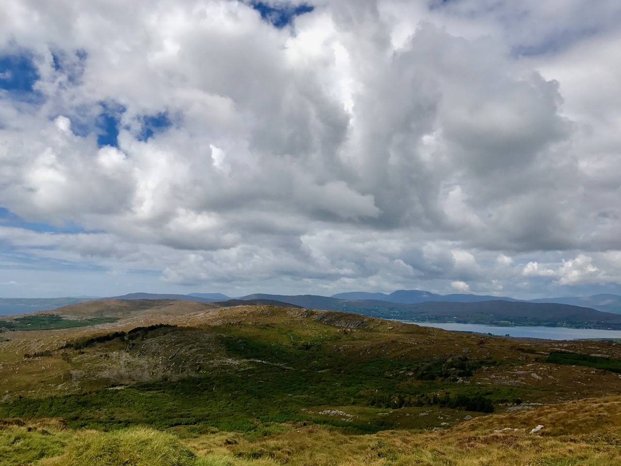
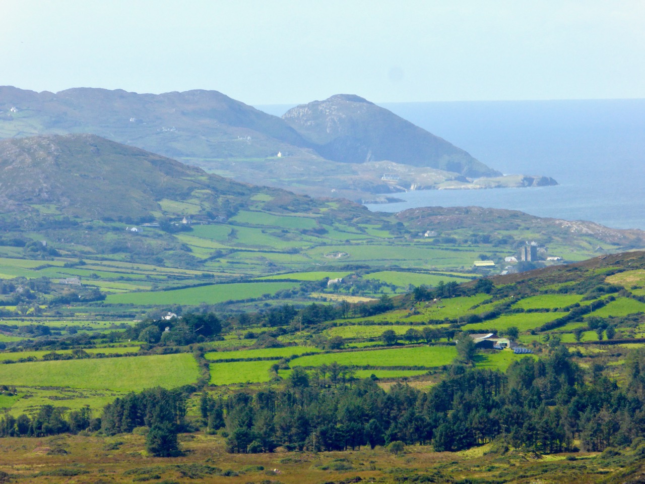
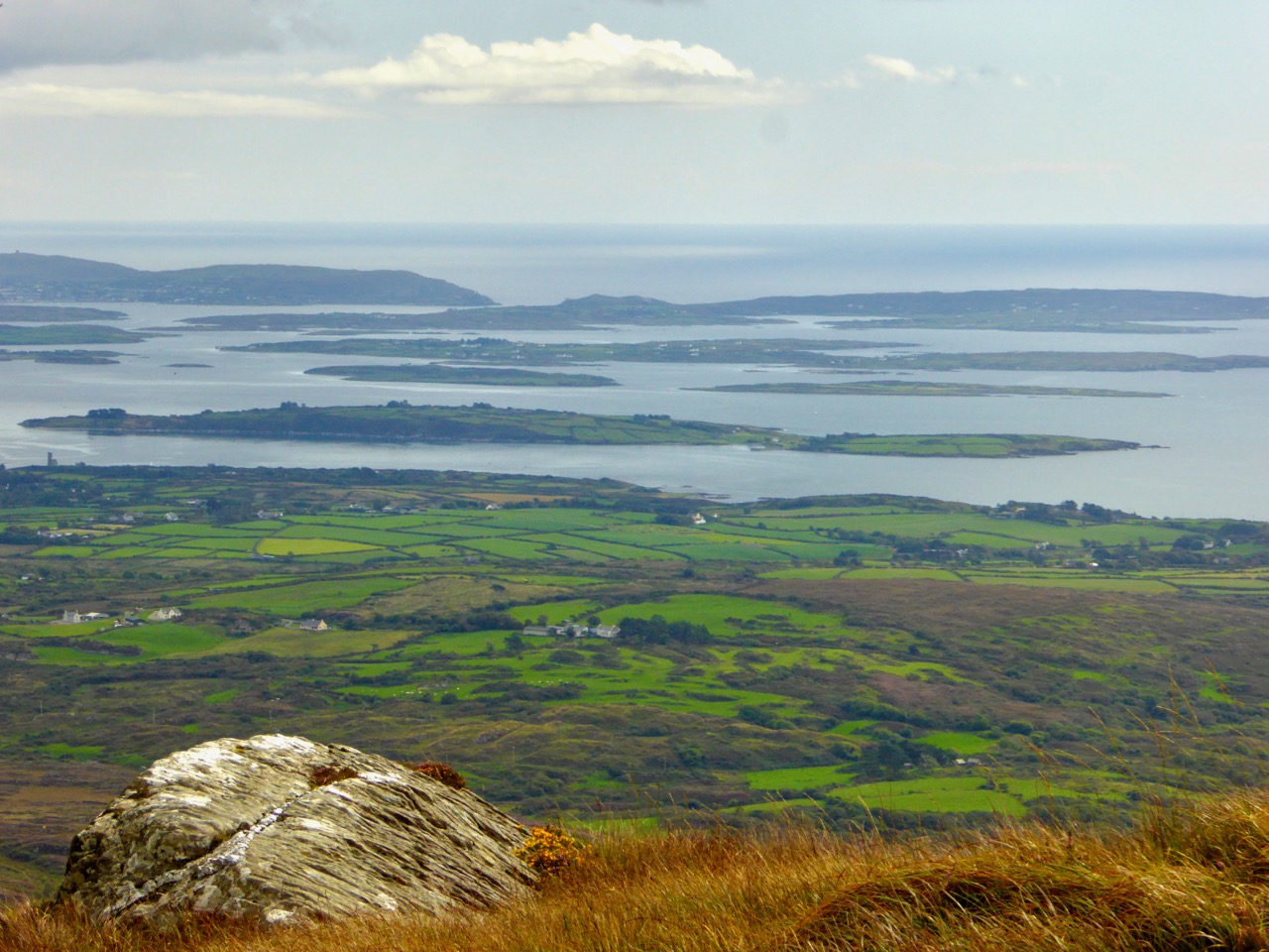
We were taken by surprise at the extent of the views both north and south from the higher ground. At one point we stopped to admire the long vista out over Dunmanus Bay with the Sheep’s Head settlement of Ahakista clearly delineated.

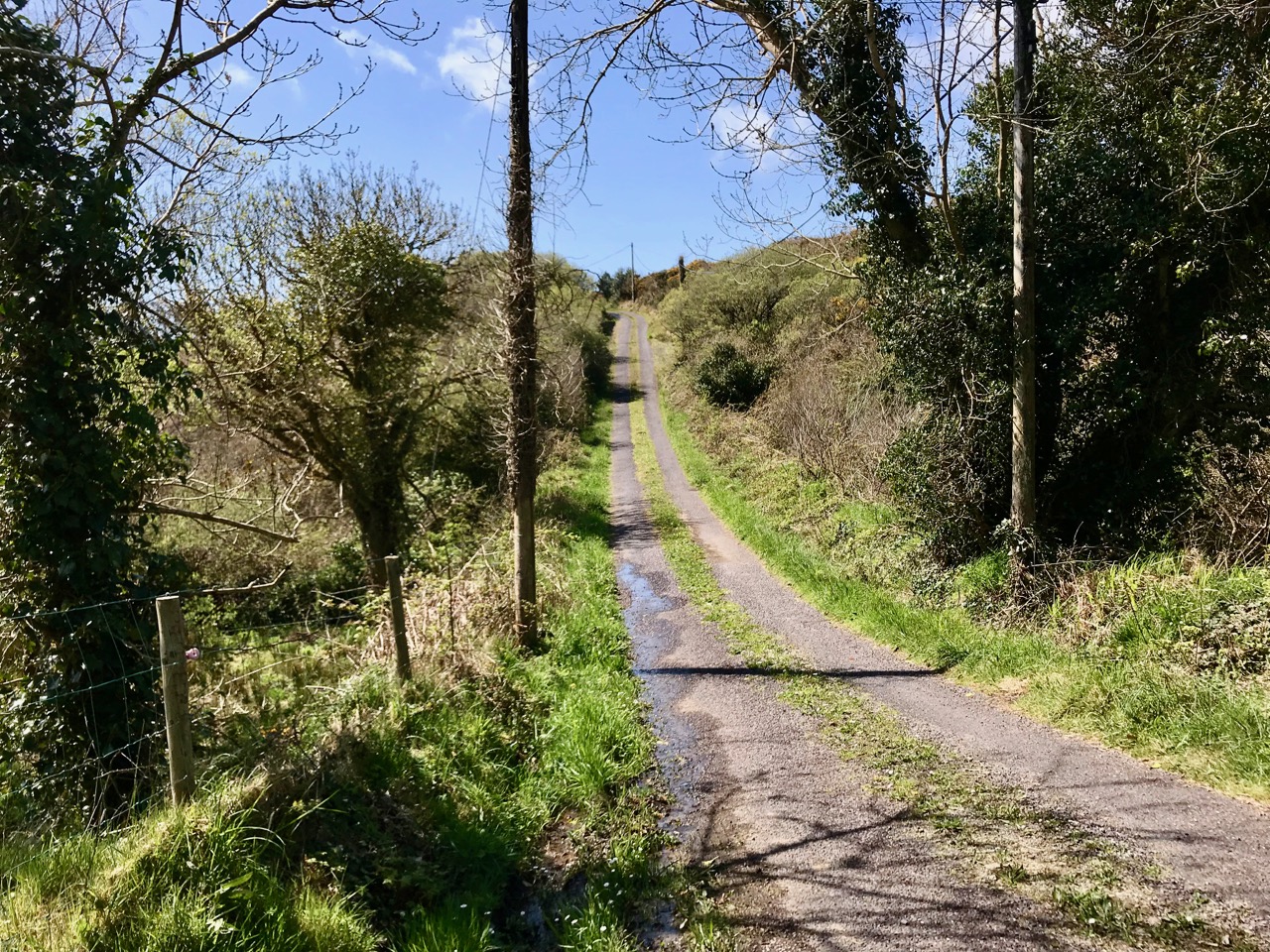
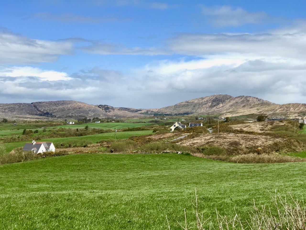
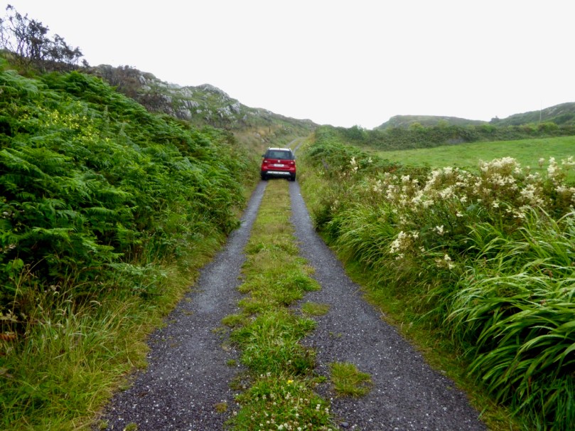
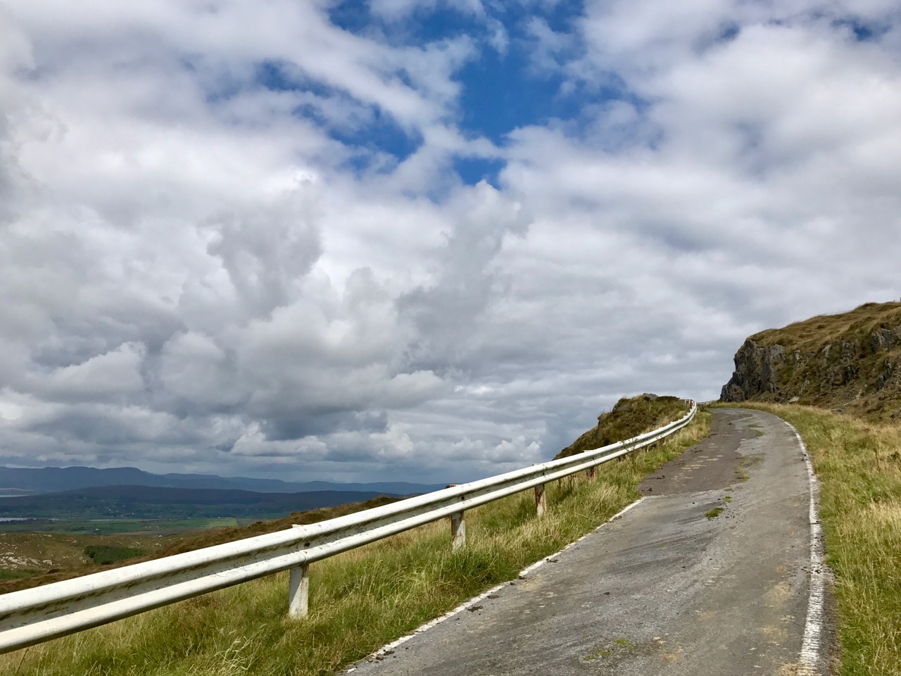
Top – the nature of the walk: I can’t guarantee that you won’t encounter a vehicle along these back roads, but we didn’t! Centre, looking back over rolling fields towards the wild high ground of Mount Gabriel. Bottom – the view towards Ahakista on the Sheep’s Head, with the Beara beyond

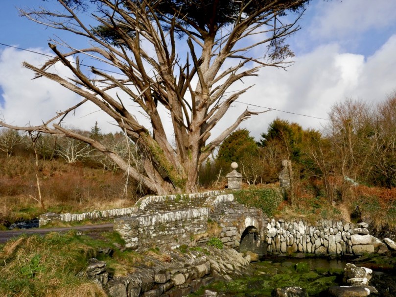
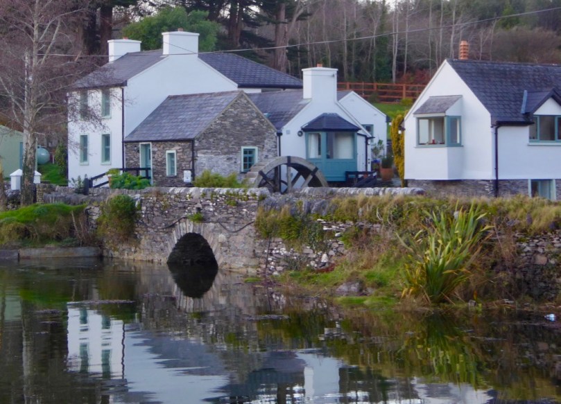
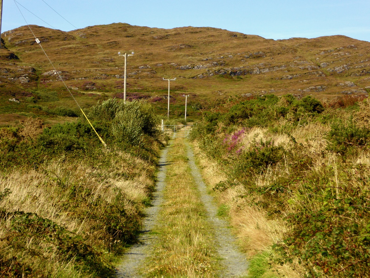
After a good hour you will reach a gateway where you will leave the boreens behind and continue across country. Of course, you don’t have to follow the marked trail: the myriad of tiny roadways continues throughout West Cork and is awaiting your further exploration. We did turn off, however, as the footpath beckoned through a leafy glen and looked most inviting. First of all, however, we paused to take a look at the bridge which carries the roadway over a stream that flows along by the path – and runs all the way down to Toormore Bay. The bridge is unusual in that it has a large stone slab lintol rather than an arch. I don’t know its history for sure, but I would guess it dates from the eighteenth century, when the road it carries was established as the main highway from Goleen to Cork!

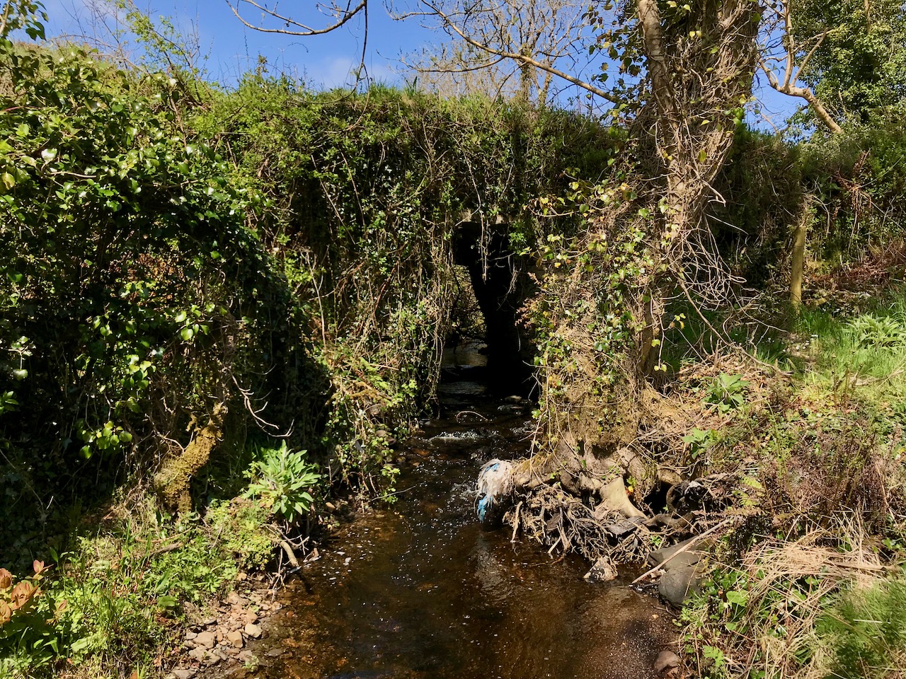
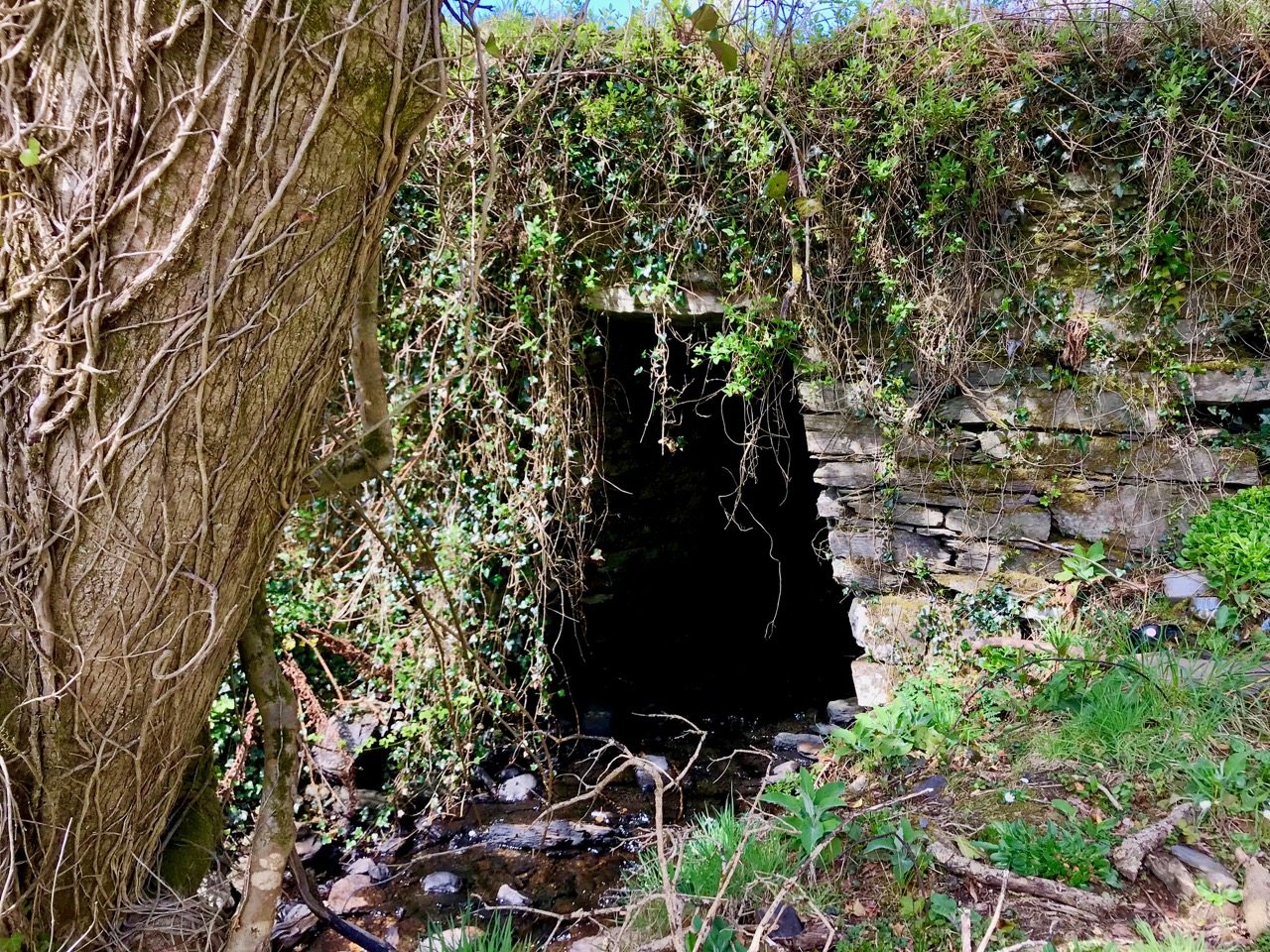
Top – the footpath diverges from the main road to Cork! Just around the corner it passes over the unusual bridge (centre and below)

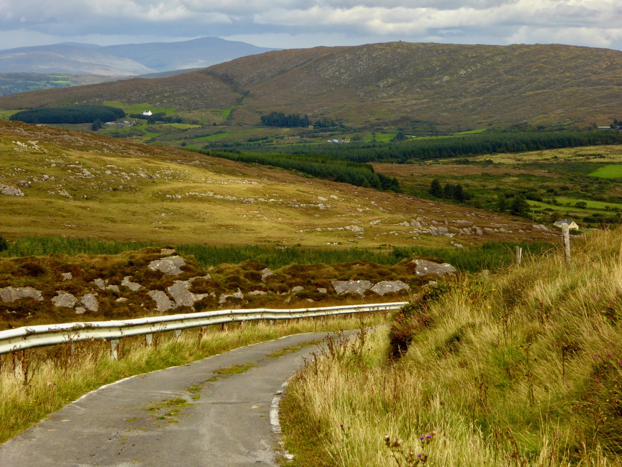
Our route is the line of the former Butter Road which ran all the way to the international Butter Market in Cork. In its heyday it would have seen plenty of traffic in the form of packhorses and donkey carts, and some of the now abandoned cottages lining its way would have been welcome ports of call on the long trek. Here’s a post from Finola about a walk we did a few years ago on another part of this highway, which tells a little more about the great butter trading days. You can also have a look at my own post from last week, which talks about the improvements to the roads of West Cork initiated by Richard Griffiths a century later, at which time the importance of our own little trail receded and was bypassed by what is now the main road going from Ballydehob and Schull down to the end of the Mizen. I suppose we therefore have Griffiths to thank for taking all the traffic away from our back roads and giving us these idyllic walking trails.

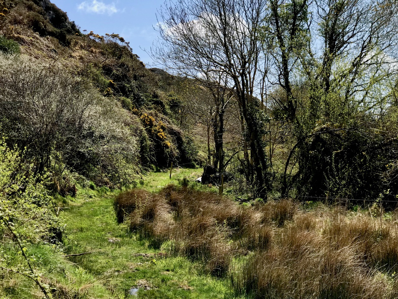
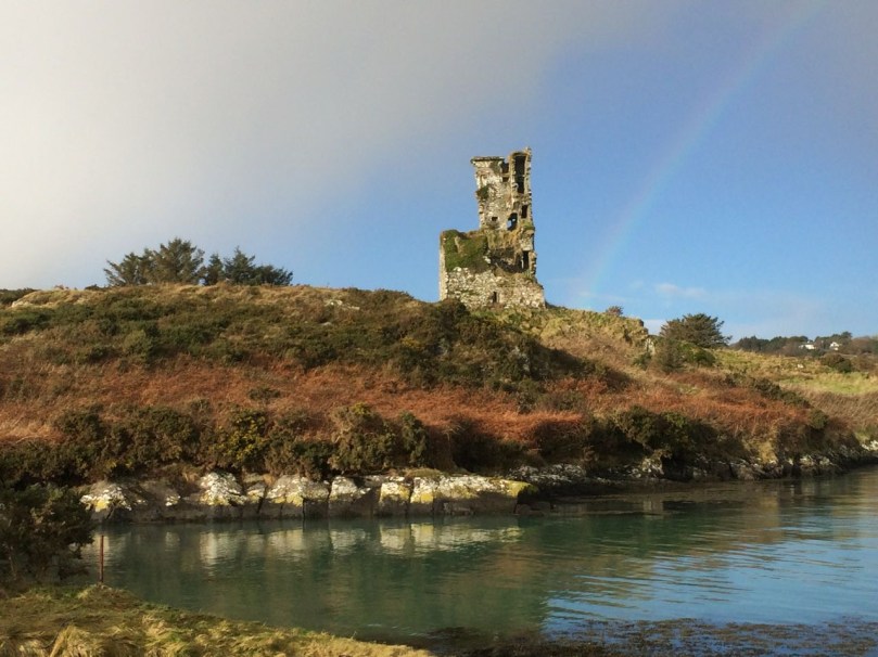
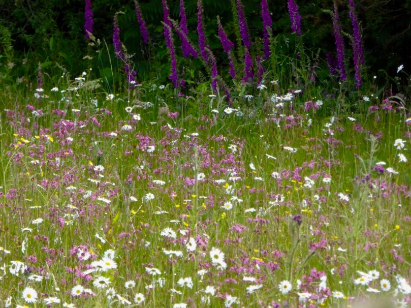
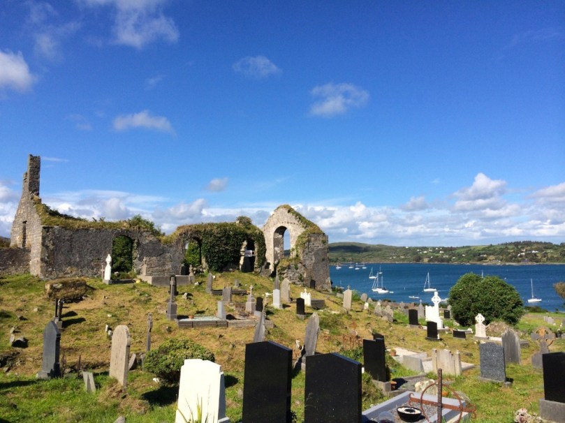
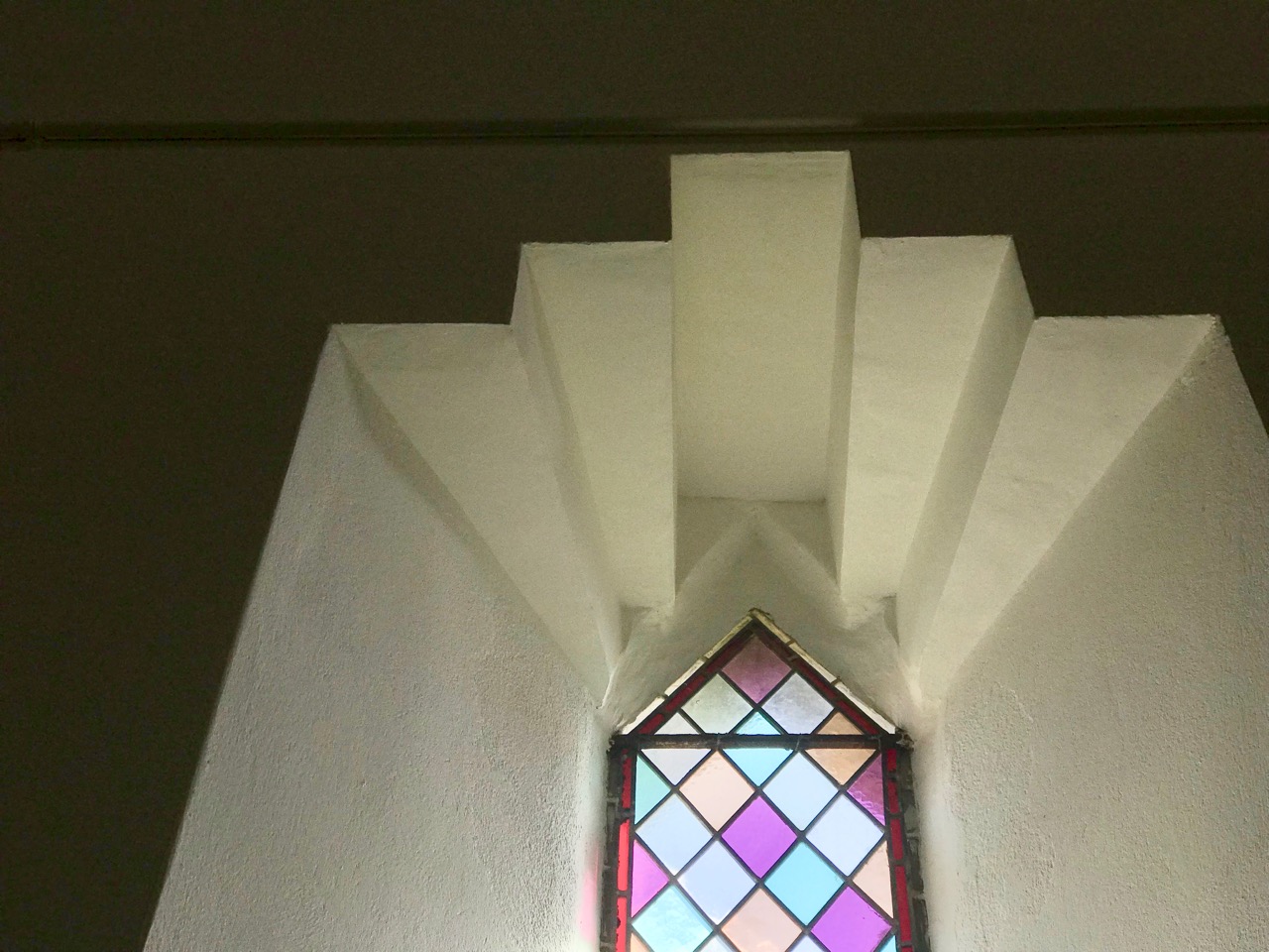
The footpath through the glen is another world – a contrast to the boreen we have been following so far. It is lush and damp underfoot, and there is green everywhere: mossy green boughs of ancient oaks, soft turf and vivid St Patrick’s Cabbage emerging in the newness of the late spring. All too soon we are in sight of our goal, the little church by the bay. But the good experiences of the day are not yet over. The church itself, and its burial ground, deserve exploration.

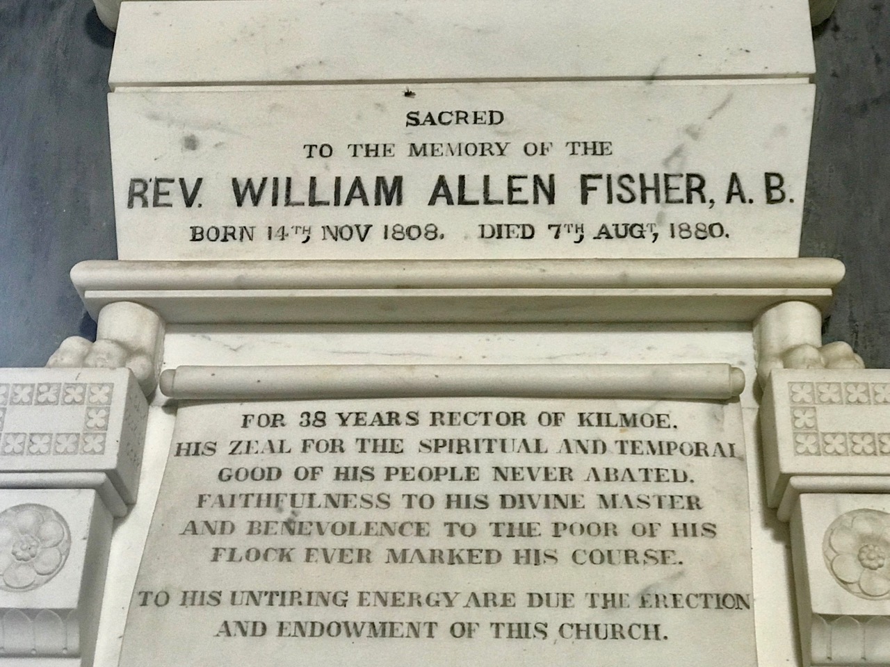
Teampol na mBocht is said to be the only Church of Ireland church in the country with an Irish name: it means ‘Church of the Poor’, so named by its builder, Rev William Allen Fisher, who was Rector of the Parish. Appalled by the ravages of the Great Famine, he raised money from well-wishers in both Ireland and England: with this he set up soup kitchens and distributed food, medicine, blankets and clothing.  But he wanted to do more than dole out charity. He determined to provide paid work for everyone in the area, regardless of their denomination. In 1847 – at the height of the famine – he commenced the building of this church. The story is told in more detail on the website of the Kilmoe Union of Parishes:

. . . Tradition has it that, in order to employ as many as possible, without benefiting the less impoverished farmers, no carts or horses were to be hired.  The stone was quarried nearby and carried to the site entirely by hand.  As Fisher wrote in a report on the church, ‘the employment was given chiefly by contract, so that the poor were able to work about their cabins, fishing etc. at the same time that they earned a subsistence for themselves.’ . . .

. . . It is a controversial building.  For many Protestants, William Fisher was a saint, a scholarly man happiest at his books, who nevertheless drudged selflessly for forty years in a remote parish, giving all his time and strength to the poor, the hungry and the sick, until he himself died of famine fever.  But for many Catholics, Fisher was a ‘souper’, whose manifold projects on the Mizen Peninsula, including the building of his church, had only one object: to win converts from Catholicism to the Church of Ireland . . .

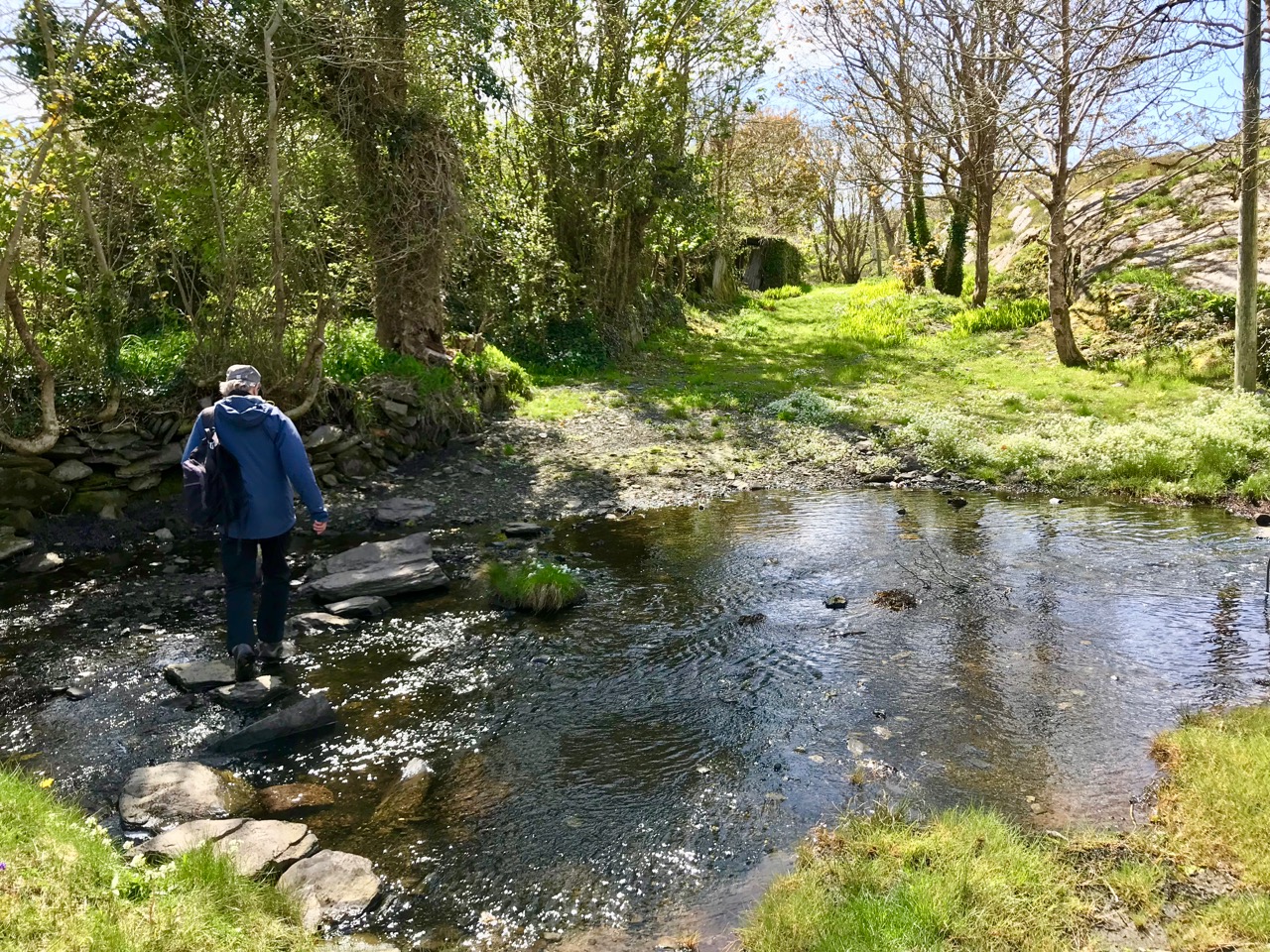
The church is not always open, so it is best to contact the Parish in advance for a look inside – it’s worth it for the history. This would be the end of the trail but we walked a little further, west of the church, and took the road up to the right. This intersects the Butter Road at a crossroads. We turned left and found ourselves heading for another green track, followed by a ford with stepping stones. Keep going and you meet the main road again: if you are following the route it’s probably best to do as we did and retrace your steps here, rather than walk on the relatively busy main road.

All in all, we had another Grand Day Out! In West Cork you really can’t fail to have a good time: every day can – and should – be a new adventure. Try this one for yourselves…


Mizen Magic 10: Sailor’s Hill

Fancy a walk? One with just enough elevation to get the heart going and with the reward of spectacular views at the top? It will take about an hour, maybe a bit longer if you stop to chat, or just gaze.

We’ve mentioned Sailor’s Hill before in the course of other posts – this one and this one. But it deserves a post of its own, because it’s a complete experience. Start from Schull and walk out along the Colla Road until you get to the old St Mary’s Church and graveyard. The National Monuments listing tell us that this was originally a medieval structure, although what we see in ruins now is mainly an eighteenth century church, situated in a picturesque burial ground. Turn right at that point.

You will notice the waymark signs. This is one of the newer extensions of the Fastnet Trails, and an initiative of a committed group in Schull. The walk up Sailor Hill is actually part of a larger walk, the Colla Loop – we are planning to do that one soon but only had time for this stretch of it today.

The road meanders gently upwards. Take the first left and then the next left. Views of Schull Harbour start to open out as the road rises. Looking back, you can see how Schull nestles at the foot of Mount Gabriel (see the photograph at the top of this post).

A tiny shrine in a gatepost

Later on, this boreen will be heady with Foxglove and Loosestrife and Oxeye Daisies, and later still the purple heather will dominate, but this is early spring and it’s been a long cold winter. 

Everything is late this year, so I am happy to see the ever-reliable Celandine in profusion.

The willows are starting to bud out too, but apart from that, it seems that dandelions and lawn daisies are the only wildflowers brave enough to flourish along the way. Not that we disdain these humble flowers – they provide early and important nourishment for the insects and the bees. Must feed those pollinators!

Connie and Betty Griffin have built a house with magnificent vistas near the top of the hill. They never stop adding to it, Betty with flowers and Connie with quirky additions, sculptures and walls. This time, he showed us his Sailor Hill Newgrange, a nifty arrangement of standing stones that respond to the rising sun by capturing the morning light in a stone recess.

Connie demonstrates his sun calendar to Robert

Up to the top then, and there it is – a breathtaking panorama that encompasses the whole of Roaringwater Bay and Long Island Sound to the south, and Mount Gabriel and its foothills to the north. Cape Clear, the Fastnet, Sherkin Island and all the smaller islands are laid out in front of you.

And there’s a cross and inscriptions, so you begin to realise that this site is about more than those views. Connie, who designed and built it, wants us to think about those who lost their lives at sea. It’s his own personal mark of respect and a reminder to us in the midst of all this grandeur to take a moment to contemplate on the power of the ocean and the fleeting nature of life.

I had to look up The Niña, 1492, and of course it was one of Columbus’ ships. He took the Santa Maria, the Niña and the Pinta on his voyage to the New World, but the Niña was his favourite. To learn why, take a look at this. But why is it here? Well, I’m not sure, but there is a tradition around here that Columbus may have visited West Cork on his way. His last provisioning stop may have been with the hospitable, learned and Spanish-speaking Fineen O’Mahony, Scholar Prince of Rossbrin

Connie has built his own tiny belvedere (he calls it his folly) perched to take maximum advantage of the view. It’s the perfect spot to sit, munch an apple, and enjoy a companionable chat before the walk down again.

A final look out to sea. There’s Long Island and beyond it the Fastnet Rock with its iconic lighthouse.

We paused to admire a Goldfinch in Connie’s garden, as well as his wonderful textural arrangement of sticks, stones and whalebones.

Thank you, Connie and Betty, from two happy walkers.

Mizen Magic 9: Rossbrin to Schull

There’s a main road between Ballydehob and Schull, and then there’s a back road – a road that meanders through farmland and down half-forgotten boreens, a road lined with wildflowers and dotted with the remains of past history, a road that looks over once-inhabited islands. South of this road lies Mizen Magic 9.

Along the back road in early summer

We’ll start at Rossbrin Cove – a place that Robert has written about over and over, like any writer with his own ‘territory.’ This was the home, in the 15th century, of Fineen O’Mahony, the Scholar Prince of Rossbrin.

Looking down now on what’s left of his castle, it’s hard to imagine that this was a place teeming with life and learning – a mini-university where scribes and poets and translators transcribed to vellum (and to paper – a first in Ireland) psalters, medical tracts and even the travels of Sir John Mandeville. The castle has been in ruins since the 1600s, and we live in fear that the next storm will bring the last of it down.

Rossbrin Castle from the sea

The road runs through the townlands of Rossbrin, Ballycummisk, Kilbronogue, Derreennatra and Coosheen. Ballycummisk has a wedge tomb from the Bronze Age and a ring fort from the Early Medieval period – just to remind you that you are far from the first to want to settle in this place. In more recent times, and like Horse Island, it was once the centre of a thriving mining industry, but a spoil heap and stone pillars are all that remain.

Large ring fort, and the remains of mining activity, in Ballycummisk

Two islands dominate the views of Roaringwater Bay along this road. The first is Horse Island, owned now by one family, with its industrial past a distant memory. There have been various plans for Horse Island in recent years – a resort, a distillery – but so far it has resisted development.

Horse Island Miners in 1898 and the ruins of miners’ dwellings

The other is Castle Island, home to yet another vestigial O’Mahony Castle – one of a string along the coastline, all within sight of each other and sited strategically to control the waters of Roaringwater Bay and their abundant resources.

There’s not much left of the castle on Castle Island

The O’Mahonys became fabulously wealthy in their day, charging for access to fishing and fish processing facilities and for supplies and fresh water. They also forged strong alliances with the Spanish and French fishermen and visitors who plied those waters – a friendship that was to cause great concern to the English crown and that was to spell, in part, their eventual downfall.

Ruined farm houses on Castle Island. The photograph was taken from a boat – that’s Mount Gabriel in the background

The closest spot to Castle Island (also uninhabited) is the beautiful little pier at Derreennatra. There is a large house up behind the pier, now inaccessible but once run as a guest house and famous for its hospitality. A curious bridge once gave access to the demesne and it remains a striking landscape feature, with its pillars and giant Macrocarpa tree.

Derreennatra Bridge

Continuing towards Schull we come to the last of the O’Mahony castles and the best preserved in this area. This is Ardintenant (probably Árd an Tinnean – Height of the Beacon – possibly referring to a function of the castle to alert others to the presence of foreign vessels) and it was the home of the Taoiseach, or Chief, of this O’Mahony sept.

Two ‘beacons,’ ancient and modern – Ardintenant or White Castle below and above it the signal stations on Mount Gabriel

The castle, or tower house, still has a discernible bawn with stretches of the wall and a corner tower still standing. If you want to learn more about our West Cork tower houses, see the posts When is a Castle..?; Illustrating the Tower House; and Tower House Tutorial, Part 1 and Part 2.

Ardintenant is also known as White Castle, a reference to the fact that it was once lime-washed and stood out (like a beacon!) to be visible for miles around. It appears to have been built on top of an earlier large ring-fort which in its own day was the Taoiseach’s residence before the fashion for tower house building.

Sea Plantain at Coosheen

From Ardintenant we head south to Coosheen, a picturesque pebble beach known only to locals. It’s one of my favourite places to go to look for marine-adapted wildflowers. On a rainy day last August I saw Sea-kale, Sea-holly, Sea Plantain and Thrift, and drove back on a boreen lined with Meadowsweet and Wood Sage and past a standing stone whose purpose has been long-forgotten but that continues its vigil through the centuries.

Our final spot in Coosheen is Sheena Jolley’s mill house, now the gallery of this award-winning wildlife photographer. She has restored it beautifully and the gardens are a work-in-progress that manage to capitalise on, rather than overwhelm, the mill stream and the rocky site. This is also the starting point for the Butter Road walk – but that deserves a new post one of these days, a post in the Mizen Magic series. We have written one but it was a long time ago.

Take a walk, or a drive, down any part of this road – do it in summer when the boreens are heady with wildflowers, or do it in winter when the colours of the countryside are at their most vivid. Heck, do it any time!


Mizen Magic 6: Schull to Castlepoint

The Mizen is the Peninsula we live on, and of course we think it’s the most beautiful part of West Cork, and of Ireland. In previous Mizen Magic posts I’ve been exploring different aspects and areas, such as the Northside, or Brow Head, or our excellent beaches. This time I’m concentrating on the stretch from Schull to Castlepoint. The map below shows the area, with the village of Schull, our starting point, on the top right. The photograph above was taken from the top of Sailor’s Hill.

A winter view of Long Island Sound – Coney Island, Long Island,  the Calves, Cape Clear and Sherkin, with the entrance to Croagh Bay in the foreground

It’s only a few kilometres, and it would take you about ten minutes to drive straight to Castlepoint from Schull. But where’s the fun in that? No- let’s start by driving (or walking if you’d rather) out to St Mary’s Church on the Colla Road. It’s largely an eighteenth century church, although there are hints of a medieval structure here and there, and it stands in what must be one of the most scenic graveyards in West Cork.

Intriguing depictions of boats are inscribed into the render inside the church. How old are they? Who did them and for what purpose?

From there, I suggest you drive to the lookout on Sailor Hill – the trail arrows for the new extension of the Fastnet Trails will show you the way. We discovered Sailor’s Hill ourselves when I was researching belvederes – the redoubtable Connie Griffin has built his own modern version of a belvedere and there is no better place to get a view of Long Island Sound and the south side of the Mizen. Here’s the viewing house Connie built  – perfect for contemplation.

Back down to the Colla Road, continue to the scenic little Colla Pier, where you can take the ferry to Long Island. Robert and I do this every year as part of the Fastnet Film Festival. The ferry runs every day but you can also book special trips – it is, as they say here, a great day out. Pack a picnic and your camera – there’s lots of birdlife, including these oystercatchers on the rocks at Colla Pier.

The ferry leaves Long Island for the return trip to Colla Pier

From the Pier the road winds across country, overlooking the sea here and there, and always with Mount Gabriel looming in the background. From here you can see tiny Coney Island, privately owned, and with one house which is rented out to holiday makers.

Beyond Coney Island are the Goat Islands – Goat Island and Goat Island Little – probably once one island, but now split into two, with a narrow passage between. There are feral goats on these islands, but not much else. They appear to be completely inaccessible, with craggy shores that are impossible to land on. That, of course, only makes them all the more mysterious. I’d love to hear from anyone who knows more about the Goat Islands.

The narrow and treacherous channel that divides the Goat Islands, and the beacon on the smaller of the two islands

The road now winds down to Croagh Bay (locally pronounced ‘Crew’), a lovely tidal sheltered inlet with the romantically named Gunpoint at its head. On the higher ground to the right you will see that an enterprising individual has converted one of the old signal stations into a unique residence. It must have the best view – but all those stairs!

We are now in the territory described by Robert in Here Be Pirates and in Pilchards and PalacesCroagh Bay, or more correctly Leamcon House, was the site of William Hull’s house and a hotbed of piratical activity.

Nowadays it’s downright idyllic and the shallow waters of Gunpoint inlet provide sanctuary to wintering birds such as these shelducks.

Our last stop is the little pier at Castlepoint, offering a dramatic view of Black Castle, one of the O’Mahony Tower Houses that dotted the coast of West Cork in the fifteenth and sixteenth centuries. This one is privately owned and the owner has stabilised and largely restored the castle, saving it for future generations from the all-too normal fate of dereliction that befalls West Cork Castles.

Robert looks across to Black Castle in the photograph above. The castle as the owner has stabilised it is shown below – he has done a first-rate job and we should all be grateful for his care of this important monument. The final photograph is of a small inlet by Castlepoint Pier.

The Mountain Road

Over three years ago I wrote a piece about the mountain that’s on our doorstep – Mount Gabriel. This rocky high terrain is always in our view as we travel around West Cork, and we feel it must have had special significance in prehistoric times: it overlooks a majority of the archaeological sites that we have explored locally – perhaps they were placed because of that. Also, there are many stories attached to Mount Gabriel (find them in my previous post), including the fact that the Archangel himself touched down on its summit and left behind a footprint in the stone! Evidently, he was intrigued to hear about Ireland’s verdant beauty and knew that …in time to come, this honest island would never part with the worship and duty it owes to the Mother of God… and so was determined to get a look at the holy place.

Derryconnell Loop Walk on the Fastnet Trails takes in the foothills of Mount Gabriel – seen here in contrasting weather conditions, but only a day apart!

There is a little-known road which runs along the foothills of the mountain which, on a good day, is as beautiful a road as you will find anywhere in Ireland. It begins at the bog of Derreennatra (more of which can be found in Finola’s post today) and you can follow it up and through the Barnacleeve Gap. If you wish, from there you can go all the way up to the summit and get some of the most stunning views all the way over the Mizen, across the Sheep’s Head and even into Kerry.

The climb to the summit of Mount Gabriel is always rewarding, with panoramic views to all points of the compass. Lower Picture: the Air Traffic Control Authority’s installations atop the mountain add an odd drama to the landscape

Part of our Mountain Road has been incorporated in the Derryconnell Loop Walk, one of the new group of the Fastnet Trails based around Schull. The whole of this loop walk is varied and picturesque, but the section from the bog is outstanding as it skirts the mountain – which always dominates the vista – and brings you to the junction with the Barnacleeve road. Keep on going, and take in the mountain itself, or follow the trail down to the old Schull Workhouse. Whichever way you go, you will be struck by the seeming remoteness of the boreens, and you will seldom encounter a vehicle.

In all weathers the Mountain is engaging: you can start out in the mist and finish up in sunshine!

In the latter part of this summer we have explored the road in all weathers, and recorded the many moods of the mountain. Reaching the summit last week, we had a search for the Archangel’s footprint. I’m convinced we found it, but we couldn’t see the lake with its magical islands which – according to the legends ‘…float about up and down, east and north and south; but every Lady-day they come floating to the western point, and there they lie fixed under the crag that holds the track of the Angel’s foot…’ (John Abraham Jagoe, Vicar of Cape Clear – Church of Ireland Magazine 1826)

The peak of Mount Gabriel is strewn with rocks, any of which might contain the Archangel’s footprint. Upper – the view to the islands of Roaringwater Bay. Lower – could this be where he touched down? A definitely footprint shaped impression on this rock – highlighted on the photo in red

In my younger days I was fortunate to hear traditional Irish musicians Margaret Barry and Michael Gorman performing on the streets of Camden Town, London, when I worked in that city. Those streets were a far cry from the home I now have in West Cork, but I recall the duo’s rendering of the tune The Mountain Road: Margaret came from Cork herself, so perhaps our own mountain (or maybe it was Gabriel?) was an inspiration to her.

Descending from the summit, we finished our walk on the Mountain Road at the gauntly atmospheric ruins of Schull Workhouse

Terry Searle – A West Cork Artist

It’s all happening in West Cork at the moment! In particular, there’s a lot going on in Skibb: the fabulous Skibbereen Arts Festival continues to run all through the week and we have already enjoyed some memorable events. The first West Cork History Festival has been a resounding success – and a learning experience: look forward to great things in the future. But don’t leave Skibbereen without visiting the O’Driscoll Building at Levis Quay, in the town centre. Opening at 1pm on Saturday 5 August and running through to 2 September is an important exhibition of the work of two artists: Terry Searle and Ian McNinch. I’m concentrating today on the life and work of Terry – one of the ‘West Cork Artists’ Group’ who built up a reputation during the latter part of the 20th century, and the story of which has still to be written. Finola and I were privileged to meet with Terry and his wife Penny Dixey recently, and thoroughly enjoyed their accounts of the somewhat Bohemian life and times of artists in West Cork.

Penny (left, with Ted) and Terry (right) at home in Schull

The exhibition is a retrospective of Terry’s work. His great grandfather was from Dublin: he was born in 1936 and brought up in the East End of London. Like many of his contemporaries he was evacuated to the countryside during the war and spent six years away from his home. It’s hard to imagine how that experience might have affected a young, evolving mind: his positive take is that it imbued in him a permanent love for nature and this has been reflected in his life work.

Terry is a painter. At the end of the war Terry was called up for National Service, where he rubbed shoulders with would-be actors, artists and musicians: their outlooks attracted him and, when he moved back to London, he started evening classes at St Martin’s School of Art and then signed on for a full-time course at Goldsmith’s College of Art. Although life was hard – there were no grants available and he had to fund his studies through a variety of jobs occupying all hours – he never looked back. As he says “…life in the coffee shops in Soho was enjoyable, with a lively social scene…”

Terry’s influences were many – particularly the large, colour-full abstracts of Rothko and Joan Mitchell – but his life-long hero is JMW Turner. London’s Tate Britain has the world’s largest collection of Turner on exhibition, so Terry had the opportunity to study his hero at first hand. Turner challenged the art traditions of his time (first half of the 19th century) and his techniques appear very ‘modern’ to our eyes. Terry is no slave to Turner’s style, but has a very particular way of viewing his subjects. I think Terry’s work is vibrant – colourful – approachable – very attractive yet with a powerful individuality. I can see some parallels with William Crozier, whose work is currently being shown at Uillinn. By chance, Terry Searle and Crozier once lived in the same road in London but were only on nodding acquaintance. As their lives and work progressed, both found their way to West Cork.

Terry Searle at work, probably around 1986: photograph by Kevin O’Farrell

Terry first visited West Cork when travelling with a group of friends in the 1970s. A number of visits followed and he found himself “enchanted” by the natural beauty of the place, and the civilised pace of life here. He must also have been aware of the strong artistic movement which focussed around Ballydehob and Skibbereen at the time. When he made the permanent relocation to the west of Ireland in 1981 he quickly became active in that movement, and was one of the founders of the West Cork Arts Centre. He contributed to the 1985 exhibition of West Cork artists in Zurich, and in 1987 was part of the important Living Landscape ‘87 Exhibition, which showed in the Crawford Gallery, Cork, as well as in the West Cork Arts Centre in Skibbereen. This extract from the introduction of the exhibition catalogue is enlightening on the spirit of the time:

…Skibbereen is a small town in the South West of the country with a population of 2,000 people. Ten years ago, because of the number of artists living in the area, a small interested group started an art society and held an annual members exhibition which ran for two weeks every July in a local hall. The demand from artists and local people increased over the years and due to the hard work of a dedicated committee, they realised a dream come true – an Arts Centre for West Cork; and with the essential practical help from the Vocational Education Committee in the provision of the building, we became the proud ‘owners’ of a thriving Arts Centre. We run exhibitions monthly, organise musical and theatrical evenings, and provide classes for all, covering a full range of artistic interests in our newly reconstructed classroom. Today, we are very proud to be hosting the first ‘Living Landscape’ exhibition by the top 25 landscape artists working in this country. Our intention to make this a prestigious annual event is ambitious, but then all our plans are ambitious…!

The Living Landscape exhibition shown at The Crawford and in Skibbereen: Terry is third from the right

I wonder how many of those involved in those times could have foreseen just where those ambitions would lead? With Uillinn in Skibbereen, the West Cork Arts Centre now has the foremost public gallery west of Cork city, and it is pushing the boundaries with major exhibitions of contemporary work. Readers will be aware of the recent West meets West exhibition – which heralds a regular exchange of art between West Cork and Cornwall – and the gallery, currently, is hosting a collaborative exhibition with IMMA on the opus of William Crozier.

It’s so good that Terry Searle is being appreciated with this show: he has never been a self-publicist, and it is high time his work received full and proper recognition. He celebrates his eightieth birthday this year. A few years ago he was diagnosed with a degenerative neuromuscular disease and has now been forced to stop painting altogether. It is painful to imagine what a loss that must be to a creative ethos such as his. This exhibition is a very special one – be sure to see it!

Robert is lining up further posts on the stories of the West Cork Artists group dating from the 1960s (and still thriving!) and would be delighted to hear from anyone who has personal accounts, reflections or memories from those days…

Image below – Terry Searle in his studio c1986 – courtesy of Kevin O’Farrell

Terry Searle - Kevin O'Farrell