Castleruddery Stone Circle

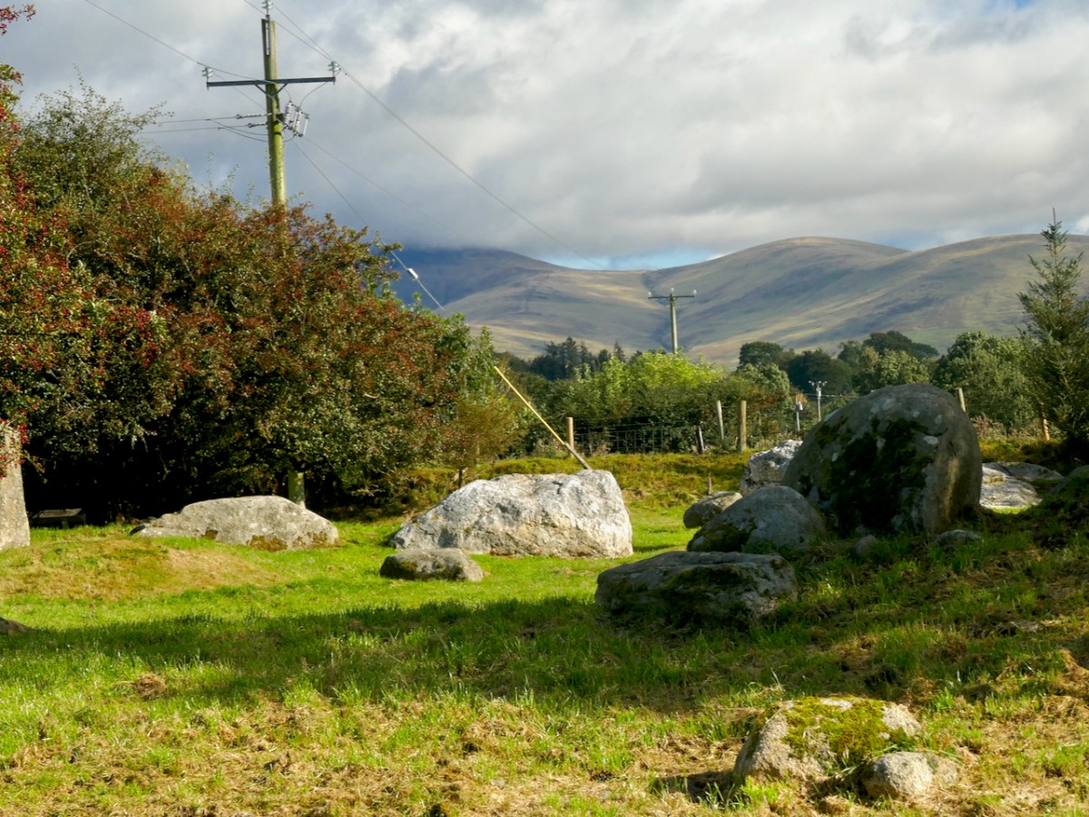
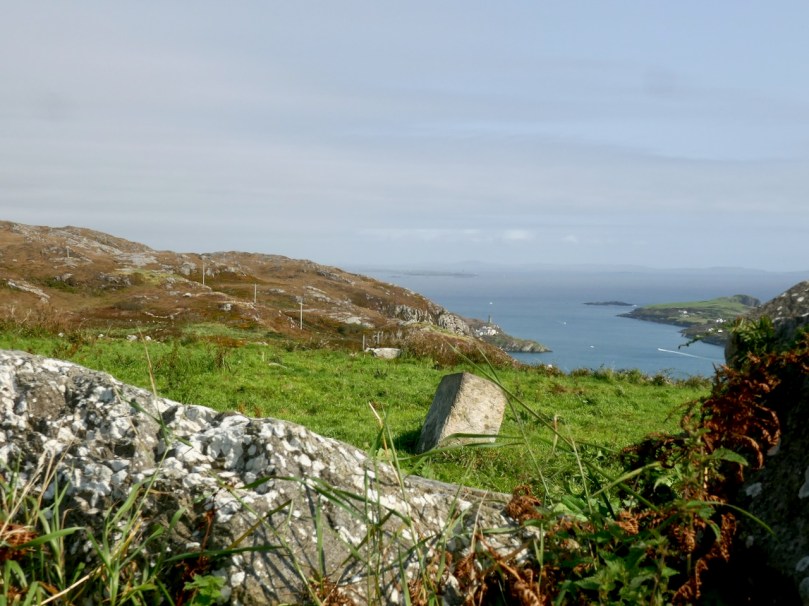
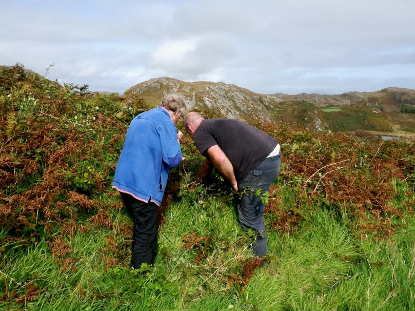
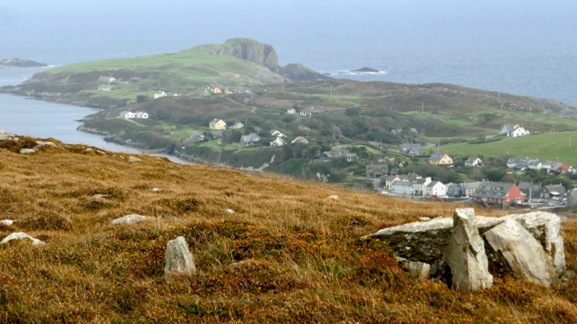
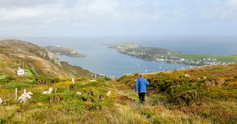
Our travels are always attuned towards our particular interests, be they history, stained glass, art or – as in this case – archaeology. We go out of our way to take in sites we have never seen before – and there are so many. When we were ‘holidaying’ in Wicklow last week we searched out this stone circle in the townland of Castleruddery Lower. It was well worth the journey.

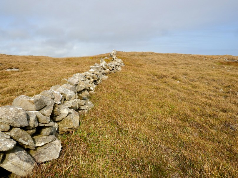
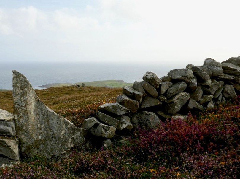
. . . Neglected, knee-high in grass and surrounded by round-crowned hawthorns whose May blossom speckles the bank, it is difficult to appreciate how important Castleruddery must have been early in the Bronze Age when Beaker copper prospectors and the Wicklow mountain goldminers passed by its brilliant entrance. It is not properly a stone circle but a henge, with a stone-lined interior. It was constructed on the summit of a hill just east of the valley into which the Little Slaney flows. Six miles north is the lovely Athgreany stone circle and only two miles to the south is the Boleycarrigeen ring, its stones embedded in a low earthen bank . . .

Aubrey Burl, Rings of Stone, France Lincoln Publishers, 1979

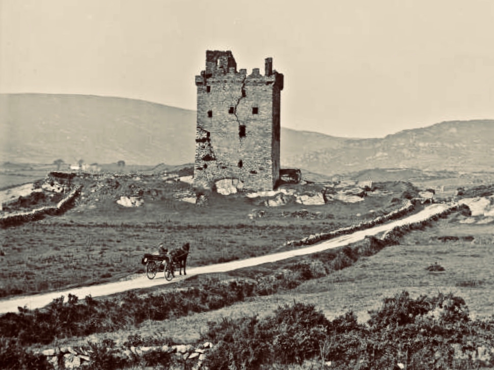
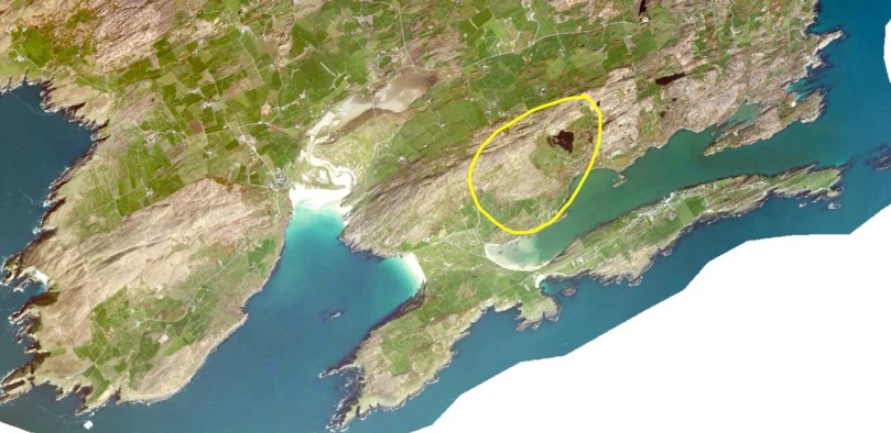
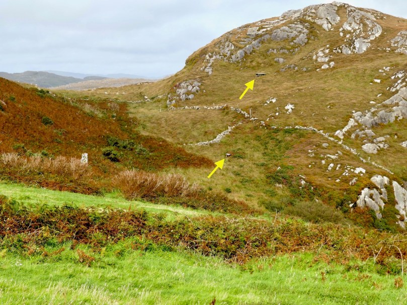
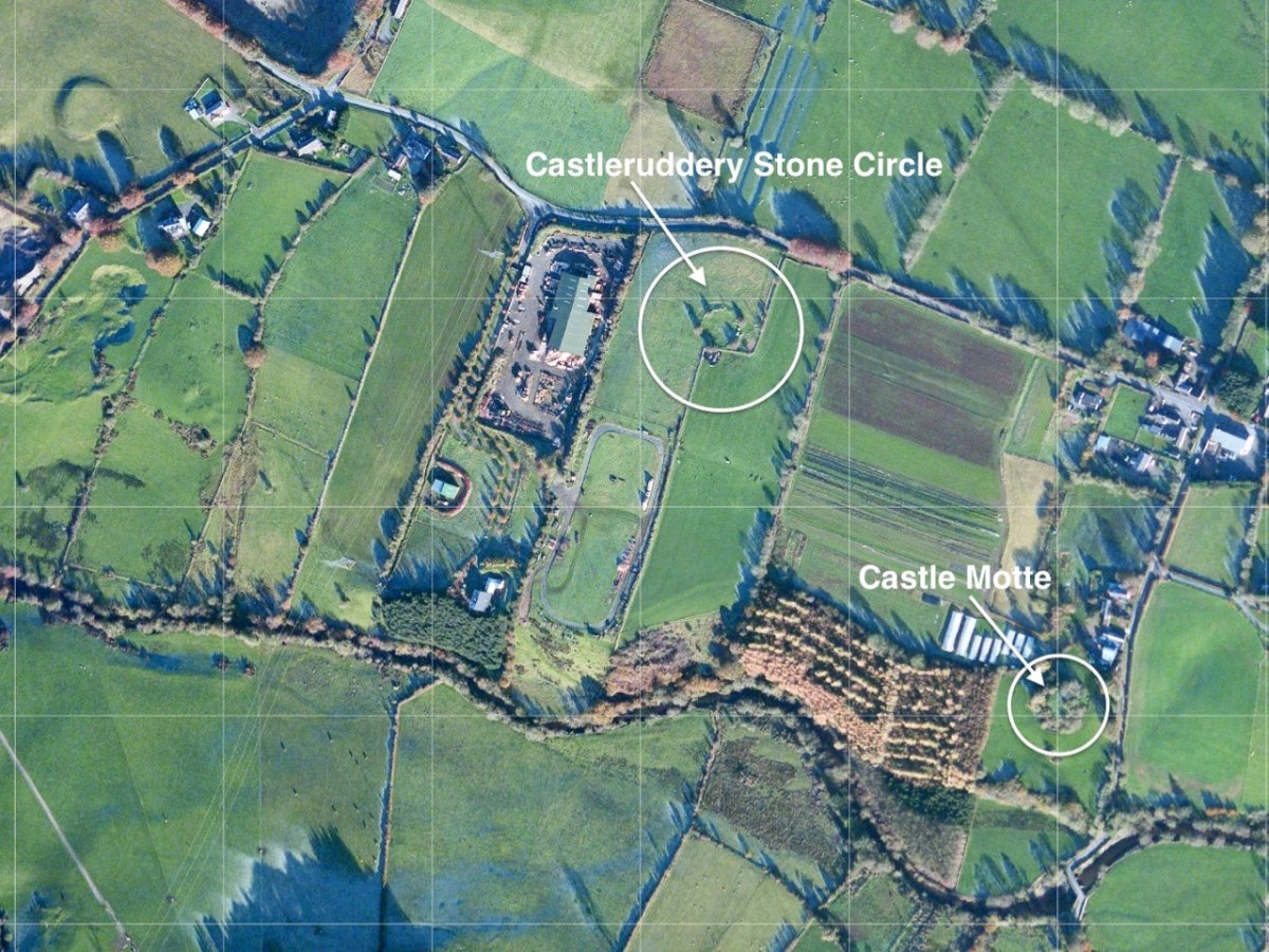
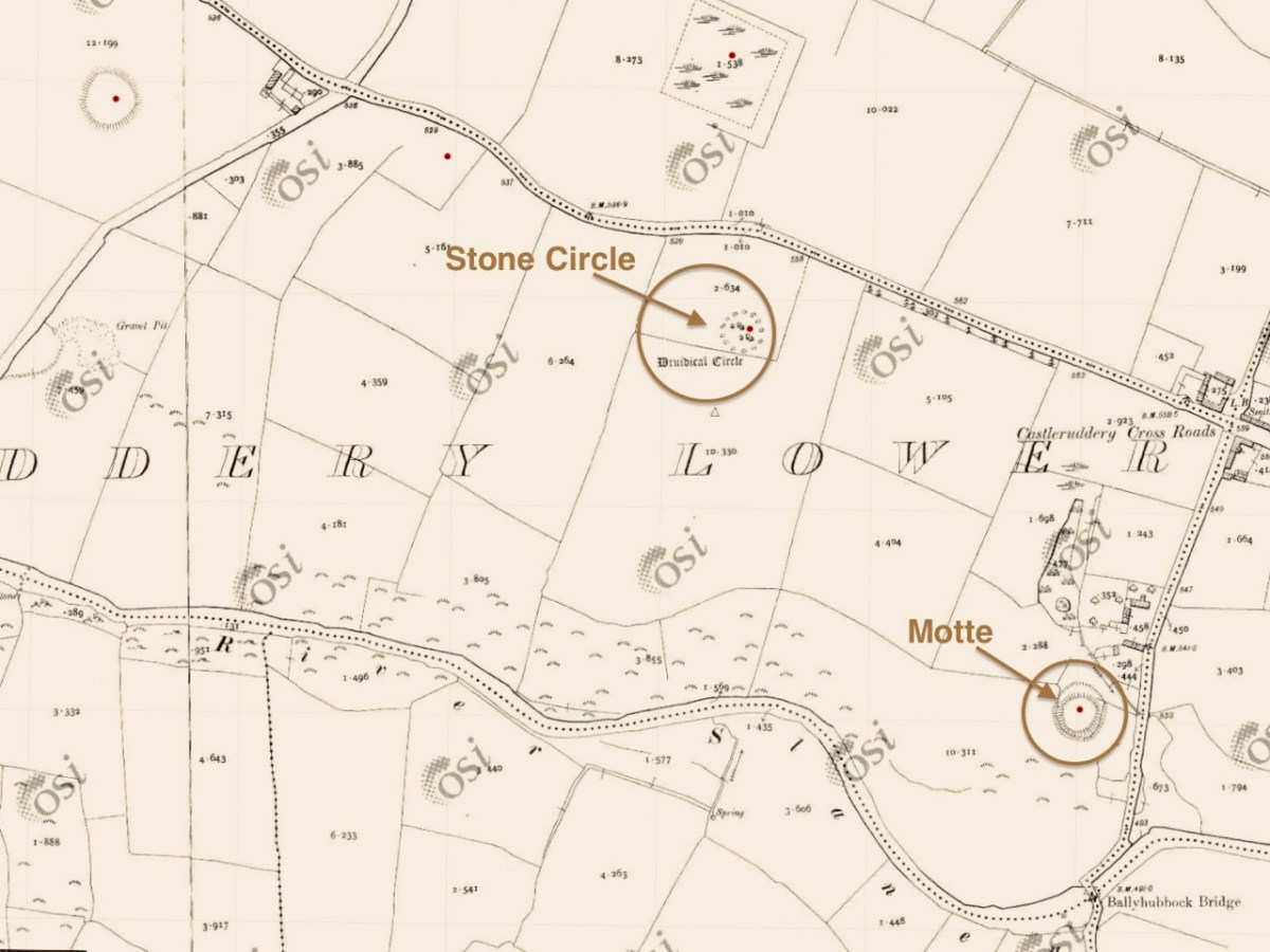
The aerial view, and the extract from the 25″ Ordnance Survey map (above) show the monument in the context of the surrounding landscape. Nearby is a medieval ‘Motte’, very much younger than the ‘Druidical Circle’ – thus named on many early maps. The local Irish name – Chaisleán an Ridire – translates as Knight’s Castle, which might make you think that there is some medieval connection between the circle and the Motte, but in fact Castleruddery stone circle is likely to date from the late Neolithic, around 2,500 BC, marking it as one of the earliest of this monument type in Ireland.

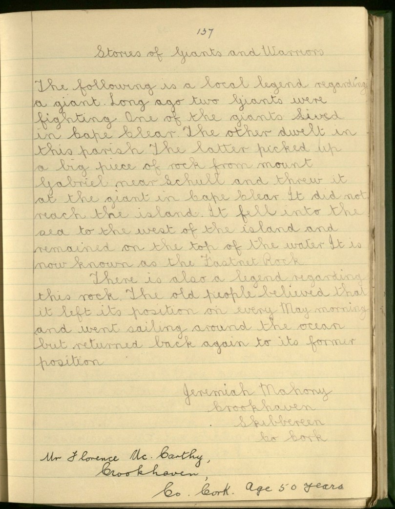
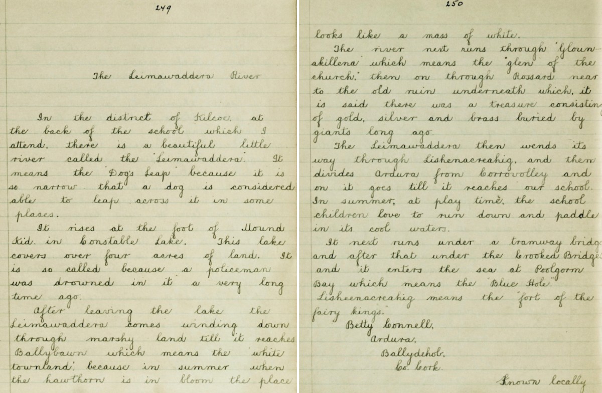
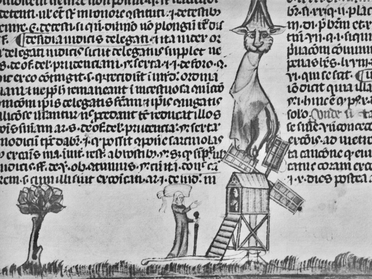
We noted this little figurine by the entrance gate to the circle: it made me wonder what folklore or traditions might be associated with the site today. I could find only one reference to Castleruddery in the Duchas Schools Folklore collection, dating from 1936:

The informer here was Michael Murphy, aged 68 – a ‘labourer’ from Colliga, Co Wicklow. The School collector was from Baile Dháithí, Dunlavin, Davidstown, Co Wicklow. There was no doubt in Mr Murphy’s mind that the stones could only have been placed there by supernatural powers!

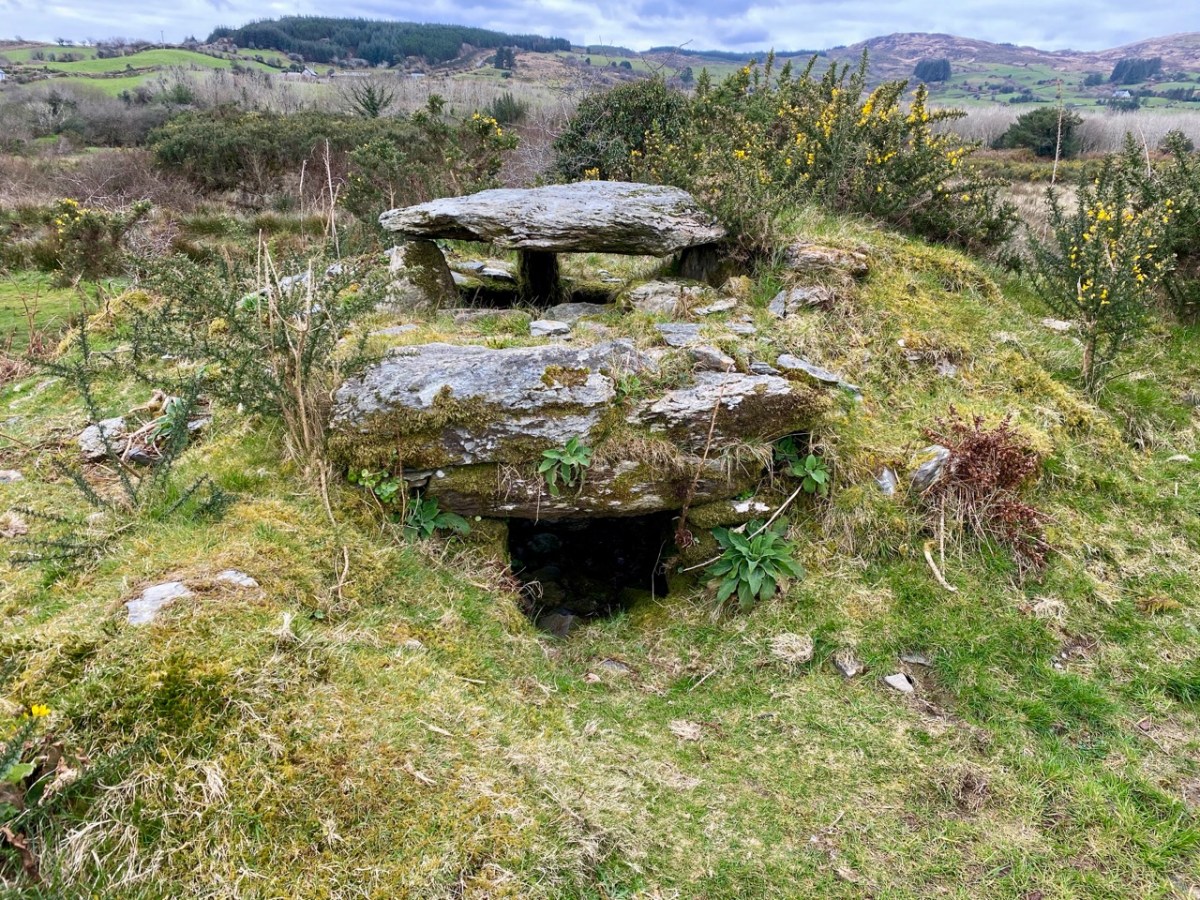
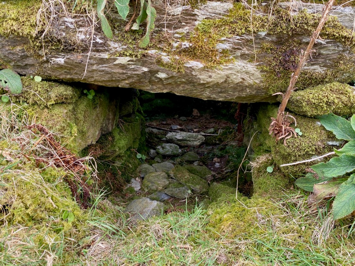
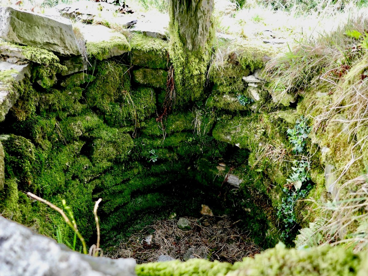
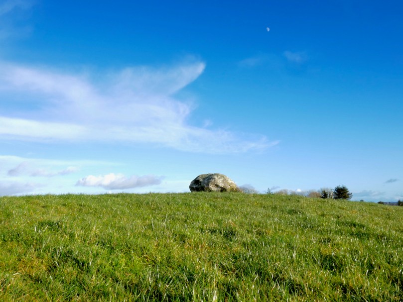
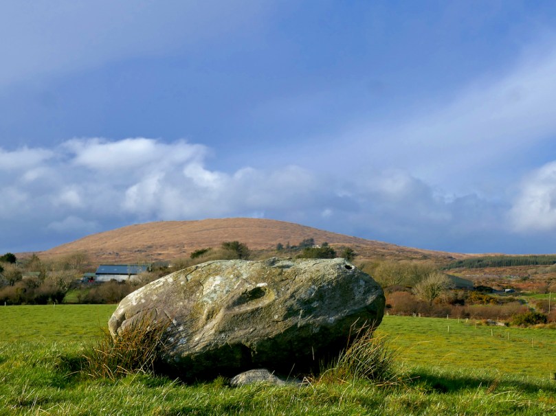
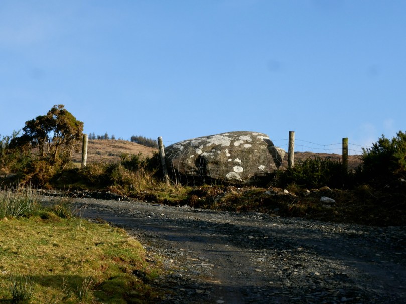
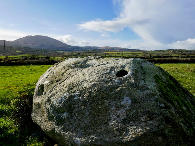
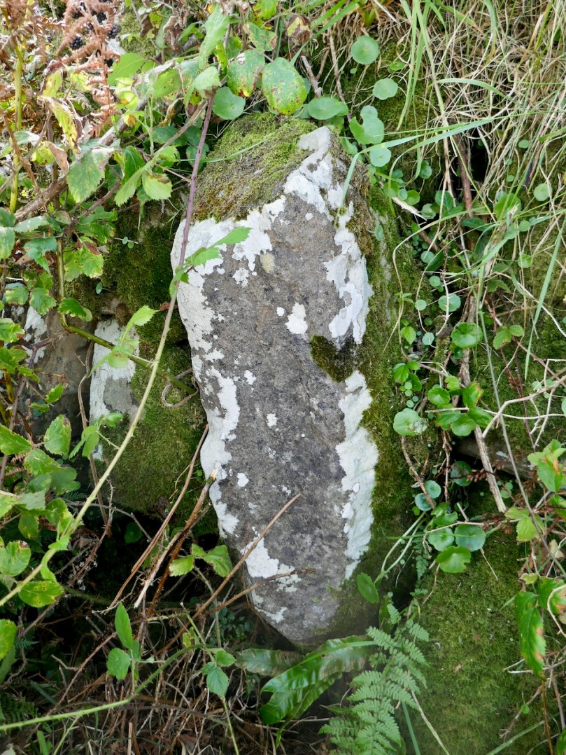
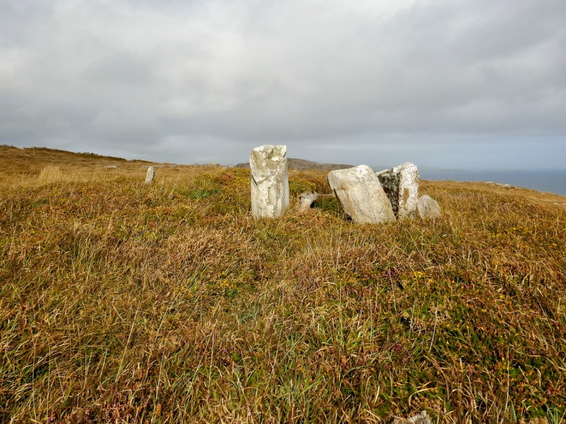
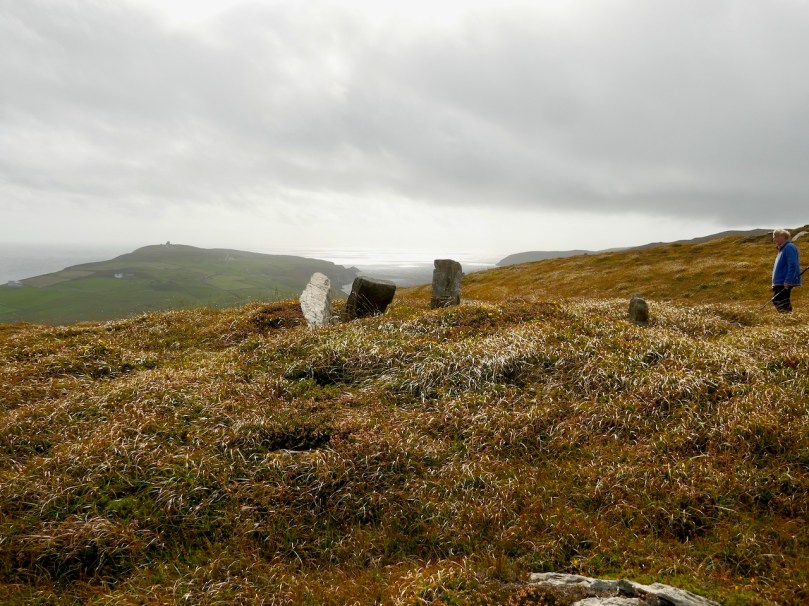
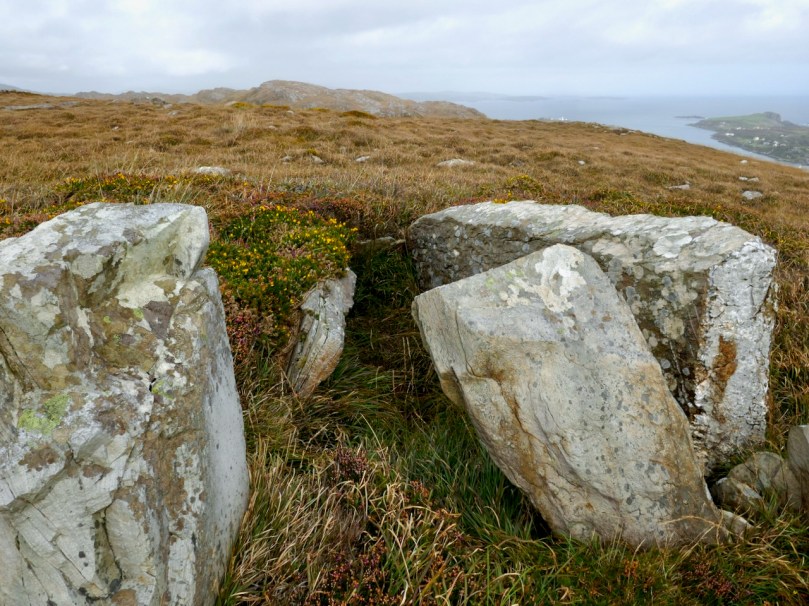
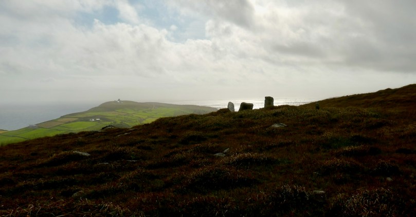
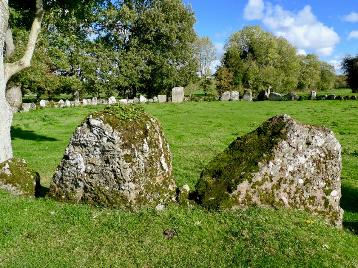
The two quartz portal stones at the east side of the circle are remarkable: deliberately chosen, no doubt, to emphasise the importance of the orientation. The circle has 29 significant stones still standing today, but there were probably more. There is evidence of attempts to break up and remove some of the stones, which would have made good building or fencing material for someone who did not share respect for the integrity of the circle.

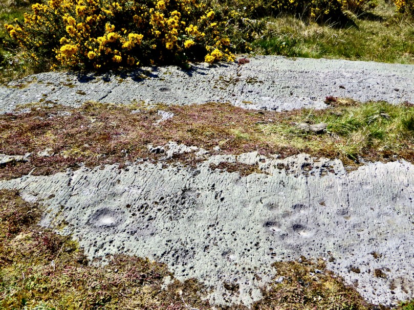
The two views above show iron ‘drill’ markings: these were made to try and separate sections of stone to be taken away for re-use. In the upper picture one section has been removed, but the operation was unsuccessful for the remainder of the boulder. One has to wonder whether otherworldy forces intervened – and meted out some form of ‘bad luck’ to the perpetrators.

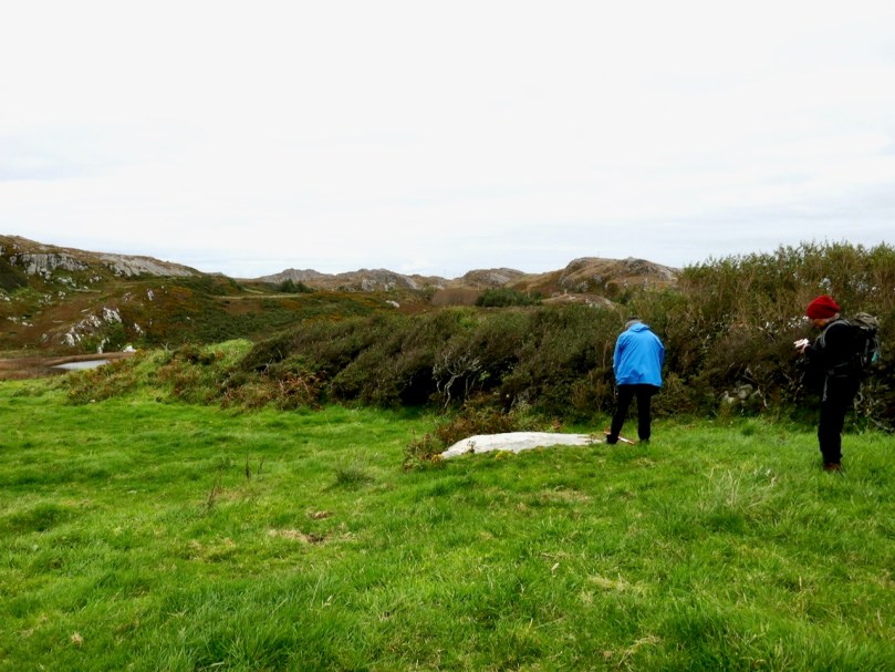
In the present day it’s territory for sheep, and they seem to be unconcerned about any ancient associations or supernatural influences interrupting their tranquil grazing. The archaeologists tell us that this is more of a ‘henge’ monument than the type of stone circle we are familiar with in West Cork. It’s certainly larger, and crop marks have shown that the 29 stones surmount an earthen ring, approximately 30 metres in diameter, and there is a further ring which was once supported or reinforced by timber. Comparisons are made with a henge circle at Grange, close to Lough Gur, Co Limerick, which we visited in 2016. There the ring of at least 113 stones has an internal diameter of 46 metres. We took the two photos below at Grange.

The Grange circle was excavated in 1939 by professor S P Ó Riordáin, and the Duchas board at the site states:

. . . The excavation indicated that the enclosure was constructed purely for sacred or ritual purposes. The bank may have provided a stand where an audience could observe ceremonies within the enclosure . . . One of the stones is known as Rannach Cruim Duibh. This suggests that the circle became associated with the festival of Lughnasa, traditionally the first Sunday in August, and a celebration of the harvest. Crom Dubh, meaning the Dark Bent One, was credited with bringing the first sheaf of corn to Ireland . . .

Duchas, Grange Circle

There must surely be connections, and common purposes, between the many similar circle monuments all over Ireland. We always want to know What was it for…? probably, we never will, but it’s part of the whole romance of archaeology to wonder about such places. We must be grateful that so much remains for us to explore.

Off the M8 – Ballysaggartmore

This post might also have been called A Monument to Imprudence because of the story which it encompasses. But, first and foremost, it is a bit of an architectural wonder, and certainly worth the deviation from the motorway if you are travelling between Cork County and Dublin. It will add only 20 minutes to your journey – plus however long you decide to spend walking the publicly accessible woodland to discover the nineteenth-century extravagances of Arthur Kiely, Esq. Leaving the M8 motorway at Fermoy, head east towards Lismore on the R666: you will reach a car park and trailhead for Ballysaggartmore on the left within half an hour. After your visit, find the R668 heading north and rejoin the M8 at Cahir.

We felt we were capturing the last of the summer as we embarked on the beautiful sunlit trails on the first day of October in this Covid laden year. We were convinced that a week or so later we would be feeling the first cool winds of autumn and undoubtedly be noticing the changing hues in the ash, beech and oak tracts of the Ballysaggartmore Demense. The name in Irish – Baile na Sagart – means ‘Priests’ Town’. I cannot find out which priest is being remembered here, but – as you will see – there is some local lore which mentions a priest – and also Kiely, the unpopular local landlord.

These extracts from the c1840 first edition 6″ Ordnance Survey maps show parts of the Ballysaggartmore Demense. In the upper plan, a house can be seen, probably newly built at the time of the survey. Nothing remains of it now, but some photographs exist, dating from 1904.

It’s time to piece together what can be found on the history of the place and its people. The first Kiely – John – purchased some 8,500 acres of land here in the late 1700s. He had two sons. On the senior John’s death in 1808 the elder brother – also John – inherited good lands at Strancally, on the Blackwater River, and proceeded to build an imposing castle there. The younger son – Arthur – had to make do with the less propitious lands around Ballysaggartmore, and built the modest house pictured above, but apparently harboured notions to match John Junior’s aspirations, embarking on a grand design to upgrade the property, starting with a splendid carriage drive and gatehouse which survives today near the beginning of our walk in the woods.

. . . Sir, Permit me through the medium of the Dublin Penny Journal an opportunity of giving the public a brief description of the situation and scenery of Ballysaggartmore, the much improved residence of Arthur Keiley, Esq, situate one mile west of Lismore, on the north side of the river Blackwater. The porter’s lodge at the entrance to the avenue is composed of cut mountain granite or free stone, of a whitish colour, variegated with a brownish strata, which gives the whole a rich and pleasing appearance; it consists of a double rectangular building, in the castellated style, flanked by a round tower at either end, through which is a passage and carriage-way of twelve feet in the centre, over which is a perpendicular pointed arch, enriched with crockets and terminated with a finial; the buildings at either side of the gateway, although similar, form a variety in themselves; and the situation is so disposed as not to be seen until very near the approach; the gate is composed of wrought and cast iron; and is, I will venture to assert, the most perfect gothic structure formed principally of wrought iron, in the kingdom. It was executed by a native mechanic, and cost about one hundred and fifty pounds . . .

Dublin Penny Journal, December 1834

The ambitions of Arthur Kiely knew no bounds. Egged on by his wife, jealous of her in-law’s estate at Strancally, he continued the carriage drive (today a further part of the picturesque walking trail) towards a humble stream which had to be crossed in order to reach the vicinity of the house which was to be upgraded to – or replaced by – something of suitable substance. The stream could easily have been culverted but no! Only an ornate neo-Gothic three-arched bridge with gate-houses at either end and surmounted by towers and pinnacles would do: a prelude, presumably, to the architectural magnificence that was being planned beyond.

At the same time as directing the building project, Arthur decided that a change of name would be advantageous. Something double-barrelled was called for, and he chose to add Ussher, a family name derived from ancestors on his mother’s side. Arthur Kiely-Ussher certainly has a ring to it. Arthur’s ambitious wife was born Elizabeth Martin of Ross House, Co Galway. Always on the look-out for a West Cork connection, I can tell you that the author Violet Martin was a great-niece of Elizabeth. Violet lived in Castletownshend and famously collaborated with Edith Somerville.

The gate-lodge and ‘Towers’ of Ballysaggartmore are remarkable survivors, and represent the sum total of Arthur’s striving to equal his brother’s show of opulence. After the extraordinary towered bridge the carriage drive peters out, and one assumes the money also dissipated. Kiely-Ussher attempted to revive the fortunes of his estate but this centred on evicting tenants in time of scarcity, which only resulted in the lands becoming less productive. The family lived through the famine but were considered notoriously bad landlords. In the 1850s Ballysaggartmore Demense was virtually bankrupt: the house was sold in 1861 and Arthur himself died shortly afterwards.

Like many another bad landlord, Arthur Kiely-Ussher has entered into folklore. It’s worth reading this lengthy entry from the Duchas Schools Folklore Collection – a superb tale of just retribution being visited on the memory of – not one – but three ghastly incarnations of a man who probably wished to be well remembered, but failed catastrophically.

. , . In Ballysagart there lived three landlords named Ussher Kiely. The three of them were brothers and they were all called Ussher. They were terrible tyrants and they evicted people every time they got the chance, and allowed no one near their land. Of the many stories told about their cruelty here is one: On Ussher’s land there is a Spring well. A very old, goodliving woman lived near the place. One day she had no water. The nearest place she could get water was the well, which was in a field behind her house, but Ussher allowed no one near the land. The neighbours always brought her a churn of water from the Blackwater, but this day she had no one to get it for her. As the Blackwater (which was two miles away) was too far for her to walk, she thought there would be no harm in going to the well for once. When she was bending down to fill her gallon in the well she heard a shout behind her; “Get away from that well and get off my land you cursed wretch. How dare a dying old hag like you interfere with my water or dirty my land with those rotten feet of yours”. It was the eldest Ussher and he made her throw back the water and he threatened to beat her if she did not get off his land immediately. She obeyed and when she was out of his sight she knelt down and cursed him saying “O God, may the brothers of this man, Ussher, who hunted me away without a drop of water, be at his funeral before the year is out, and may he grow silly and his tongue hang out of his head so that he cannot offend you again”. Another woman cursed him saying “May you die in agony, you tyrant”. Before the year was out he grew silly, and he had to be sent to a home where he died in terrible agony. His body is still to be seen in Ballysaggart where his body is embalmed in glass. His mouth is to be seen wide open and his tongue is hanging out and is as black as soot. Another of the Ussher Kielys saw a man crossing his land. He brought out his gun and threatened to blow the man’s legs from under him. The man who was only going home said “Ussher Kiely, I was walking on this land before you and I’ll be walking on it after you, so why don’t you shoot me”. Ussher put away the gun and never used it again. A few days later he complained of pains and only lived two hours. He was embalmed in glass and laid by his elder brothers side. The third Ussher Kiely was worse than the others. Every night a man used to bring cattle on Ussher’s land to graze. Ussher heard of this and one night he lay in wait and without warning shot the man. When the people heard of the shooting they piled curses on Ussher. A few days passed since the shooting when a priest was walking on Usshers land. He was reading his ‘Office’ when he met Ussher. Ussher cursed him and called him every name he could think of as well as ordering him off the land. “All right”, said the priest, “I’ll go off the land, but mark my words, tyrants like you never live a long life”. Two hours later the last of the Kielys dropped dead. The three brothers are to be seen, embalmed in glass lying side by side in a small graveyard in Ballysagart . . . Mr Tom O’Donnel told me these stories – Tom Conway


Duchas Schools Folklore Collection, Volume 0637

If you would like to read in greater detail the fortunes and fall of Arthur Kiely-Ussher I commend you to the excellent account by The Irish Aesthete. The ‘modest’ house at Ballysaggartmore was burned down during the Irish Civil War, obliterating its physical history and committing its memories to fascinating folk recollection. We are fortunate, nevertheless, that we may freely wander a trail and reminisce on misfortune. And justice.

O’Donovan Country (Sweet Ilen – Part 6)

Here’s a forerunner to Roaringwater Journal (above)! Philip Dixon Hardy lived from 1794 to 1875 and described himself as a poet, bookseller, printer, and publisher. He was the first to use a steam-powered printing press in Ireland and was the editor of The Dublin Penny Journal which was published every Saturday between 1832 and 1836. If you scroll through the contents you will see articles on all aspects of Irish life and accounts of many of his travels through the Irish countryside, including a series of ‘Rides through County Cork’. He was undoubtedly a man after our own hearts!

Continuing our own series of travels, exploring the Ilen River, we can’t help comparing our impressions of Castle Donovan (above) – which overlooks the Ilen after it has cascaded down from the summit of Mullaghmesha and broadened out to cross the plains of Cork County – with those that are recorded by Philip Dixon Hardy as he journeyed over the same terrain in 1828, almost two centuries ago.

The upper picture is taken from the Ilen plain looking north, with the castle tower set against the high mountains beyond. Above is our earliest known photograph of the castle: it comes from the Lawrence Collection, National Library of Ireland, and could date from the 1880s. Juxtapose this with the Dublin Penny Journal view, 50 years before that, shown under our header at the top of the page. Bear in mind that Hardy carried out most of his travels on foot:

. . . We will now suppose the the tourist who rejoiceth in the splendour of a wheel carriage has proceeded without any interruption to Bantry. We will act in the charitable capacity of guides to the humbler pedestrian. Him we would advise to select the old, or northern road, leaving Dunmanway to the west. Thence it proceeds to the lofty hill of Mielane, and surmounting a rising ground beyond this eminence, the vale of Castle Donovan (which forms the subject of our sketch) opens on the sight. It is hard to conceive of any thing more wild, more desolate, more lonely, than this savage vale. … I reached the eminence which commands it from the east, about two in the afternoon of a warm sunny day. Trees there are none in this district, and the heathy covering of the hills was incapable of showing any marks of the advancing season. In the centre of the vale beneath me, was the tall, castellated tower; an extensive marshy meadow lay beyond it, bounded by the steep rocky hills of Mullaugh-Nesha, and its peaked brethren. . .

Philip Dixon Hardy, 1828, from The Dublin Penny Journal

The Castle itself has a fairly well recorded history, although its origins are unclear. James N Healy – The Castles of County Cork, The Mercier Press 1988 – suggests that the first fortification on this site dates from the early 13th century, but the present building is more likely to be 16th century. There is a carved stone in a window embrasure on an upper floor which bears the date 1626, but Healy suggests that this marks a later restoration of the castle, and gives a probable date of construction between 1560 and 1584.

The castle was traditionally the seat of the Clann Cathail sept of the O’Donovans, and was first named ‘Sowagh’. I can’t find any origin for this name. Healy gives an intriguing story:

. . . A local story is told of how O’Donovan and his ally MacCarthy Duna hanged a protestant woman at the castle in 1641, as a result of which the curse of a corroding drip from the main arch was placed on the building. This would not cease until the demise of the last of the family: the castle does not appear to have been lived in again.

James N Healey – 1988 The Castles of County Cork

It is recorded that Cromwell’s officers attacked the castle and it was left in ruins. Returning to The Dublin Penny Journal, Philip Dixon Hardy describes his exploration of the remains:

. . . I diverged from the road to examine the old castle; it is founded on a rough rock whose surface, forming the floor of the vaulted hall of the castle, retains all its original inequalities. Strange notions of comfort must our ancestors have had! Here were men, possessed of a large tract of country, sufficiently wealthy to build several castles; and in this one, the constant residence for many years of a principal branch of the family, the floor of the hall is bare rock, which never has been levelled, and which is intersected with two or three ridgy indentations, nearly two feet in depth, and extending almost the whole length of the apartment!

PHILIP DIXON HARDY, 1828, FROM THE DUBLIN PENNY JOURNAL

This is what Hardy is referring to – in fact it’s not ‘the vaulted hall of the castle’! It’s the lowest floor – at ground level – and was in all likelihood a store or cattle shed. It might even have been a dungeon. The main ‘hall’ of the castle is on an upper level.

The castle structure was stabilised by the OPW and public access to the grounds was granted in 2013. Restoration works included the replacement of key elements of the masonry to prevent further decay. The ‘peep-hole’ above allows a view by a sentry located just inside the entry door of who might be standing outside: perhaps an undesirable character (below). Actually, rather than a peep-hole, this little tunnel through the wall was for a chain that secured an outer iron gate called a yett.

When you visit Castle Donovan, look over the low wall to the west of the tower itself. You will see an archaeological feature which is quite rare today, but was once common all over Ireland from early times: a cereal-drying kiln (also called a corn-drying or grain drying kiln).

What is a cereal-drying kiln? Here is a good summary, from Irish Archaeology. It looks almost megalithic – and the earliest one dated so far goes back to the Bronze Age, but there are many that are medieval, and this one at Castle Donovan is likely to be contemporary with the castle itself. The structure has a fire-pit (below) and trays of cereal were placed above the fire, and in this case under a capstone, presumably protecting the corn from wind and rain.

This extract from the 25″ Ordnance Survey map (late 19th century) shows the castle overlooking the Ilen River and, to the south, the bridge and the old school. To finish off this episode in the Ilen series, we will pause at this bridge. There’s plenty to see – good views back to the castle from the arches of the stone bridge; the site of the old National School. There is no sign of the building today, but there is a memorial stone:

This is from the Duchas Schools Folklore Collection, dating from 1937:

. . . Walkers: it was no uncommon thing for people to walk to and from Cork in olden times – often carrying baskets. Tradition has it that a woman Magg Hourihan of Deelis did the double journey on foot in one day (approximately 90 miles). Biddy Regan of Castledonovan is credited with the same feat – The occasion in both cases being the payment of Rent (which at that time was often paid through Cork butter factors). Herewith is a direction given to people who were unacquainted with the road – Bí ag dul soir, soir, soir – go bfeidir séipéal ar thaobh do láimhe deise ni fada uait Corcaig annsan.


Seán Ó Súilleabháin, múinteoir Deelish Co Cork

Previous episodes in this series: Sweet Ilen : Sweet Ilen – Part 2 : Sweet Ilen – Part 3 : Sweet Ilen – Part 4 : Sweet Ilen – Part 5

Legends of Mount Gabriel: Wrought by Giants

While references to Fionn MacCumhaill (or Finn McCool) occur in many of the old legends about Mount Gabriel, more often a generic ‘giant’ is identified as having lived on or near Mount Gabriel. Giants were, apparently, given to fighting each other and to hurling rocks through the air. Here’s a good example from Jeremiah Mahony of Crookhaven:

Giants are a familiar motif of folklore – just across the sea many of the same stories are told about the effects the Giant, Bolster, had on the landscape of Cornwall.

The rock that was seized and thrown didn’t always become the Fastnet; prominent rocks on the landscape were also identified, including what we know now as Boulder Burials (for more on this class of archaeological monument see my post Boulder Burials – A Misnamed Monument?). Here is Cornelius Moynihan from Derreenlomane School (long since closed), telling a tale he got from his grandfather of the same name, then aged 75.

In my grandfather’s land in Rathravane there is a stone called “The Giant’s Stone”. A legend says that it was thrown from Mount Gabriel by a giant long ago. Those who believe this point out the print of a knee and prints of three fingers. It looks as if one end was lifted by human agency as it is supported at that end by three stones arranged regularly.

In an unusual piece of cross referencing, Tessie Coughlan from Dunbeacon School, on the other side of Mount Gabriel, tells of the same rock landing in Moynihan’s field (above, and below with Mount Corrin in the background).

The old people of this locality say that two giants once lived at the top of Mount Gabriel near the place where the lake now lies. One of them was much taller than the other but the smaller had two heads and was cleverer and stronger than the other. It is said that they killed any person who cut a tree on the mountain side and then they cast their bodies into the lake.

One day a dispute arose between the two as to which was the stronger and it was agreed upon that they should both lift a stone and throw it as far as they could. The two giants lifted stones of equal weight and threw them over the land together. The small giant threw his stone much farther than the other did and it fell in Rathravane in a field owned by Mr C Moynihan. The other stone fell in Dreenlomane and it is still to be seen.

The stone in Rathravane is oval shaped and it bears the five prints of the giant’s fingers. It rests on a height. The stone in Dreelomane is not shaped like the one in Rathravane but it is the shape of a coffin and bears the print of one of the giant’s fingers. The old people say that it is a real coffin and that a landlord is buried in it or under it. Several people have gone to break the stone, but owing to tradition they never struck it.

Perhaps this (above) is the other rock – it’s not in Derreenlomane but not far, on the slopes of Mount Corrin. Another student from Derreenlomane school, Rita Helen, tells a similar story in her piece titled Local Monuments, and goes on to describe several others.

There is a glacial stone in Mr. Young’s field and another in Mr. Moynihans field. The one in Mr. Moynihan’s field seems to have been lifted up at one end by some persons, as three stones have been placed under this end. People say there is a print of five fingers on the one in Mr. Moynihan’s field and that a giant threw the stone from the top of Mount Gabriel over into the field. 

In this photograph of the Rathruane boulder burial, perhaps you can see the knee imprint and one of the finger holes. That’s Mount Gabriel in the background.

There is a cairn on top of Mount Corrin (Cnoc an Chairn).

There are two pillar stones in the townland called the Gallauns, parish of Schull, W.D.W. Carbery, Co Cork.

In another part of the townland there are six pillar stones forming part of a circle.

The only stone circle in the vicinity is in Dunbeacon, on the slopes of Mount Corrin, but Mount Gabriel is visible from it, as you can see in the photo above. Rita was from Rathruane, although she spells it as it is pronounced locally, Rathravane. It’s interesting that she also says There are no stones in the district with peculiar markings or strokes on them, since there is indeed rock art in Rathruane, quite close to the boulder burial. It’s an excellent example of prehistoric Rock Art, AKA cup-and-ring art.

Hannah Hayes, also from Derreenlomane has her own version of Local Monuments:

There are two large stones in Rathravane :- one in Mr. Young’s field and one in Mr. Moynihan’s field. It is said a giant threw the stone from Mount Gabriel to Mr. Moynihan’s field, and those who believe this say there is the print of five fingers in it. There are pillar stones called Galláin standing in the ground in the townland of Coolcoulachta. There are no ornamented stones in the locality.

Here are the Coolcoulaghta galláns or pillar stones – they constitute a type of monument known as a standing stone pair.

Here’s a piece from an unnamed student at Gloun School. It refers to “a kind of grave” and we wonder if this is the beautiful little wedge tomb in Ratooragh

In the western side of the Glaun hill up east of Timothy Driscoll’s there is a kind of grave. Long ago there was a chieftain living here and people say he was buried there and some treasure buried with him. On top of the clay there is a heap of stones and there is a fairly large stone standing in the centre and there is some writing carved on it.

This writing is nearly blotted out now. It was read by many people in olden times. No one ever tried to find the treasure.

No sign now of any clay or writing but the National Monuments record does reference traces of a mound which may have covered the wedge tomb originally but is impossible to make out now. There are panoramic views from this wedge tomb, not only to Mount Gabriel and Mount Corrin (above), but west to the sea as well (below).

We know you’ll want to be out and about as soon as we all can, doing your own exploring. As an enticement, here’s a story about buried treasure, courtesy of Caitlín Ní Árnéidig of the Convent of Mercy in Skibbereen.

Under a huge stone on the slope of a hill in my father’s farm, there is said to be hidden treasure.

It is said that one day “Athach Mór”, a great giant, was challenged to throw this huge stone (at least one ton and a half weight) from Mount Gabriel to that spot on the hill. First the giant seemed unwilling to try this feat but when he began to lift the stone it seemed of no weight, and he suceeded in landing it exactly on the spot.

Under it there is said to be an unusual thing (a nest containing seven golden eggs each seven inches in diameter and filled with sovereigns).

About four perches due west of this stone is another stone, under which a similar treasure is hidden.

An old man of the vicinity recently revealed that in order to find the treasure one must draw a straight line from one stone to another, then standing near the middle of the line hold a cord in the hand and lift it an eastward direction, so that it will [words missing] the stone and a light will be seen over the spot where the treasure is.

My uncle, having heard the story, decided to prove this, so he set to work at the mysterious stone. Having drawn the line he stood near the centre and cast the string eastward. Then to his astonishment he noticed a ray of light over a small portion of the stone.

He tried to split the stone but failed though still engaged at the work he finds it impossible to do.

All you have to do is figure out the location and , crucially, what the student meant to say where the words are missing. Good luck!

Going With The Wind

We set out to search for a lake in the hills above Ballybane West: it’s known as Constable Lake. There’s a story, of course – which I found in the Duchas Schools Folklore Collection, collected at Corravoley School in 1937. A whole gamut of stories, in fact, packed into two neatly handwritten pages. I don’t think I have ever found quite so much information on local lore in a single entry. Ammunition for a few more posts, perhaps!

In the district of Kilcoe, at the back of the school which I attend, there is a beautiful little river called the “Leimawaddera”. It means the “Dog’s Leap” because it is so narrow that a dog is considered able to leap across it in some places.

*

It rises at the foot of Mount Kid in Constable Lake. This lake covers over four acres of land. It is so called because a policeman was drowned in it a very long time ago.

*

After leaving the lake the Leimawaddera comes winding down through marshy land till it reaches Ballybawn which means the ‘white townland’, because in summer when the hawthorn is in bloom the place looks like a mass of white.

*

The river next runs through ‘Glounakillena’ which means the “glen of the church”, then on through Rossard near to the old ruin underneath which it is said there was a treasure consisting of gold, silver and brass buried by giants long ago.

*

The Leimawaddera then wends its way through Lishenacreahig, and then divides Ardura from Corravolley and on it goes till it reaches our school. In summer, at play time, the school children love to run down and paddle in its cool waters.

*

It next runs under a tramway bridge and after that under the Crooked Bridge and it enters the sea at Poolgorm Bay which means the “Blue Hole”.

*

Lisheenacreahig means the “fort of the fairy kings”.

BETTY CONNELL, ARDURA

In How Well Do You Know West Cork? on the Roaringwater Journal Facebook page this week, Finola posted this photo of Constable Lake:

This view is cleverly framed to minimise the clues, but several readers gave the correct answer almost immediately. Here’s a more revealing picture:

Constable Lake now lies within the boundaries of Ballybane Wind Farm and the 21 tall turbines can all be seen from its shores. It’s one of several farms in the West Cork area, strategically sited on the wild heathland ridges, working away at their mission of harvesting nature’s resources in order to provide us with electricity without burning fossil fuels.

Upper – on the aerial view I have marked each of the 21 turbines. Lower – from the Ballybane site the turbines at Drinagh and Coomatallin are visible

I find the turbines dynamic and exhilarating. I know there are many readers who will disagree with my opinion, and social media abounds with polarised views about them from all perspectives. It’s hard to home in on hard and fast truths on anything these days but I have read extensively – and scientifically – on the subject and it seems to me that these wind-turned appliances have a life expectancy of around 25 years, and they pay for their installation in less than two years. Of course, carbon emissions are involved in the construction and manufacturing processes but this is heavily outweighed by the carbon savings from running these instead of burning fossil fuels to produce our electricity. Dismantling costs are built in to the permissions, and there is no doubt in my mind that in 25 years time – or less – technology will have advanced towards other solutions.

A simple chart from 2017 (via FactChecking.org) which graphical shows how well onshore wind farms perform against other fuel sources. Only nuclear power is marginally better

Wind turbines have a huge visual impact on the landscape, so their siting is important. In the case of Ballybane they have been constructed on heathland and in an area that was formerly commercial forestry. I personally prefer the elegance of the actively dynamic structures to a dark, impenetrable and seemingly sterile sitka spruce plantation. The scale is aweing: in the following photographs here’s me at the base of one of the 64m high towers (upper picture) and, below that, you can see me again – the very tiny figure to the left of the main turbine.

The machinery of industry has always fascinated me. Windmills go back a long way. The first image, below, is from the 14th century Decretals of Gregory manuscript in the British Museum. This is followed by our photograph of Elphin mill, County Roscommon, which dates from 1730 and is said to be the oldest in Ireland. Next, an exploded view of the nineteenth century flour mill at Chillenden, Kent, UK (courtesy of John Reynolds) and then a comparable view of the workings of the Enercon E-70 Wind Energy Converter, which is the unit in use at Ballybane and has a rotor diameter of 71 metres.

The Ballybane Farm will power about 40,000 homes a year on average. That’s modest compared to the newest developments. Currently the world’s largest installation – the offshore Hornsea One Farm, Yorkshire, UK – powers a million homes, while in the Netherlands a huge Haliade-X offshore turbine is being developed with a height of 260 metres and rotor blades of 220 metres in diameter: it’s said that each sweep of the blade will keep a house powered for a day. But that’s enough of the technical stuff. I enjoyed the experience of being close to these giants, and hearing the significant swish of those blades powering us into a safer, carbon reduced future.

Above you can see the trackway leading us up to Constable Lake and the Ballybane Wind Farm. On the horizon is Roaringwater Bay and the distinct profile of Mount Gabriel. There’s an ancientness about this landscape that balances the surreal – somewhat ‘science-fiction’ – character of the turbines. For me, these elements complement each other, and the sheer scale of the contemporary engineering sets us apart from our slight, human selves – so vulnerable in these times.

Mizen Magic 18: The Prehistoric Landscape of Arduslough

There are parts of West Cork that seem to hold within them all the memories and markers of eons. Such a place is Arduslough, on the high ground across from Crookhaven (below, map and photo) and west of Rock Island (above).

Technically, the places we explored are in three different townlands – Tooreen, Arduslough and Leenane, but mostly they fall within the boundaries of Arduslough. The name has been variously translated – Árd means high place and Lough means lake, both of which seem appropriate, but in fact the placename authority, Logainm, renders it as Árd na Saileach meaning High Place of the Sallies, or Willow Trees. Not much in the way of willows is obvious now, but the lake is certainly central to your view in the townland.

The Lake is the source of drinking water for Crookhaven and is the home, according to a story collected in the late 1930’s, of. . .

. . . an imprisoned demon of the pagan times. He is permitted to come to the surface every seven years on May morning and addresses St. Patrick, who is supposed to have banished him, in the following words “It is a long Monday, Patrick”. The demon does not speak in the English but in the vernacular. The long Monday refers to the day of General Judgement. Having expressed these words his chain is again tightened, and perforce he sinks to the bottom of the lake for another period of seven year His imprisonment will not expire till the last day.

We saw no sign of the demon and the lake looked remarkably untroubled, with its floating islands of water-lilies.

For a relatively small area, Arduslough abounds in archaeological monuments – there are four wedge tombs, three cupmarked stones, a standing stone and a piece described as either an Ogham Stone or Rock Scribings, depending on what you read. The remains of old cabins dot the landscape too, reminding us that this was a much more populous place before famine and emigration decimated the population.

The standing stone, and Robert with Jim and Ciarán O’Meara

Arduslough is the home of esteemed local historian Jim O’Meara, who grew  up in Goleen but spent most of his adult life teaching in Belfast. We met up with Jim and his son Ciarán, who very kindly offered to show us the Ogham stone. It was so well hidden under layers of brambles and bracken, and built into a field fence, we would never have found it on our own.

It is impossible to say if it is real, or even false Ogham, as it is heavily weathered and lichened, but if we turn again to the School’s Folklore Collection, we find this entertaining account of it:

There is a stone in Arduslough, a townland on the hill to the north of Crookhaven, on which are very old characters or ancient writing. It is very difficult to discern these markings now as the centuries during which they were exposed to the weather have obliterated them. The following story explains the origin of them.

In ancient times there lived in Toureen a man named Pilib. He informed on some party of Irish soldiers who were hiding in the heather there. The enemy came on them and burned the heather round them in which the soldiers perished. The stone was erected in this spot and the event was recorded on the stone. Years passed and the language underwent a change. In later years the people did not understand what was recorded on the stone, and went to the Parish priest asking him to interpret it. He translated it as follows – ‘that every sin will be forgiven but the sin of the informer Pilib an Fhraoich [Philip of the Heather].

We had previously located one of the three cup-marked stones, including a visit a couple of days earlier with Aoibheann Lambe of Rock Art Kerry (below). Ciarán thought he might be able to find another one, but extensive searching and bracken-bashing failed to turn it up.

The folklore collection is full of references to mass rocks, druid’s altars, and giant’s graves, as you would expect from the number of Bronze Age wedge tombs recorded in this area. (For more on Wedge Tombs, see my post Wedge Tombs: Last of the Megaliths.) Two of them are situated on the slope above the lake (below) and we left them for another day. A third is hard to spot and indeed we didn’t.

We headed up to the high ground west of the lake to find the one that local people still call the Giant’s Grave. What a spectacular setting this is! First of all, you are now on a plateau with panoramic views in all directions. West lie the two peninsulas of Brow Head and Mizen Head and the boundless sea beyond.

This is heathland, covered in heather and Western Gorse – a colour combination that has the power to stop you in your tracks – and traversed by old stone walls.

From this colourful bed the stones of the Giant’s Grave arose, pillars silhouetted against the sky. It’s actually in the townland of Leenane, just outside the boundary of Arduslough. When Ruaidhrí de Valera and Seán Ó’Núalláin conducted their Megalithic Survey in the 1970s they commented that the tomb was ‘fairly well preserved’ and  ‘commands a broad outlook to the south and east across the sea to Cape Clear and Roaringwater Bay.’ They interpreted what was there as a wedge tomb, although with some uncommon features.

First of all, they said the tomb was ‘incorporated’ within an oval mound. While mounds are known for wedge tombs, they are unusual and most of the Cork examples, included excavated ones, show no trace of a mound. Stones sticking up here and there, protruding from the mound, they interpreted as cairn stones.

Secondly they noted two tall stones on the north side of the tomb – one is still standing and clearly visible (above and below) – whose function was ‘uncertain.’

Two tall stones at the south west end (above) seemed like an ‘entrance feature.’ Our own readings at the site indicated that the orientation was to the setting sun at the winter solstice, a highly significant direction to where the sun sets into the sea.

So – an unusual wedge tomb. Elsewhere in their report de Valera and Ó’Núalláin state repeatedly that a hilltop setting and a rounded mound are consistent with passage graves. However, at the time no passage grave had been identified this far south and they were thought to have a more northerly distribution. Since then, two have been identified in County Cork – one at the highest point on Cape Clear, which is visible from this site, and one in an inter-tidal zone between Ringarogy Island and the mainland. Perhaps it is worth considering whether, rather than a wedge tomb, this site may be a passage grave, like the one that Robert writes about this week in Off the M8 – Knockroe Passage Tomb or ‘Giant’s Grave’.

Whatever we label it, this Giant’s Grave is a spectacular site. It’s not hard to imagine, up there, that Neolithic and Bronze Age farmers were just as awe-stricken as we were with the magnificence of the surroundings. Tending their herds, they marked the seasons with the great movements of the sun and moon, and commemorated their dead with enduring stone monuments. More recently, people invested the landscape with myth and stories. Walking the hilltops, you know you are in the footsteps of all who went before.