Beyond Leap, Beyond the Law…

spooky

A West Cork village is named after an athletic achievement that happened 400 years ago: this must be an unusual appellation… The next stop after Skibbereen on the N71 road going east to Cork is Leap. Locally, this settlement is always called ‘Lepp’ – perhaps in defiance of the English epithet, and in defiance of the English forces who, after the Battle of Kinsale in 1601, pursued the Irish chieftains – no doubt intending to make examples of them on the gallows.

The leap?

Lift to the jazz Festival

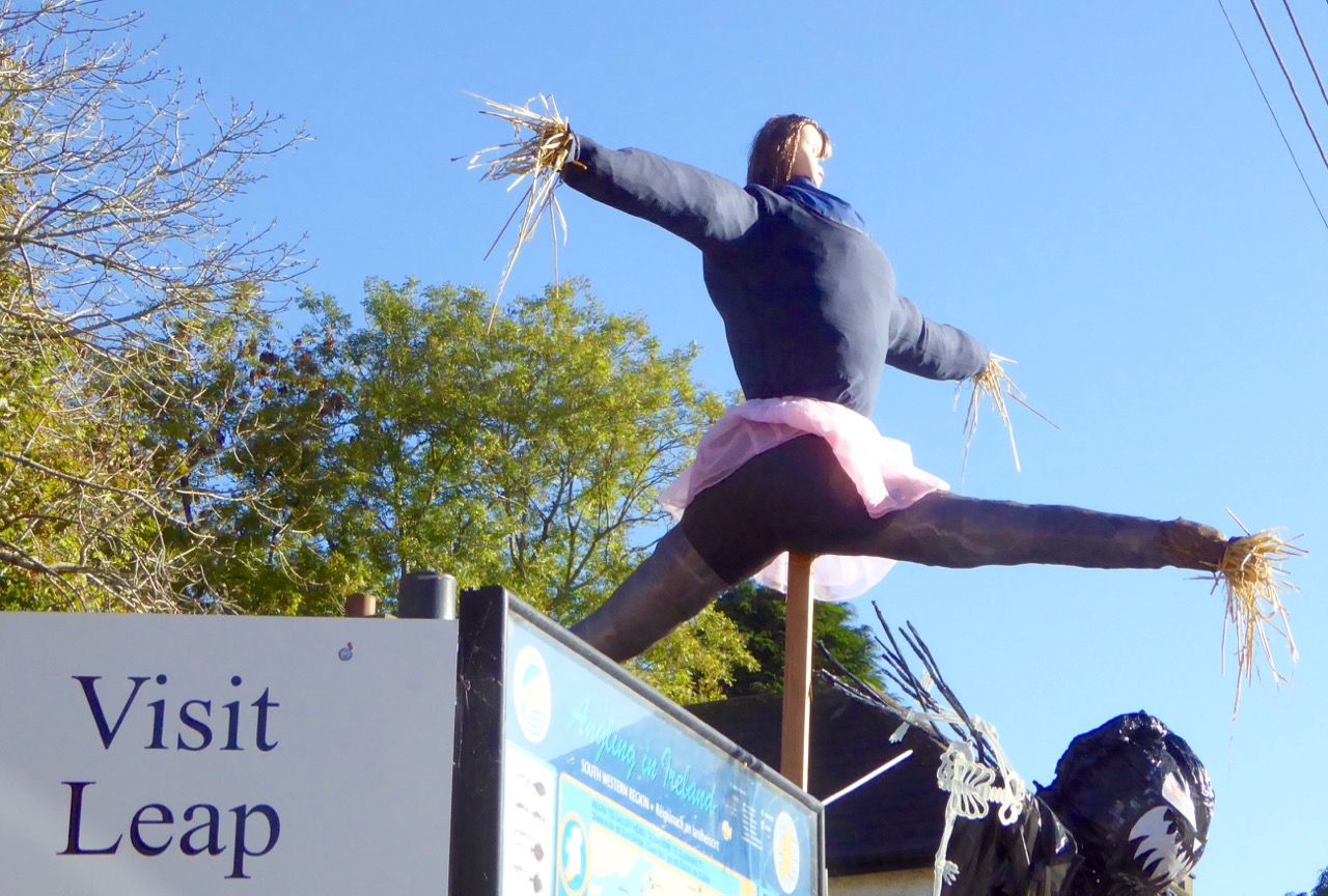
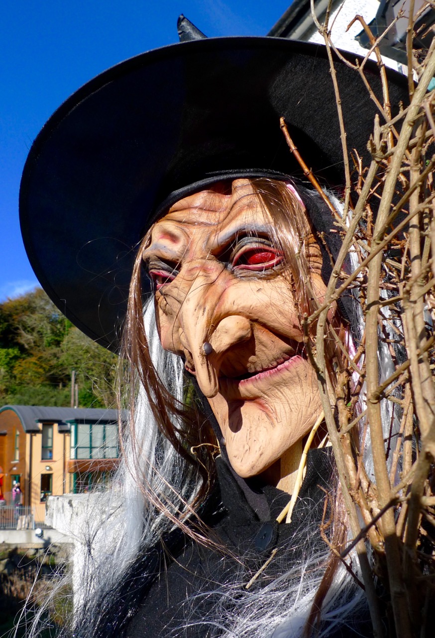
Strange things are happening in the village of Leap… These hitchikers are trying to get out of town!

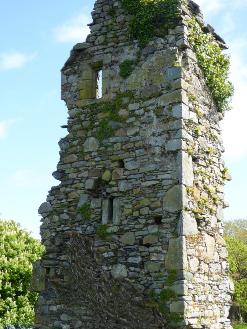
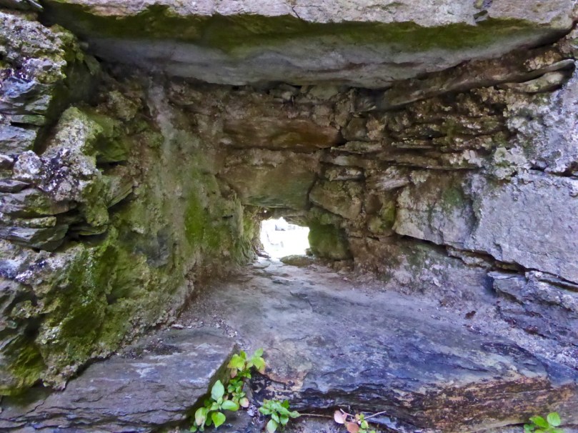
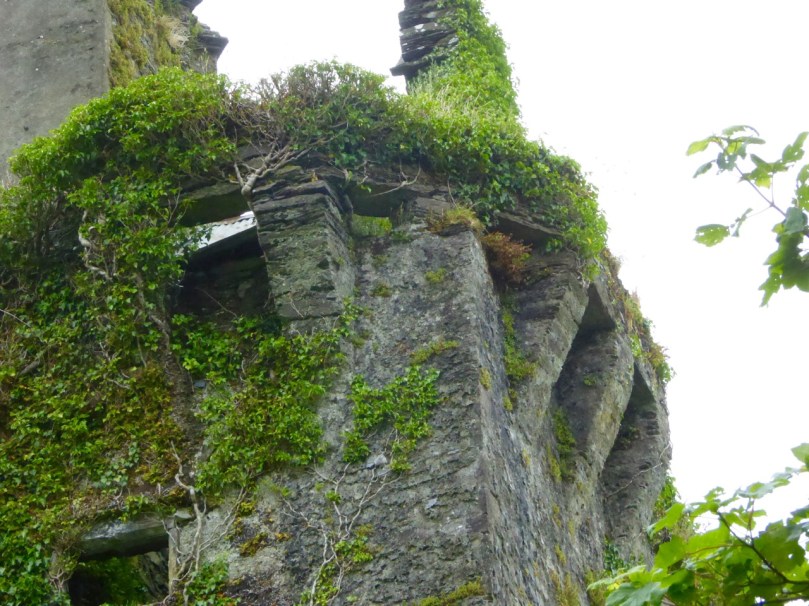
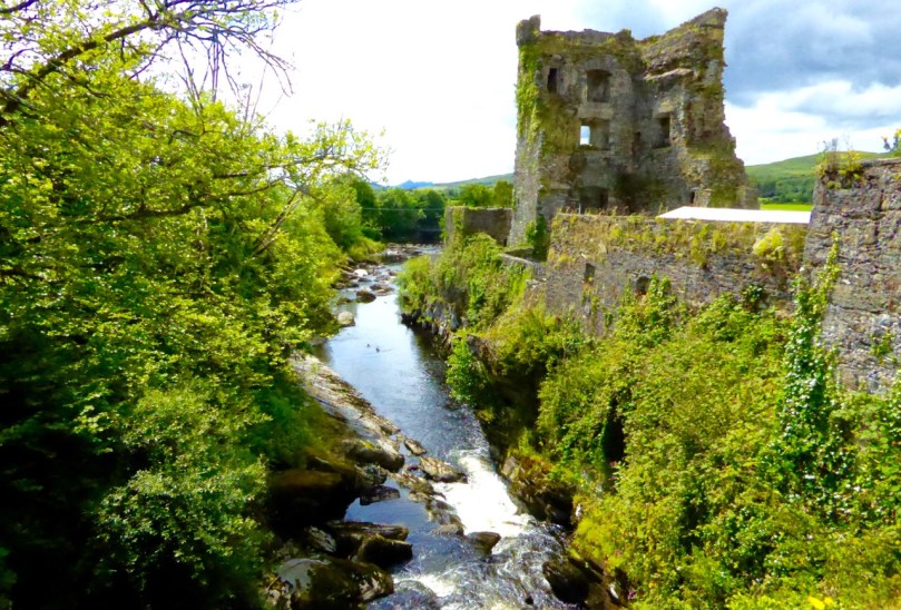
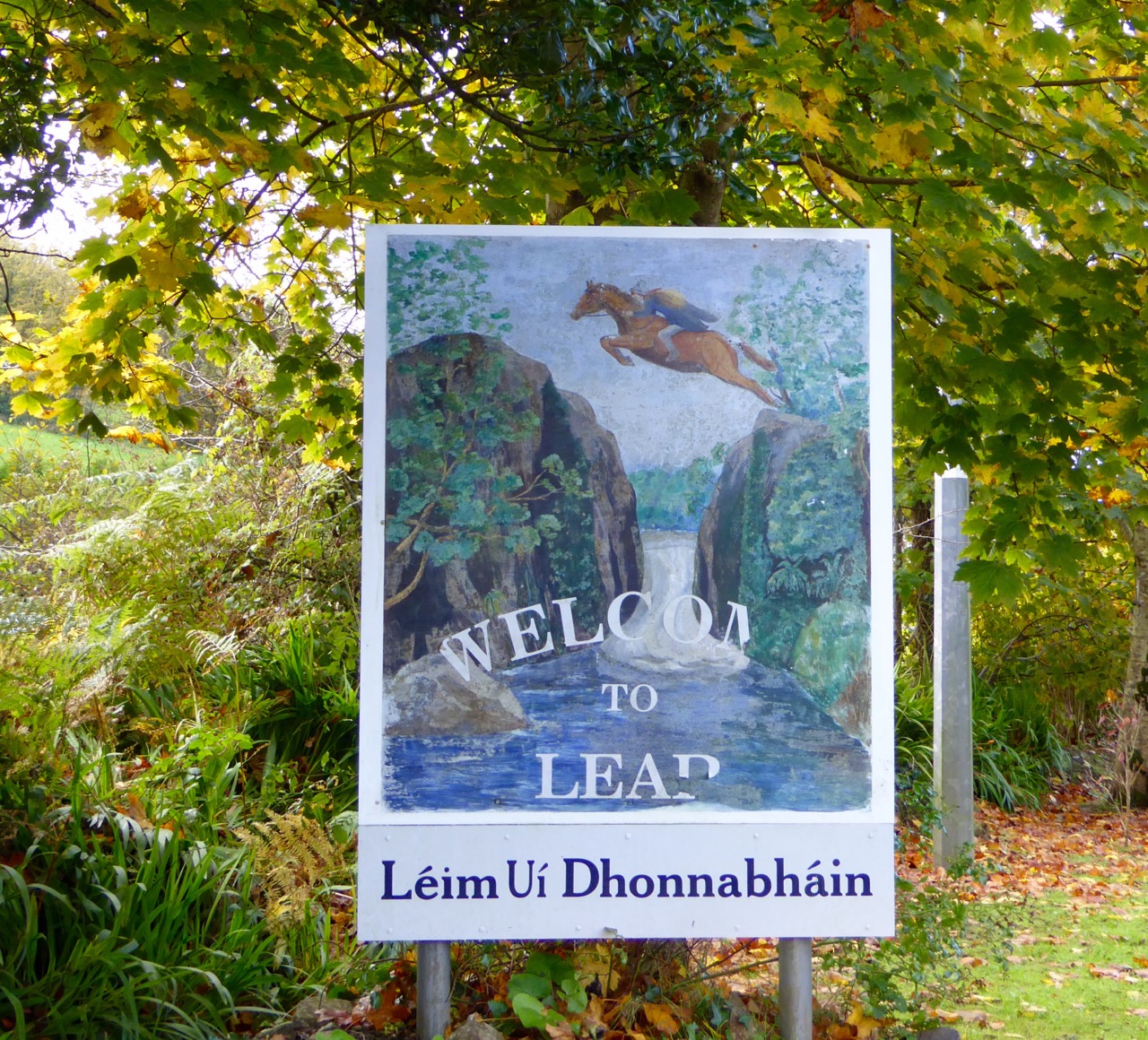
In the west, an O’Donovan (we don’t know which one) was being chased by an English contingent and reached the 12m wide gorge over the Mullaghnagowan River that flows out into Glandore Bay. It was a point of no return, and O’Donovan took the risk and urged his horse on… He (and his horse) made it, and we may assume the pursuers didn’t, as O’Donovan escaped and his feat became a legend, and the village of Leap has made sure that it won’t be forgotten.

Leap sign

O’Donovan leaped into the wild lands of West Carbery and, the story goes, from that day onwards the phrase beyond Leap, beyond the law… entered into the local parlance. We live beyond Leap, so I suppose we are also beyond the law!

Leap street

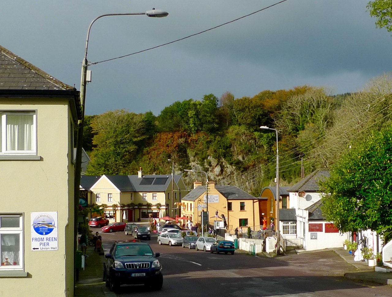
Leap’s busy main street (top); the gorge where the famous ‘leap’ took place (left) and a visitor from the bay holding up the pub sign

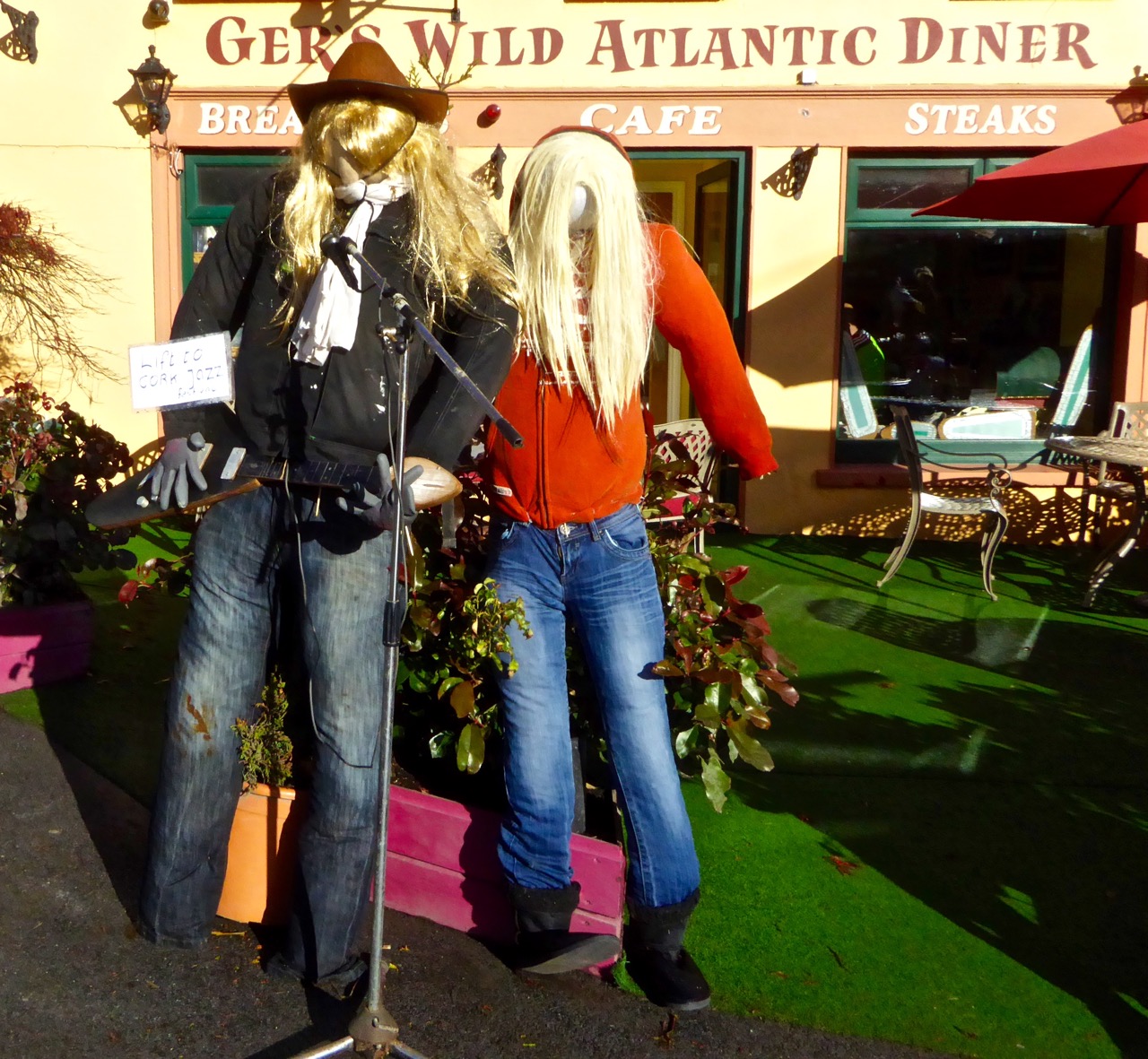
Leap is a good stopping point if you are travelling the Wild Atlantic Way. We called in there on Saturday and filled up with a hearty breakfast in Ger O’Sullivan’s Wild Atlantic Diner. There are a number of other equally good hostelries to cater for all tastes, as well as a large furniture shop (O’Donovan’s), a petrol station, a builders’ merchant and a fascinating ‘collectibles and curios’ store. It’s a lively place and hopefully benefits commercially from the considerable traffic on the main road, although that aspect might also be seen as a downside to those who live within its environs.

poster

Dining out in Leap…

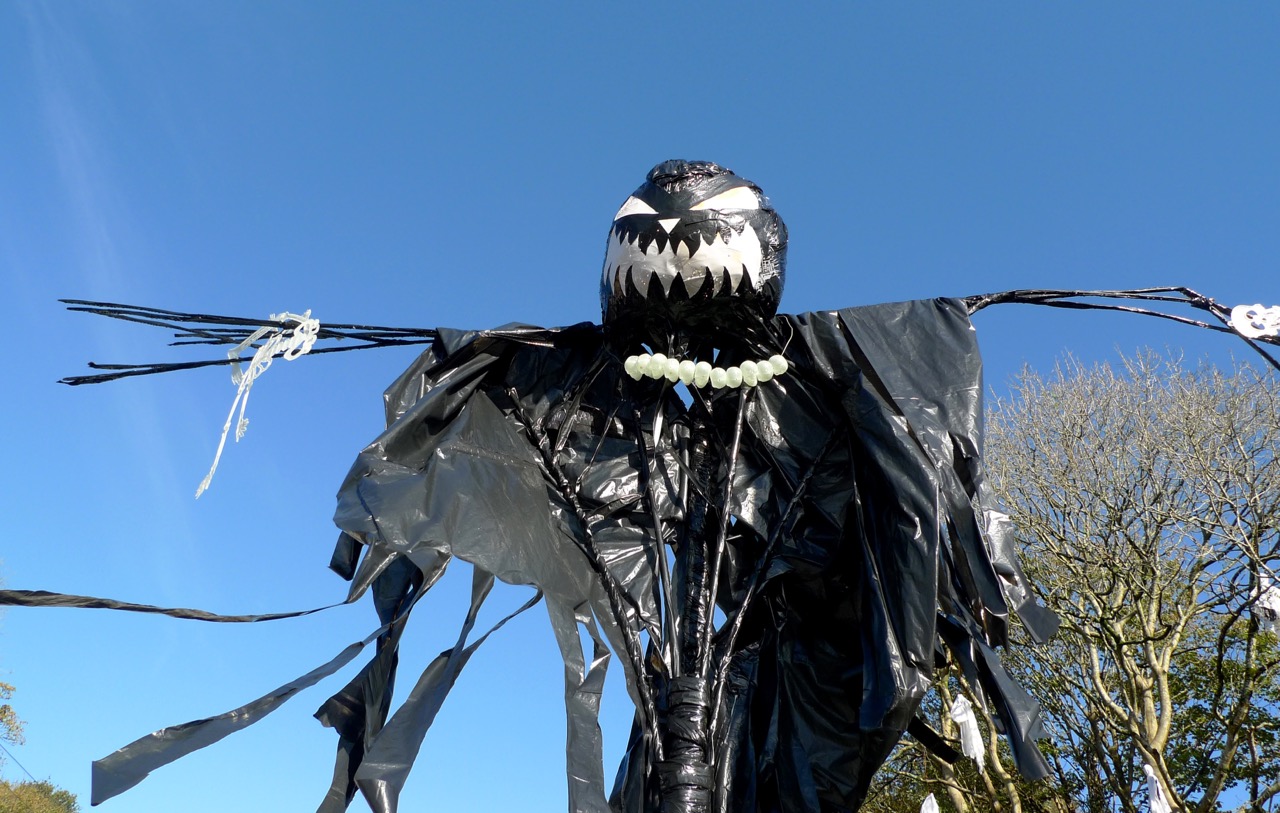
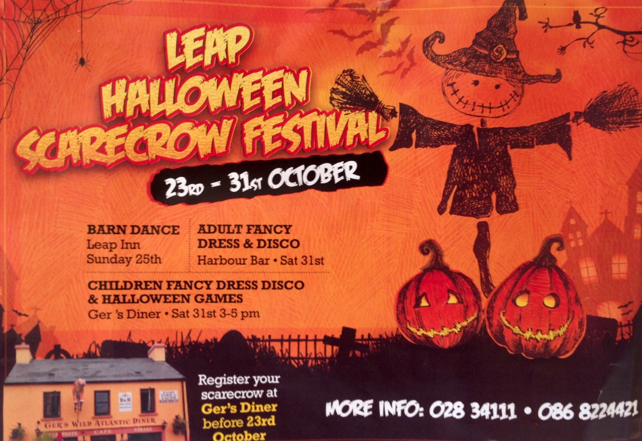
We chose our day in Leap to coincide with a Scarecrow Festival: a competition to see who can produce the wittiest or spookiest scarecrows – bearing in mind it’s Hallowe’en next weekend. The people of the village have completely embraced the idea, with something over 80 imaginative (and hilarious) entries set up in all available locations: along with us there were many families out on Saturday enjoying the entertainment.

As with anywhere in West Cork – and, indeed, in Ireland – there is plenty more history relating to Leap. Dean Swift spent some time in the area in the early 18th century, and I found much information relating to Myross Wood House, a large residence close to the water which was built by the Rev Arthur Herbert in the mid 1700s. In 1826 this house passed to the Townshends, the first of whom was John Sealy Townshend, a Trinity educated lawyer and Master of Chancery. I was intrigued to find that John had suffered from consumption as a child and had been cured by an aunt who dosed him with slugs taken in sugar and honey…

The Myross Wood Estate remained with the Townshends until 1946, when there was no male heir. It was bought by the Missionaries of the Sacred Heart and has been used as a retreat and study centre for priests. The community is still at Myross.

Big cat small cat

bride and groom

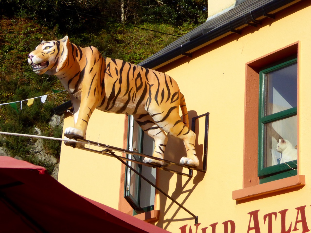
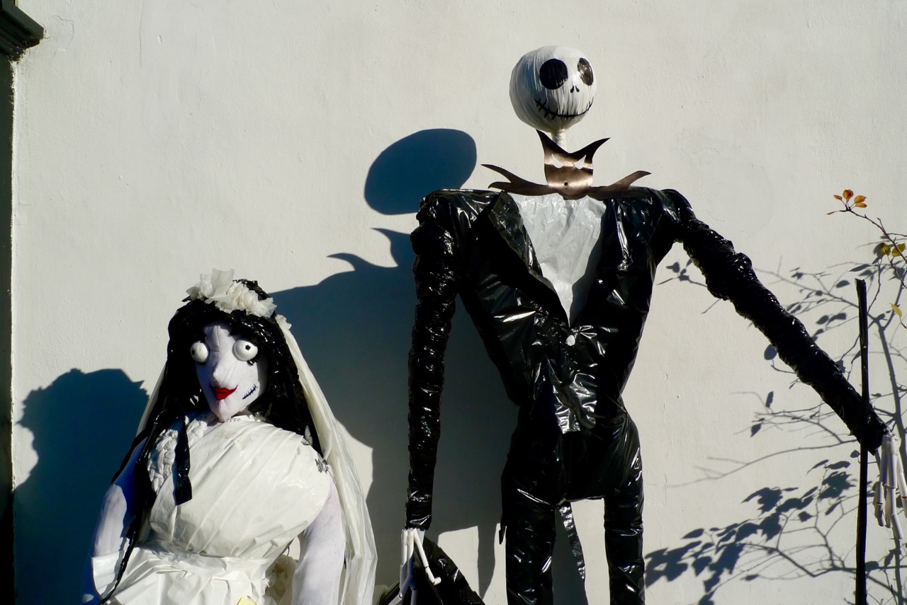
The Tiger is a permanent fixture at Ger’s Wild Atlantic Diner (top) – the white Cat may not be… Worth considering getting married in the village (above)?

Ger O’Sullivan has created a dizzying viewing platform over the gorge where the O’Donovan leaped into legend. Keep an eye – perhaps at Hallowe’en his ghost will make an appearance!

witch

Mount Corrin Walk

View from the cairn, Mount Corrin

View from the cairn, Mount Corrin

Walks that get you up to high places with panoramic views are terrific – especially when you don’t have to start at sea level! One such West Cork walk is Mount Corrin. Despite being on The Mizen, it’s part of the Sheep’s Head Walks system, which means it’s accessible and perfectly waymarked.

P1150782

The whole Mount Corrin loop walk is a 17km marathon and definitely not for the faint-hearted. But faint-hearted is exactly what we are, so we have chosen an option that can be easily accomplished on a pleasant afternoon – about a 5 km round trip. Some of these photographs are from a spring walk, and some from a fine autumn day.

From the trail - the Sheep's Head

From the trail – looking across at the Sheep’s Head

Wear good boots and bring a camera but leave the dog at home as no dogs are allowed on the Sheep’s Head Way. And if you do want to do the Big Walk, we highly recommend you pick up a copy of Walking the Sheep’s Head Way by Amanda Clarke. She and Peter have brought out a Second Edition that includes all the loop walks and they do a fabulous job of describing the whole route and provide wonderful photographs of what you can expect.

This curious little monument is right beside the parking spot

This curious little monument is right beside the parking spot

Our starting point is at a high point about half way between Durrus and Ballydehob. Drive out of Ballydehob via the road between Antonio’s Restaurant and Vincent Coghlan’s pub – that’s the Rathruane Road. About 3 km along this road you will come to a crossroads – turn right. Take the first turn left on that road and it will bring you up to the top of a hill. Once you cross over the top and start the descent on the other side you will see the waters of Dunmanus Bay ahead and to the left and a pull-out for parking on the right.

One of West Cork's most scenic parking spots

One of West Cork’s most scenic parking spots

This is your starting point – look back and you will see the way marked trail about 50ms back up the hill, running alongside a forestry plantation. It’s also your ending point: our walk will take you up to the summit and back.

P1150787

If you’re approaching from Durrus, take the R591 out of the village. Take the first turn left then the first right and follow the road to the summit. These are small country roads – be prepared to pull over or even reverse when you encounter other traffic.

Example of 'other traffic'

Example of ‘other traffic’

Once you set out, the first point of interest is what is described in the National Monuments inventory as a ‘megalithic structure’ and which looks likely to be a wedge tomb, although it is hard to be definitive about it. Whatever it is, it’s man made and intriguing.

A wedge tomb?

A wedge tomb?

You can see the cairn ahead – your destination.

P1040223

Before you get to it there is a row of standing stones. These ones are not marked on the NM inventory but it’s difficult to see what they could be other than a stone alignment. A final push now gets you to the cairn and to those panoramic views we mentioned.

P1040203

The first thing you’ll notice about the cairns (there are two of them) is the size of the large one and the scatter of stones all around them. The consensus seems to be that there has been a cairn on Mount Corrin since ancient times and that the current cairn, a more modern construction, sits on top of an older one.

The cairn on Mount Corrin is visible from this panel of rock art at Rathruane

The cairn on Mount Corrin is visible from this panel of rock art at Rathruane

We have certainly noted that the top of Mount Corrin, like the top of Mount Gabriel, is visible from several prehistoric sites and a cairn would have enhanced that visibility. The most persistent story about the cairn, though, links it to Lord Bandon.

P1040210

The Bernards, Earls of Bandon, are associated with Durrus, having laid out the town in the eighteenth century and having used Durrus Court as a summer residence. They had many interests in the area, including mining, and the always-interesting Durrus History blog gives us this information about Mount Corrin:

Mary Catherine Henrietta Bernard of Castle Bernard daughter of Lord Bandon married Colonel Aldworth on the 30th July 1863 and an address and copy of ‘God’s Holy Word’ was sent by Rev Freke and the tenantry of Durrus to which she returned thanks.  At Dreenlomane Mine (operating until c1920) owned by Lord Bandon, Captain Thomas set tar barrels alight on Mount Corrin which illuminated the sky all night and the 150 miners and their wives were treated to refreshments and similar celebrations were held in Carrigbui.

P1040197

The views from the cairn are stupendous, taking in the West Cork Peninsulas and the hinterland across to the Kerry mountains. Take a while to wander around the top – see if you can spot the collapsed walls of ancient hut sites.

P1040217

Making your way back, look down towards the farms on the northern slope of the mountain. You can still make out the unmistakeable signs of lazy beds, used to grow potatoes, and the ruins of houses abandoned long ago. It’s a poignant reminder that this land was once densely populated by people whose sole nutrition came from potatoes and who fled this area in the aftermath of the Great Famine.

P1040194 - Version 2

There now – that wasn’t gruelling at all, was it? And so rewarding. But still, a bit of effort required so you definitely deserve a coffee and cake at Budd’s, or a pint in Rosie’s. Tell them Roaringwater Journal sent you.

P1040200

Tower House Tutorial, Part 1

Ross Castle, Killarney

Ross Castle, Killarney

Can you distinguish between a crenellation and a machicolation? How about a bartizan and a barbican? By the end of this tutorial on the architecture of tower houses you will amaze your friends at dinner parties by casually dropping such terms into the conversation. (Of course you might also be labelled as a hopeless nerd.)

Rincolisky or White Hall Castle in West Cork - a good example of a basic tower house

Rincolisky or White Hall Castle in West Cork – a good example of a basic tower house

Start by reading, or re-reading, When is a Castle..? It goes over the basics of how the tower houses of West Cork were constructed and lived in. Essentially tall, square stone dwellings, they were built more for defence than comfort. Let’s look more closely at how exactly Medieval architecture coped with making such massive structures stable and workable. We’ll start with the outward appearance – walls, windows, roof and bawn. (In Part 2 we’ll go inside.)

Like many West Cork Castles, Castle Donovan is built on a rock outcrop

Like many West Cork Castles, Castle Donovan is built on a rocky outcrop

In West Cork, there’s a noticeable preference for building tower houses on rock outcrops. Since these are massive, heavy structures, building on rock is a good idea. The downside of that has been well expressed by Peter Somerville-Large in The Coast of West Cork: “Contrary to what may be written in Holy Scripture, buildings on rock have little in the way of foundation, and when they fall down or are swept away there is nothing left of them except a memory.” Somerville-Large reminds us that there were once castles at Ballydevlin, Castlemehigan and Crookhaven of which no trace now remains.

Ballinacarriga Castle. Note the splayed base batter and the unusual second floor bartizans

Ballinacarriga Castle. Note the splayed base batter and the unusual second floor bartizans

To support the tall walls, the lowest level was the thickest, splayed outwards in what is termed a base batterThe walls were constructed of stone and mortar. The mortar was lime-based – it wasn’t totally impermeable so these tower houses were damp places. Generally speaking, the cut stones were reserved for the outer and inner facings of the walls in fine castles, and in more basic ones they were reserved for quoins – the stones that were used in the angles or corners.  

A vestige of a tower house at Abbeymahon, near Courtmacsherry, shows the best cut stones reserved for the quoins

A vestige of a tower house at Abbeymahon, near Courtmacsherry, shows the best cut stones reserved for the quoins

Where walls have collapsed it is often obvious that the interior of the wall could be filled with rubble, with the best stones with the flattest faces, or the cut stones, being reserved for the outside. Cut stones were, of course, prized and many have disappeared over the intervening years, adding to the potential instability of some tower houses.

At Carriganass Castle most of the quoins have disappeared

At Carriganass Castle most of the quoins have disappeared

The walls were rendered with plaster on the outside. They could be whitewashed, which made them visible from afar. One of our local castles is known as White Castle, another as White Hall – perhaps these were originally whitewashed. The plaster could also be tinted to produce various colours – Kilcoe Castle is a good example of a tinted render based on research into this practice.

Glashare Castle in Kilkenny still shows the rendering on the outside. Note the unusual corner arrow loop

Glashare Castle in Kilkenny still shows the rendering on the outside. Note the unusual corner and cross-shaped arrow loops

The walls were pierced at various points with opes – a technical term that simply means an opening of any kind. Opes came in three varieties: doors, windows and loops. We talked about doors (raised entrances) and windows (smallest at the lowest levels, largest at the top) in When is a Castle..? Loops, arrow loops or musket loops, were always small from the outside, presenting a tiny target to attackers and preventing anyone from squeezing through (think about the origin of the word ‘loophole’). Muskets had totally replaced longbows and crossbows by the end of the 16th century so any castle built after that time had gun loops, and some even had larger cannon loops.

Carriganass Castle has many loops - the tiny one in this pictures seems to small to be useful

Carriganass Castle has many loops – the tiny one in this pictures seems too small to be useful

Inside, the loops were deeply splayed to allow the head and shoulders of the archer/shooter into the space, or embrasure. Loops could appear in the walls of the castle, or of the bawn.

A deeply splayed gun embrasure at Carriganass

A deeply splayed gun embrasure at Carriganass

At the top of the tower was the roof and the battlements. The roof was made of various materials – slate, wood or even thatch. Between the roof and the outside wall was a wall walk, protected by a parapet.

Dún an Óir, or the Fort of Gold, on Cape Clear Island. The wall walk can be clearly seen

Dún an Óir, or the Fort of Gold, on Cape Clear Island. The wall walk can be clearly seen*

In Ireland, this parapet most often took the form of what became known as Irish Crenellations. These were stepped or ‘toothed’ battlements, with tall parts (merlons) behind which defenders could take cover and shorter parts (crenels) for shooting from.

A good example of Irish crenellations from Kells Priory in Kilkenny

A good example of Irish crenellations from Kells Priory in Kilkenny

Another defensive feature was a platform that projected away from the walls, called a machicolation.  Defenders used the opening between the wall of the machicolation and the castle wall to hurl things down on attackers. Machicolations are often located above doorways, but also at corners which afford a view of two sides. When they are on corners they are called bartizans.

Corner machicolation, or bartizan, at Tocher Castle, north of Dunmanway

Corner machicolation, or bartizan, at Togher Castle, north of Dunmanway

The machicolation was supported by corbels which could be simple triangles or carved stone elements.

Shrule Castle in Mayo has decorative corbels. Note also the rounded corners of the castle which did away with the need for quoins

Shrule Castle in Mayo has decorative carved corbels. Note also the rounded corners of the castle which did away with the need for quoins

The bawn is the courtyard immediately surrounding the tower. Bawns could be restricted in size – little more than the immediate courtyard of the castle – or extensive. They are sometimes known as wards. The bawn wall was often fortified with loops and a wall walk.

The bawn wall of Carriganass Castle at Kealkill hovers picturesquely over the river

The bawn wall of Carriganass Castle at Kealkill hovers picturesquely over the river

Bawn walls are often called curtain walls, but this term is also appropriate when the wall does not actually enclose a bawn, as at Dunlough Castle at Three Castle Head. Because the towers are situated between the lake and an impregnable cliff the curtain wall provides a barrier behind which defenders can shelter.

Dunlough, or Three Castles. The curtain wall presented a formidable barrier to attackers

Dunlough, or Three Castles: the curtain wall presented a formidable barrier to attackers

In the next tutorial we will cover the inside of the tower house. Meanwhile, here’s a pop quiz. Take a look at this photo of Ross Castle and see how many features you can identify. 

Ross Castle, in Killarney, is also built on an outcropping rock base

So – how did you do?

*Thanks to Lisa Scarff for the Dún an Óir photograph.

Up the Airy Mountain…

Shadow and light

…down the rushy glen – we daren’t go a-hunting for fear of little men! We were hunting mountains last week when we travelled up the west coast of Ireland with a visiting friend – finding some of the best scenery this country has to offer.

Connemara 2

If you look down on the island from above (as in this view from NASA, below) the lie of the land is very clear: the high points are all around the perimeters, yellow and brown in colour, with lower green plains in the centre.

nasa imageIf you lived in a country like Canada, then Ireland’s mountains should seem like mere gentle slopes. Our highest peak is not too far from us, up in Kerry, Carrauntoohil (Irish: Corrán Tuathail – this could mean Tuathal’s sickle or fang, Tuathal having been a common Irish name in medieval times) and this is only 1038 metres to the summit. However, the overriding characteristic of Irish mountains is that they often sweep steeply down to the sea or to a lough and are therefore visually spectacular in their settings.

We live in the far south-west: our mountains form the backbone of each of the peninsulas: The Mizen, Sheep’s Head, Beara, Iveragh and Dingle, largely Old Red Sandstone with some Carboniferous Limestone north of Killarney. Our travels took us up to Clare – very distinctive exposed limestone ‘pavements’ and mountain tops – and then to the complexities of granite, schists and gneisses found in the district of Connemara.

Connemara 3

Connemara fence

The four pictures above show the elements of the landscape in Connemara, Co Galway: quiet boreens, reflective water and dramatic mountains

The Irish landscape -and, particularly, her mountains – has long been the inspiration for artists and poets. The work of Paul Henry (1877 – 1958) is sparse and flat, yet expertly captures the character of the high lands of the west. It has been used over and over again in tourist advertising campaigns.

Paul Henry’s work was part of popular culture during his lifetime (above): now his art is very collectible and can be found in international galleries (below)

Killary Harbour

Killary Harbour, Connemara (above) and in Paul Henry’s landscape (above left) is said to be Ireland’s only true fjord (a flooded valley cut by glacial erosion which outlets to the sea): in the foreground are mussel ropes

irish mountain postcard

We stayed in the Lough Inagh Lodge – a comfortable hotel with great character and superb views to the mountains. There I was pleased to discover two original oil paintings by Leon O’Kennedy (1900 – 1979), a little known artist  who travelled mainly in the west of Ireland and, evidently, sold his work by knocking on doors. The hotel’s paintings might have arrived in this way as they depict local views: the prism shaped peat stacks are still very much in evidence in Connemara.

O Kennedy 1

O Kennedy 2

Connemara (which derives from Conmhaicne Mara meaning: descendants of Con Mhac, of the sea) is partly in County Galway and partly in County Mayo, in the province of Connacht. We were there only two days and barely did it justice. We intend to return and get to know it more intimately. In terms of our tour of Ireland’s mountainous districts it was the icing on the cake, but that in no way lessens the particular beauty of the other places we encountered – the strangely haunting limestone heights of Clare and the perennial grandeur of Killarney: all are experiences not to be missed.

rainbow over burren

Killarney

Limestone landscape in the Burren, Clare (top) and the lakes of Killarney, Kerry (above)

Fairy Tree

…By the craggy hillside,

Through the mosses bare,

They have planted thorn-trees,

For pleasure here and there.

Is any man so daring

As dig them up in spite,

He shall find their sharpest thorns

In his bed at night.

Up the airy mountain,

Down the rushy glen,

We daren’t go a-hunting

For fear of little men.

Wee folk, good folk,

Trooping all together;

Green jacket, red cap,

And white owl’s feather!

from The Fairies by William Allingham

William Burges and Saint Fin Barre’s

You may recall my delight in finding so much animal imagery in the Honan Chapel at UCC. In Cork City again this week we discovered another ‘menagerie’ – this time at the Cathedral of Saint Fin Barre. This Gothic Revival building is an architectural and artistic wonder – quite the most significant work that I have seen to date from the palette of English designer William Burges, who lived from 1827 to 1881. In fact it is an early work of his, resulting from an architectural competition which he won in 1863 (receiving a prize of £100). Unusually for an ambitious building such as a cathedral, it was finished in a relatively short time: the first services were held in 1870 – although completion of some of the detailed carving and decoration continued through to the twentieth century.

Everything in the cathedral was designed by William Burges: stained glass windows (74 of them, incorporating twice as many individual scenes); statuary (1,260 pieces of sculpture); brasswork, floor mosaics and wood carvings. Most striking for me is the complete coherence of the building: the genesis of the design work from a single mind – down to the very last constructed item – is visually obvious and I am, of course, professionally jealous that an architect was allowed to completely indulge himself to this level of detail, apparently without the intervention or censorship of clients, building inspectors or planning authorities! The cost of the building project overran its budget some tenfold…

Whole books could (and have been) written about this building and all its intricacies. In this short post I will concentrate mainly on the iconography, especially animal images, because it’s obvious that Burges shares my own enthusiasms for the natural world. There’s much more of this than I can illustrate here, and considerably more to the whole building that’s well worth seeing. I advise you to allow an afternoon – or a day – when you visit, if you want to really get to grips with everything.

A little about the man himself, although biographical information is scant: he was described during his lifetime as “short and fat” and “so near-sighted that he once mistook a Peacock for a man”. Lady Bute, wife of his greatest patron, wrote, “…Dear Burges, ugly Burges, who designed such lovely things – what a duck…” He was undoubtedly an eccentric, attending site meetings on occasion dressed as a medieval jester. Like many of his contemporaries he smoked opium (the overdoing of which is said to have contributed to his early death) and he was a friend of Oscar Wilde, James Whistler and – according to the architectural historian Joseph Mordaunt Crook – “the whole gamut of pre-Raphaelite London”.

Three views of the eccentric William Burges: portrait by Henry van der Weyde (left), dressed as a medieval jester (centre) and a caricature by Frederick Weekes (right)

Dante Gabriel Rossetti wrote a limerick on Burges’s childish nature:

There’s a babyish party called Burges,
Who from childhood hardly emerges.
If you hadn’t been told,
He’s disgracefully old,
You would offer a bull’s-eye to Burges.

It does appear that Burges was quite active in the world of London’s creatives in his day. Elected to the Institute of British Architects in 1860, in 1862 he was appointed to its Council and in 1863 was elected to the Foreign Architectural Book Society, the FABS, which comprised the RIBA elite and was limited to fifteen members. He became a member of the Atheneum Club in 1874, was a member of the Arts Club, the Medieval Society, the Hogarth Club, and was elected to the Royal Academy just before his death.

Paradise Lost

Poor William Burges received very little praise for his work, either in his own lifetime and for a long while afterwards. Gothic Revivalist architecture went out of fashion when the new century approached, and was often derided for its heaviness and over-elaboration. For a while Victorian art was under constant assault, critics writing of “the nineteenth century architectural tragedy”, ridiculing “the uncompromising ugliness” of the era’s buildings and attacking the “sadistic hatred of beauty” of its architects. In my own view they all failed to grasp the romance of the age, expressed so beautifully and particularly in the detailing of many of the buildings, among which the Cathedral of Saint Fin Barre stands supreme.

birdie 4


Rock Art Exhibition – at the Cork Public Museum!

Rock Art from West Cork, Mount Gabriel in the background

Rock Art from West Cork, Mount Gabriel in the background

The Cork Public Museum has invited us to mount a Rock Art Exhibition and YOU are invited. Readers will remember the one we did last year in Ballydehob. Well, this one will be bigger and more comprehensive.

Ken and Robert photographing the Bohonagh Equinox Sunset

Ken and Robert photographing the Bohonagh Equinox Sunset

First of all, this time we have two partners. Ken Williams will be familiar to readers of this Journal – we profiled him in the post Shadows and Stone in Action, and he, and his photographs, figured largely in our famous Derrynablaha Expedition post. Ken is probably the foremost photographer of prehistoric monuments in Ireland, and certainly of prehistoric art. His website, Shadows and Stone is an invaluable resource of both images and information. He was recently profiled in The Irish Times Magazine – a wonderful two page spread.

Ken at work, Derrynablaha

Ken at work, Derrynablaha

Keith Payne has lived, painted and exhibited all over the world, including running his own gallery in France, but now he lives in West Cork.  He spent years travelling with the Rolling Stones creating stage sculptures and backdrops for their shows. 

Keith Payne

Keith has always been inspired by prehistoric art – cave paintings, aboriginal rock paintings, and all forms of petroglyphs. The paintings he has contributed to the exhibition are based on West Cork rock art pieces but the form, and the amazing colours, are all his own. We are thrilled that he is participating.

One of Keith's images inspired by cave Paintings

One of Keith’s images inspired by cave paintings

Besides Ken’s photographs and Keith’s paintings, the exhibition will include many of my rock art drawings and some of Robert’s more recent ones. There will also be ‘real’ rock art on display – an unusual stone from Bluid, near Castletownshend, and of course the Cape Clear Stone, which is on permanent exhibit in the Museum. It’s an example of passage grave art rather than rock art, but the comparisons are fascinating and important. A ten minute walk away, at University College Cork, are two further examples of rock art, one from County Cork and one from County Waterford.

Thi spiece of rock art is on display at University College Cork, a ten minute walk from the Museum

This piece of rock art is on display at University College Cork, a ten minute walk from the Museum

The Grand Opening will be at 2PM on Saturday October 31st. Please come if you can and say hello. But if you can’t make it, the exhibition will run until February 2016, so we hope you can drop by.

Exhibition Poster