Crash-Landing Drama!

This Piper Cherokee plane set out on a flight from Luton in the UK to Cork exactly 50 years ago but didn’t make it! Instead it ended up in the waters of Roaringwater Bay just a few minutes away from where we live today. The pilot and all three passengers survived . . . It’s all part of the boundless jigsaw puzzle which is West Cork’s history. As you know, we love to discover the whole caboodle.
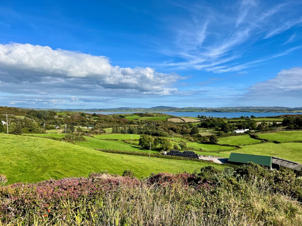
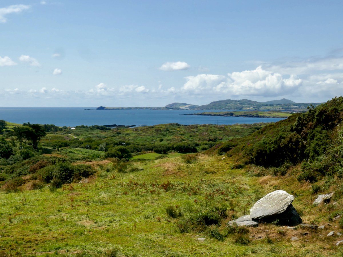
Here’s the view from just beside our house (Nead an Iolair) in the townland of Cappaghglass, looking across to the bay at Foilnamuck: a beautiful sunny day in September. Undulating country . . . Now, picture yourself piloting a small plane, lost, running out of fuel – darkness has come on – and you know you can’t get to any airport. You are going to have to ditch the plane. You can make out below you land and sea – a whole lot of islands. What do you do? You head for a stretch of sheltered water to cushion the inevitable blow.
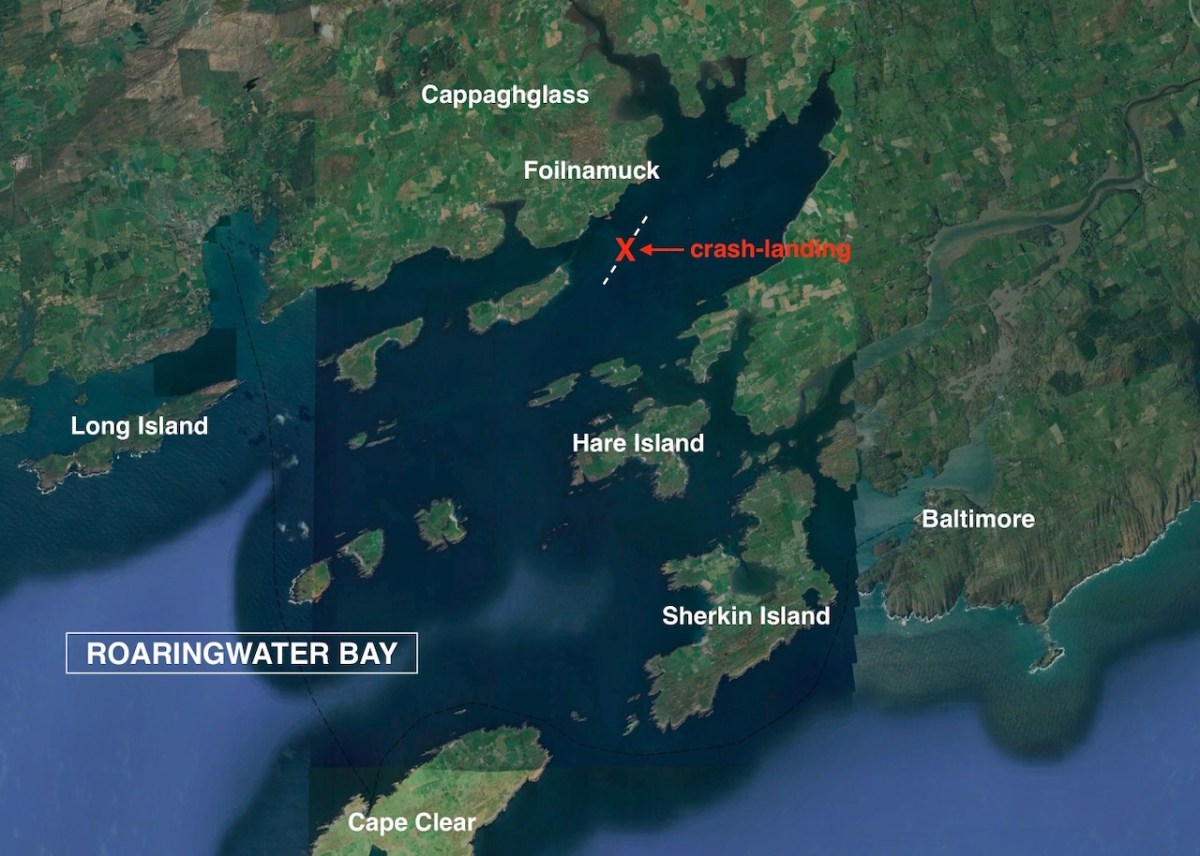
This Google Earth image shows – roughly – the site of the crash-landing that did occur on the night of 22 September 1973. In the coming days it was all over the papers. Thanks to Irish Newspaper Archives for the cuttings I have used.
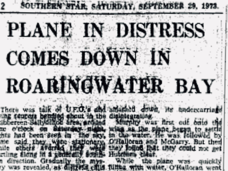
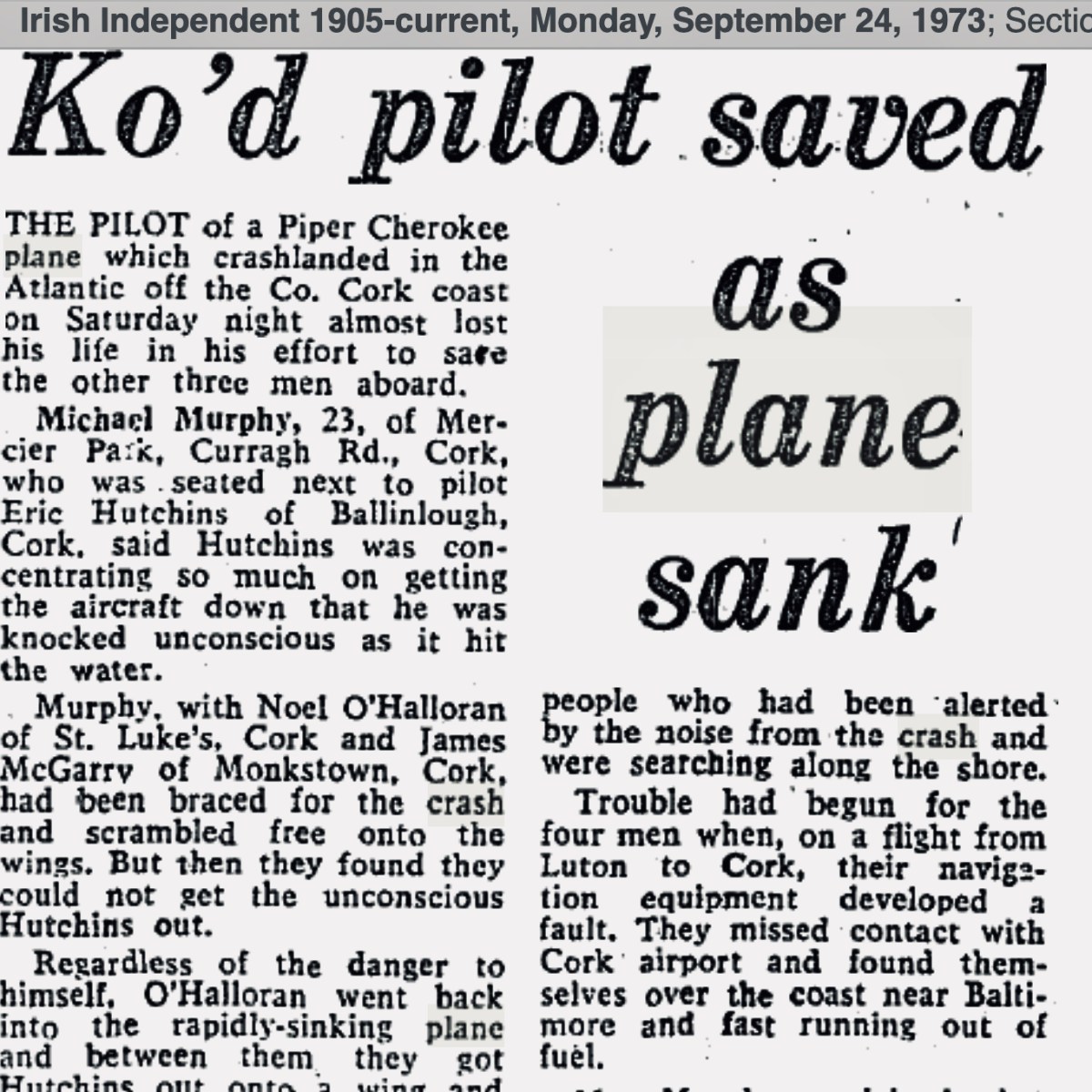
. . . AS an inspector from the aeronautical section of the Department of Transport and Power arrived in Ballydehob to begin an investigation into Saturday night’s plane crash off the Cork coast, it was learned last night that the pilot of the Piper Cherokee almost lost his life in his efforts to save the other three men on board. Michael Murphy (23), of Mercier Park, Curragh Road, Cork, who was sitting next to the pilot, Eric Hutchins of Ballinlough, Cork, said that Mr Hutchins was concentrating so much on getting the plane down that he was knocked unconscious at impact. Mr Murphy, together with Noel O’Halloran, of St Luke’s, Cork, and James McGarry, of Monkstown, Co Cork, had been braced for the crash and scrambled free on to the wing. But then they found that they could not get out Mr Hutchins who was unconscious. Mr O’Halloran then went back into the rapidly sinking plane and between them they pulled Mr Hutchins free and threw him into the water. The three men then swam ashore taking 40 minutes to reach land at Fylemuck, as they had to support the injured man all the way . . .

Irish Press, Monday 24 September 1973
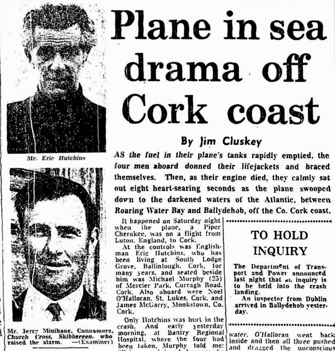
. . . Only Hutchins was hurt in the crash. And early yesterday morning, at Bantry Regional Hospital, where the four had been taken, Murphy told me: “Eric was injured because he was concentrating completely on getting the plane down. It is entirely due to his skill that we are all alive.” But Hutchins came close to paying dearly for his dedication, for he was knocked unconscious by the impact as the plane smashed down, spewing its undercarriage across the waters.

Murphy was first out onto the wing as the plane began to settle in the water. He was followed by O’Halloran and McGarry. But then they found that they could not manoeuvre the slumped Hutchins clear.

Regardless of the fact that the plane was quickly filling with water. O’Halloran went back inside and then all three pushed and dragged the unconscious man out on the wing and threw him in the water, with his lifejacket still not inflating.

With the plane tilting dangerously. O’Halloran dived under the wing and reached Hutchins. He was joined by the other two and, as the plane sank, they struck out for the shore. They reached it at Fylemuck after 40 weary minutes, still supporting the injured man between them . . .

(With Original Cutting, Above) From Irish Examiner, Monday 24 September 1973
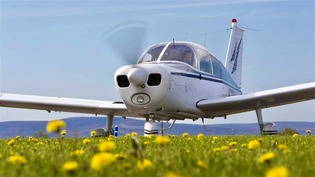
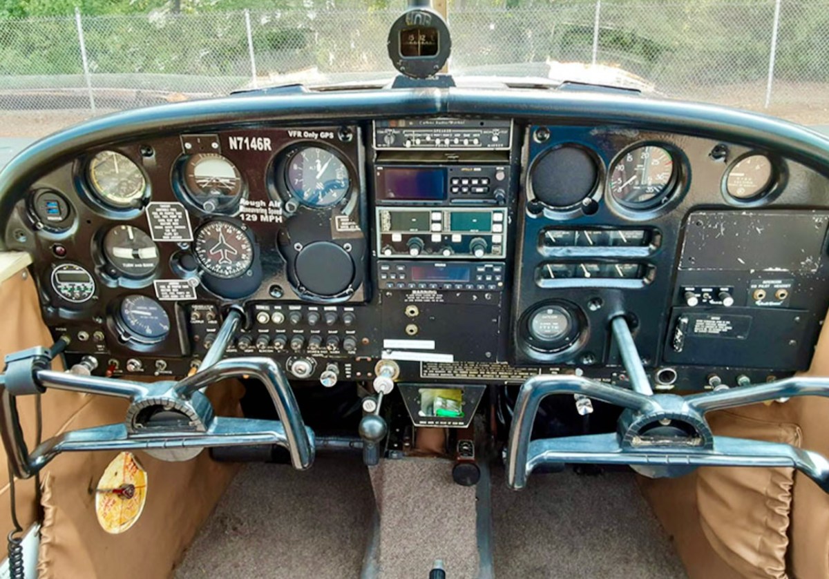
A Piper Cherokee in good times (top) with a view from the pilot’s seat (above – images courtsey AOPA). The plane has been in continuous production since 1961 and has included two, four and six seater versions. It was produced as a light affordable aircraft designed for flight training, air taxi and personal use. The 140 model piloted by Eric Hutchins on that fateful night in 1973 had an aluminium alloy semi-monocoque fuselage construction with a 150 horsepower four-cylinder engine. The standard fuel tank capacity was 136 litres, with an additional reserve of 54 litres. This was enough to cover the flight plan on that crucial day in 1973: the starting point was Luton, Bedfordshire, England, and the destination was Cork Airport, Ireland: a distance of 550km. In good conditions, with a direct flight (although in this case mainly against the prevailing wind) the plane was capable of covering over 900 km with a full tank. Things went awry when the plane’s navigation system failed during the flight. The group realised they were off-track, and they missed the Cork target, continuing westwards.

. . . Trouble had begun for the four men when, on a flight from Luton to Cork, their navigation equipment developed a fault. They missed contact with Cork airport and found themselves over the coast near Baltimore and fast running out of fuel. Mr. Murphy explained that coming down on land was out of the question because it was impossible to see the fields, adding “Eric picked an ideal place with calm water. None of us panicked, but took what precautions we could” . . .

IRISH Independent, September 24 1973
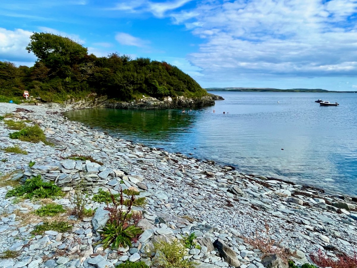
(Above) Calm water at Audley Cove, close to the crash-landing site. The water is exceptionally clear here. The four men were experienced flyers: they all belonged to an aero club and had received training in how to handle an emergency. They were also strong swimmers. They knew the drill regarding crash-landing on to water, and the actual experience would have been strictly routine, except that the pilot – Eric – was knocked unconscious during the impact. While still in the air they were sending out distress messages on the radio. The Piper Cherokee distress call was picked up by an Aer Lingus flight from London to Cork. The Marine Rescue Coordination Centre at Shannon was alerted immediately and a full-scale rescue operation was mounted, with helicopters and boats, including the lifeboat from Baltimore, under coxswain Christy Collins.
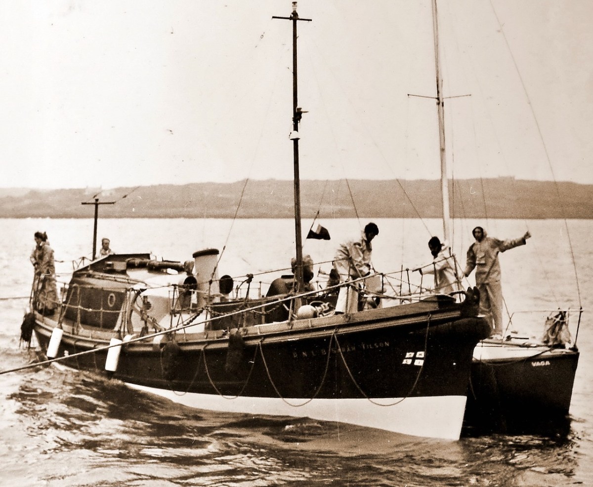
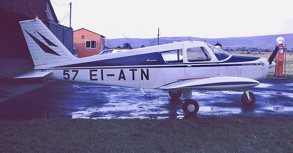
The Baltimore Lifeboat “Sarah Tilson” pictured (above – courtesy Cork Examiner Archives) in August 1973 rescuing the yacht Vaga close to Baltimore Pier. The 46ft 9in Watson class lifeboat was stationed at Baltimore between 1950 and 1978. She was launched on service 70 times and saved 21 lives. In fact her services were not needed on the night of the crash as the four men came to shore safely. The lights from the stricken plane had been seen locally and reported. The Ballydehob Garda – Paddy Curran – arrived in his Zephyr car and with the help of local neighbours was able to assist the men, who were taken to the hospital in Bantry, where Dr Larry O’Connor attended the injured pilot. Noel O’Halloran – who has given me much of this information (and the photo of the plane on the header) – told me that when the distress call was picked up it was initially thought that a large aircraft had come down, and an alert was sent out to all doctors and nurses in West Cork to attend at Schull to help with the envisaged emergency.
Two of the men – Michael Murphy and Noel O’Halloran are alive and well today – and I gather there will be a get-together for them in due course to mark the fiftieth anniversary. No doubt many stories will be shared. The pilot, Eric Hutchins, died a few years ago at the age of 84. He had been a professional flying tutor but, after the accident, retired and became a highly respected driving instructor. Michael and Noel lost touch with James McGarry and have recently discovered that he also died a while ago.
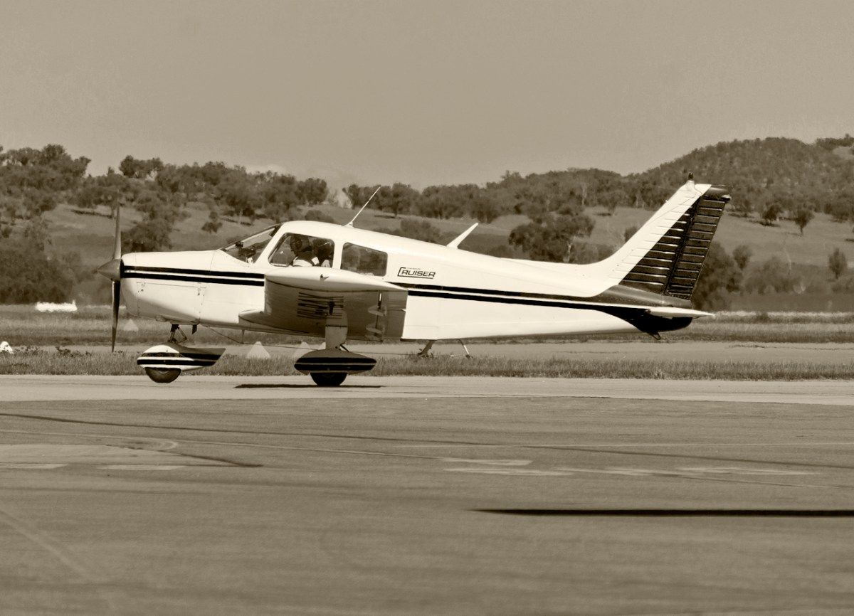
A vintage Cherokee (courtesy of Plane & Pilot Magazine)

What happened to the plane? She came to rest in approximately 7m of clear water, fairly close to the coast. On the Monday following – 24 September – she was dragged ashore. Following this, accounts are reminiscent of olden times when wrecked ships were scavenged: some locals dragged the plane on to the beach and began to dismantle it. The engine – a Rolls Royce – was pulled out using a mechanical excavator: it ended up at the Garda Barracks in Bantry. But it was too late to save the plane or the engine. When a machine has been immersed in salt water it needs to be immediately rescued and meticulously cleaned out if it is to be salvaged: unfortunately, this was not done.

I have no doubt that there are people living locally who remember all this. I was fascinated to learn about it, and that is all due to the worthy efforts of Noel O’Harrollan, who contacted Roaringwater Journal. Many thanks, Noel
Bantry Library

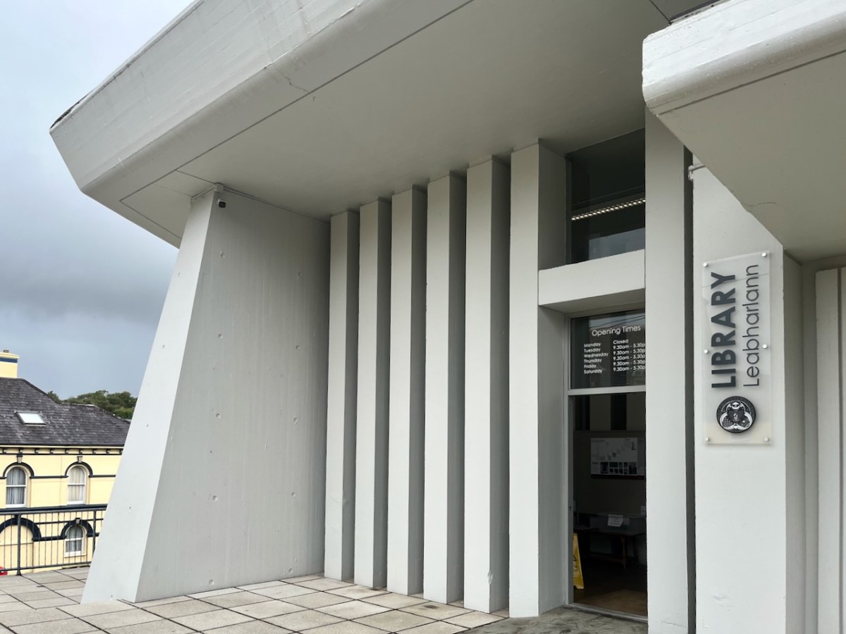
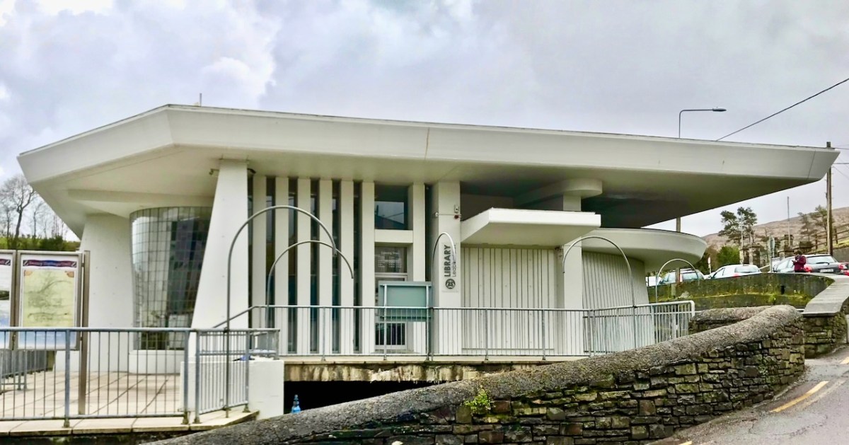
In last week’s post I described a unique type of boat that was connected with Bantry, here in West Cork. Today we are also focussed on Bantry, but this time on architecture: the Public Library, which is one of the most unusual and innovative buildings from twentieth century Ireland.

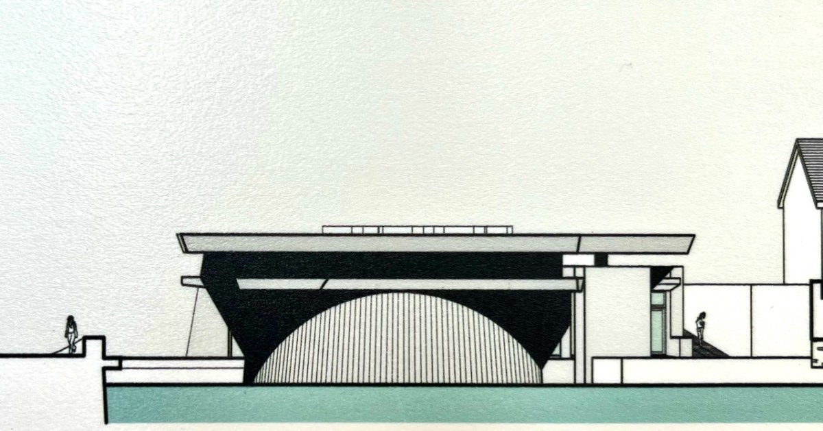
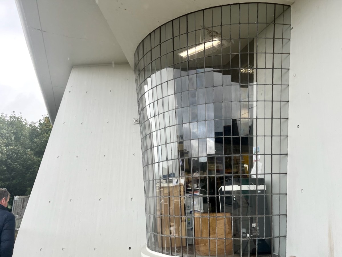
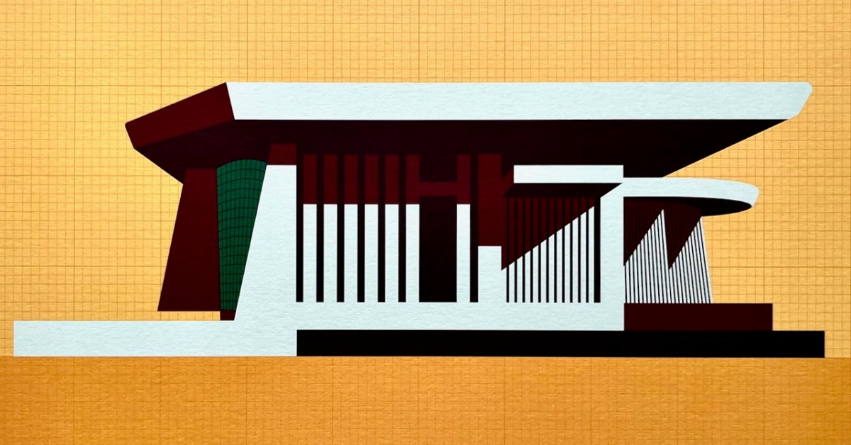
Here is the building as we see it today. The header is a limited edition print, a collaboration between Dermot Harrington of Cook Architects and Robin Foley of Hurrah Hurrah celebrating the upcoming 50th Anniversary of the completion of Bantry Library in 1974. For me, the print captures perfectly the iconic graphic of this most unorthodox design.

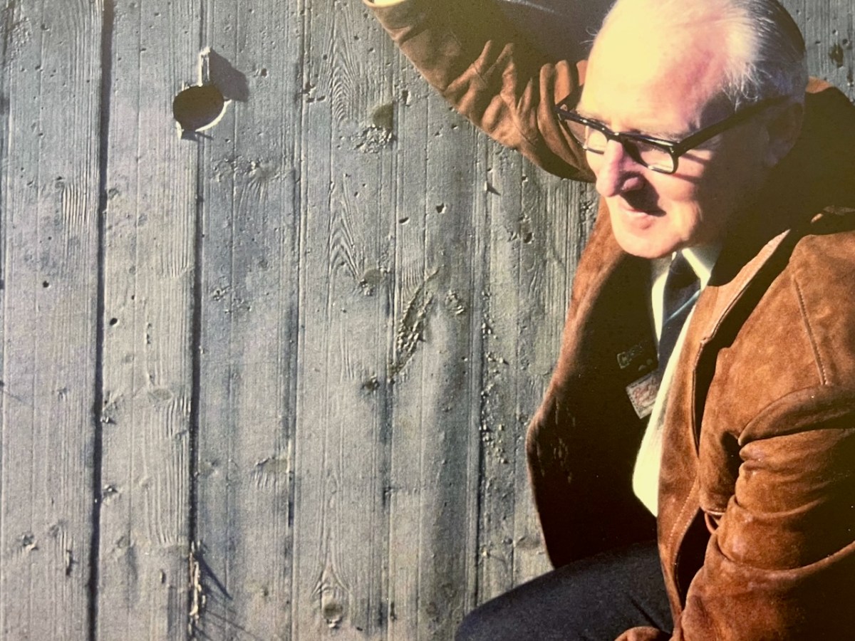
The Library was conceived by Patrick McSweeney (above) – Cork County Architect between 1953 and 1975. He deserves a post of his own one day, as he was responsible for some outstanding buildings in the county. Two of his assistants in the Architect’s Department at the time were Brian Lalor and John Verling. Both had a hand in the genesis of the Library. Interestingly for us, McSweeney, Lalor and Verling were all living around Ballydehob in those days – it was a swinging village!

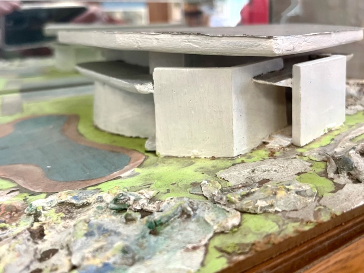
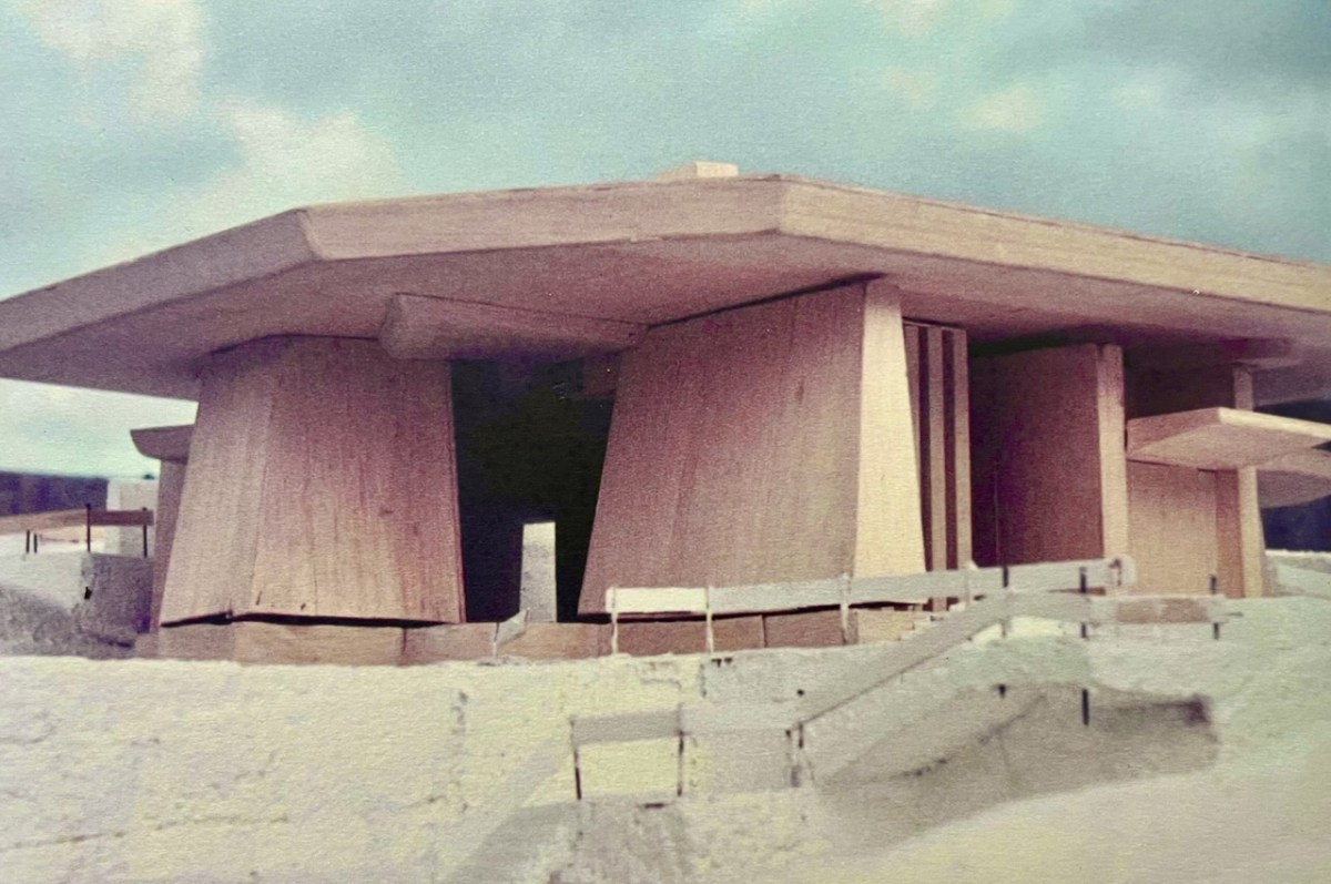
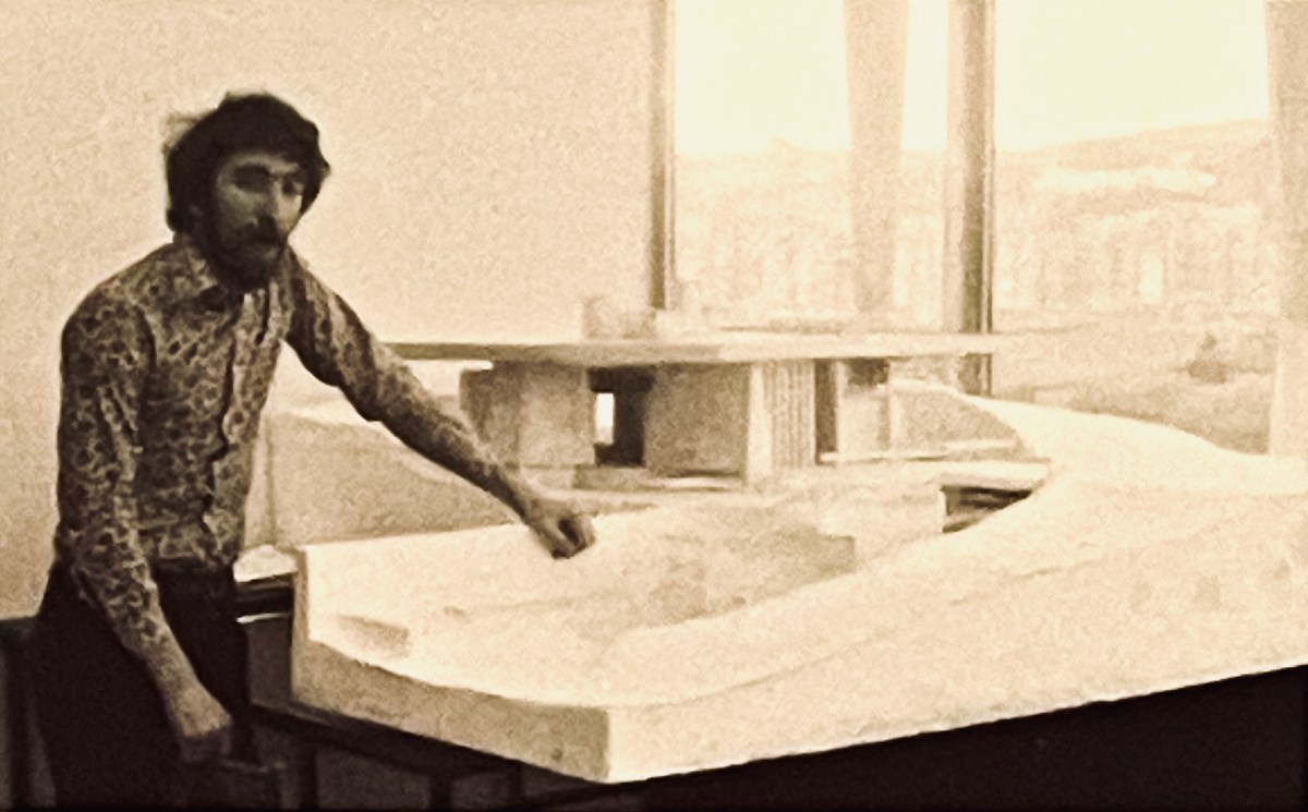
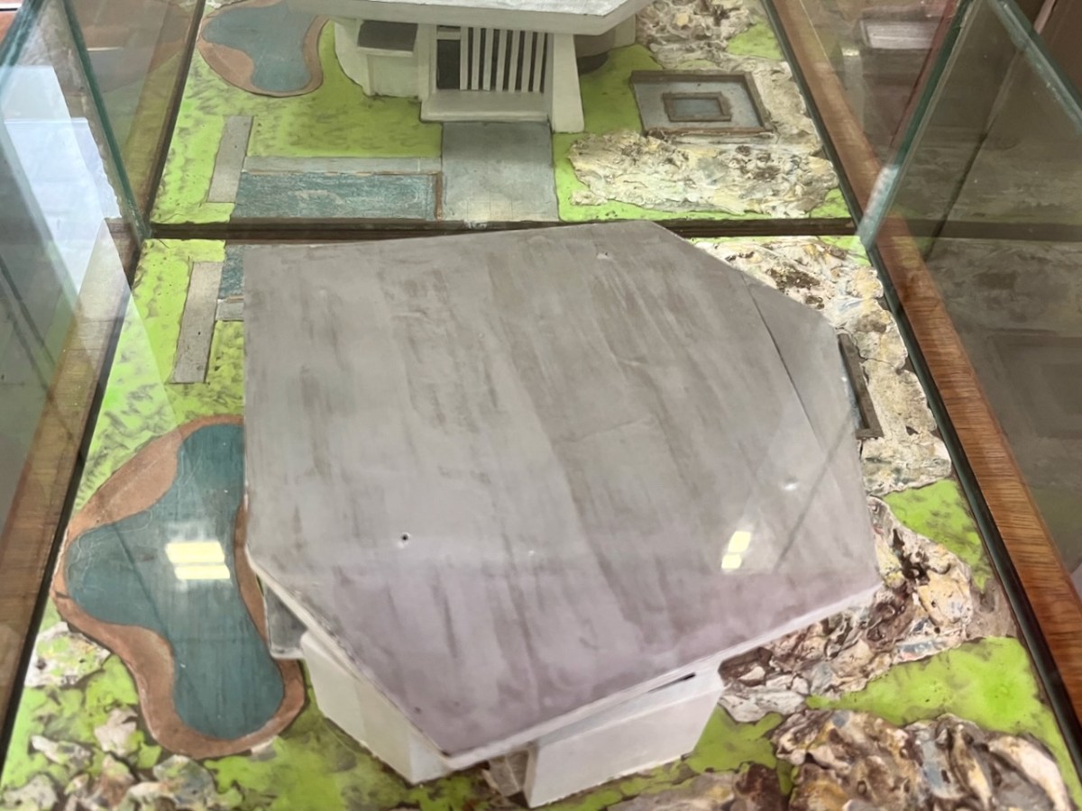
In the era before computers were universal in architects’ offices, everything was drawn by hand – or modelled. Brian recalls that Pat (McSweeney) called him into the office one day, handed him cardboard, tape and scissors, and instructed him to make a model of a building shaped like a Bronze Age dolmen. And he wanted it made in a hurry! It could well have been the one shown above – which still exists. Remarkably, although this model was made in the early 1960s, the building that resulted in the 1970s was very similar in form. Later, John Verling produced a balsa-wood model upon which the design production drawings were based:
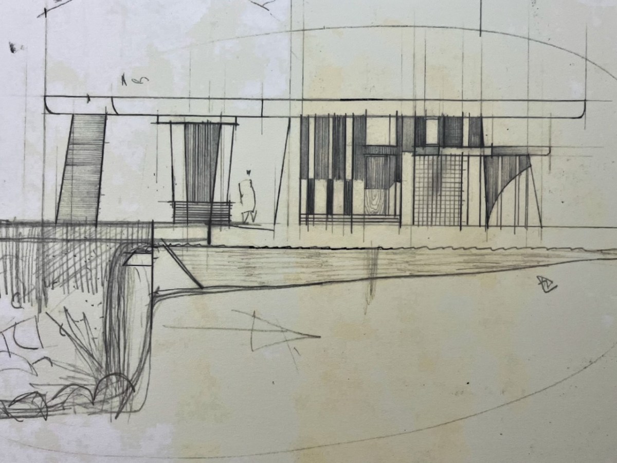
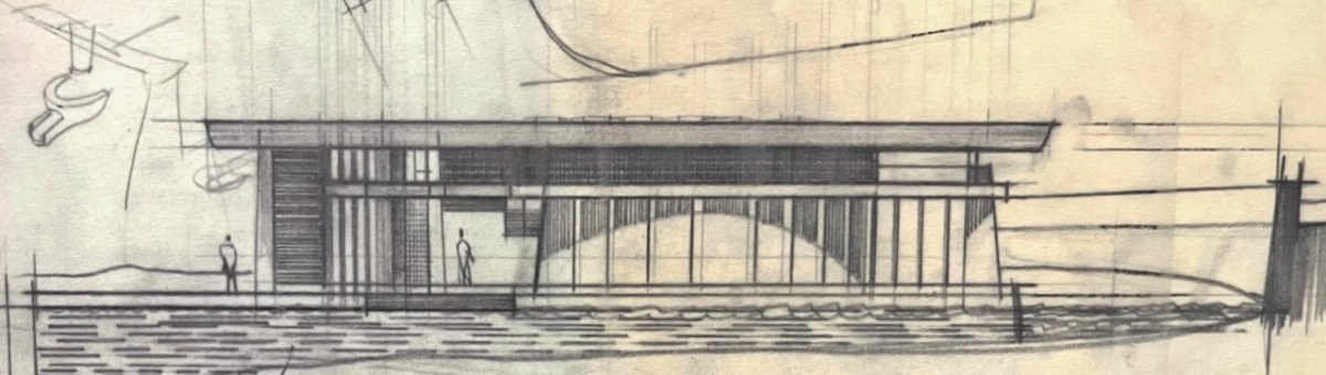
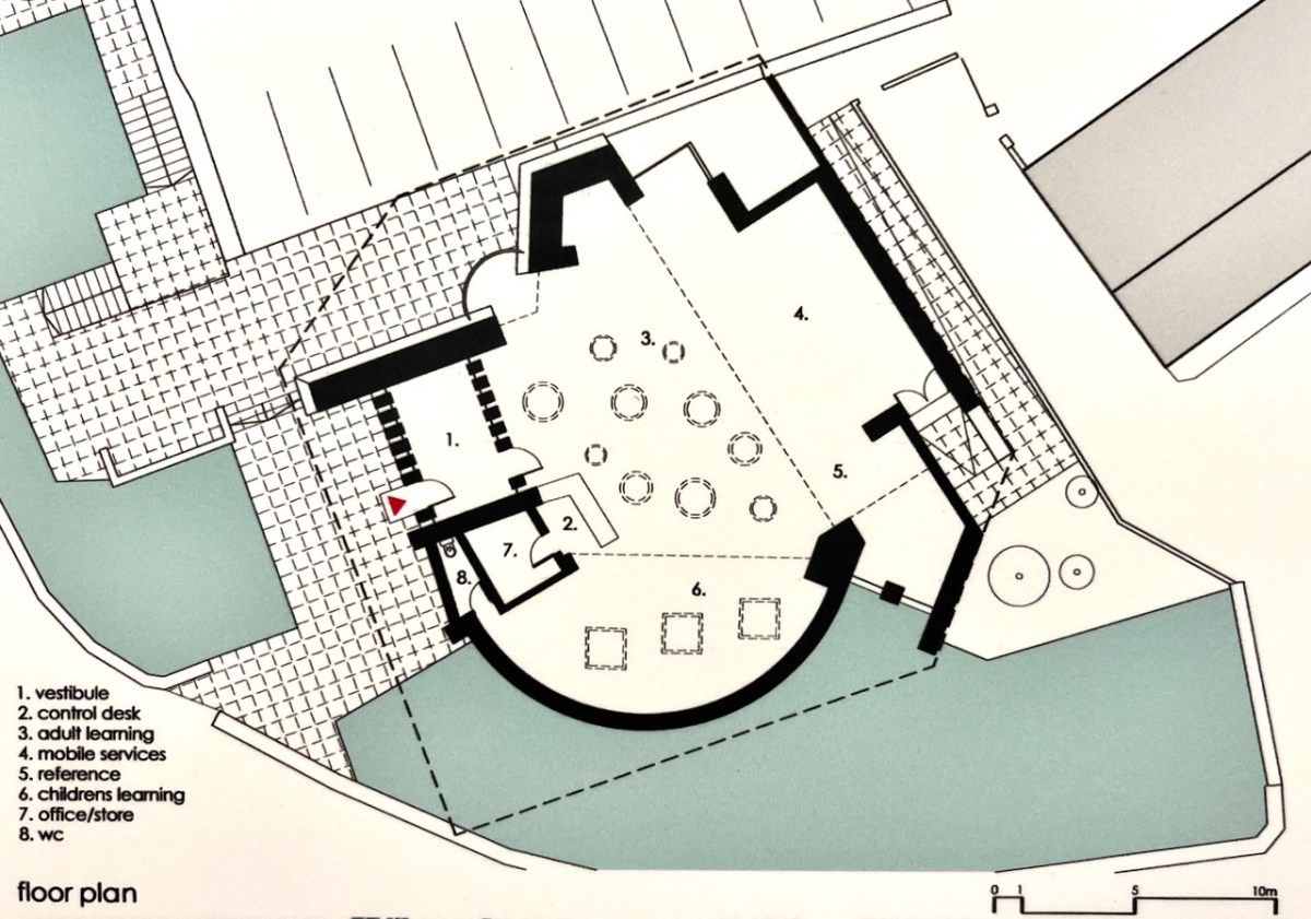
That’s John Verling, above, with his model. He and his wife, Noelle, are the subjects of the current exhibition in the Ballydehob Arts Museum (click the link). Following are some of the design sketches carried out by Harry Wallace who was leading the team in County Hall, and detailed drawings of the building that eventually ensued.

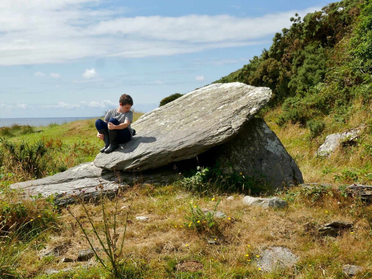
Let’s look a bit further at the early concept work, especially that first model. It’s said that McSweeney was inspired by a ‘Dolmen’. In fact we would today call that type of early megalithic structure a ‘Wedge Tomb’ or a ‘Portal Tomb’. At its simplest, this is a large flat stone slab (or slabs) supported on vertical stone slabs: it was probably a burial chamber, perhaps with its opening facing the sunset at a particular solar event. The closest such tomb structure to Ballydehob is the one featured in Finola’s post today. I wonder if Pat McSweeney was aware of this local one? He would have certainly been aware of the striking example at Altar, further west on the Mizen Pensinsula.

Another view of that very early model demonstrates how the roof shape echoes the lines of a portal tomb slab: look at this further example from the Mizen, at Arderawinny:

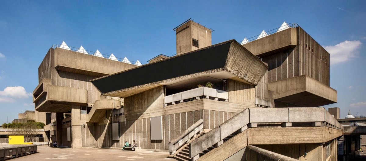
Returning to the twentieth century, and the Bantry Library project, construction posed many problems, using techniques which might have been considered at the leading edge of architecture in its time and place. Across the sea similar experiments were taking place. I was at the centre of them! I completed my architectural education in the late 1960s and went to work for the Greater London Council. I saw going up around me on the South Bank of the Thames a development which included the Hayward Gallery (below): its design (described as ‘brutalist’), earned it the nomination of the ugliest building in Britain when it opened!

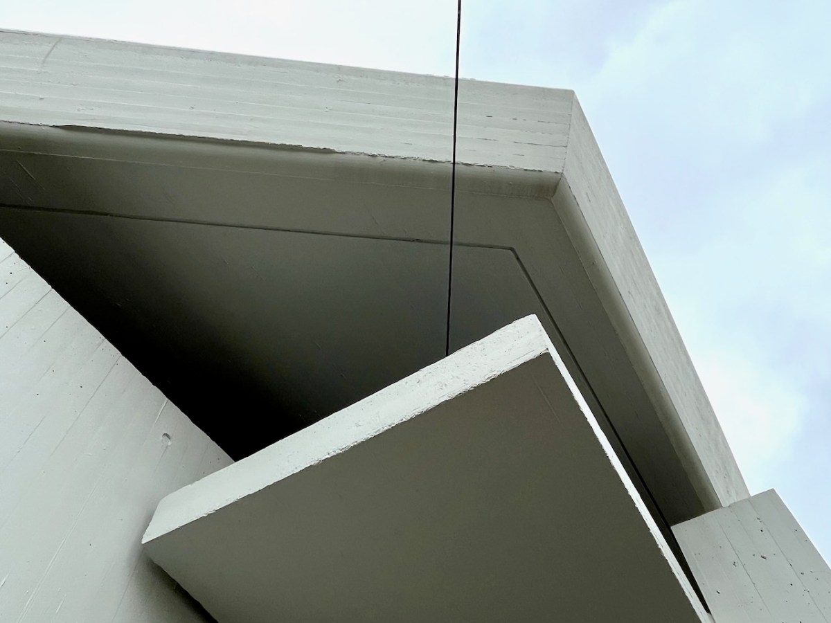
Larger in scale, this complex exhibits some of the features we see in Bantry: shutter-marked mass concrete, frameless glazing, bold overhanging roof planes… The Library roof cantilevers six metres in one part of the building.

The status of this building as an unique example of modernist architecture in Ireland has recently been recognised with a Heritage Council grant of over €250,000 to carry out refurbishments to some of the major elements.

. . . As Bantry Library approaches its 50th anniversary, we are committed to safeguarding this important building. As a protected structure within an Architectural Conservation Area, Cork County Council recognizes its responsibility to preserve and protect Bantry Library for future generations. The conservation works will take place during 2023, and we look forward to seeing the library restored to its former glory . . .

Tim Lucey, Chief Executive, Cork County Council

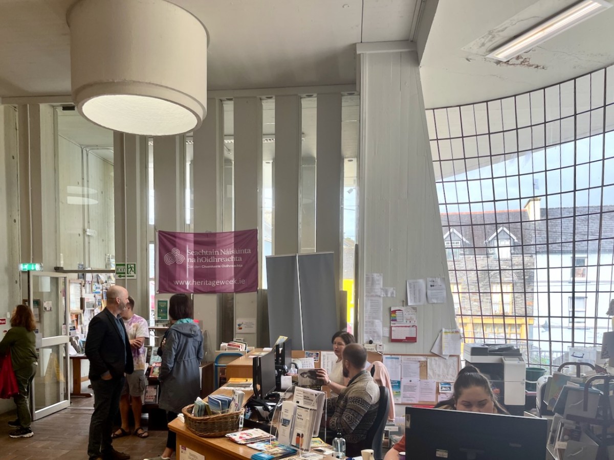
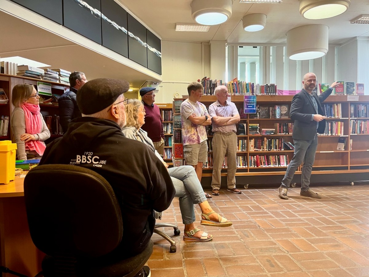
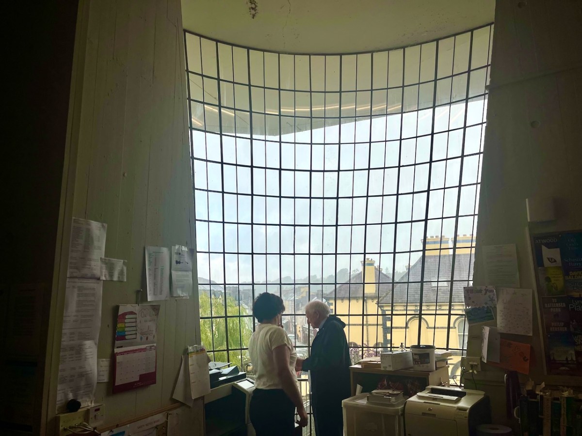
A Heritage Week talk was given by Dermot Harrington of Cook Architects at the Library (below). It was a most informative review of the building and its history.

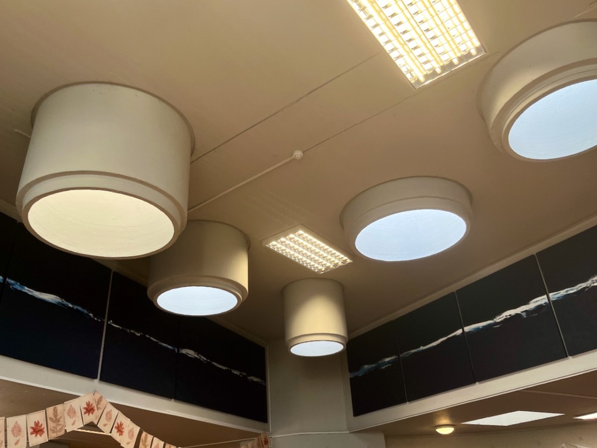
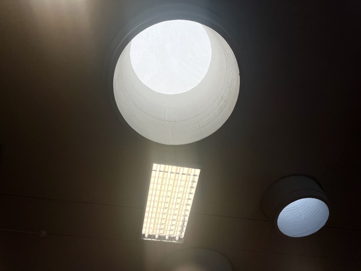
Most of the original features of the building have survived in reasonable order. I was impressed with the ‘pipe lights’ which draw daylight down into the centre of the main room:

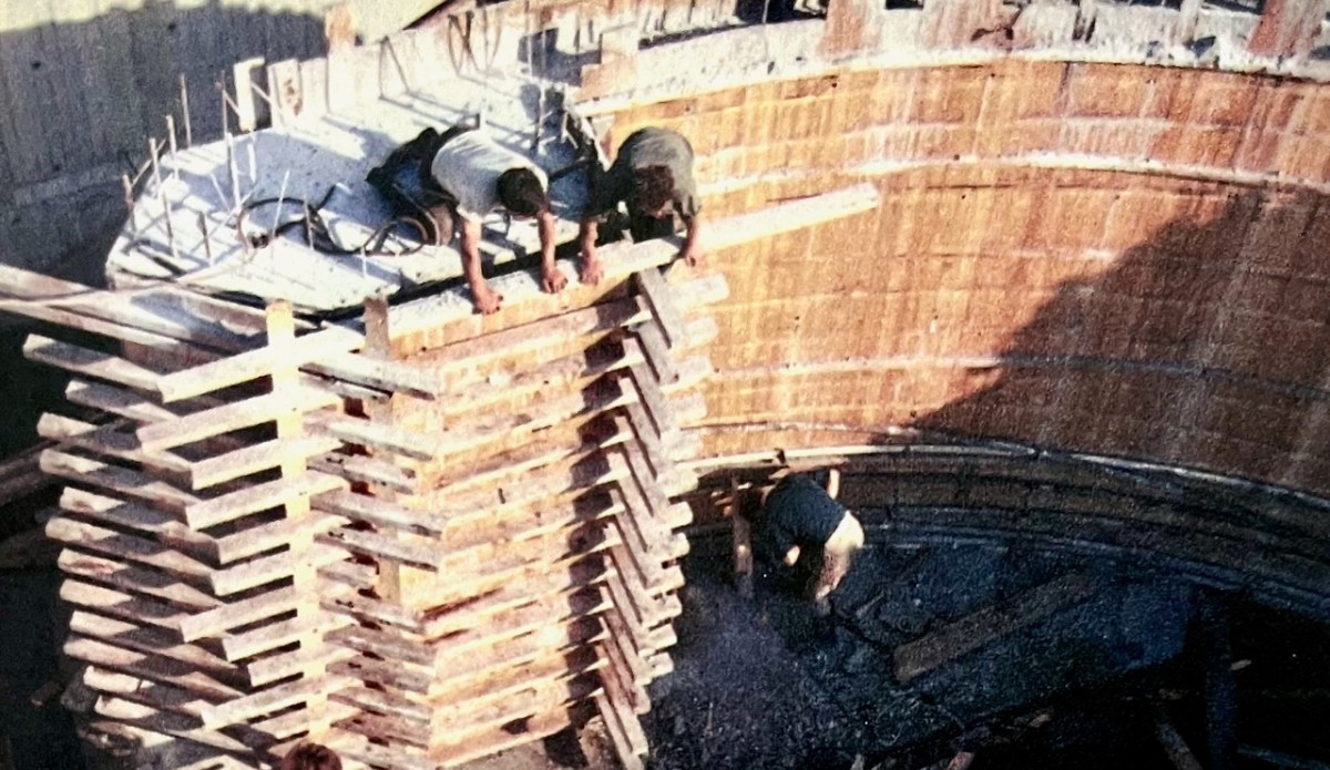
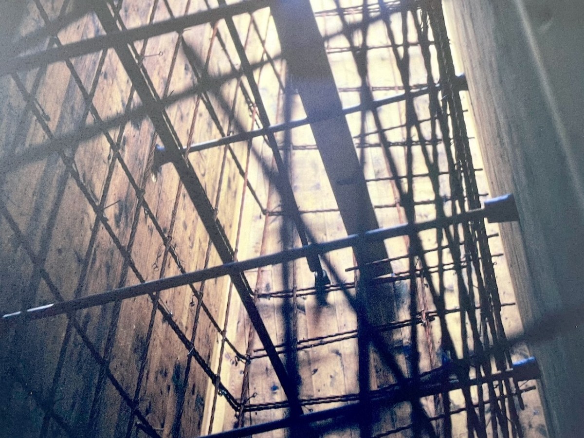
We also learned about the complexity of the building construction, and saw photographs of the steel reinforcement and board shuttering from fifty years ago:

Dermot Harrington pointed out that the building was effectively put together by only five men, under foreman Gerry O’Sullivan, who was just 27 years old. Neither he or any of the other crew had ever tackled anything like this before!

The Library is central to the life of the town, and still serves its original purpose. It’s eye-catching (perhaps sensational is a good word?) and very much alive and relevant. We look forward to the completion of the current works, and suitable festivities to mark the fiftieth birthday of this creative West Cork project.

Thank you to the Library for the information they provided and the display boards that are currently on show. Many of my illustrations are taken from these resources

Sheep’s Head Stone Circle Revived!

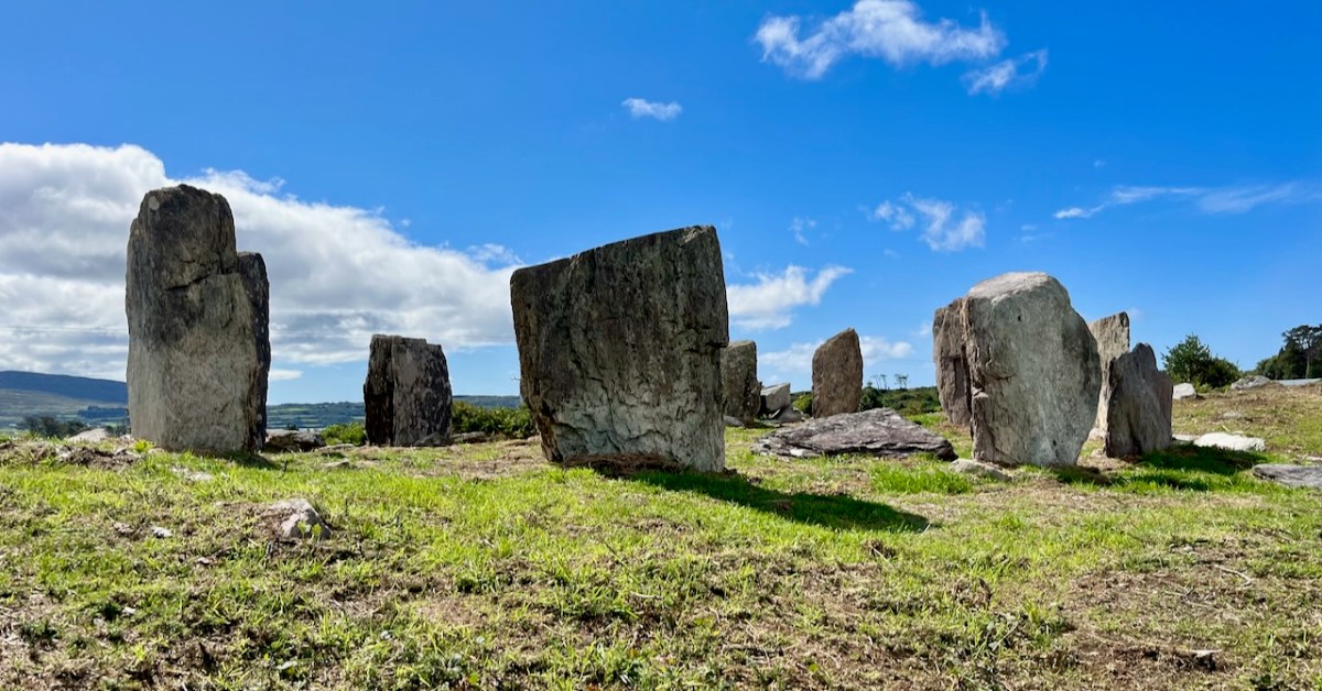
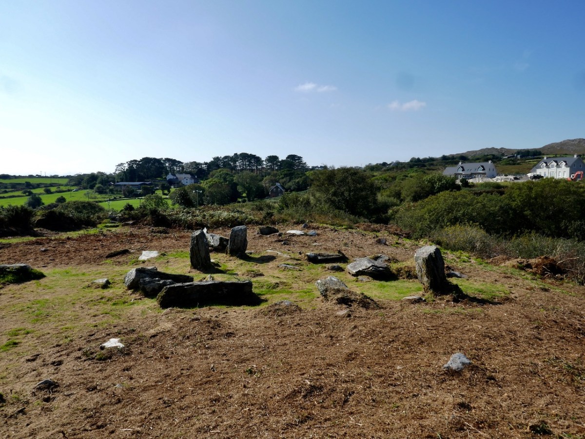
Gorteanish Stone Circle, near Ahakista on the Sheep’s Head Peninsula, is singular because it lacks ancient history. It doesn’t appear on the early Ordnance Survey maps and – to the best of my knowledge – no local stories or folklore have been recorded about it. It is a Bronze Age archaeological site, but it has apparently been overlooked until comparatively recent times.

It’s a short walk to the west out of Ahakista to the site of the stone circle. The way is marked by the stone above. Atha Tomais means ‘Tomais’s Place, and refers to Tom Whitty from Philadelphia, who settled on the Sheep’s Head in the 1980’s with his wife Suzanne and family. He is credited with having come up with the idea of establishing The Sheep’s Head Way – a series of footpaths covering the peninsula, and the project was put in hand by Tom and a local farmer, James O’Mahony, completed in (remarkably) just 18 months and formally opened by President of Ireland Mary Robinson in July 1996. During clearance work for the Ahakista footpath the remains of the stone circle at Gorteanish were discovered. It has since been suggested that there were stories of ‘old stones’ being hidden in the undergrowth. A footpath giving access to the stones from the nearby lane was duly completed and opened, and the inscribed stone marks this occasion.

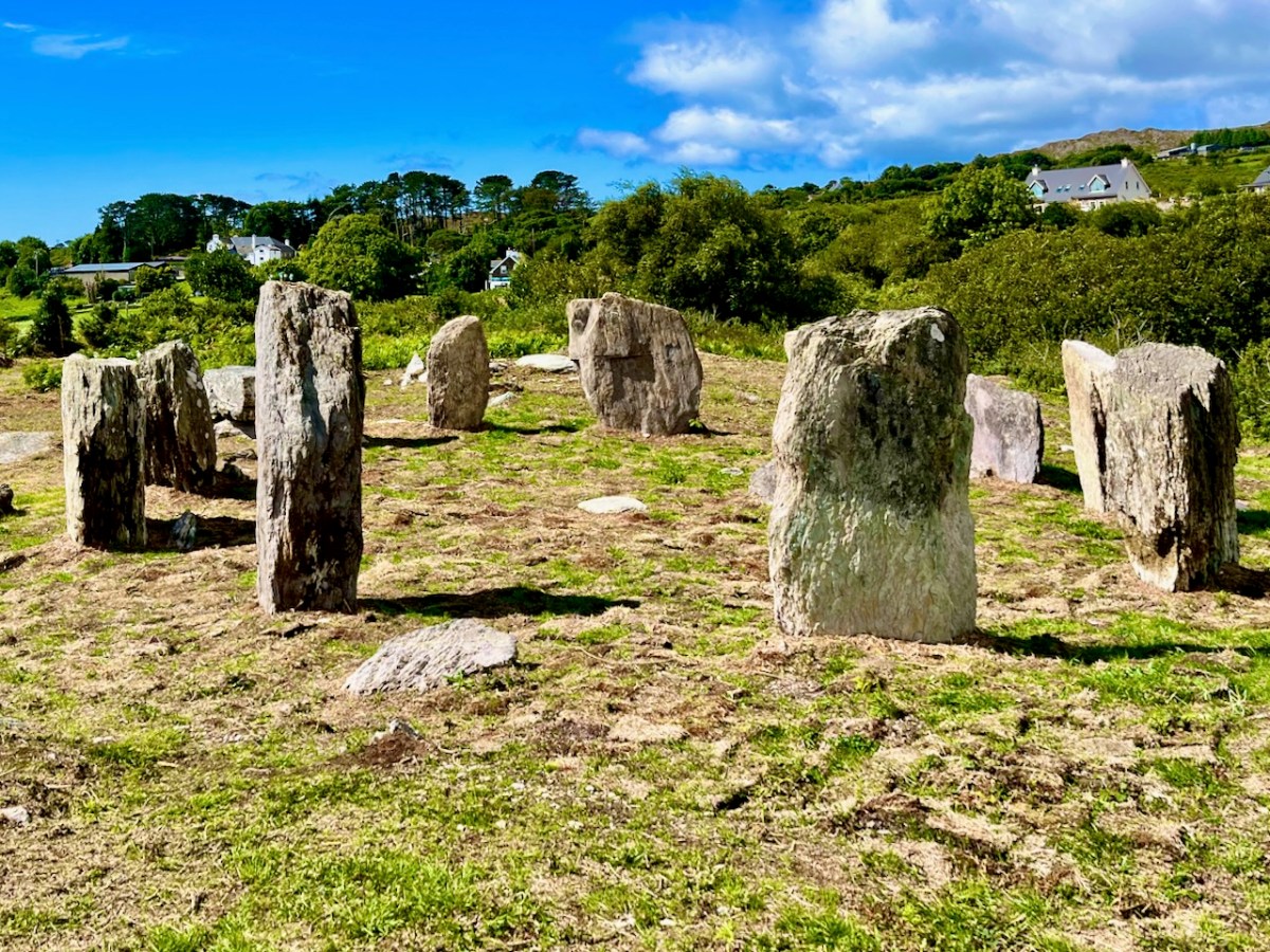
This photograph shows the circle more or less as it was found in the 1990s. Four stones are standing, and others are lying prostrate.

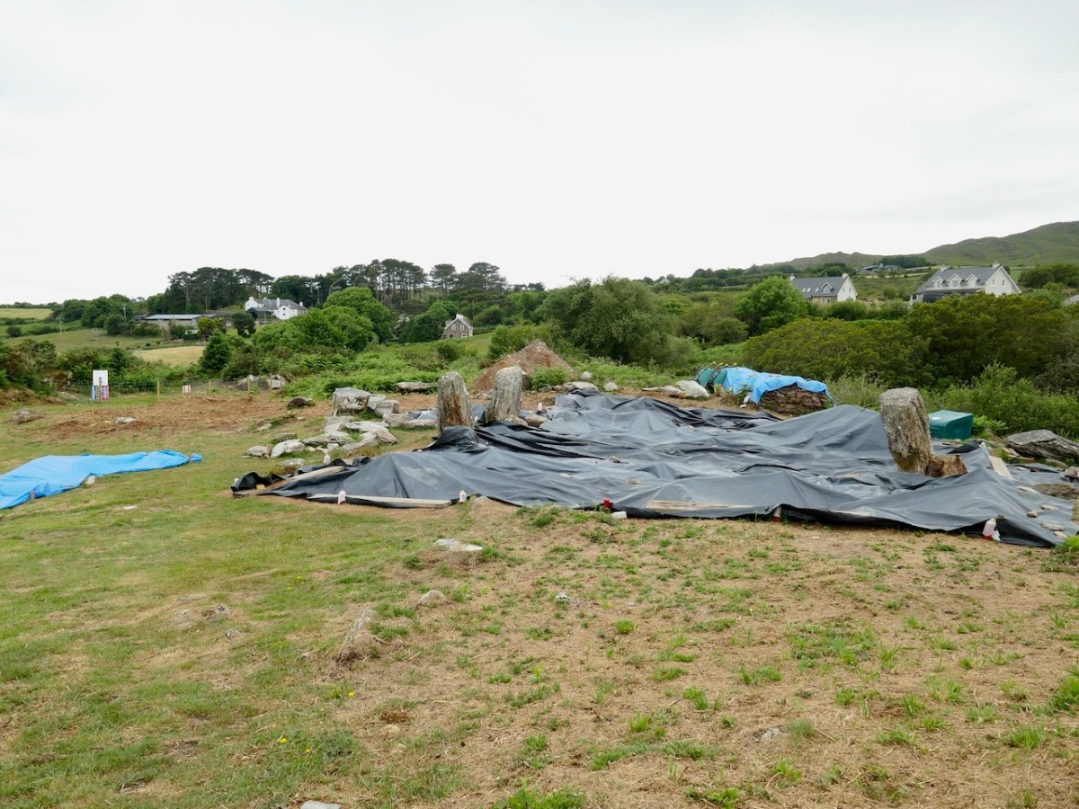
Earlier this year, the decision was taken by Professor of Archaeology at University College Cork, William O’Brien, together with a group of students, to extensively study the site at Gorteanish. Their mission was to excavate the site where necessary to establish which of the stones had been standing and to see how feasible it might be to restore these standing stones in their original sockets, using only traditional methodology. A significant area around the whole site would also be examined to search out any evidence of human occupation and activity – and hopefully to provide a reasonably accurate dating for the circle.

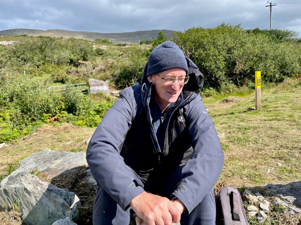
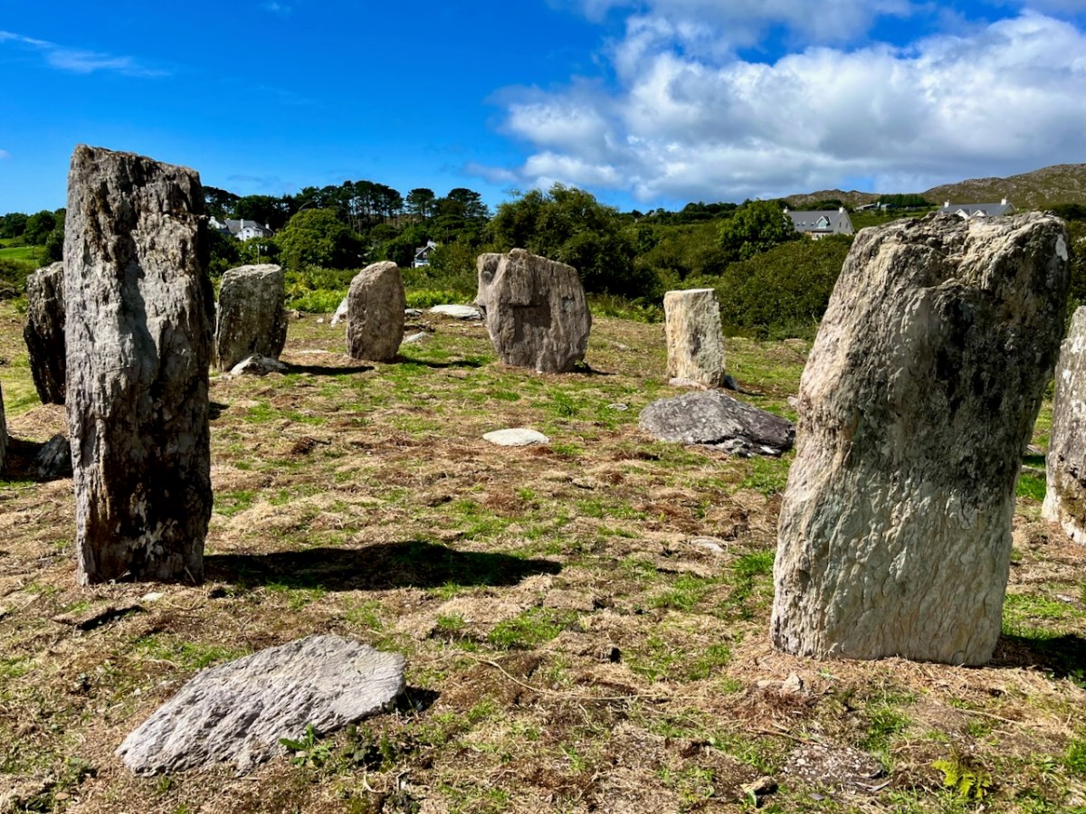
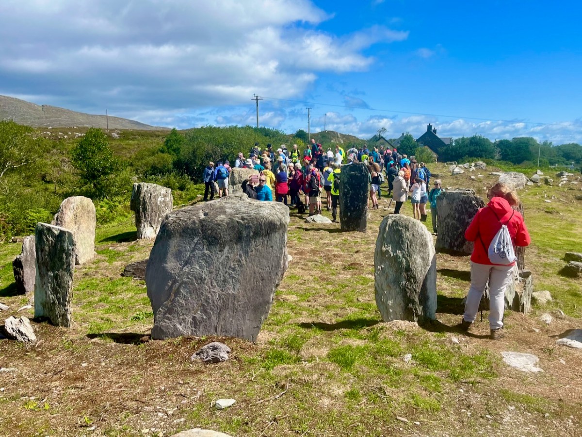
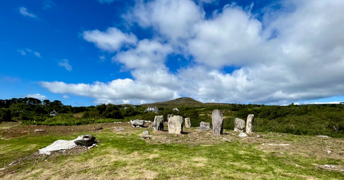
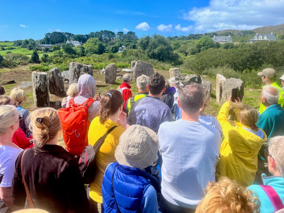
Finola and I visited the site while the archaeological works were progressing (above). Yesterday (5 August 2023) Billy O’Brien (below) was on hand to give a detailed talk on the excavation and restoration work, and we could see, for the first time in many generations, the circle restored to its complete state: it now has all eleven stones standing.

The view above shows a boulder burial monument situated to the south-west of the main circle. This has always been a visible feature of the site. A boulder burial (once called a boulder dolmen) is peculiar to Ireland. In fact it is found only in Counties Cork and Kerry. Finola has written comprehensively on this subject, here. It is usually a substantial raised stone supported on a bed of smaller stones:

. . . Boulder-burials are a group of prehistoric stone monuments of megalithic proportions, whose distribution is largely confined to south-west Ireland. Some 84 examples have been identified, 72 of these in Co Cork and the remainder in Co Kerry, where they occur both singly or in small groups of between two and four. They consist of a large boulder erratic supported by an arrangement of smaller stones, with no covering cairn or tumulus. Several examples are known which are centrally placed within stone circles . . .


Boulder-burials: A Later Bronze Age Megalithic Tradition in South-West Ireland
William O’Brien Dept of Archaeology, UCG 1992

A closer view of the boulder-burial at Gorteanish: it can be seen that the main ‘boulder’ element has split in two through the ravages of time. In the main circle, all the standing stones have been restored to their original (relatively shallow) sockets, and fixed using rammed small stones, following the evidence gained during excavation.

Most stone circles have a specific orientation. This can be seen by the shaping of the stones around the circle. In this case there are two clear ‘portal stones’ on the east side, directly opposite an axial stone on the far side (above). More usually, the stone opposite the portals is flatter, when it is known as the ‘recumbent’. In this case it is a substantial stone with a shaped top (detail, below).Perhaps this points to a feature on the horizon? Our calculations show that the orientation of this circle is towards the winter solstice sunset – just as at Drombeg Circle, not too far from here.

Yesterday’s event attracted a substantial crowd, eager to hear Professor O’Brien talking about this project. Many were no doubt surprised to see the site returned so faithfully to its original state. But – with stones standing – it has now become an iconic piece of archaeology. We are delighted that it is on our doorstep. If you want to read a deeper discussion on stone circles and their historical contexts, look at Finola’s post here – one of many that include the subject.

Another thing that Billy pointed out was the significant ancient stone wall that runs across the site; you can see traces of this above. In this view you can also see an elongated large rock apparently lying on its side. Some local commentators have suggested that this was once a very tall standing stone. If so, at about nine metres, it would have been spectacular! But the excavation confirmed O’Brien’s view that it was never standing, and has always been part of the landscape in its current position.

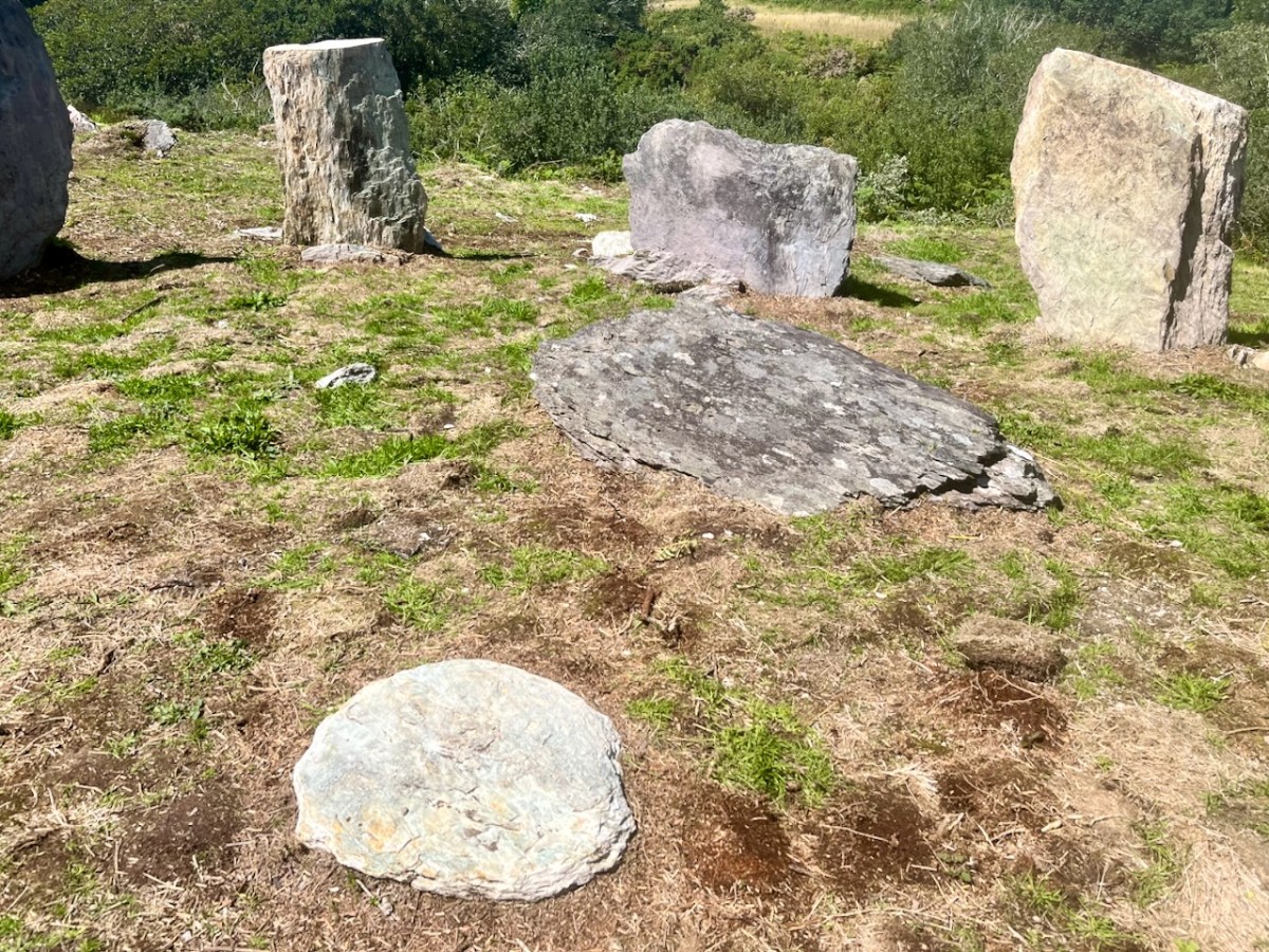
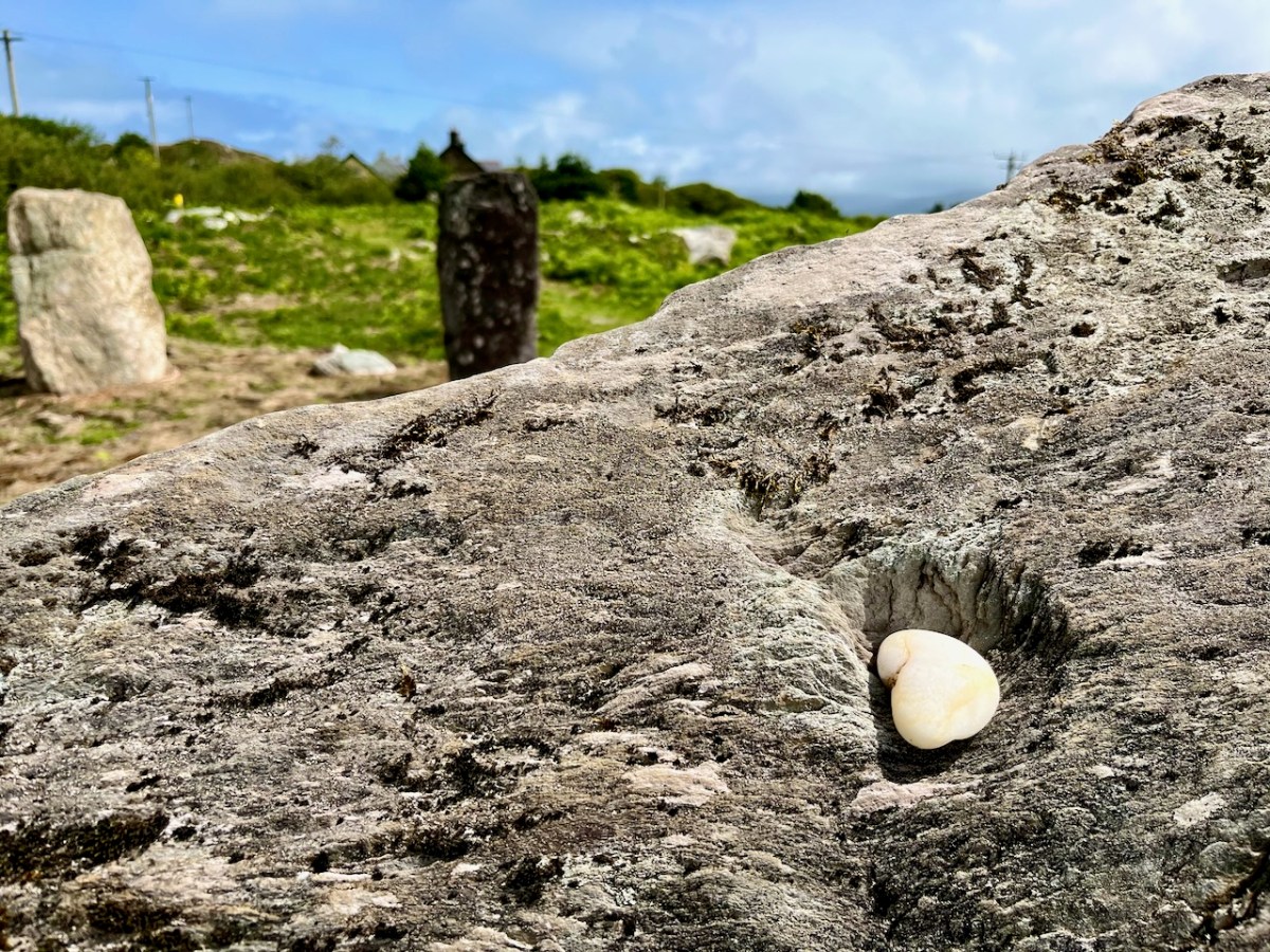
Also, an area of flat ground to the east above the site was closely examined, in case it revealed traces of any human use, but none was found. In fact, there were no signs of any notable human activity. However, one point that I found particularly interesting was that, in the centre of the circle, is a pit containing quartz stones. Quartz, that glinting reflective material that faces the much older main chamber at Newgrange (you can see a pic of it in this post), certainly catches the attention; it’s fascinating that the Gorteanish people – whoever they were – gave it an aura of importance by burying it at the focal point of this circle. The quartz has been replaced in the pit, after the excavation. Its position is marked by the only ‘alien’ element that has been introduce here – a pale coloured flat stone:

The larger earth-fast stone beyond this new addition has always been there: the site might have been constructed around it. It’s always interesting to see how people are going to react to a circle like this – here is someone’s recent contribution, also giving importance to the ‘magical’ quartz:

All in all, our day was exciting. It’s pretty special to see something ancient faithfully restored – and open for all to access. The seven fallen stones probably collapsed because of cattle rubbing up against them over centuries. That has been prevented now. We hope you will all appreciate – and enjoy – this new West Cork experience.

A Map of the County of Cork, Part 3

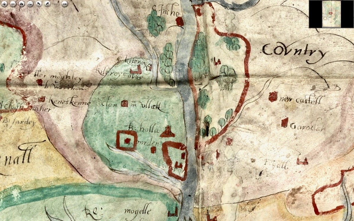
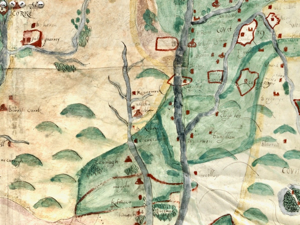
This is the last part (links to Parts 1 and 2 at the end of the post) and I will use it to look at where most people seemed to be living – along the River Lee and the Blackwater/Bride Rivers. Cork is shown, as we know it was and still is, on an island, as a substantial walled town with four towers. Two of the towers guard bridges and are ports of entry, and two guard inlets of the river. There’s a cross in the middle and five buildings outside the walls. 

The buildings to the left of the city (remember, that’s North) are labelled Mogelle, F:barro and M:nellan, while to the right (south) the upper building is unlabelled and the lower one is C:Tanboy?

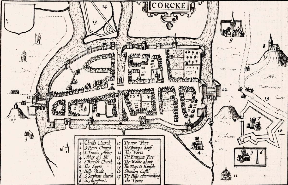
To see what this is all about, let’s take a look at the earliest map of Cork City, which I showed you in my post Mapping West Cork, Part 2: John Speed. I reproduce that map here. It dates from 1611/12. As I said in the John Speed post, while Speed seems to have based his land maps on earlier work by Mercator . . .

. . . the city maps were all new and it seems that Speed, with one of his sons, actually travelled to the cities he includes in his atlas and paced out the distances, drawing the maps based on these calculations. They are a unique and invaluable record of a time when Ireland had walled cities, especially given that so few intact stretches of those walls remain.

And there is the Market Cross! While that is the only feature inside the city on our map, Speed’s is beautifully detailed, and he provides a key to all important buildings. There are many churches, only two of which, Christ Church and St Francis’s Church, are within the walls. Assuming that Finbarr’s church is labelled F:barro on our Map (although the brown rectangle looks more like a tower house) and St Barrie’s Church on Speed’s, it is shown in different places. St Augustine’s or St Stephen’s may be the uppermost building to the right of the city, but what is the brown pyramid-shaped blob labelled C:Tanboy? Perhaps a true Cork historian can help us out here and figure out what’s what.

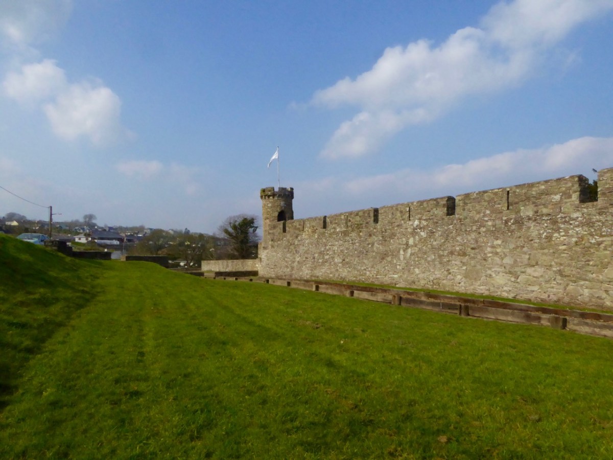
Interestingly, there is no sign, on our map, of the large star-shaped fort that Speed labels The New Fort and that subsequently became known as Elizabeth Fort. It was started in 1601 by George Carew (the original owner of this map collection) built of earth, stone and timber.  This supports a pre-1600 date for this map. Elizabeth Fort is still very much part of the Cork landscape, with its massive walls still dominating the south side of the river (above).

As we progress west along the Lee, the land is shown as wooded and there are several establishments by the river and its tributaries. I recognise Kilcrea Castle and Abbey (given here as Kileroye), but I’m sure others, more familiar with this landscape than I am, can add more.

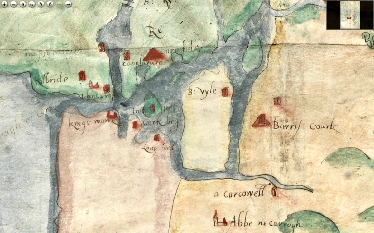
Cork Harbour, as might be expected, has many towers, the main one among them still standing is Barry’s Court (barris courte), soon (we hope) to be re-opened for visitors and also Belvelly (B:vyle), magnificently restored by a private owner. Corkbeg Island and Castle are shown, as well as several other castles on either side of the delta. Cloyne is of course indicated, as it was an important ecclesiastical centre.

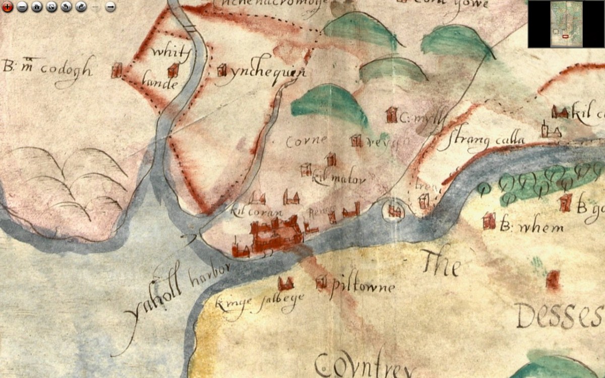
Moving now to the Blackwater/Bride River system, we see perhaps as populous and encastellated an area as around Cork, especially along the two rivers, which were navigable for many miles inland. Youghal is shown as a walled town, guarding the mouth of the harbour but also a large commercial and trading centre.

We have written about Youghal before, and specifically about its well-preserved stretches of wall – an unusual feature of Irish towns as very few medieval walls have survived.

I am reproducing below the map from Pacata Hibernia I used in my Youghal’s Walls post. As with Cork, it can help us to understand a bit more about Youghal. Note, for example, the South Abbey clearly shown outside the walls on both maps.

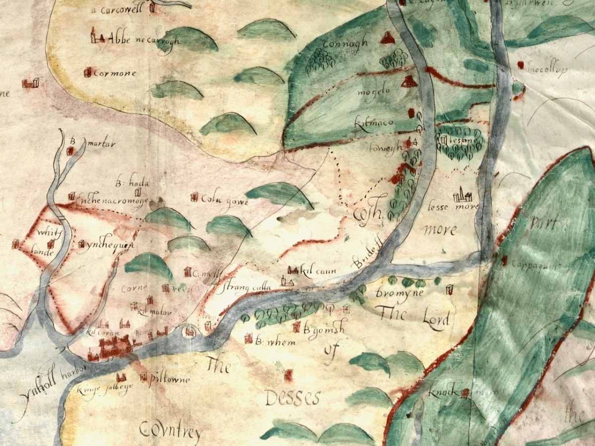
Upriver is Strancally Castle – not the more modern manor house, but the original tower house of which only a vestige remains down by the river. Also easily discernible is Pilltown in modern-day Waterford and Inchiquin, a townland east of Youghal. Inchiquin Castle is now the ruins of a round Anglo-Norman masonry tower which went through tortuous changes of ownership but was eventually occupied by in the fabled  Countess of Desmond who in 1604 died at the age of 140 by falling out of an apple tree. The castle was then seized by Richard Boyle, Great Earl of Cork, who, along with Walter Raleigh, is closely associated with Youghal and the Blackwater River. The drawing of Inchiquin below is by James Healy from his marvellous book The Castles of County Cork.

Boyle’s Castle (it’s still there) was in Lismore, but at this point lesse more is shown as a church on the banks of the Blackwater, not the centre of power it became with Boyle’s ascendance.

Castles, towns and churches line the Bride and the Blackwater, showing how important these rivers were at a time when the best way to traverse the country was by water.

I’m going to leave it there, although I just might come back to this map at some point in the future because, well, it’s so darn interesting and it’s fun to try and puzzle out the names. I hope I have supported my thesis that this map must date to before 1600. It is most likely another of those made for the purposes of identifying property in order to confiscate and carve it up during the Plantation of Munster. Please do visit it for yourself and see what you can find – additions always welcome in the comments section below.

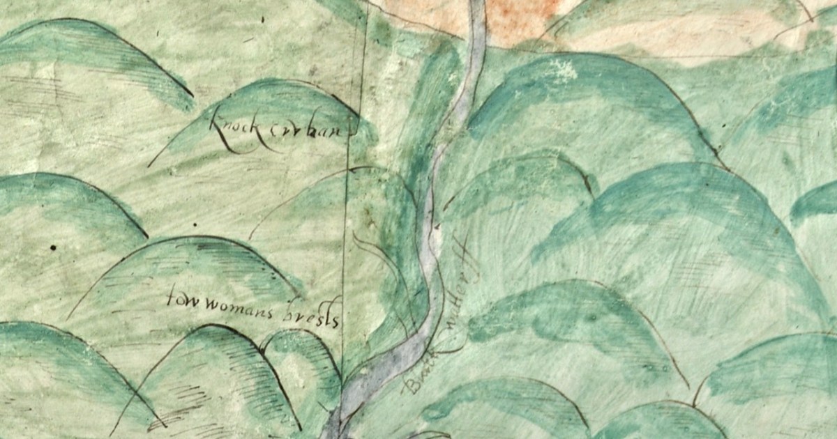
OK – one last image – the source of the Blackwater is shown in this one. What do we call these mountains now?

A Map of the County of Cork, Part 1

A Map of the County of Cork, Part 2

A Map of the County of Cork, Part 2

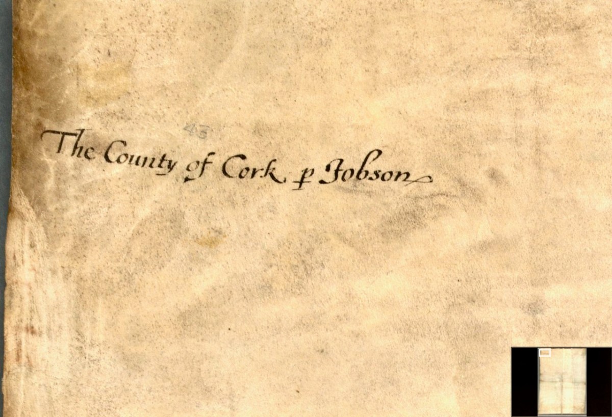
In Part 1, I said that We don’t know who did this one, or when: The date is given as 1560-1620. It seems in some ways more basic than other maps of the period, and less exact. I have now gone to the Atlas itself in Trinity College and discovered that the maps in the Digital Repository are an incomplete set. Specifically, the original Atlas at TCD contains the reverse side, the ‘verso’ of each map. Here’s what’s on the verso of the County of Cork. This:

and this:

So we see that the map is attributed to our old friend Jobson – he who drew the plantation map I wrote about here and here and which was dated to 1589. There are similarities and differences between this map and that one – the galleons and scales for example look very alike. But there’s a lot more information on the plantation map and some of it is different from our Map of the County of Cork. As to the date of the County of Cork map – we will try in this post to see if we can narrow that down a bit from the broad estimate of 1560-1620. 

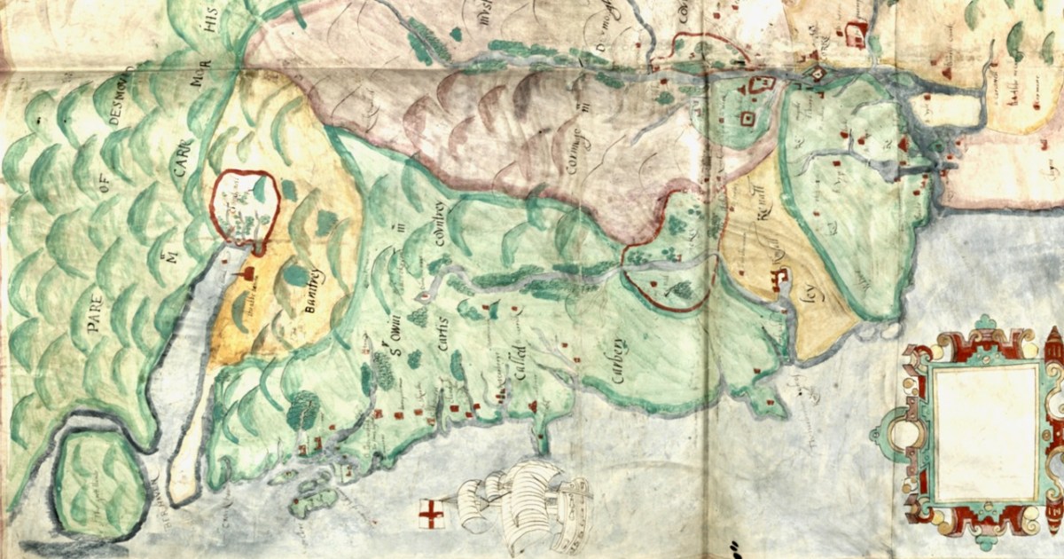
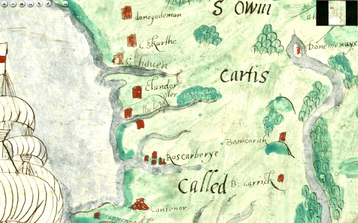
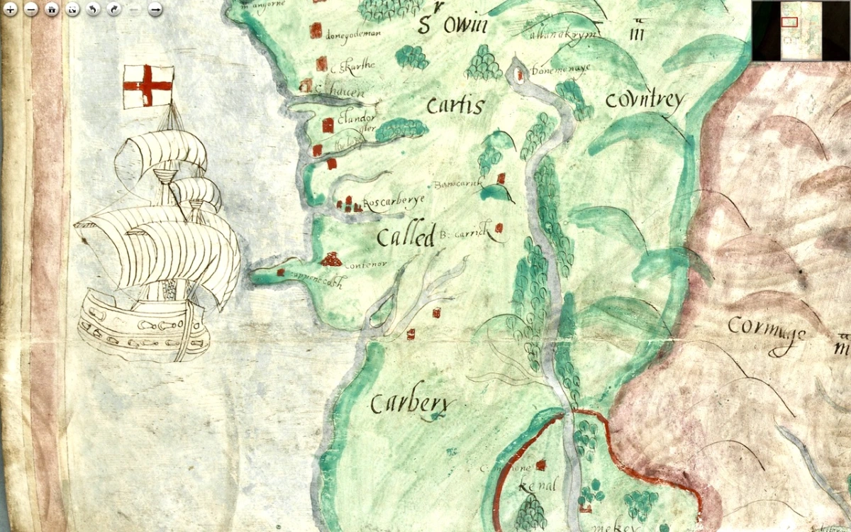
I want to go, as they say in Ireland, east along. That is, take off from where I finished last time, and travel east along the coast towards Cork, taking in the River Bandon. For the rest of this post, I’m keeping the map oriented as it is originally – that is, with west at the top (it’s actually surprising how quickly you can get used to this). Between Baltimore (Donashad) and Castlehaven (C haven), there are three castles shown, one labelled Sir Jmes Castell, Doneygodman and C skarthe. These are all a bit of a puzzle and I would invite readers to contribute ideas. On the archaeological list of Monuments for this area we can identify the O’Driscoll Castle on the Island in Lough Ine – could this be the Sir Jmes Castell? A promontory fort on Toe Head, known now as Dooneendermotmore, although likely originally an iron age refuge, was refortified in the 16th century and may, like the one I wrote about in Dunworley, have had a significant curtain wall. Was this Doneygodeman? It seems unlikely, as Doneygodeman is show inland – I wonder if instead it could be the castle at Raheen, which was a castle of the O’Donovans.

Finally, C skarthe might be a castle of the McCarthy’s – McCarthy is spelled in a variety of ways on this map, but there I can find no trace of it now. There was a castle in Listarkin, but once again, this is in the wrong place, unless this map, while certainly approximate in places, is wildly inaccurate. It seems reasonable to conclude that the more inland castles may have been harder to plot on a map that the coastal ones.

The castle at Glandore (c Landorgter) is clearly shown, along with two castles guarding the entrance to a long inlet labelled ‘the lepp.’ One may have been Kilfinnan, actually located near Glandore, which the other could possible be the coastal tower house at Downeen. This brings us to Rosscarbery (Roscarberye), shown as a collection of Buildings, as befits its status as a substantial town with a cathedral and a college, and a place of pilgrimage in the name of St Fachtna.

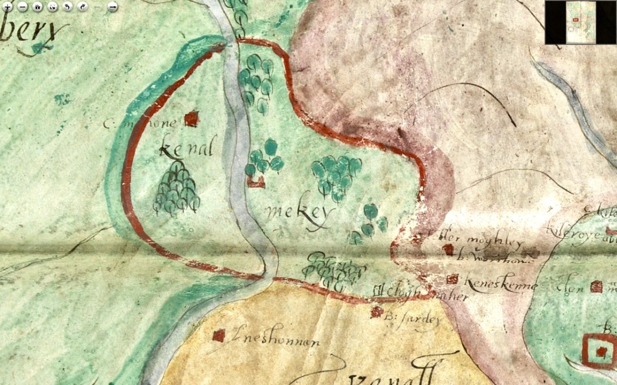
The entirety of this area, in green, is identified as Sir Owin Mc Cartis Countrey Called Carbery. Several other castles are identified here and there, and the course of the River Bandon is traced. The southernmost area is identified as Kenal Mekey, and to the south of the green-shaded section is Kennal Ley. In Canon O’Mahony’s magisterial History of the O’Mahony septs of Kinelmeky and Ivagha he states: 

In the history of South Munster there is no fact attested by more abundant evidence (evidence unknown to Smith and Gibson) than that the Sept-land of the Ui Eachach Mumhan during many centuries extended from Cork to the Mizen Head, as one continuous territory, including Kinelea and Muskerry, and was ruled by a chief whose principal residence was Rath Rathleann, in Kinelmeky.


https://archive.org/details/historyofomahony00omah/page/n1/mode/2up  Page 105

He identifies Rath Rathleann as the mighty multi-vallate ringfort of Gurranes, which was superseded by Castle Mahon, which stood where Bandon is now situated. And here it is, Kinelmeky, with C Mahon shown beside the river. Castle Mahon was later incorporated into Castle Bernard, home of Lords Bandon. Another Castle is shown further down the river – no doubt the one we are familiar with as we travel the N71.

We know that all this land was acquired by Richard Boyle after the Battle of Kinsale (1601) and that he started on his walled town of Bandon Bridge around 1620. Since this is still clearly identified as O’Mahony Territory I think we can take it that this map dates to before the battle of Kinsale.

We see Kenall Ley (Kinelea) in yellow, with the walled town of Kinsale at its heart. Kinsale walls were begun around 1380 and lasted until most of them were destroyed around 1690 by the forces of William of Orange. Inishannon is noted in Kinelea, as well as Park Castell (in what is now the townland of Castlelands) and finally B: Sardey (or is that a different first letter?). We know from another map in the Hardiman Atlas (below) that B designated a small town. Given that Kinsale is such a prominent walled town on this map, once again, a date before 1601 is likely. 

Supporting a pre-1600 date is the fact that it is the old Irish families that are identified with their territories – no settler or Plantation names are given. In fact the O’Mahonys and McCarthys are the only names on the sections of the map we have seen so far. Moreover, it it really was the work of Jobson, we know he was actively mapping in 1589.

In Part 3 I’ll do a quick meander through the most interesting parts of the rest of the map. Stay tuned.

A Map of the County of Cork, Part 1

A Map of the County of Cork, Part 3

Flower Power – New Ballydehob Exhibition!

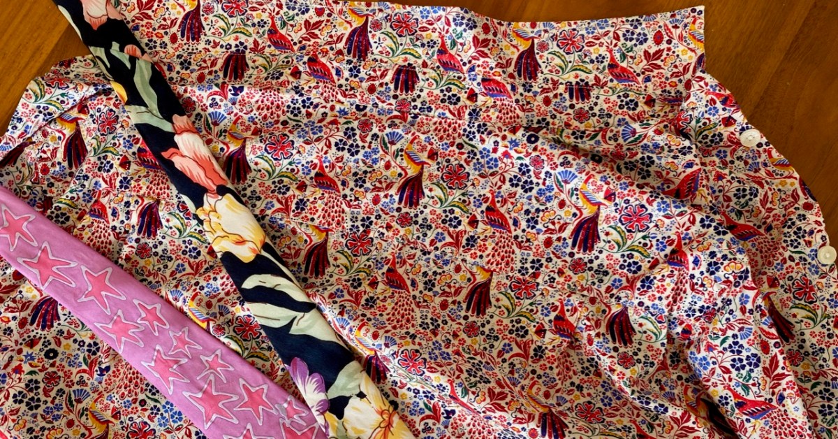
I was around in London in the early sixties, and was definitely part of the swinging Flower Power scene: beatniks, Beatlemania, Carnaby Street, flowery shirts and ties (I’ve still got some of them – below – stashed away in my wardrobe!) – the regulation Afghan coat (and its distinctive smell) . . . What I miss most, perhaps, is the purple velvet flared trousers: sadly an expanding waistline quickly did away with them.

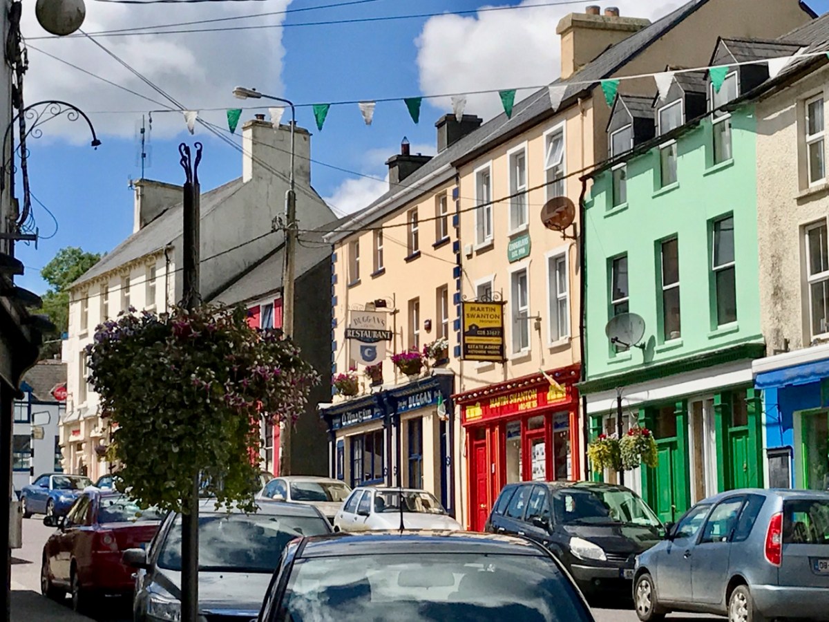
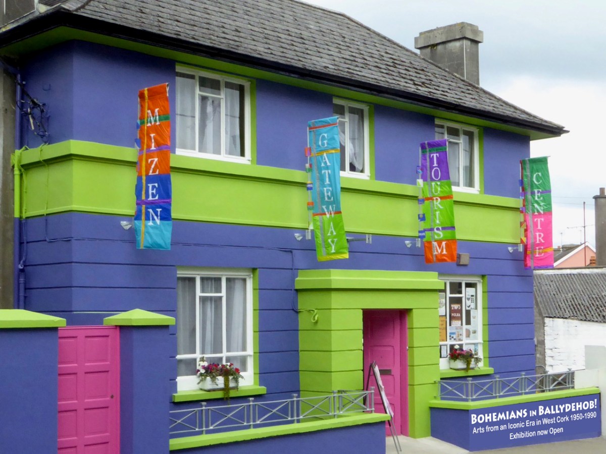
What is less well-known – in my generation at least – is the fact that there was a similar cultural phenomenon in one part of Ireland – our own West Cork! And it was centred on Ballydehob – that’s the main street, above. It’s a colourful village today – as it was then: well-suited to the cultural heritage which the artist community of the time imposed upon it. This building on the main street in those early days was particularly significant:

One of the artists who happened upon Ballydehob at that time lived on here to tell the tale (he still lives in the village and is still a working artist):

BREAKING NEWS: BALLYDEHOB IS DISCOVERED!

. . . During the early 1960s, a group of students at the Crawford School of Art in Cork, heard a rumour that something bizarre was happening in a village called Ballydehob. Here some vestige of Swinging London had taken up residence in a painted-up building called ‘The Flower House’. I was one of those students. We decided to investigate.

      Since nobody owned a car, a parental vehicle must be ‘borrowed’. Somebody’s parent was away so this could be done without controversy. One of the know-it-all students announced that Ballydehob was in County Sligo and we would need money for petrol and have to camp when we got there. Nobody owned a tent. A forever-complaining student said that ‘He didn’t want to end up arrested as a vagrant and to have to sleep in a Garda station’. A few days later we left the Crawford en-route to County Sligo. Fortunately, a more astute student rummaged in the car as we were leaving the city for the West, found a road atlas and announced that Ballydehob was actually in County Cork, a mere two hours drive over the potholes. Tent-less or Garda station camping would not be required.

     We arrived, we saw, we were astonished. Cork was then a darkly conservative place, ditto the Crawford and its staff members. What we found in Ballydehob was a house on the main street of the village with enormous flowers painted on the façade. It might have been in Chelsea or San Francisco. We entered to find a hive of creativity and alternative lifestyles. This was the world of women in flowing batik dresses, bearded men with bead necklaces and leather-thonged trousers. Even a cod-piece was observed. We sat in the café and drank coffee from the brownest of chipped brown ceramic mugs, ate inedible brownies and marvelled at the range of art and crafts being produced by this creative group.

      This establishment, which seemed to have landed from another planet since the remainder of Main Street appeared to have experienced no visual or economic change from the images recorded in the black + white photographs of the 1900s, was run by two women, one German, the other English: Christa Reichel and Nora Golden. Here was a living example of William Morris’s dictum, ‘Have nothing in your homes that you do not know to be useful, or believe to be beautiful’.

       Some ten years later, John and Noelle Verling (participants in that epic car journey) set up the Fergus Pottery in Dripsey outside Cork, later transferring it to Christa Reichel’s former premises in Gurteenakilla, Ballydehob, where it became a fixture of the creative community. A few years following, another member of the car-team, myself and Clair, came to stay with the Verlings, and also remained in the area, setting up an etching studio on the other side of Ballydehob.

       Many of those who established the creative community of West Cork have died. Another generation has grown to maturity, further expanding the tradition of West Cork as a major and continuing centre of creative engagement in all of the arts, an epi-centre of delight. . .

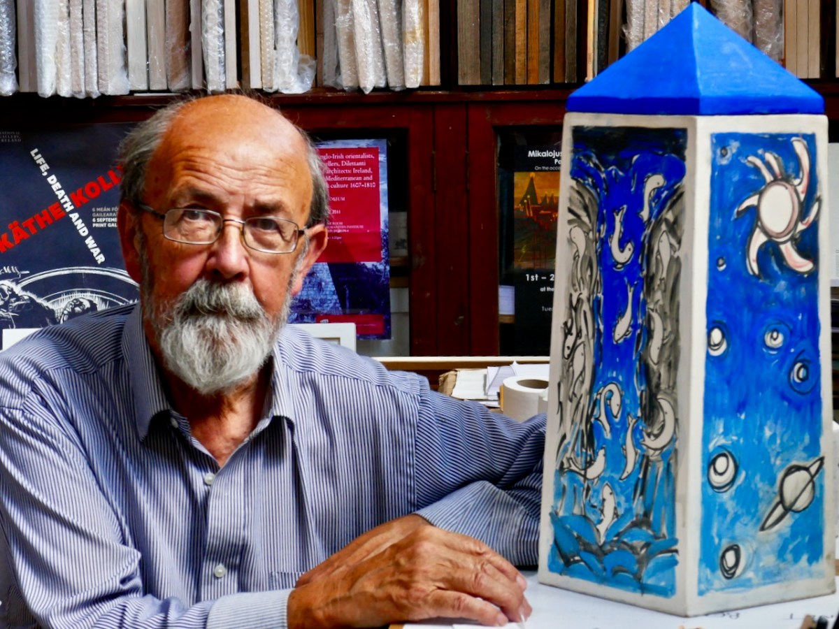
BRIAN LALOR

That’s Brian, in his studio today. Just a few years ago – in 2018 – he and I decided that that creative time in the village needed to be properly celebrated, and we gathered around us like-minded enthusiasts, and opened up the Ballydehob Arts Museum, using a room kindly donated by those who had taken over the disused bank building, right in the centre of town:

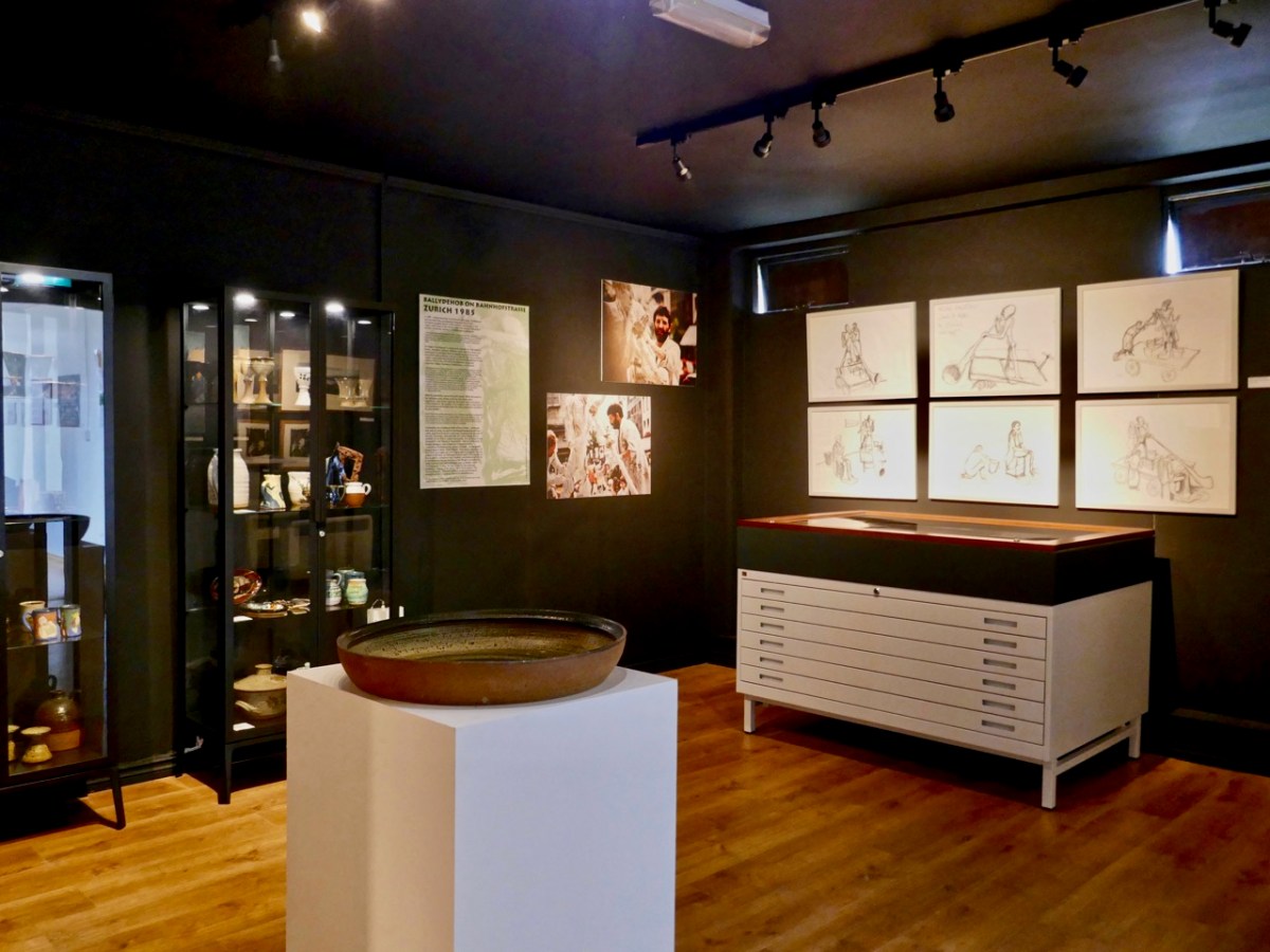
That’s the inside of the Museum above: its first exhibition opened in the summer of 2018. We had another the following year, then Covid stopped us until last year, when we featured Ian + Lynn Wright. This year’s exhibition also features a ‘couple’ of working artists: The Verlings – Noelle + John.

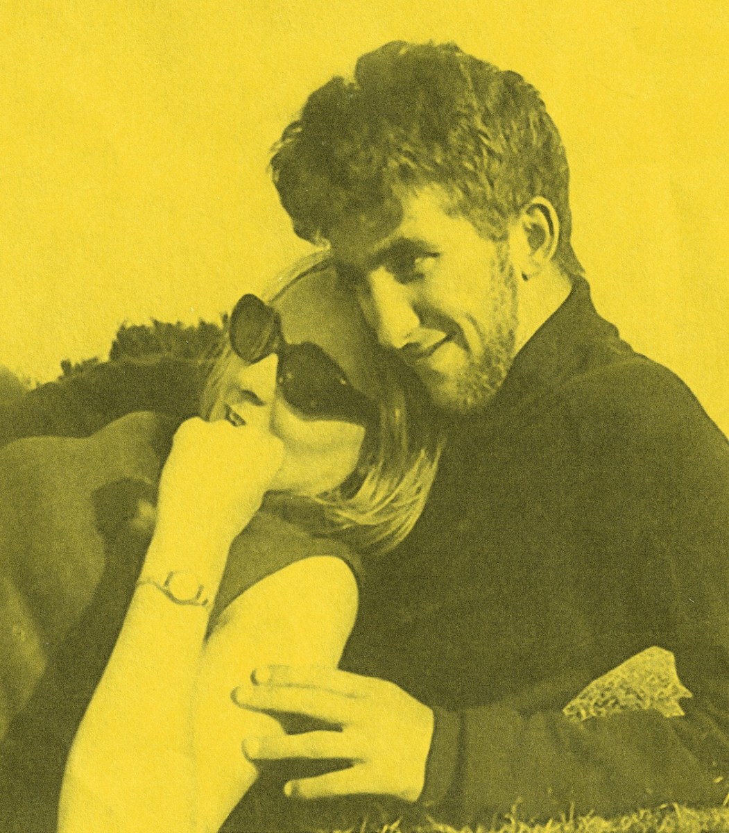
John Verling was a contemporary of Brian Lalor (who has written the account above), and they both studied architecture and art in London and at the Crawford in Cork. Brian has penned for us his memories of sharing a studio in London with John Verling:

THE PERILS OF A SHARED STUDIO, LONDON, 1967

. . . During the late 1960s, John Verling and I, then students of architecture in London, shared a quite substantial studio in one of the leafier areas of Kensington. The building, a large brightly lit interior behind a row of decaying Victorian villas (it might originally have been a Victorian studio, we never discovered) had many more recent uses and the first task on gaining possession was to somehow manage to get rid of what had been left behind by earlier tenants; office furniture, old matresses, much unidentifiable plumbing apparatus and a stuffed fox whose pelt had been consumed by moths, were among the challenging contents.

     Conversation among acquaintances in our local, the Norland Arms, evoked interest from other drinkers, an English sculptor and a South African photographer who asked could they share the space and, very willingly offered a down payment on the rent. This was agreed and not long afterwards the studio became operational, with both John and myself busy creating in our new-found haven, with only the occasional appearance of our fellow tenants. John was at that point concentrating on elegant photomontages as well as complex drawings of Portobello costermongers and was extremely productive, while I was engaged in a substantial series of elaborate and brightly coloured timber constructions enhanced by scaffold clamps, in a latter-day Bauhaus manner. Time passed, various local artists called to view the work and admire the space. We were exhibiting successfully and the studio became in W H Auden’s phrase, ‘the cave of making’. Our fellow studio members failed to turn up and when occasionally encountered in the Norland, expressed embarrassment in being behind with the rent while offering a contribution to ‘keep their name in the pot’. This was an extremely satisfactory situation with individuals happy to subsidise the rent but too busy to actually attend the studio.

     A chance encounter in the Norland brought another hopeful artist to our acquaintance, David O’Doherty, Dublin painter, he worked at the international telephone exchange. He came, he admired the studio, and invited himself to join. Fatally, we agreed. An accomplished portrait painter, he often had a sitter posed, but seemed happy to work on, undisturbed by the other occupants. Our new tenant was affable, expansive, a storyteller. He became a permanent fixture. Suddenly we realised that we were entertaining a cuckoo in our midst. O’Doherty had moved in permanently, camp bed, small stove on which there was always a fry-up in progress, an endless stream of visitors, large canvasses propped against the wall, and the catastrophic revelation of his other occupation; he was a keen traditional musician, devoted to the Uillinn pipes. Suddenly the space, ample for John and myself to pursue our work, had begun to feel like a home for the demented. 

     Gradually it became apparent that our studio, which a year before had been, in the midst of the city’s turmoil, as quiet and remote as a stylite’s pillar, had metamorphosed into Picadilly Circus with noise, air pollution and crowd control issues. The dream of having a secure place in which to create had floundered on the fatal choice of an individual whose concept of an ideal workplace was perilously close to Francis Bacon’s taste for irredeemable chaos. I bailed out, John lasted a little longer. And the completed series of brightly coloured scaffold-clamp constructions, what of them?  Occasionally I received reports of their travels. Before he emigrated to Boston, O’Doherty sold them to a construction company and they were later spotted decorating the foyer of a social welfare office in Amsterdam. After that only blessed silence . . .

BRIAN LALOR

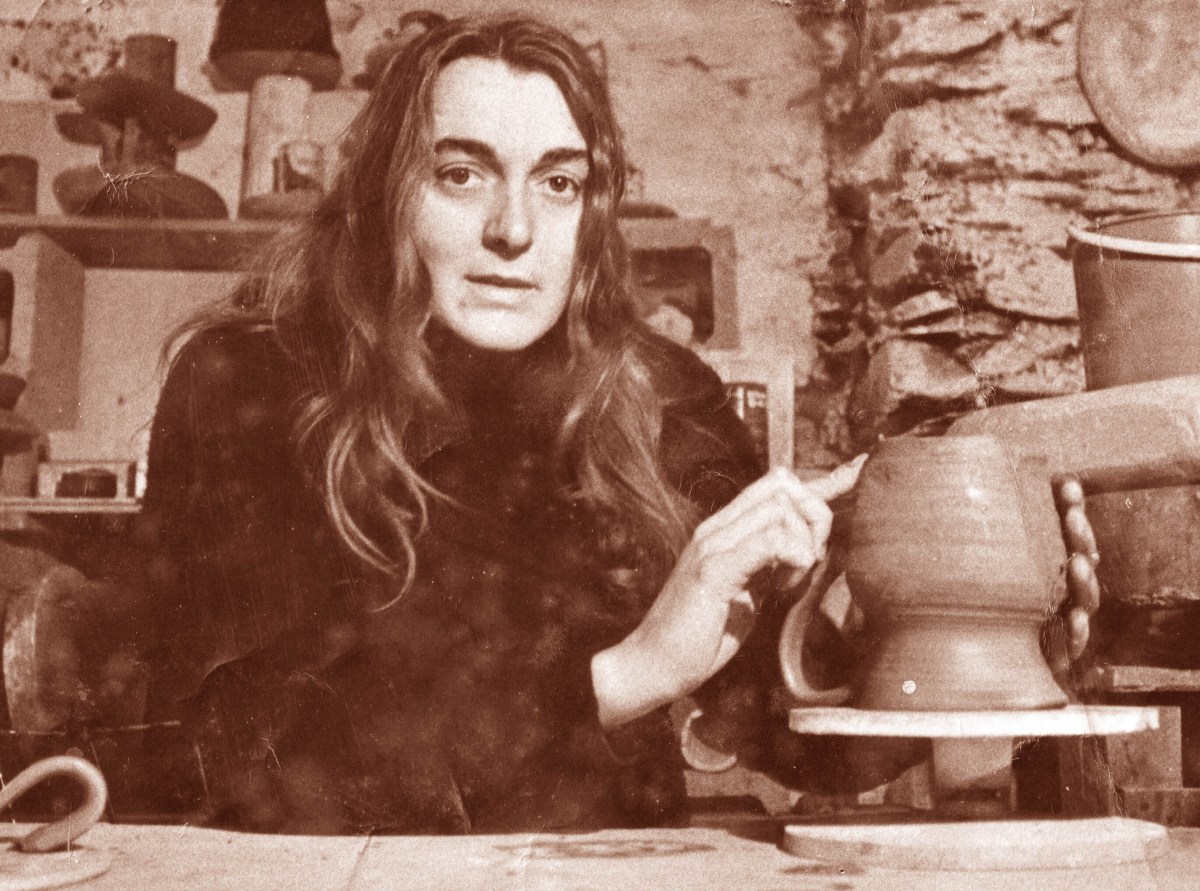
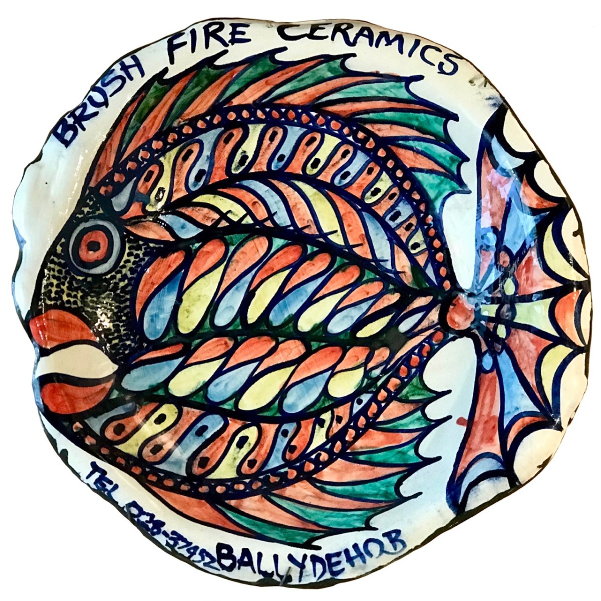
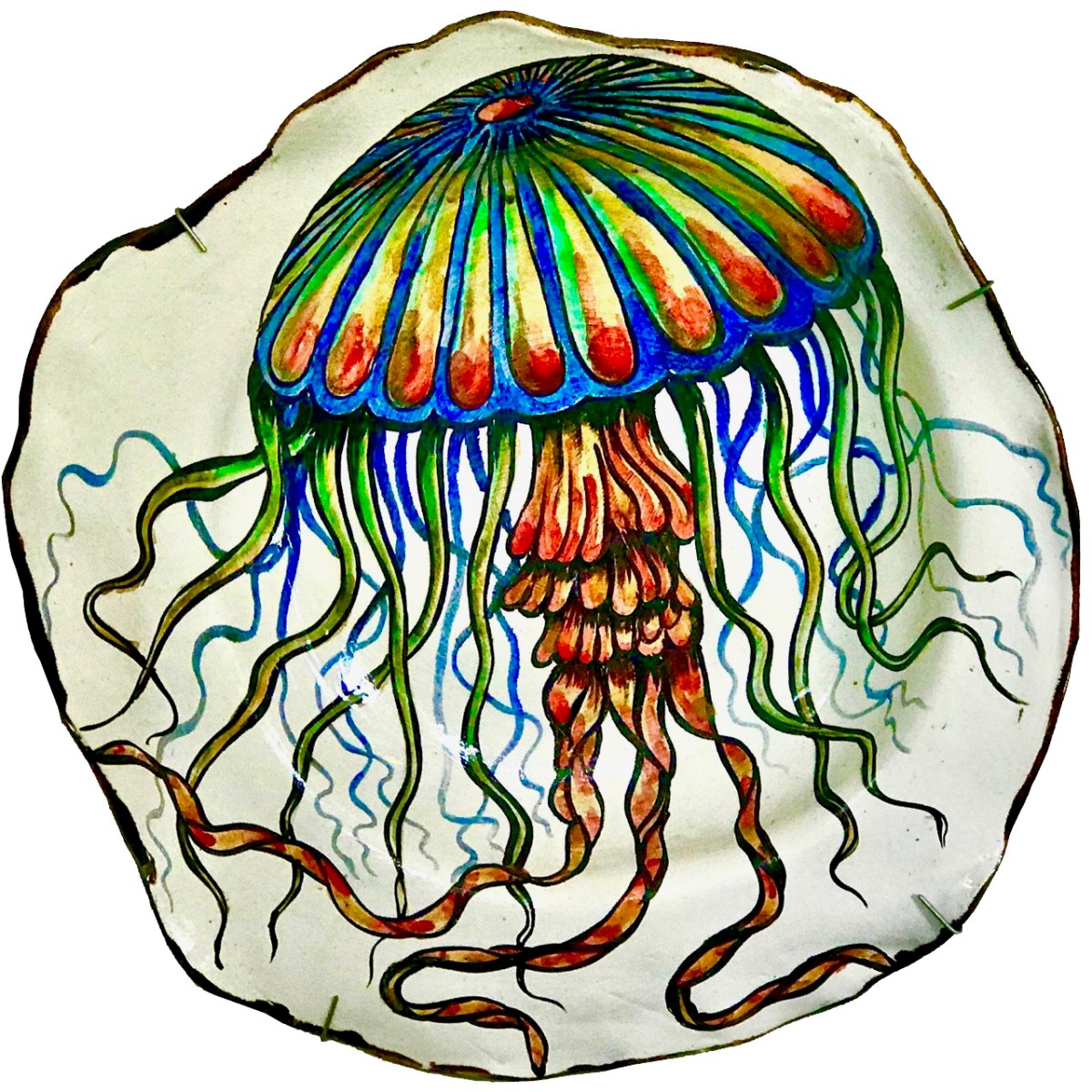
Noelle Verling (above) studied ceramics at Hammersmith College of Art. She and John met and married and – when they moved back to Ireland in 1971 – John & Noelle Verling established the Fergus Pottery in Dripsey in 1971 with Noelle as potter. She produced a wide range of domestic ware at Dripsey. When they moved in 1973 to Ballydehob to take over Christa Reichel’s studio, they adapted Reichel’s press-moulds and Gurteenakilla pottery stamp for their own work and from then on, traded as Gurteenakilla Pottery and latterly as Brushfire.

. . . The Verlings loved the windswept West Cork landscape and felt moved to record a disappearing environment. John’s paintings often depicted the doors, windows and walls of decaying buildings, repositories for the memories of past inhabitants, long gone. The windswept thorn tree is a familiar motif which connects John Verling with West Cork: the tree became his icon and frequently appeared in his paintings and on his ceramic work . . .

Alison Ospina – West Cork Inspires 2011

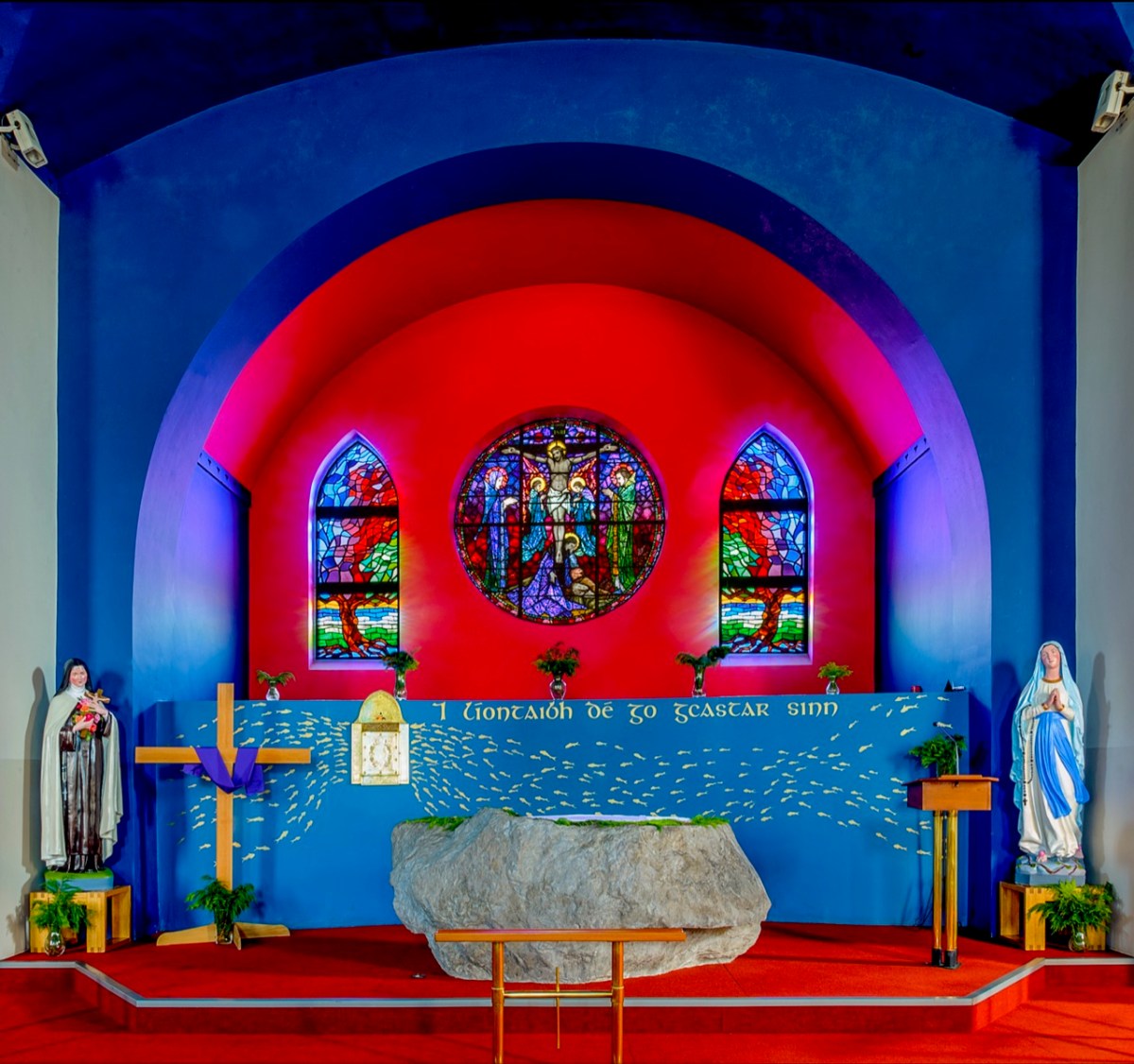
This is a rare photograph of John working on one of his favourite subjects: the gnarled thorn tree suffering from the ravages of harsh West Cork gales. Among the architectural work he undertook voluntarily was the reordering of the east end of St Bridget’s Catholic Church in Ballydehob. This was a major work.

. . . The gold fish hand drawn in the background of the altar and the depiction of one fish swimming against the shoal continues to evoke admiration from locals and visitors alike. He also designed the two ‘windswept thorn’ stained glass windows and etched the brass surround of the tabernacle. The Altar slab, composed of a vast monolith like the capstone of a dolmen, is a distinguished piece of sculpture and a tribute to his imaginative capacity . . .

John Verling Website: https://www.johnverling.com

Special thanks to Geoff Greenham for giving us this superb photo of St Bridget’s Church, Ballydehob.

The sign for the Brush Fire Ceramics Pottery, created by Noelle and John. They successfully produced a large number of individual pieces, crafted and fired by Noelle, and decorated by John.

John Verling died in 2009. Noelle Verling is living in West Cork and has been extremely helpful in providing material and information for this exhibition. Without her we would have been unable to fully present this story.

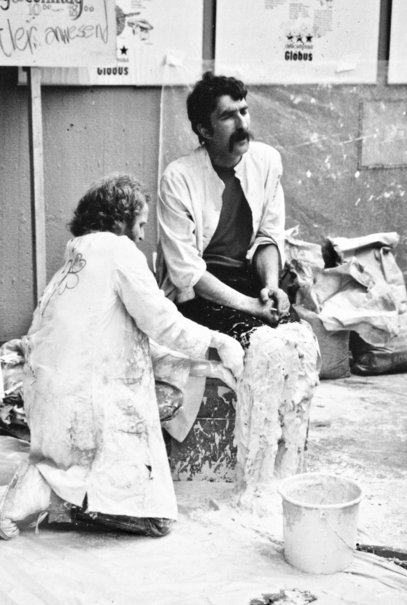
That’s John Verling in the picture above having his legs plastered by Ian Wright: this was part of a publicity stunt for the visit of a large group of West Cork artists to Zurich in 1985. John is also singing a folk song! You can read more about that particular enterprise here.

The Ballydehob Arts Museum is grateful to the town’s Community Council for providing the accommodation for the Museum. BAM is: Brian Lalor, Robert Harris, Sarah and Stephen Canty. Their combined knowledge and practical experience has ensured that our ambitions for this – our fourth exhibition – are fully realised.

ballydehobartsmuseum.com

Exhibition opens Jazz Festival Weekend in Bank House: Thursday 27 April @ 5pm, then Friday 28 April to Monday 1 May: 11am – 4pm. It will open with the Tourism Centre from June to September 2023