A Signal Success in Irish Engineering – Part 3: Old Head of Kinsale

Don’t you wish, sometimes, that you could just walk into history? I have felt that, often, when visiting historic sites: you see the remnants of something – a stone circle, rock art, an ancient dwelling, a battle site – and you just want to be able to go back in time and talk to the people who made them, or who visited them. You want to ask, of course, why the most enigmatic monuments were built – and what was it like to be there in those days?

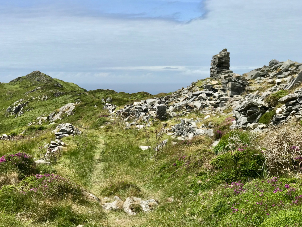
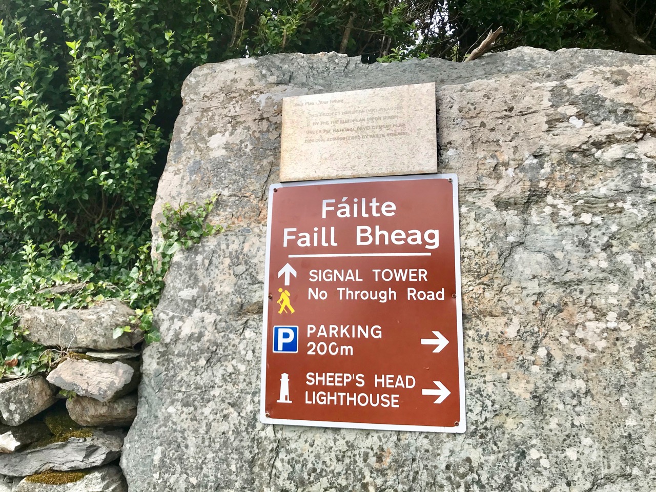
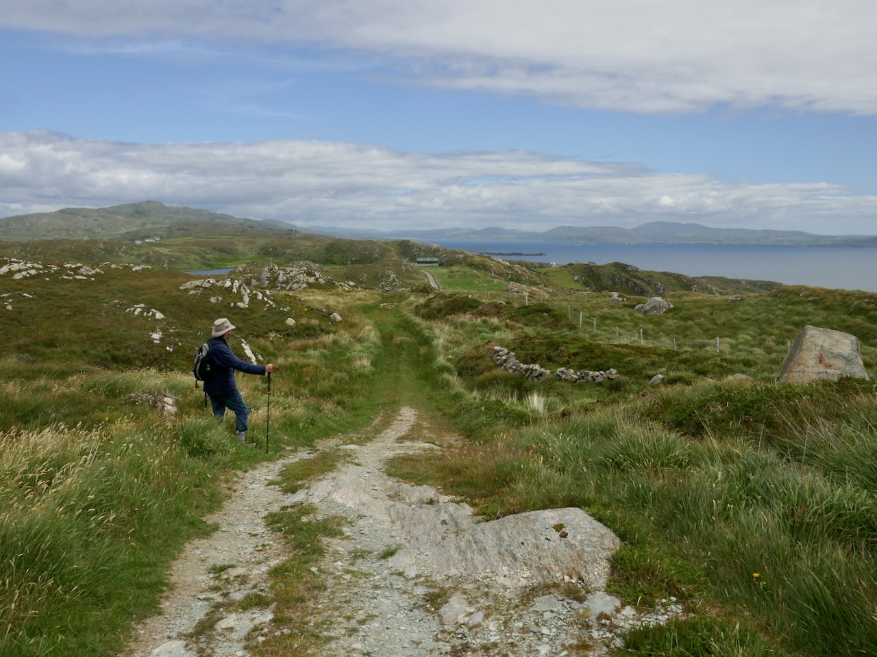
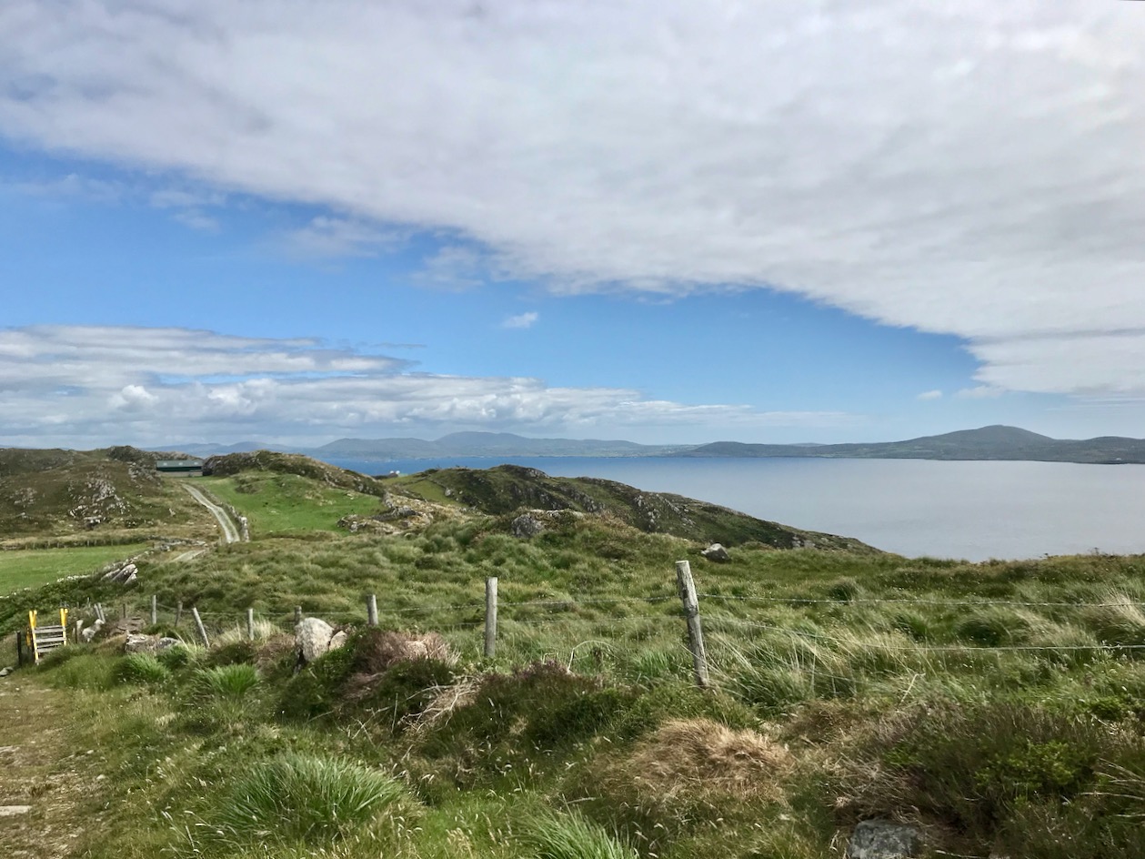
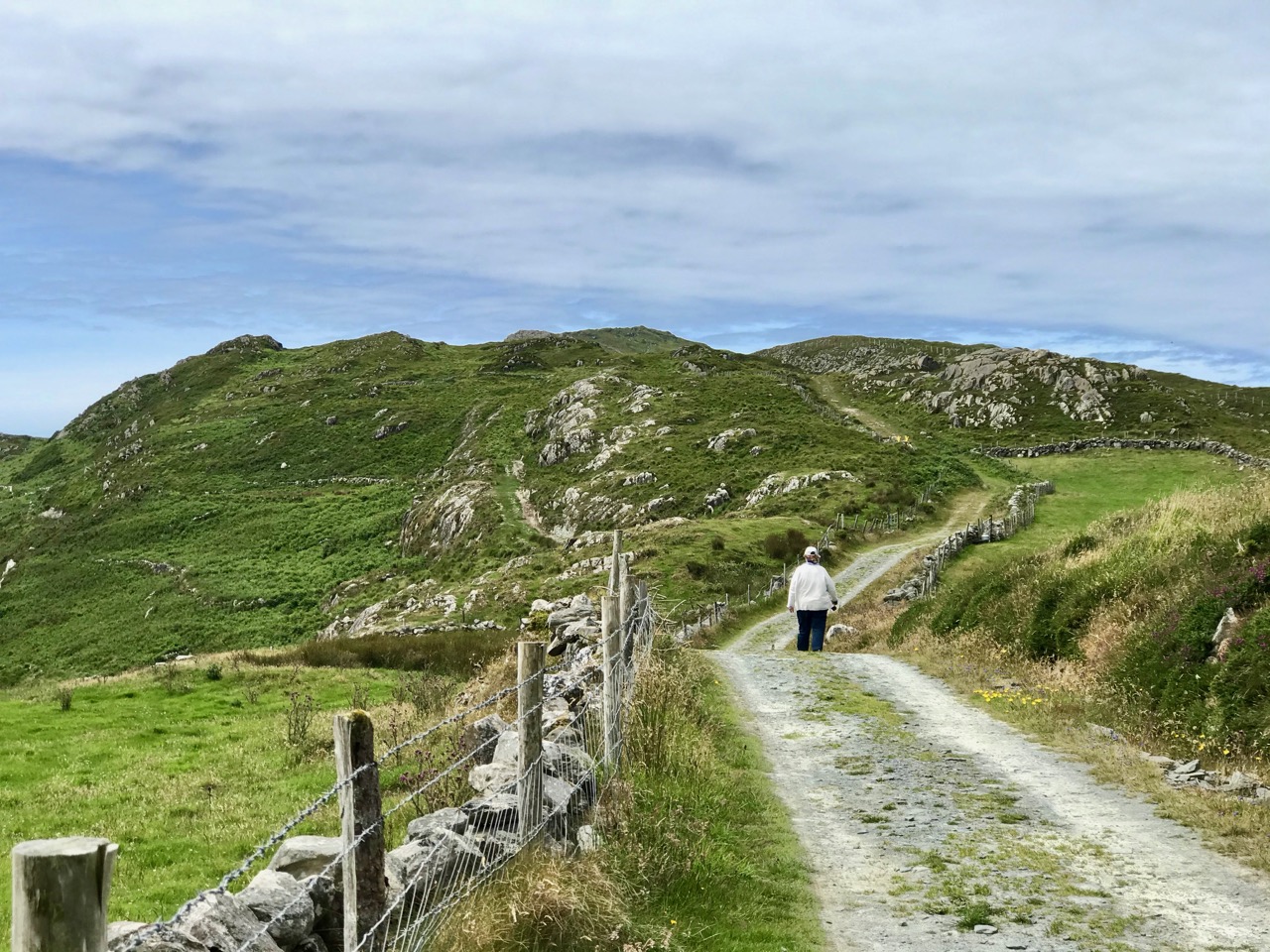
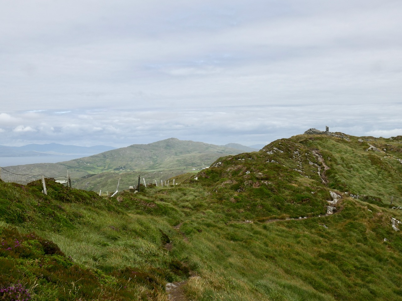
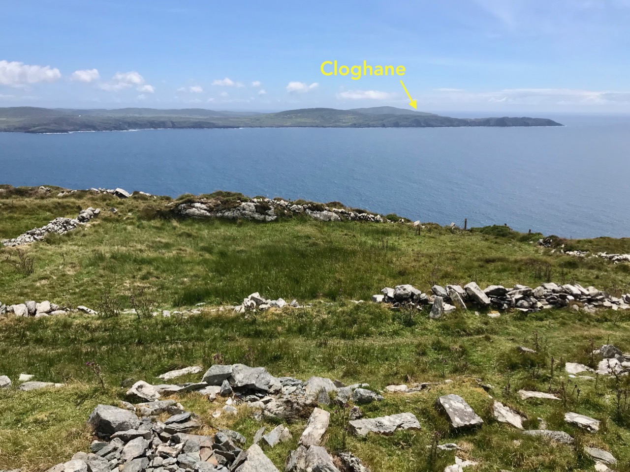
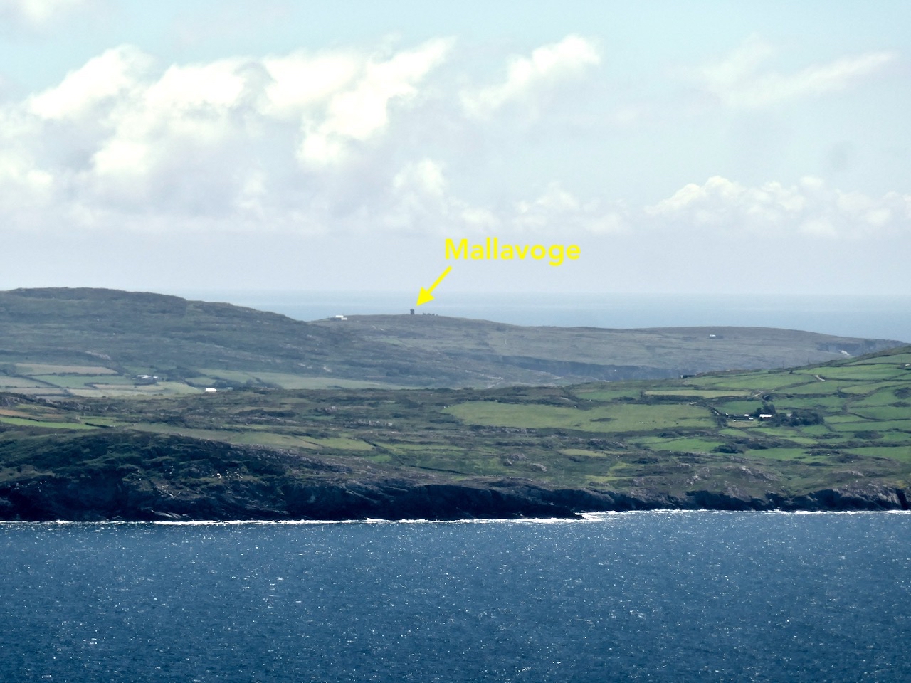
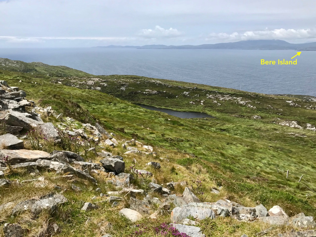
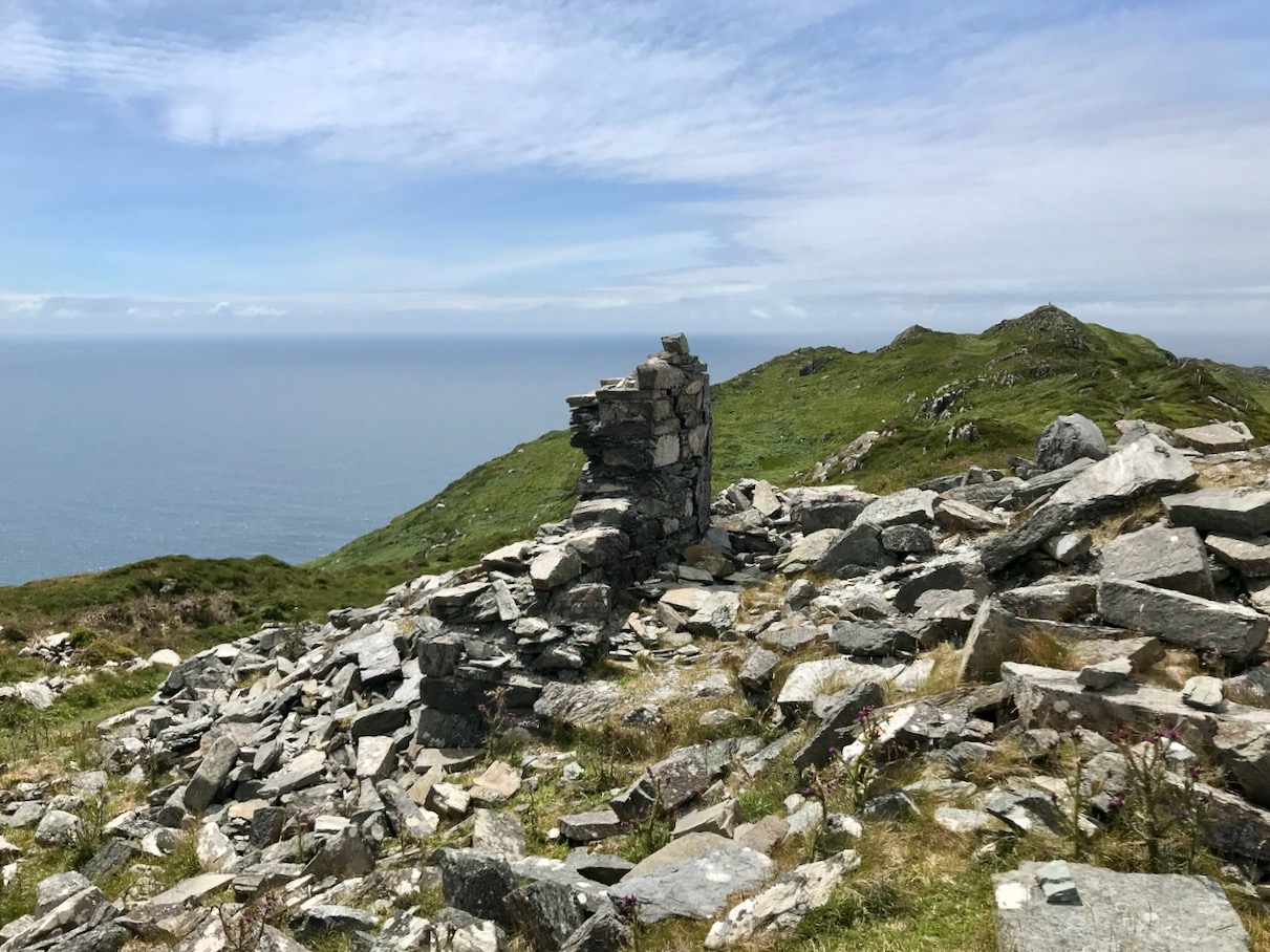
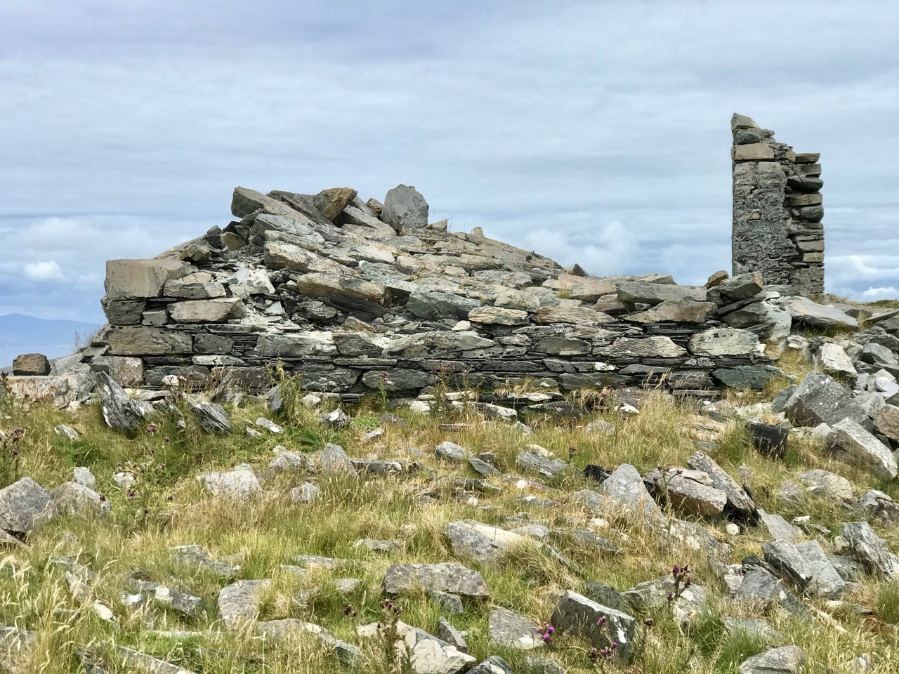
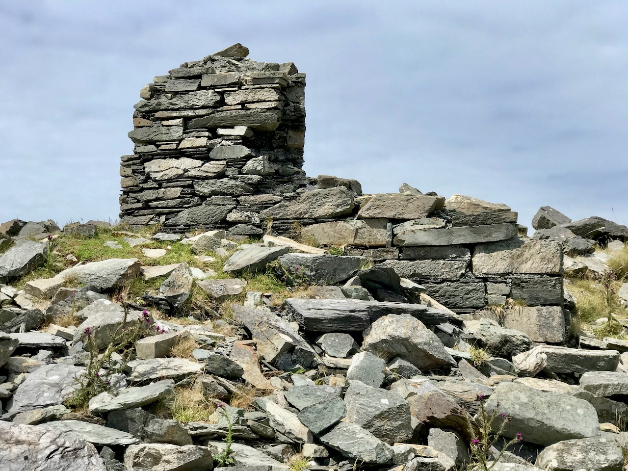
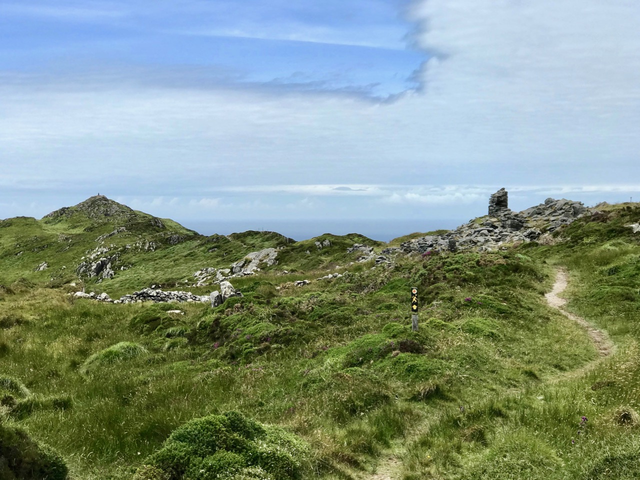
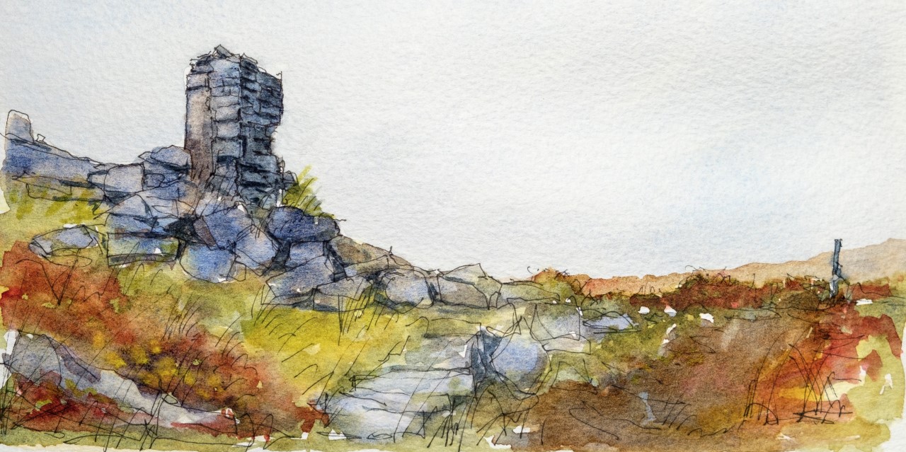
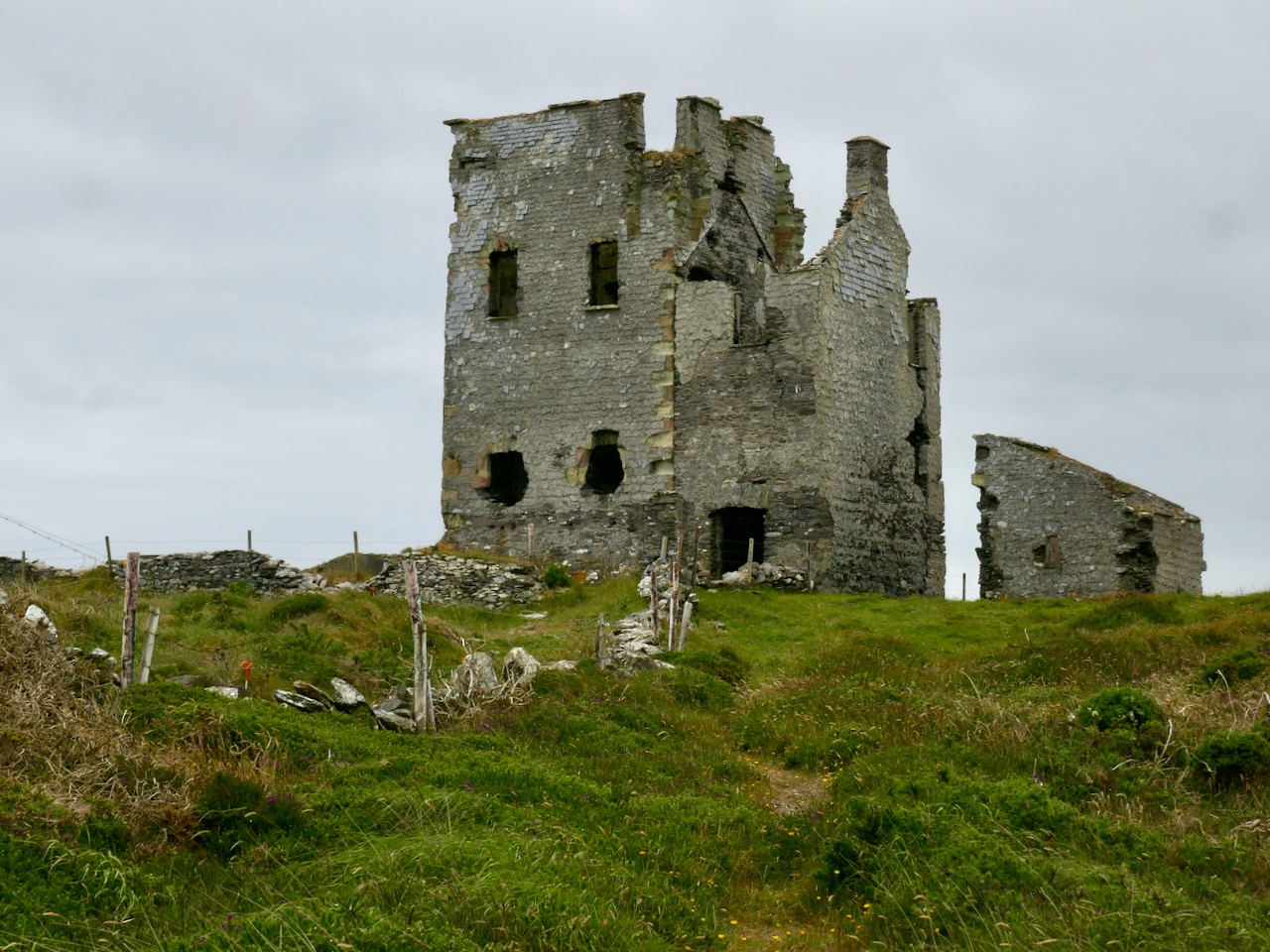
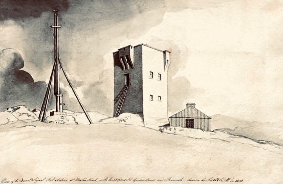
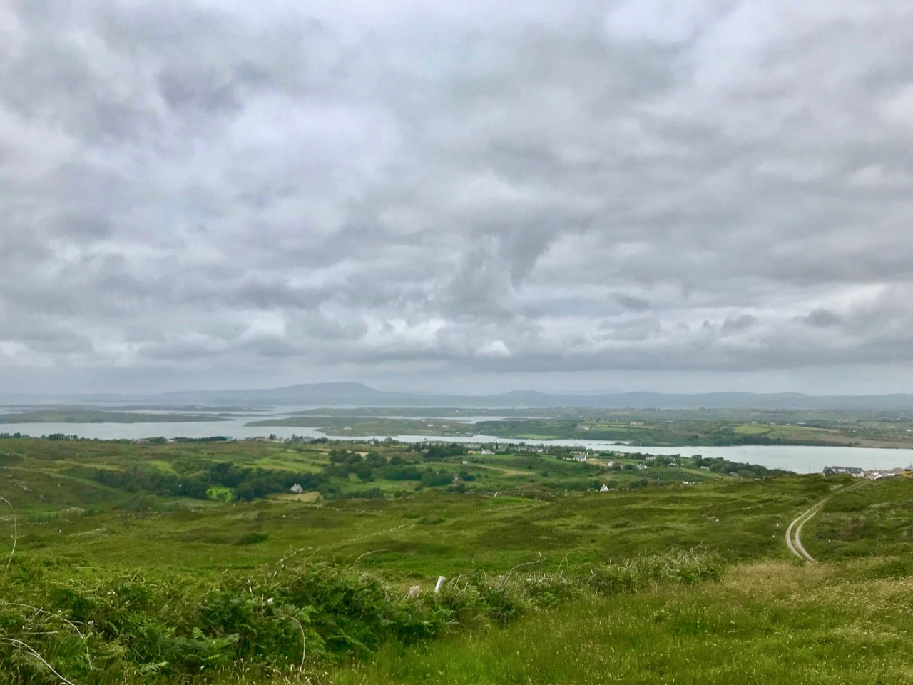
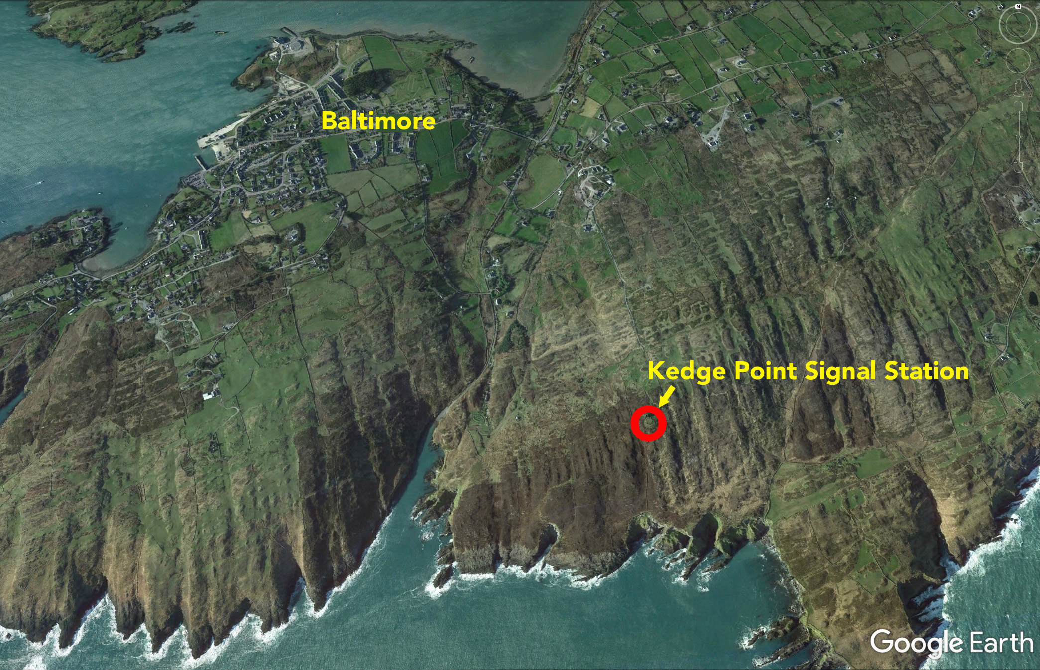
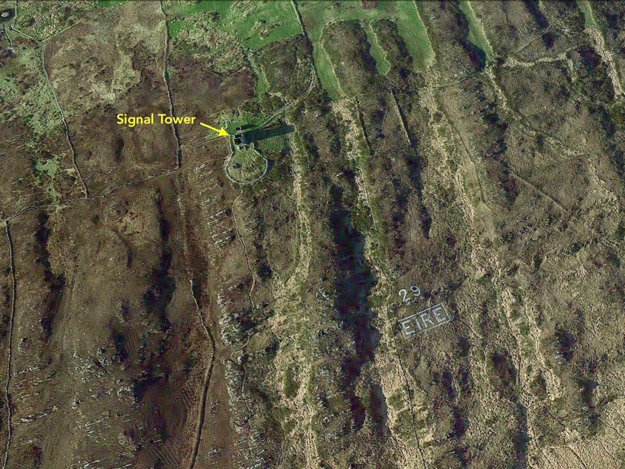
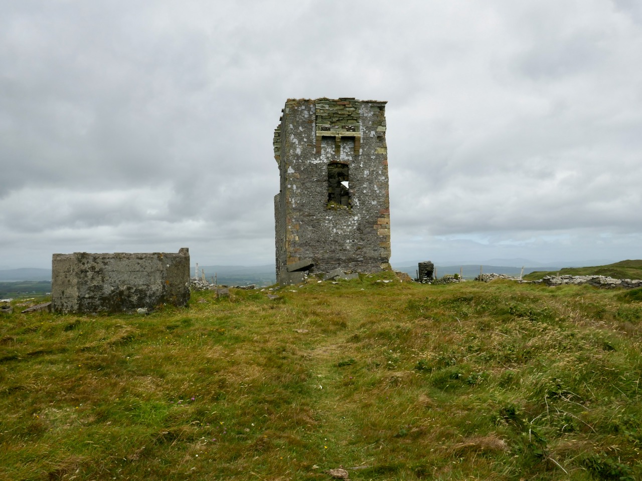
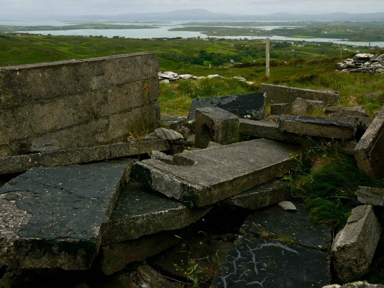
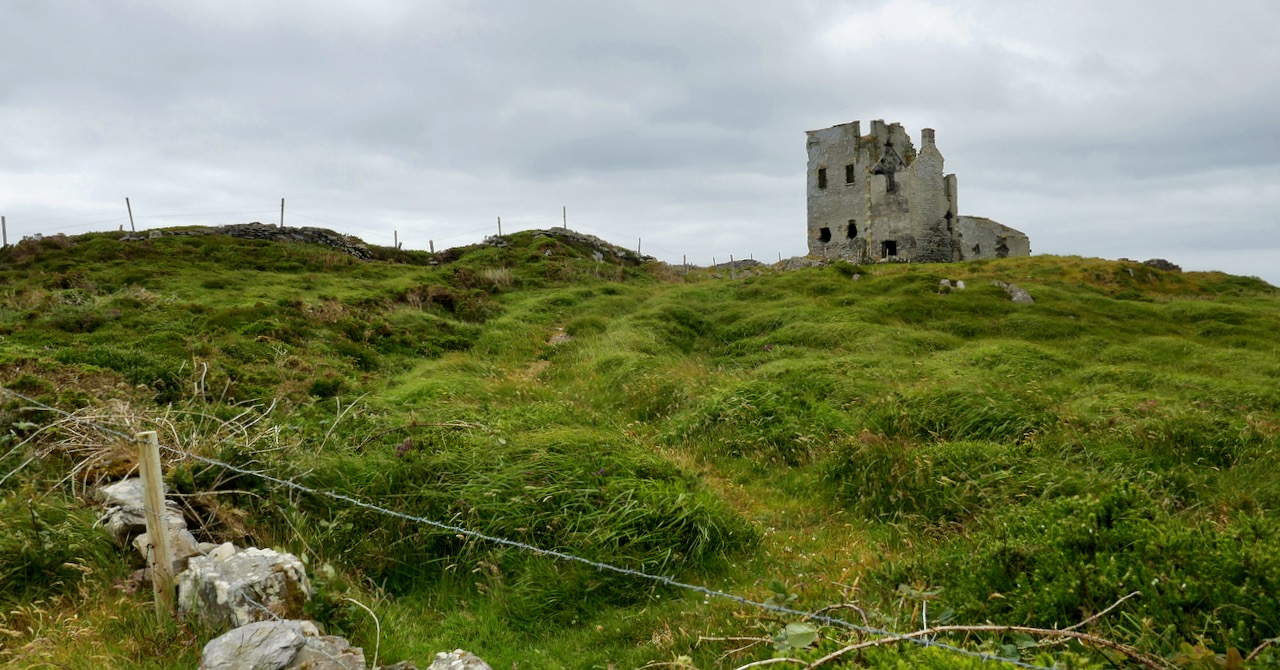
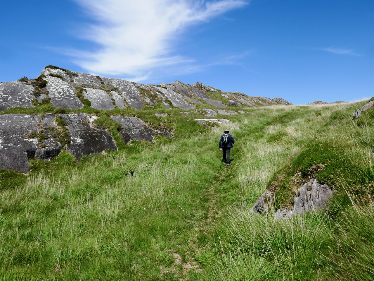
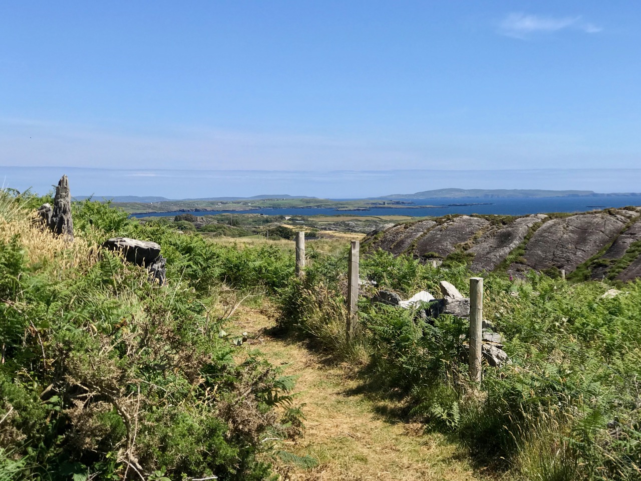
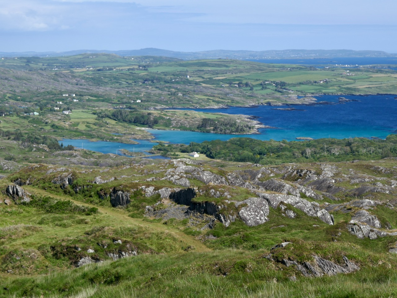
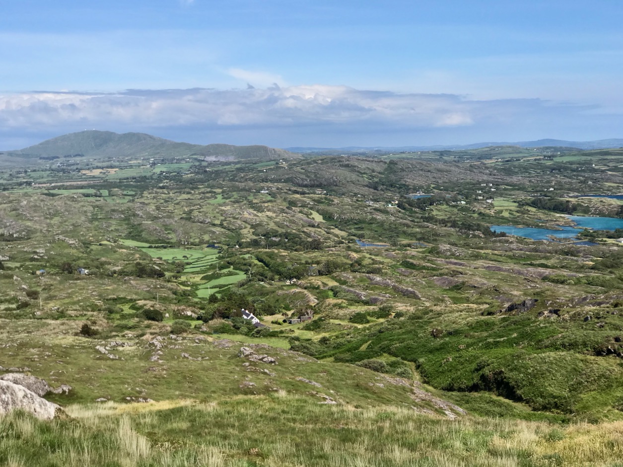
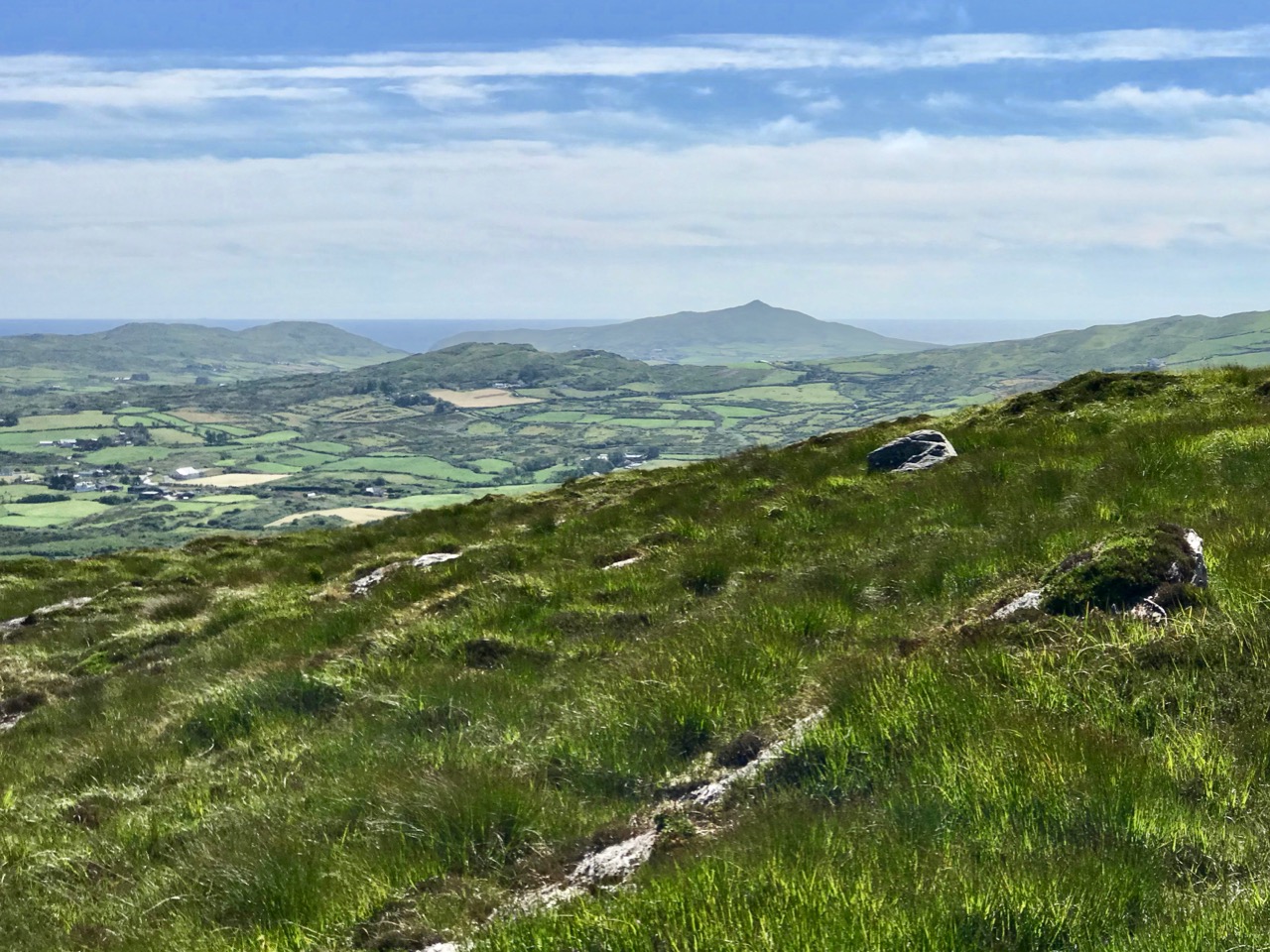
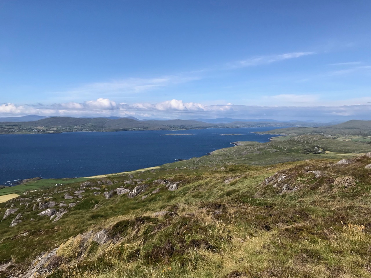
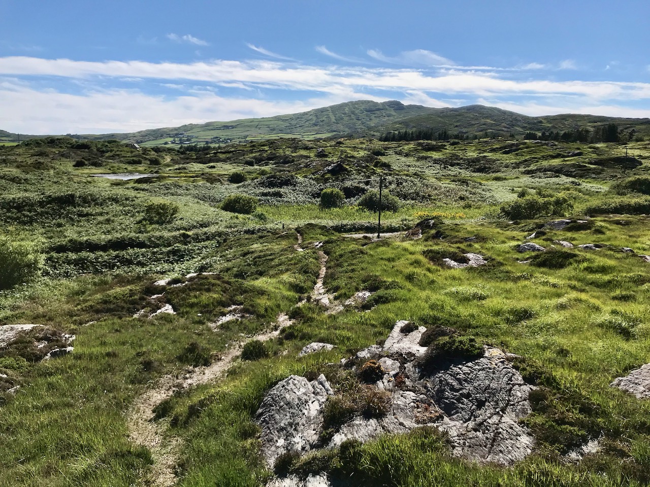
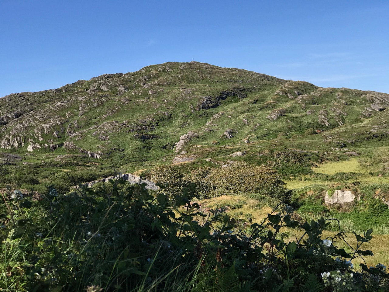
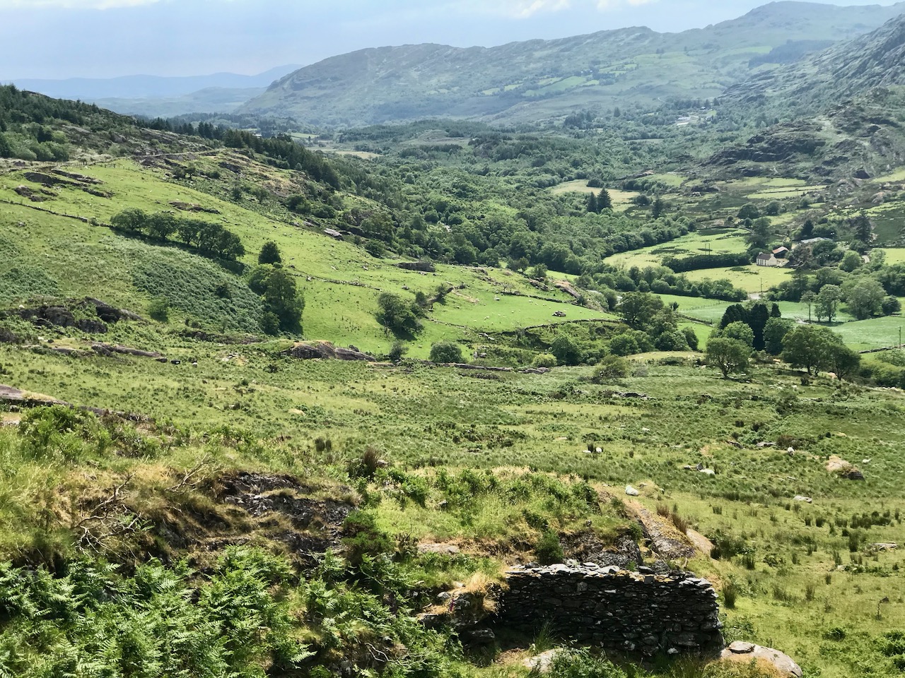
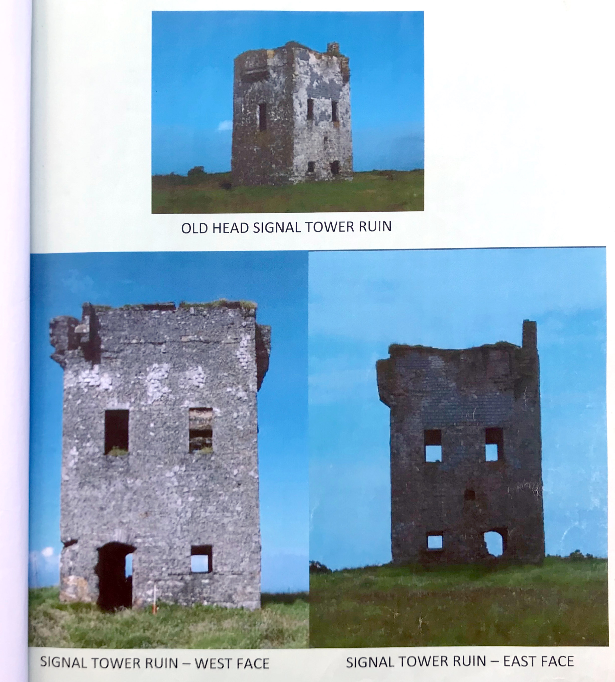
In my posts of the last two weeks we have visited some 19th century signal tower sites in West Cork. The first example, at Kedge Point near Baltimore, is a shell but there is sufficient of it to see exactly what it looked like, set high up on its lonely perch looking out over the cliffs. Last week we walked towards the westernmost end of the Sheep’s Head Peninsula to find scant ruins of a tower there, but with very fine vistas in all directions.

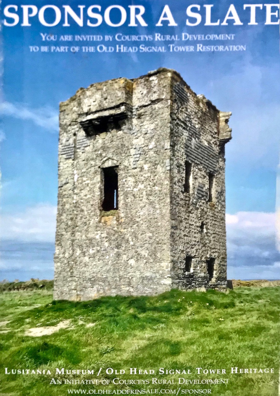
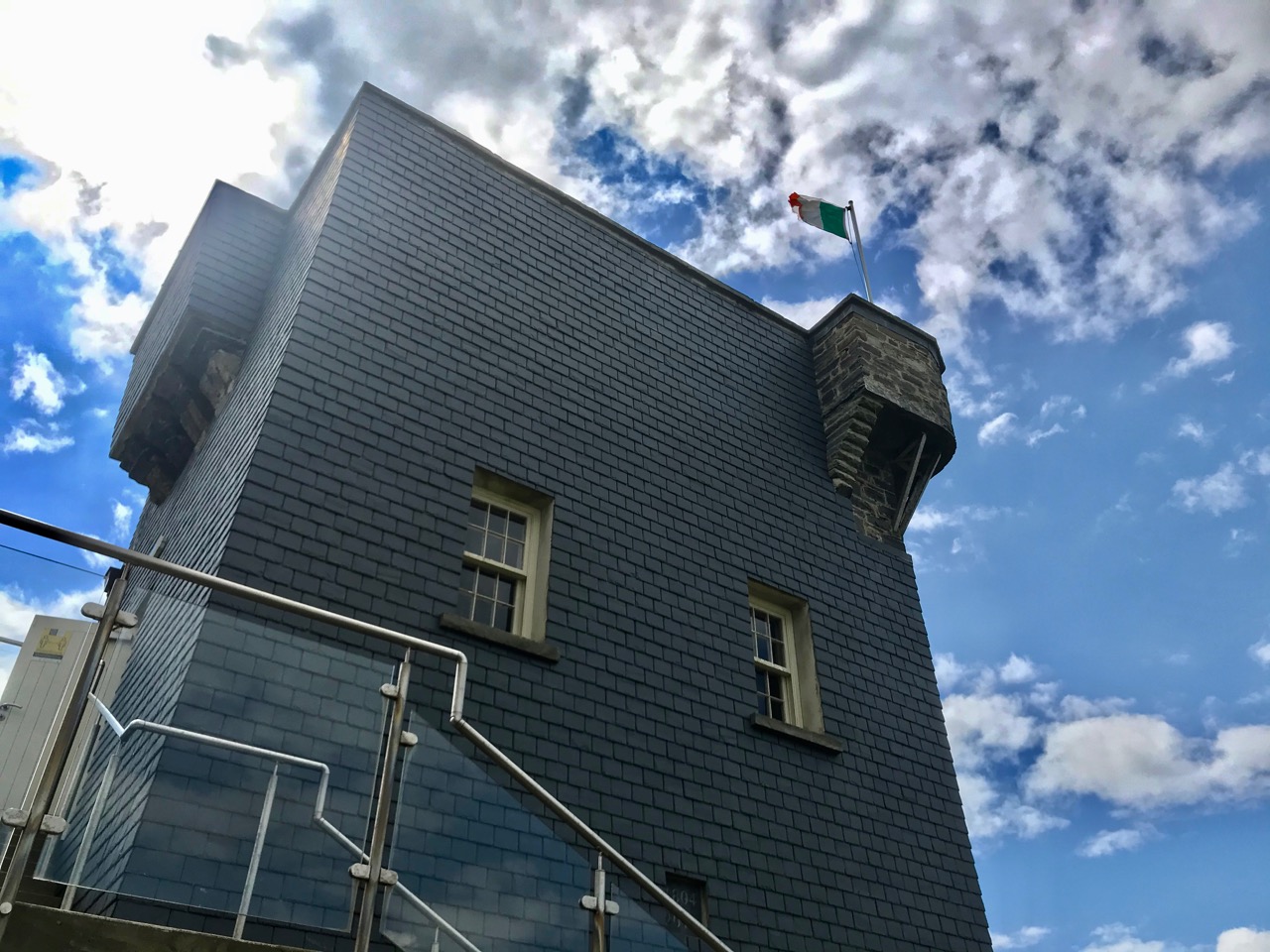
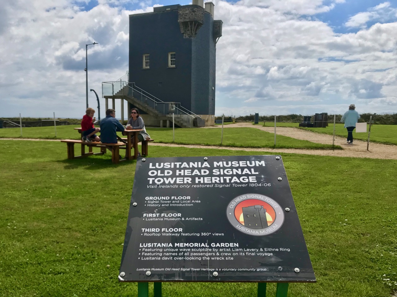
This time we are looking at another signal tower – on the Old Head of Kinsale – but it’s not a ruin. It has been fully reconstructed so that it is exactly as it was in its heyday. At the Old Head we truly can walk into history!

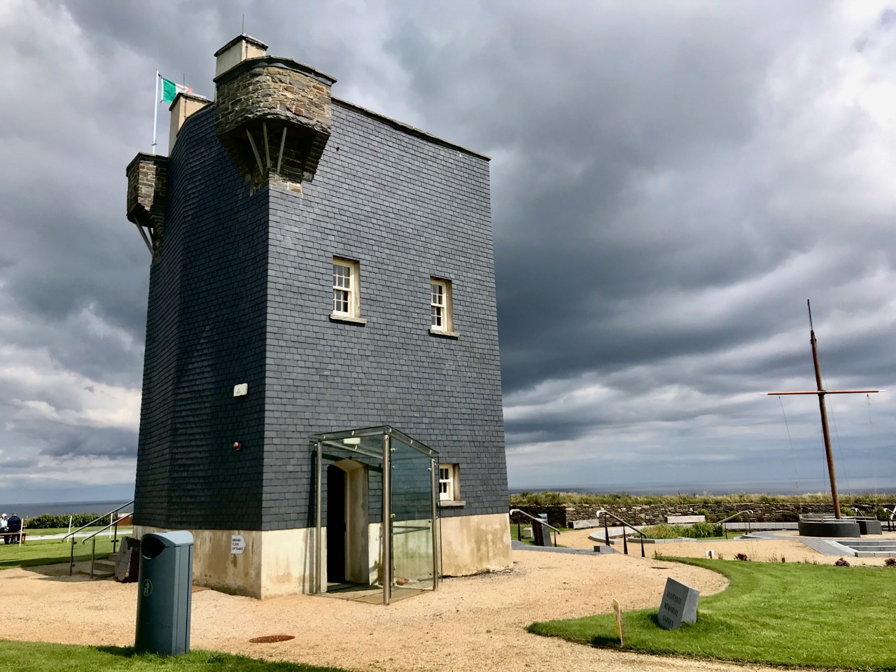
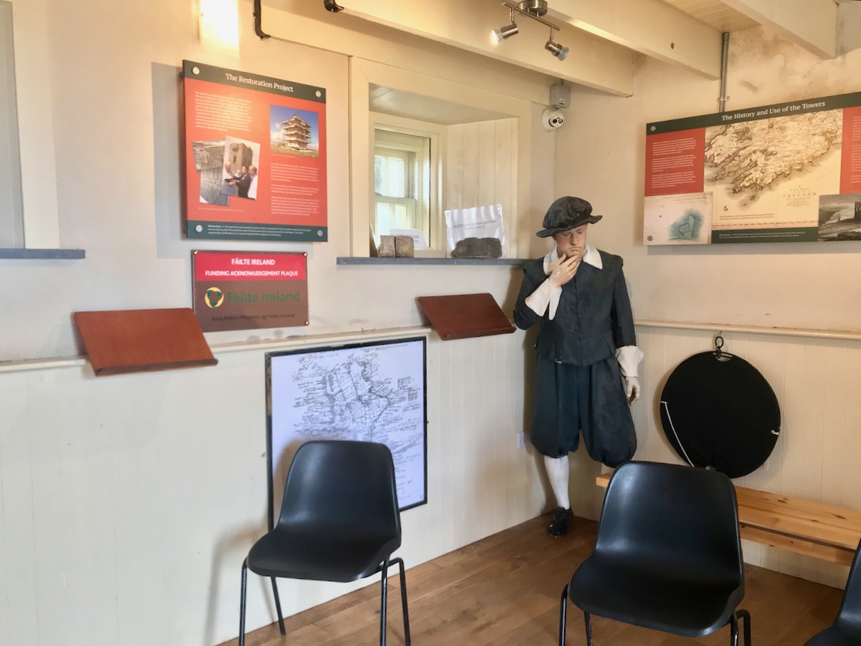
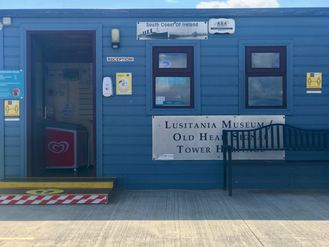
I think I’m probably safe in saying that there isn’t another museum dedicated to the Irish signal towers anywhere in the whole world! And it’s pretty special that the museum has been created by restoring an existing signal tower. And – when we visited – we were lucky enough to meet JJ who – it can reasonably be said – was the driving force behind the whole project.

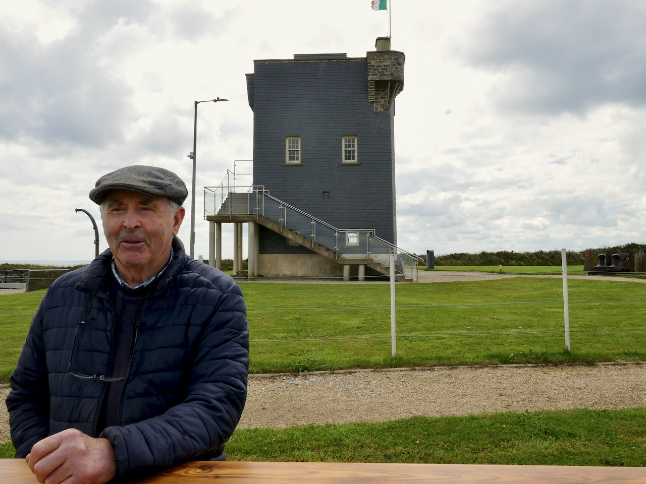
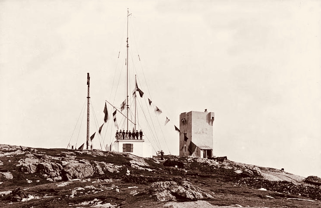
James Joseph Hayes at the Old Head of Kinsale signal tower, July 2020

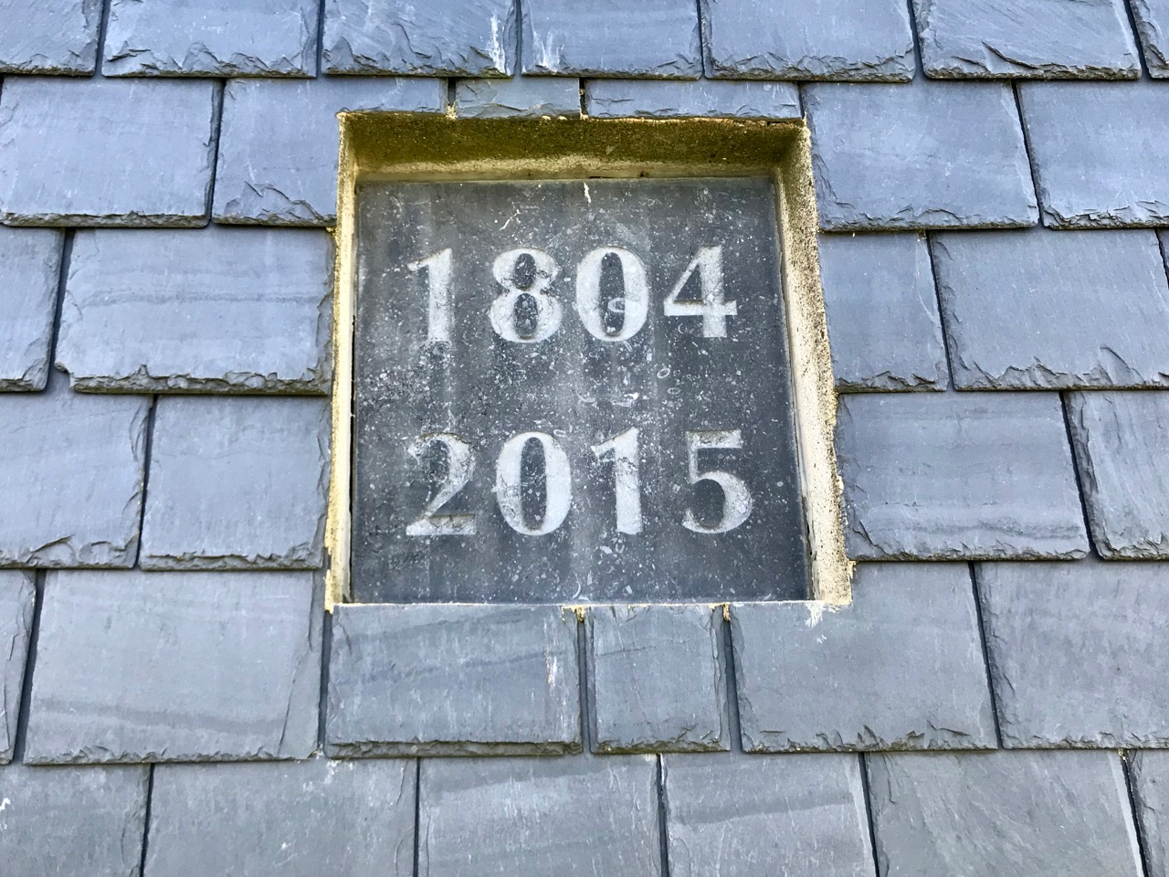
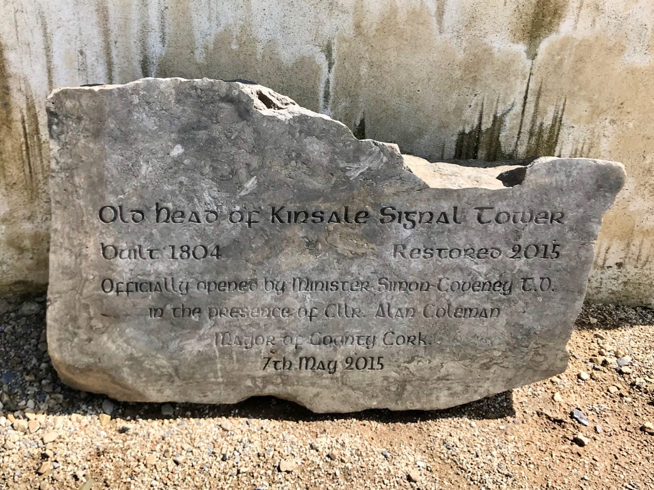
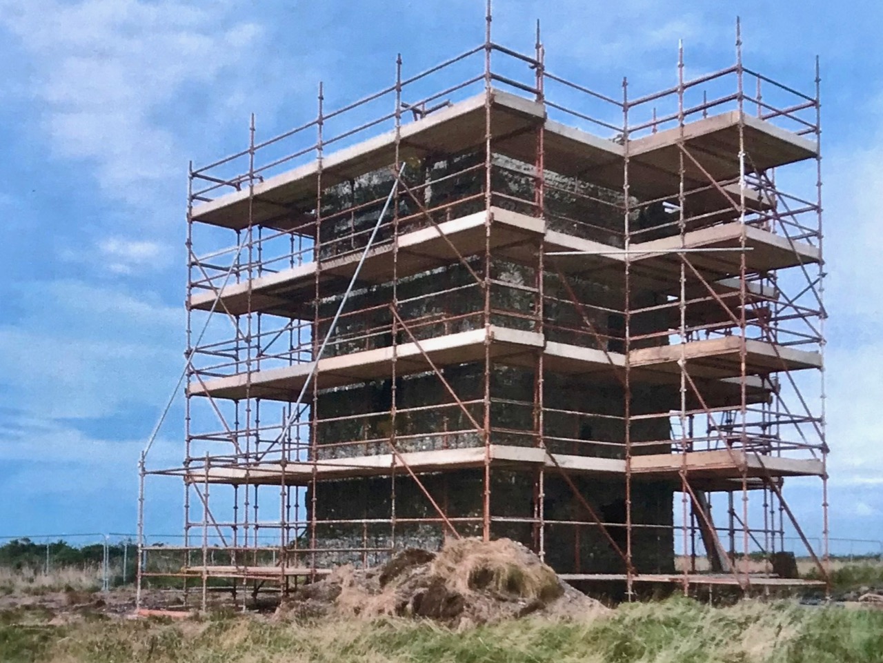
Ten years ago West Cork development Partnership were looking for projects which would benefit the area, encourage economic activity and attract visitors. JJ gained support from enthusiasts locally and proposed establishing a heritage centre at the site of the old signal tower, which was at that time a substantial ruin. As the Old Head is also the closest point to the wreck of the RMS Lusitania, which was sunk by a German torpedo in May 1915, the idea was also advanced that the heritage centre could also encompass the story of that tragedy. The whole idea caught the public imagination and, after five years of hard work, came to fruition. The fully restored building was opened in time to commemorate the centenary of the Lusitania’s sinking.

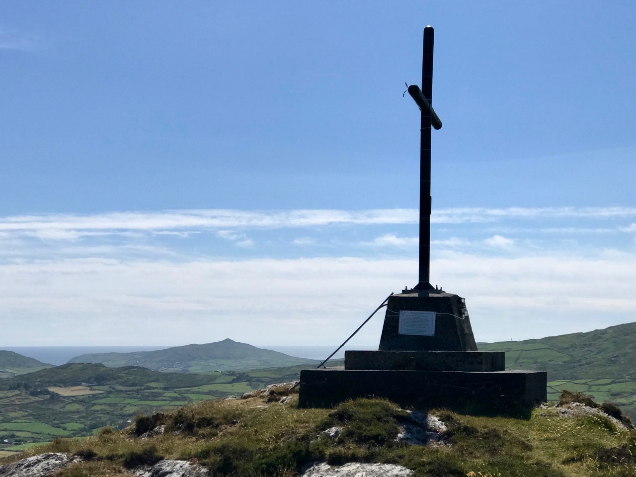
Evolution of a ruined tower, and the birth of a significant memorial to a WW I tragedy through the celebration of a little known aspect of Irish engineering in the Napoleonic era

JJ Hayes and the team he gathered around him have to be congratulated on their aspirations, and on their tenacity in realising their dreams in such a professional manner. They have brought the signal tower back to life using sound and sustainable construction techniques which are completely appropriate to the building type and will ensure that it will survive long into the future. In this video you can watch a first hand account of the restoration work, narrated by the construction Project Manager, Brandon Duarte:

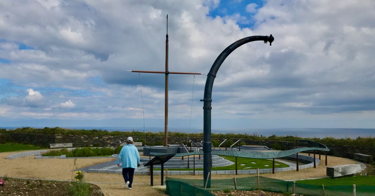
There are so many creative elements to this project: beyond the building a Lusitania Memorial Garden has been laid out as a contemporary work of art, the centrepiece of which is a 20 metre long bronze sculpture by artists Liam Lavery and Eithne Ring. We featured another example of their work earlier this year. This work contains the names of all the one thousand nine hundred and sixty two passengers and crew who were on board the ship on that fateful day. Twelve hundred perished.

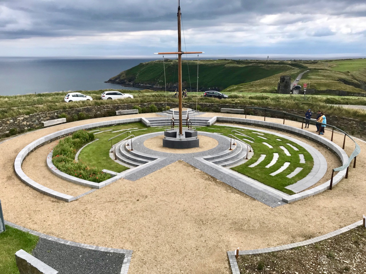
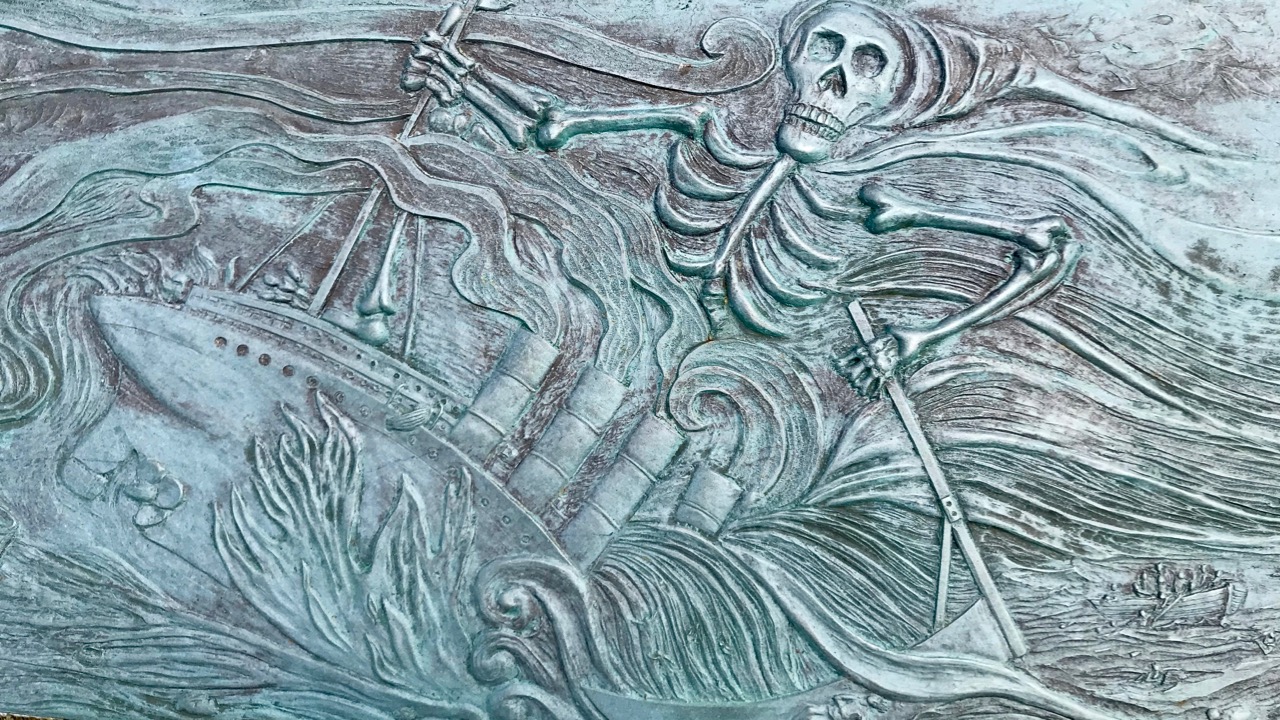
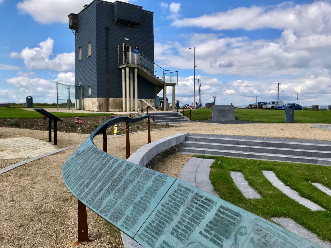
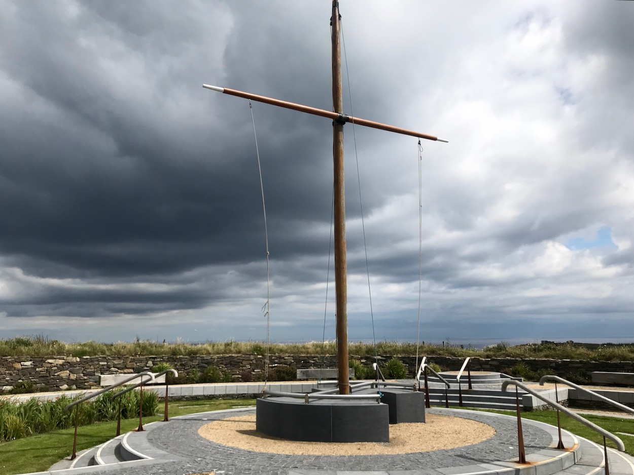
Lusitania Memorial Garden, with Sculpted artwork commemorating the victims of the sinking

The centrepiece of the Memorial Garden is a rigged ship’s mast. This is placed roughly where the original signal mast associated with this tower would have been – the focal point for sending and receiving signals over two hundred years ago. This mast is from the Sail Training Vessel Astrid – a 42 metre long tall ship which started life in the Netherlands in 1918 but sadly ended by foundering just outside Kinsale Harbour on 24 July 2013. Fortunately, in this case, all on board were rescued. It is apposite, perhaps that these many nautical links are brought together at this centre as all the signal towers are believed to have been manned by sailors or retired sailors who relied in their day on good systems of communication – systems which evolved rapidly through history.

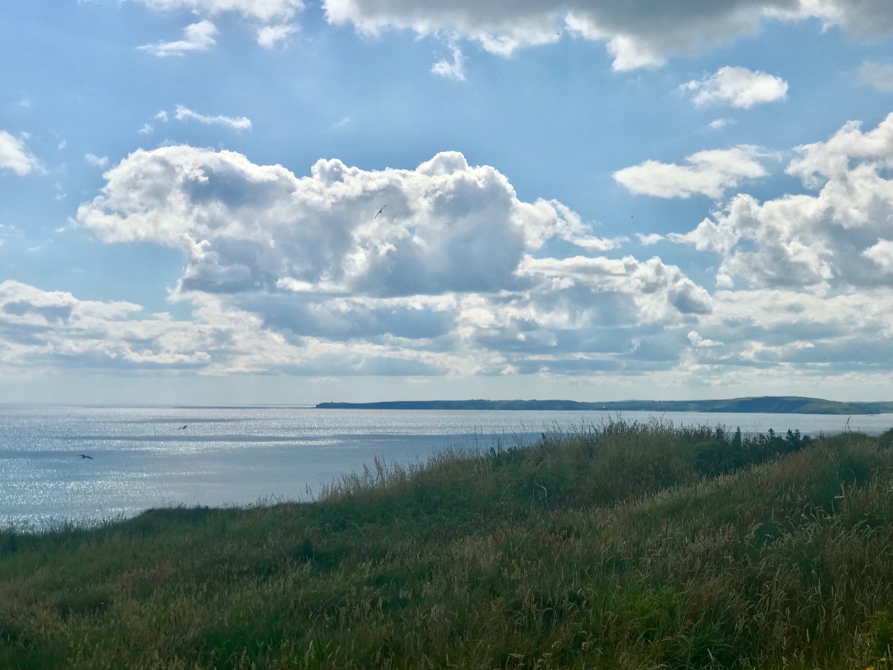
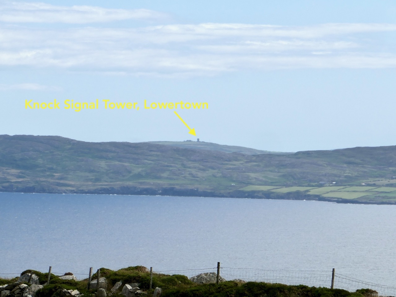
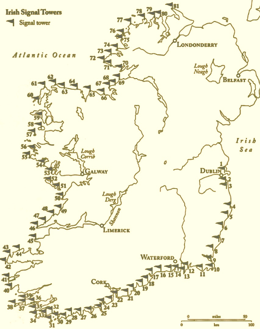
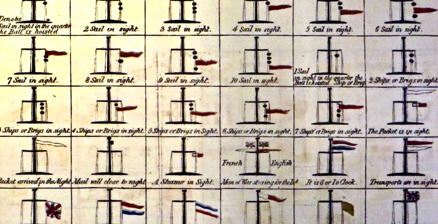
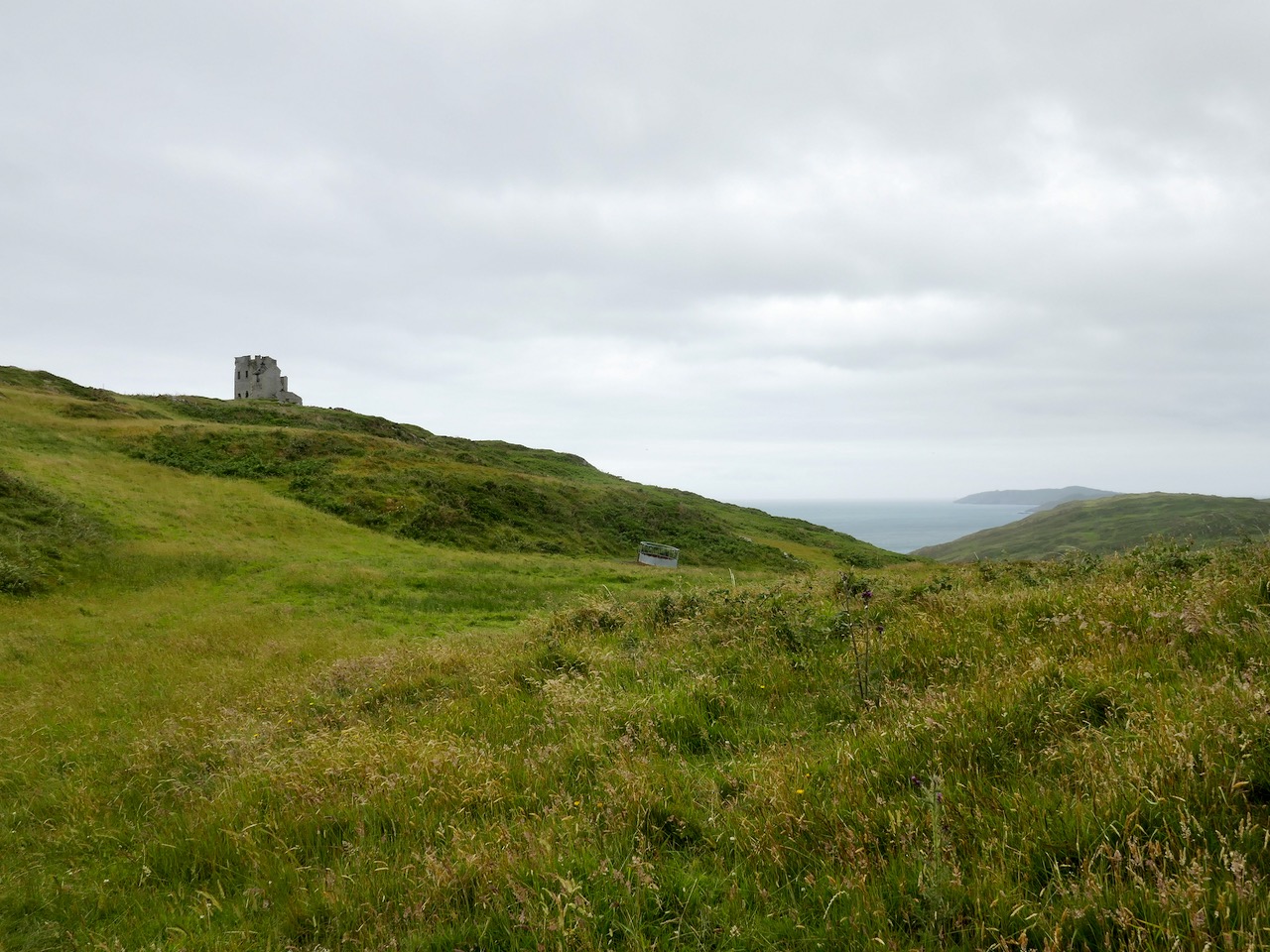
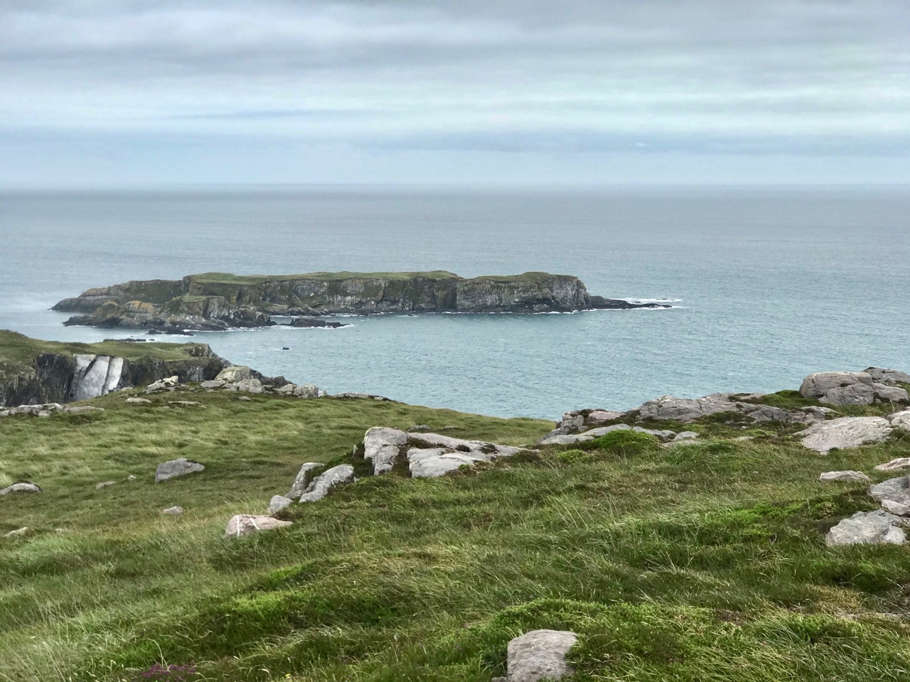
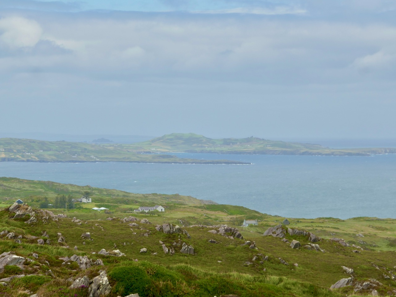
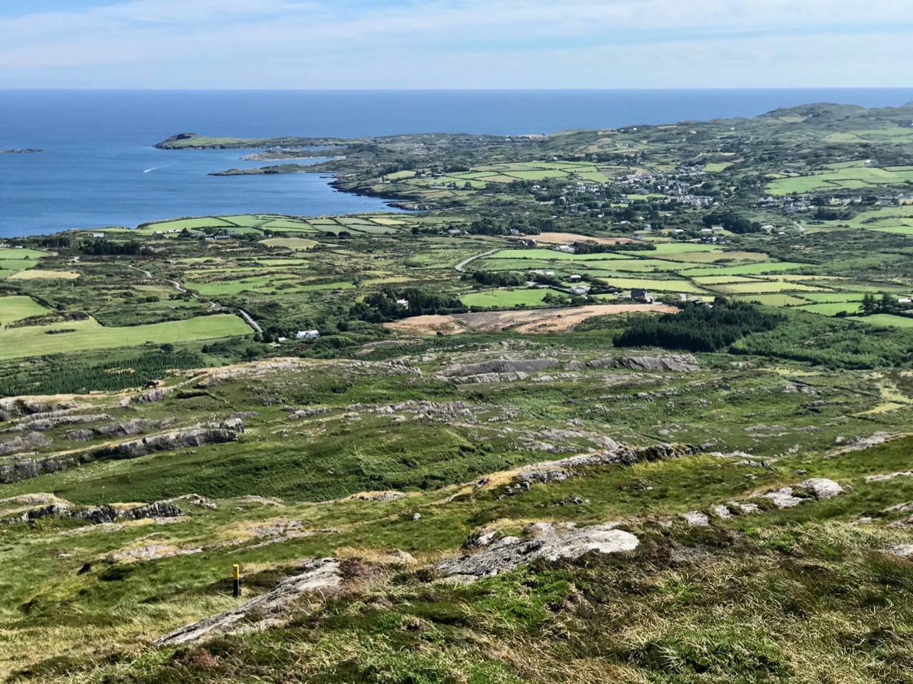
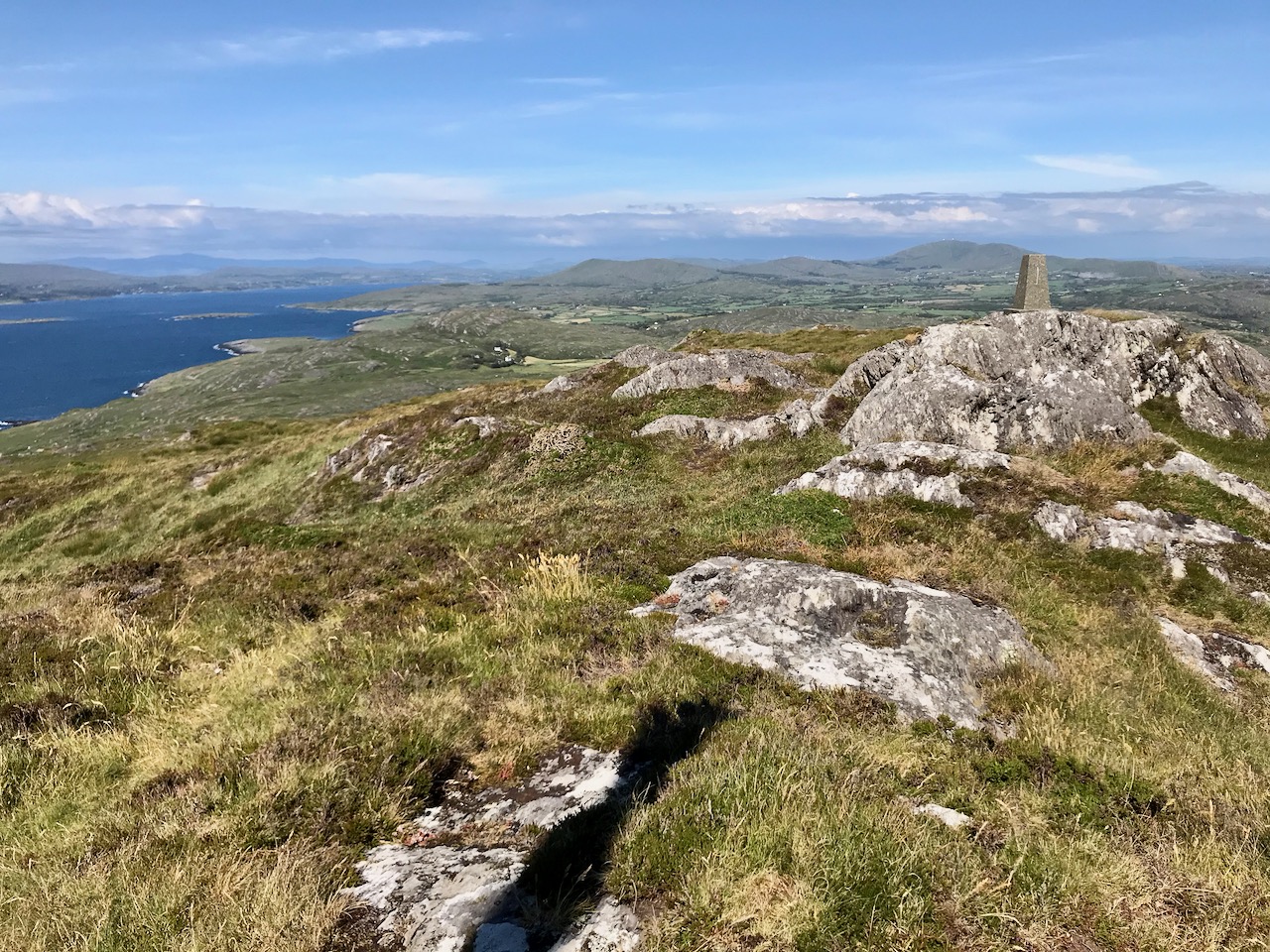
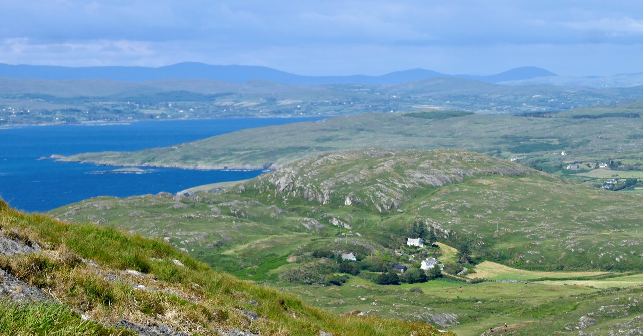
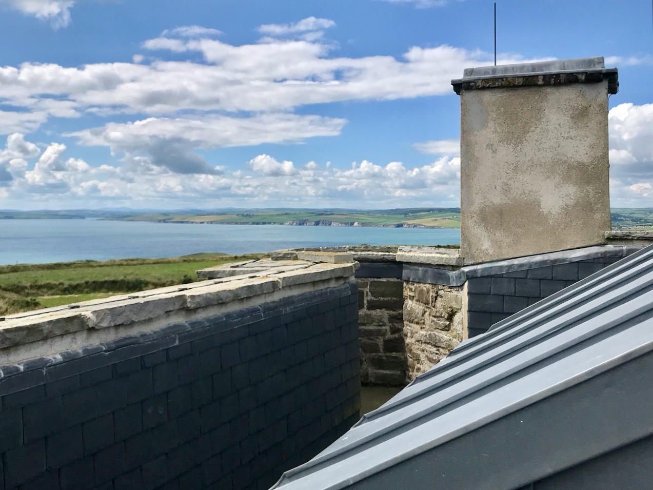
From the Old Head of Kinsale Tower, which is number 25 of the 81 that were built around the coast of Ireland you can see tower number 26, which is on the Seven Heads peninsula, 13 kilometres to the south west (above and view from the tower parapet, below). Again, we can only admire the quality of the optical devices used to see and clearly read the flag and ball signals at such a distance. In fact, the whole subject of signalling and communication – particularly in association with these Irish stations – is worthy of a future post of its own. Keep watching out!

The Old Head of Kinsale Signal Tower and Lusitania Museum has opened for the summer season following closure during the Covid19 lockdown. Systems are in place to ensure health and safety and social distancing. Follow the link to this website for full information on opening hours and directions

A Signal Success in Irish Engineering – Part 2: Ballyroon Mountain

Following on from last week’s account of Kedge Point signal tower, our second foray in search of Ireland’s coastal communication stations dating from the early years of the nineteenth century takes us to the Sheep’s Head Peninsula in West Cork. The waymarked trail that passes the now ruined Ballyroon Mountain signal tower is on the Sheep’s Head Way and is fully accessible from the parking area at Fáilte Faill Bheag (if walking from east to west), or from the Cupán Tae tea-room parking area at the very end of the road (if walking from west to east). Although there is very little of this signal tower left standing – it was largely destroyed by a storm in 1990 – the walk itself is a visually stimulating experience, not to be missed! As with the majority of the remaining signal station sites, the location here is on high ground with prominent panoramic views in all directions.

When walking the off-road Sheep’s Head Way trails, please remember that dogs are not allowed: this is one of the conditions that have been agreed with landowners when the trail routes were negotiated, so it must be respected by all users.

These two aerial images show the remote setting of this signal station. The site was developed a little over two hundred years ago, and one of the necessities was providing a firm trackway along which to bring building materials, and also to provide efficient access to and from the signal tower when in use. In the top image, also, you can make out a substantial walled field to the south of the tower: this would have been used to pen ponies or donkeys and – possibly – a goat for milk.

The track that served the signal station in its heyday has become the ‘green road’ that takes you there today. In bad weather it’s a bit wet underfoot in places, but otherwise it is a joy to walk and, on a good clear day, provides spectacular views in all directions. Look out for the other signal towers that can be seen from this site: Cloghane on Mizen Head, Mallavoge on Brow Head, Derrycreeveen on the Beara Peninsula, and Knock, which is an inland site near Lowertown, Schull.

In the upper picture here you are looking back towards the vestigial Ballyroon signal tower from the higher ground on the footpath from the Cupán Tae tea-room, while the lower picture shows the ‘pimple’ on the horizon which is the Cloghane signal tower at Mizen Head seen from Ballyroon.

The upper picture shows the Mallavoge signal tower at Brow Head (more about that site here), while the Knock signal tower is seen in the middle picture, which was taken close to the start of the Ballyroon Mountain trail. Both these photographs have the benefit of a modern zoom camera lens, but imagine how good the optics of the telescopes needed to be for those who manned the towers in the early 1800s. Not only did these silhouettes have to be clearly defined, but the flag and ball signals that were put up on the associated masts had to be readable. The lower picture looks north across Doo Lough towards Bere Island, where there were extensive fortifications in Napoleonic times, including a signal tower. Below is a photo of the Malin Head signal station, Co Donegal, dating from 1902 (National Library of Ireland Collection). There the station was kept in use for strategic purposes long after the Napoleonic era and became the site for one of Marconi’s telegraph stations. While the flags in this picture are not from the earlier times, it gives you some idea of what had to be picked out from a great distance. By eye, put the scale of the tower in this photo to the scale of the distant towers in the images  above: it’s hard to fathom how accuracy was possible yet messages were dispatched and received successfully. It evidently took about four minutes to put up a message on the mast: allowing for reading and deciphering, I would expect a message to be sent from Sheep’s Head to Cork via 11 towers in about an hour, or all the way to Dublin via 33 towers in three hours. This would depend on daylight and good visibility at all times.

The most comprehensive map of Ireland’s signal tower distrIbution that I have found so far is this one drawn for the authoritative book on the subject Billy Pitt had them built: Napoleonic towers in Ireland by Bill Clements, The Holliwell Press 2013. This clearly shows that invasion was expected to come from the west or south, rather than from the more naturally protected north-east coast.

The selection of photographs above shows the state of the ruined tower at Ballyroon Mountain today (2020). Although there’s not much of a structure left it’s still a poignant memorial to those who built and operated this and all the other links in the communication chain that substantially encircles the coastline of Ireland. It’s a legacy well worth celebrating, and we are fortunate in Cork County that we have so many examples of the building type, some of which, like this one, are accessible to visitors. We will be exploring more of them in due course. To neatly finish off this post, here is an exquisite drawing of the Ballyroon tower executed by our friend Peter Clarke who writes the Hikelines series. It’s a lovely sketch which, for me, captures the slightly edgy romanticism of this beguiling location. Thank you, Peter.

Next time: Signal Towers Part 3 – Walking into history!

A Signal Success in Irish Engineering – Part 1: Kedge Point

At first sight this gaunt ruin on the West Cork coastline could be taken for a medieval fortified house or castle, but we can date its construction very precisely – to 1805, and we also know its purpose: long-distance communication. It was only put to use for a few years, and has been derelict at least twenty times as long as it was ever in service. It’s a signal station, one of over eighty similar structures around the whole coastline of Ireland, an initiative which represented a major engineering feat of its time.

This watercolour sketch by surveyor Sir William Smith is invaluable: it dates from 1808 and shows a signal station in use in its heyday. This one is at Malin Head on the Donegal coast, Ulster, and shows the elements which would have been common to all of the stations: a signal mast, a defended tower and a ‘guard house and barrack’ – probably also an equipment store. The signal tower bears a striking resemblance to the Irish ‘tower house’ or castle dating from several hundred years earlier, with its bartizans, machicolation, base wall batter and raised entrance, All these features were practical as the towers were military installations built in the times of the Napoleonic Wars. The cartoon (below) dates from 1805 and encapsulates the fear of invasion that swept over Britain in the early 19th century. Balloons, kites, flotillas of troopships and a channel tunnel were all envisaged as ways in which the French might conquer these islands! Humorous though this may seem, France had already used military balloons in the 1790s, and Bonaparte appointed Madam Blanchard as his ‘air service chief’, though she told him an aerial invasion would probably fail because of adverse winds.

Since Theobald Wolfe Tone and the Society of United Irishmen attempted to rally France behind the Irish cause in the 1790s, Ireland was seen as a possible focus for the feared invasion, and led to the British Admiralty constructing the system of signal stations as observation posts, together with 50 Martello towers, each maintaining a garrison of troops, officers and heavy artillery. The principal purpose of the signal towers was to keep watch on the coasts and to rapidly send signals around the country if unrecognised shipping was seen. Each tower, therefore, had to be within sight of one or more of its neighbours in both directions. The average distance between towers was 13.5km, although here in West Cork the towers at Brow Head and Mizen Head are only 3.8km apart. Ireland’s coastline is about 1,400km long, depending how you measure it.

Various combinations of flags and canvas ‘balls’ could be quickly assembled on the signal masts and, with the use of a code book (above) fairly complex messages might be circulated. Another vital piece of equipment, of course, was a high quality telescope. As the Navy had such essential apparatus – and the experienced personnel to use it – the Irish signal towers were largely manned by active or retired sailors.

We set out to explore some of the signal stations close to us in West Cork. Once we feel free to travel further afield through Ireland I can see the signal towers becoming a long-term project! If those we have visited so far are good examples, they take us to some of the wildest high places with panoramic coastal views: many are utterly remote. And they are all imbued with a sense of history – of duties that demanded long hours of lonely vigilance in harsh conditions. Most are long abandoned and forlorn. But the marks of those who have been there remain inscribed on the decaying walls.

The header illustration and all the photographs above were taken on our recent visit to the signal station at Spain, to the east of Baltimore. There is rugged moorland there and dramatic cliffs overlooking Kedge Island. The site is known as Ballylinchy or Kedge Point. It’s a fair climb off-road but not difficult to reach. It’s always essential to seek permission locally before crossing farmland.

There are uninterrupted views from Ballylinchy towards Kedge Island (upper photo) and across the islands towards the Mizen (lower). Visibility was restricted on the day we visited – and this made us realise how important the weather would be for accurate observations. However, we could clearly see the signal tower on Cape Clear from this vantage point, shown below, with the Fastnet Rock and lighthouse beyond. You can understand from this view – with the camera zoomed in – how powerful the telescopes needed to be to clearly read the flag signals. Finola’s post here includes a section on the Cape Clear installations.

The Google Earth images above and below reveal the setting of this signal station on the highest point of land for miles around. History abounds on this site, with the remains of a World War 2 observation post in close proximity to the 1805 structure, and one of the many EIRE signs set into the cliff, also dating from World War 2 and set up around the coast, reportedly at the behest of the American authorities to help orientate pilots and alert them to Ireland’s neutrality.

The south facing elevation of the Kedge Point signal tower clearly shows its defensive machicolation. On the left is the stump of the LOP (World War 2 lookout post). Below – the rubble of the destroyed LOP and some of the recognisable architectural features of this tower.

Next week I will report on a very different location, which we visited on a much better day – lots of sunlight, blue skies and West Cork magic to look forward to! This time our site will be at the westernmost tip of the Sheep’s Head Peninsula, and you will get a different sense of the relative orientation and intervisibility of these intriguing historic monuments.

Below – the signal tower at Toe Head, about ten kilometres to the east, seen from Kedge Point

Mizen Mountains 5 – Knockaphuca

Perhaps one of the most satisfying mountains on the Mizen, the 237m high Knockaphuca provides a well maintained waymarked trail best tackled as it is laid out – in a counter clockwise direction. You will go up the east side and down the steep west face. If you are lucky with the weather, as we were just before the longest day, you will have an experience which is hard to rival in this corner of Ireland. The loop walk is one of the latest sections of the Fastnet Trails which have been established to the west of Schull during 2019. All credit is due to the team which has so successfully organised and laid out these trails: this has involved much behind-the-scenes hard work.

In fact the full Knockaphucka Loop trail starts in Goleen, and is 10km long. We joined it as it leaves the R591 road north of the village (upper picture – the route goes off to the left). The map above has the mountain section (which we followed) superimposed on the Google Earth contour information. The section we walked is 6.6km long, and climbs about 200 metres.

One of the first landmarks on the way is right at the point where the marked track to the mountain leaves the main road: Ballydevlin Old School House (above). There is another ‘Ballydevlin Old School’ nearer to Goleen; presumably one was the National School (established c1831) and the other may have been a denominational Church of Ireland school. This peculiar Irish duality still exists today in many places.

Once on the marked track you are in a paradise! An ancient green road takes you part-way up the mountain, passing through small gorges which must have been cut out long ago: even if you are not a geologist you can’t help being impressed by the rock formations – they could be works of art.

After a while the path turns to the east and follows narrow, grassy glens bordered by majestic, serpent-like outcrops. It’s here that the views begin to open out, particularly to the south. Always you think that there couldn’t be a finer prospect over the Mizen and across the islands of Roaringwater Bay, and always – as you climb higher – you are surprised by the next, which is even better.

Twists and turns take you more steeply across the contours and swing round towards the summit. Only then is the full picture revealed: the whole landscape set out below you – every rift, valley and glacial glen with the higher land beyond culminating in the crests of Gabriel, 407m high, to the east, and the ‘little’ Mizen Peak, 232m high, to the west.

You won’t get lost as you head for the summit: this mountain had a distinctive cross placed at its highest point in the Holy Year of 1950, which reportedly fell in 1968, leaving the inscribed concrete plinth intact. The photo below shows the plinth in 2006 – courtesy Richard Webb. A new cross was installed in 2011 by a community effort led by the local GAA: this is now visible from much of the trail. The plaque mentions ‘…these challenging times…’, referring to the financial crash that hit Ireland so badly around that time. Illumination of the cross today is provided by photo-voltaic cells.

When you get to the top – pause… Now is the opportunity to appreciate the spectacular views in every direction. On our outing the south wind had been building up all day and was at its strongest in the late afternoon, when we gained the summit. It was pretty hard to remain upright! In fact, I wondered if we were being given a message by the resident Púca whose domain this is, after all?

The path down descends quite steeply: make sure you are well shod and vigilant. But you are in for further treats: the marked way passes by some peaty mountain tarns which are exquisite in their pristine beauty. Finola was in her element finding undisturbed native species such as water-lilies and sundews.

The mountain trail section ends on the small boreen running to the west of Knockaphuca, but the waymarkers will lead you back to the starting point, and there are still views up to the summit to enjoy, along with some landscape features on the way to continue to stimulate the senses.

What more could anyone want from a day’s outing in West Cork? Well – a bit of local history, perhaps. I searched for stories about the hill, particularly about the Púca – but only turned up this one told by Jerry McCarthy and included in Northside of the Mizen, the invaluable collection of Tales, Customs and History produced by Patrick McCarthy and Richard Hawkes in 1999:

The Púca of Knocnaphuca


The old people would feed the Púca of Knocnaphuca on ‘Snap-apple Night’, or indeed, whenever one had call to travel up the hill. It was the wise person that fed the Púca the night before going up. Milk and cake would be put on a plate and left outside the house and by the next morning the food had always gone!


The Púca of Knocnaphuca was half horse and half human. One late Snap-apple Night there was a young lad out walking the road when he heard a strange, sweet music coming from the hill. He went up and saw the Púca playing on a whistle. As soon as the lad had put eyes on it, it stopped playing and caught him. Away the Púca went to the top of the hill, where a crack opened up in the rock. In they went. They were twisting and turning down through tunnels until they entered a chamber full of gold. “Now,” said the Púca, “you are mine!”…


The next morning the boy was found on the road by the Long Bog. His hair had turned white and he could not speak a word ever after.

Thank you to our artist friend Hammond Journeaux of Ballydehob for this wonderful drawing of ‘Pooka’, included in The Little People of Ireland by Aine Connor, illustrated by Hammond, The Somerville Press, 2008. Púca in Ireland has counterparts in Cornwall (Bucca), Wales (Pwca), The Channel Islands (Pouque) and Brittany (Pouquelée). A shape-shifter (Flan O’Brien’s character from At Swim-Two-Birds, the Pooka MacPhellimey, changes his appearance by smoking from a magic pipe), the Púca most often appears in Ireland as a fine black stallion with red eyes. If you meet him, you have to mount him and he will take you on a journey far across the sea. It will seem to you as though you had been away for only a few hours, but the world will have moved on several weeks, perhaps months, during your absence. We saw no trace of the creature in June but, perhaps, if we climbed this mountain in the November Dark, we would have more chance of an encounter.

Transcending Violence: Harry Clarke’s Sublime Lea-Wilson Window

Percival Lea-Wilson was assassinated by the IRA 100 years ago tomorrow, June 15th, 1920. The story has been well documented and is truly a tale of horror. Lea-Wilson was a Captain in the British Army detail looking after the prisoners who had surrendered from the General Post Office during the 1916 Rising. He was distinguished by his rough treatment of the prisoners and in particular for humiliating Tom Clarke by ordering him to strip naked in public.

Lea-Wilson is standing on the right

His actions were observed by many, including Michael Collins. Four years later Lea-Wilson, who had since re-joined the Royal Irish Constabulary (RIC) was shot dead on the street in Gorey, Co Wexford, possibly by direct order from Collins. Perhaps many Irish people would not have mourned his passing, but Lea-Wilson’s wife was devastated and the depths of her feeling led to the creation of one of Harry Clarke’s masterpiece windows.

Percival as he might have looked around the time of his marriage to Marie

There is a second amazing story about Marie Monica Lea-Wilson (her friends called her Monica) and her acquisition of yet another masterpiece, Caravaggio’s The Taking of Christ, (below) now a centrepiece of the National Gallery in Dublin. My post is about the Clarke window, but you will find lots online about the Carravaggio, for example here and here.

Marie Ryan, a Catholic, grew up in Charleville, Co Cork, where she met the young Percival when he was posted there as a member of the RIC. Percival was from a well-to-do family in London (his grandfather had been Lord Mayor and his father was a stockbroker) and had been privately educated at Winchester and Oxford. They married in a Catholic Church, but Percival did not convert – the window I am writing about is in the Church of Ireland Church in Gorey, the church he attended when he moved there as a District Inspector with the RIC, having re-joined after his stint in the army.

Harry Clarke’s Lea-Wilson window, Christchurch, Church of Ireland, Gorey, Co Wexford

Marie Lee-Wilson never got over his death and never re-married but went on to become a highly-regarded paediatrician. Here she is in later life with her colleagues at Sir Patrick Dun’s Hospital in Dublin, now closed.

In shock after his assassination, she wrote to Harry Clarke and asked him to create a window for her husband. The theme of St Stephen was agreed and other elements which Marie suggested or requested were to be incorporated, such as the Wilson coat-of-arms.

The Wilson coat of arms with the motto Facta non Verba – deeds not words

At this time, Harry’s reputation was well established and he was in great demand. Marie may have been familiar with his window in nearby Wexford town, the Church of the Assumption, commissioned by Mrs O’Keeffe for her war hero son the year before. Harry had difficulty hiring and keeping apprentices and assistants, upon whom he relied given the pressure of work. In the case of Marie’s window, he persuaded Kathleen Quigly to come to work at the studio more steadily, by offering to increase her wages, and it was Kathleen who worked on this window with him, always under his close supervision and following his design.

Another detail to note is the insignia of the Royal Irish Constabulary in the top left corner – a harp within a belt

The choice of St Stephen is telling. St Stephen was the first Christian martyr, stoned to death for “blasphemy” – that is, speaking up for his truth in a Jewish Synagogue. Here’s the passage from Acts 7, King James Version.

When they heard these things, they were cut to the heart, and they gnashed on him with their teeth. But he, being full of the Holy Ghost, looked up steadfastly into heaven, and saw the glory of God, and Jesus standing on the right hand of God, And said, Behold, I see the heavens opened, and the Son of man standing on the right hand of God. Then they cried out with a loud voice, and stopped their ears, and ran upon him with one accord, And cast him out of the city, and stoned him: and the witnesses laid down their clothes at a young man’s feet, whose name was Saul. And they stoned Stephen, calling upon God, and saying, Lord Jesus, receive my spirit. And he kneeled down, and cried with a loud voice, Lord, lay not this sin to their charge. And when he had said this, he fell asleep.

It is evident that Marie perceives Percival as a martyr, but in her choice of inscription, lay not this sin to their charge, she also invokes a sprit of forgiveness rather than of bitterness or revenge. The wife and lover in her mourns him deeply and sees his death as an injustice and as undeserved. But the Irish Catholic woman is fully alive to the political and social upheavals of her time and understands the complications of such a situation. Her choice of iconography and scripture embodies the hopelessly tanged web of relationships and reprisals that characterised the Irish War of Independence and her own invidious position as the wife of a British Office and RIC man.

Harry Clarke understood all this too, and his sensitive design works out the emotions and the messages she wished to convey. Here is Nicola Gordon Bowe’s description of the window, from the magnificent Life and Work of Harry Clarke.

. . . the subject is St Stephen, the first Christian martyr, whom Harry has shown carrying the symbolic palm of martyrdom and bearing a book in his left arm while his right hand is extended, palm forward, suggesting his innocence. The stones by which he was slain are shown leaded into the rich purples, mauves, rubies and pinks of his simple vestments, contrasting with the emerald green of the book he holds. His face is pale and angular, the head inclined to the left with a long nose and sad, pensive eyes. This soulful Celtic face is reflected in the equally direct unstylized treatment of the hands and sandalled feet. The two girl angels above and below the Saint are gentle and childlike. . .

Interestingly there is another window, beside this one, also dedicated to Lea-Wilson and also done in the Clarkes’ establishment. But this one, although similar in many ways to the first, is not signed by Harry but bears the signature of J Clarke and Sons. It must have been done by somebody else working in the studio – perhaps by Kathleen Quigly?

The second Lea-Wilson window

This one was donated by Percival’s ‘companion and brother freemasons’. The image is of a warrior in armour and a striking red cloak. There is an upper and lower angel, to match Harry’s design. The lower angel holds a fleece, indicating that this is an image of Gideon, the biblical soldier who slew a far greater army of Midianites, under God’s guidance. As such, it does not appear to hold the same reconciliatory feeling that Harry’s window does. However, look at the quote below the image (it’s from this source)

In the medieval era, the story of the angel’s visit to Gideon was often paired with the gospel story of the angel Gabriel’s visit to the Virgin Mary. In both accounts, an angel greets both Gideon and Mary with the words “The Lord is with you”, shares news of salvation for Israel and informs each of them of their special role in achieving this. As a result of this comparison, Gideon’s miracle of the fleece became a symbol of the Virgin Birth. This is because both events showed that God could make the impossible possible.

My friend Brian O’Riordan asks Could the angel holding the fleece be referring to the grieving wife, Marie?

Looking at the two windows, it is apparent why it is often difficult to say what is ‘a Harry Clarke’ and what is not. The design of the Gideon window is closely based on the St Stephen window, even to the floral decoration in the background. Elements of Gideon’s apparel are familiar – his helmet, for example echoes that of St Martin’s in the Castletownshend window I wrote about here.

Can you make out the signature and address? To the left of ‘and brother’ is J Clarke and Sons, while to the right of ‘freemasons’ is 33 Nth Frederick Street Dublin

But that’s the thing – Harry trained his apprentices rigorously to reproduce his style and whoever did this window would have been competent and comfortable at producing a look-alike. The fact that is is not signed by Harry, however, must be the primary guide in ascribing it to the Joshua Clarke Studio, rather than to Harry. It is possible that budget was an issue – an almost-Clarke would have been less expensive than a wholly-Clarke.

Gideon and the angel above him are painted in an exact rendition of Harry’s style

What is extraordinary about the Lea-Wilson story is that not one, but two great works of art stem directly from it. The story most often told is the Caravaggio one – I hope this post helps to redress that balance.

If you are anywhere close to Gorey, go visit Christchurch. There are more Harry Clarkes in that church and several other notable windows. For more Roaringwater Journal posts on Harry Clarke and on Irish stained glass, click on this link.

Coomhola Country

As the Coomhola River tumbles from Borlin to the sea, gathering tributaries, it forms many pools amongst the riffles and glides. These pools, in summer, provide leafy shelters for salmon and trout. To anyone who has fished or walked the river, each pool has its own character, and each its own name . . .


[From Hidden Gold, History and Folklore of the Coomhola and Borlin Valleys Julia Kemp: Coomhola Borlin Community Development Association 1998]

On the header is the spectacular view from Borlin, looking down the great glen where the Coomhola River finds its way through a country formed by glaciers in the Midlandian period, about 10,000 years ago. The rugged Shehy mountain range (Cnoic na Seithe in Irish, meaning Hills of the Animal Hides) with its peaks of Knockboy, Caoinkeen and Kinkeen provides some of the most dramatic scenery in West Cork, its scarred outcrops clearly showing the downward progress of the ice sheets. The contrast between the barren high land and the lush pastoral meadows laid out below evoke a beauty which is hard to match – anywhere in the world!

The Kilgarvan (Co Kerry) to Ballylickey (Co Cork) road is one of the unsung feats of Irish engineering. Until the middle of the nineteenth century it was no more than a system of ‘nearways’, providing rough, narrow access tracks to remote mountain dwellings and hard-won field systems. A famine improvement project c1846, involving metalling, a tunnel, cuttings and stone retaining walls, transformed it to the ‘through road’ which exists today – although it may seem to us no more than a boreen. It’s there for all to travel on, and will provide a breathtaking experience – but be aware that it could also deliver some hair-raising reversing episodes on the rare occasions when a vehicle is encountered coming the other way. The upper photo shows the road ‘clinging on’ to the face of a mountain outcrop, while the map gives a good idea of the circuitous route that the way takes to keep as far as possible to a level contour on its journey.

This is the country of St Finnbar. If you follow the County border east from the top of the Borlin Glen (off-road) you will very soon come to the site of his sixth century monastic settlement at Gougane Barra. This whole area was loved by the Cork born writer and illustrator Robert Gibbings, whose book Sweet Cork of Thee tells of a seven month sojourn in this mountainous region in 1949, beautifully illustrated by his woodcuts.

Mountain Road by Robert Gibbings, woodcut from Sweet Cork of Thee, published 1951

As we drove along the road beside the Inchigeelagh lakes, we could see moorhens gathering material for their nests among the taselled reeds and swans on islets, piling up dead rushes in readiness for their eggs. A corncrake was calling from a meadow. Celandines and kingcups outshone the gorse.


Mick said to me: ‘My father’s sister lived a mile to the north of us here. She married a man by the name of Scanlan. His mother came from Gougane and ’twas one evening when she was travelling west by the lake – there was no road there then, only a little bit of a track – she looked in the lake and what did she see but fields of corn and sheep and every sort of land and crop and stock. She was an old woman at the time and she knew well enough ’twas a kind of enchantment must be on the lake, so she says to herself, if I can keep an eye on it all and throw a bit of iron at it the spell will be broken. So she kept her eyes fixed on the fields and the cattle and the pigs and the hens, and all the time she was thinking where would she get a bit of iron. And the only bit she could think of was in the heel of her shoe. ‘Twould be worth it to throw in the shoe, says she. But when she went to unrip the lace wasn’t it tangled in a knot, and for the glint of a second she took her eye off the land. When she looked again ’twas all disappeared and the lake was there the same as ever.’


Our road turned south, through a wilderness of rock and bog and lilied pools . . .


[Robert Gibbings Sweet Cork of Thee, J M Dent & Sons 1951]

From the highest rim of Borlin Glen (upper picture), the Comhoola River valley is laid out below. Home to sheep and ravens, the scattered farmsteads emerge from rock and forest and provide a living – as they have for countless generations – to a hardy people.

On the lush valley floor are signs of ancient activity and occupation. A stream flows through a meadow dotted with whitethorn trees (upper), while an old stone clapper bridge has been superseded by the modern boreen taking its way up to the Borlin Valley settlements (centre). Lower – a fascinating stone circle and mass rock site is interrupted by the field fence. Here, too, is a bullaun stone and cupmarked rock (below).

Let us give the last word to Johnny O’Driscoll from Snave, recorded by his grandson Sean O’Driscoll in the 1930s and featured in Julia Kemp’s Hidden Gold:

There is little gold in this area, but there is one place where it is said a crock of gold is buried. It is about a hundred yards from the Glaslough, between Coorycomade and Ardnatrush, about a mile and a half from Coomhola National School.


There is a bush growing at the exact location, and beneath the bush is a large stone which covers the hidden treasure. It belongs to a tiny dwarf, and anybody who visits the place at midnight can see this little creature on the bush above the gold.


People did go on one occasion in search of the gold, but they were unsuccessful. A little bright light is visible about midnight above the bush. I have seen it myself on several occasions . . .