Foxglove Fever

Foxgloves in our own boreen

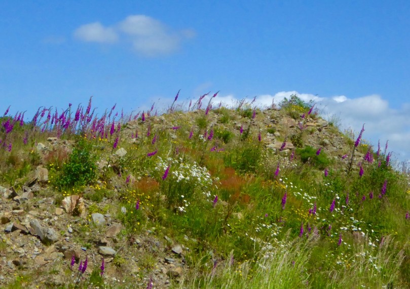
Nobody can remember a year like this one for the foxgloves. In fact, all wildflowers seem to be crowding out the boreens and invading the fields everywhere you look, including our own little patch of paradise, above.

ragged robin and oxeye daisies

Ragged Robin, Oxeye Daisies, Buttercups and Thistles

Back Road to Schull

Along the back road to Schull from Ballydehob

Last year I wrote a post, Close Reading, about the June wildflowers. The theme of the piece was that to really see what was in the hedgerows you should slow down, stop and seek.

Massed foxgloves

Not this year! This year we cycle or walk along fragrant, colourful paths that threaten to overwhelm the senses. The bounty is simply laid out before us.

Half way there

Foxgloves can have as many as 75 blooms on one stem. This one’s half way there

Foxgloves, tall and straight, are everywhere, singly or in masses. Nobody knows why it’s called foxglove, beyond the obvious explanation which doesn’t seem to quite fit the size of the flower in relation to a fox’s paw. But we do know its latin name, digitalis, was based on the idea of the flower easily slipping over a finger. It’s an important medicinal plant used in heart treatments but highly toxic if ingested raw or improperly, earning it the nicknames dead men’s bells or witches gloves.

They are a native to Ireland, quickly colonising waste ground and common near moorland. Sometimes called fairy thimbles or fairy bells here, they were associated with the little people and it was considered unlucky to have them in the house. That’s good, as they are an important source of nectar for bees and other insects.

Wasteland

This patch was cleared last year and looked barren. Here’s what’s happening now!

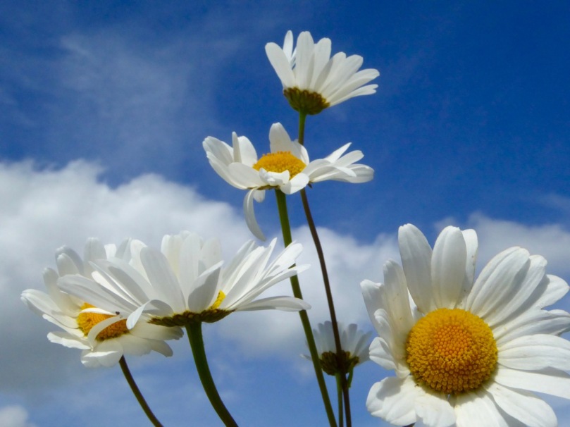
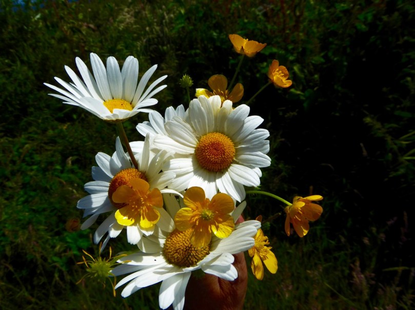
The other ubiquitous flowers of June in West Cork are the Oxeye Daisy and the Buttercup, often growing together in a riot of white and yellow. Both are native plants and, like the foxglove happily and quickly colonise any ground that’s been recently cleared. We grew up calling them dog daisies and bringing them home in great bunches for our mother, who would quietly dispose of them once we’d gone to bed – their perfume didn’t match their good looks.

oxeye daisies blue sky

And Buttercups – is there another such yellow? We held them under each other’s chins to see the yellow reflection. If it was there, it meant you liked butter. It never occurred to us to question the validity of the predictive method.

oxeye daisies and buttercups darker

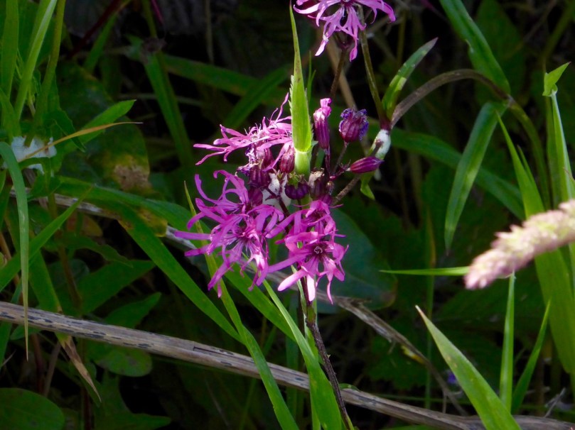
Ragged Robin – such an apt name for this native! A tiny haggard near us is full of them, much visited by butterflies. This lovely flower used to be more common, but the draining of wetlands and boggy areas has left less of their preferred habitat for them.

Ragged robin

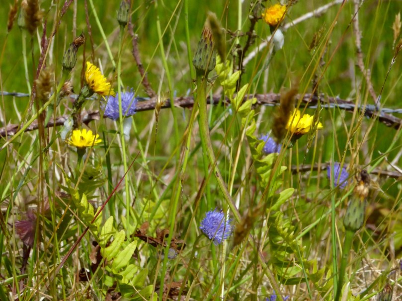
Scabious is everywhere and its brilliant periwinkle blue plays off beautifully against the yellow of the humble dandelion. The bane of gardeners everywhere, the dandelion was used in Ireland to make a tea that was supposed to be a great tonic for one of ‘consumptive habits.’ As kids, we delighted in blowing the seed heads to see what o’clock it was, and rubbing the milk on our warts as a cure. On a less charming note, we called them piss-a-beds and teased each other that touching them would result in wetting the bed.

Scabious

Scabious and DandelionsThe honeysuckle and the fuchsia are just starting to make their presence felt now. The bramble flowers and the wild roses are punctuating the hedges and the bird’s foot trefoil has taken over part of our lawn. My father waged war on anything but grass on his lawn, especially the little lawn daisies. He didn’t mind us pulling those up to make daisy chains, or to play he loves me, he loves me not.

Clockwise from top left: Birdsfoot trefoil, Wild Rose, Lawn Daisies, Campion, Foxglove and bramble flower

Of course, there is still a bit of seeking and peering involved for the tiny flowers in the hedges or fields. Speedwell, Herb Robert and Campion (below) reward the slow down and look closely approach.

Flaming June, some people call it (although the original Flaming June is actually a painting), and perhaps this year it’s a better description than ever.

colourful haggard

Capturing the View: Belvederes in West Cork

Swift's Tower

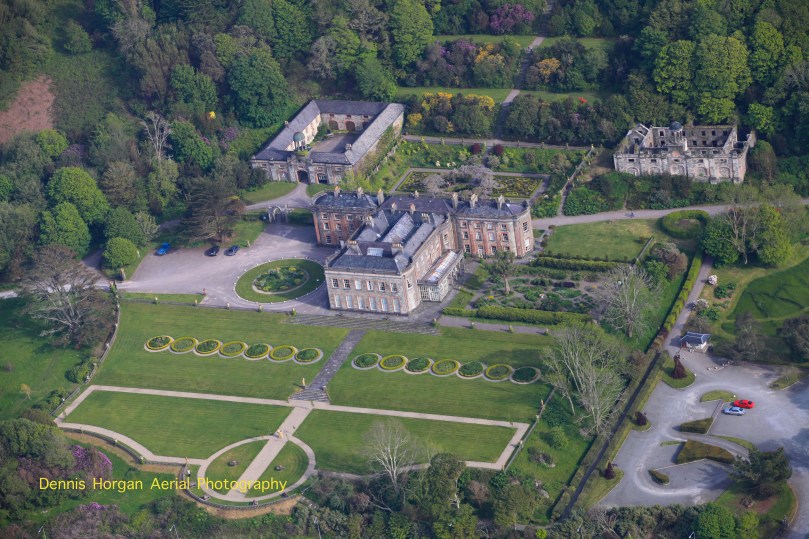
The 18th century was a time of profound change in garden design in Britain, and by extension in Ireland. In the opening decades of the 1700s great and small estates included formal gardens laid out in the French and Dutch styles that emphasised symmetry and geometry, parterres and avenues of trees. The gardens at Bantry House are a good example of this garden style. Although developed in the first half of the 19th century, they were perhaps influenced heavily by the gardens at Versailles and great European houses visited by the Earl of Bantry on his Grand Tour.

Bantry House 1

Thanks to Dennis Horgan, aerial photographer extraordinaire, for allowing me to use his shot of Bantry House. Note the formal and geometric layout of the gardens and the parterres immediately behind and to the right of the house

However, for the previous century a different style of landscaping had dominated garden design in Britain, pioneered by William Kent and Charles Bridgeman and reaching its peak in the work of Lancelot ‘Capability’ Brown. The effect they strove for was naturalistic (as opposed to natural) – a planned layout that mirrored but enhanced their idea of a ‘wild’ and romantic landscape. Large expanses of grass, strategically placed lakes and ponds, plantings of carefully chosen tree and shrub species, and clever little structures such as temples, summer houses and belvederes all combined to delight the eye, create a romantic mood and, of course, attest to the taste and wealth of the owner.

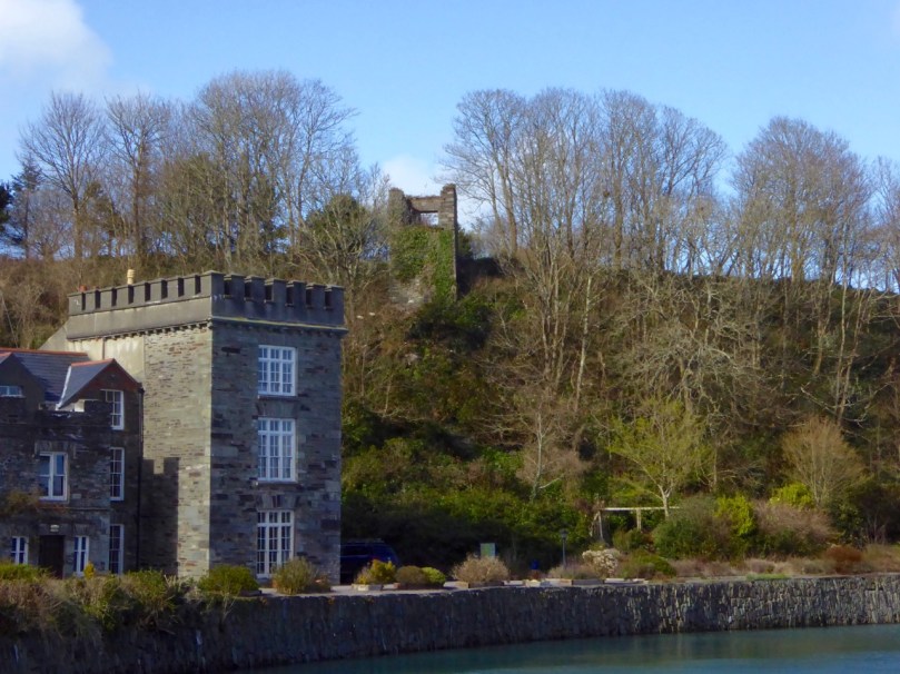
base of ruined tower belvedere New Court

Nothing remains but the stub of what was once a belvedere in the shape of a round tower on the edge of the River Ilen, on the old New Court demesne.

Echoes of these designed landscapes can be found here and there in West Cork, even where the big houses themselves have disappeared. Lately I have been on the hunt for belvederes and have found several intriguing examples. A belvedere (bel-beautiful, vedere-to see) was an edifice from which to enjoy a view. It could be as simple as a platform at a high point, or as complex as a multi-storey tower, but its most important attribute was its positioning to command a breathtaking vista.

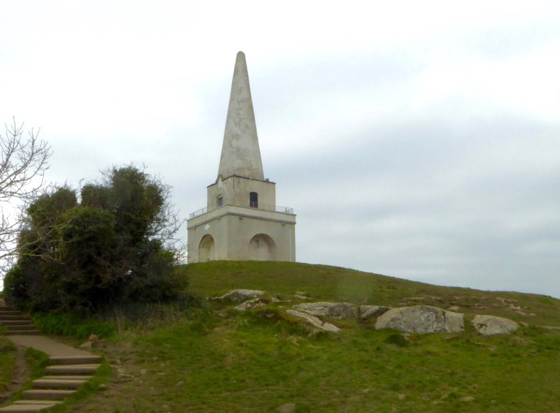
Killiney Hill belvedere

Killiney Hill, just south of Dublin

Perhaps the best known belvedere in Ireland is the one on top of Killiney Hill in Dublin. It was built in 1742 by the then-owner of the hill, John Mapas, to provide an opportunity to admire one of Ireland’s most iconic prospects. The room on the second floor had a little fireplace, windows, and a door to the exterior viewing deck, which was surrounded by wrought-iron railing. It’s no longer in use as a belvedere and many people think of it as some kind of memorial or folly.

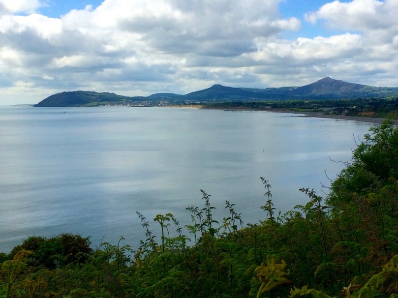
View from Killiney Hill

The view from Killiney Hill

In West Cork, the belvedere at Aughadown (known locally as the gazebo) is of the most simple kind, a viewing platform. It was associated with Aughadown House, a fortified mansion built by the Bechers that I wrote about in Trading Up In Tudor Times: Fortified Houses in West Cork.  

Belvedere, Aughadown

Peter Somerville-Large, in The Coast of West Cork, quoting Daniel Donovan*, says: Donovan described it as “a strong castellated mansion, entered by a drawbridge, surrounded by beautiful grounds and having a gazebo on one of the heights behind”. He continues: This gazebo was approached by a ramp along which the quality used to drive their carriages in order to enjoy the magnificent view out over Roaring Water Bay to the islands and the Fastnet in the distance. I found the ramp running above a field of winter wheat.

Aghadown Belvedere and tower house siting

The view from Becher’s ‘gazebo’ across to Roaringwater Bay

On each side of the Ilen River lie belvederes, in the form of towers. Imagine the ladies of the house and their guests, walking or being driven down to the water’s edge. Servants would have arrived earlier and the tea would be ready and a little fire laid against the breezes. They ascend the internal staircase to the second floor or perhaps to the roof and admire the views of the lazy Ilen River as it wends its way to the sea at Roaringwater Bay.

Creagh House Belvedere

The Creagh House belvedere

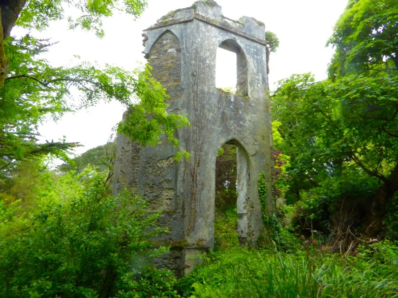
The belvedere at Creagh House exists now as a picturesque ruin. Octagonal in design, with pointed gothic windows and a small fireplace inside, it rises to three stories. Some sources describe it as the remains of a mill, and the artificial pond beside it as a mill pond, but it has all the hallmarks of a romantic garden structure.
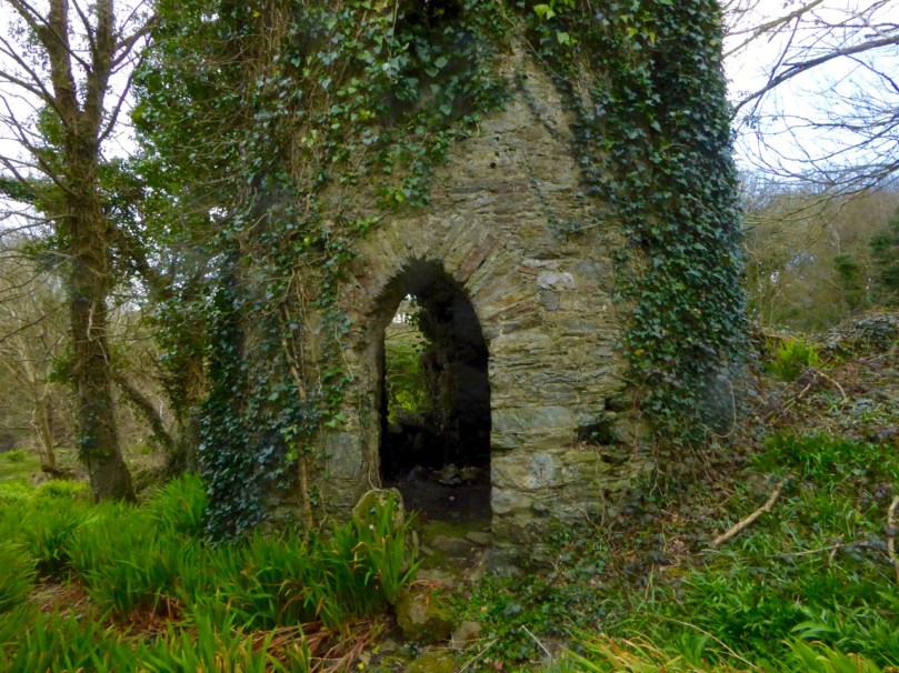
Across the river at New Court there were once three such ornamental towers. One is gone, the second is a mere stump, but the third still stands to its original height and offers lovely views of the river both to the east and the south.

Belvedere, New Court

One of the three original belvederes that once dotted the New Court Estate

At Castletownshend the local gentry were enthusiastic builders of ‘pleasure architecture’. Castletownsend Castle boast two structures of interest. The first is in the walls, an octagonal tower that is made to look like a defensive feature but in fact is purely decorative. Since there is apparently no entrance, this one may have to count as a folly rather than a belvedere.

Castle Townsend Belvedere turret

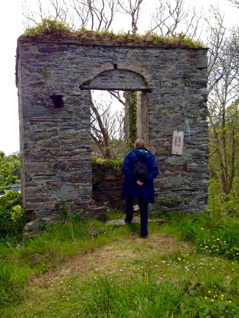
Behind the castle is the structure known as Swift’s Tower (see the very first photograph for an idea of its placement). Following the death of his beloved Vanessa in 1723, Dean Swift embarked on a long summer trip to the south west. it was in this tower, tradition has it, that he wrote the Latin poem Carberiae Rupes, which translates as The Crags of Carbery.

Swift's Tower 3

Once again we are indebted to Daniel Donovan’s Sketches in Carbery for an account of the poem and even a translation. Donovan did not have a high opinion of the poem (although he says that Dean Swift himself preferred it above other, better poems) and another critic referred to it as “a set of indifferent verses” describing a “bleak and deadly landscape”.

Carberiae Rupes

What do you think – his finest work?

Perhaps the Dean’s depressed state was to blame, or maybe he should have just stuck to prose. Or perhaps the servants hadn’t lit the fire and provided the tea – the tower certainly looks bleak enough now to bring on a fit of the dismals, in spite of the magnificent view.

Swift's Tower, Belvedere

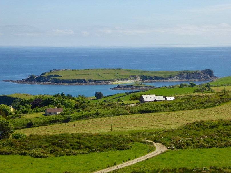
On Horse Island, just outside of Castlehaven Inlet, there is the base of a round tower that may also have been a belvedere. A visit there would have made a wonderful pleasure outing on a fine day, and the views would be stupendous.

Horse Island, Castlehaven, belvedere

You can just make out the remains of a round wall at the top left of Horse Island

There is a whole set of monuments in West Cork that are labelled as Belvederes in the National Monuments Service Inventory, but as Signal Towers in the records maintained by the National Inventory of Architectural Heritage.  These contradictory interpretations are fascinating and these towers are worth a post on their own. I will save that for another day, but to show you what I mean, take a look at the two towers on Rock Island, near Crookhaven. Belvederes or Signal Towers – what do you think? (If you’re not sure what signal towers are, take a look at this post from Amanda Clarke of Sheep’s Head Places.)

Crookhaven belvederes

Looking across to Rock Island from Crookhaven. Experts differ about the functions of the two towers

But what about nowadays? Do we still worship the view in West Cork? And do we still build belvederes from which to admire that view? The answer to both those questions can be found at Sailor’s Hill, just west of Schull!

Sailor's Hill 1

Sailor’s Hill Belvedere

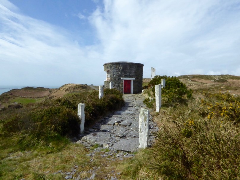
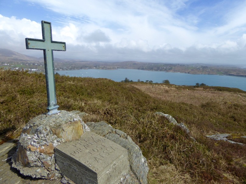
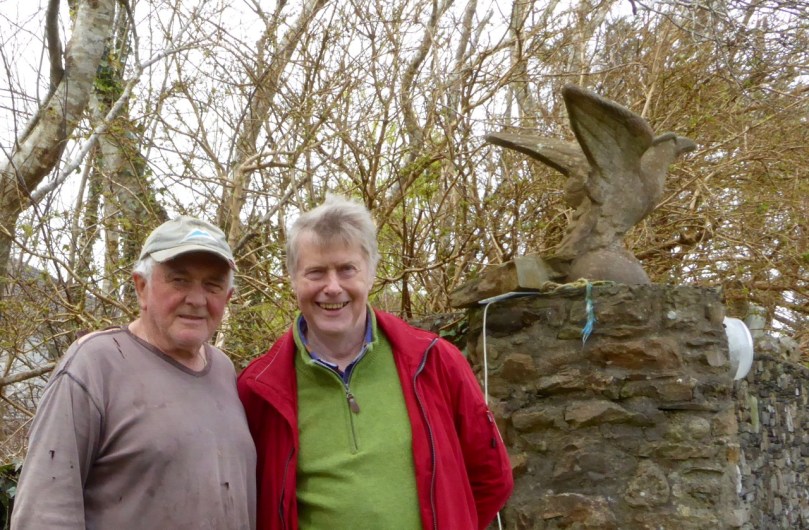
Sailor’s Hill is a labour of love by Connie Griffin who has worked on the sea and lived in this area all his life. It’s partly a memorial to those lost at sea and partly a place of contemplation to simply sit and soak up the panoramic views that stretch gloriously before you in ever direction.

Sailor's Hill Memorial 2

Schull Harbour in the background

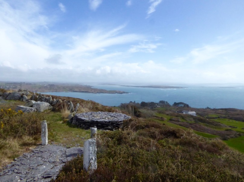
Sadly now a little overgrown and vandalised, it is still an incredible experience to arrive at Connie’s little round tower and see vast stretches of the Cork coast to the south, while the mountains of the Beara and Kerry rise behind you.

Sailor's Hill Views

It’s a testament to the power that landscape and seascape has over us: the power to move us and uplift us; the power to inspire us to try to capture it in paint and in words. We can’t really, but, like Connie, we keep trying.

Connie Griffin and Robert

Connie Griffin and Robert

*Somerville-Large attributes this information to Sketches in Carbery by Daniel Donovan. However, I have not been able to find the quote and wonder if it’s from another book.

Cape Clear: The Stone That Moved

along the roadThe enigma begins around 1874, on Cape Clear – the southernmost piece of inhabited soil on the islands of Ireland. Land here is hard won, and the stony fields are laboriously cleared using human power and – most likely – donkey power to improve prospects for grazing and tillage. In this year a narrow field in the townland of Croha West is being improved: the farm belongs to Tom Shipsey. His men – Dónal O Síocháin and Conchúr O Ríogáin – turn up a stone with strange markings on it, reportedly together with ‘shards of old incised pottery’, although these latter have never been traced.

Header: looking towards the townland of Croha West, where Thomas Shipsey and his men discovered the travelling stone. Above left – records from the Shipsey family dating back to the 1800s. Above right – possibly the earliest drawing of the Cape Clear Inscribed Stone, included in Michael J O’Kelly’s article of 1949  in the Cork Historical and Archaeological Society Journal

At this time the Curate on Cape is Revd John O’Leary. We might reasonably assume that he takes an interest in the stone and has it set up somewhere to show off its curious and undoubtedly historic decoration. We do know for sure that, when he leaves Cape Clear in 1877 to take up the curacy of neighbouring Sherkin Island, the stone goes with him and becomes a feature in his garden there. It does not, however, accompany him to Clonakilty whence he is transferred to become Parish Priest and Monsignor in 1881: instead it languishes on Sherkin, benignly fading into the undergrowth. Years later – in 1945 – the stone is ‘accidentally rediscovered’ by the then incumbent, Rev Fr E Lambe. Presumably recognising its probable significance he has it shipped off to University College Cork where it is received by Professor Seán P Ó Ríordáin.

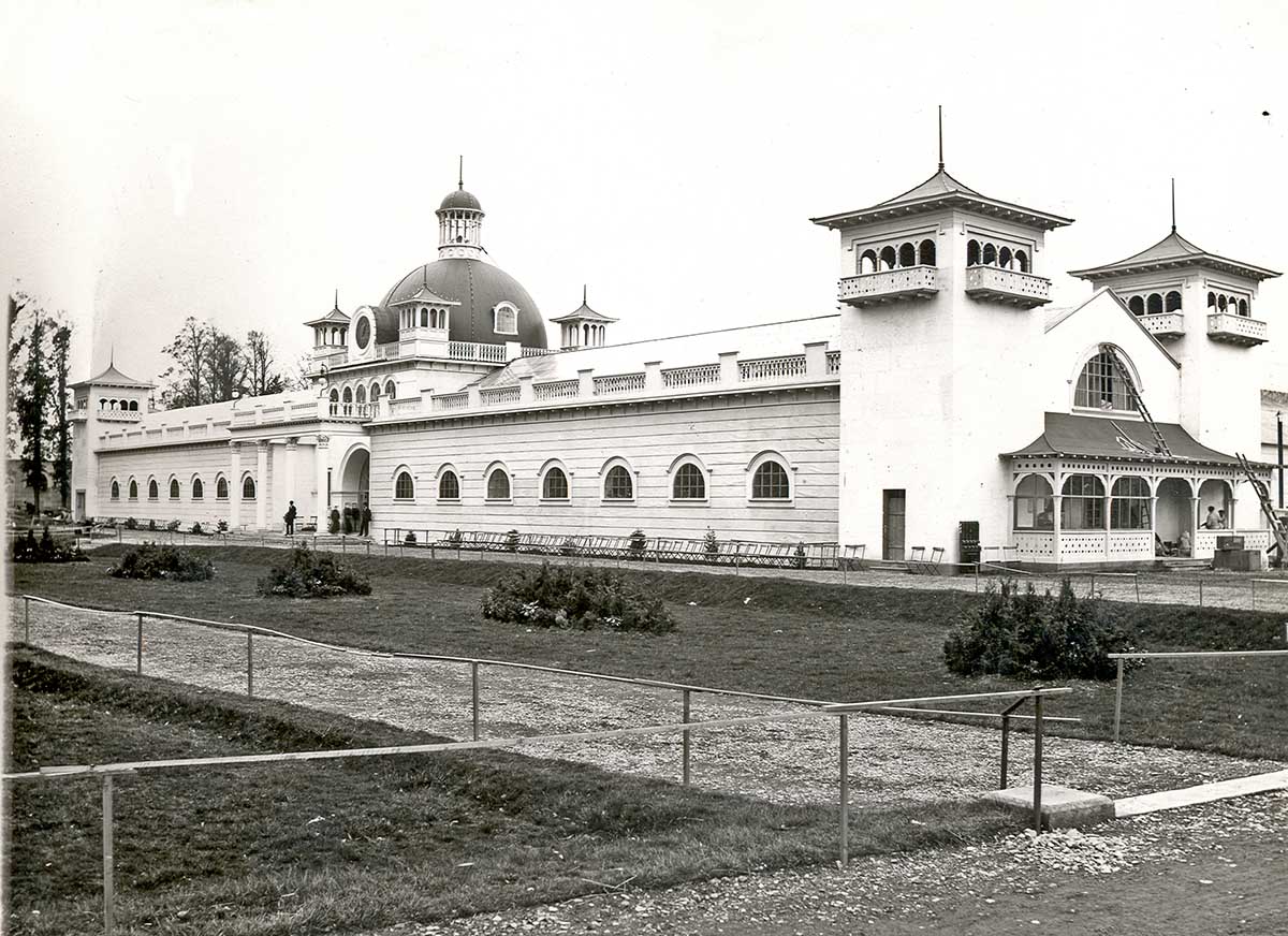
Cork Exhibition

1902 World’s Fair, Cork – now Fitzgerald’s Park and the setting for Cork Public Museum

Close to the University grounds in Cork is a residence built by Charles Beamish in 1845 at the cost of £4,000 on land purchased from the Duke of Devonshire. Beamish has the grounds laid out with a variety of shrubs and trees, and due to their density the grounds become known as The Strawberries and the house as The Shrubbery. In 1901 the house and grounds are taken over by Incorporated Cork International Association and used as the venue for the great World’s Fair of 1902. Following this the grounds – now known as Fitzgerald’s Park – are donated to Cork Corporation for recreational use by the public. Eventually The Shrubbery is converted into Cork’s Public Museum which opens in April 1945, under the auspices of UCC: the first Curator is Michael J O’Kelly. The Cape Clear Inscribed Stone completes its travels (for now) and is on permanent display in the Museum.

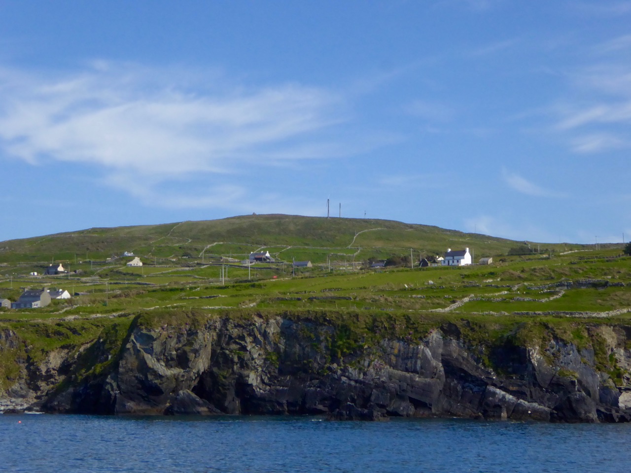
View from sea

The highest point on Cape Clear is Quarantine Hill – the trig point can be seen as a ‘pimple’ in this photograph, taken from the north side of the island

There’s a prequel to this story of the travelling stone. We have seen that it was unearthed on Farmer Shipsey’s land in 1874. Apparently this isn’t where it started out. O’Kelly (who became head of the Archaeology Department at UCC in 1946) wrote a monograph on the stone for the Cork Historical and Archaeological Society in 1949 (volume 54 pages 8 – 10):

…The motifs clearly belong to the passage-grave group of carvings and can be paralleled at Newgrange, Bryn Celli Du [Wales], Gavr’ Inis [Brittany] and elsewhere. The stone is therefore an important discovery and because of this, the lack of information about the nature of the site on which it was found is all the more disappointing. At this stage only a few vague traditions concerning its finding could be gleaned in the district. The statement of one old man that ‘a mound of stones was being cleared from a field’ may possibly indicate a cairn and if such were the case, the decorated stone may have formed part of an underlying tomb chamber. There is also some reason to think that fragments of pottery were found, though none has survived. This may be a further hint that the stone was associated with a burial. With reserve, it might therefore be assumed that the structure, whatever its exact nature, was erected by a group of passage-grave folk who either by accident or design came to land on this island off the coast of Cork…

This little narrative sowed the seed that the stone might be connected to a passage grave. If so, this would probably date the carving to some five thousand years ago. But, surely, there should be some trace of the passage grave itself if this is the case? No such traces could be found in the townland of Croha West.

View from PG

looking north
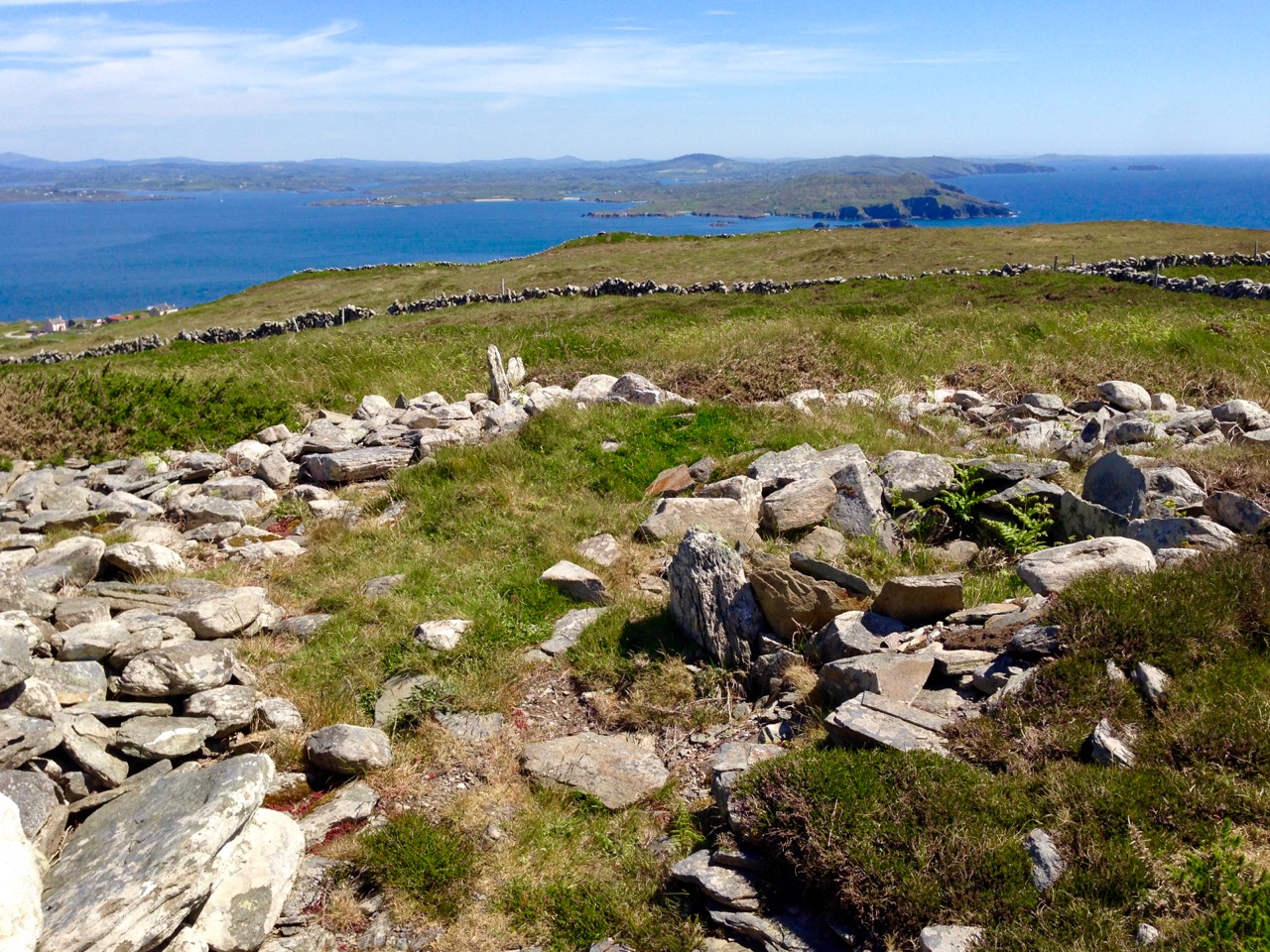
Spectacular views from the prehistoric site on Cape Clear, both looking north towards the mainland

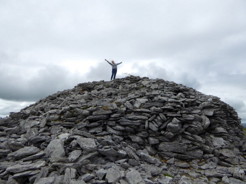
We move forward to 1984 when four archaeologists (Barra O Donnabhain, Mary O’Donnell, Jerry O’Sullivan and Paddy O’Leary) explored the wider area and discovered, on the very summit of the island, the ruins of a prehistoric structure. This site, 533 feet above sea level, is in the townland of Killickaforavane and is known locally as Quarantine Hill. At this time the island was investigating the possibility of producing electricity by wind power: hitherto electricity to some properties was provided by a diesel generating system which had been in place only since 1969. The obvious efficient place for wind generation was the highest point and plans were laid for setting up two SMA Regelsystem Gmbh 33w turbines (which began operation in 1987). In preparation for this installation an archaeological survey of the immediate area was carried out by Prof Peter Woodman and Dr Elizabeth Shee. Paddy O’Leary and Lee Snodgrass were also present at that time. The collective view seemed to indicate that the structure could, indeed, have been a small passage grave.

chamber closer

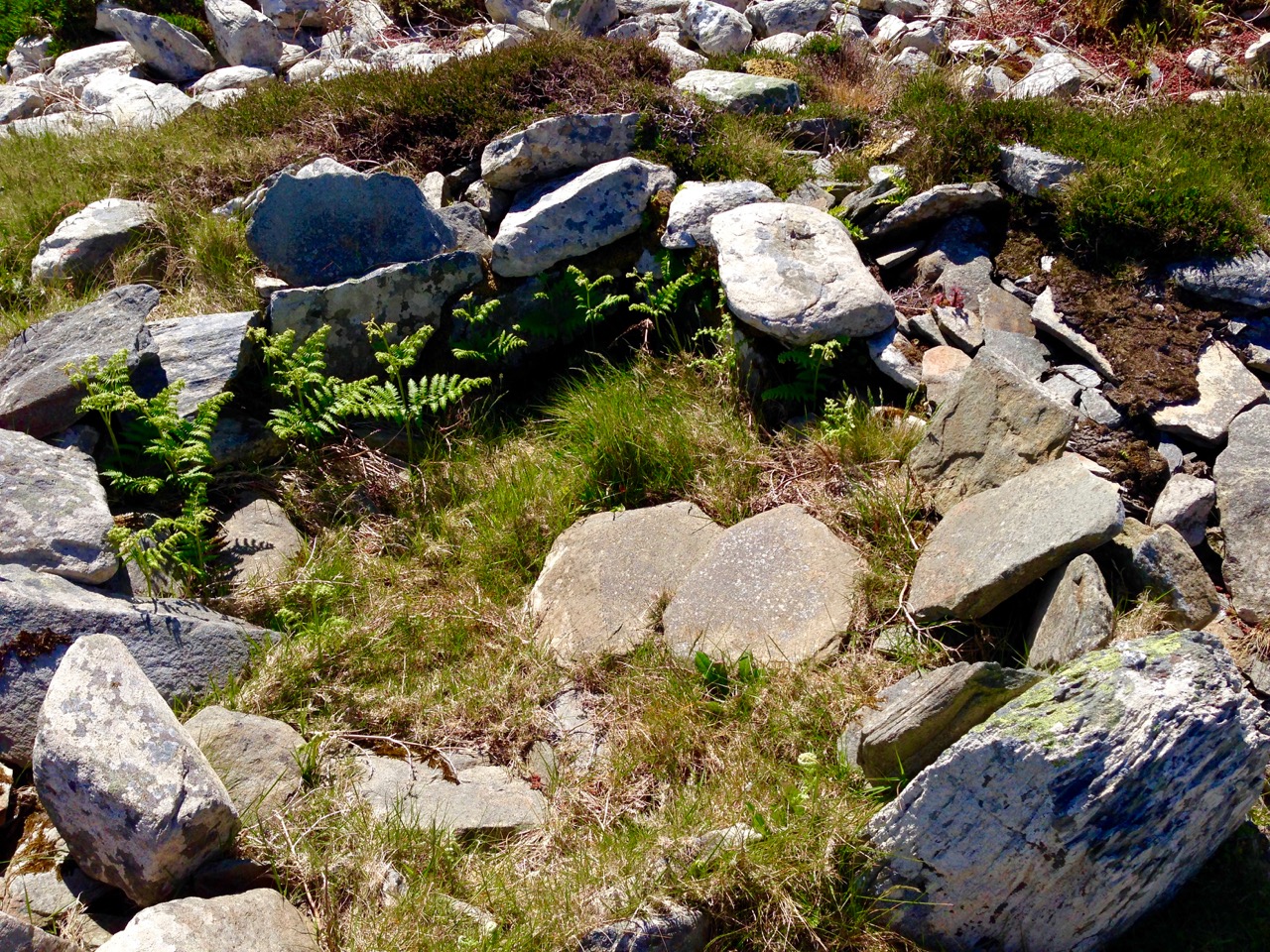
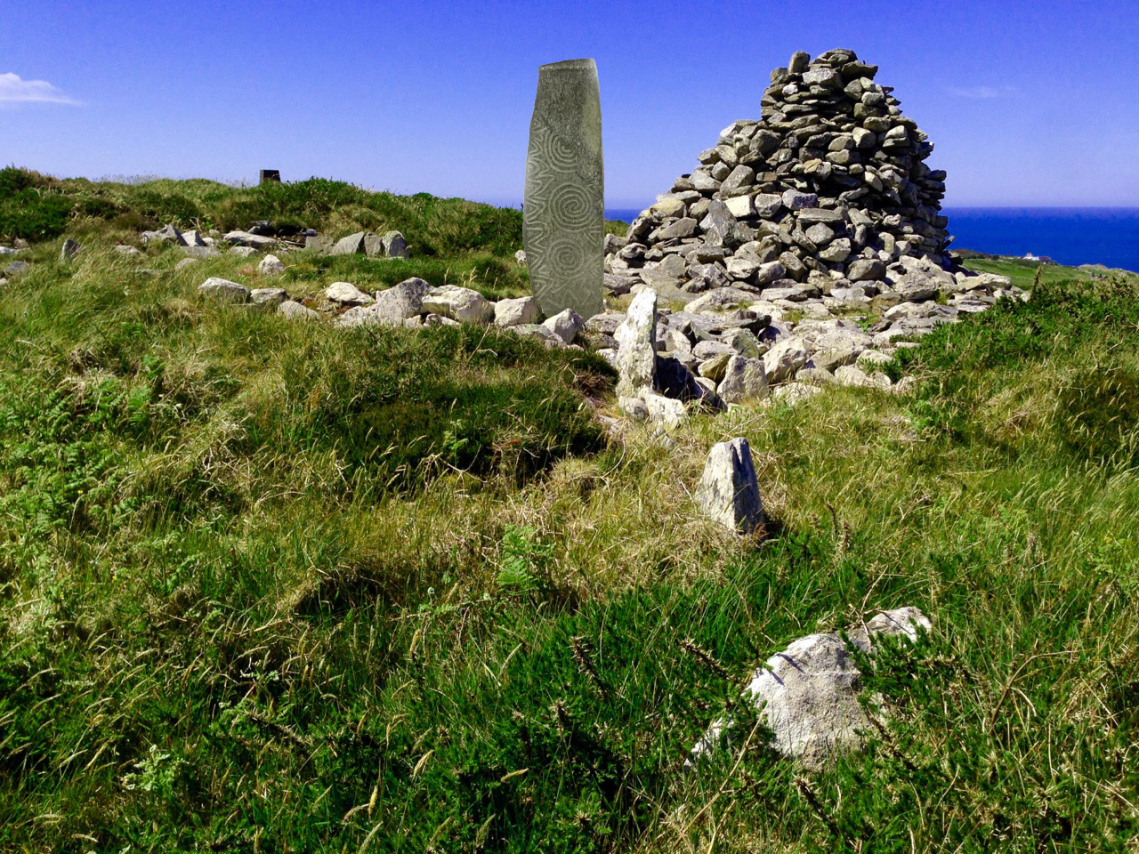
Probably the chamber of a 5,000 year old passage grave, Killickaforavane, Cape Clear

The wind turbines were sited a little distance from the prehistoric remains and have themselves become archaeology of a more industrial nature. While in use they generated 90% of the island’s demand during favourable winds (force 3+). The corrosive effects of the Atlantic climate – in particular the wild south-westerly gales – rendered the mechanisms beyond repair after some ten years; a submarine cable bringing electricity from the mainland (8 miles away) arrived in about 1995. For a short time the systems operated in tandem and produced sufficient power to feed back to Ireland’s National Grid. According to a letter to the Irish Times by Séamus Ó Drisceoil, who was manager of the island Co-op at the time of the installation …the Cape Clear system is credited with providing the first concrete evidence for the viability of wind energy in Ireland…

Tomorrow’s archaeology: the pioneering – but now defunct – wind generating system on Quarantine Hill, overlooking the passage grave site

Once the concept of the island supporting a five thousand year old passage grave on its summit has been digested, then the question has to be asked – did the Cape Clear stone now in the Cork Public Museum originate at this site? It was found a good half mile away, in a different townland – but this might suggest that an earlier antiquarian (or interested observer) discovered it on the hill and had it moved to Croha West for safekeeping, display, or even because it was thought it might have some value. No-one on the island seems to have any knowledge of this distant event. As O’Kelly says – it’s disappointing that there is no ‘story’: one might almost expect a tale of the person moving one of the ‘old stones’ having met with an unfortunate fate because of interference with the domain of The Other Crowd

the way through

Kerb and passage

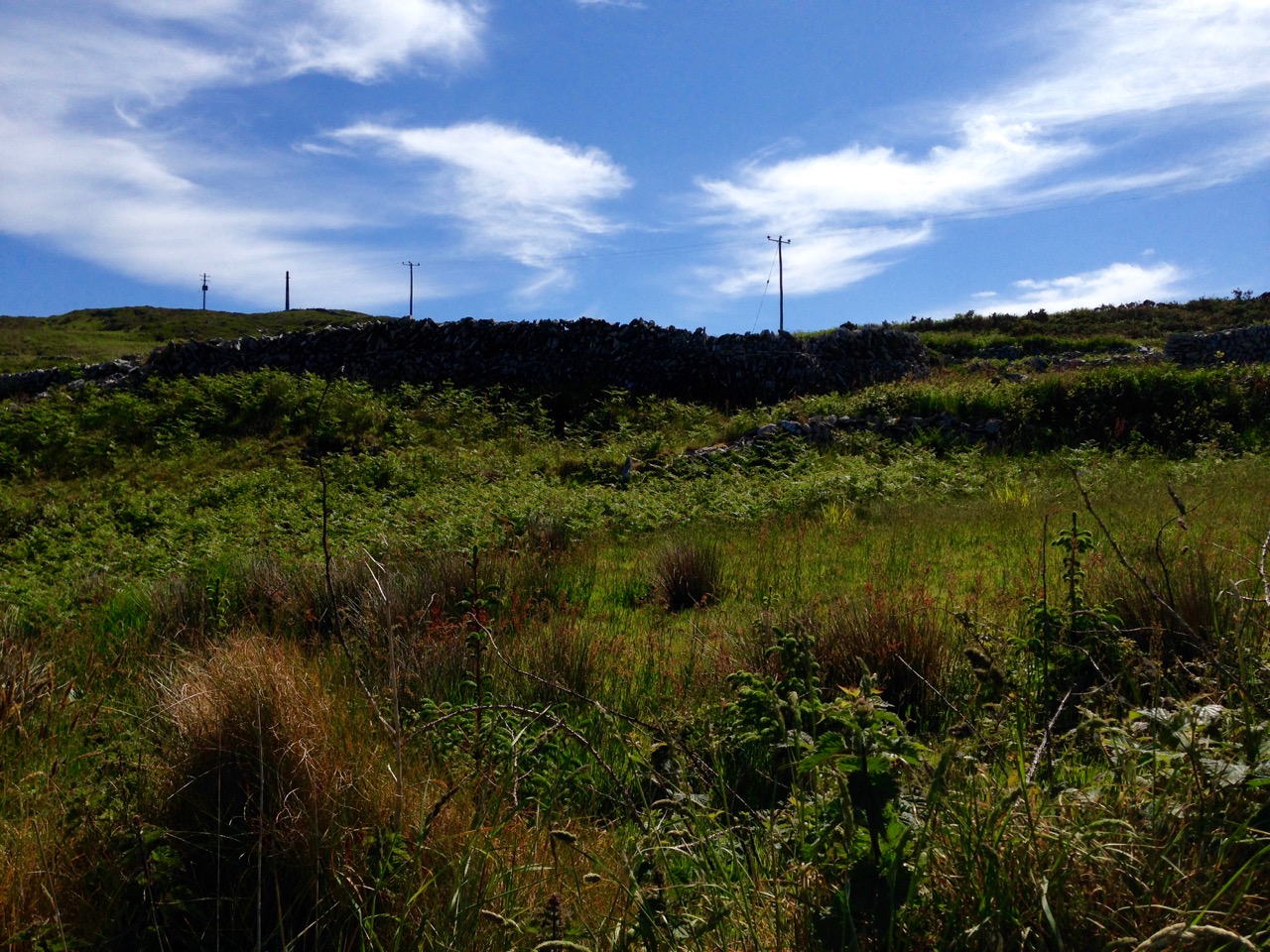
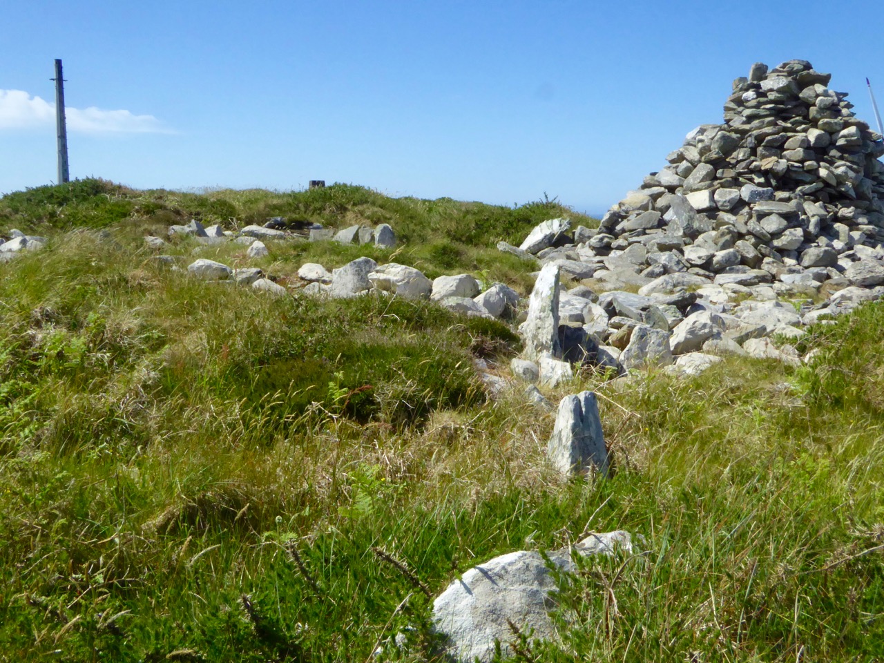
Top: looking towards the summit of Quarantine Hill – there is no clear path up there, and the traveller can be waylaid by gorse and brambles… Below: the prehistoric site – we are probably looking at the orthostats of a passage, which has a summer solstice orientation, and a kerbstone. On the right is a modern cairn while to the left in the background is the remains of one of the turbine towers

There is, surely, a strong likelihood that the Cape Clear Inscribed Stone did originate in the hilltop passage tomb, in which case we have completed the tale of its travels, up to the present day. The tomb is in ruins, although enough remains to show its shape and probable orientation. Paddy O’Leary tells the story of his investigations with Lee Snodgrass in an article for Mizen Journal, Volume 2, 1994:

…We were convinced that it was a passage tomb and that it was orientated on the rising sun of the summer solstice… We planned a two night vigil for June 1993 and were buoyed up by a good weather forecast. Saturday afternoon was sunny and we transported our equipment direct to the top of Quarantine Hill from the boat. We set up our cameras and, taking advantage of the sunny weather, took photographs, especially during the late evening, when there was a lovely sky. On Sunday morning June 20th we rose shortly after 4am to prepare for dawn. It was very cold but the sky was clear. A dull grey cloud began to show to the northeast, we set our cameras and waited for the sun. Shortly after 5am it peeped above the horizon, nestling in the gap between Carrigfada and the hill to its north… Gradually it rose in a 40 degree angle, flooding the sky with first light and mirroring its golden red orb in the brightening sea… A perfect sunrise perfectly recorded. The warmth was now penetrating almost numb fingers and feet. The line of the orientation was exactly as expected, directly along the supposed line of the passage, into the centre of the chamber… The most southerly point of Ireland had its passage tomb, with a summer solstice sunrise orientation; a nice counterpoint to the Newgrange winter solstice sunrise…
cairn and view

Quarantine Hill, Killickaforavane townland, Cape Clear. The view looking east – towards the summer solstice sunrise – from the prehistoric site on the summit

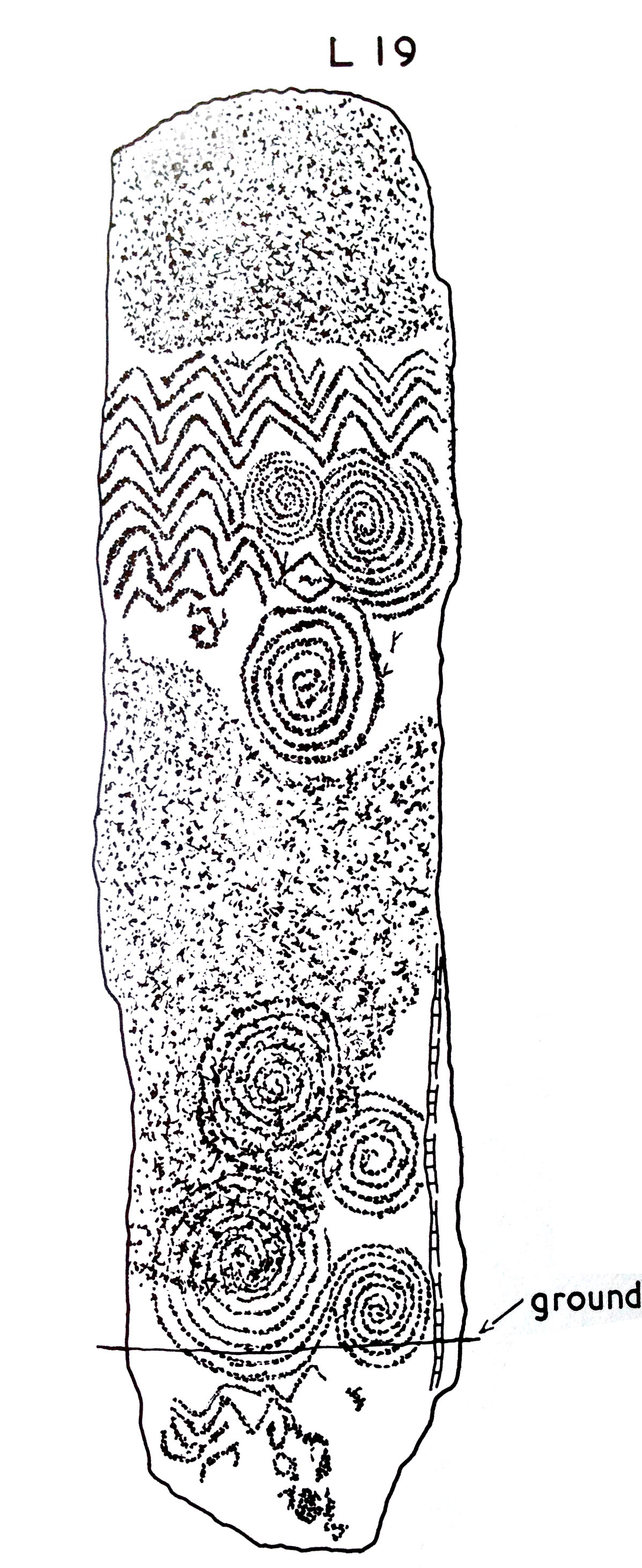
If the inscribed stone was, indeed, incorporated into the Cape Clear passage tomb, where might it have been placed? There are parallels in its design with some of the lintel stones at Fourknocks, but also I am drawn to similarities with stone L19 from Claire O’Kelly’s Corpus of decorated stones included in Michael J O’Kelly’s Newgrange – Archaeology, Art and Legend (Thames + Hudson, London 1982). This one is a standing stone – perhaps our well travelled stone was standing also.

Newgrange

Newgrange entrance stone

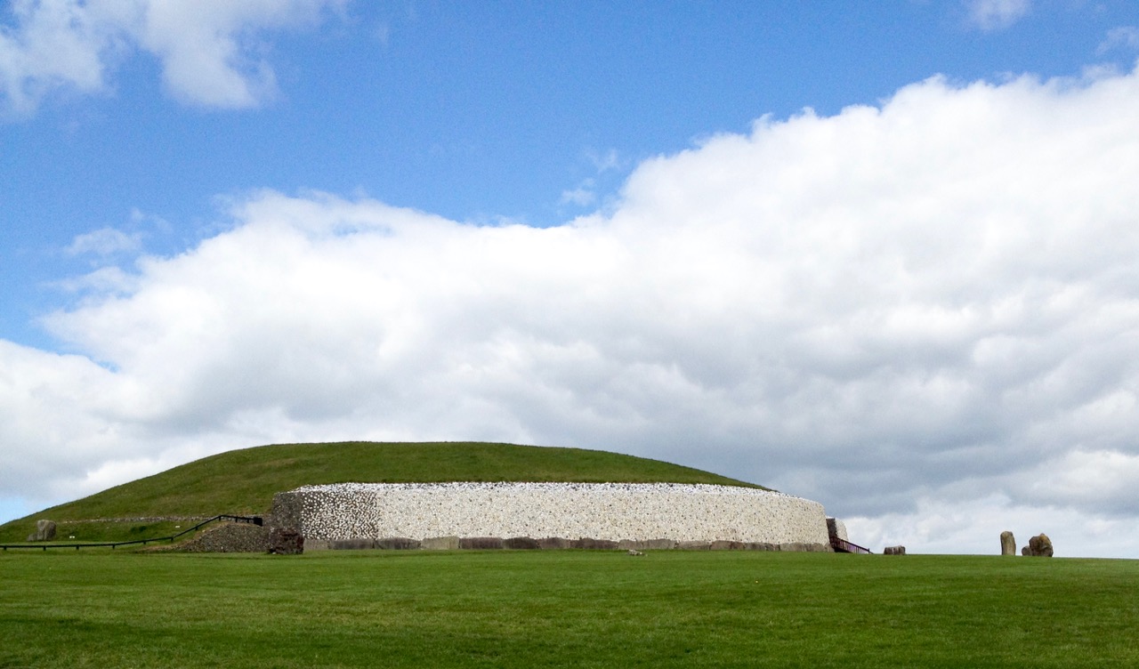
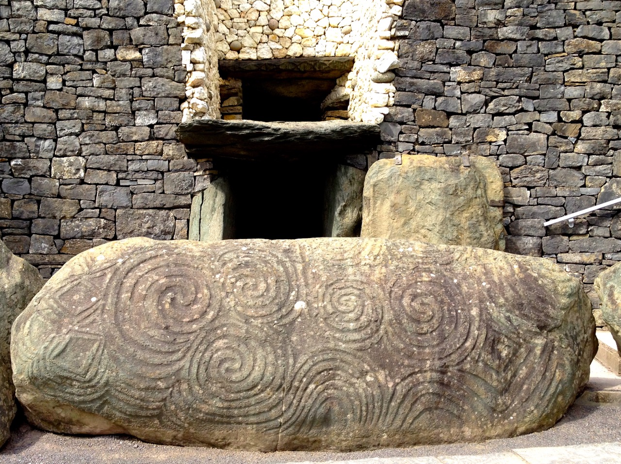
Iconic passage tomb in Meath, Ireland – one of the greatest monuments to the Neolithic people in the world: the top picture shows the east face of the great mound as reconstructed by Michael O’Kelly using the white quartz stones which were revealed during the excavations (Finola took part in these digs!); the lower picture shows the entrance stone to Newgrange – the Cape Clear inscribed stone must be related to this type of prehistoric art, although situated a very long way away…

Here’s a suggestion – probably considered heretical in some quarters: why don’t we complete the travels of the Cape Clear Inscribed Stone by taking it out of the Cork Public Museum and (with some suitable ceremony) transporting it back across the sea to Cape Clear and setting it back up there for all time? For me, museums – while obviously providing safe keeping – sometimes lack the reality of true context… Alright then, if that is considered as inconceivable an idea as I suspect it would be, let’s make a very good replica and send it up to the top of Quarantine Hill. At the same time we could re-establish a pathway to attract people up there: our own pilgrimage to this very special site involved making heavy way through gorse and brambles.

looking towards west

Below: Newgrange Stone L19 from Claire O’Kelly’s Corpus of decorated stones included in Michael J O’Kelly’s 1982 book on Newgrange

claire stone

With acknowledgements and thanks to those quoted above and the following sources, which have enabled me to pull together the story of this site: Paddy O’Leary and Lee Snodgrass (Mizen Journal Vol 2 1994 and personal communication), Michael J O’Kelly (Cork Historical and Archaeological Society Vol 54 1949), Chuck Kruger (Skibbereen and District Historical Society Journal Vol 6 2010)

Into the Kingdom

To the Skelligs

The Kingdom? No, we didn’t go to Britain – we went to Kerry. It’s always been called the Kingdom, possibly based on ancient Irish precedents, although other theories abound. Many people think it’s because of the sheer magnificence of the scenery, and I wouldn’t disagree.

Ballinskelligs Bay

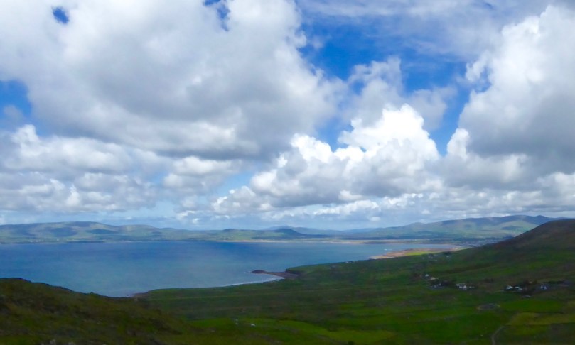
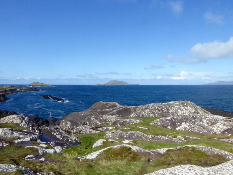
Ballinskelligs Bay. The first photograph is also Ballinskelligs Bay, with a glimpse of the famous Skelligs Islands in the background – subject of a future post, we hope!

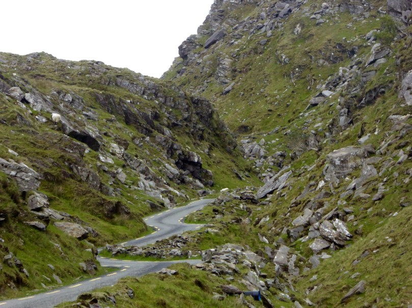
Our journey took us on the Ring of Kerry, along the south side of the Iveragh Peninsula, by the sea. This is prime tourist territory – bus after bus passed us and every lay-by was thronged with camera-wielding tourists, including us. We came back through the middle of the peninsula, through deep valleys and high mountain passes.

To Ballaghbeama

Not for the tour busses!

These are not roads that busses can manoeuvre through, so we had it mostly to ourselves, the locals, and a few tourists armed with small cars and good maps. I love this Iveragh backcountry. It’s where I spent my student days, conducting my research. I even recognised the place where I crashed my Honda 50 into a bog.

Ballaghasheen Pass

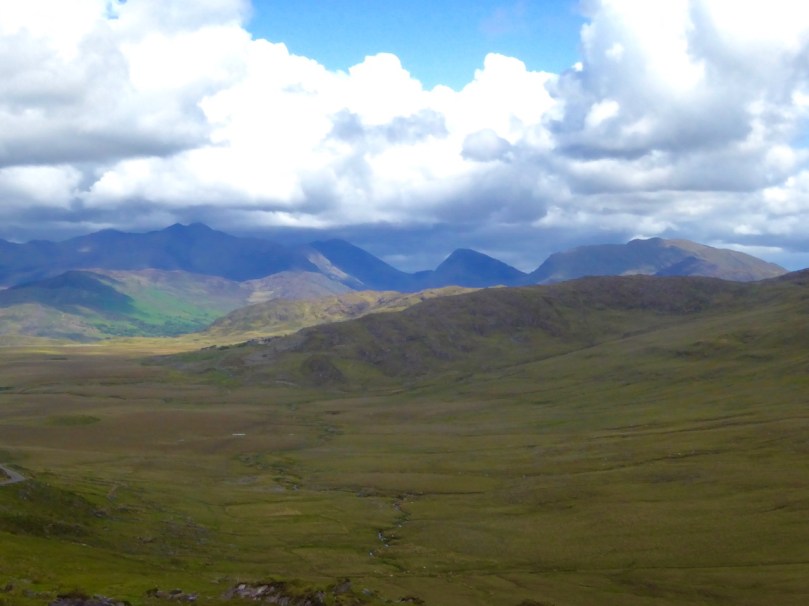
Although it seems totally mountainous, vast sheltered valleys occupy some of the hinterland of the Iveragh Peninsula  

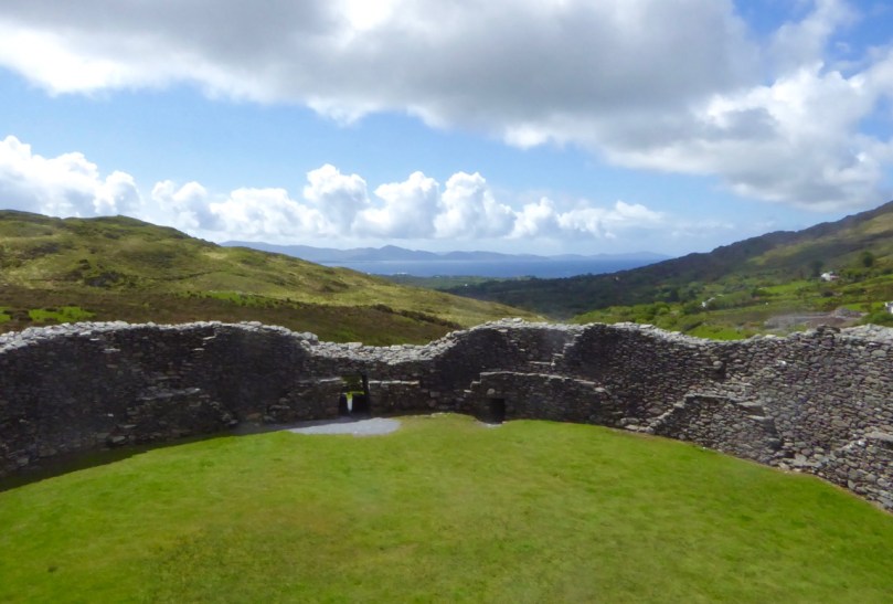
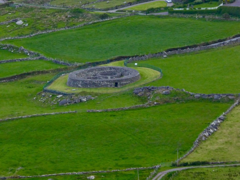
We visited two stone forts, the mighty Staigue and the lesser-known Loher, and of course some rock art. Staigue Fort is generally reckoned to be Iron Age (about 250AD), while Loher, although very similar, was built later, around the 9th Century.

Staigue Interior and outlook

Loher Stone Fort
Staigue Fort (upper), at the head of a long valley, commands views to the sea. Loher is also strategically sited with extensive views all around.

We toured Daniel O’Connell’s House at Derrynane and took the Nature Trail walk along the dunes, using the app developed by local man Vincent Hyland.

Shoreline walk

Wild flowers a-plenty on the dunes at Derrynane. Top: Sea Pinks and Sea Sandwort. Bottom: Pyramidal Orchid and Kidney Vetch

We searched in vain for the holy well devoted to Saint Crohane, patron saint of Caherdaniel – we’ll have to go back with Amanda to help us find it.

Across to the Beara

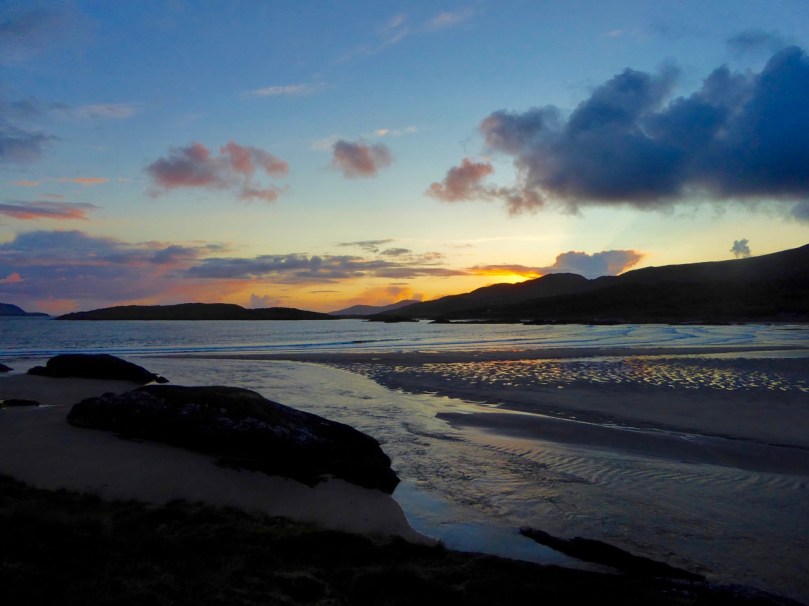
We didn’t find St Crohane’s well but when we finished our search, in twilight, this is what was waiting for us. The mountain range in the background is the Beara Peninsula in Cork

In fact, the primary purpose of our trip was to re-connect with cousins that I haven’t seen for about 45 years. The last time I saw Annie and her siblings they were kids, and we were all piled on to a donkey and cart in a vain attempt to get from Lamb’s Head to Staigue Fort. It’s a long story, but suffice it to say that the donkey came out the winner. Most of the family still live around Caherdaniel, in jaw- dropping surroundings, and we were accommodated and hosted with true Kerry hospitality.

The view from Annie's

Top: The view from Annie’s house, across to Lamb’s Head where the family grew up

Along the way we saw a house shaped like a ship (Robert has more – much more – about this!), had our first experience of bottle-feeding a lamb, and we watched Rex the sheepdog gently herd a flock of chickens into their pen for the night. We visited my cousin Betty’s grave – she died a few months ago, the heart of the family, much mourned. It was, we hope, the first of many visits, back and forth.

Abbey Island

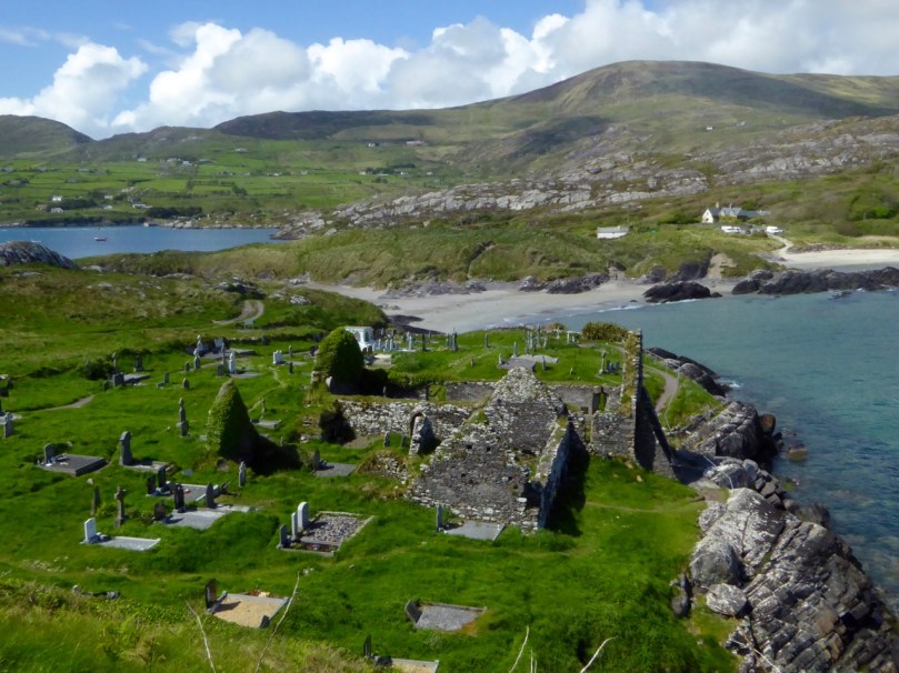
Abbey Island, Betty’s last resting place, must be one of Ireland’s most beautiful graveyards. To access it, you must walk across the sand and keep an eye out for high tides. The original monastic site was founded by St Finian in the sixth Century, although the ruined church, Ahamore Abbey, probably dates from the 10th Century.

This post is to give you a flavour for our neighbouring county and to show you why it is justly famous for its history and archaeology, but most of all for what is surely some of the most spectacular scenery in the world.

Lamb's Head to Scariff and Deenish IslandsScarrif and Deenish are the two islands out from Derrynane Bay. Uninhabited for 40 years, they are the site of salmon farms now. We walked down Lamb’s Head to get a better view of them.

Tiny green fields

As in West Cork, everywhere in Kerry you can see the traces of tiny settlements. Abandoned long ago, possibly after the famine, each field may have provided enough potatoes for one family. Now only the sheep graze peacefully.

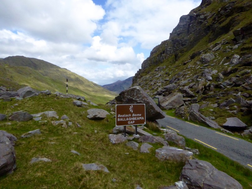
Ballaghbeama Gap

We headed home through the Ballaghbeama Gap. On the south side is Ireland’s greatest concentration of prehistoric rock art. We wrote about this in our post Derrynablaha Expedition.

Down from Ballaghbeama

Heading down towards Derrynablaha and home

Derrynane Sunset

It was hard to leave Derrynane!

Labbacallee

rookery

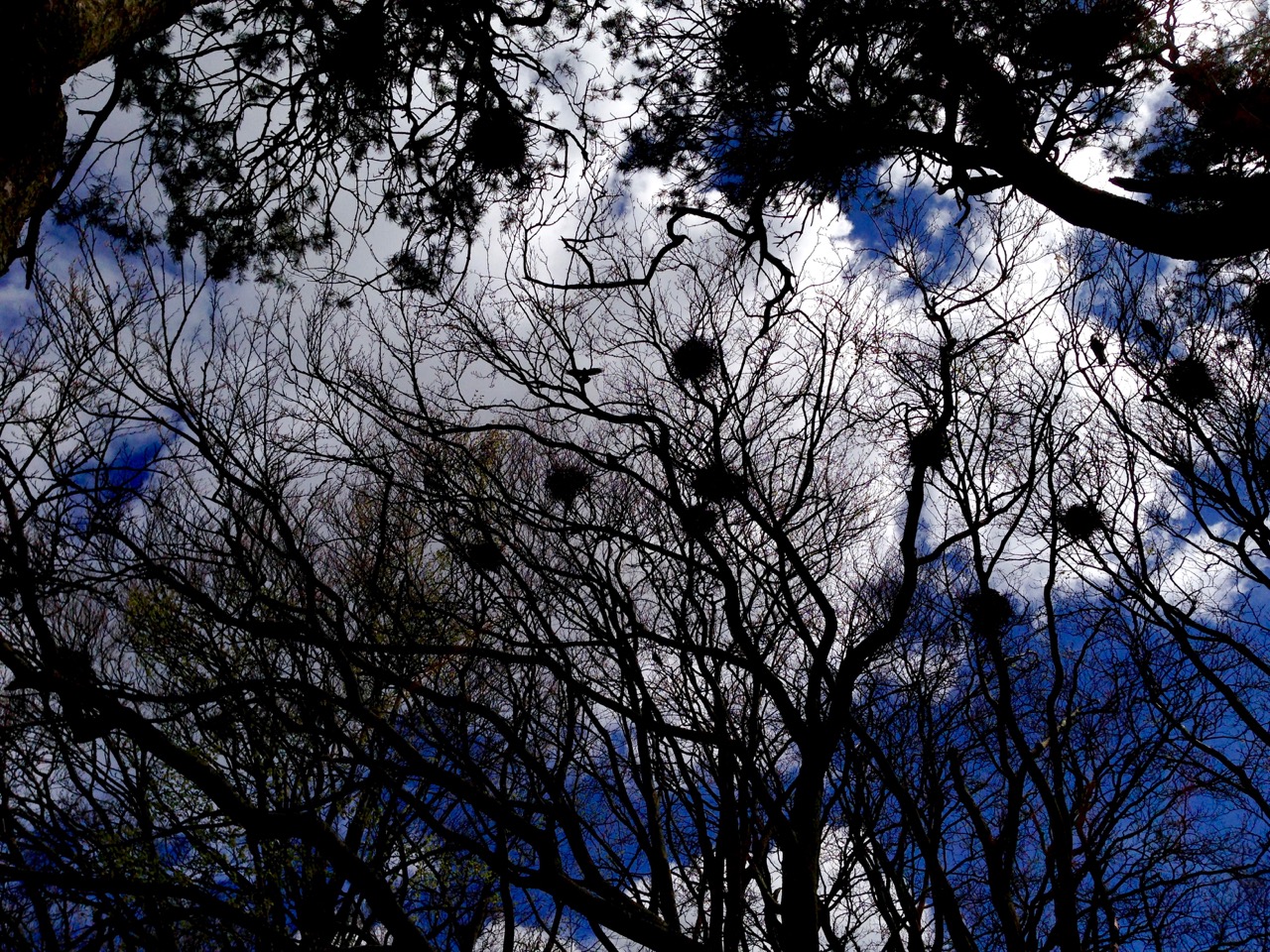
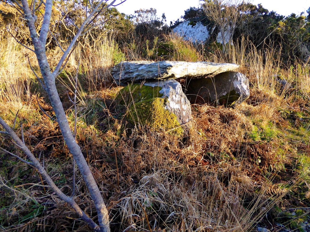
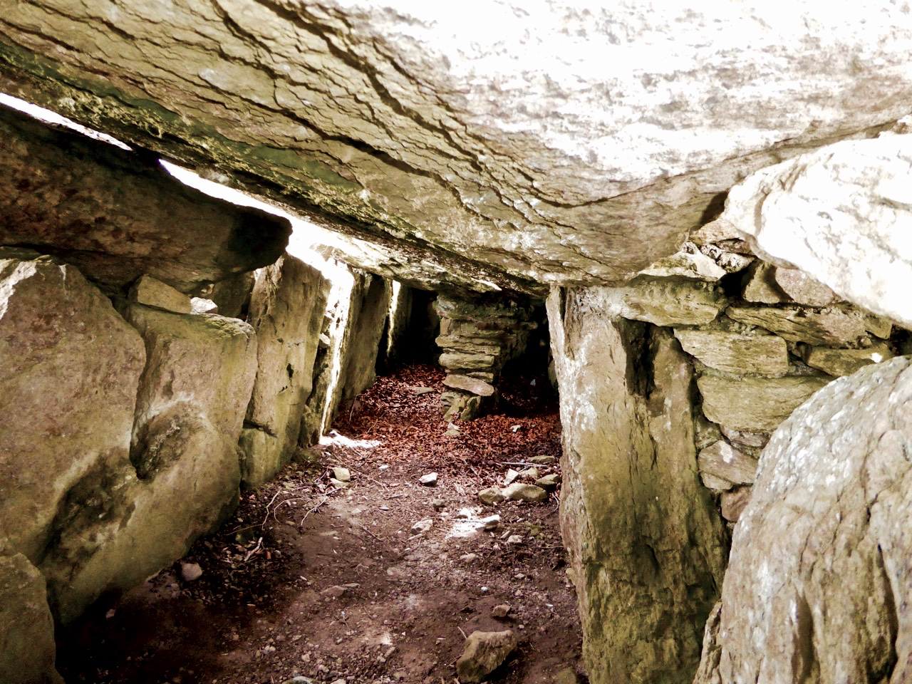
My strongest memory of our visit to Labacallee wedge tomb, Co Cork, earlier this summer was the rookery above it. Our presence seemed to make this multitude of large black birds restless: there was a constant movement over our heads – a mixing up of flapping feathers, wind in the still bare branches and screeching protests. These are the unpaid guardians of this monument, apparently the largest of its kind in Ireland, with a long documented history and a wealth of folklore.

labbacallee view

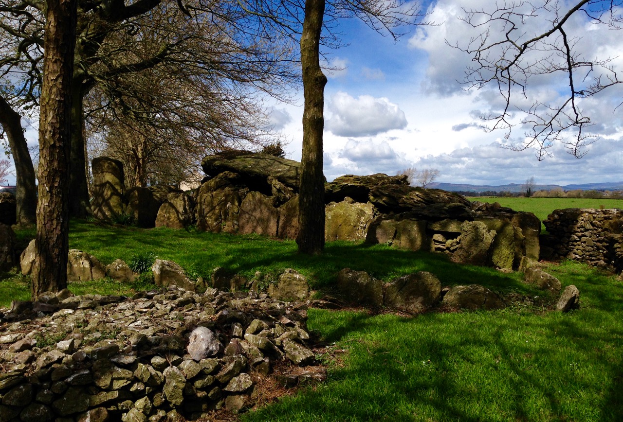
Labacallee today: it must once have been an impressive and dominant feature on an open landscape. Now it has been closed in by fields, trees and a byroad running north out of Fermoy. In the foreground is a cairn, possibly made in relatively modern times from material excavated from the monument

Finola has written about wedge tombs. She calls them The Last of the Megaliths: court-tombs, portal-tombs and passage-tombs are slightly earlier constructions, built before c2000 BC, while wedge tombs date from some 500 years after this. According to the Archaeological Inventory of County Cork Volume 1 (Stationery Office Dublin 1992) …The more numerous and widespread wedge-tombs are relatively small and simple constructions, so called because of an increase in height and width from the chamber rear to the entrance front. They generally face in a south-westerly direction, an orientation they share with stone circles and stone rows…

labbacalle back end

The east facing – and narrower – end of the wedge tomb

Labacallee is enormous, especially if you are only familiar with examples such as Altar, west of Goleen (itself sizeable) or our own more domesticated version at Kilbronogue, a neighbouring townland:

kilbronogue-wedge-tomb

A more ‘human scale’ wedge tomb at Kilbronogue, West Cork: many thanks to Stephen Lynch, a near neighbour, for looking after this example and allowing us access

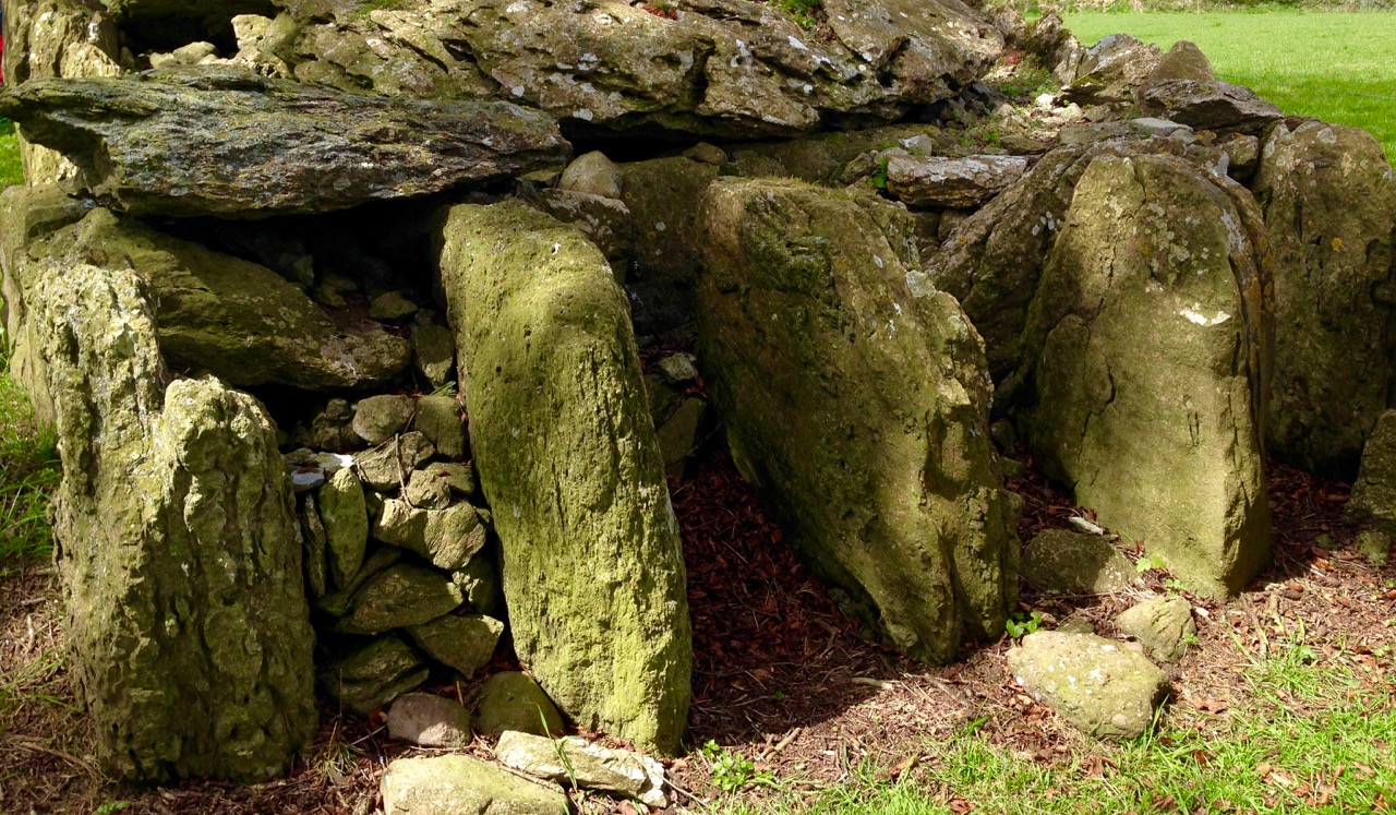
Labbacallee – the name seems to be from the Irish Leaba Caillighe – ‘the bed of the witch’ – measures some 14 metres by 8 metres overall. It has a series of upright stone ‘walls’ supporting three capstones. The largest of these measures 5 metres by 2.5 metres and is a metre in thickness: it must weigh at least 10 tons. These stones house three ‘chamber’ enclosures.

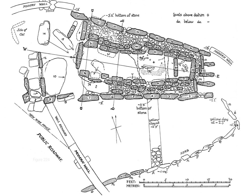
tomb plan

Plan of Labbacallee wedge tomb drawn following the excavation by H G Leask and Liam Price in 1934, from Proceedings of the Royal Irish Academy Volume 43

The tomb has been recognised as an important site in British and Irish archaeology over a long period. English antiquary John Aubrey, who lived from 1626 to 1697 (and who was incidentally described as “Shiftless, roving and magotie-headed…”) is recognised as one of the first serious recorders of historic sites. He was also a keen collector of folklore and, like me, felt that the stories that local people told about the monuments around them were valuable insights into perceived history.

John Aubrey and a drawing of Labbacalle  he published in 1693. While you can see in the drawing the principle of a chamber constructed of upright stones and roofed with large slabs, there is very little resemblance in the drawing to the structure itself (which was anyway in a ruinous state in Aubrey’s lifetime). It has been suggested that Aubrey obtained the sketch – or a verbal description of the tomb – from a Mr Gethyng who lived close by it
A drawing from the1897 work The Dolmens of Ireland, their Distribution, Structural Characteristics, and Affinities in Other Countries; together with the folk-lore attaching to them and traditions of the Irish people by William Copeland Borlase 1848 -1899. This Cornish antiquary and politician spent part of his life in Ireland so it is likely that he did visit the tomb. Certainly the drawing is more true to life than Aubrey’s. After what has been described as ‘high living’ Borlase died in disgrace, having been involved in scandal and bankruptcy
Artistic interpretations of a subject: views of Labbacallee dating from 1827 (top), 1844 (below left) and 1845 (below right by George Wilkinson)

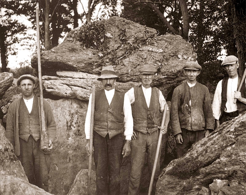
The first full scientific examination and excavation of the tomb was carried out in 1934 under the supervision of H G Leask, using workers paid one guinea per week as part of a government unemployment relief plan. According to the excavation report, at this time the smallest chamber was filled to the top with rubble, including earth, stones, ash and the bones of animals and humans. When these were cleared a skeleton of a woman was exposed, together with a bone pin which might have fastened a garment or shroud. The woman’s skull was missing but later found upright (as though on display?) in the large main chamber. One of the leg bones of the skeleton was deformed: this led to the speculation that her handicap may have set her apart in life, giving her a status that was either feared or revered: she might have been ‘marked out as a witch’.

labercalle excavators

Leask’s excavation team in 1934 (top) and (left) his drawing of the headless skeleton as found; (right) the separated skull of the ‘witch’

I am fascinated that ‘folk’ or oral traditions survive through generations, centuries and even millennia. In the case of Labbacallee, we know that the name existed back in Aubrey’s time – over three hundred years ago – and was undoubtedly well established by then. Could it be that the name – ‘bed of the witch (or hag)’ – was the persisting memory of the interment of an important person, perhaps a priestess or shaman, from very ancient times?

hag's bed

The Hag’s Bed – the main chamber in the monument, where the skull was found

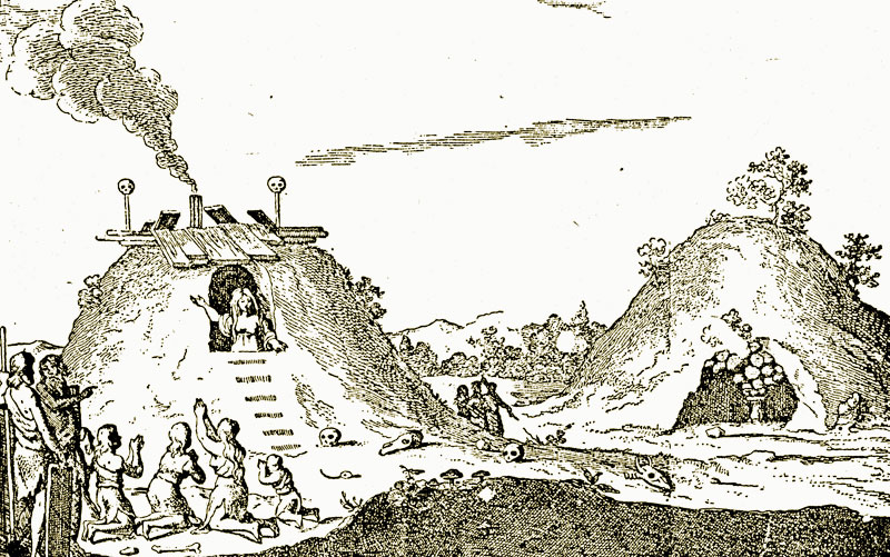
While the excavators were exploring Labbacallee they found evidence to suggest that the tomb (or part of it) had been an occupied dwelling at some point during its history. The notion that some historic and prehistoric monuments were (or are still) the dwelling places of the Old Ones, or The Other Crowd – supernatural beings possibly descended from ancient invaders of Ireland – or had in fact been used in some way by practitioners of magic – is not unknown. Borlase’s 1897 work on The Dolmens of Ireland… included this illustration (albeit from the Netherlands) of ‘A ‘White Woman’ (wise woman or witch?) prophesying from a dolmen-mound’. It’s not a big leap to the idea of a witch being buried in a wedge tomb.

whiteWoman borlase

Legends specific to a ‘hag’ of Labbacallee suggest that she was married to a druid, Mogh Ruith, who ‘had an eye’ for the hag’s sister. In a fit of jealously the hag chased the druid towards the River Funchion. He reached the water and started to cross it: the hag threw an enormous boulder which struck the druid, toppling him and pinning him down under the water. As far as we know, he’s there to this day!

labbacallee stones

Stories in stone: Labbacallee landscape

Another story specific to Labbacallee also involves a drowning – and a warning! This version is from theirishplace.com:

…Whatever the provenance and history of the remains found in the Labbacallee Wedge Tomb, there is no doubt that it is a site around which legends abound. One of the most pervasive legends tells that one day, very long ago, four local men went to the tomb in the middle of the night, with the aim of digging for the treasure that they had heard was buried there. As they started to dig, it is said that an enchanted cat appeared, fire bursting from its tail, terrifying the men, who were dazzled by the light emitting from it. Panicking, they ran screaming from the scene, and in the ensuing panic one fell into the nearby river (Funchion) and drowned. The remaining men lived to tell the tale, and their experience stood as a stark warning to others that they should never, under any circumstances, disturb the resting place of the long dead at this most mysterious of megalithic sites…

labbacallee shadows


The City of Shrone – and a talking cow!

shrone walls + gap

It’s May Day, and we’re in Ireland, so it’s no surprise that we should encounter a talking cow. We are in Kerry County and it’s a Kerry Cow that’s doing the talking. This is an ancient breed of cattle – probably the oldest in Europe – so our cow has a lot of stories to tell.

city cow

We found the cow – or, at least, the story she has written – in the City of Shrone. What sort of a metropolis is that, you wonder? It’s a pretty diminutive one: it’s almost certainly the smallest city in the world. It has no skyscrapers and no traffic jams…

no parking

Shrone does, however, have a long, long history. According to the local expert on this subject, Dan Cronin, …Historians have satisfied themselves that The City was one of the first places in Ireland to be peopled. It was here on a barren elevated site that the Tuatha Dé Danann had their base established, naming the mountains at whose base they had settled, Dhá Chich Danann, The Two Paps of Dana…

in the shadow

Dan’s book (published in 2001 by Crede, Sliabh Luachra Heritage Group) is the definitive work on The City, The Paps, and the life and traditions of the Sliabh Luachra – which is the name given to the mountains and rushy glens on the borders of Cork, Kerry and Limerick. It’s an area which has long been famous for its traditional music: at our own Ballydehob Fastnet Maritime and Folk Festival – coming up in June – two of the most notable musicians carrying that living tradition, Jackie Daly and Matt Cranitch, will once again be in residence.

Jackie Daly and Matt Cranitch

Matt Cranitch and Jackie Daly in Ballydehob, at last year’s Fastnet Maritime and Folk Festival

Meanwhile, back in the City, we have deliberately timed our visit for the First of May: this is Shrone’s big day! The City is 50 metres in diameter – it’s a very ancient stone cashel or ring fort. The Irish name for it is Cathair Crobh Dearg, meaning ‘Mansion of the Red Claw’. On the western side of the finely preserved four metre thick stone walls is an entrance (known as the gap), and anyone coming in that way has to pass by a holy well. Today is the Pattern Day for the well, and elaborate rounds are performed, culminating in taking the holy water. There is much to do with cattle at this site: the Tuatha Dé Danann are said to have originated in Boeotia – the Land of Cattle – in Greece, and the well water is notably good for cattle, especially on this day. The well was formerly in another site nearby and there cattle were driven around it to ensure good health and fertility for the herd. Farmers still take water from here and sprinkle it on their animals.

shrone aerial

Satellite view of The City of Shrone: the circular cashel wall is clear. On the left is ‘The Gap’ and the holy well. Beside ‘The Gap’ and inside the city is the ruin of Paddy Quinihan’s House (below and bottom): in the 1930s he was the deerhough (caretaker) of the holy well

keeper's house

the house

Today is Lá Bealtaine (pronounced Law Byowl-tinneh): the Irish word might refer to the ‘Fires of Baal’, reflecting a tradition of lighting fires on hilltops or in sacred places. In Ireland it was important to drive cattle through, or by, the flames as a purification ritual. As May Day was usually the first day that the animals were brought out of byres and sent to the summer pastures (booleys), it makes sense that the purification would have taken place at this time. So we have the various seasonal elements of water and fire connected with cattle and their health and fertility: it’s no wonder that our commentator at Cathair Crobh Dearg is a cow!

The holy well water at Shrone is good for animal health and fertility: Robert gives it a try!

The City of Shrone is below the Paps. According to Cronin, the early celebrants – the Danann – …were wont to go up to the top of the Paps for the fertility and immortality rituals. Fragments of ancient pagan altars still remain to this day. Petitions were made to the gods for fertility for man and beast, good return from the land, good crops and fodder. Even today, 4000 years later, several small offerings are placed on ledges near the ruins of pagan altars on top of the Paps Mountains for health of the family and of cattle and for fertility… Many of those acquainted with this old pagan custom have remarked on the peculiarity of its perseverance and continuity… I would like to explore those high parts but, ‘on the day that’s in it’, they are not even visible, and it would be unwise to venture into such a shrouded domain when, at this turning point of the year, the spirits of the hills might be abroad…

way to the paps

The way to the Paps: it’s unwise to venture there when you can’t even see the summits of the sacred mountains…

Cronin again: …So the May Day or Lá Bealtaine festivities were held each year and the years rolled by. On May Day, The City and its surroundings were a hubbub of activity. The music of pipes and fiddles re-echoed from the hills and valleys, and the lowing of cattle mingled with the sweet music of the harp. Jesters and jugglers plied their respective trades, with everybody trying to make themselves heard. It is very evident that ale was brewed here in plenty. Champions were performing feats of valour, while throngs of admirers looked on… What will we find happening today, May Day, at the smallest but most ancient city in the world?

mary and walls

Setting Up

Our Lady of the Wayside guards the sacred site now (above) while (below) preparations are made for the Bishop’s visit

It’s still a sacred site and the crowds still come. But it’s Our Lady of the Wayside who looks out over the City walls now. A Mass is performed within the Cashel on May Day afternoon. This year the Bishop of Kerry is in attendance, as is a devouring Kerry mist. I listen in vain for the echoes of harp, pipes and merrymaking. The City of Shrone on a cold, damp First of May seems a desolate place – yet an absolutely fascinating one. The pilgrims visit and the curious passer-by (like me) pauses to drink from the well. As always here in Ireland, history is writ large on the landscape, and continuity is assured both through holy ritual and piseogs…

making the mark

Pilgrims leave their marks on a ‘Neolithic altar’ under the statue of Mary

Another record of the day at The City can be viewed on Louise Nugent’s page, here. Amanda has covered the holy well at Shrone here. Voices from the Dawn website published an interview with Dan Cronin, who wrote In the Shadow of the Paps.