The Old Mine Road

to the castle

Exactly two years ago I wrote a piece for this Journal – A Moment in Time – remarking on the very specific changes that we become aware of at the end of the summer: the holiday homes being closed up and shuttered; the boats being taken off their moorings and stored away in the boatyard; the shorebirds returning to their winter quarters. I finished up by pointing out that our own summers never end: we enjoy living in Cappaghglass just as much in the darker, colder days at the turning of the year as we do when the sun is high in the heavens.

cove gray day

high road gray day

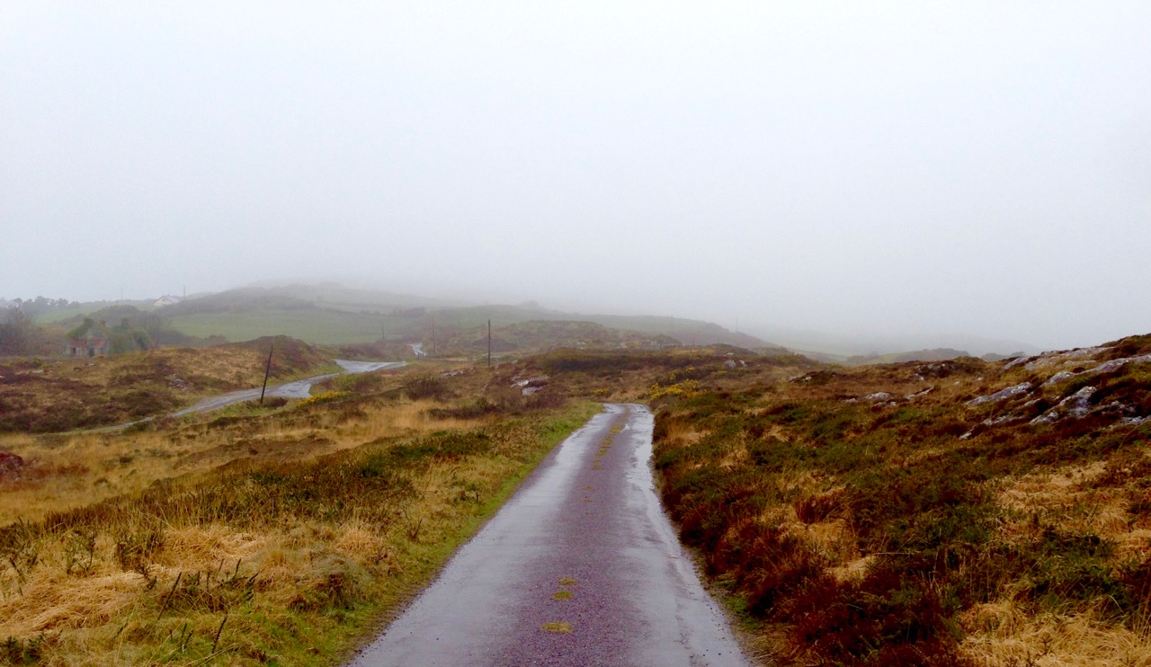
Top – starting point: Rossbrin Cove on a gray day. Bottom – The Old Mine Road wearing its raincoat

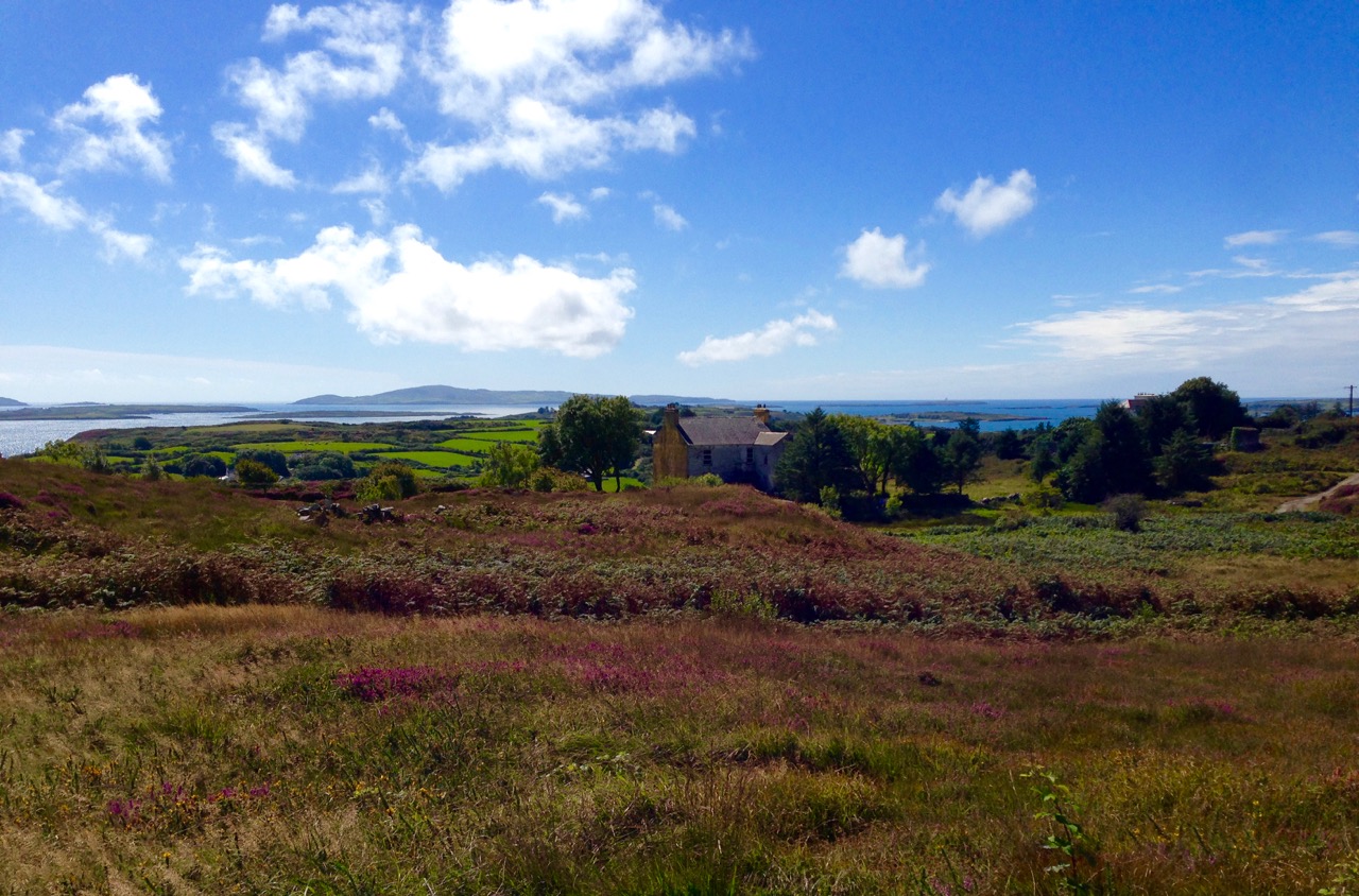
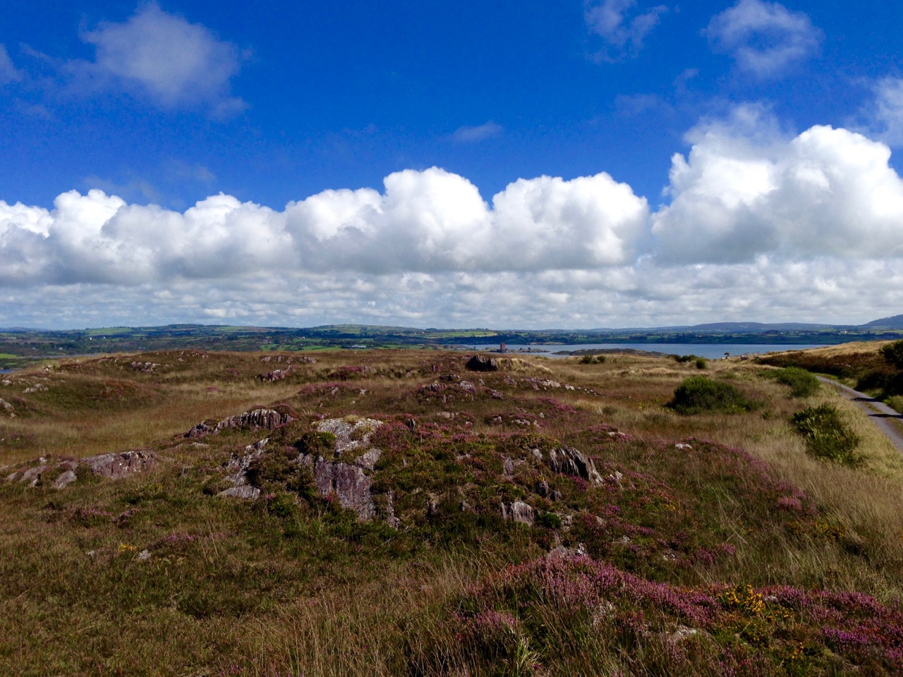
It is an idyllic life and we are privileged to have the quiet boreens to ourselves in all weathers. We have talked about Rossbrin Cove so often, in its many seasonal variations: for today’s post I’m taking the upward road through the townland, the route that I call The Old Mine Road. This road – or more accurately this series of lanes and byways – will take the traveller from the Cove into the little town of Ballydehob, and will pass through an old copper mining district which, two hundred years ago, saw heavy industry, intermittent employment, smoke, noise, pollution and desperate human working conditions where now ‘peace comes dropping slow’ with only the crying of the Choughs over an undisturbed backdrop of rock, heather and coarse grasses – and the occasional jumble of stones showing where there were once buildings, shafts and crumbling walls marking the old mine complex.
cappaghglass

captain's house sun

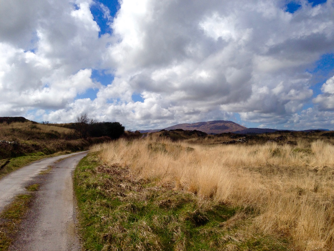
Top – the landscape of The Old Mine Road: Mount Gabriel dominates the horizon to the west. Bottom – looking from the road towards Roaringwater Bay: in the foreground is the site of old mine workings, now reclaimed by nature, with one of the two Mine Captain’s Houses in the centre and the stump of an old mine chimney on the right

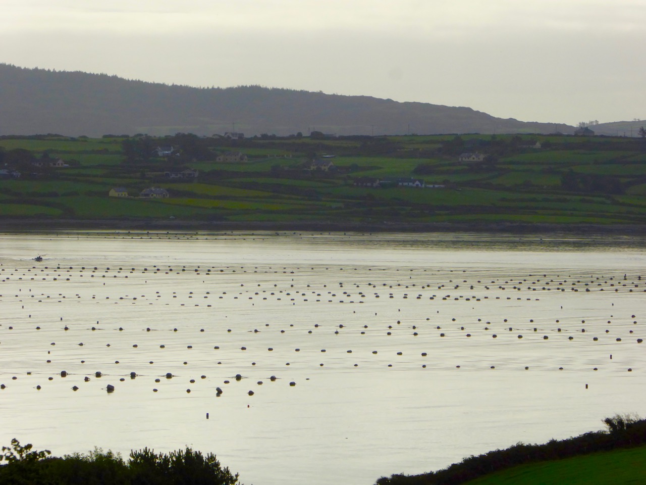
A walk along The Old Mine Road on a benign late September day will be rewarding because of the good air, the distant views to the Mounts Gabriel and Kidd, and with the bays of Roaringwater and Ballydehob below. You will find medieval history in the form of towerhouse castles, modern economy delineated by distinctive lines of mussel ropes spilling over the water and always alongside you the immediate wildness of a natural, undisturbed landscape. Views change as the way winds and dips – always interesting, always different, however many times you follow these routes.
mussel ropes

waving grass

mine buildings

Top – mussel ropes abundant in the Bay. Middle -waves of grass in the wild landscape to the north of the road. Bottom – ruins of old mine buildings can still be seen from the road

Autumn brings with it a certain melancholy. Time passes, our lives move relentlessly forward. We enjoy the changing of the seasons but we want to know that there will be so many more seasons to see. Each one will bring us unique experiences.
blue in the grass

from the road

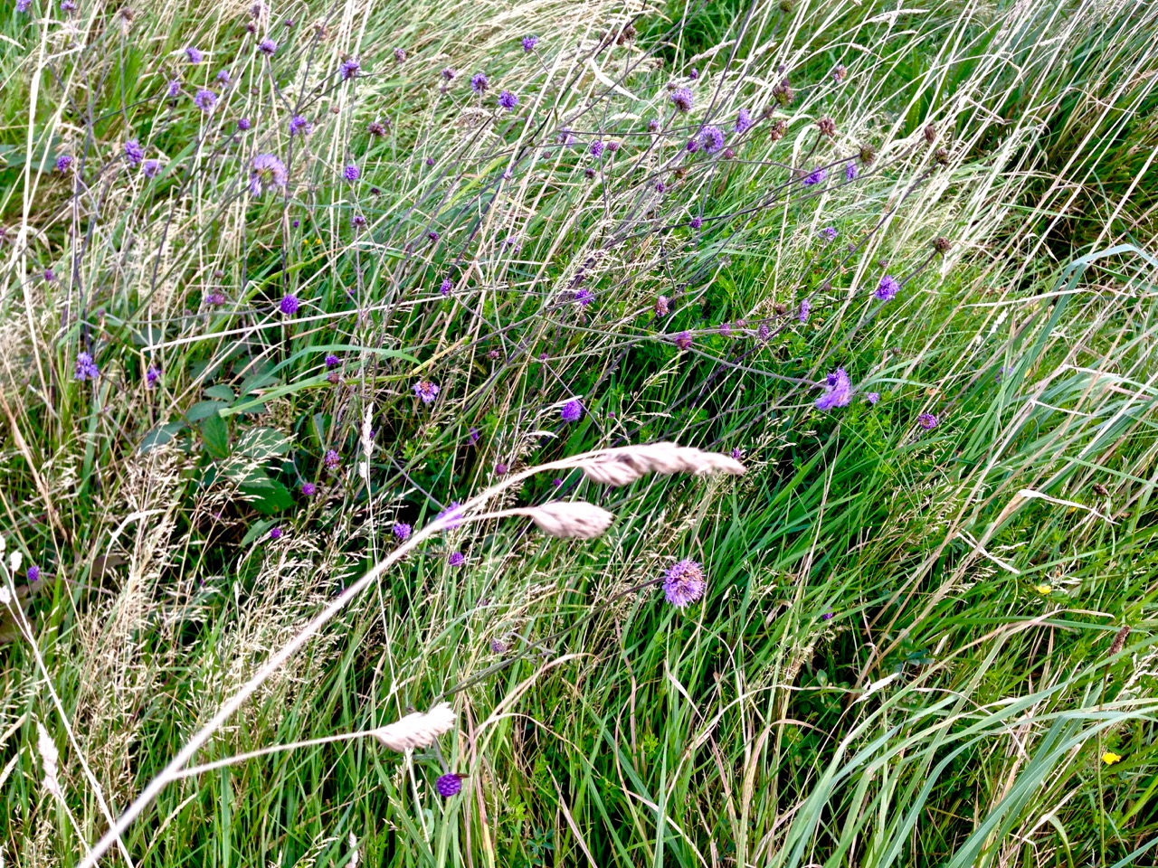
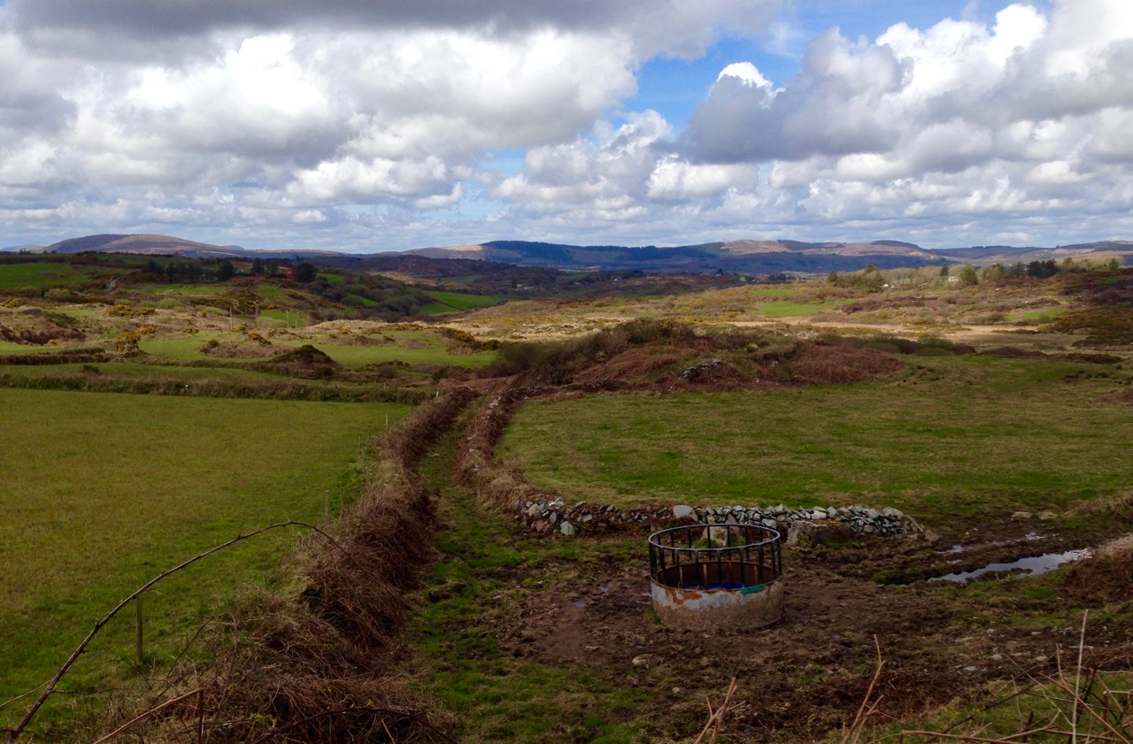
Top – wildflowers in abundance on the boreens of Cappaghglass. Bottom – signs of old workings in the fields below the road

As I walk the old road, I can’t help trying to picture the scenes there from other times. I wonder what feelings the hard working miners had – did they take in the changing light and the views? Did they see the way the grasses moved with the wind, creating waves on the landscape? Did they have any time to notice nature’s fine details – the incredible variety, colours and designs of the wild flowers? Or was theirs just a drudging commute from cottage to workplace at dawn and dusk?
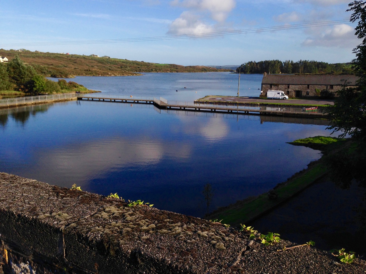
ballydehob wharf

The end of the road: Ballydehob Wharf, which would have seen great activity (intermittedly) when the mines were in full swing. Cappagh Mine was operating between 1816 and 1873, with its maximum output of about 400 tons of ore being produced in 1827

The poet Seamus Heaney has much to say about the hardship – and order – of a physical working life; his own father had worked the land and the poet was infected with memories of his younger days. This poem – Postscript – has a different emphasis but strikes me as a similar commentary on encounters with the landscape, although it’s concerned with another geography:

…And some time make the time to drive out west
Into County Clare, along the Flaggy Shore,
In September or October, when the wind
And the light are working off each other
So that the ocean on one side is wild
With foam and glitter, and inland among stones
The surface of a slate-grey lake is lit
By the earthed lightning of a flock of swans,
Their feathers roughed and ruffling, white on white,
Their fully-grown headstrong-looking heads
Tucked or cresting or busy underwater.
Useless to think you’ll park or capture it
More thoroughly. You are neither here nor there,
A hurry through which known and strange things pass
As big soft buffetings come at the car sideways
And catch the heart off guard and blow it open…
wall and heather

Champions for Ireland

wolfhounds

Irish Champions – ancient warriors, wolfhounds and rain at the Tailteann Games 1924

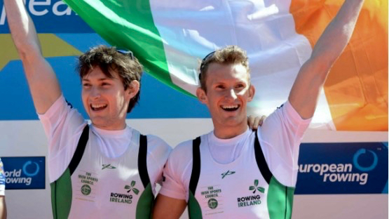
We heard hearty cheers coming across the water on Friday, when Ireland won the Olympic silver medal in the Lightweight Men’s Double Sculls Final. The cheers we heard were not coming from Rio, however (although there were plenty there), but from Lisheen, the tiny West Cork parish that’s just around the corner from us. That’s where Gary and Paul O’Donovan hail from. We think they have declared a public holiday there in honour of the two rowing brothers who, prior to this title, won gold at the European Championships in Brandenburg in Germany this year – the first Ireland rowing crew to become European Champions. This success set me looking at the records of Irish Olympic achievements over the years.

NGI 941

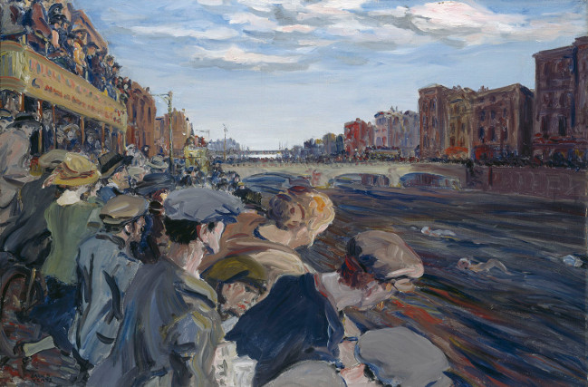
The Liffey Swim by Jack Butler Yeats, painted in 1923. Courtesy National Gallery of Ireland

Independent Ireland was represented at the Olympic Games from 1924 onwards. No Irish athletes won medals in 1924 but Jack Butler Yeats won a silver medal for the above painting and Oliver St John Gogarty won a bronze medal for literature in that year. Did you know that between 1912 and 1948 competitions in the arts were part of the Olympic Games? For a small nation Ireland has made its mark in the games: in Melbourne in 1956 Irish athletes and boxers won 5 medals between them – a gold, a silver and three bronze, and in London in 2012 boxers, athletes and a showjumper won 6 medals – a gold, a silver and four bronze. 1996 was a memorable year when, in Atlanta, Michelle Smith won 3 golds and a bronze for swimming.

An original cover from the 1924 programme for the Tailteann Games, an artist’s perception of the ancient games and (right) two medals struck for the Games

While researching this information I came across Tailteann Games. The word is pronounced ‘tell-tin’. The eleventh century Lebor Gabála Érenn (the Book of the Invasions of Ireland) states that the games were founded by Lugh Lámhfhada, Lugh of the Long Arm – the first High King of Ireland – as a mourning ceremony for the death of his foster-mother Tailtiu. Lugh buried Tailtiu underneath a mound in an area that took her name and was later called Teltown in County Meath, not far from the Hill of Tara. It’s perhaps significant that the games took place around the festival of Lughnasa – at the beginning of August. Accounts vary as to the historical periods in which the games were held: some say as early as 1800 BC, while a more generally accepted dating seems to be from the 6th to the 9th centuries AD: the festival died out after the Norman invasion but was later revived as the Tailten Fair, consisting of contests of strength and skill, horse races, religious celebrations, and a traditional time for couples to contract ‘trial’ marriages. These were allowed under Brehon Laws: couples could meet and live together for a year and a day – at the end of this time either party could end the marriage on the ‘Hills of Separation’.

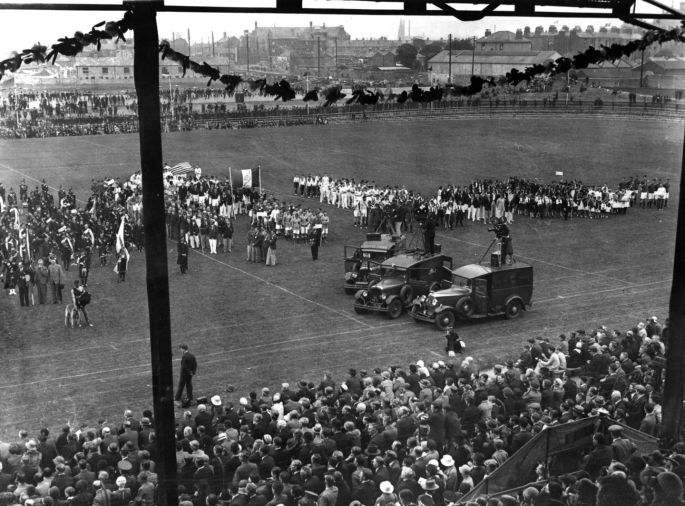
Presumably these photographs are from the ‘Opening Ceremony’ of the 1924 Tailteann Games held in Croke Park

While the 1924 Olympics were being held in Paris (where Finola’s grandfather was a member of the Irish team) a revival of the Tailteann Games was held in Croke Park, Dublin. This ‘meeting of the Irish race’ or ‘Irish Olympiad’ had been announced by Éamon de Valera in Dáil Éireann in 1921 to celebrate the founding of the Irish Free State, but the event was delayed because of the Anglo-Irish War and the Irish Civil War. Organised by the Gaelic Athletic Association (GAA), it was open to all people of Irish birth or ancestry. Participants came from England, Scotland, Wales, Canada, the USA, South Africa and Australia as well as Ireland. 

image

Note the media presence at the 1924 Tailteann Games: newsreel cameras mounted on to motor vans  

Tailteann Games were held again in 1928 and 1932. The name survives today as Rás Tailteann, which is an 8 day international cycling race around parts of Ireland. This race has run every year since it was founded in 1953 and has developed into a much sought after event by professional and amateur teams from many parts of the world: it is able to award qualifying points that are required for participation in Olympic Games and World Cycling Championships.

Fireworks_at_the_First_Tailteann_Games_August_15,_1924

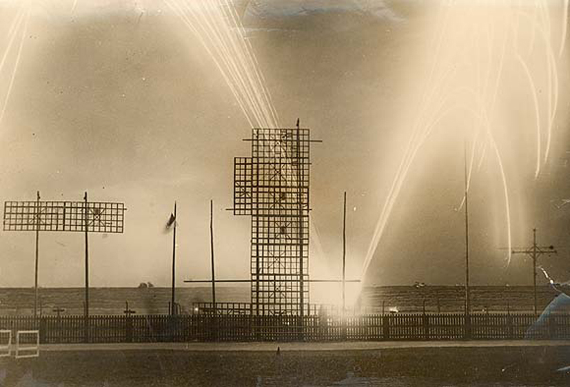
No modern games ceremony would be complete without a fireworks display: (top) this unusual photograph shows the fireworks at the 1924 Tailteann Games. (Lower left) a 1958 poster for the Rás Tailteann. (Lower right)  We watched this year’s Rás Tailteann on the road to Ballydehob. (Below) Paul and Gary O’Donovan – West Cork lads in Rio on Friday added a 2016 Olympic Silver to their many achievements (photo afloat.ie)

brothers

Foto Mizen!

Hydrangea and Montbretia

Montbretia and Hydrangea (Ava)

Sunday August 7th is The Mizen on a Sunday Project Day. The what? 

Robin

This young robin was curious about our activities in the woods

The organisers of the new Photo Mizen Festival, which launches next year in Schull, have come up with a great fundraising idea. Here it is: a photo book of life on the Mizen Peninsula during the 24-hour period of a single day, Sunday, August 7, 2016.

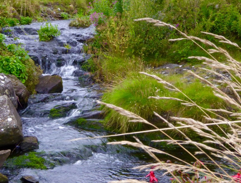
Stream

This little stream flows into the sea at Derreennatra

Derreenatra Bridge

The stream flows under this picturesque bridge (Ava)

My niece, Ava, and I decided to participate. Ava is almost 12 and she has a great eye and her parents’ camera. She and I rose at dawn this morning and set off to see what we could capture of life around us in Rossbrin.

My nephew Hugo, my sister Aoibhinn, and Marley, were happy to be photographed

Within three hours we had 250 images. Oh dear! We spent several hours deciding on the ones to submit to the Foto Mizen project and of course we had lots left over – we can only submit 5 each. So here is a selection of images that didn’t make the final cut.

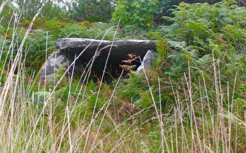
Kilbronogue Wedge Tomb

We walked up through the woods to the 3,000 year old wedge tomb at Kilbronogue (Ava)

The wildflowers were everywhere in abundance, some blowing in extravagant crowds and some tiny and hidden.

St John’s Wort, heather and gorse, and blackberry flowers

Ava took lots of photos but was a bit shy of having me take photos of her! Here she is doing her best imitation of a Jawa.

Ava the Jawa

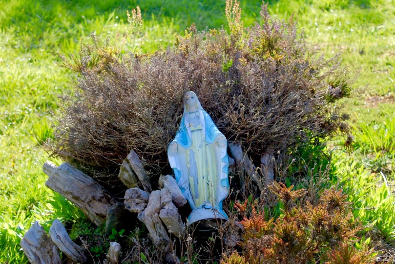
She was a little puzzled when I said our next stop was a graveyard, but got into the spirit of things right away when she found this statue.  She labelled it Creepy Mary, and I have to admit, those eyes are a little weird.

Creepy Mary

A tiny reminder from Stouke Graveyard that The Mizen is still a place where the past is sacred (Ava)

But she loved this little gate with its colourful postbox.

Gate and Post Box

And she took several photographs of the disused postbox at the old Rossbrin National School.

Rossbrin Post Box

It was a lovely way to spend time together, wandering companionably around the incredible Mizen countryside, snapping away at whatever took our fancy.

Rock wall with Montbretia

We didn’t have to go far – this is Ava’s picture of the little boreen outside our house 

Her younger brother, Hugo, got in on the act too, helping us to decide on our final five photos, which we will submit for the Photo Book Project. Turns out he has a great eye too – so next year there’ll be three of us roaming the hills of West Cork in the wee hours.

Fennel

Capturing the View: Belvederes in West Cork

Swift's Tower

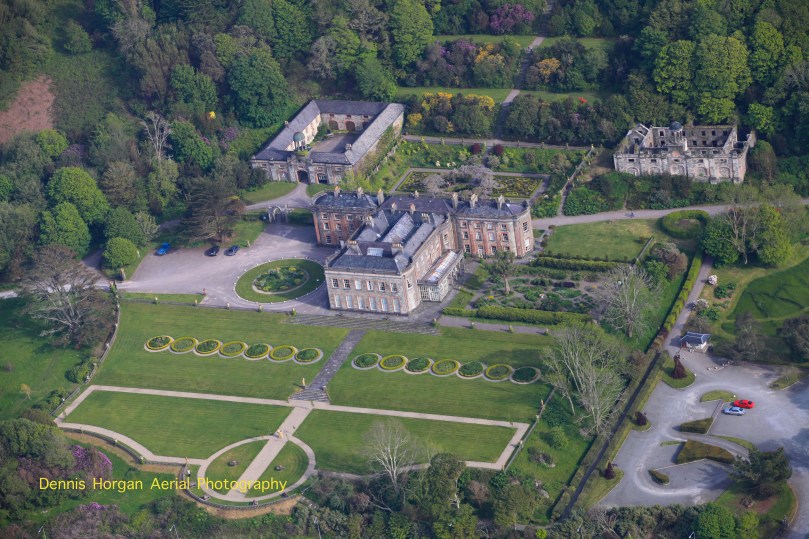
The 18th century was a time of profound change in garden design in Britain, and by extension in Ireland. In the opening decades of the 1700s great and small estates included formal gardens laid out in the French and Dutch styles that emphasised symmetry and geometry, parterres and avenues of trees. The gardens at Bantry House are a good example of this garden style. Although developed in the first half of the 19th century, they were perhaps influenced heavily by the gardens at Versailles and great European houses visited by the Earl of Bantry on his Grand Tour.

Bantry House 1

Thanks to Dennis Horgan, aerial photographer extraordinaire, for allowing me to use his shot of Bantry House. Note the formal and geometric layout of the gardens and the parterres immediately behind and to the right of the house

However, for the previous century a different style of landscaping had dominated garden design in Britain, pioneered by William Kent and Charles Bridgeman and reaching its peak in the work of Lancelot ‘Capability’ Brown. The effect they strove for was naturalistic (as opposed to natural) – a planned layout that mirrored but enhanced their idea of a ‘wild’ and romantic landscape. Large expanses of grass, strategically placed lakes and ponds, plantings of carefully chosen tree and shrub species, and clever little structures such as temples, summer houses and belvederes all combined to delight the eye, create a romantic mood and, of course, attest to the taste and wealth of the owner.

base of ruined tower belvedere New Court

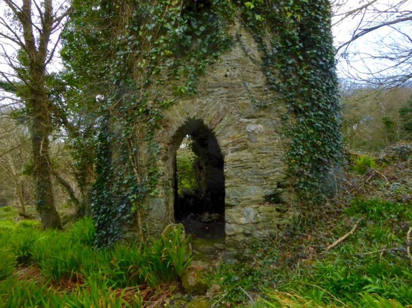
Nothing remains but the stub of what was once a belvedere in the shape of a round tower on the edge of the River Ilen, on the old New Court demesne.

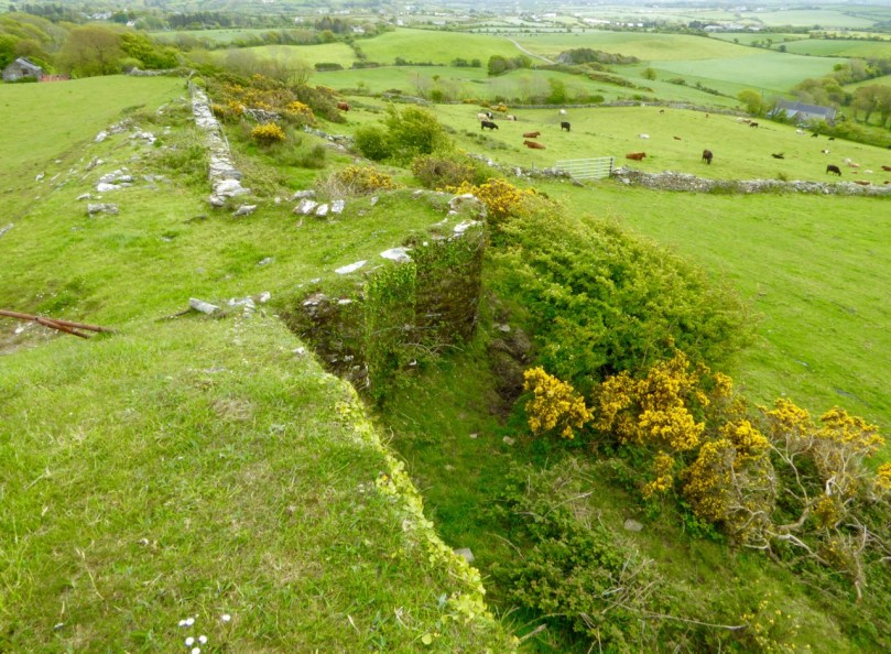
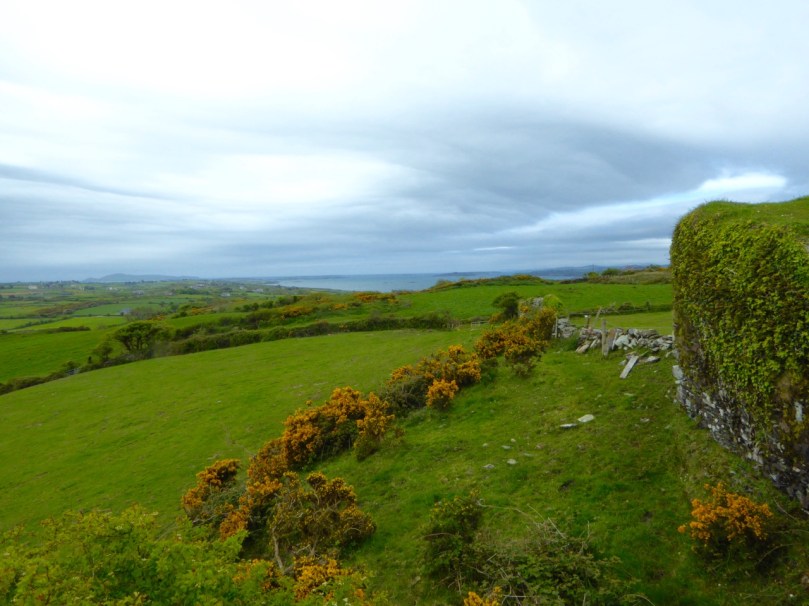
Echoes of these designed landscapes can be found here and there in West Cork, even where the big houses themselves have disappeared. Lately I have been on the hunt for belvederes and have found several intriguing examples. A belvedere (bel-beautiful, vedere-to see) was an edifice from which to enjoy a view. It could be as simple as a platform at a high point, or as complex as a multi-storey tower, but its most important attribute was its positioning to command a breathtaking vista.

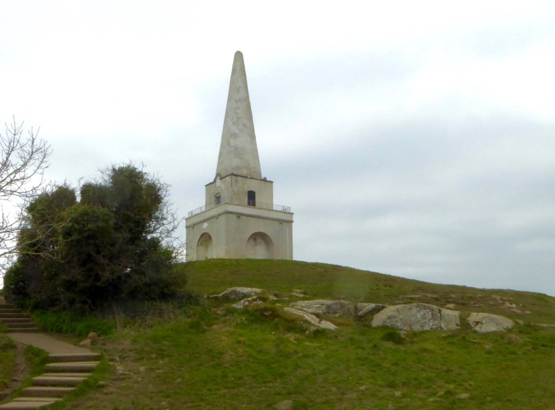
Killiney Hill belvedere

Killiney Hill, just south of Dublin

Perhaps the best known belvedere in Ireland is the one on top of Killiney Hill in Dublin. It was built in 1742 by the then-owner of the hill, John Mapas, to provide an opportunity to admire one of Ireland’s most iconic prospects. The room on the second floor had a little fireplace, windows, and a door to the exterior viewing deck, which was surrounded by wrought-iron railing. It’s no longer in use as a belvedere and many people think of it as some kind of memorial or folly.

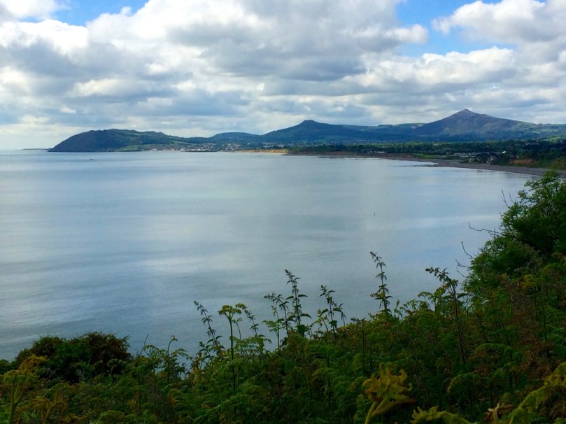
View from Killiney Hill

The view from Killiney Hill

In West Cork, the belvedere at Aughadown (known locally as the gazebo) is of the most simple kind, a viewing platform. It was associated with Aughadown House, a fortified mansion built by the Bechers that I wrote about in Trading Up In Tudor Times: Fortified Houses in West Cork.  

Belvedere, Aughadown

Peter Somerville-Large, in The Coast of West Cork, quoting Daniel Donovan*, says: Donovan described it as “a strong castellated mansion, entered by a drawbridge, surrounded by beautiful grounds and having a gazebo on one of the heights behind”. He continues: This gazebo was approached by a ramp along which the quality used to drive their carriages in order to enjoy the magnificent view out over Roaring Water Bay to the islands and the Fastnet in the distance. I found the ramp running above a field of winter wheat.

Aghadown Belvedere and tower house siting

The view from Becher’s ‘gazebo’ across to Roaringwater Bay

On each side of the Ilen River lie belvederes, in the form of towers. Imagine the ladies of the house and their guests, walking or being driven down to the water’s edge. Servants would have arrived earlier and the tea would be ready and a little fire laid against the breezes. They ascend the internal staircase to the second floor or perhaps to the roof and admire the views of the lazy Ilen River as it wends its way to the sea at Roaringwater Bay.

Creagh House Belvedere

The Creagh House belvedere

The belvedere at Creagh House exists now as a picturesque ruin. Octagonal in design, with pointed gothic windows and a small fireplace inside, it rises to three stories. Some sources describe it as the remains of a mill, and the artificial pond beside it as a mill pond, but it has all the hallmarks of a romantic garden structure.

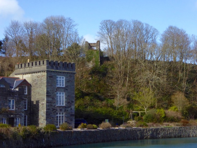
Across the river at New Court there were once three such ornamental towers. One is gone, the second is a mere stump, but the third still stands to its original height and offers lovely views of the river both to the east and the south.

Belvedere, New Court

One of the three original belvederes that once dotted the New Court Estate

At Castletownshend the local gentry were enthusiastic builders of ‘pleasure architecture’. Castletownsend Castle boast two structures of interest. The first is in the walls, an octagonal tower that is made to look like a defensive feature but in fact is purely decorative. Since there is apparently no entrance, this one may have to count as a folly rather than a belvedere.

Castle Townsend Belvedere turret

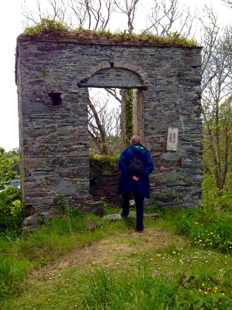
Behind the castle is the structure known as Swift’s Tower (see the very first photograph for an idea of its placement). Following the death of his beloved Vanessa in 1723, Dean Swift embarked on a long summer trip to the south west. it was in this tower, tradition has it, that he wrote the Latin poem Carberiae Rupes, which translates as The Crags of Carbery.

Swift's Tower 3

Once again we are indebted to Daniel Donovan’s Sketches in Carbery for an account of the poem and even a translation. Donovan did not have a high opinion of the poem (although he says that Dean Swift himself preferred it above other, better poems) and another critic referred to it as “a set of indifferent verses” describing a “bleak and deadly landscape”.

Carberiae Rupes

What do you think – his finest work?

Perhaps the Dean’s depressed state was to blame, or maybe he should have just stuck to prose. Or perhaps the servants hadn’t lit the fire and provided the tea – the tower certainly looks bleak enough now to bring on a fit of the dismals, in spite of the magnificent view.

Swift's Tower, Belvedere

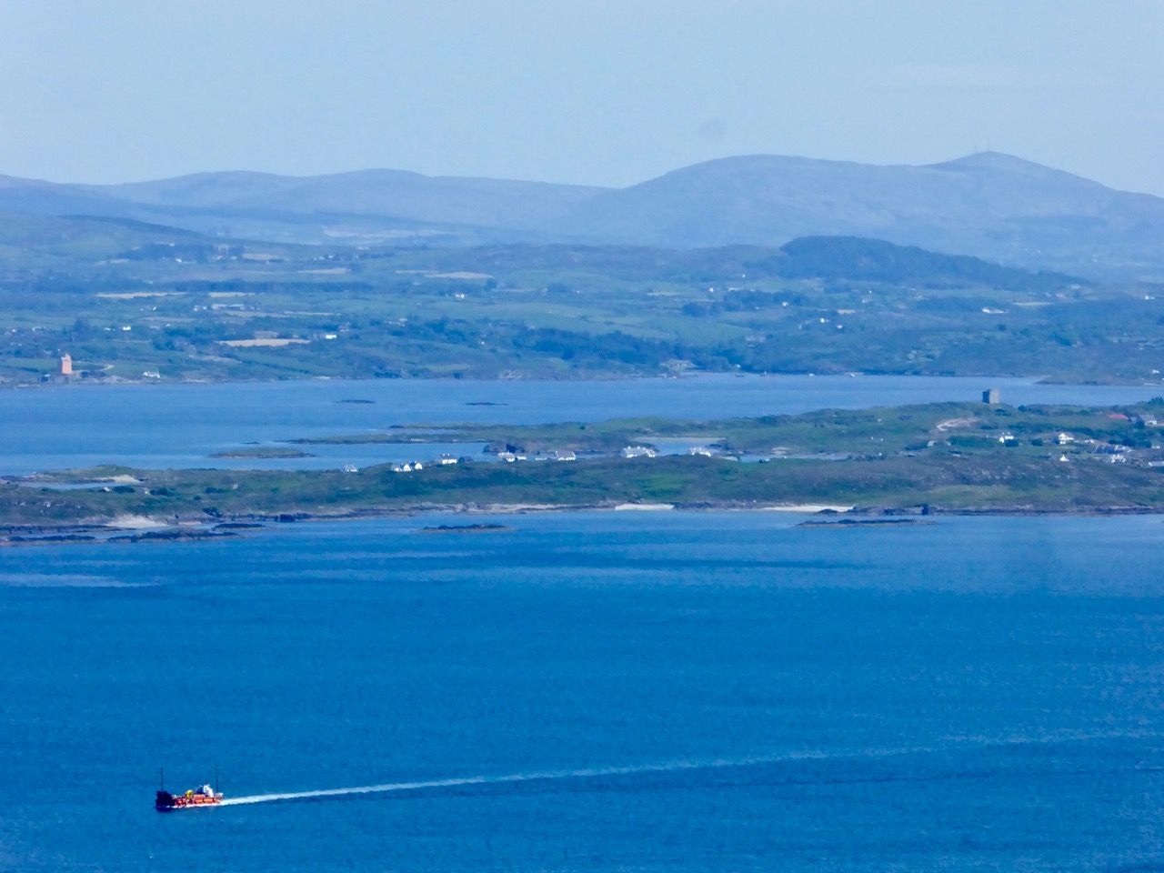
On Horse Island, just outside of Castlehaven Inlet, there is the base of a round tower that may also have been a belvedere. A visit there would have made a wonderful pleasure outing on a fine day, and the views would be stupendous.

Horse Island, Castlehaven, belvedere

You can just make out the remains of a round wall at the top left of Horse Island

There is a whole set of monuments in West Cork that are labelled as Belvederes in the National Monuments Service Inventory, but as Signal Towers in the records maintained by the National Inventory of Architectural Heritage.  These contradictory interpretations are fascinating and these towers are worth a post on their own. I will save that for another day, but to show you what I mean, take a look at the two towers on Rock Island, near Crookhaven. Belvederes or Signal Towers – what do you think? (If you’re not sure what signal towers are, take a look at this post from Amanda Clarke of Sheep’s Head Places.)

Crookhaven belvederes

Looking across to Rock Island from Crookhaven. Experts differ about the functions of the two towers

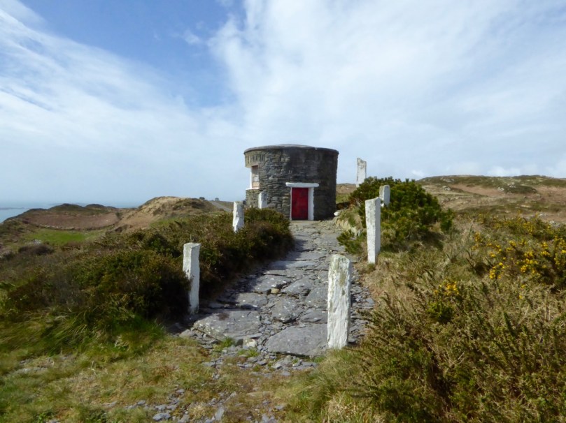
But what about nowadays? Do we still worship the view in West Cork? And do we still build belvederes from which to admire that view? The answer to both those questions can be found at Sailor’s Hill, just west of Schull!

Sailor's Hill 1

Sailor’s Hill Belvedere

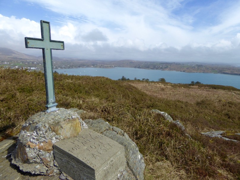
Sailor’s Hill is a labour of love by Connie Griffin who has worked on the sea and lived in this area all his life. It’s partly a memorial to those lost at sea and partly a place of contemplation to simply sit and soak up the panoramic views that stretch gloriously before you in ever direction.

Sailor's Hill Memorial 2

Schull Harbour in the background

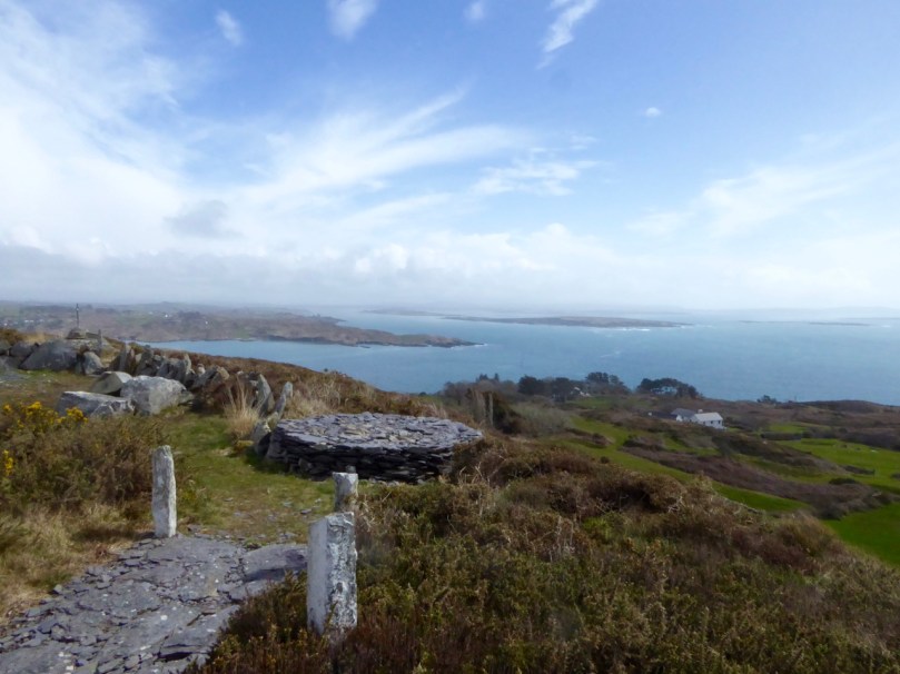
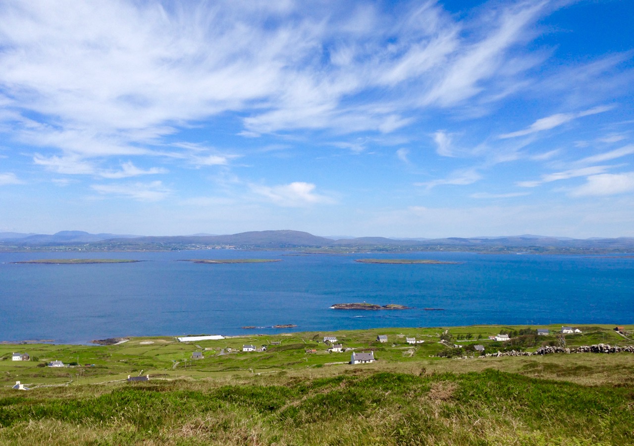
Sadly now a little overgrown and vandalised, it is still an incredible experience to arrive at Connie’s little round tower and see vast stretches of the Cork coast to the south, while the mountains of the Beara and Kerry rise behind you.

Sailor's Hill Views

It’s a testament to the power that landscape and seascape has over us: the power to move us and uplift us; the power to inspire us to try to capture it in paint and in words. We can’t really, but, like Connie, we keep trying.

Connie Griffin and Robert

Connie Griffin and Robert

*Somerville-Large attributes this information to Sketches in Carbery by Daniel Donovan. However, I have not been able to find the quote and wonder if it’s from another book.

Here Be Pirates!

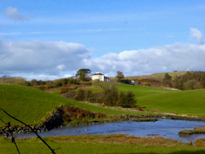
Crough Bay in the townland of Leamcon – one of the sheltered and hidden moorings which became known as a pirates’ nest in the late sixteenth and early seventeenth centuries. This is a view of part of the former estate of Sir William Hull who, as Vice Admiral of Munster, was charged with routing the pirates but in fact connived with them for his own financial gain

…Ireland may well be called the nursery and storehouse of pirates… wrote Sir Henry Mainwaring in a manuscript now in the British Museum (A Discourse of Pirates, on the suppression of piracy 1618). He had first-hand knowledge: this adventurer who was born in the time of Elizabeth spent most of his life at sea, survived the English Civil War – although on the losing side – and had been privateer, pirate and Royal Naval captain. He died at the age of 66 with his feet on dry land, although in poverty and exile in France.
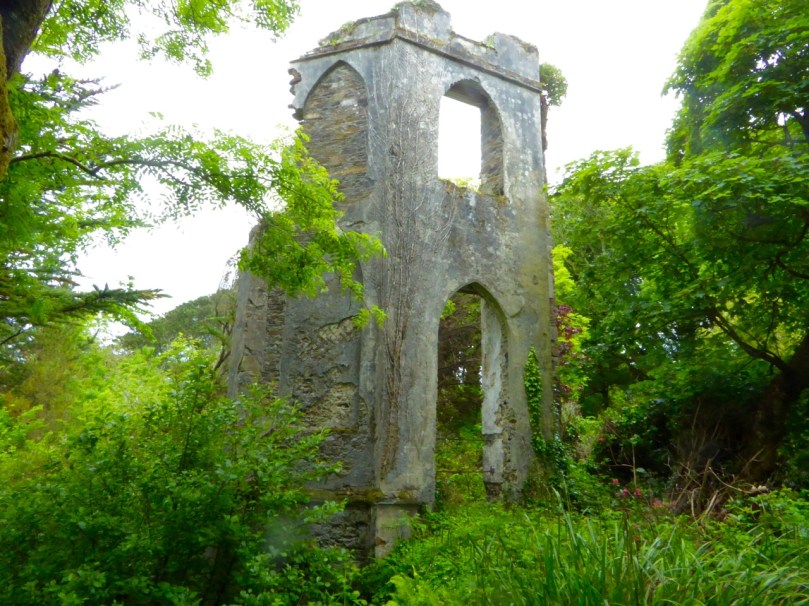
map of baltimore

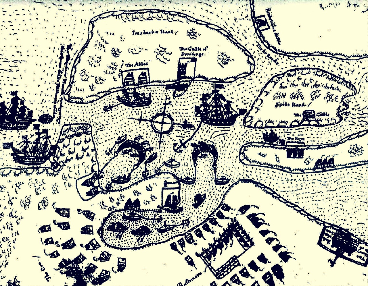
The Earl of Cork’s map of Baltimore,1628 –  following well-founded fears of ‘Turk’ raids he petitioned the Admiralty to fortify the coastal settlements. He was ignored and in 1631 the town was sacked and burned by Barbary pirates who carried away over 100 of the residents to the slave markets in Morroco

My possible ancestor Captain James Harris of Bristol died with his feet in the air: he was hanged at Wapping, in the estuary of the Thames, with 16 other pirates in December 1609. They had been captured in Baltimore, in sight of Roaringwater Bay. Why was it that Ireland – and, in particular, this coastline of west Cork was the notorious harbourer of pirates from all over Europe?

behold leamcon

According to Mainwaring, the west of Ireland was enticing because food and men were abundant; fewer naval ships patrolled the coast [than in England]; many of the local inhabitants were willing to trade with the pirates; and there was a …good store of English, Scottish, and Irish wenches which resort unto them… 

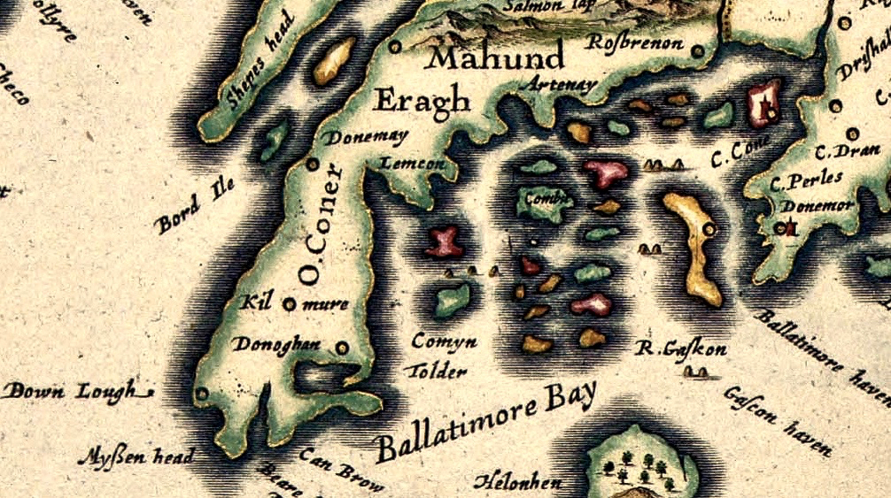
1611 John Speed map – Roaringwater

John Speed’s map of 1611 which portrays ‘Ballatimore Bay’ and Carbery’s Hundred Islands – ideal territory for concealing pirates. Note the curious geography, the names of the Irish clans and some of the places we recognise today: Rossbrenon (Rosbrin); Lemcon; Shepes Head and Myssen Head

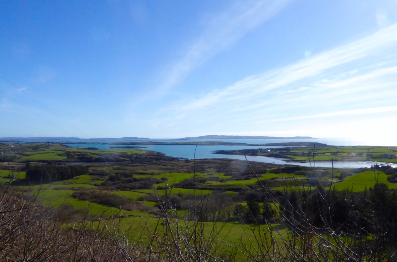
The coast of west Cork, in particular, was eminently suitable for sheltering ships in need of careening and victualling: bays, coves, inlets and estuaries abound and Carbery’s Hundred Isles (in fact many more than a hundred but it depends on what you count as an island) offer refuges a-plenty. In Captain Harris’s time there was only one naval ship patrolling the whole area from Kinsale around to Bantry and beyond – and this was the Tremontane – an ancient leaky pinnace which could be easily outrun by any respectable pirate crew. All the more unfortunate, then, for my forebear and his band who fell into the hands of the authorities, no doubt through some act of treachery or double-dealing.

Captain Harris’s family paid to retrieve his body from the gallows at Execution Dock (above left) and gave him a Christian burial. It was more usual for the bodies to be immersed by ‘three high tides’ before being disposed of. In particularly notorious cases the corpses were tarred and then hung in gibbets (iron cages – above right) to remain in public view. Captain Kidd was displayed this way for at least forty years after his death in 1701.

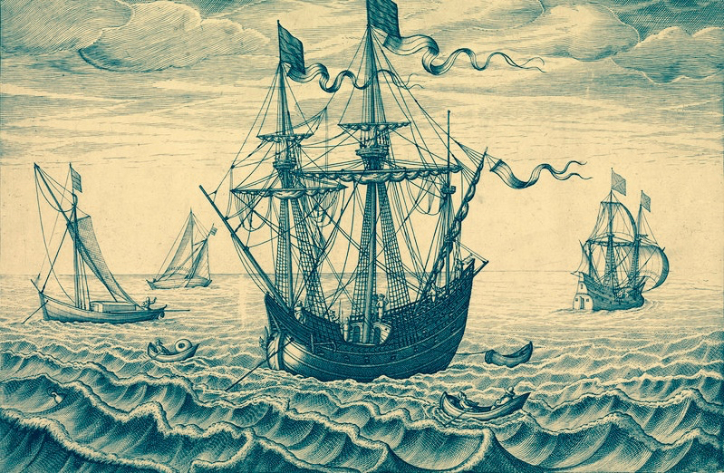
pirate ship

…The Irish folk surreptitiously colluded with pirates. When a captain needed supplies, he sent word of his needs. The reply to his note told him where he might find “so many Beeves or other refreshments as he shall need” on a specific night. When he and his men came ashore, they were to fire upon those who tended the herd, which allowed the herders to claim that they had been forced to hand over the cattle. Later on, he secretly landed “the goods or money in exchange, which by custom, they expect must be 2 or 3 times the value” If the pirates desired arms and/or ammunition and the Irish had any, they traded those items, too… (from Pirates and Privateers – The History of Maritime Piracy – an excellent online resource compiled by Cindy Vallar).

If you would like to learn more about Pirates in west Cork (and to listen to some great music) come along to the Fastnet Maritime + Folk Festival in Ballydehob this weekend 17th – 19th June: Robert is giving an illustrated talk on William Hull and the Leamcon Pirates’ Nest on Saturday 18th at 2.30pm in the Old Bank Building

Cape Clear: The Stone That Moved

along the roadThe enigma begins around 1874, on Cape Clear – the southernmost piece of inhabited soil on the islands of Ireland. Land here is hard won, and the stony fields are laboriously cleared using human power and – most likely – donkey power to improve prospects for grazing and tillage. In this year a narrow field in the townland of Croha West is being improved: the farm belongs to Tom Shipsey. His men – Dónal O Síocháin and Conchúr O Ríogáin – turn up a stone with strange markings on it, reportedly together with ‘shards of old incised pottery’, although these latter have never been traced.

Header: looking towards the townland of Croha West, where Thomas Shipsey and his men discovered the travelling stone. Above left – records from the Shipsey family dating back to the 1800s. Above right – possibly the earliest drawing of the Cape Clear Inscribed Stone, included in Michael J O’Kelly’s article of 1949  in the Cork Historical and Archaeological Society Journal

At this time the Curate on Cape is Revd John O’Leary. We might reasonably assume that he takes an interest in the stone and has it set up somewhere to show off its curious and undoubtedly historic decoration. We do know for sure that, when he leaves Cape Clear in 1877 to take up the curacy of neighbouring Sherkin Island, the stone goes with him and becomes a feature in his garden there. It does not, however, accompany him to Clonakilty whence he is transferred to become Parish Priest and Monsignor in 1881: instead it languishes on Sherkin, benignly fading into the undergrowth. Years later – in 1945 – the stone is ‘accidentally rediscovered’ by the then incumbent, Rev Fr E Lambe. Presumably recognising its probable significance he has it shipped off to University College Cork where it is received by Professor Seán P Ó Ríordáin.

Cork Exhibition

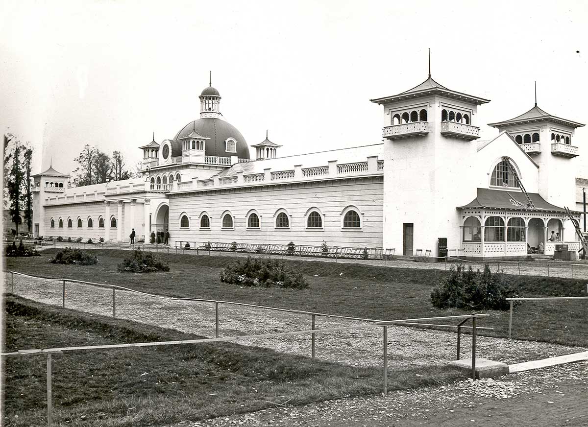
1902 World’s Fair, Cork – now Fitzgerald’s Park and the setting for Cork Public Museum

Close to the University grounds in Cork is a residence built by Charles Beamish in 1845 at the cost of £4,000 on land purchased from the Duke of Devonshire. Beamish has the grounds laid out with a variety of shrubs and trees, and due to their density the grounds become known as The Strawberries and the house as The Shrubbery. In 1901 the house and grounds are taken over by Incorporated Cork International Association and used as the venue for the great World’s Fair of 1902. Following this the grounds – now known as Fitzgerald’s Park – are donated to Cork Corporation for recreational use by the public. Eventually The Shrubbery is converted into Cork’s Public Museum which opens in April 1945, under the auspices of UCC: the first Curator is Michael J O’Kelly. The Cape Clear Inscribed Stone completes its travels (for now) and is on permanent display in the Museum.

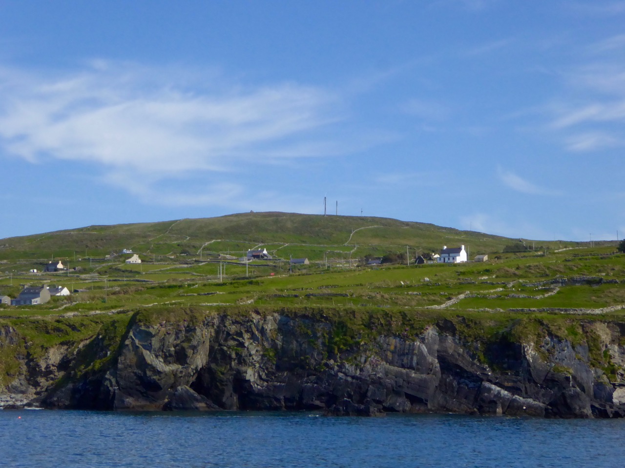
View from sea

The highest point on Cape Clear is Quarantine Hill – the trig point can be seen as a ‘pimple’ in this photograph, taken from the north side of the island

There’s a prequel to this story of the travelling stone. We have seen that it was unearthed on Farmer Shipsey’s land in 1874. Apparently this isn’t where it started out. O’Kelly (who became head of the Archaeology Department at UCC in 1946) wrote a monograph on the stone for the Cork Historical and Archaeological Society in 1949 (volume 54 pages 8 – 10):

…The motifs clearly belong to the passage-grave group of carvings and can be paralleled at Newgrange, Bryn Celli Du [Wales], Gavr’ Inis [Brittany] and elsewhere. The stone is therefore an important discovery and because of this, the lack of information about the nature of the site on which it was found is all the more disappointing. At this stage only a few vague traditions concerning its finding could be gleaned in the district. The statement of one old man that ‘a mound of stones was being cleared from a field’ may possibly indicate a cairn and if such were the case, the decorated stone may have formed part of an underlying tomb chamber. There is also some reason to think that fragments of pottery were found, though none has survived. This may be a further hint that the stone was associated with a burial. With reserve, it might therefore be assumed that the structure, whatever its exact nature, was erected by a group of passage-grave folk who either by accident or design came to land on this island off the coast of Cork…

This little narrative sowed the seed that the stone might be connected to a passage grave. If so, this would probably date the carving to some five thousand years ago. But, surely, there should be some trace of the passage grave itself if this is the case? No such traces could be found in the townland of Croha West.

View from PG

looking north
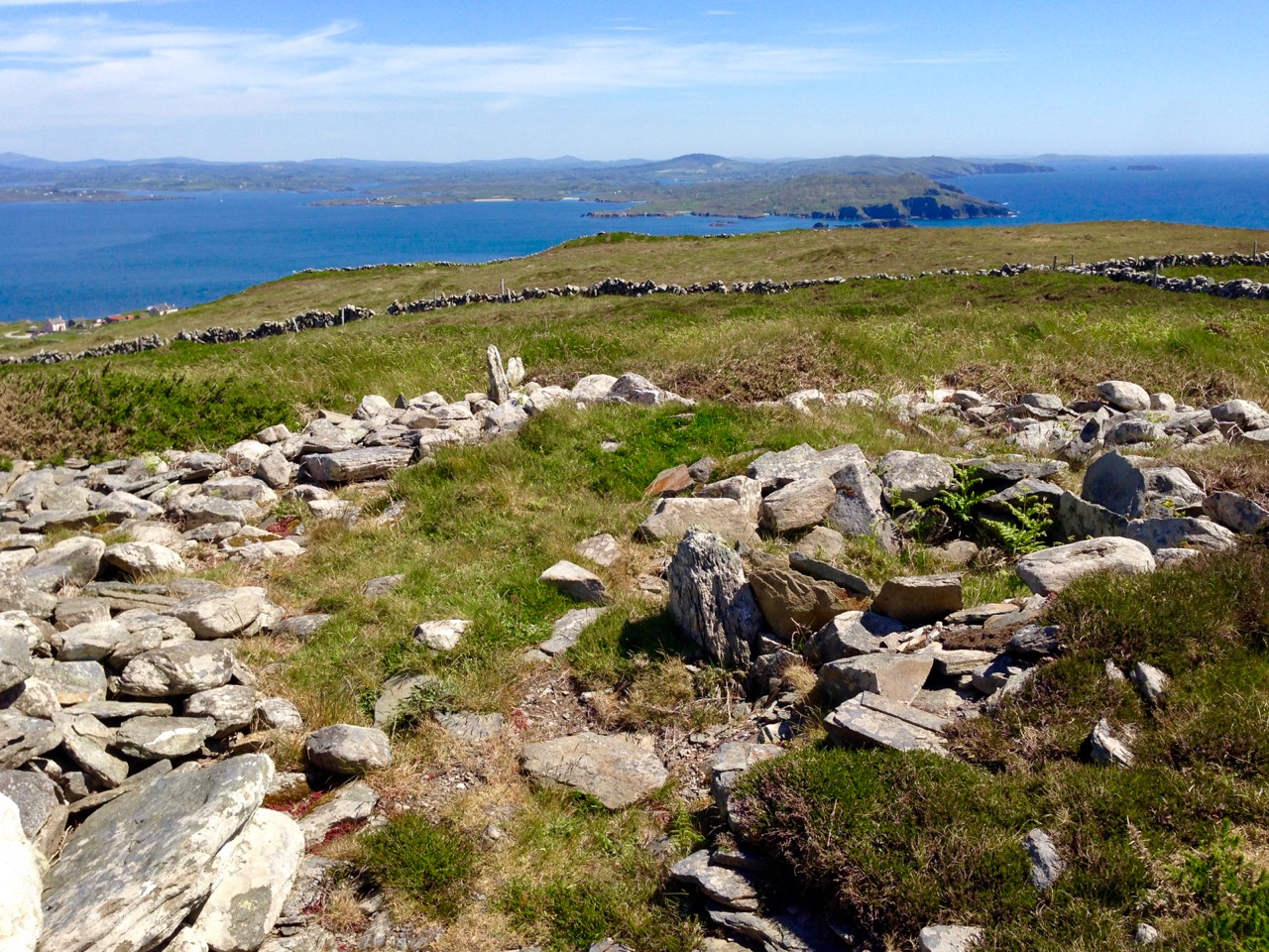
Spectacular views from the prehistoric site on Cape Clear, both looking north towards the mainland

We move forward to 1984 when four archaeologists (Barra O Donnabhain, Mary O’Donnell, Jerry O’Sullivan and Paddy O’Leary) explored the wider area and discovered, on the very summit of the island, the ruins of a prehistoric structure. This site, 533 feet above sea level, is in the townland of Killickaforavane and is known locally as Quarantine Hill. At this time the island was investigating the possibility of producing electricity by wind power: hitherto electricity to some properties was provided by a diesel generating system which had been in place only since 1969. The obvious efficient place for wind generation was the highest point and plans were laid for setting up two SMA Regelsystem Gmbh 33w turbines (which began operation in 1987). In preparation for this installation an archaeological survey of the immediate area was carried out by Prof Peter Woodman and Dr Elizabeth Shee. Paddy O’Leary and Lee Snodgrass were also present at that time. The collective view seemed to indicate that the structure could, indeed, have been a small passage grave.

chamber closer

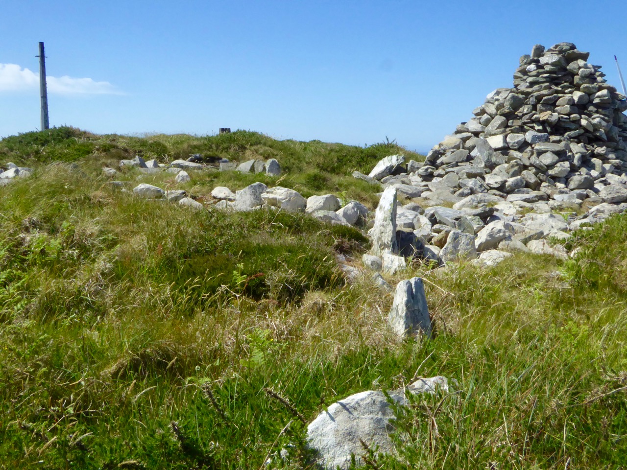
Probably the chamber of a 5,000 year old passage grave, Killickaforavane, Cape Clear

The wind turbines were sited a little distance from the prehistoric remains and have themselves become archaeology of a more industrial nature. While in use they generated 90% of the island’s demand during favourable winds (force 3+). The corrosive effects of the Atlantic climate – in particular the wild south-westerly gales – rendered the mechanisms beyond repair after some ten years; a submarine cable bringing electricity from the mainland (8 miles away) arrived in about 1995. For a short time the systems operated in tandem and produced sufficient power to feed back to Ireland’s National Grid. According to a letter to the Irish Times by Séamus Ó Drisceoil, who was manager of the island Co-op at the time of the installation …the Cape Clear system is credited with providing the first concrete evidence for the viability of wind energy in Ireland…

Tomorrow’s archaeology: the pioneering – but now defunct – wind generating system on Quarantine Hill, overlooking the passage grave site

Once the concept of the island supporting a five thousand year old passage grave on its summit has been digested, then the question has to be asked – did the Cape Clear stone now in the Cork Public Museum originate at this site? It was found a good half mile away, in a different townland – but this might suggest that an earlier antiquarian (or interested observer) discovered it on the hill and had it moved to Croha West for safekeeping, display, or even because it was thought it might have some value. No-one on the island seems to have any knowledge of this distant event. As O’Kelly says – it’s disappointing that there is no ‘story’: one might almost expect a tale of the person moving one of the ‘old stones’ having met with an unfortunate fate because of interference with the domain of The Other Crowd

the way through

Kerb and passage

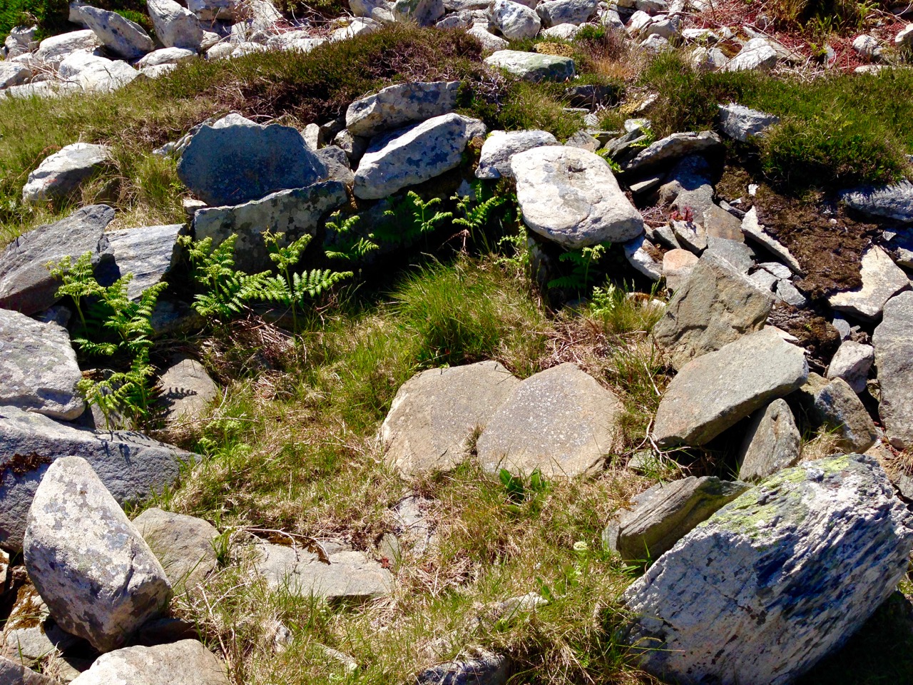
Top: looking towards the summit of Quarantine Hill – there is no clear path up there, and the traveller can be waylaid by gorse and brambles… Below: the prehistoric site – we are probably looking at the orthostats of a passage, which has a summer solstice orientation, and a kerbstone. On the right is a modern cairn while to the left in the background is the remains of one of the turbine towers

There is, surely, a strong likelihood that the Cape Clear Inscribed Stone did originate in the hilltop passage tomb, in which case we have completed the tale of its travels, up to the present day. The tomb is in ruins, although enough remains to show its shape and probable orientation. Paddy O’Leary tells the story of his investigations with Lee Snodgrass in an article for Mizen Journal, Volume 2, 1994:

…We were convinced that it was a passage tomb and that it was orientated on the rising sun of the summer solstice… We planned a two night vigil for June 1993 and were buoyed up by a good weather forecast. Saturday afternoon was sunny and we transported our equipment direct to the top of Quarantine Hill from the boat. We set up our cameras and, taking advantage of the sunny weather, took photographs, especially during the late evening, when there was a lovely sky. On Sunday morning June 20th we rose shortly after 4am to prepare for dawn. It was very cold but the sky was clear. A dull grey cloud began to show to the northeast, we set our cameras and waited for the sun. Shortly after 5am it peeped above the horizon, nestling in the gap between Carrigfada and the hill to its north… Gradually it rose in a 40 degree angle, flooding the sky with first light and mirroring its golden red orb in the brightening sea… A perfect sunrise perfectly recorded. The warmth was now penetrating almost numb fingers and feet. The line of the orientation was exactly as expected, directly along the supposed line of the passage, into the centre of the chamber… The most southerly point of Ireland had its passage tomb, with a summer solstice sunrise orientation; a nice counterpoint to the Newgrange winter solstice sunrise…

cairn and view

Quarantine Hill, Killickaforavane townland, Cape Clear. The view looking east – towards the summer solstice sunrise – from the prehistoric site on the summit

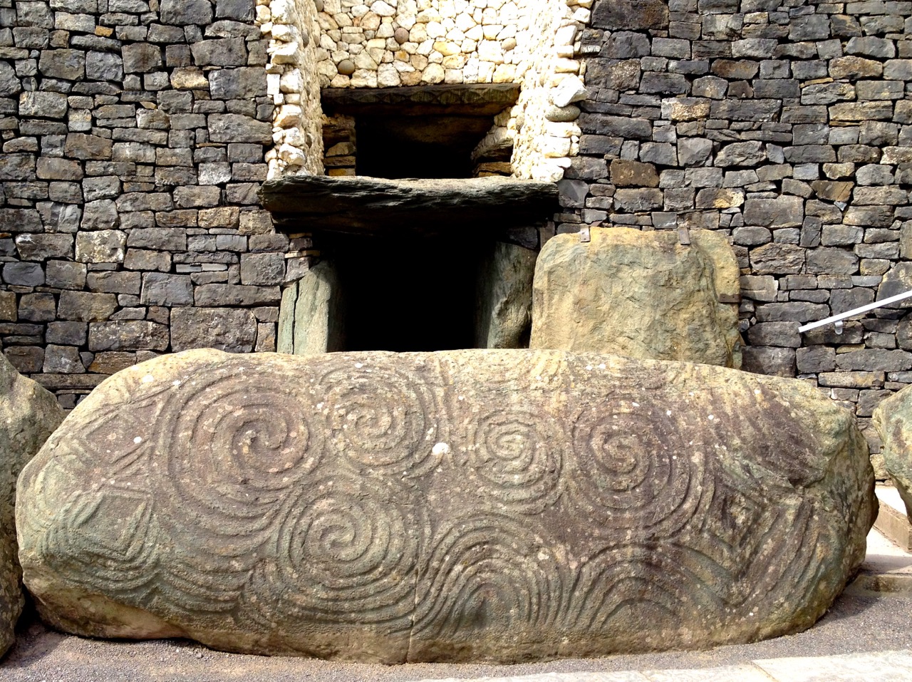
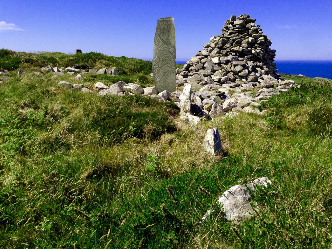
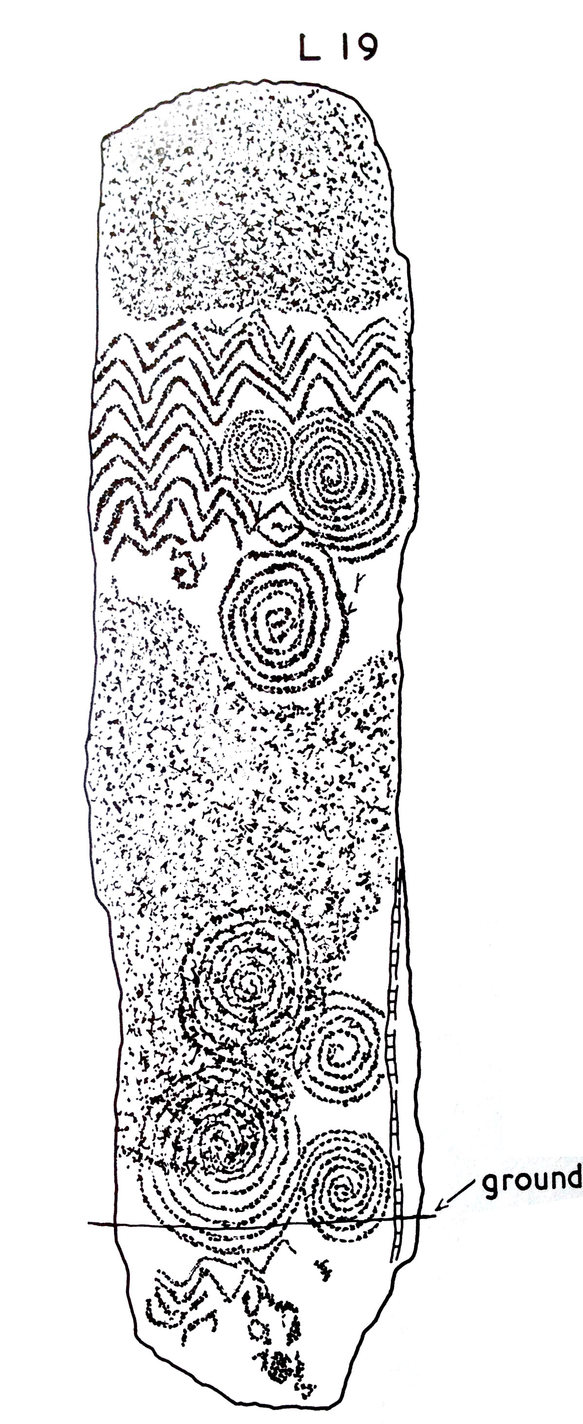
If the inscribed stone was, indeed, incorporated into the Cape Clear passage tomb, where might it have been placed? There are parallels in its design with some of the lintel stones at Fourknocks, but also I am drawn to similarities with stone L19 from Claire O’Kelly’s Corpus of decorated stones included in Michael J O’Kelly’s Newgrange – Archaeology, Art and Legend (Thames + Hudson, London 1982). This one is a standing stone – perhaps our well travelled stone was standing also.

Newgrange

Newgrange entrance stone

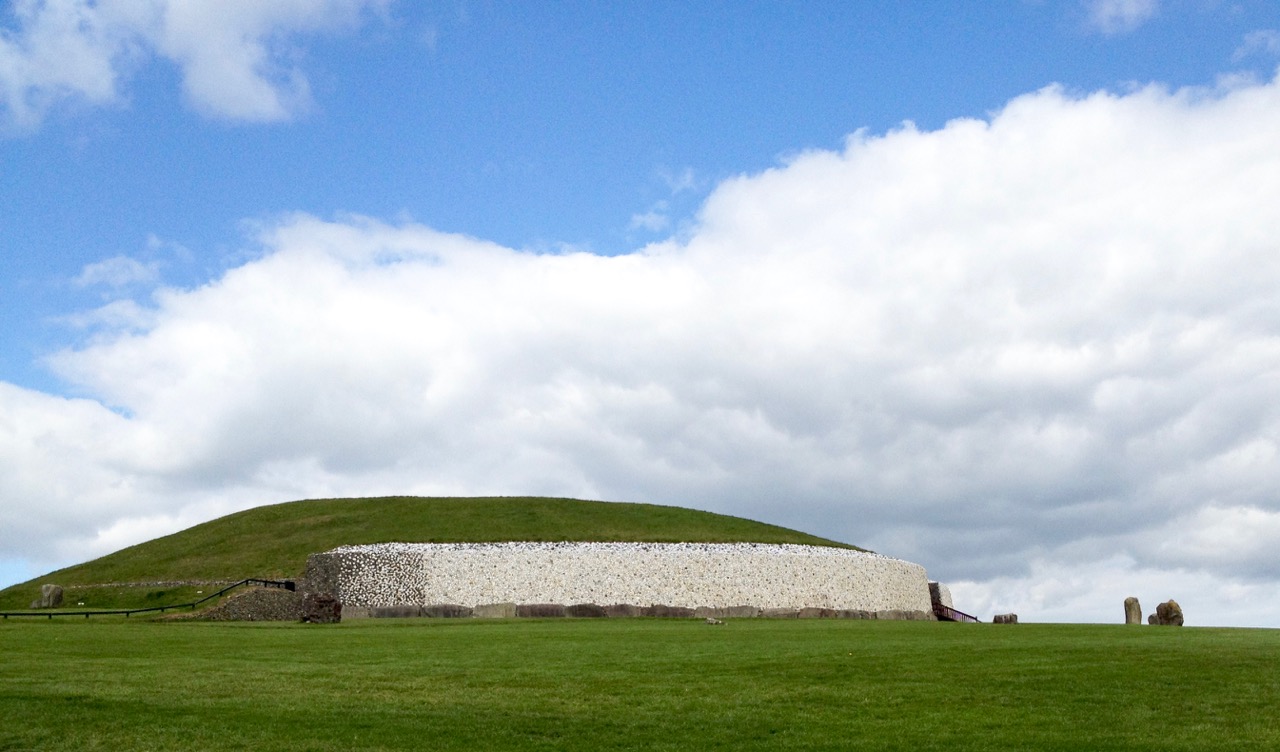
Iconic passage tomb in Meath, Ireland – one of the greatest monuments to the Neolithic people in the world: the top picture shows the east face of the great mound as reconstructed by Michael O’Kelly using the white quartz stones which were revealed during the excavations (Finola took part in these digs!); the lower picture shows the entrance stone to Newgrange – the Cape Clear inscribed stone must be related to this type of prehistoric art, although situated a very long way away…

Here’s a suggestion – probably considered heretical in some quarters: why don’t we complete the travels of the Cape Clear Inscribed Stone by taking it out of the Cork Public Museum and (with some suitable ceremony) transporting it back across the sea to Cape Clear and setting it back up there for all time? For me, museums – while obviously providing safe keeping – sometimes lack the reality of true context… Alright then, if that is considered as inconceivable an idea as I suspect it would be, let’s make a very good replica and send it up to the top of Quarantine Hill. At the same time we could re-establish a pathway to attract people up there: our own pilgrimage to this very special site involved making heavy way through gorse and brambles.

looking towards west

Below: Newgrange Stone L19 from Claire O’Kelly’s Corpus of decorated stones included in Michael J O’Kelly’s 1982 book on Newgrange

claire stone

With acknowledgements and thanks to those quoted above and the following sources, which have enabled me to pull together the story of this site: Paddy O’Leary and Lee Snodgrass (Mizen Journal Vol 2 1994 and personal communication), Michael J O’Kelly (Cork Historical and Archaeological Society Vol 54 1949), Chuck Kruger (Skibbereen and District Historical Society Journal Vol 6 2010)