Landscaping – with Trish Punch

Brow Head

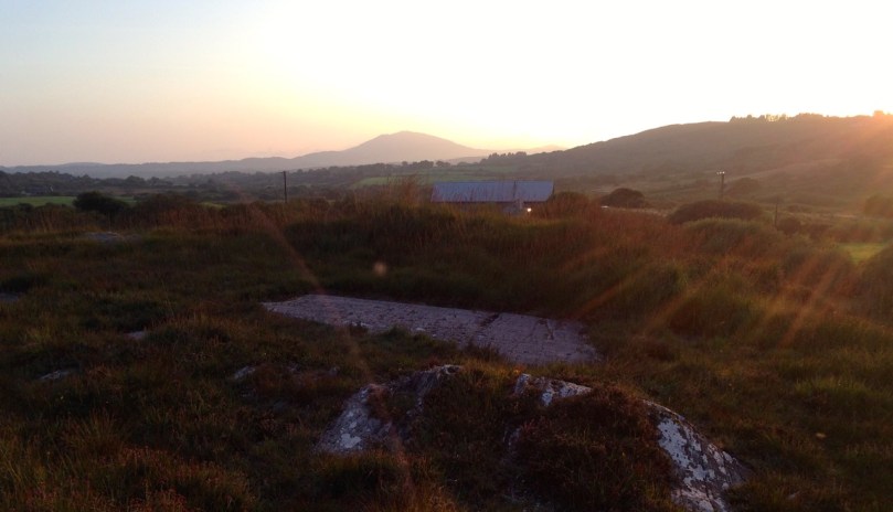
Brow Head silhouetted against the setting sun*

In our quest to bring you the best West Cork has to offer, we pepper our posts and our Facebook Page with photographs. After a great day-long course with Celia Bartlett (last year, highly recommended!) I managed to wean myself from the auto mode on my camera and have been taking pictures using the manual setting for more than a year now.

Rock Island

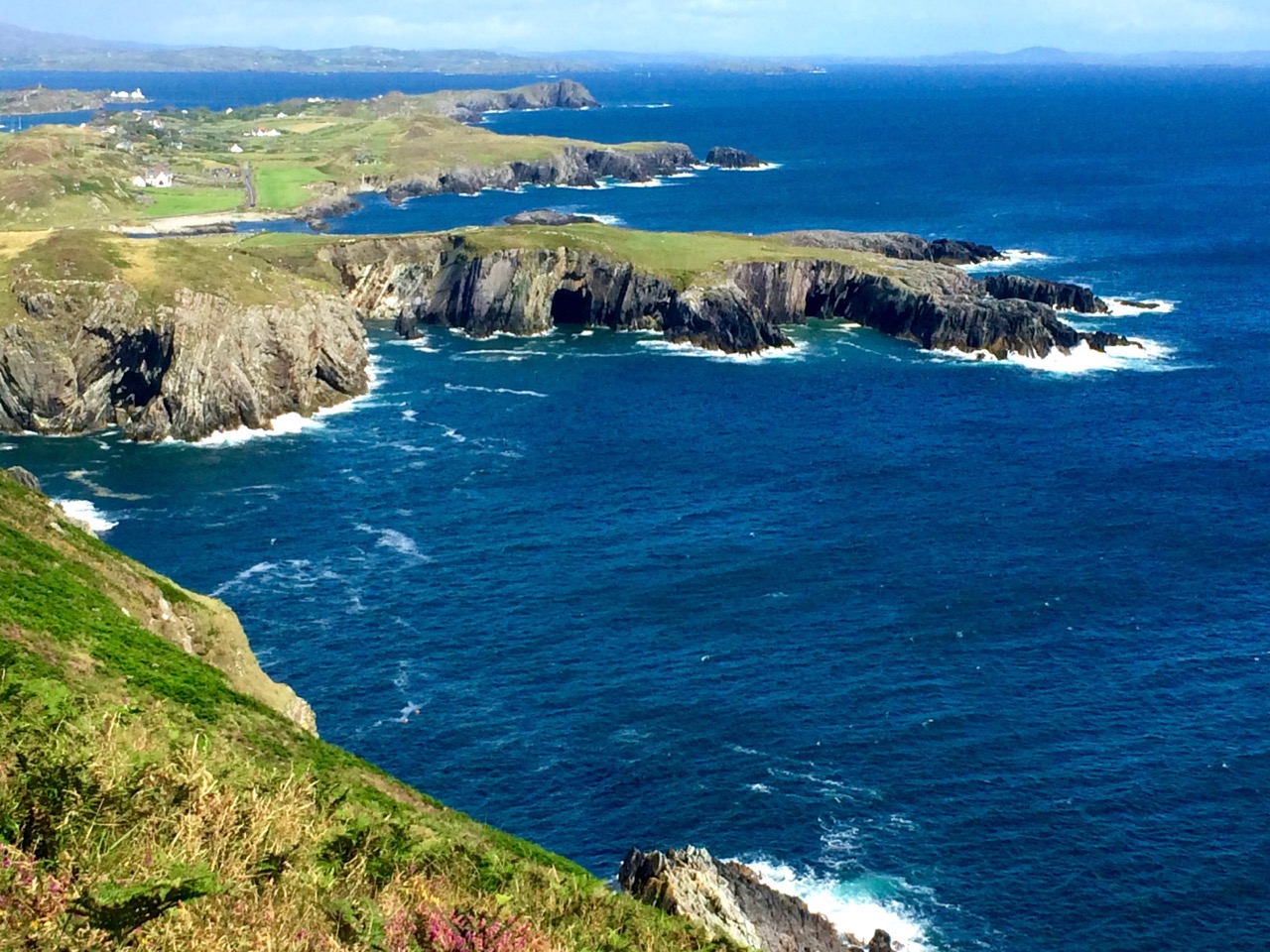
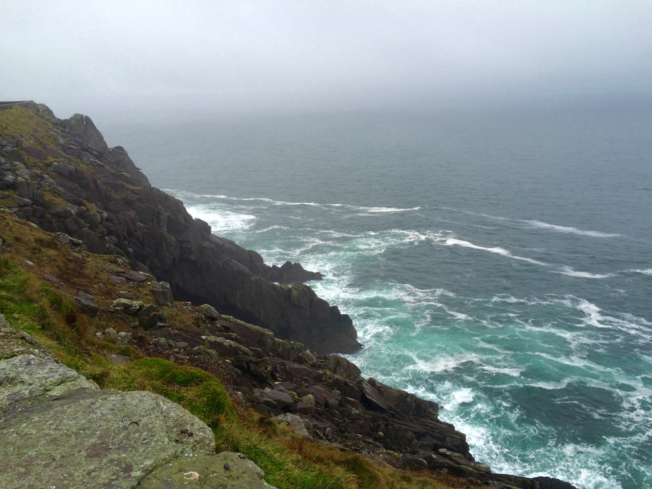
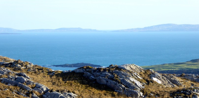
Rock Island and Crookhaven Inlet

And I’m hitting the wall again – knowing my camera is able to deliver so much more and that there’s a lot I need to learn about composition. So I signed up for a one-on-one workshop with Trish Punch and boy, am I glad I did!

Trish 4

This is Trish – she’s a professional landscape photographer who supplies images to Lonely Planet (Lonely Planet!) among other prestigious publishers and travel sites. She specialises in the Wild Atlantic Way and is currently pursuing a project to capture the islands along the Way. Take a look at her website and be prepared to do some serious drooling.

Crescent sky

We started at dawn and watched the light appear over Ballydehob Bay

But Trish is also an inspiring, encouraging, and organised teacher – and a lot of fun to be with. We had a great day together, starting at dawn and ending when the sun set. Throughout the day she encouraged me constantly to slow down, think about my shots, use the principles of good composition, really examine where the eye was being led in the frame and check the light. 

Schull Pier

This was taken on Schull Pier – the mooring bollard takes on a sculptural quality in the right lighting

I’ve been making all the classic mistakes, chief of which is to plonk the main subject right in the middle of the frame. I have also struggled with sharp focus, especially in low light, and Trish insisted on me using my tripod (something I have been reluctant to do – I don’t want to lug it around) and showed me how to use my timer to take the shot, since my camera won’t accommodate a cable or remote shutter release.

Barleycove Wetlands

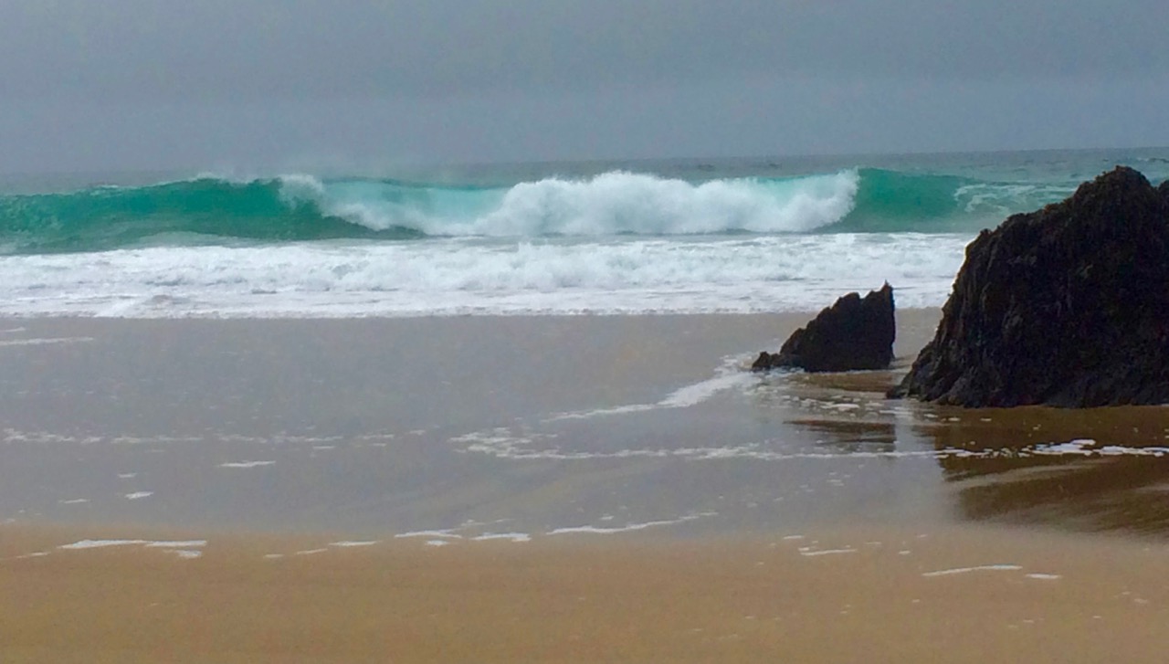
Watching where the light comes from – these marsh grasses at Barley Cove glow golden in the low evening light

We were fortunate to have a really great day in December, with a long Golden Hour at each end. I’ve been practising what she taught me since then and I feel a little more confident each day. I hope you, our dear readers, will see a difference too, over time.

River Lee near Ballingeary 2

The River Lee near Inchigeelagh

We took a trip to Macroom the other day and I used the opportunity to practise what I learned with Trish. Mostly I just tried to slow down and think more about the composition of the shot. It was another amazing day with clear blue skies – but this time very cold with lots of frost where the sun hadn’t managed to penetrate.

Sunshine and Frost, West Cork

Sunshine and shadow on a frosty day in West Cork

If you’ve been thinking you’d like to improve your photography skills, give Trish a call or drop her an email. You can take one of her planned workshops or she can customise a day, or a weekend, for you no matter what level you’re at.

Coral House

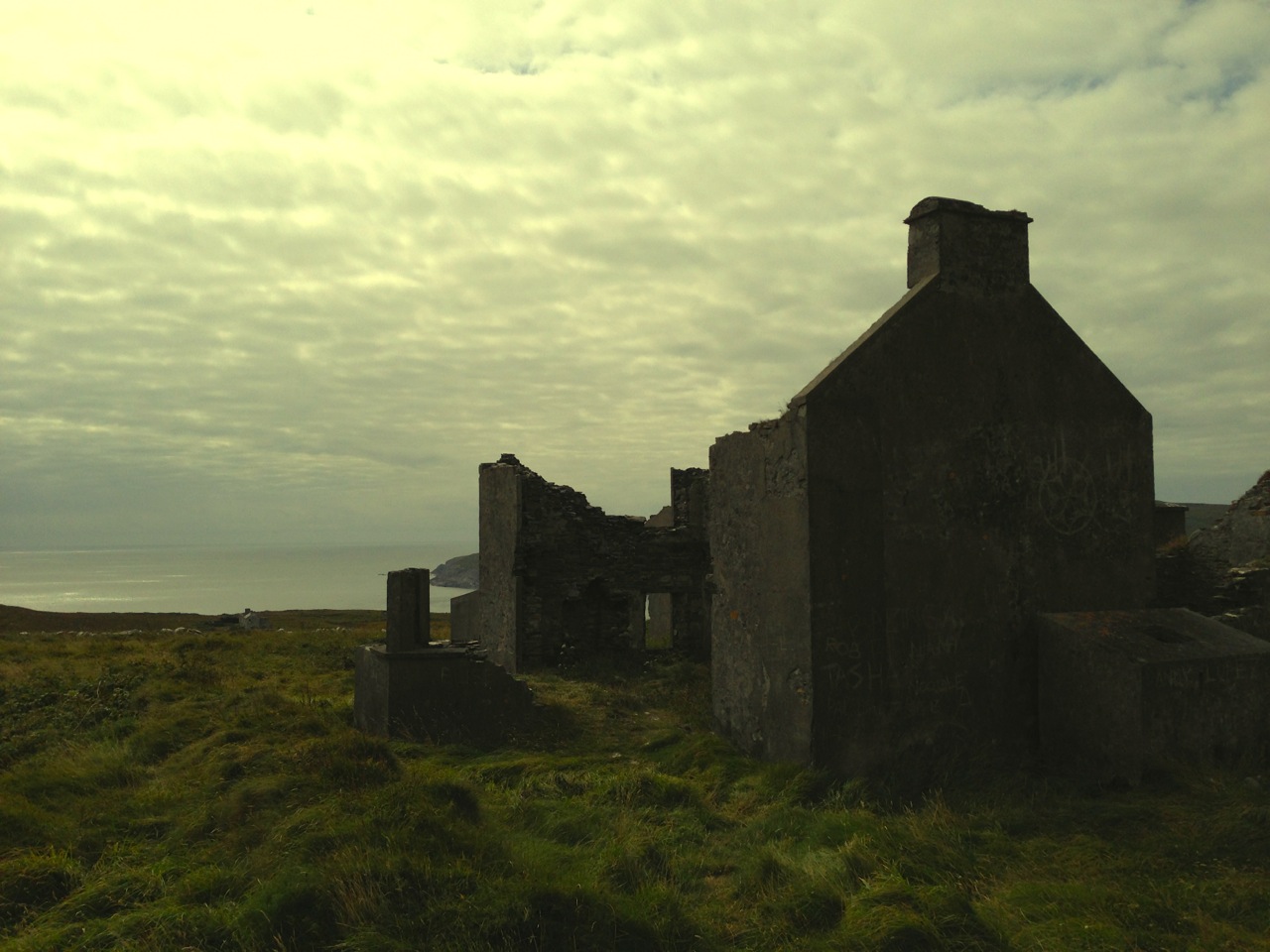
House in the Shehy Mountains

Don’t be intimidated if you’re operating on the automatic settings or if you don’t know the difference between shooting in RAW or JPEG (I didn’t) – you’ll come away knowing a lot more about how to move forward in your skills. And you’ll have time in the open with lots of laughter and surrounded by incredible landscape – now what could be better than that?

Pass of Keimaneigh

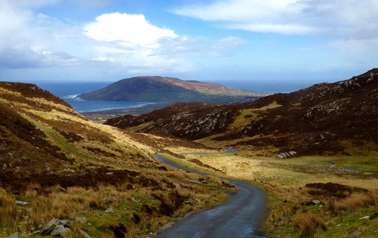
Heading up to the Pass of Keimaneigh

*I took the first five photographs above on the day of the workshop (Dec 16) and the next five in the last two weeks.

Atlantic Winter

Dingle Beach

When St Brendan of Clonfert set out to discover America in 512 he and his fellow monks had to face the enormity of the Atlantic Ocean in tiny boats built out of wood and oxhides, sealed with animal fat. Up here in Nead an Iolair our view out to the islands of Roaringwater Bay and beyond is dominated by that same ocean and – sometimes – we feel just as small. This year the winter gales have started early, and spates of fierce westerlies have been throwing the Atlantic straight at our windows. The tiles rattle alarmingly while we are tucked up in bed at night. At these times I think of the Saint and what he had to face. But, like Brendan, we always survive the storms, and often wake up in the morning to a calm, clear day – except that you can hear the constant ‘roaring’ of the open sea out over the bay.

celebrating massOn their way to the New World – Saint Brendan and his companions take advantage of a passing Atlantic denizen to celebrate Mass…

The Atlantic has shaped Ireland. The sea is omnipresent: poets have written about it, storytellers have woven tales around it, and composers have tried to capture its spirit in music. Here’s a small section from the impressive ‘Brendan Voyage’ written by Shaun Davey for orchestra and Uillinn pipes – it’s the haunting second movement, played by Liam O’Flynn with the Irish National Youth Orchestra, at a performance in Cork City Hall. It makes me think of the wonderful sunrise on that calm day after the storm…

Brendan Voyage

Long Island Beacon

Brow Head

Mizen Head

Our own Atlantic: telescopic view of a storm battering Long Island, taken from our garden at Nead an Iolair (top), Brow Head, near Crookhaven (centre), and the impressive land and seascape at Mizen Head – Ireland’s most south-westerly point (lower picture). At the head of this page you can see the huge rollers that come into Dingle Bay, Co Kerry

Dogger, Rockall, Malin, Irish Sea:
Green, swift upsurges, North Atlantic flux
Conjured by that strong gale-warning voice,
Collapse into a sibilant penumbra.
Midnight and closedown. Sirens of the tundra,
Of eel-road, seal-road, keel-road, whale-road, raise
Their wind-compounded keen behind the baize
And drive the trawlers to the lee of Wicklow.
L’Etoile, Le Guillemot, La Belle Hélène
Nursed their bright names this morning in the bay
That toiled like mortar. It was marvellous
And actual, I said out loud, “A haven,”
The word deepening, clearing, like the sky
Elsewhere on Minches, Cromarty, The Faroes.

Glanmore Sonnets VII, taken from Field Work by Seamus Heaney, published by Faber and Faber Ltd

Seamus Heaney was deeply affected by the seascape of his native Ireland. Anyone who works on or beside the sea is aware of the resonant names from the Shipping Forecasts, and the poet has used those names here to introduce his word-picture of the elemental Atlantic.

Near Malin Head 2

On the Beara

Donegal Beach

Atlantic contrasts from Mizen to Malin: near Malin Head – Ireland’s most northerly point (top), off the Beara (centre) and a beach in Donegal (lower)

A later traveller over the Atlantic waters was Chistopher Columbus in the 15th century. On the way he looked out for St Brendan’s Isle, a spectral island situated in the North Atlantic somewhere off the coast of Africa. It appeared on numerous maps in Columbus’ time, often referred to as La isla de SamborombónThe first mention of the island was in the ninth-century Latin text Navigatio Sancti Brendani Abatis (Voyage of Saint Brendan the Abbot), from whence it became firmly implanted into Irish mythology. St Brendan took a little party of monks to the island to say Mass: when they returned after a few days to the rest of the flotilla, they were told that they had been away for a year! The phantom island was seen on and off by mariners for years until in 1723 a priest performed the rite of exorcism towards it during one of its apparitions behind low cloud… You can see St Brendan’s Isle for yourselves, above the wonderful giant fish in the second picture down.

Dingle Peninsula

Coast Road

Dingle peninsula (top), and Coast Road in Donegal (lower)

I was pleased to find this Irish Times video made by Peter Cox when he was fundraising for his book Atlantic Light: spectacular photographs of the coastline on Ireland’s Wild Atlantic Way. The excellent aerial views in this film are all taken by a drone… Look out for places you will have seen in our blogs!

atlantic video

We are privileged that the Atlantic Ocean is the abiding but ever-changing feature in our daily lives. It must affect us in unknown ways: I do know that, wherever I go in this world, I will – like Saint Brendan – always be drawn back here to our wonderful safe haven…

St-Brendan-Coin1


Irish Roads

Heading towards the light

Driving the Gap of Dunloe in Kerry – it can only be done in winter.

To give you a flavour of what it’s like to drive in Ireland, I’ve put together a few of my favourite photographs of the roads we’ve travelled. Sometimes I wonder if we will get to the point where we take for granted the spectacular scenery which is such an everyday occurrence for us, but then we find ourselves pulling over once again to wonder at the wild landscape, the grandeur of the mountains, the way the sea cuts deeply into the sandstone cliffs, the old castles and ruins that dot the fields – and we know that we will never tire of Irish roads.

This slideshow requires JavaScript.

I’ve chosen only photographs that have roads in them, so you can get the feel of travelling in Ireland. And yes, it does rain in Ireland and the clouds come down and cover everything and then driving isn’t as much fun. Find a pub to hole up in, wait a while, and try a prayer to St Medard

Dingle

Of course some  of you, dear readers, do this every day, like we do, so tell us your own favourite Irish roads – or share a photograph on our Roaringwater Journal Facebook page if you like.

This slideshow requires JavaScript.

Obstacles are common – so don’t drive too fast along the rural roads as you never know what might be around the bend.

Tractor pace

And there’s no point in being in a big hurry…
Only room for one at a timeThere’s only room for one at a time

We do have freeways/motorways in Ireland, and tolled highways, and congested city streets with honking traffic. Our advice is to get off the highways and out of the cities as soon as possible. Get on this road, for example, that runs through the Black Valley in Kerry, and see where it takes you.

Black Valley, Kerry

Happy driving in Ireland!

By the lighthouse

Mizen Mission

Tooreen Lake

Tooreen Lake

A joint post by Robert and Finola…

Finola

According to the forecast today could be the last fine day of 2014, so we decided to make the most of it and set off on a mission. And what a day it was! Cold, yes, but with that brilliant light that only happens on crisp winter days.

Looking across Roaringwater Bay

Looking across Roaringwater Bay

Our mission? it was to find a piece of prehistoric rock art I had last visited over 40 years ago in the townland of Castlemehigan, near the end of the Mizen Peninsula. But once in the vicinity of Castlemehigan we couldn’t resist continuing to the end of the tiny road, which climbed up the rocky hills on the northern side of Crook Haven. Parking the car, we climbed to the highest point we could find. We’re used, by now, to the jaw-dropping views around here, but even by Mizen standards, this was something special. 

Crookhaven Village

Crookhaven Village

South of us, across the Haven was the village of Crookhaven nestled in its protective harbour. Looking north we could see across the Sheep’s Head to where the unmistakeable outline of Hungry Hill loomed on the Beara Peninsula. To the west was the White Strand and Brow Head, crowned by the historic Marconi telegraph station and to the east was the whole of Roaringwater Bay: Cape Clear Island, Sherkin, Baltimore, and the ring of hills that run down to the water.

Back in the vicinity of the rock we knocked on the door of a farmhouse to ask directions and permission. Often when we do this we are met with a blank look – not every ancient monument location has survived in the folk memory of the local residents. But this time we hit it lucky, with Florence O’Driscoll – ah yes, he knew it – the mass rock is what we were looking for. I showed him a picture of the rock and he confirmed that was the one, it was on his land and he would take us there.

Castlemehigan Rock

Castlemehigan Rock

My write-up and drawing of the time brought back some memories of an unusual rock with very large depressions, almost more basins than cupmarks. I also had a very clear recollection of being taken to the site by Bernard O’Regan, a local (and well-remembered) amateur archaeologist who was very helpful to me at the time. Because the rock was very overgrown, he had arranged to have it cleaned for me and when we arrived there were two men on top of the rock hacking away the gorse and heather. Nowadays, rock art specialists abide by an ethic of zero surface contact – no clearing or scrubbing allowed!

Castlemehigan rock surface

Castlemehigan rock surface

Although this rock lacks any of the circles, grooves and lines that add interest and appeal to many panels of rock art, it is special in other ways. Several of the cupmarks are unusually large, and one is basin-shaped (that is, with straight sides and a flat bottom).

Oriented to Mount Gabriel to the east

Mount Gabriel clearly visible

Some cupmarks appear to run in rows and the rows run in specific directions – one line of cupmarks run directly east/west pointing at the lake that lies about 100 meters away at the bottom of the field. Another line pointed to Mount Gabriel, about 15 kms away on the distant horizon. The two large basin-like depressions are directly north/south of each other.

row of cupmarks

Row of cupmarks

What could be a standing stone is located a few metres away.

Standing stone?

Standing stone?

In comparing my original drawing, done 42 years ago, there wasn’t much I would change. Some cupmarks appear to have pecked areas between them which conjoin them in a dumb-bell motif. My original decision was that there were two dumb-bells, but perhaps now I would be tempted to say there were three or even four. However, this just illustrates the subjective nature of the recording process. Especially where lichen obscures the surface, decisions like this come down to professional judgement and experience: drawings can differ from one recorder to another, or even from one visit to another when lighting conditions show up more or less of the carving detail.

Original drawing, updated by Robert

Original drawing, updated by Robert

Robert

This earthfast boulder is a beautiful object – not least because of its setting. I love these Mizen landscapes – they have a very particular character. Large areas of rock outcrop are interspersed with the tiniest fields, tracks and bog. Here there are lakes close by – once natural features, they have been turned into reservoirs to serve local communities. The marked rock overlooks one of these – this one supplying nearby Goleen.

Mount Gabriel clearly visible from the Derreennaclogh stones

Mount Gabriel clearly visible from the Derreennaclogh rock

This example reminds me in some ways of the Derreennaclogh rock – it’s of similar size and shape. Also, at Derreennaclogh Mount Gabriel is prominent on the western horizon, and we’ve been told that the setting sun towards the short end of the year appears to ‘roll’ down the slope of the hill at times. At Castlemehigan the rock also looks out to Mount Gabriel – this time to the east. This is a relatively isolated piece of rock art: the nearest recorded example is at Cooradarrigan, on the far side of Schull. It’s tempting to think that the flat, table-like surfaces of both Derreennaclogh and Castlemehigan were considered significant to those ancient people – who made them notable by marking them – because of their settings which relate to unmistakable landscape features. Otherwise, one might question why large areas of flat rock surface in the immediate vicinities – ideal for carving – have apparently been left untouched.

Florence and Finola

Florence and Finola

Florence O’Driscoll, our guide on this expedition, proved to be a fund of information. He had farmed the land which had been his father’s before him. Finola must have met his father when she explored the rocks over forty years ago. Florence carried the stories of the rock from his father’s generation, and probably from generations before that. He told us that the rock had been used as a mass rock in penal times – and that the hill above it was known as Cnocan an Aifreann (the hill of the mass): there is what certainly appears to be a cross carved into the rock surface, close to the large basin (Finola did not record this in her original drawing – she will add it when we update the records). Florence told of the time that the ‘Tans’ (the Black-and-Tans) caught red-handed the Priest celebrating the mass: the Priest threw the crucifix into the lake below the rock (the lake was then smaller than it is now). Ever since then, says Florence, the lake has never run dry – and never will.

Look for the possible cross carving on the right

Look for the possible cross carving on the right

It’s interesting that stories carried through local tradition pay no heed to time or history. They don’t need to: the ‘story’ is a part of the rock, as much as the carvings are. Florence told the tales as if they had happened yesterday. I hope they will continue to be told as long as the rock continues to display its enigmas.

Mass in penal times (Maggie Land Blanck Collection)

Mass in penal times (Maggie Land Blanck Collection)

Mizen Magic 3: Brow Head

On Brow Head, looking back up the Mizen Peninsula

On Brow Head, looking back up the Mizen Peninsula

Contrary to popular belief, Mizen Head is not the most southerly point on the Irish mainland – that distinction actually belongs to Brow Head, just to the east. Brow Head doesn’t have the same profile as Mizen Head: many people have never heard of it. But it’s magnificent, steeped in history, wonderfully scenic and best of all, totally walkable.

Possible prehistoric field boundary, visible at low tide

Possible prehistoric standing stone and field boundary, visible at low tide

You arrive at Brow Head by driving west from Schull out towards Crookhaven. If the water is low in the Haven you may spy the remains of ancient field boundaries, covered at high tide.

Galley Cove

Galley Cove

The starting point is Galley Cove – a smaller and quieter beach than the popular Barley Cove a little further west, but featuring the same white sand and inviting Caribbean-blue water. You can leave the car here and proceed on foot uphill if you’re feeling in the need of an aerobic workout. Or you can drive up the narrow road, but be warned: if you meet a car coming down you may have to reverse a considerable distance. There is parking for three or four cars at the top of the hill.

Recently-erected standing stones

Recently-erected standing stones

The first thing you’ll notice, in front of the lone house at the top of the hill, is an impressive row of standing stones, aligned to point back down the Mizen Peninsula. These are recent additions to the landscape, testament to the enduring tradition of erecting such stones in this part of the world.

Scramble up through the heather to the remains of the Napoleonic-era signal tower and the Marconi Telegraph Station – see Robert’s post for more about Marconi and early wireless telegraph in West Cork. From here there are panoramic views east to Crookhaven and down the Mizen Peninsula, west to Mizen Head, North to Barley Cove and southeast to the Fastnet Rock.

Follow the path now south west to the tip of the Head. This was a copper mining area in the nineteenth Century and you can still see the ruins of the Mine Captain’s house, miners’ dwellings and fenced off mine shafts. Abandoned cottages litter the north-facing slopes, with small overgrown fields defined by stone walls.

Near the tip of the Head you must cross a narrow causeway with steep cliffs on either side. This part is not for the faint of heart (or small children, perhaps) especially on a windy day. Find a sheltered spot at the end and sit a while. You may see gannets diving here, or dolphins in the waters below, and you will certainly be aware of the power of the pounding waves.

Next parish - America!

Next parish – America!

Before you leave, make sure that you make a wish – after all, this is a special place, and special places in Ireland have their own magic. 

Heron tracks

In the Haven

In Search of Ghosts

ruin

Lonely and wild – Brow Head is the most southerly point on the mainland of Ireland. There are ghosts here: ghosts of ancient people who created the stone monuments, perhaps 5000 years ago, that are now inundated by every tide in the bay at Ballynaule below this Irish ‘Lands End’; ghosts of early farmers who began to lay out field boundaries criss-crossing this windswept promontory; ghosts of the defenders of an empire who feared a French invasion that never happened; ghosts of the prospectors who sunk two shafts – now barely protected by rusting wire – during the nineteenth century copper mining era; and, lastly, ghosts of the pioneers of our own digital age, represented in the brooding ruins that crown the hilltop here above West Cork’s remotest village, Crookhaven.

Brow Head - haunt of ghosts

Brow Head – haunt of ghosts

Charles Motte

Napoleon setting his sights on the British Empire 1804 (Charles Motte)

Facing up to Napoleon: Brow Head Signal Tower, built in 1804

Facing up to Napoleon: Brow Head Signal Tower, built in 1804 in anticipation of a French invasion

We can be very specific about one ghost: Guglielmo Marconi – born at Bologna, Italy, on April 25, 1874 to Giuseppe Marconi, an Italian country gentleman, and Annie Jameson, daughter of Andrew Jameson of Daphne Castle, Enniscorthy, County Wexford, Ireland. The Jamesons were and are renowned distillers of Irish Whiskey. It’s reasonable to say that Marconi was an ‘Irish Italian’, and that heritage was reinforced when in 1905 he married Beatrice O’Brien, daughter of the 14th Baron Inchiquin. Marconi’s fame is that he pioneered the commercial application of electromagnetic waves – or Radio.

Marconi - wishful thinking!

Marconi – wishful thinking!

At the age of twenty one, Marconi was able to demonstrate to his father how, without any visible physical link (without wires), he could transmit dots and dashes through the rooms of their home in Pontecchio. “…When I started my first experiments with Hertzian waves…” he is quoted as saying, “…I could scarcely believe it is possible that their application to useful purposes could have escaped the notice of eminent scientists…” His parents used their influence to help him travel to England to meet the Engineer-in-Chief of the British Post Office with the result that in 1896 Marconi obtained the first ever patent in wireless telegraphy.

Signal Station at Poldhu, Cornwall, 1914

Signal Station at Poldhu, Cornwall, 1914

Marconi’s ambitions started in a room in Italy: by December 1901 he was able to send messages from Poldhu, Cornwall, to St John’s, Newfoundland, a distance of 2100 miles – an historic achievement. In his attempts to bridge the Atlantic with Radio waves he had explored the west coasts of Britain and Ireland for suitable telegraphic locations. One of his destinations was Crookhaven, which he visited many times – using the Flying Snail en route!

The Marconi Wireless Telegraph Station at Brow Head - exactly 100 years ago

The Marconi Wireless Telegraph Station at Brow Head – exactly 100 years ago

Brow Head was one of a number of transmitting stations set up by Marconi and it got off to a flying start soon after opening in 1901 when, in the presence of Marconi himself, Morse signals were received from Poldhu, 225 miles away. The fact that the Atlantic gap was conquered only a few months after this shows the rapid pace of developments at that time.

Calling America...

Calling America…

The village of Crookhaven had long been the first and last port of call for ships going between Northern European ports and America. Over the centuries ships stocked up here with provisions before tackling the open sea. Because of this, the major shipping lines had agents here. Reuters and Lloyds had flag-signalling and semaphore equipment on Brow Head to communicate with the maritime traffic, superseded by the telegraph station. At the end of the 19th Century it was said that “…you could cross the harbour on the decks of boats…” Up to 700 people are reputed to have lived in the area at that time: now, Crookhaven has a permanent population of no more than 40. An article written by one of the telegraph operators in 1911 summarises:

…As Crookhaven is the first station with which the homeward bound American liners communicate it is naturally a busy station. By the aid of wireless all arrangements are made for the arrival of the ships, the landing and entraining of the passengers and mails, whilst hundreds of private messages to and from passengers are dealt with. Messages are also received from the Fastnet Lighthouse, which is fitted with wireless, reporting the passing of sailing ships and steamers. These messages are sent by vessels not fitted with wireless by means of signals to the Fastnet, thence by wireless to Crookhaven, whence they are forwarded to Lloyds and to the owners of the vessels…

Engraving by Mary Francis Cusack, 1875

Engraving by Mary Francis Cusack, 1875

We have some first hand accounts of the workings of the signal station in its heyday from the handwritten log books of Arthur Nottage – for many years landlord of the Welcome Inn at Crookhaven – who died aged 90 in 1974. In 1904 he arrived in West Cork (from England) to work on a shift basis with one other man as Marconi telegrapher at Brow Head. Until 1914 he operated the Morse code apparatus with a salary – generous for the time – of £1 per week.

Arthur Nottage of Crookhaven

Arthur Nottage of Crookhaven

A hundred years ago telegraphy had advanced to such a stage that it was no longer necessary for stations to operate close to the shipping lanes, and small, isolated sites such as Brow Head were closed down. Legend has it that in 1922 the Irregulars destroyed the buildings during the Civil War.

Becoming Archaeology: the ruins on Brow Head today

Becoming archaeology: the ruins on Brow Head today

Finola and I have both been inspired by the landscape and atmosphere of this Atlantic frontier. It’s a place we will return to. All West Cork landscapes are impressive, but this is a place apart. If you want to feel at the end of the world, walk here: you won’t meet many others, even in the height of the visitor season. Perhaps that’s because it’s haunted – but in the best possible way. Like so much of Ireland the world has come here – a mark has been made – memories have been left behind. Now, you hear the ghosts in the ever-present currents of wind and surf.

Base of Marconi's mast at Brow Head

Base of Marconi’s mast at Brow Head

(I am grateful to Michael Sexton and the Mizen Journal (Number 3 1995) for many fascinating items on the Crookhaven Telegraph Station not recorded elsewhere.)