Crookhaven Through Time

I’ve had the most marvellous emails from James Goggin – thank you James! Three of his grandparents came from Crookhaven – and the fourth, well that’s him in this spectacular photograph. Yes, he’s in a diving suit. James tells me: His name was Allen G Tyson, and he had come from Wales to work at the Crookhaven Quarry, seconded from Flintshire council in North Wales. Aggregates from the quarry were sent to North Wales amongst other places. He was a tall man and brilliant mathematician and civil engineer and lived with us in later life until his death in ’79. He designed the first dual carriageway in N.Wales and worked on the blue jubilee bridge in Queensferry (similar to and at the same time as Sydney and Newcastle bridges). 

The quarry, of course, is the monumental structure, above, that Robert wrote about in his post Industrial Archaeology in Crookhaven, one of our most popular posts. It seems that anyone who has ever been to Crookhaven has wondered about that wall of concrete across the bay. James also sent me this shot of a group of men who worked at the quarry. Cloth caps and moustaches were the order of the day – except for Allen Tyson – he’s the suited and coiffed individual in the back row.

Once in Crookhaven, Allen met and married Bridget O’Driscoll. They had 5 children, including James’s mother Phyllis, who married Joe Goggin. Joe died not too long ago at the age of 91 and still has a sibling in Clonakilty, James remembers happy family holidays in his Nana’s house, the old Barracks next to the Marconi House in the village. He is full of stories and precious memories.

My father used to row coal to the Fastnet for a shilling or two.  He told me of an uncle who used to shoot the sea mines ( like prickly conkers) with a .303 from Carrigeen cliffs off Rock Street. Nana would climb down to the sea for driftwood for the fire into her 70s. I remember the sacred heart picture and light, and the lights would flicker as I believe there was a generator in the village for power. A large old transistor radio in the kitchen with all the valves visible. Cold cupboard (a safe) under the stairs. Soda bread (and marmalade daily made in the range.  

James told me several other stories about his father, whom he admired and loved. But he also sent me another gem! A link to a movie, I Thank a Fool, made partly in Crookhaven, and released in 1962. You can watch it here – the Crookhaven parts start around the 1:09 mark and it is a complete nostalgia fest for those of us who love this part of the world. Here are some screen captures.

The village is still totally recognisable.

The 1804 Brow Head Signal Station is used as a ‘house’ where some of the action takes place. You can see Marconi’s Wireless Telegraph station in the background. For more on these structures go here for Marconi and here for the Signal Station.

There is also a funeral at St Brendan’s Church. The procession gives us a marvellous opportunity to see back to Crookhaven and the mining magazine that was once clearly visible behind the town, but which is no longer a mark on the landscape. I’ve used that as my feature image at the top of the post, but here’s another take. That’s Peter Finch as the leading man.

I love it when this kind of serendipity happens – thanks again, James. I know that anyone who loves Crookhaven, as we do, will really like this walk through past times.

Marconi and Brow Head

WordPress, to my dismay, has now labelled all the content on this blog as ‘by Finola’. This is due to the necessity, for various reasons, of adjusting ‘ownership’ and management parameters. It’s a bit heartbreaking, though, as it’s no longer easily discernible which of the posts (approx half of the 1,132 posts so far) were written by Robert. So every now and then I thought it would be good to highlight one of his older posts. So here is his wonderful account, written originally in 2014, and titled In Search of Ghosts, of the spirits that haunt Brow Head.

ruin

 Lonely and wild – Brow Head is the most southerly point on the mainland of Ireland. There are ghosts here: ghosts of ancient people who created the stone monuments, perhaps 5000 years ago, that are now inundated by every tide in the bay at Ballynaule below this Irish ‘Lands End’; ghosts of early farmers who began to lay out field boundaries criss-crossing this windswept promontory; ghosts of the defenders of an empire who feared a French invasion that never happened; ghosts of the prospectors who sunk two shafts – now barely protected by rusting wire – during the nineteenth century copper mining era; and, lastly, ghosts of the pioneers of our own digital age, represented in the brooding ruins that crown the hilltop here above West Cork’s remotest village, Crookhaven.*

Brow Head - haunt of ghosts
Brow Head – haunt of ghosts
Charles Motte
Napoleon setting his sights on the British Empire 1804 (Charles Motte)
Facing up to Napoleon: Brow Head Signal Tower, built in 1804
Facing up to Napoleon: Brow Head Signal Tower, built in 1804 in anticipation of a French invasion

 We can be very specific about one ghost: Guglielmo Marconi – born at Bologna, Italy, on April 25, 1874 to Giuseppe Marconi, an Italian country gentleman, and Annie Jameson, daughter of Andrew Jameson of Daphne Castle, Enniscorthy, County Wexford, Ireland. The Jamesons were and are renowned distillers of Irish Whiskey. It’s reasonable to say that Marconi was an ‘Irish Italian’, and that heritage was reinforced when in 1905 he married Beatrice O’Brien, daughter of the 14th Baron Inchiquin. Marconi’s fame is that he pioneered the commercial application of electromagnetic waves – or Radio.


Marconi - wishful thinking!
Marconi – wishful thinking!

At the age of twenty one, Marconi was able to demonstrate to his father how, without any visible physical link (without wires), he could transmit dots and dashes through the rooms of their home in Pontecchio. “…When I started my first experiments with Hertzian waves…” he is quoted as saying, “…I could scarcely believe it is possible that their application to useful purposes could have escaped the notice of eminent scientists…” His parents used their influence to help him travel to England to meet the Engineer-in-Chief of the British Post Office with the result that in 1896 Marconi obtained the first ever patent in wireless telegraphy.

Signal Station at Poldhu, Cornwall, 1914

Marconi’s ambitions started in a room in Italy: by December 1901 he was able to send messages from Poldhu, Cornwall, to St John’s, Newfoundland, a distance of 2100 miles – an historic achievement. In his attempts to bridge the Atlantic with Radio waves he had explored the west coasts of Britain and Ireland for suitable telegraphic locations. One of his destinations was Crookhaven, which he visited many times – using the Flying Snail en route!

The Marconi Wireless Telegraph Station at Brow Head - exactly 100 years ago
The Marconi Wireless Telegraph Station at Brow Head – exactly 100 years ago

 Brow Head was one of a number of transmitting stations set up by Marconi and it got off to a flying start soon after opening in 1901 when, in the presence of Marconi himself, Morse signals were received from Poldhu, 225 miles away. The fact that the Atlantic gap was conquered only a few months after this shows the rapid pace of developments at that time.

Calling America...
Calling America…

 The village of Crookhaven had long been the first and last port of call for ships going between Northern European ports and America. Over the centuries ships stocked up here with provisions before tackling the open sea. Because of this, the major shipping lines had agents here. Reuters and Lloyds had flag-signalling and semaphore equipment on Brow Head to communicate with the maritime traffic, superseded by the telegraph station. At the end of the 19th Century it was said that “…you could cross the harbour on the decks of boats…” Up to 700 people are reputed to have lived in the area at that time: now, Crookhaven has a permanent population of no more than 40. An article written by one of the telegraph operators in 1911 summarises:

…As Crookhaven is the first station with which the homeward bound American liners communicate it is naturally a busy station. By the aid of wireless all arrangements are made for the arrival of the ships, the landing and entraining of the passengers and mails, whilst hundreds of private messages to and from passengers are dealt with. Messages are also received from the Fastnet Lighthouse, which is fitted with wireless, reporting the passing of sailing ships and steamers. These messages are sent by vessels not fitted with wireless by means of signals to the Fastnet, thence by wireless to Crookhaven, whence they are forwarded to Lloyds and to the owners of the vessels…

Engraving by Mary Francis Cusack, 1875

 We have some first hand accounts of the workings of the signal station in its heyday from the handwritten log books of Arthur Nottage – for many years landlord of the Welcome Inn at Crookhaven – who died aged 90 in 1974. In 1904 he arrived in West Cork (from England) to work on a shift basis with one other man as Marconi telegrapher at Brow Head. Until 1914 he operated the Morse code apparatus with a salary – generous for the time – of £1 per week.

Arthur Nottage of Crookhaven

 A hundred years ago telegraphy had advanced to such a stage that it was no longer necessary for stations to operate close to the shipping lanes, and small, isolated sites such as Brow Head were closed down. Legend has it that in 1922 the Irregulars destroyed the buildings during the Civil War.

Becoming Archaeology: the ruins on Brow Head today
Becoming archaeology: the ruins on Brow Head today

 Finola and I have both been inspired by the landscape and atmosphere of this Atlantic frontier. It’s a place we will return to. All West Cork landscapes are impressive, but this is a place apart. If you want to feel at the end of the world, walk here: you won’t meet many others, even in the height of the visitor season. Perhaps that’s because it’s haunted – but in the best possible way. Like so much of Ireland the world has come here – a mark has been made – memories have been left behind. Now, you hear the ghosts in the ever-present currents of wind and surf.

Base of Marconi's mast at Brow Head
Base of Marconi’s mast at Brow Head

 *I am grateful to Michael Sexton and the Mizen Journal (Number 3 1995) for many fascinating items on the Crookhaven Telegraph Station not recorded elsewhere.

An Artist’s Encounter with West Cork

Perhaps this book review is a little late arriving? The book was – after all – published by Brandon of Dingle in 1990: thirty two years ago! The artist, and I, were in our forties then. But – don’t hesitate – although it’s out of print you can find copies readily available on many booksellers’ websites. You can spend a Euro (the postage will cost four times that!) or many Euros: but it’s well worth whatever you have to pay.

Here it is: a modestly sized paperback volume. But it punches well above its weight. It is beautifully written, and exquisitely illustrated. For everyone who is interested in West Cork, Ireland or the art of engraving it’s a must for your bookshelves. And, historically, it’s fascinating: the cover picture, above, shows Tig na nGaedheal (locally known as Brendan’s) – once described as ‘the greatest and most famous sweet shop ever in Skibbereen’. Sadly, Martha Houlihan, who ran it with her husband Brendan, passed away a little while ago and the shop is no longer trading. It’s still a significant feature in the town streetscape (below). Note the figures looking out of the door and window in Brian’s etching – a typical humorous touch.

The book includes nigh on a hundred of Brian’s engravings. This is only a fraction of the huge body of work he has created in his lifetime to date, and he’s never idle. It’s good to know that Uillinn – the West Cork Arts Centre gallery – has a retrospective of Brian’s work in the pipeline. It will be impossible to show more than a fraction of the art he has produced so far, but we certainly look forward to experiencing that selection.

What I personally enjoy about Brian’s works in this book is the atmospherics that they create. Take, for example, The Dark Edge of Europe, above. The breadth of its content is overwhelming: it’s the landscape of West Cork summed up in gradations of grey, with coastline, lanes, settlements, hills and distant mountains, focussed on a foreground which features an ancient hill-fort. A tale of occupation and morphology: an eternal human story. The illustrations in the book are accompanied and amplified by wonderfully crafted written descriptions.

. . . Defining the high spots in the ribs of land, and distributed with apparent regularity all over this landscape, were lush green rings. Single, and occasionally double or triple concentric rings of grassy banks, these features resembled a giant’s game of quoits, forgotten and left to decorate the landscape. The gargantuan quoits are of course the ring forts or fairy rings of the Irish countryside, and outlined the forms taken by the rural farmsteads and dwellings from pre-Christian times down to the sixteenth century. Each ring represented an earthen rampart on high ground, with perhaps a dry moat or further rampart encircling some wattle huts. Simple and utilitarian, this form of dwelling satisfied the political and practical exigencies of the day – or aeon, for that matter. Rural life was lived in the midst of the land, without congregating in towns or villages . . .

The Land of Heart’s Desire: West of West, Brian lalor

Mount Gabriel dominates much of the landscape in our part of West Cork. Brian’s view, above, is titled Mount Gabriel Gorse Fires. The artist ‘discovered’ remote West Cork back in the 1970s. In the book he describes the journey:

. . . The road wound away into the distance, a ribbon of reflected light, and the weaving shapes of the blackthorns threw a black Gothic tracery across the landscape. The immediate surrounding had a silvery sharpness, the precision of a lunar landscape; brightly outlined walls enclosed pools of darkness. We were no longer at the door to West Cork but in its very interior. We had arrived . . .

Well Met By Moonlight: West of West, Brian Lalor

Essential to the intimate knowledge of West Cork’s landscape is the sea – and the coastline which encompasses it. This view is titled Rock Island & Crookhaven. Brian enhances the rendering with a description:

. . . From the heights of Brow Head the outline of Rock Island at the mouth of the harbour resembles a partially submerged submarine, its twin customs-observation buildings the conning towers of this strange naval mammoth. An ill-assorted collection of buildings adhere like barnacles to the back of this submarine: the roofless lighthouse barracks, a defunct fish factory and an abandoned, rambling Victorian mansion suggest an unfavourable location. Wedged in the little cove in front of the mansion is the hulk of an old wooden trawler. A graveyard of vanished days and forgotten hopes . . .

Coastline: West of West, Brian Lalor

Ballydehob’s 12-arch bridge – or railway viaduct – must be one of the most profusely illustrated and photographed features of West Cork. The Schull, Ballydehob and Skibbereen tramway was a significant piece of transport infrastructure that ran from 1886 until 1947. It’s a fascinating piece of Victorian engineering, the first 3ft gauge railway line to be built in Ireland. Everything about it was eccentric: here’s one of my RWJ posts setting out the history of the line. Brian has a little anecdote well worth the recounting:

. . . As it is one of the most pleasing architectural features of the local landscape, I drew the Twelve Arch Bridge on many occasions and it reappears in a variety of forms amongst these etchings. One village magnate commissioned me to do a large picture of this monument for his new house. The price was agreed and the picture eventually produced. I had chosen an angle which showed the bridge emerging as it does from thickets of brambles and conifers on either side of the water. Delicate fronds of foliage wound in the foreground of the picture and the subject itself basked in the distance, looking solid and ancient. I was quite pleased with the results. When I presented it to my patron he gazed at it in silence for a long time. Then with a large and calloused hand he ran his index finger across the view a number of times, shaking his head slowly as he did so. ‘No. no good at all, It won’t do,’ he muttered more to himself than me. He had been counting the arches. In my enthusiasm for the atmosphere of the piece the accurately rendered number of the arches had become obscured, those on the extreme edges becoming partially lost in the undergrowth. The commission was rejected. If you are paying for twelve arches you don’t want to be short-changed with ten and two halves!

Coastline: West of West, Brian Lalor

Fastnet. An iconic silhouette – perhaps a fish-eye view? The lighthouse is a ubiquitous element of structure which can be seen from all the waters and islands of Roaring Water Bay. Brian’s words:

. . . Roaring Water Bay encompasses an area of about a hundred square miles of water between Baltimore in the east and Crookhaven in the west. The tortuous coastline of the bay, as of much of the rest of West Cork, is punctuated by small coves, each with an old stone pier or miniature harbour. Up to the mid-nineteenth century these were the arteries of communication and trade and a wide array of lighters, barges, rowboats and yawls plied the coast, ferrying freight around the rim of the land rather than through it. Never far from the safety of land, they darted from port to port with the assurance of safe harbours at frequent intervals to reduce the threat from treacherous seas. Today, however, only the yachtsman holds this perspective on the land; it is a medieval cartographer’s view of the world: good on outlines, vague concerning the interior . . .

Coastline: West of West, Brian Lalor

The eye of the artist searches out ways to tell a story or unfold a scene in graphic simplicity. This is St Brendan Crookhaven: a simple church that is dear to the hearts of mariners, and has long been so.

Stone Circle and Child Sacrifice is a thought-provoking piece. These ancient sites date back thousands of years: there are many here, beyond the West. We wonder at them, and can only guess at the significance they had to their constructors.

. . . The Landscape of the mind, which co-exists, interlocks and overlaps with the geographer’s vision, is an intangible, ephemeral thing. You may encounter it unexpectedly on a moonlit night or on some deserted headland, or perhaps in the dim light of a public bar. In this part of the world, soaked in memories and half-memories of the past, much is implied rather than stated. Like the collective unconscious, the landscape, too, is composed of a multitude of intertwining details. This collection of etchings of West Cork is concerned with those details: with small corners of towns and villages, with oddly-shaped fields and erratic skylines. Each etching is a vignette of landscape, architecture or environment. The pictures are organized around a number of themes yet the material as a whole has such an overall unity that what illustrates one section also has relevance for another. The point which they make is a collective one . . .

WELL MET BY MOONLIGHT: WEST OF WEST, BRIAN LALOR

Brian’s book is as much about the human side of West Cork as it is about the natural or supernatural. He illustrates towns – Kinsale, above – and the landscape. For me, this is a very significant little volume: the travels described within it echo my own journeying through this most special of places. Thank you, Brian, for so vividly enhancing my appreciation of West Cork.

Kilcoe

A Signal Success in Irish Engineering – Part 8: Brow Head

It’s surprising that it’s taken us eight episodes of this series to reach Brow Head, as it is one of the nearest to us, and one of the best preserved – albeit a ruin. It’s not far from the last one we explored: Cloghane, on Mizen Head. In fact, at 3.8km apart, these two towers are the closest of any in the whole system of signal towers around much of the coast of Ireland: 81 towers, each one generally in sight of two others.

Above – views north-west across to Cloghane, Mizen Head, from Brow Head. The lower photo is taken with a long lens. Cloghane is 3.8km away from Brow Head: it doesn’t sound very far but, as you can see from the centre picture here, it’s remarkable that telescopes were good enough, in the early 19th century, to make out visual signals in any great detail. Weather conditions were obviously an important factor in this. Below, the tower at Knock, Lowertown, near Schull, is some 19km away to the east. When we visited the vestigial Ballyroon signal tower, on the Sheep’s Head to the north, we could also clearly see across to Brow Head – a distance of about 17km.

Brow Head – the headland itself – has been the subject of a previous post on Roaringwater Journal. It has a remarkably diverse history: not only is it the site of the Napoleonic-era signal tower, but of industrial and scientific activity. There are the substantial remains of a nineteenth century copper mine (photo above): I noted that the Mine Captain here was Hugh Harris from Cornwall – and wondered if he was a relation – until I read that he was dismissed as ...an incompetent authority…! Most interesting, perhaps, are the ruins of a signalling station set up by Guglielmo Marconi – established in 1901.

This photograph was taken in 1914. It shows the Marconi installation still in use: the signal tower is visible in the background, on the left. On the far right is a building which I take to be the electricity generating station, powering the telegraph. During the Emergency (1939 – 1945), a lookout emplacement was built to the south of the Marconi station: many of these were built around the coast, the majority sharing a site with a Napoleonic-era tower. Have a look here for more information on these comparatively recent structures.

For this excellent drone picture of the Brow Head site, taken in 2017, I am most indebted to Jennifer & James Hamilton, mvdirona.com. Jennifer and James are intrepid adventurers, travelling around the world on their Nordhavn52 vessel. It’s well worth going to their website to see what they get up to: it makes our own travels in the West of Ireland seem a little humdrum… On the right of the photo is the 1804 signal tower; on the left is the Marconi station with – just in front of it – all that is left of the 1939-45 lookout post. On the right in the foreground is the generating station shown in the present day photo, below. Note, also, in all these images can be seen the four-block supporting base for the Marconi transmission mast.

What happened to these buildings? Here’s an account I received from a RWJ correspondent (very many thanks, Rachel), after I had published an earlier post on them in 2014 – it is based on contemporary newspaper articles during the Irish War of Independence:

. . . Brow Head was destroyed on the 21st August 1920 at 12:45 – 1am, having been raided less than 2 weeks earlier on the 9th August. All reports mention the use of fire; only some mention the use of bombs. Explosives had, however, been stolen during the earlier raid on Brow Head (they were used for fog-signalling). Due to delays in reporting, some articles suggest different dates for these events but I’m fairly sure the 9th and 21st of August are the correct ones. 9th August: Armed and masked men raid the station and take stores of explosives, ammunition, and rifles. There are conflicting reports over whether any wireless equipment was taken during this raid. 21st August: Reports that all buildings at Brow Head (war signal station, post office, coastguard) destroyed, either by fire, or fire and bombs depending on the article. Some reports say 40 men were involved, some 70, some 150, some 150-200. These men had masks and were armed with revolvers to cover the three or four guards, they were described as young and courteous. The raid is said to have taken 5 hours; all Post Office equipment was taken away, as well as other stores. Other wireless equipment was smashed. The raiders helped the guards move their furniture/belongings out before setting fire to the buildings . . .

Rachel Barrett

So far we haven’t said much about the 1804 signal tower itself. Although ruined, it is a good example, reasonably stable, and has survived two centuries of severe Atlantic gales remarkably well. All the elements are recognisable: projecting bartizans, slate hung external walls for improved weatherproofing, an intact roof and distinct internal features – and a little enigmatic graffitti. Compare all these with the other towers in our series so far (there are links at the end).

If you set out to visit the Brow Head site on a good day, you can’t do better than to park at Galley Cove – at the bottom of the long, steep access road (and beside the Marconi commemoration board and sculpture by Susan O’Toole) – and then walk up. You will enjoy continuously changing spectacular views in all directions, and you will begin to see the signal tower above you as you approach the brow of Brow Head.

West Cork based artist Brian Lalor visited the Brow Head site with the Mizen Field Club in 1984. His sketch of the buildings is an interesting record as it appears to show, on the left, the 1939-45 lookout post intact (below). Very little remains now, 37 years later (lower). I wonder what led to this particular piece of destruction?

I’ll finish off with another sketch view of the Brow Head signal tower: this is by Peter Clarke, who runs the excellent Hikelines site. Many thanks, Peter.

The previous posts in this series can be found through these links:

Part 1: Kedge Point, Co Cork

Part 2: Ballyroon Mountain, Co Cork

Part 3: Old Head of Kinsale, Co Cork

Part 4: Robert’s Head, Co Cork

Part 5: Downeen, Co Cork

Part 6: Dunnycove

Part 7: Cloghane, Mizen Head

Mizen Magic 22: Crookhaven Harbour

It’s just the day for a Sunday drive, so come along with us as we explore the shore around Crookhaven Harbour. It’s turned cold all of a sudden, so we won’t do too much hiking or climbing today, just some gentle pottering around some spectacular scenery, with a hearty lunch in the middle of it all.

We’ve provided a map but you probably won’t need it as it’s a relatively small area and easy to see where you are at all times.

We’re starting off at Rock Island (1 on the map) – you remember what an interesting day we had there with Aidan Power? You can read that post as you wander around the island, either by car or on foot, and it will help to orient you to where you are. 

Driving off the island we turn left, along the road that hugs the water. We pass several sites along the way that date from various times in Crookhaven’s history. The first is the stone quarry that Robert wrote about in Industrial Archaeology in Crookhaven (2). It’s impossible to miss, looming above the road like an abandoned fortress wall. When he researched it, he drew a blank but one of our readers, John d’Alton from Schull, wrote to tell us of the background to the  Granite Company Lt. 

Once you’ve passed the old quarry workings, keep an eye on some small field coming up on the sea side. You will make out the ruins,(3) much overgrown, of some buildings near the water’s edge. This is all that’s left of a fish palace, originally built in 1616 by Richard Boyle, Great Earl of Cork, and his business partner in this area, the notorious Sir William Hull – read all about it in Robert’s post, Pilchards and Palaces.

The next site is on private land and not really visible from the road so here we are letting you into a little secret. At 4 on the map there’s what seems to be an old quay. There are really only a few rocks left, but one of those rocks is a piece of archaeology – a cupmarked stone. The cupmarks were probably hammered out thousands of years ago and the rock was probably transported here from close by to help build the quay. If you’re not too sure what a cupmarked stone is, take a look at this post, The Complex Cupmark. That’s Robert, below, taking a photo of the cupmarked stone.

We’ve arrived at the long beach at the head of the Harbour and we’re going to leave the car here and, because the tide’s out, walk on the white strand out towards a curious row of stones sticking out of the sand (5).

The Dúchas Folklore Schools Collection tells us these were known locally as The Blacks, and it was believed that some black sailors who drowned at sea were buried there. Indeed they do look like grave markers, but in fact they are part of an ancient field wall system that dates to when the tide was lower. 

There’s an enormous upright stone here too – tempting to think that it may be a standing stone, deliberately erected, but archaeologists think this is a natural feature. In fact, it may have landed in this position after tumbling from the hill above, or perhaps it’s a left-over glacial erratic.

There are wonderful views from here back to Rock Island and across to Crookhaven, but let’s make our way back to the road now and wander down to Galley Cove. If you’ve a mind to, walk or drive up the road to Brow Head a little way (6), just for the incredible views across the whole of the Harbour and all the way to Mount Gabriel. We’ve written about Brow Head before, way back in 2014, and you can take a look at that post now, although it really deserves an update (one of these days).

Back down at the small parking lot at the base of the Head, you’ll find yourself at the beautiful Galley Cove (7). Since it’s December, you’ll have it all to yourself.

Linger to read the plaques that go along with the statue of Marconi (see Robert’s post on him here). There are several statues of Marconi around the world, and this one may be the quirkiest. It’s actually a witty take on the Washington DC statue – a mixture of the head of Marconi and the female figure of electricity  – take a look here to see what I am talking about.

Are you gasping for lunch? Could you, as they say around here, murder a crab sandwich and a pint (or a coffee, since you’re driving)? You are in luck, as you WILL find O’Sullivan’s pub open and they do the best crab sandwiches on the Mizen. On the way, take a look at St Brendan’s Church of Ireland (8), possibly the only old church in the area that still doesn’t have electricity. Nobody quite knows how old it is, but there has been a church on this spot since at least the 1600s. 

Don’t be surprised to find O’Sullivan’s (9) heaving – this is a very popular spot and we have never been there when it’s not busy. If possible, have your lunch sitting outside. In summer, you’ll be fighting for a table and surrounded by folk in sailing gear.

Have a meander around the village and see what else you can find (hint – the Mizen Goldsmith ’s jewellery is beautiful and would make a wonderful Christmas gift, although you might have to make an appointment at this time of year.)

Time to head for home, with one last little detour on the way, through Castlemehegan.  As you drive back the way you came, take a road that angles off to the left at number 4 on the map. It will take you back to Goleen over the hills and you’ll be wowed by the views from up there (10).

Did you have a good day?

Mizen Magic 18: The Prehistoric Landscape of Arduslough

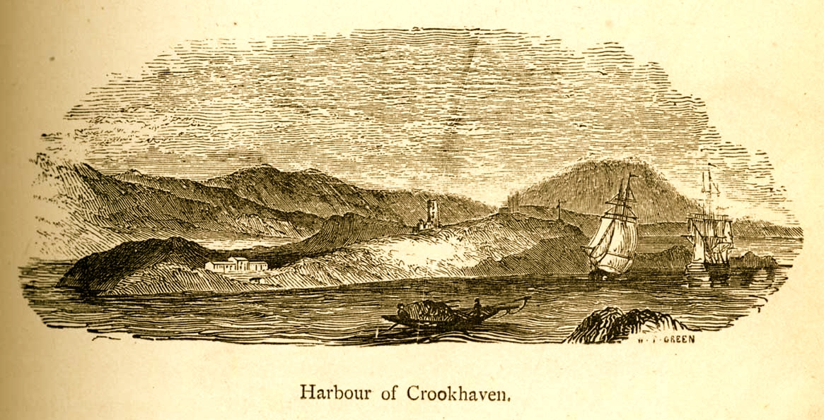
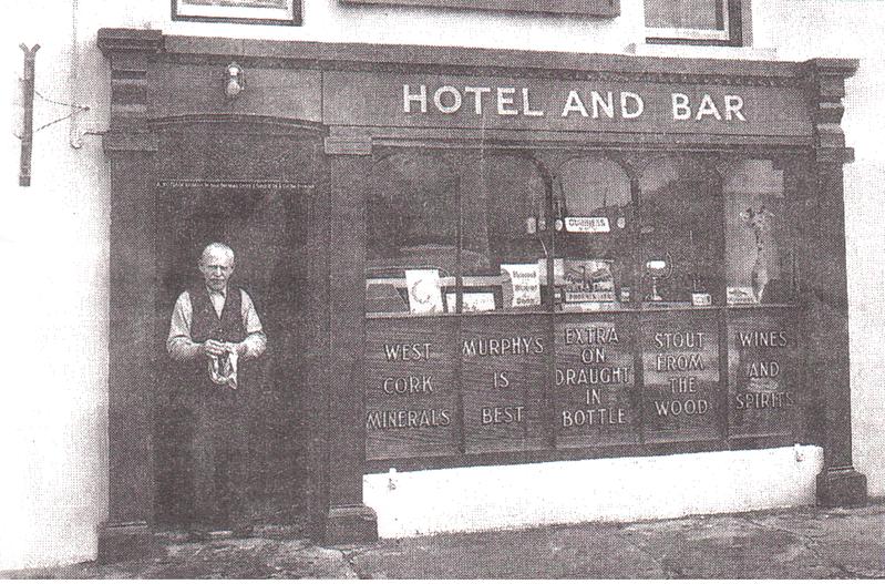
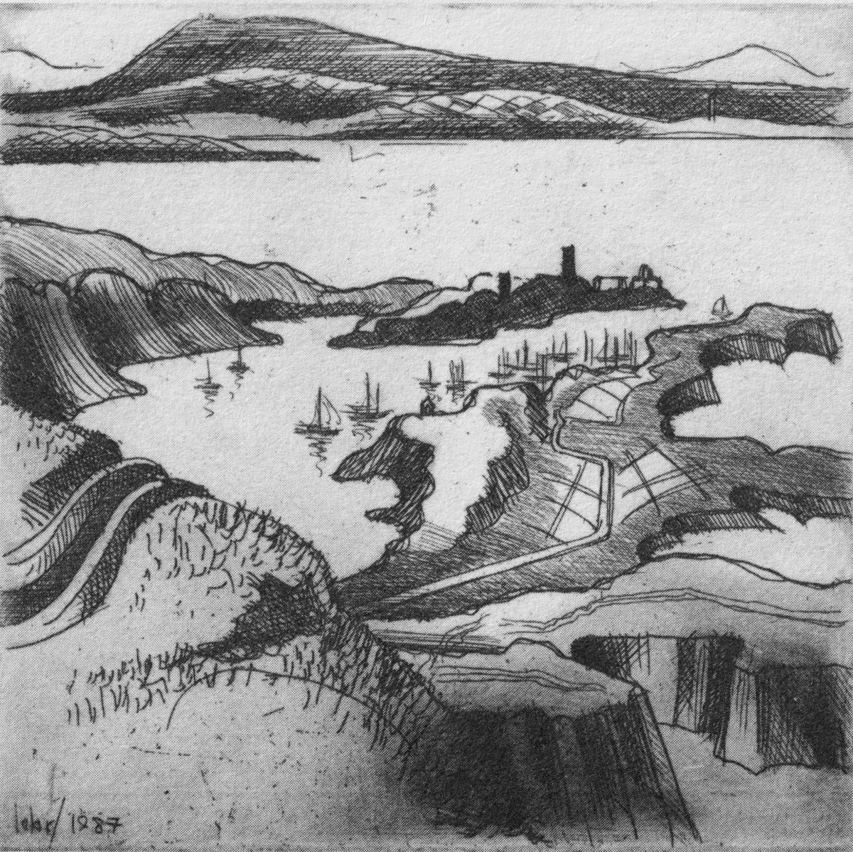
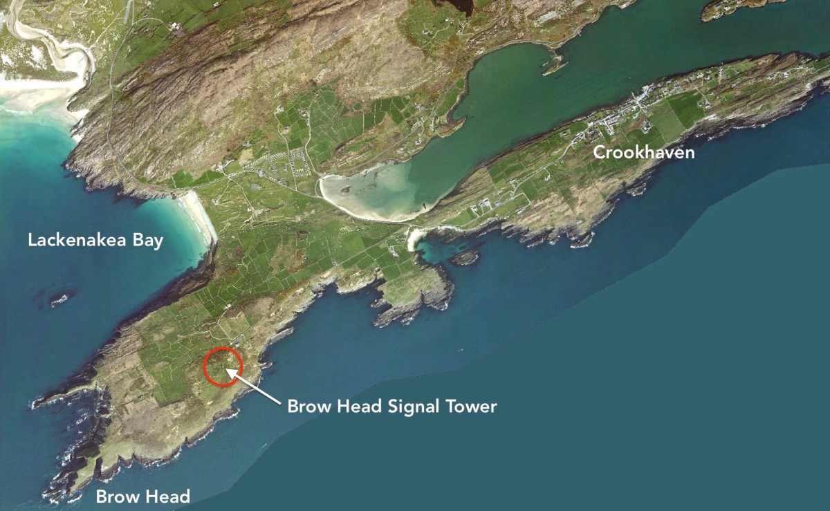
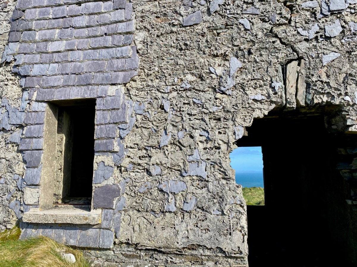
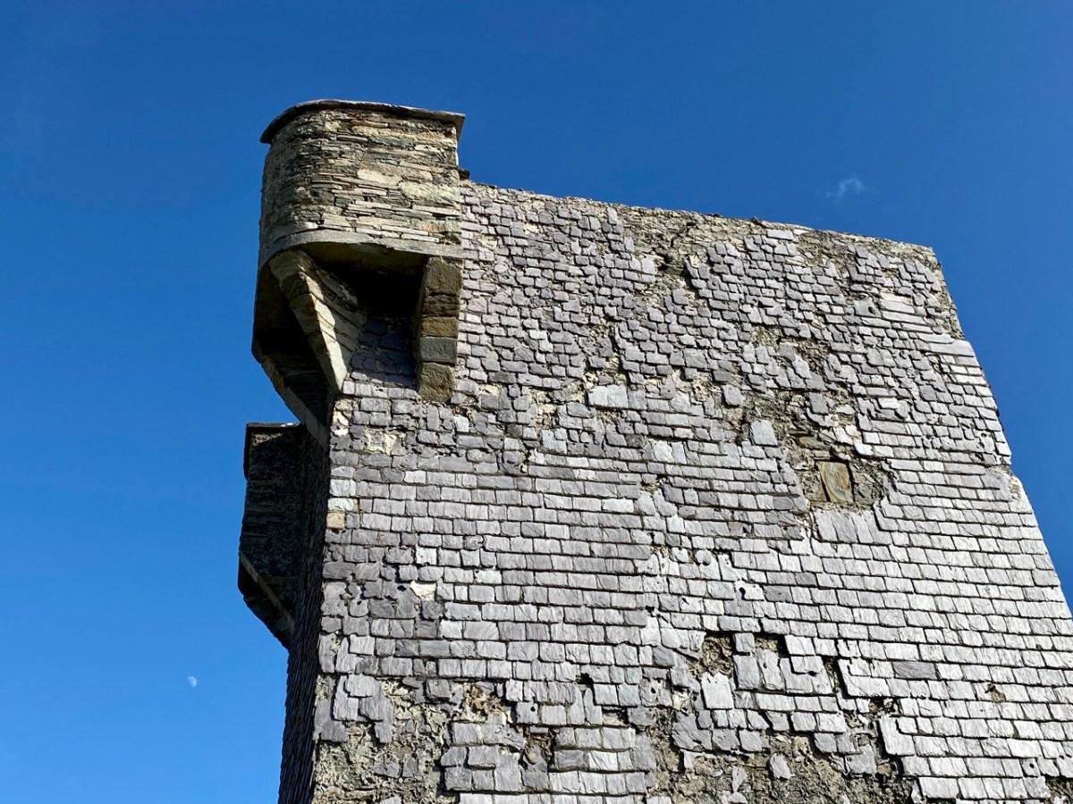
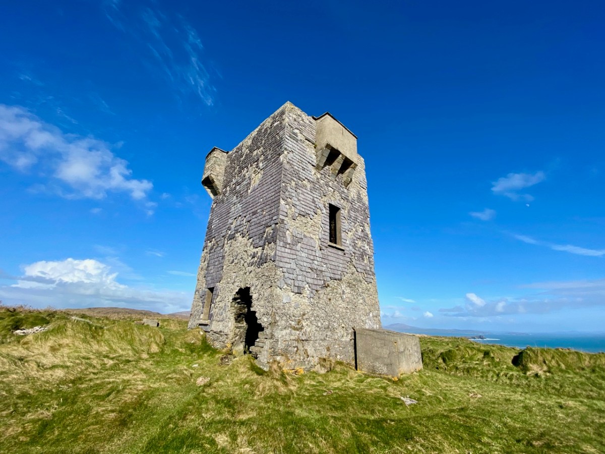
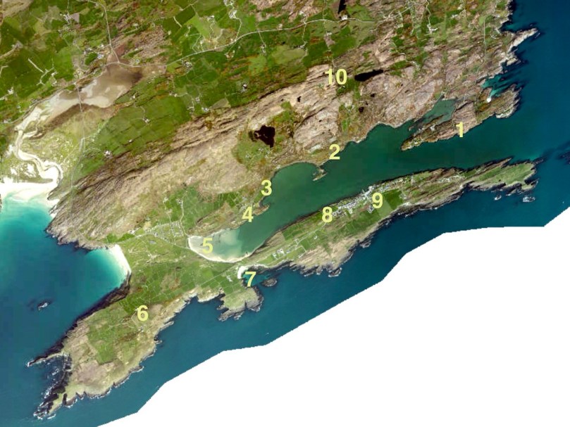
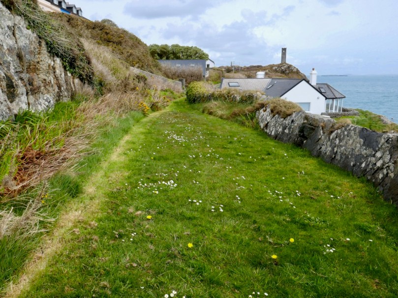
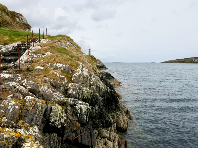
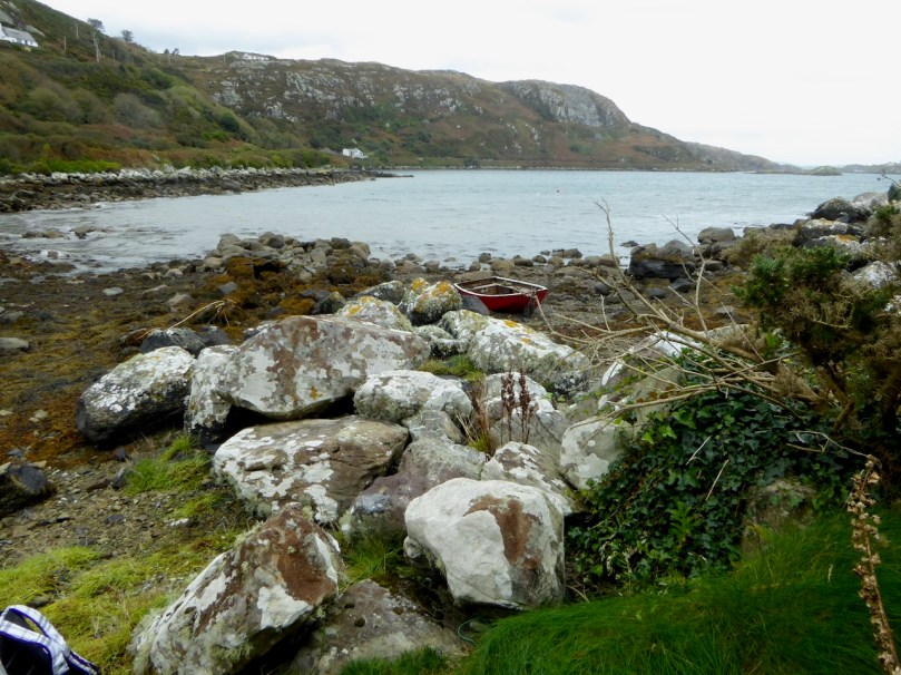
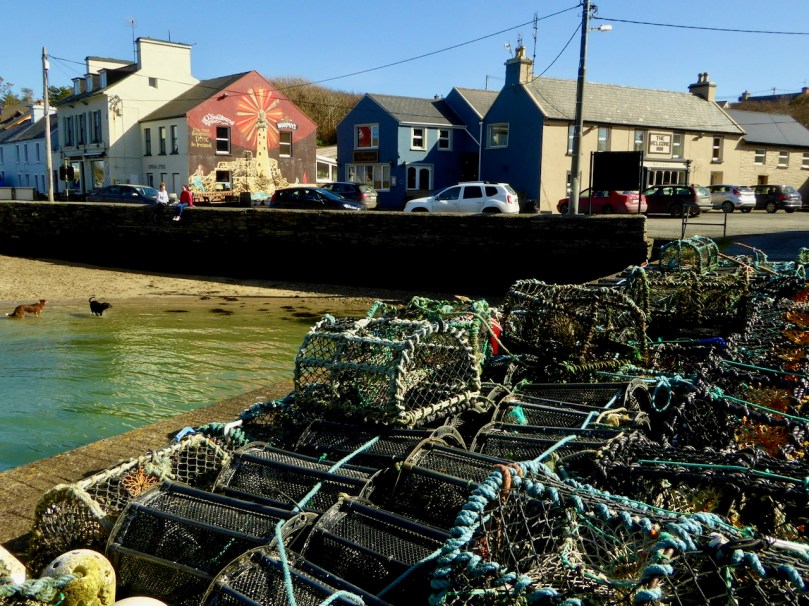
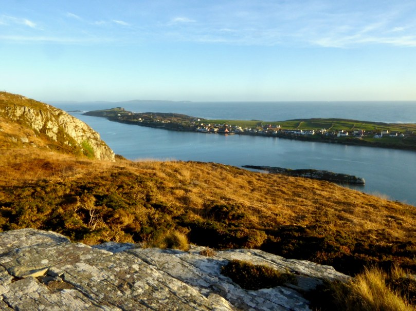
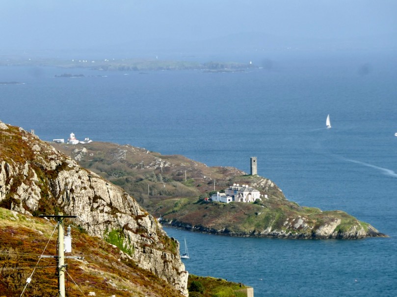
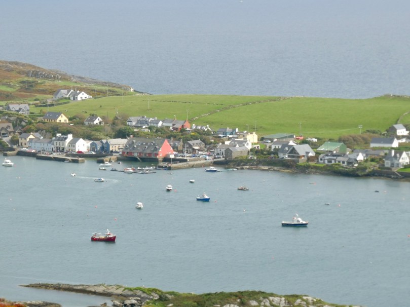
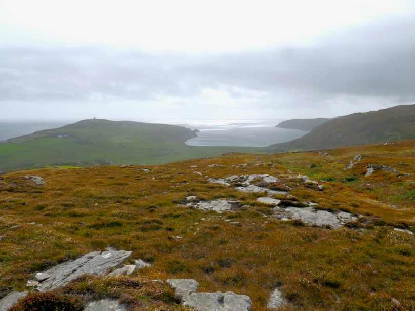
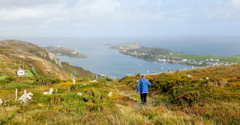
There are parts of West Cork that seem to hold within them all the memories and markers of eons. Such a place is Arduslough, on the high ground across from Crookhaven (below, map and photo) and west of Rock Island (above).

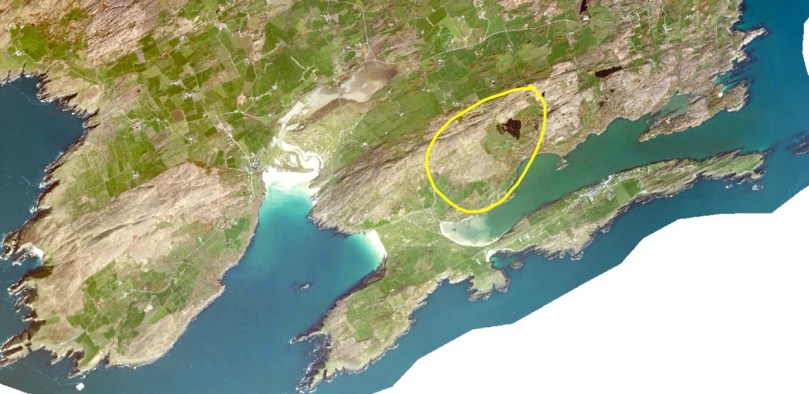
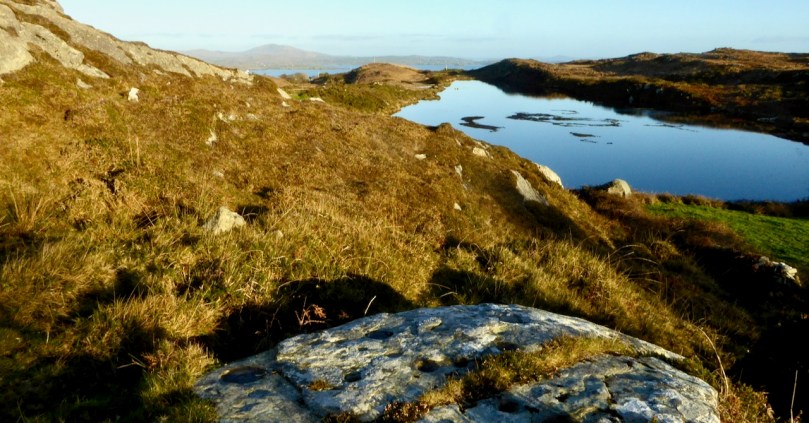
Technically, the places we explored are in three different townlands – Tooreen, Arduslough and Leenane, but mostly they fall within the boundaries of Arduslough. The name has been variously translated – Árd means high place and Lough means lake, both of which seem appropriate, but in fact the placename authority, Logainm, renders it as Árd na Saileach meaning High Place of the Sallies, or Willow Trees. Not much in the way of willows is obvious now, but the lake is certainly central to your view in the townland.

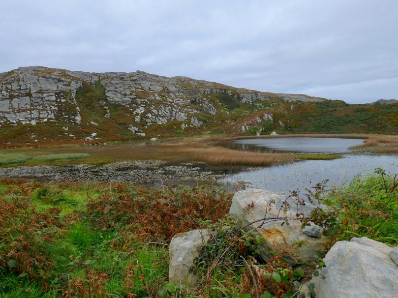
The Lake is the source of drinking water for Crookhaven and is the home, according to a story collected in the late 1930’s, of. . .

. . . an imprisoned demon of the pagan times. He is permitted to come to the surface every seven years on May morning and addresses St. Patrick, who is supposed to have banished him, in the following words “It is a long Monday, Patrick”. The demon does not speak in the English but in the vernacular. The long Monday refers to the day of General Judgement. Having expressed these words his chain is again tightened, and perforce he sinks to the bottom of the lake for another period of seven year His imprisonment will not expire till the last day.

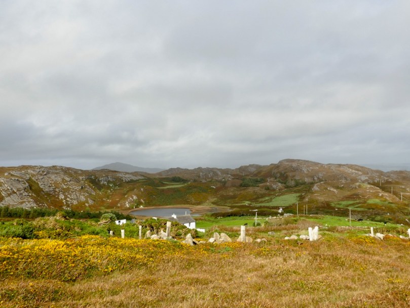
We saw no sign of the demon and the lake looked remarkably untroubled, with its floating islands of water-lilies.

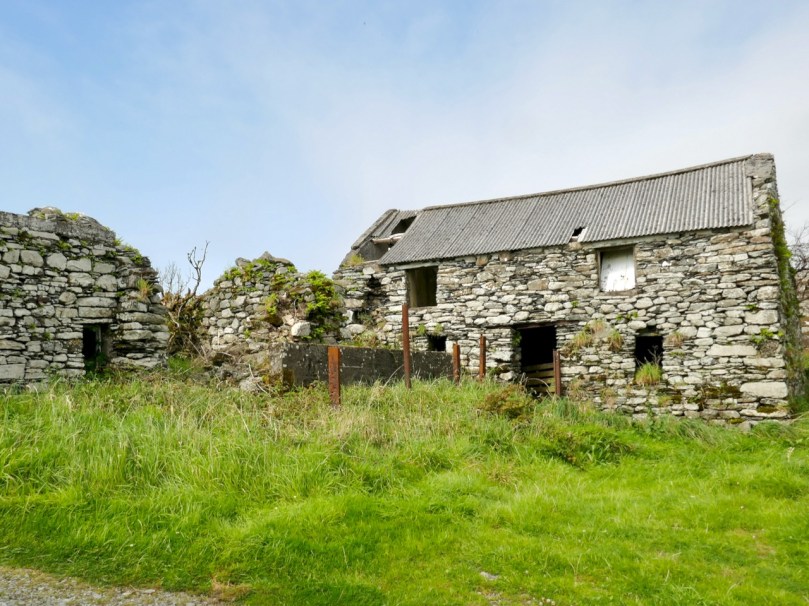
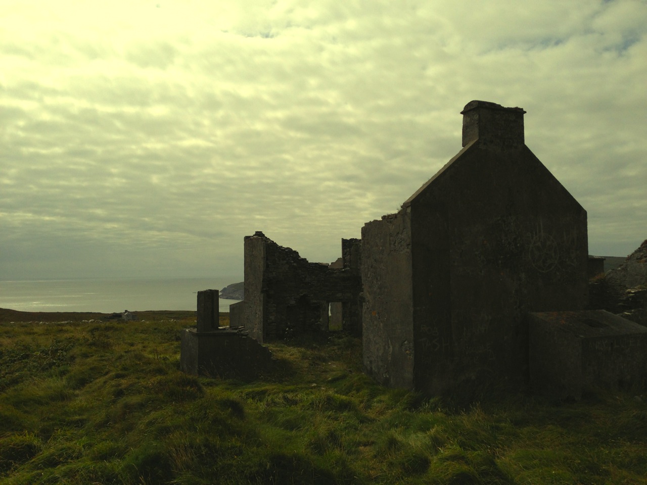
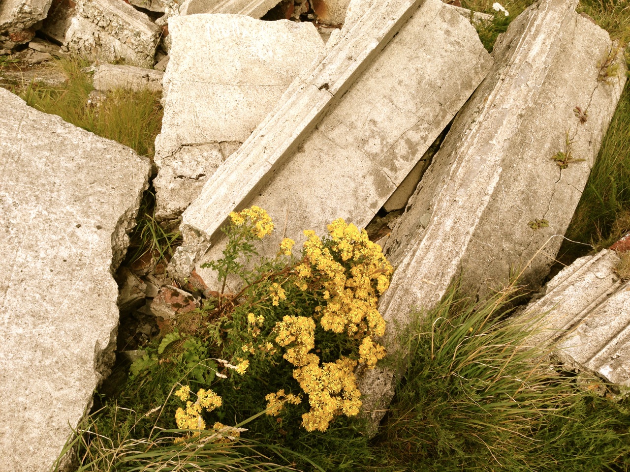
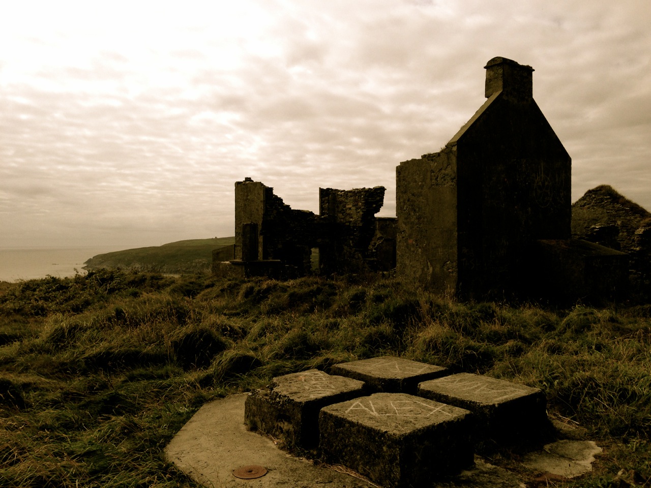
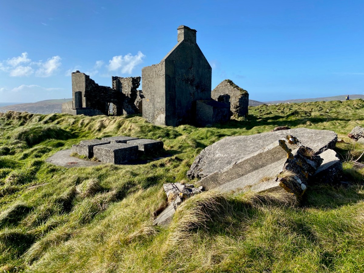
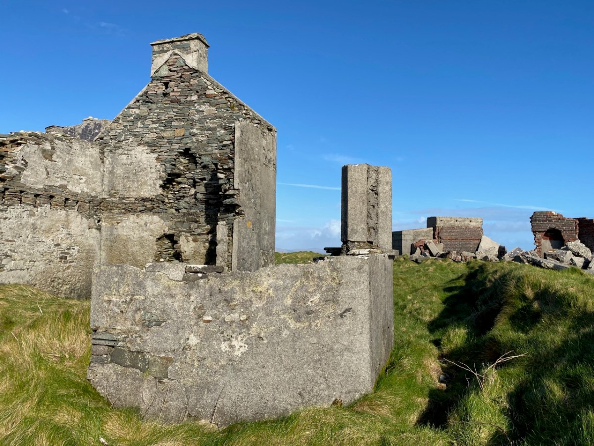
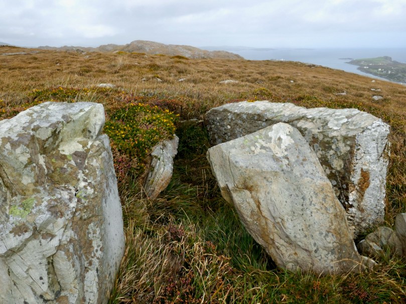
For a relatively small area, Arduslough abounds in archaeological monuments – there are four wedge tombs, three cupmarked stones, a standing stone and a piece described as either an Ogham Stone or Rock Scribings, depending on what you read. The remains of old cabins dot the landscape too, reminding us that this was a much more populous place before famine and emigration decimated the population.

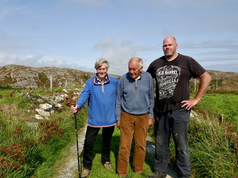
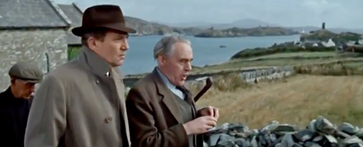
The standing stone, and Robert with Jim and Ciarán O’Meara

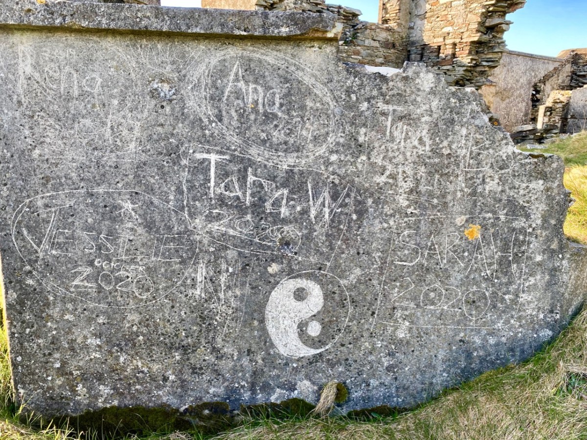
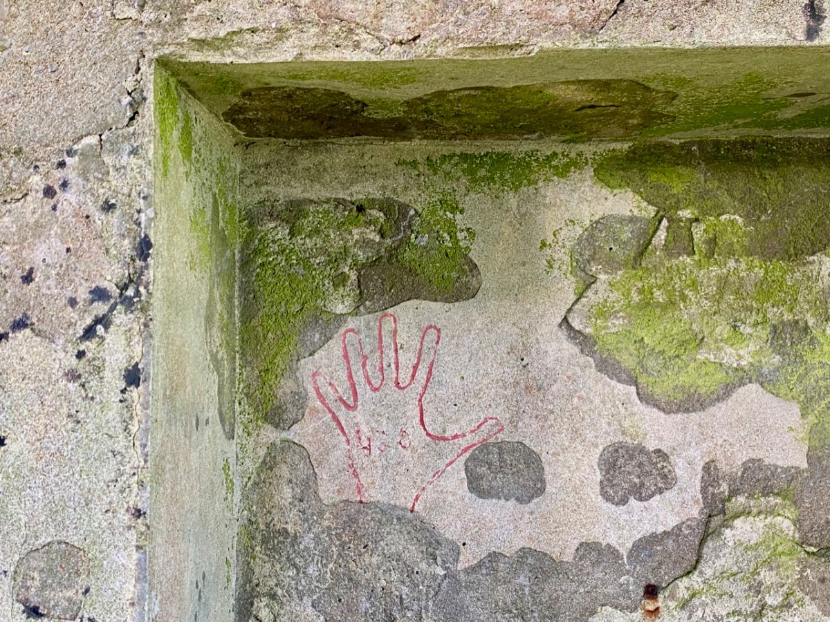
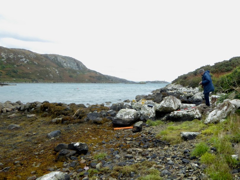
Arduslough is the home of esteemed local historian Jim O’Meara, who grew  up in Goleen but spent most of his adult life teaching in Belfast. We met up with Jim and his son Ciarán, who very kindly offered to show us the Ogham stone. It was so well hidden under layers of brambles and bracken, and built into a field fence, we would never have found it on our own.

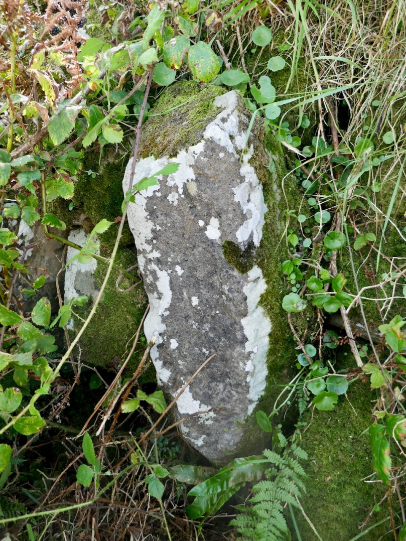
It is impossible to say if it is real, or even false Ogham, as it is heavily weathered and lichened, but if we turn again to the School’s Folklore Collection, we find this entertaining account of it:

There is a stone in Arduslough, a townland on the hill to the north of Crookhaven, on which are very old characters or ancient writing. It is very difficult to discern these markings now as the centuries during which they were exposed to the weather have obliterated them. The following story explains the origin of them.

In ancient times there lived in Toureen a man named Pilib. He informed on some party of Irish soldiers who were hiding in the heather there. The enemy came on them and burned the heather round them in which the soldiers perished. The stone was erected in this spot and the event was recorded on the stone. Years passed and the language underwent a change. In later years the people did not understand what was recorded on the stone, and went to the Parish priest asking him to interpret it. He translated it as follows – ‘that every sin will be forgiven but the sin of the informer Pilib an Fhraoich [Philip of the Heather].

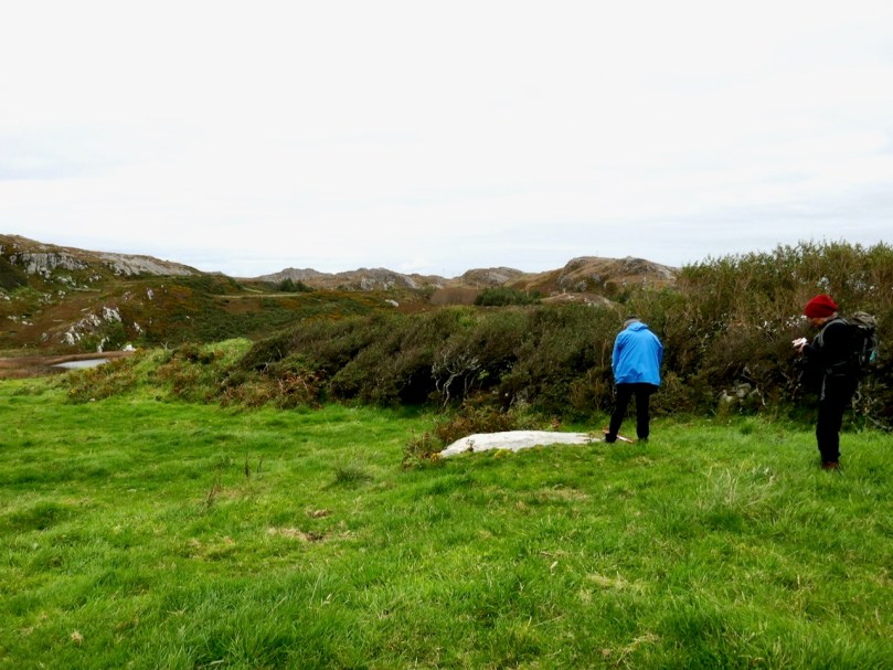
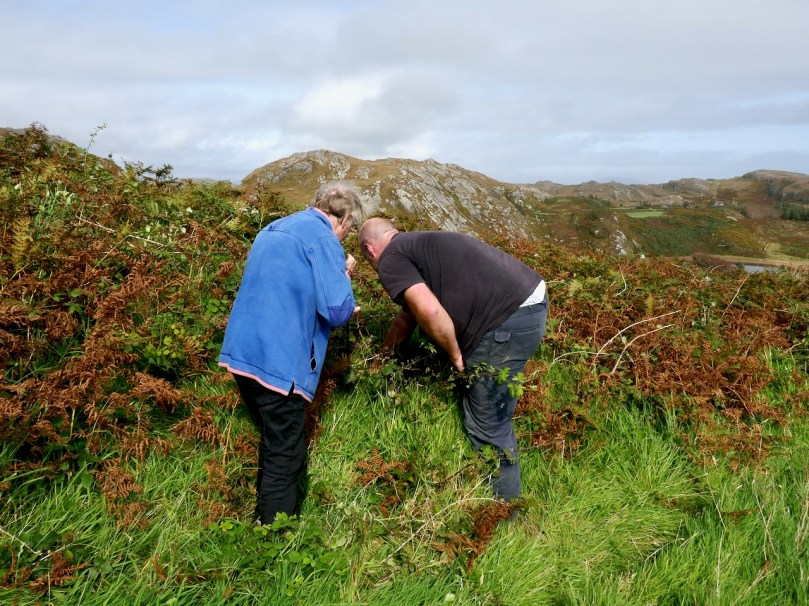
We had previously located one of the three cup-marked stones, including a visit a couple of days earlier with Aoibheann Lambe of Rock Art Kerry (below). Ciarán thought he might be able to find another one, but extensive searching and bracken-bashing failed to turn it up.

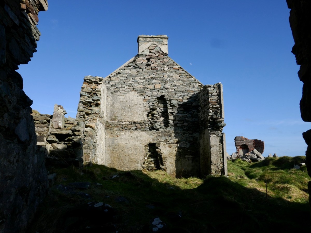
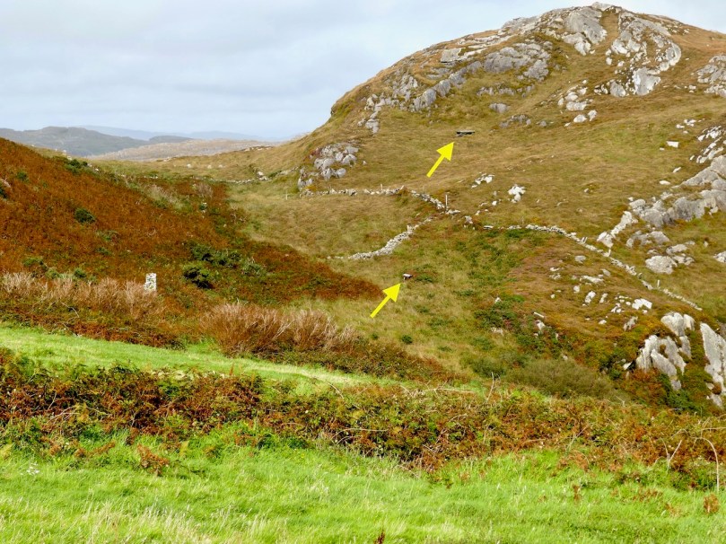
The folklore collection is full of references to mass rocks, druid’s altars, and giant’s graves, as you would expect from the number of Bronze Age wedge tombs recorded in this area. (For more on Wedge Tombs, see my post Wedge Tombs: Last of the Megaliths.) Two of them are situated on the slope above the lake (below) and we left them for another day. A third is hard to spot and indeed we didn’t.

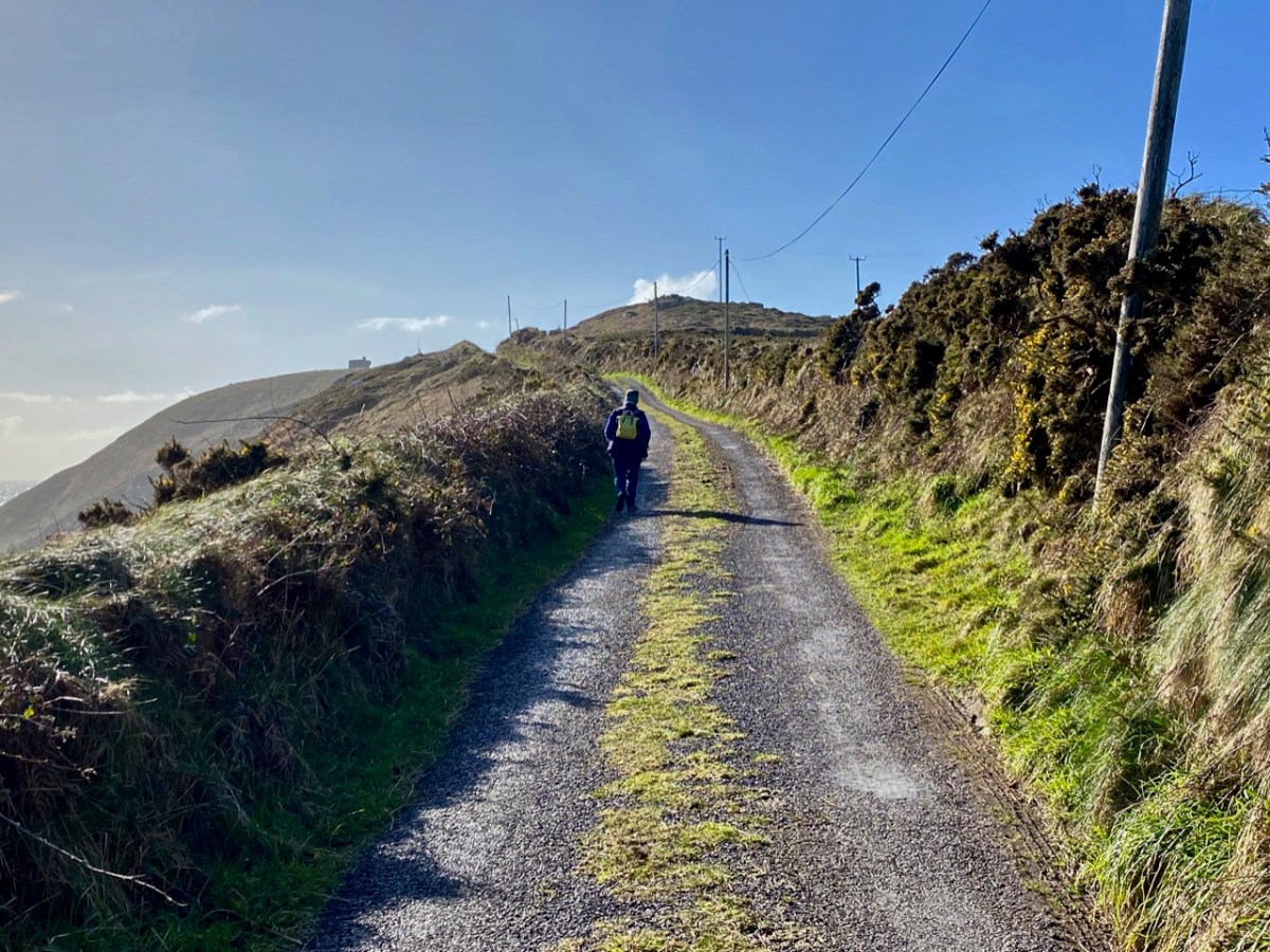
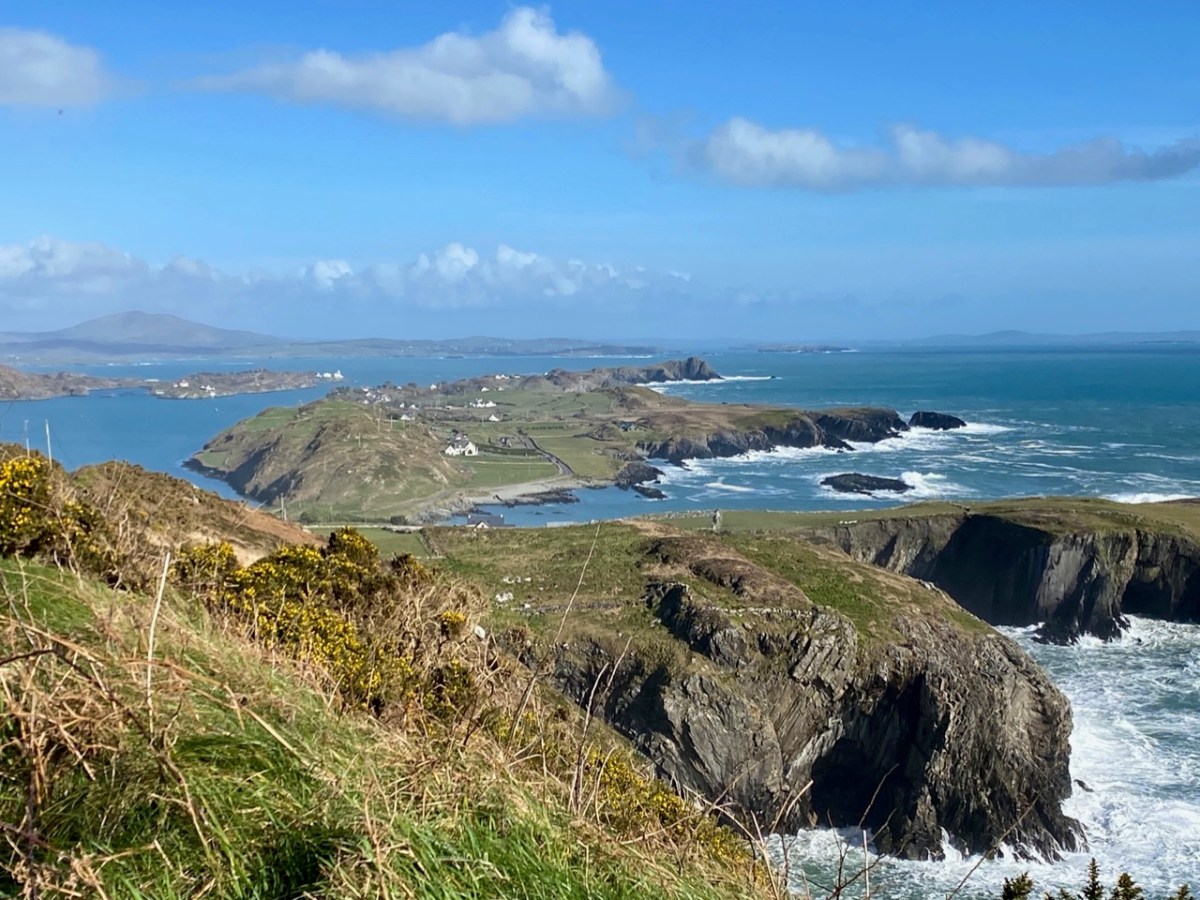
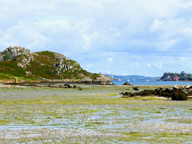
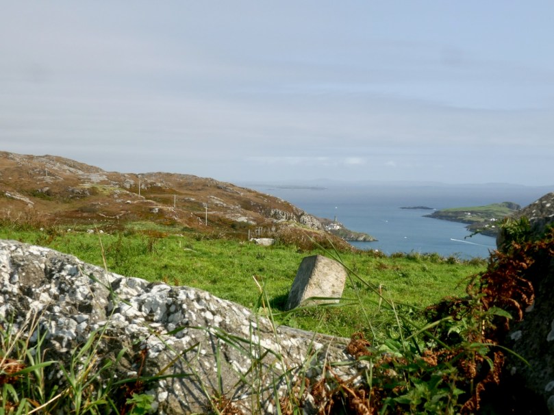
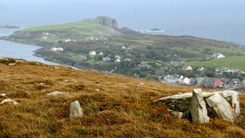
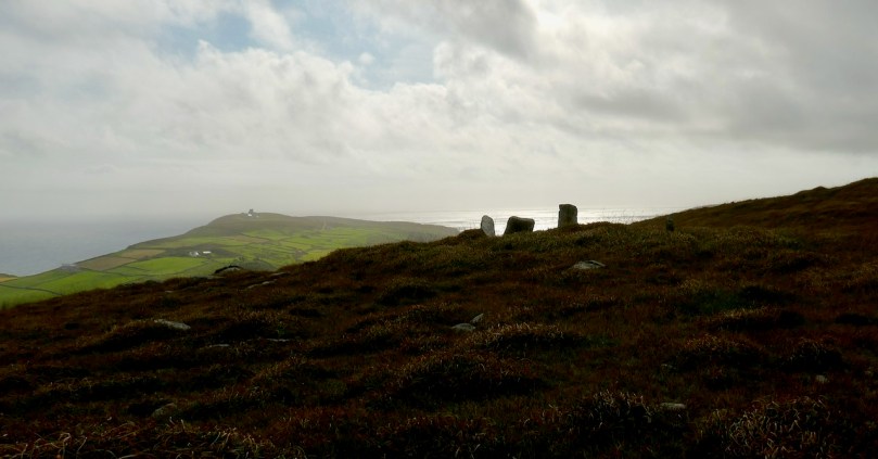
We headed up to the high ground west of the lake to find the one that local people still call the Giant’s Grave. What a spectacular setting this is! First of all, you are now on a plateau with panoramic views in all directions. West lie the two peninsulas of Brow Head and Mizen Head and the boundless sea beyond.

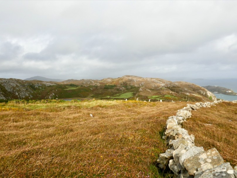
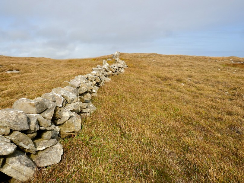
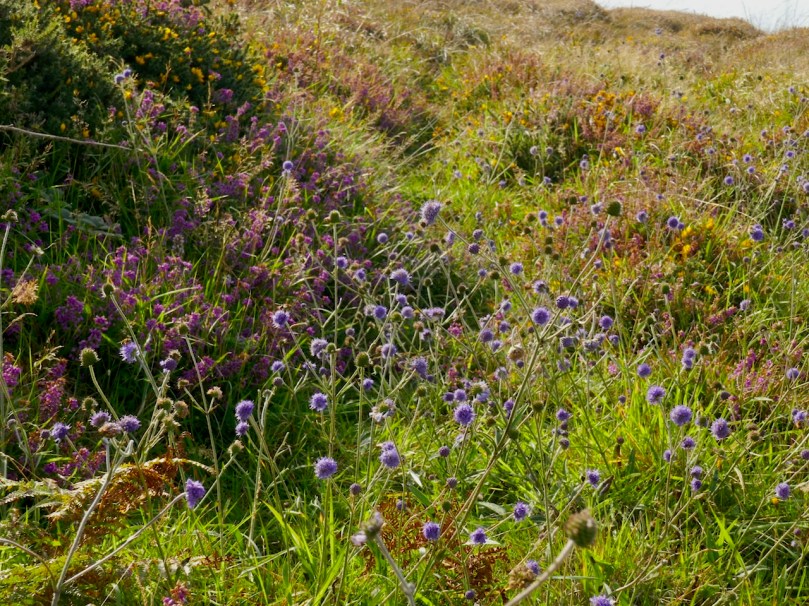
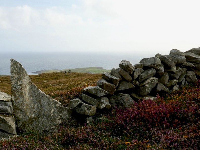
This is heathland, covered in heather and Western Gorse – a colour combination that has the power to stop you in your tracks – and traversed by old stone walls.

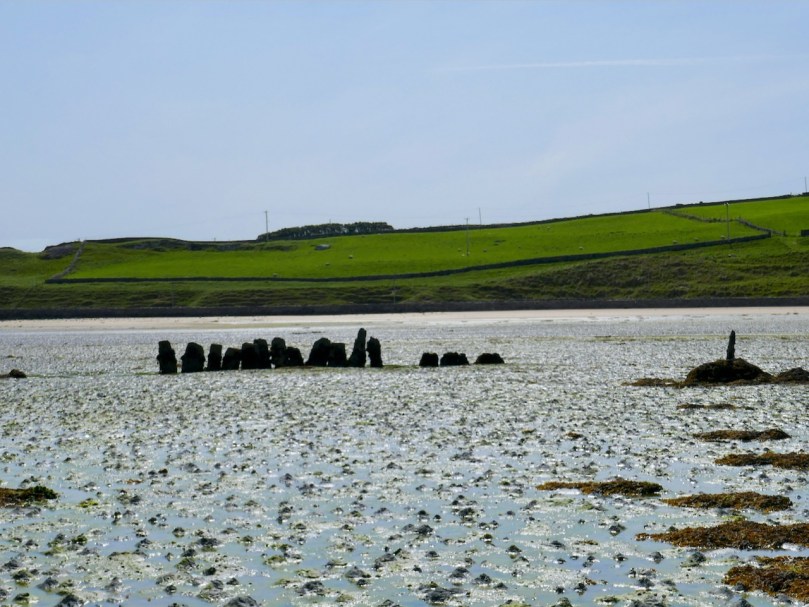
From this colourful bed the stones of the Giant’s Grave arose, pillars silhouetted against the sky. It’s actually in the townland of Leenane, just outside the boundary of Arduslough. When Ruaidhrí de Valera and Seán Ó’Núalláin conducted their Megalithic Survey in the 1970s they commented that the tomb was ‘fairly well preserved’ and  ‘commands a broad outlook to the south and east across the sea to Cape Clear and Roaringwater Bay.’ They interpreted what was there as a wedge tomb, although with some uncommon features.

First of all, they said the tomb was ‘incorporated’ within an oval mound. While mounds are known for wedge tombs, they are unusual and most of the Cork examples, included excavated ones, show no trace of a mound. Stones sticking up here and there, protruding from the mound, they interpreted as cairn stones.

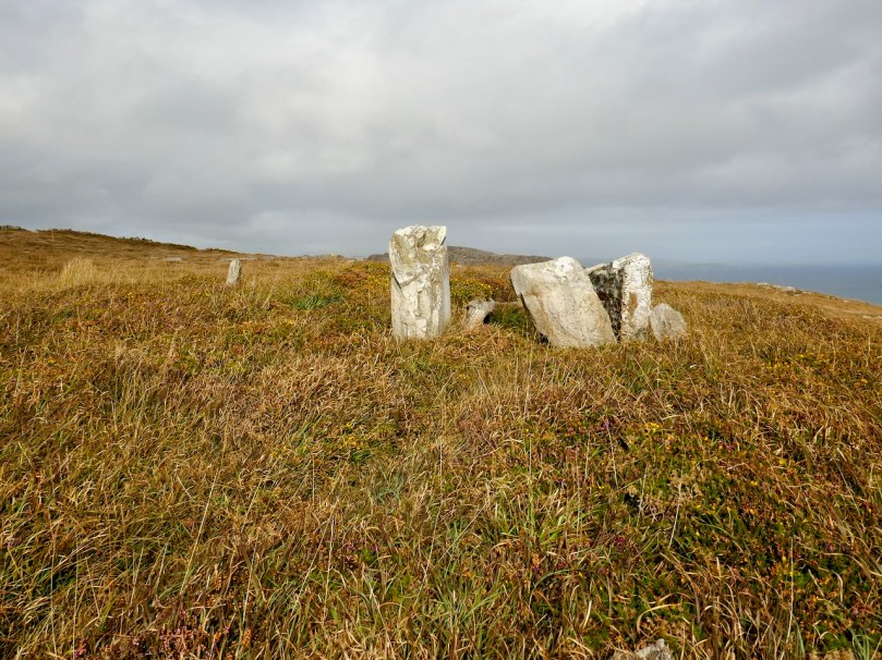
Secondly they noted two tall stones on the north side of the tomb – one is still standing and clearly visible (above and below) – whose function was ‘uncertain.’

Two tall stones at the south west end (above) seemed like an ‘entrance feature.’ Our own readings at the site indicated that the orientation was to the setting sun at the winter solstice, a highly significant direction to where the sun sets into the sea.

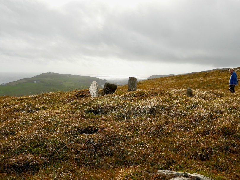
So – an unusual wedge tomb. Elsewhere in their report de Valera and Ó’Núalláin state repeatedly that a hilltop setting and a rounded mound are consistent with passage graves. However, at the time no passage grave had been identified this far south and they were thought to have a more northerly distribution. Since then, two have been identified in County Cork – one at the highest point on Cape Clear, which is visible from this site, and one in an inter-tidal zone between Ringarogy Island and the mainland. Perhaps it is worth considering whether, rather than a wedge tomb, this site may be a passage grave, like the one that Robert writes about this week in Off the M8 – Knockroe Passage Tomb or ‘Giant’s Grave’.

Whatever we label it, this Giant’s Grave is a spectacular site. It’s not hard to imagine, up there, that Neolithic and Bronze Age farmers were just as awe-stricken as we were with the magnificence of the surroundings. Tending their herds, they marked the seasons with the great movements of the sun and moon, and commemorated their dead with enduring stone monuments. More recently, people invested the landscape with myth and stories. Walking the hilltops, you know you are in the footsteps of all who went before.