Castlehaven – The Haven

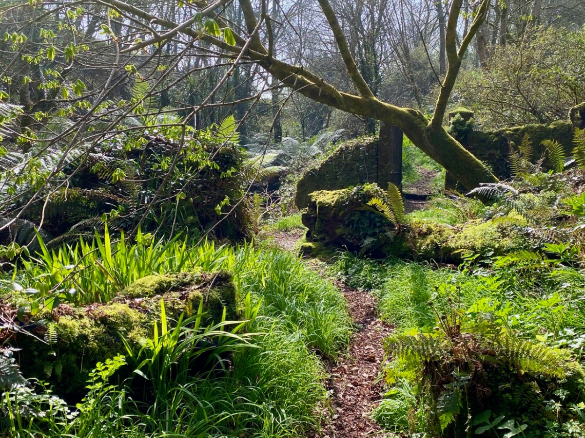
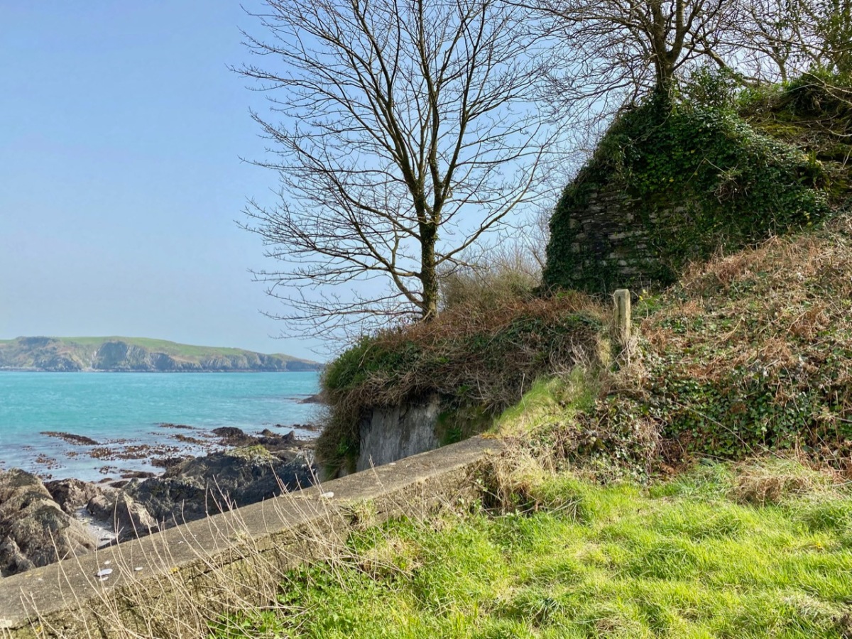
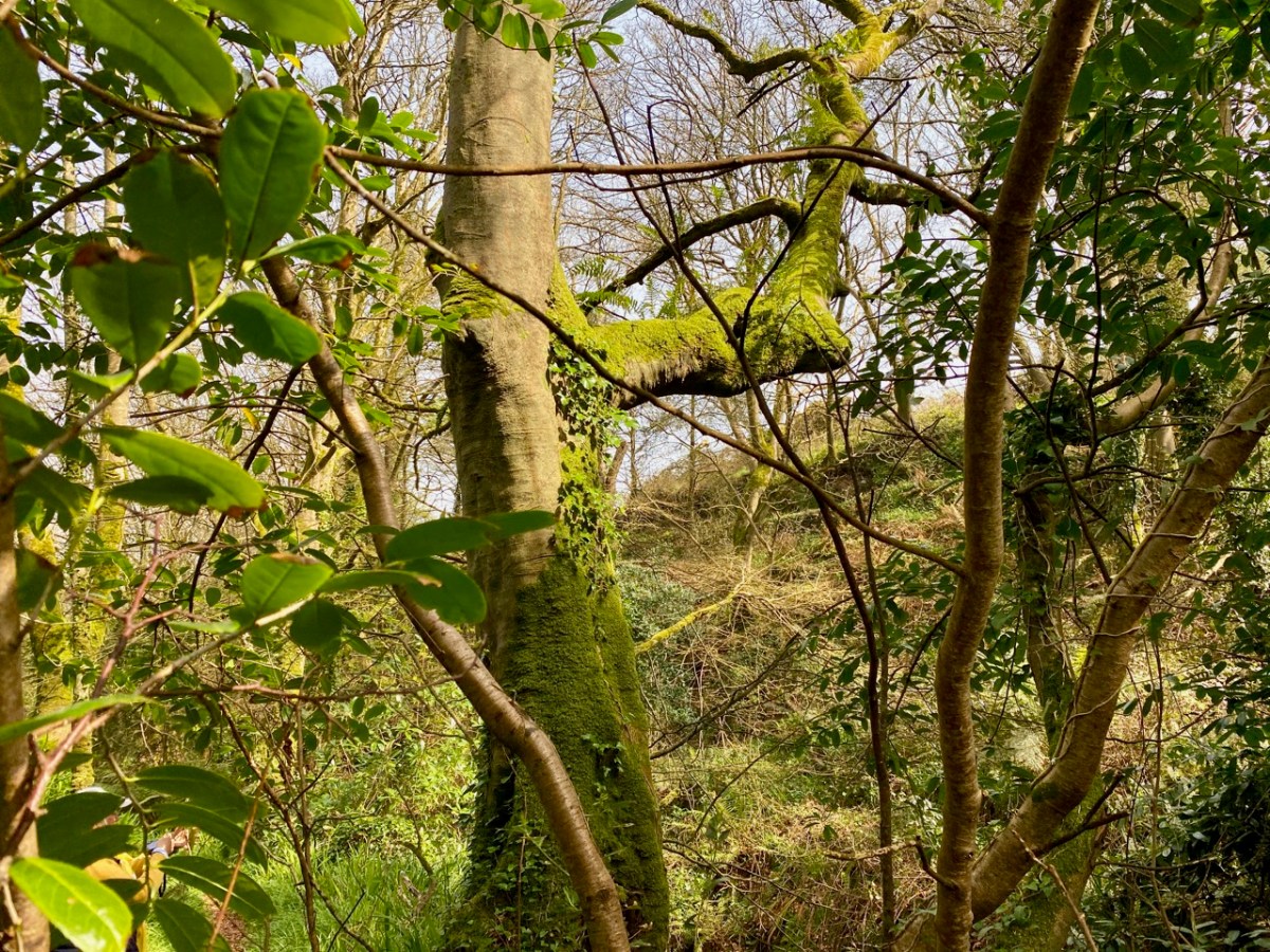
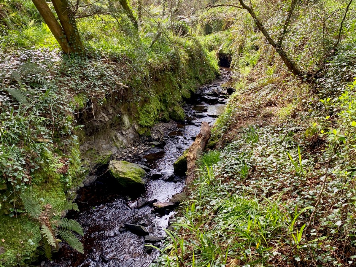
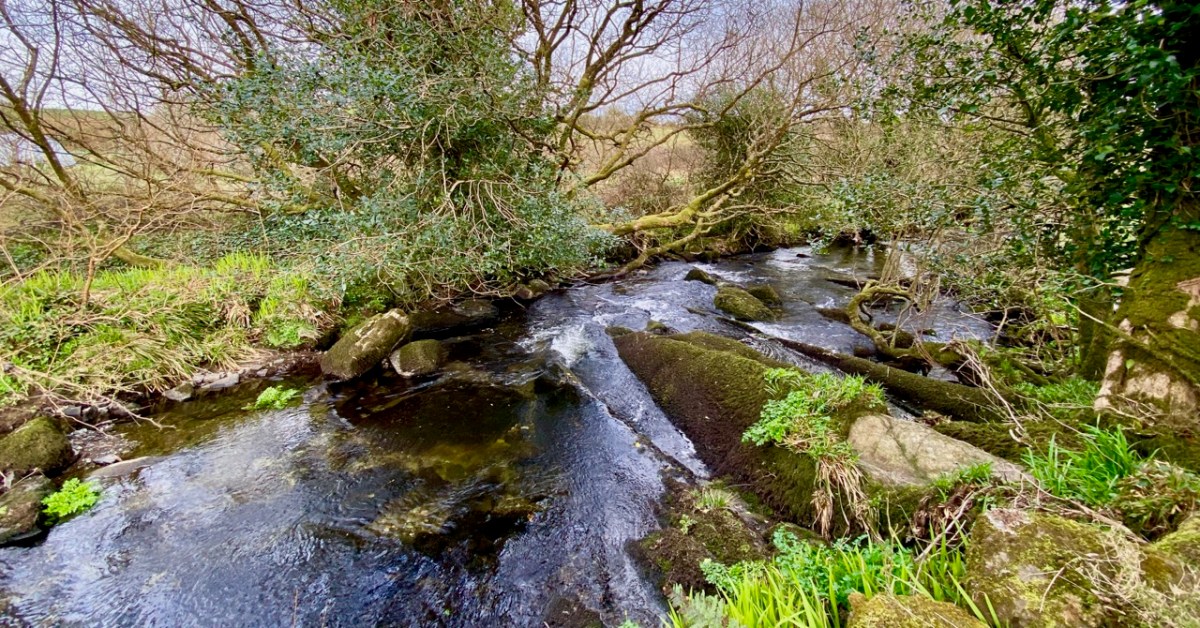
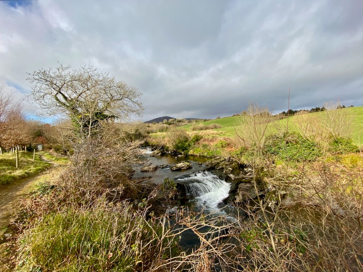
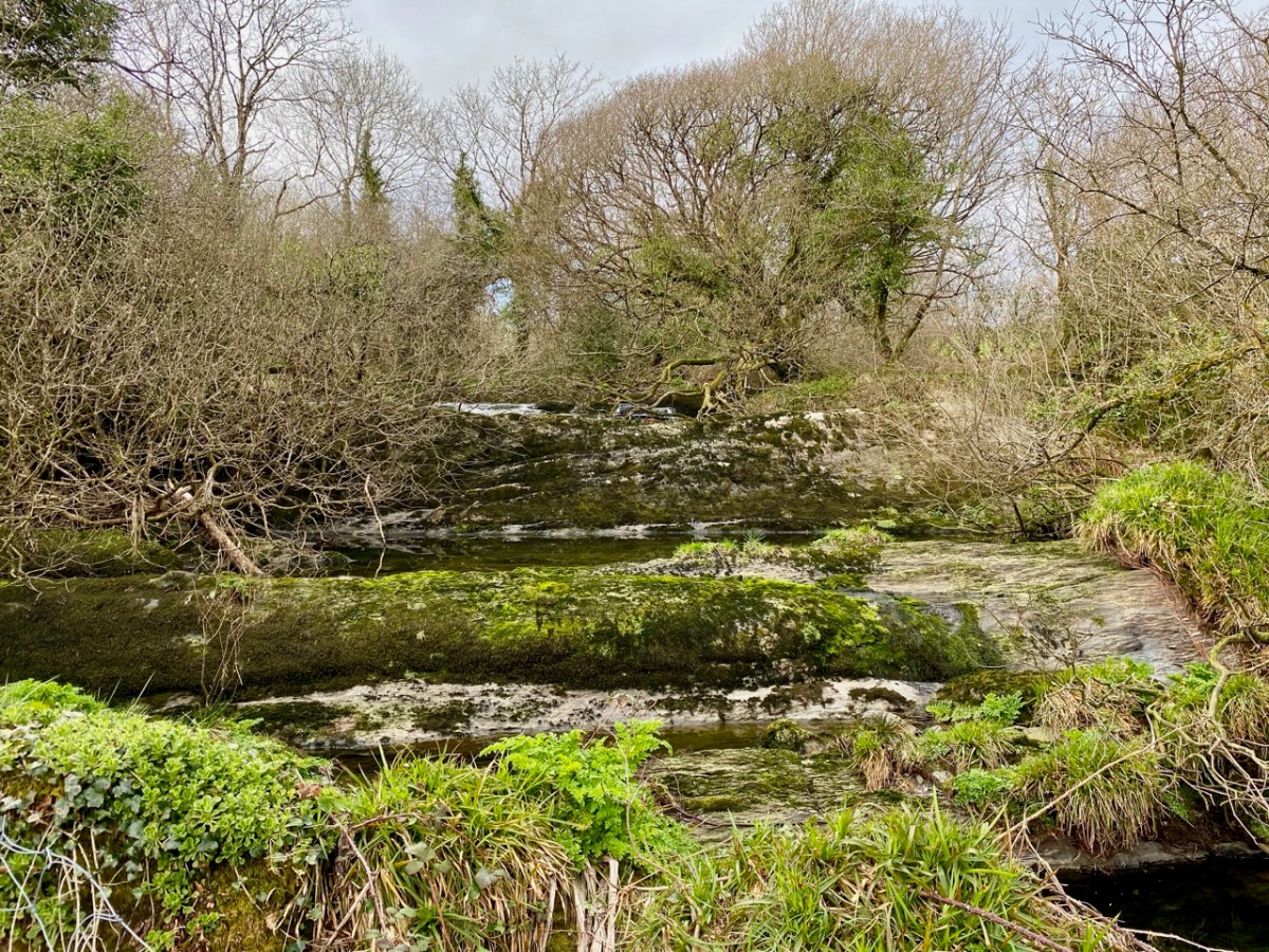
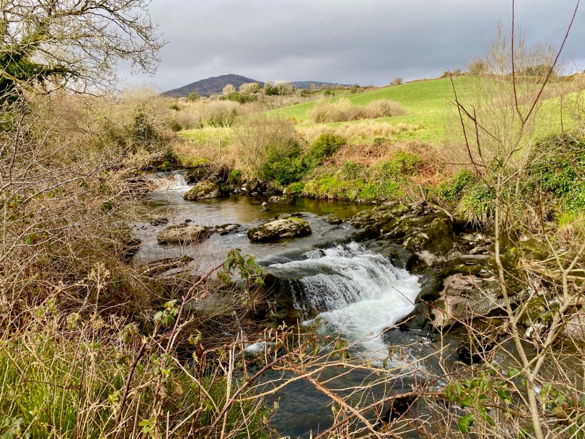
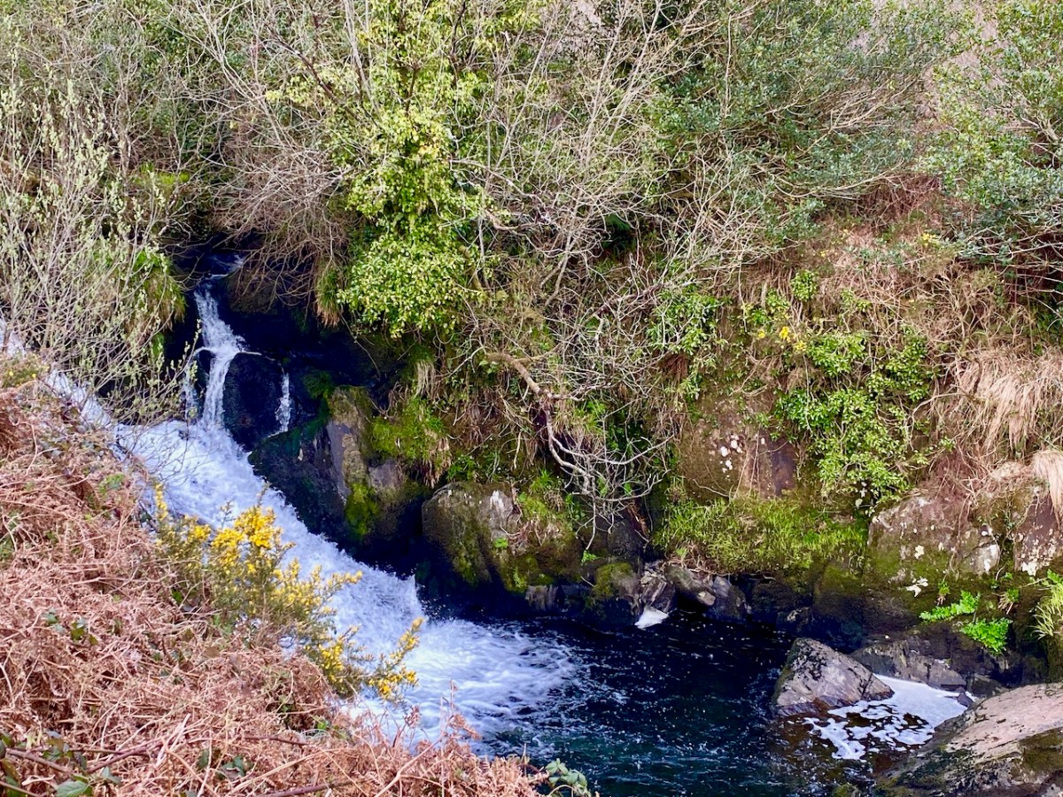
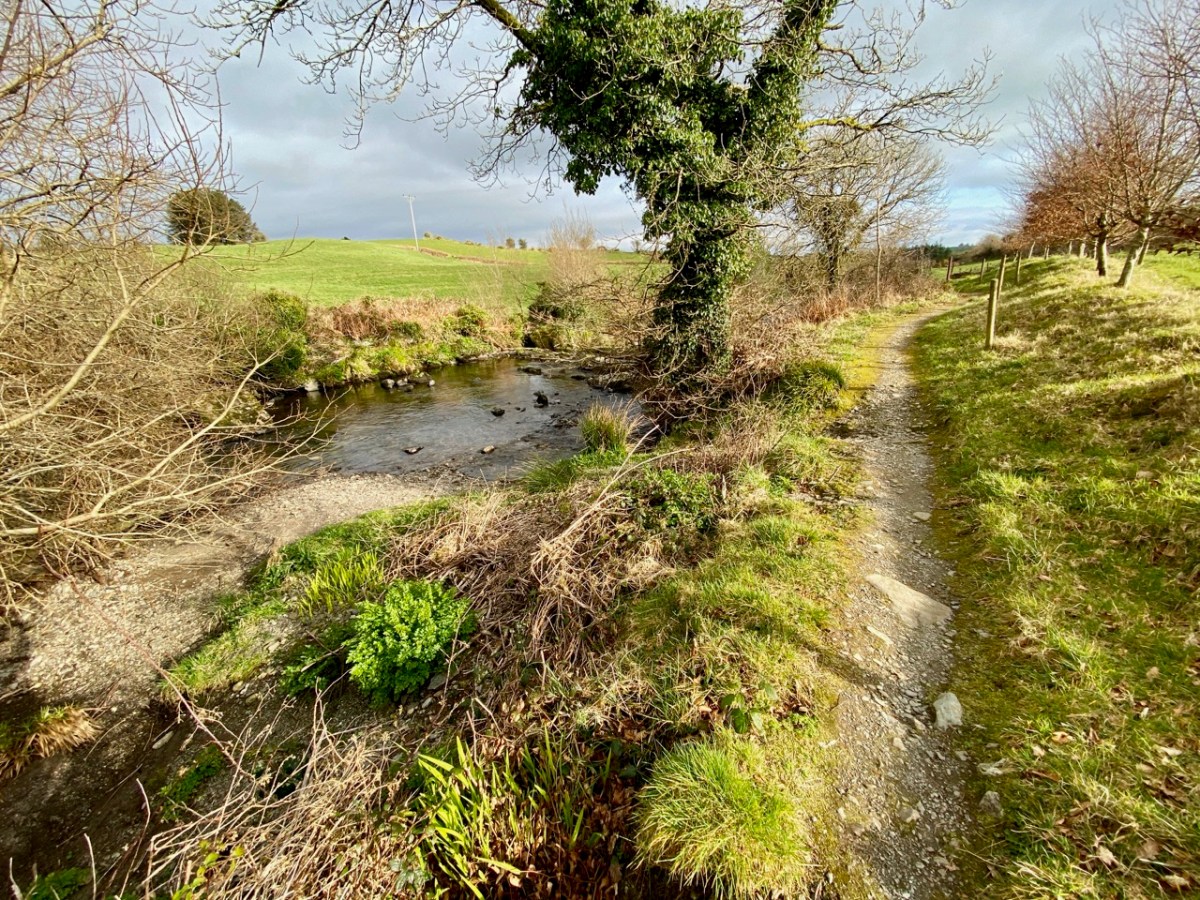
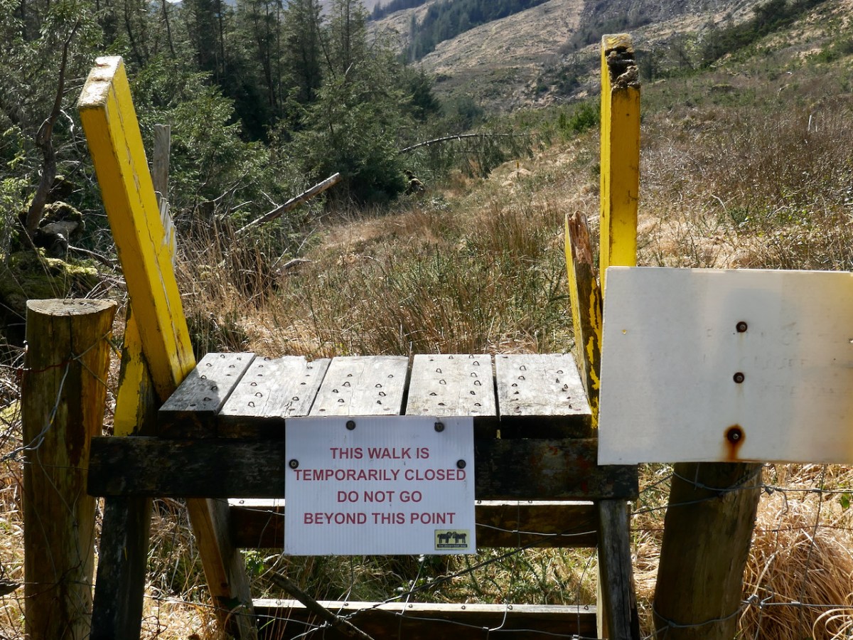
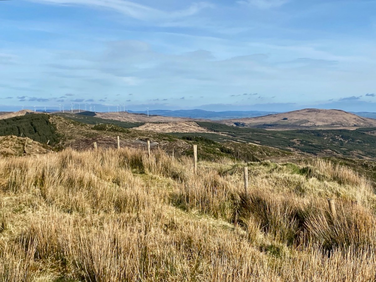
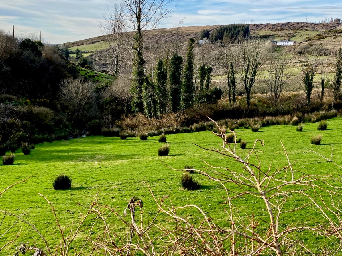
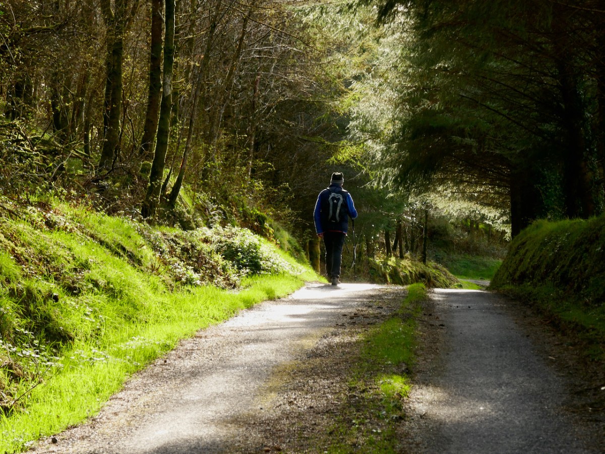
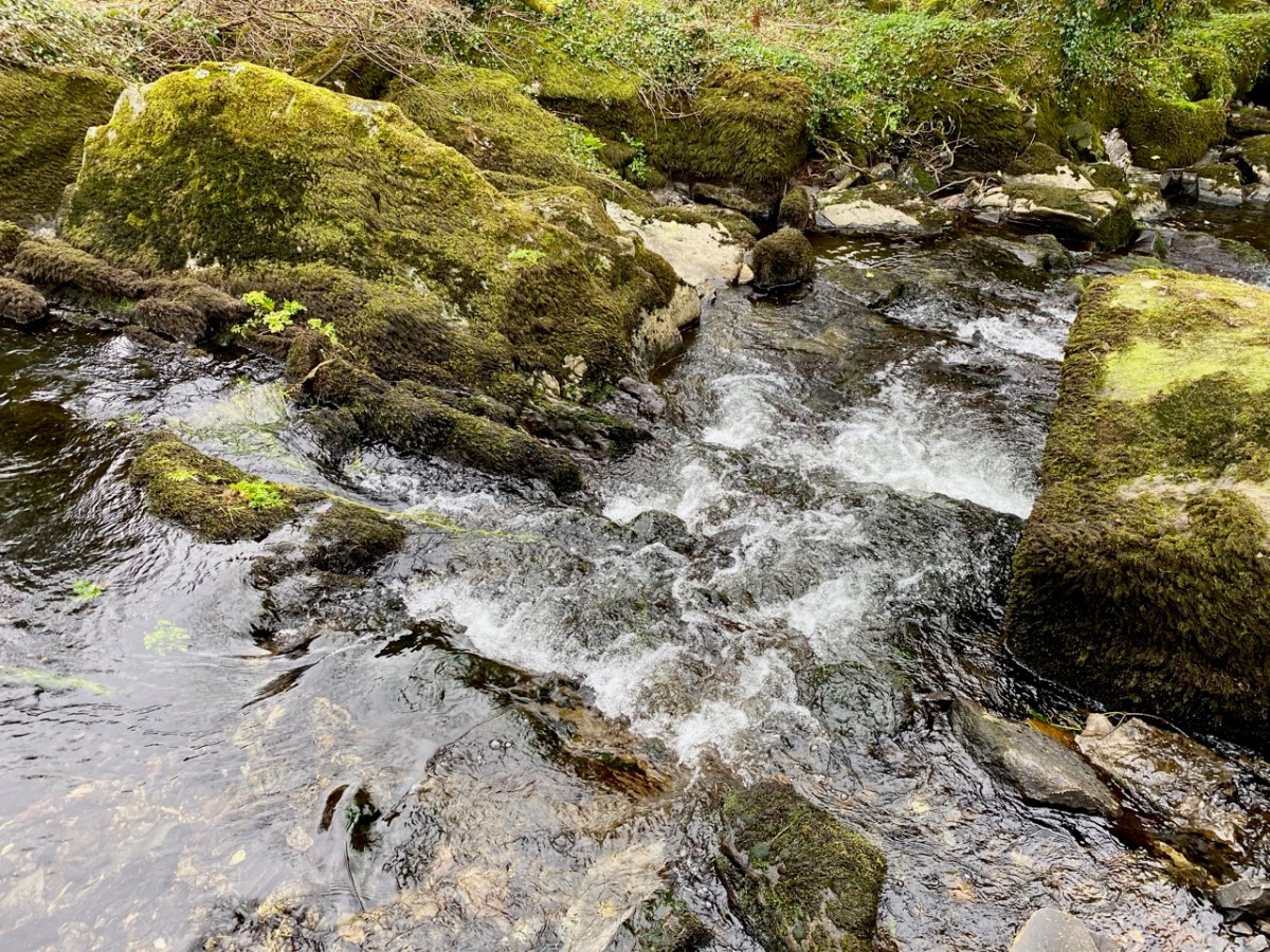
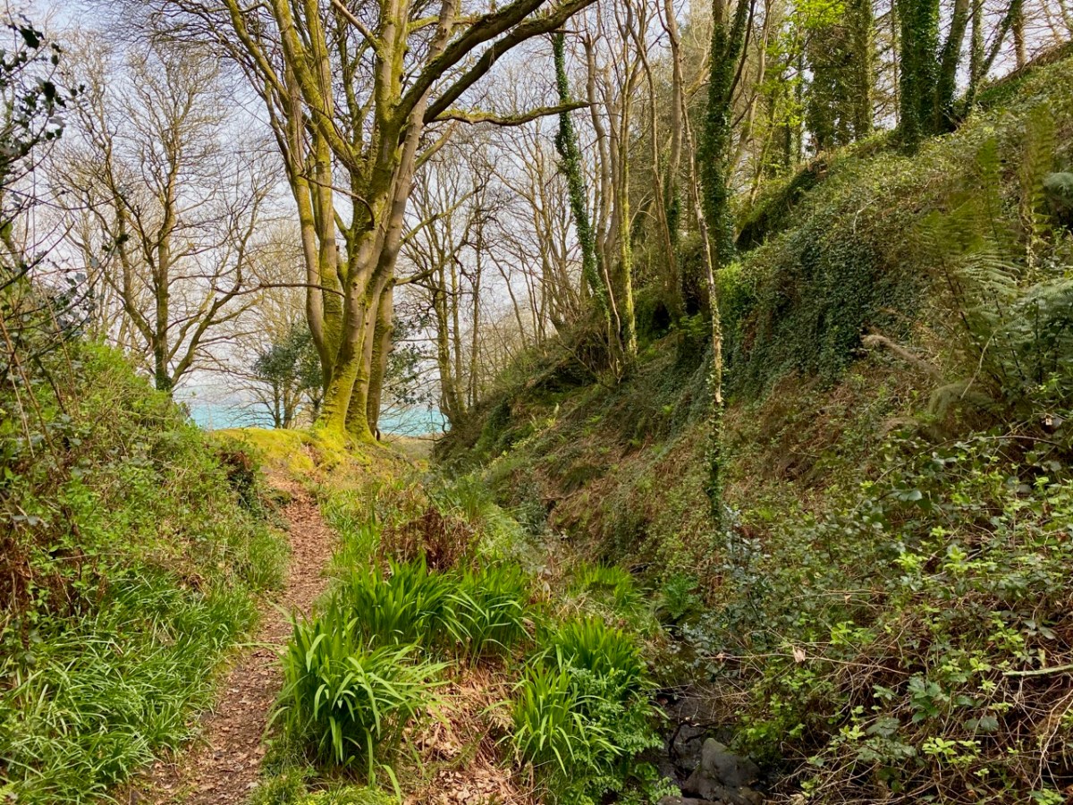
The word ‘haven’ is said to have a Norse origin: hǫfn. This translates simply as ‘harbour’. Does this mean that the Vikings visited West Cork and gave Castlehaven its name? Dictionary definitions include ‘a safe haven in times of trouble’ – refuge, retreat, shelter, sanctuary, asylum . . . The word conjures up something a little magical, and our exploration last week of the secretive valley that leads inland from Castlehaven – at the southern end of a significant West Cork cove – was certainly an enchanting experience. We traversed it on the greenest of days at the arrival of spring:

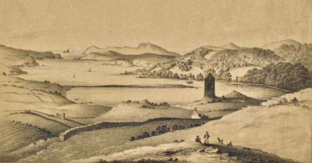
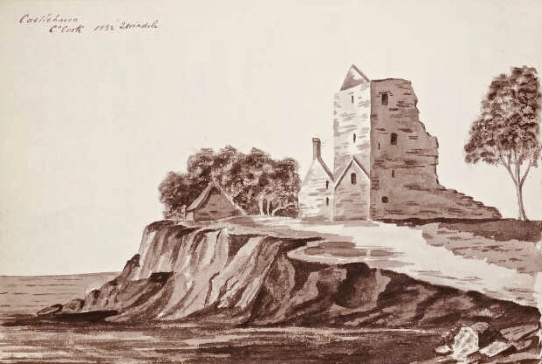
The header is a nineteenth century engraving, and shows a possibly idealised view looking across The Haven, towards the open waters of the Atlantic. In the foreground is the castle of Raheen, or Rathin. Castlehaven itself is at the far end, and the old tower house there – now all but vanished into the lush undergrowth – was strategically important, particularly during the Nine Years’ War between Gaelic Irish lords and the English. Spain also took an opportunistic interest in intervening in matters between Ireland and England. There are many accounts of the skirmish that occurred here on 6 December 1601, all of them varying to such a degree that we can have no real idea, even, of who was victorious! I like this version, penned by a contributor to the Duchas Schools Folklore Collection. It’s part of an extensive essay about the history of the area, which we will revisit in due course:

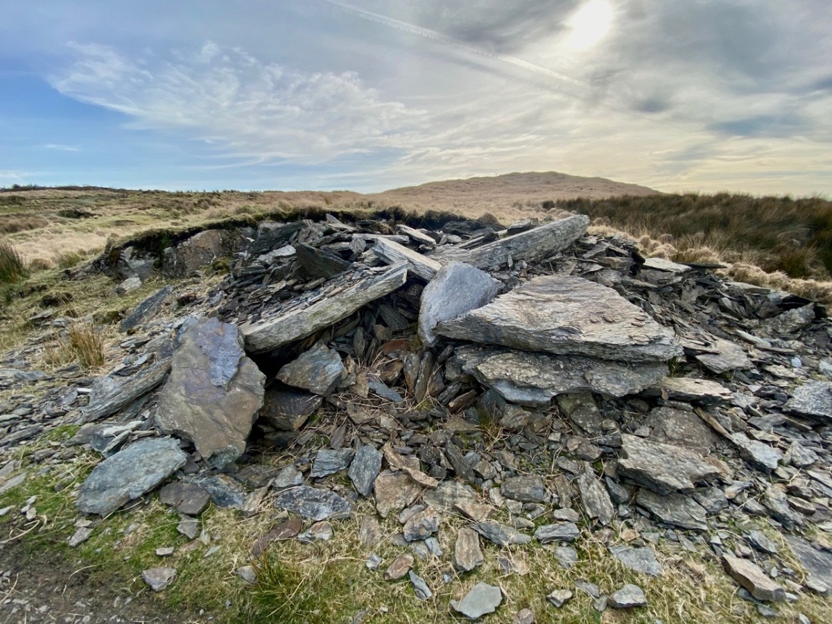
. . . Beside the Cemetery at Castlehaven stood, about ten years ago, the ruins of Castlehaven Castle, described by Don O’Sullivan in connection with the war of O’Neill & O’Donnell. “Porto Castello”, as it is called by O’Sullivan, played a very important part in connection with the Battle of Kinsale. Both O’Sullivan & Carew give accounts of a battle fought in the harbour, and while the former claims that Admiral Levison and his ships were driven off with loss of some vessels at the harbour’s mouth, Carew claims victory for the British fleet. Local tradition says that inside Reen Point, on the eastern side of the harbour lies a Spanish Vessel laden with gold, but that misfortune is sure to follow anyone who seeks the treasure. Castlehaven Castle was fortified by a combined garrison of Spanish and Irish and withstood the assault of Admiral Levison of the British fleet. The ruins of this castle were in a fair state of preservation about fifteen years ago, but the lower portion of the wall showed signs of weakness, and the great pity was, that nothing was done to prevent the collapse of the entire ruin a few years later. It is ‘said’ that stones had been removed for road metalling many years ago and this vandalism could certainly bring about the unfortunate collapse which only left only a confused pile of stones . . .


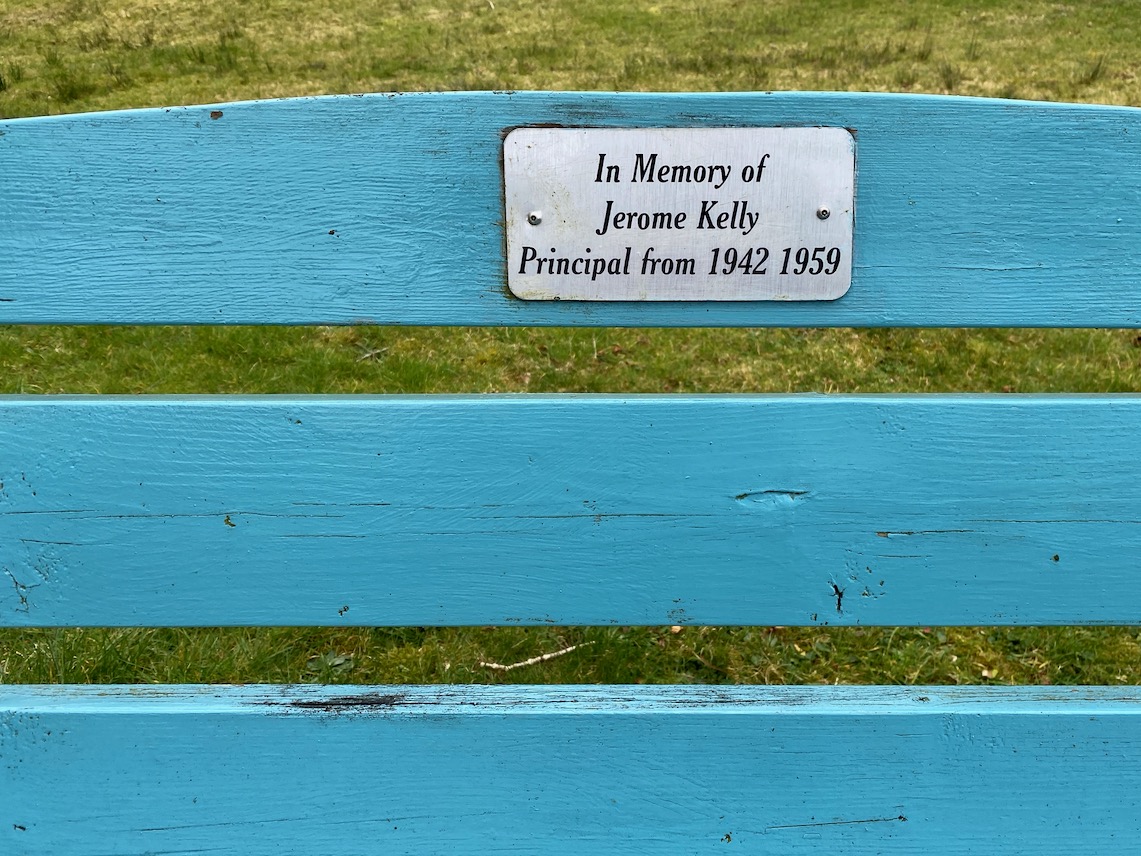
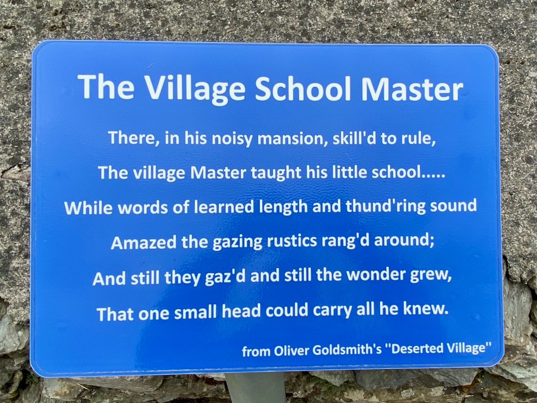
Seán Ó Donnabháin – Teacher, Baile an Chaisleáin School, Castletownshend 1936
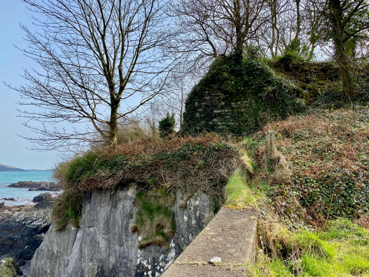
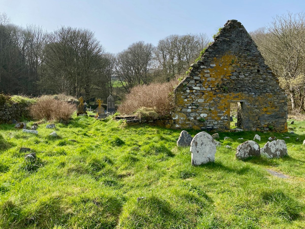
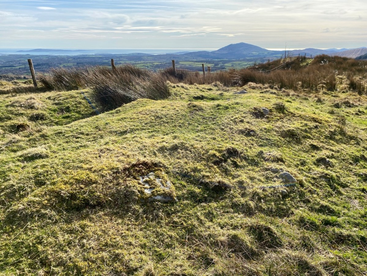
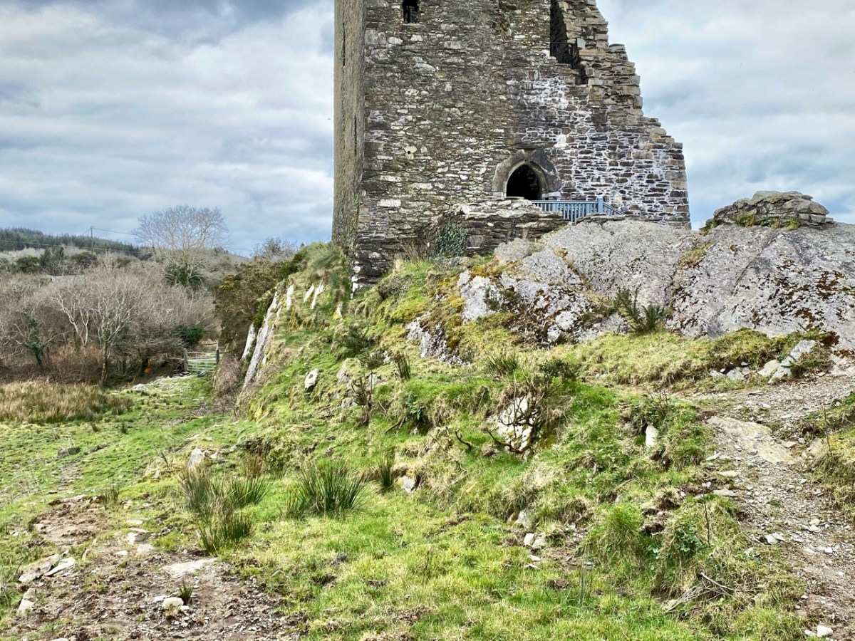
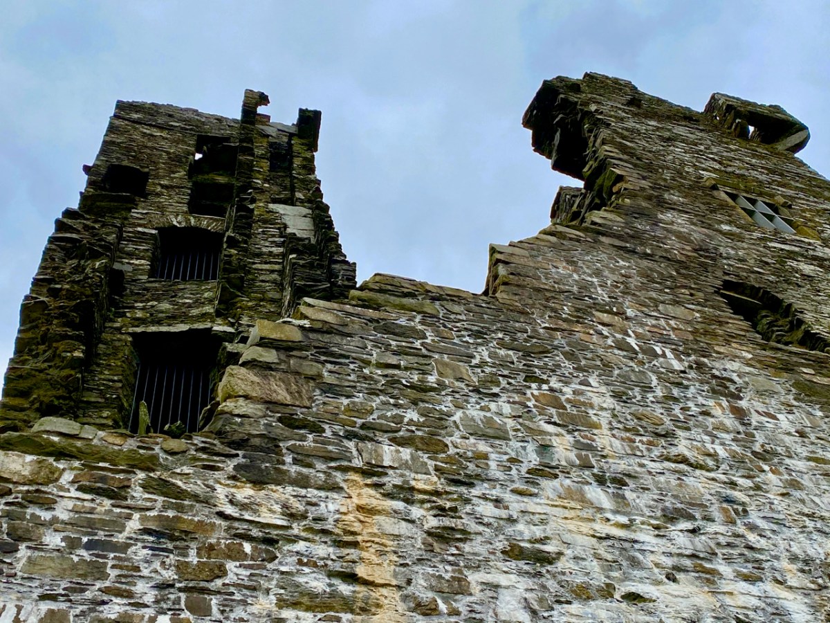
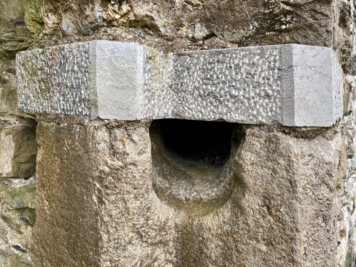
Upper – a view of the now-vanished tower of Glenbarrahane Castle at the entrance to the Haven by Cork antiquarian John Windele, 1801 – 1865 (courtesy National Library of Ireland) and lower – the vestigial stone walls that remain today beside the grey sands of Castlehaven

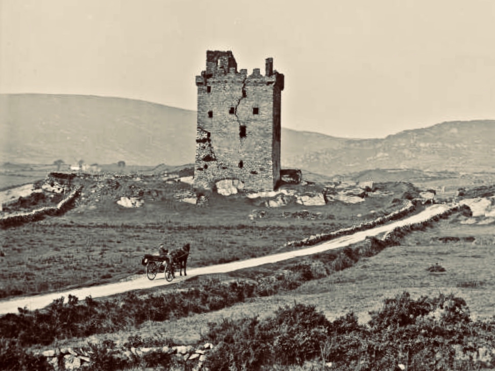
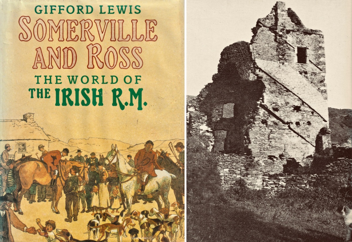
Among our inherited collection of West Cork books in the library at Nead an Iolair is this volume by Gifford Lewis, published in 1985 by Penguin Viking. Ostensibly relating to the writings of Somerville and Ross, it is illustrated with a well-researched collection of old photographs which include some of the castle at The Haven still standing.

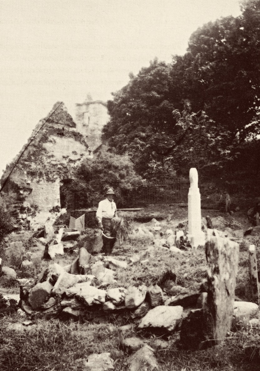
This photograph (above) is particularly valuable. It is also from the Gifford Lewis book and is captioned as follows:

. . . A very early plate by Sir Joscelyn Coghill (c. 1865) showing the old Castlehaven church and above it the Castle in which the Reverend Robert Morrit lived, and before him the Reverend Thomas Somerville. The Tithe War had its effect. Eventually, the Tithe Commission Act of 1838 moved the burden of supporting the Protestant clergy from the peasants to the landowners. The Catholic/Protestant confrontation in Ireland came with the influx of Elizabethan English, the first after the Reformation of the English Church. Those who came to Ireland as Protestants were much less likely to be assimilated than those who came before the Reformation, like the Martins. The ousting of the topmost layer of native Catholic society by a new Protestant one is audible in the list of Rectors of Castlehaven church from 1403 to 1640: O’Driscoll, O’Callaghan, O’Driscoll, Cormac/Basse, Pratt, Stukely . . .

Gifford lewis, Somerville and Ross – The World of the Irish R.M. 1985

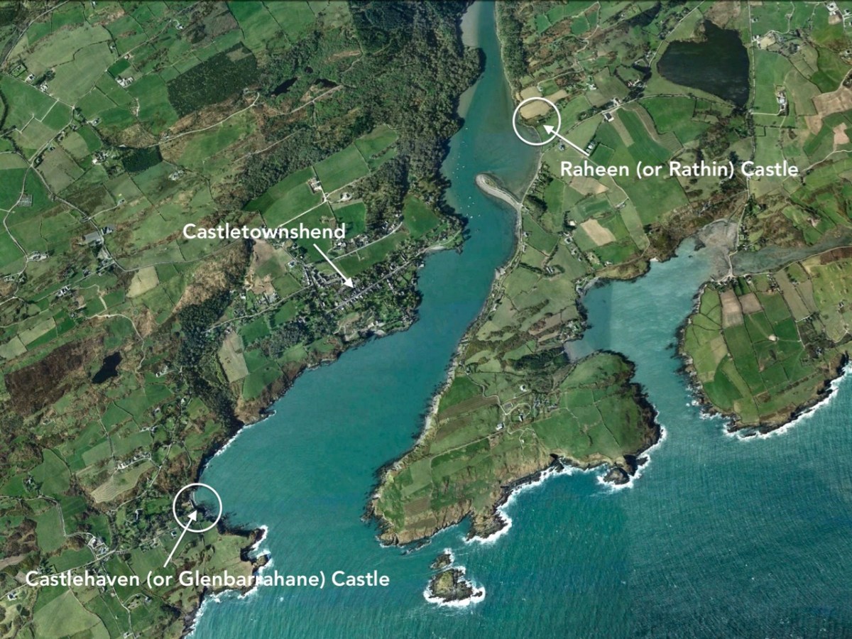
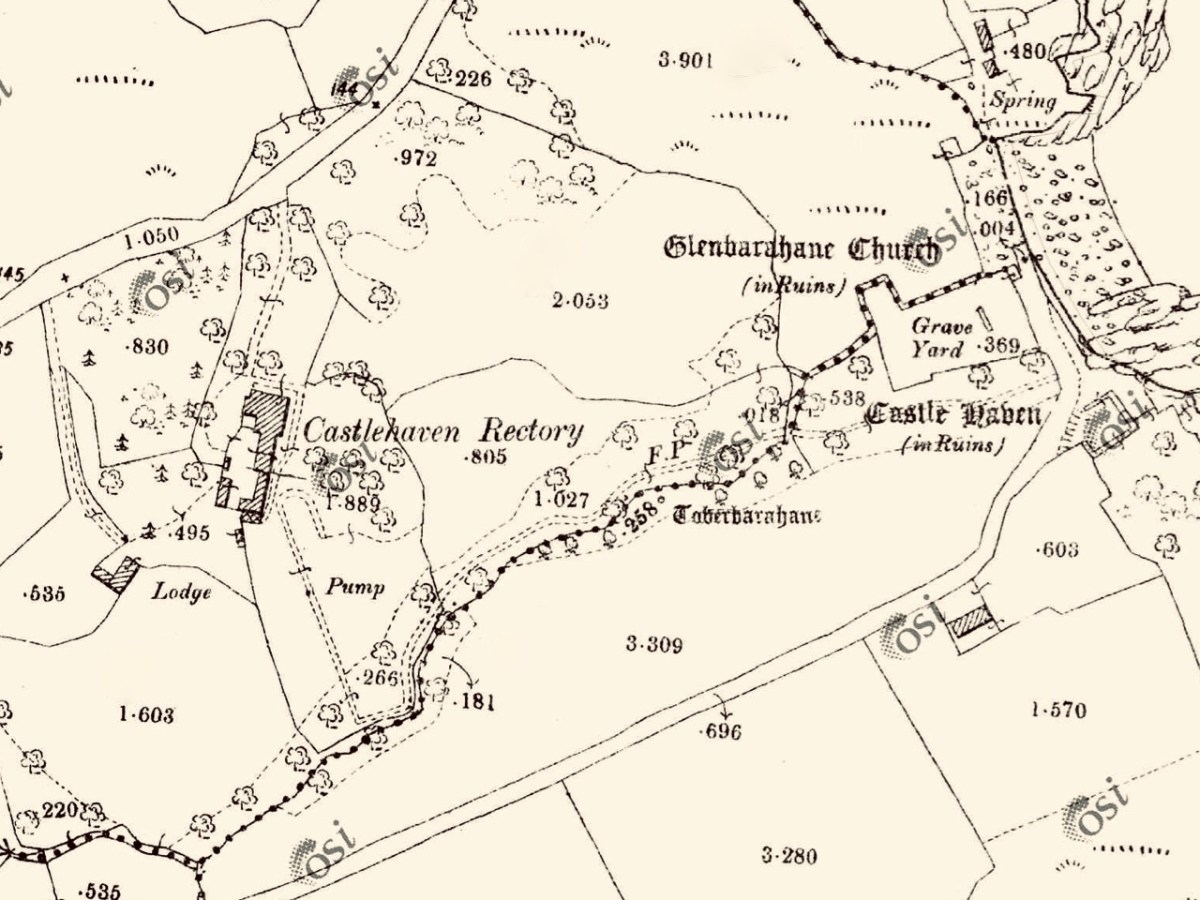
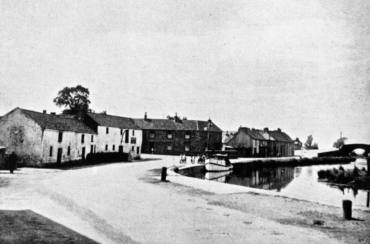
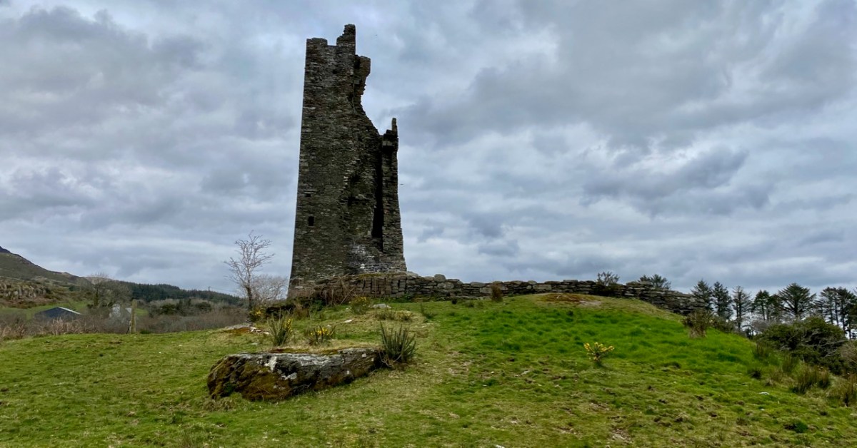
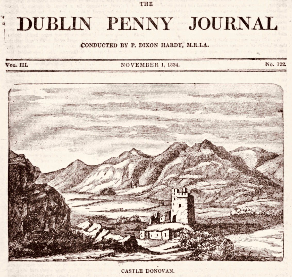
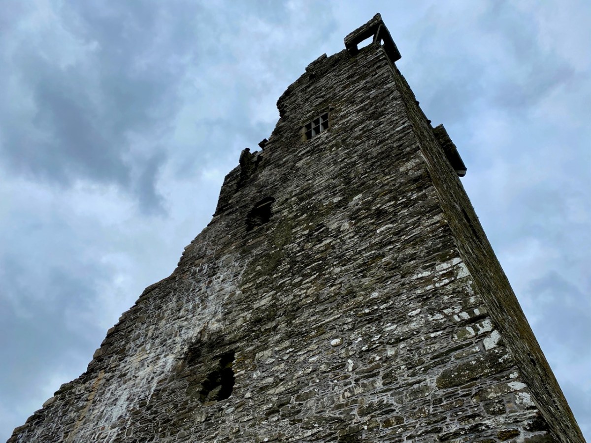
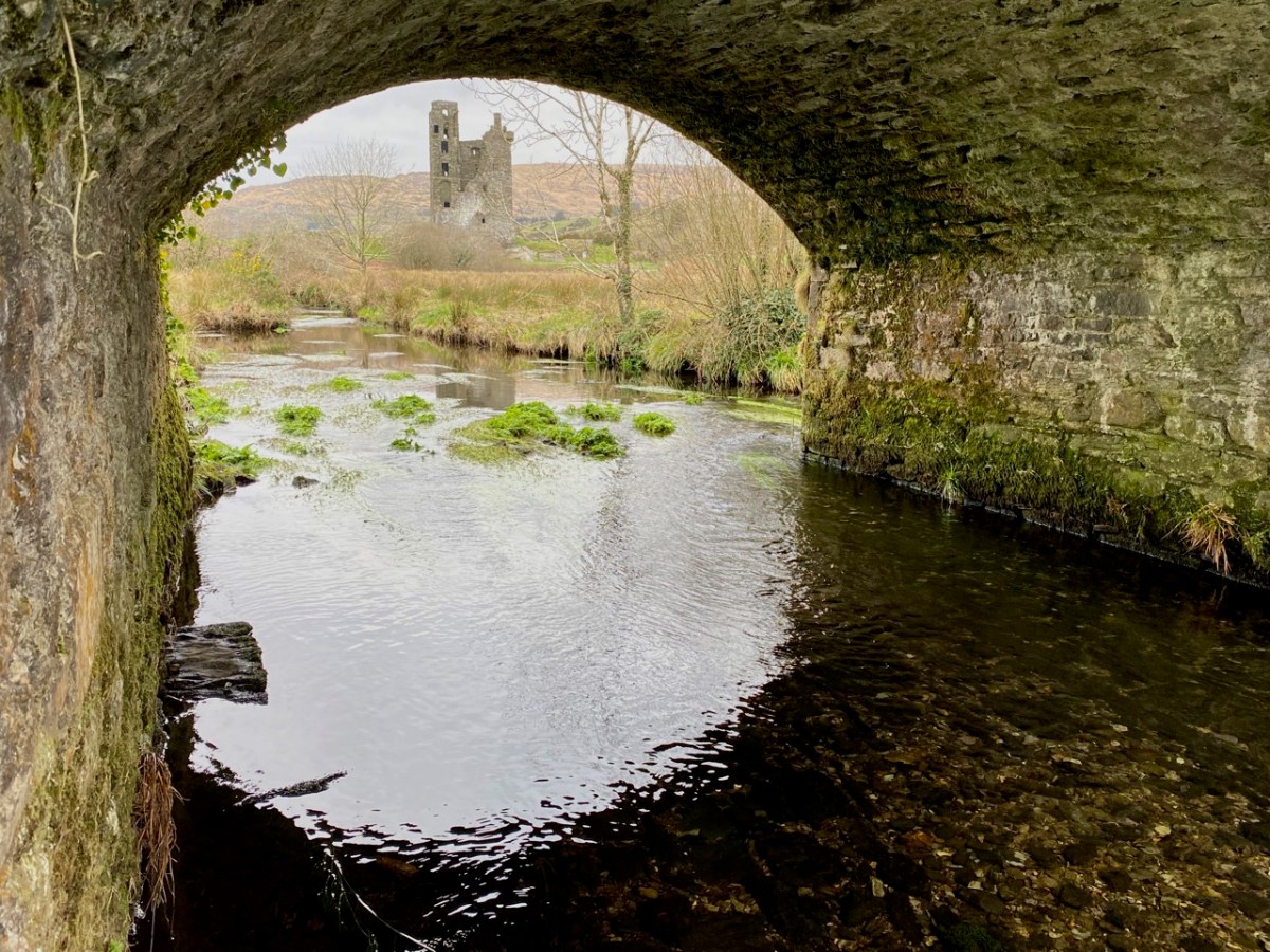
The aerial view shows the inlet of Castle Haven guarded by its O’Driscoll castle at the southern end. In the upper reaches of The Haven is a further castle, properly known as Raheen (or Rathin), sited above the natural spit of The League: the juxtaposition of castle and land-spit was probably deliberate, to create a defensive barrier against any invaders infiltrating the upper waters of The Haven. The mid-19th century 6″ Cassini OS map (above) shows the location in detail. James N Healy (The Castles of County Cork, Mercier Press, 1988) well describes its situation: “. . . It is a remarkable sight, tall and dignified in its quiet isolation . . .” and attributes it to the O’Donovan family, associated with Castle Donovan on the Ilen River – which we visited recently. Raheen was attacked from the water by Cromwell’s army in 1649 and remarkably survives in that breached condition today.

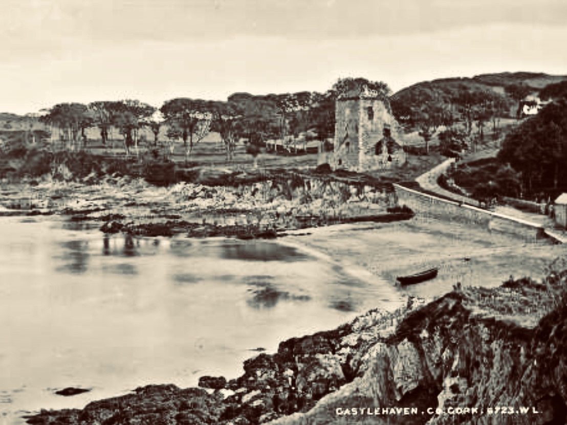
The coloured postcard above is based on a view probably taken around the turn of the 19th and 20th centuries. The viewpoint is identical with that in the header engraving, and The League can be clearly seen in both representations. Because the whole inlet is known as Castlehaven, we have to be careful when reading references or captions, as the two castles – which I always endeavour to refer to by their original names (Glenbarrahane and Rathin) are often both known as Castlehaven Castle. And, of course, we also have the castle at Castletownshend itself to further confuse the issue, although the structure there now is relatively late (the present building dates mainly from the 19th century, although an earlier Bryans Fort on the same site was probably 17th century).

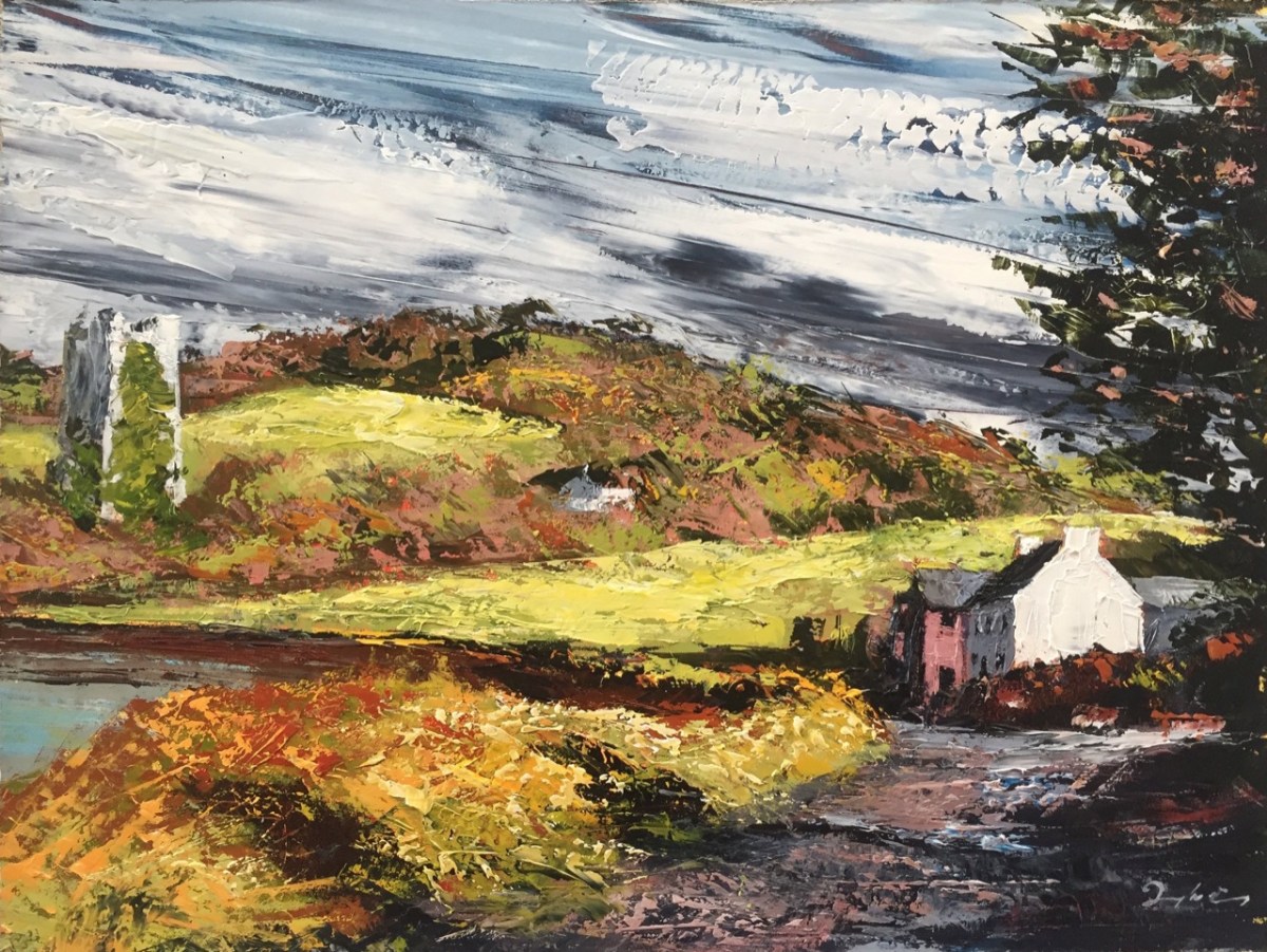
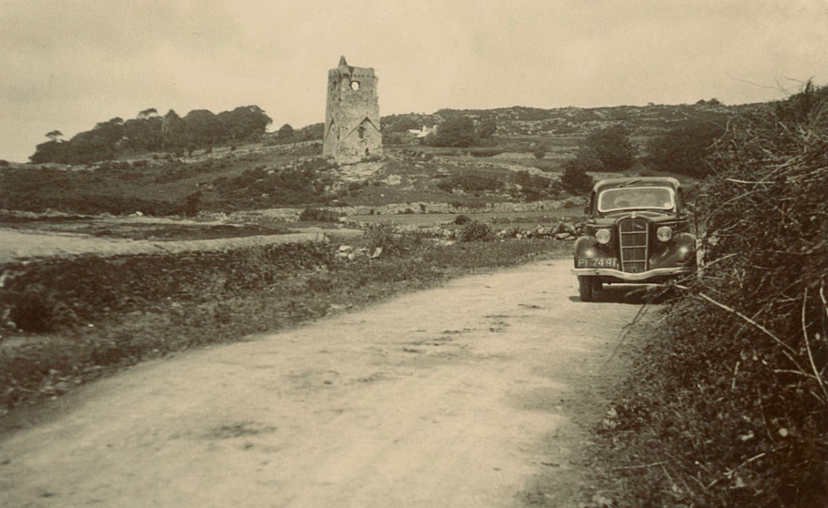
Here is a very fine painted view of Rathin Castle by contemporary West Cork artist Donagh Carey (thank you, Donagh!) You can find his works here: we are pleased to have some of them hanging at Nead at Iolair. I can’t resist including this photograph taken in the 1930s (below) – from the Adrian Healy postcard collection – showing Rathin, with the added bonus of a 1936 Ford 10 in the foreground!

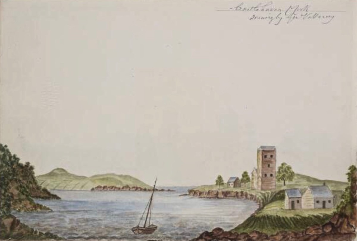
This view (above) is an enigma. It is referred to as ‘Castlehaven Castle’ and is a pen-and-watercolour drawing by Charles Vallancey (1721 – 1812). If the written caption is ‘Castlehaven Mouth’, then it must be Glenbarrahane (although the foreground topography should surely have shown the old church and graveyard?); if it is fact ‘Castlehaven North’, then it would more likely be Rathin – and it is certainly visually closer to this castle. However, then the mouth of the Haven is not in the right place at all. Vallancey was a British military surveyor who had been sent to Ireland in the mid 18th century: he became fascinated with the country and its topography and settled here as a self-styled historian and antiquarian. An extract of his work follows, from a report on West Cork:

. . . There was only one road between Cork and Bantry; you may now proceed by eight carriage roads beside several horse tracks branching off from these great roads; from Bantry the country is mountainous and from the high road has the appearance of being barren and very thinly populated; yet the valleys abound with corn and potatoes and the mountains are covered with black cattle. In 1760, twenty years ago it was so thinly inhabited an army of 10,000 men could not possible have found subsistence between Bantry and Bandon. The face of the country now wears a different aspect: the sides of the hill are under the plough, the verges of the bogs are reclaimed and the southern coast from Skibbereen to Bandon is one continued garden of grain and potatoes except the barren pinnacles of some hills and the boggy hollows between which are preserved for fuel . . .

Charles vallancey – A Report on West Cork, 1778, British Library

Vallancey was noted for obtaining the Great Book of Lecan (Leabhar Mór Leacáin), a medieval manuscript written between 1397 and 1418 in Castle Forbes, Lecan, Co Sligo. He passed it on to the Royal Irish Academy, where it resides today. Sadly, his work apparently only garnered the poorest of appraisals – as an example, here is the 19th century Quarterly Review:

. . . General Vallancey, though a man of learning, wrote more nonsense than any man of his time, and has unfortunately been the occasion of much more than he wrote . . .

The Quarterly review, London, John Murray

In my Extreme Green post I promised a ‘salacious scandal’ associated with Castlehaven. Alas – we have this week run out of time and space . . . Keep watching!

Extreme Green – Castlehaven

There are many places in West Cork that deserve more than one visit. Our enforced confinement close to home focusses us on that thought. March went out like a lamb and – on the first day of April – we went off to enjoy the stirrings of spring in one of our favourite spots: Castlehaven.

Here’s that spot seen from above. It’s accessed from a boreen that goes nowhere else, and is to the south west of Drishane, just outside Castletownshend. In the view you can see the little cove and an old burial ground which surrounds the ruin of the original church of St Barrahane, probably built on medieval foundations but disused by the 1600s. This benign place has bathed in some momentous historical events but is now forever peaceful and seems far removed from our material world.

The 25″ OS map – dating from the late nineteenth century – marks the main features of Castlehaven: the ‘Grave Yard’, Rectory (based on an older house) and ‘Toberbarahane’ – a holy well. One of our favourite walks begins just to the south of the graveyard and wends its way up to the well, – and beyond – following a small stream which has ferociously gouged a channel through the rock formations in ancient glacial times. Today I can only describe the experience as ‘Extreme Green’ because our eyes are drawn to a riot of spring growth and exotic flora. In fact, Finola described it as a rainforest path when we first visited a few years ago.

The Holy Well is still revered, evidently, especially by sailors who need protection while at sea. The saint was known as Bearchán, and most likely came from the Corca Laoighde family  (the Annals describe the O’Driscolls as kings of the Corca Laoighde in the twelfth century), although we can find very little of his life. According to Pádraig Ó Riain’s A Dictionary of Irish Saints, Bearchán’s pattern day is not known, but Amanda gives it as 3rd December in Holy Wells of Cork & Kerry, something which she must have gleaned from local knowledge.

The Holy Well is easy to find and involves crossing a stout timber bridge to the left of the path. On our previous visit, three years ago, a tree had fallen across the path and the bridge was damaged, but this has now been put right.

Finola is coming back along the holy well path, and the bay of Castlehaven is immediately beyond her. The colour of the sea is stunning azure at this time of the year. Just beyond the gate, and sited right above the strand, is all that is left of Castle Haven, a strategic tower house which saw action on 6 December 1601, during the Nine Years’ War between Gaelic Irish lords and the English. The O’Driscolls, who held the castle then, had welcomed in a small convoy of Spanish munition ships. The commander of the English naval forces based at Kinsale, Admiral Leveson, was ordered to “. . . seeke the Spanish fleete at Castlehaven, to take them if he could, or otherwise to distresse them as much as he might . . .” I’ll leave the rest of this story as a cliff-hanger, to be completed in a future post, but we will return to the castle which gave Castlehaven its name.

The old photograph dates from the late 1800s and is from the Lawrence Collection, courtesy of the National Library of Ireland. My photo shows all that remains of the castle today: a section of stone walling close to the cliff face. Its downfall occurred in 1926 and we know this because:

. . . Edith Somerville recorded that while taking a walk on 26 February 1926 she heard a loud rumble and in looking towards the direction of the old tower found that it had collapsed. Nowadays only a mere stump remains, and that covered with briars and weeds. The castle stood on the side of the harbour of Castlehaven, to the immediate south of the stony grey beach, and the decayed church, graveyard and holy well of St Barrahane, the local patron saint who gives his name to the nearby glen and castle. The castle and haven was known as Cuan-an-Chaisleán to the Irish, as Castlehaven to the English, and El Puerto Castello to the Spanish, but they all mean the same thing . . .

The Castles of County Cork by James N Healey, The Mercier Press, 1988

In the next post I’ll be telling you more about the pivotal sea-battle at Castlehaven between the Irish – Spanish alliance and the English forces; and setting out a case of mistaken identity. We will also be exploring another Castlehaven Castle, and looking into a salacious scandal that led to a beheading or two in 1631. There’s much to look forward to…!

Following the Cascades (Sweet Ilen – Part 7)

There’s a walk that goes down from Castledonovan to Drimoleague: it follows an ancient mass path and much of it is right alongside the Ilen River. At its northern end there is a section known as the Deelish Cascades: this is geologically fascinating, and gives us some insights into how our West Cork landscape was formed thousands of years ago.

. . . The oldest rocks exposed in West Cork are of Devonian age (410 – 355 million years ago) . . . These mostly red and green sandstones, siltstones and mudstones were deposited on a continental landmass in a low latitude desert or semi-arid environment. The sediments were deposited from rivers, whose flow was dominated by flash-floods fed by episodic rainfall, which originated predominantly from mountainous areas lying to the north which were were formed during the Caledonian Orogeny (mountain building event) in latest Silurian and early Devonian times. The environment was perhaps similar to the present day Arabian desert. This “Old Red Sandstone” continent extended over what is now northwest Europe. In Cork and Kerry these sediments accumulated in a large subsiding trough (the Munster Basin), resulting in one of the thickest sequences of Old Red Sandstone encountered anywhere in the world (at least 6km thick) . . .

Geology of West Cork, M Pracht and A G Sleeman, geological Survey of Ireland 2002

I have marked on this Geology Map the course of the Ilen River from its source on Mullagmesha Mountain to the tidal estuary which begins at Skibbereen. The map shows the ‘grain’ of the various faults which run SW to NE over the terrain: the river generally flows perpendicular to these faults, and the ‘grain’ is clearly seen in the exposed river bed running over the Deelish Cascades.

Praeger usefully simplifies the geological definition of the landscapes (for more on Praeger see Finola’s complementary post today):

. . . The story which geology tells as to how West Cork and Kerry got its present form is interesting, and I shall try to tell it in non-geological language. Towards the close of Carboniferous times – that is, after the familiar grey limestone which covers so much of Ireland and the beds of sandstone and shale which succeeded it were laid down on an ancient sea-bottom, but long before the beginning of the Mesozoic period, when the New Red Sandstone and white Chalk were formed – the crust of the Earth in Ireland and beyond it was subjected to intense lateral squeezing from a north-south direction. This forced it into a series of great east-west folds, thousands of feet high from base to summit – the Carboniferous beds on top, and below them and following their ridges and hollows the massive strata of Devonian time, and other deeper-buried systems. A series of pieces of corrugated iron laid one over the other will illustrate what happened. The folding was developed particularly conspicuously in the Cork-Kerry area. What we see is the result of this ancient crumpling, now greatly modified by the effect of millions of years’ exposure to sun and frost, rain and rivers . . . The more resistant slates, carved into a wilderness of mountains, still tower up, forming long rugged leathery ridges. A sinking of the land has enhanced the effect by allowing the sea to flow far up the troughs. That the ridges were longer is shown by the high craggy islands that lie off the extremities, and continue their direction out into the Atlantic . . .

The Way That I Went, Robert Lloyd Praeger, Methuen & Co London, 1937

While the upheavals of far-off eras reaching back millions of decades certainly laid the foundations of our landscape, the geological events which actually honed the shaping of the terrain as we see it today are far more recent – the ‘Ice Ages’ which developed only 30,000 years ago and had receded by about 10,000 BC. During that time sea levels fell and then rose again, and the topography and shoreline of the island with which we are familiar today was established. The ice sheets covered most of the land and were up to 1,000 metres thick. As they melted, glaciers fell away from the highest points and carved fissures into the slopes, creating valleys and rivers. One of the most extensive ‘local’ ice-caps was in south-west Munster where a ‘Cork-Kerry’ glaciation, centred on or close to the Kenmare river, developed independent of the general ice sheet. Our own ‘Sweet Ilen’ was a consequence of the ice movement, and the rock formations that we see in the Deelish Cascades are good evidence of these modern geological events.

All the way down the Cascades you will see evidence of the scouring of the rocky river bed, and huge ‘erratic’ boulders that have been carried from the mountain-top on the ice flow, to be deposited randomly – and picturesquely – in the torrent. Of course, you don’t have to know about geology to appreciate the walk: you are free to explore the well kept path and delight in this West Cork experience which has been laid out for us all through the mighty efforts of the Drimoleague Heritage Walkways and the Sheep’s Head Way.

Previous episodes in this series: Sweet Ilen : Sweet Ilen – Part 2 : Sweet Ilen – Part 3 : Sweet Ilen – Part 4 : Sweet Ilen – Part 5 : Sweet Ilen – Part 6

Mizen Mountains 6 – Derrylahard East

The peak of Derrylahard East is perplexing. It’s on a continuation of the Eastern Mizen Ridge that runs from just west of Mount Corrin (which we visited exactly a year ago), takes in Letterlickey Cairn (ditto) and peters out close to the wind farm at Ballybane West (which we explored last October). At its highest point it overlooks Glanlough (from the Irish Gleann Locha – ‘Glen’ or ‘Meadow’ of the lake). We must not be confused or misled by another Glanlough nearby – on the Sheep’s Head peninsula, nor yet another in Co Kerry.

On the map above I have indicated Glanlough, which is central to our most recent peregrination. It is a mountain lake which has been virtually hidden over the last decades by thick commercial pine forests. Very recently, much of the forest has been felled, and views from the top of the ridge are now revealed: they are magnificent and far-reaching. In fact, from the high point we found we could see the 12 arched bridge at Ballydehob – which means. of course, that we can also see Derrylahard East from our own village.

The upper picture was taken from the Derrylahard East Peak with a lens stretched well beyond its limit, but you can see the 12 arched bridge and the sandboat quay house just below the centre of the view: Cape Clear is on the horizon. The lower picture was taken a while ago from the 12 arched bridge in Ballydehob, looking north towards the Derrylahard East Peak, which is swathed in cloud to the left of the rainbow.

We started the walk at the western end of the loop: we accessed it from a road that runs through the forestry from Barnageehy down to Durrus. As we gained the higher ground we could see the ridge path that would lead west through to Mount Corrin – currently closed due to storm damage. We turned uphill and kept close to the townland boundary. Below – Finola is correctly negotiating the stile by going backwards down the steps!

We followed the Sheep’s Head Barnageehy Loop Walk in an anti clockwise direction, circling the lake of Glanlough and looking out for the summit, which is known as Derrylahard East Peak, even though it appears to be within the townland of Glanlough. According to the 6″ OS map, which dates from the 1840s, there was once a trig point at this summit: a height of 990ft – 302 metres.

At the peak: Finola looking back towards Gabriel – always dominating the landscapes in West Cork – with the islands and ocean in the distance; Dunmanus Bay and the Sheep’s Head to the west, with the Beara Peninsula visible beyond; the view east encompassing the Ballybane West turbines and Mount Kidd.

Upper map: the 1904 OS showing Glanlough lake in context with the wider topography of West Cork. Above – the Down Survey, made between 1656 and 1658: this section covers the area shown in the OS above it, and is at a comparable scale. The red asterisk shows the position of the lake at Glanlough: I had hoped there might be some notation on the Down Survey that would give some insight into the name of Glanlough, but the old map is fascinating for the fact that very few of the names are familiar to us and barely a scattering of them can be easily equated with place names today.

I said at the outset that the peak of Derrylahard East is perplexing. For one thing, it is clearly in the townland of Glanlough, yet bears the name of the neighbouring townland. Then there is the altitude of the summit: mountainviews.ie shows two figures for the height above sea level: 301m (which I would – almost – agree with), but also the figure of 353.9m, which must be a mistake. Unless, of course, there is something preternatural in this small patch of West Cork territory: I’m thinking of the legend of the ‘floating’ islands in the lake on Mount Gabriel. According to John Abraham Jagoe, Vicar of Cape Clear – from the Church of Ireland Magazine 1826 – they float about up and down, east and north and south; but every Lady-day they come floating to the western point, and there they lie fixed under the crag that holds the track of the Angel’s foot…’ Perhaps our peak fluctuates at will to confuse us? The shape of the summit is also intriguing: we sensed there are traces of a circular platform and a number of loosely scattered stones – could there have been a megalithic structure here?

The views from this peak would justify it being marked out as a special site, and we could expect to find some stories recorded in the folklore archives, but no: the Duchas Schools Collections reveals nothing of the peak, the lake, nor the townland.

As we descended the track we were grateful that the recent forestry removal has opened up the extensive views to the south, over Roaringwater Bay, but we are also reminded of the devastation that this type of monoculture creates. The scarring of the landscape will last for years, until eventually covered by further spruce planting: then the views will vanish again.

As we left behind the havoc of the ravaged hillsides it was good to find some pastoral prospects, reminding us that West Cork always has unfolding delights and juxtapositions, wherever we wander.

Previous posts in this series:

Knockaphuca, Corrin, Letterlicky Cairn, Lisheennacreagh, Knockatassonig

Back to the Irish Canals

Our readers with good memories may remember a long-running series I penned five years ago, about the canals of Ireland. I revisited that series recently – for a Trasna na Tíre talk* – and realised that I had left it incomplete back in 2017! What better time to finish off the journey than now – when we can only travel outside our lockdown limits through virtual technology?

In 2016 Finola and I explored part of the Irish canal system, following in the footsteps of Tom and Angela Rolt who had voyaged the same way exactly 70 years before, in 1946. They were pioneers in their day, as boating for ‘pleasure’ on the canals was rare. In their book Green & Silver they also managed to capture, in words and photographs, the essence of a decaying transport system in Ireland immediately following WWII, and our travels tried to give an impression of the considerable transformation of inland waterways in Ireland since their time. We traversed, on road and on foot, their voyage around the Shannon Navigation, and the Grand and Royal Canals.

The upper photograph was taken by Angela Rolt in 1946: it shows the Rolt’s boat moored up in sleepy Robertstown (Grand Canal), receiving the attentions of a crowd of small children who had never seen a pleasure cruiser before. Below that is the photo of Robertstown we took in 2016, seventy years later. Our own travels in that year, however, omitted the Rolt’s journey through Dublin, when they had to pass across the Liffey and Dublin Port to get from the Grand Canal to the Royal Canal. The header is an extract from a 19th century map of the docks area in Dublin.

That’s the ‘Green & Silver’ route, above, which the Rolts travelled in 1946. Starting from Athlone they went anti-clockwise around the triangle formed by the Shannon Navigation, Grand Canal; and Royal Canal. This involved crossing the Liffey in Dublin

We have visited Dublin many times in recent years, and I managed to take photographs to complement those of the Rolts, in order to finally complete the ‘Green & Silver’ series today. First, however, let’s try to get an idea of the scale of Dublin Port by comparing aerial views, like by like, of that district and our own Rossbrin Cove in West Cork. The scale and area of each of these two photographs is exactly the same (1600 hectares): the demography (population and land use) couldn’t be more different.

. . . After tea we journeyed on through Landestown and Digby Bridge Locks to the Leinster aqueduct over the River Liffey. It was an attractive pound, the canal skirting a ridge of high ground on our right with a view over the valley to the left until it turned to cross the river. As there was little traffic about, we stopped for a few moments on the aqueduct, an impressive structure of four arches, to look down at the swift flowing peat-stained waters which we next should see, and enter, in the heart of Dublin . . .

Green & Silver by L T C Rolt, Chapter 6
Top – early print of the Leinster Aqueduct, Grand Canal; lower – the Rolts pause to admire the structure as they cross the Liffey on the aqueduct

. . . The day before we were due to leave our moorings at Grand Canal Dock I thought it as well to reconnoitre the entrance from the Liffey into the Royal Canal at Spencer Dock, North Wall. The channel into the tidal lock was barred by an enormous rolling lift bridge over which an endless procession of cars and lorries was rattling and thundering. To my eyes it appeared as though this formidable barrier was seldom or never moved. In any case it seemed optimistic to suppose that this ponderous mechanism would be operated, and the traffic along North Wall suspended, merely to allow the passage of our small craft. Looking up at the dock I saw yet another obstacle; a drawbridge this time operated by two steel beams high overhead which looked at this distance, with their long rods linking beams to bridge, like a pair of slender, long-beaked birds. This carried Sherriff Street, another busy thoroughfare, across the dock . . .

GREEN & SILVER BY L T C ROLT, CHAPTER 8
Top – Tom Rolt surveying the Scherzer style ‘rolling lift bridge’ located at the entrance to Spencer Dock, Royal Canal, in 1946. It was erected by the firm of Spencer & Co of Melksham, Wiltshire, in 1912. The bridge was worked by an electric motor – now removed. Lower – the bridge in the present day

. . . It looked as if our passage bade fair to dislocate the traffic of Dublin. I thereupon visited the engineers department of Corus Iompair Eireann at Westland Row Station where I tactfully suggested that if I came up to North Wall at low tide we might just be able to get under the bridge there, but I was received with helpful courtesy and matters were quickly arranged. Of course the bridge would be lifted, that was no trouble at all. And when did I wish to come up the river. To-morrow? High tide was at noon; if I would undertake to be at the bridge at that time it would be opened at once. Arrangements were made on the spot by telephone . . .

GREEN & SILVER BY L T C ROLT, CHAPTER 8
Upper – Angela Rolt’s photograph of the Sherriff Street lift bridge at Spencer Dock, Royal Canal, in 1946; centre – the lift bridge today (courtesy  William Murphy aka Infomatique). Lower – the overhead beam lift bridge mechanism is a principle often found on canal navigations: here is a more vernacular example on the Barrow Navigation (from Ireland of the Welcomes, 1971)

. . . Next morning we crossed the waters of the outer basin and entered the tidal lock. Actually there are three locks of different sizes here, side by side, and we entered the smallest of them which was on our port side. The lower gates opened, we paid a final farewell to the Grand Canal, and were soon dancing over the little waves of the Liffey mouth. It was our one brief taste of salt water. Having made sure that no steamers were on the move to or from the quays, we headed straight across the channel and came up the river close to the North Wall side. We swung straight in and got our lines onto the quay wall precisely at the time appointed. Everything went like clockwork. The bridgeman clambered up into his overhead cabin, men appeared from nowhere armed with red flag to stop the traffic and in a few moments, with a rumble of machinery, the bridge opened remarkable swiftly. We passed through into the tidal lock, and the bridge as quickly closed behind us. While the lock was filling, I paid my dues, two pounds for the ninety-two miles and forty-seven locks to Richmond Harbour. This done, the Sherriff Street Bridge drew up with similar despatch and we sailed through to begin our journey on the Royal Canal. Probably very few of the thousands who pass over the North Wall Bridge or board the steamer for Liverpool or Glasgow at the nearby quay suspect that this is the gateway of a forgotten water road which leads through the heart of Ireland . . .

GREEN & SILVER BY L T C ROLT, CHAPTER 8

Grand Canal Dock, Dublin – photographs which we took in 2014 (above). The decline which was apparent then continues to this day. Currently there is a plan to sell much of the land for redevelopment. It goes without saying that navigable water will need to be retained to allow access from the Grand Canal itself to the Liffey. Below – another context for the Port of Dublin in the 1950s!

The Heinkel Kabine ‘bubble car’ was designed by the same company which produced German long-range heavy bombers during the Second World War: this famous micro-car was manufactured for a short time between 1956 and 1958 under licence in Dundalk’s Great Northern Railway Ireland (GNRI) works. More than 6,000 were manufactured here.

The beauty of the rural Royal Canal: Chaigneau Bridge, Ballybranigan, Co Longford in 2016

The previous series of Roaringwater Journal posts on Irish waterways can be found (in reverse order) here.

*Robert’s Trasna na Tíre talk can be reached on this link.

O’Donovan Country (Sweet Ilen – Part 6)

Here’s a forerunner to Roaringwater Journal (above)! Philip Dixon Hardy lived from 1794 to 1875 and described himself as a poet, bookseller, printer, and publisher. He was the first to use a steam-powered printing press in Ireland and was the editor of The Dublin Penny Journal which was published every Saturday between 1832 and 1836. If you scroll through the contents you will see articles on all aspects of Irish life and accounts of many of his travels through the Irish countryside, including a series of ‘Rides through County Cork’. He was undoubtedly a man after our own hearts!

Continuing our own series of travels, exploring the Ilen River, we can’t help comparing our impressions of Castle Donovan (above) – which overlooks the Ilen after it has cascaded down from the summit of Mullaghmesha and broadened out to cross the plains of Cork County – with those that are recorded by Philip Dixon Hardy as he journeyed over the same terrain in 1828, almost two centuries ago.

The upper picture is taken from the Ilen plain looking north, with the castle tower set against the high mountains beyond. Above is our earliest known photograph of the castle: it comes from the Lawrence Collection, National Library of Ireland, and could date from the 1880s. Juxtapose this with the Dublin Penny Journal view, 50 years before that, shown under our header at the top of the page. Bear in mind that Hardy carried out most of his travels on foot:

. . . We will now suppose the the tourist who rejoiceth in the splendour of a wheel carriage has proceeded without any interruption to Bantry. We will act in the charitable capacity of guides to the humbler pedestrian. Him we would advise to select the old, or northern road, leaving Dunmanway to the west. Thence it proceeds to the lofty hill of Mielane, and surmounting a rising ground beyond this eminence, the vale of Castle Donovan (which forms the subject of our sketch) opens on the sight. It is hard to conceive of any thing more wild, more desolate, more lonely, than this savage vale. … I reached the eminence which commands it from the east, about two in the afternoon of a warm sunny day. Trees there are none in this district, and the heathy covering of the hills was incapable of showing any marks of the advancing season. In the centre of the vale beneath me, was the tall, castellated tower; an extensive marshy meadow lay beyond it, bounded by the steep rocky hills of Mullaugh-Nesha, and its peaked brethren. . .

Philip Dixon Hardy, 1828, from The Dublin Penny Journal

The Castle itself has a fairly well recorded history, although its origins are unclear. James N Healy – The Castles of County Cork, The Mercier Press 1988 – suggests that the first fortification on this site dates from the early 13th century, but the present building is more likely to be 16th century. There is a carved stone in a window embrasure on an upper floor which bears the date 1626, but Healy suggests that this marks a later restoration of the castle, and gives a probable date of construction between 1560 and 1584.

The castle was traditionally the seat of the Clann Cathail sept of the O’Donovans, and was first named ‘Sowagh’. I can’t find any origin for this name. Healy gives an intriguing story:

. . . A local story is told of how O’Donovan and his ally MacCarthy Duna hanged a protestant woman at the castle in 1641, as a result of which the curse of a corroding drip from the main arch was placed on the building. This would not cease until the demise of the last of the family: the castle does not appear to have been lived in again.

James N Healey – 1988 The Castles of County Cork

It is recorded that Cromwell’s officers attacked the castle and it was left in ruins. Returning to The Dublin Penny Journal, Philip Dixon Hardy describes his exploration of the remains:

. . . I diverged from the road to examine the old castle; it is founded on a rough rock whose surface, forming the floor of the vaulted hall of the castle, retains all its original inequalities. Strange notions of comfort must our ancestors have had! Here were men, possessed of a large tract of country, sufficiently wealthy to build several castles; and in this one, the constant residence for many years of a principal branch of the family, the floor of the hall is bare rock, which never has been levelled, and which is intersected with two or three ridgy indentations, nearly two feet in depth, and extending almost the whole length of the apartment!

PHILIP DIXON HARDY, 1828, FROM THE DUBLIN PENNY JOURNAL

This is what Hardy is referring to – in fact it’s not ‘the vaulted hall of the castle’! It’s the lowest floor – at ground level – and was in all likelihood a store or cattle shed. It might even have been a dungeon. The main ‘hall’ of the castle is on an upper level.

The castle structure was stabilised by the OPW and public access to the grounds was granted in 2013. Restoration works included the replacement of key elements of the masonry to prevent further decay. The ‘peep-hole’ above allows a view by a sentry located just inside the entry door of who might be standing outside: perhaps an undesirable character (below). Actually, rather than a peep-hole, this little tunnel through the wall was for a chain that secured an outer iron gate called a yett.

When you visit Castle Donovan, look over the low wall to the west of the tower itself. You will see an archaeological feature which is quite rare today, but was once common all over Ireland from early times: a cereal-drying kiln (also called a corn-drying or grain drying kiln).

What is a cereal-drying kiln? Here is a good summary, from Irish Archaeology. It looks almost megalithic – and the earliest one dated so far goes back to the Bronze Age, but there are many that are medieval, and this one at Castle Donovan is likely to be contemporary with the castle itself. The structure has a fire-pit (below) and trays of cereal were placed above the fire, and in this case under a capstone, presumably protecting the corn from wind and rain.

This extract from the 25″ Ordnance Survey map (late 19th century) shows the castle overlooking the Ilen River and, to the south, the bridge and the old school. To finish off this episode in the Ilen series, we will pause at this bridge. There’s plenty to see – good views back to the castle from the arches of the stone bridge; the site of the old National School. There is no sign of the building today, but there is a memorial stone:

This is from the Duchas Schools Folklore Collection, dating from 1937:

. . . Walkers: it was no uncommon thing for people to walk to and from Cork in olden times – often carrying baskets. Tradition has it that a woman Magg Hourihan of Deelis did the double journey on foot in one day (approximately 90 miles). Biddy Regan of Castledonovan is credited with the same feat – The occasion in both cases being the payment of Rent (which at that time was often paid through Cork butter factors). Herewith is a direction given to people who were unacquainted with the road – Bí ag dul soir, soir, soir – go bfeidir séipéal ar thaobh do láimhe deise ni fada uait Corcaig annsan.


Seán Ó Súilleabháin, múinteoir Deelish Co Cork

Previous episodes in this series: Sweet Ilen : Sweet Ilen – Part 2 : Sweet Ilen – Part 3 : Sweet Ilen – Part 4 : Sweet Ilen – Part 5