Brian’s Sketchbook: The Signal Towers

Brow Head Buildings

We have received a unique and treasured gift – a sketchbook from the 1980s of prehistoric and historic sites around West Cork. It’s the work of our good friend, and national treasure, Brian Lalor, artist, writer and printmaker. For an overview of his style, check out the retrospective of his work at Graphic Studio Dublin. Or browse the long list of his books, including the magnificent Encyclopaedia of Ireland, which he edited.
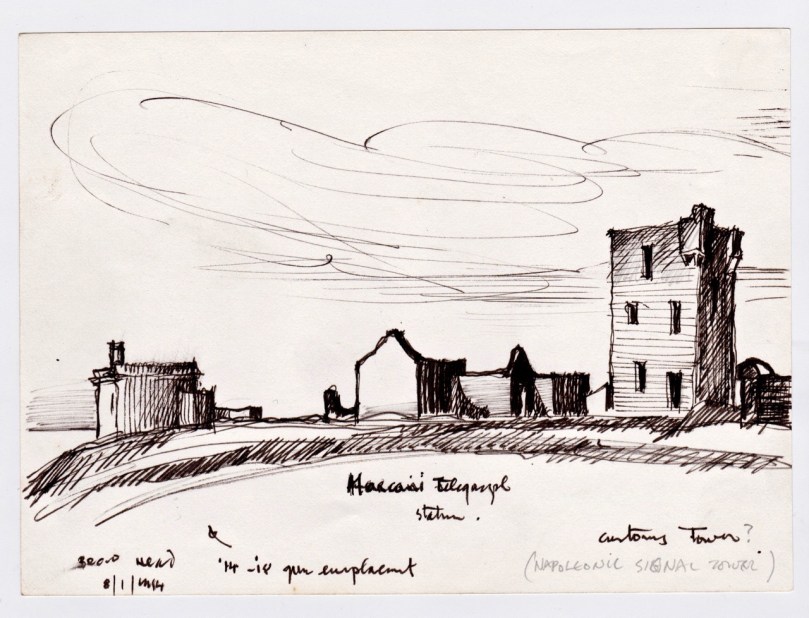
Marconi Station, Brow Head

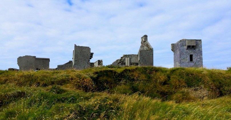
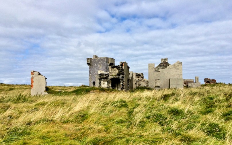
Brow Head: (above and below) on the right is the Napoleonic-era Signal Tower; the other buildings date mainly from the time of the Marconi Telegraph Station, taken from a different angle than the sketch above

Brian has studied both architecture and archaeology and to that adds the keen observant eye of the artist. As a result these sketches, although, as he explained, often hastily done during a brief visit to a site, are accurate, detailed and charming in equal measure. They were made on field trips with the Mizen Archaeological & Historical Society in the 1980s. This was an active society, publishing a well-regarded journal from 1993 to 2004 and leading regular field trips for members.
Brow Head ruined building

The sketches, just over 50 of them, were made for the most part between 1980 and 1987 so besides their intrinsic artistic value, they also constitute an important record of the state of the site 30 years ago, allowing us a comparison with its current condition. My intention is to visit (or re-visit) a lot of the sites, with his sketches in hand and show our readers both how beautifully Brian captured the structures or artefacts at the time and whether there are any changes visible from then to now. I decided to start with the Signal Towers on Cape Clear and Brow Head, and a third tower on Rock Island that may or may not be contemporaneous.
Wolfe Tone front

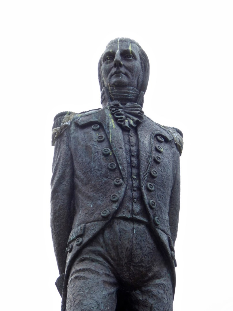
Theobald Wolfe Tone – detail of the statue in Bantry town square

In 1796 the French navy, partly at the invitation of Wolfe Tone and the United Irishmen, staged an unsuccessful invasion of Ireland, sailing into Bantry Bay. Several raids followed in 1798. Although all were quickly quashed, a panic about the possibility of a French invasion spread throughout Britain and Ireland. A series of Napoleonic-era fortifications and viewing towers were constructed around the coast in locations with panoramic views, and within sight of each other, to spot foreign shipping activity and raise the alarm. On the east coast, these mainly took the form of Martello Towers and were stocked with heavy armaments, but here in the south west defensible Signal Towers were built not to house artillery but as advanced-warning stations. Here and there they were complemented by batteries and other fortifications – but that’s a story for another day.
Cape Clear Signal Tower

The Cape Clear Signal Tower

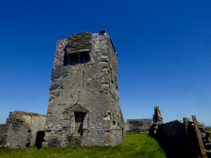
Signal towers were built around the coast to the same plan – tall square towers with first-floor entrances and machicolations. From a distance, they look like the medieval tower houses I have posted about on several occasions but up close they are shorter and the windows are bigger. Internal staircases and partitions were made of wood, not stone and have generally not survived, so the signal stations are essentially shells. in both the Cape Clear and Brow Head example, the exterior slate cladding has survived remarkably well.
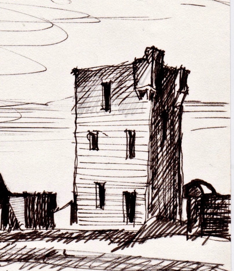
Brow Head Detail - signal tower

Brow Head Signal Tower – detail from Brian’s sketch

In his excellent article for the Irish Times, Nick Hogan describes the towers, how they were staffed, the accommodation provided and how the signalling was done:

The signalling system, referred to as an optical telegraph, required that each signal station be visible to its counterparts on either side. Sending a message involved raising and lowering a large rectangular flag, a smaller blue pendant and four black balls in various combinations along a system centred on a tall wooden mast. The stations also communicated with ships.
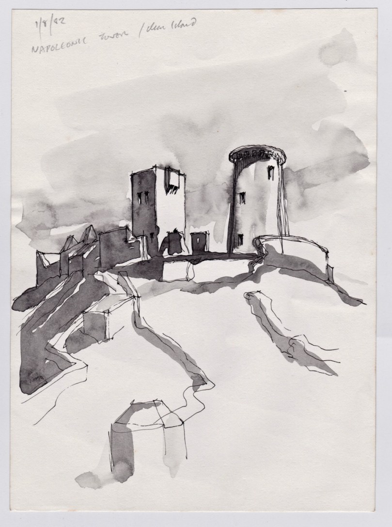
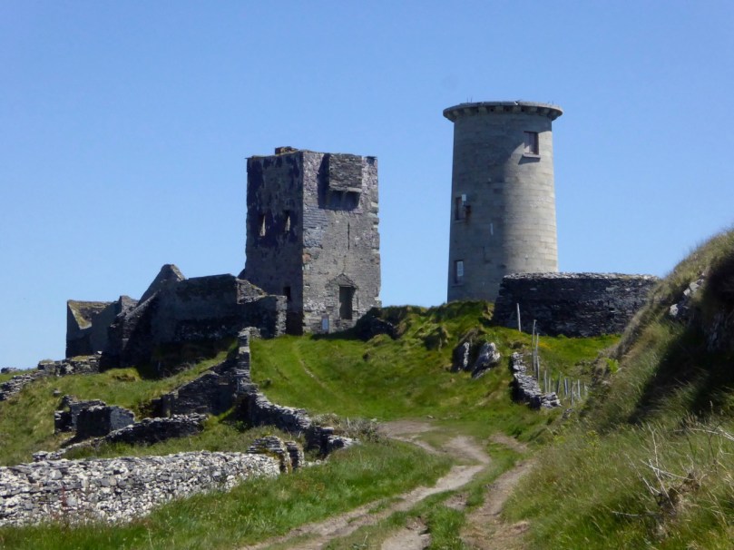
Cape Clear Towers

Signal Tower and Original Fastnet lighthouse, Cape ClearTop: Brian’s sketch of the Signal Tower and Lighthouse on Cape Clear Island, done in 1982; Below: how it looked in June, 2016, 34 years later

While many signal stations are lonely and isolated buildings glimpsed on distant headlands, abandoned since the mid-1800s, both the Brow Head and Cape Clear buildings had further phases of use. In Cape Clear a lighthouse was built in 1818 – a forerunner of the Fastnet Rock Lighthouse. It was so often shrouded in fog that it was abandoned in the 1840s. The buildings attached to the signal tower, built of brick and concrete, probably date to this period of occupation. The signal tower is built of stone, using techniques not far removed from medieval construction methods. The lighthouse provides a wonderful contrast, being built of cut granite blocks expertly measured, shaped and fitted. 
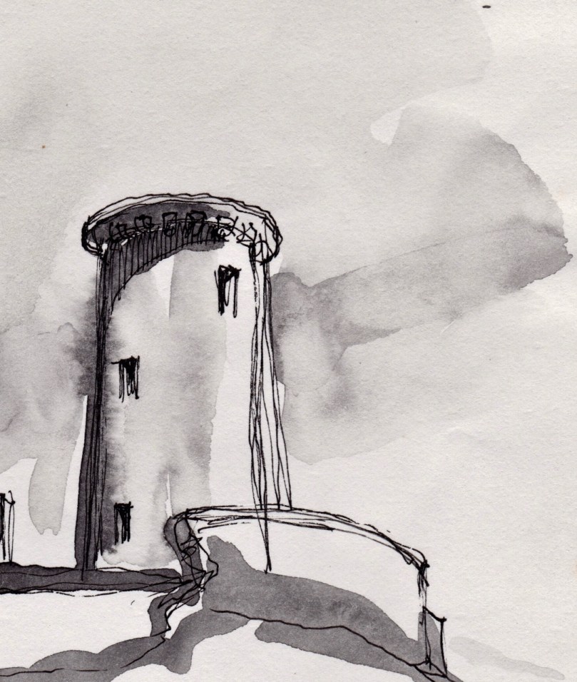
Cape Clear Deatil - Lighthouse

Cape Clear Lighthouse, detail from sketch

In June of 2016, when we visited, it looked exactly as it had to Brian and the Mizen field group – an indication, perhaps that somebody is looking after the site and that the few visitors who come (it’s quite a hike to get there) respect the heritage. [Edit: Since I wrote this, Brian has pointed out that in the Cape Clear Signal Tower there is a porch under the machicolation in his drawing that has since disappeared. The outlines of the porch can be clearly seen in the photographs of the signal tower.]
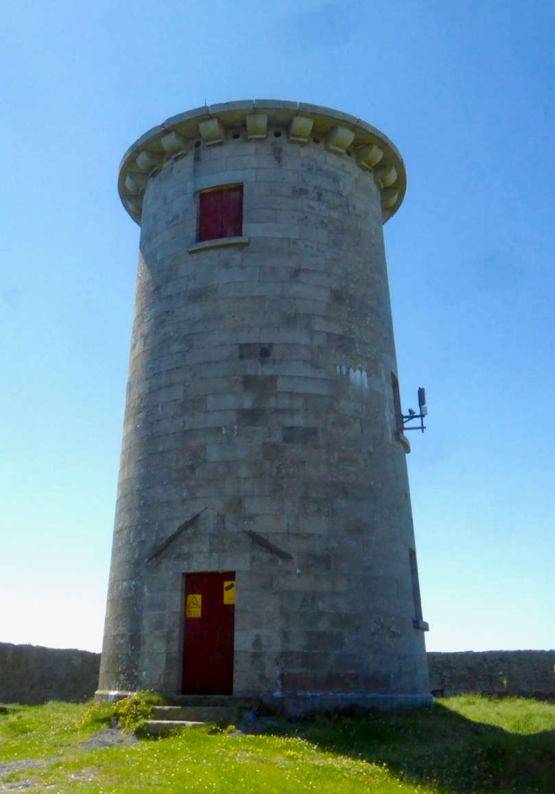
Cape Clear Lighthouse

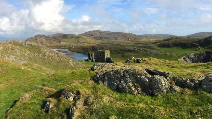
Brow Head is easier to access, and as a result there is more graffiti in evidence, but the changes to the site since Brian’s sketch are more the result of time and climate than any damage by humans. This is a complex site with multiple periods of occupation. The signal tower is there, of course, looking exactly as it did in the 1980s. Beside it is a network of buildings dating from the the early years of the 20th century: this is what remains of the Marconi Telegraph Station. Read all about this in Robert’s piece on Marconi, In Search of Ghosts. Besides the Marconi Station a Second World War Look Out Post was occupied here in the 1940s – little remains of this small concrete building except the characteristic half-round shape and a section of wall.
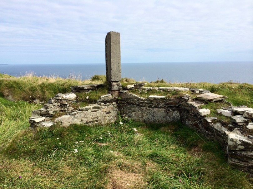
Brow Head octagonal?

Finally, on Brow Head there is a mysterious building that Brian labels ’14 – ’18 Gun Emplacement. This building no longer exists, and the ruinous remains that litter the ground seem robust enough to fit this inscription. Or do they? So – a mystery, and obviously  more research needed on our part. If any of our readers can help – let us hear from you!
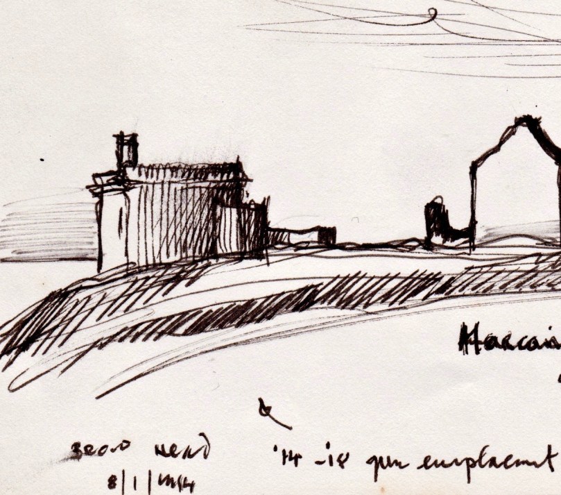
Brow Head Detail - gun emplacement

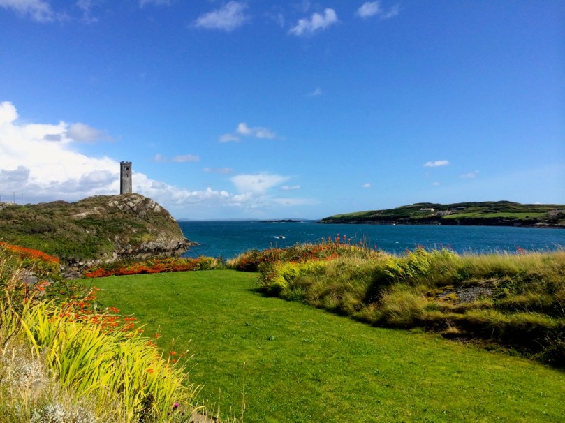
The last tower is on Rock Island. It is clearly visible from the Brow Head Signal Tower ( a requirement for the placement of signal towers) but, strangely, it is one of two very similar towers on Rock Island, and while they are similar to each other, they are quite different from the classic signal tower design. However, both the National Monuments site  and the National Inventory of Architectural Heritage listings name them as Napoleonic-era Signal Towers, and perhaps that is indeed what they are.
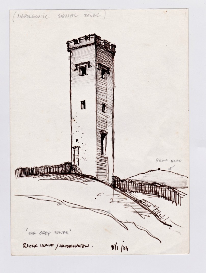
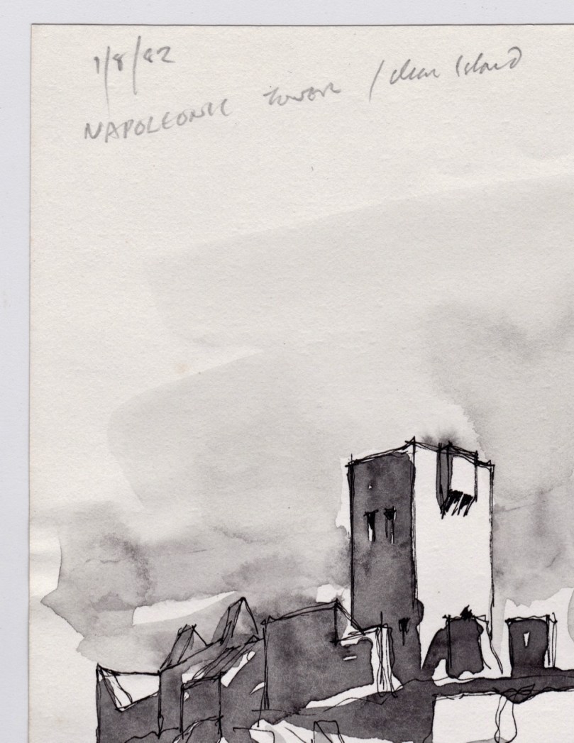
Rock Island Tower

Brian’s sketch of the Rock Island Signal Tower

However, in discussion with Brian, he pointed out that most of the buildings on Rock Island were developed as part of a major Coast Guard installation around the same time as the Marconi Station, and we wonder if there might be a connection – that is, that these are Coast Guard-related Watch Towers, rather than Napoleonic-era Signal Towers. Once again – more research needed! [Edit: See comment from Navtell in comment section, below.]
Rock Island Signal Station

Rock Island Second TowerThe two towers on Rock Island: similar to each other but quite different from the classic Signal Tower on nearby Brow Head

This is only my first foray into Brian’s Sketchbook. Look out for more posts in the future and in the meantime, join with me in being grateful that a precious resource like this survived numerous moves and that we have the opportunity to learn from it.
Cape Clear Detail - Signal Tower

The Cape Clear Signal Tower

Landscaping – with Trish Punch

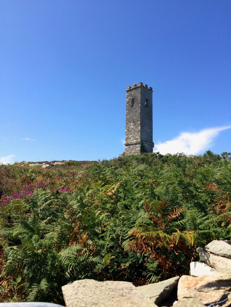
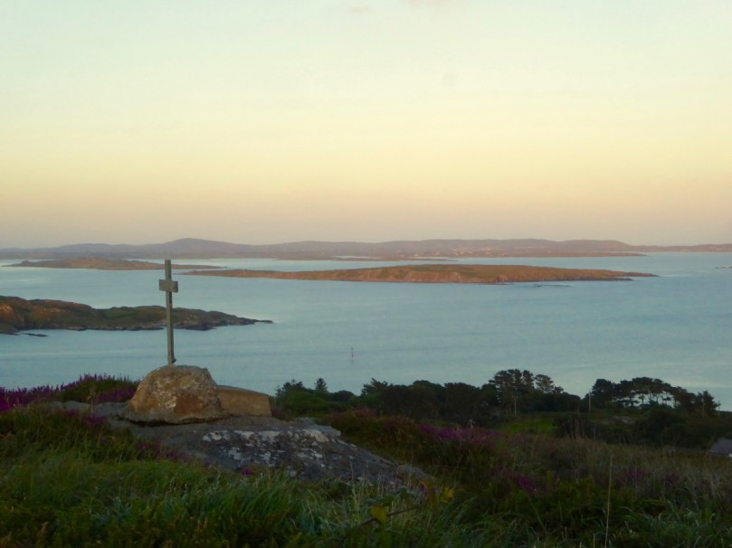
Brow Head

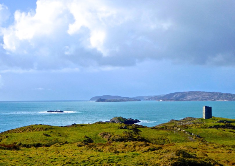
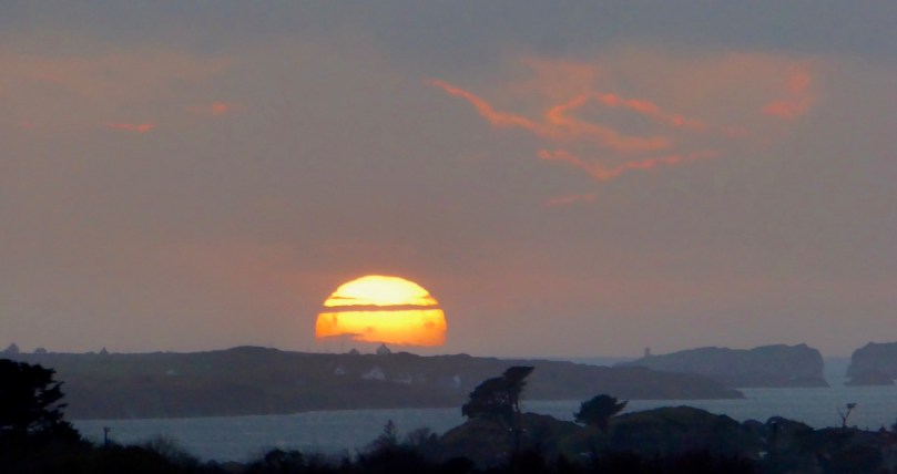
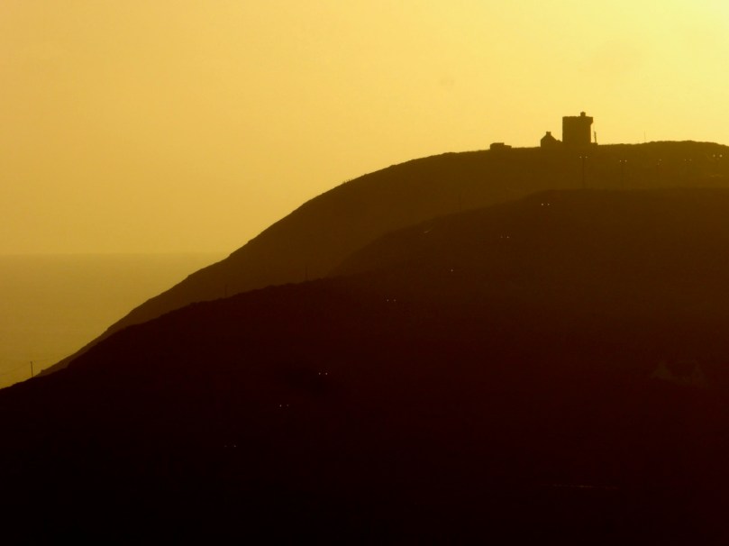
Brow Head silhouetted against the setting sun*

In our quest to bring you the best West Cork has to offer, we pepper our posts and our Facebook Page with photographs. After a great day-long course with Celia Bartlett (last year, highly recommended!) I managed to wean myself from the auto mode on my camera and have been taking pictures using the manual setting for more than a year now.

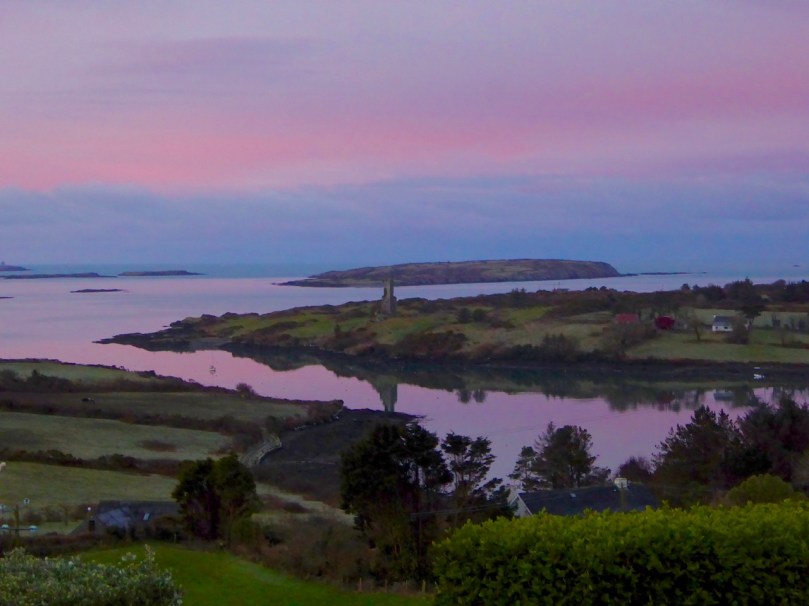
Rock Island

Rock Island and Crookhaven Inlet

And I’m hitting the wall again – knowing my camera is able to deliver so much more and that there’s a lot I need to learn about composition. So I signed up for a one-on-one workshop with Trish Punch and boy, am I glad I did!

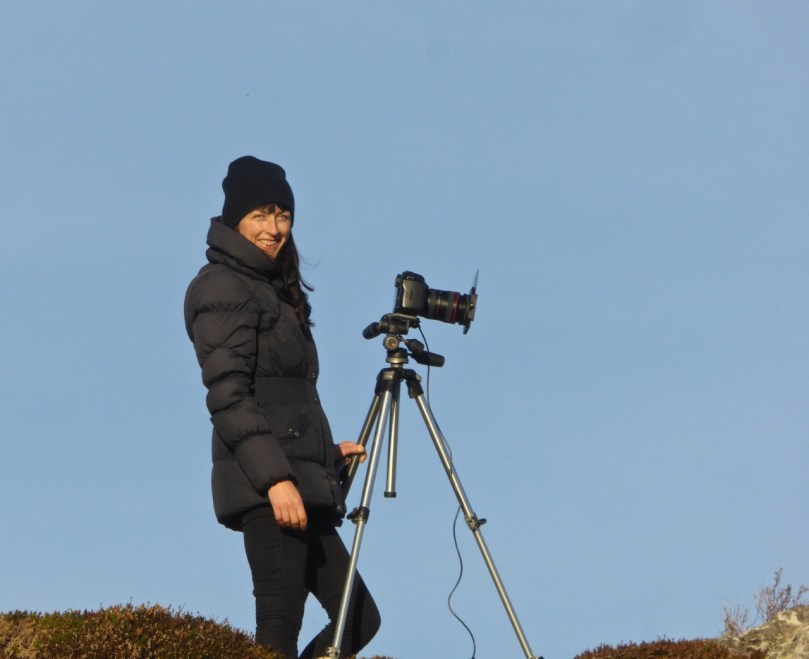
Trish 4

This is Trish – she’s a professional landscape photographer who supplies images to Lonely Planet (Lonely Planet!) among other prestigious publishers and travel sites. She specialises in the Wild Atlantic Way and is currently pursuing a project to capture the islands along the Way. Take a look at her website and be prepared to do some serious drooling.

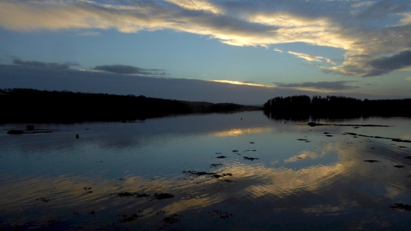
Crescent sky

We started at dawn and watched the light appear over Ballydehob Bay

But Trish is also an inspiring, encouraging, and organised teacher – and a lot of fun to be with. We had a great day together, starting at dawn and ending when the sun set. Throughout the day she encouraged me constantly to slow down, think about my shots, use the principles of good composition, really examine where the eye was being led in the frame and check the light. 

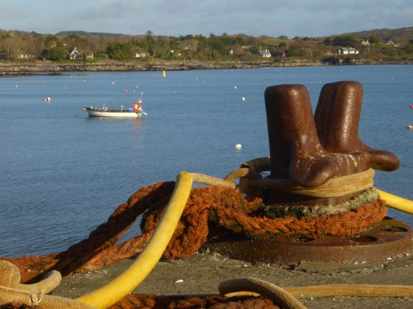
Schull Pier

This was taken on Schull Pier – the mooring bollard takes on a sculptural quality in the right lighting

I’ve been making all the classic mistakes, chief of which is to plonk the main subject right in the middle of the frame. I have also struggled with sharp focus, especially in low light, and Trish insisted on me using my tripod (something I have been reluctant to do – I don’t want to lug it around) and showed me how to use my timer to take the shot, since my camera won’t accommodate a cable or remote shutter release.

Barleycove Wetlands

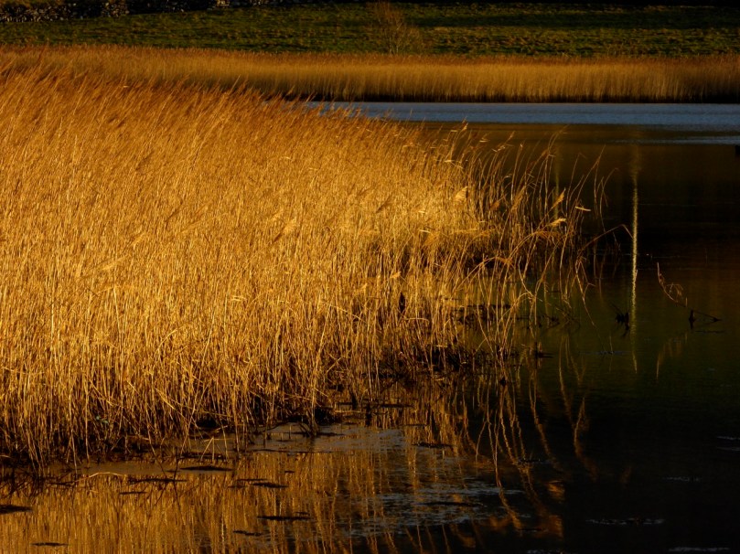
Watching where the light comes from – these marsh grasses at Barley Cove glow golden in the low evening light

We were fortunate to have a really great day in December, with a long Golden Hour at each end. I’ve been practising what she taught me since then and I feel a little more confident each day. I hope you, our dear readers, will see a difference too, over time.

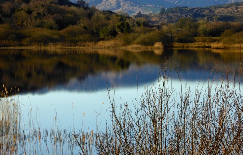
River Lee near Ballingeary 2

The River Lee near Inchigeelagh

We took a trip to Macroom the other day and I used the opportunity to practise what I learned with Trish. Mostly I just tried to slow down and think more about the composition of the shot. It was another amazing day with clear blue skies – but this time very cold with lots of frost where the sun hadn’t managed to penetrate.

Sunshine and Frost, West Cork

Sunshine and shadow on a frosty day in West Cork

If you’ve been thinking you’d like to improve your photography skills, give Trish a call or drop her an email. You can take one of her planned workshops or she can customise a day, or a weekend, for you no matter what level you’re at.

Coral House

House in the Shehy Mountains

Don’t be intimidated if you’re operating on the automatic settings or if you don’t know the difference between shooting in RAW or JPEG (I didn’t) – you’ll come away knowing a lot more about how to move forward in your skills. And you’ll have time in the open with lots of laughter and surrounded by incredible landscape – now what could be better than that?

Pass of Keimaneigh

Heading up to the Pass of Keimaneigh

*I took the first five photographs above on the day of the workshop (Dec 16) and the next five in the last two weeks.

West Cork in Photographs – Your Favourites, Part 2

Courtmacsherry Bay

A winter walk in Courtmacsherry Bay

Part 2 of your (and our!) favourite West Cork photographs of 2016. If you’re not here already, as they say in West Cork – Where else would you want to be?

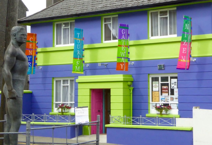
Banners up

The new Ballydehob Tourist Information Centre

Castle in the mist

Kilcoe Castle in the mist

Colours of West Cork

Toormore – the colours of West Cork

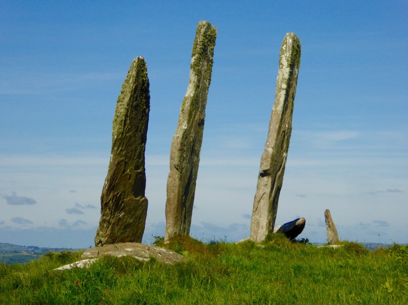
The Fingers

The Fingers, Gurranes, near Castletownshend

Summer in Goleen

Summer in Goleen

Three Castles

Three Castle Head

Black Castle

Black Castle, south of Lowertown

Mizen North Colours

North Side of the Mizen

Sun sets over Long Island

The sun goes down over Long Island

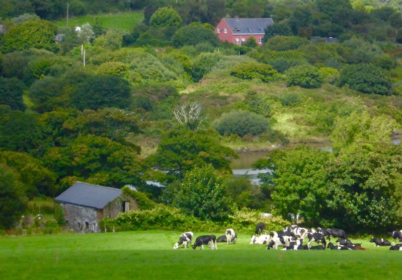
And an extra – one of my own favourites from this year. No drama – just a quiet sunlit meadow, an old stone barn and a colourful house. My West Cork.

Eugene and Margaret'sIn case you missed it, here’s a link to Part 1 of this two part exploration of West Cork in photographs.


West Cork in Photographs – Your Favourites, Part 1

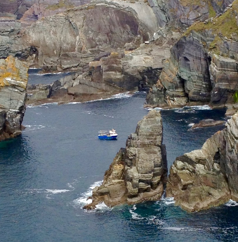
Navigating Mizen Head

A fishing boat navigates the rocks of Mizen Head

Our Roaringwater Journal Facebook Page features lots of our photographs of West Cork – two or three every week – and we know by the views and the ‘likes’ the ones that capture your imagination. It’s become a tradition here with us at the end of the year to go through them all and show you the top choices. Think of it as our Christmas present to you, our wonderful readers – nothing to read, just images of our gorgeous part of the world to drool over. Of course, we have our own favourites too, even if they didn’t get as many likes as others did, so we sneaked a few of those in here two. This is the first of two posts – the next one in a few days.

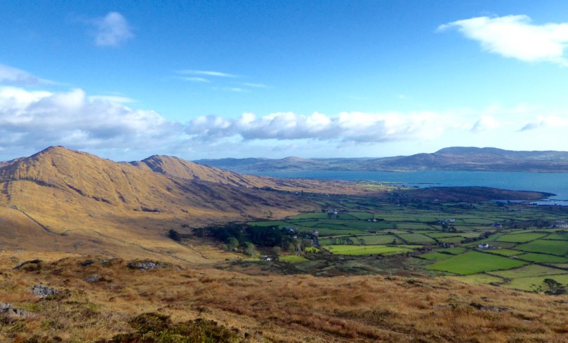
Sheeps Head November Day

Sheep’s Head

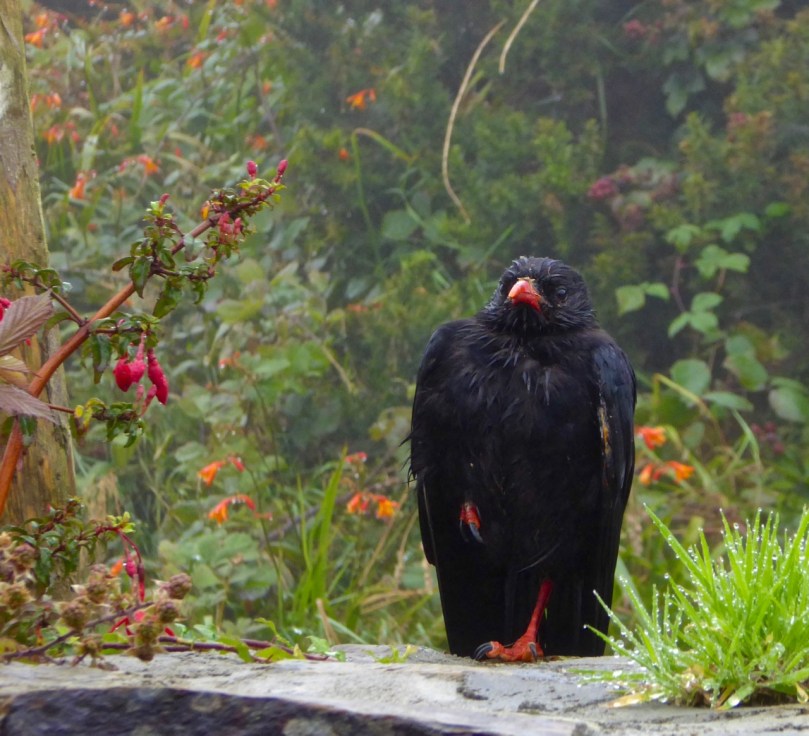
Chough by the Gate

Chough in the rain

Fastnet in the sunset

Fastnet Lighthouse at sunset

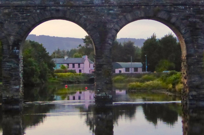
2 0f the 12

Two of the arches of Ballydehob’s famous Twelve Arch Bridge

Roaringwater Bay from Sailors' Hill

Roaringwater Bay from Sailor’s Hill above Schull

Gougane Oratory 2

Gougane Barra in the autumn

To the Mass Rock, Sheeps Head

Walking to the Mass Rock, Sheep’s Head

Kealkill 2

The archaeological complex at Kealkill – a five stone circle, a standing stone pair and a radial cairn

Rossbrin Dawn

Rossbrin Cove dawn

The next batch (Part 2) is now up. Enjoy!

Drombeg Solstice Celebration

Setting

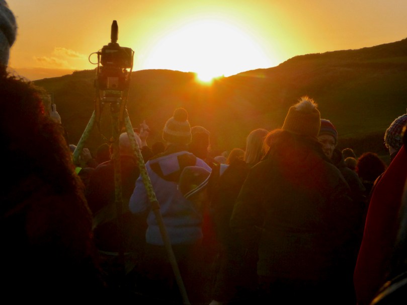
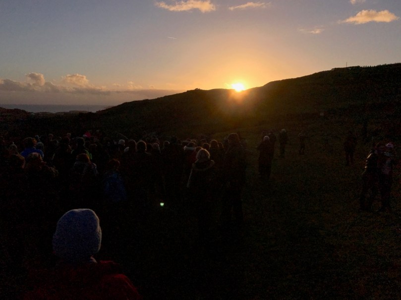
At sunset on the winter solstice the sun sets over the recumbent stone at Drombeg Stone Circle, near Glandore in West Cork. That is – if you stand looking between the two portal stones, you will see the sun set in a notch in the opposite hill and over the recumbent stone which is diametrically across from the two portal stones.

approaching 2 RH

For a full explanation of what I’m talking about here and for more about how and why stone circles were constructed, see our post Ancient Calendars. And take a look at Shadows and Stone in Action for our record of the same phenomenon, except at the autumn equinox, down the road at Bohonagh Stone Circle.

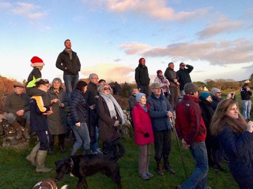
Watching

This solstice was the first opportunity Robert and I had to see the Drombeg phenomenon and what an evening we had for it – clear skies and a glowing sun. What’s lovely about this every year is that local people turn out to witness the solstice sunset at a stone circle designed by Bronze Age people perhaps three or four thousand years ago and still functioning the same way millennia later. It’s our West Cork Newgrange.

Meaden 2

Terrence Meaden (above) was there – a physicist and archaeologist, he’s been researching and writing about the calendrical aspects of Drombeg for several years now. Tirelessly visiting at all times of the year, his research compellingly illustrates how the builders planned the placement of the stones to maximise shadow-casting at the eight cardinal points of the calendar – solstices, equinoxes and cross-quarter days. While I don’t agree with a couple of his conclusions, he has done us all a service by encouraging us to look afresh at a monument we thought we knew.

Drummers

There was a lovely, community feeling to the hour we spent at Drombeg. People kept arriving and greeting one another in a sociable way. Kids ran around, a couple of drummers kept up a steady beat, and a group was holding a meditative circle that including some harmonious humming.

Final Moment

Anticipation mounted as the sun sank lower, there was a final good natured jockeying for position to get the best shots, and a collective sigh as the sun finally disappeared into the cleft.

Last Rays

It felt good to be part of something that West Cork people have been coming together to celebrate for thousands of years.

Your Favourite Posts of 2016

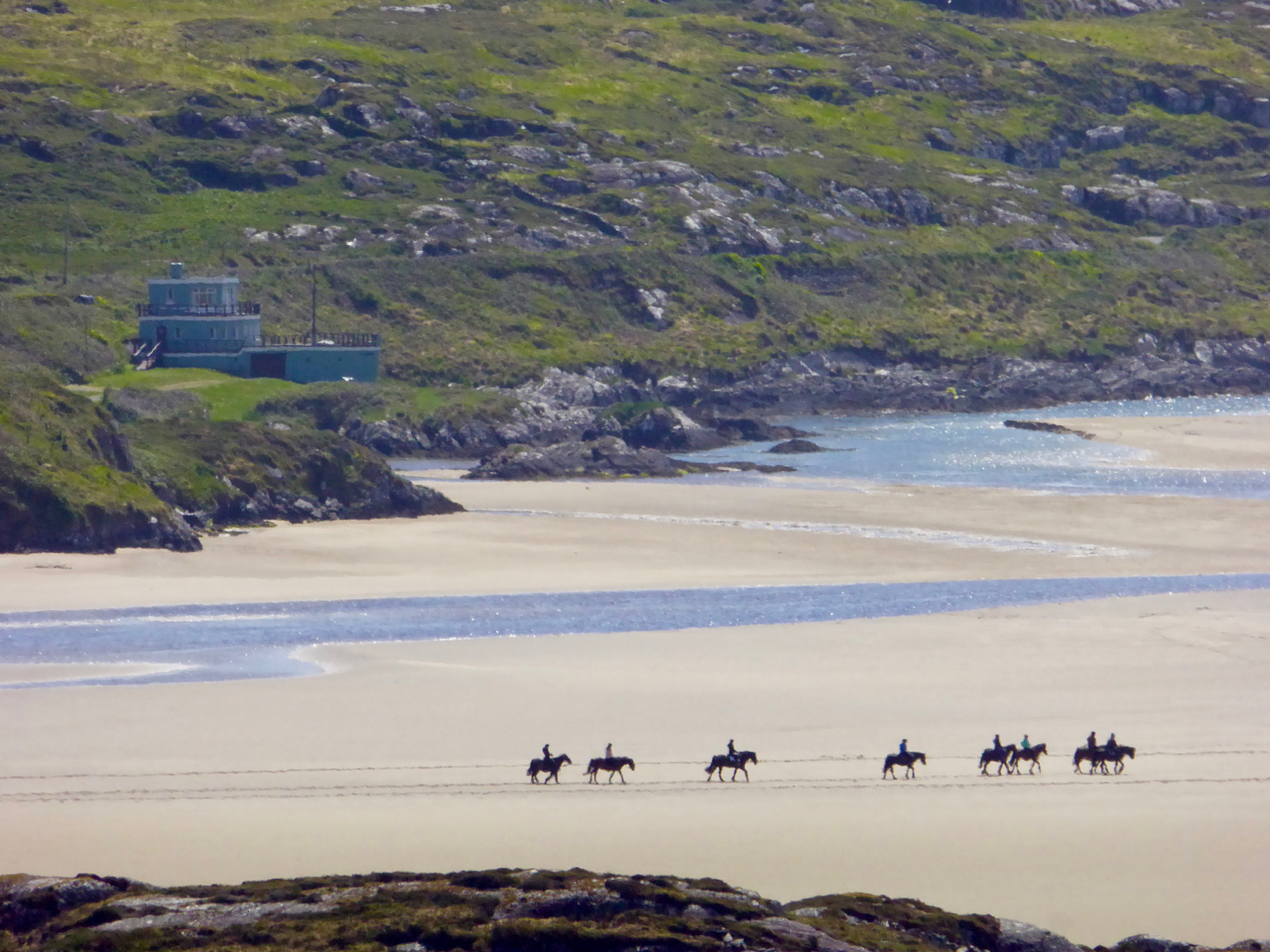
Horses at Caherdaniel

It’s that time of the year again! The wonders of technology enable us to know which of our posts have received the most views: we can see how many people clicked on each article although we don’t specifically know who you are! This is great for us, because we can get an idea of what you – our readers – like to see and this helps us when considering what to write in the future. Not that we necessarily always respond to the statistics, because sometimes we just think there are things that you need to know about, regardless of their potential popularity or otherwise!

Not in the ‘top ten’ – but through the year Finola has expanded – and passed on to you – her knowledge of the wildflowers that make the hedgerows and verges of West Cork so colourful (bee in fuschia, left), while Robert has used the Olympic year of 2016 to examine the history of some sporting events in Ireland (Tailteann Games 1924, right)

So, during this year, Finola and I have published exactly 100 articles for Roaringwater Journal: that’s almost one each every week. It’s fascinating for us to look back and see where we have been, what turns our interests have taken, and of course to see how well (or otherwise) our writing was received. Statistics are one thing, but it’s your comments that really inform us – so keep them coming…

From Outposts of Empire: memorials in St Barrahane’s Church, Castletownshend (left) and St Patrick’s Cathedral, Dublin (right)

Top of the board are two posts from Finola: one from the beginning of the year – Outposts of Empire, which researched and reviewed some of the monuments that are to be found in Protestant churches, cathedrals and graveyards in County Cork and Dublin. It’s a rich history of often only distantly remembered soldiers and battles. Why is this such a popular post? Perhaps because 2016 has been the focus for commemorations: the centenary of the Easter rising, and the fact that one hundred years ago many Irishmen were dying in the Great War. That has rather coloured the whole year in Ireland and Finola’s post – which also mentions some of the experiences of her own family – probably touches on many fertile memories.

Skibb men

How are ye keeping?

The next post in popularity dates only from last week: Finola’s latest humorous exploration of how people speak in West Cork – How are you keeping? This has become our top ‘viral hit’ on our Facebook page with thousands of views and 69 shares to date… Finola describes it as her ‘latest instalment of the How to Sound Like You’re From West Cork course’. The fifth of the series so far, it’s hilarious and has clearly captured the imaginations of our local readers.

key

Fourknocks, Boyne Valley: fetch the key and let yourself in…

To balance things out a bit the next two posts in popularity have come from Robert: Aweigh in Kerry – which delighted in the discovery of a boat-shaped house (pictured on the page header – an architectural gem) – and Fourknocks – the Little Giant, an account of a very unusual archaeological site in the Boyne Valley, north of Dublin. We were very taken by this site and its eccentricities: in order to gain access we had to collect the key (from a farm a mile away – and leaving a deposit of 20 euros) and let ourselves into the tomb which has some beautiful rock carvings.

East Window and Apse

Magnificent mosaic work in the Church of the Ascension, Timoleague

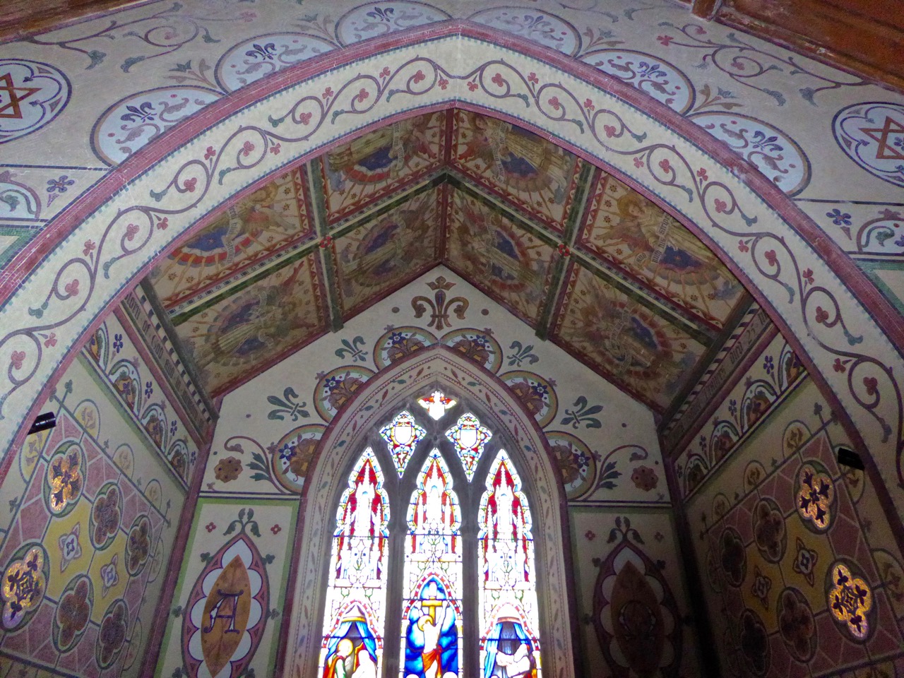
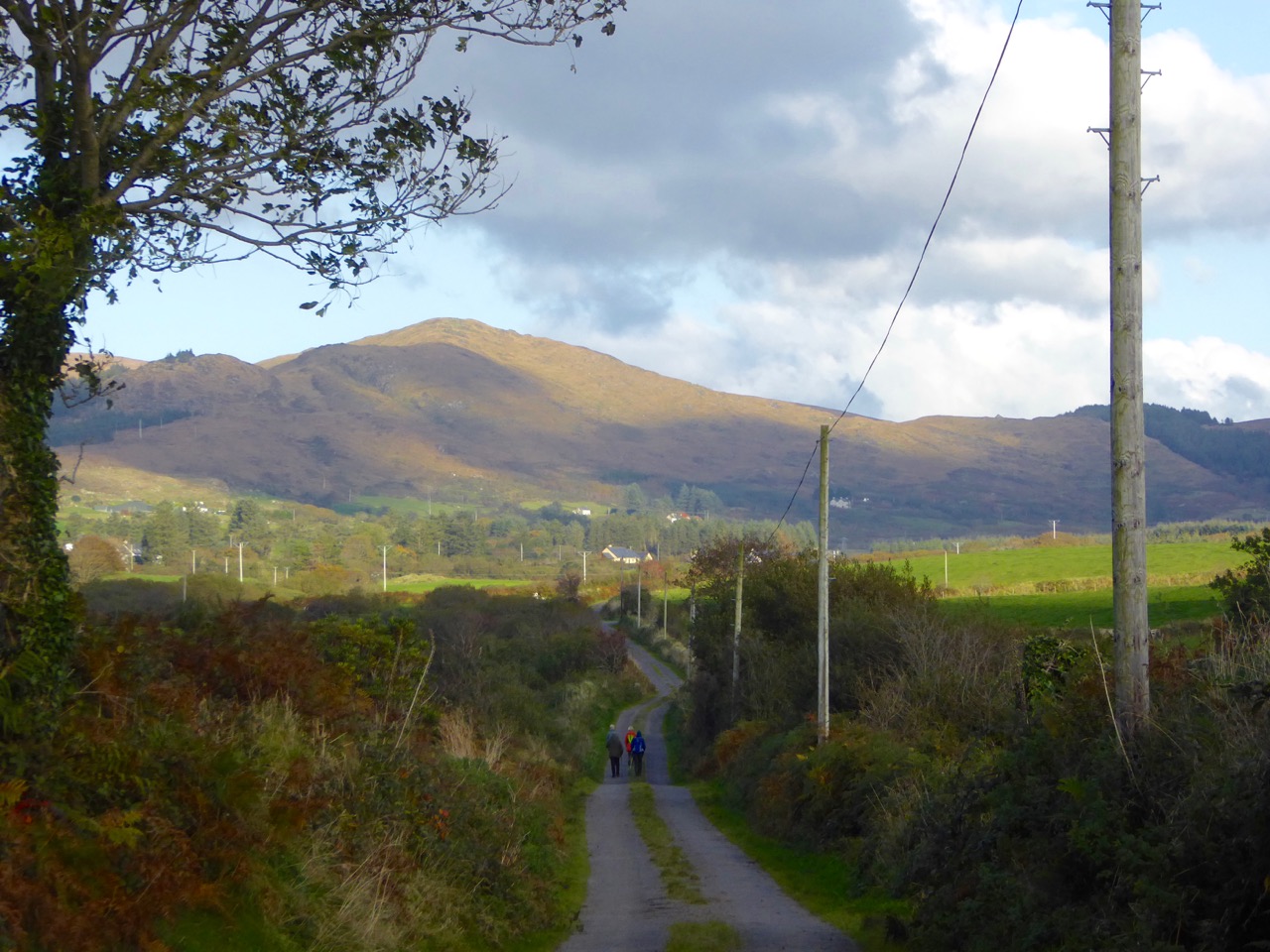
Next up is Finola’s Mosaics and Maharajas – an exploration of a wonderful church in Timoleague with walls decorated in mosaic tiling. But there’s also a strange and poignant story which this church reveals to us (read the post)… And – what’s in a name? Well, perhaps the more bizarre – or seductive or beguiling – the title of a post is, the more hits it gets! Finola’s The Murdering Glen (a valley north of Bantry, again, with a story attached) certainly attracted a lot of attention.

On the walk

looking towards west

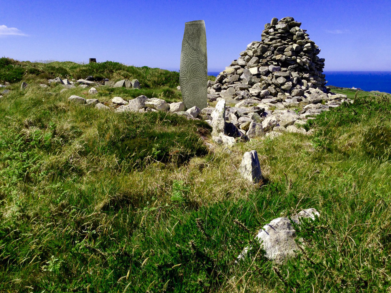
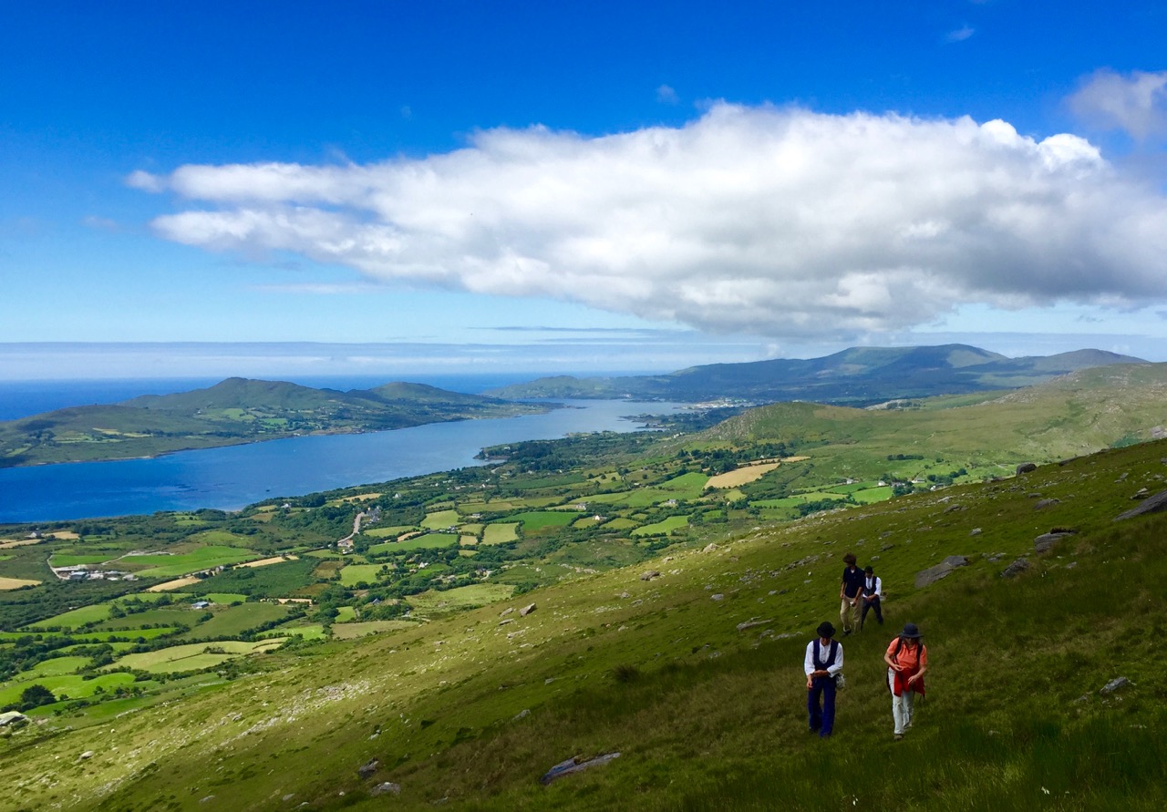
Upper picture – the murdering Glen; lower picture – Robert’s imagining of the Cape Clear Stone restored to its rightful place on the island…

Robert’s report on the passage tomb on the summit of Cape Clear – and the story of the carved stone that’s now in the Cork Public Museum comes next: Cape Clear – the Stone that Moved, closely followed by Finola’s post on the historic walled town of Youghal in East Cork: Youghal’s Walls. Then we had ‘Auf der Waltz” – The Journeymen, a popular piece about two German apprentice blacksmiths who passed through West Cork this summer as part of their three year travels through Europe gaining experience towards becoming masters of their trade. This was also written by Robert.

on hungry hill

The Journeymen exploring beautiful West Cork: Hungry Hill (photo by Dietrich Eckardt)

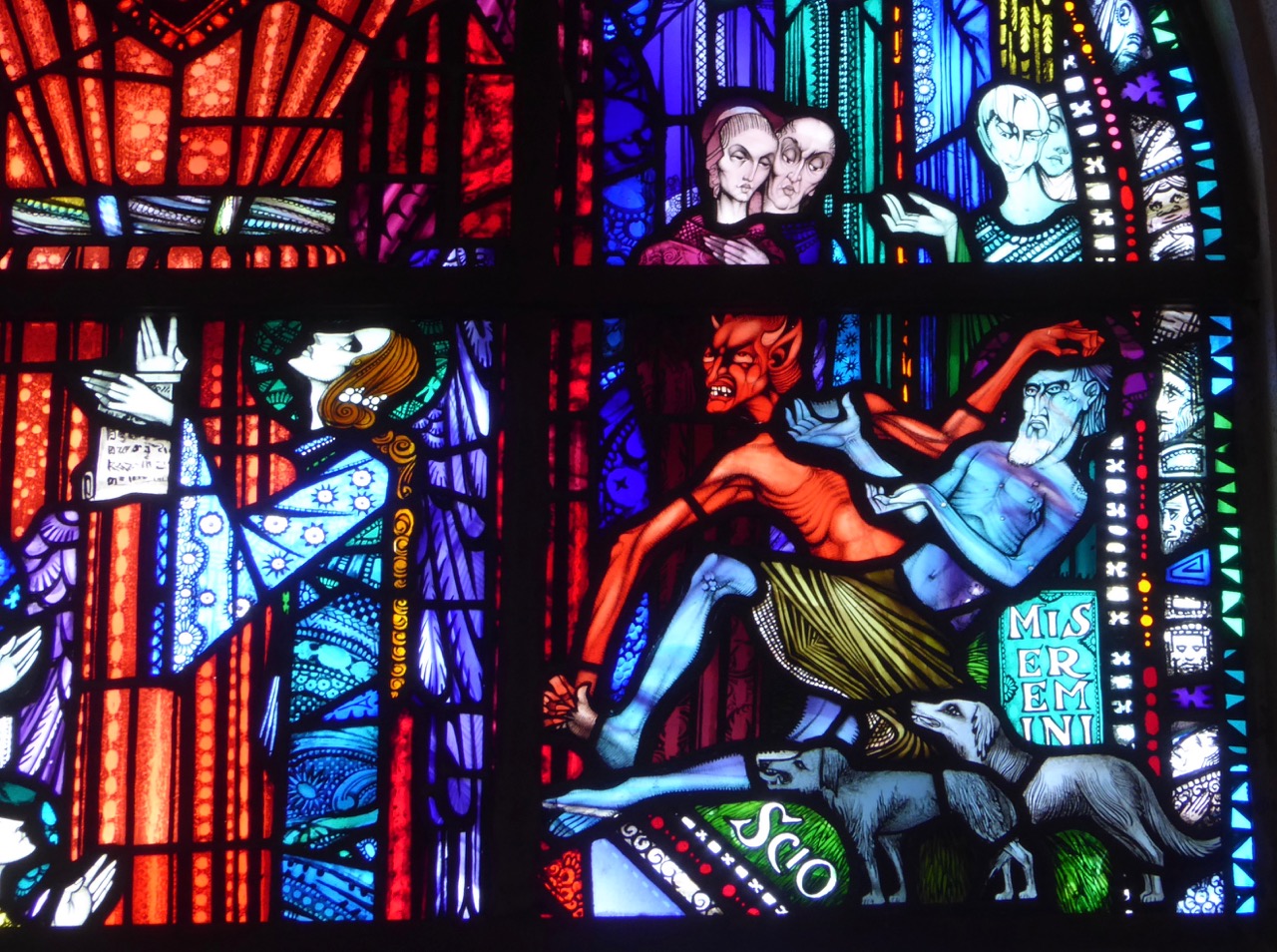
Rather than list all the other posts in some sort of ‘order of popularity’, let’s round up with our own favourites. Finola has been enthusiastically researching stained glass windows in churches – wherever we travel. Besides her continuing respect for Harry Clarke – probably Ireland’s finest artist in this medium – she has discovered the identity and work of artists who inherited his mantle when he passed away (far too young) in 1931. The Harry Clarke Studios continued on until 1973 and also produced some stunning work. Have a look at Discovering Richard King to appreciate just one of the artists who followed after Harry. Another of Finola’s great posts on this medium – The Christmas Story, One Window at a Time – appeared only two weeks ago.

HC Studio, Athlone

The spectacular stained glass work of Richard King, a small detail from Sts Peter and Paul’s Catholic Church in Athlone

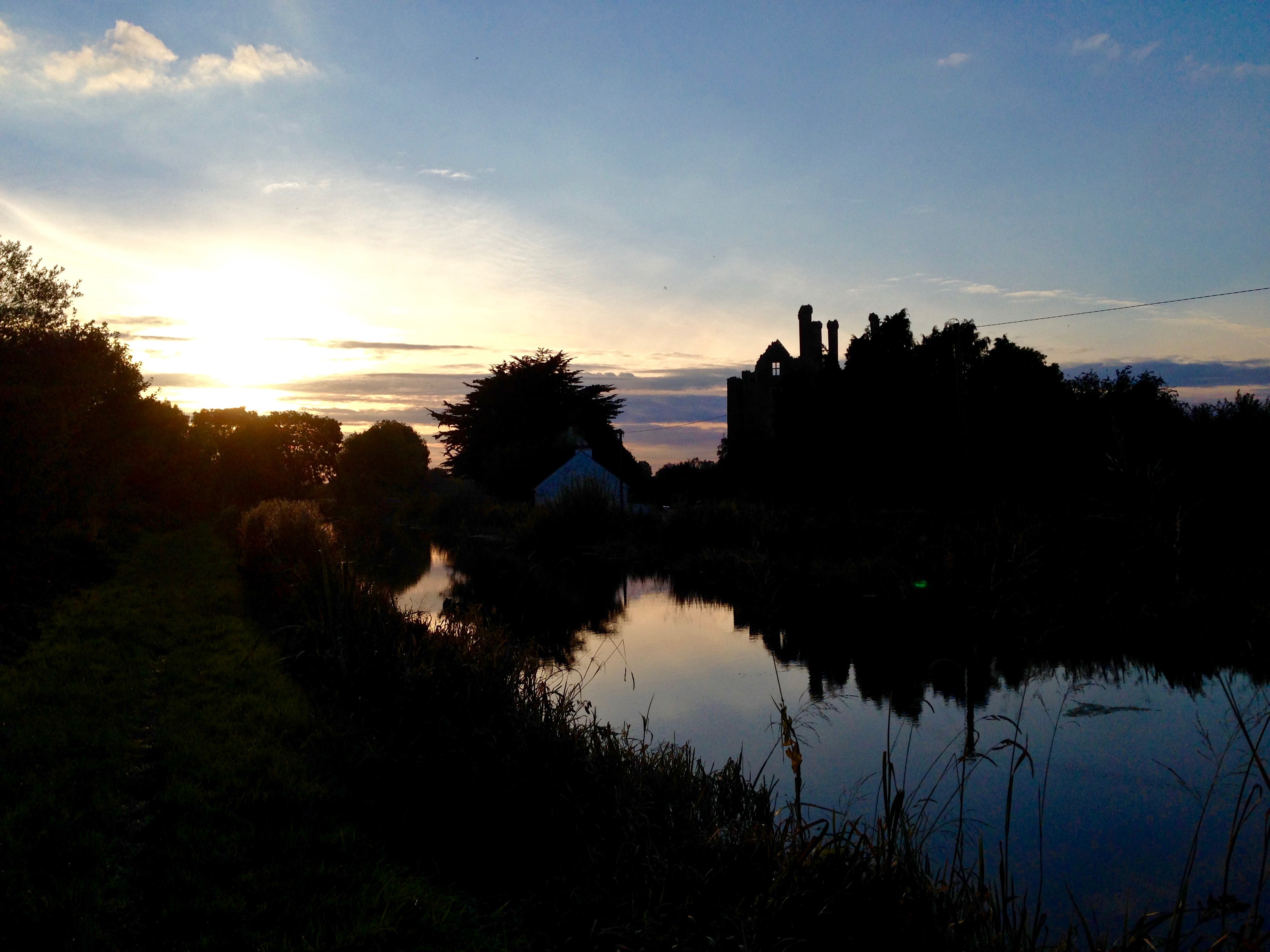
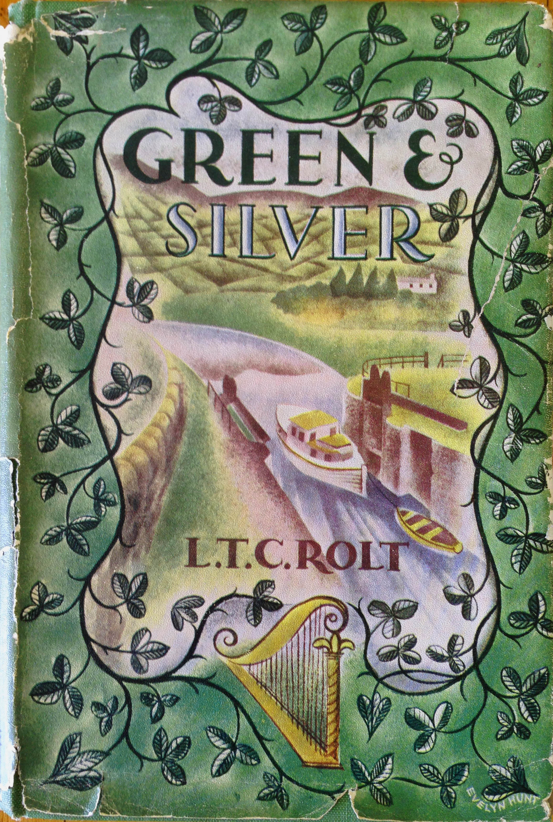
For myself, the subject that has engaged me most this year is my Travel by Water’ series: seven posts (so far) on the Irish Canals inspired by my review of Green & Silver – a book which I was given as a prize at school in 1963! We retraced the steps of L T C Rolt, the author of the book, and his wife Angela who took some very atmospheric photographs as they travelled around the Irish waterways in 1946 – exactly 70 years ago. To celebrate my own 70th birthday this year we attempted to replicate each of the photographs as closely as possible with present-day views of the same scenes. The venture has turned out to be a real social history of Ireland and the changes that have happened during that interval of time.

ballycowan sunset

Travel by Water – ghostly reflections beside the Grand Canal at Ballycowan

So thank you to all of you – our readers. Without you our work on Roaringwater Journal would have been pointless. With you – and with the value of your comments and discussions – we feel the whole exercise is well worthwhile – so, please, let us know your own personal favourites… We certainly intend to keep the Journal going for a few years yet! Don’t forget, there is a full index in the Navigation Page – here. And, I’m sure you all know by now, anything highlighted in blue is a link to something else: either another one of our posts in the Journal, or to another relevant source of information on the subject. Good hunting!

cover