Sticking with the west end of the Mizen, we will introduce you today to some prehistoric rock art (two very different cupmarked stones), a remote and gorgeous stone pier, an historic mine site with links to the Famine, and finally a headland with sea-arches and an ancient promontory fort.
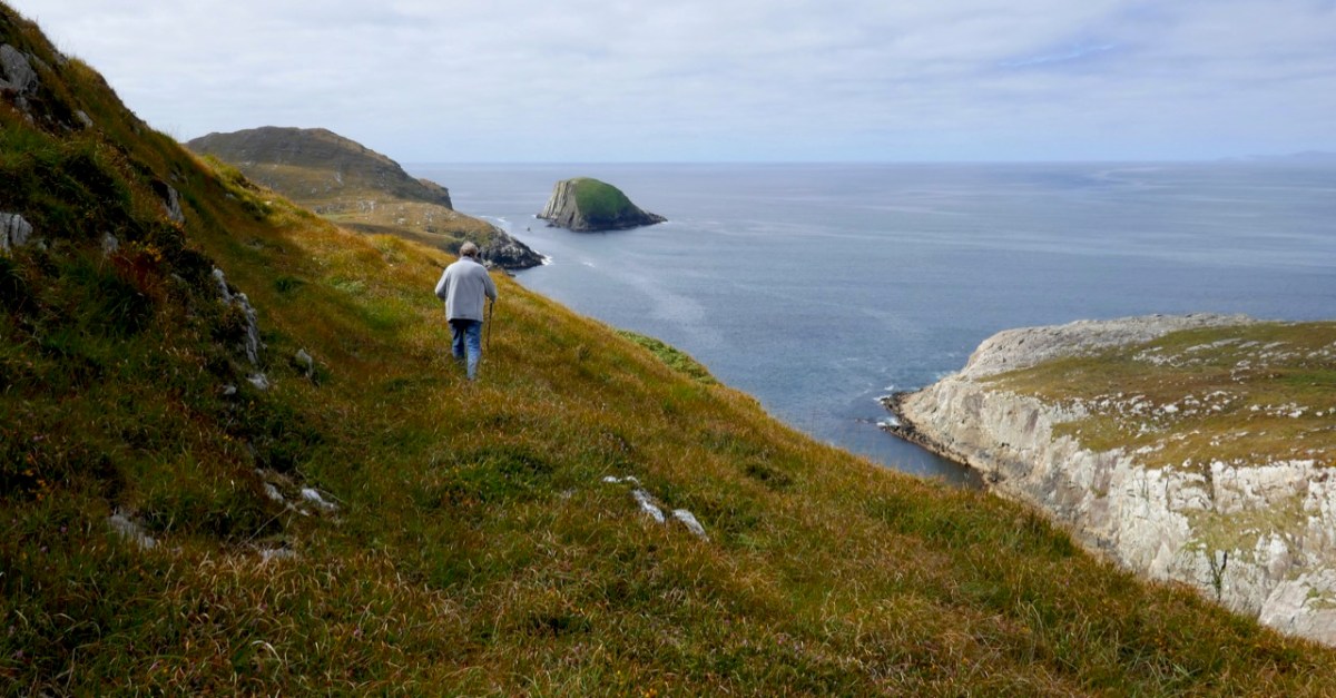
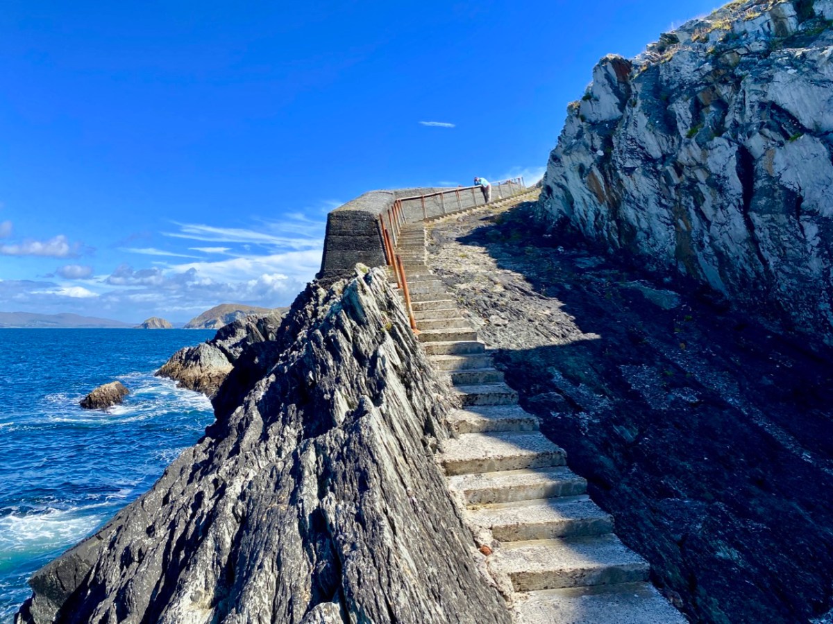
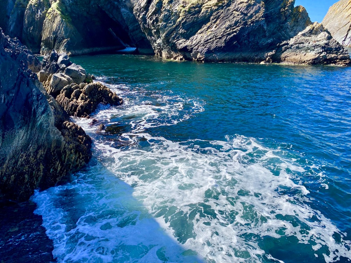
Let’s start with Toor – that secluded and beautiful spot out on the wild northern edge of the Mizen. It’s hard to believe that this was a well-used pier in its day. It has held up well, despite the bashing it gets from the ocean. And there are sea-caves!
Between us we took so many photos at Toor that we ended up making a slideshow, to the Music of Liam O’Flynn’s Joyce’s Tune from The Given Note. This link will take you there.
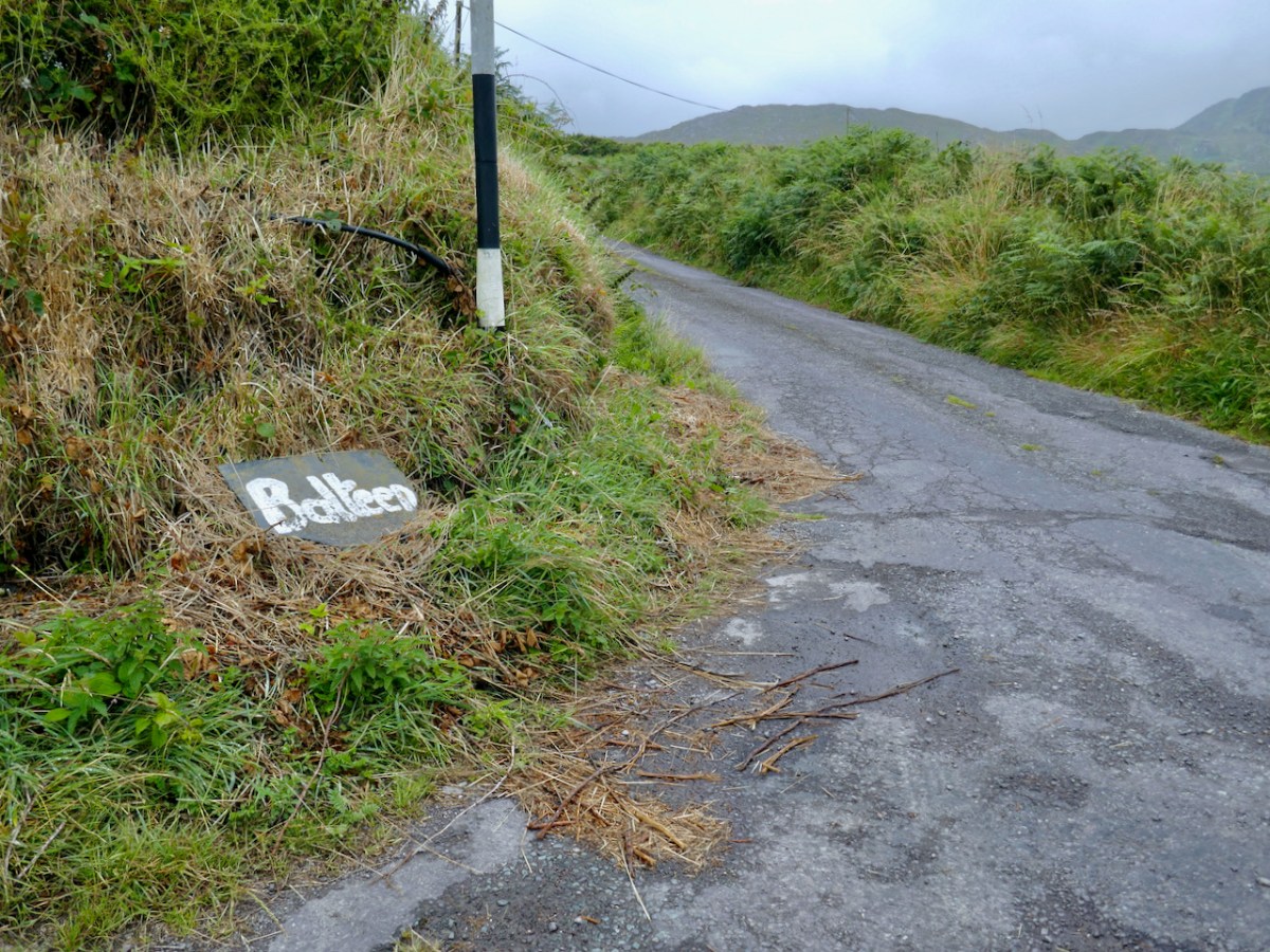
The townland of Balteen has not one but two cupmarked stones, the first built into a ditch by the side of the road. My post was was titled Rock Art and Red Socks, but you’ll have to click on the link to see why. The second rock was on private property but we were welcomed to come in and view it and take photos. I included some videos of both rocks in the post.
The mine, known as Dhurode Mine, was established by the Rev Robert Traill just before the Famine. A complex character, Traill was famously sectarian before that awful event, but redeemed himself with his energetic charity during the Great Hunger, eventually succumbing to famine fever.
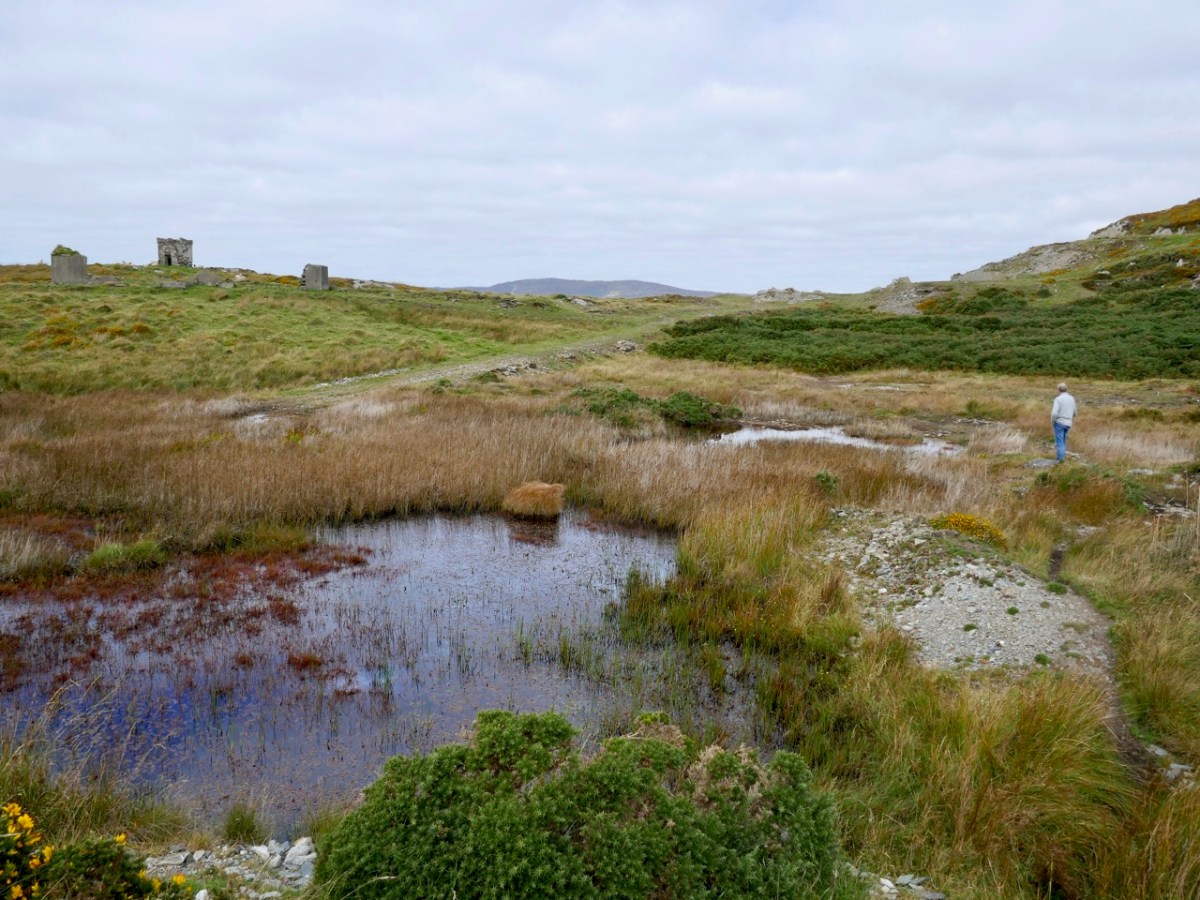
My post was Two Mines Are Better Than One (Mizen Magic 16). There are surprisingly many clues left of the mining activities. There were shafts, now with concrete caps, as well as open cast workings. Now it is silent, except for the call of the sea birds, but still carries the atmosphere of former days.
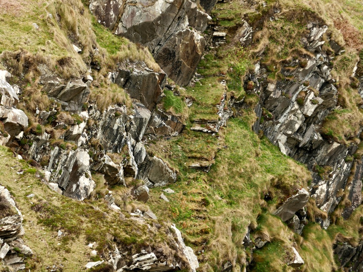
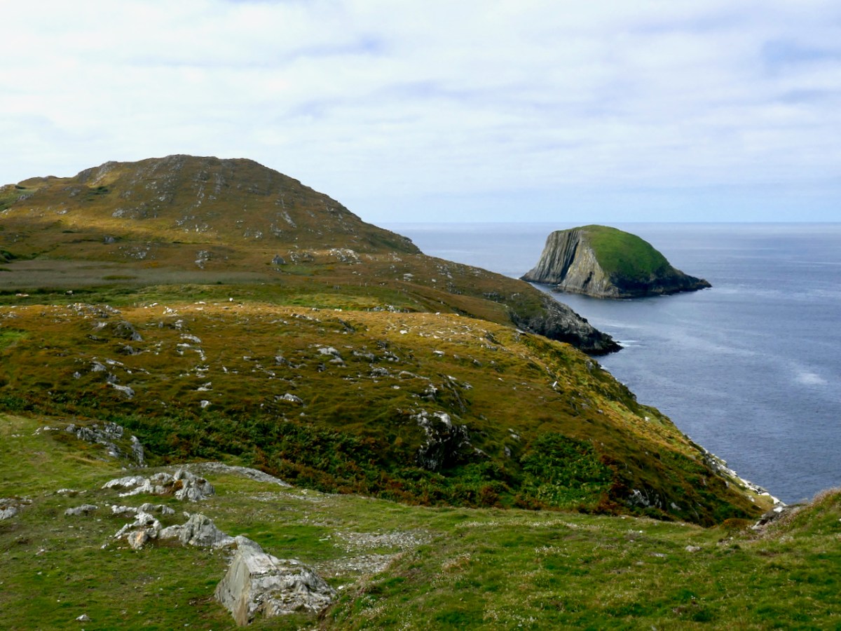
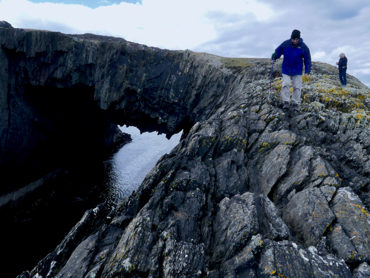
Finally, we have Lackavaun. Sea arches, a promontory fort, still-visible lazy beds, and a clear view to Bird Island. This was a tricky island to get on to, there was no landing place and it could only be attempted in calm weather. The first trip was to collect the eggs of the cóbach (the Black-backed Gull). Once ashore, the men attached ropes to iron bars which had been driven into the rock faces, and climbed down the cliffs to gather the eggs.
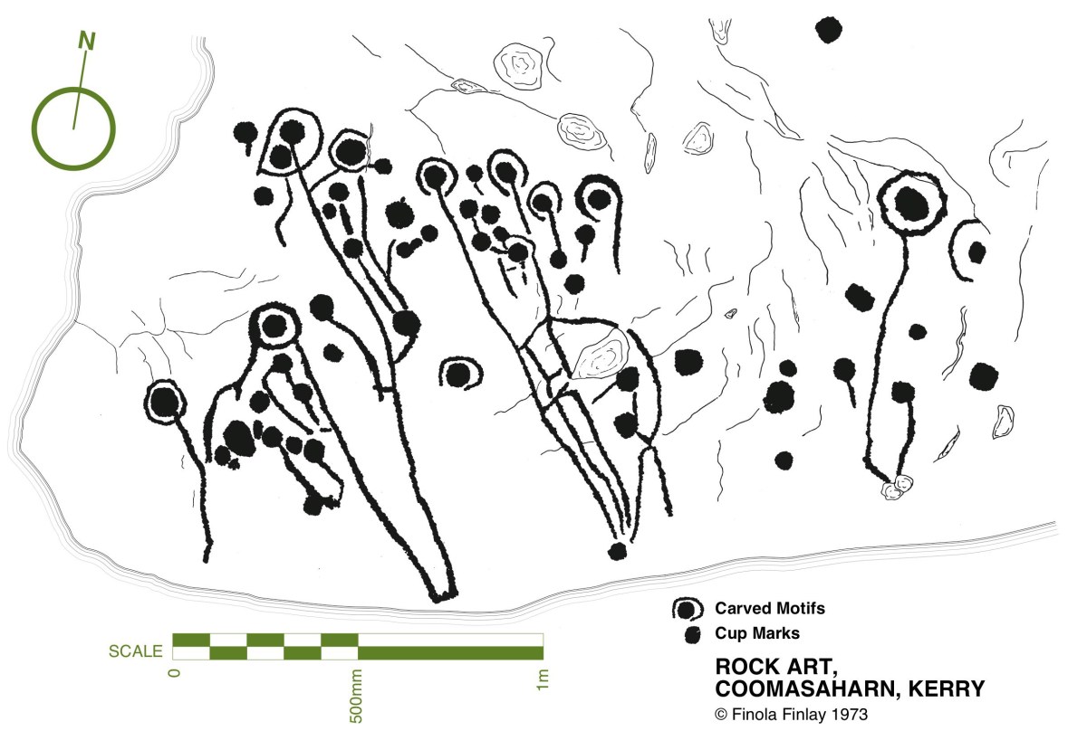
There’s a concentration of prehistoric rock art around Castletownshend and I am currently writing a paper about that for the next issue of the Journal of the Skibbereen and District Historical Society. There are seven individual pieces of rock art: as part of the research I recently visited the one stone I hadn’t seen yet. Fortunately, we had the company and assistance of Conor Buckley of Gormú Adventures (been on one of his marvellous walks yet? If not, try this one, or this one or this one.) who, as a native of the area, knows everyone and introduced us to the landowner, the genial Bill O’Driscoll.
The townland is Farrandeligeen – isn’t that a wonderful name? A dealg is a spine or thorn or prickle, and therefore a deilgín is a small one of those. So it can be translated as the Land of the Thorns, which can be blackberries or blackthorns – and this being West Cork, probably both. An old saying is Is beag an dealga dhéanfadh braon – the tiniest thorn can cause big problems. Thorn in a hiking boot, anyone?
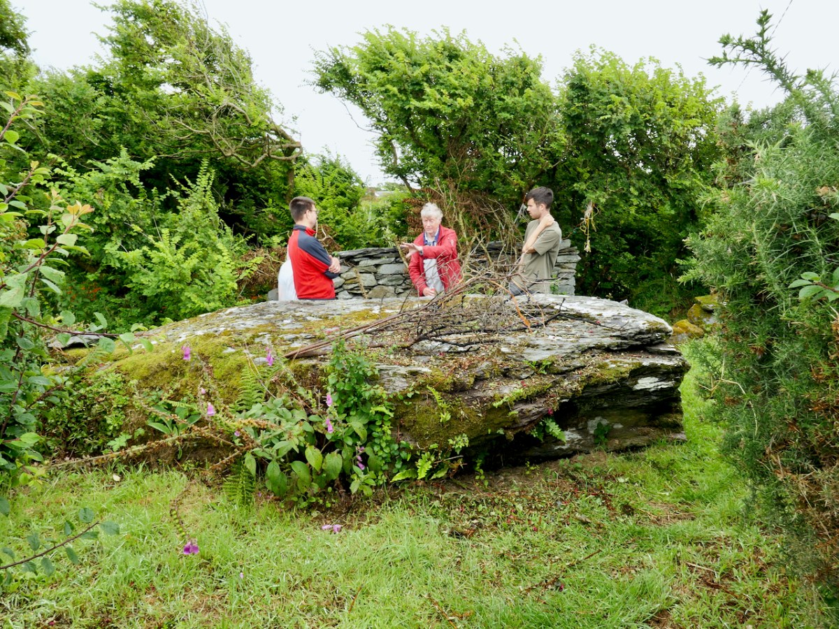
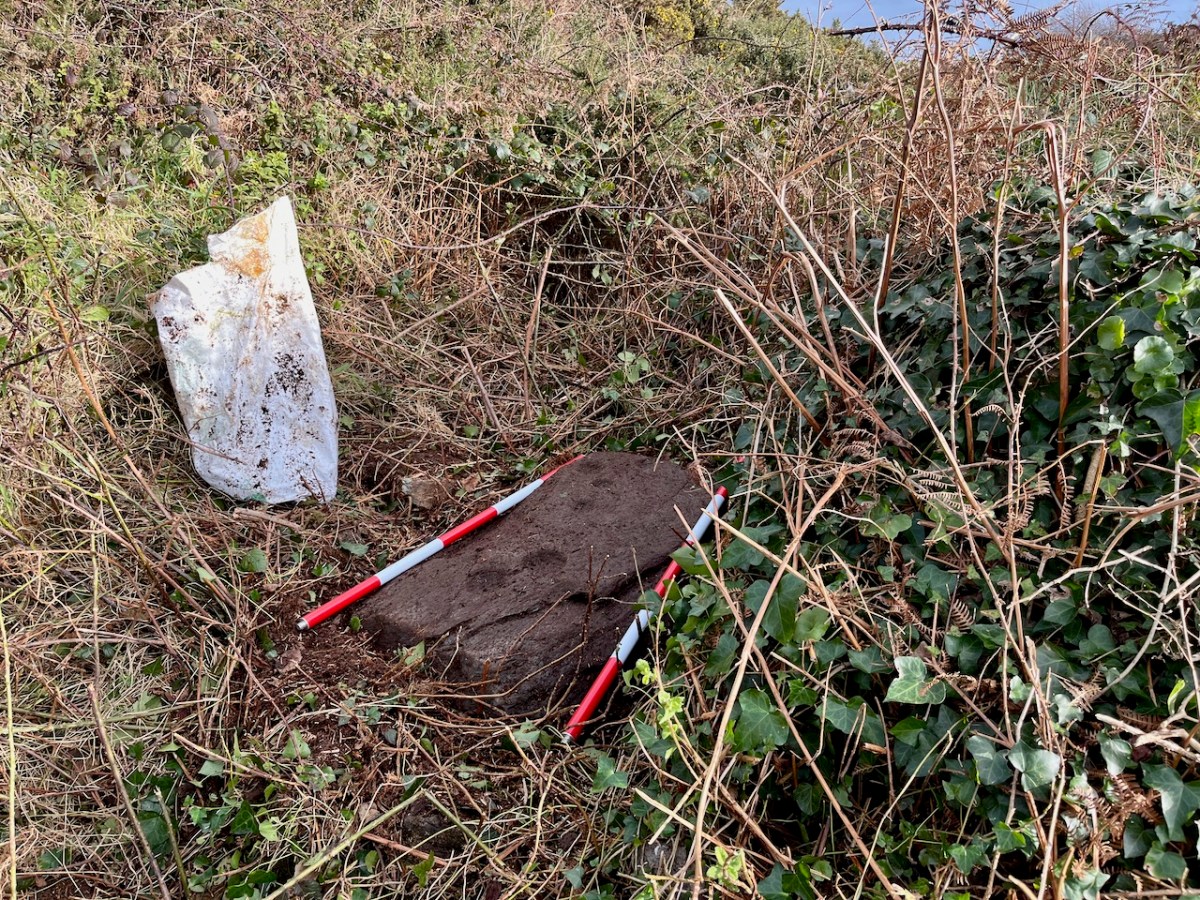
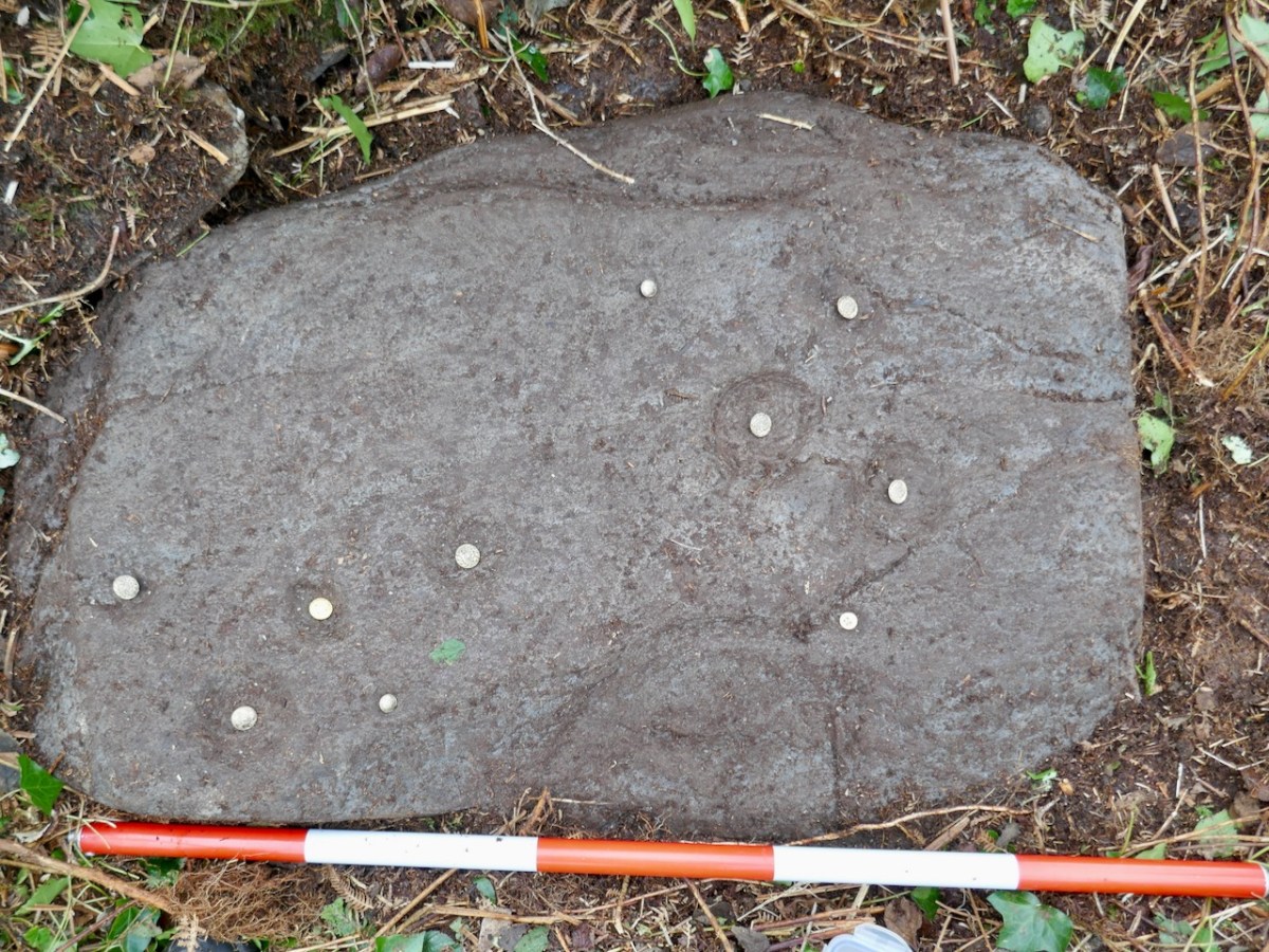
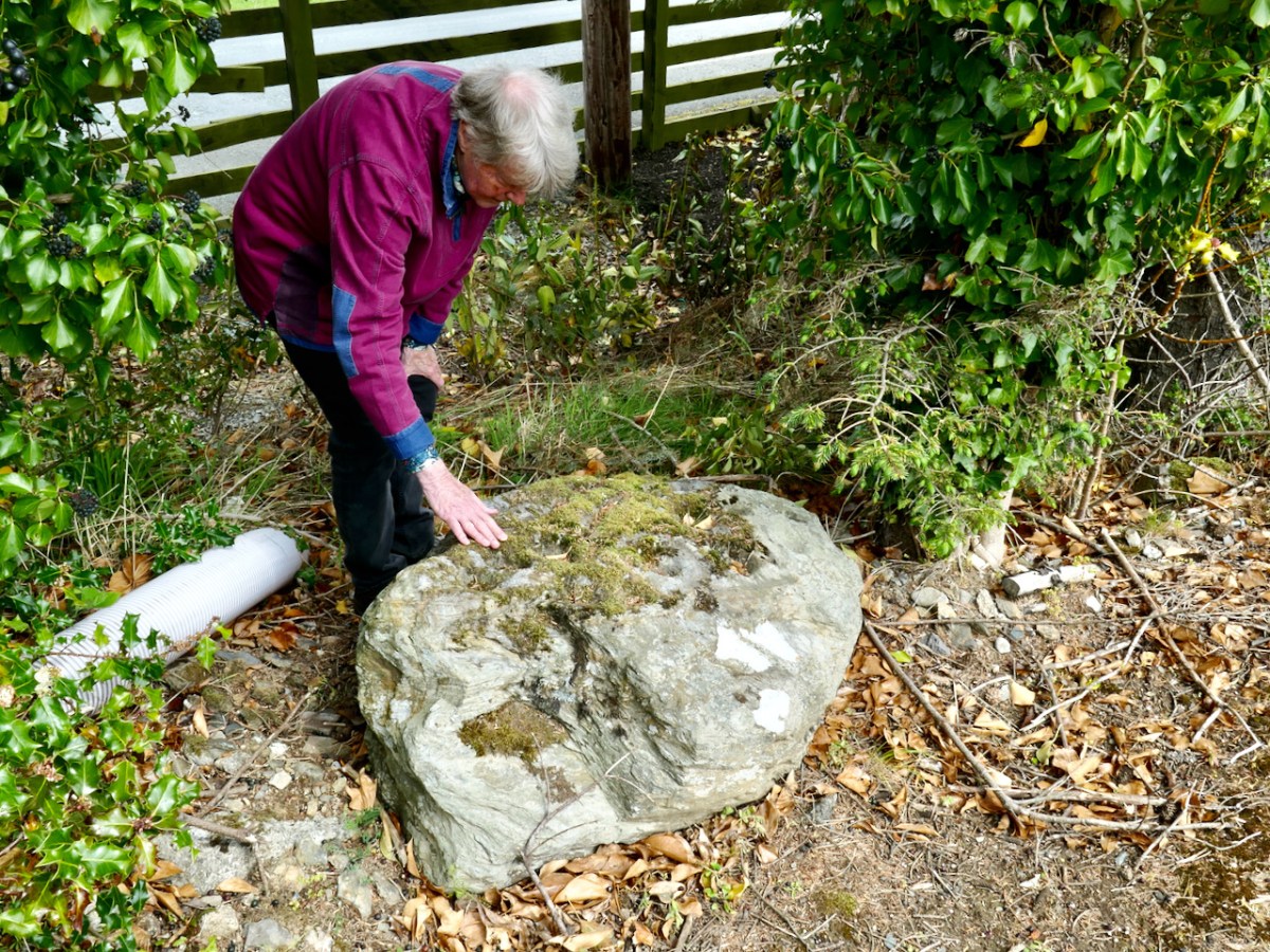
The land lived up to its name. Bill took us to where he knew the rock art was, and that’s when we encountered the deligeen bit. Fortunately he had a stout fork with him, and took to hacking and bashing his way through the thorns, while we stood back and offered encouragement. The first place proved unfruitful and he moved a few metres away and soon struck gold. Among the brambles, earth, gorse and general undergrowth there was a hint of something white. This turned out to be a bag filled with stones – the very bag he had put there to remind him that this is where the rock art was – but so many years ago that it had slipped his mind until now.
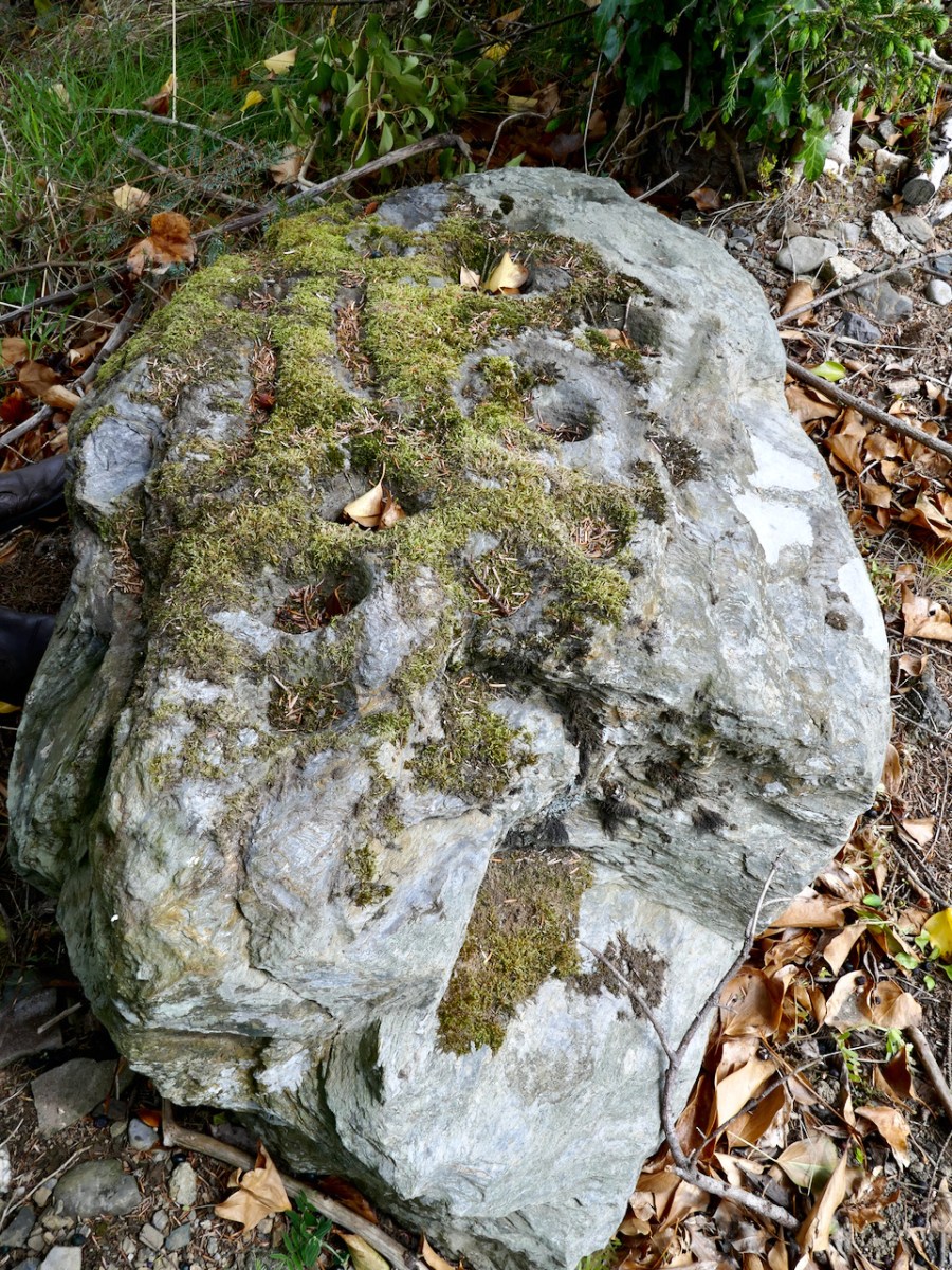
And so the stone gradually came into view until I could finally get down to clearing it off with my gloves. (I was sorry I hadn’t brought the red socks.) This stone is already in the National Monuments Records as a ‘Cupmarked Stone’ (CO151-013) and is described as having ‘at least ten cupmarks’. Bill told us that his father had said he remembered the stone standing upright – it had fallen to its present position flat on the ground since his father’s time.
For more on what a cupmarked stone is, and how it fits in to the general category of ‘Rock Art’, see my post The Complex Cupmark. For now, quoting from that post:
The cupmark is the most basic and numerous element or motif of rock art in Ireland and elsewhere. In the examples labelled rock art in County Cork, they occur with other motifs, principally concentric rings, sometimes with radial grooves, and a variety of curved or straight lines. They can be incorporated within a motif (as in cup-and-ring marks, rosettes, or where enclosed by lines) or they may be scattered, seemingly randomly, over the surface of the rock, between and among the other motifs.
. . . patterns of straight lines, or of rough circles or semi-circles, can be made out in several of the stones we have recorded to date.
Rock art is widespread across the Atlantic coast of Europe and is believed to date from the Neolithic, about 5,000 years ago. The cupmark as a motif, however, continued well into the Bronze Age, since we find it on wedge tombs and boulder burials. We do not know what the significance of the cupmark is, but it must have held a special meaning to the carvers since it persisted over time and space.
We got the rock cleared enough to identify the cupmarks and I put a button in each one to make sure it showed up – sorry, those are not gold coins. Some of the cupmarks are tiny. You can look at the cupmarks as a random scatter, or as in the quote above, you can see two groups, in which a cupmark is surrounded by a semicircle of four others.
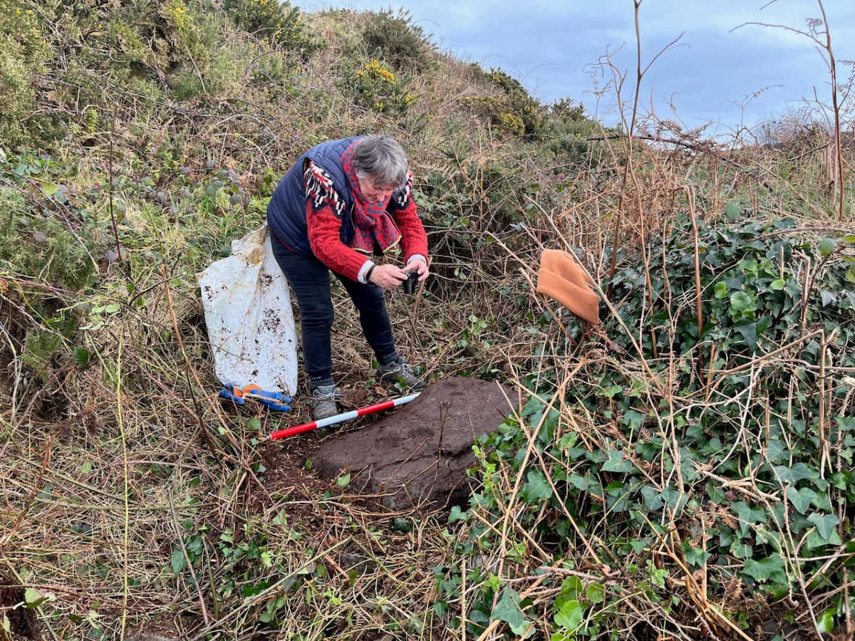
It was hard to get the rock clean enough to see detail so I decided to carry out a photogrammetric survey, the object of which is to end up with a 3D image from 2D photographs. That involves taking LOTS of photos (in this case, 100) of the stone, working my way systematically across the surface of the stone at three different levels, keeping the camera settings consistent.
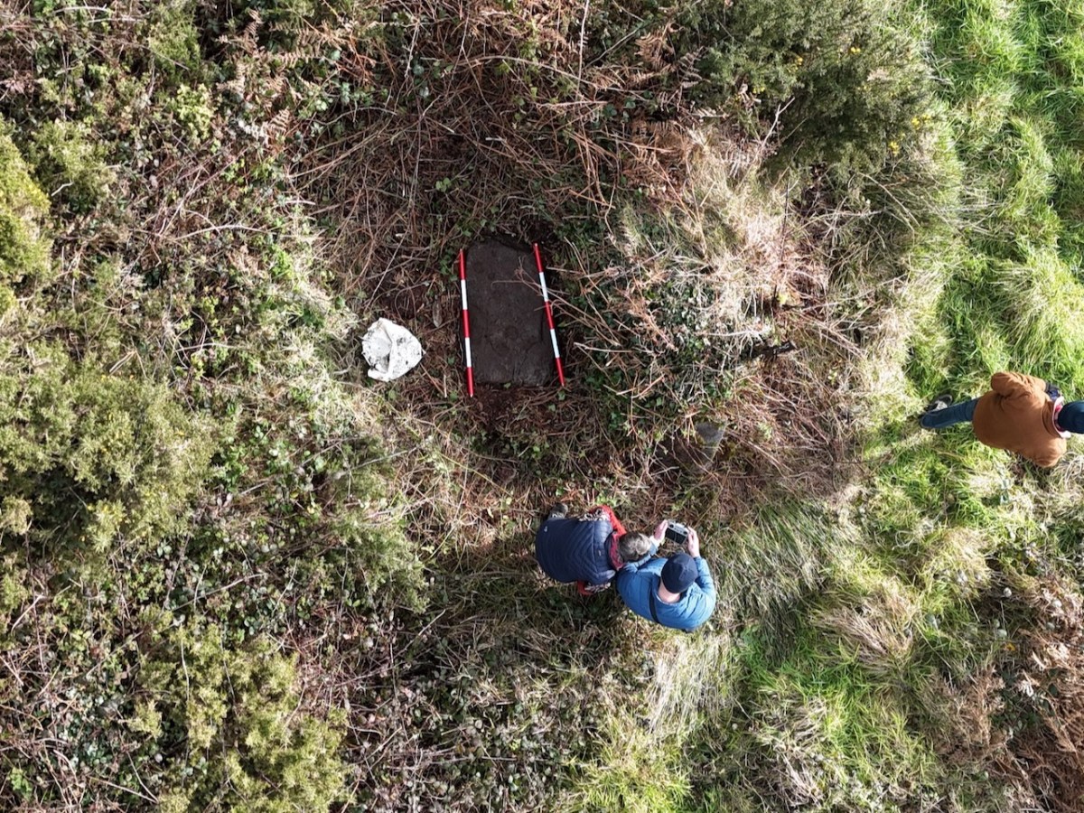
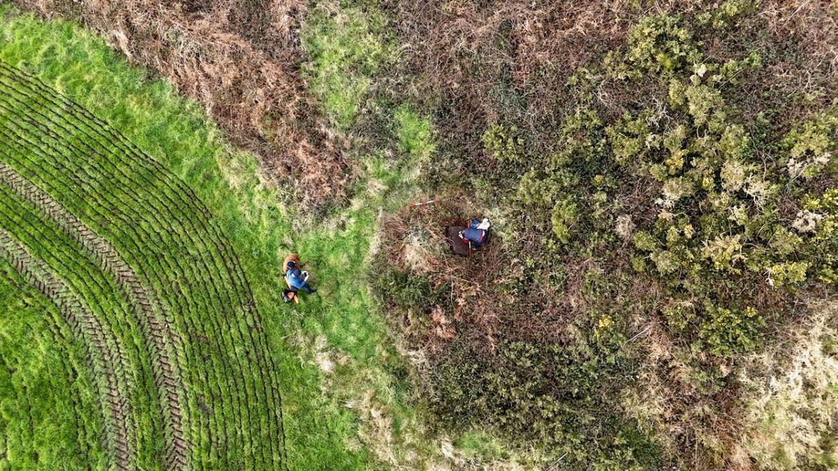
Conor had his drone with him – a new experience for us! He took photos and videos of the stone in its general location, capturing me doing the photogrammetry and also a good indication of the amount of undergrowth that had to be cleared out of the way before the rock came into view. (Thank you, Bill!)
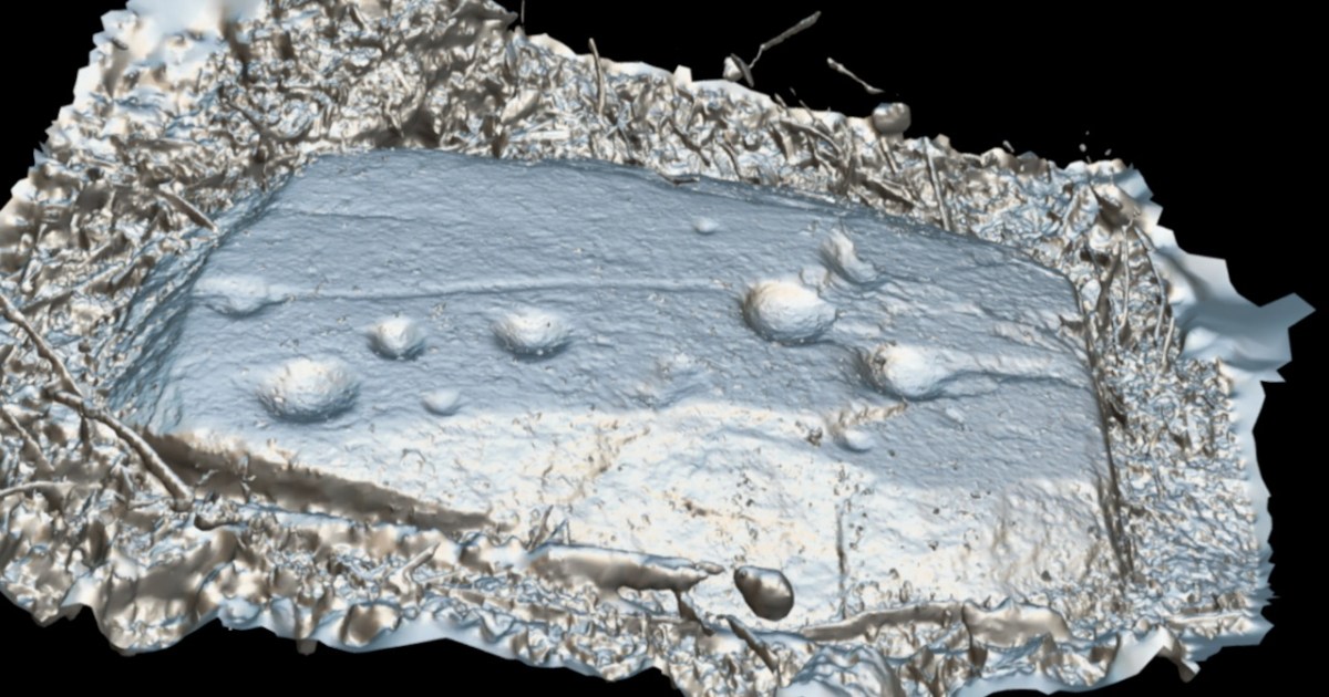
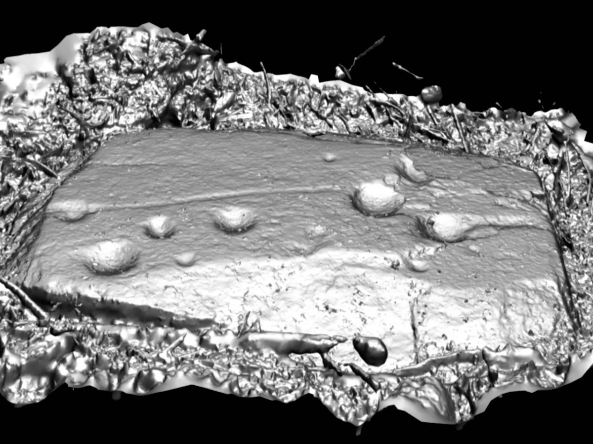
I sent the photographs off to UCC, to the Department of Archaeology, where Nick Hogan generously processed them for me, using the Department’s specialised software. The results are fascinating!
First of all, it looks like there are more than just cupmarks on this rock. A long line stretches from the far left (in this image) cupmark to the right hand grouping. There is a hint of a circle around the bottom left cupmark. The three large cupmarks in the right grouping appear to be conjoined, and there is a line from from the far right cupmark to the end of the stone.
You can view the render in what is called Matcap, which creates it in a metallic view (above and below). On a grey day with no shadows, and still lots of mud on the stone, none of this was obvious to the naked eye. There is a possibility that these new elements, rather than being carved, are natural contours in the rock itself. We haven’t had time yet to go back and check this out more carefully, but we will have to do so – and update this post! If indeed the lines turn out to be carved, that fact will elevate the rock from a Cupmarked Stone to Rock Art. Watch this space.
If you can stretch your memories, think back. We started to write Roaringwater Journal in October 2012. At that time we had just settled in West Cork, and we were anxious to revisit the work which Finola had carried out between 1971 and 1973, when she was studying Archaeology at the University of Cork. For her final thesis subject, she specialised in surveying and recording the Rock Art of West Cork and Kerry.
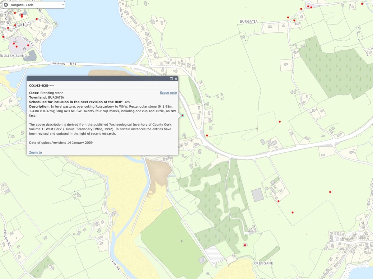
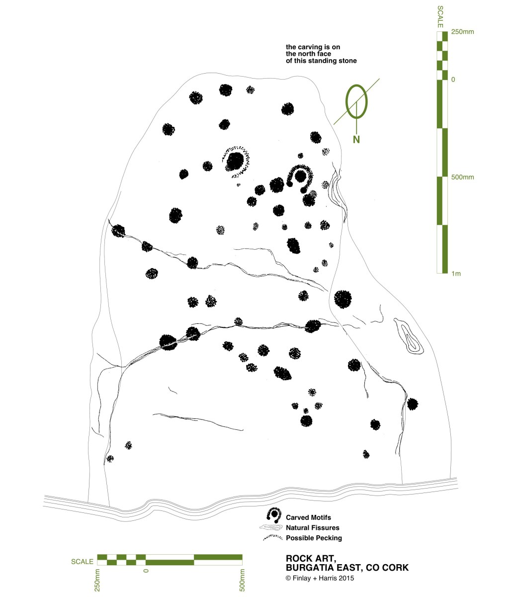
Finola has her thesis, above, and is turning to the page which shows the drawing she made from Burgatia, which is a townland outside Rosscarbery, in West Cork. When Finola was researching, there was only the one standing stone in Burgatia listed as bearing the cup marks and circles of Rock Art. Since the 1970s, however, a further stone has been identified with this feature. It is a standing stone just to the right of the N71 as that road rises from the Causeway as you travel East from Rosscarbery. In Finola’s day, this rock was only identified as a ‘standing stone’. The header picture to this post shows the stone.
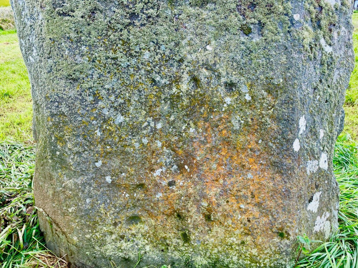
These two extracts from the present day OS map show the entries given for each of these stones – stone 1 at the top and stone 2 below. The current edition of the map now indicates that stone 2 has significant Rock Art on the west-facing elevation. The Archaeological Inventory has been revised and updated twice since Finola’s survey – in 1992 and 2009. One of these revisions has added the information that “…the stone has twenty-four cup marks, including one cup-and-circle, on NW face…”
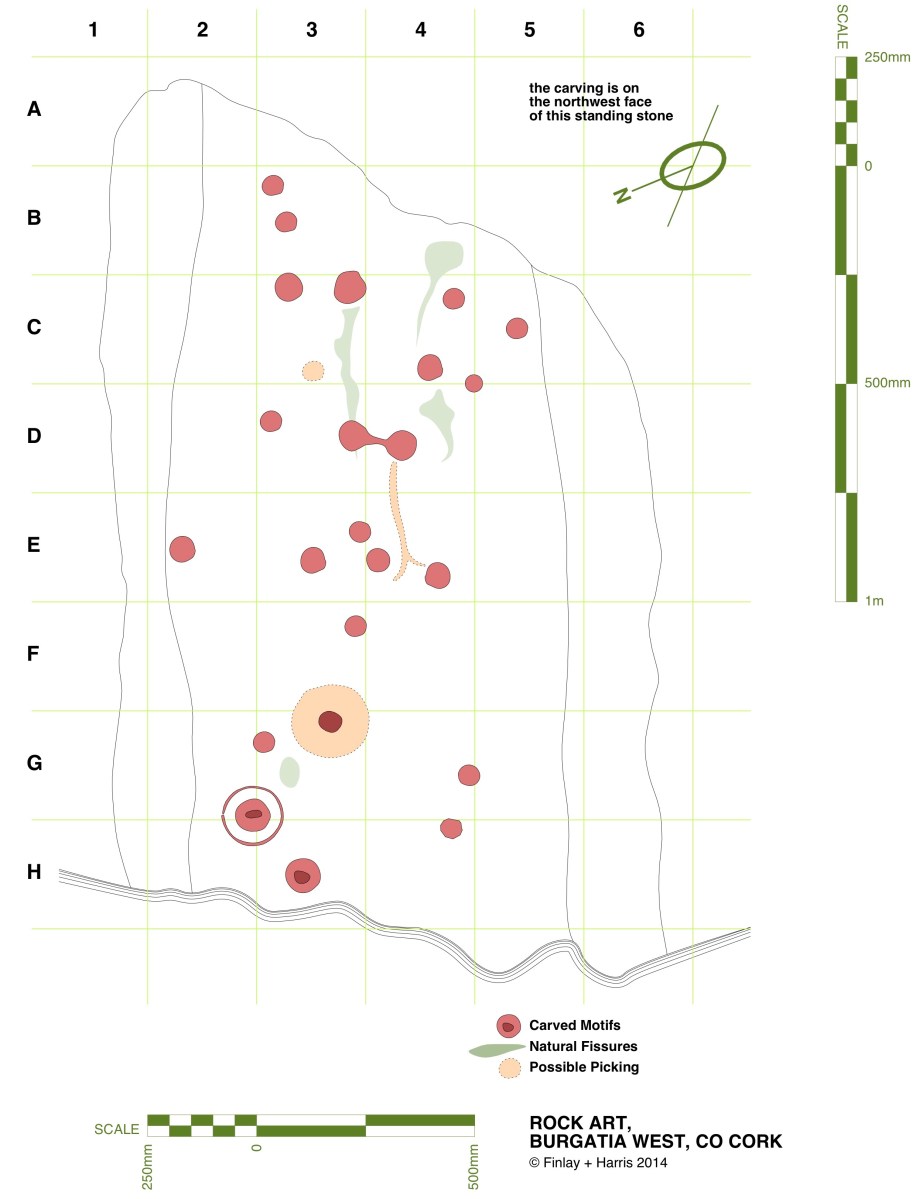
Here is that NW face, photographed this month – May 2023. Many of the cup marks show up well. Back in 2014 we decided that we would fully measure the marked surface of this rock, in order to add to the inventory created by Finola in her University days. Here is my own 2014 drawing:
In the lower picture, I have adapted the same drawing to overlay it on a photograph taken as part of the survey. That was in 2014. Now – nine years later – I believe I have discovered an additional cup mark! Have a look at this close-up of the lower part of the stone:
Comparisons between the two photographs (2023) and the one taken in 2014 (below) show that the level of the ground has apparently lowered in nine years, exposing the additional marking. As the field is cultivated, it is quite possible that there has been some movement of the ground in relation to the rock foundation.
Above – Burgatia 2, January 2014. Note the cup-and-ring mark, and the higher ground level.
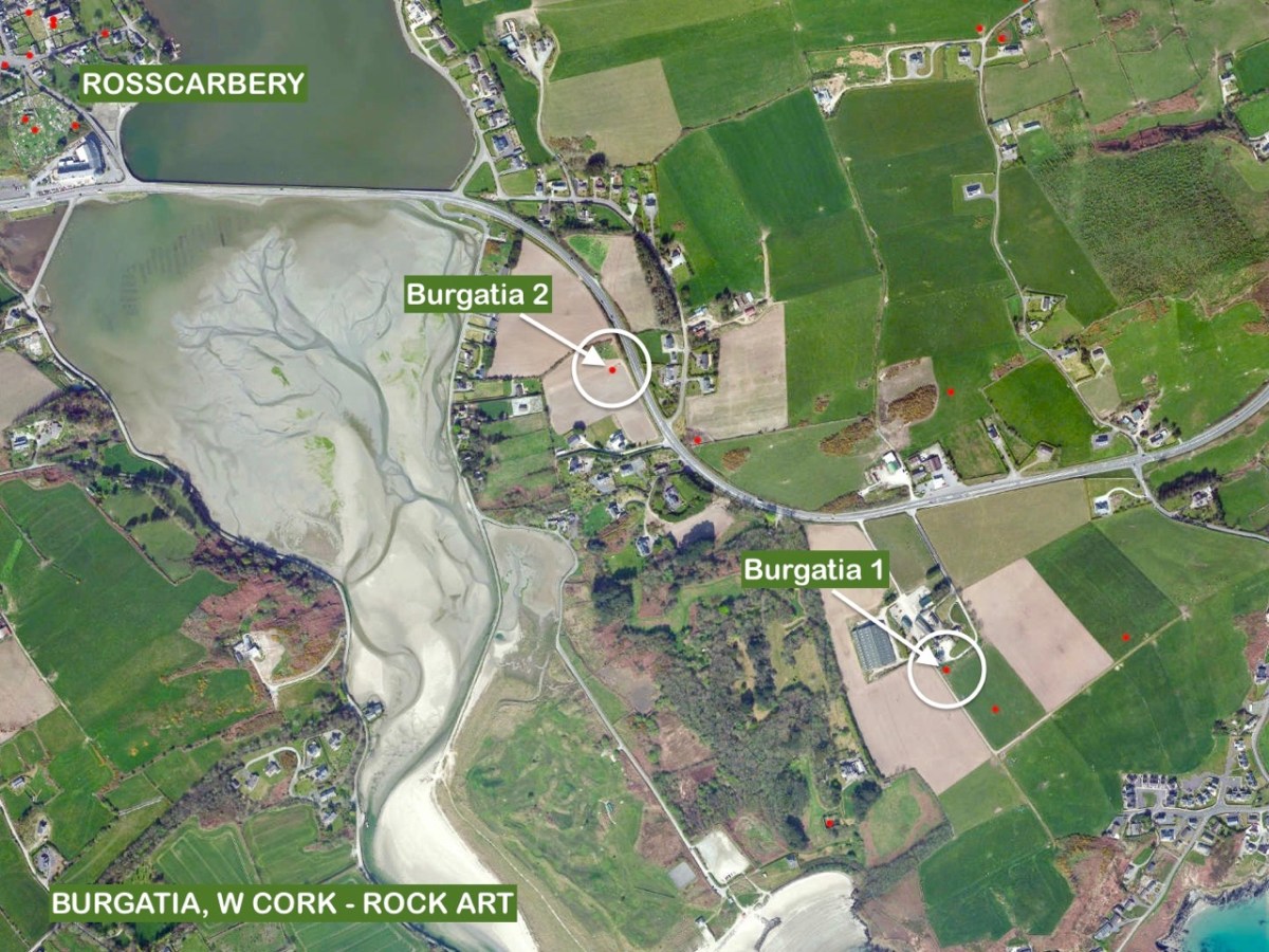
The aerial view, above, shows the relationship between Burgatia 2 and Burgatia 1. As we were revisiting, we also called to have a look at the latter. Here is Finola’s drawing from 1973 – the one that appeared in her thesis:
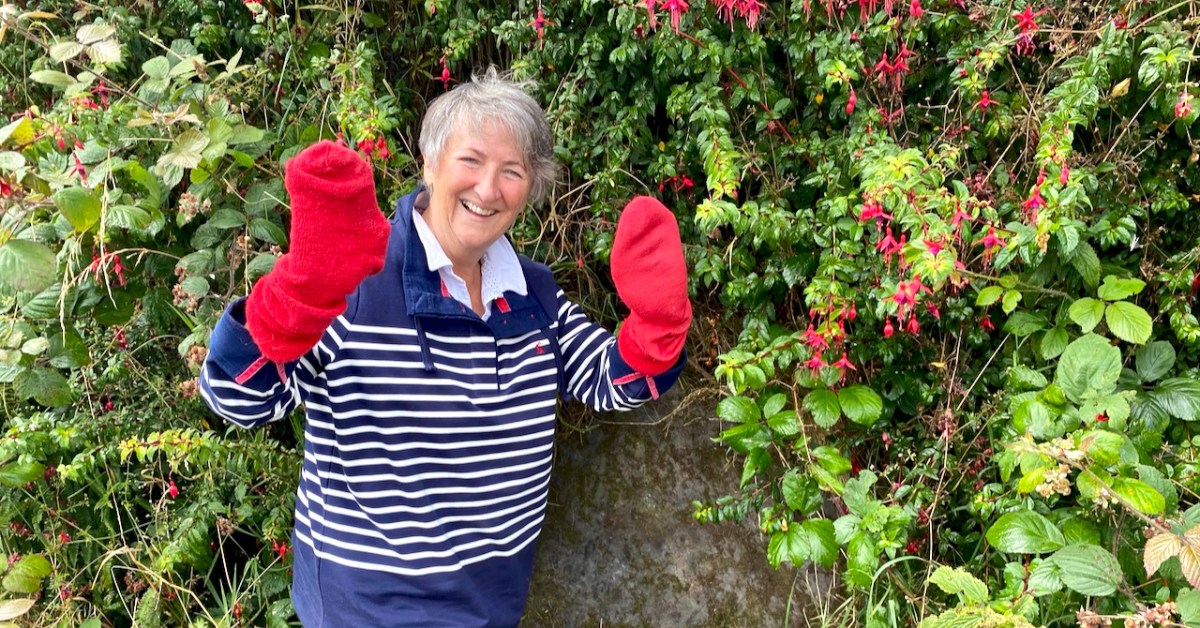
Here’s Finola at Burgatia 1 earlier this month (thanks to Amanda for this):
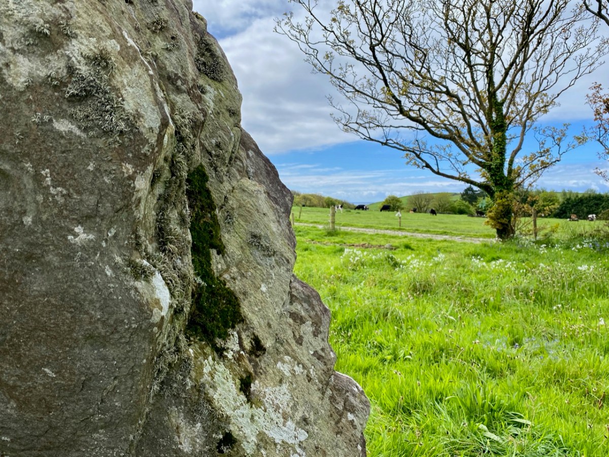
And the view west from the rock, from which you can glimpse the sea (also this month). See below for the same view in 2014:
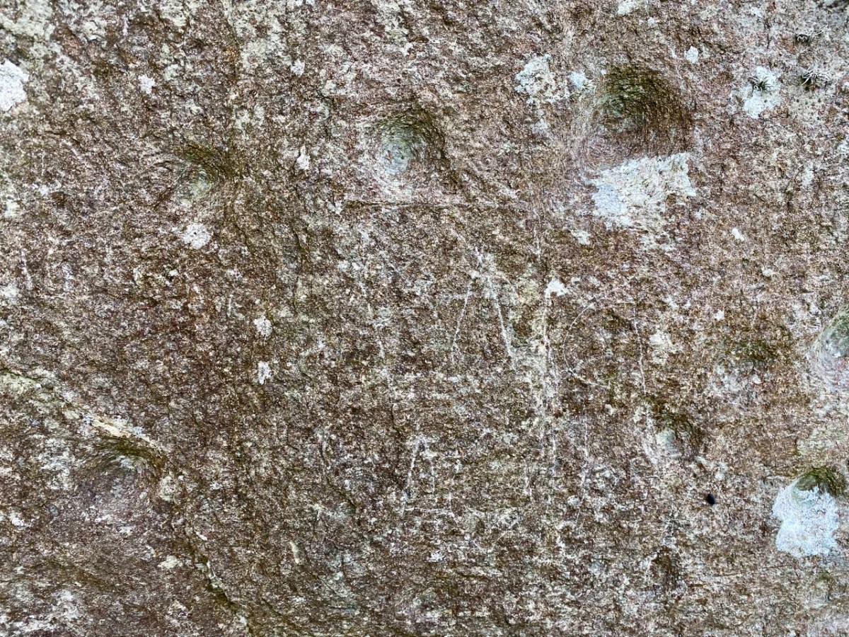
Burgatia 1 seen this month: note the graffiti. We don’t recall having seen this before. Please note this stone is on private land, and permission must always be obtained from the owners (who live in the adjacent house) before accessing it. Here’s the stone in context, showing its southwest facing face which – in this case – has no markings. No one can tell the full history of any of the archaeology discussed today. There are some theories that the standing stones may once have been lying down, and the carvings were made on their (then) upper faces. They were then, possibly, erected to make more significant monuments – one with its cup marks facing one way, and the other facing the opposite way (as it happens).
I’ll finish with this extract from the earliest 6″ Ordnance Survey marked up map. I’m interested to see that here Burgatia 2 is shown in a field boundary:
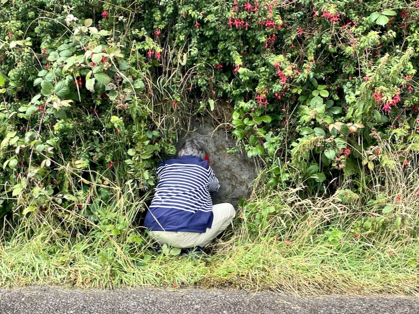
What do red socks have to do with rock art? Well, nothing really, but they turned out to be surprisingly useful this week.
It’s been ages since we talked about rock art, hasn’t it? Thinking about that, I decided to do some tidying up in our blog and I have created a special page for Rock Art, and another one for Mizen Magic, since this post also fits into the Mizen Magic series.
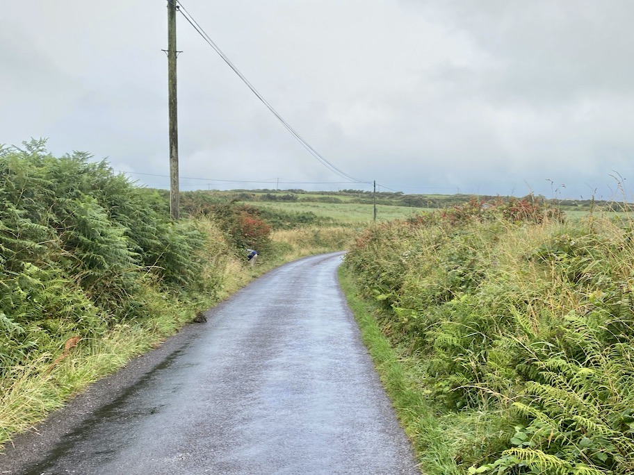
Robert and I set off to hunt down rock art we haven’t yet seen on the Mizen. The National Monuments site contains two records for Cupmarked Stones in the townland of Balteen, and both proved easy to find. (If you can’t remember what a Cupmarked Stone is, take a look at this post before reading on.) The first is along the road that leads from Barley Cove to the North Side. That’s my butt marking the location of the rock, above.
It’s built into the bank and we might not have been as quick to spot it as we were unless somebody else had already found it and cleared away some of the overgrowth – I suspect Rock Art Kerry, AKA Aoibheann Lambe had been there before us, perhaps a couple of years ago. We usually remember to bring a soft brush with us for a gentle cleaning of the rock surface (lots of moss on this one) but we had forgotten this time. The red socks came to the rescue.
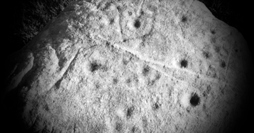
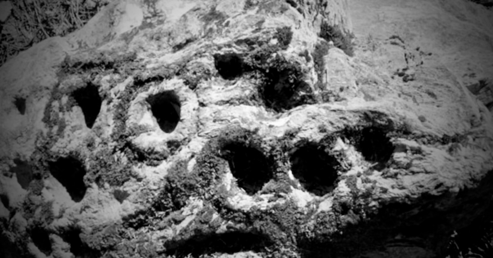
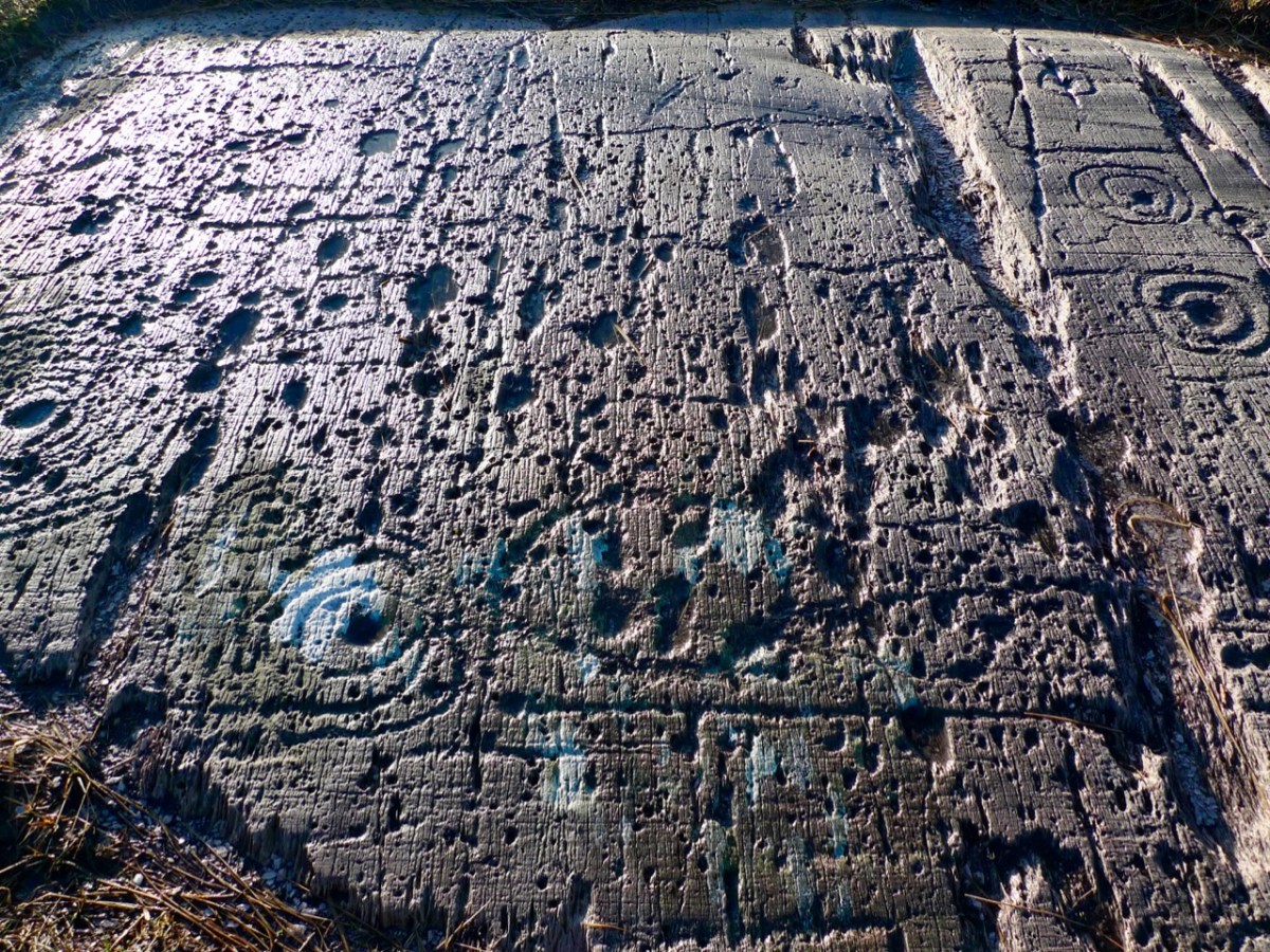
This is a lovely example of a cupmarked stone – although it’s possible there is more on it than cupmarks only. The central cupmark appears to have some carving around it that helps to mark it out and elevate it – not a complete circle but an arc that may end in an expanded finial. We have sent the photos off to UCC for a 3D rendering and this may clarify this aspect of the carving. Here’s a short video – see what you think about that arc.
Meanwhile, since it’s hard to make out what’s in the surface of a grey rock on a grey day, clever Robert has made a scaled drawing of it. We know that cupmarked stones like this can date anywhere from the Neolithic (about 5,000 years ago) up to the Bronze Age (ended about 2,500 years ago), and that the cupmarks were probably made by picking or bashing them out with a stone cobble, but we don’t know why they were done, or what meaning the cupmark itself may carry.
We also don’t know if this one is in its original position, but it’s likely that it is not. It is currently incorporated into the bank at the side of the road, leading us to suspect that it was found in the vicinity and built into the wall to give it a place where it would be visible to all passers-by.
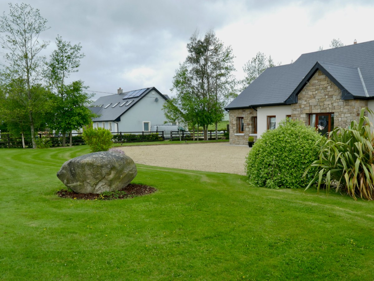
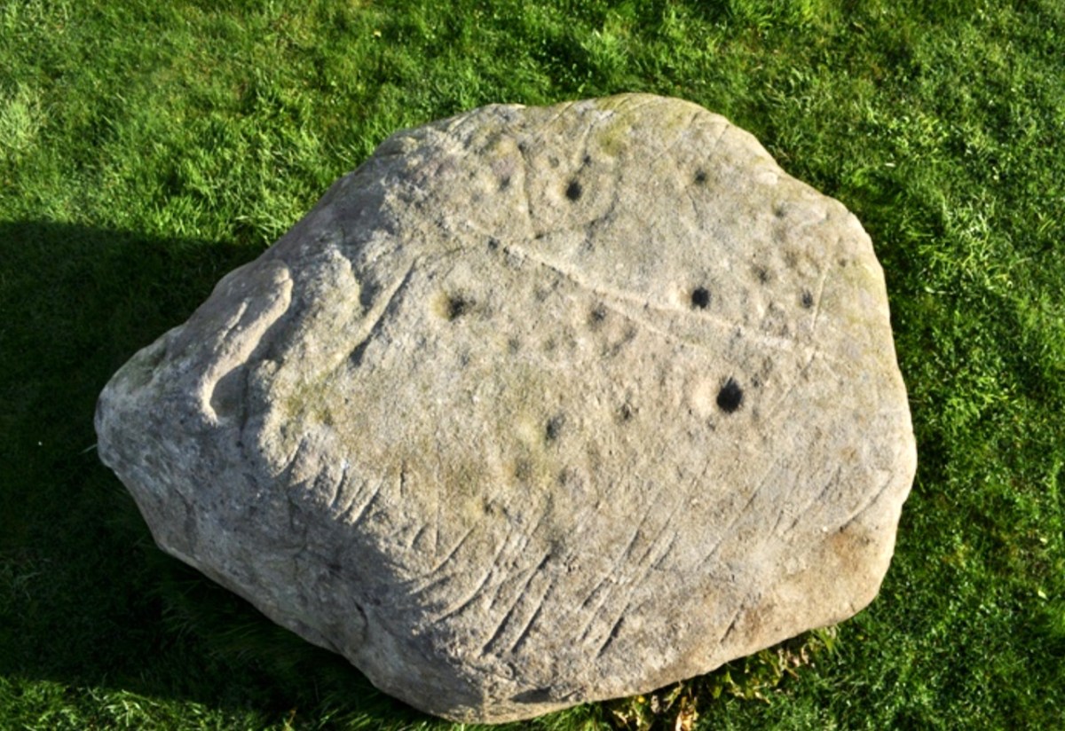
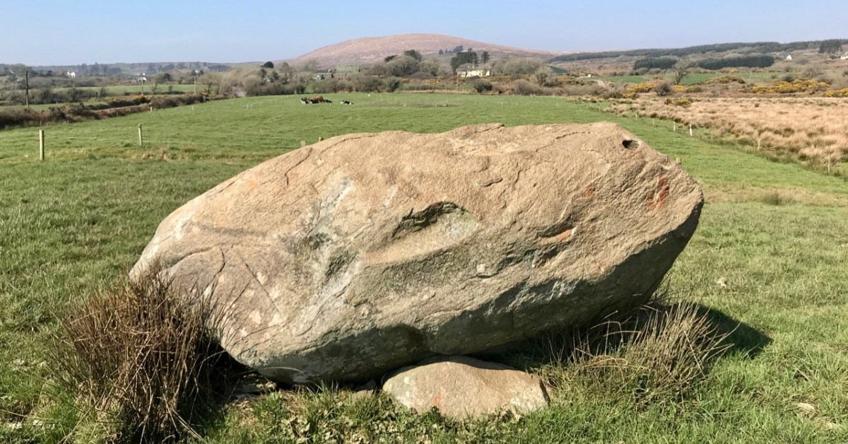
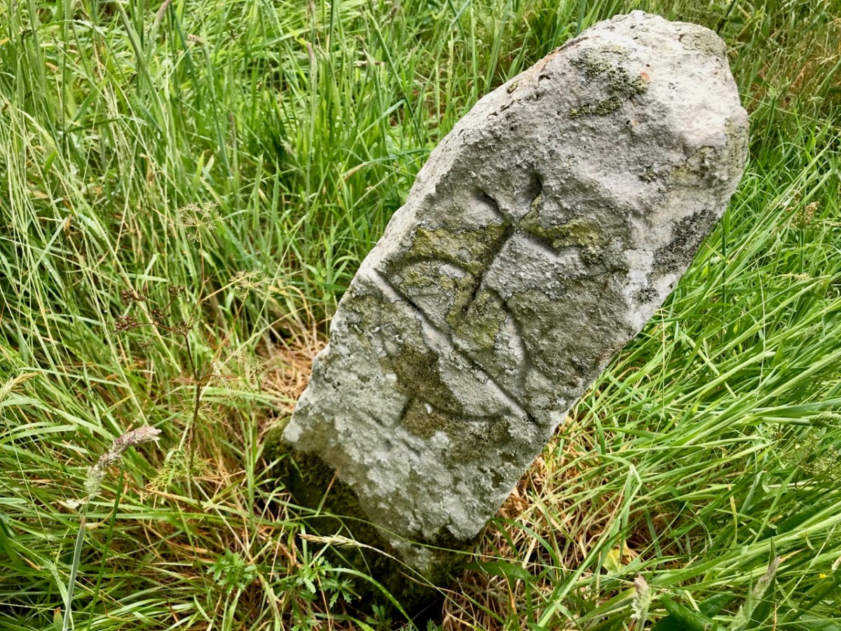
The second one (above) was a surprise! First of all, it’s enormous! It looks like it may have been a capstone for a large structure, or perhaps a boulder burial. However, it’s difficult to determine if there is anything underneath and it may well be a glacial erratic that simply ended up here. This one is in the same townland but it’s on private property, so we are not pinpointing it on a map, at the request of the owners – but they are happy to give permission to see the stone and they welcomed us to take photos and tell them a little about rock art in general. There are nine cupmarks, from large to small and some appear to be arranged in a rough semi-circle – something we have observed on other cupmarked stones.
I am trying something a little new with this post – doing short videos to see if this helps to convey more than a photograph might. I’d be interested in your feedback on this. Note: You may have to play the videos on YouTube – sorry if this aspect isn’t working right for everyone!
Just when you think you have seen all the Mizen has to offer, it reveals yet more of its secrets!
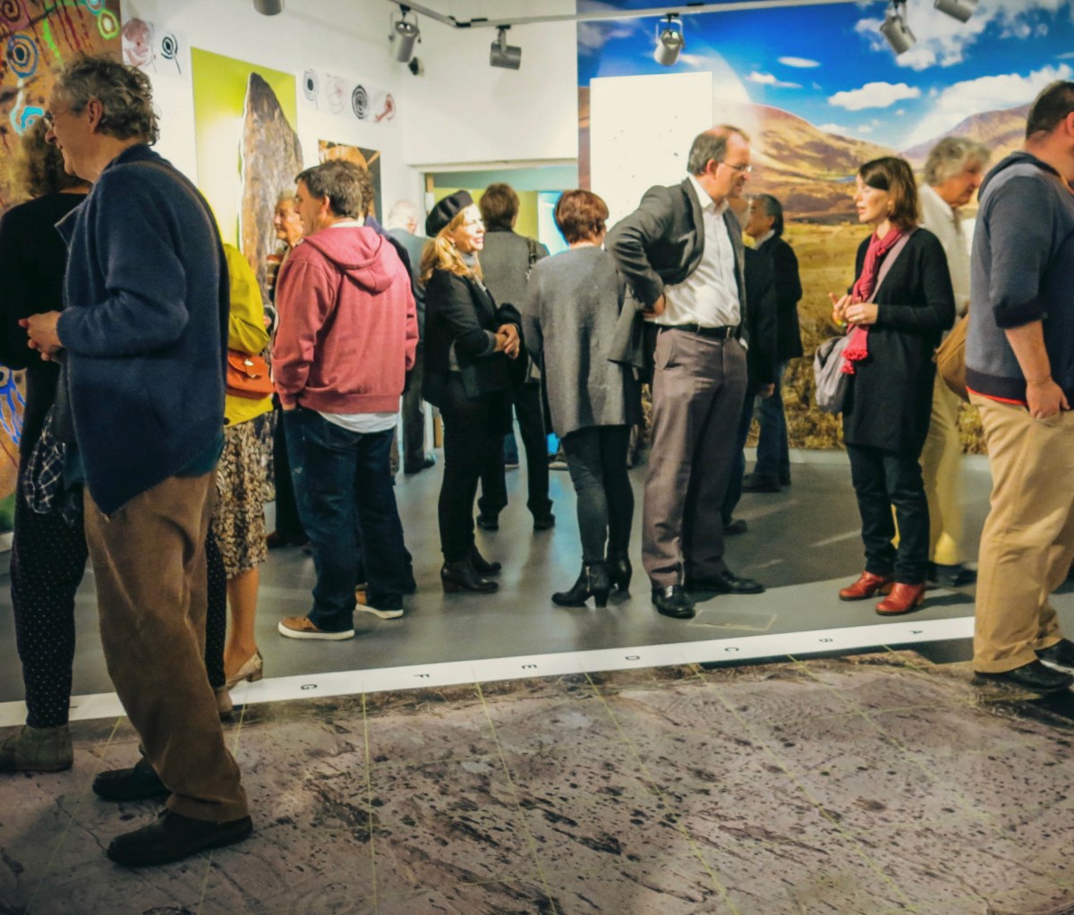
While writing this Journal over the years, Finola and I have included many examples of Prehistoric Rock Art, mainly on the west side of the country, in Cork and Kerry. Here is just one – you can find others through the search facility in the header. Finola’s UCC thesis from 1973 also concentrated on specimens from the southwest and her own drawings based on tracings direct from the rock surfaces provide a unique record of this form of prehistoric art. They have formed the basis of exhibitions which we have promoted over the years: here’s one from 2015.
Upper: the opening of our Rock Art exhibition at Cork Public Museum , October 2015 and (lower) one of Finola’s drawings from 1973. Another area in Ireland which has a concentration of Rock Art is Wicklow. We have been spending a few days in that county, and decide to go and have a look for some examples there. Finola dug out from her archives a photo which she took in 1972 when she and some college friends visited a Wicklow site:
Could we find that particular rock again? Well, we think we did, but it has been moved in fairly recent times. Here it is in its new setting (we believe) – it’s not very propitious:
The present site is in the townland of Togher More, behind a fence lining a main road. The National Monuments record tells the story, which confirms that Finola’s earlier photograph was taken in the townland of Baltynanima:
. . . Class: Rock art (present location) Townland: TOGHER MORE Description: Found during ploughing c. 1.8m to the SW in Baltynanima and moved here in the mid 1980’s (see W1018-036—- for original location record). An irregular shaped schist boulder (L 1.3m; W 0.9m; T 0.5m) with 16 cup marks and the remains of another where the corner of the boulder appears to have come away. The four largest cups (diameters 10-12cm; depth c. 6cm) are enclosed by circles (max ext. diameter 20cm) formed by incised lines (widths 1.5-2cm; depths 1cm) with the exception of one which has only a semi circle incised line around it. The remaining 13 cups have diameters of 6-8cm and depths of 4-5cm. There are also three incised linear grooves (L 14- 22cm; W 4cm; D 2.5-3.5cm) visible on the stones surface. Described, photographed and drawn by Price on the 29th January 1933 . . .
National Monuments Record WI018-049
It’s not unusual to find that ‘portable’ stones with Rock Art on the surface are moved, usually to protect them if a site is to be developed. Here’s another example we found, in the townland of Knockrahen:
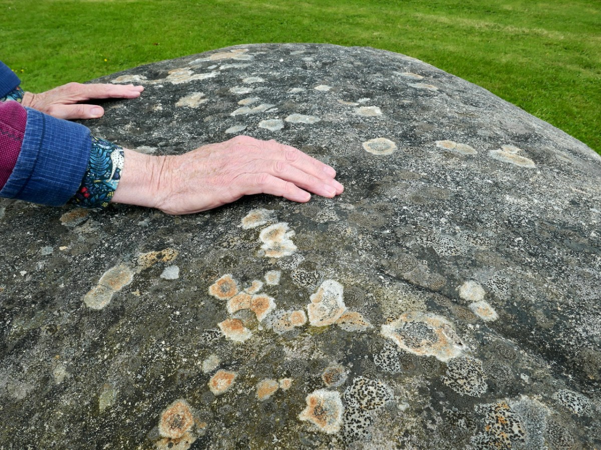
In this case the rock was found while the foundations were being dug for the house. The owner (with whom we spoke) noticed the markings and decided to keep it as a feature in her new garden. The photo below was taken by Chris Corlett for the National Monuments records. Thank you, Chris (and the NM), for allowing us to use this – and the detail on the header pic. Below Chris’s photo is Finola’s, with my hand in the shot to give it scale.
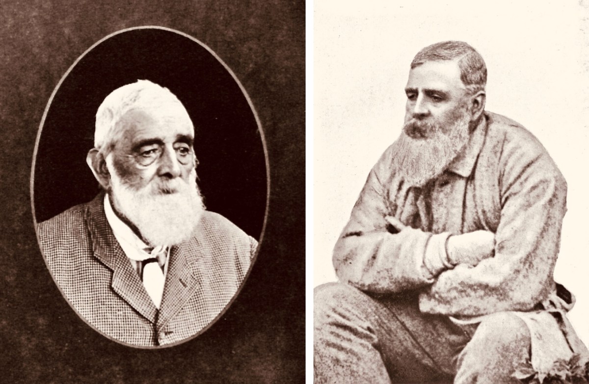
While out in Wicklow we noticed that many of the National Monument records of Rock Art are credited to George Henry Kinihan (1829 – 1908). He was a geologist who also had an interest in archaeology. His home was in Clontarf and he is buried in the Protestant churchyard in Avoca, Co Wicklow. He was involved in his lifetime in engineering works, particular railway construction, but was also a keen Rock Art enthusiast.
Two portraits of Kinihan: he was said to have been of ‘strong and massive build’. He spent some of his early years working under George du Noyer of the Irish Geological Survey – who shared with him an interest in antiquities in the landscape. Here is a du Noyer drawing of cross slabs in Co Wexford:
On du Noyer’s death in 1869, Kinihan was appointed District Surveyor of the Geological Survey, in charge of field work and mapping, and oversaw the completion of the One Inch Geological Map of Ireland. He also became President of The Royal Geological Society of Ireland in 1880. Now, here is a conundrum:
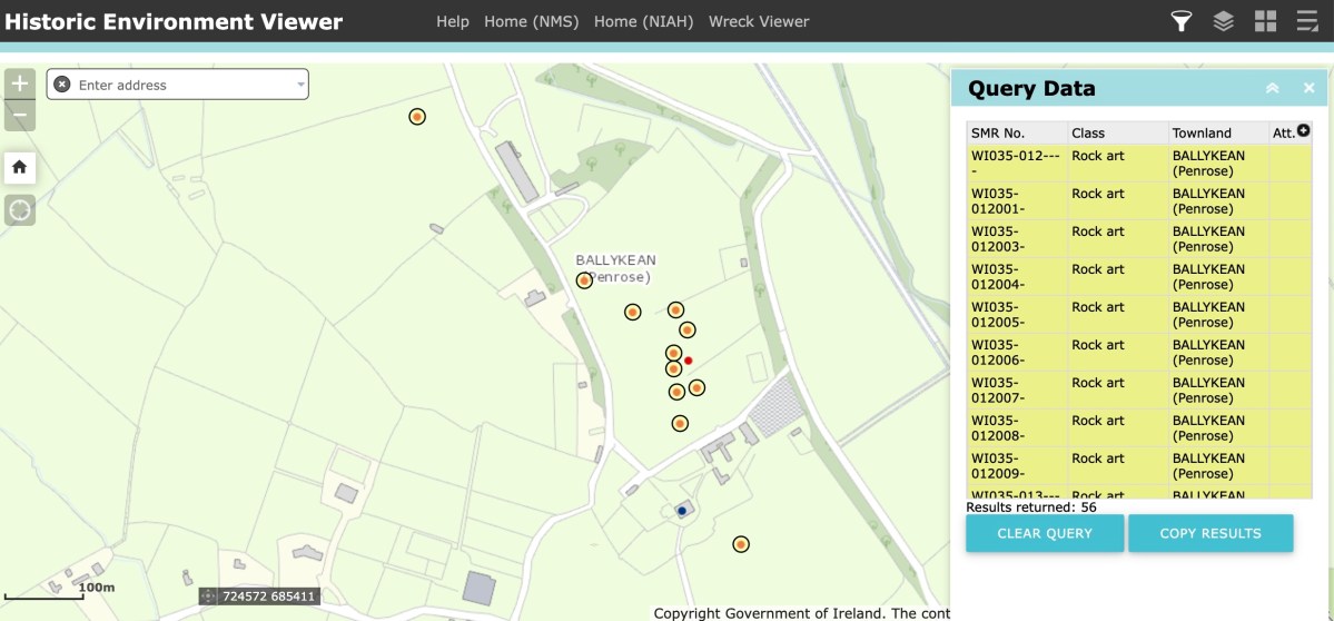
Here is part of the current Historic Monuments Viewer, showing the location of archaeological sites in Ballykean, Co Wicklow. All the yellow-and-red dots are recorded as Rock Art, discovered by Kinihan (there are 14 just in this small area of the townland). In every case, the site is described in detail, with numbers of cupmarks etc recorded. But also – in every case – the description concludes: ‘…The site indicated by Kinahan in 1884 was inspected in 1990, however this stone was not located…’ These are not the only instances in Co Wicklow where Rock Art found by Kinihan can no longer be traced. Does this mean that all these instances have now been destroyed or buried? Is it possible that this experienced archaeological enthusiast could have misinterpreted so many sites? It remains an adventure for us – another day – to go in search of some of these enigmatic examples to see if we re-establish the credibility of this Wicklow giant in this very particular specialism.
Over the years we have written a lot about stone. That’s not surprising, because our interests in Irish archaeology involve stones: standing stones, stone circles, rock art, gravestones . . . It’s what the surviving history of our earliest dwellers on this island is all about. So I thought it would be a good idea to sift through our Roaringwater Journal photographic library – which goes back a decade – and turn up some pictures and stories which I have never used before: all of them involving stones. That header pic, above, is a boulder burial at Rathruane, just outside our West Cork village of Ballydehob.
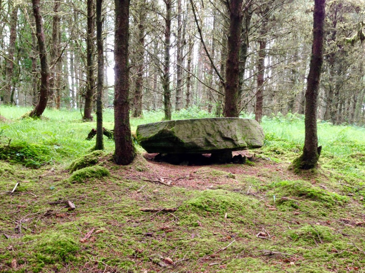
Here’s another boulder burial, a long way away in Co Cavan, now surrounded by trees which are probably relatively recent. Finola wrote about this monument type six years ago, and pointed out that they are not well named: when examined archaeologically, very few of these stones have been associated with buried human remains. They are said to have been positioned between 1,500 and 1,000 years BC, a time we refer to as the ‘Bronze Age’. So, by then, humans were already aware of the use of metal for tools, weapons and decorative adornments. But imagine the time before that – when people only had natural materials to hand – wood, vegetation and, of course – if you wanted to create something permanent – stone: we call these times Neolithic – and generally that covers the period of habitation of Ireland from 6,000 BC onwards.
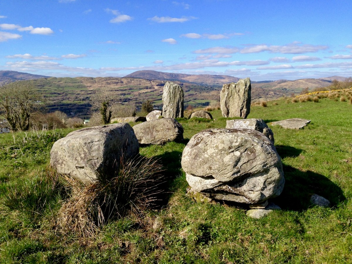
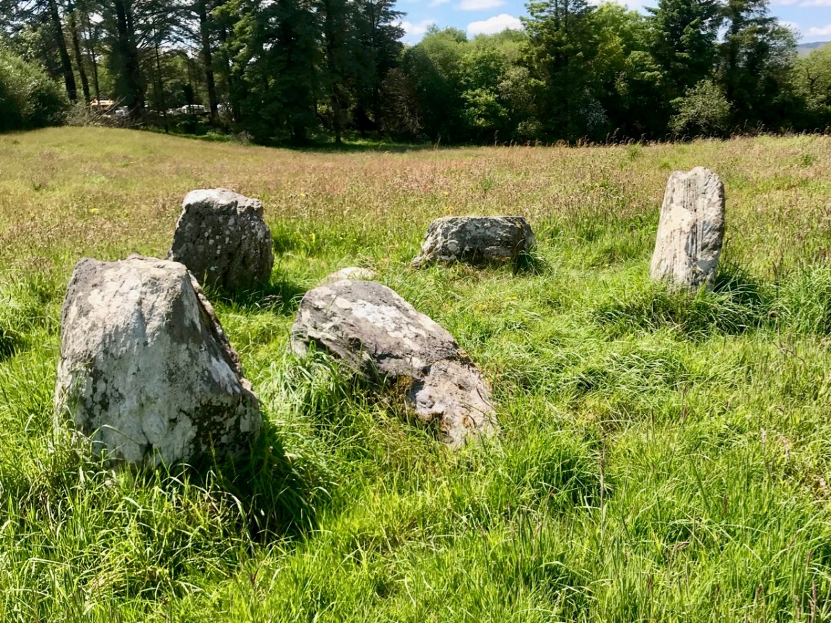
Here is another West Cork site: Breeny More, to the north of Bantry. There’s a whole lot of stones here including, unusually, four ‘boulder burials’ arranged in a square. There are also further stones in this grouping which were once part of a stone circle. The site is magnificently located, with distant views west across to Bantry Bay (below).
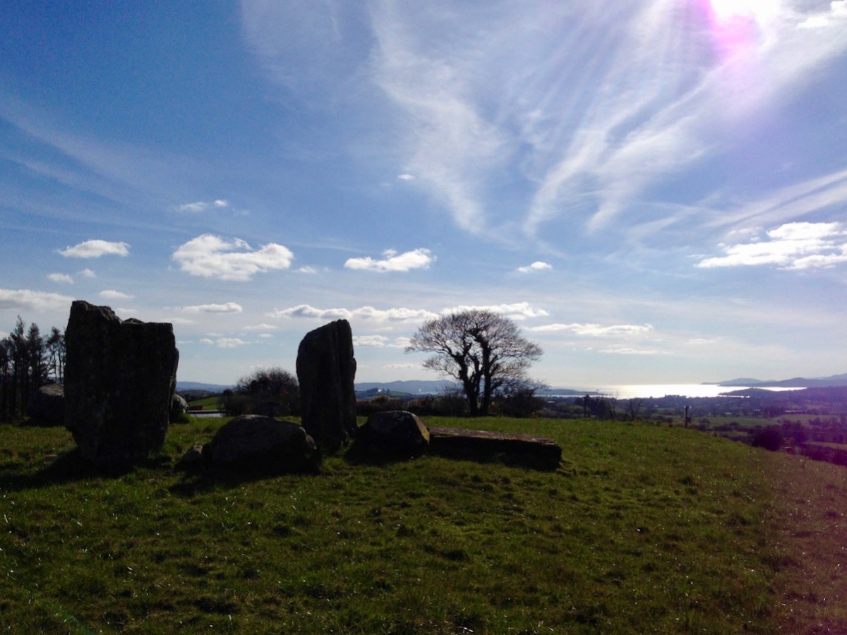
We are all familiar with groups of stonesarranged in a circle. Here is the ‘stone circle’ at Ardgroom, County Cork: it’s on the Beara Peninsula. As with the Boulder Burials, these monument types are generally thought to date from the Bronze Age.
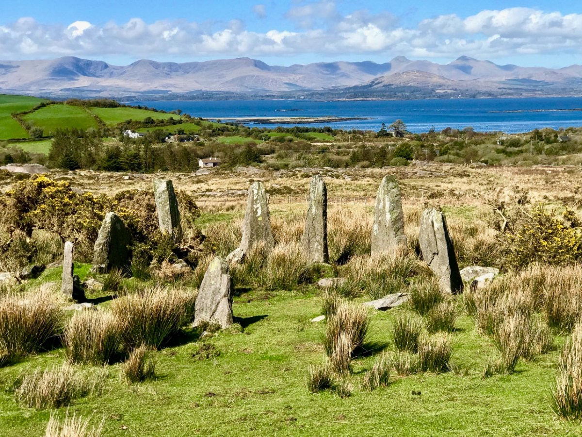
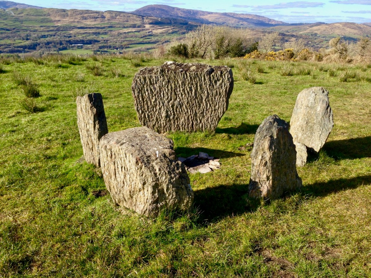
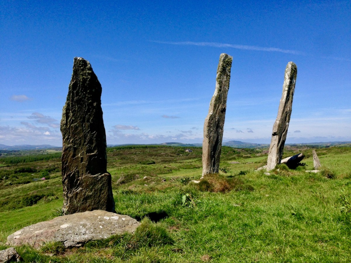
These modestly sized ‘five stone’ stone circles are also in County Cork. The National monuments Survey of Ireland lists 53 ‘five stone’ circles in the county, while a further 41 ‘multiple stone’ circles are noted. There are also some anomalies which defy definition, such as ‘The Fingers’ at Knockdrum, West Cork, just outside Castletownshend:
This appears to have been, originally, an alignment of five tall standing stones. One has fallen and broken, while the fifth is now missing. It is reasonable to assume, from the number of stone ‘monuments’ all around us in West Cork (and in many other parts of Ireland), that these sites were of great significance to the populations who constructed them. But we don’t know for sure why they are there – although theories abound.
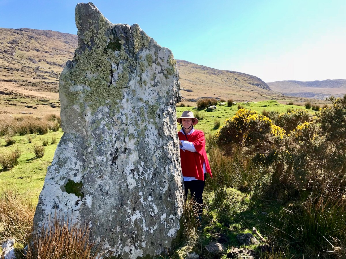
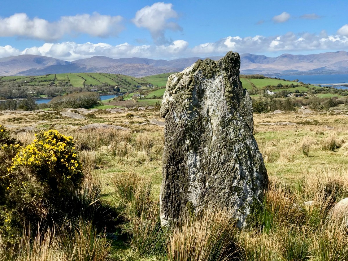
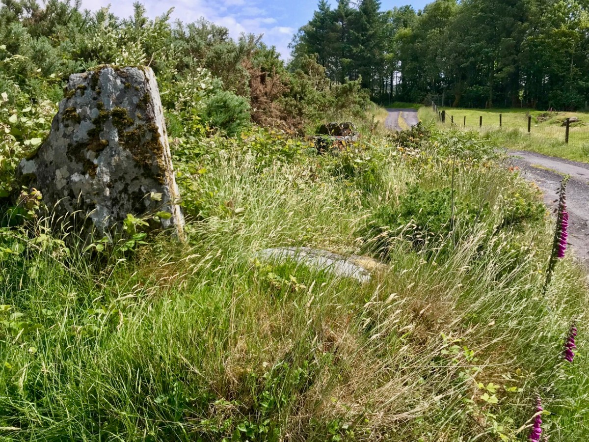
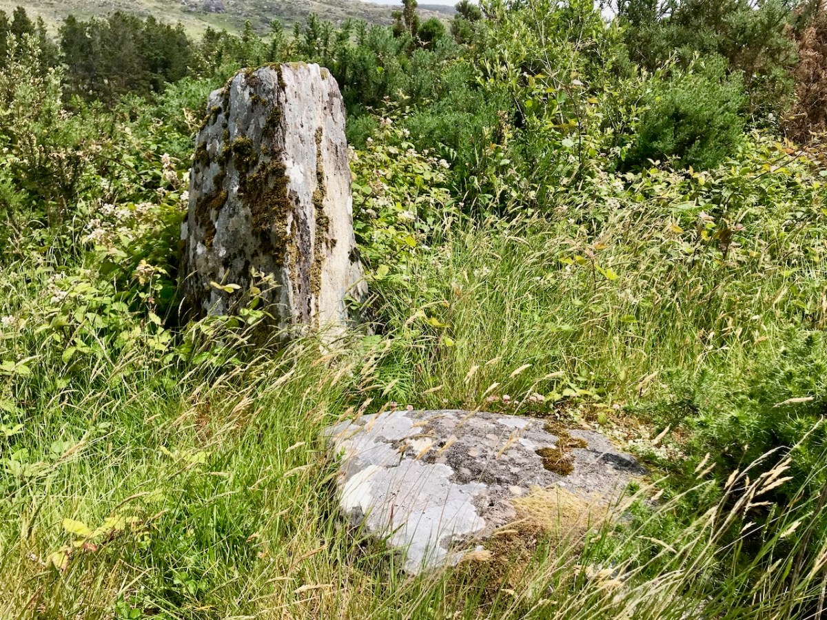
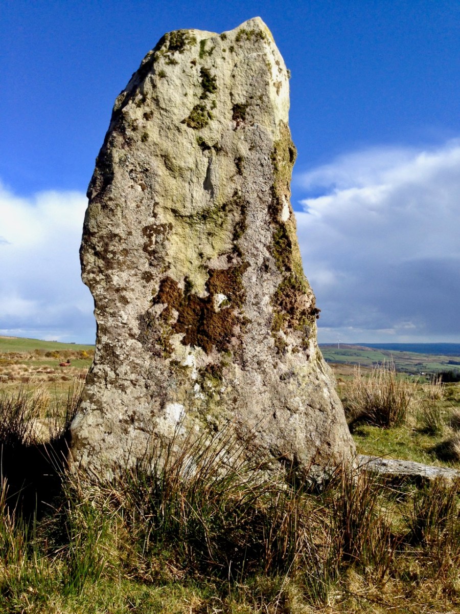
I am fascinated by the number of single standing stones we come across in our travels. It’s impossible to say how many there are in Ireland – probably thousands. And they can range in size from the large stones – above – in West Cork, to individual examples in moorland or fields, or on roadsides – below.
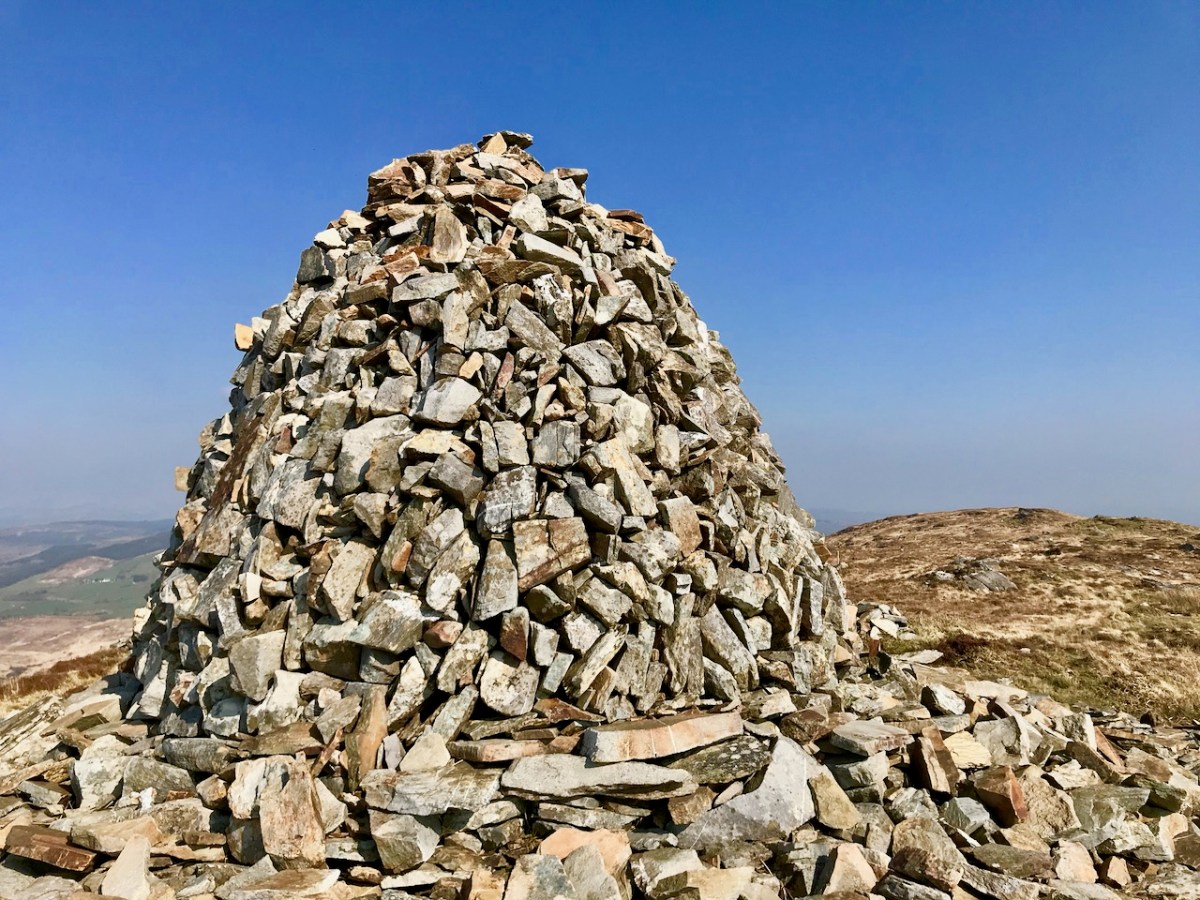
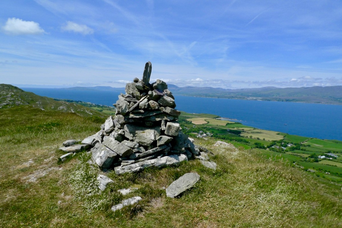
The Irish word ‘carn’ means a heap or pile of stones, Cairn monuments are mounds of stones, often marking the summit of a significant hill or mountain. They may or may not be ancient, and we have seen them change significantly over time. On Mount Corrin, not far from us in West Cork, there were two cairns only a few years ago. Now there is a single, significant cairn (top pic below): this implies a deliberate ‘re-ordering’ of what was there before. Regardless of their history, they can be visually impressive.
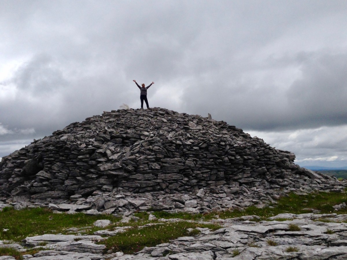
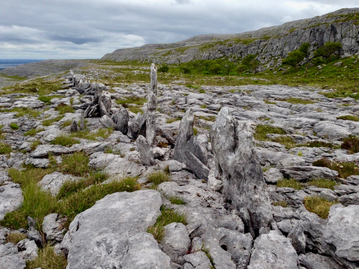
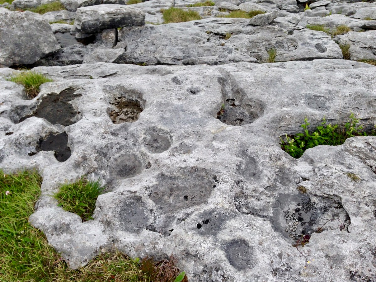
The centre pic above is a small cairn on a Sheep’s Head summit, while the enormous one above is in The Burren, County Clare. The Burren is an extraordinary landscape of exposed limestone. The limestone formed as sediments in a tropical sea which covered most of Ireland approximately 350 million years ago. Today, the Burren supports a remarkable assortment of wild flowers: over 70% of Ireland’s species of flowers are found there, among the ubiquitous stone surfaces.
Ever since humans set foot on Irish soil, they have embraced the stones – both for practical uses such as shelter or enclosure, but also as a means of marking and communicating. Readers will be familiar with our particular interests in Prehistoric Rock Art:
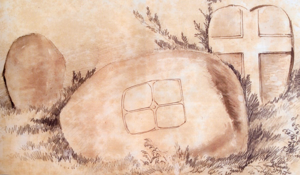
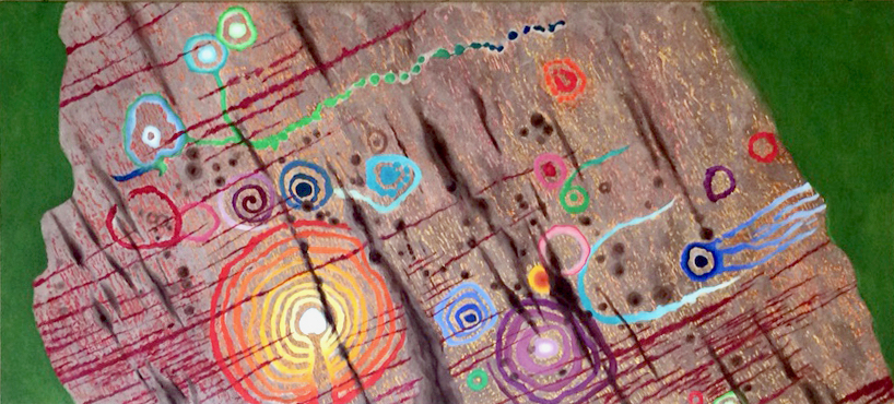
This is an important example of Ireland’s Rock Art, from West Cork, perhaps dating from 5,000 years ago: it was discovered in comparatively recent times. The painting is by Keith Payne, and is an interpretation of this same rock outcrop. We have no evidence that the carvings were ever coloured – or pigmented.
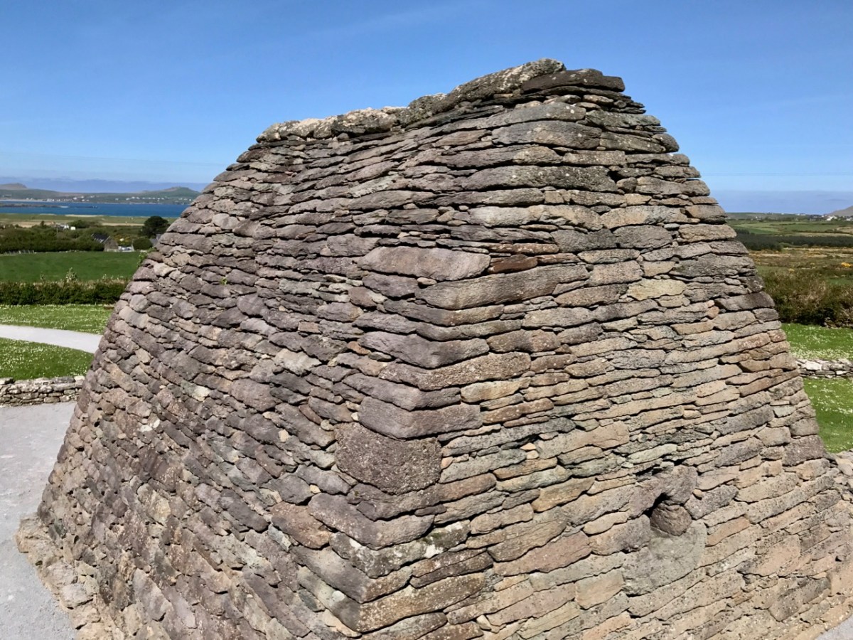
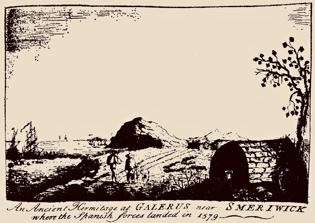
Today we are very familiar with the use of stone as a building material: this practice is likely to have been current since very early times. In Ireland we have many examples of ancient – but undateable – stone buildings. The ‘Oratory’ at Gallurus is a good example of a built enclosure (walls and roof) made entirely from stone. A present day view of it, top, shows this remarkably preserved structure; archaeologists and historians have long debated its age and likely use. The print above dates from 1756.
Welcome to the UCD Library Cultural Heritage Collections blog. Discover and explore the historical treasures housed within our Archives, Special Collections, National Folklore Collection and Digital Library