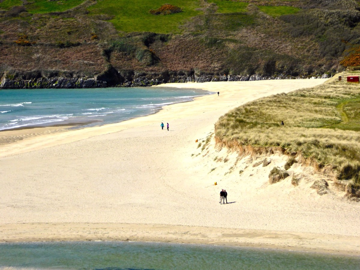
Moving west at the Far End of the Mizen we come to two very special, and completely different, places. Barley Cove is one of Ireland’s most popular beaches, and rightly so – but there is much more to it than meets the eye. Three Castle Head, is, in my opinion , the most beautiful historic site in Ireland. OK, a bold statement – but wait til you see.
The area around Barley Cove encompasses a European Special Area of Conservation (SAC). In my post, Barley Cove: A Special Area of Conservation, I explained that SACs are areas designated as particularly interesting or sensitive on account of their flora or fauna. There’s a complex assessment process carried out that looks at the species present in the area, how important or endangered they are, or how representative of a particular habitat. It’s all done by the National Parks and Wildlife Service and the report on the Barley Cove area is online.
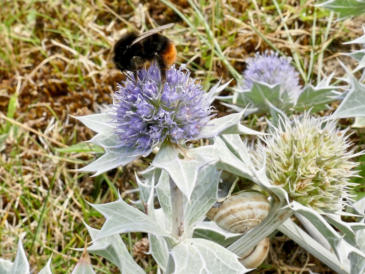
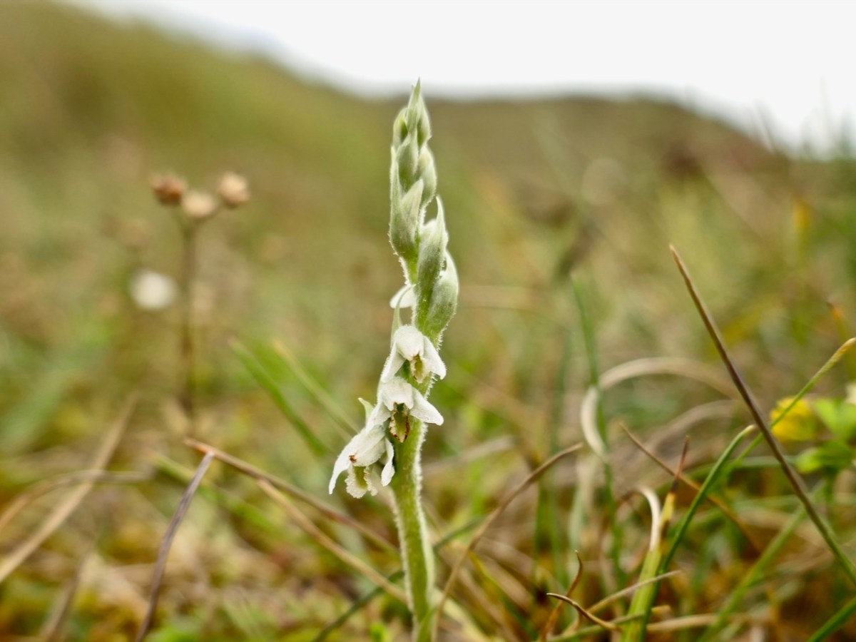
It’s also one of my favourite places to find wildflowers and that post included a gentle little slideshow. Because I went on October one of the flowers I saw was the little orchid, Autumn Lady’s Tresses. Although it is found here and there around the coast it is an unassuming little thing and quite hard to spot, so I was delighted to find it.
But I have been more recently, in July last year, and made a new slideshow, which I called Lying in the Dunes. I am a bit better at it now, and can sync the music to the images.
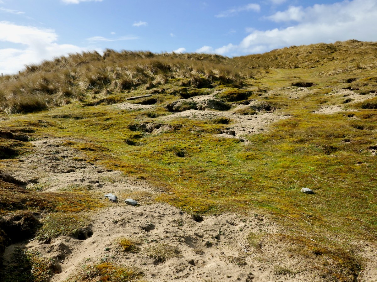
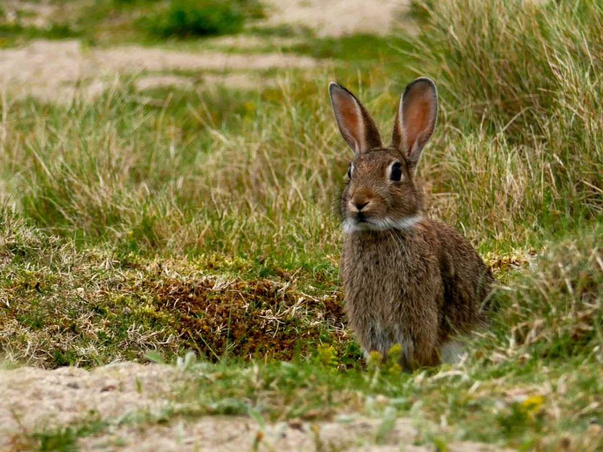
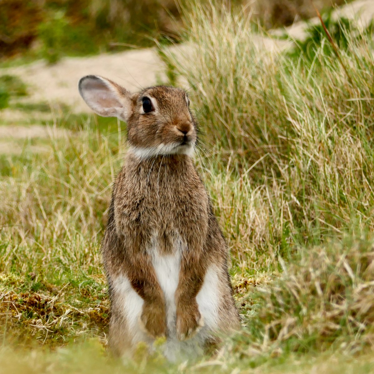
Barley Cove is also home to a large colony of rabbits. In my post The Bunnies of Barley Cove, I wrote: When you think that an adult female (a doe) can have up to seven litters a year, each one yielding up to ten kittens, the proliferation rate is explosive. They are kept somewhat in check in the wild by natural predators and a high mortality rate. Left totally undisturbed, rabbit populations probably undergo the same cyclical variations that other mammals do, with numbers increasing for about ten years and then declining due to over-population, before building up again.
Observing the bunnies and getting close to them called for patience and slow movements: I had to crawl through long grass and try not to spook them. Once they and I were at eye level, it felt like a real communication – being regarded by those deep pools of age-old knowledge, gentle and wise, was lovely. At the same time, the ears were on high alert, and I knew that one false move and he was gone.
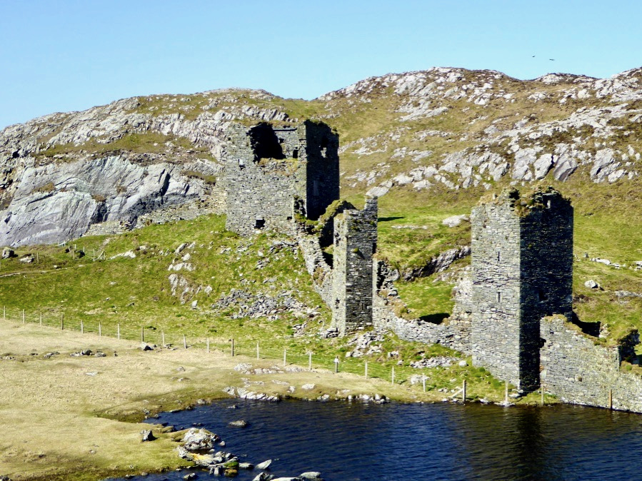
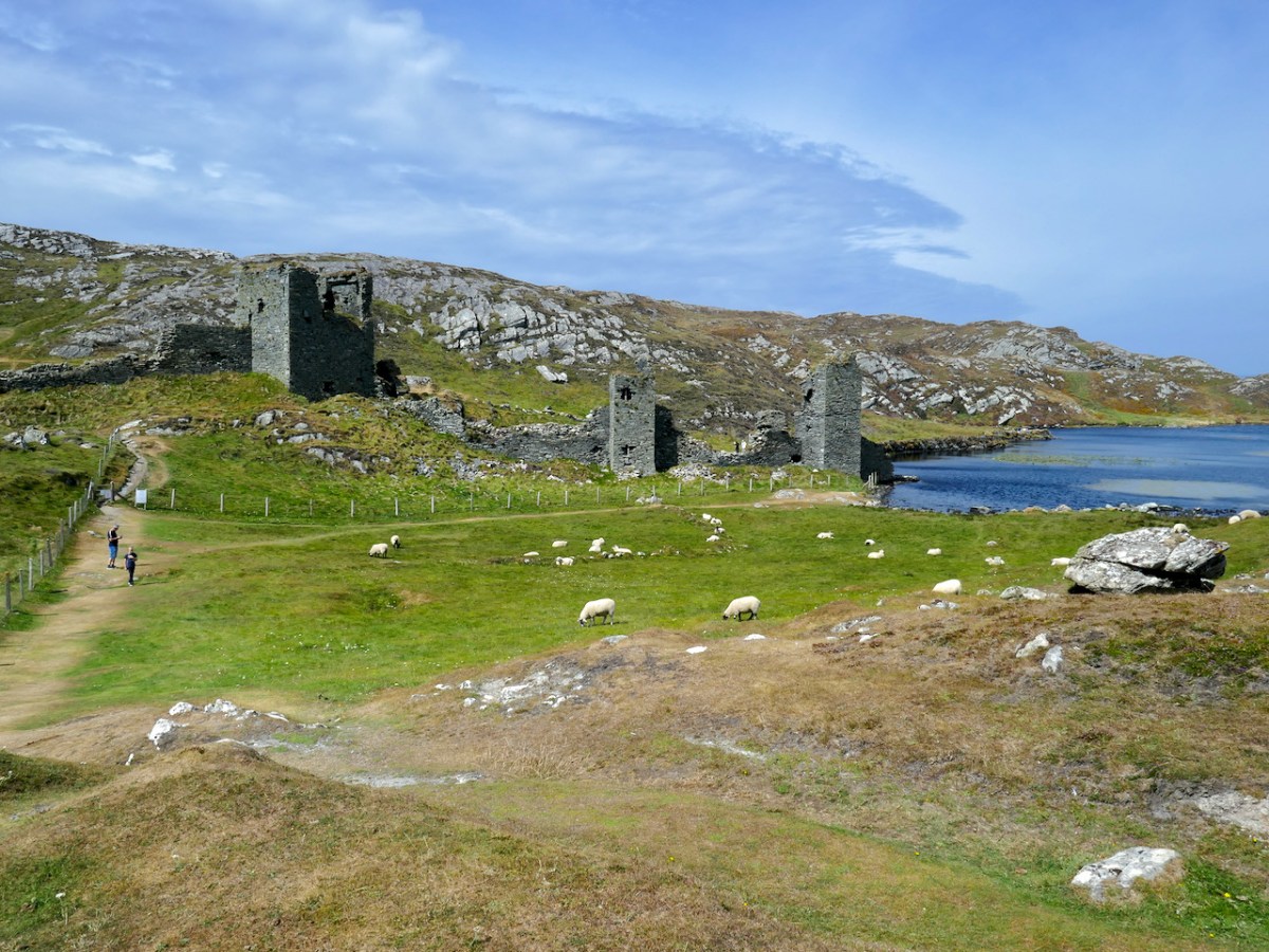
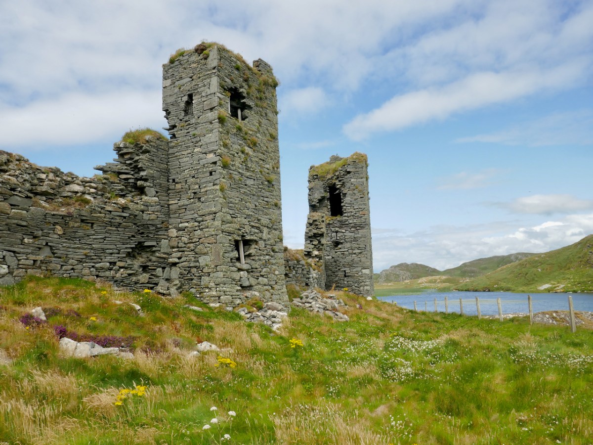
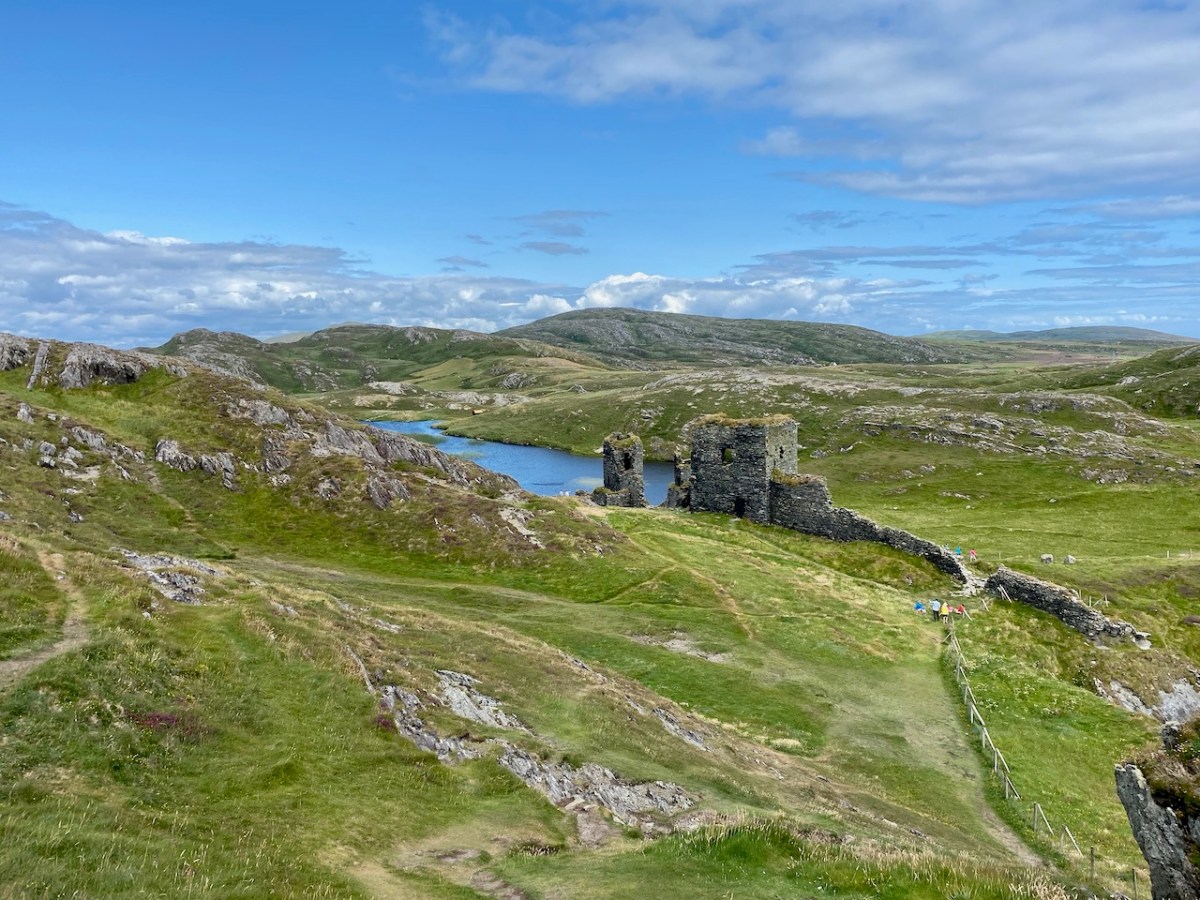
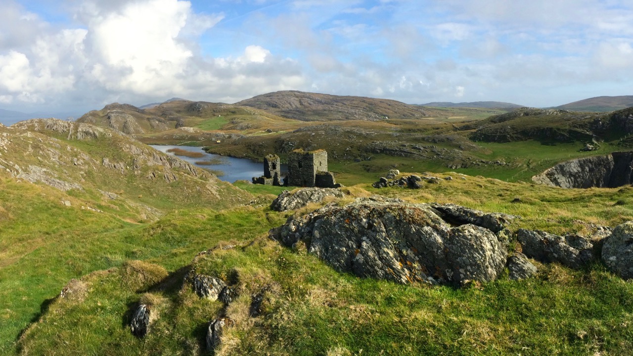
Moving further west again, we come to Dunlough, or Three Castle Head. This was one of my Castles of Ivaha series, and surely our most unusual castle in the most spectacular setting. To come over the hill and see it for the first time is an experience none of us will forget.
It’s a complex site and I tried to unravel the various phases of building that you can see, as well as the construction methods and functions of the curtain wall with its three towers. But in the end I had to say But all of that is dry as dust – who can worry about a dating timeframe when what presents itself to your view is so beautiful, so perfectly situated and so hopelessly romantic?
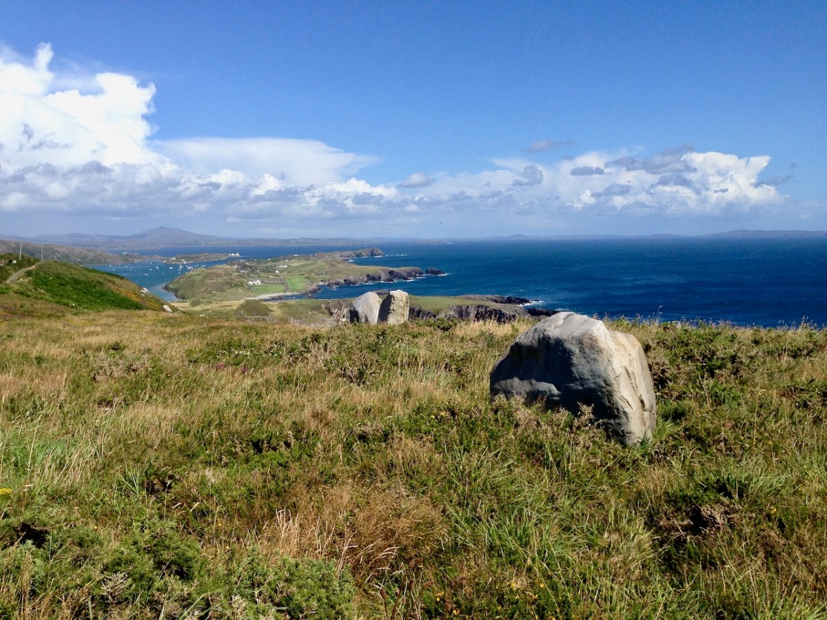
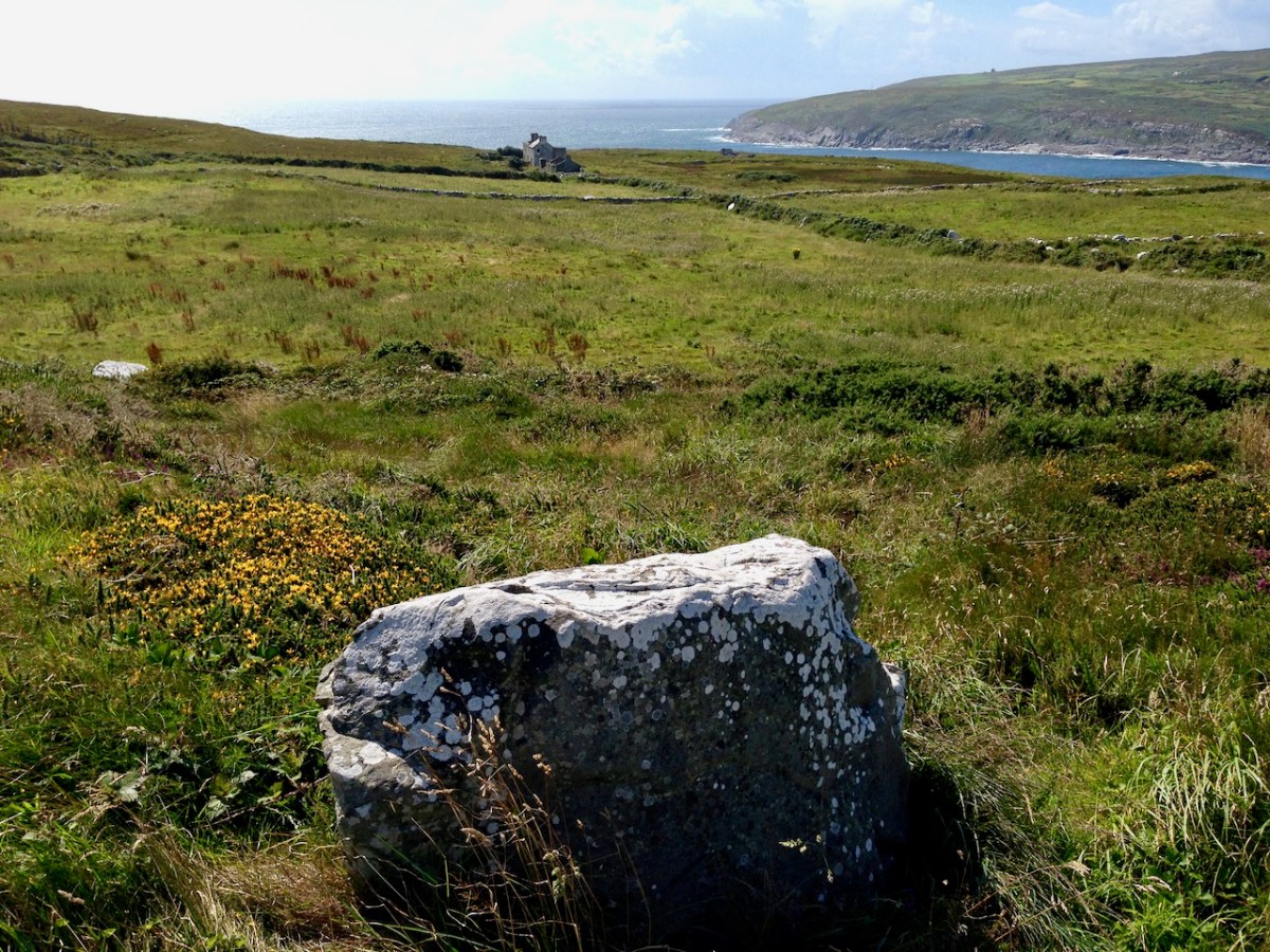
Here is a collection of photographs taken in West Cork from some of the high places: ridges, peaks, mountain paths. The pics were all taken around ten years ago, and haven’t been used in our blog posts previously. They serve to show stunning landscapes, of course, and hopefully illustrate the variety of the country which surrounds us here. The header is taken from the peak above Three Castle Head.
The upper pic is looking down on Bantry town from the high ground to the south, while the lower one reminds you of the evening view from Bantry at sea level.
If you leave your car at Galley Cove Beach and walk up the steep track towards Brow Head you will come across this enormous stone row – and you will look back to the peninsula of Crookhaven. Don’t be fooled by the stones: they have been placed on this site fairly recently. They are impressive, nevertheless.
And here is a closer view of Crookhaven.
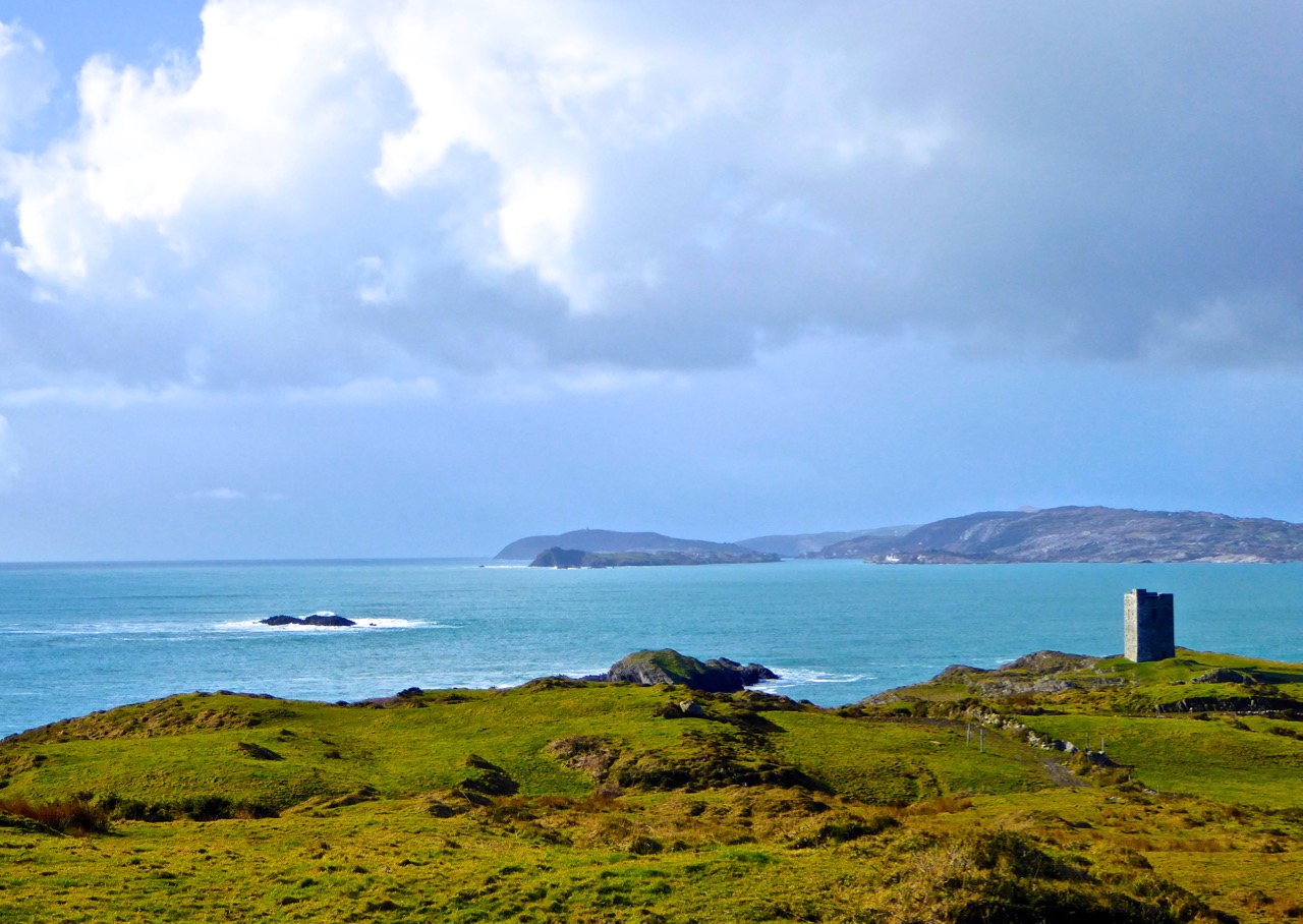
While turning from this spot and looking west, you will see the end of the coastline at Brow Head. This stone is likely to be more anciently placed. In the distance is Mizen Head with its Napoleonic era signal tower at Cloghane.
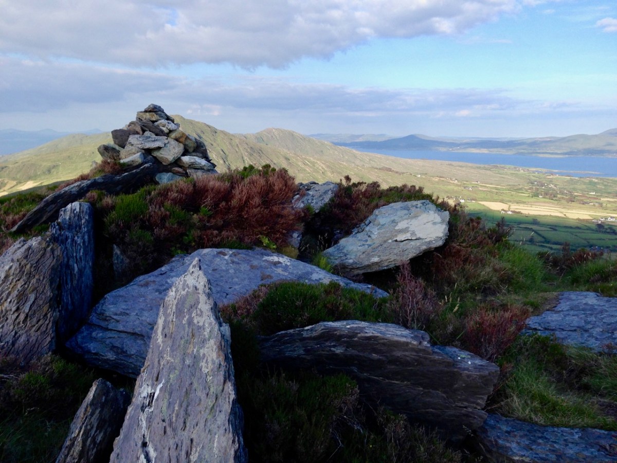
Contrasting light effects seen on the footpath that follows the ridge on the Sheep’s Head Way. That’s the spit of land that runs from east to west between the Mizen Head and the Beara Peninsula. There are cairns on the summits, with the remains of a wedge tomb and a Marriage Stone to be seen along the way.
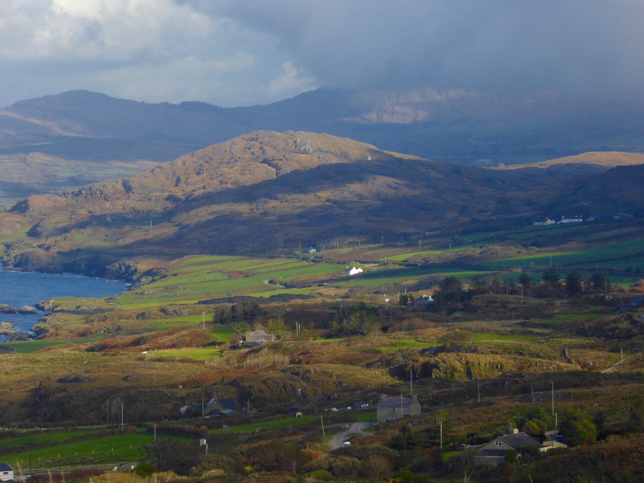
The view north from the heights of the Sheep’s Head takes in the Beara Peninsula and – seen above – the high point of Hungry Hill dominating the distant rugged landscape.
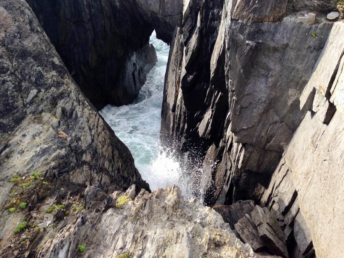
You are never far from the coastline in West Cork. Look out for wild seas constantly sculpting the rocks over millennia.
From our home in Cappaghglass we look out to our own ‘high place’ – Mount Gabriel. This enigmatic tract of land dominates the area and is imbued with legends and folklore. It is also one of the most atmospheric of our peaks at all times of the year.
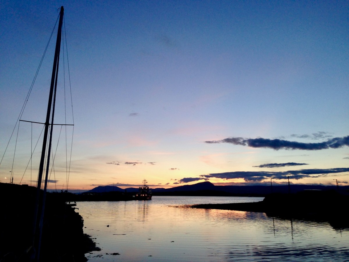
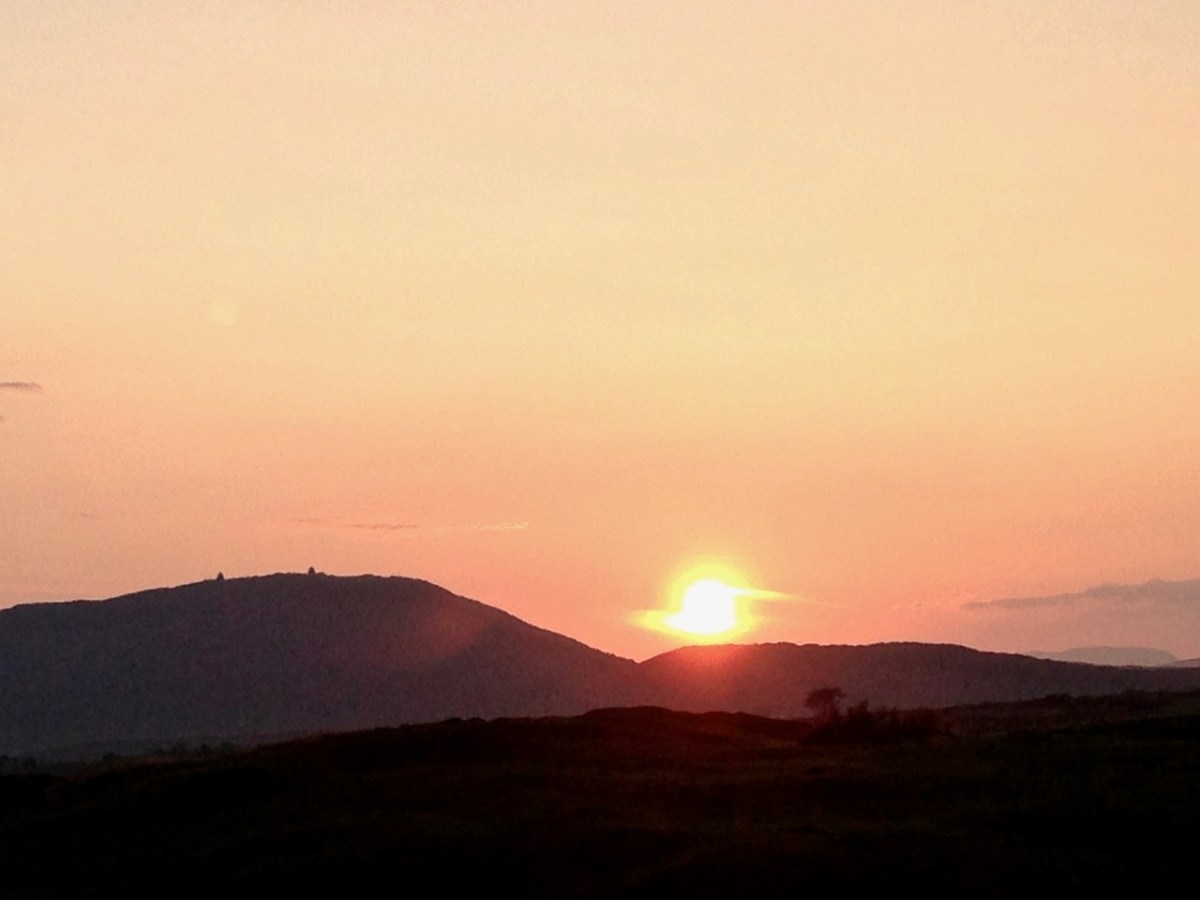
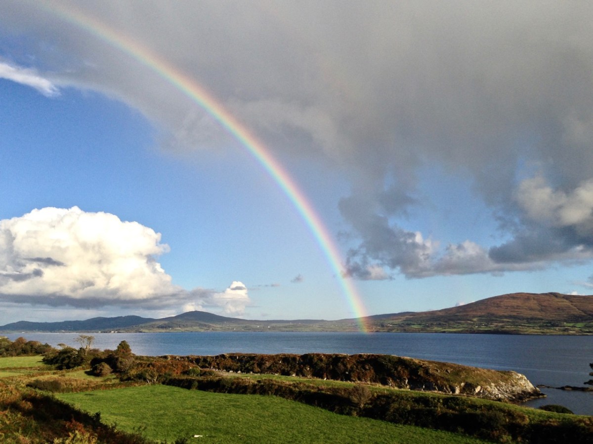
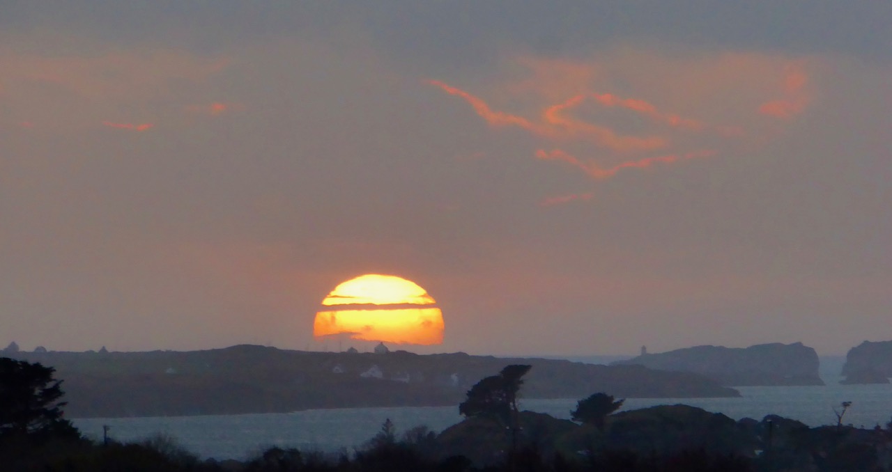
Another local view for us (above): we face out to Rossbrin Cove on the Mizen Peninsula. Finally, the celestial spectacle (below) finds its pot of gold on the shores of the Mizen.
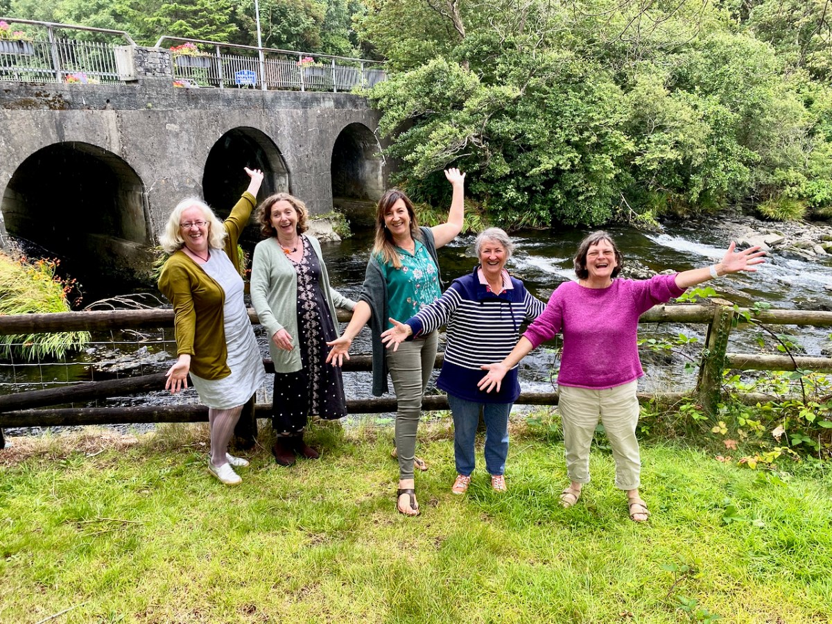
It’s been a very busy week! The best part about it was that my sister, Aoibhinn (pronounced Eeving), is visiting and she and I were able to do lots of things together. That’s her in the coral jacket, above. You see, she has ME, or Chronic Fatigue Syndrome, and she was really nervous about her ability to participate in the activities I had booked or planned, or stay the course once on them.
Aoibhinn does really well at managing her condition, but she has to be very careful or she can end up in a major crash. She struggles with tiredness and pain all the time (sore joints, headaches) but finds that sea swimming helps her cope mentally, so she was up for one of the things we planned to do together, our Dawn Swim and Pilgrimage with Gormú. We met Conor and Celine, and two other participants at Castlehaven and started off by walking the short way up to the Holy Well, where we heard of St Barrahane. Readers may remember Conor from the Placenames post.
Next came the swim. While Aoibhinn opted for a short immersion, I surprised myself by swimming all the way to Faill Dic, with encouragement from Conor, and the lovely safety valve of a float if I needed it. Breakfast was so welcome – porridge, fruit and hot tea made by Celine and Conor (below) – while we listened to more stories, all set around the cove we were in. It was a fantastic experience – I highly recommend it!
The Ellen Hutchins Festival andHeritage Week are both in full swing this week, so there are any god’s amount of things to choose from. We concentrated on botany and butterflies during the week and ended with stained glass and history yesterday.
Micheline Sheehy-Skeffington and Nick Scott led us through the Glengarriff Woods. While this walk involves an uphill section, the pace is easy because it involves lots of stopping to talk about the plants we encounter along the way. We loved Nick’s descriptions of the forest environment, and all the layers that make up the plant life from the canopy down. And we were riveted by Micheline’s focus on the Arbutus (AKA the Strawberry Tree), a rare tree that occurs only here and in the Iberian Peninsula.
Micheline is investigating her theory that it may have come with the Bronze Age miners who came to exploit the rich copper resources of West Cork and Kerry. Her recent article in Archaeology Ireland sparked my interest and I was thrilled to be able to go along on this walk with her.
The photograph above illustrates the challenges in tracking Arbutus trees – they grow on cliffs and in inaccessible places.
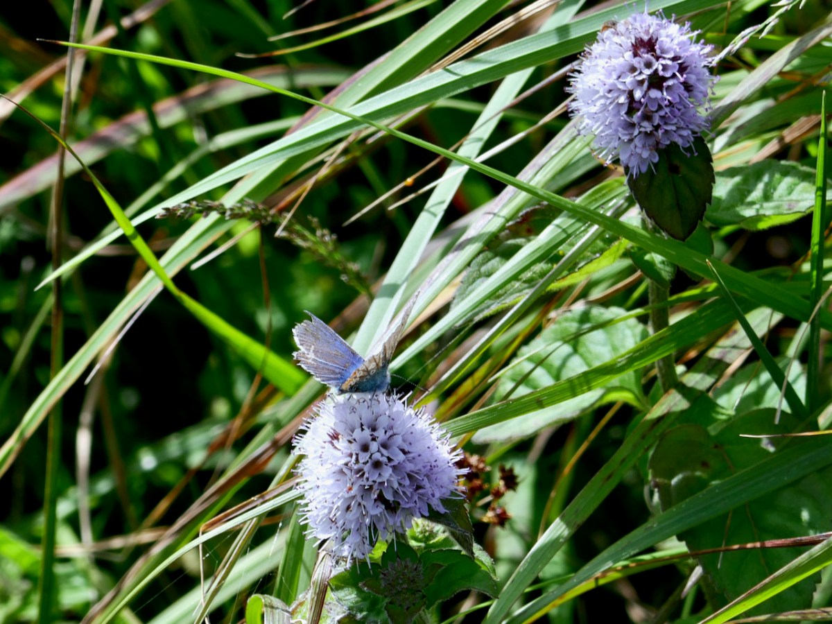
Once again, although this walk involved picking our way through long grasses and scrambling over rocks, the pace was slow, with frequent stops to ooh and aah over butterflies and hear Damaris talk about their habitats and plant requirements. Some of the plants were so tiny that we had to see them through a hand lens to really appreciate them.
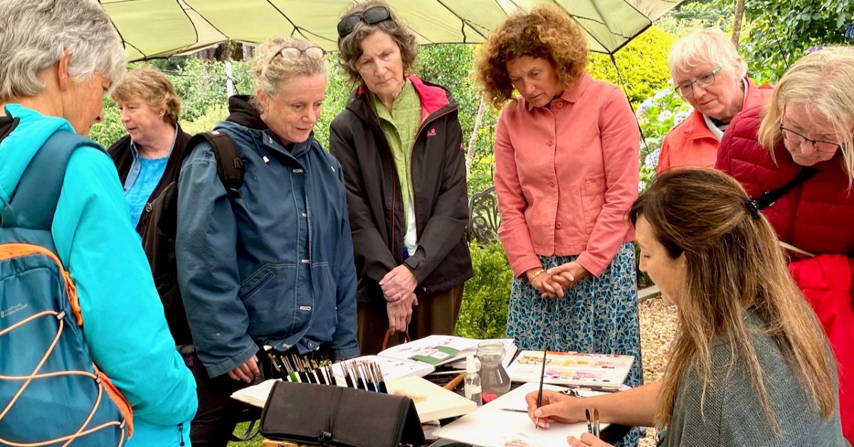
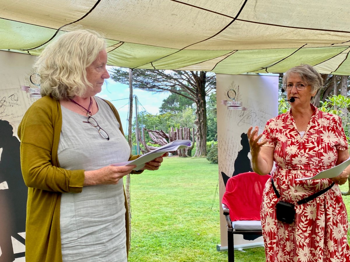
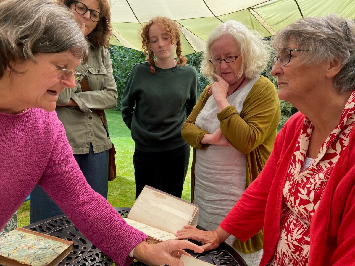
We had a rest day on Thursday, and on Friday it was time for Seaweed and Sealing Wax 2. This was the second production masterminded by Karen Minihan, based on the correspondence between Ellen Hutchins and Dawson Turner. See Robert’s post from last year for an account of Seaweed and Sealing Wax 1. This year, we were joined by the poet, Laura McKenna and the botanical artist Shevaun Doherty. That’s Shevaun surrounded by audience members in the top photo of this post, while Laura is in the photo below.
While Karen and I led the audience through the letters, Laura read a selection of poems that responded to Ellen’s life and work, and Shevaun worked away on painting a piece of seaweed, explaining her process to the audience at one point.
At the end, Madeline Hutchins, Ellen’s great, great, grandniece, showed us some of Ellen’s books and letters. As with last year, we were under a tent in the grounds of Sea View House Hotel, right next door to where Ellen herself had lived in the opening years of the nineteenth century.
We finished the week with a trip to Timoleague, where I was booked to give two stained glass talks at the Church of the Ascension Open House. This is part of a huge community effort to save and safeguard the fabulous mosaics in this church and I am always thrilled to be a part of it. Take a look at this video by the Rev Kingsley Sutton, Touching Heritage, to get an excellent overview of the whole project.
The church is truly one of West Corks hidden gems, and the fund-raising effort needs all the help it can get. In between the talks, we were whisked off to lunch at a fabulous private house right on the sea. Nice work if you can get it!
So – it’s been an incredibly busy week of flowers, talks, and butterfly hunting (above) and I am feeling it now. But all of our activities were accessible to Aoibhinn, with time to rest in between, or go for a lovely dip locally. So – if there’s anybody out there who wonders if you would be able for a botany walk or a dawn swim and ‘pilgrimage’ – no need to be intimidated by a title or a description when the pace is leisurely and, as Aoibhinn found, there’s always a handy rock to sit down on for a while.
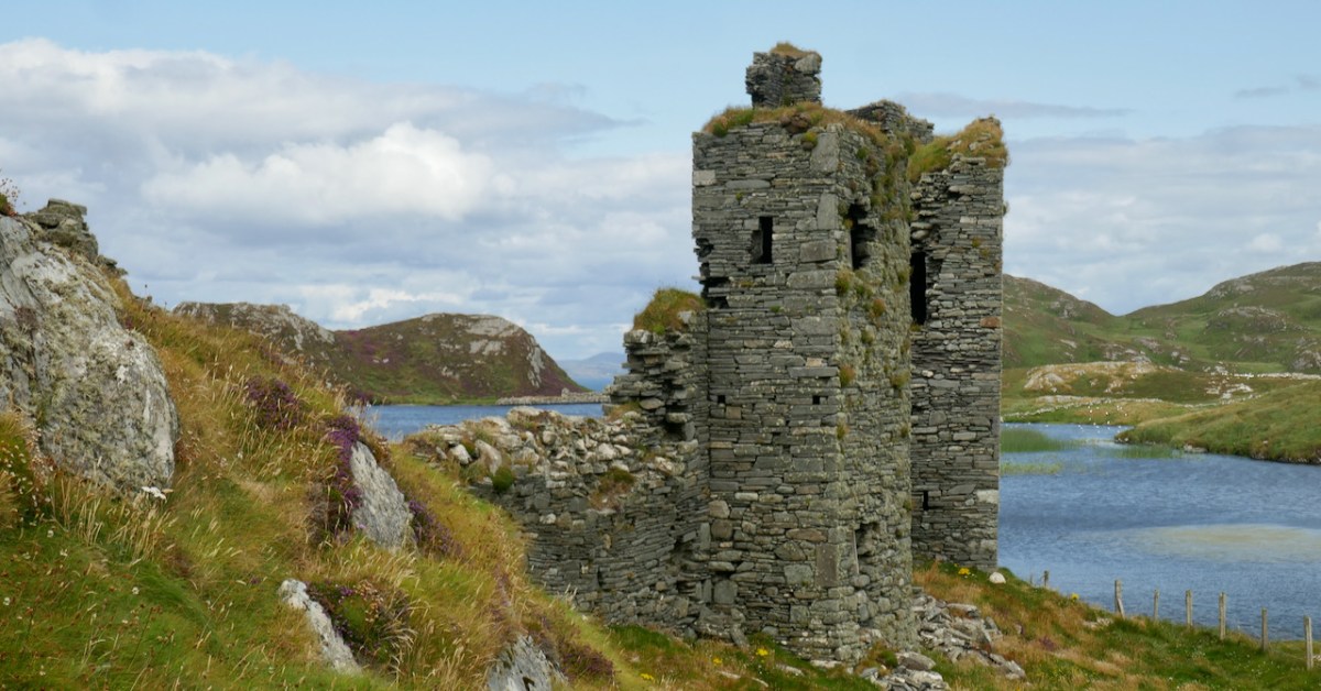
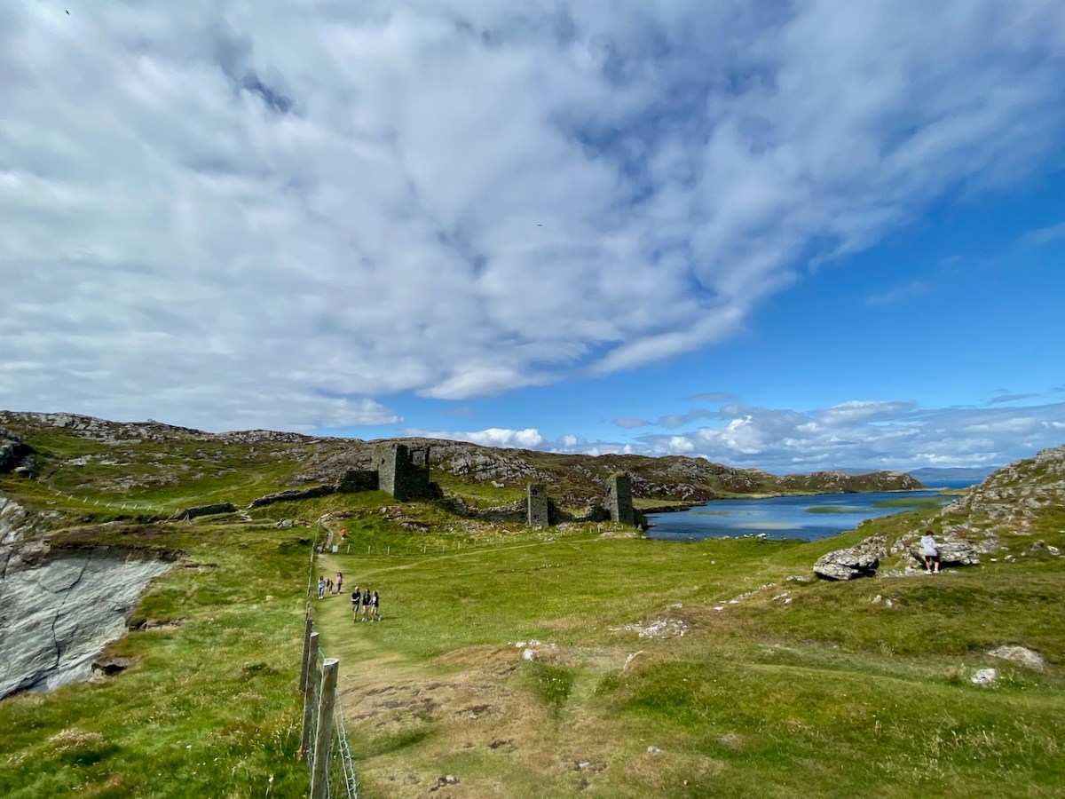
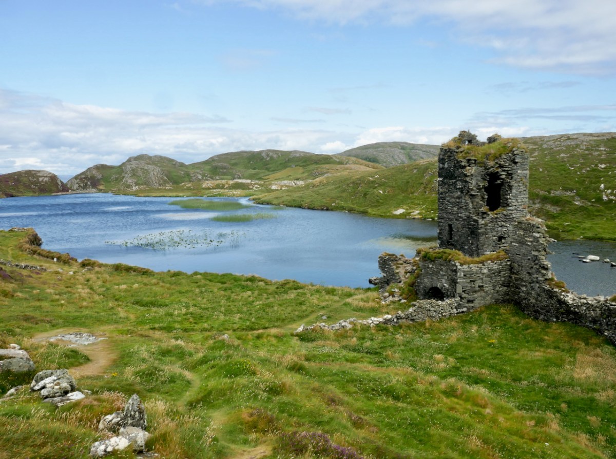
It’s actually amazing that in all the years we’ve been writing Roaringwater Journal (since 2012), we’ve never written before about Three Castle Head in detail, although we’ve mentioned it lots and visit it often. I consider it to be one of the most beautiful places in West Cork, perhaps in Ireland, and certainly one of the most interesting. It’s one of The Castles of Ivaha.
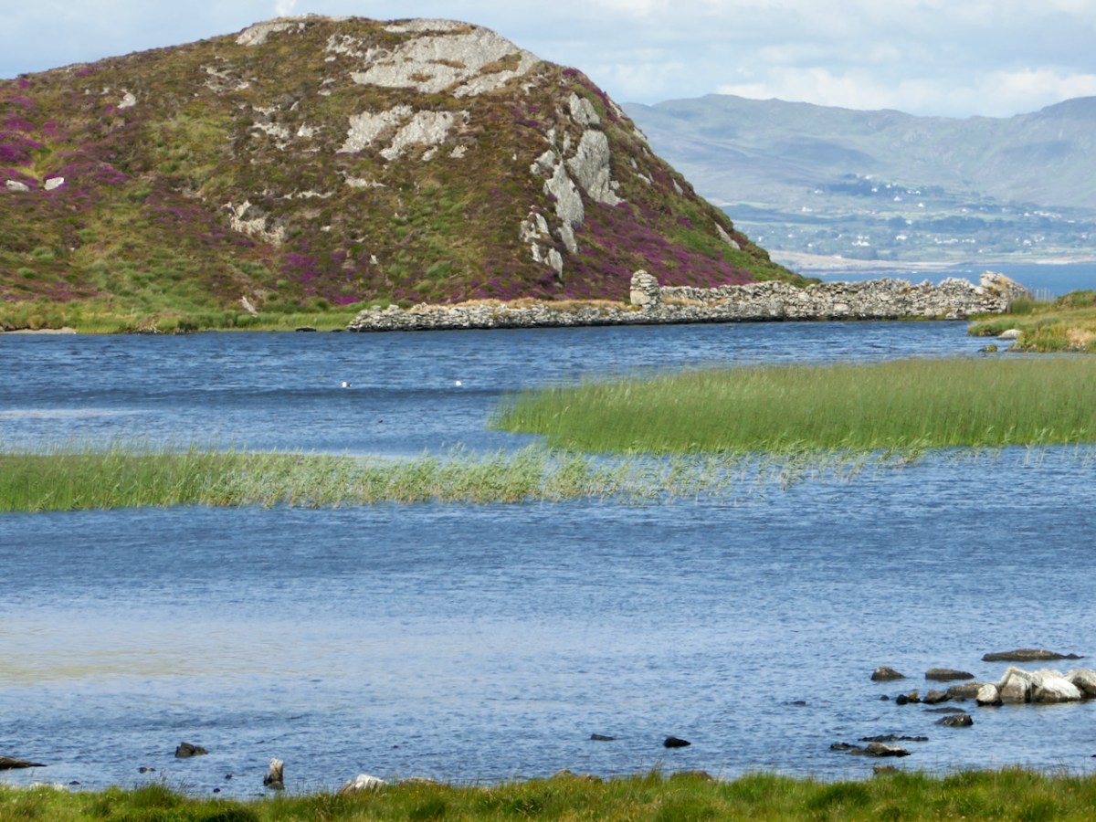
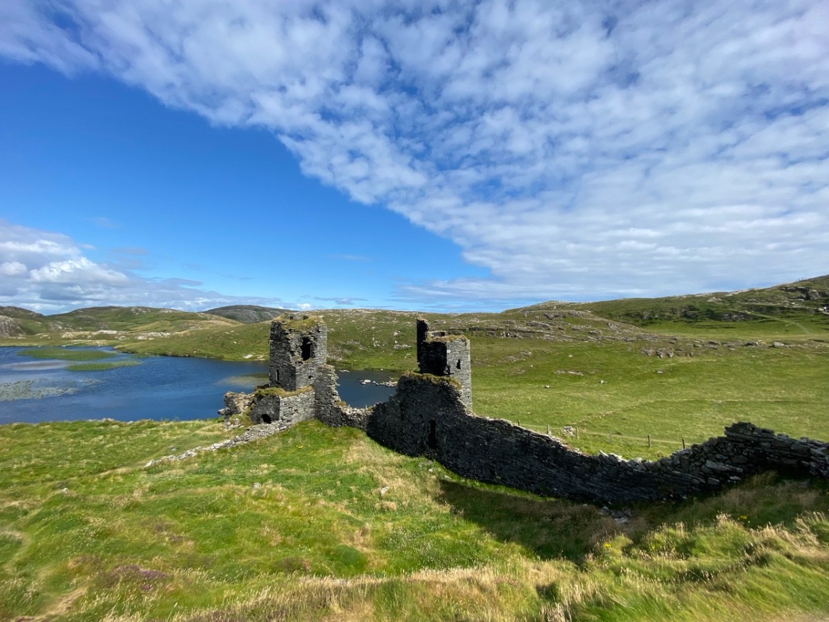
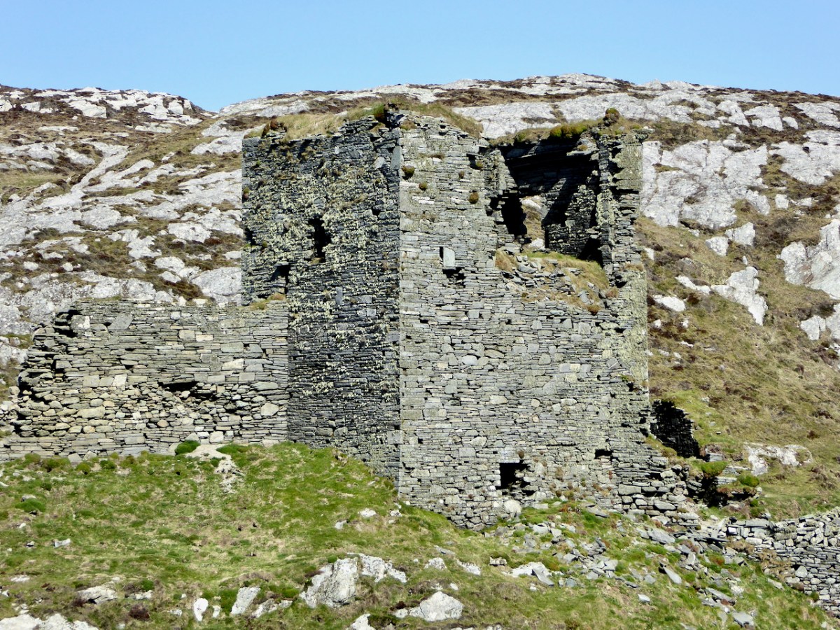
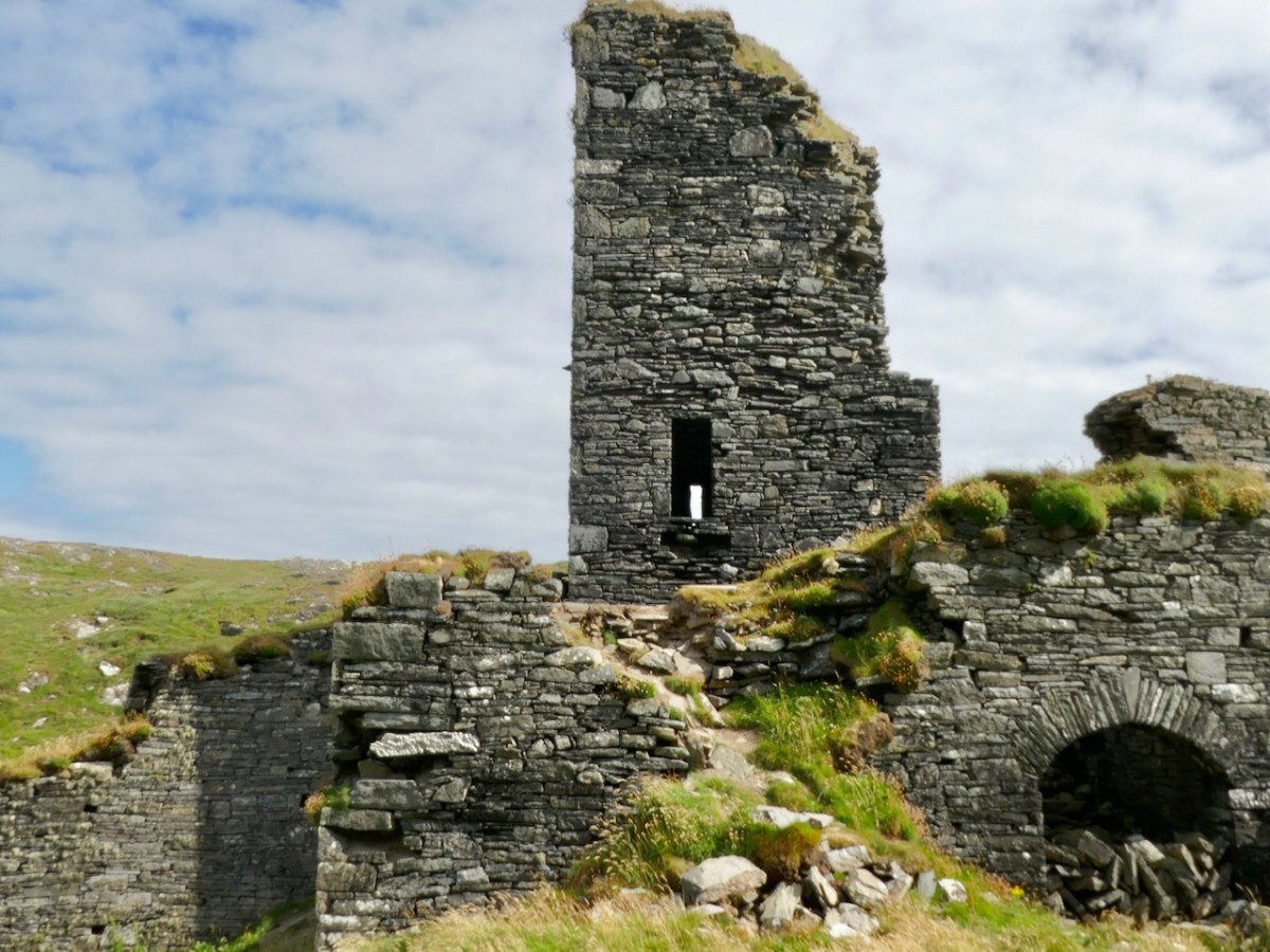
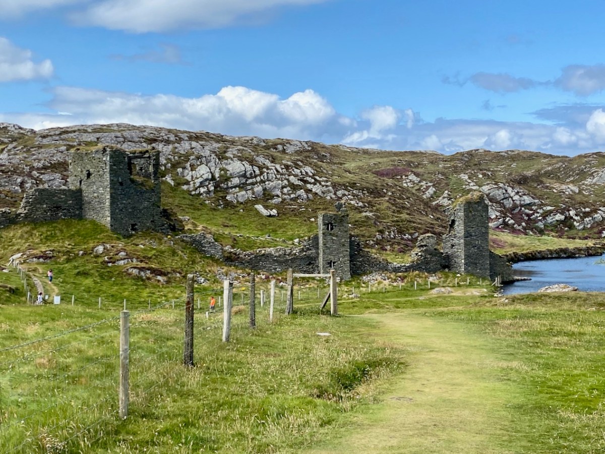
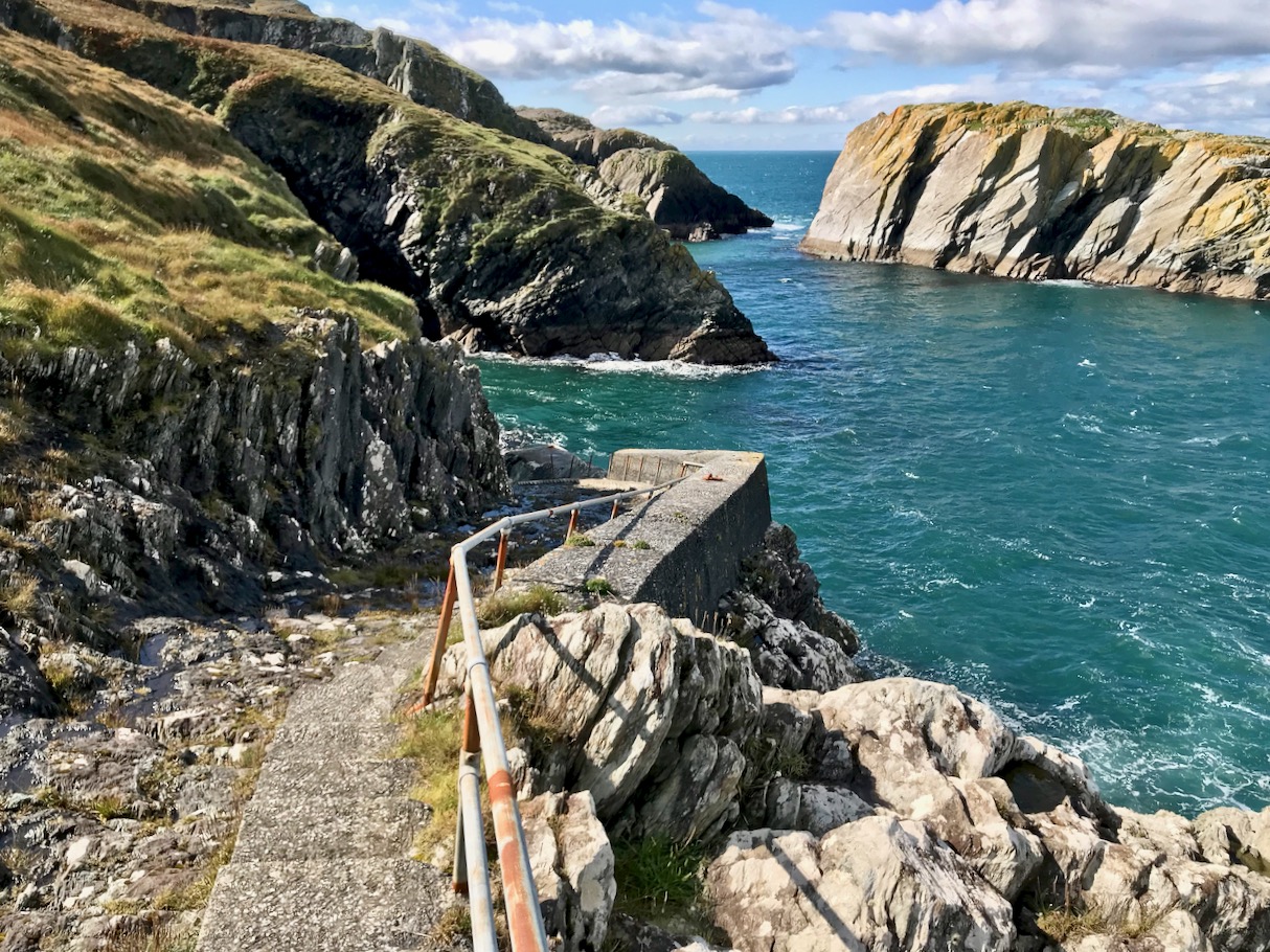
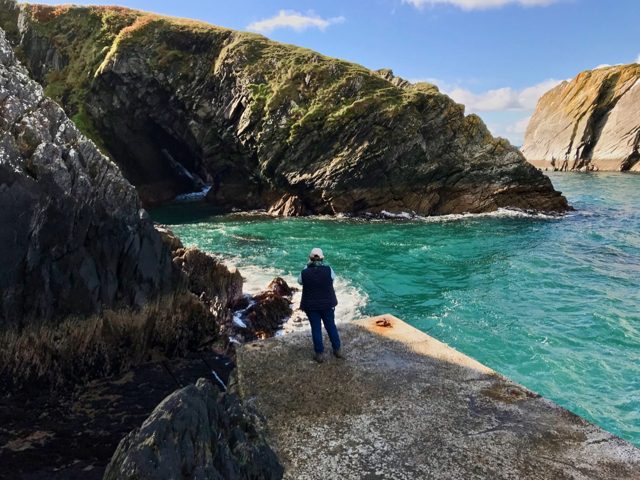
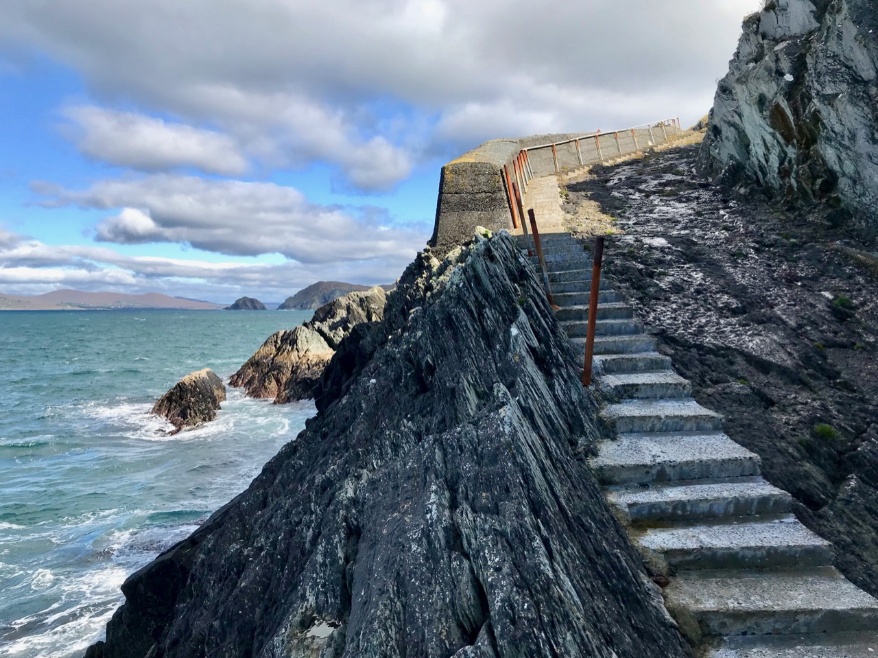
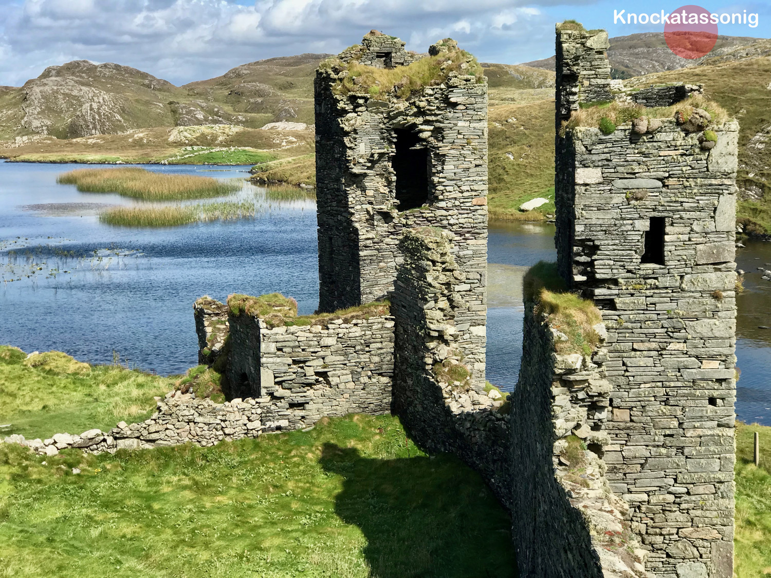
To come over the brow of the hill on a sunny day and catch your first glimpse of Three Castle Head is breathtaking, so let’s describe first what you actually see in front of you. Instead of three distinct castles, what you see is a long wall, known as a curtain wall, punctuated by three towers. The wall stretches from a precipitous cliff on the south west to a lake on the north east end, and it is this lake that gives this place its Irish name of Dunlough (from Dún Loch, or Fort of the Lake).
The lake may have been held back at one point at the north east end where it drains into the sea – a long wall stretches partly across it here – or this wall may have been part of the fortification system for the whole promontory.
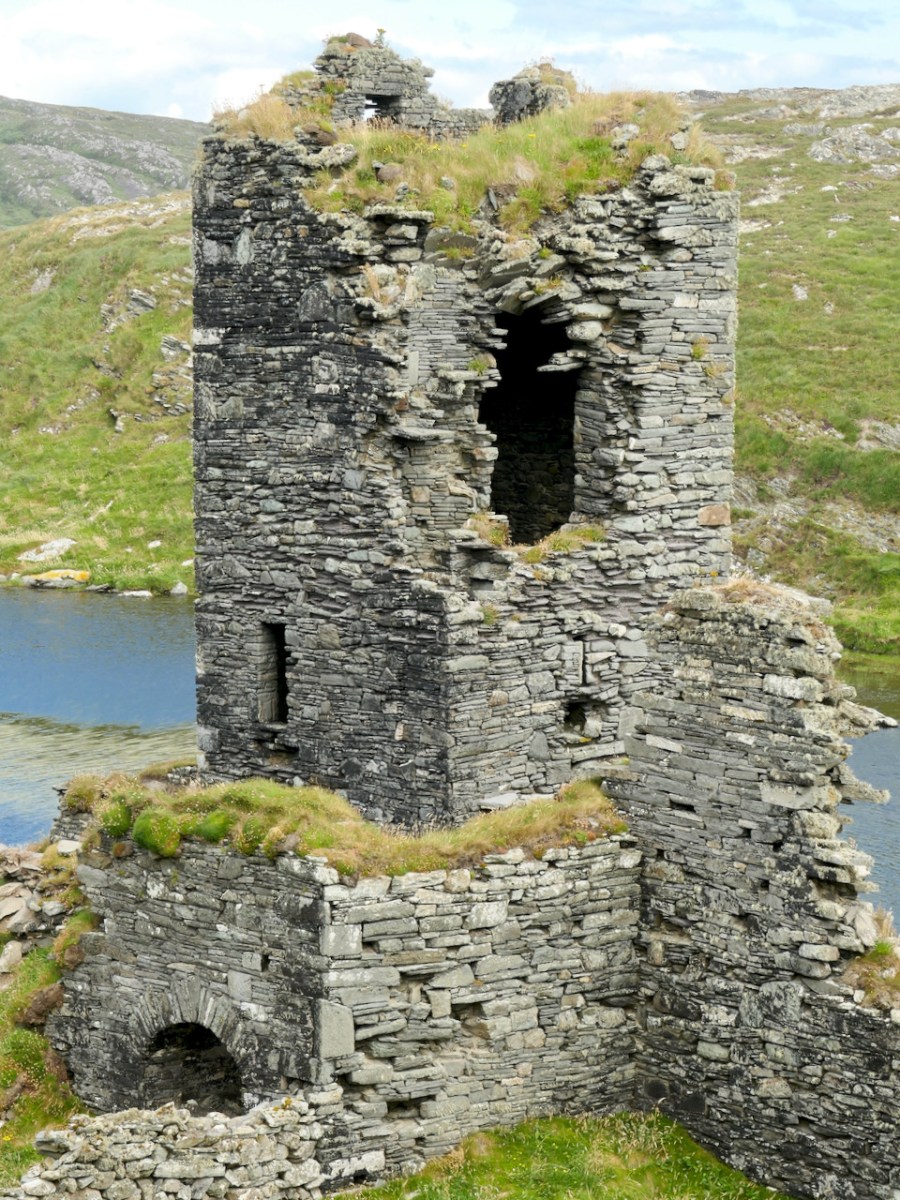
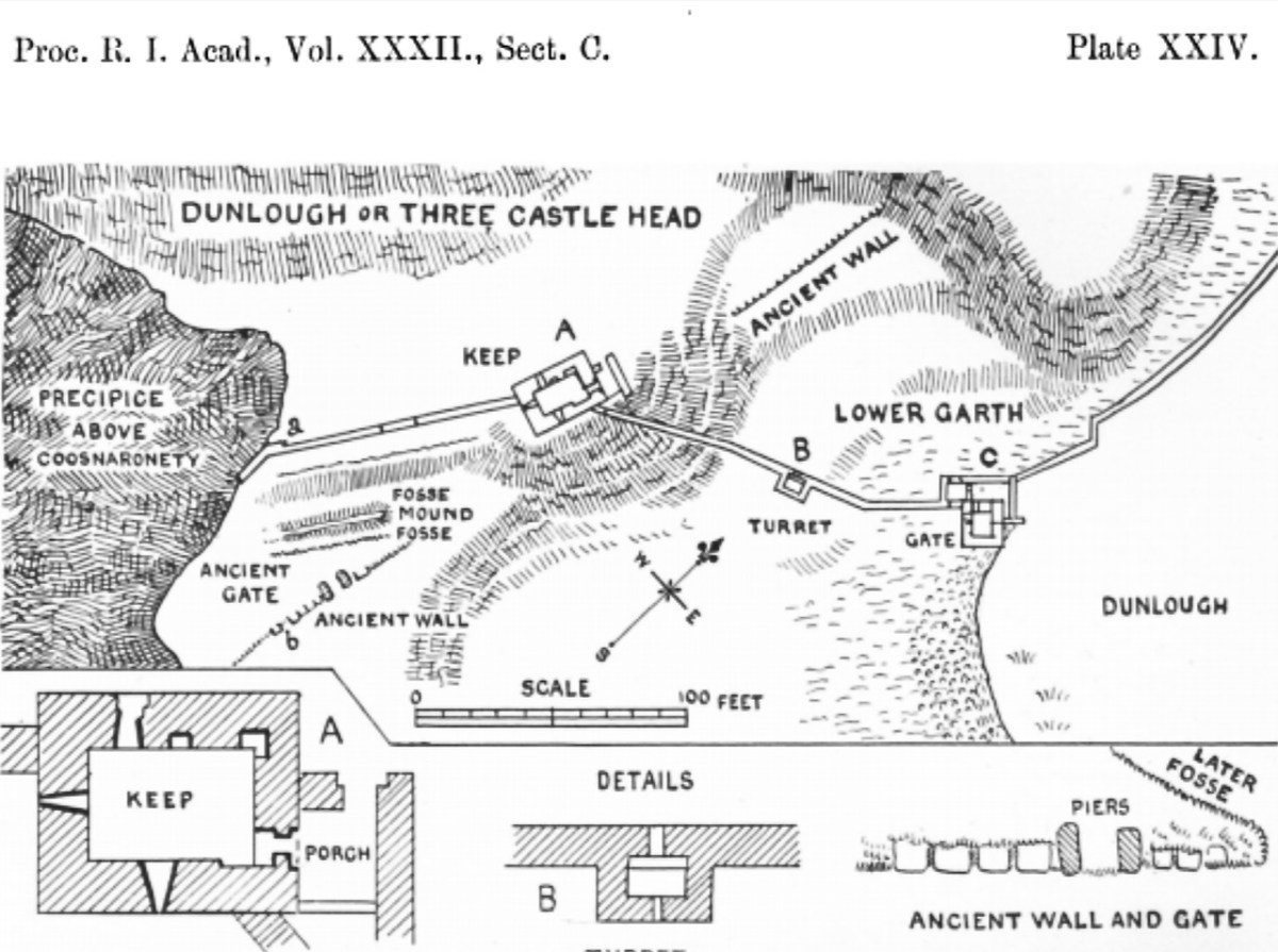
The curtain wall would have constituted a formidable defence for the area behind it – the cliff makes it impregnable on the west side, while the lake forms a barrier on the east. Our old friend Thomas J Westropp visited Dunlough in about 1914, when there was more to see on the ground of the pre-curtain wall fortifications, wrote up his observations, and supplied a drawing.* More on his conclusions later. For convenience, I will use his terminology for the three towers, although they are not necessarily what a modern medieval historian would use. He called the largest tower, located more or less in the middle of the wall, the Keep; the one immediately to the east the Turret, and the one closest to the lake the Gatehouse. You might like to have a good read of the posts Tower House Tutorial Part Iand Part IIto help you make sense of what follows.
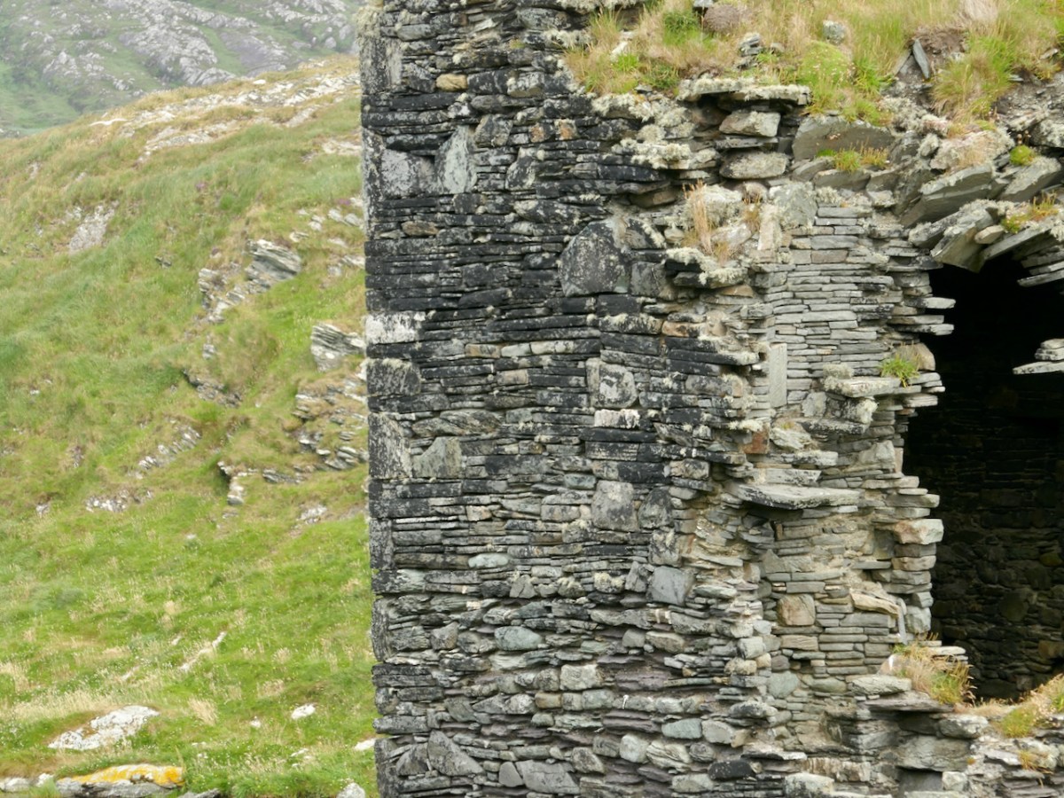
The wall and the three towers are very finely built, using the rubble construction method, where both sides of the wall are shaped with stones carefully chosen for their straight edges, and the interior is filled with rubble. Mark Samuels, in his discussion of the construction of this tower says:
A proper lime mortar, quite hard, white and capable of adhering to the stones was used in the basebatter. However, at second-floor level, the mortar was little more than earth and the building stands entirely by virtue of the careful laying of the stones. The unusual drystone construction gives it a ‘vernacular’ air which is a peculiarity of this stronghold.
The Tower Houses of West Cork by Mark Wycliffe Samuel, 1998
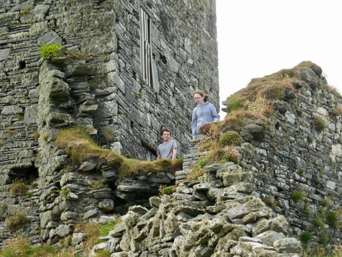
There is evidence of little mortar being used where the interior of the curtain walls can be seen, so this was a very skilful job indeed of ‘dry stone’ construction. Where mortar is discernible, however, it appears to be the local blue till, rendered into a kind of mud, rather than limestone-based mortar, and this has robbed the walls of some cohesion, so that they crumble more quickly once they start deteriorating. For a fairly thorough outline of what’s involved, see my post Building a Stone Wall. The curtain wall is likely to have had a rampart or wall walk, but no sign of this remains. Our budding archaeologist companions on our recent visit are taking a good look at the construction, below.
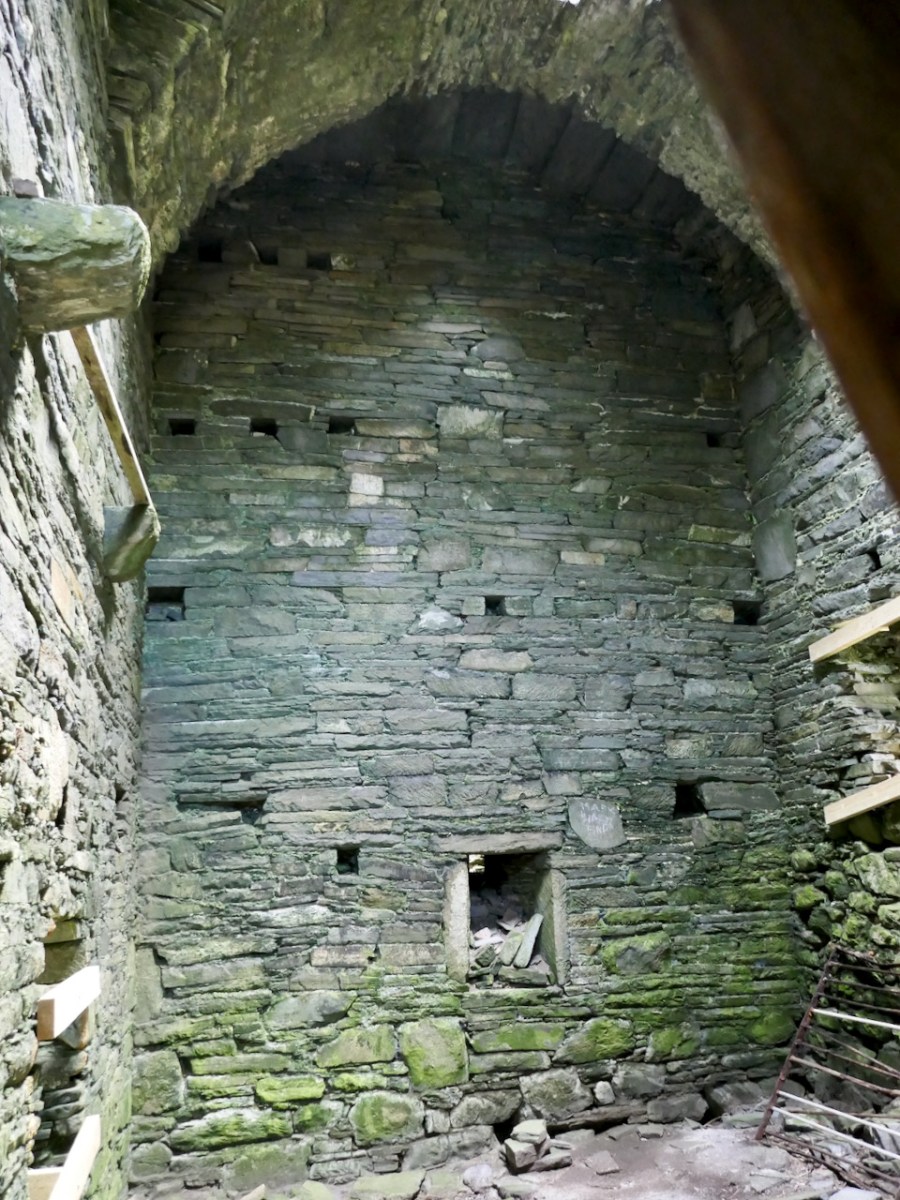
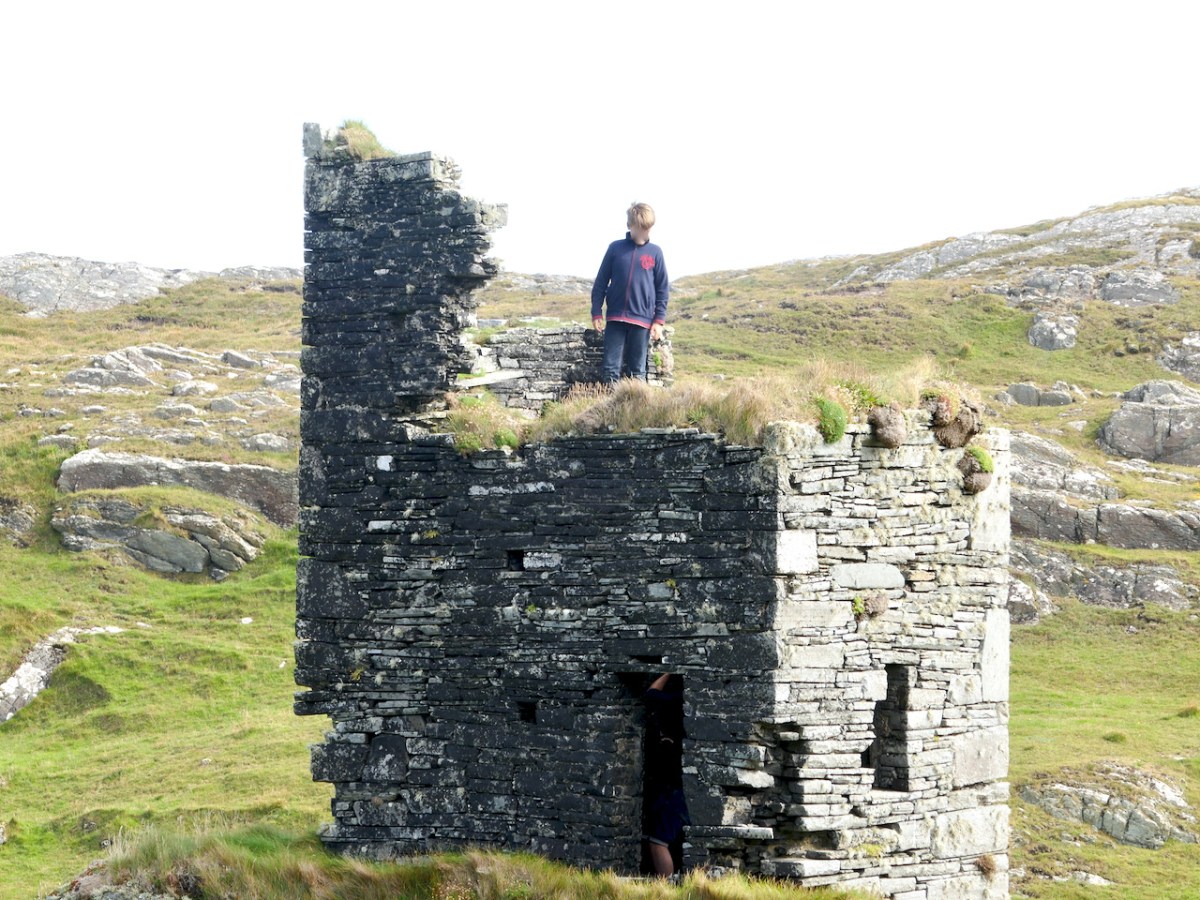
The Keep is the kind of tower house that the O’Mahonys were building all over Ivaha (The Mizen) in the 15th century and is typical of those towers, with a few interesting variations. There are two entrances, one above the other, denoting that this was, in common with all the other O’Mahony tower house, a ‘Raised Entry’ castle. However, unlike the others, the entries are surrounded by a small forecourt. Typically, the ground-level entry gave access only to the ground and first floors and there was no access to the upper, or residential floors (those above the vault) from it. The residential floors were accessed by means of a staircase inside the raised entry: it runs inside the wall to the right of the doorway.
Above that floor is the vault, which would have separated the lower floors from the upper floors where the household of the chieftain lived or where they would have entertained visitors. Some of the O’Mahony Castles, where they survive sufficiently to asses them, had a continuous vault, such as the one at Dunmanus. However, in others, and this is the case in the Keep at Dunlough, the Vault is formed by archways, upon which great slatey slabs have been laid to form the floor above. In the Keep, you can still see the impression in the mortar overlaying the arches of the wicker used to build these wicker-centred arches.
There would have been at least one and probably two more floors above the arch/vault – the residential floors. These were not comfortable dwellings – there were no fireplaces and the windows, although bigger than the lower floors, would not have let in much light. Above the top floor, a wall walk would have patrolled by look-outs.
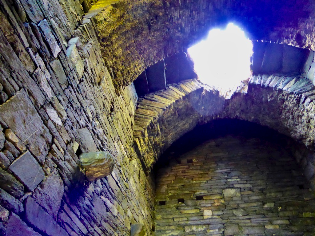
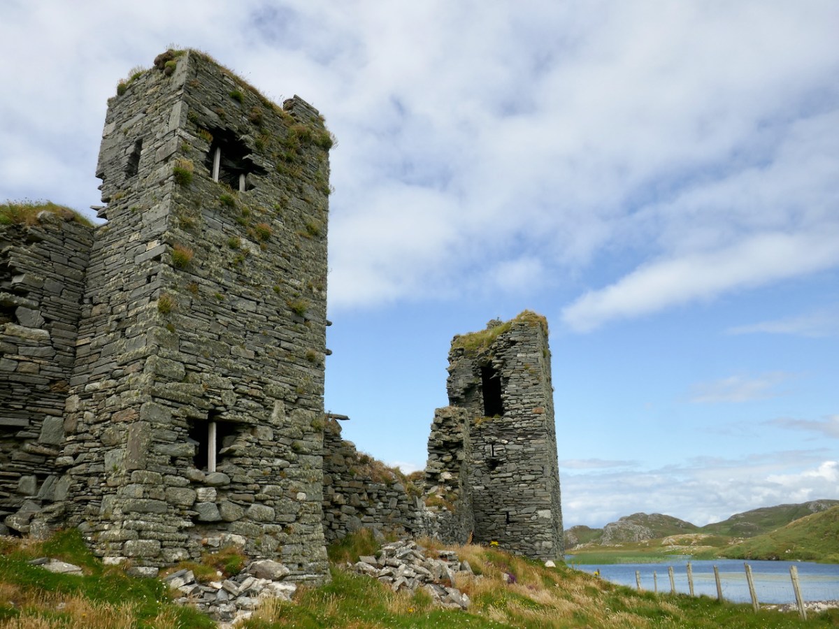
Westropp christened the middle tower (below) the Turret as it is the slimmest of the three. There is no evidence of a stairway so the floors were reached by means of ladders. Unlike the other two towers, which were built straddling the curtainwall, this one has three of its sides outside the wall, with the entrance through the wall on the north side.
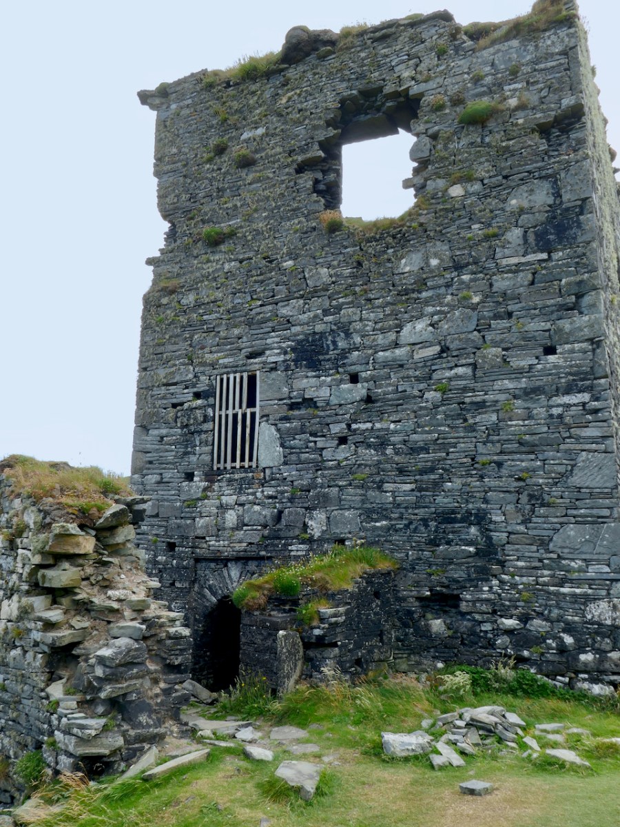
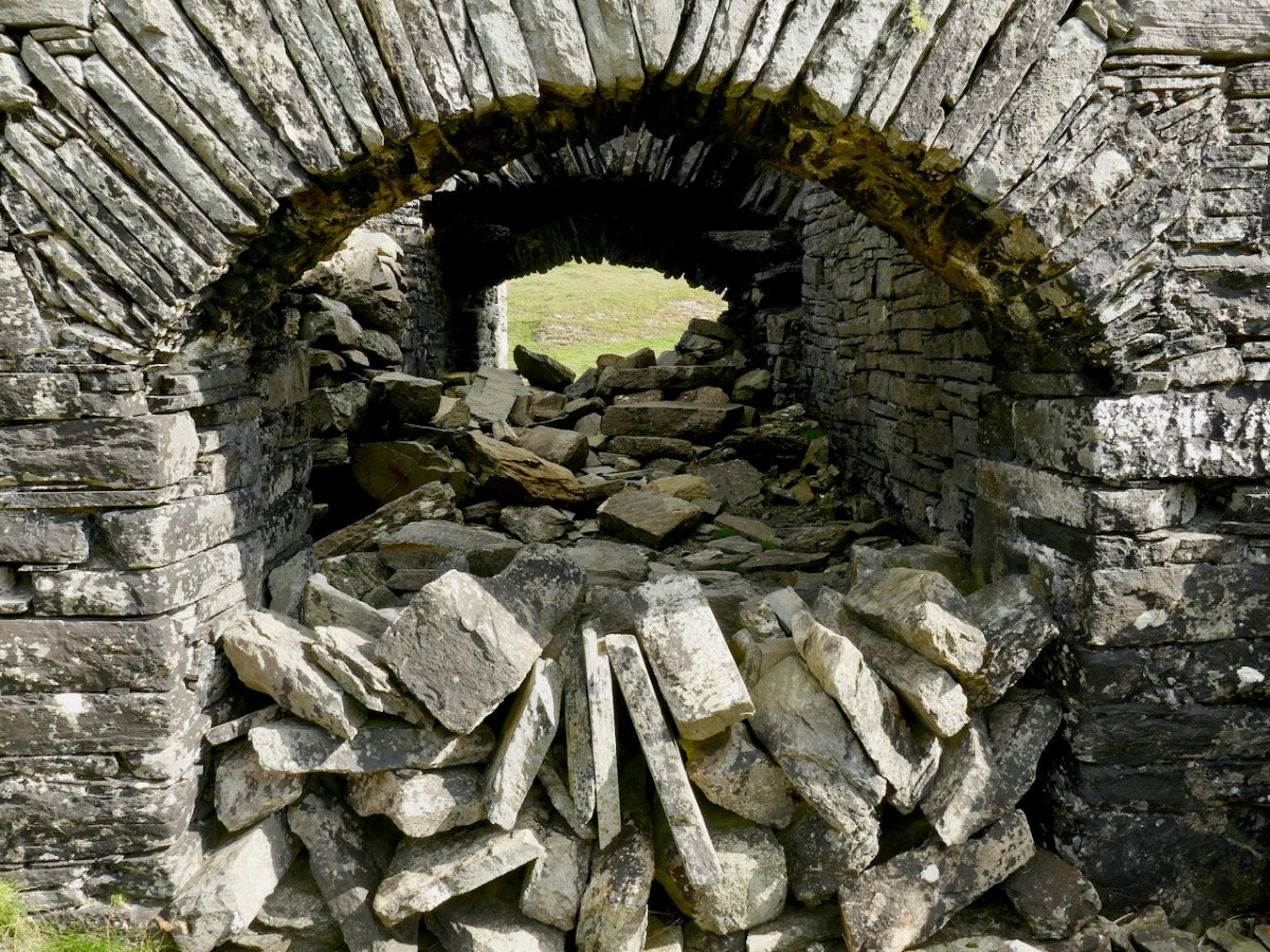
The gatehouse is perhaps the most complex of the three towers. At its base is an arched passageway, now with the collapse of ages completely blocking it.
Because it’s difficult to really see this tower now, I will give you Westropp’s description of it from his 1914 visit:
The entrance had inner and outer arches, which were closed and barred from the inside, I presume lest anyone should get into the enclosed hill, hide till night, and then open the gate treacherously. The outer gate is 6 feet 10 inches wide, the inner, 6 feet 3 inches and 9 feet 8 inches apart ; they have slightly pointed arches. From the interspace a small door opens into a little court, or rather passage, round the other two sides of the gate tower. This turret has a vaulted basement 9 feet by 9 feet 9 inches, and walls 4 feet thick, with a loophole, commanding the outer face of the gate. There are two stories or lofts, reached by a ladder through a trap-door and under another vault. The second floor has slits in each face ; the third, one to the south, and a torn gap westward above the gate. Over the upper vault is a little gabled attic, with an ope overlooking the lake. A small stair runs spirally up the north-west corner. The walls having been very thin there, have fallen, or been broken, down to the basement vault. A short wall runs from the gatehouse out into the lake.
Westropp, 1915 (see footnote)
The small spiral staircase can be clearly see where the outer wall has fallen away (above).
Several sources tell us that this is the oldest of the O’Mahony Castles, built in 1207 by Donagh the Migratory O’Mahony – there are references in Annals to a ‘castle at Dun Locha’. Modern scholarship on castles tends to agree that there were structures called castells before the coming of the Normans, but it is clear that they did not look like these tower houses. It may be that the reference in the annals is to Dunloe in Kerry, but it may also be that there was indeed a castell here in 1207. If there was, it was not what we are looking at now: any analysis of its construction places it firmly in the fifteenth century.
Once again, we turn to Westropp. When he visited Dunlough in about 1914 there was more to see on the ground of the pre-curtain wall fortifications, and he wrote up his observations, and supplied a drawing (above). This was an ancient promontory fort, he said, dating to well before the castle-building era, and he traced the line of the fort bank through the remains of fosses, or ditches, vestigial but still visible. The next phase was the building of a wall, and this may well have been the castell of 1207. It follows a line south-west to north-east, at a different angle to the curtain wall. He was able to make out a gate feature near the cliff. This was demolished, he said, to build the curtain wall we see today.
I agree with the broad strokes of Westropp’s analysis. Yes this is an old stronghold of the O’Mahony clan – and what you are looking at today was not built in 1207, but built on top of the 1207 fortifications. The O’Mahonys went on a castle-building spree in the 1400s and the Dunlough curtain wall and towers, in terms of their architecture and their similarity with all the other O’Mahony castles, fits with that timeframe.
But all of that is dry as dust – who can worry about a dating timeframe when what presents itself to your view is so beautiful, so perfectly situated and so hopelessly romantic? So let’s take a vote – is this Ireland most beautiful castle? Hands up who agrees with me!
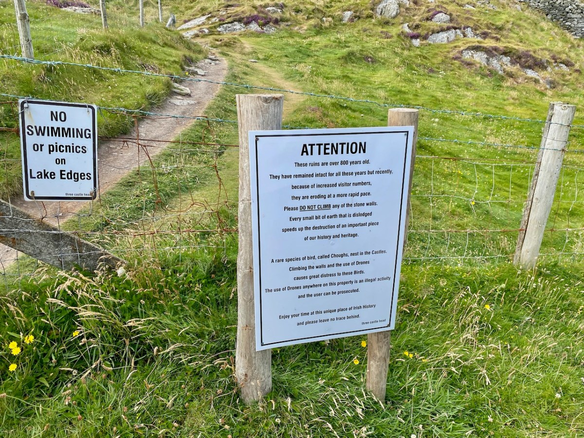
One last word – for many years Three Castle Head was off limits as a private farm. In recent years the owners have been welcoming visitors and this is gratefully acknowledged. However, the increased footfall is coming with a cost in wear and tear. Look at the walls above – these are fragile ruins: knocking off one loose stone can have a catastrophic effect on the building envelope.
It’s also dangerous to go clambering over unstable ruins like this. So, a heartfelt plea – if you visit, and I hope you do, PLEASE STAY OFF THE WALLS! I was pleased to see a new notice up about this on our most recent visit, and indeed visitors seemed more respectful than they had when I was last there (above). If we stay away from the walls, hopefully they will stand to delight us for more generations to come.
*Fortified Headlands and Castles in Western County Cork. Part I. From Cape Clear to Dunmanus Bay by Thomas Johnson Westropp Source: Proceedings of the Royal Irish Academy: 1914 – 1916, Vol. 32 pp. 249-286, (accessed at: https://www.jstor.org/stable/25504178)
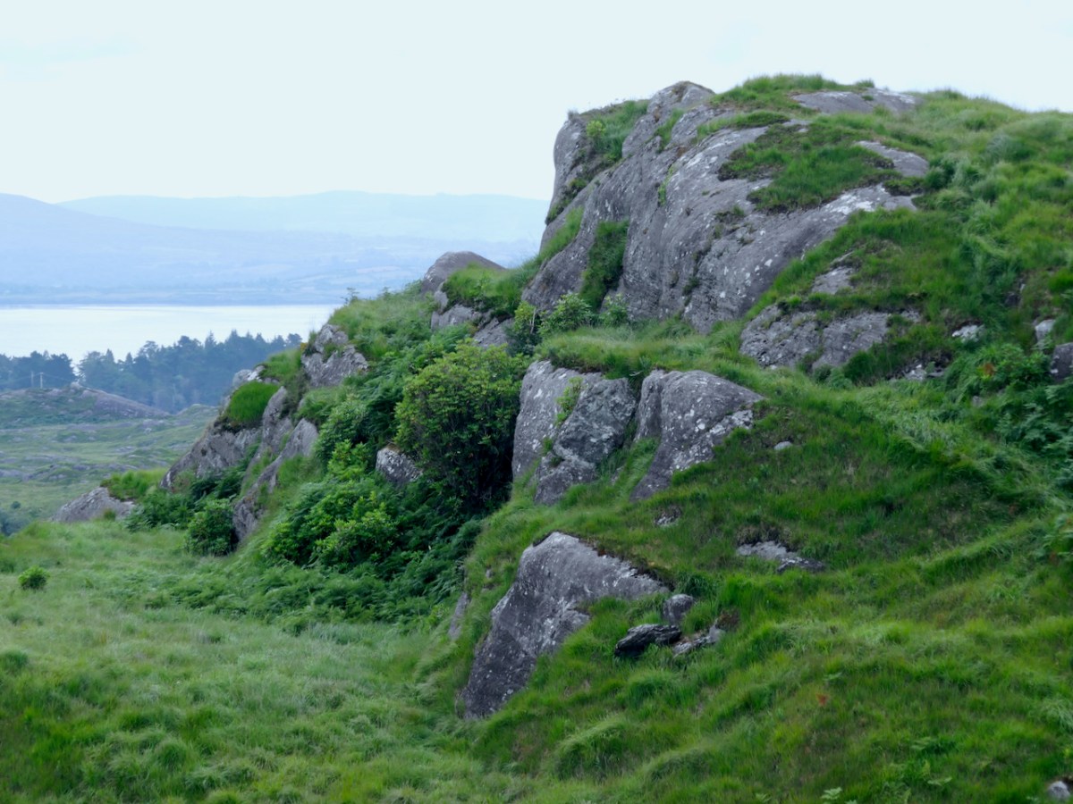
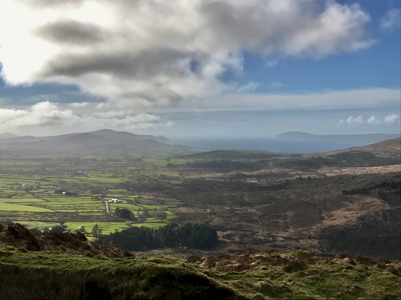
The first day of October seemed ripe for starting a new project. It was also a beautiful, rich, blustery autumnal day – ideal for heading to the remotest uplands. I have always been drawn to high places: there’s something romantic about seeing the coastal landscape laid out below your eyes, especially in these western wildernesses where bare rock, gorse and heather intertwine with history: ancient farmsteads, ruined cottages and impossibly isolated forgotten quays, seemingly abandoned along our most rugged shores.
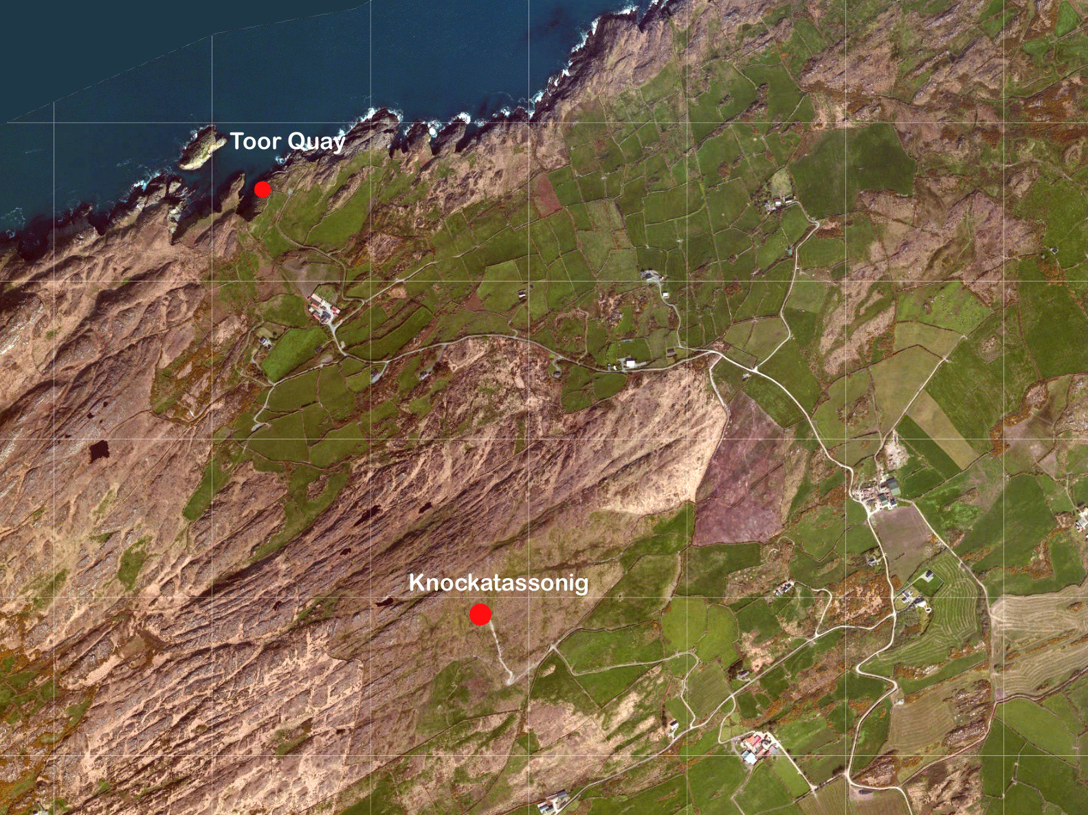
Header – Toor Island just off the mainland close to the west end of the Mizen Peninsula: the high ground beyond is the peak of Knockatassonig. Above – it’s a most remote and wild place for a pier, but Toor Quay is still accessible from a winding, overgrown footpath and 107 concrete steps: today it’s only the occasional haunt of anglers
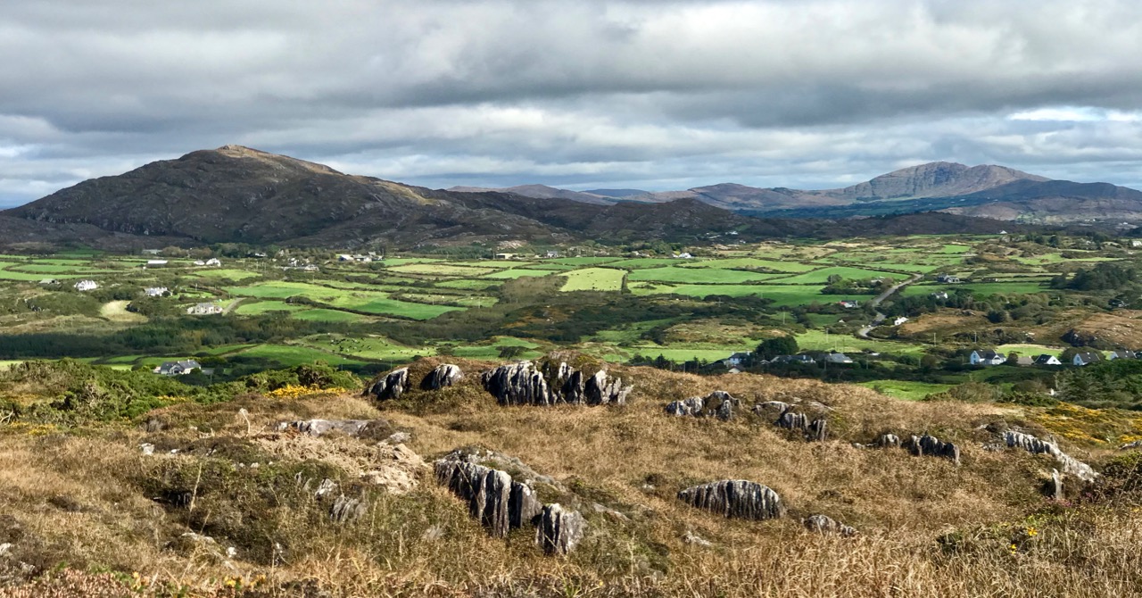
This project – Mizen Mountains – sets out to explore all the peaks on our westernmost peninsula. Are they mountains? It all depends on the context, and your perspective. Mizen’s loftiest outcrop – Gabriel – is 400 metres above sea level. Quite modest (Kerry’s MacGillycuddy’s Reeks claim the country’s highest summit, Carrauntoohil, at 1,038 metres), yet when you do look down on the spine of our peninsula from above, it’s all rocky crags and ridges pushing upwards towards the heavens, while at the edges the mountains fall precipitously towards the sea. It’s great, dramatic country, calling out for exploration – and there’s nothing we like better than finding new ways to discover this land and all its stories.
The view to the western end of the Mizen Peninsula, seen from the slopes of Mount Gabriel. The Sheep’s Head is across to the right
50 years ago the writer, Peter Somerville Large, set out to travel the western peninsulas of Ireland on a rusty bicycle purchased for the purpose in Skibbereen. I like the introduction he gives to his book The Coast of West Cork, first published in 1972, and still in print – it serves my own project well:
. . . I set out into the country. The sun had filtered through after rain, making the tarmac steam with moisture and sending up towering clouds off the mountains into the sky. Cattle stood motionless in the boggy fields and water dripped from the leafless sycamores . . . I travelled along the coast of West Cork, through Carbery, from Clonakilty to Roaringwater Bay with its fringe of islands and castles, and north to Bantry and the Beare peninsula. Much of the land near the coast consists of bog and mountain with headlands like lines of slanting spears thrust into the Atlantic. But there are parts that are sheltered, with a tropical lushness that is partly ascribed to the benign influence of the Gulf Stream. Ruins are soon covered with thick ivy and it takes only a few trees or slips of fuchsia to make a protective wall. Some valleys and hillsides have pockets of moss-covered oak-trees which are survivors of the ancient forest that covered the country three hundred years ago . . . From Goleen the old road wound high over a ridge before dropping down to Crookhaven. Almost all the land was rocky around Knocknamadree; The quilted shadows of clouds passed along the high ground over to the sea . . .
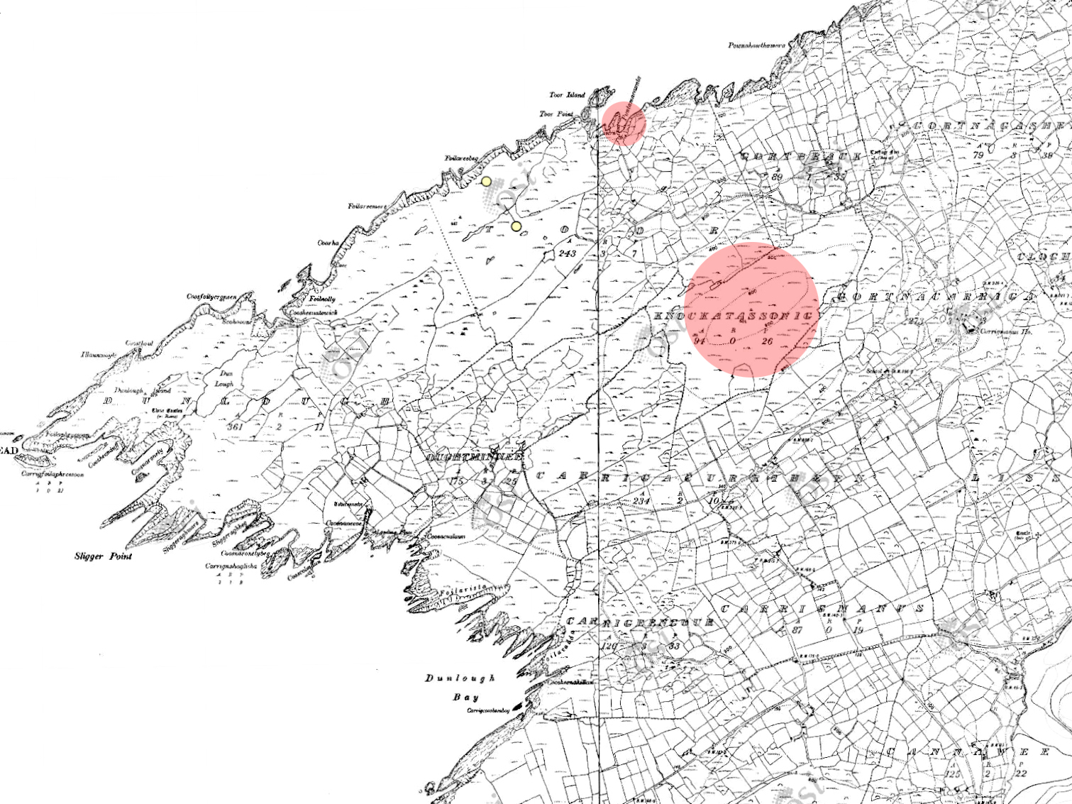
Satellite view of the rocky landscape towards the western edge of the Mizen: Knockatasonnig is a barren peak
I have set the bar at the 200 metre contour line – anything above that is, for me, a mountain! So I will be traversing the terrain in search of all the eminences above this elevation on the Mizen, looking specifically at topography and any traceable history and folklore specific to these ‘mountains’. But I will also be talking about our journeys to these destinations: you know how fond we are of getting ‘off the beaten track’. Every new exploration is invariably a revelation! This time around, we are going west – almost as far as is possible on this peninsula – to the townland of Knockatassonig, which peaks at 204 metres.
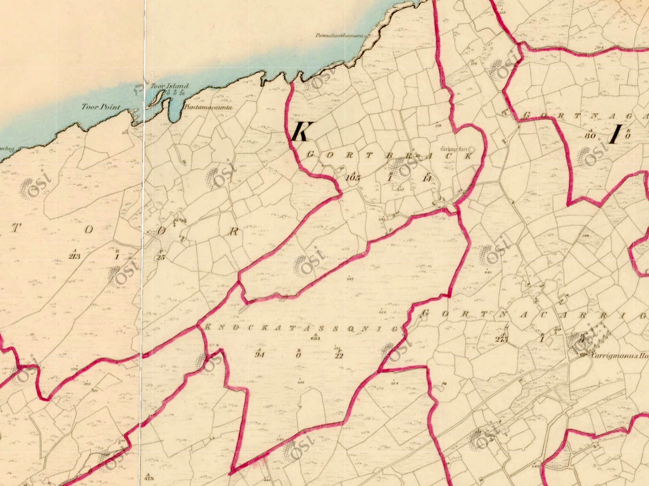
Top – the 25″ Ordnance Survey map, locating Toor Quay and Knockatassonig. Lower – the earlier 6″ map outlining the townlands
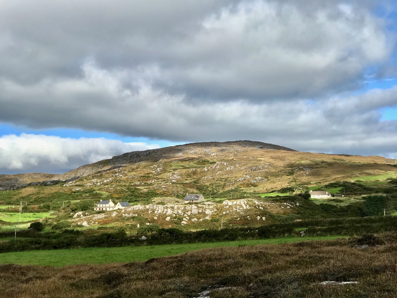
Knockatassonig is a curiosity. It’s a townland which doesn’t seem to have any habitation – and possibly never did. The 6″ map, above, was originally surveyed in 1846 and is valuable in outlining the townland boundaries at that time. It may be that in pre-famine times there were dwellings in the area: Ireland was much more heavily populated in those days, even in places like this which seem so remote today. But sometimes the townland names are particularly useful to us because they can tell us something of the history, which would have been passed on aurally through the generations until the maps were made.
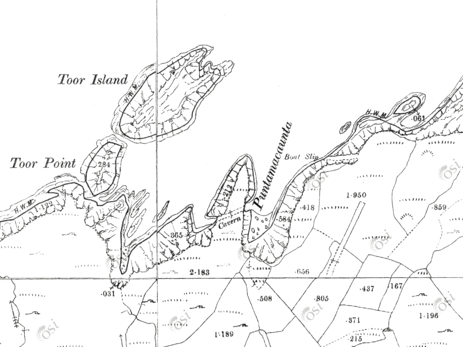
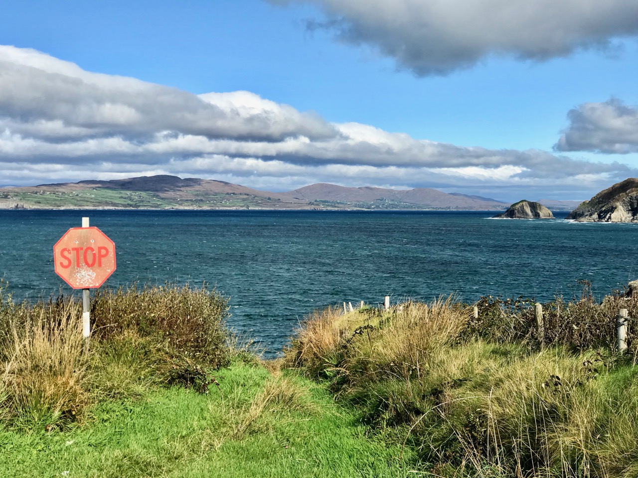
Upper – detail from the 25″ map, showing the ‘Boat Slip’ at Toor. The map was presumably surveyed before the present pier was made; the slip has been cut into the solid rock and launching boats there must have been a treacherous business. Lower – today, a steep, narrow boreen can be negotiated as far as the Stop sign! An overgrown footpath goes on down to the sea and quay. The mountains seen over the water are on the Sheep’s Head
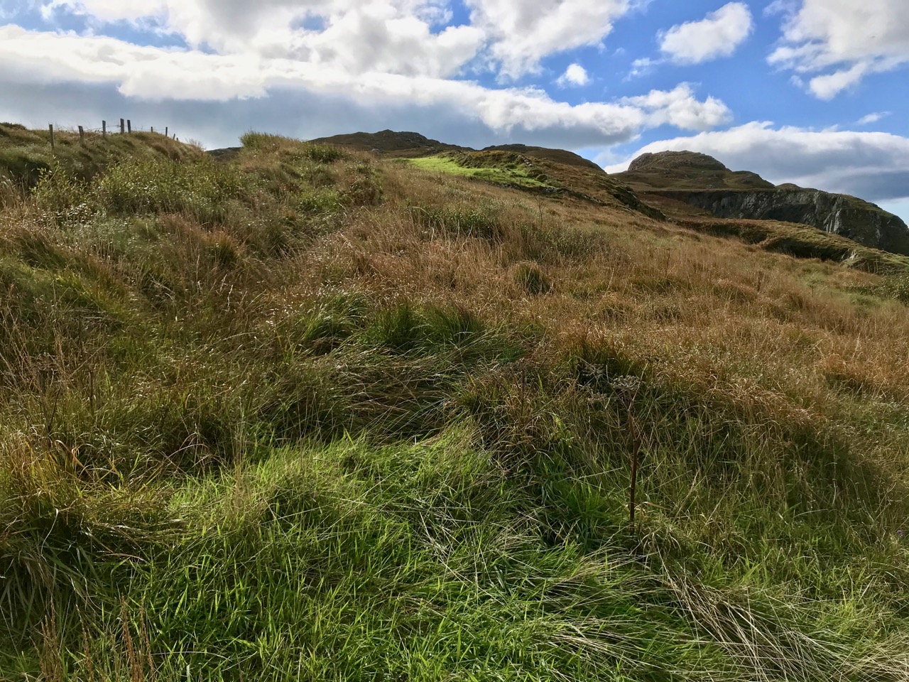
So far we haven’t talked much about the ‘Mountain’ of Knockatassonig. This summit is very visible, but virtually inaccessible at this time of the year due to bracken and spiky fences. It can just be seen on the left in the header picture: that’s taken from the footpath which goes down to Toor Quay. Like most of the Mizen peaks, Knockatassonig commands good distant views. It should be more approachable in the winter months. Although it’s hard to get to, it can be seen from several places on the Mizen, including Dunlough. The photo below shows the peak on the horizon beyond the ruins of Three Castle Head:
Here’s a view of Knockatassonig summit seen from the south-west side, taken from the small road that goes down towards Toor. The view below shows the complex profile of the summit seen from the north
In looking at the peaks of the Mizen I intend to explore and uncover – where possible – any extant memories of stories or local lore relating to them. As far as Knockatassonig goes, I have found nothing recorded, other than the name, which is shared with the townland. So what does it mean? Well, it’s not clear, but the logainm website suggests ‘The hill of the Englishman’, and compares this name to the entry for Corr na Seirseanach in Co Monaghan ‘The round hill of the Englishmen’ or ‘The round hill of the mercenaries or hired soldiers’. Well – that’s a surprise . . . and a bit hard to reconcile with the unpopulated landscape we see today in this part of West Cork. The Monaghan version of the name can be supported by political events dating from the early 1300s: it’s hard to relate these to any activities we are aware of on the Mizen, but Irish history is a complex thing – as are place-names. When Finola heard the name she thought it meant ‘The hill of the foxes’: a direct translation into the Irish of that would be Knock an tSionnaigh. Townland names were often written down in Anglicised form by surveyors whose ears may not have been attuned to the Irish nuances. I’m voting with Finola on this one: there’s sure to be a good few foxes in that landscape!
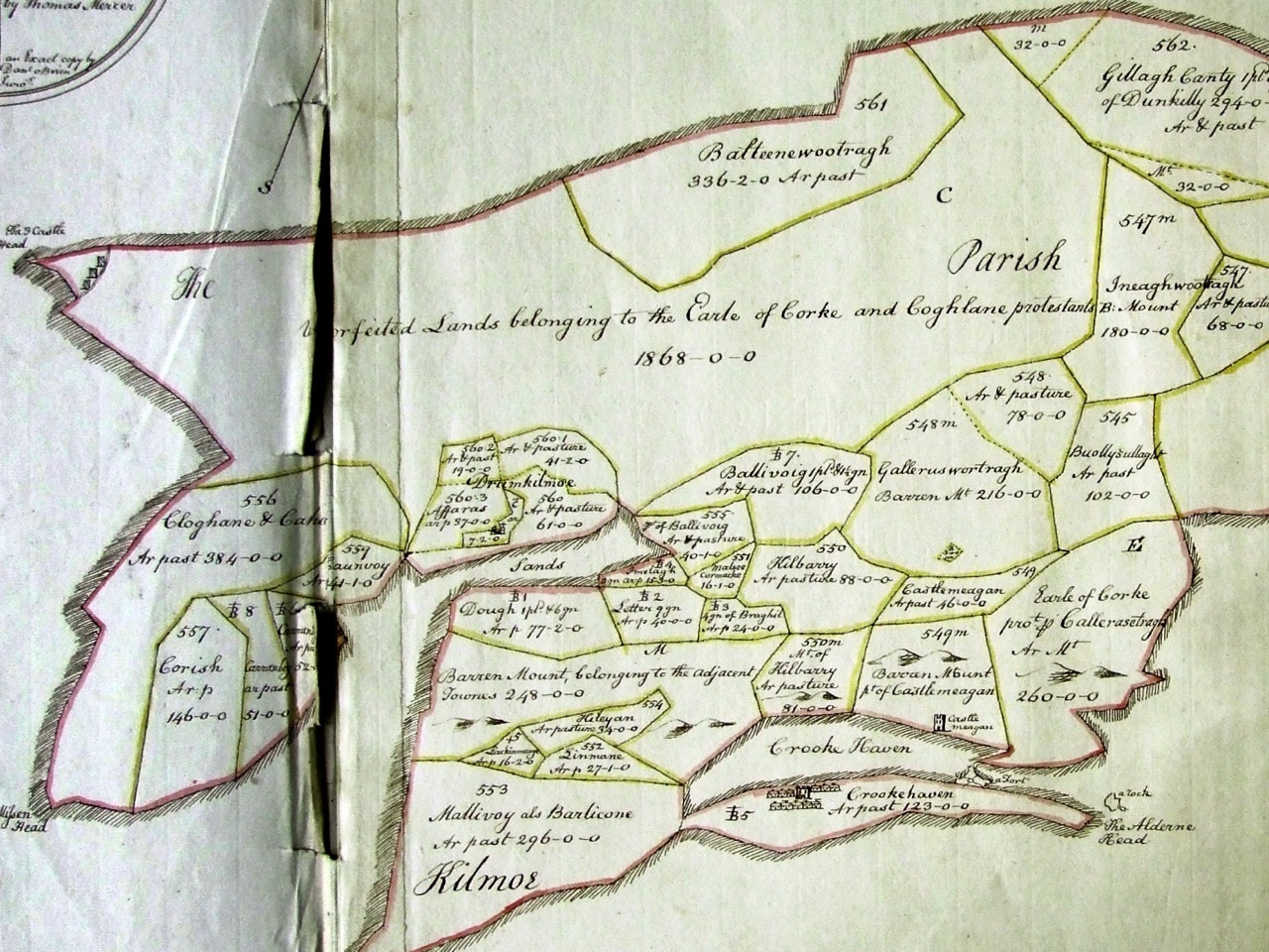
Here’s an earlier source of information on Irish names: the Down Survey. Undertaken between the years 1656 and1658, the Down Survey of Ireland is the first ever detailed land survey on a national scale anywhere in the world. It sought to measure all the land to be forfeited by the Catholic Irish in order to facilitate its redistribution to merchant adventurers and English soldiers. The extract above details the Parish of Kilmoe at the end of the Peninsula: note Three Castle Head depicted at the far left. The survey does not give modern townland names but we can work out where the Knockatassonig peak would be – in the section labelled Unforfeited Lands belonging to the Earle of Corke and Coghlane protestants In which case, of course, not only the present day townland of Knockatassonig but all those around it could reasonably be termed ‘ . . . of the Englishman . . .’ Food for thought?
Below – peaks of the Mizen: many will be the subjects of future posts
Part 2 of your (and our!) favourite West Cork photographs of 2016. If you’re not here already, as they say in West Cork – Where else would you want to be?
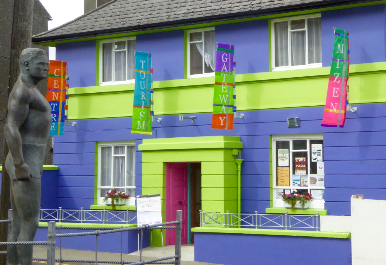
The new Ballydehob Tourist Information Centre
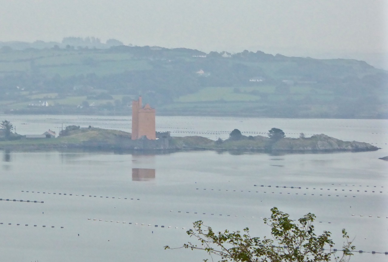
Kilcoe Castle in the mist
Toormore – the colours of West Cork
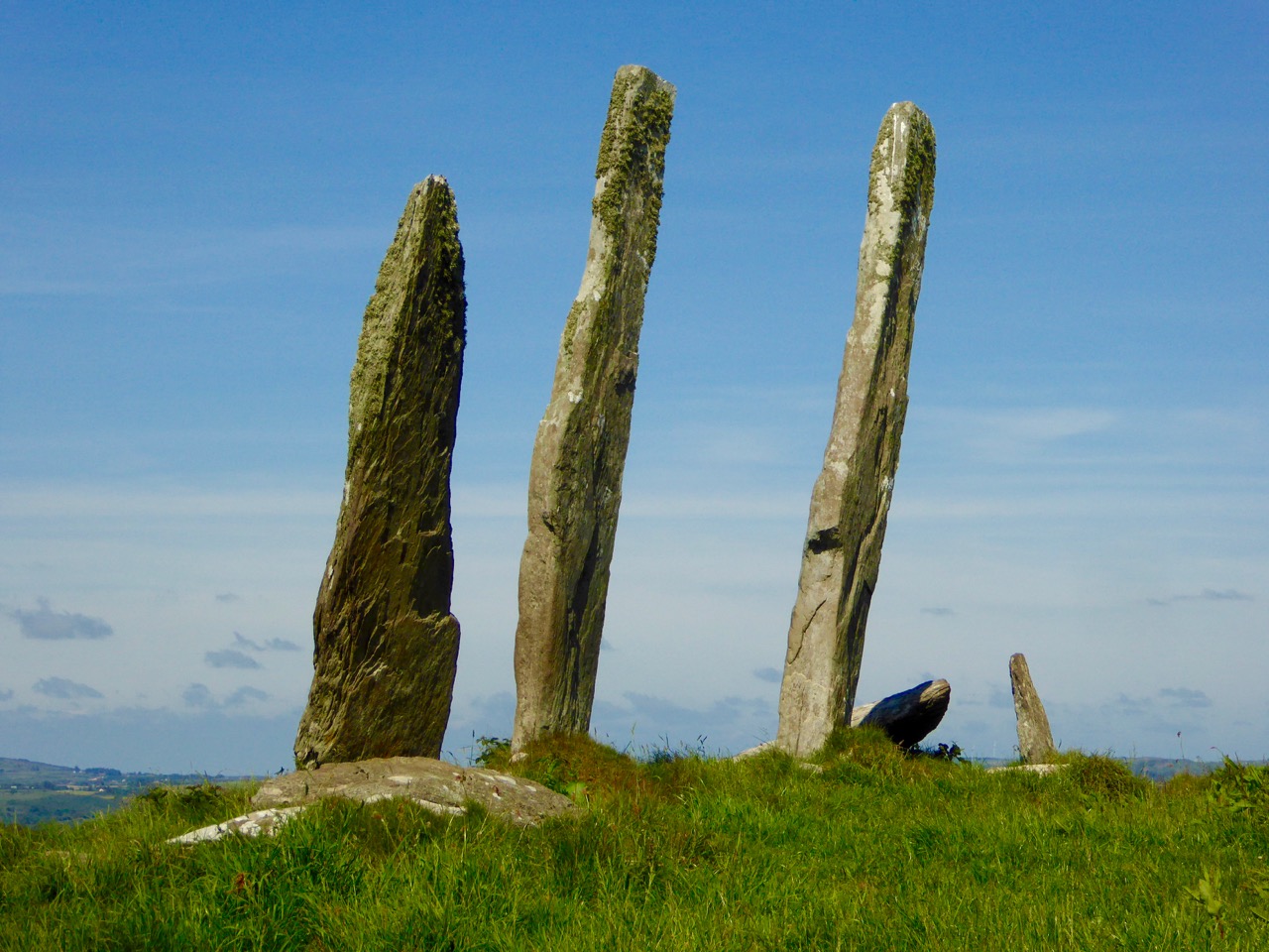
The Fingers, Gurranes, near Castletownshend
Summer in Goleen
Three Castle Head
Black Castle, south of Lowertown
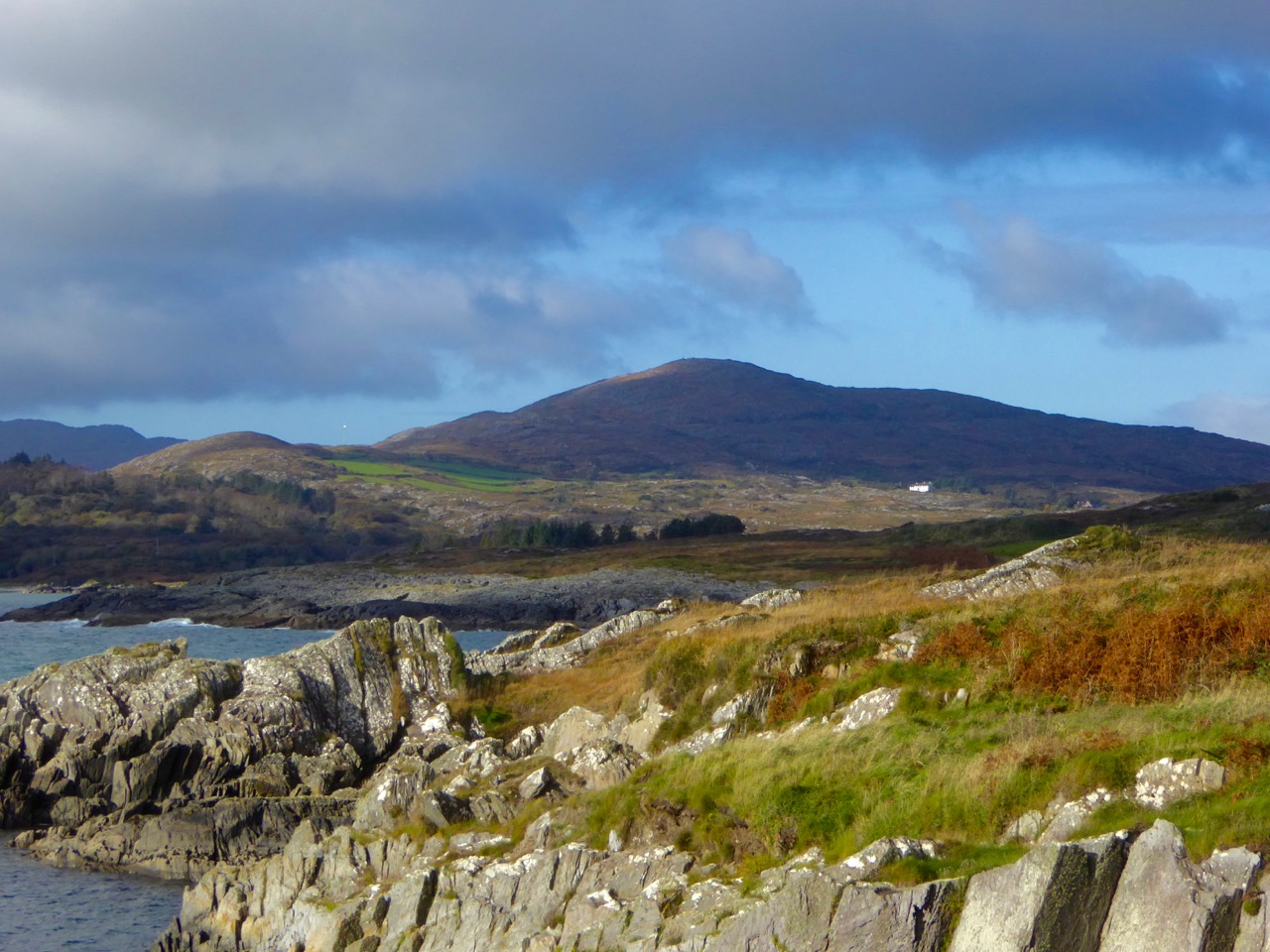
North Side of the Mizen
The sun goes down over Long Island
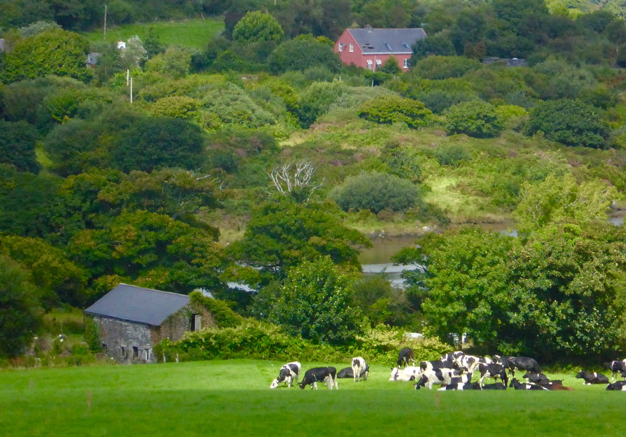
And an extra – one of my own favourites from this year. No drama – just a quiet sunlit meadow, an old stone barn and a colourful house. My West Cork.
Welcome to the UCD Library Cultural Heritage Collections blog. Discover and explore the historical treasures housed within our Archives, Special Collections, National Folklore Collection and Digital Library