Through the Yellow Gap

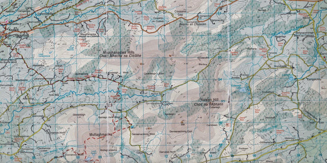
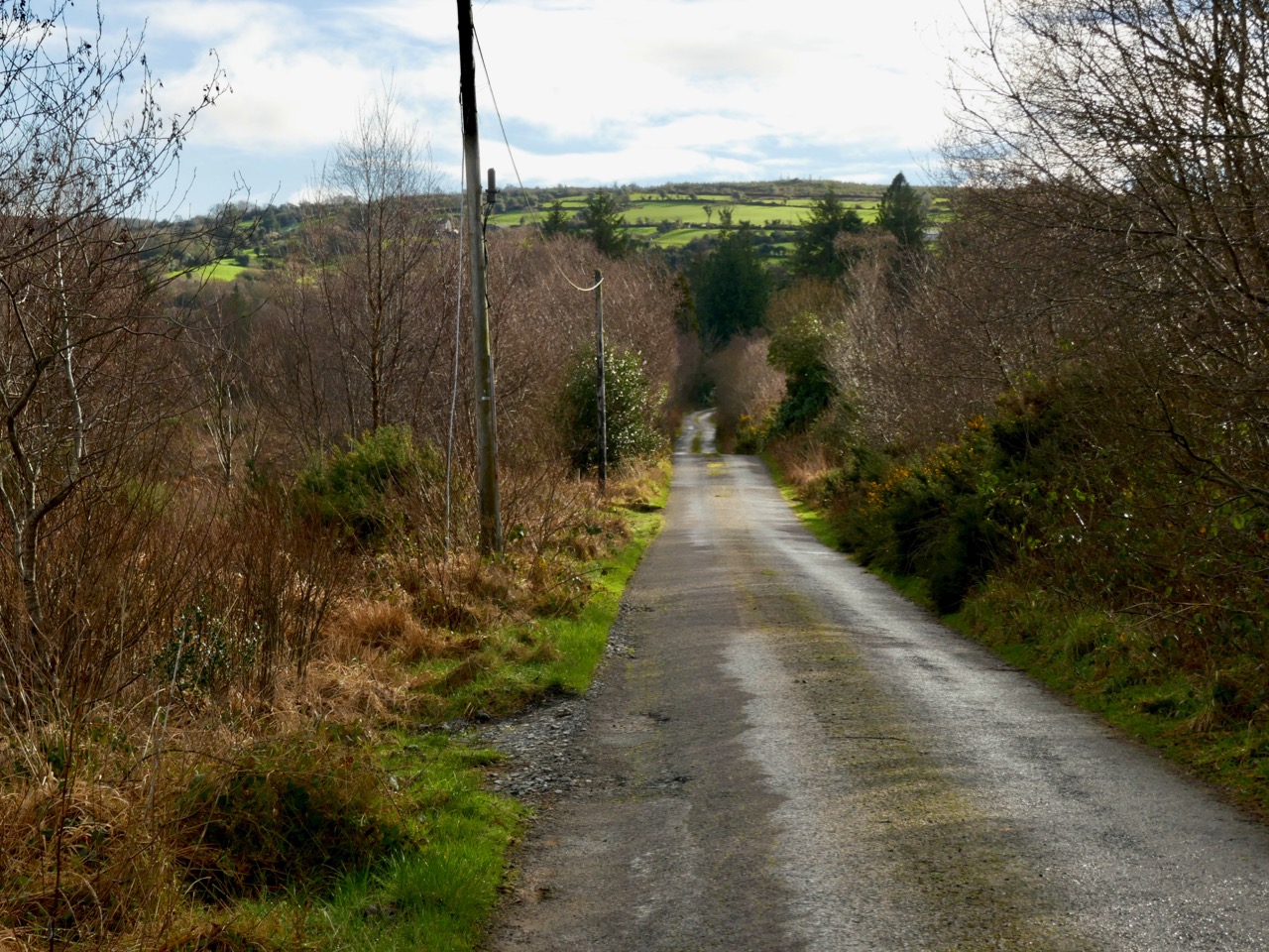
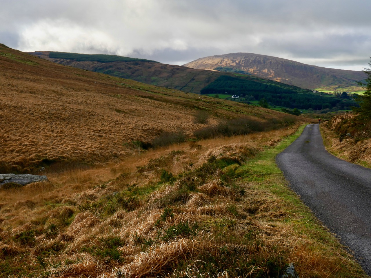
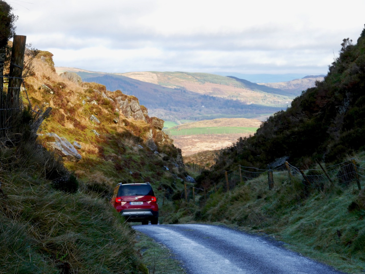
The middle of January: you might expect to be battened down here in West Cork with raging gales or bitter north winds, but Saturday dawned with a clear sky to reveal a most beautiful sun-warmed landscape. We had to be out! We adopted exploring mode and headed for the hills to the north-east of Bantry. OS Map 85 entices with a whole swathe of archaeological sites from megalithic tombs to stone rows and circles, but it was a name that drew us: Barrboy – probably from the original Irish barrabhuidhe – which means ‘yellow summit’. As the highest point of the road in that place (pictured below – about 350m above sea level) is a mountain pass, we have chosen to name our journey Through the Yellow Gap.

The ‘Yellow Gap Road’ runs west to east across the centre of this extract from OS Map 85: we turned on to it from the N71 at Lahadane, just north of Bantry, and dropped back on to the main road to Drimoleague south of Coolkellure

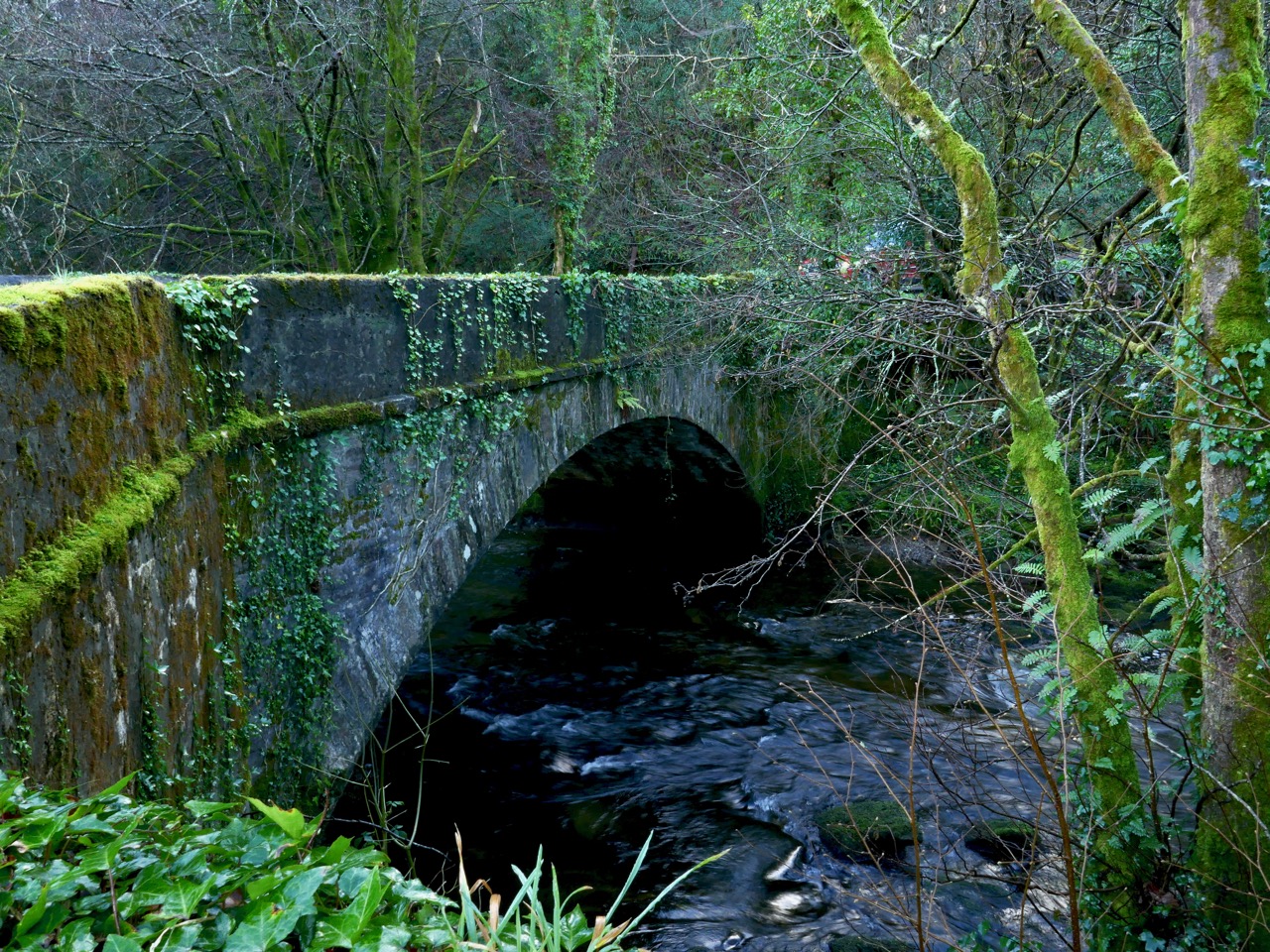
The first part of our route followed the Mealagh river and we were intrigued by the boreens that cross it in places over very fine stone arches: these will have to be explored another time – we were aiming for the hills.
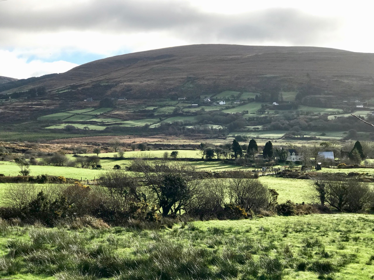
Our day offered us a study of light and landscape, which only the combination of January low sun and shadows can give. If anything the yellowness of the uplands with their rocks, mosses and furze is emphasised by this light: Finola is sure that the colour is due to the fionnán (blonde) grass which is so prevalent during the winter months (header picture). We felt we were in a very remote place, known only to those who spend their lives there, but we were in fact barely a hop and a skip from our own home.

Studies in light and landscape: with a different vista at every turn we were treated to outstanding views typical of rural Ireland

As is so often the case with our off-the-beaten-track excursions, we saw hardly anyone in the whole day, but we did chance to bump into our cycling friend Tim who is in training for yet another Everesting event. The rules are straightforward:

. . . The concept of Everesting is fiendishly simple. Pick any hill, anywhere in the world and ride repeats of it in a single activity until you climb 8,848m – the equivalent height of Mt Everest. Complete the challenge, and you’ll find your name in the Hall of Fame, alongside the best climbers in the world . . .
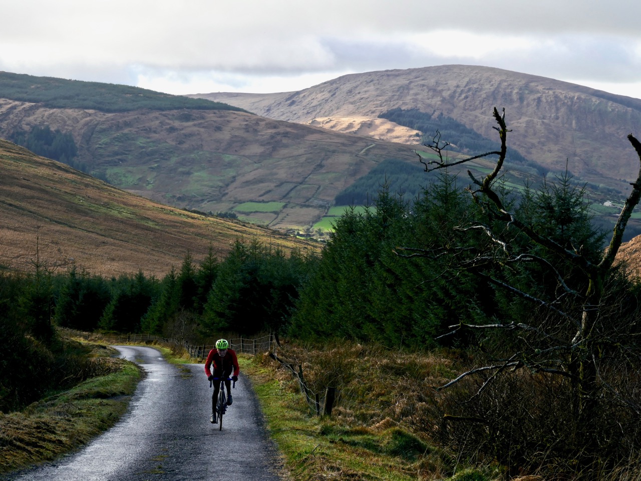
Tim on his way up the Yellow Gap Road (also known as Nowen Hill). He has to do this climb 56 times in one go to achieve the ‘Everest’. In fact, his aim is to do a ‘Double Everest’ on this hill! This will be his third Everesting event in West Cork… Good luck, Tim

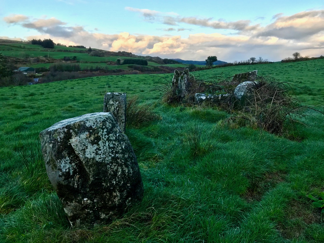
Our travels took us through some very attractive ‘deep’ countryside dotted with cottages and small settlements. Humans have been here for a very long time and have left evidence of their occupation in enigmatic standing stones, alignments, circles and tombs. Some can be seen from the roadside, but many involve explorations across fields or into forests. Always, we are left wanting to know who these early settlers were and why they left us these monuments.
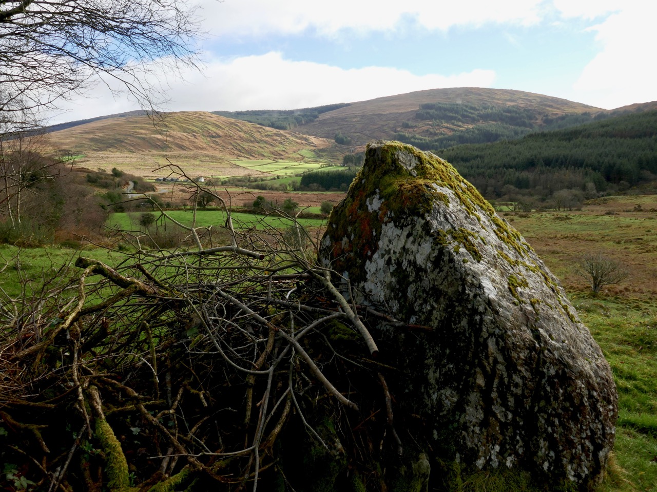
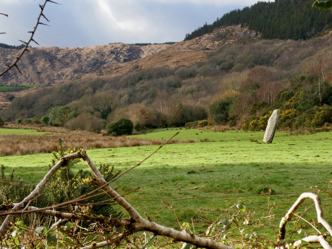
Upper pictures – single standing stones which can be seen from the roadside; lower picture – a five-stone circle and a two-stone alignment on high pasture land: all are ancient and mysterious

As the road threaded its way through the gap and began to descend we seemed to re-enter a less wild landscape, and habitations became more frequent. Eventually we found ourselves in a small community – Coolkelure – with a great sense of history. there was a fine C of I church, a school which had been in use until the 1950s, and an avenue leading to a large house which has had a chequered history, There is an entry in Duchas (the Schools Folklore Collection) about this village:

. . . Coolkelure is situated about four miles and a half west of Dunmanway. There is a holy well at the side of the road but it is covered in now with briars and bushes. Its origin is unknown. There are three steps going into it and there are medals, pieces of cloth and pennies up on a stone over the well. About twenty feet in from it there are rocks nearly a thousand feet high. It is said that a giant lived there in olden times. On the other side of the road is a marsh and the giant is supposed to be buried there. There is a huge stone over his grave. Further on is Coolkelure House. This formerly belonged to Shouldhams, now it is the property of Lady Bandon. The avenue looks beautiful in summer and it is hedged with rhododendrons of every hue . . . (Joan Collins, aged 12 years, from Patrick Collins, aged 60 years – c1934)
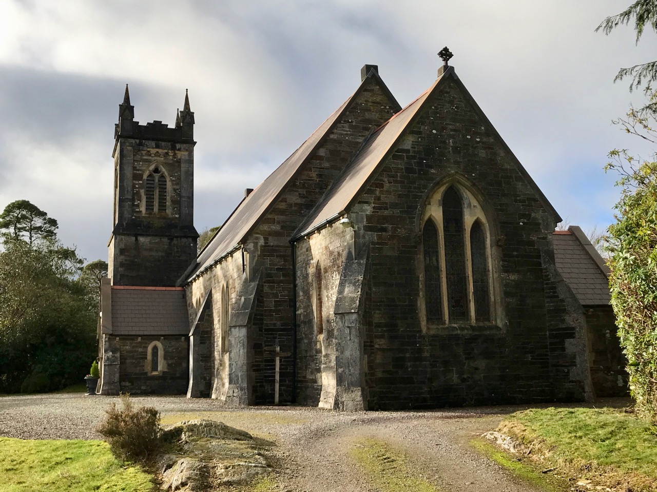
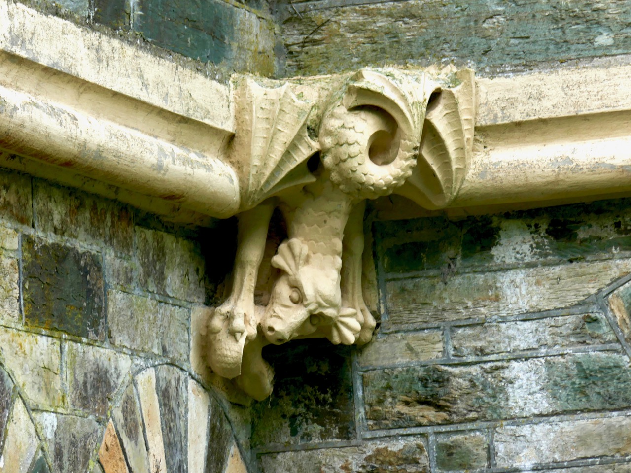
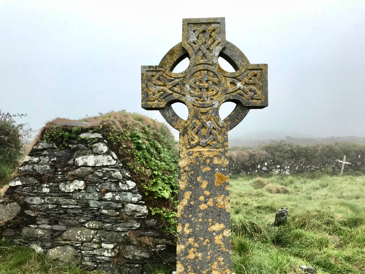
Upper – Coollkelure Church; centre – the Lodge at the gateway to Coolkelure House; lower – one of many fine gargoyles on the eccentric Lodge

Well, we didn’t see the holy well, the thousand feet high cliff, the giant or his grave. But we did see rhododendrons – large thickets of them – all the way along many of the roads we travelled. They must look very striking when in bloom in the springtime, but they are an invasive species which threatens the true natural hedgerows. In Coolkelure, also, occurred one of the highlights of our day. We met and got into conversation with Donal and Caitriona – a most hospitable couple who own a small house overlooking the lake. They invited us in, we were given coffee and cakes, and the chat was mighty!
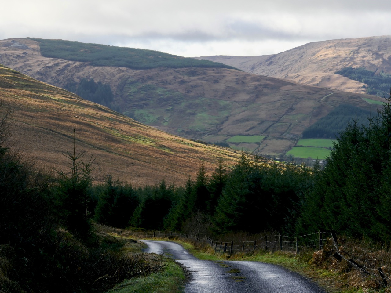
Upper – looking back at our way through the mountains; centre – an example of the many stands of invasive rhododendrons that we encountered and lower – the road becomes tamer as we approach a pastured landscape

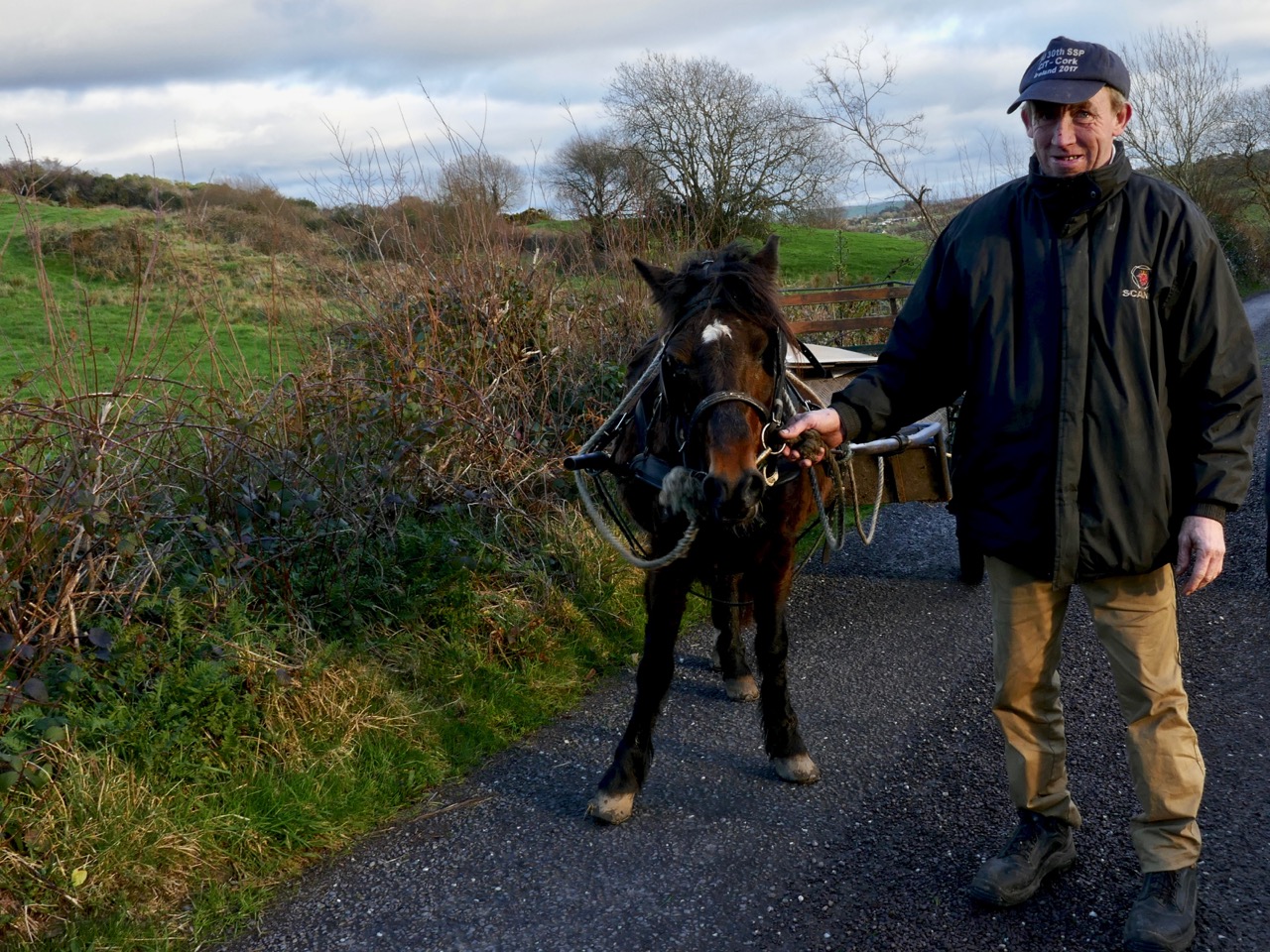
We left Coolkelure and headed out of the hills, feeling fulfilled by all the events of the day. Our adventures were not quite over, however, as we encountered Daisy and her owner with their ‘road-car’, delighted that we stopped to photograph them (below). In fact, between us we took at least two hundred photographs on our day out and can only include a modest selection on these pages.
Off the M8 – The Great Dolmen of Kernanstown

Our ‘Off the M8‘ series is intended to make your journeys across Ireland far more interesting! We travel between Cork and Dublin fairly regularly and, each time, we determine to search out something new. It may be an aspect of medieval history, architecture, stained glass or – as in today’s example – archaeology.

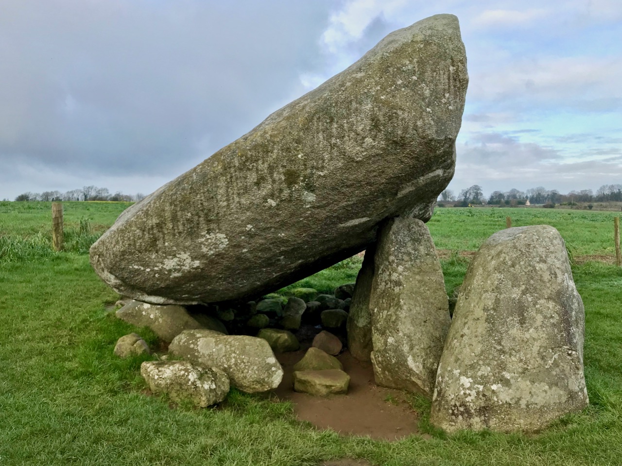
How far you want to stray from the ease and directness of the motorway in your explorations is entirely up to you. This diversion will add about forty minutes to your journey: you will leave the M8 at Junction 3, head across to Carlow on the R430, and then, after Carlow, meet the M9 at Junction 4 and continue up to Dublin. You’ll have to take a little diversion east out of Carlow on to the Hacketstown Road (R726) to find today’s destination: the largest prehistoric portal tomb in Europe, and perhaps in the world!

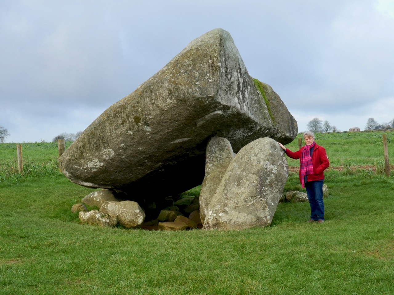
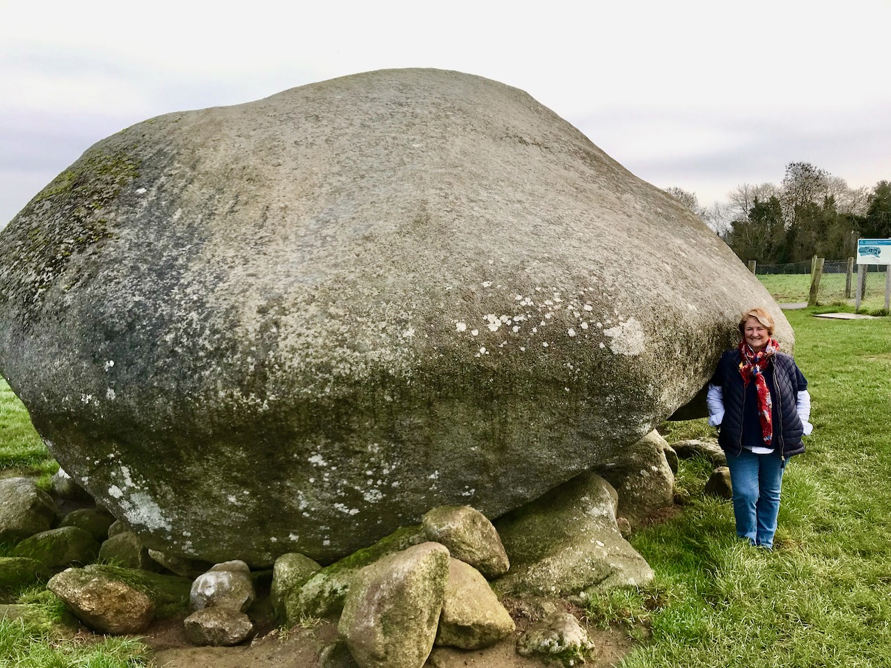
Robert stands at the east face of the megalithic structure: the orientation suggests a relationship to the rising sun, possibly at significant calendrical events

It’s known variously as the Brownshill Portal Tomb, or the Kernanstown Dolmen (Kernanstown is the name of the Townland, and the word ‘Dolmen’ was formerly used to describe megalithic structures which consist of a large stone slab resting on smaller boulders). The Irish National Monuments Service, in its listing of the Archaeological Survey of Ireland, has set out to regularise the names given to various structures. It does not recognise the once widely-used terms ‘Dolmen’ or ‘Cromlech’, but defines a variety of ‘Megalithic Tomb’ structures, of which the Portal Tomb is one:
. . . A single, short chamber formed by two tall portal-stones, two sidestones and a backstone. Sometimes a stone between the portals closes the entry. The chamber is covered by a roofstone, often of enormous size, which slopes down from the front towards the rear. Cremation was the preferred burial rite and these date to the Neolithic from 3800 to 3200 BC . . .

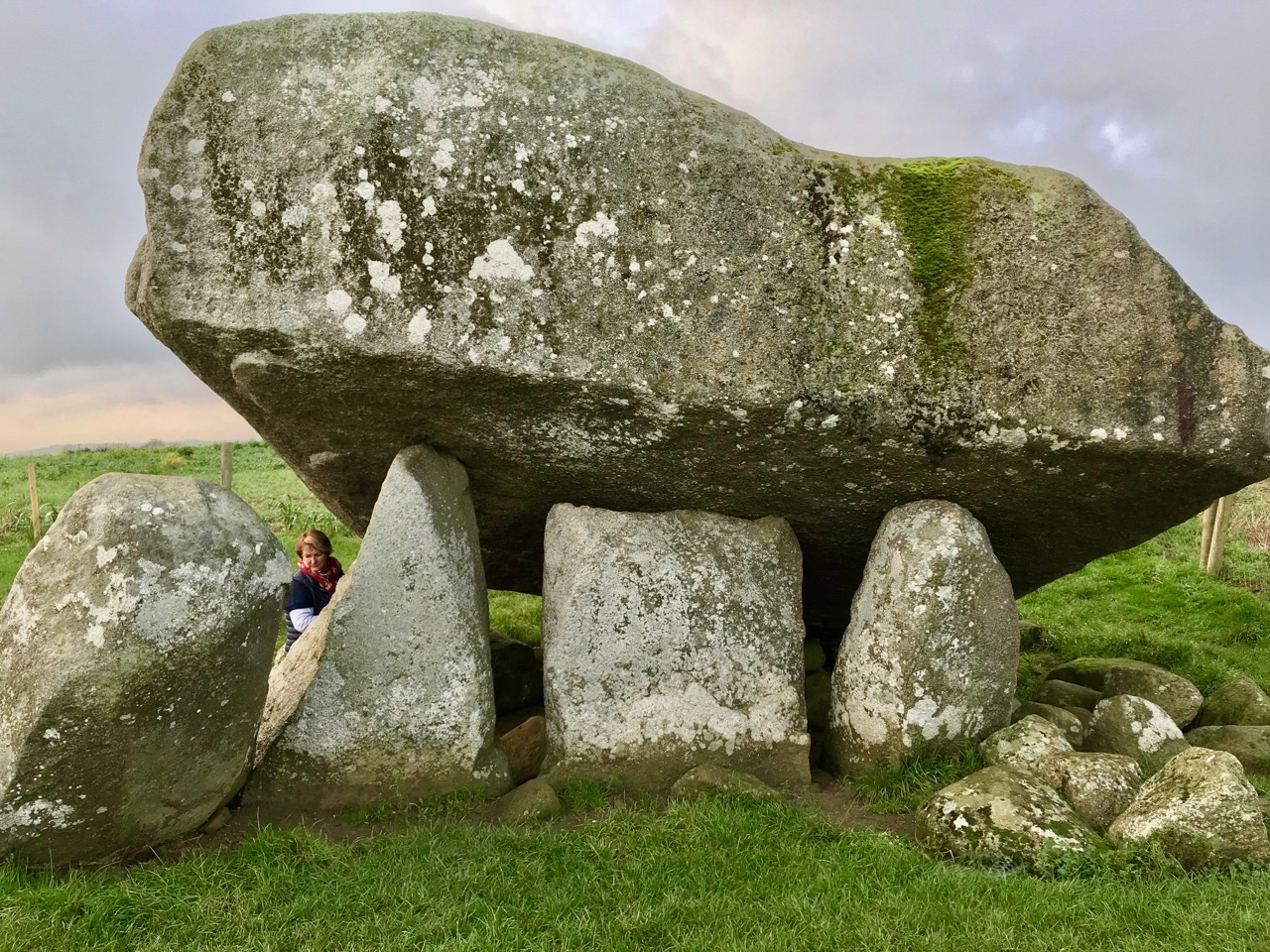
Finola is giving scale to the portal tomb in the header picture, where the two ‘portal stones’ and central ‘gate stone’ support the east side of the capstone: these features are common to these structures across Ireland, Britain and Europe. Above – the back (west face) of the capstone: Finola is standing at the southern tip

Historically, ‘Dolmen’ was the most common term for these archaeological structures. William Copeland Borlase (1848 – 1899) wrote a lengthy treatise in three volumes on The Dolmens of Ireland, their Distribution, Structural Characteristics, and Affinities in Other Countries; together with the folk-lore attaching to them and traditions of the Irish people published in 1897. In it, he describes the Brownshill / Kernanstown structure thus:
In the Barony of Carlow, in the Townland of Kernanstown, and Parish of Urghin, two miles E. of Carlow, to the N. of Browne’s Hill, or Browneshill House, also called Mount Browne, are three dolmens. The largest of the three is marked Cromlech in Ord. Surv. Map No. 7.

There are three dolmens on this hill. One is of enormous proportions, the two others are smaller. The former has been described by Ryan, Ledwich, and G. Du Noyer. Of one of the latter there is a drawing and plan in Miss Stokes’s collection of drawings of dolmens. The remaining one is situated a distance of 50 yards to the N. of the latter.

The great dolmen stands in the centre of a large flat field in permanent pasture, and has no trace of a bank or cairn near it. It consists of a splendid block of granite, the longer axis of which is N. and S., raised at an angle of 35 degrees to the horizon, upon four blocks, three of which, pillar-like, support the E. side, at a height of 6 feet above the floor, while one sustains its lower and W. side, at a height of only about 2 feet above ground.

The following are my measurements of the block thus elevated into position: Superficial measurement from N.E. to S.W., 23½ feet; ditto from N.W. to S.E., 22 feet; girth 65 feet; thickness at W. side, 6 feet; at S. side, 5 feet; at E. side, 6 feet; and at N. side, 4 feet.

. . . it is, I believe, the largest block raised from the ground by the dolmen-builders which is known, not only in the British isles, but on the continent of Europe

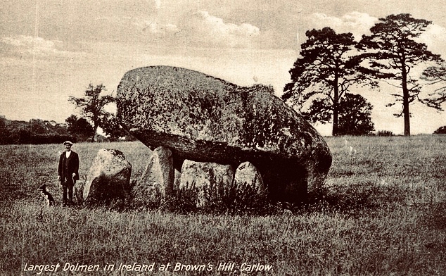
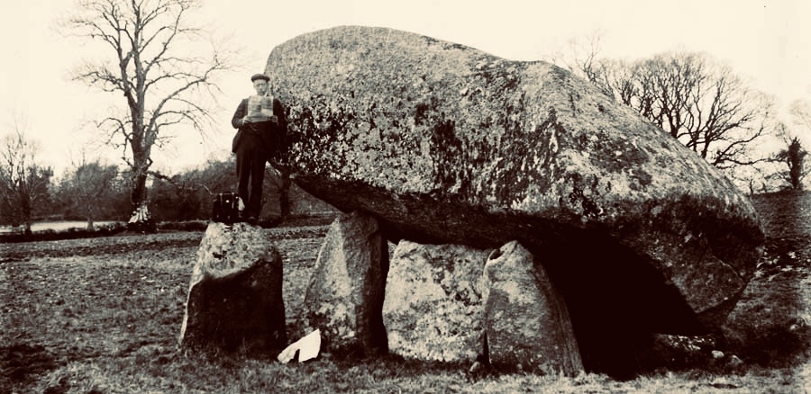
Two picture postcards of the ‘Brown’s Hill Dolmen’ probably dating from the late 19th or early 20th century

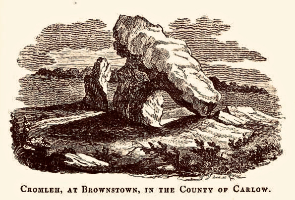
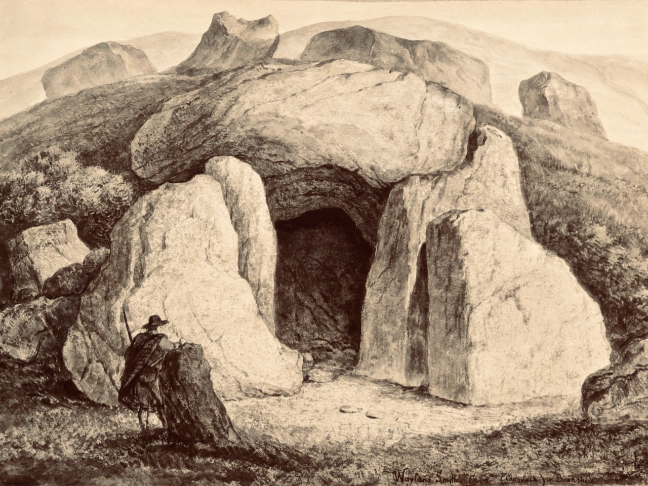
Today, there is only one portal tomb visible at Brownshill, although the National Monuments listing confirms that there were three in the area at one time. I was intrigued to find this engraving:

There is no ‘Brownstown’ in County Carlow, so it is likely that this engraving (above) is another version of ‘Brownshill’. It’s hard to see in this the portal tomb we have been describing, so it is possible it is an image of one of the other ‘lost’ dolmens. There is no further information attached to this illustration.

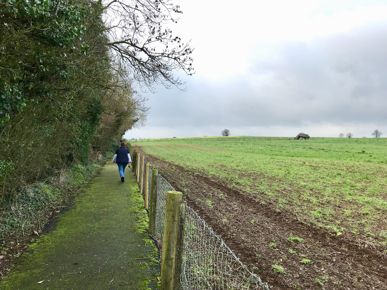
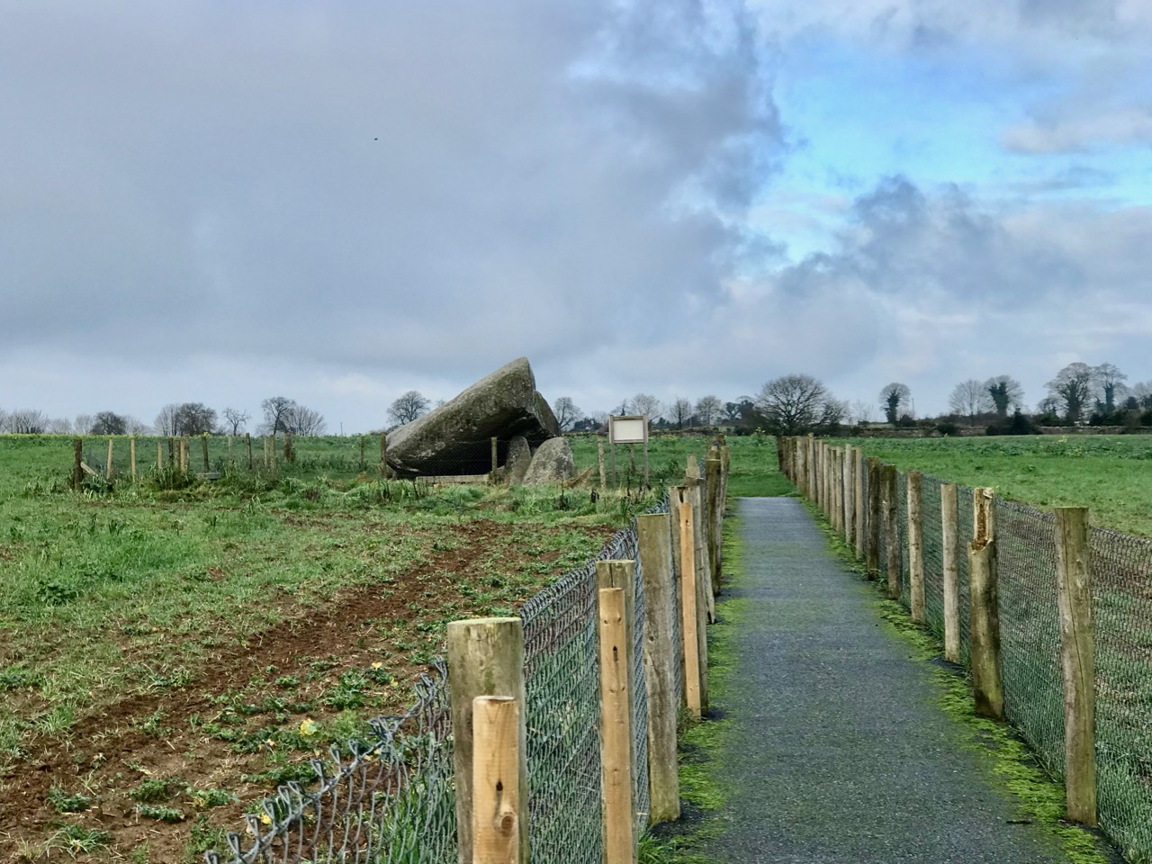
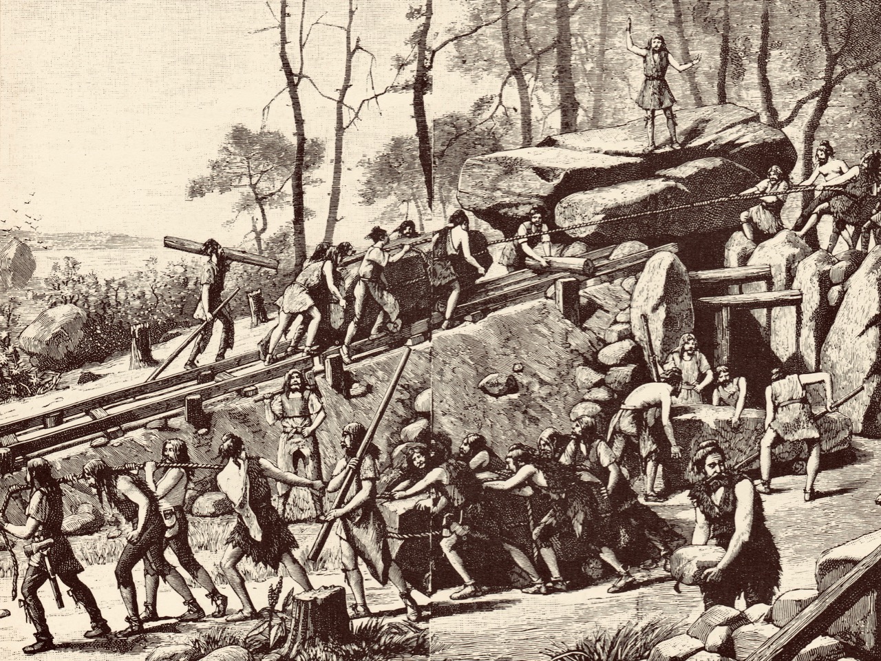
The two illustrations above show how the portal tomb is today enclosed and made accessible by means of a fenced pathway leading from the road to the east of the structure. This setting is not ideal: the impressive nature of the huge capstone is visually diminished by the fencing – although the provision of good disabled access to the monument is highly commendable. The massive granite stone has been estimated to weigh up to 160 tons, and we can only wonder at the methods used to lift it some 5,000 years ago. Here is an imaginative view (dating from the nineteenth century) of a megalithic tomb being built:

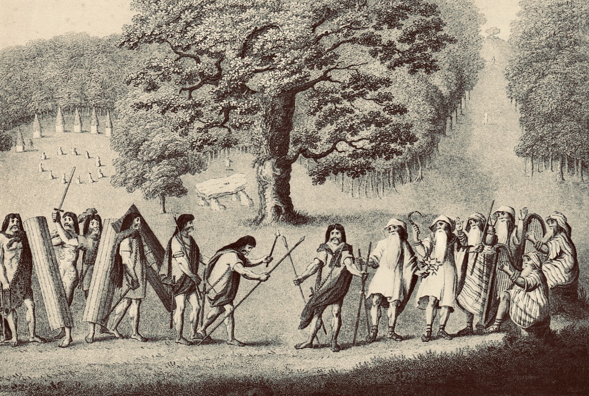
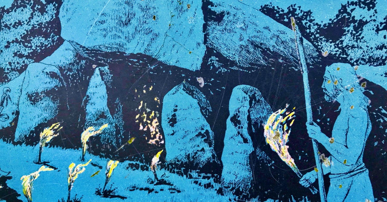
Celtomania is an expression which has been used by some antiquarians to describe the use of megalithic structures by ‘Druids’ and ancient races for ritual purposes. This fanciful scene by Edward King (above) shows ancient warriors, sickle-wielding and harp-playing druids, oak trees and standing stones – and a ‘dolmen’. It is taken from a 1969 book on megalithic structures in Brittany which I purchased in my travels there in the 1970s: Carnac ou les mésaventures de la narration by Denis Roche.

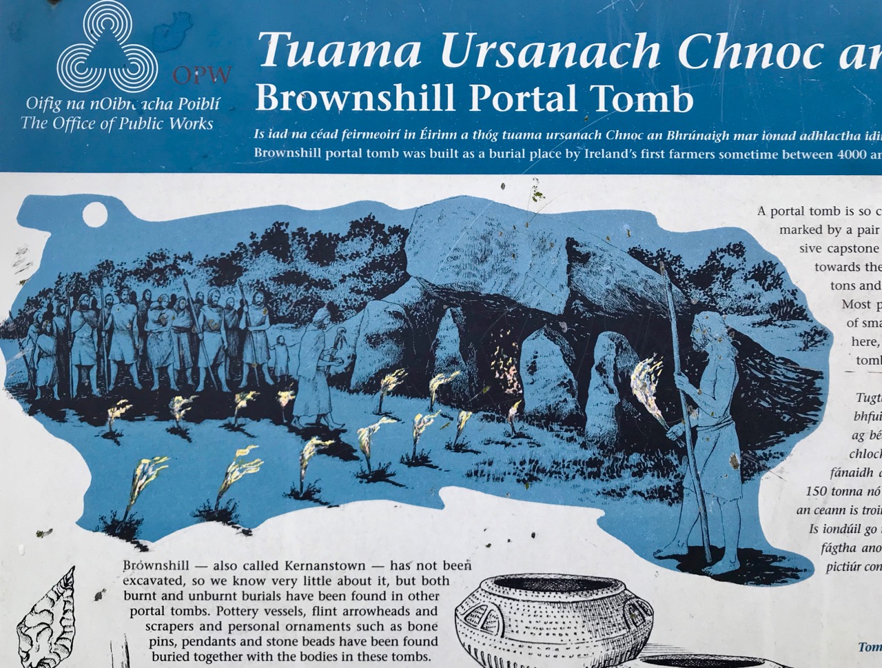
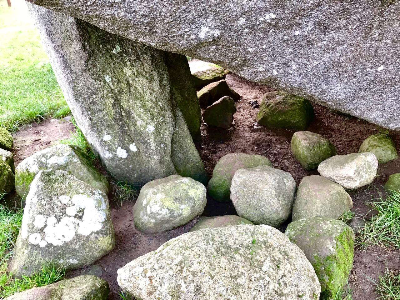
The ‘chamber’ of the Brownshill monument is visible when viewed from the south (top photo, above). This structure has never been excavated so we cannot say for sure that it was used to deposit human remains or cremations; in tombs elsewhere, excavations have revealed such a use in some, but not all. It has been suggested that all such structures were fully or partly covered in earth or stone, as implied in the example from Brittany below:

The structure at Brownshill, County Carlow must surely be one of the wonders of the megalithic world. It’s hard not to think that the sheer immensity of the raised capstone would require it to be seen so that the labour involved in its construction is appreciated. These stone edifices were the earliest architecture in the world of our settled ancestors, and the first examples of engineering prowess: one of the reasons for their existence must have been the demonstration of power and knowledge.

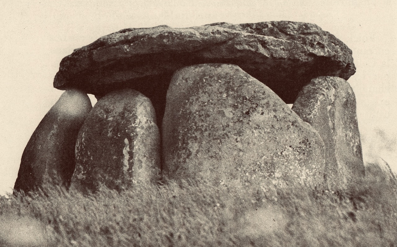
Above – a dolmen in Brittany (where they are still known by that name!) demonstrating a reversal of the principles of construction at Brownshill. In the Irish example, the huge capstone is supported by comparatively slender uprights; in France the capstone, although also substantial and heavy, sits on very large portal stones. The result is visually impressive in a different way.

Here in Ireland there are many more examples of portal tombs waiting to be visited and reported on: they are on our list.

West Cork Obscura – Robert’s Choices

‘Hidden West Cork’ and ‘off the beaten track’ have been oft-used phrases in our posts – and that’s part of our mission with Roaringwater Journal: exploration of some of the more secret places, and researching and recording their stories. Finola has looked out her own favourites; my current choices are here – although, with 569 posts written to date between us, we could have picked out so many.

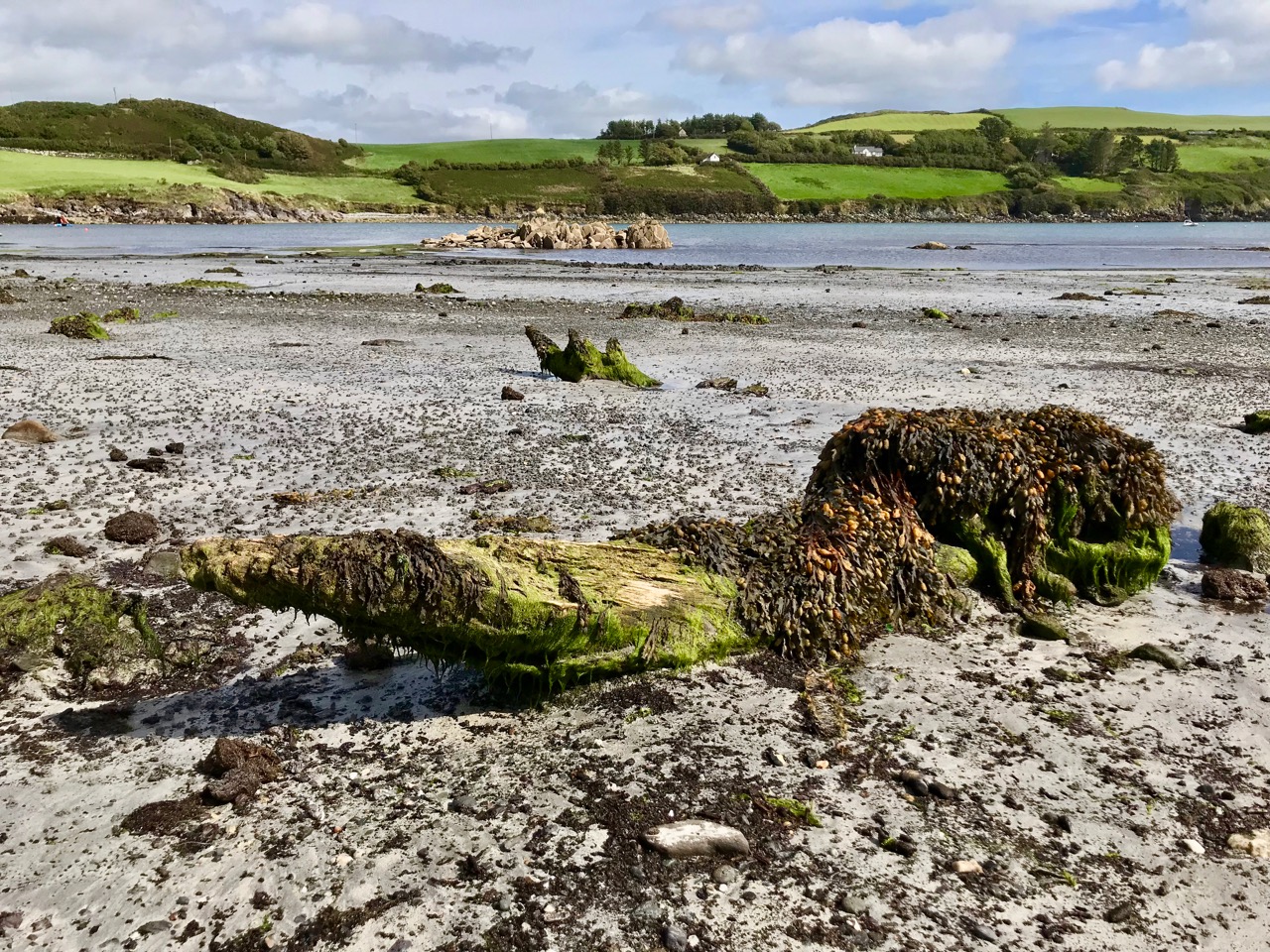
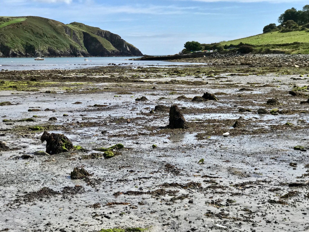
Header and above – one of the discoveries which made a great impression on me during the year was Tralong Bay, out beyond Glandore and Drombeg: it’s a beautiful piece of the coastline, at the end of a cul-de-sac and – it seemed to us – very little visited. But to visit is to transport yourselves back thousands of years as, on the beach and exposed at low tide, are the remains of an ancient forest. Here is the post.

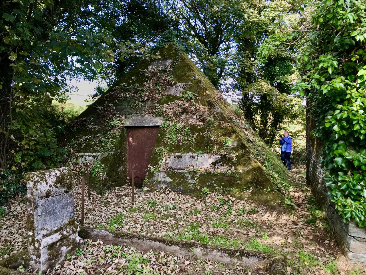
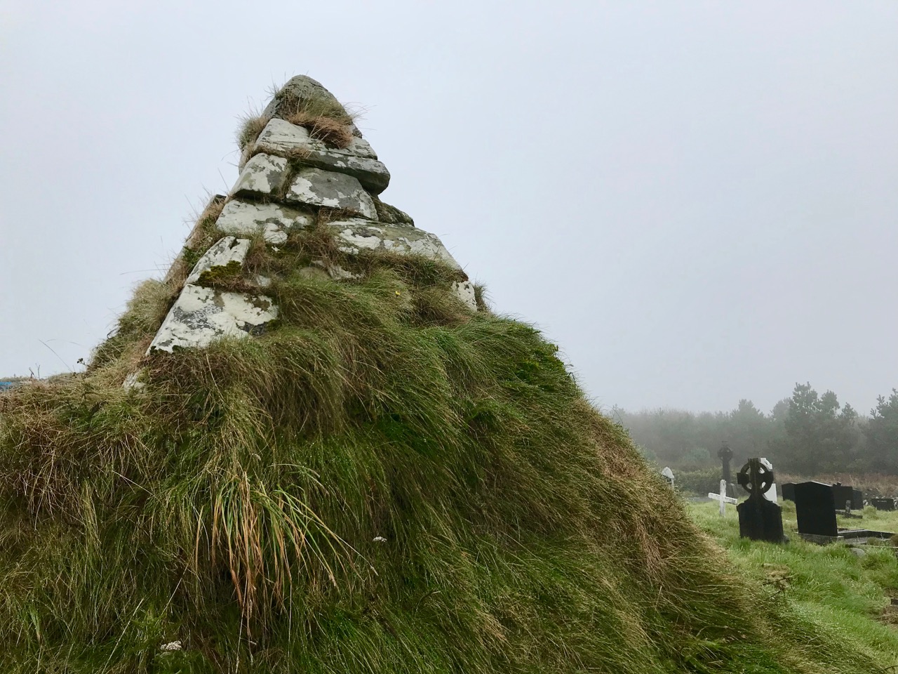
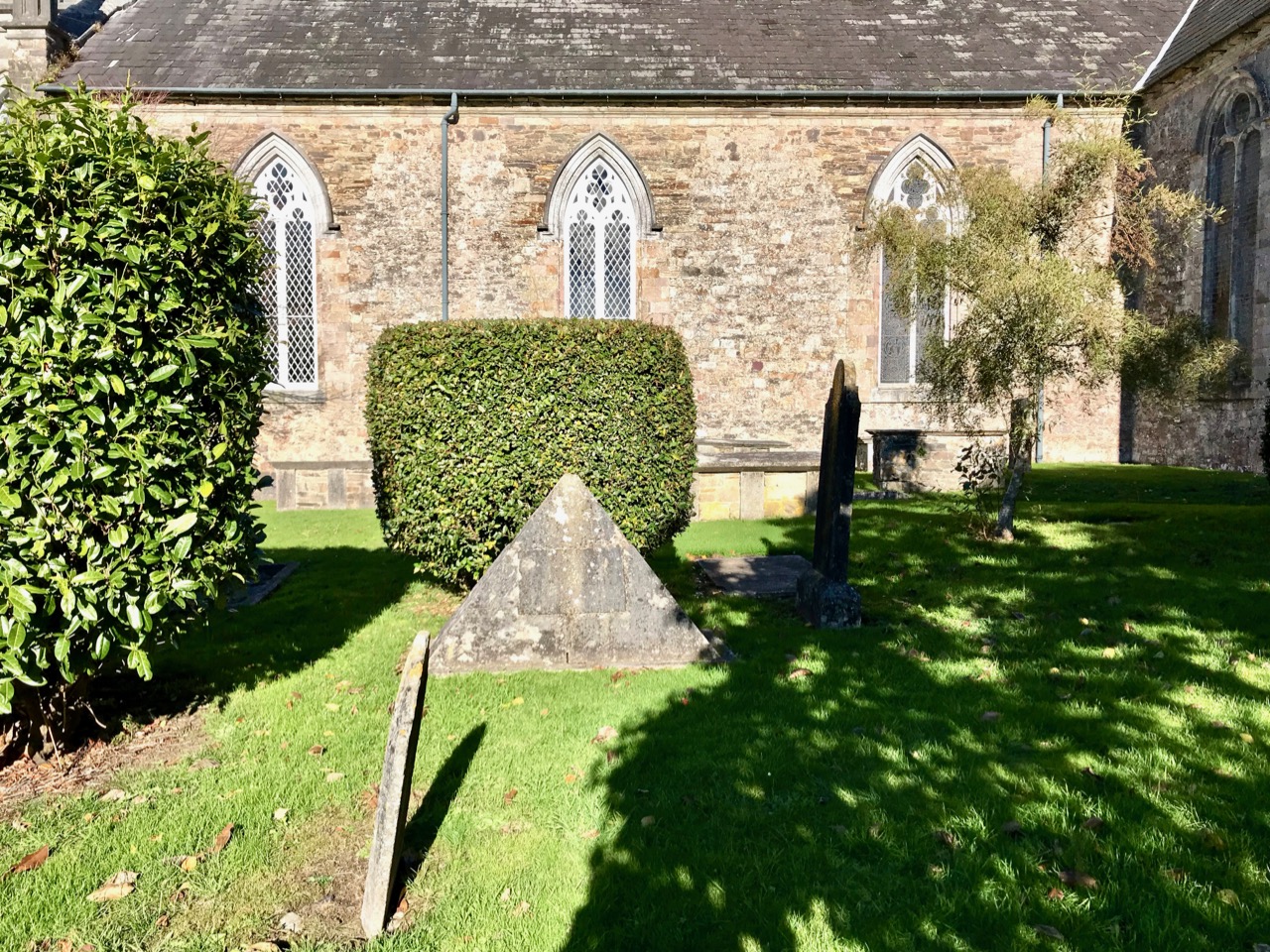
A quirky discovery, not too far away from Tralong, was the pyramid-shaped mausoleum in the old burial ground at Glandore. For us, ancient graveyards are treasure troves of local history. This one – a peaceful and secluded place well worth a visit anyway – conceals an enigma: find the story here.

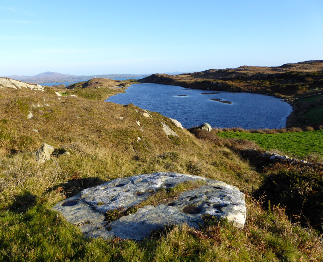
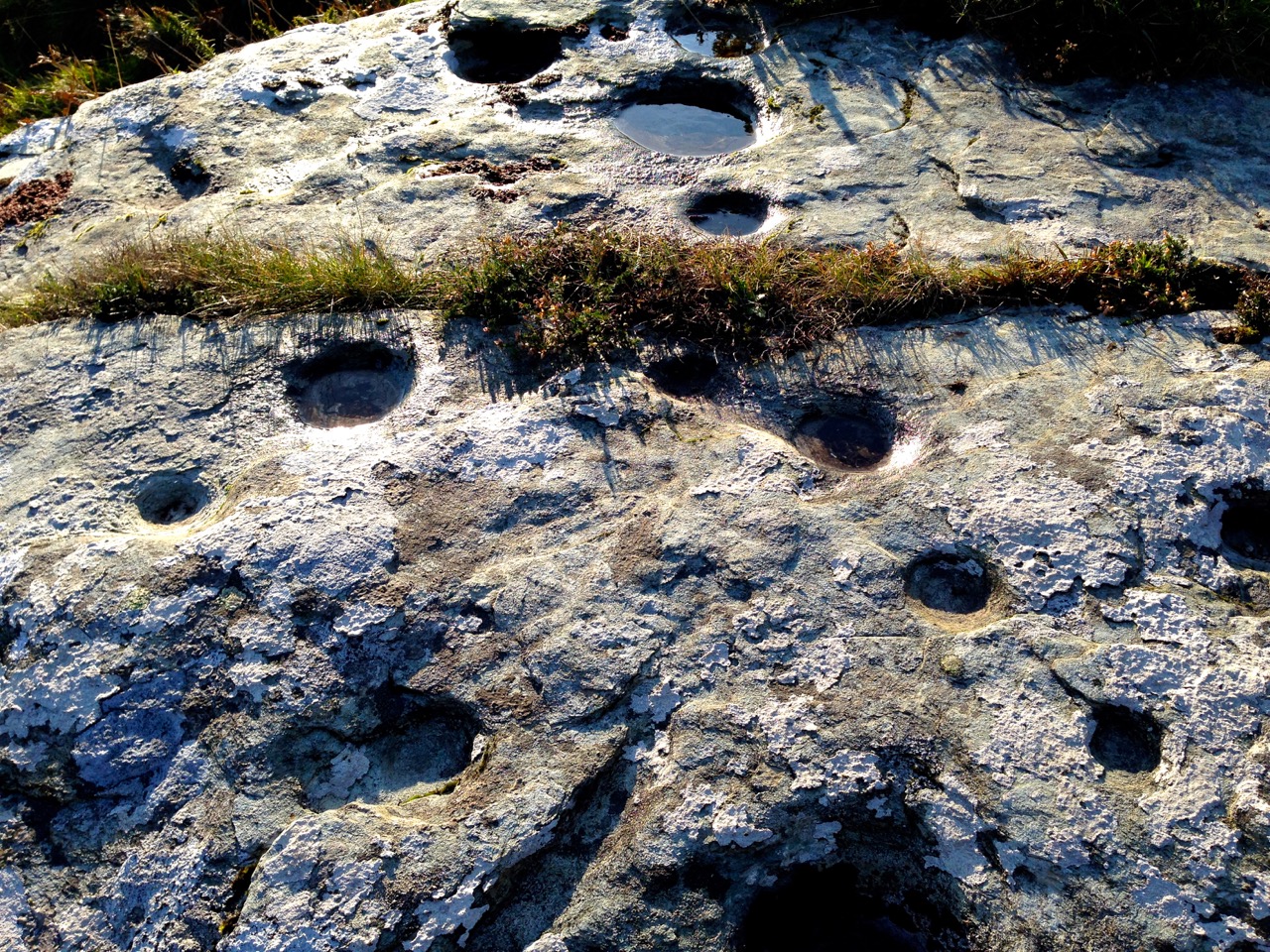
The Rock Art at Castlemehigan in its spectacular setting (above). Below is a close view of some of the markings on the rock

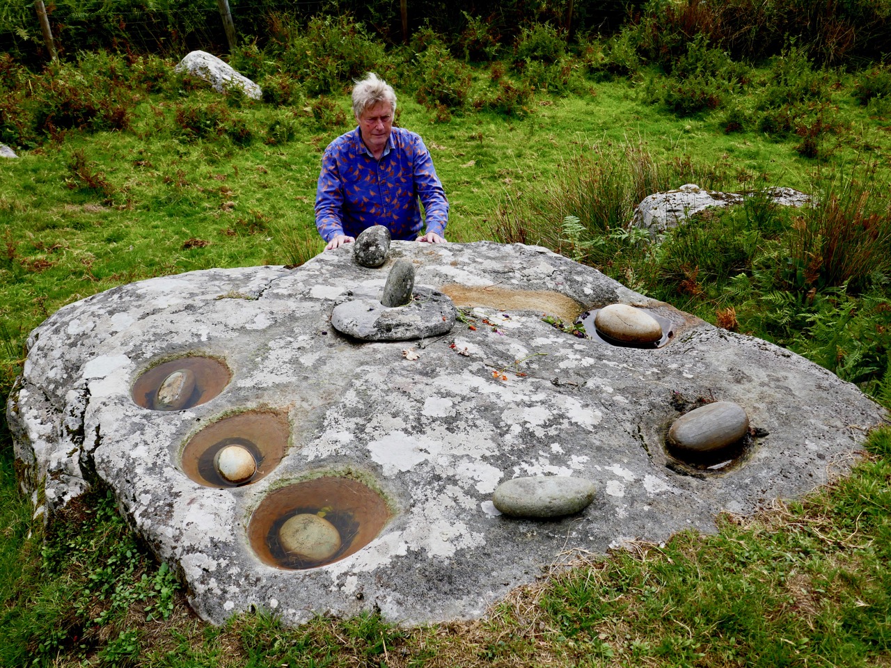
Delving back a few years, I found this December post on a visit to a spectacular example of Rock Art at the far end the Mizen Peninsula: Castlemehigan. The cupmarks on this earthfast boulder are impressive and the view from it is spectacular, especially on the clear winter day that we were blessed with. The rock was also in use as a Mass Rock during penal times, and there is evidence of this on the surface. We were told a story about those times by Florence O’Driscoll, whose land the rock is on. Make sure you have permission to visit if you go!

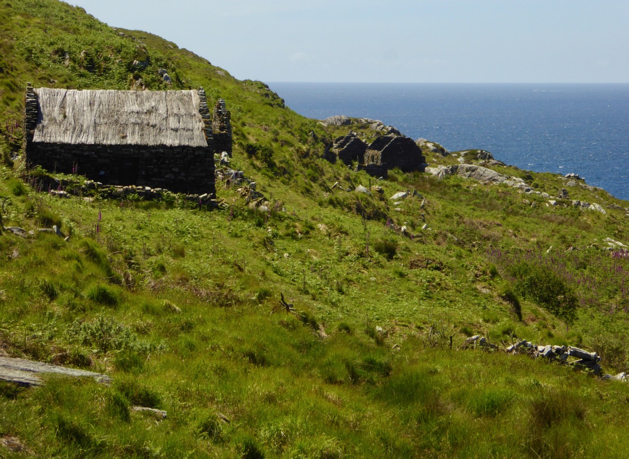
Finola managed to combine her consuming interest in wildflowers with industrial history and an account of a very special walk on the Sheep’s Head. It’s one of the marked trails on that peninsula – and takes in the deserted settlement of Crimea where a cottage has been partially restored (picture above) – finishing at the abandoned mine workings at Gortavallig, perched precariously on the very edge of a cliff (below). Here is the link to Finola’s post.

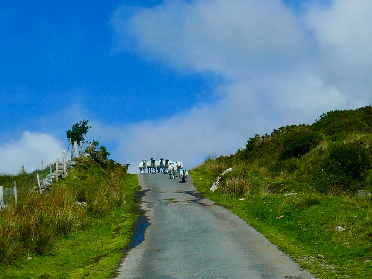
Here am I trying to get my head around the enigmatic ‘Rolls of Butter’ (above). I have to admit they are in Kerry (only just), but involved us travelling one of our all-time favourite roads, much of which is actually in West Cork: that’s the Priest’s Leap Road which runs over the mountains from Bantry (more or less) to Kenmare (more or less). We go out of our way to use this road because of the superb views – and a special piece of folklore – but, if you give it a try, be prepared for a narrow and steep journey (below)! Here is the post.

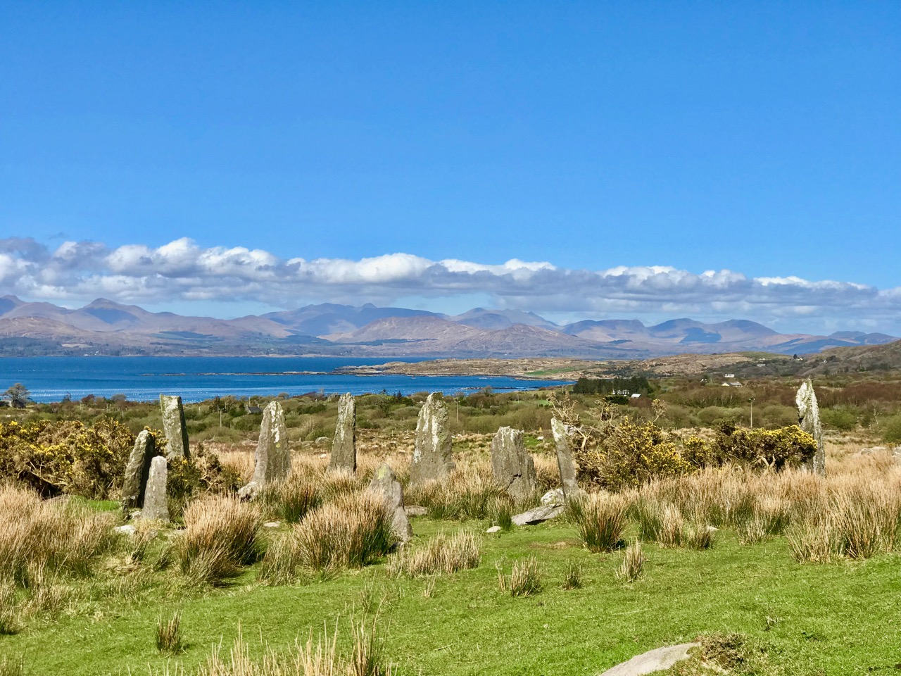
Archaeology dictates many of our outings. One of the less well-known monuments is Ardgroom Outward Stone Circle (pictured above and below) on the Beara Peninsula. This year, following a harsh winter, the weather turned sublime, and we have travelled extensively to make the most of it. We find ourselves often drawn to the Beara (much of which is in West Cork). This post describes an expedition which included stone monuments, colourful villages, stained glass – and ice cream! Have a look.

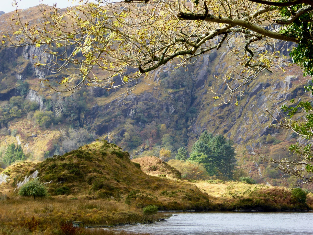
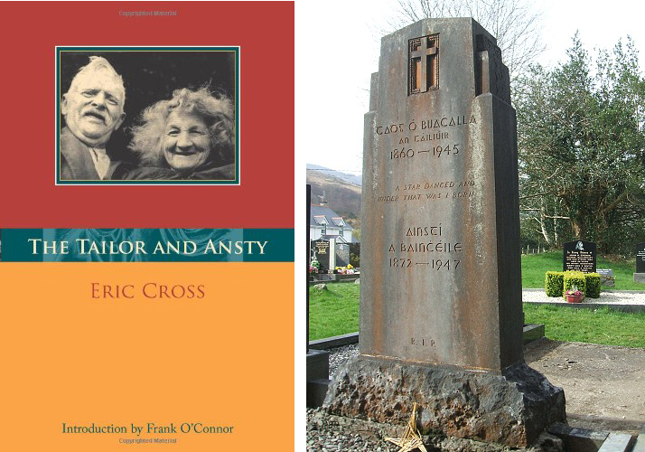
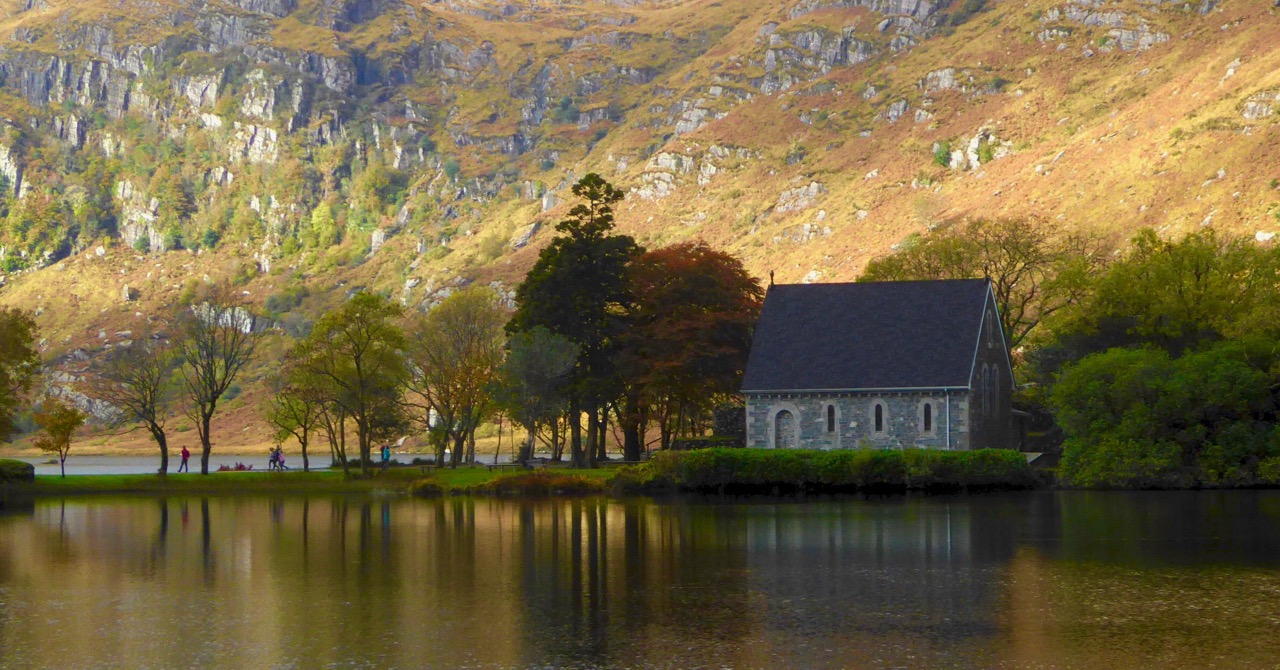
It was almost five years ago that we first reported on one of our perenially favourite West Cork locations: Gougane Barra (above). It’s a holy place – an alluringly beautiful lake sited in the Shehy Mountains, close to the source of Cork’s special River Lee. Here, in the sixth century, Saint Finbarr set up a collection of cells for his monastic community on an island. Here, also, lived the couple ‘The Tailor and Ansty’, immortalised in a book written in 1942 by Eric Cross. It’s a not entirely happy story as the book was banned because of its down-to-earth portrayal of the facts of life, and storyteller Tim Buckley (‘The Tailor’) was forced to burn his copy of it in front of the local priests: the incident led to an abrasive debate in Seanad Éireann on censorship. This story is, perhaps, one of the less well-known historical aspects of West Cork (and Ireland), but visit Gougane Barra for its beauty – and make sure you find the gravestone of ‘The Tailor & Ansty’: it was carved by their friend Seamus Murphy and bears the inscription . . .  A Star Danced And Under That Was I Born . . .

We hope that, between us, we might have given you some good ideas for exploration of our wonderful West Cork landscapes and – perhaps – encourage you off the highways and on to the byways: there are so many adventures to be had, summer or winter. Travel Well!

Off the M8 – Lismore Quest

It’s half an hour’s drive off the motorway, leaving at Fermoy – but well worth the diversion. Lismore, County Waterford, is an ancient town. St Carthage arrived here in 635 and established a great centre of learning famous throughout Europe; the Vikings ransacked it in the ninth century, after which the Norman Prince John, son of King Henry II, arrived in 1185 to build the Castle, which passed through the ownerships of Walter Raleigh and the Great Earl of Cork, before becoming the Irish residence of the Duke of Devonshire. So there’s lots to see, and lots of history to take in: be prepared for many visits!

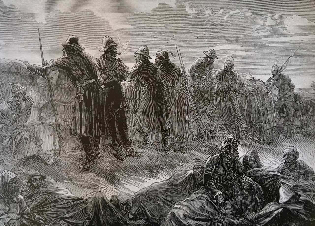
Our quest was to find a grave in the churchyard of St Carthage’s Cathedral. I am currently preparing a talk on the links between West Cork and Zululand (believe me, this is relevant)! The principle subject of this talk is a ‘soldier artist’ – William Whitelocke Lloyd, who was born and brought up in Strancally Castle, County Waterford, but lived for most of his adult life in Glandore, West Cork, (where you will find a pyramid). What should we find in St Carthage’s? Another pyramid! But that’s incidental to the main story here.

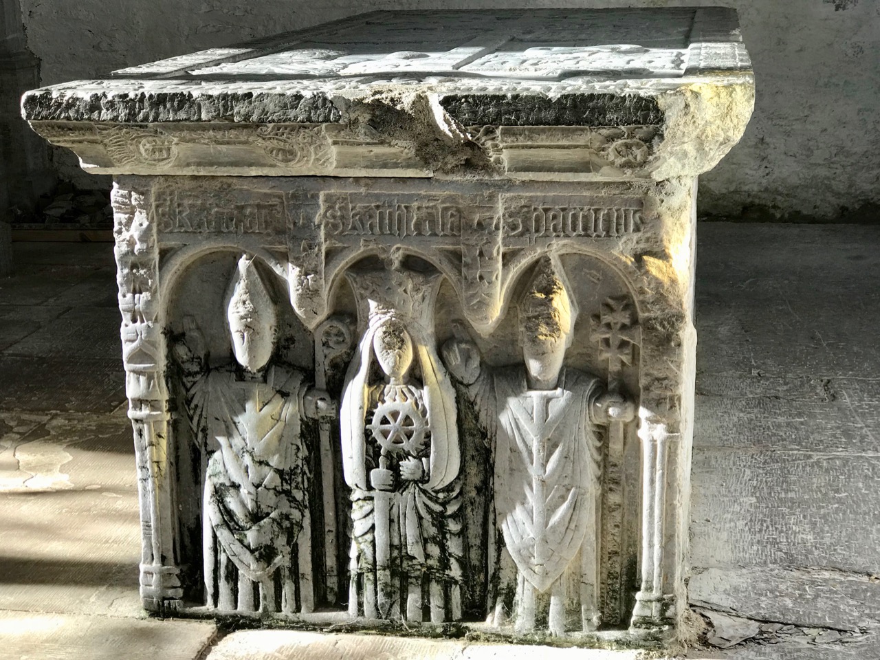
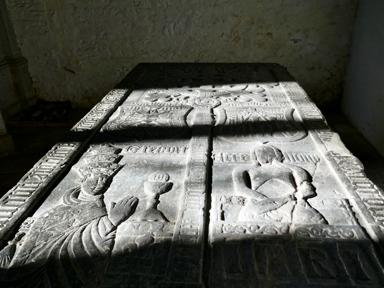
The Cathedral is said to be on the site of the original monastic foundation, and there’s some pretty ancient stonework inside it, including the quite remarkable tomb of the McGrath family which dates from 1486. The present building, however, comes mainly from the early seventeenth century when the Earl of Cork carried out major works, but also retained some earlier structure.

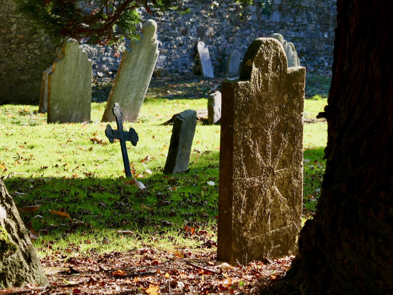
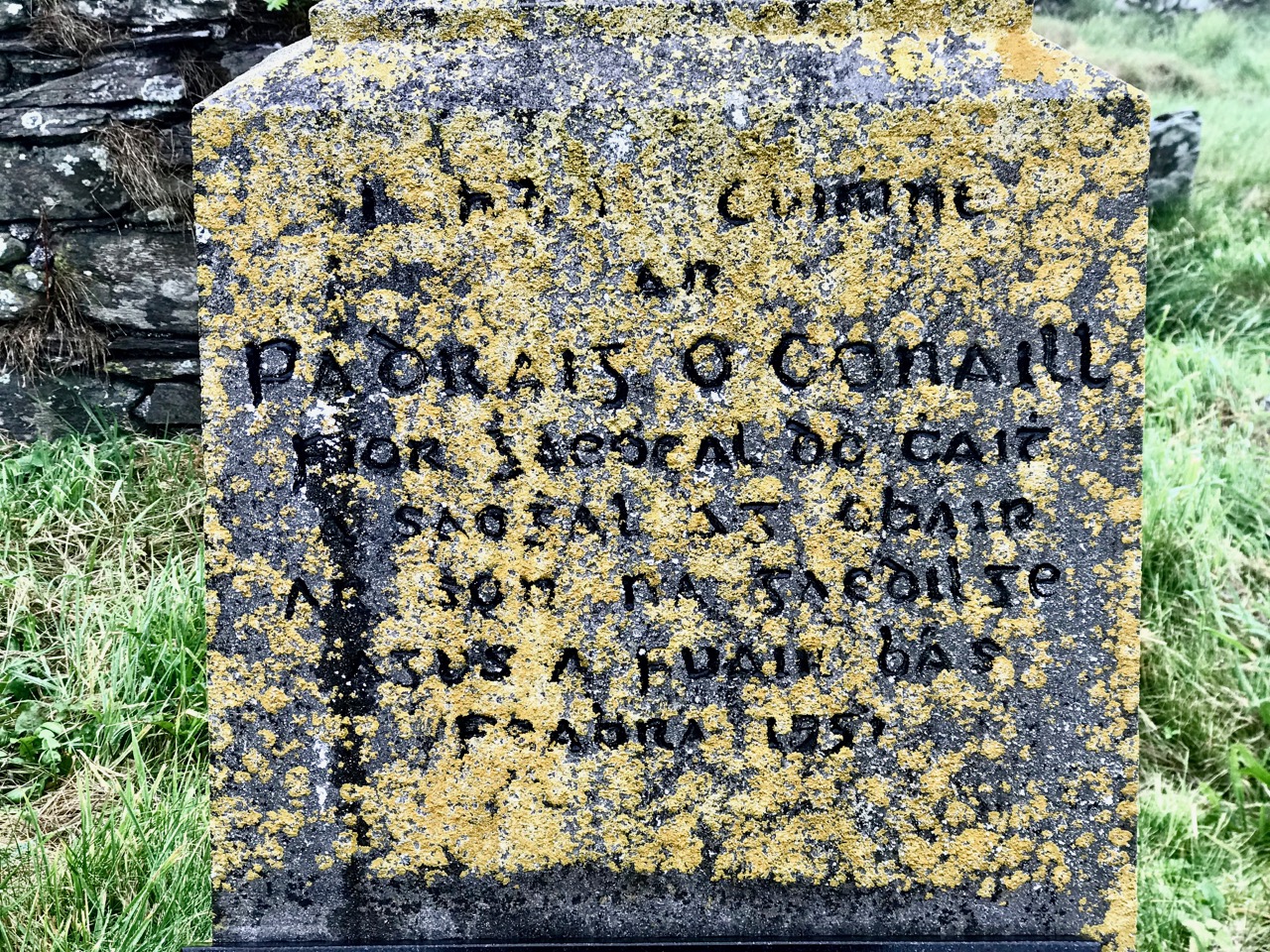
We did find the Whitelocke Lloyd grave, a little forlorn, close to the north west corner of the Cathedral. It has not weathered well and the inscription is not easily decipherable; a fallen cross lies broken across it. If you want to find out about this man’s exploits in the Zulu wars of 1879 – 80 and his career as an artist – for which he had no formal training – and why he is buried here with no family around him (his wife Catherine Anna Mona Brougham, daughter of the Dean of Lismore lies in a matching grave in Casteltownshend) you’ll have to come to my talk!

The somewhat forlorn grave of William Whitelocke Lloyd in the grounds of the Cathedral (above) and (upper pictures) two examples of the watercolour sketches of William Whitelocke Lloyd carried out while he was on active service in Africa. They were faithful records of the terrain and the conditions which the soldiers endured. Whitelocke Lloyd was ‘discovered’ by the Illustrated London News who used his drawings to produce engravings for publication – one is shown below.

Today’s post is largely a miscellany of the splendours we discovered in and around St Carthage’s Cathedral, and we hope this will inspire you to go there yourselves: it’s only two hours away from home – a mere hop and a skip.

Finola was delighted to find this rarity in St Carthage’s Cathedral – a window by the pre-Raphaelite artist Edward Byrne-Jones.

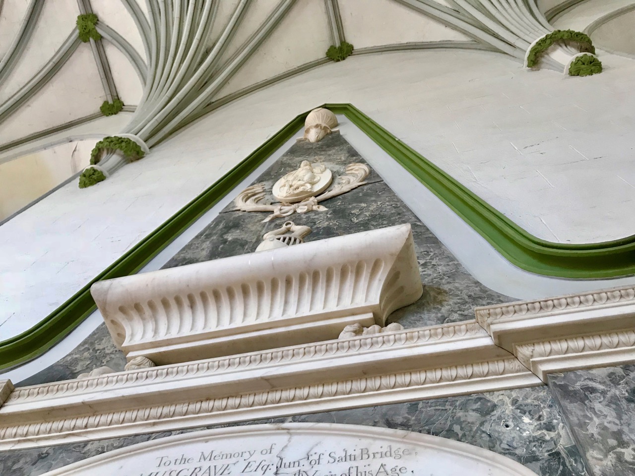
As with many Anglican churches, there are numerous elabortate memorials on the walls of St Carthage’s Cathedral. Here are just three examples, above.

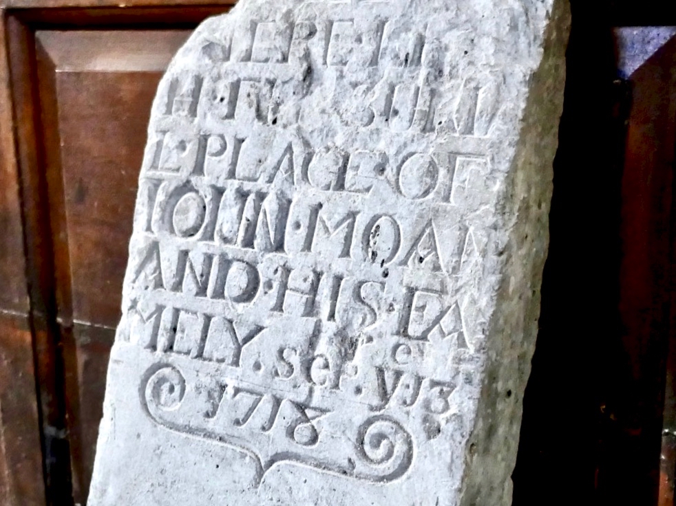
In the Cathedral reposes this McGrath family tomb – one of the finest examples of sixteenth century stone carving in Ireland. Below – one of the earliest grave inscriptions, dating from 1718.

Robert’s Talk – West Cork and the Zulu Wars – will be given at the Talks in the Vaults series, Bank House, Ballydehob on Tuesday 13 November, at 8pm

Autumnal Day Out – Myross Pyramid

Following what might be described as a Mediterranean summer which went on beyond all expectations well into October – where I suppose it became an Indian summer – we have just had the first truly autumnal days. Mist has descended over the islands of Roaringwater Bay and everything – trees, grass, nature – is dripping wet. This doesn’t put a stop to our travels, but we do see everything in a different light.

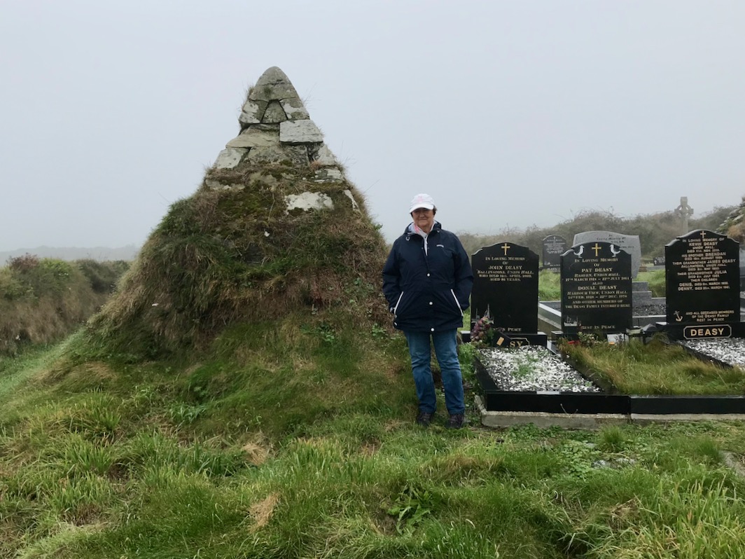
Last week I reported on a surprising find, a pyramid-shaped tomb in the idyllically off-the-beaten-track burial ground at Glandore over the hills not too far away from Nead an Iolair. This led to a large number of comments and responses, including some that told us about another West Cork pyramid, at a graveyard in Myross parish, only a little bit further along the coast. Thank you to all our correspondents: you sent us out on a fruitful search in this mellow season of mists.

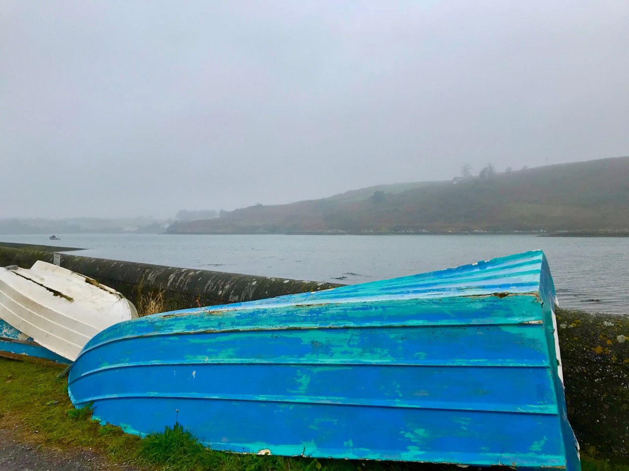
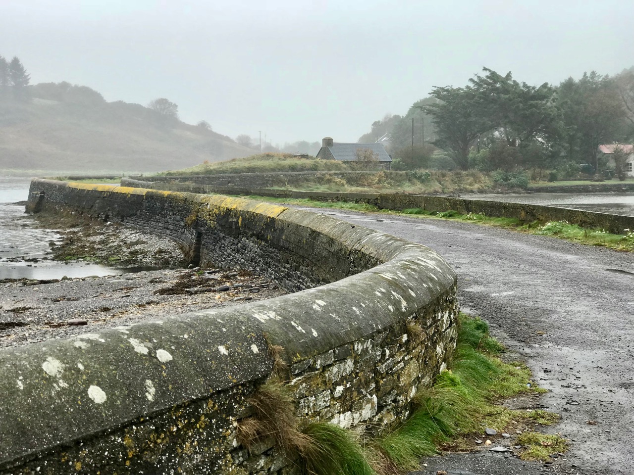
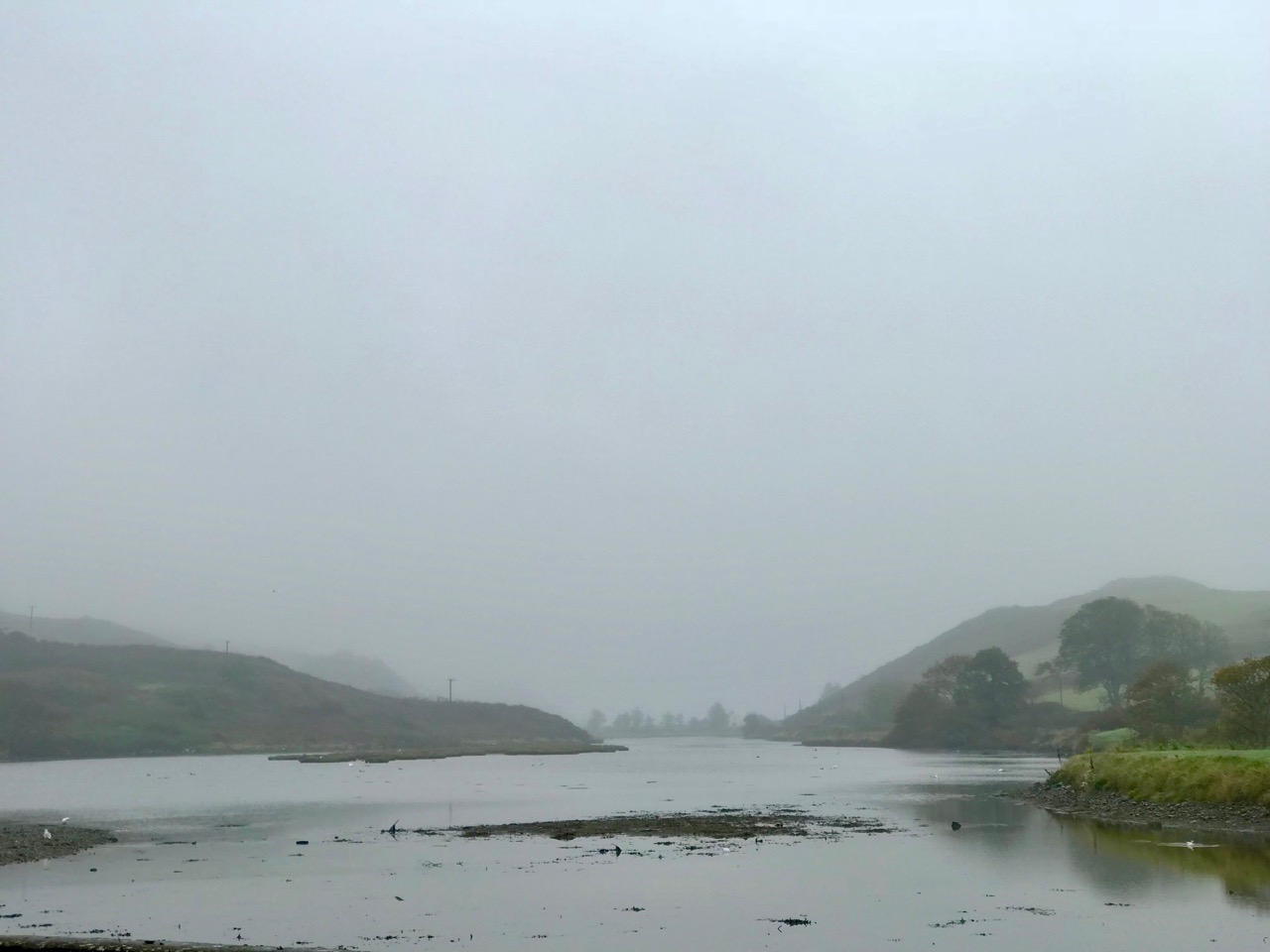
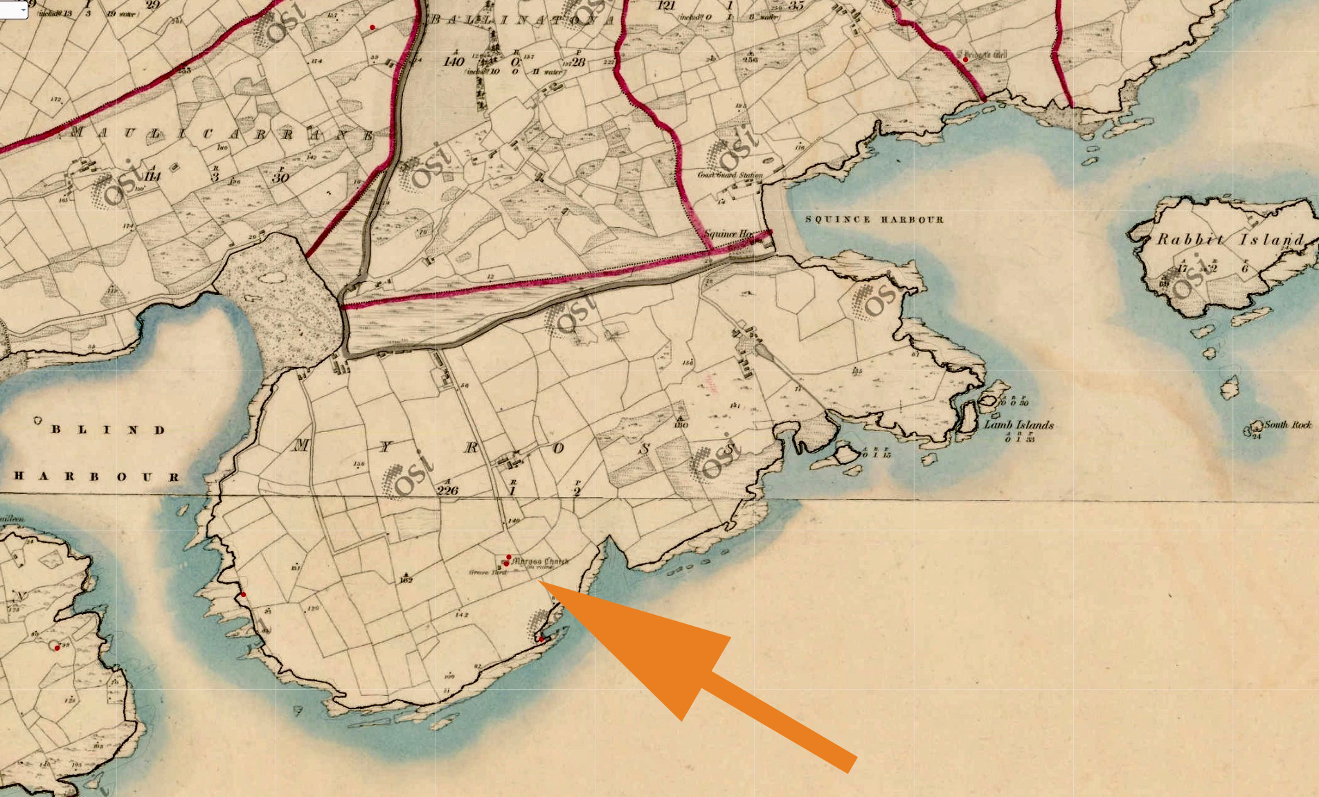
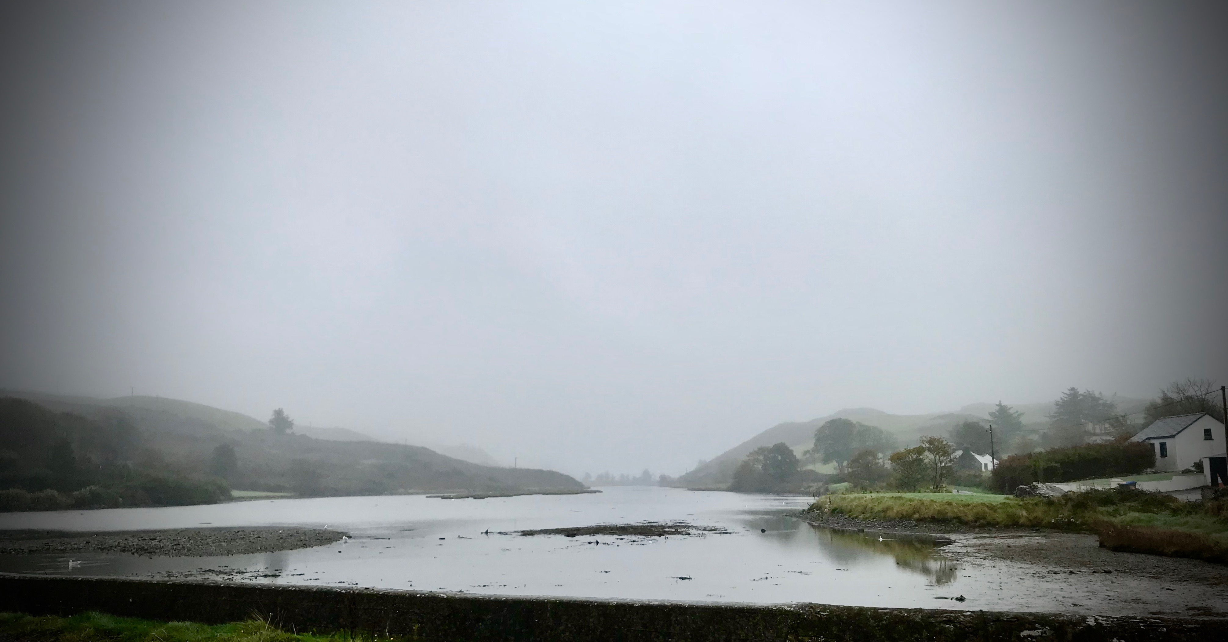
The townland of Myross is an island, of sorts. A stretch of water runs between Blind Harbour in the west and Squince Harbour in the east, and old stone causeways give access at either end. On the day of our visit there was hardly a sign of life, and the fog prevented us getting any idea of the fine ocean views which can evidently be enjoyed from the ancient graveyard. Nevertheless, we felt the day that was in it empathised with the muted atmosphere of this silent place.

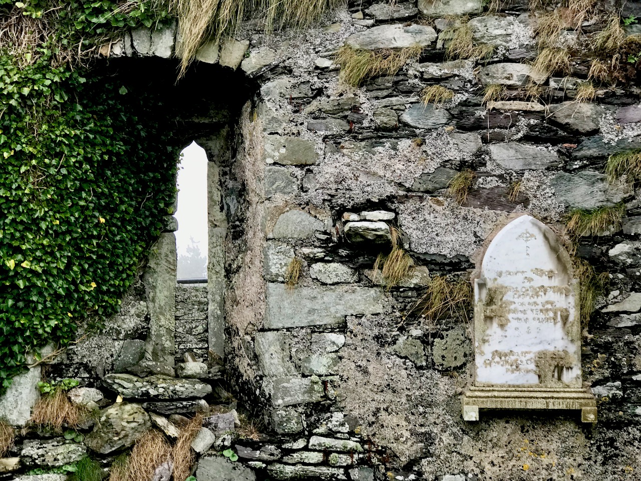
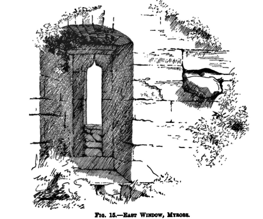
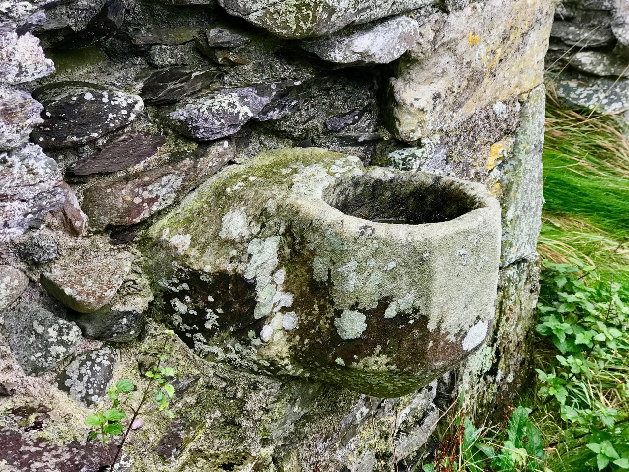
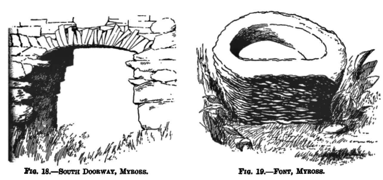
At the centre of the burial ground stand the ruins of a substantial church, in very poor repair. Some of the masonry has been reinforced with brick piers and timber posts, but the structure is fenced off to indicate the risks of its instability. Inside the church are an old font, and a piscina. The illustrations here are from a massive work – The Diocese of Ross and its Ancient Churches by Charles Webster, Dean of Ross, published by the Royal Irish Academy in 1932.

W Mazier Brady’s Clerical and Parochial Record of Cork, 1863, records that the Church of Myross was in use in 1615 but in ruins by 1699. Subsequent researches tell us that a little further to the east is the townland of Carrigihilly and here survives another ancient burial ground: local tradition asserts that here was a Cistercian Monastery – Maure Abbey (Abbey de Sancto Mauro) – founded in 1172 by Dermot MacCarthy, King of Desmond. We didn’t get to Carrigihilly on our autumnal day out: another expedition to the area beckons.

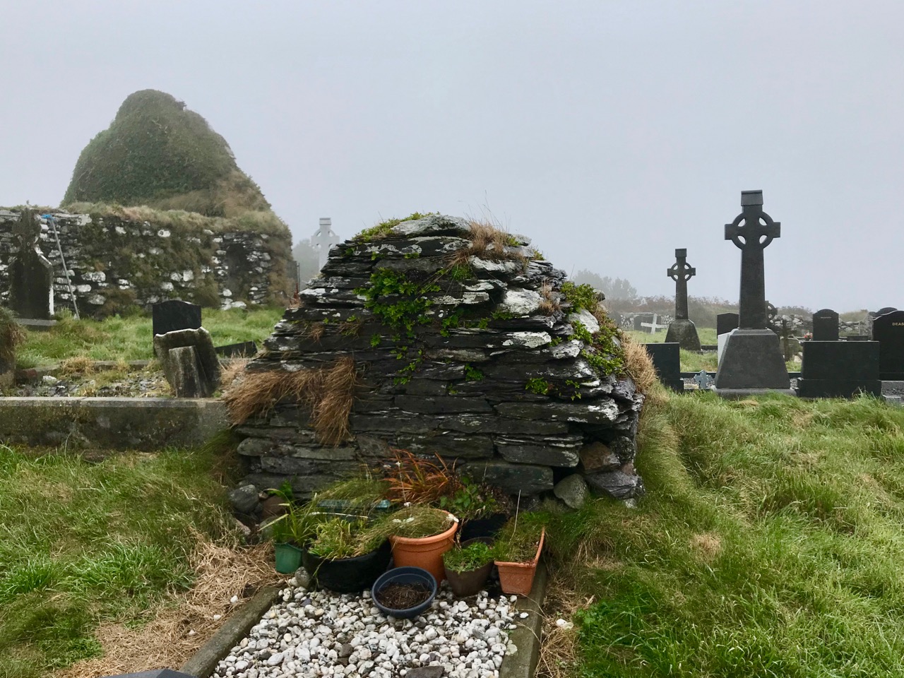
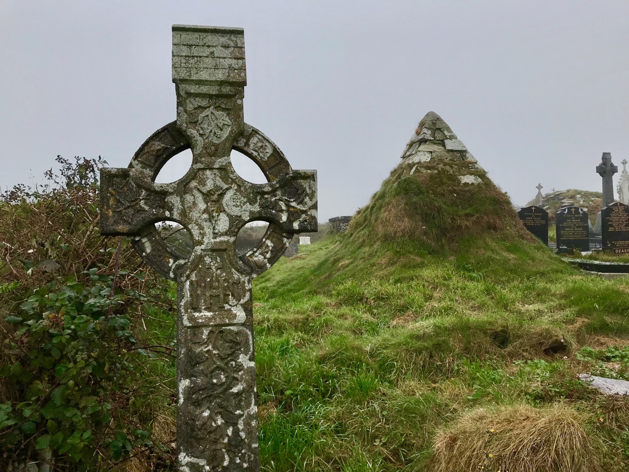
The focus of our visit was, of course, a second pyramid in West Cork – and there it is! More modest in size, perhaps, than the Glandore example, but standing out, nevertheless. Unlike the one at Glandore, there is no visible inscription on the masonry, much of which is quite overgrown. Tradition has it, however, that this tomb is a burial place for the O’Donovans, who are well represented in this part of West Cork, even today.

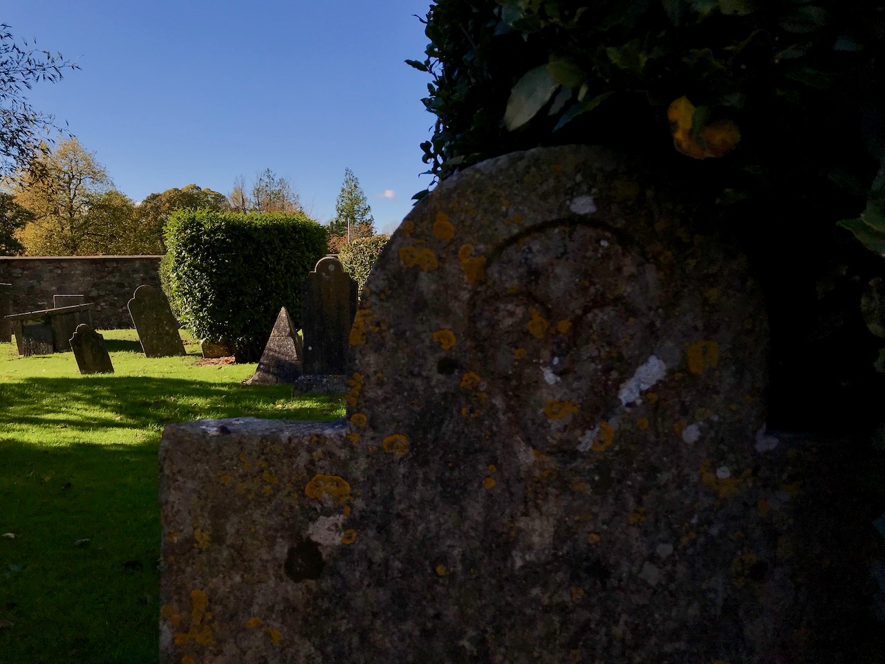
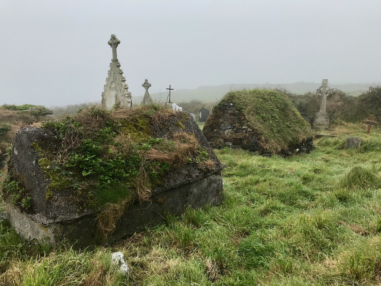
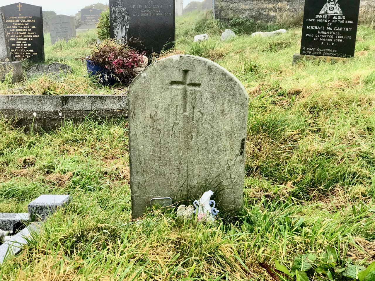
Keeping the pyramid company in this Myross graveyard are other significant chest tombs and unusual ‘gabled’ tombs, also uninscribed, and a small number of carved gravestones dating from the nineteenth century, very weathered but partly legible. It would be fascinating to know something of the lives of those who are interred in this remote and atmospheric West Cork location.

Cormac’s Chapel: The Jewel in the Crown (Part 2)

I said I’d be back in a week and it’s been a year! I’ve been working my way through a series of posts on Irish Romanesque architecture (see the bottom of this post for the list so far) and last October I wrote the first of a two part post on Cormac’s Chapel, the Romanesque jewel on the Hill of Cashel in Co Tipperary. Since this is part 2 (unless you’ve read it before and have an amazing memory) go back there now and read up on the Chapel and its history, as well as my detailed description of the exterior.

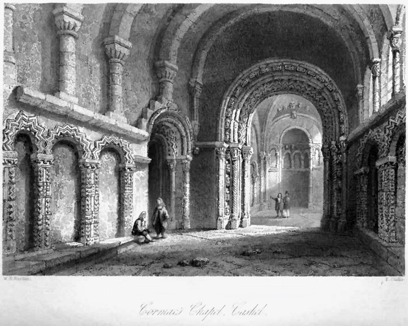
Illustration by W H Bartlett from The Scenery and Antiquities of Ireland by Joseph Coyne and Nathaniel Willis

Right, done that? Great, then come on inside. I was fortunate to visit Cashel last year, when the Chapel was open and I could spend as long as I liked taking photographs inside. This followed many years when it was closed – a conservation measure necessary to address the dampness which plagues stone-roofed buildings. During this open period it was noted that the number of visitors, all emitting carbon dioxide, was having a detrimental effect on the interior, so now it is only accessible during a guided tour and for a limited stay inside. Hopefully, this post will help you see things that you might miss during a short visit, or even items that those excellent guides might not cover.

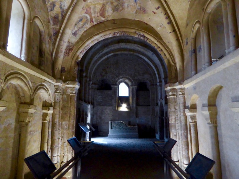
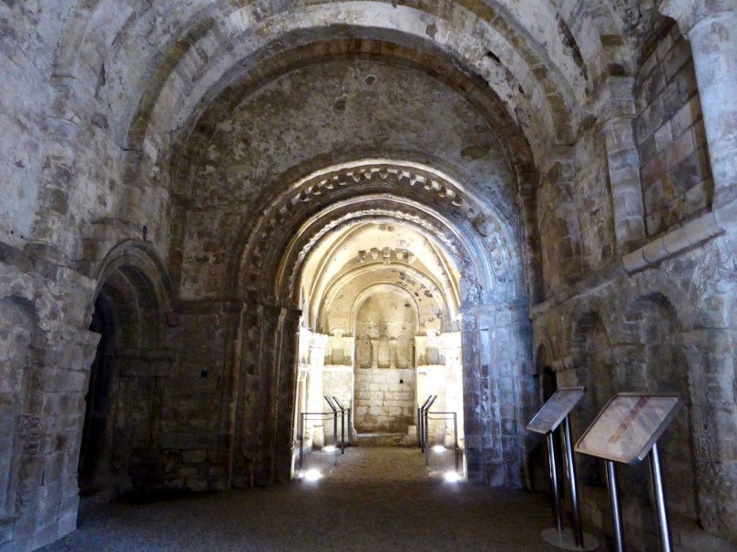
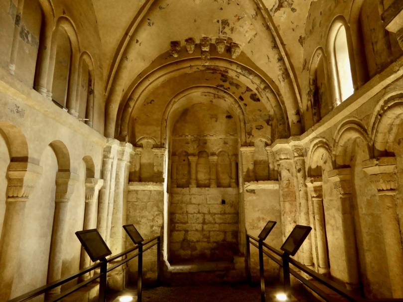
The interior, looking towards the chancel

This was a royal chapel, used for high ceremonies and built to enhance the prestige of King Cormac. When we think of such edifices, our mind probably pictures a cathedral, but large churches were still in the future in Ireland in the first half of the twelfth century and Cormac’s chapel, although small by European standards, was not outside the normal dimensions of Irish churches of the period. What was important was not its size, but the extraordinary attention to detail and decoration that went into its construction. Moreover, it had a second storey, under the steeply pitched roof. Although we are not completely sure what the functions were of that upper level, it effectively doubled the space available to its users.

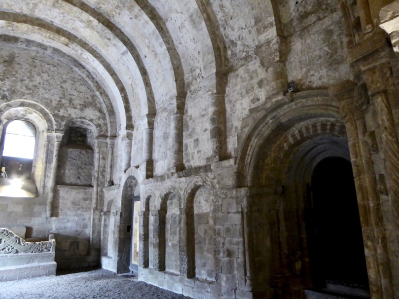
The north wall – note the blind arcading and barrel vaulted celing with parallel ribs, and the ornate door that leads to the second storey

Inside, the chapel is a nave and chancel structure, common among Romanesque churches, the only difference being the altar projection at the end of the chancel. The upstairs is accessed through the two square towers (see Part 1) and an ornate door in the north wall opens to a spiral staircase leading up to that floor (not accessible to the public). The size of this door and its elaborately carved orders speaks to its importance in some ceremonial way – O’Keefe says it tempts us to imagine the enactment inside Cormac’s Chapel of some ritual of procession involving relics.* In contrast, the north and south doors, the main entries to the nave, which are ornate on the outside, are relatively plain on the inside.

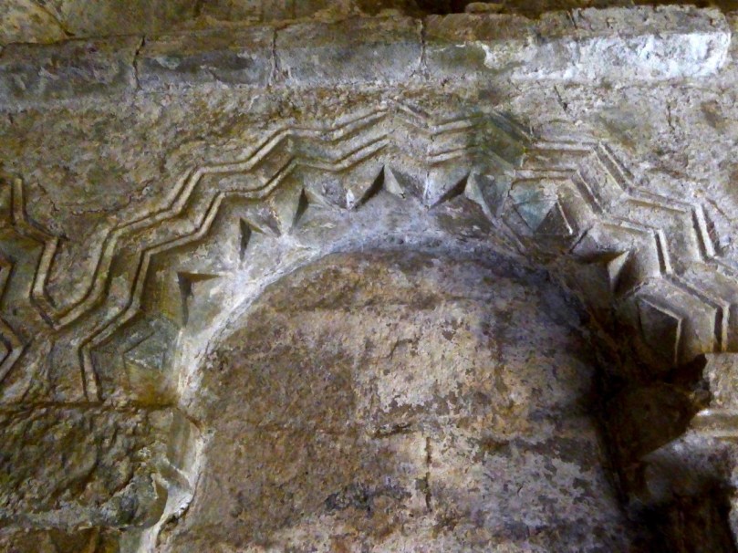
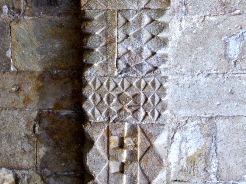
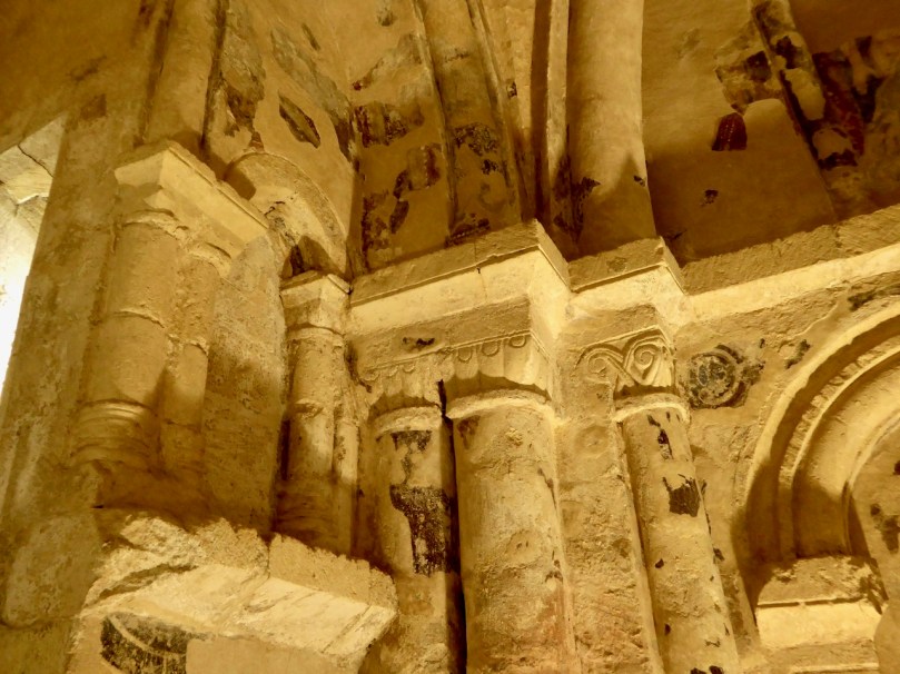
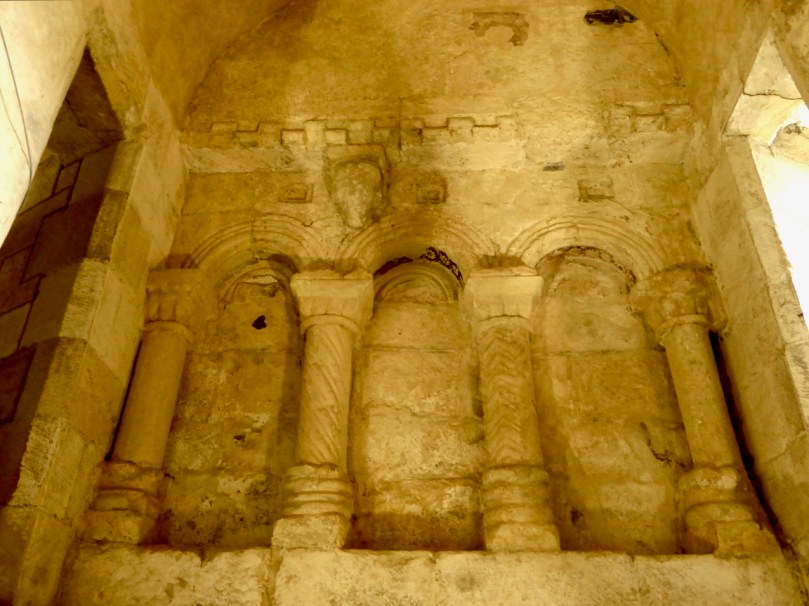
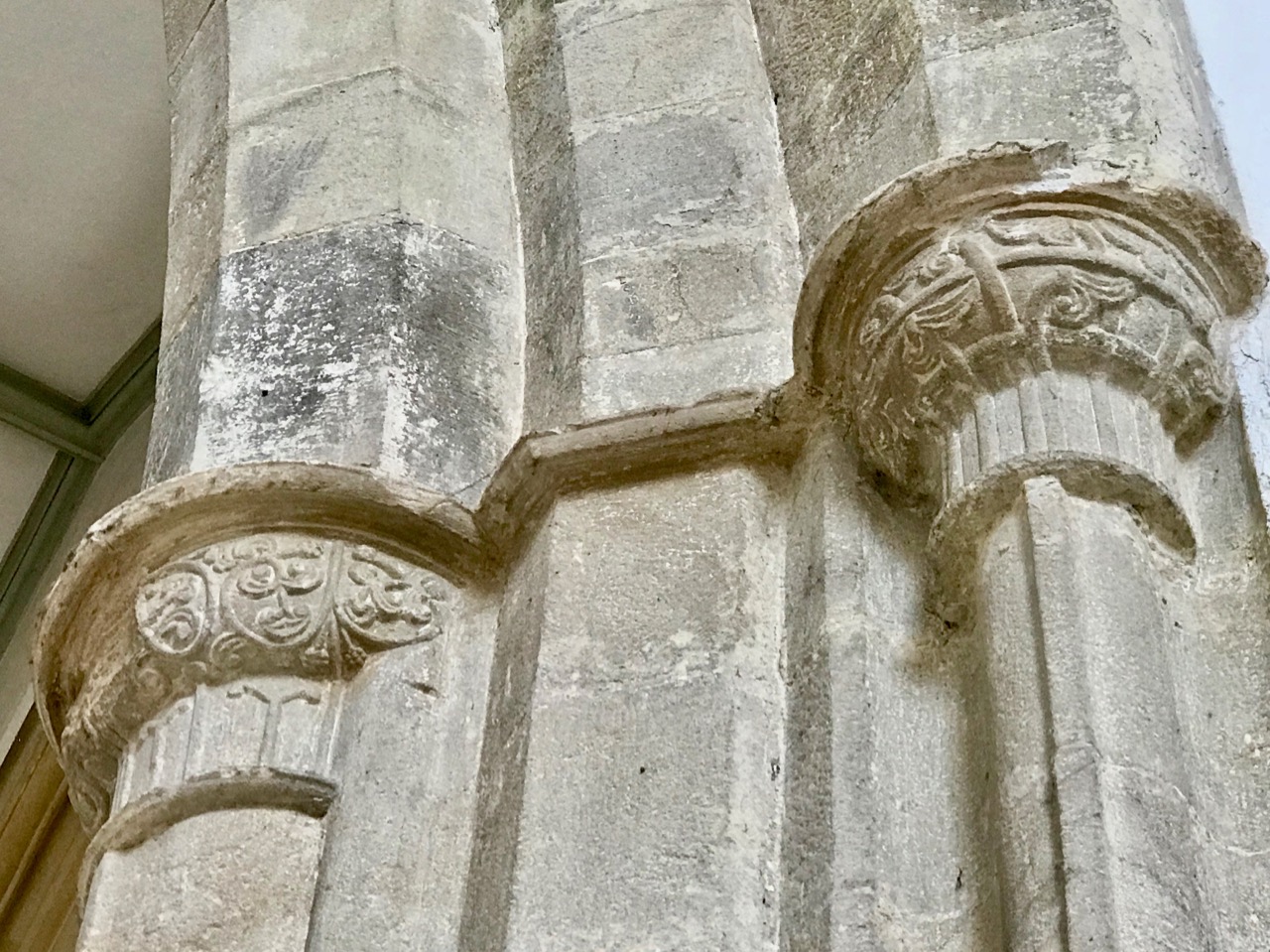
The nave is barrel vaulted, with parallel ribs running across the ceiling. The walls have blind arcades up to half their height, topped by a string course and a series of columns to support the ribbing. The blind arcade arches are carved with chevrons (above) while the columns between the arcades have irregular checkerboards of chevrons, lozenges and petals (below). The west wall has three windows on its upper stage, although only the middle one admits light now.

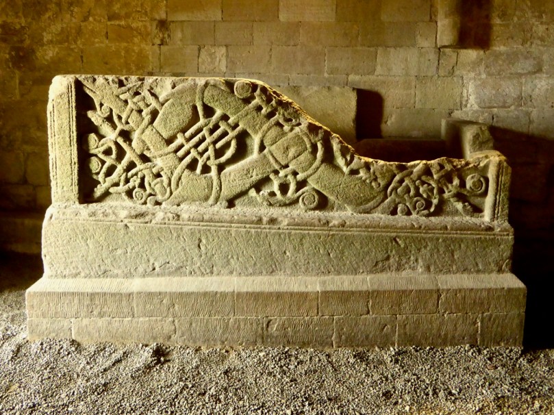
Beneath those three windows is a fragment of a large stone box, often described as a sarcophagus, wonderfully carved in the ‘Urnes’ style – a Scandinavian tradition of intertwined animals. Tradition has it that this is the tomb of Cormac himself, and certainly this carving style, although very different from what is found in the rest of the chapel, is probably contemporaneous with it. It was moved to the chapel from the later, Gothic, cathedral, where it was found. Whatever its use, it is a magnificent artefact, the work of a master craftsman.

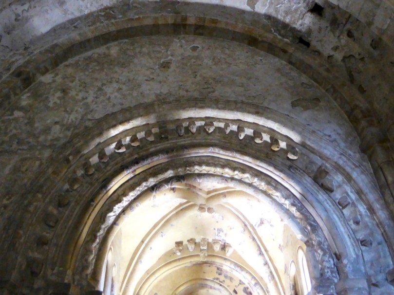
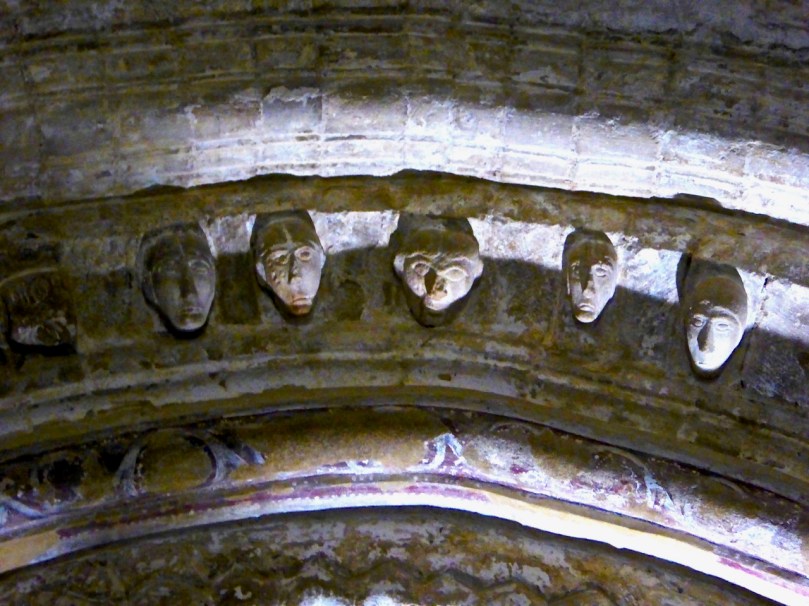
At the east end of the nave is the chancel arch with four orders. The archivolts of the first order mainly consist of carved heads, each individual and striking. Some are more time-worn than others, but the features can be clearly discerned in many.

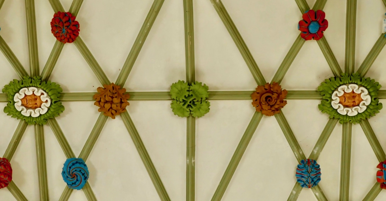
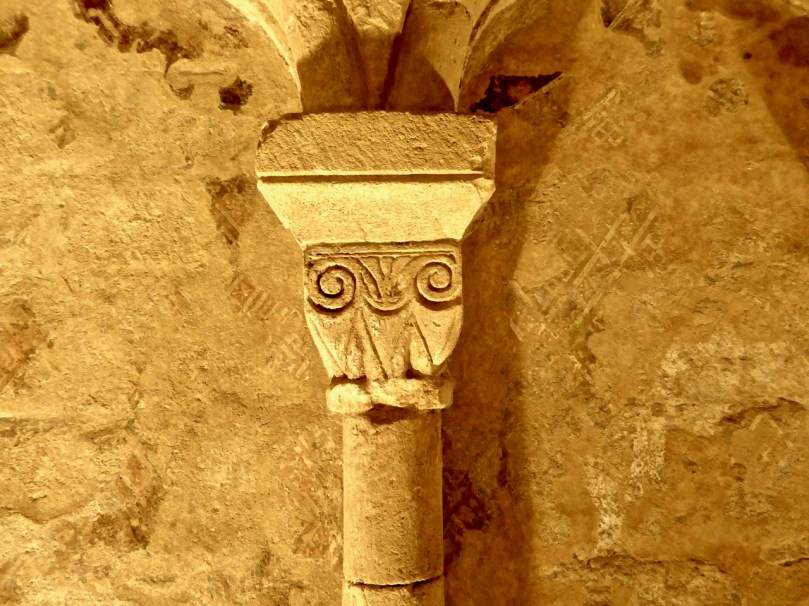
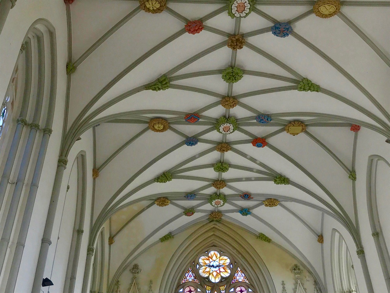
The chancel is also rib-vaulted, like the nave, but this time the ribs intersect at a central point, rather than being parallel. Like the nave, the walls have blind arcading above which are further arches and window-openings. Capitals are decorated with scrolls and scallops.

A final arch spans the projection which held an altar. The arcading in this final section is quite elaborate, and two deeply splayed windows provide light to this area.

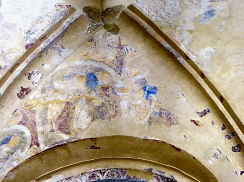
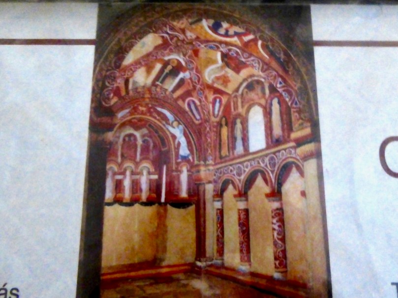
Once in the chancel area, which has been well lit, you can start to appreciate the vestiges of paintings that would have enlivened the interior of Cormac’s chapel. A conjectural reconstruction of the artwork is provided in an explanatory panel – the chapel must have looked magnificent and colourful indeed. Preserving these precious fragments has been a tremendous effort.

Finally, stand in the nave and take a careful look around – you will see that the chancel is offset to one side of the nave. While some authors have suggested this as a decision to change dimensions midway through the building process (Dermot Bannon’s nightmare) and others have ruminated about mistakes, O’Keefe demurs. It makes a lot more sense, he says, to interpret Cormac’s Chapel as built to plan, and to suggest that the nave widens on the north side to reflect and accommodate the visual spectacles of procession involving both north-side doorways.

Sketch by Richard Lovett, from his Irish Pictures. The ‘offset chancel is clearly seen in this illustration

There you have it – the glorious high point of Irish Romanesque architecture inside and out. If you haven’t been to Cashel yet, there’s a treat in store. And if you have, well, go again, and make sure to sign up for the guided tour that includes Cormac’s chapel.

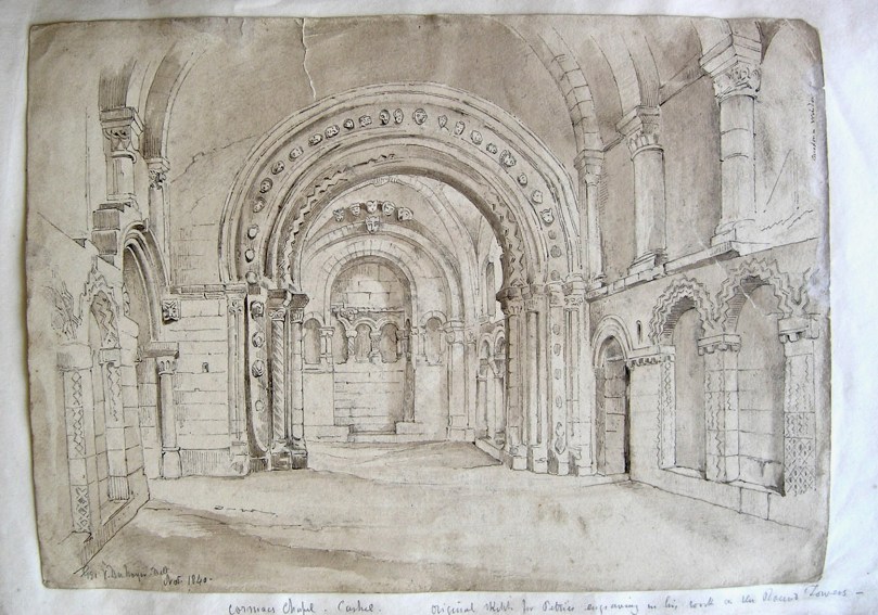
The interior of Cormac’s Chapel sketched by George Victor duNoyer for George Petrie**

Previous posts on Irish Romanesque architecture

Irish Romanesque – an Introduction

Irish Romanesque 2 – Doorways

Cormac’s Chapel: The Jewel in the Crown (Part 1)

*Once again, I relied heavily on Prof Tadhg O’Keefe’s manuscriptRomanesque Ireland: Architecture and Ideology in the Twelfth Century, which he has generously uploaded to Academia.

**George Victor Du Noyer, “Cormac’s Chapel Cashel. Original sketch for Petrie’s engraving in his book on the Round Towers. Geo V Du Noyer. Delt Nov 1840,” Royal Society of Antiquaries of Ireland, accessed October 21, 2018, http://rsai.locloudhosting.net/items/show/22213