Wild Beasts of Ireland

tiger at feet st canice

There are wild beasts all around us!  Animal, fish, serpent or fowl, real or mythical, carved, painted – imagined. This is my second ‘Menagerie’ – previously we explored the Honan Chapel in Cork, and I was struck by all the wildlife representations there, as set out in this post from over two years ago.

2 deer cashel

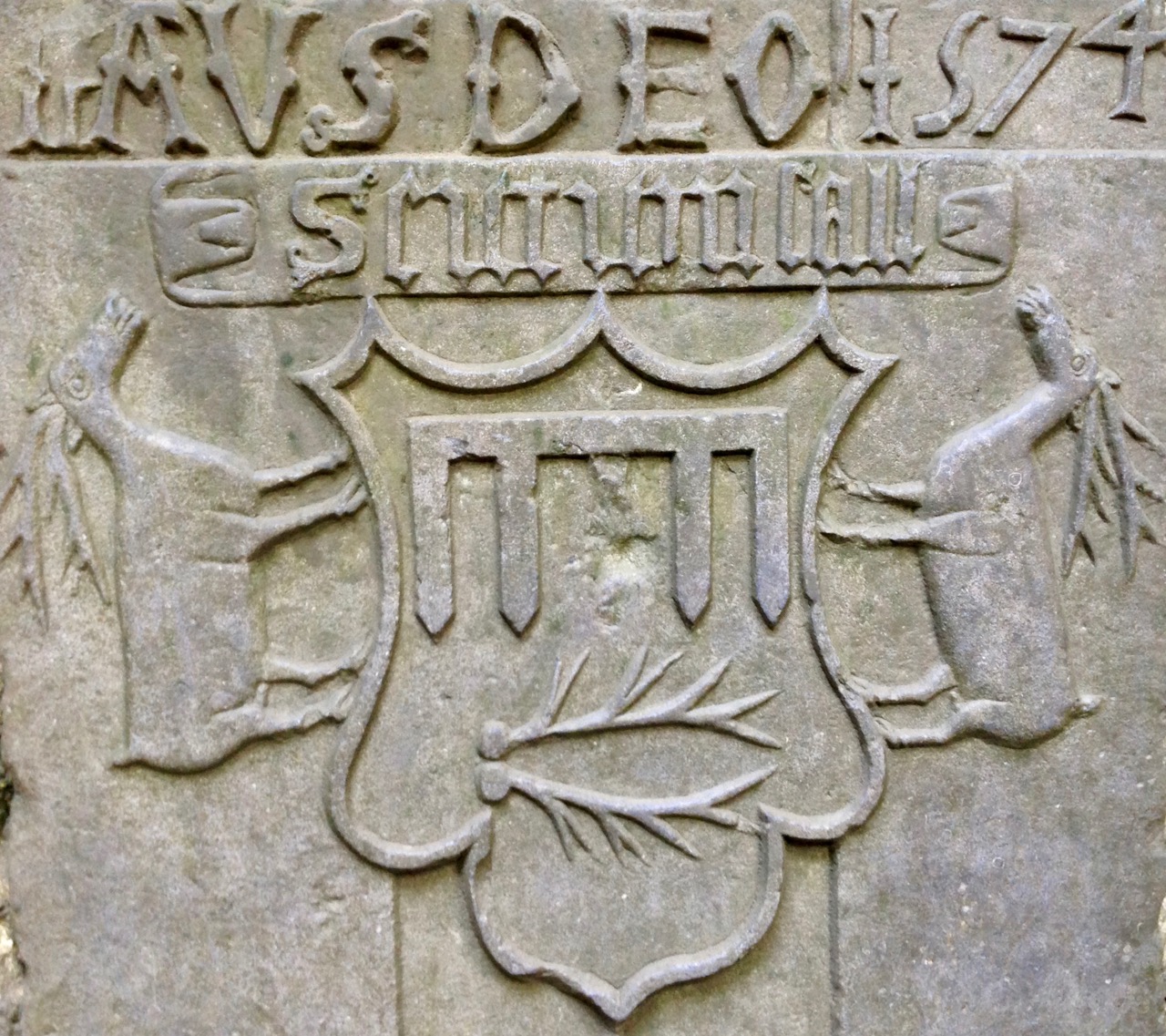
Deer and antlers on a memorial plaque in the Cathedral at Cashel – one of the earlier representations here, dating from 1574. Top picture – believed to be a tiger, this fine beast lies at the feet of a medieval knight in St Canice’s Cathedral, Kilkenny

Our travels take us around many of Ireland’s historic sites, and I’m always on the lookout for Creatures – they are abundant everywhere. Countless stories of the saints involved animals: they are common symbols on tombs and heraldic plaques, but we can’t resist also using them today – for inns, shop signs or just decoration on the streetscape. Have a look around you – you might be surprised how many you can see…

toucan guiness

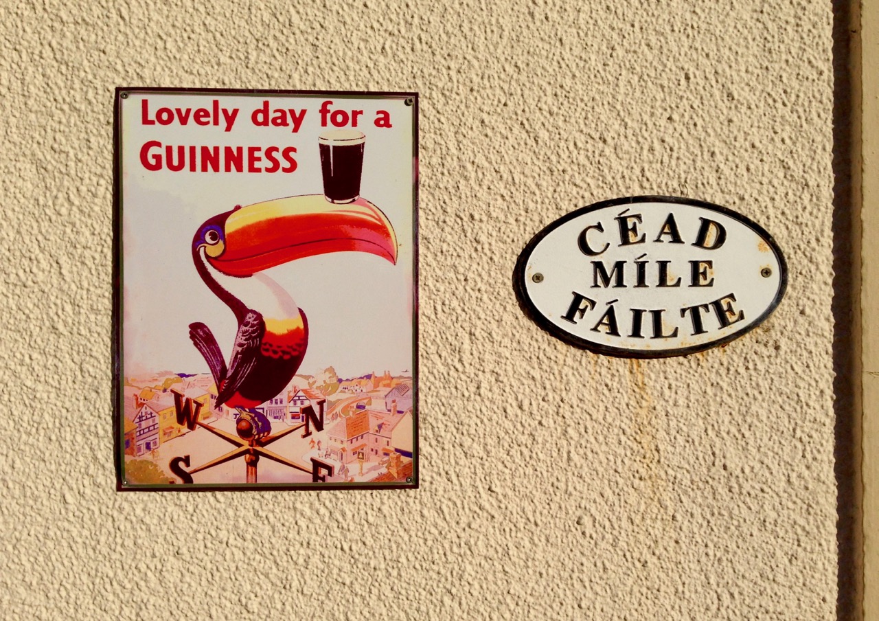
Inhabited streetscapes: top – two Kilkenny Cats undoubtedly belonging to Dame Alice Kytler and, above – there are plenty of these toucans still around in Ireland! They originate from a ‘zoo’ advertising campaign for Guiness begun in 1935 (abeted by Dorothy Sayers who wrote captions and verses); the toucan campaign flourished until 1982

Nobody has ever claimed the toucan as an Irish bird, but pelicans were certainly not uncommon in medieval carvings here. That’s because the pelican in early Christianity symbolises atonement as it was believed to wound itself in order to feed its young with its own blood.

2 birds shield cashel

fish lid st canice

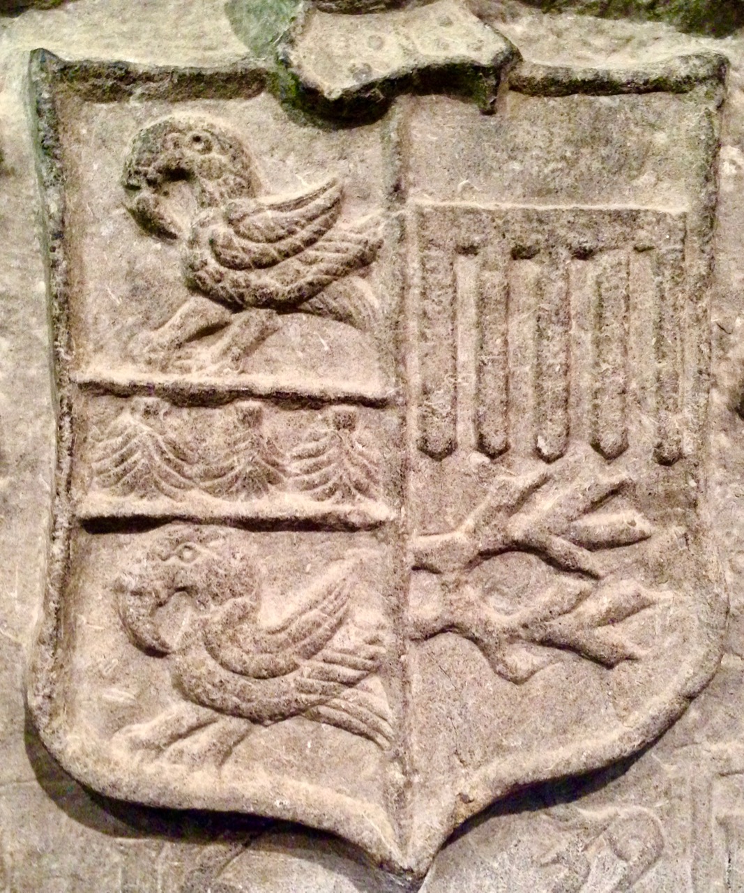
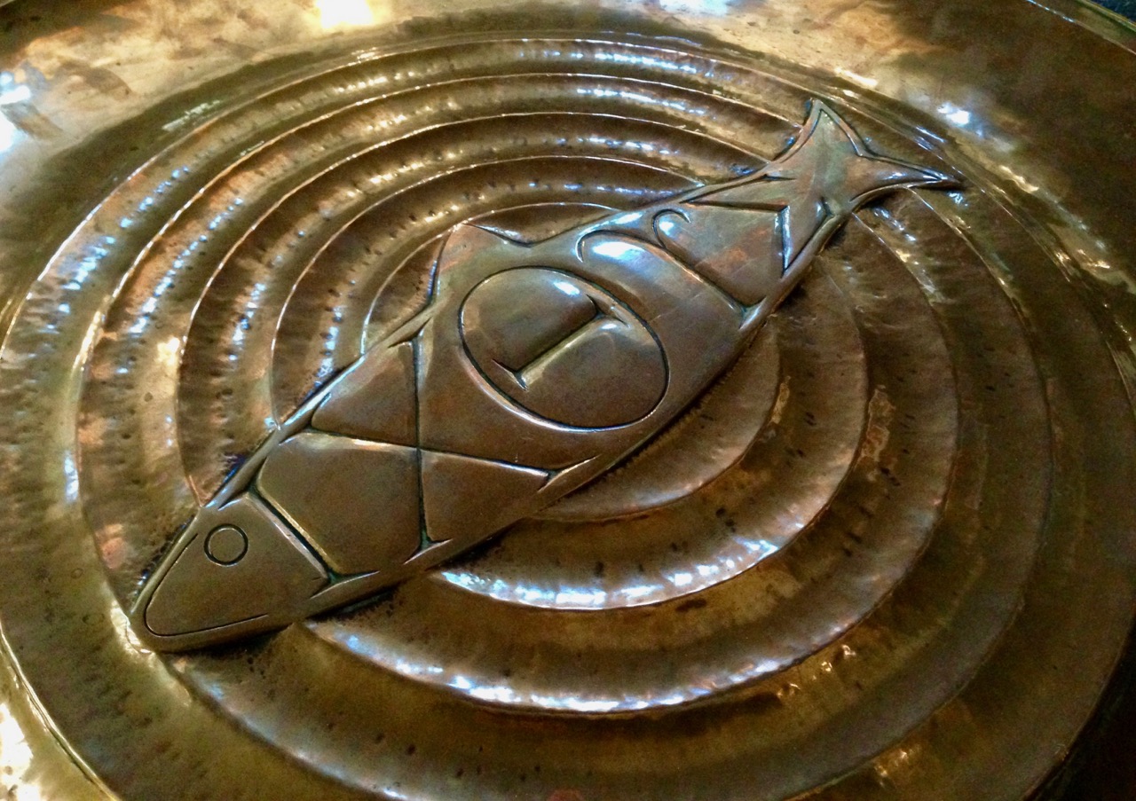
Christian symbolism: top – medieval pelicans at Cashel, and below – a fish incorporated in a modern lid to the ancient font in St Canice’s Cathedral, Kilkenny. The Greek ΙΧΘΥΣ is an acrostic for ησοῦς Χριστός, Θεοῦ Υἱός, Σωτήρ, literally translating as Jesus Christ, Son of God, Saviour

Also in Christian symbolism the lamb represents Jesus – the Lamb of God – who was sacrificed in order to atone for human sin.

lamb with pennant kilkenny

ihs lamb detail
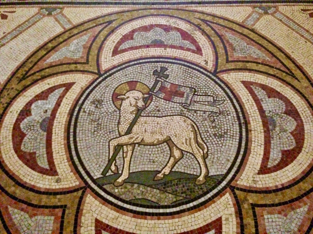
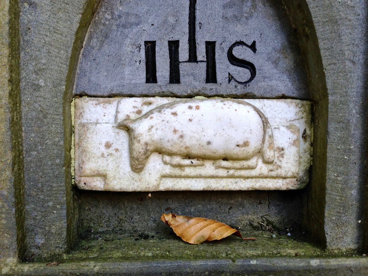
Top picture – not a wild beast, perhaps, but a pascal lamb mosaic in St Mary’s Cathedral, Kilkenny. Lower picture – this strange creature is also a lamb, from a graveyard memorial in Killeen, Co Meath

Lions are popular animals in Britain and Ireland, possibly because they appeared on royal crests and were therefore associated with status and dignity. I was surprised to find bears and eagles well represented.

All the lions (graphic tiles and wistful memorials) are from the Collegiate Church in Youghal. The stained glass is from St Peter’s Church, Bandon, Co Cork and shows off bears (from crests of the Earls of Bandon – their motto was Bear & Forbear), eagles, another lion and – for good measure – a fine serpent

Some of the most splendid and oldest carved stonework in Ireland is to be found at Cormac’s Chapel, Cashel and at Clonfert Cathedral, both dating from the twelfth century. The Hiberno Romanesque doors and arches display arrays of human heads but also numerous creatures.

Heads cormacs chapel

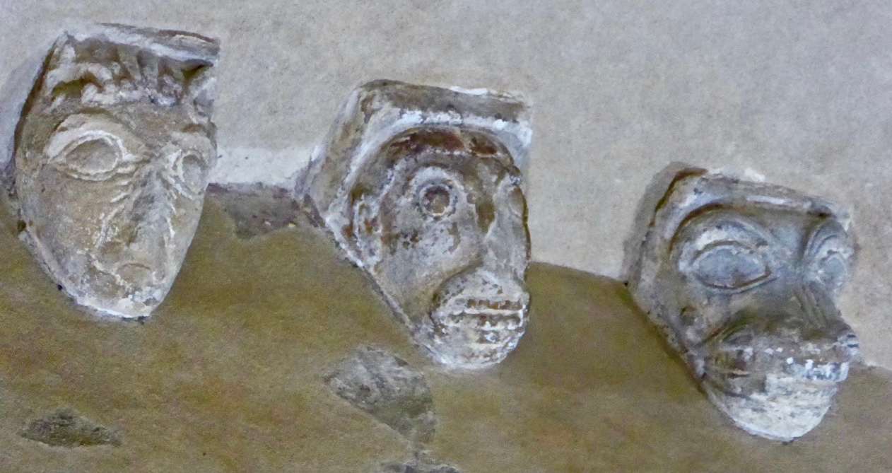
Upper pictures – a small selection from the riotous carvings at Clonfert Cathedral, Co Galway and – lower picture – ambiguous creatures from Cashel, Co Tipperary: all are around 900 years old

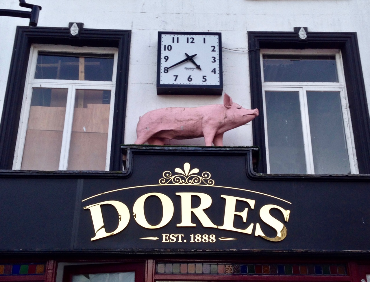
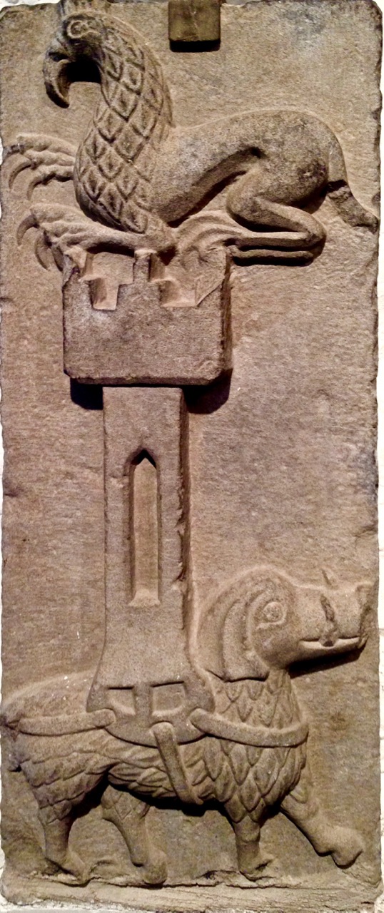
I’ll round off for now with some more cat-like creatures and a Kilkenny pig. Oh – and a carving we found in the Cashel museum, titled ‘Elephant and Castle’. Both the carving and the name are enigmatic, as the creature with a castle on its back (wherein resides another creature – a gryphon?) looks to me like a boar with feathers!

pig dores kilkenny

Elephant + Castle


The Murdering Glen

On the walk

The long valleys that run eastwards from Bantry are filled with antiquities – Discovery Map 85 is dotted with red circles of places we want to tramp around. We have been particularly intrigued by the ‘Murdering Glen’, labelled on the map: can you see it?.

Murdering Glen Map

Today we got a chance for a thorough exploration of the Murdering Glen, on the invitation of our friend Bridget, who lives there and is a keen explorer herself. After a wonderful lunch supplied mainly from her garden we set out up the road towards the Glen, with Bridget assuring us that the place appeared peaceful enough these days and not to worry.

Murdering Glen

The Glen is indeed dramatic, with steep sides and an enormous overhanging rock – just the kind of place for a brigand to lurk. In this case the brigand (and his mother) were locals, by the name of O’Kelly, who would lay in wait for travellers and murder them for their gold, before throwing them into the Butcher’s Pool.

Murder Rock

In  the 1930s schoolchildren in every National School in Ireland were asked to write down the stories they heard at home and these were recorded, in their own writing, by the National Folklore Commission. Here is the outline of the project, as presented on Duchas, the website that now stores that collection:

For the duration of the project, more than 50,000 schoolchildren from 5,000 schools in the 26 counties of the Irish Free State were enlisted to collect folklore in their home districts. This included oral history, topographical information, folktales and legends, riddles and proverbs, games and pastimes, trades and crafts. The children recorded this material from their parents, grandparents, and neighbours. The scheme resulted in the creation of over half a million manuscript pages, generally referred to as ‘Bailiúchán na Scol’ or ‘The Schools’ Collection’.

To my delight, I was able to find the original story in the collection – and here it is, in the handwriting of schoolboy Michael Keohane from Dromore National School. I think you will agree he has done a magnificent job of telling the local legend.

murdering-glen

murdering-glen-page-2Before we left the murderous spot Bridget led us up to the mass rock, on a ledge on the side of the valley. It was a block of sparkling quartz, with holes to collect water, into which you can dip your warts in hopes of a cure.

Bridget shows us the mass rock

We  walked then towards the Trawlebane Bridge, where Robert and I had joined the walk two years ago to honour and remember Chief O’Neil. Robert’s post, The Chief, will take you back to that day and show you the spot where, before we started the walk, participants decided to put on an impromptu display of Crossroads Dancing, just as local people would have done on a fine summer evening in the old days.

Trawlebane Crossroads

There was more, much more to see, just in the immediate neighbourhood. We spent time in a Cillín first, in the middle of a field, with a magnificent blackthorn tree to mark the lonely spot where unbaptised children were traditionally buried. Read more about this practice in my post Unknown Souls.

Cillín

Blackthorn TreeA little five-stone circle was next – a classic of its kind, with four stones set on edge and a recumbent stone marking the axial alignment. (See more examples of them in my post Family-Friendly Archaeology). Besides three sites in nearby Kerry, these small stone circles are only found in Cork. They mirror exactly the larger multiple-stone circles, just with fewer stones – an efficient variation requiring fewer resources to erect but accomplishing the same outcomes.

Five stone circle

Unfortunately, this five-stone circle has been filled with field debris, creating the appearance of a mound

We also passed numerous ringforts and several standing stones. Looming over us as we walked was Dromore hill, on top of which was erected, in the Marian Year of 1954, an enormous cross, now rather improbably lit up at night. The cross is clearly visible from the stone circle and the standing stones, presenting opportunities to ponder on the juxtaposition of what is considered sacred in its own day, and what communities will expend precious resources to erect at different times over millennia.

Cross above circle

CrossOn  our trip to Sligo recently Robert and I were sensitised to the phenomenon of monuments seemingly echoing or imitating the topography behind them – see his post Discovering Carrowmore for more about this. I was struck by one of the standing stones – the top did seem to echo the hill behind it. Coincidence?

Standing Stone shape

October in West Cork can feature some of the best weather and walking conditions of the year. Today did not disappoint, with blue skies and crisp air.

Tree

Thank you, Bridget, and our other exploring companions Amanda and Peter, for a marvellous day of Murder, Mythology and Megaliths.

At the rabbit ears

Into the Heartland

Elphin Windmill

Because we live on it, sometimes we get carried away by the notion that The Wild Atlantic Way represents the best that Ireland has to offer. A recent trip to the midlands – the Heartland of Ireland – convinced us (if we needed it) that there is no part of Ireland that isn’t beautiful and full of fascinating things to do and see. (Like the Elphin Windmill, Co Roscommon, above.)

Parked at Coolnahay

We spent a lot of time along rivers and canals! 

Robert explains the background and purpose of our trip in his post, Travel by Water. I knew very little about canals before I met Robert and it’s been eye-opening to learn about the history and the sheer extent of Ireland’s inland waterways. We spent a lot of time exploring the canals – walking and driving – and enjoyed it all tremendously.

Boa Island figures

Boa Island on Lough Erne, Co Fermanagh, is home to these mysterious carved figures. Lower left: heads on a medieval church in Kilmallock, Co Limerick. Lower right: a contemporary sculpture celebrates the mythical Finn McCool, in Keshcarrigan, Co Leitrim

But wherever we went there were always other places luring me away – tower houses and fortified houses, churches and graveyards, friendly villages and colourful houses, stained glass windows and prehistoric sites. We drove along roads where we counted ring forts in every field. We explored ancient graveyards and we found a Holy Tree. We visited two sites we posted about last week, the Corlea Iron Age Trackway, and the Hill of Uisneach.

Holy Chestnut

The Holy Tree. A local man we met called it a ‘holy show’ and it certainly had some very questionable items mixed in with the statues and offerings

It’s autumn now, and, while we do experience a change of colour here in West Cork, it’s really in the midlands that the colours of the deciduous trees can overwhelm the senses. They were just starting to turn. I’m strongly tempted to head back in another couple of weeks for the full experience.

Birr Castle Gardens 2

These photographs were all taken at Birr Castle Gardens. Birr Castle (Co Offaly) was one of the most interesting and beautiful places we visited, home of the famous telescope and beautifully maintained

We visited thirteen of Ireland’s 32 counties on this trip – and never came close to the sea or the Wild Atlantic Way. Instead, everywhere we went we saw notices for the latest iteration of the Tourist Board’s marketing scheme. This one is called Ireland’s Ancient East, and appears to take in every county that isn’t on the Atlantic seaboard. A good resource, if you’re considering a trip like this, is Neil Jackman’s guidebook, Ireland’s Ancient East – we kept it by us and found it invaluable.

Grange Stone Circle, Lough Gur

Grange Stone Circle, the largest in Ireland, is one of a complex of monuments at Lough Gur, Co Limerick

Our headquarters for the biggest chunk of our time away was the incomparable Mearescourt House near Mullingar, Co Westmeath. George and his team made us welcome and comfortable, there were glorious grounds to wander around and animals to meet, and delicious breakfasts that left us feeling full for the rest of the day.

Mearescourt House

Mearescourt House – highly recommended!

When tourists are interviewed about their holidays in Ireland they praise the scenery, the food, the music – but most of all, they say, it’s the people who make it so enjoyable. We agree! Everywhere we went we ended up in conversation, as you do here, with local people delighted to help out with information, share old stories, invite us to the sessions, tell us where to go for a nice dinner, or point out places off the beaten track (and then rescue us later when we got lost).

Claire and Paddy Crinnegan, Coolnahay

Paddy and Claire Crinnegan maintain the canal lock at Coolnahay on the Royal Canal. in Co Westmeath They made us tea, fed us Claire’s delicious currenty bread, told us about the trad concert that evening, loaned us a book, and related stories of growing up at the lock, where Claire’s father was the lock keeper.

Future posts will go into more depth on some of what we saw and experienced on this trip. This one is just an introduction, to share some of our impressions and drop some hints about what might be upcoming.

Clonfert Doorway

Clonfert Cathedrall (Co Galway) has the most beautiful Romanesque doorway I have ever seen
Along the canals and rivers, flora and fauna
Top left: in case you might get too happy with yourself; top right: the imposing gates to Portumna Castle, Co Galway, a 17th century house now owned and managed by the Office of Public Works; Bottom left: I peeped inside the priest’s section of a confession box and observed how he maintains an efficient count of time spent on each confession; bottom right; we disturb the rooks at Ballycowan Castle, Co Offaly

HC Studio, Athlone

Athlone Cathedral (Co Westmeath) has a gorgeous set of enormous windows from the Harry Clarke Studios – this is a detail from just one of them.

Can you detect a future post or two?

Tracking the Past

Guiding the oxen

Bogs are mysterious and dangerous places now, and they were even more so for our ancestors. The raised bogs of the midlands were laid down after the ice age and covered vast areas of land, creating difficulties and opportunities for prehistoric peoples.

Construction

The top photo and this one are of the imaginatively assembled diorama showing how the trackway was built

Turf cutters find things in bogs all the time – last year we wrote about the extensive field systems under the blanket bogs of the Ceide Fields of Mayo. Bog bodies are the most fascinating finds no doubt, but all kinds of organic materials can be preserved in the acidic and anaerobic environment of the bog.

Section and Pegs 2

A long section of trackway has been conserved and is on view in a climate-controlled room

In  Corlea, County Longford, what was found turned out to be the longest and largest Iron Age trackway ever discovered. It was excavated by Dr Barry Raftery in the late 80s/early 90s and a whole section of it is conserved and on display in an attractive visitor’s centre in Corlea, which is located exactly where the trackway was found. Noel Carbery was our guide on a recent visit and we couldn’t have asked for a more enthusiastic and knowledgeable person to answer our questions and show us around. 

Visitor Centre

Building the road was a massive undertaking and must have taken hundreds of people working together. Using dendrochronology to date the oak, archaeologists determined that the trackway was constructed in 148BC, placing it in the Iron Age. It is speculated that it provided a routeway from the Shannon to the royal inauguration site of Rathcroghan in Co Roscommon, allowing wheeled vehicles to cross the bog. We can picture warriors in their chariots and full regalia following a ceremonial way to some great feast at Cruachain.

The trackway was held in place by means of wooden stakes

Ironically, its very magnitude proved its undoing – it was so heavy it sank into the bog within ten years of being built. Oak planks were laid on runners, occasionally supported by additional brushwood, and fixed in place with stakes which served to peg the boards to the underlying peat and keep them from moving around. A layer of peat on top may have helped to even out the surface.

Infill

Gaps are filled in with branches and saplings of oak, ash or birch

The builders showed considerable skill in splitting the logs to form planks and in whittling the stakes and boring the sockets, using metal axes and adzes. Gaps were filled in with round saplings  and brushwood.

Woodworm?

Top left – 2000 year old silver birch bark, beautifully preserved. Top right – some shrinkage of the interior wood is visible. Below – is this woodworm?

The excavation and conservation was as large an effort as building the road. Once the planks were revealed they had to be kept dry, then immersed in special substances and freeze dried. Finally, they were returned to Corlea, to the new visitor centre where they are kept in climate-controlled conditions. Nevertheless, some deterioration is inevitable and on our visit we observed shrinkage of one runner away from its bark, and some signs of what looked like woodworm in one of the planks, indicating the difficult task of conserving two thousand year old timbers.

Chopping

There is lots of fascinating information at the Visitor Centre about other trackways (including some from much earlier) and about building methods. I particularly loved the little diorama that an artist had made showing the trackway under construction. We also learned a lot about the bog itself, which surrounds the Visitor Centre on all sides.

Modern Bog Trackway

Top – a modern bog trackway, in the form of narrow-gauge railway tracks. Below left – this bog is being ‘milled’ to provide fuel for a power station. Below right – a more traditional cutting to provide domestic fuel

The Corlea Trackway deserves to be much better known than it is. I highly recommend a visit if you’re anywhere close by – it’s not everyday you get to walk beside a 2000 year old royal road!

Home sweet home

The Navel of Ireland

eyes of the goddess

Today we happened upon the Navel of Ireland. That’s the name given to the Hill of Uisneach in the townland of Loughanavally, in the barony of Rathconrath, in the county of Westmeath. It’s an archaeological centre of powerful cultural significance, one of (possibly) six ‘royal’ sites in the island of Ireland.

palace rendering

Seen in the developing visitor centre below the Hill – an artist’s reconstruction of the ‘Royal Palace’ on the Hill of Uisneach, County Westmeath

Today, Ireland is divided into four provinces: Leinster, Ulster, Munster and Connacht. The Irish word for this division is cúige, which literally means ‘fifth part’. That’s confusing, until you learn that there was, before the Norman invasion, a fifth province, known as Mide. The Irish word Midhe means ‘middle’. Mide has survived as a county – Meath; but this large county was divided in two during the time of Henry VIII, and we now have both Meath and Westmeath.

Justin the guide 2

catstone in context 2
Upper picture – Justin, our tour guide, explains the significance of the earthwork known as the ‘Royal Palace’. Lower picture – approaching the Navel of Ireland, the focal point of the Hill of Uisneach

Uisneach was probably the ancient headquarters of the fifth province, but was also particularly important because it was the place where all the provinces came together. The provinces were formerly administered by the dynasties, or ruling families of the day, and it is likely that they met up here to ensure that laws were fair and consistent through the whole of the land, and also to exchange news and stories, to feast, and to hold contests. In that latter context the tradition survives – rugby and hurling contests between the provinces in Ireland are madly important events – and their followers positively tribal!

ancient trackway 2

distant fort 2

Upper picture – an ancient trackway appears to lead to another circular enclosure on a distant hilltop (shown in the lower picture)

Uisneach is privately owned – and a working farm – but we are fortunate that the owner fully appreciates the significance of the place and allows access – by permission – through the services of a number of guides who are well versed in its known history and traditions. Our tour guide today was Justin – a complete Uisneach enthusiast. We followed him for two hours and were shown many of the currently accessible sites. There are very many more: access to others is being worked on, as is a small visitor centre, so a visit to Uisneach is an evolving experience. Some of the hill was excavated, intermittently, over a period of years during the 1920s by R A S Macalister and R L Praeger. In 2001 a long term project was started by Dr Roseanne Schot  of NUI Galway: this is continuing. Future plans for the archaeological investigations include aerial Lidar surveys which could uncover hidden features and artefacts without excavation.

Justin talks about the first archaeological excavators of the Hill (left) and (right) describes the ‘wood henge’ which has been found by laser scanning on the Hill’s summit

While the science of archaeology is being focussed on Uisneach, the equally important investigations of folkore and mythology (the stories of the hill) are also in full swing. Naturally, St Patrick made an appearance on the hill back in the day (we were shown his stone ‘bed’) and I was fascinated to read, later, that Geoffrey of Monmouth in his 11th century History of the Kings of Britain tells how stones from Uisneach were magically transported to Stonehenge. From the top of the hill it is said that you can see twenty counties – and all four (five?) provinces. The day of our visit was not quite clear enough for this, but we did ascend to the summit, where we could see the remains of a passage tomb – perhaps five thousand years old – although these had been disturbed and disbursed by the Ordnance Survey, who placed a trig point there back in the 1800s.

walking to the catstone

Our visit to The Catstone, an enormous glacial erratic which became the meeting place of the chieftains of all the provinces of Ireland

The goal of our little expedition was the Navel of Ireland – by tradition the centre of the whole land, and the place where the meetings of dynasties took place. It’s a little way on from the summit of the hill and only enjoys some of the views, but it is marked by an enormous natural boulder set into a circular earthwork of human construction: Justin painted a word picture for us of each of the chieftains sitting at the head of his own province on the banks of the earthwork and facing the stone while all the important affairs of state were discussed. Culturally this was where the provinces met. In relatively modern times the boulder has been called The Catstone: some say this is because it resembles a cat, others would have it that a cat is a traditional symbol for a place where our world meets the ‘otherworld’.

decorating the goddess

Upper left – the entrance to Uisneach symbolises the Bealtainne Fires which have been celebrated on the hilltop. Upper right – an image of Lugh on the shores of the lake (middle pictures) where he is said to have met his end. Lower picture – Eriu being adorned with autumnal hues

On our way down from the hill we met with a large crowd coming up. They were off to the Catstone for a ceremony of their own which involved drumming and singing – and, possibly, making contact with the ‘otherworld’ themselves. I think there’s a continuity here: a gathering place imbued with some deep significance and referenced to Irish mythology through Eriu, a goddess who gave her name to Ireland, and Lugh – a god or ancient hero who, according to the stories, met his death in a lake near the summit of the hill. Whatever your beliefs, there’s no denying that the Hill of Uisneach has been an empowering place in ancient times, and remains so today.

With thanks to Justin for such an erudite and enthusiastic tour of the Hill, and great appreciation of the interest and generosity of the Clarke family in allowing the Hill to be researched and visited

Below – off to the ceremony on Uisneach Hill

ready for the ceremony

The Old Mine Road

to the castle

Exactly two years ago I wrote a piece for this Journal – A Moment in Time – remarking on the very specific changes that we become aware of at the end of the summer: the holiday homes being closed up and shuttered; the boats being taken off their moorings and stored away in the boatyard; the shorebirds returning to their winter quarters. I finished up by pointing out that our own summers never end: we enjoy living in Cappaghglass just as much in the darker, colder days at the turning of the year as we do when the sun is high in the heavens.

cove gray day

high road gray day

Top – starting point: Rossbrin Cove on a gray day. Bottom – The Old Mine Road wearing its raincoat

It is an idyllic life and we are privileged to have the quiet boreens to ourselves in all weathers. We have talked about Rossbrin Cove so often, in its many seasonal variations: for today’s post I’m taking the upward road through the townland, the route that I call The Old Mine Road. This road – or more accurately this series of lanes and byways – will take the traveller from the Cove into the little town of Ballydehob, and will pass through an old copper mining district which, two hundred years ago, saw heavy industry, intermittent employment, smoke, noise, pollution and desperate human working conditions where now ‘peace comes dropping slow’ with only the crying of the Choughs over an undisturbed backdrop of rock, heather and coarse grasses – and the occasional jumble of stones showing where there were once buildings, shafts and crumbling walls marking the old mine complex.

cappaghglass

captain's house sun

Top – the landscape of The Old Mine Road: Mount Gabriel dominates the horizon to the west. Bottom – looking from the road towards Roaringwater Bay: in the foreground is the site of old mine workings, now reclaimed by nature, with one of the two Mine Captain’s Houses in the centre and the stump of an old mine chimney on the right

A walk along The Old Mine Road on a benign late September day will be rewarding because of the good air, the distant views to the Mounts Gabriel and Kidd, and with the bays of Roaringwater and Ballydehob below. You will find medieval history in the form of towerhouse castles, modern economy delineated by distinctive lines of mussel ropes spilling over the water and always alongside you the immediate wildness of a natural, undisturbed landscape. Views change as the way winds and dips – always interesting, always different, however many times you follow these routes.

mussel ropes

waving grass

mine buildings

Top – mussel ropes abundant in the Bay. Middle -waves of grass in the wild landscape to the north of the road. Bottom – ruins of old mine buildings can still be seen from the road

Autumn brings with it a certain melancholy. Time passes, our lives move relentlessly forward. We enjoy the changing of the seasons but we want to know that there will be so many more seasons to see. Each one will bring us unique experiences.

blue in the grass

from the road

Top – wildflowers in abundance on the boreens of Cappaghglass. Bottom – signs of old workings in the fields below the road

As I walk the old road, I can’t help trying to picture the scenes there from other times. I wonder what feelings the hard working miners had – did they take in the changing light and the views? Did they see the way the grasses moved with the wind, creating waves on the landscape? Did they have any time to notice nature’s fine details – the incredible variety, colours and designs of the wild flowers? Or was theirs just a drudging commute from cottage to workplace at dawn and dusk?

ballydehob wharf

The end of the road: Ballydehob Wharf, which would have seen great activity (intermittedly) when the mines were in full swing. Cappagh Mine was operating between 1816 and 1873, with its maximum output of about 400 tons of ore being produced in 1827

The poet Seamus Heaney has much to say about the hardship – and order – of a physical working life; his own father had worked the land and the poet was infected with memories of his younger days. This poem – Postscript – has a different emphasis but strikes me as a similar commentary on encounters with the landscape, although it’s concerned with another geography:

…And some time make the time to drive out west
Into County Clare, along the Flaggy Shore,
In September or October, when the wind
And the light are working off each other
So that the ocean on one side is wild
With foam and glitter, and inland among stones
The surface of a slate-grey lake is lit
By the earthed lightning of a flock of swans,
Their feathers roughed and ruffling, white on white,
Their fully-grown headstrong-looking heads
Tucked or cresting or busy underwater.
Useless to think you’ll park or capture it
More thoroughly. You are neither here nor there,
A hurry through which known and strange things pass
As big soft buffetings come at the car sideways
And catch the heart off guard and blow it open…
wall and heather