When in Youghal…

boyle header

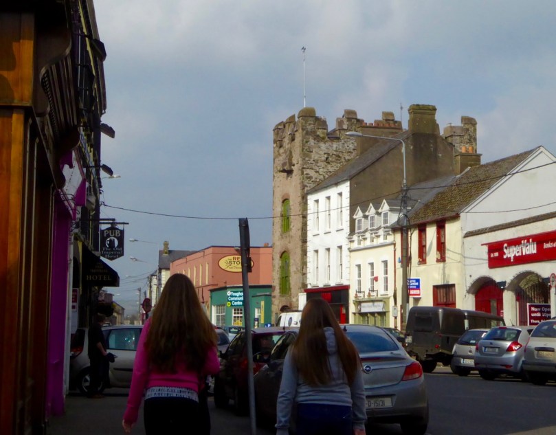
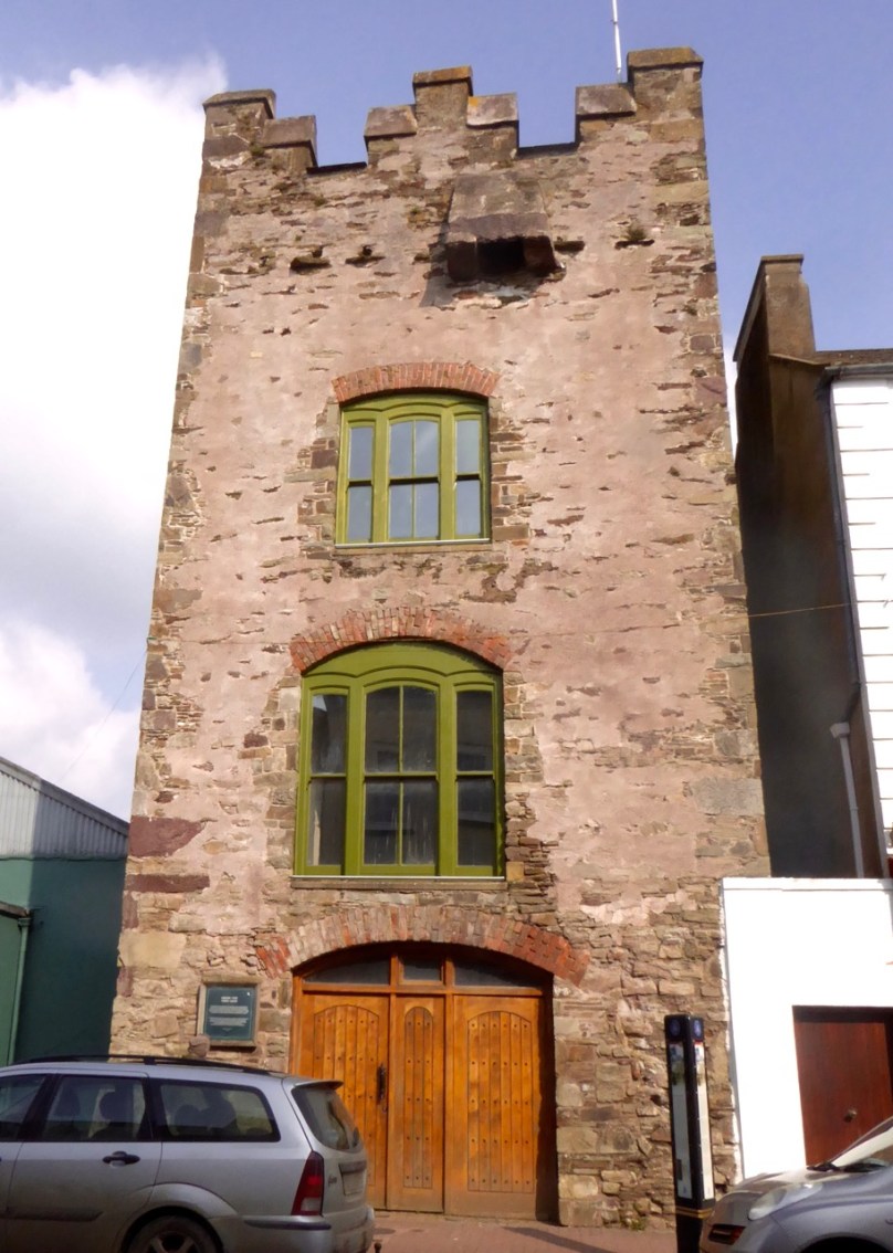
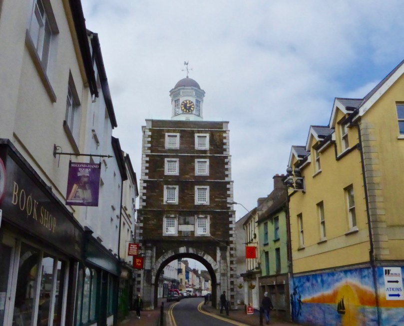
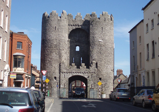
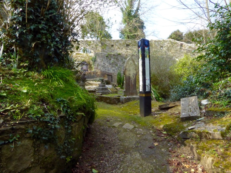
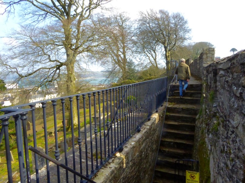
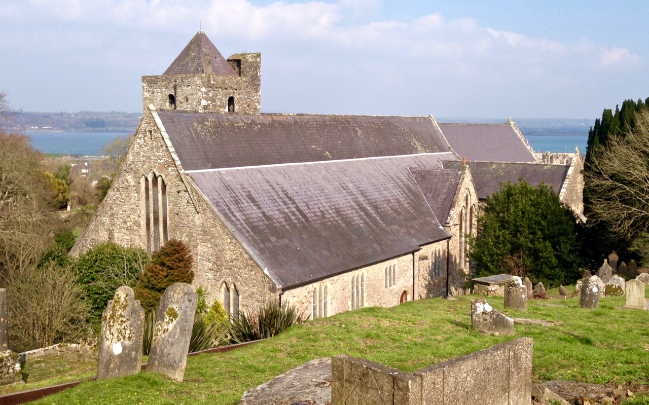
We spent St Patrick’s Day in Youghal – within County Cork but a long way from our own part of that territory. The place is falling down with history, and warrants an extended visit. Finola has written about the walled town and some of its architecture: I will be concentrating on the Collegiate Church of St Mary, a building that goes back a long way and is said to be on the site of the monastic foundation of Saint Declan, a fifth century contemporary – or even a predecessor of – St Patrick.

Saints by Harry Clarke: St Patrick, Ballinasloe (left) and St Declan, Honan Chapel (right)

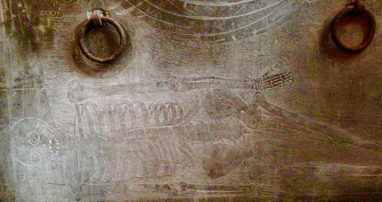
The Vikings came to Youghal, and one stone slab in the church depicts a vessel from those days. There are so many other memorial stones, carvings and inscriptions that we spent hours in the building just trying to take them all in. I can only show you a taster and recommend you to go and see for yourselves.

longboat

Carving of a Viking longboat – can you see it?

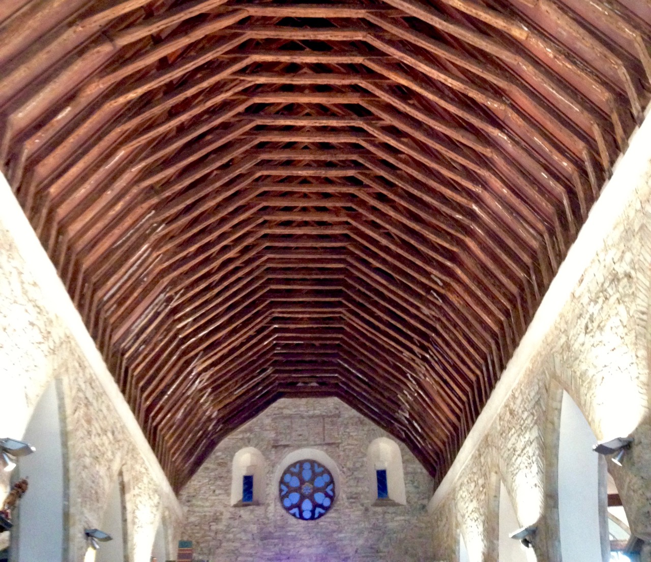
The structure of the present church deserves close study. It claims to be the oldest church in Ireland that has had continuous worship taking place – since the 13th century. Look firstly at the roof over the Great Nave: the timbers have been carbon dated to around 1170, although an intriguing hand-printed notice about this feature states …The roof of this church was put up there in 1220 by French labour, there are two german cathedrals roofed with Irish Oak and their walls bear the same masons marks as this church. They were all built by the same hands. Ireland was covered with oak woods in 1220, but saw mills were not invented until 1328. They had to pick each oak tree the same size, and with an axe skin and square it up. So each piece is a small oak tree – or Saplyn…

oak roof

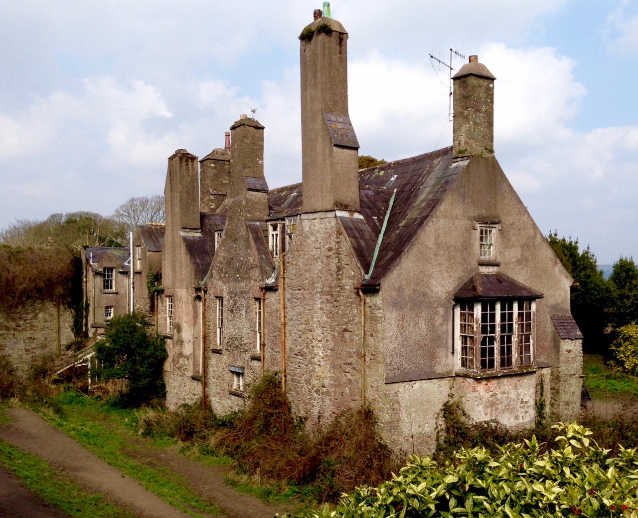
In 1464 St Mary’s was made a Collegiate Church, with the foundation of Our Lady’s College of Yoghill by the Earl of Desmond. It was served by a ‘ Warden’ of eight ‘fellowes’ and eight ‘singing clerks’. In the precincts of the church is the Warden’s House, known as Myrtle Grove. This also has a long and complex history: this article about Henry and Edith Blake – two of its colourful inhabitants (who are buried in its garden) is worth a read. Another former inhabitant of the house – and one of Youghal’s celebrities – is (or was) Sir Walter Raleigh.

myrtle grove 2016

Sir Walter Raleigh, once the owner of many thousand acres in Cork, including the whole settlement of Youghal – and his home, Myrtle Grove, in 1833 (top right) and seen today (above)

Myrtle Grove is said to be one of the oldest houses in Ireland: it remains in private ownership. St Mary’s Church itself is unusual in that it is in the guardianship of the state while also continuing as a place of worship.

st mary's church

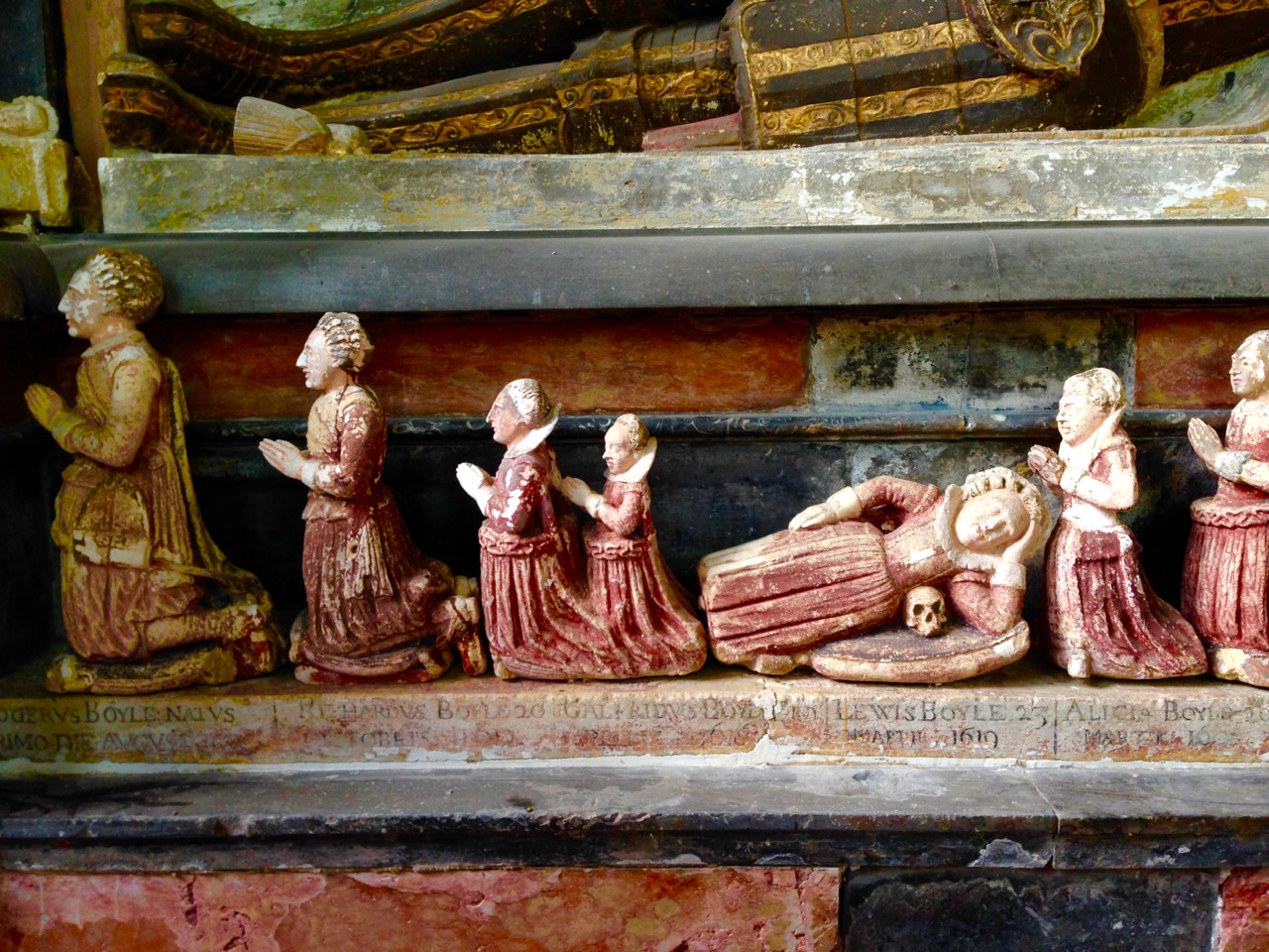
Another Youghal celebrity was Richard Boyle – the Great Earl of Cork (1566 – 1643). While Raleigh had acquired his estates during the English ‘plantations’ following the Desmond rebellion, Boyle, also an English incomer, was an entrepreneur and an opportunist. He invested in many ventures – mining, fishing, iron smelting and linen weaving – as well as studying law and pursuing his political career. He was appointed Clerk of the Council of Munster in 1600, became a privy councillor for the whole of Ireland in 1612, and, having found favour with Queen Elizabeth, was knighted and made Earl of Cork and Viscount Dungarvan in 1620. Eventually he was created Lord Treasurer of Ireland. He owned Bandon and designed and built Clonakilty, while also relieving Raleigh of all his estates – 42,000 acres – for the rather small sum of £1500. Boyle died in 1643 and is interred in a tomb he built for himself and his family in St Mary’s Church, Youghal. He is said to have been the richest man in the known world at the time of his death. Go and see his tomb – it is spectacular! Boyle had two wives and fifteen children by one of them: all – and Boyle’s mother – are included in the monument.

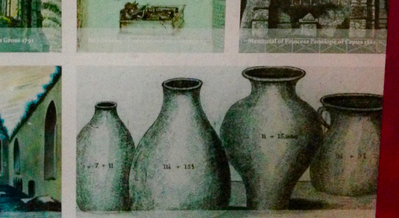
The Collegiate Church is one of the places where – in the middle ages – ‘acoustic jars’ were used to enhance acoustics. These ceramic vessels were placed in niches above the choir area: the niches are still there but, unfortunately, the vases are not.

acoustic jars

There’s a lot more to the fascinating story of this church. I’ll leave you with a visual round-up of some of the details that we found, all of which add to the interest and the richness of the place. You could call it a ‘medieval miscellany’ – I call it my Youghal Menagerie.

miscellany 17

Mizen Mud: Recipe for a February Exploration Day

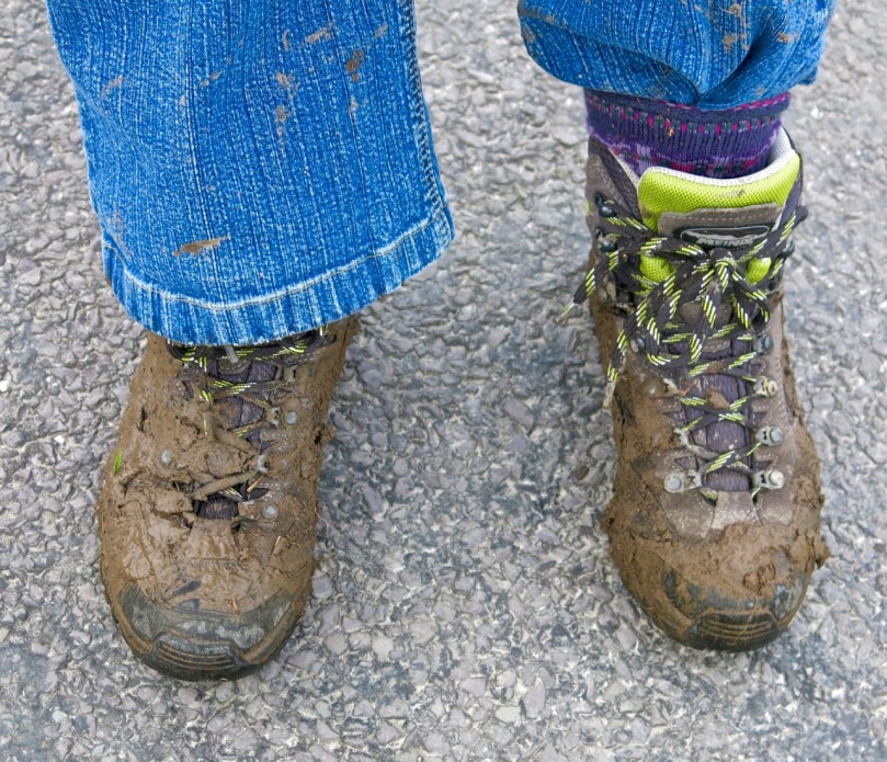
Muddy Boots

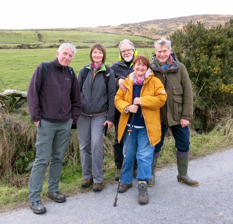
It’s been a wet, wet winter, but when the sun shines in February (which it does, honestly!), we are out exploring. This particular day our companions were Jessie, Brandon, Amanda and Peter and our accompaniment was MUD, and lots of it.

Explore Group

Amanda took the photo of the group, and the one of my muddy boots

We had goals – Amanda was after some elusive holy wells and Robert wanted to find the pirate steps at Canty’s Cove for his talk on William Hull and the Leamcon Pirates’ Nest, part of the Ballydehob spring lecture series, ’Talks at the Vaults.’ Jessie is a professional tour guide, wanting to learn more about the Mizen. Finally, I wanted us to swing by Dunmanus Castle so I could check out a few construction details.

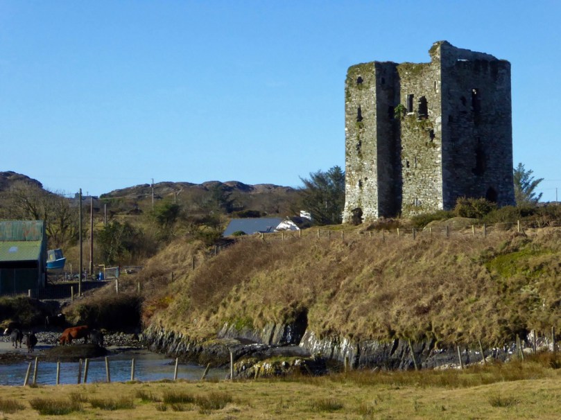
Dunmanus Castle and bridge

Dunmanus Castle on its knoll, surrounded by water

You don’t actually need goals like this to go out exploring, but it helps. It gets you into places you wouldn’t normally go, down tiny boreens, into farmyards and across fields. You end up knocking on doors and meeting people who know all about the well, or the old stones, or the legends of the place, or who owns what field and whether he minds people tramping through it. On this occasion we met, for the first time, the near-legendary Pat McCarthy, one of the writers of Northside of the Mizen, and a huge authority on this area. We’ve promised ourselves a return visit with him as we weren’t able to stay long enough for a good talk.

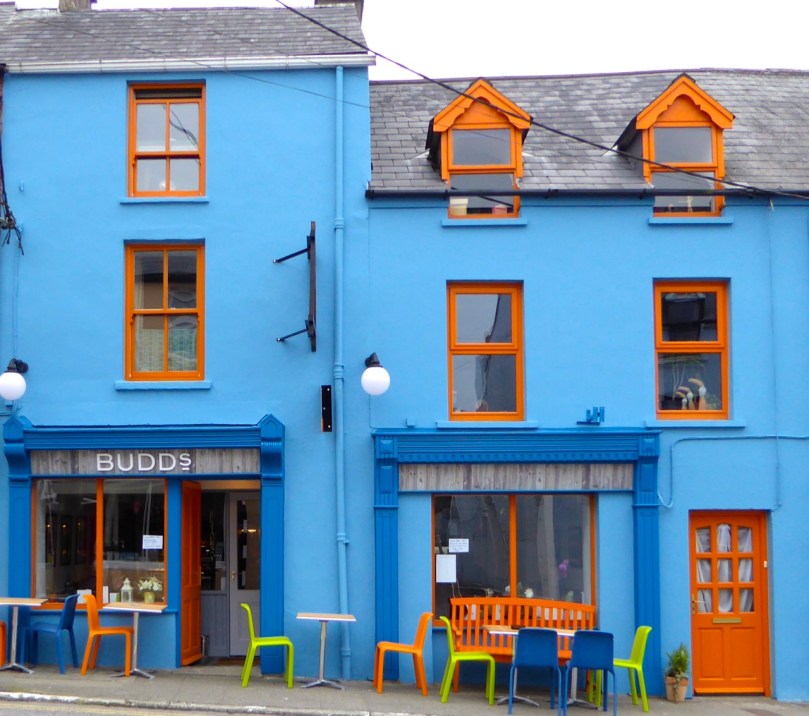
Budds

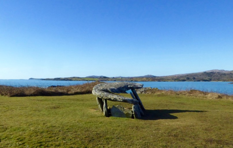
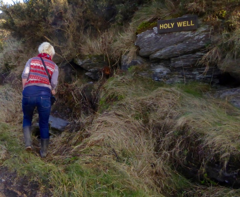
The best way to start a day like this is with excellent coffee, in Budds of Ballydehob, where we assembled with our map to plot our course. It was off then to Toormore and the Altar wedge tomb. On this occasion we weren’t actually after the wedge tomb (although I can never resist a photo of it) but the little holy well across the road.

Altar Wedge Tombe

Our next stop was Dunmanus, to take a good walk around the castle with the camera, looking for details I had missed on previous visits.

Dunmanus Castle ground floor entrance details: The bar-hole for barring the door once inside; the spud stone and the hanging eye. The hollows are for the pole that the door swings on

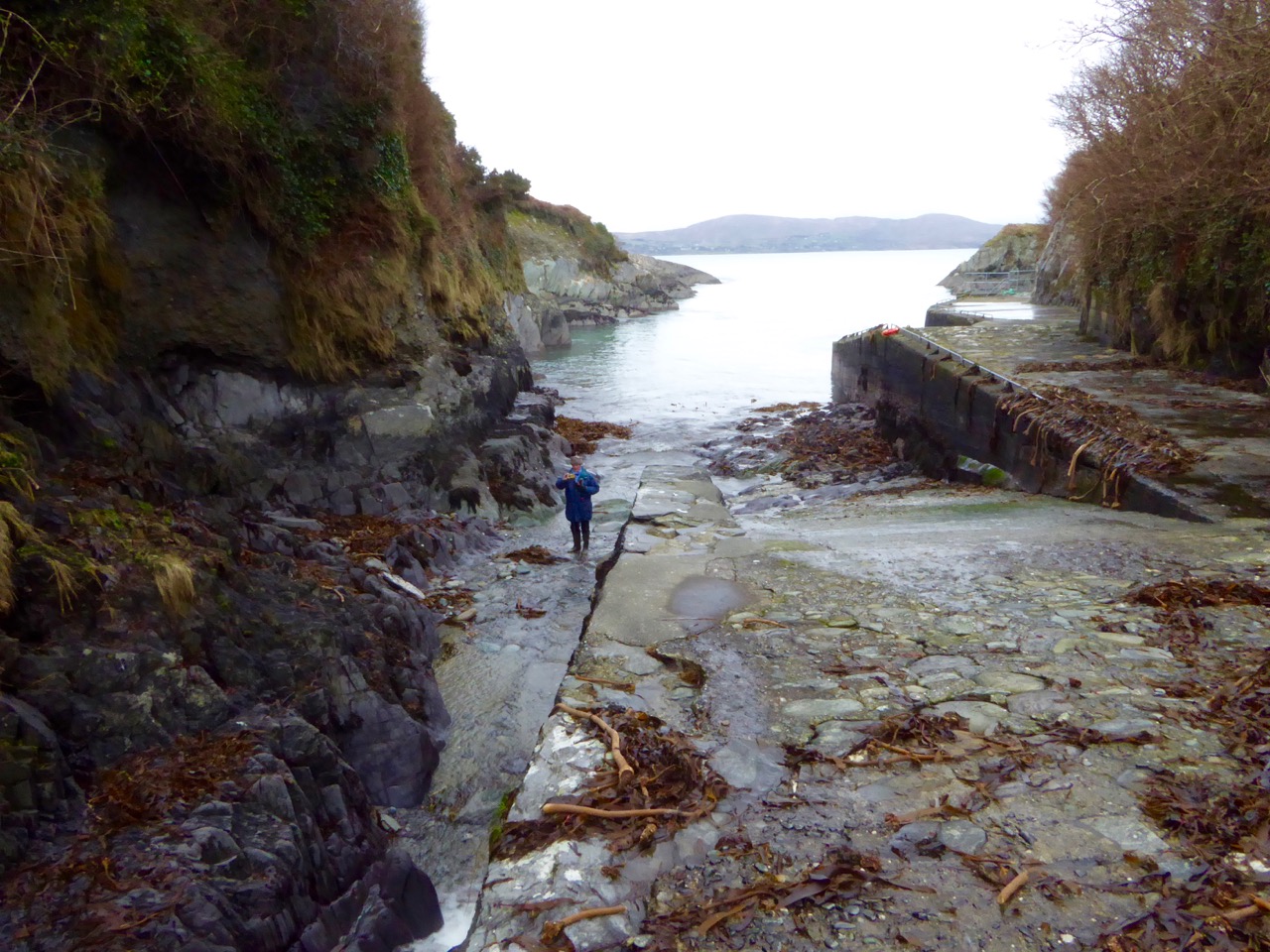
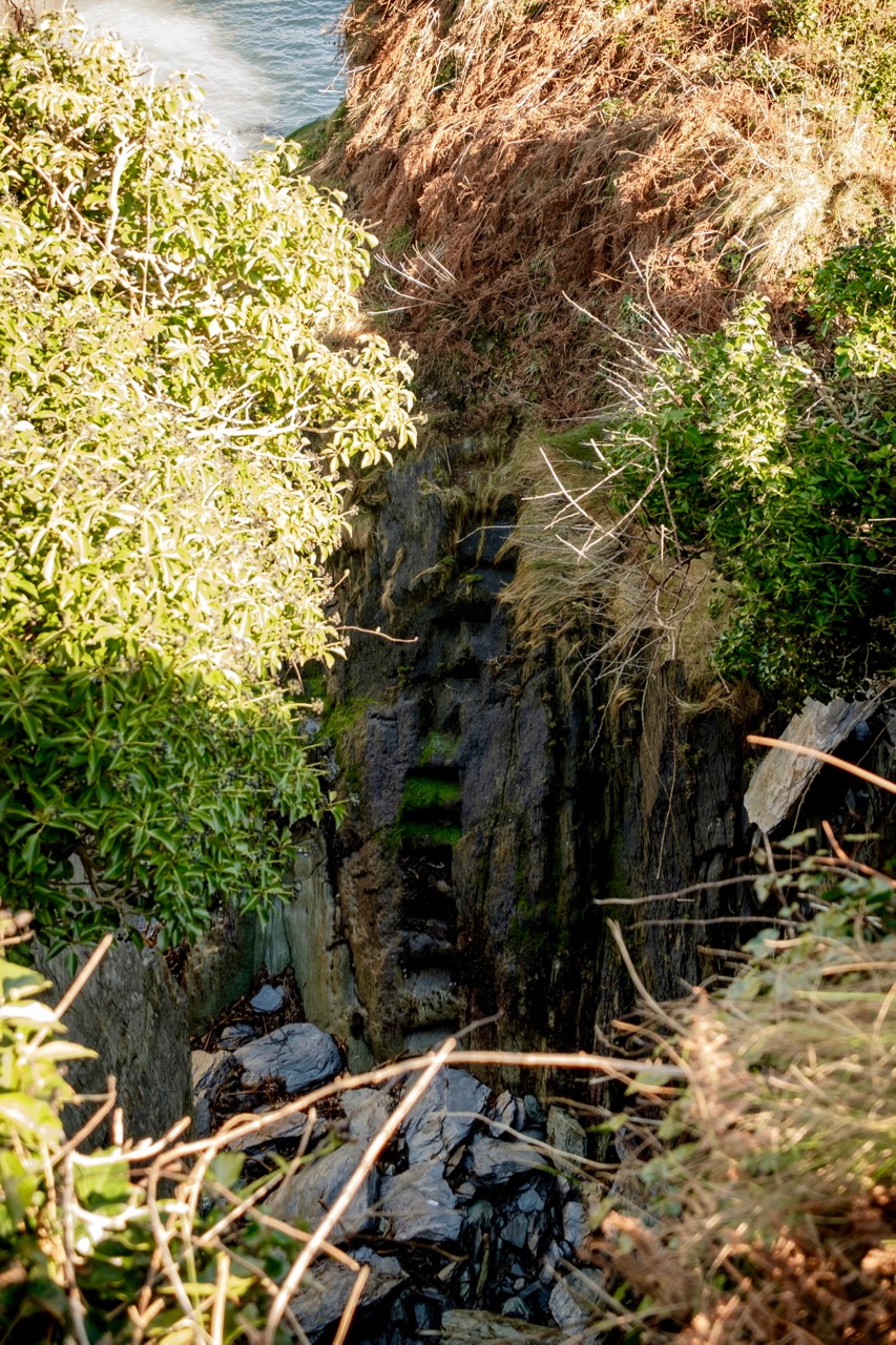
And then on to Canty’s Cove. You can read Robert’s post, Canty, for more about this place and its association with Canty the Pirate. Finding the steps wasn’t easy and it was a big thrill when we finally figured out where to look.

from Canty's House

This is the inlet with the pirate steps. Photographing them involved hanging over the edge with someone holding on to your ankles

Pirate Steps

How would you like to climb up these with a keg on your back?

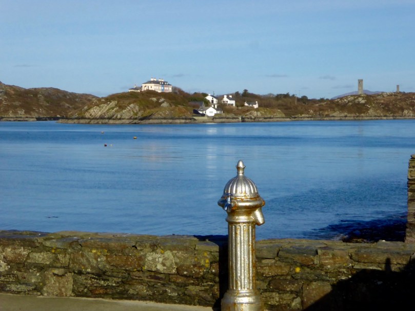
By then we were starving – this exploring is hungry work – so we repaired to O’Sullivan’s of Crookhaven for one of their famous crab sandwiches. Even at that early date the sunshine was so inviting that people were sitting outside with their sandwiches and their pints.

water pump at Crookhaven

Crookhaven Pier

From Crookhaven it’s a quick trip to Lissagriffin, where there’s a medieval church and a bullaun stone doing double duty as a holy well/wart well. The church has a panoramic view over the salt marshes behind Barley Cove Beach as well as interesting architectural features.

Lissagriffin Doorway

Our next holy well was right by the side of the road a couple of miles further east – labelled so we couldn’t mistake it.

Callorus Oughter

Amanda inspects Tobareenvohir – or Tobairín an Bhóthar, the Little Well of the Road

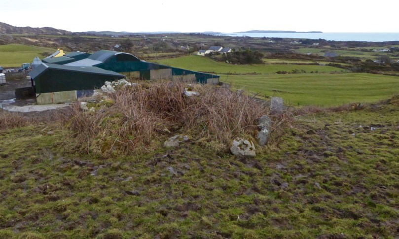
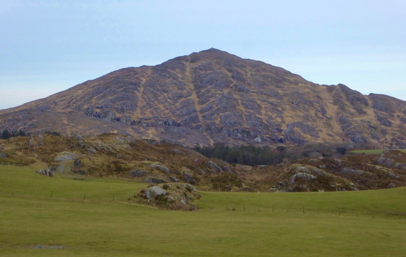
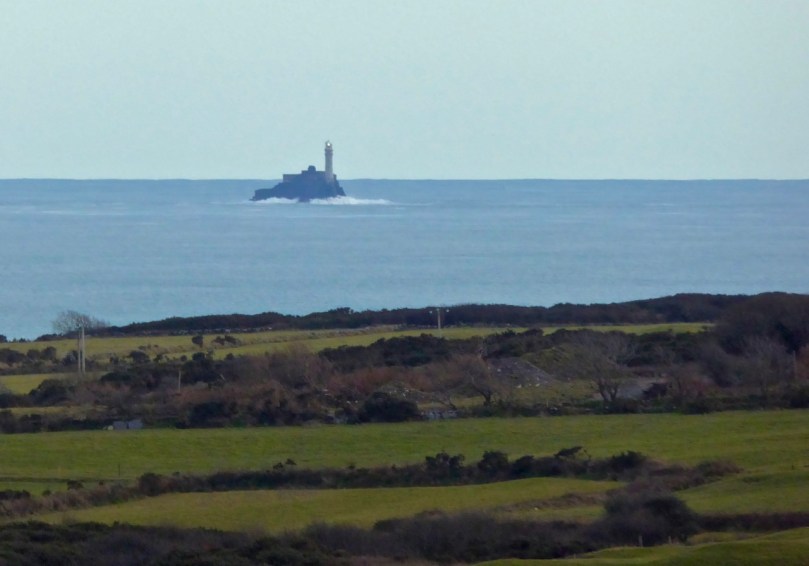
The final one was harder to find and necessitated negotiations of some seriously muddy fields. Tobairín Brón (Little Well of Brone) was in the general vicinity of where we ended up, along with a small monastic site – all very brambly and hard to decipher. But what a place – a view clear out to the Fastnet Rock, with Knockaphuca looming behind us. Cnoc an Phúca means the Hill of the Mischievous Spirit – it’s been tamed, presumably, by the large cross erected on its peak.

Monastic site

Knockaphuca

Fastnet Rock

Read Amanda’s post for her take on the four wells we visited that day.

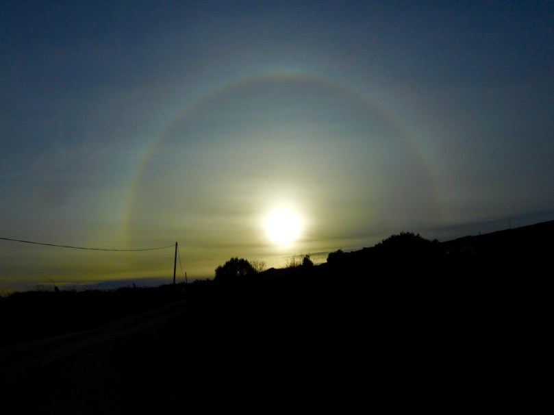
By then the sun, so warming earlier in the day, had been overtaken by high cirrus clouds, and we were donning jackets and gloves and remembering that it was only February after all. As if to make up for its lack of warmth, it treated us to a magnificent solar halo (I’ve always called them sun dogs)  as we made our way back to the cars.

Sun dog

We were never much more than 30 kms (or about 40 minutes) from home but in that distance we managed to see heritage sites dating from the bronze age through the medieval period up to the recent past, surrounded all the time by the magnificent scenery of the Mizen. You can do this anywhere in Ireland. Using the Historic Environment Viewer of the National Monuments Service, define the area you want to explore, pick your fancy (ring forts? medieval churches? cross slabs? megalithic tombs? castles? rock art?), and off you go.

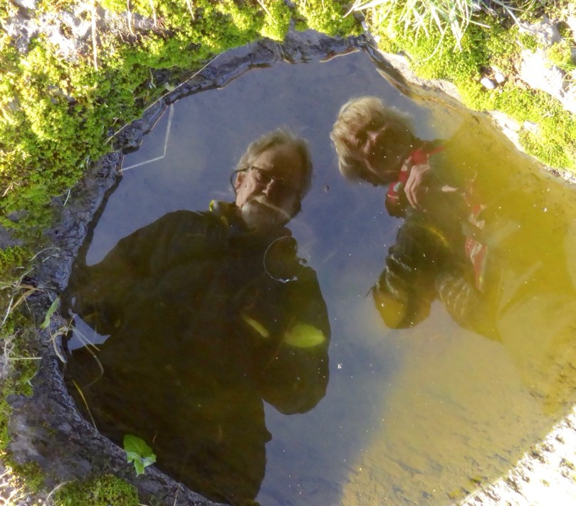
Peter and Amanda in a holy well

A holy well looks back at Amanda and Peter

Now, if you’ll excuse me, I’m off to buy some wellies…

Canty

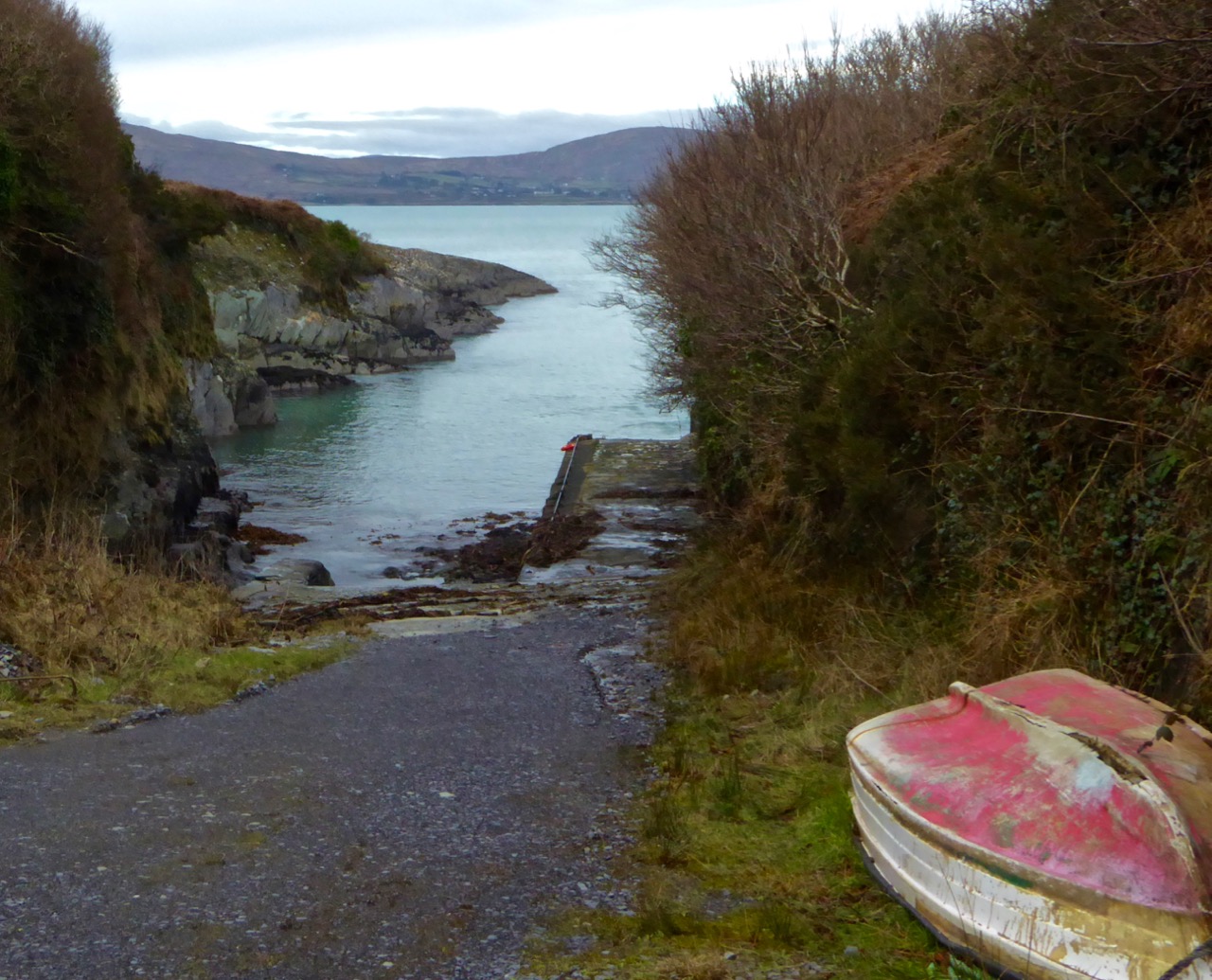
slipway 2

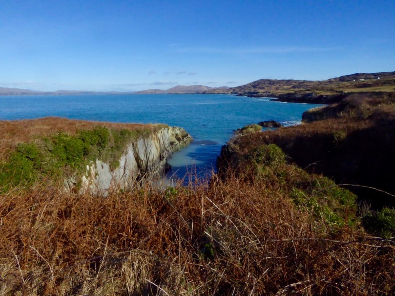
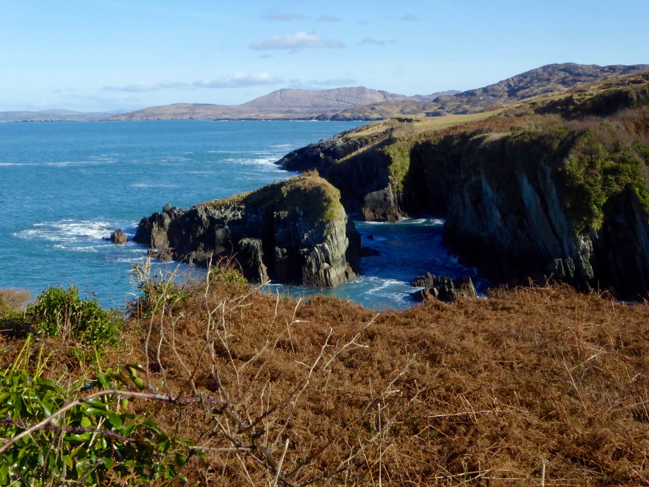
On the north side of the Mizen we found Canty’s Cove. The little road which approaches the Cove from the west has been recently resurfaced, and there have been some major restoration works on the stone jetties and steps there. Don’t try to reach the Cove from the east side: a trackway is shown on the OS map (88), but it is virtually impassable – even on foot – at this time of the year, as the harsh winter storms have waterlogged the ground and submerged parts of it.

wild water

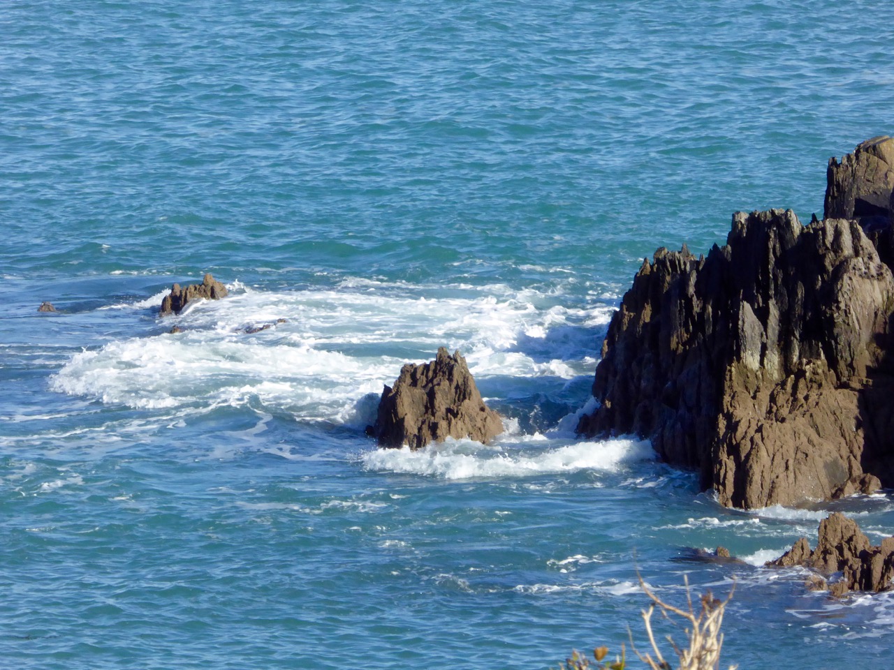
Wild coast beyond Canty’s Cove

Our reason for visiting the Cove? We were looking for pirates! Or, at least, for traces of them… We had heard that there are ‘pirate steps’ in the vicinity of the Cove, and we had unearthed some legends of Canty himself: a notable pirate and all-round rogue.

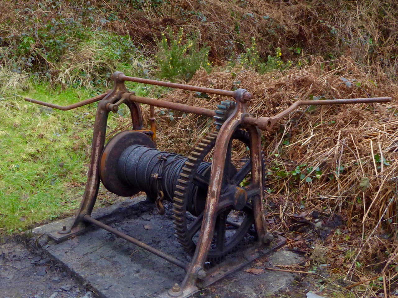
windlass

As with many of the ‘secret’ quays hidden away around the rugged and heavily indented coastline of West Cork, Canty’s Cove was used primarily by fishing boats, either working individually for shellfish or, communally, seining for pilchards, mackerel and herring. We have touched on seining in a previous post. It seems to have been brought to Ireland’s west coast by fishermen from Cornwall back in the sixteenth century. The shoals of pilchard, first seen in Mount’s Bay and around Land’s End in the early spring, naturally moved west and the fishing fleet from Cornwall followed them in July or August. Traditionally it was St James’ Day (1 July) that saw the start of the seining season in West Cork. For the next three months the pilchards were …dark, fat and full of oil… With the onset of winter the seine boats were laid up and the nets repaired and hung out in the lofts. The pilchard industry on Ireland’s west coast is said to have been most productive between 1550 and 1750, with millions of pressed and salted pilchards going by the barrel load to Spain, Portugal and France. Seining survived well beyond those days, although mainly then for mackerel. Northside of the Mizen records a very active industry within living memory:

…Both Canty’s Cove and Gurthdove had streams and the waters from them were used in the cleaning of the mackerel. When grading, the fish were sorted into bloaters (big), rags (damaged), medium and small grades, and you were allowed so many of each grade per barrel. The fish were then salted by rubbing coarse salt into them, and this happened twice with the second salt on the tenth day. On the second salt, the fish were packed flat into the barrel, and pickle was poured over the fish until the barrel was full. After the second salting the lid of the barrel was then put down, sealed with an iron hoop and the barrel was branded with the mark of the buyer, along with its weight and number of fish. The barrels were left on their sides and a hole was made three-quarters of an inch in diameter, which was closed with a wooden stopper. Tom Collins of Dunkelly West, as a boy, would earn one shilling a week by topping up the barrels with pickle after school. Salt added to water made a pickle that had to be strong enough to float a medium size potato with a six inch nail through it. The barrels were constantly filled with pickle until they went for export, when the wooden stopper was hammered home and the barrel stood up. One Cash and Tally of 132 fish would sell for five shilling in the nineteen-thirties. There could be up to 1000 barrels lined up in Canty’s Lane until November Dark…

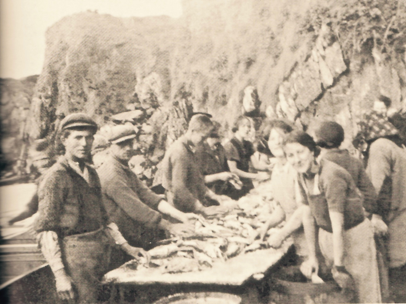
fish table

Fish processing on the pier at Canty’s Cove, taken in the 1920s. This photo and the one below are from Northside of the Mizen

On the west coast, the last working seine boat was said to have put out from St Finan’s Bay, Kerry, in 1946. This was remembered by Mike Séamus O’Sullivan and recorded in The Kerryman in 2003:

…the place was alive with fish. We put out the seine and in no time at all it was full. We arrived below at the pier in The Glen with 24,000 mackerel and every man made £24 pounds that night – a fortune in those days…

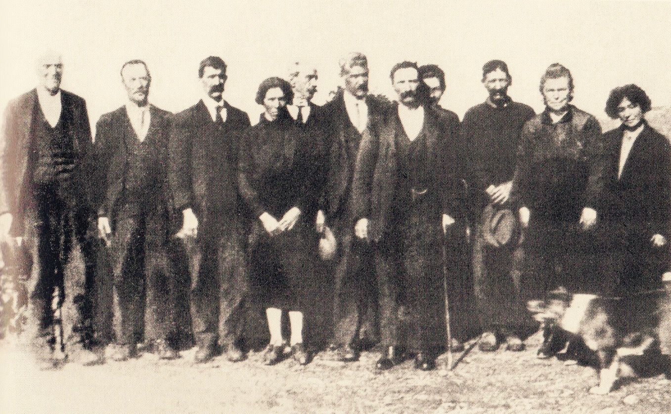
dunkelly fishers

The fishing community of Dunkelly, late 1920s

But what of the pirates? I hear you all cry… And, is there any buried treasure…? Of course there is! According to an excellent article by John Hawke in the now defunct Mizen Journal, Jeremiah McCarthy of Dunkelly (who died in 1989) recalled how he and his forefathers had dug for gold as a boy – “The old people spoke of ‘Canty’s Gold’ that lay buried seven ridges from one of the walls and many have dug for it – it was great exercise, but we never found it.” Jeremiah told the story of how Canty was a pirate and robbed people who came to buy goods from him and then threw them over the cliff into the sea, from the door of his house in Canty’s Garden. In the Collection of Irish Folklore dating from the 1930s this story was recorded from a Richard Moynihan of Dunbeacon, then aged 59 years:

…Another secret building was situated in Goleen Parish. It was built across the quay leading from a hotel which was owned by a man named Canty. Lodgers often came to the hotel and the man used to take them back to the secret room. Whilst they were talking to him, he shifted a lock in the trap door which was in the room which caused the floor of the room to go to the side and the lodger was thrown down into the tide. He then had a net with which he hauled up the corpse and took whatever money he possessed. Around this place is ever since haunted. Lights were frequently seen there and cries were often heard…

Many other similar stories connected to the Cove have been told or written down over the years. Today, the place still has an otherworldly feel to it: partly it’s to do with remoteness and the barren coastline in this wild place. ‘Canty’s House’ and ‘Canty’s Garden’ can be identified on the cliffs above the Cove: they are marked on old versions of the OS map. All that’s left now are a few stone walls and a steep drop into the sea. It’s not hard to picture Canty himself disposing of his victims over the edge, nor to hear their cries on the wind, wailing across the centuries.

Canty's Cove

There are Cantys living in West Cork today. We shouldn’t brand them with the reputation of one who was possibly a forebear: after all, many centuries have passed since the time of Canty the Pirate – and we do live in a more civilised age, don’t we? In fact, the Cantys – sometimes O’Cantys (O an Chaintigh) – had a prestigious past: in the age of the castles they were bards, like their O’Daly neighbours across the water on the Sheep’s Head (it’s only four miles away as the seagull flies). Interestingly, I have heard it suggested that Canty’s House is actually the remains of the ‘lost’ O’Mahony castle at Dunkelly: the site is certainly impregnable.

Canty's Garden

The approach to Canty’s Cove seen from Canty’s Garden. The building on this site may once have been a ‘lost’ O’Mahony castle

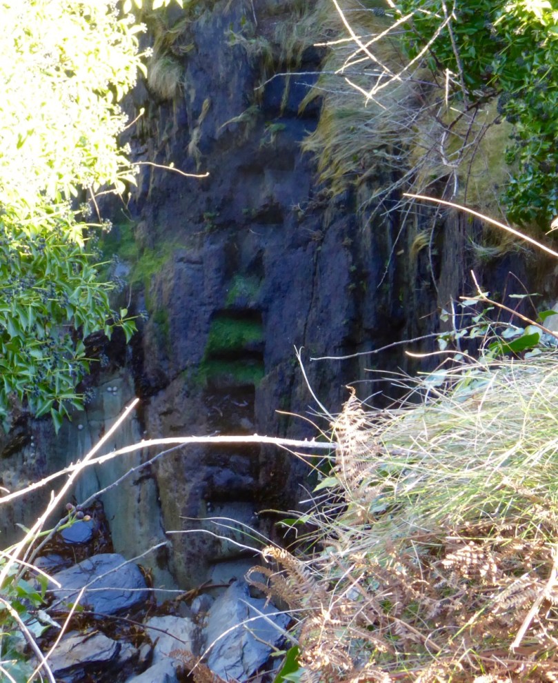
Pirates, castles, seining, treasure – there are also the ‘Pirate’s Steps’, although they are very hard to find (and on private land, so seek permission if you go looking) and – evidently – the Buan, or ‘perpetual well’ (which we couldn’t trace): in all, a wealth of history and legend. We have to respect Canty for lingering in folk memory a good few hundred years…

For this research I am indebted to Northside of the Mizen by Patrick McCarthy and Richard Hawkes, Mizen Productions, 1999, Canty’s Cove – Legend and History by John Hawke, The Mizen Journal No 5, 1997, and also local memories, still alive. The fine view of the Pirate Steps (below) was taken by Peter Clarke, at great risk to life and limb…

Pirate Steps Canty's

Illustrating the Tower House: A Guest Blog (sort of)

Tower House Full View

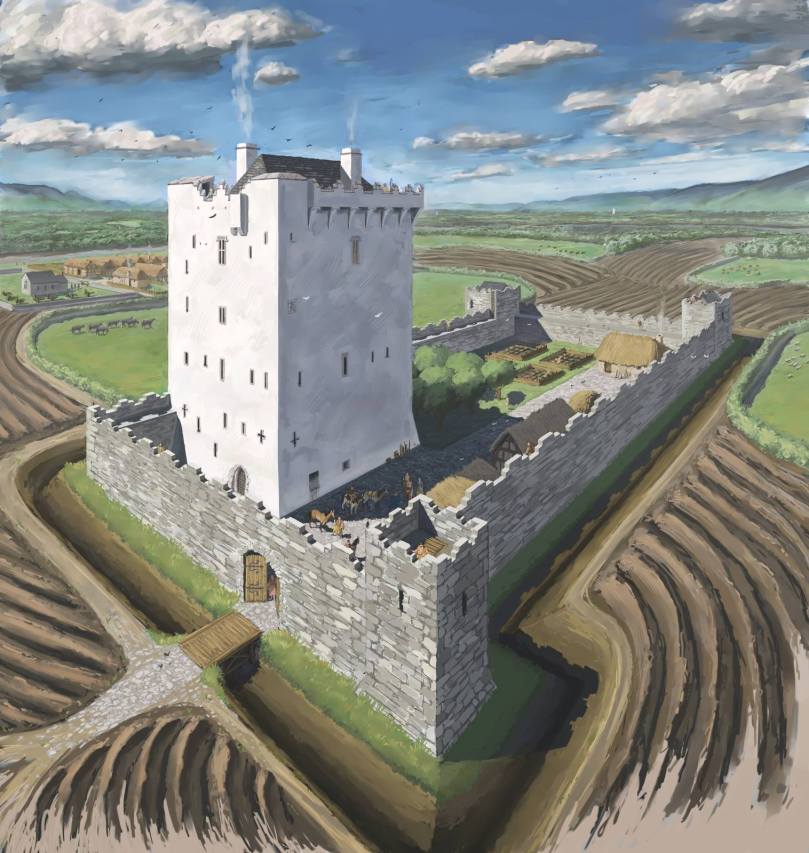
There’s this brilliant young man, JG O’Donoghue, who combines the best qualities of researcher and sketch artist to produce outstanding illustrations, especially of heritage subjects. I’ve been a fan of his on Facebook for a while, but recently I saw the full extent of his talent.

Path to a Castle

Kilcrea Castle, Co Cork

You see, he’s done this job on tower houses. I’ve been studying tower houses for a while, especially the tower houses of West Cork (see my posts here and here and here) and recently I gave a talk about them in Ballydehob. So I recognise accuracy when I see it, as well as a meticulous attempt to be true to both published accounts and his own close observations. He has generously allowed me to use his drawings in this blog post, as well as his own words, slightly edited to fit the length of a blog post. So this is not my post, really – it’s his, as you’ll see if you head on over to his own blog, or follow him on Facebook. Since much (but not all) of what follows is based on Kilcrea Castle, Near Ovens in County Cork, I have included some of my own photographs of that site, to give you a sense of what it looks like on the ground.

Above the main entry

JG Writes:

The Tower House

Tower houses are a type of late medieval Irish castle, believed to have originated around 1300, or sometime within the 14th century, but most are probably from the 15th to the 17th centuries. By the 17th century, this would have made Ireland the most heavily castellated part of the British Isles. The tower house signifies changes in Ireland: on one hand it shows a resurgence in Gaelic power in the west after years of decline following the coming of the Normans in the 12th century. On the flip side it is a sign of the collapse of centralised power in the form of the English monarchy and a rise in decentralisation.
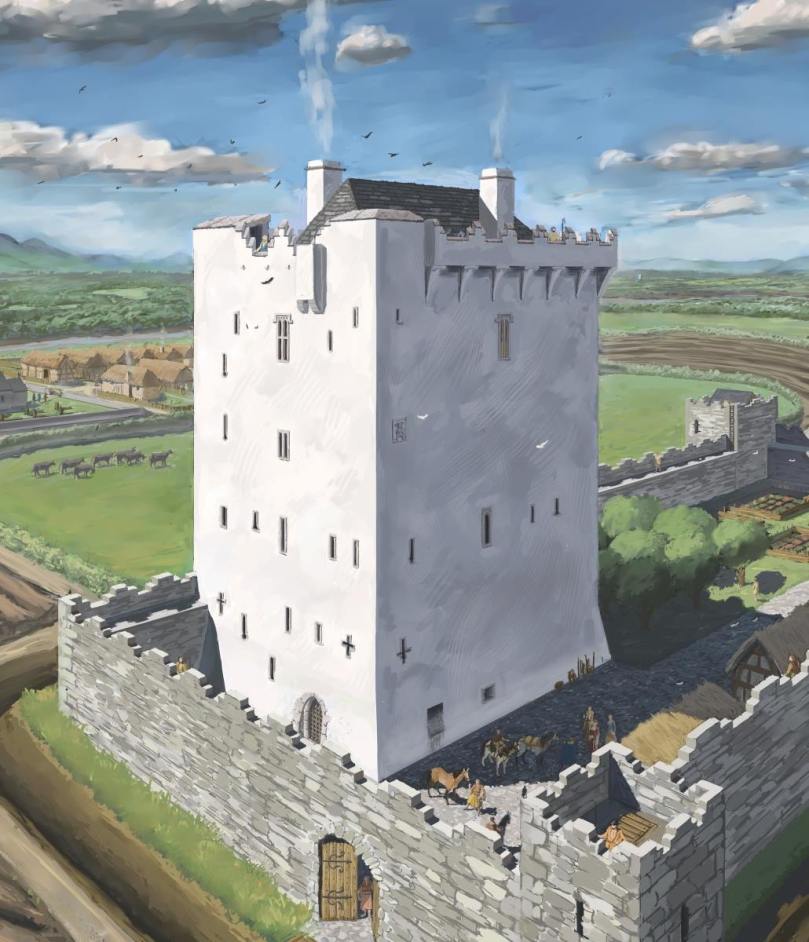
Tower House Closer View

One tower house in five has a bawn wall in Ireland. The bawn is the external wall you see attached to the castle shown here. The actual design of the tower house itself though is nearly entirely based on Kilcrea tower house, in Cork, my favourite tower house and one which I have visited a few times and read extensively on. The only changes to the overall design of Kilcrea was the inclusion of a second chimney for the kitchen room inside, and the machicolation. I added these elements so the castle would be more representative of tower houses as a whole. Also the crenellation (the regular gaps in the walls at the roof & bawn, which provided cover for archers) in the castle are a style specific to late medieval Ireland. The bawn crenellations are based off Blarney Castle.
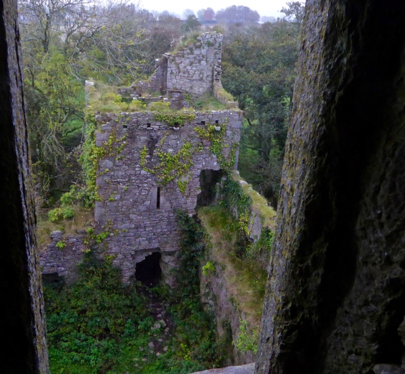
Bawn Corner Tower

The bawn walls and corner tower

Notice as well how white the tower house is? This is probably how most tower houses would have looked, as they were coated with a substance called harling, a mixture of limewash and crushed pebbles. Because of this, commentators at the time often mention the white gleaming castles of the Irish, as you can imagine these would have been visible for miles around and been quite a symbol of power and prestige. You may also see the little figure on the dark side wall of the tower house: this is a sheela-na-gig, a type of sculpture common in Ireland at the time, this one is based off the one in Ballynacarriga Castle.

Ballynacarriga Sheelanagig

This is the sheela-na-gig from Ballynacarriga

Tower houses are believed to have been surrounded by mixed farming, some cereal with animal husbandry too as shown in the illustration. Often they are found associated with churches and friaries, some were even built attached to churches, and some probably weren’t too far from some sort of clustered settlement. Note as well the dry moat. Not all tower houses had moats, but some did, like Kilcrea, so I included it here.
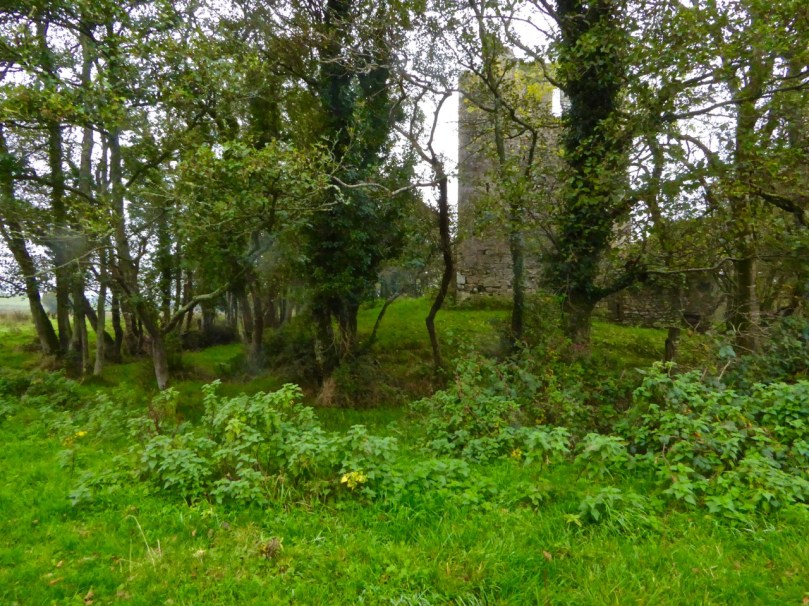
Moat at Kilcrea

Notice also the slight batter (where the wall comes outwards at the bottom to defend against a battering ram), also in the bawn towers, which is based on Kilcrea & Barryscourt.  As you can see though, the real bling in the tower house is the top of it, this is where most showing off happened with turrets, crenellations, chimneys, gabled/pitched roofs and machicolations, as shown here. Another place they showed off was the ashlar (fine finished masonry) windows. The top floor in Kilcrea was believed to be the hall, with the floor directly below the lord’s chambers. Hence they have the nicest windows, especially the hall floor, which had 4 large windows as shown.

Great Hall Window

One of the windows on the top floor

Also notice the variety of windows: some were narrow slits just for archers to fire from inside, others have the addition of a cross slit, which could be used by crossbows too and then there were others with either triangular or circular holes, these were for later fire arms. Some windows even had all three as shown here in the 1st floor window in the dark side of the tower house, the one closest to the light. All these windows, except for the decorative ones on the top floors, would have been splayed inwards allowing maximum cover for archers.

Inside the Tower House 
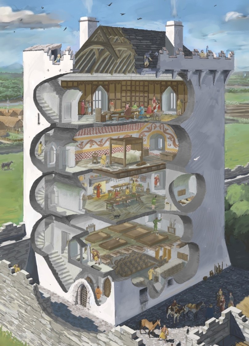
TowerInterio65-Internal

Ground Floor – here is a cellar, as in Stanihurst’s “house and castle” account of Mallow castle, 1584, “lower rooms whereof ar sellors vaulted over”. Here various food and drink would have been kept, perhaps not just for the castle itself but for the wider community, acting as a safe house for everyone’s goods in case of raids. The floor surface here is very basic and is just beaten earth.

Lower floors

1st Floor – I have made into a sleeping quarters. There is mention in the historical recorded accounts of tower houses that they were used for sleeping and that there were beds without curtains, and you could sometimes fit three people into them. So here I have shown some rudimentary beds, not just for guests, but also for the guards and servants. The 2nd & 1st floors are also covered with reeds, this would have often been what medieval floors were covered with according to medieval accounts, which then on occasion would have been swept out and replaced. This room also doubles up as a guardsroom, as this floor was probably the last line of defence before the attackers get into the rest of the castle, so I’d imagine weapons would have been kept here for ease of access.
Kilcrea murder hole

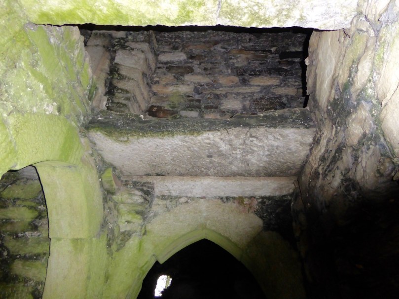
Entrance lobby with murder hole above it

Murder Hole Room & Lobby – you will notice small rooms off both ground and 1st floors. In the ground floor this was the lobby, where for defence purposes, once you were past the main front door, you were greeted by two other strong doors, one to the rest of the tower house, another to the ground floor. Above this was the murder hole room, essentially a room with a hole in it, the reason for the dramatic name is that while you were trapped in the lobby between the two strong doors, you would be fired upon from above by muskets (apparently unlike what movies would have us believe, hot oil was rarely used). But in the day to day, these were probably used as a kind of door eye hole.
Mural stairs from Ground Floor

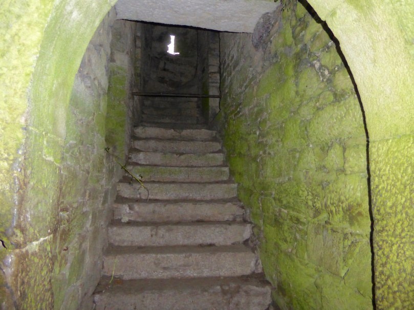
The mural stairs leading up from the main entrance. The bar across is said to be there to prevent a re-occurence of the time a cow wandered up to the second floor

Stairs – in a tower house usually started as a mural stairs to the left of the lobby entrance, these were then carried on by spiral staircases from the first floor up to the 4th floor, which then had another set of straight stairs leading to a small spiral stairs to the wall walk area. This was probably defensive in nature, so it was harder for the attackers to take the spiral stairs and wall walk. This last set of stairs was usually hidden within one of the window embrasures at the top floor, this was a common feature in southern Ireland.
First floor window and corbels to support second floor

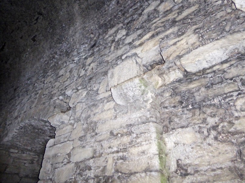
The ground floor with window embrasure to the left. Above it you can see the corbels which would have supported the first floor

2nd Floor – shows a kitchen with some sleeping quarters off in the mural chambers around the main room, these were L shaped rooms and could be accessed via the window embrasures of the main room. You can see one person leaning out of one such a door, having a word, while another person is sleeping inside another L shaped room.

Access to Mural Chamber, 2nd floor

Entrance to one of the mural chambers

Kilcrea’s main room was probably more sleeping quarters, but in some other tower houses which had fireplaces at this level there is speculation that these were the kitchens. Most kitchens would probably have been external though.

Upper floors

3rd Floor – Here I created the lord’s room: situated between two floors with fireplaces, this would have been quite a warm room. It shows a typical late medieval bed, chests used for storage and a Savonarola chair, or X chair, in front of the bed, these were quite common throughout Europe at the time, made in Italy. The third floor has its floor boards shown rather than covered, with the occasional fur. Also note the paintings on the wall. There is mention in some written sources that the Irish decorated their walls with branches: I found a piece of metalwork from late medieval Ireland with this very design, the Clogán Óir Bronze Bell shrine of St. Senan, which was early medieval with later alterations in the late middle ages. One side had a pair of dragons with floriated tails and above, branch and leaf ornament along the top, so I used that here, while the knot-work is based off other metalwork at the time.

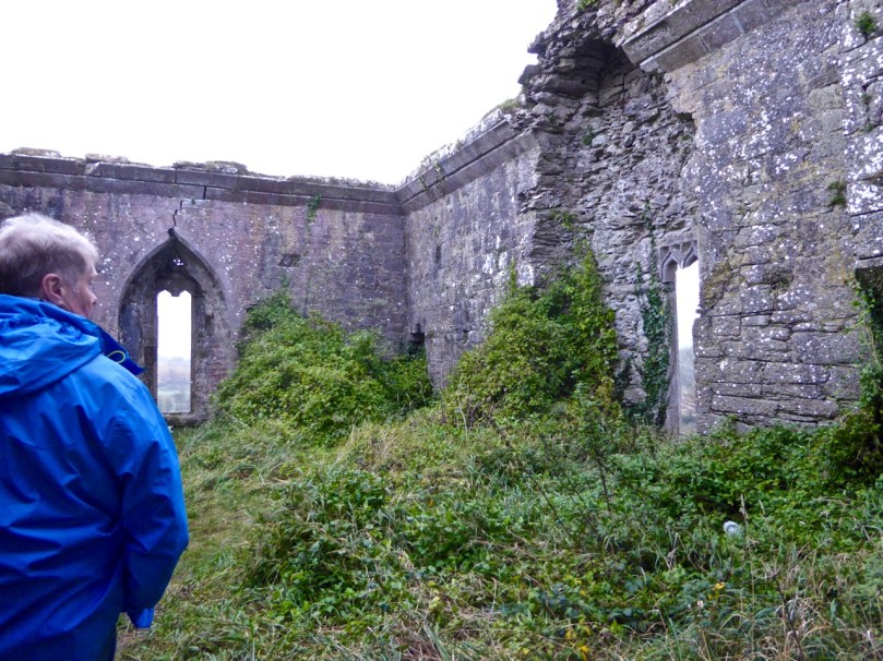
4th Floor – This was the dining room. In the earlier periods there was always a large external hall to the tower house, made of non stone material, but as time moved on more and more of the the hall activities were taking place within the tower house. This dining room floor in Kilcrea had lovely large windows, not all of them surviving, some with double lights with ogee heads, as shown. I added a transomed triple ogee headed light as shown in the window on the left, which is typical of a late medieval tower house. These windows must have created quite a bright room. Rooms of this stature were probably decorated with ornate wood panelling as shown. No such panelling survives in Ireland, so these are inspired by ones in Britain. Generally tables at the time were long with benches and only really the lord would have had a separate chair. People ate with their hands, there were no forks yet in Europe and everyone had a personal knife with which to cut their food.
Kilcrea Great Hall

Roof – the 4th floor in Kilcrea had very thin walls, in comparison to the rest of the tower house, most likely to give it more space and air. The roof wasn’t gabled but hipped, resting on cornices as shown above the wood panelling. The roofs were often covered with tiles but many were probably thatched too. On the wall walk level, in the front, you can see there were holes at the bottom of the parapets. In Kilcrea some of the wall walk flagstones had chutes carved into them to drain away the rain. The other side (the shadow side) shows wall walk machicolations, which were extended floors with holes in the ground: these are based on Blarney Castle with its pointed corbels. Chimneys were also on the wall walk level and were to become display features in their own right, rising to great heights to carry smoke away but also to show everyone around how well the castle was heated (in later periods castellated houses had lots of chimneys as an extra form of bling).
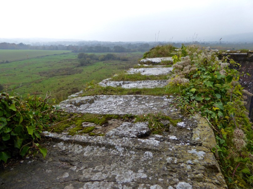
Wall walk

The Wall Walk, with flagstone chutes designed to carry off the rain

Garderobes

Usually tower houses had 2 garderobes, as did Kilcrea, one for public and another for private use. In the case of Kilcrea both were probably public, but the upper one accessed from the dining hall had 3 holes in it, so probably had wooden seats with three holes for 3 people to use at the same time.
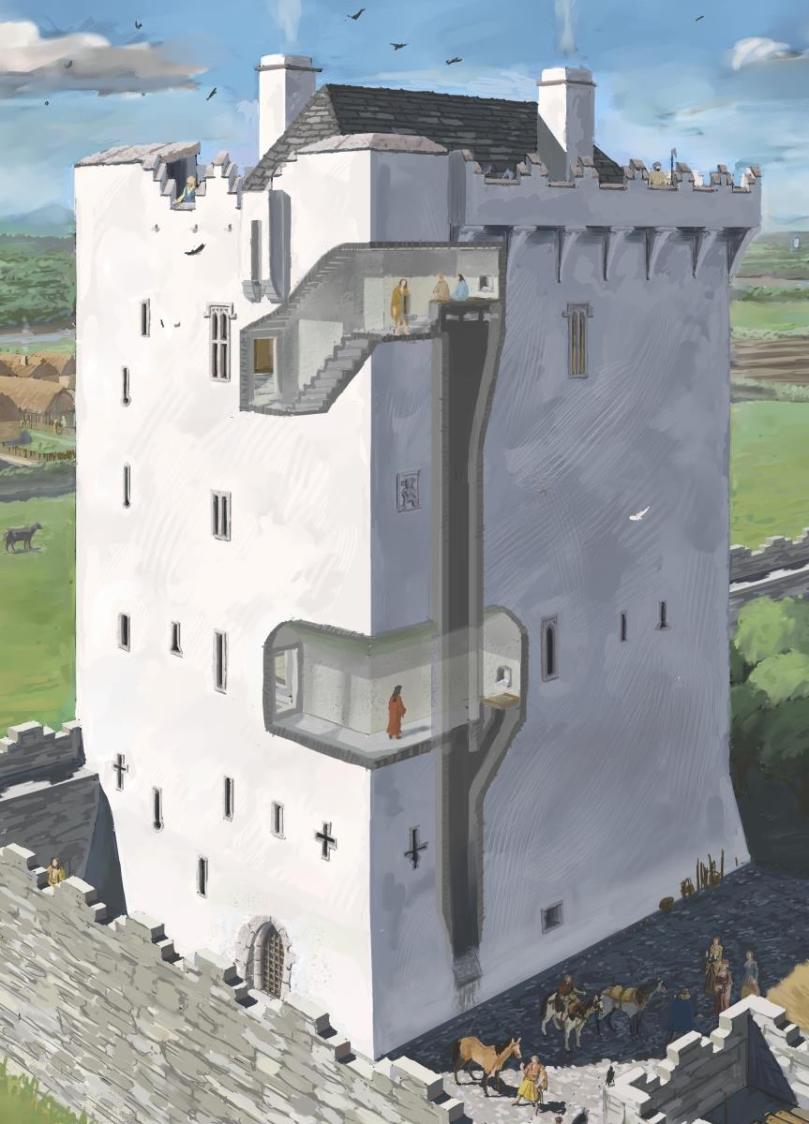
Tower House Garderobes

This upper garderobe chamber also had a window with a slop stone, which were small drainage basins underneath windows, which were essentially urinals (often found on stairs). The garderobe on the 2nd floor, is one of the 3 L shaped chambers off the main room. Garderobes were normally at the ends of passages in both Anglo-Norman castles and tower houses, to give more distance between the rest of the house and the toilets.
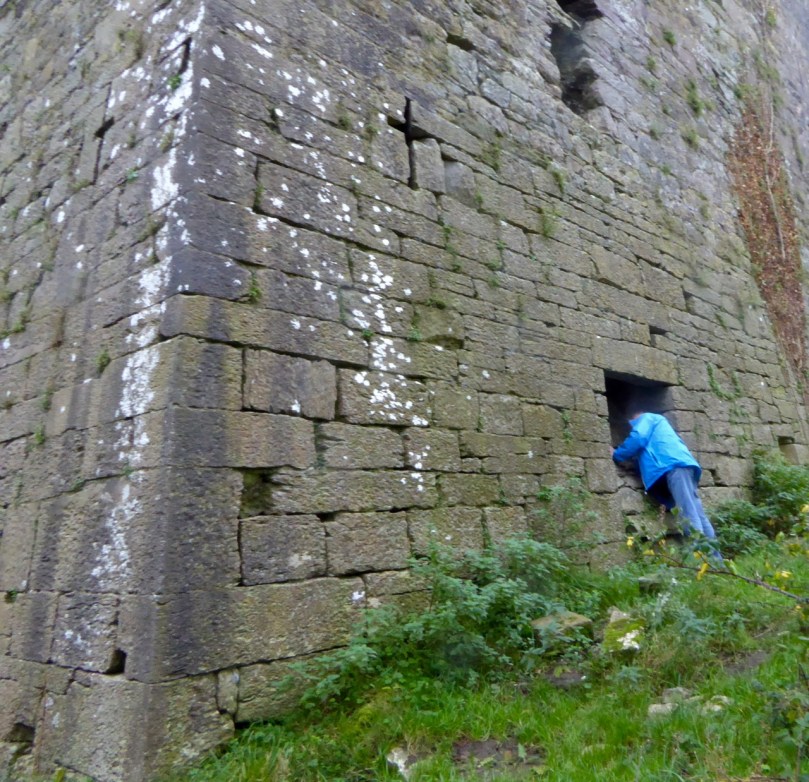
Inspector of Drains

Inspector of Drains

Thank you, JG – for your talent in representing medieval life and for your generosity in allowing me to feature your incredible drawings! Go raibh míle maith agat!

‘Going to the Skelligs’

star wars on the skelligs

My eye was taken by an article in the Irish Times this week which stated that the Archbishop of Canterbury and the Pope have agreed to work towards a fixed date for Easter. Currently, that festival can occur anywhere between 22 March and 25 April – this year it will be an early one: Easter Sunday will be on 27 March. This has meant that, in Ireland, the Easter school holiday will last for three weeks, from St Patrick’s day (17 March – and always a day off school) until 4 April. Evidently the church leaders believe that a fixed date for all Christians around the world to celebrate Easter would be logical and practical. So much for logic – what about history and tradition?

It’s all about the sun and the moon, and the Vernal Equinox. That’s the point in the first half of the year when day and night are of exactly equal length. We are used to thinking of the equinox occurring on 21 March but this won’t happen again until the 22nd century! From now until 2044 the equinox will be on 20 March, then on the nineteenth. This is in part because our Gregorian calendar is inaccurate, but also because the Earth’s axial precession is gradually changing. In 325 the Council of Nicaea established that Easter would be held on the first Sunday after the first full moon occurring on or after the Vernal Equinox, but that was taken to be 21 March. You can begin to see the complications…

As you might expect, Ireland has had a lot to say about all this. The early church here, established by Saint Patrick, didn’t necessarily agree with the Roman church over certain issues, including the date of Easter. Matters came to a head in 664 when a synod was convened in Whitby, Yorkshire attended by delegates from the Ionian tradition and the Roman tradition. The Ionians were led by the Irish Saint Colmán, Bishop of Lindisfarne. They supported the older traditions, but the debate was won by the Romans and Saint Colmán resigned his post and returned to Ireland, where he founded abbeys in Inishbofin and Mayo and – presumably – continued to celebrate Easter in the ‘old way’.

The situation today is still confused. While Roman Catholic and Protestant churches use the ‘Alexandrine rules’, agreed in the 7th century and adapted when the Gregorian calendar was introduced (1582), Orthodox churches generally follow a method based on the earlier Julian calendar but, in fact, there are different systems used by the many different branches of Orthodoxy around the world so the Easter festival in any year may be celebrated on varying dates in divergent places.

Let’s look at tradition, especially in Ireland. Although the churches here did eventually conform to the Roman calculations, there was always some dissent. Folklore tells us that the monks on the Skelligs – isolated rocks off the Kerry coast which housed a monastery back in medieval times – followed a calendar which was several days behind the rest of the country – this sounds as though they were still basing themselves on the Julian system. This was useful, however, if you missed out on getting married before the beginning of Lent (you couldn’t marry during Lent): the period we are in now – between Little Christmas (6 January) and the beginning of Lent – was in Ireland always the most popular time for weddings. ‘Going to the Skelligs’ was a joking expression used unkindly against confirmed bachelors and spinsters.

From Danaher The Year in Ireland – Mercier Press 1972:

In much of the south-west of Munster there is a vague tradition that the festival of Easter was celebrated a week later on the island sanctuary of Sceilg Mhichil than on the mainland. Whether this tradition is a distant echo of the ancient controversy on the date of Easter is a matter of speculation, but it did give the occasion of another form of disapproval of the unmarried. These had lost their chance of marrying this year on the mainland, but they could still be married on the Skellig, and steps must be taken to send them there… All over County Kerry, in parts of west County Limerick, in much of County Cork, especially along the coast, and in west County Waterford the negligent were greeted, in the first days of Lent, with a barrage of chaff and banter. ‘You’re off to the Rock, I suppose?’ ‘Don’t miss the boat!’ ‘Is it Mary or Katie you’re taking on the excursion’ etc etc. The victims had to grin and bear it… In many places the custom was carried further, and local poets were encouraged to compose verses on the occasion, verses which told of a grand sea excursion to the Skelligs, praised the splendid vessel which would take the party there and gave a long list of the participants, linking together the names of the bachelors and old maids as incongruously as possible. These verses – most of them mere doggerel – were written out and circulated about the parish so that all might enjoy them, and were sung to popular airs, often in the hearing of those lampooned in them… The custom has in more recent times taken the form of large posters, giving details of the ‘Grand Excursion’ with a list of the couples taking part in it. These notices were hung in prominent positions on the first Sunday of Lent, where they might be read by all on their way to church… In south-east County Cork the Skellig joke appeared in its most extreme form. Here bands of young men went about on Shrove Tuesday evening, and if some inveterate bachelor ventured out and fell into their hands he was bound with ropes and had his head ducked under a pump or in a well; this drenching was called ‘going to the Skelligs’

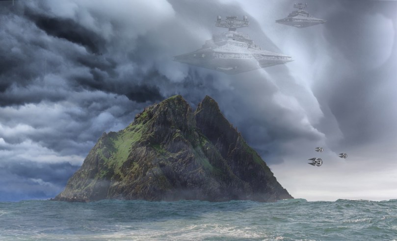
The Skelligs have been in the news recently, as the setting for a scene in the new Star Wars film: The Force Awakens. Filming on the historic site provoked considerable debate and discontent among archaeologists and conservationists. Despite our own reservations, Finola and I went to watch the film in Vancouver and – although we had to wait until the very end (the Skelligs appear only in the last scene) – we were delighted to see one of the West of Ireland’s most magnificent seascapes on the big screen – and in 3D!

Shrovetide is nearly upon us. If you haven’t arranged your pre-Lent weddings yet don’t forget there’s always the Skelligs!

With thanks to mavek-cg (http://mavek-cg.deviantart.com) for the fine image on the header

The Booley

Bucolic

Booleying is an Irish term for transhumance – the agricultural tradition of taking cattle up to the high open lands to graze during the summer months.

booley farm

Booleying territory: on the upland moors of the Sheep’s Head the ruins of a simple cottage in a lonely glen tell of bygone farming practices

The English poet Edmund Spenser went to Ireland in 1580 and was given lands in County Cork that had been confiscated in the Munster Plantation. (His fellow colonialist Sir Walter Raleigh was also granted large areas of land, which he sold to Sir Richard Boyle who later became Earl of Cork and one of the richest men in the British Isles). In 1596 Spenser wrote a pamphlet – A View of the Present State of Ireland – based on his experiences. This piece is highly regarded as a historical source on 16th century Ireland although it refers somewhat inaccurately to booleying: …the Irish country people keep their cattle and live themselves the most part of the year in bollies, pasturing upon the mountains and wild waste plains, and removing to fresh lands as they had depastured the former… 

irish rebellion

16th century Ireland: the Munster Plantation

Our trusted commentator Kevin Danaher devotes a chapter in Irish Customs and Beliefs (Mercier Press 1964) to ‘The Summer Pastures’: …If you could take away the cattle from the fields around the house all during the summer and autumn, you could have more hay and a bit of winter pasture. Therefore you could keep more cattle and were a richer man. But where could you put the cattle in summer and autumn?

peak

Old walls on the Coomkeen ridge tell of early land divisions

(Danaher) …In Ireland there are big areas of the countryside which have some value during the better part of the year but none at all during the winter and spring. These are, of course, the mountains and moor lands. In the cold season they are barren and desolate, but when the milder part of the year comes they provide grazing which may be sparse but is very sweet. Our farming ancestors knew this and a system was worked out which gave the milch-cows the benefit of them. They were away in the mountains or the moors, far from the homestead over bad roads or no roads at all, so that the cattle could not be driven home for milking. Some of the family went and lived with the cows on the mountain. Some sort of dwelling was built there for them, they milked the cows morning and evening and made the butter which could be stored until the men from the home farm came for it once a week…

Varieties of simple shelters – ancient beehive style (left from George Walsh’s window in St Kentigern’s Church, Eyeries, on the Beara Peninsula and – top right – from Dingle, County Kerry – both were used by contemplative hermits but some booley huts were built in similar style) and, bottom right, an example of an Irish cabin

Of the booley houses – or huts – Danaher writes: Most of them were just rough copies of the kind of houses ordinarily used as dwellings, smaller and simpler but made of the same materials and by the same methods. Usually they had only one room, with a simple fireplace, often without any chimney, only a hole in the roof over the hearth… In fine weather their occupants could live out of doors all through the long period of daylight, coming in only to sleep or to cook food and eat it, and the buaile houses were used as sleeping-places only…

booley hut

This structure on the Sheep’s Head is recorded on the National Monuments Record as a Booley Hut

Farming practices have changed in the modern day and I am not aware that any booleying still happens – but the custom lives on in memory and in place names. The Irish word Buaile (pronounced bool-yeh), is translated as a feeding or milking place for cows – so it refers to the dairy as well as the summer pastures. There is a townland near us called Corravolley: that’s the anglicised name. Two roads lead there, and on each road is a signpost:

Do you notice the subtle difference in the Irish rendering of the name on these signs? One reads ‘An Chorrbhaile’ and the other ‘An Chorrbhuaile’. One letter is different in the second sign, but it makes all the difference in the way you might translate its meaning. An Chorrbhaile combines corr – round hill, pointed hill, hollow, pointed, conspicuous with baile – townland, town, homestead, but the alternative suffix buaile means cattle-fold, or summer-pasture. As Corravoley is way up in the hills it is very likely that it was the place of the booleying.

cattle in the wild

Other examples of Irish names which may have derived from the booley include Coill na Buailidh, Kilinaboley, Kilenabooley, Both Théith, Boheagh, Knocknaboley, Buaile h’Anraoi, and Cnoc an tSamhraidh (which actually translates as Summerhill – a place name associated with transhumance in Britain).

bullocks

In Scandinavia, transhumance is still practiced: there the common mountain or forest pasture used for transhumance in summer is called seter or bod / bua. The same term refers to a mountain cabin, which is used as a summer residence. In summer (usually late June), livestock is moved to a mountain farm, often quite distant from a home farm, in order to preserve meadows in valleys for producing hay. Livestock is typically tended for summer by girls and younger women, who also milk and make cheese. As autumn approaches and grazing becomes in short supply, livestock is returned to the home farm. Note the Norse word būð which sounds like ‘both’ as in ‘bothy’, and the use of that word in Scotland to mean a basic shelter on the high moors, unlocked and available for anyone to use free of charge.

from the uplands

There is physical evidence of the booleying in Ireland. On the Coomkeen route of the Sheep’s Head Way we found a little glen high up on the mountain, a setting for a ruined small stone house which could well have been used by those herding the cattle on the summer pasturage in bygone days. It’s a beautiful sheltered site, guarded by two ancient thorn trees, and we could easily imagine – through our romantic 21st century vision – the hard but simple lifestyle invoked there.

booley thorns

Guardians of the Booley – two ancient thorn trees stand by the abandoned cottage

I feel particularly close connections to that way of life as my Dartmoor ancestors were transhumers. They kept a remote farm out on the moor uplands, well away from the nearest centre of civilisation. The enclosure had been established towards the end of the 18th century and involved the building of miles of stone boundary walls (which caused dissent among the commoners) and my forebears who lived there for a few generations were paid to run cattle from other farms on the pastures during the summer months. By the early 1900s the farm had been abandoned and nature has gradually taken over and created an attractive antiquity which I loved to wander over and recreate in my mind’s eye the scenes of family life: my maternal great-grandmother was one of fourteen children born on the farm in one generation.

teignhead today

Family home: Teignhead Farm on Dartmoor – used as a summer run for cattle, although it was  a permanent residence way off the beaten track for the large family of my forebears – an early 19th century print (top left), a photograph dated 1889 (top right) and the ruins of the house today (below)

Novelist Philip Robinson writes:

…The ghostly footprints of ancient sod walls still mark the sites where families once moved with their cattle up to uplands in county Antrim during the summer months (from May to October). They built temporary ‘booley’ huts to live in, usually beside a water burn or spring… The families that took their cattle to booley places on the Commons like Ardboley (High Booley), Carnbilly (Booley Cairn) or Milky Knowes had their home farms down on lower ground in clusters or villages called ‘clachans’. The arable land around each clachan was shared out between the group in a jigsaw of tiny plots and strips each year, and when the cattle returned before the 1st November, the field markers were torn down and the land around the clachans returned to common winter grazing. The homecoming to the clachan at harvest time was another great time of celebration and seasonal customs, closely tied up with Halloween bonfires and gatherings on 31st October.

on the move

On the move – Kerry cattle (believed to be Ireland’s most ancient breed) from the collection of photographer Tomás Ó Muircheartaigh, who documented life in rural Ireland between the 1930s and the 1950s

We know that Booleying was an ancient practice as it is mentioned in the Brehon Laws – which takes it back at least to the time of St Patrick. Later, under the 14th century Statute of Kilkenny the Irish ...were forbidden to booley or pasture on those of the march lands belonging to the English; if they did so the English owner of the lands might impound the cattle as a distress for damage; but in doing so he was to keep the cattle together, so that they might be delivered up whole and uninjured to the Irish owner if he came to pay the damages… The historian, John O’Donovan (1806-1861) noted (in his Ordnance Survey Letters of 1838) that the people owned houses in two townlands, one of which was a booley. …It is a great habit among the people of the island to have two townlands and houses built on each where they remove occasionally with their cattle. The townlands are held under one lease and one of these farms is called a Bouley…

booley house

In Ireland The Booley is relegated to the tune books but there are those alive today who remember the tradition in their own families. Danaher relates: …old people tell of the buaile as a very happy place, full of song and laughter. On Sunday evenings the girls from several buailes would come together and the young men came up from the farms to be with them, and there was music and dancing and gaiety on hillsides that now hear only the bleat of the sheep and the cry of the grouse and the curlew…

boley fair poster