Tower House Tutorial, Part 2

Oooh, it open - let's go inside!

Oooh, it’s open – let’s go inside!

It’s time to move inside! Now that you are all experts in tower house construction from the outside, let’s go into one of these small castles and see how they were built.

Remember that a tower house was all about defence and thus many of the features you will find inside have much to do with an expectation of attack and little to do with comfort. This was all fine, of course, as long as weapons consisted of bows and arrows, swords and spears, and even muskets. But as soon as cannon appeared on the scene the tower house was doomed – even its thick stone walls were no proof against such a bombardment.
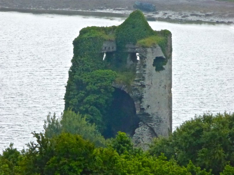
Raheen architecture

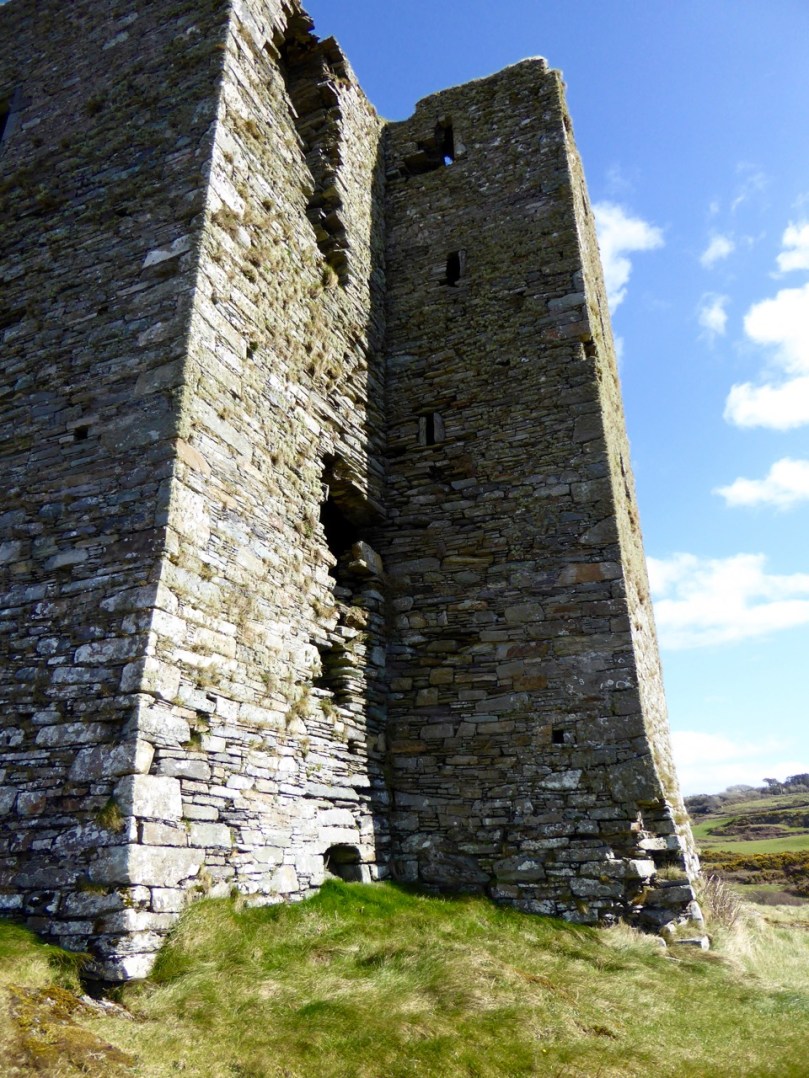
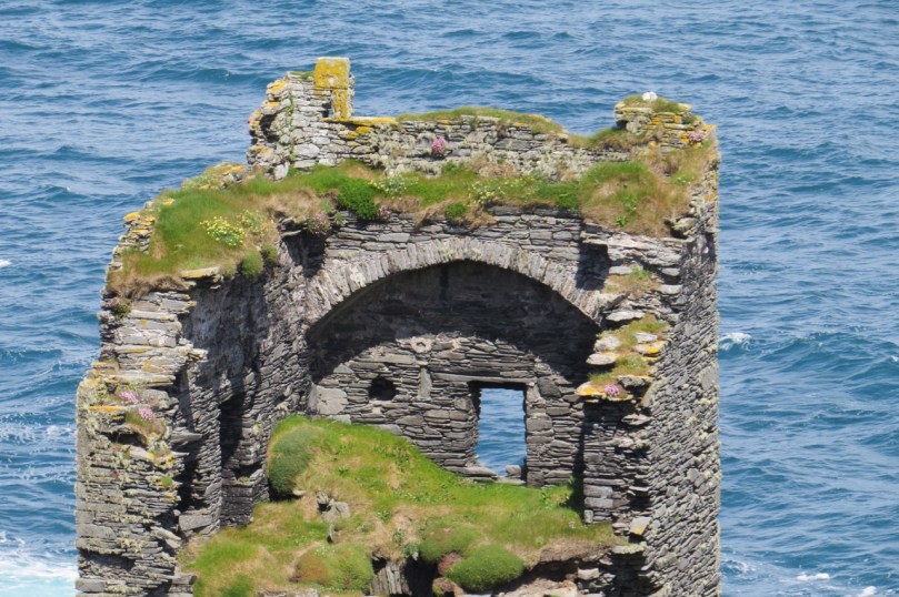
Ironically, having a wall or two blown away by cannons, as at Raheen Castle (by Cromwellian forces), above, allows us to see the internal construction of the castle. In the case of Raheen the lower floors were separated from the upper floor by an enormous barrel-vaulted ceiling.
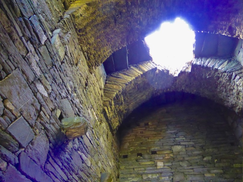
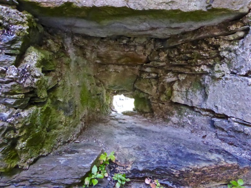
Dunlough Castle - note the projecting corbel denoting a wooden floor, and the imprint of the wicker scaffolding on the ceiling mortar

Dunlough Castle – note the projecting corbel denoting a wooden floor, and the imprint of the wicker scaffolding on the ceiling mortar

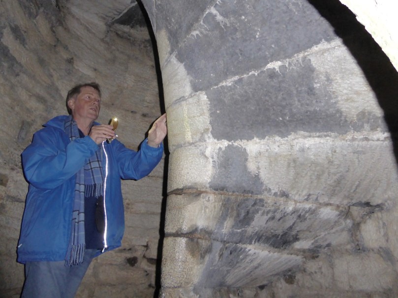
These vaulted ceilings were wicker-centered. A scaffolding of wicker was erected first and a layer of mortar laid on top of that. Ceiling stones were laid on the scaffold and mortared into place and then the stone work was built up to provide the floor of the next story. When the scaffold was dismantled the impression of the wicker was left on the mortar – clearly visible in several of our examples here.
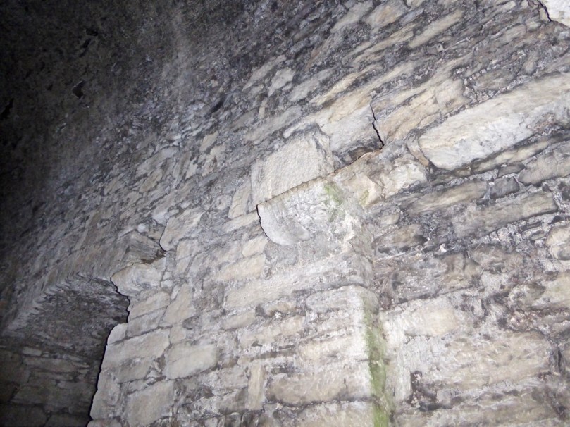
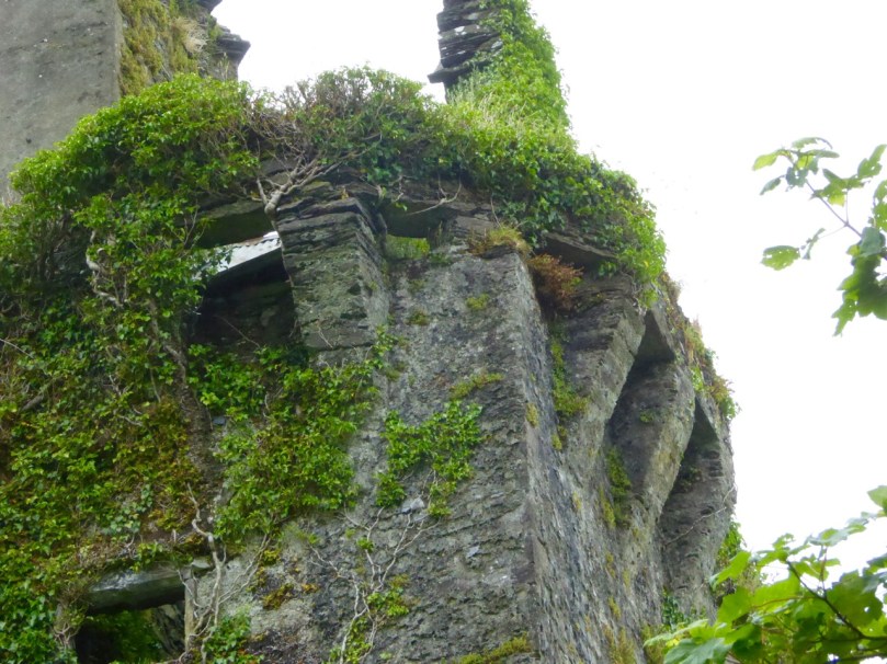
Floors were supported using projecting corbels and beams which fitted into sockets

Floors were supported using projecting corbels and beams which fitted into sockets

The entrance was often a raised entrance (see When is a Castle..?) with access via an outside wooden stairs that could be pulled up when necessary. Tower houses where the entrance was on the ground floor needed a defended access and this was often in the form of a small lobby, externally (as at Dunlough Castle) or internally, as at Kilcrea Castle. The door was secured with a heavy wooden bar, slotted into a bar-hole.

Look for a bar-hole behind the main door

Look for a bar-hole behind the main door

At Kilcrea we see that the lobby could be defended from each side and also from above, with the addition of a murder hole – literally a hole through with the inhabitants could throw rocks or boiling water down on those trapped in the entry.

Each floor was accessed by a stairway. Although some very basic castles may have relied on internal wooden stairs leading from one floor to another, most staircases were accommodated inside the walls – thus they are called mural stairs.
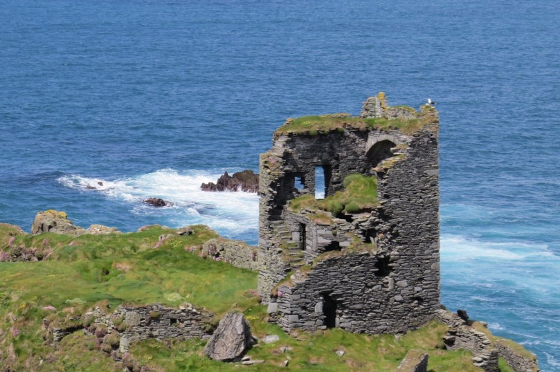
Dún an Óir Castle on Cape Clear Island. The mural stair can be clearly seen

Dún an Óir Castle on Cape Clear Island. The mural stair can be clearly seen

Stairs were both straight or spiral and some castles had both. A straight set of stairs didn’t need a very thick wall, but a spiral stairs needed either very thick walls or a corner tower or projection. Building a set of spiral stairs was a highly-skilled task and not just because of the inherent difficulty of working with intractable stone.
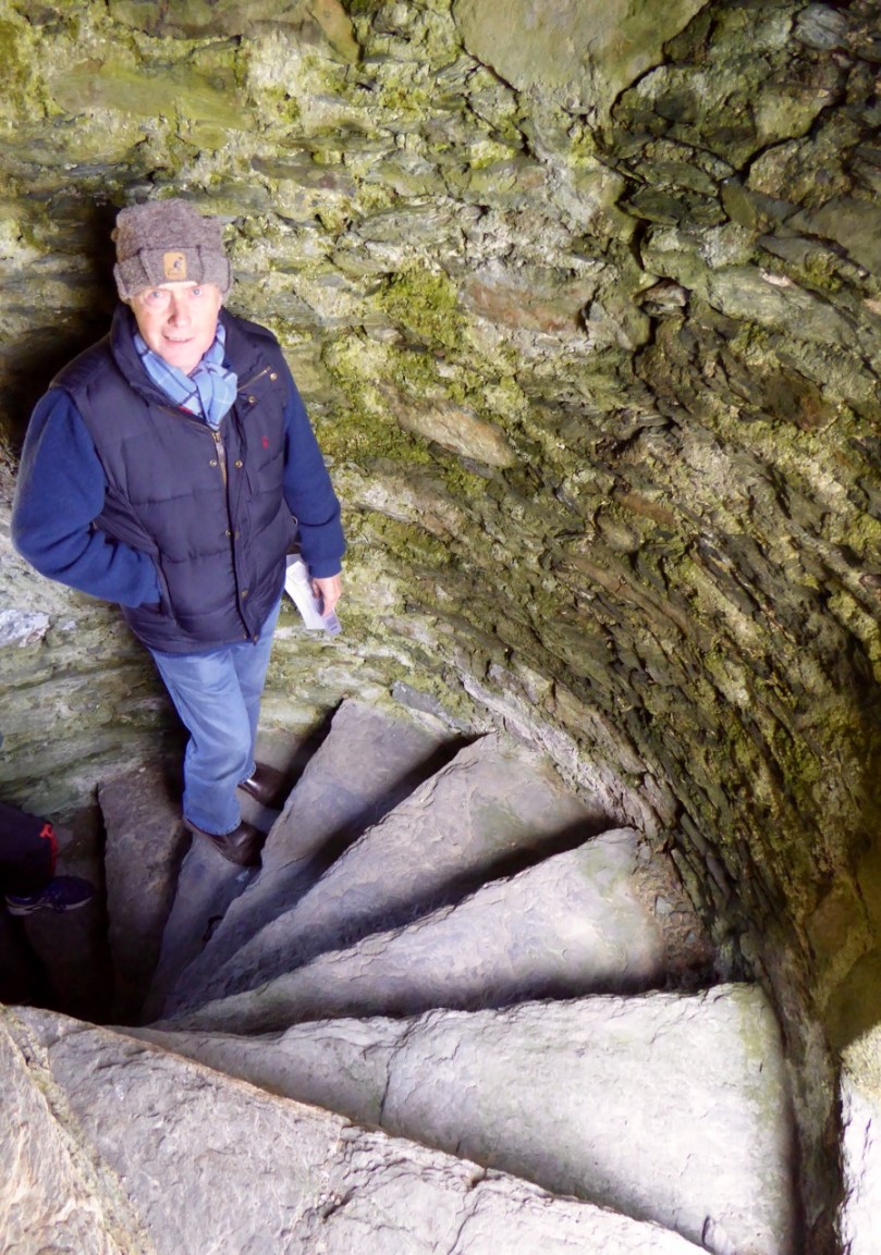
Castle Donovan spiral staircase

Castle Donovan spiral staircase

They were usually built so that you ascended them clockwise, thus presenting more of yourself to defenders above, who could hold onto the newel post with their left hand and wield a sword in their right. It was important to make the steps slightly uneven too, so that an ascending attacker could trip easily if he didn’t watch carefully.

Dunlough spiral staircase

Dunlough spiral staircase

Windows had to be inserted to light the way but these could only be slits, to be used as arrow or gun loops when necessary. A cross-shaped loop was called a crosslet.

This crosslet provides light for a spiral staircase and allows an archer to shoot from inside the castle

This crosslet provides light for a spiral staircase and allows a defender to shoot from inside the castle
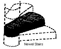
spiral stairsOne of the most beautiful examples of a spiral staircase we have come across is at Kilcrea Castle, near Aherla in Cork. While all such staircases* are impressive, the one at Kilcrea is a work of art. All the wall and sill stones are dressed to conform to the shape of the spiral and the sinuous progression of the newel and the steps is a joy to behold.

Kilcrea spiral staircase

The beautifully constructed spiral staircase at Kilcrea Castle. All the stones are dressed to fit the contours of the circular stairwell

The walls hold other items of interest too. Mural chambers, for example, may have served a variety of purposes from storage to dressing – some have loops for lighting but many have not. Cupboards were built into the walls to hold lights and valuables – a mural cupboard is called an aumbry.

Two mural chambers: left is a rectangular chamber with two aumbries (cupboards) and right is an L-shaped chamber light by a loop

Garderobes (indoor toilets) are usually enclosed in a mural chamber for privacy (although not always!), with the garderobe chute extending down the wall to an external exit.

Dunmanus Garderobe chute
Upper: The garderobe at Ballinacarriga. Lower: Dunmanus Castle showing where the garderobe chute exits at the base of the castle

The lowest floor was often used for storage or for cattle and hence the floor was sometimes left in a natural state.

Castledonovan ground floor

Castle Donovan ground floor

The next floors were for administration and daily living activities of castle inhabitants and workers. Floors were wooden – corbels and beam sockets to support the floors show where the next level began.
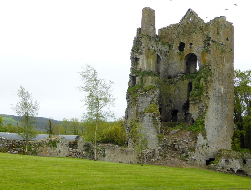
Cullohill Castle - floor levels clearly visible, plus the addition of a later firepalce that obscures a window

Cullohill Castle – floor levels clearly visible, plus the addition of a later fireplace that obscures a window

Fenestration (the arrangement of windows) was organised to emphasise defence – small windows and loops on the lower floors, larger on the top floor or solar. This was the private living quarters of the lord and his family, and a place where the women of the household could enjoy privacy and peace.

A fireplace from Castledonovan

A fireplace from Castledonovan

It was sometimes the only room in the castle to have a fireplace and generally speaking was the most comfortable room and therefore also used for entertaining.

Top floor, Kilcrea - the only floor with sizeable windows and more finely finished than the lower floors

Top floor, Kilcrea – the only floor with sizeable windows and more finely finished than the lower floors

If this floor had more than one room, the other might be called the great hall and be the entertainment space.
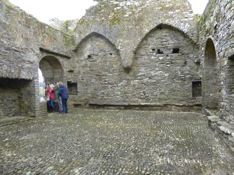
The Great Hall at Ballinacarriga. But what are we all looking at?

The Great Hall at Ballinacarriga. But what are we all looking at?

Ballinacarriga is unique in West Cork in that there are several carved window embrasures.

From the solar a stairway led to the battlements and wall walk. The roof could be made of timber, slate, or even thatch. The wall walk at Kilcrea had specially designed weepers to carry water away from the roof.

The wall walk at Kilcrea - note the weepers

The wall walk at Kilcrea – note the weepers

So there you are – next time you wander around a deserted castle in Ireland (we specialise in them!) you will be able to rattle off the proper terms for everything you see. The more you know, the more you appreciate the genius of our Medieval castle-builders.

Ballinacarriga Great Hall

Ballinacarriga Great Hall

I’ve learned so much doing these posts on castle architecture I am tempted to move on to abbeys – what do you think?

* The illustration of the newel stairs is from the Castles of Britain website. I believe it is from an Irish castle. That site also has an excellent glossary.
Launched!

A joint post by Finola and Robert

Mingling

Hallowe’en (All Hallows – Samhain) was the perfect day to launch our Prehistoric Rock Art Exhibition at the Cork Public Museum. As Finola said in her remarks at the opening, it’s a time when the veil between two worlds is at its thinnest: in this case, it’s the veil between an ancient time and the present day. We hope the exhibition emphasises the work of our distant ancestors who have inscribed the landscape and given us the enigma that is Rock Art.

Blank Canvass

Almost there
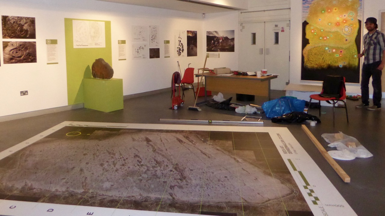
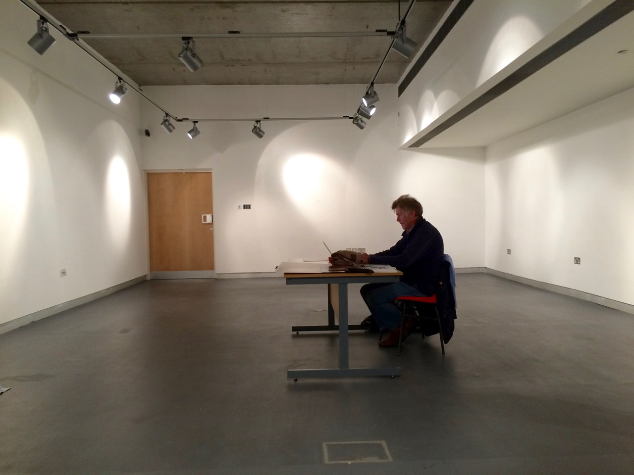
Before the Exhibition – Robert contemplates the blank canvas (top) and installation work in progress (below)

As our regular readers will know, the exhibition has been a very successful collaborative effort: Finola and Robert (providing drawings, explanations and the overall design); Keith Payne, a West Cork painter whose work is inspired by ancient art; Ken Williams, the excellent photographer of megaliths and monuments; the staff of Cork Public Museum, including intern Clare Busher O’Sullivan who came up with the idea and Dan Breen, Assistant Curator and his team, who made sure it all happened.

The Team

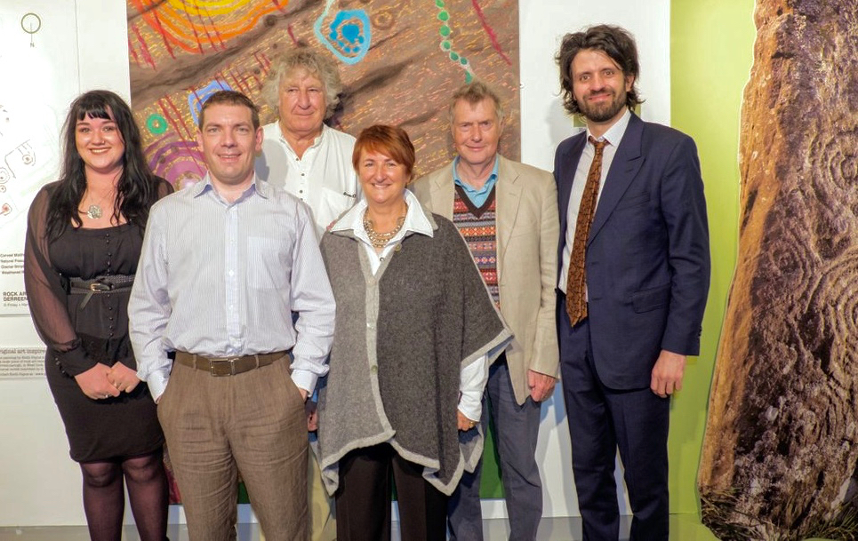
The Core Team: Clare Busher O’Sullivan, Ken Williams, Keith Payne, Finola Finlay, Robert Harris and Dan Breen

After some intensive days, on site and off, it has all come together and was launched yesterday. It was a grand launch: Firstly, William O’Brien – Professor of Archaeology at UCC – outlined a history of rock art studies and research which started back in the nineteenth century. He mentioned a predecessor in the department – Professor Michael J O’Kelly – who was born exactly 100 years ago and is best known for his excavations and restoration work at Newgrange, the Boyne Valley passage tomb: Finola worked on those excavations and it was Professor O’Kelly who suggested that she should carry out the research on rock art in Cork and Kerry which led to her Master’s thesis on the subject in 1973 – and, 42 years later, to the undertaking of this exhibition.
Professor Michael J O’Kelly (left) was renowned for his work at Newgrange (right)

Next up was Finola, who told us more about her expeditions back in the early 1970s. In those days when the boreens of rural Ireland were mostly populated by donkey carts her own travel was by means of her brother’s Honda 50 motorcycle, and we pictured her loaded down with compass, tapes, chains, chalk and tracing paper – a recording methodology now completely out of favour. But the result was a set of beautiful monochrome illustrations that form the core of the exhibition.

Coomasaharn

Rock Art: a detail of the picking technique (top left), and Finola’s drawings from 1973

In our modern days non-invasive recording methods have to be used: Ken Williams has developed a very effective method of photography using slave flash units to provide low angle lighting over the carved rocks, which brings the maximum level of detail out of the panels. The exhibition contains many fine examples of Ken’s work in this field.

Ken Williams in action: at the Bohonagh stone circle (left) and in the Derrynablaha townland, Kerry (right)

Finola also talked about Keith Payne’s work. He produces large and visually striking paintings based on particular rock art motifs. Two of these artworks are in the exhibition and will inevitably draw the eye, providing a good and colourful counterpart to Finola’s drawings.

Keith Payne at the hanging (left) and at the launch, in front of the remarkable Derreennaclogh stone (right)

The official launch was in the capable hands of Ann Lynch, now Chief Archaeologist at the Irish National Monuments Office. Ann and Finola were fellow students at UCC. Ann outlined the work of her department in recording Ireland’s monuments – and the difficulties involved in pursuing the preservation and protection of these monuments, including Rock Art – before formally declaring the exhibition open.

Ann declares it open

Ann Lynch, Chief Archaeologist at the National Monuments Office, declares the Exhibition open

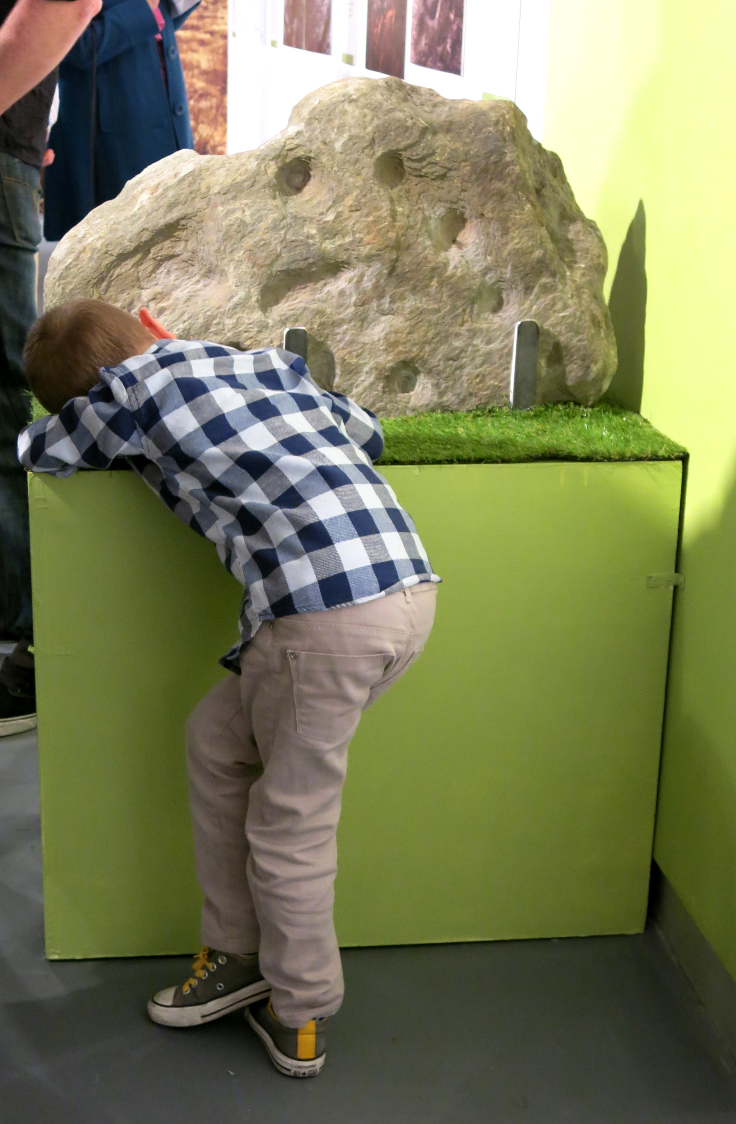
Noteworthy exhibits include one piece of Rock Art – the Bluid Stone from County Cork – which is in the safe keeping of the Museum, and will remain on permanent display after the exhibition closes at the end of February next year. The Museum also houses an example of passage grave art from Cape Clear island (prominent in our own view from Nead an Iolair).

Tired

Fine Detail: the Bluid Stone under close inspection

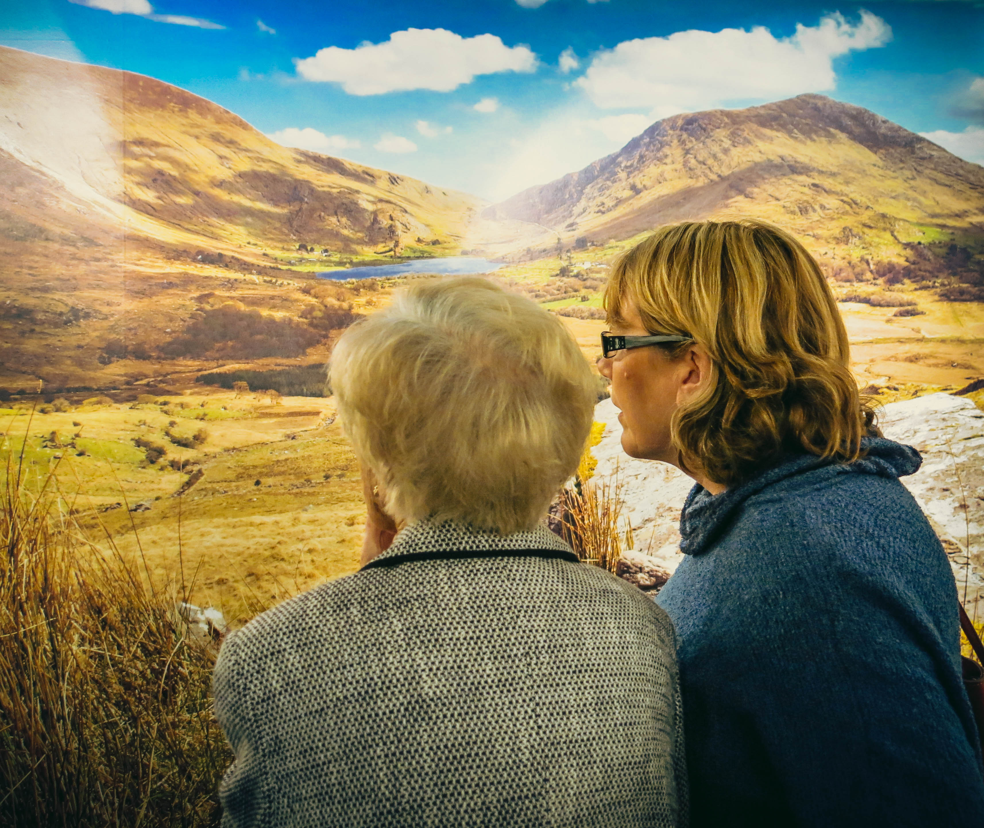
Other exhibits include Ken’s superb photo of the iconic stone at Derrynablaha, Co Kerry, in its panoramic setting of a Neolithic landscape. This occupies the whole of the end wall – and is simply beautiful.

Gazing

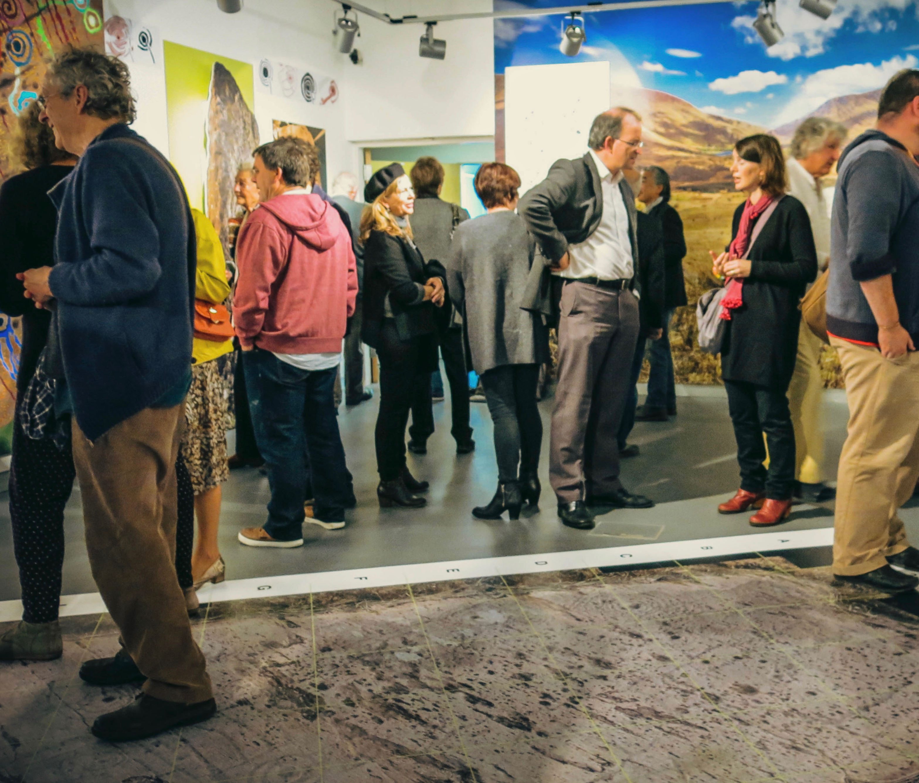
Visitors are surprised to see much of the floorspace taken up with a 70% life-sized image of the stone at Derreennaclogh: some hesitate to walk over it, but the printing is on hard-wearing vinyl, so feel free. The idea is to give you the feel of what it’s like to discover and explore the Rock Art out in the field. We have to mention how impressed we have been with the printing work carried out by Hacketts of Cork in the preparation of the exhibition – in particular, we were fascinated to watch the professionalism of their installation of the large items.

Yes – that floor can be walked on!

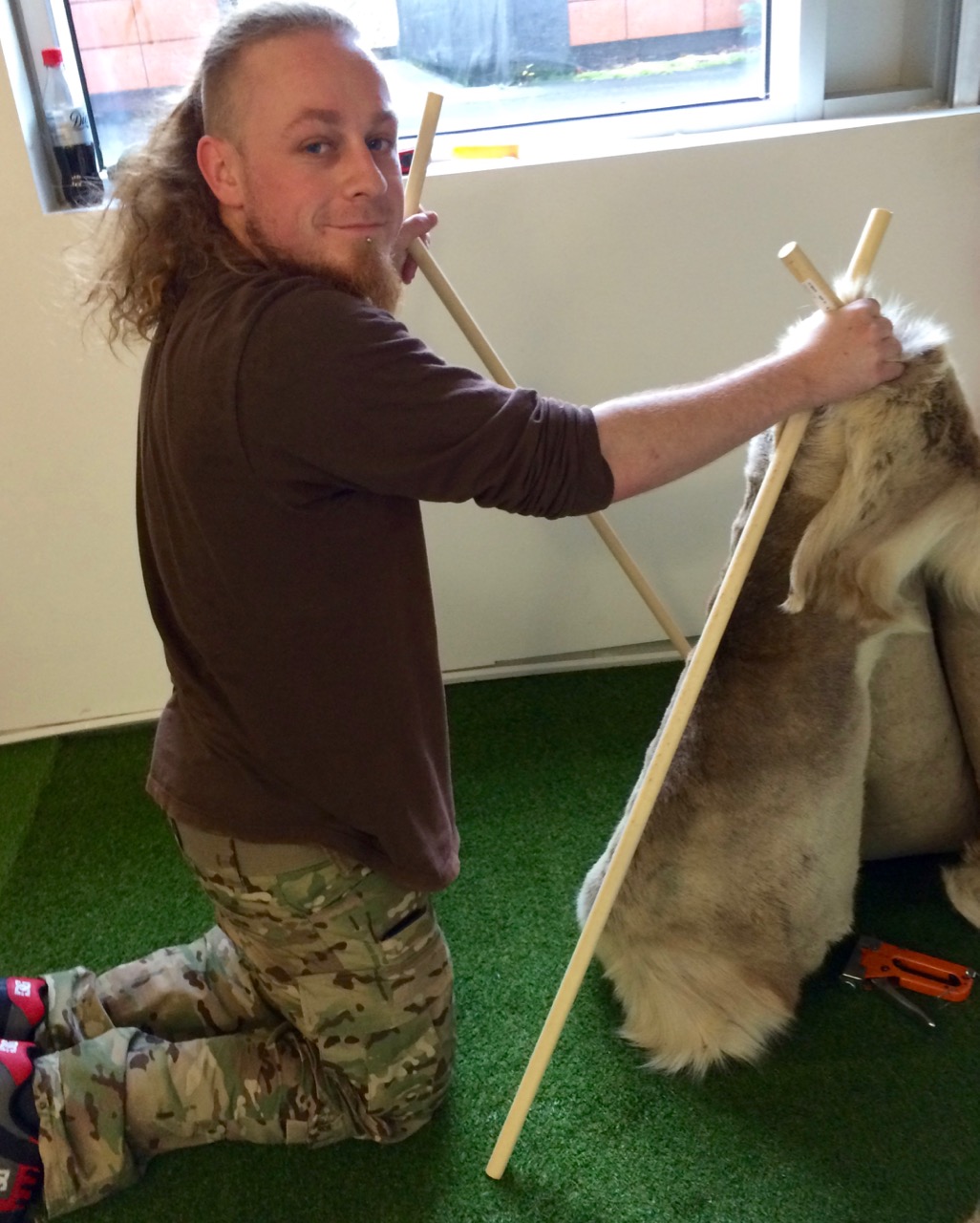
The timescale is set admirably by Alex Lee’s ‘Neolithic Settlement’ on the approach to the exhibition room. It’s well worth studying closely all the artefacts set out in this, and imagining what life must have been like for our artist ancestors in Ireland four or five thousand years ago.

Alex

Alex Lee at work on the Neolithic Settlement

We were delighted by how many of our friends from West Cork and beyond attended the opening, and gave us positive feedback. If you go during the next four months, please sign the visitors’ book. We are so grateful to our friends Amanda and Peter Clarke for being so supportive throughout – and for taking most of these photographs of the event: very many thanks.

Earnest discussions (left) and one of Ken’s superb photographs (right)

Our own day was rounded off by a visit to the Shandon Dragon festival, which processed through the centre of Cork in the evening – another unmissable event which reminds us of ancient times and long-held beliefs…

Shandon Dragon

Hallowe’en: The Shandon Dragon Procession makes its way through Cork City

Mount Corrin Walk

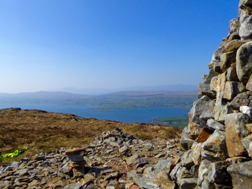
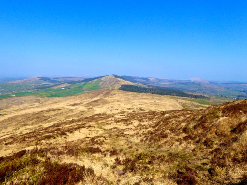
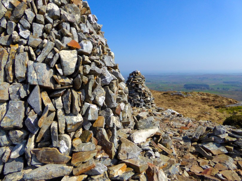
View from the cairn, Mount Corrin

View from the cairn, Mount Corrin

Walks that get you up to high places with panoramic views are terrific – especially when you don’t have to start at sea level! One such West Cork walk is Mount Corrin. Despite being on The Mizen, it’s part of the Sheep’s Head Walks system, which means it’s accessible and perfectly waymarked.

P1150782

The whole Mount Corrin loop walk is a 17km marathon and definitely not for the faint-hearted. But faint-hearted is exactly what we are, so we have chosen an option that can be easily accomplished on a pleasant afternoon – about a 5 km round trip. Some of these photographs are from a spring walk, and some from a fine autumn day.
From the trail - the Sheep's Head

From the trail – looking across at the Sheep’s Head

Wear good boots and bring a camera but leave the dog at home as no dogs are allowed on the Sheep’s Head Way. And if you do want to do the Big Walk, we highly recommend you pick up a copy of Walking the Sheep’s Head Way by Amanda Clarke. She and Peter have brought out a Second Edition that includes all the loop walks and they do a fabulous job of describing the whole route and provide wonderful photographs of what you can expect.
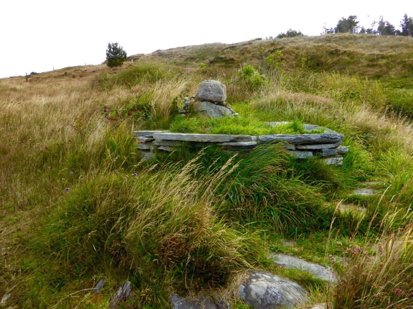
This curious little monument is right beside the parking spot

This curious little monument is right beside the parking spot

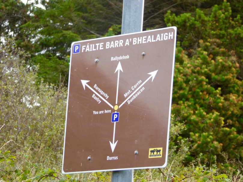
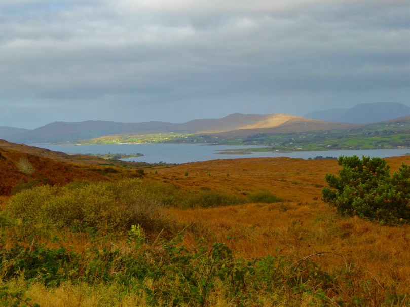
Our starting point is at a high point about half way between Durrus and Ballydehob. Drive out of Ballydehob via the road between Antonio’s Restaurant and Vincent Coghlan’s pub – that’s the Rathruane Road. About 3 km along this road you will come to a crossroads – turn right. Take the first turn left on that road and it will bring you up to the top of a hill. Once you cross over the top and start the descent on the other side you will see the waters of Dunmanus Bay ahead and to the left and a pull-out for parking on the right.

One of West Cork's most scenic parking spots

One of West Cork’s most scenic parking spots

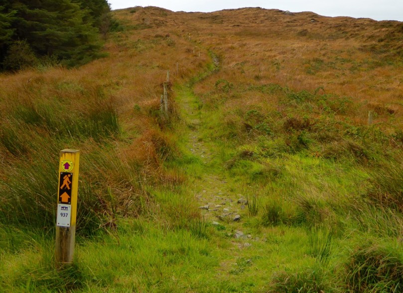
This is your starting point – look back and you will see the way marked trail about 50ms back up the hill, running alongside a forestry plantation. It’s also your ending point: our walk will take you up to the summit and back.

P1150787

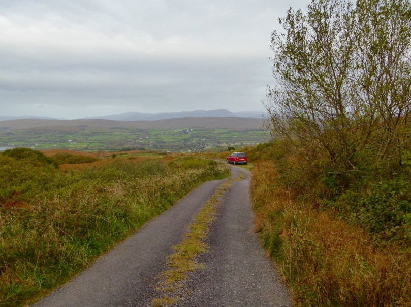
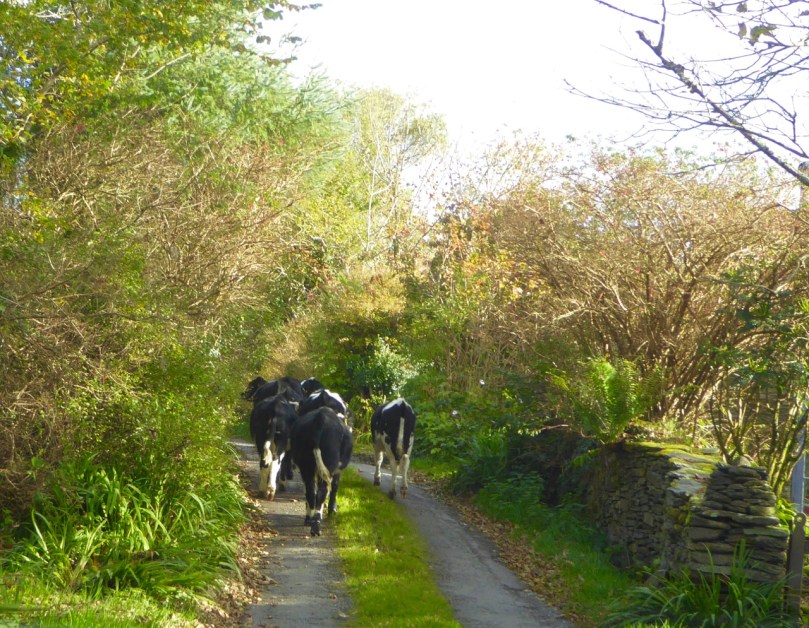
If you’re approaching from Durrus, take the R591 out of the village. Take the first turn left then the first right and follow the road to the summit. These are small country roads – be prepared to pull over or even reverse when you encounter other traffic.

Example of 'other traffic'

Example of ‘other traffic’

Once you set out, the first point of interest is what is described in the National Monuments inventory as a ‘megalithic structure’ and which looks likely to be a wedge tomb, although it is hard to be definitive about it. Whatever it is, it’s man made and intriguing.

A wedge tomb?

A wedge tomb?

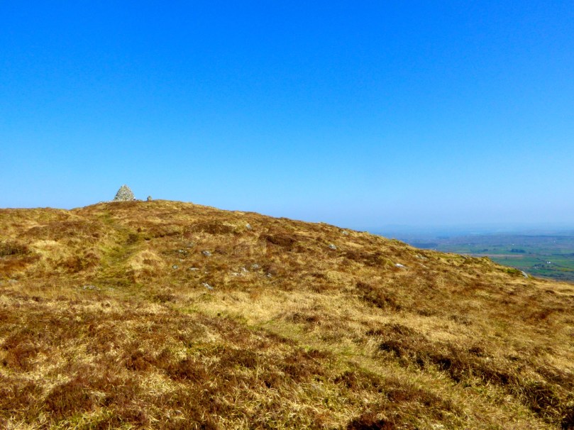
You can see the cairn ahead – your destination.

P1040223

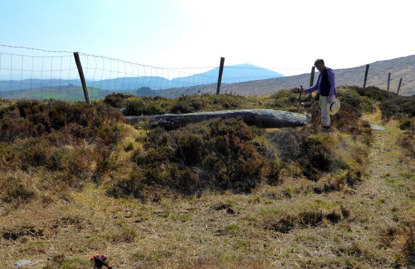
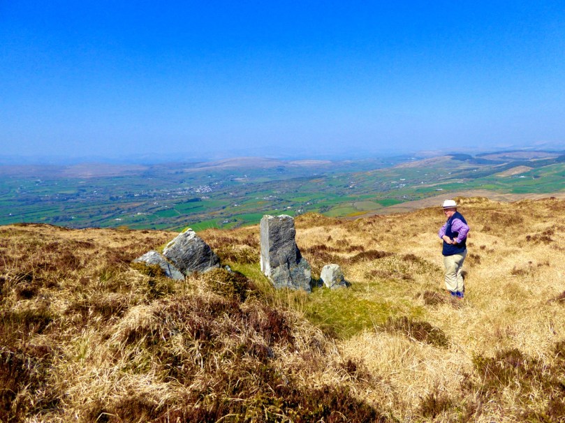
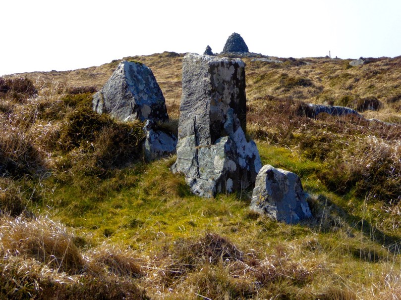
Before you get to it there is a row of standing stones. These ones are not marked on the NM inventory but it’s difficult to see what they could be other than a stone alignment. A final push now gets you to the cairn and to those panoramic views we mentioned.

P1040203

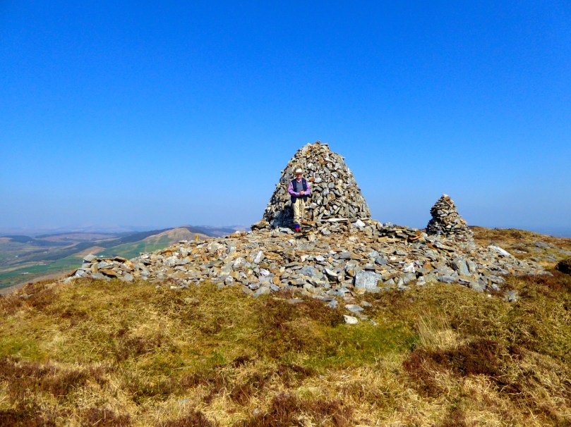
The first thing you’ll notice about the cairns (there are two of them) is the size of the large one and the scatter of stones all around them. The consensus seems to be that there has been a cairn on Mount Corrin since ancient times and that the current cairn, a more modern construction, sits on top of an older one.

The cairn on Mount Corrin is visible from this panel of rock art at Rathruane

The cairn on Mount Corrin is visible from this panel of rock art at Rathruane

We have certainly noted that the top of Mount Corrin, like the top of Mount Gabriel, is visible from several prehistoric sites and a cairn would have enhanced that visibility. The most persistent story about the cairn, though, links it to Lord Bandon.

P1040210

The Bernards, Earls of Bandon, are associated with Durrus, having laid out the town in the eighteenth century and having used Durrus Court as a summer residence. They had many interests in the area, including mining, and the always-interesting Durrus History blog gives us this information about Mount Corrin:

Mary Catherine Henrietta Bernard of Castle Bernard daughter of Lord Bandon married Colonel Aldworth on the 30th July 1863 and an address and copy of ‘God’s Holy Word’ was sent by Rev Freke and the tenantry of Durrus to which she returned thanks.  At Dreenlomane Mine (operating until c1920) owned by Lord Bandon, Captain Thomas set tar barrels alight on Mount Corrin which illuminated the sky all night and the 150 miners and their wives were treated to refreshments and similar celebrations were held in Carrigbui.

P1040197

The views from the cairn are stupendous, taking in the West Cork Peninsulas and the hinterland across to the Kerry mountains. Take a while to wander around the top – see if you can spot the collapsed walls of ancient hut sites.

P1040217

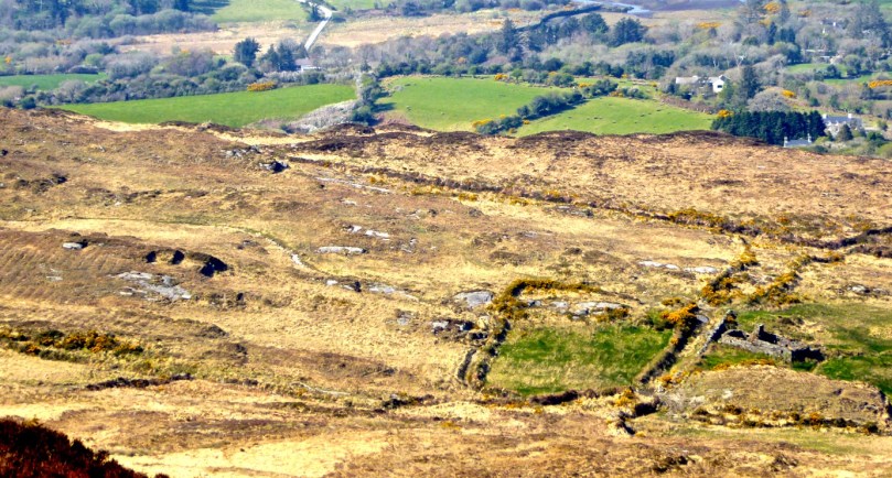
Making your way back, look down towards the farms on the northern slope of the mountain. You can still make out the unmistakeable signs of lazy beds, used to grow potatoes, and the ruins of houses abandoned long ago. It’s a poignant reminder that this land was once densely populated by people whose sole nutrition came from potatoes and who fled this area in the aftermath of the Great Famine.

P1040194 - Version 2

There now – that wasn’t gruelling at all, was it? And so rewarding. But still, a bit of effort required so you definitely deserve a coffee and cake at Budd’s, or a pint in Rosie’s. Tell them Roaringwater Journal sent you.

P1040200

Tower House Tutorial, Part 1

Ross Castle, Killarney

Ross Castle, Killarney

Can you distinguish between a crenellation and a machicolation? How about a bartizan and a barbican? By the end of this tutorial on the architecture of tower houses you will amaze your friends at dinner parties by casually dropping such terms into the conversation. (Of course you might also be labelled as a hopeless nerd.)

Rincolisky or White Hall Castle in West Cork - a good example of a basic tower house

Rincolisky or White Hall Castle in West Cork – a good example of a basic tower house

Start by reading, or re-reading, When is a Castle..? It goes over the basics of how the tower houses of West Cork were constructed and lived in. Essentially tall, square stone dwellings, they were built more for defence than comfort. Let’s look more closely at how exactly Medieval architecture coped with making such massive structures stable and workable. We’ll start with the outward appearance – walls, windows, roof and bawn. (In Part 2 we’ll go inside.)

Like many West Cork Castles, Castle Donovan is built on a rock outcrop

Like many West Cork Castles, Castle Donovan is built on a rocky outcrop

In West Cork, there’s a noticeable preference for building tower houses on rock outcrops. Since these are massive, heavy structures, building on rock is a good idea. The downside of that has been well expressed by Peter Somerville-Large in The Coast of West Cork: “Contrary to what may be written in Holy Scripture, buildings on rock have little in the way of foundation, and when they fall down or are swept away there is nothing left of them except a memory.” Somerville-Large reminds us that there were once castles at Ballydevlin, Castlemehigan and Crookhaven of which no trace now remains.

Ballinacarriga Castle. Note the splayed base batter and the unusual second floor bartizans

Ballinacarriga Castle. Note the splayed base batter and the unusual second floor bartizans

To support the tall walls, the lowest level was the thickest, splayed outwards in what is termed a base batterThe walls were constructed of stone and mortar. The mortar was lime-based – it wasn’t totally impermeable so these tower houses were damp places. Generally speaking, the cut stones were reserved for the outer and inner facings of the walls in fine castles, and in more basic ones they were reserved for quoins – the stones that were used in the angles or corners.  

A vestige of a tower house at Abbeymahon, near Courtmacsherry, shows the best cut stones reserved for the quoins

A vestige of a tower house at Abbeymahon, near Courtmacsherry, shows the best cut stones reserved for the quoins

Where walls have collapsed it is often obvious that the interior of the wall could be filled with rubble, with the best stones with the flattest faces, or the cut stones, being reserved for the outside. Cut stones were, of course, prized and many have disappeared over the intervening years, adding to the potential instability of some tower houses.

At Carriganass Castle most of the quoins have disappeared

At Carriganass Castle most of the quoins have disappeared

The walls were rendered with plaster on the outside. They could be whitewashed, which made them visible from afar. One of our local castles is known as White Castle, another as White Hall – perhaps these were originally whitewashed. The plaster could also be tinted to produce various colours – Kilcoe Castle is a good example of a tinted render based on research into this practice.

Glashare Castle in Kilkenny still shows the rendering on the outside. Note the unusual corner arrow loop

Glashare Castle in Kilkenny still shows the rendering on the outside. Note the unusual corner and cross-shaped arrow loops

The walls were pierced at various points with opes – a technical term that simply means an opening of any kind. Opes came in three varieties: doors, windows and loops. We talked about doors (raised entrances) and windows (smallest at the lowest levels, largest at the top) in When is a Castle..? Loops, arrow loops or musket loops, were always small from the outside, presenting a tiny target to attackers and preventing anyone from squeezing through (think about the origin of the word ‘loophole’). Muskets had totally replaced longbows and crossbows by the end of the 16th century so any castle built after that time had gun loops, and some even had larger cannon loops.

Carriganass Castle has many loops - the tiny one in this pictures seems to small to be useful

Carriganass Castle has many loops – the tiny one in this pictures seems too small to be useful

Inside, the loops were deeply splayed to allow the head and shoulders of the archer/shooter into the space, or embrasure. Loops could appear in the walls of the castle, or of the bawn.

A deeply splayed gun embrasure at Carriganass

A deeply splayed gun embrasure at Carriganass

At the top of the tower was the roof and the battlements. The roof was made of various materials – slate, wood or even thatch. Between the roof and the outside wall was a wall walk, protected by a parapet.

Dún an Óir, or the Fort of Gold, on Cape Clear Island. The wall walk can be clearly seen

Dún an Óir, or the Fort of Gold, on Cape Clear Island. The wall walk can be clearly seen*

In Ireland, this parapet most often took the form of what became known as Irish Crenellations. These were stepped or ‘toothed’ battlements, with tall parts (merlons) behind which defenders could take cover and shorter parts (crenels) for shooting from.

A good example of Irish crenellations from Kells Priory in Kilkenny

A good example of Irish crenellations from Kells Priory in Kilkenny

Another defensive feature was a platform that projected away from the walls, called a machicolation.  Defenders used the opening between the wall of the machicolation and the castle wall to hurl things down on attackers. Machicolations are often located above doorways, but also at corners which afford a view of two sides. When they are on corners they are called bartizans.

Corner machicolation, or bartizan, at Tocher Castle, north of Dunmanway

Corner machicolation, or bartizan, at Togher Castle, north of Dunmanway

The machicolation was supported by corbels which could be simple triangles or carved stone elements.

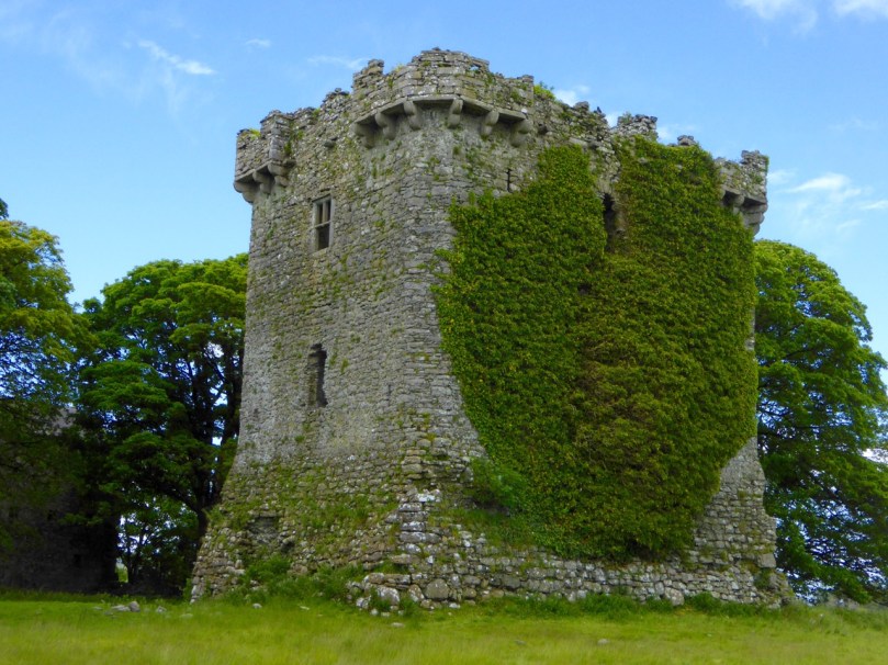
Shrule Castle in Mayo has decorative corbels. Note also the rounded corners of the castle which did away with the need for quoins

Shrule Castle in Mayo has decorative carved corbels. Note also the rounded corners of the castle which did away with the need for quoins

The bawn is the courtyard immediately surrounding the tower. Bawns could be restricted in size – little more than the immediate courtyard of the castle – or extensive. They are sometimes known as wards. The bawn wall was often fortified with loops and a wall walk.

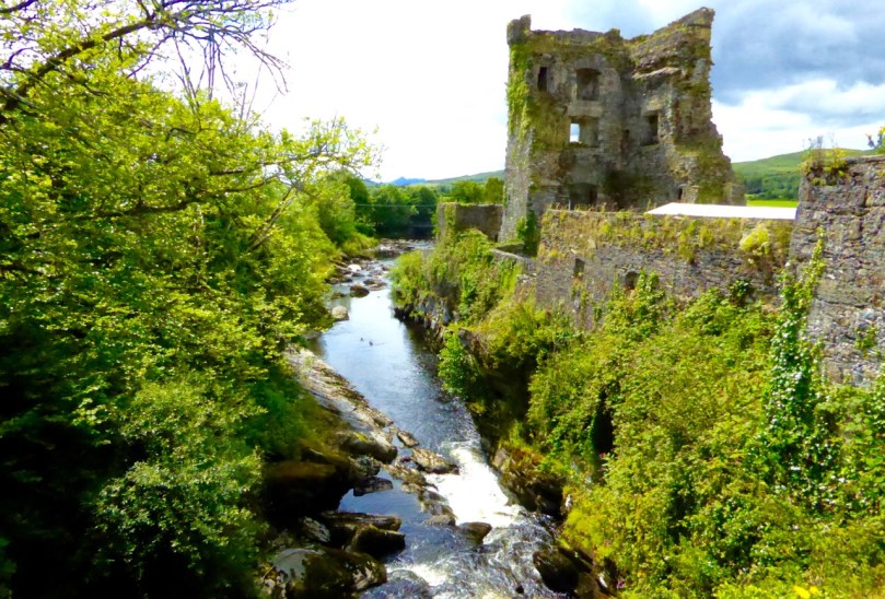
The bawn wall of Carriganass Castle at Kealkill hovers picturesquely over the river

The bawn wall of Carriganass Castle at Kealkill hovers picturesquely over the river

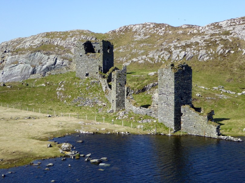
Bawn walls are often called curtain walls, but this term is also appropriate when the wall does not actually enclose a bawn, as at Dunlough Castle at Three Castle Head. Because the towers are situated between the lake and an impregnable cliff the curtain wall provides a barrier behind which defenders can shelter.

Dunlough, or Three Castles. The curtain wall presented a formidable barrier to attackers

Dunlough, or Three Castles: the curtain wall presented a formidable barrier to attackers

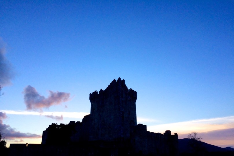
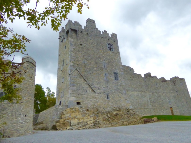
In the next tutorial we will cover the inside of the tower house. Meanwhile, here’s a pop quiz. Take a look at this photo of Ross Castle and see how many features you can identify. 

Ross Castle, in Killarney, is also built on an outcropping rock base

So – how did you do?

*Thanks to Lisa Scarff for the Dún an Óir photograph.

Rock Art Exhibition – at the Cork Public Museum!

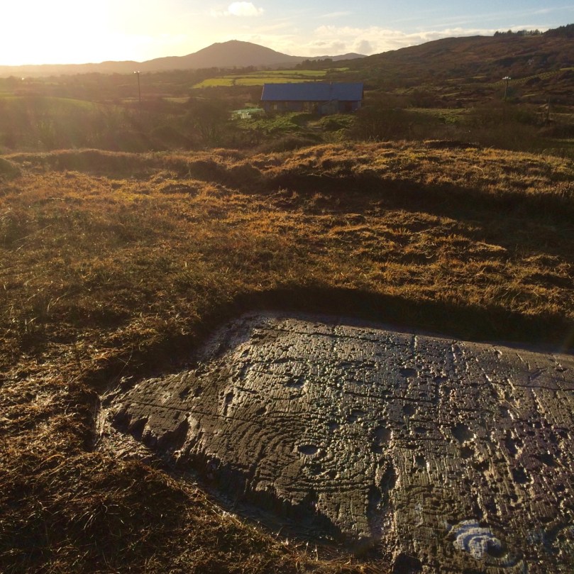
Rock Art from West Cork, Mount Gabriel in the background

Rock Art from West Cork, Mount Gabriel in the background

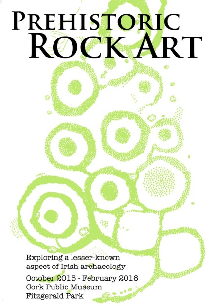
The Cork Public Museum has invited us to mount a Rock Art Exhibition and YOU are invited. Readers will remember the one we did last year in Ballydehob. Well, this one will be bigger and more comprehensive.

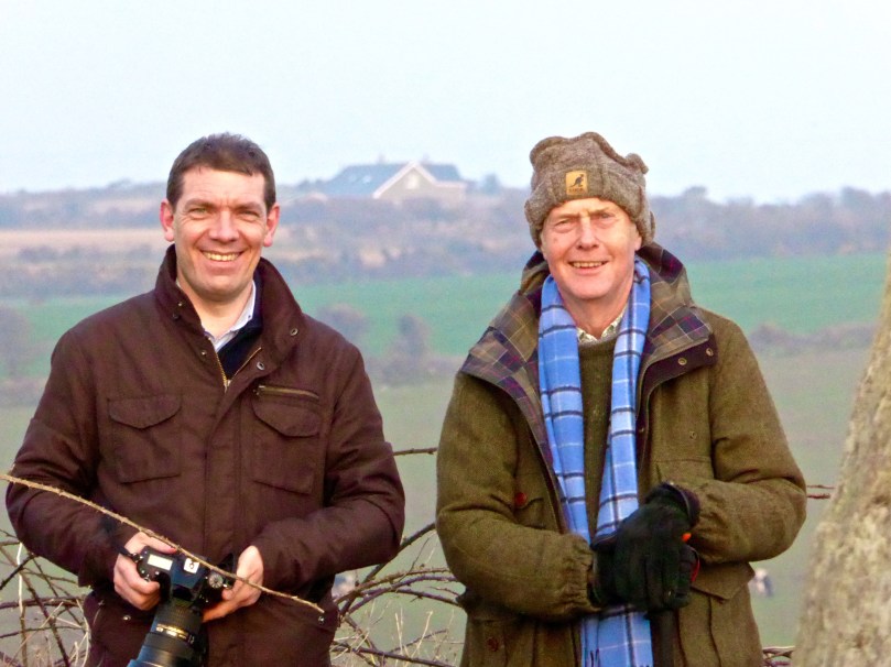
Ken and Robert photographing the Bohonagh Equinox Sunset

Ken and Robert photographing the Bohonagh Equinox Sunset

First of all, this time we have two partners. Ken Williams will be familiar to readers of this Journal – we profiled him in the post Shadows and Stone in Action, and he, and his photographs, figured largely in our famous Derrynablaha Expedition post. Ken is probably the foremost photographer of prehistoric monuments in Ireland, and certainly of prehistoric art. His website, Shadows and Stone is an invaluable resource of both images and information. He was recently profiled in The Irish Times Magazine – a wonderful two page spread.

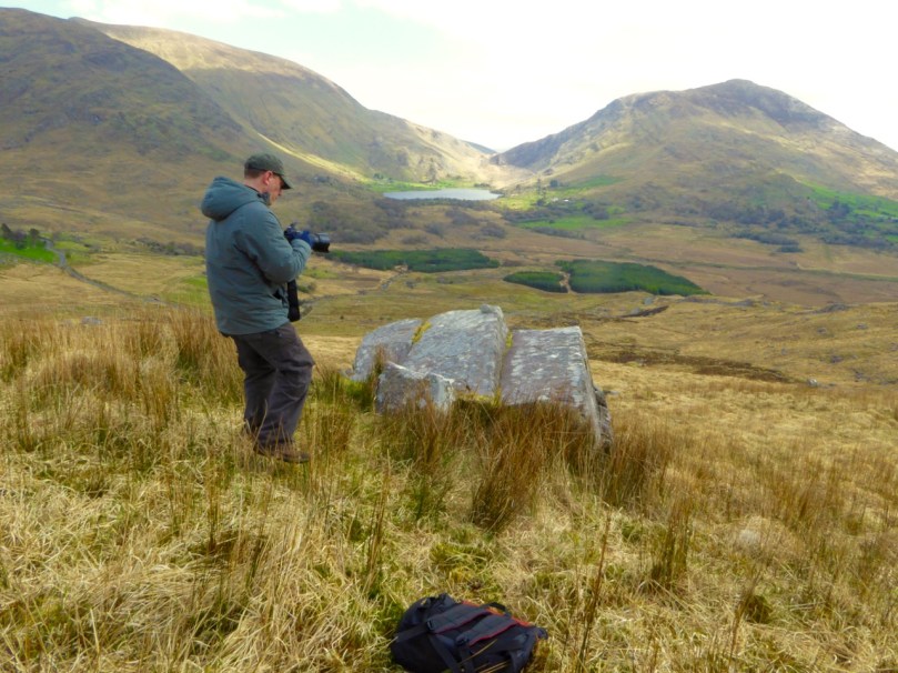
Ken at work, Derrynablaha

Ken at work, Derrynablaha

Keith Payne has lived, painted and exhibited all over the world, including running his own gallery in France, but now he lives in West Cork.  He spent years travelling with the Rolling Stones creating stage sculptures and backdrops for their shows. 

Keith Payne

Keith has always been inspired by prehistoric art – cave paintings, aboriginal rock paintings, and all forms of petroglyphs. The paintings he has contributed to the exhibition are based on West Cork rock art pieces but the form, and the amazing colours, are all his own. We are thrilled that he is participating.

One of Keith's images inspired by cave Paintings

One of Keith’s images inspired by cave paintings

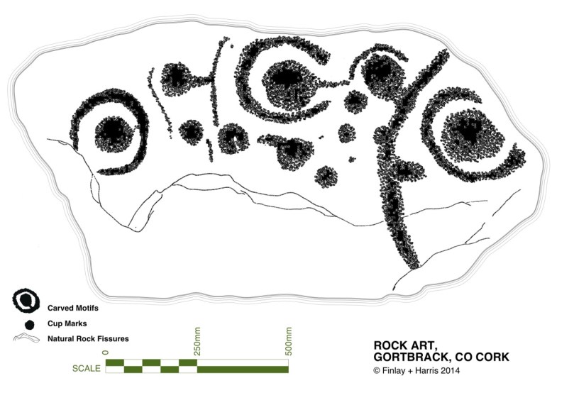
Besides Ken’s photographs and Keith’s paintings, the exhibition will include many of my rock art drawings and some of Robert’s more recent ones. There will also be ‘real’ rock art on display – an unusual stone from Bluid, near Castletownshend, and of course the Cape Clear Stone, which is on permanent exhibit in the Museum. It’s an example of passage grave art rather than rock art, but the comparisons are fascinating and important. A ten minute walk away, at University College Cork, are two further examples of rock art, one from County Cork and one from County Waterford.

Thi spiece of rock art is on display at University College Cork, a ten minute walk from the Museum

This piece of rock art is on display at University College Cork, a ten minute walk from the Museum

The Grand Opening will be at 2PM on Saturday October 31st. Please come if you can and say hello. But if you can’t make it, the exhibition will run until February 2016, so we hope you can drop by.

Exhibition Poster

Castle Haven

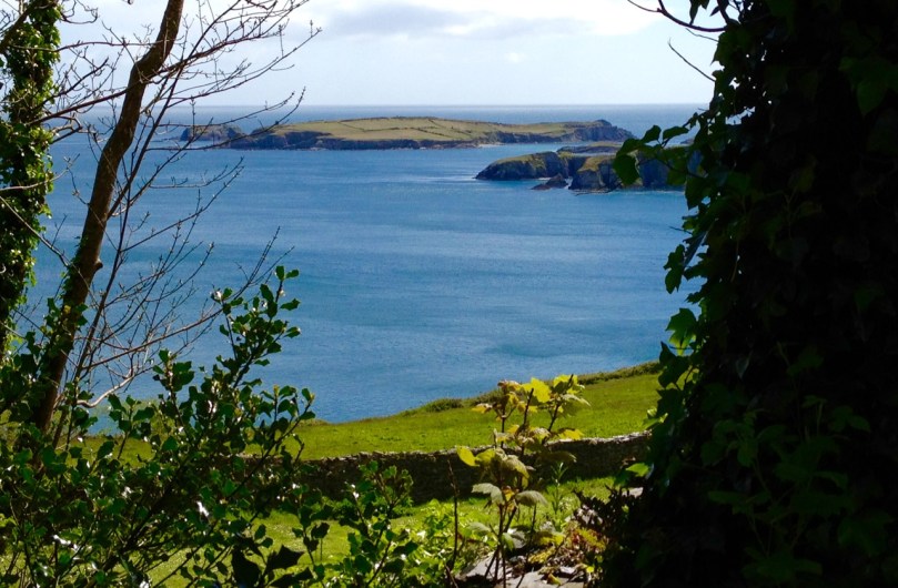
The entrance to Castle Haven. Horse Island is separated from the mainland by the charmingly named Flea Channel.

The entrance to Castle Haven. Horse Island is separated from the mainland by the charmingly named Flea Channel

South West of Skibbereen lies a deeply indented section of the coast known as Castle Haven. It is perhaps best known for the town that clings to the steep hill on its west side – Castletownshend. We have written much about Castletownshend itself, about Edith Somerviille and about the lovely St Barrahane’s Church and its Harry Clarke windows. But the whole inlet is an explorer’s paradise, yielding up its treasure to us on successive visits so this post will be about other things to see around the Haven.

Castle Haven

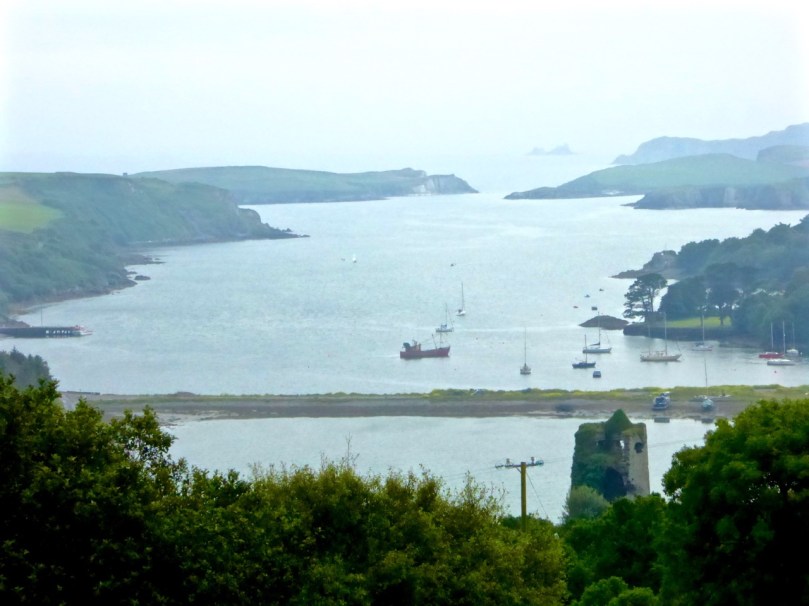
Catle Haven on a misty day. The inlet was guarded by two castles: this one at Raheen and another at the entrance to the Haven

The Haven is shallow at its top end, but up to the spit of land that runs across it near Reen Pier, it provides a deep and sheltered harbour for boats, and a popular sailing ground. We like to drive down the road that runs above the eastern side of the Haven. It’s twisty and a bit treacherous but at a certain point it presents a view of the whole inlet, dominated by Raheen Castle.

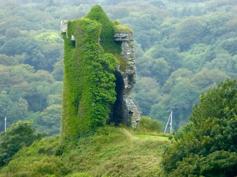
Raheen Castle

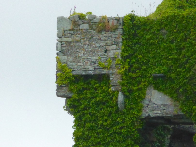
This was a castle of the O’Donovan clan, built in the late 16th or early 17th century. It didn’t last long – it was attacked by Cromwellian forces in 1649 and the collapsed upper stories may be the result of cannonball damage.

Raheen Corner machicolation

Continuing to the end of the east side brings you past Reen to the wonderful harbours of Myross and Squince, but that’s a post for another day. Now we’ll return to the west side of the inlet and visit two spectacular archaeological sites, Knockdrum Fort and the Gurranes Stone Row, before proceeding down into Castletownshend.

Knockdrum interior and views to north

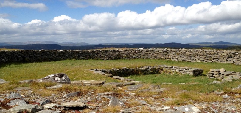
The interior of Knockdrum Stone Fort, with square hut site in the middle. The fort commands panoramic views across the countryside and out to sea

To get to Knockdrum Fort, you have to park at the large church about 2km before the village. Walk downhill about half a kilometre until you get to the signposted green road to the fort. A pleasant trudge brings you to a set of steps and these lead up to the site. This is an excellent example of an early medieval stone fort – the kind of fortified homestead that marked the residence of a family of high status before the Normans taught us how to build tower houses.  From this site there are striking views across Castle Haven.

Entrance to Knockdrum

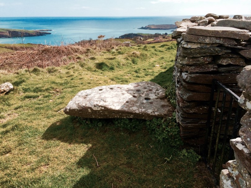
The entrance to Knockdrum Fort, looking towards the entrance to Castle Haven. Outisde the entrance is this large rock, covered in cup-and-ring art

But there’s more to this place than just the fort. There’s an early Medieval cross slab just inside the entrance, and a fine example of 4000 or 5000 year old rock art just outside it. There’s another piece, a cupmarked stone, inside the fort, lying on the ground. All three are here thanks to the activities of Boyle Somerville, a keen amateur archaeologist and brother of Edith Somerville who lived in Drishane House, just below the fort. Farmers who found such items would bring them to him and he placed them here for safekeeping. Also inside the fort you will see evidence of a souterrain – an underground passage used for storage when the fort was active.

Knockdrum cross slab

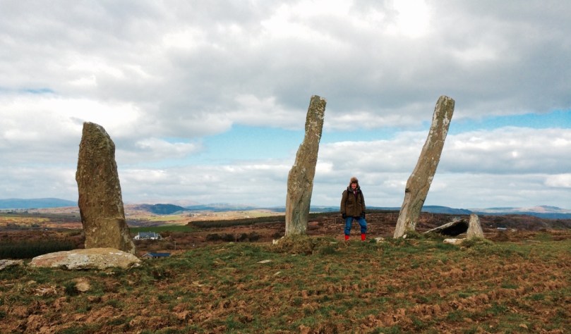
If you look north across the valley once at Knockdrum you will see a stone row on a nearby hill. These are the Garranes ‘Fingers’. (They are on private land so you should seek permission to visit and make sure there are no bulls in the fields.) The best way to access them is to tramp through the fields across the road from the entrance to Knockdrum. It’s well worth the effort – once you get up to them you will see that more uprights are now lying on the ground. This was originally an alignment of at least five stones, unusually tall and thin, positioned so that they would be visible on the skyline from many directions.

Gurranes Fingers

Drive down towards the village now, until you get to the entrance to Drishane House. To the right of the gate is a bench dedicated to Boyle Somerville. In 1936 he was shot dead by the IRA, who claimed he was recruiting local young men for the British Navy. He was liked and respected locally and, outraged by the deed, the people of Castletownshend raised money for this memorial. If the house is open (there will be a sign) this is a wonderful place to visit. For a small charge you can wander around the extensive grounds and visit the Edith Somerville Museum. We love to go in spring, when the bluebells provide a vivid carpet and a photographer’s paradise.

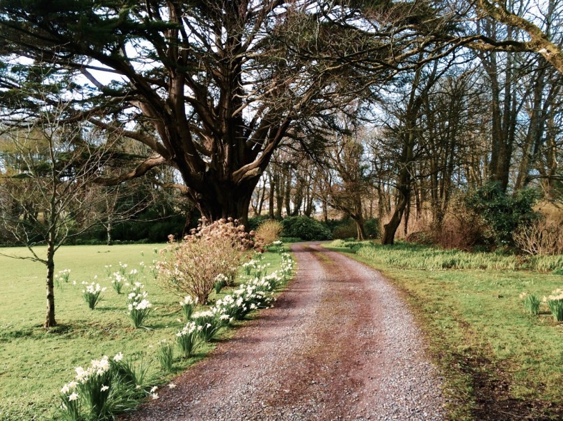
Drishane house driveway in spring

Drishane House driveway in the spring, with the giant macrocarpa (a Californian cypress tree)

Down to the village now and up to the church. But this time, instead of heading inside to see the Clarke windows, or behind the church to view the graves of Somerville and Ross, cross the graveyard until you find a gate at the far side and head east along the edge of the field towards the water. There you will find the remains of a structure labelled as a star-shaped fort on the OS map. Nowhere near as enormous as the massive star-shaped Charles Fort in Kinsale, nevertheless it is a reminder of a time when the sleepy village was not as peaceful as it is now. Dating to the 1650s, not a lot remains, just enough to confirm that this was a structure built for defence. Along the way you might also see a ruined square tower, known as Swift’s Tower. This was built as a belvedere, (a place to admire the view) and legend has it that Dean Swift visited and liked to write there.

Left is the remains of a bastioned fort, labelled as a ‘Star-Shaped Fort’ on the OS map. Right is the belvedere, where Swift is said to have written

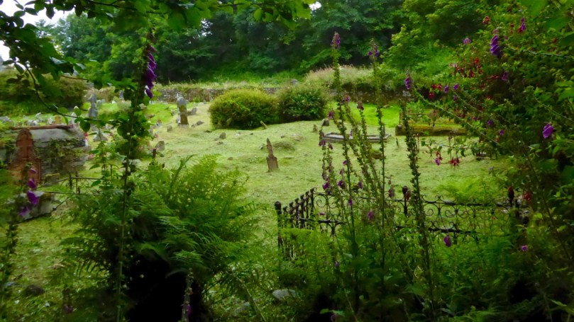
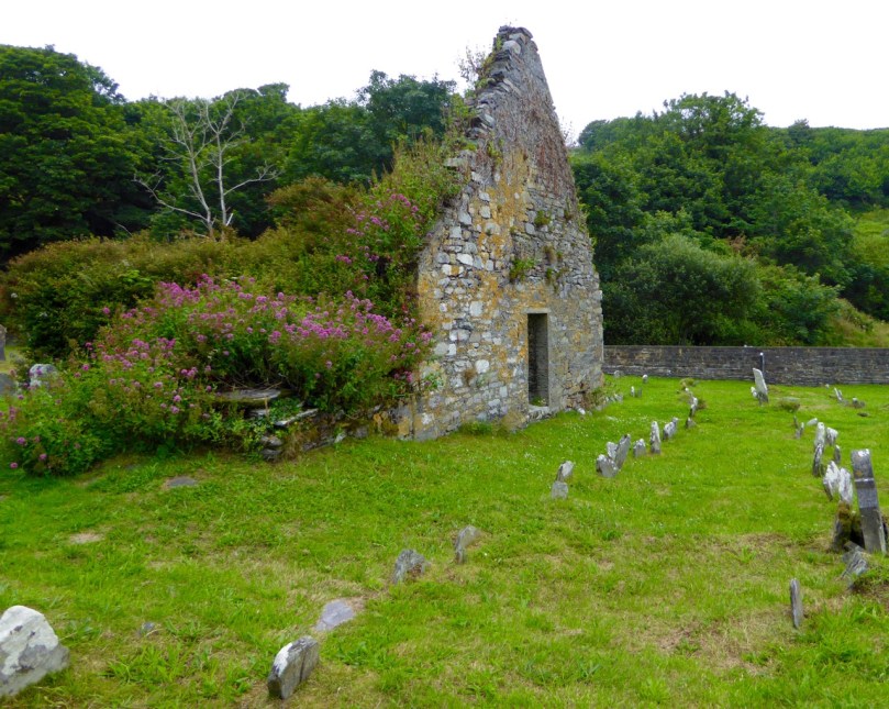
Drive back out of town now and take the left turn after the entrance to Drishane House. Follow this road for about a kilometre to a sharp left turn, just before a small crossroads and turn left down a narrow road that ends at the sea. A tower house used to guard this part of the Haven but nothing remains of it now except a stump covered in ivy and brambles. But wander around the graveyard and admire the picturesque siting of the old church, already in ruins by the mid-1600s. This is a good example of a classic West Cork graveyard. Most graves are marked by simple stones at the head and foot, with no inscriptions. 

Castlehaven Graveyard atmosphere

There are some family plots and some more elaborate memorials, including one for Ellen Buckley, second wife of O’Donovan Rossa (although his name, interestingly, does not appear on the headstone).

Castlehave graveyard, old church

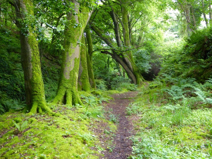
To the immediate left of the graveyard you will find a stile leading to a green path. Take this path and walk up though the luxuriant woods past a rushing stream until you come to a little wooden bridge.

Path by the stream

On the other side is a holy well, cut into the hillside and decorated with ribbons and fishing floats. Make a wish, or say a prayer – this is a special place and still visited and maintained by local people.

Take OS Discovery Map 89 with you. Most of the sites I describe are actually marked on it. But if you get lost, have fun, and let us know what you discovered!

Path through woods