The Electrification of Ireland – A Medieval Diversion

In my recent posts I have set out a brief history of how the new State became electrified – and how this affected the urban and rural ways of life in Ireland. An important part of the story was the building of the hydro electric power station at Ardnacrusha, on the River Shannon, between 1925 and 1929. That’s the original control room, above, unaltered since construction – there’s not a screen in sight! Most of the works of the station are now handled elsewhere using screens and keyboards rather than dials and switches. This site became the nerve centre for the electrification of Ireland and the National Grid was established in tandem with the project.

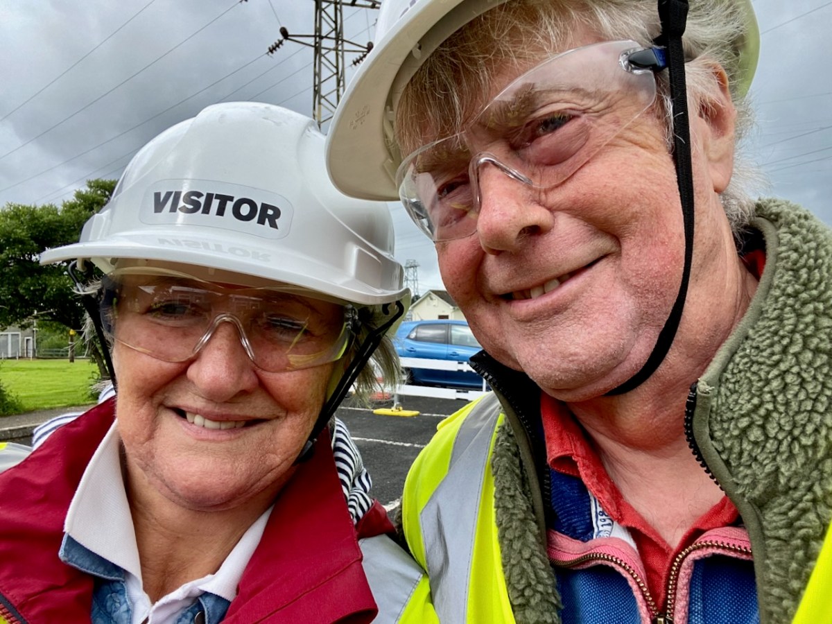
This selfie shows Finola and I on a visit to Ardnacrusha last week. (If you want to go yourself you have to book in advance). We had a great time! And I’ll be reporting back on that trip in due course. But first I want to take you back in time – more than a thousand years . . .

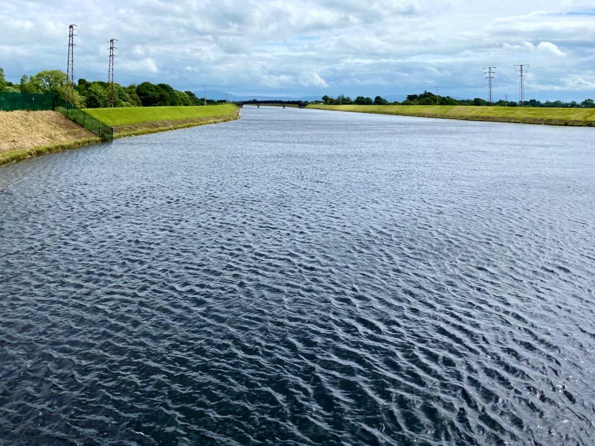
Here’s the River Shannon today, just north of the power station. There’s a big head of water there, and the river had to be dammed and flooded to maximise the feed to the turbines. The significantly raised water level had consequences.

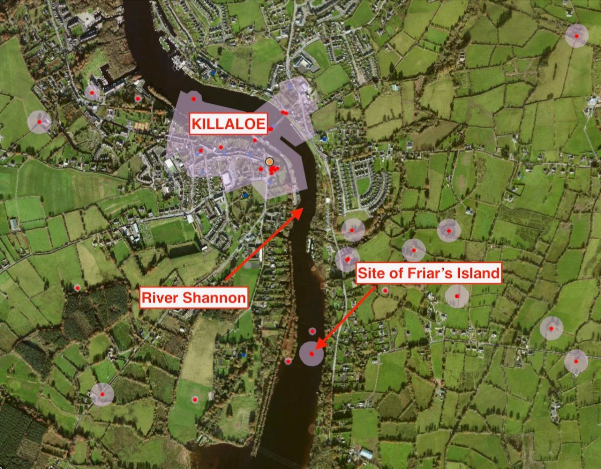
The aerial view, above, shows the river today with its elevated water level. In the pic you can see the ‘Site of Friar’s Island’ indicated: before 1930 there was an island there, on which were some noted relics, including the Oratory of St Molua of Kyle (also known as St Lua), who died in the year 608. His feast is celebrated on August 4th. It’s said that crowds used to assemble there on that day, most of them wading across the water to get to the island. This description of the saint is from the Schools Folklore Collection (informant Tom Seymour, aged 60, Cloncully Co Laois):

. . . We don’t know where he belongs. Some say he belongs to Killaloe. He had his monastery in Kyle. Near the monastery he had a big stone where he used to pray. There are two big holes where he laid his elbows, and two more where the tears fell. In Ballaghmore there is a trough laid up on a stone. It is always half-full of St Molua’s water. The hottest day in the summer the well is always half-full of water. When he died the people of Killaloe wanted to bury him in Killaloe and the people of Kyle wanted to bury him in Kyle. They made two coffins, one went to Kyle and the other to Killaloe. He had another monastery in Offaly . . .

Schools Folklore Collection

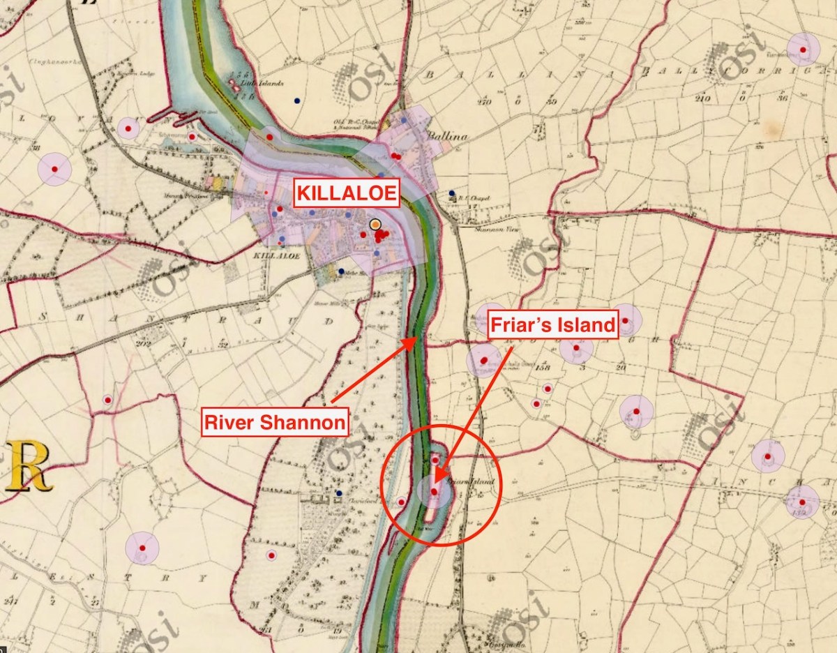
In this extract from the early OS 6″ map (above) you can see that the island was quite substantial. The pilgrimage involved visiting a holy well and St Lua’s Oratory. The small church was by tradition built by the saint, although it seems likely to date from the ninth or tenth centuries.

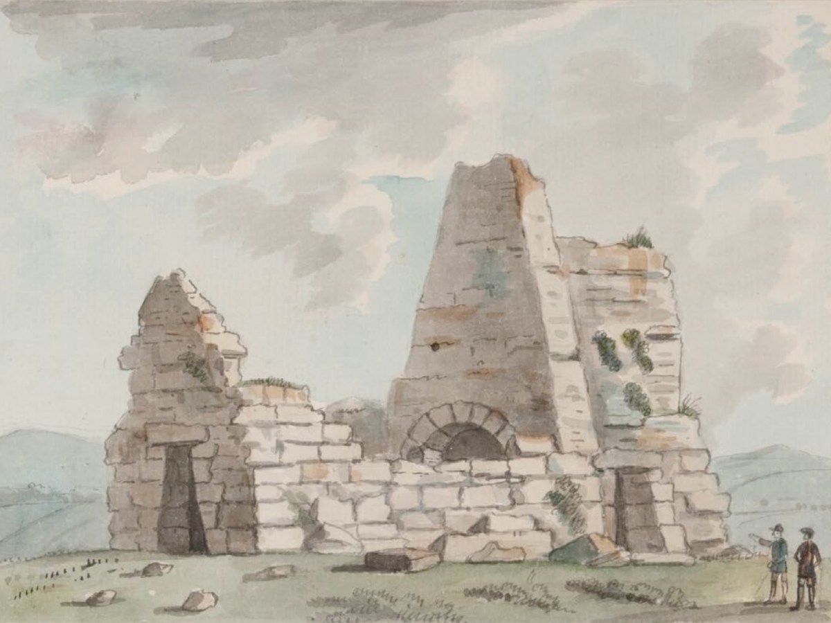
St Lua’s Oratory – Eighteenth Century water colour – Royal Irish Academy. The figures are somewhat out of scale. Below is a photograph of the Romanesque structure taken on the island in the 1920s.

. . . The nave walls are constructed with uncoursed cyclopean sandstone masonry while the chancel walls are constructed with roughly squared stones of smaller size. The chancel has a single-light round-headed E window with stepped sill-stone and unusual flat-headed doorway in the S wall. The round-headed chancel arch has curious jamb-stones which are not flush with the chancel arch and project inwards. The triangular-shaped chancel roof is bonded with lime mortar and is well preserved. The nave walls are poorly preserved and only survive several courses high with a trabeate doorway in the W wall. Excavations at Friar’s Island prior to the removal of the church revealed that the church was constructed on a stone platform enclosed by a possible cashel with a revetment wall of unknown purpose. A second stone platform (dims. 22ft (6.71m) N-S; 50ft (15.25m) E-W) was located to the S of the church and eleven skeletons were uncovered under or close to the foundations of the N wall of the church (Macalister 1929, 16-24) . . .

National Monuments Service description

As the plan to establish the new power station progressed, it became obvious that the level of the river below Killaloe would have to be raised significantly in order to maximise the water power turning the turbines to be installed: some five meters, in fact. The consequence for Friar’s Island were that it would be flooded, and the Oratory would be lost.

Considerable debate ensued, the main factions being archaeologists, engineers, and the Catholic Church. Politically, the efficient functioning of the new power station was paramount in order to show the State and the world that Ireland was an entity to be reckoned with. At the same time, the archaeologists were keen to project that the independent country recognised and championed its very rich ancient heritage, and would therefore go out of its way to preserve all surviving artefacts. The Catholic Church was anxious to show allegiance to all aspects of progress in the State, while noting that it was also the fundamental root of the unique Irish culture that led to the historical founding of sites such as St Lua’s Oratory. I was fortunate to be given access to a paper by Niamh NicGhabhann of the University of Limerick: Medieval Ireland and the Shannon Hydro-Electric Scheme: reconstructing the past in independent Ireland. Here’s an abstract:

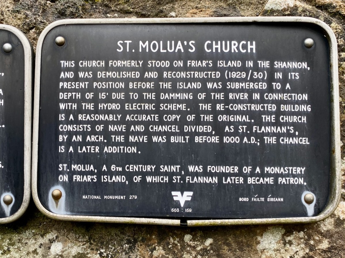
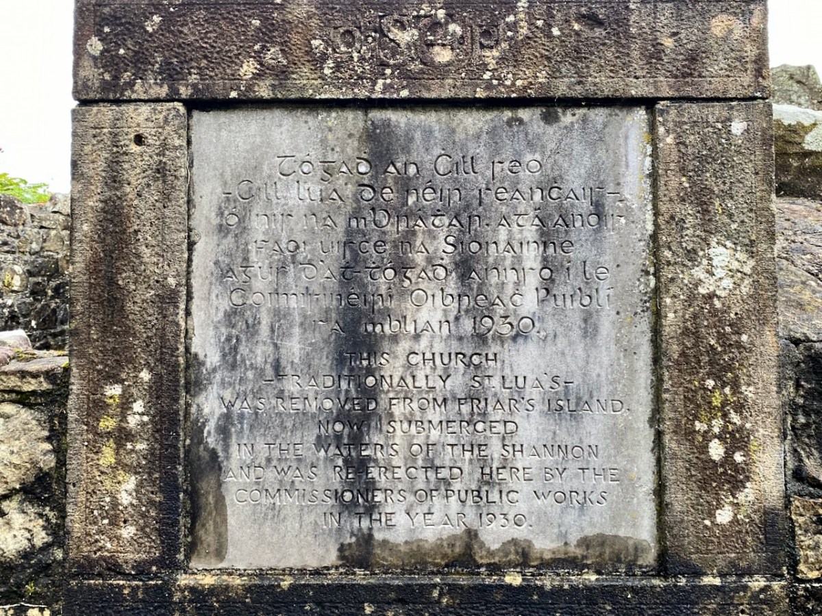
. . . This essay considers the position of Irish medieval buildings in the early years of the twentieth century. Focusing on the treatment of the oratory of St Lua at Killaloe, it examines the ways in which the ruins of the medieval past were used to signify a range of political, religious and cultural ideas and attitudes. The rising water levels following the Shannon Scheme works (begun in 1925) meant that this stone oratory was moved from its original position on Friar’s Island to the grounds of St Flannan’s Roman Catholic Church in 1929. The resulting paper trail reflects the complex processes of decision-making within a civil service in transition as the new Irish Free State calibrated its position with regard to the past and the treatment of medieval ruins throughout the countryside. The case study of St Lua’s oratory is considered here in the context of the nineteenth-century tradition of scholarship on medieval buildings, the development of the idea of a national Irish architecture during this period, and the impact of this tradition on subsequent engagement with the buildings of the medieval past . . .

Niamh NicGhabhann
IrIsh studIes revIew, 2017 vOL 25 NO. 4

Above – a surviving photograph of St Lua’s Oratory being disassembled in 1929. The various debates had produced three alternative solutions to the dilemma of the impending inundation of Friar’s Island:

1 – Allow the island and the ruins to vanish below the flood: by far the cheapest course of action.

2 – Build a new concrete platform (effectively a new ‘island’) above the level of the flood water, and transfer the remains of the building to this.

. . . The RSAI officially responded in support of the second proposed scheme of work, involving the elevation of the building and the construction of a concrete pier. They suggested one amendment to the plan, that a ring of grass be added around the building to give the concrete plinth the appearance of an island. Given that both the RSAI and the OPW were in favour of the second scheme as the most appropriate and cost-effective course of action, the fact that the oratory was eventually moved and transported some distance from the site, however, reflects competing values, as well as several structural problems that emerged in the second scheme as proposed. As works progressed, it became clear that the elevated island site would be eventually undermined by the flow of the river, making this process untenable . . .

Niamh NicGhabhann
IrIsh studIes revIew, 2017 vOL 25 NO. 44

3 – The Scheme that was eventually adopted involved dismantling the Oratory and re-assembling it as faithfully as possible, on a suitable mainland site. Initially the suggested site was on the Clare bank of the Shannon, but the ground conditions were not suitable for a permanent structure.

. . . A further plan for relocation was also progressed, which involved moving the ruin into the town of Killaloe, and locating it beside the later and larger oratory of St. Flannan, and the medieval cathedral of St Flannan. These plans were at quite an advanced stage by mid – 1929, with several drawings and maps produced by Leask’s office for the purpose. However, while the preservation process was certainly hampered by these structural issues, ideological concerns also had a direct impact on the treatment of the oratory . . . The intervention of Bishop Fogarty was also noted on 13 July 1929, when the Limerick Leader reported that “the safeguarding of such a venerable relic of primitive Christian architecture is due to the timely intervention of Dr Fogarty, Bishop of Killaloe, who put the matter before the Government”. (Limerick Leader, 13 July 1929) . The use of the word “relic” as opposed to “ruin” is significant here, reflecting an interpretation of the site as part of a tradition of faith, rather than of architectural or antiquarian interest . . .

NIAMH NICGHABHANN
IRISH STUDIES REVIEW, 2017 VOL 25 NO. 44

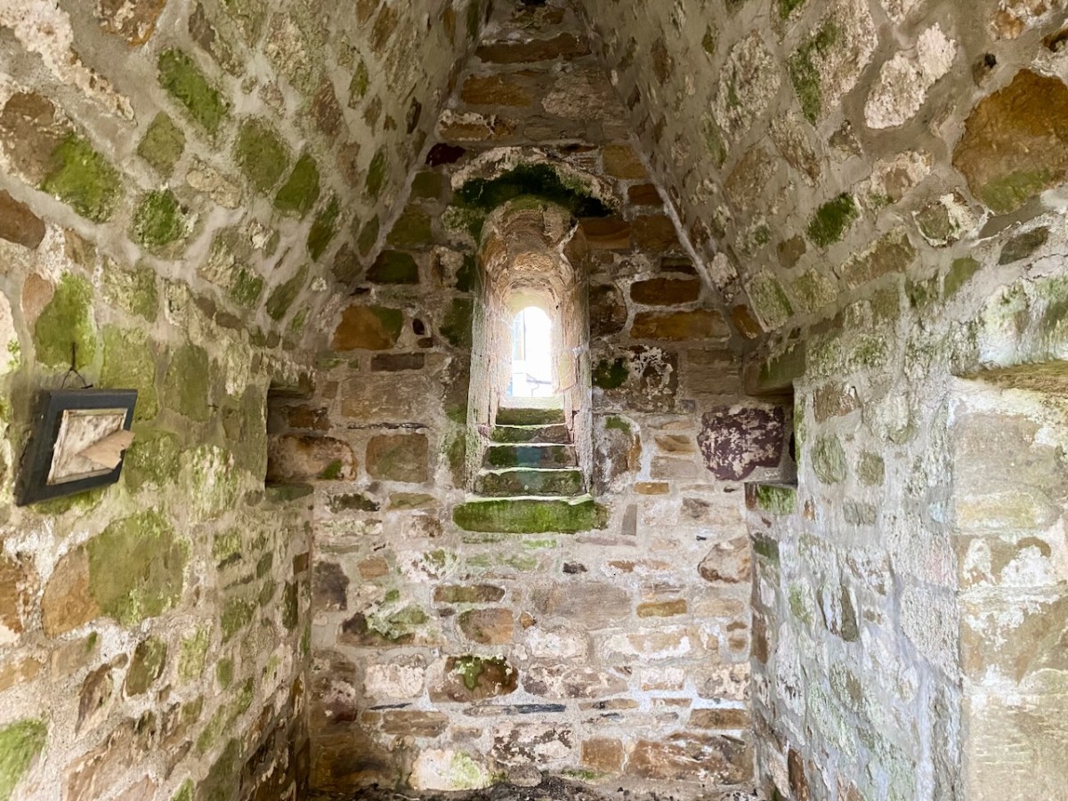
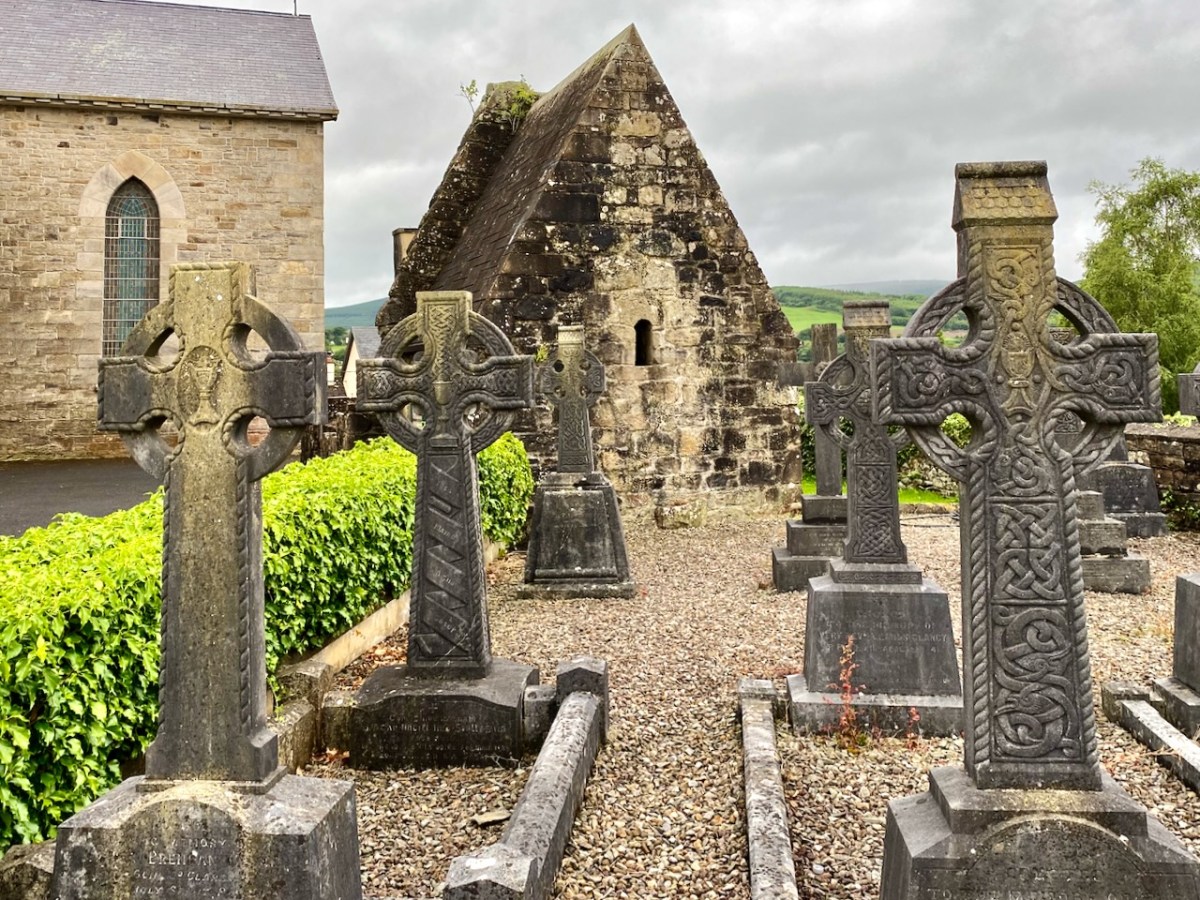
In this photograph of the Oratory as it stands today in the church grounds at Killaloe, it is perhaps worth wryly commenting that we see a true piece of early medieval architecture behind the screen of ‘pseudo’ high crosses. We have a good record of how the remains were dismantled and accurately re-assembled: this was written by the archaeologist H G Leask MRIA in 1930:

. . . In order that the rebuilding should be, as far as was possible, an accurate one, it was necessary to adopt a system of marking the stonework by which the original stones should occupy their original positions when reassemble. The stones being very varied in size and irregular in shape, and laid uncured, no system of numbering such as could easily be applied to squared ashlar was admissible. To the Clerk of Works in charge, Mr C J Dowdall, must be given the credit for the scheme finally decided upon. This consisted in marking with paint of different colours a series of level lines at two feet vertical intervals all round the exterior and interior wall faces. These lines were crossed again by a series of vertical lines at the same intervals but of one distinctive colour for each wall face inside and out. Where the squares formed by this grid of paint enclosed, unmarked, a number of small stones, diagonal lines were added to each square to ensure that every stone showed the same marking. A complete series of elevational photographs of each wall face was taken and careful drawings were also made with the coloured guide lines indicated upon them. On the large plot of ground on the opposite side of the river kindly lent by Major Lefroy, above future water level, timber guide planks were laid down as a frame to each wall and gable face. On the timber frames the coloured guide lines were indicated and the stones when transported were laid down face upwards, in sand, in correct relation with the coloured marks. Each wall, of course, was divided in two vertically along its length and “displayed”. Important quoin, jamb, and arch stones were numbered in colour in regular order. The transport over the Shannon was carried out by means of a specially built barge and a rope stretched from shore to shore, the workmen simply “handing” the boat across by this means. An inclined trackway with truck and winch was erected by Messrs Siemens Bau Union and two small temporary jetties by direct labour. The Most Reverend Dr Fogarty, Bishop of Killaloe, vested a site in the Church enclosure on the summit of the hill in Killaloe town, and the building has been erected there and is now (May, 1930) approaching completion. (Note: the work of re-erection was finally completed in July, 1930) . . .

The Church of St Lua, or Molua, Friar’s Island, Co Tipperary, Near Killaloe
Further Notes – H G Leask
13 May 1930

A couple of afterthoughts to finish off with: a letter from Canon Clancy to Leask, dated 14 October 1930, asked whether a gate could be installed, as it is “liable to be desecrated by boys using it as a urinal, in fact, some boys have already been using it”. And a contemporary cutting from the Nenagh Guardian noted that . . . works cost thousands of pounds are being misused on a “folly” in demolishing St Lua’s Chapel and hiding it in a yard when they could have lifted it above the waters and put a strong light in it that would have illuminated the whole country round, and made it one of the sights of the place . . .

I am grateful to Niamh NicGhabhann for allowing me access to her excellent paper on the tensions surrounding the proposals for the Oratory remains. Further information on the Electrification of Ireland can be found in these posts:

Night’s Candles are Burnt Out

Electrifying West Cork

Rural Electrification – Process and Effect

Fort of Gold 1: The Promontory Fort

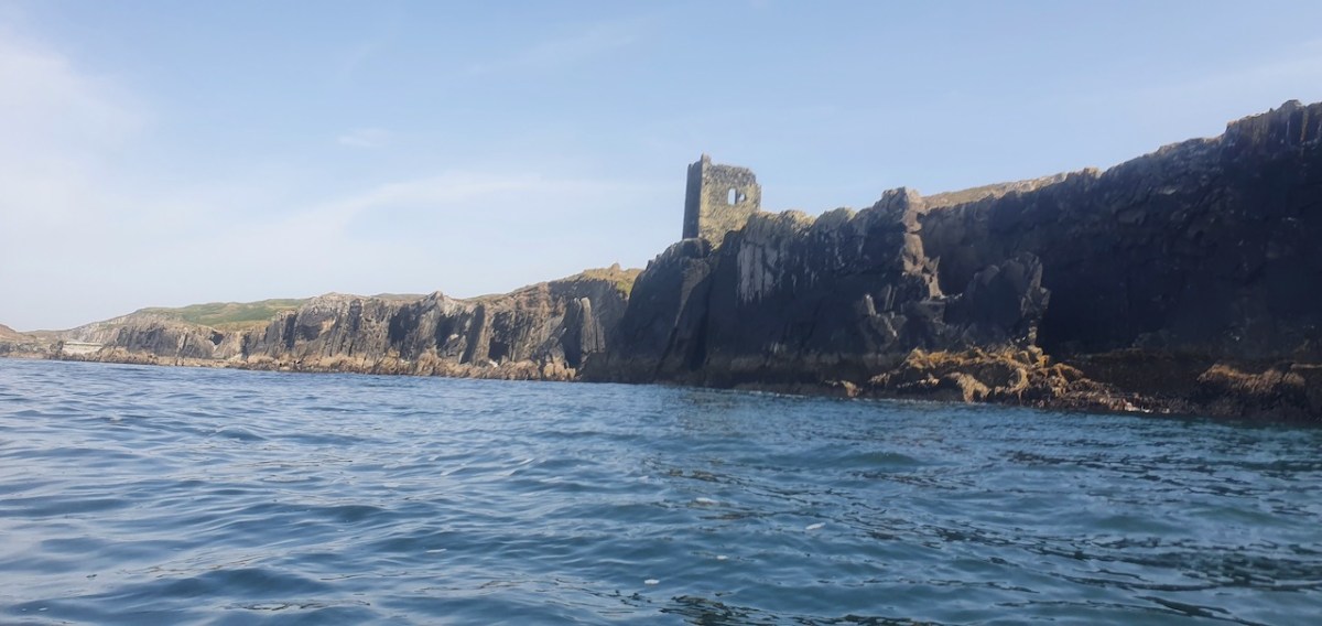
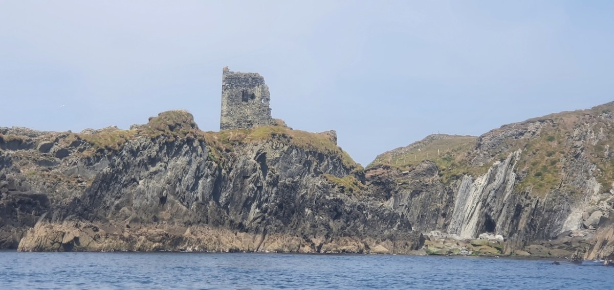
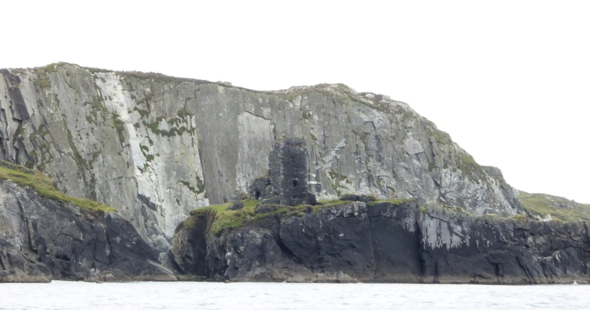
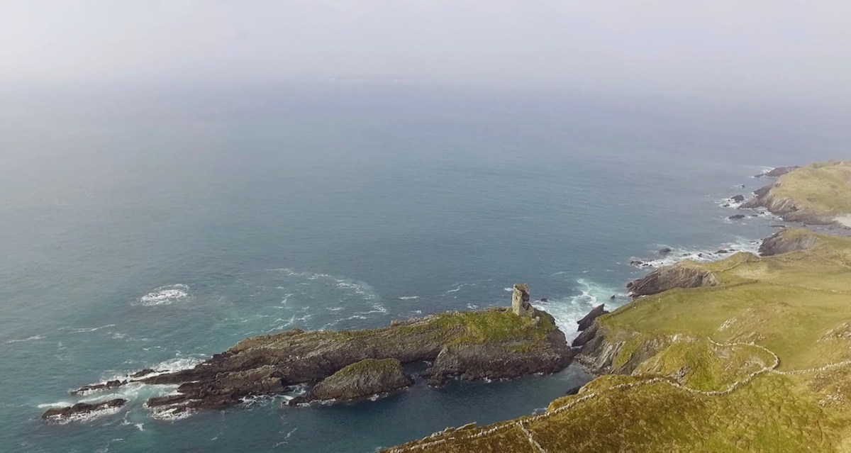
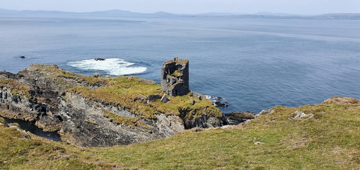
I have been gifted with a marvellous set of photographs of Dunanore, or Dún an Óir – an O’Driscoll Castle on Cape Clear. The gift came from one of our readers, Tash, and I am very grateful indeed. Regular readers know that I like to use my own photos, and I do have some that I took from the sea (like the one below) but I have none of Dún an Óir from the land, let alone from the castle itself! 

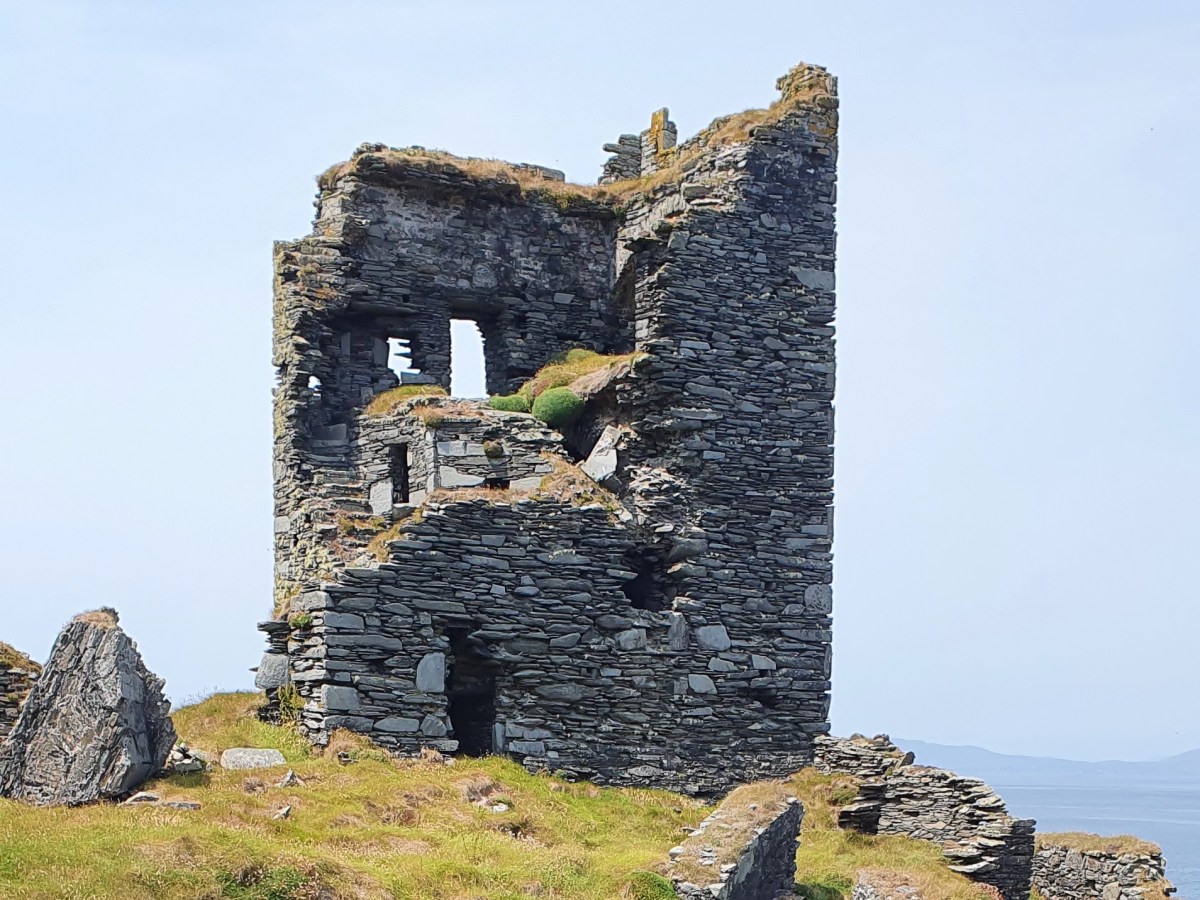
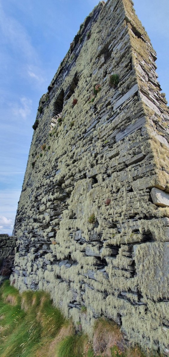
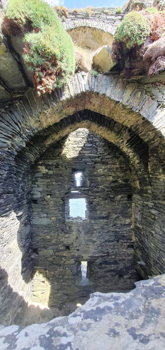
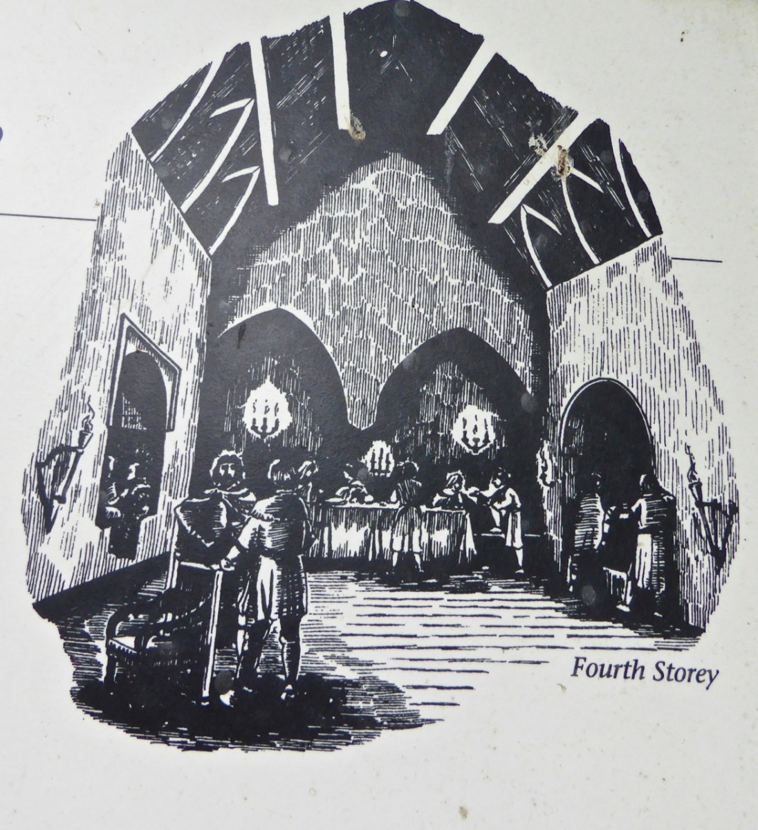
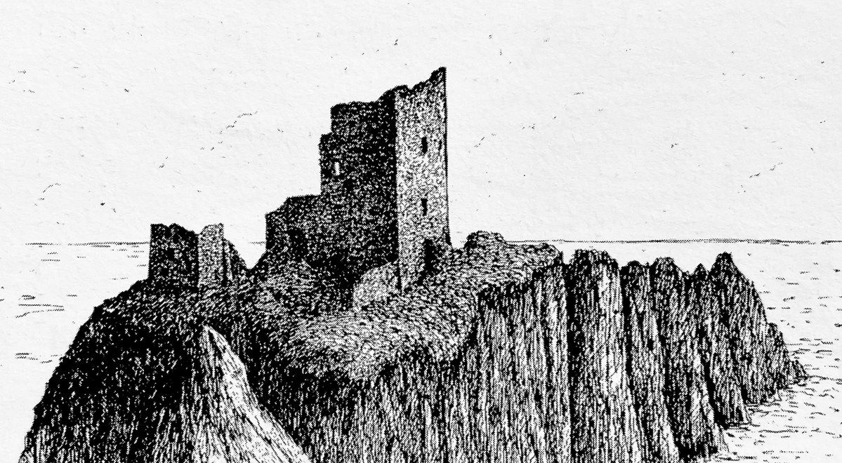
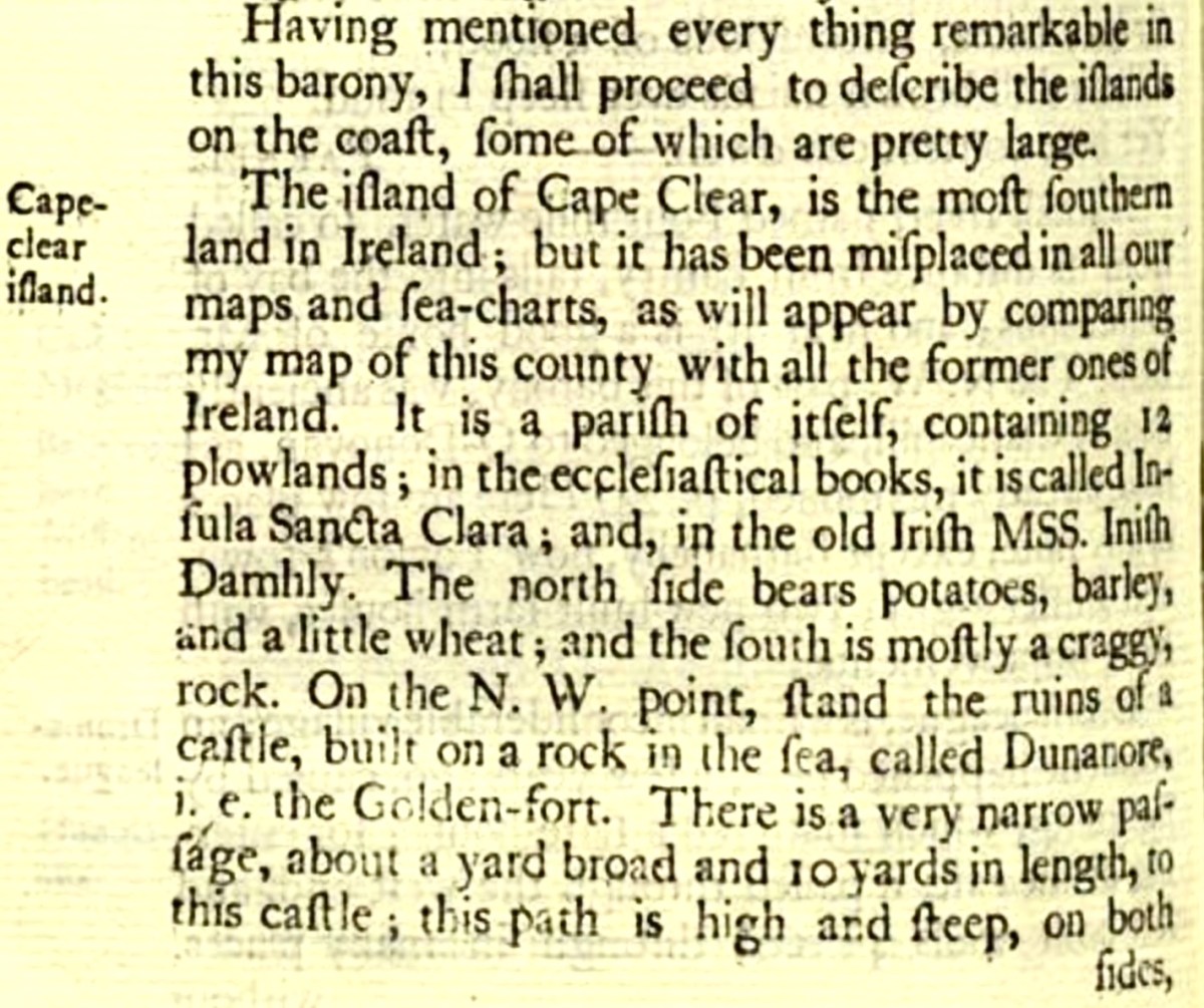
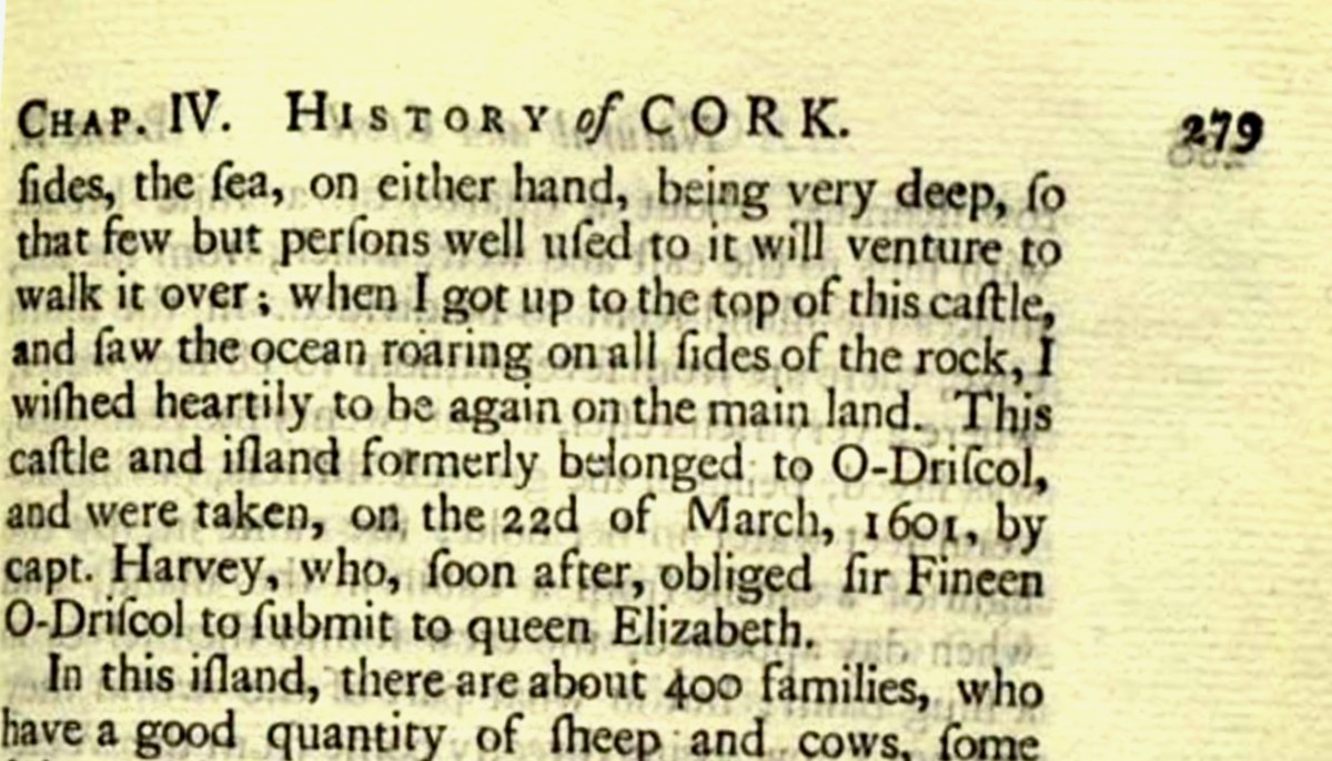
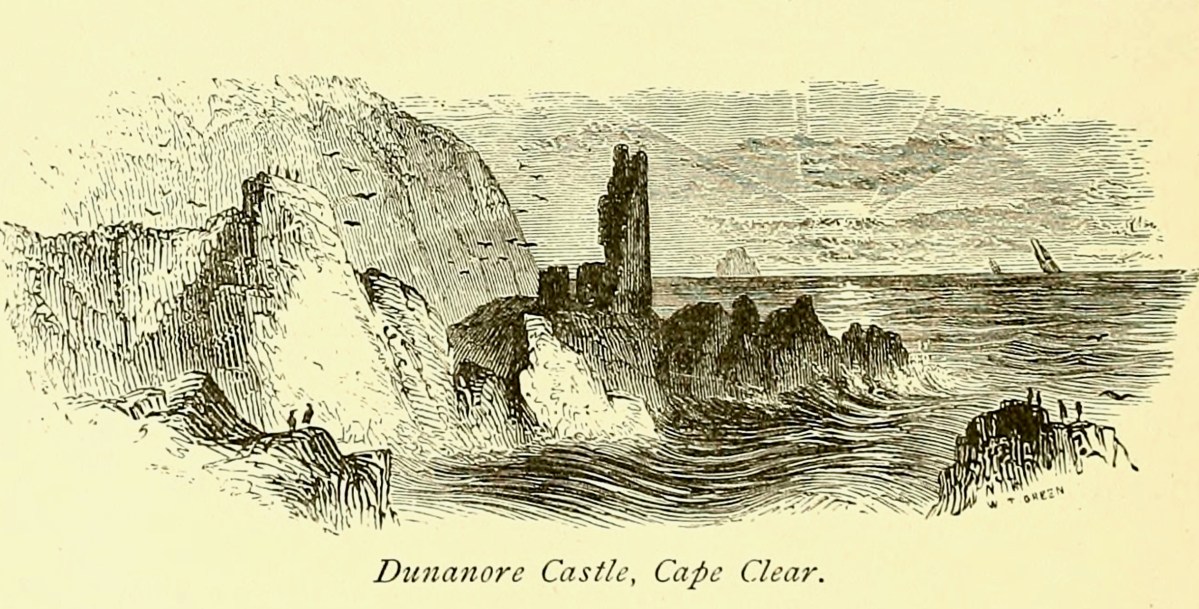
And that’s because, as you can see from the drawing by Jack Roberts at the top of this post, this castle is situated in a very perilous location, on the edge of a cliff, on a small island, essentially, making access a hazardous scramble up from a rocky beach. It was once connected to the rest of Cape Clear by a narrow causeway but this has long collapsed. It was still there in the 1770s when Charles Smith visited. In his The Ancient and Present State of the city of Cork Vol 1, he wrote:

And this brings us to the name – Dún an Óir. It means, of course, Fort of Gold, and some of the old legends about this place talk about the name coming from stories of buried treasure. But in fact, this has been the name of this fort since the first maps of this area were made in the fifteen hundreds and it speaks to the wealth of the O’Driscoll clan who built it. Remember, their other stronghold, now called Baltimore, was Dún na Séad, or Fort of Jewels (on at least one map given as Castle of Perles). On Sherkin, their castle was Dúnalong – or the Fort of the Ships – that’s it as it is now, below.

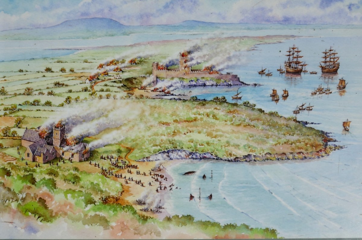
There are many accounts of their fleets of ships, and the battles they waged against the Waterfordmen in which they came out the worst for wear when Dunalong was attacked. The scene below, from an information sign on Sherkin, shows the Battle of the Wine Barrels, 1537, with both Dunalong and the Friary on Sherkin in flames

Dún means ‘fort’ but seems to be especially applied to promontory forts in the southwest. Before the castle was built, therefore, it is likely that the O’Driscolls fortified the headland, which may date well back to the Early Medieval period (400-1200) or even to the Iron Age (500BC to 400AD, or 500BCE to 400BC for those who prefer the secular version). The Illustration below is taken with permission from Dún an Óir Castle: an uncertain future, by Dr Sarah Kerr, and shows the present state of the castle, marooned on what was once a promontory connected to the Island.

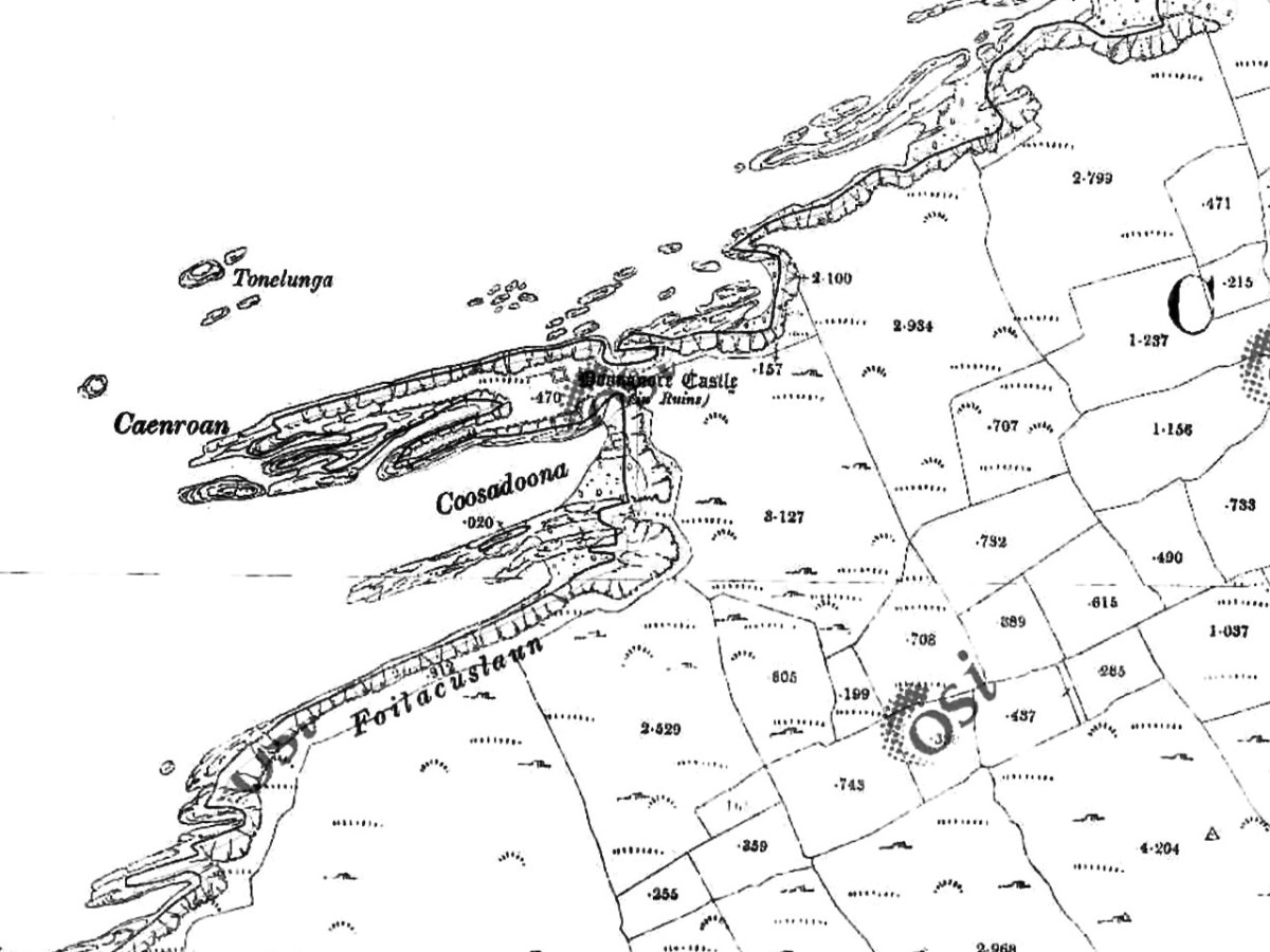
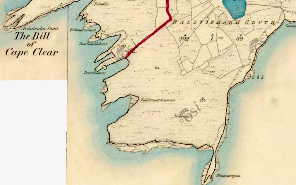
Our Promontory Fort man is Thomas Westropp (see here and here), and he wrote about Dún an Óir in his 1914-16 paper for the Royal Irish Academy, Fortified Headlands and Castles in Western County Cork. Part I. From Cape Clear to Dunmanus Bay. He visited the site, but like many a good explorer before and after him, did not venture out onto the promontory, but satisfied himself with what he could see from the high ground above it. That included the promontory and ruined castle, the rather ominously named Tonelunga (The sea-bed of the Ships), the end of the promontory called Caenroan (quay of the Seals), the inlet between the promontory and the cliffs, Coosadoona (the Little Harbour of the Fort) and the high cliffs behind the fort, Foilacuslaun (Cliffs of the Castle). All of these are marked on the 19th century twenty-five inch map.

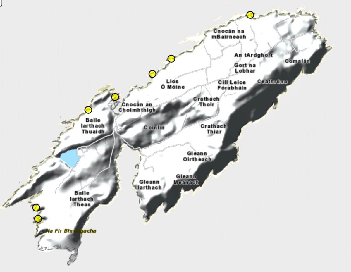
Westropp writes about Dún an Óir as one of three Promontory forts on Cape Clear Island, although in fact there are more than that, as identified by the National Monuments Record – each yellow dot below is one.

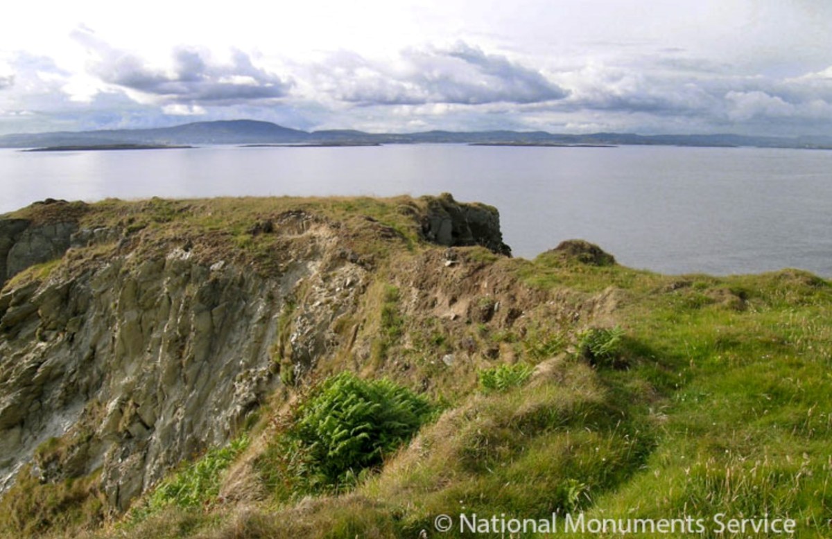
Here’s one of them (below), Lios Ó Móine (the Fort of the Meadow – lios is usually used to designate an earthen ring fort): the description and then the photo are by National Monuments Service (NMS). In the photo you can see the narrow neck of land leading out to the promontory. This is likely what the spit leading out to Dún an Óir may have looked like.

Description: In rough pasture, at the foot of a steep N-facing slope on Stuckaunfoilnabena, a headland on the NW coast of Clear Island. A narrow eroding neck of land (Wth 3m; L 15m) leads to the roughly anvil-shaped headland. Across this neck of land are the remains of three earthen banks and the shallow remains of three fosses. Further examination of the remains was not possible for safety reasons.

Curiously, the NMS does NOT identify Dún an Óir as a promontory fort – here is what it says: 

Description: The location of the tower house ‘Doonanore Castle’ (CO153-015002-) on a promontory, on the NW shore of Clear Island, suggested that it may have been built on the site of a promontory fort. However, there are no visible surface traces of an earlier defences across the promontory. The promontory is now isolated at high tide but was connected to mainland by causeway until 1831.

However, it has this to say about the earthwork identified on the high ground: 

In pasture, on a steep N-facing slope to the E of the tower house known as Doonanore Castle . . . An earthen bank . . .extends upslope in a S to SW direction from a modern E-W field boundary wall on the cliff-top at N and ends at a large outcropping rock on the edge of another cliff. This bank appears to have formed part of the defences on the land approach to the castle from the E. The bank has three contiguous linear stretches [and] there is an entrance near the N end. There is a possible hut site near the centre of the enclosed area. The short promontory on which Doonanore Castle stands is a possible coastal promontory fort.

So, as you can see, although the NMS declines to label it a promontory fort because there are no longer any signs of banks or walls, it does concede that it is possible. It also extends the defences of that fort to the higher ground above it.

Back to Westropp – He quotes:

the poem of O Huidhrin, before 1418, tells how “0 hEidersceoil assumed possession of the Harbour of Cler.” It was of some importance to the foreign traders in wine and spices, and so figures in all the early portolan maps. Angelino Dulcert, in 1339, calls it Cap de Clar ; the subsequent portolans, Cauo de Clara, 1375 and 1426 ; Clarros, 1436 ; C. d’Clara or Claro, 1450 and 1552, and, to give no more, Cauo de Chlaram, in 1490. The 0 Driscolls’ Castle probably dates between 1450 and the last date. It was probably on an earlier headland fort, as it is called Dunanore. In 1602 it surrendered without resistance to the English, who burned it.

Westropp goes on to say

Dr. O’Donovan, in his ” Sketches of Carbery,” gives a few notes on the later history. He says there was a garrison at the Castle in Queen Anne’s time, and mentions the huge iron ring-bolt, set in the rock, to which the O Driscolls formerly moored their galleys in the creek. The last is improbable, even to impossibility: no one could moor galleys in the dangerous wave-trap, open to the most stormy and unsheltered points. The islanders regard the ruin as haunted, and tell of the singing of ships’ crews in its vaults. One “Croohoor” (Conor) O’Careavaun (Heremon’s grandson) lived as a hermit there in the eighteenth century. Another legend tells how, in 1798, the inhabitants painted the Farbreag Rocks and pillars so as to resemble soldiers in uniform to keep away the French ! If any truth underlies this, it is probably based on the idle act of some revenue or other officers, in the endless leisure of their island station.

In the map above, of the southwest end of the Island, you can just make out the name Firbreaga, almost covered by the O of OSI. Fir Bréaga means The Lying Men, an apt translation given Westropp’s story. No doubt the name is older than 1798, and may refer to the cliffs at that end seeming to be less dangerous from the sea than they actually were. Note also the two yellow dots for two more promontory forts- Doonthomas (Thomas’s Fort) and Coosfoilaskehaun (the Small Harbour of the Knife-Edge Cliff).

Westropp’s description of the promontory upon which Dun an Óir sits is poetic:

The path runs up a very slight ledge, flaking away and high above the creek, along the face of a cliff of polished silvery slate. The low neck joined it to the mainland, and the nearly perpendicular strata make the dock-like creek of Coosadoona, fort-cove, to the south Beside this cove, opposite to the castle, an enormous precipice rises high above the tower top. In the other direction is a noble view across the wide, porpoise-haunted bay, and its low islands to the blue, many-channelled Mount Gabriel, and on to Mizen Head. 

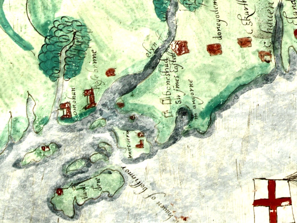
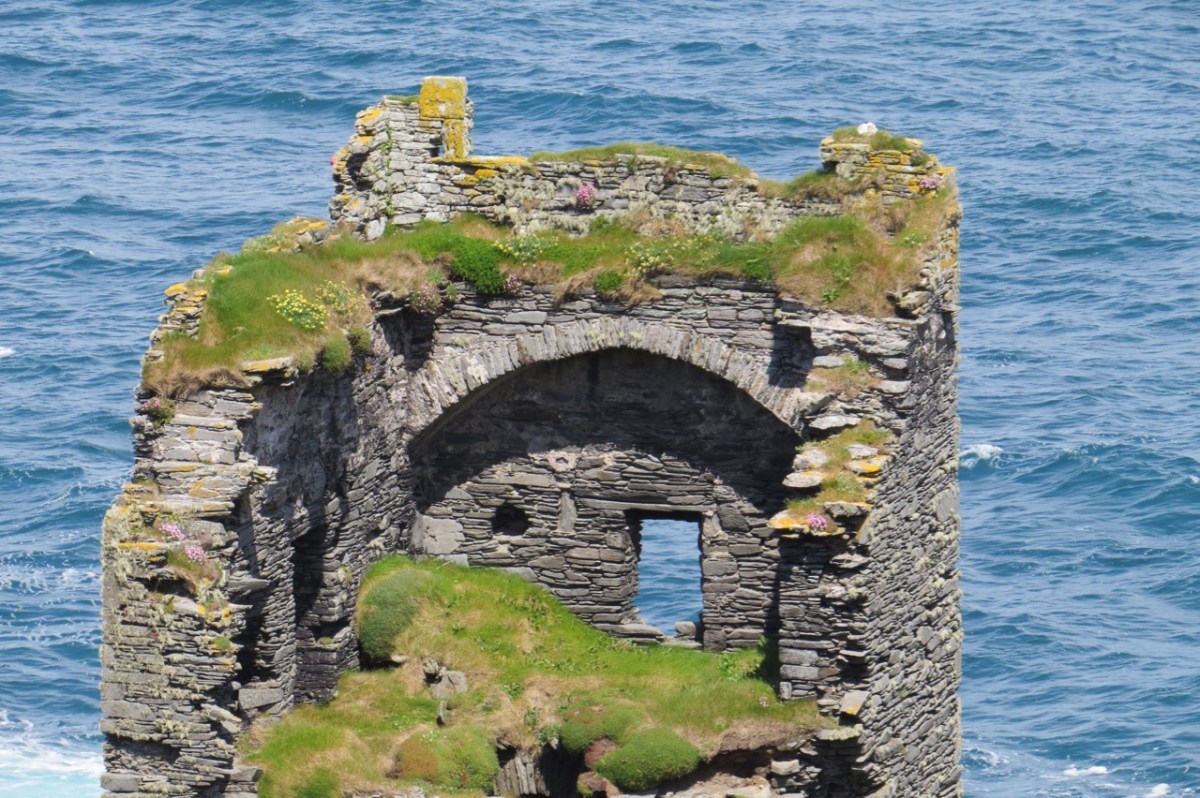
In fact, very little is known about the history of Dún an Óir before the Battle of Kinsale in 1601. We can deduce from its strategic location that the O’Driscolls used it to keep an eye on every ship that sailed in and out of Roaringwater Bay, to exact fishing dues before the rival O’Mahonys could get to the incoming vessels, to curb the power of those O’Mahonys, and to establish their dominance over the land of Cape Clear Island. (See this post for more on the map above.) Because the castle would have been rendered, probably in some shade of white or near-white, it would have been visible from all around Roaringwater Bay, and have represented a potent statement of supremacy.

After the Battle of Kinsale the Castle was seized by Captain Harvey, as described in Pacata Hibernia:

‘While these things were on doing, Captain Roger Harvy sent a party of men to Cape Clear, the castle whereof being guarded by Captain Tirrell’s men, which they could not gain, but they pillaged the island and brought thence three boats; and the second day following the rebels not liking the neighbourhood of the English, quitted the castle, wherein Captain Harvy placed a guard. At this time Sir Finnin O’Driscoll came to Captain Harvy and submitted himself.’

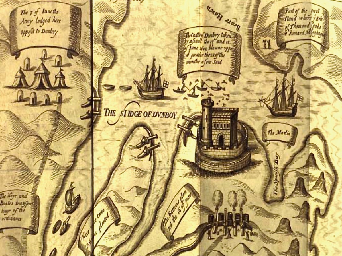
This illustration, from Pacata Hibernia, is of the siege of Dunboy Castle, the stronghold of O’Sullivan Beare, on Beara Peninsula. The destruction of Dún an Óir is described by James Burke in his article Cape Clear Island in the Journal of the Cork Historical and Archaeological Society Journal of 1908. Rather than Harvey simply taking over the castle, Burke relates the following:

Its central arch and the steps leading to its upper portion remain; but the huge pieces of its eastern wall now lying about show how severely it has suffered from the havoc of war. This wholesale destruction occurred when Dunanore Castle, together with the island, was captured on the 22nd of March, 1601, by Captain Roger Harvey, following on the defeat of the Spaniards at Kinsale. By means of the artillery he planted on the high ground adjoining it, he battered down the eastern wall and compelled the garrison to surrender, for which and other services (as Dr Donovan writes in his “Sketches of Carbery”) he was granted at the time a commission by Lord Deputy Mountjoy as Governor of Carbery.

It is far more likely that the ruined state of the castle is a result of the natural passage of time than the ‘havoc of war.’ For one thing, it would have been a monumental task to deploy artillery overland on Cape Clear. Any cannon fire would have come more naturally from the English warships we know were in use during this period and therefore, the damage would have been to the seaward side of the castle – but this side is actually intact.

A romantic view of the ruins of Dún an Óir above, by W Willes.* Next week we will look at what is left of the castle and what we can tell from that. I’ll be using the marvellous photos from Tash in that post.

*From: Picturesque Ireland : a literary and artistic delineation of the natural scenery, remarkable places, historical antiquities, public buildings, ancient abbeys, towers, castles, and other romantic and attractive features of Ireland, by John Savage, 1885.

The Castles of West Cork – a New Menu Page

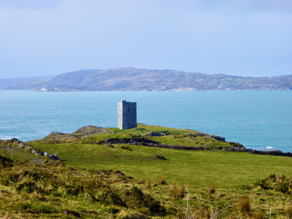
I’ve been working on a post about one of our storied and stunning West Cork Castles. That post will come next week but, spoiler alert, it’s located on Cape Clear Island.

But as I wrote it struck me that we could do with a specific Menu Page all about castles because we have written so many posts about them and those posts are buried in various paces on our All Pages -Navigation. So here it is – our new Menu Page devoted to The Castles of West Cork. As with all out Navigation pages, you can access it by clicking on the three-bar icon in the banner photo at the top of the blog.

I’ve divided it into a few sections, starting with defining our terms – while archaeologists use the term ‘tower house’ to denoted the tall, rectangular stone towers built here mostly in the 15th and 16th centuries, we just call them castles. Thickly ringing the coastline, and slightly sparser inland, they were potent symbols of the power and wealth of the Irish families and their chieftains who held sway in West Cork – the McCarthys, O’Mahonys, O’Driscolls and O’Donovans.

There’s a special section devoted to the Castles built by the O’Mahonys in what used to be called Ivaha, but is now commonly known as the Mizen Peninsula. We’ve visited them all, and provide as much information as we can of both the history of each castle and how they were constructed.

We’ve also written about non-Ivaha castles: the magnificently reconstructed Kilcoe, the lovingly restored Rincolisky, and Castle Donovan, stabilised by the OPW.

Finally, two posts: one about what followed the tower houses (fortified manors like Coppinger’s Court below) and one about an Anglo-Norman masonry castle in Liscarrol – a jaw-dropping keepless Castle which nowadays houses cattle (final photo).

With well over 1000 posts stretching back ten years, we keep trying to simplify navigation on our site. We hope this new page helps.

In High Places

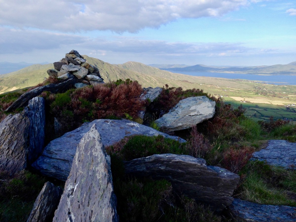
Here is a collection of photographs taken in West Cork from some of the high places: ridges, peaks, mountain paths. The pics were all taken around ten years ago, and haven’t been used in our blog posts previously. They serve to show stunning landscapes, of course, and hopefully illustrate the variety of the country which surrounds us here. The header is taken from the peak above Three Castle Head.

The upper pic is looking down on Bantry town from the high ground to the south, while the lower one reminds you of the evening view from Bantry at sea level.

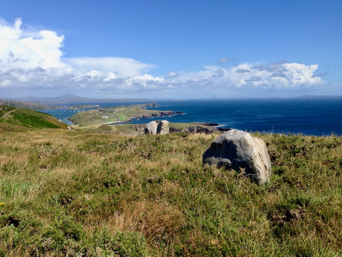
If you leave your car at Galley Cove Beach and walk up the steep track towards Brow Head you will come across this enormous stone row – and you will look back to the peninsula of Crookhaven. Don’t be fooled by the stones: they have been placed on this site fairly recently. They are impressive, nevertheless.

And here is a closer view of Crookhaven.

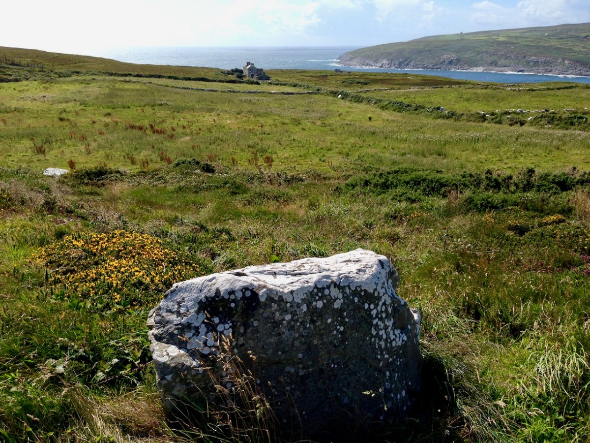
While turning from this spot and looking west, you will see the end of the coastline at Brow Head. This stone is likely to be more anciently placed. In the distance is Mizen Head with its Napoleonic era signal tower at Cloghane.

Contrasting light effects seen on the footpath that follows the ridge on the Sheep’s Head Way. That’s the spit of land that runs from east to west between the Mizen Head and the Beara Peninsula. There are cairns on the summits, with the remains of a wedge tomb and a Marriage Stone to be seen along the way.

The view north from the heights of the Sheep’s Head takes in the Beara Peninsula and – seen above – the high point of Hungry Hill dominating the distant rugged landscape.

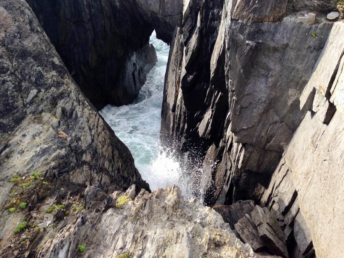
You are never far from the coastline in West Cork. Look out for wild seas constantly sculpting the rocks over millennia.

From our home in Cappaghglass we look out to our own ‘high place’ – Mount Gabriel. This enigmatic tract of land dominates the area and is imbued with legends and folklore. It is also one of the most atmospheric of our peaks at all times of the year.

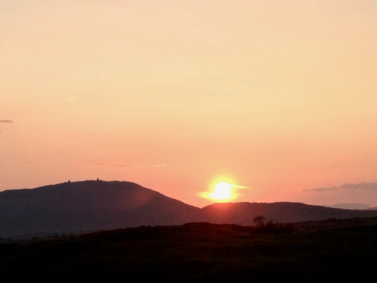
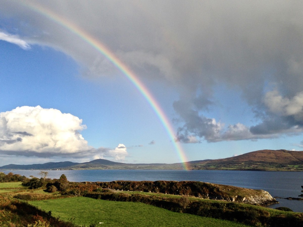
Another local view for us (above): we face out to Rossbrin Cove on the Mizen Peninsula. Finally, the celestial spectacle (below) finds its pot of gold on the shores of the Mizen.

Derrynablaha and its Rock Art

A bit of a nostalgia trip for Finola and me this week: we spent a couple of days in Kerry and dropped in to Derrynablaha – the iconic valley which has some of Ireland’s most notable Rock Art. These stones were carved on natural rocks on the hillsides many thousands of years ago. To this day, we don’t know what they signify.

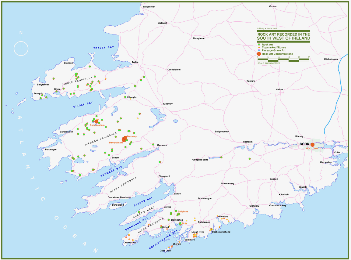
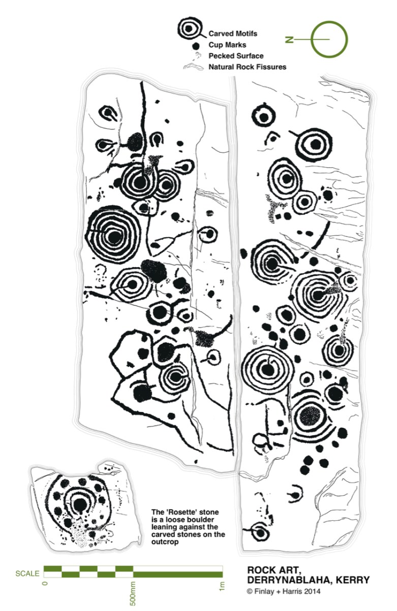
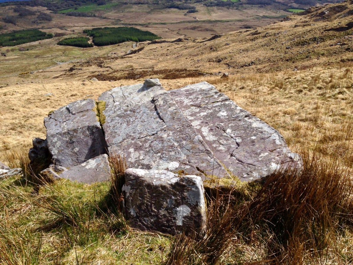
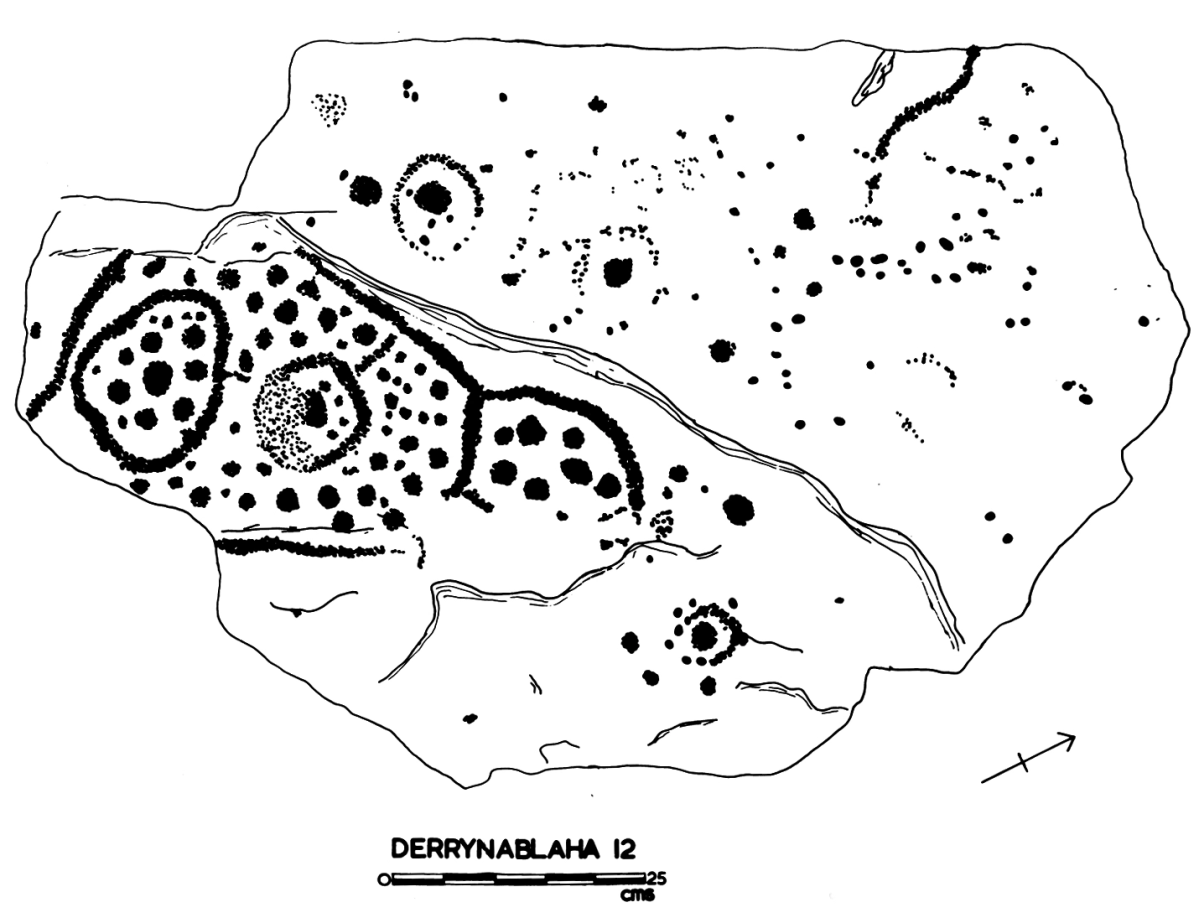
Some years ago, Finola and I organised exhibitions showing examples of Rock Art – many taken from Finola’s 1973 University of Cork thesis. The map above was drawn for the exhibitions: you can find Derrynablaha in the centre of the Iveragh Peninsula, left of centre. Below is a rendering of Finola’s thesis drawing showing – arguably – the most significant piece of Rock Art on this island:

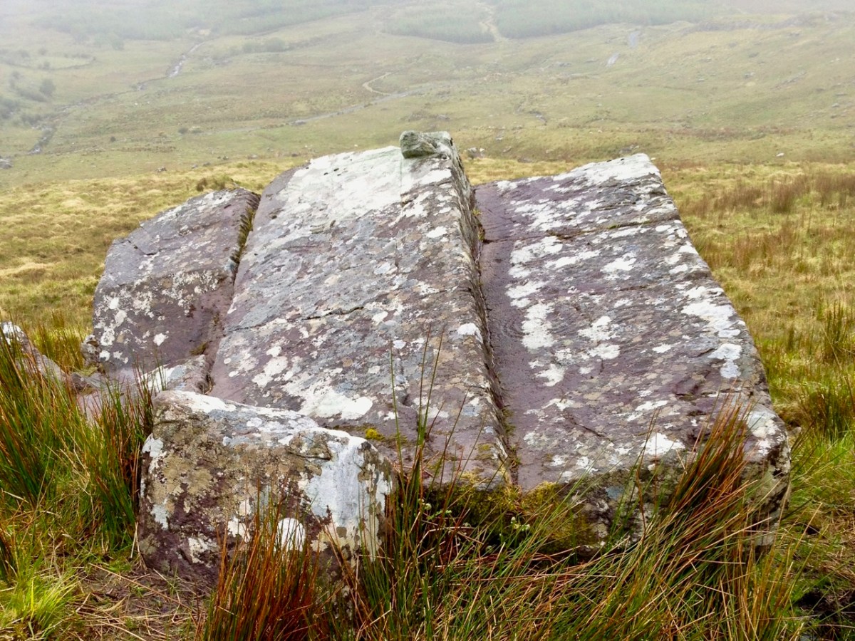
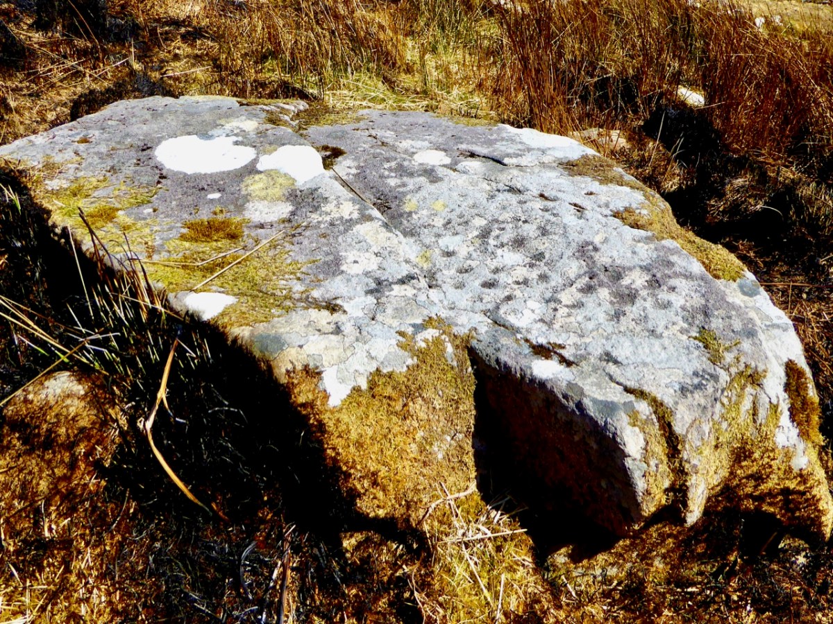
Here’s a photo of these rocks which I took on my first visit to this valley, in 2012. It was a dull day! The next photo was taken on a better day three years later. This shows how weather conditions can affect the way that Rock Art motifs are seen:

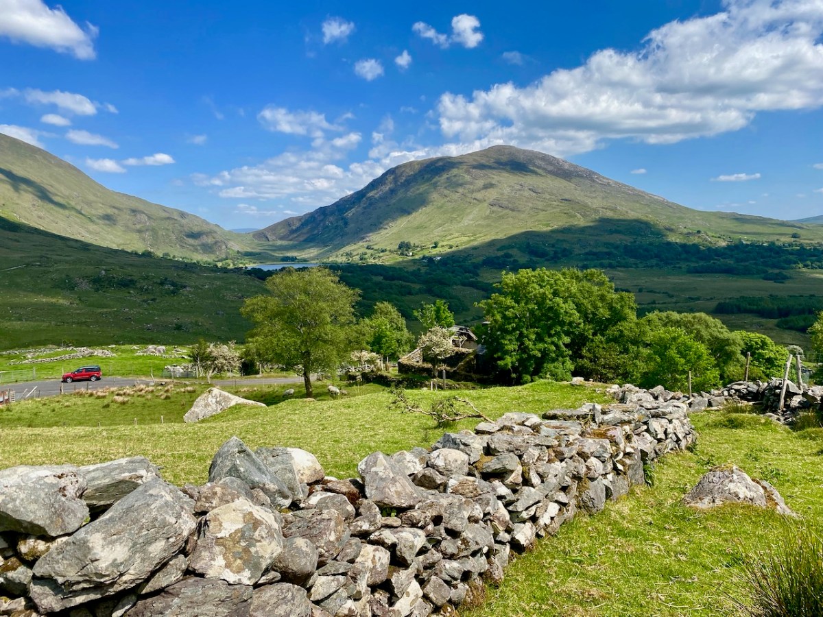
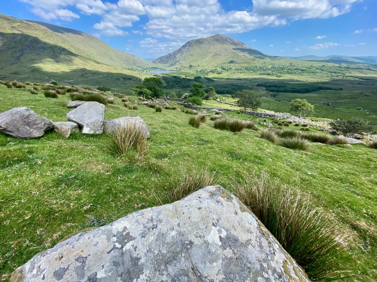
On our most recent visit – last week – we didn’t have time to scale the steep hillside to view this rock formation, but we enjoyed just taking in the stunning landscapes of the townland.

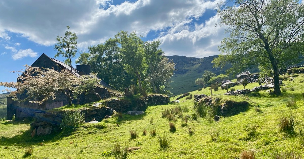
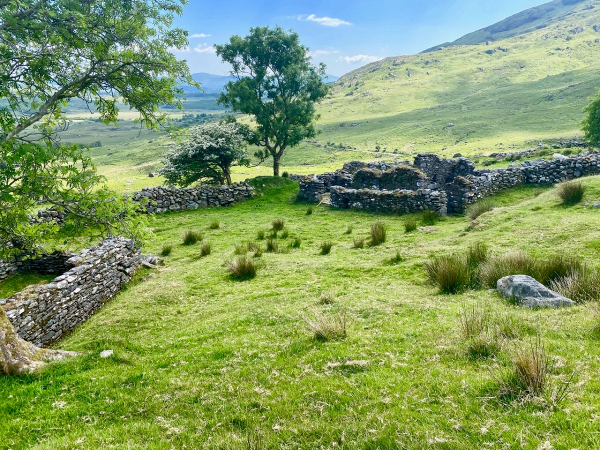
Above, and in the header picture, you can see the ruin of the cottage, which was once the only dwelling in this valley. It was still lived in when Finola visited to carry out her survey of the Rock Art in 1972 – fifty years ago. Then it was occupied by John O’Sullivan and his sister, May. John’s brother – Daniel – discovered much of the Rock Art in the surrounding landscape and reported this in the 1960s to Michael Joseph O’Kelly, then Professor of archaeology at UCC, and his wife Claire. Subsequently the O’Kellys made some expeditions to Derrynablaha, as did the Italian rock art expert, Emannuel Anati. Daniel had died prior to Finola’s visits and she recalls that the remaining family were excellent stewards of the Rock Art, ensuring that it was preserved and not damaged. She has ‘hazy memories’ of being brought into the house and given cups of tea and brown bread.

After we had published earlier posts about Derrynablaha, Finola was contacted by Faith Rose – the great niece of the O’Sullivans who lived in this cottage in 1969: Faith had visited the valley in that year. She recalls:

. . . I remember their bedroom was downstairs, the staircase to the upstairs being unsafe. There were none of the usual services in the house. There was an old fashioned fireplace where you could cook with a settle at the side. I seem to remember being told it had been built under some government scheme and the original stone farmhouse was to be seen slowly returning to nature close by. I wonder if you recall any of this. My great aunt and uncle were shy people who extended us the best hospitality. To my sister and I it was a magical place, but the hardness of their lives there was clear . . .

Faith Rose 2021

There are the ruins of several other buildings set within this landscape, indicating that the settlement was once significantly more populated in earlier times. Now it is wildly lonely, but impressively beautiful. When Finola carried out her surveys, she recorded 23 pieces of Rock Art. Today it is recognised that there are 26 known examples, with a further 7 stones in the adjacent townland of Derreeny. Long term readers of this Journal may recall that we visited the townland in April of 2015 – together with a small group of enthusiasts – to seek out all the known examples. At that time Ken Williams was using techniques he had developed to photograph the carvings in fine detail. These employed several portable light sources. The following sequence shows one of the rocks (number 12) taken without lighting; Finola’s drawing traced in 1972; then Ken’s technique in action and his results, which are remarkable:

Once again you are reading about the Rock Art at Derrynablaha! There have been several posts on this subject over the years, but we make no apologies: we never tire of the beautiful landscapes of Kerry – and we have seen it in all weathers. It would be good if we could be closer to solving the meanings of these rock carvings; this is unlikely to happen. Over the last 300 years since the phenomenon was first recorded in Ireland (and Britain, and many other places in Europe and the world) there have been varying theories – dozens – put forward for its existence: none of them is conclusive. Think on . . .

The Antiquities of Bealad

There’s an area of West Cork bounded on the south by Castleventry and on the north by Ballinvard. In between and round about there’s Bealad, Rossmore and Caherkirky. This is the territory into which we were inducted by Dan O’Leary and Sean O’Donovan, this week. It’s like a fellowship – people who are passionate about local history find each other and it’s only a matter of time before we start talking field trips.

Dan and Sean had organised the whole thing – including the all important coffee and food and bathroom breaks. Our headquarters was the old National School in Bealad, now wonderfully re-purposed as a community hub – a lesson in how to do this for others with such buildings on their hands. We started with an overview of local history and then it was off to Castleventry. 

Amanda is, as you all know by now, the expert on Holy Wells (book will be out soon!) and the first time she and I visited this well, several years ago, we met Sean, who was restoring it. You can read all about that here, and more about the well itself. All are invited to the annual celebration at the well, which takes place on June the 4th at 8pm (after milking).

Just up the road from the well is the Castleventry graveyard and ring fort. An extraordinary site by any standards, this site encompasses an impressive bi-vallate ring fort/cashel, and a ruined ‘something’ within, as well as a graveyard. 

This was obviously the residence of a high-status individual – a chief of a local Clan. The banks and ditches are deep and would have represented a formidable fortification, along with a palisade fence on top of the inner bank. The photo below gives some idea of the depth of the ditch that separates the outer and inner banks. There are commanding views across the country in all directions – nobody seeing it would have been in any doubt as to the importance of the occupier. Souterrains, no longer accessible, were found within – see Robert’s post about Knockdrum Stone Fort for a similar type of fort and souterrain.

But it was the church within that presented an interesting challenge! According to its listing, this is the medieval parish church of Castleventry, already in ruins by 1615.

A screen shot of the relevant page in Clerical and Parochial Records of Cork, Cloyne, and Ross, by W Maziere Brady.

One of the participants on the field trip was our friend Con Manning, a distinguished medievalist and archaeologist, now retired from the National Monuments Service. Con was immediately struck by a couple of things. First, it’s unusual to find a church in a ring fort, and second, it just didn’t look like a church to him – in fact it looked more like a tower of some kind. Not a tower house, but perhaps a small Anglo-Norman keep.

There are no examples in West Cork of such keeps – the Castle at Glanworth, north of Fermoy, would be the closest example to an early Norman masonry tower. When Fineen McCarthy defeated the Anglo-Normans at the Battle of Callan in 1261, it is said he rampaged through West Cork, burning and destroying every structure they had built – which would certainly explain their absence. 

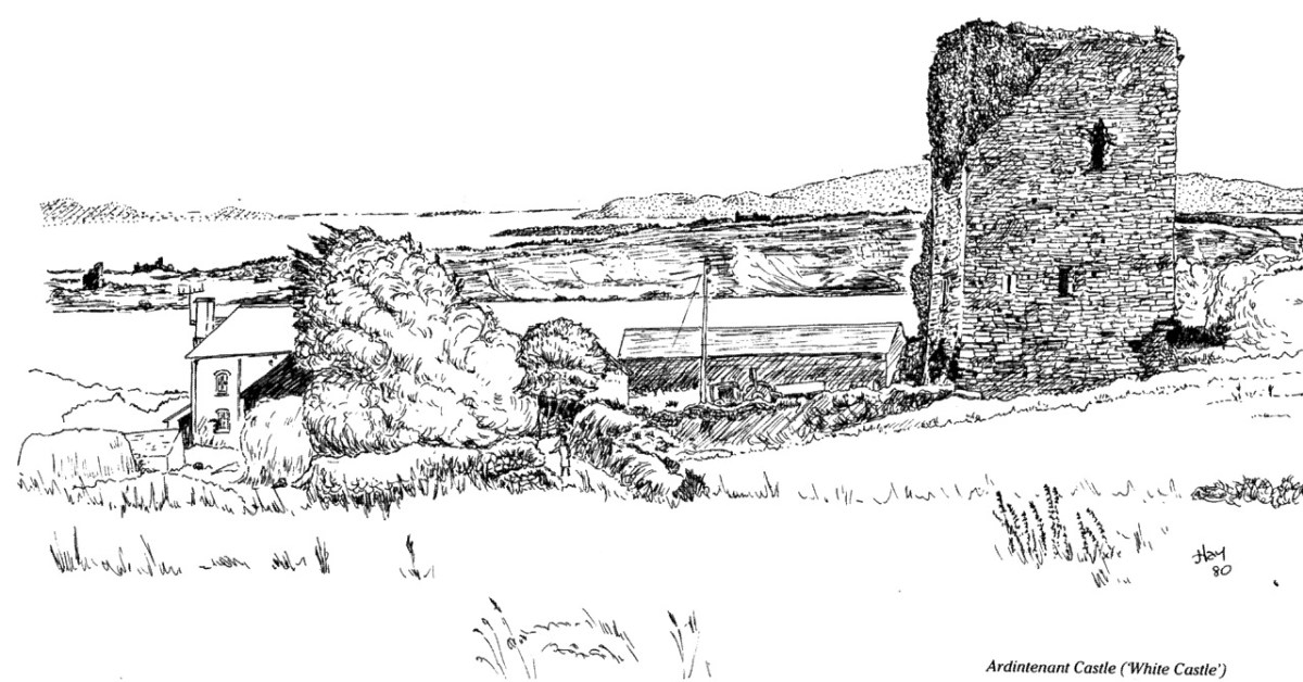
But – what if this one survived, or survived in part? What if it was taken over by the local Irish chief – there are certainly precedents for them building their tower houses inside ring forts, we have only to look at Ardintenant for that. What if, over the centuries, in its ruinous state, people took it that it had been a church? There was a medieval Castleventry church – Brady’s listing shows it clearly – but was this it? Also, Brady calls it Castrumventry and the word Castrum is applied to castles – the closest castle to here is 5kms north at Ballinvard (we’re coming to that). The Irish word for Castleventry, according to the sign at the entrance is Caislean na Gaoithe – Castle of the Winds.

Here we are at this puzzling site: Robert, Sean, Dan, Una, Amanda and Con

So many questions! Con is continuing his investigations, raising even more intriguing possibilities about the site and so we may revisit this one at some time in the future.

From Castleventry we travelled on to Ballinvard Castle, just outside Rossmore, where the owners, Pat and Mary Daly had kindly agreed to meet us and show us the castle, which is in a working farm and not normally open to visit. In the last few years, the ivy has died back due to heavy frosts, and this has allowed a clear view of many of the hitherto-obscured features of the castle. Once again, we were grateful to Con’s expertise as he pointed out various aspects of the building that placed it in the 16th century – a castle of the Hurley (Ó Muirthile) family.

One of those was the workings of the Yett, an iron grill that sat outside the main door and could be closed from inside by way of a hole of the doorway through which a chain was pulled tight from a room inside.

Here’s a illustration of how it works. You can see the same Yett hole at Castle Donovan, which has many features in common with Ballinvard. 

Dan had one surprise for us – he brought us to the townland of Caherkirky, to a double boulder burial with a very tall standing stone. In a previous visit to this site he thought he detected cupmarks – and he was right! There was one on the boulder burial, and several on the standing stone. See Robert’s post today for another example of the same kind of monument. It was a good feeling to be back again with my beloved rock art!

Knowing my penchant for popping into every church I pass, Dan’s final treat for us was the church in Rossmore, but this time, instead of the stained glass, what he wanted me to see were the Stations of the Cross. Obviously Italian, they were painted, and the artist had let his/her imagination take flight on the costumes – more like Spanish grandees than the biblical characters we’re used to. Not like any I had ever seen before and a real surprise.

Thank you, Dan and Sean – it was a great and eclectic day, and who knows what will come out of Con’s close examination of Castleventry – stay tuned!