The Marvel of Margaret Barry

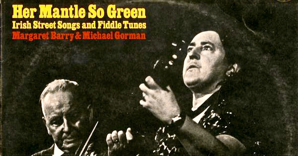
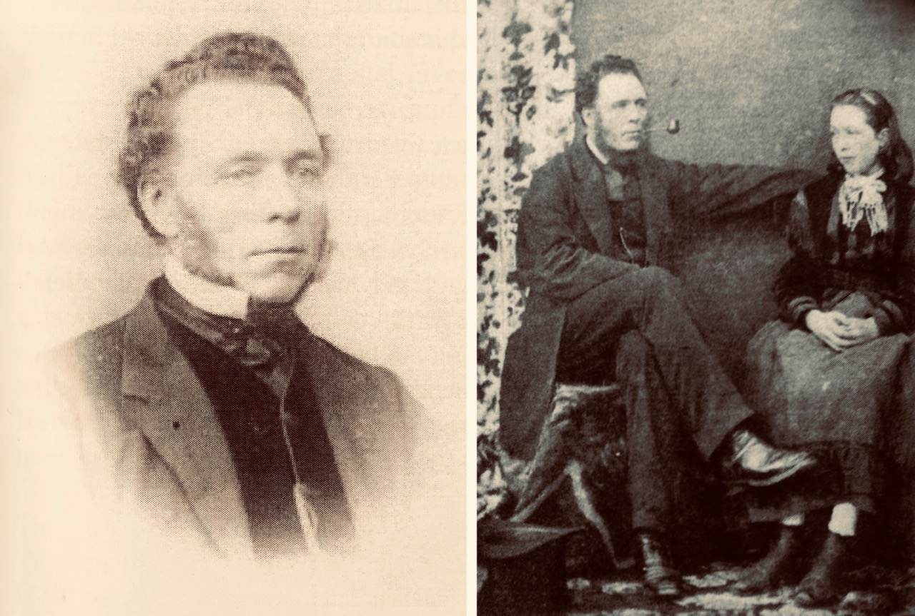
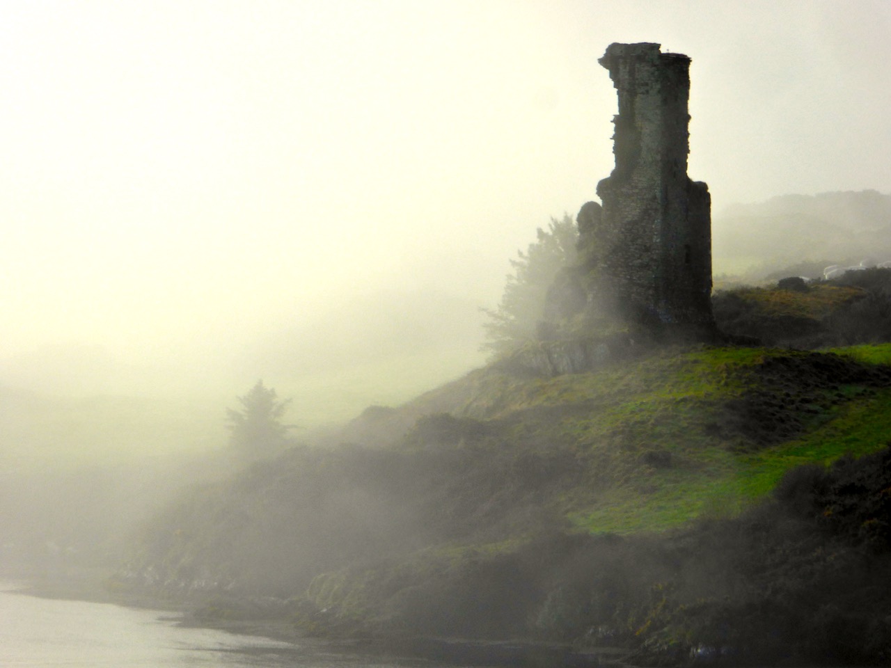
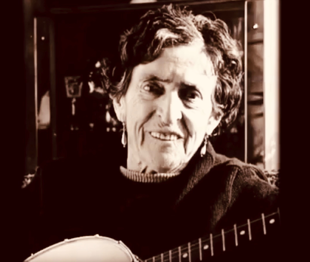
When I was in my college years, I lived on the fringes of London. It was the 1960s and – among many other cultural stirrings – there was a burgeoning Irish traditional music scene, in and around Camden Town. The Irish community in the capital had been thriving since the 1950s, when London was being rebuilt following the Blitzes of the recent war. Although not a close follower of Irish music at that time I had taken up the squeeze-box, and, curious enough to hover at the edges of The Music, was fortunate to briefly encounter many singers and players who are now considered legends. One of these is Margaret Barry, seen above in her later years and, below, when she was first becoming established as an Irish traditional music performer.

If you ever saw (and heard) Margaret Barry, you would never forget her. Her voice is unlike anyone else’s. She was born in the City of Cork, and has the distinctive accent of that place, whether she is speaking or singing. I find it completely compelling, but I can understand that it’s not to everyone’s taste. Nevertheless, whatever your own views, her story is fascinating – and at the same time a valuable social commentary on aspects of twentieth century Ireland. Margaret was born in 1917 – on New Year’s Day – and died in 1989. She made a living from music – and spanned the spectrum from obscure street performer to lauded professional much in demand on radio and television, performing in venues which included London’s Royal Albert and Festival Halls and New York’s Rockefeller Centre.

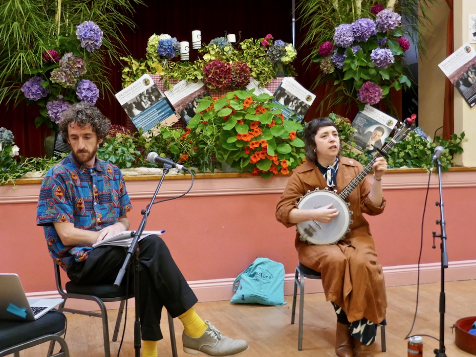
The reason I’m writing about Margaret Barry today is that she was the subject of a talk given at this year’s Drimoleague Singing Festival: “…A celebration of the human voice in the heart of West Cork…”, now an established annual event held around the feast day of Cork’s patron saint, St Finnbarr, September 25th. It’s great that Ireland’s special saints – who ‘kept alive civilisation’ during the otherwise Dark Ages in pre-medieval Europe – are still living and celebrated in traditional culture, which encompasses literature, art, music and folk tradition. Yesterday’s talk, in a crowded hall, was presented by Jason Murphy and Lisa O’Neill (pictured above mid-talk, with Lisa – Singer in Residence at this year’s Festival – giving her own extraordinary rendering of one of Margaret Barry’s songs). It’s worth watching the following YouTube video of Lisa singing a version of ‘The Galway Shawl’ to give you an idea of Margaret’s characteristic style as interpreted by Lisa, and sealing her own authority on the perpetuation of The Music:

Because Margaret Barry is a legend, it’s inevitable that the life and exploits of this lady from Cork have become imbued with folklore. This can happen very quickly in Ireland! Jason – a radio documentary maker – and Lisa – who has studied Margaret’s work – set out to shed light on the reality of her life, times and travels. The talk is work in progress – look out for a comprehensive programme coming up on RTE Radio soon. The talk in no way diminished Margaret Barry’s status and renown in the folk music world, but it did question some of the hitherto accepted accounts of her life. For example, when I first became interested in her singing over fifty years ago, I gleaned (mainly from notes on the sleeves of LPs) that she was from travelling stock, and that’s something you’ll still find quoted in practically every contemporary account of her life. According to Lisa and Jason, however, she came from musical families in Peter Street, Cork. Her mother’s father – Bob Thompson – was an accomplished uilleann pipe maker and player who was married to a Spanish Guitarist and singer. Living through hard times, Bob had to temporarily pawn his own uilleann pipes but lost them when a fire broke out in the pawnshop: he did not play again for ten years! Margaret’s parents and uncles were street singers and musicians, her father earning a precarious living playing the violin in silent-era cinemas and with dance bands. 

Another invariably quoted story is that she left home at 16 with nothing but a bicycle and a banjo tied to her back with string as she set off to busk her way through the harsh streets of Ireland. It’s an engaging picture, but probably simplifies a complex situation. Margaret’s mother died when she was only twelve years old, and soon afterwards her father married a girl not very much older than she was. It’s likely that she did decide to go off and fend for herself – and during her lifetime she did travel around Ireland, sometimes in a horse-drawn caravan, but she had also become interested in the musical traditions she experienced around her and took every opportunity to learn songs from every source, to teach herself to play the fiddle and banjo – and also to use her own talents to earn money wherever she could, and to survive. Here’s her own account of those times, recorded by American musicologist Alan Lomax in the 1950s:

Alan Lomax left a valuable collection of information on ethnic musical cultures from America, Africa and Europe, which he and a dedicated team collected over many years. Much of the collection is available online in the archive of the Association for Cultural Equity. Amongst the publications of the Association is a CD of Margaret Barry singing and talking about her life, which can currently be purchased as a download.

Margaret succeeded in her chosen life of itinerant song performer and always said that she had enjoyed it, regardless of the often hard times. She certainly achieved notoriety and featured in programmes on TG4 and RTE in her lifetime. She had a long-term relationship and musical partnership with the Sligo musician Michael Gorman, whose fiddle playing features on many of the recordings made of her. It seems appropriate to include here this 1965 recording of Margaret accompanied by Michael, singing ‘Still I Love Him’:

The talk we heard in Drimoleague on Saturday was a tour-de-force by Lisa and Jason, reviving my own interest in Margaret Barry, the ‘street singer’ from Cork (also known as ‘Queen of the Gypsies’, a title she was happy enough to embrace, whatever the true circumstances of her ancestry). To finish this post, here’s one of her songs for which she is, perhaps, best known: ‘She Moved Through the Fair’. Margaret was once asked if this tune had come to her from her traveller background: she is said to have replied that she had learned it from a recording of Count John McCormack…

Mine Ghost

My name is Thomas – William Thomas. When I’m at the mines they call me Captain Thomas – because I’m in charge! I’m visiting some of my old ‘haunts’, and thought you might join me, to see what a working day was like in ‘ . . . one of the wildest districts in the United Kingdom . . . ‘ – Gortavallig, on Rinn Mhuintir Bháire. I know you call this place The Sheep’s Head now: that amuses me. I’m always trying to pick up on the Irish words – it’s such a poetic language. My grandfather was a natural Cornish speaker, but the language was gone by the time I was born – it’s only used by the Bards nowadays.

That’s my house – above – in the townland of Letter East. That’s where I stayed with my family when I was Captain at Gortavallig. It was rough going when I had to get to the mine – a solid hour’s trek across rough country, and the same back again. As part of the work that we did while developing this mine we built a good ten miles of road, which helped with communications in that untamed north-coast country.

Come with me now on the way that leads down, firstly, to the cove at Bunown in Eskraha townland: there’s a slipway there, and a house where my assistant Superintendent, Mister Bennett, lodges. It was once a coast-guard station. This cove has also been the scene of some tragedies in your own time. There was the writer, James Farrell, who drowned while fishing off the rocks there in 1979. He’s buried beyond by the church of St James in Durrus, looking out forever over Dunmanus Bay. The sea is a dangerous element: I know, because I’ve had to work with it. But it’s your friend, as well as your foe. If it wasn’t for the sea we would have no chance of transporting ore from the remoteness of Gortavallig.

The rocks at Bunown – on a good day! James Gordon Farrell is buried facing the water of Dunmanus Bay at St James’, Durrus

They say that, wherever you are in the world, if there’s a mine – or even a hole in the ground – you’ll find a Cornishman at the bottom of it! That’s because pulling the metal out of the ground – and from the cliffs – and even from under the sea – was our lifeblood in that far western peninsula. But the land was ravaged. This scene (below) is where I grew up and learned my trade: Dolcoath, near Camborne in Cornwall, in its heyday one of the busiest mining areas in the world. My father James was agent there and I enjoyed ‘ . . . a liberal education and had the very great advantage of being taught dialling and the whole routine of the profession by the most eminent miners of the day and worked for several years as a tributer – an admirable practical school . . . ‘

I was pleased to get away from the noise, the grime and the stench of that place when I was called to Ireland with my own family in 1845, firstly to Coosheen on the Mizen – where I revived an ailing venture by successfully rediscovering the copper-bearing lode. After that I came here to the Sheep’s Head where the surveyors, travelling on board small inshore vessels, could see promising ore-bearing strata on the cliff-faces which were being eroded on this coastline. My job was to work those veins – a gargantuan one bearing in mind the uncompromising nature of the landscape and the remoteness of the geography.

Looking back across silver waters as we walk together on the rough pathway to Gortavallig: nature has been tamed by the fields that go down to the coast west of Bunown, whereas the way to the east is across rough, wild country

If you follow this path with me you will have to have good shoes and a steady gait, and the will to clamber upwards and downwards on sometimes steep and rough rock faces. But you will be rewarded by the remarkable vistas and the untamed surroundings. Your only companions will be the choughs: these sleek red-billed birds are a comfort to me as they have always been a symbol of Cornwall, sharing pride of place on that county’s coat-of-arms, together with an image of the Cornish miner! Did you know that the chough is the embodiment of old King Arthur, who is ready to rise again and save our nations in times of trouble?

A chough espied on our walk to Gortavallig, and the Coat-of-Arms of Cornwall which is shared between bird, fisherman and miner

After a vigorous hour’s trekking over the rough terrain we will catch our first glimpse of the mining works at Gortavallig: a row of small stone cottages perched on the cliff-top. This is known today as the Cornish Village, although it wasn’t just Cornish mine-workers who lived here. Good, strong Irishmen came to the place and earned their keep, and everyone here had to pay rent for the single-roomed lodgings. If there had been windows on the seaward side of these dwellings they would have enjoyed magnificent views, but we were more concerned at keeping out the extremes of the weather, and the few small windows only faced inland. There was plenty of ocean to be seen while you were working your hearts out to extract the minerals!

‘Cornish’ cottages close by the mine workings at Gortavallig

Once we have passed by the cottages we find ourselves traversing a sheer cliff edge. Below us the sea roars, but it’s down there that we built two quays, one 73 feet long and 40 feet high, the other 92 feet long and 36 feet high and, at the base of the cliff, a dressing floor 180 feet long and 50 feet wide, while above it we put in a stone dam and sluice so that we could wash the ore. Water was such an important element to us: in Cornwall we used its power to turn wheels and drive machinery such as crushers. We were never short of it here in Ireland.

Hold on to that rope or you might go over the edge!

Now, of course, on an idyllic day of blue sky and sunshine, you couldn’t find a place more picturesque, peaceful and redolent of nature’s beauty, but imagine what it was like in my time when men, women (we called them Bal Maidens in Cornwall) and children laboured long hours to bring out the precious ore and break, dress and prepare it for market: there was always the movement of ropes and machinery as trucks were pushed out of the mine-galleries on the rail-way, and figures constantly toiled up and down the precipitous rough stepways to and from the quays so far below. Although built in as sheltered a position as possible, they were constantly battered by heavy swells and breakers. In fact, they have now disappeared altogether.

Finola braves the cliff edge to get a view of the site of the old quays below, accessed by the rough and steep stone lined path

If we go up to the hillside above the mine workings we can look out over the reservoir, and we can also see the fenced-off openings of shafts. Most of the engineering took place, of course, underground: hard work in restricted spaces. We did our best to ensure safety, but there were accidents.

A lot of people have said that our mine was a ‘failure’, but I wouldn’t necessarily share that view. In May 1847 I presented my first report to the directors of the company:

. . . We have set bounds to the Atlantic waves, for though they lash and foam sometimes over craggy rocks, our works have withstood the furious storms of two severe winters. A complete wilderness and barren cliff, which had been for past ages the undisturbed resort of the Eagle, the Hawk and Wild Sea Bird, has by our labours for the past 16 months been changed into a valley of native industry, giving employment, food, and comfort, to numbers of the hitherto starving, but peacable inhabitants. We have in the course of 16 months, with an average number of 24 miners, whose earnings ranged from 9 shillings to 12 shillings a week, explored 174 fathoms of ground. We have also employed about 26 surface men, at the rate of 10 pence and one shilling a day . . .

In May 1848 the SS William and Thomas collected 88 tons of copper ore from the quay of our mine at Gortavallig. It sold for £269 14s in Swansea. Yes – it was the only shipment that the mine ever exported, but it gave employment and food to families in one of the remotest areas of the West of Ireland during the ‘Great Hunger’. In my time at Rinn Mhuintir Bháire I was able to set up – at my own cost – the Coosheen Fishery Association over on the Mizen, which also helped with food production through those bad years. With my brothers Charles and Henry, and my son John, we helped to bring industry to the remote fastnesses of West Cork and Kerry – including the mine at Dhurode, on the Mizen. I feel satisfaction that our lives have benefited our neighbours here in these far western peninsulas which bear such a similarity to our own native Cornwall . . .  Now you will want to return to civilisation: thank you for your company and mind your step – I think I’ll rest a while here pondering on old times with my pipe and tobacco.

Captain William Thomas possibly in 1843 (left) and right, with one of his daughters in 1852. The latter photograph was taken by Hastings Moore in Ballydehob

From the Skibbereen Eagle, 7 June 1890:

Died, May 22nd at Coosheen, Schull, William Thomas, of Bolleevede, Camborne, Cornwall, aged 82 years, manager of mines in Cork and Kerry for nearly 50 years. He truly believed in Irish men and Irish mines. He wrote and spoke on their behalf to the utmost of his ability . . .

Two Mines Are Better Than One (Mizen Magic 16)

I was actually in search of a nineteenth century Protestant clergyman, not expecting to find this remote and beautiful valley. But Robert is also writing about nineteenth century mining today – hence my title.

Dhurode mine on the far north shore of the Mizen Peninsula was established by the Rev Robert Traill (above) in 1843. I’ve written about Traill in my series on Saints and Soupers. He featured largely in the episode on tithes, and again for his heroism at the height of the Famine. He deserves a post of his own and that will come. Besides everything else, he was obviously an entrepreneur. He joined forces with a navy man, Captain Forster, to establish in 1843 the Consolidated and West Carbery Company.

This is what you can see from the road: the powder house is silhouetted on the horizon. The ruined building in the foregound may relate to the water wheel and stamps

The Metal Mines of West Cork by Diane Hodnett is my chief source of information for a lot of what follows about the mine. It’s an outstanding book of scholarship and a, er, mine of information (sorry). She writes : In June of that year [1843], an adit had been started on the course of the lode, and driven over 180 feet, with a whim shaft sunk down to it. By June the following year, Dhurode Mine had sold 97 tons of copper ore at Swansea, and received £331 4s in payment.

There’s a great description of the mine from April 1846 in Diane Hodnett’s book. The potato blight had first hit the previous autumn, but most people had managed to make it through the winter and the full horror of Famine in the Mizen had still to dawn. A man called St Pierre Foley had visited the mine and this is what he saw:

Dhurode is about four miles NW of Crookhaven. It is situated on Dunmanus Bay, placed amphitheatrically like, and is now well studded with neat slated cottages, built for the use of miners employed in the works. The Manager is Henry Thomas. Ore: yellow copper pyrites and is variable in its assay. There is a good horse whim erected for drawing, water wheel and stamp heads with sufficient water power for crushing etc., the ores, and all the necessary offices, working shops and sheds, built around the mine in a very convenient and picturesque manner.

This is a photograph of a horse-powered whim, used for drawing up materials to the surface. This photo is from the Beamish Museum, County Durham, England, and used under the Creative Commons license

Some cargoes of ore have been shipped from this mine. New roads are being built through the mountainous district, which will assist considerably in facilitating the carriage of the ores to the safe and commodious harbours at and along the Crookhaven coast, beside expediting and ensuring regularity of shipment – a matter depending too much on certain states of weather, as regards the Dunmanus coasts.

The restored 19th century waterwheel and tin stamps at Geevor Tin Mine, Cornwall, England, used under the Creative Commons license

S0 – a promising start to this enterprise but by the autumn of 1846 it was becoming clear that the potato harvest had failed again and that West Cork was heading into a full-blown disaster. Robert Traill, as principal shareholder, could not invest time or money in the mine, being fully occupied with the calamity on his doorstep and his duties to the Schull Relief Committee and his own flock. The manager, Captain Henry Thomas (one of the famous Thomas brothers, Mine Captains all, who managed several mines in Ireland – see Robert’s post, Irish Poldarks) carried on until 1850, but admitted that very little was being done, given the state of the countryside.

The waterfall and the remains of the stamp house below it

There is little indication now of the ‘neat slate cottages’ not even as much as at the Gortavallig Mine about which Robert is writing today. At Gortavallig, they are known as the Cornish Miners’ Cottages, and it is likely that Cornish men were imported to work the Dhurode Mine too, although local people would have filled many of the positions, as they did at Gortavallig, including women and children.

This may have provided sufficient employment for some to enable them to survive the worst of the Great Hunger. It’s interesting to speculate here about those who worked at the Mine – Robert Traill was famously anti-Papist and until 1847 had, by his own confession, never been inside a Catholic house. There was a large population of poor Protestants on the Mizen – Traill had over 2,000 of them within his parish – many descended from linen weavers and flax growers brought in to service an industry that no longer flourished in West Cork. He may have seen a venture like this as not only having the potential to enrich him but also as a way of providing a living for many of his indigent parishioners.

Captain Henry Thomas

The mine revived in the 1850s under the management of yet another Thomas brother, Charles. For a while it seemed to be producing well, but letters flew back and forth (all faithfully recorded in Hodnett’s book) with accusations and counter-accusations of mismanagement and overspending on useless equipment. Things staggered on until 1863. As late as 1862 a report noted that gold had been found as well as copper and that there was on site a water wheel measuring 24 feet in diameter, and 4 feet wide, which was attached to stamps. There were dressing floors, a smith’s forge, a carpenter’s shop and a good residence for the agent, with 10 acres of ground for the mining work.

Upper: The ruins of a substantial house – perhaps the agent’s? Lower: The building remains in the foreground may date from the 1900-1906 phase

One final phase of mining came in 1900 and lasted until 1906. Some of the buildings may date from then, but there are no real records of the activity there during this period. Today, the place is home to a flock of placid sheep. If it was not for the abundant evidence of ruined buildings and cement-capped mine shafts it would be hard to imagine that such a remote, wild and beautiful place could have been the centre of a busy industrial complex.

Upper: one of the cement-capped shafts. Lower: The powder house

The most obvious structure is the round gunpowder magazine. Diane Hodnett reckons it was built to support the initial blasting of the lodes in the original adit, and that it bears a strong resemblance to the powder house at Crookhaven which dates from the 1830s. It was originally castellated, and is square inside, although round outside.

The waterwheel and stamps were powered by a quarried-out waterfall (above), which still provides a burbling backdrop to the walk down to the mine site. Partial walls of the stamp house still stand, covered with ivy. Pushing through the bracken to get to the waterfall was like entering an overgrown fairy glen.

From there we wandered down to the main site and the powder house, and then to the opencast workings. I’m not quite sure which period this belongs to or what they were looking for in this working. The rock face is heavily grained with quartz but also now with lichen, after so many years.

The real surprise for us came when we walked east from the mine site, along the side of a valley running up from the sea. We hadn’t expected the ruggedness, the colour and the contours of what turned out to be a very special, and quite hidden, part of our Mizen Peninsula.

With astounding views across to the Sheep’s Head and beyond to the Beara, and west to the inaccessible Bird Island, this was a very rewarding discovery indeed.

Just when you think you’re getting to know this incredibly peninsula, the Mizen, it will throw up another hidden wonder!

Keeping Time in Youghal

I had time to pass in East Cork on Saturday, so I went off to Youghal (pronounce it ‘yawl’), a substantial town with a great deal of history. I had a purpose in mind: to check out a recently opened museum, dedicated to the way that the time of day was chronicled here over a number of centuries.

The museum is housed in an iconic building that has spanned the main street of the town for 250 years: the Clock Gate Tower. That’s it bottom centre in the aerial view below, and underneath that is the more usual view of it, from the road. It’s the most visible building in Youghal town, and you can see one of its three clock faces (which all show exactly the same time) in this photograph.

In medieval times Youghal was a walled town, and the site of the Clock Gate Tower was one of the defended entrance points at the south end of the enclosed settlement; Finola has written about the walls here. Masonry walls were fine in the days of bows and arrows but became obsolete when heavy artillery took over: by the late 1700s the town had expanded beyond the walls and the southern gate was redundant: before the Clock Gate Tower was completed in 1777 a medieval gateway known as the Iron Gate stood on the site.

Upper – a map from the Pacata Hibernia showing Youghal – first published in 1633: we are looking at the town from the east. The Iron gate is highlighted: even then the town had expanded beyond the original walls. Lower – the Iron Gate in 1681: by that time the original defensive towers had been embellished with a clock and bell tower

It was perhaps whimsical – in the 18th century – to replace the earlier gate with a building which could be seen as a pastiche of what was there before, but it has certainly succeeded in creating a distinctive landmark which has lasted to the present day, and continues to fulfil the function of a clock and bell tower central to the town.

This early photograph of Youghal’s main street with the Clock Tower probably dates from around 1900

I took the Clock Gate Tower Tour and can assure you that a great time was had by all who were on it. Before you go, however, make sure you are able for climbing the six flights of steps from street level to the very top: there were no lifts in the 1770s, and no way that any mechanical assistance could now be fitted into the restricted spaces in the building. However, the staircases are safe and easy, and there is plenty of time to pause on each floor to see the fascinating displays that have been installed. I’m not going to reveal everything that the tour includes, or you might think you don’t need to take part! Just a few tasters will suffice.

I will disclose that you will get a feeling for what prison life was like two or three hundred years ago, as this was then one of the main functions of the tower, and one of the floors has been set out as a cell. Our enthusiastic ‘storyteller’ guide, Katy (above) pointed out that the restricted space could have held a large number of inmates, unsegregated and crowded together with no sanitation (other than a window). Prisoners had to pay for their own food, which was hauled up through the same window from friends outside. Even in 1841 the conditions that prevailed here were considered appalling – and Youghal was specifically mentioned in the Report of Inspectors General on the General State of the Prisons of Ireland of that year:

My favourite room was one dedicated to the workings of the clock (header picture and above). From the earliest days the Clock Keeper was also responsible for ringing the town bell:

. . . In 1622 Balltazar Portingale was appointed as clock-keeper and was given free quarters in return for ringing the clock at four in the morning from Easter to Michaelmas, and at five in the morning from Michaelmas to Easter, and at nine at night all the year. . .

In more modern times the bell was also employed to summon the fire brigade. Following complaints from some outlying residents of the town that it could not be heard, the original bell was replaced with a larger version, still in use today and connected to the clock mechanism for striking the hours.

From 1915 to 1955 three generations of the McGrath family lived as tenants in the tower: they had responsibility for winding its clock and announcing a death by ringing the town bell. John McGrath, now 80, was born in the Clock Gate and has great memories of his childhood there: he provided a lot of the information to help fit out the fourth floor of the museum as a 1950s interior, and he can be heard talking about his youthful experiences on one of the audio-visual screens:

As someone who also grew up in the 1950s (but not in a clock tower!) I can confirm the authenticity of some of the exhibits in the highest room of the museum

Probably the most exciting part of Youghal’s Clock Gate Tower Tour is the culmination: being allowed to ascend to the viewing platform at the very top. It’s a small area, but safely enclosed with unobtrusive glass balustrades. From it you get a panoramic vista in all directions over the whole town and the sea beyond. And, knowing how much history you are standing above, it’s well worth the modest tour fee. It will be time well spent!

This museum experience is proving justly popular: if you plan a visit check in advance with the Clock Gate website. In the summer tours are run seven days a week – I believe winter opening hours are being assessed; there is a phone number on the website. Have a great time . . .

Rossbrin Calendar

We know Rossbrin Cove intimately – more so than any other part of West cork. That’s because it’s right on our doorstep, and there is seldom a day when we don’t walk or drive along the Cove; and, even if we fail to get out, the views from our windows at Nead an Iolair will always be looking down on the Cove and its castle. I conceived the idea of sorting through all our pictures and selecting a ‘calendar’ of Rossbrin, taking us consecutively through the months of the year so that we can follow the seasons and the changes that every day brings. That’s Rossbrin Castle above, a view taken in January – which can often be atmospherically misty. But the picture below was also taken in that month, when we explored an abandoned house in the environs of Rossbrin: just as atmospheric in its own way – and bursting with a story to tell . . . But we’ll never know it.

Low tide at Rossbrin, taken from the pier and looking towards the boatyard – an important aspect of the Cove as the winter laying-up and maintenance of pleasure boats brings all-year-round life to the area and provides a livelihood. The picture above was taken in February, on a good clear day. In the middle distance you can just make out a wrecked boat uncovered by the receding water: this is the ‘Flying Foam’ – still rather enigmatic – which I wrote about a little while ago. We expect our strongest gales in February, and the picture below was taken when storm clouds began to gather.

March can also be a month when the weather is inclement (above), but we had a surprise in 2018 when snow covered the land around us (below) – a climatic event seldom experienced in Roaringwater Bay, which is more usually kept mild by the Gulf Stream. That’s Castle Island beyond the Cove – once inhabited (and with its own castle which you can see in the picture) but now just used to run sheep and cattle.

You can see how quickly the weather changes in West Cork: Rossbrin Castle Farm is enjoying blue sea and skies in April, and the gorse is in bloom, showing that love is in season! In the detail below, at the edge of the Cove and also in April, we can see the new spring growth beginning to overtake last year’s seed-heads.

By the time May arrives, boats are already being taken out of winter storage and are anchored in the Cove. We get fabulous skyscapes perched up here above Rossbrin, and these mares’ tails herald windy weather ahead.

This is one of my favourite pictures – taken by Finola from Nead an Iolair in June. Late evening sun paints the sky and sea in almost implausible colours – although the photo has not been doctored. The whole effect beautifully outlines the Fastnet Rock lighthouse on the horizon with some of Carbery’s Hundred Isles silhouetted as if floating; Rossbrin is in the foreground. By day you can see that wildflowers are abundant this month (below).

The sea in July is at its bluest. Here is Roaringwater Bay out beyond the shelter of Rossbrin on a calm day. There is hardly a ripple on the surface, except for the elegant wake of the yacht motoring in.

Nead an Iolair – our house – taken in August. You can see that Rossbrin Cove is central to our view out over the Islands. The name of the house means ‘Nest of the Eagle’, and the birds have obligingly flapped their way into the photo, courtesy of Photoshop. White-tailed Sea Eagles do survive in Kerry – not too far away – and they have occasionally been seen in West Cork. Once they were common across the west of Ireland. Below is another August picture – a wild apple tree close to the shore of Rossbrin.

I couldn’t resist adding this picture to the August tally (above): it’s an abandoned post box set into the wall of the old Rossbrin School, now closed. The school building survives as a private house and retains some of the architectural features of its previous use.

This magnificent machine is a remote-controlled boat-lift and was photographed on the large slipway which is at the western end of the Cove, last September. The Cove is a natural harbour and has been used as a resource for sheltering fishing boats and providing facilities for fish processing since medieval times. This post outlines how ‘fish palaces’ worked: there was at least one here in Rossbrin.

By October most of the boats have been taken off their moorings (above), and the weather changes again. We sometimes have the first of the winter storms this month, although it can equally be benign. Autumn brings with it dramatic skies and sunsets – and a feeling of melancholy, because the holiday houses down by the water are empty and shuttered for the onset of winter. But the weather can continue to surprise and November sunshine (below) can be as warming as any other time of year. It’s a good time for us to watch out for the wading birds – such as the curlews – who come in close to shore and forage on the mud flats.

And so we come to the end of the year in Rossbrin. This has been a fairly random selection of images, picked out because each was taken in a particular month. We know how fortunate we are to live in this rich and constantly changing environment. Not only are we surrounded by nature, but the immediate history is alive with stories – of Fineen O’Mahony, the Scholar Prince of Rossbrin, who lived at Rossbrin Castle in the 15th century and surrounded himself with a university of monks and scribes and made a fortune out of fishing dues – and of Sir William Hull and the Great Earl of Cork who exploited Rossbrin in the 17th century, also for fish. Now we look down on a sparsely populated townland and the bay beyond it: it’s a most beautiful place to know and to live in. For December I have chosen a classic view of the castle with a wintry sky and late sun creating patterns on the half-tide.

Ballydehob and Boats

Two years ago Finola wrote about the Cruinniú na mBád (Boat Gathering) in Ballydehob. When I saw that Tidy Towns have erected some new information boards down by the quay – one dedicated to the history of the pier and its importance to the town in past times – I thought it was time to revisit the whole subject of Ballydehob and boats. By chance, our friend Jack suggested that Finola might like to travel with him in his Drascombe and sail up to the quay in this year’s gathering, so we have some ‘live’ coverage of the event from our on-board correspondent! I prefer to keep my feet dry, so watched the event from the vantage point of the 12-arch railway bridge.

Header – Finola took this pic from Jack’s Drascombe of one of the fleet heading for Ballydehob this weekend, rounding the point opposite Rincolisky Castle and negotiating the mussel ropes; above – the view from the 12-arch bridge, waiting for the boats to arrive at Ballydehob Quay

Ballydehob Tidy Towns has recently unveiled two new information boards close to the quay: one (below) is all about the railway line that connected Skibbereen, Ballydehob and Schull: I had a hand in that board! The other tells the history of the harbour itself and is full of information, collected by Cormac Levis, whose forebears worked many of the boats that traded into the town. Cormac initiated the Cruinniú na mBád in 2004 and it has been going ever since, barring the occasional cancellation due to atrocious weather conditions (which can happen, even here in serene West Cork).

The new information boards enlighten us on many aspects of Ballydehob history, particularly within the vicinity of the 12-arched bridge and the quay. The view above, from Cormac’s board, shows the harbour in the early 1900s and is reproduced courtesy of the Fergus O’Connor Collection and the National Library of Ireland. Note the higher section of buildings to the right of the main warehouse – they are no longer there; they are said to have once housed seven families

The pier at Ballydehob is often called ‘the sandboat quay’ as one of the main commodities to arrive in the town was sea-sand dredged from beaches nearby and on the islands. This was rich in nitrates and minerals and was valued as a fertilizer. However, sand was only one of the commodities that came to Ballydehob; the following is an extract from an excellent piece that Cormac Levis wrote in the (now sadly defunct) Mizen Archaeological and Historical Journal, back in 1996:

On market day, which was Thursday, a long line of small two-oar and four-oar boats would make their way up the channel, lug sails set if the wind was favourable. One by one they would approach the quay, bringing people from the Skeam Islands, Horse Island and Hare Island to do their marketing. Some would have eggs and butter to sell, some would have a plough or other farm implement for the smith to repair. Wrack timber would be brought to be cut into planks or corn to be milled. During the summer months the Hare Island boats would be occupied by women only, their menfolk having migrated en masse to fish lobsters east along the coast as far as Ballycotton. On the arrival of the first letter bearing the fruits of their husband’s labours, they would set out to buy two pigs at Ballydehob Fair. Quite often, if the wind wasn’t in their favour, they would row the full four miles to Ballydehob . . . The day of a cattle fair would occasionally see the arrival of the 39ft MV Mary Patricia with cattle from Old Court or Sherkin. The 20ft Barker, driven by a 6/7 Kelvin, would visit to load up with provisions for Burke’s shop on Hare Island. A rather melancholic sight that would be seen from time to time, was that of two oarsmen making their sad way down the channel returning to one of the islands with a coffin across the gunnels of their small boat . . .

From the 1996 Mizen Journal article by Cormac Levis: a photograph of one of the sandboats from 1936, and a diagram showing the hessian dredge that was used for collecting the sand

Cormac provides good information on the sandboats – this is a short extract:

When William T Young of Ballydehob purchased the stores and quay from Jane Swanton of Skibbereen in 1899, the property was described as the ‘old stores’ and ‘sand quay’, indicating that the practice of discharging sand there was well established by that time . . . In 1885 John Collins moved to Filenamuck. There in the early 1890s he built two boats for W T Young. These sister boats were the largest of the Ballydehob sand boats, capable of carrying a cargo of 8 tons 5 cwt and were typical of the Collins design. They had a 24ft keel, an overall length of 28ft, a beam of approximately 8ft 3ins and, when fully laden, a draught of approximately 4ft 6ins. They had a very shallow keel and, unladen, they had a draught of approximately 1ft 9ins . . . One of the two boats described above came to be known as the Conqueror and the other simply as Levis’s boat, after her skipper Charlie Levis.

The Sandboat Bar in Ballydehob is still owned and run by the Levis family

Today, the harbour of Ballydehob – while as picturesque as ever – is quiet, and seldom hosts anyone travelling by water. Ballydehob Bay itself is silted up and it’s only on the highest tides of the year – when the moon is full – that boats of any size can make the journey. So we salute the intrepid voyagers who, every year, keep up the memory of a thriving waterfront that was once the heart of the community. If, like me, you are nostalgically inclined – on the day of Cruinniú na mBád, as you stand looking for the flotilla coming in on the rising flood, close your eyes slightly and imagine that you hear the sound of the whistle as a little train clatters over the viaduct behind you . . .

Finola (see her post this week for more on what’s happening here) will assure you that it’s an exhilarating and moving experience approaching Ballydehob by water: I’ll close with some more of her pictures: there was a stiff breeze with high gusts coming in – I’m amazed she managed to keep her horizons horizontal!