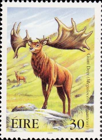
Megaloceros seen in Cahir Castle
Have you seen an Irish Elk? It’s not something I’ve bumped into…
You’d know it if you had! Megaloceros Giganticus stood over two metres high at the shoulders and had antlers up to four metres wide. It was the largest Deer that ever roamed the Earth.
And it was Irish?
It actually lived all over Europe – and in Russia and China. But the best fossilised examples have been found in Ireland, preserved in the peat bogs.
Have you seen an Irish Elk?
I certainly have: there are some whole skeletons in the wonderful Natural History Museum in Dublin, but their antlers hang in many a hall – by which I mean a ‘Baronial’ hall or castle. They seem to have been popular trophies to have mounted on the wall along with all the Foxes and Salmons that didn’t get away… And these ‘trophies’ became sought after in the boom years: Christie’s sold a pair of antlers for £52,850 in 2001, and another pair from Powerscourt, Co Wicklow, sold for £77,353 in 2005.

Dublin’s Natural History Museum
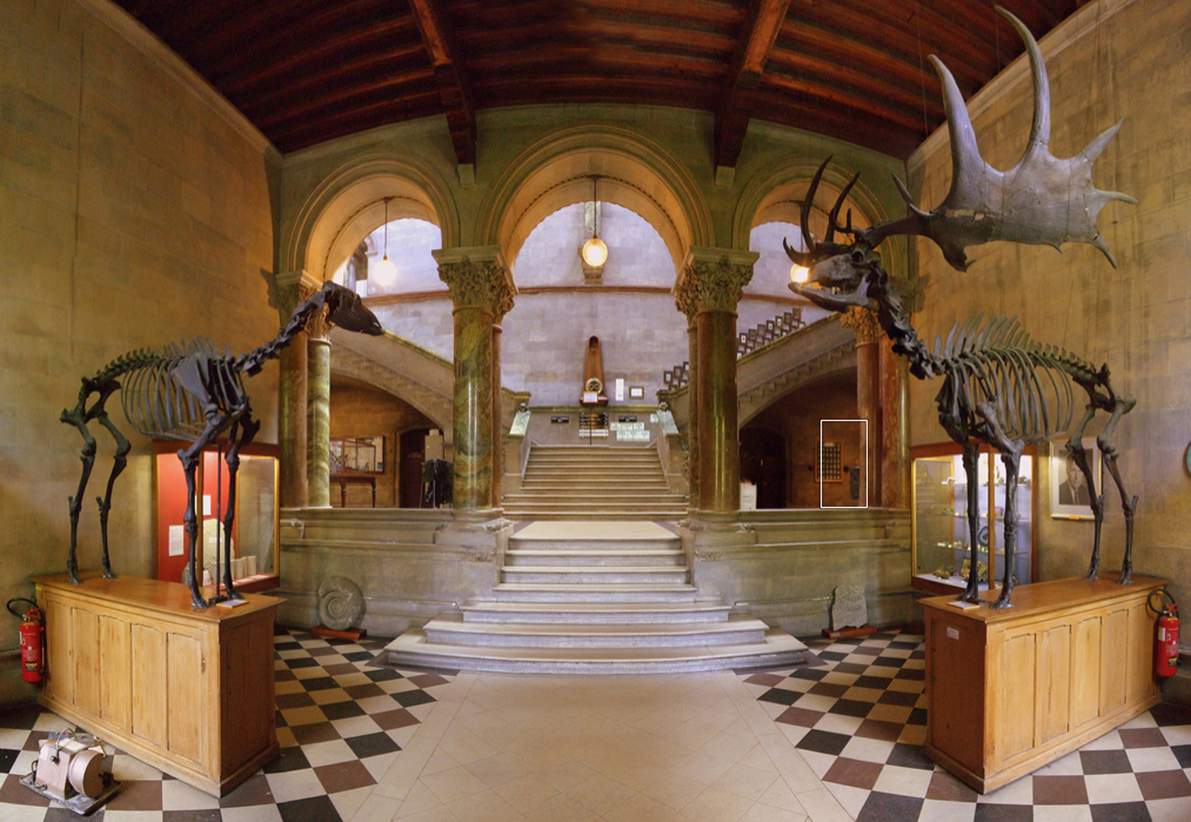
Trinity’s pair of Irish Elks – female and male
But trophies means that someone would have hunted them. Surely they were never around at the same time as people?
It’s a good chance they were. The latest dating of Megaloceros is around 5,000 BC, although others assert that they died out several Millennia before that. The first humans are supposed to have settled in Ireland around 8,000 BC – the Mesolithic period.

Lascaux Cave Painting – estimated to be 17,300 years old
And why did they die out?
There are a few theories: being hunted – not being able to adapt to changing climates and environments – or simply that their antlers were too big…


I like that theory…
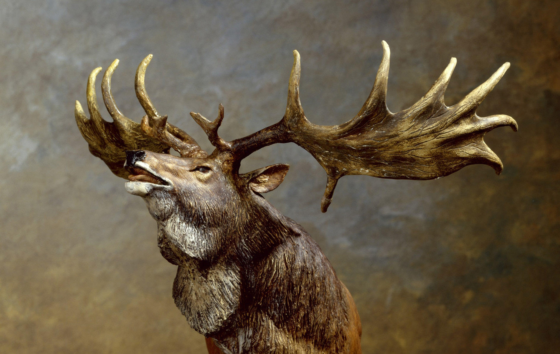
Yes. We saw this one at Ballymaloe – but it wasn’t on the menu!

Ballymaloe Trophy
Such a shame that it doesn’t still exist.
True… although it might be a bit scary if you met it on the slopes of Mount Gabriel!
Along with Ireland’s last Wolf?
Exactly.

Closest relation alive today: Canadian Bull Moose (Robert Bateman)
But you know…
Yes?
I read that some scientists believe that if they found a good enough specimen – preserved in the permafrost perhaps – they could extract enough DNA to re-establish the species through cloning. And others, too: Mammoths maybe, and Sabre-Toothed Tigers.


So, one day, our view from Nead an Iolair could be enhanced by a herd of grazing Giant Elks.
Now, there’s a thought…
I’ll give the last word to Seamus Heaney – who found inspiration in Megaloceros:
We have no prairies
To slice a big sun at evening–
Everywhere the eye concedes to
Encrouching horizon,
Is wooed into the cyclops’ eye
Of a tarn. Our unfenced country
Is bog that keeps crusting
Between the sights of the sun.
They’ve taken the skeleton
Of the Great Irish Elk
Out of the peat, set it up
An astounding crate full of air.
Butter sunk under
More than a hundred years
Was recovered salty and white.
The ground itself is kind, black butter
Melting and opening underfoot,
Missing its last definition
By millions of years.
They’ll never dig coal here,
Only the waterlogged trunks
Of great firs, soft as pulp.
Our pioneers keep striking
Inwards and downwards,
Every layer they strip
Seems camped on before.
The bogholes might be Atlantic seepage.
The wet centre is bottomless.
(Bogland, Seamus Heaney 1969)