Night’s Candles are Burnt Out

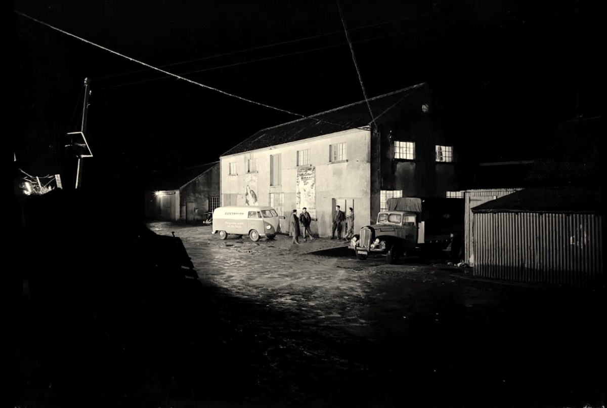
There’s a wealth of tales to be told about the first decades of independent Ireland. The 1920s and 1930s saw a flourishing of confident projects portraying a nation on the cusp of change, establishing itself in Europe and beyond. One such was the hydro-electric scheme at Ardnacrusha on the River Shannon. Foundations were laid in 1925 and works completed within four years, providing the young country with what was then the world’s largest power station. The intention was to enable everyone in Ireland to avail of the most trendsetting modern commodity: electricity.

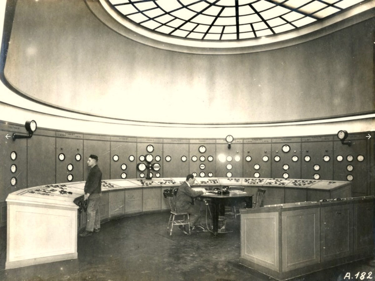
The documentary photo above looks like a scene from a science-fiction film: it’s the control station at Ardnacrushsa, shortly after the completion of the project. This, and many other of the illustrations which I will refer to, are taken from the excellent ESB Archives: I am very grateful to them for the use of these. The building of the huge dam and power station was documented in fine detail – and not just in words and photographs. The notoriously outspoken and visionary artist – Seán Keating – chose to record the accomplishments in his own medium, painting.

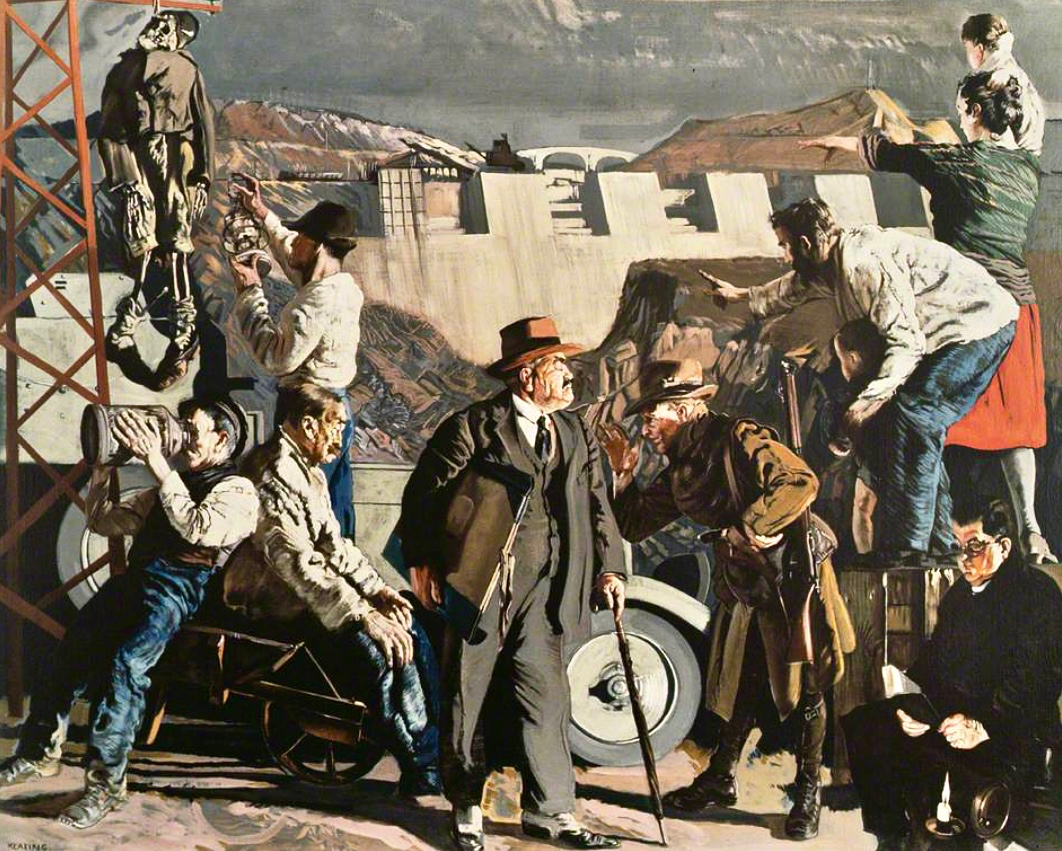
This is one of Keating’s works from the time: Night’s Candles are Burnt Out. (Thanks to Gallery Oldham). It is, perhaps, the finale of his series drawn and painted during the construction of the works – which he undertook on site under his own initiative and without a sponsor. Art historian (and biographer of Keating) Dr Éimear O’Connor suggests:

. . . Keating went down to Ardnacrusha because he knew that the construction project was emerging history. It was all happening around where he was born and raised. The machinery was going to carve up this landscape that he saw as ‘a medieval dungheap’, that was how he described it in later years. And this was a metaphor for him, the whole thing was all about Ireland moving forward into modernity. Night’s Candles features the dam at Ardnacrusha, but also includes a group of figures in the foreground, all of whom represent different aspects of what Keating saw as the Ireland of the day. When he showed it at the Royal Hibernian Academy in Dublin, it was called ‘the problem painting of the year,’ which Keating thought was hilarious. They couldn’t get their heads around this idea of what he was trying to do at all . . .

O’Connor: Seán Keating: Art, Politics and Building the Irish Nation, 2013 (Irish Academic Press)

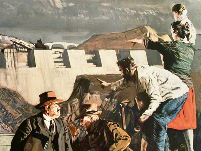
In this detail from the painting we see Keating himself (top right) together with his wife and sons, pointing to the vision of Ireland’s future. On the left of the full painting is Keating again, inspecting a hanging skeleton, perhaps reminiscent of the Famine. Most significantly, perhaps, at the bottom right is a priest reading by the light of the candle. O’Connor is clear about this portrayal:

. . . It tells you an awful lot about Keating and his attitude to the Church at the time. Like many others in the cultural sphere in Ireland, he was disappointed with post-Treaty Ireland, with successive governments and the Church, who were in cahoots, if you know what I mean. He knew well that the whole country was tied up with them, and with that kind of organized religion that was deeply conservative. And Night’s Candles is very much an expression of that disappointment, I think . . .

O’Connor: Seán Keating: Art, Politics and Building the Irish Nation, 2013 (Irish Academic Press)

It’s worth dwelling on this painting a little longer, and viewing Keating’s thought processes, through O’Connor’s eyes:

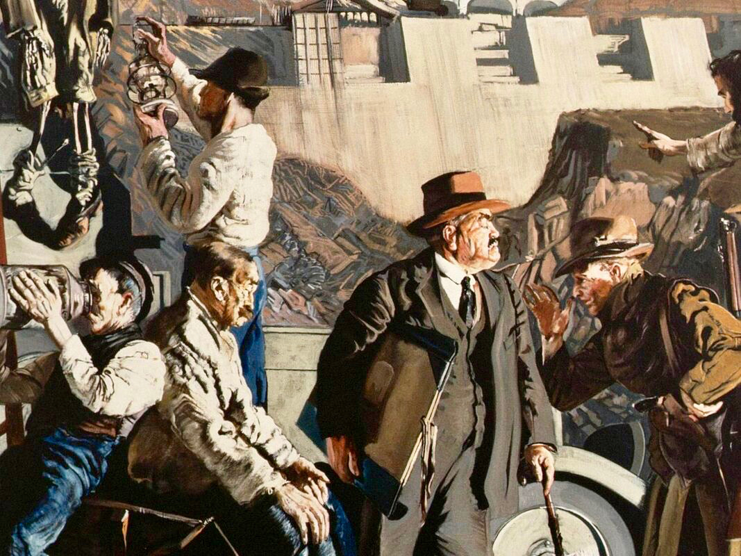
. . . What Keating was trying to do was reflect upon a country on the brink of change. It was in those years, in the 1920s, that the term ‘gombeen man’ came into being. We all know that it means the kind of businessman or politician who’s making money off the backs of everybody else. And that’s the gombeen man in the middle of the painting. I think it’s quite clear that Keating’s hope was that modernity, as represented by Ardnacrusha, would end all that stage-Ireland paddywhackery that had prevailed for years . . .

O’Connor: Seán Keating: Art, Politics and Building the Irish Nation, 2013 (Irish Academic Press)

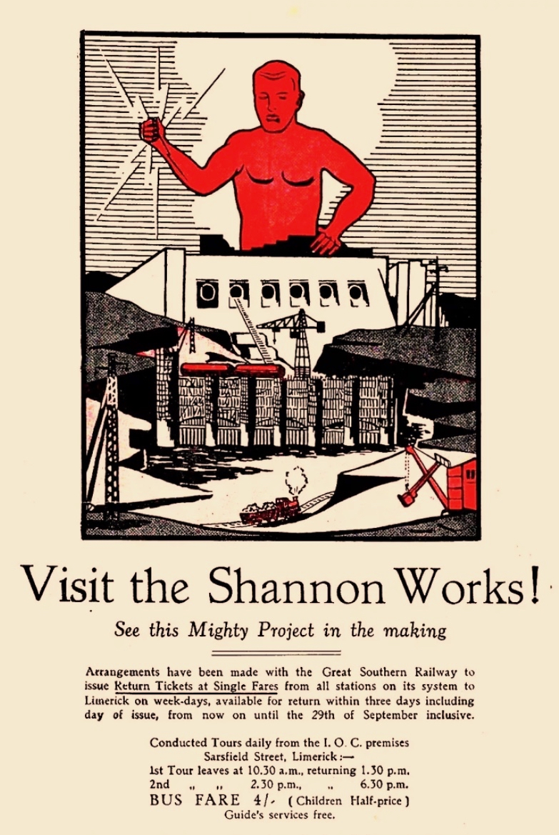
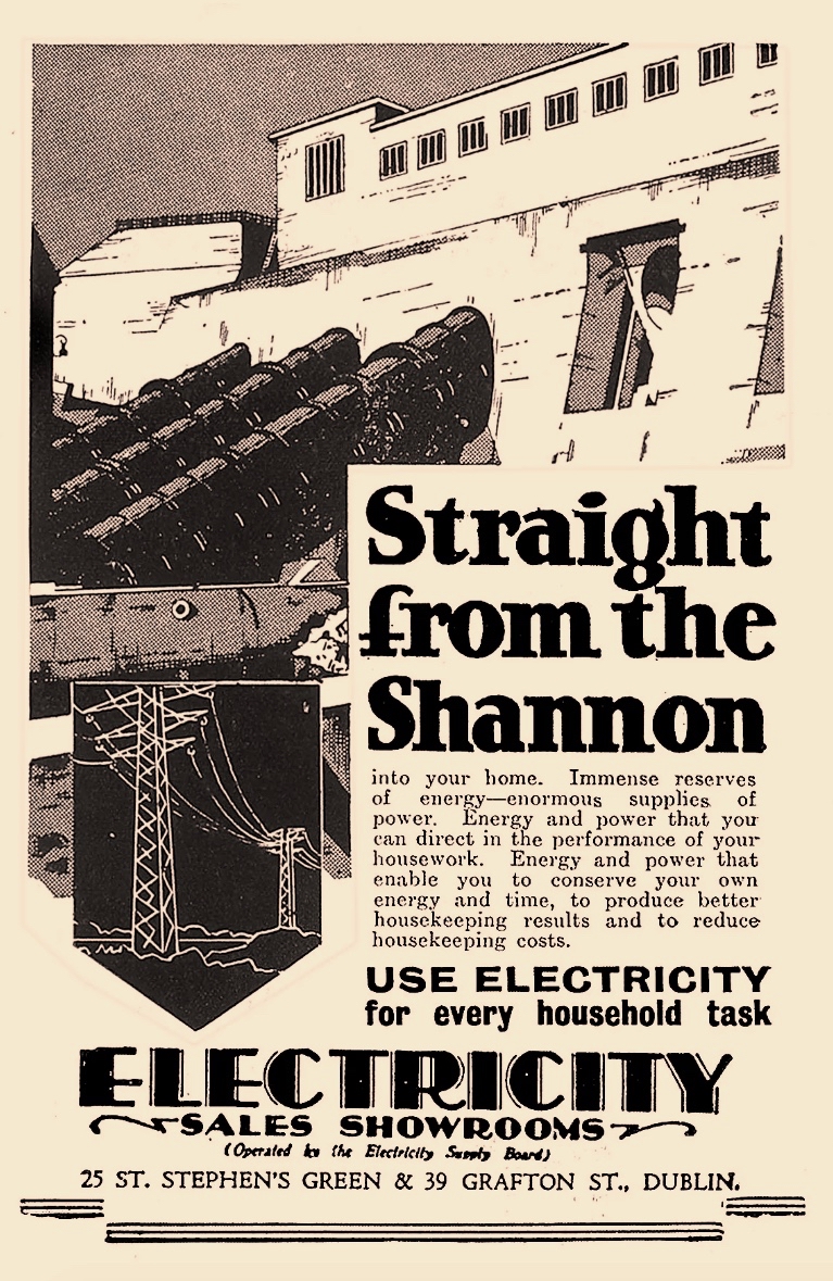
Above – posters from the time of the construction work at Ardnacrusha (ESB Archives). It was certainly the most exciting project in Ireland’s young days, and tourism was encouraged. Hand-in-hand with the major works themselves went a crucial publicity campaign to encourage people to embrace the coming of a readily available electricity supply to homes and businesses. The steps taken to try and ‘get the message across’ was an uphill task. Considerable funds were expended – and a large sales force garnered – to tour the country and persuade the population to buy into the project.

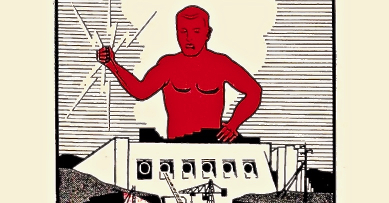
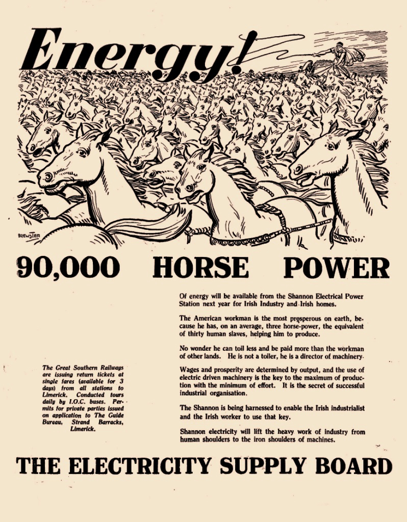
The visuals, humour and underlying psychology of this Ardnacrusha construction-era promotional poster really appeal to me. In case you can’t read the ‘small print’, this is the message that’s being pushed:

. . . 90,000 Horse Power of energy will be available from the Shannon Electrical Power Station next year for Irish Industry and Irish homes . . . The American workman is the most prosperous on earth, because he has, on average, three horse-power, the equivalent of thirty human slaves, helping him to produce. No wonder he can toil less and be paid more than the workman of other lands. He is not a toiler, he is a director of machinery . . .

Post-Famine, America was always seen as the ‘golden land of opportunity’ for Irish emigrants. Now, in 1930, we are being told that Ireland will have the capability to match those fabled fortunes!
. . . Shannon Electricity will lift the heavy work of industry from human shoulders to the iron shoulders of machines . . .

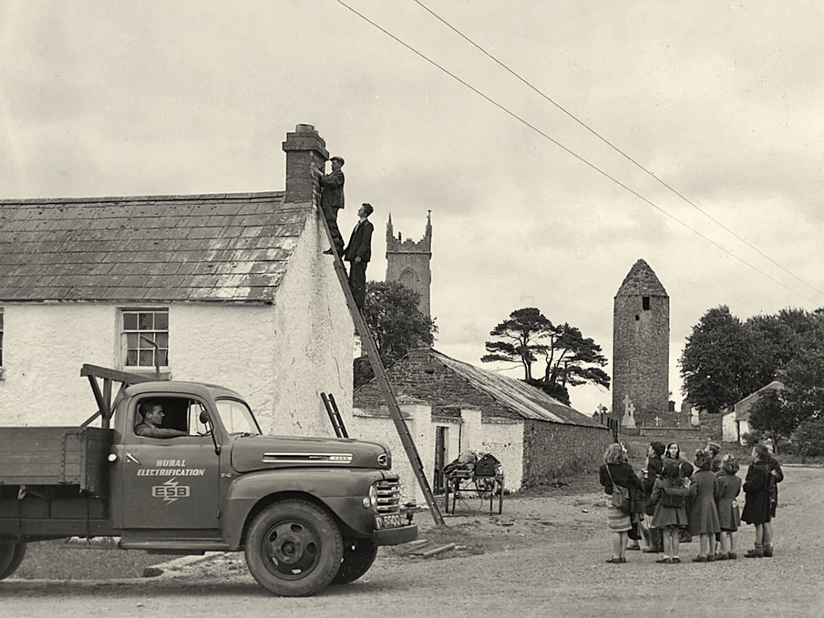
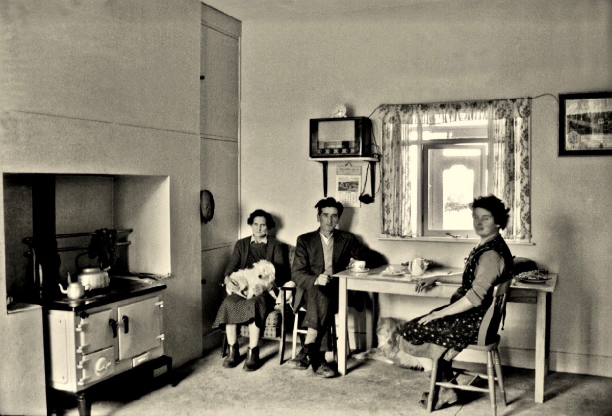
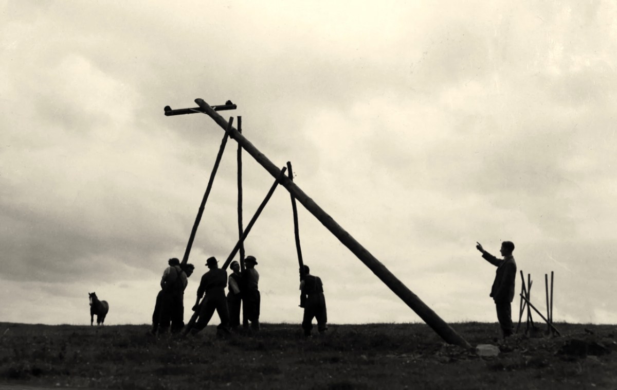
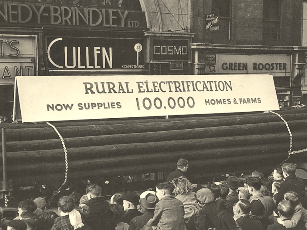
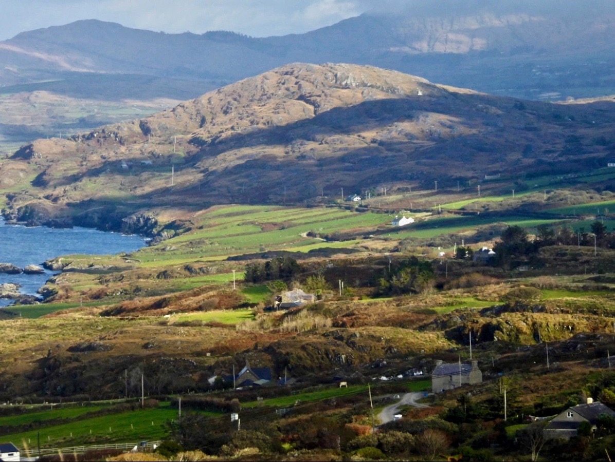
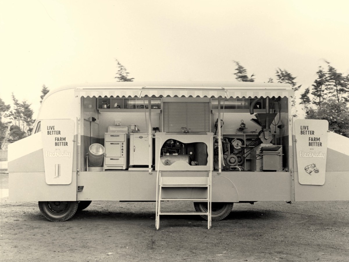
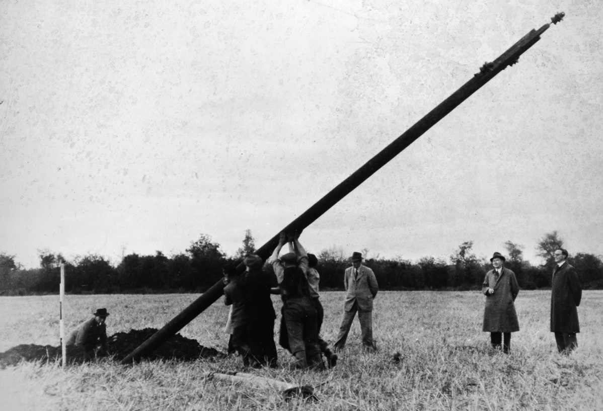
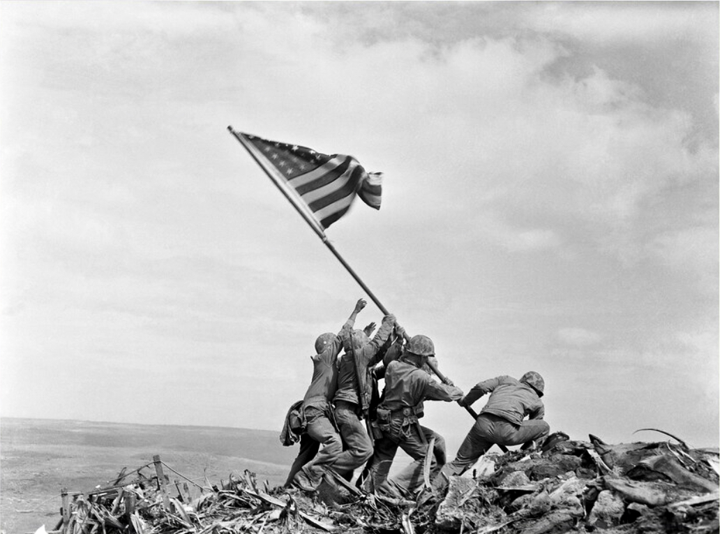
The coming of electricity across Ireland opened up markets for retailers to vend a host of innovative gadgets. This mobile electricity showroom from the 1950s (ESB Archives) covers the gamut of lighting, cooking, refrigerating, water supply to sinks using pumps, milking machines and labour-saving devices for farms. In a future post I want to focus on Rural Electrification, which was a long haul: taking poles and wires out into the extensive hinterland. This was – arguably – the most heroic part of the process of electrification, and we can’t help wondering whether the following somewhat iconic ESB print of the first ‘peg’ being raised at Kilsallaghan, on 5 November 1946 was inspired by the famous Iwo Jima Victory photograph taken by Associated Press photographer Joe Rosenthal on February 23 1945 (lower pic). Both portray a moment of triumph.

Many thanks are due to Michael Barry who referred me to material from the ESB Archives covering our own West Cork areas. Watch out for our commentary on this in a forthcoming post!

In High Places

Here is a collection of photographs taken in West Cork from some of the high places: ridges, peaks, mountain paths. The pics were all taken around ten years ago, and haven’t been used in our blog posts previously. They serve to show stunning landscapes, of course, and hopefully illustrate the variety of the country which surrounds us here. The header is taken from the peak above Three Castle Head.

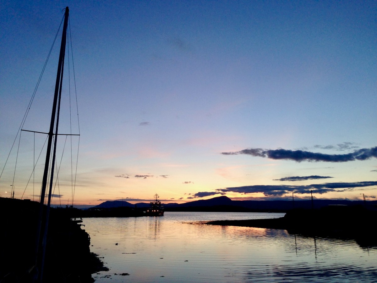
The upper pic is looking down on Bantry town from the high ground to the south, while the lower one reminds you of the evening view from Bantry at sea level.

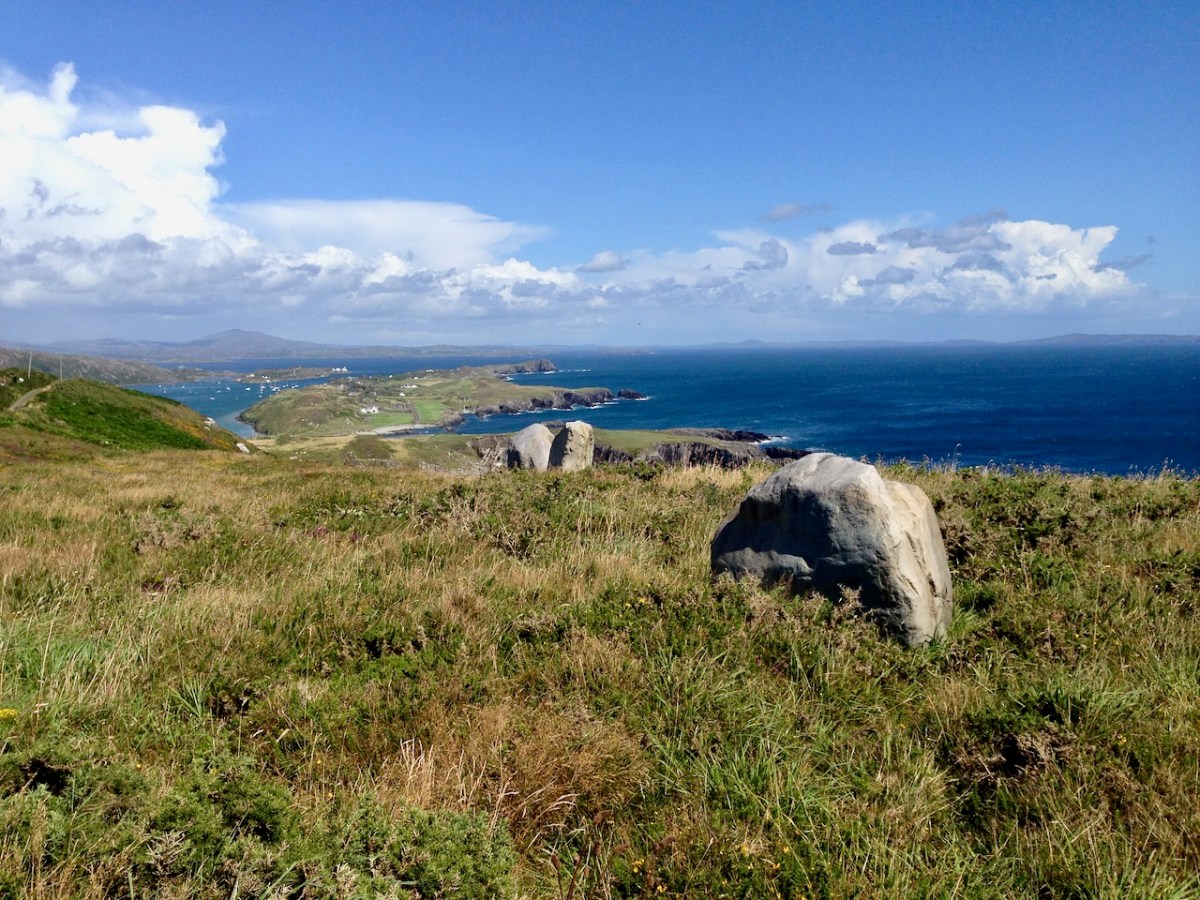
If you leave your car at Galley Cove Beach and walk up the steep track towards Brow Head you will come across this enormous stone row – and you will look back to the peninsula of Crookhaven. Don’t be fooled by the stones: they have been placed on this site fairly recently. They are impressive, nevertheless.

And here is a closer view of Crookhaven.

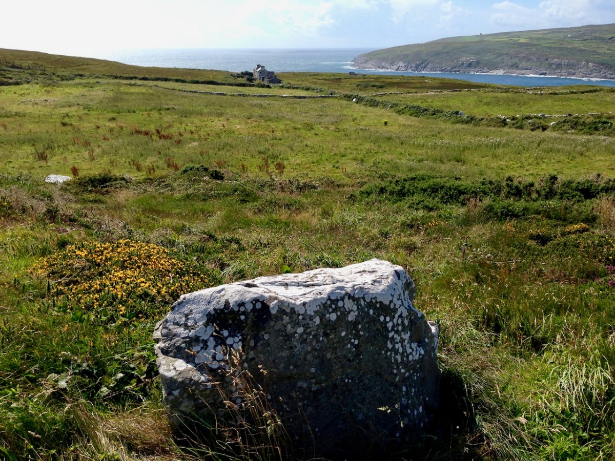
While turning from this spot and looking west, you will see the end of the coastline at Brow Head. This stone is likely to be more anciently placed. In the distance is Mizen Head with its Napoleonic era signal tower at Cloghane.

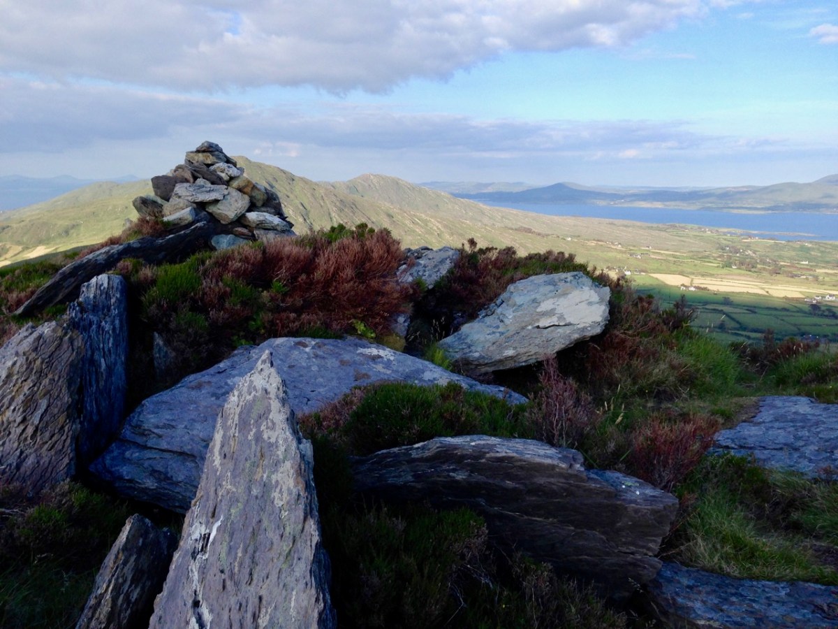
Contrasting light effects seen on the footpath that follows the ridge on the Sheep’s Head Way. That’s the spit of land that runs from east to west between the Mizen Head and the Beara Peninsula. There are cairns on the summits, with the remains of a wedge tomb and a Marriage Stone to be seen along the way.

The view north from the heights of the Sheep’s Head takes in the Beara Peninsula and – seen above – the high point of Hungry Hill dominating the distant rugged landscape.

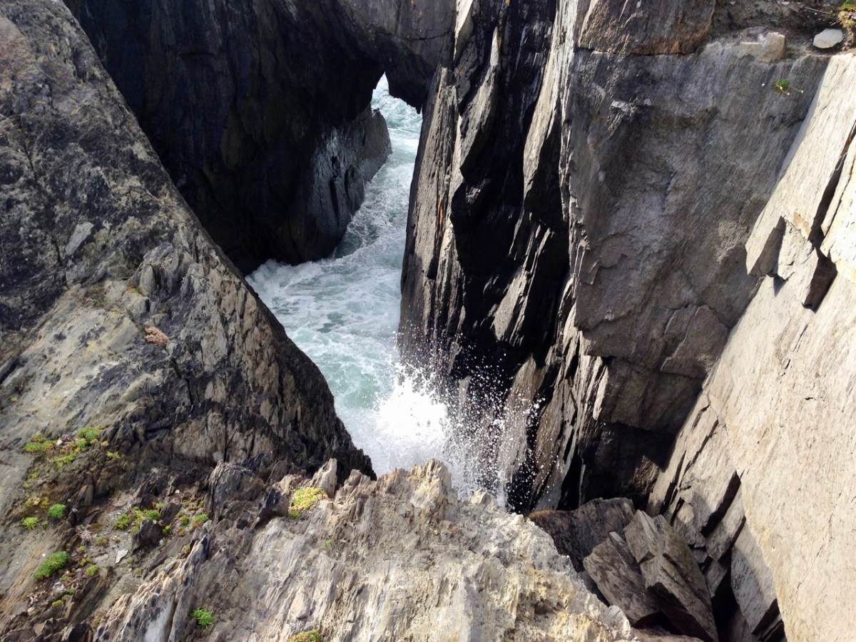
You are never far from the coastline in West Cork. Look out for wild seas constantly sculpting the rocks over millennia.

From our home in Cappaghglass we look out to our own ‘high place’ – Mount Gabriel. This enigmatic tract of land dominates the area and is imbued with legends and folklore. It is also one of the most atmospheric of our peaks at all times of the year.

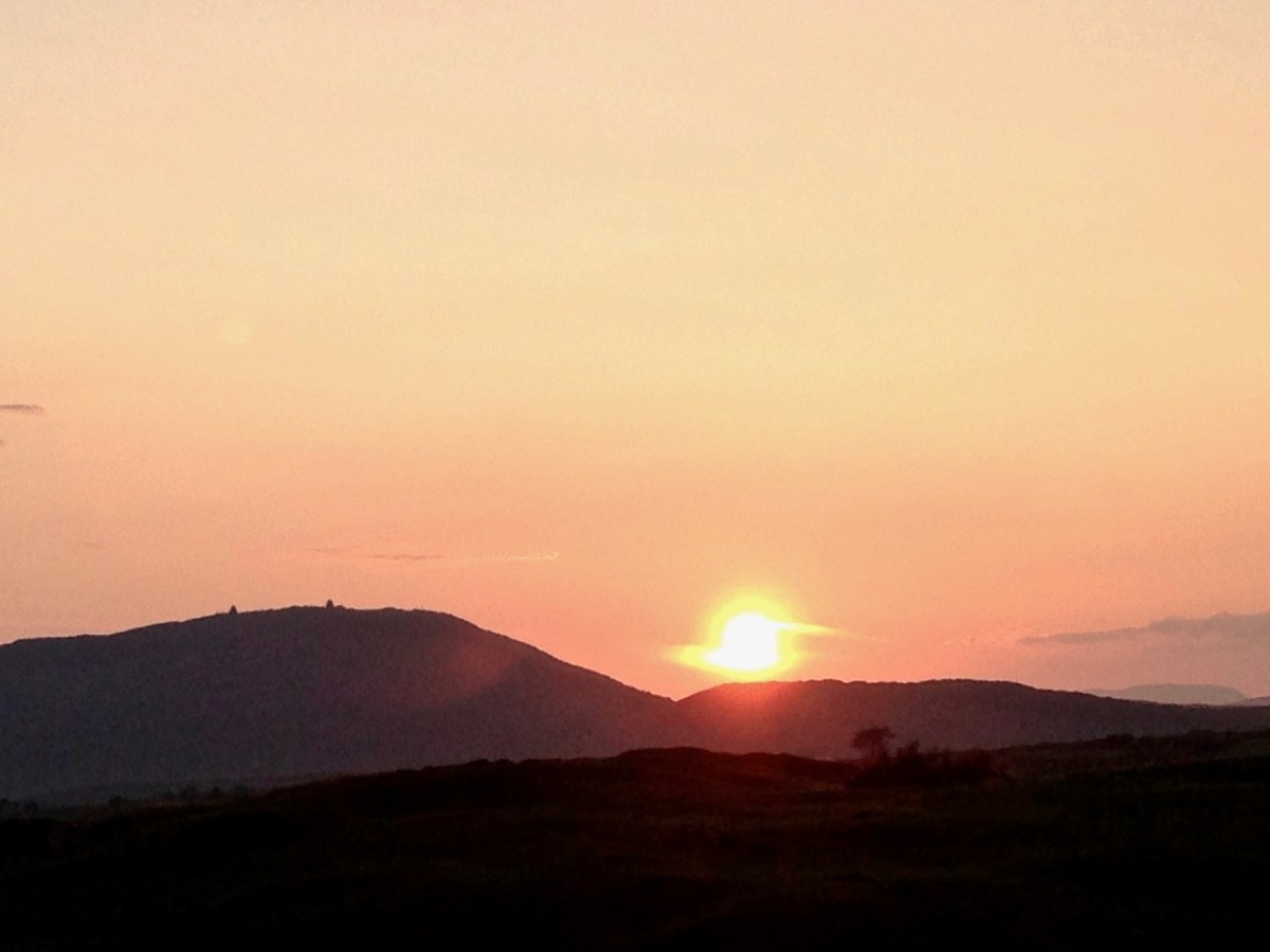
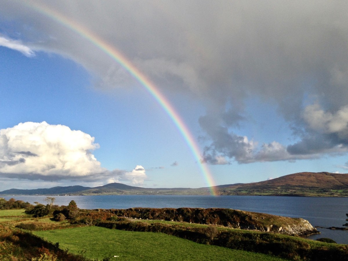
Another local view for us (above): we face out to Rossbrin Cove on the Mizen Peninsula. Finally, the celestial spectacle (below) finds its pot of gold on the shores of the Mizen.

Derrynablaha and its Rock Art

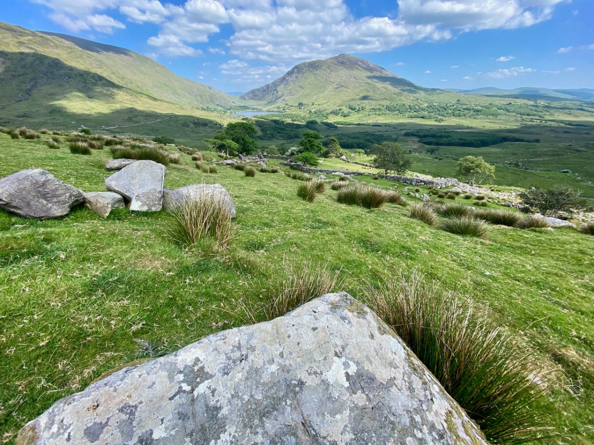
A bit of a nostalgia trip for Finola and me this week: we spent a couple of days in Kerry and dropped in to Derrynablaha – the iconic valley which has some of Ireland’s most notable Rock Art. These stones were carved on natural rocks on the hillsides many thousands of years ago. To this day, we don’t know what they signify.

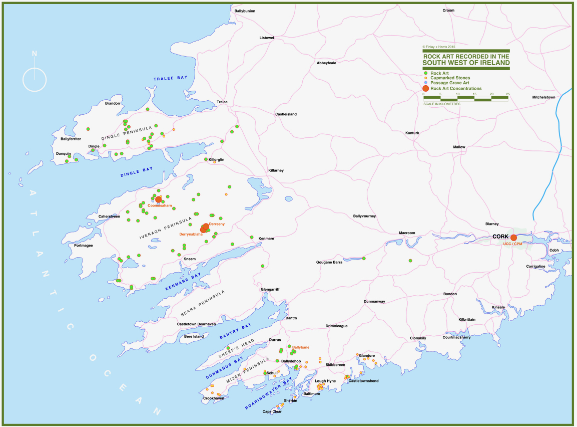
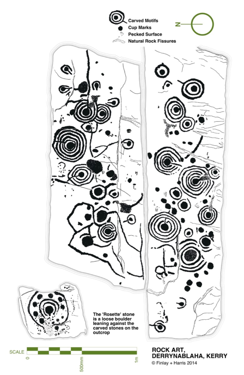
Some years ago, Finola and I organised exhibitions showing examples of Rock Art – many taken from Finola’s 1973 University of Cork thesis. The map above was drawn for the exhibitions: you can find Derrynablaha in the centre of the Iveragh Peninsula, left of centre. Below is a rendering of Finola’s thesis drawing showing – arguably – the most significant piece of Rock Art on this island:

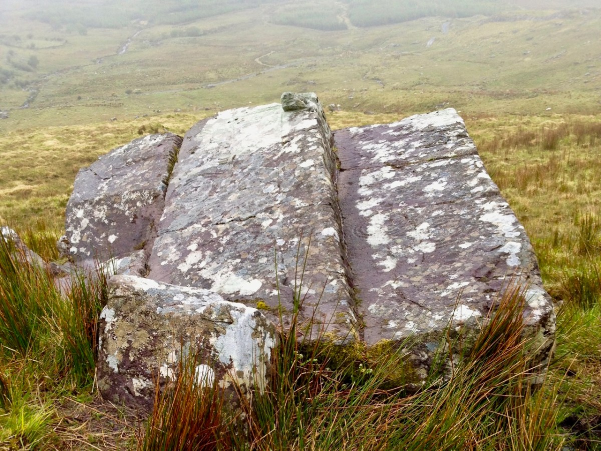
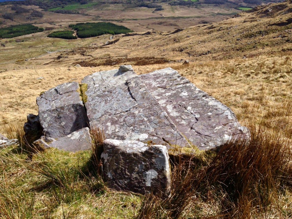
Here’s a photo of these rocks which I took on my first visit to this valley, in 2012. It was a dull day! The next photo was taken on a better day three years later. This shows how weather conditions can affect the way that Rock Art motifs are seen:

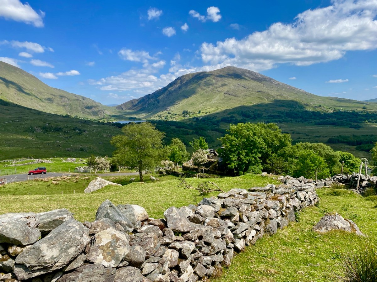
On our most recent visit – last week – we didn’t have time to scale the steep hillside to view this rock formation, but we enjoyed just taking in the stunning landscapes of the townland.

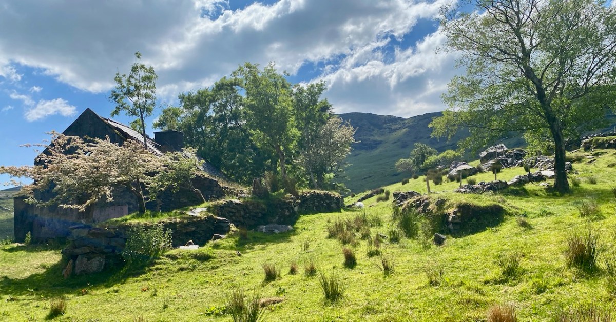
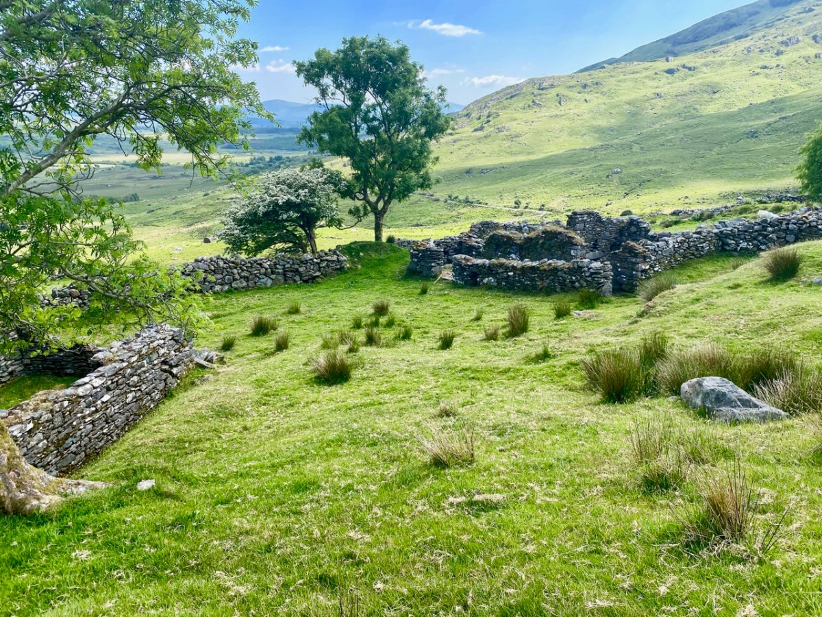
Above, and in the header picture, you can see the ruin of the cottage, which was once the only dwelling in this valley. It was still lived in when Finola visited to carry out her survey of the Rock Art in 1972 – fifty years ago. Then it was occupied by John O’Sullivan and his sister, May. John’s brother – Daniel – discovered much of the Rock Art in the surrounding landscape and reported this in the 1960s to Michael Joseph O’Kelly, then Professor of archaeology at UCC, and his wife Claire. Subsequently the O’Kellys made some expeditions to Derrynablaha, as did the Italian rock art expert, Emannuel Anati. Daniel had died prior to Finola’s visits and she recalls that the remaining family were excellent stewards of the Rock Art, ensuring that it was preserved and not damaged. She has ‘hazy memories’ of being brought into the house and given cups of tea and brown bread.

After we had published earlier posts about Derrynablaha, Finola was contacted by Faith Rose – the great niece of the O’Sullivans who lived in this cottage in 1969: Faith had visited the valley in that year. She recalls:

. . . I remember their bedroom was downstairs, the staircase to the upstairs being unsafe. There were none of the usual services in the house. There was an old fashioned fireplace where you could cook with a settle at the side. I seem to remember being told it had been built under some government scheme and the original stone farmhouse was to be seen slowly returning to nature close by. I wonder if you recall any of this. My great aunt and uncle were shy people who extended us the best hospitality. To my sister and I it was a magical place, but the hardness of their lives there was clear . . .

Faith Rose 2021

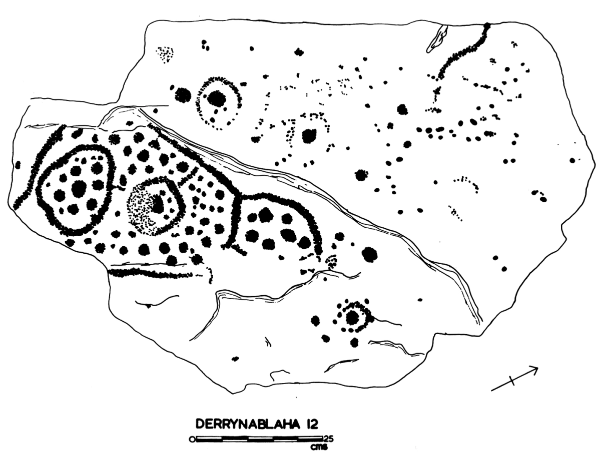
There are the ruins of several other buildings set within this landscape, indicating that the settlement was once significantly more populated in earlier times. Now it is wildly lonely, but impressively beautiful. When Finola carried out her surveys, she recorded 23 pieces of Rock Art. Today it is recognised that there are 26 known examples, with a further 7 stones in the adjacent townland of Derreeny. Long term readers of this Journal may recall that we visited the townland in April of 2015 – together with a small group of enthusiasts – to seek out all the known examples. At that time Ken Williams was using techniques he had developed to photograph the carvings in fine detail. These employed several portable light sources. The following sequence shows one of the rocks (number 12) taken without lighting; Finola’s drawing traced in 1972; then Ken’s technique in action and his results, which are remarkable:

Once again you are reading about the Rock Art at Derrynablaha! There have been several posts on this subject over the years, but we make no apologies: we never tire of the beautiful landscapes of Kerry – and we have seen it in all weathers. It would be good if we could be closer to solving the meanings of these rock carvings; this is unlikely to happen. Over the last 300 years since the phenomenon was first recorded in Ireland (and Britain, and many other places in Europe and the world) there have been varying theories – dozens – put forward for its existence: none of them is conclusive. Think on . . .

A Map of the County of Cork, Part 2

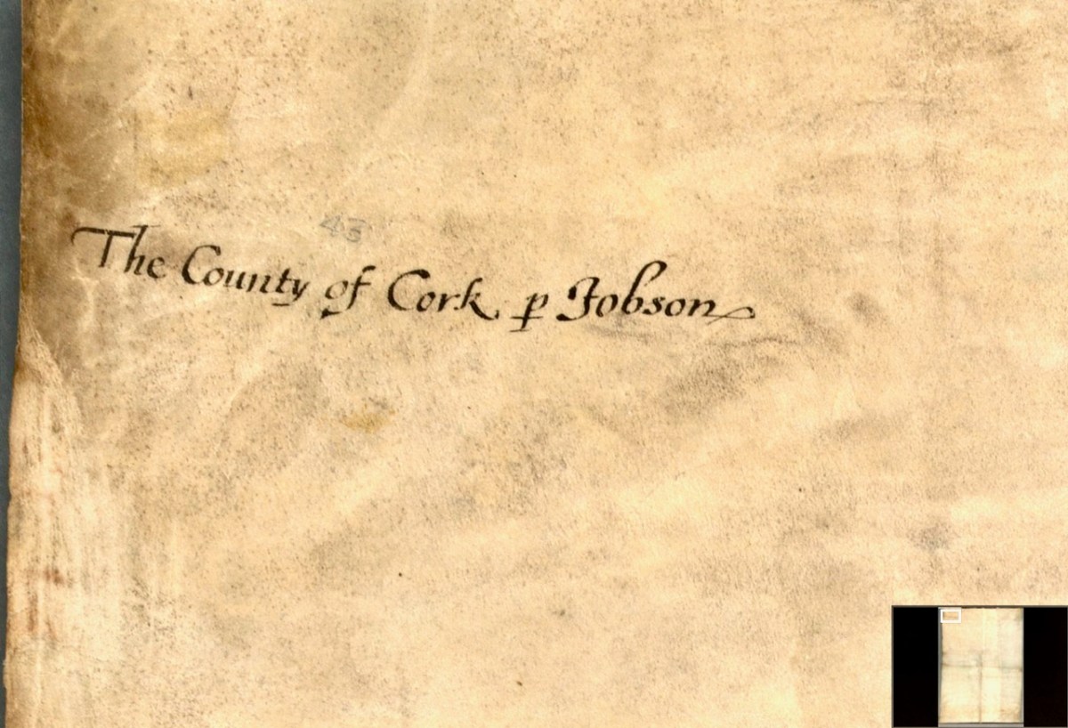
In Part 1, I said that We don’t know who did this one, or when: The date is given as 1560-1620. It seems in some ways more basic than other maps of the period, and less exact. I have now gone to the Atlas itself in Trinity College and discovered that the maps in the Digital Repository are an incomplete set. Specifically, the original Atlas at TCD contains the reverse side, the ‘verso’ of each map. Here’s what’s on the verso of the County of Cork. This:

and this:

So we see that the map is attributed to our old friend Jobson – he who drew the plantation map I wrote about here and here and which was dated to 1589. There are similarities and differences between this map and that one – the galleons and scales for example look very alike. But there’s a lot more information on the plantation map and some of it is different from our Map of the County of Cork. As to the date of the County of Cork map – we will try in this post to see if we can narrow that down a bit from the broad estimate of 1560-1620. 

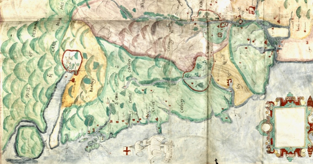
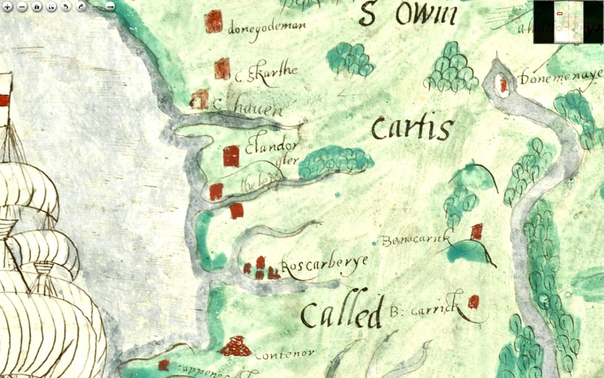
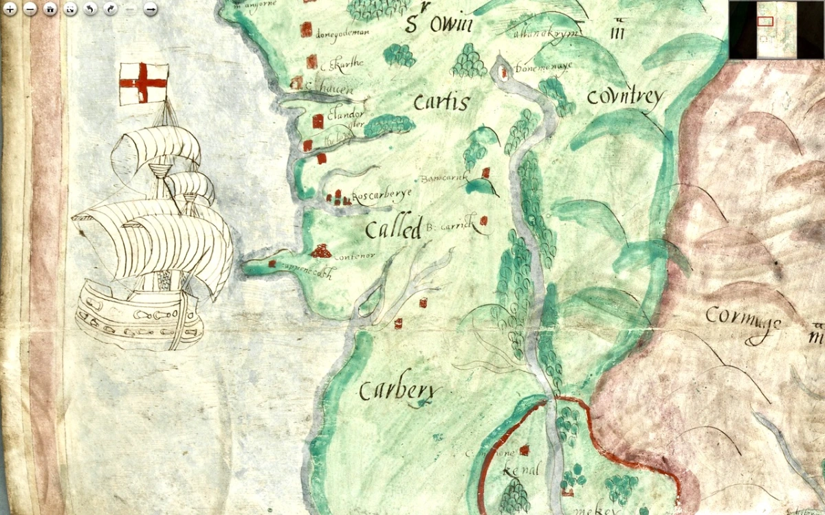
I want to go, as they say in Ireland, east along. That is, take off from where I finished last time, and travel east along the coast towards Cork, taking in the River Bandon. For the rest of this post, I’m keeping the map oriented as it is originally – that is, with west at the top (it’s actually surprising how quickly you can get used to this). Between Baltimore (Donashad) and Castlehaven (C haven), there are three castles shown, one labelled Sir Jmes Castell, Doneygodman and C skarthe. These are all a bit of a puzzle and I would invite readers to contribute ideas. On the archaeological list of Monuments for this area we can identify the O’Driscoll Castle on the Island in Lough Ine – could this be the Sir Jmes Castell? A promontory fort on Toe Head, known now as Dooneendermotmore, although likely originally an iron age refuge, was refortified in the 16th century and may, like the one I wrote about in Dunworley, have had a significant curtain wall. Was this Doneygodeman? It seems unlikely, as Doneygodeman is show inland – I wonder if instead it could be the castle at Raheen, which was a castle of the O’Donovans.

Finally, C skarthe might be a castle of the McCarthy’s – McCarthy is spelled in a variety of ways on this map, but there I can find no trace of it now. There was a castle in Listarkin, but once again, this is in the wrong place, unless this map, while certainly approximate in places, is wildly inaccurate. It seems reasonable to conclude that the more inland castles may have been harder to plot on a map that the coastal ones.

The castle at Glandore (c Landorgter) is clearly shown, along with two castles guarding the entrance to a long inlet labelled ‘the lepp.’ One may have been Kilfinnan, actually located near Glandore, which the other could possible be the coastal tower house at Downeen. This brings us to Rosscarbery (Roscarberye), shown as a collection of Buildings, as befits its status as a substantial town with a cathedral and a college, and a place of pilgrimage in the name of St Fachtna.

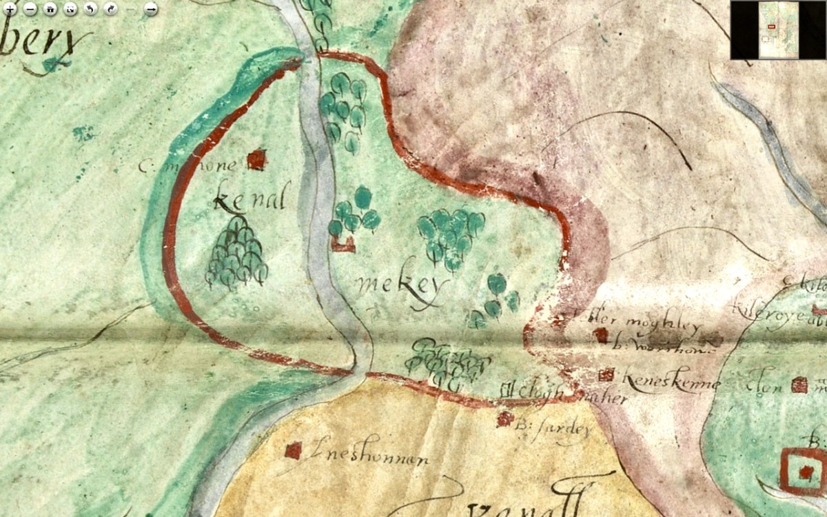
The entirety of this area, in green, is identified as Sir Owin Mc Cartis Countrey Called Carbery. Several other castles are identified here and there, and the course of the River Bandon is traced. The southernmost area is identified as Kenal Mekey, and to the south of the green-shaded section is Kennal Ley. In Canon O’Mahony’s magisterial History of the O’Mahony septs of Kinelmeky and Ivagha he states: 

In the history of South Munster there is no fact attested by more abundant evidence (evidence unknown to Smith and Gibson) than that the Sept-land of the Ui Eachach Mumhan during many centuries extended from Cork to the Mizen Head, as one continuous territory, including Kinelea and Muskerry, and was ruled by a chief whose principal residence was Rath Rathleann, in Kinelmeky.


https://archive.org/details/historyofomahony00omah/page/n1/mode/2up  Page 105

He identifies Rath Rathleann as the mighty multi-vallate ringfort of Gurranes, which was superseded by Castle Mahon, which stood where Bandon is now situated. And here it is, Kinelmeky, with C Mahon shown beside the river. Castle Mahon was later incorporated into Castle Bernard, home of Lords Bandon. Another Castle is shown further down the river – no doubt the one we are familiar with as we travel the N71.

We know that all this land was acquired by Richard Boyle after the Battle of Kinsale (1601) and that he started on his walled town of Bandon Bridge around 1620. Since this is still clearly identified as O’Mahony Territory I think we can take it that this map dates to before the battle of Kinsale.

We see Kenall Ley (Kinelea) in yellow, with the walled town of Kinsale at its heart. Kinsale walls were begun around 1380 and lasted until most of them were destroyed around 1690 by the forces of William of Orange. Inishannon is noted in Kinelea, as well as Park Castell (in what is now the townland of Castlelands) and finally B: Sardey (or is that a different first letter?). We know from another map in the Hardiman Atlas (below) that B designated a small town. Given that Kinsale is such a prominent walled town on this map, once again, a date before 1601 is likely. 

Supporting a pre-1600 date is the fact that it is the old Irish families that are identified with their territories – no settler or Plantation names are given. In fact the O’Mahonys and McCarthys are the only names on the sections of the map we have seen so far. Moreover, it it really was the work of Jobson, we know he was actively mapping in 1589.

In Part 3 I’ll do a quick meander through the most interesting parts of the rest of the map. Stay tuned.

A Map of the County of Cork, Part 1

A Map of the County of Cork, Part 3

Illaunloughan

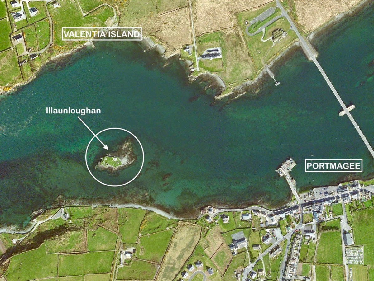
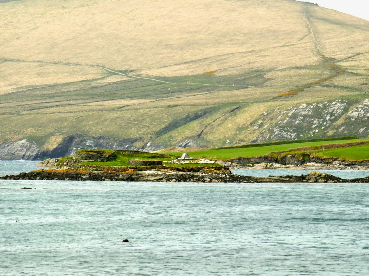
We embarked on a sea voyage in order to explore the island of Illaunloughan, which is off the coast of Kerry not far from Portmagee. To the north is Valentia Island. It is said that this tiny landfall – only 0.3 acres in area – is the smallest of Ireland’s offshore islands which contain medieval monastic remains.

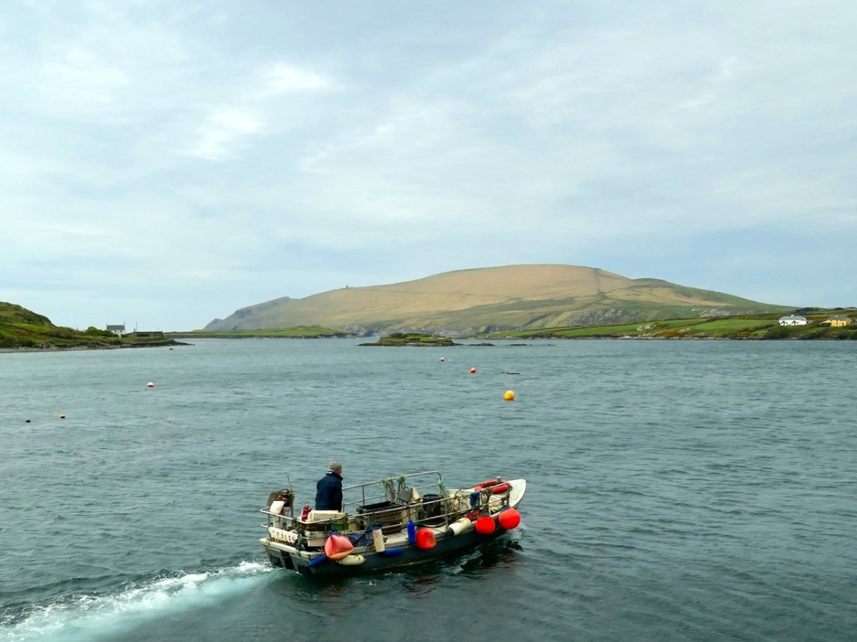
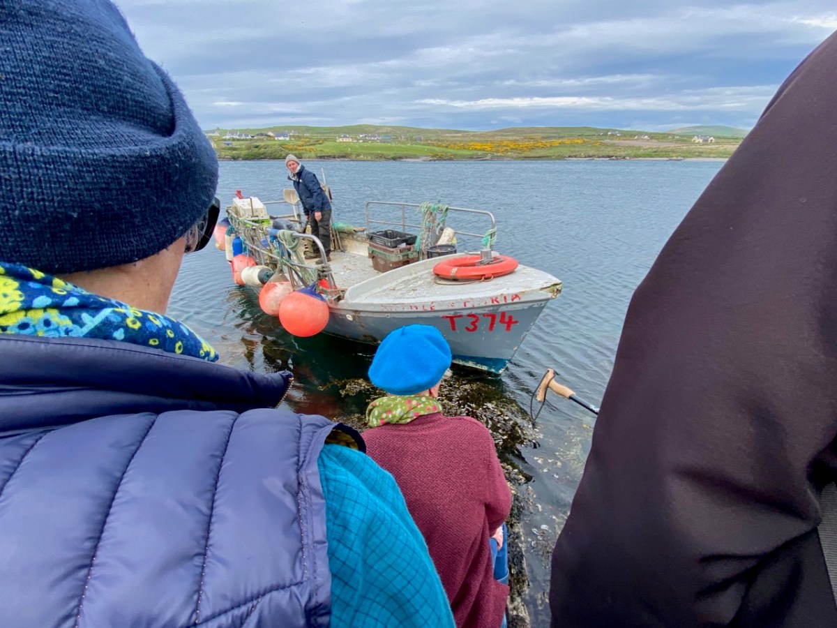
Our sea journey was on board an aluminium fishing boat – there it is, below, with the island of Illaunloughan in the background.

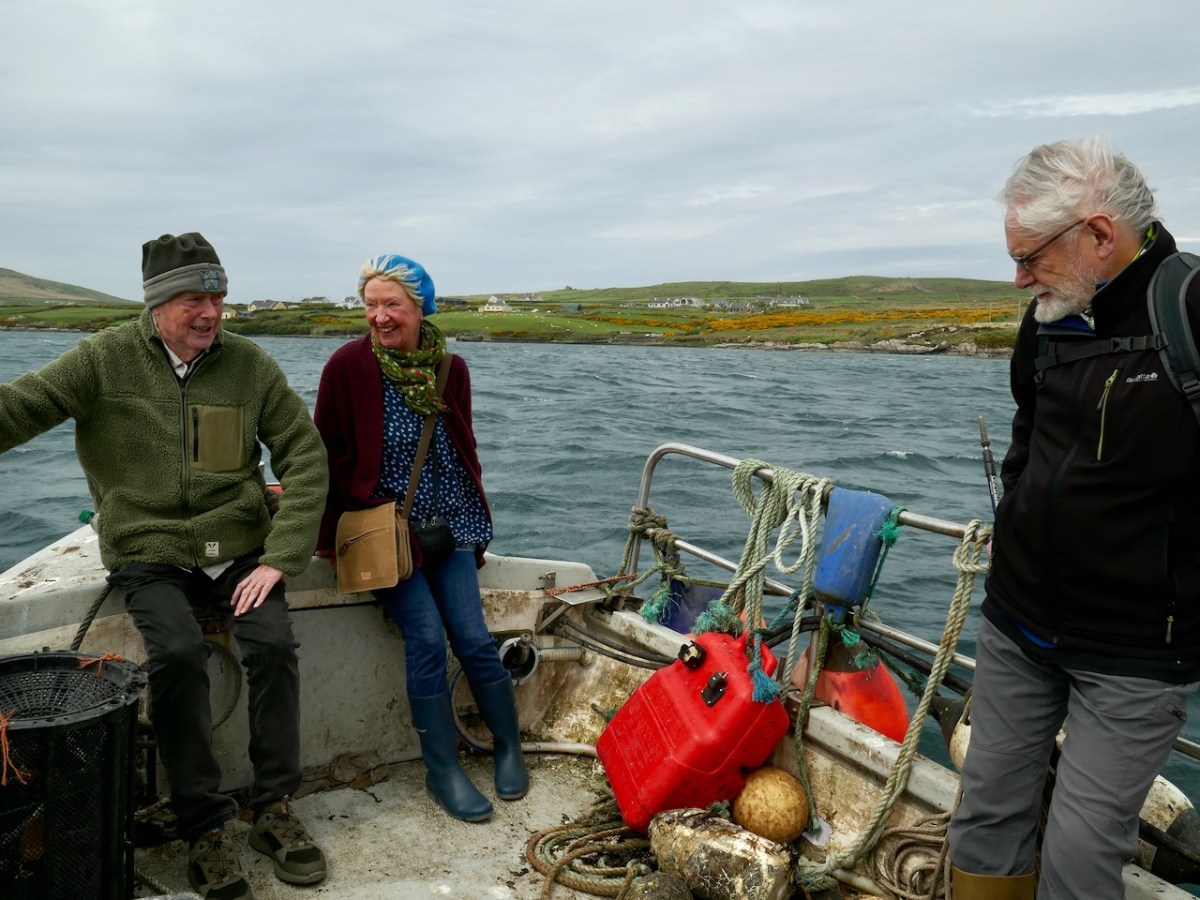
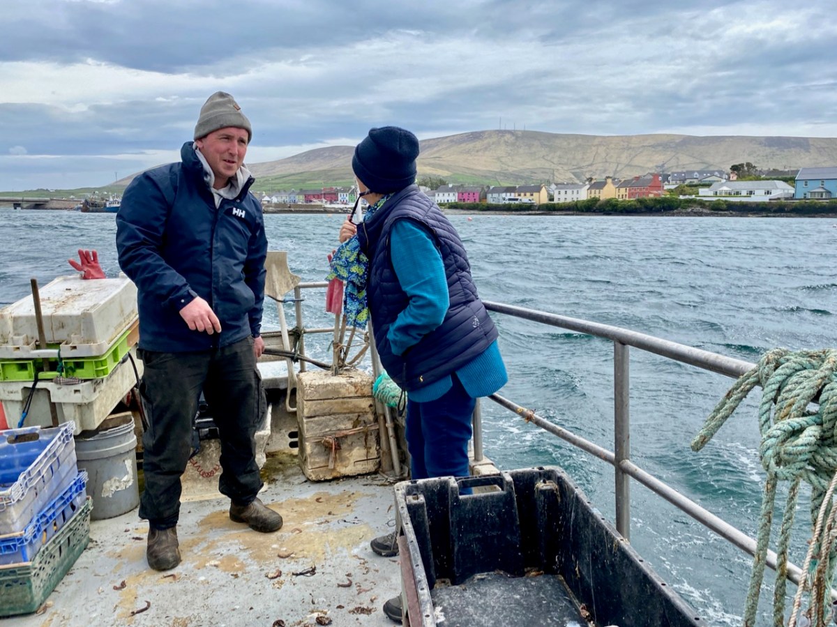
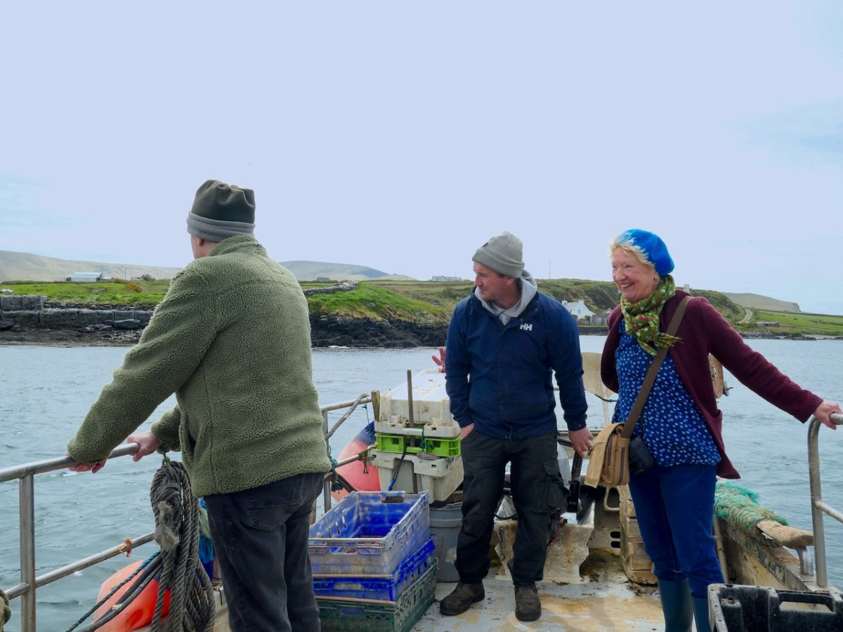
And there’s the full crew (two pics below): myself, Amanda, Peter, David the boatman and Finola. We were – as you might guess – on an archaeological expedition in Kerry, which included the search for a holy well on this island.

You can see Portmagee in the background of the photo above. It’s not a long journey: just a few minutes from the harbour there. In fact it is said that on a couple of tidal events during the year you can actually walk across to Illaunloughan, but the voyage was far more exciting for us!

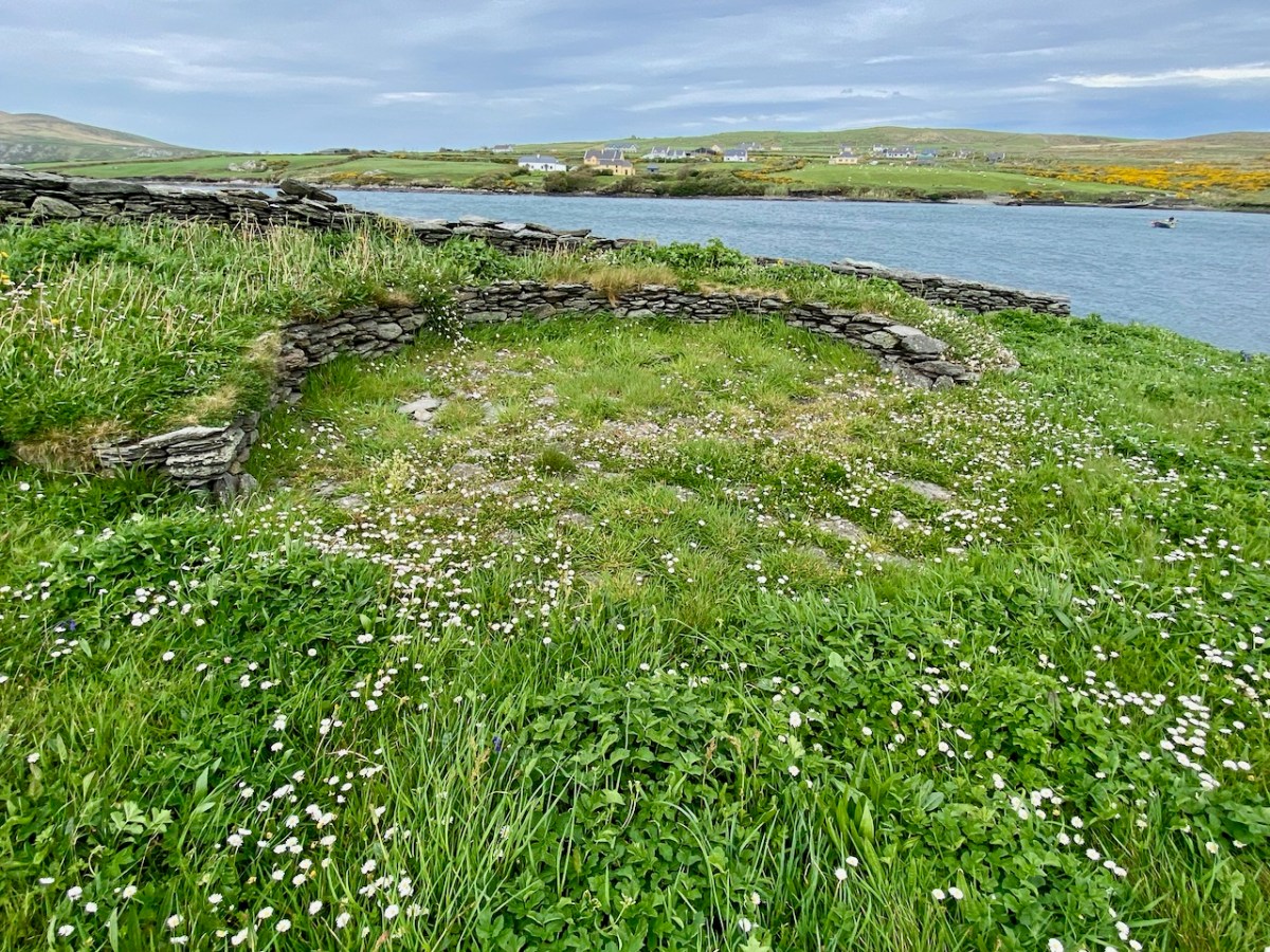
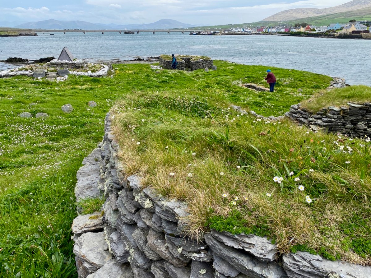
This is the view of the island as the boat approaches it: you can see various of the archaeological features. It doesn’t take long to explore – but it’s fascinating. A full survey of the surviving monuments was undertaken by Jenny White-Marshall and Claire Walsh in the 1990s: this resulted in the publication Illaunloughan Island: An Early Medieval Monastery in County Kerry, Wordwell Press, 2005. Here is a synopsis:

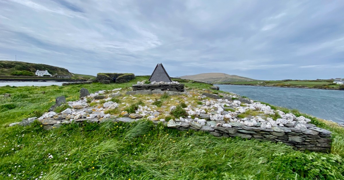
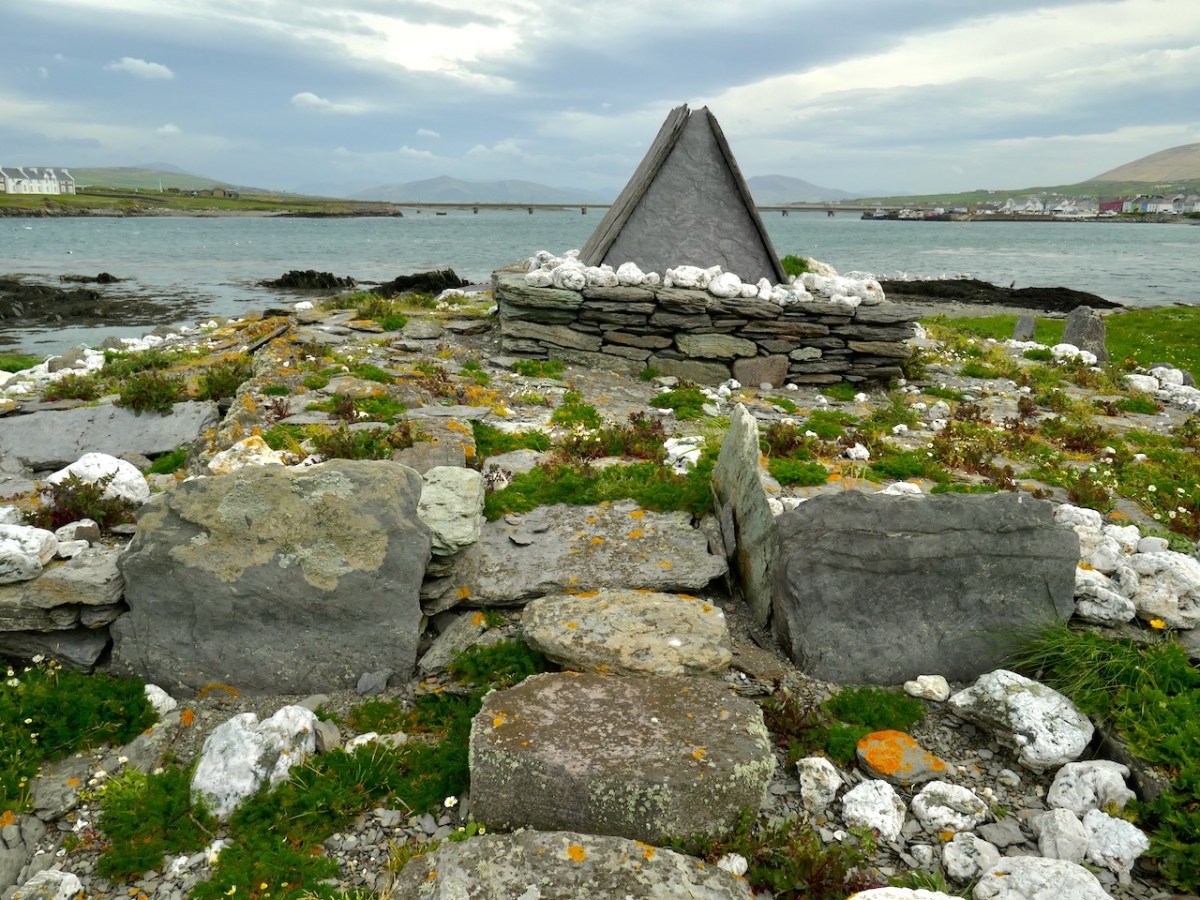
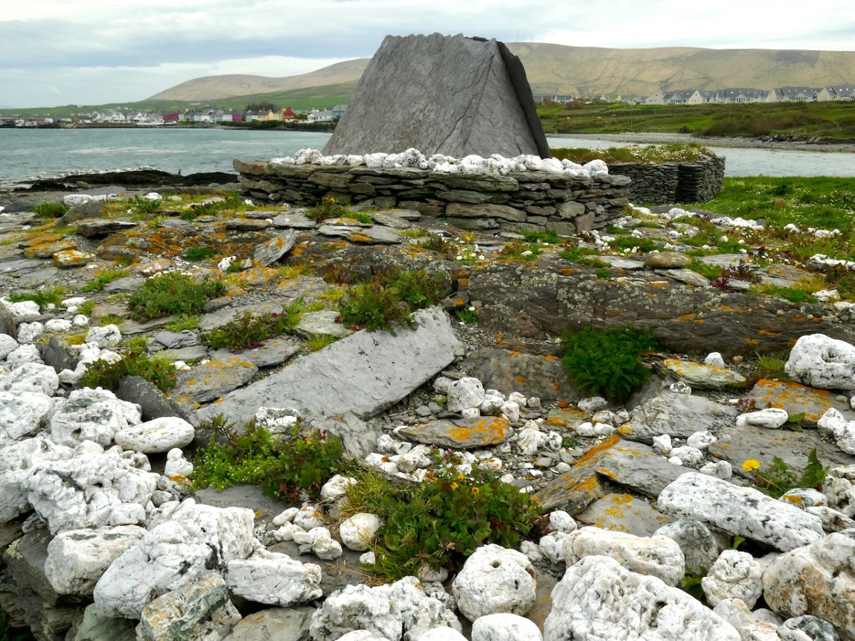
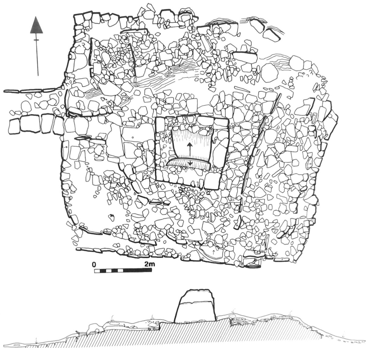
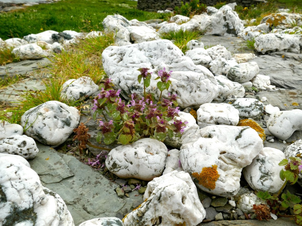
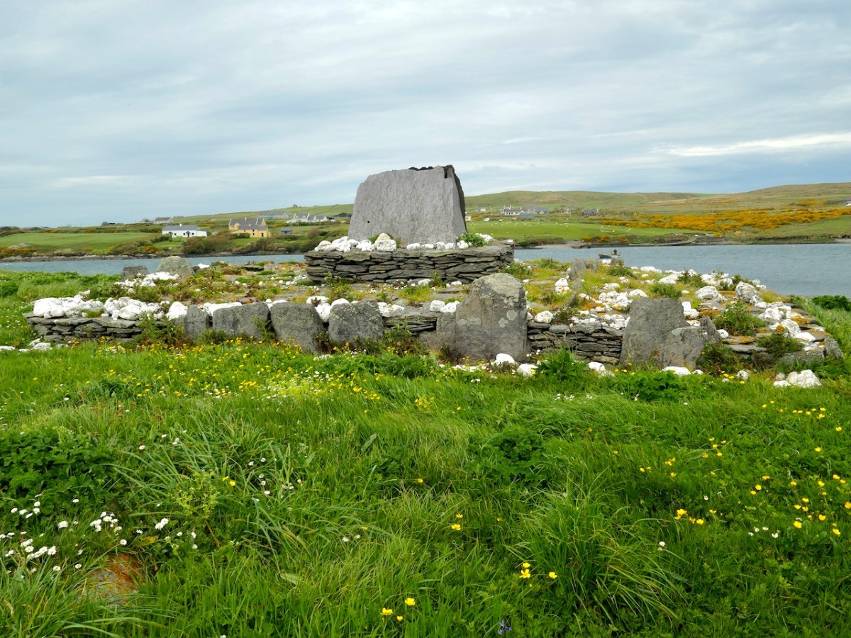
 . . . The gable-shrine is one of a small group of reliquary shrines that occurs at the western end of the Iveragh Peninsula: similar examples are found at Killoluaig, Kilpeacan and Killabuonia. These shrines or specially marked graves are generally ascribed to the founder. The base of the gable-shrine at Illaunloughan consists of a large terraced mound, 9m by 7.6m, which rises to a height of 1.5m. The mound is partly built on an area of rock outcrop which was levelled off on its southern side with soil, stone and pea-gravel. Vertically set kerb-stones and masonry walling were placed along the edges to retain this fill; the mound has been eroded on the northern side by the action of the sea. White quartz stones of varying sizes were liberally scattered over the mound. At its western edge stone steps lead up to an area of rough paving that surrounds a rectangular drystone structure on which stands the slab-shrine. The end-slabs are missing. When the side-slabs were removed an underlying core of pea-gravel and white quartz was exposed. This sealed two small, irregularly shaped, stone-lined cists, each of contained neatly stacked exhumed human bones. A minimum of three individuals, all male, is represented in this skeletal assemblage which comprised fragments of the skulls of two individuals, a single mandible, and several long bones. Large numbers of scallop shells and white quartz pebbles were placed both within and around the cists.
The eastern quadrant of the gravel mound was evidently planned as a cemetery for monks who wished to be buried close to their saints, for at least five bodies were interred here. These were laid side by side, and were extended inhumations oriented from east to west, with the heads to the west.
Following excavation, much of the shrine platform was dismantled. This revealed three rock-cut graves, all oriented from east to west, sealed beneath the mound material. The graves, located on the north-eastern, the southern and the western sides of the shrine, clearly predate the construction of the mound and shrine. Fragments of human bone were recovered from two of them, including a sizeable part of a shattered femur, found at the western end of the grave. No bone was recovered from the third grave. It is hoped to determine, through trace element analysis, whether the bones in the earlier graves represent parts of the individuals translated into the cists beneath the gable-shrine. The evidence so far collated on the Illaunloughan shrine indicates that it is a multiperiod structure. The presence of a sacred focus (an earlier shrine?) is strongly suggested by the earlier graves, though no trace of any such structure survives. C14 (AMS analysis) dating of bone from the cists beneath the gable-shrine has yielded a date in the early seventh century for one individual and the middle of the eighth century for a second. Half-scallop shells, present in the fill of the cists and on their stone lids, were clearly of some significance to those who interred the translated bones. Some of the scallop shells from the shrine have been perforated and they may have been suspended from cords. The scallop is, of course, the emblem of St James, whose remains were ‘discovered’ in a field of shells in Compostela, north-western Spain, in AD 813. The shrine at Compostela rose to prominence as a place of pilgrimage in the eleventh century (Harbison 1991, 22). This may be further evidence of refurbishment of the shrine at a late period . . .

National MoNuments Historic Environment Viewer

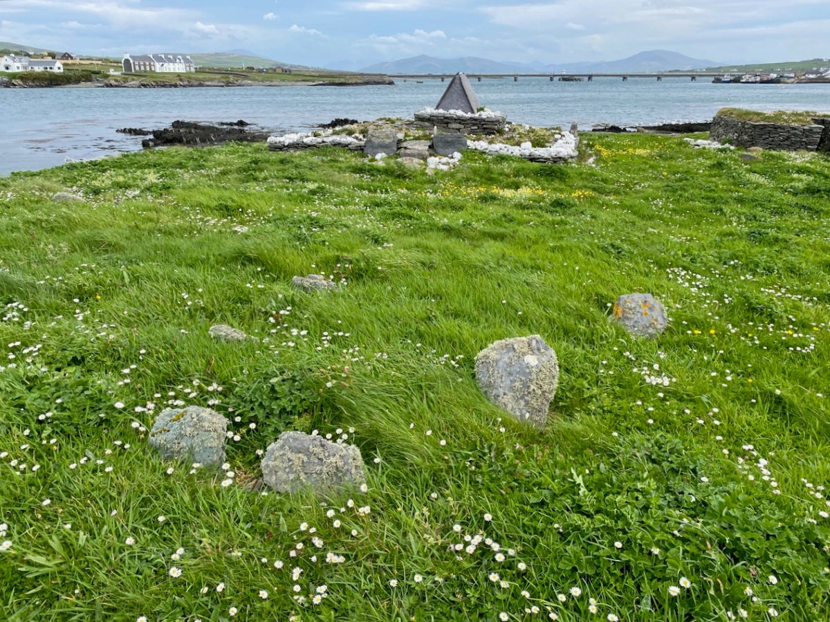
Two views of the gable shrine (upper photographs) together with a scaled drawing from the National Monuments Service (above). This distinctive site, with its embellishments of white quartz pebbles and slate capping, suggests an internment of some great importance – probably a local saint. The gable-shrine was reconstructed after excavation and is now complete. Note from the description above (National Monuments Service) that three rock-cut graves were revealed under the present structure – empty – and the suggestion has been made that the later shrine was constructed to ‘translate’ the earlier burials because of the significant status of those who were buried there.

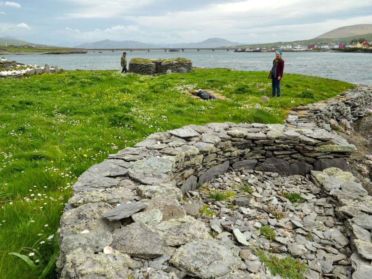
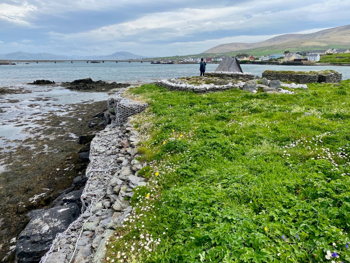
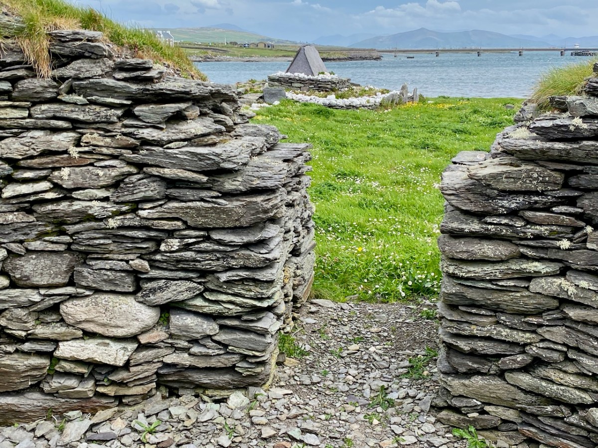
The gable shrine seen with the bridge from Portmagee to Valentia Island in the background. In front of the shrine are (probably much later) grave markers. It was common practice to put burials close to anciently sacred sites: in fact, up to the 20th century Illaunloughan was used as a cillín for the burial of unbaptised infants and as a graveyard by local people.

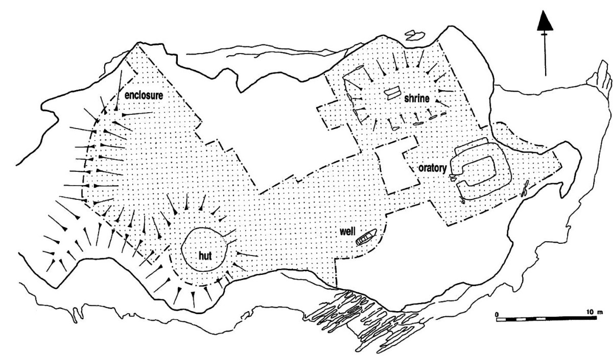
This plan of the island (National Monuments Service) shows the principal features: the gable shrine, an oratory, a stone hut and a well. It also serves to show how small the island actually is – yet it supported a community of men and children (one of the three burials in the shrine was seven or eight years old). Their main diet is said to have been fish and seafowl based. The drystone oratory (church) was excavated and radiocarbon dated to the 8th century. The excavations of the surrounding land revealed that a range of domestic and industrial activities were undertaken, including fine metal-working, bone-working and cereal processing (Irish Heritage News 2018).

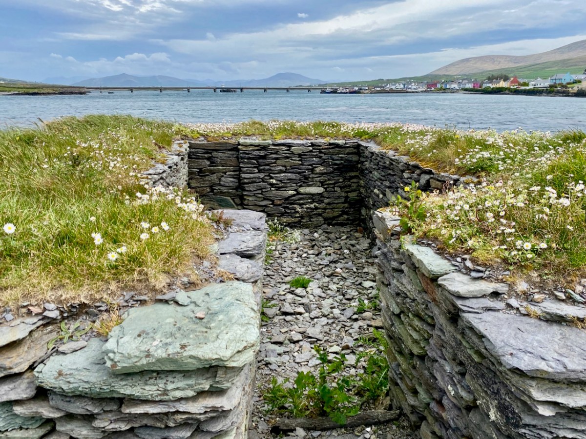
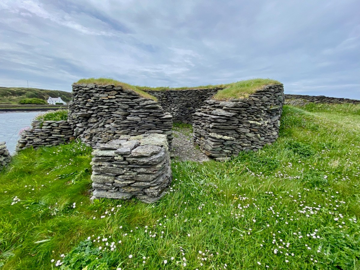
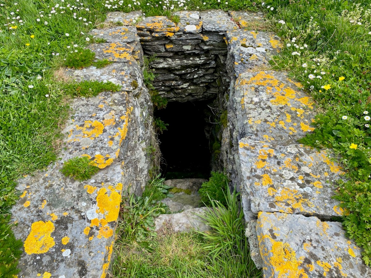
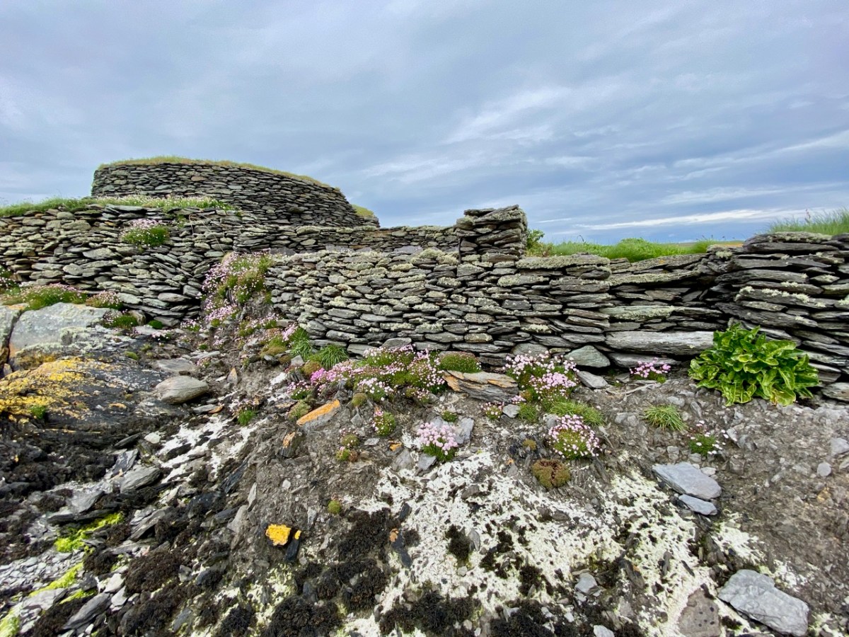
The pics above show the oratory, a stone hut and the well. The latter would have been a necessity for any permanently based community on the island: Amanda’s particular interests in holy wells made her wonder whether this one had any local folklore or dedication.

Further areas of worked stone marked out enclosures or terraced areas which would have had some significance to the community based there. After excavation, the island’s features have been returned to good structural condition. The site suffered some serious vandalism in fairly recent years. Fortunately, its general lack of access has provided some protection.

This felt to us a very special site, and we were privileged to be able to visit it. If you read the book about it, you will see that the thinking of those who carried out the excavations was that it was active from the 7th to the 9th centuries. In more recent times this dating has been questioned – possibly because radio-carbon dating results have been revised since those findings. It is now being suggested that use of the monastic site may have continued into the 11th century: we have to note that a Hiberno-Norse coin of 1020-35 was found under the paving of the plinth surrounding the gable shrine. White-Marshall and Walsh suggest this could be evidence for the use or maintenance of the shrine in the 11th century, while another commentator – Cormac Bourke (in reviewing the excavation report) – has suggested the continuous use of the site into that period.

For Amanda, the dedication of this site to a local saint would be important. Two saints named Lochan appear in the Martyrology of Tallaght (c. AD 800); one could have been the founder. It’s also worth noting that Saint Finnbar of Cork was baptised Lochan: he was educated at Kilmacahil, Kilkenny, where the monks named him Fionnbharr (white head) because of his light hair. His dates in any case do not fit with Illaunloughan: Finnbar was born around 550.

The island of Illaunloughan is low-lying, and at some risk of future indundation if climate change leads to drastic sea-level rise. We were fortunate to get the opportunity to visit this magical place, thanks to our local boatman – who bore us safely back to dry land!

PS Many thanks to Amanda ClarkeHoly Wells of Cork & Kerry – for dreaming up this remarkable adventure. And for finding us a boatman!

Beranger’s West Cork?

Who was Gabriel Beranger and why was his work so important? And why have I added a question mark? All will be revealed.

Timoleague Castle, abbey and town, co[unty] of Cork (RIA MS 3 C 30/68)

While we have several Beranger watercolours of Cork subjects, only two, Timoleague (above) and Castlehaven, are from West Cork*. They are the earliest painted depictions of each place, and as such represent incredibly significant records. Each one dates between 1770 and 1799. The description of the watercolour above says: A scenic view of Timoleague Castle, abbey, surrounding town and river [Argideen] Co. Cork. Two men, hauling a boat along the bay are depicted in the foreground of drawing.

The Abbey (actually a Franciscan Friary) is easily recognisable, but the castle is nowadays hidden behind other buildings. There is no real sign of a ‘town.’

Here’s what it looks like nowadays.

There’s a second drawing of Timoleague, this time done from a different perspective and focussing on the Castle, which is surrounded by an extensive bawn wall.

Now on to the watercolour of Castlehaven. It’s beautiful, I think. Importantly, it shows the tower house as complete, whereas it is nowadays only a stub, covered in ivy and brambles.

The church in Castlehaven graveyard is shown as a house rather than a church. The small addition to the left end of it may have been, according to Conor O’Buachaille of Gormú, a guardhouse, a feature of graveyards from the grave-robbing era.

Gabriel Beranger , born in around 1729, was from a Dutch Huguenot background, but settled in Ireland in his early 20s. He was a printer and watercolourist who spent a lot of time travelling around Ireland and recording what he saw – often landscapes, but particularly anything of antiquarian interest. Wealthy patrons employed him for that purpose, since antiquarian pursuits were popular among the gentry. Helpfully, he kept notes along the way in a journal. The journal, Beranger’s sketchbooks and some of the watercolours came into the possession of Sir William Wilde about a hundred years after Beranger’s death, and we are indebted to Wilde for most of what we now know about the artist. Wilde wrote a series of posts based on this material for the The Journal of the Royal Historical and Archaeological Association of Ireland, now the Royal Society of Antiquaries of Ireland. Wilde took up a lot of space with his own theories about the antiquities themselves (he didn’t believe that round towers could have been bell towers, for example) but did manage to squeeze in some biographical and professional data about Beranger.

The good old Dutchman was spare in person, of middle height, his natural hair powdered and gathered into a queue; he had a sharp, well-cut brow and good bushy eyebrows, divided by the special artistic indentation; a clear, observant, square-ended nose, that sniffed humbug and took in fun; clear, quick, brown eyes; a well-cut, playful, dramatic mouth, eloquent and witty; not a powerful, but a chin quite congruous with the face. Well shaven, no shirt to be seen, but his neck surrounded with a voluminous neckcloth, fringed at the ends, a drab, rather Quaker-cut coat and vest for household purposes, and when out on sketching excursions he had on a long scarlet frock coat, yellow breeches, top boots, a three-cocked hat, and held in his hand a tall staff and a measuring tape. Like Woverman’s white horse or Petrie’s red woman, he frequently introduced himself in this remarkable but at the time not uncommon costume into his pictures. He was a keen observer of nature, men, and manners, and appeared to relish Irish fun, as indeed his dramatic cast of countenance, shown in the very good crayon drawing made by himself when about middle life, would indicate, and of which an admirable lithograph is appended to this biography.


Memoir of Gabriel Beranger, and His Labours in the Cause of Irish Art, Literature, and Antiquities,
from 1760 to 1780, with Illustrations
W. R. Wilde
The Journal of the Royal Historical and Archaeological Association of Ireland, Fourth Series, Vol. 1, No. 1 (1870),
https://www.jstor.org/stable/25506575

Of his art, this is what Wilde has to say:

He was a most painstaking artist, and a faithful delineator of antiquarian remains. He is said to have been self-taught, and this may account for the hardness of some of his drawings; yet no one of his time could draw an old castle, a cromlech, or a round tower better ; but his extended landscapes were not good, and more resemble plans than pictures. He particularly failed in trees and green fields. Had his observations and descriptions, and his drawings of Irish scenery and antiquities, been published eighty or ninety years ago, they would have caused archaeological study to progress in this country, and perhaps forestalled the opinions of subsequent writers.

Ditto

Then comes the part that is most pertinent to West Cork:

To each volume there is, at the commencement, a copious Alphabetical Index, followed by an ” Advertisement,” stating that ” the castles which com pose this collection I designed on the spot, except the following, which were communicated to me by various gentle men here undernamed, whose kindness I acknowledge with thanks,” &c. From this it would appear that besides his own drawings he obtained, with a view to publication, several others which I am inclined to think he copied with his own hand for the purposes of his work. Among the names of persons who contributed sketches, we find that of Colonel Charles Vallancey as the most conspicuous.

Ditto

Wilde (below, as a young man) died before he could finish his series on Beranger and the last piece was written by Lady Wilde, who occupied most of it with a paean of praise to her husband. William and Jane were at the forefront of the literary of antiquarian movements of their day, and are also, of course, remembered as the parents of Oscar.

There is, as it turns out, no record of Beranger having been in West Cork, although we know he took extended painting trips to several counties – including Wicklow (see my post Antiquarians loved Glendalough) and Sligo (Robert’s Discovering Carrowmore). What we are sure about is that General Charles Vallancey was here, first to manage the defence of southwest Ireland against the threat of French invasion, and then to make a series of grand plans to link West Cork to the rest of Ireland and to the world! I hope to write more of this in a future post.

So – whose West Cork is this – Beranger’s or Vallancey? The answer is – both. In the Digital Repository, both are acknowledged as originators. Vallancey was a man of enormous energy and drive. He wrote several volumes of his Collectanea de rebus hibernicis, (available at the Internet Archive) and required illustrations for them – hence his patronage of Beranger, and others. The illustration above is from one of his Collectanea and so he must have wished himself to be depicted this way, as benign and intellectual. Love those little glasses! He was a scholar of Irish – one of the first to raise its profile as an ancient and beautiful language – and an antiquarian of the fanciful sort – forever banging on about druids and Chaldeans and coming up with far-fetched theories. Unfortunately, we don’t have Vallancey’s originals, so we can’t compare the accuracy of the drawings. While we know that Beranger’s reputation was for painstaking exactness, we don’t have the same information about Vallancey’s. To me, comparing it to places Beranger drew on the spot, the rendition of the castles looks a little approximate, especially the fenestration. Nevertheless, as illustrations of two places in eighteenth century West Cork, these watercolours are priceless.

One last detail and quote. Wilde was able to describe Beranger’s dress – that’s because he often put himself in the frame, to add human scale and interest. In his lively piece Beranger’s painted people – himself and others, Peter Harbison gives several examples. But we have our own, from the Timoleague Castle painting. There he is, in his long scarlet frock coat, yellow breeches, top boots, a three-cocked hat, and held in his hand a tall staff and a measuring tape. (Well, more or less.)

Do you know Timoleague and/or Castlehaven well? Can you add to the commentary on those painting? I’d love to have any comments you might have.

*I am grateful to the Digital Repository of Ireland, under whose Creative Commons License I have used these illustrations. See here for more of their Beranger collection.