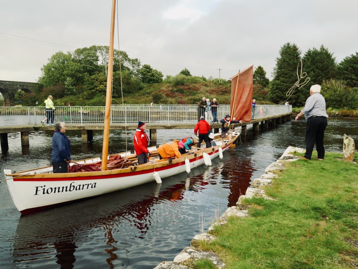
The importance of West Cork in world history was emphasised today at the Ballydehob Cruinniú na mBád (Meeting of the Boats). This annual event reminds us how busy our quay was back in the day when all the commerce of the village was based on the tidal waters. Finola wrote about the gathering in 2017. But today – 19 August 2023 – I had my eye out for a very particular vessel: Fionnbara.
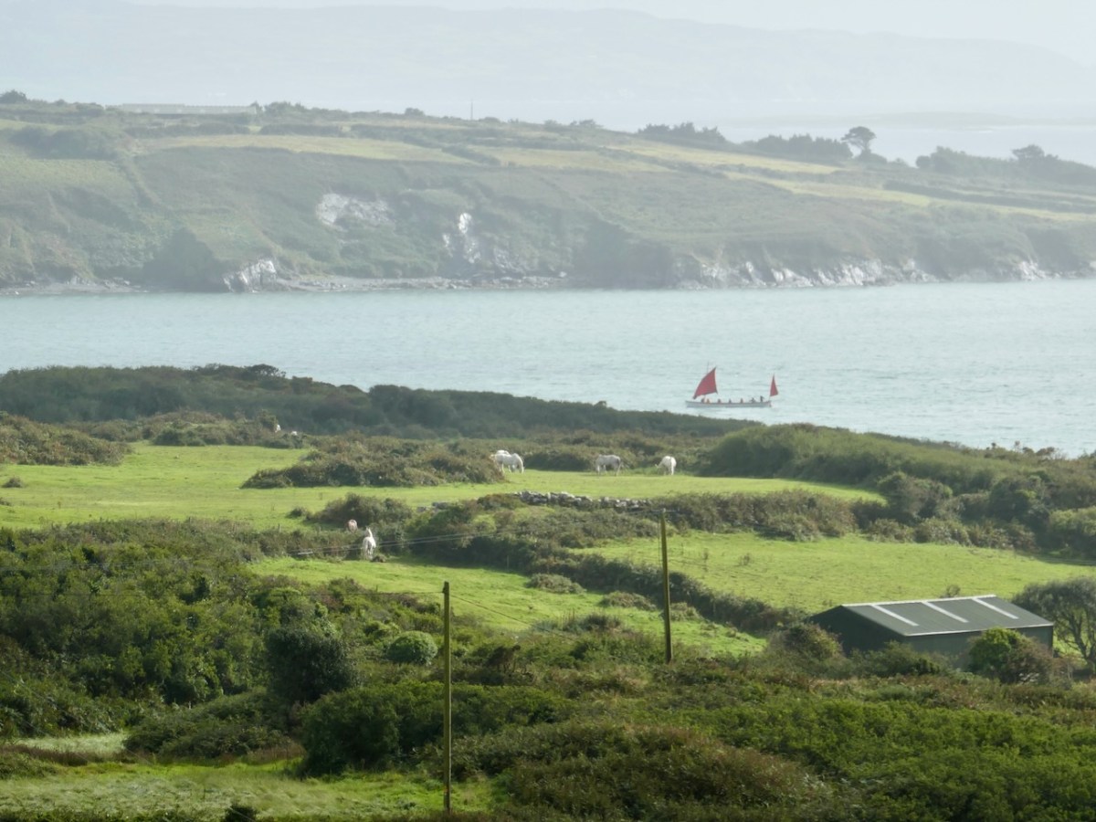
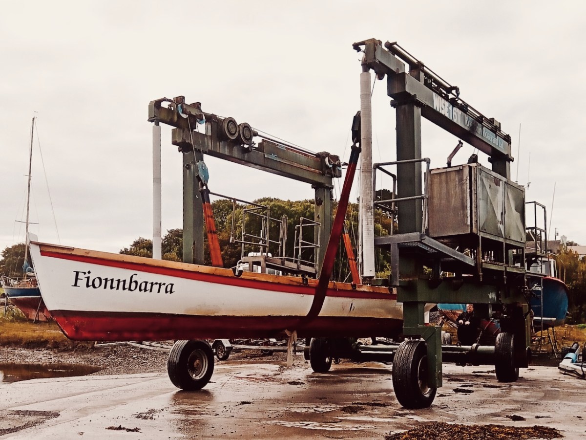
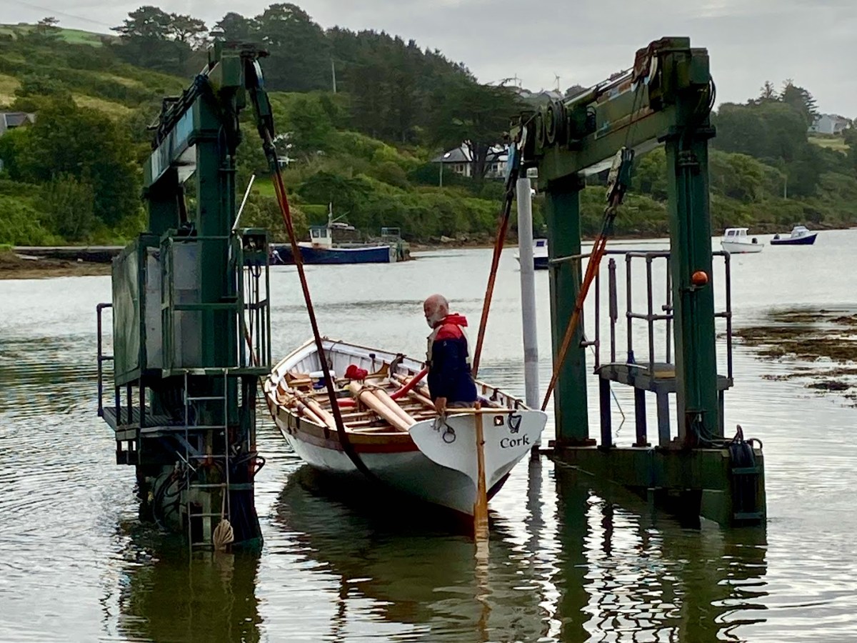
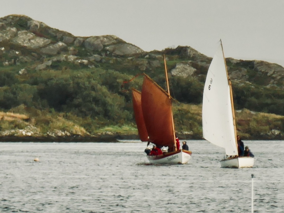
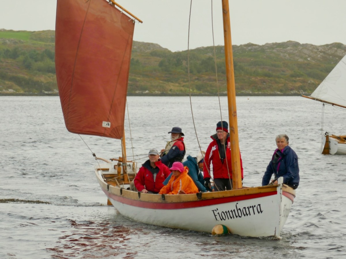
There she is – above – leaving Rossbrin Harbour today, bound for Ballydehob. And here she is being launched early this morning, using the boatyard’s lifting gear. Many thanks to Jack O’Keeffe – her Skipper – and Anne O’Keeffe for the great photos.
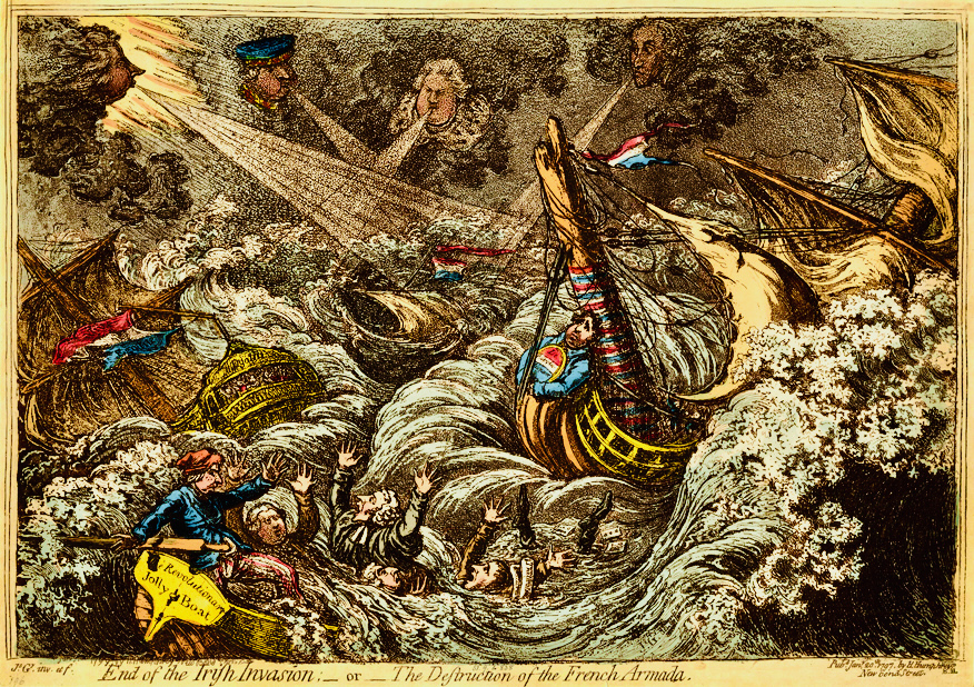
Above: ‘End of the Irish Invasion’ or ‘The Destruction of the French Armada’ by James Gilray 1797 (courtesy of the British Museum)
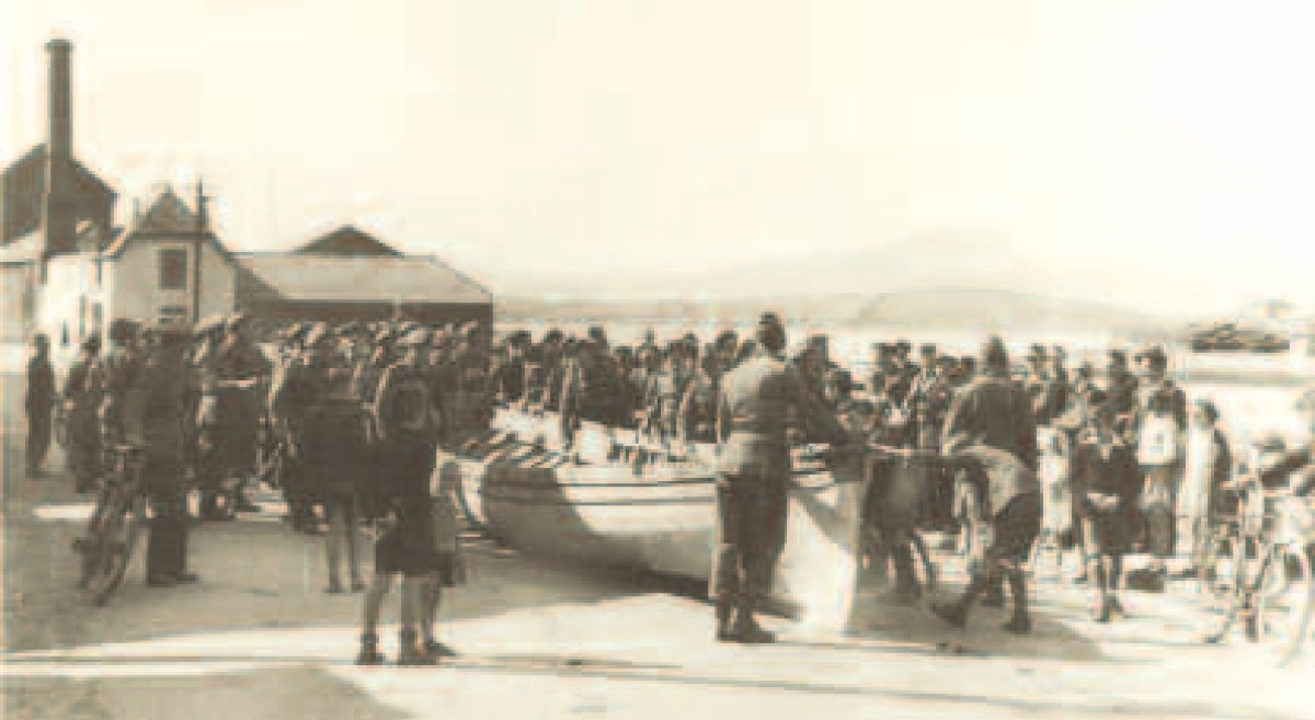
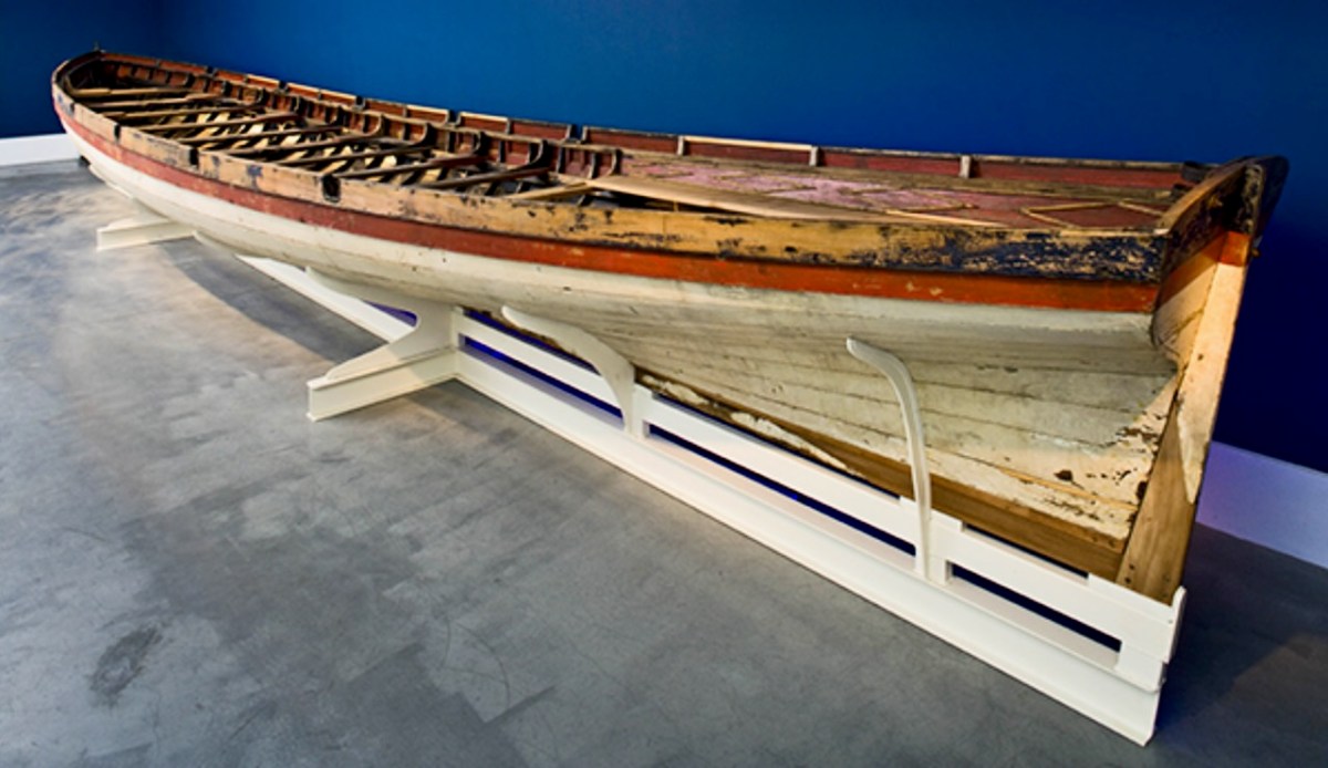
The boat is a replica – one of many around the world – of a craft which found its way to the shores of Bere Island – in West Cork – in 1796, after a disastrous escapade by the French navy, under the encouragement of Theobald Wolfe Tone of the Society of United Irishmen. A fleet of 43 vessels carrying 14,000 men headed for Bantry Bay intending to invade Ireland and declare it independent from Britain. Severe storms threw the ships off course and into disarray, and the opportunity was lost. During the chaos one of the French ships – La Résolue – lost her masts in a collision. Lt Proteau was sent in a ‘barge’ to find another ship to tow the frigate to safety, but instead he and his crew were driven ashore and captured. The ‘barge’ was taken as a prize of war and handed to the local Irish militia commander, Richard White of Bantry House. There it remained – gently rotting – for 148 years. In 1944 it was despatched to the National Maritime Museum in Dún Laoghaire and – after conservation – is now displayed at the Collins Barracks Museum. The ‘Bantry Bay Boat’, ‘Bantry Skiff’ or ‘Bantry Yole’, as the unusual craft is variously known, has attracted considerable attention and has inspired many boatbuilders to produce copies.
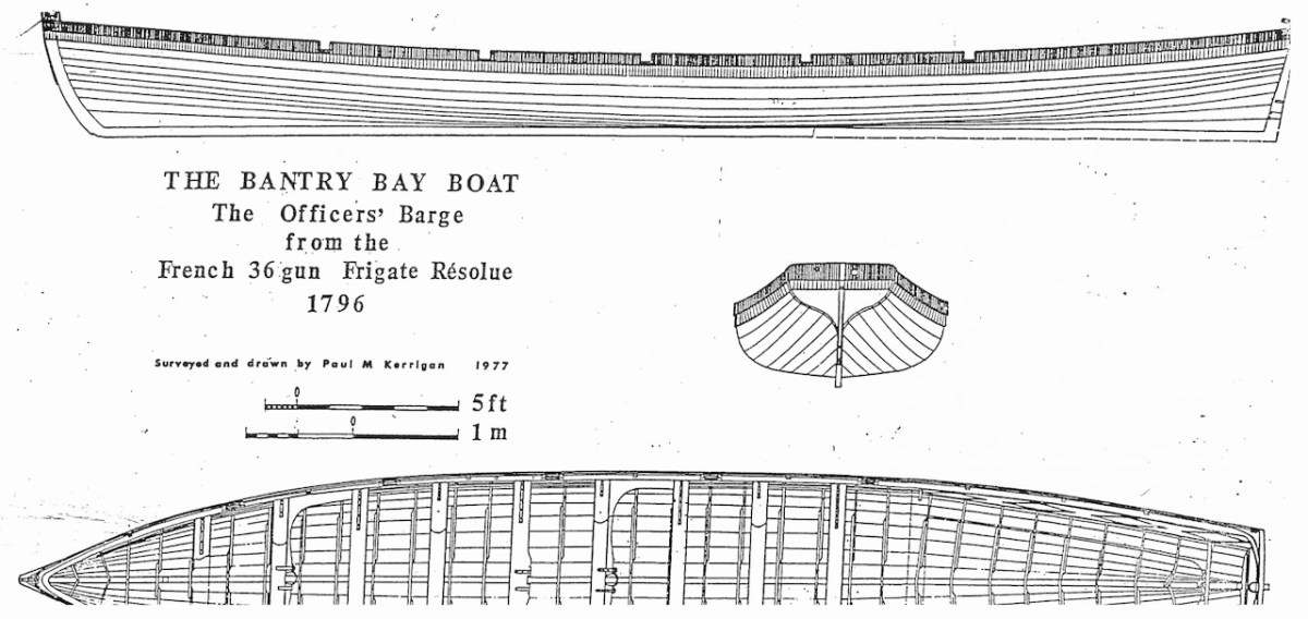
Below: upper – the Bantry Boat being transported from Bantry Railway Station to Dún Laoghaire in 1944; centre – plans of the original craft drawn by Paul Kerrington in 1977; lower – the original Bantry Bay Boat on display in the Collins Barracks Museum today (courtesy History Ireland – article by Lar Joye July/August 2018)
One of these copies is the Fionbarra, which arrived in Ballydehob today. The original was 11.64 metres long, 2.05 metres in beam, and a very fast boat. It was powered by ten oars or three sails, and could carry around ten passengers as well as the crew.
Ballydehob Bay today, 19th August 2023. The small boats are beginning to approach the old quay. With thanks to Finola for many of these photographs.
Building of the Fionbarra began in Waterford and was transferred to Meitheal Mara, a community boatbuilding venture based in Cork city. Construction was completed in 2008. We really appreciated the work of the team who transported her to West Cork and sailed her up the estuary today.
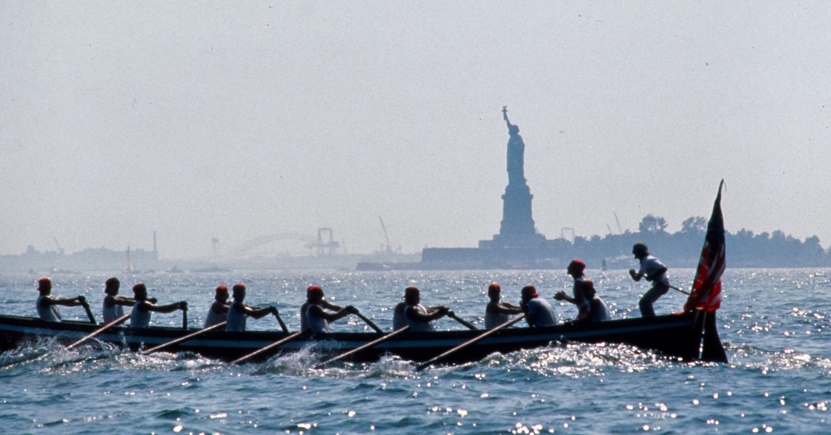
You may wonder why I have put in a header pic from across the Atlantic? This is to demonstrate the influence that the West Cork ‘Bantry Yole’ has had on the boating community all around the world. Atlantic Challenge International was founded in 1984 as a maritime training trust, and its activities are largely based on replicas of the 1796 Bantry craft. As a consequence there are relatives of the Fionbarra in many countries. I understand that there are currently at least 80 such replicas, spread over four continents, in the present day.
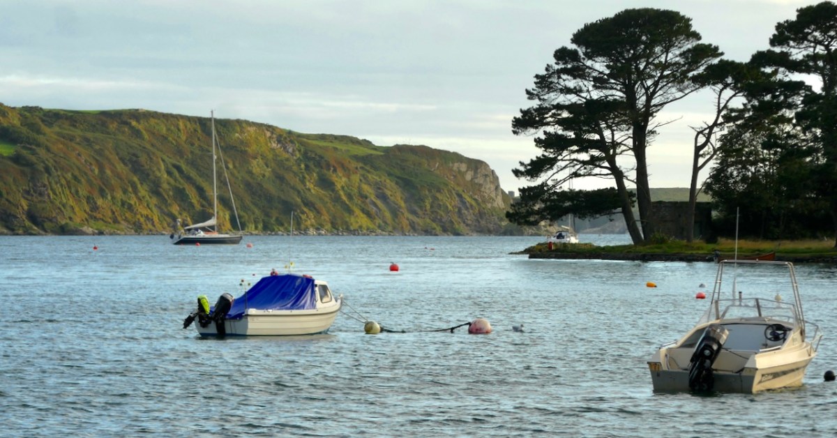
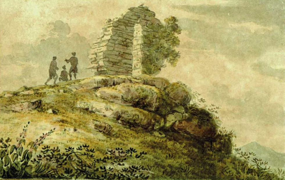
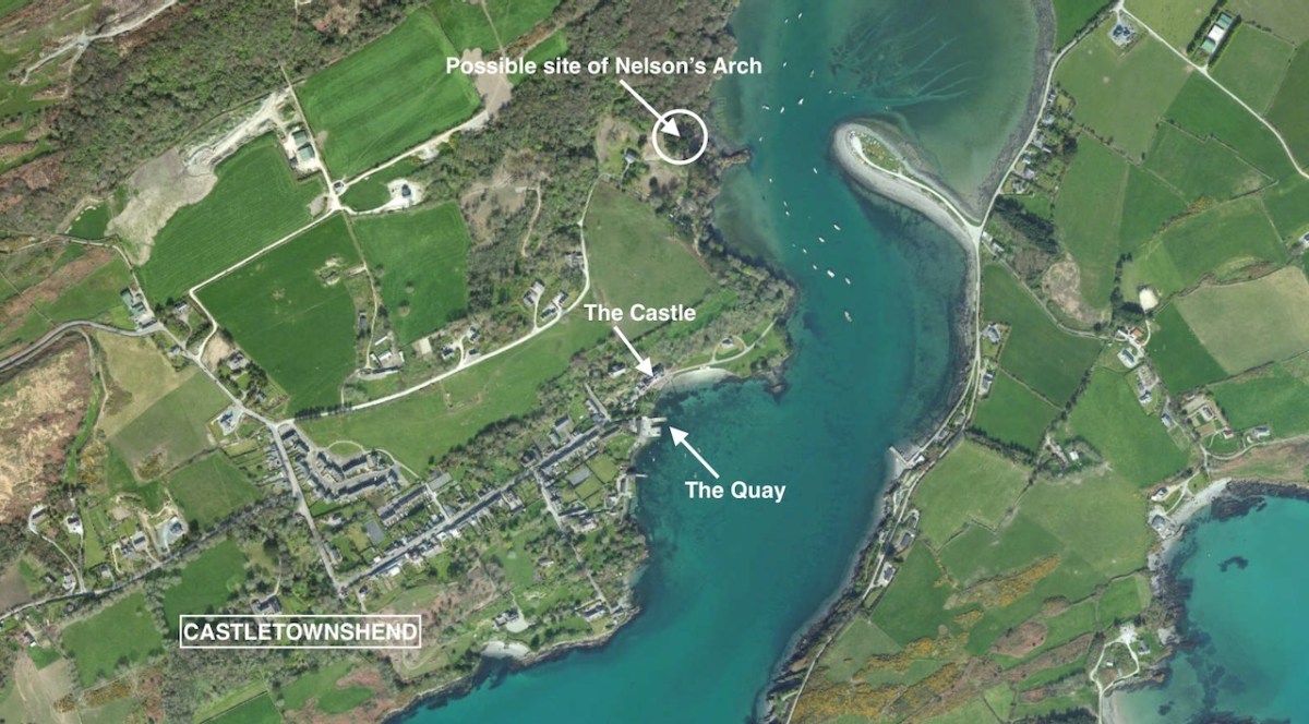
This is the inlet at Castlehaven, looking towards Castletownshend. It’s a peaceful scene. Finola and I were in the village at the weekend, showing groups around the church and the graveyard: it was a West Cork History Festival event. Very recently, I came across a reference to a structure that used to stand looking over this inlet: it was known as Nelson’s Arch. Here’s a watercolour print dating from the early nineteenth century . . .
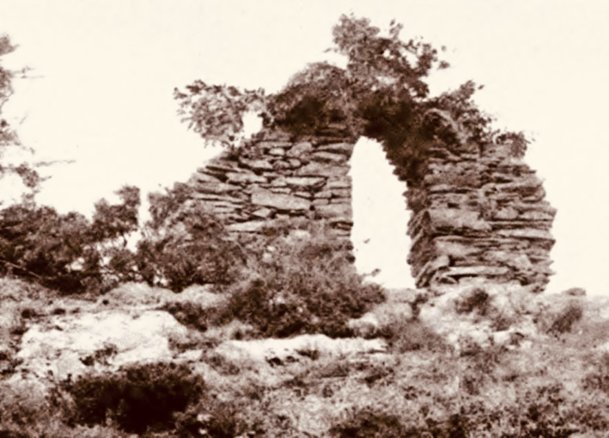
It looks like part of a ruined building. In fact, this is how it appeared when built! It’s a folly, but with a purpose. It commemorated the death of Britain’s Admiral Nelson, and the defeat of the French fleet at the Battle of trafalgar in 1805. Dennis Kennedy researched the arch and wrote an article about it for History Ireland, in January 2016. here’s a brief extract:
This arch . . . was the first monument erected anywhere in the world to the victor of Trafalgar, Admiral Lord Nelson. It was completed twenty days after the battle, and less than a week after the first news of it reached these islands. The artist, and the builder, was Captain Joshua Rowley Watson RN, then stationed in Castletownshend as the naval officer in command of a large force of Irish Sea Fencibles defending that section of the west Cork coastline against possible French invasion. On hearing of the victory at Trafalgar and the death of Nelson, Captain Watson designed and built, in one day, the rough stone arch . . .
Dennis kennedy, History Ireland Issue 1, Volume 24
I can’t tell you for sure where this arch was constructed, only that it ‘looked out over the harbour at Castletownshend’. I am speculating that the site was where I have indicated in the above aerial view. My reason for suggesting this is that is an old archaeological record shown on the earliest Ordnance Survey maps states that ‘a structure’ existed at this spot. Evidently a plaque (now lost) was placed on the ‘structure’ setting out its origin:
. . . This arch, the first monument erected to the memory of Nelson after the battle of Trafalgar, was sketched and planned by Captain Joshua Rowley Watson RN, and built by him and twelve hundred of the Sea Fencibles then under his command (assisted by eight masons). It was erected in five hours on the 10th of November 1805 . . .
Dennis kennedy, History Ireland Issue 1, Volume 24
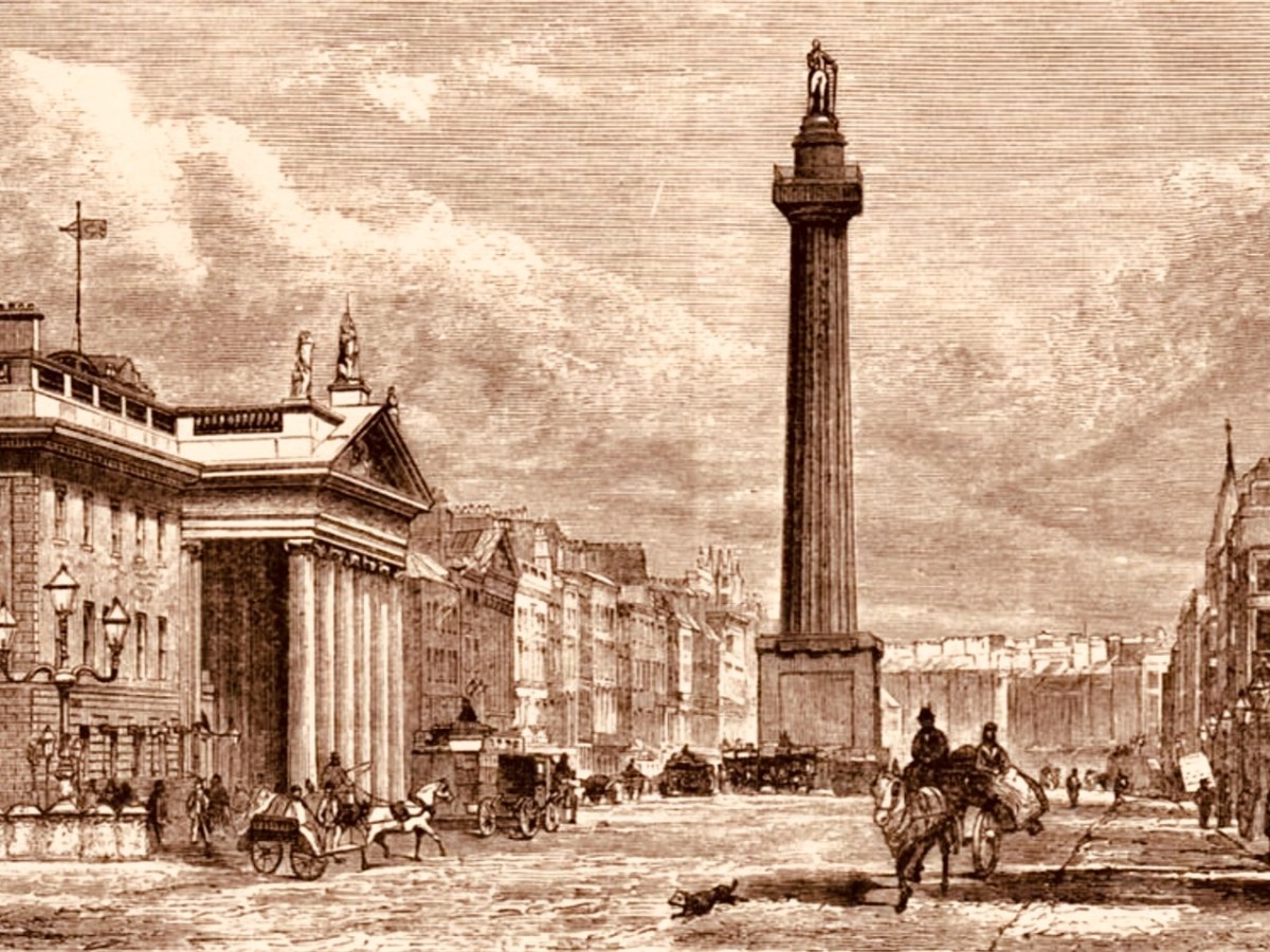
The idea of twelve hundred men – and eight masons – building this structure is hard to ponder. The Battle of Trafalgar took place on 21 October 1805. Subsequently, of course, two further notable monuments to Nelson were erected: the column in Trafalgar Square, London, was completed in 1843 to a design by the architect William Railton at a cost of £47,000. It’s still standing, guarded by its four bronze lions, which were added by Sir Edward Landseer in 1867. Its height (to the tip of Nelson’s hat!) is 51.59 metres. But Dublin City Centre also had a Nelson’s ‘column’:
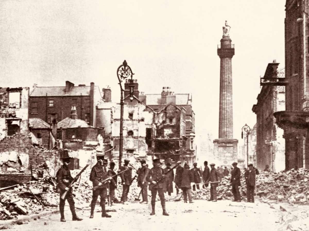
This structure in today’s O’Connell Street was made by Cork sculptor Thomas Kirk. From its opening on 29 October 1809 the 40.9 metre high Pillar was a popular visitor attraction, as it contained a staircase which could be climbed by the public, and which provided a wide view over the city centre. The London column – built from Dartmoor granite – was never provided with a staircase, but it’s a ‘must-see’ tourist destination. It’s actually the only extant monument to Nelson: having survived the rising on Easter Monday, 24 April 1916 – when the nearby General Post Office was reduced to a burnt-out shell, (below) – Dublin’s Pillar succumbed to an attack – probably by dissident volunteers – on 8 March 1966 . . .
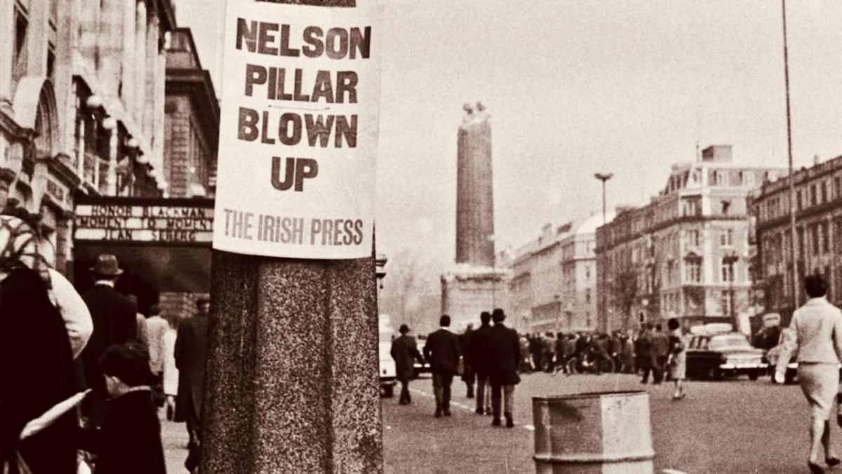
In the early hours of a Tuesday morning, a powerful explosion destroyed the upper portion of the Pillar and brought Nelson’s statue crashing to the ground amid hundreds of tons of rubble. An IRA spokesman denied involvement, stating that they had no interest in demolishing mere symbols of foreign domination: “We are interested in the destruction of the domination itself” (quote from the Irish Independent newspaper). According to Kennedy’s History Ireland article, our Nelson’s Arch at Castletownshend suffered a similar fate only a few days later, in March 1966. There must be many West Cork residents who remember the arch when it stood (and when it fell). I have only managed to find the photograph that Kennedy used in his piece:
Compare this with the watercolour sketch: it obviously survived virtually unchanged during its lifetime of 161 years. To my knowledge no-one has laid claim to destroying the structure. But the motivation – disgruntlement at a brazen symbol of British imperialism – was undoubtedly the same as the Dublin Pillar destruction. If anyone is able to provide further information on the life and death of Nelson’s Arch, Castletownshend, we would be delighted to add it here.
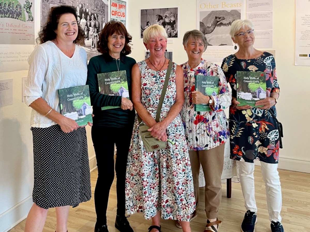
This was the scene in the Working Artist Studios, Ballydehob, on Friday evening. It was the launch of a brand new book by our friend Amanda Clarke: Holy Wells of County Cork. That’s Amanda, above, in the centre, with Finola on her left. Regular readers will know that we share many adventures with Amanda and Peter, and we were so pleased to see the successful fruition of her years of research with this outstanding volume, exquisitely designed by Peter, now available to purchase online, and in bookshops. Finola wrote about this venture last week. I thought I would indirectly celebrate it today by reviving a Roaringwater Journal post from five years ago, about one of our own expeditions that included a visit to a holy well.
Once again we followed in the footsteps of Amanda and Peter: they had visited the Glen of Aherlow in County Tipperary and pointed us to St Berrehert’s extraordinary site at Ardane which I described in this post. Not far away is another site, equally remarkable, and related to St Berrehert’s Kyle in that they were both restored by the Office of Public Works in the 1940s. They are also both very easily accessible in a few minutes from the M8 motorway at Cahir.
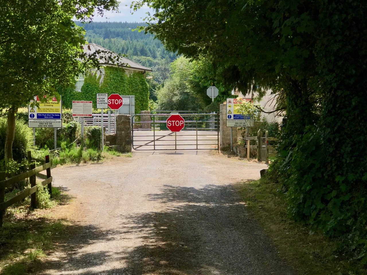
We were delighted to be travelling again through the beautiful Glen in the shadow of the Galtee Mountains (above) as we searched out a boreen that led us down to the railway. We parked and crossed at the gate, watching out carefully as this is the Waterford to Limerick Junction line used by two trains a day (except on Sundays!)
Once across, we were in an idyll. It’s a private lane, running alongside a gentle stream, but the Bourke family allow visitors to walk (as they have done for centuries) to the old church, the cell and the holy well of Saint Péacáin. Ancient stone walls line the way, and trees overhang, shading the dappled sunlight in this most exceptional of Irish seasons. We met Bill Bourke, who regaled us with tales of his life spent mostly far away from this, his birthplace – but who returned to rebuild the family home and to enjoy perpetual summer in what is, for him, the most beautiful setting in the world. He also told us of the crowds who used to come to celebrate St Péacáin at Lughnasa – 1st August – paying the rounds and saying the masses.
In her monumental work (it runs to over 700 pages) The Festival of Lughnasa – Oxford University Press 1962 – Máire MacNeill points out the harvest feast day was such an important ancient celebration that it survives as the focus of veneration of many local saints who would otherwise have been known for their own patron day, and she particularly mentions Tobar Phéacáin in this regard: a place well away from any large settlement where the great agricultural festival was so critical to the cycle of rural life.
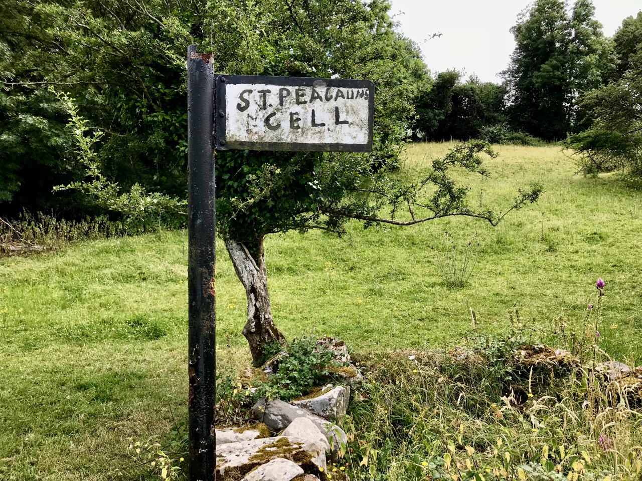
The rural setting of St Péacáin’s Cell can be seen above, just in front of the trees; the church and the well are nearby. MacNeill provides a description of Tobar Phéacáin and includes some variant names:
. . . Tobar Phéacáin (Peakaun’s Well), Glen of Aherlow, Barony of Clanwilliam, Parish of Killardry, Townland of Toureen . . . On the northern slope of the Galtee Mountain at the entrance to the Glen of Aherlow and about three or four miles north-west of Caher there is a well and ruin of a small church. About a mile beyond Kilmoyler Cross Roads a path leads up to it . . . In 1840 O’Keefe, of the Ordnance Survey team, reported that the old church was called by the people Teampuillin Phéacáin, or just Péacán . . .
. . . The well, which he described as lying a few perches south-east of the church was called Peacan’s Well or Tobar Phéacáin. It was surrounded by a circular ring of stonework. He stated: ‘The pattern-day still observed at this place falls on the 1st of August, which day is, or at least until a few years since, has been kept as a strict holiday.’ Devotions were also, he said, performed there on Good Friday . . .
A hundred years after O’Keefe wrote this, the church ruins were tidied up by the Office of Public Works. As at St Berrehert’s Kyle, it seems there were numerous carved slabs on the site and remnants of high crosses, implying a significant ecclesiastical presence here. All these have been fixed in and around the church ruin for safekeeping, and in an intelligent grouping. It’s wonderful to be able to see such treasures in the place they were (presumably) made for, and to experience them in such a remote and peaceful ambience.
McNeill continues:
. . . Nearby is the shaft of a cross which tradition avers was broken in malice by a mason who was then stricken with an inward pain and died suddenly as a punishment for his sacrilege . . . O’Keefe was told a story of a small stone, 6 or 7 inches long and 4 or 5 in depth, having ten little hollows in it and resting in a hollow of the ‘altar’ of the old church. Christ, or according to others St Péacán, asked a woman, who had been churning, for some butter; she denied having any and when the visitor departed she found the butter had turned into stone which retained the impression of her fingers . . . Nuttall-Smith speaks also of a cave where the saint used to practice austerities . . .
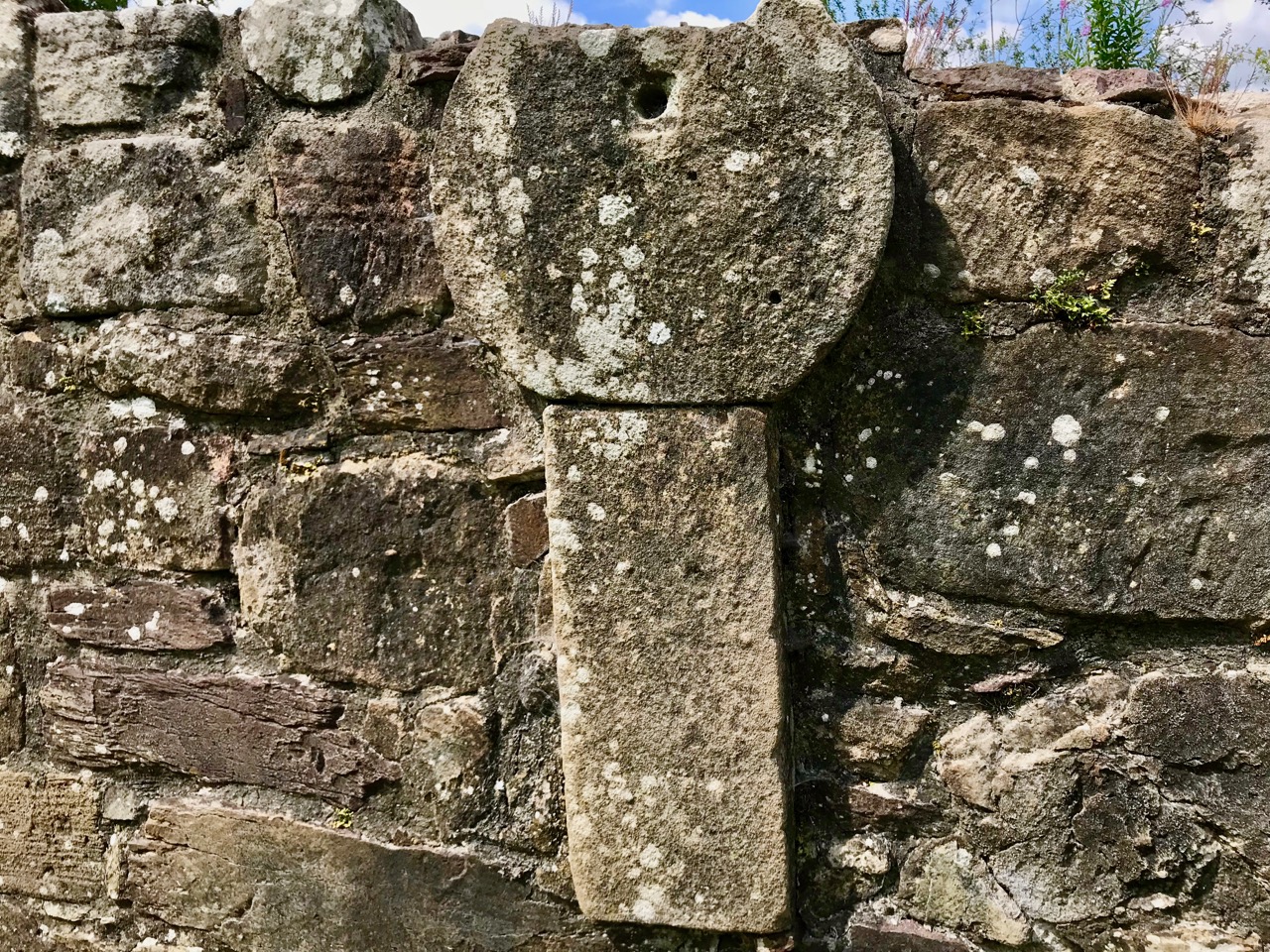
The carved fragments are quite remarkable and are in all likelihood well over a thousand years old. I have yet to see anywhere in Ireland – outside of museums – which has such an extensive collection of fascinating medieval antiquities as these sites in the Glen of Aherlow. Here you can also see cross slabs and a sundial said to date from the eighth century.
Nuttall-Smith’s ‘cave’ – quoted by MacNeill above – is likely to be St Péacáin’s Cell, set in a field on the far side of the river. This was probably a clochán, or beehive-hut, of the type once used by anchorites. It is protected by a whitethorn tree, but was quite heavily overgrown on the day of our visit. We could make out the ballaun stones inside, said to be the knee prints of the Saint who made his constant devotions there. Amanda – in her post on the holy well – reports that Péacáin would also stand daily with arms outstretched against a stone cross, chanting the psalter.
McNeill discusses the significance of weather at the August celebrations:
. . . Paradoxically for a day of outing so fondly remembered, no tradition of the Lughnasa festival is stronger than that which says that it is nearly always rainy. No doubt this has been only too often experienced. Saint Patrick’s words to the Dési: ‘Bid frossaig far ndála co bráth’ (Your meetings shall always be showery) must be as well proved a prophecy as was ever made. Still there must be more significance in the weather beliefs than dampened observation. Certainly it was expected that rain should fall on that day, and sayings vary as to whether that was a good or bad sign . . . There are a few interesting beliefs about thunder, which was also expected on that day: the loud noise heard at Tristia when the woman made rounds there to have her jealous husband’s affection restored; the prophecy that no-one would be injured by lightning at Doonfeeny, a promise also made by St Péacán . . .
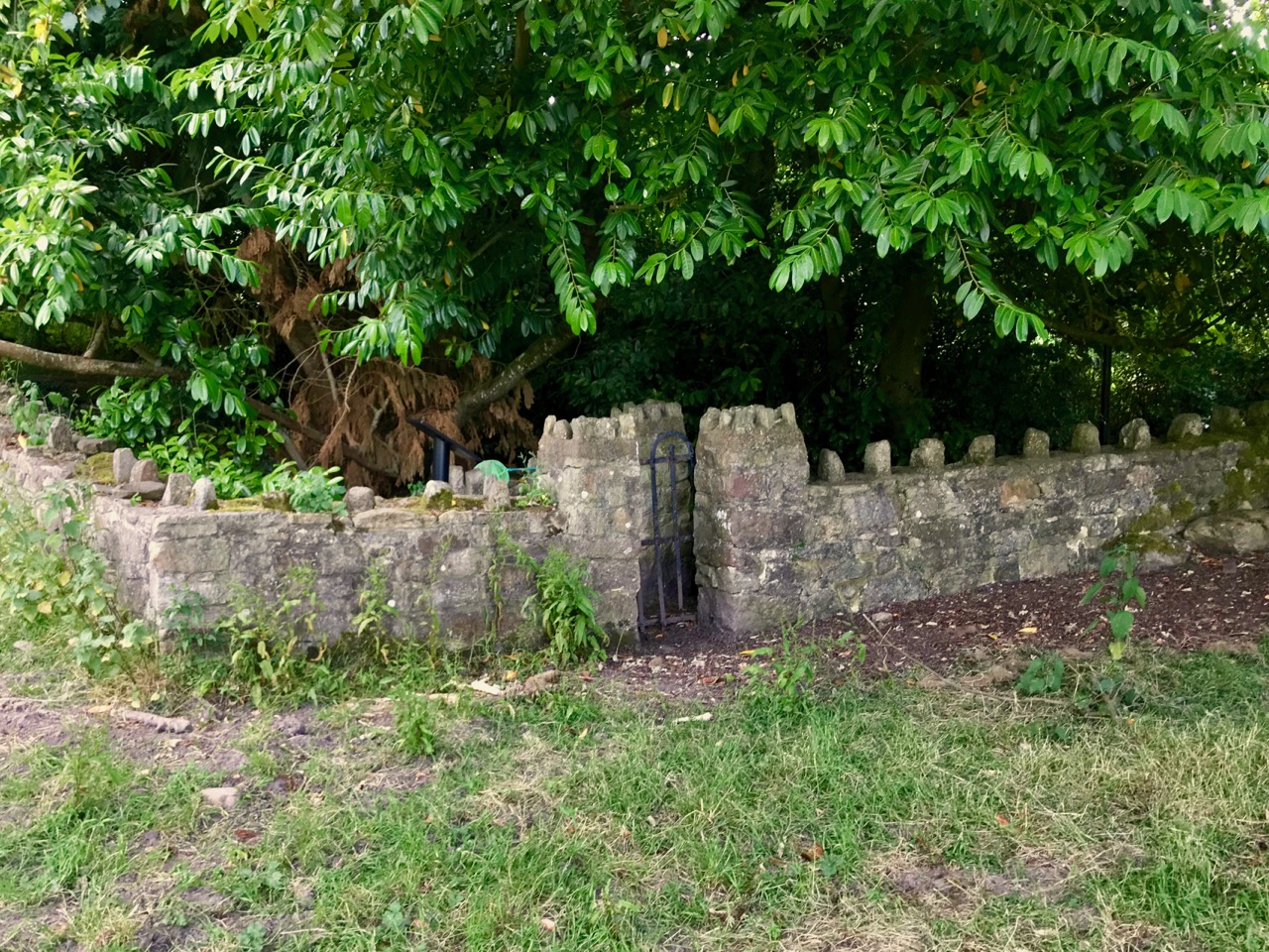
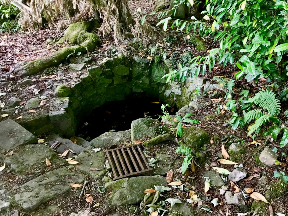
The holy well is tucked away in a stone-walled enclosure hidden under the trees on the edge of the field which contains the Saint’s cell. It is also a tranquil place, obviously still much visited: the water is crystal clear, refreshing and will ensure protection from burns and drowning. This is a magical setting to complete our day’s travels in the beautiful Glen of Aherlow.
As a finale to this little series on Ireland’s Electrification Ventures back in the 20th century, I’m taking you on a tour of Ardnacrusha. This generating station – powered entirely by water from the River Shannon – was the largest in the world when it was built by Siemens, between 1925 and 1929. Siemens AG is the foremost industrial manufacturing company in Europe, and its Irish connections began in 1874, when Siemens laid the first direct electrical cable across the Atlantic, linking Ballinskelligs Bay on Ireland’s west coast to North America. The pioneering continued, in 1883, when the company built one of the world’s first electric railways, linking Portrush and Bushmills in Co Antrim. After Ardnacrusha, Siemens became responsible for many of Ireland’s landmark achievements, including the ESB’s first pumped storage power plant at Turlough Hill; the DART rapid transport network; the baggage handling systems for Dublin Airport’s Terminal 2; and – in 2016 – the orders for Galway Wind Park – then the largest in Ireland.
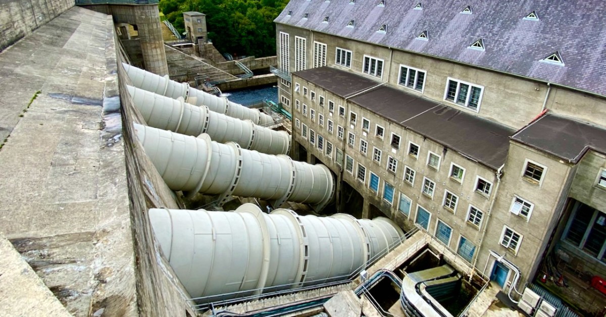
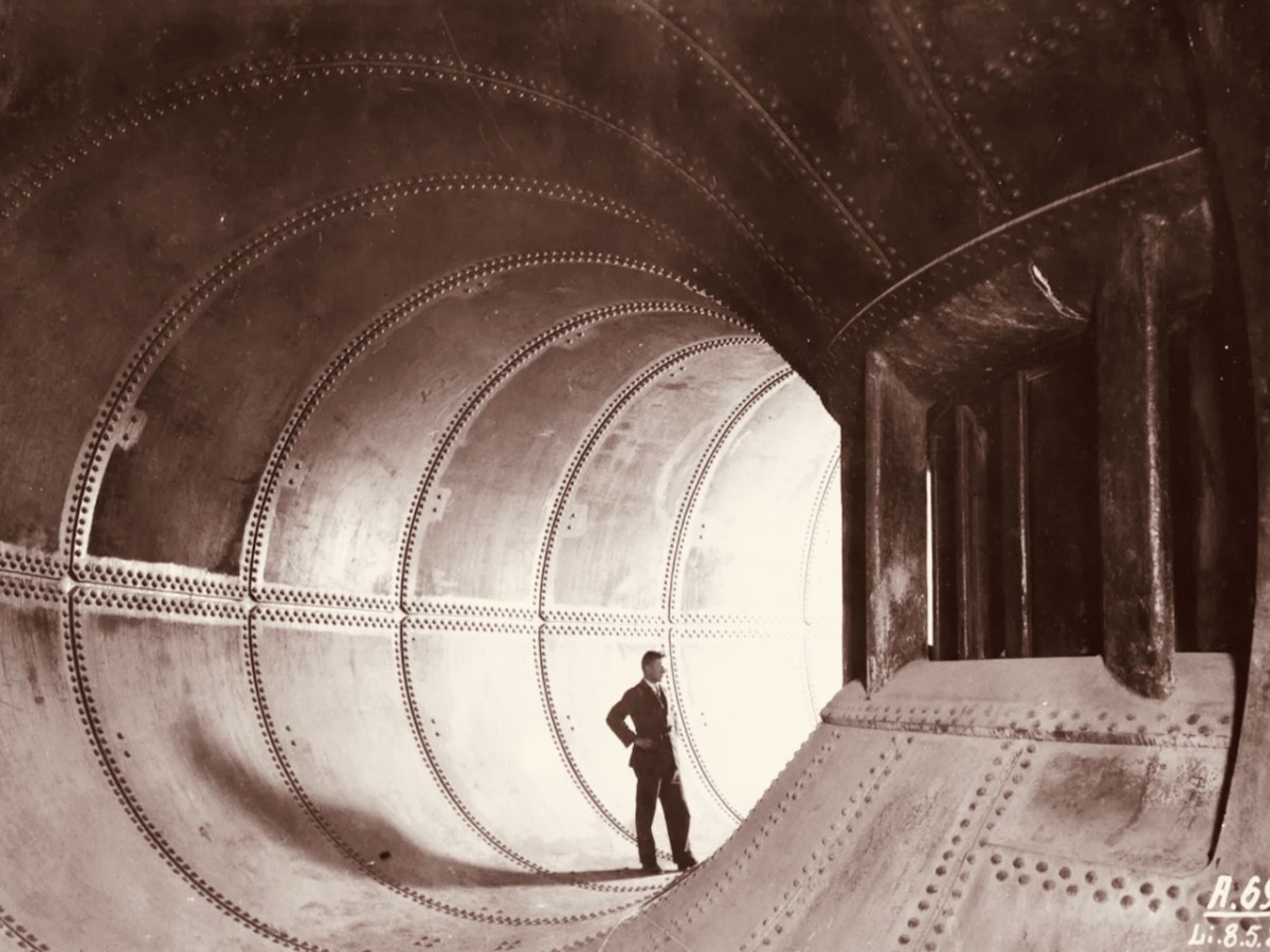
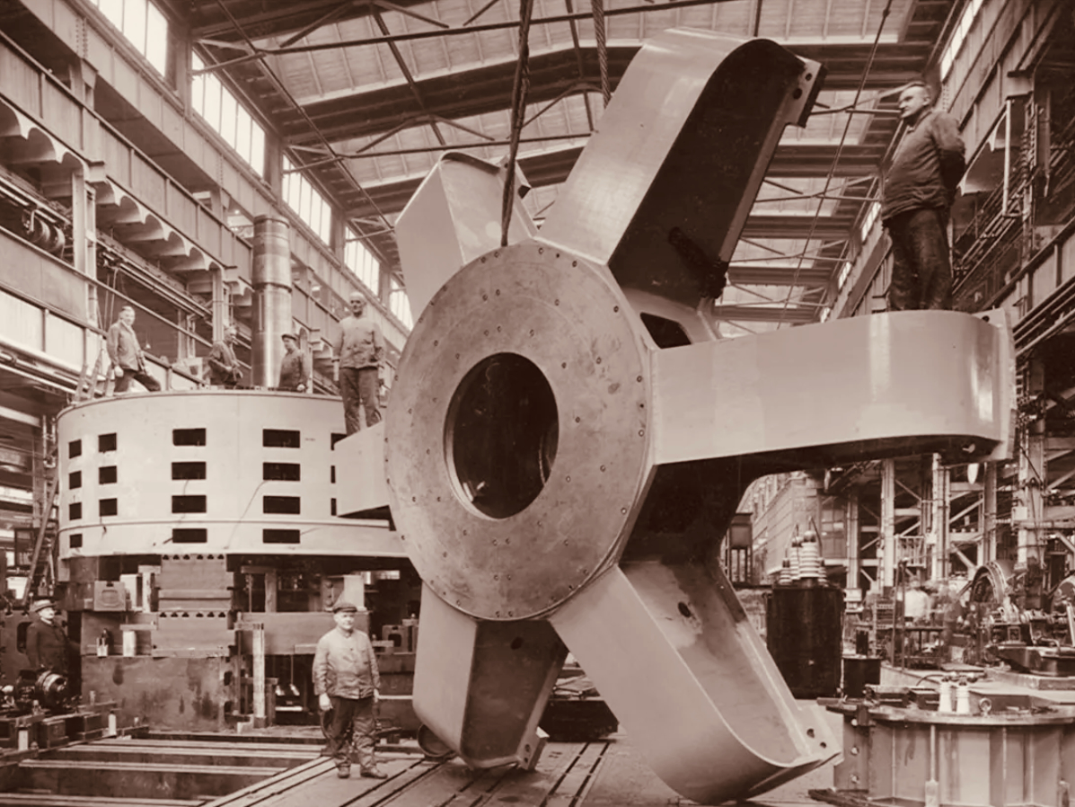
The header pic shows one of the three vertical-shaft Francis turbo-generator units after construction. These were joined by one vertical-shaft Kaplan turbo-generator unit between 1933 and 1934. Above is one of the penstocks which brings the water into the turbine casings.
. . . The construction of the Shannon Scheme was a mammoth undertaking for a country the size of Ireland, especially when the State was barely three years old. The project cost £5.2 million, about 20% of the Government’s revenue budget in 1925 . . .
ESB DOCUMENTS
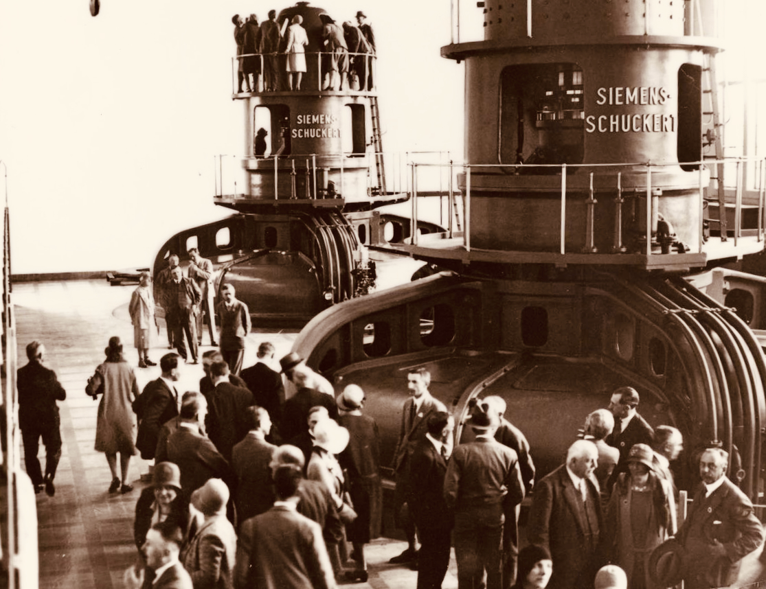
Visitors to Ardnacrusha in the turbine house on opening day, 22 July 1929 (ESB Archives). Below – a part of one generator awaiting installation (ESB Archives).
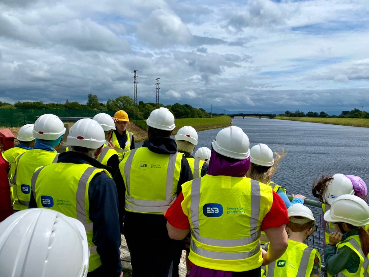
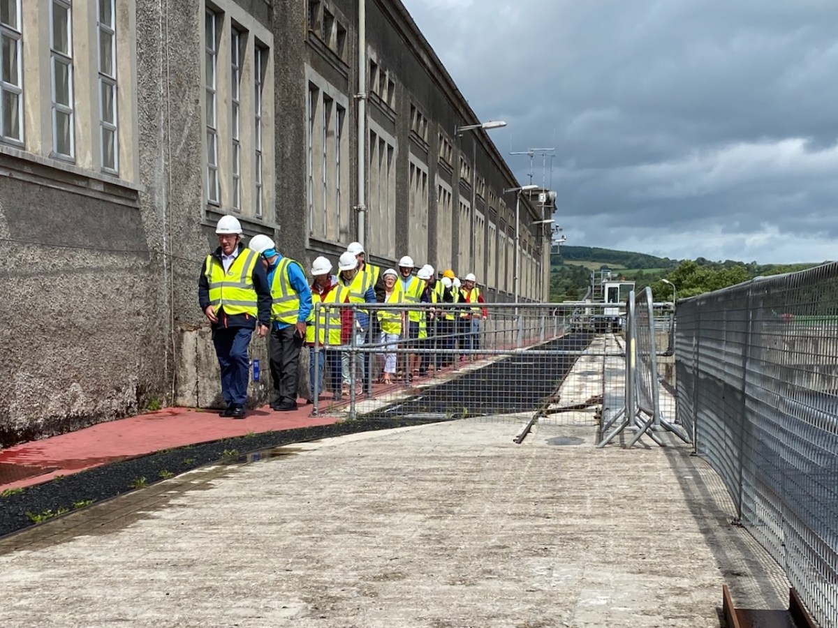
We joined a group visiting the generating station in early July. It was a great and satisfying experience! Safety was the top principle, but we got to see all the features of the whole set-up. If you want to go, book in advance – it’s free – and fascinating (if, like me, you are moved by engineering and history).
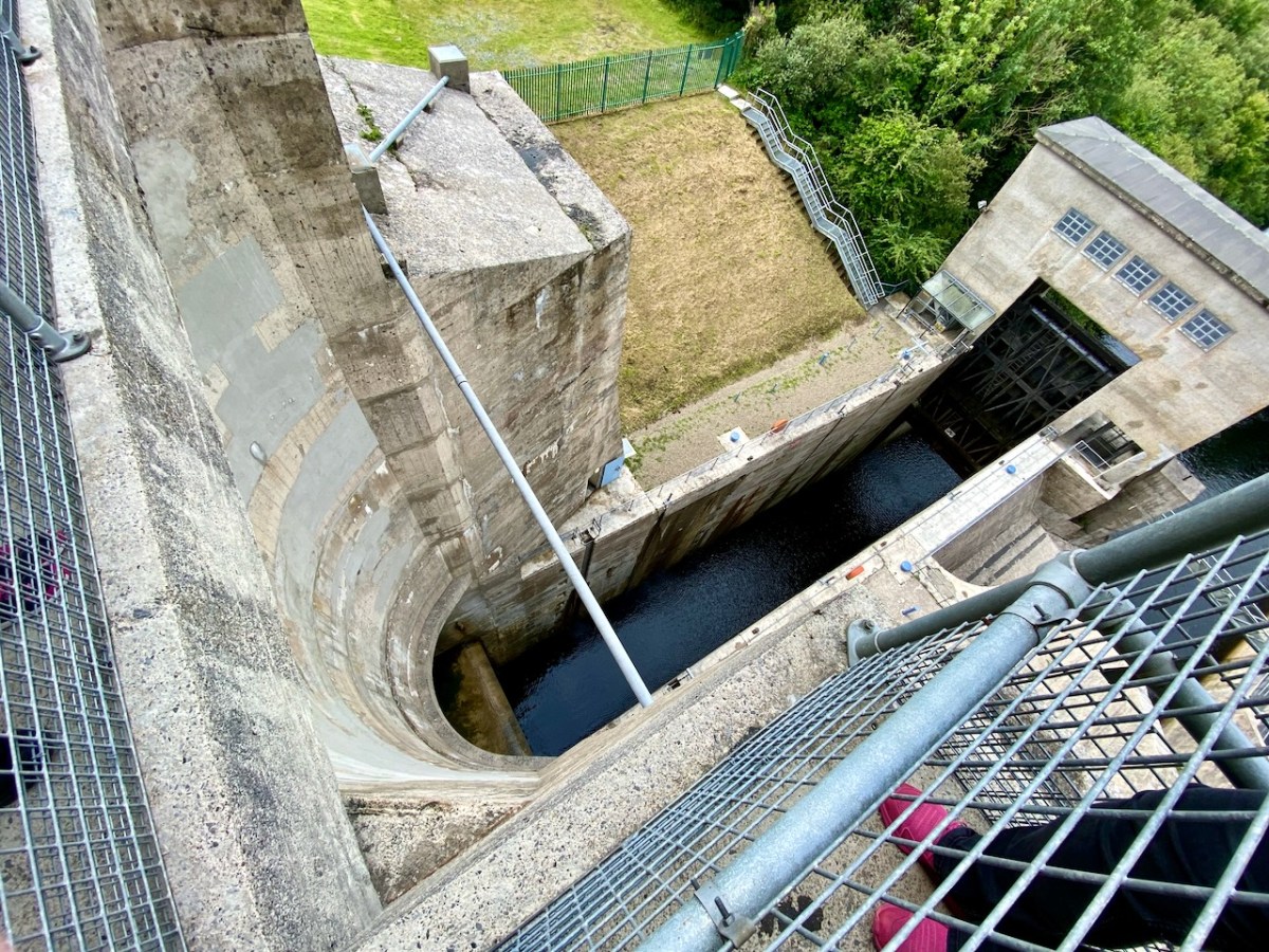
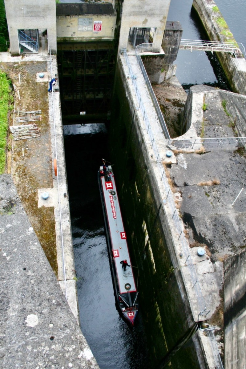
The pound lock at Ardnacrusha: it provides navigation for boats through the dam. At a drop of 100ft – 30 metres – it’s the deepest lock in the whole of Britain and Ireland. Following is a pic of a traditional British narrow-boat – NB Earnest – traversing the lock (Irish Waterways History).
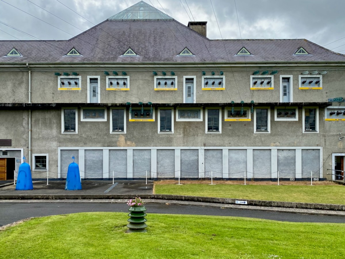
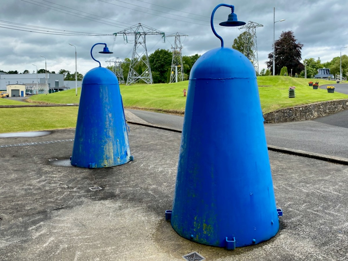
The main building at Ardnacrusha has a definite sense of ‘Bavarian Character’ to it – probably because of its German roots. I wonder if that’s the reason it escaped being bombed in World War II? Concerns were definitely expressed that this could have happened, and steps were taken to mitigate any possible damage. I was particularly impressed by these one-person air-raid shelters, which have been preserved because of their historical interest:
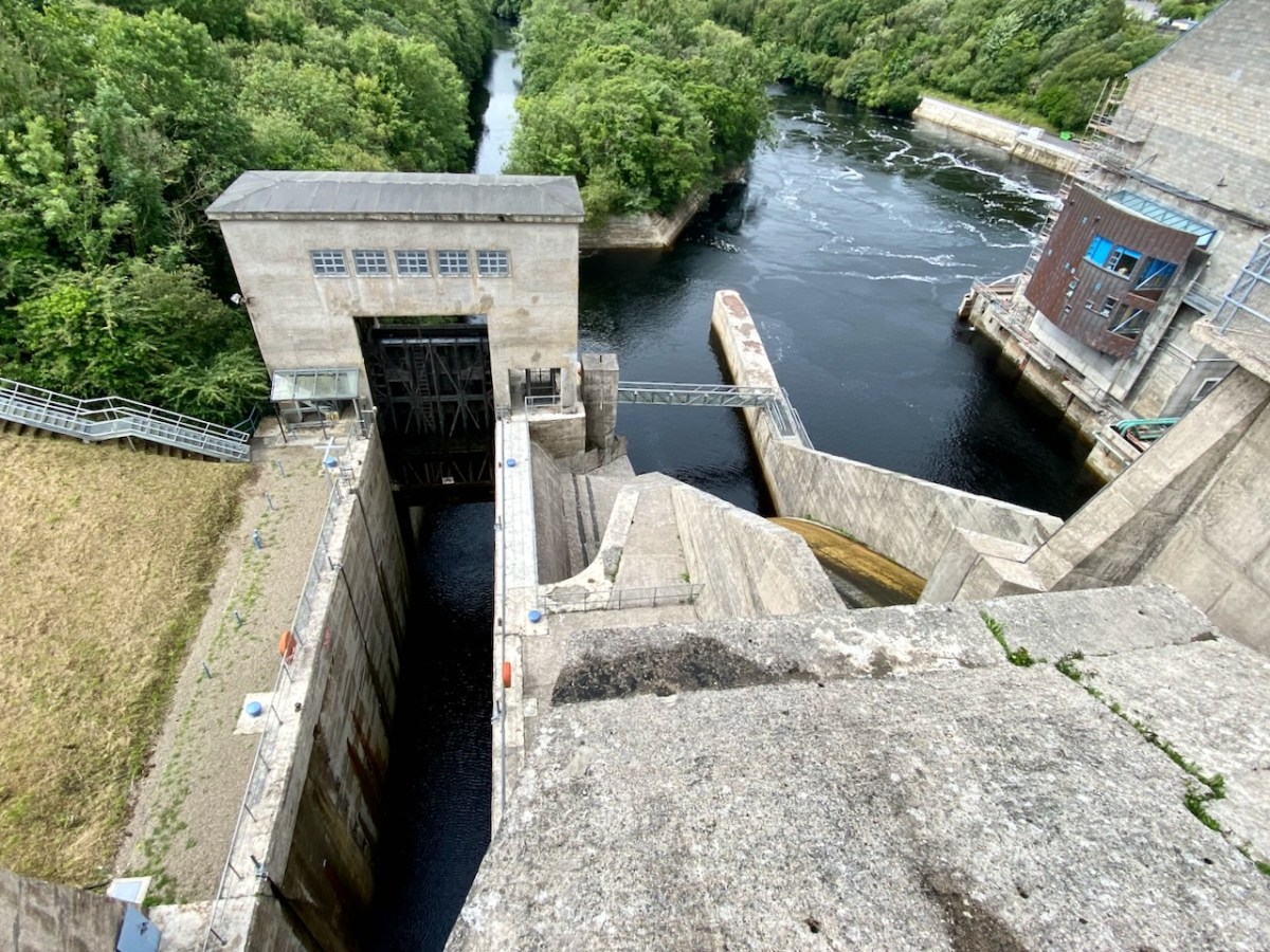
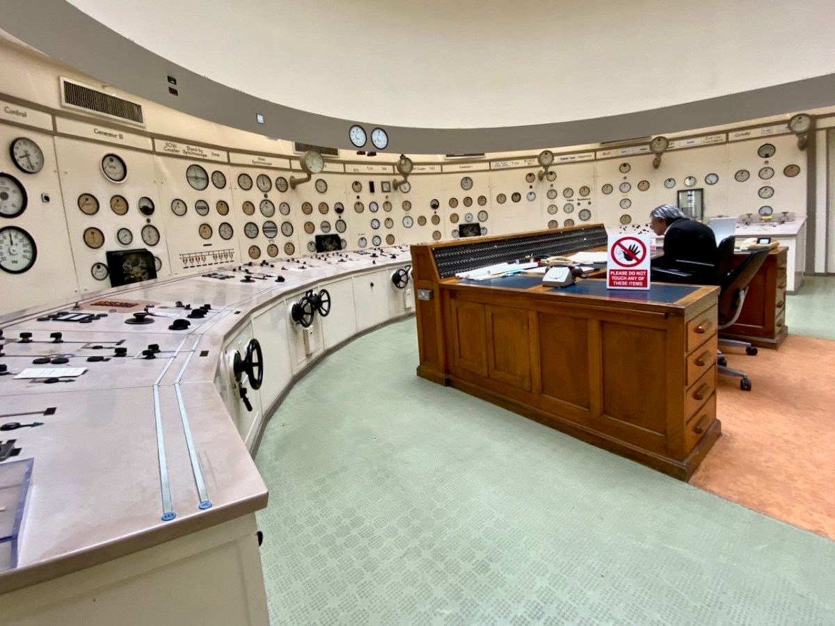
Here’s the ‘back end’ of the main building block, showing the position of the canal lock but also the new architectural-award winning control room – copper sheet clad – which has taken the place of the original room and desk, which have nevertheless been preserved as a piece of history:
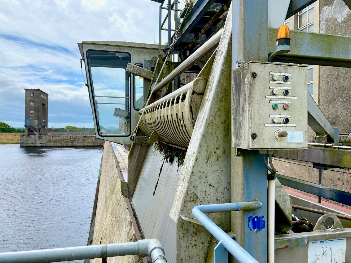
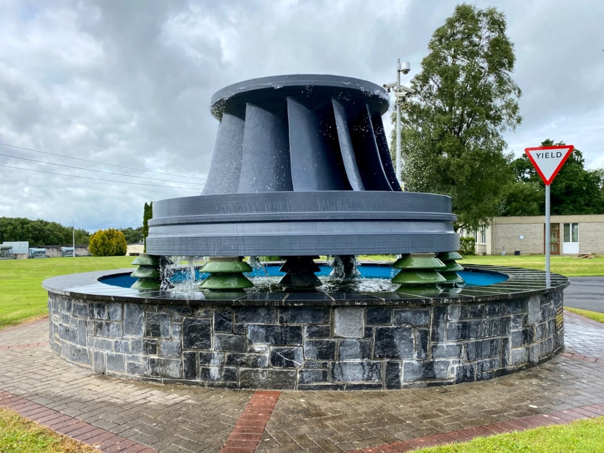
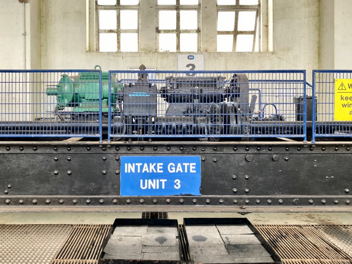
The machine above cleans the weir intake grills leading to the turbines. Everything here has its historical aspects emphasised, where relevant. The wondrous machine above is in full working order to this day, cleaning the intake grids on the weirs coming in from the main dam. A replaced turbine impeller is used as a decorative fountain feature beside the driveway into the station:
In a previous post, I mentioned that the artist Seán Keating was so impressed by the project that he painted a series of canvases during the construction process. The majority of these originals are now on display in the power station offices – accessible on the tour.
I once again express my thanks to Michael Barry for setting me on this rewarding path. I understand he is giving electrification and Ardnacrusha due mention in his forthcoming book A Nation is Born.
Further information on the Electrification of Ireland can be found in these posts:
Above – on the left is the old Vaughan’s Hall in Ballydehob. Local historian Eugene McSweeney tells this tale:
. . . This hall in Ballydehob ‘had the Electricity’ around 1951-52. UK Queen Elizabeth II was crowned in 1953 – June 2 – and a film was made by the BBC. This film was sent around to be shown in village halls etc all over Britain, but also in Ireland. Vaughan’s Hall was able to borrow a projector, and an evening was set aside to show the coronation film. There were ‘some local lads’ who felt that good Irish citizens shouldn’t be gawking at this English Royal event. They brought some heavy chains, and threw them over the new electric wires connecting into the hall. This caused a short circuit and the lights – and the film – went out! Ballydehob had to wait for another day to see the coronation . . .
Eugene McSweeney, Ballydehob
During the 1930s most towns in Ireland were connected to the National Grid. The outbreak of World War II in Europe led to shortages of fuel and materials and the electrification process in Ireland came to a virtual halt. In the early 1950s the Rural Electrification Scheme gradually brought electric power to the countryside, a process that was completed on the mainland in 1973 – not without some Herculean efforts by the on-site crews . . .
. . . While battling with the rocks in the Schull/Ballydehob fastnesses, blasting our way to our goal, we were informed that our next area was Castletownbere. No stick of exploding gelignite could produce more of a stunning effect in the Area Office than when the news reached us. Then we knew we were being accepted and acknowledged as mountainy men, men of steel and gelignite, capable of shaking still further the serenity of the West Cork mountains whose calm had not been disturbed by the noise of men and clash of steel since O’Sullivan Bere . . .
ESB ARCHIVES – AO Report 1951
Above – the pegging teams faced an onerous task when they moved over to the Beara Peninsula. Here are extracts from the reports of the Area Officer when works set out towards Castletownbere in late 1951:
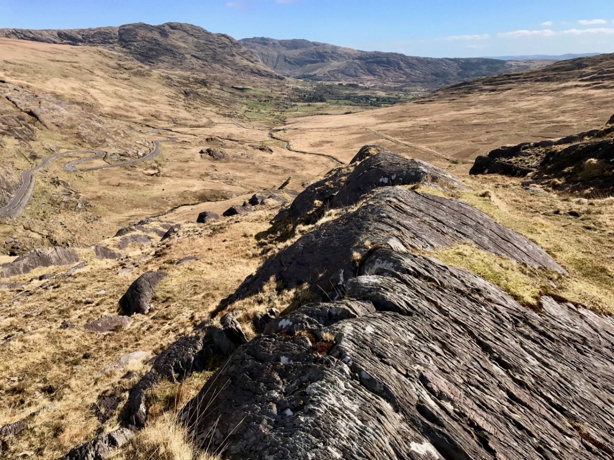
. . . In November 1951 I left Ballydehob to visit Castletownbere area, the future scene of our endeavours. Looking at the country between Glengariff and Castletownbere I wrote off the battle of the Schull area as a skirmish, as I felt that the real battle was here. Here were crags, crevices, canyons, woods, bogs, etc, which defied all exaggeration. W Trusick, the pegging engineer, was very much depressed at the thought of what lay ahead of him as we climbed up the winding road from Glengarriff to the heights of Loughavaul and beyond again to Coolieragh. However, when we topped the climb at Coolieragh the vista of mountain and sea that met our eyes gave us a temporary respite from our morose reflections . . .
ESB ARCHIVES
Extract from the reports of the Area Officer when works set out towards Castletownbere in late 1951:
. . . Here was a scene that is hard to equal anywhere else in Ireland. Ahead of us lay the country of O’Sullivan Beara. Away in the distance lay Beara island like a sleeping monster resting on the sea, protected on the northern side by the massive bulk of Hungry Hill, and farther west by a ring of mountains whose western slopes dip down into the Atlantic Ocean. Behind us we looked across Bantry Bay at Bantry away in the distance sheltered by the bulk of Whiddy island. Nearer to us was Glengariff with its myriad of islets and heavily wooded hinterland, cosy and comfortable looking, secure in the shelter of its encircling mountains. On a cold November day in the weak wintry sunshine people do not stay long admiring scenery from such a dank vantage point as Coolieragh, and so we continued our journey westwards along by Adrigole, close to the Healy Pass, skirting the foot of Hungry Hill with its silver streak waterfalls and finally we arrived at the capital of the Beara Peninsula, Castletownbere . . .
ESB Archives
. . . Mr O’Driscoll and his crew in Dromahane, had apparently two major obstacles: First, the landed gentry who vehemently objected to the “beastly sticks” being put anywhere on their land: the second being a van which objected to moving under any circumstances whatever. Of the original 320 economic acceptances, 57 were ‘backsliders’, most of these being cottagers and small farmers. As an offset, 20 new consumers were gained, mostly having large premises, with the result that the total revenue was increased by £2. Only 20 premises were wired for outside light, due, in general, to the speed with which the contractors wanted to move from one house to another, and to their telling their clients that outside wiring could be done after they had been connected to the supply lines. Principal items sold in the area were 20 cookers, 30 irons, 20 kettles and 11 Milking Machines. Milking Machines are becoming increasingly popular in this area, solving as they do, the problem of milking on a Sunday when, normally, labour is not available. Mr O’Driscoll is doubtful if post development will meet with any marked success . . .
ESB Archives – DromAhane, Co Cork
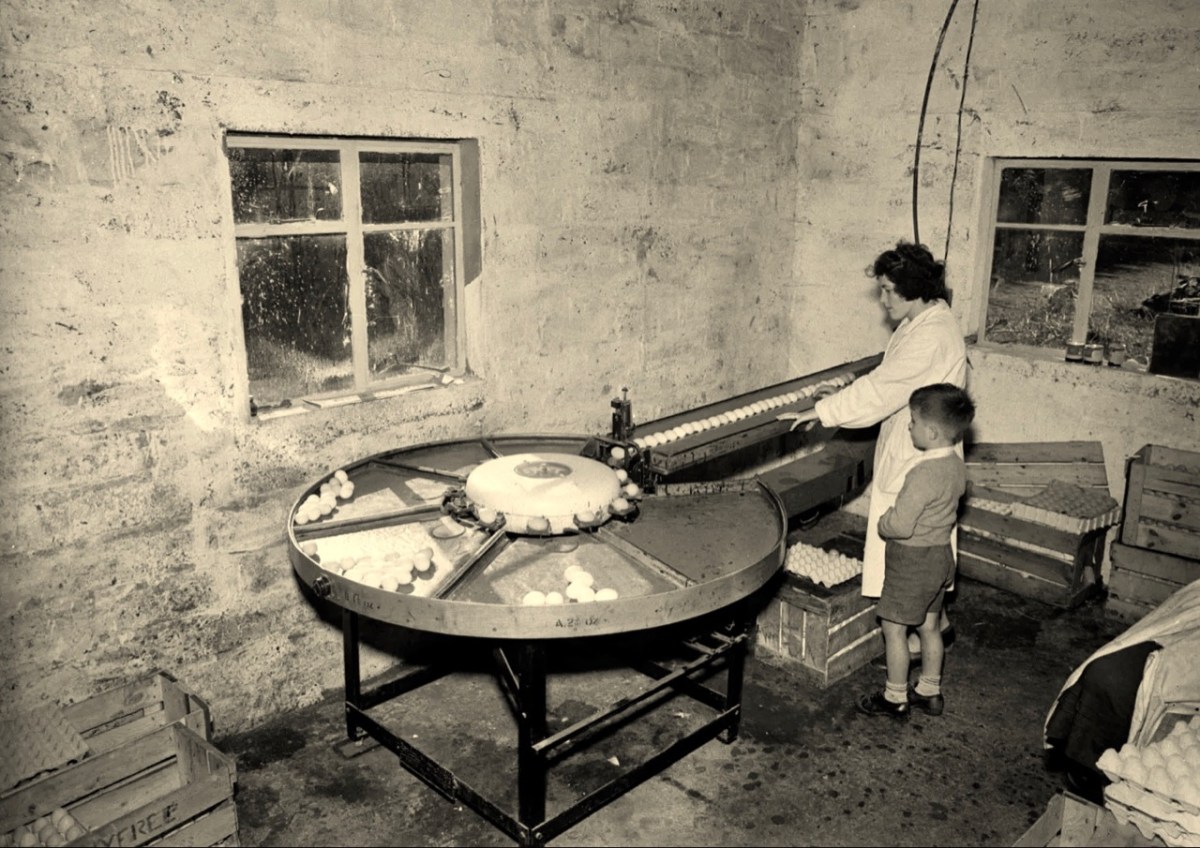
It’s intriguing that the reports in the ESB Archives from the time of installation so often represent negative views about the ‘success’ or otherwise of the rural electrification project (Mr O’Driscoll is doubtful if post development will meet with any marked success). It’s as if this ‘new fangled’ technology is never going to take the place of the way traditional life is lived in remoter places. With this viewpoint, the drudgery of manual tasks such as bringing in water from an outside source, cooking, washing clothes is likely to continue, with the housewife / farmer’s wife and their children having maximum input. It’s just as well that a more enlightened attitude prevailed in some places – here’s an early taker of the benefits of an electric egg sorting machine (ESB Archives):
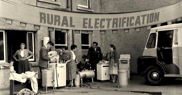
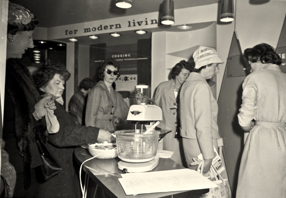
In urban areas, there was certainly enthusiasm for the improvements which ‘modern living’ offered (below). The new devices must have appeared exotic at first, but no doubt their benefits were instantly apparent to those who set their minds positively.
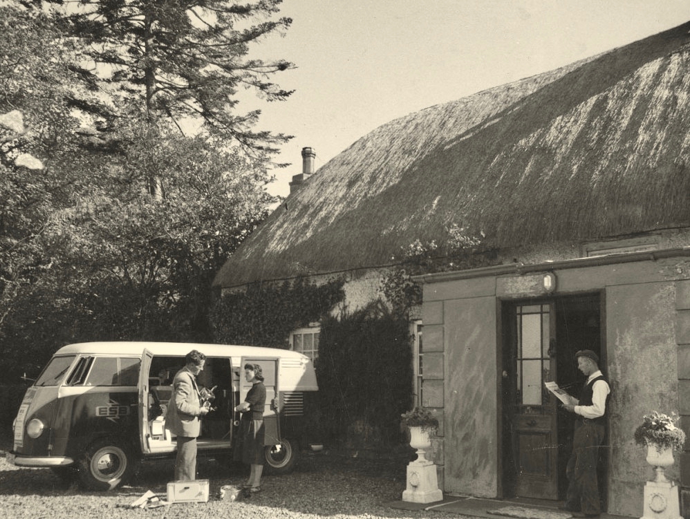
The heroes were the riggers and the geligniters, braving the elements and the raw landscape, to eventually bring power to the furthest reaches of rural Ireland (a task not completed, it could be said, until 1991, when Cape Clear – off our own West Cork coast – was connected to the National Grid). After those heroes came the dealers and traders. Someone had to provide all the water heaters, pumps, milking machines, refrigerators, cookers, washing machines . . . It was big business.
Above – an ESB salesman exercising persuasion on a willing customer. The man looks on! Below – interesting juxtaposition . . .
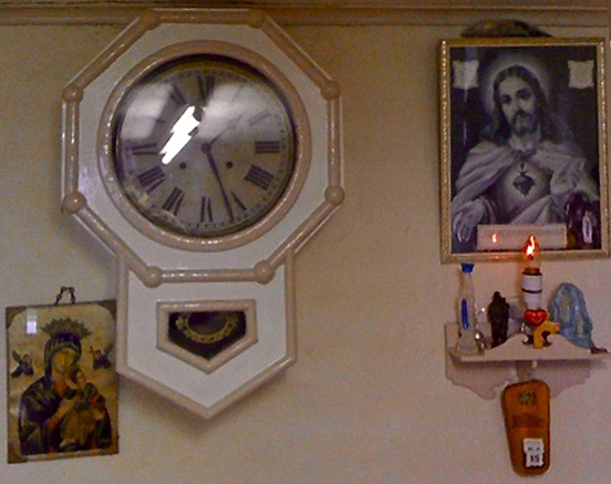
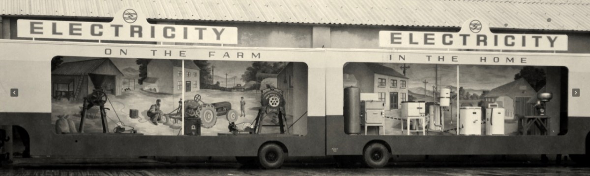
. . . Once a community was connected, or about to be connected, the ESB held public demonstrations of household appliances. These were then sold bringing electric irons, kettles, stoves to homes. The demonstration evening in Glenamaddy was held in January 1951. The handwritten report records that it took place “in the very fine Esker Ballroom”; these events were social occasions that brought communities together. The Glenamaddy evening “was attended by about 90, including 50 women. As is usual, the women appeared to be more keen than the men and more inclined to ask questions (and to argue). After the demonstration, a melodeon player turned up and an impromptu dance got under way” . . . Small towns and rural townlands became brighter and winters less harsh and Christmas more special as the fairy lights began to shine. It also gave rise to a rural Irish icon as every house had the Sacred Heart picture with the (electric) red lamp: many didn’t get a kettle and washing machine until later on . . .
ESB ARCHIVES
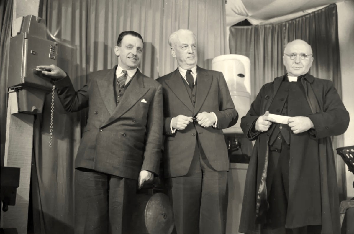
(Above) Seán Lemass – Minister for Industry and Commerce – performing the formal ‘switch-on’ in Ballinamult Creamery (Co Waterford) on 1st March 1954. This was the Electricity Supply Board’s 100,000th customer. Also in attendance are Mr R F Browne, ESB Chairman, and The Very Rev Father Walsh, PP Ballinamult.
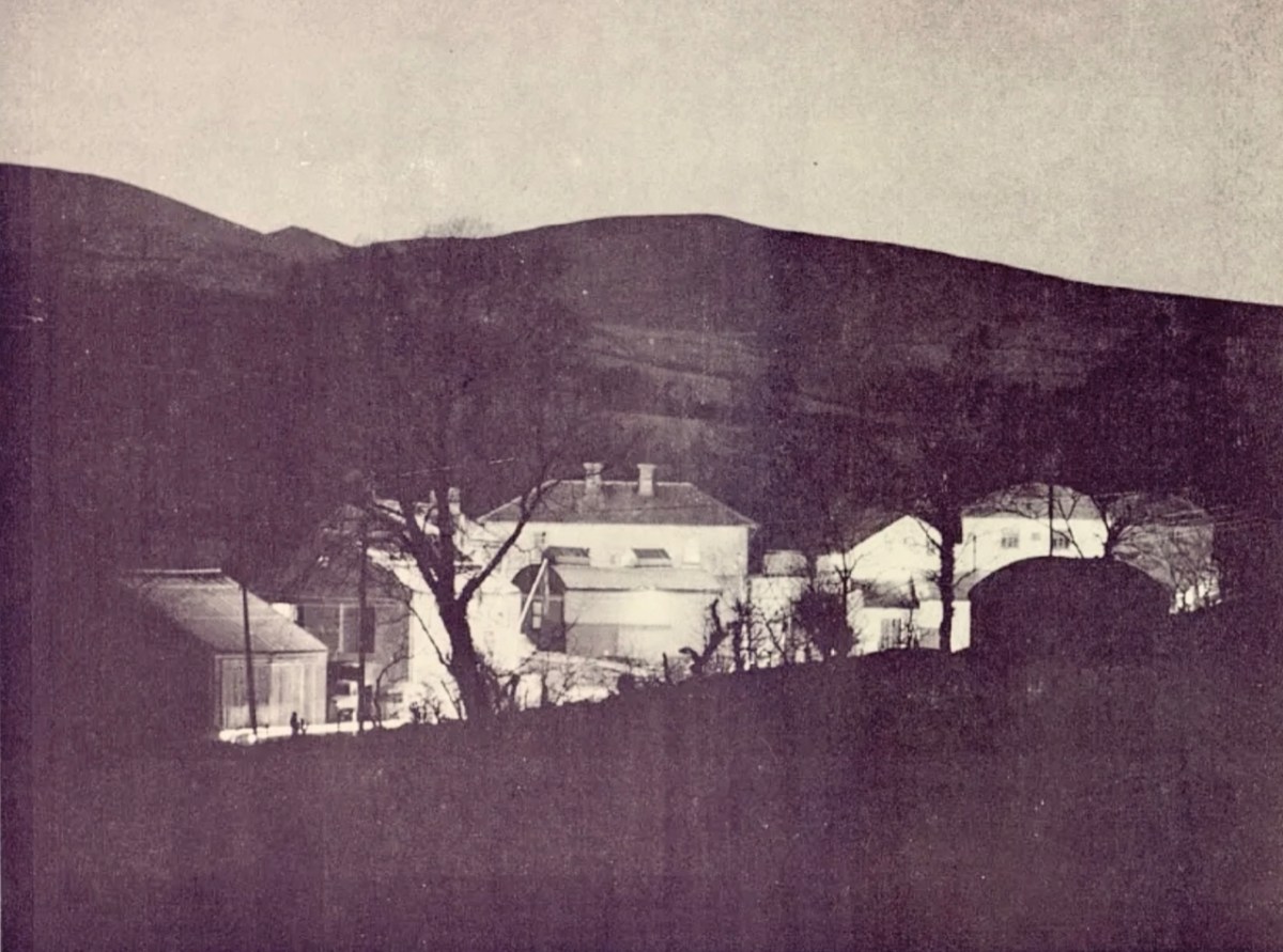
Above: “As the last rays of sun leave the hills, the lights go on at Ballinamult Creamery, the Board’s 100,000th Rural Consumer”
. . . In November, Miss Crowley of the ICA toured Sherkin Island and lectured in nearby Skibbereen giving her ideas on modern home-making and sponsoring the use of electricity to a great extent. The area demonstration at the end of November was very well attended and sparked off a keen interest in the various appliances on show, just as the connections in the area were commencing. ESB sales in the area are now in the region of £1,300 while contracts are on hands for six pumping installations . . .
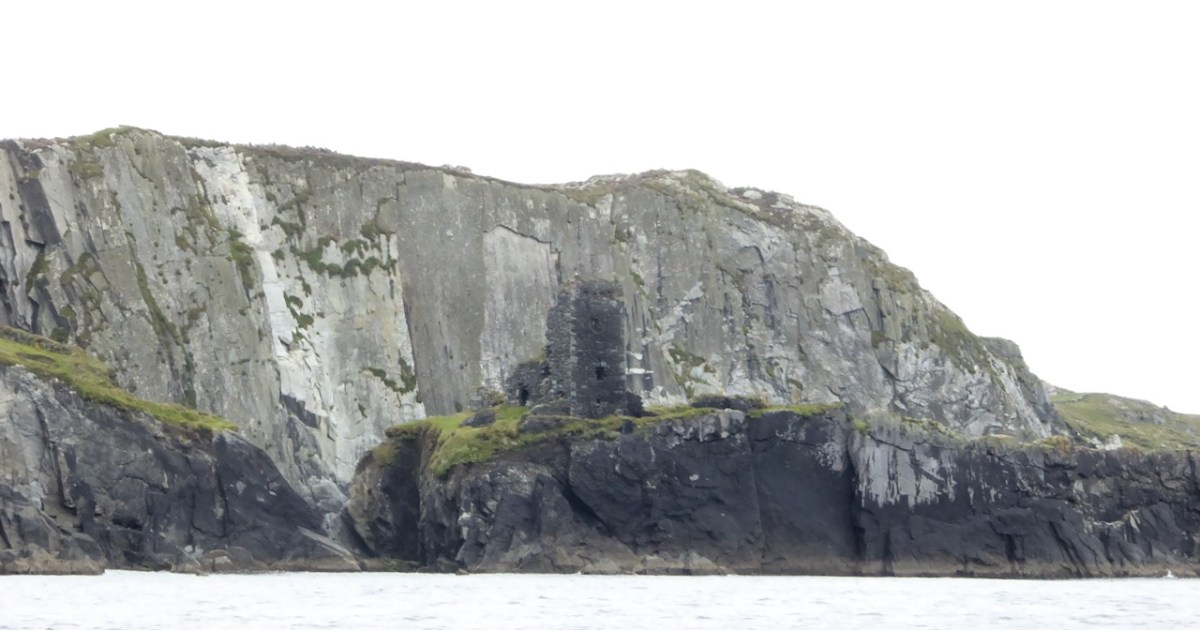
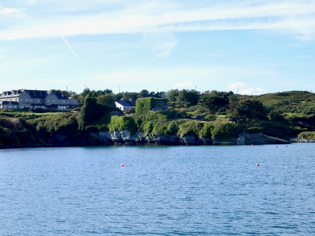
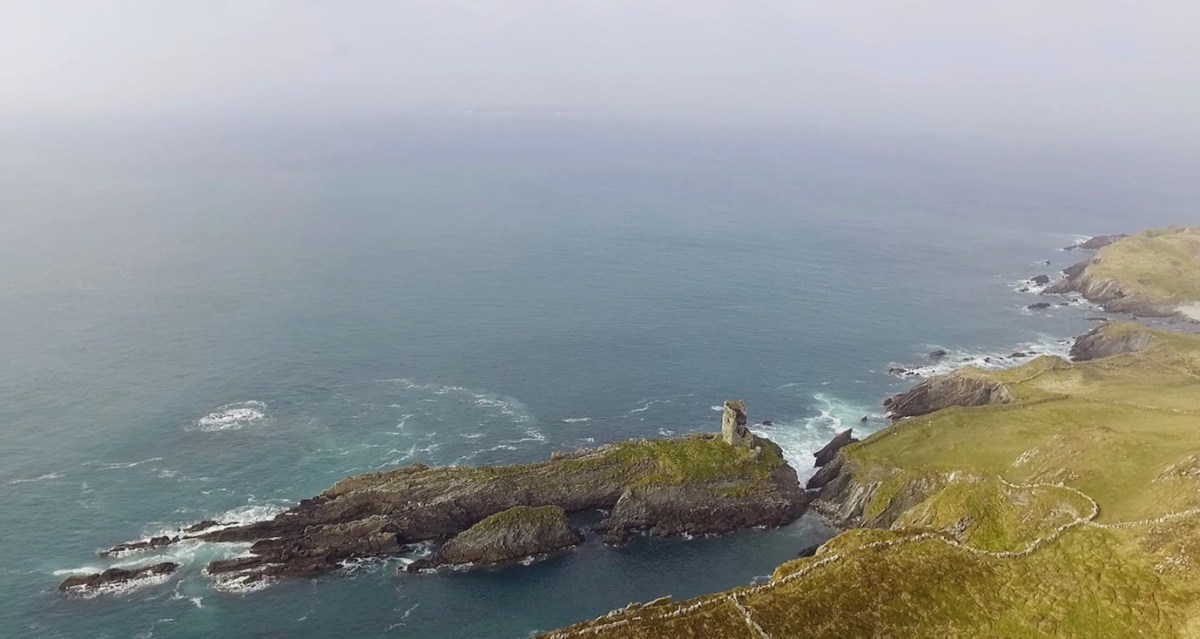
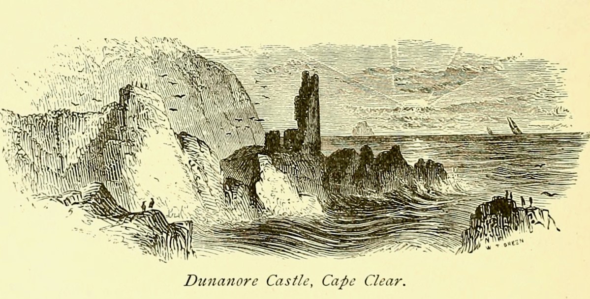
I have been gifted with a marvellous set of photographs of Dunanore, or Dún an Óir – an O’Driscoll Castle on Cape Clear. The gift came from one of our readers, Tash, and I am very grateful indeed. Regular readers know that I like to use my own photos, and I do have some that I took from the sea (like the one below) but I have none of Dún an Óir from the land, let alone from the castle itself!
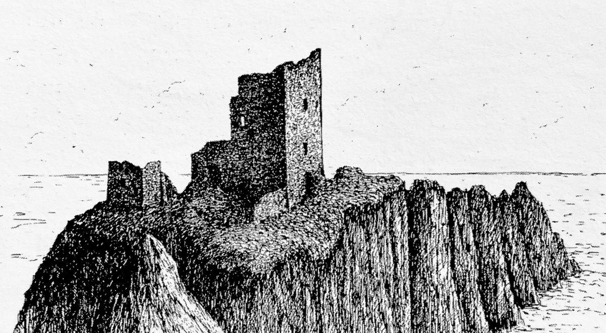
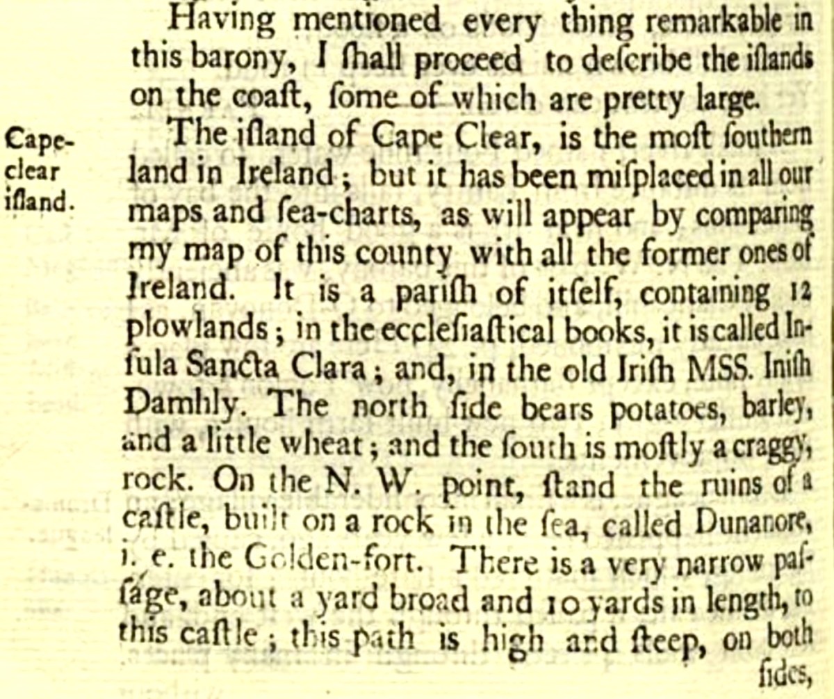
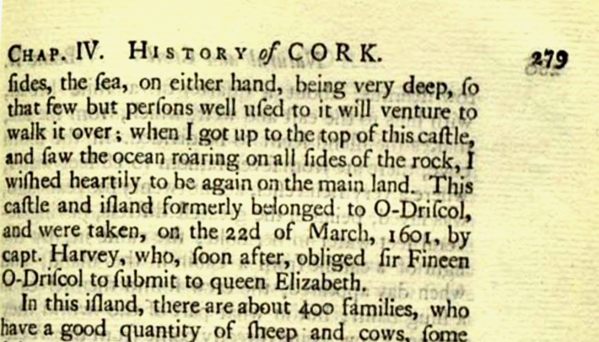
And that’s because, as you can see from the drawing by Jack Roberts at the top of this post, this castle is situated in a very perilous location, on the edge of a cliff, on a small island, essentially, making access a hazardous scramble up from a rocky beach. It was once connected to the rest of Cape Clear by a narrow causeway but this has long collapsed. It was still there in the 1770s when Charles Smith visited. In his The Ancient and Present State of the city of Cork Vol 1, he wrote:
And this brings us to the name – Dún an Óir. It means, of course, Fort of Gold, and some of the old legends about this place talk about the name coming from stories of buried treasure. But in fact, this has been the name of this fort since the first maps of this area were made in the fifteen hundreds and it speaks to the wealth of the O’Driscoll clan who built it. Remember, their other stronghold, now called Baltimore, was Dún na Séad, or Fort of Jewels (on at least one map given as Castle of Perles). On Sherkin, their castle was Dúnalong – or the Fort of the Ships – that’s it as it is now, below.
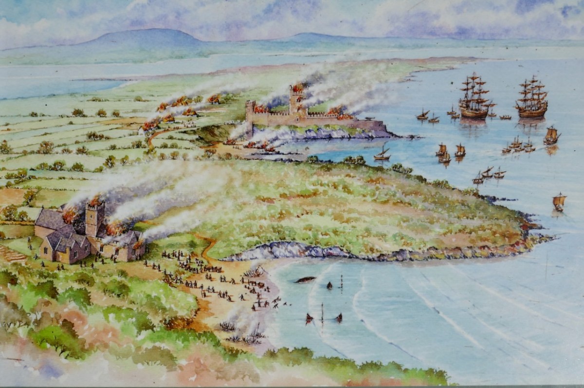
There are many accounts of their fleets of ships, and the battles they waged against the Waterfordmen in which they came out the worst for wear when Dunalong was attacked. The scene below, from an information sign on Sherkin, shows the Battle of the Wine Barrels, 1537, with both Dunalong and the Friary on Sherkin in flames
Dún means ‘fort’ but seems to be especially applied to promontory forts in the southwest. Before the castle was built, therefore, it is likely that the O’Driscolls fortified the headland, which may date well back to the Early Medieval period (400-1200) or even to the Iron Age (500BC to 400AD, or 500BCE to 400BC for those who prefer the secular version). The Illustration below is taken with permission from Dún an Óir Castle: an uncertain future, by Dr Sarah Kerr, and shows the present state of the castle, marooned on what was once a promontory connected to the Island.
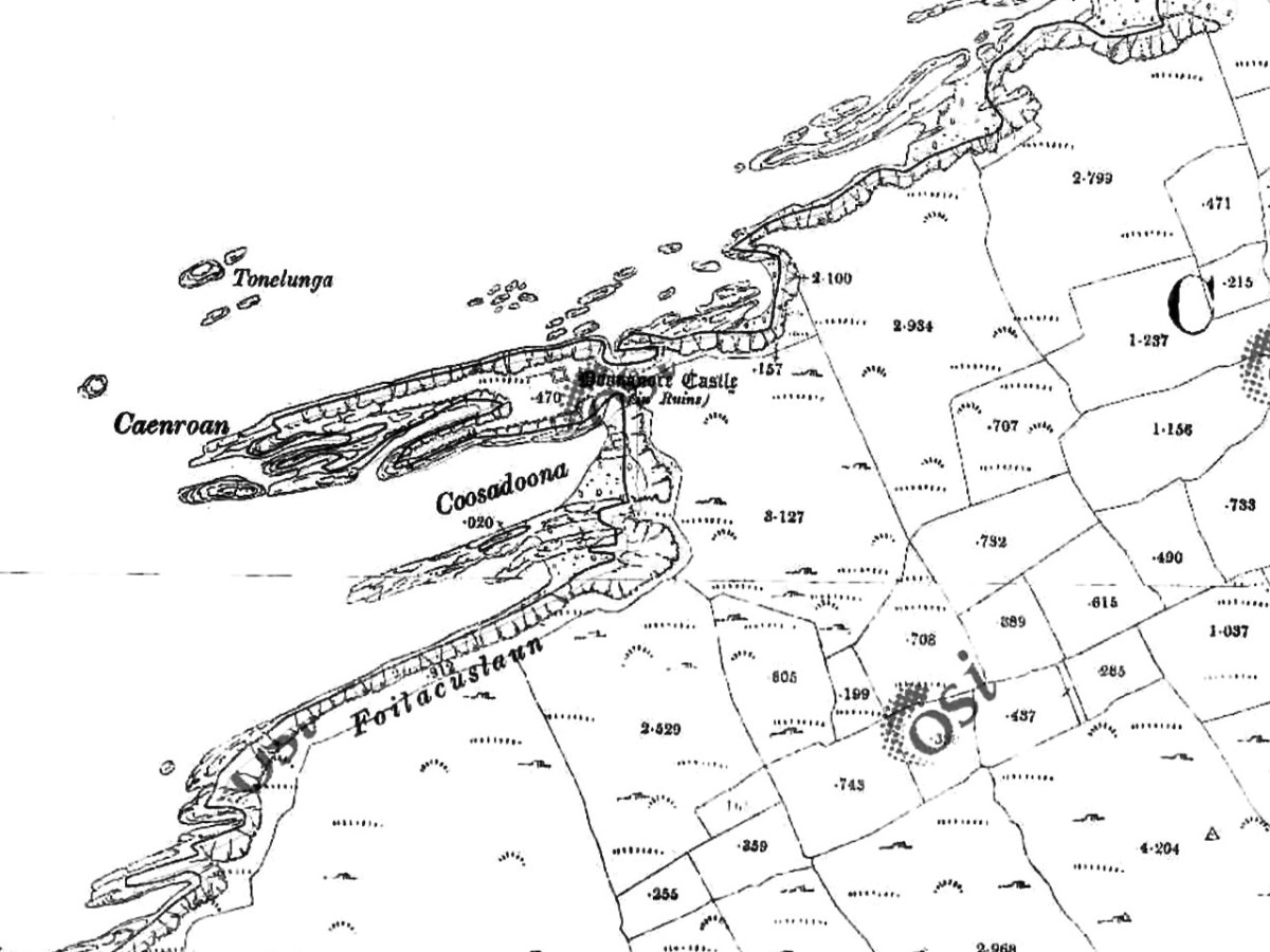
Our Promontory Fort man is Thomas Westropp (see here and here), and he wrote about Dún an Óir in his 1914-16 paper for the Royal Irish Academy, Fortified Headlands and Castles in Western County Cork. Part I. From Cape Clear to Dunmanus Bay. He visited the site, but like many a good explorer before and after him, did not venture out onto the promontory, but satisfied himself with what he could see from the high ground above it. That included the promontory and ruined castle, the rather ominously named Tonelunga (The sea-bed of the Ships), the end of the promontory called Caenroan (quay of the Seals), the inlet between the promontory and the cliffs, Coosadoona (the Little Harbour of the Fort) and the high cliffs behind the fort, Foilacuslaun (Cliffs of the Castle). All of these are marked on the 19th century twenty-five inch map.
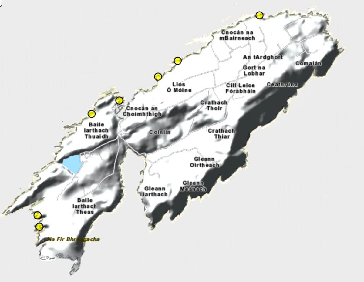
Westropp writes about Dún an Óir as one of three Promontory forts on Cape Clear Island, although in fact there are more than that, as identified by the National Monuments Record – each yellow dot below is one.
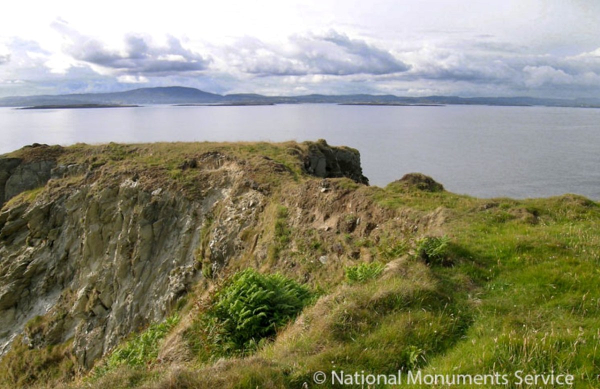
Here’s one of them (below), Lios Ó Móine (the Fort of the Meadow – lios is usually used to designate an earthen ring fort): the description and then the photo are by National Monuments Service (NMS). In the photo you can see the narrow neck of land leading out to the promontory. This is likely what the spit leading out to Dún an Óir may have looked like.
Description: In rough pasture, at the foot of a steep N-facing slope on Stuckaunfoilnabena, a headland on the NW coast of Clear Island. A narrow eroding neck of land (Wth 3m; L 15m) leads to the roughly anvil-shaped headland. Across this neck of land are the remains of three earthen banks and the shallow remains of three fosses. Further examination of the remains was not possible for safety reasons.
Curiously, the NMS does NOT identify Dún an Óir as a promontory fort – here is what it says:
Description: The location of the tower house ‘Doonanore Castle’ (CO153-015002-) on a promontory, on the NW shore of Clear Island, suggested that it may have been built on the site of a promontory fort. However, there are no visible surface traces of an earlier defences across the promontory. The promontory is now isolated at high tide but was connected to mainland by causeway until 1831.
However, it has this to say about the earthwork identified on the high ground:
In pasture, on a steep N-facing slope to the E of the tower house known as Doonanore Castle . . . An earthen bank . . .extends upslope in a S to SW direction from a modern E-W field boundary wall on the cliff-top at N and ends at a large outcropping rock on the edge of another cliff. This bank appears to have formed part of the defences on the land approach to the castle from the E. The bank has three contiguous linear stretches [and] there is an entrance near the N end. There is a possible hut site near the centre of the enclosed area. The short promontory on which Doonanore Castle stands is a possible coastal promontory fort.
So, as you can see, although the NMS declines to label it a promontory fort because there are no longer any signs of banks or walls, it does concede that it is possible. It also extends the defences of that fort to the higher ground above it.
Back to Westropp – He quotes:
the poem of O Huidhrin, before 1418, tells how “0 hEidersceoil assumed possession of the Harbour of Cler.” It was of some importance to the foreign traders in wine and spices, and so figures in all the early portolan maps. Angelino Dulcert, in 1339, calls it Cap de Clar ; the subsequent portolans, Cauo de Clara, 1375 and 1426 ; Clarros, 1436 ; C. d’Clara or Claro, 1450 and 1552, and, to give no more, Cauo de Chlaram, in 1490. The 0 Driscolls’ Castle probably dates between 1450 and the last date. It was probably on an earlier headland fort, as it is called Dunanore. In 1602 it surrendered without resistance to the English, who burned it.
Westropp goes on to say
Dr. O’Donovan, in his ” Sketches of Carbery,” gives a few notes on the later history. He says there was a garrison at the Castle in Queen Anne’s time, and mentions the huge iron ring-bolt, set in the rock, to which the O Driscolls formerly moored their galleys in the creek. The last is improbable, even to impossibility: no one could moor galleys in the dangerous wave-trap, open to the most stormy and unsheltered points. The islanders regard the ruin as haunted, and tell of the singing of ships’ crews in its vaults. One “Croohoor” (Conor) O’Careavaun (Heremon’s grandson) lived as a hermit there in the eighteenth century. Another legend tells how, in 1798, the inhabitants painted the Farbreag Rocks and pillars so as to resemble soldiers in uniform to keep away the French ! If any truth underlies this, it is probably based on the idle act of some revenue or other officers, in the endless leisure of their island station.
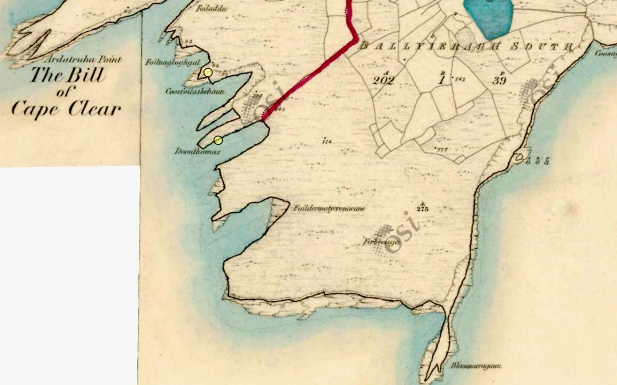
In the map above, of the southwest end of the Island, you can just make out the name Firbreaga, almost covered by the O of OSI. Fir Bréaga means The Lying Men, an apt translation given Westropp’s story. No doubt the name is older than 1798, and may refer to the cliffs at that end seeming to be less dangerous from the sea than they actually were. Note also the two yellow dots for two more promontory forts- Doonthomas (Thomas’s Fort) and Coosfoilaskehaun (the Small Harbour of the Knife-Edge Cliff).
Westropp’s description of the promontory upon which Dun an Óir sits is poetic:
The path runs up a very slight ledge, flaking away and high above the creek, along the face of a cliff of polished silvery slate. The low neck joined it to the mainland, and the nearly perpendicular strata make the dock-like creek of Coosadoona, fort-cove, to the south Beside this cove, opposite to the castle, an enormous precipice rises high above the tower top. In the other direction is a noble view across the wide, porpoise-haunted bay, and its low islands to the blue, many-channelled Mount Gabriel, and on to Mizen Head.
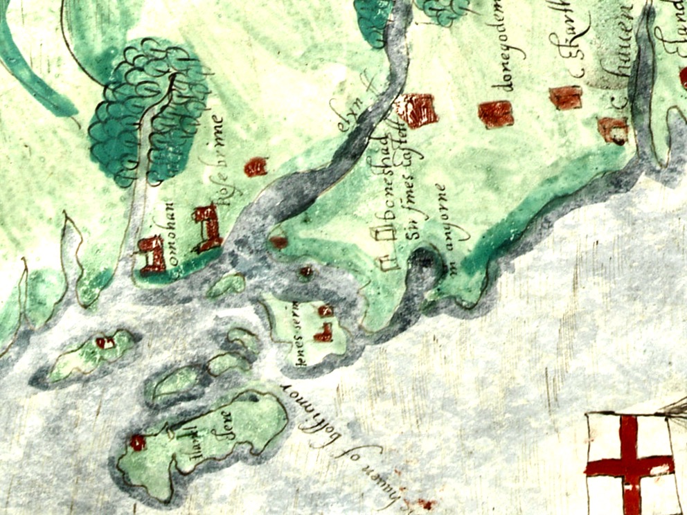
In fact, very little is known about the history of Dún an Óir before the Battle of Kinsale in 1601. We can deduce from its strategic location that the O’Driscolls used it to keep an eye on every ship that sailed in and out of Roaringwater Bay, to exact fishing dues before the rival O’Mahonys could get to the incoming vessels, to curb the power of those O’Mahonys, and to establish their dominance over the land of Cape Clear Island. (See this post for more on the map above.) Because the castle would have been rendered, probably in some shade of white or near-white, it would have been visible from all around Roaringwater Bay, and have represented a potent statement of supremacy.
After the Battle of Kinsale the Castle was seized by Captain Harvey, as described in Pacata Hibernia:
‘While these things were on doing, Captain Roger Harvy sent a party of men to Cape Clear,the castle whereof being guarded by Captain Tirrell’s men, which they could not gain, butthey pillaged the island and brought thence three boats; and the second day following therebels not liking the neighbourhood of the English, quitted the castle, wherein Captain Harvy placed a guard. At this time Sir Finnin O’Driscoll came to Captain Harvy and submitted himself.’
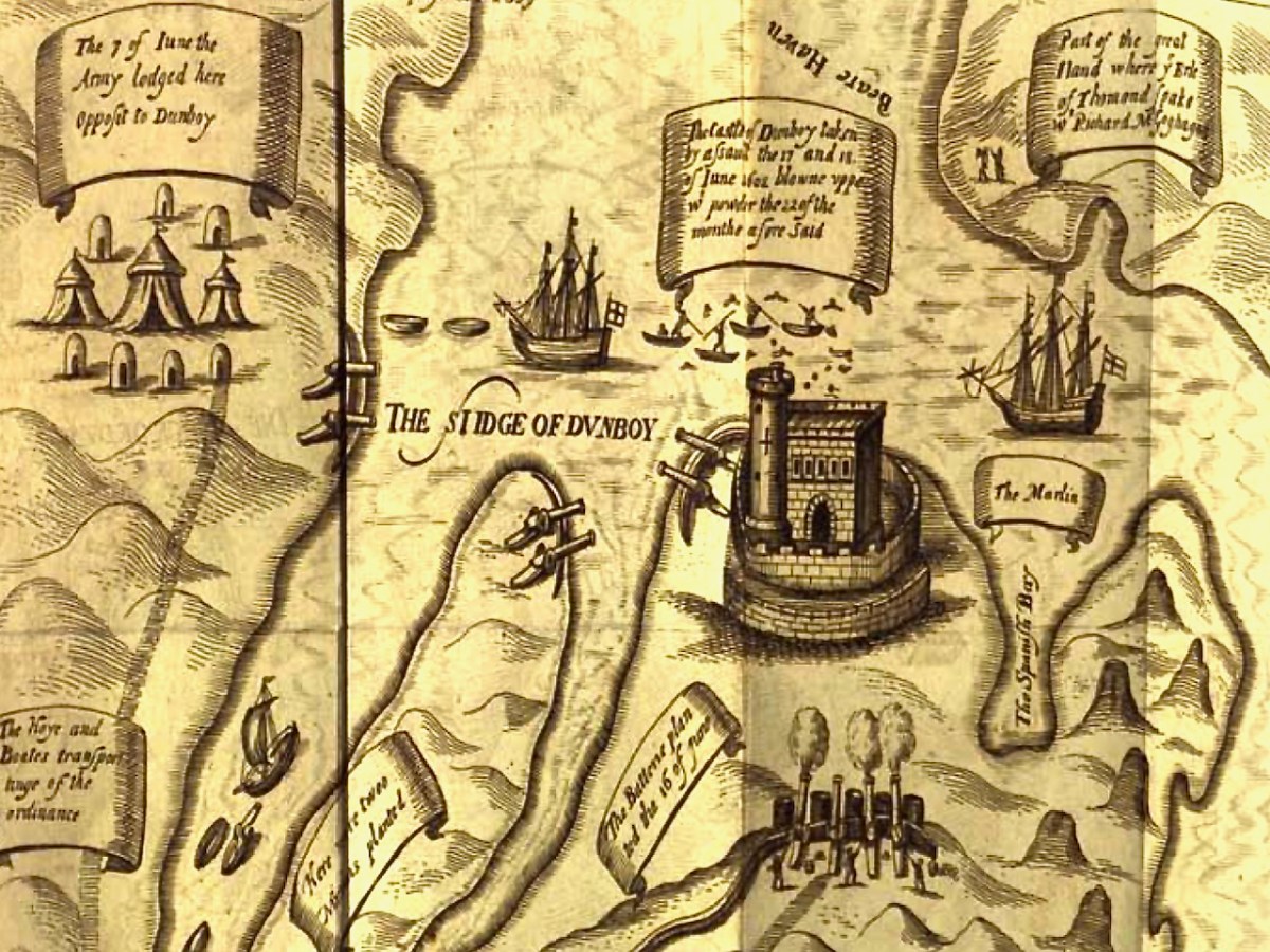
This illustration, from Pacata Hibernia, is of the siege of Dunboy Castle, the stronghold of O’Sullivan Beare, on Beara Peninsula. The destruction of Dún an Óir is described by James Burke in his article Cape Clear Island in the Journal of the Cork Historical and Archaeological Society Journal of 1908. Rather than Harvey simply taking over the castle, Burke relates the following:
Its central arch and the steps leading to its upper portion remain; but the huge pieces of its eastern wall now lying about show how severely it has suffered from the havoc of war. This wholesale destruction occurred when Dunanore Castle, together with the island, was captured on the 22nd of March, 1601, by Captain Roger Harvey, following on the defeat of the Spaniards at Kinsale. By means of the artillery he planted on the high ground adjoining it, he battered down the eastern wall and compelled the garrison to surrender, for which and other services (as Dr Donovan writes in his “Sketches of Carbery”) he was granted at the time a commission by Lord Deputy Mountjoy as Governor of Carbery.
It is far more likely that the ruined state of the castle is a result of the natural passage of time than the ‘havoc of war.’ For one thing, it would have been a monumental task to deploy artillery overland on Cape Clear. Any cannon fire would have come more naturally from the English warships we know were in use during this period and therefore, the damage would have been to the seaward side of the castle – but this side is actually intact.
A romantic view of the ruins of Dún an Óir above, by W Willes.* Next week we will look at what is left of the castle and what we can tell from that. I’ll be using the marvellous photos from Tash in that post.
Welcome to the UCD Library Cultural Heritage Collections blog. Discover and explore the historical treasures housed within our Archives, Special Collections, National Folklore Collection and Digital Library