Roaringwater Bay in 1612

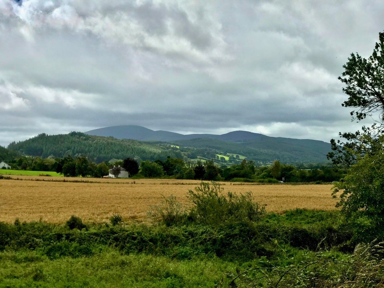
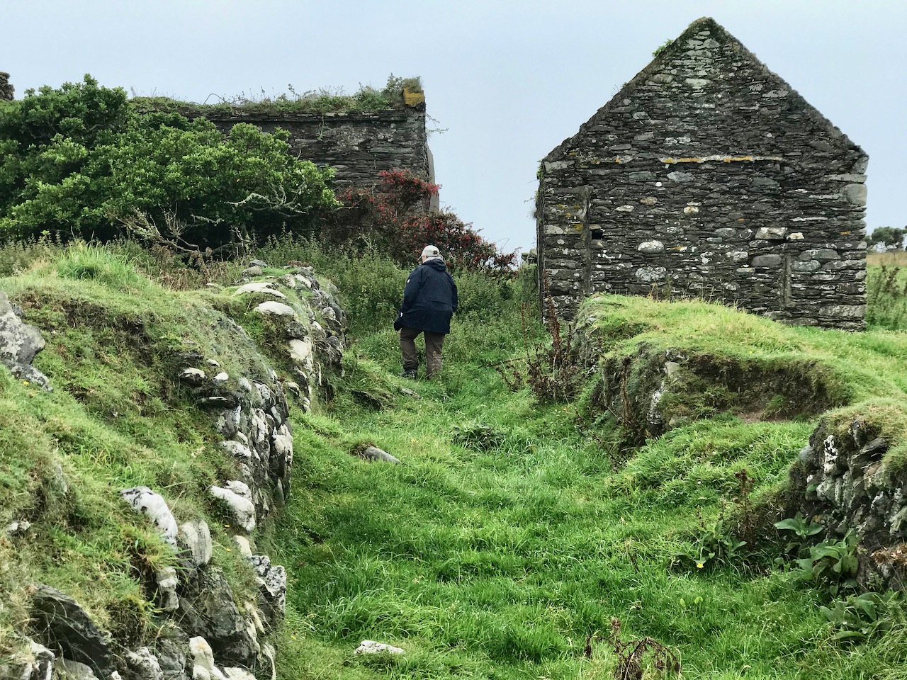
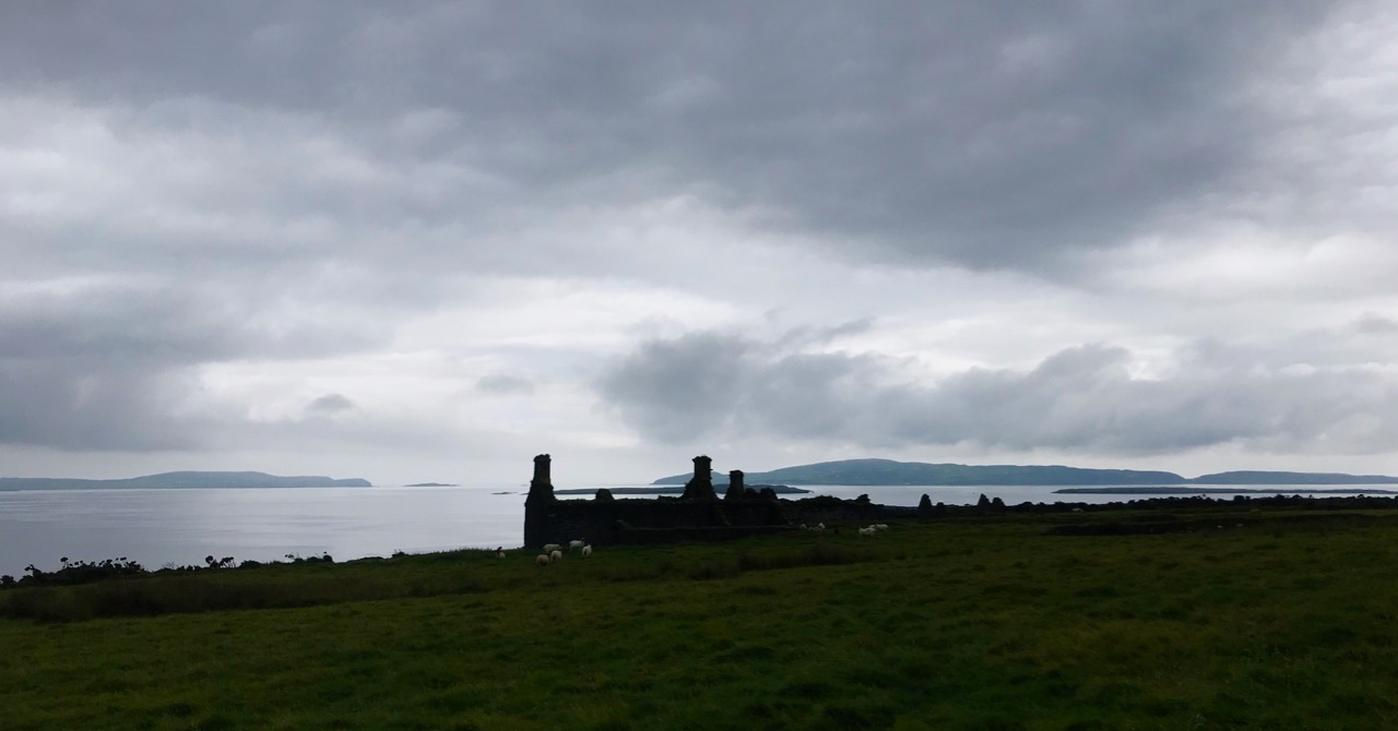
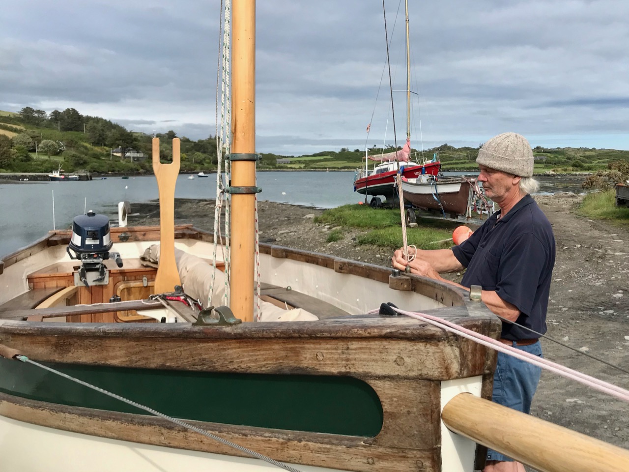
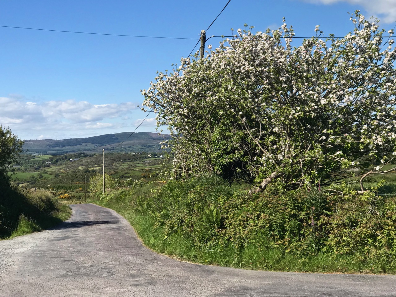
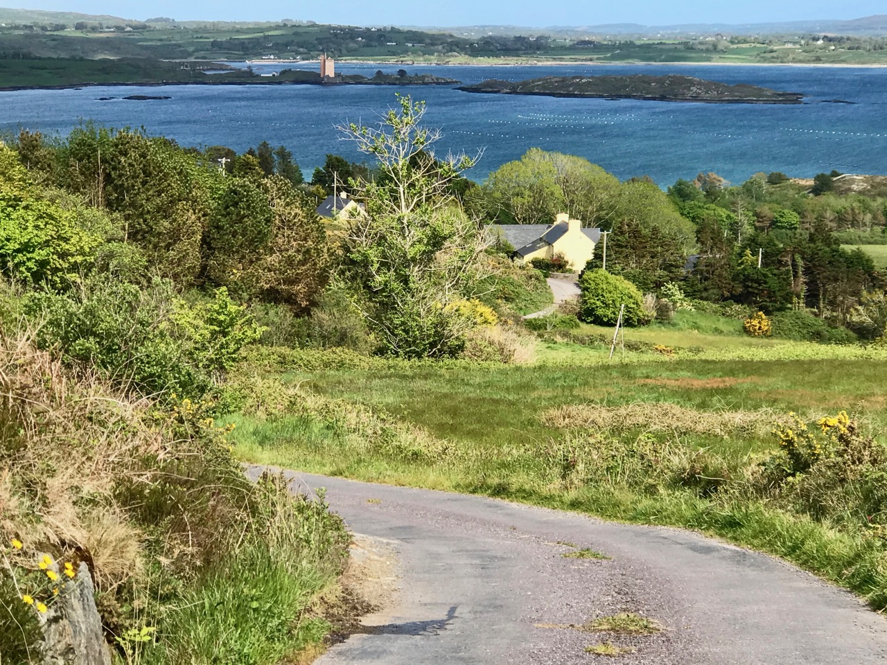
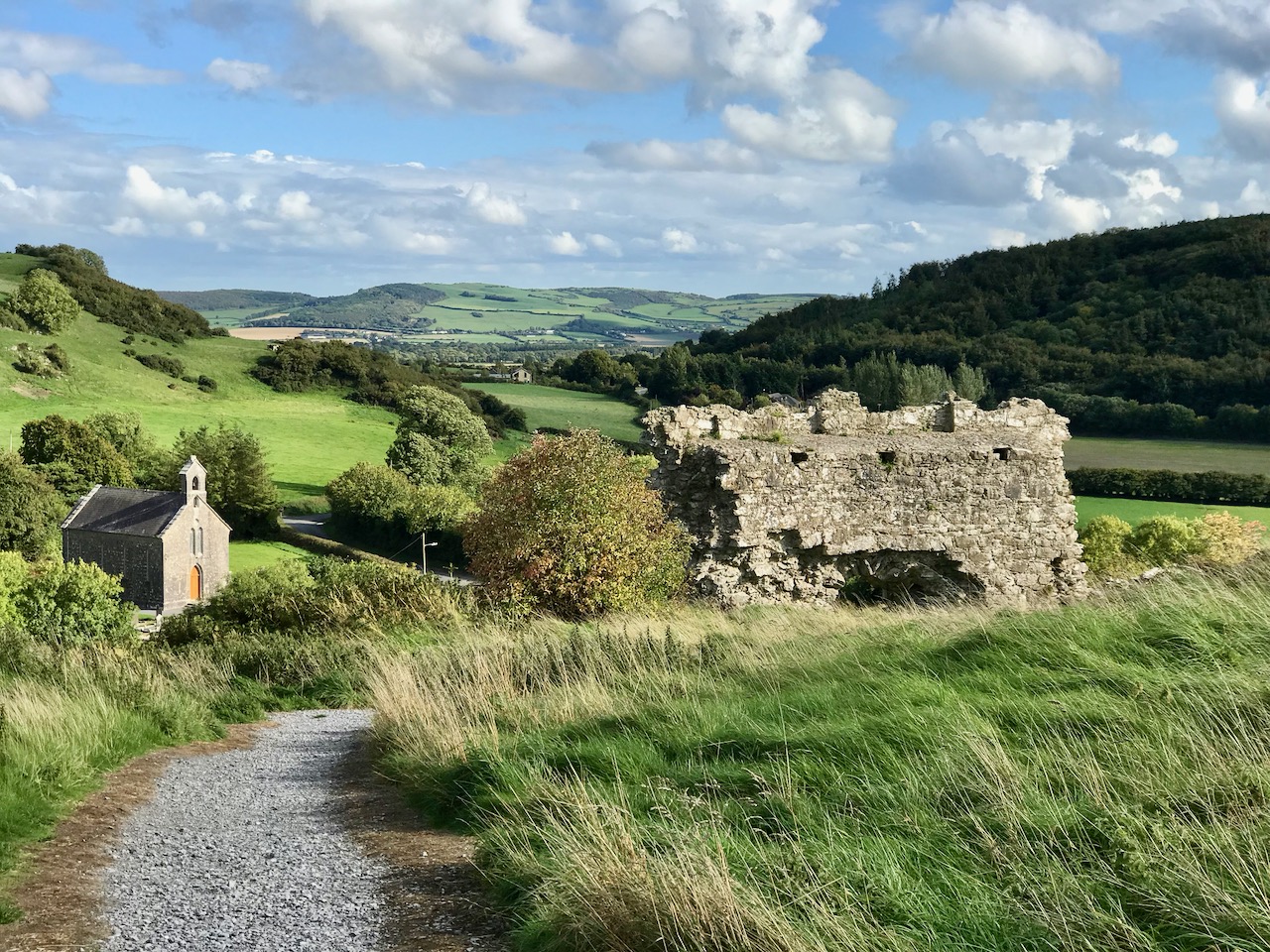
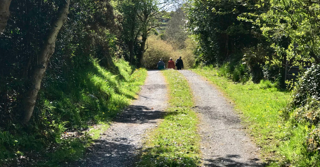
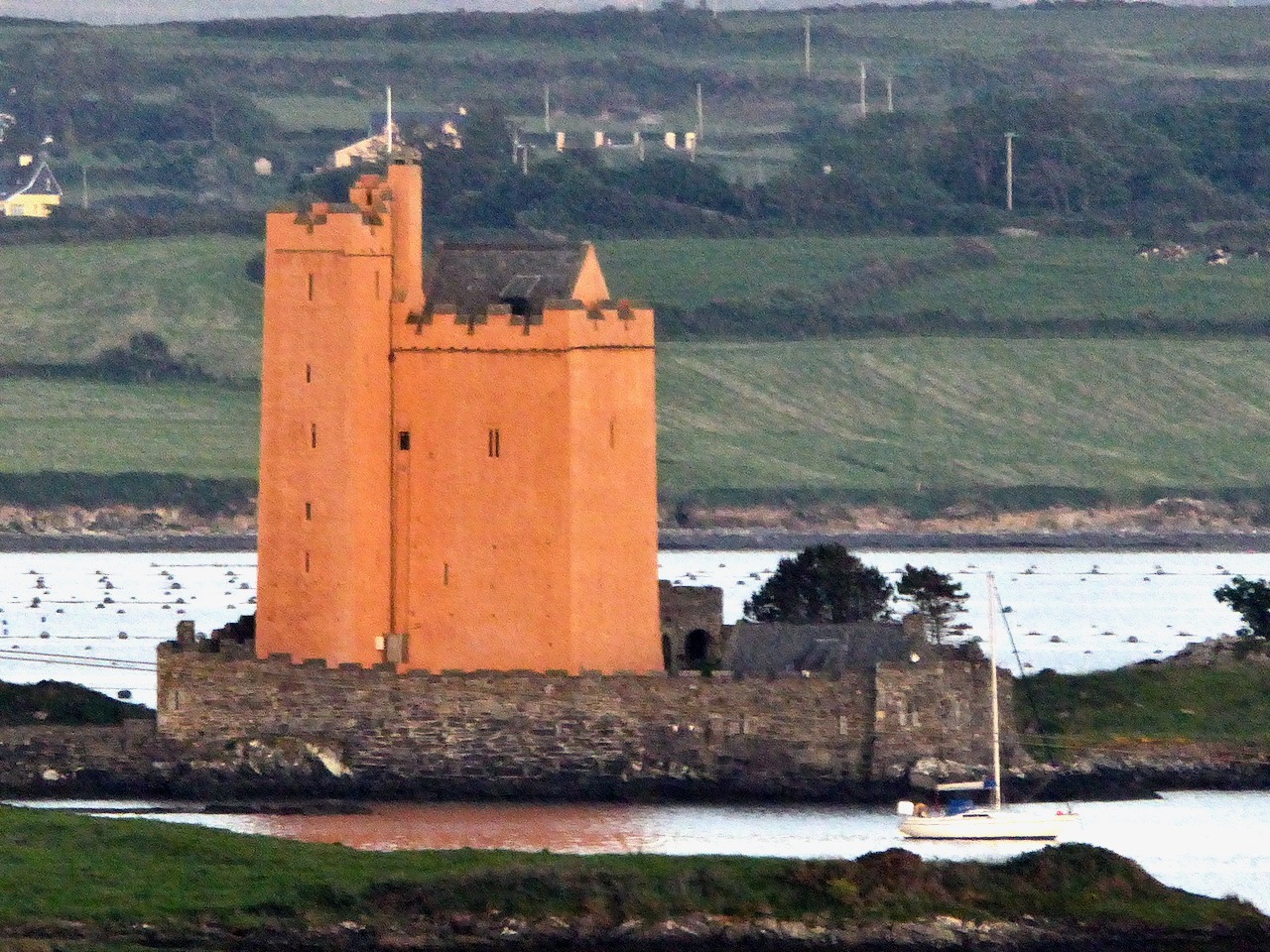
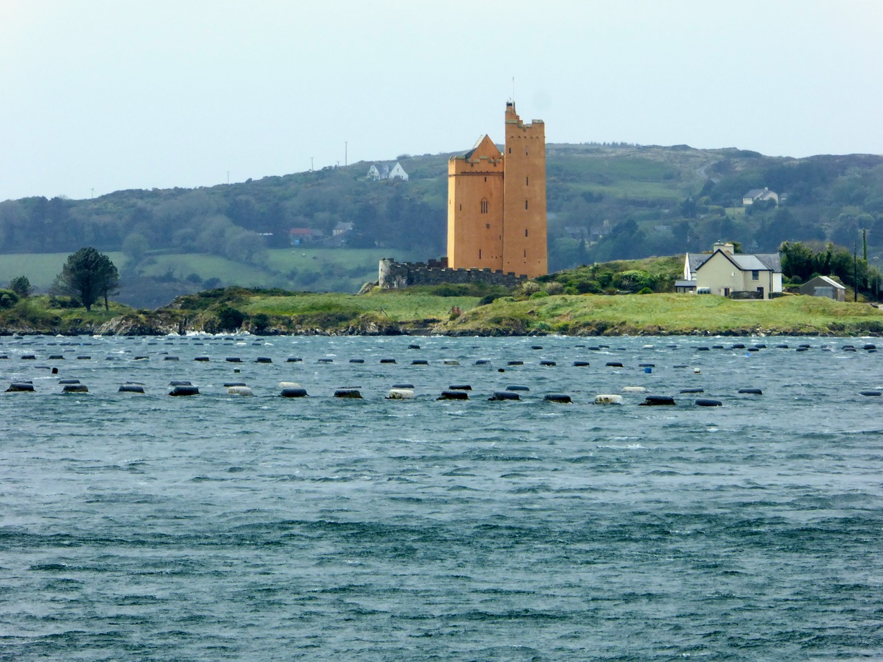
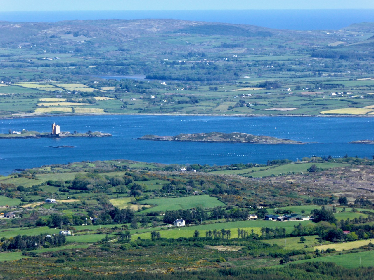
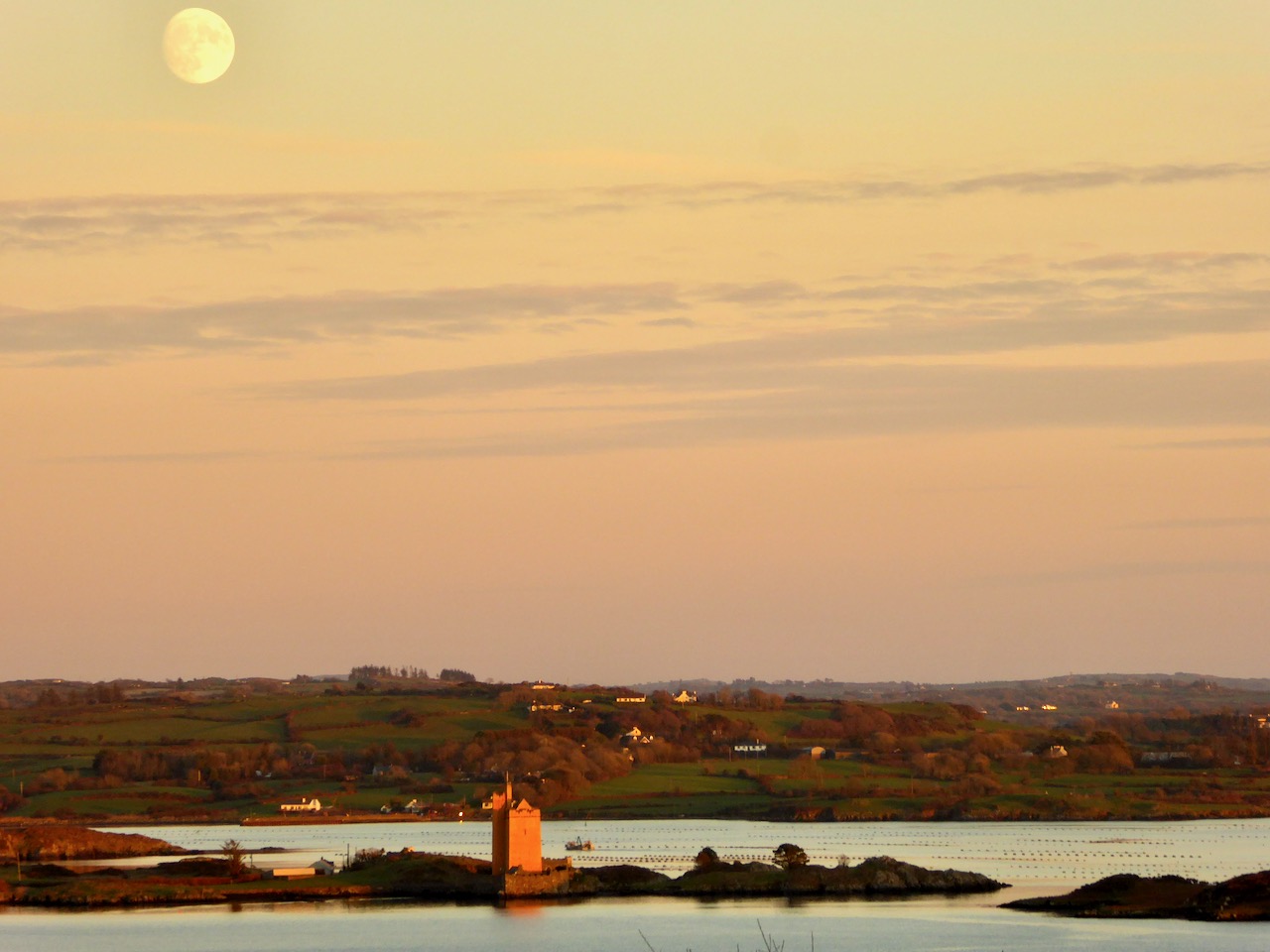
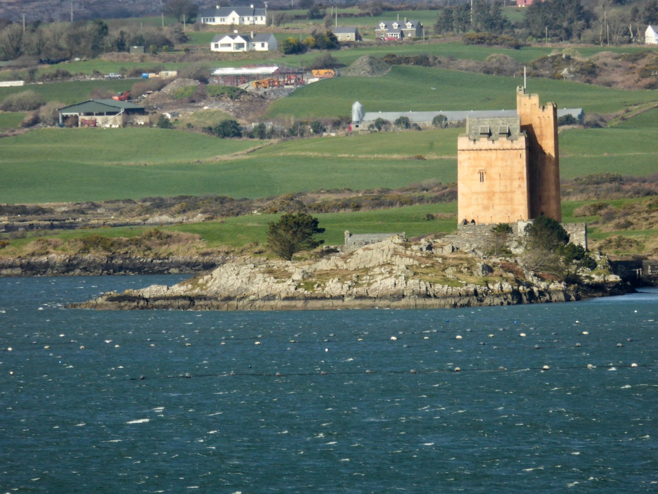
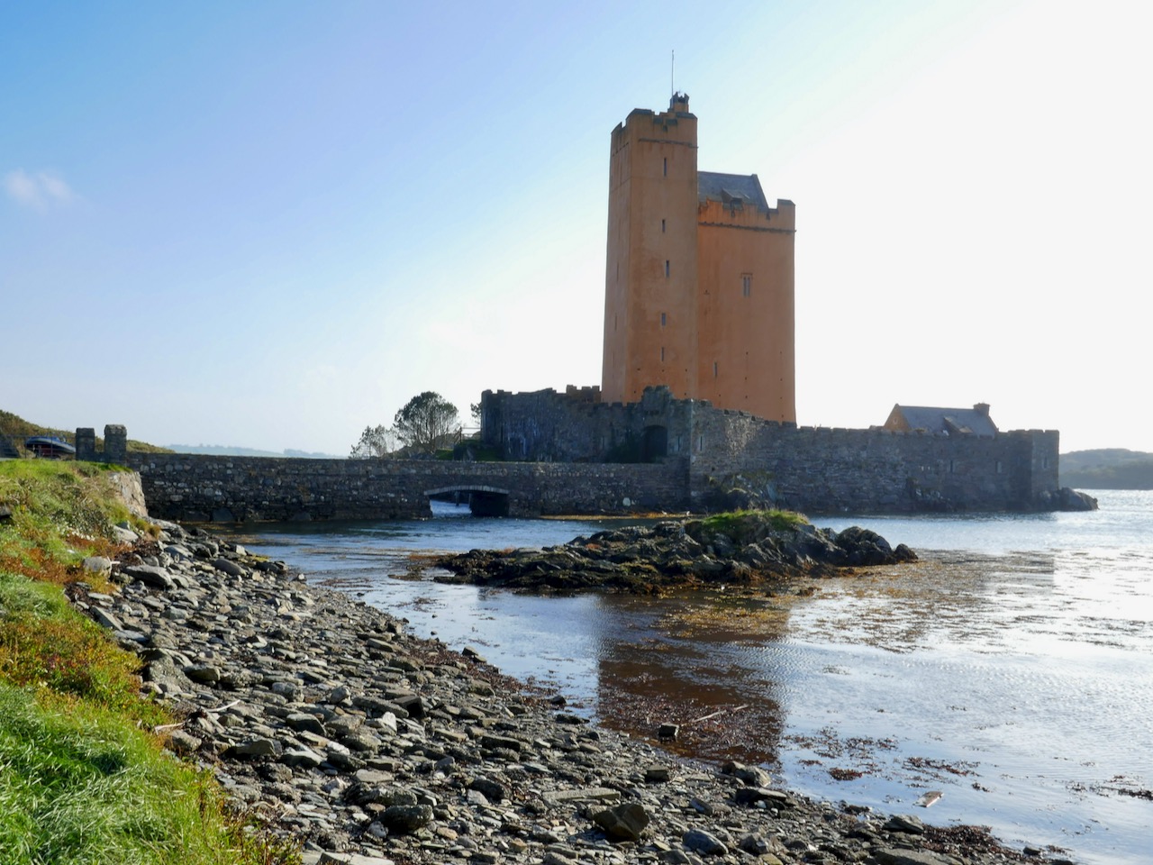
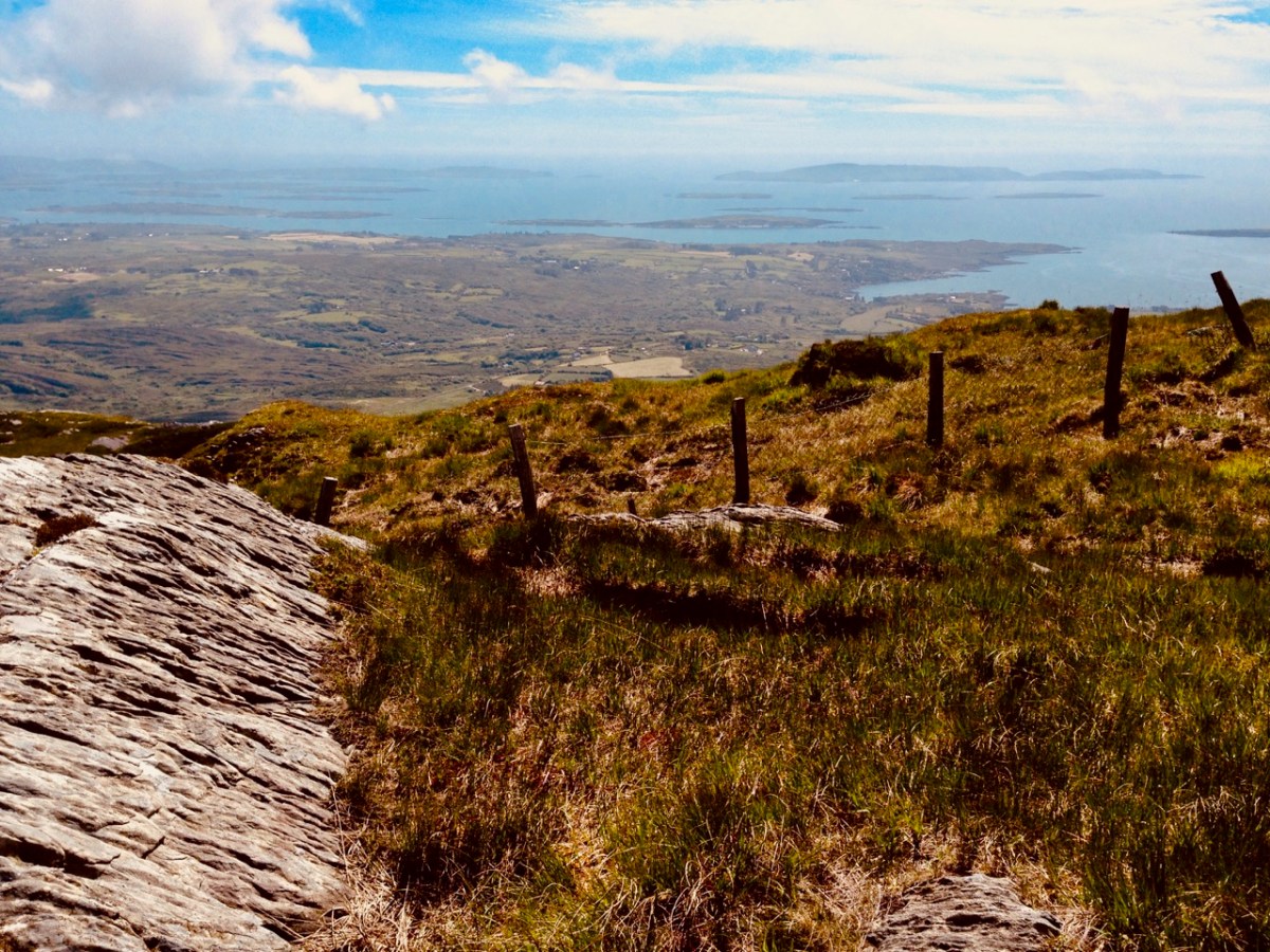
Roaringwater Bay must be so familiar to you, if you are a regular reader of this Journal. It’s a land- and sea-scape of hidden coves, inlets, islands, mountains and castles: a treasure trove for explorers and historians. That’s Black Castle at Castlepoint, Leamcon, above – said to have been built by Connor O’Mahony in the mid fifteenth century. Probably the best place to get an overview of the coastline is to climb to the top of Mount Gabriel (407m) and have a look down. You will see stretched out the archipelago of ‘Carbery’s Hundred Isles’ – seen here in autumnal hue – Cape Clear is the distant remote landfall over on the right:

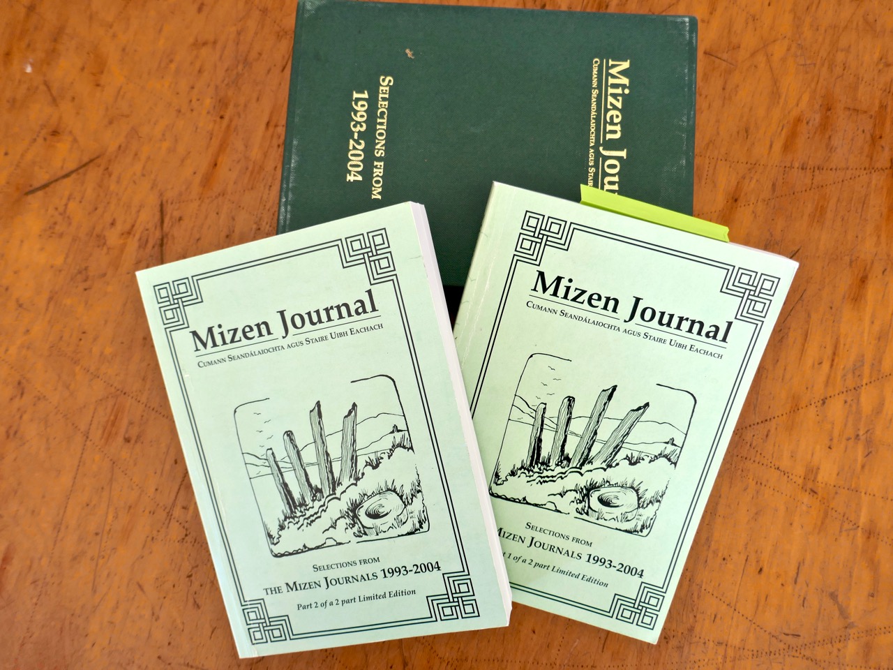
We always have a sizeable pile of books waiting to be pored over. Currently at the top is this study, The Alliance of Pirates, written by Connie Kelleher and just published (2020) by Cork University Press. We have yet to consume every detail, but we do assure you that it’s full of fascinating historical information – not just about pirates, but about life and culture in the west of Ireland in the late sixteenth and early seventeenth centuries. Connie is an ‘underwater archaeologist’ and we have followed her over many years, lecturing and presenting original information which she has gathered together on her subject. We couldn’t fail to be hooked on everything she says, illustrates and writes about, as the focus is on our own doorstep. One linchpin of this book is a map which is dated to 1612. This article from Atlas Obscura explains the map and Kelleher’s approach. It’s worth reading: note that you may be required to register on the Atlas Obscura website (it’s free) in order to access it.

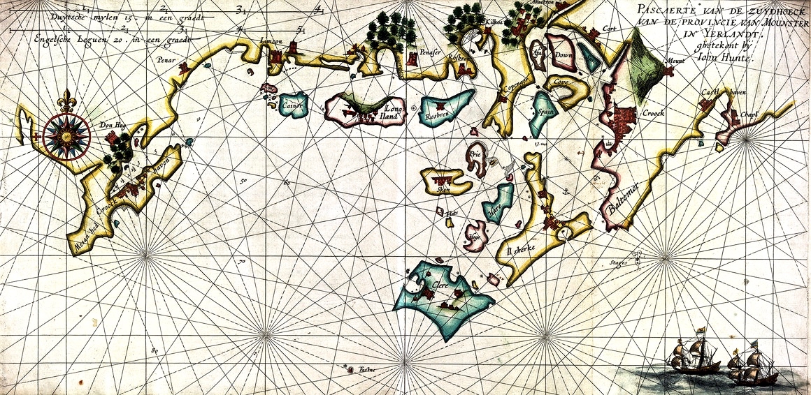
The 1612 chart of the “Pirate Harbours” of southwest Munster which became a valuable source of information for Connie Kelleher‘s studies © SUB GÖTTINGEN 4 H BRIT P III, 6 RARA UNIVERSITÄT BIBLIOTHEK GÖTTINGEN LIBRARY ARCHIVES, GERMANY

The purpose of today’s post is to examine the 1612 map in detail and attempt to identify and relate to many of the places which are named and illustrated. Before that, though – let’s consider how such a chart came to be made. Finola has written previously about how West Cork as a whole was being mapped in the sixteenth and seventeenth centuries here and here. The thing that sets the 1612 map apart, however, is that it was made in secret, and largely from surveys only carried out at sea. Also, it was specifically intended to enable a Dutch fleet to assail the pirate strongholds which became numerous around the area from Baltimore to Crookhaven, centred on Roaringwater Bay and ideal for forays into the wider Atlantic trade routes.

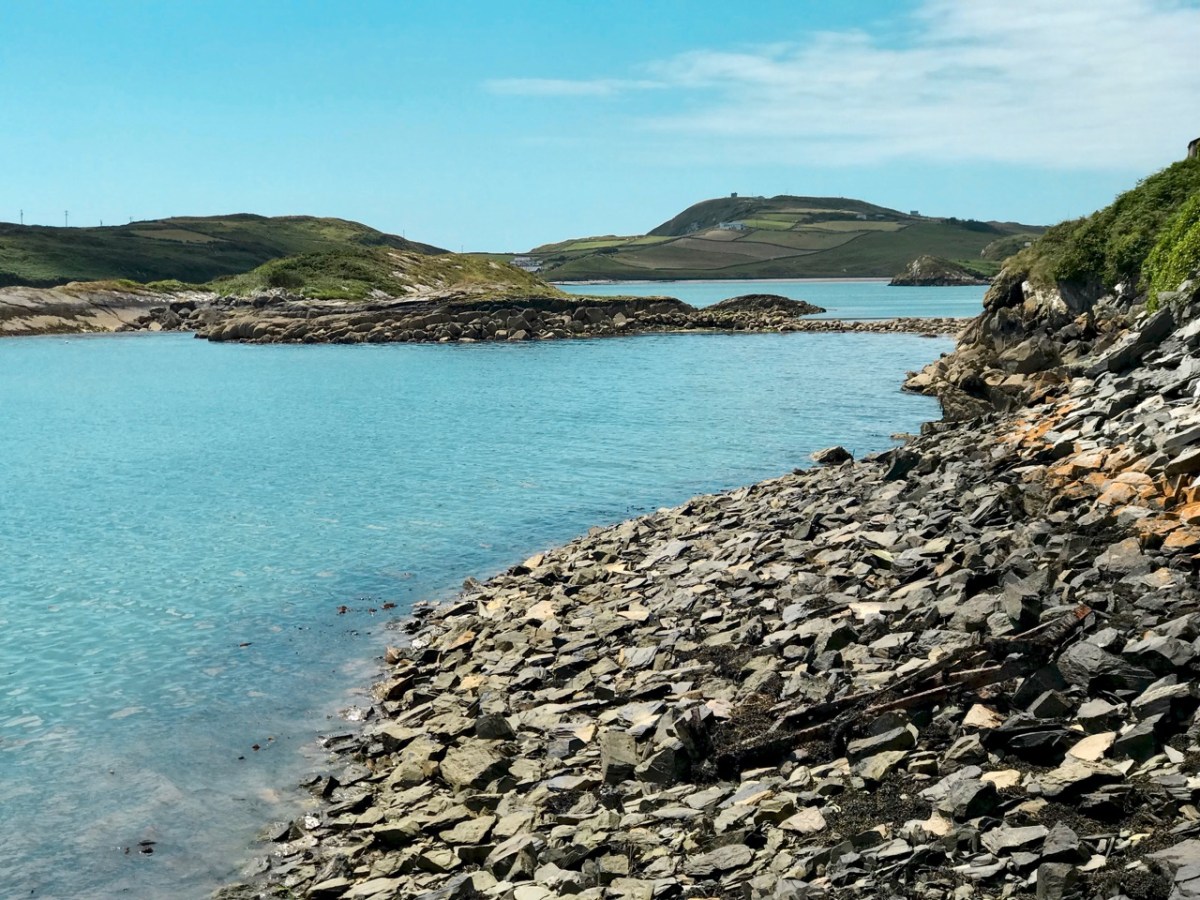
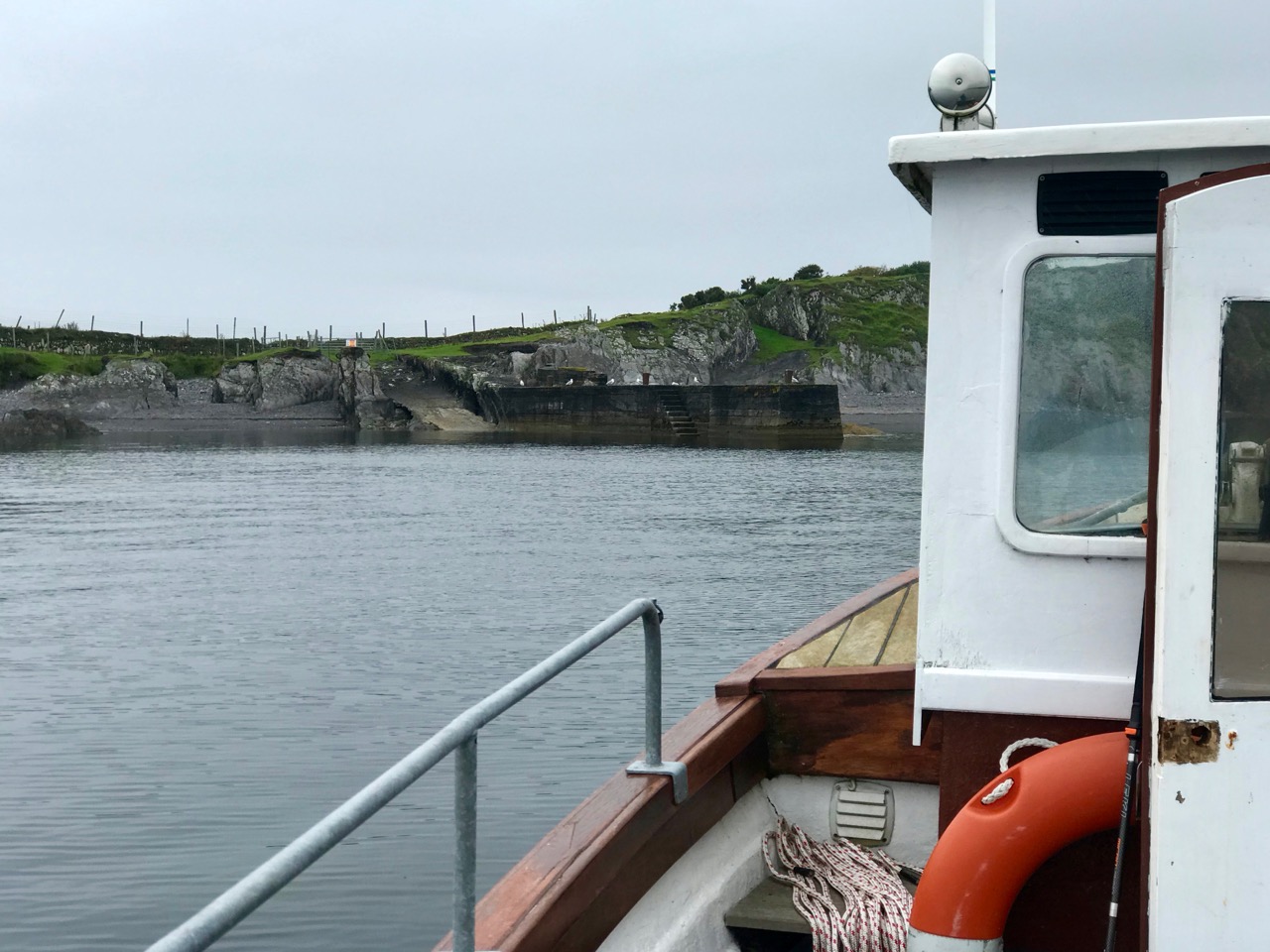
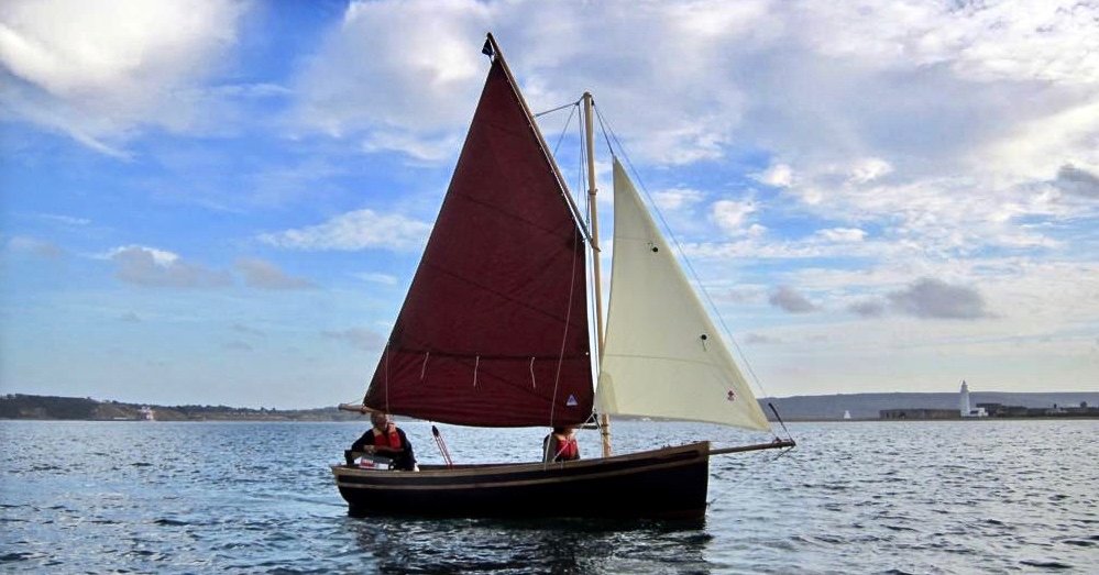
The sheltered waters of Crook Haven – an important recognised centre for careening and victualling ships operating legitimately on the Atlantic trade routes: ships that would become prime targets for the pirates based in secret ‘nests’ along the same coastline

. . . In 1612, having grown tired of the ongoing pirate harassment, the Dutch government lobbied James I for permission to enter the harbours of southwest Ireland to attack the pirates themselves. James I agreed, but only under the conditions that the pirates would be captured alive and handed over, along with captured goods, to the Kings’ ships to be transported for trial by the Admiralty in England.

To prepare their ships for the attacks, Dutch hydrographer Hessel Gerritszoon was tasked with mapping the Irish coastline with a special focus on the “pirate coast” of southwestern Ireland. A large task in front of him, Gerritszoon engaged English cartographer John Hunt to assist. . .

Atlas Obscura

The leeskarte which the hydrographers produced still exists, and has been housed since the mid 1700s in the library at the University of Göttingen in Germany, which acquired it in the mid 1700s. During her researches, Connie Kelleher travelled to Göttingen to examine and document the map, which is a wonderful resource for enlightening us on some aspects of our local history.

. . . It is a type of ‘treasure map’ informing on the heritage within the landscape at the time, which could potentially help us identify other pirate-related locations, including archaeological sites . . .

Connie Kelleher

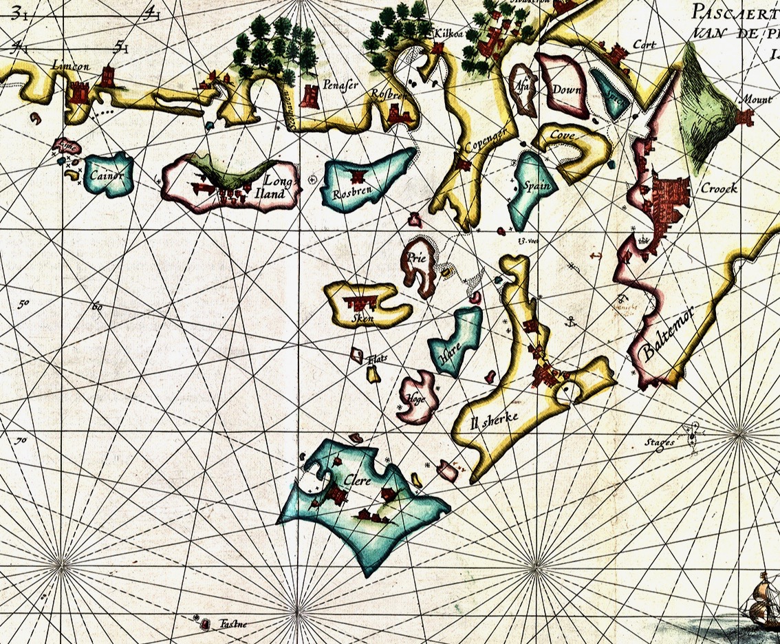
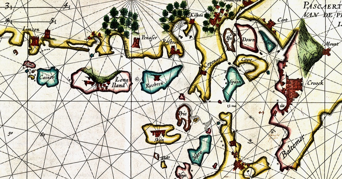
In this extract from the 1612 map I have focussed on our immediate area – the environs of Roaringwater Bay itself. Many names will ring bells with us (Clere, Baltemor, Rossbren for example); others won’t. For a simple comparison I have chosen a version of the historical 6″ Ordnance Survey map, dating from the late nineteenth century – it’s probably the clearest and best annotated example of what we would recognise around us today in terms of place-names:

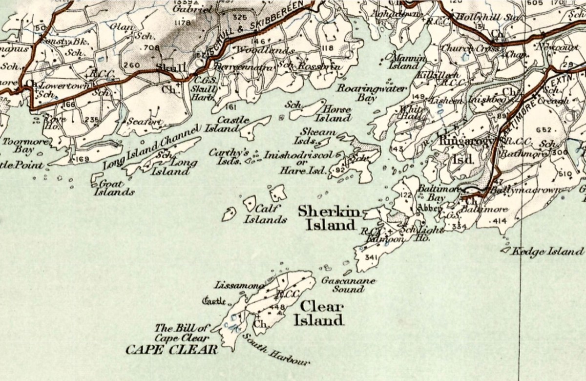
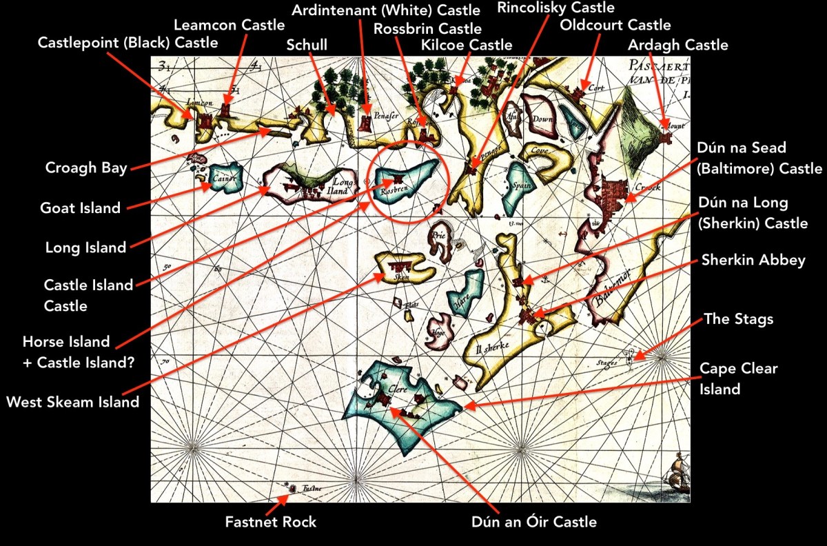
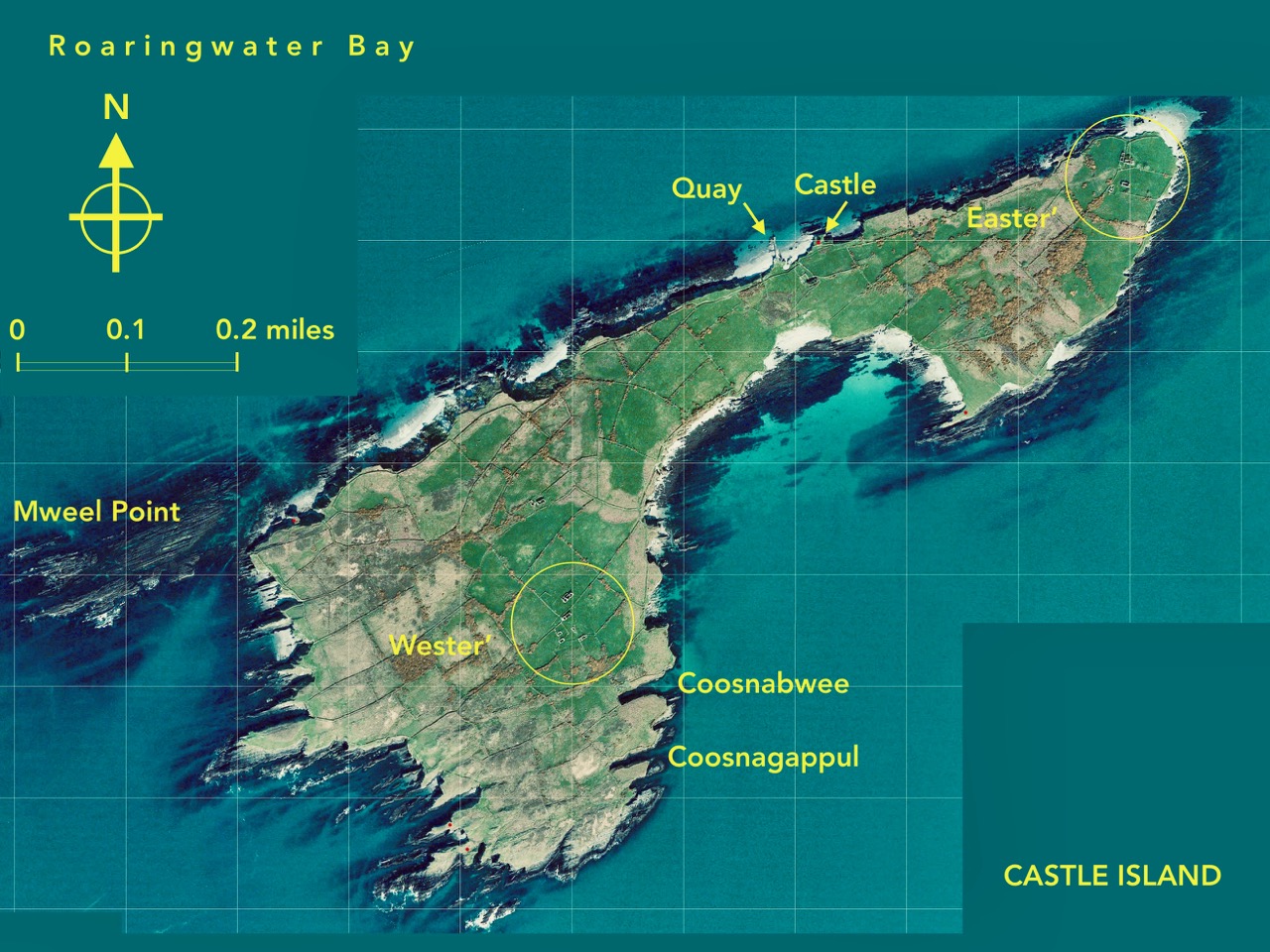
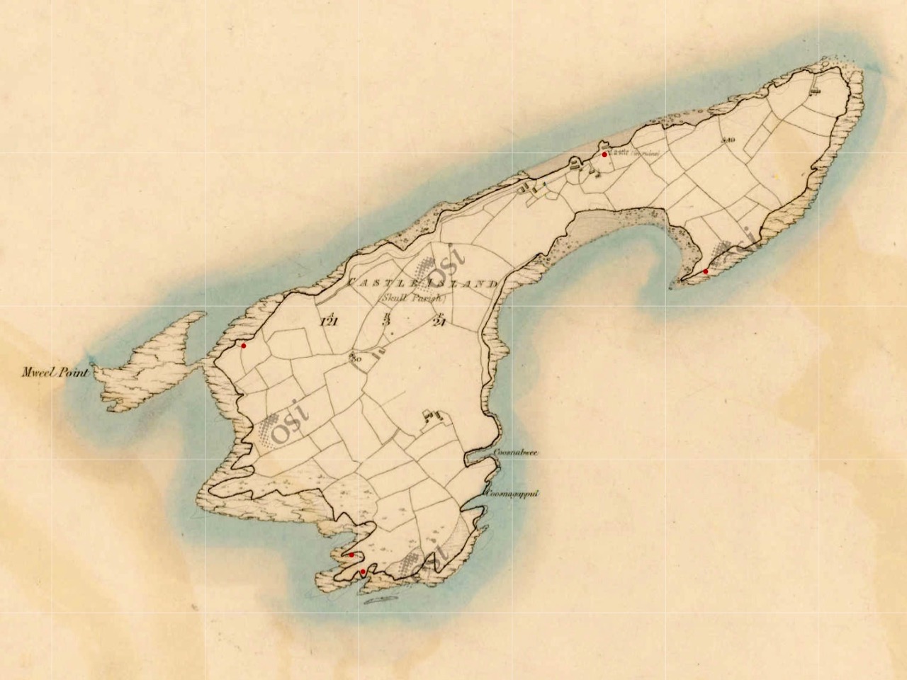
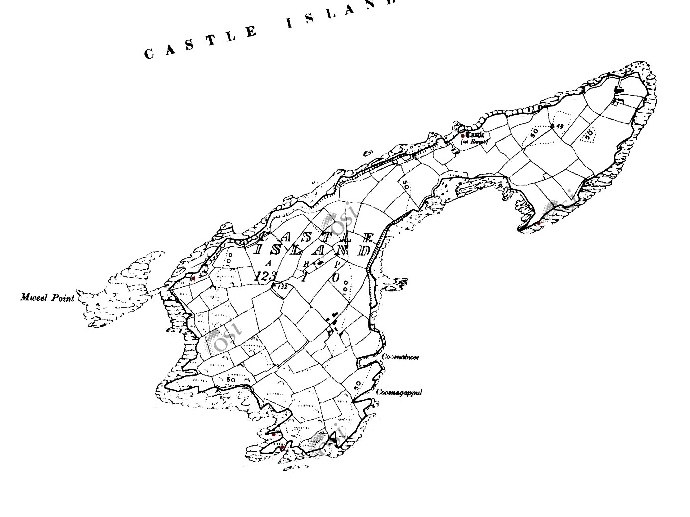
Here I have located and labelled our environs, as shown in 1612. It is remarkable that every castle and many significant features are clearly shown. Now, have a look at my red circle around ‘Horse Island + Castle Island’.

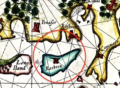
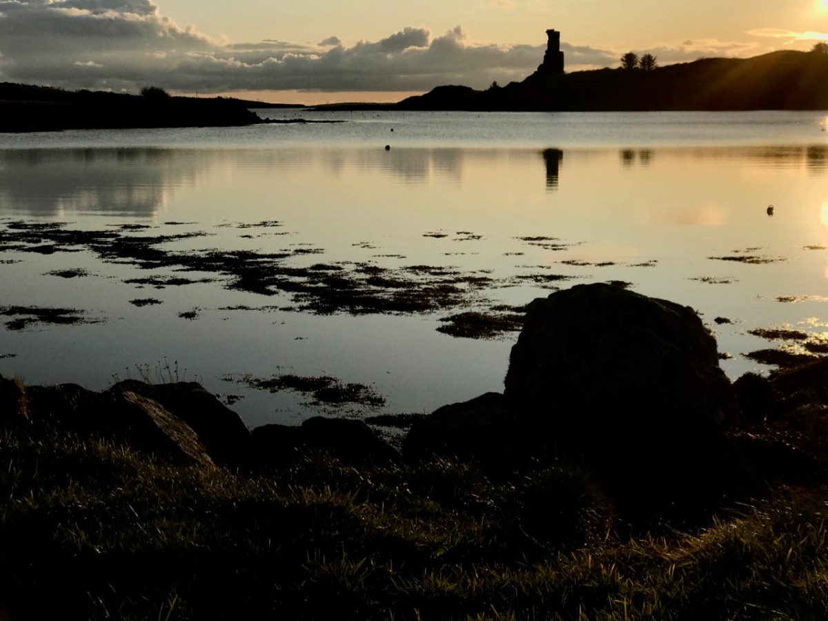
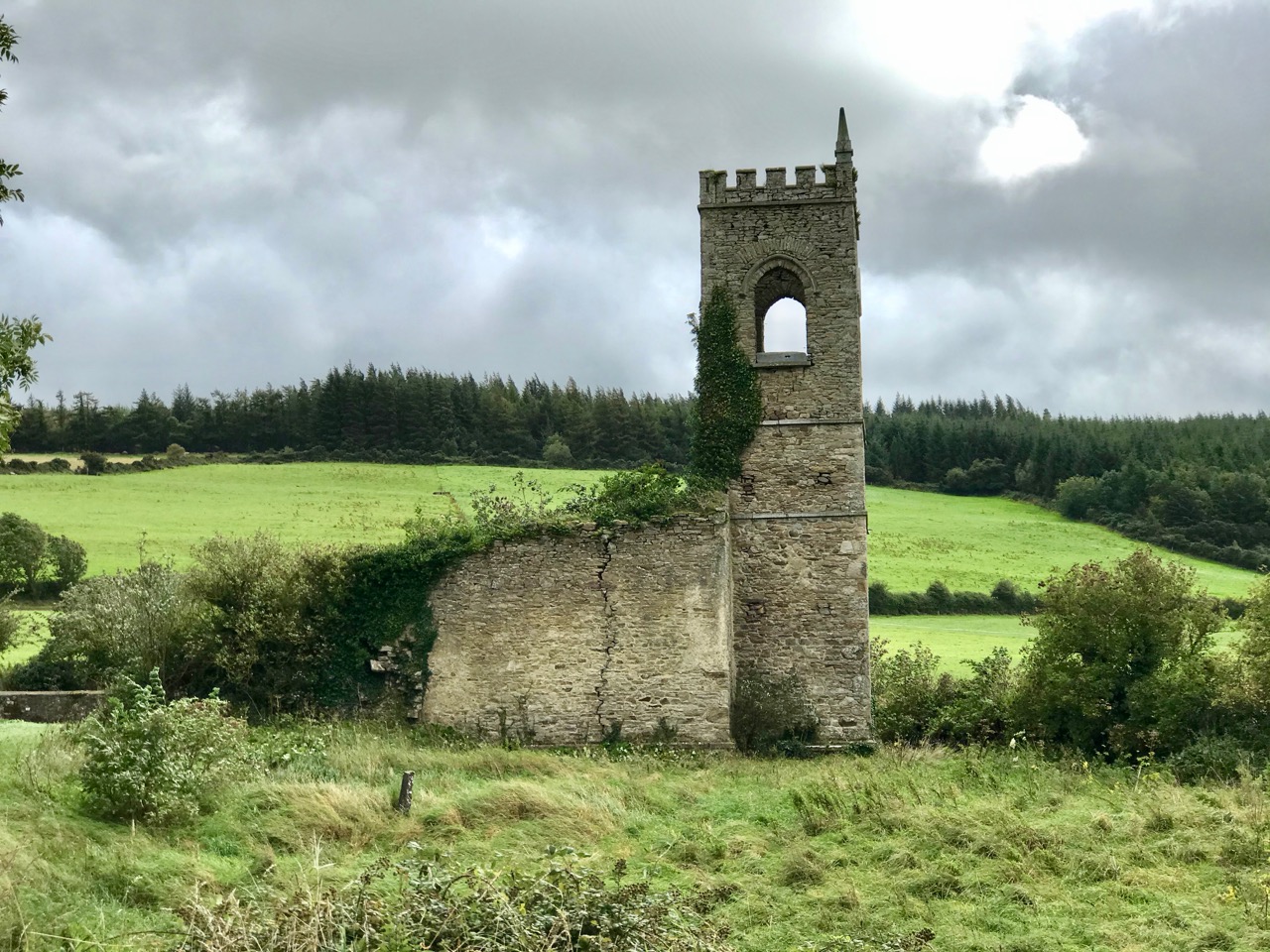
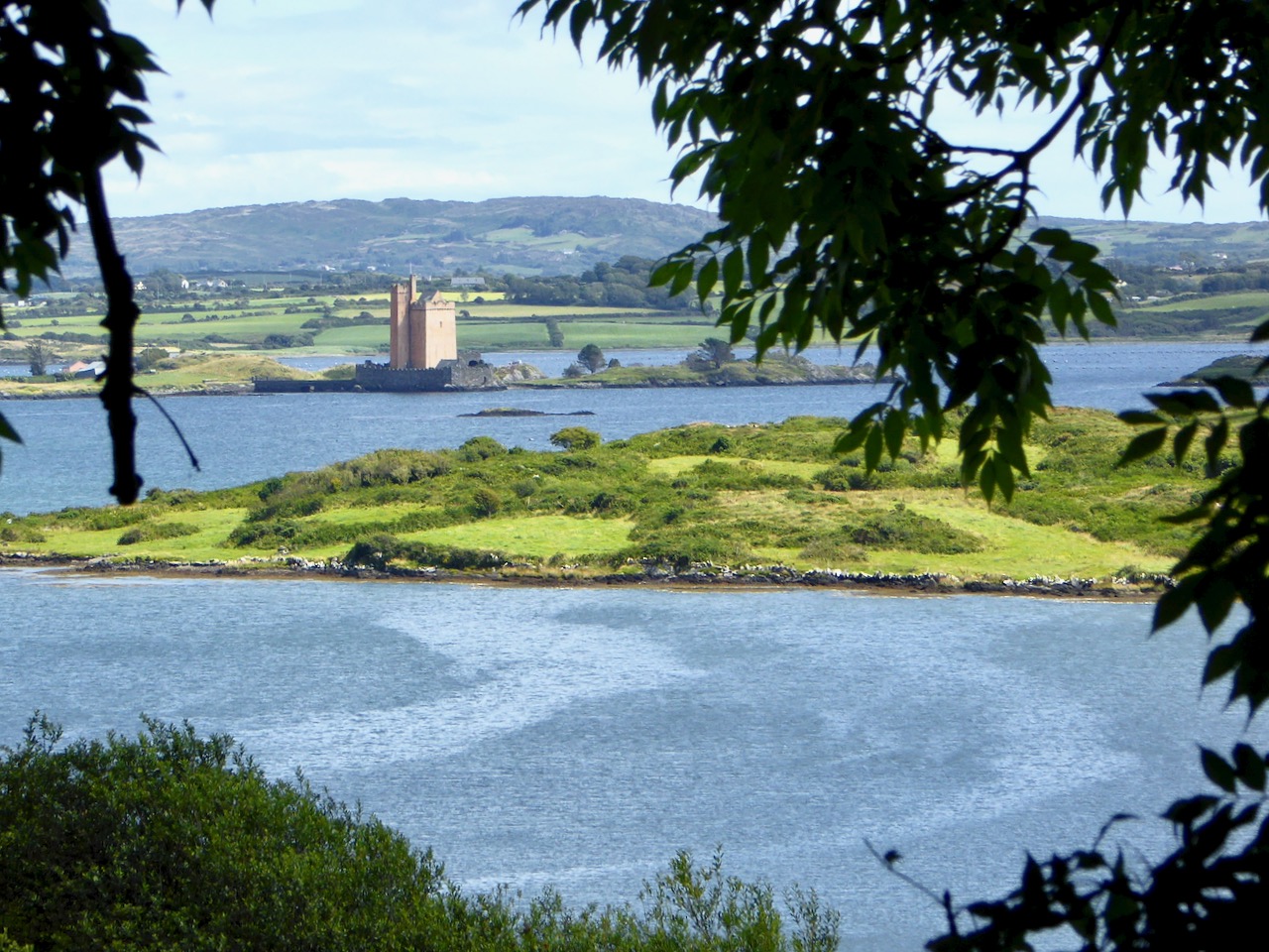
There’s an island missing! Opposite ‘Rossbren’ on the mainland is shown a single island: Rosbren. Next to it is Long Island. In fact, there are two islands here – Horse Island and Castle Island. On the 1612 map there is a castle shown on the Rosbren island, but the castle is actually on Castle Island. Somehow, the surveyors have missed this detail: perhaps the visual information which could be got offshore was confusing. What is interesting, though, is that the dotted lines at the east end of Rosbren on the 1612 map seem to mark the line of a causeway, the vestiges of which do appear today at very low tides and the feature exists in local folk memory. That level of detail on a chart, produced in the limited circumstances of its, time is remarkable! You can read more about Castle Island here.

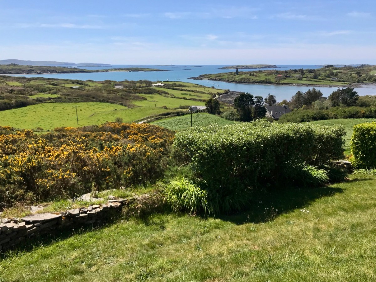
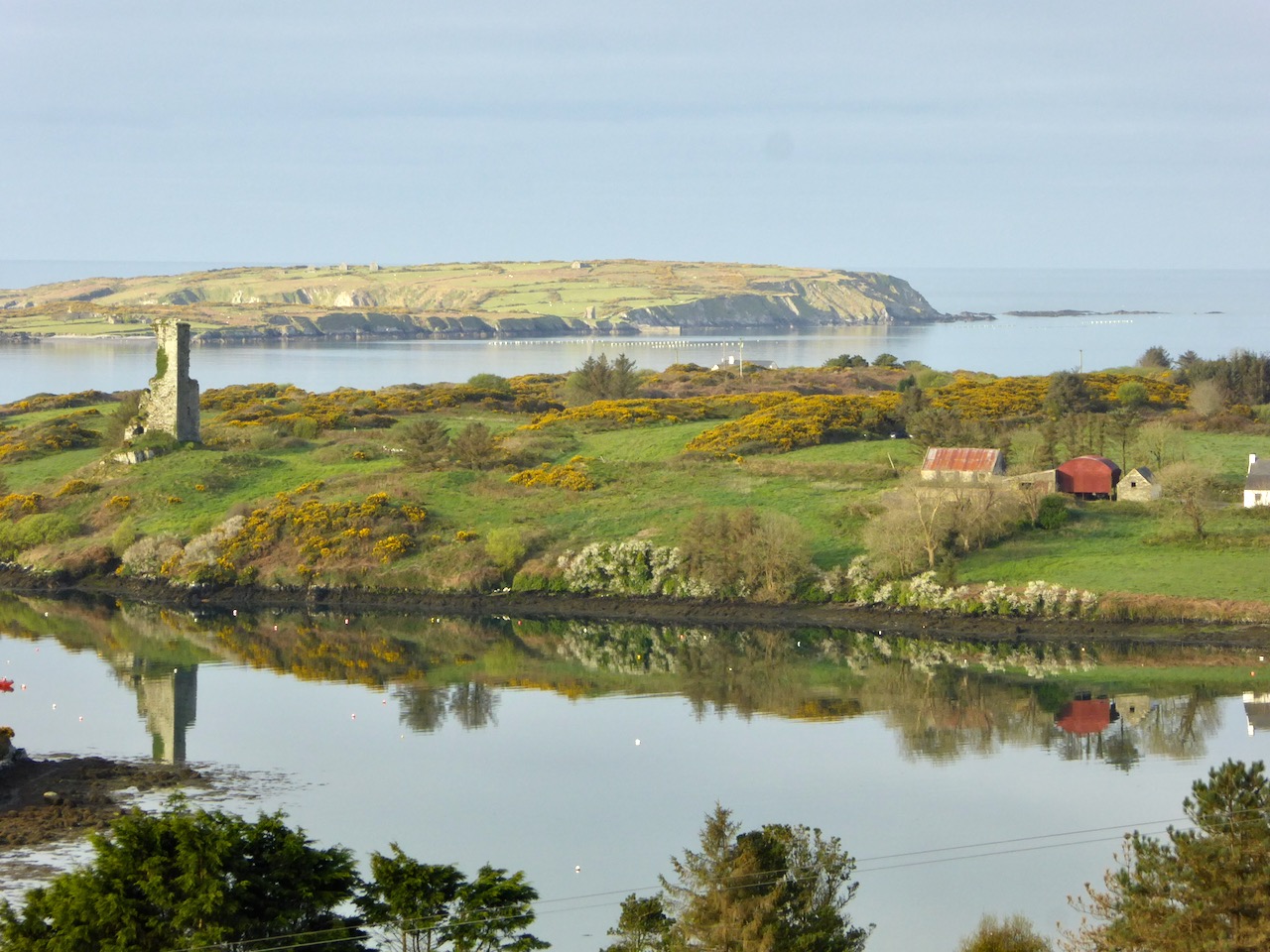
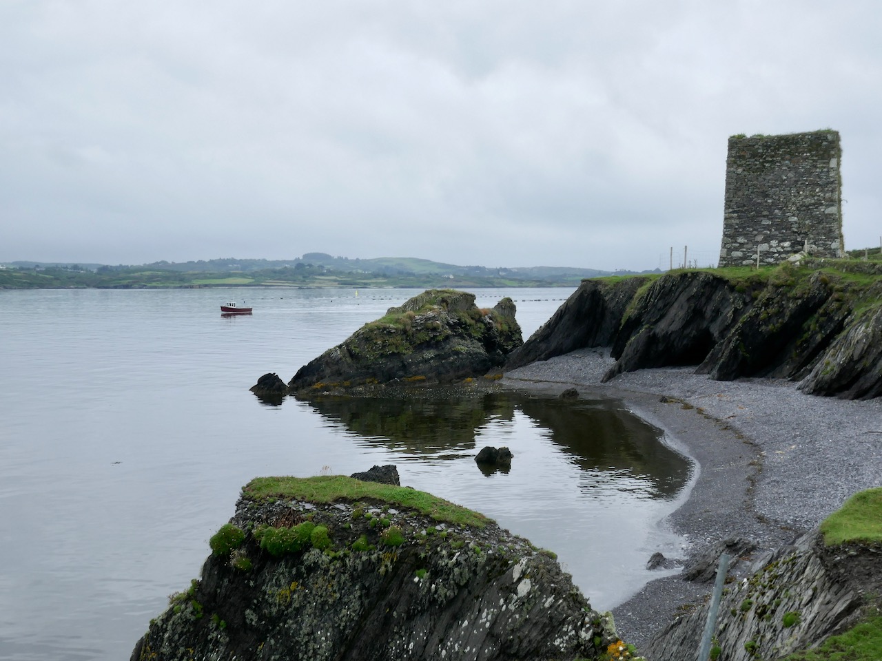
Our view across Rossbrin Cove with its O’Mahony castle and, beyond Rossbrin Castle, Castle Island. On the left of the picture is Horse Island

I want to show you some further details from the 1612 leeskarte. Firstly, here’s a close-up of Crookhaven (Croock haven on the map). Note the scales in Dutch miles and English leagues, and ‘Limcon’ – in fact Leamcon – which was one of the major pirate centres and also the territory of Sir William Hull, a Vice Admiral of Munster from 1609. His job description involved rooting out the plague of pirates in Roaringwater Bay but in fact entailing a lot of profitable collaboration with them. Also of interest here is the depiction of Goat Island – named ‘Cainor’ and a castle – ‘Penar’ which is likely to be Ballydevlin, at the mouth of Goleen harbour; also ‘Don Hog’, which we believe refers to Castlemehigan. There is no trace remaining of either of these two.

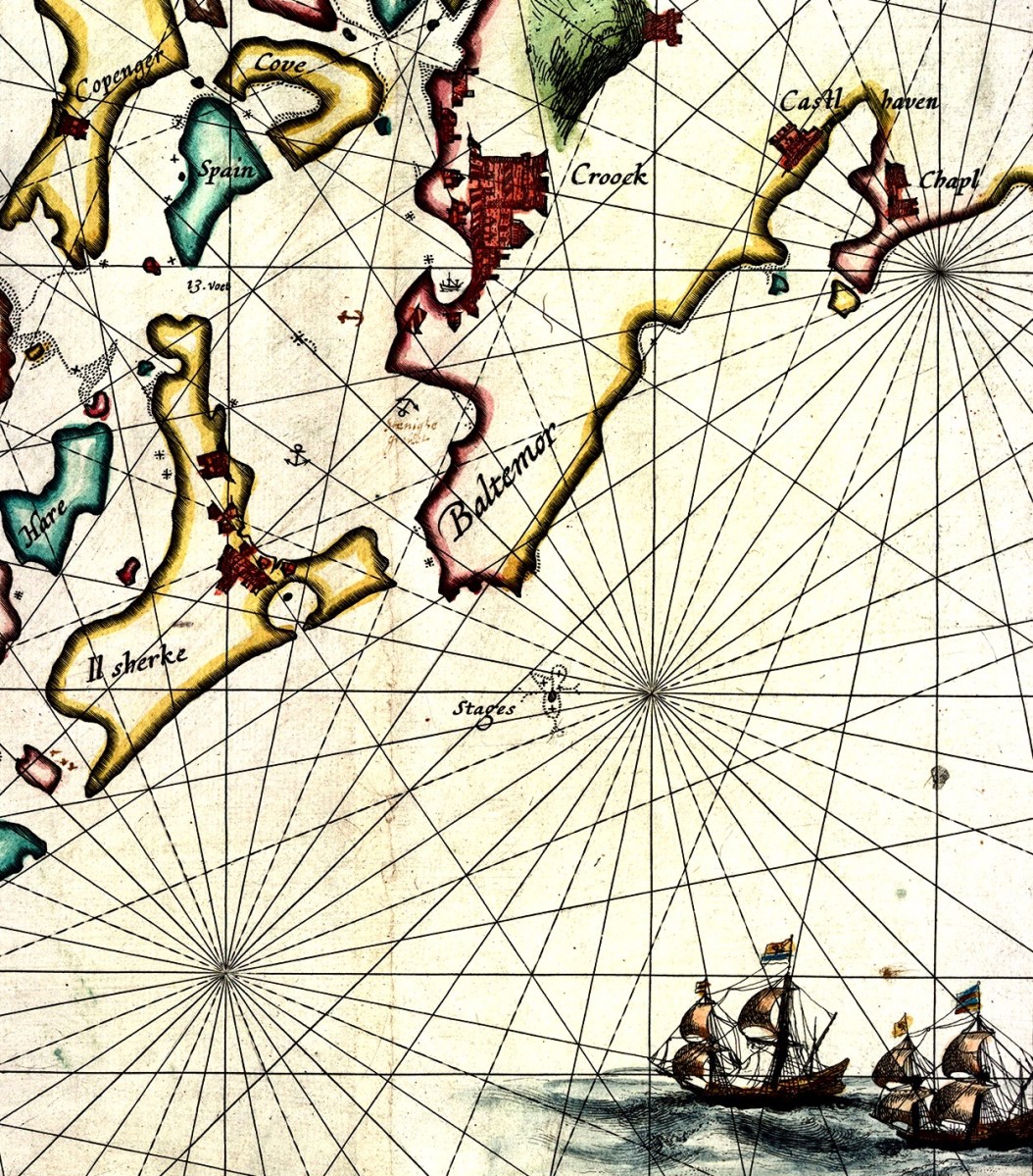
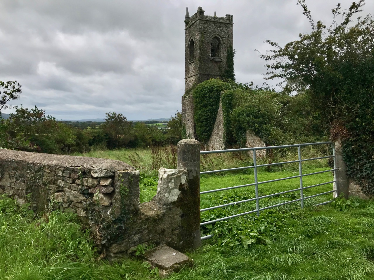
Another detail from the map (above) shows Spain Island, Sherkin and ‘Baltemore’. the depiction of galleons in full sail is a fine ornamental ‘illumination’. Also, note the small anchor symbols. In some places on the whole map, anchorage depths are shown: another remarkable factor highlighting the observation skills of the surveyors. Additionally on this detail, note the name ‘Croock’ – Thomas Crook, an Englishman, took a lease on Baltimore Castle in 1605. The ‘Chapl’ below Castlehaven is probably the now ruined church at Myross, detailed in my post here.

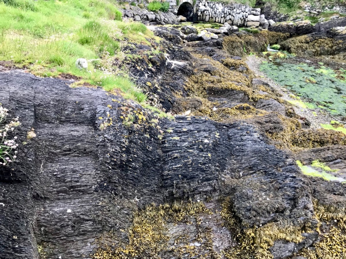
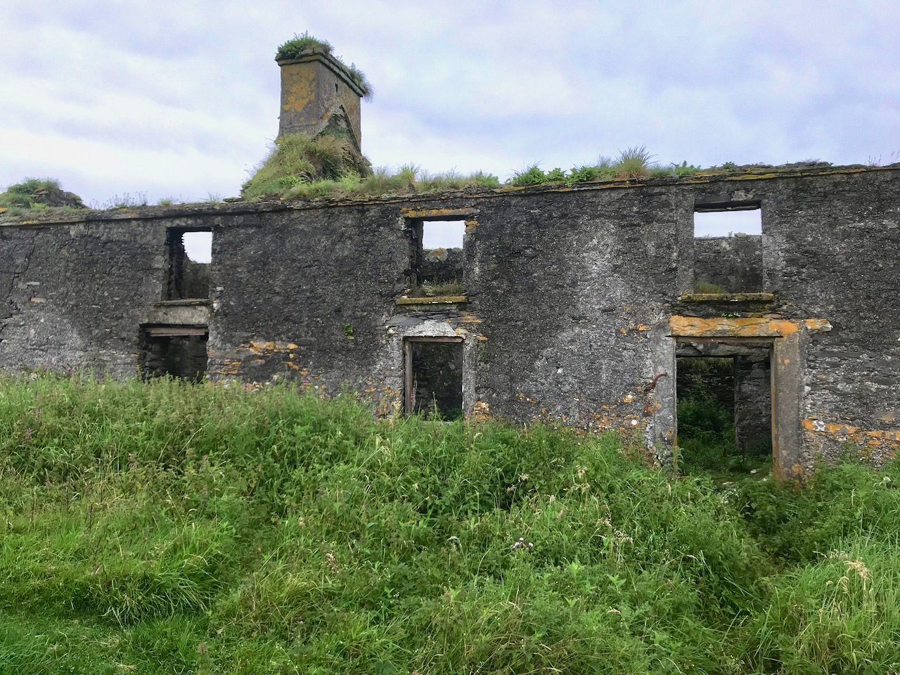
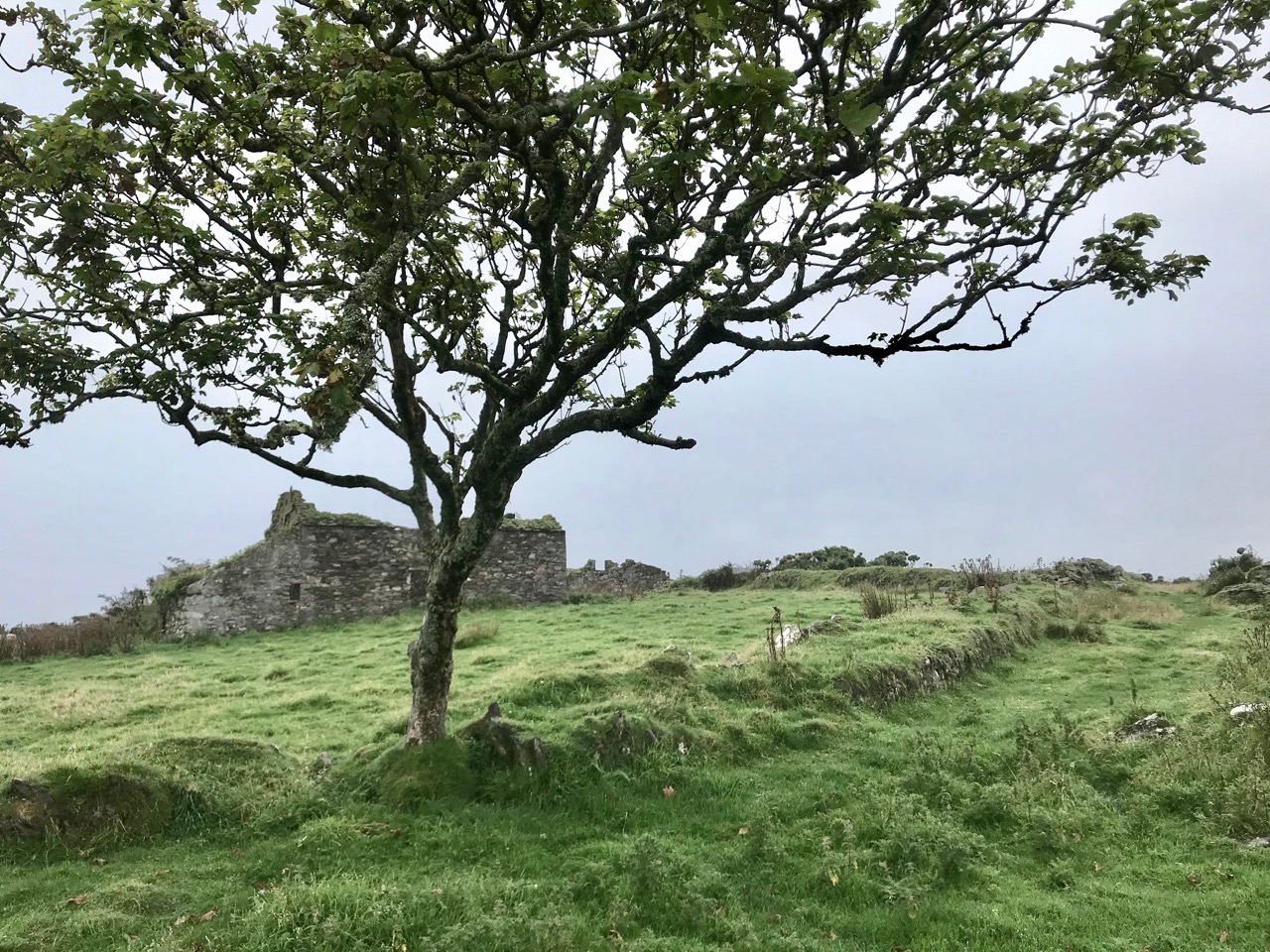
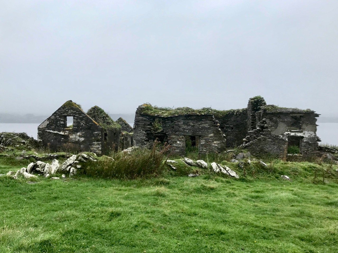
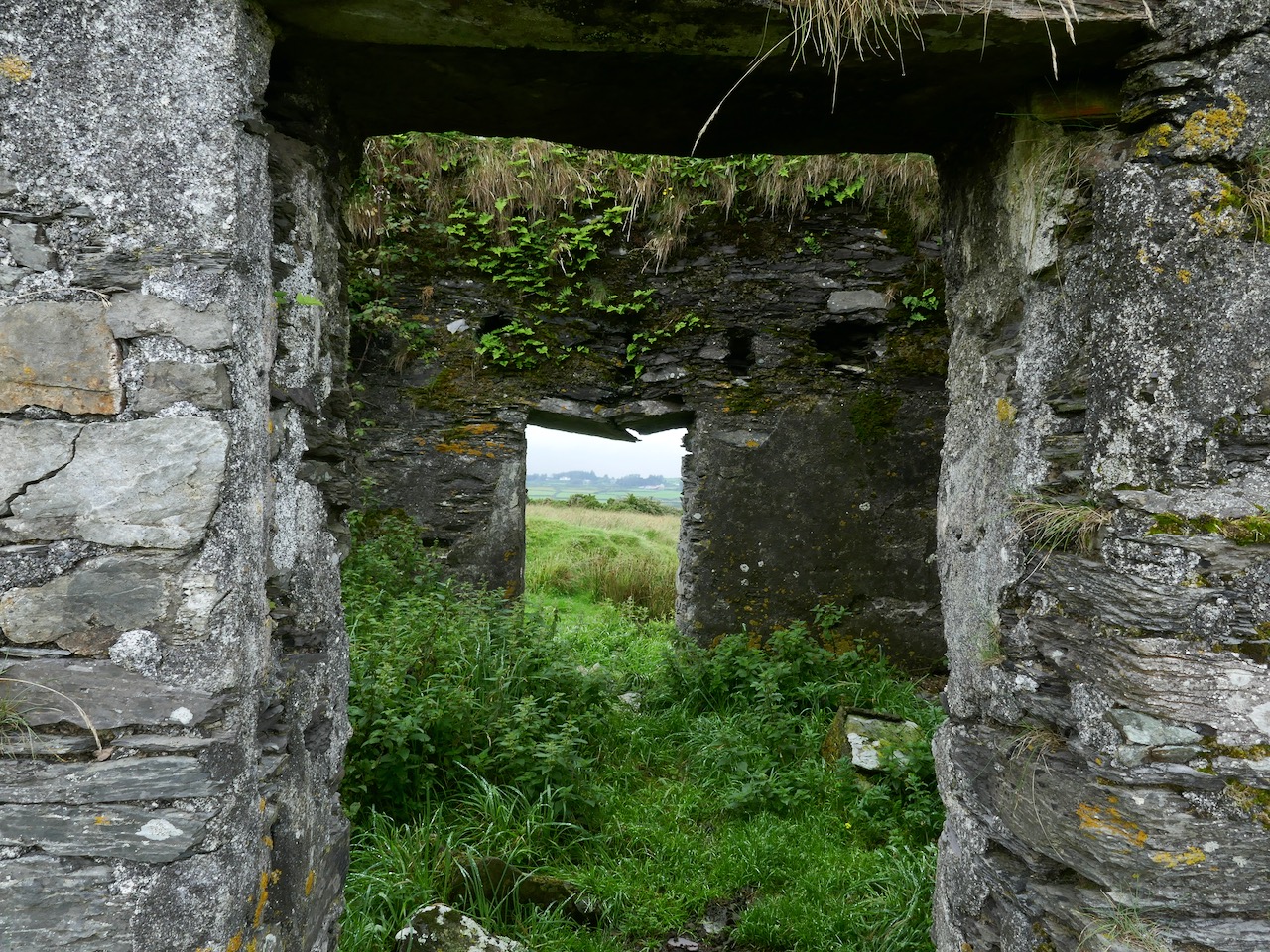
Our photograph of old (possibly ancient) steps carved into the rocks at Dereenatra. Connie Kelleher highlights the physical remains that can be found today in many of the former pirate strongholds around the coast of West Cork. Several are in the form of frequently hidden away steps and tying-up points in remote locations. I have included references to ‘pirate steps’ in a previous post. For the full picture, don’t forget to get hold of Connie’s book: it will make an ideal Christmas present for the archaeologists and pirate enthusiasts among you!

Off the M8 – A High Cross and a Complex Saint

We haven’t had an ‘Off the M8’ for quite some time. You remember that, on our journeys from West Cork to Dublin, we would go (literally) off the beaten track to find new places of interest to visit – making a ‘grand day out’ of every trip. However, the unexpected arrival of the Covid19 pandemic severely curtailed our travelling – and everyone else’s – for many months. Covid is by no means over, even now, but we are slowly venturing further afield and, last week, made the trip up to the Dublin area, following all the guidelines. Nevertheless, we couldn’t resist trying out a fresh route which adds about 40 minutes to the overall journey but which takes in a new (for us) medieval stone cross and a historic site with thought-provoking associations. It is situated with fine views of the Slieveardagh Hills to the west.

We followed the normal route as far as Cahir, on the M8, then headed off east on the N24 and N76 towards Callan. Just after Ninemilehouse (Ireland has some wonderful place names!) you cross from County Tipperary into County Kilkenny and, within a few minutes (watch carefully), you’ll see a small signpost directing you off to the right down a tiny boreen to Killamery High Cross.

The first thing you’ll see, at the end of this lane, is the ruin of a significant church. Some distance beyond it you’ll make out the distinctive shape of the large, carved stone cross but also many other treasures including old grave slabs, bullaun stones and a very fine holy well dedicated to Saint Nicholas.

The site is associated with an Irish holy man, as you would expect: Saint Gobhan, Gobán Fionn, Gobban – or even Gobanus – who lived from c560 to c639AD. Foundations associated with this saint were many, including Portadown, Co Armagh, in the north; also as Abbot to the monastery of Old Leighlin, County Carlow, where in 633AD he presided over a great Synod held to debate the timing of Easter (we seem to remember only the later Synod of Whitby – 664AD – which also set out to regularise the date but which led to irreconcilable disagreement between the Irish and Roman factions). Latterly, Gobhan was linked to the Kingdom of Kerry – near Tralee, but we are interested today in the monastery he set up by a holy well in Killamery. He had a thousand monks with him and it is said that an army of angels helped build the walls.

The angels must also have helped to eradicate that monastery as there is now no trace of Gobhan’s foundation in County Kilkenny, just a lonely 19th century church, the well (pictured above), a burial ground and this very fine High Cross. The cross is well worth a visit: some say it’s the oldest of the Western Ossory high crosses, which are themselves considered to be a distinct group. I have looked previously at the Kilkieran examples. Here at Killamery there is just the one cross and, perhaps for that reason, it stands out in the memory. Some scholars reckon it could be 8th century, but most attribute it to the 9th. It’s ancient by any standard, certainly, and it’s probably unavoidable that the carving is so weathered.

The Duchas signboard (above) describes the scenes depicted on the various elements of the cross,  but most of what we can decipher today is limited to geometrical patterns – very much in the ‘Celtic’ tradition. There may have once been other visible motifs: the large plinth stone is completely worn on all surfaces.

The cross certainly predates any of the other artefacts, bullauns and stone markers which surround it today, but it is likely that the adjacent holy well is even more ancient: it is dominated by an intriguing, large shaped monolith.

Among the artefacts which have arrived at this site is a fine 17th century (probably) cross slab and a memorial to the United Irishmen who lost their lives at nearby Carrigmoclear in 1798 – both shown below.

The origins of Gobhan himself merit some consideration. He has associations with metalworkers and, of course, we know that Saint Gobnait was their patron saint. Could there be some fusion of names in folk history and oral tradition? Like Gobhan, Gobnait is revered at many sites around Ireland and undertook diverse travels around the island in search of the nine white deer which set her destiny.

There’s nothing more Irish than the experience of finding references to hundreds of years of history hiding down a lonely boreen to nowhere in the rural heart of this land. More than anything, it makes us want to know more. What is real? What is myth – although made to seem logical and credible through stories which are still told? Of course, we can never know the reality, but we can share in the spirit of the stories, and wonder at a piece of stone beautifully carved, perhaps, thirteen hundred years ago . . .

Once you have visited this fascinating site, find your way across to the M9 (it’s straightforward enough) and you’ll be up to the big city in a jiffy!

Castle Island Explored – Part 1

In this early spring photograph, taken from our Eyrie at Nead an Iolair, you can see Rossbrin Castle in the foreground. Beyond it lies Castle Island, uninhabited and slightly mysterious, but with clear traces of former occupation including a medieval tower house, a substantial quay and several abandoned dwellings. As we look over this island every day, we have long held an ambition to visit it, recently fulfilled when we were offered a lift out there on our good friend and neighbour’s fishing boat.

This map shows the scale of the island – just under a mile in length, and occupying 123 acres of mixed land. The main settlements – of Wester’ and Easter’ – are shown, as are the Quay and the Castle. It’s interesting to compare the two Ordnance Survey plans (below): the first 6″ edition was drawn up between 1829 and 1841, and the second one is the 25″ edition, drawn between 1888 and 1913. You can clearly see how the fields have changed, with new boundaries created in the later survey. Presumably this was due to an increase in population resulting in more clearances of rough land.

Both these maps show the Castle – said to date from the 15th century and one of the chain of O’Mahony fortresses that are strategically situated around this most south-westerly part of the Mizen. Of that clan we can find the following written by W O’Halloran in 1916:

Dr Smith says – these Mahowns derive their pedigree from Kean Mc Moyle More, who marrid Sarah, daughter to Brian Boru, by whom he had Mahown, the ancestor of all the sept. It is from this Kean the village of Iniskeen, in Carbery, has its name, and from this sept the Bandon is sometimes called Droghid Mahon. Mahon was the ancestor of the Mahonys, or O’Mahonys . . . The O’Mahonys, whose stronghlad was in the neighbourhood of Bandon (Drohid Mahon), were the first to encroach on the territory of the O’Driscolls. This occurred long before the Anglo-Norman invasion. They possessed themselves of the western portion of Corca Laidhe called Ivahah, which comprised the parishes of Kilmoe, Schull, Durrus, Kilcrohane, Kilmacougue, and Caheragh. They had fourteen strongly built castles . . .

Early Irish History and Antiquities and the History of West Cork, W O’Halloran

The M V Barracuda approaches Castle Island on an atmospherically damp day in late August. The quay itself seems to have been constructed  during the time of the Congested Districts Board from 1892 to 1922. It is a substantial structure and the investment in that time suggests that there was a significant community living and working on the island to justify it. However, a number of sources assert that Castle Island was “. . . home to a community of approximately 15 families who were last resident on the island up to the year 1870 . . .” Our own observations of the abandoned dwellings on the island led us to the conclusion that, although now significantly deteriorating, these habitations must have been in use more recently than this.

Examples of now-ruined houses, barns and boreens on Castle Island. These are not ‘cabins’ or even cottages, but significant homesteads. Some – including the large residence in the upper picture – have the vestigial remnants of timber door and window frames, unlikely to have survived in place in this harsh environment for 150 years.

A community of sheep roams unhampered by fences or boundaries, and Finola absorbed how nature has taken over and populated the landscape in spite of wild winters and lack of shelter: we counted precisely two and a bit trees on the whole island!

The story of this island is somewhat overlooked generally – one of the reasons we were so keen to visit. In our library, however, we are fortunate enough to have some copies of the Journals of the Mizen Archaelogical and Historical Society – now out of print. That Society was active for thirty years between 1979 and 2010, and produced a dozen journals gathering important historical research by mainly local people. Here’s a post we put together when our good friend Lee Snodgrass – a leading light in that organisation – passed away recently.

In that Journal we have found two articles about Castle Island. One – by Anthony Beese – explores the local placenames, and the other – by Liam O’Regan – speaks of The Castle Island Evictions 1889 – 90. This latter clearly shows that the island was inhabited in the late nineteenth century (apparently contrary to current popular thinking). Also, following those evictions, many of the tenants returned later and it seems very possible that some islanders remained in situ into the twentieth century. Both Journal articles have stories which need to be told, and I will attempt to do that in a later Roaringwater Journal post. For now, however, you will have to be content with . . . the story so far . . . which tells of our voyage of discovery to the island on an overcast day in the summer.

The Picarooner

Question: what’s the connection between these rather lovely donkeys in a little North Devon (UK) village, and our own beautiful Roaringwater Bay (below)?

Answer: a Picarooner! And here is one . . .

Selkie belongs to our friends and neighbours, Oliver and Susie Nares. It has a mooring at Audley Cove – just over the hill from us. It has been out of the water during the winter receiving some refurbishment and a new colour scheme (it’s shown above in last year’s livery). I was pleased to get an invitation to the launch this week, down at Rossbrin Cove.

Oliver and Selkie, getting ready for the launch

A Picarooner is a small fishing boat which has a long history. The name is reportedly the corruption of a Spanish word and means ‘sea chaser’ or ‘sea robber’. These boats are now associated with the North Devon coast and, specifically, the fishing village of Clovelly, where they still bring in catches – mainly of herring – using sustainable methods. But there is a fascinating etiology legend – which they will tell you in the West Country – that they were originally the ‘cockboats’ or shore tenders carried on board the galleons of the Spanish Armada which foundered on the west coast of Ireland and the southwest coast of England in the summer of 1588 while trying to return to Spain by circumnavigating the British Isles and Ireland. These endeavours were confounded by exceptional storms and lack of local knowledge of treacherous coastlines together with the effects of a strong gulf stream pushing them off course. There were many attempted landfalls in Ireland – in County Clare, Kerry, the Blasket Islands and Valentia Island – resulting in numerous wrecks. It is logical that their cockboats, which were stored on deck, would have survived the destructions and taken on lives of their own, wandering the lonely seas until they landed up on strange shores. One such landing was at Clovelly – or so the story goes – and the local fishermen and boatbuilders there were so impressed with the construction of the craft – its size, shape and manoeuvrability – that they established their own fleet of them to seek out the enormous shoals of herring which had arrived off that coastline due to a medieval climate change bringing warmer waters. That same climate change also brought a similar influx of fish to the south west of Ireland and – particularly – to Roaringwater Bay, allowing the Gaelic chiefs here to prosper.

Photo above by Franzfoto, Wiki Commons; header photo  by Adrian Pingstone, Wiki Commons

This is the fishing village of Clovelly, probably little changed from the times of the Armada and the herring bonanza. It is built into the side of a cliff and the one cobbled main street is so narrow and steep that only donkeys and pedestrians can negotiate it. I know it well, as I spent numerous years of my architectural career working on projects in the village, restoring scores of cottages, boating facilities and the two village inns. The village is owned to this day by a descendant of Zachary Hamlyn who, born to a farming family in Higher Clovelly, made his fortune as a lawyer in London and returned to purchase the whole estate for around £9,000 in 1738.

Old Clovelly – romantic views from Alfred William Hunt (upper) and an engraving (lower), both mid nineteenth century

It’s very fitting that the Nares should launch their Picarooner herring boat under the shadow of Rossbrin Castle, as Finnin O’Mahony, who occupied it in the fifteenth century, became fabulously wealthy through the medieval herring and pilchard fishing industry. The O’Mahonys and their fellow Gaelic overlords levied dues on visiting fishermen from Spain, Portugal, France and England and provided victuals, barrels, salt, liquor – and fish palaces for processing the catch.

The Nares family getting their feet wet, and preparing to run back to Audley Cove. Interesting to note that the Picarooner has a ‘cockboat’ of its own!

It’s worth going back to Clovelly before finishing off this post. Here is a gem: the village Harbourmaster, Stephen Perham, giving us a first-hand account of using a Picarooner for its traditional purpose – fishing for herrings. I remember Stephen well from my Devon days.

Oliver and Susie’s boat was built by Martin Heard of Tregatreath, Mylor Bridge in Cornwall. Martin sadly passed away in 2009, but the yard still builds and maintains traditional boats. This is another connection for me as I had cousins living in nearby Perranarworthal, and spent idyllic summer holidays there in my youthful days.

Many thanks to the Nares for inspiring this post and providing some of the material, including the view of Selkie under sail (above)

Wending the Boreens

Only in Ireland can you wend your way along boreens. The Irish word is bóithrín, – a small bóthar (road). We are surrounded by them in our West Cork townlands. In these days of Covid19 restrictions, they are our whole world. With a maximum walk of 5 kilometres allowed, we can only ever be on boreens. But that’s no hardship – mostly they are beautiful (in fact they are all beautiful), and we enjoy every step we can take. So today’s post is simply a celebration of what is around us. But I have also combed the RWJ archives to look for boreens outside of our local area, for a bit of variety and comparison. Rest assured that any illustrations beyond our present limits were taken in other – normal – times!

Of course a ‘boreen’ or small road doesn’t have to be in a rural location, This fine boreen in Eyries, on the Beara Peninsula, is in fact a well used highway through the town, but you can’t deny that it is as atmospheric and picturesque as many of the rural byways shown here. It’s a moment in time captured for all time.

The photo at the top of the page is special for us: it’s the view we get when we turn out of Nead an Iolair, heading down towards Rossbrin Cove. And there (above) is our first glimpse of the sheltered harbour, overlooked by the medieval castle that was the home of Clan Chieftain Fininn O’Mahony in the 15th century. Not only do we have all the wonders of West Cork’s landscape on our doorstep, but we also have deep history as well…

How much closer can you get to nature than this ‘green’ boreen just a short walk up the road from where we live in Cappaghglass? The stone hedge banks have become completely assimilated into the surroundings, and are a haven for so many native species of wildflowers, as Finola will readily point out to us!

And just a few yards from that last green trackway is the boreen that takes us down into our village of Ballydehob. Those are apple trees flourishing as part of the natural hedgerow.

We have very little woodland around us here. This slightly mysterious tree-lined boreen was found on our travels near Glendalough, in County Wicklow, last year.

Close by the little harbour of Glandore (in Irish Cuan D’Ór – Harbour of Gold) in West Cork, we found a secluded boreen which pointed us towards an oddity: a pyramid in a graveyard – well worth a visit. Read about it in this post from two years ago.

Returning to our own neighbourhood these two recent photos, taken only a couple of days ago, show how you can never quite know what you are going to find just around the corner or over the brow of the next hill. That’s Jeremy Irons’ Kilcoe Castle in the upper picture, and Cape Clear Island (on the horizon) in the lower one.

In contrast, here’s a little trackway that takes you up to the summit of the Rock of Dunamase in County Laois. This historic site with a view is associated with momentous events in the history of this country: in the painting by Daniel Maclise that hangs in the National Gallery of Ireland, The Marriage of Strongbow and Aoife is depicted as taking place at the now ruined Great Hall on the Rock. You can find the whole story of this most critical juncture in Ireland’s history in Finola’s post here.

Even further afield – in Ballymoney, Co Antrim – is this spectacular avenue of beech trees planted on the entrance driveway leading to an eighteenth century Georgian mansion, Gracehill House. This boreen – open to pedestrians – is known as the Dark Hedges, and we visited it when we explored the North of Ireland three years ago.

Although in normal times we travel a lot – on major roads and motorways, as well as boreens – the places we like the best are near to home. How could we not be impressed by the winding boreen that climbs to the top of Mount Gabriel, the highest point on the Mizen? Look at the spectacular views (above). The preacher Caeser Otway travelling in this area in 1822 wrote:

. . . On my way to Bantry I passed the dark and lofty Mount Gabriel and took my way over a dreary, comfortless tract of country. Let no one say after looking at these moors , studded over with cabins crowded with children, pigs, goats, cocks and hens that an Irishman is not an industrious creature . . . Men, women, boys and girls toiling up the mountainside with seaweed and sea sand in baskets on their backs . . . See them reclaiming from amidst rocks and bogs, patches of ground on which to cultivate their only food, the potato; and no one witnessing this struggle of human industry against nature, but must acknowledge that the Irish are a most industrious race . . .

The 400 year old road that crosses the mountains from Cork into Kerry north of Bantry has to count as a boreen, as it’s single track for much of the way. The Priest’s Leap sign (above) marks the point at which the two counties meet. Although we have travelled all over Ireland in our explorations, this is still one of our favourite routes, and always will be. We so look forward to being able to go there again, when the present ‘lockdown’ is lifted.

Another glimpse of the Priest’s Leap ‘boreen’.

This elegant woodland boreen is a fine example of regency landscaping, being part of the Ballyfin Demesne in Co Laois. Like so many of Ireland’s fine luxury hotels, Ballyfin remains closed until the Covid19 restrictions are lifted.

We’ll finish this post where we started – near to home in West Cork, with happy memories of unrestricted rambles with friends along the quietest and most beautiful of Ireland’s boreens . . .

Kilcoe Castle – A Magnificent Reconstruction

Kilcoe Castle has been wonderfully restored and conserved by Jeremy Irons. His work allows us to see what a 15th century castle would have looked like in the landscape and has saved a precious piece of our heritage. This is important as there are so few castles that have been conserved here and lots that have disappeared or are in danger of doing so. Before you read on you might like to refresh your understanding of our West Cork castles, or Tower Houses, by reading When is a Castle?; Tower House Tutorial, Part 1; Tower House Tutorial, Part 2; or Illustrating the Tower House: A Guest Blog (sort of)

First of all, let’s address the issue of the colour of the exterior lime render, since this has been controversial. In fact, the only reason it’s been criticised is that people are not used to seeing castles as they originally stood, since the lime render has long ago disappeared from them, leaving the familiar bare stone walls that people have assumed was how they looked from the start. But all castles were rendered – without that they would have been porous and running with water inside and out.

This is JG O’Donoghue’s reconstruction drawing (used with permission) of what a fifteenth century tower house would have looked like. It was based on Kilcrea Castle. Note the white render and note also that another white castle can be seen in the distance

And the render was coloured! There is evidence of all kinds of additions that would have added colour, including animal fats, blood and hair, flour, shell, sand and stone rubble. The plasterer had his formula and also used what was available locally, materials that would increase cohesion and improve drying time. Irish places names abound in references to coloured castles – just Google the words “castle Ireland” and then put white, black, red, green in front of it and see how many there are. Or look for Irish equivalents, such as Castlederg – for Caisleán Dearg, meaning Red Castle. There’s even a Castleboy in Meath that comes from Caisleán Buí, meaning yellow castle. So the choice of colour was not idiosyncratic or random but well grounded in historical precedents. The render was essential to keep the castle dry and will have to be renewed occasionally as it does eventually wash away – which is why very few examples have survived from the fifteenth century.

The other reason to include colouring elements in the render was to make the castle stand out in the landscape. These were statement residences and the statement was one of power and prestige. They were meant to be seen from a long way off so that nobody could be in any doubt who was the most important person in the neighbourhood. In West Cork, they were also meant to be seen from other castles – those built either by members of the same or another family (the McCarthys, O’Mahonys, O’Driscolls, O’Sullivans or O’Donovans). Kilcoe was a McCarthy castle: the McCarthys were the overlords of all the West Cork clans and this castle was inserted right into the middle of territory controlled by the O’Mahony’s and the O’Driscolls as a constant reminder of the hierarchy. Accordingly, Kilcoe is the largest castle in Roaringwater Bay and has a unique design that incorporates an additional corner tower, distinguishing it from all the other castes around it. There is only one other West Cork castle of the same design – Dunmanus Castle on Dunmanus Bay, a castle of the O’Mahonys.

It was also important that castles could be seen from the water, because control of the fisheries was what gave the great West Cork families their vast wealth. Salted herring and pilchards were staples of the European diet in the Middle Ages because there were so many fasting days on which eating of meat was forbidden and because fresh food wasn’t always readily available in the winter. The O’Mahonys and O’Driscolls catered to the huge fleets of Spanish, French, Portuguese and British fishing boats that plied the waters of Roaringwater Bay, providing, for hefty fees, permission to fish in ‘their’ waters, fish processing facilities and salt in several ‘fish palaces’ along the shore, fresh water, and taverns with fine wines and (sorry) accommodating women. The McCarthy’s must have been involved in this lucrative trade too, but it is also likely that their objective in building Kilcoe was to keep an eye on the the ‘take’ so that they could extract, as befitted those at the top of the food chain, their due share from those who owed them submission and therefore were obligated to yield up hefty donations on a yearly basis.

Castles such as Kilcoe were heavily fortified. Mostly the inhabitants were worried about incursions by other Irish families. It was not until after the Battle of Kinsale in 1601 that the forces of the British Crown came to lay siege to Kilcoe. Thanks to its defensive features and siting Kilcoe was able to hold out longer than any other West Cork castle. The McCarthys abandoned it after Kinsale but an O’Driscoll held on until finally surrendering in 1603. What were the features of this castle that allowed it to resist so successfully?

Fist of all, it was sited on a small island. Like a few other West Cork castles, it was connected by a causeway that could be destroyed at will, cutting off access to the castle. It was surrounded by a strong bawn wall, which is clearly visible now as it has been reconstructed. The wall was punctured by arrow loops and had a wall walk at the top where crenellations provided cover for archers. The roof of the tower also had a wall walk and crenellations – in this case they took the form of what became known as Irish Crenellations. These were stepped or ‘toothed’ battlements, with tall parts (merlons) behind which defenders could take cover and shorter parts (crenels) for shooting from. The crenellations have been expertly reconstructed as part of the restoration of the castle.

Heavy ordinance such as cannons were not yet staples of siege warfare in Ireland – it was Cromwell who unleashed their destructive force half a century later. When the castle finally surrendered, it was intact. Over the years, of course, it fell into disrepair and finally into ruin. It was shored up and some work was done by the Samuels family, but when they sold it to Jeremy Irons the restoration program got underway.

What Kilcoe Castle looked like before reconstruction

This is a private home and I have never been inside it. But if you are curious you can see lots of interior photographs here: https://jeremyirons.net/category/kilcoe-castle/. My objective in this post has been to emphasise the importance of the restoration of this magnificent tower house so that it will be a highlight of West Cork heritage for generations to come, as well as to acknowledge the solid research that went into the reconstruction program, resulting in a spectacular structure that is a superb and historically-accurate addition to our West Cork landscape. Thank you, Jeremy Irons and your team, from all of us in West Cork.