End of Navigation

end of navigation

In 1946, the Rolts travelled to the upper limit of the Shannon Navigation in their borrowed boat, Le Coq. In 2016, exactly seventy years later, we followed them and found ourselves in Battlebridge, Co Leitrim. The Rolts’ travels – and our journey retracing their steps – have been the subject of a series of posts on this blog, and there are still a few more to come!

Battlebridge

Battlebridge 2016

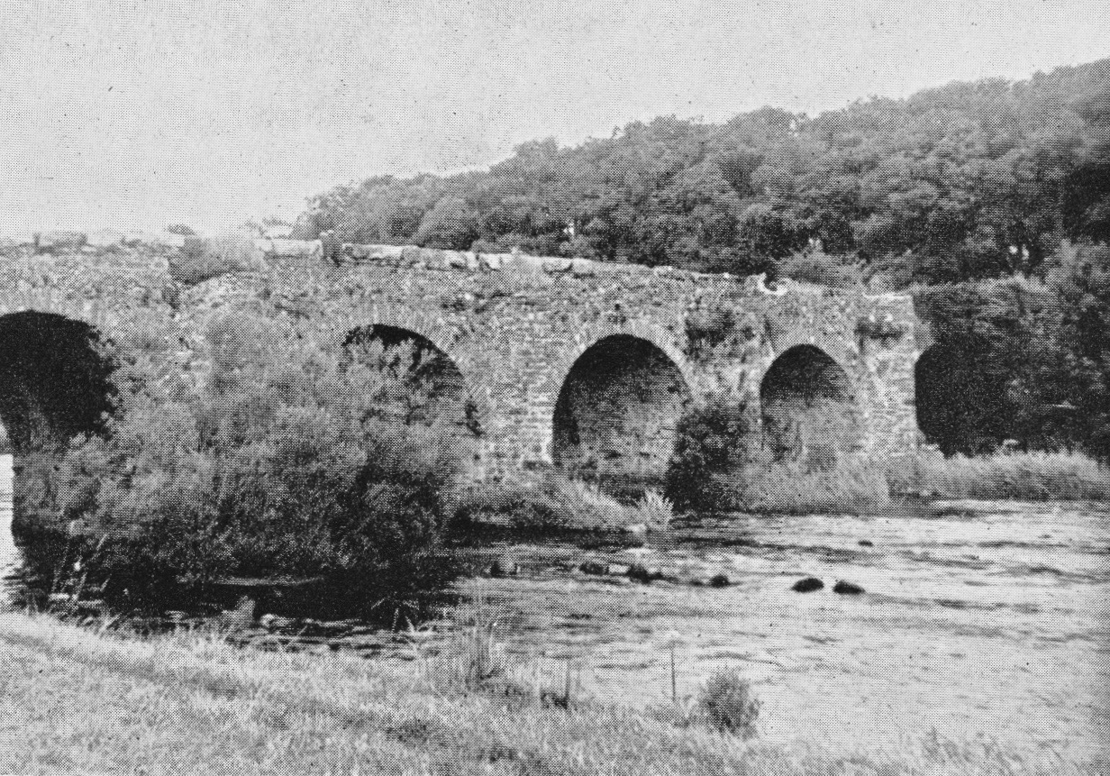
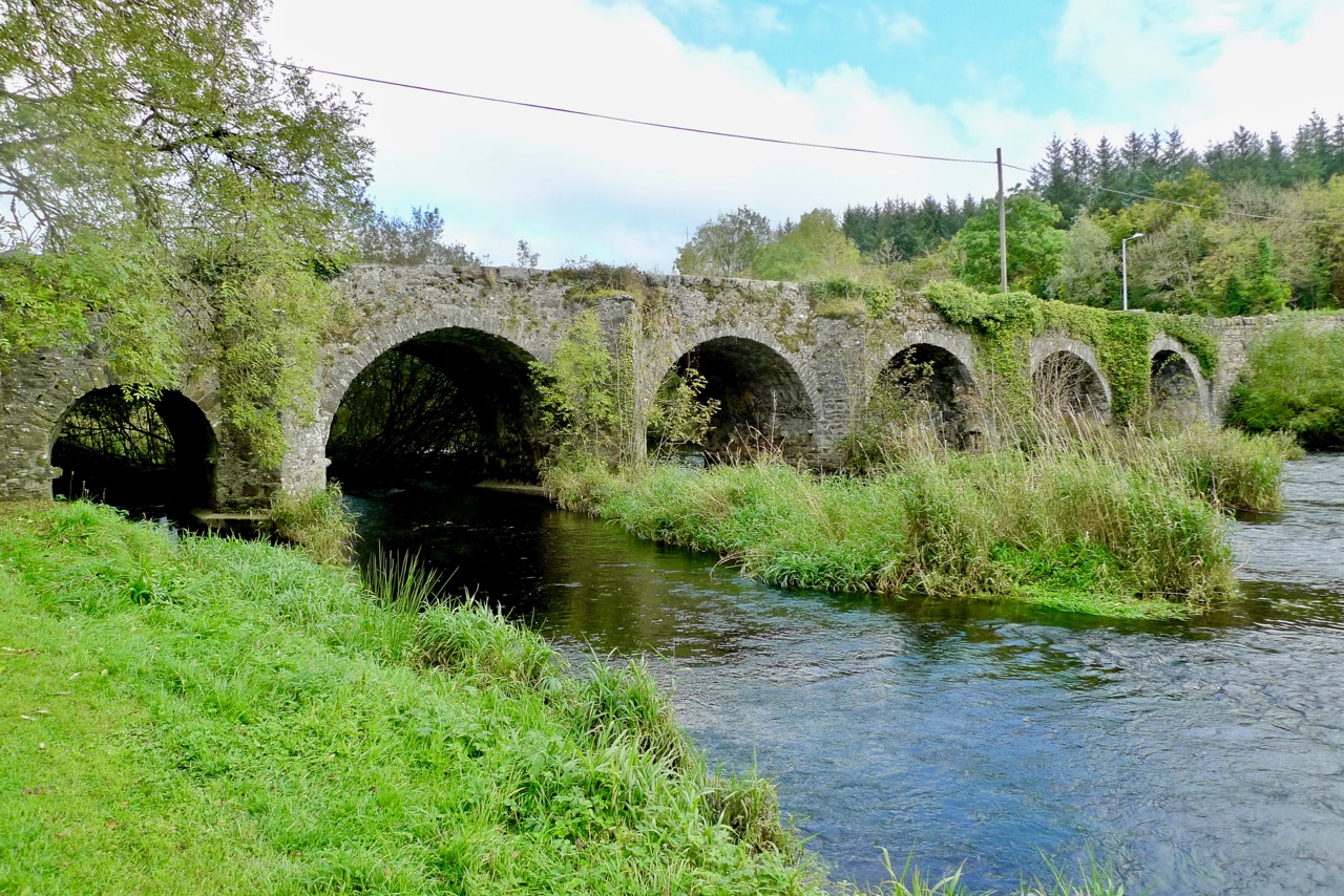
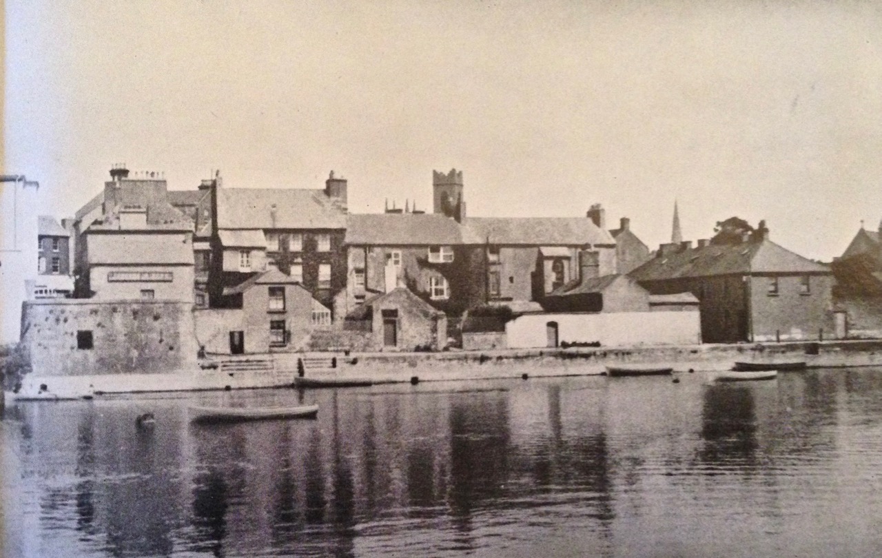
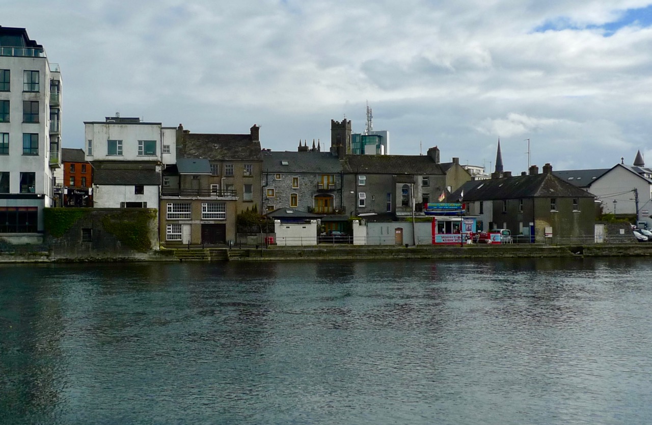
Upper picture: Angels Rolt’s photograph of the historic Battlebridge, taken in 1946. Lower picture: we revisited the site in 2016 – very little has changed

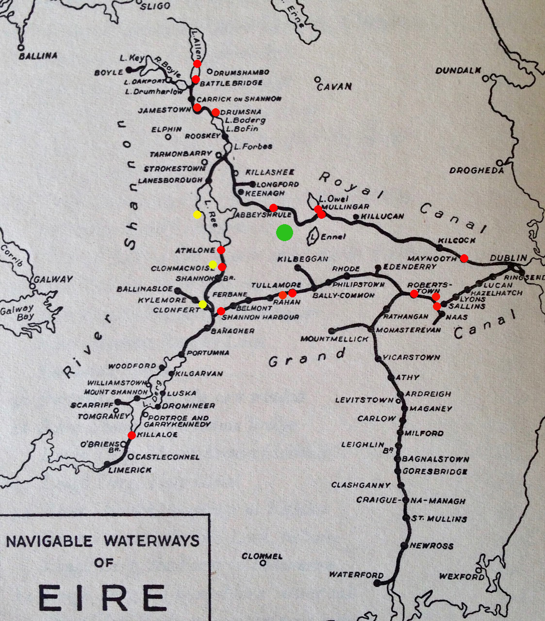
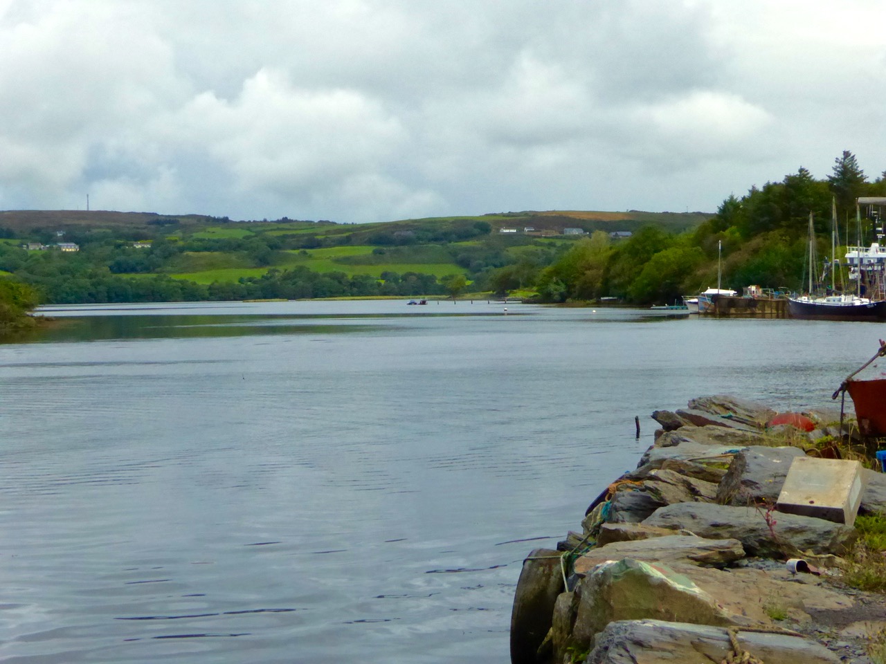
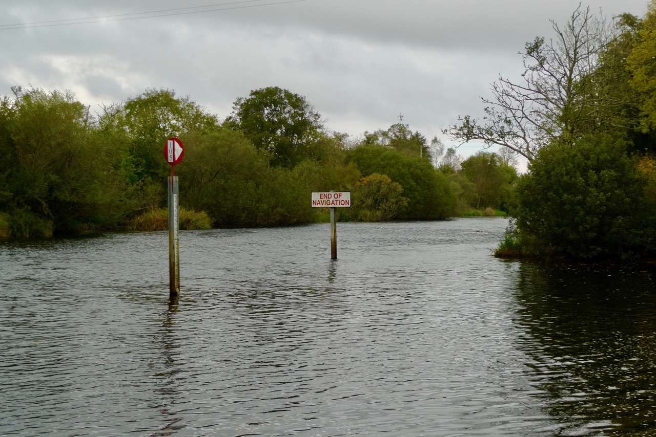
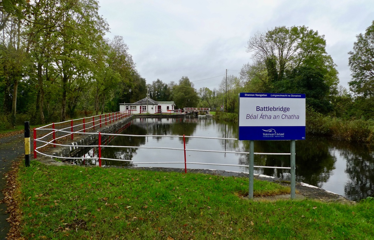
Battlebridge is still the ‘end of navigation’ on the Shannon itself. But, interestingly, it is now possible to travel by water much further north – something the Rolts were unable to do.

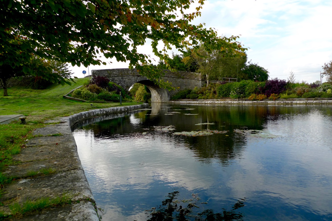
…It was but a brief journey to Battlebridge where the Shannon becomes a shallow stream brawling over boulder strewn rapids under the arches of the fine old bridge. Here, in the last few yards of deep water, we came about to moor to two trees beside the bank at the tail of the ruined entrance lock of the Lough Allen Canal. It was a delightful mooring, secure, secluded and sheltered, the country round being undulating and well-wooded, for we had now left the level plain for the fringe of the broken, lake-studded country of central Leitrim… (Green and Silver L T C Rolt, George Allen and Unwin 1949)

Ardnacrusha 1925

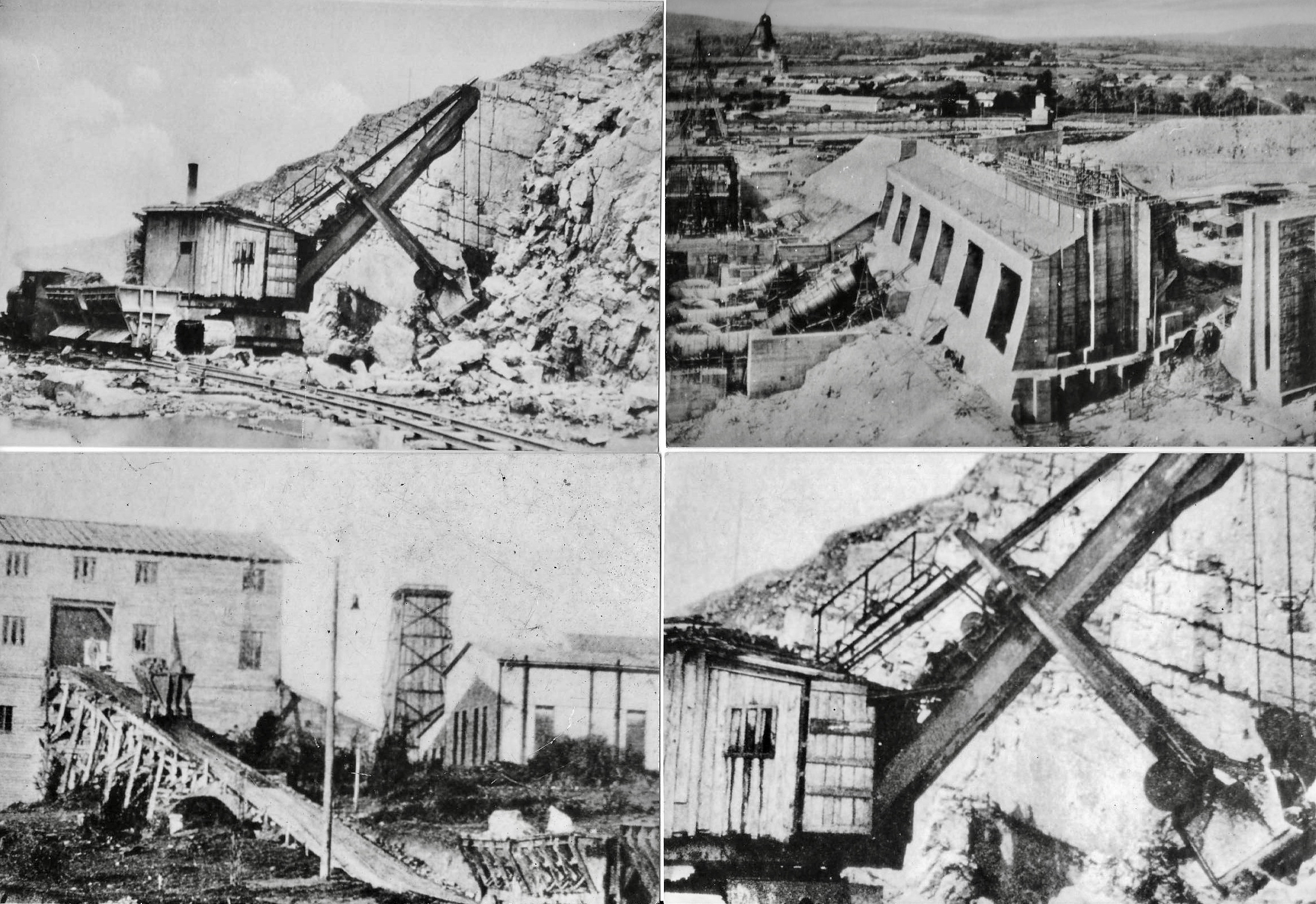
The huge Ardnacrusha power station – in its day the largest hydroelectric generating scheme in the world – under construction in 1925: it was completed and opened on 22 July 1929 and, by 1935, was producing 80% of all electricity in the Free State

The Lough Allen Canal connected the Shannon Navigation to the Lough: it was first opened in 1817. Boats would trade to quays on the lake with grain and return with sand or with coal from the Arigna mines. The fate of the canal was sealed when Lough Allen became a storage reservoir for the great hydro-electric station at Ardnacrusha. To increase its capacity, the level of the lake was raised by dam to a height above the old canal banks.

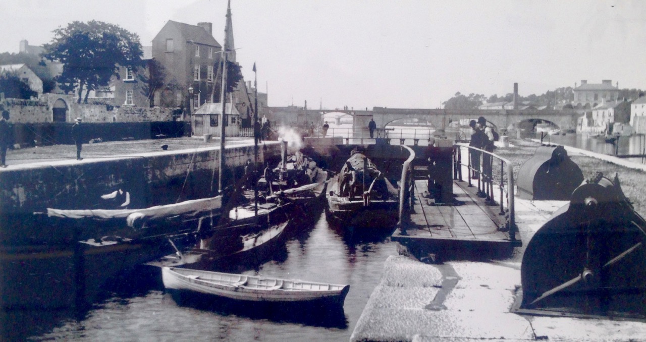
…The last trading boat left the Lough Allen Canal in 1927, while the last pleasure craft battled its way through the weeds in 1932. The lock-keeper, young Sean Nangle, still lived in the neat, freshly white-washed cottage beside the ruined entrance lock, but his duties were confined to bank ranging on the reach of the river below. Le Coq was the first craft to visit Battlebridge for seven years, so that our arrival was a minor sensation, and it was with a sense of newly discovered importance that Sean signed his name on our pass… (Green and Silver)

Battlebridge lock

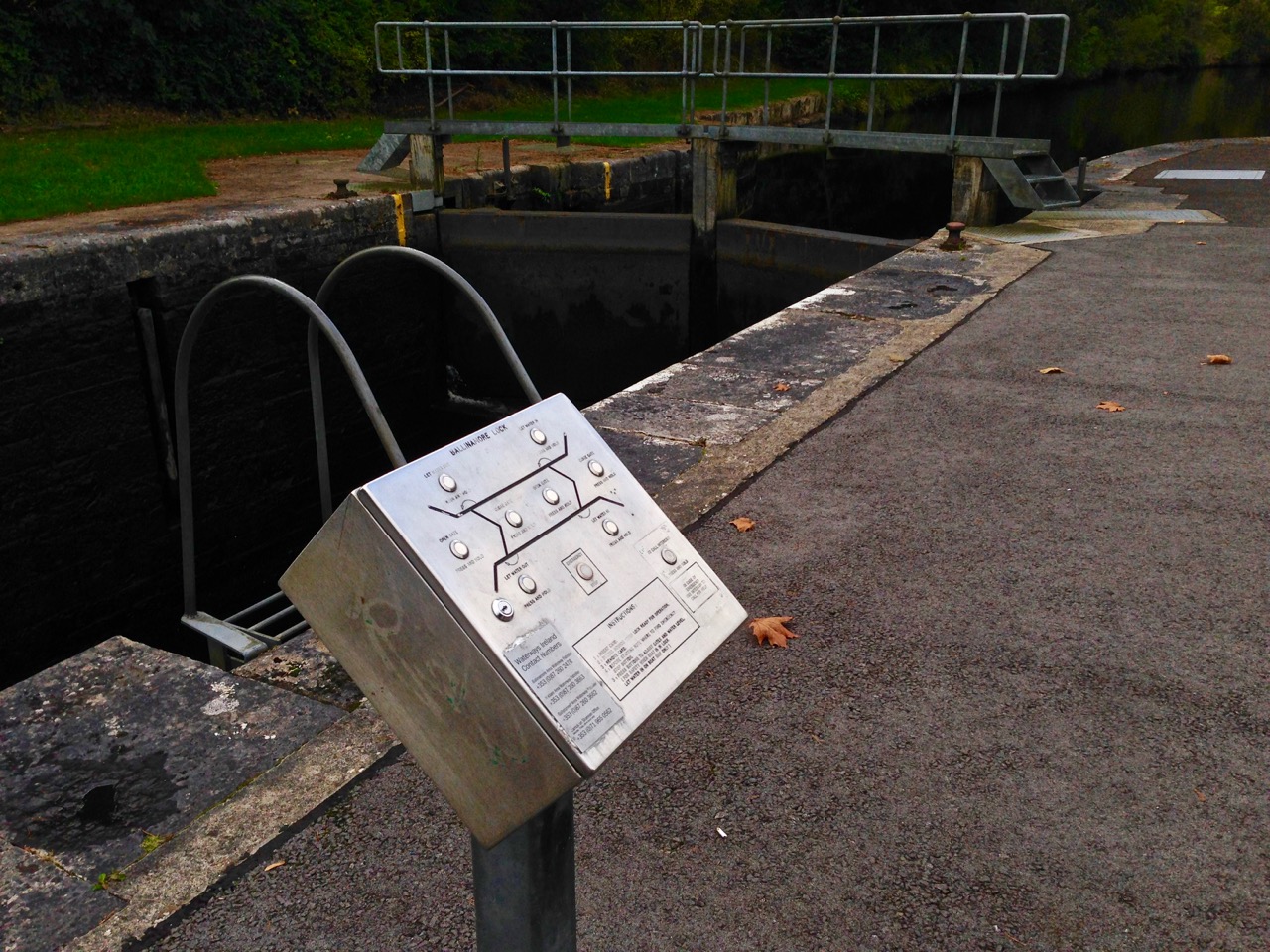
Battlebridge Lock, the first lock on the now restored Lough Allen Canal. The cottage in the distance was the home of ‘young’ Sean Nangle in 1946

One thing that the Rolts might never have anticipated was the revival of the Irish canals which has come about during the seventy years since their adventures, mainly during the economic boom of the decade or so from the mid 1990s. A cross-border authority – Waterways Ireland – is now responsible for a significant network of canal and river navigations within the island, including many that have been re-established. One is the Lough Allen Canal, now providing access from the Shannon to Upper Lough Erne in County Fermanagh, Northern Ireland.

…That evening Sean accompanied us to the inn which stood by the road side just across the old bridge, and a grand friendly house it proved to be. Nowhere in rural Ireland did we find any lack of kindness, hospitality and friendship, but in these respects this little inn at Battlebridge is particularly memorable. For this, credit must go to the Beirne family, mother, daughter and son. I will not attempt to characterize them; they speak for themselves in their photograph. Leaning against the counter in the bare whitewashed bar we enjoyed the best glass of ‘single’ porter that we found on our travels, while intruding chickens pecked unconcerned about our feet. Through an open doorway a turf fire glowed in a wide open hearth equipped with crane and ratchet hook. Upon the fire reposed a squat, black pot-oven with more smouldering turf upon its lid… Conversation was interrupted when a drove of bullocks passed by with a soft patter of hooves. Everyone crowded to the door to comment and criticize and to speculate where they had come from and whither they were bound, an argument which was settled when the drover himself stepped in for a glass… (Green and Silver)

The Beirne Family

Biernes 2016

Beirnes

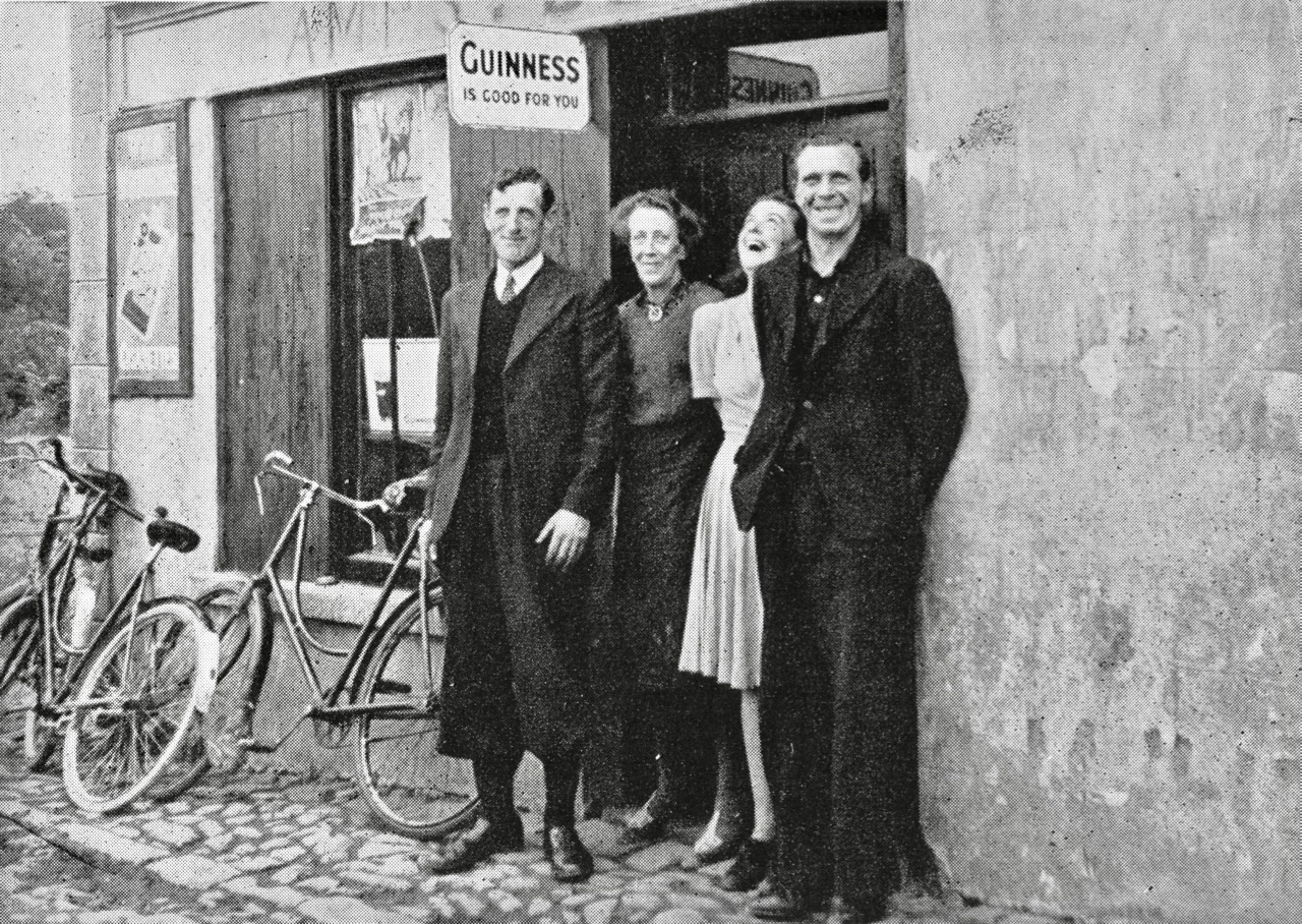
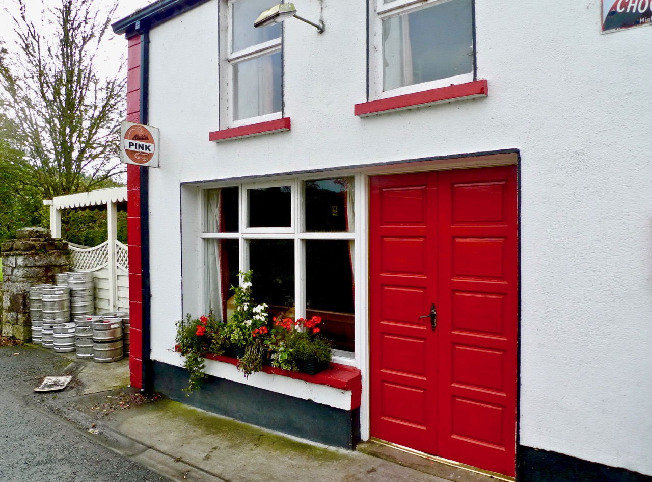
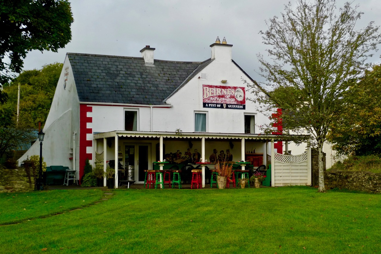
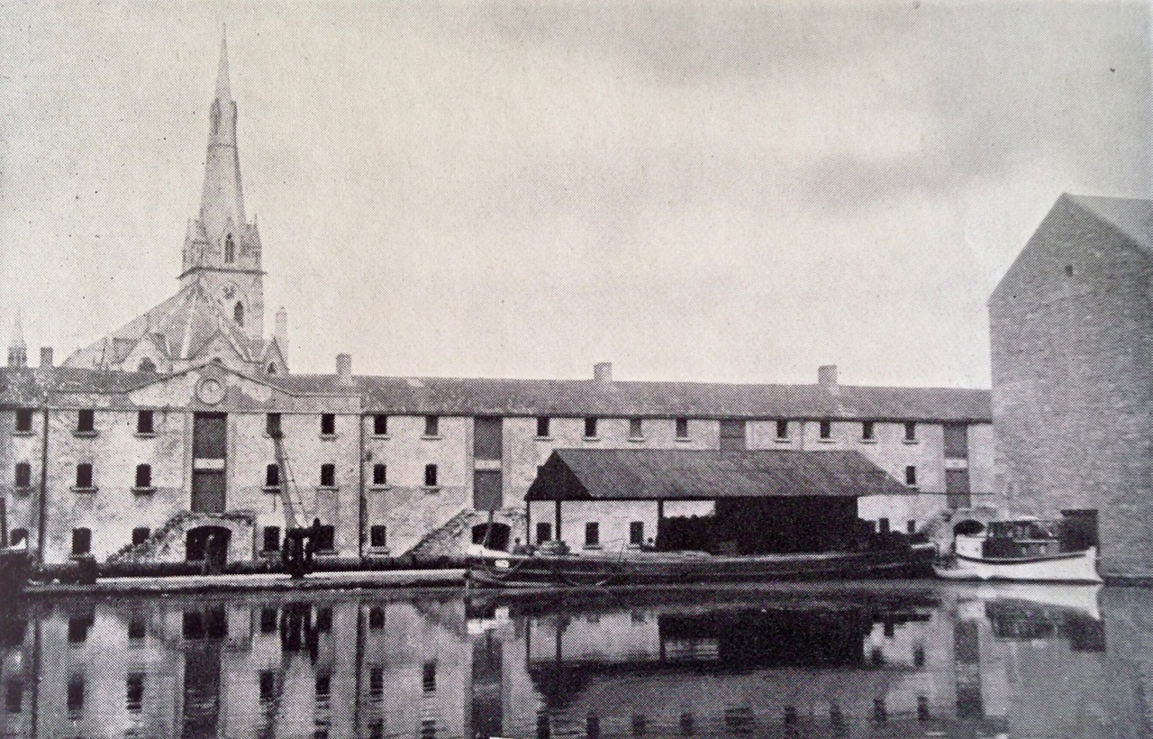
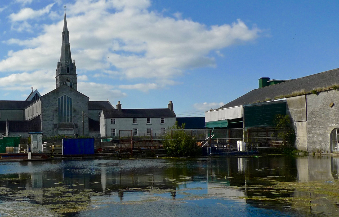
Upper picture: Angela Rolt’s photograph of the Beirne family in 1946. Lower pictures: Beirnes Bar is still trading in 2016

The re-opening of the Lough Allen Canal was heralded triumphantly in April 1996. I was pleased to find an archived RTE news report on that event. The official cutting of the tape was carried out by the Minister for Arts, Culture and the Gaeltacht – Michael D Higgins, now our President.

lock gates

Lough Allen

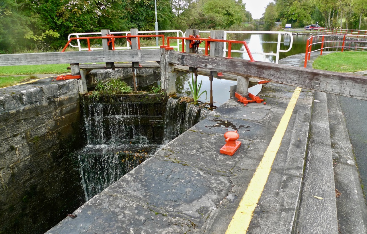
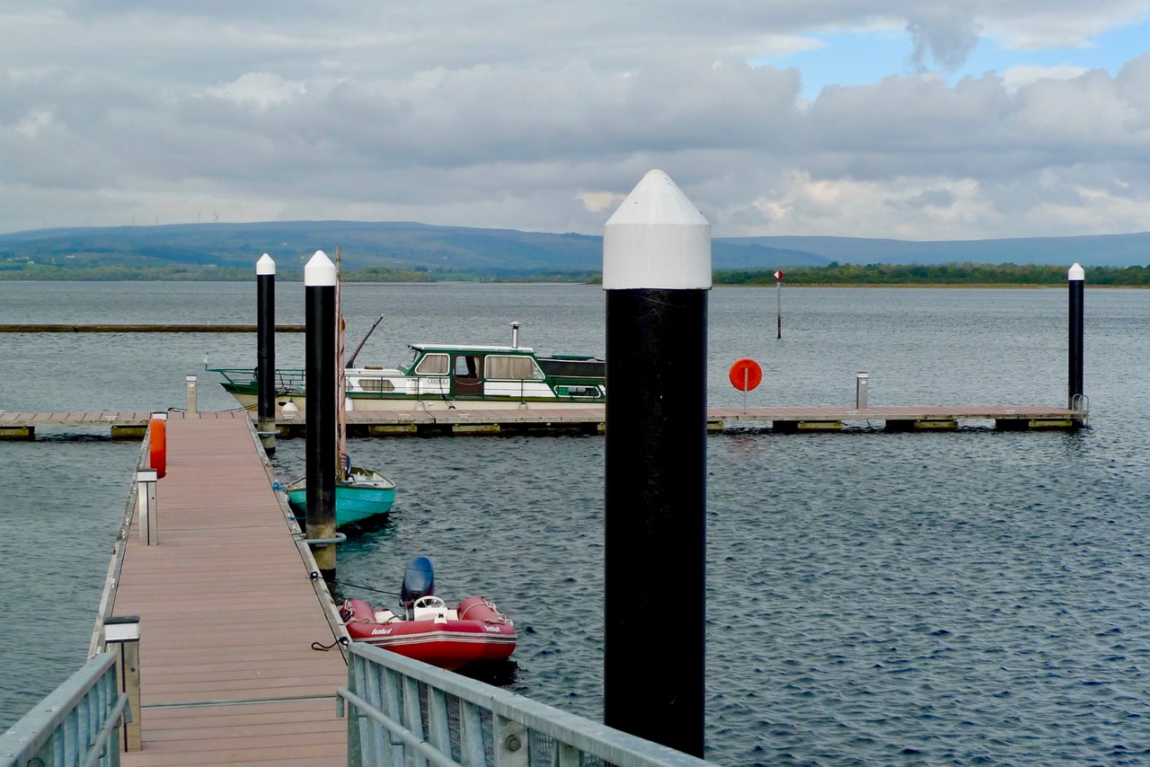
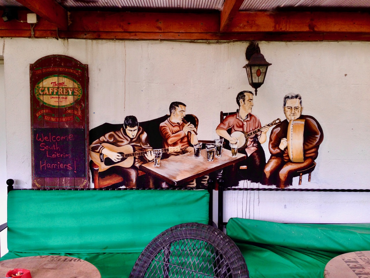
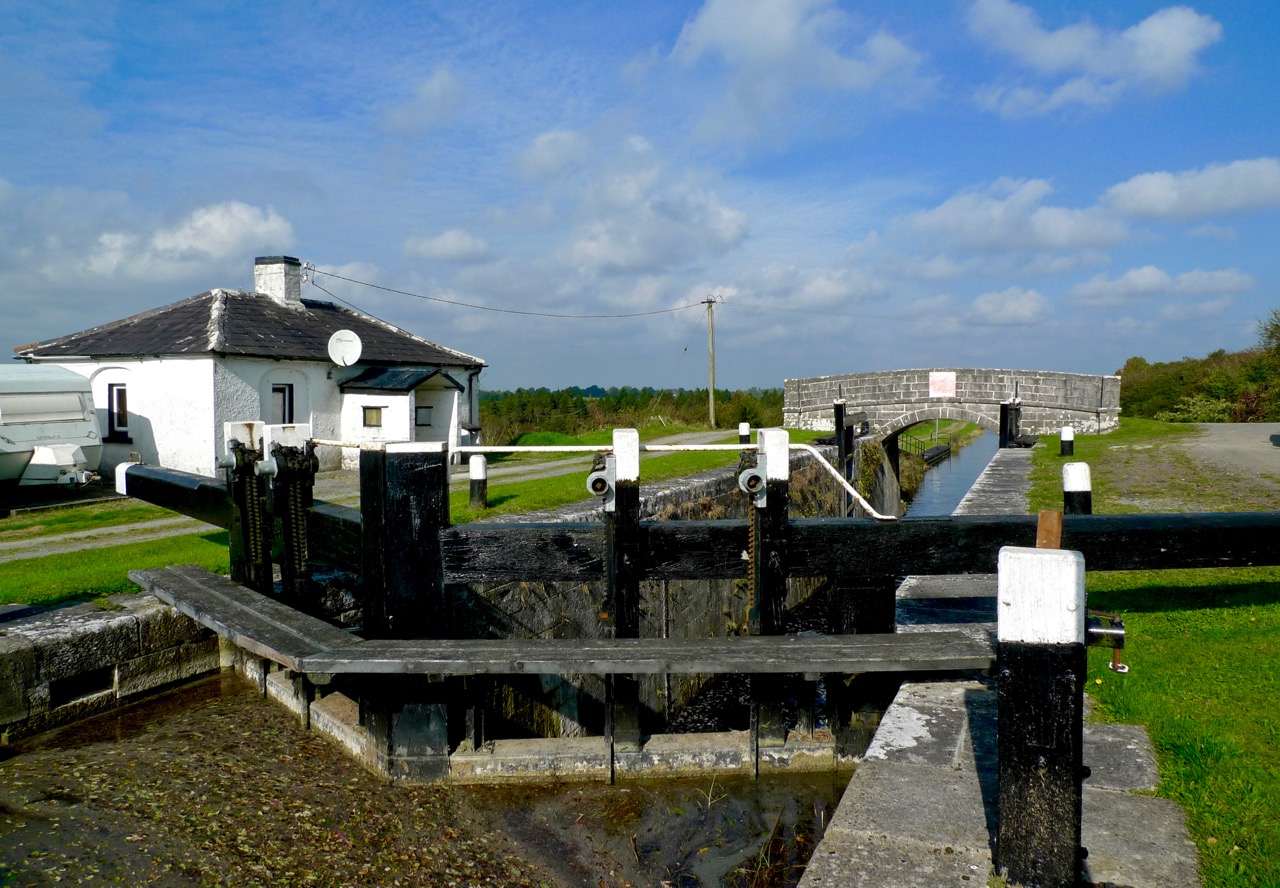
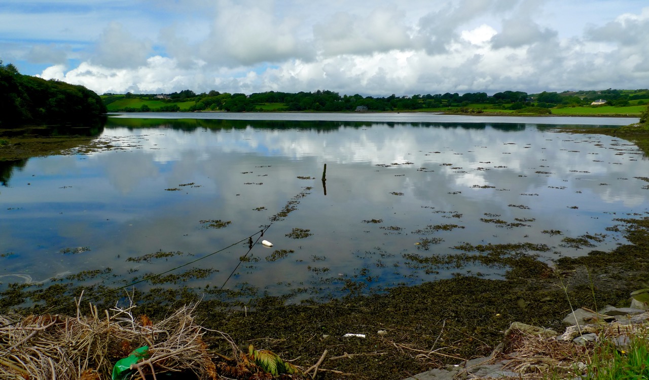
Upper picture: the lock at Battlebridge on the restored canal. Lower picture: Lough Allen today. Below: A mural on the garden terrace of Beirnes Bar

band playing

The Town of Luan’s Ford

o'ferrall fry place

…One of the shops we visited was O’Ferrall’s, whose frontage dates from the days when shop-fitting was not merely a business but an art, as the picture we took of it, with ‘himself’ in the doorway, clearly reveals. Old Mr O’Ferrall was a tall gaunt figure. His hawk-like features had an aristocratic cast which was somehow enhanced by a long coat of archaic cut and a high stand-up collar. He had, we discovered, a great sense of the past, and as we sat together in the confined space of the small wooden cubicle to which, as in most Irish bars, women must retire in order to drink with propriety, he talked of the history of Athlone. Like that of most Irish towns, it has been stormy… (Green & Silver L T C Rolt 1946)

fry place bistro 2016

Top picture – Angela Rolts’ photograph of O’Ferrall’s shop and bar, Fry Place, Athlone – taken in June 1946 just before the Rolts embarked on their journey around the Irish waterways which they describe and illustrate in their book Green & Silver. Lower picture – the same view, Fry Place, Athlone – taken in 2016 – now a highly regarded bistro. The new shop frontage pays due respect to its predecessor in terms of overall proportion and despite the loss of the ornate bow windows. It’s interesting, too, that – seventy years on – the premises is still a local meeting place and purveyor of good food and drink

This is the fifth instalment of the Travel By Water series… When we retraced the steps of Tom and Angela Rolt – seventy years after they made their voyage of discovery around the Irish canals and waterways – we visited the town of Athlone for the first time. We were impressed enough to determine that we would return for a more detailed exploration of this midlands settlement, historically a strategically important crossing point of the Shannon – a formidable barrier intersected with her great lakes – the largest river in Britain and Ireland.

17th-century-bridge

At one time (some histories say as early as the Bronze Age) this river crossing just below Lough Ree would have been a wide ford – Luan’s Ford. In the 11th century, Tairrdelbach Ua Conchobar, King of Connacht, had built a wooden bridge which survived, with various restorations, until 1566, when the first stone bridge was constructed (depicted above in a print now in the Aidan Heavey Public Library, Athlone). It could well be this medieval bridge that is commemorated in the ceilidh dance The Bridge of Athlone. The present bridge was opened in 1844.

Athlone Bridge

Athlone’s Victorian bridge today. Note the flat ‘navigation arch’ on the left (west side of the river): this replaces an earlier movable section of the bridge which allowed taller boats to pass through

The Shannon Navigation is now managed by the cross border authority Waterways Ireland. This body also manages the navigable canals, rivers and lakes throughout the island of Ireland, and does a very good job of it. Such an undertaking would probably have never been foreseen by the Rolts 70 years ago when some of the canals had been derelict for many years, and others were in poor condition. The Rolts’ borrowed boat Le Coq was based in Athlone and was probably the last craft to fully circumnavigate the circular route encompassing the Royal Canal, the Shannon and the Grand Canal in the 20th century: the Royal Canal fell into disuse shortly after the Rolts’ journey and was formally closed in 1961. Today the Royal Canal is completely restored to navigation (it was reopened in 2010).

the lock athlone

birds on weir

Upper picture – Athlone Lock today – some of the original Victorian lock machinery has been retained and is in working order although the main operations are electrically powered. Middle picture – upstream of Athlone the river widens dramatically as it approaches Lough Ree. Lower pictures – distinctive livery of the lock machinery in Athlone: note the commemoration of Thomas Rhodes, the engineer of the navigation improvements

We were fortunate to find some early photographs of Athlone and the river: these significantly predate the time of the Rolts’ journey but are worth showing for historical interest.

lock in use athlone

athlone fry place

Upper picture – probably early 20th century – the lock at Athlone: note the commercial craft in the lock, one of them a steamer, and the lifting span on the bridge in the distance. Lower picture – Fry Place, Athlone, courtesy of The Leftbank Bistro: this probably dates from the late Victorian period and shows O’Ferrall’s on the left (see above) and a matching shopfront to the right

Compare Angela Rolt’s photograph of Athlone’s waterfront in 1946 (below) with my 2016 picture underneath it. Architecturally there is very little change to the buildings she recorded. Obviously, there has been considerable alteration to the town elsewhere in the last 70 years but the river itself has remained a constant.

Waterfront Athlone

Athlone Waterfront

shannon commission

Travel by Water

Ballynacarrigy Bridge

We have been on a voyage of discovery – or, perhaps, rediscovery. You remember that recently I reviewed a book which I received as a school prize in 1963: Green & Silver by L T C Rolt? That was a book about travelling by water through some of the canals and rivers of Ireland. The book was published in 1949 but I found out that the journey was undertaken in 1946 – exactly 70 years ago and, also, the year in which I was born. Tom Rolt was a good travel writer and a good observer, and the book is full of descriptions of the places and people that he and his wife Angela came across: it’s a valuable social document and it is rather significant that three score years and ten have passed since they completed their explorations.

Tom Rolt (left) and Angela and Tom Rolt (right) aboard Le Coq, the boat with which they set sail from Athlone to circumnavigate the inland waterways of Ireland between June and September 1946. The photos are taken on the Grand Canal

Back in my more youthful days I also travelled by water, but around the English canal system, a journey of nearly 2,000 miles, taking several months. I also wrote a book after the journey: Canals and their Architecture. Tom Rolt was to have written the introduction to that book but he was unable to, because of illness. As a tribute to him, and to mark his journey through Ireland, Finola and I have been retracing his steps. We should have travelled by water, too, but that would have impinged overmuch on our busy lives here in West Cork. Instead, we covered in a couple of weeks by car what Tom and Angela had taken three months to achieve. Their’s were difficult times, too, immediately after The Emergency when fuel was virtually unobtainable.

navigable waterways

Map of the journey taken from Green & Silver. We have marked on it the sites which we wanted to visit, either because Angela had photographed them or because there was a ‘story’ about the place in the book

Angela Rolt recorded the journey in her own way – through the lens of her camera. Her wonderfully evocative monochrome photographs illustrate Green and Silver, and provided a goal for each leg of our own travels. Armed with the book and digital scans of all her pictures we set out to retrace the watery steps of Le Coq – the little boat which the Rolts borrowed – and take a new photograph at every place they visited. The aim was to set up each photograph of 2016 to exactly match those of 1946 and, through the lens, to record the differences that have taken place in Ireland during all those years. Of course, there is much more to this exercise than the photos: Rolt’s book contains many stories, of people and places not necessarily illustrated but well described, so we also looked out for those: would anyone today have any memories of the people talked about in the book? And would the descriptions of the places that the waterways served in those days ring true in the present?

harbour town

Tullamore 2016

Just one example of our efforts to retrace the steps of the Rolts and record a changing Ireland. Upper photograph – taken by Angela Rolt in 1946 at Tullamore Harbour, Grand Canal. Lower photograph – taken by Robert at the same site. Although the canal harbour itself is intact today – it is an administrative centre for Waterways Ireland – there have been some significant changes. The fine three storeyed warehouses which faced on to the canal 70 years ago have gone, demolished in the 1960s. The Church of the Assumption beyond the harbour was destroyed by fire in 1983 and has since been rebuilt to a modern design except for the tower, which survived the fire

This project will take a little time to fully document. It might occupy a few blog posts! This one is by way of introduction. One thing that struck me most forcefully is the change which the waterways of Ireland have undergone in seventy years. Now all the navigable waterways of Ireland are administered by a single cross-border authority – Uiscebhealaí Éireann (Waterways Ireland); some of the canals which were derelict or near-derelict in 1946 have been fully restored, and many are equipped with modern electric lock gear – something which the Rolts could never have envisaged in their time. However, the volatile economic situations which Ireland has been subjected to in the late twentieth century, and into the twenty-first, have also had their effects, and we found this reflected in some of the stories which we followed during our travels.

Shannon Erne Waterway

The restored Shannon-Erne navigation links waterways between the Republic of Ireland and Northern Ireland. The 63km canal was constructed originally in the mid nineteenth century but became moribund by 1865. The navigation was reopened in 1994. All sixteen new modern locks are operated electronically by hydraulics: boaters are issued with a key which activates the control panels (above)

Another surprise for me was the quality of the engineering and the scale of the undertakings which Ireland displays on its system of navigations. These were massive construction projects in their day, but they nonetheless manage still to convey a sense of respect for their settings, an appropriateness of all materials used, and a constant appreciation of human scale. The architecture of Ireland’s canals is truly vernacular, something I hope to demonstrate during these explorations.

Mullawornia Lock

Mullawornia Lock, Lock 40, Royal Canal, County Longford. The lock-keeper’s house is an unspoilt example of a vernacular architecture which can be seen across Ireland’s canals

To be continued…

Into the Heartland

Elphin Windmill

Because we live on it, sometimes we get carried away by the notion that The Wild Atlantic Way represents the best that Ireland has to offer. A recent trip to the midlands – the Heartland of Ireland – convinced us (if we needed it) that there is no part of Ireland that isn’t beautiful and full of fascinating things to do and see. (Like the Elphin Windmill, Co Roscommon, above.)

Parked at Coolnahay

We spent a lot of time along rivers and canals! 

Robert explains the background and purpose of our trip in his post, Travel by Water. I knew very little about canals before I met Robert and it’s been eye-opening to learn about the history and the sheer extent of Ireland’s inland waterways. We spent a lot of time exploring the canals – walking and driving – and enjoyed it all tremendously.

Boa Island figures

Boa Island on Lough Erne, Co Fermanagh, is home to these mysterious carved figures. Lower left: heads on a medieval church in Kilmallock, Co Limerick. Lower right: a contemporary sculpture celebrates the mythical Finn McCool, in Keshcarrigan, Co Leitrim

But wherever we went there were always other places luring me away – tower houses and fortified houses, churches and graveyards, friendly villages and colourful houses, stained glass windows and prehistoric sites. We drove along roads where we counted ring forts in every field. We explored ancient graveyards and we found a Holy Tree. We visited two sites we posted about last week, the Corlea Iron Age Trackway, and the Hill of Uisneach.

Holy Chestnut

The Holy Tree. A local man we met called it a ‘holy show’ and it certainly had some very questionable items mixed in with the statues and offerings

It’s autumn now, and, while we do experience a change of colour here in West Cork, it’s really in the midlands that the colours of the deciduous trees can overwhelm the senses. They were just starting to turn. I’m strongly tempted to head back in another couple of weeks for the full experience.

Birr Castle Gardens 2

These photographs were all taken at Birr Castle Gardens. Birr Castle (Co Offaly) was one of the most interesting and beautiful places we visited, home of the famous telescope and beautifully maintained

We visited thirteen of Ireland’s 32 counties on this trip – and never came close to the sea or the Wild Atlantic Way. Instead, everywhere we went we saw notices for the latest iteration of the Tourist Board’s marketing scheme. This one is called Ireland’s Ancient East, and appears to take in every county that isn’t on the Atlantic seaboard. A good resource, if you’re considering a trip like this, is Neil Jackman’s guidebook, Ireland’s Ancient East – we kept it by us and found it invaluable.

Grange Stone Circle, Lough Gur

Grange Stone Circle, the largest in Ireland, is one of a complex of monuments at Lough Gur, Co Limerick

Our headquarters for the biggest chunk of our time away was the incomparable Mearescourt House near Mullingar, Co Westmeath. George and his team made us welcome and comfortable, there were glorious grounds to wander around and animals to meet, and delicious breakfasts that left us feeling full for the rest of the day.

Mearescourt House

Mearescourt House – highly recommended!

When tourists are interviewed about their holidays in Ireland they praise the scenery, the food, the music – but most of all, they say, it’s the people who make it so enjoyable. We agree! Everywhere we went we ended up in conversation, as you do here, with local people delighted to help out with information, share old stories, invite us to the sessions, tell us where to go for a nice dinner, or point out places off the beaten track (and then rescue us later when we got lost).

Claire and Paddy Crinnegan, Coolnahay

Paddy and Claire Crinnegan maintain the canal lock at Coolnahay on the Royal Canal. in Co Westmeath They made us tea, fed us Claire’s delicious currenty bread, told us about the trad concert that evening, loaned us a book, and related stories of growing up at the lock, where Claire’s father was the lock keeper.

Future posts will go into more depth on some of what we saw and experienced on this trip. This one is just an introduction, to share some of our impressions and drop some hints about what might be upcoming.

Clonfert Doorway

Clonfert Cathedrall (Co Galway) has the most beautiful Romanesque doorway I have ever seen
Along the canals and rivers, flora and fauna
Top left: in case you might get too happy with yourself; top right: the imposing gates to Portumna Castle, Co Galway, a 17th century house now owned and managed by the Office of Public Works; Bottom left: I peeped inside the priest’s section of a confession box and observed how he maintains an efficient count of time spent on each confession; bottom right; we disturb the rooks at Ballycowan Castle, Co Offaly

HC Studio, Athlone

Athlone Cathedral (Co Westmeath) has a gorgeous set of enormous windows from the Harry Clarke Studios – this is a detail from just one of them.

Can you detect a future post or two?

Oldcourt

red hull

…At Oldcourt a boat-building yard flourished within the walls of an old O’Driscoll castle overlooking the pier and river. Schooners and steamships used to anchor at this spot, the highest point they could travel up the river. Here their cargoes of coal and other supplies were unloaded and placed on specially built lighters with a small draught that would be poled along a further sluggish turn or two upstream to the pier at Skibbereen. In this way cargoes of cattle were brought up by islanders to be sold at the market… (description of the townland of Oldcourt from The Coast of West Cork by Peter Somerville-Large 1974)

gentle Ilen

The tidal River Ilen making its lazy way out to Roaringwater Bay on a late summer evening has a melancholy beauty: it is wide and slow and – mid tide – is a perfect mirror to the sky. The sounds of Oystercatchers and Curlews coming over the water always bring thoughts of autumn: the harvest is ready to cut, the verges are brilliantly orange with the montbretia and the hedges purple-red and weighed down with fuscia.

Montbretia

wide river

We went down to Oldcourt to seek out history and atmosphere. We knew that it had once been a transport hub for the transhipments of goods and we wanted to see what might be visible from those earlier times. It was the river Ilen (pronounced eye-len) that gave birth to Skibbereen following a pirate raid on Baltimore in 1631. According to Skibbereen historian Gerald O’Brien …in the wake of the shock of that – the most daring pirate raid mounted against Britain or Ireland – a small number of survivors rowed upstream to resettle in the safety of the Ilen Valley. The role of this river-borne migration from Baltimore [was] a factor in the foundation of Skibbereen… (Journal of the Skibbereen and District Historical Society, Vol 7, p 91).

reflections

beyond the bridge

rust

We found atmosphere a-plenty. On the upstream side of the wide inlet where the transhipment quays were sited is a streamlined modern boatyard where sleek yachts are wintered and serviced while, opposite and downstream, is a far more eclectic establishment surrounding and embracing the remains of the medieval castle and bawn: this is Hegarty’s‘…one of Ireland’s last surviving traditional boatyards…’

birdie in circle

Our aim was to search for the old quay and the medieval buildings which had been part of the castle demesne, but we were fascinated to pick our way through boats of all kinds – classic, sailing, fishing, ferrying – and boat paraphernalia: here an old decapitated wheelhouse, there a collection of masts, everywhere ropes and tackle…

green ropes

Oldcourt Castle is a tower house standing four storeys high but originally at least one storey higher, once surrounded by a bawn, some ruins of which remain. It was an O’Driscoll clan castle, probably dating from the 15th century, and was captured by English forces after the Battle of Kinsale in 1601.

Old Court Castle

Ilen and Castle

Part of the castle bawn was used as a grain store up to comparatively modern times: now it houses a fascinating boat restoration. The story begins with Connor O’Brien (1880-1952) whose ketch, the Saoirse, took him on a circumnavigation of the world between 1923 and 1925. On this journey he stopped off at Port Stanley in the Falkland Islands. The islanders were so impressed at the way the Saoirse rode the waves that they asked O’Brien to arrange the building of a similar boat. This was the Ilen, named after the river and estuary and registered at the port of Skibbereen in February 1926. She was 56 feet in length overall with a beam of 14 feet and a displacement of 45 tonnes. Connor set sail in August 1926 from Cape Clear, arriving at Port Stanley in January 1927 where he handed it over to the new owners, The Falkland Islands Company, in exchange for £1,500. There she remained until the early 1990s, carrying cargoes of stores, mail, passengers and sheep. Limerick man Gary McMahon found it abandoned on one of the islands and determined that it should return to its homeland for restoration. There was great excitement when he sailed the ketch back into Baltimore in 1998.  The refitting of this eighty-two year old vessel in the old bawn at Hegarty’s, Oldcourt, is now the centre of an educational project allowing people to experience first-hand the ancient skills of wooden boat building.grain store

ilenframesThe old grain store – formerly part of the Castle bawn – now houses the restoration project of the AK Ilen (above – courtesy of Roeboats)

Such a hive of activity at OIdcourt today… Echoes of busy days gone by when the schooners were arriving with their cargoes bound for the growing town of Skibbereen.

Ilen postage stamp

Fastnet Trails: Rossbrin Loop, Part 1

A joint post by Robert and Finola

In Robert’s post about the Fastnet Trails, we introduced you to this new trail system, and in particular to one of the delightful walks – the Lisheenacrehig Loop. Today’s post is about another of the walks – the Rossbrin Loop. This walk is all on country boreens, so you can wear your ordinary walking shoes and take the dog if you like but keep him on a leash and stick to the road. You will pass other dogs on the way, as well as fields of livestock.

The high road

You can do this whole walk as laid out in the brochure. It’s just under 12km and will take you at least three hours, but probably more if you like to stop to explore, take pictures, have a chat along the way. Oh, and see where it says ‘easy grade’? Take that with a pinch of salt – this walk will give you a good work out as it takes you from sea level to 70m (230ft) and back again.

Rossbrin Trail 1

But we know that many of you like to take an easier pace and, like us, might find a 12km loop a bit intimidating, so we’ve decided to give you another option. We will lay out a 2-walk option for you, beginning with Walk 1 now, and we will do Walk 2 in a future post. We provide our time estimate for a meander rather than a march. And – a disclaimer: our suggestions depart slightly from the official Fastnet Trail and have not been sanctioned by that group. Where you depart from the marked trail, you walk at your own risk.

Walk 1: Ballydehob, Greenmount, Foilnamuck, Cappaghglass, Ballydehob

Time: 2 to 2.5 hours (with diversion)

Level: Easy but some steep stretches

Take: Binoculars and camera

Twelve Arch Bridge

Park in the Ballydehob car park just east of the river estuary and start by taking the lovely nature walk that takes you over the 12 Arch Bridge. This beautiful structure was once part of the West Carbery Tramway and Light Railway. A train ran across this bridge from 1886 to 1947 – Robert has written about The Flying Snail that traversed West Cork, but for a real flavour of what it was like read Poisson d’Avril in Somerville and Ross’s The Irish R.M. Here’s the first paragraph:

The Irish R.M.The atmosphere of the waiting-room set at naught at a single glance the theory that there can be no smoke without fire. The stationmaster, when remonstrated with, stated, as an incontrovertible fact, that any chimney in the world would smoke in a south-easterly wind, and further, said there wasn’t a poker, and that if you poked the fire the grate would fall out. He was, however, sympathetic, and went on his knees before the smouldering mound of slack, endeavouring to charm it to a smile by subtle prodding with the handle of the ticket-punch. Finally, he took me to his own kitchen fire and talked politics and salmon-fishing, the former with judicial attention to my presumed point of view, and careful suppression of his own, the latter with no less tactful regard for my admission that for three days I had not caught a fish, while the steam rose from my wet boots, in witness of the ten miles of rain through which an outside car had carried me.

Ballydehob Quay saw brisk trade in the days before the Bay silted up. The lovely old Pier House once functioned as a coal warehouse. 

Greenmount Stream

Following the walkway, you emerge by the school and turn left on to the Greenmount Road. This can be a busy stretch, so be careful along here. Once you get to the turquoise shed, turn left. Here you find yourself beside a burbling stream that empties into Ballydehob Bay at a small and picturesque pier. This and others like it were busy piers in the old days, serving the fishing boats as well as the sand boats that worked these waters, dredging sand to be used as fertiliser and building material. Nowadays this little inlet seems hardly navigable and the same blue and white boat has been moored here for a long time.

Greenmount Quay

The road climbs steadily up now past working farms. Looking back towards Ballydehob you can see the Bay and even the 12 Arch Bridge in the distance.

Pastoral

As you round a corner your view changes  and Kilcoe Castle comes into view. Now home to Jeremy Irons, who has restored it beautifully from a complete ruin, it was a classic 15th century tower house owned by the McCarthy Clan. So well was it situated and defended that the inhabitants were able to hold out for two years in the aftermath of the Battle of Kinsale (1601). Situated on a tiny island and glowing a soft amber colour, it is a beloved landmark in these parts.

Kilcoe Castle from Greenmount

Below you is a shallow bay that is a haven for shorebirds and seals. If the tide is out linger a while and use your binoculars to see what you can pick out along the tidal flats below you. If you’re lucky the seals might be out along the rocks, sunning themselves. Once underway again, you’ll pass an old cottage on the left. A recently-dug pond in its garden is already full of water lillies.

Water lillies

Continue now along the narrow boreen and brace yourself for the climb to the highest point  of the walk. No longer on leafy lanes, you are now walking on a bare plateau with panoramic views in all directions. The whole of Roaringwater Bay gleams before you. To the east, towards Kilcoe, lie the mussel beds that now dot this part of the Bay. Sherkin Island and Cape Clear are on the horizon, as is the Fastnet Rock. Ahead of you is the looming shape of Mount Gabriel, dominating the skyline as it does in so many parts of West Cork.

Fields of Cappaghglass

If you look carefully here you will see that the gorse and bracken barely conceals the outline of tiny field walls. There was a large population around here once and a thriving industry. Read Robert’s piece, Copper Country, for more about the mining activities of Cappaghglass. There are a few clues left – the stump of a large chimney that once provided a prominent landmark but that was felled by lightning can still be seen.

Rust and heather

Don’t turn left here (as the trail map wants you to) but instead continue straight on and turn right at the T junction and descend to the crossroads. From the crossroads you can go right and follow the road back to Ballydehob. But if you still have the energy and want to prolong the walk a little, there a diversion here that is worth considering. Turn left and climb the hill until the road flattens out. About 500m from the crossroads look up and to your left and you will see the silhouette of a large ring fort. A tiny green lane leads up to it between some houses but it is on private land.  

Ballycummisk Ring Fort

Irish ring forts generally date to the Early Medieval period – this one may be between 1500 and 1000 years old and would have been the enclosure of a farm house. A wooden fence on top of the earthworks would have kept wolves out and animals in. But the prominent position of this one also meant that it would have been a high-status dwelling. There are hints of a fosse (an outer ditch), which was a defensive feature, and reports of a souterrain, or underground passage, situated in the middle. The ridges of lazy beds – the traditional potato-growing grooves – cross the interior of the fort, indicating that this ground was used to feed a family until the area was de-populated in the aftermath of the famine. There is a large standing stone, known locally as Bishop’s Luck, above the ring fort. This could be Bronze Age or even older.

Textures

It’s an easy walk, downhill all the way, back to Ballydehob. You’ll be more than ready for a coffee and cake in Budds or a lovely bowl of soup in the Porcelain Room by the time you get there. Tell them the Roaringwater Journal sent you.

Wall E lurking

See you next time for Walk 2.