Earlier in the year I went back to my childhood days, remembering when I first learned about Jonathan Swift from my Granma, and walked with her to the places associated with him in the town of my birth: Farnham, Surrey. Here is the post.
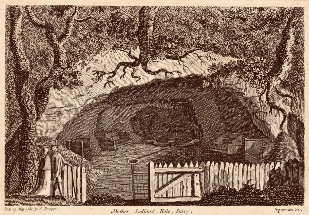
If you read my ‘Dean Swift and I’ post you will find this engraving of ‘Mother Ludlam’s Cave’ which was close to Stella’s Cottage, and must have been familiar to Jonathan Swift during his years living in Surrey. I came across this old print in a local bookshop when I was growing up in Farnham, and it has stayed with me ever since
I have been keeping a few series of posts going through the year: one is about the Napoleonic signal towers that dot the coastline all around this island. I began the series in 2020 (do you remember how we thought the Covid restrictions would soon be over?). In 2021 I continued the posts with new episodes. This is one of my favourites.
The Napoleonic Signal Tower at Brow Head, West Cork
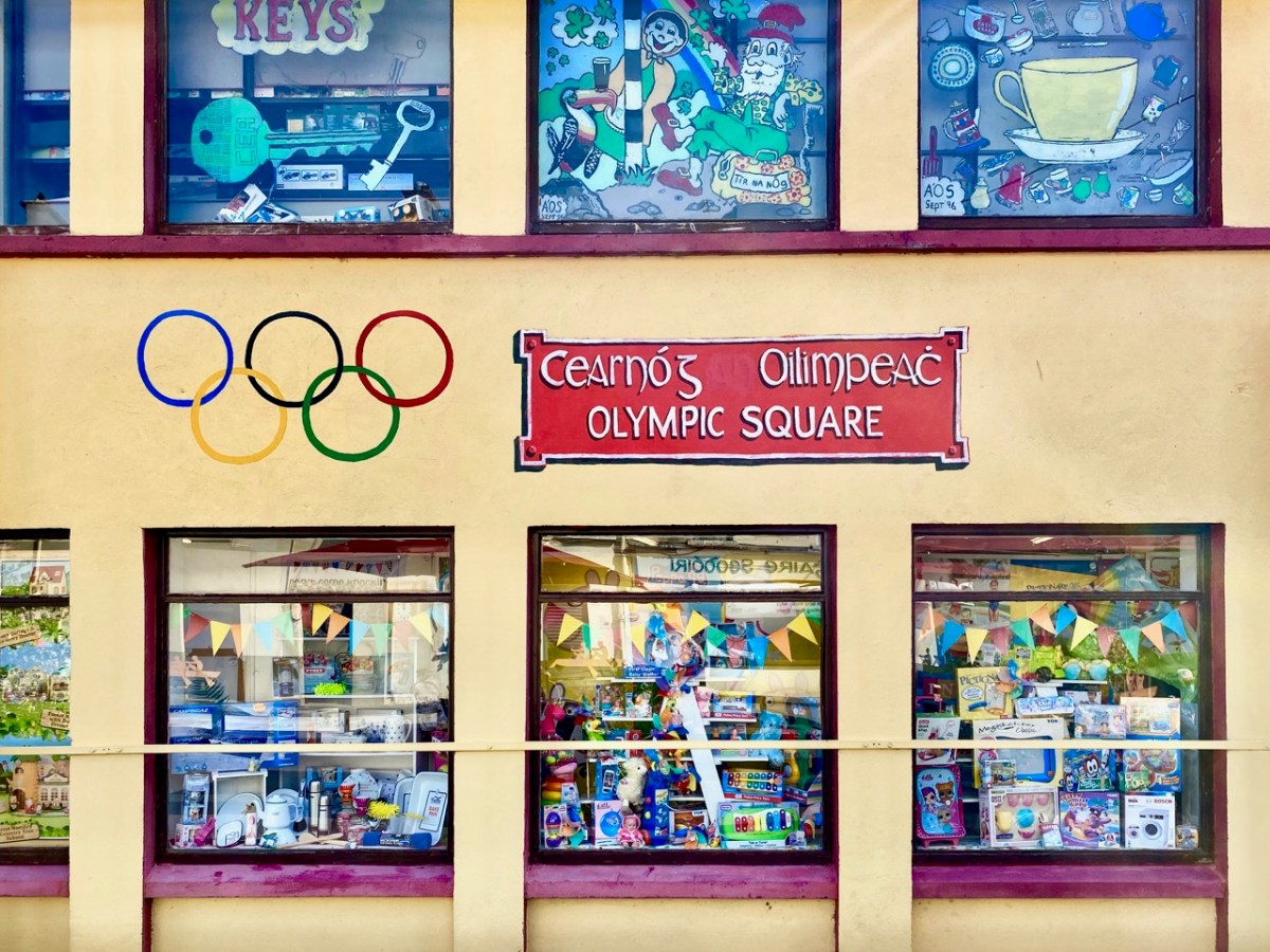
West Cork had good coverage from our blog during the year which has just ended. I began a series of posts about West Cork Villages and Towns. Perhaps it was an interesting time to concentrate on our local communities: hopefully it proved that we West Corkonians are not deterred from celebrating life as much as is possible in these strange times.
The communities of (top to bottom) Bantry, Schull and Skibbereen have been the subjects of posts in my West Cork Villages and Towns series in the past year. There are many more to come in the future, including the remarkable activities that take place in our ‘home’ village, Ballydehob (below).
It proved a remarkably popular post and I was forced to admit that it did come from my imagination, although all the background historical information can be verified. What really interested me was the interest and enthusiasm that everyone has about life here on our wild West Cork coastline all those centuries ago!
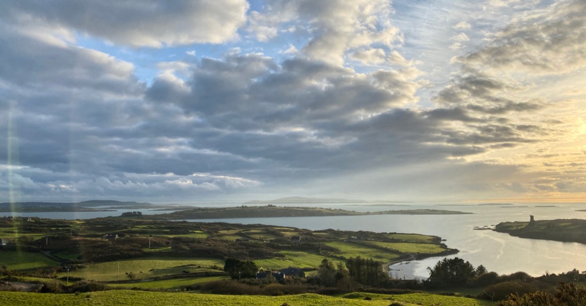
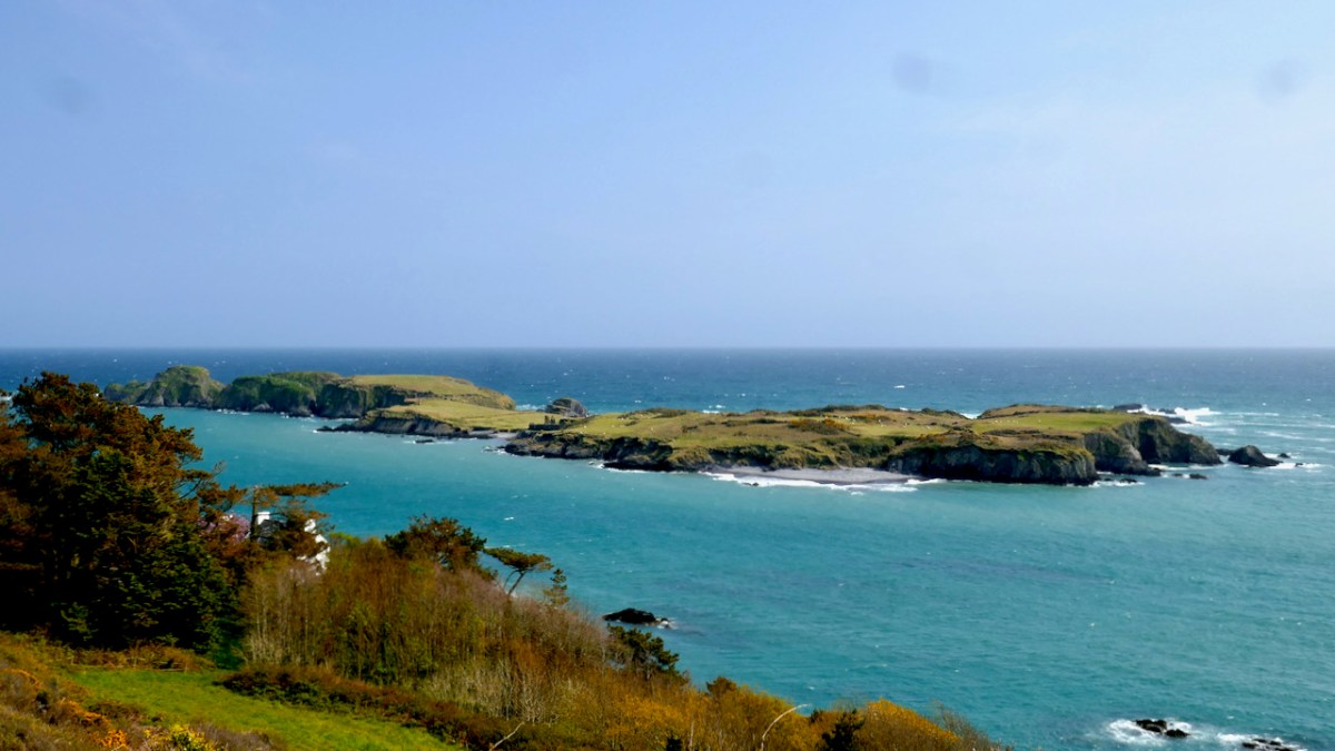
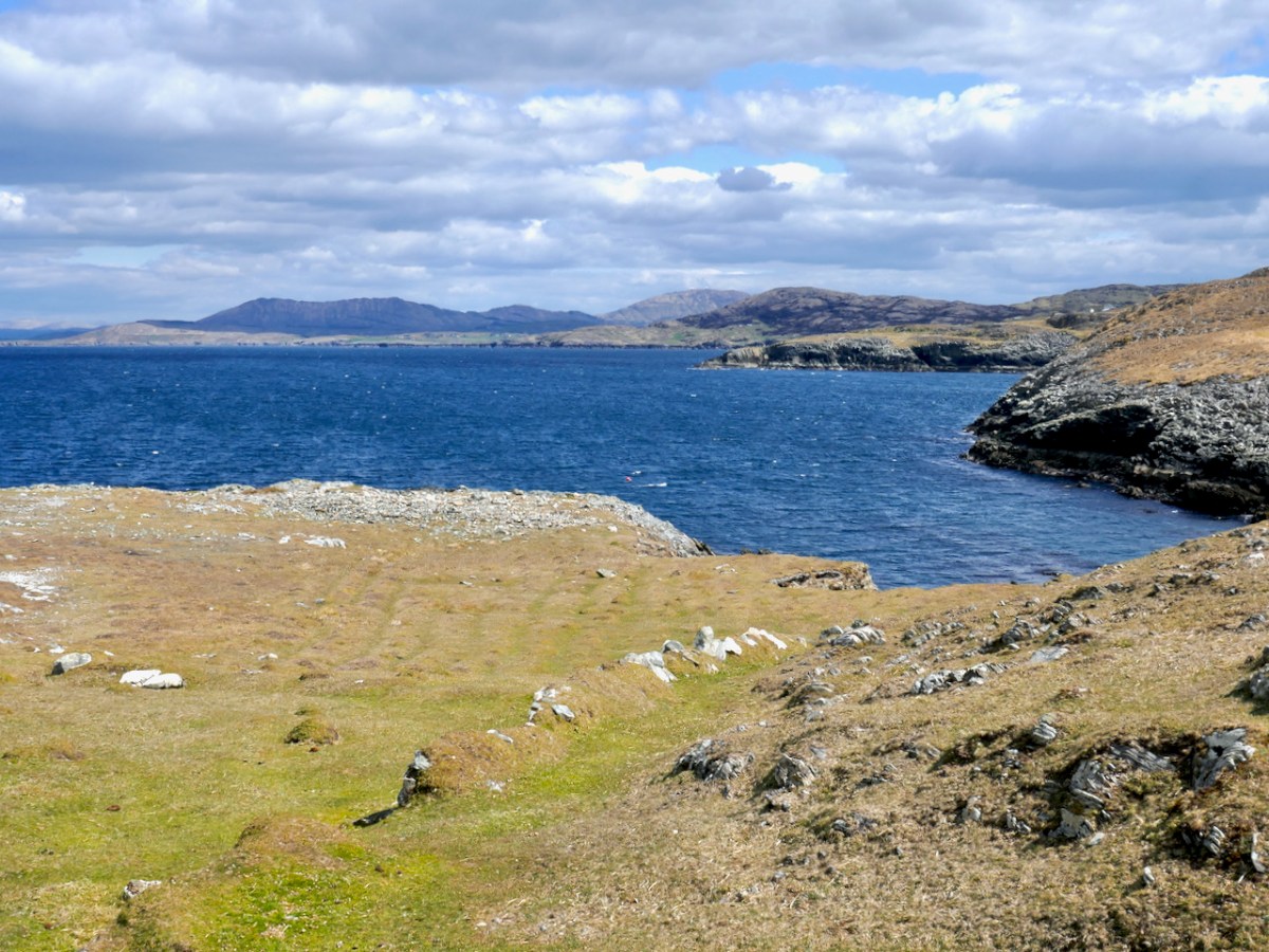
We are most fortunate to live overlooking Rossbrin Cove and the islands of Roaringwater Bay
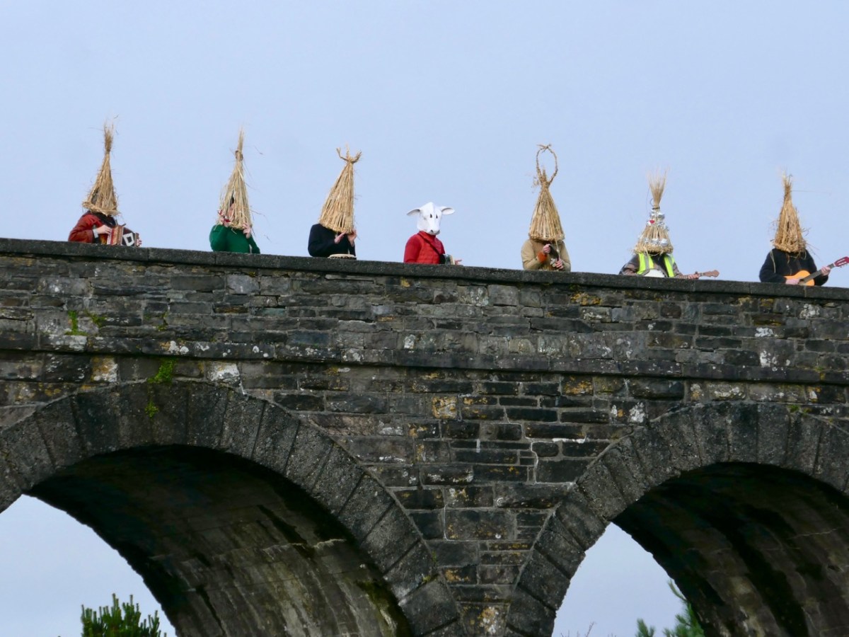
It’s always a difficult task to choose just a few posts from the 50 or so each of us has written over the last twelve months. If I started all over again I would probably choose many different ones. But they are all still there to be read (dating back to 2012): you only have to search the archives! Our new year began – yesterday – with the enactment of an ancient Irish tradition in Ballydehob: the Wran Day. That will be my post next weekend, but here’s a taster. Happy New Year everybody…!
The traditional continues, with a twist. This year, instead of photos we’ve already published, we’ve gone through our albums and chosen the ones we didn’t use this year (2021) but want to share now. It’s a fairly random collection – our guiding principle was personal preference or something that jogs a pleasant memory for us, all taken in West Cork in 2021. Some of them are similar to images we have used, but that’s because we take so many! So, as every year, although we’ve provided links to relevant posts, we’ll keep the writing to a minimum – all you have to do is scroll!
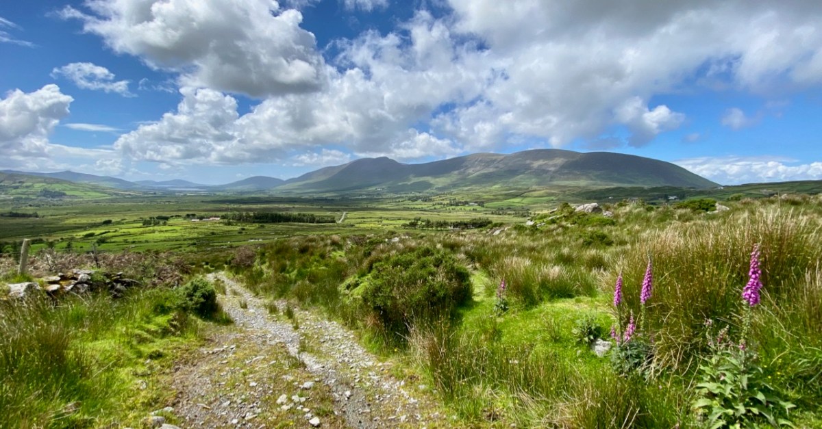
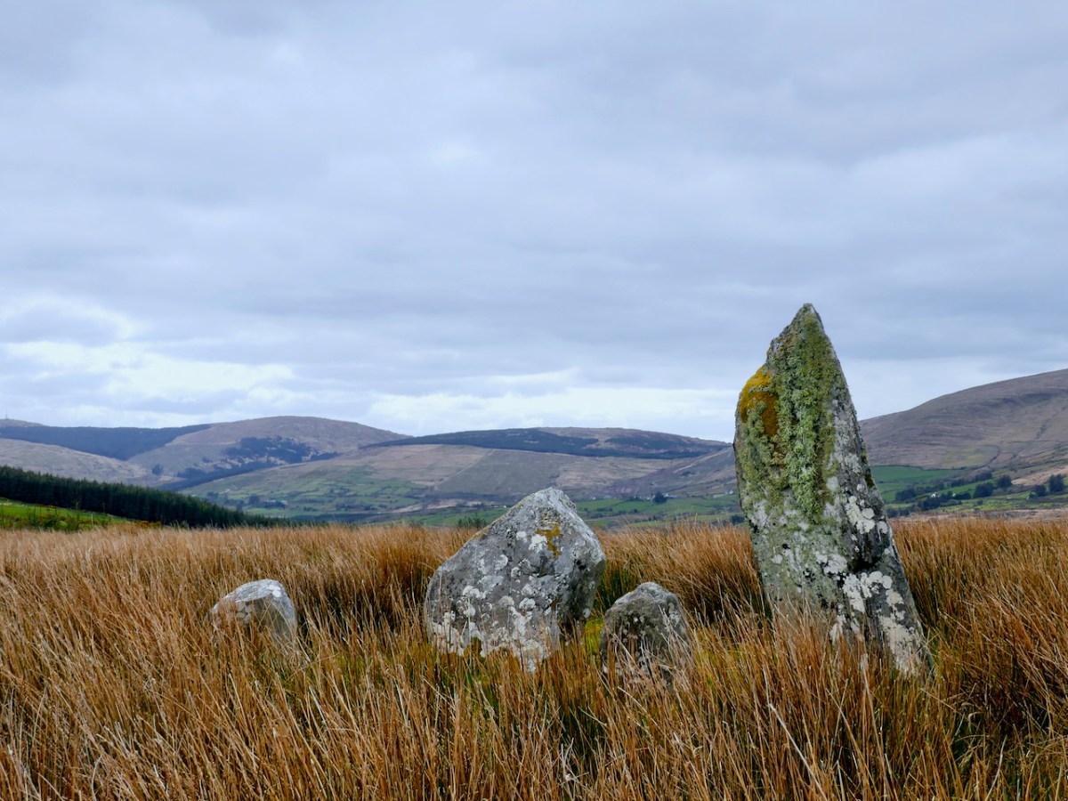
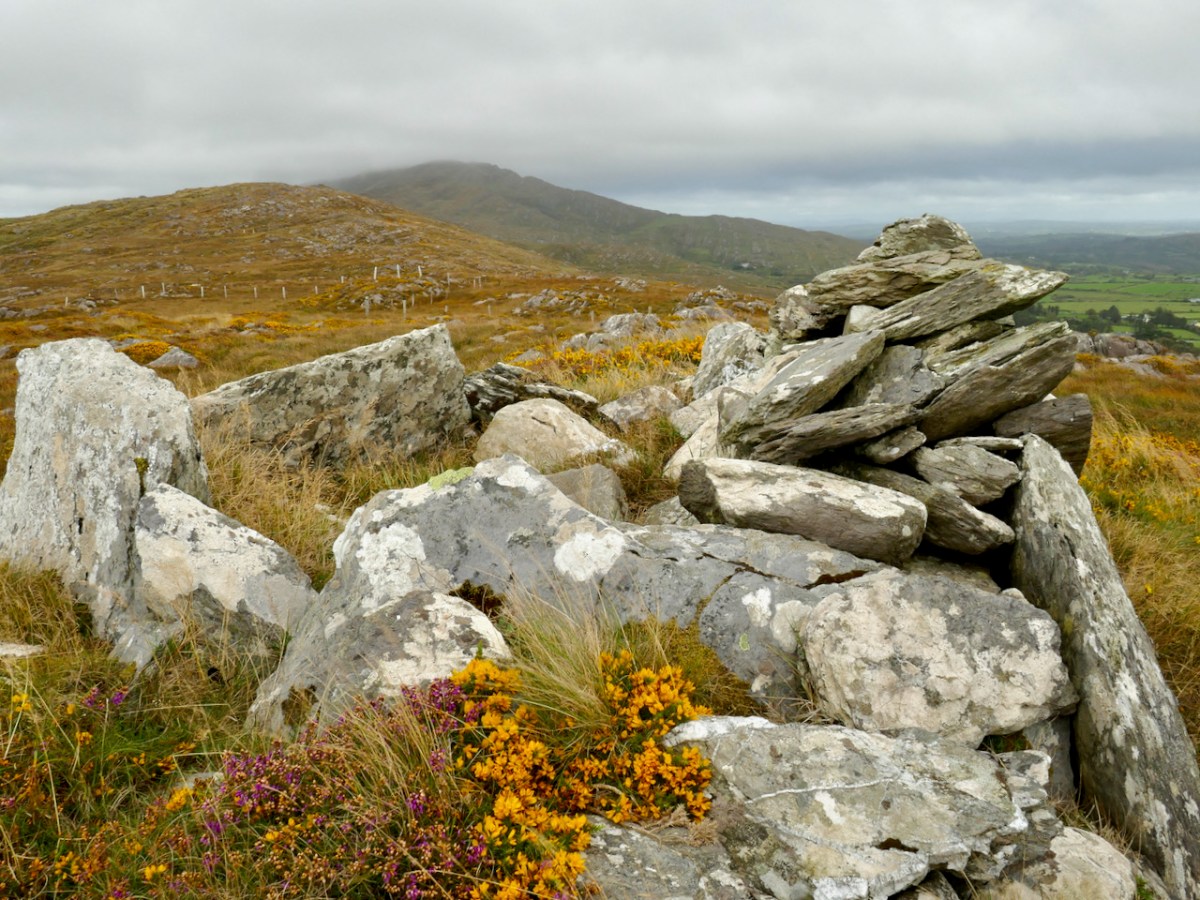
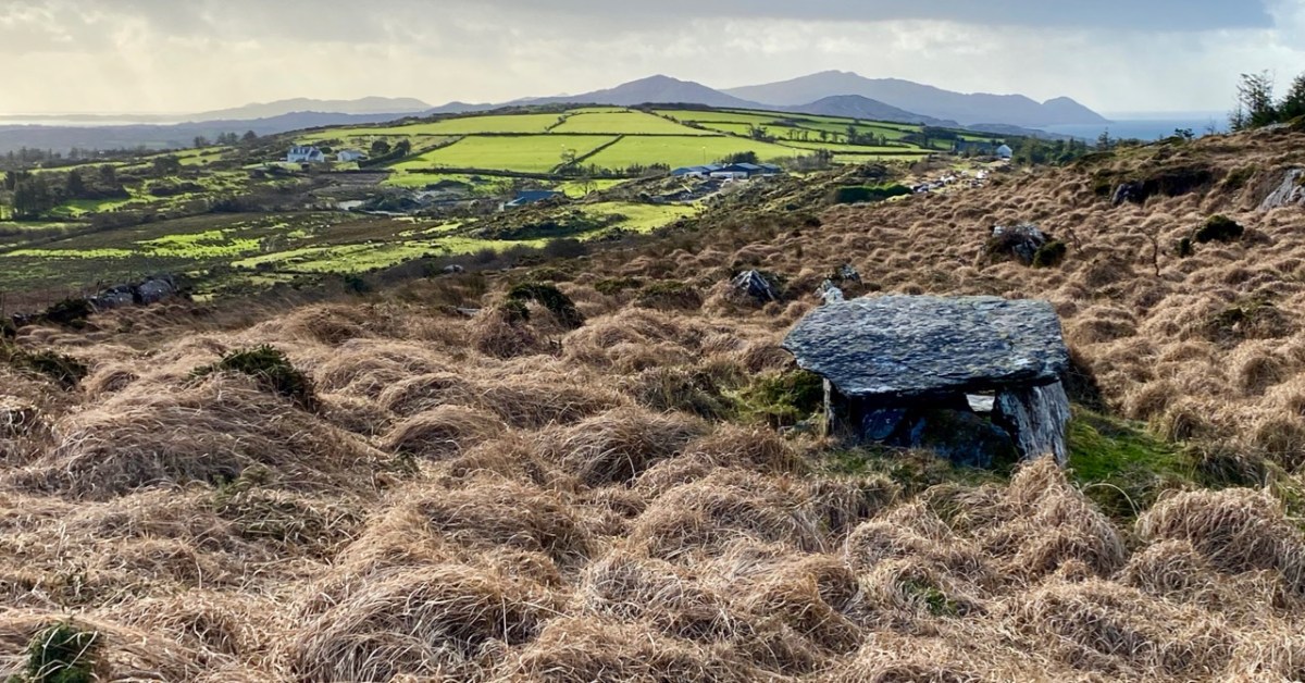
A mysterious megalithic tomb – we’re not quite sure what type it it – on a mountain in West Cork. We haven’t written about this one yet, but getting to it was quite an adventure.
At this time we usually do a couple of ‘reviews’: looking back through the year and picking posts and photographs that jump out at us, asking to be shown again. Next week’s offering will be our selection of favourite Roaringwater Journal articles from 2021, but here, following on from Finola, is my choice of photographs that have never been published. We gave ourselves the stipulation that they have to be from West Cork, and they had to be taken this year. We are trying to have a minimum amount of commentary – and hope they will speak for themselves. First up – above – is Ratooragh Wedge Tomb, far down on the Mizen: we discovered it in February, and that exploration resulted in this article.
Baltimore Beacon has a recognisable profile: we can see it in the far distance from our home: Nead an Iolair
Barley Cove is a favourite place for us to walk – far enough away from the madding crowds: there are few of those in West Cork!
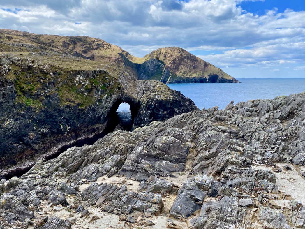
We like to explore the seascapes over by Dunkelly: here is a wonderful natural sea-arch
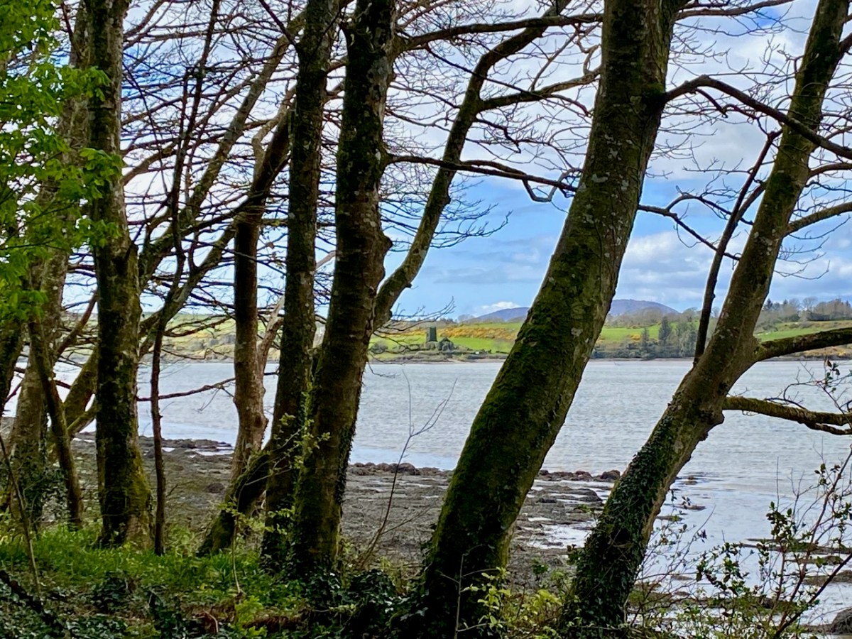
This view is from Inish Beg Estate, looking across the Ilen River towards the burial ground at Aughadown. In the background is Mount Gabriel
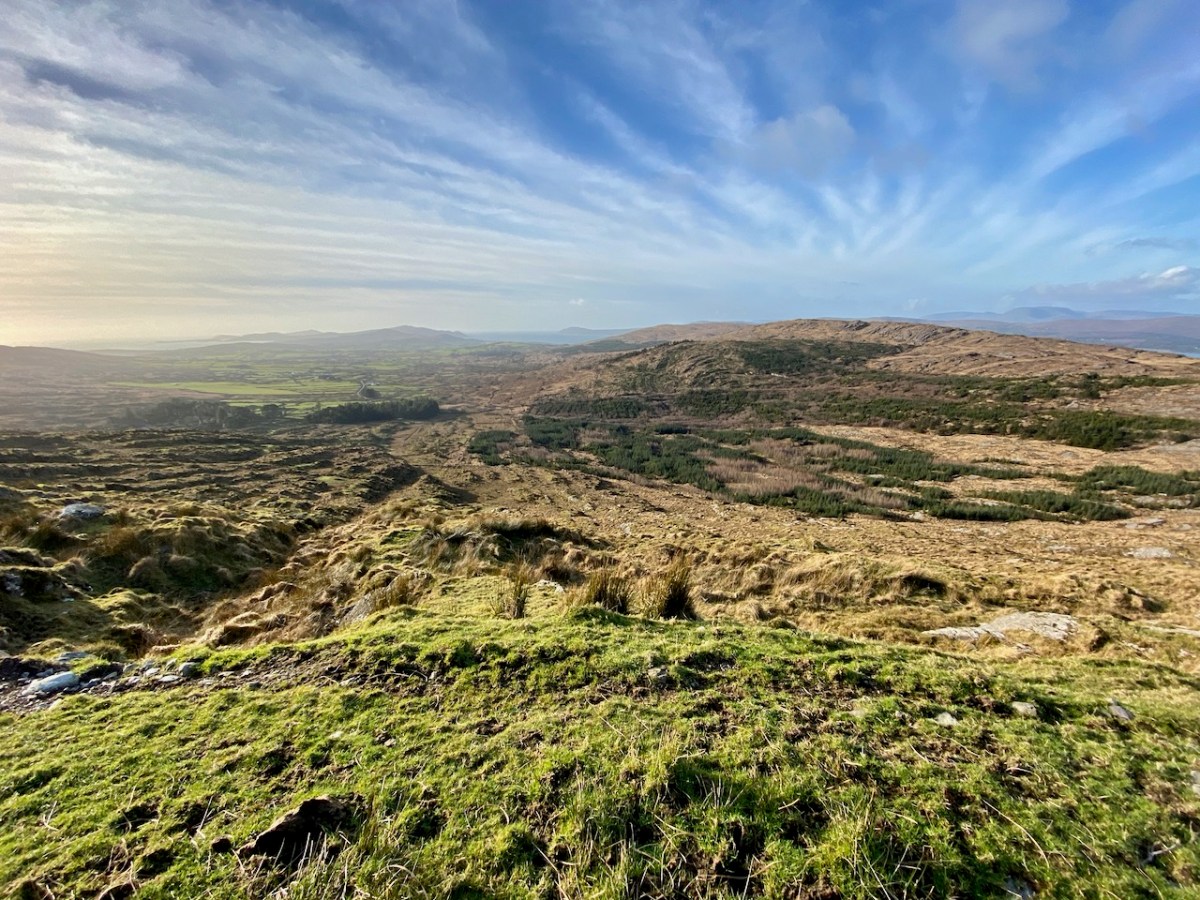
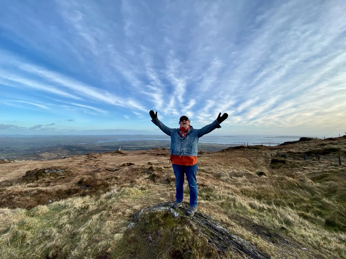
…And here is the view from the upper slopes of Mount Gabriel. Go up there on a good day and you are ensured the most scenic prospect from the top. During the year, Finola walked all the way up and – next – you can see her celebrating her achievement!
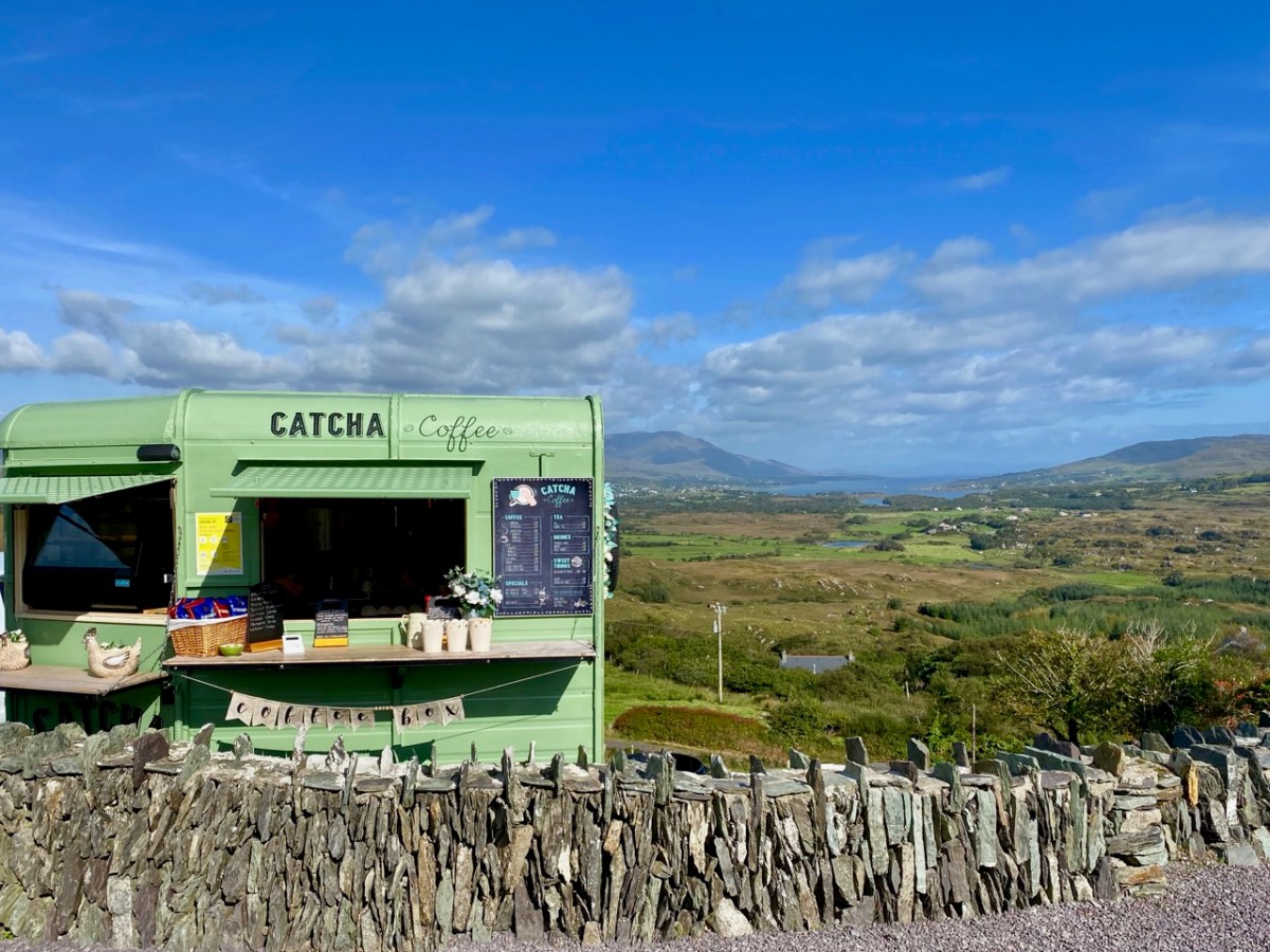
The strange times that we live in have seen an abundance of food and drink outlets springing up in town and country. I like the look of this oneon the Beara
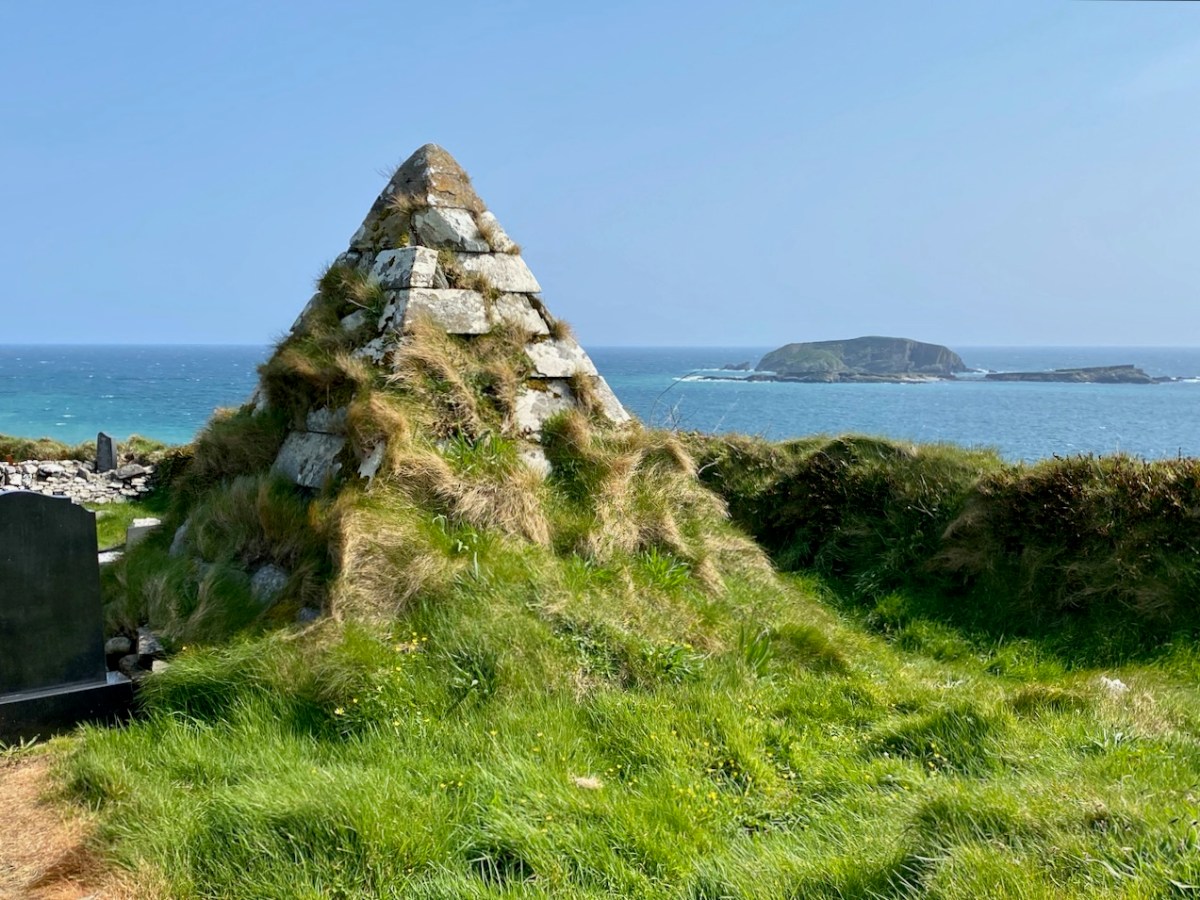
This pyramidical grave marker is one of a few in West Cork: it’s at Myross, and looks out over High Island and Low Island
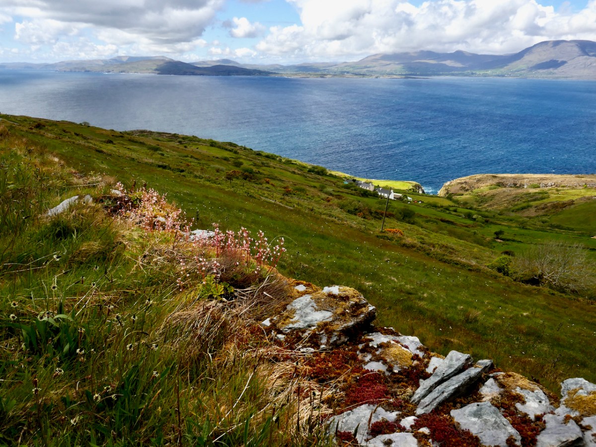
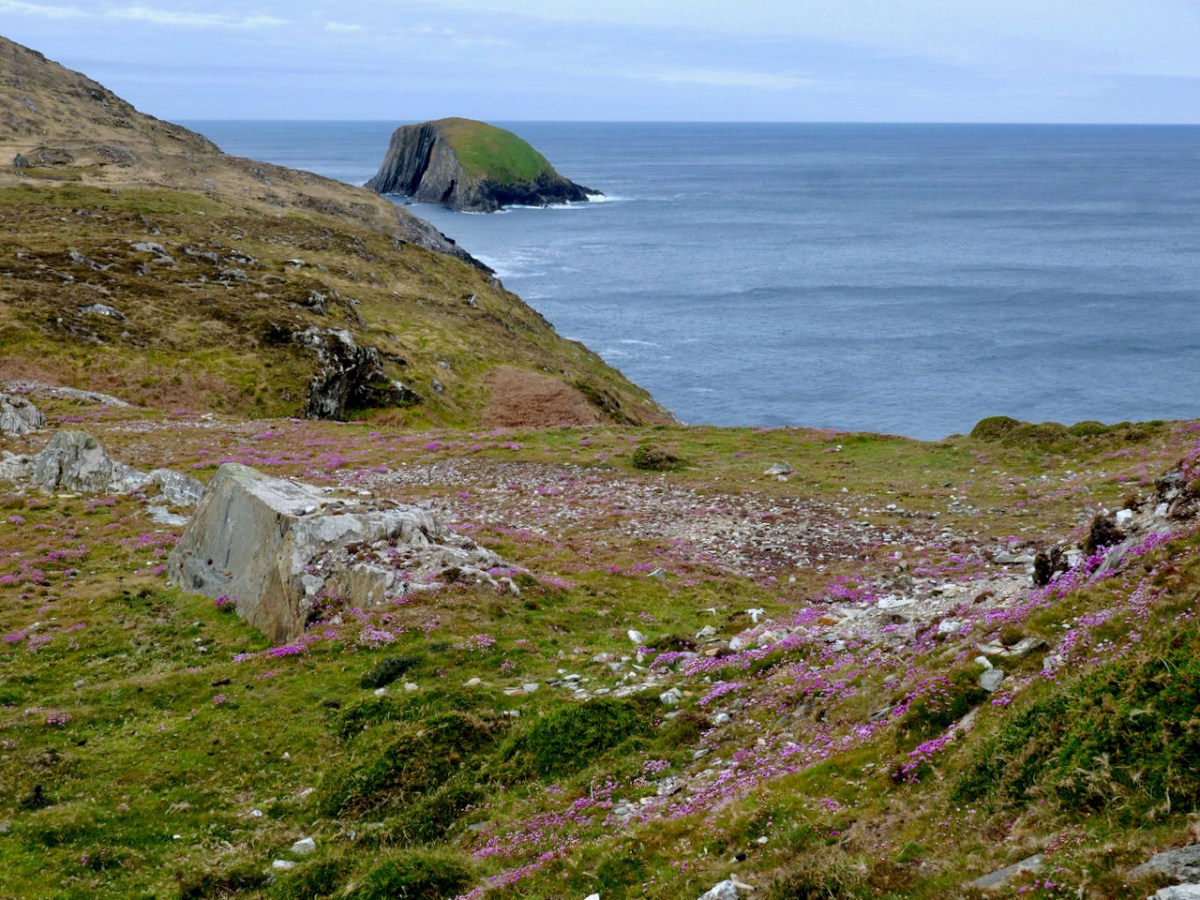
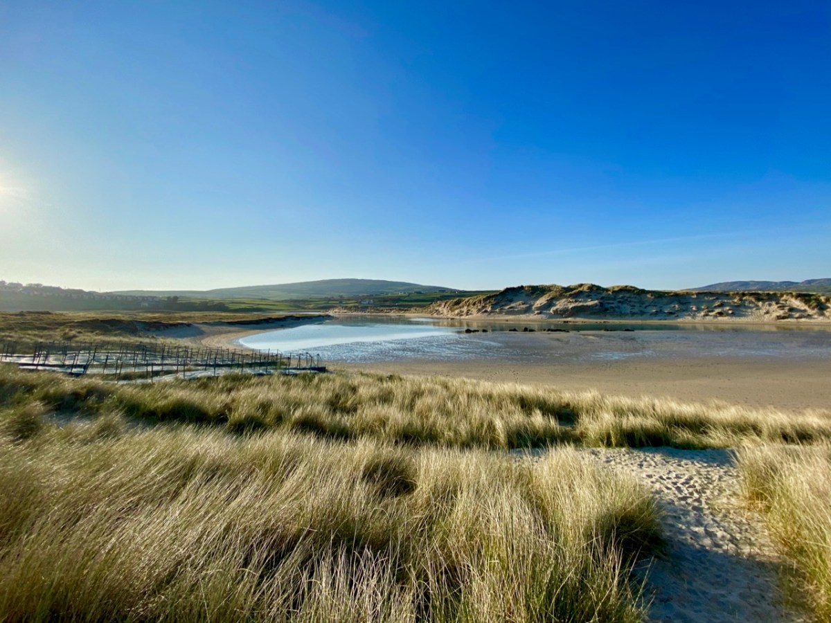
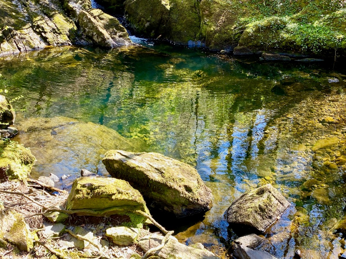
The West Cork landscapes offer an always changing mix of water and rock
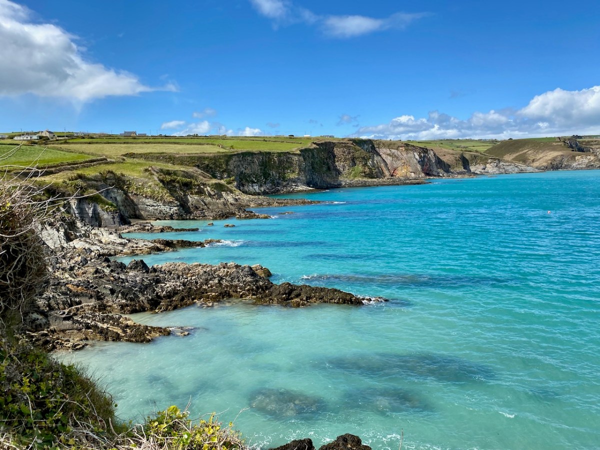
This is the coastline at Dirk, beyond Ring: it really is that colour under the summer sun!
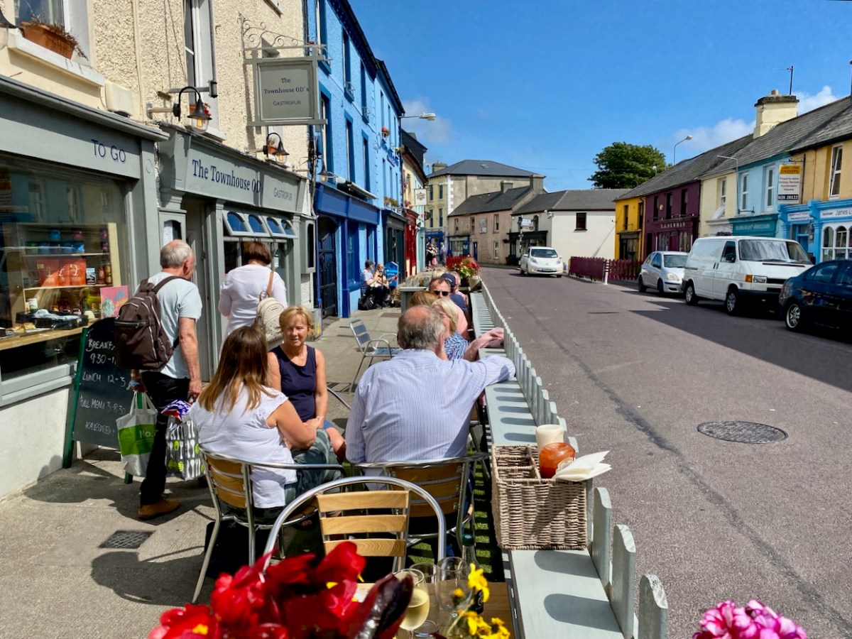
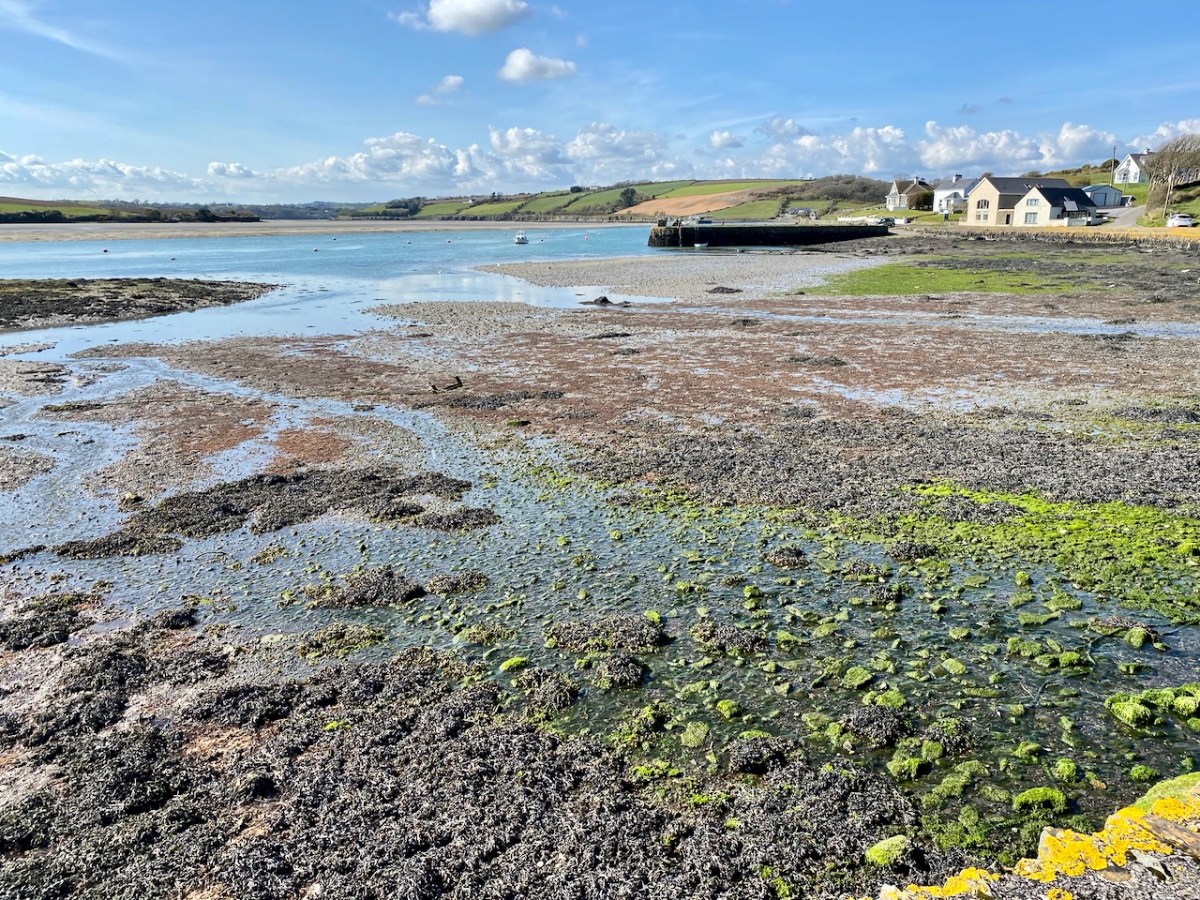
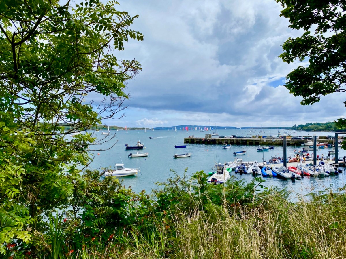
Our neighbouring town is Schull, which even in these Covid times was busy with seafarers in the summer holidays
We look down on Rossbrin Cove. Here is our view on a clear day in February
I asked Finola to take my picture next to this gentle giant – I couldn’t resist!
This may seem a surprising picture to finish off with, but Yay Burger has become our go-to on a Sunday night after a hard day on the Blog! Yay Burger has been a life-saver for us through the pandemic, and is one of a number of food outlets that have earned Ballydehob the title ‘centre of the culinary universe’
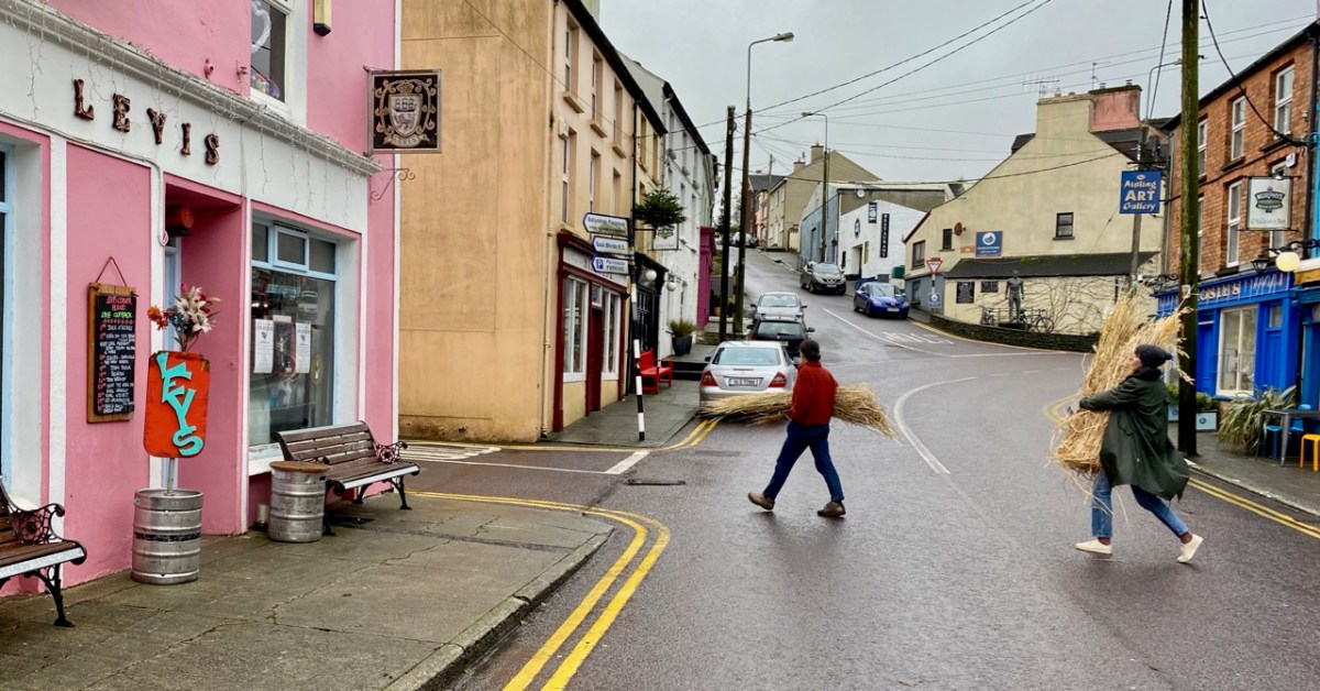
Do you remember pre-Covid days? Those times seem to bring out the nostalgia in me… It’s only two years ago that I wrote a post about our preparations – in Ballydehob – for the Wran Day celebrations that would take place on St Stephen’s Day – 26 December – following. Those festivities did happen, and we were then all in happy ignorance of how our lives were to be changed mightily by the pandemic that struck the world just a few weeks later. We’d like to think that, after all this time has passed, a level of normality will be returning. That’s not quite the case – but we are planning a ‘Wran’ this year, and today we gathered in Levis’s Corner House to make ready for it. Here’s a photo – kindly loaned by Pól Ó Colmáin – of the results of the workshop we held to prepare for the ‘Wran’ in 2019.
So firstly, here’s an abridged version of the post I put up after that workshop two years ago. I’ll follow it with an update of the equivalent [but socially distanced!] event which we held today . . .
* * * * * Back to 2019 * * * * *
Wran Hunting has featured before in Roaringwater Journal: that’s the way that St Stephen’s Day – 26 December – has been celebrated for generations in ‘Celtic’ parts of western Europe, specifically Ireland and The Isle of Man, but also in Cornwall – where it’s now only a memory – Brittany, Wales and Scotland. ‘The Wran’ is a very strong surviving tradition here, especially on the west side of the country. The Dingle Gaeltacht is the place to go if you want to see all the action (you may have to click on the bottom right of the window to turn on the sound):
In our own Ballyedhob community ‘The Wran’ is not forgotten. In fact you can even find a poem written about it in the Duchas folklore records. This was recorded in the 1930s by John Levis, aged 32, who took it down from Jeremiah Driscoll, aged 64 years. Jeremiah had been a Wren Boy in Ballydehob. Here’s the poem:
Come all you ladies and gentlemen,
For tis here we are with our famous wran
With a heart full of cheering for every man
To rise up a booze before the year is gone.
*
Mr O’Leary we came to see,
With our wran so weak and feeble,
The wran is poor and we can’t feed him,
So we hope your honour will relieve him
*
We’ve hunted our wran three miles and more
We’ve hunted this wran all around Glandore
Through hedges and ditches and fields so green,
And such fine sport was never seen.
*
As we copied our wran again
Which caused our wran-boys for to sing, She stood erect and wagged her tail, And swore she’d send our boys to jail.
*
As we went up through Leaca Bhuidhe
We met our wran upon a tree,
Up with a cubit and gave him a fall,
And we’ve brought him here to visit you all.
*
This the wran you may plainly see,
She is well mounted on a holly tree,
With a bunch of ribbons by his side
And the Ballydehob boys to be his guide.
*
The wran, the wran, the king of all birds,
St Stephen’s day he was caught in the furze,
Although he is little, his family is great,
So rise up landlady and fill us a treat.
*
And if you fill it of the best,
We hope in Heaven your soul will rest,
But if you fill it of the small,
It won’t agree with our boys at all.
*
To Mr O’Leary and his wife
We wish them both a happy life,
With their pockets full of money, and their cellars full of beer, We now wish a merry Christmas and a happy New Year.
*
And now, our song is ended, we have no more to say,
We hope you’re not offended for coming here today,
For coming here this morning we think it is not wrong,
So give us our answer and let us all be gone.
Traditional, DUCHAS
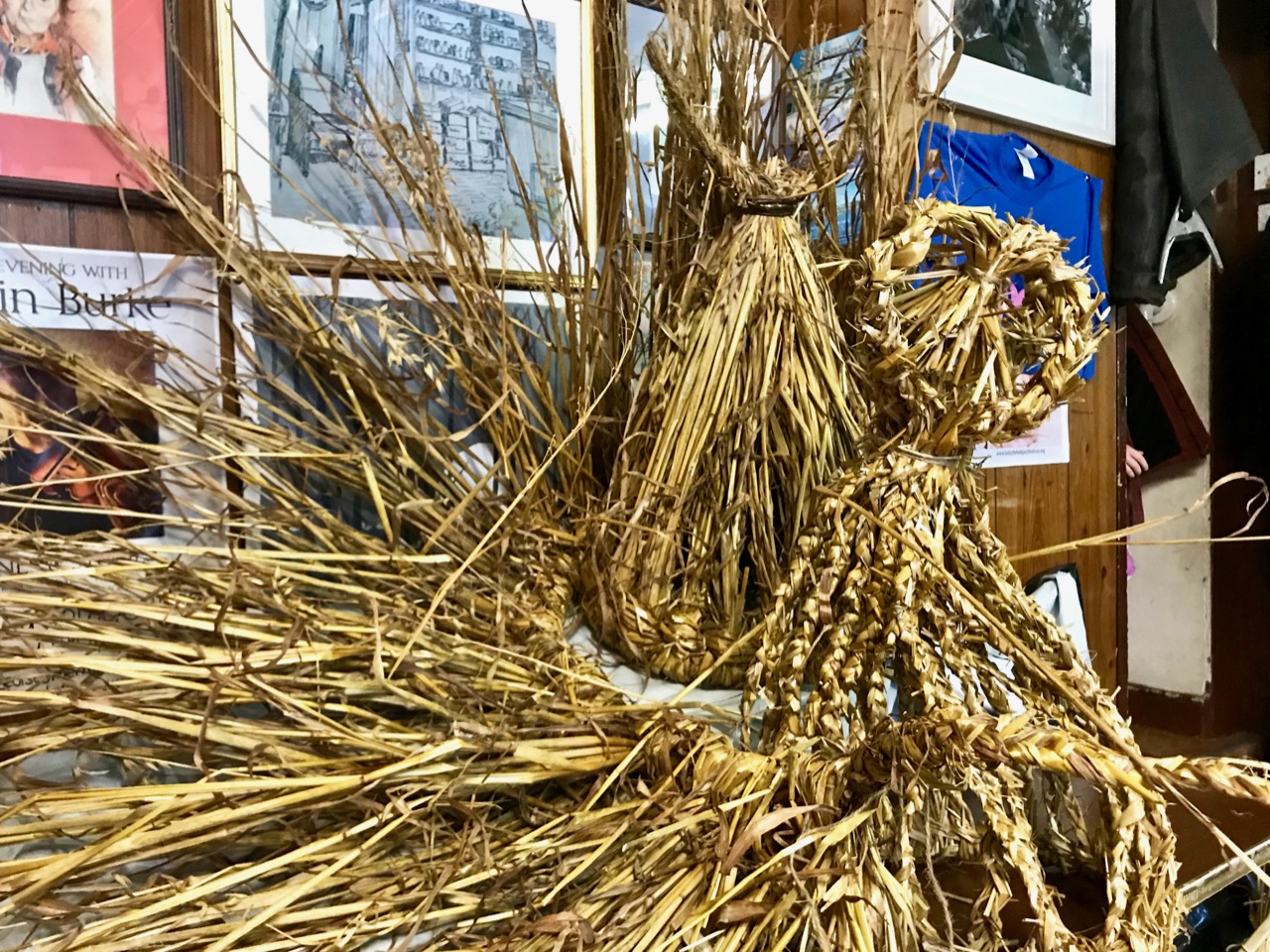
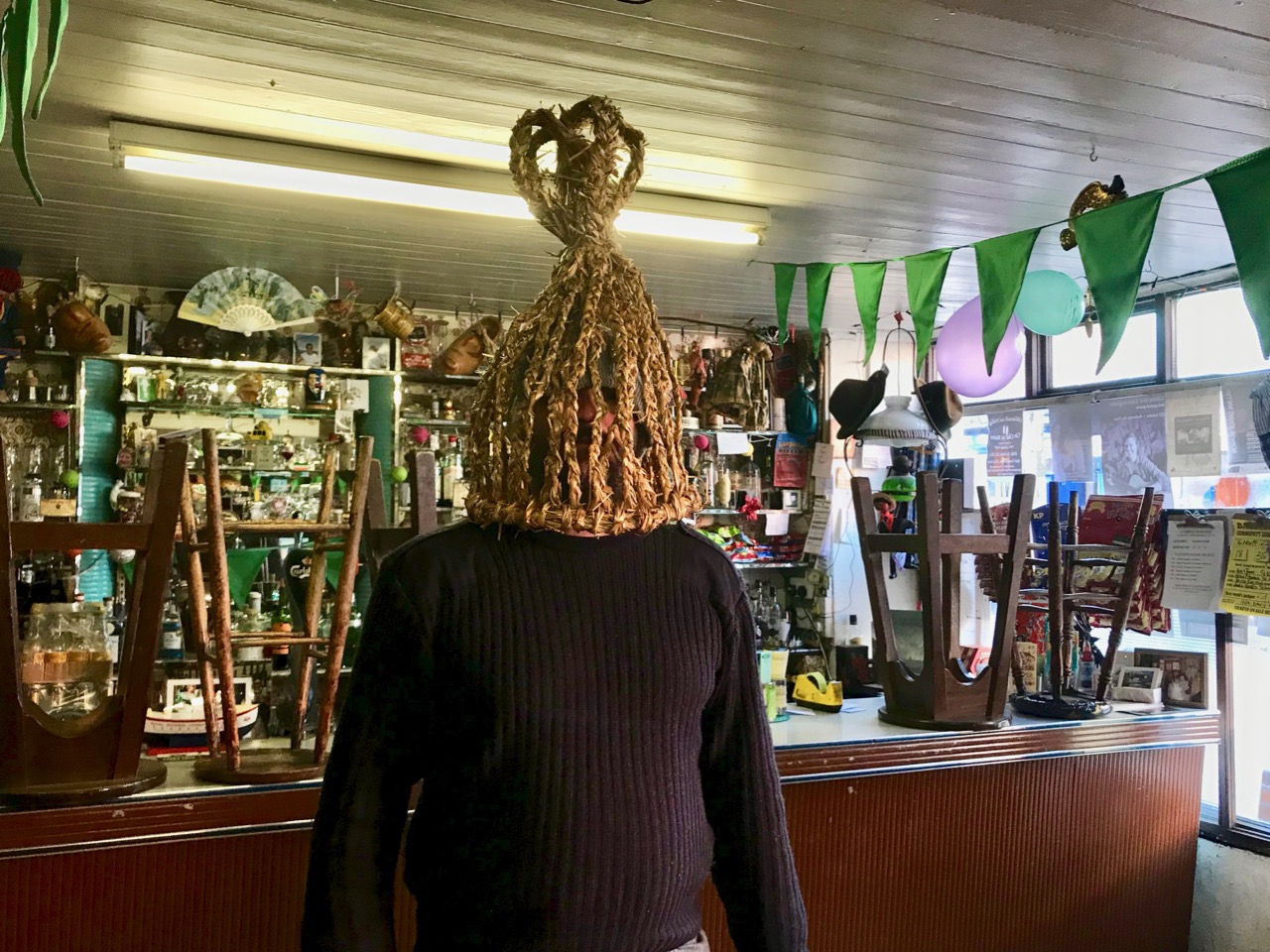
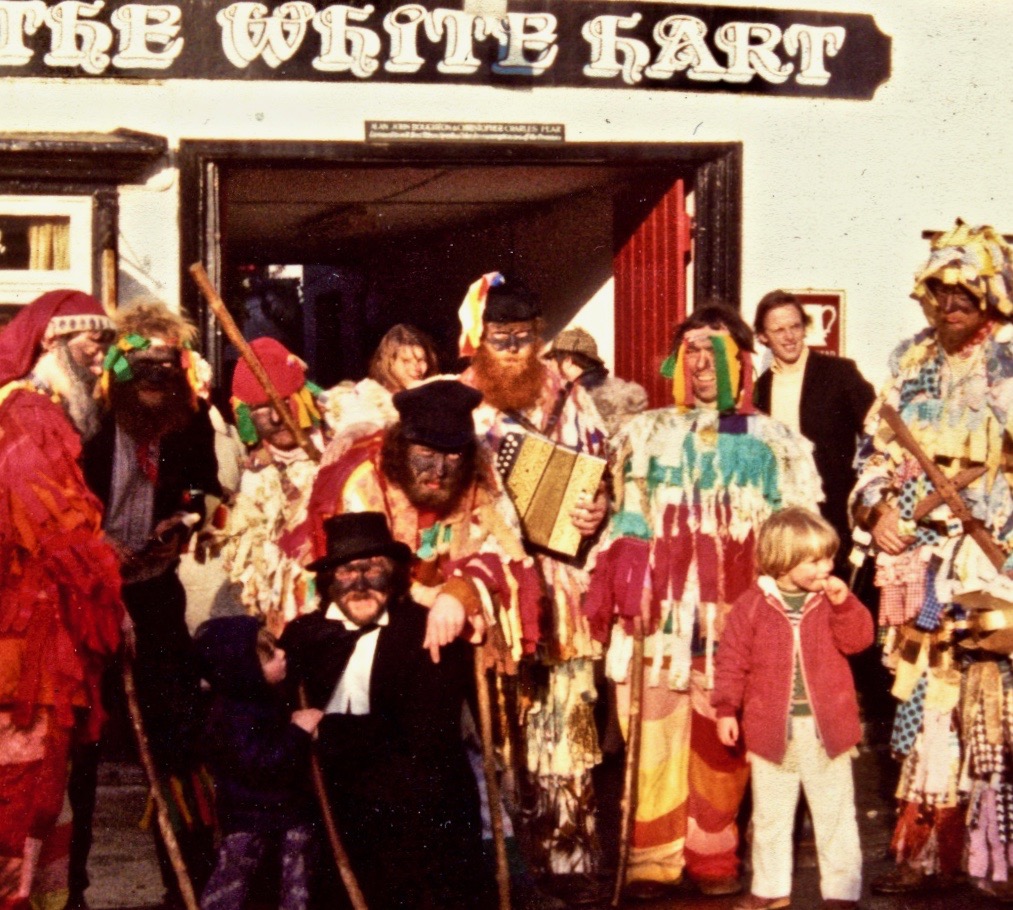
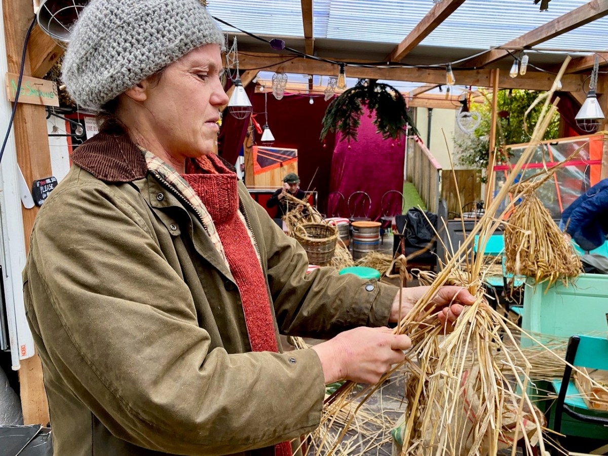
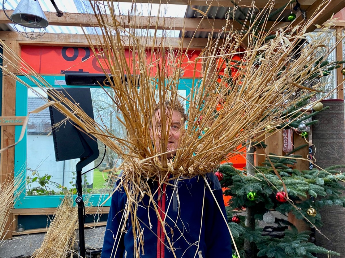
By good fortune there’s ‘Mr O’Leary’ above! He’s the landlord of Levis’ Corner House Bar in Ballydehob: he allowed the Wran workshop to take over his pub yesterday. Basically that involved covering the whole place in straw out of which, magically, appeared lots of wonderfully crafted Wran masks. Joe is wearing a fine example.
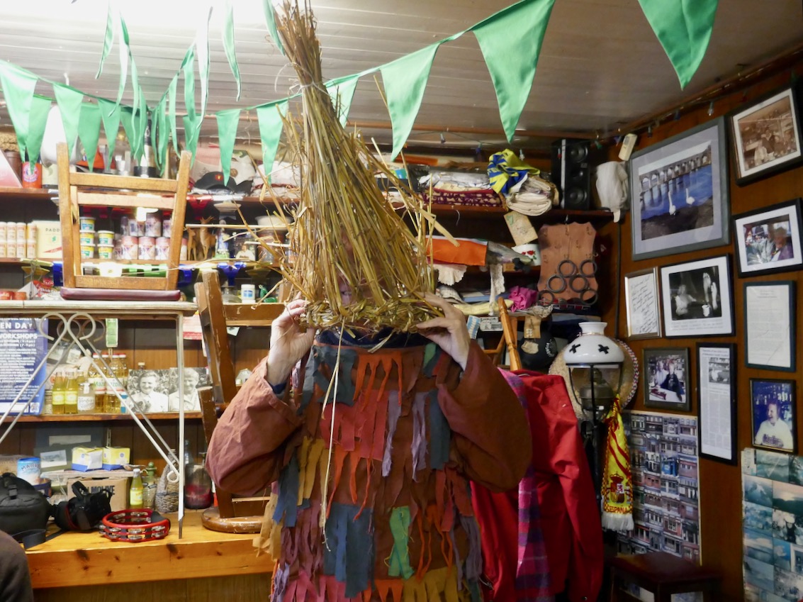
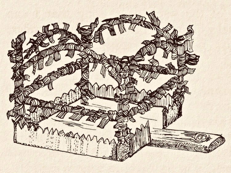
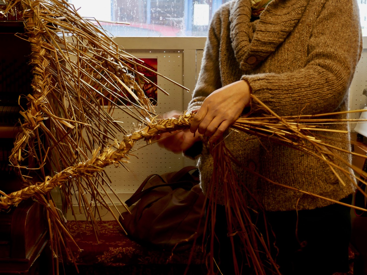
Finola and I were at the workshop, and there I am with work in progress on the straw mask which we made (upper picture). You’ll notice that I’m wearing ‘tatters’: I’ve had these for years, and I used to don them for our own mumming tradition in Devon which also happened on 26 December (that’s me with the squeezebox mumming in the 1970s! – lower picture). Over there we called St Stephen’s ‘Boxing Day’ because that was when ‘Christmas boxes’ were given to the postman, the milkman and anyone else who provided their services through the year. Interestingly, Kevin Danaher mentions the ‘Wran box’ which was taken around the houses by the wrenners (or Wran Boys) and used to collect money ‘for the Wran’. This illustration of a Wren box from County Galway is from Danaher’s book The Year in Ireland:
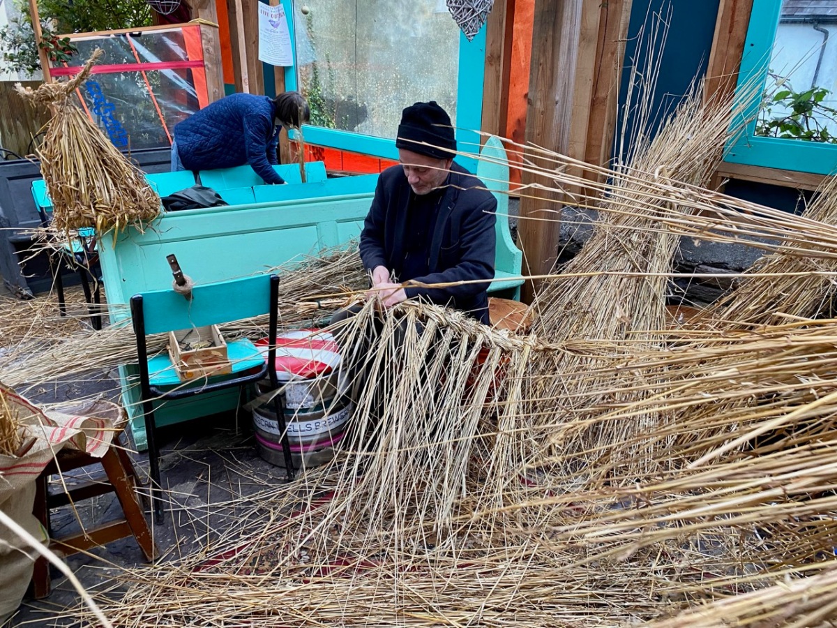
The workshop in Levis’ was very well attended, and there is clearly great enthusiasm for reviving this custom. Sonia collected the straw at the annual Thrashing in Ballydehob – which is a traditional harvest celebration. It’s not easy to find the right straw for making the masks nowadays: anything that has been through a combine harvester has been flattened and will not survive the plaiting.
It’s a complex process, but the group coped well in acquiring the new skills under Sonia’s tutelage. The making – every year – has always been part of the tradition where it’s still practised today. Sometimes the straw masks (which are only one part of the ‘disguise’) are destroyed after Stephen’s. In some of the Dingle traditions they are ritually burned on the following St Patrick’s Day.
* * * * * *Fast Forward to 2021 * * * * *
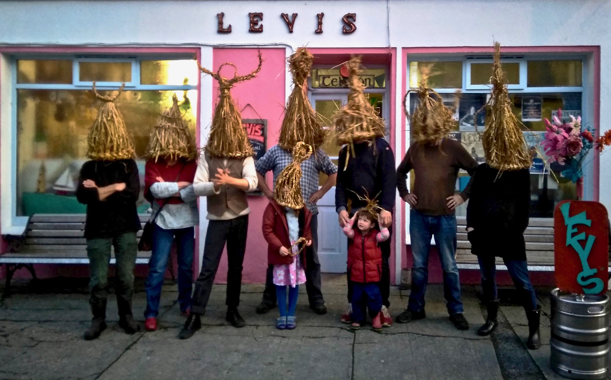
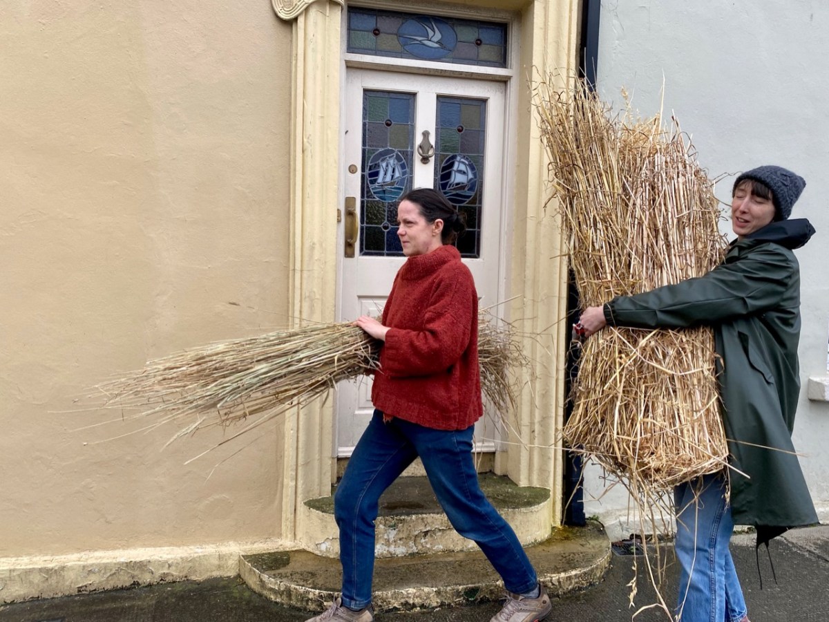
Two years later, on a damp Sunday in Ballydehob, you might have seen the strange sight of bundles of straw being transported across the road to Levis’, where the 2021 Wran Workshop is about to take place in the ‘outback’ area of the bar. That’s Sonia (on the left above) who is masterminding the whole proceedings, and also oversaw the growing of the straw.
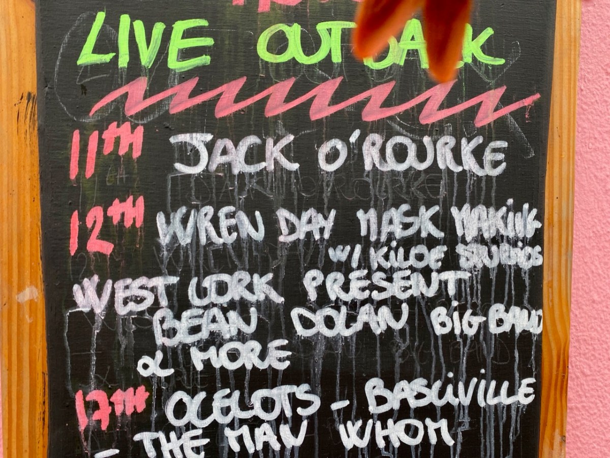
We all really appreciate Joe and Caroline – who run Levis’s – who are so supportive of community events and who, like everyone else, have had to struggle to keep business going through the ups and downs of Covid restrictions. The ‘Outback’ – formerly their yard – has been remarkably transformed into a comfortable outdoor venue, and live concerts and events are continuing through the winter season, helping to make our days seem as normal as possible.
We were a small but dedicated group, determined to get the tradition going again in Ballydehob. We are not sure, yet, when it will happen. Traditionally it should be Stephen’s Day, but it all depends on how available the participants will be. We will keep all our readers fully informed! meanwhile, if you need encouragement, look at the work that has gone into the straw masks this year . . .
Here’s Sonia Caldwell again, above. We have featured her Kilcoe Studios in a previous post. She is undoubtedly the energy behind this project. Look out for us all shortly after Christmas – there is good entertainment to be had. But, also, essential traditions to be kept alive to ensure that our world keeps turning!
That’s Pól Ó Colmáin, above, testing out his mask for size before finishing off the conical headpiece. Marie and he run the Working Artist Studios in the main Street of Ballydehob – a wonderful addition to our village’s thriving assets. Pol also bravely works away at teaching the Irish language to a number of students, including me! Here are both of them this afternoon with their completed Wran Day pieces – and also my own mask back at home . . .
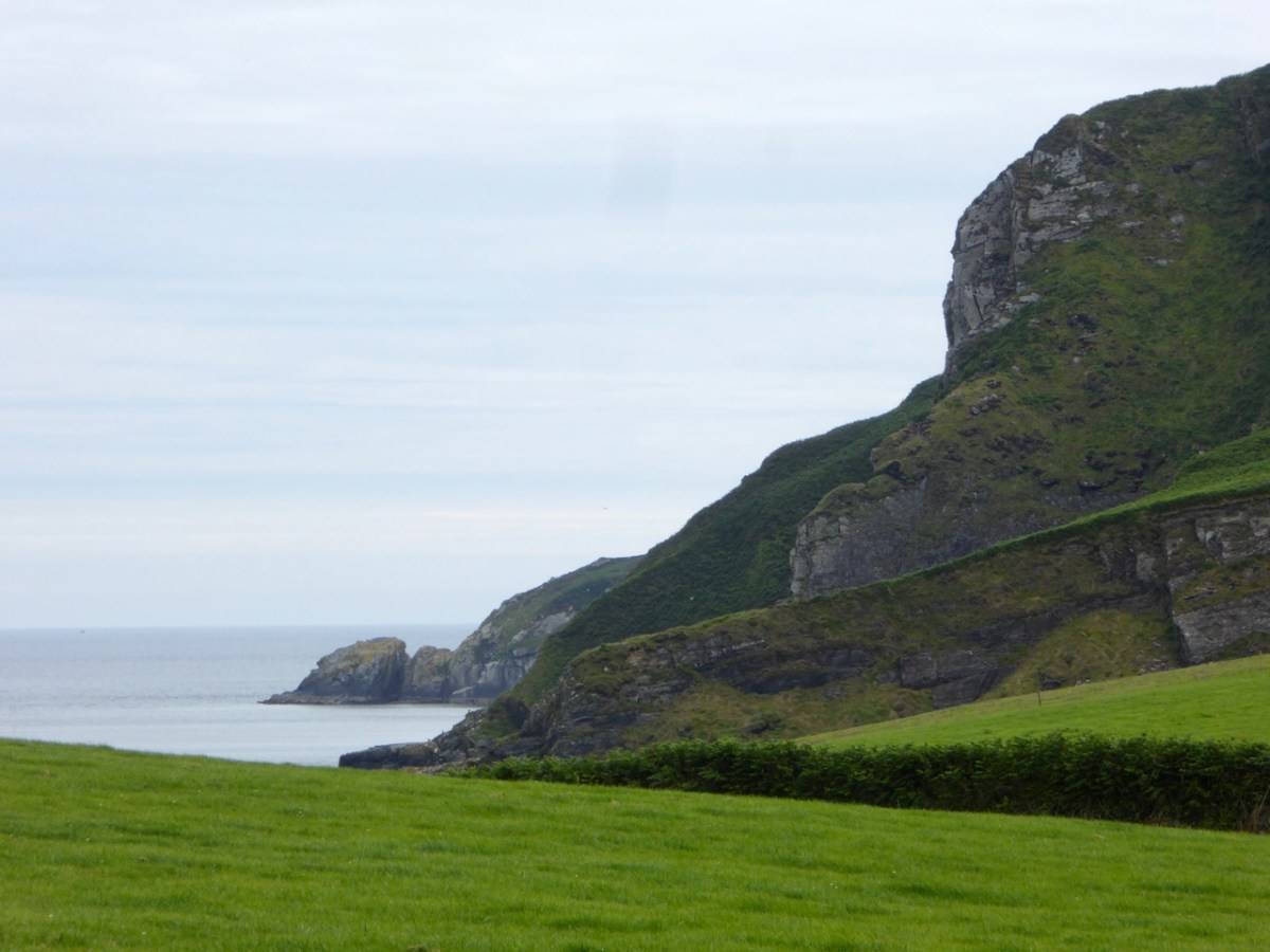
Here’s the latest episode in our series about Napoleonic-era signal towers in West Cork. There are links to the earlier posts at the bottom of this one. That’s Toe Head above – in the far distance, and that view is taken from the signal tower site at Kedge Point, Spain, to the east of Baltimore.
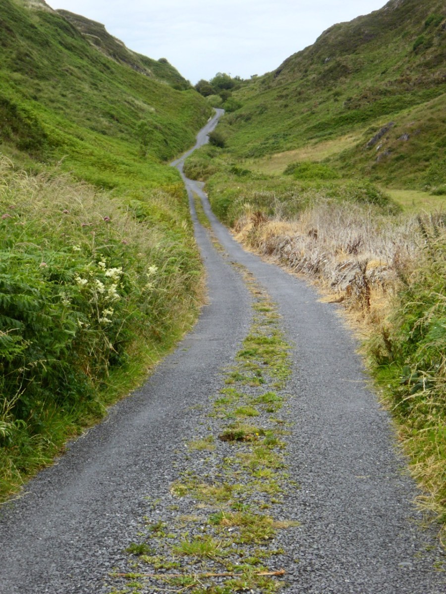
Toe Head itself is a spectacular setting in West Cork: the views, above, show the nature of the terrain, the boreens, and the seascape in the area. So far I have written accounts of nine signal towers: this is the tenth. I’d like to tell you how many of these structures are in West Cork, but that would mean that I would have to geographically define ‘West Cork’. I can’t do that, as there is officially no such area: we are all part of County Cork! All I can do is to let you know that there are nineteen signal tower sites located in the whole County. I have another nine to cover, after this one. But I assure you – Toe Head is definitely in our West Cork!!
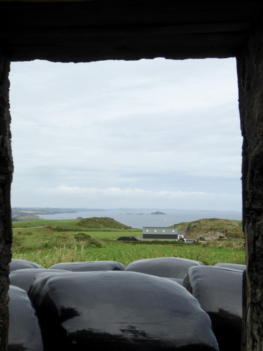
Here’s the Toe Head tower – in a sea of black bales. If you have followed the series so far, you will have noticed that each tower is fairly basic, and generally offers the appearance of a medieval castle. But they were all built at the very beginning of the nineteenth century, to provide a system of surveillance and signalling around the coast of Ireland, from Malin Head in the north to Pigeon House Fort, Dalkey, on the east coast. Each signal tower is within view of one – or two – others, depending where it lies on the chain. In the first post in the series, here, I explain the logic and geometry of the project.
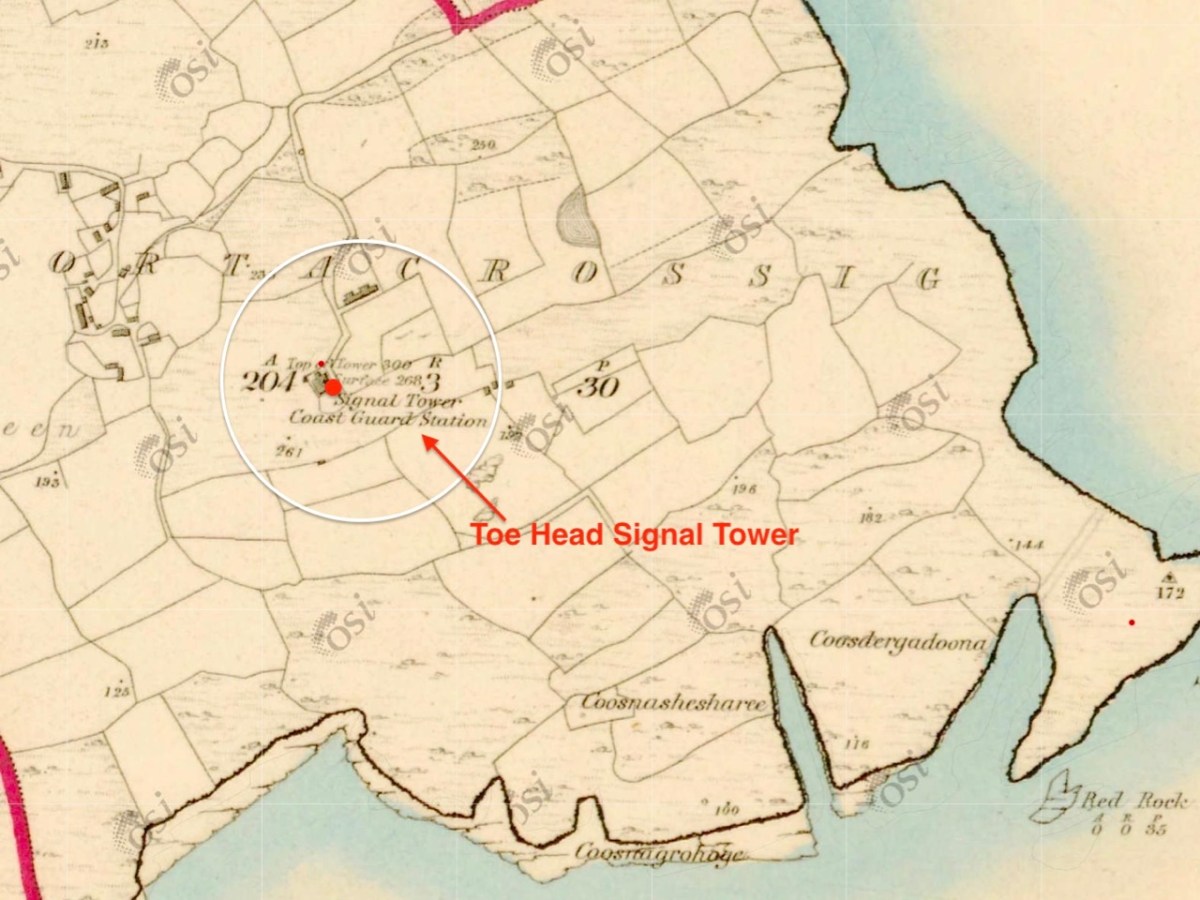
The 6″ Ordnance Survey map extract in the upper picture dates from 1842. By this time the use of the tower for signalling had ceased – the Napoleonic invasion threat lasted only through the first few years of the century: many towers became disused after this and some have vanished altogether, although many ruins do remain because of their remote locations. In the case of Toe Head, the building was adapted to incorporate a Coast Guard Station. I am assuming that, originally, the tower was a simple square structure , and the extension to the rear was added to provide additional accommodation for the Coast Guard service. The current aerial view shows newer farm buildings and an access road close by.
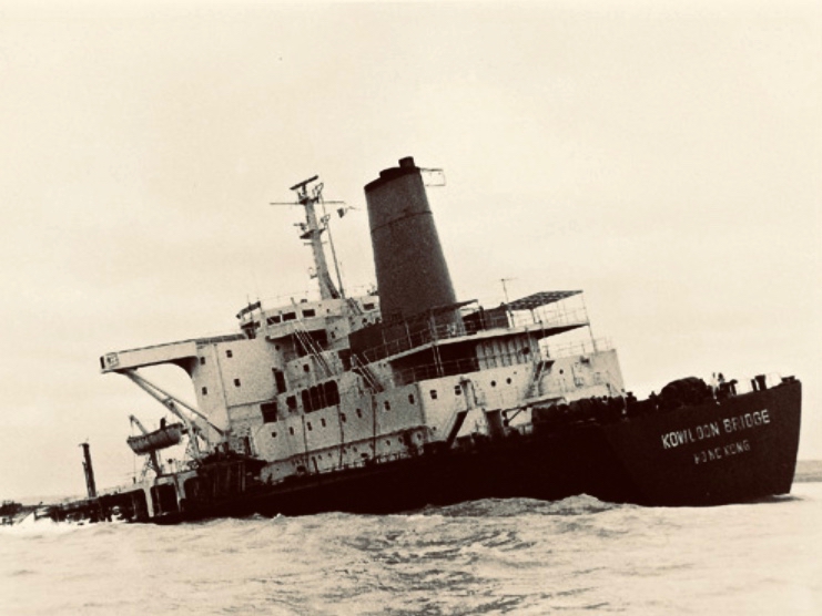
If you look at previous posts in this series, you will see that the Toe Head tower is architecturally simpler, with no bartizans or other ornamentation – it’s more like a small Anglican church tower than a ‘castle’. Like many others, it’s clear to see that this building was slate-hung: this form of weather-proofing was probably added at a later date – possibly when the Coast Guard service took it over. At the centre of the view from the window above you can see the Stag Rocks which in the 1980s became the graveyard of the 900ft long Kowloon Bridge, a bulk cargo carrier travelling from Quebec. The ship was disabled by a storm and then abandoned, drifting on to the Stags. A detailed account of the event was posted in the Irish Examiner 30 years later.
The abandoned Wreck of the Kowloon Bridge close by the Stags in November, 1986 (centre picture). The lower picture shows the wreck underwater today (courtesy Aquaventures.ie): she drifted out of control towards the rocks before running aground on the reef. The resulting fuel spill spread out over the Irish coastline causing extensive damage to local wildlife, and financial losses for the local fishing fleet. Apparently, no-one was ever held to account for the environmental disaster.
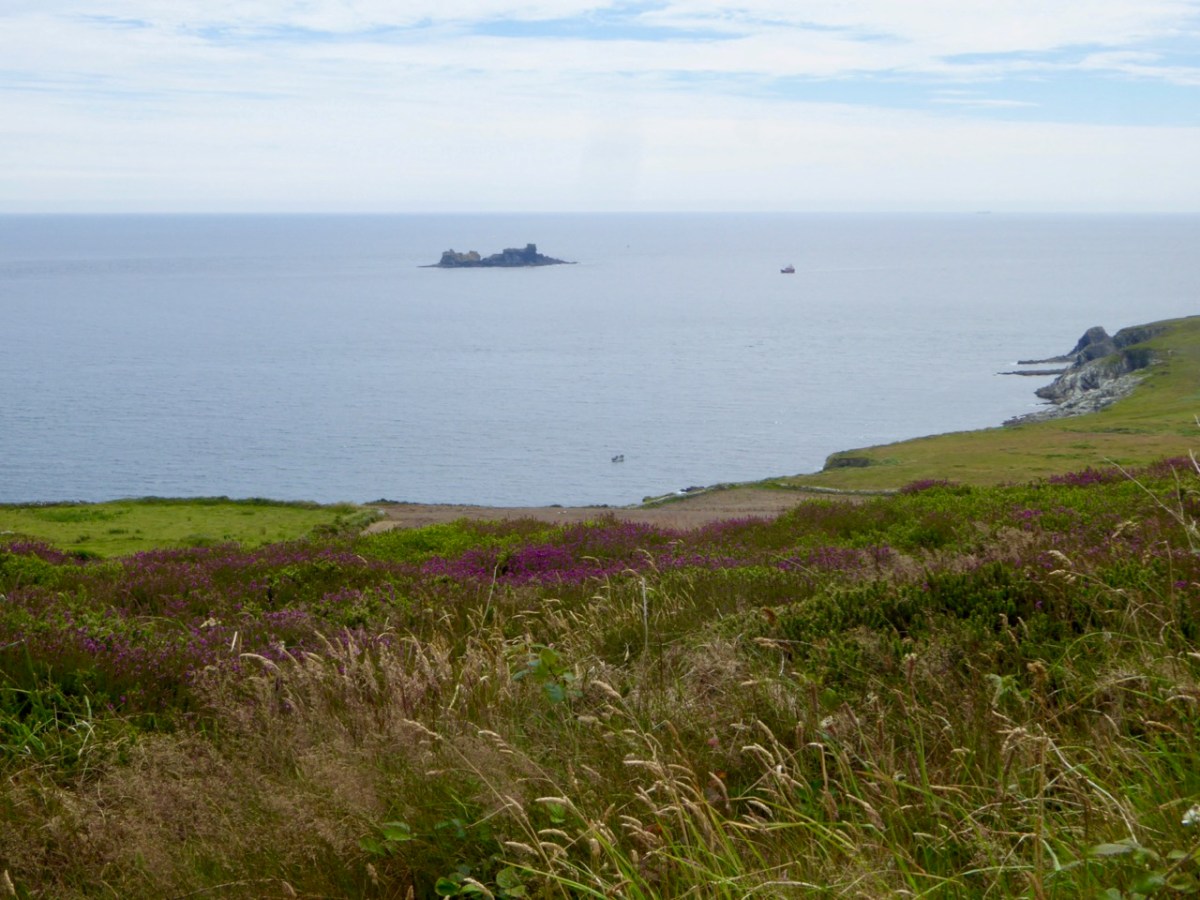
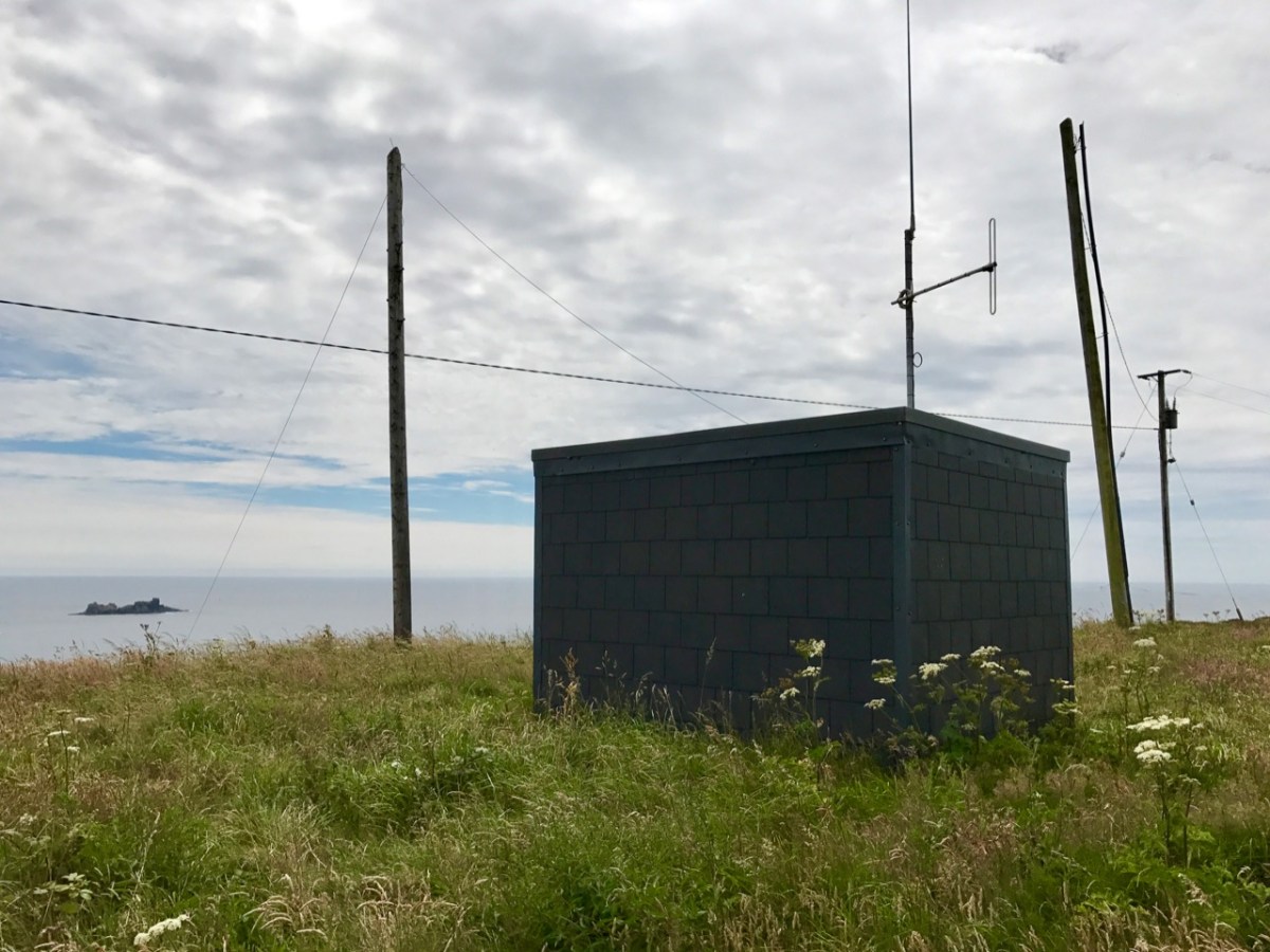
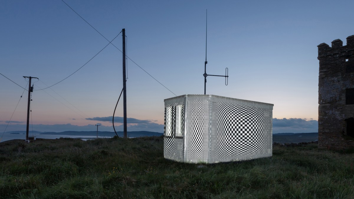
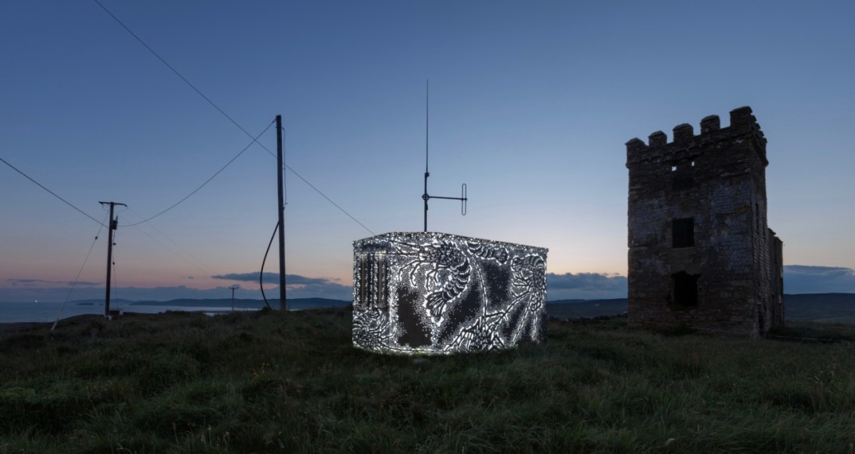
The Stag Rocks can be seen in my picture above, which shows the current incarnation of a World War II Lookout Post that was put in place close by the older signal tower in 1942. You can read more about these lookouts in this post: they were designed by Howard Cooke RIBA of the Irish Office of Public Works at the outbreak of that war (during which Ireland remained neutral). I mentioned in that same previous post an art installation project carried out in 2014 by Tim Schmelzer of Vienna. His work at Toe Head is particularly impressive, and here are some still shots to illustrate the nature of the artworks, which were created on-site using high-powered projection equipment.
The signal tower ruin today is gaunt and desolate. Nevertheless it’s an atmospheric place to visit. On the slopes below the building is an EIRE sign (officially number 28), also dating from the World War II years, when Irish neutrality had to be spelled out to the warring powers flying overhead. I came across an interesting comment from Anne Wilkinson in 2018, giving a slightly different take on the EIRE signs:
. . . These EIRE signs were also to alert German Pilots and crew who were conscientious objectors and who had overflown the UK, to ditch and parachute to safety. Many airmen lived at the Curragh Camp. They were allowed freedom during the day, eg. they often cycled the lanes and roads to enjoy the peace and quiet and then returned to the Curragh Camp for their curfew hour . . .
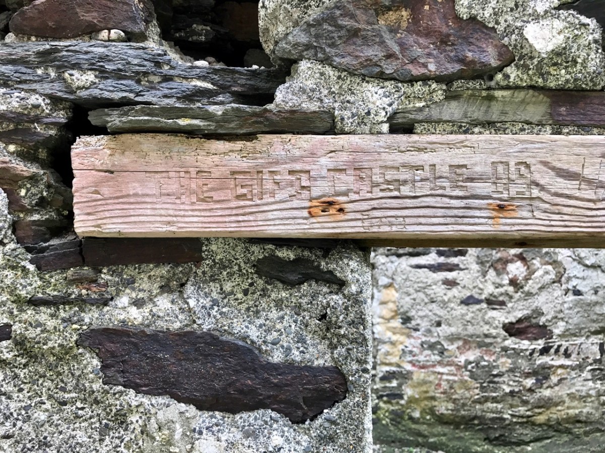
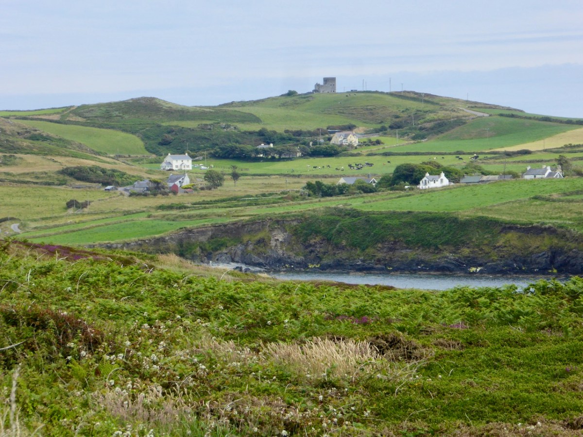
And here’s a little enigma to finish off the post (above). It’s graffiti carved on a timber lintel over one of the openings of the signal tower buildings. It’s probably quite recent – dating from ’89 or’99 – but what does it spell out? And why is it here? It’s tempting to say THE GIFT CASTLE but that ‘T‘ after the GIF doesn’t ring true . . . There’s a story there somewhere: perhaps one of our readers can give us a clue! Finally, here’s a distant view of the signal tower, looking across Toe Head.
The previous posts in this series can be found through these links:
The sixteenth century was a desperate time in Munster. Two successive Desmond Rebellions (read about them here and here) had resulted in a devastated countryside where, according to the Annals of the Four Masters the lowing of a cow, or the whistle of the ploughboy, could scarcely be heard from Dunquinn to Cashel in Munster. The power of the FitzGeralds, Lords of Desmond, and their allies among the Gaelic chieftains, had been broken.
The Tudor government determined that what was needed was a complete colonising effort, that would bring the benefits of English civilisation to the lawless Irish. William Cecil, Lord Burleigh, set about planning the Plantation of Munster.
In June 1584, a commission surveyed southwest Munster, mapping out the lands belonging to a swathe of Irish lords associated with the rebellion, which were then granted to a small group of wealthy English Undertakers.
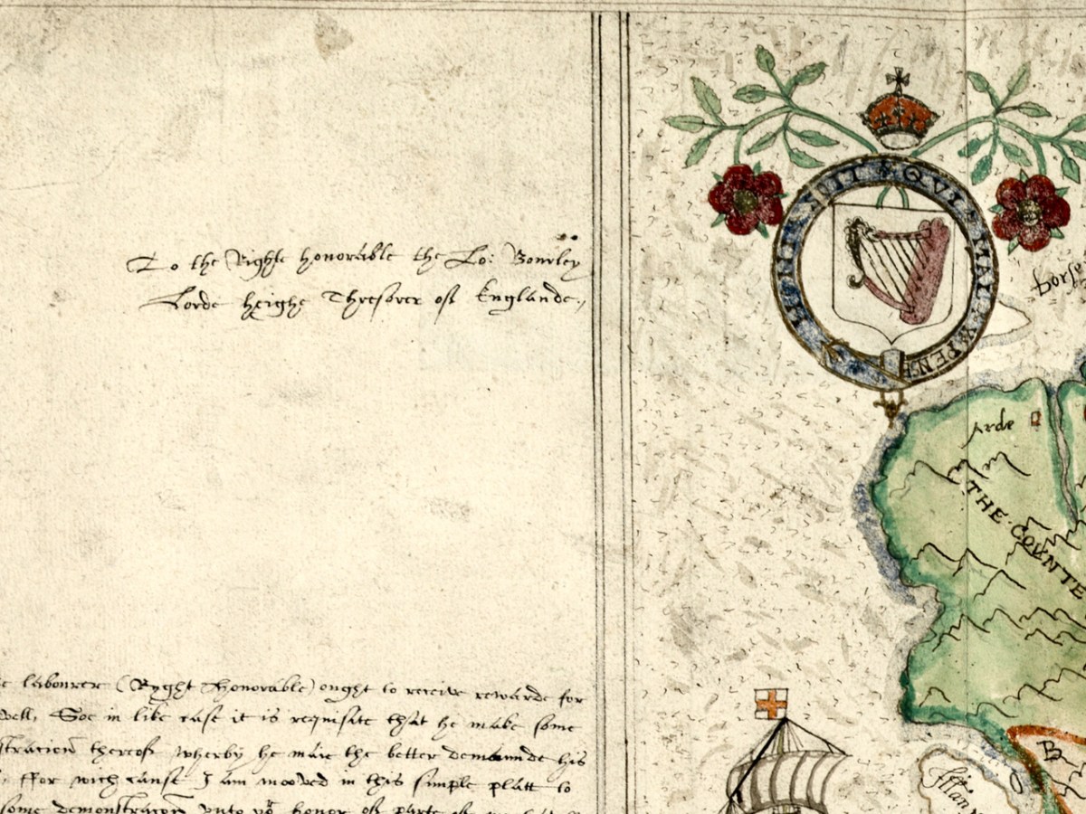
Jobson’s dedication – to the Right Honourable the Lord Burleigh, Lord High Treasurer of England
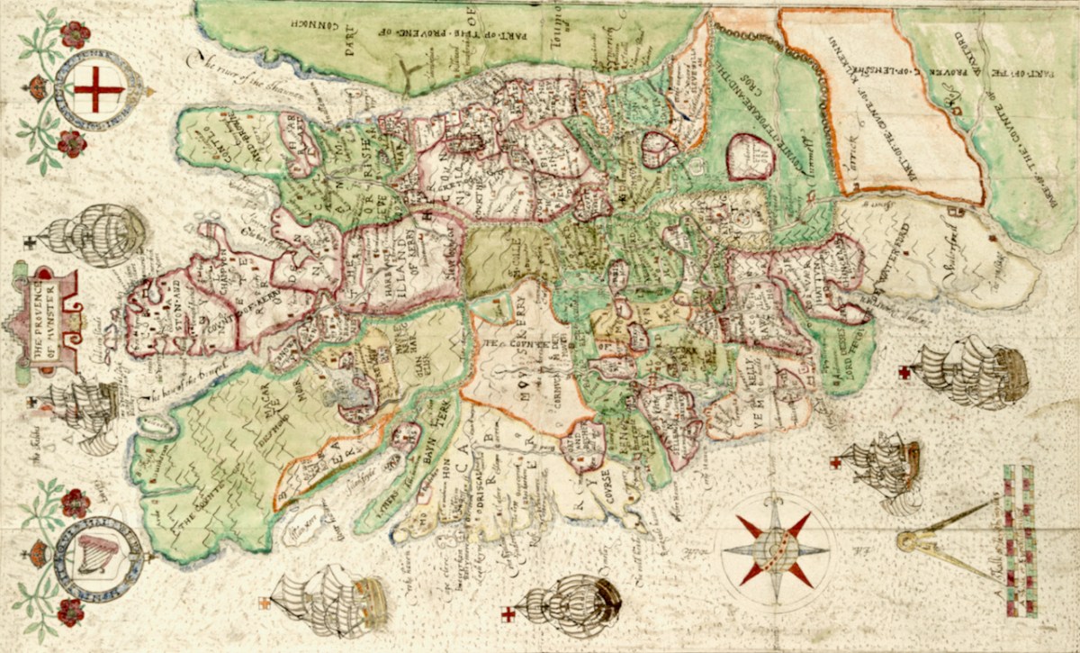
What a project like this needed, of course, was an accurate map and they were hard to come by in medieval Ireland. Francis Jobson, a free-lance cartographer, set himself the task of producing such a map, and in 1589 he inscribed this one, The Province of Munster Map (the subject of this post), to Cecil. The original is in the library of Trinity College and I have been given permission to use it in our blog (see end of post for complete citation.)
Jobson’s signature
George Carew, one of the primary planters, the first President of Munster, was a man who asserted he had an ancestral claim to large chunks of Munster. To back up his various claims, he collected papers and maps in support of the colonising efforts, and these maps later found their way to Trinity College in Dublin, to form part of a collection called the Hardiman Atlas, after the nineteenth century librarian who recognised what they were and bound them together.
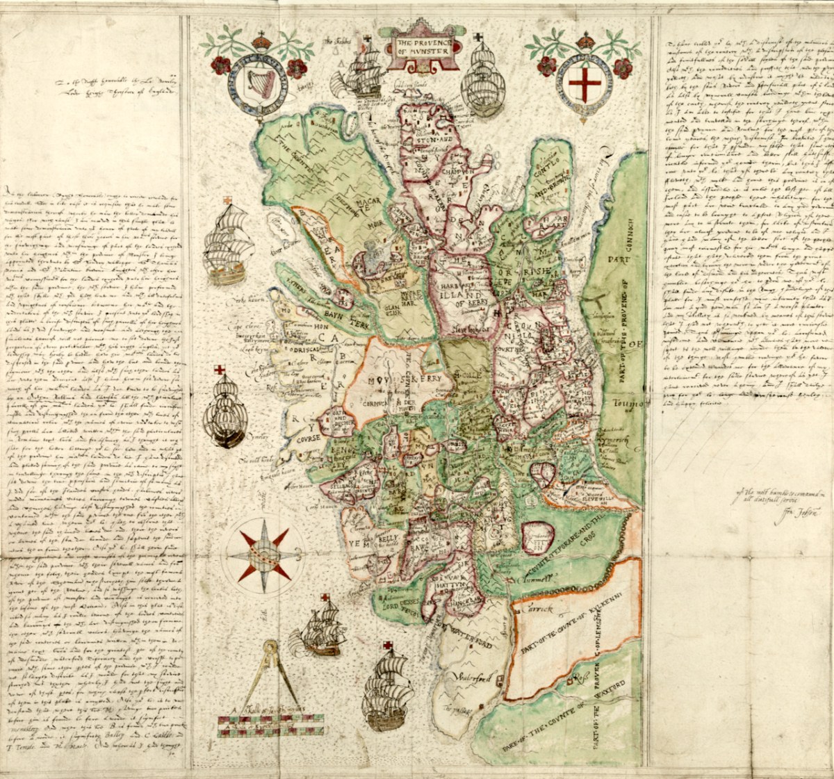
The Province of Munster Map is but one of this collection, now digitised and available for viewing in theDigital Repository of Ireland. And an excellent job they have done of it – the high-resolution image is so clear that it allows us to zoom in and see lots of detail. Here is the complete map.
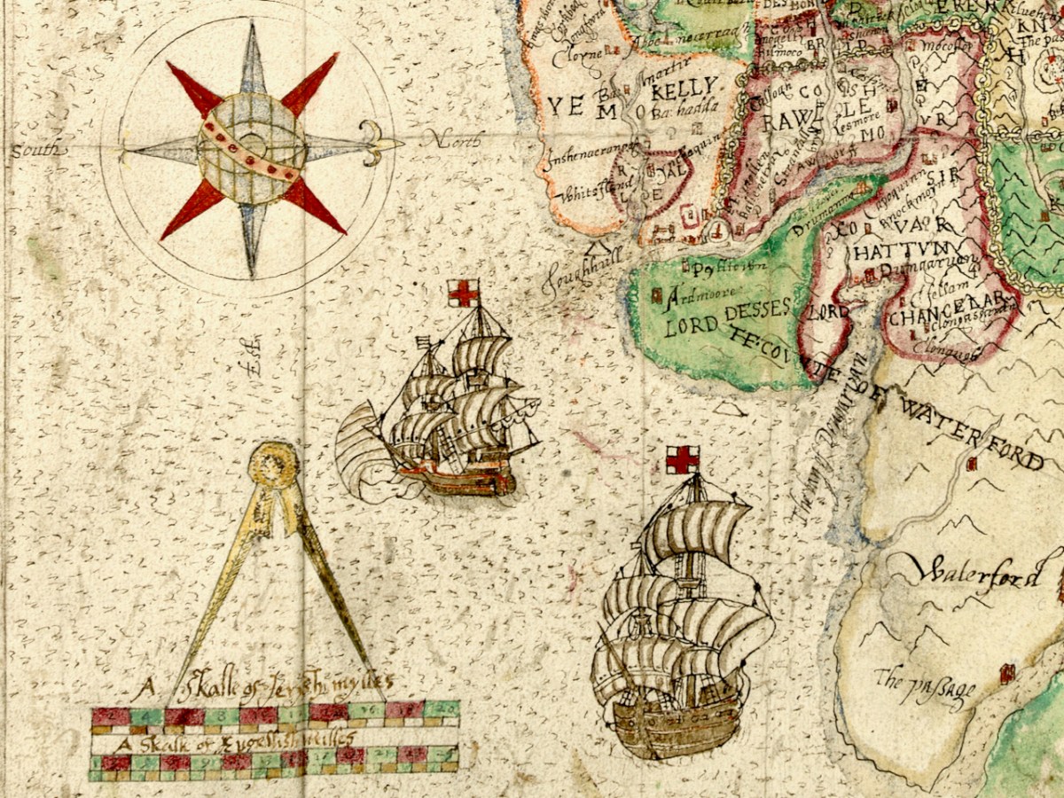
The first thing that strikes the modern viewer is that Ireland is on its back – that is, instead of north being at the top, west is. This wasn’t unusual for the time. JH Andrews, one of Ireland’s foremost cartographic historians explains it thus, With east at the bottom, Dublin, the Englishman’s point of entry to Ireland, is the point on the map nearest him. To provide a more normal orientation, I have turned the map sideways, below, so you can assess how accurate it is.
The task facing Jobson was to provide as clear information as possible for the colonising effort. Any kinds of fortifications, where the Irish could defend their territory, were important, as were transportation corridors, by sea, river or land, as well as barriers to movement, such as mountains or dense forests. Control of the fisheries had generated great wealth for the Irish chieftains so it was important to have details of coastal areas.
Speaking of Jobson’s Map of Ulster, Annaleigh Margey says
His maps are crucial to our understanding of England’s changing relationship with Ulster at the end of the sixteenth century. As the Nine Years’ War began, Jobson provided representations of the Gaelic lordships in Ulster, but also imposed England’s vision for the creation of a new county system onto the provincial landscape. In Jobson’s 1598 map, now at Trinity College, Dublin (p. 42), this framing of the new political geography is obvious. Throughout Ulster, the various Gaelic lordships are denoted by the lord’s name and a line defining their boundary. Settlements such as castles and churches that could be integrated into English settlement plans are displayed by small replicas in red across the map.
She could well have been speaking of the Map of Munster. The principal families and their territories are all presented, as well as their main castles. While West Cork is not rendered accurately, we can see what Jobson felt was important to include. The O’Mahonys (Mahound) are there and the castles shown for them are Dunbeacon, Rossbrin and Ardintenant, which is labelled C o mahoun, as befits the castle of the Chief (see my post on Ardintenant here). The whole of Ivaha (now the Mizen Peninsula) is assigned to Mohon (spelling was approximate in these maps) and Crookhaven is indicated, probably because it is an excellent harbour.
The O’Driscolls are shown at Baltymore, with Castles also on Sherkin (Ineseyrkan) and Cape Clere. The Ilen River is shown as the Ellyn ff (ff or flu is often found on old maps to designate a river). Interestingly, the whole of the Sheep’s Head has no detail on it and only one word – Rymers. The O’Dalys were the traditional bards of several Irish families and they had their bardic school near Kilcrohane – they are The Rymers! The Abbey in Bantry is noted (in fact it was a Franciscan Friary) – and even Priest’s Leap is on this map. Once the only land route between Bantry and Kenmare, it is now a steep, treacherous and extremely scenic back road.
We have only just started looking at this map. The next post will continue the journey. Meanwhile – have a look yourself and see what you can see. I have lots of questions about it – for example, about the scale that Jobson uses (above) – I am hoping our readers might have some answers!
I am grateful indeed to Michelle Agar, Cataloguer, Digital Collections, at the Library of Trinity College Dublin, who gave permission to feature the map from the Hardiman collection in this blog. Also to the kind office of Dr Áine Madden, Communications and Engagement Coordinator with the Digital Repository of Ireland at the Royal Irish Academy. The complete citation for the map is as follows: Jobson, Francis, & Manuscripts & Archives Research Library, Trinity College Dublin. (2021) The Province of Munster, Digital Repository of Ireland [Distributor], Trinity College Dublin, the University of Dublin [Depositing Institution], https://doi.org/10.7486/DRI.rb69b272p
I am also grateful to the British National Portrait Gallery, who provide an easy method to use images from their collection under license, for purposes such as this non-commercial blog
Welcome to the UCD Library Cultural Heritage Collections blog. Discover and explore the historical treasures housed within our Archives, Special Collections, National Folklore Collection and Digital Library