Spring Green

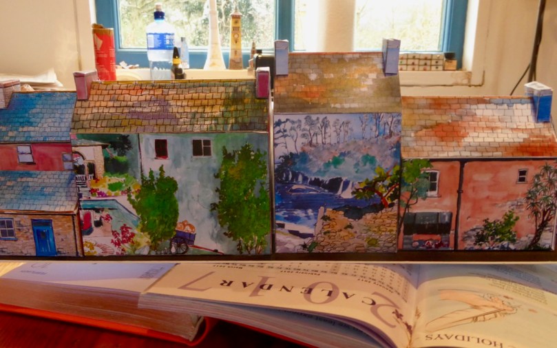
Spring comes early this year – on the 20th of March instead of the 21st. It’s all to do with the precession of the equinoxes. But you might follow the old tradition (and why wouldn’t you?) that Spring begins on St Brigid’s Day – the 1st of February. We have been having many good, clear – and warm – days of sunshine since then, to balance out all the cool and wet ones, and the days are ‘drawing out’.

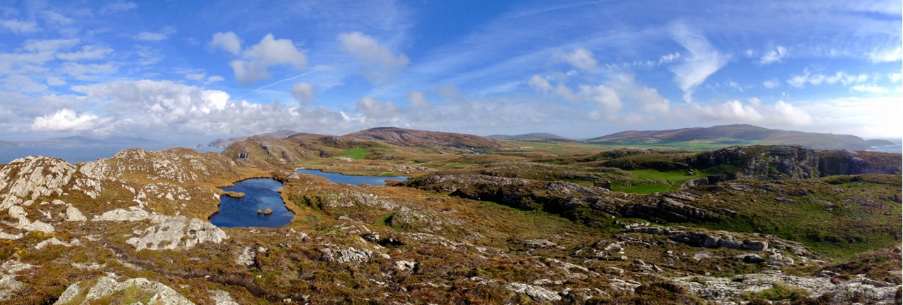
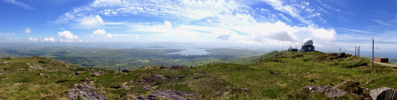
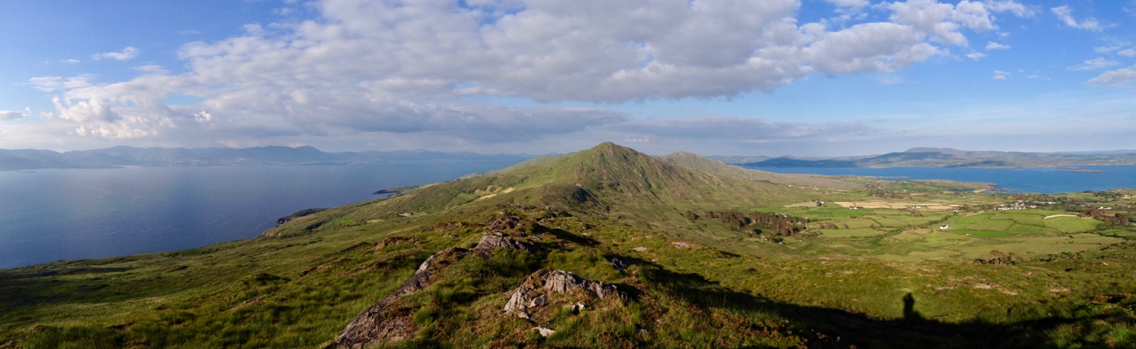
Ireland’s green landscapes presented using the panorama technology of a phone camera! Top – the two lakes at Dunlough, above Three Castle Head, Mizen Peninsula; centre – view across Roaringwater Bay from the top of Mount Gabriel; lower – Peekeen ridge, Sheep’s Head Peninsula

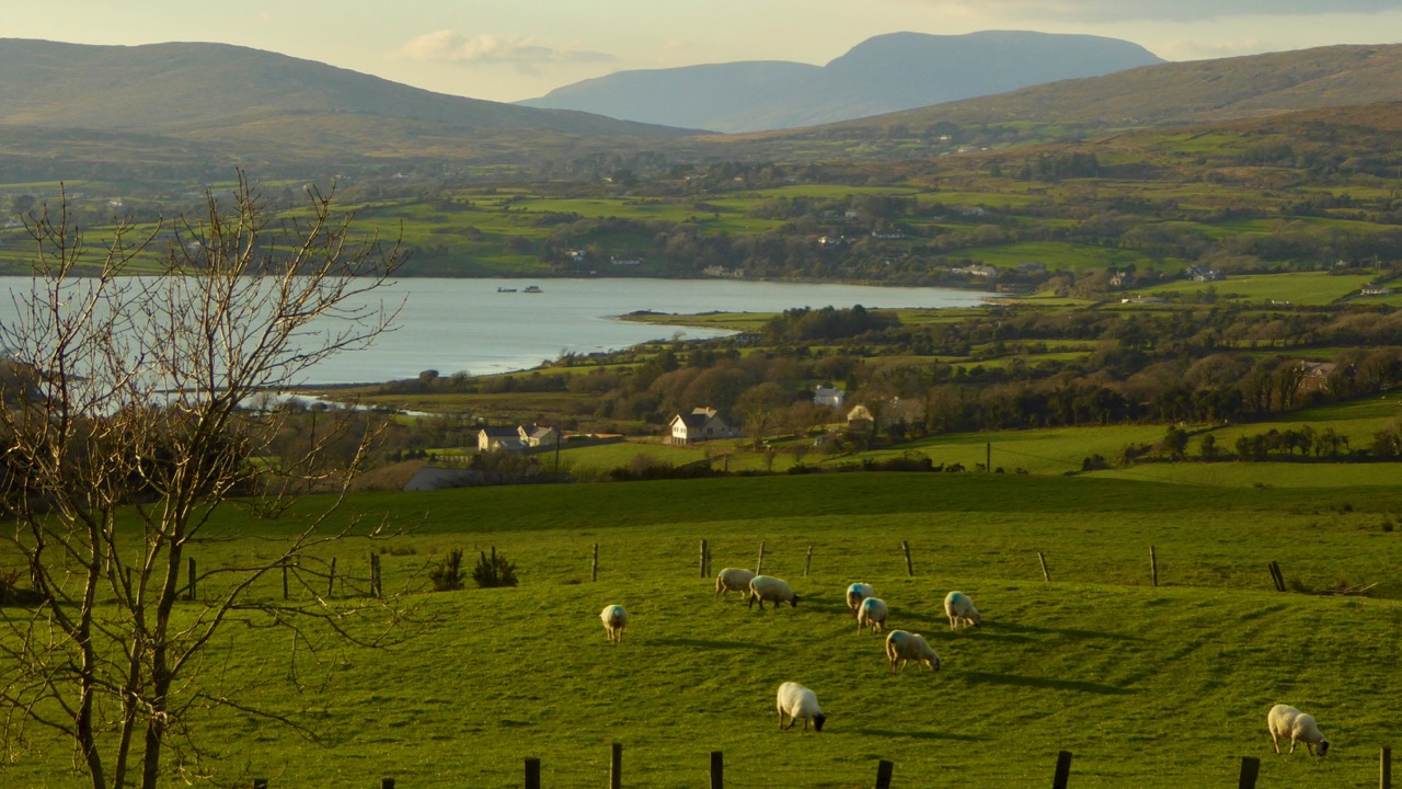
It’s the abundance of weather – in all its varieties – that makes Ireland’s landscapes so green, and so beautiful: as we are not so far from St Patrick’s Day (last week, when everything turned green!) today’s post is a celebration of the special colour as we find it around us. Finola mentions it today, but in a different context.

…When Erin first rose from the dark swelling flood,
God bless’d the green island and saw it was good;
The em’rald of Europe, it sparkled and shone,
In the ring of the world the most precious stone…

(William Drennan 1754 – 1820)

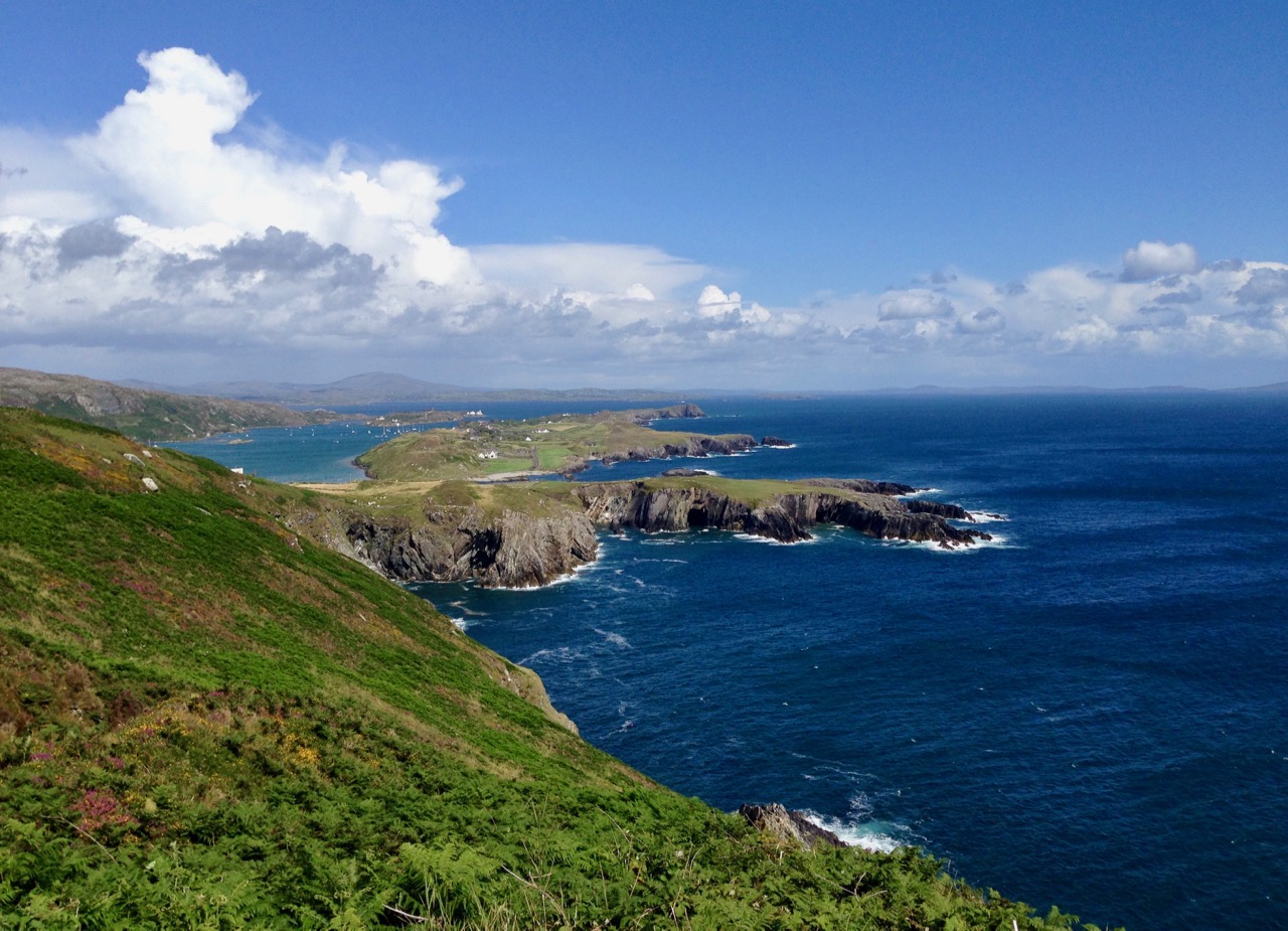
Where Ireland’s most westerly land mass dips into the Atlantic: looking east from Brow Head towards Crookhaven

…Ireland, it’s the one place on earth that heaven has kissed with melody, mirth, and meadow and mist…
(Old Irish Blessing)

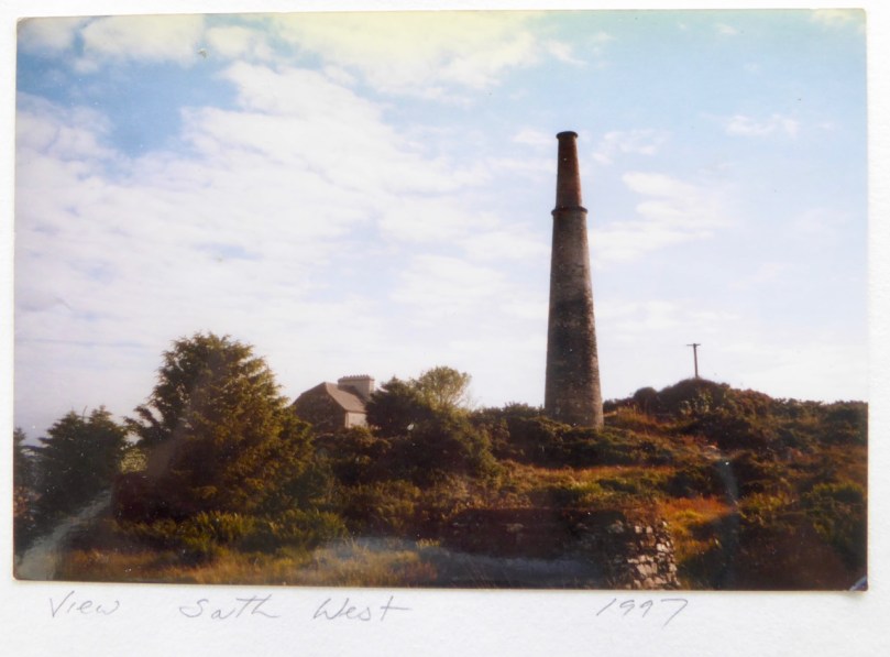
Rossbrin Cove – with its ancient castle lost in the mist – seen from the green fields of Cappaghglass

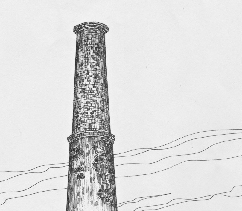
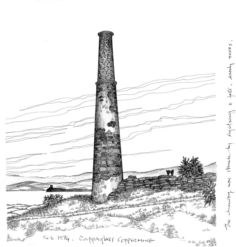
In our own townland of Cappaghglass we have vivid green pastures but also, up on the old mine road, colours that constantly change with the seasons. It’s too early yet for the abundance of wild blooms that will transform the hedgerows and verges – we’ll watch out for those.

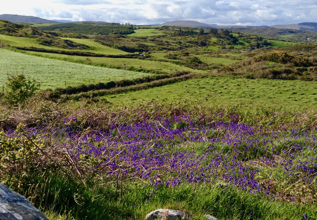
Cappaghglass: upper – a kaleidoscope of colours along the mine road, waiting for the Spring; lower – the colour green proliferates when the wildflowers appear

…When I come out on the road of a morning, when I have had a night’s sleep and perhaps a breakfast, and the sun lights a hill on the distance, a hill I know I shall walk across an hour or two thence, and it is green and silken to my eye, and the clouds have begun their slow, fat rolling journey across the sky, no land in the world can inspire such love in a common man…

(Frank Delaney)

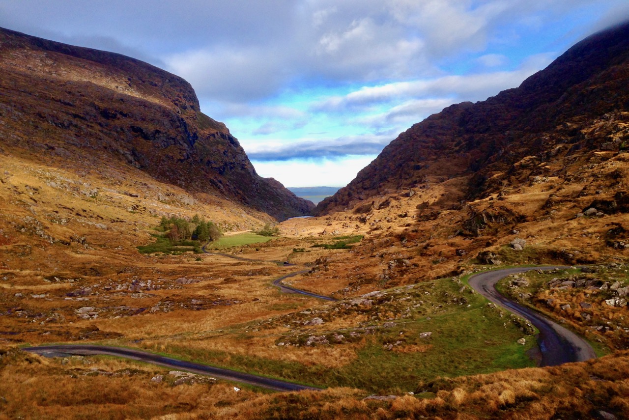
One of Ireland’s spectacular roads makes its way through the Kerry mountains

Her eyes were like two sparkling diamonds
Or the stars of a bright frosty night
Her cheeks were like two blooming roses
And her teeth of the ivory so white
She resembled the Goddess of Freedom
And green was the mantle she wore
Bound round with the shamrock and roses
As she strayed along Erin´s green shore

(Mick Moloney)

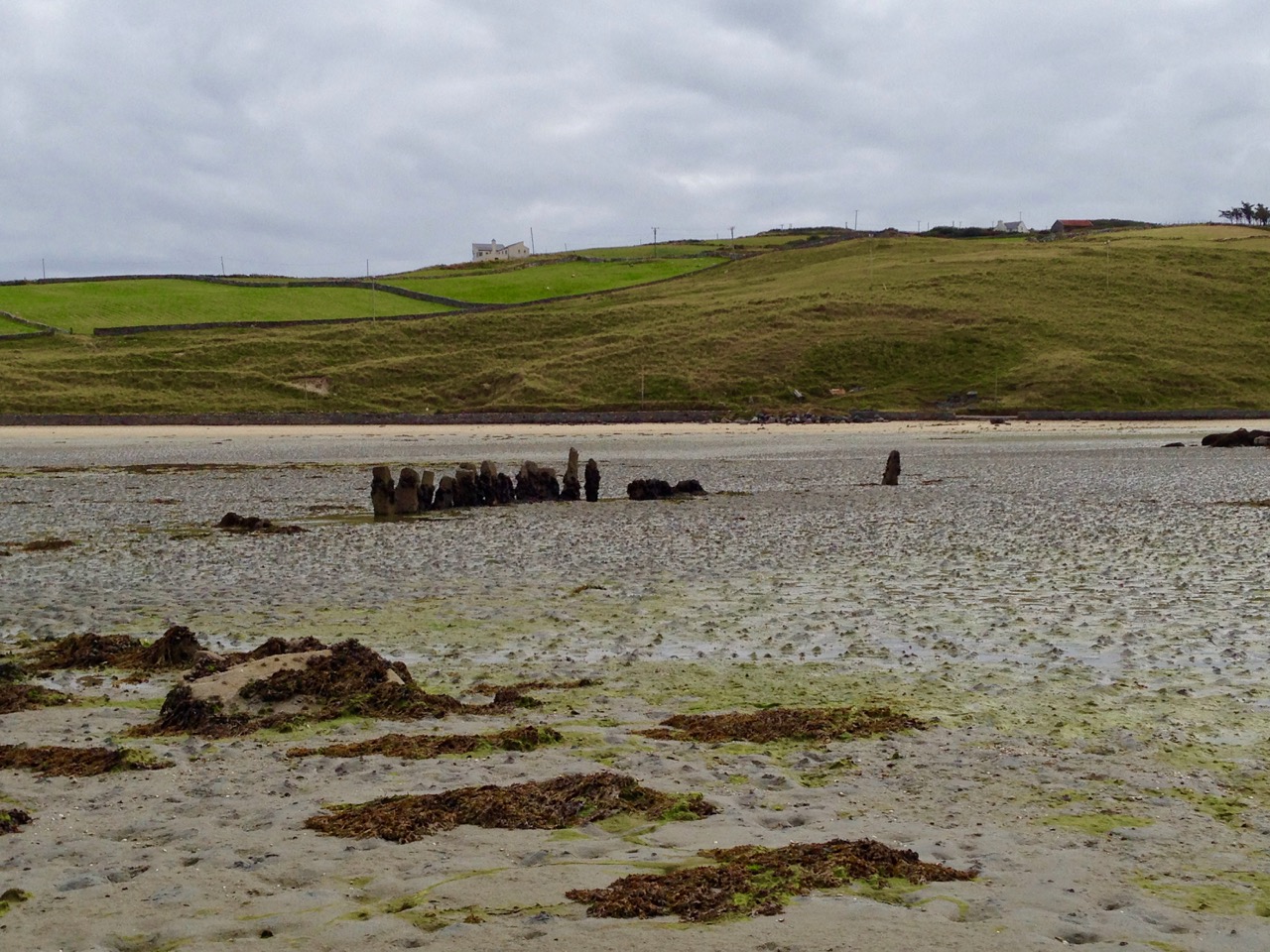
Erin’s green shore: upper – our own Roaringwater Bay: Horse Island just off the coast and Cape Clear beyond. Lower – the tide is out below Brow Head, Crookhaven, exposing an ancient stone row which has been drowned by rising sea levels

…The gorse was in bloom, the fuchsia hedges were already budding; wild green hills, mounds of peat; yes, Ireland is green, very green, but its green is not only the green of meadows, it is the green of moss – and moss is the plant of resignation, of forsakenenness. The country is forsaken, it is being slowly but steadily depopulated…

(Heinrich Böll – 1957)

…There is not in the wide world a valley so sweet
As that vale in whose bosom the bright waters meet;
Oh! the last rays of feeling and life must depart,
Ere the bloom of that valley shall fade from my heart…

(Thomas Moore)

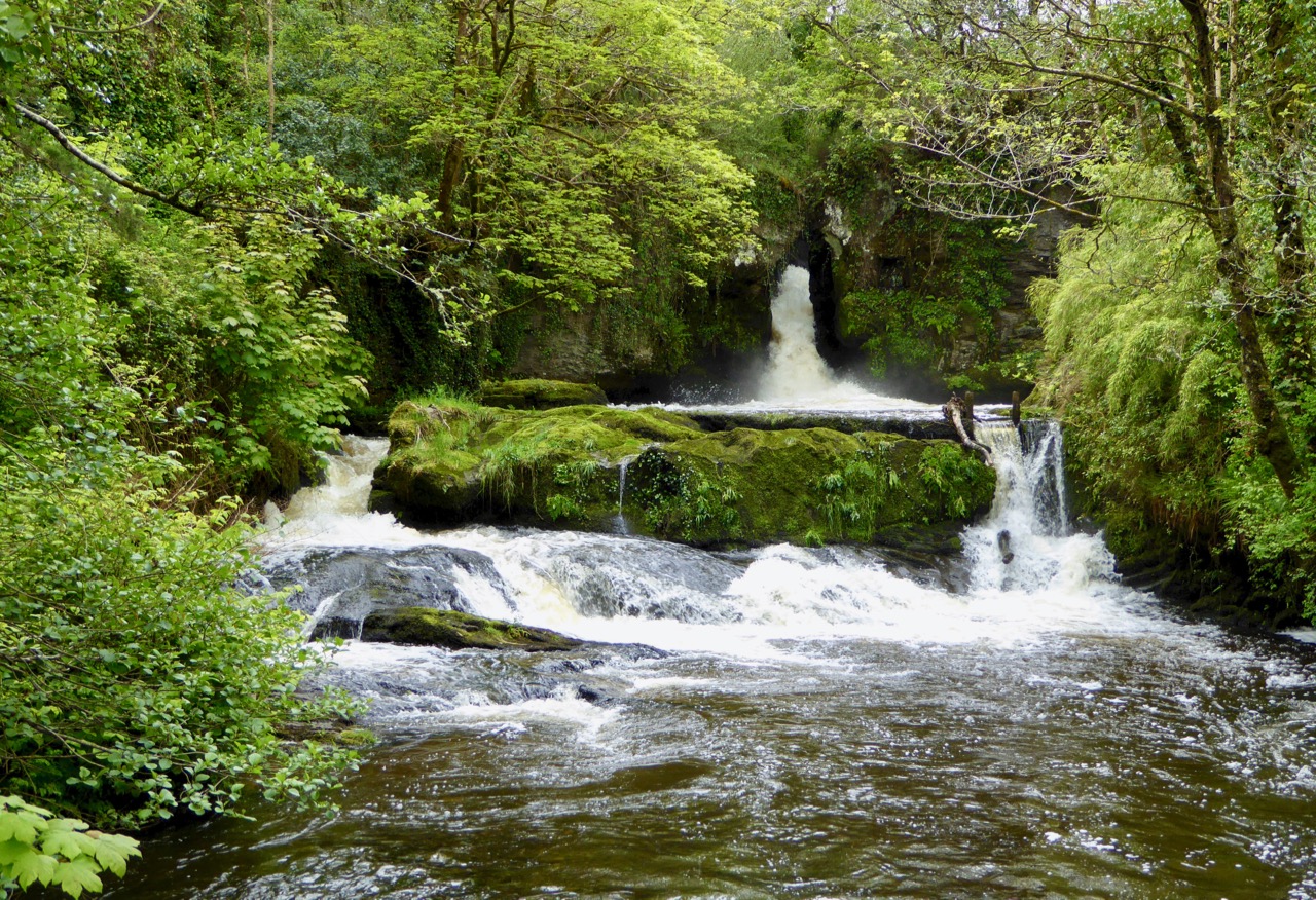
The meeting of several waters here at Donemark Falls, just north of Bantry

…Sure a little bit of Heaven fell from out the sky one day and it nestled on the ocean in a spot so far away. When the angels found it, sure it looked so sweet and fair, they said, “Suppose we leave it for it looks so peaceful there.”
So they sprinkled it with stardust just to make the shamrocks grow. ‘Tis the only place you’ll find them no matter where you go. Then they dotted it with silver to make its lakes so grand and when they had it finished, sure they called it Ireland…

(Linda Weaver Clarke)

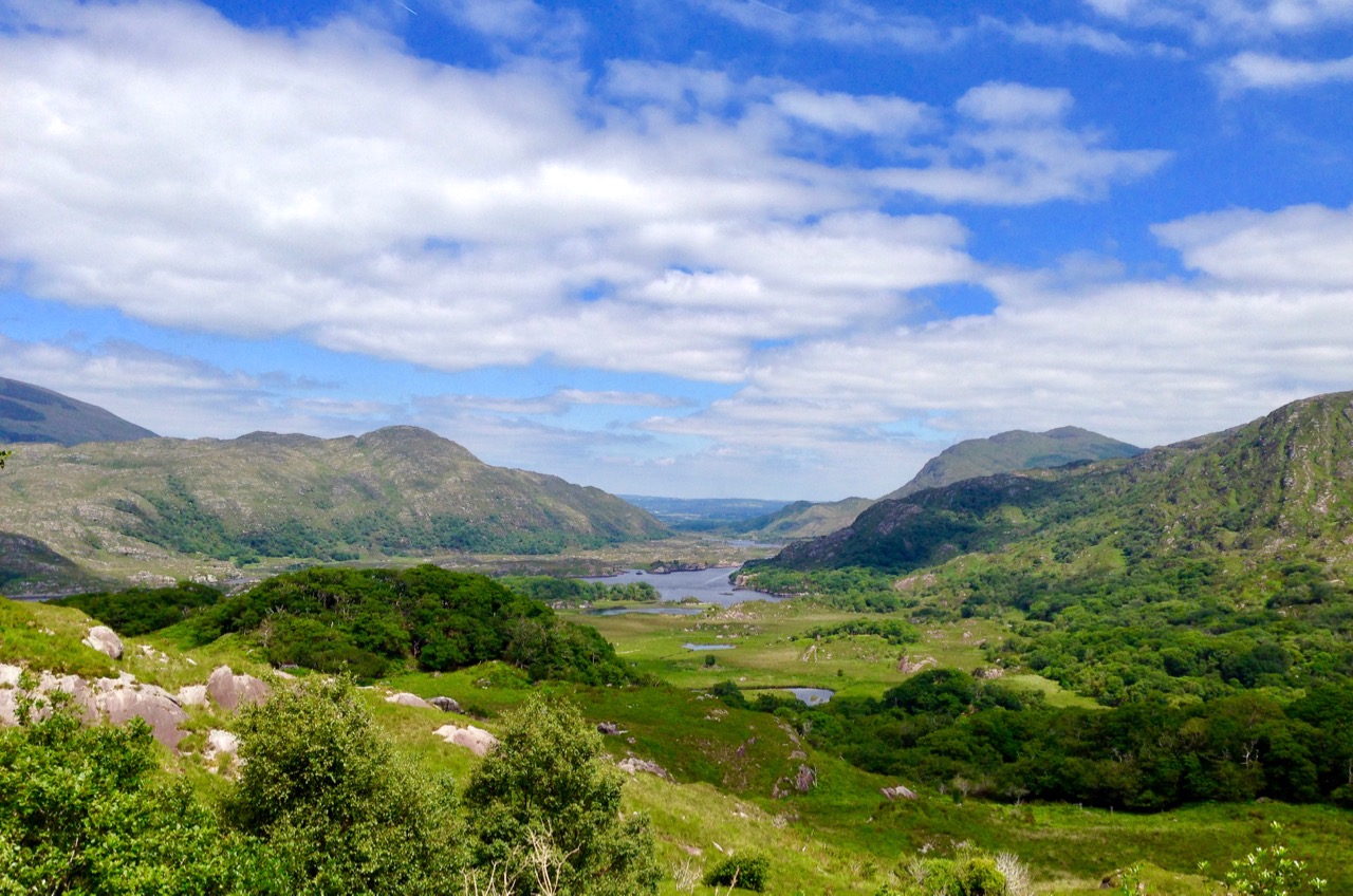
The Lakes of Killarney, Co Kerry

The seas in which Ireland floats are as variegated in colour and texture as the landscape itself. Should our last words on this go to James Joyce…?

…The sea, the snotgreen sea, the scrotumtightening sea…

(James Joyce – Ulysees)

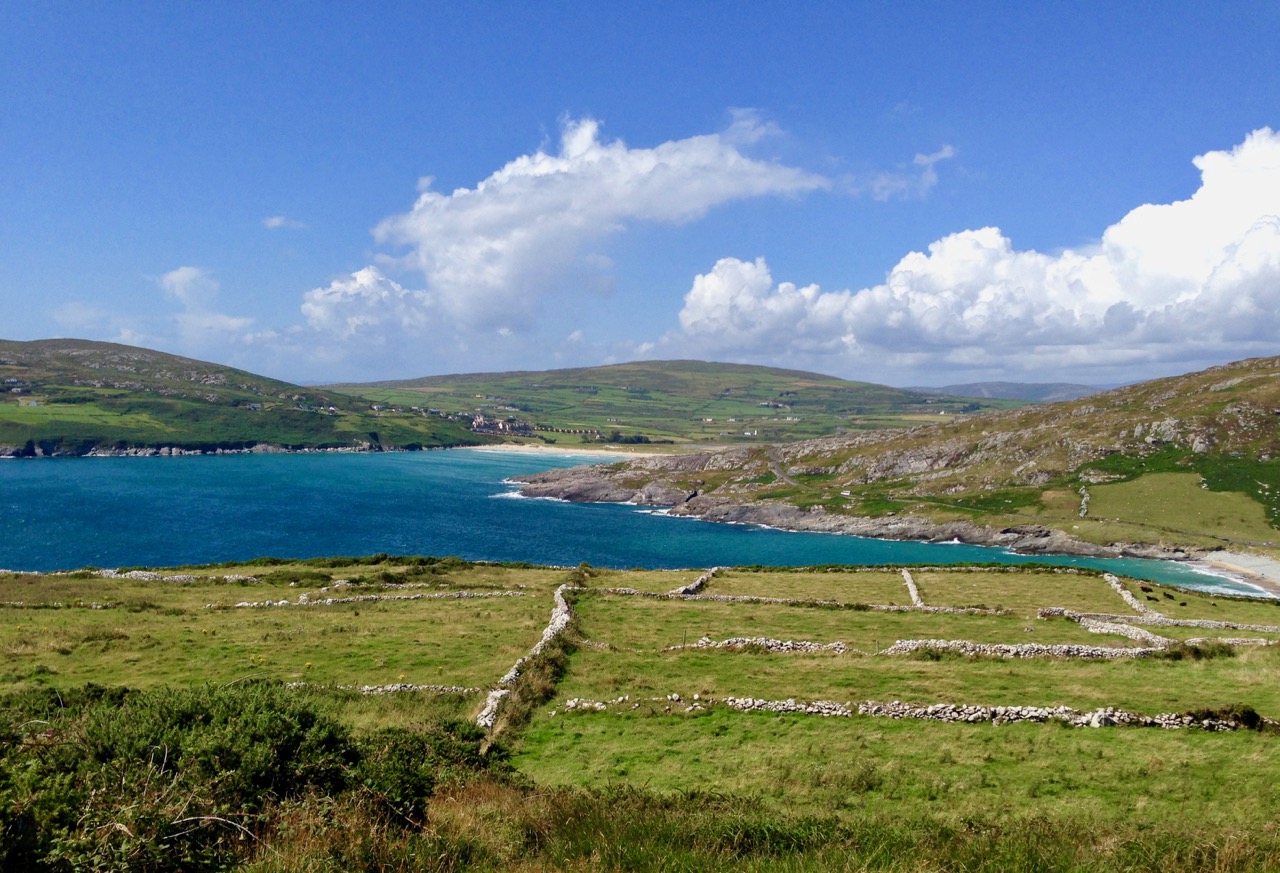
Ancient fields on Brow Head, Mizen Peninsula, looking towards Barleycove

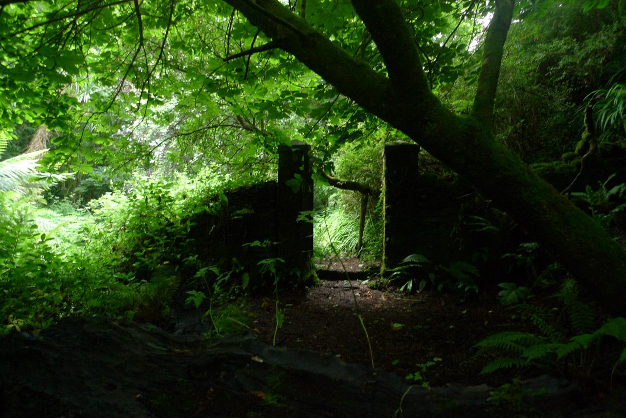
All beauty is in the fine detail, we are told. The panoramas, the wide views, the seascapes are unbeatable – but, sometimes, it’s just the simplicity of a gateway that invites you in to explore this verdant island…

Orange to Green – For the Week That’s In It

Right so…where were we when we got interrupted by the bould Saint Patrick? Ah yes, on the red side of the colour wheel. Let’s keep moving, so, on to orange and through the yellows till we hit the greens. (For anyone tuning in for the first time, take a look at Purple and Pink, which also has links to previous posts on our penchant for colourful buildings.)

Biggs is an iconic building in Bantry

We’ll start with the orangey ones (except I couldn’t resist heading off with this gorgeous house on the Beara Peninsula). Orange is a startling shade but also surprisingly sophisticated.

Timoleague (top) and Leap

And some times just plain fun. Nothing like a splash of sunshine to brighten your day!

Kinsale (top) and Goleen

On to the yellows – a favourite of many, it seems, both shop-owners and householders.

Kinsale, Clonakilty, Kilmallock

Depending on the trim, yellow can seem quite electric. I love this shop in Millstreet (above)

This one is in Aghada, East Cork

Wonderful collection of colours on and around this farmhouse
More Kinsale
Eyeries, on the Beara, is one of the most colourful villages in Ireland. It’s where you’ll find the rainbow

The Ludgate Centre, in Skibbereen. It’s just as colourful inside

I’ll stop just shy of true greens and leave them and the blues for next time. The limes, above and below, are the exact right transition colour from yellow. Don’t you agree?

A real beauty, in Kilgarvan

And, if you really need your green fix NOW, head over to Robert’s post, Spring Green.

Purple and Pink – and Everything in Between

Purple house, colourful

You all know of my fascination with the colourful houses that dot the Irish countryside. It’s been a while since I posted about them so for new readers, check out A Lick of Paint and An Extra Lick of Paint and All the Trimmings.

Union Hall Pink

colour-wheelToday I am concentrating on the red side of the colour wheel – from purple to pink. We’ll stop where it shades into blue at one end and orange on the other. This gives us a vast range to choose from and, because it’s all diametrically opposite the greens of the Irish countryside, guarantees that the house will stand out in the countryside.

It’s always a wonderful surprise to come around a corner on a tiny boreen and discover something like this…

Red, Mill Little

Or this…

Pink, North of Skibb

Or this.

colourful, north of Skibb

I’ve included a few shops as well, because – Kinsale! Located on the southernmost extent of the Wild Atlantic Way, it’s one of the most colourful of all Irish towns and a delight to stroll around.

Purple in Kinsale

Janey Mac Purple in Kinsale

But it’s by no means the only colourful village – lots of other examples here too. Ballinspittle, for example – home of the famous grotto of the moving statue – is a kaleidoscope of colour.

Ena's, Ballinspittal

Ballinspittal red and yellow

Humble terraced cottages can assert their individuality through subtle architectural variations, or through one huge difference – colour!

Kilbrittain Purple

colourful in Millstreet

The main streets of towns and villages are enlivened with splashes of bold colour that catch the eye and brighten your day.

Red and Lilac Timoleague

Purple and red, Ballinspittal

Perhaps one of the best examples I’ve seen of how a building can be transformed by colour comes from our own Ballydehob. Here is the old bank building, abandoned and unloved.

Bank House Before

And here it is now – our vibrant Bank House, home to the Tourist Information Centre and all kinds of events and occasions. As I said – purple and pink display to excellent advantage when contrasted with green!

Bank House from above

Next time we’ll wander over to a different area of the colour wheel. I’ve seen some mighty oranges and limes lately!

Lost Landmark

Photo 97It’s a sad thing to lose an iconic landmark. You know the kind I mean – the one that’s in every photo of the place, the one that helps to define it, the instantly recognisable image. In the case of West Cork, that would include the Mizen Bridge, the Galley Head Lighthouse, Ballydehob’s Twelve Arch Bridge, the castles at Three Castle Head, Bantry House, the Baltimore Beacon and of course the Fastnet Rock.

The morning after the lightening strike

The Cappaghglass Mine Chimney the morning after the lightning strike

But we used to have another one, until it was hit by lightning and came down in 2002, 15 years ago this month. The mine chimney at Cappaghglass stood tall on the crest of the hill, visible for miles around from Mount Gabriel to Cape Clear, from Long Island to Baltimore.

View from magazine

I don’t know the origin of this drawing. It’s a view of both mine captain houses and the chimney, taken from the south near Audley Cove

It was the most visible manifestation of the industrial past that has vanished so completely from this area. When it was built (to replace an even older one) in 1862 it was to vent steam from the engine that powered crushing machinery. Robert has written about the mining industry here – take a look at his post, Copper Country. At its height, hundreds of people were employed, above and below ground in the Cappagh Mine and what is now a lonely stretch of heathery hilltop was once a populous place.

Fastnet Trail sign

The chimney was so conspicuous on the landscape that it was used by the Admiralty to provide a reference point for mariners and by travellers to orient themselves in West Cork.

Admiralty Chart

Admiralty chart showing the ‘Steam Chimney’ as a reference point

As many landmarks are, it was also a favourite spot with locals – a place to walk out to on a fine summer’s evening or to bring your visitors to so they could admire the panoramic views over Roaringwater Bay and listen to tales of a grandfather’s backbreaking labour in the mines.

Jan Clement print

The storm that roared in on the afternoon of February 9 in 2002 came with no warning. It slammed into Cappaghglass with a noise like a jet engine. The first lightning strike killed several cows on an adjacent field, the next brought down the chimney and one after that hit the telephone wires causing a powerful surge to explode into the old Mine Captain’s House, by then the comfortable and modernised home of Terri and Mark O’Mahony and their family. The impact was devastating (we’ve seen the pictures) – the house was ruined and everyone inside was incredibly lucky to escape with relatively minor injuries.

Chimney stump

The chimney stump today

The O’Mahonys have rebuilt the Mine Captain’s House, but all that remains of the chimney is a stump. There was talk of reconstructing it but this never happened. In circumstances like this, all we have are the images that we can gather together to remind us of what an iconic structure this was. Fortunately, there are photographs and works of art extant that bear witness to how it dominated the landscape and that help us understand how it became such a beloved feature of the countryside.

Photo 97 to SW

Among the images that remain is a charming drawing by Brian Lalor (yes, he of Brian’s Sketchbook fame), commissioned by friends to celebrate Mark O’Mahony’s birthday. It shows the chimney and the house and since it was done in 2002 it must have been just before the lightning strike.

Lalor 2002 sketch

But last week a new image emerged – Brian came across a pen and ink drawing he did in 1974 and he has allowed me to use it in this post. Because Brian unites the eye of the artist with the training of the architect and archaeologist, this is an important new piece of documentary evidence, as well as being a work of art. Thus we can see that the lower two-thirds of the chimney were made of stone, with render still clinging to the outside in patches. The top third is brick, separated from the stone by a corbeled course of expertly laid brick – a feature that is repeated at the top of the chimney also.

Lalor Cappaghglass Chimney – closeup

In Brian’s drawing the chimney stands splendidly on the hill like a round tower and its medieval resonance is echoed by the distant castle across the water.

Lalor Cappaglass Coppermine

My thanks to Mark and Terri O’Mahony for allowing me to use their photographs and drawings in this post, and to Brian Lalor for giving me a copy of his sketch. It’s lovely to have this evidence – but of course I can’t help regretting that the chimney is gone forever.

Mining area

Cappaghglass now

Tiny Ireland

Bunratty Castle

If you live around here or have visited Ireland you’ve seen them in all the best gift shops: Tiny Ireland – those intriguing paper models of Irish buildings and towns that make the perfect gift.

Top photograph: Bunratty Castle. Above: Skibbereen, the model and the real thing, and Tiny Cobh

They say that a true craftsperson makes it look easy. But this week we visited Tiny Ireland in her studio and found out first hand just how much talent and research and imagination goes into every single detail.

Anke with boxed Gallarus

Anke shows us her Tiny Gallarus

And who is Tiny Ireland? Meet Anke Eckardt. She’s lived here in West Cork since she was a little girl, plays a mean tin whistle, is an artist, a master joiner and boat builder and joint owner with Rui of West Cork Boats. The idea for Tiny Ireland came to her when she made some paper models with and for her son Fionn to complement his train set. That was ten years ago. She has been making models ever since, but devoting herself seriously to it for the last five years.

Designer at work – Anke in her studio. Full marks for anyone who can guess the pub she’s working on.

Anke starts with familiarising herself with the town or village. She wanders round with her camera, talks to everyone, gets a feel for the place, and then does extensive research on the history of the area. In the case of West Cork, like any other native she already knows every inch of it – the stories, the atmosphere, the iconic buildings, the colours and contours of the landscape. She tries to capture that same sense of place wherever she goes.

UCC

GPOTop: Both Anke and I went to University College Cork and the Quad holds a special place in our hearts. Bottom: Anke’s contribution to the 1916 commemorations – the General Post Office in Dublin

Back in the studio she decides on which buildings to use and starts drawing and painting and figuring out what should go where on the model and what extra details to include. Each building occupies one sheet in the kit. Anke wants each sheet to be a beautiful object in itself, to be poured over before you even start the scoring and cutting process. Can you imagine the cleverness it takes to construct even one building? Add to that all the little details that go into making it unique and contributing to its cultural and geographic character.

Glucksman Gallery in box

Not just traditional buildings! Here is the ultra-modern Glucksman Gallery at UCC

We came home with a Tiny Kenmare kit so that we could experience the assembly process first hand. Not only was this great fun but it gave us additional insights into both the craft of model making and the lovely additional details that Anke has inserted into each piece – details that extend the model into little bits of history.

Robert assembles Packie’s Pub

The second Kenmare building we assembled was O’Donnabháin’s pub and guest house (pronounce it O Dunn-eh-vawn’s). Look around the side – Anke has added the image of a funeral coming over a suspension bridge. Curious, I looked up what this was all about and found that Kenmare did indeed have the first suspension bridge ever built in Ireland – read an amusing account of its history here – and that the funeral was a real one, that of an IRA man murdered by the Black and Tans in 1921.

Kenmare Funeral

On the shelfKenmare is as scenic and colourful as any town anywhere has a right to be. It’s a great shopping town too, with wonderful cafes and pubs, and right on the justly-famed Ring of Kerry.

Colourful Kenmare 1

Every model Anke makes is unique and delightful. Individual pubs, shops, castles, etc are often made at the request of the owner. Here’s one for Tigh Neachtain in Galway. Anke showed us a draft of the Explanation sheet that goes with it. It’s an object lesson in how one building can encompass the story of a town. Richard Martin, by the way, is better known to history as Humanity Dick.

Tig Neachtain

Tig Neachtain ExplanationFor tourists, Tiny Ireland models make the perfect gift, light and packable and chock full of the real Ireland. For all of us, making one engages us in a creative act that comes out of the rich imagination and artistic talent of Anke Eckardt.

Tiny Bantry

Evans InteriorTiny Bantry – note Miss Evans traditional shop on the right. Here’s what it’s like inside. For more on this and other traditional Irish shops, see Shopping for Memories

And it’s not just models. Recently Anke has started to produce charming watercolours of the traditional shops and pubs she loves. We in Ballydehob have loved her posts on our wonderful old shopfronts. Here’s an example – Just drive down our main street and you can’t miss The Chestnut Tree.

chestnut-tree

Happy cutting and glueing!

Around the back

Brian’s Sketchbook: The Signal Towers

Brow Head Buildings

We have received a unique and treasured gift – a sketchbook from the 1980s of prehistoric and historic sites around West Cork. It’s the work of our good friend, and national treasure, Brian Lalor, artist, writer and printmaker. For an overview of his style, check out the retrospective of his work at Graphic Studio Dublin. Or browse the long list of his books, including the magnificent Encyclopaedia of Ireland, which he edited.

Marconi Station, Brow Head

Brow Head: (above and below) on the right is the Napoleonic-era Signal Tower; the other buildings date mainly from the time of the Marconi Telegraph Station, taken from a different angle than the sketch above

Brian has studied both architecture and archaeology and to that adds the keen observant eye of the artist. As a result these sketches, although, as he explained, often hastily done during a brief visit to a site, are accurate, detailed and charming in equal measure. They were made on field trips with the Mizen Archaeological & Historical Society in the 1980s. This was an active society, publishing a well-regarded journal from 1993 to 2004 and leading regular field trips for members.

Brow Head ruined building

The sketches, just over 50 of them, were made for the most part between 1980 and 1987 so besides their intrinsic artistic value, they also constitute an important record of the state of the site 30 years ago, allowing us a comparison with its current condition. My intention is to visit (or re-visit) a lot of the sites, with his sketches in hand and show our readers both how beautifully Brian captured the structures or artefacts at the time and whether there are any changes visible from then to now. I decided to start with the Signal Towers on Cape Clear and Brow Head, and a third tower on Rock Island that may or may not be contemporaneous.

Wolfe Tone front

Theobald Wolfe Tone – detail of the statue in Bantry town square

In 1796 the French navy, partly at the invitation of Wolfe Tone and the United Irishmen, staged an unsuccessful invasion of Ireland, sailing into Bantry Bay. Several raids followed in 1798. Although all were quickly quashed, a panic about the possibility of a French invasion spread throughout Britain and Ireland. A series of Napoleonic-era fortifications and viewing towers were constructed around the coast in locations with panoramic views, and within sight of each other, to spot foreign shipping activity and raise the alarm. On the east coast, these mainly took the form of Martello Towers and were stocked with heavy armaments, but here in the south west defensible Signal Towers were built not to house artillery but as advanced-warning stations. Here and there they were complemented by batteries and other fortifications – but that’s a story for another day.

Cape Clear Signal Tower

The Cape Clear Signal Tower

Signal towers were built around the coast to the same plan – tall square towers with first-floor entrances and machicolations. From a distance, they look like the medieval tower houses I have posted about on several occasions but up close they are shorter and the windows are bigger. Internal staircases and partitions were made of wood, not stone and have generally not survived, so the signal stations are essentially shells. in both the Cape Clear and Brow Head example, the exterior slate cladding has survived remarkably well.

Brow Head Detail - signal tower

Brow Head Signal Tower – detail from Brian’s sketch

In his excellent article for the Irish Times, Nick Hogan describes the towers, how they were staffed, the accommodation provided and how the signalling was done:

The signalling system, referred to as an optical telegraph, required that each signal station be visible to its counterparts on either side. Sending a message involved raising and lowering a large rectangular flag, a smaller blue pendant and four black balls in various combinations along a system centred on a tall wooden mast. The stations also communicated with ships.

Cape Clear Towers

Signal Tower and Original Fastnet lighthouse, Cape ClearTop: Brian’s sketch of the Signal Tower and Lighthouse on Cape Clear Island, done in 1982; Below: how it looked in June, 2016, 34 years later

While many signal stations are lonely and isolated buildings glimpsed on distant headlands, abandoned since the mid-1800s, both the Brow Head and Cape Clear buildings had further phases of use. In Cape Clear a lighthouse was built in 1818 – a forerunner of the Fastnet Rock Lighthouse. It was so often shrouded in fog that it was abandoned in the 1840s. The buildings attached to the signal tower, built of brick and concrete, probably date to this period of occupation. The signal tower is built of stone, using techniques not far removed from medieval construction methods. The lighthouse provides a wonderful contrast, being built of cut granite blocks expertly measured, shaped and fitted. 

Cape Clear Deatil - Lighthouse

Cape Clear Lighthouse, detail from sketch

In June of 2016, when we visited, it looked exactly as it had to Brian and the Mizen field group – an indication, perhaps that somebody is looking after the site and that the few visitors who come (it’s quite a hike to get there) respect the heritage. [Edit: Since I wrote this, Brian has pointed out that in the Cape Clear Signal Tower there is a porch under the machicolation in his drawing that has since disappeared. The outlines of the porch can be clearly seen in the photographs of the signal tower.]

Cape Clear Lighthouse

Brow Head is easier to access, and as a result there is more graffiti in evidence, but the changes to the site since Brian’s sketch are more the result of time and climate than any damage by humans. This is a complex site with multiple periods of occupation. The signal tower is there, of course, looking exactly as it did in the 1980s. Beside it is a network of buildings dating from the the early years of the 20th century: this is what remains of the Marconi Telegraph Station. Read all about this in Robert’s piece on Marconi, In Search of Ghosts. Besides the Marconi Station a Second World War Look Out Post was occupied here in the 1940s – little remains of this small concrete building except the characteristic half-round shape and a section of wall.

Brow Head octagonal?

Finally, on Brow Head there is a mysterious building that Brian labels ’14 – ’18 Gun Emplacement. This building no longer exists, and the ruinous remains that litter the ground seem robust enough to fit this inscription. Or do they? So – a mystery, and obviously  more research needed on our part. If any of our readers can help – let us hear from you!

Brow Head Detail - gun emplacement

The last tower is on Rock Island. It is clearly visible from the Brow Head Signal Tower ( a requirement for the placement of signal towers) but, strangely, it is one of two very similar towers on Rock Island, and while they are similar to each other, they are quite different from the classic signal tower design. However, both the National Monuments site  and the National Inventory of Architectural Heritage listings name them as Napoleonic-era Signal Towers, and perhaps that is indeed what they are.

Rock Island Tower

Brian’s sketch of the Rock Island Signal Tower

However, in discussion with Brian, he pointed out that most of the buildings on Rock Island were developed as part of a major Coast Guard installation around the same time as the Marconi Station, and we wonder if there might be a connection – that is, that these are Coast Guard-related Watch Towers, rather than Napoleonic-era Signal Towers. Once again – more research needed! [Edit: See comment from Navtell in comment section, below.]

Rock Island Signal Station

Rock Island Second TowerThe two towers on Rock Island: similar to each other but quite different from the classic Signal Tower on nearby Brow Head

This is only my first foray into Brian’s Sketchbook. Look out for more posts in the future and in the meantime, join with me in being grateful that a precious resource like this survived numerous moves and that we have the opportunity to learn from it.

Cape Clear Detail - Signal Tower

The Cape Clear Signal Tower