The Rocky Road to Nowhere

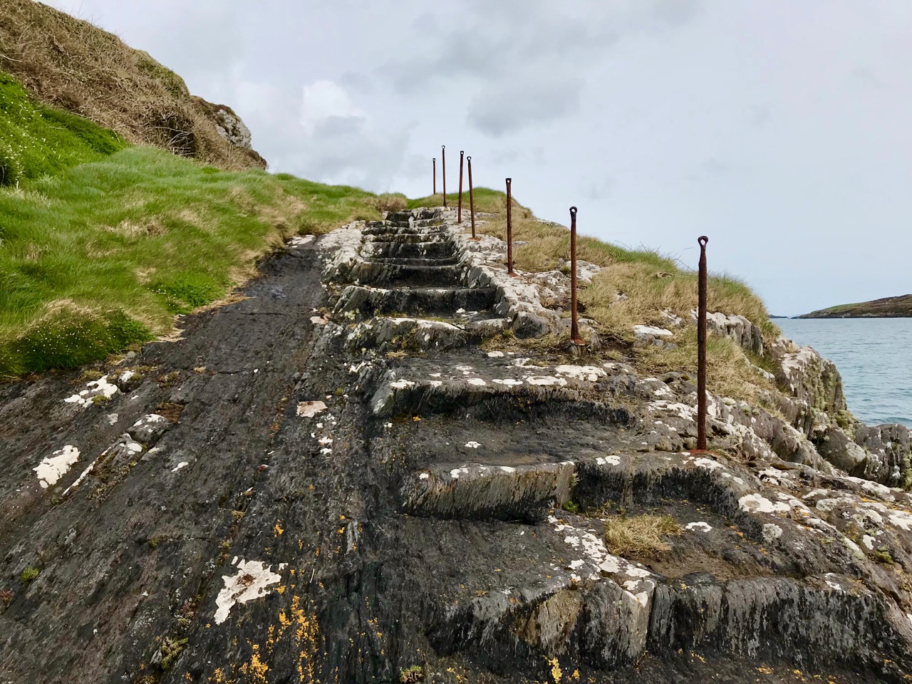
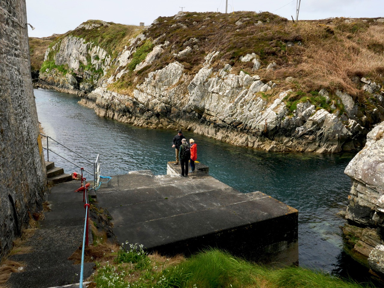
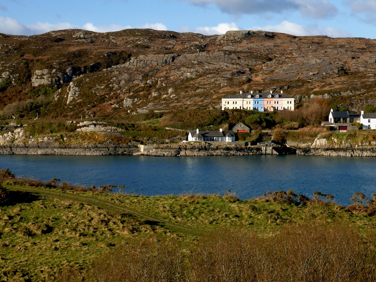
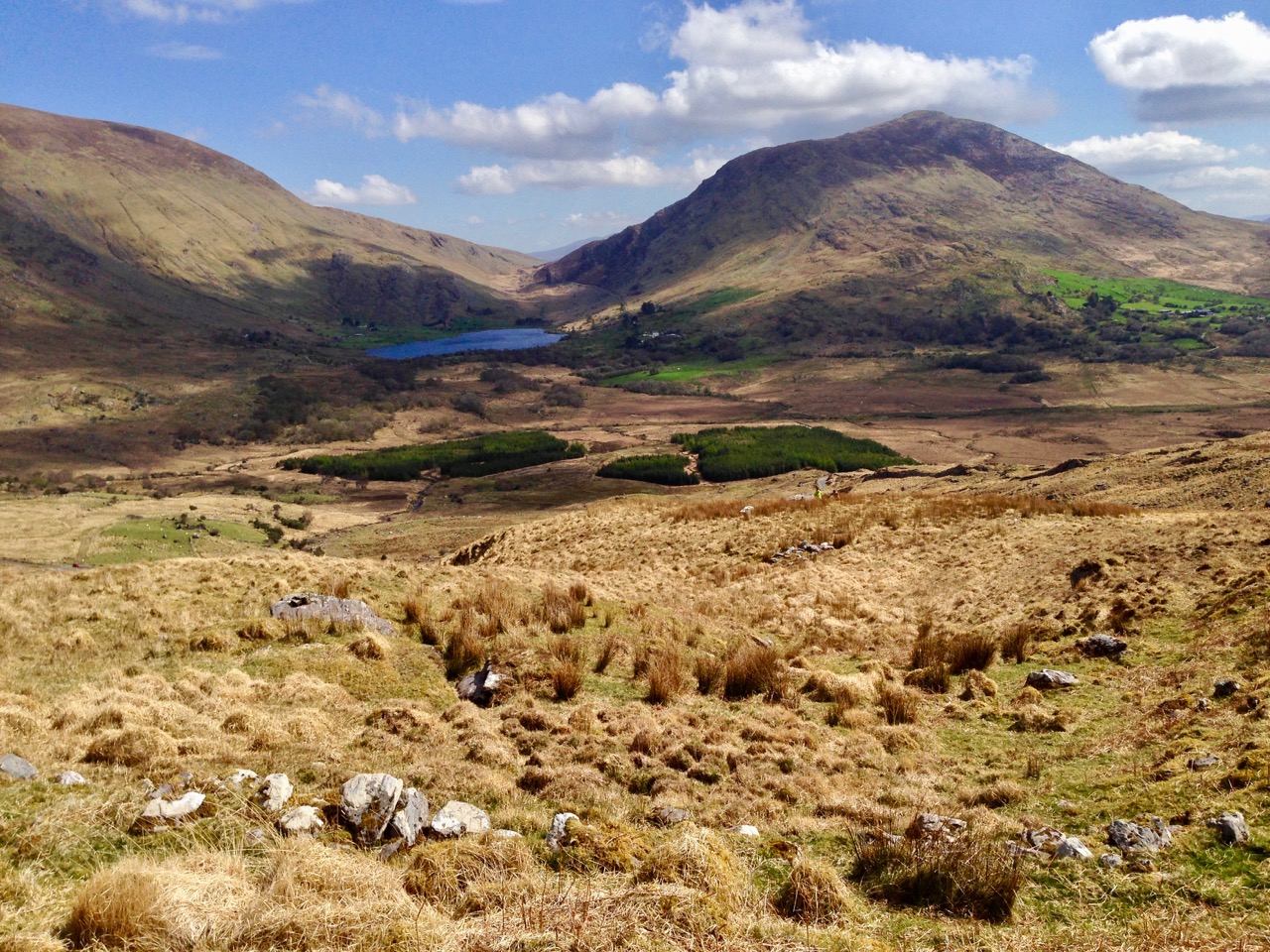
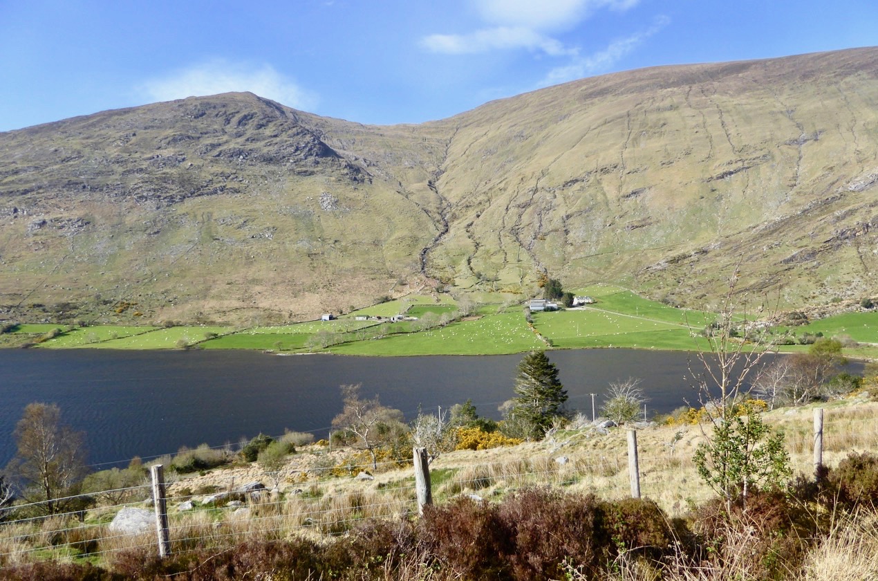
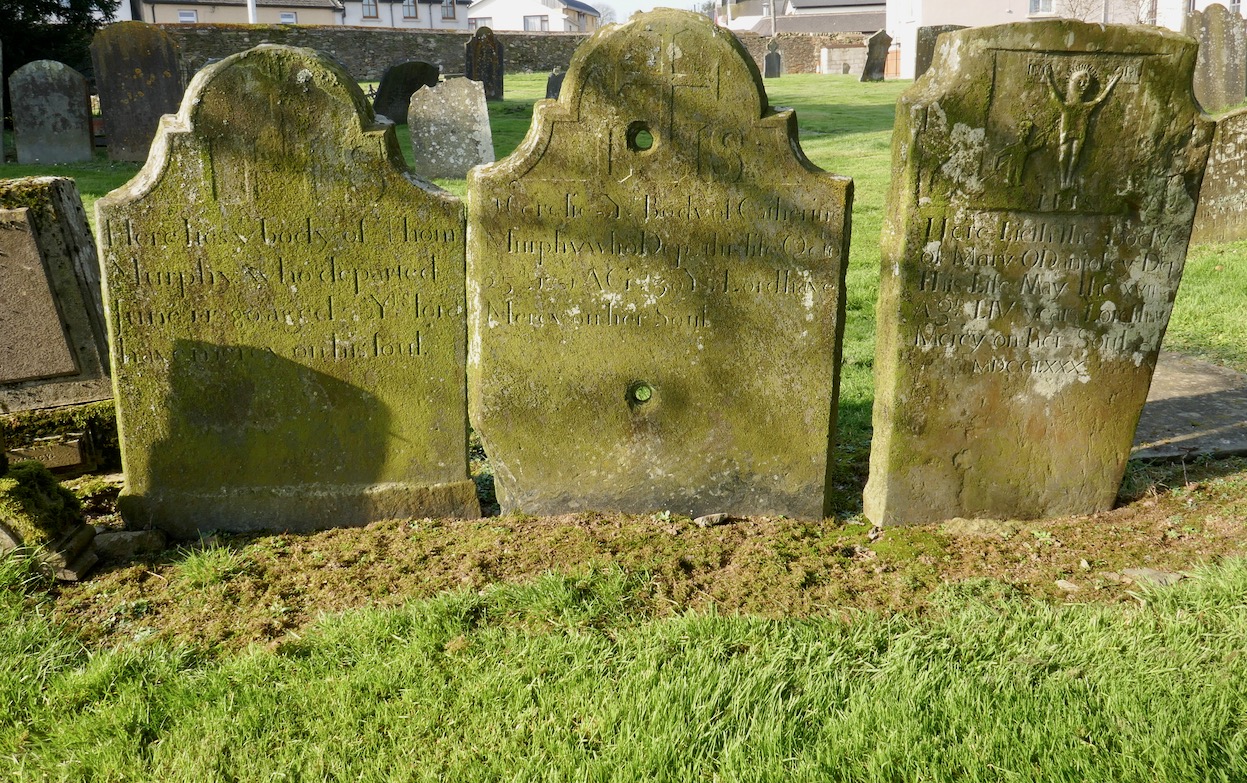
The road from Cork to Crookhaven – one of the most westerly communities in the whole of Europe – ran into the sea here at Rock Island. The picture above shows the remote settlement in the distance across an expanse of water, and the stone steps in the foreground are literally the end of the road that was laid out by Sir Richard John Griffith – Engineer of Public Works in Cork, Kerry and Limerick – between 1822 and 1830.

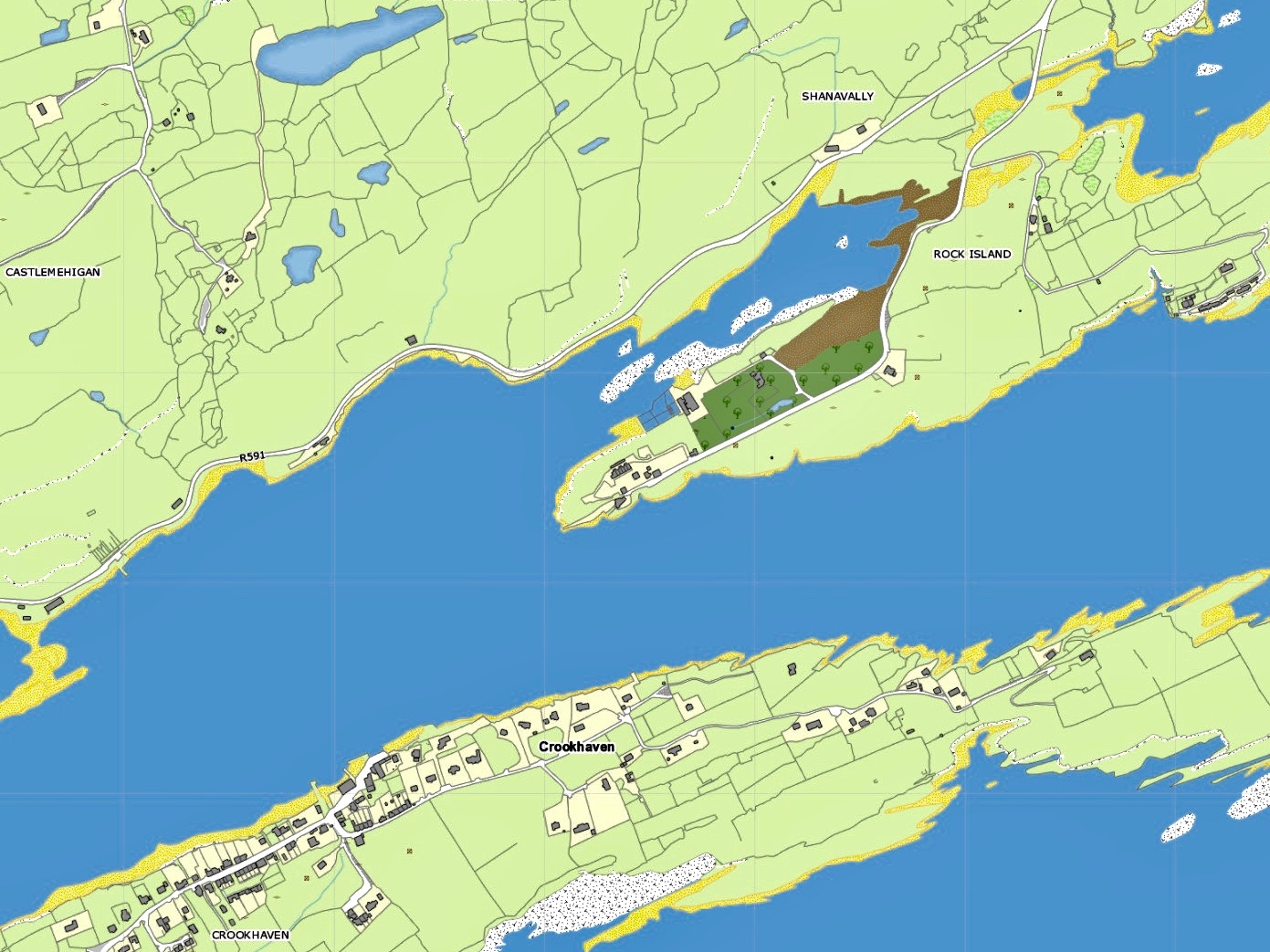
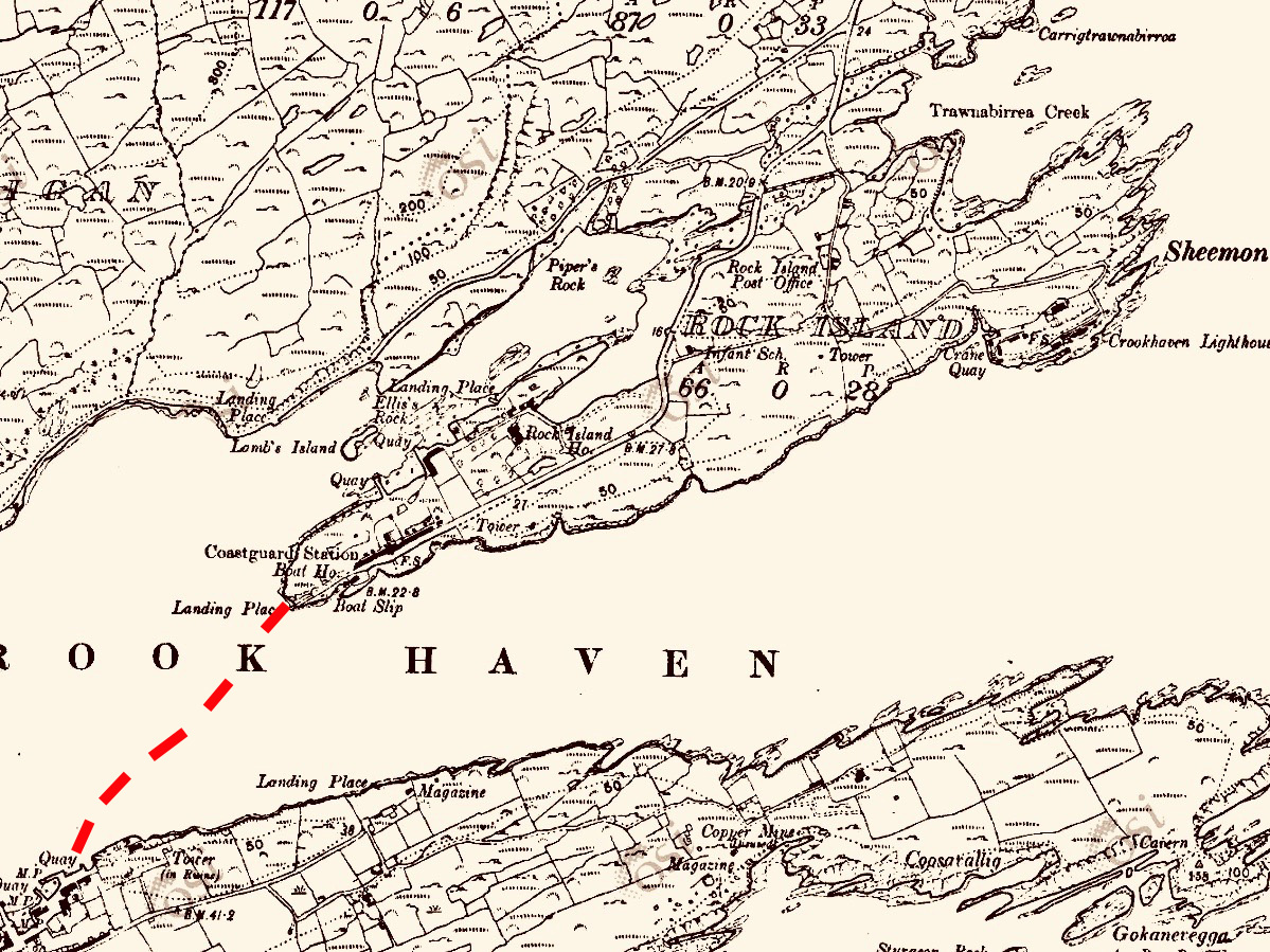
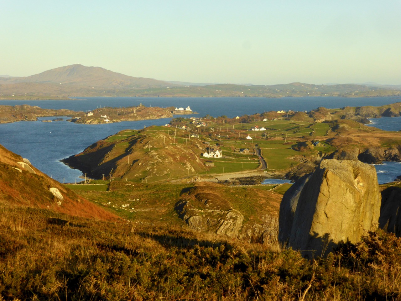
Upper – map showing Rock Island today: note the R591 road which now goes around the north side of Crookhaven Bay to reach the village. Lower – the Cassini map of c1848, showing Griffith’s Road – the direct route across Rock Island to the Landing Place at the western point: from there you went by water to Crookhaven Quay

Griffith’s brief as Engineer was to lay out many miles of new roads in some of the most inaccessible parts of the three counties. But even in his day travelling through the hinterland of Ireland was risky and uncomfortable: always far better to go by water along the coast – at least the passage was direct and relatively smooth in calm weather, while the byroads of the day were at best circuitous and muddy. Here’s an extract from a report by Griffith dated 1824:

. . . Richard Griffith, Road Engineer, Progress Report, Skibbereen to Crookhaven, Wheeled Carts now Appear, where heretofore Loads were carried on the Backs of Horses, New Entrance to Town Of Bandon, Road From Courtmacsherry to Timoleague, Road from Clonakilty to New Fishery Pier At Ring, New Road Skibbereen to Bantry, Macroom to Killarney, with a Note on The System of Labour Organisation Used . . .

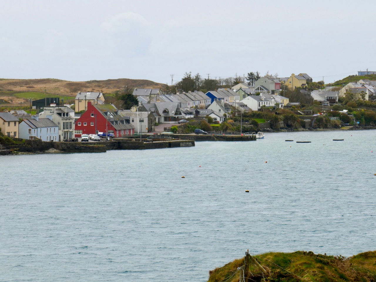
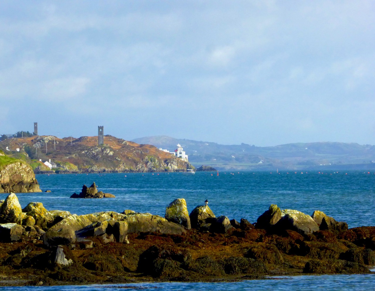
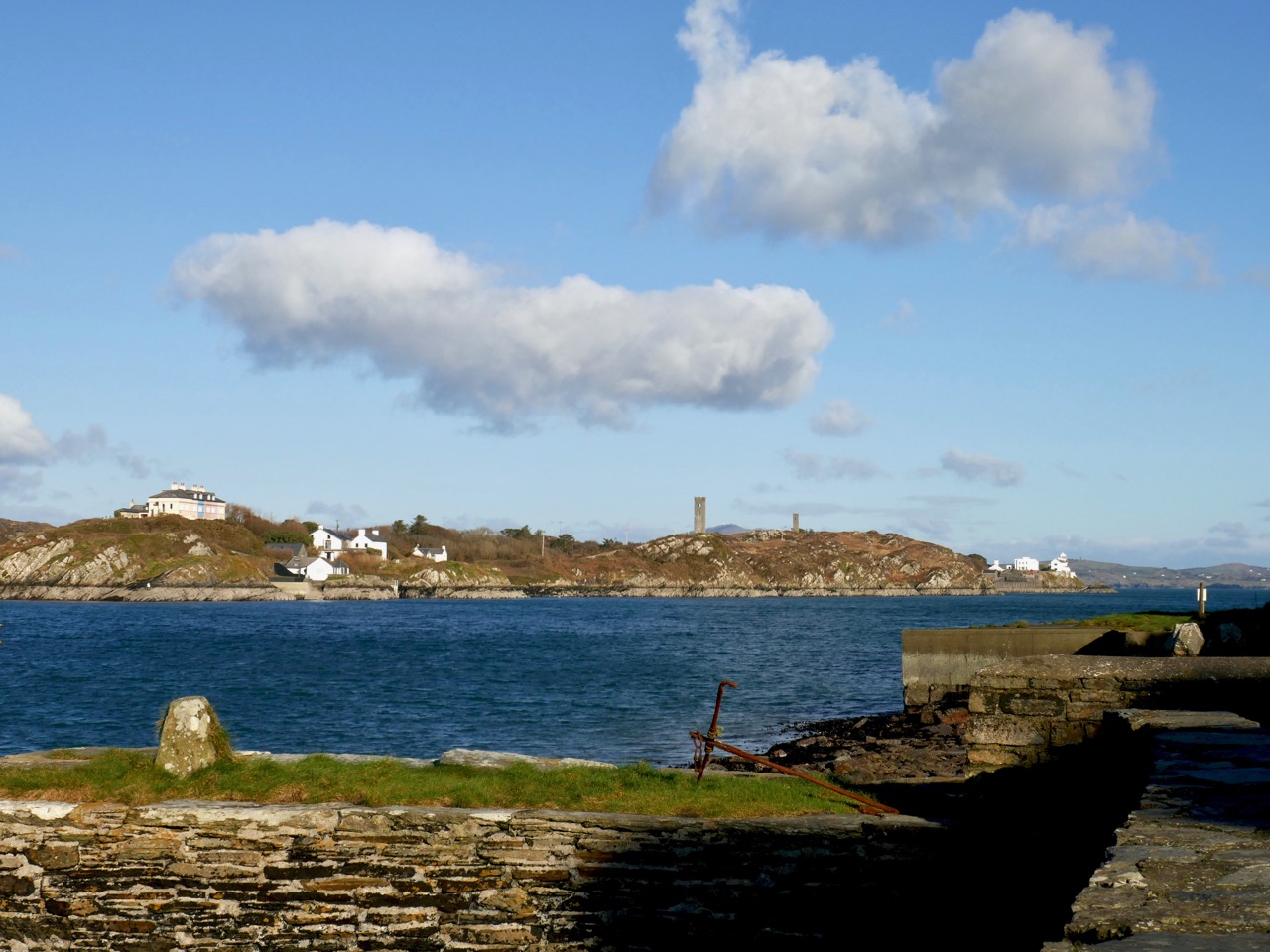
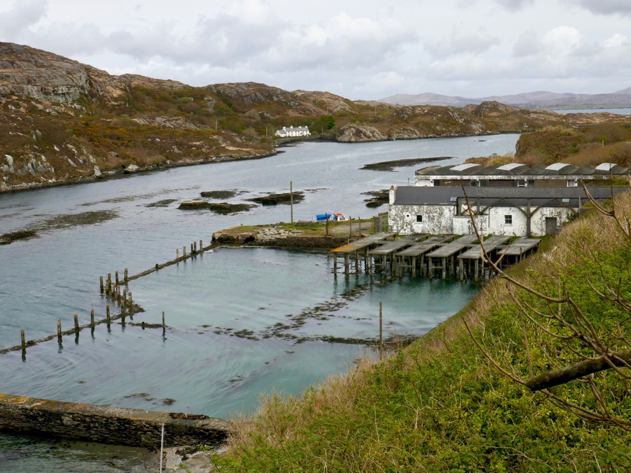
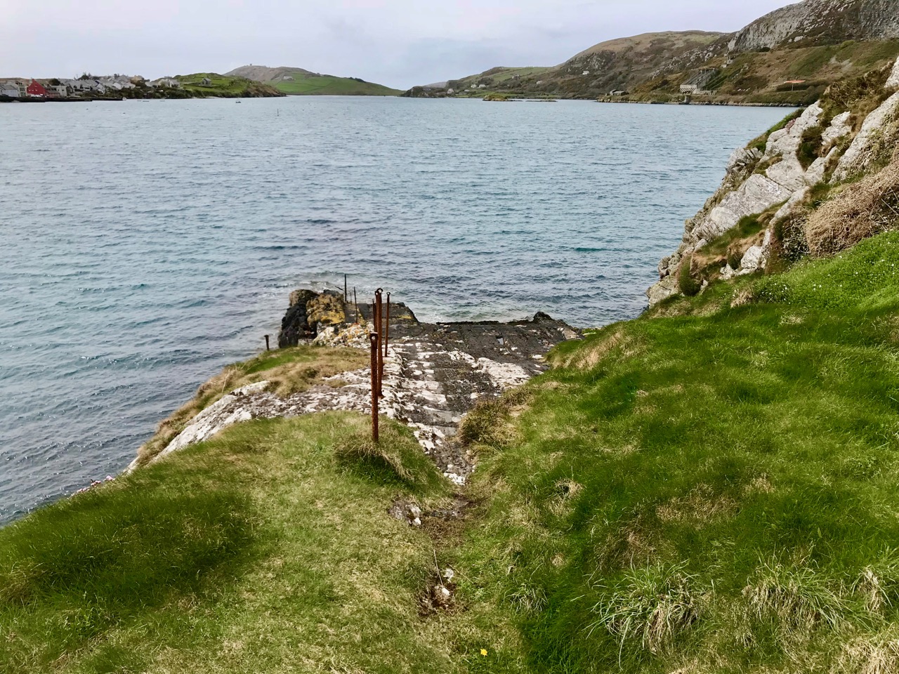
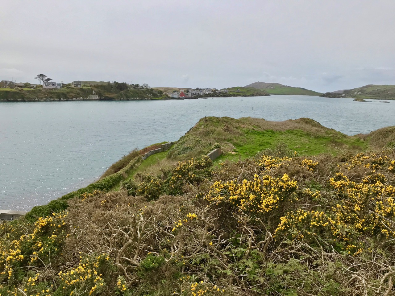
Connections by water: a telephoto view of Crookhaven, taken from above the ‘Landing Place’ at the west end of Rock Island

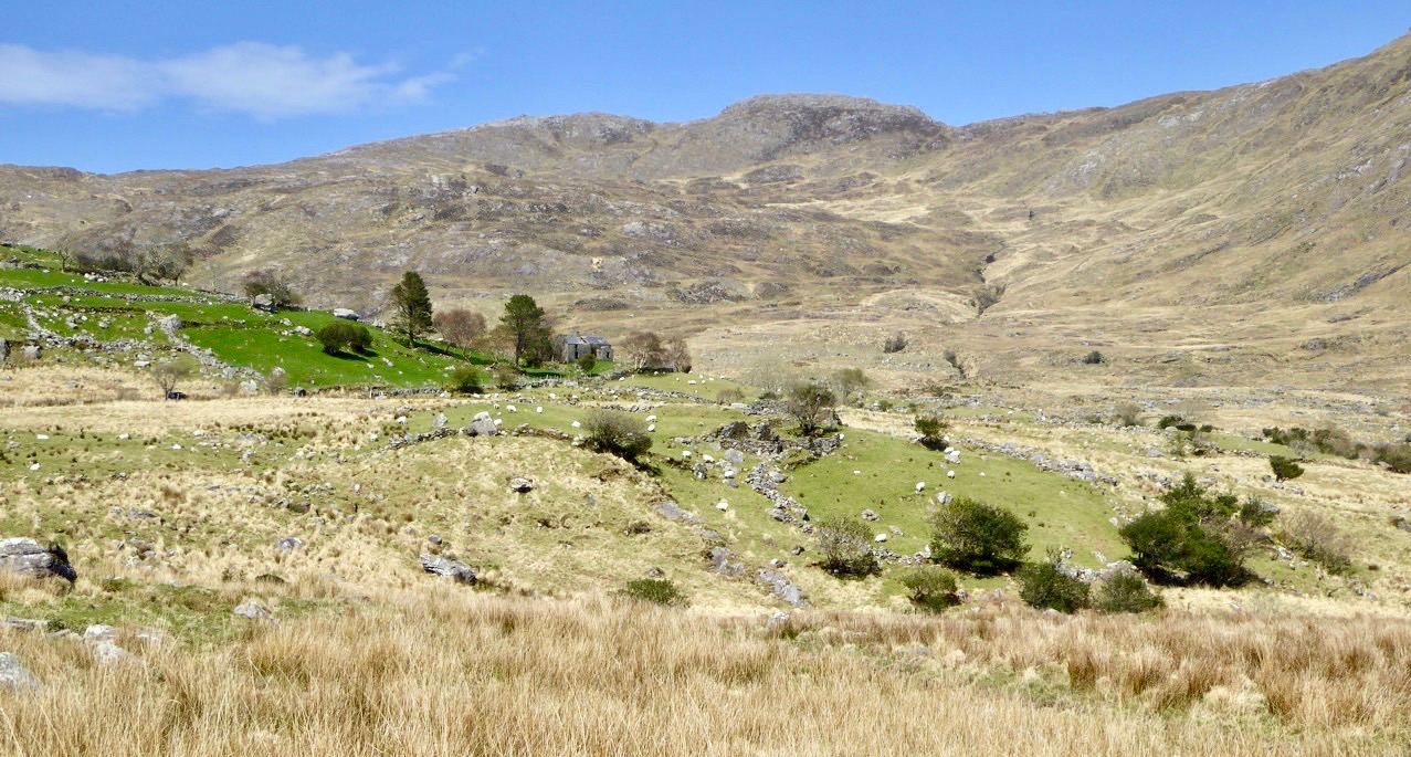
A few years ago, Finola wrote about the Butter Roads, an eighteenth century venture to serve the hub of Cork – and its international Butter Market – from the wilds of Ireland’s rural hinterland. Griffith and his contemporaries improved on this network during the nineteenth century: what we have today – especially here in West Cork – is an updating of Griffith’s system, with a few improved main roads connecting up with the web of winding boreens which then accessed the scattered townlands and farms – and still do.

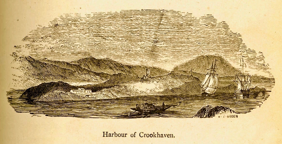
An engraving signed W T Green from A History of the City and County of Cork by Mary Cusack, Cork 1875

Born in Dublin in 1784, Richard Griffith exerted a great influence over the whole of Ireland during his lifetime. He was fascinated by the relatively new science of geology and studied in London and Edinburgh. I was particularly interested to see that he spent some time in Cornwall, studying mine engineering and mining techniques. Returning to Ireland in 1808, He was appointed Engineer to the Bog Commissioners and over the following four years wrote detailed accounts of the geology of various parts of the country, including Clare, Cork , Kerry, Leitrim, Mayo, Sligo and Wicklow. He became Professor of Geology and Mining at the Royal Dublin Society in 1812, and Inspector-General of His Majesty’s Royal Mines in Ireland at about the same time. The first edition of his Geological Map of Ireland was published in 1815.This was revised and republished a number of times over the following 40 years, and was the work he considered his major achievement.

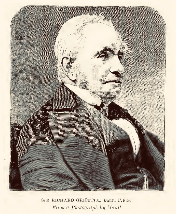
Sir Richard Griffith 1784 – 1878

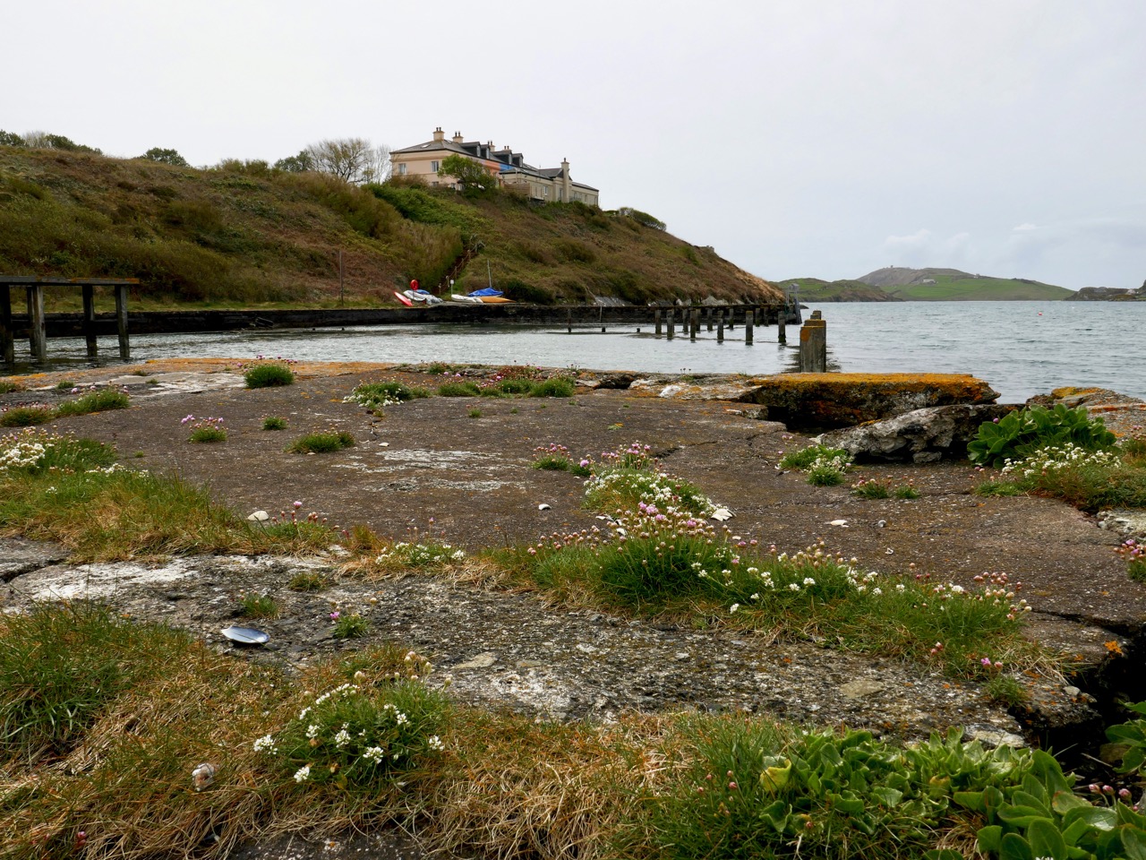
You will see from Finola’s post today that we visited Rock Island during the week in the good company of Aidan Power who has written an account of the place. It’s wonderful to get a guided tour with an enthusiastic expert. It was Aidan who sparked my imagination when he pointed out that a mail boat was rowed over from Crookhaven every day to the Landing Place at Rock Island – and was the regular and reliable means of communication between that village and the rest of Cork.

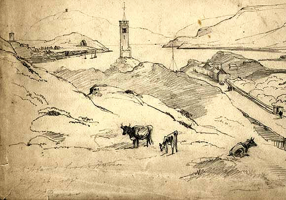
This drawing of Rock island by Brocas is dated 1837, and clearly shows, on the right hand side, Griffith’s Road leading down to the Landing Place, the principal connection with Crookhaven

There’s a lot more of Griffith’s story to be told: particularly his appointment as Boundary Commissioner in 1824, a post he held for 41 years. This resulted in the full recording of all townland boundaries and designations – although these were often anglicised at the time, resulting in the loss of many local traditional names. He died in 1878 at the age of 94. On his grave in Mount Jerome Cemetery is the epitaph . . . Not slothful in business, fervent in spirit, Serving the Lord . . .

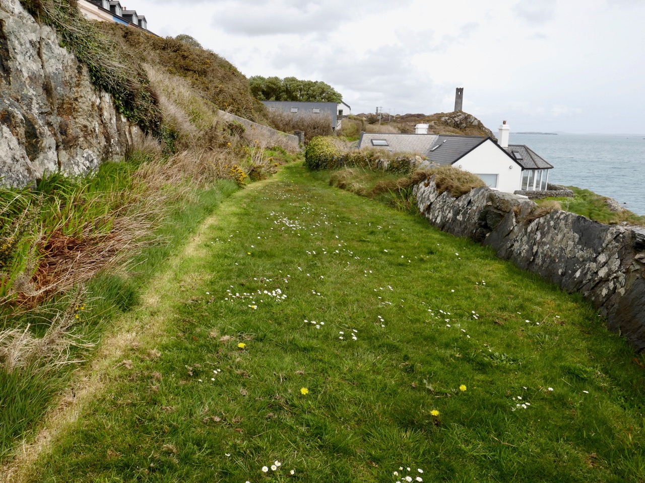
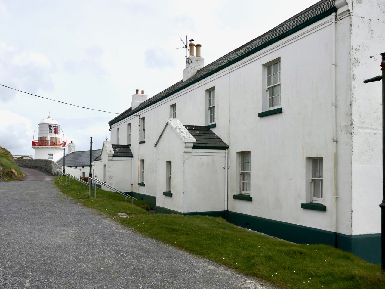
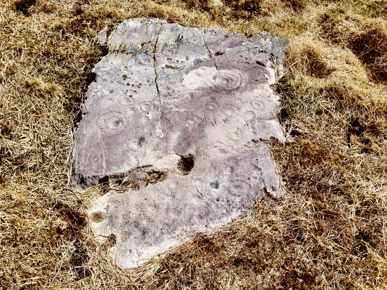
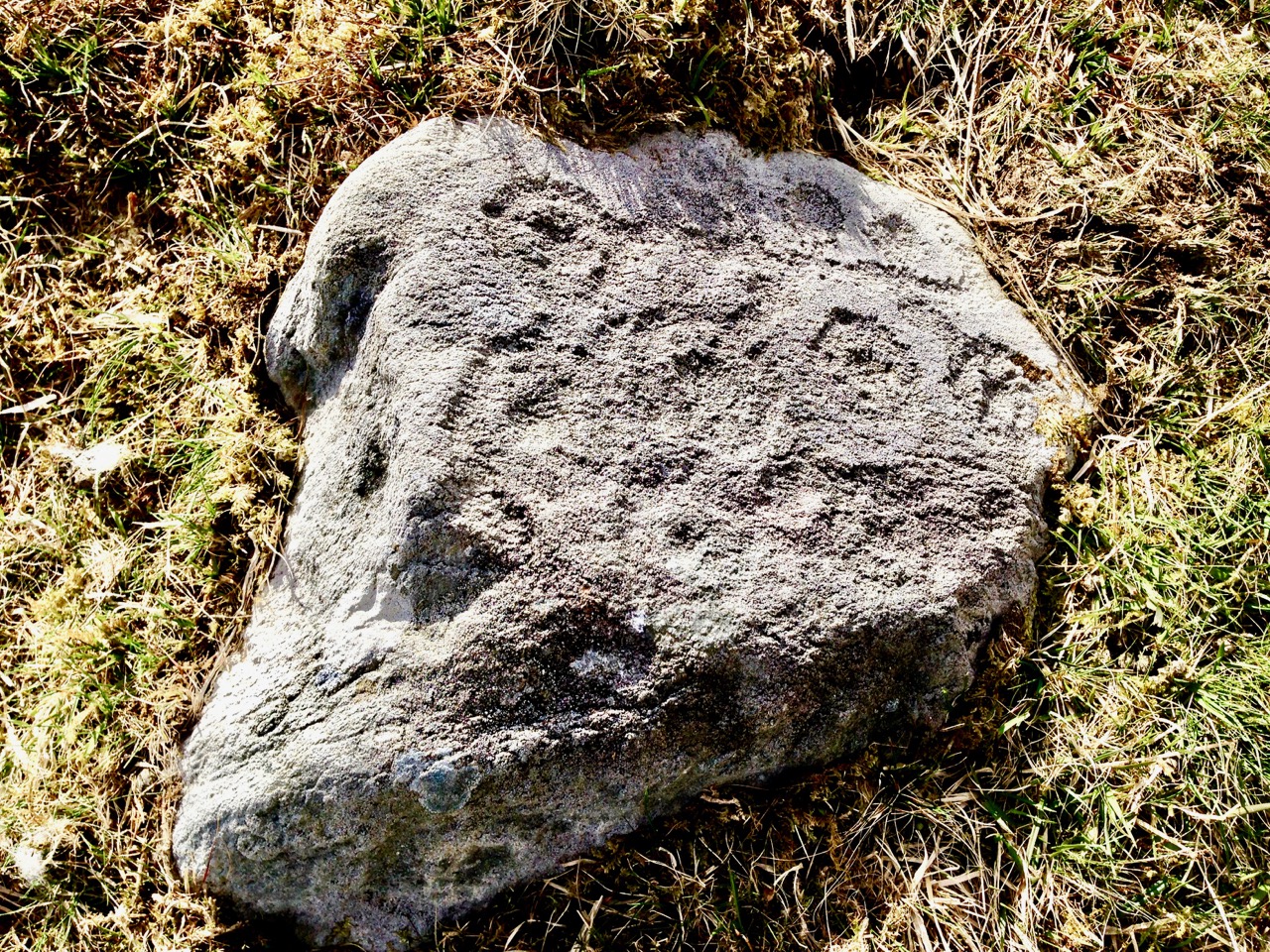
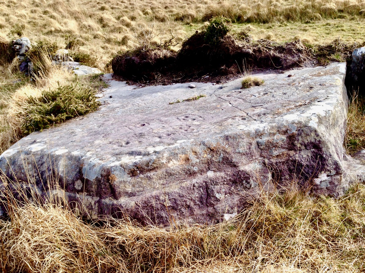
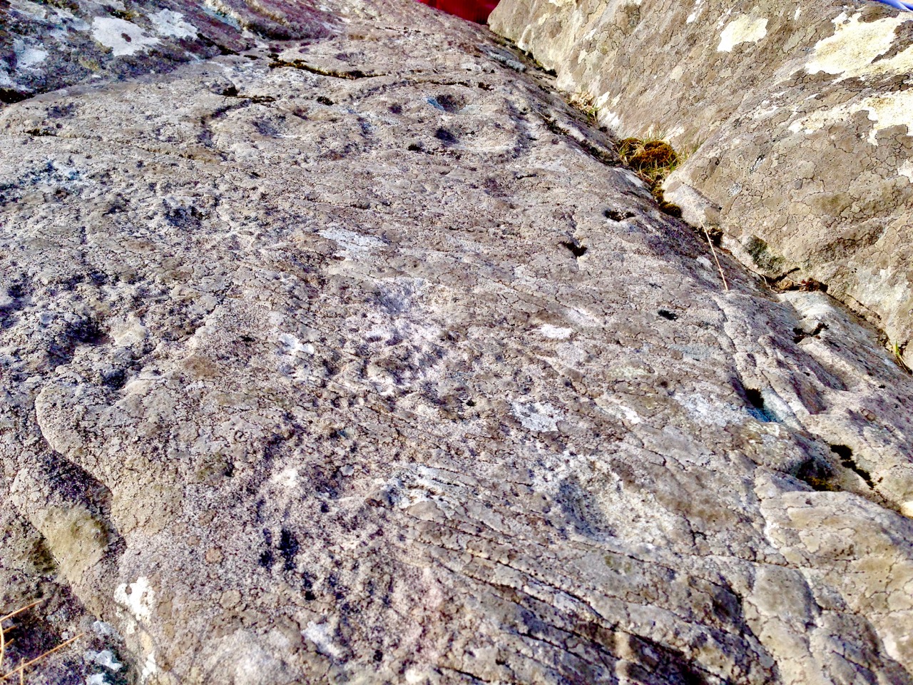
Griffith’s Road on Rocky Island is lost to a grassy track (upper picture and on the left in the lower picture) but is still traceable and remains theoretically a public highway! You can at least still follow it on foot to the point where it becomes a series of rocky steps that finish in the sea. You will have quite a wait for the Crookhaven mailboat today, however.

Mizen Magic 11: Rock Island

It was a pleasure and a privilege this week to tour Rock Island with Aidan Power, author of the book Rock Island, Crookhaven, A Coastal Townland’s History Since 1800. Published in 2006*,  this was a huge undertaking for Aidan, an amateur historian, accomplished with a high degree of professionalism and meticulously researched.

This photograph was taken from Brow Head and shows Rock Island’s location in relation to Crookhaven (foreground) and the rest of the Mizen. The furthest peak is Mount Gabriel

Aidan was living on Rock Island at the time and he knows every inch of it and every story that is embedded in the rocky soil. Today, there is only one permanent resident on Rock Island, but at its height it was home to over 100 people and a very busy place indeed. There were two populations – government employees working for the Lighthouses or the Coast Guard, and local people working in the fishing and provisioning industries.

While the lighthouse remains in the care of Irish Lights, the cottage is now in private hands and includes an ultra-modern addition with views to envy

Location was key – Rock Island is situated at the entrance to Crookhaven Harbour, a natural haven conveniently located at the extreme south west tip of Ireland – the last and first post of call for ships on the transatlantic route. As such, a Coast Guard presence was necessary, since smuggling was a way of life and foreign vessels apt to drop in or take refuge. Having sustained a French invasion by sea in 1796, the British government was on high alert for any further signs of foreign-assisted uprisings. Nearby Brow Head had a manned signal station which needed support and housing.

Lighthouse cottages

It was also the most convenient centre to build, maintain and provision two lighthouses: Crookhaven Lighthouse on Rock Island itself, and the famous Fastnet Lighthouse, 12 kms out. The east end of the Island was the centre of lighthouse-related activity. Aidan showed us the keeper cottages, one of which he had lived in but all now in use as holiday cottages. One set of houses was for the Crookhaven Lighthouse and the other for the Fastnet. He showed us where the Fastnet components had been assembled, tested and shipped out to the Fastnet Rock – a feat of engineering still breathtaking in its scope – see more about it in our post An Carraig Aonair: The Fastnet Rock.

Upper: The Fastnet assembly station. Lower: The road to the lighthouse is beautifully constructed – this lovely arch leads to the sea

The Western end was occupied by the Coast Guard end and was also the extent of the original road – see Robert’s companion piece today, The Rocky Road to Nowhere, for more about this road and the engineer who built it. The revenue officers, according to Aidan’s book, were very unpopular as smuggling was endemic on the West Cork Coast. One of the officers was called the Tidewaiter – yes, he waited for the incoming tide so he could board ships. It was a dangerous job – Aidan quotes Pococke’s account from 1752: . . .they have a term of hiding an officer, which is knocking in the head and putting him under a turf. There have been many instances of officers never heard of.

Rock Island as viewed from Crookhaven

The Admiralty started a serious crackdown on smuggling in 1816 and that’s when their lease on the West End of Rock Island began. The Coast Guard eventually became a reserve of the Royal Navy and later was controlled by the Admiralty. Its vicissitudes on Rock Island are chronicled by Aidan, including its less-than-stellar performance during the Famine. His account is exhaustive and provides a detailed picture of a British service that was deeply disliked and where the officers felt constantly under siege, culminating in a series of attacks by the IRA in 1920 and the eventual abandonment of the post that year.

Today the former Coast Guard Station has been beautifully renovated and the houses are used for holidays. They look magnificent in their flashy paint, reminders of both a colonial past and a Celtic Tiger economy.

The easterly tower

I have mentioned the two towers in a previous post, both of which have been incorrectly described in the National Monuments records and the Buildings of Ireland site. They are described as belvederes by National Monuments (see my post on Belvederes for an explanation) and as signal towers by Buildings of Ireland.

Brian Lalor’s sketch of the tower, also incorrectly identified as a Napoleonic-era Signal Tower, based on information from National Monuments

The most likely use for the westerly one, according to Aidan, was as a pilotage tower. Pilotage was a competitive business, and whoever could first see the ship at sea and get to it first with an offer of service, had a distinct advantage over others. The easterly tower was used by the Coast Guard as a look out.

At the north side of the island is a sheltered harbour which from the 1920s to the 1970s was the centre of a lucrative lobster and shellfish industry which created a certain level of prosperity in the area, until the inevitable over-fishing caused a decline in the lobster population. Today the remains of the lobster ponds can still be seen, along with a large building that was used in the 1980s and 90s as a food production facility making, improbably, garlic butter.

Upper: the remains of the quay by the lobster ponds. Lower: Aidan, Amanda, Peter and Robert on our Rock Island tour

I have only given you a flavour of Rock Island – it’s also a place where bird and plant life is abundant and where seals pop up to say hello as you wander around the coast.

Sea Campion

It’s a tranquil place from another time, staggeringly beautiful and seeping history from its pores.

This curious castellated boat shed is one of a pair on the north side

We are currently using this image as our Facebook Page header – you could mistake it for a Greek island on a sunny day

*The book is available on Amazon, or contact us for the author’s email address.

Lee Snodgrass and Mizen Archaeology

West Cork lost a friend and champion this week. Lee Snodgrass was involved in many movements, political and environmental, and participated in all kinds of events to do with heritage and meditation and yoga and music and art. But it was as an archaeologist we knew her first and best.

Lee and her partner, Paddy O’Leary, along with Bernard O’Regan, first launched the idea of the Schull Field Club in 1979. The aim of the club was to preserve, protect and record local monuments and to note the archaeology, history, flora and fauna of the Mizen.*

Ardintenant (White) Castle, sketch by Brian Lalor, done on a Mizen Field Club outing

It was very successful and soon there were monthly meetings, field trips and eventually, from 1993 to 2004 a highly regarded Journal, the copies of which are now jealously guarded by those fortunate enough to have them. The Field Club became the Mizen Peninsula Archaeology and History Society. Paddy and Lee were at the heart of all those efforts, although the real strength of the club was how many people got involved, led trips, gave talks and contributed to the Journal.

The Early Medieval site of Kilbrown on the Mizen. See our post Mizen Mud for photographs of this enigmatic (and very muddy) place

At Lee’s memorial service people talked about her elegance and style, her wayward sense of time, the tinge of glamour she brought to every occasion, the utter devotion with which she nursed Paddy through his long final illness.

The Cape Clear Passage Grave, spectacularly sited on the highest point of Cape Clear Island

Brian Lalor, a member of the Field Club, paid tribute to Lee as a ‘generative’ person – she got things done! She and Paddy were Mizen archaeology – the go-to people when new discoveries were made or when a monument was in danger. When the Cape Clear Passage Grave was discovered, they camped overnight on the mountain to confirm the orientation of the solstice sunrise. When a piece of rock art was discovered in the garden of a house in Schull, Lee wrote a full description of it that is still the only complete record. She was an excellent photographer and used her skills to record many monuments and artefacts.

Cooradarrigan rock art, discovered by accident on the garden of a new house

They explored and mapped the souterrain at Liss Ard, agitated successfully for the restoration of the stone row at Coolcoulaghta, helped to survey old graveyards – in short did their part and more to preserve and celebrate the heritage of the Mizen. Paddy is remembered and talked about still, and Lee will join him now when the stories are told of the couple who did so much for this area.

Dunbeacon Castle – there isn’t much left, but what a strategic siting, with a clear view all down Dunmanus Bay

We’ve known Lee only for the last five years, but like everyone else who knew her we liked and admired her. We picked her brains often on aspects of Mizen archaeology and she turned to us to record a new rock art find when she could no longer undertake it. We met her everywhere – lectures, gallery openings, festivals, concerts – always looking wonderful and always supportive of  local efforts.

Variously known as St Coleman’s Grave and a ‘penitential station’, this is one of a complex of monuments that includes a holy well and a boulder burial

I’ve chosen to illustrate this tribute to Lee with photographs and drawings of sites on and near the Mizen visited over the years by the Field Club. The drawings are all by Brian Lalor, from the sketchbook he has entrusted to me and which I have written about before in the post Brian’s Sketchbook: The Signal Towers. They were all done on trips with the Field Club.

Lee made a difference in West Cork. Isn’t that, in the end, what we all hope to do with our lives?

*Information based on the Introduction to the boxed set of the Mizen Journal, written by Deirdre Collins

Sun’s Out!

On one April day after a bleak, harsh winter that had gales, hurricanes, blizzards and unceasing bitter east winds thrown at us – the sun came out! We were out too, and headed up to the Beara Peninsula to see if we could remember what sun-soaked landscapes felt like… They felt great!

Header – the glories of Cork and Kerry combine on the spectacular Beara; top photograph – finally, after a long,harsh winter, we see the spring blossoms appearing; middle – a wayside shrine on the road out from Glengariff; bottom – Hungry Hill dominates the views as we head west on the peninsula

You will remember our previous visits to the Beara: there are not enough superlatives for what it has to offer in the way of stunning scenery and colour. None of these photographs have been enhanced – what you see is exactly what we saw on the day – and it’s what you will see, too, if you choose aright (although even on dull days we always find plenty to interest us).

Top photograph – St Kentigern’s Church is in the centre of one of Ireland’s most colourful villages; middle – the sunlight plays games with the beautiful windows by glass artist George Walsh; bottom – light from the windows dances on the pews

We knew where we were going: Finola was keen to revisit the little Catholic church of St Kentigern in Eyeries, which has a fine collection of windows by George Walsh: it’s a gem – and at its best for the quality of the light enhancing it on the day. I wanted to see the settlement itself in the early spring sunlight as it’s one of the most colourful places in the whole of Ireland! Neither of us was disappointed.

Just a taster of the treats in store in Eyeries: on a beautiful spring day there was hardly a soul around, but we were still able to find an ice cream in O’Sullivan’s!

Our second objective was to travel into the hills and find Ardgroom Outward stone circle. The trail involves farm gates, stiles and a lot of mud – but the 9 stone circle (named locally ‘Canfea’) is a fine, almost intact monument with wide vistas to mountain and sea. The impressive outlier stone is 3.2m in height.

The magnificent Ardgroom Outward (or ‘Canfea’) stone circle is accessible via a marked, boggy path: the vistas from the site make the journey worthwhile. Finola is dwarfed by the huge outlier!

It’s barely a skip up to Eyeries from Nead an Iolair, so we had to carry on around the peninsula and take in the almost surreal views of oceans, lakes and mountains before dipping into Kerry and then heading over the top back into Cork county and down the Healy Pass – surely one of Ireland’s most spectacular road trips.

Returning home – with the evening sun setting gloriously over Roaringwater Bay – we reflected that there can’t be many places in the world where a single day can offer such a feast to satisfy all the senses.


Rock Art: Returning to Derrynablaha

Three years ago Finola and I both wrote posts about a remote valley in the Kerry hills, north of Sneem, where some iconic examples of Irish Rock Art can be found: Derrynablaha Expedition by Finola, and my own Glen of Ghosts. I think it’s time to revisit this hauntingly beautiful place, and its ancient carved stones which could date back 5,000 years, to Neolithic times.

All the examples of Rock Art illustrated in this post can be found in the townlands of Derrynablaha and Derreeny, Co Kerry

When Finola visited the valley in 1972 and 1973 she explored and recorded 23 marked stones, all within the townland of Derrynablaha: these were illustrated in her UCC thesis The Rock Art of Cork and Kerry. Between 1986 and 1996 The Iveragh Peninsula Archaeological Survey undertook further detailed research, resulting in a comprehensive volume published by Cork University Press: this contains a 30 page section on Rock Art and includes many of Finola’s drawings. The book lists 26 known examples, now, in Derrynablaha with a further 7 stones in the adjacent townland of Derreeny.

Cork University Press volume (left) which includes many of Finola’s drawings (sample page,right)

My introduction to prehistoric Irish Rock Art came in the early 1990s when I first visited West Cork to look at a piece of land which my friends Danny and Gill had purchased, with a view to building themselves a house: I was to be the designer. We walked the 5 acre site at Ballybane West and discovered a large, flat outcrop of rock some 30 metres long by 10 metres wide, the surface of which was covered with strange carved motifs. These intrigued and occupied me for many years. Eventually I made contact with the Department of Archaeology at University College Cork and unearthed Finola’s thesis. Finola had visited ‘Danny’s Rock’ during her explorations: she and I have just completed a comprehensive article on Rock Art in the environs of Ballybane West for a forthcoming edition of the Journal of Bantry Historical Society, due to be launched on 10 May.

Because of the number of pieces of Rock Art at Derrynablaha, as recorded by Finola, I set out to visit the site and was fortunate, I think, to locate several of the pieces there: they are hard to find. My most significant impression of the place was its isolation and loneliness: when Finola was there decades before, the O’Sullivan house was occupied – a family home and working farm – now it was a ruin returning to nature. No one lives in that valley today: it is home to sheep and eagles.

The most iconic piece of Rock Art in Derrynablaha is high up on the slopes of a mountain: there is no path, and the trek is across bogs, boulders and streams. Also remember that all the land is private – farmed now by another O’Sullivan from a neighbouring valley – and permission has to be sought in advance of any attempt to visit. Strict rules apply, understandably, to the use of gates and fences and no dogs will be permitted. The iconic piece is probably Ireland’s most important. When you stand up there, on a good day, you can see to distant horizons and take in outstanding views: time for reflection, perhaps, on what inspired our forebears to create such panels in these places – was it where they lived? Or did they assemble there for celebrations? The mountainside seems to present a natural platform here, with the carved rocks a central focal point. The work involved in carving these motifs would have been significant and time-consuming – they had only stone tools.

When we give talks about Rock Art we ask a question: Is it art? Some of it is certainly pleasing to the eye – the iconic Derrynablaha carvings are. But they also appear random, as though new carvings have been squeezed in amongst older ones: maybe the proliferation of motifs – or the number of carvers involved – was more important than any particular visual effect or relationship. We don’t ever try to answer that question, nor guess meanings for things we can never know. It’s enough – for me, at least – to experience these ‘footprints’ of former souls in such wild places.

We go far out of our way to look for Rock Art. It would take more than a lifetime to see every piece in Ireland. Some would argue that such a pursuit would be pointless – seen one, seen them all. It is true that the motifs are similar, although variable, across Rock Art panels, not only in Ireland, but in Britain and on continental Europe. That in itself is remarkable: 5,000 years ago humankind was making identical marks on rock surfaces all over its world. For me, however, it’s not really the motifs – spectacular though many of them are. It’s the places that they mark which are meaningful. Rock Art took me to the mountainside in that lonely Kerry glen and showed me a most incredible view across townlands and counties: I see it as inspiration, relevant as much in the 21st century of this struggling world as it was, perhaps, thousands of years ago, when the same world was a little bit newer.

The Headstones of Ferns

Ferns, in Co Wexford, is an historic town that boasts many fine heritage attractions including an Anglo-Norman Castle, an Augustinian Abbey and other medieval ruins, high crosses and associations with the McMurroughs and the Marshalls. Not least among its delights is the Cathedral graveyard, which has one of the best collections of eighteenth century headstones I have ever seen.

Look at the headstone above and the one below. The elements used in the carving are identical except that the central image in the first is a crucifixion scene and in the second it’s an IHS in a sunburst. Note the J Byrne signature under the carving to the left above and the Pat Byrne signature below. How were J and Pat related? Does the difference demonstrate anything other than the preference of the person who commissioned the headstone? I’m tempted to see the gradual replacement of the crucifixion image with slightly less ‘popish’ symbols, but I’m probably overthinking this

In our post Memento Mori, I introduced you to Irish headstones and the practice, which really only dates back to the 18th century, of routinely placing headstones on graves. Even then, only those who had the means to pay for a carved headstone were memorialised in this way – most still lay in graves with simple field stones at their head (and sometimes feet).

In Headstones or Folk Carvings? we visited Kilcoole graveyard to Co Wicklow, home to many fine headstones including one by Dennis Cullen, an acknowledged master carver. In Ferns we found many of the headstones had been carved by J Byrne (or J: Byrne, as he styled it) and although his technique does not quite have the refinement of Dennis Cullen, his carvings have a charm and energy that make them recognisable even where the headstone is not signed.

See the ‘J: Byrne’ signature just below the carvings to the right. There is no date on this headstone for William Lea (or Leacey? See the tiny superscript above the ‘Lea’). The detail on the angels is very fine and I love the little arrow in the centre of the sunburst, just below the IHS

The most common image is, of course, the IHS. Known as a Christogram, IHS is shorthand for the name of Jesus. It is often surrounded by a sunburst, or surmounted by a cross. Interestingly, the earlier and later headstones are more likely to feature the IHS as their main element.

Two early headstone, from 1758 and 1773, starting with Here Lieth. Mogue is a local name, for Saint Mogue of Ferns, whose well lies across the road. Note that the final Y of Mercy doesn’t quite fit on the line so a superscript is used

Many of the most interesting headstones date from the 1790s and where they have a signature it is that of J Byrne. There must have been a vogue for crucifixion scenes at the time, because they appear here and there throughout the graveyard and date to this period.

The J: Byrne signature is almost obscured by lichen. This is a typical J Byrne carving, with a crucifixion scene: Jesus on the cross, Mary and possibly John on either side, all three with halos. Sun and moon round out the carving

Jesus is on the cross at the centre of the tableau, with Mary on one side and John on the other. Occasionally other figures appear – Roman soldiers, a man on horseback, angels.

The dress, as is common with carvings of this period, reflects eighteenth century styles – observe the soldier in the frock coat in the Moses Breen scene (above) and the angel in the seamed jacket on John Kehoe’s stone (below).

There are a couple of headstone with horses in the crucifixion scene, but it’s unusual

The most frequent other symbols are the sun and moon, often with faces. The sun/moon symbols can be the main elements or can be wedged into available spaces on either side of crucifixion scenes.

The lettering styles vary, although generally they become tidier over time. Occasionally, the lines incised to keep the carver straight can be discerned. Words that don’t fit are either carried over, or a tiny superscript finishes them so they can stay on the same line.

The lightly incised ‘stay between the lines’ can be seen in Mogue Doyle’s headstone from 1775

This 1792 headstone is for Catherine Murphy. But it is also for her husband. However, none of the husband’s details appear. I can understand that he would have been added to the headstone at the time of her death, for efficiency perhaps, with his dates to be added later – but the fact that his name is missing gives rise to all kinds of speculation!

One mysterious element of several of the gravestones in Ferns is that at some point in the past someone has drilled holes in some of the headstones (see the two examples, below). If anyone can tell us the significance of this, we would be grateful to know it.

We highly recommend a visit to Ferns. Give yourself a day to take in all that’s there, but don’t forget to have a good wander around the old graveyard. Morning is best, as the light goes behind the headstones in the afternoon.

I love the primitive quality of this 1780 stone for Mary O”Danioley – Jesus on the cross with the soldier piercing his side with a spear