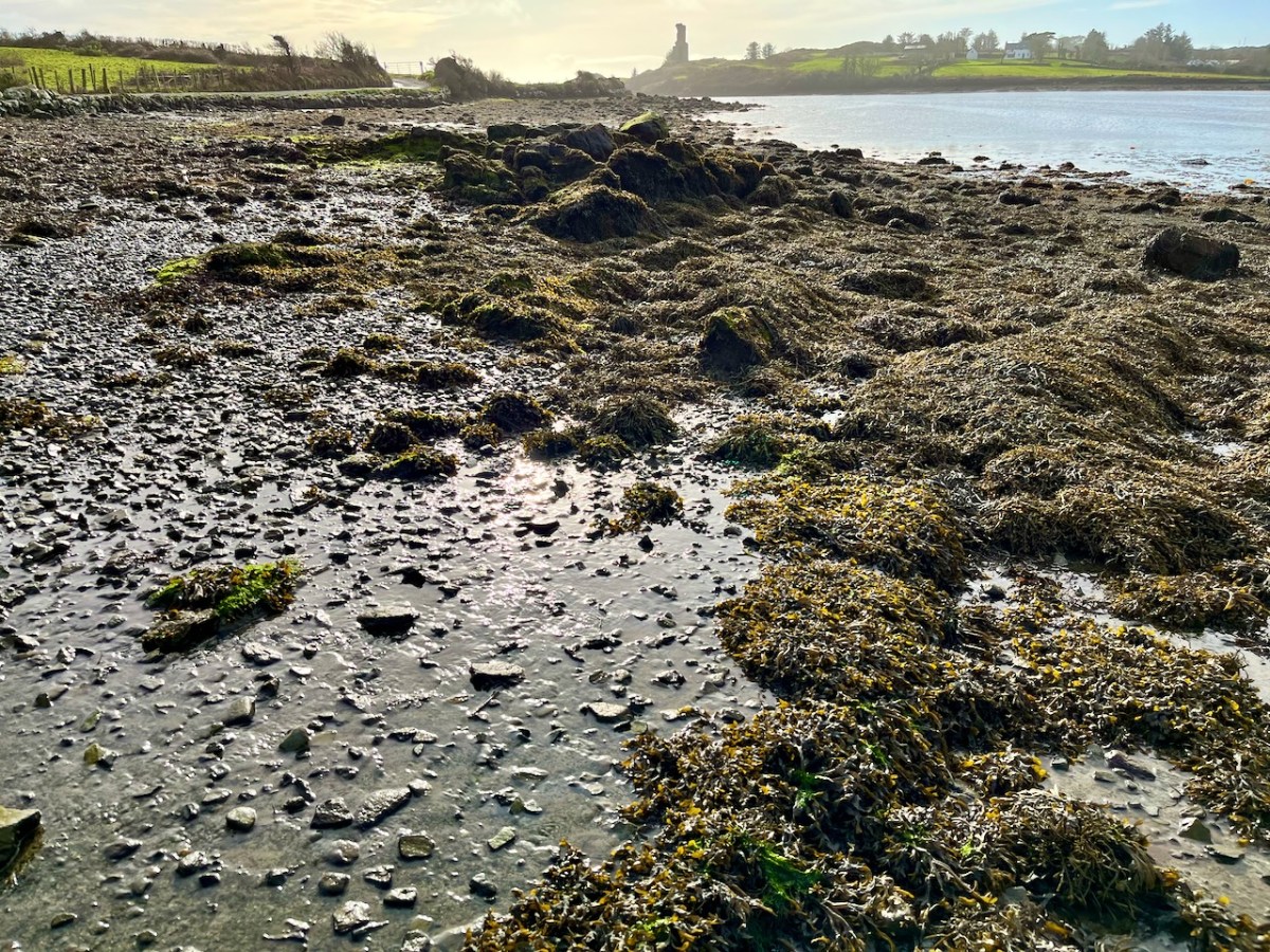
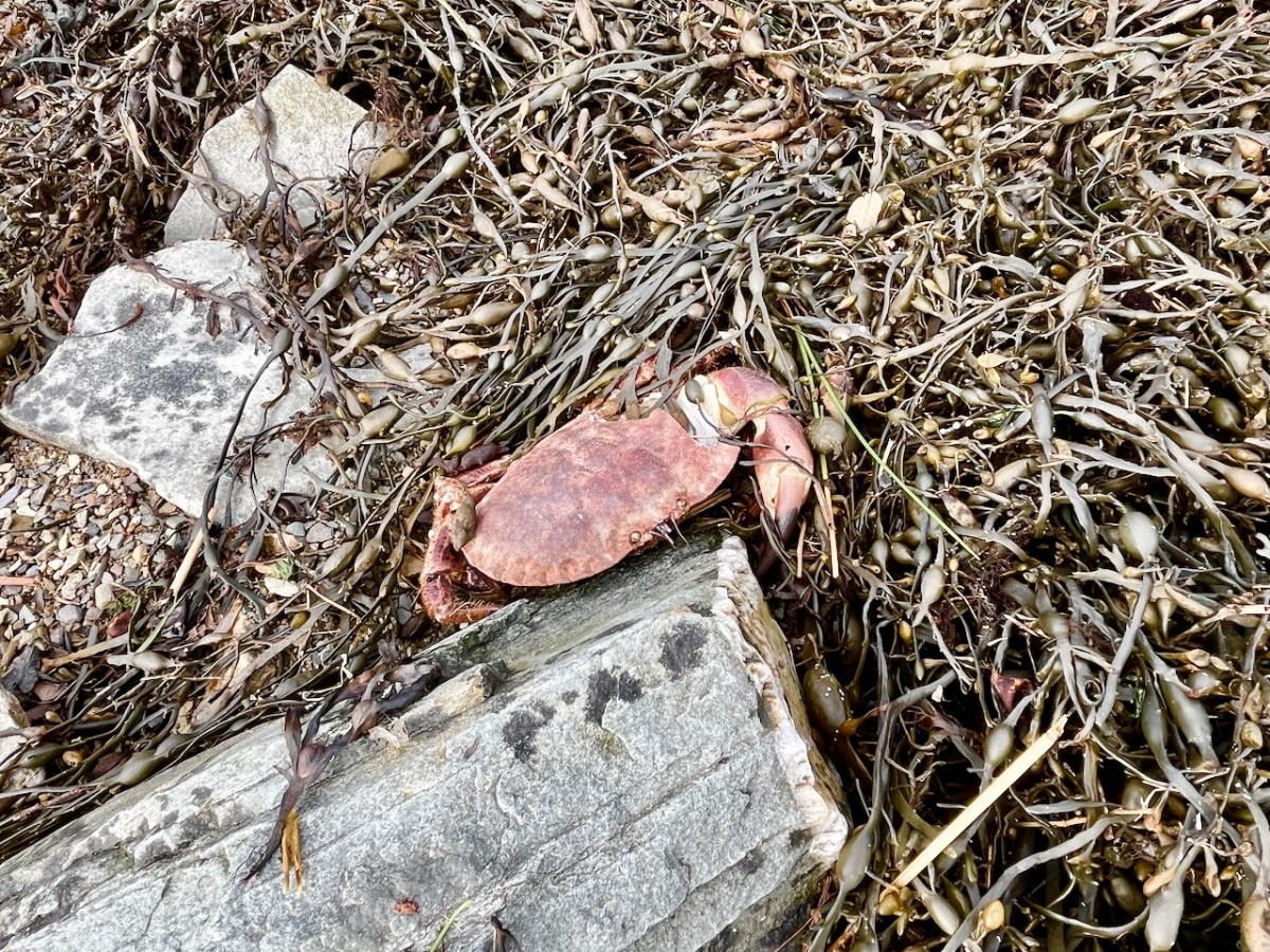
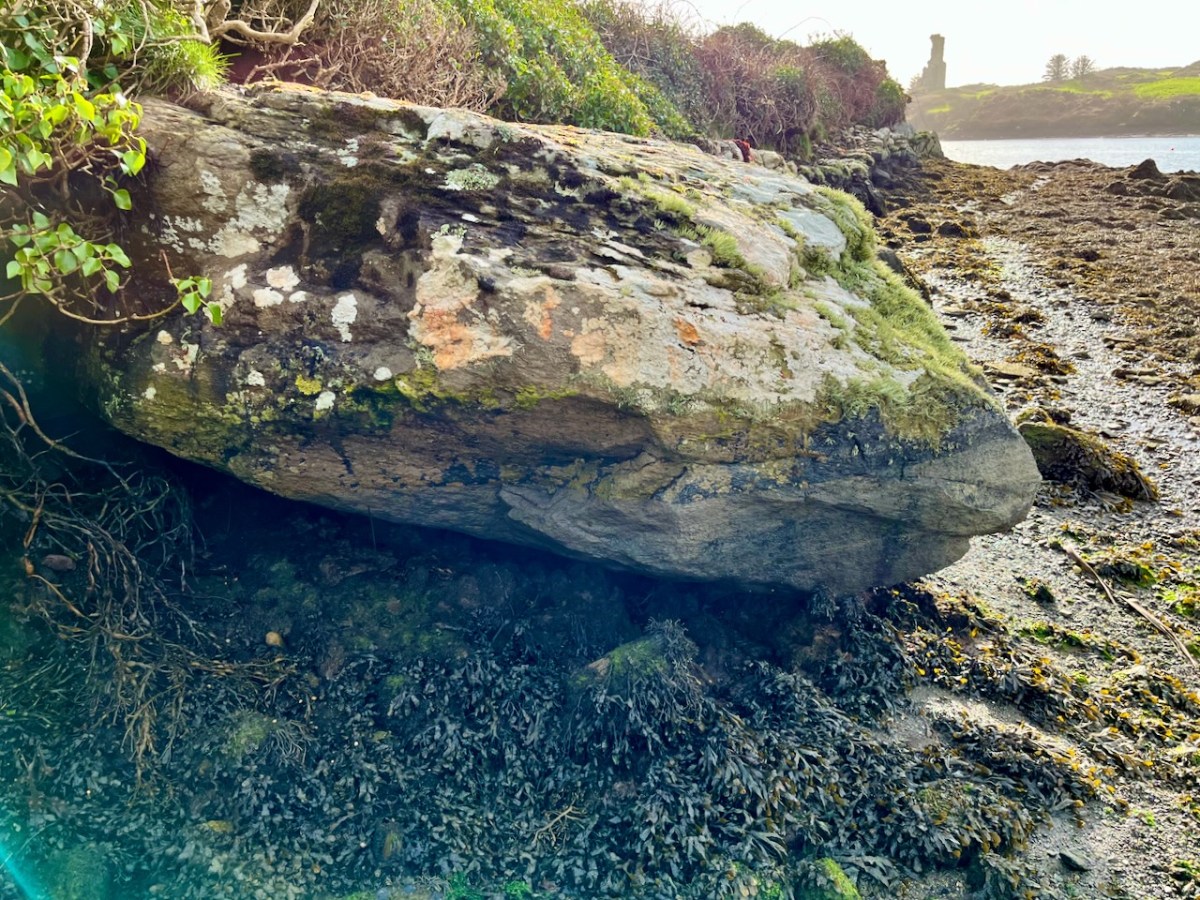
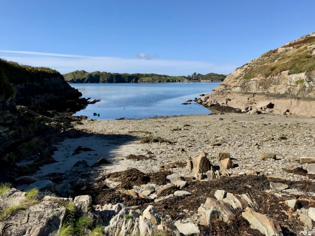
The weather so far this year is breaking records for coldness, wetness and evapotranspiration – while Earth as a whole continues to get warmer. In simple terms that means it’s not pleasant to wander too far from home. I decided to walk down to the shoreline of Rossbrin Cove – all of ten minutes – and see what the winter storms may have washed up: often an interesting diversion.
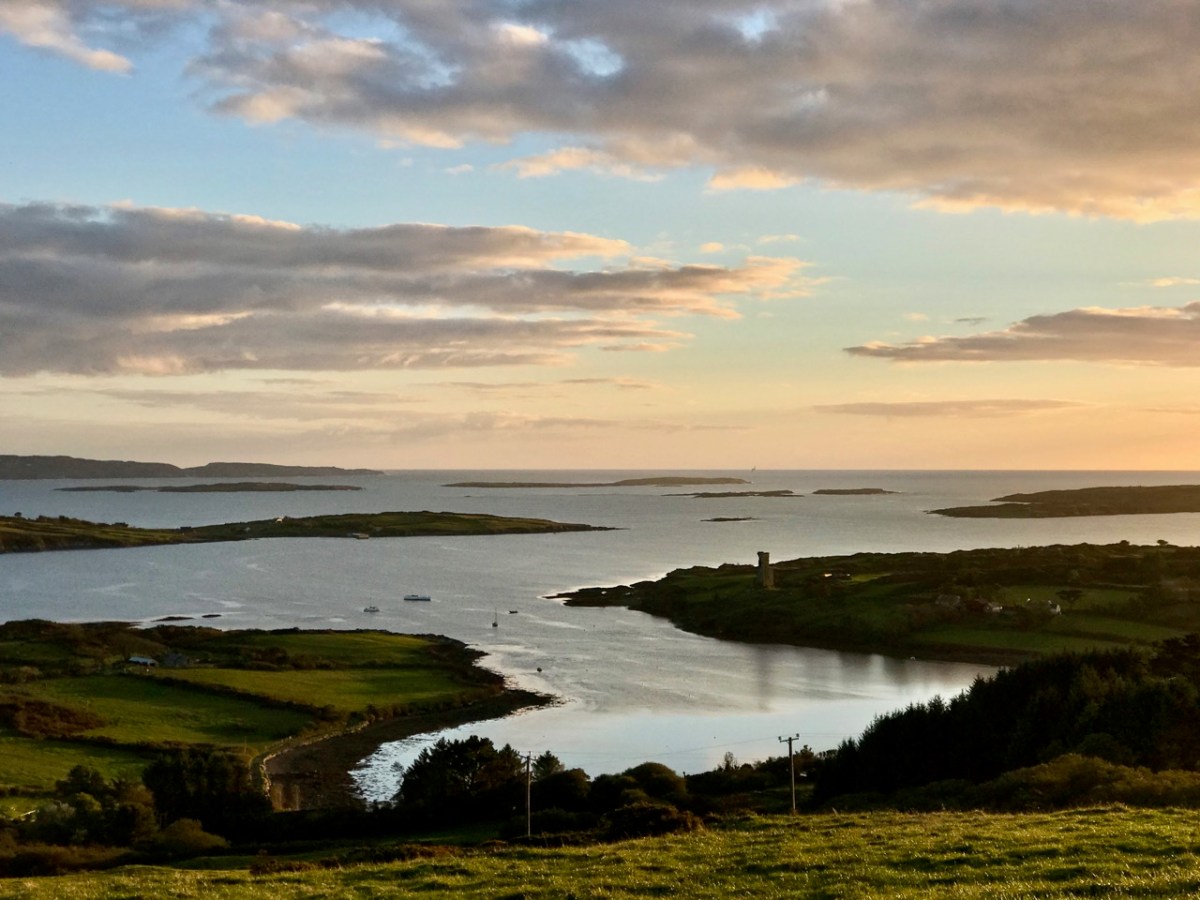
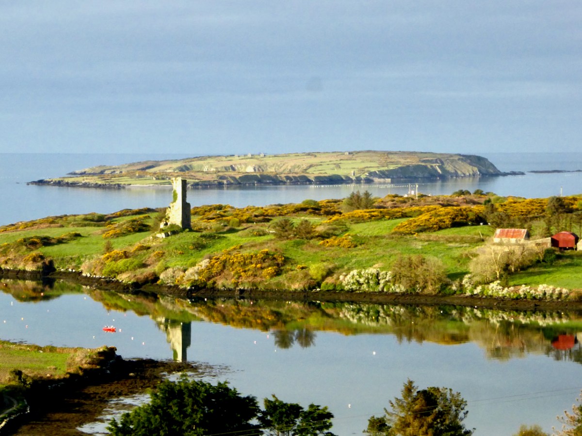
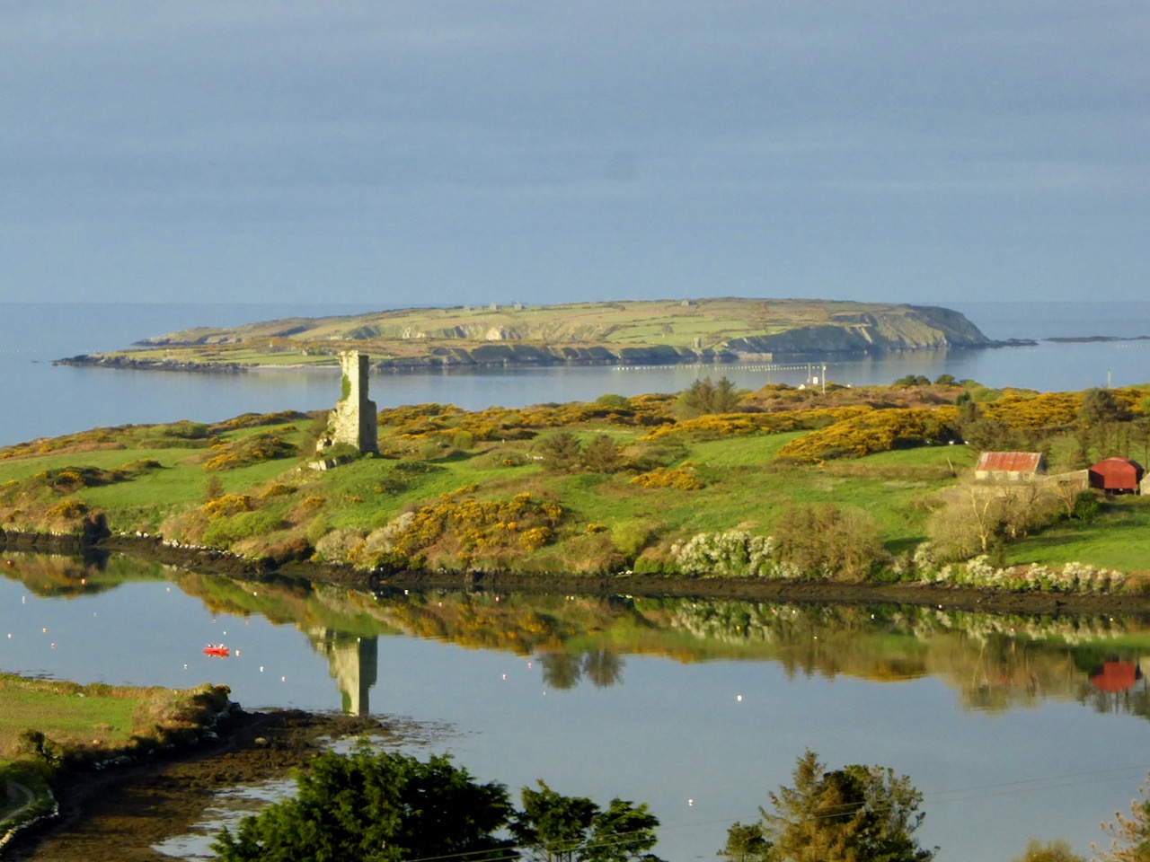
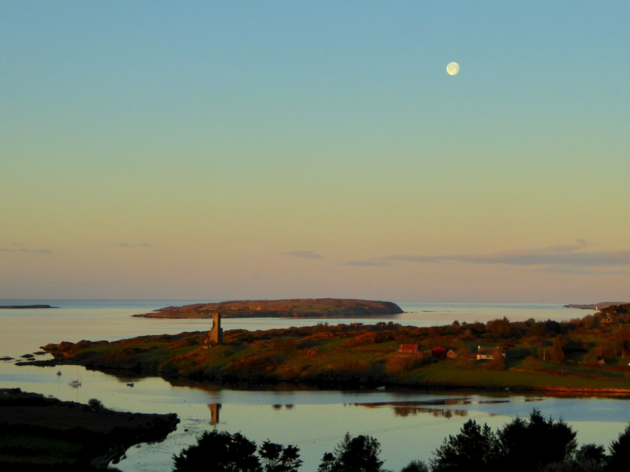
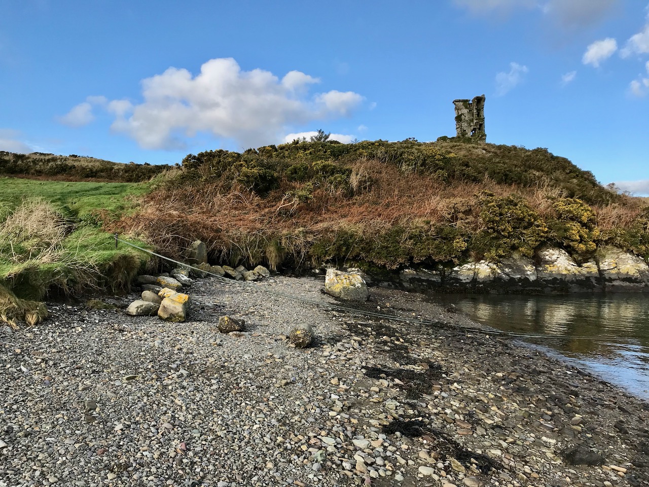
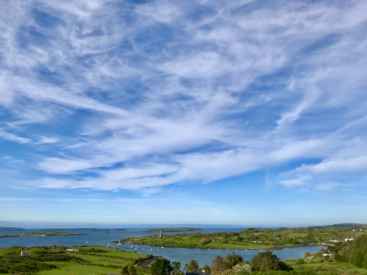
Above: looking down on Rossbrin Cove with some of the islands of Roaringwater Bay beyond. It is a natural harbour, and there is a thriving boatyard at the western end of it. The difference between low and high tides is around 2.5 metres on average, and much of the inlet dries out when it is at an extreme low. I timed my walk to arrive when the tide was fully down, as I wanted to explore the exposed mud-flats, with hopes of finding intriguing detritus.
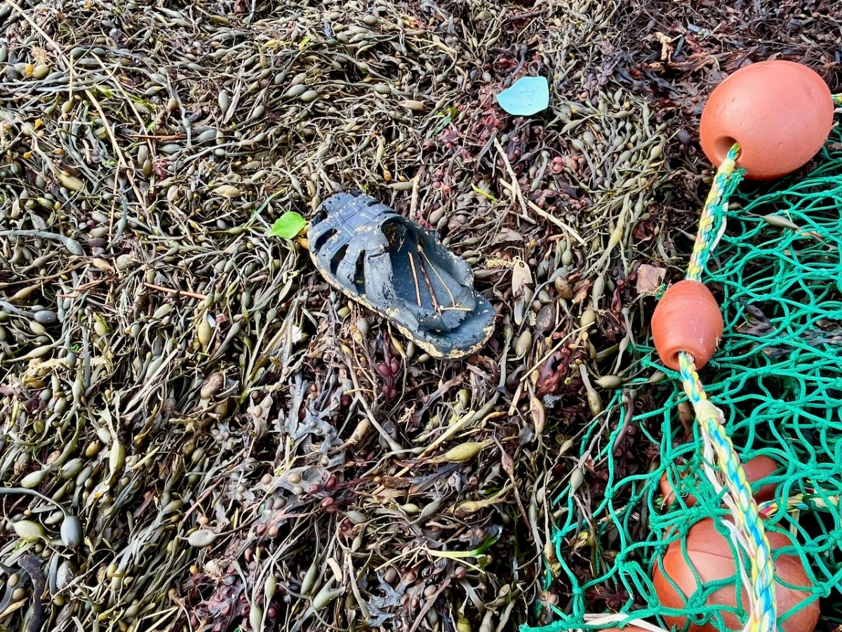
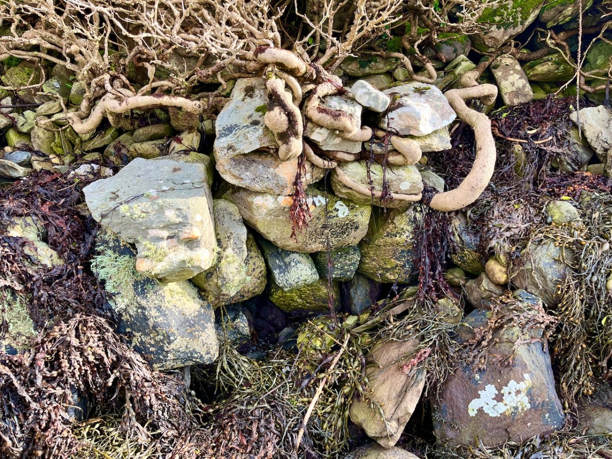
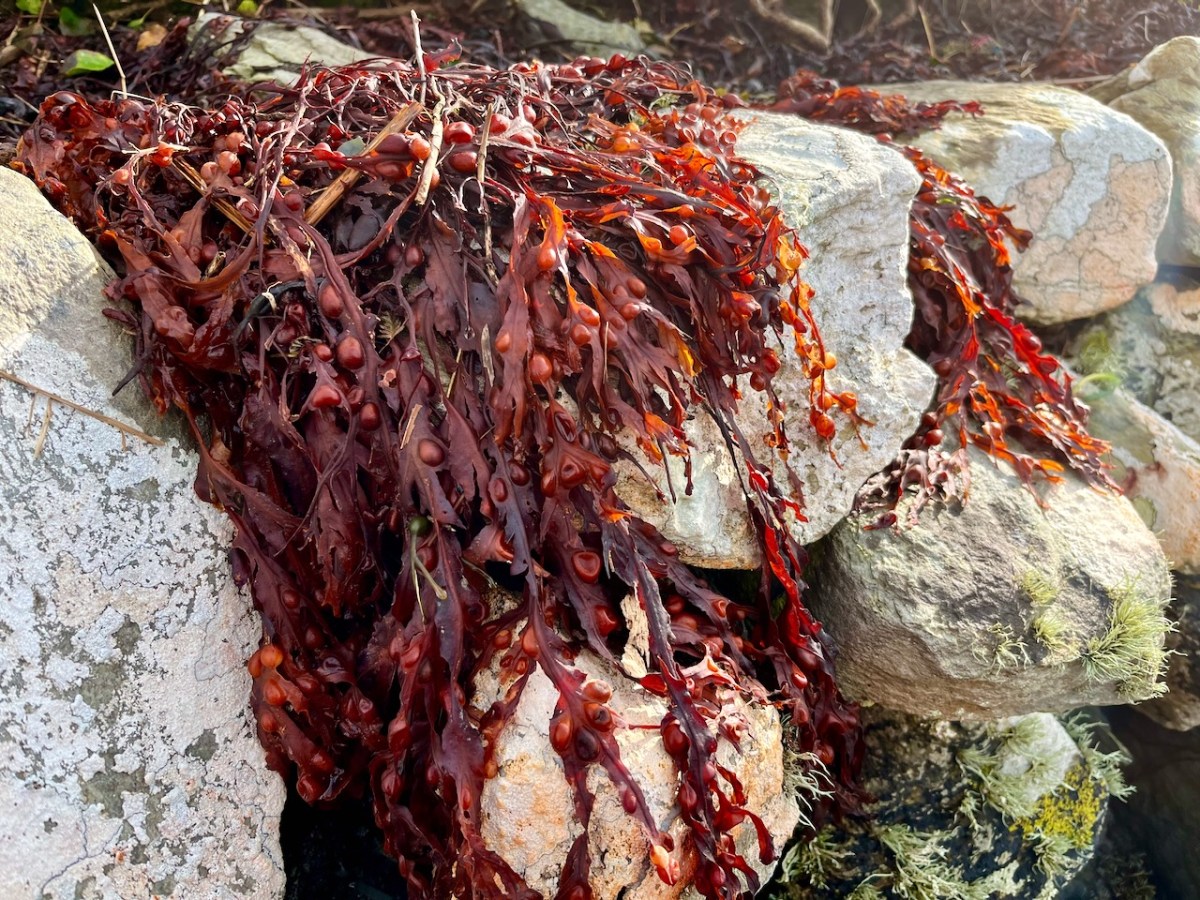
Not an inspiring start! In fact, as I continued my review, I noted that there was very little other than the natural environment – weather-worn boulders, skeletal shells and masses of seaweed – to disturb the order of things in Rossbrin on this February day. If our harsh storms had been of some positive effect it was perhaps to flush out any washed-up debris that might have accumulated in the winter – being now past St Brigid’s Day I consider it appropriate to call the season spring.
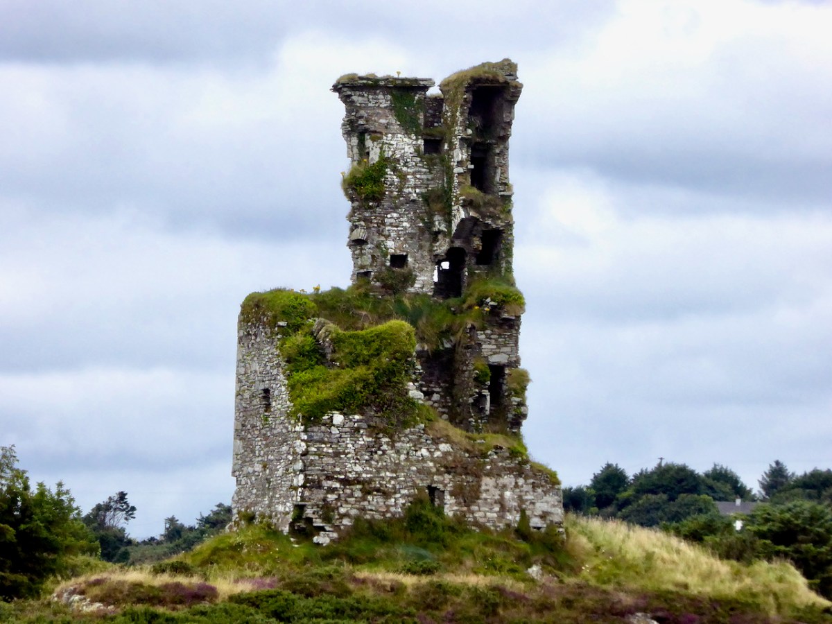
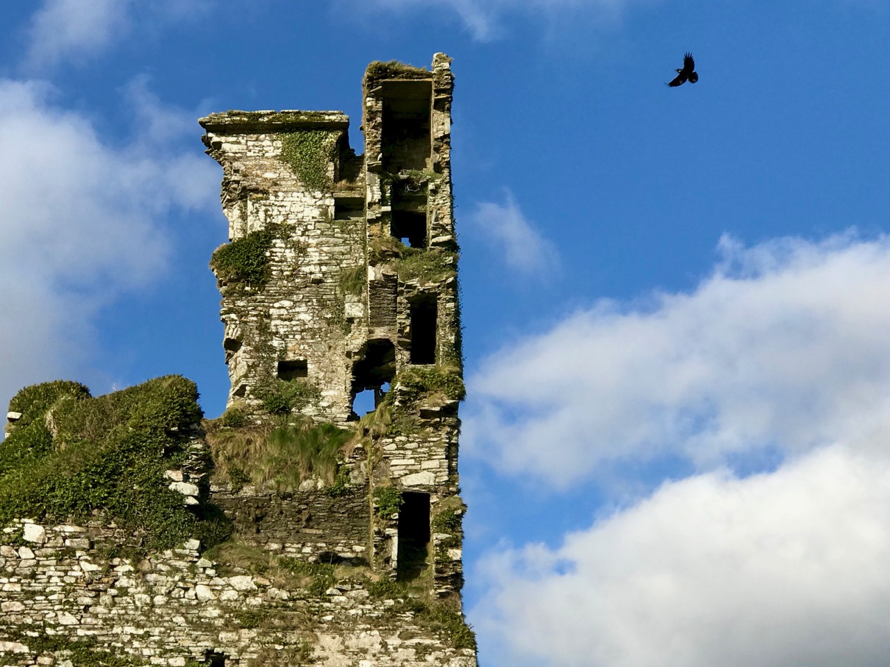
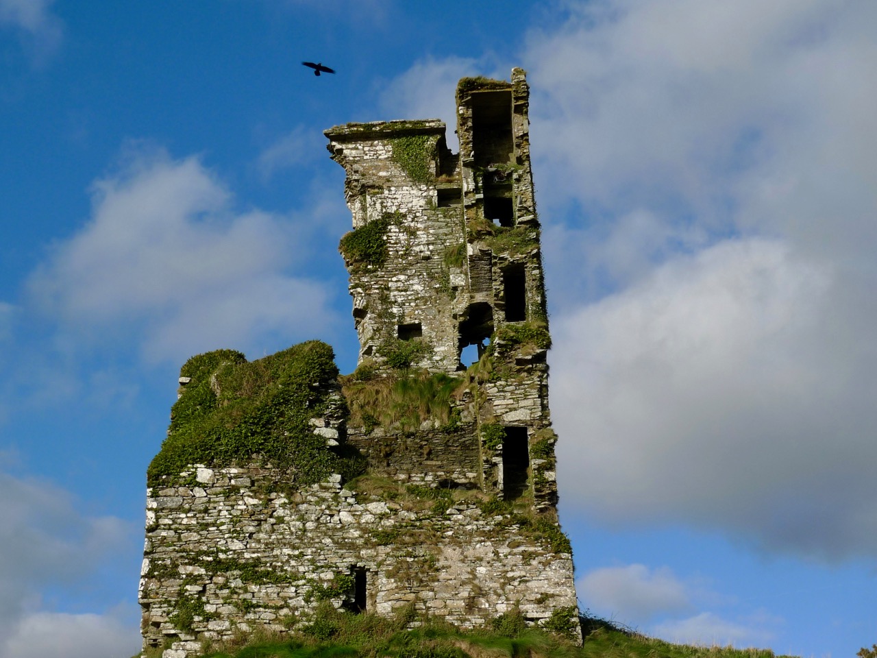
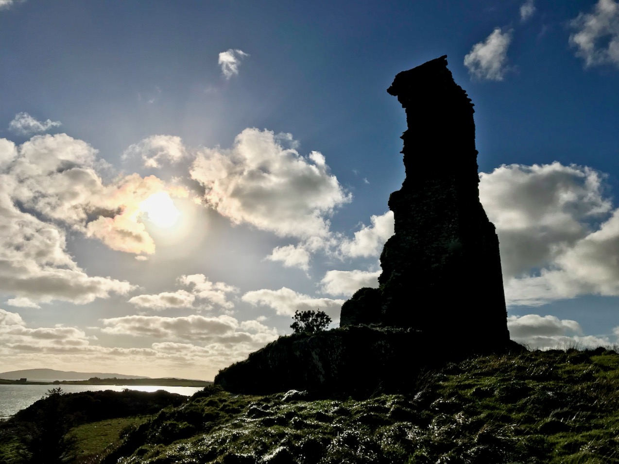
No matter that the exploration was superficially disappointing, the magic of this little bit of West Cork soon took over, and my mind was filled with the enormity of its history. There was a university here in medieval times: manuscripts were written here in the castle that has become a crumbling pile. Ravens and seabirds now rule over the stronghold. I walked on.
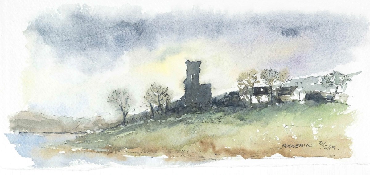
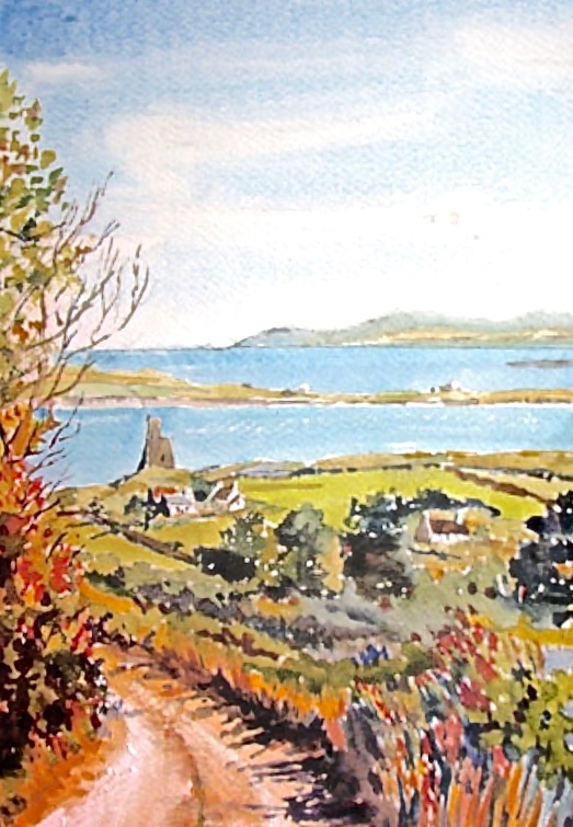
The margins of the cove are lined with ancient banks. At every turn there is a composition which a maestro could frame: I make do with a camera. Rossbrin inspired our artist friend Peter Clarke . . . Thank you, Peter!
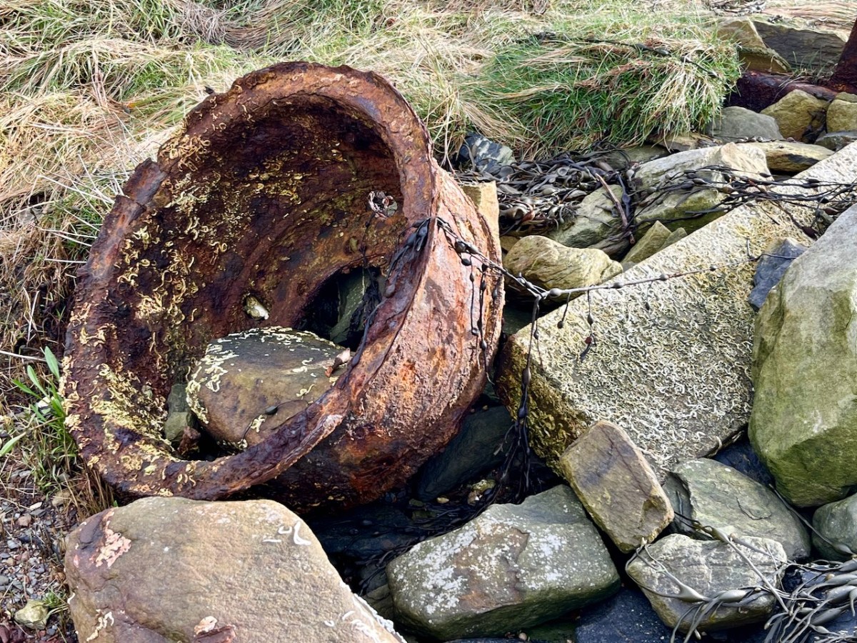
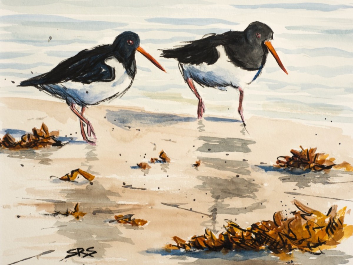
Evidence of more recent history: possibly a pot which was used in the process of tarring a clinker boat hull. No doubt vessels were built on these shores – and used to make basic livings. There is still fishing activity in and around the cove; mussel beds thrive in Roaringwater Bay; seaweed collection happens also. In summer months the deeper waters of Rossbrin are occupied by leisure orientated sailing craft. I enjoy the calm days of winter when there is hardly anything on the water. I watched a small flock of oystercatchers scurrying and foraging with their brilliant beaks, and then I turned for home.
The Rossbrin oystercatchers were uncooperative, and wouldn’t let me photograph them. Instead I have imported this wonderfully atmospheric painting by Cornish based artist Steve Sherris. Thank you, Steve
We have posted extensively about Rossbrin Cove, its history and its people. Have a look at these:
Last week we gave a brief introduction to the wealth of historical material that we can find in the website devoted to the 17th century Down Survey – here’s a link to that site, and another (here) to our previous article. The subject – and some of the deeper detail we can discover in the website – is well worth a further look.
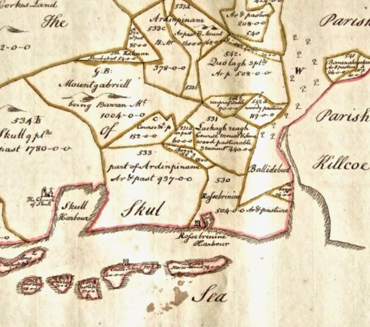
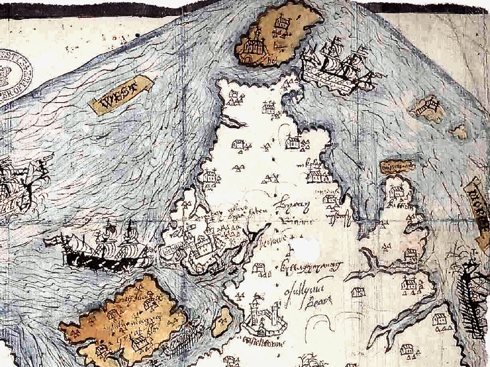
The Down Survey (the above view of some of the islands out in Roaringwater Bay is extracted from it) was carried out between 1656 and 1658, and thus gives us an excellent picture of how terrain we are so personally familiar with was perceived pictorially in the mid 17th century. We don’t know who the surveyors were, except that they were under the command of Sir William Petty, ‘surgeon- general of the English army’. Ireland became one of the most-mapped countries in the world at that time, following the Cromwellian and Williamite land redistributions. The beneficiaries were the new landlords of the Ascendancy, who wanted to know exactly what they had acquired, and the initial emphasis was on boundaries and basic land-measurement.
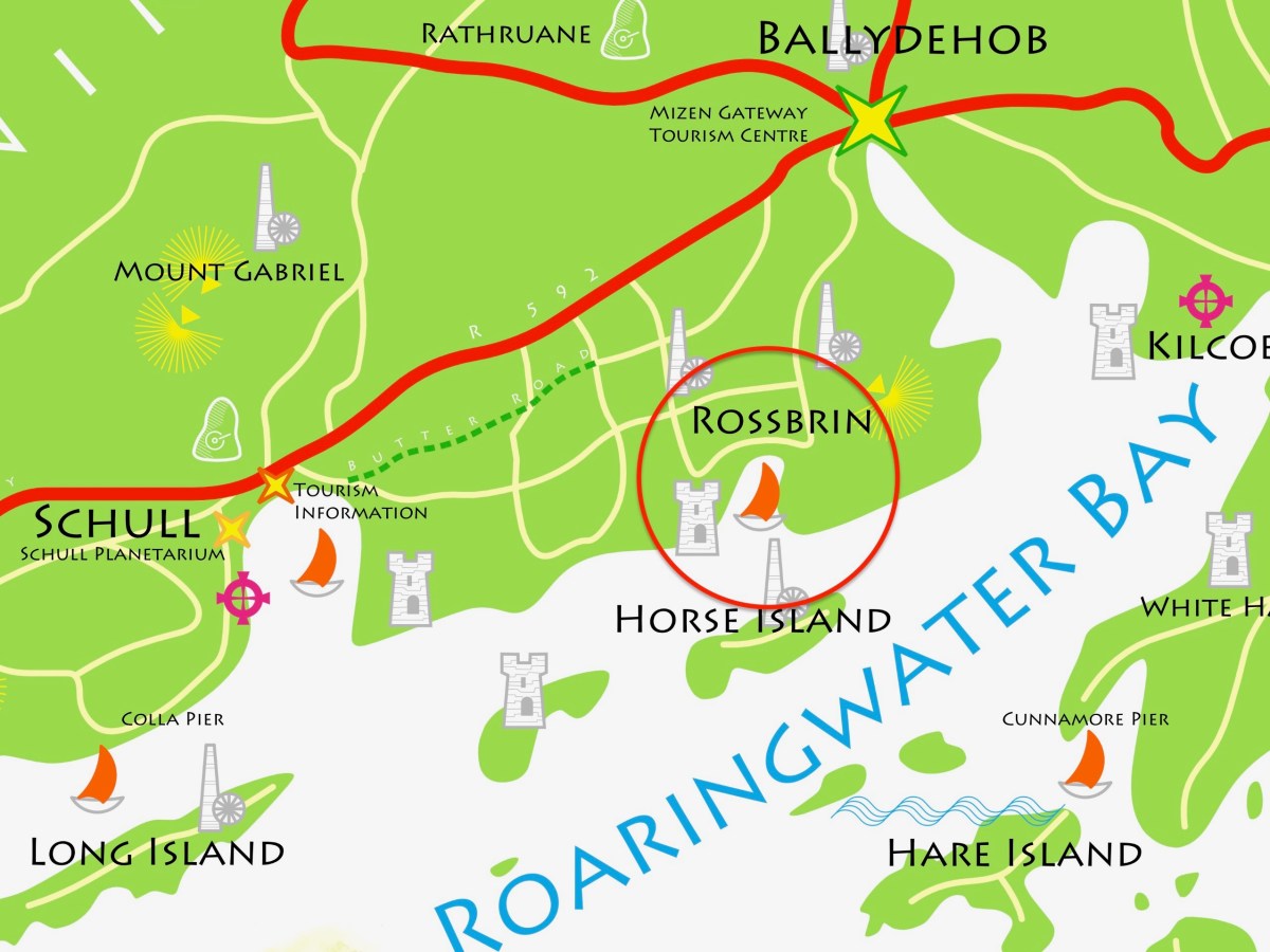
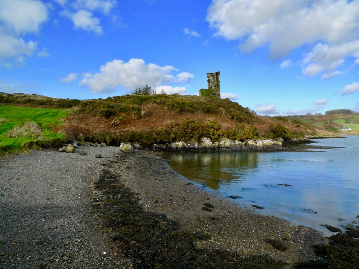
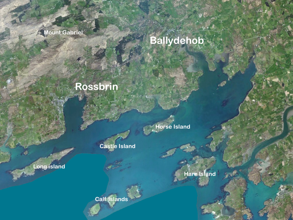
We wanted to know what our little bit of West Cork looked like on those earliest maps. Our view is down toward Rossbrin Cove, below where we live, and our house is a mere blip on the contemporary aerial view at the top of the page. In the first example from the Down Survey mapping – under that view – the cove of ‘Rofsbrinine Harbour’ is marked, and the castle, whose remains still guard the harbour entrance to this day (above), is clearly shown.
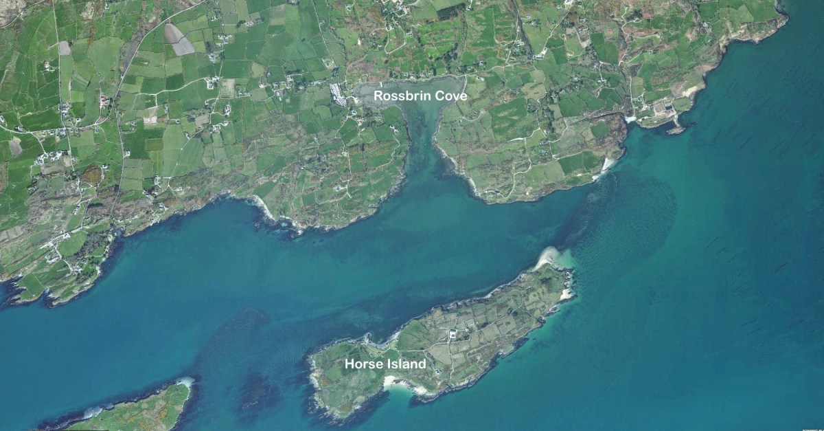
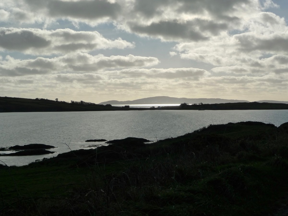
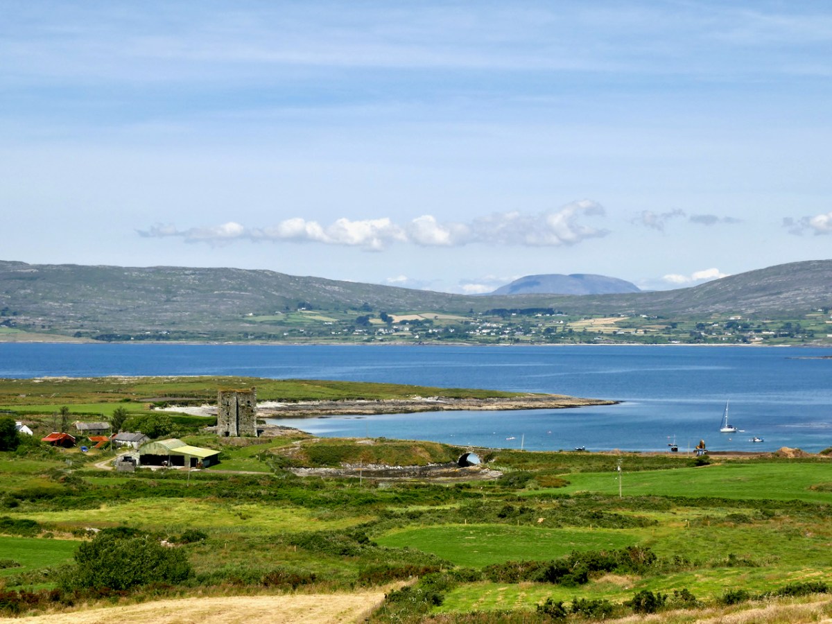
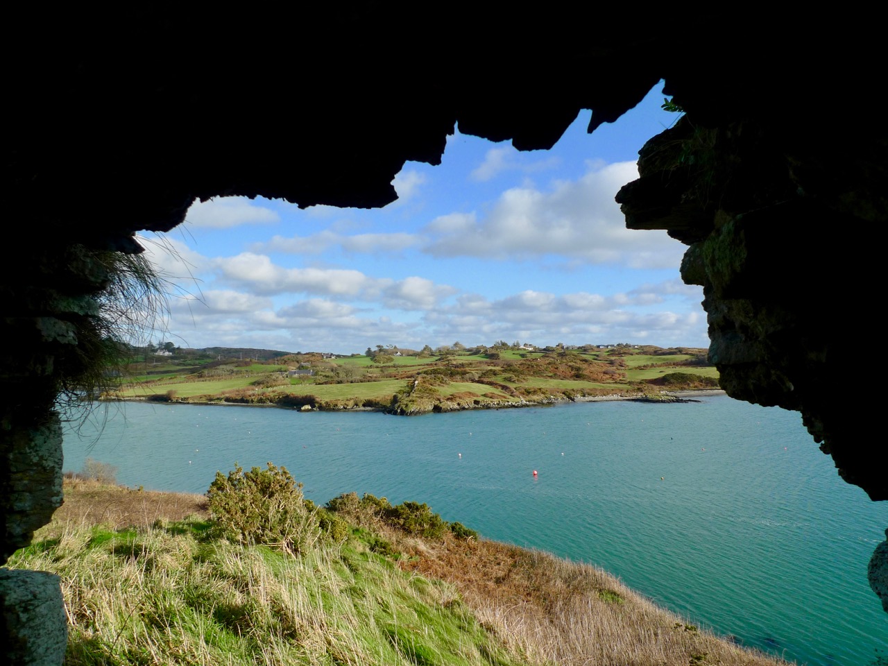
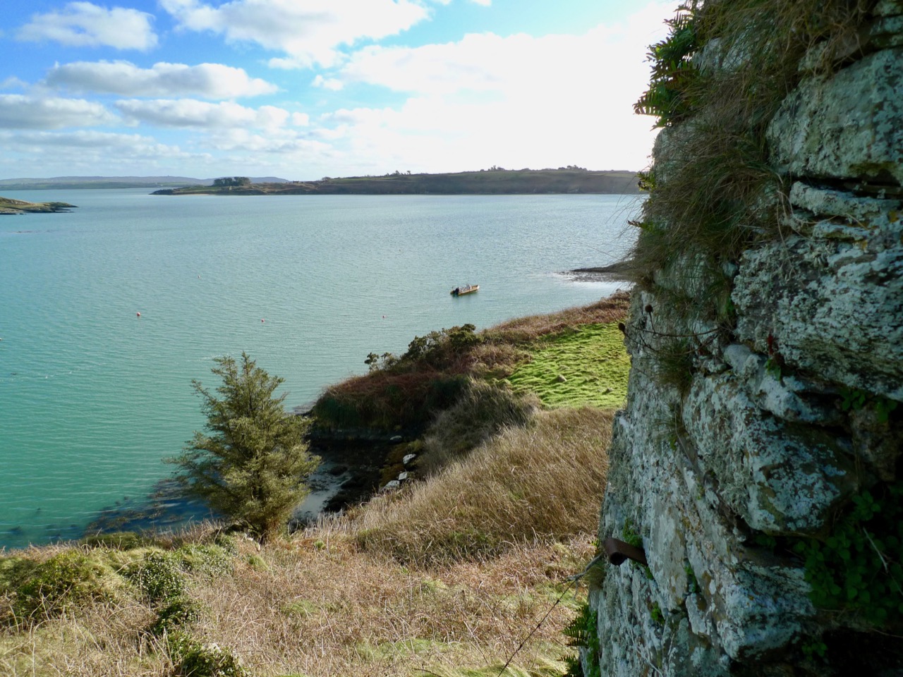
This view looks across the channel from the site of Rossbrin Castle. Immediately in the foreground is Horse Island, while beyond is the distinctive profile of Cape Clear. Let’s look at the Down Survey entry for Cape Clear – with. for comparison – a modern map of that island below it.
That map, above, is taken from a nautical chart. It’s understandable that a 17th century map wouldn’t have the level of accuracy we would expect from a modern survey, but take a look, now, at this contemporary aerial view of Cape Clear Island:
It’s remarkable, I think, how strikingly the early map resembles the profile – if not the fine detail – of the modern chart – and also the shape of the island as shown on the aerial view. For example, the ‘Bill of Cape Clear’ shows up very clearly on the chart – the beak-like protrusion on the far western end of the land-mass – a feature which is represented as very similar on the 17th century version, and of course on the modern prospect. Here’s a view of Dún an Óir – Cape Clear’s castle – today:
Just to add to the experience, the above satellite view gives a more ‘flattened’ impression of what is really going on locally: compare this to the expanded view of our coastline from the Down Survey – note that ‘Cape Cleare’ is included on this extract:
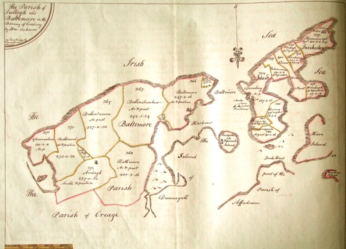
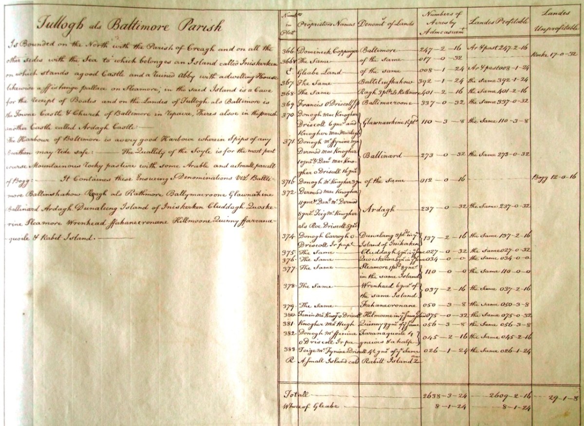
As a further example, to finish off this brief overview (which will be continued in future posts) let’s have a look at the Down Survey entry for the Baltimore area – a little further along our coast, travelling east:
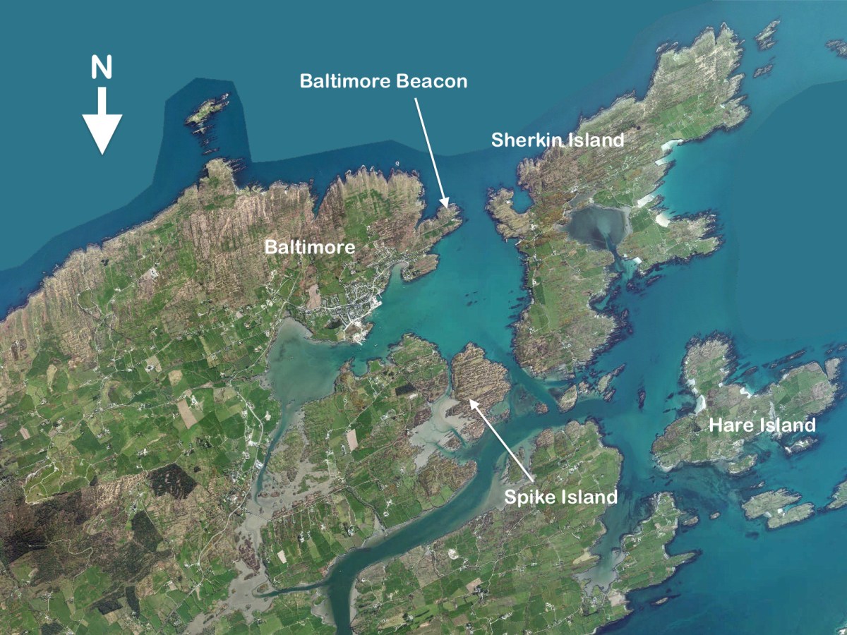
This is in fact the Down Survey entry for the Parishes of ‘Tullogh & Baltimore’. The first thing to note is that the north point is facing downwards! If you look at many of the survey pages the orientation varies considerably, and is probably more to do with what conveniently fits on a sheet than any attempt to be consistent. So that we can make an easier comparison with today’s terrain, I have also switched the orientation of this aerial view:
In my opinion it’s remarkable that the Down Survey maps do bear a very reasonable resemblance to the reality. Obviously, a great deal of detail is missing, but the purpose of the maps – to delineate land ownership – is satisfactorily served (albeit that this is to the benefit of the incoming English lords and landowners).
Here’s a view of the site of the medieval fish palace at Baltimore. The Down Survey comprises more than maps: there is other related material, including terriers. These particular terriers don’t have legs or tails – it’s a term for a written, descriptive survey of an estate: some english examples are recorded from the ninth century. Here’s the terrier for Baltimore within the Down Survey:
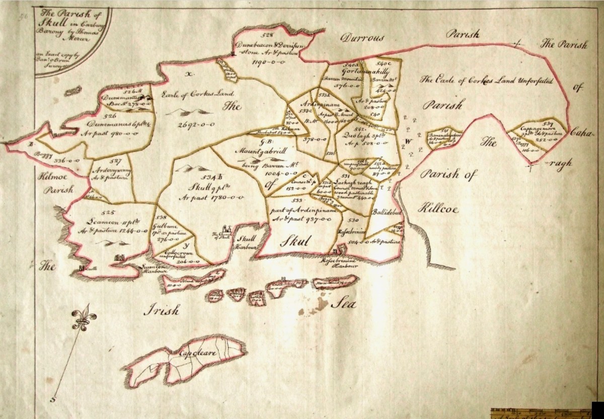
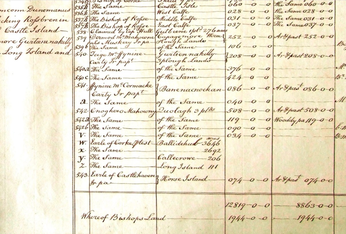
The terrier in this case is mainly a description of parcels of land, their owners, and the values. Here’s a closer example, from a terrier for ‘Skull’:
There’s a lot more of West Cork within the Down Survey archives. A future post will turn in greater detail to some of this material.
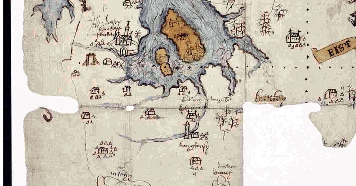
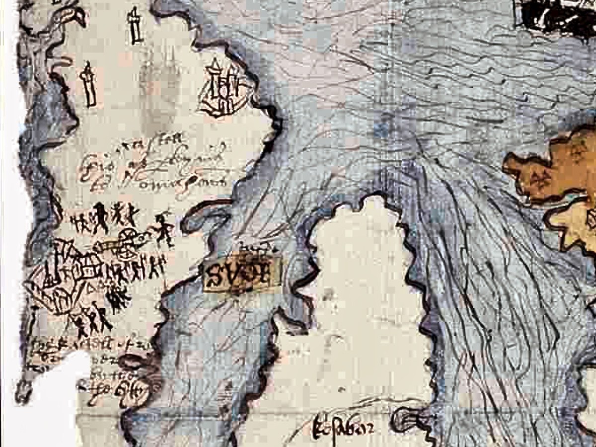
Last week we took a look at this intriguing map and picked out many of its features. This week we want to see what is actually being depicted in this extraordinary document. By the way, before we get on with that – what is that strange construction beside the Bantry Abbey? A drying rack? A Gallows?
The main source I am using is the article written by P.O’Keeffe (this may have been Paddy O’Keeffe of Bantry – if anyone can confirm this I would be grateful). It was published in the Journal of the Cork Historical and Archaeological Society in 1958. It’s a brilliant piece of analysis based on a close reading of the map, cross-referencing with the Pacata Hibernia, and a deep dive into the few other sources for medieval West Cork History.
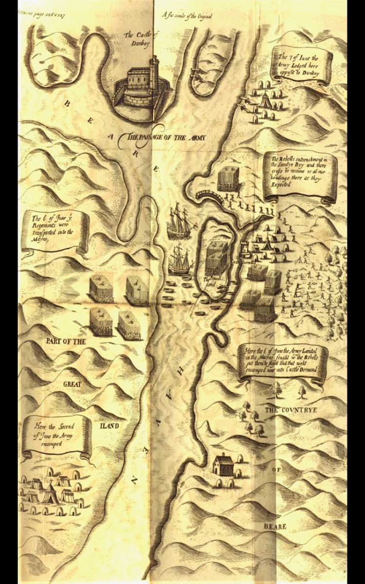
The Passage of the Army – an illustration from the section of Pacata Hibernia dealing with the Siege of Dunboy
First, a very brief background – a slightly more detailed version can be found in Robert’s 2019 post, An Excursion to Dunboy. After the Battle of Kinsale, where a combined force of Irish and Spanish were defeated by the British, Donal Cam O’Sullivan Beare retreated to Dunboy. Having forcibly taken it back from the Spanish commander whom he had left in charge and who was prepared to surrender it, he strengthened its fortifications and leaving it in charge of a deputy, he departed for Ardea Castle to meet a Spanish ship bringing reinforcements and supplies.
While he was absent the British made their way, by land and sea, to the Beara, attacked and destroyed Dunboy (with some assistance from Donal Cam’s cousin, Owen O’Sullivan of Carriganass), killing or subsequently hanging (in Castletownbere) all the defenders and inhabitants. The also murdered all those who has sought refuge on Dursey Island. This all happened in June 1602.
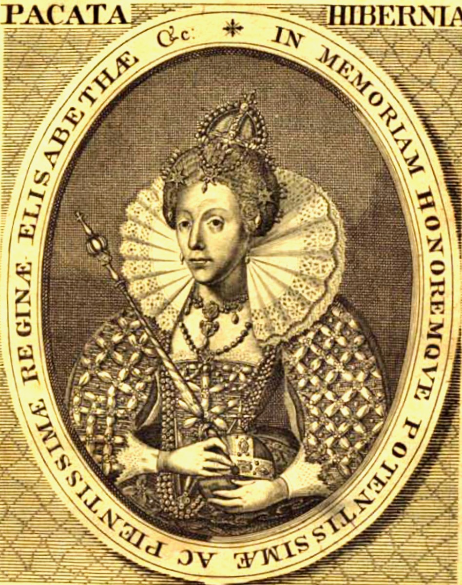
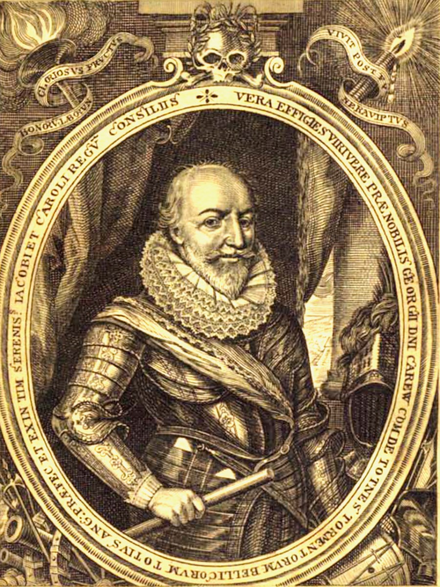
The campaign that marked the end of the Nine Year’s War was chronicled in a book called Pacata Hibernia, (Ireland appeased and reduced; or, an historie of the late warres of Ireland), written by Sir Thomas Stafford and dedicated to Elizabeth I (above) and to his boss (and possible father), George Carew, the President of Munster (below). Stafford lays out the course of each battle, siege and engagement, illustrated with maps and drawings.
Seen as glorious victories by the British, the Battle of Kinsale and destruction of Dunboy spelled the death-knell of the power of the old Gaelic lordships in West Cork and ushered in the large-scale takeover of Munster by the new planter class who arrived to a devastated and depopulated landscape. A visit to Dunboy (below) nowadays does not in any way convey the seismic effect this siege had on Irish history.
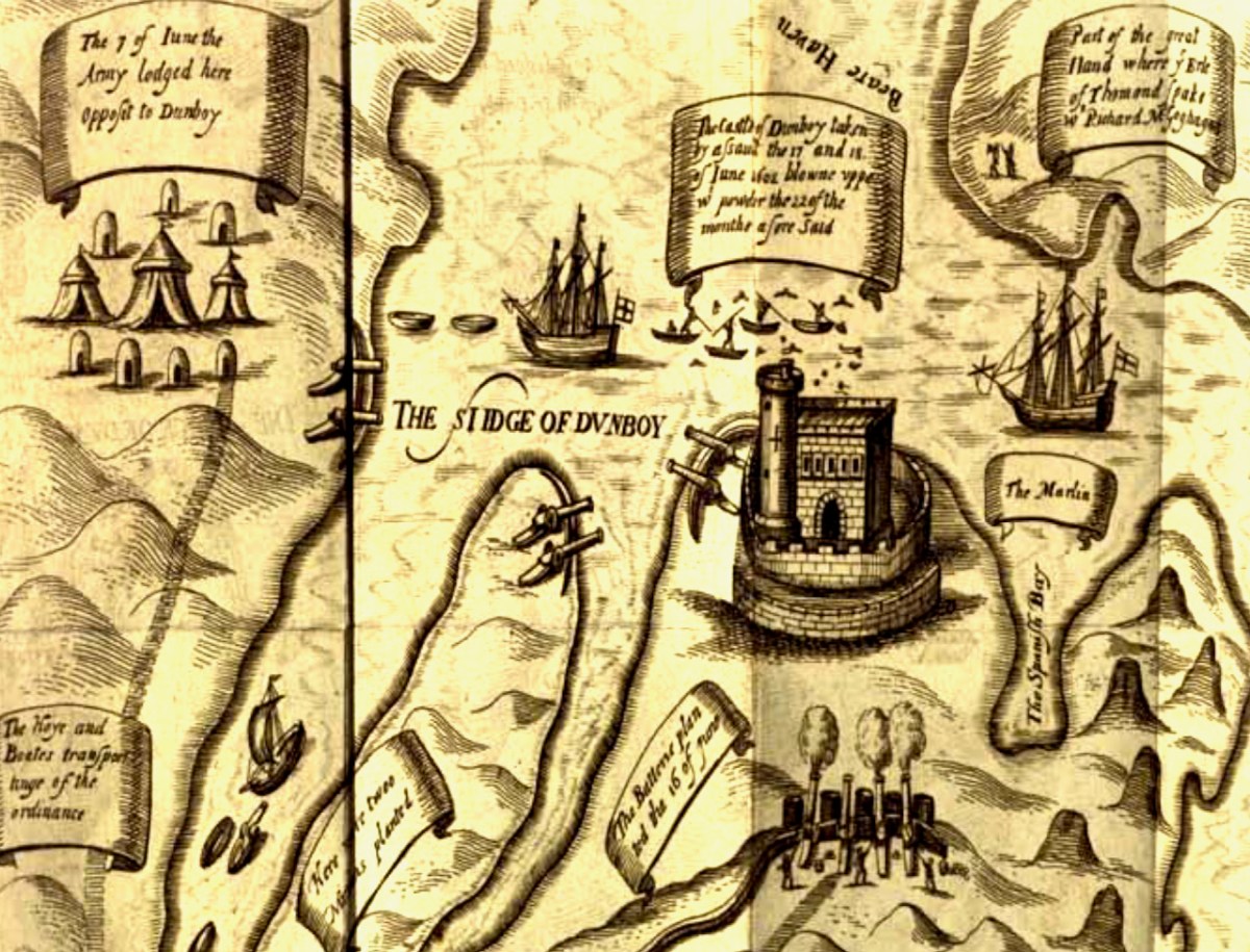
Because a previous historian had assigned this map to the 1550s, O’Keeffe goes to great pains to demonstrate that what is depicted here is indeed the Siege of Dunboy.
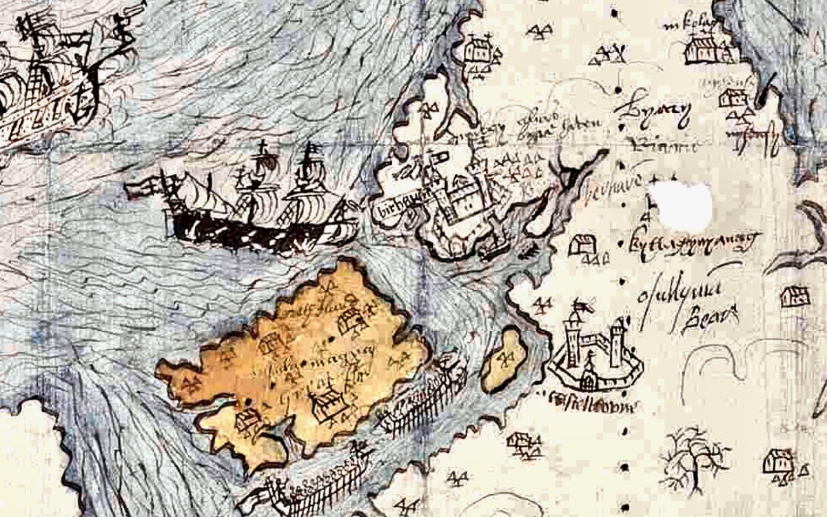
Thus, the movement against Dunboy, in its initial stages, was entirely a naval action, ships playing a vital role in ferrying troops, guns and supplies, firstly to Bear Island and secondly to Dinish Island, thirdly, to the mainland and into strategic creeks about Dunboy, and, finally, to the Dursey. The principal islands mentioned in the Pataca report are Whiddy, Great Island (Bear Island) Doughe Insh (Dinish Island) and Dursey, and each one of these played a vital part in the attackers’ plans. Can it be coincidence that these islands are specially emphasised in our map by colour washes? Troops were ferried from Muintervarry to Bear – the map shows two galleys being rowed up the Bear Island Sound. Boats ran the fire of Dunboy into the Creeks about the castle. The map shows boats in precisely similar positions.
A Spanish ship came to Kenmare Bay carrying Bishop McEgan and Turlough O’Brien with supplies and money. The map shows a Biscayner being rowed out of Kenmare Bay. A pinnace and three other boats went to capture the Dursey – a ship is shown clearing the Dursey Sound. Finally, the boundary line on the Muintervarry Peninsula, and the dotted ‘scale’ embrace the specific region mentioned on the Pacata Hibernia. Can the occurrence of all these features be purely coincidental? It seems unlikely, and unless serious arguments can be advanced to the contrary, we must consider that the map was used to illustrate the events of Dunboy in 1602.
O’KEEFfe, P., A Map of Beare and Bantry, Journal of the Cork HISTORICAL and Archaeological Soc 1958, Vol 63, No 167
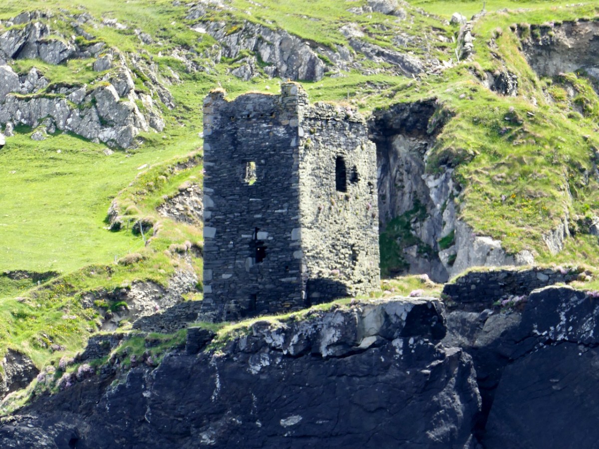
Very convincing. What remains a puzzle, however, is the castle that is being besieged on the Mizen Peninsula. O’Keeffe has deciphered two words above the castle as ‘Kastell’ and ‘Omahons’ and the inscription below as ‘the kastell of rosebry . . . wer . . . by the m . . . of the Cytty of . . .’ The drawing may show that the tower inside the bawn has already been destroyed by the cannon outside the walls, being fired by a soldier in a plumed hat. Troops are shown with muskets, crossbows and axes. The bawn wall has at least one corner tower and a substantial gatehouse.
The inscription appears to verify that this is Rossbrin, and we do know that the Rossbrin O’Mahonys took part, on the Irish side, in the Battle of Kinsale, so it makes sense that their castle would come in for the same treatment as Dunboy. However, only one authority (Smith*) states that Rossbrin was besieged by Carew in 1602, while others assert that it was not, and that the tower was substantially intact up to comparatively recent times. There is no mention of actions against Rossbrin in Pacata Hibernia. O’Keefe speculates that what is being illustrated may be the recorded siege of Rossbrin in1562 when “the authorities in Cork fitted out an expedition to capture the castle from the O Mahonys” or in 1571 “when Perrott attacked and captured the castle.”
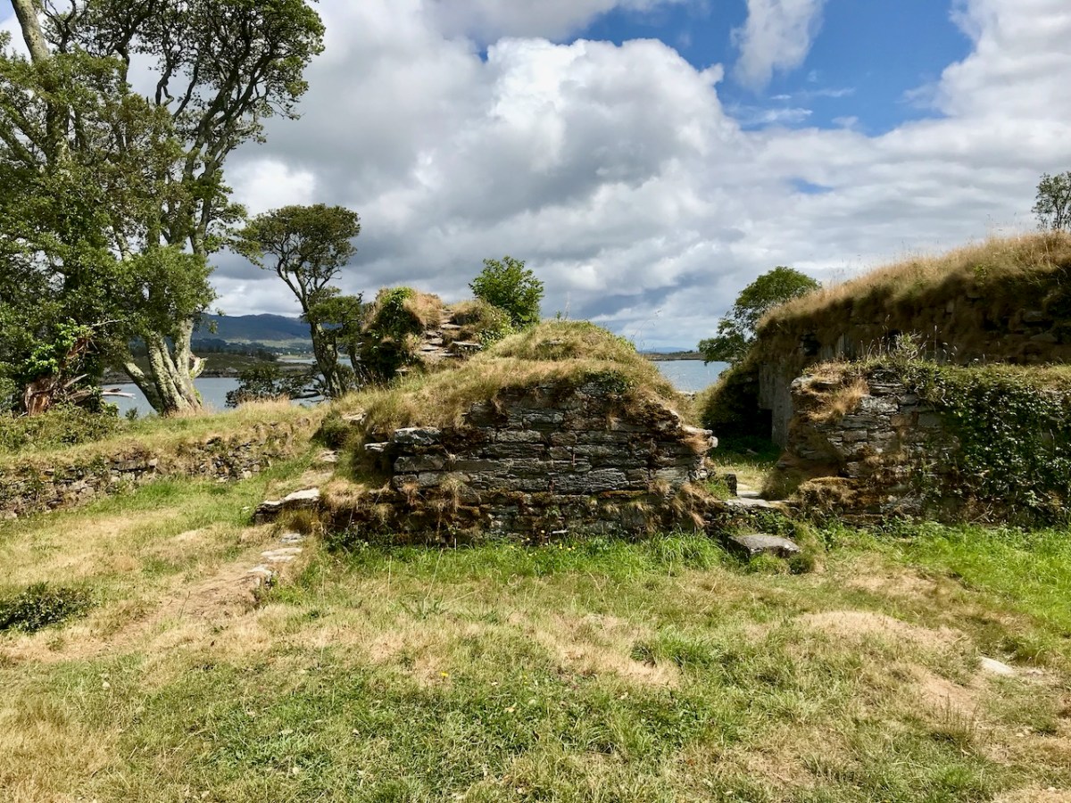
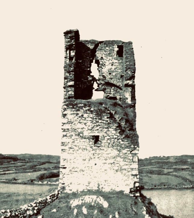
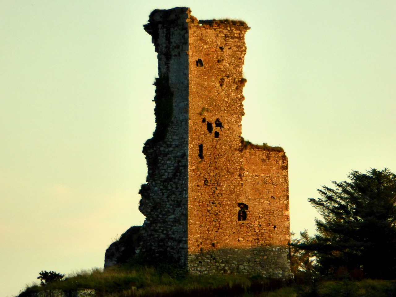
However, this calls for some chronological sleight of hand – in order to establish that what is depicted on the map is a siege of the 1550s, O’Keefe postulates that this map was produced in the 1550s and then later modified to include the Siege of Dunboy. Not very likely, given that his rationale for assigning it to 1602 is so clear, and the map has all the unified appearance of being done at one time and by one hand. What’s left of Rossbrin now can be seen above and below.
The other possibility is that the castle of the Mizen being besieged is not Rossbrin. In this case, the likeliest candidate would be Dunmanus (below), which was captured by Owen O’Sullivan of Carriganass. While the castle under siege on the map is on the correct side of the Mizen for Rossbrin, and not Dunmanus, we have already seen in Part 1 that Ardea Castle is located on the wrong side of the Kenmare River, so perhaps the cartographer was a little more approximate with some locations than others, or perhaps the boundaries of the paper available for the map forced a couple of castles to be squeezed in, even if the location wasn’t totally accurate.
I have yet another resource to consult, but I don’t have access to it yet, so it is possible that there is more, and better, analysis of this map. If so, I will either write a future post, or revise this one. Meantime, I would be interested in anyone else’s take on The Story.
*Smith, Charles, 1893, The Ancient and Present State of the County and City of Cork (available here)
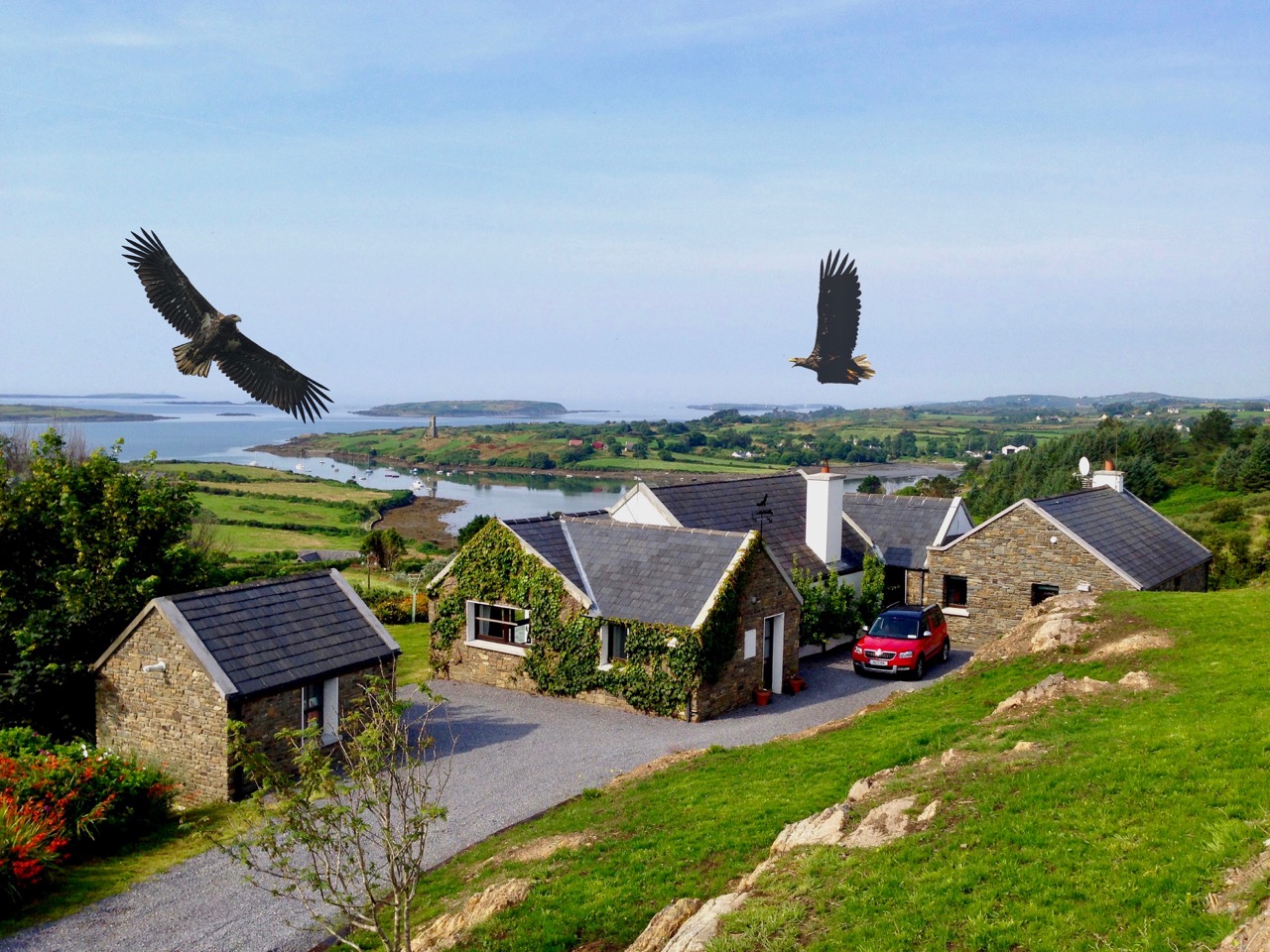
Last week we talked a little about the history of Rossbrin’s medieval castle, and the importance of this natural inlet as a historical centre of fishery, scholarship and European culture. Rossbrin Cove stills serves as an anchorage and refuge for sailing boats on the edge of Roaringwater Bay, but is now a peaceful haven, with only the sounds of the shore birds and slapping masts to lightly disturb an overriding tranquility that gives the place a very particular atmosphere. Our photograph (above) is taken on the boreen going to the castle; on the skyline in the centre is a wind turbine, and just below that is Nead an Iolair (Irish for Eagle’s Nest). The picture below shows the eagles wheeling over our house, with Rossbrin Castle and our view to the Cove beyond.
I have been exploring images of the Cove and its castle – some historic photographs and a few artists’ impressions. As it’s right on our doorstep, we have taken many pictures of Rossbrin during our years here. I am also sifting through a few of these.
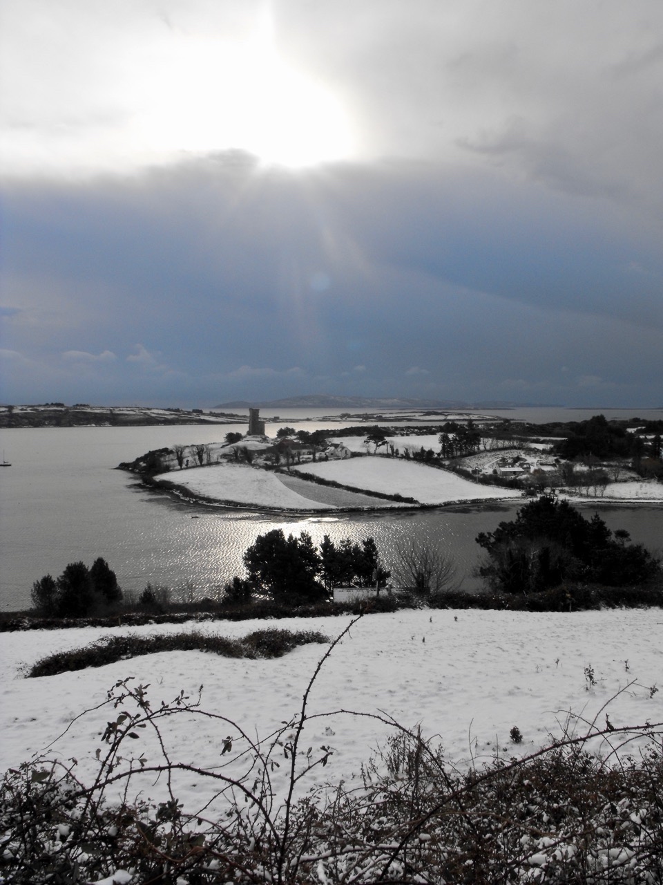
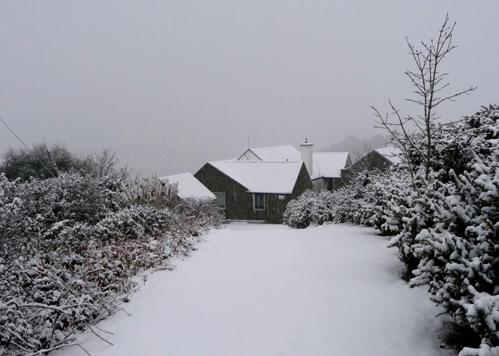
Ten years ago, the west of Ireland experienced an exceptional snowfall, and above is a photograph taken by our near neighbour, Julian van Hasselt, before we arrived. Mostly, our weather is relatively mild due to the effects of the gulf stream on the south-western coast. The castle can clearly be seen here, beyond the fields of Castle Farm. This view of our house (below) was also taken in 2010 by our neighbours Dietrich and Hildegard Eckardt:
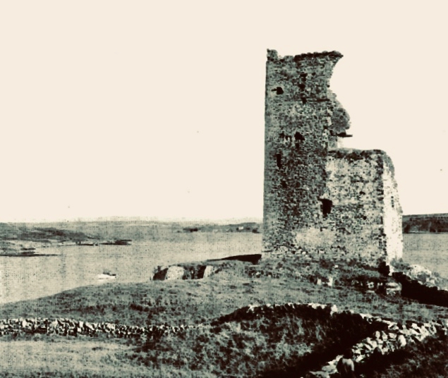
I showed a couple of early photographs of the castle last week. Here are two more taken before a substantial part of the ruined structure was toppled by a storm in the 1970s:
It’s good to see a bit of context, so here is another winter view of the castle on its rock with Castle Island behind. That island was also part of the O’Mahony territory. It is farmed by its present owner but no-one lives there now. You can make out the ruined castle on the island by the shore, just to the right of centre; it’s one of many that can be seen on, or close to, the shores of the Bay.
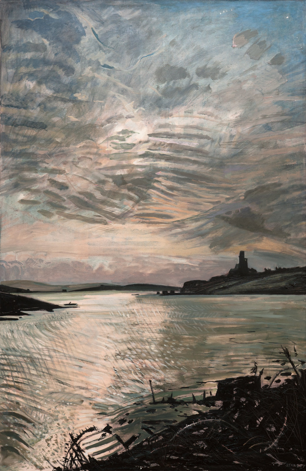
Let’s have a look at some of the art works that feature the Cove and the Castle. Jacqueline Stanley was one of many artists who was attracted to the beauty of West Cork. Now in her nineties, she moved from England to Ireland in the mid 1970s and purchased the old School House at Rossbrin as a country retreat: it has only recently changed hands.Here are two of her works, depicting Rossbrin. You can find more on her website.
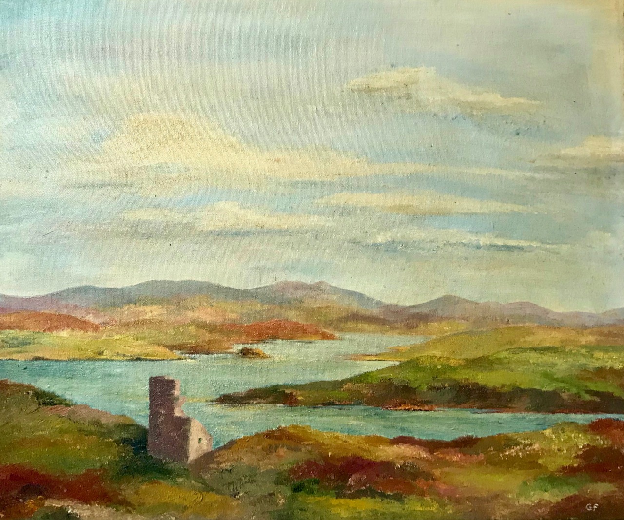
I particularly like this view (above) which was painted by Jackie from the vantage point above the high road going down to the Cove, close to the remains of the copper mine at Ballycumisk. Last week I showed a painting by Geraldine van Hasselt, Julian’s mother, also from the 1970s. Every painting or photo is a historical document – and important to retain, in view of the fragile nature of the structure today.
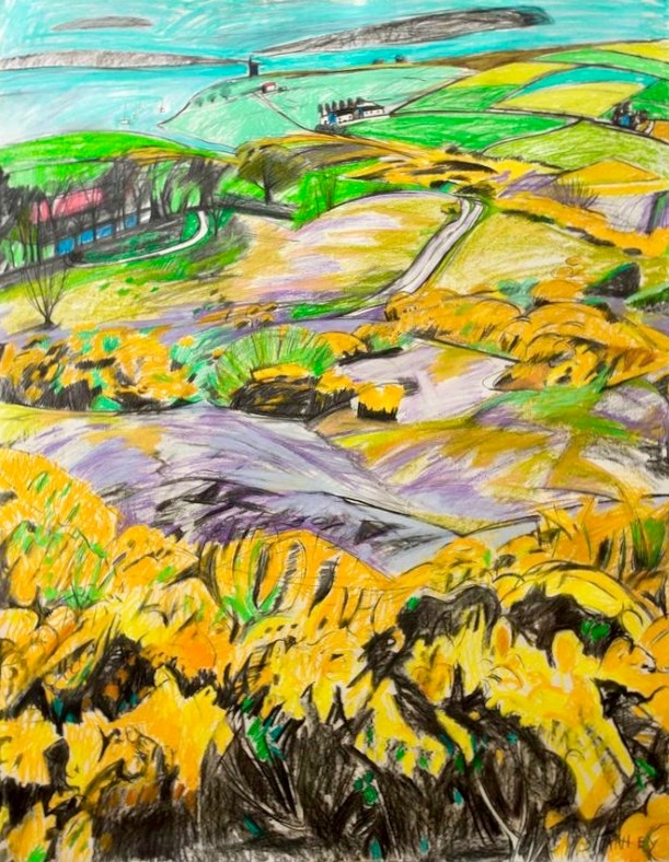
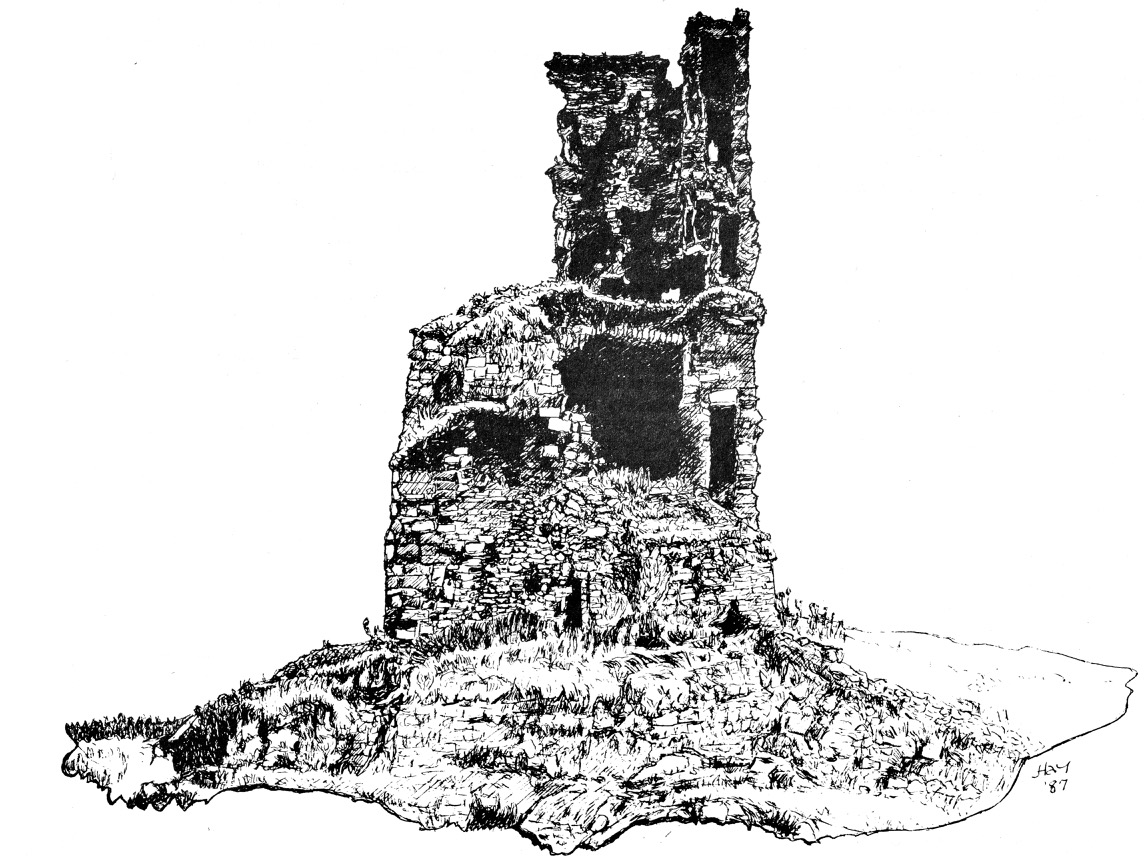
Our friend Peter Mabey is an architect and artist. He has lived in West Cork for a long time: he and I were at college together in Kingston, Surrey, and were surprised to meet each other by chance in Skibbereen market a good few years ago now. Above is one of his attractive watercolours looking down towards the Cove. The vantage point looks remarkably like the one chosen by Jackie Stanley. Below is a drawing of Rossbrin from the monumental work The Castles of County Cork by the late James N Healy, published in 1988 by Mercier:
The ruin is a romantic reminder of past times, enhanced by the changing weather moods of Roaringwater Bay. This photograph, by Finola, emphasises the character of the place:
I can’t resist finishing this little two-part foray into the medieval remnants of our historically significant ‘centre of culture and learning’, which now languish on the edge of the waters below us with an artist whose work we admire: Peter Clarke, who writes and illustrates the Hikelines blog. His watercolour sketches are exquisite and always atmospheric. He has kindly allowed me to use his portrayal of Rossbrin Castle as my tailpiece. Thank you, Peter – and thank you to all the other artists who have been inspired by this remote and beautiful part of Ireland.
It was just Raven and I, down at Rossbrin today. We were both inspecting the O’Mahony stronghold which has stood here for, perhaps, 800 years in one form or another. Peter Somerville-Large explored the area and its history in the early 1970s:
Down beside a narrow inlet which empties at low tide stands Rosbrin, the most easterly of the O’Mahony castles. Like the O’Driscolls, the O’Mahonys had a passion for building castles: they built twelve, and six survive, all overlooking or right on the edge of the sea. They shared with the O’Driscolls one of the finest fishing grounds in Europe, controlling the waters and exacting dues from visiting fishing boats in much the same way. ‘None of the fisheries of Munster are so well known,’ wrote an observer in 1688, ‘as those of the promontory of Ivaha, whereto a great fleet of Spaniards and Portuguese go, even in the midst of winter . . .’
The Coast of West Cork, 1972
Neither Raven nor I would be deterred by the winter weather. On a day of hard frost followed by blue skies and sunshine, nowhere could be more beautiful than Rossbrin, and nothing could be more poignant than the quiet remoteness of this western corner of Ireland, once considered ‘the greatest centre of learning in Europe’. I walked in the company of the wisest of the corvids over the vanished ruins of a great university.
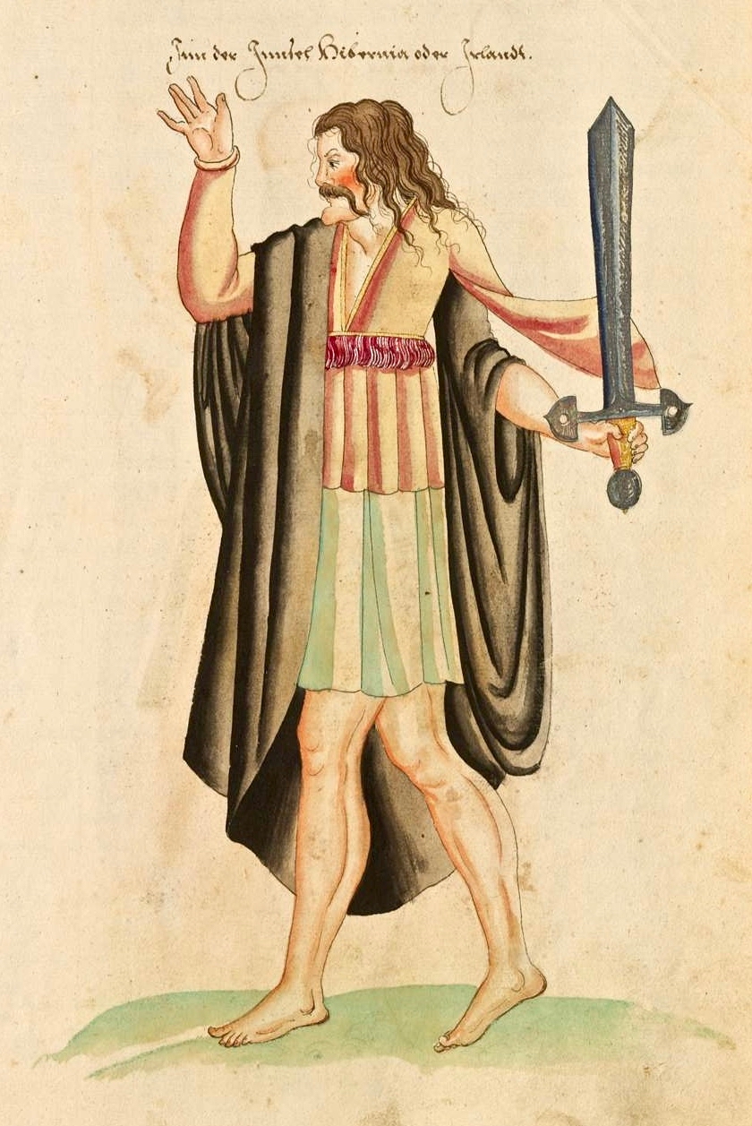
Finnin O’Mahony – Taoiseach, or chieftain, of the clan – as he may well have looked in the latter part of the fifteenth century (above): cultured, fashionable, flamboyant even, and powerful. It’s sobering to think that, while Columbus was following in the footsteps of Saint Brendan to rediscover the New World, scholars and scribes were busy on the shores of Roaringwater Bay writing and translating treatises, medical manuscripts and historical accounts of travellers busy in their quests to prove the earth may not be flat after all . . .
The Annals of Ulster tell us that Finghinn Ó Mathúna of Rossbrin Castle who died in 1496 was an acclaimed historian of the then known world. And, the Annals of Connaught lauded him as ‘a great scholar in Irish, Latin and English’. The Annals of the Four Masters referred to Finghinn Ó Mathúna as being unmatched in Munster for hospitality and scholarship. The O’Mahony territory was inclusive of today’s parishes of Dromore and Caheragh and all the lands westwards to Mizen Head. Finghinn made Rossbrin Castle both his residence and a rendezvous for Irish scholars . . . Most writers who laud the scholarship of Finghinn Ó Mathúna lament the loss of many of Rossbrin Castle’s manuscripts . . .
From an article by Alfie O’Mahony in the Skibbereen and District Historical Society Journal, Volume 6, 2010
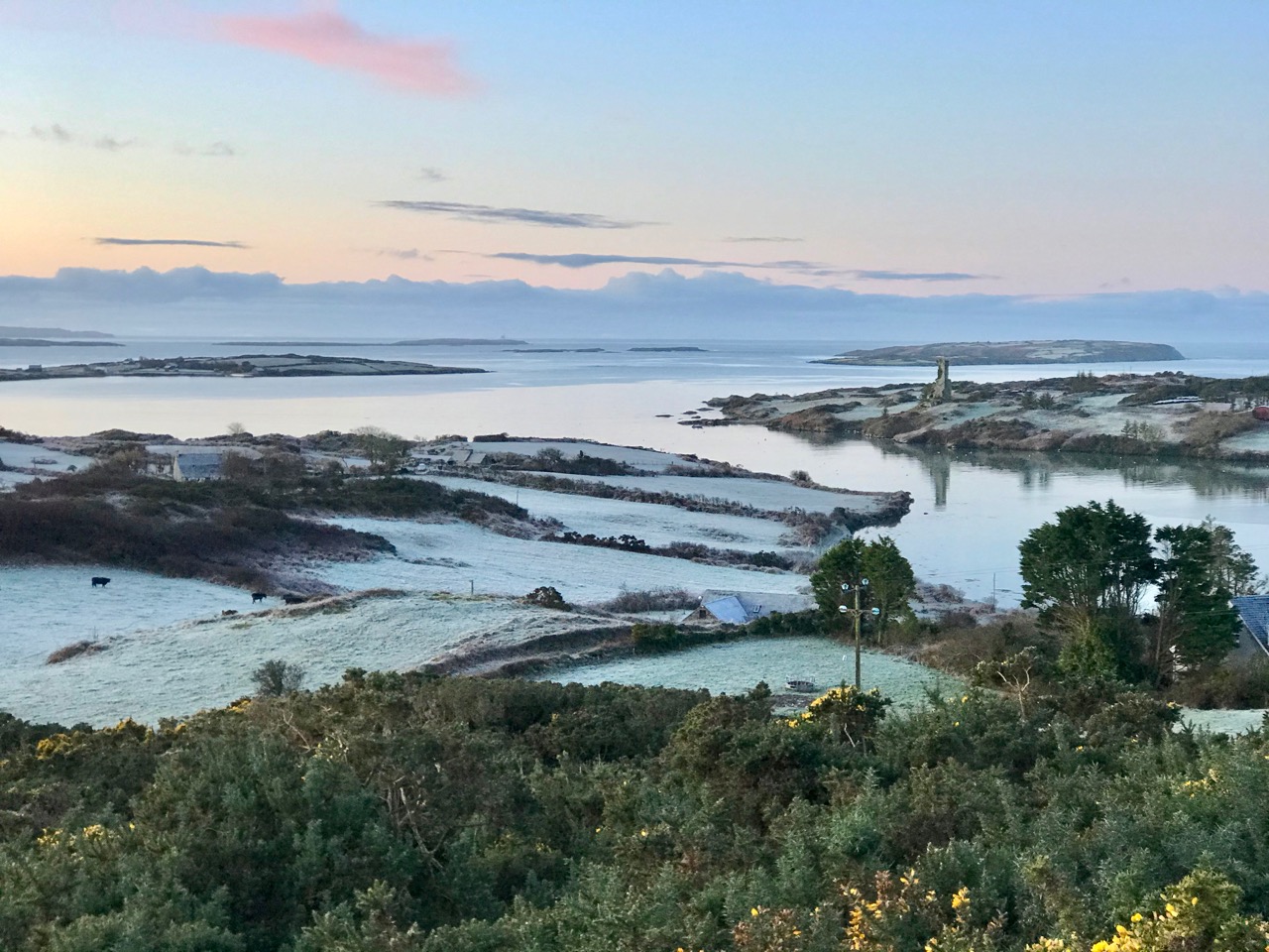
Roaringwater Bay – the view to the south, today, from Rossbrin. In the foreground is Horse Island, and beyond is the profile of Cape Clear, also a place of learning to this day: students of the Irish language spend time on the island, one of the Gaeltacht areas where Irish is still the native tongue. One of the reasons for Finghinn being so expert in languages himself was the desire to communicate with the visiting fishermen whose needs provided him and his clansmen with a good living. As well as a celebrated place of learning, Rossbrin Cove would have supplied fish palaces and all the trappings of the industry: barrels and salt for preserving, victuallers, alehouses, brothels . . . It must have been a boisterous and vibrant place.
Peter Somerville-Large gives a commentary on the more recent history of the castle:
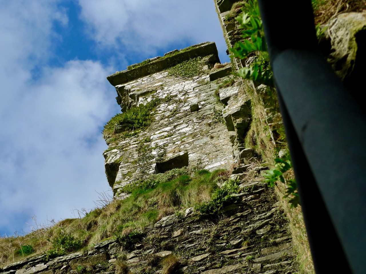
One wall of the splintered tower has a crack running down the side. Another was partly blown down by a storm in 1905. If there is another great storm like that one, Rosbrin might well disappear without trace, like the O’Mahony castles at Ballydevlin, Castle Meighan and Crookhaven. It is sited on an area which is very difficult to approach from either land or sea, standing on a rock. Contrary to what might be written in Holy Scripture, buildings on rocks have little in the way of foundation, and when they fall down or are swept away there is nothing left of them except a memory . . .
To the south of the rock on which the castle stands are the vestigial remains of an ancient stone quay (above), still in use as a landing place. The Cove itself – a natural haven – would have been the main harbour area serving the fishing fleets. The castle stands sentinel above the harbour entrance, ensuring that no-one could approach unseen.
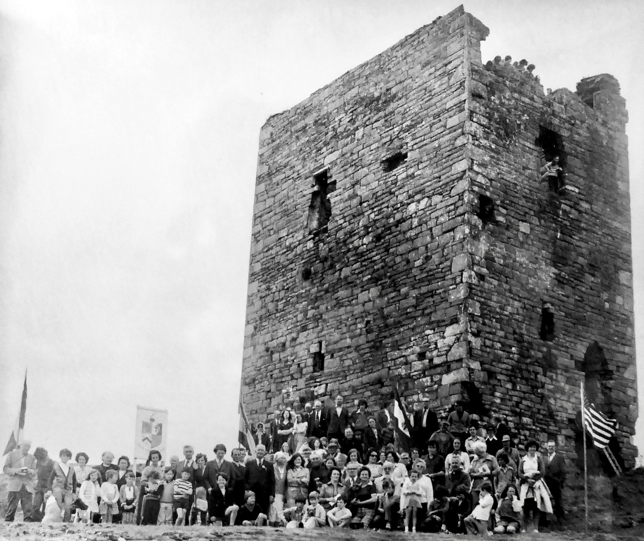
I have been looking for older illustrations of the castle, in order to ascertain how much erosion is taking place as the years go by. Here’s a fascinating record of an O’Mahony Clan Gathering, photographed in 1975 by Michael Minihan of Skibbereen. There is a lot more of the building intact at that time. Can you see the spectators high up on the walls and roof? [Note: I was mistaken – this is actually Leamcon or Black Castle before reconstruction. I am leaving it in to illustrate what Rossbrin may have looked like before it started to fall apart.]
As most of you will know, we look down on Rossbrin Cove and Castle from our eyrie up at Nead an Iolair. We consider anyone living on or by the Cove a neighbour. One of these is Julian, the first to welcome us when we arrived here many years ago. On my walk today I called in on him – he lives next door to the Castle Farm. I was over the moon when he showed me a portrayal of the Castle which his mother, Geraldine, painted in the 1970s, only a year or so after the gathering at Leamcon, above. A substantial part of the Rossbrin castle walls has collapsed in relatively recent times.
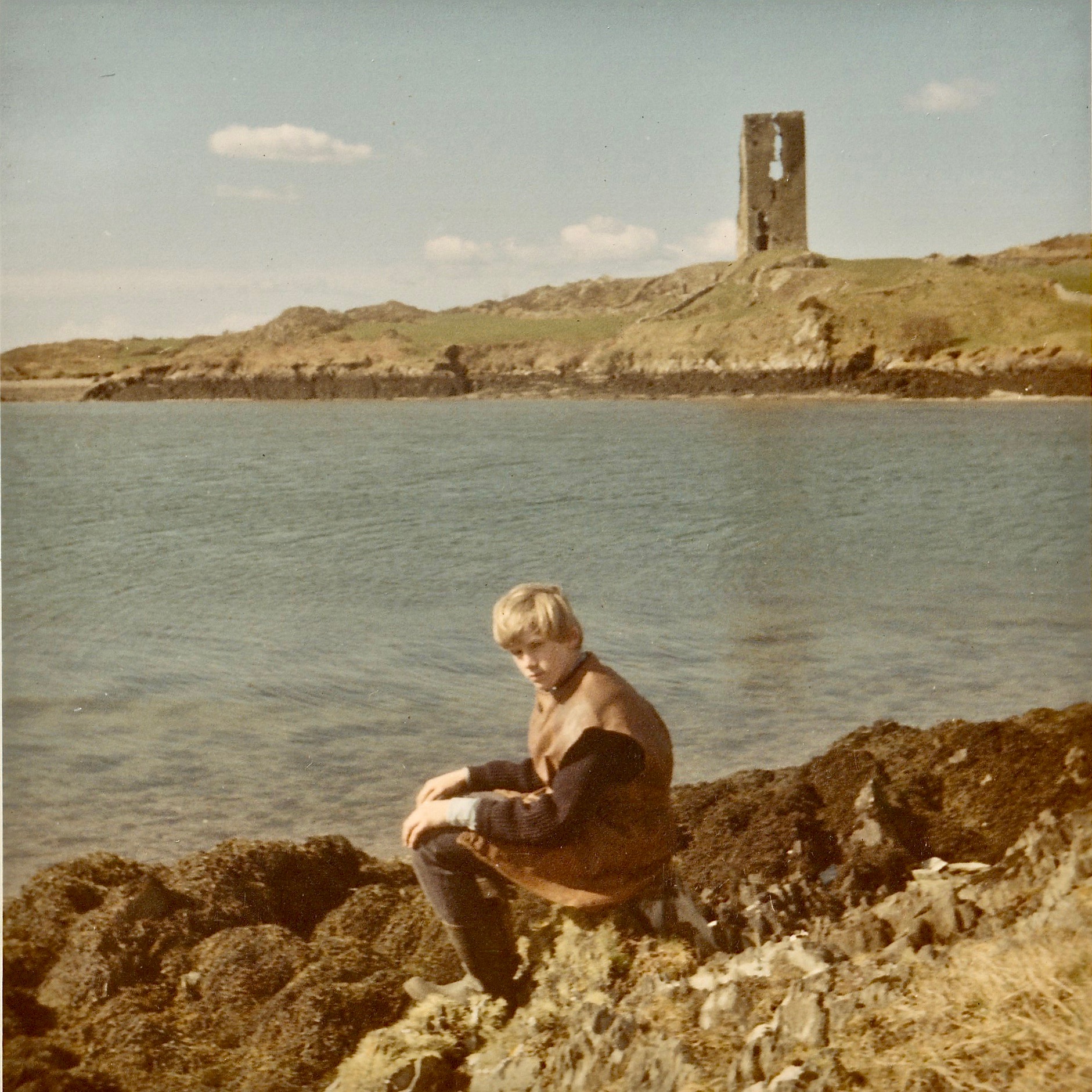
Rossbrin Castle, painted by Geraldine van Hasselt in the 1970s (above). Best of all, though, is a photograph of Julian – her son – taken at Easter, 1969: significant parts of the walls have collapsed since this picture was taken.
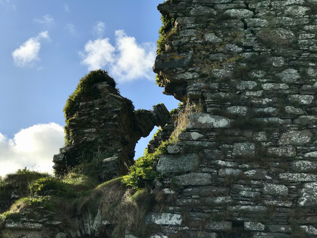
Julian van Hasselt on Rossbrin shore: behind him is a clear view of the castle. You can see the vertical crack which eventually led to the collapse of half the tower.
At this time of the year we get excellent sunsets when the weather is right. Today’s was a good one! I reluctantly said goodbye to Raven, my companion whose constant cronking seemed to follow me as I perambulated this place of deep history. I wonder: was it just Raven? Or might it have been Finghinn himself, speaking to me in yet another of his languages? I think I’ll have to return to Rossbrin to find out!
With many thanks to friends Julian and Raven . . .
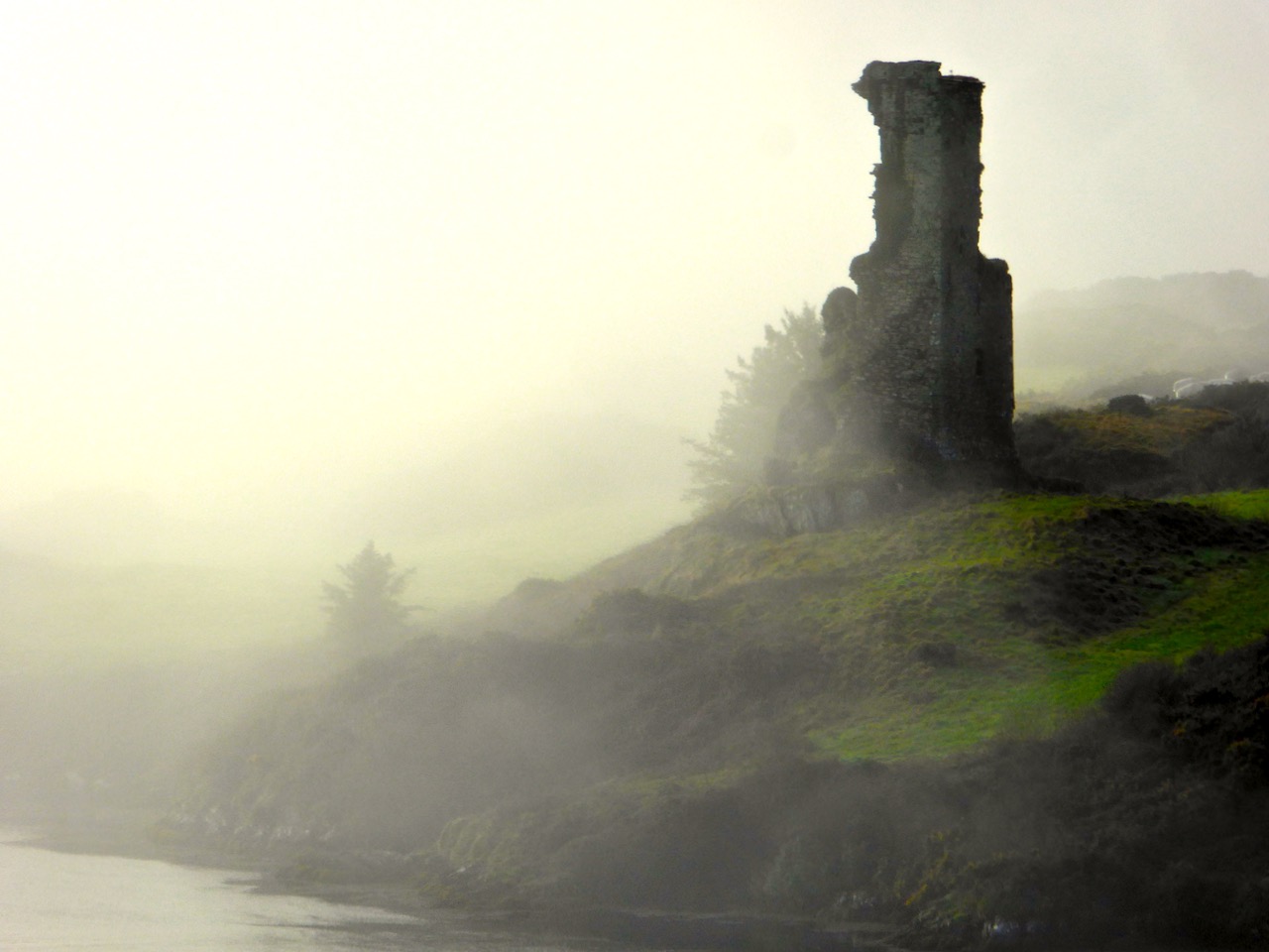
We know Rossbrin Cove intimately – more so than any other part of West cork. That’s because it’s right on our doorstep, and there is seldom a day when we don’t walk or drive along the Cove; and, even if we fail to get out, the views from our windows at Nead an Iolair will always be looking down on the Cove and its castle. I conceived the idea of sorting through all our pictures and selecting a ‘calendar’ of Rossbrin, taking us consecutively through the months of the year so that we can follow the seasons and the changes that every day brings. That’s Rossbrin Castle above, a view taken in January – which can often be atmospherically misty. But the picture below was also taken in that month, when we explored an abandoned house in the environs of Rossbrin: just as atmospheric in its own way – and bursting with a story to tell . . . But we’ll never know it.
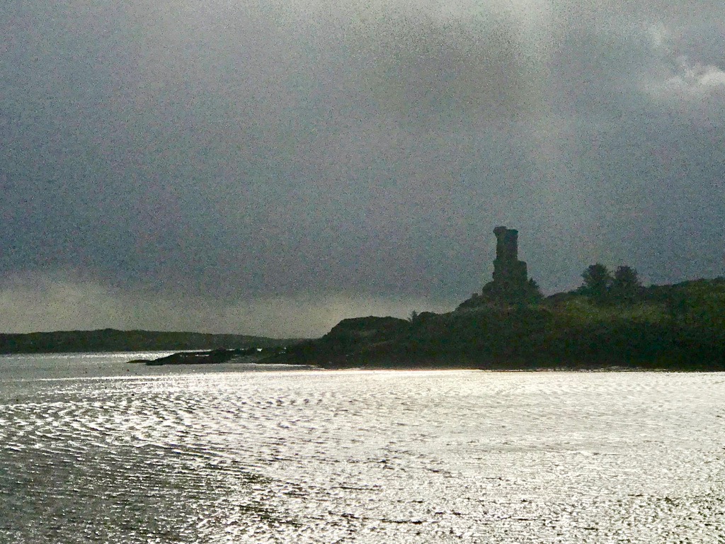
Low tide at Rossbrin, taken from the pier and looking towards the boatyard – an important aspect of the Cove as the winter laying-up and maintenance of pleasure boats brings all-year-round life to the area and provides a livelihood. The picture above was taken in February, on a good clear day. In the middle distance you can just make out a wrecked boat uncovered by the receding water: this is the ‘Flying Foam’ – still rather enigmatic – which I wrote about a little while ago. We expect our strongest gales in February, and the picture below was taken when storm clouds began to gather.
March can also be a month when the weather is inclement (above), but we had a surprise in 2018 when snow covered the land around us (below) – a climatic event seldom experienced in Roaringwater Bay, which is more usually kept mild by the Gulf Stream. That’s Castle Island beyond the Cove – once inhabited (and with its own castle which you can see in the picture) but now just used to run sheep and cattle.
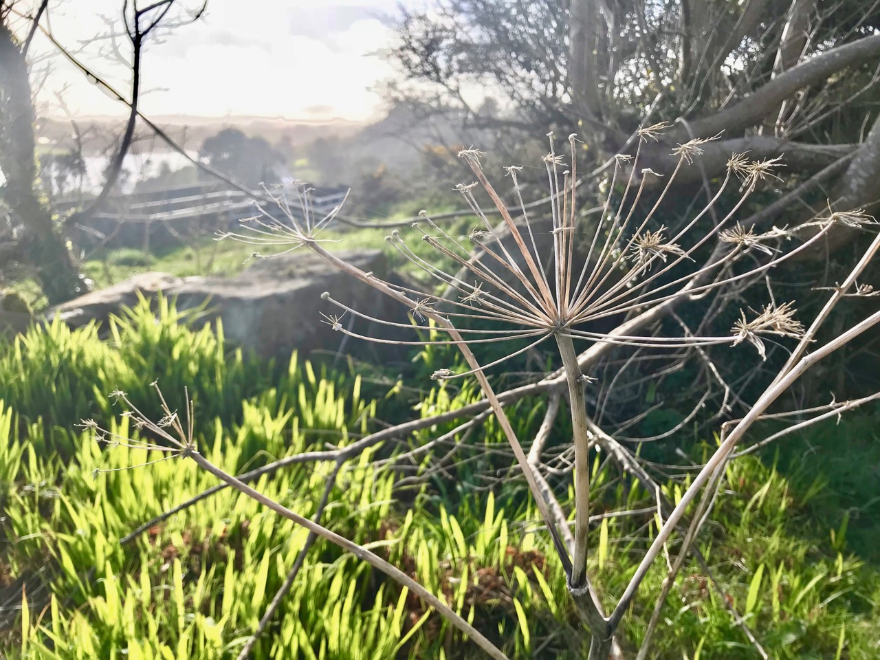
You can see how quickly the weather changes in West Cork: Rossbrin Castle Farm is enjoying blue sea and skies in April, and the gorse is in bloom, showing that love is in season! In the detail below, at the edge of the Cove and also in April, we can see the new spring growth beginning to overtake last year’s seed-heads.
By the time May arrives, boats are already being taken out of winter storage and are anchored in the Cove. We get fabulous skyscapes perched up here above Rossbrin, and these mares’ tails herald windy weather ahead.
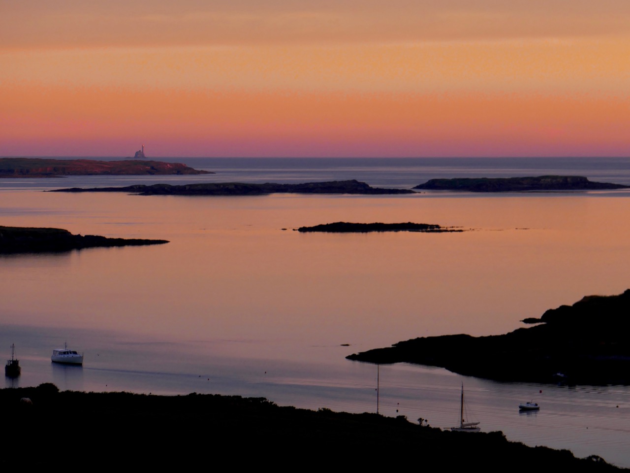
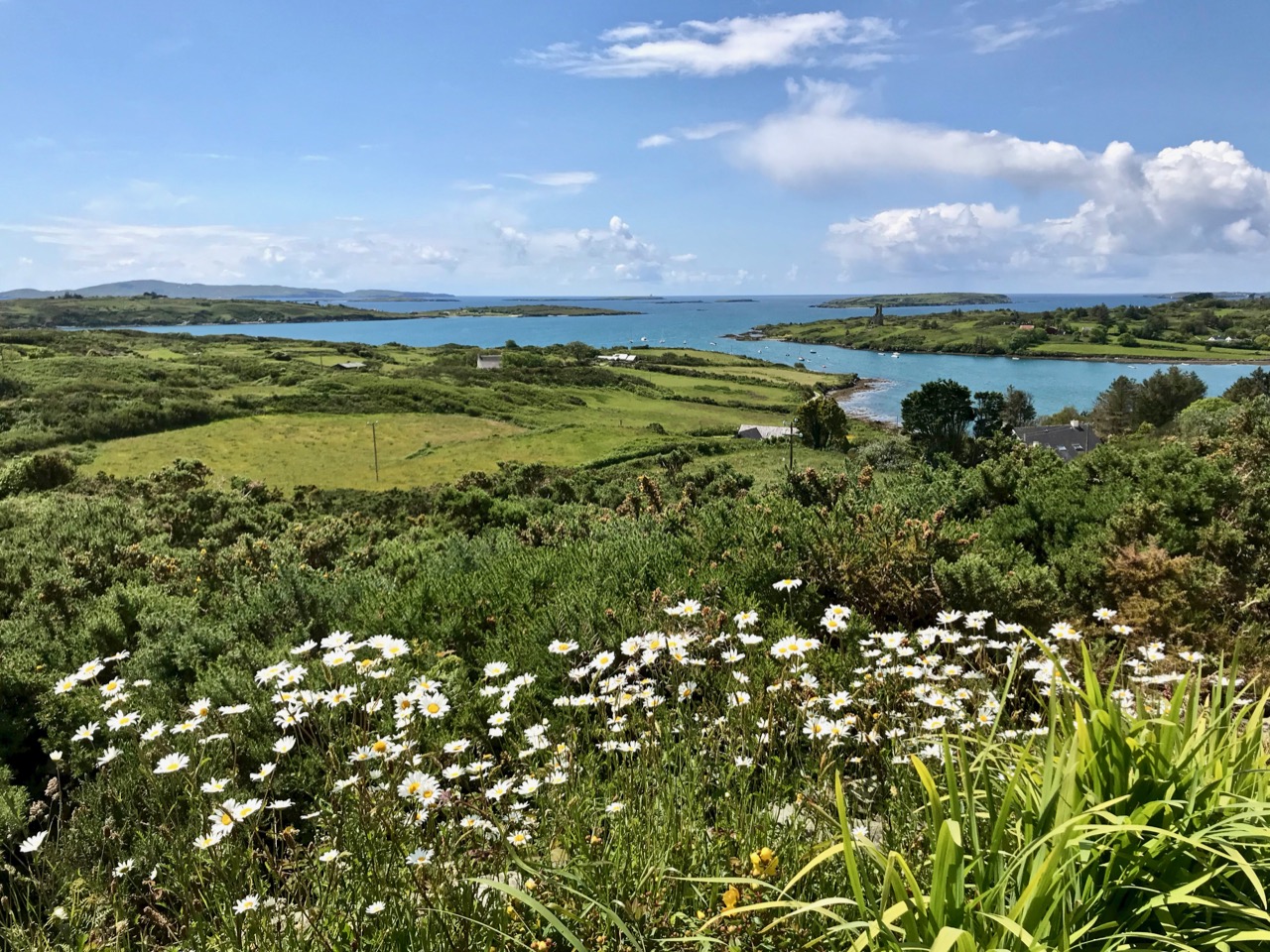
This is one of my favourite pictures – taken by Finola from Nead an Iolair in June. Late evening sun paints the sky and sea in almost implausible colours – although the photo has not been doctored. The whole effect beautifully outlines the Fastnet Rock lighthouse on the horizon with some of Carbery’s Hundred Isles silhouetted as if floating; Rossbrin is in the foreground. By day you can see that wildflowers are abundant this month (below).
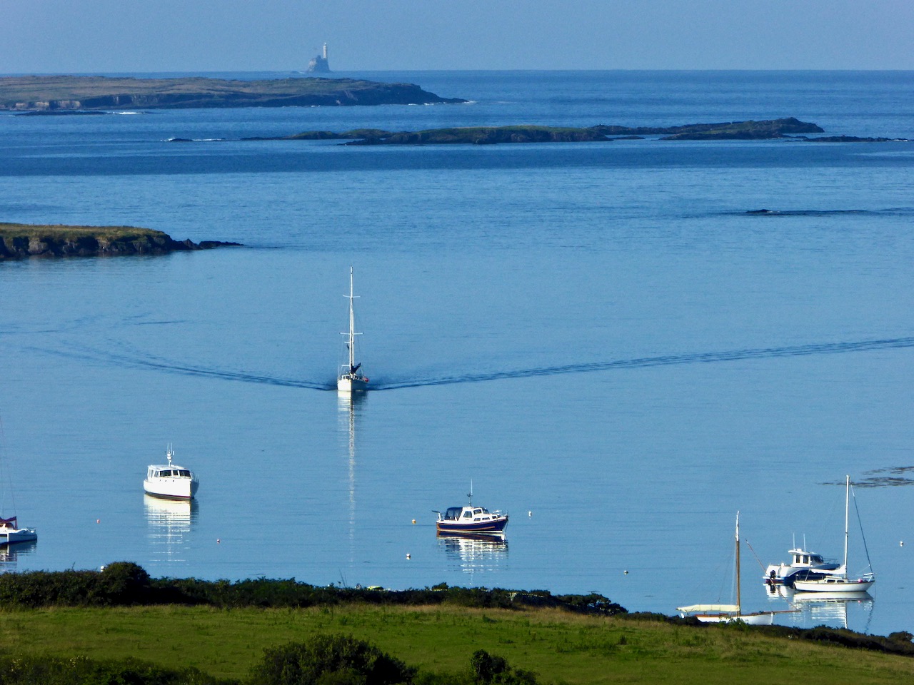
The sea in July is at its bluest. Here is Roaringwater Bay out beyond the shelter of Rossbrin on a calm day. There is hardly a ripple on the surface, except for the elegant wake of the yacht motoring in.
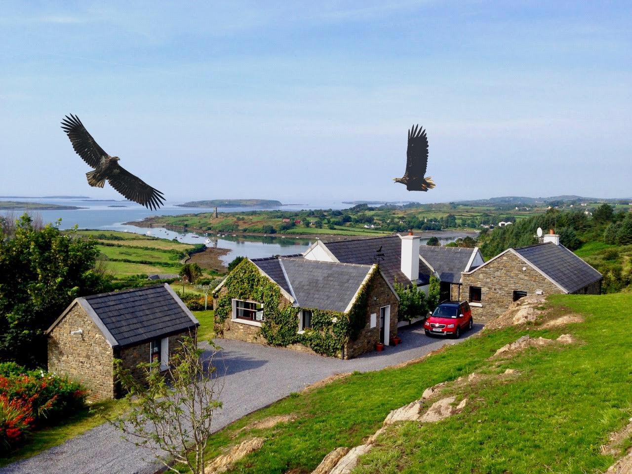
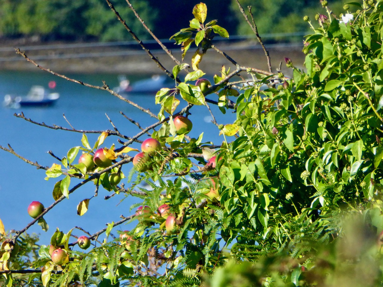
Nead an Iolair – our house – taken in August. You can see that Rossbrin Cove is central to our view out over the Islands. The name of the house means ‘Nest of the Eagle’, and the birds have obligingly flapped their way into the photo, courtesy of Photoshop. White-tailed Sea Eagles do survive in Kerry – not too far away – and they have occasionally been seen in West Cork. Once they were common across the west of Ireland. Below is another August picture – a wild apple tree close to the shore of Rossbrin.
I couldn’t resist adding this picture to the August tally (above): it’s an abandoned post box set into the wall of the old Rossbrin School, now closed. The school building survives as a private house and retains some of the architectural features of its previous use.
This magnificent machine is a remote-controlled boat-lift and was photographed on the large slipway which is at the western end of the Cove, last September. The Cove is a natural harbour and has been used as a resource for sheltering fishing boats and providing facilities for fish processing since medieval times. This post outlines how ‘fish palaces’ worked: there was at least one here in Rossbrin.
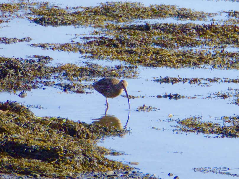
By October most of the boats have been taken off their moorings (above), and the weather changes again. We sometimes have the first of the winter storms this month, although it can equally be benign. Autumn brings with it dramatic skies and sunsets – and a feeling of melancholy, because the holiday houses down by the water are empty and shuttered for the onset of winter. But the weather can continue to surprise and November sunshine (below) can be as warming as any other time of year. It’s a good time for us to watch out for the wading birds – such as the curlews – who come in close to shore and forage on the mud flats.
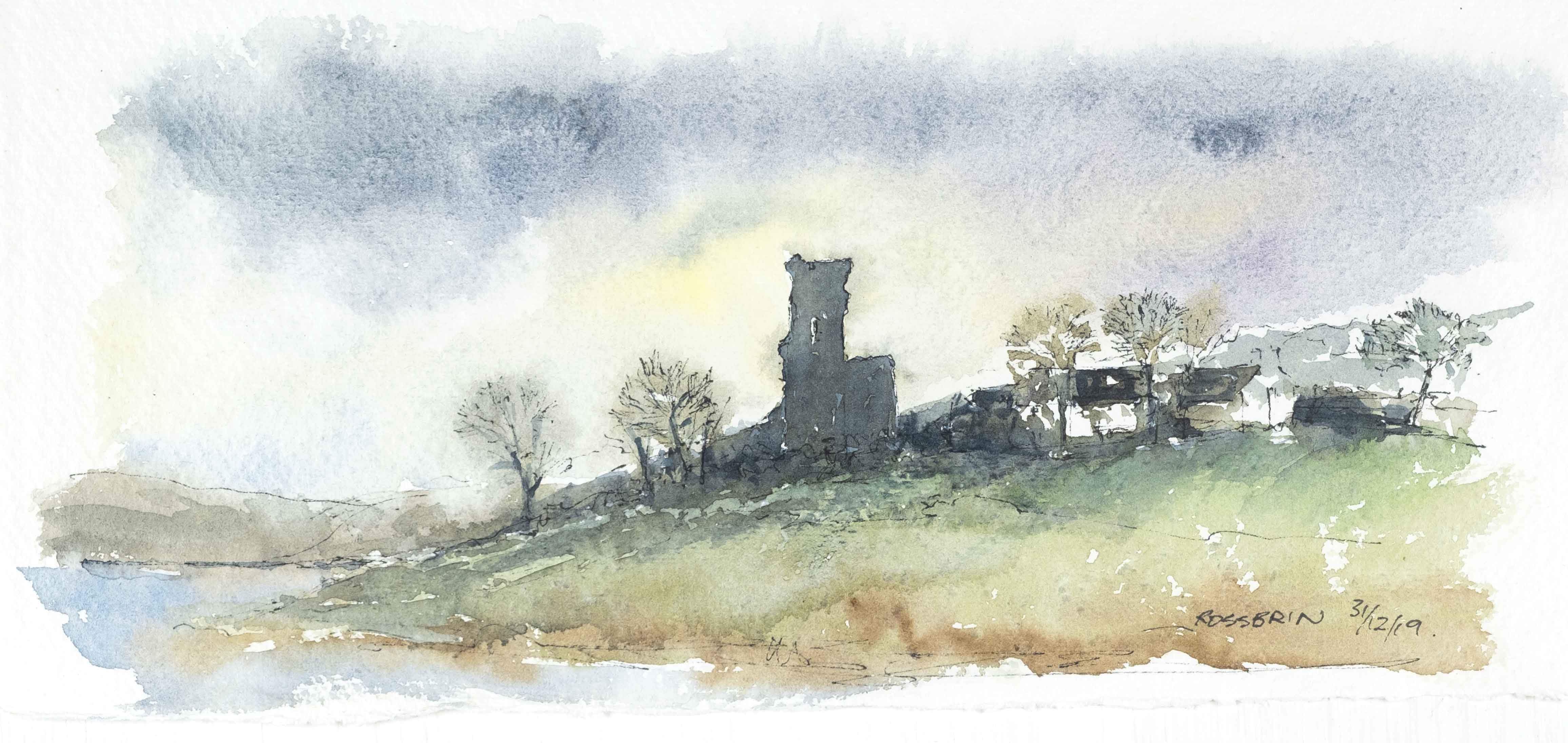
And so we come to the end of the year in Rossbrin. This has been a fairly random selection of images, picked out because each was taken in a particular month. We know how fortunate we are to live in this rich and constantly changing environment. Not only are we surrounded by nature, but the immediate history is alive with stories – of Fineen O’Mahony, the Scholar Prince of Rossbrin, who lived at Rossbrin Castle in the 15th century and surrounded himself with a university of monks and scribes and made a fortune out of fishing dues – and of Sir William Hull and the Great Earl of Cork who exploited Rossbrin in the 17th century, also for fish. Now we look down on a sparsely populated townland and the bay beyond it: it’s a most beautiful place to know and to live in. For December I have chosen a classic view of the castle with a wintry sky and late sun creating patterns on the half-tide.
Welcome to the UCD Library Cultural Heritage Collections blog. Discover and explore the historical treasures housed within our Archives, Special Collections, National Folklore Collection and Digital Library