Cork, Part 2: Eiléan Ní Chuilleanáin

Like Brian Lalor, the poet Eiléan Ní Chuilleanáin*grew up in Cork in a house alive with art, scholarship and republican ideals, in a city yet to emerge into modernity. As a poet she returns often to the subject of Cork, immersed from childhood, as Brian, in its unique character. She has said . . . there is a poetry, and I include my own, which can only be written out of the sense of the absolute proximity of the real past, and the place which is home, from which history can be seen.

In a poem that begins ‘In the graveyards of the city’ she writes,

Tablets fixed on their boundary walls,
They are shouldered by tall square houses
Chimneys nodding to each other
Over the heads of gesturing
Angels, all back and no sex.

And we instantly see what she describes, although we hadn’t before.

In 2007 the poet and critic Thomas McCarthy wrote in the Irish University Review**:

The Gallery Press book, Cork, was certainly one of the most beautiful local books of 1977. Written to accompany Brian Lalor’s subtle, and sometimes very slight, drawings of Cork, the poems were full of a sunlit magic. The book itself, as an object, was one of Gallery Press’s finest hours. It marked a restoration of dignity to the world of Irish poetry publishing just at the moment when standards of production and presentation had begun to decline everywhere. I remember the display copies of the limited hardback of this book in the old Cork Craftsman’s Guild shop in Patrick Street: how fine it looked, how fitting it was that this volume of poems and drawings was displayed with the best ceramics and wood-cuts of the day. The opening poem is probably as complete an evocation of Cork as will ever get published:

The island, with its hooked
Clamps of bridges holding it down
Its internal spirals
Packed as tight as a ship
With a name in Greek or Russian on its tail
In a lingua franca of water –
And now the river, flat and luminous
At its fullest, images the defences:
Ribbed quays and stacked roofs
Plain warehouse walls as high as churches
Insolent flights of steps
Within are narrow lanes, man high
Flagged and flattened
By the prudent stonecutters, . . .

McCarthy concludes, It is a perfect description, pencil-like and deftly matched to the delicate drawings of Lalor. The latter give Ní Chuilleanáin free rein; they allow her to soar with that light method, the elusive and evocative, and even retiring, loose line.

Eiléan’s Cork of the 1970s is just as convoluted as Brian Lalor’s. In a 2008 essay***  she describes it thus:

There are gestures at consistency. But much of the city is a haphazard succession of buildings dating from a mixture of periods, still following the medieval pattern of streets and laneways, crammed on their island site, churches, markets and houses. On the hills that surrounded the town suburbs grew up: some respectable, terraces with British Army names recalling Wellington and Waterloo, inhabited by the officers from the barracks higher up again; some grim and filthy with names like Brandy Lane, Spudtown, Cat Lane. I still remember the smell of the lanes and tenements, the public houses and their truculent customers, the shadowy shawled women making off down an entry clutching drink or money with equal desperation.

One of her poems seems to translate these thoughts from prose. As McCarthy puts it, Psychologically and socially, Ní Chuilleanáin’s Cork is a complex and evasive place, made concrete only through the most intense observation

Geometry of Guilt, the windows
Broken or always empty;
Daylight sucked in and lost, a bird astray;
The knife edge of the street, blinded
Fronts of houses like a baconslicer
Dropping to infinity, down
Draughty quays and frozen bridges
And the facades are curves of seeping stone
As damp as a scullery
Or a child’s game of windows and doors arranged
Matching the caves of womb and skull

I will finish with another of McCarthy’s astute assessments of Eiléan’s work: Ni Chuilleanain maintains a psychic bridge between two cranky and petulant discourses, Dublin and Cork. Her poems have become that undelivered Golden Box, forever on its way from Cork to the good Dean, a box of poems which, when opened, reveals sunlight, cloisters, avenues, water channels, and sites of ambush.

We are soft-footed and busy as dogs
Disappearing down alleyways,
The faces I meet are warped with meaning.
We turn away from each other,
Our shoulders are smooth as the plaster veils of statues
That are turning their backs in the windows and doors.

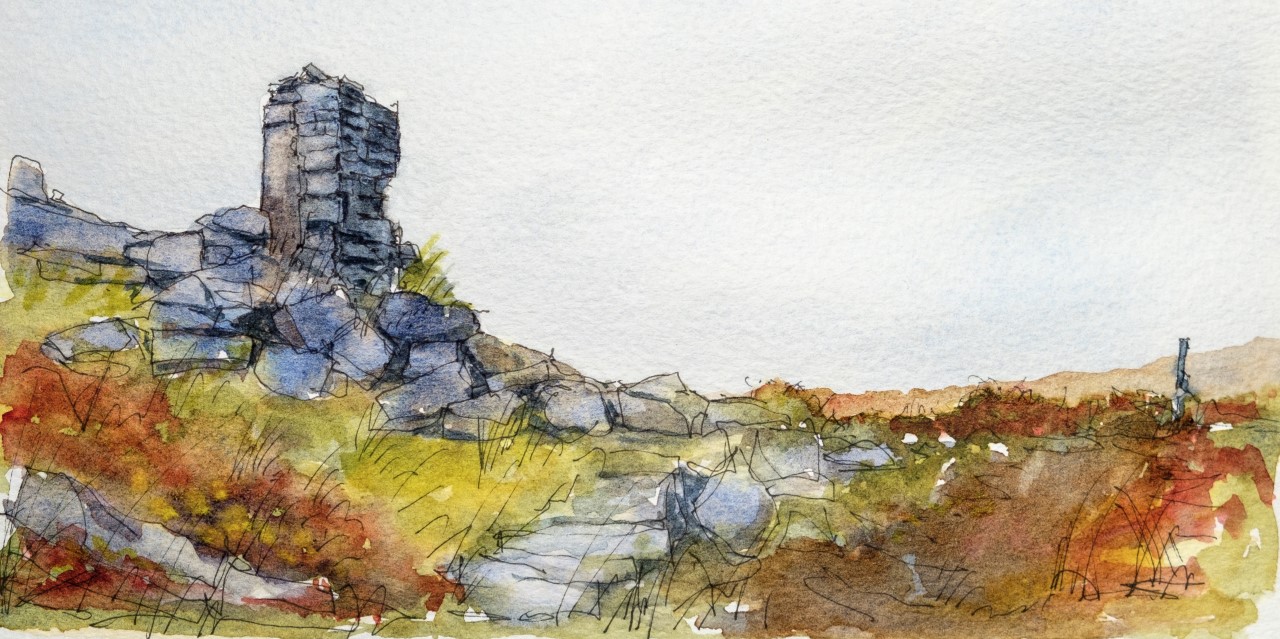
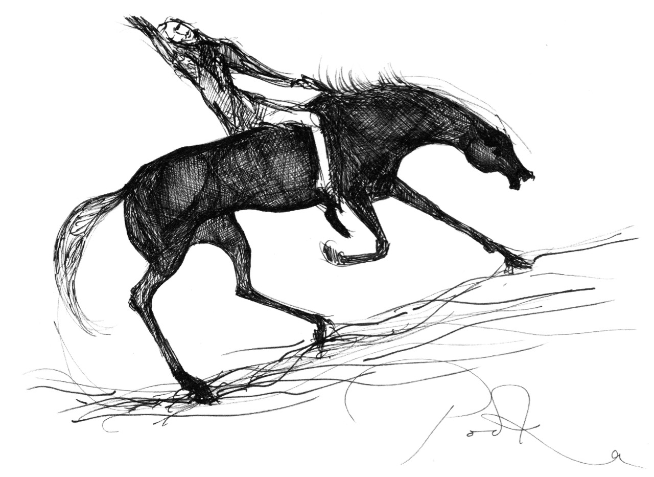
As in the previous post, Cork, Part 1: Brian Lalor, all the drawings are by Brian Lalor and reproduced here by permission of the artist.

*Eiléan Ní Chuilleanáin is pronounced (approximately) Elaine Nee Quillinawn

**‘We Could Be in Any City’: Eiléan Ní Chuilleanáin and Cork Author(s): Thomas McCarthy Source: Irish University Review , Spring – Summer, 2007, Vol. 37, No. 1, Edinburgh University Press (Stable URL: http://www.jstor.com/stable/25517350

***Home and Places, in Home/Lands, A collection of essays commissioned by the International Writing Program at The University of Iowa to mark the third New Symposium held on the island of Paros, Greece, in May 2008.

Cork, Part 1: Brian Lalor

In 1973 and 1974 the artist and writer, Brian Lalor, made a series of drawings of Cork, his native city. These drawings were published by the Gallery Press in 1977, along with poems by the Cork poet Eiléan Ní Chuilleanáin, in a book simply titled Cork. Both poet and artist/writer were already established and both have gone on to forge distinguished careers in Irish art and literature.

Grand Parade

I have owned a copy of this book since 1978 – a birthday gift from my mother. Knowing of my love for the city of Cork, my home for seven years, she mailed it to me in Canada. I have cherished it ever since. The copy she posted to me was signed by Eiléan Ní Chuilleanáin. This year, seated in our living room overlooking Rossbrin Cove, Brian Lalor signed it for me too.

Brian’s drawings of his (and my) beloved Cork capture a city on the edge of modernising. He has graciously given me permission to reproduce some of his drawings in these posts and I will use his own words (from A Note on the Drawings at the end of the book) since they capture so much better than I ever could his fascination with the city and his intentions in recording its idiosyncratic character.

The South Gate Bridge. That couple looks familiar

This collection of drawings developed as a result of a habit of many years, begun in Cork and fostered in Europe and the countries of the Eastern Mediterranean, a habit of of never passing a laneway, flight of stairs, courtyard or public building without investigating what secrets it might conceal, what historical or human curiosity might be within. Coming then to Cork in the early seventies and finding it a city reeling from the cataclysm of “urban renewal,” it seemed an appropriate time to attempt a record of the inconsequential details which made up the character of the place, while the opportunity still existed.

Upper: Paradise Place. Lower: Curry’s Rock. Older women still wore the traditional shawl in the early 70s and were known as Shawlies

This is not Cork seen from its public face but from above and behind, not just observed in its principal role as the second city of the Republic but sought out in all its idiosyncrasies and individuality. The monuments of Architecture, memorials to wealth and power, religious fervour and civic pride will not be found here, except when they creep in by accident for, avoiding the European grand manner, they block no vista nor crown a Summit. Rather, they lurk in unexpected places and just spring upon one, owing their location principally to occupying the sites of earlier ecclesiastical foundations. This latter fact is the clue to understanding the city of Cork, the link with the past. For it was in the periods of its earliest habitation that the considerations of commerce, security and the political existences of the time gave rise to what held as the nucleus of the city up to the present day.


Cornmarket Street

Cork was never a planned city; it grew organically from the meanderings of the River Lee through the marshlands of the depression between the surrounding hills. Its streets and by-ways follow today those of the middle ages, and the water channels which gave access from the early town to the outer expenses of the river basin. The line which runs from the Episcopal seat of Shandon to that of Saint Finbarr’s was the principal artery of the ancient city of Cork, as it is today nine centuries later. It is around this thread that the drawings are gathered. This line held the centre of all life within the city from its foundation in the tenth century, to the late nineteenth, and even today what is outside this line is peripheral to the soul of the city.

St Patrick’s Quay

Next week, the poetry. . .

A Signal Success in Irish Engineering – Part 2: Ballyroon Mountain

Following on from last week’s account of Kedge Point signal tower, our second foray in search of Ireland’s coastal communication stations dating from the early years of the nineteenth century takes us to the Sheep’s Head Peninsula in West Cork. The waymarked trail that passes the now ruined Ballyroon Mountain signal tower is on the Sheep’s Head Way and is fully accessible from the parking area at Fáilte Faill Bheag (if walking from east to west), or from the Cupán Tae tea-room parking area at the very end of the road (if walking from west to east). Although there is very little of this signal tower left standing – it was largely destroyed by a storm in 1990 – the walk itself is a visually stimulating experience, not to be missed! As with the majority of the remaining signal station sites, the location here is on high ground with prominent panoramic views in all directions.

When walking the off-road Sheep’s Head Way trails, please remember that dogs are not allowed: this is one of the conditions that have been agreed with landowners when the trail routes were negotiated, so it must be respected by all users.

These two aerial images show the remote setting of this signal station. The site was developed a little over two hundred years ago, and one of the necessities was providing a firm trackway along which to bring building materials, and also to provide efficient access to and from the signal tower when in use. In the top image, also, you can make out a substantial walled field to the south of the tower: this would have been used to pen ponies or donkeys and – possibly – a goat for milk.

The track that served the signal station in its heyday has become the ‘green road’ that takes you there today. In bad weather it’s a bit wet underfoot in places, but otherwise it is a joy to walk and, on a good clear day, provides spectacular views in all directions. Look out for the other signal towers that can be seen from this site: Cloghane on Mizen Head, Mallavoge on Brow Head, Derrycreeveen on the Beara Peninsula, and Knock, which is an inland site near Lowertown, Schull.

In the upper picture here you are looking back towards the vestigial Ballyroon signal tower from the higher ground on the footpath from the Cupán Tae tea-room, while the lower picture shows the ‘pimple’ on the horizon which is the Cloghane signal tower at Mizen Head seen from Ballyroon.

The upper picture shows the Mallavoge signal tower at Brow Head (more about that site here), while the Knock signal tower is seen in the middle picture, which was taken close to the start of the Ballyroon Mountain trail. Both these photographs have the benefit of a modern zoom camera lens, but imagine how good the optics of the telescopes needed to be for those who manned the towers in the early 1800s. Not only did these silhouettes have to be clearly defined, but the flag and ball signals that were put up on the associated masts had to be readable. The lower picture looks north across Doo Lough towards Bere Island, where there were extensive fortifications in Napoleonic times, including a signal tower. Below is a photo of the Malin Head signal station, Co Donegal, dating from 1902 (National Library of Ireland Collection). There the station was kept in use for strategic purposes long after the Napoleonic era and became the site for one of Marconi’s telegraph stations. While the flags in this picture are not from the earlier times, it gives you some idea of what had to be picked out from a great distance. By eye, put the scale of the tower in this photo to the scale of the distant towers in the images  above: it’s hard to fathom how accuracy was possible yet messages were dispatched and received successfully. It evidently took about four minutes to put up a message on the mast: allowing for reading and deciphering, I would expect a message to be sent from Sheep’s Head to Cork via 11 towers in about an hour, or all the way to Dublin via 33 towers in three hours. This would depend on daylight and good visibility at all times.

The most comprehensive map of Ireland’s signal tower distrIbution that I have found so far is this one drawn for the authoritative book on the subject Billy Pitt had them built: Napoleonic towers in Ireland by Bill Clements, The Holliwell Press 2013. This clearly shows that invasion was expected to come from the west or south, rather than from the more naturally protected north-east coast.

The selection of photographs above shows the state of the ruined tower at Ballyroon Mountain today (2020). Although there’s not much of a structure left it’s still a poignant memorial to those who built and operated this and all the other links in the communication chain that substantially encircles the coastline of Ireland. It’s a legacy well worth celebrating, and we are fortunate in Cork County that we have so many examples of the building type, some of which, like this one, are accessible to visitors. We will be exploring more of them in due course. To neatly finish off this post, here is an exquisite drawing of the Ballyroon tower executed by our friend Peter Clarke who writes the Hikelines series. It’s a lovely sketch which, for me, captures the slightly edgy romanticism of this beguiling location. Thank you, Peter.

Next time: Signal Towers Part 3 – Walking into history!

Mizen Mountains 5 – Knockaphuca

Perhaps one of the most satisfying mountains on the Mizen, the 237m high Knockaphuca provides a well maintained waymarked trail best tackled as it is laid out – in a counter clockwise direction. You will go up the east side and down the steep west face. If you are lucky with the weather, as we were just before the longest day, you will have an experience which is hard to rival in this corner of Ireland. The loop walk is one of the latest sections of the Fastnet Trails which have been established to the west of Schull during 2019. All credit is due to the team which has so successfully organised and laid out these trails: this has involved much behind-the-scenes hard work.

In fact the full Knockaphucka Loop trail starts in Goleen, and is 10km long. We joined it as it leaves the R591 road north of the village (upper picture – the route goes off to the left). The map above has the mountain section (which we followed) superimposed on the Google Earth contour information. The section we walked is 6.6km long, and climbs about 200 metres.

One of the first landmarks on the way is right at the point where the marked track to the mountain leaves the main road: Ballydevlin Old School House (above). There is another ‘Ballydevlin Old School’ nearer to Goleen; presumably one was the National School (established c1831) and the other may have been a denominational Church of Ireland school. This peculiar Irish duality still exists today in many places.

Once on the marked track you are in a paradise! An ancient green road takes you part-way up the mountain, passing through small gorges which must have been cut out long ago: even if you are not a geologist you can’t help being impressed by the rock formations – they could be works of art.

After a while the path turns to the east and follows narrow, grassy glens bordered by majestic, serpent-like outcrops. It’s here that the views begin to open out, particularly to the south. Always you think that there couldn’t be a finer prospect over the Mizen and across the islands of Roaringwater Bay, and always – as you climb higher – you are surprised by the next, which is even better.

Twists and turns take you more steeply across the contours and swing round towards the summit. Only then is the full picture revealed: the whole landscape set out below you – every rift, valley and glacial glen with the higher land beyond culminating in the crests of Gabriel, 407m high, to the east, and the ‘little’ Mizen Peak, 232m high, to the west.

You won’t get lost as you head for the summit: this mountain had a distinctive cross placed at its highest point in the Holy Year of 1950, which reportedly fell in 1968, leaving the inscribed concrete plinth intact. The photo below shows the plinth in 2006 – courtesy Richard Webb. A new cross was installed in 2011 by a community effort led by the local GAA: this is now visible from much of the trail. The plaque mentions ‘…these challenging times…’, referring to the financial crash that hit Ireland so badly around that time. Illumination of the cross today is provided by photo-voltaic cells.

When you get to the top – pause… Now is the opportunity to appreciate the spectacular views in every direction. On our outing the south wind had been building up all day and was at its strongest in the late afternoon, when we gained the summit. It was pretty hard to remain upright! In fact, I wondered if we were being given a message by the resident Púca whose domain this is, after all?

The path down descends quite steeply: make sure you are well shod and vigilant. But you are in for further treats: the marked way passes by some peaty mountain tarns which are exquisite in their pristine beauty. Finola was in her element finding undisturbed native species such as water-lilies and sundews.

The mountain trail section ends on the small boreen running to the west of Knockaphuca, but the waymarkers will lead you back to the starting point, and there are still views up to the summit to enjoy, along with some landscape features on the way to continue to stimulate the senses.

What more could anyone want from a day’s outing in West Cork? Well – a bit of local history, perhaps. I searched for stories about the hill, particularly about the Púca – but only turned up this one told by Jerry McCarthy and included in Northside of the Mizen, the invaluable collection of Tales, Customs and History produced by Patrick McCarthy and Richard Hawkes in 1999:

The Púca of Knocnaphuca


The old people would feed the Púca of Knocnaphuca on ‘Snap-apple Night’, or indeed, whenever one had call to travel up the hill. It was the wise person that fed the Púca the night before going up. Milk and cake would be put on a plate and left outside the house and by the next morning the food had always gone!


The Púca of Knocnaphuca was half horse and half human. One late Snap-apple Night there was a young lad out walking the road when he heard a strange, sweet music coming from the hill. He went up and saw the Púca playing on a whistle. As soon as the lad had put eyes on it, it stopped playing and caught him. Away the Púca went to the top of the hill, where a crack opened up in the rock. In they went. They were twisting and turning down through tunnels until they entered a chamber full of gold. “Now,” said the Púca, “you are mine!”…


The next morning the boy was found on the road by the Long Bog. His hair had turned white and he could not speak a word ever after.

Thank you to our artist friend Hammond Journeaux of Ballydehob for this wonderful drawing of ‘Pooka’, included in The Little People of Ireland by Aine Connor, illustrated by Hammond, The Somerville Press, 2008. Púca in Ireland has counterparts in Cornwall (Bucca), Wales (Pwca), The Channel Islands (Pouque) and Brittany (Pouquelée). A shape-shifter (Flan O’Brien’s character from At Swim-Two-Birds, the Pooka MacPhellimey, changes his appearance by smoking from a magic pipe), the Púca most often appears in Ireland as a fine black stallion with red eyes. If you meet him, you have to mount him and he will take you on a journey far across the sea. It will seem to you as though you had been away for only a few hours, but the world will have moved on several weeks, perhaps months, during your absence. We saw no trace of the creature in June but, perhaps, if we climbed this mountain in the November Dark, we would have more chance of an encounter.

Coomhola Country

As the Coomhola River tumbles from Borlin to the sea, gathering tributaries, it forms many pools amongst the riffles and glides. These pools, in summer, provide leafy shelters for salmon and trout. To anyone who has fished or walked the river, each pool has its own character, and each its own name . . .


[From Hidden Gold, History and Folklore of the Coomhola and Borlin Valleys Julia Kemp: Coomhola Borlin Community Development Association 1998]

On the header is the spectacular view from Borlin, looking down the great glen where the Coomhola River finds its way through a country formed by glaciers in the Midlandian period, about 10,000 years ago. The rugged Shehy mountain range (Cnoic na Seithe in Irish, meaning Hills of the Animal Hides) with its peaks of Knockboy, Caoinkeen and Kinkeen provides some of the most dramatic scenery in West Cork, its scarred outcrops clearly showing the downward progress of the ice sheets. The contrast between the barren high land and the lush pastoral meadows laid out below evoke a beauty which is hard to match – anywhere in the world!

The Kilgarvan (Co Kerry) to Ballylickey (Co Cork) road is one of the unsung feats of Irish engineering. Until the middle of the nineteenth century it was no more than a system of ‘nearways’, providing rough, narrow access tracks to remote mountain dwellings and hard-won field systems. A famine improvement project c1846, involving metalling, a tunnel, cuttings and stone retaining walls, transformed it to the ‘through road’ which exists today – although it may seem to us no more than a boreen. It’s there for all to travel on, and will provide a breathtaking experience – but be aware that it could also deliver some hair-raising reversing episodes on the rare occasions when a vehicle is encountered coming the other way. The upper photo shows the road ‘clinging on’ to the face of a mountain outcrop, while the map gives a good idea of the circuitous route that the way takes to keep as far as possible to a level contour on its journey.

This is the country of St Finnbar. If you follow the County border east from the top of the Borlin Glen (off-road) you will very soon come to the site of his sixth century monastic settlement at Gougane Barra. This whole area was loved by the Cork born writer and illustrator Robert Gibbings, whose book Sweet Cork of Thee tells of a seven month sojourn in this mountainous region in 1949, beautifully illustrated by his woodcuts.

Mountain Road by Robert Gibbings, woodcut from Sweet Cork of Thee, published 1951

As we drove along the road beside the Inchigeelagh lakes, we could see moorhens gathering material for their nests among the taselled reeds and swans on islets, piling up dead rushes in readiness for their eggs. A corncrake was calling from a meadow. Celandines and kingcups outshone the gorse.


Mick said to me: ‘My father’s sister lived a mile to the north of us here. She married a man by the name of Scanlan. His mother came from Gougane and ’twas one evening when she was travelling west by the lake – there was no road there then, only a little bit of a track – she looked in the lake and what did she see but fields of corn and sheep and every sort of land and crop and stock. She was an old woman at the time and she knew well enough ’twas a kind of enchantment must be on the lake, so she says to herself, if I can keep an eye on it all and throw a bit of iron at it the spell will be broken. So she kept her eyes fixed on the fields and the cattle and the pigs and the hens, and all the time she was thinking where would she get a bit of iron. And the only bit she could think of was in the heel of her shoe. ‘Twould be worth it to throw in the shoe, says she. But when she went to unrip the lace wasn’t it tangled in a knot, and for the glint of a second she took her eye off the land. When she looked again ’twas all disappeared and the lake was there the same as ever.’


Our road turned south, through a wilderness of rock and bog and lilied pools . . .


[Robert Gibbings Sweet Cork of Thee, J M Dent & Sons 1951]

From the highest rim of Borlin Glen (upper picture), the Comhoola River valley is laid out below. Home to sheep and ravens, the scattered farmsteads emerge from rock and forest and provide a living – as they have for countless generations – to a hardy people.

On the lush valley floor are signs of ancient activity and occupation. A stream flows through a meadow dotted with whitethorn trees (upper), while an old stone clapper bridge has been superseded by the modern boreen taking its way up to the Borlin Valley settlements (centre). Lower – a fascinating stone circle and mass rock site is interrupted by the field fence. Here, too, is a bullaun stone and cupmarked rock (below).

Let us give the last word to Johnny O’Driscoll from Snave, recorded by his grandson Sean O’Driscoll in the 1930s and featured in Julia Kemp’s Hidden Gold:

There is little gold in this area, but there is one place where it is said a crock of gold is buried. It is about a hundred yards from the Glaslough, between Coorycomade and Ardnatrush, about a mile and a half from Coomhola National School.


There is a bush growing at the exact location, and beneath the bush is a large stone which covers the hidden treasure. It belongs to a tiny dwarf, and anybody who visits the place at midnight can see this little creature on the bush above the gold.


People did go on one occasion in search of the gold, but they were unsuccessful. A little bright light is visible about midnight above the bush. I have seen it myself on several occasions . . .

Wending the Boreens

Only in Ireland can you wend your way along boreens. The Irish word is bóithrín, – a small bóthar (road). We are surrounded by them in our West Cork townlands. In these days of Covid19 restrictions, they are our whole world. With a maximum walk of 5 kilometres allowed, we can only ever be on boreens. But that’s no hardship – mostly they are beautiful (in fact they are all beautiful), and we enjoy every step we can take. So today’s post is simply a celebration of what is around us. But I have also combed the RWJ archives to look for boreens outside of our local area, for a bit of variety and comparison. Rest assured that any illustrations beyond our present limits were taken in other – normal – times!

Of course a ‘boreen’ or small road doesn’t have to be in a rural location, This fine boreen in Eyries, on the Beara Peninsula, is in fact a well used highway through the town, but you can’t deny that it is as atmospheric and picturesque as many of the rural byways shown here. It’s a moment in time captured for all time.

The photo at the top of the page is special for us: it’s the view we get when we turn out of Nead an Iolair, heading down towards Rossbrin Cove. And there (above) is our first glimpse of the sheltered harbour, overlooked by the medieval castle that was the home of Clan Chieftain Fininn O’Mahony in the 15th century. Not only do we have all the wonders of West Cork’s landscape on our doorstep, but we also have deep history as well…

How much closer can you get to nature than this ‘green’ boreen just a short walk up the road from where we live in Cappaghglass? The stone hedge banks have become completely assimilated into the surroundings, and are a haven for so many native species of wildflowers, as Finola will readily point out to us!

And just a few yards from that last green trackway is the boreen that takes us down into our village of Ballydehob. Those are apple trees flourishing as part of the natural hedgerow.

We have very little woodland around us here. This slightly mysterious tree-lined boreen was found on our travels near Glendalough, in County Wicklow, last year.

Close by the little harbour of Glandore (in Irish Cuan D’Ór – Harbour of Gold) in West Cork, we found a secluded boreen which pointed us towards an oddity: a pyramid in a graveyard – well worth a visit. Read about it in this post from two years ago.

Returning to our own neighbourhood these two recent photos, taken only a couple of days ago, show how you can never quite know what you are going to find just around the corner or over the brow of the next hill. That’s Jeremy Irons’ Kilcoe Castle in the upper picture, and Cape Clear Island (on the horizon) in the lower one.

In contrast, here’s a little trackway that takes you up to the summit of the Rock of Dunamase in County Laois. This historic site with a view is associated with momentous events in the history of this country: in the painting by Daniel Maclise that hangs in the National Gallery of Ireland, The Marriage of Strongbow and Aoife is depicted as taking place at the now ruined Great Hall on the Rock. You can find the whole story of this most critical juncture in Ireland’s history in Finola’s post here.

Even further afield – in Ballymoney, Co Antrim – is this spectacular avenue of beech trees planted on the entrance driveway leading to an eighteenth century Georgian mansion, Gracehill House. This boreen – open to pedestrians – is known as the Dark Hedges, and we visited it when we explored the North of Ireland three years ago.

Although in normal times we travel a lot – on major roads and motorways, as well as boreens – the places we like the best are near to home. How could we not be impressed by the winding boreen that climbs to the top of Mount Gabriel, the highest point on the Mizen? Look at the spectacular views (above). The preacher Caeser Otway travelling in this area in 1822 wrote:

. . . On my way to Bantry I passed the dark and lofty Mount Gabriel and took my way over a dreary, comfortless tract of country. Let no one say after looking at these moors , studded over with cabins crowded with children, pigs, goats, cocks and hens that an Irishman is not an industrious creature . . . Men, women, boys and girls toiling up the mountainside with seaweed and sea sand in baskets on their backs . . . See them reclaiming from amidst rocks and bogs, patches of ground on which to cultivate their only food, the potato; and no one witnessing this struggle of human industry against nature, but must acknowledge that the Irish are a most industrious race . . .

The 400 year old road that crosses the mountains from Cork into Kerry north of Bantry has to count as a boreen, as it’s single track for much of the way. The Priest’s Leap sign (above) marks the point at which the two counties meet. Although we have travelled all over Ireland in our explorations, this is still one of our favourite routes, and always will be. We so look forward to being able to go there again, when the present ‘lockdown’ is lifted.

Another glimpse of the Priest’s Leap ‘boreen’.

This elegant woodland boreen is a fine example of regency landscaping, being part of the Ballyfin Demesne in Co Laois. Like so many of Ireland’s fine luxury hotels, Ballyfin remains closed until the Covid19 restrictions are lifted.

We’ll finish this post where we started – near to home in West Cork, with happy memories of unrestricted rambles with friends along the quietest and most beautiful of Ireland’s boreens . . .