Oldcourt

red hull

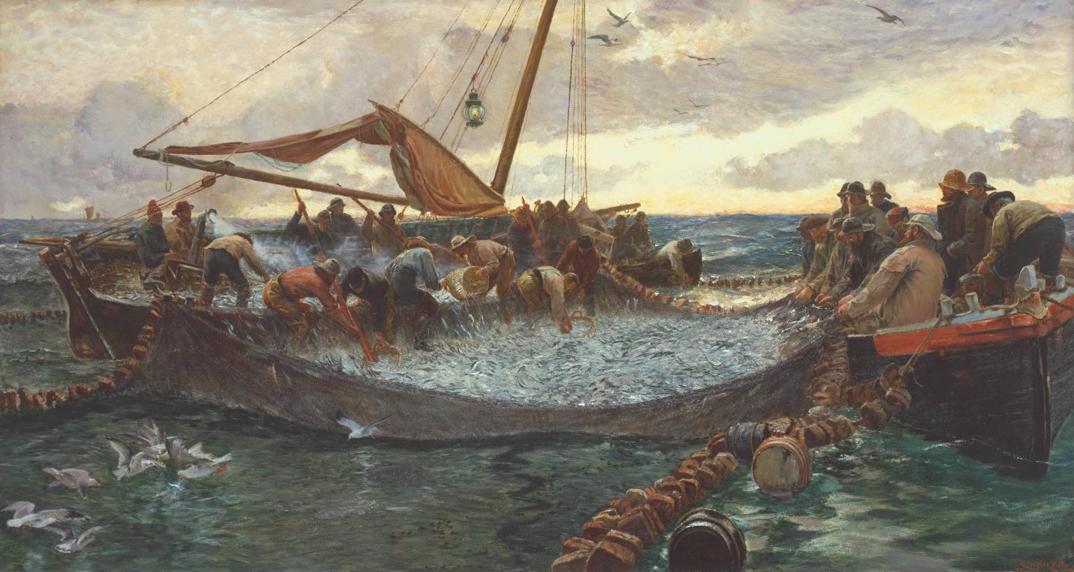
…At Oldcourt a boat-building yard flourished within the walls of an old O’Driscoll castle overlooking the pier and river. Schooners and steamships used to anchor at this spot, the highest point they could travel up the river. Here their cargoes of coal and other supplies were unloaded and placed on specially built lighters with a small draught that would be poled along a further sluggish turn or two upstream to the pier at Skibbereen. In this way cargoes of cattle were brought up by islanders to be sold at the market… (description of the townland of Oldcourt from The Coast of West Cork by Peter Somerville-Large 1974)

gentle Ilen

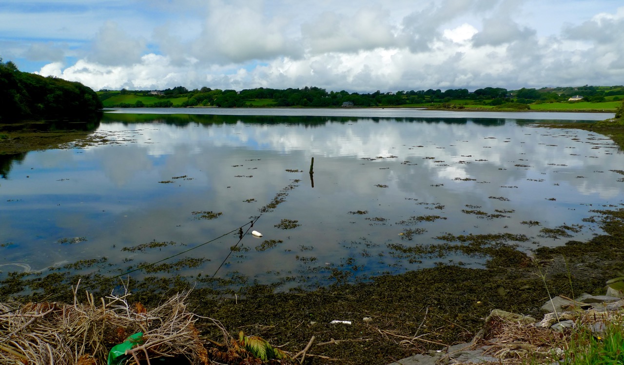
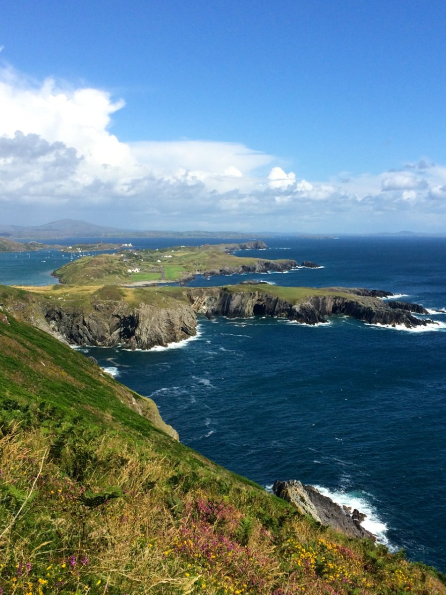
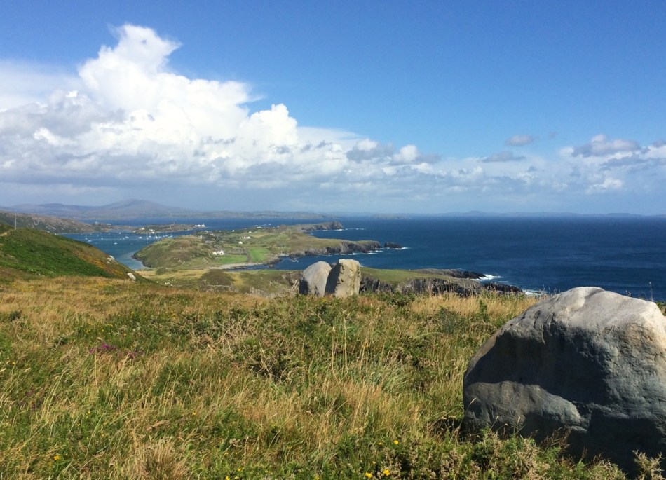
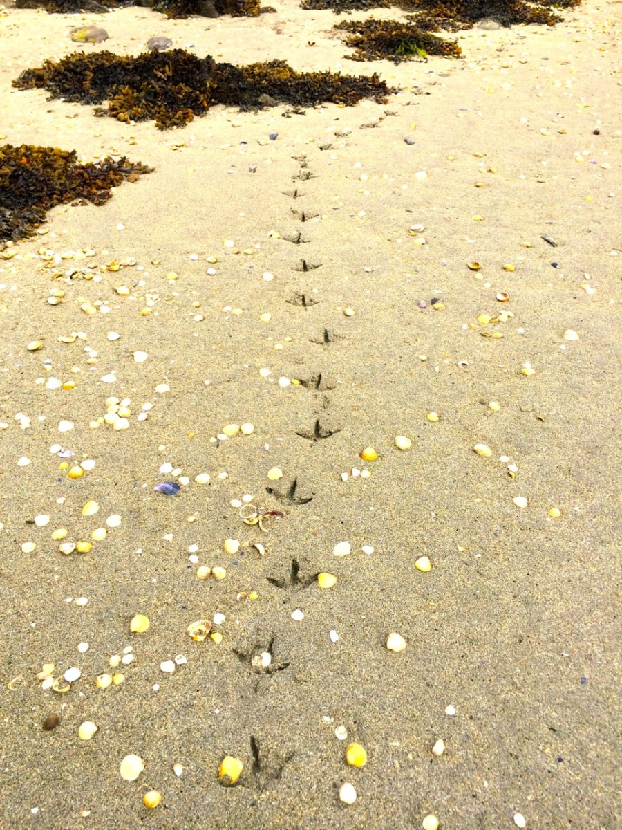
The tidal River Ilen making its lazy way out to Roaringwater Bay on a late summer evening has a melancholy beauty: it is wide and slow and – mid tide – is a perfect mirror to the sky. The sounds of Oystercatchers and Curlews coming over the water always bring thoughts of autumn: the harvest is ready to cut, the verges are brilliantly orange with the montbretia and the hedges purple-red and weighed down with fuscia.

Montbretia

wide river

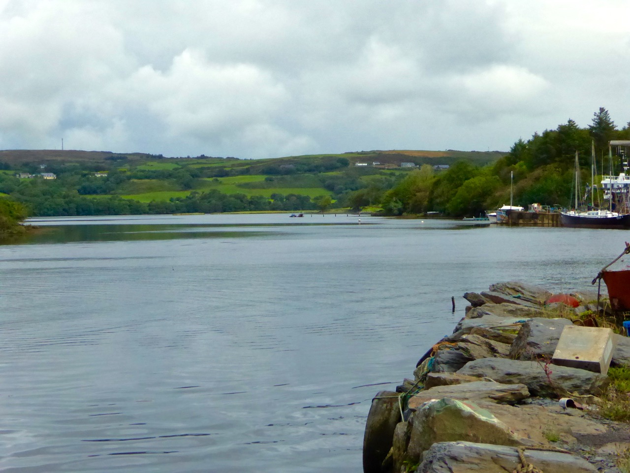
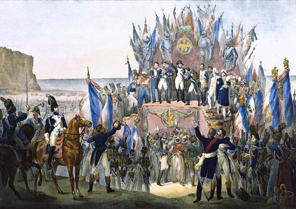
We went down to Oldcourt to seek out history and atmosphere. We knew that it had once been a transport hub for the transhipments of goods and we wanted to see what might be visible from those earlier times. It was the river Ilen (pronounced eye-len) that gave birth to Skibbereen following a pirate raid on Baltimore in 1631. According to Skibbereen historian Gerald O’Brien …in the wake of the shock of that – the most daring pirate raid mounted against Britain or Ireland – a small number of survivors rowed upstream to resettle in the safety of the Ilen Valley. The role of this river-borne migration from Baltimore [was] a factor in the foundation of Skibbereen… (Journal of the Skibbereen and District Historical Society, Vol 7, p 91).

reflections

beyond the bridge

rust

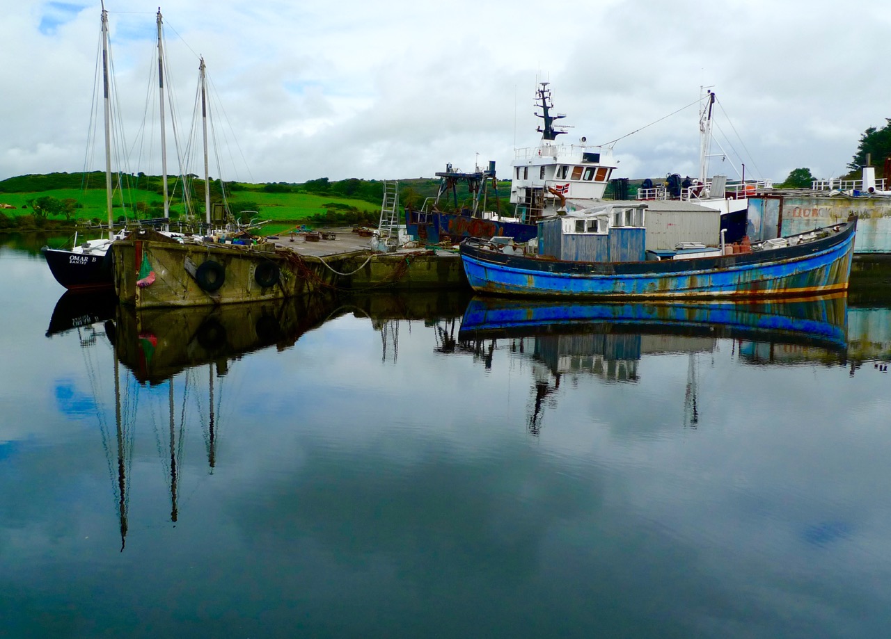
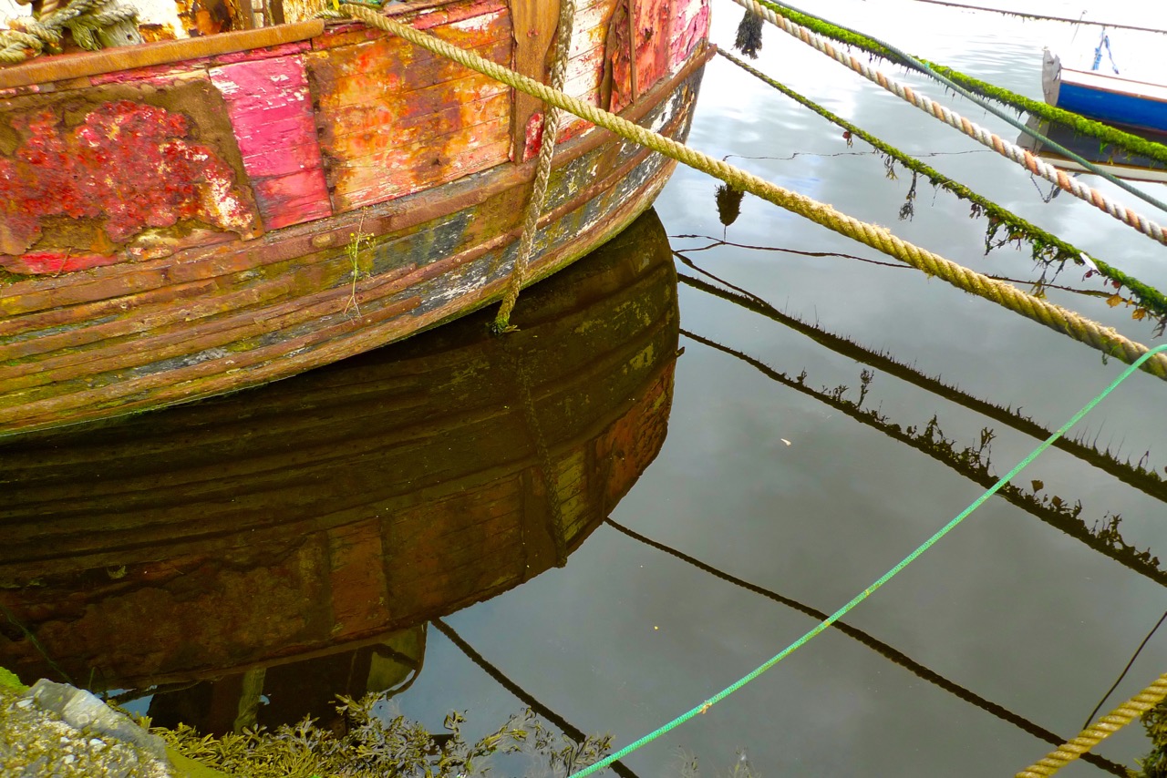
We found atmosphere a-plenty. On the upstream side of the wide inlet where the transhipment quays were sited is a streamlined modern boatyard where sleek yachts are wintered and serviced while, opposite and downstream, is a far more eclectic establishment surrounding and embracing the remains of the medieval castle and bawn: this is Hegarty’s‘…one of Ireland’s last surviving traditional boatyards…’

birdie in circle

Our aim was to search for the old quay and the medieval buildings which had been part of the castle demesne, but we were fascinated to pick our way through boats of all kinds – classic, sailing, fishing, ferrying – and boat paraphernalia: here an old decapitated wheelhouse, there a collection of masts, everywhere ropes and tackle…

green ropes

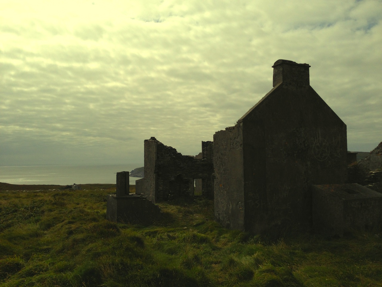
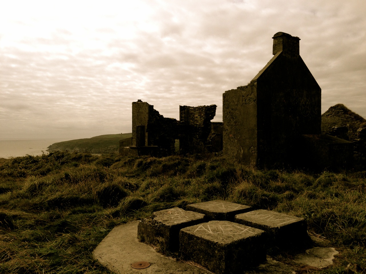
Oldcourt Castle is a tower house standing four storeys high but originally at least one storey higher, once surrounded by a bawn, some ruins of which remain. It was an O’Driscoll clan castle, probably dating from the 15th century, and was captured by English forces after the Battle of Kinsale in 1601.

Old Court Castle

Ilen and Castle

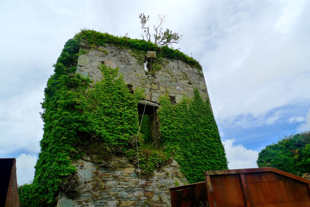
Part of the castle bawn was used as a grain store up to comparatively modern times: now it houses a fascinating boat restoration. The story begins with Connor O’Brien (1880-1952) whose ketch, the Saoirse, took him on a circumnavigation of the world between 1923 and 1925. On this journey he stopped off at Port Stanley in the Falkland Islands. The islanders were so impressed at the way the Saoirse rode the waves that they asked O’Brien to arrange the building of a similar boat. This was the Ilen, named after the river and estuary and registered at the port of Skibbereen in February 1926. She was 56 feet in length overall with a beam of 14 feet and a displacement of 45 tonnes. Connor set sail in August 1926 from Cape Clear, arriving at Port Stanley in January 1927 where he handed it over to the new owners, The Falkland Islands Company, in exchange for £1,500. There she remained until the early 1990s, carrying cargoes of stores, mail, passengers and sheep. Limerick man Gary McMahon found it abandoned on one of the islands and determined that it should return to its homeland for restoration. There was great excitement when he sailed the ketch back into Baltimore in 1998.  The refitting of this eighty-two year old vessel in the old bawn at Hegarty’s, Oldcourt, is now the centre of an educational project allowing people to experience first-hand the ancient skills of wooden boat building.grain store

ilenframes
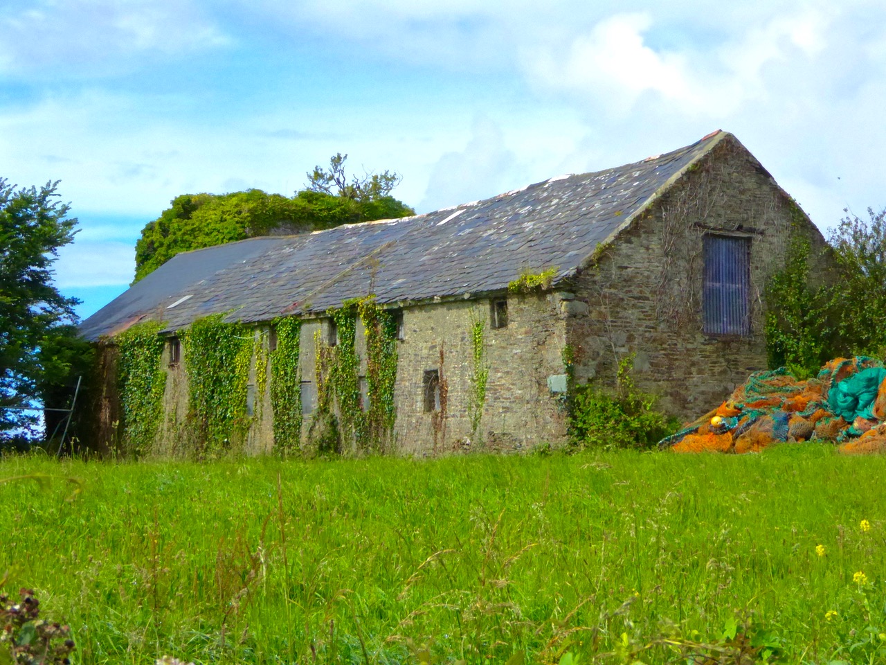
The old grain store – formerly part of the Castle bawn – now houses the restoration project of the AK Ilen (above – courtesy of Roeboats)

Such a hive of activity at OIdcourt today… Echoes of busy days gone by when the schooners were arriving with their cargoes bound for the growing town of Skibbereen.

Ilen postage stamp

Umha Aois

spearhead

There’s a magic to the working of metal: you can pick this up when you are doing it, or when you are watching others do it. It could be the arcane transformation of rough nuggets of ore, first into liquid and then into beautiful solid objects that inspires that impression – or perhaps it’s because the senses are battered by the fierce heat, the molten rivulets, the streaming sparks, the incessant hammering, the sheer excitement… It’s no wonder that our ancestors embraced the emerging technologies hundreds of generation ago, and created spectacular objects which, today, we place in our museums and venerate.

sparking

Umha Aois are artists and sculptors working as ‘experimental archaeologists’ who have been in Skibbereen this week as part of the Skibberen Arts Festival. They use Bronze Age metal working techniques to produce replicas of ancient tools, weapons and musical instruments and also contemporary art objects. We went to their workshops set up in the grounds of Liss Ard House and met Holger Lönze – a locally based sculptor – James Hayes from Bray and their colleagues who are researching and using stone and clay moulds, ‘lost wax’ processes and charcoal pit-furnaces.

Robert holding a recently cast bronze bell, while Finola tries out an adze

It’s very appropriate that we should be looking at Bronze Age metalwork in our own corner of West Cork as we are in the shadow of Mount Gabriel, site of substantial copper mine workings probably dating from some three and a half thousand years ago. A number of Bronze Age mines have been found on the Mizen Peninsula: it must have been a significant local activity and source of trade. It has of course continued almost up to the present day; our own townland of Cappaghglass saw considerable copper extraction during the nineteenth century.

copper mountain

Copper Mountain – on Mount Gabriel can be found the sites of 32 separate workings dating from 1700 – 1400 BC, but there is no evidence of smelting or metalworking in the same vicinity: perhaps the ‘magic’ of the process required it to be carried out in more secret places?

Back to the Umha Aois project (it’s pronounced oowah eesh and means Bronze Age): we saw pieces in various stages of production, including axe heads, adze heads and spear heads, cast from stone moulds. They are elegant objects, especially when they have been polished to a gleaming finish.

axe heads

Bronze axe head, showing the mould used to cast it

The group was using pit furnaces which they had constructed on site. These consisted of basin shaped depressions in the ground lined with clay, and pipework of clay running from two sets of bellows. The clay pits were filled with charcoal and fired to a high temperature to convert the ore in the crucibles to a molten state.

empty furnace

Top – the principle components of a Bronze Age pit furnace; below left – crucible being heated; below right – the bellows in action

In another shelter we were also shown the ‘lost wax’ process: small objects were shaped in wax and then encased in clay. The wax was melted, leaving a mould in the clay cavity which was then filled with molten metal. Once hardened, the clay moulds are broken apart; the copper or bronze objects are then finished and polished. Here is a BBC video that demonstrates these techniques. There are incredible examples of this type of worked metal in the National Museum in Dublin, including some in gold – thousands of years old and yet so elegant and sophisticated.

melting out the waxClay moulds used in the ‘lost wax’ process

Holger has also made a Bronze Age musical instrument, which he demonstrated for us. The pattern is based on ‘trumpets’ which have been found in Europe, the finest being the Loughnashade trumpet, discovered during drainage works at the site of a former lake in County Armagh. Holger’s trumpet is a bronze cast: some finds have been made from curved and rivetted sheets of bronze. Here is a link to a recording of the sound made by a similar reconstructed instrument.

Holger Lönze conjuring up ancient music!

By exploring techniques, lifestyles and behaviour of our forebears through practical application, experimental archaeologists such as Umha Aois help us to understand that people who lived in the Bronze Age were not intellectually ‘primitive’ as was once thought; they have passed down to us their own aesthetic appreciation of art, music and their highly developed knowledge of sciences that enabled them to construct the complex megalithic monuments – and enigmatic Rock Art – which are yet beyond our own understanding.

Experimental archaeology in the walled garden at Liss Ard

Our ancestors left behind rugged stone monuments, landscapes which have shaped the pattern of our countryside, and sublimely beautiful objects: magic to our eyes and senses.

This Bronze Age gold disc – now in the National Museum, Dublin – was found at Sparrograda, Ballydehob:

sparrograda disc

Forgotten Hero – Michael Davitt

Straide, Co Mayo - Michael Davitt's statue outside the museum dedicated to him
Straide, Co Mayo – Michael Davitt’s statue outside the museum dedicated to him

On our recent travels in Mayo we chanced upon a little museum in a rural situation. I was fascinated by the setting: housed in an old church adjoining the ruins of a 13th century abbey (which itself has some fine medieval carvings). The church has been restored specifically to accommodate the museum, which tells the story of Michael Davitt – who was born close to the site of the museum in 1846, and was buried right behind it in 1906.

Sixty years: a relatively short life – but years filled with remarkable achievement pursuing the causes of basic human rights and of freedom for Ireland. Years filled, also, with considerable hardships.

eviction
Eviction

The village of Straide, in County Mayo, was hard hit by the famine – The Great Hunger – when Michael was born: a disaster that led to starvation and forced emigration for millions of Irish people. The Davitts were no exception to this. When he was only four years old Michael witnessed his own family being evicted from their cottage because they were unable to pay the rent to the landlord. He watched while their few possessions were piled on to the lane and their home was flattened.

Evicted families had little choice: starvation, the workhouse or emigration. The Davitts took the latter course, arriving in Liverpool in November 1850. From there they travelled on foot to Haslingden in Lancashire and settled in the closed world of a poor, Irish immigrant community with strong nationalist feelings and a deep hatred of ‘landlordism’.

At the age of ten, Michael was sent to work in a local cotton mill. At the age of eleven his right arm was entangled in the machinery of a spinning machine and had to be amputated. There was no compensation for accidents suffered by child labourers in the Victorian world, nor – indeed – very much concern or compassion for the conditions suffered by the working classes generally in the British Empire at that time.

Lancashire cotton mill c1900

Michael was fortunate as his plight was noticed by a local benefactor, John Dean, who helped him to gain an education in a Wesleyan school. When he left the school at fifteen, Michael Davitt secured a job in a post office and learned to become a typesetter. He also started night classes at the local Mechanics Institute and used its library, where he read extensively about Irish history, contemporary Irish life and radicalist views on land nationalisation and Irish independence.

One of Michael Davitt's campaigning newspapers
One of Michael Davitt’s campaigning newspapers

In 1865 Michael joined the Irish Republican Brotherhood. Two years later he left his job to devote himself full-time to the IRB, as secretary for Northern England and Scotland, organising covert arms smuggling to Ireland. He was arrested in London in 1870, convicted of treason and sentenced to 15 years of penal servitude in Dartmoor Prison.

Dartmoor Prison - hard labour
Dartmoor Prison – hard labour! (Harper’s Encyclopaedia)

While imprisoned he came to the conclusion, recorded in his Leaves from a Prison Diary, that violence was self defeating and he became an advocate of agitation through non-violence: years later  Mahatma Gandhi cited Davitt as a major influence in the creation of his own peaceful resistance movement.

Ghandi visiting a cotton mill in Lancashire, 1931
Gandhi visiting a cotton mill in Lancashire, 1931

Eventually in Westminster the Irish Parliamentary Party began to campaign against cruelty inflicted on political prisoners and pressed for an amnesty for detained Irish nationalists. Partially due to public furore over their treatment, Davitt and other prisoners were released in 1877 on a ticket of leave: Michael had served seven and a half years. He and the other prisoners were given a hero’s welcome when they returned to Ireland.

'Licence to be at large'
‘Licence to be at large’

For the rest of his life Michael Davitt was devoted to the causes he believed in. In Ireland the Land League became a reality and eventually Irish tenant farmers were enabled to buy their freeholds with UK government loans through the Land Commission. County Councils in Ireland were also able to build over 40,000 new rural cottages, each on an acre of land. By 1914, 75% of occupiers were buying out their landlords. In all, over 316,000 tenants purchased their holdings, amounting to 15 million acres out of a total of 20 million acres in the country. This set the pattern of small owner-occupied farms that we see all around us today in rural Ireland – a system that has long struggled to be economically efficient, but which allows independence and self-pride, which the landlord system certainly did not.

Independent Ireland
Independent Ireland

Michael Davitt was not able to see the realisation of his vision for Ireland, but he played an important part in the movements that enabled it: many historians say that his role was central to it. Such were his energies and beliefs that he involved himself in universal human rights movements, and advocated for more than just the oppressed Irish. He said women should have the right to vote; he spoke out for labour unions and helped found the British Labour Party. He served in Parliament, wrote numerous books, founded newspapers and travelled the world speaking for the underprivileged everywhere. He spoke out against anti-Semitism and supported the Boer fight for freedom in Africa.

I had never heard of Michael Davitt (Finola had): it seems his name was erased from Irish history for a while because of disagreements with other campaigners. Fortunately, that wrong has now been righted, and we have this museum in his memory – celebrating his life and work and open seven days a week all through the year. There is a life-sized bronze statue outside it. Recently a new bridge in Mayo has been named after him. As a man he didn’t seek personal acclaim: he wanted his funeral to be unassuming, yet over 20,000 people filed past his coffin. At Davitt’s grave a Celtic Cross in his memory bears the words Blessed is he that hungers and thirsts after justice, for he shall receive it.

The new Michael Davitt Bridge, connecting Achill Island with the mainland - courtesy Polranny Pirates
The new Michael Davitt Bridge, connecting Achill Island with the mainland – courtesy Polranny Pirates

Davit wrote in his will: To all my friends I leave kind thoughts, to my enemies the fullest possible forgiveness and to Ireland an undying prayer for the absolute freedom and independence which it was my life’s ambition to try and obtain for her…

MichaelDavittStampHR

For his group, Patrick Street, musician Andy Irvine penned a song about Michael Davitt: his memory lives on…

O Forgotten Hero in peace may you rest

Your heart was always with the poor and the oppressed

A prison cell could never quell the courage you possessed

Pilchards and Palaces

Black Castle, Leamcon

Black Castle, Leamcon – also known as ‘The Hound’s Leap’ – William Hull territory

A little while ago I described an outing we undertook exploring some of the archaeological sites on the Mizen Peninsula. We were out again a few days ago checking on some monuments off to the west of us. I had researched the Archaeological Survey Database, and determined to have a look at the ‘Fish Palace’ located in the townland of Leenane, close to Crookhaven – evidently a substantial establishment set up by Sir William Hull and his business partner, Sir Richard Boyle, first Earl of Cork, in 1616.

Leenane Fish Palace in 2015

Leenane Fish Palace in 2015

Hull was a notorious character – his family home was Larkbeare, near Exeter in Devon. He had been appointed Deputy Vice Admiral of Munster in 1609 under James I, and settled in Leamcon near Black Castle or ‘The Hound’s Leap’, one of the O’Mahony castles built along the coast of Roaringwater Bay. Set on a promontory into Toormore Bay, Leamcon  is one of the most defensible of these, only being reached by crossing a narrow bridge. Hull’s job was ostensibly to protect the southern Irish coastline against piracy. In fact, the post seemed to encourage collaboration with the pirates, where it would financially benefit both the Admiralty and Hull himself.

You probably want to know what a ‘Fish Palace’ is? I had seen the term on Irish Ordnance Survey maps, and had established that it is a class of monument in the Archaeological Inventory of County Cork 1992, where it is well described:

‘…Fish palaces: The fishing and curing (smoking, pickling and pressing) of pilchards (Sardinia pilchardis) became an important industry in West Cork during the 17th century. This industry suffered from the erratic pattern of pilchard shoals (some years none would appear in Irish waters) and was in serious decline by the middle of the 18th century. Today, all that remains are the ruins of curing stations, called “pallices” along the coast. The word “palace” is of uncertain derivation, but probably originated in the SW of England where it meant a cellar used for storing fish. Usually the “press wall” is the only standing structure, with its horizontal line of lintelled support niches. These held one end of a press beam; at the other end a heavy weight was suspended and in the middle was a wooden press or “buckler”. The buckler was placed over an open barrel of pilchards and the downward force of the press beam pressed the pilchards into the barrel. Also fish or “train” oil was squeezed out through a drain in the base of the barrel; this was valuable as a luminant and was used by the tanning industry…’

All this has been ringing bells with me: firstly, because I know from the map that a Fish Palace once existed down below Nead an Iolair – overlooking Rossbrin Cove and Castle – but no trace is left now, except that the field there is still known as ‘The Palliashes’; but secondly because when I lived in Newlyn in Cornwall I looked out over Mounts Bay, where a pilchard fishery had been active since the 16th century. This was a huge business, whose heyday was the middle of the 19th century. Pilchard quantities are measured in ‘hogsheads’ – one hogshead holding 3,000 fish: in 1847 the exports of pilchards from Cornwall amounted to 40,883 hogsheads or 122 million fish! By good fortune we have a pictorial record of the activities, as two of the Newlyn School of Artists chose seining as the subject matter for two impressive paintings.

'Pilchards' - Charles Napier Hemy 1897 (Tate Gallery)

‘Pilchards’ – Charles Napier Hemy 1897 (Tate Gallery)

'Tucking Pilchards' Percy Craft 1897 - Penlee Gallery

‘Tucking Pilchards’ Percy Craft 1897 (Penlee Gallery)

*

In the good times Mounts Bay was brimming with seine boats. The pilchards were harvested during the summer when the shoals swam in close to the shore. Lookouts known as Huers were posted on the cliffs, from where the shoals could be seen and semaphore signals were sent out to the waiting boats who let out 400 yard long nets to surround and trap them. The nets were kept upright by floats at the surface and weights at the bottom, presenting an impenetrable wall to the pilchards. The pilchards were then removed by smaller tuck nets and loaded into punts and carried ashore. The seine net provided a convenient keep net in which the fish could be kept alive and fresh until they were processed.

Early photographs of seining, and the fishing fleets working out of Penzanace and Newlyn, Cornwall

During my time in Newlyn there was an active pilchard processing plant – now closed down – but I was fortunate enough to visit the works and see the pressing and preserving taking place, using exactly the same methods that William Hull’s workers employed four centuries before. Just as in those earlier times the main markets for the processed fish were in France and Spain.

Pressed Pilchards (Richard Greenwood)

Pressed Pilchards (Richard Greenwood)

As in Ireland, the pilchard shoals severely declined – probably because of overfishing – and the industry followed. Nowadays there is a small amount of pilchard fishing taking place in Cornwall, but it is barely viable.

Mousehole, Mounts Bay - Ernest Watson

Mousehole, Mounts Bay – Ernest Watson

To the casual observer, our little expedition to the Crookhaven Fish Palace might have seemed pointless – a lot of scrambling through bracken and brambles to find a few old stone walls and the crumbling remains of an abandoned quay. Through our eyes, however, we saw the industry and energy of former days: Irish men and women labouring long and hard to put clothes on the back of a Knight and an Earl…

canned pilchards

Mizen Magic 3: Brow Head

On Brow Head, looking back up the Mizen Peninsula

On Brow Head, looking back up the Mizen Peninsula

Contrary to popular belief, Mizen Head is not the most southerly point on the Irish mainland – that distinction actually belongs to Brow Head, just to the east. Brow Head doesn’t have the same profile as Mizen Head: many people have never heard of it. But it’s magnificent, steeped in history, wonderfully scenic and best of all, totally walkable.

Possible prehistoric field boundary, visible at low tide

Possible prehistoric standing stone and field boundary, visible at low tide

You arrive at Brow Head by driving west from Schull out towards Crookhaven. If the water is low in the Haven you may spy the remains of ancient field boundaries, covered at high tide.

Galley Cove

Galley Cove

The starting point is Galley Cove – a smaller and quieter beach than the popular Barley Cove a little further west, but featuring the same white sand and inviting Caribbean-blue water. You can leave the car here and proceed on foot uphill if you’re feeling in the need of an aerobic workout. Or you can drive up the narrow road, but be warned: if you meet a car coming down you may have to reverse a considerable distance. There is parking for three or four cars at the top of the hill.

Recently-erected standing stones

Recently-erected standing stones

The first thing you’ll notice, in front of the lone house at the top of the hill, is an impressive row of standing stones, aligned to point back down the Mizen Peninsula. These are recent additions to the landscape, testament to the enduring tradition of erecting such stones in this part of the world.

Scramble up through the heather to the remains of the Napoleonic-era signal tower and the Marconi Telegraph Station – see Robert’s post for more about Marconi and early wireless telegraph in West Cork. From here there are panoramic views east to Crookhaven and down the Mizen Peninsula, west to Mizen Head, North to Barley Cove and southeast to the Fastnet Rock.

Follow the path now south west to the tip of the Head. This was a copper mining area in the nineteenth Century and you can still see the ruins of the Mine Captain’s house, miners’ dwellings and fenced off mine shafts. Abandoned cottages litter the north-facing slopes, with small overgrown fields defined by stone walls.

Near the tip of the Head you must cross a narrow causeway with steep cliffs on either side. This part is not for the faint of heart (or small children, perhaps) especially on a windy day. Find a sheltered spot at the end and sit a while. You may see gannets diving here, or dolphins in the waters below, and you will certainly be aware of the power of the pounding waves.

Next parish - America!

Next parish – America!

Before you leave, make sure that you make a wish – after all, this is a special place, and special places in Ireland have their own magic. 

Heron tracks

In the Haven

In Search of Ghosts

ruin

Lonely and wild – Brow Head is the most southerly point on the mainland of Ireland. There are ghosts here: ghosts of ancient people who created the stone monuments, perhaps 5000 years ago, that are now inundated by every tide in the bay at Ballynaule below this Irish ‘Lands End’; ghosts of early farmers who began to lay out field boundaries criss-crossing this windswept promontory; ghosts of the defenders of an empire who feared a French invasion that never happened; ghosts of the prospectors who sunk two shafts – now barely protected by rusting wire – during the nineteenth century copper mining era; and, lastly, ghosts of the pioneers of our own digital age, represented in the brooding ruins that crown the hilltop here above West Cork’s remotest village, Crookhaven.

Brow Head - haunt of ghosts

Brow Head – haunt of ghosts

Charles Motte

Napoleon setting his sights on the British Empire 1804 (Charles Motte)

Facing up to Napoleon: Brow Head Signal Tower, built in 1804

Facing up to Napoleon: Brow Head Signal Tower, built in 1804 in anticipation of a French invasion

We can be very specific about one ghost: Guglielmo Marconi – born at Bologna, Italy, on April 25, 1874 to Giuseppe Marconi, an Italian country gentleman, and Annie Jameson, daughter of Andrew Jameson of Daphne Castle, Enniscorthy, County Wexford, Ireland. The Jamesons were and are renowned distillers of Irish Whiskey. It’s reasonable to say that Marconi was an ‘Irish Italian’, and that heritage was reinforced when in 1905 he married Beatrice O’Brien, daughter of the 14th Baron Inchiquin. Marconi’s fame is that he pioneered the commercial application of electromagnetic waves – or Radio.

Marconi - wishful thinking!

Marconi – wishful thinking!

At the age of twenty one, Marconi was able to demonstrate to his father how, without any visible physical link (without wires), he could transmit dots and dashes through the rooms of their home in Pontecchio. “…When I started my first experiments with Hertzian waves…” he is quoted as saying, “…I could scarcely believe it is possible that their application to useful purposes could have escaped the notice of eminent scientists…” His parents used their influence to help him travel to England to meet the Engineer-in-Chief of the British Post Office with the result that in 1896 Marconi obtained the first ever patent in wireless telegraphy.

Signal Station at Poldhu, Cornwall, 1914

Signal Station at Poldhu, Cornwall, 1914

Marconi’s ambitions started in a room in Italy: by December 1901 he was able to send messages from Poldhu, Cornwall, to St John’s, Newfoundland, a distance of 2100 miles – an historic achievement. In his attempts to bridge the Atlantic with Radio waves he had explored the west coasts of Britain and Ireland for suitable telegraphic locations. One of his destinations was Crookhaven, which he visited many times – using the Flying Snail en route!

The Marconi Wireless Telegraph Station at Brow Head - exactly 100 years ago

The Marconi Wireless Telegraph Station at Brow Head – exactly 100 years ago

Brow Head was one of a number of transmitting stations set up by Marconi and it got off to a flying start soon after opening in 1901 when, in the presence of Marconi himself, Morse signals were received from Poldhu, 225 miles away. The fact that the Atlantic gap was conquered only a few months after this shows the rapid pace of developments at that time.

Calling America...

Calling America…

The village of Crookhaven had long been the first and last port of call for ships going between Northern European ports and America. Over the centuries ships stocked up here with provisions before tackling the open sea. Because of this, the major shipping lines had agents here. Reuters and Lloyds had flag-signalling and semaphore equipment on Brow Head to communicate with the maritime traffic, superseded by the telegraph station. At the end of the 19th Century it was said that “…you could cross the harbour on the decks of boats…” Up to 700 people are reputed to have lived in the area at that time: now, Crookhaven has a permanent population of no more than 40. An article written by one of the telegraph operators in 1911 summarises:

…As Crookhaven is the first station with which the homeward bound American liners communicate it is naturally a busy station. By the aid of wireless all arrangements are made for the arrival of the ships, the landing and entraining of the passengers and mails, whilst hundreds of private messages to and from passengers are dealt with. Messages are also received from the Fastnet Lighthouse, which is fitted with wireless, reporting the passing of sailing ships and steamers. These messages are sent by vessels not fitted with wireless by means of signals to the Fastnet, thence by wireless to Crookhaven, whence they are forwarded to Lloyds and to the owners of the vessels…

Engraving by Mary Francis Cusack, 1875

Engraving by Mary Francis Cusack, 1875

We have some first hand accounts of the workings of the signal station in its heyday from the handwritten log books of Arthur Nottage – for many years landlord of the Welcome Inn at Crookhaven – who died aged 90 in 1974. In 1904 he arrived in West Cork (from England) to work on a shift basis with one other man as Marconi telegrapher at Brow Head. Until 1914 he operated the Morse code apparatus with a salary – generous for the time – of £1 per week.

Arthur Nottage of Crookhaven

Arthur Nottage of Crookhaven

A hundred years ago telegraphy had advanced to such a stage that it was no longer necessary for stations to operate close to the shipping lanes, and small, isolated sites such as Brow Head were closed down. Legend has it that in 1922 the Irregulars destroyed the buildings during the Civil War.

Becoming Archaeology: the ruins on Brow Head today

Becoming archaeology: the ruins on Brow Head today

Finola and I have both been inspired by the landscape and atmosphere of this Atlantic frontier. It’s a place we will return to. All West Cork landscapes are impressive, but this is a place apart. If you want to feel at the end of the world, walk here: you won’t meet many others, even in the height of the visitor season. Perhaps that’s because it’s haunted – but in the best possible way. Like so much of Ireland the world has come here – a mark has been made – memories have been left behind. Now, you hear the ghosts in the ever-present currents of wind and surf.

Base of Marconi's mast at Brow Head

Base of Marconi’s mast at Brow Head

(I am grateful to Michael Sexton and the Mizen Journal (Number 3 1995) for many fascinating items on the Crookhaven Telegraph Station not recorded elsewhere.)