York or Cork?

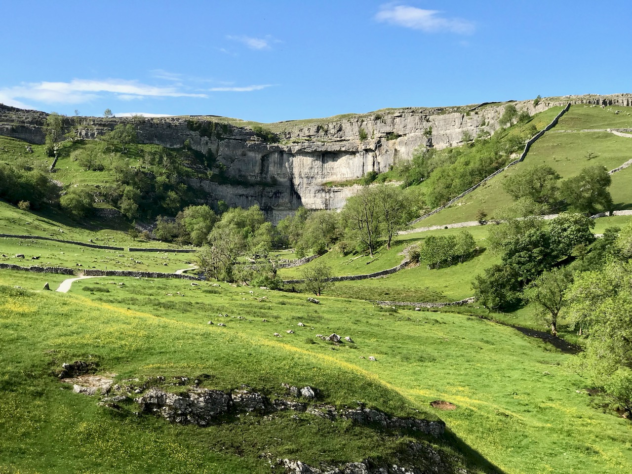
If this seems an enigmatic title, it is reflective of the fact that Finola and I have just visited Yorkshire, where  – for Finola’s birthday – we treated ourselves to a superabundance of medieval architecture and some idyllic wanderings in the Dales (that’s Malham Cove, a spectacular limestone cliff and pavement, above). This set me to thinking about comparisons between the county of Yorkshire and our own County Cork: both are the largest counties in their respective countries, but Yorkshire – at 14,850 km2 – is almost double the area of Cork, 7,500 km2.
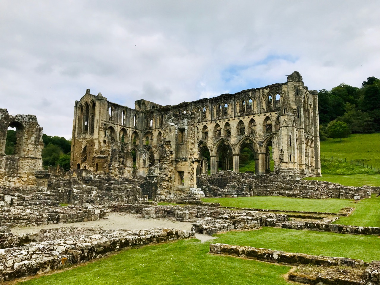
The gaunt ruins of Rievaulx Abbey in North Yorkshire: this was the first great Cistercian abbey in Britain, established in 1132. It became one of the most powerful and housed a community of 650 brothers at its peak in the 1160s under its most famous abbot, Aelred

In Ireland we can’t compete with the sheer scale of the monastic settlements that we can see in Yorkshire. However, in spite of those impressive ruins which are so well cared for by the state and the National Trust, nothing can compare, for us, with the timeless serenity and isolated beauty of places such as Kilree, which Finola described in a recent post.
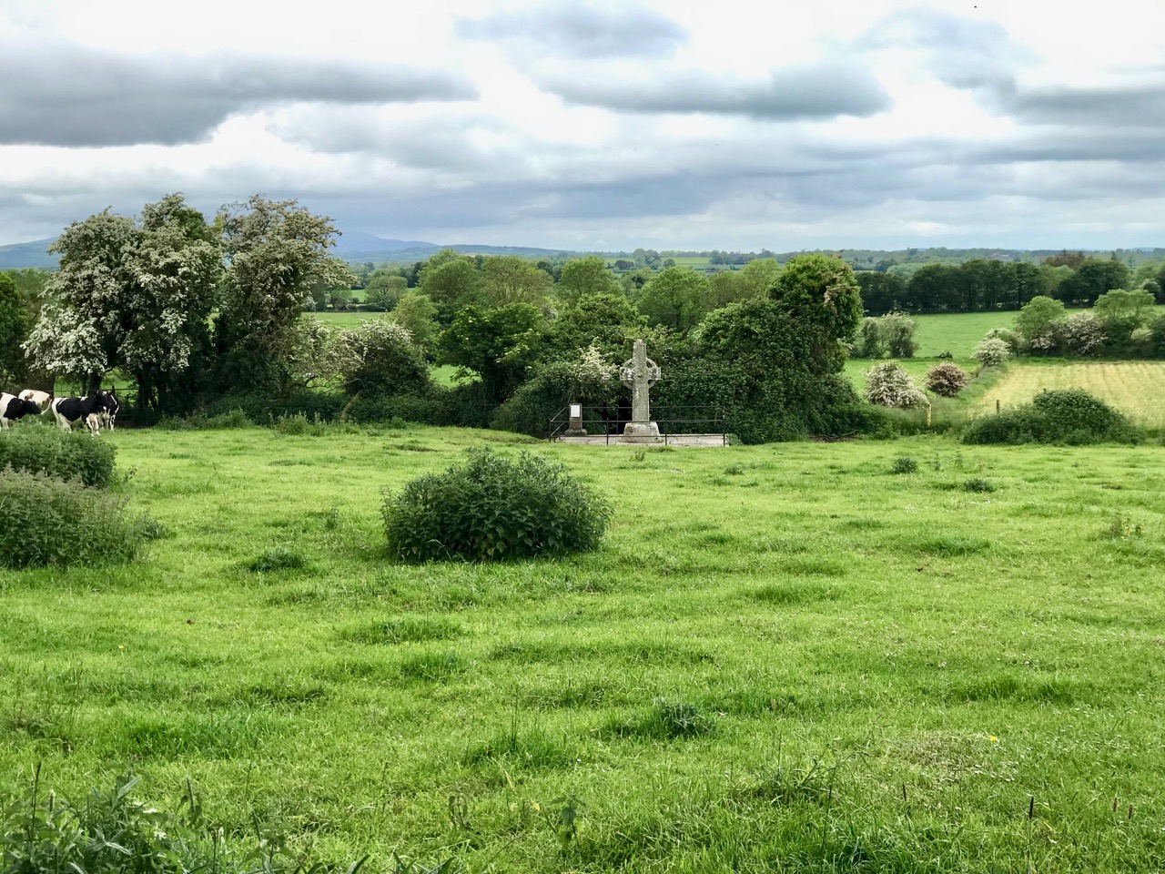
The medieval High Cross at Kilree, Co Kilkenny. This example of ecclesiastical art probably dates from the 8th century and stands remote and seldom visited, deep in rural Ireland – a reclusive gem

I feel that this post gives me an excuse to tell a little Cork / York story that I learned many years ago from Gerald Priestland, the BBC’s religious affairs correspondent from 1977 to 1982 – who lived not far away from me in West Penwith, Cornwall. Priestland was researching the history of the Parish of St Buryan in the far west of the peninsula: the Irish saint, Buriana, was said to be the sister of St Piran, Patron Saint of Cornwall – who, you will know from reading my posts – here, (and here), was born on Cape Clear, just over the water from us in West Cork, where he was known by the name of St Ciarán. Finola is republishing another post about Cape Clear today.

The coast of West Penwith, Cornwall: Gerald Priestland lived here – on the hill, and I lived not far away – over the hill

St Buryan was known as “The Wickedest Parish in Cornwall” in earlier times – I can’t vouch for its present day reputation! This was supposedly because the settlement (which Priestland describes as . . . a bleak and haunted landscape . . .) received a special privilege in the year 936 from the Saxon King Athelstan as he was passing through on his way to defeat the Danes on the Isles of Scilly. He founded an independent College of Priests at St Buryan and layed down that the lands (some 770 acres) . . . are to be exempt from all secular assessment; but not from the rendering of prayers which the clergy have promised me (that is, Athelstan): 100 Masses and 100 Psalters daily . . . The Domesday Book confirms that Buryan maintained its freedom from taxation but also confirms the charter that . . . the privilege and ordinance of sanctuary and aforementioned liberty may not perish through old age . . . That is to say that St Buryan was made a place of sanctuary then, and will remain so always. The consequence of this was that any wrong-doer or fugitive, instead of having to go into exile, could live freely within the parish boundaries without suffering any punishment – forever. So the place filled up with felons, brigands, rogues and villains!
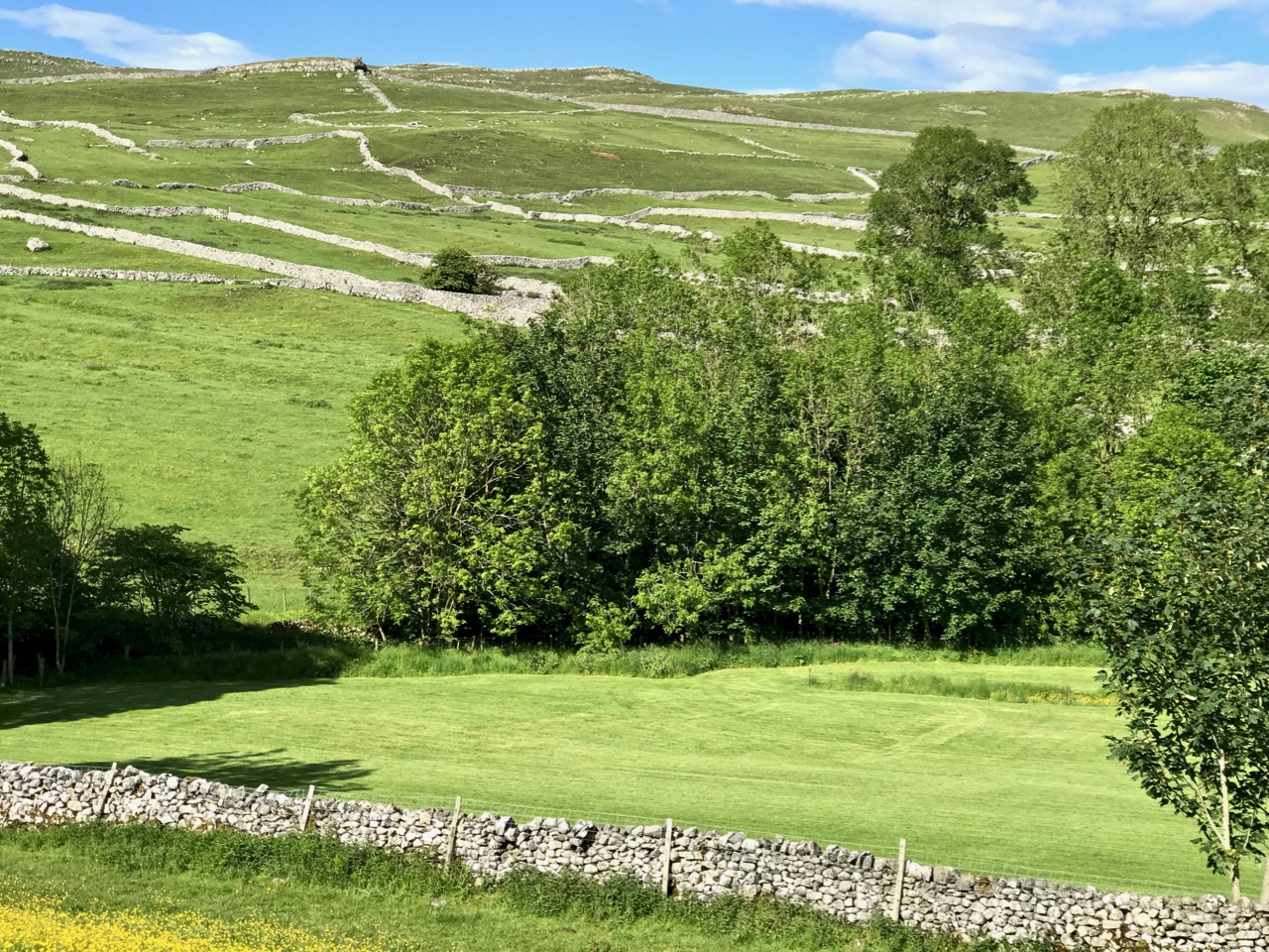
Scenic Yorkshire: landscape of the Dales (just to remind you of the subject of today’s post)!

St Buryan became – and remained – a den of iniquity. So much so that in 1328 the Bishop of Exeter, Grandisson, was forced to excommunicate everyone in the settlement. Priestland writes:

Grandisson came as close to the boundaries of Buryan as he dared, and from the top of St Michael’s Mount – six miles across the water – he pronounced the fulminacio sentencio contra Barianes – the Greater Excommunication against the people of Buryan. The bell was tolled and the book and candles were cast down. There are not many parishes in England that can claim that very specific distinction . . .

Deans continued to be appointed to the parish – and were duly paid a stipend – but none of them ever went there. The last of the absentee Deans was Fitzroy Henry Stanhope, an army officer of ill reputation who had lost a leg at Waterloo (he was known thereafter as ‘Peter Shambles’). He was offered the position at Buryan in 1817 by his Commander-in-Chief, the Duke of York, in lieu of an army pension: it was worth a thousand pounds a year. There was one problem: Stanhope had to be ordained, but no-one could be found to do it. One day the Duke was told that his friend the Bishop of Cork was on Holiday in London. At once Stanhope was sent round in a carriage with the message:

“Dear Cork – Please ordain Stanhope – Yours York”

By sundown, he was back, with the reply:

“Dear York – Stanhope’s ordained – Yours Cork”

This incident has gone down in history as the shortest piece of official correspondence on record. And doubly justifies the title of my post today!
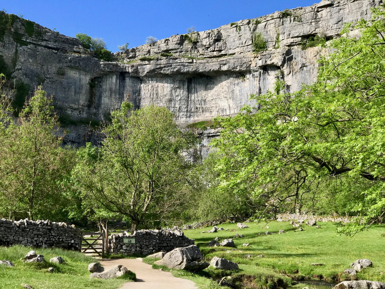
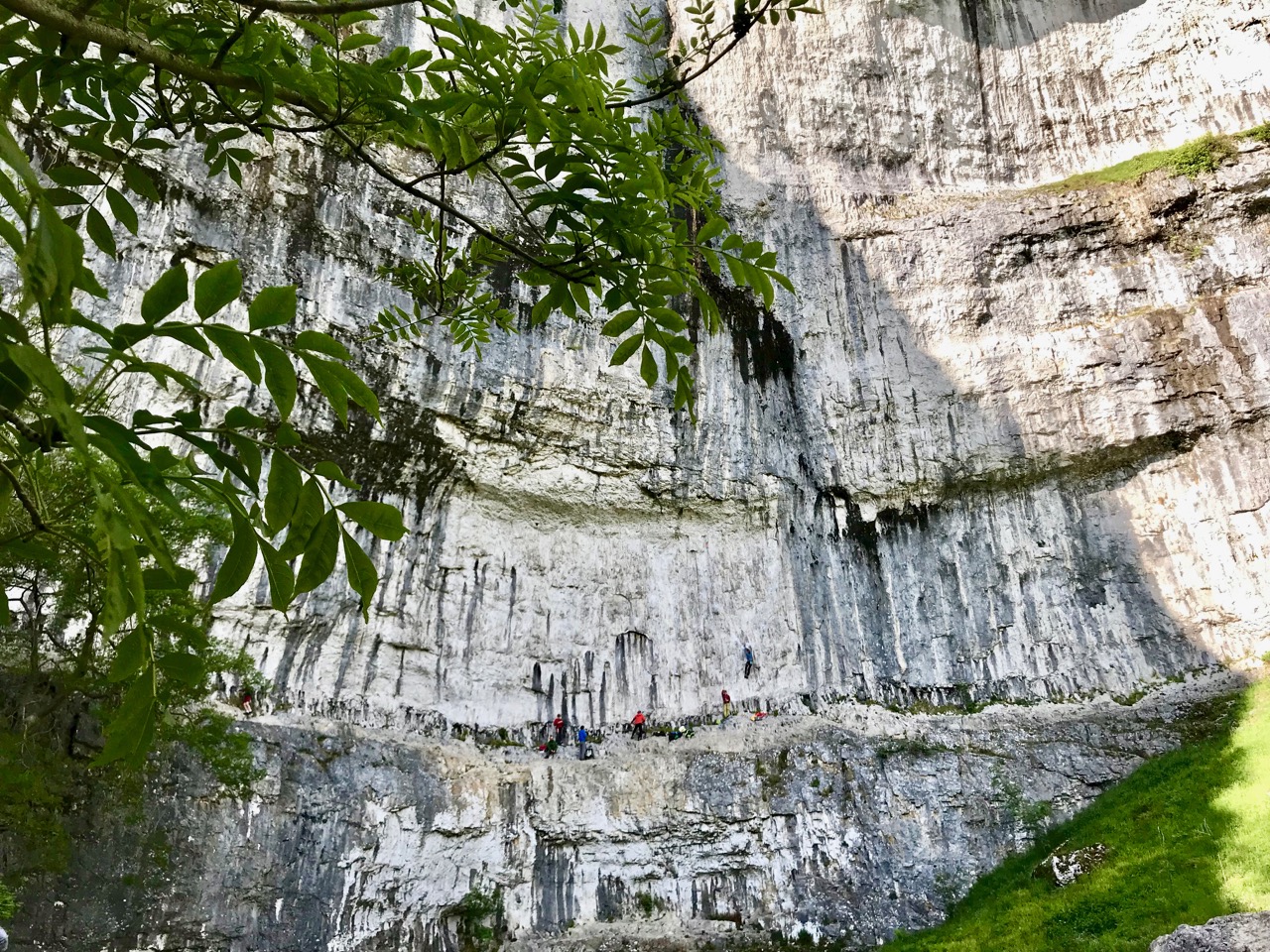
Malham Cove again: this geological formation would have been a huge waterfall as the glaciers began to melt after the last Ice Age. In the lower picture you can see the true scale of the place – look at those figures on the lower ledge! It is a popular spot for climbers

So – Cork, or York? We are very fortunate to be able to travel so easily to see the beautiful places of the world. But – always – the best part of travelling for me is coming home to West Cork: there’s no doubt where my heart is . . .
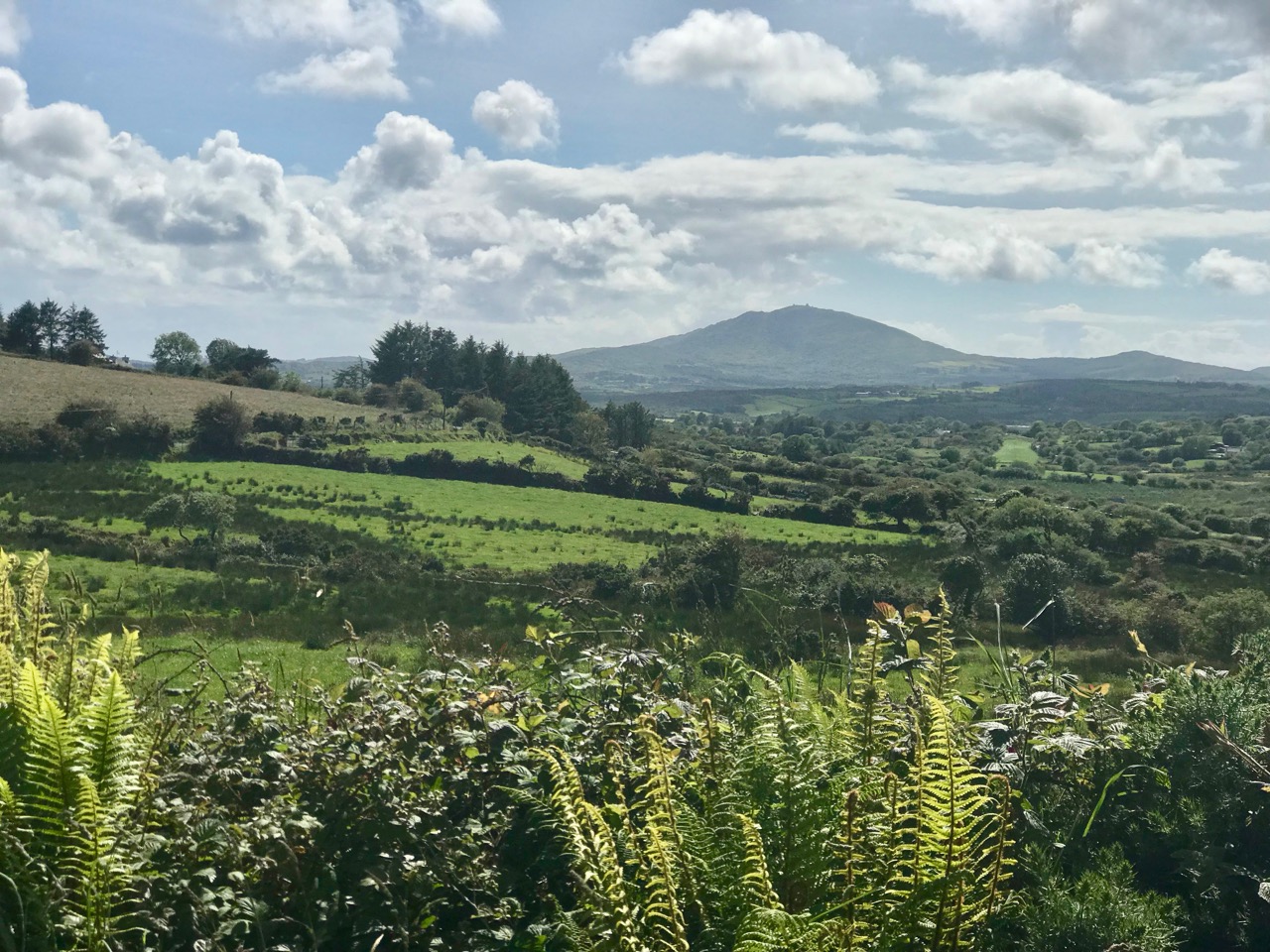
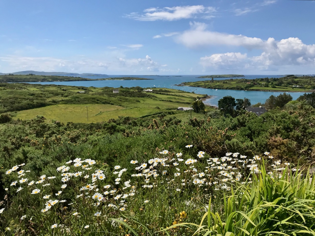
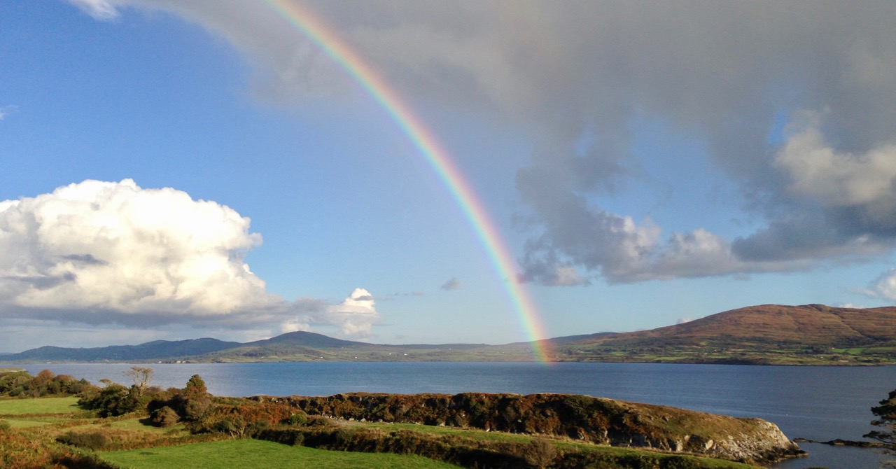
County Cork landscapes: Mount Gabriel (upper) and our very own view (lower) from Nead an Iolair, taken on the day I returned from Yorkshire. Below – looking across to the Mizen, from the Sheep’s Head.
Miniature World

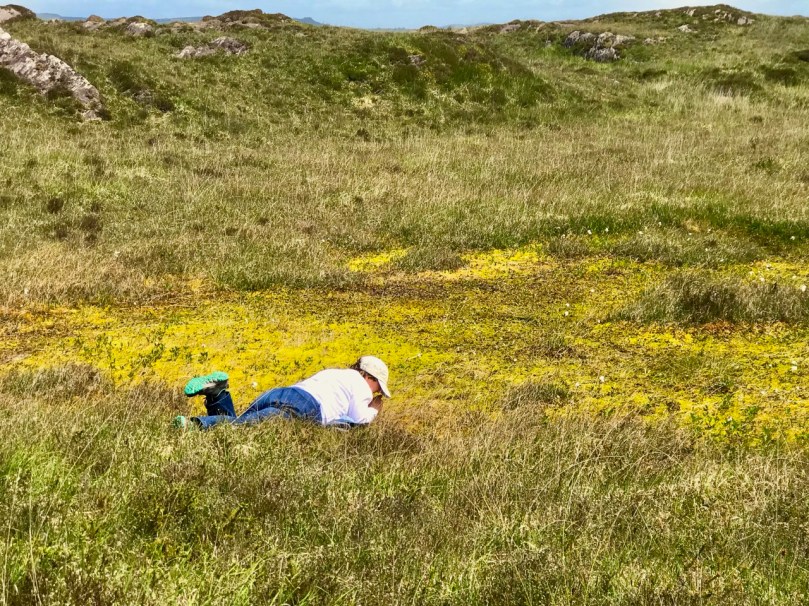
A bog seems at first like an unpromising site for photography but all it takes is getting close. This isn’t as easy as it sounds, since bogs are wet places, but having arrived home sodden but exhilarated I’ve decided it’s definitely worth getting wet. My role model in this type of close observation is Tina Claffey, whose book, Tapestry of Light, and whose Facebook Page are constant sources of inspiration. Tina – thank you! We must be twin souls because like you I return again and again to the same patch of bog. Time loses meaning as I simply lie and let my eye tune in.

My little patch is quite close to my house and I described it in my post last year “The Wildest and Richest Gardens” – West Cork Bog Soaks. It’s taken a while this spring for the Cappaghglass soak to wake up but it’s well and truly alive now so here’s what’s there already.

On the rocks

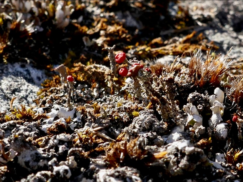
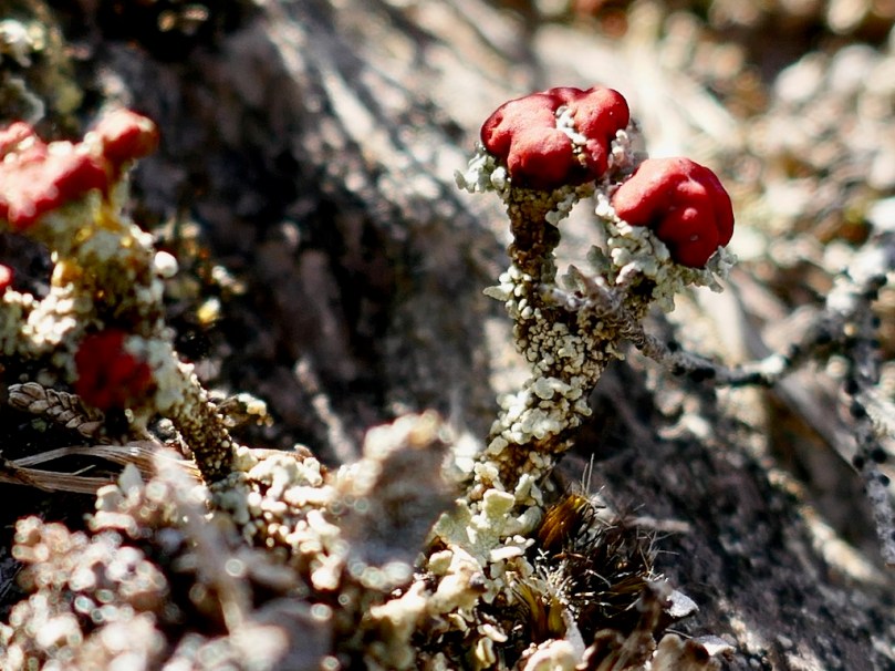
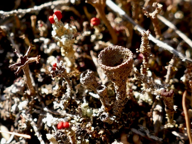
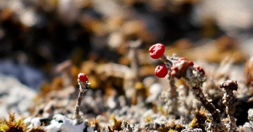
First of all, the soak is surrounded by heather and rock. Lying on the rock, with my face a few centimetres from the surface, I have become aware of the rich lichen growth all around me. I don’t know a lot about lichens but I have been studying this one (above and below) – Devil’s Matchstick.

It’s obvious how it got that name, and it’s sometimes also known as Nail Lichen too. It’s only about a centimetre high, about the length of my little fingernail. The Latin name is Cladonia floerkeana. In Ireland we get this bright red form of it, whereas in North America the tips are black.  The site I go to to learn about Lichens is http://www.irishlichens.ie. Here’s what they say about lichens on their home page:

Lichens are dual organisms; a fungus and one or more algae in a stable, mutually beneficial (symbiotic) partnership. The fungus provides structural form and protects the algae from extremes of light and temperature. Algae are capable of photosynthesis and some of the sugars produced provide the fungus with energy for growth and reproduction. Some lichens can live for many hundreds of years and being sensitive to pollution levels they are important environmental indicators.

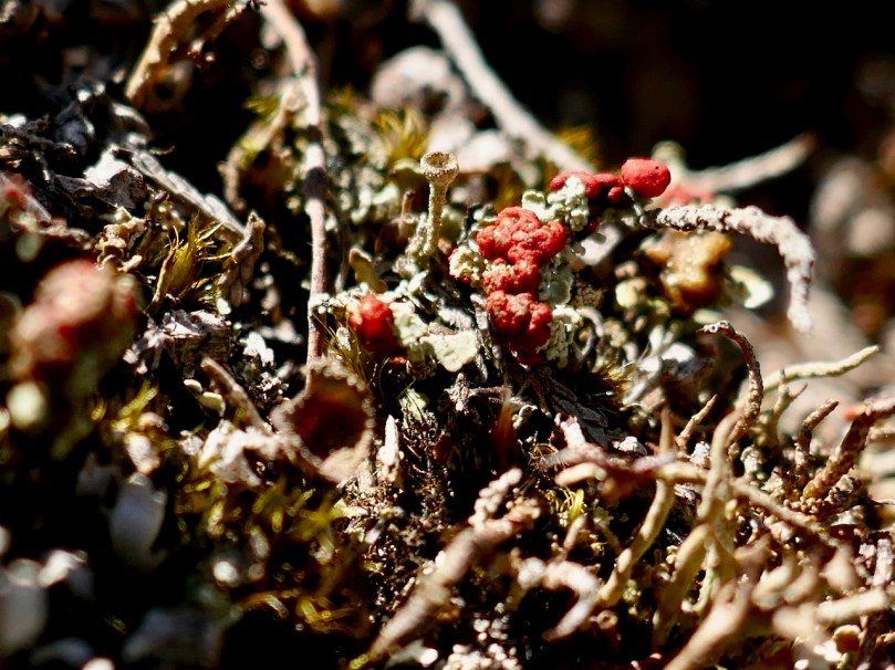
There are several red-tipped lichens in the Cladonia group so I must look out for others. The trunk is described as squamulose which simply means scaly, at the bottom and becoming fruticose (or shrubby) as it grows. The stems are called podetia, and they are topped by the bright red apothecia. Yikes! Don’t think I’ll become a lichen expert in this lifetime.

And look at this one, that looks like a goblet – it’s another Cladonia but I don’t know which one. And lots of white lichen to boot. It’s a whole world down there on the rock, under our feet. 

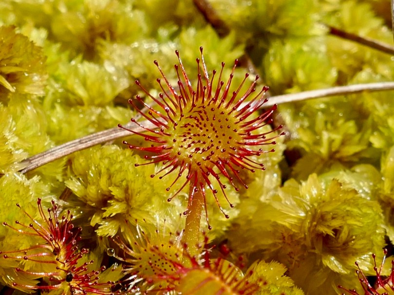
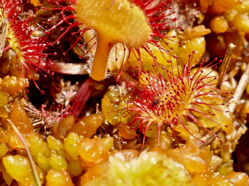
Let’s move over to the the bog soak now and look at two things in particular. The first is the Sundew. At first I thought it wasn’t up yet, but as I got closer I realised that it was just emerging from the surrounding Sphagnum moss (the second thing).

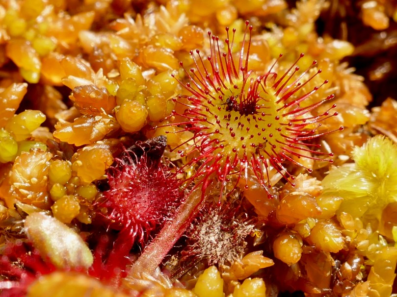
Besides looking weirdly otherworldly, the Sundew is a clever little critter, well adapted to this habitat. It’s developed a special mechanism to ensure it gets the nutrition it needs, since there isn’t much in the bog. It traps insects on its little sticky hairs, then the leaf rolls rolls over and digests them.

You might not want to watch this video if you have a weak stomach

The sundew does have a little white flower, but it’s the leaves that are the centre of all the action on this plant. Our bog soak has the Round-leaved Sundew, which is more common in Ireland than the Oblong-leaved Sundew that you saw in the video.

A hapless ant is this Sundew’s meal

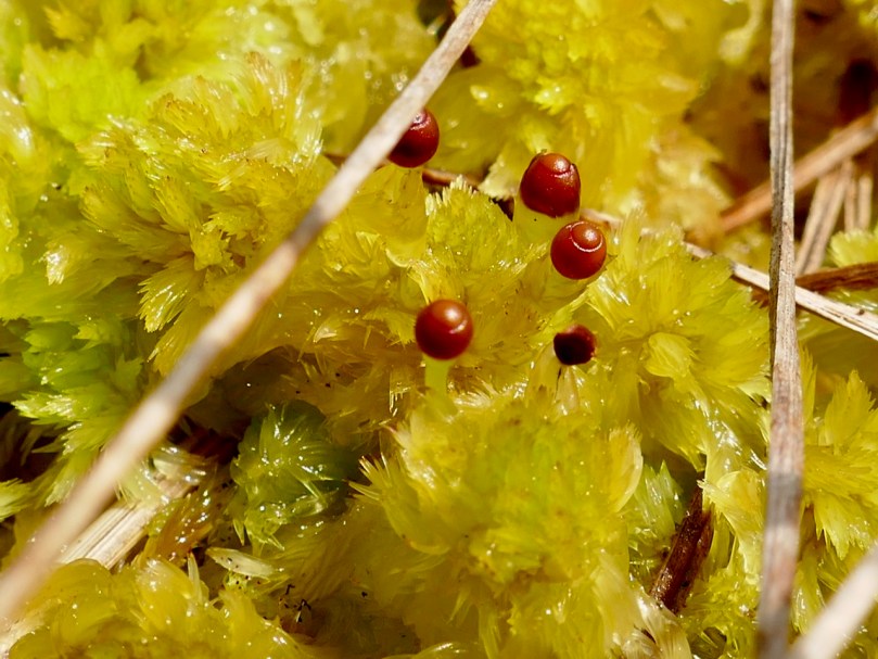
Finally, as I was nosing around (er, literally) among the Sphagnum, I saw that some of them had these little brown caps and I wondered what they were. It turns out that mosses propagate by means of spores, and the caps are little exploding spore capsules. When they blow, they fire the spores great distances.

Take a look at the spores exploding in slow motion – it’s quite a sight.

Some of the capsules in my little patch had exploded already – you can see the empty cup-like capsules in the photograph below – at the bottom of the picture..

Sphagnum itself is an amazing moss – we wouldn’t have bogs without it, as it’s what holds all the moisture. The Irish Peatland Conservation Council has an excellent information page on Sphagnum. It includes this:

A huge number of tiny microscopic plants and animals live with Sphagnum mosses. A few drops of water squeezed from wet Sphagnum contains hundreds of microscopic species such as desmids, diatoms, algae, cyanobacteria, amoebae, rhizopods, flagellates, ciliates, rotifers (wheel organisms), worms, nematodes (round worms), flat worms and heliozoans (sun animals). One scientist counted over 32,000 microscopic animals from a Sphagnum moss growing in a bog pool!

Now that’s a bit too miniature for my lens. I’m happy at the magnification I can achieve with my Lumix. If you need me, you know where I’ll be.


Oldest Lighthouse in the World!

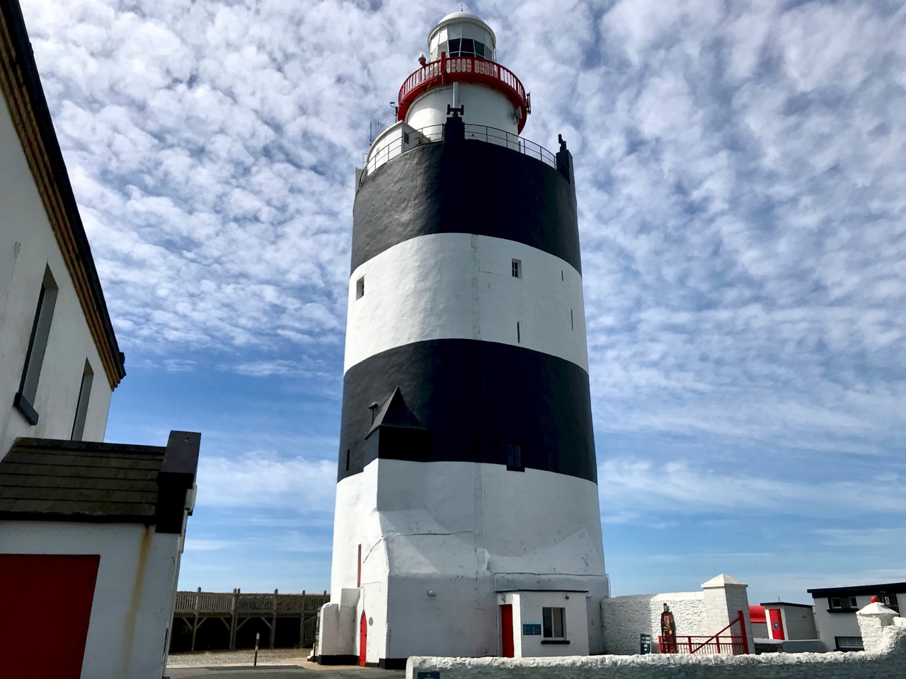
It’s a bit off the beaten track, but we had to make the journey to visit the oldest working lighthouse in the world! It’s right at the southern tip of the Hook Peninsula, in County Wexford. Maybe it’s an extravagant claim that it is the ‘oldest in the world’: there is another ‘oldest’ lighthouse – The Tower of Hercules – in Galicia, northern Spain, which is said to have been built in the 2nd century. However, the Tower of Hercules was given a major restoration at the end of the 18th century, including a new neoclassical facade, with the original Roman structure retained behind this. Wexford’s assertion that the main visible structure of the Hook Lighthouse – both inside and out – is exactly what was built in the 13th century, perhaps gives it the edge. I was delighted to find, incidentally, that the Tower of Hercules has an Irish connection: it is mentioned in the 11th century Lebor Gabála Érenn (The Book of the Invasions of Ireland). If you recall my account of the story of Cesaire – the first person ever to set foot on Irish soil – you will remember that on her travels away from Egypt in the years before the Great Flood Cesaire stopped off in Spain and climbed to the top of a very tall tower from which she could see, in the distance, Ireland’s wonderful green land, and from there she travelled on to arrive on Ireland’s shores in Bantry Bay. Well, according to tradition, it was the Tower of Hercules which she climbed!

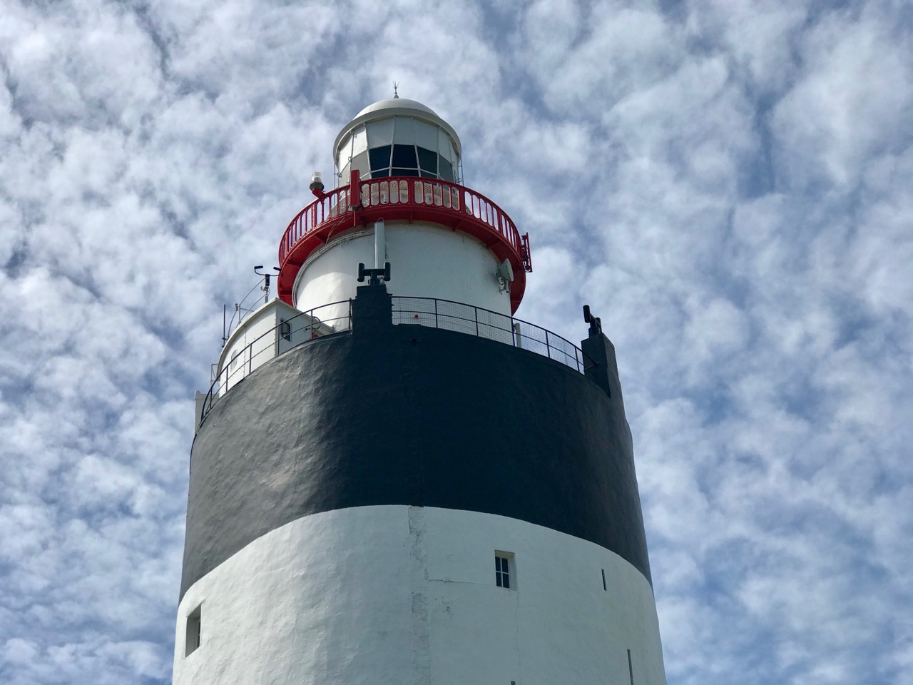
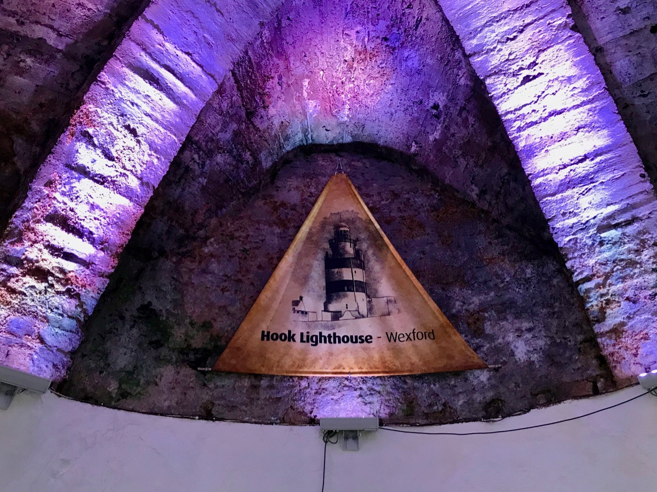
Header – the bulky main structure of the tower dates from the 13th century – its walls are four metres thick. The chambers within the tower are stone vaulted (above)

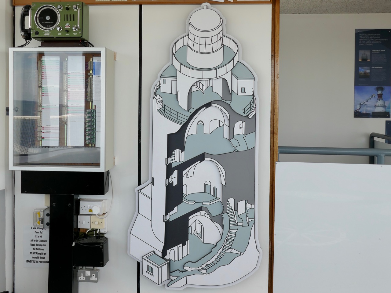
The lowest tier of the tower consists of three storeys, and has a base diameter of 13 metres. Each storey has a vaulted stone ceiling. Above this is the narrower section – 6 metres in diameter – which would have supported the original brazier, kept burning at all times to warn ships of the rocky ‘Hook’ of land at the entrance to the channel leading up to the port of New Ross – the most important in Ireland in the 13th century.

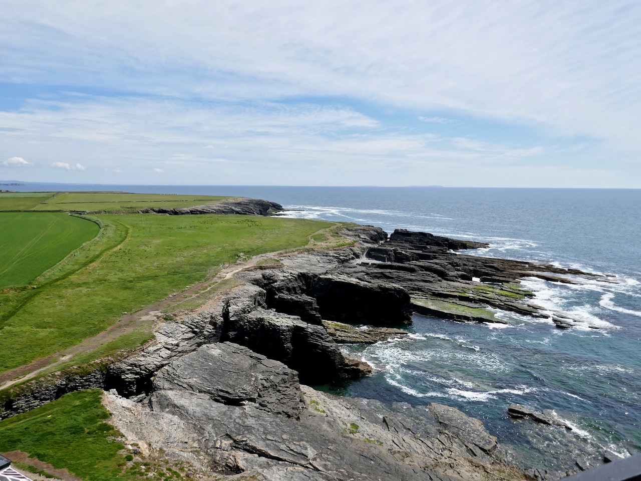
Upper – an exploded view of the structure of the lighthouse, one of the exhibits on the guided tour; centre – the whole tower: the topmost section, housing the electric lighting system, is relatively modern; lower – the treacherous rocks around the shore of the Hook 

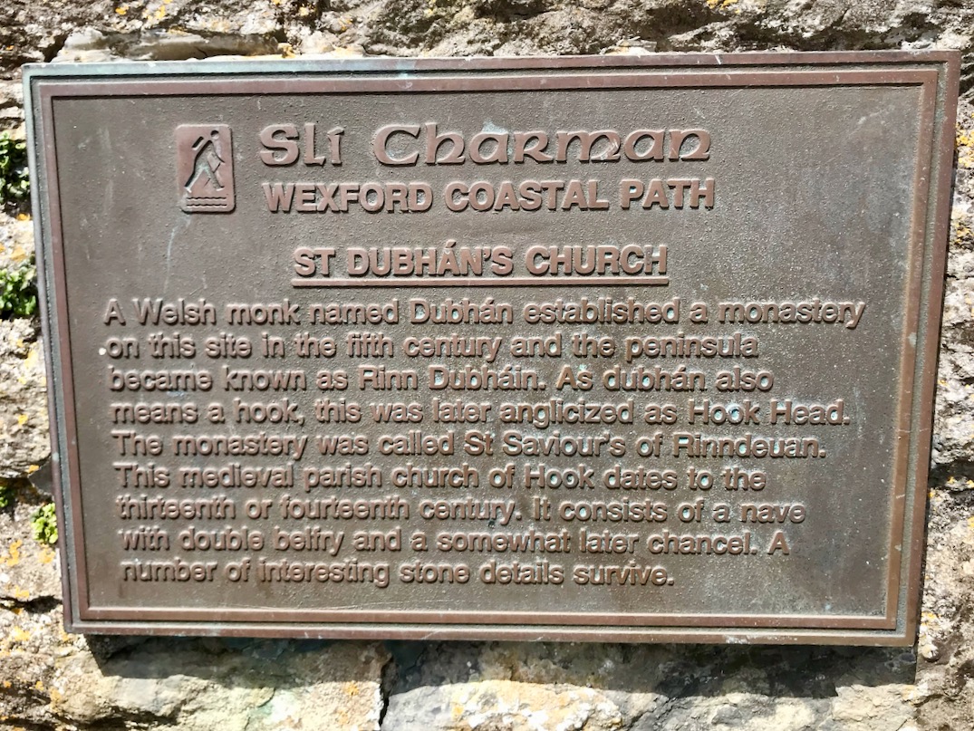
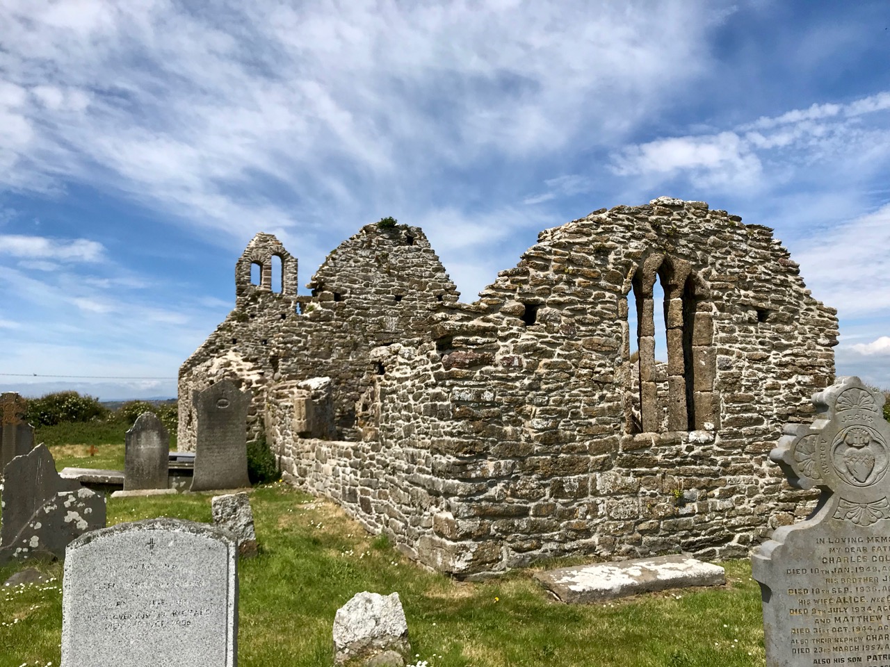
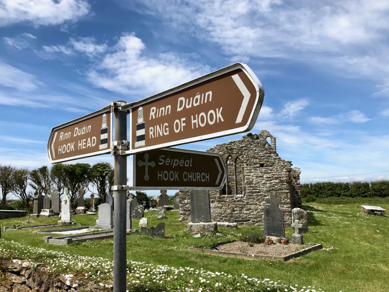
But there was, in fact, a light burning on this headland for hundreds of years before the construction we see today: this was a beacon fire established by Saint Dubhán, a monk from Wales, in the 5th century. Dubhán came to Ireland as a missionary, and built his monastic settlement a little way inland: this is marked today by the medieval ruins of a church and burial ground.

Dubhán’s monastic site not far from Hook Head. It was the saint who set up the first beacon light on this peninsula
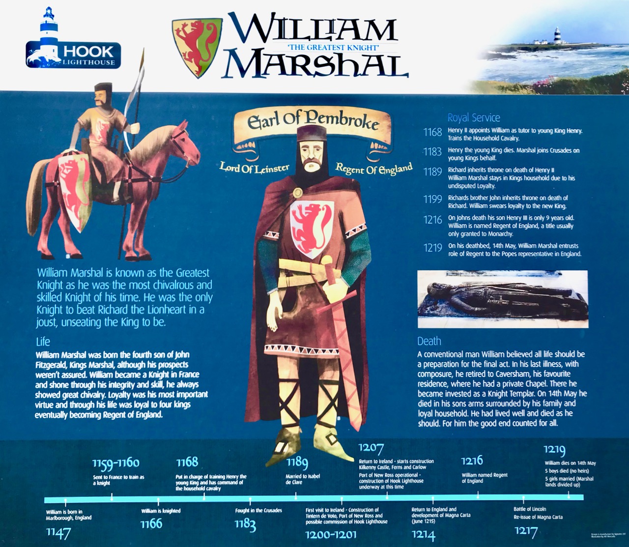
The lighthouse we see today was built by Strongbow’s son-in-law William Marshall, Earl of Pembroke (1147 – 1219). He constructed it and made sure that the light was maintained in perpetuity to fulfil a promise he made when he was threatened with shipwreck off the Hook while trying to get into the port of New Ross. Marshall is one of the medieval hero-warriors: known as ‘The Greatest Knight’ he is at the centre of many legends. Turtle Bunbury gives a good account of him here.

William Marshall, Earl of Pembroke is very much in evidence at Hook Head: you can even hear him telling his own story when you are in the lighthouse (above)!

If you find your way to Hook Head Lighthouse today you are in for many treats. Firstly, it’s good to know that it is open to visitors all the year round, and guided tours are always available (you can only go inside the tower with a guide). Also there is a welcome heritage centre on site with a shop and cafe – and a fine pirate-themed children’s playground.
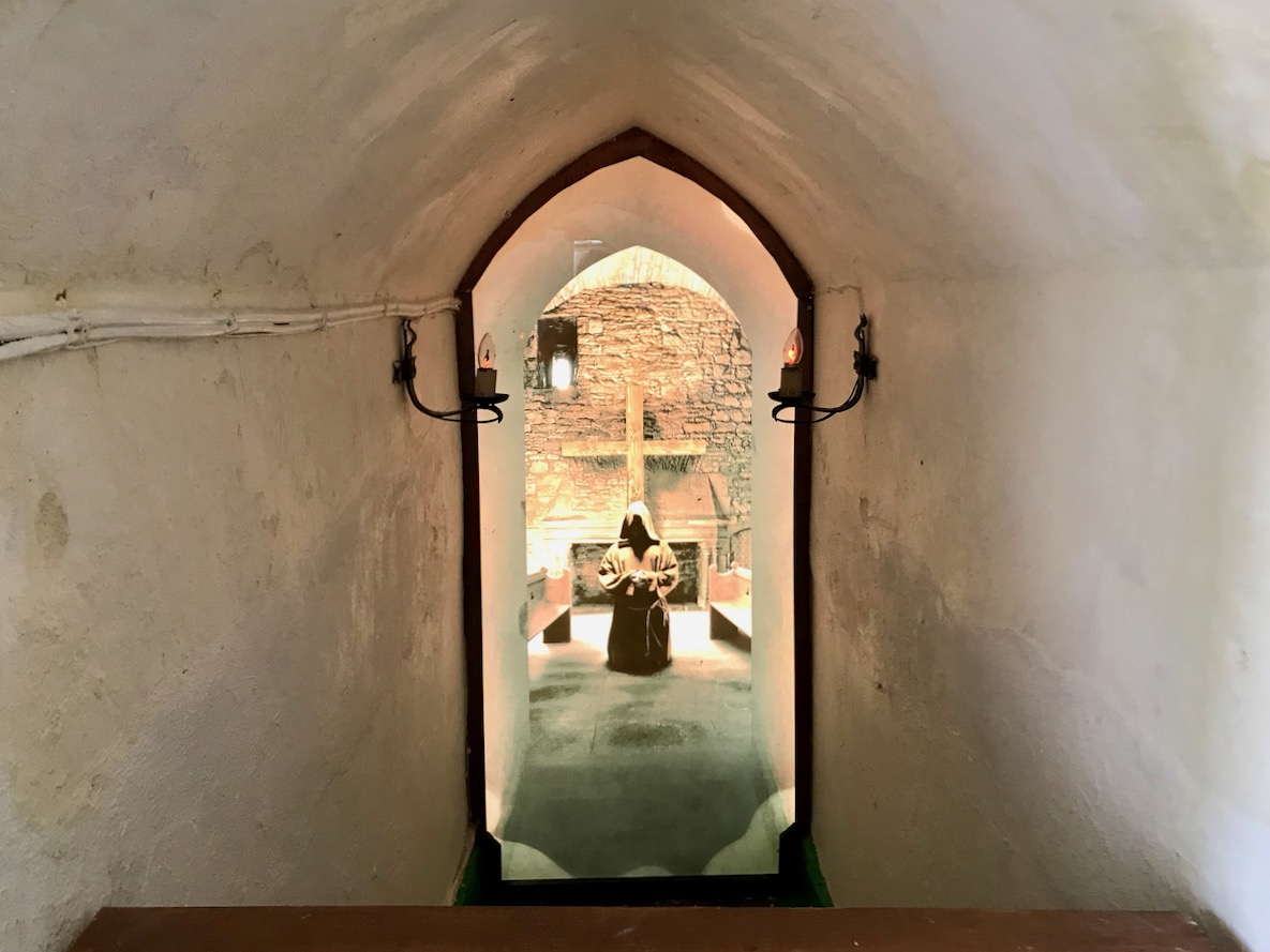
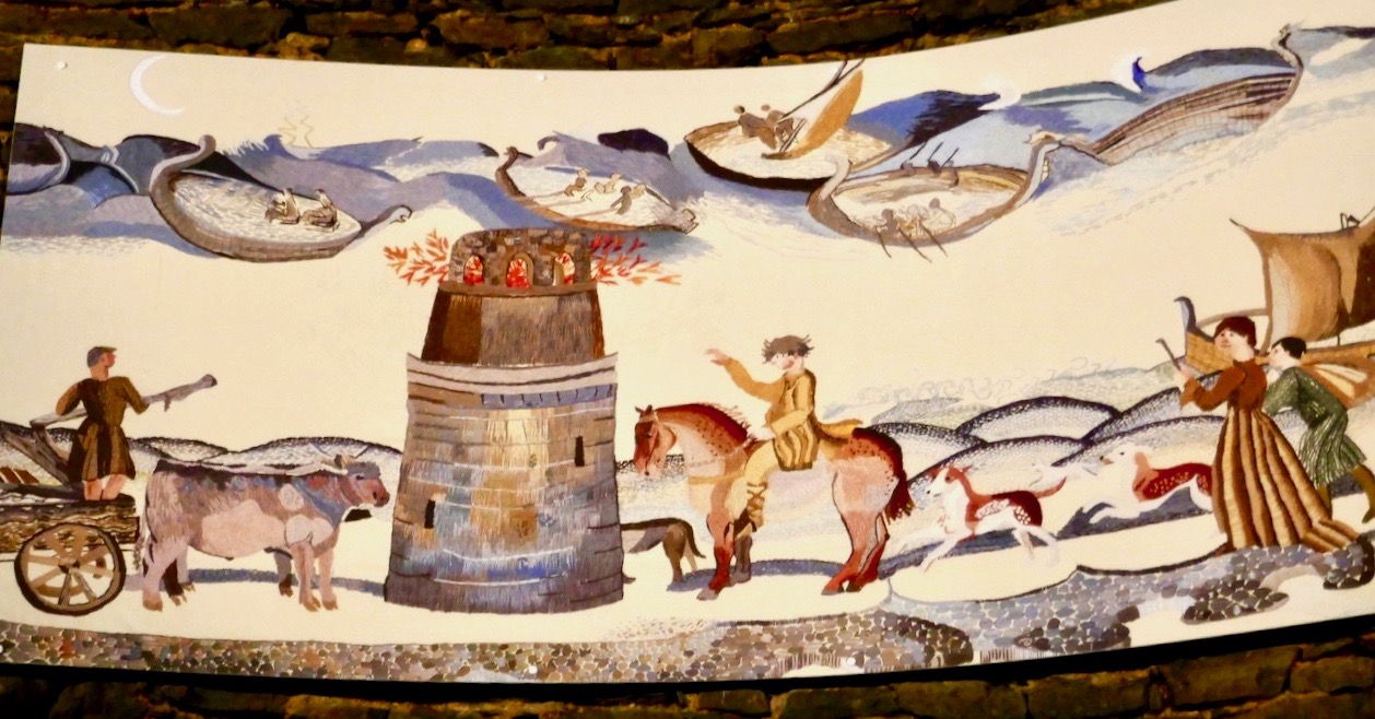
Saint Dubhán and his followers are remembered through the displays in Hook Head Lighthouse: the mural above shows the first beacon established by the 5th century saint

It’s a grand day out, if you happen to be within reach of the Wexford coast. There are so many strands of Ireland’s multi-facetted history to be traced here: the earliest missionary monks, Norman Knights, sea-travel through the ages, connections with the medieval world – and a wonderful piece of early Irish architecture still serving its original function.
Mizen Magic 15: Long Island

The summer sun is falling soft on Carbery’s hundred isles— 
The summer sun is gleaming still through Gabriel’s rough defiles—

(from Thomas Osborne Davis The Sack of Baltimore 1844)

Up here in Nead an Iolair (Eagle’s Nest) we look out over the Carbery Islands. There are supposed to be a hundred of them, although some are just little rocky outcrops: the tips of underwater mountains at the margins – and the mercy – of the Atlantic.

Horse Island, Castle Island and Long Island lie along the length of the coast below us. Peter Somerville-Large (The Coast of West Cork 1972) quotes a tradition that they all used to be one island:

In the latter end of March, AD 830, Hugh Domdighe being monarch of Ireland, there happened terrible shocks of thunder and lightning . . . At the same time the sea broke through the banks in a most violent manner, The Island, then called Innisfadda, on the west coast of this country was forced asunder and divided into three parts.

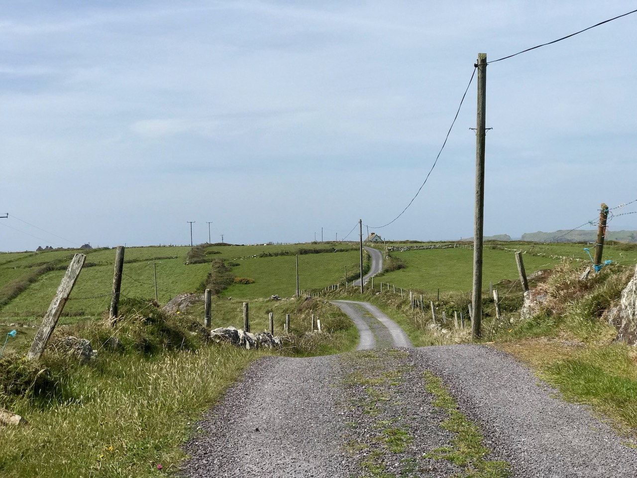
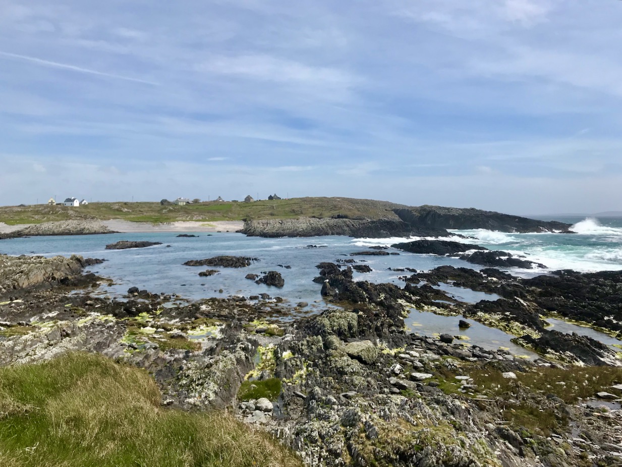
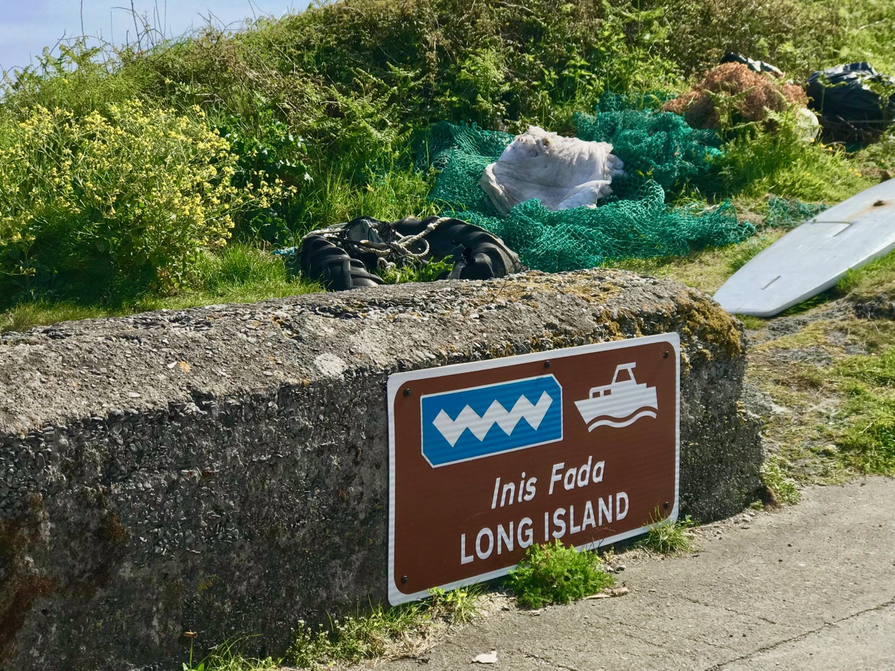
Long Island is still known as Inis Fada in the Irish language: the Anglicised name is a direct translation; header – the long road that winds from East to West on Long Island; second picture – the Wester village seen above the Atlantic breakers on the wild and battered far shore

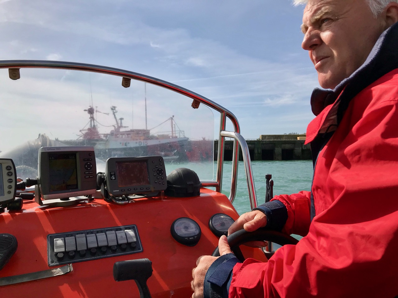
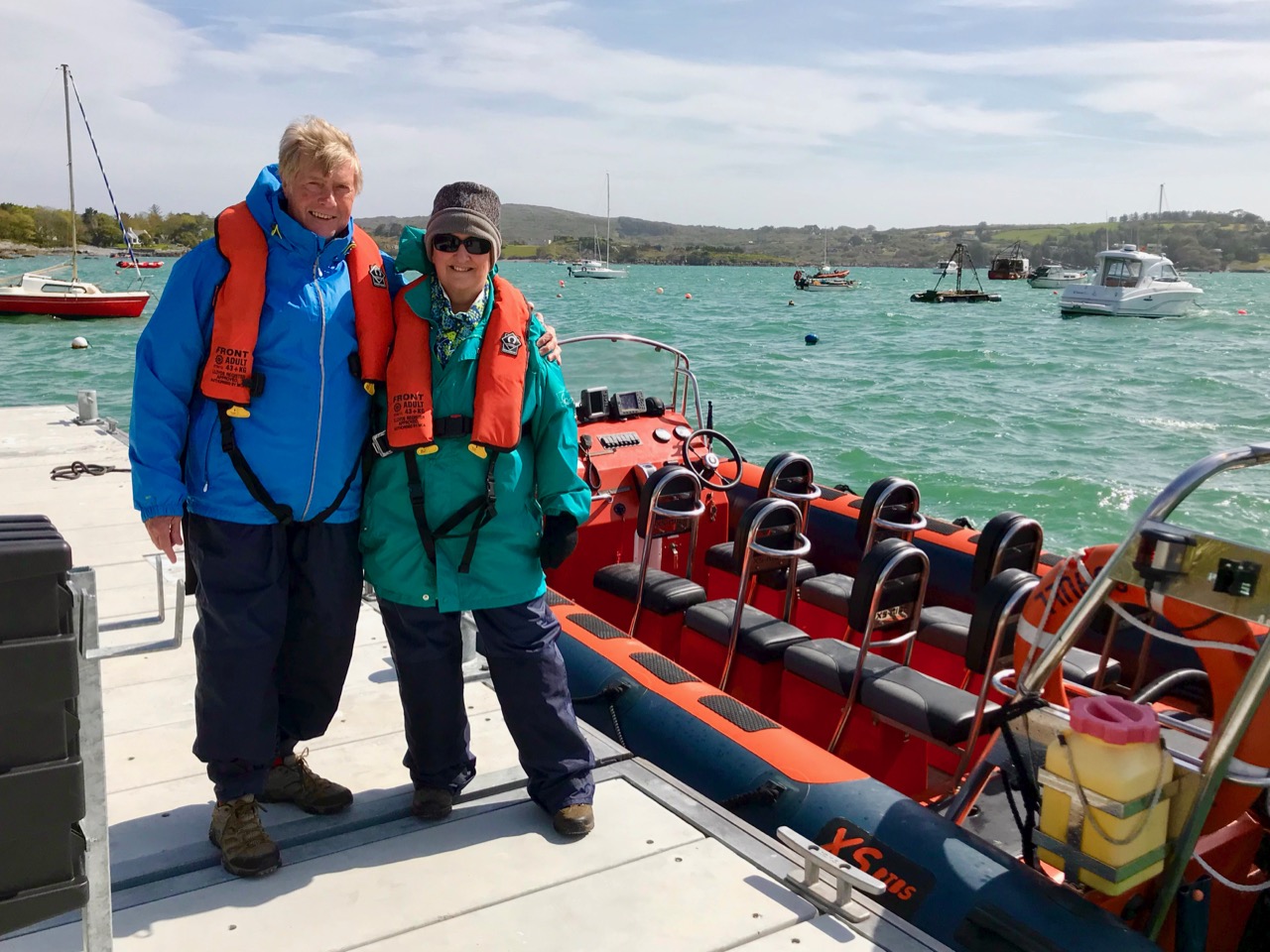
We had a day’s adventure on the island, walking almost the full length of it; Finola was madly busy identifying all the wildflowers. It’s part of the magic of Long Island that we covered a distance of over 10 kilometres in the day, although the length of the island tip to tip is just over 4k. There is a regular ferry to the island from Colla Pier (not every day of the week), but we chose to travel from Schull pier with Helen of Schull Sea Safari (a whale watching trip with Helen will be a future outing for us). Our mode of transport was Helen’s very fine large RIB, the Kealtra – superbly equipped. With a hard south-easterly wind the waters were very choppy and we had to be fully kitted out for the crossing!

Upper – intrepid travellers kitted out for a choppy crossing on the Kealtra! Lower – skipper Donie taking the RIB out of Schull Harbour

After the heady excitement of a blustery crossing, stepping on to the tranquil world of Long Island is a magical experience. You are immediately aware that the place holds memories – and ghosts – but is still a community in the modern world thriving against the odds.

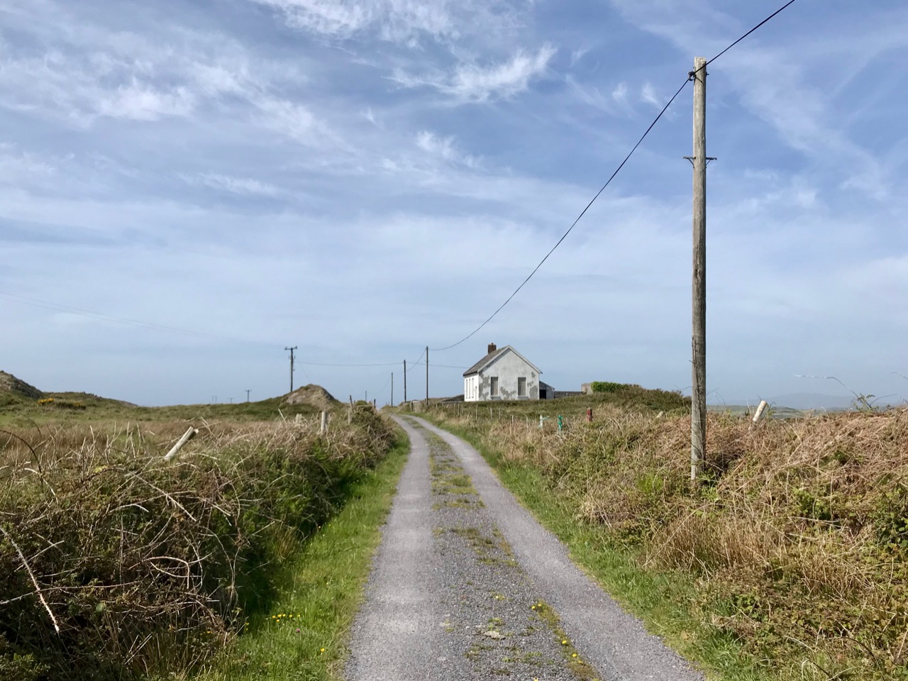
Everywhere there are signs of the past: abandonment, fading history, but also livings still being forged from the environment. The sadness is the obvious population decline. Looking through the available census records, a melancholic picture emerges: 1841 – population 305; 1911 – population 143; 1951 – population 74; 1991 – population 11; today – population 7 (and that’s an increase of 1 from 2 years ago). There was once a school: the decaying building is now a lonely waymark at the centre of the island’s single boreen.

The Island School – long deserted and gently decomposing

Peter Somerville-Large in conversation with the local residents during his visit half a  century ago:

I talked to Mr McCarthy, who had lived here all his life and could remember when the place had been full of fishermen all speaking a mixture of Irish and English. One by one he had watched them leave. A dozen families still remained, comprising perhaps forty people altogether. The school had shrunk year by year, to four pupils, then two – it closed after that. There was neither electricity, nor any shop – nothing to keep the young from making the short crossing over to the mainland. It would take them fifteen minutes, according to wind and weather. There they disappeared for ever. When the old ones like himself died out the place would become empty.

Contrasts at the west end of Long Island

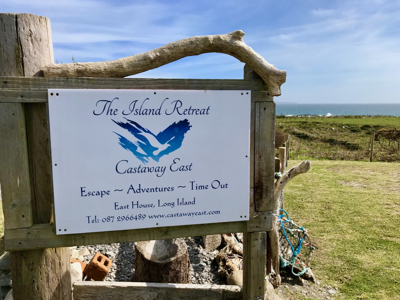
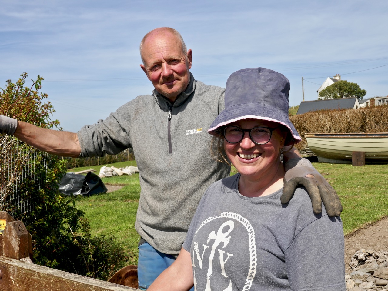
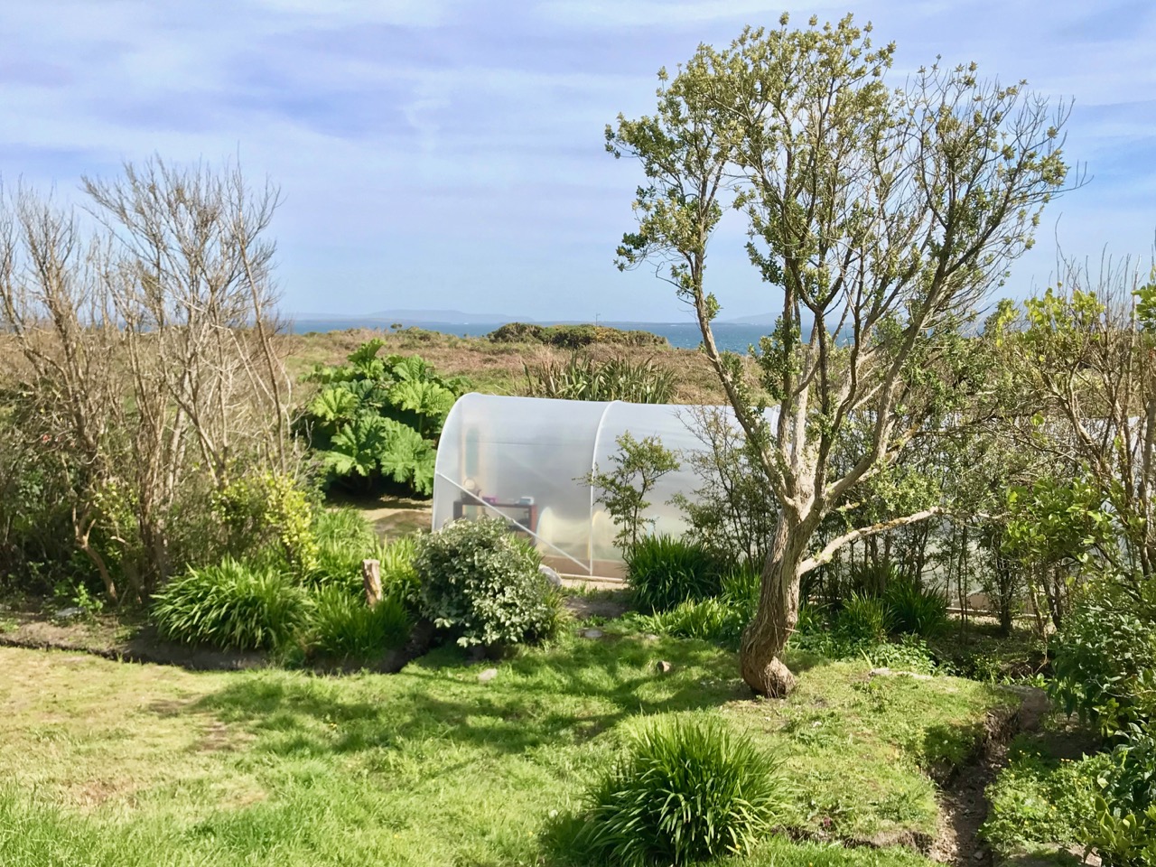
Although there are many houses that are intact and well looked-after (a number are holiday homes), you would think that the odds were ultimately stacked against the survival of this island. Yet those who do live here full-time have tenacity – and there is fresh energy. Helen and Maurice have built their own new house and run businesses which allow them to be island based, while Castaway East is a ‘Place of New Beginnings’, a venture offering B & B or full board and – if you want – retreat packages to recharge your batteries. Peter and Tracy are also experts in garden landscaping as can be seen from the works they have carried out for themselves.

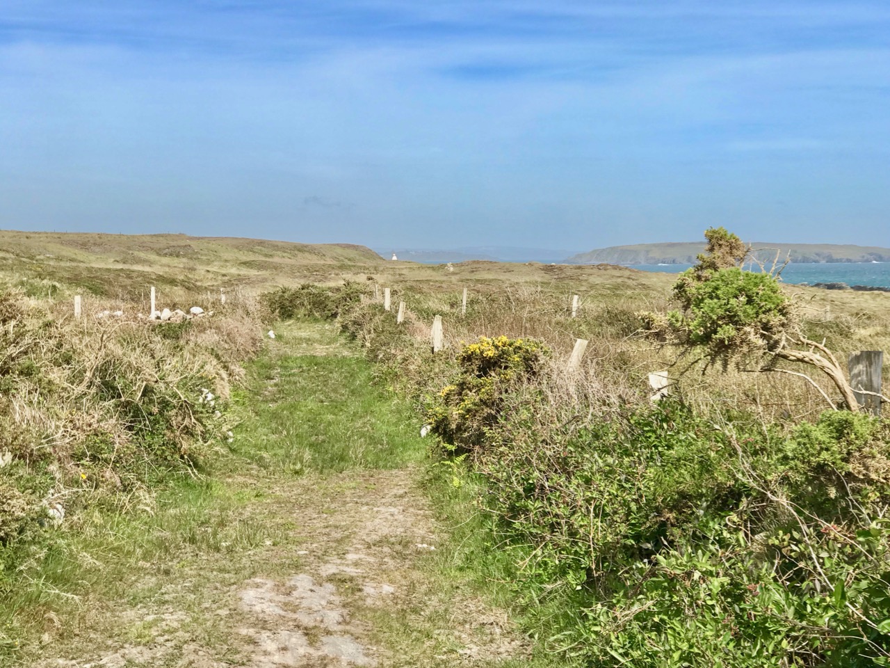
The East end of the Island: you can walk past Peter and Tracy’s ‘Island Retreat’ to the old copper mine and navigation beacon

We were pleased to find that the island’s well has been maintained and presented in excellent order – mainly by Joe, one of the Islanders. It’s a little haven, not to be missed. The day’s adventure gave us so much photogenic material – I will be returning to this magical place in a future post.

Long Island Wildflowers – a Reconnaissance

Robert and I set off on Tuesday for Long Island and enjoyed everything about it. See his post Mizen Magic 15: Long Island for a full account of our day. One of Roaringwater Journal’s New Year Resolutions was to spend more time on the islands and this was an excellent start! I was there mainly to take a look at the wild flowers, with a view to leading a wildflower walk there later in the year. Do let me know if you’d be interested in coming along, in the comments section below.

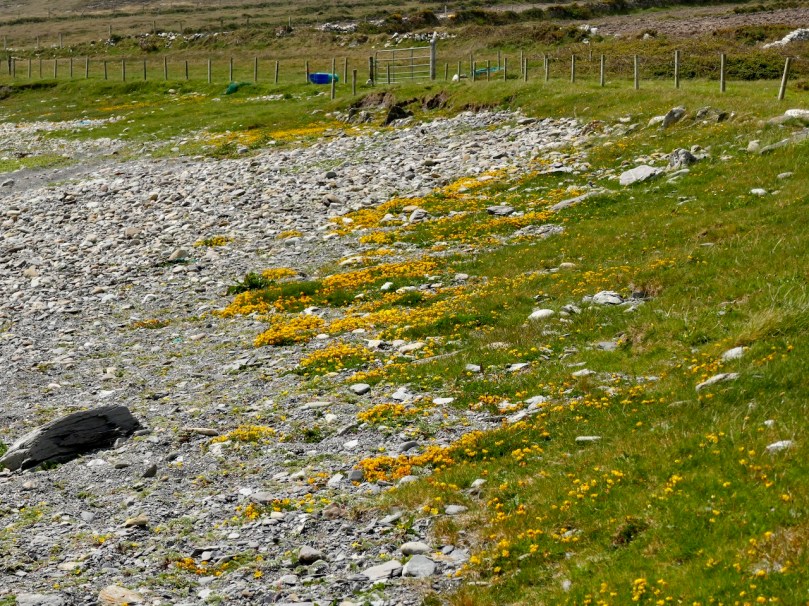
I’m used to seeing Bird-foot Trefoil in my garden, but here it’s spread to the stony beach and looks wonderful

Wildflowers come and go, so what I saw was a lovely selection of late spring and early summer blooms. I also got a feel for the character of the island and the habitats it hosts.

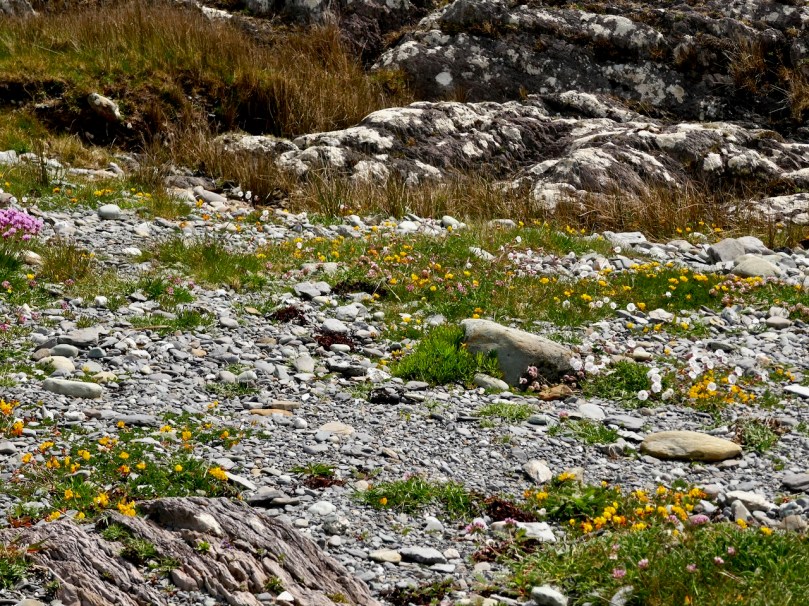
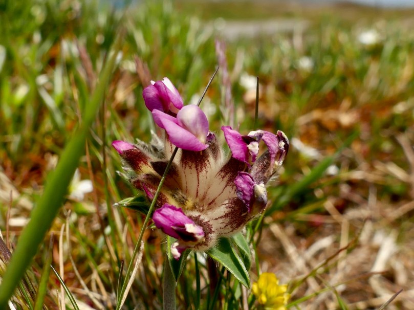
The maritime habitat was rich with Thrift, Trefoil, Kidney Vetch (also the lower photo) and Sea Campion

It would be lovely to be able to say that the island is pristine and free of invasive species, but alas we did see some Japanese Knotweed along the way. We are left scratching our heads as to how it manages to spread like that.

The uncultivated higher ground was particularly colourful, with Lousewort predominating. In this photograph you can also see the yellow of Tormentil and the pale flowers of Common Milkwort (see below for more on this Milkwort)

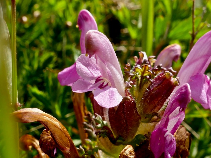
I don’t think I have ever seen such a profusion of Lousewort (below) anywhere else and this is one of the things that gives Long Island a particular colour at this time of year. It’s not a pretty name, for what is, in fact a beautiful little plant, but it was so called because it was believed that sheep got lice from eating it. This has never been proven, but the name stuck. Long Island, with its acres of damp moorland, provides the perfect habitat for Lousewort.

It’s also perfect for Tormentil and Common Milkwort (below). This last flower is tiny – you have to get your face up close to the grass to see it and it’s normally a deep purply-blue. However, on Long Island there were lots of very pale Milkwort, almost white. Although I knew that Milkwort came in pink and white, besides dark blue, I had only seen blue before this year. Now I have to find some pink!

The Yellow Iris (below), which most people call Flags, are in abundance in all the marshy areas, creating a colourful swath here and there. Up close, they are very dramatic. Here, it’s native and welcome, but in North America it has become invasive, choking waterways and displacing native plants.

A couple of unusual flowers to end with, beginning with Musk Stork’s-bill (below). I found this little beauty before in a graveyard in Rosscarbery but this is the first time I have seen it near where I live. It’s described as ‘probably introduced’ which means that it’s not native but has been here a long time.

The flowers of the Stork’s-bill look very like a Crane’s-bill, but the leaves are hairy and they have these funny spiky seed pods, both of which help in identification

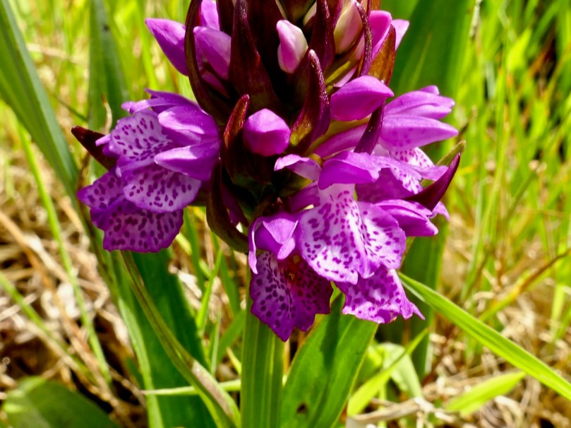
Finally – who can resist an orchid? There are several kinds of Marsh Orchid, but I think this one (above and below) is the Irish Marsh Orchid. We saw it before on Cape Clear, so it obviously loves islands! I was glad I had my hand lens with me, as this is best viewed close up.


Witches’ Marks and Lovelorn Shepherds: Inscribed Rock Art in a Remote Valley

One day in the summer of 1972 I set off on my Honda 50, backpack full of recording tools, to find a new and different example of rock art. This was not my usual prehistoric cup-and-ring carving, but inscribed or scratched markings in a ‘cave.’ When I returned yesterday, 47 years later, it was to a place even more remote and wildly beautiful than it had been in my memory. Read Robert’s post for a full account of our walk up the Valley of the Cooleenlemane River.

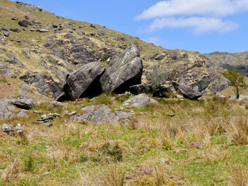
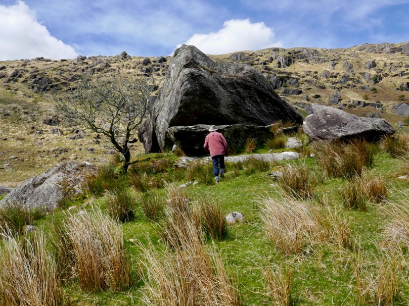
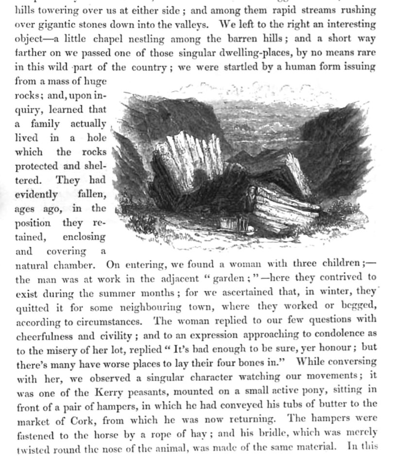
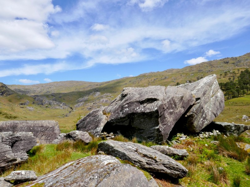
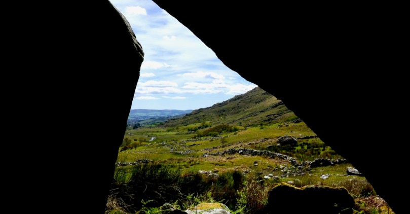
The site itself is arresting. Huge slabs lean against each other to form three shelters – nowadays harbouring sheep but in times past, perhaps humans. There is an account in the Halls’ Tour of Ireland of an encounter they had with a family living in this area in what looks remarkably like our destination.

The House of Rocks from Ireland, Its Scenery, Character, &c by Mr and Mrs S C Hall, page 149. Drawn by A Nicholl, engraved by Landells

The ‘caves’ are known locally as the Bealick – Pat Joe pronounced it The Bay Lick. Leach (pronounced lack) is the word for a flagstone or slab so this could be a reference to the enormous stones themselves, but baoleach (pronounced bway-lock) is also the Irish word for dangerous, which may refer to beliefs about the power of the place. The townland name, Cooleenlemane, could mean the Little Nook of the Rock Outcrop, or it could mean the Rock Outcrop at the Remote End (of the valley). Either way, it’s apt.

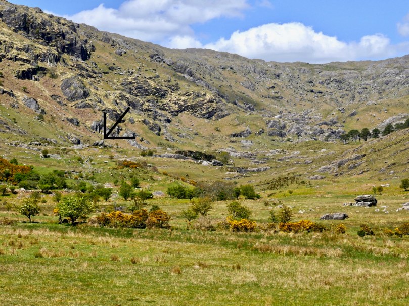
The arrow points to the Bealick: you can see it from a long way away as you walk up the valley

We’ve written many posts about rock art in this blog, but the closest we’ve come previously to dealing with Inscribed markings was Robert’s post on the Aultagh stone, which has been suggested as an Ogham (or fake-Ogham) stone. This one is very different.

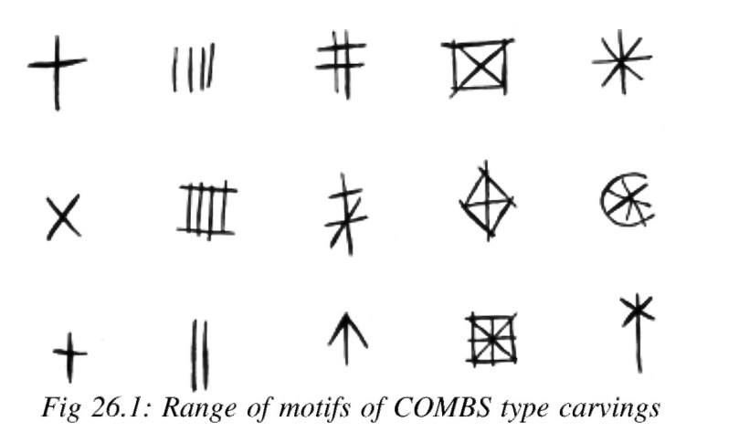
This type of site has been described most comprehensively in Elizabeth Shee Twohig’s paper, An Enduring Tradition, Incised Rock Art in Ireland in the 2014 book From Megaliths to Metal: Essays in Honour of George Eogan. She coins the term COMBS, based on where these kinds of marks occur – Caves, Outcrops, Megaliths and Boulder-Shelters, and gives details on the ones that have been documented to date, including the list I included in my 1973 thesis.

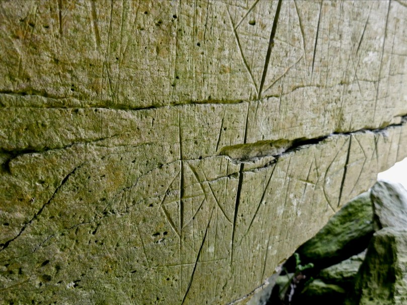
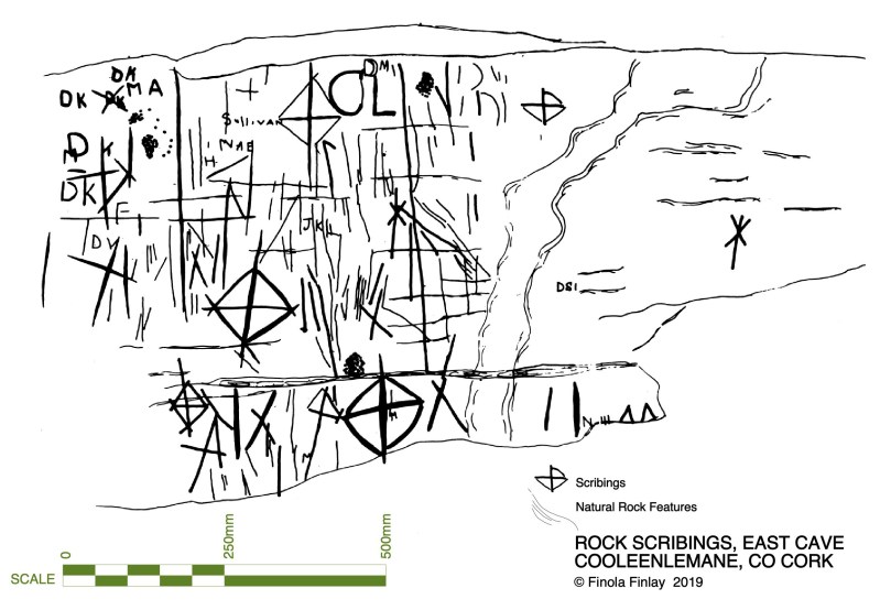
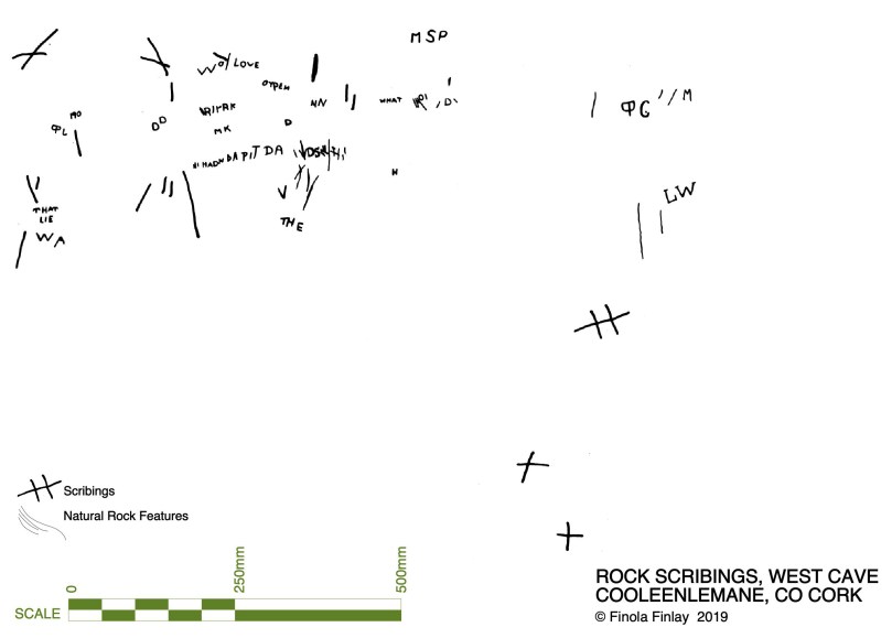
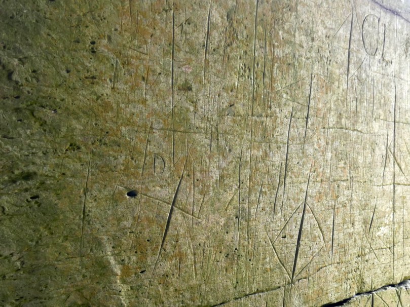
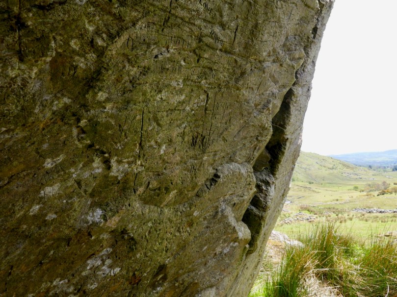
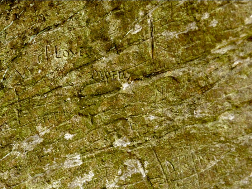
I described and drew three of the sites then – Glanrastel, Kealanine and Cooleenlemane – and I hope to get back to the others also. Of the three, Cooleenlemane has the greatest range of markings. There are three caves here, but markings only in two, which I labelled the East and West Cave. The markings run the full gamut of Shee Twohig’s motif range. There are also initials and words and letters that do not form words but that seem to run together.

The East Cave has the widest range of markings

This is what I wrote in my 1973 thesis about how the carvings were made:

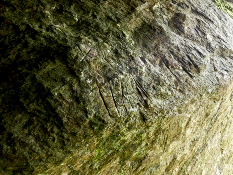
The three sites of Glanrastel, Kealanine and Cooleenlemane share an identical incising technique. The markings have a V-shaped cross-section with smooth faces. In the case of the lighter marks, this effect could have been achieved by scratching with a strong knife, and at Kealanine and Cooleenlemane this technique accounts for many of the initials and letters, and some of the straight strokes. The deeper strokes were probably made by reaming with the end of a pointed tool. This tool need not have been metal. Identical techniques of marking have been identified by Shee. . . from passage-graves, which she suggests were executed with the edge of a stone axe.

The West Cave has more words and letters

At the time, we had no idea how to interpret these kinds of markings. I did say in my thesis they were more likely to be historic rather than prehistoric, and pointed out the Christian nature of the many cross motifs. The initials and words are, of course, fully modern.

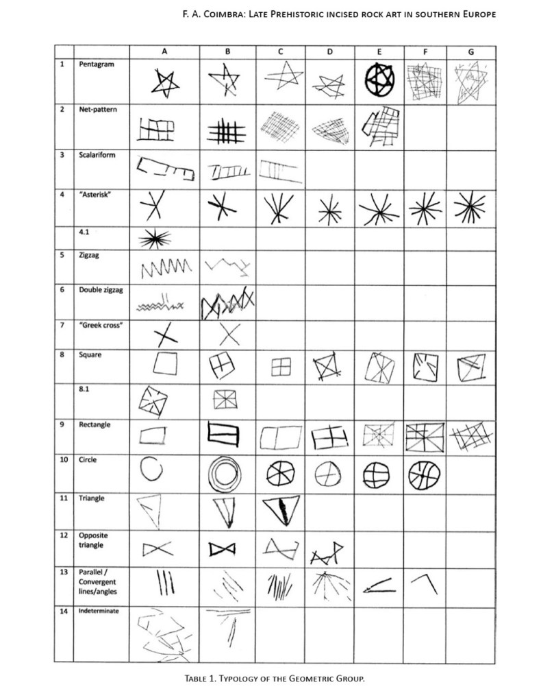
But in fact, incised markings such as these are known from many contexts, including prehistoric. They are widely distributed in southern Europe, where they may be associated with figurative carvings also. The 2014 Proceedings of the XVII UISPP World Congress was published as Post-Paleolithic Filiform Rock Art in Western Europe, filiform being the word chosen to describe incised rather than pecked rock art. A chart of what the authors call The Geometric Type (above) contain many motifs that would be at home in Cooleenlemane. Some of these may date from the Bronze Age or the iron Age.

Shee Twohig also points out the long and varied traditions of marks of the COMBS type, including Early Medieval inscribed crosses on rock outcrops, and thirteenth century mason’s marks. You may remember our post about Keith Payne’s exhibition, Early Marks: inspired by Genevieve von Petzinger’s book The First Signs, he depicted many such inscribed markings, including one from Blombos Cave in South Africa, reckoned to be 75,000 years old.

A recent discovery at Creswell Crags in Nottinghamshire generated excitement earlier this year and may hold the answer to the puzzle of what at least some of these marks are all about. Dubbed Witches’ Marks, they are believed to have been tokens to ward off evil spirits. According to this BBC piece Protection marks are most commonly found in medieval churches and houses, near the entrance points, particularly doorways, windows and fireplaces. They are also often found in caves and shelters, near the entrance.

I said some of those marks – The initials and words, to my mind are equally important as evidence of our enduring need to leave our, er, mark on the world. How many generations of DKs (Several Dinny Keohanes, apparently, lived around the valley) carved their initials and hoped to be remembered? And was someone in the West Cave, in the time honoured-tradition of the love-struck everywhere, trying to make a declaration while sheltering with his sheep against a spring gale?

In the inevitable way of such special places in Ireland, the Bealick eventually became known as a Mass Rock (see this post for an explanation and examples) and it is described thus in the National Monuments records (Monument number CO091-003). Indeed, it would have made an excellent location for a mass rock, remote and hidden in its lonely valley.

From this angle you can see the three caves. There are no markings in the closest one

Seeing it again after all these years, I was struck by wonder at how my 22 year-old self managed to find it (I suspect I would have applied to the nearest dwelling and been directed there after multiple cups of tea and slices of brown bread) and to draw it. It must have taken hours then, but the 20 minutes I spent stooped inside yesterday trying to get photographs just about crippled me. But mostly what I felt was gratitude – first for the privilege I had been granted all those years ago of doing something so exciting and important for my thesis, and second for the untouched and pristine nature of the Bealick and its setting.

(Thanks, Keith, for the inspiration for this shot)