Rossbrin Calendar

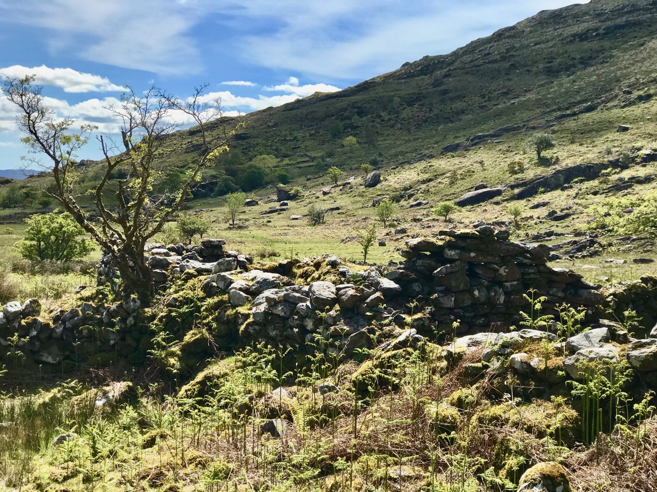
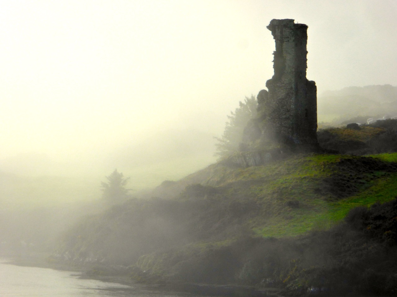
We know Rossbrin Cove intimately – more so than any other part of West cork. That’s because it’s right on our doorstep, and there is seldom a day when we don’t walk or drive along the Cove; and, even if we fail to get out, the views from our windows at Nead an Iolair will always be looking down on the Cove and its castle. I conceived the idea of sorting through all our pictures and selecting a ‘calendar’ of Rossbrin, taking us consecutively through the months of the year so that we can follow the seasons and the changes that every day brings. That’s Rossbrin Castle above, a view taken in January – which can often be atmospherically misty. But the picture below was also taken in that month, when we explored an abandoned house in the environs of Rossbrin: just as atmospheric in its own way – and bursting with a story to tell . . . But we’ll never know it.

Low tide at Rossbrin, taken from the pier and looking towards the boatyard – an important aspect of the Cove as the winter laying-up and maintenance of pleasure boats brings all-year-round life to the area and provides a livelihood. The picture above was taken in February, on a good clear day. In the middle distance you can just make out a wrecked boat uncovered by the receding water: this is the ‘Flying Foam’ – still rather enigmatic – which I wrote about a little while ago. We expect our strongest gales in February, and the picture below was taken when storm clouds began to gather.

March can also be a month when the weather is inclement (above), but we had a surprise in 2018 when snow covered the land around us (below) – a climatic event seldom experienced in Roaringwater Bay, which is more usually kept mild by the Gulf Stream. That’s Castle Island beyond the Cove – once inhabited (and with its own castle which you can see in the picture) but now just used to run sheep and cattle.

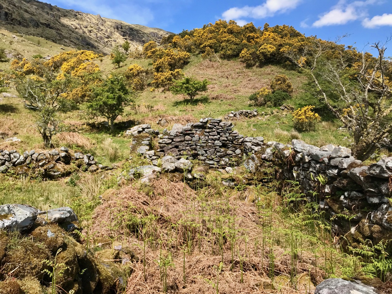
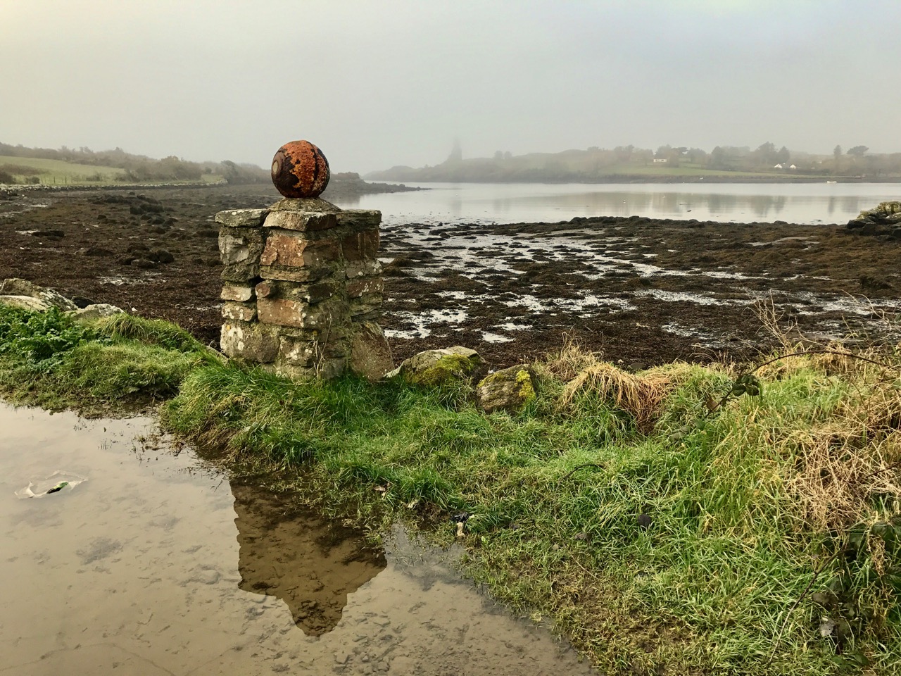
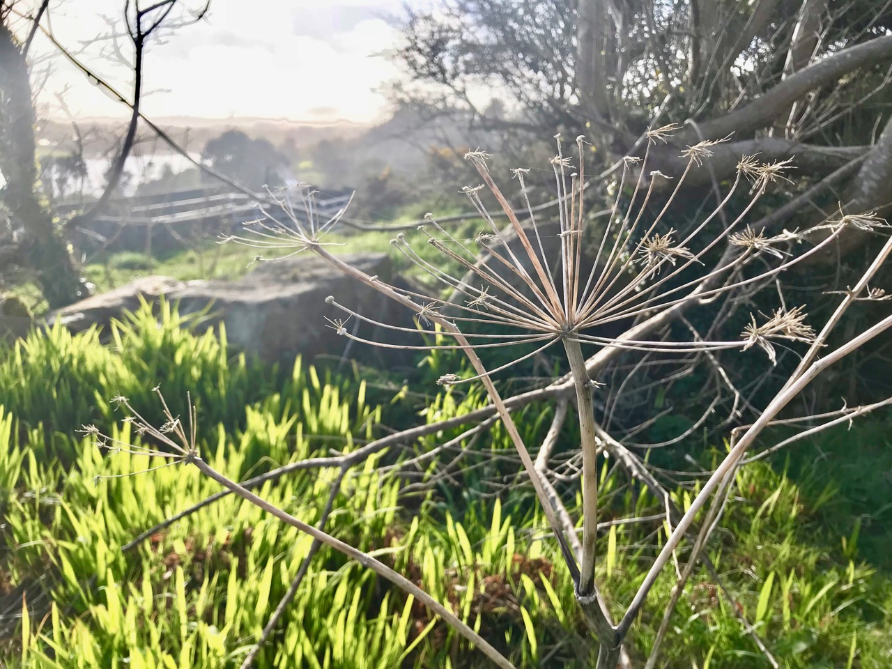
You can see how quickly the weather changes in West Cork: Rossbrin Castle Farm is enjoying blue sea and skies in April, and the gorse is in bloom, showing that love is in season! In the detail below, at the edge of the Cove and also in April, we can see the new spring growth beginning to overtake last year’s seed-heads.

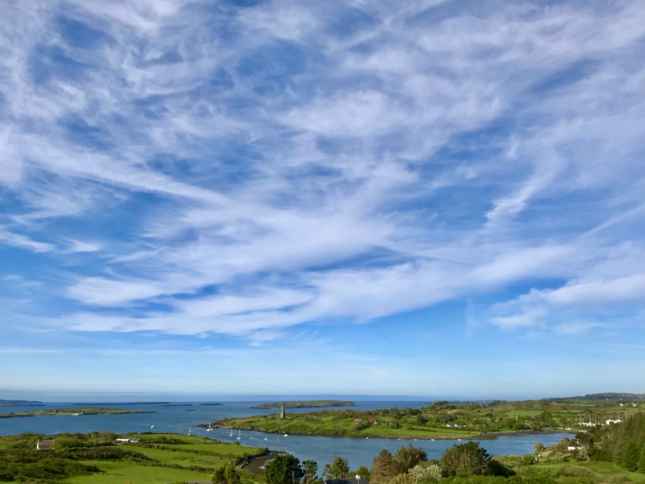
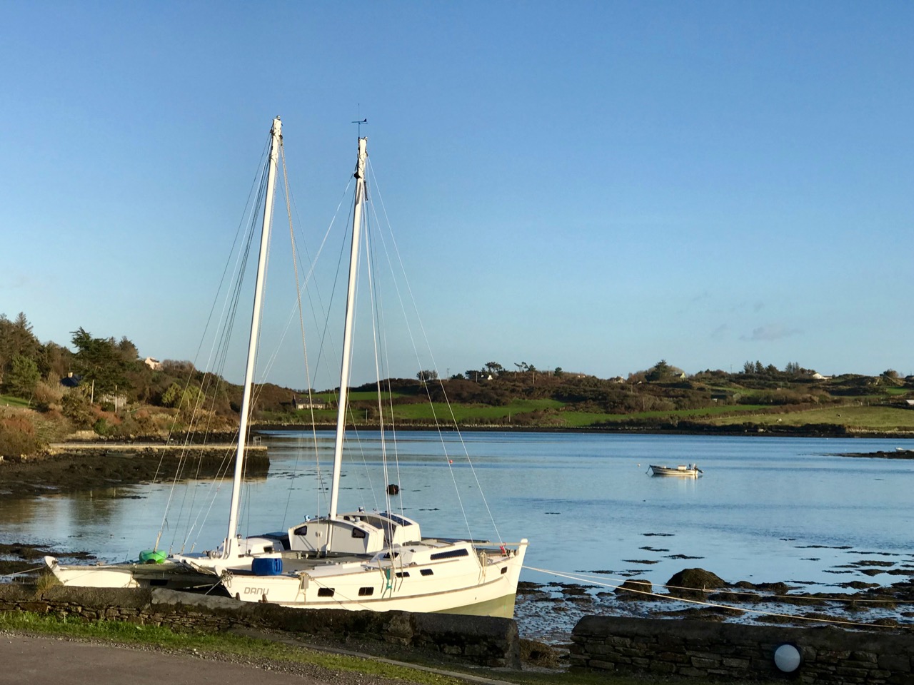
By the time May arrives, boats are already being taken out of winter storage and are anchored in the Cove. We get fabulous skyscapes perched up here above Rossbrin, and these mares’ tails herald windy weather ahead.

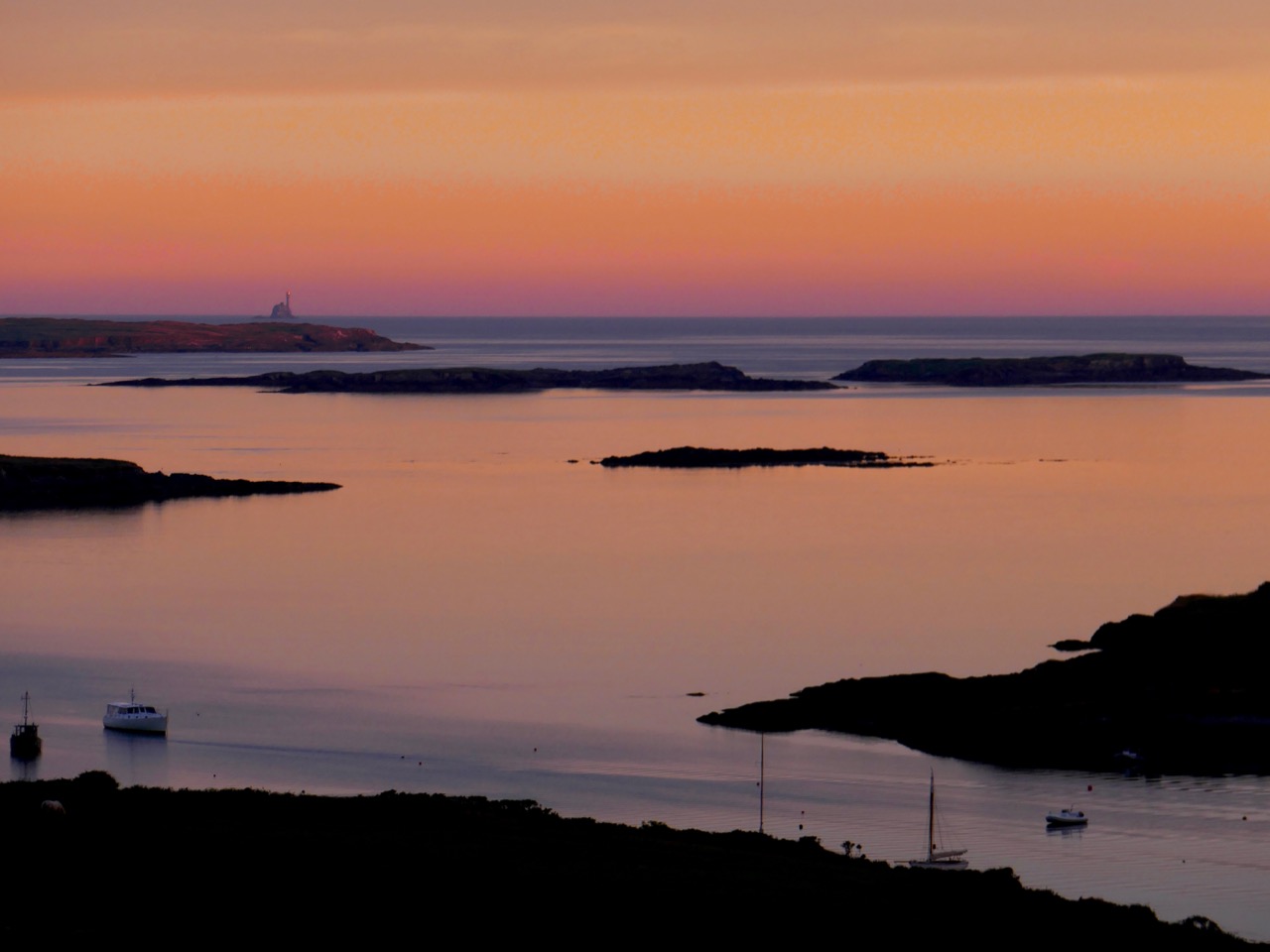
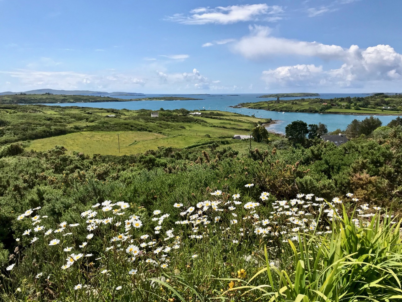
This is one of my favourite pictures – taken by Finola from Nead an Iolair in June. Late evening sun paints the sky and sea in almost implausible colours – although the photo has not been doctored. The whole effect beautifully outlines the Fastnet Rock lighthouse on the horizon with some of Carbery’s Hundred Isles silhouetted as if floating; Rossbrin is in the foreground. By day you can see that wildflowers are abundant this month (below).

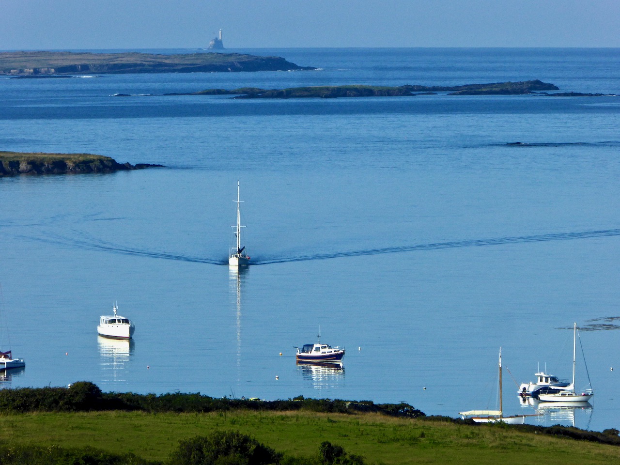
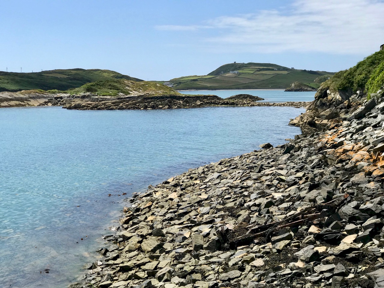
The sea in July is at its bluest. Here is Roaringwater Bay out beyond the shelter of Rossbrin on a calm day. There is hardly a ripple on the surface, except for the elegant wake of the yacht motoring in.

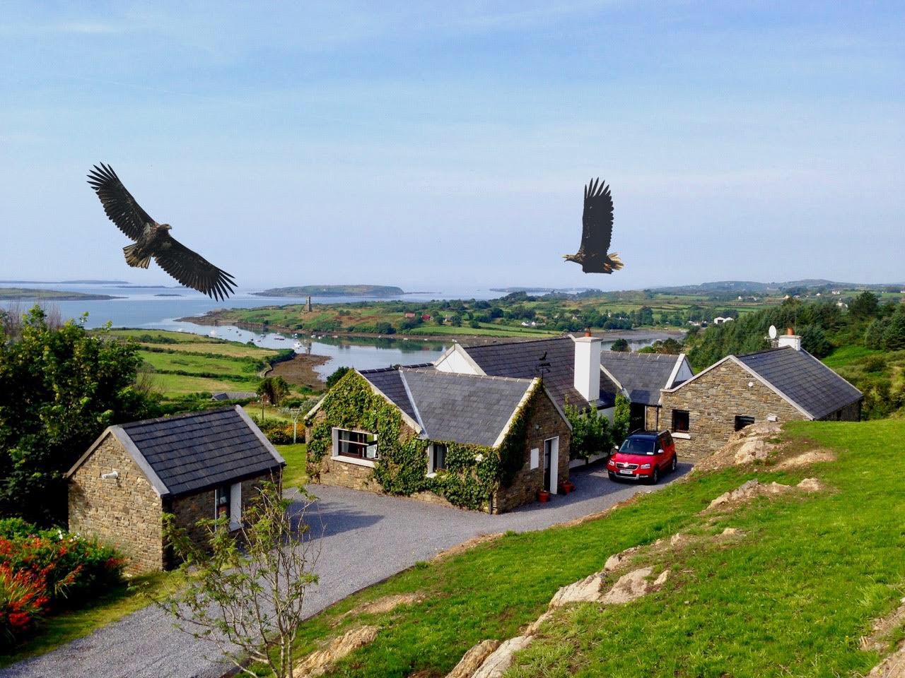
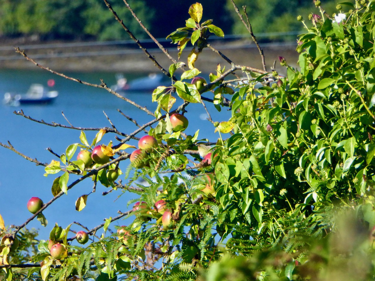
Nead an Iolair – our house – taken in August. You can see that Rossbrin Cove is central to our view out over the Islands. The name of the house means ‘Nest of the Eagle’, and the birds have obligingly flapped their way into the photo, courtesy of Photoshop. White-tailed Sea Eagles do survive in Kerry – not too far away – and they have occasionally been seen in West Cork. Once they were common across the west of Ireland. Below is another August picture – a wild apple tree close to the shore of Rossbrin.

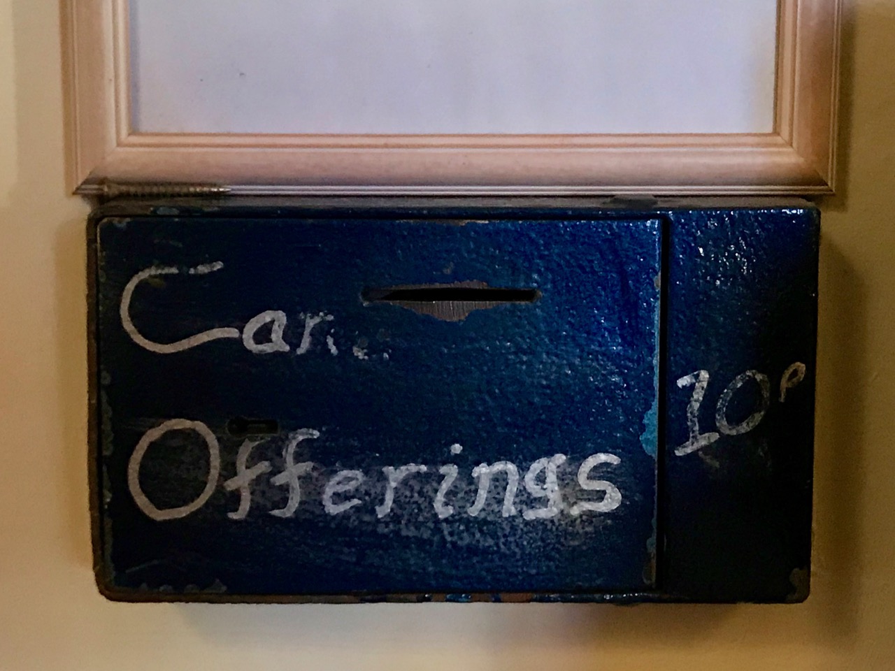
I couldn’t resist adding this picture to the August tally (above): it’s an abandoned post box set into the wall of the old Rossbrin School, now closed. The school building survives as a private house and retains some of the architectural features of its previous use.

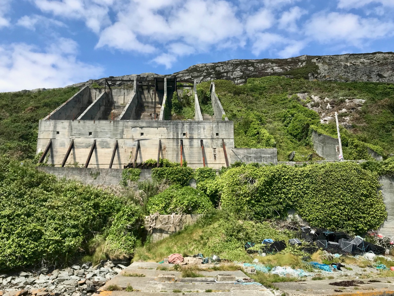
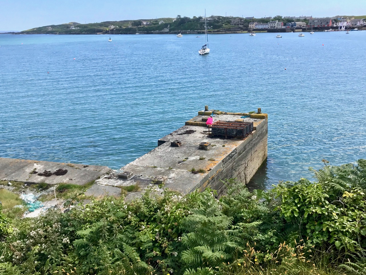
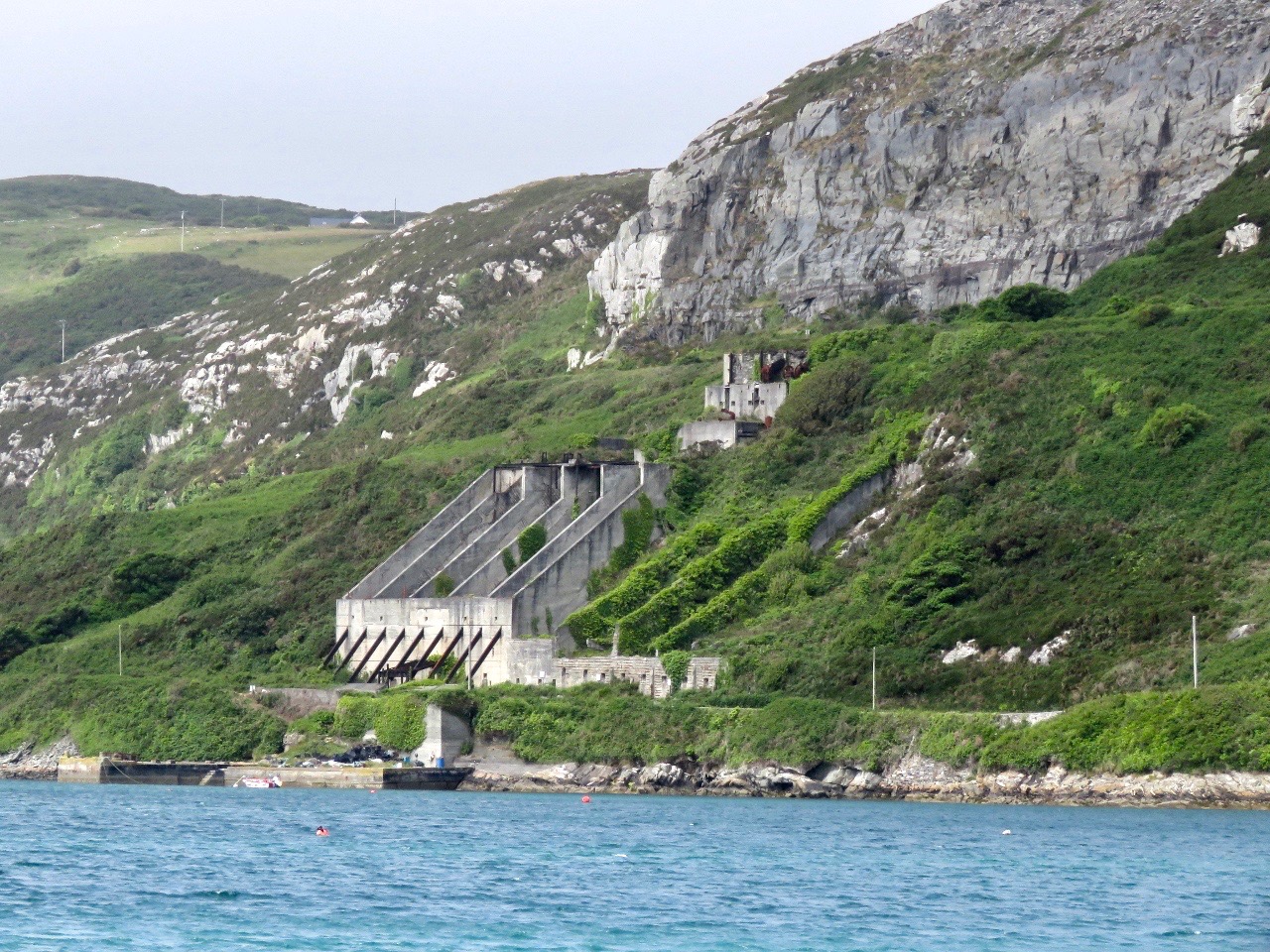
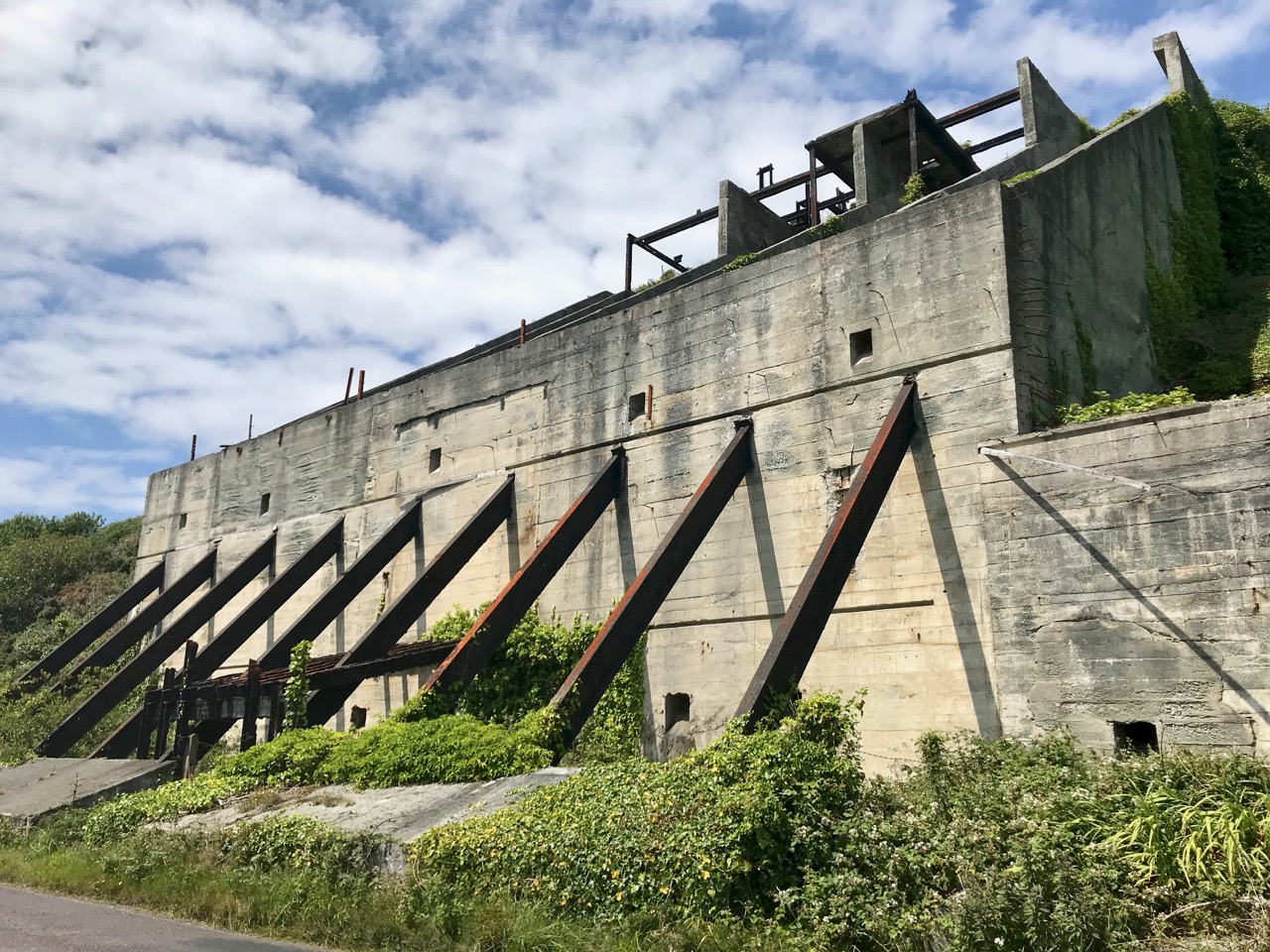
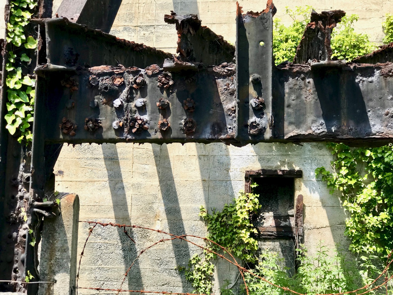
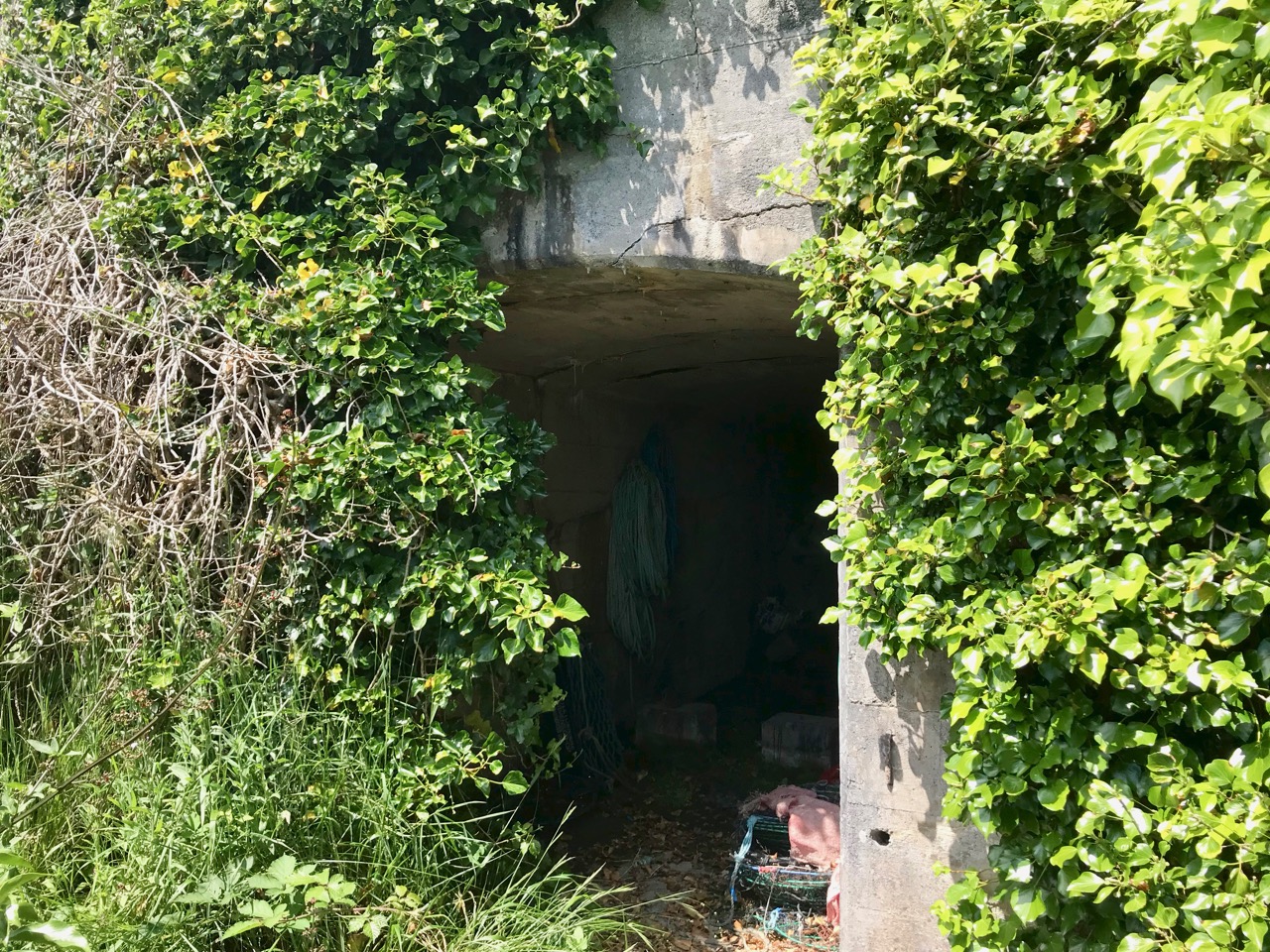
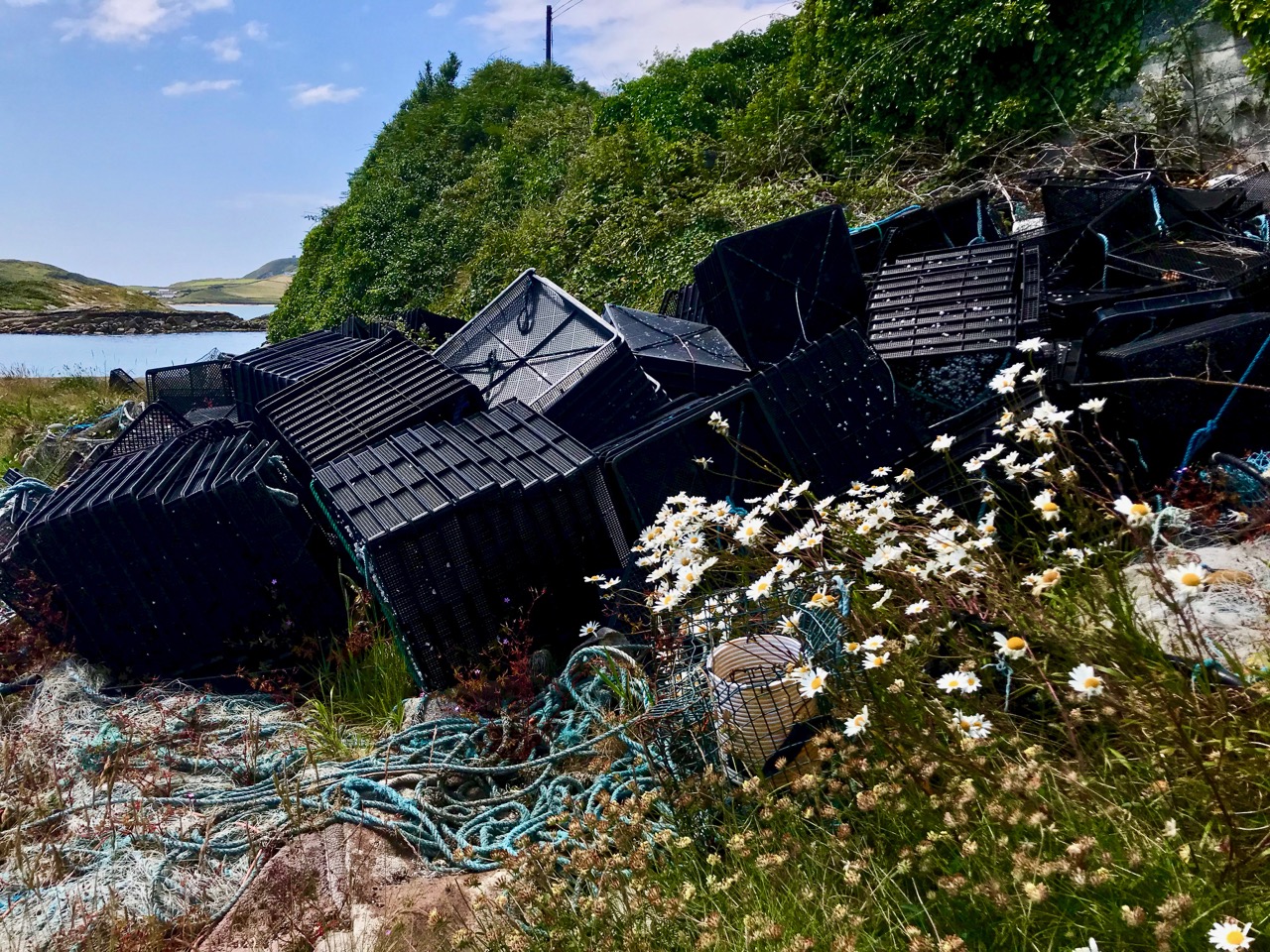
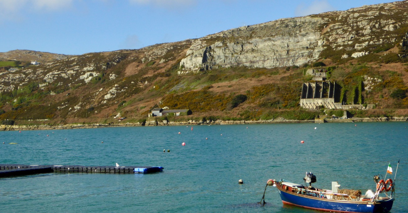
This magnificent machine is a remote-controlled boat-lift and was photographed on the large slipway which is at the western end of the Cove, last September. The Cove is a natural harbour and has been used as a resource for sheltering fishing boats and providing facilities for fish processing since medieval times. This post outlines how ‘fish palaces’ worked: there was at least one here in Rossbrin.

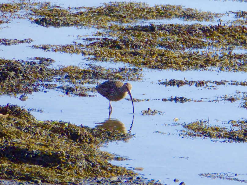
By October most of the boats have been taken off their moorings (above), and the weather changes again. We sometimes have the first of the winter storms this month, although it can equally be benign. Autumn brings with it dramatic skies and sunsets – and a feeling of melancholy, because the holiday houses down by the water are empty and shuttered for the onset of winter. But the weather can continue to surprise and November sunshine (below) can be as warming as any other time of year. It’s a good time for us to watch out for the wading birds – such as the curlews – who come in close to shore and forage on the mud flats.

And so we come to the end of the year in Rossbrin. This has been a fairly random selection of images, picked out because each was taken in a particular month. We know how fortunate we are to live in this rich and constantly changing environment. Not only are we surrounded by nature, but the immediate history is alive with stories – of Fineen O’Mahony, the Scholar Prince of Rossbrin, who lived at Rossbrin Castle in the 15th century and surrounded himself with a university of monks and scribes and made a fortune out of fishing dues – and of Sir William Hull and the Great Earl of Cork who exploited Rossbrin in the 17th century, also for fish. Now we look down on a sparsely populated townland and the bay beyond it: it’s a most beautiful place to know and to live in. For December I have chosen a classic view of the castle with a wintry sky and late sun creating patterns on the half-tide.

Industrial Archaeology in Crookhaven

Roaringwater Journal has featured Crookhaven many times. This far south-western outpost of Ireland has layers of history: thousands of years ago people lived in this area and made marks on the rocky landscape while countless generations of seafarers forged a ‘haven’ from the naturally sheltered ‘crook’ of land upon which the settlement is based. Even into the twentieth century pioneering technological advances were being made in Crookhaven: in the early 1900s Marconi sent some of the world’s earliest radio communications from Brow Head to vessels in the Atlantic shipping lanes.

Header – the ‘old quarry’ dominates the landscape to the north of Crookhaven Harbour. Above – looking across the harbour from the ‘quarry quay’ towards Brow Head, one of the scenes of operation of Marconi in Ireland

I am fascinated by all traces of industrial history: for me it’s ‘modern archaeology’: some of it might survive long enough to puzzle historians of the far future. I couldn’t ignore, therefore, the huge steel and concrete structures which line the R591 road which approaches Crookhaven when travelling from Goleen. They are built into the hillside above the road, and tie in with a substantial stone quay which has been constructed below it.

The quay which was presumably built to serve the quarry to the north of Crookhaven: the village can be seen across the water

Looking at the construction of this quay, and particularly the wear on the masonry steps leading down to the water, it would be reasonable to assume that the quay predates the concrete and steel structures which abut the road above it – by a long way. You might suppose that such significant edifices would have a history attached to them which would be easy to find, either from local informants, or in written or electronic record. However, I have so far drawn a blank. Well – not quite: there are countless identical references in contemporary accounts of Crookhaven to ‘…the old roadstone quarry on the side of the mountain, which provided metalling for the roads of Wales until 1945…’ I did find one variant, a caption to a general view of the area: ‘…Looking up to the roadstone quarry along the north shore of Crookhaven Harbour. The quarry was a source of gravel for Welsh tarred gravel roads until the 1930s…’

The quay below the ‘roadstone quarry’ is a paradise for industrial archaeologists and photographers! It must have had generations of users, up to fairly recent times, all of whom have left behind traces of their presence, but no solid history. I’m hopeful that readers of this post might be stirred to recall stories or memories – or even point me to some documented history to explain the provenance of this little piece of the complex West Cork jigsaw. *In fact, I have received information since this post was published – see the last paragraph.

I’m borrowing this photograph of the Crookhaven quarry from the log of the MV Dirona, with thanks to Jennifer and James Hamilton, who hail from Victoria, British Columbia and are currently cruising the world in their Nordhaven 5263 vessel. They explored the south west coast of Ireland in June 2017 and, from the water, took this perfect view of the quay, the ‘roadstone quarry’ and the mountain face above it, from which the stone has been extracted. The rock face could have been worked for stone before the 20th century, although we don’t have hard evidence for this: in September 1846 a road was proposed between Rock island and Crookhaven, and the county surveyor provided an estimate of £1,857. Prior to this, the road which had been built by Richard Griffith, civil engineer for Munster, extended as far as Rock Island, and passage from there to Crookhaven itself could only be made by water. The 1846 road is today the R591 which passes below the quarry. It would be reasonable to suppose that locally available stone suitable for roadmaking could have been used, and the quarry may have had its origins at this time. The construction of the adjacent quay could have been contemporary with this early use of the quarry, but the huge concrete and steel structures we see today are certainly an incarnation of the quarry workings in the early 20th century.

One of the fascinations of old industrial sites is the way they are taken over by nature if left relatively undisturbed. This one is no exception. There is a monumentality here which is being eroded and softened as time goes by. What does the future hold? Interestingly a -presumably serious – proposal was made in a not-too-long-ago iteration of the Goleen & District Community Council Development Plan:

PROPOSALS

2.24 The old roadstone quarry-works at Crookhaven Harbour should be developed as an amenity – perhaps a hotel with a restaurant with observation deck at the top…

Hmmm… notions of grandeur there, perhaps – and little regard for practicalities, but it shows the power of imagination! I think it’s far more likely that the area will remain in its present state for many years to come and, perhaps, attract a level of ‘industrial architecture tourism’. Incidentally, it’s not too far away from the site of a fish palace run by William Hull and the Great Earl of Cork in the early seventeenth century: the remains of this are there to see to this day, although almost entirely returned to nature.

Below – a now impassable tunnel under the road connects the quarry workings with the quay; nature entangled with the leftovers of human activity

NOTE: in 2020 our friend, local historian and expert photographer John D’Alton of Schull has contacted Roaringwater Journal with some updated information about the Crookhaven quarry. John tells us that the quarry was never owned by the Roadstone Company. That was incorporated in 1949 by the Roche brothers who operated out of Dublin from the 1930s, but never operating this far south and west. John also adds that the company that operated the Crookhaven quarry was the Browhead Granite Company Limited, incorporated in London in 1917. The quarry opened for business in 1928 and closed in September 1939. It was this company that contracted for the construction of the impressive structure still there today. The company exported stone to various ports in England in particular, London especially, and Ipswich, among others, supplying stone for road surfaces. The Granite company was a successor to the Browhead Copper Mining Company that despaired of finding copper in mineable quantities in far West Cork. Interestingly, the structure is one of the earliest examples of this type of reinforced concrete construction in the country, the original Mizen (Cloughan Island) Bridge being another.

Many Thanks, John, for finding and sharing such detailed information which has been lacking until now!

Endpiece – the old workings and quay are directly opposite the centre of Crookhaven – here’s a view towards the quarry from the village:

Cooleenlemane – A Walk into History

Finola has written about the destination of our adventures yesterday – the inscribed ‘caves’ at Cooleenlemane. Above is a photo of the view from the ‘cave’ entrance, looking back at the glen which we journeyed across. My post today is about that journey on foot through decades of human history and thousands of years of topographical transformation.

Upper – looking back and leaving the world behind: a rough track climbs up from the entrance to the Cooleenlemane valley and very soon we were absorbed into the wild emptiness of the mountainsides (lower)

When I looked into the furthest reaches of the glen as we made our way over the rocky track I saw first, in my mind’s eye, the movement of the glacier which shaped it – the splintering, shuddering path it took and the debris it left in its wake: strangely distorted outcrops and huge erratic boulders feigning dice unrestrainedly scattered by a random hand.

Scribings on the rocks in the glen of Cooleenlemane: these are made by nature (and the movement of glaciers) long before humans appeared in Ireland. I often wonder whether observation of these marks could have inspired our earliest artists?

Then I couldn’t help the vision that came into my mind of herds of the huge Irish Elk – Megaloceros giganteus – that ruled places such as this in Ireland after the ice receded 10,000 years ago. It was around that time that human habitation came back to these revitalised lands: some say that it was human hunters who wiped out the elk – and the bear – in Ireland using spears, bows and rocks. When you are immersed in these wild places, with no signs of the 21st century around you, it is easy to imagine such scenes from the distant past.

But – lonely and remote as this valley seems today – there is significant evidence of enduring human occupation here. As we journeyed up to the ‘caves’ we were tracing ancient tracks and paths and saw the remains of several settlements: stone walls, enclosures including a cashel, and many haphazard piles of rock that presumably came from rudimentary field clearances. We had the good fortune to meet and talk to Pat Joe O’Leary, who resides in the last house before you enter the glen, and he told us that sixteen families had lived out here.

Some of the many traces that remain of the dwellings which were once occupied by  families eking out their lives in the remoteness of Cooleenlemane and (lower image) piles of stones cleared from the lands to provide pastures and potato beds

It’s right to describe the stories that Pat Joe told us as living memories, because he carries them. His own family has lived in the valley for generations so – like the bards of old – he is the keeper of the traditions and lore of the area. One of his tales was about a man from the glen who was the last to be hanged in Cork gaol. His name was Timothy Cadogan, and he was accused of the murder of William Bird, a land agent, at Bantry in 1900. Tim Cadogan was from one of the families who lived in Cooleenlemane – who had been evicted by Bird – and Pat Joe assured us that the name T Cadogan is inscribed on a stone beside one of the old buildings in the valley. Unfortunately, we did not hear this until we were returning from our expedition, so missed seeing the stone. Interestingly there is a record in the Schools Folklore Collection – in Irish – describing the same event, more or less in the same words that Pat Joe used. The event occurred in 1900, became recorded as folklore in 1936, and was told to us as oral tradition in 2019!

Contemporary newspaper account of the hanging of Timothy Cadogan – formerly from Cooleenamane – on 11 January 1901. Cadogan was tried twice before being sentenced to hang. The ‘Bungled Execution’ is reported as a failure on the part of the executioner, causing the condemned man to suffer a long, slow death by strangulation

Ignorant of such thoughts of the harsh realities of the world – even this far-away corner of it – we reached our destination: the ‘caves’. This is an unusual rock formation where a large outcrop has been split into enormous slabs, probably through glacial action. The rocks lean against each other and form crude shelters, within which are the inscribed surfaces. Finola’s post describes these in detail.

The rocks which form the ‘caves’ have a brooding presence on the landscape. It’s not surprising that they harbour enigmatic symbols with some possible other-worldly connotations

In addition to the sites of old farms and cottages that we passed by and explored on our trail, we clearly saw the imprint of ‘lazy-beds’ – ridge and furrow arable cultivation methods traditionally used in Ireland for planting the potato. These took our minds back to famine times and the harsh reality of having to forge an existence out of minimal resources. Also, we could only wonder at how clearly life – and history – have been etched into these aged and incredibly beautiful landscapes.

The very clear impressions of the potato beds which tell of the subsistence farming practiced for generations in Cooleenlemane accompanied our hike

Looking back on our day in the wildness of West Cork, my abiding memories are beauty and poignancy. I have used this term before – achingly beautiful – and I often have to return to it in order to try to sum up my own emotional reaction to such unique places in Ireland. You won’t find these places in tourist guides – getting here is hard work! Nor will you find very much recorded in the archaeological records about Cooleenlemane. But everything you see here is Ireland’s real history – deep, deep history; we are fortunate in every step we take into it.

Signs of Spring

A curious advertising sign from a disused bicycle shop. Perhaps the ‘springing’ lion is sufficient to justify the title of today’s post . . . It’s been a good few months since I last sampled my ever-growing collection of Irish signs and curiosities. I cannot say why, but these latest examples – and all the previous ones – amused me or attracted me when I saw them, sufficiently enough to put them on record. The humour of some of them is profoundly Irish – but also universal – whereas the ‘curiosities’ are examples of the love of colour, or just eccentricity. Anyway, that’s quite enough commentary from me: the images will, hopefully, speak for themselves.


I think the ‘Floating walkway’ must be a unique sign – purpose-made just for that one location, on the dunes at Barley Cove, here in West Cork. When the tide is in, walking across can be a seasickness-inducing business: you have been warned!

Michael ‘Tea’ Higgins here – Ireland’s President. Honoured, I’m sure, to be thus celebrated as a part of his nation’s tea-drinking ceremonies.

Partly obliterated signs can be intriguing. With some, the intention is easy to guess – with others, one can only contemplate . . .

I couldn’t resist these pics showing Ireland in its best colours. However, if you want to see a lot more of that, have a look at Finola’s posts here.

I could go on . . . but I don’t want to send you to sleep! That’s quite enough for now – look out for more in the future.

Drawn to the Beara

The spectacular landscapes of the Beara Peninsula draw us again and again: have a look at some of our past explorations here and here. There’s no doubt that for fine, distant views, tranquil coastlines and variety in geology, history and archaeology this part of Ireland takes some beating. And, for us, it’s ideal: near enough that we can have a full day out absorbing all these things, yet still being home in time for tea!

This is the weekend when clocks ‘spring forward’ – giving us longer evenings. But also the sun is getting noticeably stronger, colours are getting more intense, and the shadows are hardening. It’s a great time to be out on our travels.

That’s Hungry Hill above – highest peak in the Caha Mountain range, Co Cork – and the background setting for Daphne du Maurier’s 1943 novel of that name. The story is based on the real-life Puxley family who set up and ran Allihies copper mines in the first half of the nineteenth century. Du Maurier weaves the tale to give the name of the hill a symbolic meaning – the mines ‘swallow up’ the lives of those who work them and the plot is charged with tragedy and unhappiness.

We crossed the peninsula on the Healy Pass, one of Ireland’s great road journeys, with breathtaking views towards Bantry Bay in the south and the Kenmare River to the north as you traverse the 334 metre summit. The road, known in Irish as Bealach Scairte, was originally cut as a nineteenth century famine relief project, and improved in the 1930s, when it was named in honour of Tim Michael Healy, a Cork man who served as the first governor general of the Irish Free State.

We had a mission: to visit Dereen Garden, which is open all year round. We were there before the tourist season got going, and we mainly had the beautiful walks and vistas to ourselves. The woodland garden was laid out 150 years ago with sub-tropical plants from around the world and has been improved and added to since then; it is famous for its huge Arboreum rhododendrons. Evidently there is a variety of wildlife to be seen, including red squirrels, sitka deer and hares, but they were all keeping out of the way when we visited.

We were hoping to sample some of the fine eateries which have been set up on the Beara but, again, we were a little too early in the year: an excuse for another trip when they open up. So we reluctantly turned our way back towards the Healy Pass – to get the views from the other direction – and were stopped in our tracks by a sign pointing to ‘stone circles’. This is in a townland named Cashelkeelty and is near Lauragh, Co Kerry. Finola had a look at her archaeological records on the phone and found it was somewhere we had to go! It involved a long, uphill walk through a forest, but was very well worth it. Read Finola’s post to find all the details.

I will show only one picture as a taster (above) – but also to point out the proximity of the high grade overhead powerline which runs right by the ancient stones. Does it add or detract from the monument itself?

There were many more vistas to be taken in on our few hours spent on this dramatic peninsula, where mountains so spectacularly meet the sea. We can never tire of this, our own little part of the world.

Barley Lake

In Ireland February 1st – St Brigid’s Day – is thought of as the first day of Spring: we begin to look out for snowdrops and daffodils, and expect to see a ‘real stretch’ in the evenings. Of course, we also make our St Brigid’s Cross to ensure good luck and fertility to the household. It’s no coincidence, I’m sure, that the church festival of Candlemas (St Blaise’s Day) falls on the following day: February 2nd. Traditionally, people took candles into the church to be blessed that day, and these were used for the rest of the year.  Surely this is something else connected with the turning of the year and the coming of the light?

Header – a tantalizing glimpse of Barley Lake seen from the N71 road north of Glengarriff. Above – the winding boreen that heads up towards Crossterry Mountain

To make our own celebration of the arrival of Spring we set out on February 2nd on a trip to Crossterry Mountain in County Cork, just north of the road running west to the Beara Peninsula from Glengarriff. This was unexplored territory for us, but we had long planned to visit Barley Lake: if you travel on the spectacular N71 road from Bantry over to Kenmare you get tantalising glimpses of this corrie or tarn away to the west, just before you pass through the first of the tunnels.

Above – a closer view of the mountain crater that contains the lake

If you are into geology, Barley Lake is a classic demonstration of how Ireland’s land mass was moulded by the movement of the great glacier sheets towards the end of the last Ice Age, some 10,000 years ago. As the melting glacial ice moved south, it carved out and dragged huge boulders, which ‘plucked’ or excavated the land surface, leaving craters which filled with water after the ice melted. These are known as ‘corrie lakes’, ‘ribbon lakes’ or ‘tarns’. Barley Lake is one such crater; another is the lake at Gougane Barra in the Shehy Mountains, also in West Cork.

Upper – how ‘corrie lakes’ or ‘tarns’ are formed (DooFi  via Wikipedia). Above – glacial geology clearly delineated by fresh snow on the way to Crossterry Mountain

The road to the lake is remote and picturesque, but we were surprised to find quite a sizeable settlement high up on the mountainy road. We were not quite sure what it is called, but the townland is Crostera West. We enjoyed some of the names we found on the map: Lake Derreenadavodia, Magannagan Stream . . .

Mountain dwellers: Coomarkane townland, Scully’s Cottage and a red-roofed barn becoming part of the landscape

Driving, you approach Barley Lake from the north side. On the extract from OS Map 85, below, you can see the narrow way that winds up to a high point – the 300 metre contour, where there is a place to park, and then proceed on foot. Look carefully at the way the road is drawn here – it’s no exaggeration: there really is a series of hard S bends that have to be negotiated to get up the mountain. We should have photographed them, but I was hanging on tight to the steering wheel, while Finola was hanging on to anything she could – and we found ourselves driving into a blizzard!

Middle photo – a relatively straightforward part of the drive up the mountain, before we reached the S bends! Lower photo – snow coming in as we reached the summit

It was a day of weather contrasts: some of the journey was made in that beautiful low sunlight that we have been experiencing at the start of this year, while at other times the wind whipped suddenly in and threw sleet and ice at us. On the top we found a good covering of snow on the rock-strewn path that we had to take to reach the shores of the lake. We braved the elements, and passed by peat workings that looked to be still in use.

Top – the path to the lake. Above – peat workings

The lake itself felt remote and lonely – and unvisited on our winter day, although I gather many hikers aim to circumnavigate the shores. We didn’t: it takes several hours and the light was beginning to fade with the incoming snow. It would be fair to say that it’s bleak up there, but – as always in Ireland – beautiful. Our only companions were sheep, who seemed to space themselves out neatly on every available ledge.

Robert – finding his own ledge! Thank you to Finola, who took all the photographs on this journey

In spite of some challenging conditions, it was a grand day out. As we wended our way carefully back down the bends, we admired the wonderful distant views, and – as we approached the glens of Glengarriff, fortuitously back in sunlight – paused to examine more geological formations.

We never tire of exploring West Cork, and we will never run out of destinations: as always, our delight is the out-of-the-way side roads – Ireland’s speciality.