Coomkeen, Summer and Winter

Coomkeen Road, winterThe Coomkeen Loop Walk on the Sheep’s Head is one of the most richly satisfying walks in West Cork. And that’s saying something, in this land of jaw-dropping vistas and absorbing heritage.

Start, summer

The start of the trail in June

We walked it in June with our friends Amanda and Peter and again in November with our friend John. We had extraordinary days on both occasions. While the November day was cloudless, the one in June provided enough scattered cloud to supply that variation in light and shade that lends such atmosphere to the West Cork landscape.

And in November

And in November

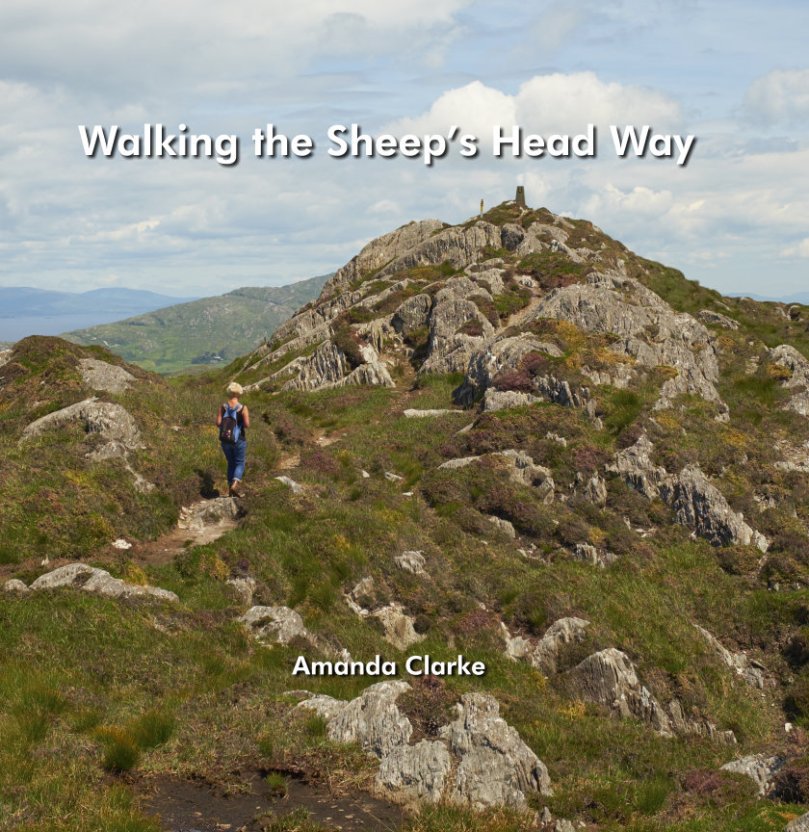
To reach the start of the Coomkeen trail, drive from Durrus towards Ahakista and turn right at the Church of Ireland (before you get to the pier). Ascend to the top of that road and you will find a parking spot and the clearly marked trailhead. There are various ways you can do this walk. The complete loop is a 7km walk that brings you along the spine of the peninsula before you drop down onto tracks and then the road back up to the parking place. Our own favourite option is to walk until you reach the little lake and then retrace your steps along the ridge. Lough na Fuilla, Lake of Blood, is so called, the story goes, because thirst-crazed cattle found it dry and attacked each other in their frenzy.

Lough na Fuilla

Either way is fairly easy, although the complete loop presents a long steep climb back to the starting point. As with all Sheep’s Head walks, be prepared for any weather, wear good boots, bring a camera and leave the dog at home. If you want more information, consult the section on the Durrus Trailhead in Walking the Sheep’s Head Way.

Winter fields on Bantry Bay

Winter fields on Bantry Bay

Perhaps you think that it sounds fine to go for a mountain hike in June – but November? Yes, it was a little cooler and a lot windier, but the November hike was just as spectacular as the June one had been. Most striking of course, is the change in colour.

In summer the foxgloves are everywhere

In summer the foxgloves are everywhere

Because this is a ridge walk, the views are immense. To the north is Bantry Bay and Whiddy Island with its huge oil tanks. Beyond that are the mountains of the Beara, looking as wild and remote as, in fact, they are. To the south is Dunmanus Bay and the Mizen Peninsula. 

The Summit

The Summit

Amanda and Peter were able to show us an enormous standing stone on our June trip, although we missed it in November.

Rooska East standing stone

But we did visit the same ruin of a small farmhouse on the north side of the ridge. Incredible to think that someone eked out a living so high up. Although only a few broken down walls remain, the poignancy of the site comes from what was once a garden by the house, with thorn trees still bravely clinging on.

Further on are the remains of booleys – small huts used by the young people sent to mind the cattle on the high ground during the summer. Perhaps the little farmhouse was part of that endeavour.

Robert and John inspect the little ruined farmhouse

Robert and John inspect the little ruined farmhouse

Running along the ridge and crisscrossing the mountain are the remains of old stone walls. Impossible to tell how long ago they may have been first built, or how recently they functioned to separate pastures.

Walls, Summer

Walls, winterIn November the dominant colours are the blond of the grasses (called fionán, pronounced fyuh-nawn) and the amber, brown and honey tones of the bracken and heather, interspersed with the greenery of gorse and pasture. Although visually stunning, the predominance of the fionán (properly called Purple Moor Grass) and bracken have a less positive underlying meaning. They take hold where the hillside has been set on fire time and again. The fires that we often see here are supposedly to control the gorse and increase grazing for sheep, but in fact according to Birdwatch Ireland, repeat burning “has led to a loss of cover (protection) for Red Grouse…depletes moorland fauna, and can lead to soil acidification, leaching and thus soil degradation.”

In summer, it’s all green but the wild flowers provide bursts of colour.

In November, the only wild colour to be found came from a yellow brain fungus on a dead gorse trunk. Yes, it’s really called that, and is normally yellow but darkens after dry weather. It’s not feeding on the gorse, apparently, but on other fungus that is feeding on the wood. Charming.

Yellow brain fungus on gorse?

Do the walk, any time of year. Then show the photos to your friends and watch them make plans for a trip to West Cork. Or should we just keep this our secret?

Contemplating the route

Mount Corrin Walk

View from the cairn, Mount Corrin

View from the cairn, Mount Corrin

Walks that get you up to high places with panoramic views are terrific – especially when you don’t have to start at sea level! One such West Cork walk is Mount Corrin. Despite being on The Mizen, it’s part of the Sheep’s Head Walks system, which means it’s accessible and perfectly waymarked.

P1150782

The whole Mount Corrin loop walk is a 17km marathon and definitely not for the faint-hearted. But faint-hearted is exactly what we are, so we have chosen an option that can be easily accomplished on a pleasant afternoon – about a 5 km round trip. Some of these photographs are from a spring walk, and some from a fine autumn day.

From the trail - the Sheep's Head

From the trail – looking across at the Sheep’s Head

Wear good boots and bring a camera but leave the dog at home as no dogs are allowed on the Sheep’s Head Way. And if you do want to do the Big Walk, we highly recommend you pick up a copy of Walking the Sheep’s Head Way by Amanda Clarke. She and Peter have brought out a Second Edition that includes all the loop walks and they do a fabulous job of describing the whole route and provide wonderful photographs of what you can expect.

This curious little monument is right beside the parking spot

This curious little monument is right beside the parking spot

Our starting point is at a high point about half way between Durrus and Ballydehob. Drive out of Ballydehob via the road between Antonio’s Restaurant and Vincent Coghlan’s pub – that’s the Rathruane Road. About 3 km along this road you will come to a crossroads – turn right. Take the first turn left on that road and it will bring you up to the top of a hill. Once you cross over the top and start the descent on the other side you will see the waters of Dunmanus Bay ahead and to the left and a pull-out for parking on the right.

One of West Cork's most scenic parking spots

One of West Cork’s most scenic parking spots

This is your starting point – look back and you will see the way marked trail about 50ms back up the hill, running alongside a forestry plantation. It’s also your ending point: our walk will take you up to the summit and back.

P1150787

If you’re approaching from Durrus, take the R591 out of the village. Take the first turn left then the first right and follow the road to the summit. These are small country roads – be prepared to pull over or even reverse when you encounter other traffic.

Example of 'other traffic'

Example of ‘other traffic’

Once you set out, the first point of interest is what is described in the National Monuments inventory as a ‘megalithic structure’ and which looks likely to be a wedge tomb, although it is hard to be definitive about it. Whatever it is, it’s man made and intriguing.

A wedge tomb?

A wedge tomb?

You can see the cairn ahead – your destination.

P1040223

Before you get to it there is a row of standing stones. These ones are not marked on the NM inventory but it’s difficult to see what they could be other than a stone alignment. A final push now gets you to the cairn and to those panoramic views we mentioned.

P1040203

The first thing you’ll notice about the cairns (there are two of them) is the size of the large one and the scatter of stones all around them. The consensus seems to be that there has been a cairn on Mount Corrin since ancient times and that the current cairn, a more modern construction, sits on top of an older one.

The cairn on Mount Corrin is visible from this panel of rock art at Rathruane

The cairn on Mount Corrin is visible from this panel of rock art at Rathruane

We have certainly noted that the top of Mount Corrin, like the top of Mount Gabriel, is visible from several prehistoric sites and a cairn would have enhanced that visibility. The most persistent story about the cairn, though, links it to Lord Bandon.

P1040210

The Bernards, Earls of Bandon, are associated with Durrus, having laid out the town in the eighteenth century and having used Durrus Court as a summer residence. They had many interests in the area, including mining, and the always-interesting Durrus History blog gives us this information about Mount Corrin:

Mary Catherine Henrietta Bernard of Castle Bernard daughter of Lord Bandon married Colonel Aldworth on the 30th July 1863 and an address and copy of ‘God’s Holy Word’ was sent by Rev Freke and the tenantry of Durrus to which she returned thanks.  At Dreenlomane Mine (operating until c1920) owned by Lord Bandon, Captain Thomas set tar barrels alight on Mount Corrin which illuminated the sky all night and the 150 miners and their wives were treated to refreshments and similar celebrations were held in Carrigbui.

P1040197

The views from the cairn are stupendous, taking in the West Cork Peninsulas and the hinterland across to the Kerry mountains. Take a while to wander around the top – see if you can spot the collapsed walls of ancient hut sites.

P1040217

Making your way back, look down towards the farms on the northern slope of the mountain. You can still make out the unmistakeable signs of lazy beds, used to grow potatoes, and the ruins of houses abandoned long ago. It’s a poignant reminder that this land was once densely populated by people whose sole nutrition came from potatoes and who fled this area in the aftermath of the Great Famine.

P1040194 - Version 2

There now – that wasn’t gruelling at all, was it? And so rewarding. But still, a bit of effort required so you definitely deserve a coffee and cake at Budd’s, or a pint in Rosie’s. Tell them Roaringwater Journal sent you.

P1040200

Showing Off West Cork

This is how you sightsee in West Cork!

This is how you sightsee in West Cork!

Ladies and Gentlemen, meet Susan Byron! Susan is the face behind Ireland’s Hidden Gems, a custom travel service for visitors to Ireland, and she and I met last year when Robert and I spent a week in Clare. Susan loves nothing better than to hop in her car and take off for a few days to some part of Ireland she wants to explore or re-explore. There are very few places she hasn’t seen, but I soon discovered that the Sheep’s Head was one of them. She has been to the Mizen before but hadn’t seen some our OUR hidden gems. In short order we decided that a visit must be organised, and a couple of weeks ago she arrived, bearing Burren lamb, bottles of wine, and an infectious enthusiasm to see everything.

The 17th century Bardic School

The 17th century Bardic School on The Farranamagh Loop walk

Now if someone who runs a bespoke travel agency wants to see your piece of paradise, well, you’re going to put your best foot forward. Fortunately, this isn’t a problem in West Cork – it’s pretty well a fail-safe place to show off. Susan spent her first day whale watching (something we promise ourselves to do soon) and exploring the area east of Skibbereen. On day two and three she was all ours and we spent the first day on the Sheep’s Head and the second on the Mizen.

Mizen farm

Mizen farm

First of all, travelling with Susan is a hoot. She’s got a hot car, a ready laugh, an inexhaustible supply of stories, insatiable curiosity, and a real passion for Ireland. She is amazingly well-read – she knew the dates of the castles before I could tell her and was already familiar with what most tourists want to to see and do in West Cork. So this was a cheerful, companionable time of exploration, chatting, coffee and scones, hiking and sightseeing.

Our Sheep’s Head day took in two loop walks – the Farranamanagh loop and the lighthouse loop. We started off in drifting mist but the sun came out in the afternoon and soon we were shedding coats and applying the sunscreen. After a stroll around the lovely Farranamanagh walk (famous for its 17th century Bardic School) we had lunch in The Creamery in Kilcrohane and browsed in the Sheep’s Head Producers Market. We bought eggs from a farmyard, said hello to contented alpacas, and took innumerable photos of the killer views.

The Lighthouse Loop offers unparalleled vistas at the end of Sheep’s Head – south to Mizen Head and the sweep of the West Cork coastline, and then, as you round the end, north to the Beara and to the Iveragh Peninsula (Ring of Kerry) beyond it. The trail has some steep sections and clings to a cliff edge for part of the northern stretch. It, and the Farranamanagh Loop are but two of the many waymarked trails that crisscross the Sheep’s Head. Each is as rewarding as the next and you could easily spend several days exploring this one Peninsula.

Lake Farranamanagh

Lake Farranamanagh

The Mizen, of course is OUR peninsula and we are always delighted to introduce it to friends. The weather was brilliant so we were able to drive in Susan’s cool car with the top down. (In my next life I want to come back as a blonde with a convertible.) Three Castle Head was at its most spectacular, with the water that deep azure blue that people who don’t live here have a hard time believing is real.

The Three Castles: it's love at first sight for Susan

The Three Castles: it’s love at first sight for Susan

The curtain wall and the lake

The curtain wall and the lake

Spring was bustin’ out all over so the air was heady with wildflowers and the fields full of newborn lambs. The drive on the north side of the Mizen is as jaw-droppingly gorgeous as any stretch of road in Ireland – the only difference is that it’s empty. We met not a single car, which enabled us to stop where we pleased to survey the scenery or take photos.

Barley Cove Beach

Barley Cove Beach

Susan wound up her time by conducting some retail therapy in Schull. No better place!

Schull, colourful village with great shopping

Schull, colourful village with great shopping

She has posted numerous photographs on her Facebook page and even used the phrase “possibly the most beautiful place I have ever been….” about Three Castle Head. That’s how I feel about that magical place – but when someone who has seen everything Ireland has to offer says it, maybe, just maybe, I’m not delusional after all.

Susan at the cairn. Three Castle Head on the Mizen

Susan at the cairn. Three Castle Head on the Mizen

Out and About with Visitors in West Cork

At Coppinger's Court

At Coppinger’s Court

Vi and Grant and Jan and Brian came to stay last week – good friends from Canada here to see the Real Ireland. 

We had some challenges right away. First, the rental car Grant had booked was under repair and the substitute, although it nominally held all six of us, was too cramped and uncomfortable to venture too far afield. Second, muscle wear and tear issues among the group dictated that walks not be too long or arduous. 

No problem! The weather was (mostly) fine, we got in one good hike on the Sheep’s Head, and then set about discovering the delights of flatter terrain, local amenities and cultural events. Robert and I hadn’t toured Bantry House before, although we had been there for concerts. The house will be a future post in itself, but for the moment it’s worth recording that this may be the last summer to see it with its original furniture, as much of it is on the auction block later this year.

One day we spent exploring the area south east of Skibbereen. We started with lunch at Glandore overlooking the harbour, then on to the obligatory stop at the Drombeg Stone Circle, one of the better-know recumbent stone circles that dot West Cork. On to Coppinger’s Court (another subject for a full post), a 17th century fortified house and home to one of the fearsome characters in West Cork history. Back then to Castletownshend and dinner in Mary Anne’s, followed by a concert in the little church of St Barrahane’s. This was an evening of Beethoven, Debussy and Rachmaninov with Christopher Marwood of the Vanbrugh Quartet on the cello, and the brilliant young American Alexander Bernstein on the piano. It was truly a world-class performance, eliciting a standing ovation from the appreciative audience.

At Drombeg, Jan and Brian

At Drombeg, Jan and Brian

Concert In St. Barrahane's, Castletownshend

Concert In St Barrahane’s, Castletownshend

Another day, we wandered around Schull, dipping into the shops and stopping for coffee. Later that evening we attended PlayActing Theatre’s two one-woman shows in the local parish hall. Karen Minihan brought us up to date with her character, Eileen, going through a midlife crisis – it was moving, sad and funny all at once. Then Terri Leiber took us into the experience of eight-year-old Stacey negotiating the dysfunctional lives of the adults around her in 1960s Britain – a tour de force in which she played every role, with a minimalist stage set, a soundtrack from the times, and a beautiful nuanced performance.

Terri Leiber in May the Force

Terri Leiber in May the Force

Shopping at the local markets always makes food preparation easier and fresher and we all took turns. 

In Baltimore, we walked out to the Beacon, with its marvellous views of Sherkin Island and the faraway mountains of Kerry. We hope it’s a good memory to take away of this special part of Ireland. 

At the Baltimore Beacon

At the Baltimore Beacon

Vi and Grant, Jan and Brian – Ferdia has been missing you already!

Ferdia

Ferdia

Walking the Sheep’s Head Way

COVER-FRONT

The definitive guide, by Amanda Clarke

NOTE: Since we wrote this post Amanda and Peter have brought out a second edition, including all the loop walks.

This week we attended a very special event – the launch of a new book, Walking the Sheep’s Head Way, written by Amanda Clarke and designed by Peter Clarke. Readers of this blog will be familiar with Amanda and Peter by now, as we have shared many adventures, hikes and explorations with them. 

Amanda and Peter at the launch

Amanda and Peter at the launch

For twelve years now they have been keen photographers and chroniclers of the Sheep’s Head: the book is a natural outgrowth of the passion they have for the peninsula.

Along the north side

Along the north side

Starting and ending in Bantry, the book takes us on the original Sheep’s Head Way, beginning along the north side, out to the lighthouse, and back along the south side. It is divided into 11 sections, each one a separate walk, although they can be combined. Each walk is mapped, and because the Way is so clearly marked, you can’t go wrong. No, really!

Out to the lighthouse!

To the lighthouse!

Amanda has immersed herself in the history, geography, flora, birdlife, archaeology, folklore and landscape of the Sheep’s Head. (Indeed, it is difficult to live here and NOT be fascinated by it all and carried away by the sheer magnificence of the scenery.) Each walk is accompanied by her observations – what to look out for, the meaning of a particular feature, the history of the area, stories of the old days.

As she has done for Robert and me, she leads the reader through the walk as if she’s chatting along beside you like an old friend, filling you in on what’s around you or encouraging you to pause and just listen. 

Abandoned houses at Crimea

Abandoned houses at Crimea

Each walk has its own character – whether it’s a holy well, a famine graveyard, an abandoned settlement, a prehistoric stone circle, old mine workings or signal towers – Amanda provides the essential commentary to enhance your understanding. 

The walks encompass high ridges with sweeping views, cliffhangers with yawning drops to the sea below, soft boggy trails, seaside ambles, and stretches of boreen fringed with wild flowers. 

A ridge walk

A ridge walk

The Sheep’s Head Way has been recognised in Ireland as an area of outstanding natural beauty, and in Europe as a Destination of Excellence (one of the EDENs). And yet, you can walk for miles and never meet another soul, especially in the off season. 

Looking towards the Beara

Looking towards the Beara

If you’re contemplating a holiday in Ireland, or if you’re already here and thinking about dropping down to see us in the Wilds of West Cork, pick up a copy of this book (buy it on Amazon or at one of our great local book shops) pack a pair of stout boots, check out Living the Sheep’s Head Way, and be prepared to be blown away. 

Looking down to Dunmanus Bay

Looking down to Dunmanus Bay

Let us know when to put the kettle on.

Ancient Calendars

One of West Cork's ancient calendars

One of West Cork’s ancient calendars

We’ve been catching up on our rock art project this week and it’s brought us out into the field. On Saturday the weather was spectacular – crisp, but with a totally blue sky and vibrant colours. See Amanda’s photo of the day here. We spent most of the day just east of Rosscarbery, a picturesque settlement above the water at Rosscarbery Bay, where the birdlife viewing is always a delight.

One of the sites we visited was Bohonagh. Not only does it boast cupmarked stones, but a very fine boulder burial and a stone circle.

Bohonagh Stone Circle

Bohonagh Stone Circle

West Cork is particularly rich in 3000 year old Bronze Age stone circles and most of them are of the ‘axial’ or ‘recumbent’ type. This means that the circle is laid out on an axis that is oriented in a particular direction. On one side of the circle is a stone laid longways – the recumbent stone. Across from the recumbent are the portals: two tall stones that appear to create a doorway into the circle. Sometimes the stones rise in height from the recumbent to the portals, and the portal stones may be set ‘end-on’ to the circle. There are always, therefore, an uneven number of stones – up to 17 have been recorded, although many circles are incomplete, with fallen or missing stones. The purpose of the axis was to provide a line of sight on a sunrise or sunset (and perhaps even moonrise and moonset) at important calendrical points such as solstices and equinoxes.

The portal stones at Bohonagh

The portal stones at Bohonagh

Bohonagh quartz

Quartz at Bohonagh

A feature of these circles is that many of them include quartz rocks: sometimes as one of the circle stones, sometimes as an additional rock in the interior or exterior of the circle, and sometimes on a nearby monument such as a boulder burial. At Bohonagh there were several quartz rocks, including one lying outside the circle and two supporting the boulder burial. In one case, at Ballycommane, we have seen an enormous quartz rock function as the capstone of a boulder burial – quite awe-inspiring in its visual impact. Interestingly, this same phenomenon occurs in a stone circle in Cornwall – Boscawen-Un in the West Penwith Peninsula, not that far from West Cork! As we watched the quartz under the boulder burial glisten in the sun (impossible to capture on a photograph) we knew it had to be seen as a very special stone to the builders of these circles.

Brooding stones at Dunbeacon

Brooding stones at Dunbeacon

Stone circles often command sweeping views of the surrounding countryside. This makes them well worth visiting, even if a goodly hike is involved. Because they are invariably located on private land, it is good practice to try to track down the landowner and request permission, and of course to always close gates and observe good field etiquette on a visit. Don’t be surprised to find that many are no longer intact: the centuries have taken their toll and many of the stones have fallen or disappeared over time. On the upside, this adds to the romantic wildness of the scene.

Gorteanish Stone Circle, re-discovered in the laying out of  the Sheep's Head Way

Gorteanish Stone Circle, re-discovered in the laying out of the Sheep’s Head Way

One of the most famous of the West Cork stone circles is Drombeg, near Glandore. Here, people gather on the winter and summer solstices to witness sunrise and sunset.

Drombeg on a wet day

Drombeg on a wet day

At Bohonagh, the alignment is to the spring equinox sunrise and sunset, due east and west. We plan to be there!