Local Heroes: Ballycommane Gardens – and Bronze Age Site!

This week we were privileged to meet with Andy Stieglitz and Ingolf Jungmann at their home, Ballycommane House, between Durrus and Bantry. We’d been once before, several years ago, when we had met Andy, then busily engaged in renovating one of the sheds. Now the house has been extended and modernised, along with various outbuildings. Andy and Ingolf, both retired and living here full time, are running the house as a bed and breakfast, with an adjacent self-catering cottage, and have opened their garden to the public.

I don’t know the names of most of these flowers, although the one above is from one of their heritage-variety fruit trees

They have taken a few acres of scrubland and pasture – and turned it into a little piece of paradise! Both keen gardeners, they have been working now for fifteen years to develop their arboretum and lay out different areas of the garden connected by meandering paths. Here and there open spaces invite you to lounge and simply take in the sights and the scents.

This Gunnera is, thankfully, the non-invasive variety

Or you can keep strolling and discovering. They specialise in plants from the Azores, where they like to winter, and have discovered that many Azorean species flourish in this mild climate. Of course they have had to learn to deal with the wind, as parts of the site are quite exposed, and with the unpredictable Irish climate.

But Andy and Ingolf value all plants and also celebrate the humble wildflowers that are my special interest. Ingolf has learned to propagate the wild primroses and the colourful borders he has created are a joy.

Wild Primroses are generally pale yellow, but pink varieties also occur. Ingolf tells me the pink ones are a little harder to propagate 

Wild spurges mix with the Azorean ones – the Euphorbia genus is one of the largest and most variable on earth, and while we know it mainly from our wild Spurge varieties they can range from tiny to huge and from colourful (Poinsettias!) to shades of green.

A native Euphorbia (top) is flourishing while below an Azorean import looks very comfortable also. Note the tiny native spurge that has sprung up underneath it – a study in contrasts

Now in March, the garden hasn’t quite come into its own yet. Nevertheless, there is plenty to see and surprising hits of colour here and there. Wherever you look, the eye is caught.

Above: We decided it was an Azorean daisy. Below: I think it’s Green Alkanet, a garden escape that has naturalised widely in Ireland

Ballycommane House is part of the marvellous West Cork Garden Trail and is open from March to October. Andy and Ingolf love to welcome visitors so plan a trip to see this treasure. And when you do, there’s a surprise in store – Ballycommane is also home to a Bronze Age Boulder Burial and Standing Stone Pair!

Andy (left), Ingolf and I contemplate the boulder burial

Regular readers of this blog will know that Robert and I worry about loss of and damage to our ancient monuments due to neglect, lack of knowledge, and occasional wilfulness. That’s why I am calling this post Local Heroes because Andy and Ingolf, quite apart from the enormous work involved in developing their house and garden, have embraced the challenge of celebrating and safeguarding these monuments for all of us.

The Boulder Burial is a large erratic of quartz. Quartz was highly prized in prehistory and was used in various ways. Not surprising, given how it gleams and sparkles in the sun. This one is visible from across the valley

Today was the official unveiling of their Visitor Centre – a converted piggery now in use to display a set of explanatory posters developed by Prof Billy O’Brien and Nick Hogan of UCC. Billy has excavated this site and two other Boulder Burial sites and is more responsible than any other researcher for what we know about the age and possible functions of Boulder Burials. You can read my posts, Boulder Burials: a Misnamed Monument? and Standing Stone Pairs: A Visit to Foherlagh for more about these kinds of monuments.

The standing stone pair is of the local slatey sandstone, chosen to be flat on top – no doubt this served some kind of purpose

Billy was there to do the honours and to give us a talk on the site. When he excavated here in 1989 it rained, he told us, every day of the dig. Although no carbon-datable material turned up he was confident in assigning a mid-to-late Bronze Age date – it’s about 3,000 years old.

Cutting the ribbon to officially open the Visitor Centre

He asked us (there was quite a crowd!) to consider the setting of the boulder burial and standing stone pair in the landscape, and spoke about their use to memorialise high-status individuals and to mark locations from which sunrises and sunsets might be observed at solstices and equinoxes.

Unfortunately tree plantings have obscured the view from the boulder burial, but this is what it looks like. You can see all the way down the Sheep’s Head to Seefin Mountain

Ballycommane is a very special place indeed and we are very fortunate that Andy and Ingolf are committed to being good stewards of the prehistory they have inherited. Thank you, Andy and Ingolf – and for that yummy cake too!


Reviving St Patrick’s Cross!

It’s an archaeologist’s job to dig things up from the past. Today – the Feast of St Patrick – I’m digging up an old custom and suggesting that it’s something we should all revive!

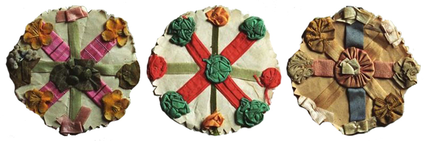
Examples of St Patrick’s crosses survive in glass cases today. These three are from Ireland’s National Museum of Country Life, Castlebar, Co Mayo

I have found much of my information on this subject in Kevin Danaher’s 1972 book The Year in Ireland – A Calendar published by The Mercier Press. Danaher begins his calendar on St Brighid’s Day (his spelling), and naturally discusses the custom of the making of bogha Bríde – the St Brighid’s cross. In this tradition, very much alive today, a cross is made from straw or reed and hung in the house to ensure good luck and protection for the coming year. In future years new crosses are made, but the old ones are never thrown away: if you visit a traditional Irish cottage, you are likely to see a whole lot of Brighid’s crosses pinned over the mantlepiece or among the rafters in various stages of decay.

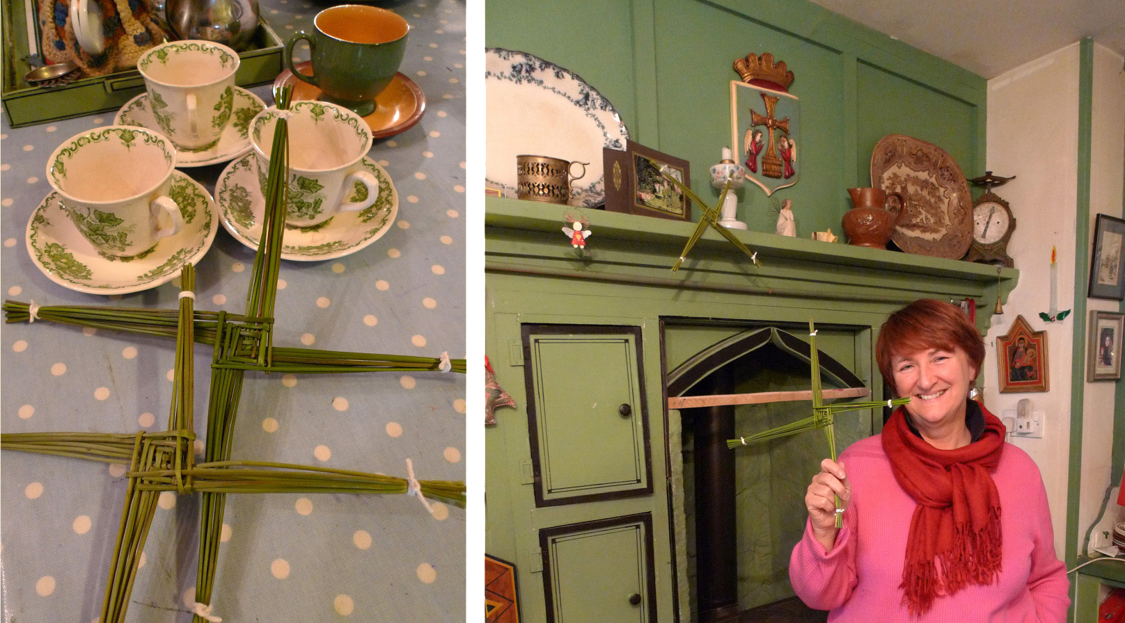
A traditional Irish cottage, Finola and her St Brighid’s cross. See this post

When Danagher comes to the next important Irish Festival – St Patrick’s Day – he mentions a similar custom involving a St Patrick’s cross or badge, worn on the clothing for the day itself, and then hung in the house to ensure that the saint’s blessing continues through the years. The custom was still within living memory when Danaher wrote, but its practice appears to have died out altogether in the early years of the twentieth century, although surviving examples of these crosses, emblems or badges can be seen in museums today. I am not aware of anyone keeping up this custom so – to celebrate the day that’s in it – I am proposing a revival!

Danaher’s illustrations of St Patrick’s crosses from The Year in Ireland

First, the history: an English traveller in Ireland, Thomas Dinely, wrote in 1681:

The 17th day of March yearly is St Patrick’s, an immoveable feast when the Irish of all stations and conditions wore crosses in their hats, some of pins, some of green ribbon, and the vulgar superstitiously wear shamroges, 3-leaved grass, which they likewise eat (they say) to cause a sweet breath . . .

Dean Swift in his Journal to Stella wrote from London on 17 March 1713:

The Irish folks were disappointed that the Parliament did not meet to-day, because it was St Patrick’s day; and the mall was so full of crosses, that I thought all the world was Irish . . .

Here’s ‘Mannanaan Mac Lir’ writing in the Journal of the Cork Historical Society in 1895:

For a week or so preceding the National Festival, the grown members of the family are occupied in making “St Patrick’s Crosses” for the youngsters, boys and girls; because each sex have a radically different “Cross”. The “St Patrick’s Cross” for boys consists of a small sheet of white paper, about three inches square, on which is inscribed a circle which is divided by elliptical lines or radii, and the spaces thus formed are filled in with different hues, thus forming a circle of many coloured compartments. Another form of St Patrick’s Cross is obtained by drawing a still smaller circle, and then six other circles, which have points in the circumference of this circle as their centre, and its centre as their circumferential point, are added; after which one large outer circle encompasses the whole, thus forming a simple and not inartistic attempt at imitating those circle or bosses  of our beautiful Celtic cross pattern. The many spaces, concave, convex or otherwise, thus formed, are then shaded in; each a different hue, and this constitutes the “St Patrick’s Day Cross”, of which our little ones are so proud. In our time, when every school boy is supplied with a pair of compasses and a box of water colours, the making of a St Patrick’s Cross is only the work of a few idle moments . . .

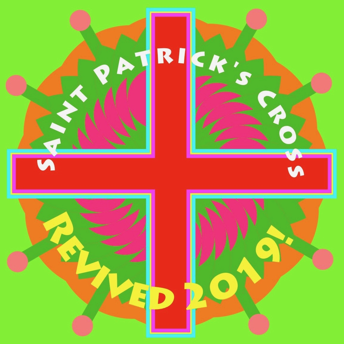
Hmmm… Well, the architect in me is intrigued enough to try out these instructions and – perhaps – add a few embellishments to see what sort of a job can be made of it:

What do you think? I have to admit to using my electronic drawing board rather than the compasses and water colours! ‘Mannanaan Mac Lir’ goes on to describe the girl’s cross:

The little girl’s “St Patrick’s Day Cross” – which is made by an elder sister, or if sufficiently skilled, by herself – is formed of two pieces of card-board or strong thick paper, about three inches long, which are placed across at right angles, forming a cross humette. These are wrapped or covered with silk or ribbon of different colours, and a bunch or rosette of green silk in the centre completes the tasteful little girl’s “St Patrick’s Cross”, which is pinned on the bosom or shoulder . . .

Not a little curious is the etiquette of those children’s “St Patrick’s Crosses,” for whereas it would be considered effeminate of a little boy to wear “a girl’s cross”, it would be considered most unbecoming on the part of the little miss to don a boy’s paper cross . . .

‘Mannanaan Mac Lir’ continues to enlighten us further on this custom:

I have known two or three old priests in Cloyne diocese break up and distribute among the girls of their respective parishes their old and worn vestments, for the purpose of being made into St Patrick’s crosses. The cross thus made (from a priest’s vestment) was an object of veneration; and I have known many such forwarded by their owners to their kindred in America, where they were doubtless received as welcome souvenirs of an ancient custom in the land of their fathers . . .

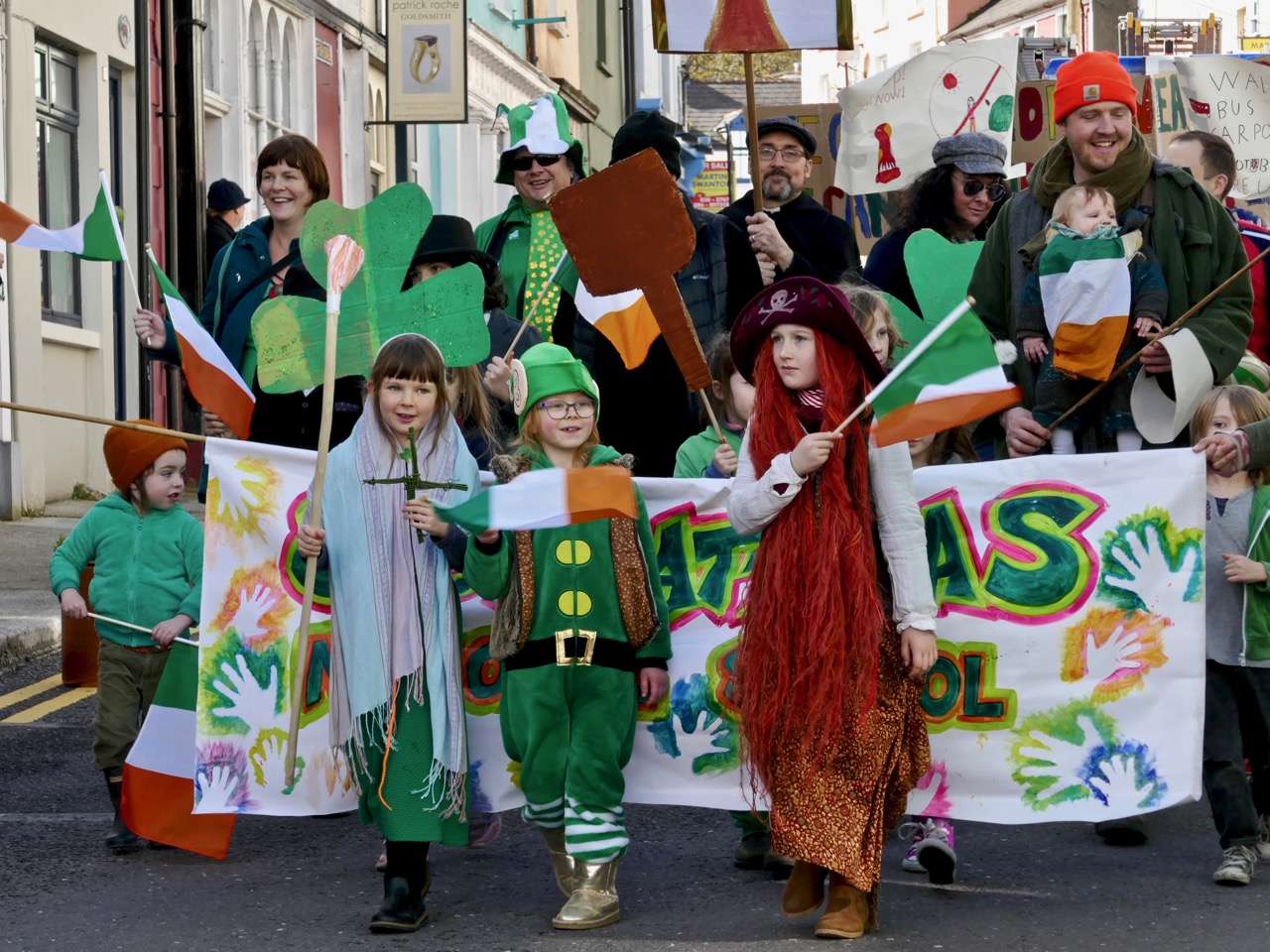
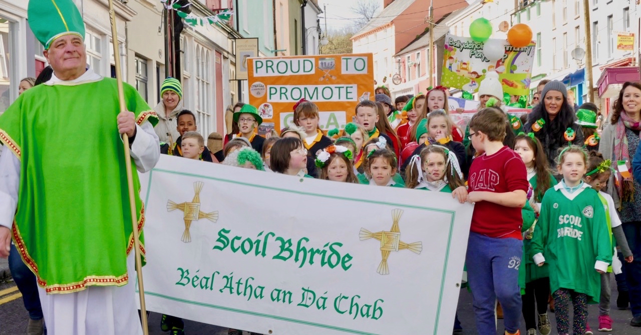
My final offering (above) – have I encouraged you all to get busy and help me revive this custom in time for St Patrick’s Day next year? I hope so . . . I’ll finish off with a couple of pics of a custom that’s still as strong as ever: the annual St Patrick’s Day Parade in Ballydehob, West Cork. Of course, the sun shone out!

New Court Bridge – a Hidden Wonder

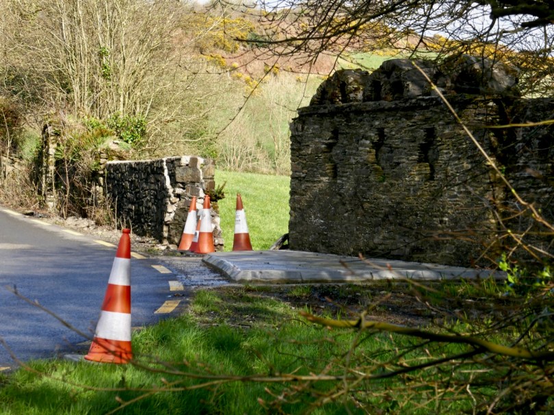
New Court Bridge has been badly damaged recently. Why does that matter?
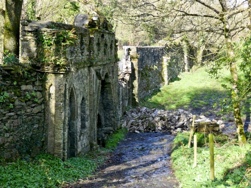
The damage from behind the wall. Now you can see that this is a bridge – but a most unusual one!

Most people driving by this dangerous bend, where the Ilen River meets the N71 just west of Skibbereen, notice the funny arches on top of the wall, but don’t think twice about them. It’s too risky to stop and take a close look, after all. Most people, in fact, probably don’t realise that they are driving over a bridge, although that’s a bit more obvious now as the County Council have put in one of those concrete pads that are going in front of all bridge walls at the moment (see lead photograph).
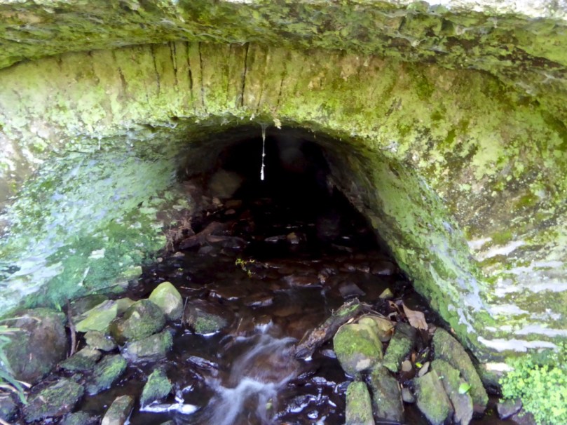
Water under the bridge

Does anyone know how the damage happened? Did a car take the bend too fast and hit the wall? Did the concrete work loosen the structure of the wall? Let us know if you have information. I hope nobody was hurt. All I know is that one morning I was driving into Skibbereen and there was a chunk of the wall – gone!

Early Ordnance Survey map of the New Court Estate, bounded by the Ilen River on the east and south. The red dots indicate the locations of the belvederes (marked as towers) and the bridge

We tend in Ireland to think of old estate walls like this one as ‘Famine Walls’, erected during the mid nineteenth century as work projects. But this wall was far older than that, and it hid a secret – an elaborate facade on the back with decorative arches and niches. It was part of the plan for a pleasure garden undertaken by Henry Tonson at his newly acquired ‘seat’ which he called New Court, to distinguish it from Old Court, across the river. Originally, there was a matching wall across the road, but it was demolished in a truck accident many years ago. EDIT: I misinterpreted this – rather than a matching wall across the road, in fact there were matching arches on either side of the road, west of the entry to New Court. Both are now gone, one at least due to the aforementioned truck accident. Thanks to Sean Norris for this information.
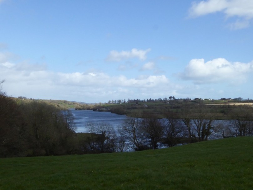
The Ilen floats by – a navigable river was a must for transporation to and from these early estates

The Tonsons had arrived in the 1660s. According to Burke’s Peerage, Major Richard Tonson received a grant of land in the county of Cork from Charles II for his distinguished exertions in favour of royalty during the Civil Wars and purchased the castle and lands of Spanish Island, in the same county. If he built anything on Spanish Island, just off Baltimore, no traces remain, and indeed, although strategic in marine terms at that time, it is hard to imagine how the island, mostly bare rock, would have made for comfortable accommodation.
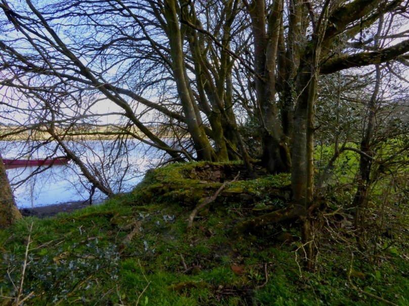
The stump of one of the belvederes, overlooking the river

It appears he, or his son, Henry, bought the land on the west bank of the Ilen and Henry set about establishing his dwelling there. This included building the wall around the estate. Eventually, and we are not sure when, one of the Tonsons (over time they acquired a title, Lord Riversdale) developed the area around the house as a vast pleasure garden.
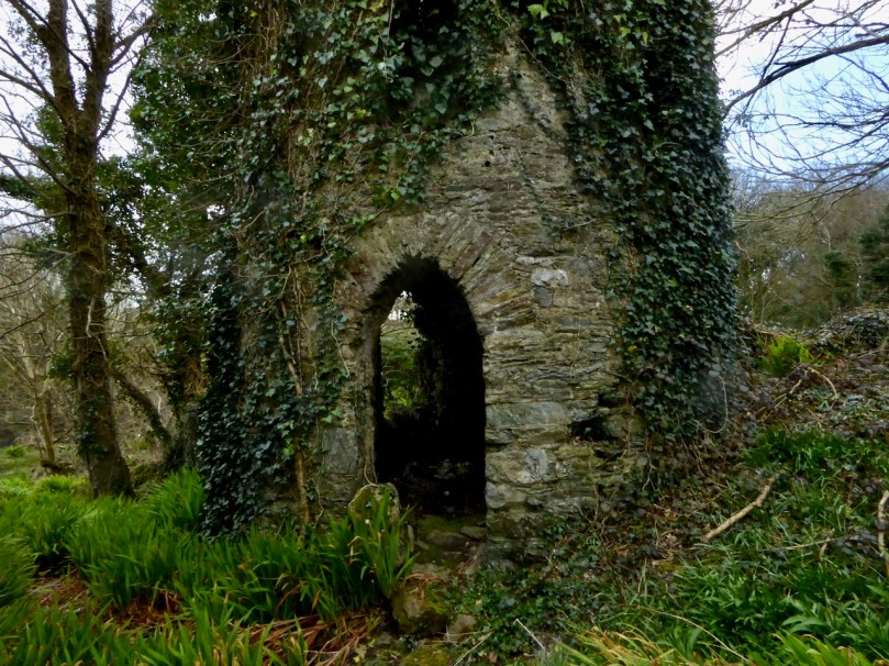
The most complete belvedere. This one also functioned as a dovecote

The fashion for designed landscapes is an eighteenth century phenomenon. As I said in my post on belvederes, in that century

. . . a different style of landscaping. . . dominated garden design in Britain, pioneered by William Kent and Charles Bridgeman and reaching its peak in the work of Lancelot ‘Capability’ Brown. The effect they strove for was naturalistic (as opposed to natural) – a planned layout that mirrored but enhanced their idea of a ‘wild’ and romantic landscape. Large expanses of grass, strategically placed lakes and ponds, plantings of carefully chosen tree and shrub species, and clever little structures such as temples, summer houses and belvederes all combined to delight the eye, create a romantic mood and, of course, attest to the taste and wealth of the owner.
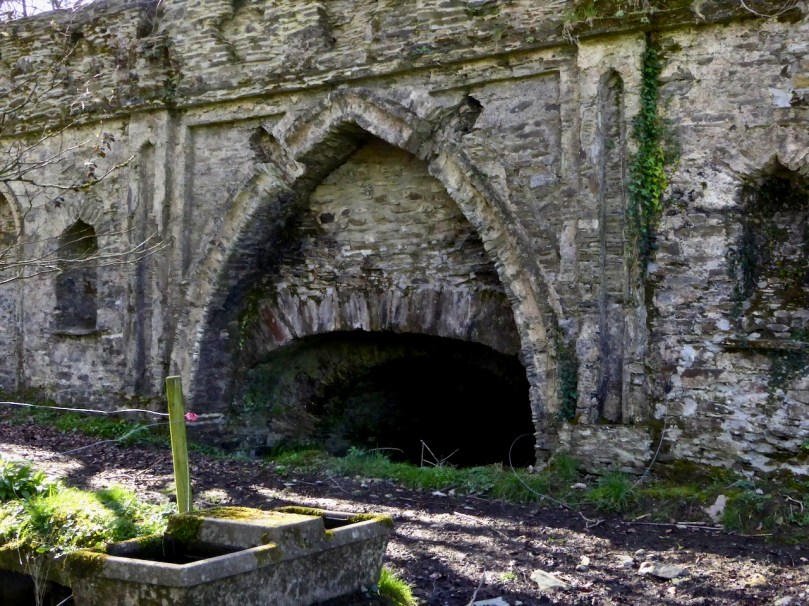
A closer look at the construction of the bridge. It would be fascinating to attempt a reconstruction drawing. The niches may well have held statuary or decorative urns

Although the grand houses at the centre of the estate have now gone (see this photograph in the National Library for a glimpse of the last one), there is lots of evidence still of such a designed landscape. Originally lawns sloped to the river – no need to build artificial ponds as the Ilen provided the perfect watery scene. Little round towers were built to be used as gazebos or belvederes (and in one case a dovecote): three in all, of which the stump of one and a fairly complete second are still to be seen. The bridge with its elaborate facing was the crowning glory of the estate wall.
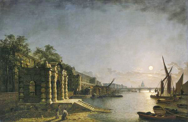
The York House Water Gate as it would have looked originally on  the Thames (Wiki Commons)

What did the bridge wall look like originally? We don’t know, but Peter Somerville-Large in his Coast of West Cork says it was modelled on the ‘water gates at Hampton Court’. I can’t find any images of this online, but I have found the water gate at York House, which is still there. It was built as a ceremonial landing place on the Thames (above) although it is now a long way from the river.
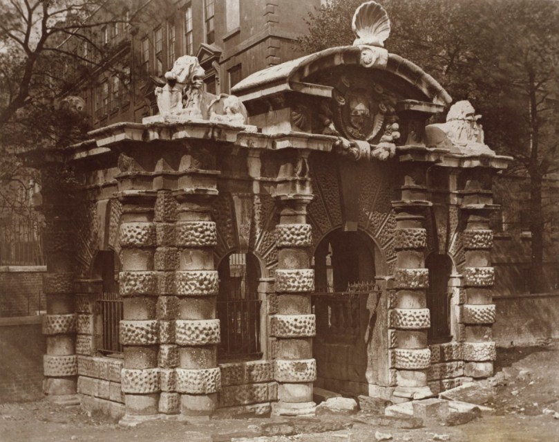
The York House Water Gate in an early photograph (www.royalacademy.org.uk/art-artists/work-of-art/O18442 Credit, Royal Academy of Arts / Photographer William Strudwick )

Of course, it is larger and more elaborate, but you can still see the basic shape, with its curved arch on top and the arched niches in the wall. The arches at New Court may have been plastered, perhaps, or faced with some material. The York House Water Gate dates to 1626 and it’s all that left of the York House estate – the Tonsons may well have been familiar with it or with similar water gates along the Thames. Building such an edifice would have been aspirational, indicating a desire to impress.
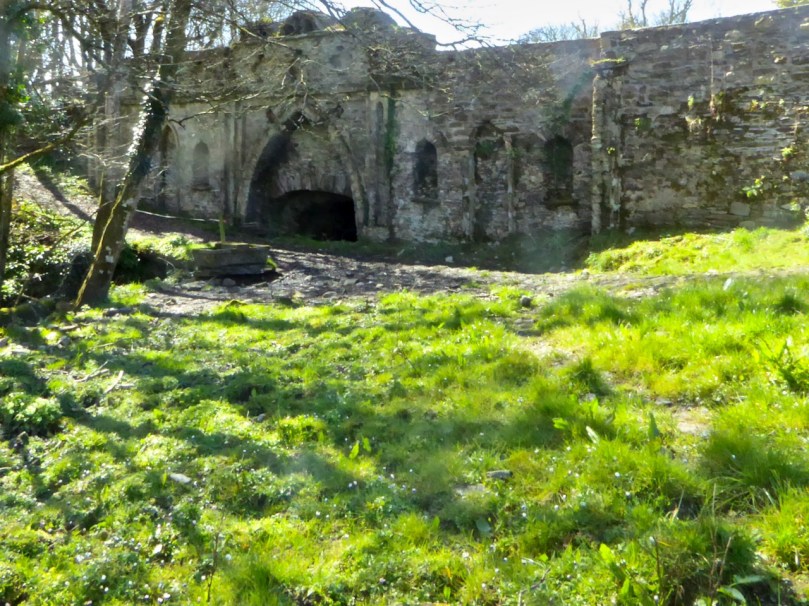
This was what it looked like in 2016 – taken by a camera with spots on the lens

The likelihood, therefore, is that the bridge at New Court is most probably eighteenth century, and early eighteenth century at that – about three hundred years old. We don’t have a lot of structures in West Cork dating to then. Surely it’s worth preserving those that still exist? I am hopeful that the National Monuments Service (they’ve been alerted and have notified their Monument Protection Unit) will come riding to the rescue. I’ll be keeping an eye on it all – you do too. But note that this is private property, so no walking or driving through the gates without permission.

UPDATE, MARCH 20, 2019. This notice was received from the National Monuments Protection Unit: “Cork County Council (Bridge Management) have indicated it is prepared to repair the wall as a Reactive Maintenance Incident and will ensure repairs meet any necessary heritage requirements.”
The Mass Rock – revisited

This post was originally published way back in 2014 but I have updated it with a few new photographs and edited the text slightly.

An raibh tú ag an gCarraig? / Were You at the Rock?

nó a’ bhfaca tú féin mó grá / Or did you yourself see my love,

nó a’ bhfaca tú gile, / Or did you see a brightness,

finne agus scéimh na mná? / The fairness and the beauty of the woman?

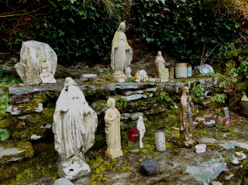
This beautiful song speaks to a revered tradition in Irish history and folk custom – the mass rock. During the period of the Penal Laws (late 17th and first half of 18th Century) when the practice of Catholicism was outlawed, parishioners would gather at a secret location to attend mass. The priest travelled from community to community in disguise, a lookout was posted, and mass was celebrated on a lonely rock far from the reach of the law. The song encodes the message that the people still find ways to attend mass, despite the harsh prohibition against it.

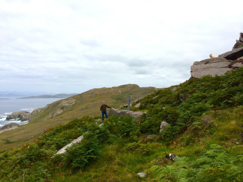
Mass rocks are often in remote locations, such as this one in Kerry, or the lead image on the Beara

Dr. Hilary Bishop, in her excellent website Find a Mass Rock says, As locations of a distinctively Catholic faith, Mass Rocks are important religious and historical monuments that provide a tangible and experiential link to Irish heritage and tradition. She also points out that, because of the imperative for secrecy, mass rocks are difficult to find.

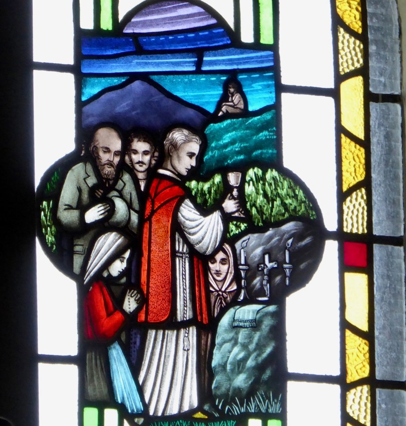
This stained glass window shows mass at a mass rock, with a lookout posted to keep an eye out for the redcoats

We certainly experienced this when we set out for a day of mass rock hunting. Working from a list generated from the National Monuments Service database we spent a day on the Sheep’s Head and the Mizen and had trouble finding all the rocks on the list. One, if it was still there, had disappeared under impenetrable layers of gorse. A second rock was last recorded in the 1980s: residents were no longer familiar with it.

One of our favourite holy wells, at Beach on the Sheep’s Head, also incorporates a mass rock. Mass is celebrated here every August

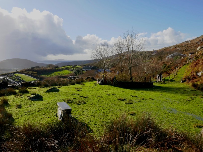
Knowledge of mass rocks has passed down from generation to generation. In the deep countryside, the sites maintain a mystique and a sense of the sacred. We’ve written about the mass rock and holy well at Beach, where Mary conjured up a blanket of fog to confuse the English soldiers and allow the priest to escape. At Beach and at our first stop, the mass rock at Glanalin on the Sheep’s Head Way, mass is still celebrated.

The Glanalin rock (above), and the one we visited on the Beara Peninsula, are good examples of the remote locations typical of many mass rocks, high on a hillside or hidden in an isolated valley. You can picture the procession of worshippers, in ones and twos, slipping silently through the bracken, pausing to make sure they are not being watched, climbing higher, following an overgrown trail, arriving at the meeting place where the hushed crowd awaits the arrival of the priest.

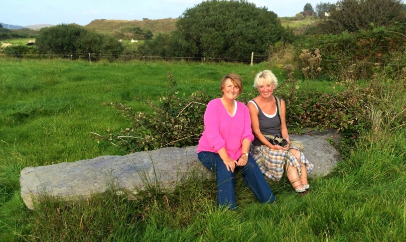
One of the rocks we found (above) looked for all the world like a fallen standing stone – and that’s probably what it was. (I wonder if I should go to confession, though – I’m sure that sitting on a mass rock would qualify as at least a venial sin.)

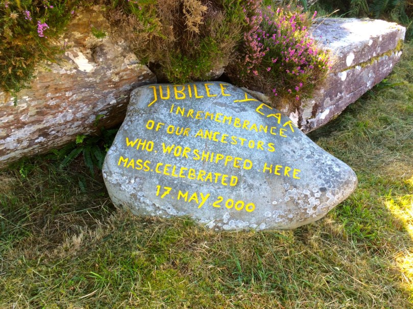
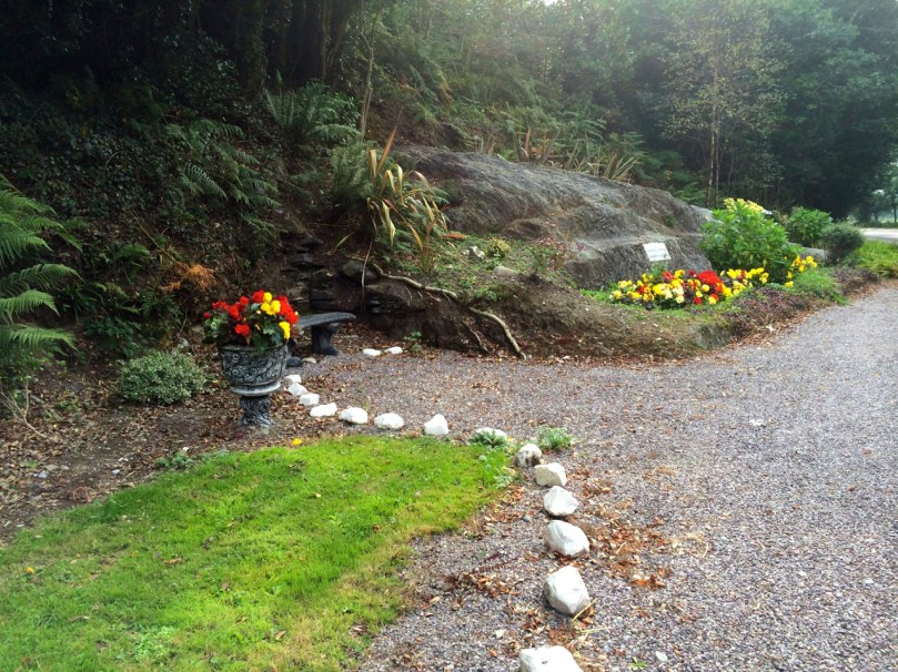
A mass rock that is easily visited is the one at Cononagh Village (above), right at the side of the main road into West Cork, the N71. This site is beautifully maintained – Cononagh is obviously proud of its heritage: signage and flowers invite the passerby to take a closer look.

The mass rock we visited last year, at Foherlagh, has a commanding view of the surrounding countryside. This one even had a small scoop-out in the rock, identified as a holy well

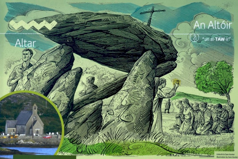
Another easily accessible site is Altar, at Toormore. This is a wedge tomb, probably over 4,000 years old and excavated in 1989. It remained in use through the Bronze Age and into the Iron Age. Dr. William O’Brien, in Iverni, says of this site: …over time this tomb came to be regarded as a sacred place, housing important ancestral remains in what was a type of community shrine. How fitting, then, that the flat capstone of the Altar wedge tomb became, in the Penal Days, a mass rock. And how intriguing to think of the continuation of this sacred space over the course of thousands of years.

But perhaps our favourite of all the mass rocks we have visited is the one at Castlemehigan. We wrote about it here. It started out life as a cupmarked stone perhaps in the Neolithic, then probably got converted into a bullaun stone in the Early Medieval period, before finally serving as a mass rock – and it has all the stories to go with its long history.


‘Flying Foam’

A recent post – Fish Palaces and How They Worked – discussed the history of the fishing industry in the south west of Ireland, and focussed on our own Roaringwater Bay. There’s an ‘extra’ story following on from that – well worth the telling, but frustratingly incomplete.

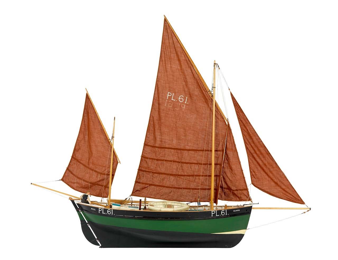
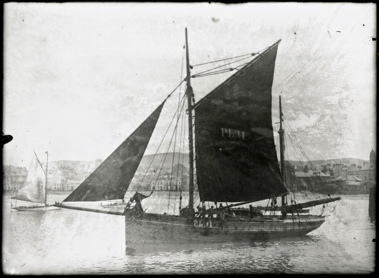
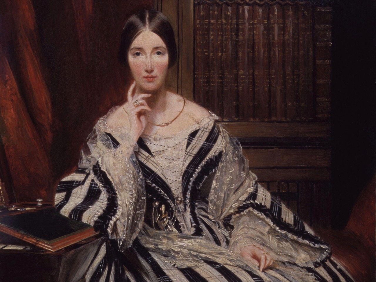
The header picture (courtesy of the National Maritime Museum, Greenwich) shows a ‘dandy-rigged nobby’, a traditional fishing vessel built on the Isle of Man during the second half of the nineteenth century. The photograph above shows such a boat, also from the Isle of Man. ‘Nobbies’ like these came to form the basis of a fishing fleet centred on Cape Clear and Baltimore, provided by the benefice of ‘the wealthiest lady in Victorian Britain’ – Baroness Angela Burdett-Coutts (1814 – 1906). Here she is, below.

Angela Burdett-Coutts was just twenty-three when in 1837 she gained an inheritance of around three million pounds (roughly one hundred and thirty million pounds in today’s money) from her Grandfather, which she immediately directed to good causes. According to the Dictionary of National Biography

In 1862 Father Davis, the parish priest of Rathmore, co. Cork (now Baltimore), appealed to her for aid on behalf of the people of the south-west of Ireland, especially in the district of Skibbereen, Crookhaven, and the Islands of Cape Clear, Sherkin, Hare, and the Calves, which had never recovered from the sufferings of the famine years 1848 and 1849 . . . Her chief work was to revive and extend the fishing industry of the south-west coast. She advanced large sums of money, on a well-devised scheme of repayment out of profits, to provide the fishermen of Baltimore and the Islands with the best fishing-boats that could be built, and fitted them with modern and suitable gear. In the course of five years the new fishing fleet of Baltimore was valued at 50,000 pounds . Much of the capital was in due course repaid; and Father Davis used all his influence to keep his parishioners scrupulously to their engagements. In 1884 she paid her first visit to the district and was everywhere welcomed with enthusiasm. With the assistance of Sir Thomas Brady she soon afterwards helped to inaugurate a fishery training school for 400 boys at Baltimore. The school was opened by her on 16 Aug 1887, when she was received with bonfires on the wild hill-sides, and flags flew from every cottage down the coast from Queenstown to Baltimore.

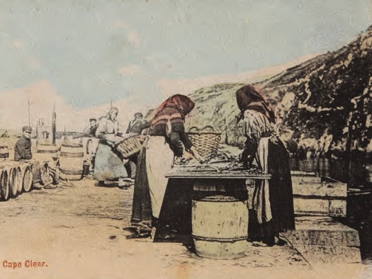
Fish processing on the quay in Cape Clear, nineteenth century

By 1900 fishing in West Cork was in its heyday, with an annual turnover of £100,000. Between 1880 and 1926 Baltimore was the largest fishing port in Ireland and 78 fishing vessels were registered locally. By 1907, after the North Pier had been built, the fleet was so numerous that you could, it was said, walk to Sherkin across the decks of the boats!

Looking across to Sherkin Island from the Cove, Baltimore, today

A further version of the story appeared in Ireland’s Own Magazine, in September 2018, narrated by Eugene Daly:

My father, Mícheál Ó Dálaigh, was born on Cape Clear in 1910, the eldest of four children. When his father Eugene died in 1920, he quickly had to take over the part of breadwinner and at a young age became a fisherman . . . The people of Clear, often known as Capers, had for many generations always been fishermen. On Cape Clear one is aware of the all-embracing sea. In the 1880s, through the work of Father Charles Davis, a £10,000 loan was granted by the English philanthropist, Baroness Angela Burdett-Coutts. With those loans they bought ‘dandies’, 50 to 60 ft long made in the Isle and Man and later in Baltimore Fishery School. By 1920 there were up to forty of these boats fishing out of Trá Chiaráin, the island harbour. Some of the musical names for these boats include Sarah Gale, Guiding Star, Carbery Queen, Jasmine of Downings etc . . .

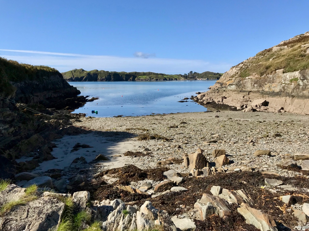
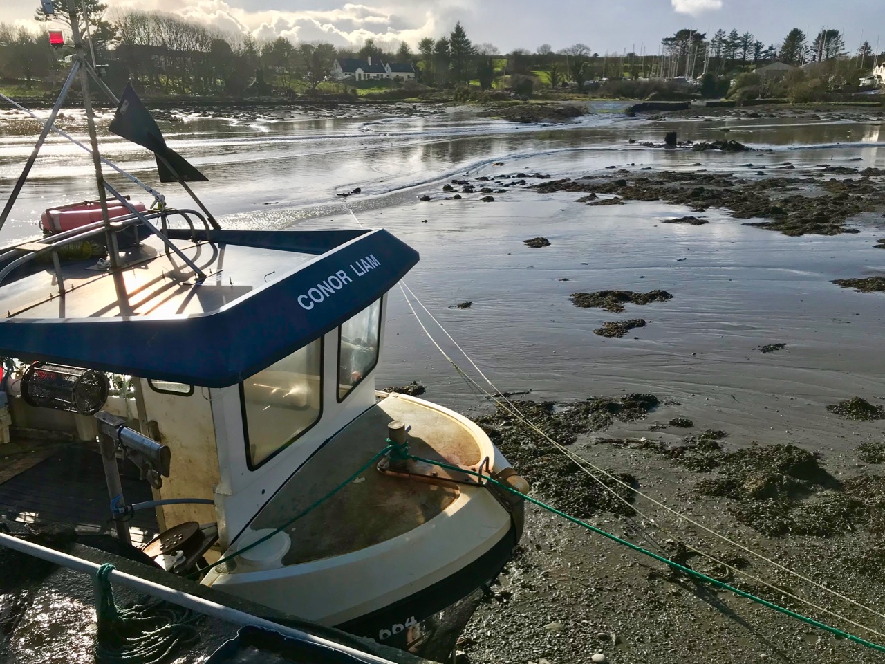
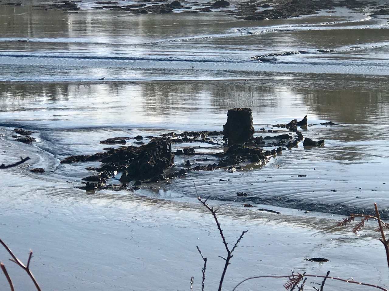
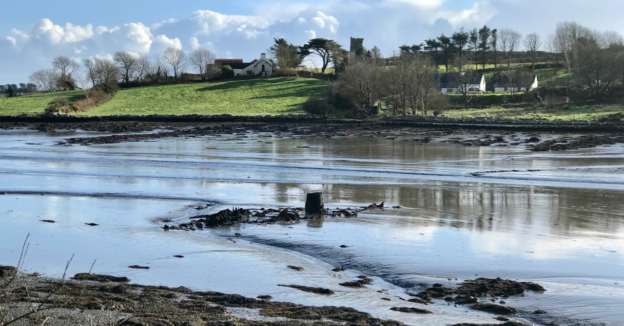
What is of interest to us is that – according to local tradition – there is the remains of one of the ‘nobbies’ or ‘dandies’ in Rossbrin Cove, just below where we live in Nead an Iolair. You’ll have to look at low tide: you can just make out the scuttled boat in the picture above, on the right in the middle distance. In the view below the wreckage is clear.

It was our near neighbour, Michael John, who told us that this was one of the Burdett-Coutts boats, and that it was named ‘Flying Foam’. He also remembered hearing a poem or recitation about the boat and its fate at some time in the past but – in spite of many enquiries locally – I can as yet glean no further information. Frustratingly, this is where the story is left hanging in the air . . . Perhaps a reader of this journal might have the memory and can enlighten us? We would love to find the poem!

Abhainn na Seangán – River of the Ants!

What’s in a name? In Ireland – quite a lot, usually, although the meaning often takes some searching out. Perusing Ordnance Survey Ireland sheet 85 on a late February afternoon when the sun miraculously appeared and lit up a countryside ripe for exploration, my eye was drawn to a river running through the hills to the east of Bantry: Owennashingaun. How could you overlook such a name? And how could you not be intrigued by the Irish place-name which must have preceded it before the surveyors put their anglicisation to it: Abhainn na Seangán? Even better was the discovery of the meaning of this name: River of the Ants!

Our byway heading into the hills

With high expectations we set out, with Finola at the ready with her camera. As with all West Cork locations, Abhainn na Seangán is but a few paces from Nead an Iolair, as the crow flies. Pausing only to pick up our friend Gill in Ballybane West along the way, we were soon heading north for the foothills of Mullaghmesha (Irish: Mullach Méise – Summit of the Altar).

Turning north at the Cullomane Crossroads on the R586 we almost immediately crossed the Owennashingaun River (I’ll use the Anglicised version as that is what usually appears on the map). Here it’s just a gentle, straight watercourse which follows the main road until it picks up the Ahanaclaurshee Stream (Irish: River of the Harp) and then becomes the Ilen River, which flows on through Skibbereen and eventually reaches the sea at Baltimore.

Glens, farms and distant highlands on our road heading for Mullaghmesha

We skirted two smallish peaks – Sprat Hill and Knocknaveagh (Irish:Cnoc na bhFiach, wonderfully ‘The Hill of the Ravens’) – before reaching the townland of Tralibane, an important Irish landmark as it was here that Captain Francis O’Neill was born in 1838. He travelled the world and had a colourful life of many adventures before being elevated to the role of Chief Superintendent of Police in Chicago in 1901. O’Neill came from a musical family in his West Cork childhood and is best known today as one of the most successful collectors of Irish Traditional Music. Here is a post I wrote about The Chief back in 2014.

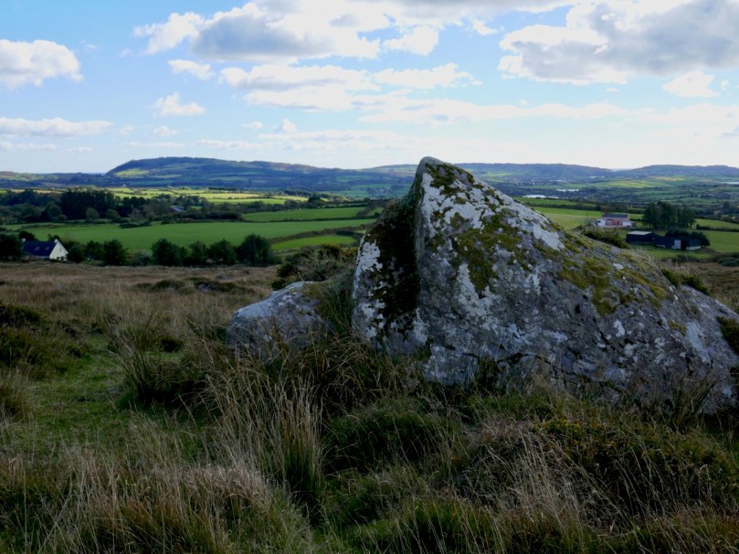
From Tralibane we travelled north-east on deserted boreens, through a soft, green landscape of glens and standing stones (see the header picture), gradually rising towards more distant highlands, until we encountered again the ‘River of the Ants’. The source of Abhainn na Seangán is on the slopes of Mullaghmesha, whose peak is at 495 metres: we didn’t make it up there to look for the altar: a destination for another day. The name of the river remains enigmatic: I searched the excellent resource www.logainm.ie and found an archive record there dating from 1840 which gives the translation as: ‘river of the pismires’. I then had to look up ‘pismires’, which is evidently from early English:

1350 – 1400: Middle English pissemyre, equivalent to pisse to urinate + obsolete mire ant, perhaps Scandinavian (compare Danish mire, Swedish myra) cognate with Dutch mier; pejorative name from stench of formic acid proper to ants

There was nothing untoward with the smell of the river as we followed it – and we didn’t see any ants! So the mystery remains. Surely there must be a story embedded in local knowledge or folklore which could enlighten us?

Upper – sweeping views began to open up as the road climbed towards Castle Donovan; centre – the iconic ruined castle, which was taken into the care of the State in 2000 and has since received major stabilisation and renovation; lower – a splendid piece of signage at Castle Donovan – every possible disaster has been foreseen!

The ruin of Castle Donovan is as fine as any in West Cork, and is fortunate to be in permanent State care. Set on a plateau with the mountain rising behind it, it is an impressive focal point in the landscape, which can be seen for miles around. We passed by the castle and headed up on a rough, winding way: looking back, the silhouette of the tower house stands out with benign West Cork rolling pasture as a prepossessing backdrop.

The road very quickly becomes a true mountain pass, and an early evening haze seemed to hang over everything as we skirted the east side of Mullaghmesha. We hardly saw a soul on our whole journey, but we were eyed warily by sheep who plainly considered us intruders on their territory.

On the north side of the mountain we entered the Mealagh Valley, and were reminded of our recent adventures travelling through the Yellow Gap. Finding our way down to the lowlands again, we took our last look at the River of the Ants at Dromore, and bid it a fond farewell. In spite of its unfathomable name, it had taken us on a grand exploration. Give it a try for yourselves!

Upper, the distinctive church at Dromore, with its pencil-thin ’round tower’ and, above, our last view of Owennashingaun