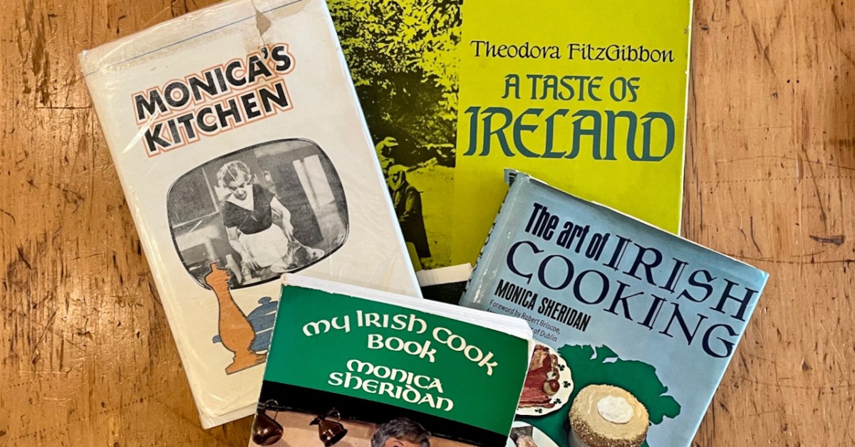
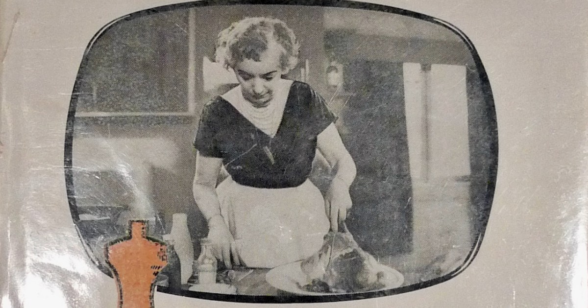
I always drift back to Monica Sheridan at Christmas. Ireland’s first TV chef, she lives in the memory for those of us who grew up at the dawning of the television age in Ireland. Her Christmas Cake recipe is a classic and because it is nowhere on the internet, I decided, way back in 2013, to put the whole recipe in a blog post. This actually led me down a rabbit hole because the three posts I have written about Monica Sheridan were published so long ago that they no longer display properly, so I have spent the day updating them. Here is the first post I wrote about her – it was called Monica’s Kitchen and was all about her first cookbook.
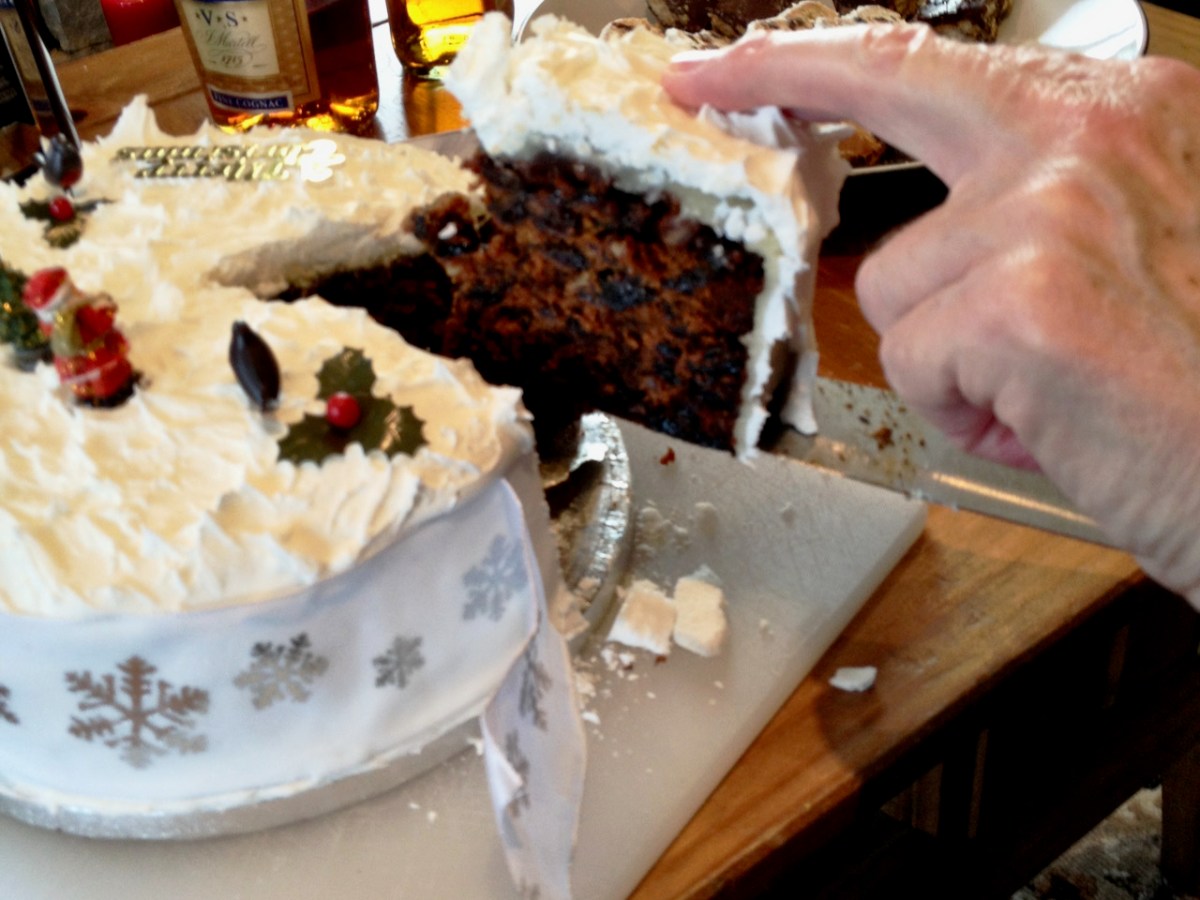
And here is the Christmas Cake post. She described it thus: unorthodox, unhygienic, almost improper – but it does work. She’s right – I have made it and it is delicious.
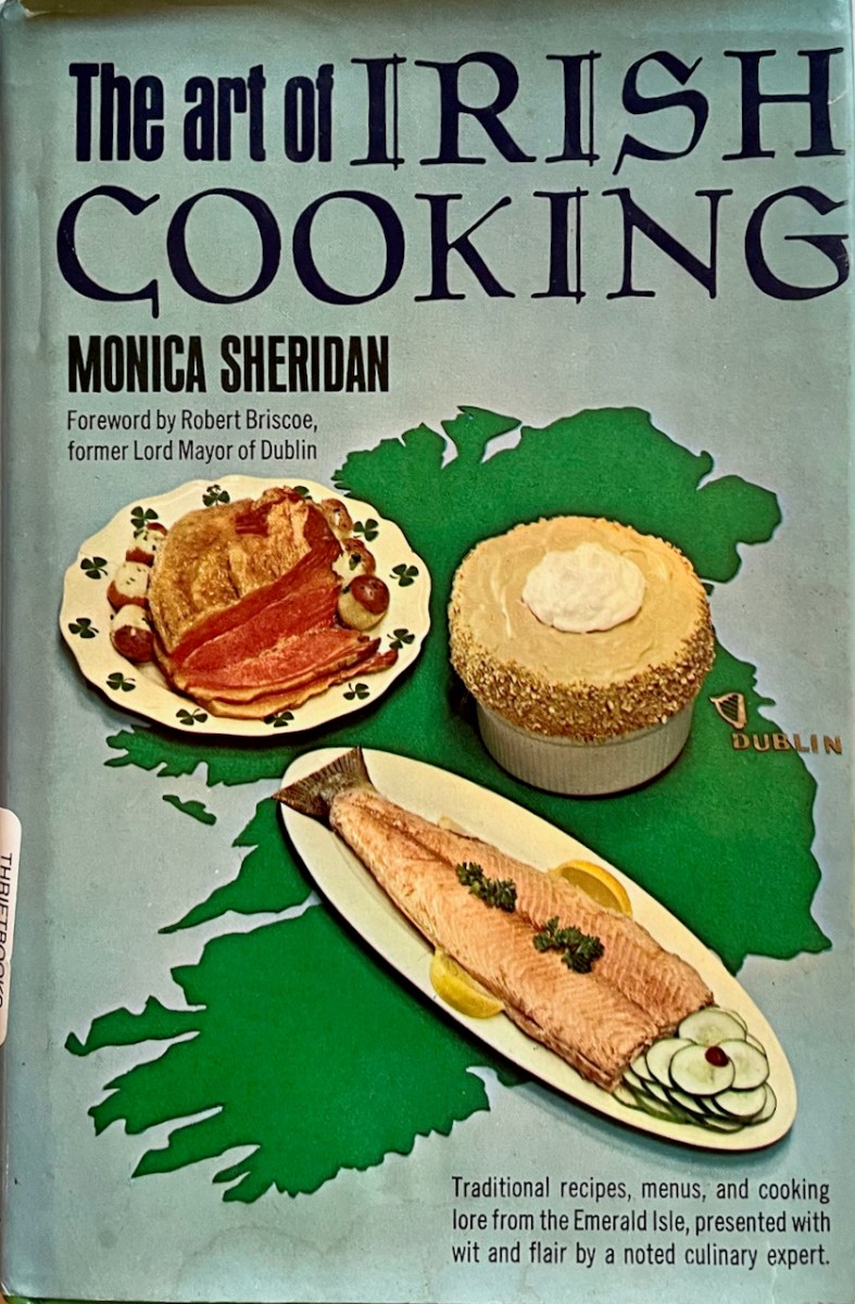
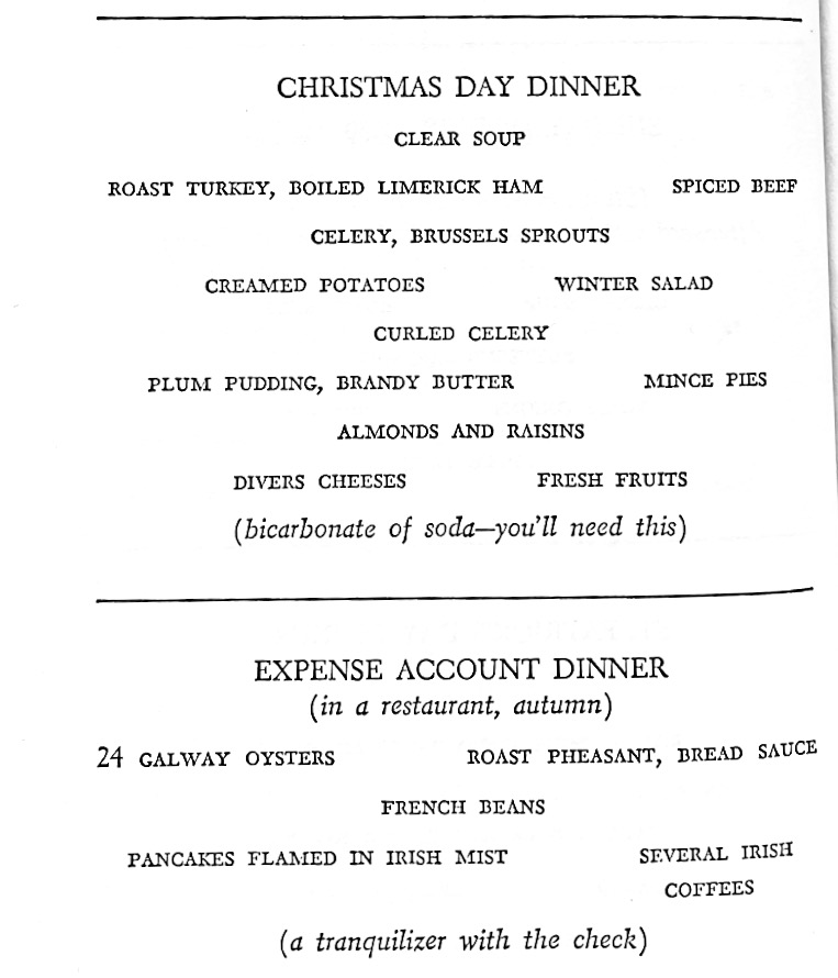
Many of the recipes are the same, but there are significant differences between the Irish and American books. Amusingly, the chapter on ‘Drink’ is re-labelled ‘Beverages.’ All the same colloquial come-here-till-I-tell you chat is here and there’s an introduction by Bob Briscoe, the popular Lord Mayor of Dublin, who can’t resist the Irish-American tropes, saying, Our traditional Irish fare proved itself a boundless source of rugged health and stamina. . . it built the muscles that helped to push the great railroads across the American continent, and the Irish intellects that have adorned the world’s literature. For some reason, the American edition required menus, as if the publisher had said – ‘Yes, but what do the Irish actually eat at a meal?’ Here’s the Christmas dinner menu (with a bonus Expense Account menu delivered with her trademark sense of fun).
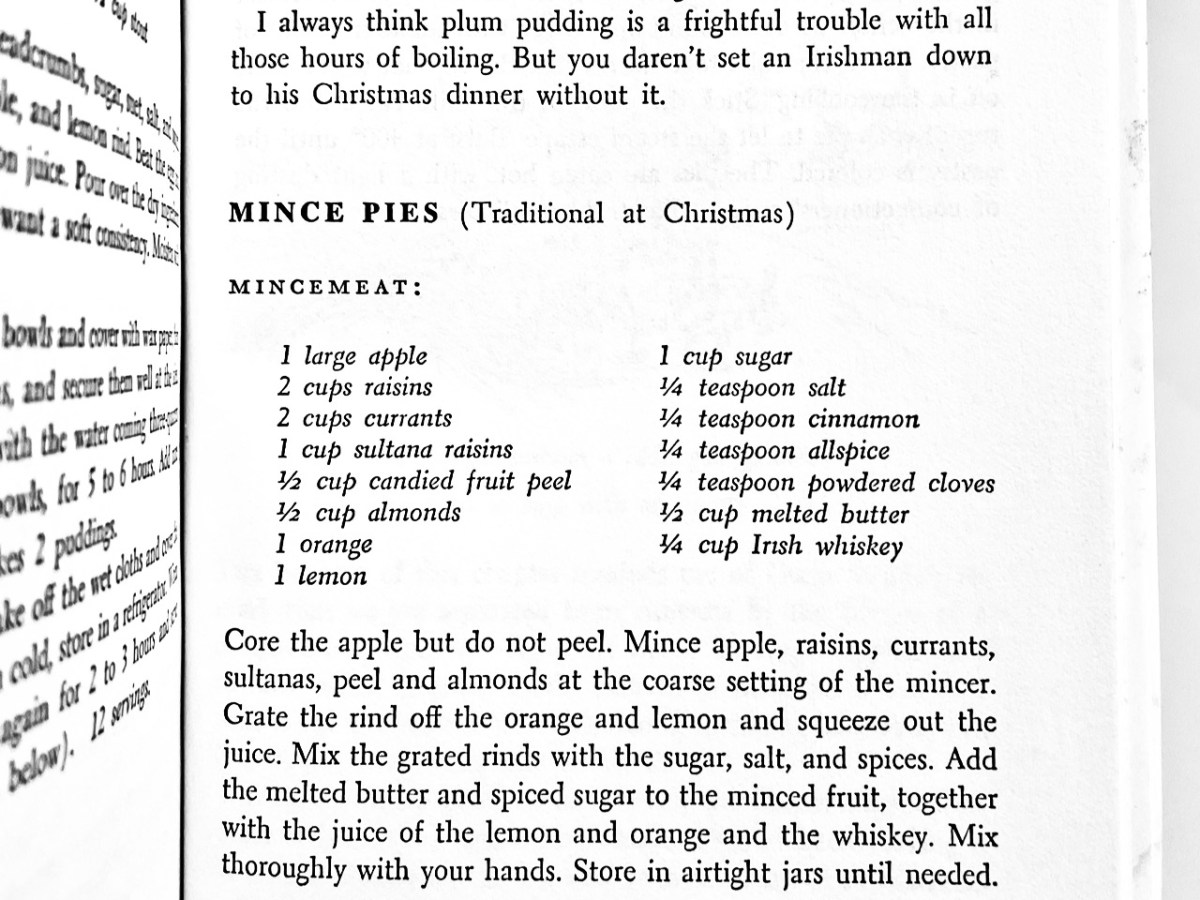
I have no idea what creamed potatoes are (mashed with cream?) or why she serves celery twice, the second time ‘curled.’ But this American edition is the only one where she gives a recipe for Mince Pies, so I am including her recipe for Mincemeat, in case there are those of you out there who like to make their own. Other recipes I have consulted call for shredded suet, but Monica keeps it fairly simple, although she does assume you have a mincer. It’s not such a standard piece of kitchen equipment as it used to be, so if you’re not sure what it is, here’s a link. I love her comment on the puddings too!
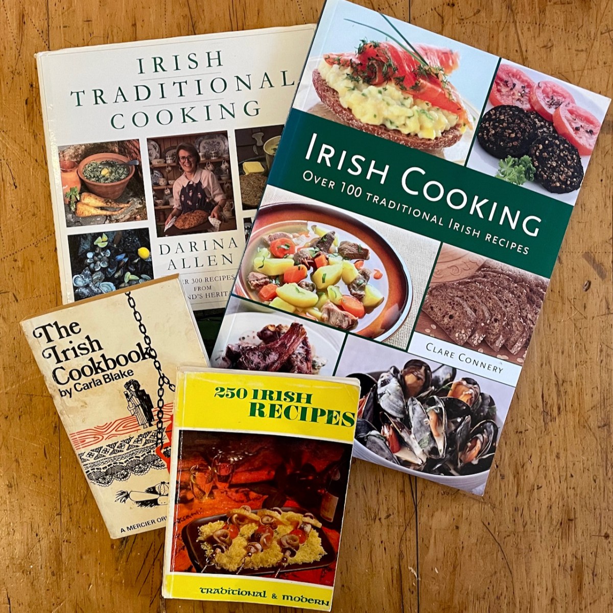
All our mothers and grandmothers cooked from Monica Sheridan and Maura Laverty‘s cookbooks. Together, these two women dragged Irish cuisine into the 20th century. Oh – yes, there was Theodora FitzGibbon too – well deserving of a future post. That’s my copy of her A Taste of Ireland in the lead photograph. I have several other cookbooks devoted to Irish cooking, from the 60’s to the 90’s. Fillet Sole St Brigid, anyone? Or a nice dish of Sloke?
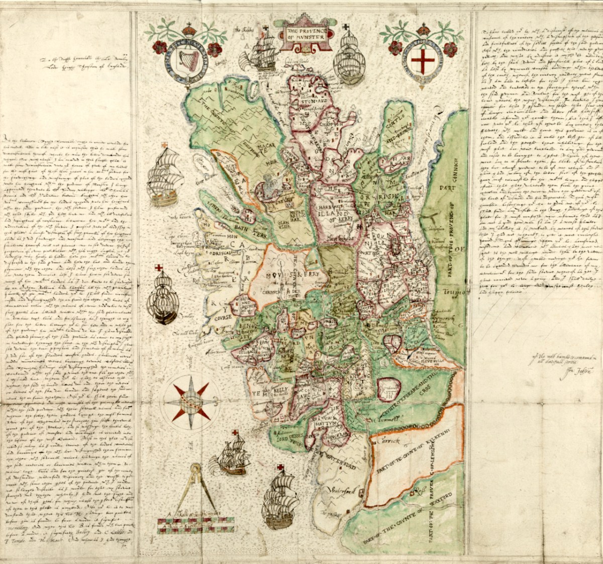
As I said in Part 1, this map was made to provide information for the purposes of plantation – that is, colonisation – of Munster, and in particular of those lands forfeited by the Desmonds after their ill-fated rebellions. Jobson, the cartographer who signed this was, according to Andrews, an enthusiastic map-maker who was unusually determined that his maps would survive. Accordingly, he made copies and presented them to likely future employers – hence this one, inscribed to Lord Burleigh, faithful and long-serving eminence grise to Elizabeth 1. That’s herself, below. (Full citation for the map is at the end of the post.)
He also showed unusual zeal in presenting duplicates to likely patrons: no one was going to deprive posterity of a Jobson map by “borrowing” the only copy. Other features of his complex cartographic persona were more distinctly Irish, such as his deceptively slapdash-looking style and his apparent ignorance of earlier Anglo-Irish cartography.
Much of the ‘slapdash’ nature of the map can be explained when we realise that this map, in fact, was a reduction to small scale of detailed townlands surveys that he, Jobson, and others had carried out, and that he obviously had not been able to make all his observations ‘on the ground’ for whatever reasons. The map was studied in the late nineteenth century, along with a host of other evidence by W H Hardinge. He starts his paper, read to the Royal Irish Academy in 1891, by giving the background to the maps:
So soon, however, as the Queen and her Council decided upon establishing, under certain conditions and limitations, a plantation of her English subjects upon these forfeited territories; and for that purpose determined to grant them out to undertakers, in scopes of twelve, ten, eight thousand, and a lesser number of English acres, it became indispensable to the interests of the crown, as well as to equity in the distribution of the lands amongst the undertakers, to have the area of each town accurately measured, ascertained, and laid down upon a plot or map. Accordingly, I find a commission to that end, bearing date the 19th June, in the twenty-sixth year of the reign of Queen Elizabeth [1584], accompanied by minute instructions from the ministers and lords of Her Majesty’s Privy Council in England addressed to Sir Henry Wallop, Knt., under-treasurer of Ireland, and to other commissioners there, of whom the auditor-general, and the surveyor and escheator-general were two; authorizing and requiring them to make special inquiry in relation to said forfeitures, to measure the demesnes, and to reduce acres to plow lands, according to the custom of the country, and to value the acres rateably according to perches. The survey was completed in the year 1586, and must have been returned into England, as ” The Plot from England for inhabiting and peopling Munster” was soon afterwards sent to the lord deputy. And, further, a very large proportion of the principal plantation grants were passed under the great seal of England almost simultaneously, based upon that survey, and which could not have been so passed unless the guiding information enabling the distribution had been on the spot.
On Mapped Surveys of Ireland Author(s): W. H. Hardinge and Ths. Ridgeway Proceedings of the Royal Irish Academy (1836-1869) , 1861 – 1864, Vol. 8 (1861 – 1864), pp. 39-55 Available here
Hardinge then goes on to comment on Jobson’s Map of Munster:
In a long and expressive marginal note, Jobson sets out his services, stating “that he was three years in her majesty’s service, surveying and measuring part of the lands escheated to the crown in Munster ;” and further, “that Arthur Robinson and Lawson were employed on same survey.” The map in question is genuine, and clearly a reduction by Jobson from the townland surveys, made in pursuance of the pre-recited commission, as a gift likely to be acceptable to Lord Burleigh.
From such accumulated evidence, I concluded that there must have been mapped surveys accompanying the inquisitions and books of survey; and that nothing less could satisfy the exigencies of the plantation – a work that was to be guided by a measure of land up to that time unknown in Ireland, and by a scale of crown rent imposition of three-pence per English arable acre.
In a further note, he cites the cost of the survey as £2,900 – this translates to about £700,000 in today’s money.
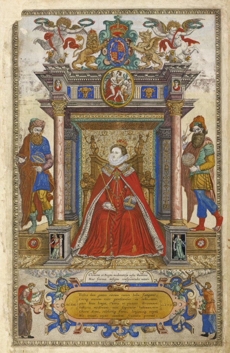
This is the frontispiece to Saxton’s Atlas of the Countries of England and Wales. Christopher Saxton was one of the premier Elizabethan cartographers and in this glorious illustration he is showing how indispensable maps and map-makers are to Elizabeth and to the world. Source Wikimedia Commons
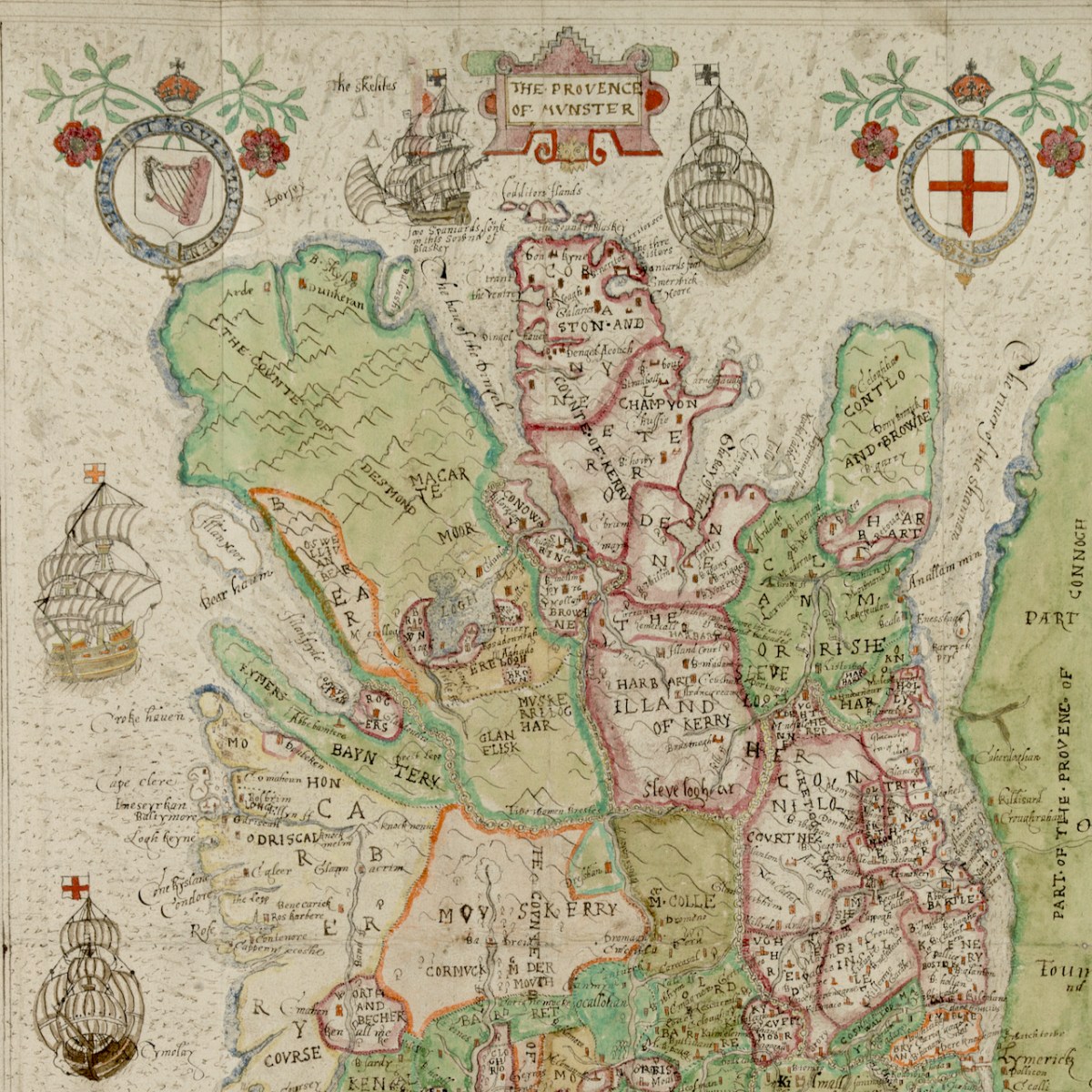
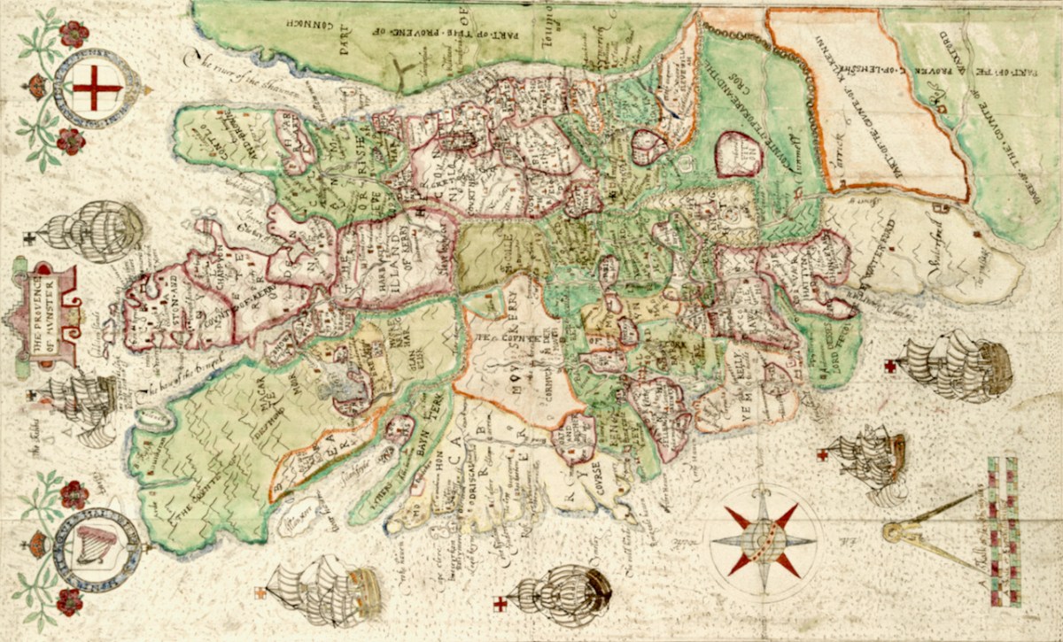
Munster in this map refers to the counties of Waterford, Cork, Kerry and Limerick, rather than the present-day province which also includes Tipperary and Clare. Let’s take a closer look now at some more elements of the map, starting with the section on the counties of Cork and Kerry. Two peninsulas (yes – only two!) are clearly delineated, surrounded by galleons. Note the two crests, one with a harp and the other with the English cross of St George, both bearing the regal motto of Honi Soit Qui Mal Y Pense.
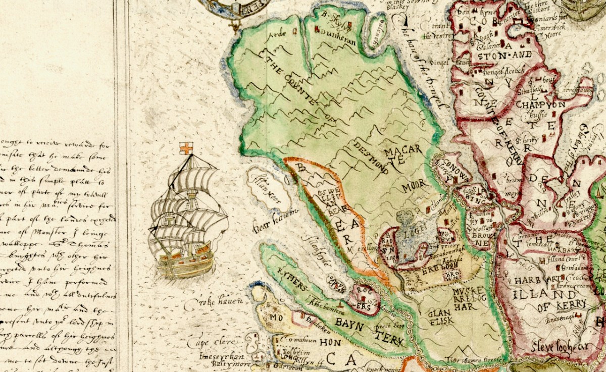
Honing in to take a closer look at the green area (below) labelled the Counte (County) of Desmond we see that the principal families names are Macarte Moor (McCarthy Mór)), who were the overlords of West Cork, and O’Swellivan Bear (O’Sullivan Bear) on the south coast. Below is Donal Cam O’Sullivan Beare – the very man named on the map – read more about him in An Excursion to Dunboy.
Bere Island is Illan Moor (Illaun Mór, which is its traditional name – Large Island – as it is, in fact, Ireland’s largest island). Whiddy Island is called Illanfoyde, and is assigned to the O’Sullivans. All around Bantry is assigned to Rogers, a completely unfamiliar name, although one of our commentators last week noted that there is a strand there called Roger’s Strand!
That whole green area is odd, though, isn’t it? In fact, the Beara and Iveragh Peninsulas are shown as one large landmass, with the Beara marked off by an orange line. Here is the surest evidence we have that this map was not drawn on the ground (or by sea) using actual observations and measurements. The coasts and hinterland of both these peninsulas must have presented formidable obstacles to cartography and reminds us that mapping was a dangerous profession in Elizabethan Ireland.
The dangers are starkly revealed in an account by the Attorney General who related that Richard Bartlett, ablest of all the Queen’s Anglo-Irish cartographers, was beheaded in Donegal in 1609 “because they would not have their country discovered”.
And if it wasn’t the natives, then it was the arduous work of surveying these wild lands that challenged the map makers. This was highlighted by the story of Robert Lythe, an English military engineer who almost went blind and lame while serving in Ireland from 1567 to 1571.
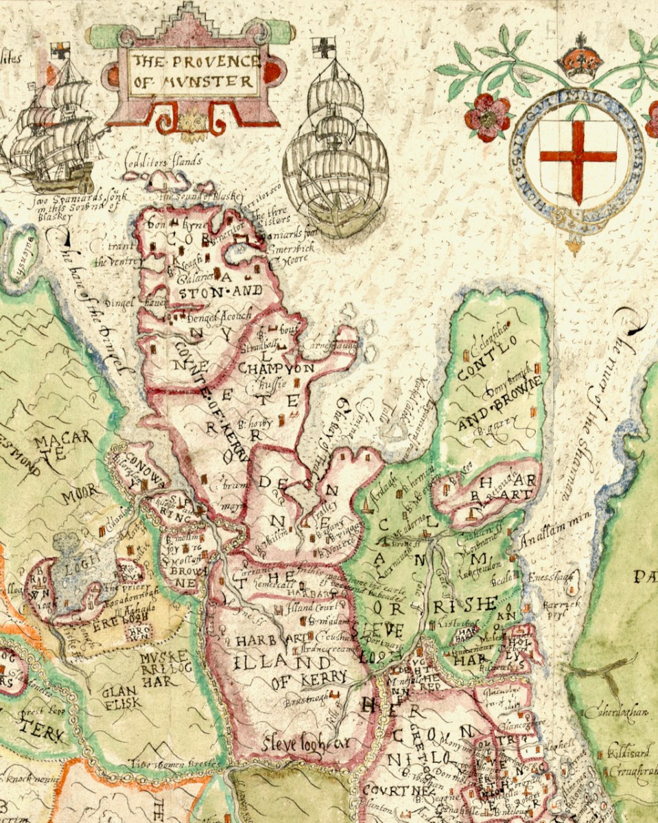
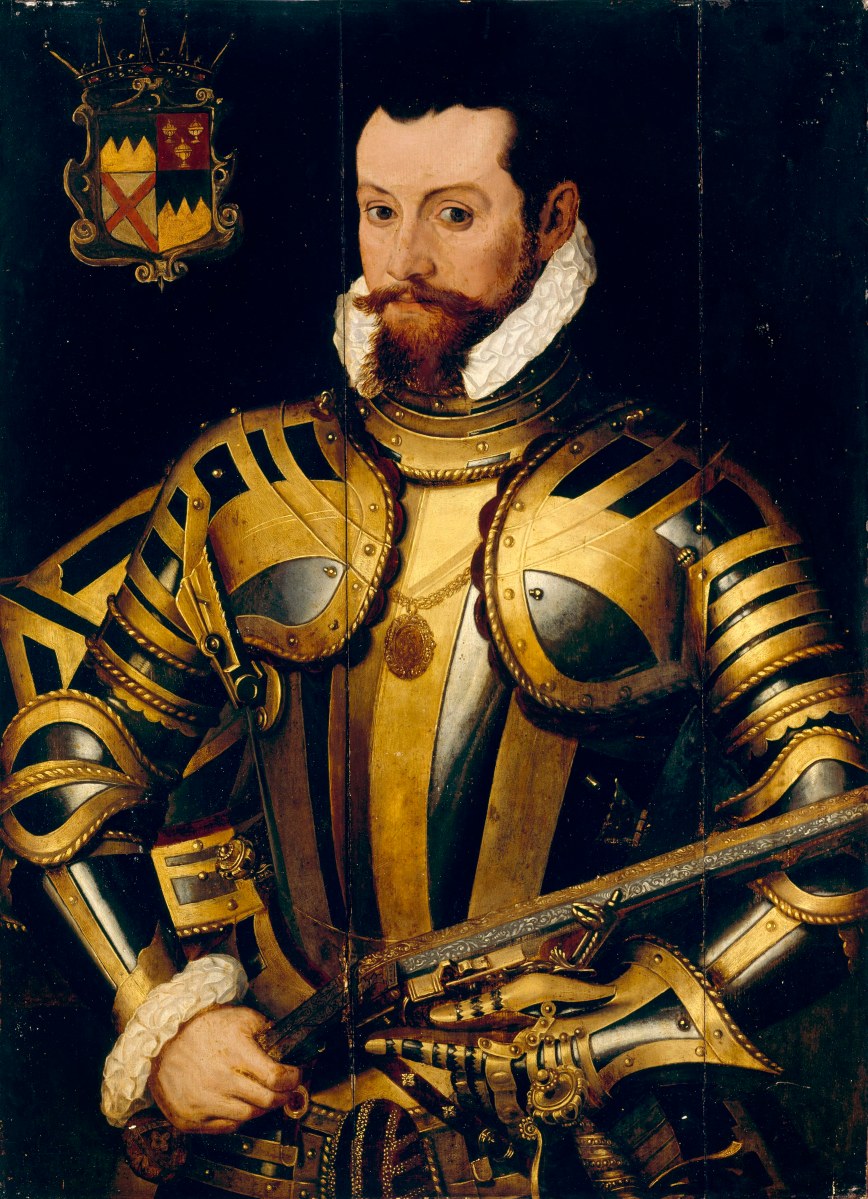
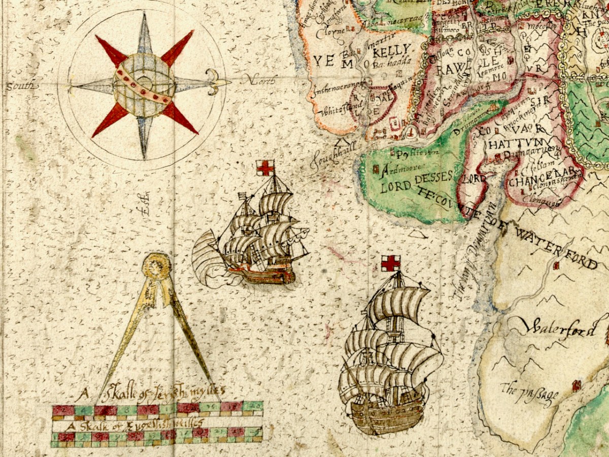
Dingle (in red), however, is a different matter – it has assumed outsize proportions, probably an indication of its importance in the Desmond Rebellions. There are many more place names on it than there are on the green mass. Ventry and Smerwick Harbours are indicated since both were important sites of resistance in the Desmond Rebellions – the barbarous massacre of Spanish and Italian allies at Smerwick was one of the decisive acts in the war, and involved such luminaries on the British side as Black Tom Butler, Earl of Ormond (below), Walter Raleigh and Edmund Spenser. Ventry was where the English troops entered the peninsula.
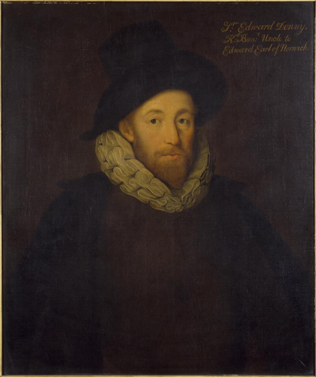
The Bay of Tralee is noted and the area around it is labelled DENE – this refers to the lands granted to Sir Edward Denny (below). I have written about the extraordinary story of the Dennys and their tenure in Tralee – a story that culminated in Ireland’s Newest Stained Glass Window. And by the way – can you see Sliabh Luacra at the bottom of this section – the home of a distinctive tradition in Irish music.
Whew – better end there for today. As you can see. we have barely scratched the surface of what can be gleaned from this map. Perhaps we will revisit it in a future post – but for now I leave you with the tip of the Dingle Peninsula, slightly expanded from the lead image, so you can try your own hand at making out what an Elizabethan planter might have been vitally interested in.
I am grateful indeed to Michelle Agar, Cataloguer, Digital Collections, at the Library of Trinity College Dublin, who gave permission to feature the map from the Hardiman collection in this blog. Also to the kind office of Dr Áine Madden, Communications and Engagement Coordinator with the Digital Repository of Ireland at the Royal Irish Academy. The complete citation for the map is as follows: Jobson, Francis, & Manuscripts & Archives Research Library, Trinity College Dublin. (2021) The Province of Munster, Digital Repository of Ireland [Distributor], Trinity College Dublin, the University of Dublin [Depositing Institution], https://doi.org/10.7486/DRI.rb69b272p
*I am also grateful to the British National Portrait Gallery, who provide an easy method to use images from their collection under license, for purposes such as this non-commercial blog
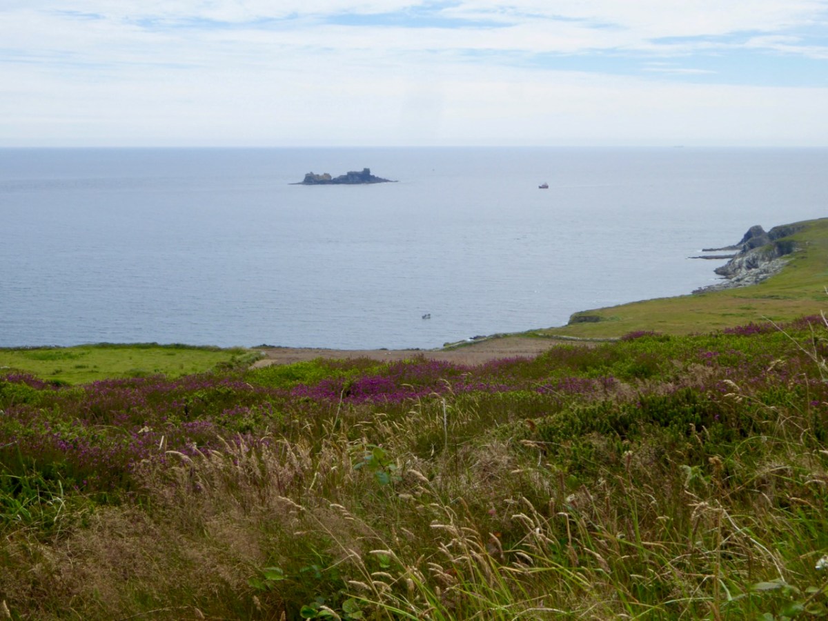
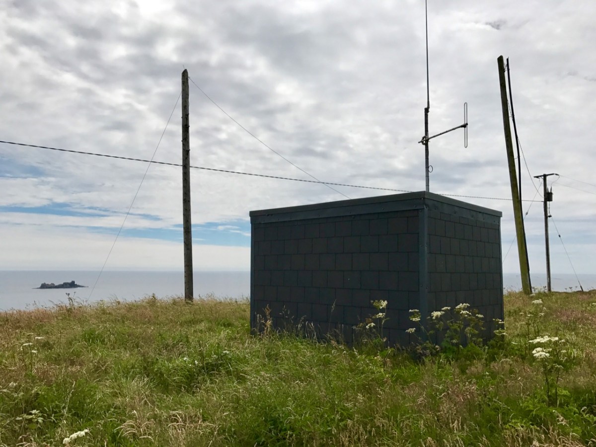
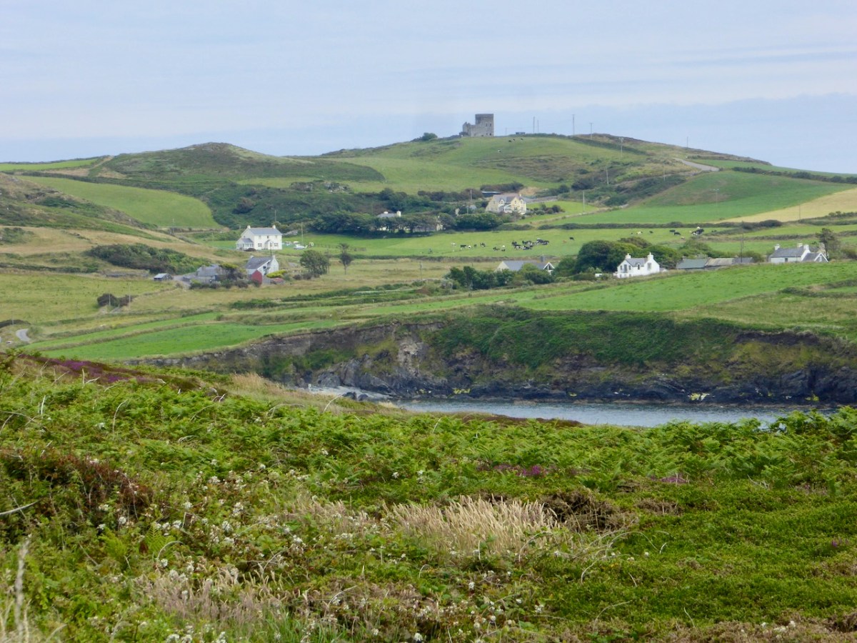
Here’s the latest episode in our series about Napoleonic-era signal towers in West Cork. There are links to the earlier posts at the bottom of this one. That’s Toe Head above – in the far distance, and that view is taken from the signal tower site at Kedge Point, Spain, to the east of Baltimore.
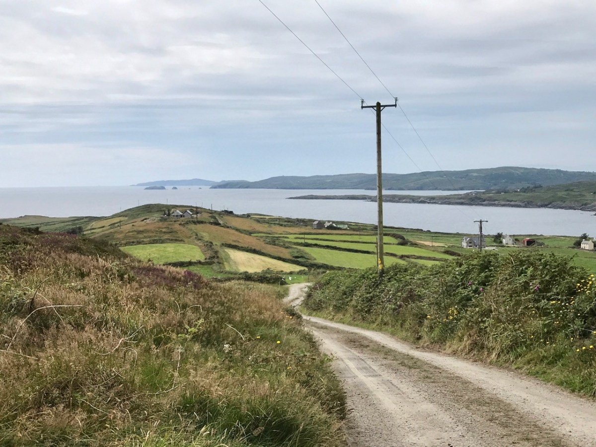
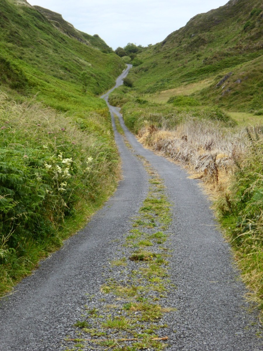
Toe Head itself is a spectacular setting in West Cork: the views, above, show the nature of the terrain, the boreens, and the seascape in the area. So far I have written accounts of nine signal towers: this is the tenth. I’d like to tell you how many of these structures are in West Cork, but that would mean that I would have to geographically define ‘West Cork’. I can’t do that, as there is officially no such area: we are all part of County Cork! All I can do is to let you know that there are nineteen signal tower sites located in the whole County. I have another nine to cover, after this one. But I assure you – Toe Head is definitely in our West Cork!!
Here’s the Toe Head tower – in a sea of black bales. If you have followed the series so far, you will have noticed that each tower is fairly basic, and generally offers the appearance of a medieval castle. But they were all built at the very beginning of the nineteenth century, to provide a system of surveillance and signalling around the coast of Ireland, from Malin Head in the north to Pigeon House Fort, Dalkey, on the east coast. Each signal tower is within view of one – or two – others, depending where it lies on the chain. In the first post in the series, here, I explain the logic and geometry of the project.
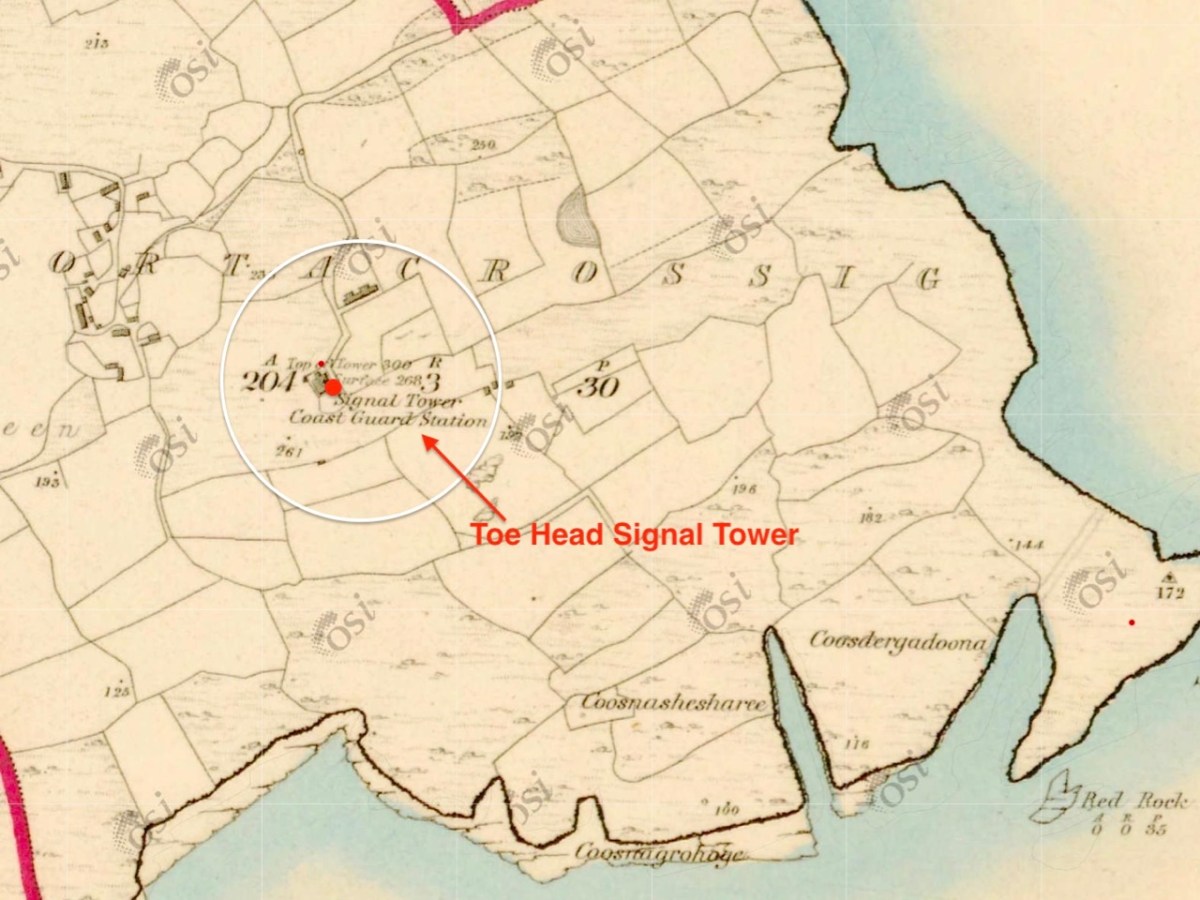
The 6″ Ordnance Survey map extract in the upper picture dates from 1842. By this time the use of the tower for signalling had ceased – the Napoleonic invasion threat lasted only through the first few years of the century: many towers became disused after this and some have vanished altogether, although many ruins do remain because of their remote locations. In the case of Toe Head, the building was adapted to incorporate a Coast Guard Station. I am assuming that, originally, the tower was a simple square structure , and the extension to the rear was added to provide additional accommodation for the Coast Guard service. The current aerial view shows newer farm buildings and an access road close by.
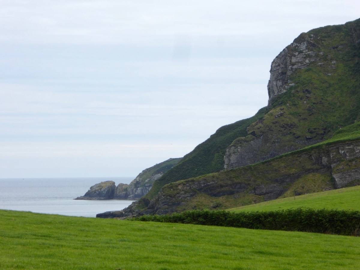
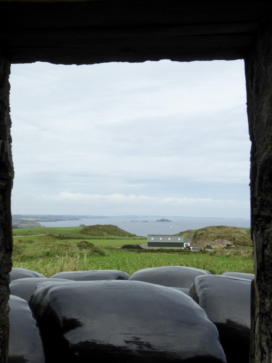
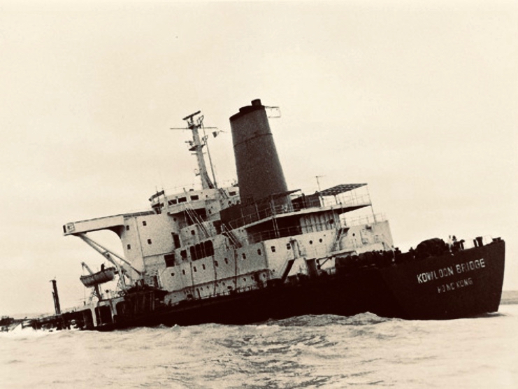
If you look at previous posts in this series, you will see that the Toe Head tower is architecturally simpler, with no bartizans or other ornamentation – it’s more like a small Anglican church tower than a ‘castle’. Like many others, it’s clear to see that this building was slate-hung: this form of weather-proofing was probably added at a later date – possibly when the Coast Guard service took it over. At the centre of the view from the window above you can see the Stag Rocks which in the 1980s became the graveyard of the 900ft long Kowloon Bridge, a bulk cargo carrier travelling from Quebec. The ship was disabled by a storm and then abandoned, drifting on to the Stags. A detailed account of the event was posted in the Irish Examiner 30 years later.
The abandoned Wreck of the Kowloon Bridge close by the Stags in November, 1986 (centre picture). The lower picture shows the wreck underwater today (courtesy Aquaventures.ie): she drifted out of control towards the rocks before running aground on the reef. The resulting fuel spill spread out over the Irish coastline causing extensive damage to local wildlife, and financial losses for the local fishing fleet. Apparently, no-one was ever held to account for the environmental disaster.
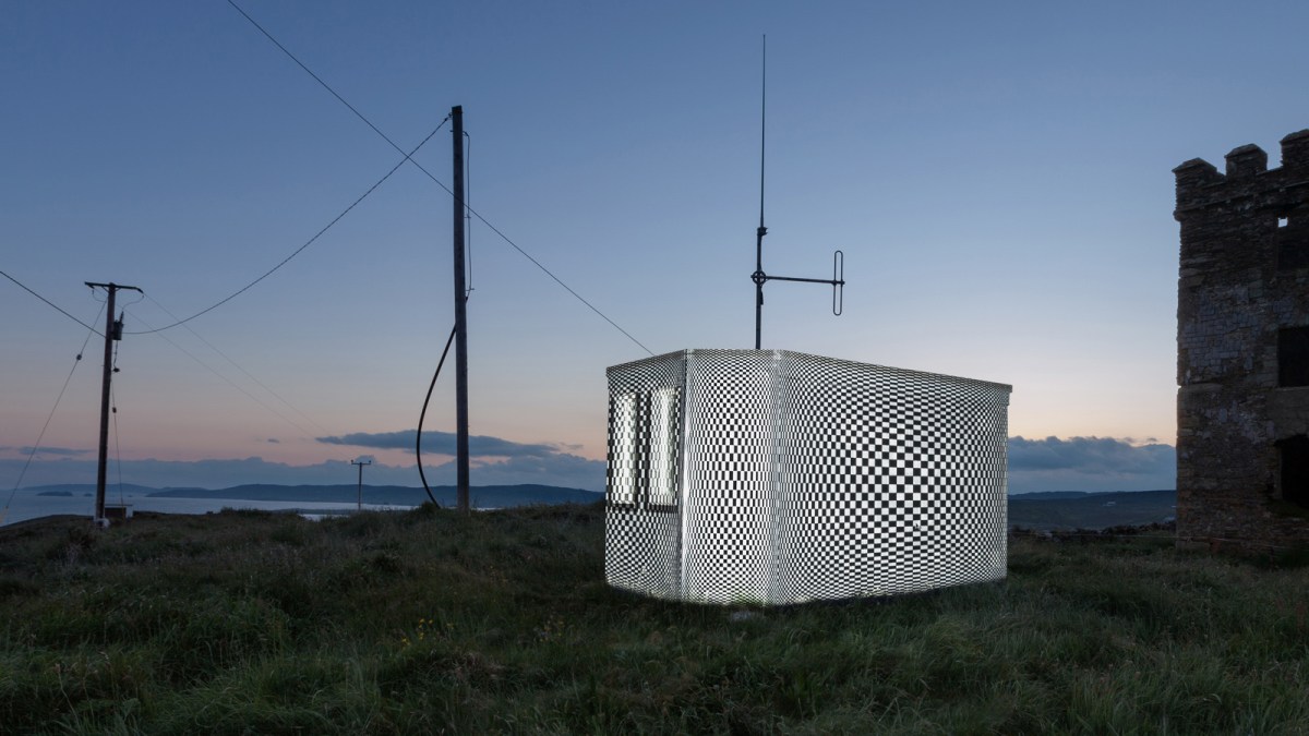
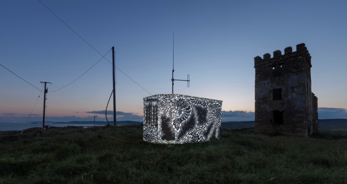
The Stag Rocks can be seen in my picture above, which shows the current incarnation of a World War II Lookout Post that was put in place close by the older signal tower in 1942. You can read more about these lookouts in this post: they were designed by Howard Cooke RIBA of the Irish Office of Public Works at the outbreak of that war (during which Ireland remained neutral). I mentioned in that same previous post an art installation project carried out in 2014 by Tim Schmelzer of Vienna. His work at Toe Head is particularly impressive, and here are some still shots to illustrate the nature of the artworks, which were created on-site using high-powered projection equipment.
The signal tower ruin today is gaunt and desolate. Nevertheless it’s an atmospheric place to visit. On the slopes below the building is an EIRE sign (officially number 28), also dating from the World War II years, when Irish neutrality had to be spelled out to the warring powers flying overhead. I came across an interesting comment from Anne Wilkinson in 2018, giving a slightly different take on the EIRE signs:
. . . These EIRE signs were also to alert German Pilots and crew who were conscientious objectors and who had overflown the UK, to ditch and parachute to safety. Many airmen lived at the Curragh Camp. They were allowed freedom during the day, eg. they often cycled the lanes and roads to enjoy the peace and quiet and then returned to the Curragh Camp for their curfew hour . . .
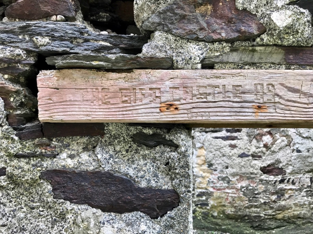
And here’s a little enigma to finish off the post (above). It’s graffiti carved on a timber lintel over one of the openings of the signal tower buildings. It’s probably quite recent – dating from ’89 or’99 – but what does it spell out? And why is it here? It’s tempting to say THE GIFT CASTLE but that ‘T‘ after the GIF doesn’t ring true . . . There’s a story there somewhere: perhaps one of our readers can give us a clue! Finally, here’s a distant view of the signal tower, looking across Toe Head.
The previous posts in this series can be found through these links:
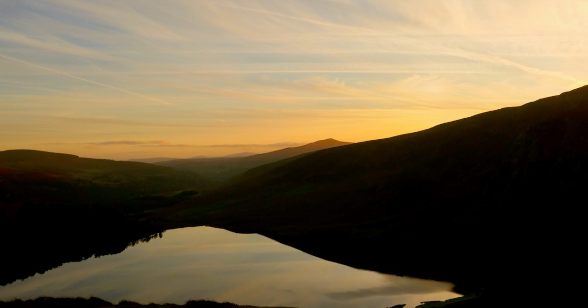
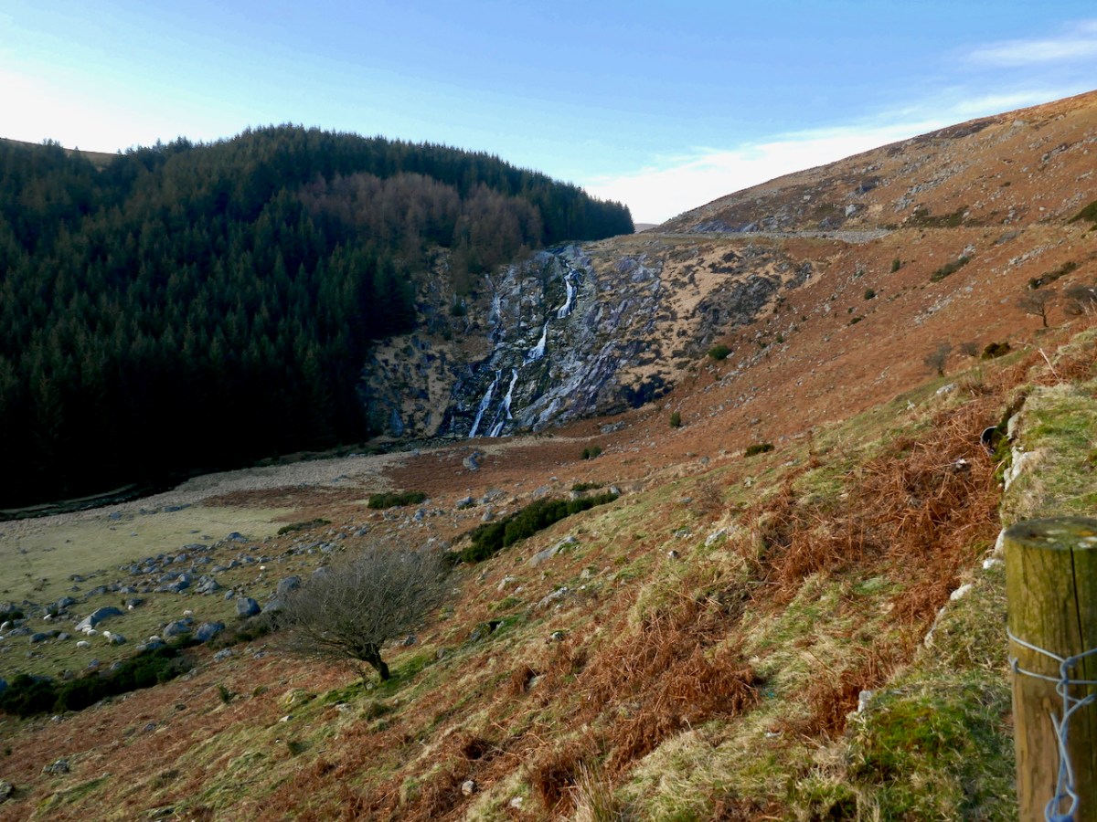
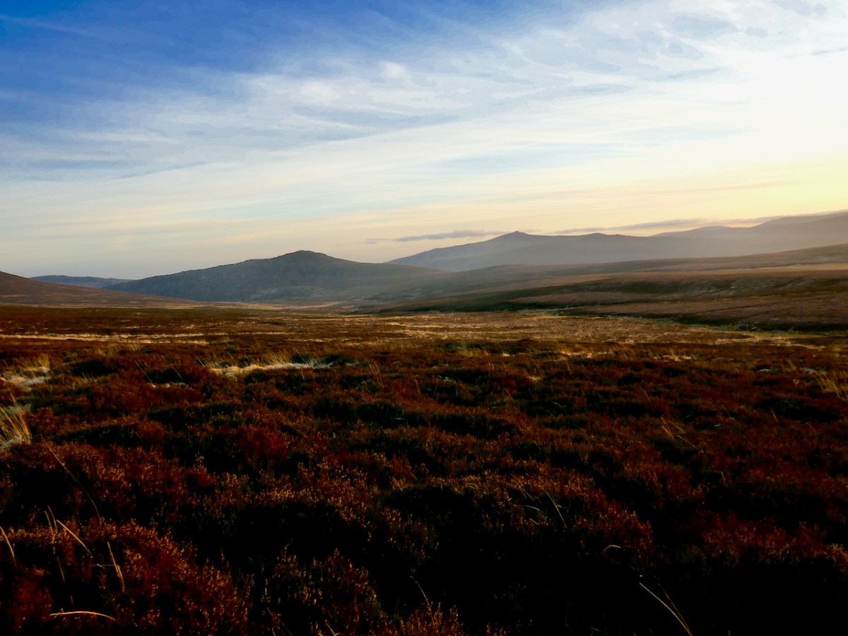
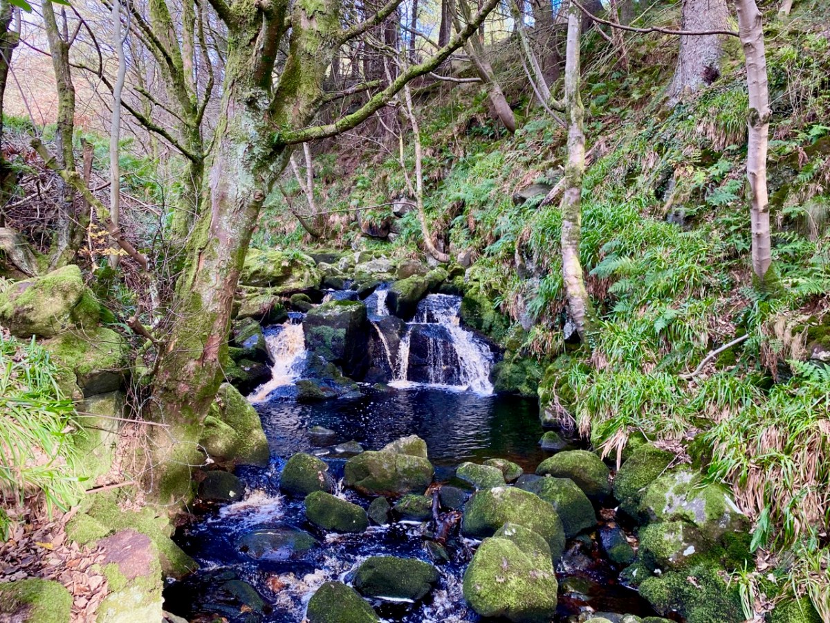
On our most recent trip to the east of this beautiful country – County Wicklow – we experienced the first snows of winter lining the edges of the remote roads that penetrate the mountains here. It’s a magnificent although often bleak wilderness: immersed in such vast, empty tracts of moorland you feel as far away from the civilised world as you can get without leaving these shores, yet Dublin city itself is just a stone’s throw distant – another of Ireland’s remarkable idiosyncrasies.
The 1790s was an era of conflict and change across the western world. News of independence in America and revolution in France inspired Catholic and Presbyterian communities in Ireland. In 1791, the Society of United Irishmen was founded, with the hope of uniting all religious persuasions in pursuit of Irish independence. In the late 18th century, the wild, inaccessible Wicklow mountains provided ideal shelter for insurgent groups who set out to disrupt British and loyalist forces. The deep valleys and fast strongholds of the natural terrain hid rebels from reprisals long after the United Irish forces had succumbed in other areas of the country. This group of ‘outlaws’ was so troublesome that the authorities resolved to forge a road across the impenetrable landscape:
. . . Construction of the road began in 1800 through parts of the county “infested with insurgent plunderers”. The road commenced from Rathfarnham in Dublin to Killakee and continued over the Featherbed Mountain to Glencree, where a major camp was formed. There were four work parties of fifty men each. Soldiers were paid a shilling a day and overseers earned five shillings daily; but very few local civilians could be induced to accept work and no “dependence” was placed on those that did . . .
The Sally Gap and Wicklow Gap roads built by the British are still the main roads through the Wicklow Mountains today. The network of military barracks that they link are still to be seen at Glencree, Laragh, Glenmalure, and Aughavannagh. Intended to stop local unrest, ‘Wicklow Military Road’ is today a scenic reminder of the dramatic events of that time.
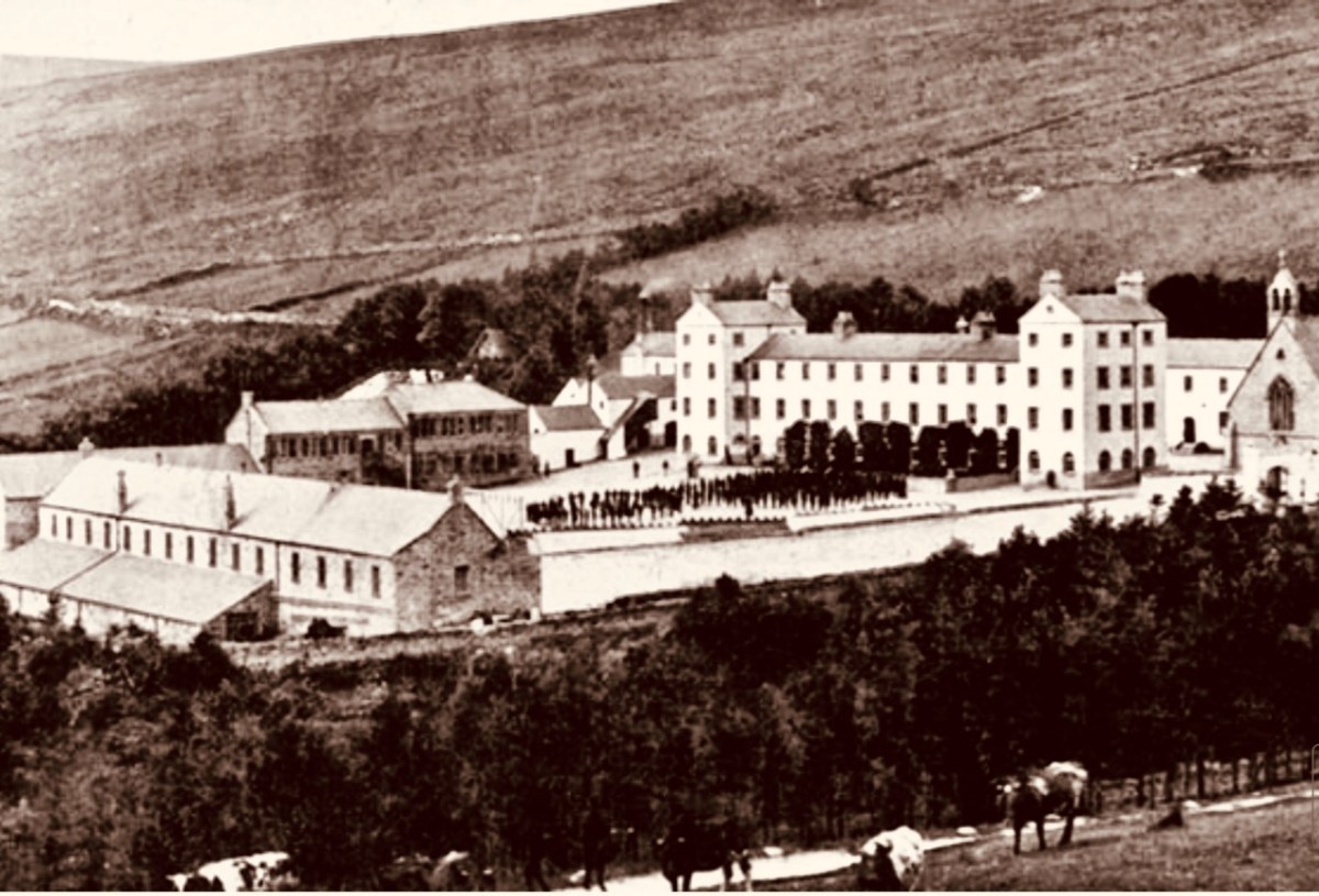
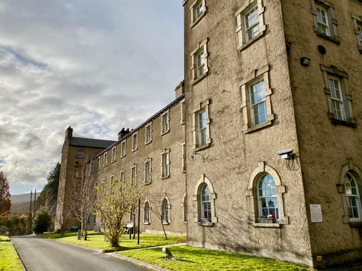
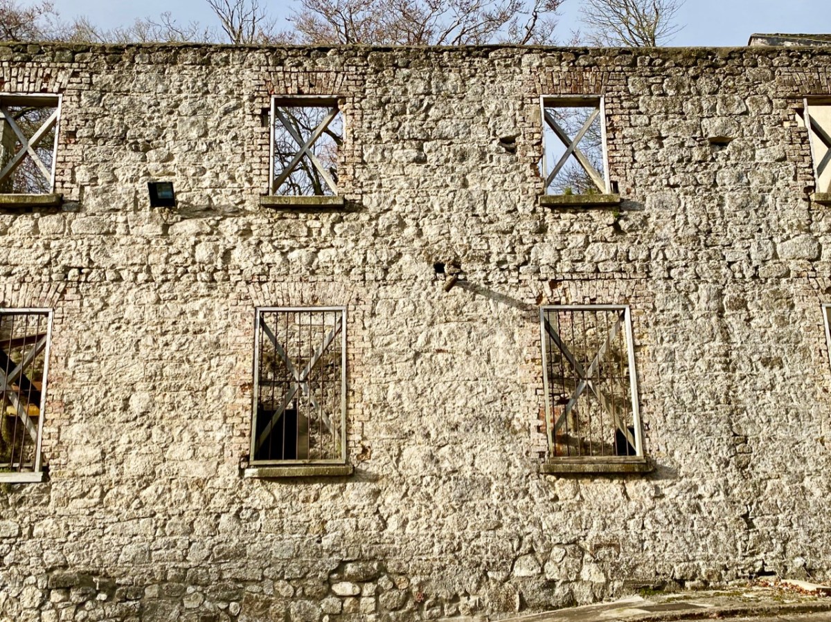
Built originally as a British Army barracks, the settlement at Glencree has gone through several mutations. This photo from the nineteenth century (above – courtesy Glencree.ie) shows St Kevin’s Reformatory, established on the site of the then abandoned barracks in 1858 and running through to 1940. One suspects it was a grim place: there are few records existing. It housed up to 300 boys.
Many of the buildings survive today, when Glencree has become the home of The Centre for Peace and Reconciliation. Founded in 1974 in response to the conflict in Northern Ireland, Glencree played an important role in the Irish Peace Process, bringing together those in conflict for confidential dialogue and helping to build relationships across divides. This Irish-based, independent, non-governmental organisation has evolved its expertise on a global basis, and this has been shared in more than ten conflict and post-conflict countries around the world.
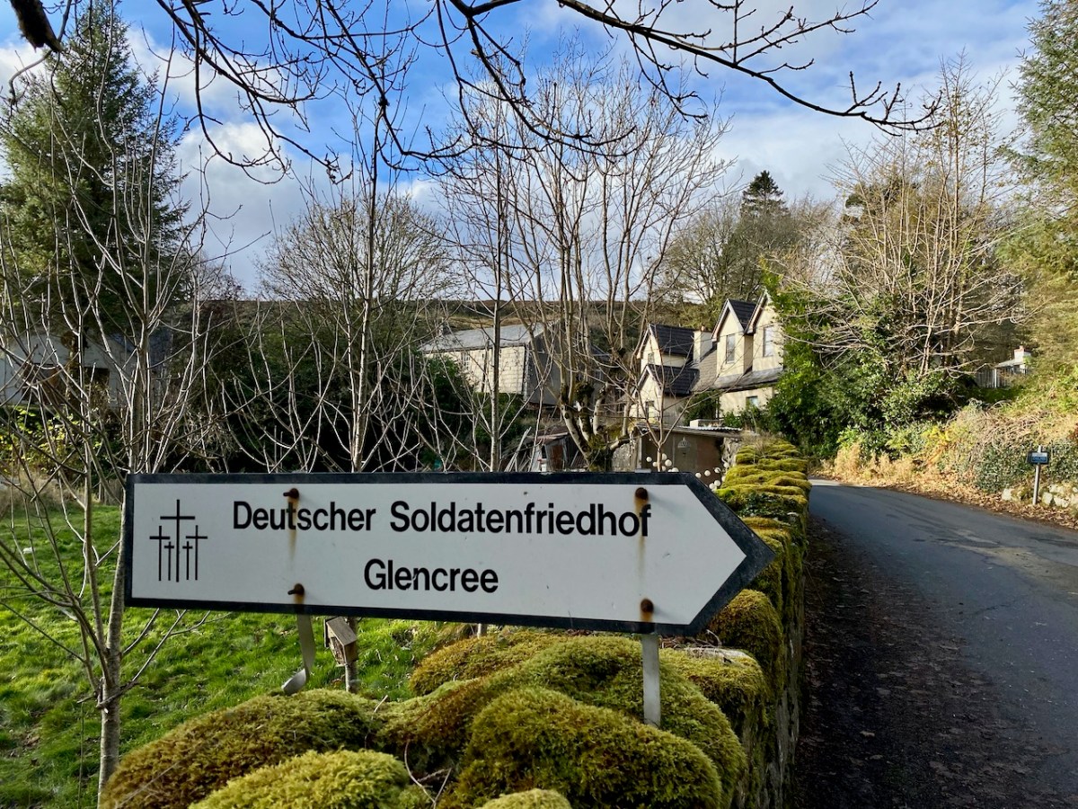
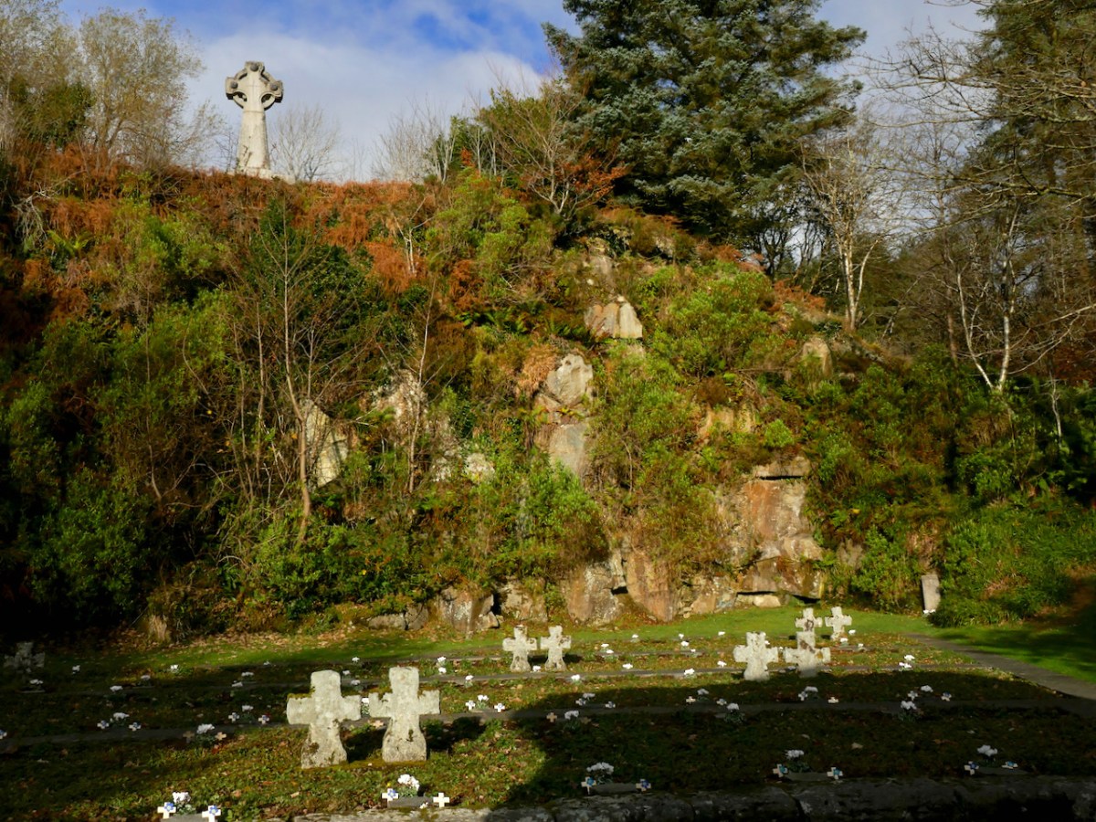
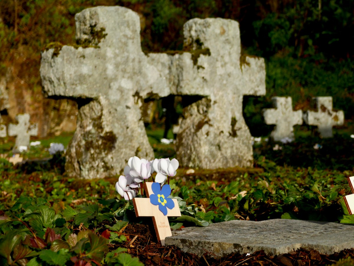
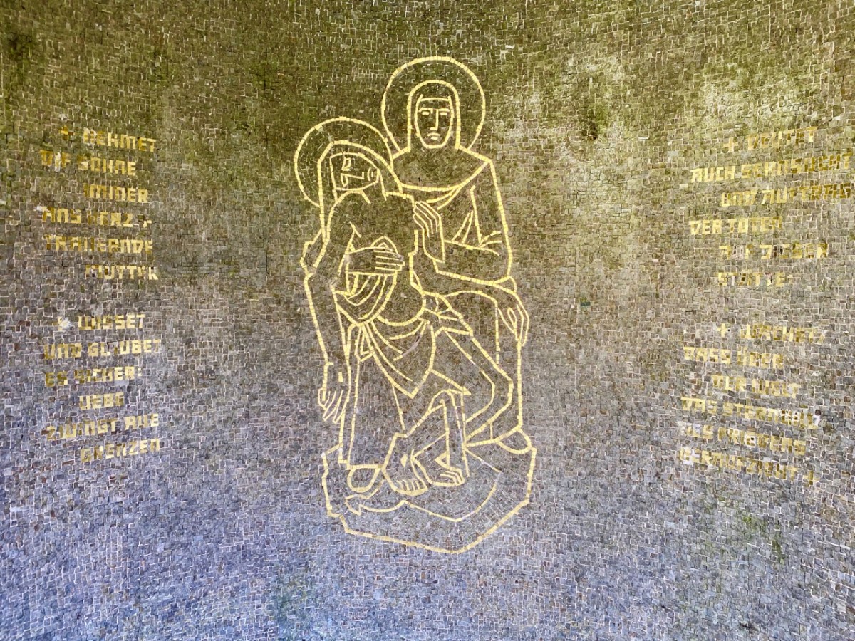
There is so much to discover in Glencree. You may be surprised – as we were when we first visited – to come across a German cemetery. Set in a landscaped former quarry, the German Military Cemetery is one of the many German war cemeteries in Western Europe. The bodies of 134 German military servicemen and civilians are buried here, dating from both World Wars. It is a secluded, peaceful garden of memory, marked by art and poetry, and kept in immaculate order.
You could ponder at length on this little graveyard: there are many historical connections. After the nearby Reformatory School closed, the buildings were used for a time as a refugee centre for German children following the bombing of Dresden in 1945. In 1954 the German Legation sent a letter urging the Irish authorities to give consideration to a single cemetery for German war dead in Ireland. These would include German soldiers and sailors washed up on Irish beaches, wrecked or crash-landed after being shot down during the Second World War. Six graves at Glencree remember German soldiers who died in British prisoner-of-war camps in Ireland during the First World War. All the bodies were re-interred here after this cemetery opened in 1961. In pre-Covid times, there would be a series of commemorative events in Glencree every November to pay respect to all victims of all wars.
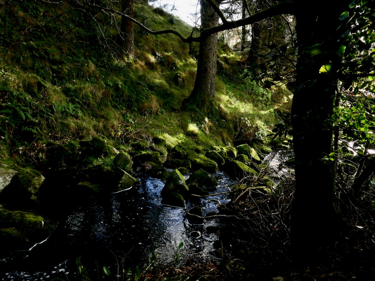
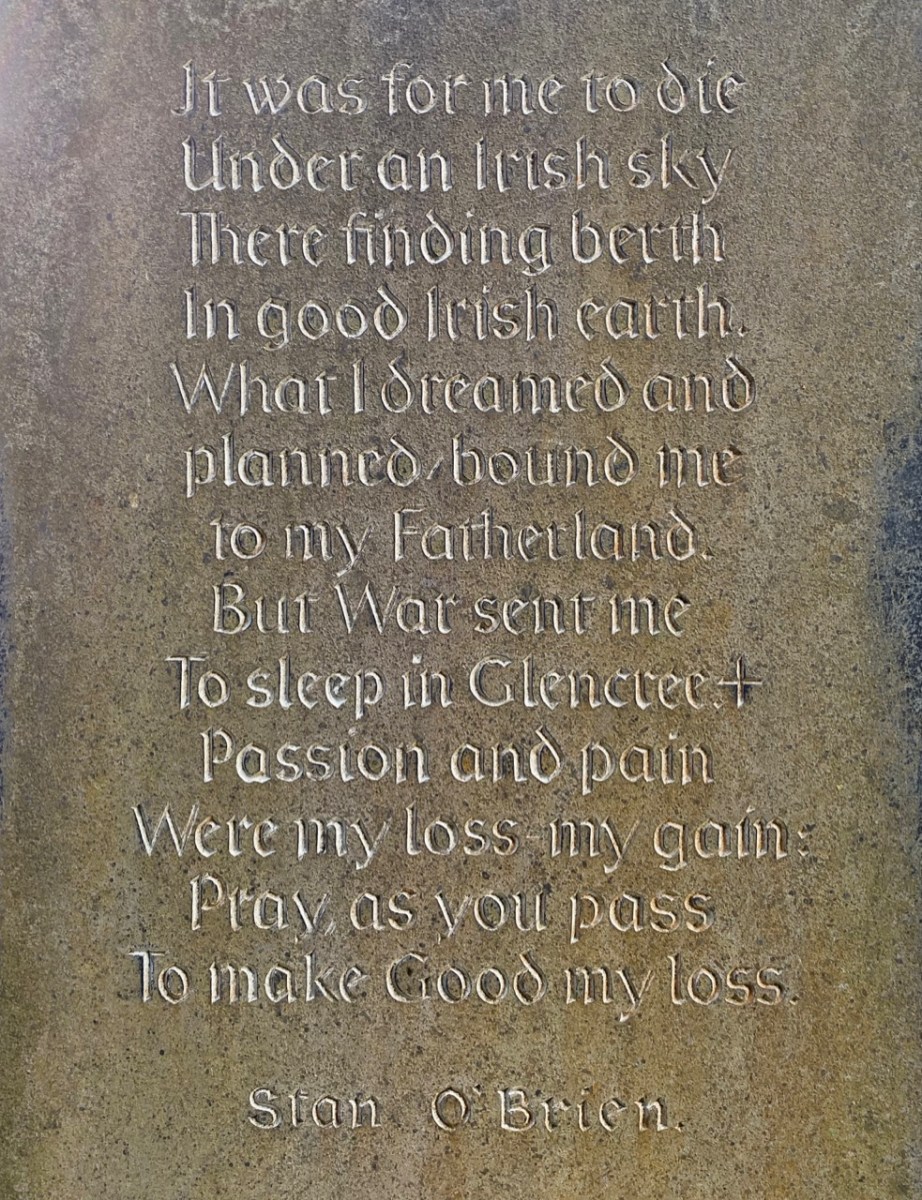
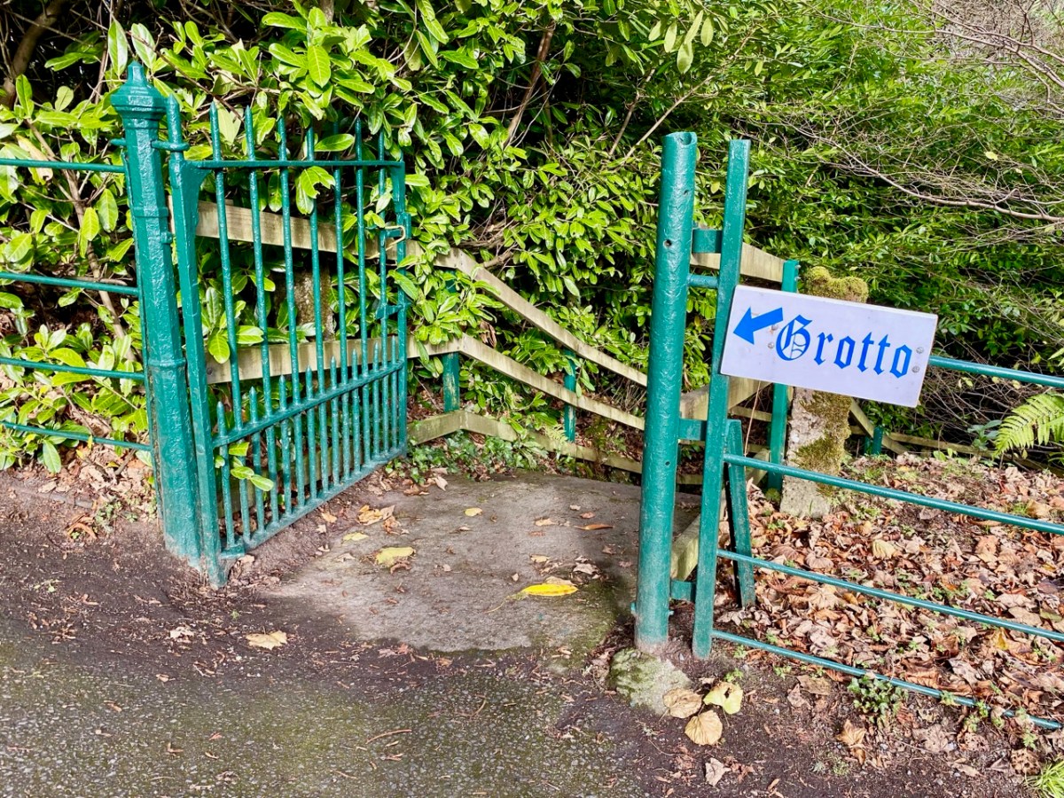
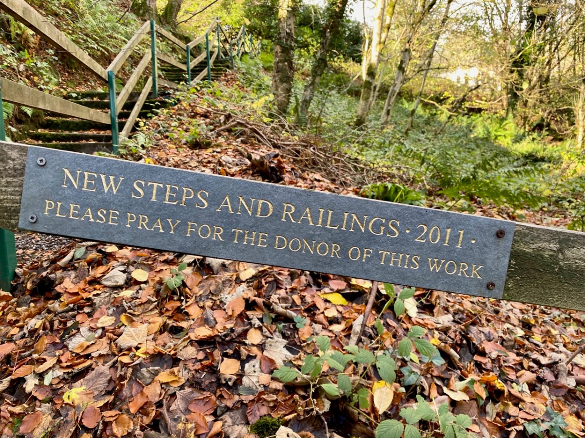
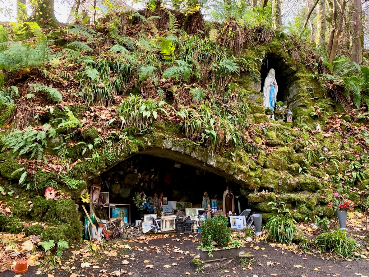
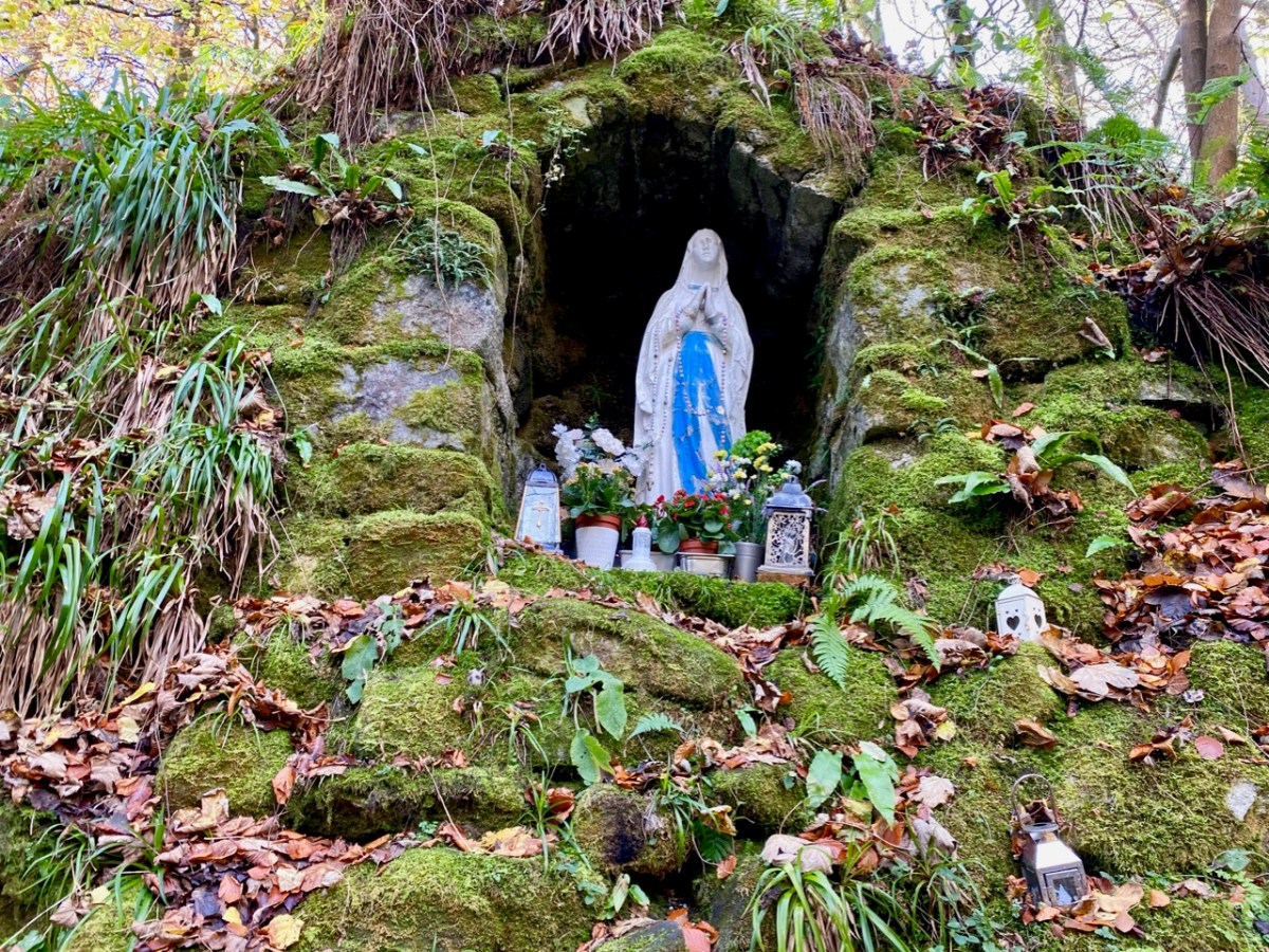
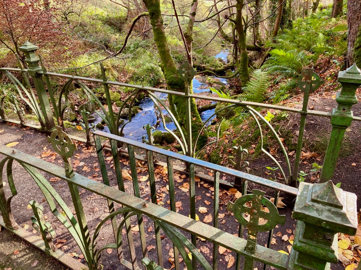
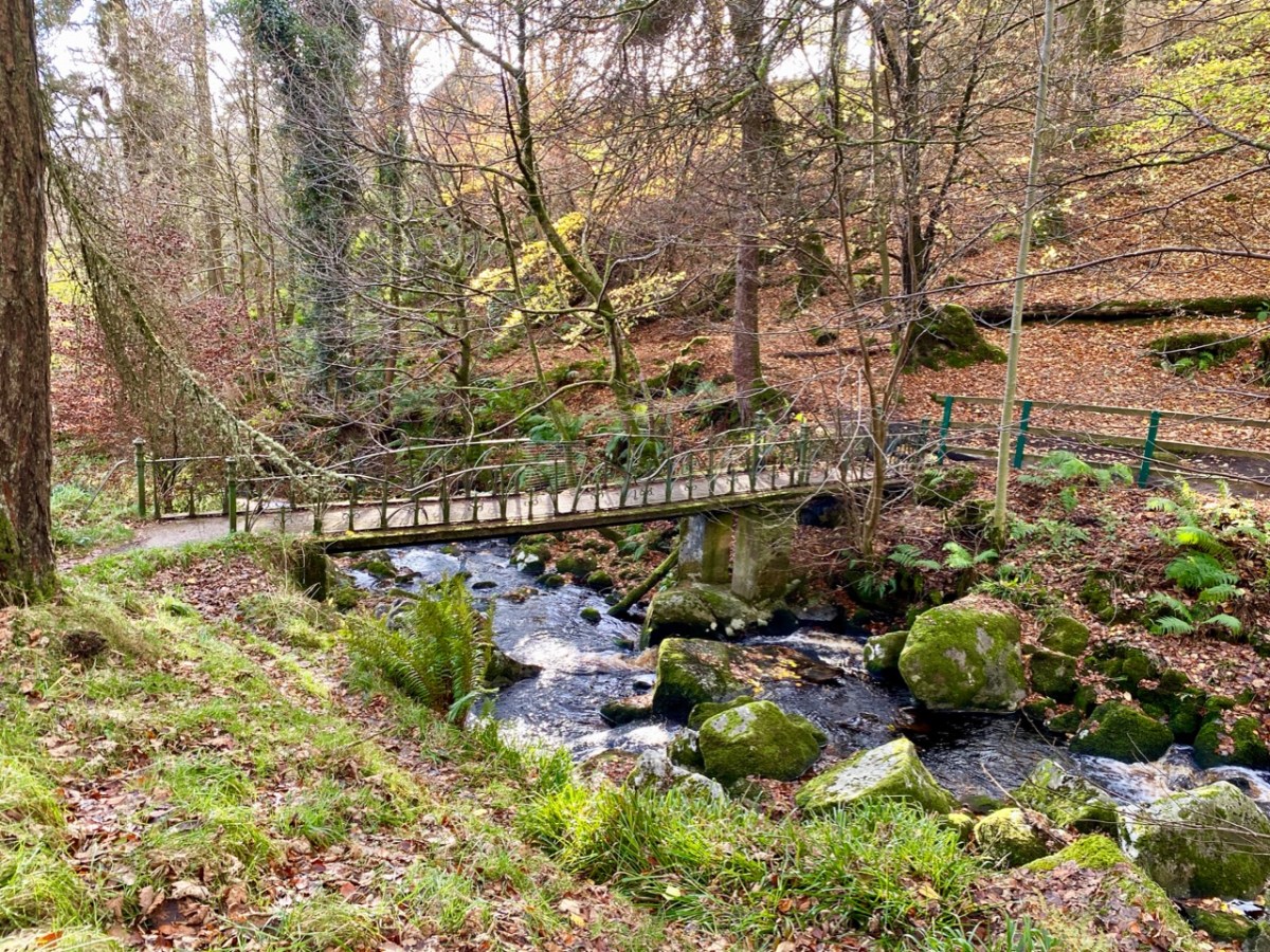
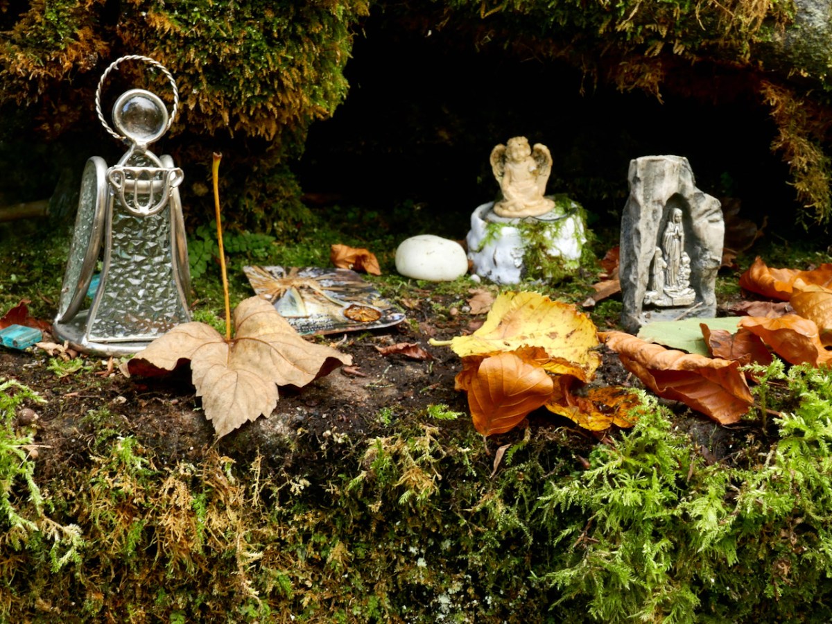
There is added interest, for us, at Glencree: a grotto established (as far as I can ascertain) in the Marian Year of 1954, dedicated to Our Lady of Reconciliation. It is reached from a path and steps which descend into the stream valley below the church.
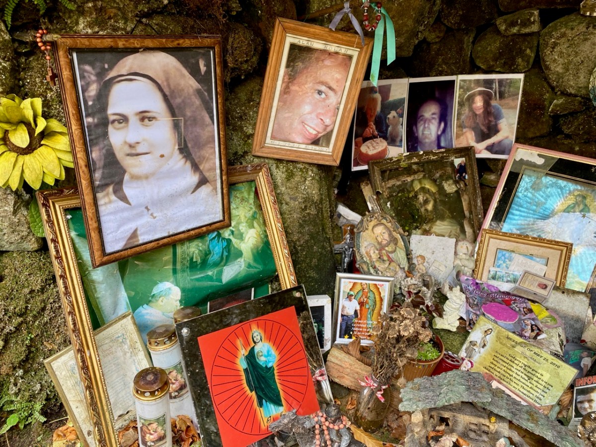
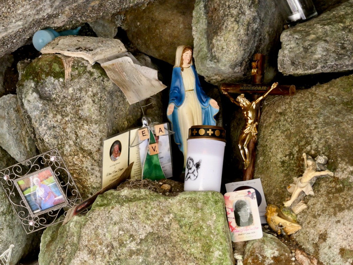
The ‘cave’ is much visited, and – as in many other locations in Ireland, particularly holy wells – petitions for the good health of individuals, and personal relics are in evidence.
Glencree is a place apart. You might, as did we, come across it by accident and get drawn into its many strands. You should certainly visit this secluded haven of tranquility in Wicklow, and consider the implications of its transition from a base of an occupying military force in a wilderness haunted by outlaws to a modern-day centre of reconciliation.
The sixteenth century was a desperate time in Munster. Two successive Desmond Rebellions (read about them here and here) had resulted in a devastated countryside where, according to the Annals of the Four Masters the lowing of a cow, or the whistle of the ploughboy, could scarcely be heard from Dunquinn to Cashel in Munster. The power of the FitzGeralds, Lords of Desmond, and their allies among the Gaelic chieftains, had been broken.
The Tudor government determined that what was needed was a complete colonising effort, that would bring the benefits of English civilisation to the lawless Irish. William Cecil, Lord Burleigh, set about planning the Plantation of Munster.
In June 1584, a commission surveyed southwest Munster, mapping out the lands belonging to a swathe of Irish lords associated with the rebellion, which were then granted to a small group of wealthy English Undertakers.
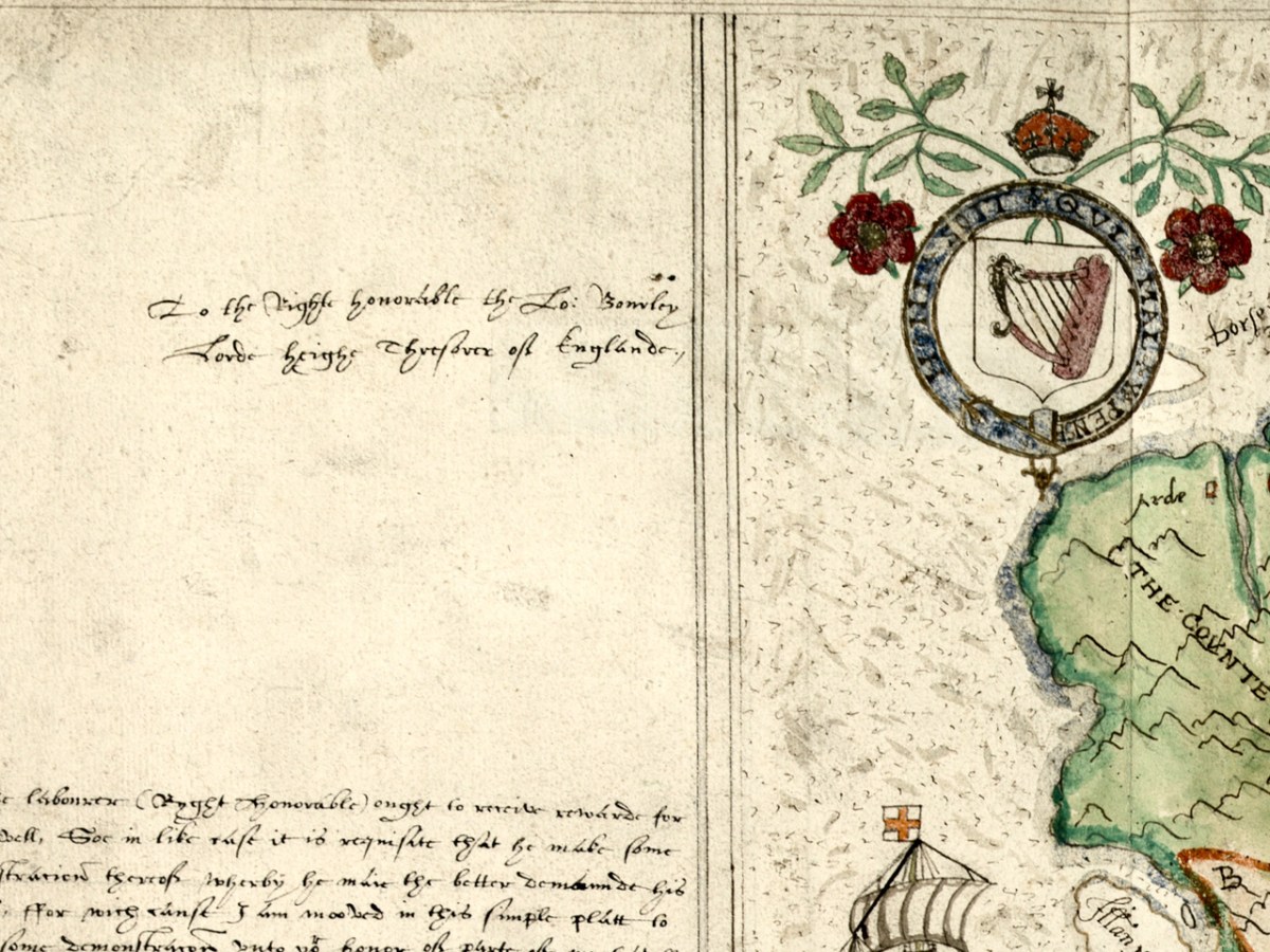
Jobson’s dedication – to the Right Honourable the Lord Burleigh, Lord High Treasurer of England
What a project like this needed, of course, was an accurate map and they were hard to come by in medieval Ireland. Francis Jobson, a free-lance cartographer, set himself the task of producing such a map, and in 1589 he inscribed this one, The Province of Munster Map (the subject of this post), to Cecil. The original is in the library of Trinity College and I have been given permission to use it in our blog (see end of post for complete citation.)
Jobson’s signature
George Carew, one of the primary planters, the first President of Munster, was a man who asserted he had an ancestral claim to large chunks of Munster. To back up his various claims, he collected papers and maps in support of the colonising efforts, and these maps later found their way to Trinity College in Dublin, to form part of a collection called the Hardiman Atlas, after the nineteenth century librarian who recognised what they were and bound them together.
The Province of Munster Map is but one of this collection, now digitised and available for viewing in theDigital Repository of Ireland. And an excellent job they have done of it – the high-resolution image is so clear that it allows us to zoom in and see lots of detail. Here is the complete map.
The first thing that strikes the modern viewer is that Ireland is on its back – that is, instead of north being at the top, west is. This wasn’t unusual for the time. JH Andrews, one of Ireland’s foremost cartographic historians explains it thus, With east at the bottom, Dublin, the Englishman’s point of entry to Ireland, is the point on the map nearest him. To provide a more normal orientation, I have turned the map sideways, below, so you can assess how accurate it is.
The task facing Jobson was to provide as clear information as possible for the colonising effort. Any kinds of fortifications, where the Irish could defend their territory, were important, as were transportation corridors, by sea, river or land, as well as barriers to movement, such as mountains or dense forests. Control of the fisheries had generated great wealth for the Irish chieftains so it was important to have details of coastal areas.
Speaking of Jobson’s Map of Ulster, Annaleigh Margey says
His maps are crucial to our understanding of England’s changing relationship with Ulster at the end of the sixteenth century. As the Nine Years’ War began, Jobson provided representations of the Gaelic lordships in Ulster, but also imposed England’s vision for the creation of a new county system onto the provincial landscape. In Jobson’s 1598 map, now at Trinity College, Dublin (p. 42), this framing of the new political geography is obvious. Throughout Ulster, the various Gaelic lordships are denoted by the lord’s name and a line defining their boundary. Settlements such as castles and churches that could be integrated into English settlement plans are displayed by small replicas in red across the map.
She could well have been speaking of the Map of Munster. The principal families and their territories are all presented, as well as their main castles. While West Cork is not rendered accurately, we can see what Jobson felt was important to include. The O’Mahonys (Mahound) are there and the castles shown for them are Dunbeacon, Rossbrin and Ardintenant, which is labelled C o mahoun, as befits the castle of the Chief (see my post on Ardintenant here). The whole of Ivaha (now the Mizen Peninsula) is assigned to Mohon (spelling was approximate in these maps) and Crookhaven is indicated, probably because it is an excellent harbour.
The O’Driscolls are shown at Baltymore, with Castles also on Sherkin (Ineseyrkan) and Cape Clere. The Ilen River is shown as the Ellyn ff (ff or flu is often found on old maps to designate a river). Interestingly, the whole of the Sheep’s Head has no detail on it and only one word – Rymers. The O’Dalys were the traditional bards of several Irish families and they had their bardic school near Kilcrohane – they are The Rymers! The Abbey in Bantry is noted (in fact it was a Franciscan Friary) – and even Priest’s Leap is on this map. Once the only land route between Bantry and Kenmare, it is now a steep, treacherous and extremely scenic back road.
We have only just started looking at this map. The next post will continue the journey. Meanwhile – have a look yourself and see what you can see. I have lots of questions about it – for example, about the scale that Jobson uses (above) – I am hoping our readers might have some answers!
I am grateful indeed to Michelle Agar, Cataloguer, Digital Collections, at the Library of Trinity College Dublin, who gave permission to feature the map from the Hardiman collection in this blog. Also to the kind office of Dr Áine Madden, Communications and Engagement Coordinator with the Digital Repository of Ireland at the Royal Irish Academy. The complete citation for the map is as follows: Jobson, Francis, & Manuscripts & Archives Research Library, Trinity College Dublin. (2021) The Province of Munster, Digital Repository of Ireland [Distributor], Trinity College Dublin, the University of Dublin [Depositing Institution], https://doi.org/10.7486/DRI.rb69b272p
I am also grateful to the British National Portrait Gallery, who provide an easy method to use images from their collection under license, for purposes such as this non-commercial blog
Since I decided to try to grow a wildflower meadow, I’ve been documenting the wildflowers on my one West Cork Acre each year. You can chart my progress by taking a look at One Acre, One Acre – One Year On, and One-Acre Three Years On. (Hmmm – what happened to Two Years on?)
I’ve found new flowers and learned something new each year and this year was no exception. I’ve set aside a portion of my garden as a perennial wildflower meadow. My strategy, based on my reading of best practice, is not to cut it until the autumn, and then cut and rake it once everything has more or less finished blooming. The raking is important, since leaving the cut grass fertilises the soil, and what you want in a wildflower meadow is soil that is as impoverished as possible.
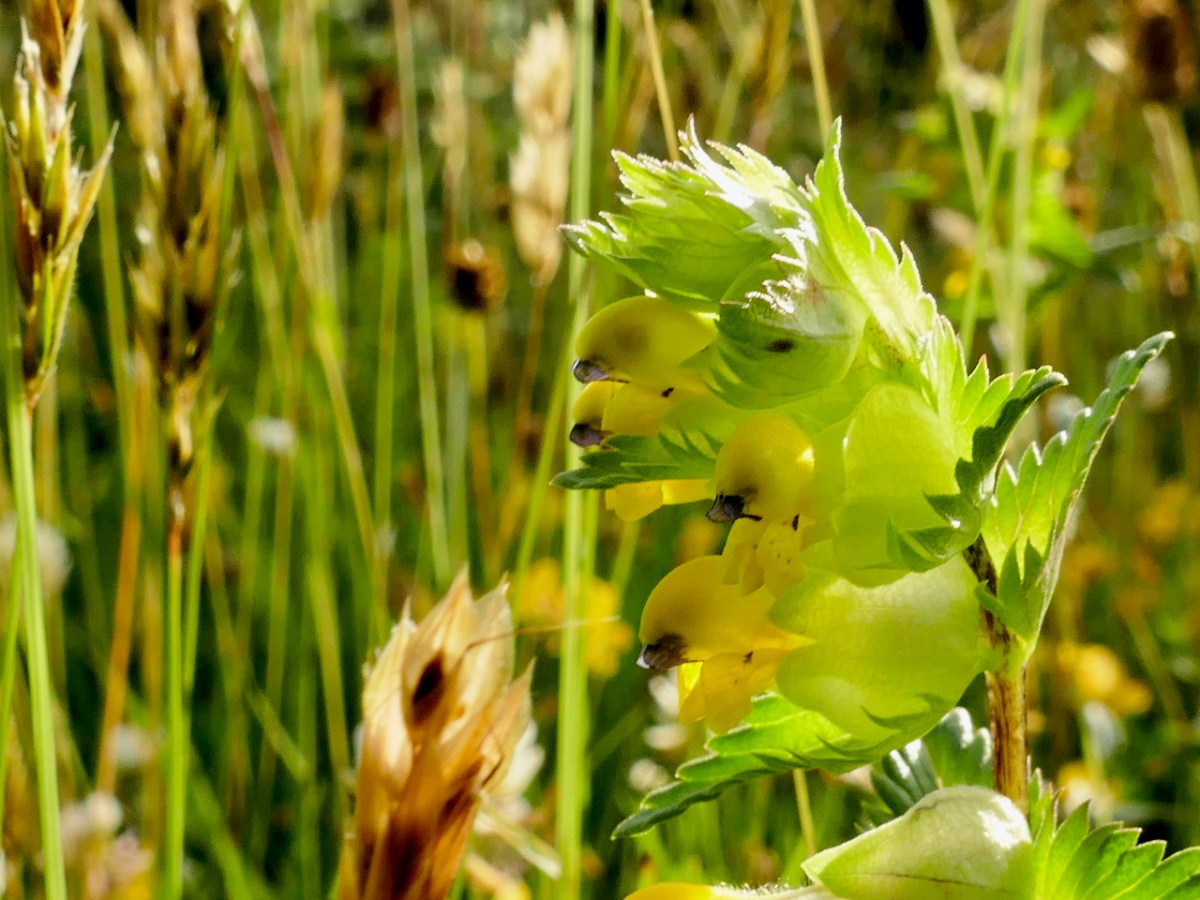
A perennial wildflower meadow is what happens when you provide minimal intervention – just sit back and let whatever comes up, some up. But when a lawn has had years of cutting, and the grass is thick, one intervention that is recommended is to scatter the seeds of Yellow Rattle (above and below), a native wildflower that helps keep the grasses sparse, allowing other flowers to gain a foothold among those thick, tough roots.
This year, the meadow flourished. The Yellow Rattle had seeded itself very successfully last autumn – so much so that I was wondering if I now needed to thin it a bit – oh the irony. Along came my young friend Niamh and patiently harvested as much of the seed as we thought she should. Some of it went to her house, and the rest I scattered an area of the meadow I seemed to have missed before.
The other thing that happened was that I discovered that bracken had invaded part of the meadow (above). Left unchecked, bracken will take over and choke out everything else. It’s an important plant in its natural habitat and provides food and shelter for several invertebrate species – but it’s vital to manage it in a situation like this, if you can. Niamh pulled out what she could and stamped down the rest. I will need to keep on top of this or my meadow will drown in bracken.
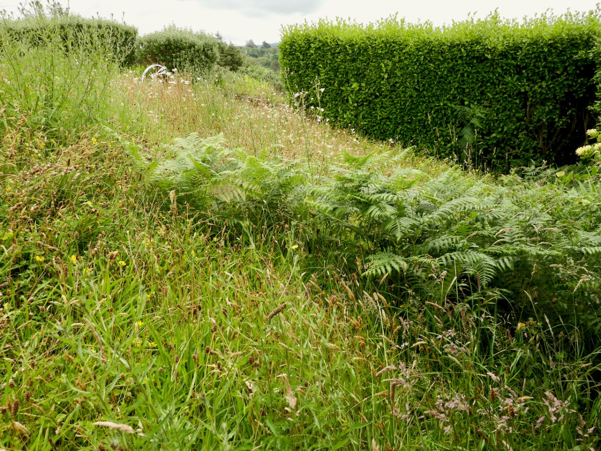
The wildflower meadow is only small one part of our One Acre. For the rest, I try to cut as little as possible and just about every day I wander around, trying to record what’s coming up. I was so entranced at what was happening in May that I made a little slideshow called Lying in the Grass. Here it is again – every single flower was photographed in one week in May this year, all on my one acre .
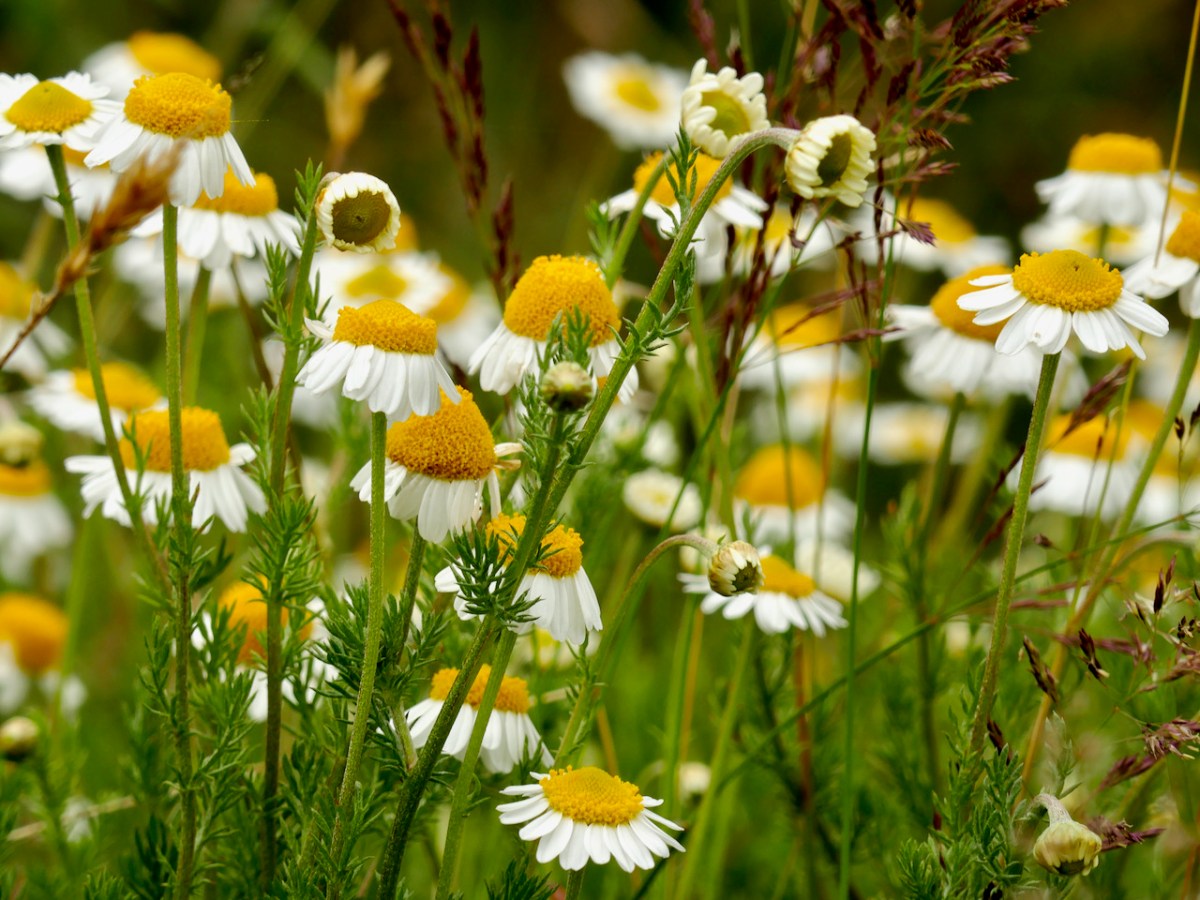
The months of June and July are the height of the wildflower season and all parts of the acre sprout flowering plants – the lawns, the stone walls, the hedges, the gravel driveway and the boreen that our neighbour uses to get his cattle across the top of our property – it’s where the Chamomile grows.
I continue to be delighted at what comes up all over our acre – the colour and variety is amazing, and I feel like I am doing my part for our pollinators. But mostly it’s just – beautiful!
Welcome to the UCD Library Cultural Heritage Collections blog. Discover and explore the historical treasures housed within our Archives, Special Collections, National Folklore Collection and Digital Library