We have received a unique and treasured gift – a sketchbook from the 1980s of prehistoric and historic sites around West Cork. It’s the work of our good friend, and national treasure, Brian Lalor, artist, writer and printmaker. For an overview of his style, check out the retrospective of his work at Graphic Studio Dublin. Or browse the long list of his books, including the magnificent Encyclopaedia of Ireland, which he edited.
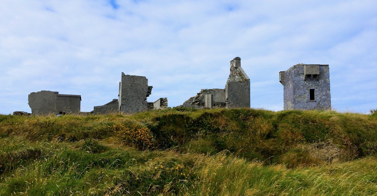
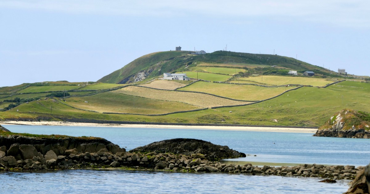
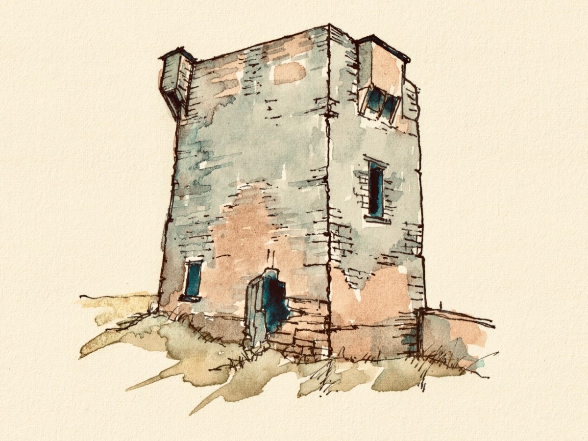
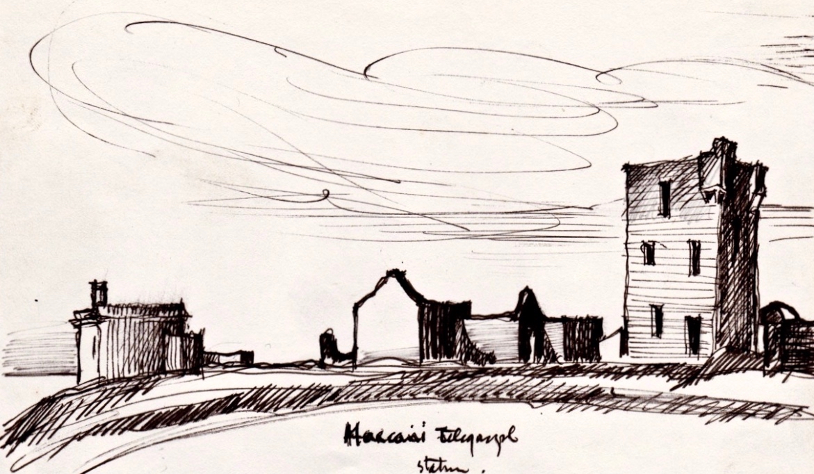
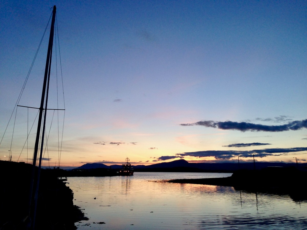
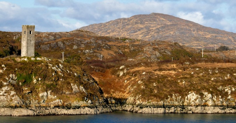
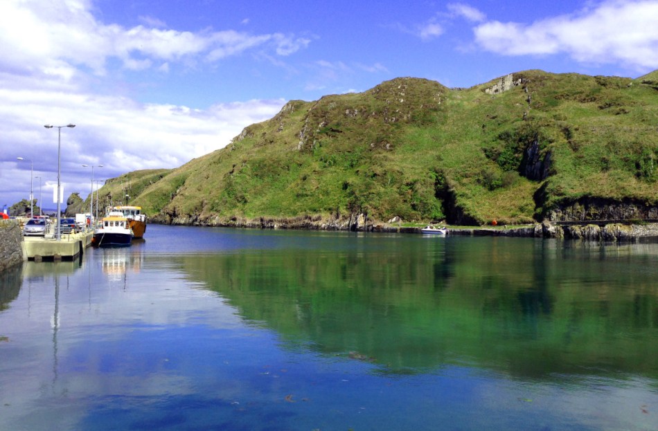
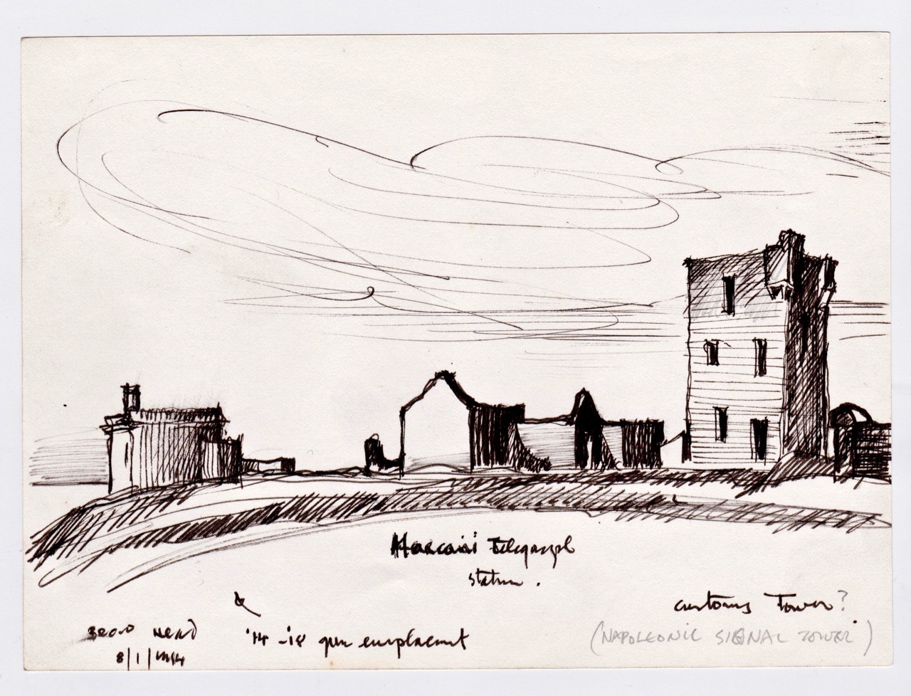
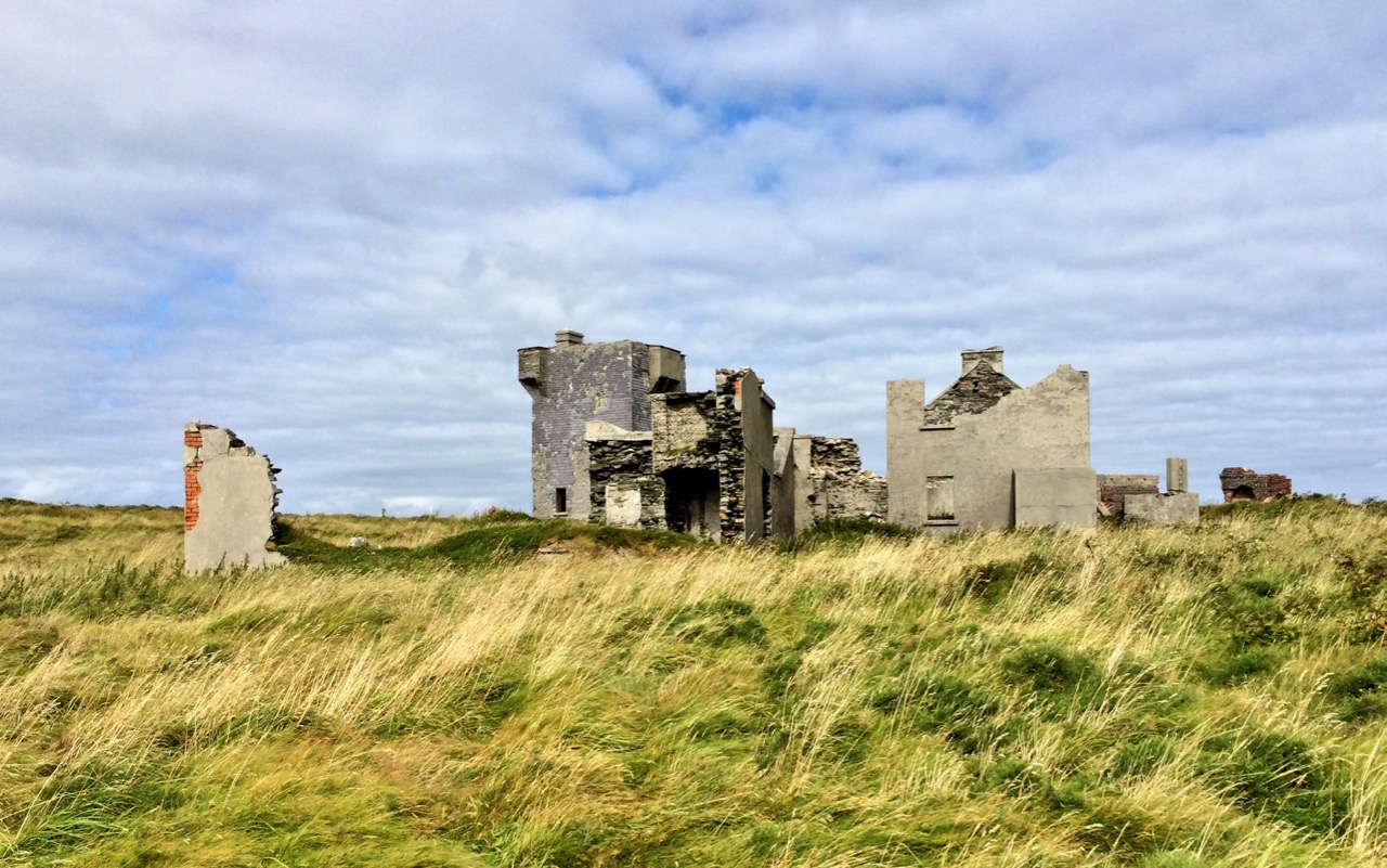
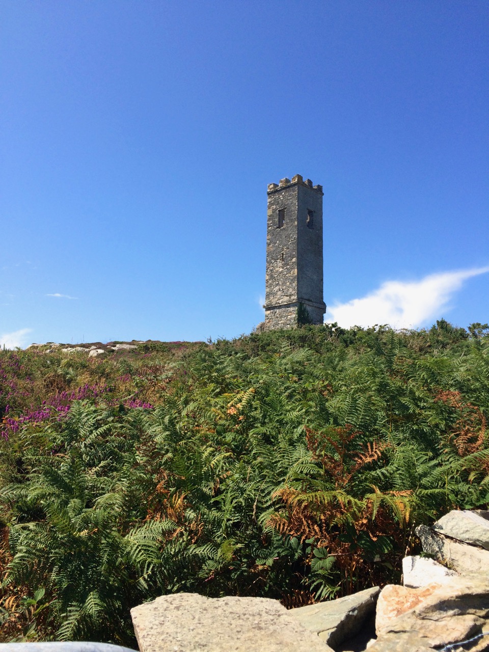
Brow Head: (above and below) on the right is the Napoleonic-era Signal Tower; the other buildings date mainly from the time of the Marconi Telegraph Station, taken from a different angle than the sketch above
Brian has studied both architecture and archaeology and to that adds the keen observant eye of the artist. As a result these sketches, although, as he explained, often hastily done during a brief visit to a site, are accurate, detailed and charming in equal measure. They were made on field trips with the Mizen Archaeological & Historical Society in the 1980s. This was an active society, publishing a well-regarded journal from 1993 to 2004 and leading regular field trips for members.
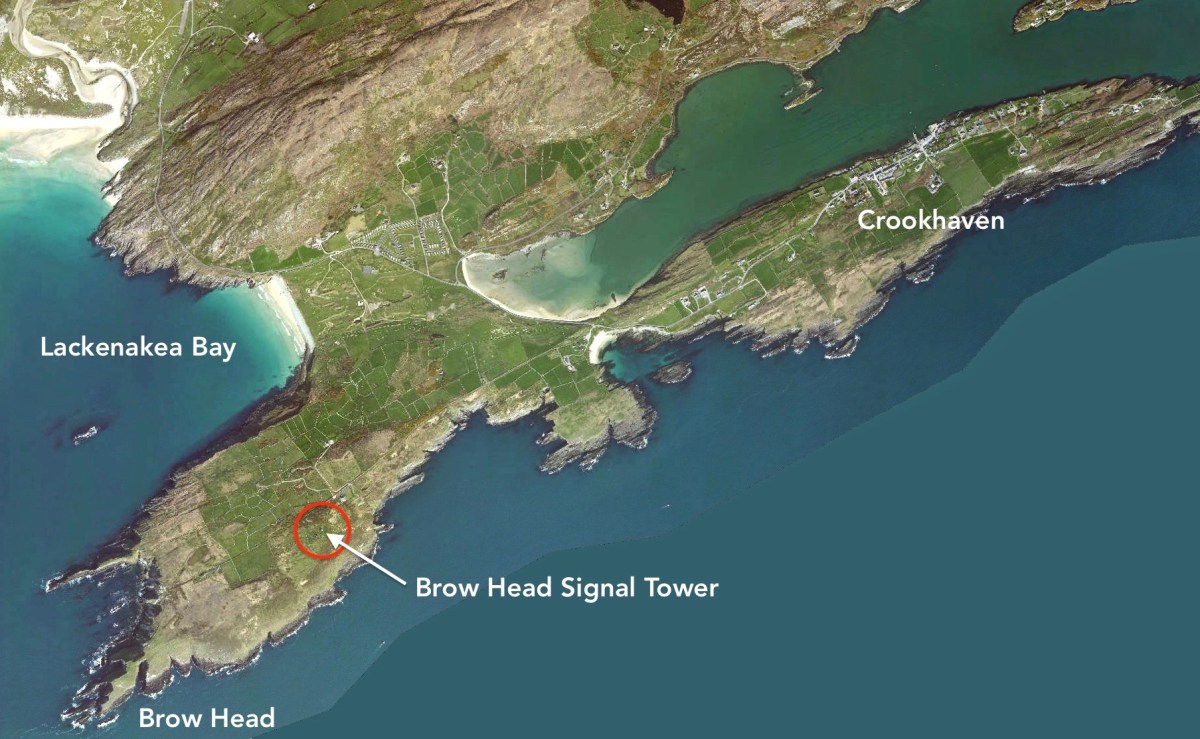
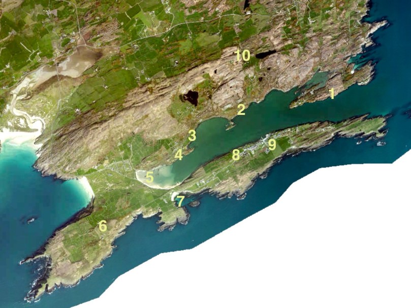
The sketches, just over 50 of them, were made for the most part between 1980 and 1987 so besides their intrinsic artistic value, they also constitute an important record of the state of the site 30 years ago, allowing us a comparison with its current condition. My intention is to visit (or re-visit) a lot of the sites, with his sketches in hand and show our readers both how beautifully Brian captured the structures or artefacts at the time and whether there are any changes visible from then to now. I decided to start with the Signal Towers on Cape Clear and Brow Head, and a third tower on Rock Island that may or may not be contemporaneous.
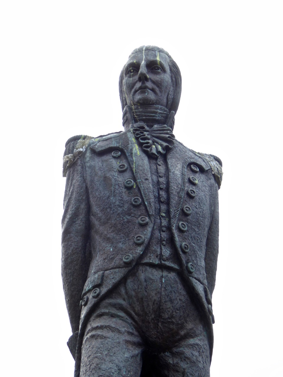
Theobald Wolfe Tone – detail of the statue in Bantry town square
In 1796 the French navy, partly at the invitation of Wolfe Tone and the United Irishmen, staged an unsuccessful invasion of Ireland, sailing into Bantry Bay. Several raids followed in 1798. Although all were quickly quashed, a panic about the possibility of a French invasion spread throughout Britain and Ireland. A series of Napoleonic-era fortifications and viewing towers were constructed around the coast in locations with panoramic views, and within sight of each other, to spot foreign shipping activity and raise the alarm. On the east coast, these mainly took the form of Martello Towers and were stocked with heavy armaments, but here in the south west defensible Signal Towers were built not to house artillery but as advanced-warning stations. Here and there they were complemented by batteries and other fortifications – but that’s a story for another day.
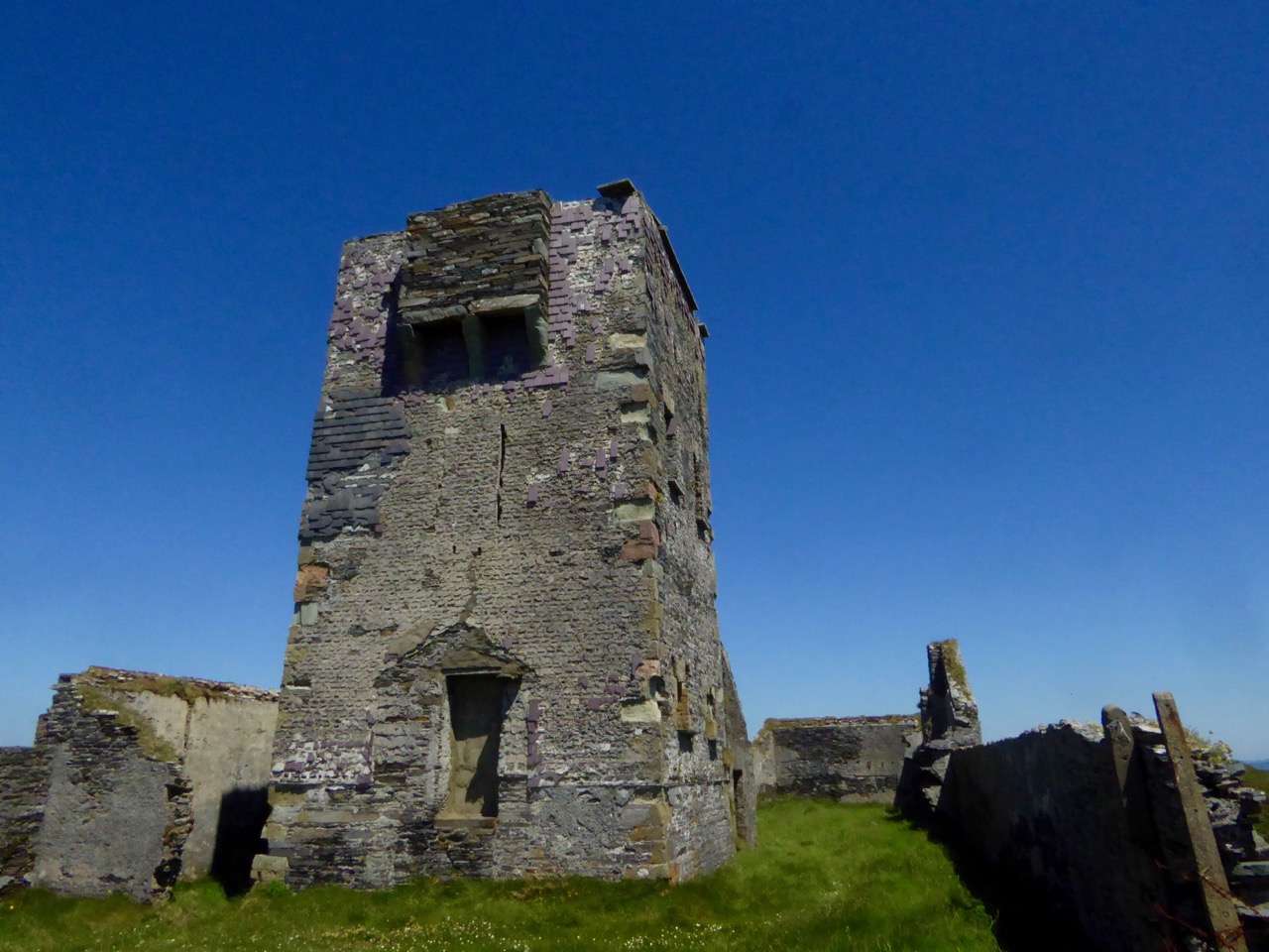
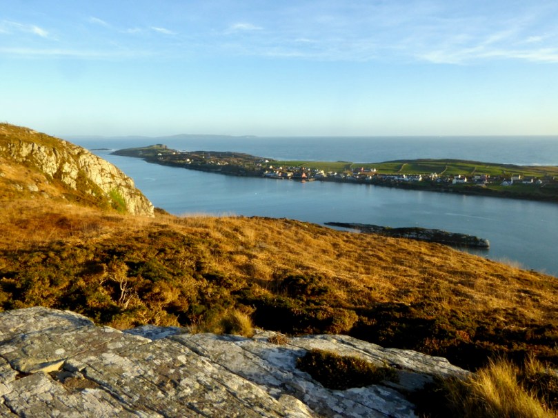
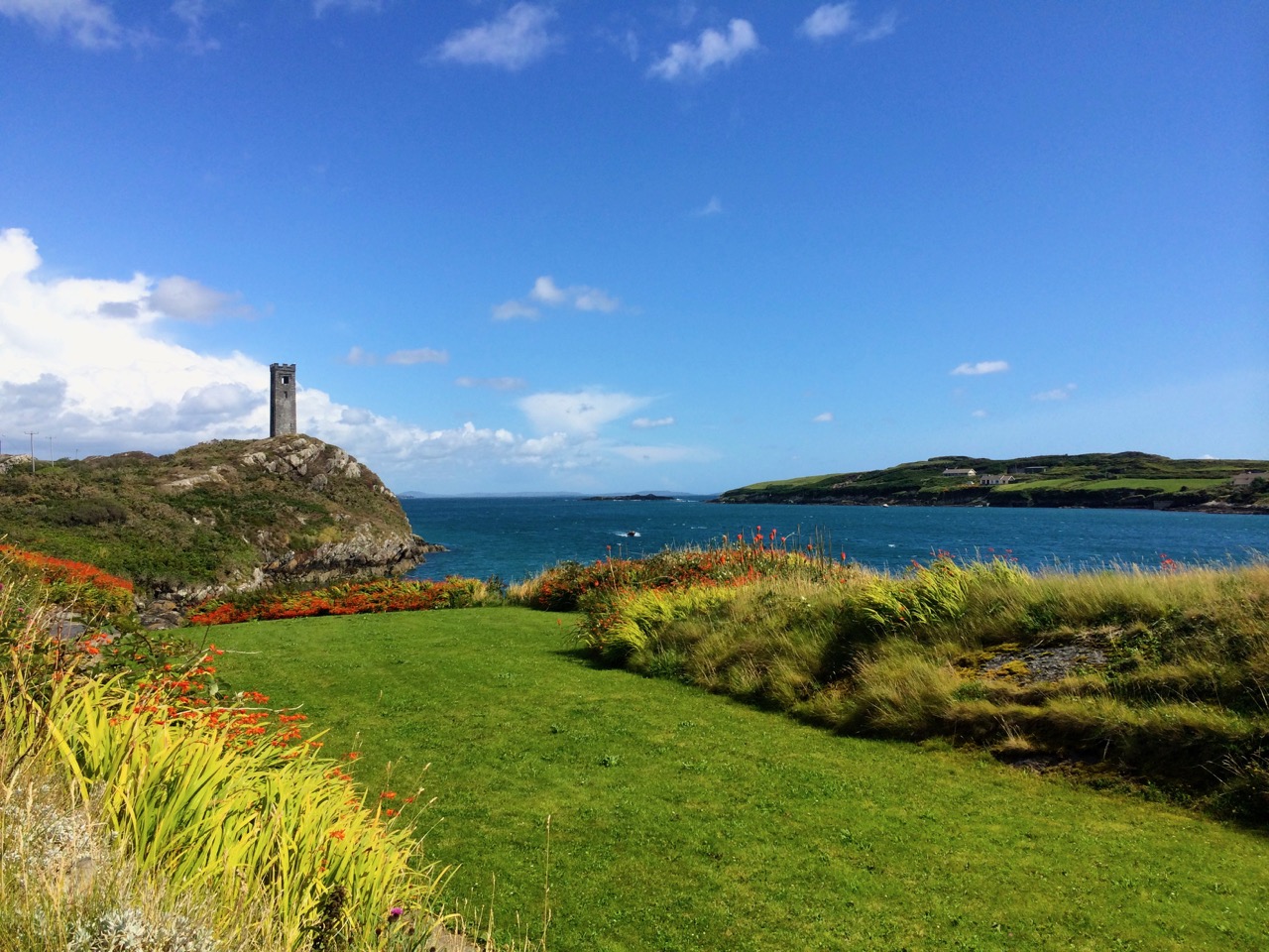
The Cape Clear Signal Tower
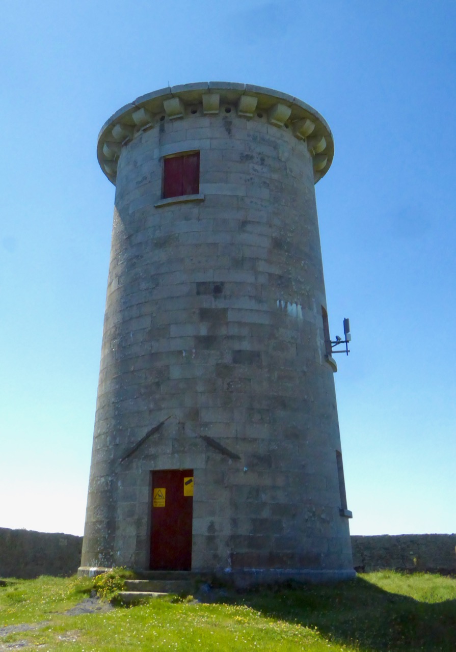
Signal towers were built around the coast to the same plan – tall square towers with first-floor entrances and machicolations. From a distance, they look like the medieval tower houses I have posted about on several occasions but up close they are shorter and the windows are bigger. Internal staircases and partitions were made of wood, not stone and have generally not survived, so the signal stations are essentially shells. in both the Cape Clear and Brow Head example, the exterior slate cladding has survived remarkably well.
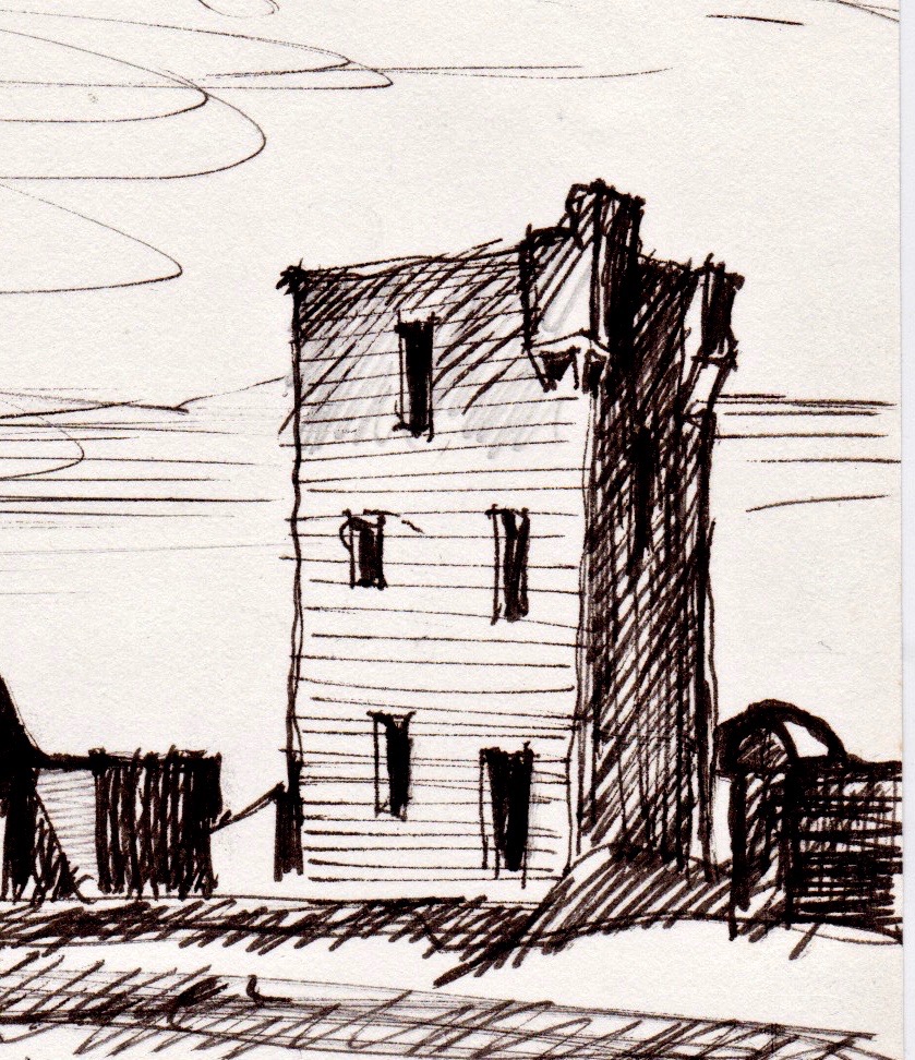
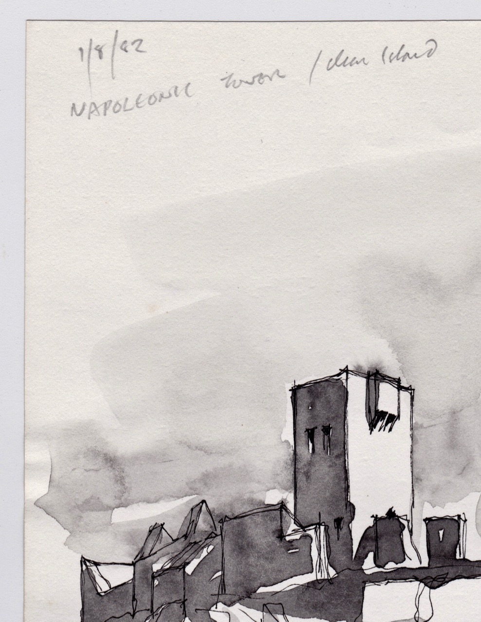
Brow Head Signal Tower – detail from Brian’s sketch
In his excellent article for the Irish Times, Nick Hogan describes the towers, how they were staffed, the accommodation provided and how the signalling was done:
The signalling system, referred to as an optical telegraph, required that each signal station be visible to its counterparts on either side. Sending a message involved raising and lowering a large rectangular flag, a smaller blue pendant and four black balls in various combinations along a system centred on a tall wooden mast. The stations also communicated with ships.
 Top: Brian’s sketch of the Signal Tower and Lighthouse on Cape Clear Island, done in 1982; Below: how it looked in June, 2016, 34 years later
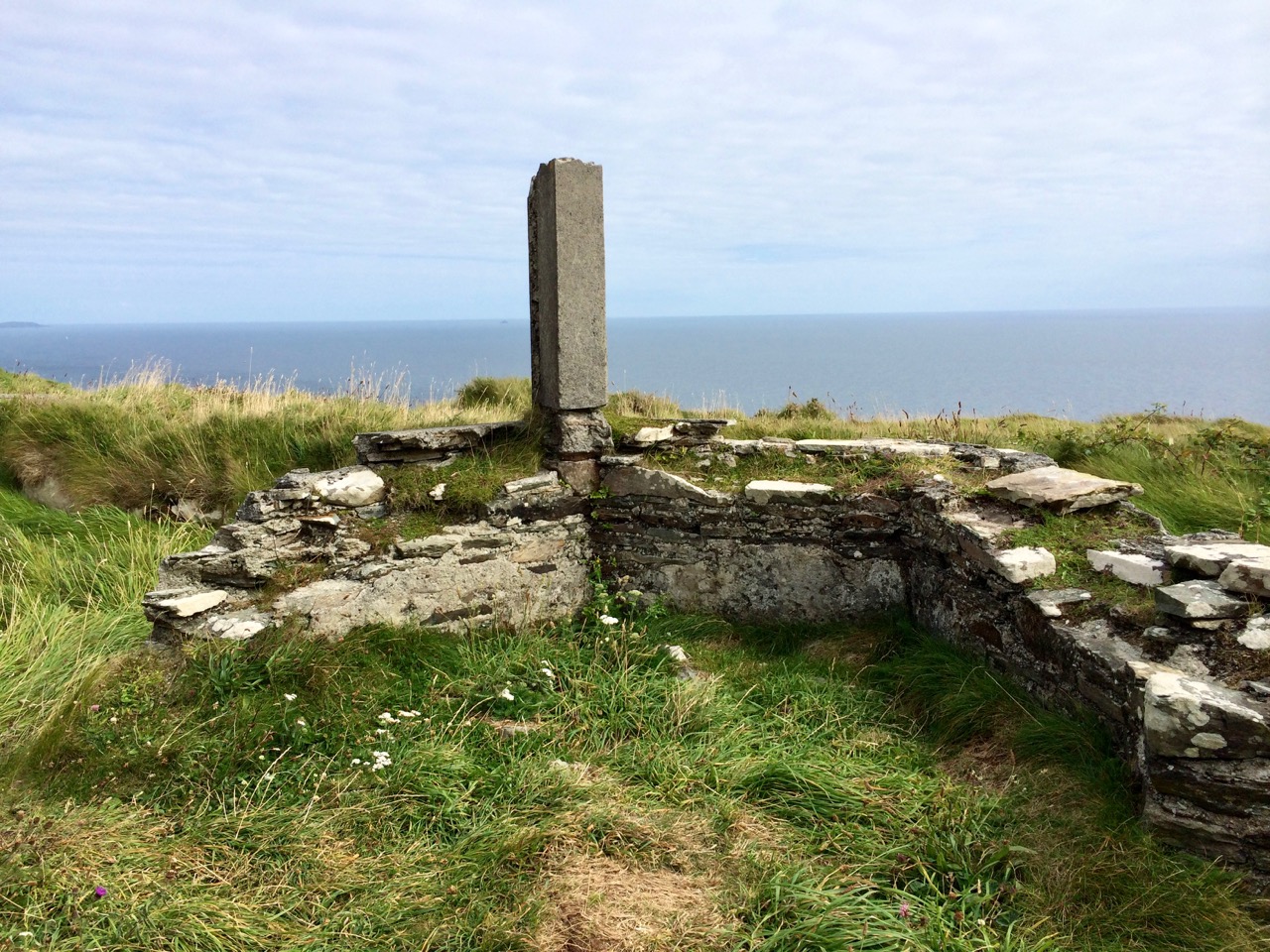
While many signal stations are lonely and isolated buildings glimpsed on distant headlands, abandoned since the mid-1800s, both the Brow Head and Cape Clear buildings had further phases of use. In Cape Clear a lighthouse was built in 1818 – a forerunner of the Fastnet Rock Lighthouse. It was so often shrouded in fog that it was abandoned in the 1840s. The buildings attached to the signal tower, built of brick and concrete, probably date to this period of occupation. The signal tower is built of stone, using techniques not far removed from medieval construction methods. The lighthouse provides a wonderful contrast, being built of cut granite blocks expertly measured, shaped and fitted.
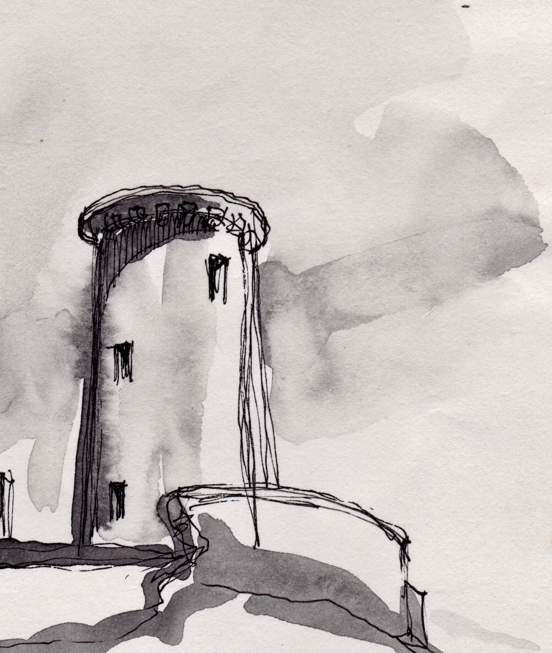
Cape Clear Lighthouse, detail from sketch
In June of 2016, when we visited, it looked exactly as it had to Brian and the Mizen field group – an indication, perhaps that somebody is looking after the site and that the few visitors who come (it’s quite a hike to get there) respect the heritage. [Edit: Since I wrote this, Brian has pointed out that in the Cape Clear Signal Tower there is a porch under the machicolation in his drawing that has since disappeared. The outlines of the porch can be clearly seen in the photographs of the signal tower.]
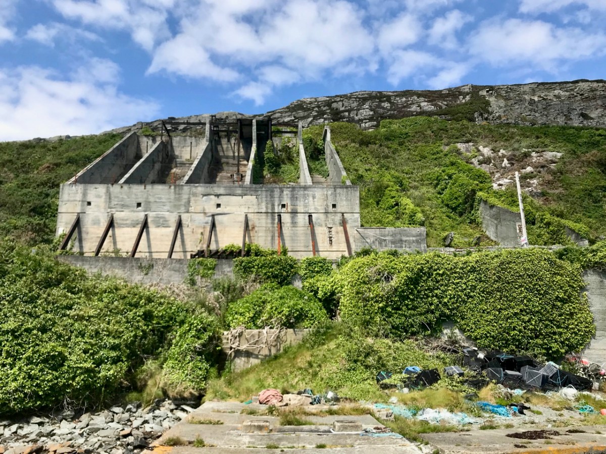
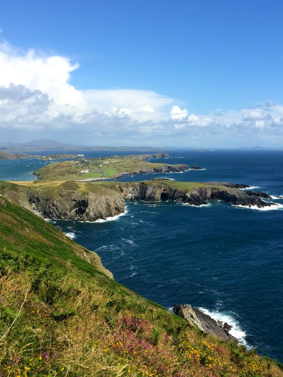
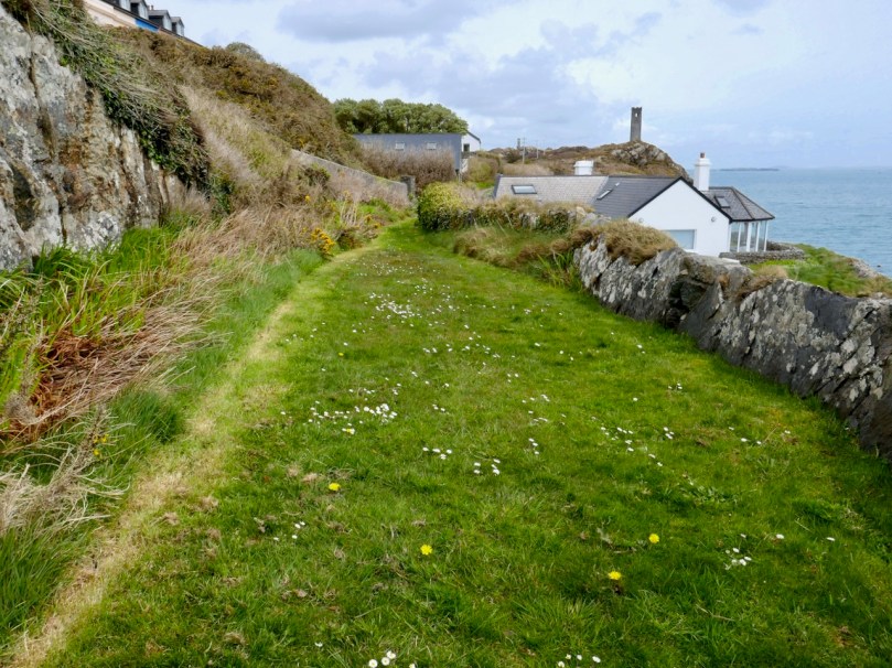
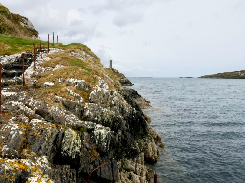
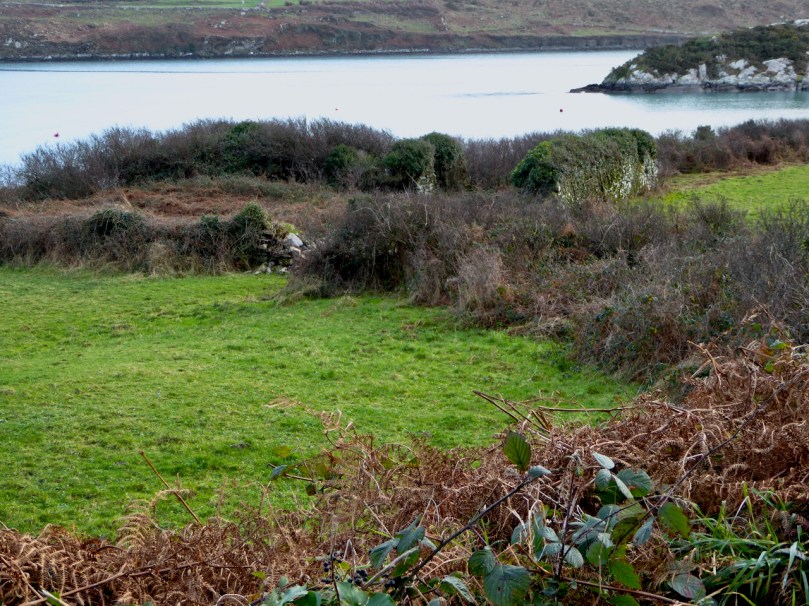
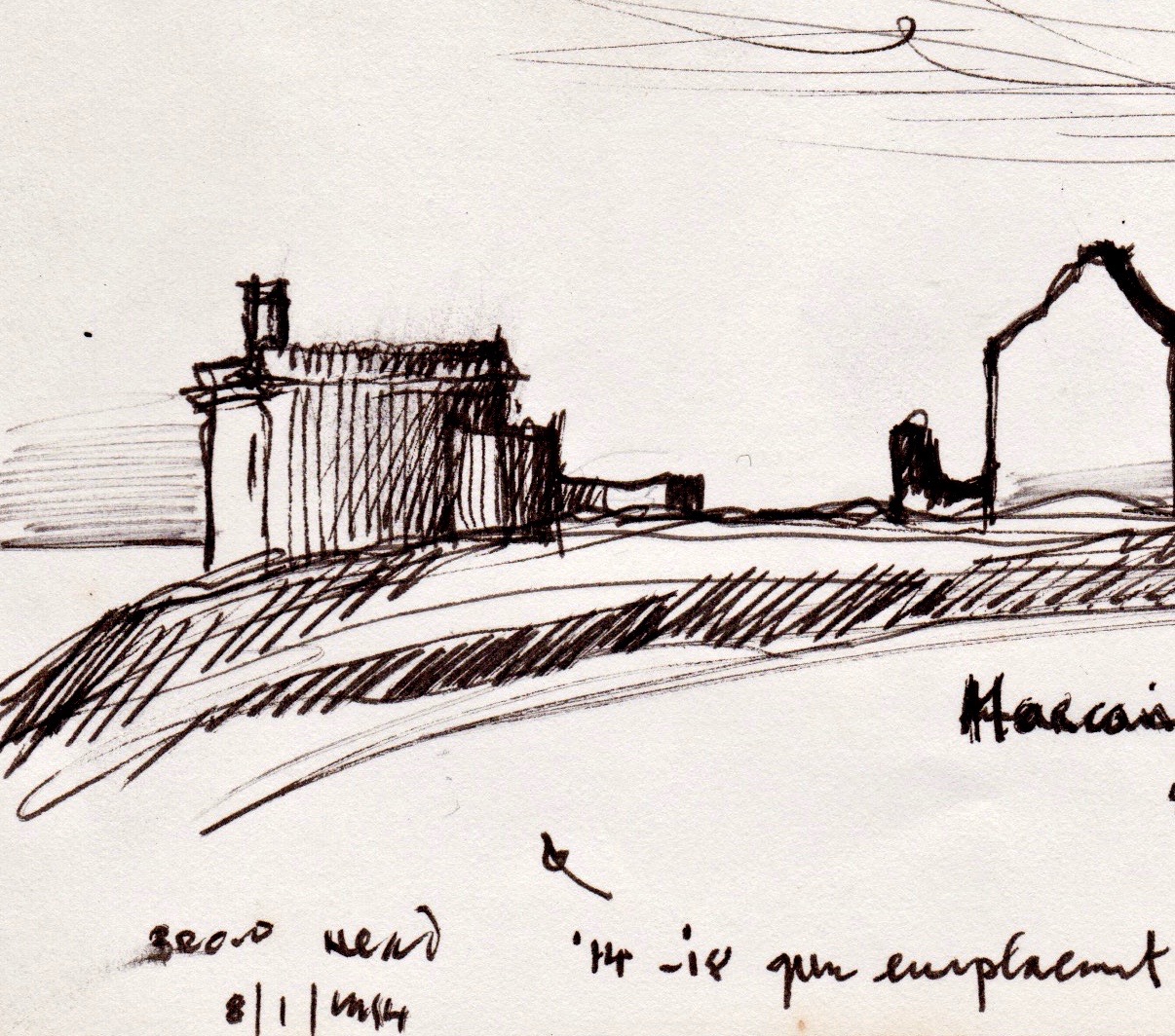
Brow Head is easier to access, and as a result there is more graffiti in evidence, but the changes to the site since Brian’s sketch are more the result of time and climate than any damage by humans. This is a complex site with multiple periods of occupation. The signal tower is there, of course, looking exactly as it did in the 1980s. Beside it is a network of buildings dating from the the early years of the 20th century: this is what remains of the Marconi Telegraph Station. Read all about this in Robert’s piece on Marconi, In Search of Ghosts. Besides the Marconi Station a Second World War Look Out Post was occupied here in the 1940s – little remains of this small concrete building except the characteristic half-round shape and a section of wall.
Finally, on Brow Head there is a mysterious building that Brian labels ’14 – ’18 Gun Emplacement. This building no longer exists, and the ruinous remains that litter the ground seem robust enough to fit this inscription. Or do they? So – a mystery, and obviously more research needed on our part. If any of our readers can help – let us hear from you!
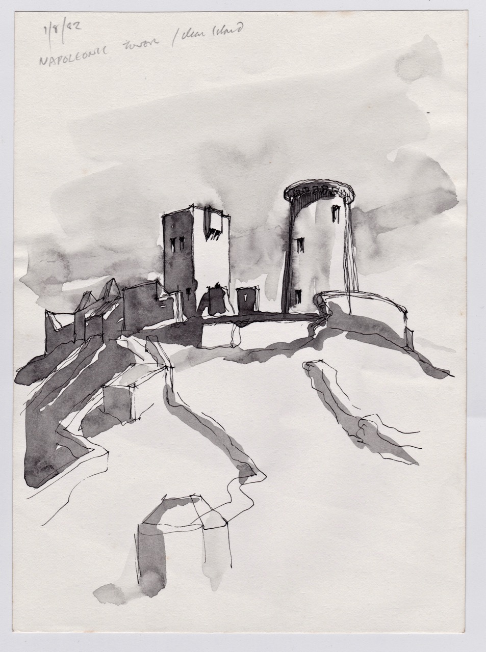
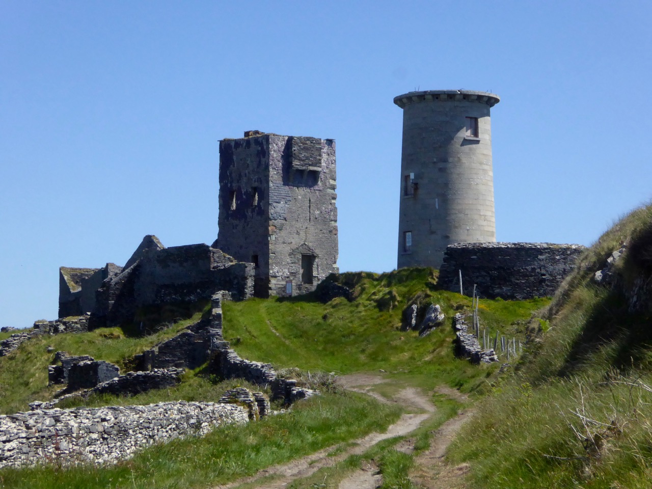
The last tower is on Rock Island. It is clearly visible from the Brow Head Signal Tower ( a requirement for the placement of signal towers) but, strangely, it is one of two very similar towers on Rock Island, and while they are similar to each other, they are quite different from the classic signal tower design. However, both the National Monuments site and the National Inventory of Architectural Heritage listings name them as Napoleonic-era Signal Towers, and perhaps that is indeed what they are.

Brian’s sketch of the Rock Island Signal Tower
However, in discussion with Brian, he pointed out that most of the buildings on Rock Island were developed as part of a major Coast Guard installation around the same time as the Marconi Station, and we wonder if there might be a connection – that is, that these are Coast Guard-related Watch Towers, rather than Napoleonic-era Signal Towers. Once again – more research needed! [Edit: See comment from Navtell in comment section, below.]
 The two towers on Rock Island: similar to each other but quite different from the classic Signal Tower on nearby Brow Head
This is only my first foray into Brian’s Sketchbook. Look out for more posts in the future and in the meantime, join with me in being grateful that a precious resource like this survived numerous moves and that we have the opportunity to learn from it.
The Cape Clear Signal Tower
Email link is under 'more' button.